| PalestineRemembered | About Us | Oral History | العربية | |
| Pictures | Zionist FAQs | Haavara | Maps | |
| Search |
| Camps |
| Districts |
| Acre |
| Baysan |
| Beersheba |
| Bethlehem |
| Gaza |
| Haifa |
| Hebron |
| Jaffa |
| Jericho |
| Jerusalem |
| Jinin |
| Nablus |
| Nazareth |
| Ramallah |
| al-Ramla |
| Safad |
| Tiberias |
| Tulkarm |
| Donate |
| Contact |
| Profile |
| Videos |
Welcome To al-Sarkas, Khirbat - خربة السركس (ח'ירבת א-סרכס)
|
District of Haifa
Ethnically cleansed days ago |
العربية Google Earth |
 |
Gallery (11) |
- Statistics & Facts
-
Before & After

- Satellite View
- Articles 4
- Pictures 11
- Oral History 1
- Members
- Families
- All That Remains
- Wikipedia
- Videos
- Guest Book 1
- Links
| Statistic & Fact | Value | |||||||||
| Occupation Date | April 15, 1948 | |||||||||
| Distance From District | 42 (km) South of Haifa | |||||||||
| Elevation | 25 (meters) | |||||||||
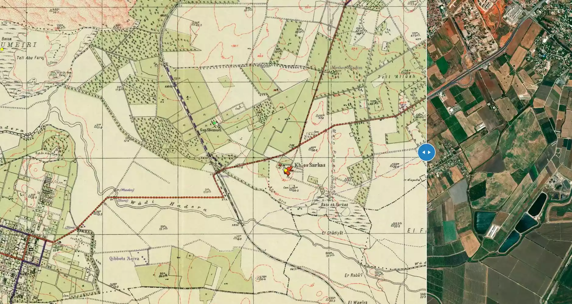
| Before & After Nakba, Click Map For Details |
||||||||||
|
||||||||||
| Map Location | See location #50 on the map View from satellite |
|||||||||
| Military Operation | Most likely Coastal Clearing | |||||||||
| Refugees' Migration Routes | Many of the villagers were expelled to Tulkarm area, many are still living there and are known by el-Sharkas. | |||||||||
| Exodus Cause | Expulsion by Zionist troops | |||||||||
| Village Temains | The village has been completely defaced | |||||||||
| Ethnically Cleansing | al-Sarkas, Khirbat inhabitants were completely ethnically cleansed. | |||||||||
| Population |
|
|||||||||
| Number of Houses |
|
|||||||||
| Near By Towns |
||||||||||
|
|
||||||||||
| Inhabitants Place of Origin | Khirbat al-Sarkas was founded by Circassians from Russia who have been cleansed from their country by the Rassian Czarist armies in the 19th century. | |||||||||
| Exculsive Jewish Colonies Who Usurped Village Lands |
Gan Shemu'el & Talmey EI'azar | |||||||||
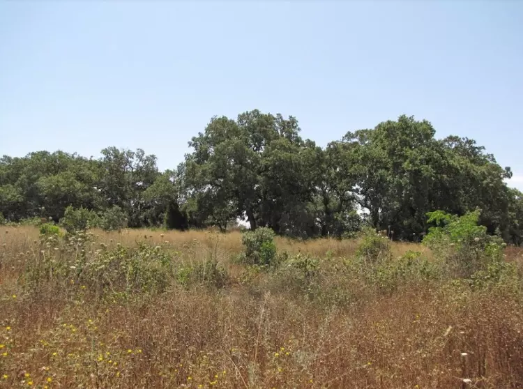
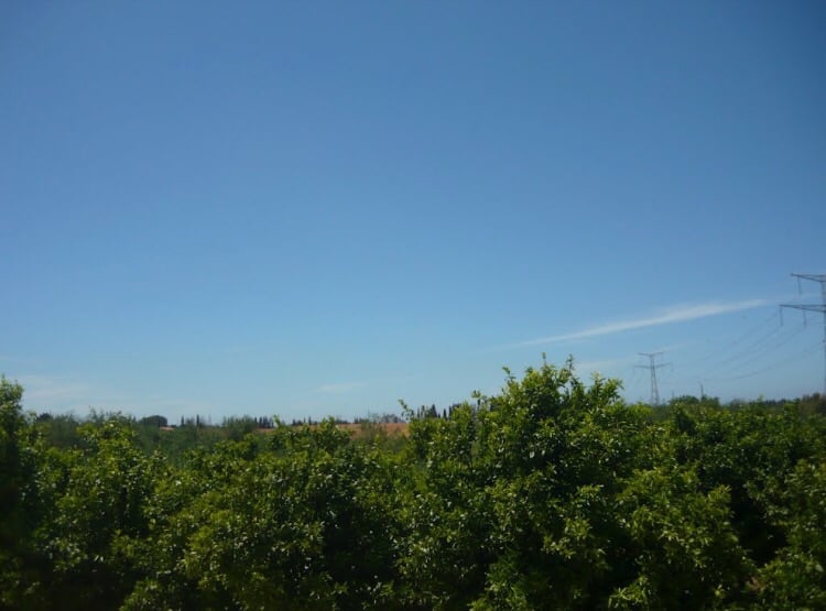
Village Before NakbaThe village was located on a slight knoll a bit more than 3 km northeast of Hadera, south of the Hadera-Afula highway. Its name suggests that it may have been founded by Circassians from the southern borderlands of Russia who had been expelled by Czarist armies and had sought refuge in Ottoman territories. Circassians are known to have settled in this region in the nineteenth century. In the Mandate era, it was classified as a hamlet in the Palestine Index Gazetteer.Zionists Colonies on Village LandsGan Shemu'el was built about 1 km from the khirba in 1913. The settlement of Talmey El'azar was established near the village site in 1952Village TodayCactuses and spikes of grain are scattered across the site there are no traces of any landmarks or houses. The land near the site is used by Israeli farmers for raising cattle and growing citrus.SourceDr. Walid al-Khalidi, 1992: All That Remains. |
||||||||||
| Related Maps | Town Lands' Demarcation Maps خرائط للقضاء توضح حدود القرى والاودية Town's map on MapQuest View from satellite Help us map this town at WikiMapia |
|||||||||
| Related Links | Wikipedia's Page Google Search Google For Images Google For Videos |
|||||||||
| More Information | في كتاب كي لا ننسى في كتاب بلادنا فلسطين المزيد من موقع هوية |
|||||||||
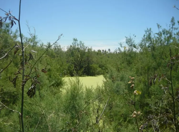
- موقع القريه تغطيه الاعشاب
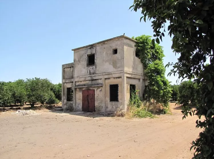
Posted by abu raya - بيت قديم الى الشمال من القريه
Posted by abu raya 1 - اراضي القريه يستغلها المستوطنون لزراعه الحمضيات
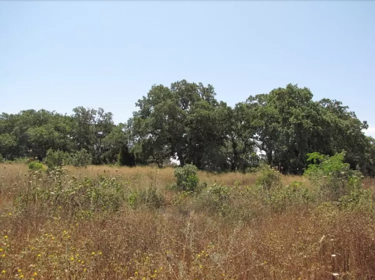
Posted by abu raya - موقع من جنوب القريه
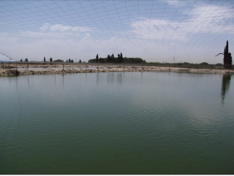
Posted by abu raya - برك يستغلها المستوطنون لتربيه الاسماك غرب موقع القريه
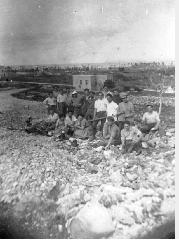
Posted by abu raya - صوره قديمه للمستوطنين في القريه بعد احتلالها
Posted by abu raya - موقع القريه مغطى بالاعشاب
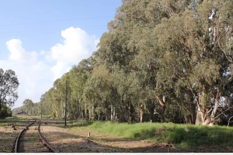
Posted by abu raya - خط سكه القطار بالقرب من القريه
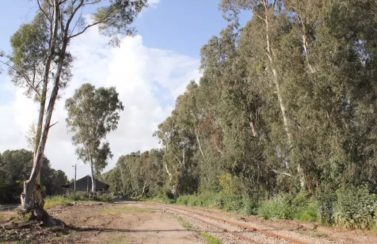
Posted by abu raya - بالقرب من موقع القريه
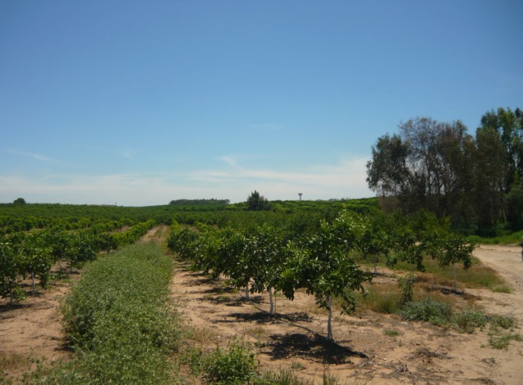
Posted by abu raya - اراضي القريه يستغلها المستوطنون لزراعه الحمضيات
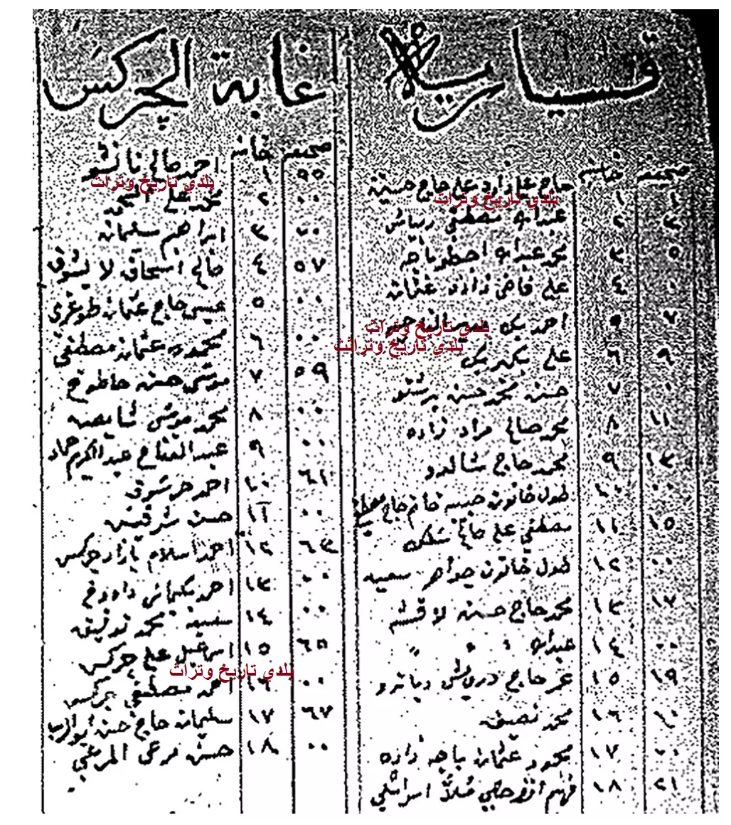
Posted by abu raya - قائمة بسكان (غابة الشكرس) وبلدة (قيسارية) من سجل النفوس العثماني. لاحظوا وجود العديد من الاسماء الاّ عربية مع بعض اخوانهم من التركمان والعرب مثل عائلة ابو الرب / غوادرة من بني سعيدان.
Want to browse more? 80,000 pictures were grouped in these gallaries:
| Display Name | Clan/Hamolah | Country of Residence |
No links have been shared yet, be free to the first to share the first link.
 Fake Valor: Why Did Zionist Jews Hoist Nazis Flag on Their Ships in the 1930s?
What is new?
-
Facts About Oct. 7th Gaza Raid
-
Remined Us Please:: Who Did Rape Who? Palestinians Raped Israelis? Or, was the other way around?
-
When Prof. Edward Said was invited to debate Bibi Netanyahu in the 1980s, watch what happened!
-
Abusing Blood Libel!
-
Zionist FAQ: Isn't it true that Palestinians don't want peace? Palestinians never accepted the two-state solution
- Facts about Haavara (Transfer) Agreement between Ben-Gurion & Hitler
-
Haavara FAQs: Why Did Zionist Jews Hoist Nazis' Flags on Their Ships in the 1930s?
-
Dear ChatGPT: Why did the Jewish Agency suppress news of the Holocaust during WWII?
-
Video Playlist: Jews share their DNA tests to end the conflict for good.
-
A Tale of Two Conflicts: Examining the Definition of Genocide
-
Prof. Abraham Polak And The Suppressed History of the Khazars and European Jewry
-
How Ronald Reagan would have framed the genocide in Gaza if he were still alive?
-
Haavara FAQs: Let us do the math: how many German Jews did The Haavara Agreement save?
-
Zionist FAQs: The Hebron Massacre of 1929, "clearly proves" that Palestinians are antisemitic, how could you deny it?
-
Zionist FAQs: Why Anti-Zionist Is Not Antisemitism?
-
Zionist FAQs: Isn't it true that the KGB create Palestinian Nationalism in the early 1960s?
- Zionist FAQs: Muslims are killing Muslims all the time; why are Israeli Jews being singled out in the media?
- Zionist FAQs: How is Israel an apartheid state when 20% of its citizens are Arabs who enjoy full rights?
-
Haavara FAQs: Analysis of Herzl's Uganda Scheme and how it could have saved millions of Jews.
-
Haavara FAQs: Why did Hayim Greenberg describe American Jewry as "morally bankrupt" in early 1943?
-
Haavara FAQs: What if the Evian Conference was a resounding success? What would have been the impact of saving European Jewry on Zionism?
- Haavara FAQs: What if the six million were saved, how that would have impacted the Zionist project?
-
Haavara FAQs: How did Zionist leaders react when Europe's Jews lingered in the DP camps after WWII ended?
-
Why does the American Jewish community repeat lies that David Ben-Gurion had debunked before he died?
-
Who has the power to rename the Tatar/Khazar Gene Marker to Jewish IV?
-
Zionist FAQs: Why won't Egypt, Syria, and Jordan take their people back? Jews are indigenous to Palestine, and Arabs immigrated after Jews developed the country. Arabs should leave.
-
Haavara FAQs: Did Hitler and the Nazis conflate between Judaism and Zionist? If that wasn't case, then why?
-
Haavara FAQs: Winston Churchill and antisemitism, a collection of articles written Churchill.
-
Haavara FAQs: Broken by country, how many Jews survived vs. killed during the Holocaust?
-
Haavara FAQs: Why did European Jews vote with their feet and to immigrated to the Americas, not Palestine, after WWII?
-
Watch this American Jewish Girl describing Israeli Jews' cognitive dissonance like no other in under two minutes
-
Haavara FAQs: When the Nazis went out of their way to hide the Holocaust, Israeli Jews did the exact opposite by broadcasting their genocide of Gazans. But why?
-
Haavara FAQs: How Zionist Jews went out of their to show their appreciation to Nazism and Fascism?
- Haavara FAQs: Why Zionist leaders were against bombing the death camps & the Railroads leading to them?
-
Haavara FAQs: Hitler's message to the British and American people: If Jews are such noble citizens and you care about them, how come you're not letting them in? I will gladly ship them to you at my expense, even on luxury liners!
-
A shortlist of Zionist and Israeli false flag operations in the name Jews.
-
The Most Moral Army
- The Land of Kapos (Israel): Where the brave are boycotted and Kapos walk free.
- Why did early Zionists often named their communal enterprises "colonial"?
- Zionist Relations with Nazi Germany by Faris Glubb
-
Two NY Times advertisements by Zionists in the early 1943 that exposes Zionists' treason at the height of the calamity
- Facts Not Lies about the Palestinian-Israeli Conflict.
- Site's pictures have been categorized
- Campgain Against Lice
- A Survey of Palestine, the official source about Palestine before Nakba produced by the British Mandate; over 1200 pages.
- Satellite View & Google Earth: Over 6,000 placemarks identifying all destroyed towns, W. Bank & Gaza Strip Towns, & refugee camps.
- PalestineRemembered.com and its Nakba Oral History Project were featured on al-Jazeera Satellite TV.
- Nakba Oral History Video Podcast:
 Over 700 Oral History interviews (including 3,500+ hours of recording) can be viewed online.
 - Palestine Village Statistics Project
- Gaza Jail Break
- النسخة العربية للموقع الان متوفرة
- Videos: Documenting the destroyed villages in video: Tracing all that remains since Nakba.
- Videos: Responding to Zionist Propaganda
- Interview: The ethnic cleansing of Palestine: George Galloway interviews Israeli Historian Ilan Pappe.
- For Palestinians, memory matters. It provides a blueprint for their future By George Bisharat.
- Zionist FAQ now available in Hebrew שאלות שציונים שואלים, עכשיו בעברית
- Video: The Stephen Walt and John Mearsheimer report on the influence of the Israel Lobby on U.S. Foreign Policy
- The Palestinian-Israeli conflict for beginners
