| PalestineRemembered | About Us | Oral History | العربية | |
| Pictures | Zionist FAQs | Haavara | Maps | |
| Search |
| Camps |
| Districts |
| Acre |
| Baysan |
| Beersheba |
| Bethlehem |
| Gaza |
| Haifa |
| Hebron |
| Jaffa |
| Jericho |
| Jerusalem |
| Jinin |
| Nablus |
| Nazareth |
| Ramallah |
| al-Ramla |
| Safad |
| Tiberias |
| Tulkarm |
| Donate |
| Contact |
| Profile |
| Videos |
Welcome To Raml Zayta - رمل زيتة (قزازة) (רמל זיתא)
|
District of Tulkarm
Ethnically cleansed days ago |
العربية Google Earth |
 |
Gallery (12) |
- Statistics & Facts
-
Before & After

- Satellite View
- Articles 1
- Pictures 12
- Members 2
- All That Remains
- Wikipedia
- Videos 2
- Guest Book 3
- Links
| Statistic & Fact | Value | ||||||||||||||||||
| Occupation Date | March 15, 1948 | ||||||||||||||||||
| Distance From District | 15 (km) Northeast of Tulkarm | ||||||||||||||||||
| Elevation | 25 (meters) | ||||||||||||||||||
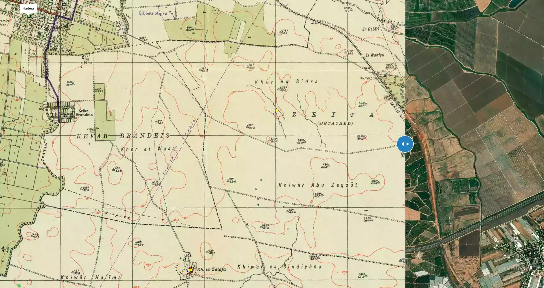
| Before & After Nakba, Click Map For Details |
|||||||||||||||||||
|
|||||||||||||||||||
| Map Location | See location #1 on the map View from satellite |
||||||||||||||||||
| Military Operation | Coastal Clearing | ||||||||||||||||||
| Exodus Cause | Expulsion by Zionist troops | ||||||||||||||||||
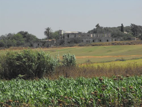
| Village Temains | Raml Zayta was mostly destroyed with the exception of two houses, one of which is currently being occupied by an Israeli Jewish family. | ||||||||||||||||||
| Ethnically Cleansing | Raml Zayta inhabitants were completely ethnically cleansed. | ||||||||||||||||||
| Pre-Nakba Land Ownership |
**Town Lands' Demarcation Maps |
||||||||||||||||||
| Land Usage As of 1945 |
|
||||||||||||||||||
| Population |
|
||||||||||||||||||
| Near By Towns |
|||||||||||||||||||
|
|||||||||||||||||||
| Exculsive Jewish Colonies Who Usurped Village Lands |
Sde Yitzchaq and the Israeli City of Chadera. | ||||||||||||||||||
| Featured Video | |||||||||||||||||||
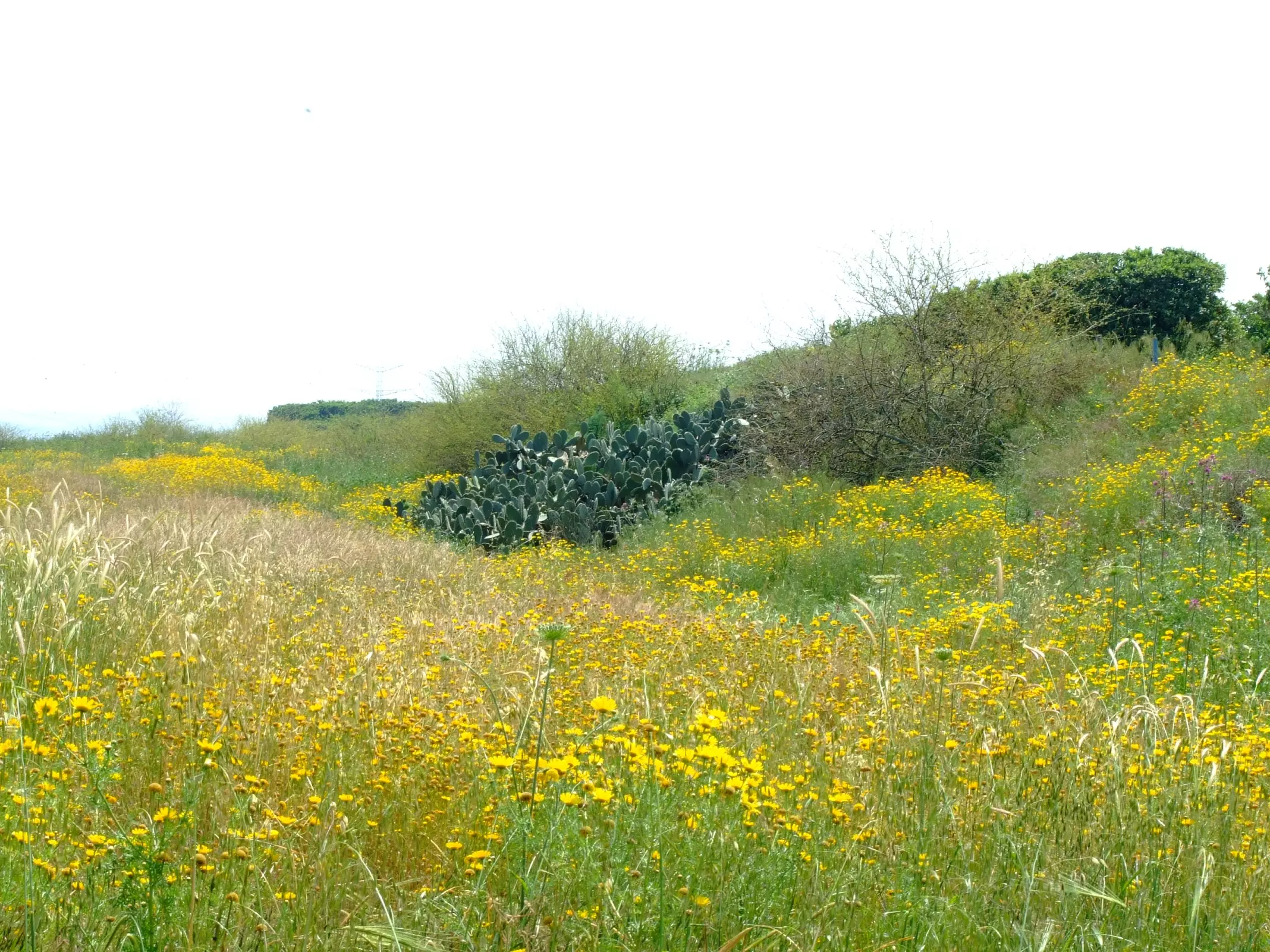
Village Before NakbaThe village stood on a flat, sandy spot on the central coastal plain. It was linked by a secondary road to the coastal highway, and by dirt paths to neighboring villages. Its houses, built of mud, cement, and stone, were dispersed in no particular pattern; most were built in the middle of farms. The village had some small shops scattered among the houses. The villagers obtained their domestic water from wells, and most of them worked in agriculture and livestock breeding. Agriculture, which was both rainfed and irrigated by water drawn from wells, was based on grain, vegetables, and watermelons. In 1944/45 a total of 126 dunums was devoted to citrus and bananas and 12,554 dunums were allotted to cereals; 27 additional dunums were irrigated or used for orchards. In the eastern part of the village lands lay Khirbat Tall Durur, which had been a prosperous village in the sub-district of Haifa during Ottoman times but which was deserted during the British Mandate as a result of the dispute over the lands of neighboring Wadi al-Hawarith.Village Occupation and Ethnic CleaningThe nearest villages for which there is any hard information fell victim to early Haganah operations designed to 'clear' the coastal area in the center of the country (see Khirbat al-Shuna, Haifa sub-district). Nearby Wadi al-Hawarith was attacked and its residents were pressured into leaving on 15 March, while the inhabitants of 'Arab al-Fuqara' were expelled on 10 April following a Haganah General Staff decision to depopulate the village. Raml Zayta probably was depopulated under similar circumstances.Zionists Colonies on Village LandsThe settlement of Sde Yitzchaq (149201), founded in 1952, is on village land. The city of Hadera (142204), originally a settlement founded in 1890, has expanded so that some of its suburbs are now on village land.Village TodayStone rubble is visible on the site. Only two of the original village houses remain. One of them is still inhabited by the only Palestinian family that stayed in the village. The second house has been renovated and expanded by the addition of new rooms, and is now occupied by a Jewish family. Eucalyptus, fig, mulberry, and pomegranate trees, in addition to cactuses, grow on the site. Vegetables and orchards are grown by Israelis on the village lands.SourceDr. Walid al-Khalidi, 1992: All That Remains. |
|||||||||||||||||||
| Related Maps | Town Lands' Demarcation Maps خرائط للقضاء توضح حدود القرى والاودية Town's map on MapQuest View from satellite Help us map this town at WikiMapia |
||||||||||||||||||
| Related Links | Wikipedia's Page Google Search Google For Images Google For Videos |
||||||||||||||||||
| More Information | في كتاب كي لا ننسى في كتاب بلادنا فلسطين المزيد من موقع هوية |
||||||||||||||||||
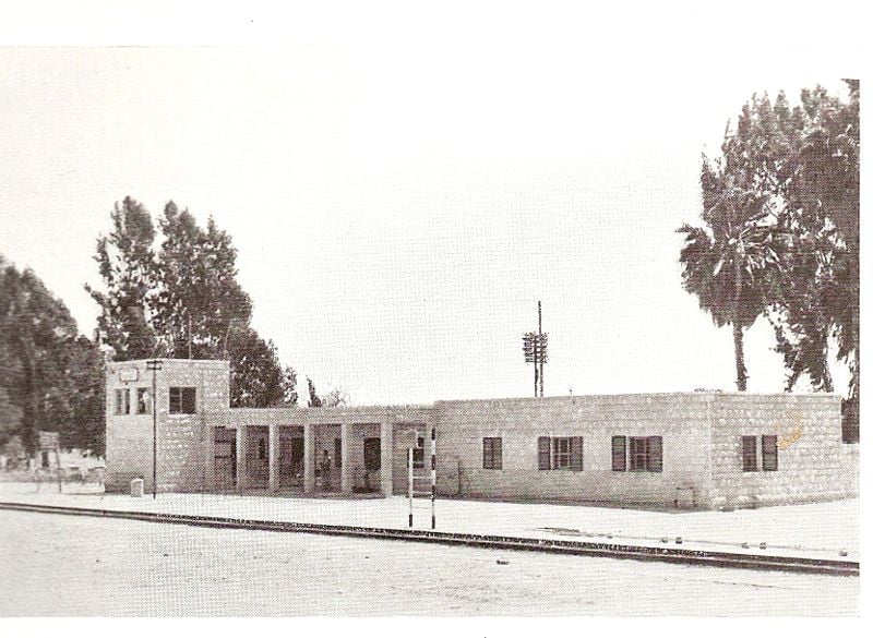
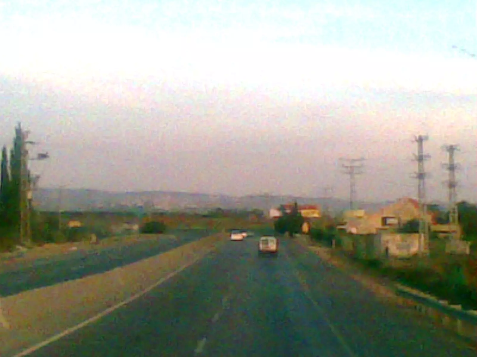
- الطريق العام بالقرب من القريه
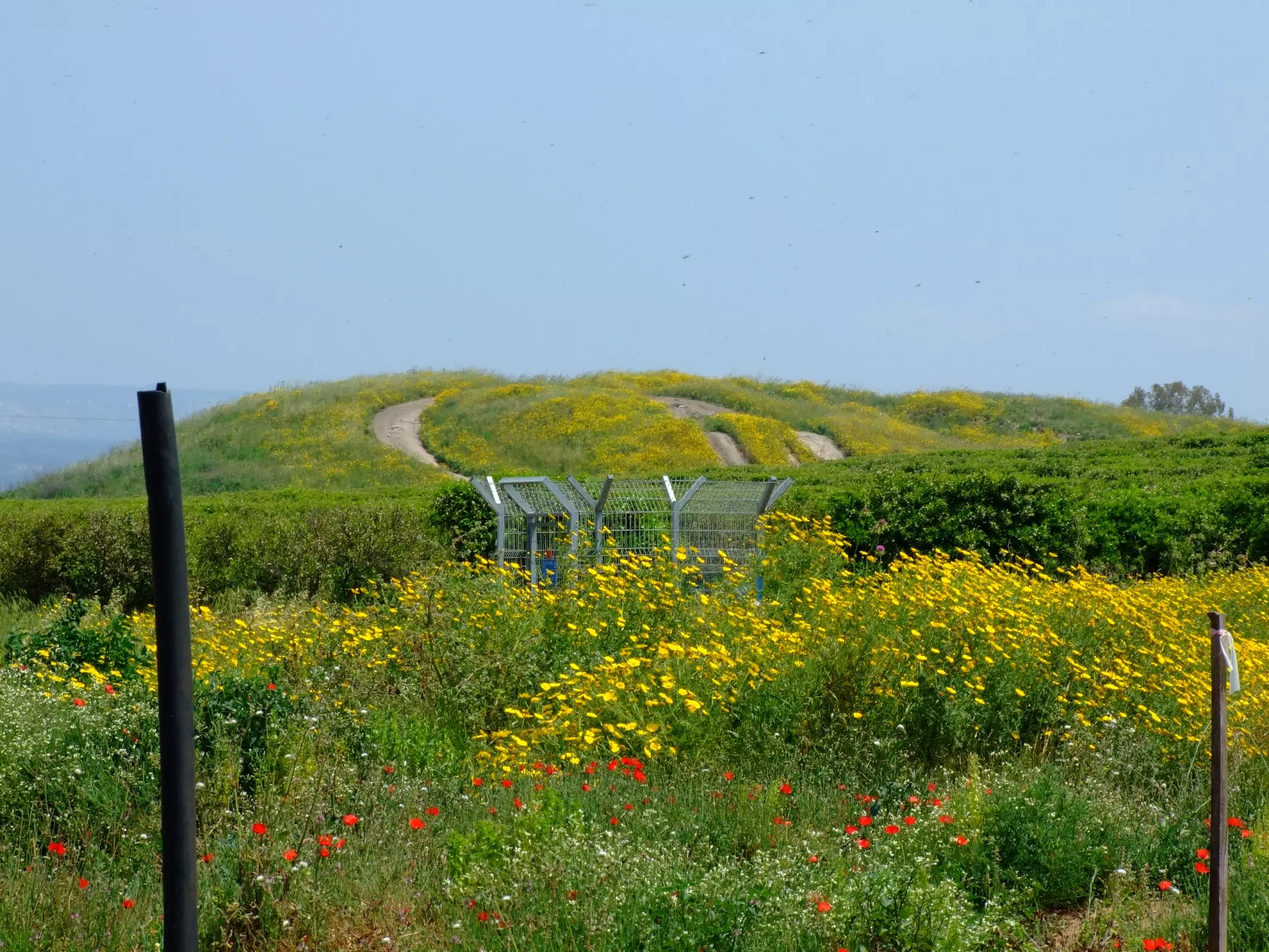
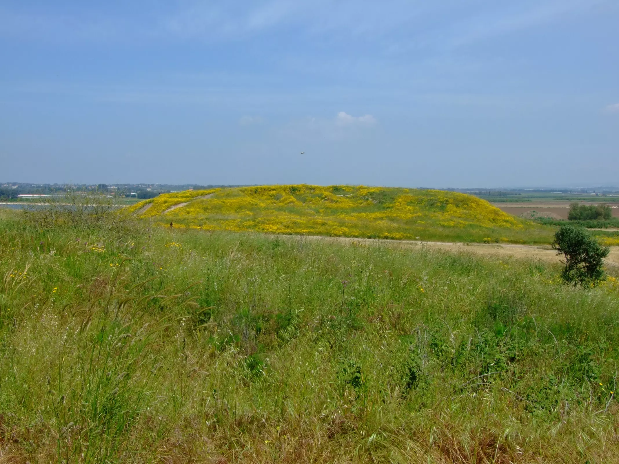
Posted by ابو الثائر - Raml Zayta - the eastern mound
Posted by Uri Zackhem - Cacti @ Raml Zeyta
Posted by Uri Zackhem - The eastern mound looking from the western mound
Posted by Uri Zackhem - محطة القطار الحجازي في الخضيرة - صورة تاريخية قديمة
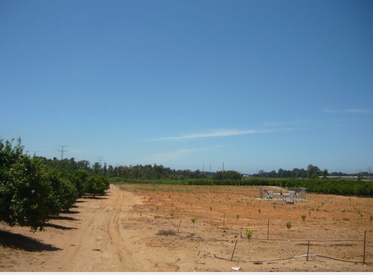
Posted by Wadina - الحقول في منطقة رمل زيتا - مستعمرة بيت إلعيزر
Posted by Wadina - رمل زيتا
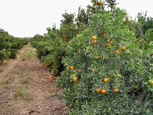
Posted by Wadina - حمضيات رمل زيتا
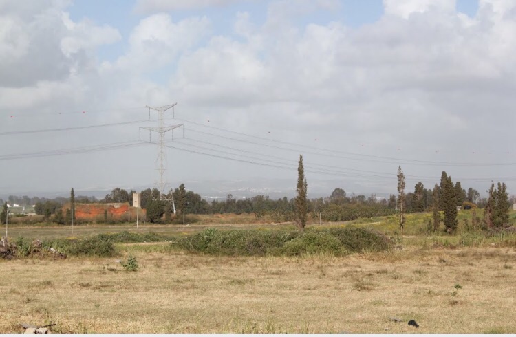
Posted by Wadina - موقع القريه
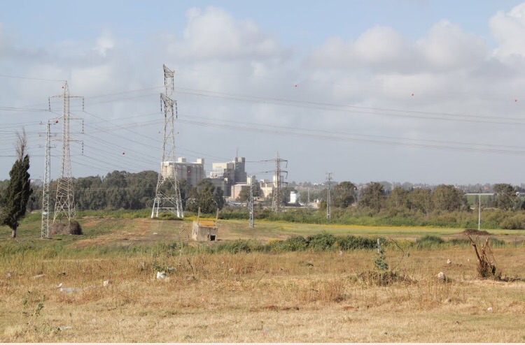
Posted by abu raya - موقع القريه واثار بيوتها
Posted by abu raya - اراضي القريه
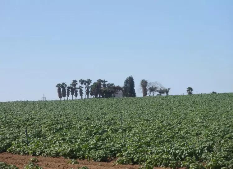
Posted by abu raya - اراضي القريه
Posted by abu raya
Want to browse more? 80,000 pictures were grouped in these gallaries:
| Display Name | Clan/Hamolah | Country of Residence |
| زيتاوي يدرس بالخارج | عباس | السويد |
| الزيتاوي | رباح | مكة, مكة |
- Tracing all that remains of Raml Zayta Duration: min 51 sec
- أول زيارة توثيقية لخربة المجدل المهجرة (رمل زيتا - قضاء طولكرم): التل القديم والمقبرة وبير المجدل ومقام الشيخ عبدالله والعائلات (مناع, غضية, زبيدي وحسونة) والتاريخ الذي يربطها بالنسيج الاجتماعي للقرى المجاورة يوم كان (الرمل) عمّار Duration: 4 min 16 sec
No links have been shared yet, be free to the first to share the first link.
 Fake Valor: Why Did Zionist Jews Hoist Nazis Flag on Their Ships in the 1930s?
What is new?
-
Facts About Oct. 7th Gaza Raid
-
Remined Us Please:: Who Did Rape Who? Palestinians Raped Israelis? Or, was the other way around?
-
When Prof. Edward Said was invited to debate Bibi Netanyahu in the 1980s, watch what happened!
-
Ezra Klein of the NY Times on the "Jewish Race".
-
Abusing Blood Libel!
-
Did Israeli Soldiers Activate The Hanniba Direective On Oct. 7th? You Be The Judge
-
Zionist FAQ: Isn't it true that Palestinians don't want peace? Palestinians never accepted the two-state solution
- Facts about Haavara (Transfer) Agreement between Ben-Gurion & Hitler
-
Haavara FAQs: Why Did Zionist Jews Hoist Nazis' Flags on Their Ships in the 1930s?
- Haavara FAQs: When Chaim Weizmann met FDR in mid-1943, why was he silent about rescuing European Jewry?
-
Dear ChatGPT: How did Palestinians resist Napoleon's invasion of their country in 1799?
-
Dear ChatGPT: Gaza had a vibrant Jewish community in the mid-17th century. What happened to them?
-
Dear ChatGPT: Why did the Jewish Agency suppress news of the Holocaust during WWII?
-
Video Playlist: Jews share their DNA tests to end the conflict for good.
-
A Tale of Two Conflicts: Examining the Definition of Genocide
-
Prof. Abraham Polak And The Suppressed History of the Khazars and European Jewry
-
How Ronald Reagan would have framed the genocide in Gaza if he were still alive?
-
Haavara FAQs: Let us do the math: how many German Jews did The Haavara Agreement save?
-
Zionist FAQs: The Hebron Massacre of 1929, "clearly proves" that Palestinians are antisemitic, how could you deny it?
-
Zionist FAQs: Why Anti-Zionist Is Not Antisemitism?
-
Zionist FAQs: Isn't it true that the KGB created Palestinian Nationalism in the early 1960s?
- Zionist FAQs: Muslims are killing Muslims all the time; why are Israeli Jews being singled out in the media?
- Zionist FAQs: How is Israel an apartheid state when 20% of its citizens are Arabs who enjoy full rights?
-
Haavara FAQs: Why Did Dorothy Thompson Flip From A Zionist Advocate to A Silenced Dissenter?
-
Haavara FAQs: Analysis of Herzl's Uganda Scheme and how it could have saved millions of Jews.
-
Haavara FAQs: Why did Hayim Greenberg describe American Jewry as "morally bankrupt" in early 1943?
-
Haavara FAQs: What if the Evian Conference was a resounding success? What would have been the impact of saving European Jewry on Zionism?
- Haavara FAQs: What if the six million were saved, how that would have impacted the Zionist project?
-
Haavara FAQs: How did Zionist leaders react when Europe's Jews lingered in the DP camps after WWII ended?
-
Why does the American Jewish community repeat lies that David Ben-Gurion had debunked before he died?
-
Who has the power to rename the Tatar/Khazar Gene Marker to Jewish IV?
-
Zionist FAQs: Why won't Egypt, Syria, and Jordan take their people back? Jews are indigenous to Palestine, and Arabs immigrated after Jews developed the country. Arabs should leave.
-
Haavara FAQs: Did Hitler and the Nazis conflate between Judaism and Zionist? If that wasn't case, then why?
-
Haavara FAQs: Winston Churchill and antisemitism, a collection of articles written Churchill.
-
Haavara FAQs: Broken by country, how many Jews survived vs. killed during the Holocaust?
-
Haavara FAQs: Why did European Jews vote with their feet and to immigrated to the Americas, not Palestine, after WWII?
-
Watch this American Jewish Girl describing Israeli Jews' cognitive dissonance like no other in under two minutes
-
Haavara FAQs: When the Nazis went out of their way to hide the Holocaust, Israeli Jews did the exact opposite by broadcasting their genocide of Gazans. But why?
-
Haavara FAQs: How Zionist Jews went out of their to show their appreciation to Nazism and Fascism?
- Haavara FAQs: Why Zionist leaders were against bombing the death camps & the Railroads leading to them?
-
Haavara FAQs: Hitler's message to the British and American people: If Jews are such noble citizens and you care about them, how come you're not letting them in? I will gladly ship them to you at my expense, even on luxury liners!
-
A shortlist of Zionist and Israeli false flag operations in the name Jews.
-
The Most Moral Army
- The Land of Kapos (Israel): Where the brave are boycotted and Kapos walk free.
- Why did early Zionists often named their communal enterprises "colonial"?
- Zionist Relations with Nazi Germany by Faris Glubb
-
Two NY Times advertisements by Zionists in the early 1943 that exposes Zionists' treason at the height of the calamity
- Facts Not Lies about the Palestinian-Israeli Conflict.
- Site's pictures have been categorized
- Campgain Against Lice
- A Survey of Palestine, the official source about Palestine before Nakba produced by the British Mandate; over 1200 pages.
- Satellite View & Google Earth: Over 6,000 placemarks identifying all destroyed towns, W. Bank & Gaza Strip Towns, & refugee camps.
- PalestineRemembered.com and its Nakba Oral History Project were featured on al-Jazeera Satellite TV.
- Nakba Oral History Video Podcast:
 Over 700 Oral History interviews (including 3,500+ hours of recording) can be viewed online.
 - Palestine Village Statistics Project
- Gaza Jail Break
- النسخة العربية للموقع الان متوفرة
- Videos: Documenting the destroyed villages in video: Tracing all that remains since Nakba.
- Videos: Responding to Zionist Propaganda
- Interview: The ethnic cleansing of Palestine: George Galloway interviews Israeli Historian Ilan Pappe.
- For Palestinians, memory matters. It provides a blueprint for their future By George Bisharat.
- Zionist FAQ now available in Hebrew שאלות שציונים שואלים, עכשיו בעברית
- Video: The Stephen Walt and John Mearsheimer report on the influence of the Israel Lobby on U.S. Foreign Policy
- The Palestinian-Israeli conflict for beginners
