| PalestineRemembered | About Us | Oral History | العربية | |
| Pictures | Zionist FAQs | Haavara | Maps | |
| Search |
| Camps |
| Districts |
| Acre |
| Baysan |
| Beersheba |
| Bethlehem |
| Gaza |
| Haifa |
| Hebron |
| Jaffa |
| Jericho |
| Jerusalem |
| Jinin |
| Nablus |
| Nazareth |
| Ramallah |
| al-Ramla |
| Safad |
| Tiberias |
| Tulkarm |
| Donate |
| Contact |
| Profile |
| Videos |
Welcome To al-Mas'udiyya - المسعودية (صميل) (אל-מסעודיה)
|
District of Jaffa
Ethnically cleansed days ago |
العربية Google Earth |
 |
Gallery (23) |
- Statistics & Facts
-
Before & After

- Satellite View
- Articles 4
- Pictures 23
- Aerial Views 4
- Members 11
- All That Remains
- Wikipedia
- Videos 2
- Guest Book 7
- Links
| Statistic & Fact | Value | ||||||||||||
| Occupation Date | December 25, 1947 | ||||||||||||
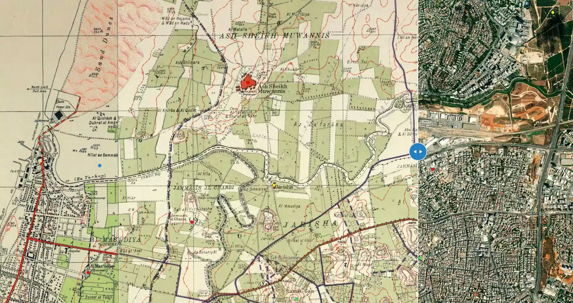
| Distance From District | 5 (km) Northeast of Jaffa | ||||||||||||
| Elevation | 25 (meters) | ||||||||||||
| Before & After Nakba, Click Map For Details |
|||||||||||||
|
|||||||||||||
| Map Location | See location #14 on the map View from satellite |
||||||||||||
| Military Operation | Haganah or IZL | ||||||||||||
| Refugees' Migration Routes | Initially, many refugees sought refuge in the neighboring Jammasin, but later they were on the move again. | ||||||||||||
| Exodus Cause | Fear of Jewish attack, or of being caught in the fighting | ||||||||||||
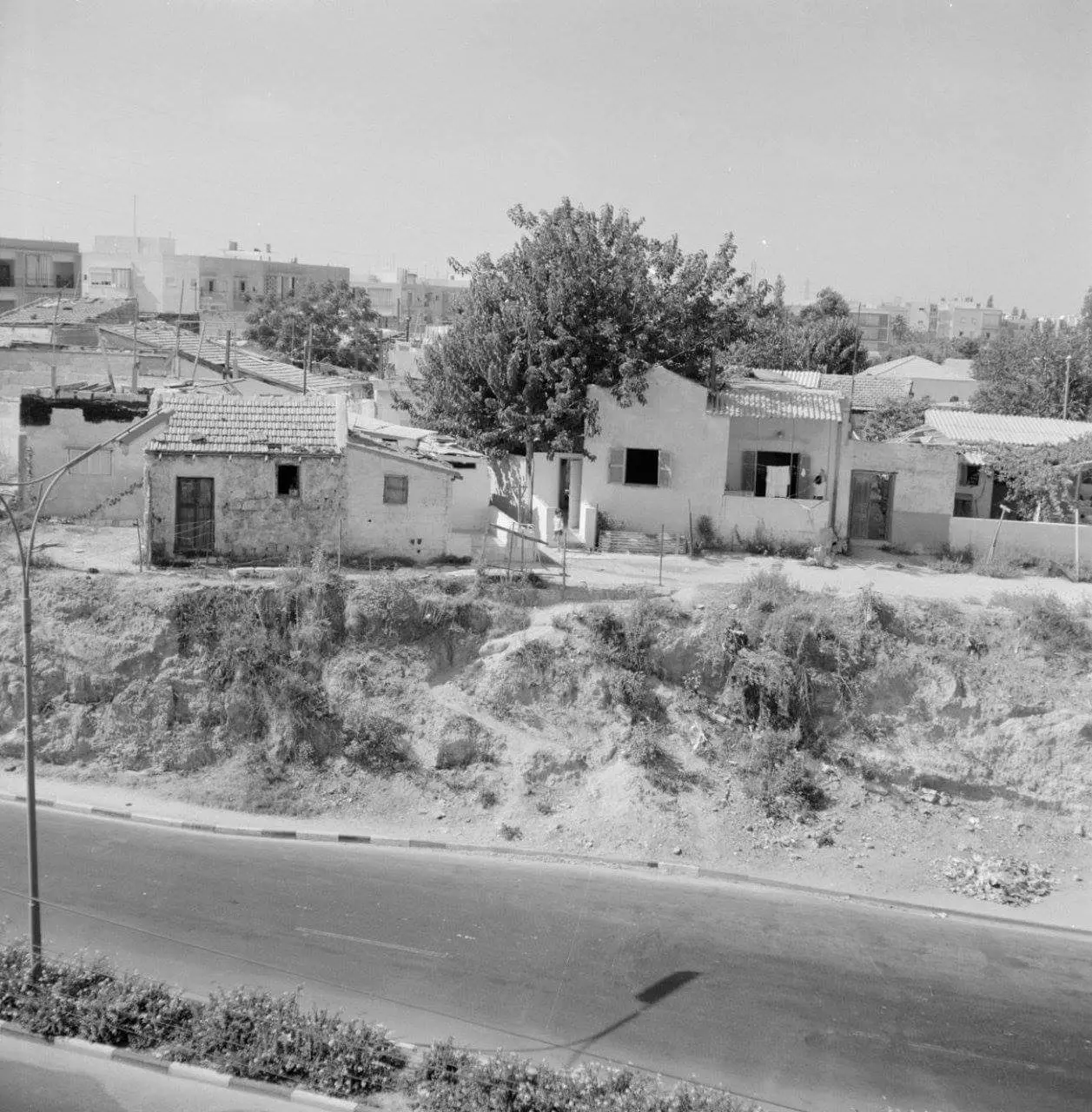
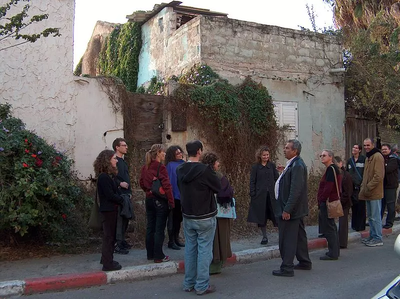
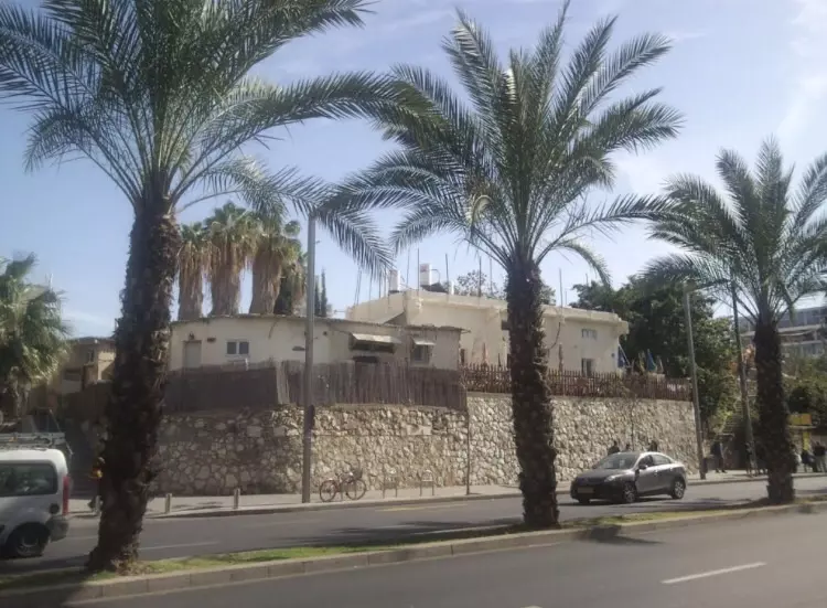
| Village Temains | al-Mas'udiyya was mostly destroyed with the exception of a deserted house that belonged to Muhammad Baydas. | ||||||||||||
| Ethnically Cleansing | Despite of a peace truce between the villagers and the Haganah, the villagers were terrorized into fleeing on 25th of December 1947. | ||||||||||||
| Population |
|
||||||||||||
| Number of Houses |
|
||||||||||||
| Near By Towns |
|||||||||||||
|
|||||||||||||
| Town's Name Through History | The village was known originally by its alternative name Summayl, but it was renamed to al-Mas'udiyya in the early twentieth century. | ||||||||||||
| Schools | al-Mas'udiyya had an elementary school for boys founded in 1931, and in 1945 it had an enrollment of 31 student. | ||||||||||||
| Places of Warship | One mosque which was built on top of a church foundation. | ||||||||||||
| Nearby Wadies & Rivers | al-Mas'udiyya was situated 1.5 km south of the al-'Awja River. | ||||||||||||
| Exculsive Jewish Colonies Who Usurped Village Lands |
Tel Aviv City | ||||||||||||
Village TodayAccording to the Palestinian historian Walid Khalidi, the village remaining structures on the village land are:"All that remains of the village is one deserted house that belonged to Muhammad Baydas. Nearby is the al-Mas'udiyya (or Summayl) bridge-an arched, steel structure." |
|||||||||||||
| Related Maps | Town Lands' Demarcation Maps خرائط للقضاء توضح حدود القرى والاودية Town's map on MapQuest View from satellite Help us map this town at WikiMapia |
||||||||||||
| Related Links | Wikipedia's Page Google Search Google For Images Google For Videos |
||||||||||||
| More Information | في كتاب كي لا ننسى في كتاب بلادنا فلسطين المزيد من موقع هوية |
||||||||||||
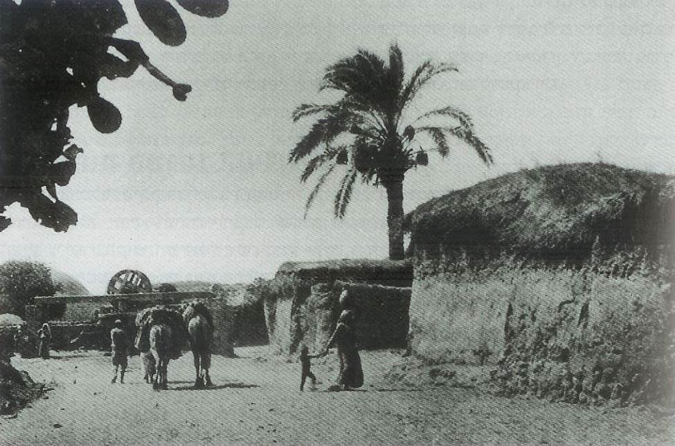
- منظر عام سنة 1920
- صورة رائعة للقرية اخذت بعد النكبة
- Al-Mas'udiyya (Summayl), december 2008
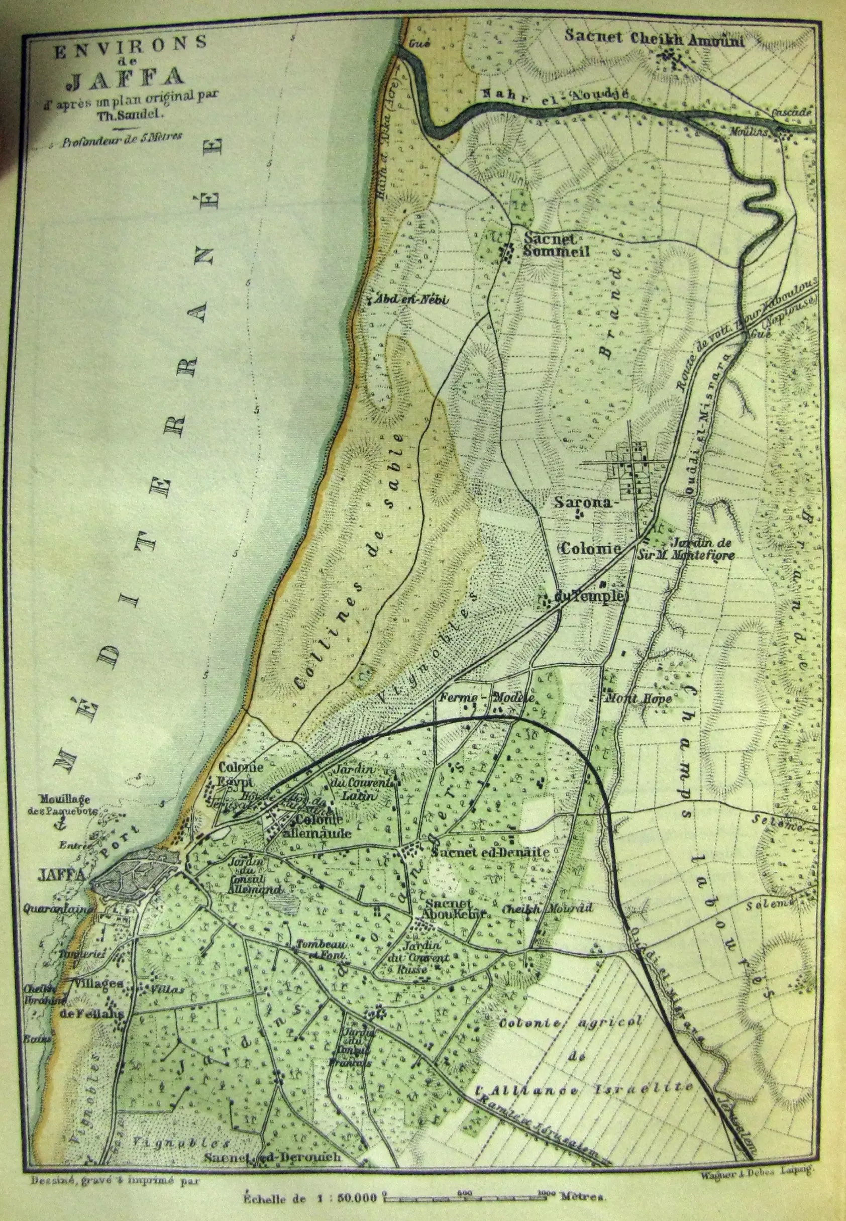
Posted by Paul Tieman 1 - The surrounding of Jaffa in a Baedeker travel guide of Palestine (1893) Sacnet Sommeil = al-Mas'udiyya
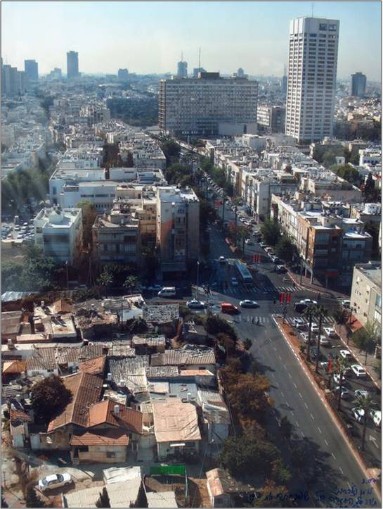
Posted by Paul Tieman - قرية صوميل التي اصبحت اليوم جزء من تل ابيب حيث بنيت عليها ايضا بلدية تل ابيب
Posted by Raneen G. 3 - summayl a refugee in front of the house from which he was expelled in 48, photo michael jacobson
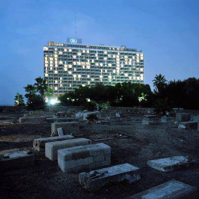
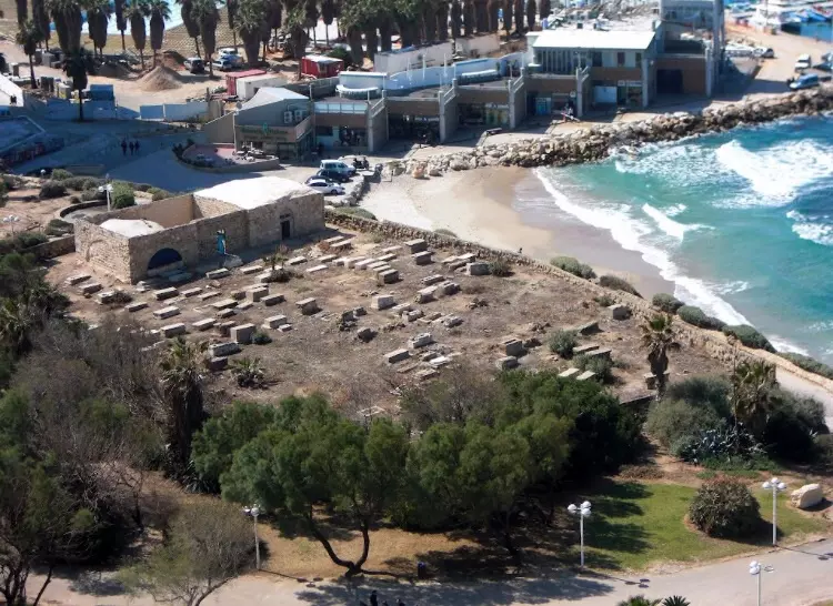
Posted by ariella azoulay - مقبرة القرية ويظهر فندق الهيلتن في الخلف حيث ظغت مدينة تل أبيب عليها، منقول من صفحة كفر برا
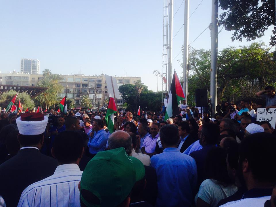
- مظاهرة امام بادبة تل ابيب ضد هدم البيوت العربية
Posted by فتحي ابو رضا \ العايدي - مقبره القريه بجانب شاطى البحر
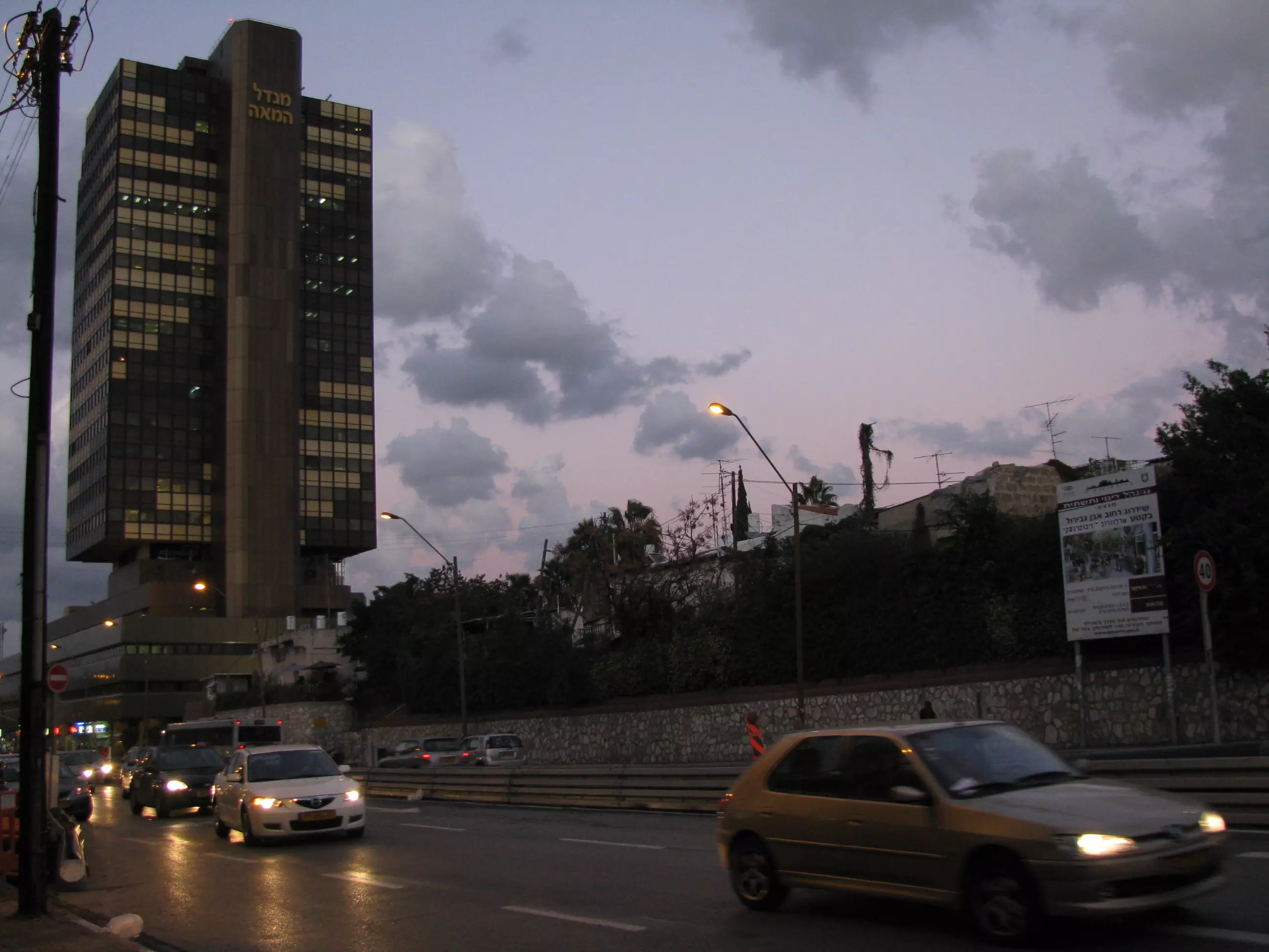
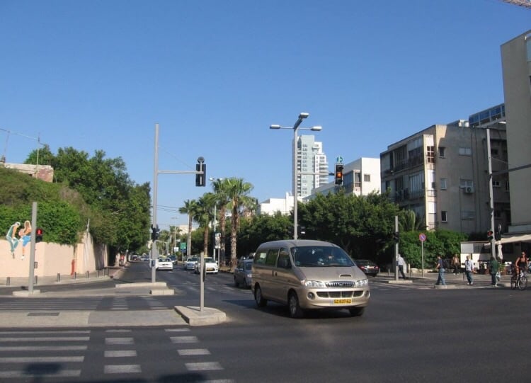
Posted by abu raya - موقع القريه اليوم وهو جزء من تل ابيب
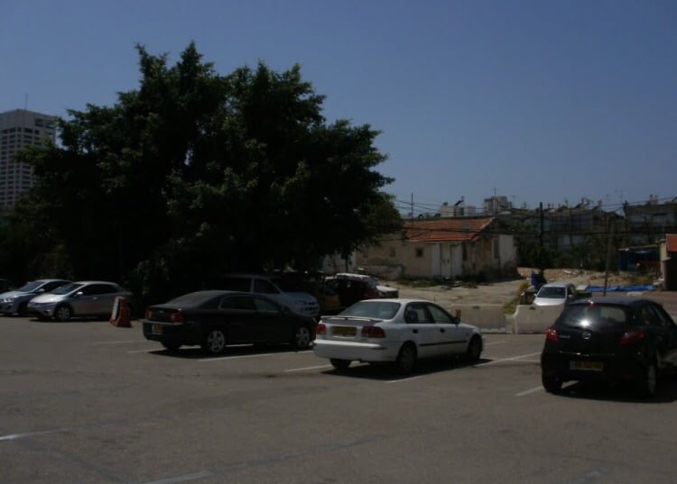
Posted by abu raya - موقع القريه
Posted by abu raya - موقع القريه
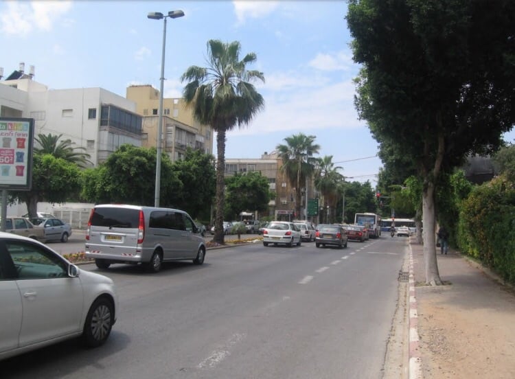
Posted by abu raya - موقع القريه
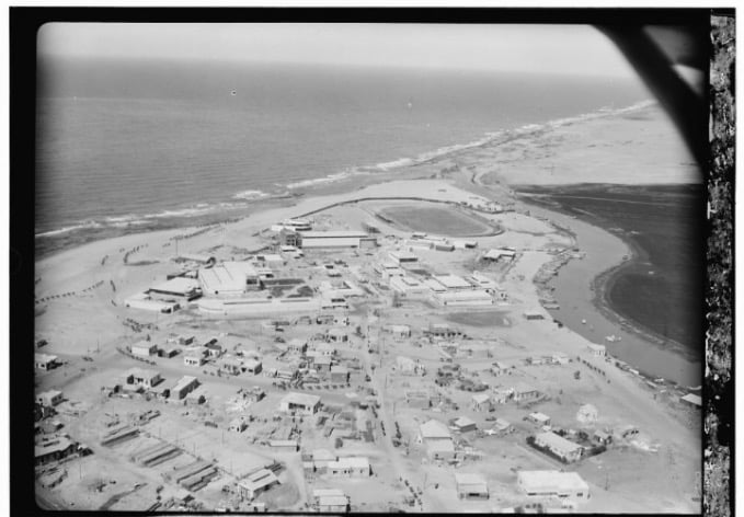
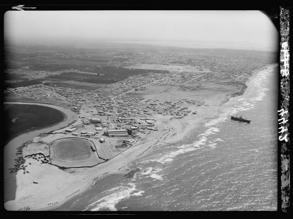
Posted by abu raya - صوره من الجو لقريه المسعوديه قبل النكبه
Posted by abu raya - قريه المسعوديه قبل النكبه
Posted by abu raya - صوره من الجو لقريه المسعوديه قبل النكبه
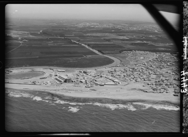
Posted by abu raya - صوره من الجو لقريه المسعوديه ونهر العوجا قبل النكبه
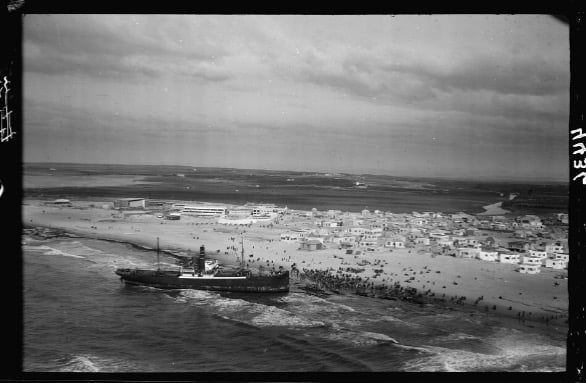
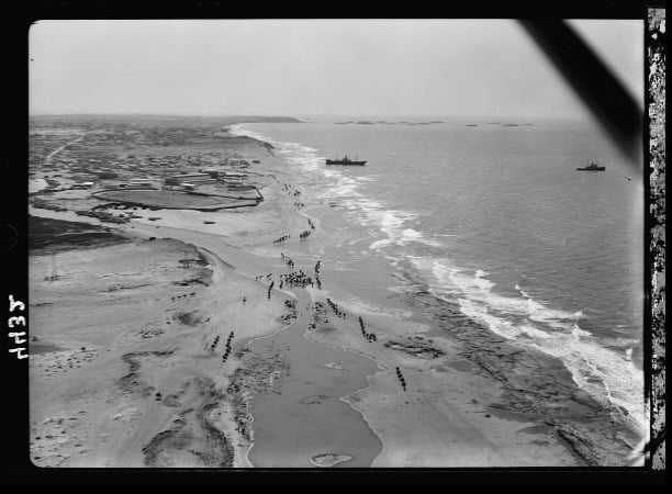
Posted by abu raya - شاطى قريه المسعوديه قبل النكبه
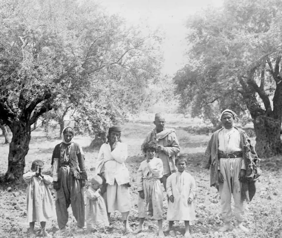
Posted by abu raya - صور نادرة جدا لقرية المسعودية ( صوميل ) --pre-Nakba
- صور نادرة جدا لقرية المسعودية ( صوميل ) --pre-Nakba #2
- صور نادرة جدا لقرية المسعودية ( صوميل ) --pre-Nakba #3
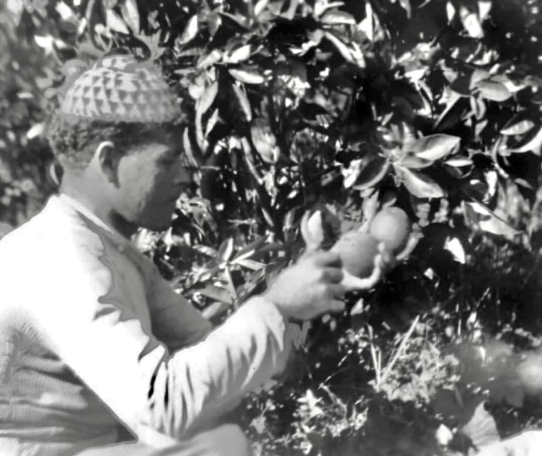
- صور نادرة جدا لقرية المسعودية ( صوميل ) --pre-Nakba #4

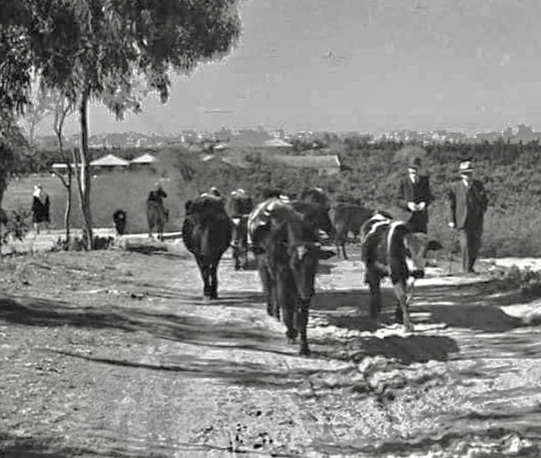
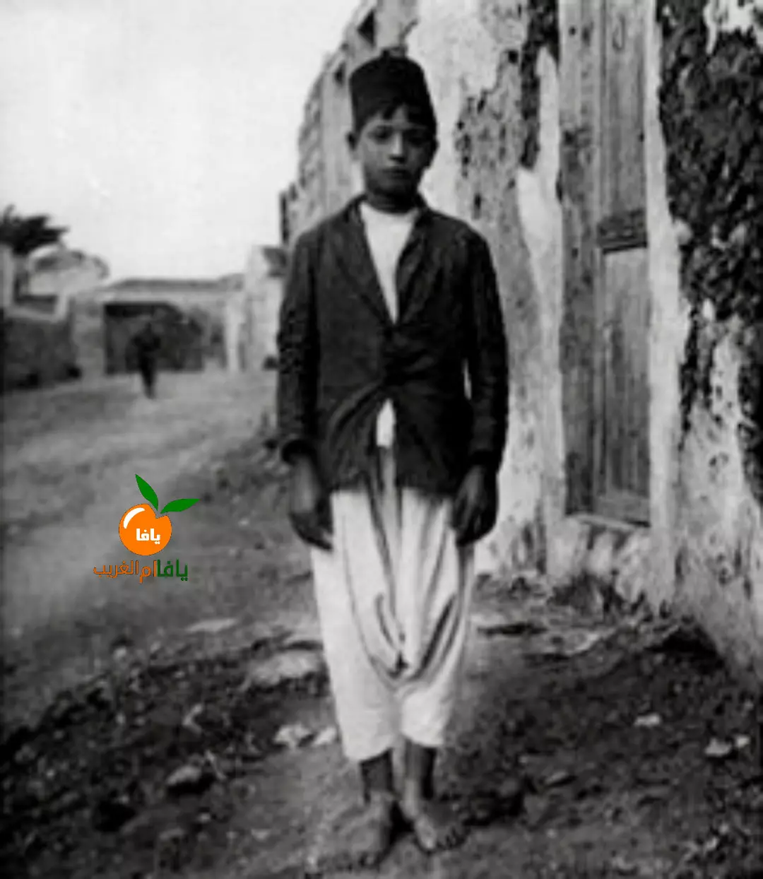
- شاب من قرية صوميل قضاء يافا يلتقط صورة من أمام بيته الصورة من عام 1921 للمصور الهولندي فرانك شولتن..
Want to browse more? 80,000 pictures were grouped in these gallaries:
| Display Name | Clan/Hamolah | Country of Residence |
| Esraa | التوم/عليان | Toronto, Canada |
| محمود أبويوسف | عشيرة القطاطوة | غزة, فلسطين |
| فراس حجاج | حجاج | - |
| فادي حسن | ابو زيد | عمان |
| عماد التوم | التوم | الزرقاء, الاردن |
| Saleh Abusaad | - | Abu Dhabi, United Arab Emirates |
| Billal Saoud | Saoud | Kuwait |
| Juman A.J | - | Jordan/Palestine |
| يافاوي Yafawi | أيوب (أبو دقيق) Ayyoub | Amman, Jordan |
| sharifsaed | أبو سعد | غزة |
| Ahmed Salem El Sayed Ahmed | - | - |
- News piece about Summayl: the building/destruction plans and Zochrot's opposition (Hebrew) Duration: 3 min 45 sec
- فيلم عن قرية صميل (المسعوديه) قضاء يافا- انتج عام 2008 وعرض لاول مره في نوفمبر 2010 Duration: 12 min 9 sec
No links have been shared yet, be free to the first to share the first link.
 Fake Valor: Why Did Zionist Jews Hoist Nazis Flag on Their Ships in the 1930s?
What is new?
-
Facts About Oct. 7th Gaza Raid
-
Remined Us Please:: Who Did Rape Who? Palestinians Raped Israelis? Or, was the other way around?
-
When Prof. Edward Said was invited to debate Bibi Netanyahu in the 1980s, watch what happened!
-
Ezra Klein of the NY Times on the "Jewish Race".
-
Abusing Blood Libel!
-
Zionist FAQ: Isn't it true that Palestinians don't want peace? Palestinians never accepted the two-state solution
- Facts about Haavara (Transfer) Agreement between Ben-Gurion & Hitler
-
Haavara FAQs: Why Did Zionist Jews Hoist Nazis' Flags on Their Ships in the 1930s?
-
Dear ChatGPT: Why did the Jewish Agency suppress news of the Holocaust during WWII?
-
Video Playlist: Jews share their DNA tests to end the conflict for good.
-
A Tale of Two Conflicts: Examining the Definition of Genocide
-
Prof. Abraham Polak And The Suppressed History of the Khazars and European Jewry
-
How Ronald Reagan would have framed the genocide in Gaza if he were still alive?
-
Haavara FAQs: Let us do the math: how many German Jews did The Haavara Agreement save?
-
Zionist FAQs: The Hebron Massacre of 1929, "clearly proves" that Palestinians are antisemitic, how could you deny it?
-
Zionist FAQs: Why Anti-Zionist Is Not Antisemitism?
-
Zionist FAQs: Isn't it true that the KGB create Palestinian Nationalism in the early 1960s?
- Zionist FAQs: Muslims are killing Muslims all the time; why are Israeli Jews being singled out in the media?
- Zionist FAQs: How is Israel an apartheid state when 20% of its citizens are Arabs who enjoy full rights?
-
Haavara FAQs: Analysis of Herzl's Uganda Scheme and how it could have saved millions of Jews.
-
Haavara FAQs: Why did Hayim Greenberg describe American Jewry as "morally bankrupt" in early 1943?
-
Haavara FAQs: What if the Evian Conference was a resounding success? What would have been the impact of saving European Jewry on Zionism?
- Haavara FAQs: What if the six million were saved, how that would have impacted the Zionist project?
-
Haavara FAQs: How did Zionist leaders react when Europe's Jews lingered in the DP camps after WWII ended?
-
Why does the American Jewish community repeat lies that David Ben-Gurion had debunked before he died?
-
Who has the power to rename the Tatar/Khazar Gene Marker to Jewish IV?
-
Zionist FAQs: Why won't Egypt, Syria, and Jordan take their people back? Jews are indigenous to Palestine, and Arabs immigrated after Jews developed the country. Arabs should leave.
-
Haavara FAQs: Did Hitler and the Nazis conflate between Judaism and Zionist? If that wasn't case, then why?
-
Haavara FAQs: Winston Churchill and antisemitism, a collection of articles written Churchill.
-
Haavara FAQs: Broken by country, how many Jews survived vs. killed during the Holocaust?
-
Haavara FAQs: Why did European Jews vote with their feet and to immigrated to the Americas, not Palestine, after WWII?
-
Watch this American Jewish Girl describing Israeli Jews' cognitive dissonance like no other in under two minutes
-
Haavara FAQs: When the Nazis went out of their way to hide the Holocaust, Israeli Jews did the exact opposite by broadcasting their genocide of Gazans. But why?
-
Haavara FAQs: How Zionist Jews went out of their to show their appreciation to Nazism and Fascism?
- Haavara FAQs: Why Zionist leaders were against bombing the death camps & the Railroads leading to them?
-
Haavara FAQs: Hitler's message to the British and American people: If Jews are such noble citizens and you care about them, how come you're not letting them in? I will gladly ship them to you at my expense, even on luxury liners!
-
A shortlist of Zionist and Israeli false flag operations in the name Jews.
-
The Most Moral Army
- The Land of Kapos (Israel): Where the brave are boycotted and Kapos walk free.
- Why did early Zionists often named their communal enterprises "colonial"?
- Zionist Relations with Nazi Germany by Faris Glubb
-
Two NY Times advertisements by Zionists in the early 1943 that exposes Zionists' treason at the height of the calamity
- Facts Not Lies about the Palestinian-Israeli Conflict.
- Site's pictures have been categorized
- Campgain Against Lice
- A Survey of Palestine, the official source about Palestine before Nakba produced by the British Mandate; over 1200 pages.
- Satellite View & Google Earth: Over 6,000 placemarks identifying all destroyed towns, W. Bank & Gaza Strip Towns, & refugee camps.
- PalestineRemembered.com and its Nakba Oral History Project were featured on al-Jazeera Satellite TV.
- Nakba Oral History Video Podcast:
 Over 700 Oral History interviews (including 3,500+ hours of recording) can be viewed online.
 - Palestine Village Statistics Project
- Gaza Jail Break
- النسخة العربية للموقع الان متوفرة
- Videos: Documenting the destroyed villages in video: Tracing all that remains since Nakba.
- Videos: Responding to Zionist Propaganda
- Interview: The ethnic cleansing of Palestine: George Galloway interviews Israeli Historian Ilan Pappe.
- For Palestinians, memory matters. It provides a blueprint for their future By George Bisharat.
- Zionist FAQ now available in Hebrew שאלות שציונים שואלים, עכשיו בעברית
- Video: The Stephen Walt and John Mearsheimer report on the influence of the Israel Lobby on U.S. Foreign Policy
- The Palestinian-Israeli conflict for beginners
