| PalestineRemembered | About Us | Oral History | العربية | |
| Pictures | Zionist FAQs | Haavara | Maps | |
| Search |
| Camps |
| Districts |
| Acre |
| Baysan |
| Beersheba |
| Bethlehem |
| Gaza |
| Haifa |
| Hebron |
| Jaffa |
| Jericho |
| Jerusalem |
| Jinin |
| Nablus |
| Nazareth |
| Ramallah |
| al-Ramla |
| Safad |
| Tiberias |
| Tulkarm |
| Donate |
| Contact |
| Profile |
| Videos |
Welcome To Indur - إندور (عين دور) (אינדור)
|
District of Nazareth
Ethnically cleansed days ago |
العربية Google Earth |
 |
Gallery (84) |
- Statistics & Facts
-
Before & After

- Satellite View
- Articles 4
- Pictures 84
- Aerial Views 1
- Land Deeds 9
- Oral History 5
- Members 5
- All That Remains
- Wikipedia
- Videos 3
- Guest Book 9
- Links
| Statistic & Fact | Value | ||||||||||||||||
| Occupation Date | May 24, 1948 | ||||||||||||||||
| Distance From District | 10.5 (km) Southeast of Nazareth | ||||||||||||||||
| Elevation | 175 (meters) | ||||||||||||||||
| Before & After Nakba, Click Map For Details |
|||||||||||||||||
|
|||||||||||||||||
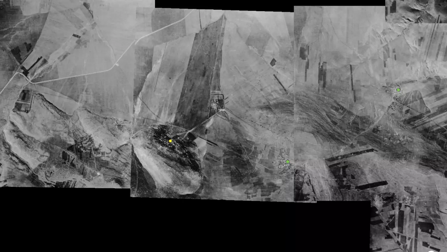
| Pre-Nakba Aerial View |
|||||||||||||||||
|
|||||||||||||||||
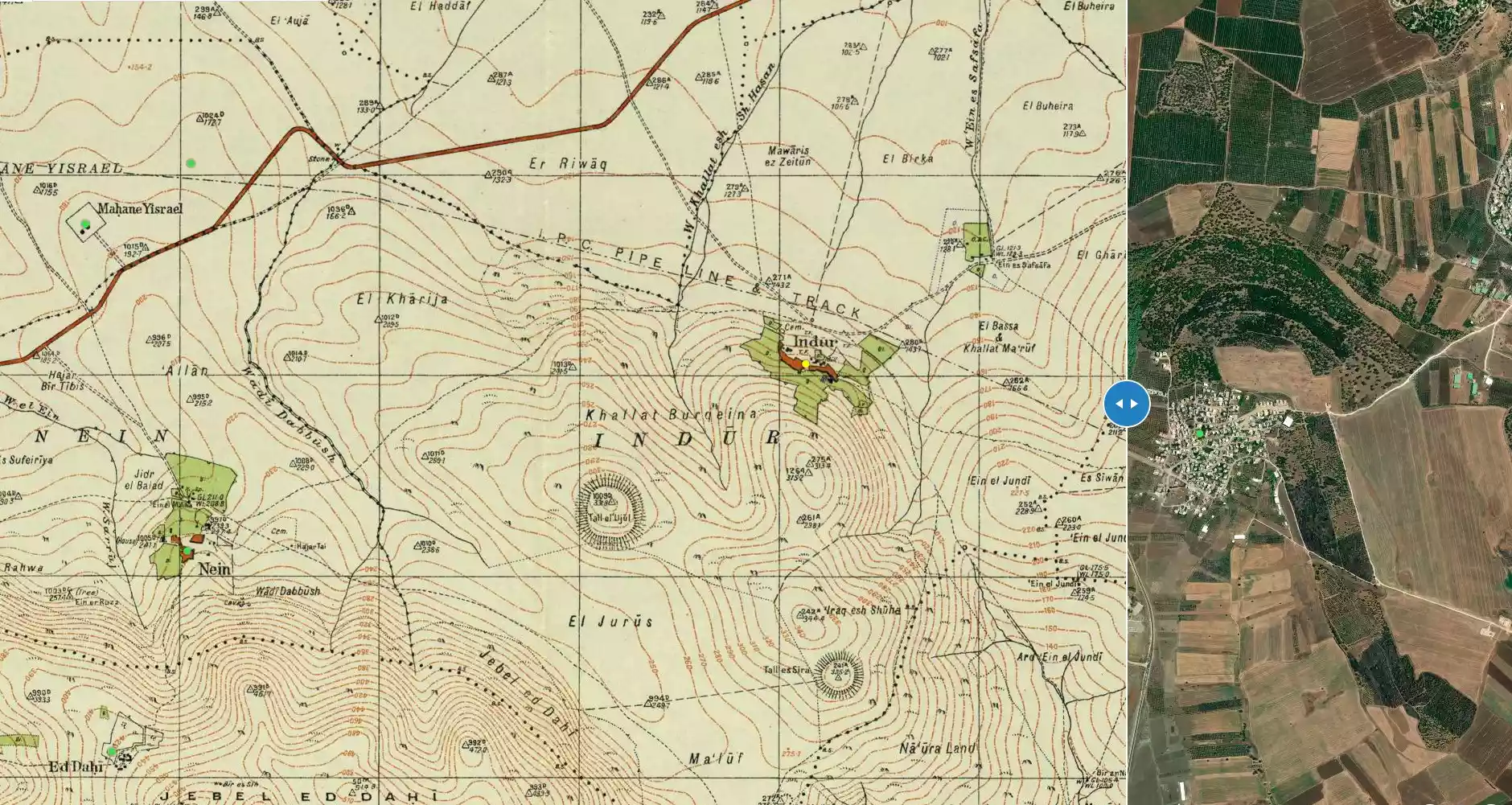
| Map Location | See location #4 on the map View from satellite |
||||||||||||||||
| Military Operation | Possible Baysan valley Clearing (Operation Gideon) | ||||||||||||||||
| Attacking Units | Golani Brigade | ||||||||||||||||
| Defenders | Some Palestinian and ALA volunteers, and possibly some Syrian Army. | ||||||||||||||||
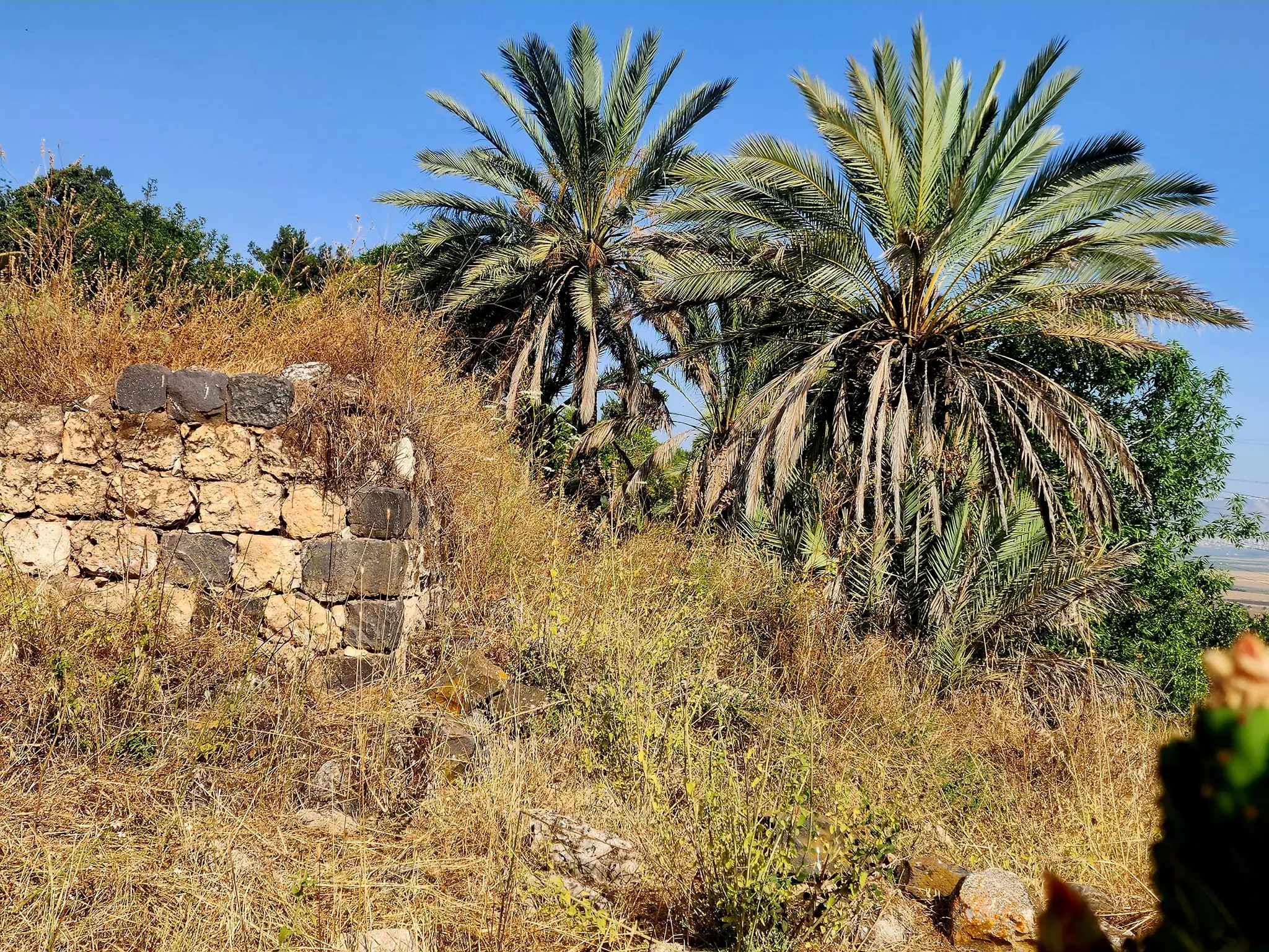
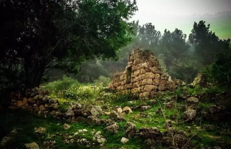
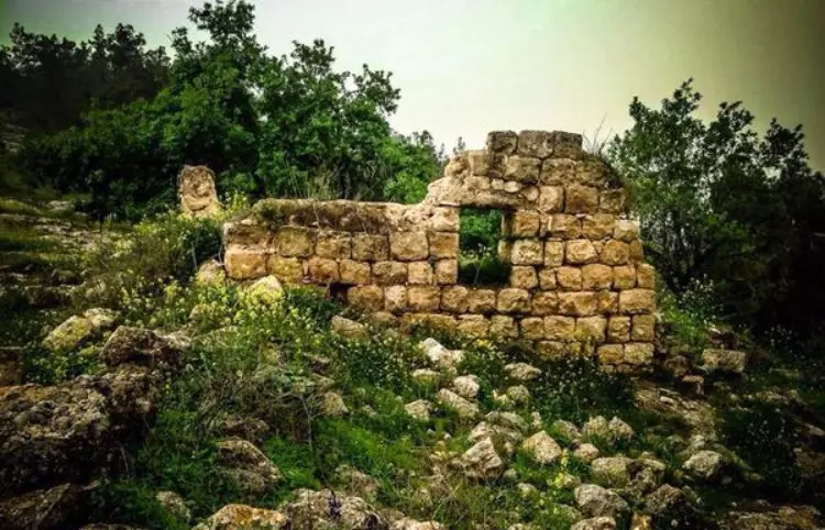
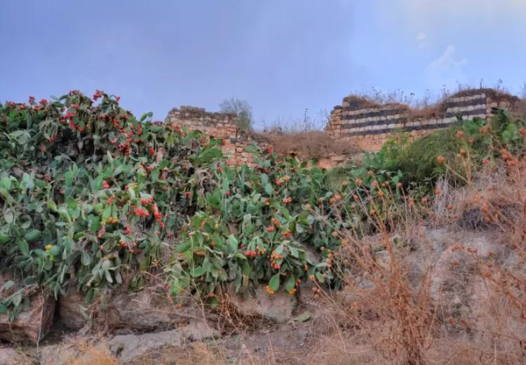
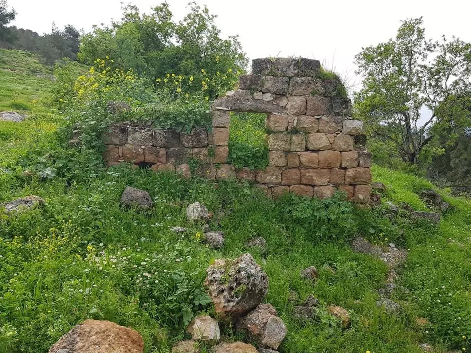
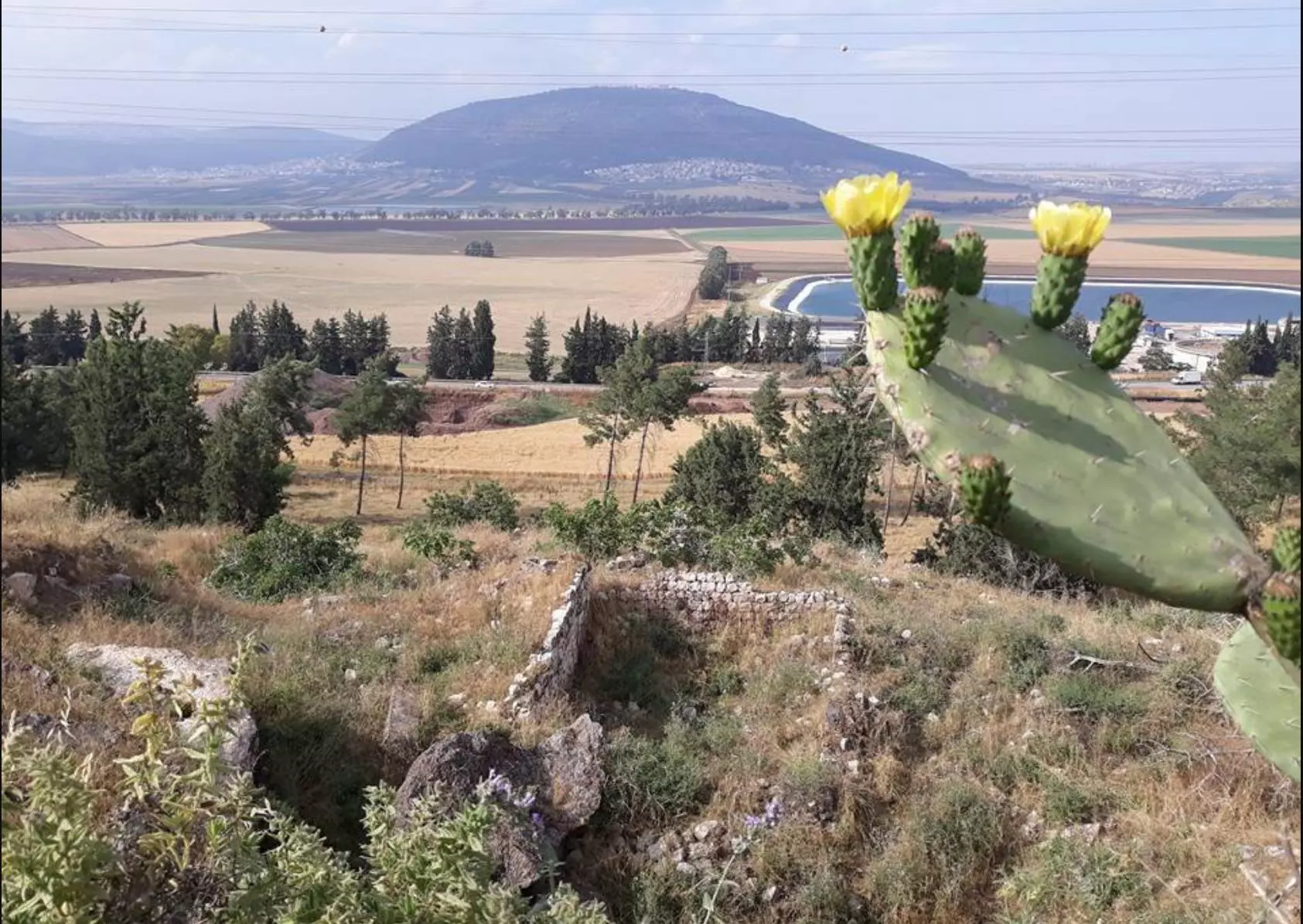
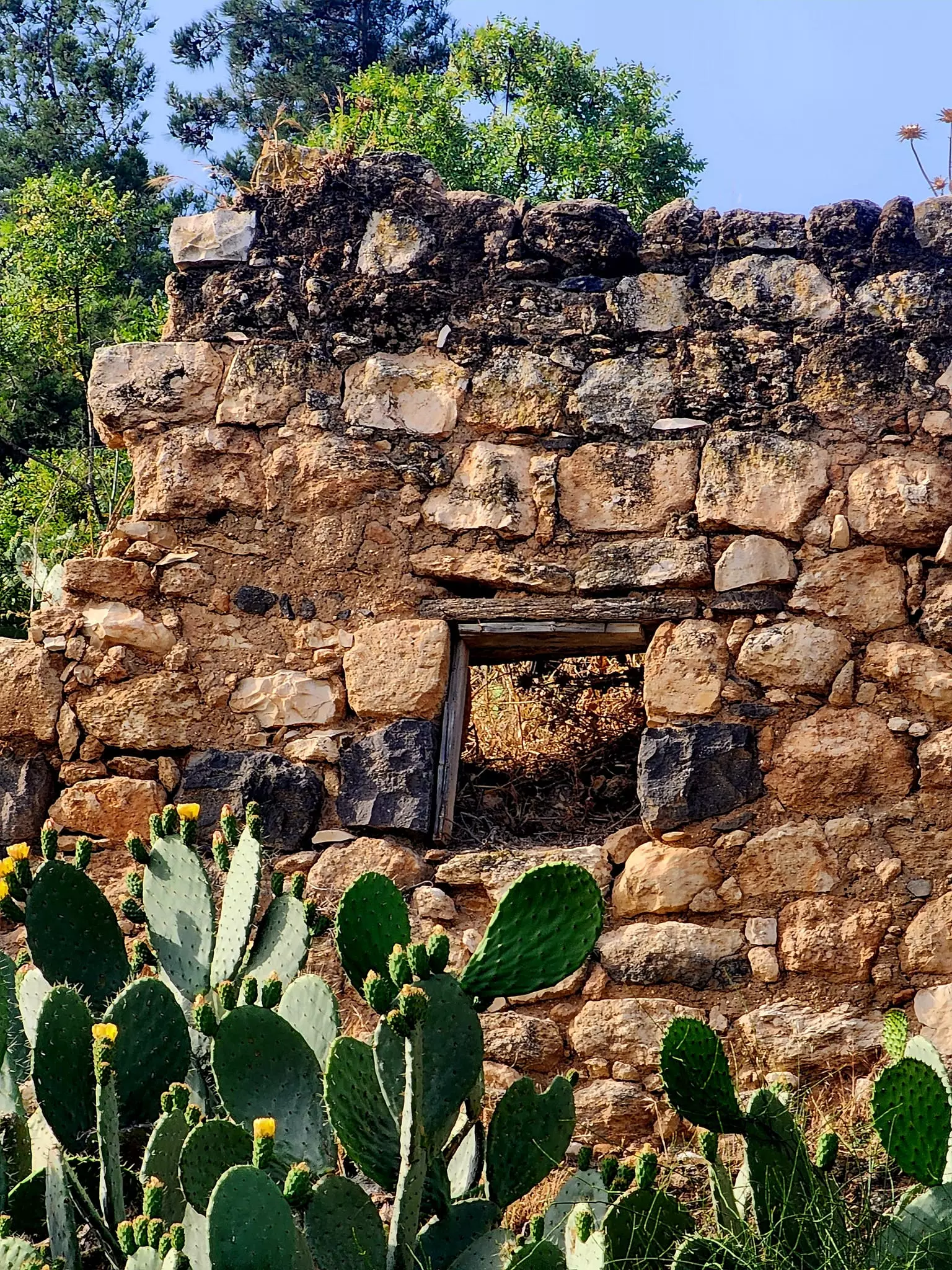
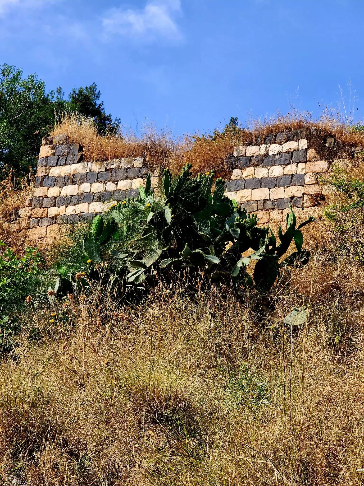
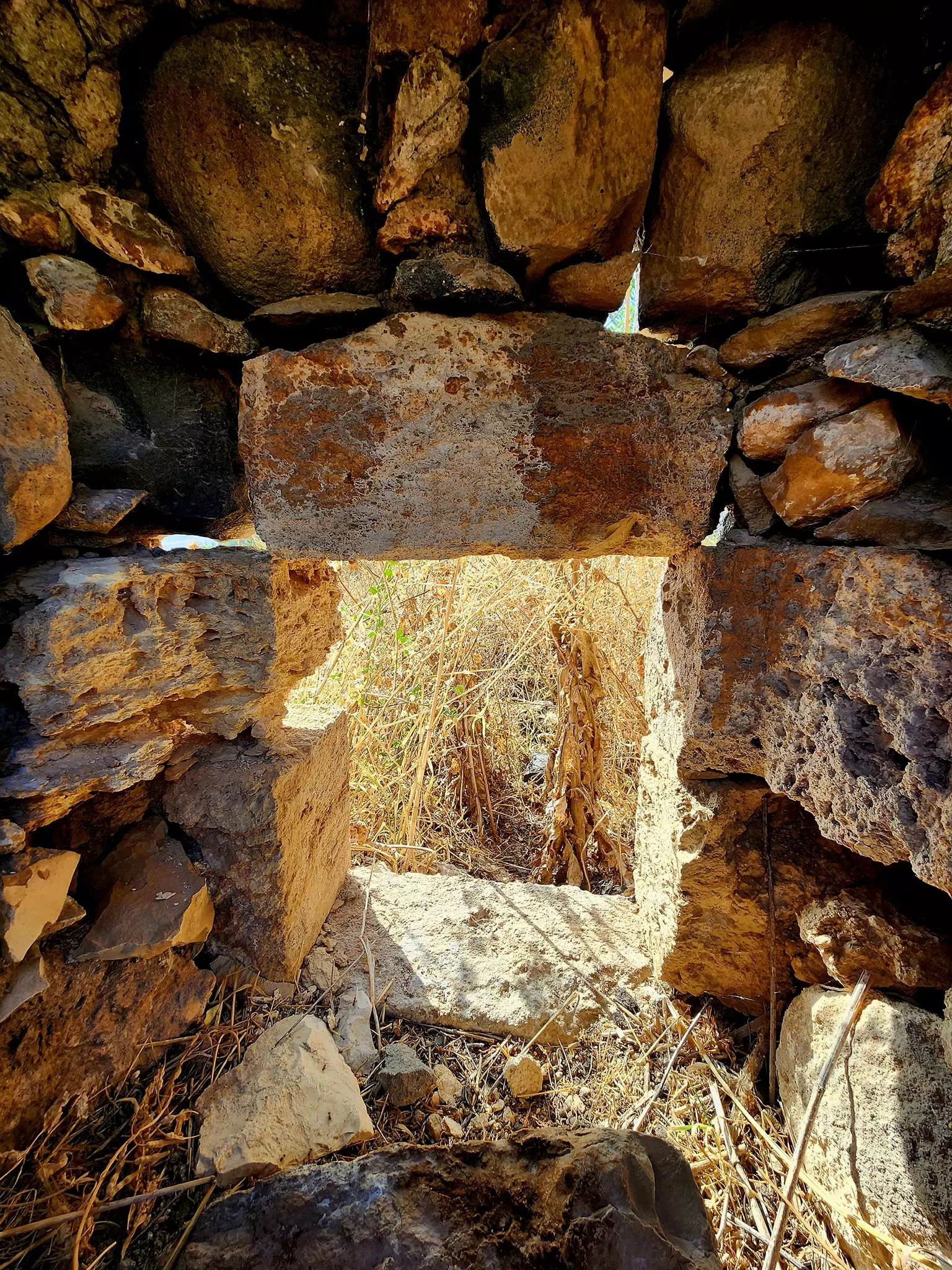
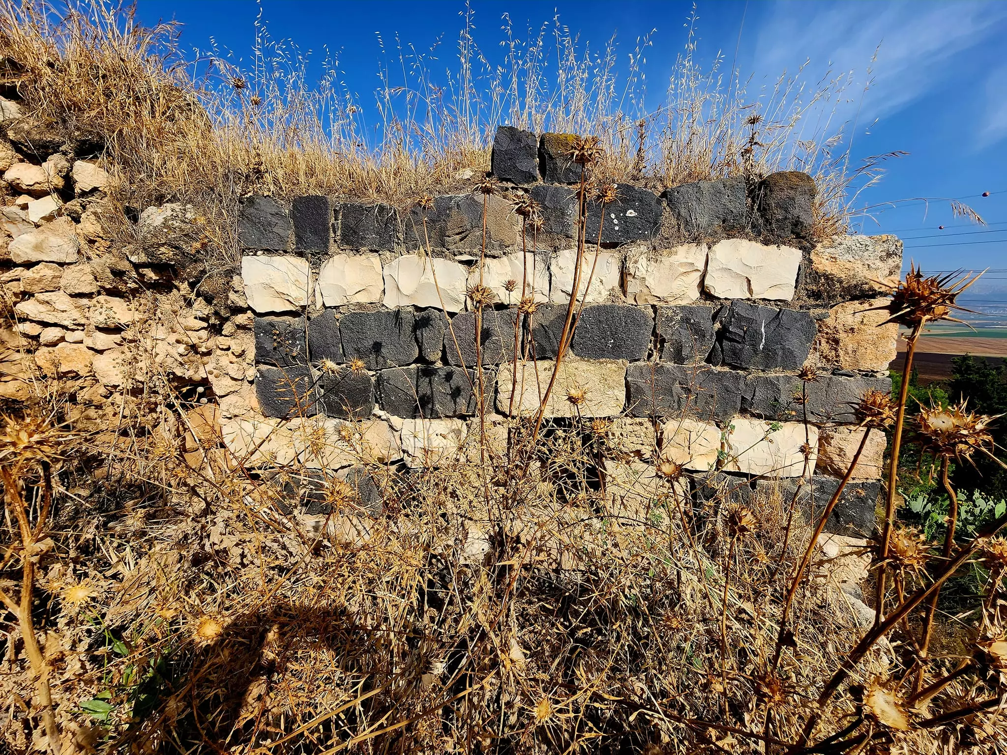
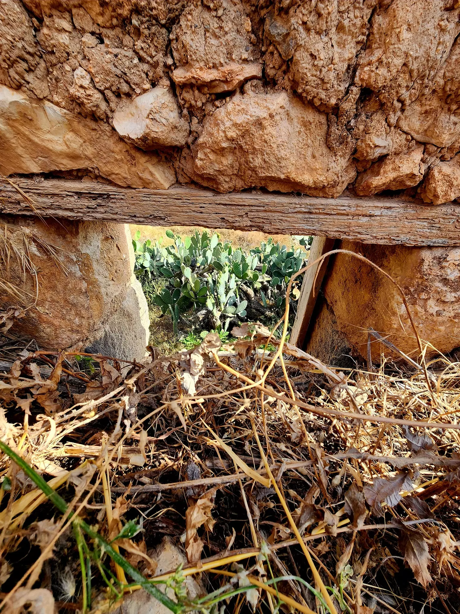
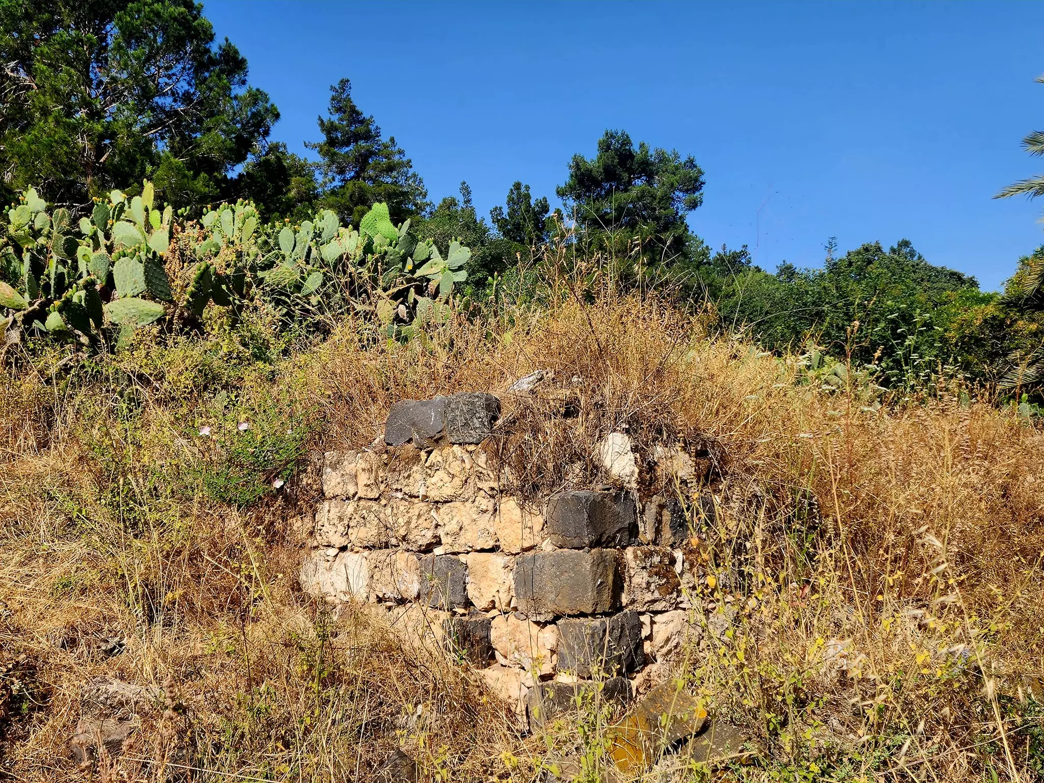
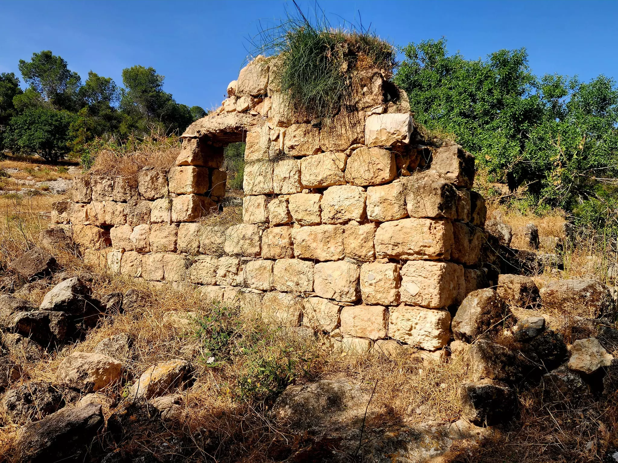
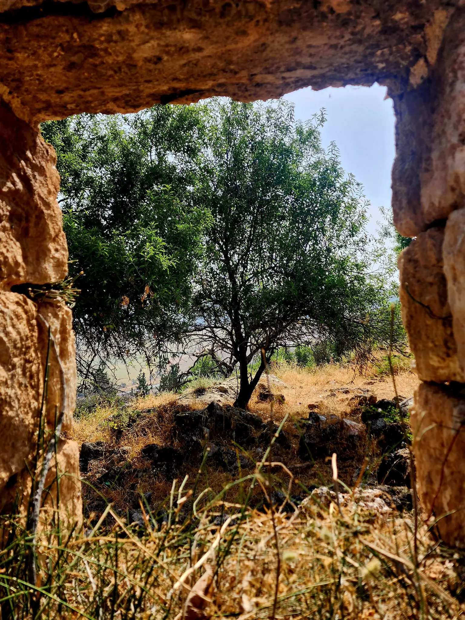
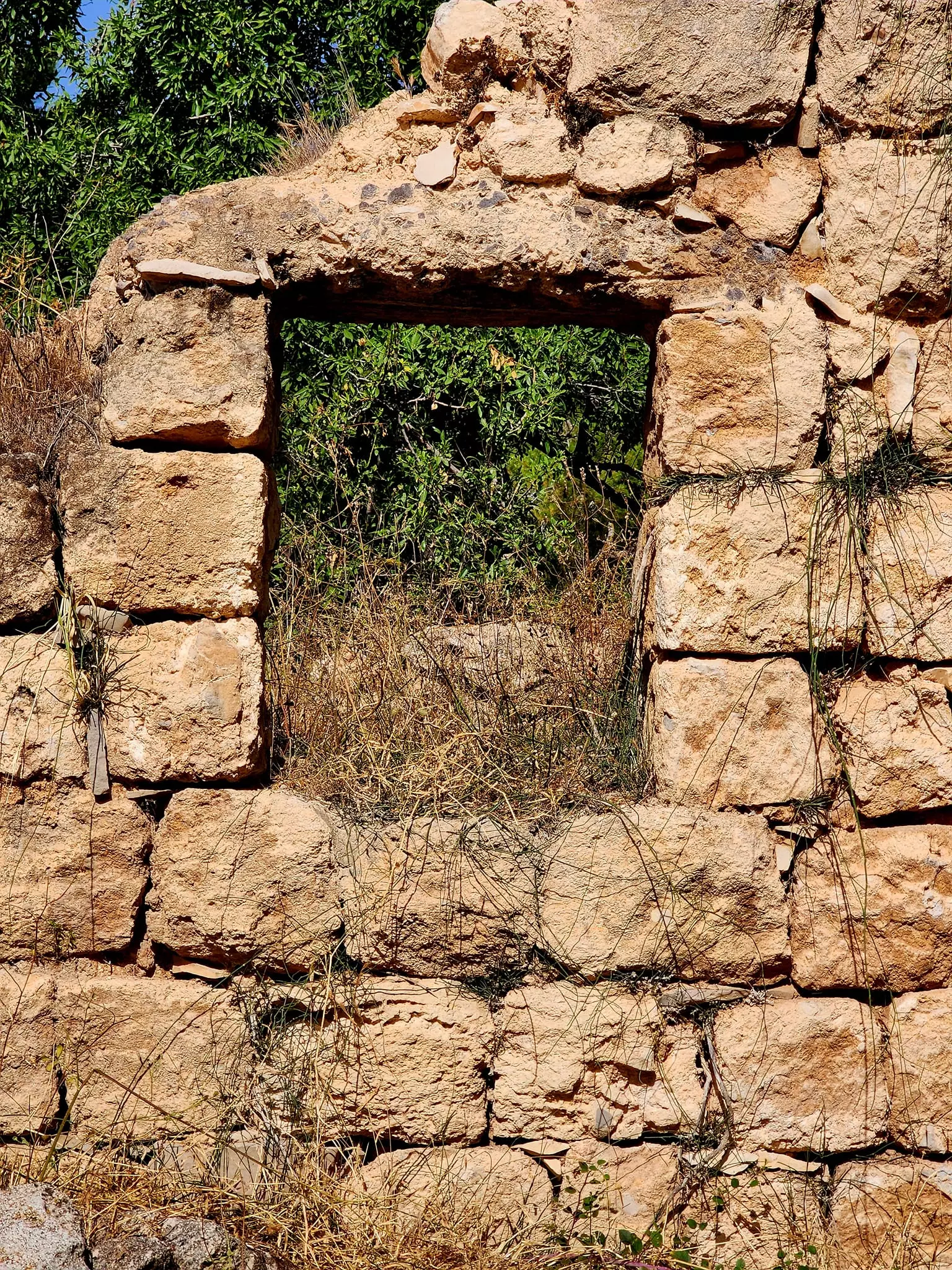
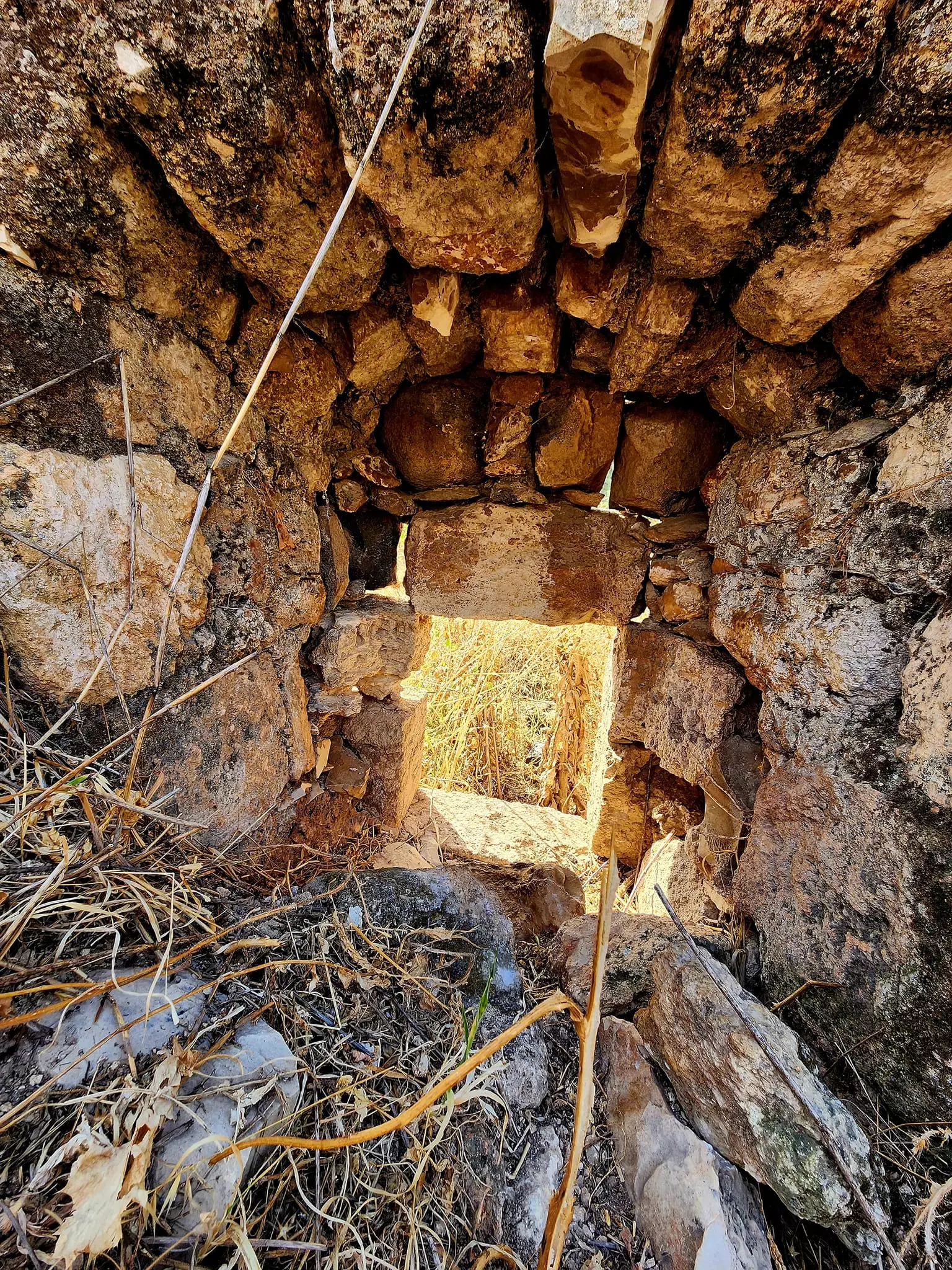
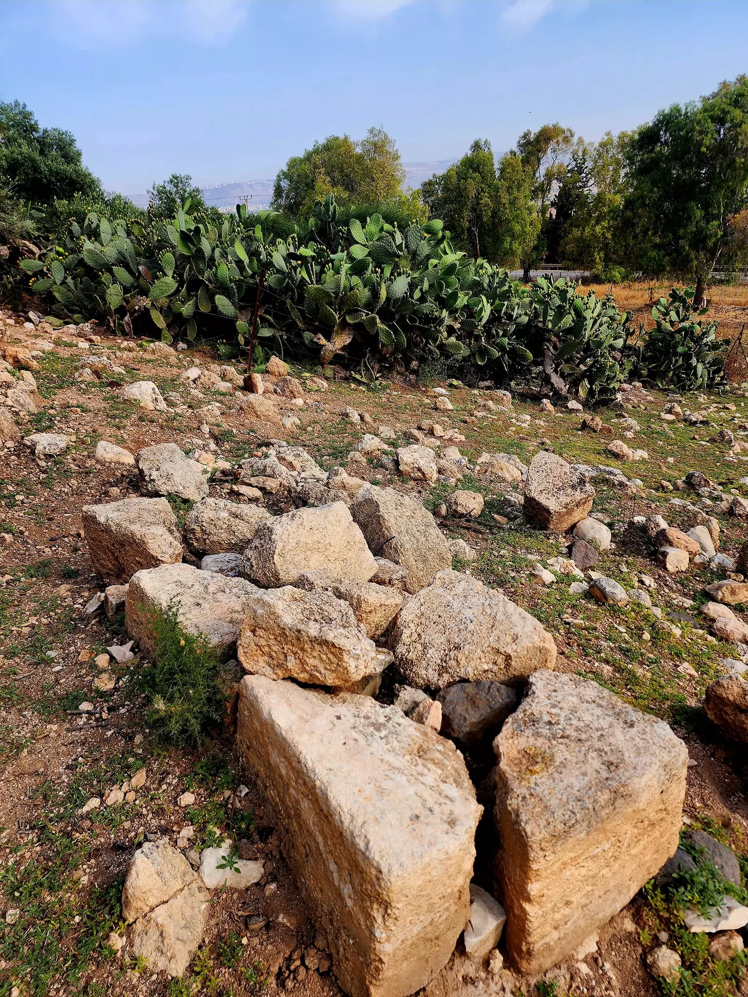
| Village Temains | Indur was completely destroyed, and only house walls and rubble left behind. | ||||||||||||||||
| Ethnically Cleansing | Indur inhabitants were completely ethnically cleansed. | ||||||||||||||||
| Pre-Nakba Land Ownership |
**Town Lands' Demarcation Maps |
||||||||||||||||
| Land Usage As of 1945 |
|
||||||||||||||||
| Population |
|
||||||||||||||||
| Number of Houses |
|
||||||||||||||||
| Near By Towns |
|||||||||||||||||
|
|||||||||||||||||
| Schools | Indur had an elementary school for boys which was founded by the Ottomans, however, it closed its doors during the British Mandate period. | ||||||||||||||||
| Town's Notable People | A prominent son of the village was , Shaykh Tawfiq Ibrahim, one of the leaders of the 1936-39 rebellion against the British Mandate. | ||||||||||||||||
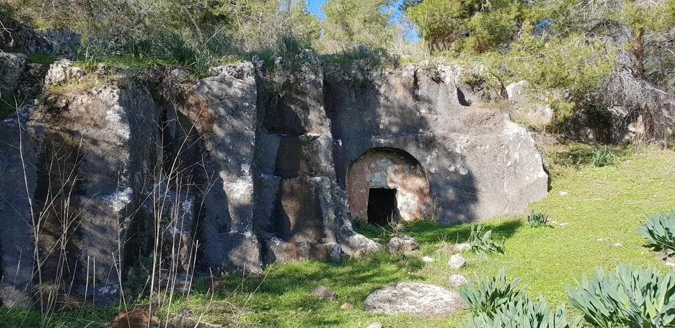
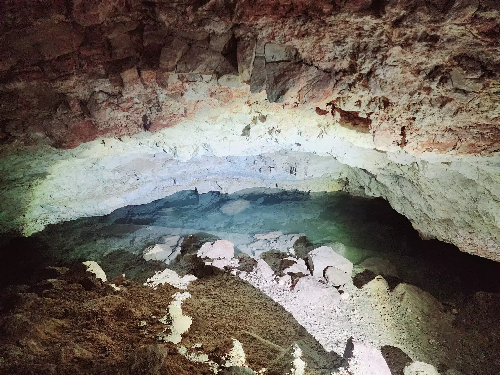
| Archeological Sites | The Canaanite town of 'Ayn Dur (Endor) probably was situated on Tall al-'Ajjul or or Khirbat al-Safsafa. | ||||||||||||||||
| Exculsive Jewish Colonies Who Usurped Village Lands |
No Israeli settlements on village land | ||||||||||||||||
| Featured Video | |||||||||||||||||
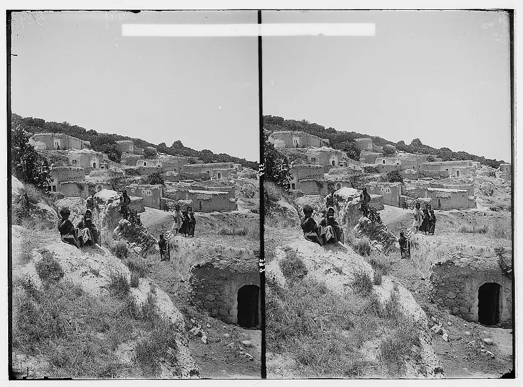
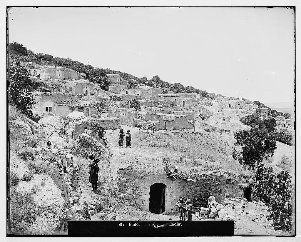
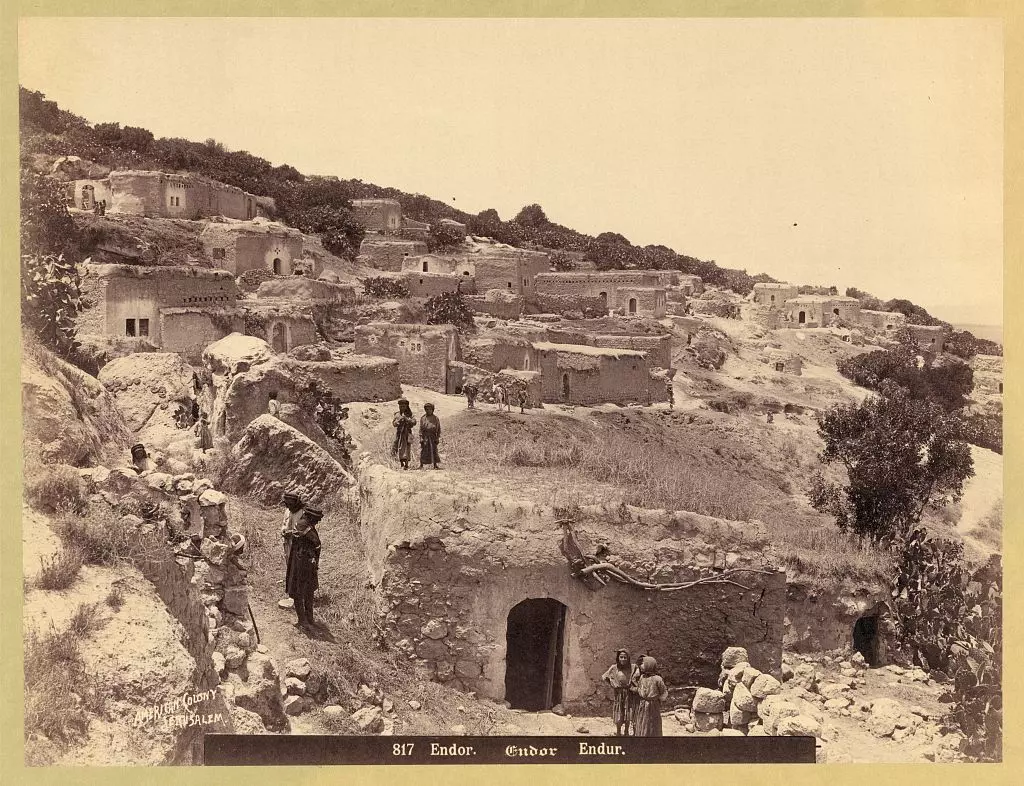
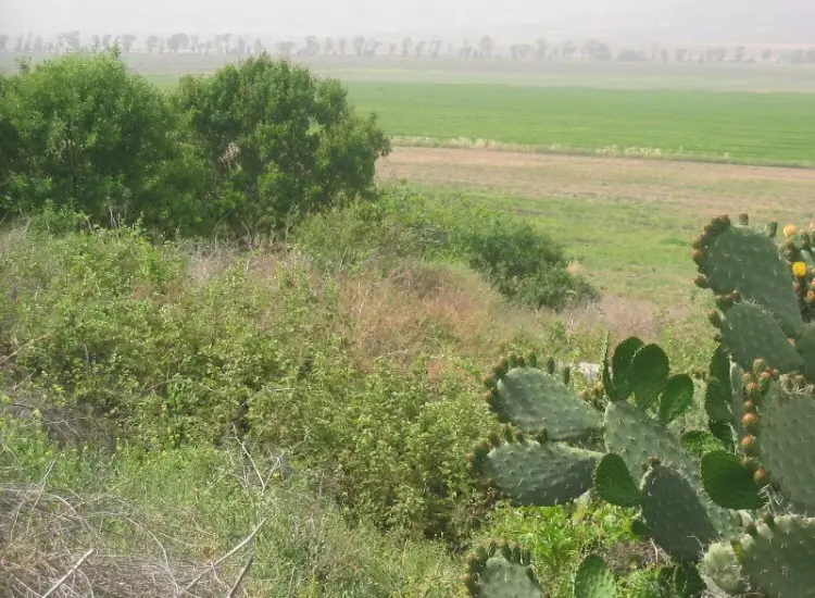
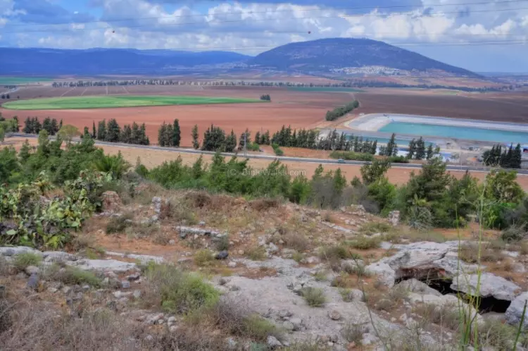
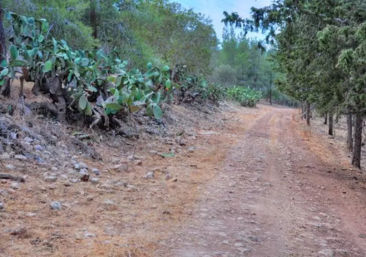
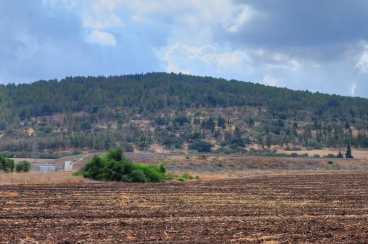
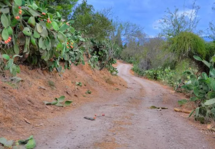
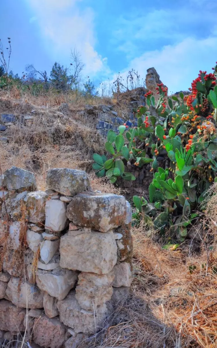
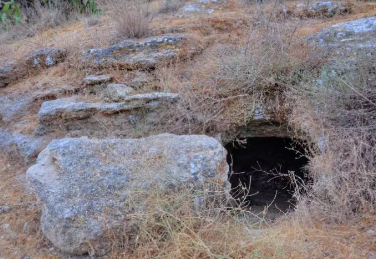
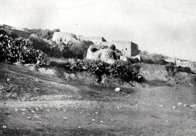
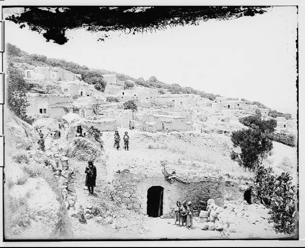
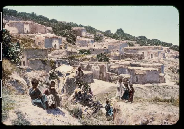
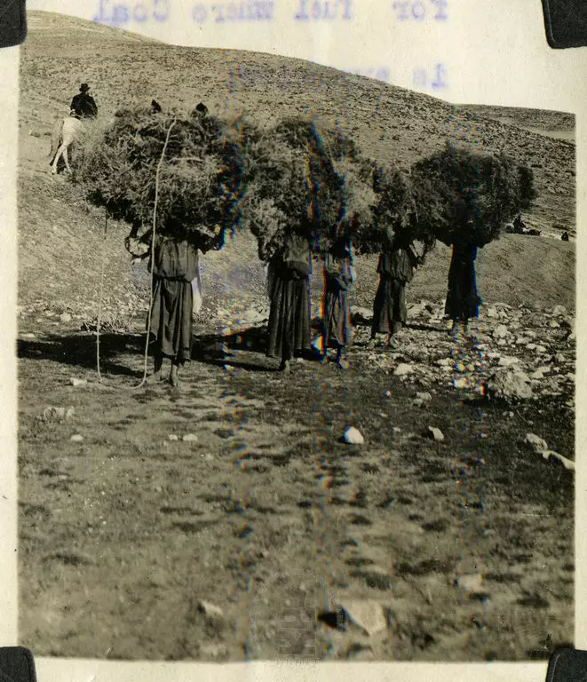
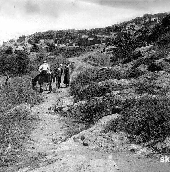
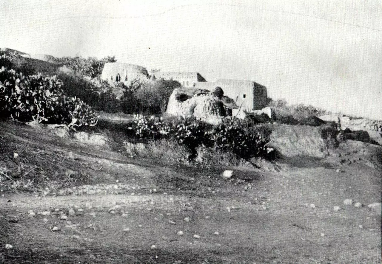
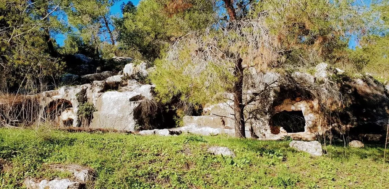
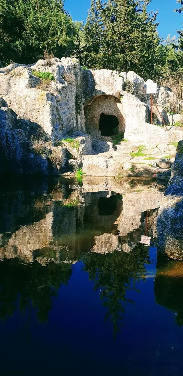
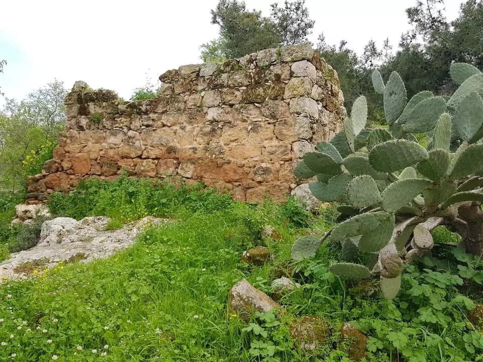
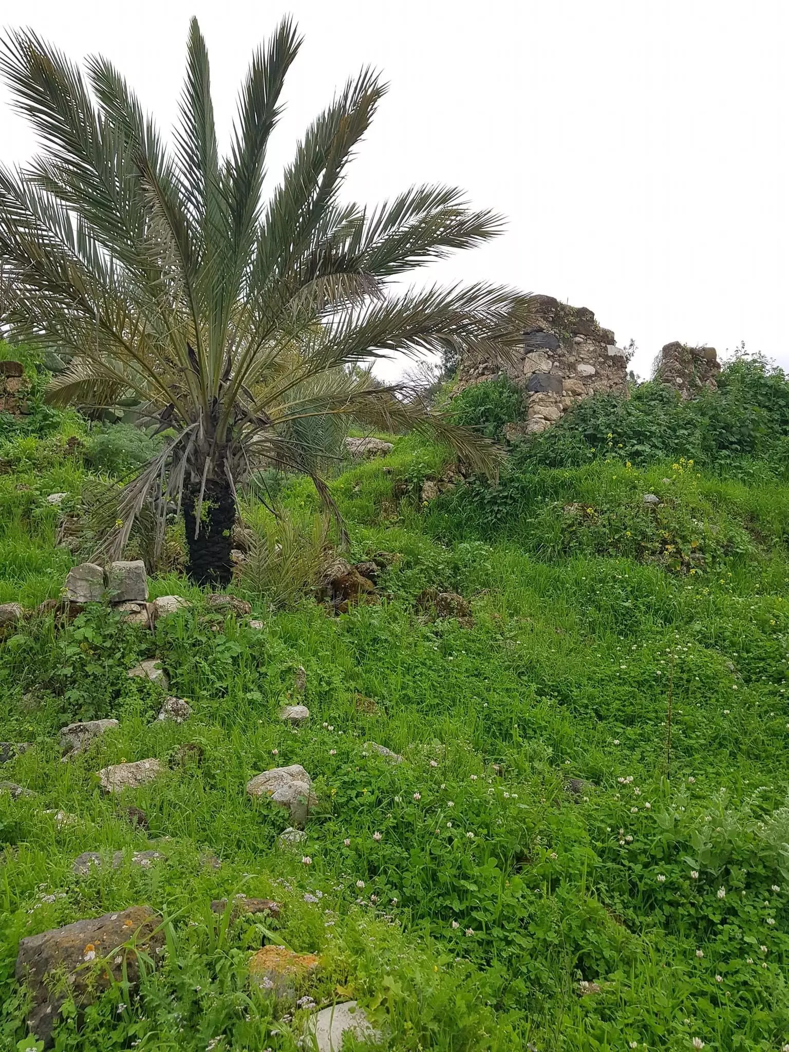
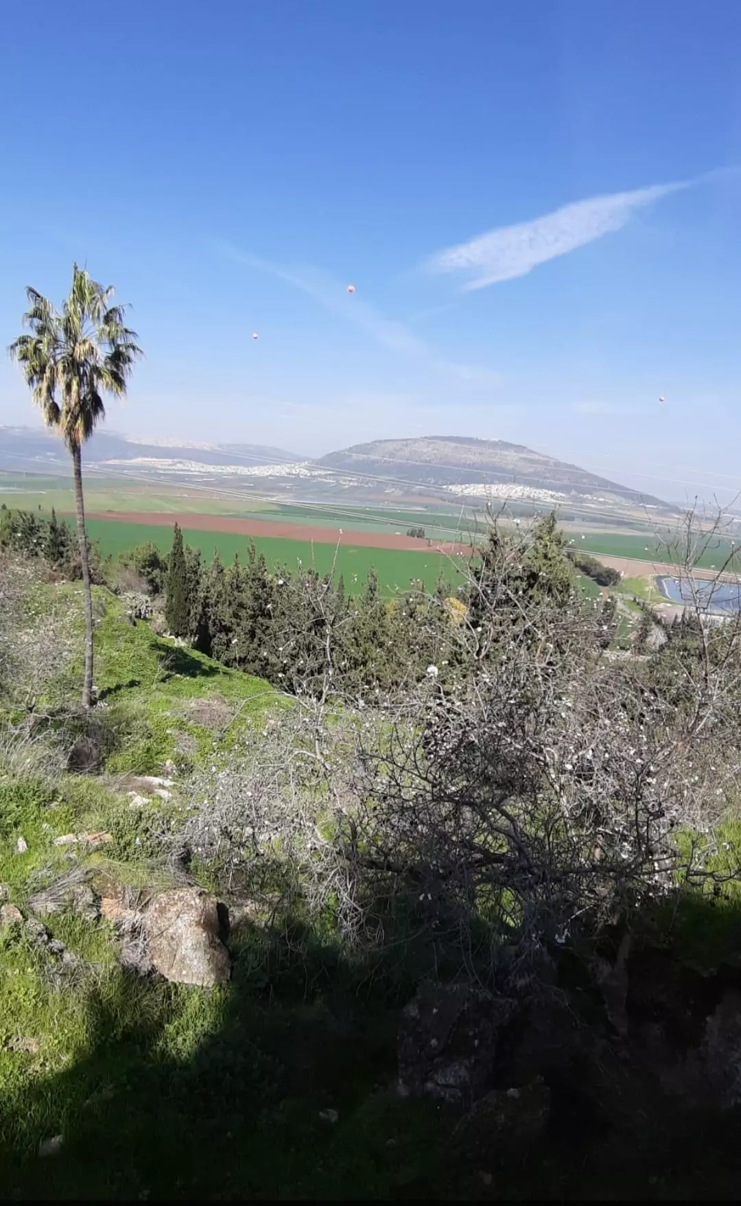
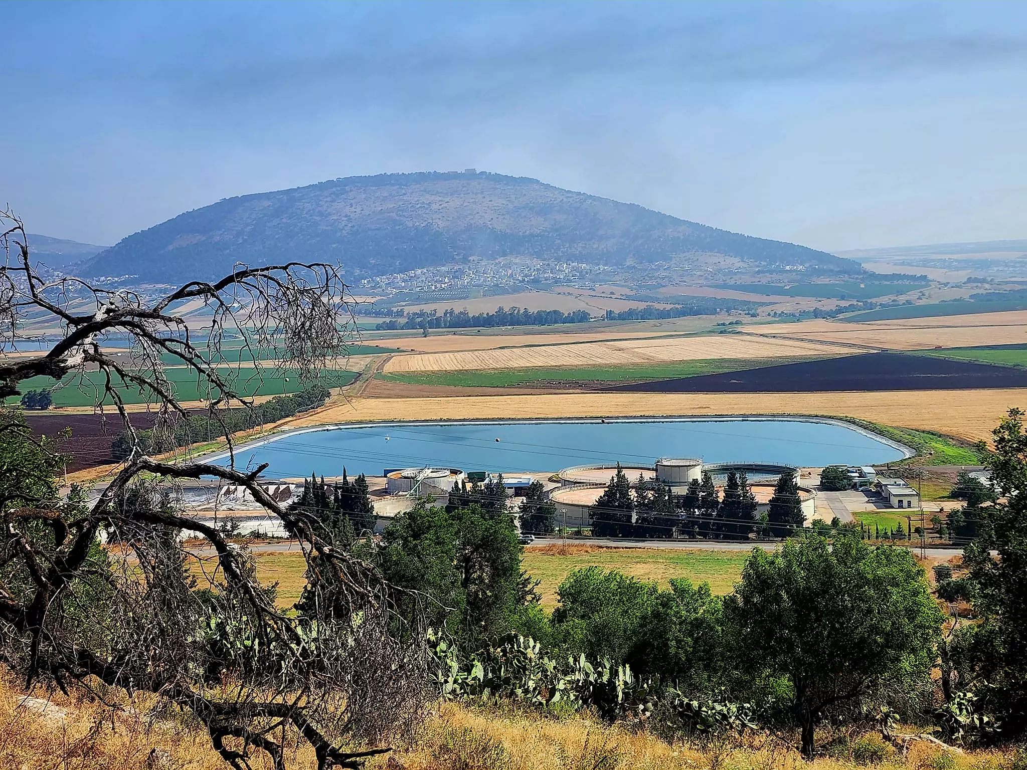
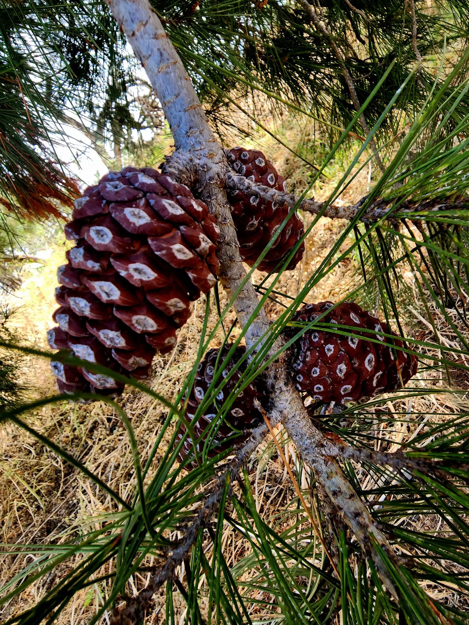
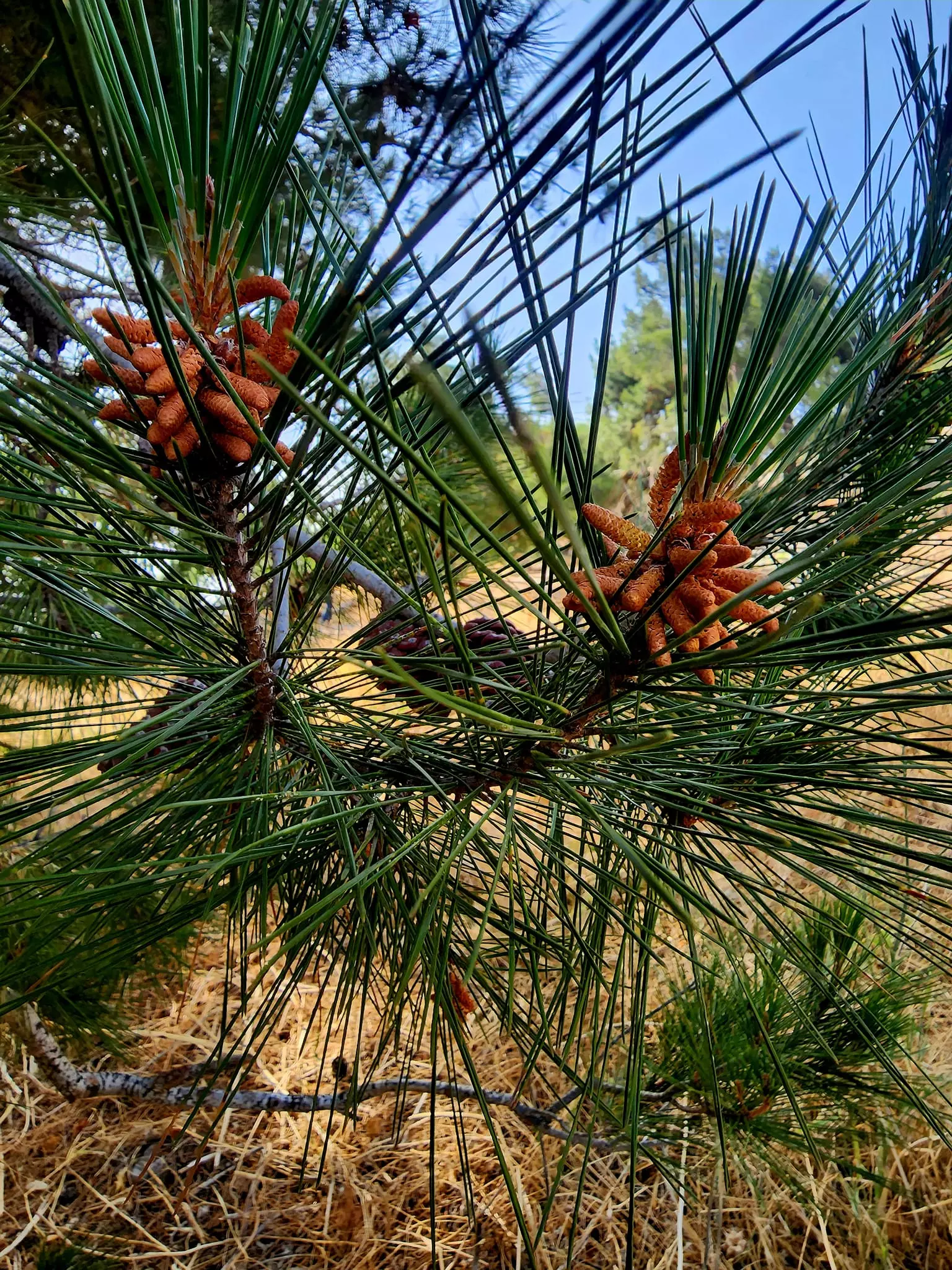
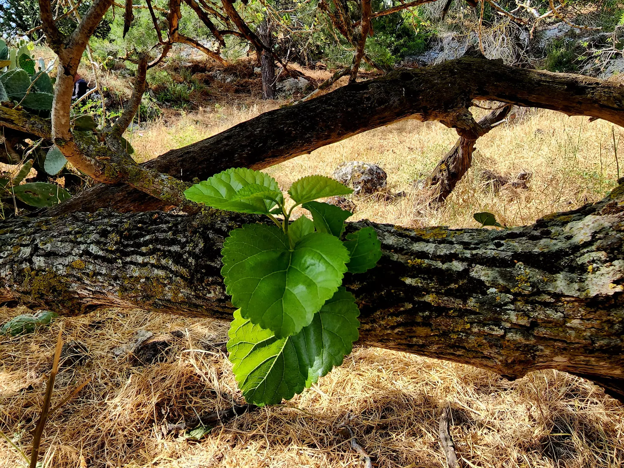
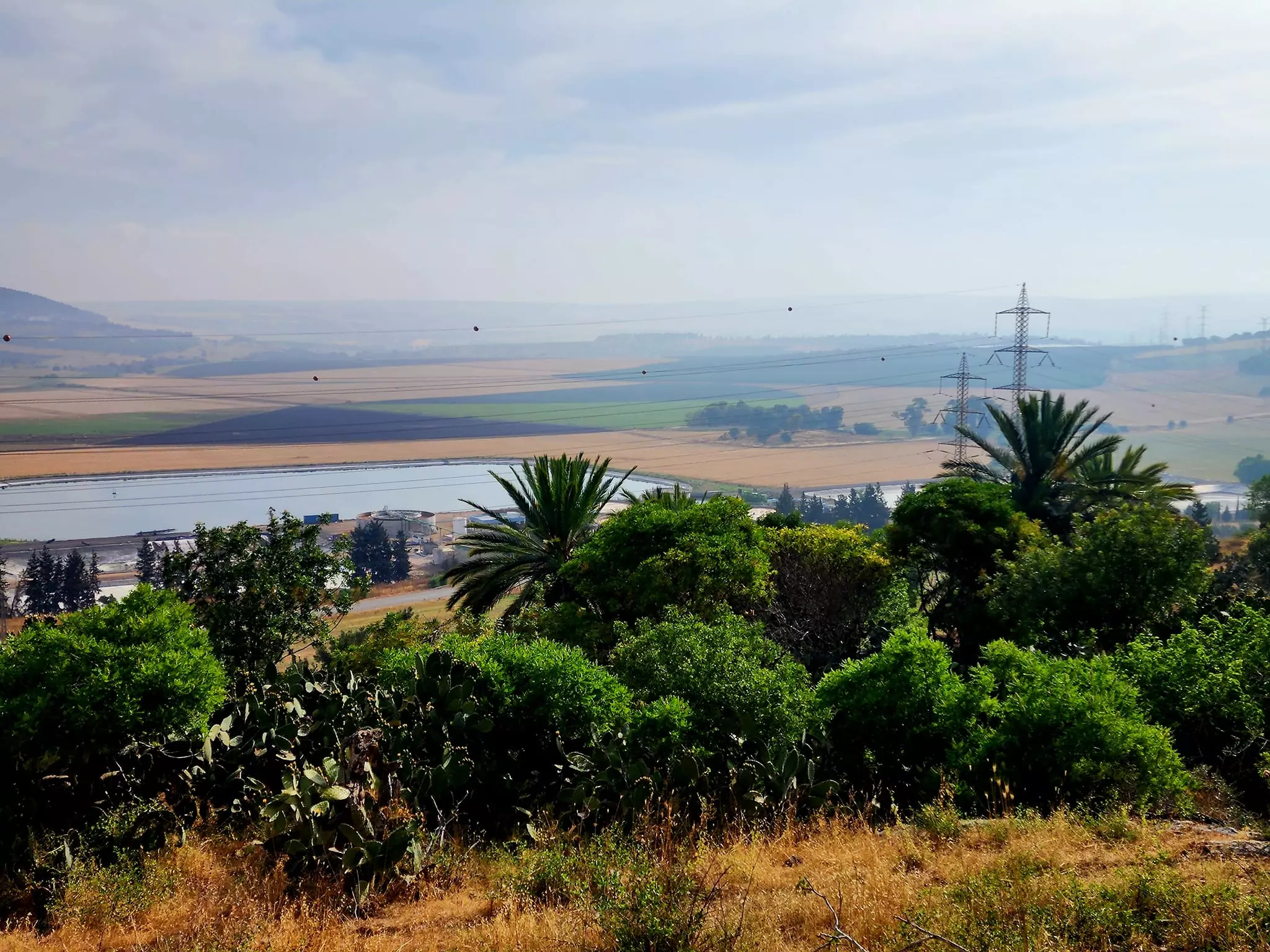
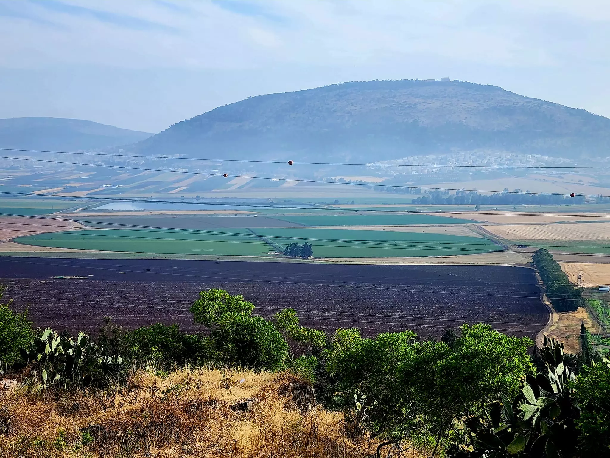
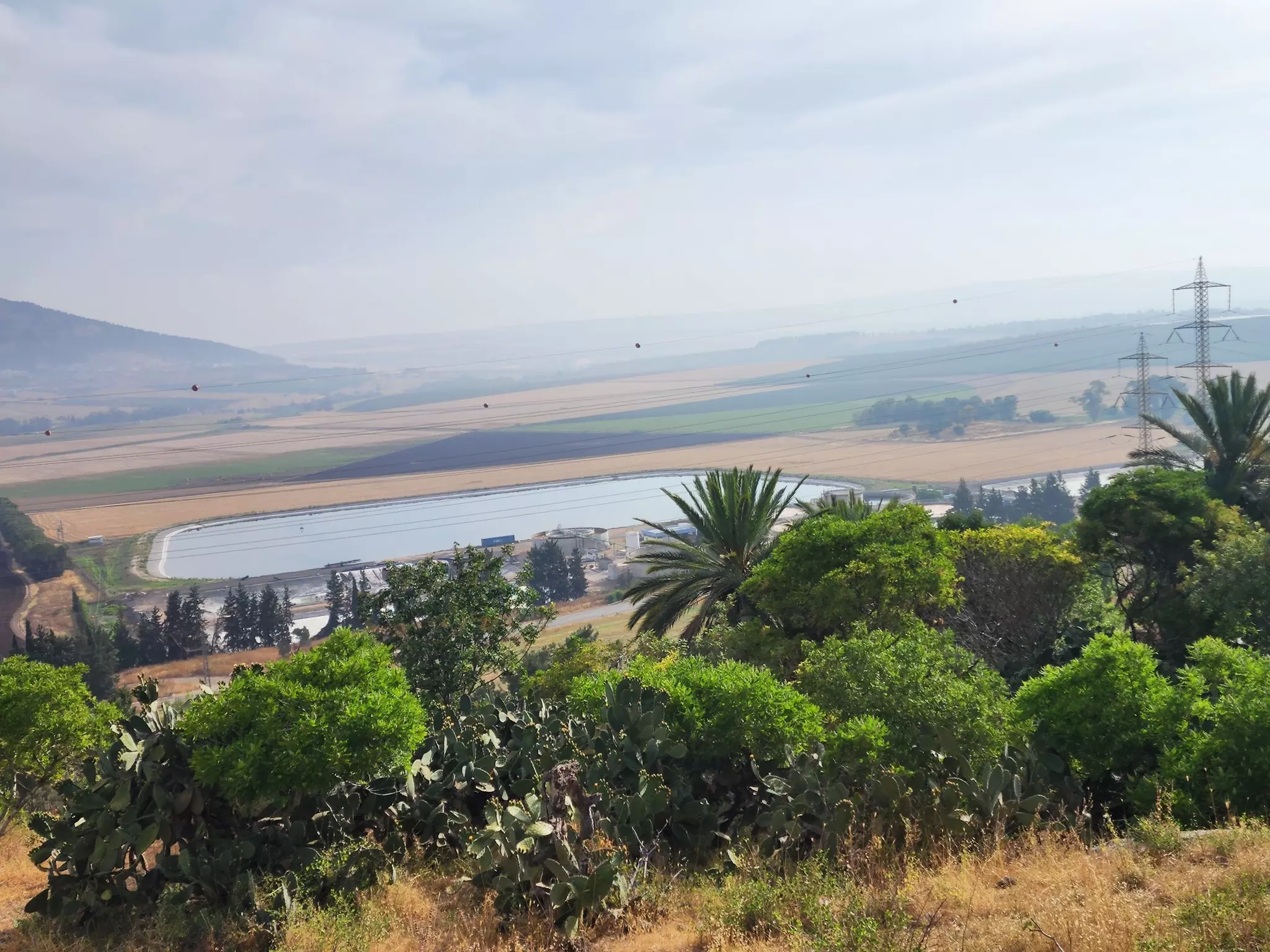
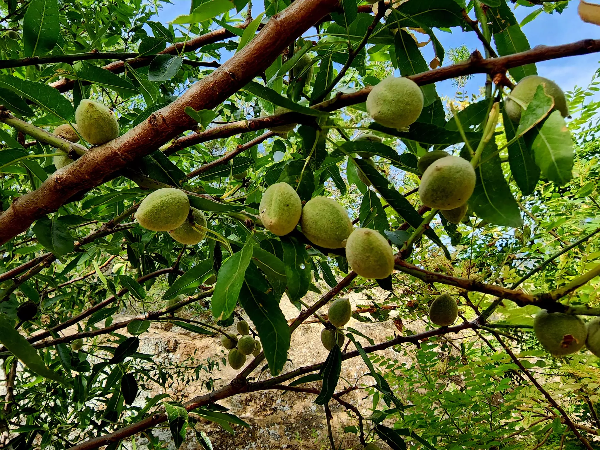
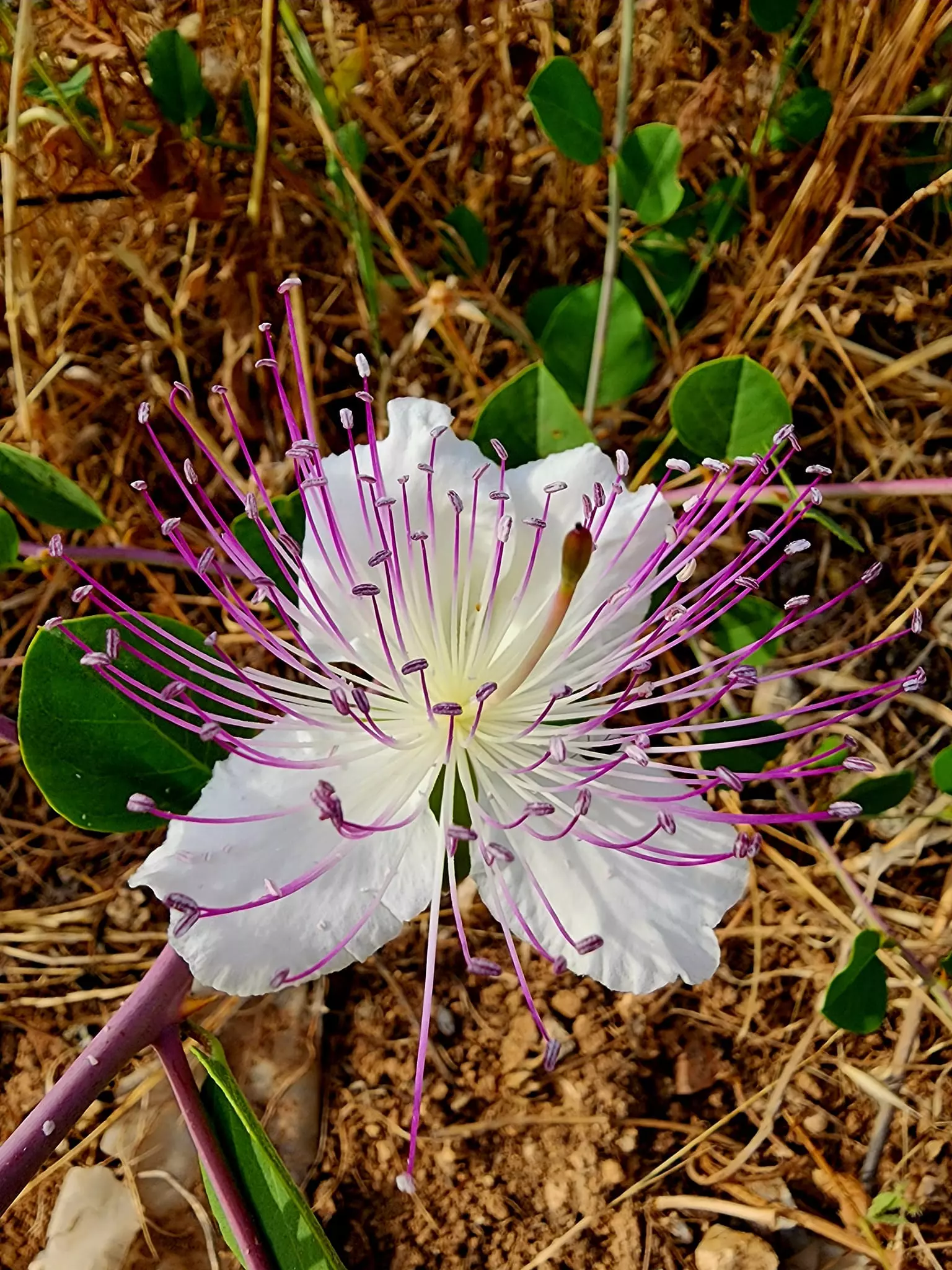
Village Before NakbaThe village was situated on the lower, northeastern slopes of Mount al-Dahi, facing north and overlooking the plain of Marj ibn 'Amir. Indur lay a few km from a highway that led to Tiberias and Nazareth; the pipeline of the British-owned Iraq Petroleum Company (IPC) passed 0.5 km north of the village. The village name probably preserved that of the Canaanite town of 'Ayn Dur (Endor), 'spring of the sanctuary,' which is mentioned in the Bible as the place where Saul consulted a soothsayer before going into battle against the Philistines (1 Kings 28:18–25). The ancient town may have been located on the site of Indur itself or on that of Tall al-'Ajjul (185226) or Khirbat al-Safsafa (187227), two nearby khirbas. The Crusaders called it Endor. In 1596, Indur was a village in the nahiya of Shafa (liwa' of Lajjun) with a population of twenty-two. It paid taxes on a number of crops, including wheat, barley, and olives, as well as on other types of property such as goats and beehives.In the late nineteenth century, Indur was a village built of adobe bricks and situated against a steep hillside. Several small caves were located above the village (see photo). A prominent son of the village was Shaykh Tawfiq Ibrahim, one of the leaders of the 1936–39 rebellion against the British. He was an associate of Shaykh Izzeddin al-Qassam, the Muslim preacher from Haifa (born in Jabla, south of Latakiya) whose death in action against British forces in 1935 triggered the rebellion in the following year. Indur consisted of a string of houses that curved back and forth in conformity with the contours of the site. Its houses were made of stone and cement or stone and mud. Its population was Muslim, with the exception of one Christian. An elementary school (in which children from the neighboring village of Nin were also enrolled) was established under Ottoman rule but was closed by the British Mandate government. Grain cultivation constituted the main component of the village economy. In 1944/45 a total of 24 dunums was devoted to citrus and bananas and 9,864 dunums were allotted to cereals; 394 dunums were irrigated or used for orchards, of which 180 dunums were planted with olive trees. The villagers also engaged in animal husbandry. The presence of rock-cut cisterns, silos, and tombs, as well as abandoned houses, the ruins of which were close to the village's inhabited dwellings, indicated that the site had been occupied for a long time. Village Occupation and Ethnic CleaningIsraeli historian Benny Morris reports that the village was occupied on 24 May 1948; the villagers of Indur may have left as a result of a military assault and under the influence of the fall of the neighboring town of Baysan. Although most of the Baysan Valley had been conquered by the Haganah before 15 May, the Golani Brigade went on 'cleansing and defending' the area until early June.Zionists Colonies on Village LandsThere are no Israeli settlements on village land. The settlement of Davrat (183228) is close by, due west of the village site. It was founded in 1946 on the boundary between the lands of Indur and those of the village of Dabburiyya (185233).Village TodayMany partially ruined walls still stand on the village site. Date, doum palm, fig, and almond trees grow on the village lands (see photos section). The surrounding flat lands are cultivated by Israelis and the hilly lands serve as grazing areas.SourceDr. Walid al-Khalidi, 1992: All That Remains. |
|||||||||||||||||
| Related Maps | Town Lands' Demarcation Maps خرائط للقضاء توضح حدود القرى والاودية Town's map on MapQuest View from satellite Help us map this town at WikiMapia |
||||||||||||||||
| Related Links | Wikipedia's Page Google Search Google For Images Google For Videos |
||||||||||||||||
| More Information | في كتاب كي لا ننسى في كتاب بلادنا فلسطين المزيد من موقع هوية |
||||||||||||||||
- Northern views. Endor village. 1900-1920
Posted by Joehar Hamdan 3 - The village site with some house remain visible, 1987
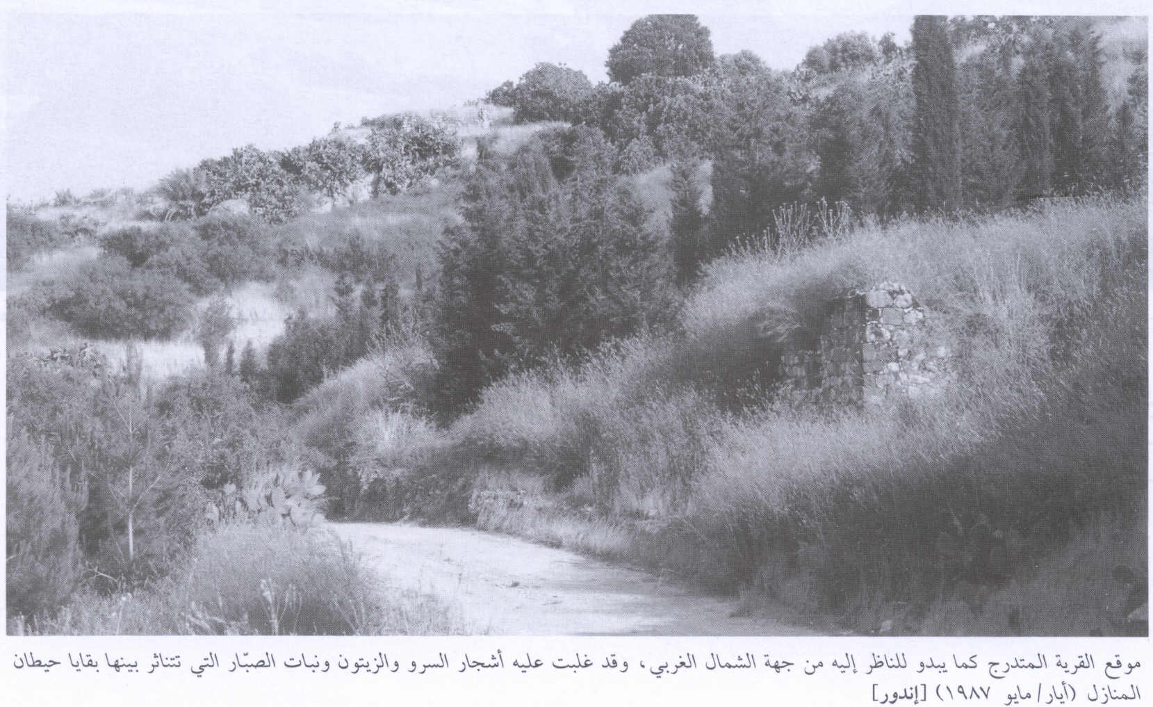
Scanned from "All That Remains" by Dr. Walid Khalidi 3 - اراضي قرية اندور المهجرة -27.5.2004
Posted by Makbula Nassar 1 - اراضي قرية اندور المهجرة -27.5.2004
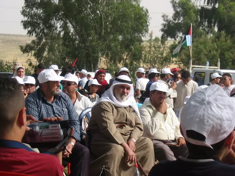
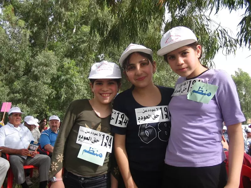
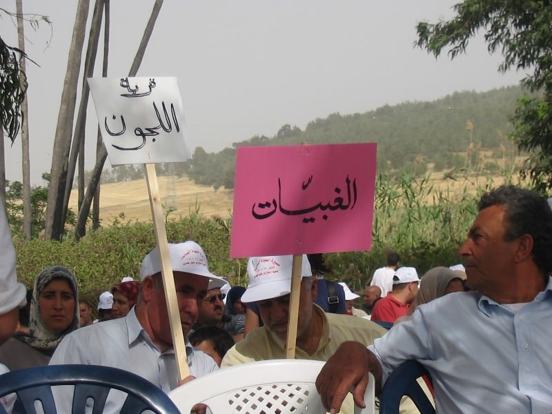
Posted by Makbula Nassar 1 - مسيرة العودة في قرية اندور المهجرة -27.5.2004
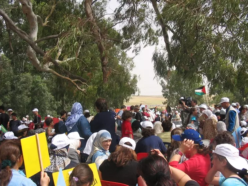
Posted by Makbula Nassar 2 - مسيرة العودة في قرية اندور المهجرة -27.5.2004
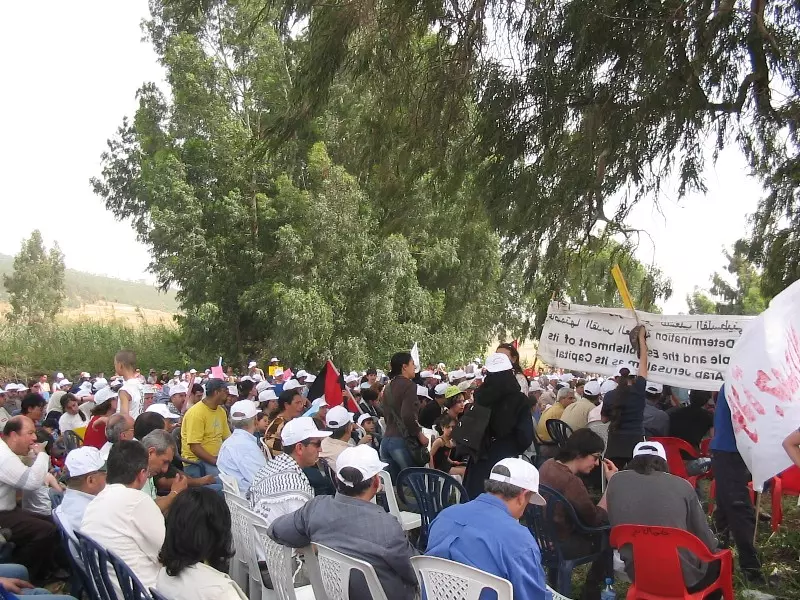
Posted by Makbula Nassar - مسيرة العودة في قرية اندور المهجرة -27.5.2004

Posted by Makbula Nassar 1 - مسيرة العودة في قرية اندور المهجرة -27.5.2004
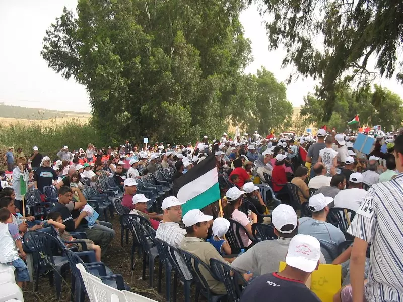
Posted by Makbula Nassar - مسيرة العودة في قرية اندور المهجرة -27.5.2004
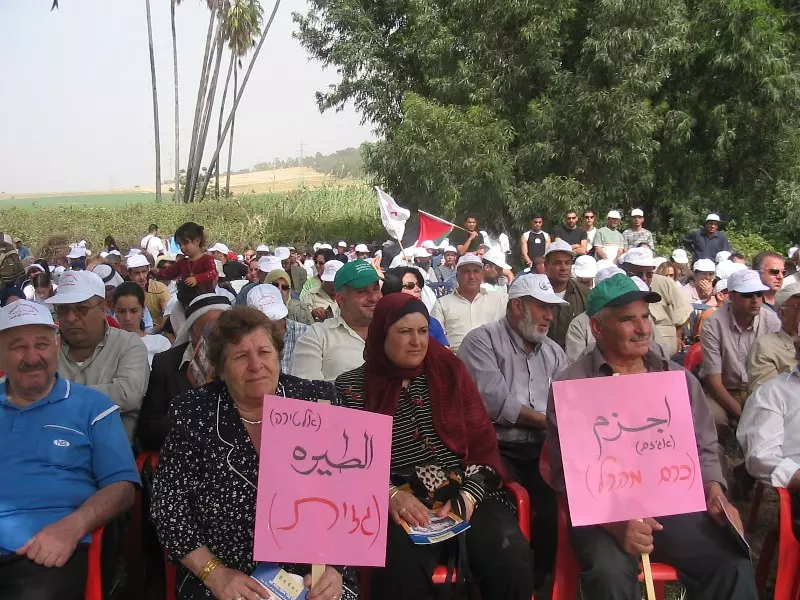
Posted by Makbula Nassar - الشيخ عبد السلام مناصرة , يلقي كلمة اهل القرية في مسيرة العودة -27.5.2004

Posted by Makbula Nassar - اهالي قرية اندور في مسيرة العودة -27.5.2004
Posted by Makbula Nassar - راهنوا ان الكبار يموتون والصغار ينسون !!! -27.5.2004
Posted by Makbula Nassar 2 - 27.5.2004 - مسيرة العودة في قرية اندور المهجرة
Posted by Makbula Nassar 1 - General view, Matson Collection. (Before 1914)
2 - People engaged in daily activities outside stone, residential buildings of a section of Ein-dor. 1910-1910
Posted by Joehar Hamdan 1 - endor 13/03/2010
Posted by abo el ameen 1 - endor 2010
Posted by abo el ameen - abo el ameen yaktof lawz endor
Posted by abo el ameen - abo el ameen yaktof lawz endor

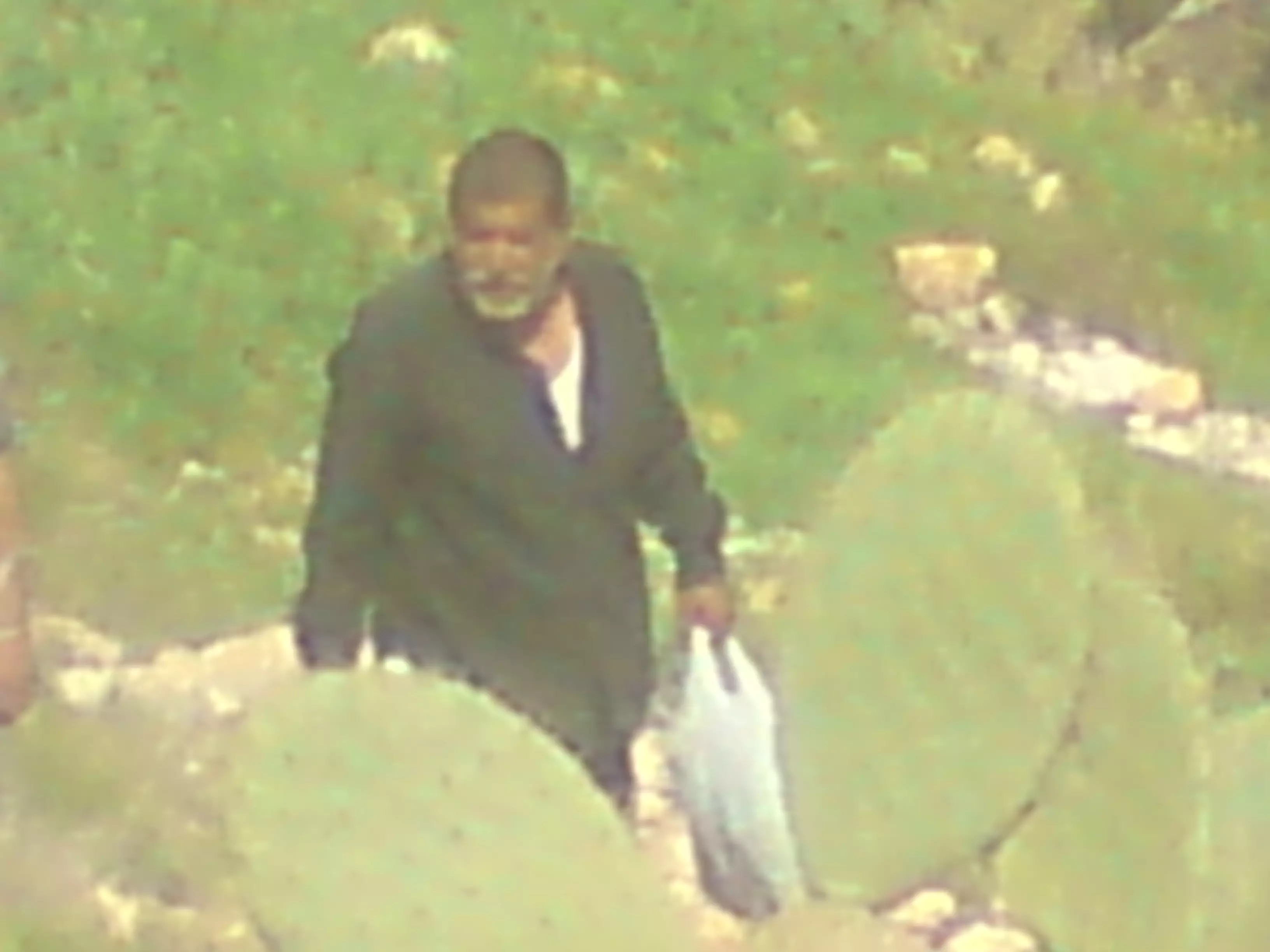
Posted by abo el ameen - indor 2010
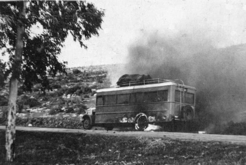
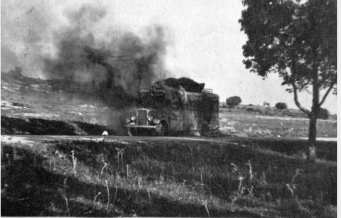
Posted by abo el ameen - تفجير حافلة ١٩٣٦
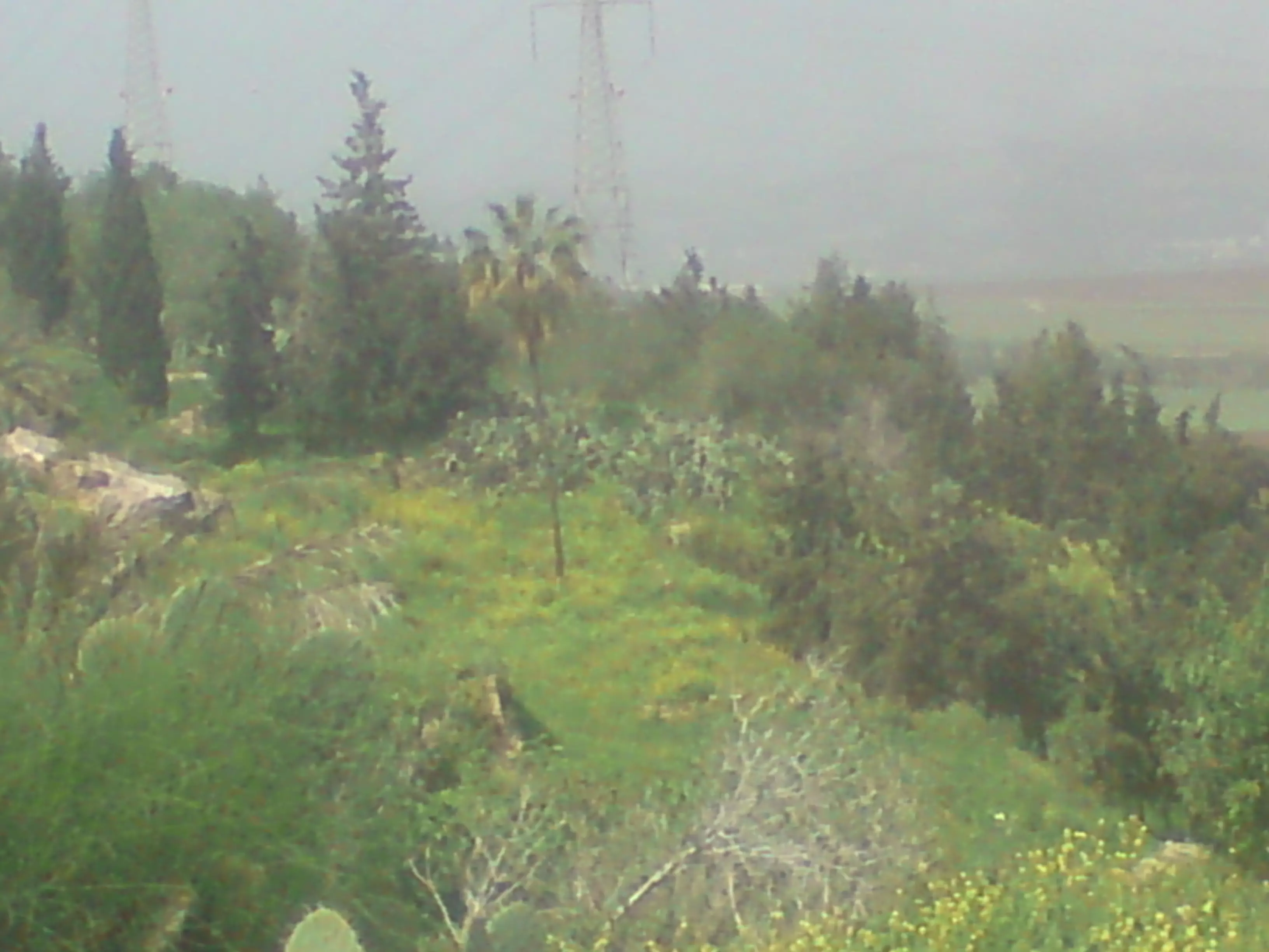
- نظره من اراضي القريه باتجاه موقع القريه على التله
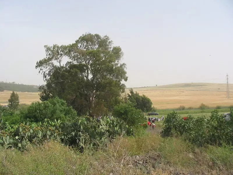
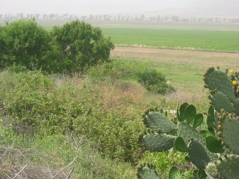
Posted by abu raya - اراضي قريه عين دور
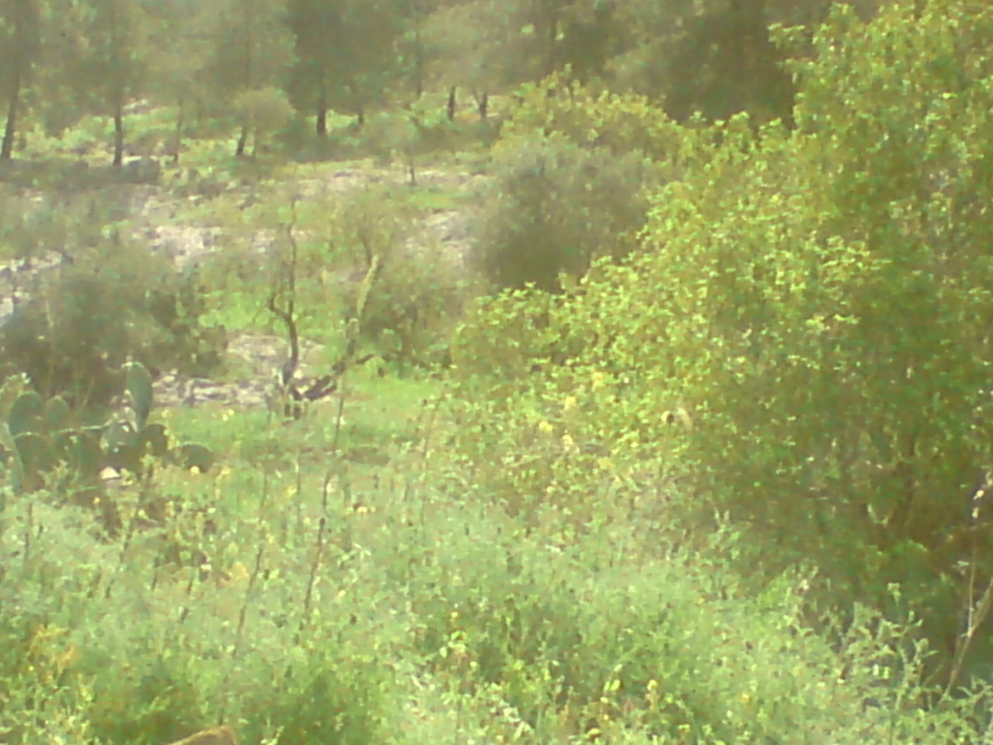
Posted by abu raya - اراضي القريه
Posted by abu raya - من موقع القريه
Posted by abu raya - بقايا بيوت القريه
Posted by abu raya - اثار بيوت القريه
Posted by abu raya - موقع القريه
Posted by abu raya - عين دور
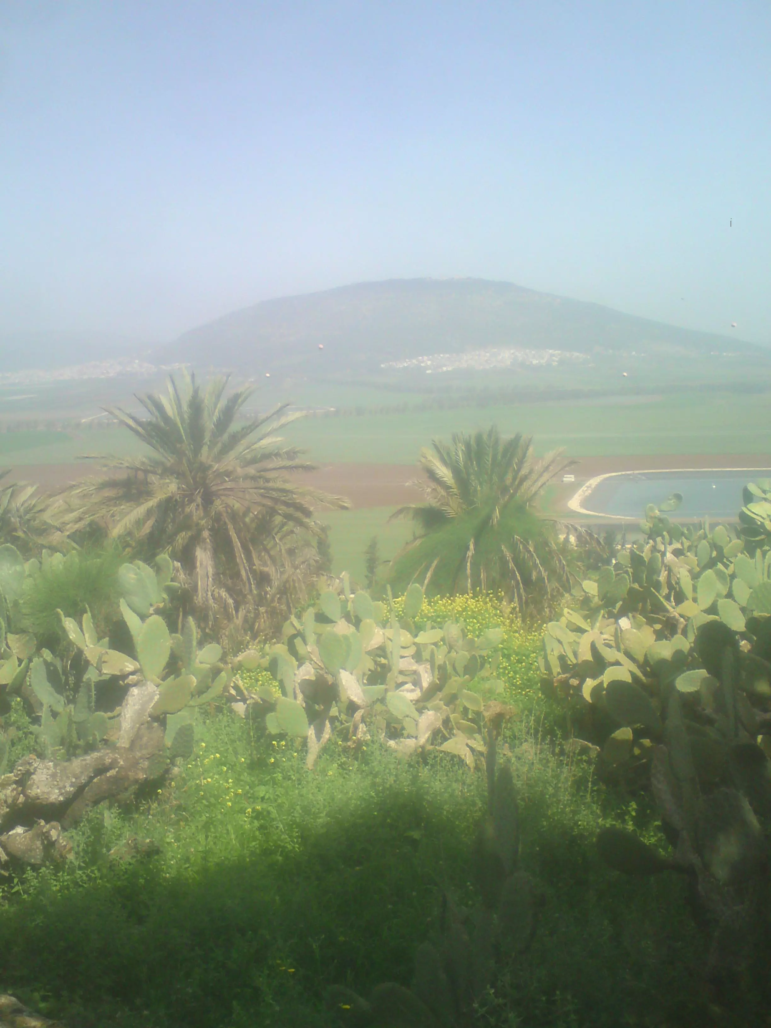
Posted by abu raya - اراضي القريه وموقعها على التله
Posted by abu raya - عين دور
Posted by abu raya - عين دور
Posted by abu raya - عين دور
Posted by abu raya - عين دور
Posted by abu raya - القريه قبل النكبه
Posted by abu raya - تفجير باص في عين دورسنه 1936
Posted by abu raya - قريه اندور قبل النكبه
Posted by abu raya - صوره نادره من قريه اندور قبل النكبه
Posted by abu raya - 1926 قريه عين دور
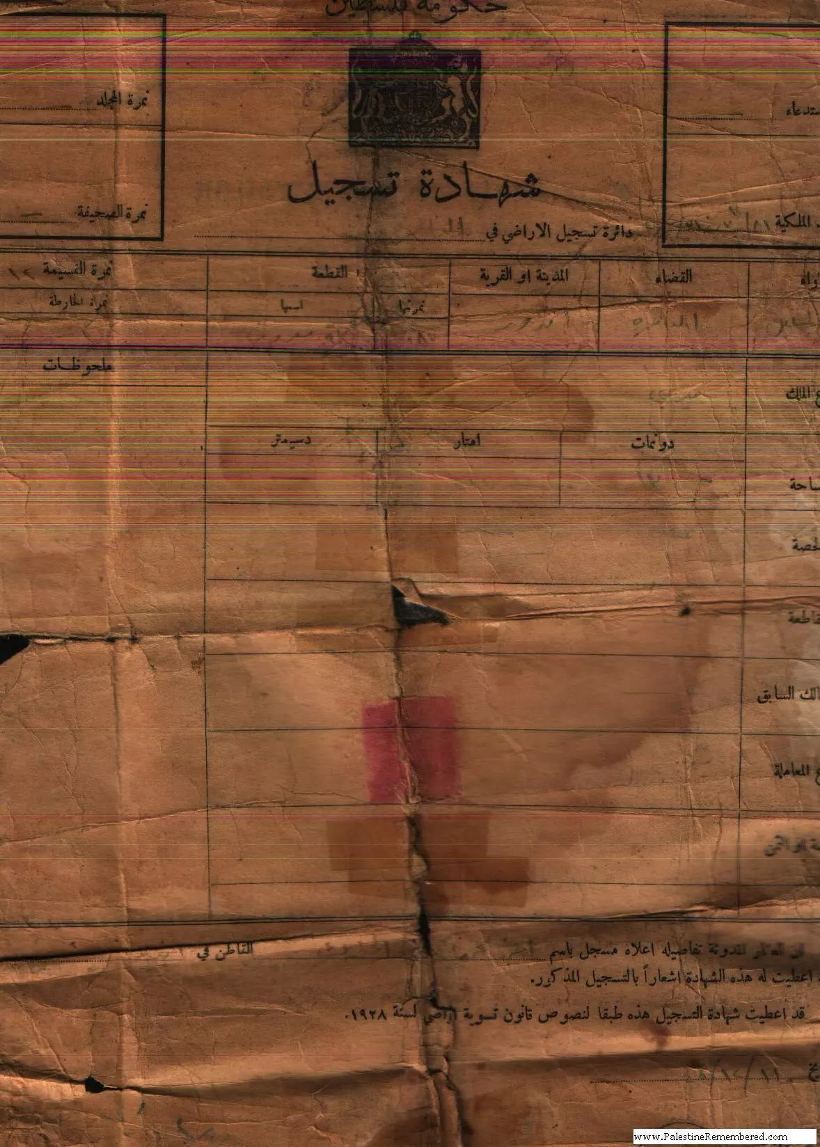
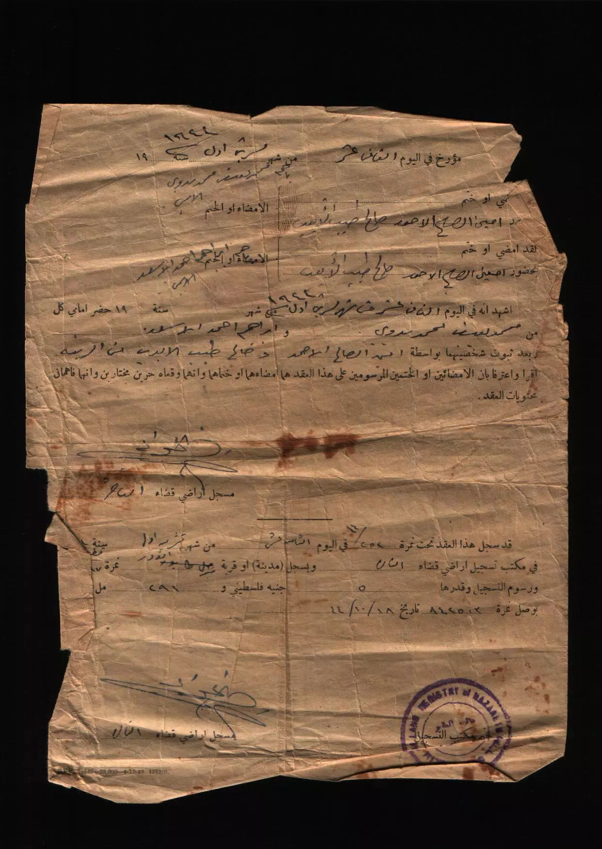
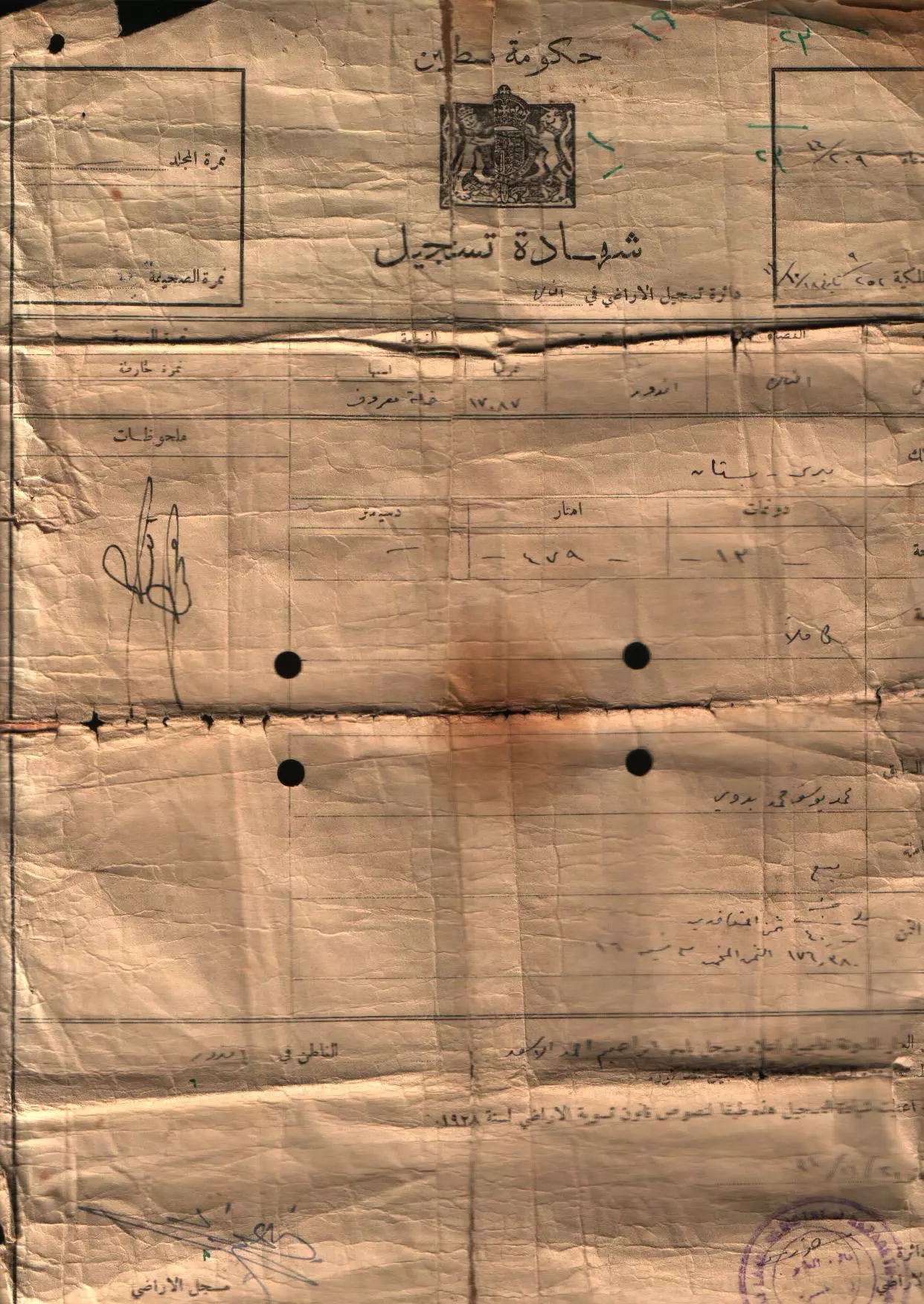
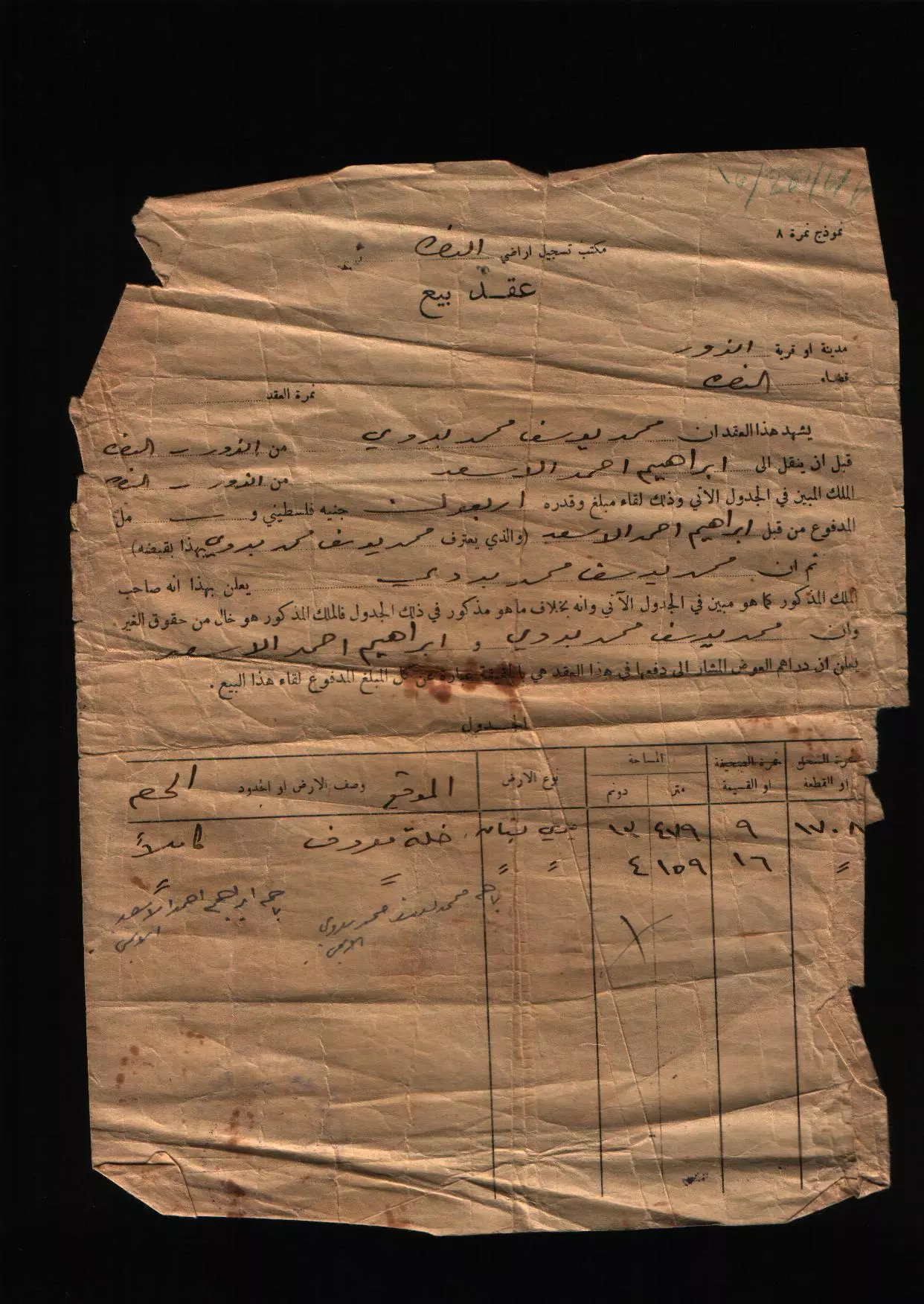
Posted by أبو اليزن السعافين - كواشين ارض وفرت لنا غضون مقابلة محمد الحايك لتدوين شهادته عن النكبة
- كواشين ارض وفرت لنا غضون مقابلة محمد الحايك لتدوين شهادته عن النكبة #4
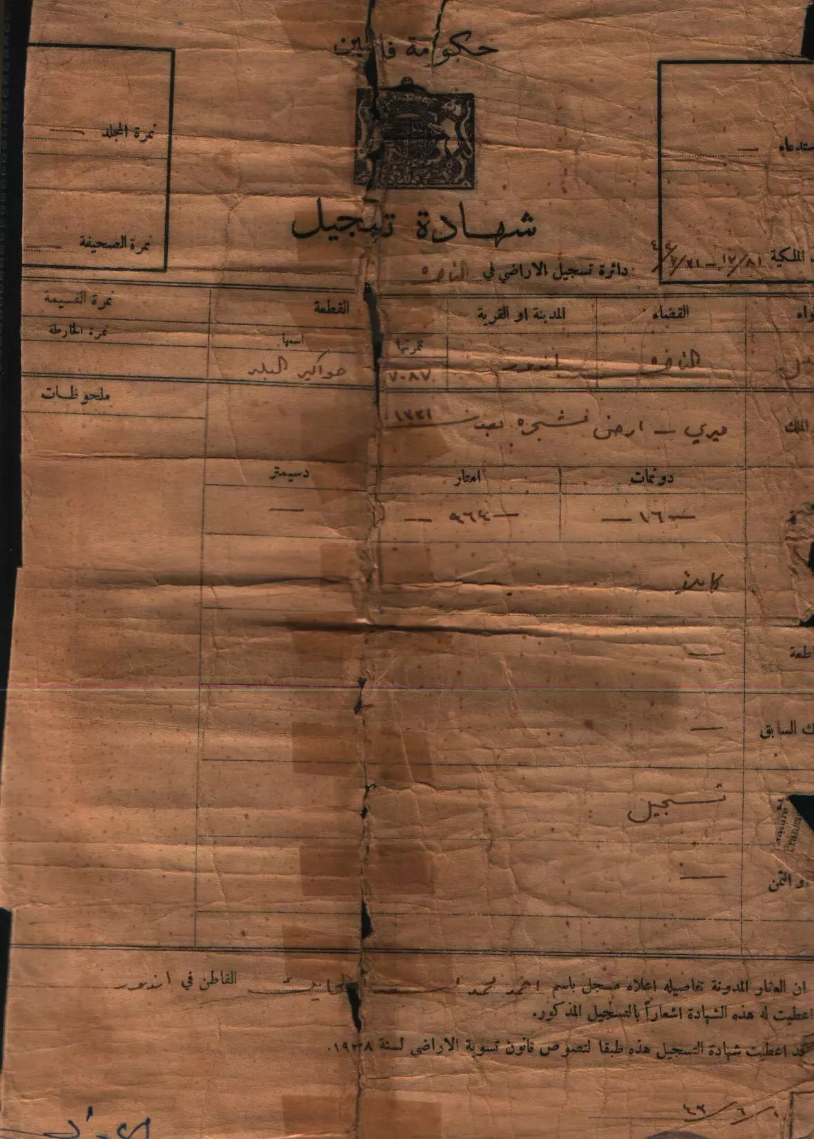
- كواشين ارض وفرت لنا غضون مقابلة محمد الحايك لتدوين شهادته عن النكبة #3
- كواشين ارض وفرت لنا غضون مقابلة محمد الحايك لتدوين شهادته عن النكبة #2
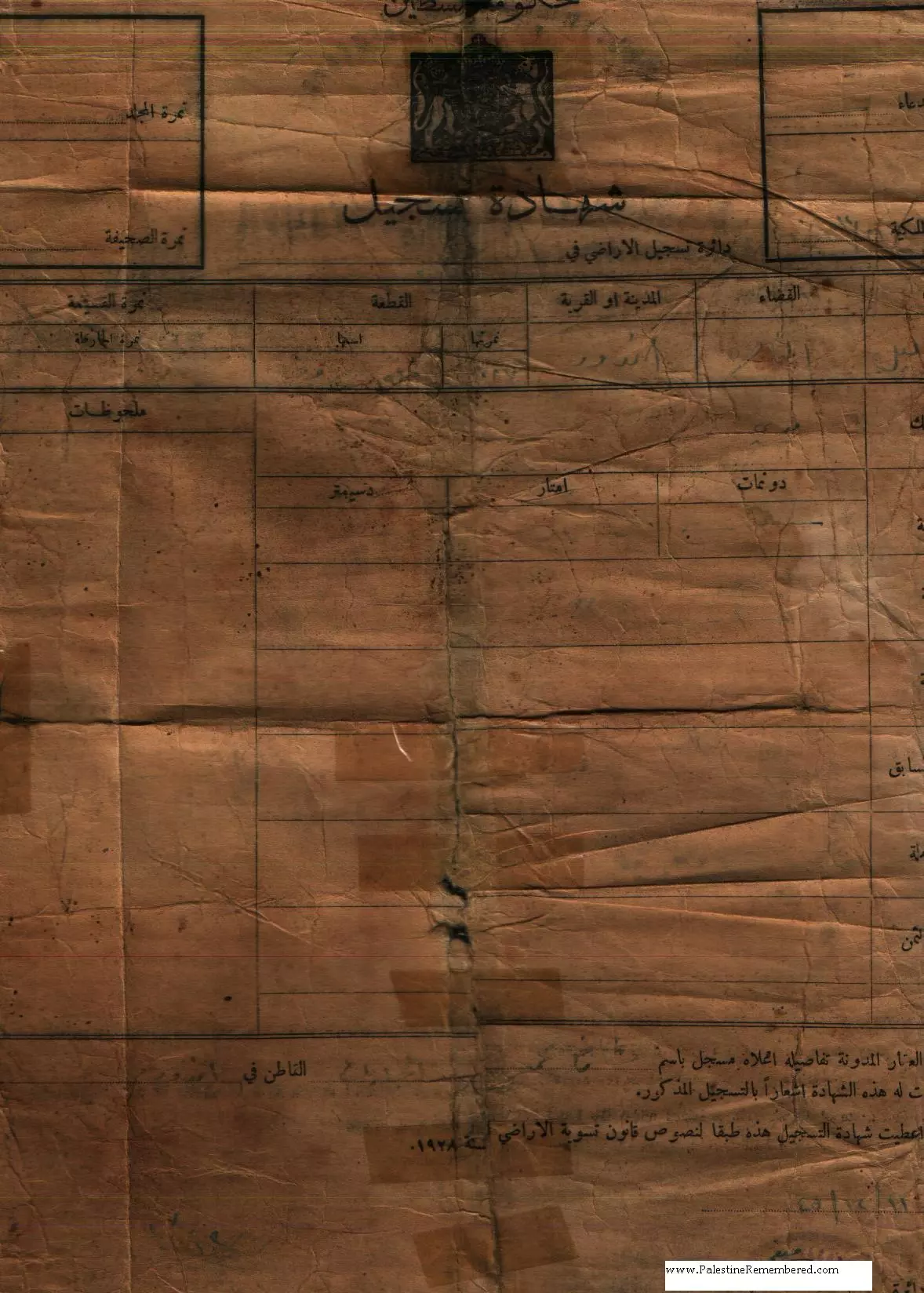
- كواشين ارض وفرت لنا غضون مقابلة نجليه احمد لتدوين شهادتها عن النكبة
- كواشين ارض وفرت لنا غضون مقابلة نجليه احمد لتدوين شهادتها عن النكبة #5
- كواشين ارض وفرت لنا غضون مقابلة نجليه احمد لتدوين شهادتها عن النكبة #4
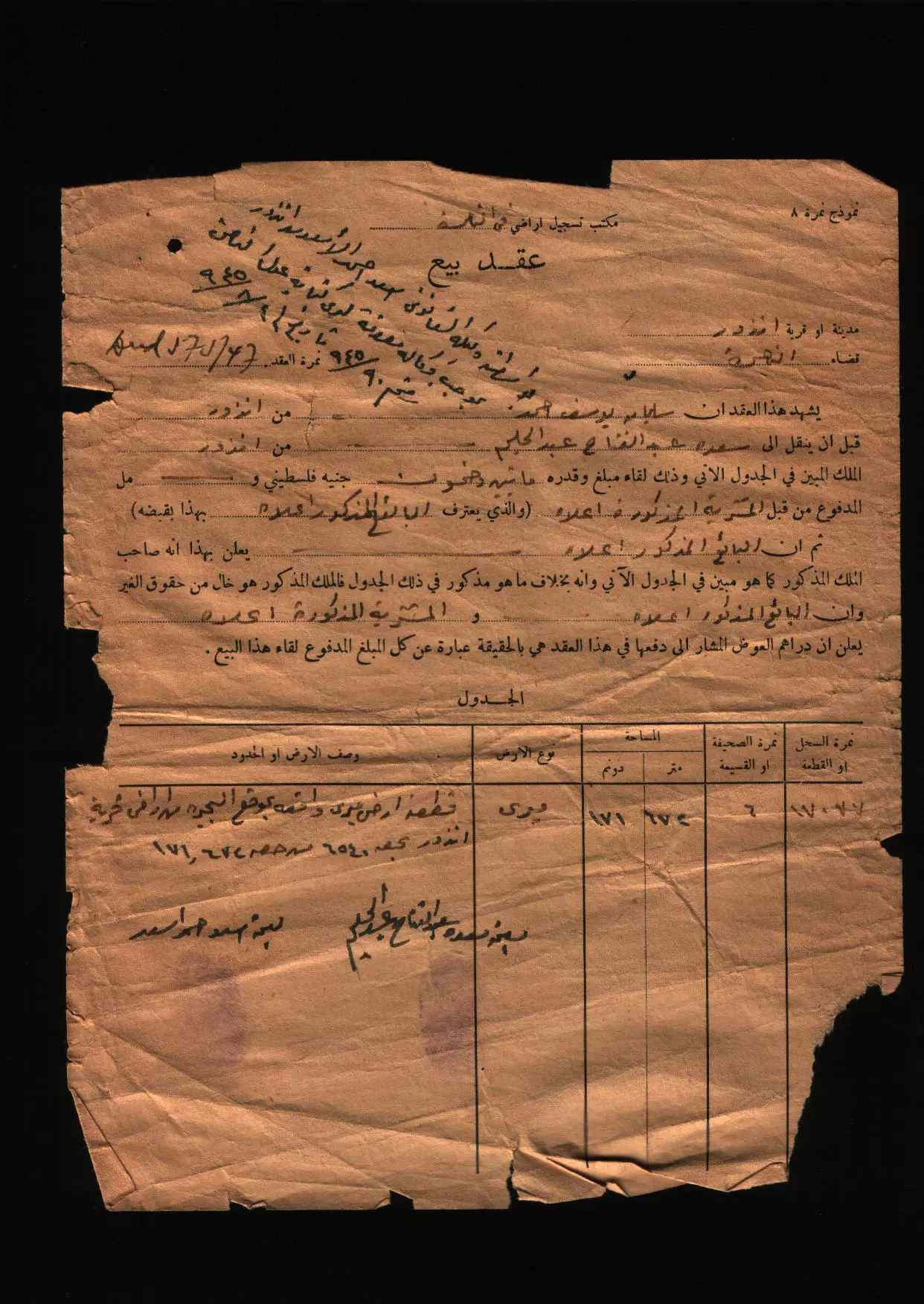
- كواشين ارض وفرت لنا غضون مقابلة نجليه احمد لتدوين شهادتها عن النكبة #3
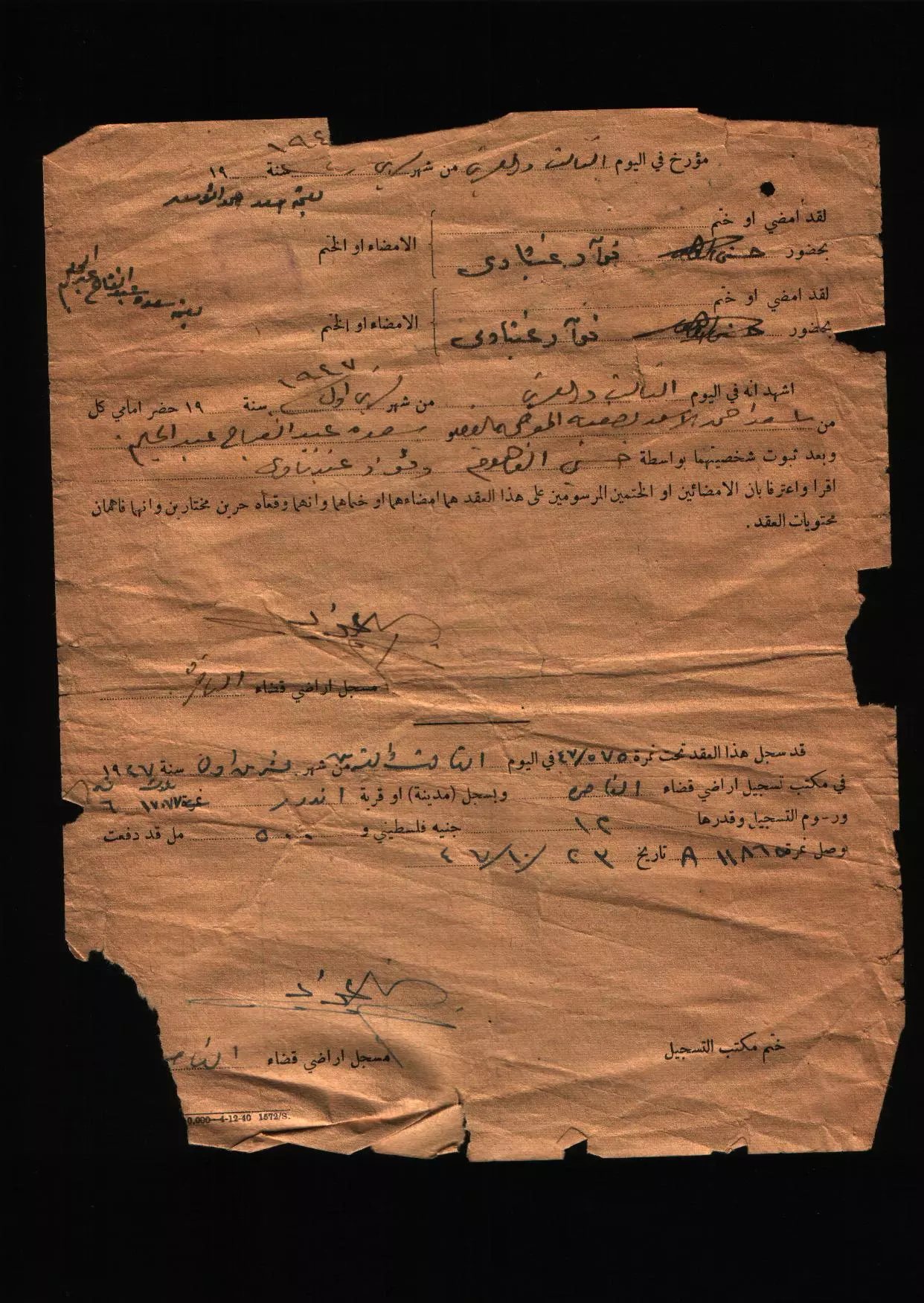
- كواشين ارض وفرت لنا غضون مقابلة نجليه احمد لتدوين شهادتها عن النكبة #2
- من قرية اندور المهجرة قضاء الناصرة سنة 1920
- Indur in the 1890s
- جولة بين انقاض بيوت اندور المهجرة
- جولة بين انقاض بيوت اندور المهجرة #2
- جولة بين انقاض بيوت اندور المهجرة #3
- جولة بين انقاض بيوت اندور المهجرة #4
- جولة بين انقاض بيوت اندور المهجرة #5
- جولة بين انقاض بيوت اندور المهجرة #6
- جولة بين انقاض بيوت اندور المهجرة #7
- Pre-Nakba Aerial view of the village / صورة من الجو للقرية اخذت قبل النكبة
- منظر عام لموقع قرية أندور المهجرة (قضاء الناصرة ) . في الأفق يظهر جبل الطور وفي أسفل الجبل من اليمين تظهر قرية أم الغنم (السعايدة ) ومن اليسار قرية دبورية . تبعد أندور عن الناصرة مسافة25 كم باتجاه الجنوب الشرقي . بلغ عدد سكانها عشية النكبة قرابة 720 نسمة ، أما مساحة أراضيها فبلغت نحو 12500 دونم . كانت قرية نشيطة جدا في ثورة 1936 -1939 ومنها كان قائد المنطقة توفيق الابراهيم قنانبة (أبو ابراهيم الصغير ) . وقد قام الانجليز بهدم بيت رافع أفندي الفاهوم الواقع في اندور على ما فيه بسبب المشاركة في الثورة . هجّرت القرية في الرابع والعشرين من أيار عام1948.
- Let us see how the most "liberal and civilized" of world Jewry has obliterated our village. How else will the Jews be great and safe again? -- القرية دمرت بالكامل.. من هنا مر الهمج
- Let us see how the most "liberal and civilized" of world Jewry has obliterated our village. How else will the Jews be great and safe again? -- القرية دمرت بالكامل.. من هنا مر الهمج #2
- Let us see how the most "liberal and civilized" of world Jewry has obliterated our village. How else will the Jews be great and safe again? -- القرية دمرت بالكامل.. من هنا مر الهمج #3
- Let us see how the most "liberal and civilized" of world Jewry has obliterated our village. How else will the Jews be great and safe again? -- القرية دمرت بالكامل.. من هنا مر الهمج #4
- Let us see how the most "liberal and civilized" of world Jewry has obliterated our village. How else will the Jews be great and safe again? -- القرية دمرت بالكامل.. من هنا مر الهمج #5
- Let us see how the most "liberal and civilized" of world Jewry has obliterated our village. How else will the Jews be great and safe again? -- القرية دمرت بالكامل.. من هنا مر الهمج #6
- Let us see how the most "liberal and civilized" of world Jewry has obliterated our village. How else will the Jews be great and safe again? -- القرية دمرت بالكامل.. من هنا مر الهمج #7
- Let us see how the most "liberal and civilized" of world Jewry has obliterated our village. How else will the Jews be great and safe again? -- القرية دمرت بالكامل.. من هنا مر الهمج #8
- Let us see how the most "liberal and civilized" of world Jewry has obliterated our village. How else will the Jews be great and safe again? -- القرية دمرت بالكامل.. من هنا مر الهمج #9
- Let us see how the most "liberal and civilized" of world Jewry has obliterated our village. How else will the Jews be great and safe again? -- القرية دمرت بالكامل.. من هنا مر الهمج #10
- Let us see how the most "liberal and civilized" of world Jewry has obliterated our village. How else will the Jews be great and safe again? -- القرية دمرت بالكامل.. من هنا مر الهمج #11
- Let us see how the most "liberal and civilized" of world Jewry has obliterated our village. How else will the Jews be great and safe again? -- القرية دمرت بالكامل.. من هنا مر الهمج #12
- Let us see how the most "liberal and civilized" of world Jewry has obliterated our village. How else will the Jews be great and safe again? -- القرية دمرت بالكامل.. من هنا مر الهمج #13
- Let us see how the most "liberal and civilized" of world Jewry has obliterated our village. How else will the Jews be great and safe again? -- القرية دمرت بالكامل.. من هنا مر الهمج #14
- Let us see how the most "liberal and civilized" of world Jewry has obliterated our village. How else will the Jews be great and safe again? -- القرية دمرت بالكامل.. من هنا مر الهمج #15
- Let us see how the most "liberal and civilized" of world Jewry has obliterated our village. How else will the Jews be great and safe again? -- القرية دمرت بالكامل.. من هنا مر الهمج #16
- Let us see how the most "liberal and civilized" of world Jewry has obliterated our village. How else will the Jews be great and safe again? -- القرية دمرت بالكامل.. من هنا مر الهمج #17
- Let us see how the most "liberal and civilized" of world Jewry has obliterated our village. How else will the Jews be great and safe again? -- القرية دمرت بالكامل.. من هنا مر الهمج #18
- Let us see how the most "liberal and civilized" of world Jewry has obliterated our village. How else will the Jews be great and safe again? -- القرية دمرت بالكامل.. من هنا مر الهمج #19
- Let us see how the most "liberal and civilized" of world Jewry has obliterated our village. How else will the Jews be great and safe again? -- القرية دمرت بالكامل.. من هنا مر الهمج #20
- Let us see how the most "liberal and civilized" of world Jewry has obliterated our village. How else will the Jews be great and safe again? -- القرية دمرت بالكامل.. من هنا مر الهمج #21
- Let us see how the most "liberal and civilized" of world Jewry has obliterated our village. How else will the Jews be great and safe again? -- القرية دمرت بالكامل.. من هنا مر الهمج #22
- Let us see how the most "liberal and civilized" of world Jewry has obliterated our village. How else will the Jews be great and safe again? -- القرية دمرت بالكامل.. من هنا مر الهمج #23
- Let us see how the most "liberal and civilized" of world Jewry has obliterated our village. How else will the Jews be great and safe again? -- القرية دمرت بالكامل.. من هنا مر الهمج #24
- Let us see how the most "liberal and civilized" of world Jewry has obliterated our village. How else will the Jews be great and safe again? -- القرية دمرت بالكامل.. من هنا مر الهمج #25
Want to browse more? 80,000 pictures were grouped in these gallaries:
- كواشين ارض وفرت لنا غضون مقابلة محمد الحايك لتدوين شهادته عن النكبة
- كواشين ارض وفرت لنا غضون مقابلة محمد الحايك لتدوين شهادته عن النكبة #4
- كواشين ارض وفرت لنا غضون مقابلة محمد الحايك لتدوين شهادته عن النكبة #3
- كواشين ارض وفرت لنا غضون مقابلة محمد الحايك لتدوين شهادته عن النكبة #2
- كواشين ارض وفرت لنا غضون مقابلة نجليه احمد لتدوين شهادتها عن النكبة
- كواشين ارض وفرت لنا غضون مقابلة نجليه احمد لتدوين شهادتها عن النكبة #5
- كواشين ارض وفرت لنا غضون مقابلة نجليه احمد لتدوين شهادتها عن النكبة #4
- كواشين ارض وفرت لنا غضون مقابلة نجليه احمد لتدوين شهادتها عن النكبة #3
- كواشين ارض وفرت لنا غضون مقابلة نجليه احمد لتدوين شهادتها عن النكبة #2
| Display Name | Clan/Hamolah | Country of Residence |
| الأسعد | - | - |
| خليل الحايك | الحايك | IRBID-JORDAN |
| Samer | Sawalha | Irbid, jordan |
| who cares | قنانبة | اكسال |
| aml jmal | tator | - |
- في موقع مقبرة قرية اندور المهجرة (قضاء الناصرة ) مع السيد صبري مناصرة قبالة قبر جده عبد االغني Duration: min 2 sec
- فضائية النجاح - هوانا الوطن -تعرّف على قرية اندور المدمرة قضاء الناصرة Duration: 2 min 30 sec
- الذاكرة مفتاح العودة -الحلقة 76- قرية أندور Duration: 23 min 22 sec
No links have been shared yet, be free to the first to share the first link.
 Fake Valor: Why Did Zionist Jews Hoist Nazis Flag on Their Ships in the 1930s?
What is new?
-
Facts About Oct. 7th Gaza Raid
-
Remined Us Please:: Who Did Rape Who? Palestinians Raped Israelis? Or, was the other way around?
-
When Prof. Edward Said was invited to debate Bibi Netanyahu in the 1980s, watch what happened!
-
Ezra Klein of the NY Times on the "Jewish Race".
-
Abusing Blood Libel!
-
Zionist FAQ: Isn't it true that Palestinians don't want peace? Palestinians never accepted the two-state solution
- Facts about Haavara (Transfer) Agreement between Ben-Gurion & Hitler
-
Haavara FAQs: Why Did Zionist Jews Hoist Nazis' Flags on Their Ships in the 1930s?
-
Dear ChatGPT: Why did the Jewish Agency suppress news of the Holocaust during WWII?
-
Video Playlist: Jews share their DNA tests to end the conflict for good.
-
A Tale of Two Conflicts: Examining the Definition of Genocide
-
Prof. Abraham Polak And The Suppressed History of the Khazars and European Jewry
-
How Ronald Reagan would have framed the genocide in Gaza if he were still alive?
-
Haavara FAQs: Let us do the math: how many German Jews did The Haavara Agreement save?
-
Zionist FAQs: The Hebron Massacre of 1929, "clearly proves" that Palestinians are antisemitic, how could you deny it?
-
Zionist FAQs: Why Anti-Zionist Is Not Antisemitism?
-
Zionist FAQs: Isn't it true that the KGB create Palestinian Nationalism in the early 1960s?
- Zionist FAQs: Muslims are killing Muslims all the time; why are Israeli Jews being singled out in the media?
- Zionist FAQs: How is Israel an apartheid state when 20% of its citizens are Arabs who enjoy full rights?
-
Haavara FAQs: Analysis of Herzl's Uganda Scheme and how it could have saved millions of Jews.
-
Haavara FAQs: Why did Hayim Greenberg describe American Jewry as "morally bankrupt" in early 1943?
-
Haavara FAQs: What if the Evian Conference was a resounding success? What would have been the impact of saving European Jewry on Zionism?
- Haavara FAQs: What if the six million were saved, how that would have impacted the Zionist project?
-
Haavara FAQs: How did Zionist leaders react when Europe's Jews lingered in the DP camps after WWII ended?
-
Why does the American Jewish community repeat lies that David Ben-Gurion had debunked before he died?
-
Who has the power to rename the Tatar/Khazar Gene Marker to Jewish IV?
-
Zionist FAQs: Why won't Egypt, Syria, and Jordan take their people back? Jews are indigenous to Palestine, and Arabs immigrated after Jews developed the country. Arabs should leave.
-
Haavara FAQs: Did Hitler and the Nazis conflate between Judaism and Zionist? If that wasn't case, then why?
-
Haavara FAQs: Winston Churchill and antisemitism, a collection of articles written Churchill.
-
Haavara FAQs: Broken by country, how many Jews survived vs. killed during the Holocaust?
-
Haavara FAQs: Why did European Jews vote with their feet and to immigrated to the Americas, not Palestine, after WWII?
-
Watch this American Jewish Girl describing Israeli Jews' cognitive dissonance like no other in under two minutes
-
Haavara FAQs: When the Nazis went out of their way to hide the Holocaust, Israeli Jews did the exact opposite by broadcasting their genocide of Gazans. But why?
-
Haavara FAQs: How Zionist Jews went out of their to show their appreciation to Nazism and Fascism?
- Haavara FAQs: Why Zionist leaders were against bombing the death camps & the Railroads leading to them?
-
Haavara FAQs: Hitler's message to the British and American people: If Jews are such noble citizens and you care about them, how come you're not letting them in? I will gladly ship them to you at my expense, even on luxury liners!
-
A shortlist of Zionist and Israeli false flag operations in the name Jews.
-
The Most Moral Army
- The Land of Kapos (Israel): Where the brave are boycotted and Kapos walk free.
- Why did early Zionists often named their communal enterprises "colonial"?
- Zionist Relations with Nazi Germany by Faris Glubb
-
Two NY Times advertisements by Zionists in the early 1943 that exposes Zionists' treason at the height of the calamity
- Facts Not Lies about the Palestinian-Israeli Conflict.
- Site's pictures have been categorized
- Campgain Against Lice
- A Survey of Palestine, the official source about Palestine before Nakba produced by the British Mandate; over 1200 pages.
- Satellite View & Google Earth: Over 6,000 placemarks identifying all destroyed towns, W. Bank & Gaza Strip Towns, & refugee camps.
- PalestineRemembered.com and its Nakba Oral History Project were featured on al-Jazeera Satellite TV.
- Nakba Oral History Video Podcast:
 Over 700 Oral History interviews (including 3,500+ hours of recording) can be viewed online.
 - Palestine Village Statistics Project
- Gaza Jail Break
- النسخة العربية للموقع الان متوفرة
- Videos: Documenting the destroyed villages in video: Tracing all that remains since Nakba.
- Videos: Responding to Zionist Propaganda
- Interview: The ethnic cleansing of Palestine: George Galloway interviews Israeli Historian Ilan Pappe.
- For Palestinians, memory matters. It provides a blueprint for their future By George Bisharat.
- Zionist FAQ now available in Hebrew שאלות שציונים שואלים, עכשיו בעברית
- Video: The Stephen Walt and John Mearsheimer report on the influence of the Israel Lobby on U.S. Foreign Policy
- The Palestinian-Israeli conflict for beginners
