| PalestineRemembered | About Us | Oral History | العربية | |
| Pictures | Zionist FAQs | Haavara | Maps | |
| Search |
| Camps |
| Districts |
| Acre |
| Baysan |
| Beersheba |
| Bethlehem |
| Gaza |
| Haifa |
| Hebron |
| Jaffa |
| Jericho |
| Jerusalem |
| Jinin |
| Nablus |
| Nazareth |
| Ramallah |
| al-Ramla |
| Safad |
| Tiberias |
| Tulkarm |
| Donate |
| Contact |
| Profile |
| Videos |
Welcome To Mughr al-Khayt - مغر الخيط (מע'ר אל-ח'יט)
|
District of Safad
Ethnically cleansed days ago |
العربية Google Earth |
 |
Gallery (26) |
- Statistics & Facts
-
Before & After

- Satellite View
- Articles 1
- Pictures 26
- Oral History 2
- Members 21
- All That Remains
- Wikipedia
- Videos
- Guest Book 36
- Links
| Statistic & Fact | Value | |||||||||||||||||||||
| Occupation Date | May 2, 1948 | |||||||||||||||||||||
| Distance From District | 4.5 (km) North East of Safad | |||||||||||||||||||||
| Elevation | 500 (meters) | |||||||||||||||||||||
| Before & After Nakba, Click Map For Details |
||||||||||||||||||||||
|
||||||||||||||||||||||
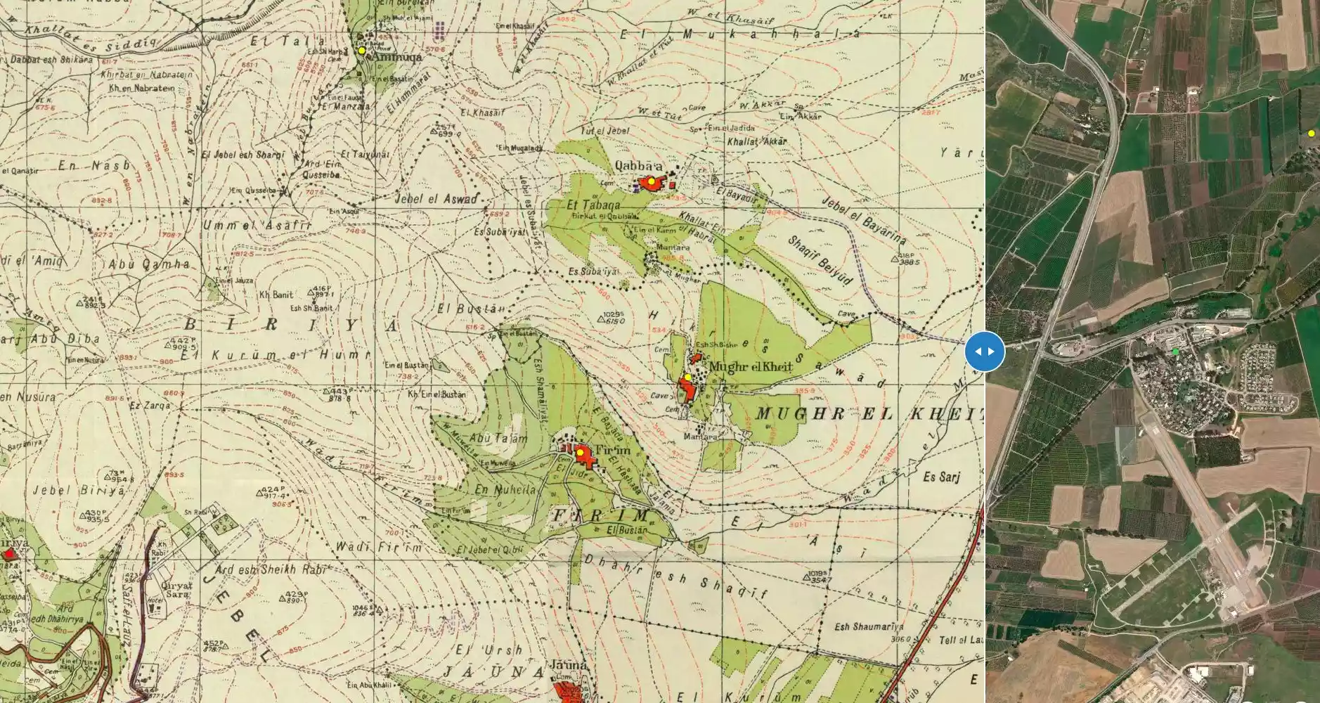
| Map Location | See location #59 on the map View from satellite |
|||||||||||||||||||||
| Military Operation | Operation Yiftach (commanded by the ethnic cleansing champion Yigal Allon) | |||||||||||||||||||||
| Attacking Units | The Palmach's First Battalion | |||||||||||||||||||||
| Exodus Cause | Military assault by Zionist troops | |||||||||||||||||||||
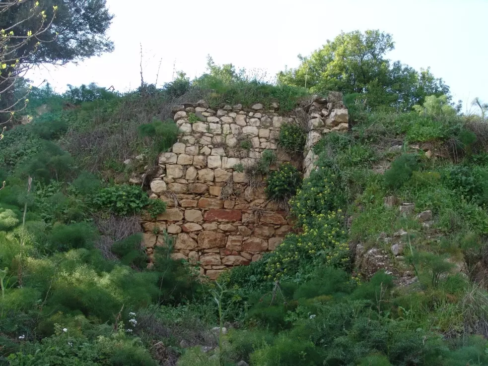
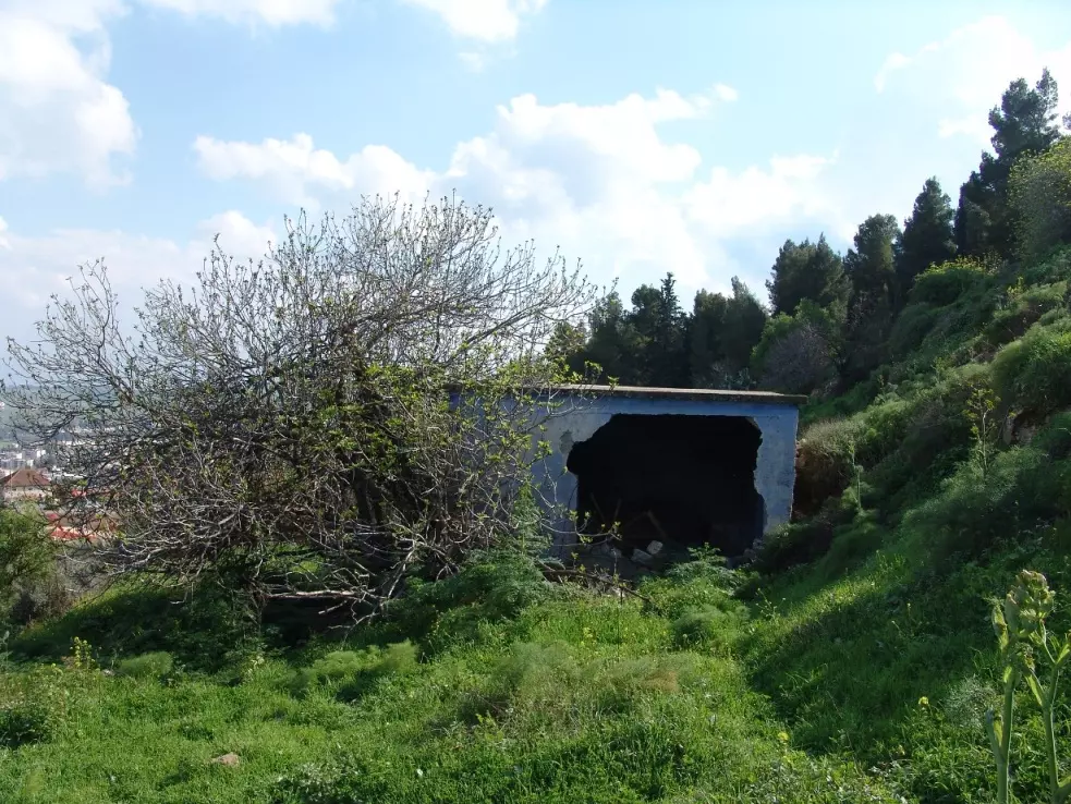
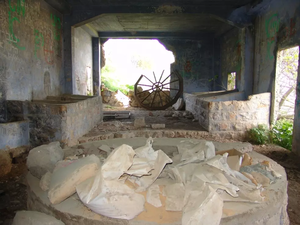
| Village Temains | Mughr al-Khayt was mostly destroyed with the exception of few cement rooms remain standing. | |||||||||||||||||||||
| Ethnically Cleansing | Mughr al-Khayt inhabitants were completely ethnically cleansed. | |||||||||||||||||||||
| Pre-Nakba Land Ownership |
**Town Lands' Demarcation Maps |
|||||||||||||||||||||
| Land Usage As of 1945 |
|
|||||||||||||||||||||
| Population |
|
|||||||||||||||||||||
| Number of Houses |
|
|||||||||||||||||||||
| Exculsive Jewish Colonies Who Usurped Village Lands |
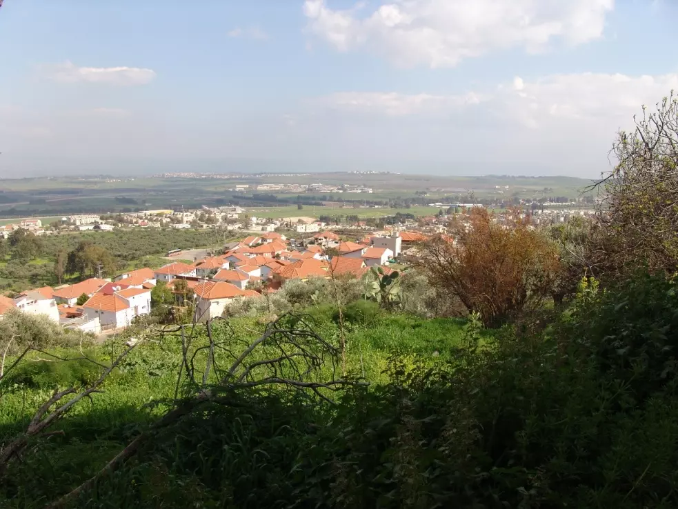
The settlements of Chatzor ha-Gelilit and Ro'sh Pinna are nearby village lands | |||||||||||||||||||||
| Featured Video | ||||||||||||||||||||||
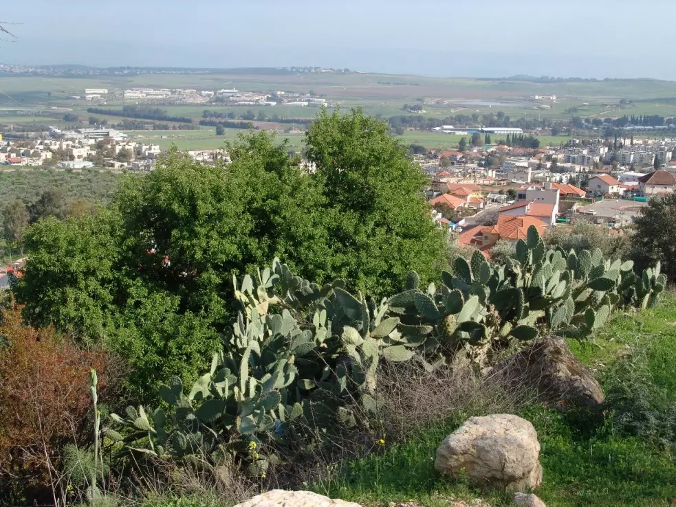
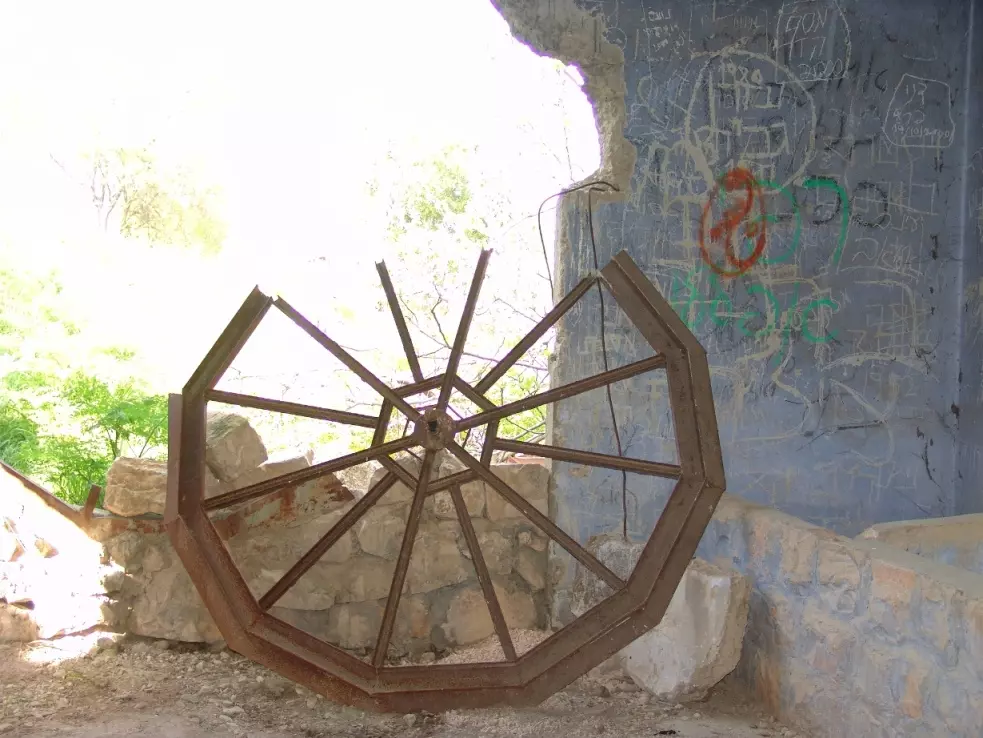
Village Before NakbaThe village was situated on the northeastern slope of Mount Kan'an in Upper Galilee, overlooking the Ghawr (the low-lying land around the Jordan) between Lakes Tiberias and al-Hula. The last part of its name, 'al-Khayt,' referred to the relatively level plateau which surrounded it and which was known as ard al-khayt. This region was a volcanic sill that separated the basin around Lake Tiberias, to the north, from that of Lake al-Hula, to the south (see Mansurat al-Khayt, Safad sub-disctrict). A secondary road linked Mughr al-Khayt to a highway that led to Safad and Tiberias. In 1596, Mughr al-Khayt was a village in the nahiya of Jira (liwa' of Safad) with a population of ninety-four. It paid taxes on a number of crops, including wheat, barley, and fruits, as well as on other types of produce, such as goats and beehives. [Hut. and Abd.:178]In the late nineteenth century, Mughr al-Khayt was a village built of brick and stone. It had a population of about 300 and was known for the many caves in its vicinity. [SWP (1881) I:199] Mughr al-Khayt was actually a 'twin-village,' consisting of two quarters about 100 m apart, spaced parallel to each other in a north-south direction. Its entire population was Muslim. The villagers relied on rainfall to irrigate grain and fruit trees. Their agricultural lands were located on all but the western side of the site. With 540 dunums planted with olive trees in the 1942/43 season, Mughr al-Khayt ranked fifth in olive cultivation among the villages in Safad sub-district. It had two olive presses. In 1944/45 a total of 3,742 dunums were allocated to cereals; 573 dunums were irrigated or used for orchards. An archaeological site near the village (known as al-Maghar) contained the remains of houses, rock-hewn tombs, columns, cisterns, and an olive press. Village Occupation and Ethnic CleaningDuring Operation Yiftach (see Abil al-Qamh, Safad sub-district), Palmach units shelled Mughr al-Khayt with mortars during the night of 2 May 1948. This took place just over a week before the final assault on Safad, and Israeli historian Benny Morris says it may have been designed to increase pressure on the city. But the mortar barrage was mainly initiated 'in order that in the end the Arabs would flee from [the village],' in the words of a participating officer. The attack apparently worked, resulting in the evacuation of the village along with two others (Fir'im and Qabba'a) similarly targeted during the same night. It is not clear where the villagers took refuge or what happened to the village itself.Zionists Colonies on Village LandsThe settlement of Chatzor ha-Gelilit (201265), founded in 1953 on village lands, is 1 km to the southeast of the village site; Ro'sh Pinna (201263), although not on village lands, is only 2 km south of the site; it was founded in 1882.Village TodayThe site is overgrown with grass and cactuses and littered with stone rubble from destroyed houses. Two cement rooms, built adjacent to one another, still stand and are in relatively good condition. Of the hundreds of olive trees that once grew there, only a few remain. The mountainous land around the site is mostly wooded or used by Israelis as pasture; only a fraction of it is used for growing crops.SourceDr. Walid al-Khalidi, 1992: All That Remains. |
||||||||||||||||||||||
| Related Maps | Town Lands' Demarcation Maps خرائط للقضاء توضح حدود القرى والاودية Town's map on MapQuest View from satellite Help us map this town at WikiMapia |
|||||||||||||||||||||
| Related Links | Wikipedia's Page Google Search Google For Images Google For Videos |
|||||||||||||||||||||
| More Information | في كتاب كي لا ننسى في كتاب بلادنا فلسطين المزيد من موقع هوية |
|||||||||||||||||||||
- موسى عليان
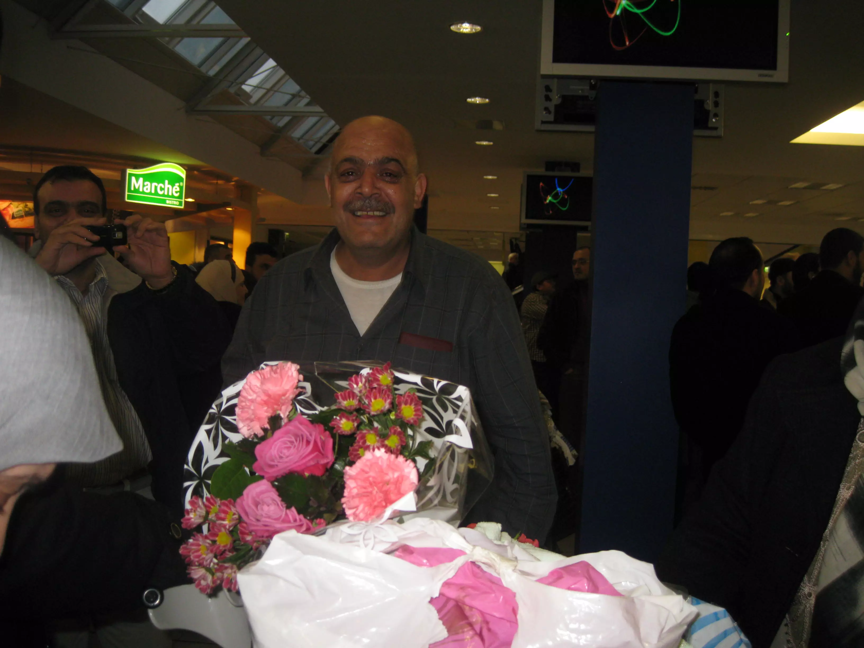
Posted by Ramzi 2 - مغار الخيط من الناحية الغربية , تظهر مستوطنة حتسور المقامة على اراضي القرية 4/2003
Posted by Makbula Nassar 1 - مغار الخيط من الناحية الغربية , تظهر مستوطنة حتسور المقامة على اراضي القرية 4/2003
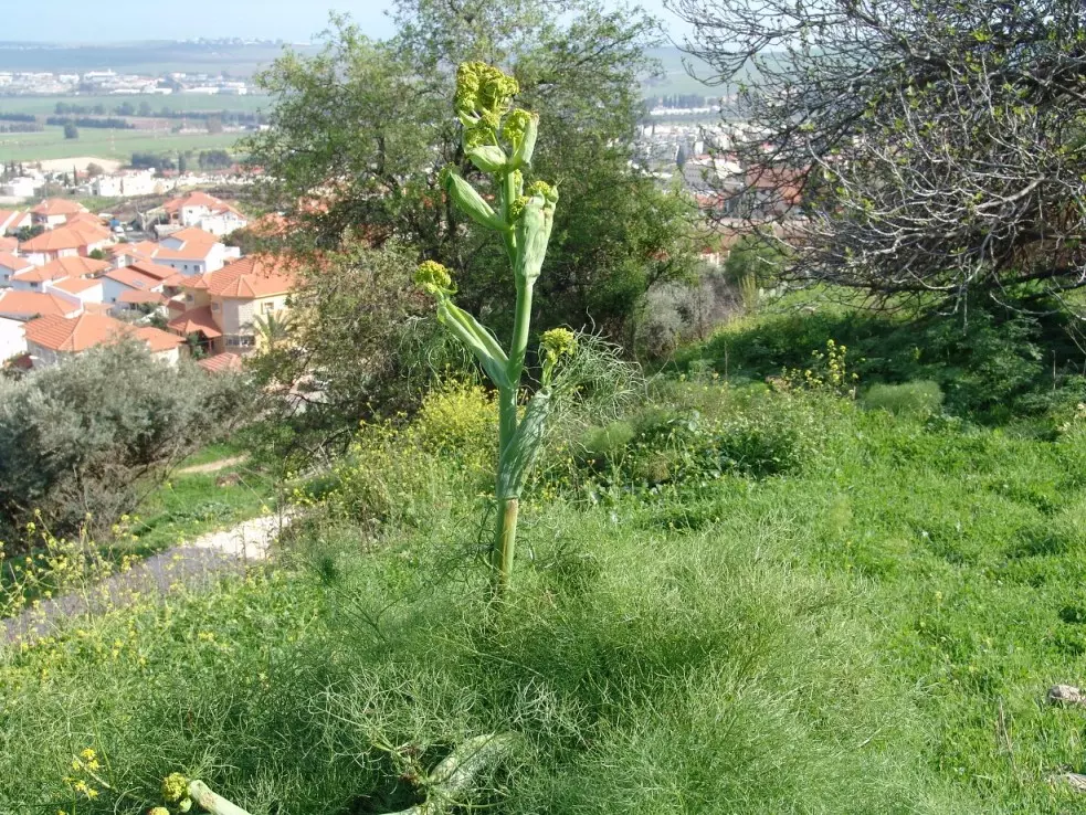
Posted by Makbula Nassar 1 - نبات الكلخ في مغار الخيط من الناحية الغربية , تظهر مستوطنة حتسور المقامة على اراضي القرية 4/2003
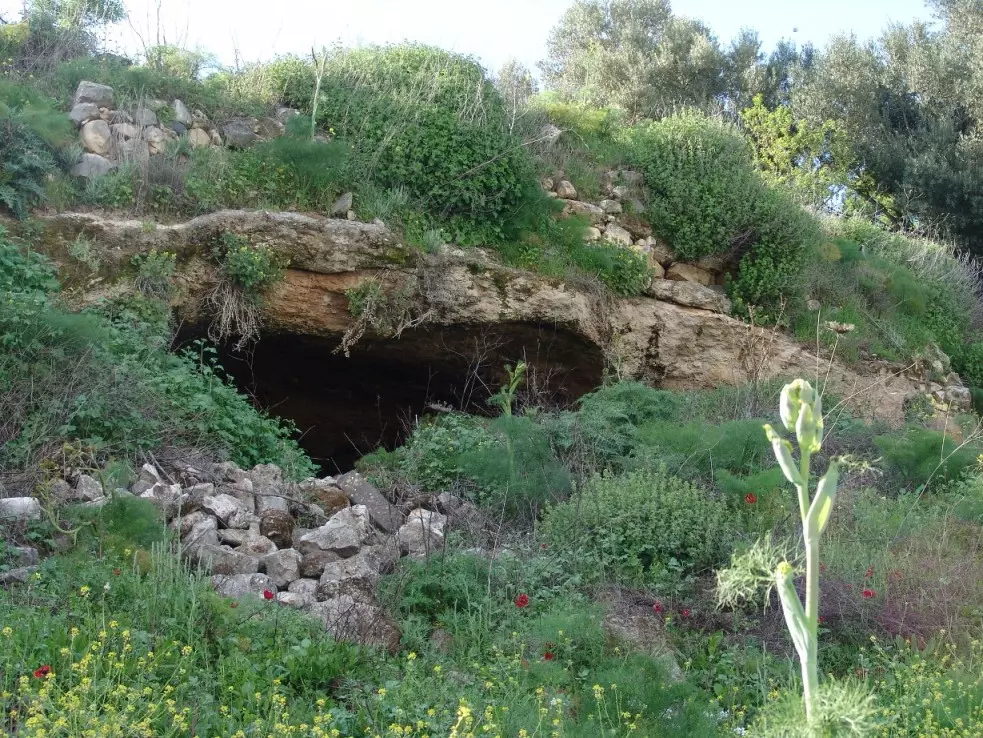
Posted by Makbula Nassar - مغارة بالقرب من معصرة الزيتون 4/2003
Posted by Makbula Nassar 1 - 4/2003 بقايا جدار بالقرب من منطقة المعصرة
Posted by Makbula Nassar - 4/2003 اثار الردم لبعض البيوت من القرية على السفح من الناحية الغربية
Posted by Makbula Nassar - 4/2003 معصرة الزيتون
Posted by Makbula Nassar - 4/2003 من الداخل - معصرة الزيتون
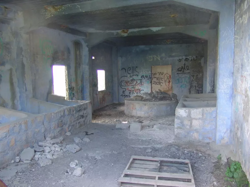
Posted by Makbula Nassar 2 - 4/2003 من الداخل - معصرة الزيتون
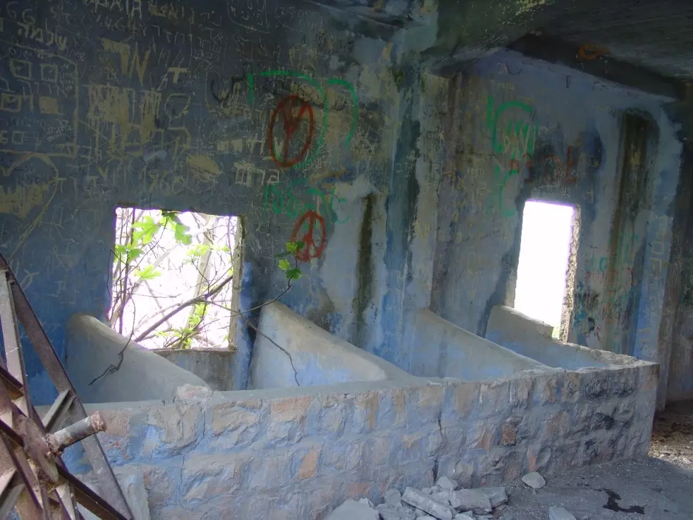
Posted by Makbula Nassar - 4/2003 من الداخل - معصرة الزيتون
Posted by Makbula Nassar 1 - 4/2003 من الداخل - معصرة الزيتون
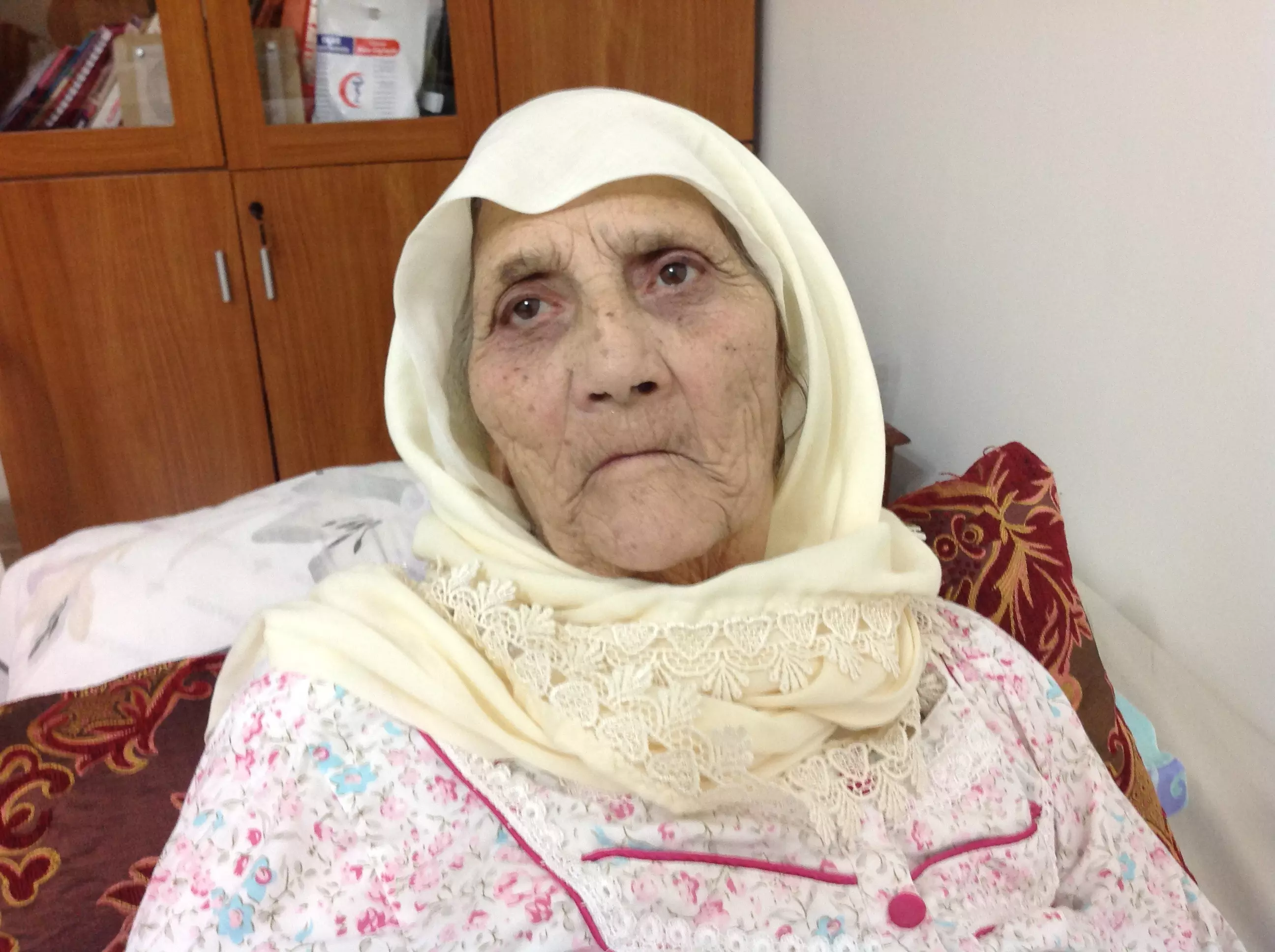
Posted by Makbula Nassar - Hajja Ghasbeya Al As3ad

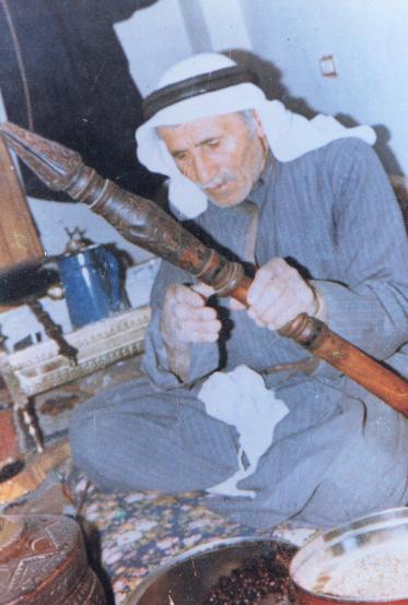
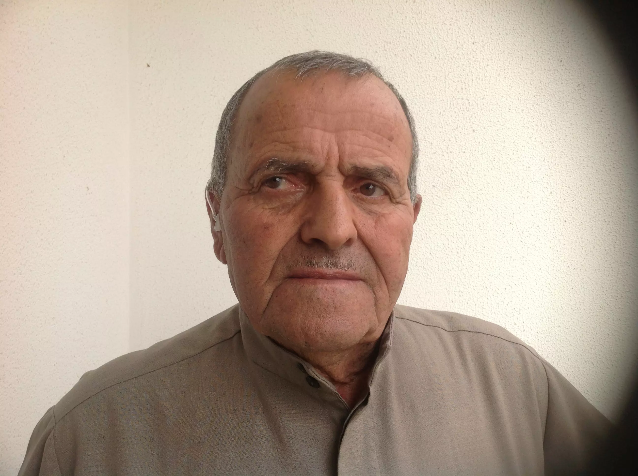
Posted by Nabil El-Hajj 2 - Mukhtar Mugher El khait

Posted by رائد يونس 2 - Deeb Elsheyati...grand father of my wife..died in Lebanon Allah Yerhamoh
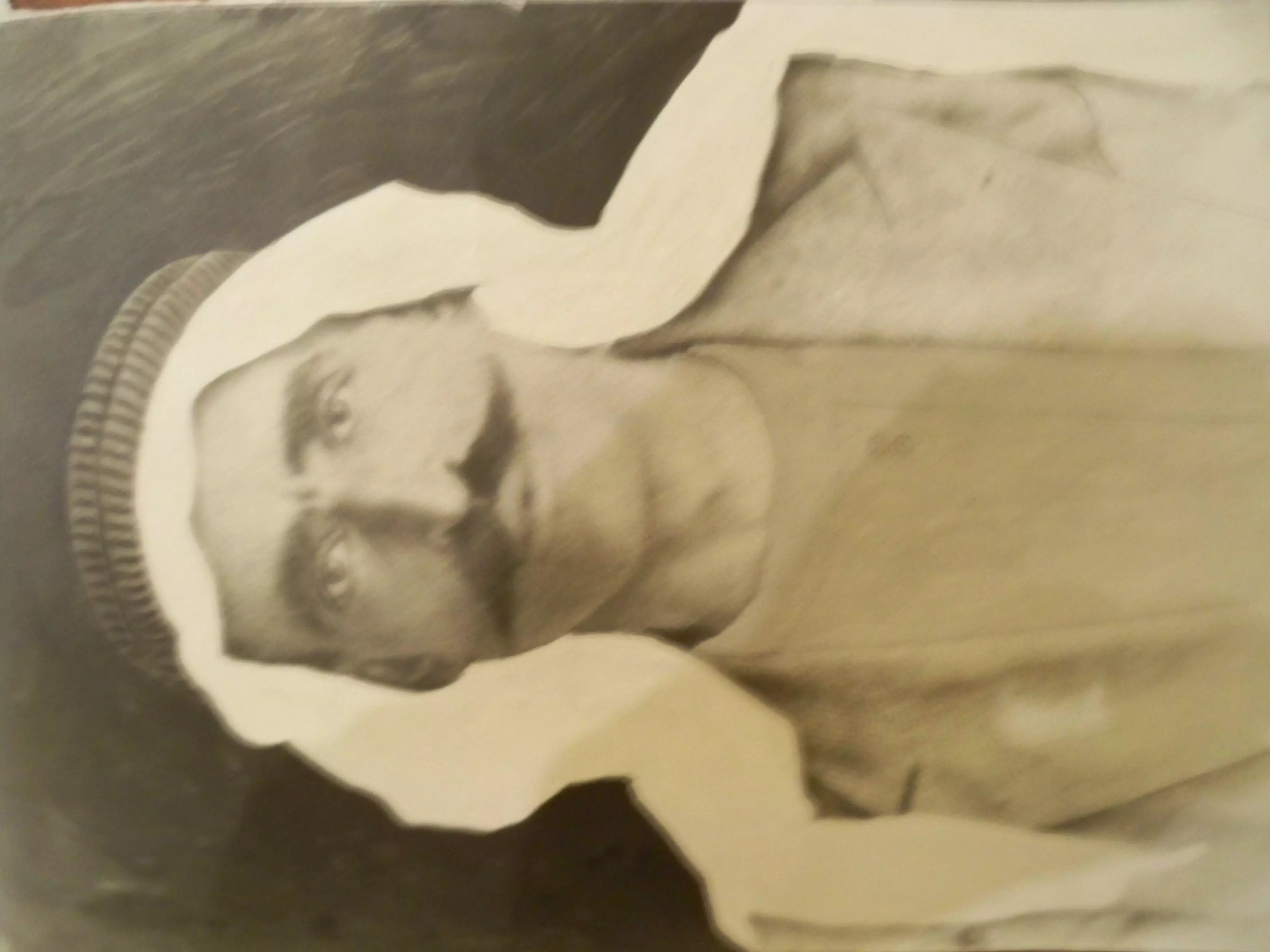
Posted by Palastine Son in Law 1 - الحاج عيسى عبد المعطي
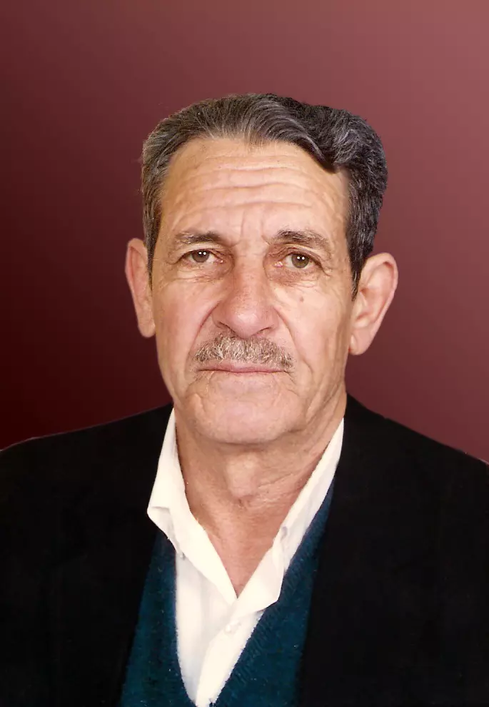
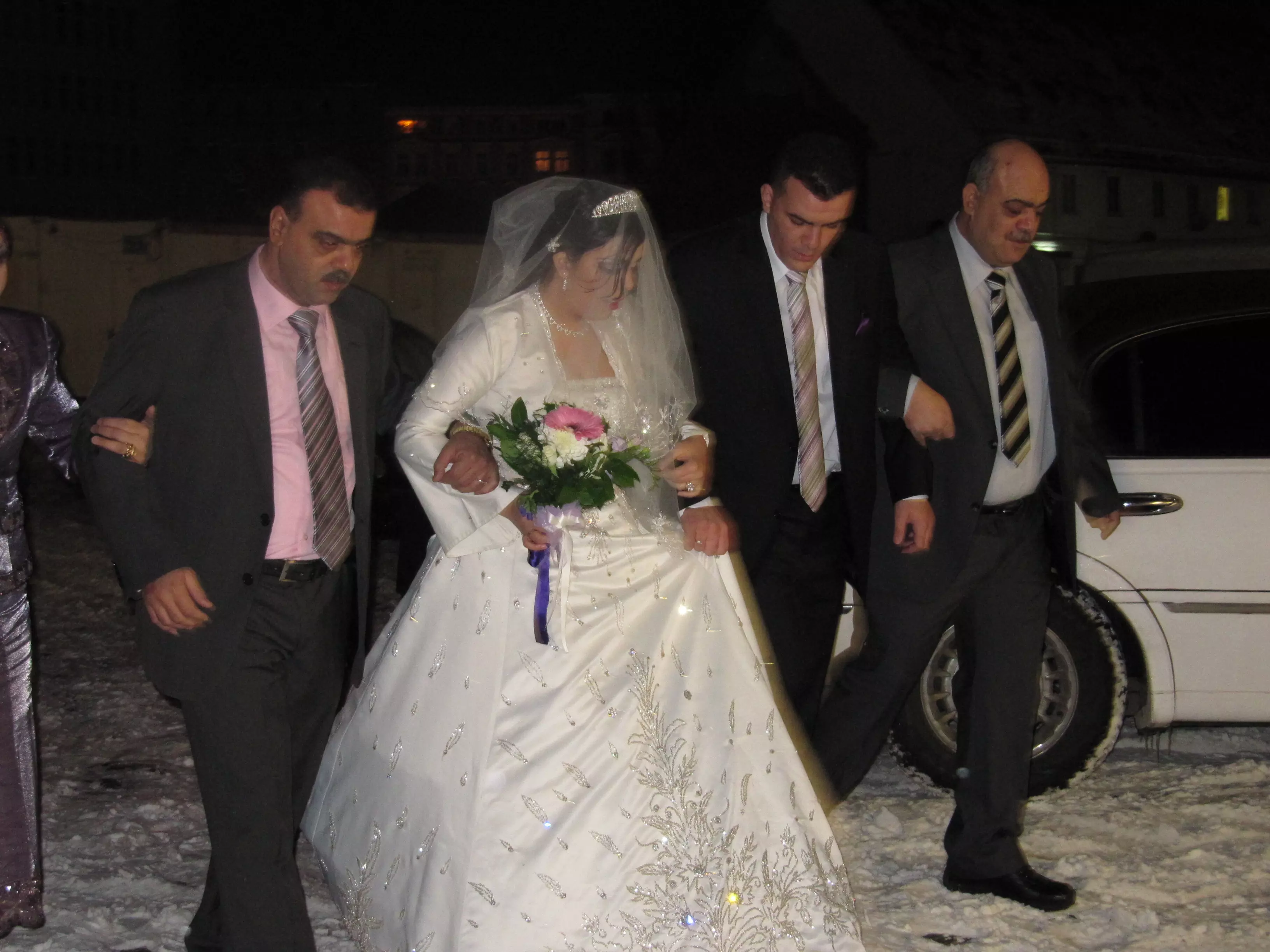
Posted by مهند قدورة 1 - زفاف ياسر
Posted by ابو ياسر - الحاج ابوياسر
Posted by ابو ياسر - المرحوم الحاج حسين علي يونس ( ابو جهاد)

Posted by علي يونس - Um Issam Alayan
Posted by Amin Alayan - Khalid Slayman Alayan
Posted by Amin Alayan - صوره من موقع القريه باتجاه اراضيها من الشرق

Posted by abu raya - حقول زيتون مغرالخيط

Posted by abu raya - صورة للحاج عمر الاسعد وابنه احمد الاسعد رحمهما الله وصورة للحاج قاسم الاسعد رحمه الله من سكان بلدة مغر الخيط

Posted by الاسعد - صورة للحاج عمر الاسعد وابنه احمد الاسعد رحمهما الله وصورة للحاج قاسم الاسعد رحمه الله من سكان بلدة مغر الخيط #2

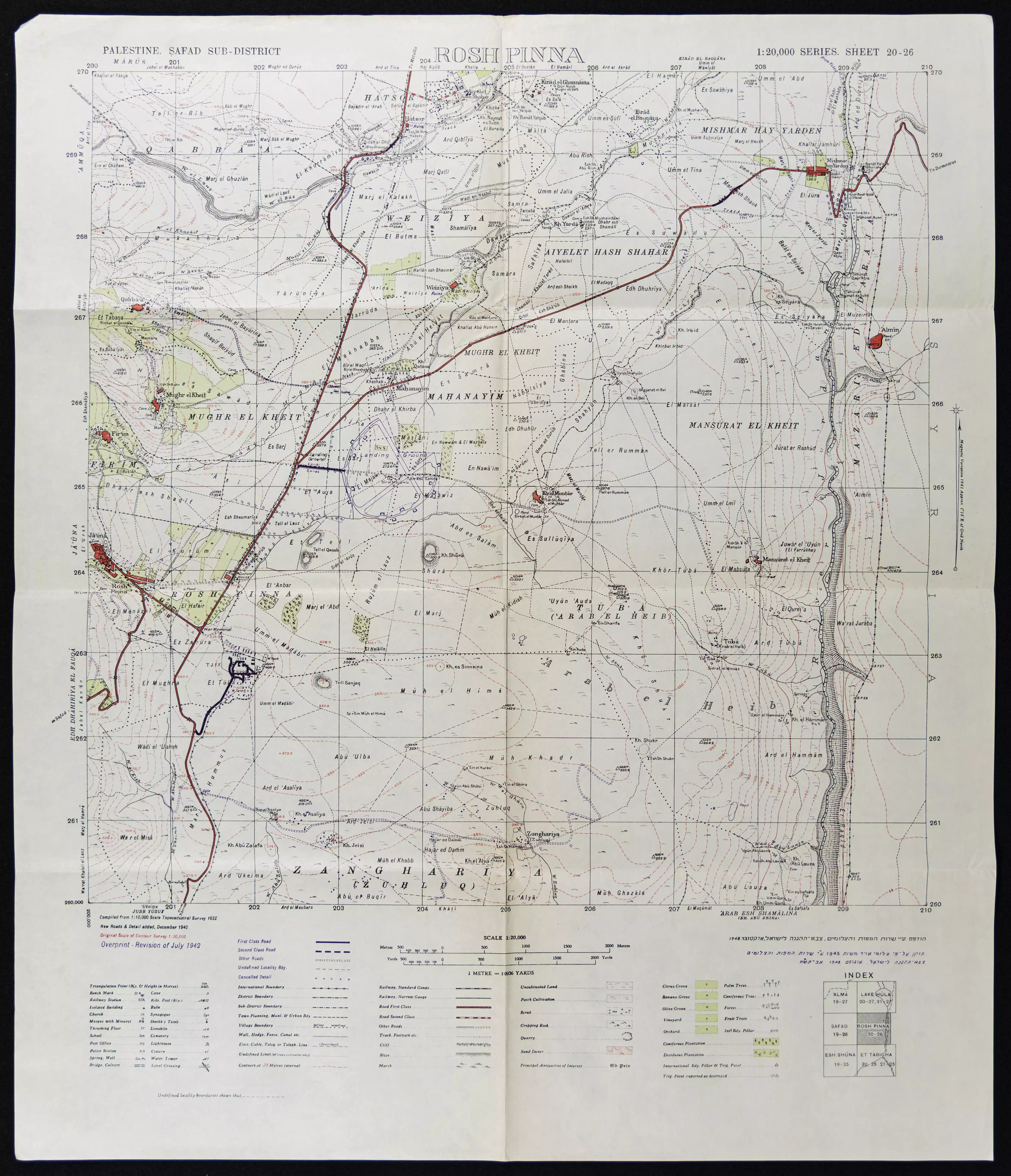
Posted by الاسعد - خارطة تُظهِر الحدود والطرق بأنواعها والأماكن المقدسة والطبيعة الطوبغرافية من تلال وسهول ومنحدرات والتشكيلة الطبيعية للأرض وأنواع المزروعات. نُشرت الخريطة فترة الانتداب البريطاني، تم إضافة تعديلات عليها من قِبَل خدمة الخرائط والصور التابعة للقوات العسكرية الاسرائيلية فترة الأربعينيات.
Want to browse more? 80,000 pictures were grouped in these gallaries:
| Display Name | Clan/Hamolah | Country of Residence |
| Younes Younes | - | Palestine |
| saja_younis | Younis | Doha, Qatar |
| Amin Alayan | - | - |
| وسام البقاعي | - | لبنان /تعلبايا |
| ALI YOUNIS | YOUNIS | - |
| wissam elbeqai | - | edmonton canada |
| Ahmad Al-haj | - | - |
| YOUNESS JAMIL | - | FRANCE, FRANCE |
| mahmoud ahmad elbekai | - | copenhagen, danmark |
| Rabih | Tarchahani | dubai, UAE |
| Wisam Atef Diab hasan Alchayati | Alchayati | NY, USA |
| Hussein EL BEQAI | - | Ankara, Turkey |
| Nabil El-Hajj | - | beka3, Lebanon |
| Mustapha Younes | - | Bekaa, Lebanon |
| Chayati | - | Abu Dhabi, U.A.E |
| al haj younes | YOUNESS | ABU DHABI, U.A.E |
| Nizar Younes | - | Dubai |
| medal | - | - |
| Ramzi | Ramzi | Beqaa, Lebanon |
| Ahmad.H.Ghani | Ahmad Abed Al Ghani | Beqaa, Lebanon |
| muhammad ghannoum | omar | - |
No links have been shared yet, be free to the first to share the first link.
 Fake Valor: Why Did Zionist Jews Hoist Nazis Flag on Their Ships in the 1930s?
What is new?
-
Facts About Oct. 7th Gaza Raid
-
Remined Us Please:: Who Did Rape Who? Palestinians Raped Israelis? Or, was the other way around?
-
When Prof. Edward Said was invited to debate Bibi Netanyahu in the 1980s, watch what happened!
-
Ezra Klein of the NY Times on the "Jewish Race".
-
Abusing Blood Libel!
-
Did Israeli Soldiers Activate The Hanniba Direective On Oct. 7th? You Be The Judge
-
Zionist FAQ: Isn't it true that Palestinians don't want peace? Palestinians never accepted the two-state solution
- Facts about Haavara (Transfer) Agreement between Ben-Gurion & Hitler
-
Haavara FAQs: Why Did Zionist Jews Hoist Nazis' Flags on Their Ships in the 1930s?
- Haavara FAQs: When Chaim Weizmann met FDR in mid-1943, why was he silent about rescuing European Jewry?
-
Dear ChatGPT: How did Palestinians resist Napoleon's invasion of their country in 1799?
-
Dear ChatGPT: Gaza had a vibrant Jewish community in the mid-17th century. What happened to them?
-
Dear ChatGPT: Why did the Jewish Agency suppress news of the Holocaust during WWII?
-
Video Playlist: Jews share their DNA tests to end the conflict for good.
-
A Tale of Two Conflicts: Examining the Definition of Genocide
-
Prof. Abraham Polak And The Suppressed History of the Khazars and European Jewry
-
How Ronald Reagan would have framed the genocide in Gaza if he were still alive?
-
Haavara FAQs: Let us do the math: how many German Jews did The Haavara Agreement save?
-
Zionist FAQs: The Hebron Massacre of 1929, "clearly proves" that Palestinians are antisemitic, how could you deny it?
-
Zionist FAQs: Why Anti-Zionist Is Not Antisemitism?
-
Zionist FAQs: Isn't it true that the KGB created Palestinian Nationalism in the early 1960s?
- Zionist FAQs: Muslims are killing Muslims all the time; why are Israeli Jews being singled out in the media?
- Zionist FAQs: How is Israel an apartheid state when 20% of its citizens are Arabs who enjoy full rights?
-
Haavara FAQs: Why Did Dorothy Thompson Flip From A Zionist Advocate to A Silenced Dissenter?
-
Haavara FAQs: Analysis of Herzl's Uganda Scheme and how it could have saved millions of Jews.
-
Haavara FAQs: Why did Hayim Greenberg describe American Jewry as "morally bankrupt" in early 1943?
-
Haavara FAQs: What if the Evian Conference was a resounding success? What would have been the impact of saving European Jewry on Zionism?
- Haavara FAQs: What if the six million were saved, how that would have impacted the Zionist project?
-
Haavara FAQs: How did Zionist leaders react when Europe's Jews lingered in the DP camps after WWII ended?
-
Why does the American Jewish community repeat lies that David Ben-Gurion had debunked before he died?
-
Who has the power to rename the Tatar/Khazar Gene Marker to Jewish IV?
-
Zionist FAQs: Why won't Egypt, Syria, and Jordan take their people back? Jews are indigenous to Palestine, and Arabs immigrated after Jews developed the country. Arabs should leave.
-
Haavara FAQs: Did Hitler and the Nazis conflate between Judaism and Zionist? If that wasn't case, then why?
-
Haavara FAQs: Winston Churchill and antisemitism, a collection of articles written Churchill.
-
Haavara FAQs: Broken by country, how many Jews survived vs. killed during the Holocaust?
-
Haavara FAQs: Why did European Jews vote with their feet and to immigrated to the Americas, not Palestine, after WWII?
-
Watch this American Jewish Girl describing Israeli Jews' cognitive dissonance like no other in under two minutes
-
Haavara FAQs: When the Nazis went out of their way to hide the Holocaust, Israeli Jews did the exact opposite by broadcasting their genocide of Gazans. But why?
-
Haavara FAQs: How Zionist Jews went out of their to show their appreciation to Nazism and Fascism?
- Haavara FAQs: Why Zionist leaders were against bombing the death camps & the Railroads leading to them?
-
Haavara FAQs: Hitler's message to the British and American people: If Jews are such noble citizens and you care about them, how come you're not letting them in? I will gladly ship them to you at my expense, even on luxury liners!
-
A shortlist of Zionist and Israeli false flag operations in the name Jews.
-
The Most Moral Army
- The Land of Kapos (Israel): Where the brave are boycotted and Kapos walk free.
- Why did early Zionists often named their communal enterprises "colonial"?
- Zionist Relations with Nazi Germany by Faris Glubb
-
Two NY Times advertisements by Zionists in the early 1943 that exposes Zionists' treason at the height of the calamity
- Facts Not Lies about the Palestinian-Israeli Conflict.
- Site's pictures have been categorized
- Campgain Against Lice
- A Survey of Palestine, the official source about Palestine before Nakba produced by the British Mandate; over 1200 pages.
- Satellite View & Google Earth: Over 6,000 placemarks identifying all destroyed towns, W. Bank & Gaza Strip Towns, & refugee camps.
- PalestineRemembered.com and its Nakba Oral History Project were featured on al-Jazeera Satellite TV.
- Nakba Oral History Video Podcast:
 Over 700 Oral History interviews (including 3,500+ hours of recording) can be viewed online.
 - Palestine Village Statistics Project
- Gaza Jail Break
- النسخة العربية للموقع الان متوفرة
- Videos: Documenting the destroyed villages in video: Tracing all that remains since Nakba.
- Videos: Responding to Zionist Propaganda
- Interview: The ethnic cleansing of Palestine: George Galloway interviews Israeli Historian Ilan Pappe.
- For Palestinians, memory matters. It provides a blueprint for their future By George Bisharat.
- Zionist FAQ now available in Hebrew שאלות שציונים שואלים, עכשיו בעברית
- Video: The Stephen Walt and John Mearsheimer report on the influence of the Israel Lobby on U.S. Foreign Policy
- The Palestinian-Israeli conflict for beginners
