| PalestineRemembered | About Us | Oral History | العربية | |
| Pictures | Zionist FAQs | Haavara | Maps | |
| Search |
| Camps |
| Districts |
| Acre |
| Baysan |
| Beersheba |
| Bethlehem |
| Gaza |
| Haifa |
| Hebron |
| Jaffa |
| Jericho |
| Jerusalem |
| Jinin |
| Nablus |
| Nazareth |
| Ramallah |
| al-Ramla |
| Safad |
| Tiberias |
| Tulkarm |
| Donate |
| Contact |
| Profile |
| Videos |
Welcome To al-'Urayfiyya - العريفية (אל-עוריפיה)
|
District of Safad
Ethnically cleansed days ago |
العربية Google Earth |
 |
Gallery (20) |
- Statistics & Facts
-
Before & After

- Satellite View
- Articles 1
- Pictures 20
- Members
- All That Remains
- Wikipedia
- Videos
- Guest Book
- Links
| Statistic & Fact | Value |
| Occupation Date | April 1, 1948 |
| Distance From District | 21.5 (km) North East of Safad |
| Elevation | 175 (meters) |
| Before & After Nakba, Click Map For Details |
|
|
|
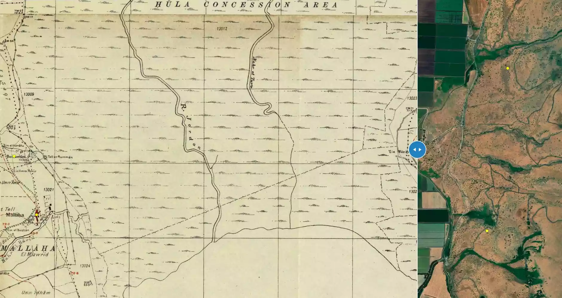
| Map Location | See location #28 on the map View from satellite |
| Military Operation | Operation Yiftach (commanded by the ethnic cleansing champion Yigal Allon) |
| Attacking Units | The Palmach's First Battalion |
| Exodus Cause | Military assault by Zionist troops |
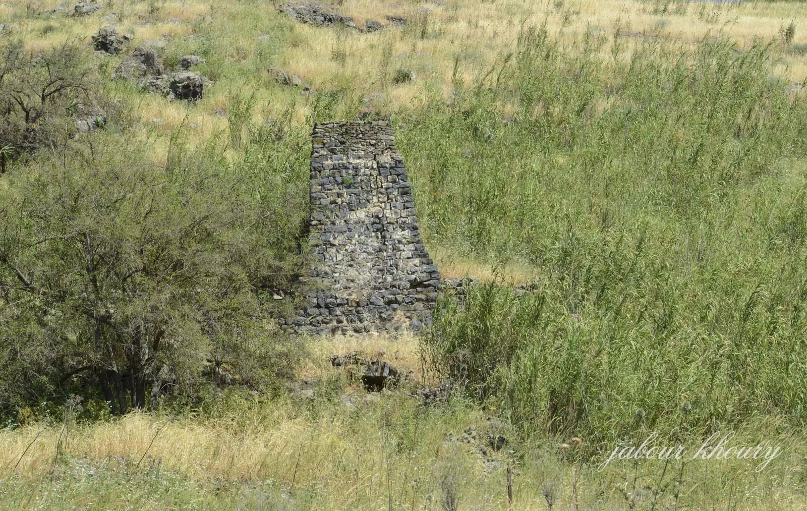
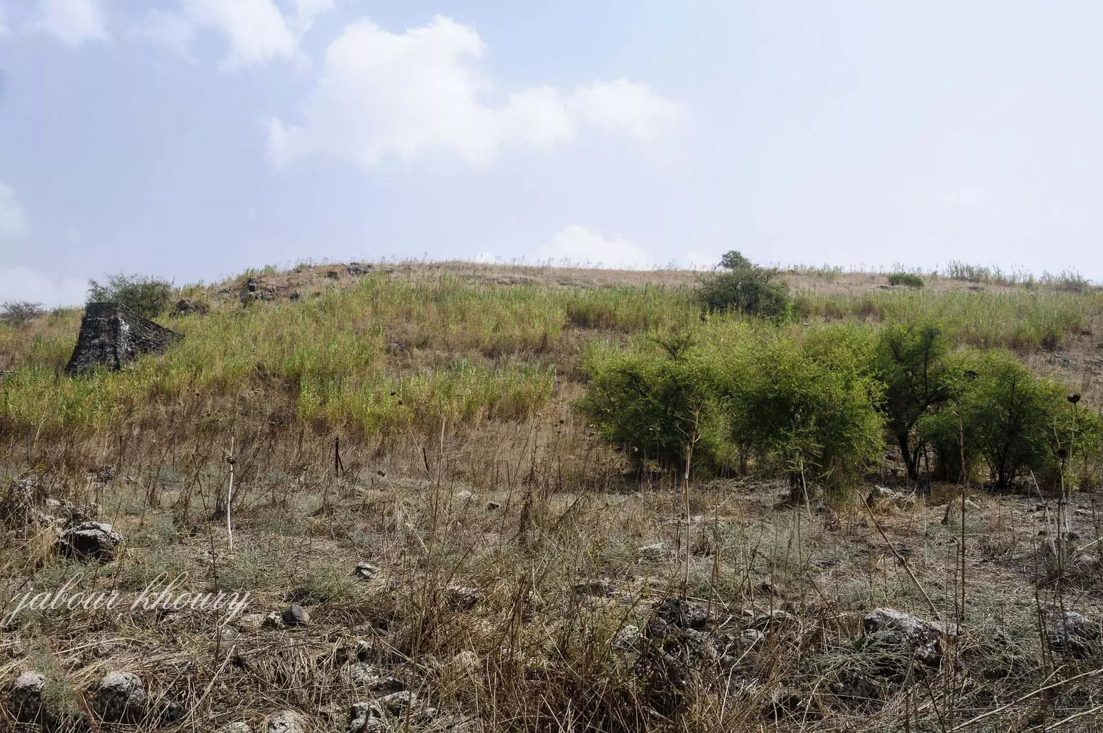
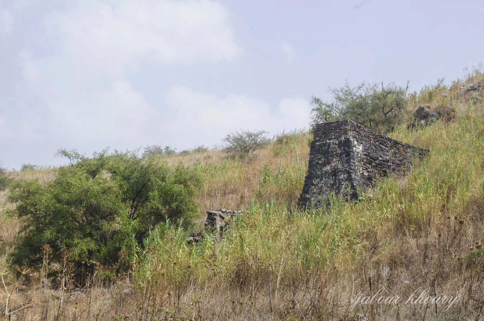
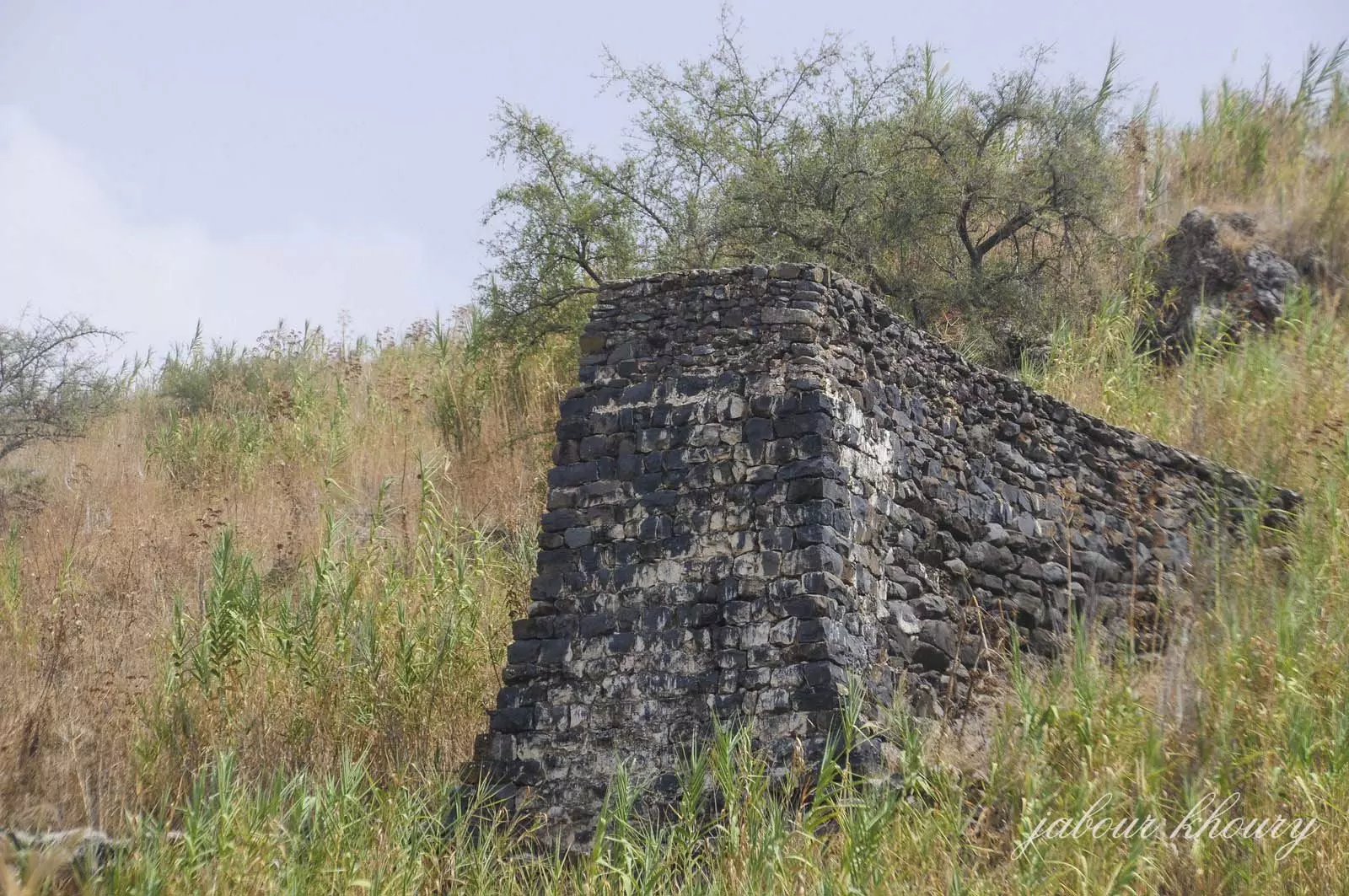
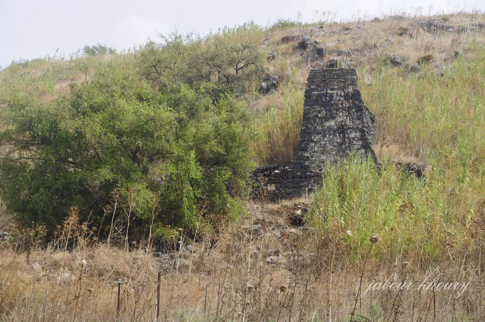
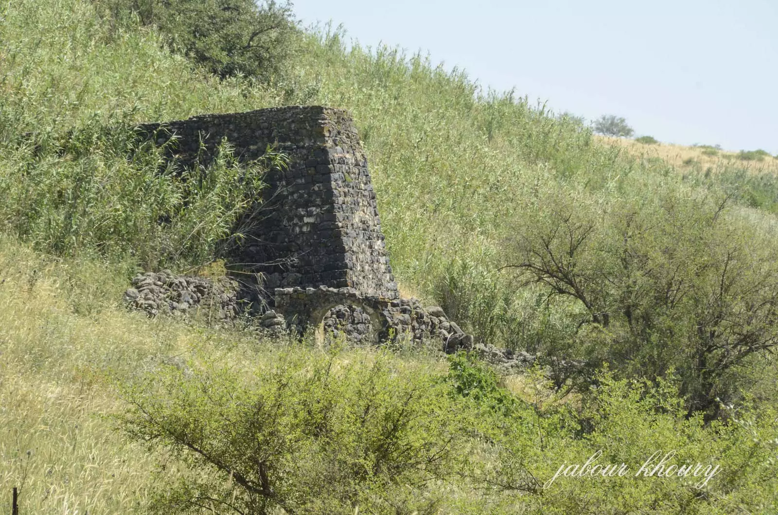
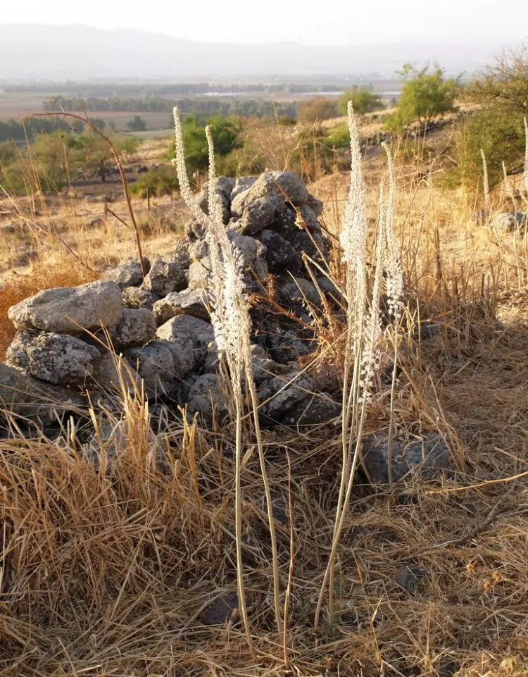
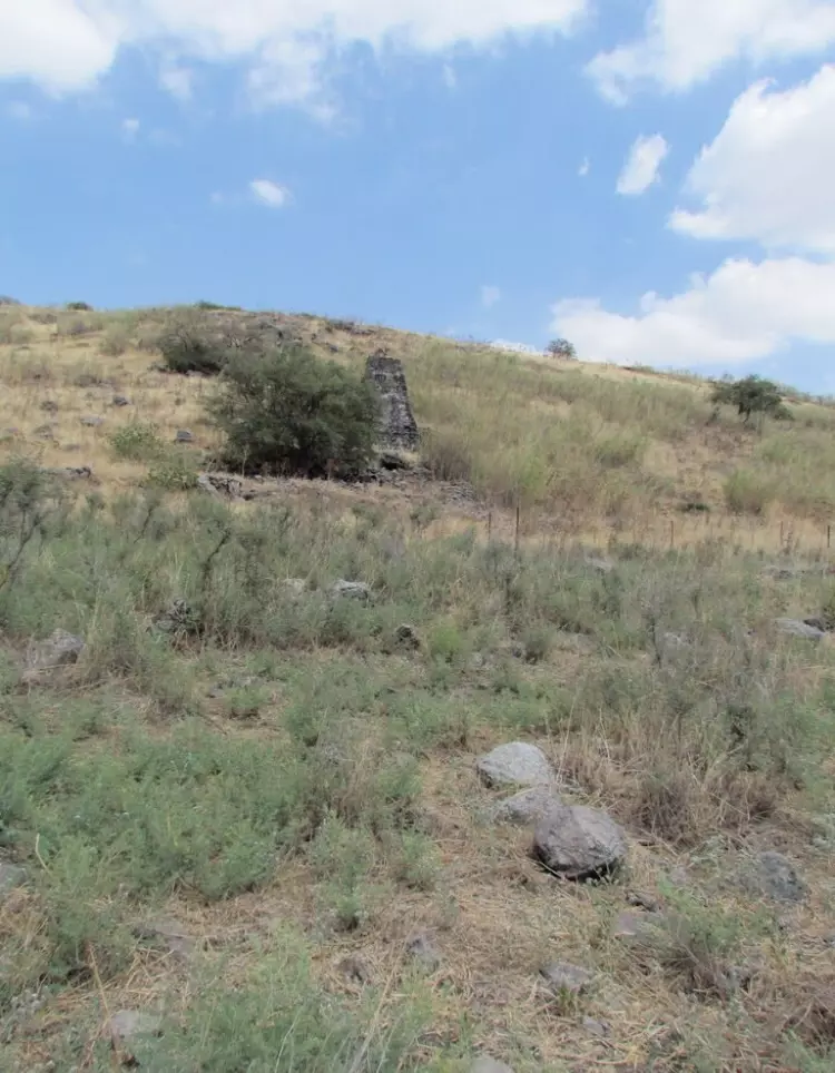
| Village Temains | The village has been mostly destroyed with the exception of the water mill. |
| Ethnically Cleansing | al-'Urayfiyya inhabitants were completely ethnically cleansed. |
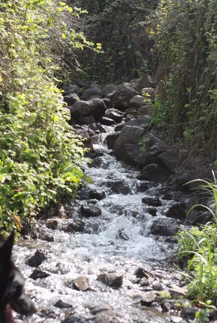
| Archeological Sites | The village contained the remains of a masonry channel, which carried the water that powered a watermill |
| Exculsive Jewish Colonies Who Usurped Village Lands |
No settlements on village lands |
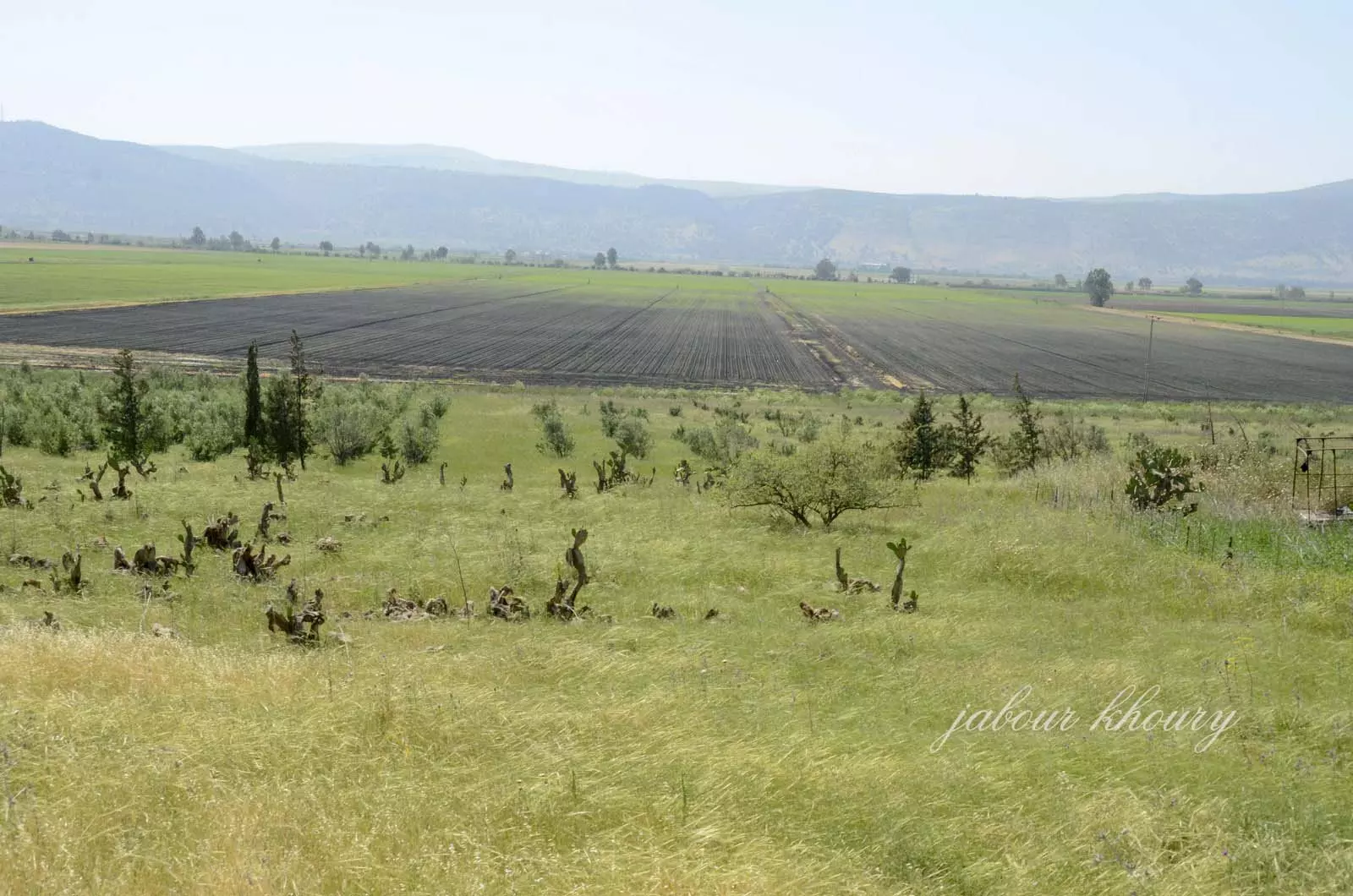
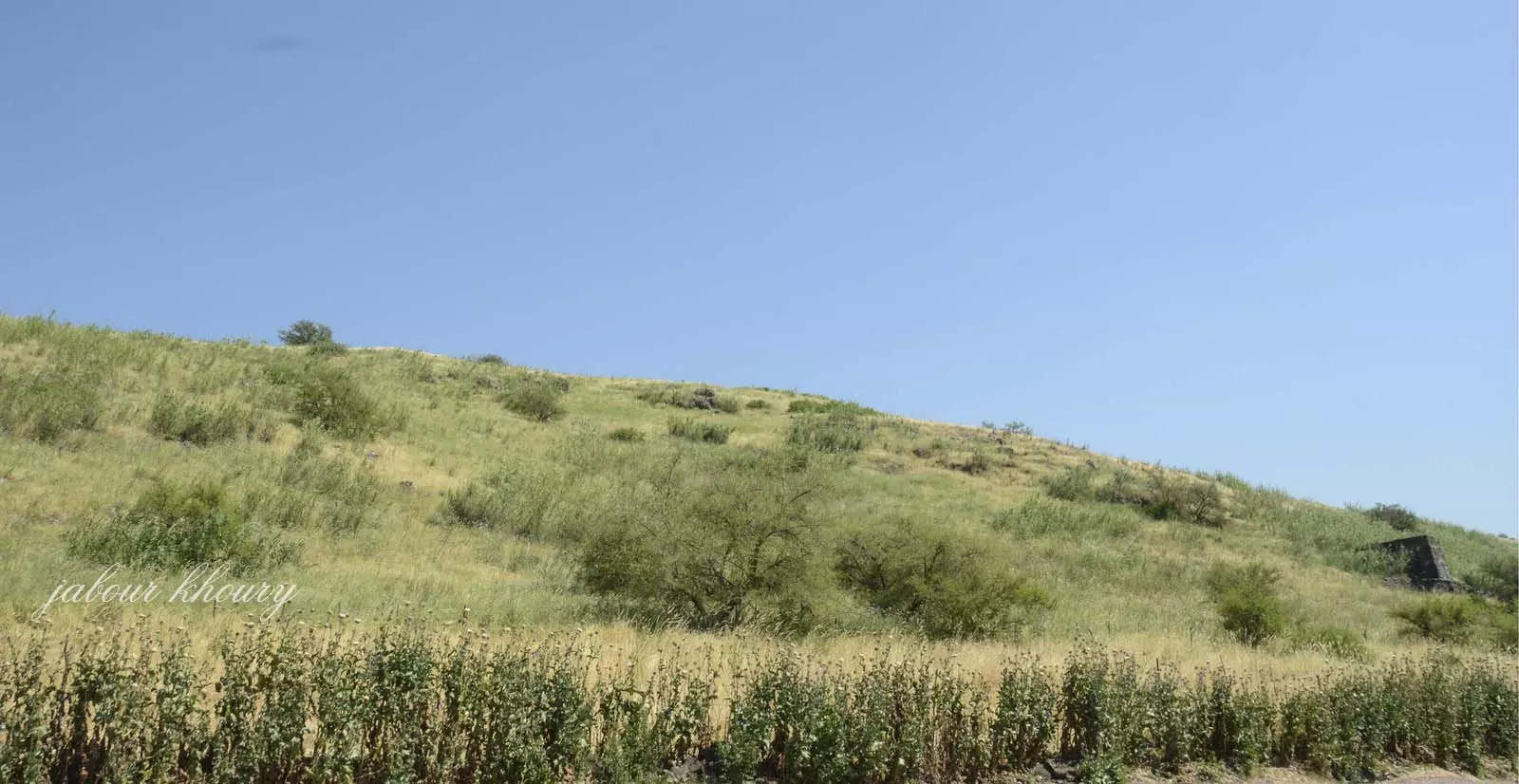
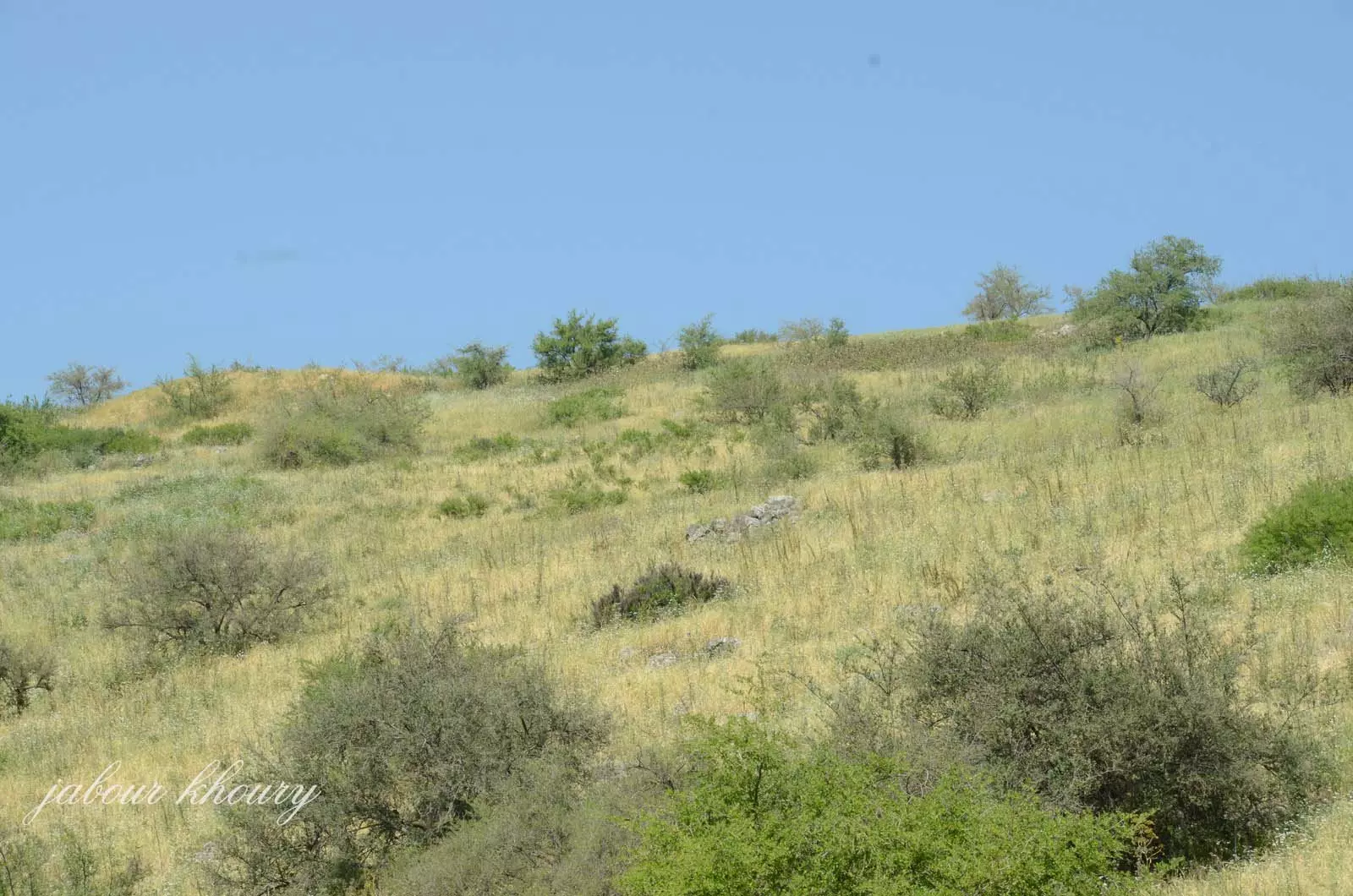
Village Before NakbaThe village was classified as a hamlet by the Palestine index Gazetteer, and was situated on a slope at the foot of the Golan Heights, overlooking the al-Hula Plain in the west.Village Occupation and Ethnic CleaningLike almost all the villages in the northwest corner of Palestine, al-'Urayfiyya was overrun in April–May 1948 during Operation Yiftach (see Abil al-Qamh, Safad sub-district). It is not known precisely when it was occupied by Zionist forces or what were the circumstances of its depopulation. While some villages in its vicinity were occupied at the beginning of May, others held out until the end of the operation on 25 May. Its proximity to the Palestine–Syria border suggests that it was probably attacked in the early stages of the operation, and its population probably fled or were expelled at this time, as was the case for the neighboring village of Khiyam al-Walid.Zionists Colonies on Village LandsThere are no Israeli settlements on village land.Village TodayThe site is deserted and overgrown with grass, thorns, a variety of trees, and cacti. The remains of a masonry channel, which carried the water that powered a watermill, are visible.SourceDr. Walid al-Khalidi, 1992: All That Remains. |
|
| Related Maps | Town Lands' Demarcation Maps خرائط للقضاء توضح حدود القرى والاودية Town's map on MapQuest View from satellite Help us map this town at WikiMapia |
| Related Links | Wikipedia's Page Google Search Google For Images Google For Videos |
| More Information | في كتاب كي لا ننسى المزيد من موقع هوية |
- Remains of a water mill on the slope where the village was located, 1987
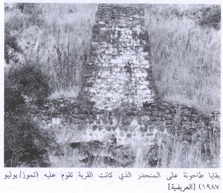
Scanned from "All That Remains" by Dr. Walid Khalidi - منظر لموقع القريه من الجهه الجنوبيه
Posted by Jabour Khoury - منظر لطاحونه القريه البناء الوحيد المتبقي
Posted by Jabour Khoury - الطاحونه
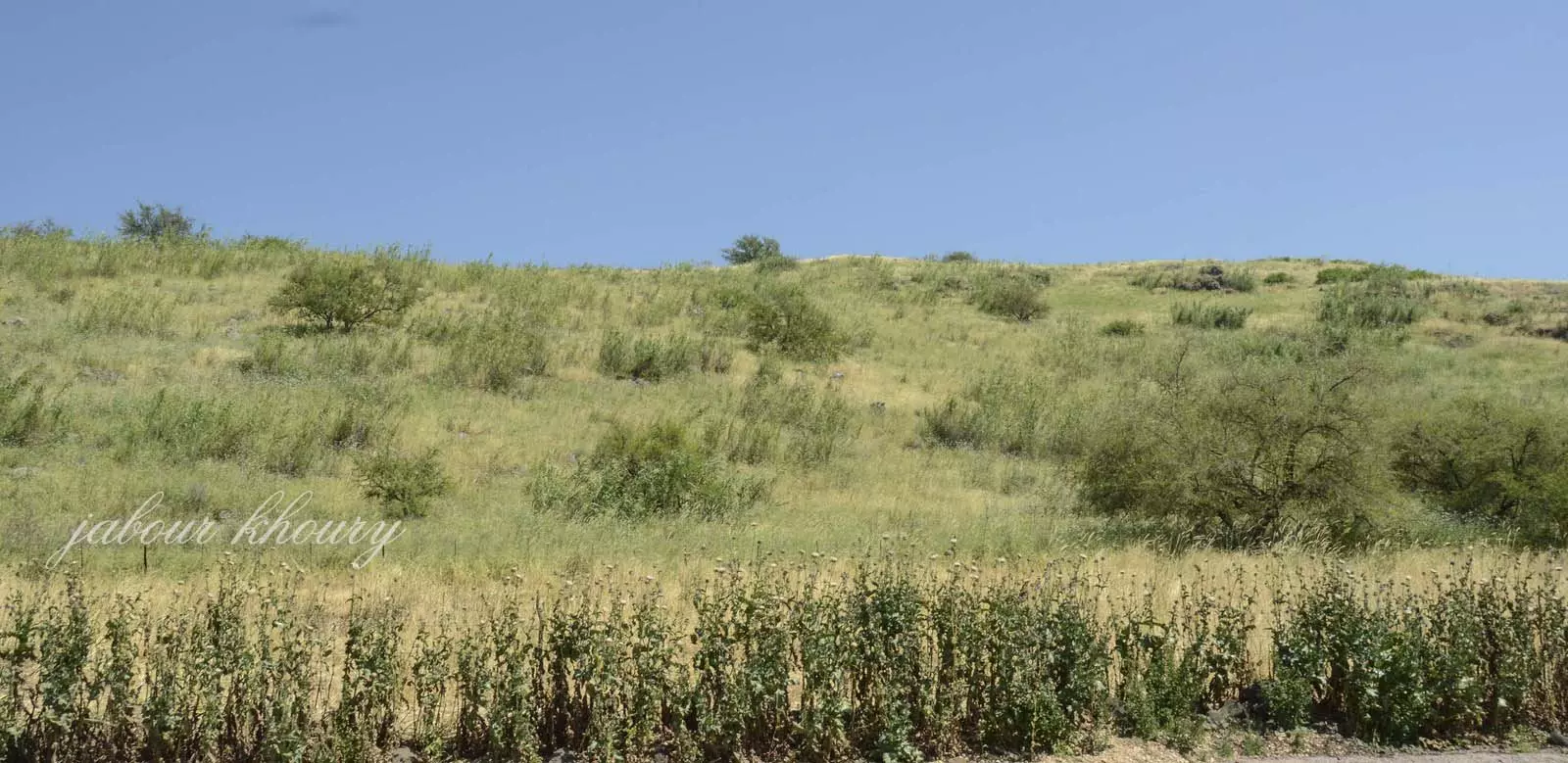
Posted by Jabour Khoury - موقع القريه والطاحونه منظر من جهه الغرب نحو الشرق
Posted by Jabour Khoury - الجهه الغربيه من اراضي القريه ويظهر بوضوح بقايا نبات الصبار
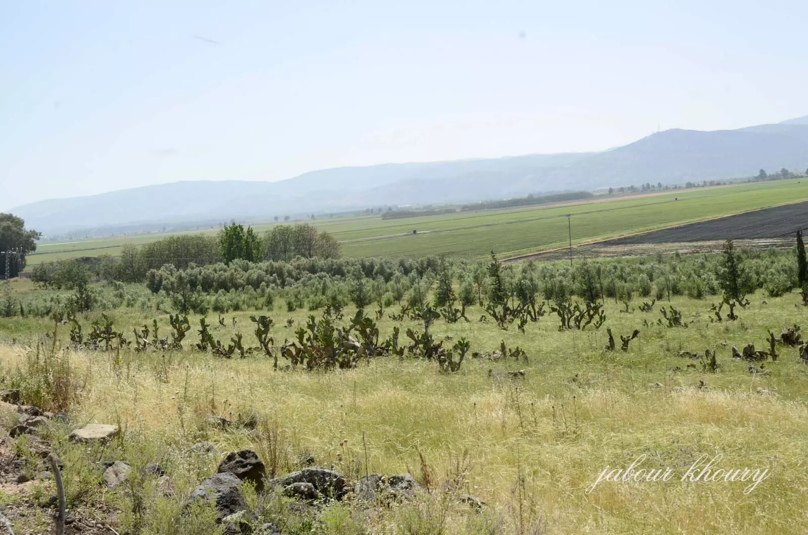
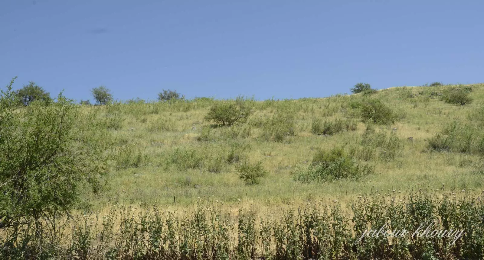
Posted by Jabour Khoury - الجهه الغربيه من اراضي القريه وسهل الحوله
Posted by Jabour Khoury - نظره الى موقع القريه من الشمال الى الجنوب
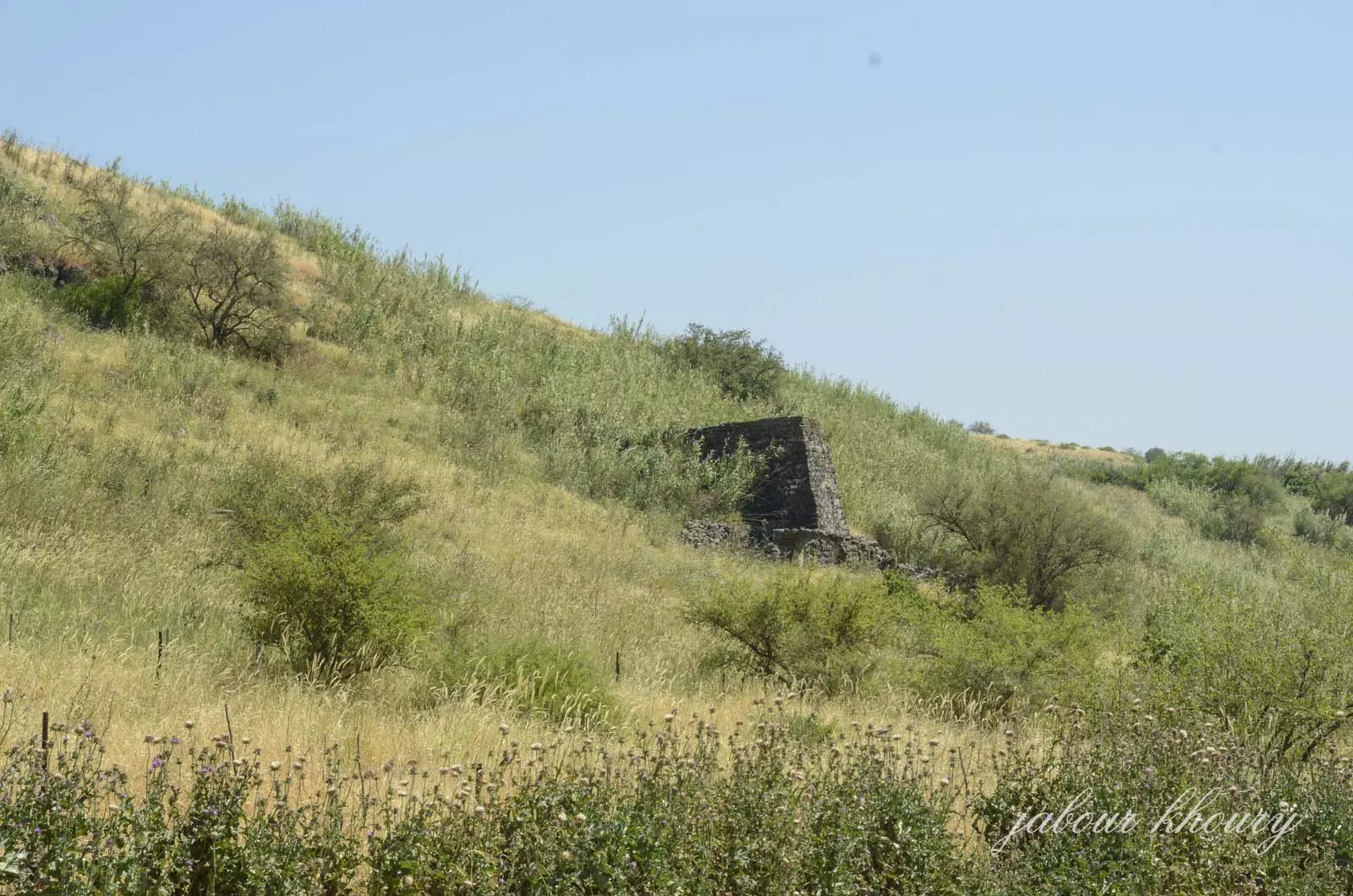
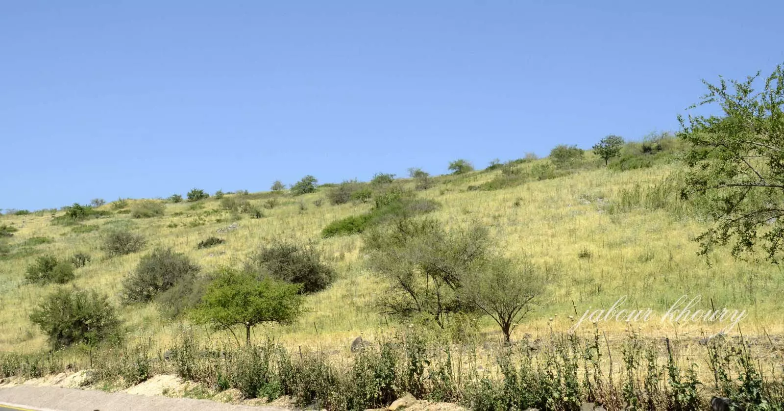
Posted by Jabour Khoury - طاحونه القريه
Posted by Jabour Khoury - منظر عام لموقع القريه
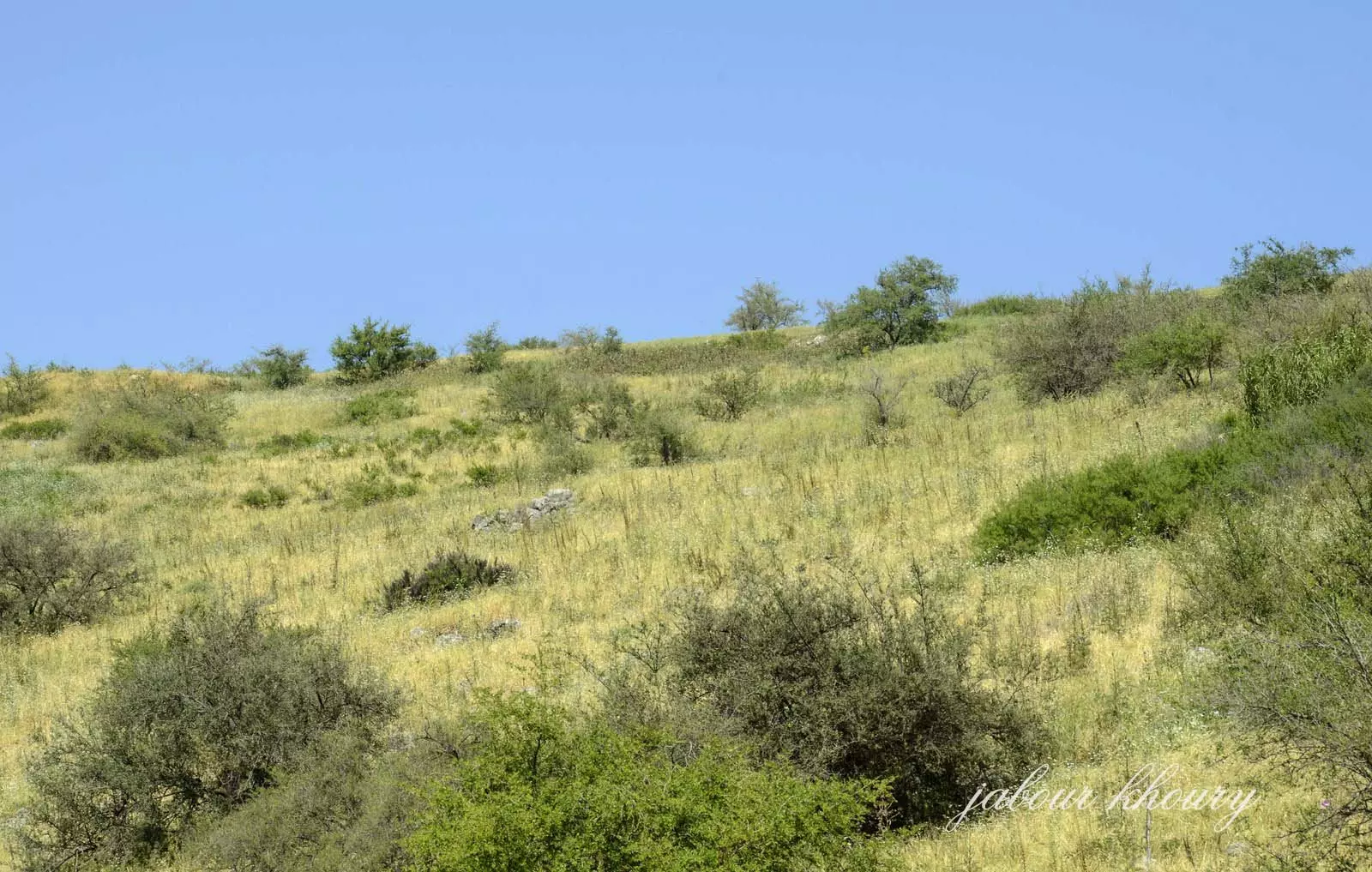
Posted by Jabour Khoury - الجهه الشماليه من موقع القريه
Posted by Jabour Khoury - مركز القريه
Posted by Jabour Khoury - شمال القريه
Posted by Jabour Khoury - ركام احد المنازل في الجهه الشماليه للقريه
Posted by Jabour Khoury - ركام المنزل
Posted by Jabour Khoury - الطاحونه المتبقيه- نظره من الجهه الغربيه
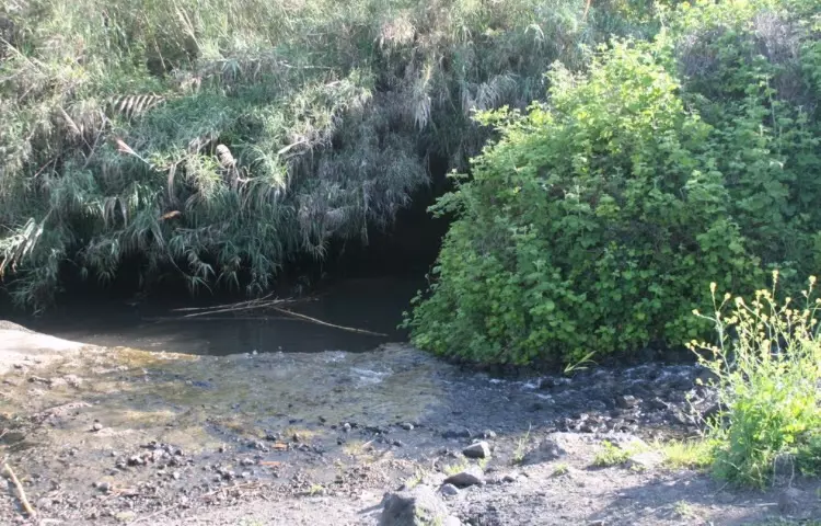
Posted by Jabour Khoury - عيون القريه
Posted by abu raya - عين القريه
Posted by abu raya - موقع القريه واثار بيوتها
Posted by abu raya - موقع القريه
Posted by abu raya
Want to browse more? 80,000 pictures were grouped in these gallaries:
| Display Name | Clan/Hamolah | Country of Residence |
No links have been shared yet, be free to the first to share the first link.
 Fake Valor: Why Did Zionist Jews Hoist Nazis Flag on Their Ships in the 1930s?
What is new?
-
Facts About Oct. 7th Gaza Raid
-
Remined Us Please: Who Did Rape Whom? Was it Palestinians who raped Israelis? Or, was the other way around? You'll be the judge
-
When Prof. Edward Said was invited to debate Bibi Netanyahu in the 1980s, watch what happened!
-
Ezra Klein of the NY Times on the "Jewish Race".
-
Abusing Blood Libel!
-
How and why Israeli Jewry has become the most hated cult?
-
Did Israeli Soldiers Activate The Hannibal Direective On Oct. 7th? You Be The Judge
-
Zionist FAQ: Isn't it true that Palestinians don't want peace? Palestinians never accepted the two-state solution
- Facts about Haavara (Transfer) Agreement between Ben-Gurion & Hitler
-
Haavara FAQs: Why Did Zionist Jews Hoist Nazis' Flags on Their Ships in the 1930s?
- Haavara FAQs: When Chaim Weizmann met FDR in mid-1943, why was he silent about rescuing European Jewry?
-
Dear ChatGPT: How did Palestinians resist Napoleon's invasion of their country in 1799?
-
Dear ChatGPT: Gaza had a vibrant Jewish community in the mid-17th century. What happened to them?
-
Dear ChatGPT: Why did the Jewish Agency suppress news of the Holocaust during WWII?
-
Video Playlist: Jews share their DNA tests to end the conflict for good.
-
A Tale of Two Conflicts: Examining the Definition of Genocide
-
Prof. Abraham Polak And The Suppressed History of the Khazars and European Jewry
-
How Ronald Reagan would have framed the genocide in Gaza if he were still alive?
-
Haavara FAQs: Let us do the math: how many German Jews did The Haavara Agreement save?
-
Zionist FAQs: The Hebron Massacre of 1929, "clearly proves" that Palestinians are antisemitic, how could you deny it?
-
Zionist FAQs: Why Anti-Zionist Is Not Antisemitism?
-
Zionist FAQs: Isn't it true that the KGB created Palestinian Nationalism in the early 1960s?
- Zionist FAQs: Muslims are killing Muslims all the time; why are Israeli Jews being singled out in the media?
- Zionist FAQs: How is Israel an apartheid state when 20% of its citizens are Arabs who enjoy full rights?
-
Haavara FAQs: Why Did Dorothy Thompson Flip From A Zionist Advocate to A Silenced Dissenter?
-
Haavara FAQs: Analysis of Herzl's Uganda Scheme and how it could have saved millions of Jews.
-
Haavara FAQs: Why did Hayim Greenberg describe American Jewry as "morally bankrupt" in early 1943?
-
Haavara FAQs: What if the Evian Conference was a resounding success? What would have been the impact of saving European Jewry on Zionism?
- Haavara FAQs: What if the six million were saved, how that would have impacted the Zionist project?
-
Haavara FAQs: How did Zionist leaders react when Europe's Jews lingered in the DP camps after WWII ended?
-
Why does the American Jewish community repeat lies that David Ben-Gurion had debunked before he died?
-
Who has the power to rename the Tatar/Khazar Gene Marker to Jewish IV?
-
Zionist FAQs: Why won't Egypt, Syria, and Jordan take their people back? Jews are indigenous to Palestine, and Arabs immigrated after Jews developed the country. Arabs should leave.
-
Haavara FAQs: Did Hitler and the Nazis conflate between Judaism and Zionist? If that wasn't case, then why?
-
Haavara FAQs: Winston Churchill and antisemitism, a collection of articles written Churchill.
-
Haavara FAQs: Broken by country, how many Jews survived vs. killed during the Holocaust?
-
Haavara FAQs: Why did European Jews vote with their feet and to immigrated to the Americas, not Palestine, after WWII?
-
Watch this American Jewish Girl describing Israeli Jews' cognitive dissonance like no other in under two minutes
-
Haavara FAQs: When the Nazis went out of their way to hide the Holocaust, Israeli Jews did the exact opposite by broadcasting their genocide of Gazans. But why?
-
Haavara FAQs: How Zionist Jews went out of their to show their appreciation to Nazism and Fascism?
- Haavara FAQs: Why Zionist leaders were against bombing the death camps & the Railroads leading to them?
-
Haavara FAQs: Hitler's message to the British and American people: If Jews are such noble citizens and you care about them, how come you're not letting them in? I will gladly ship them to you at my expense, even on luxury liners!
-
A shortlist of Zionist and Israeli false flag operations in the name Jews.
-
The Most Moral Army
- The Land of Kapos (Israel): Where the brave are boycotted and Kapos walk free.
- Why did early Zionists often named their communal enterprises "colonial"?
- Zionist Relations with Nazi Germany by Faris Glubb
-
Two NY Times advertisements by Zionists in the early 1943 that exposes Zionists' treason at the height of the calamity
- Facts Not Lies about the Palestinian-Israeli Conflict.
- Site's pictures have been categorized
- Campgain Against Lice
- A Survey of Palestine, the official source about Palestine before Nakba produced by the British Mandate; over 1200 pages.
- Satellite View & Google Earth: Over 6,000 placemarks identifying all destroyed towns, W. Bank & Gaza Strip Towns, & refugee camps.
- PalestineRemembered.com and its Nakba Oral History Project were featured on al-Jazeera Satellite TV.
- Nakba Oral History Video Podcast:
 Over 700 Oral History interviews (including 3,500+ hours of recording) can be viewed online.
 - Palestine Village Statistics Project
- Gaza Jail Break
- النسخة العربية للموقع الان متوفرة
- Videos: Documenting the destroyed villages in video: Tracing all that remains since Nakba.
- Videos: Responding to Zionist Propaganda
- Interview: The ethnic cleansing of Palestine: George Galloway interviews Israeli Historian Ilan Pappe.
- For Palestinians, memory matters. It provides a blueprint for their future By George Bisharat.
- Zionist FAQ now available in Hebrew שאלות שציונים שואלים, עכשיו בעברית
- Video: The Stephen Walt and John Mearsheimer report on the influence of the Israel Lobby on U.S. Foreign Policy
- The Palestinian-Israeli conflict for beginners
