| PalestineRemembered | About Us | Oral History | العربية | |
| Pictures | Zionist FAQs | Haavara | Maps | |
| Search |
| Camps |
| Districts |
| Acre |
| Baysan |
| Beersheba |
| Bethlehem |
| Gaza |
| Haifa |
| Hebron |
| Jaffa |
| Jericho |
| Jerusalem |
| Jinin |
| Nablus |
| Nazareth |
| Ramallah |
| al-Ramla |
| Safad |
| Tiberias |
| Tulkarm |
| Donate |
| Contact |
| Profile |
| Videos |
Welcome To al-Muftakhira - المفتخرة (אל-מופתח'רה)
|
District of Safad
Ethnically cleansed days ago |
العربية Google Earth |
| Gallery (11) |
- Statistics & Facts
-
Before & After

- Satellite View
- Articles 1
- Pictures 11
- Oral History 1
- Members
- All That Remains
- Wikipedia
- Videos
- Guest Book 1
- Links
| Statistic & Fact | Value | ||||||||||||||||||
| Occupation Date | May 16, 1948 | ||||||||||||||||||
| Distance From District | 25.5 (km) North East of Safad | ||||||||||||||||||
| Elevation | 75 (meters) | ||||||||||||||||||
| Before & After Nakba, Click Map For Details |
|||||||||||||||||||

|
|||||||||||||||||||
| Map Location | See location #22 on the map View from satellite |
||||||||||||||||||
| Military Operation | Operation Yiftach (commanded by the ethnic cleansing champion Yigal Allon) | ||||||||||||||||||
| Attacking Units | The Palmach's First Battalion | ||||||||||||||||||
| Exodus Cause | Fear of Jewish attack, or of being caught in the fighting | ||||||||||||||||||
| Village Temains | The village has been completely destroyed, and only house rubble left behind. | ||||||||||||||||||
| Ethnically Cleansing | al-Muftakhira was ethnically cleansed over two phases: the 1st was in early May and the 2nd was on the 16th of May 1948. | ||||||||||||||||||
| Pre-Nakba Land Ownership |
**Town Lands' Demarcation Maps |
||||||||||||||||||
| Land Usage As of 1945 |
|
||||||||||||||||||
| Population |
|
||||||||||||||||||
| Number of Houses |
|
||||||||||||||||||
| Near By Towns |
|||||||||||||||||||
|
|||||||||||||||||||
| Schools | The village had a small school | ||||||||||||||||||
| Exculsive Jewish Colonies Who Usurped Village Lands |
Shamir and Lahavot ha-Bashan | ||||||||||||||||||
| Featured Video | |||||||||||||||||||
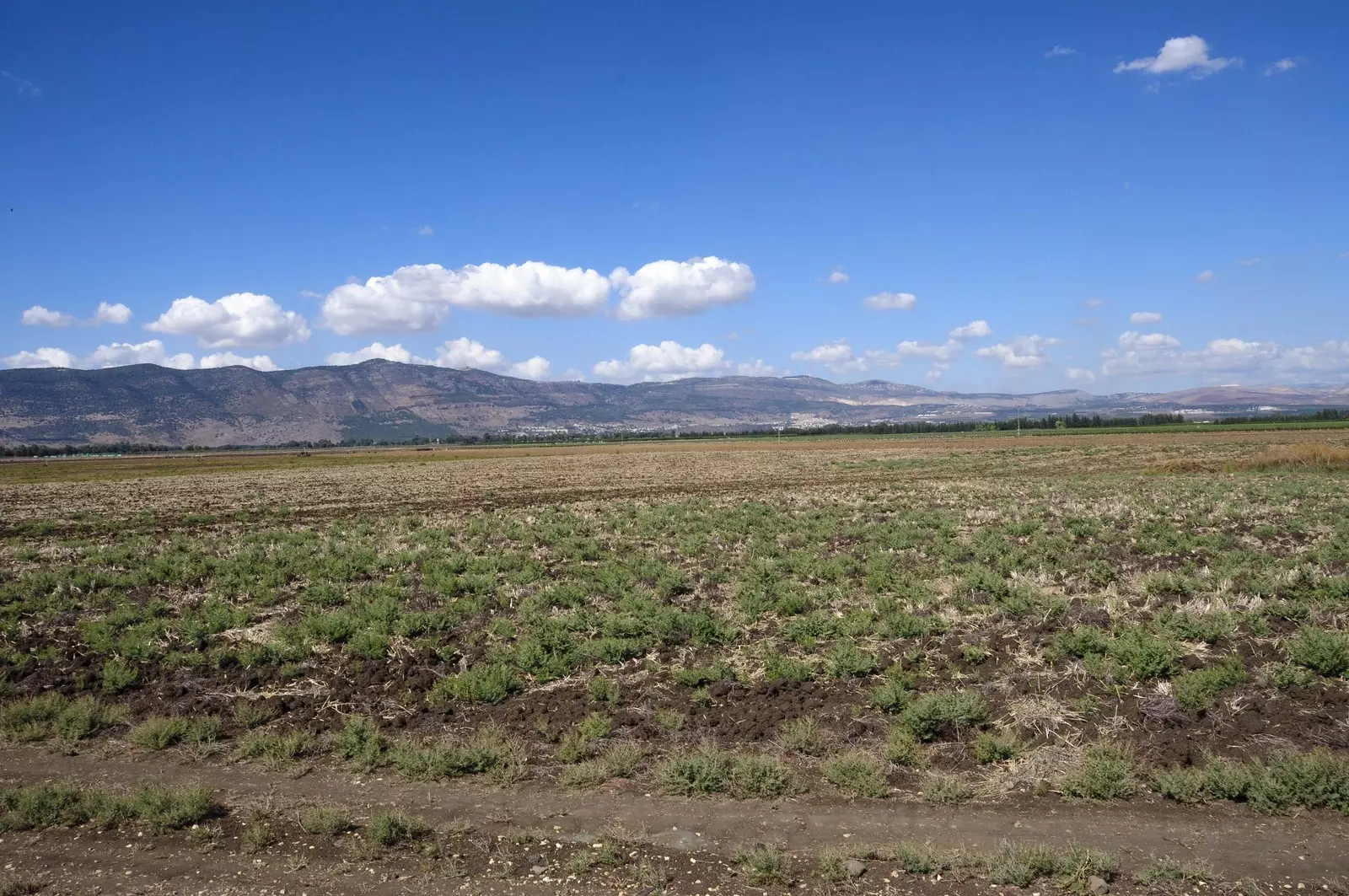
Village Before NakbaThe village was located on flat terrain in the central eastern part of the al-Hula Plain. Its closely clustered houses were built initially of adobe brick roofed with cane, but later houses were built of masonry. All of the residents of al-Muftakhira were Muslims. They had a small school and worked primarily in agriculture. They grew a variety of crops, including wheat, corn, onions, and animal fodder, and drew irrigation water for some of these crops from a stream near the site. Some of them also raised livestock and engaged in fishing, while still others were traders. Many went to the weekly Tuesday market in the neighboring village of al-Khalisa to sell their produce. In 1944/45 they planted a total of 924 dunums in cereals; 3,597 dunums were irrigated or used for orchards. A nearby khirba contained the remains of building foundations and walls.Village Occupation and Ethnic CleaningAccording to Israeli historian Benny Morris, the villagers were dispersed in two waves: one on 1 May and another on 16 May 1948. He attributes the dispersal to the villagers' fear of a Jewish attack or an actual mortar or ground assault. Such assaults were common during Operation Yiftach (see Abil al-Qamh, Safad sub-district). [M:124]Zionists Colonies on Village LandsThe settlement of Shamir (212285), established in 1944, is on village lands, east of the village site. Lahavot ha-Bashan (210283), established in 1945, is close to the site to the southeast; it is on lands that belonged to the neighboring village of Khiyam al-Walid.Village TodayOnly the stone debris of houses and the occasional ruined wall attest to the former presence of the village. A few eucalyptus trees grow on the site. The site has been turned into an archaeological center, and the surrounding lands are cultivated by Israeli farmersSourceDr. Walid al-Khalidi, 1992: All That Remains. |
|||||||||||||||||||
| Related Maps | Town Lands' Demarcation Maps خرائط للقضاء توضح حدود القرى والاودية Town's map on MapQuest View from satellite Help us map this town at WikiMapia |
||||||||||||||||||
| Related Links | Wikipedia's Page Google Search Google For Images Google For Videos |
||||||||||||||||||
| More Information | في كتاب كي لا ننسى في كتاب بلادنا فلسطين المزيد من موقع هوية |
||||||||||||||||||
- General view of village lands & some house rubble, 1987
Scanned from "All That Remains" by Dr. Walid Khalidi - اراضي القريه من الجهه الغربيه نظره من الشرق الى الغرب في البعيد تظهر اراضي قريه الصالحيه
Posted by Jabour Khoury - اراضي القريه من الجهه الغربيه نظره من الشرق الى الغرب في البعيد تظهر اراضي قريه الصالحيه
Posted by Jabour Khoury - مركز القريه كان بالقرب من اشجار الكينا- نظره من الجنوب الى الشمال وفي الخلفيه تظهر مزارع شبعا
Posted by Jabour Khoury - اراضي القريه ومزارع شبعا بالخلفيه
Posted by Jabour Khoury - الراضي القريه التى زرعها المستوطنون باشجار الزيتون
Posted by Jabour Khoury - اراضي القريه المزروعه باشجار الزيتون نظره الى الجنوب الغربي
Posted by Jabour Khoury - اراضي القريه نظره باتجاه الشمال الغربي
Posted by Jabour Khoury - اراضي القريه- نظره باتجاه الجنوب الشرقي
Posted by Jabour Khoury - نظره باتجاه الغرب
Posted by Jabour Khoury - خارطة تُظهِر الحدود والطرق بأنواعها والأماكن المقدسة والطبيعة الطوبغرافية من تلال وسهول ومنحدرات والتشكيلة الطبيعية للأرض وأنواع المزروعات. نُشرت الخريطة فترة الانتداب البريطاني، تم إضافة تعديلات عليها من قِبَل خدمة الخرائط والصور التابعة للقوات العسكرية الاسرائيلية فترة الأربعينيات.
Want to browse more? 80,000 pictures were grouped in these gallaries:
| Display Name | Clan/Hamolah | Country of Residence |
No links have been shared yet, be free to the first to share the first link.


