| PalestineRemembered | About Us | Oral History | العربية | |
| Pictures | Zionist FAQs | Haavara | Maps | |
| Search |
| Camps |
| Districts |
| Acre |
| Baysan |
| Beersheba |
| Bethlehem |
| Gaza |
| Haifa |
| Hebron |
| Jaffa |
| Jericho |
| Jerusalem |
| Jinin |
| Nablus |
| Nazareth |
| Ramallah |
| al-Ramla |
| Safad |
| Tiberias |
| Tulkarm |
| Donate |
| Contact |
| Profile |
| Videos |
Welcome To al-Shawka al-Tahta - الشوكة التحتا (א-שוכה א-תחתא)
|
District of Safad
Ethnically cleansed days ago |
العربية Google Earth |
 |
Gallery (19) |
- Statistics & Facts
-
Before & After

- Satellite View
- Articles 1
- Pictures 19
- Members
- All That Remains
- Wikipedia
- Videos
- Guest Book
- Links
| Statistic & Fact | Value | ||||||||||||
| Occupation Date | May 14, 1948 | ||||||||||||
| Distance From District | 31.5 (km) North East of Safad | ||||||||||||
| Elevation | 175 (meters) | ||||||||||||
| Before & After Nakba, Click Map For Details |
|||||||||||||
|
|||||||||||||
| Map Location | See location #3 on the map View from satellite |
||||||||||||
| Military Operation | Operation Yiftach (commanded by the ethnic cleansing champion Yigal Allon) | ||||||||||||
| Attacking Units | The Palmach's First Battalion | ||||||||||||
| Exodus Cause | Fear of Jewish attack, or of being caught in the fighting | ||||||||||||
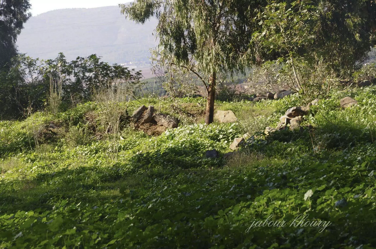
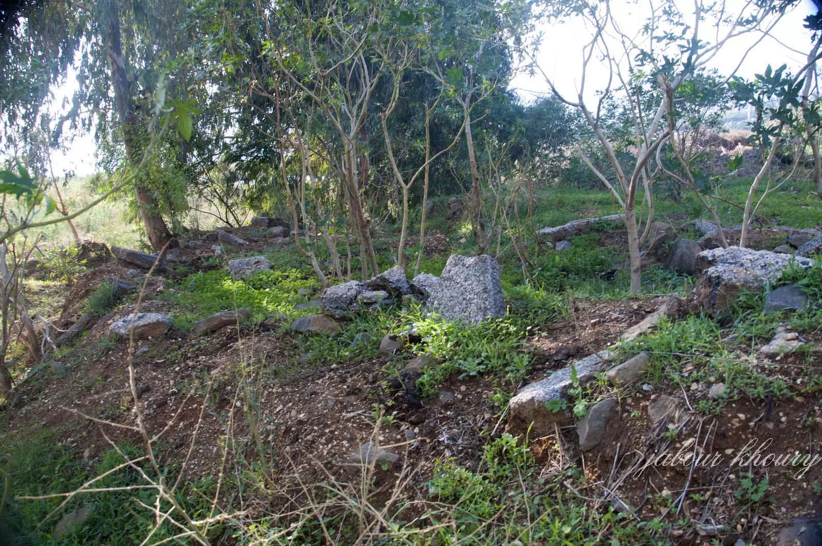
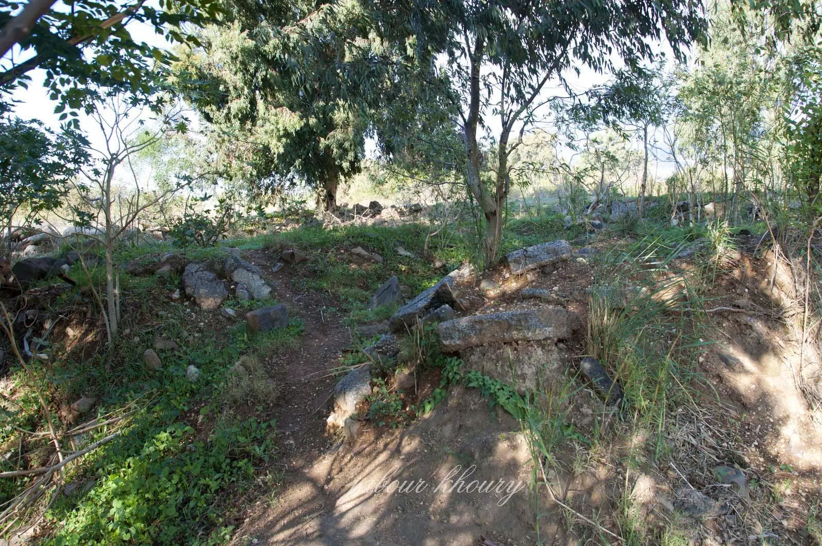
| Village Temains | The village has been completely destroyed, and only house rubble left behind | ||||||||||||
| Ethnically Cleansing | al-Shawka al-Tahta inhabitants were completely ethnically cleansed. | ||||||||||||
| Pre-Nakba Land Ownership |
|
||||||||||||
| Land Usage As of 1945 |
|
||||||||||||
| Population |
|
||||||||||||
| Number of Houses |
|
||||||||||||
| Archeological Sites | The village contained two khirbas known by Tall al-Qadi and Khirbat al-Day'a | ||||||||||||
| Exculsive Jewish Colonies Who Usurped Village Lands |
Dan and Dafna | ||||||||||||
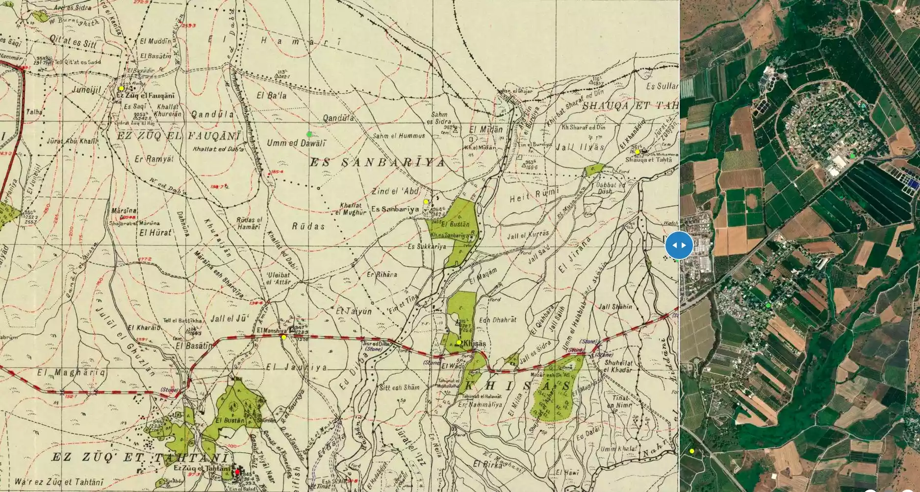
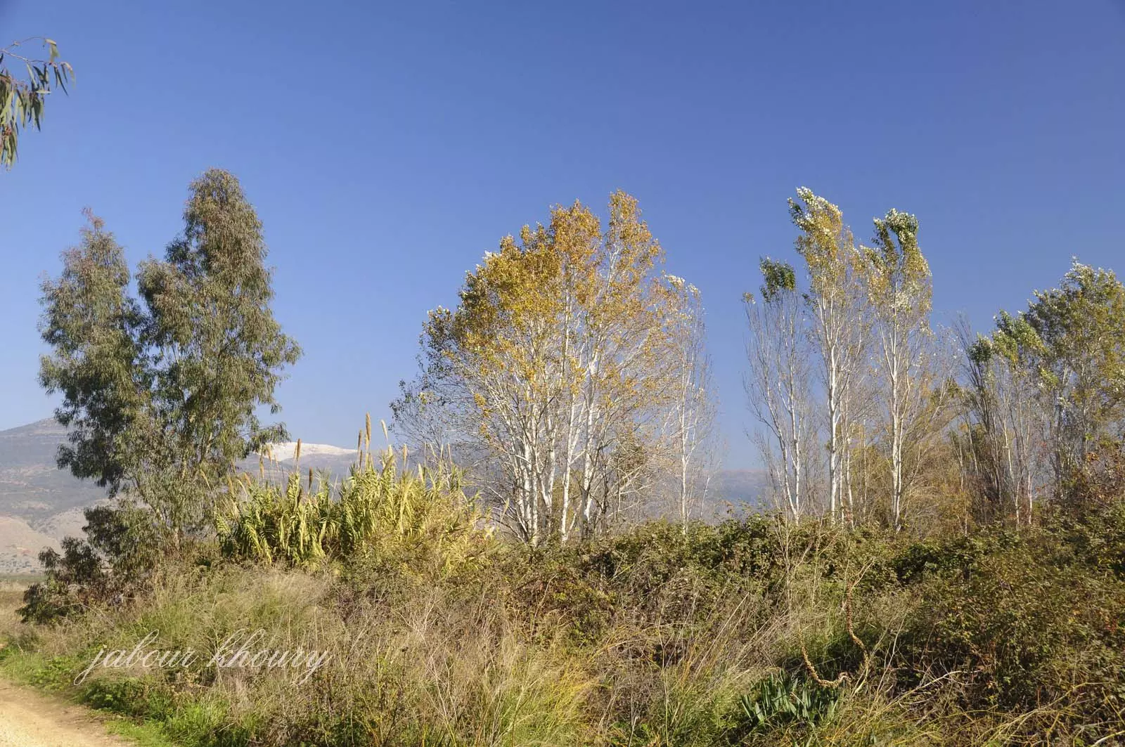
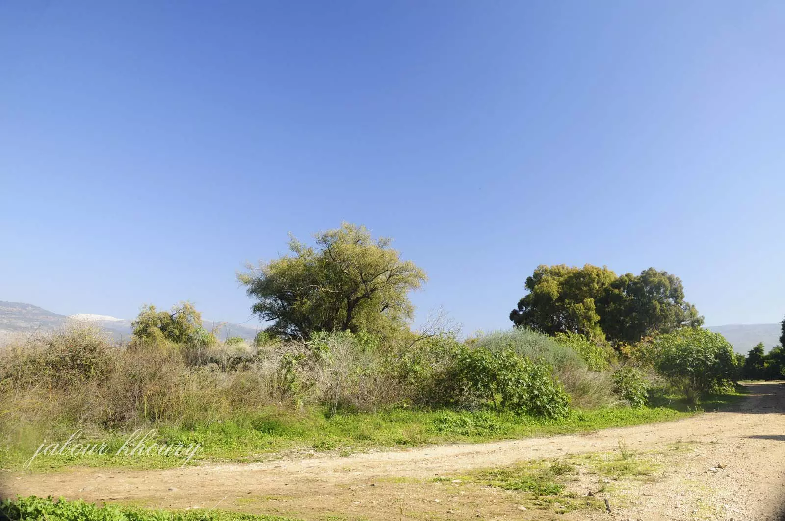
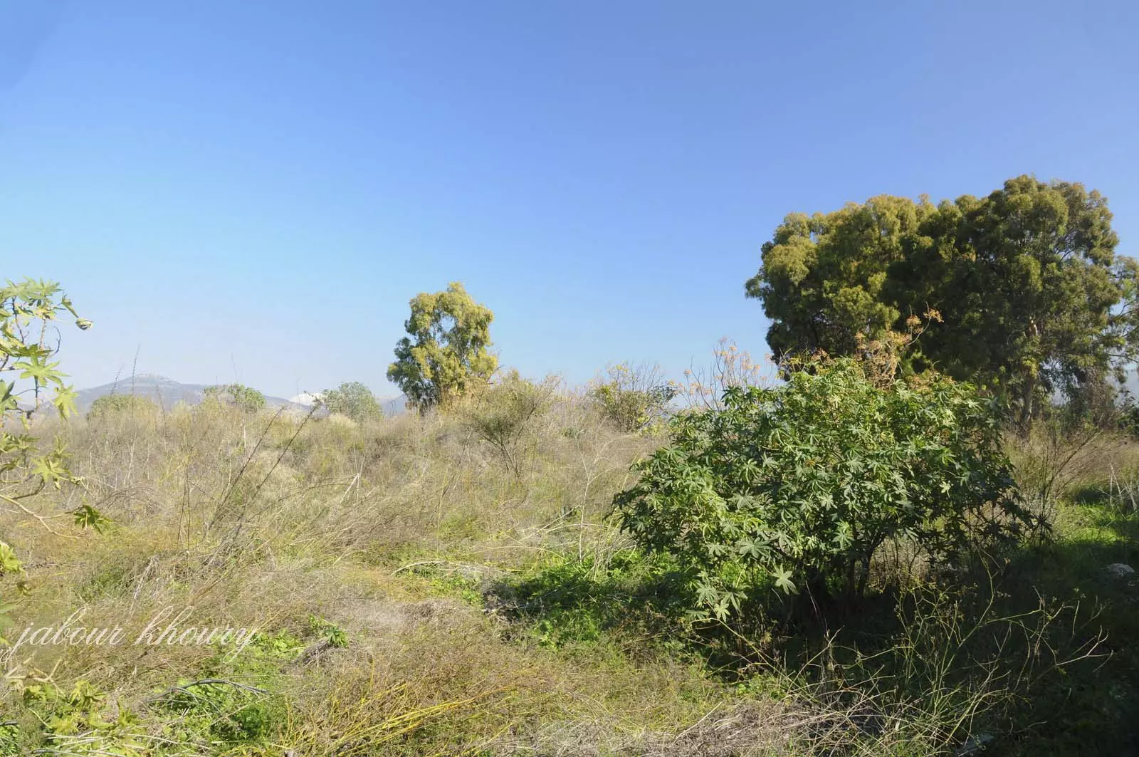
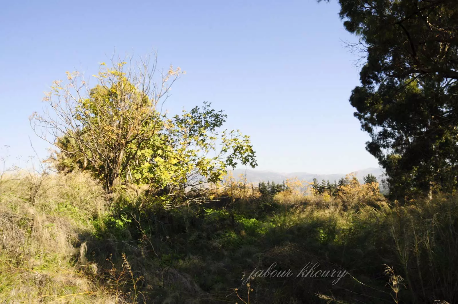
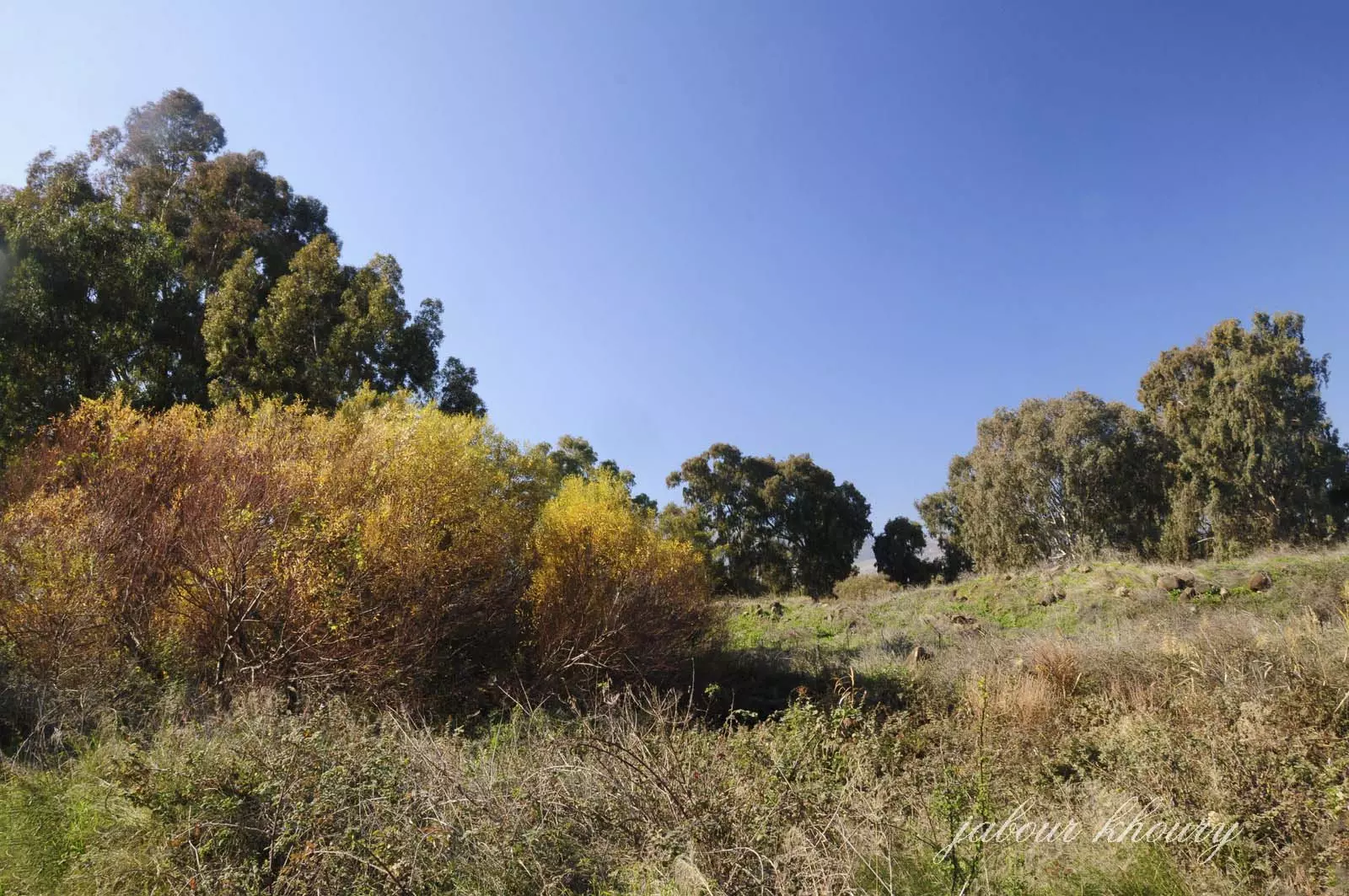
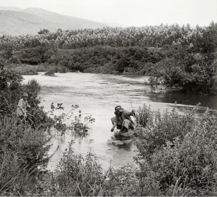
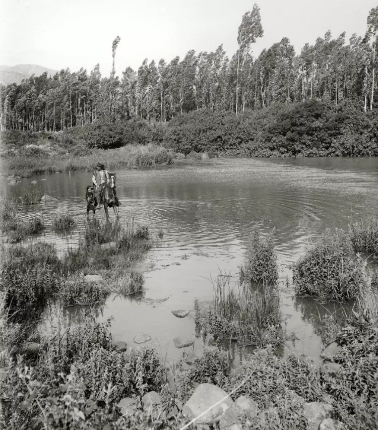
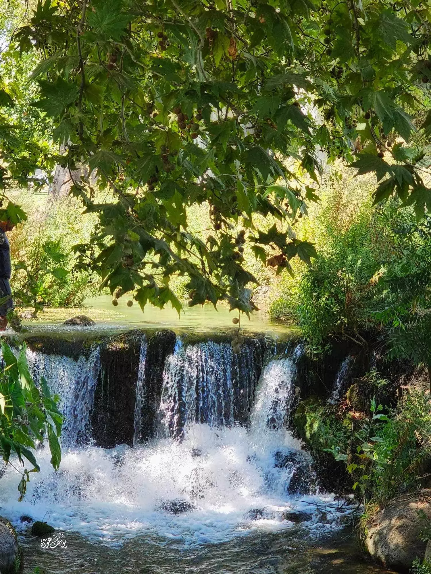
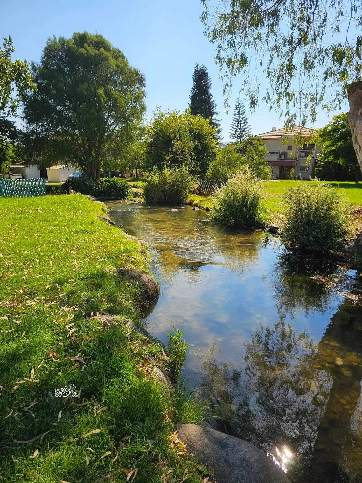
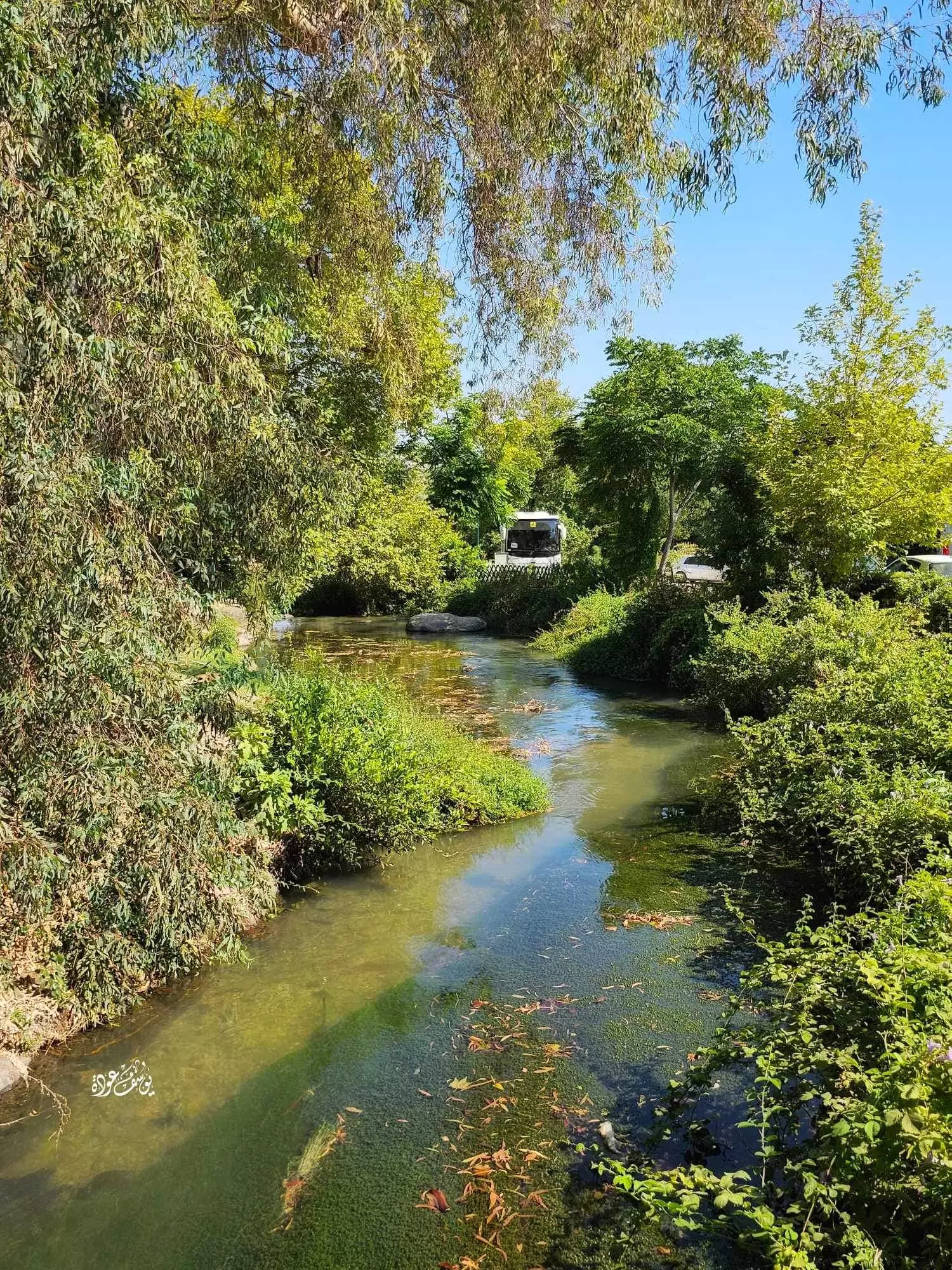
Village Before NakbaThe village stood on gently sloping hills in the northeast part of the al-Hula Plain, to the southwest of Tall aI-Qadi. It was linked by a paved road to the nearby Jewish settlements of Dan and Dafna; the road led west to al-Khalisa, a village on the highway that led to Safad. Al-Shawka al-Tahta had a semicircular layout and its houses were clustered closely together. Its entire population was Muslim. A thick growth of natural vegetation flourished on the village's northern side, thanks to a plentiful water supply provided by the perennial stream that flowed from Tall aI-Qadi. Agriculture was both rainfed and irrigated from a number of springs; crops consisted mainly of grain and fruits. In 1944/45 a total of 140 dunums was allocated to cereals; 1,845 dunums were irrigated or used for orchards. Archaeological sites near al-Shawka al-Tahta include Tall aI-Qadi (211294), to the northeast, and Khirbat al-Day'a (210293) to the south.Village Occupation and Ethnic CleaningIsraeli sources report that the villagers of al-Shawka al-Tahta feared a Zionist attack and fled on 14 May 1948; the sub-district capital, Safad, had been captured a few days earlier, which would have contributed to the villagers' panic. Safad had been captured during Operation Yiftach (see Abil al-Qamh, Safad sub-district), which aimed at occupying the eastern Galilee and uprooting its residents.Zionists Colonies on Village LandsTwo Zionist settlements are very close to the village site. Dan (211293), founded in 1939, is 2 km to the east, and Dafna (210292), also established in 1939, is 1 km to the southeast. Neither settlement is on village landVillage TodayNothing remains of al-Shawka al-Tahta. Stone rubble from destroyed houses is for the most part hidden under eucalyptus trees and wild grasses. A few cactuses grow on the site. The surrounding lands are used by Israelis both for farming and as pasture.SourceDr. Walid al-Khalidi, 1992: All That Remains. |
|||||||||||||
| Related Maps | Town Lands' Demarcation Maps خرائط للقضاء توضح حدود القرى والاودية Town's map on MapQuest View from satellite Help us map this town at WikiMapia |
||||||||||||
| Related Links | Wikipedia's Page Google Search Google For Images Google For Videos |
||||||||||||
| More Information | في كتاب كي لا ننسى في كتاب بلادنا فلسطين المزيد من موقع هوية |
||||||||||||
- Village Rubble In 1987

Scanned from "All That Remains" by Dr. Walid Khalidi - ردم البيوت
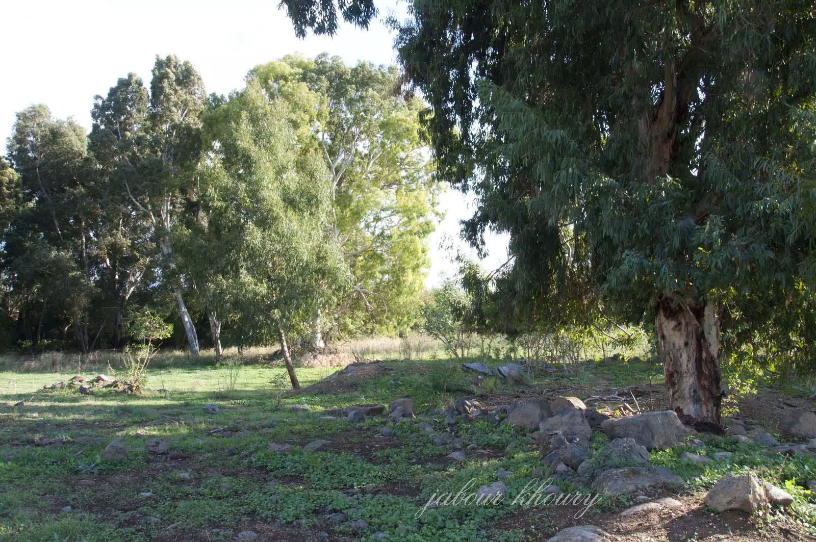
Posted by Jabour Khoury - ردم البيوت في موقع القريه
Posted by Jabour Khoury - اثار بعض البيوت في الجهه الغربيه من القريه
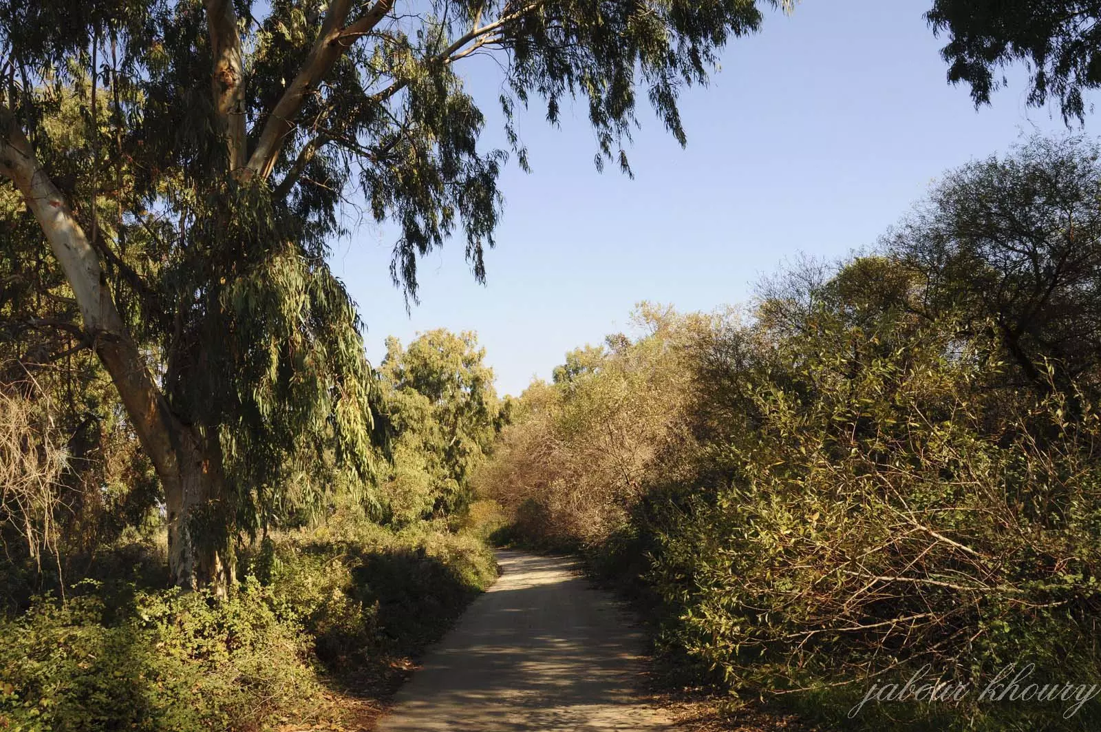
Posted by Jabour Khoury - الطريقيه المؤديه الى مركز القر
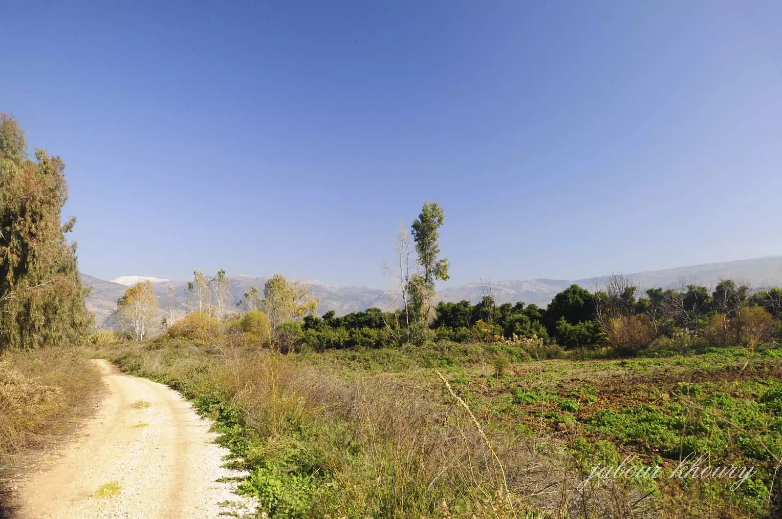
Posted by Jabour Khoury - اراضي القريه من الجهه الجنوبيه الغربيه
Posted by Jabour Khoury - الطريق المؤدي الى مركز القريه
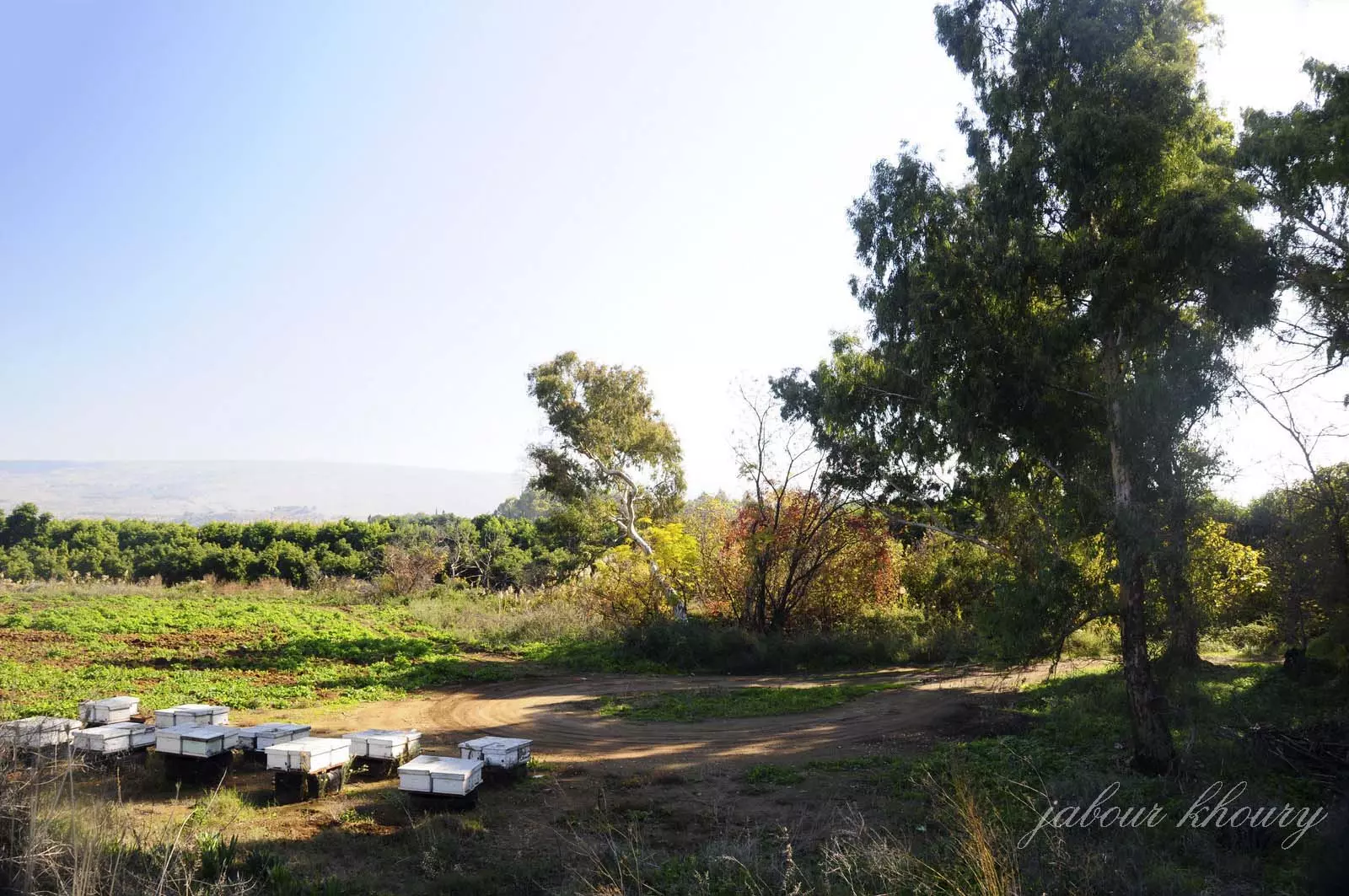
Posted by Jabour Khoury - اراضي القريه وي الخلفيه يظهر جبل الشيخ
Posted by Jabour Khoury - مركز القريه
Posted by Jabour Khoury - موقع القريه المغطى بالاعشاب والاشجار
Posted by Jabour Khoury - شجره تين وحيده متبقيه في موقع القريه
Posted by Jabour Khoury - شمال غرب القريه
Posted by Jabour Khoury - ردم البيوت في الجهه الغربيه من القريه
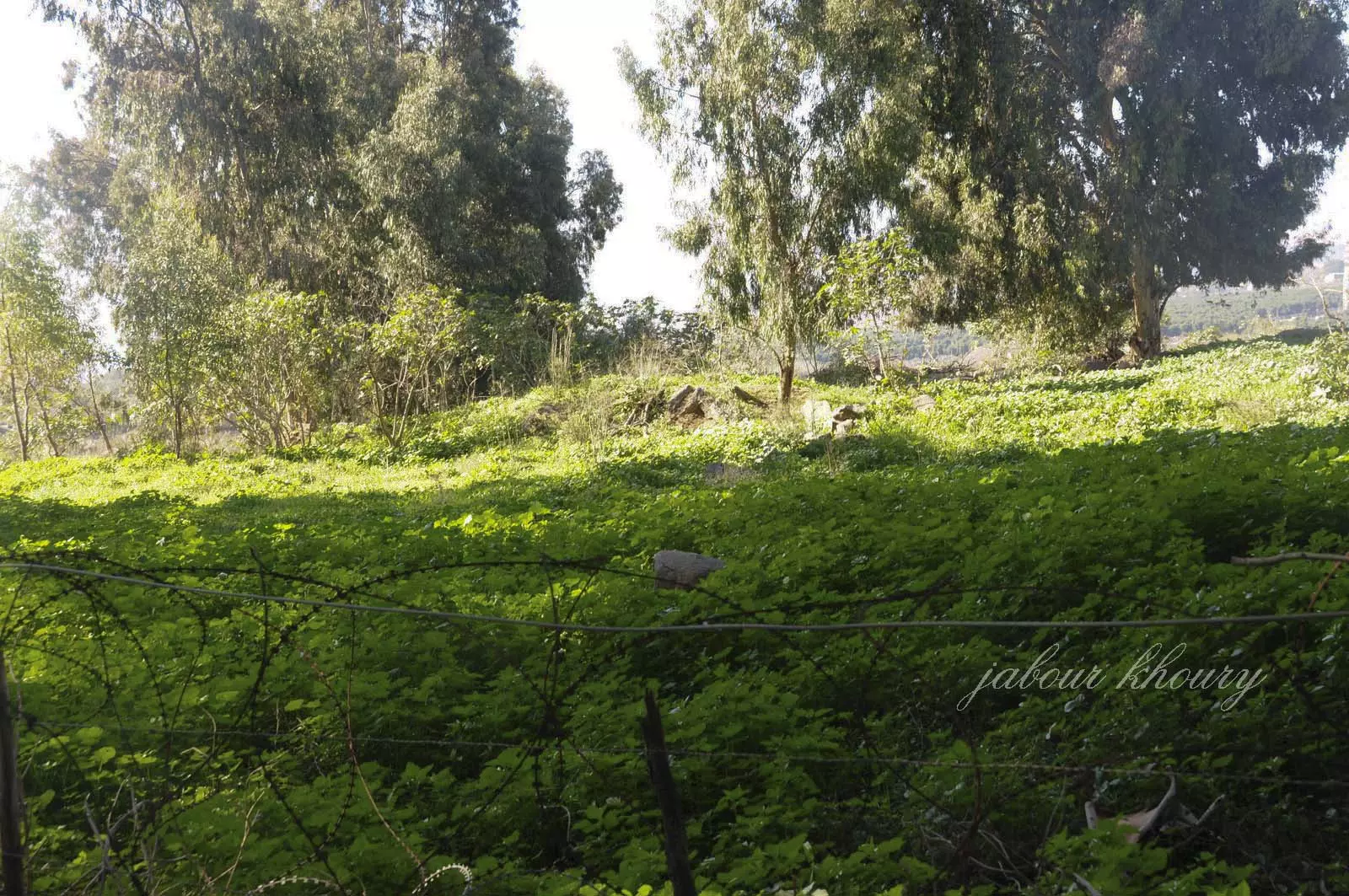
Posted by Jabour Khoury - ردم البيوت في الجهه الغربيه من القريه
Posted by Jabour Khoury - صوره من الشوكا التحتا قبل النكبه
Posted by abu raya - الشوكا التحتا قبل النكبه
Posted by abu raya - قرية الشوكة التحتا المهجرة--يوسف عودة
- قرية الشوكة التحتا المهجرة--يوسف عودة #2
- قرية الشوكة التحتا المهجرة--يوسف عودة #3
Want to browse more? 80,000 pictures were grouped in these gallaries:
| Display Name | Clan/Hamolah | Country of Residence |
No links have been shared yet, be free to the first to share the first link.
 Fake Valor: Why Did Zionist Jews Hoist Nazis Flag on Their Ships in the 1930s?
What is new?
-
Facts About Oct. 7th Gaza Raid
-
Remined Us Please:: Who Did Rape Who? Palestinians Raped Israelis? Or, was the other way around?
-
When Prof. Edward Said was invited to debate Bibi Netanyahu in the 1980s, watch what happened!
-
Ezra Klein of the NY Times on the "Jewish Race".
-
Abusing Blood Libel!
-
Did Israeli Soldiers Activate The Hanniba Direective On Oct. 7th? You Be The Judge
-
Zionist FAQ: Isn't it true that Palestinians don't want peace? Palestinians never accepted the two-state solution
- Facts about Haavara (Transfer) Agreement between Ben-Gurion & Hitler
-
Haavara FAQs: Why Did Zionist Jews Hoist Nazis' Flags on Their Ships in the 1930s?
- Haavara FAQs: When Chaim Weizmann met FDR in mid-1943, why was he silent about rescuing European Jewry?
-
Dear ChatGPT: How did Palestinians resist Napoleon's invasion of their country in 1799?
-
Dear ChatGPT: Gaza had a vibrant Jewish community in the mid-17th century. What happened to them?
-
Dear ChatGPT: Why did the Jewish Agency suppress news of the Holocaust during WWII?
-
Video Playlist: Jews share their DNA tests to end the conflict for good.
-
A Tale of Two Conflicts: Examining the Definition of Genocide
-
Prof. Abraham Polak And The Suppressed History of the Khazars and European Jewry
-
How Ronald Reagan would have framed the genocide in Gaza if he were still alive?
-
Haavara FAQs: Let us do the math: how many German Jews did The Haavara Agreement save?
-
Zionist FAQs: The Hebron Massacre of 1929, "clearly proves" that Palestinians are antisemitic, how could you deny it?
-
Zionist FAQs: Why Anti-Zionist Is Not Antisemitism?
-
Zionist FAQs: Isn't it true that the KGB created Palestinian Nationalism in the early 1960s?
- Zionist FAQs: Muslims are killing Muslims all the time; why are Israeli Jews being singled out in the media?
- Zionist FAQs: How is Israel an apartheid state when 20% of its citizens are Arabs who enjoy full rights?
-
Haavara FAQs: Why Did Dorothy Thompson Flip From A Zionist Advocate to A Silenced Dissenter?
-
Haavara FAQs: Analysis of Herzl's Uganda Scheme and how it could have saved millions of Jews.
-
Haavara FAQs: Why did Hayim Greenberg describe American Jewry as "morally bankrupt" in early 1943?
-
Haavara FAQs: What if the Evian Conference was a resounding success? What would have been the impact of saving European Jewry on Zionism?
- Haavara FAQs: What if the six million were saved, how that would have impacted the Zionist project?
-
Haavara FAQs: How did Zionist leaders react when Europe's Jews lingered in the DP camps after WWII ended?
-
Why does the American Jewish community repeat lies that David Ben-Gurion had debunked before he died?
-
Who has the power to rename the Tatar/Khazar Gene Marker to Jewish IV?
-
Zionist FAQs: Why won't Egypt, Syria, and Jordan take their people back? Jews are indigenous to Palestine, and Arabs immigrated after Jews developed the country. Arabs should leave.
-
Haavara FAQs: Did Hitler and the Nazis conflate between Judaism and Zionist? If that wasn't case, then why?
-
Haavara FAQs: Winston Churchill and antisemitism, a collection of articles written Churchill.
-
Haavara FAQs: Broken by country, how many Jews survived vs. killed during the Holocaust?
-
Haavara FAQs: Why did European Jews vote with their feet and to immigrated to the Americas, not Palestine, after WWII?
-
Watch this American Jewish Girl describing Israeli Jews' cognitive dissonance like no other in under two minutes
-
Haavara FAQs: When the Nazis went out of their way to hide the Holocaust, Israeli Jews did the exact opposite by broadcasting their genocide of Gazans. But why?
-
Haavara FAQs: How Zionist Jews went out of their to show their appreciation to Nazism and Fascism?
- Haavara FAQs: Why Zionist leaders were against bombing the death camps & the Railroads leading to them?
-
Haavara FAQs: Hitler's message to the British and American people: If Jews are such noble citizens and you care about them, how come you're not letting them in? I will gladly ship them to you at my expense, even on luxury liners!
-
A shortlist of Zionist and Israeli false flag operations in the name Jews.
-
The Most Moral Army
- The Land of Kapos (Israel): Where the brave are boycotted and Kapos walk free.
- Why did early Zionists often named their communal enterprises "colonial"?
- Zionist Relations with Nazi Germany by Faris Glubb
-
Two NY Times advertisements by Zionists in the early 1943 that exposes Zionists' treason at the height of the calamity
- Facts Not Lies about the Palestinian-Israeli Conflict.
- Site's pictures have been categorized
- Campgain Against Lice
- A Survey of Palestine, the official source about Palestine before Nakba produced by the British Mandate; over 1200 pages.
- Satellite View & Google Earth: Over 6,000 placemarks identifying all destroyed towns, W. Bank & Gaza Strip Towns, & refugee camps.
- PalestineRemembered.com and its Nakba Oral History Project were featured on al-Jazeera Satellite TV.
- Nakba Oral History Video Podcast:
 Over 700 Oral History interviews (including 3,500+ hours of recording) can be viewed online.
 - Palestine Village Statistics Project
- Gaza Jail Break
- النسخة العربية للموقع الان متوفرة
- Videos: Documenting the destroyed villages in video: Tracing all that remains since Nakba.
- Videos: Responding to Zionist Propaganda
- Interview: The ethnic cleansing of Palestine: George Galloway interviews Israeli Historian Ilan Pappe.
- For Palestinians, memory matters. It provides a blueprint for their future By George Bisharat.
- Zionist FAQ now available in Hebrew שאלות שציונים שואלים, עכשיו בעברית
- Video: The Stephen Walt and John Mearsheimer report on the influence of the Israel Lobby on U.S. Foreign Policy
- The Palestinian-Israeli conflict for beginners
