| PalestineRemembered | About Us | Oral History | العربية | |
| Pictures | Zionist FAQs | Haavara | Maps | |
| Search |
| Camps |
| Districts |
| Acre |
| Baysan |
| Beersheba |
| Bethlehem |
| Gaza |
| Haifa |
| Hebron |
| Jaffa |
| Jericho |
| Jerusalem |
| Jinin |
| Nablus |
| Nazareth |
| Ramallah |
| al-Ramla |
| Safad |
| Tiberias |
| Tulkarm |
| Donate |
| Contact |
| Profile |
| Videos |
Welcome To Kafr Sabt - كفر سبت (כפר סבת)
|
District of Tiberias
Ethnically cleansed days ago |
العربية Google Earth |
 |
Gallery (27) |
- Statistics & Facts
-
Before & After

- Satellite View
- Articles 1
- Pictures 27
- Aerial Views 3
- Members 2
- All That Remains
- Wikipedia
- Videos
- Guest Book 2
- Links 1
| Statistic & Fact | Value | |||||||||||||||||||||
| Occupation Date | April 22, 1948 | |||||||||||||||||||||
| Distance From District | 10.5 (km) Southwest of Tiberias | |||||||||||||||||||||
| Elevation | 225 (meters) | |||||||||||||||||||||
| Before & After Nakba, Click Map For Details |
||||||||||||||||||||||
|
||||||||||||||||||||||
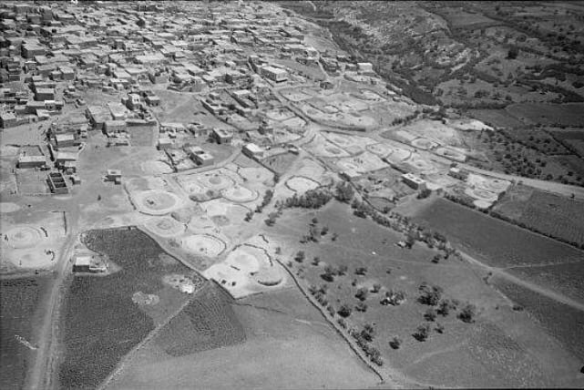
| Pre-Nakba Aerial View |
||||||||||||||||||||||
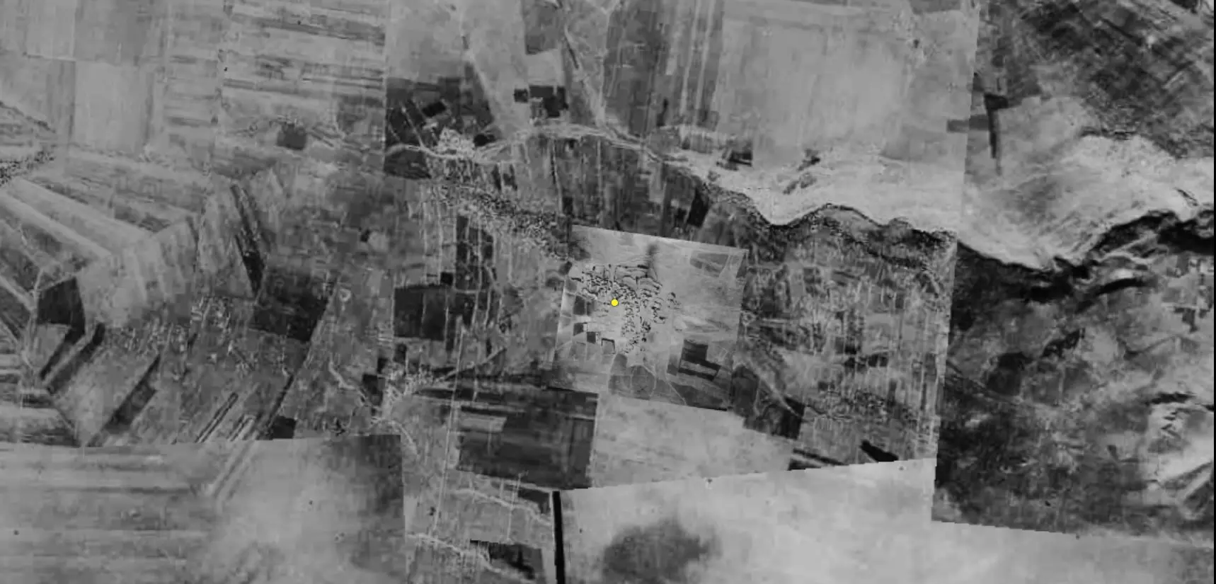
|
||||||||||||||||||||||
| Map Location | See location #16 on the map View from satellite |
|||||||||||||||||||||
| Exodus Cause | Influence of fall of, or exoduce from, neighboring town | |||||||||||||||||||||
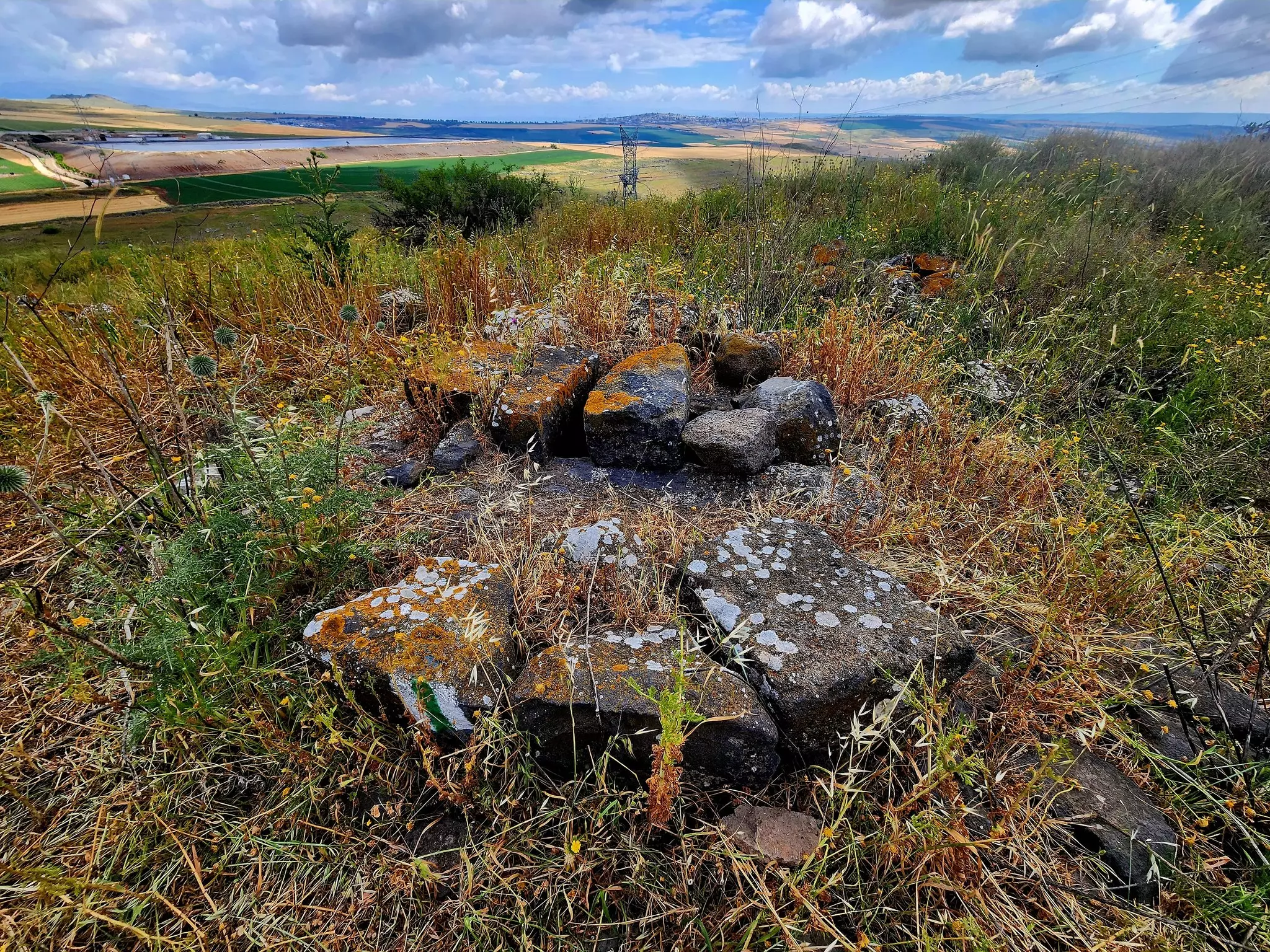
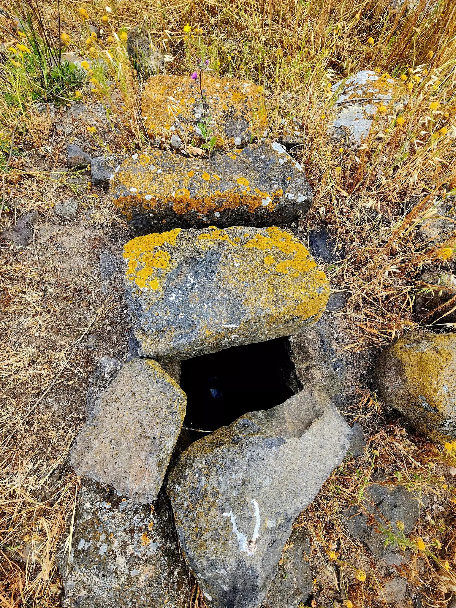
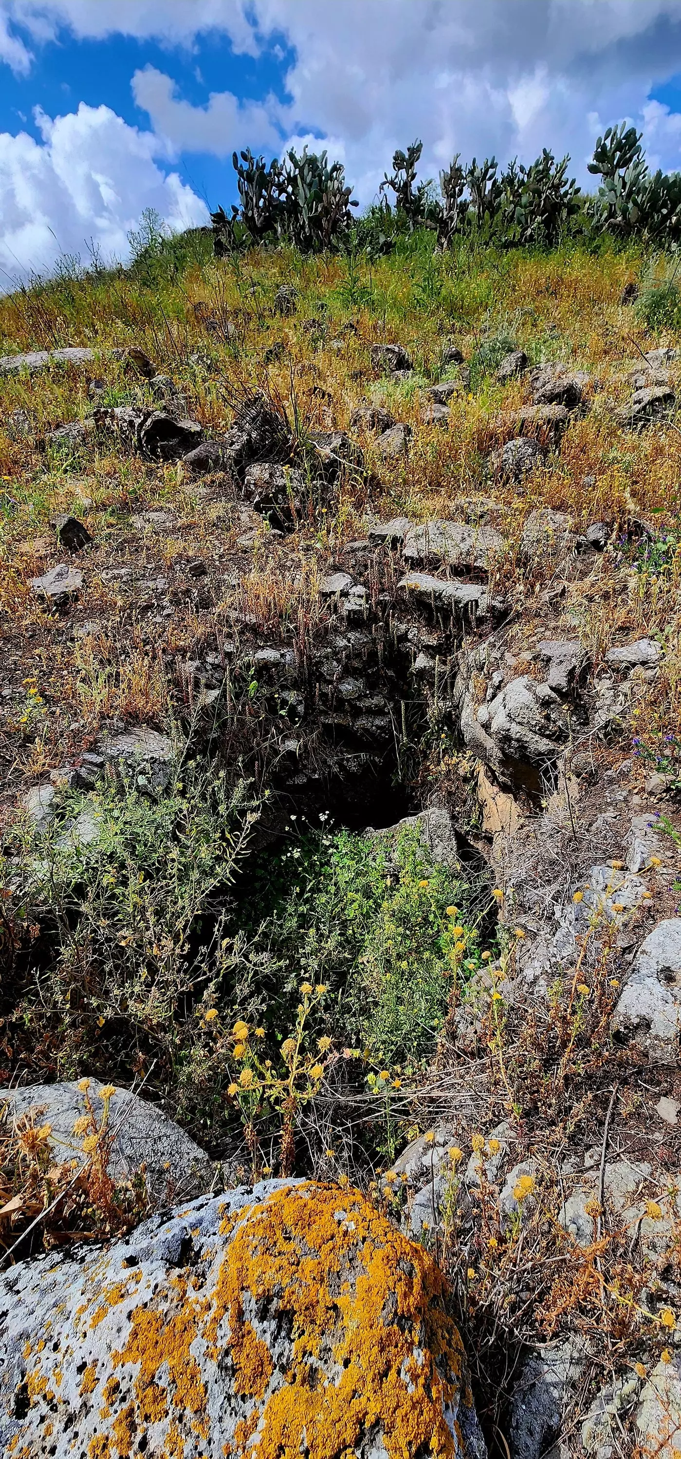
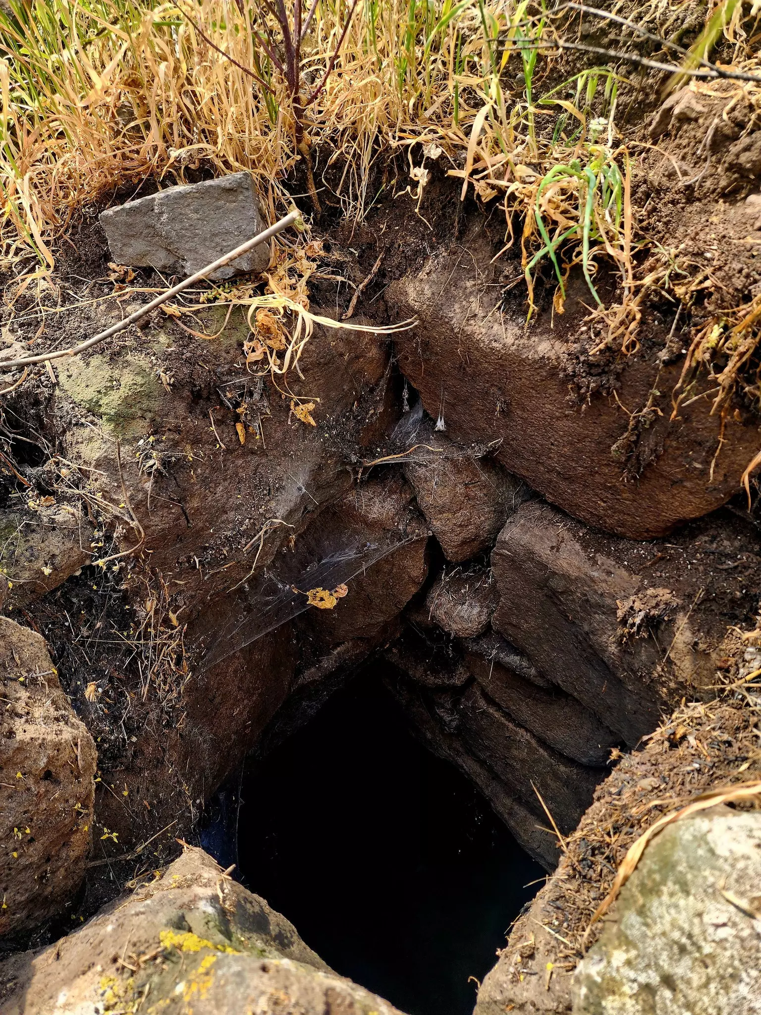
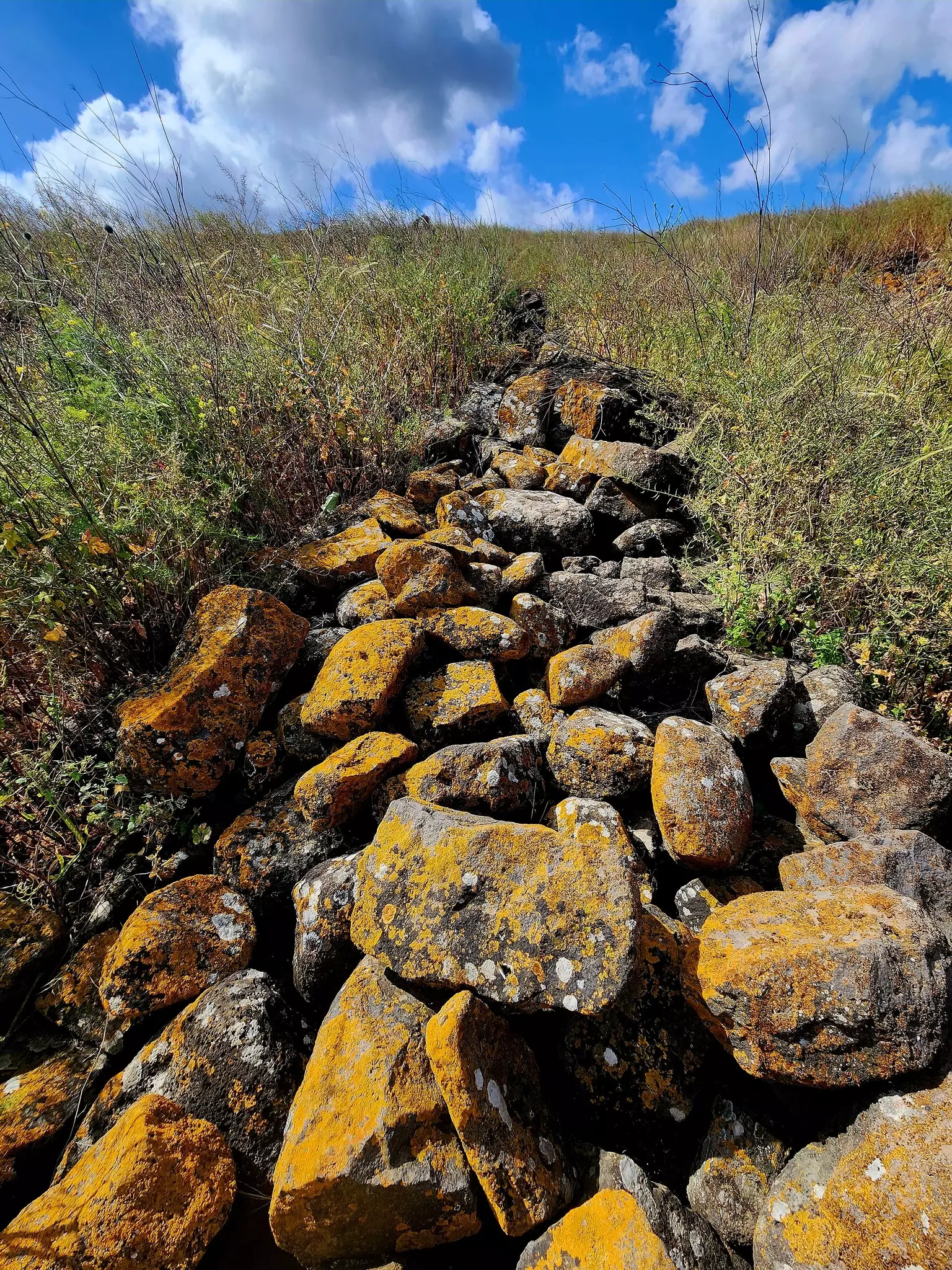
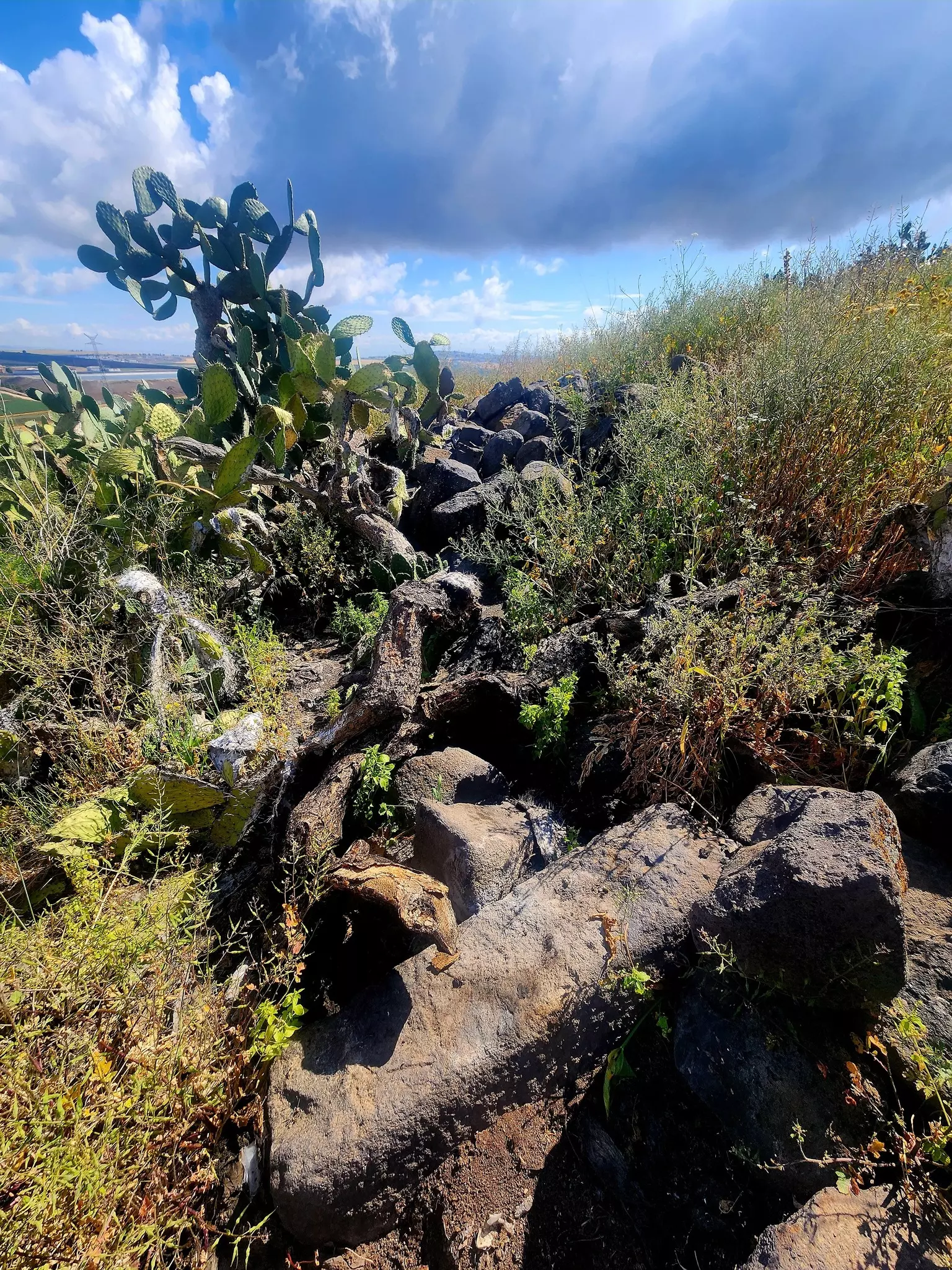
| Village Temains | Kafr Sabt was completely destroyed, and only house rubble left behind. | |||||||||||||||||||||
| Ethnically Cleansing | Kafr Sabt inhabitants were completely ethnically cleansed. | |||||||||||||||||||||
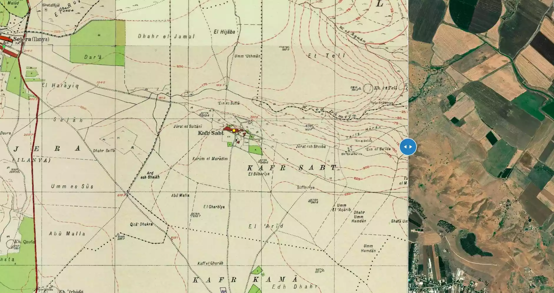
| Pre-Nakba Land Ownership |
**Town Lands' Demarcation Maps |
|||||||||||||||||||||
| Land Usage As of 1945 |
|
|||||||||||||||||||||
| Population |
|
|||||||||||||||||||||
| Number of Houses | In 1931: 71 (includes Umm al-'Alaq and 'Arab al-Mashariqa) | |||||||||||||||||||||
| Town's Name Through History | The Romans referred to Kafr Sabt by Kefar Shabtay, and the Crusades called it Cafarsset. | |||||||||||||||||||||
| Archeological Sites | The village contains many khirbas, including Khirbat Umm al-'Alaq and khirbat Damiya. | |||||||||||||||||||||
| Exculsive Jewish Colonies Who Usurped Village Lands |
Sde nan, Sharon, and Ilaniyya | |||||||||||||||||||||
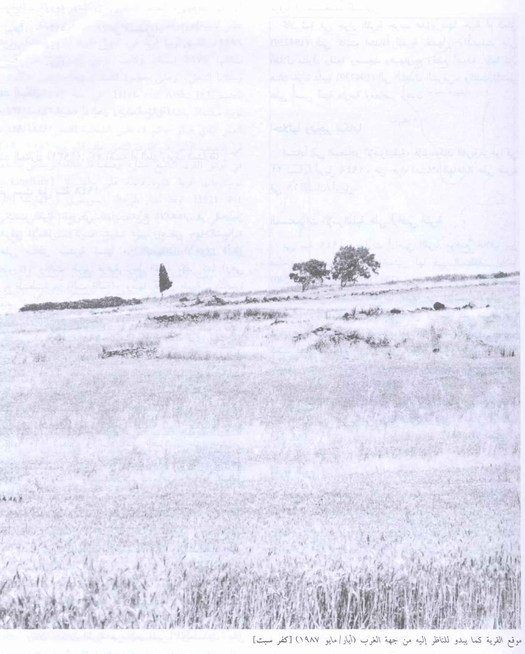
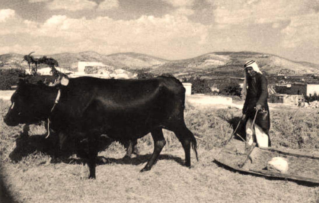
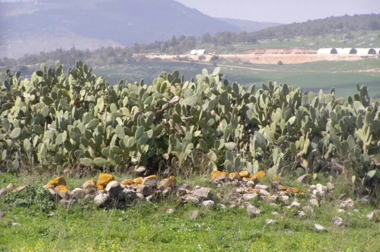
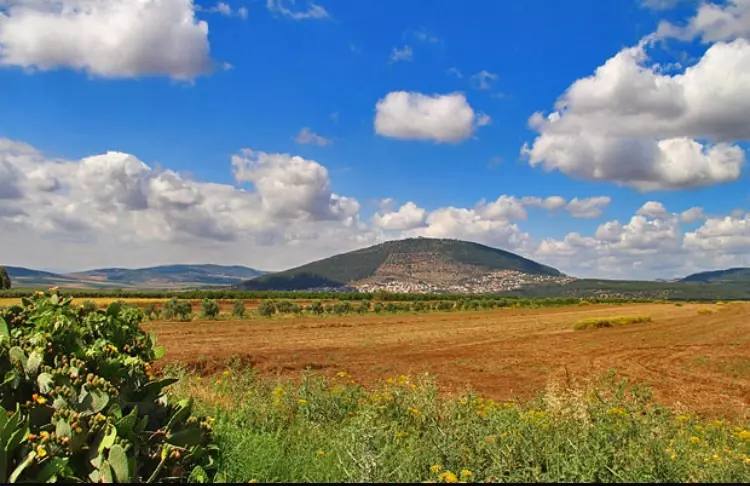
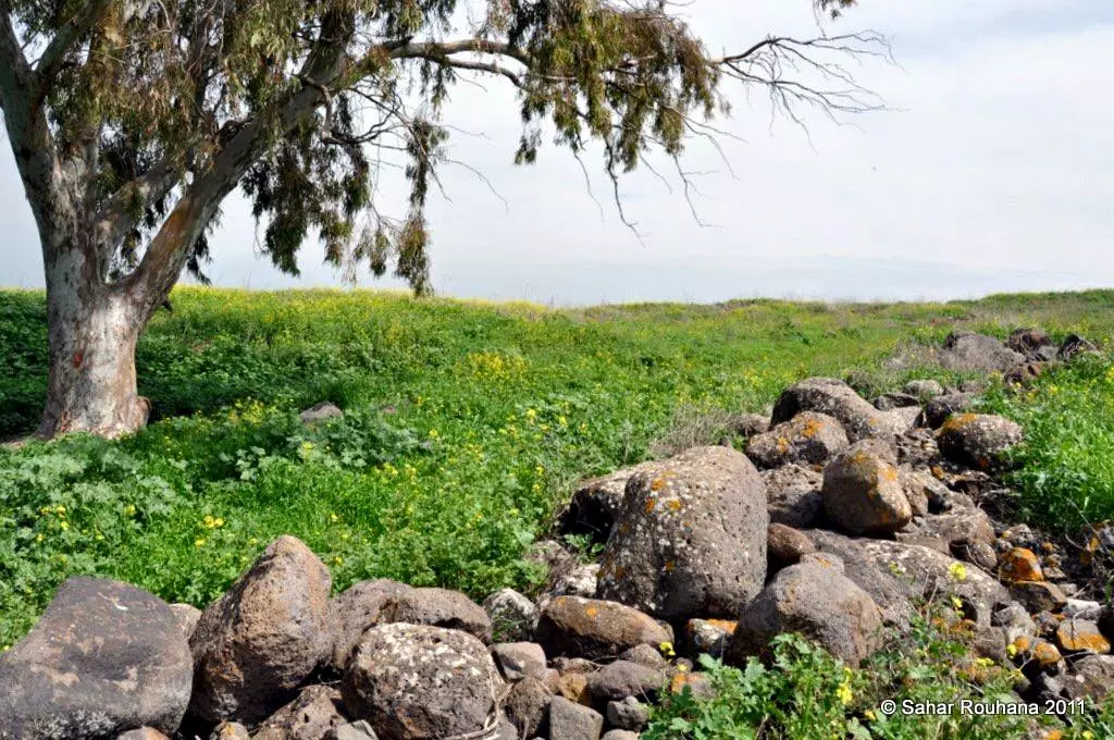
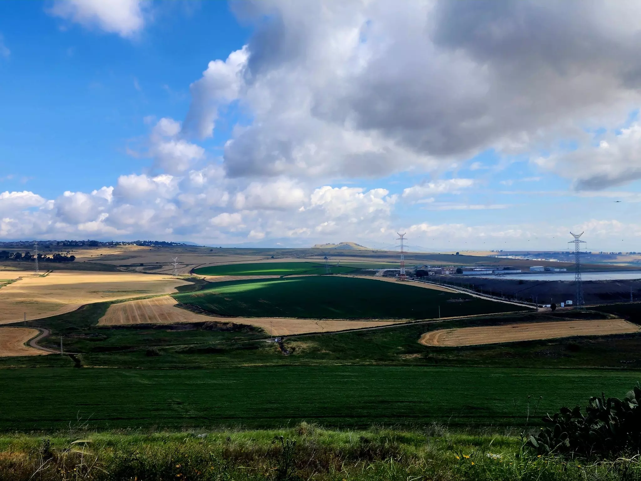
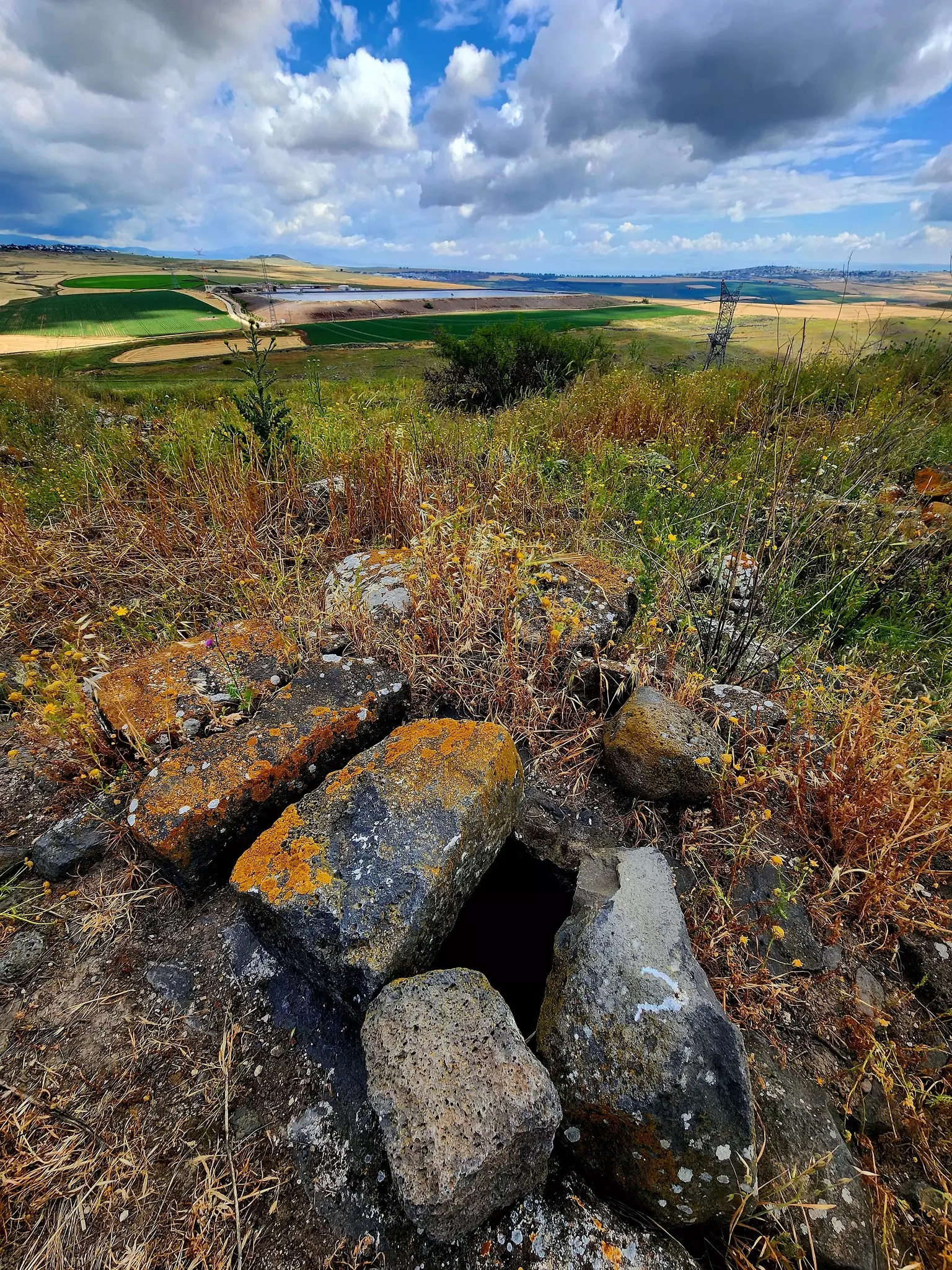
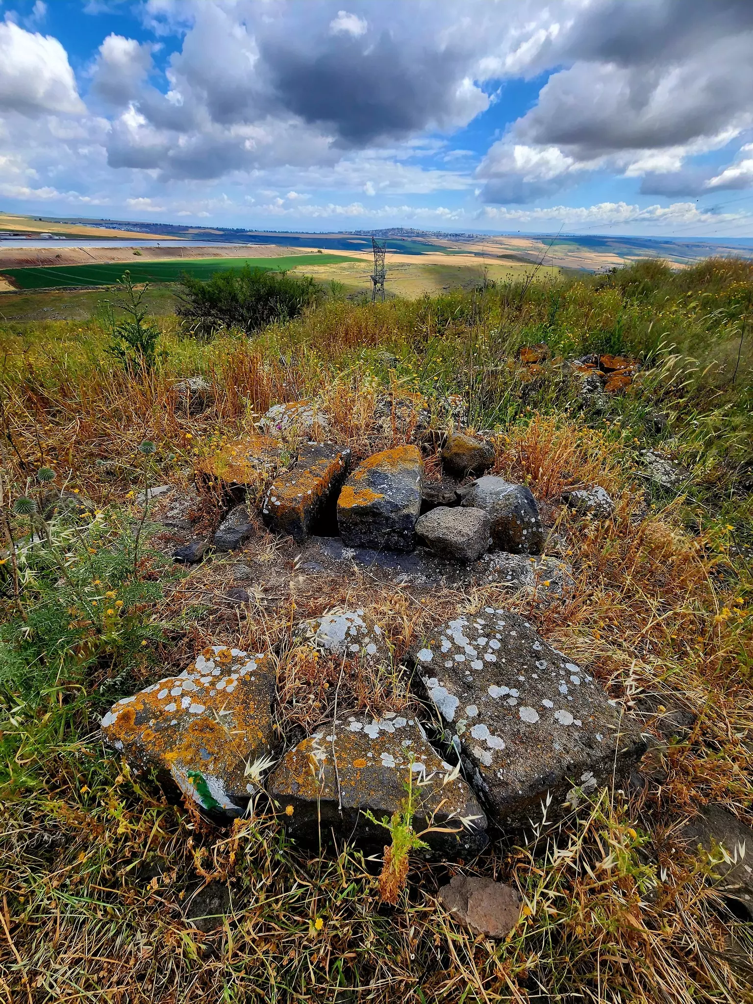
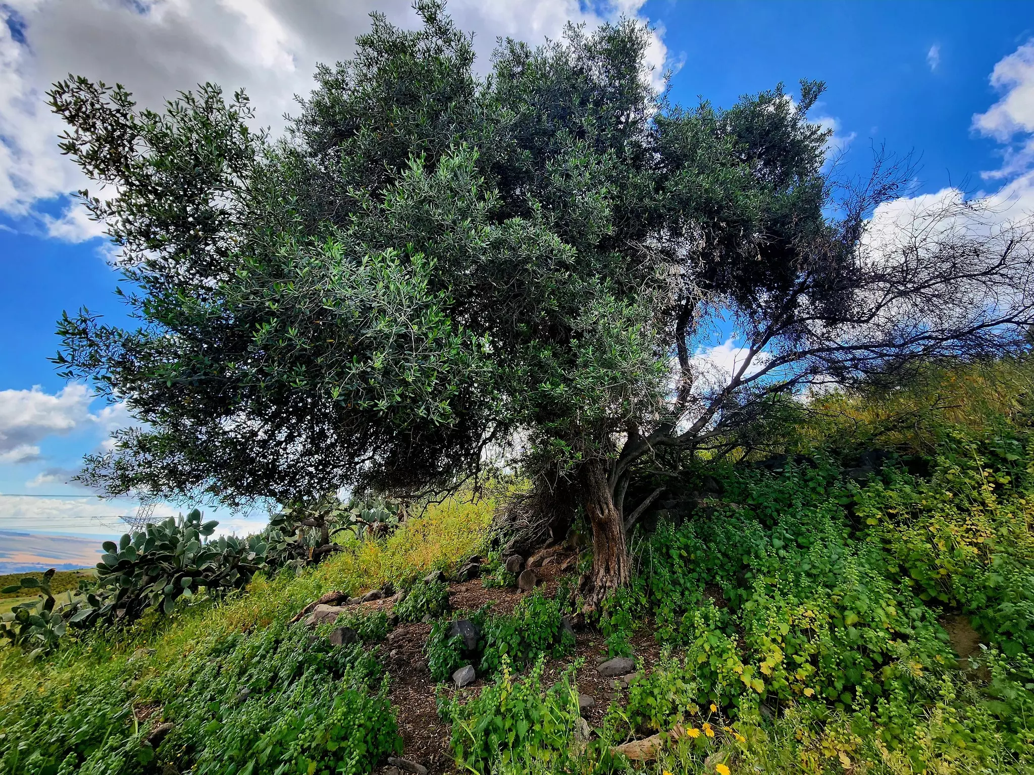
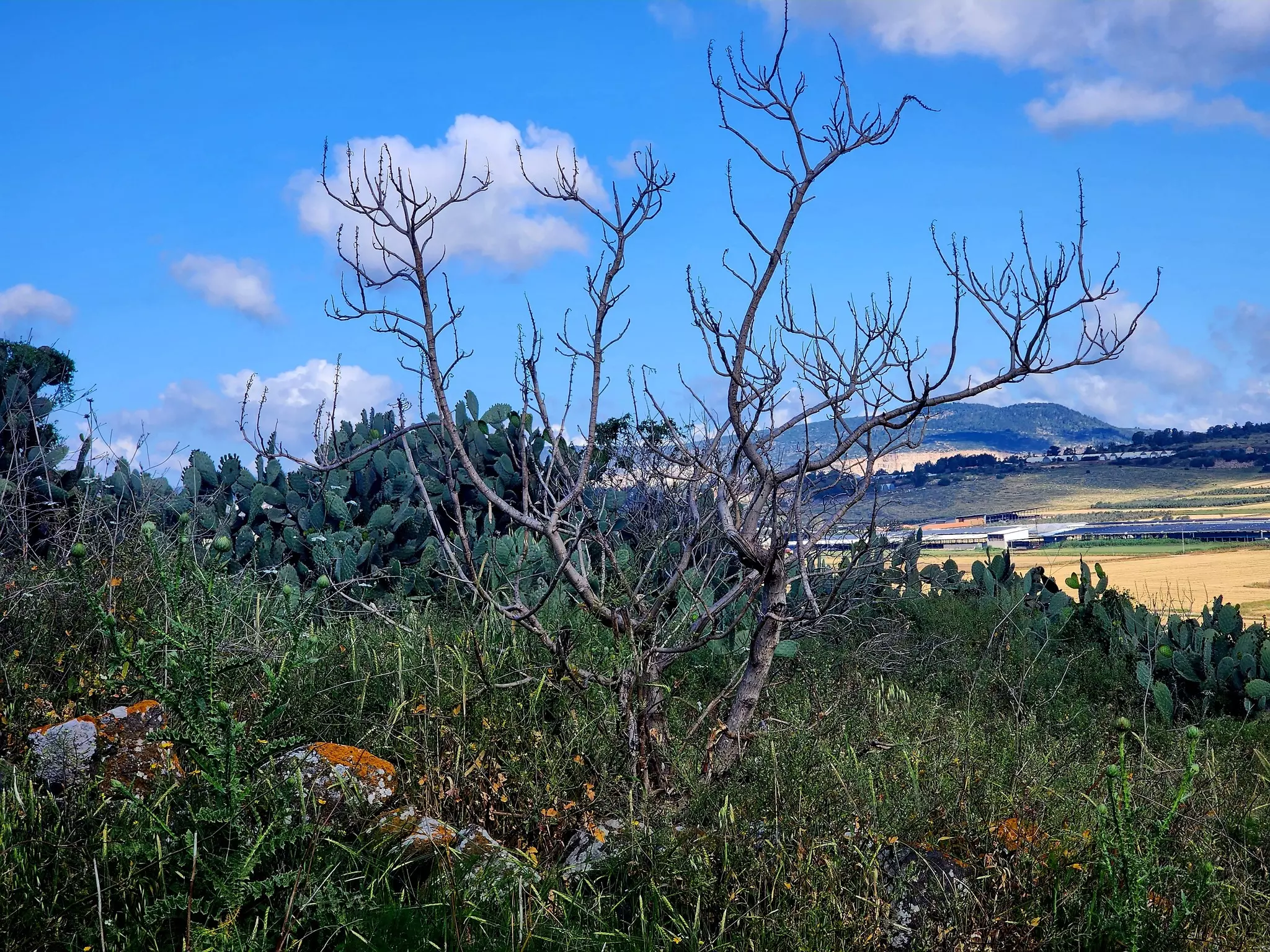
Village Before Nakbahe village was located on a gradually sloping plain in the eastern lower Galilee. It overlooked a wadi on the north, and relatively flat areas on the other sides (see photo). A secondary road linked the village to Kafr Kama (a still-existing Palestinian village) and from there to the Tiberias-Nazareth highway. Kafr Sabt was known by the name Kefar Shabtay in the Roman period. It was mentioned by the Arab geographer al-Maqdisi (d. A.D. 985) as one of the villages of Qisarya (Caesarea). He said it was large, populated, and had a mosque on the main street. [[D 6/3:407]] It was also mentioned by another Arab geographer, Yaqut al-Hamawi (d. 1228) as a village near Tiberias. [[Ibid.]] The Crusaders called it Cafarsset. In 1596, Kafr Sabt was a village in the nahiya of Tiberias (liwa' of Safad) with a population of 160. It paid taxes on a number of crops, including wheat, barley, and cotton, as well as on other types of property, such as goats and beehives. [[Hut. and Abd.:188]]In the late nineteenth century, Kafr Sabt was a village built of stone and surrounded by level, arable land, with a population of about 300. [[SWP (1881) I:360]] The village layout was long and narrow, extending from east to west. Its houses, which were clustered together, were built of various materials, including stone, mud, and cement. The village also housed members of the Bedouin 'Arab al-Mashariqa tribe, who lived in tents. The villagers were Muslims, and they relied on agriculture and livestock breeding for their livelihood. Their main crops were grain and fruit, which they cultivated primarily to the southeast of the village. In 1944/45 a total of 4,258 dunums was planted in cereals; 7 dunums were irrigated or used for orchards. There were several khirbas in the vicinity, including Khirbat Umm al-'Alaq (194239), which was an extension of the village and contained the ruins of houses, a fortress, a mosque, cisterns, presses, and pieces of columns. Other khirbas included Damiya (194239), in the northeast, which contained extensive ruins of building foundations and olive presses. Village Occupation and Ethnic CleaningAccording to Israeli sources, the villagers fled on 22 April 1948, as a direct result of the occupation of Tiberias by the Haganah on 18 April.Zionists Colonies on Village LandsIn 1949, the village lands were the subject of a dispute between two adjacent Israeli settlements in the region, Ilaniyya (188240) and Sharona (194236). The former had demanded compensation for Arab attacks in the early months of the war and had been allocated 350 dunums of the lands of Kafr Sabt which, they said, had belonged to 'our destroyers.' But the farmers of Sharona also had designs on the land and took it over by force. The Agriculture Ministry intervened and ordered the Sharona settlers off the land. [[M:xv, 177]]Israel established the settlement of Sde Ilan (189239) to the west of the village site in 1949. It is not on village land. [[M:xx]] Village TodayPiles of stone and stone terraces provide the main indications that the village once occupied the site. Cactuses and a few scattered trees grow among the rubble on the village site. The lands around the site are planted in grain, fruit trees, and almond trees (see photos section).SourceDr. Walid al-Khalidi, 1992: All That Remains. |
||||||||||||||||||||||
| Related Maps | Town Lands' Demarcation Maps خرائط للقضاء توضح حدود القرى والاودية Town's map on MapQuest View from satellite Help us map this town at WikiMapia |
|||||||||||||||||||||
| Related Links | Wikipedia's Page Google Search Google For Images Google For Videos |
|||||||||||||||||||||
| More Information | في كتاب كي لا ننسى في كتاب بلادنا فلسطين المزيد من موقع هوية |
|||||||||||||||||||||
- An aerial view of village, 1937
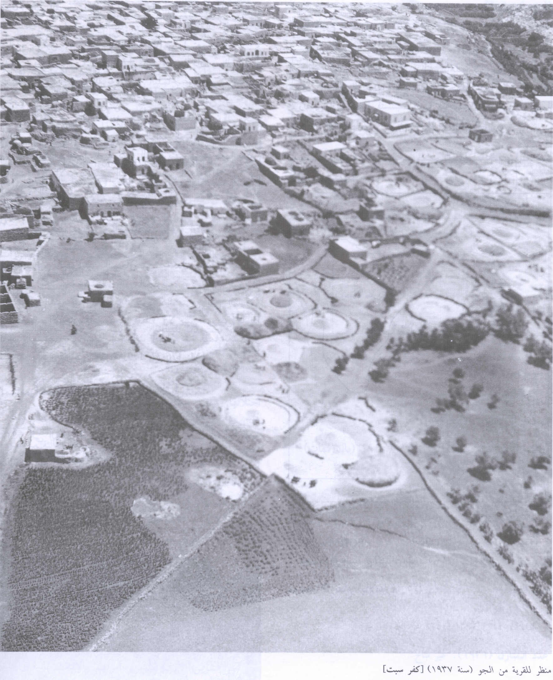
Scanned from "All That Remains" by Dr. Walid Khalidi - موقع القرية المدمرة من الجهة الغربية للقرية المدمرة والمطهرة عرقياً. 1987
Scanned from "All That Remains" by Dr. Walid Khalidi 1 - ايام الحرث قبل النكبة
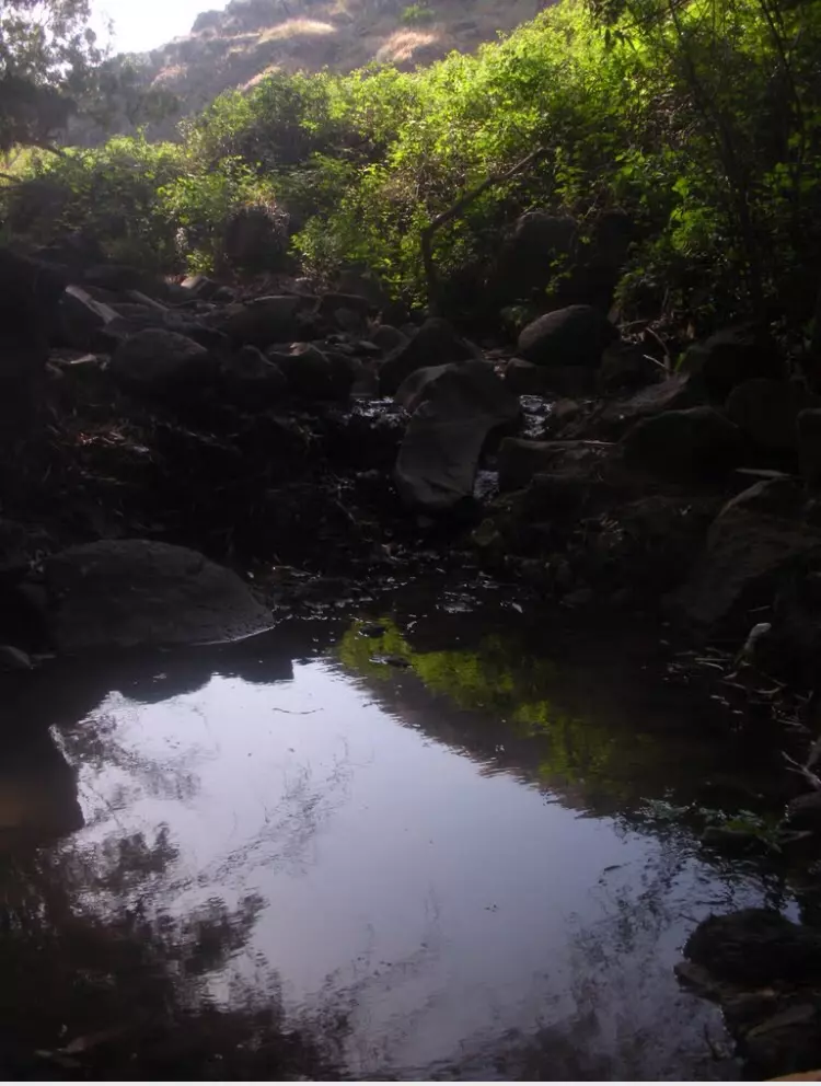
- عين القريه
Posted by abu raya - منظر من شرق القريه
Posted by abu raya - كفر سبت واراضيها قبل النكبه
Posted by abu raya - الصبار في القريه
Posted by abu raya - اثار ردم بيوت القريه
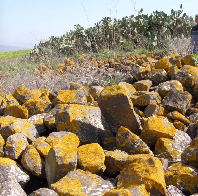
Posted by abu raya - ردم بيوت القريه
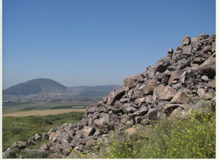
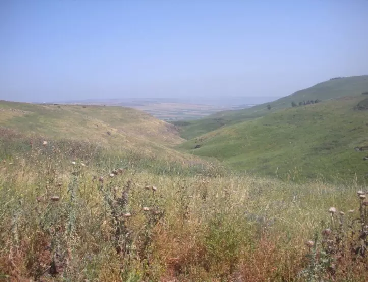
Posted by abu raya - اراضي قريه كفر سبت
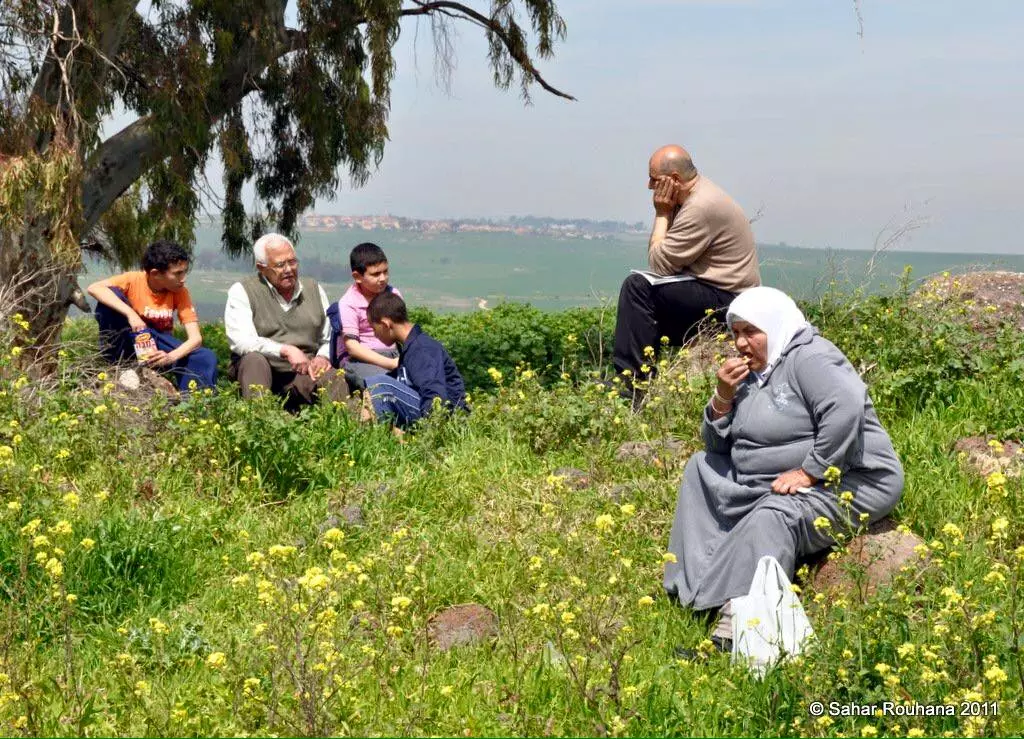
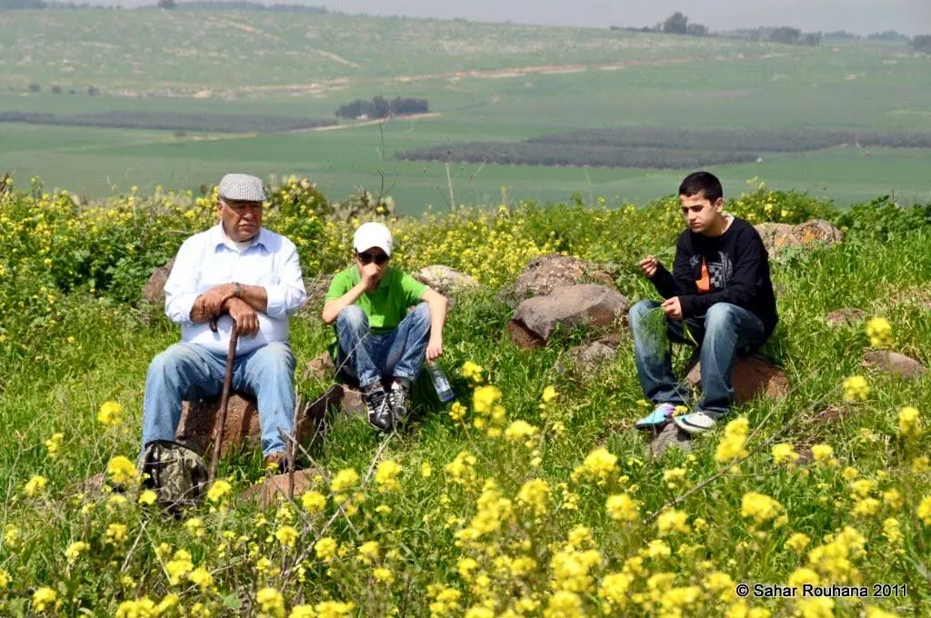
Posted by abu raya - على الاطلال
- الاطلال
- قعدة على الاطلال
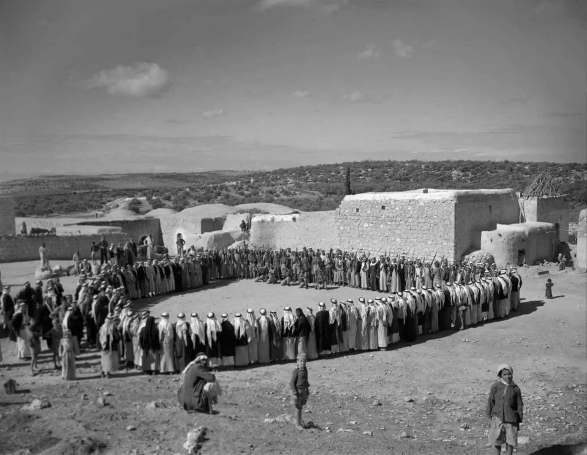
- صلح عشائري .. يوم الجمعة.. 30 مارس 1948
- Pre-Nakba Aerial view of the village / صورة من الجو للقرية اخذت قبل النكبة
- The "most civilized" who landed on us from Europe obliterated the village, except for a few remaining structures like this one. This is how the Jews will be great again. That is how they can feel safe: Jim Crow, plunder, ethnic cleansing, and genocide.
- The "most civilized" who landed on us from Europe obliterated the village, except for a few remaining structures like this one. This is how the Jews will be great again. That is how they can feel safe: Jim Crow, plunder, ethnic cleansing, and genocide. #2
- The "most civilized" who landed on us from Europe obliterated the village, except for a few remaining structures like this one. This is how the Jews will be great again. That is how they can feel safe: Jim Crow, plunder, ethnic cleansing, and genocide. #3
- The "most civilized" who landed on us from Europe obliterated the village, except for a few remaining structures like this one. This is how the Jews will be great again. That is how they can feel safe: Jim Crow, plunder, ethnic cleansing, and genocide. #4
- The "most civilized" who landed on us from Europe obliterated the village, except for a few remaining structures like this one. This is how the Jews will be great again. That is how they can feel safe: Jim Crow, plunder, ethnic cleansing, and genocide. #5
- The "most civilized" who landed on us from Europe obliterated the village, except for a few remaining structures like this one. This is how the Jews will be great again. That is how they can feel safe: Jim Crow, plunder, ethnic cleansing, and genocide. #6
- The "most civilized" who landed on us from Europe obliterated the village, except for a few remaining structures like this one. This is how the Jews will be great again. That is how they can feel safe: Jim Crow, plunder, ethnic cleansing, and genocide. #7
- The "most civilized" who landed on us from Europe obliterated the village, except for a few remaining structures like this one. This is how the Jews will be great again. That is how they can feel safe: Jim Crow, plunder, ethnic cleansing, and genocide. #8
- The "most civilized" who landed on us from Europe obliterated the village, except for a few remaining structures like this one. This is how the Jews will be great again. That is how they can feel safe: Jim Crow, plunder, ethnic cleansing, and genocide. #9
- The "most civilized" who landed on us from Europe obliterated the village, except for a few remaining structures like this one. This is how the Jews will be great again. That is how they can feel safe: Jim Crow, plunder, ethnic cleansing, and genocide. #10
- The "most civilized" who landed on us from Europe obliterated the village, except for a few remaining structures like this one. This is how the Jews will be great again. That is how they can feel safe: Jim Crow, plunder, ethnic cleansing, and genocide. #11
- The "most civilized" who landed on us from Europe obliterated the village, except for a few remaining structures like this one. This is how the Jews will be great again. That is how they can feel safe: Jim Crow, plunder, ethnic cleansing, and genocide. #12

Want to browse more? 80,000 pictures were grouped in these gallaries:
| Display Name | Clan/Hamolah | Country of Residence |
| رائد سرساوي | سرساوي | سورياحلب مخيم النيرب / جدة المملكة العربية السعودية |
| حمزة كنعان | كنعان | - |
 Fake Valor: Why Did Zionist Jews Hoist Nazis Flag on Their Ships in the 1930s?
What is new?
-
Facts About Oct. 7th Gaza Raid
-
Remined Us Please:: Who Did Rape Who? Palestinians Raped Israelis? Or, was the other way around?
-
When Prof. Edward Said was invited to debate Bibi Netanyahu in the 1980s, watch what happened!
-
Ezra Klein of the NY Times on the "Jewish Race".
-
Abusing Blood Libel!
-
Did Israeli Soldiers Activate The Hanniba Direective On Oct. 7th? You Be The Judge
-
Zionist FAQ: Isn't it true that Palestinians don't want peace? Palestinians never accepted the two-state solution
- Facts about Haavara (Transfer) Agreement between Ben-Gurion & Hitler
-
Haavara FAQs: Why Did Zionist Jews Hoist Nazis' Flags on Their Ships in the 1930s?
- Haavara FAQs: When Chaim Weizmann met FDR in mid-1943, why was he silent about rescuing European Jewry?
-
Dear ChatGPT: How did Palestinians resist Napoleon's invasion of their country in 1799?
-
Dear ChatGPT: Gaza had a vibrant Jewish community in the mid-17th century. What happened to them?
-
Dear ChatGPT: Why did the Jewish Agency suppress news of the Holocaust during WWII?
-
Video Playlist: Jews share their DNA tests to end the conflict for good.
-
A Tale of Two Conflicts: Examining the Definition of Genocide
-
Prof. Abraham Polak And The Suppressed History of the Khazars and European Jewry
-
How Ronald Reagan would have framed the genocide in Gaza if he were still alive?
-
Haavara FAQs: Let us do the math: how many German Jews did The Haavara Agreement save?
-
Zionist FAQs: The Hebron Massacre of 1929, "clearly proves" that Palestinians are antisemitic, how could you deny it?
-
Zionist FAQs: Why Anti-Zionist Is Not Antisemitism?
-
Zionist FAQs: Isn't it true that the KGB created Palestinian Nationalism in the early 1960s?
- Zionist FAQs: Muslims are killing Muslims all the time; why are Israeli Jews being singled out in the media?
- Zionist FAQs: How is Israel an apartheid state when 20% of its citizens are Arabs who enjoy full rights?
-
Haavara FAQs: Why Did Dorothy Thompson Flip From A Zionist Advocate to A Silenced Dissenter?
-
Haavara FAQs: Analysis of Herzl's Uganda Scheme and how it could have saved millions of Jews.
-
Haavara FAQs: Why did Hayim Greenberg describe American Jewry as "morally bankrupt" in early 1943?
-
Haavara FAQs: What if the Evian Conference was a resounding success? What would have been the impact of saving European Jewry on Zionism?
- Haavara FAQs: What if the six million were saved, how that would have impacted the Zionist project?
-
Haavara FAQs: How did Zionist leaders react when Europe's Jews lingered in the DP camps after WWII ended?
-
Why does the American Jewish community repeat lies that David Ben-Gurion had debunked before he died?
-
Who has the power to rename the Tatar/Khazar Gene Marker to Jewish IV?
-
Zionist FAQs: Why won't Egypt, Syria, and Jordan take their people back? Jews are indigenous to Palestine, and Arabs immigrated after Jews developed the country. Arabs should leave.
-
Haavara FAQs: Did Hitler and the Nazis conflate between Judaism and Zionist? If that wasn't case, then why?
-
Haavara FAQs: Winston Churchill and antisemitism, a collection of articles written Churchill.
-
Haavara FAQs: Broken by country, how many Jews survived vs. killed during the Holocaust?
-
Haavara FAQs: Why did European Jews vote with their feet and to immigrated to the Americas, not Palestine, after WWII?
-
Watch this American Jewish Girl describing Israeli Jews' cognitive dissonance like no other in under two minutes
-
Haavara FAQs: When the Nazis went out of their way to hide the Holocaust, Israeli Jews did the exact opposite by broadcasting their genocide of Gazans. But why?
-
Haavara FAQs: How Zionist Jews went out of their to show their appreciation to Nazism and Fascism?
- Haavara FAQs: Why Zionist leaders were against bombing the death camps & the Railroads leading to them?
-
Haavara FAQs: Hitler's message to the British and American people: If Jews are such noble citizens and you care about them, how come you're not letting them in? I will gladly ship them to you at my expense, even on luxury liners!
-
A shortlist of Zionist and Israeli false flag operations in the name Jews.
-
The Most Moral Army
- The Land of Kapos (Israel): Where the brave are boycotted and Kapos walk free.
- Why did early Zionists often named their communal enterprises "colonial"?
- Zionist Relations with Nazi Germany by Faris Glubb
-
Two NY Times advertisements by Zionists in the early 1943 that exposes Zionists' treason at the height of the calamity
- Facts Not Lies about the Palestinian-Israeli Conflict.
- Site's pictures have been categorized
- Campgain Against Lice
- A Survey of Palestine, the official source about Palestine before Nakba produced by the British Mandate; over 1200 pages.
- Satellite View & Google Earth: Over 6,000 placemarks identifying all destroyed towns, W. Bank & Gaza Strip Towns, & refugee camps.
- PalestineRemembered.com and its Nakba Oral History Project were featured on al-Jazeera Satellite TV.
- Nakba Oral History Video Podcast:
 Over 700 Oral History interviews (including 3,500+ hours of recording) can be viewed online.
 - Palestine Village Statistics Project
- Gaza Jail Break
- النسخة العربية للموقع الان متوفرة
- Videos: Documenting the destroyed villages in video: Tracing all that remains since Nakba.
- Videos: Responding to Zionist Propaganda
- Interview: The ethnic cleansing of Palestine: George Galloway interviews Israeli Historian Ilan Pappe.
- For Palestinians, memory matters. It provides a blueprint for their future By George Bisharat.
- Zionist FAQ now available in Hebrew שאלות שציונים שואלים, עכשיו בעברית
- Video: The Stephen Walt and John Mearsheimer report on the influence of the Israel Lobby on U.S. Foreign Policy
- The Palestinian-Israeli conflict for beginners
