| PalestineRemembered | About Us | Oral History | العربية | |
| Pictures | Zionist FAQs | Haavara | Maps | |
| Search |
| Camps |
| Districts |
| Acre |
| Baysan |
| Beersheba |
| Bethlehem |
| Gaza |
| Haifa |
| Hebron |
| Jaffa |
| Jericho |
| Jerusalem |
| Jinin |
| Nablus |
| Nazareth |
| Ramallah |
| al-Ramla |
| Safad |
| Tiberias |
| Tulkarm |
| Donate |
| Contact |
| Profile |
| Videos |
Welcome To Ma'dhar - معذر (מעד'ר)
|
District of Tiberias
Ethnically cleansed days ago |
العربية Google Earth |
 |
Gallery (20) |
- Statistics & Facts
-
Before & After

- Satellite View
- Articles 1
- Pictures 20
- Aerial Views 1
- Land Deeds 6
- Oral History 4
- Members 3
- All That Remains
- Wikipedia
- Videos
- Guest Book
- Links
| Statistic & Fact | Value | |||||||||||||||||||||
| Occupation Date | May 12, 1948 | |||||||||||||||||||||
| Distance From District | 12.5 (km) Southwest of Tiberias | |||||||||||||||||||||
| Elevation | 200 (meters) | |||||||||||||||||||||
| Before & After Nakba, Click Map For Details |
||||||||||||||||||||||
|
||||||||||||||||||||||
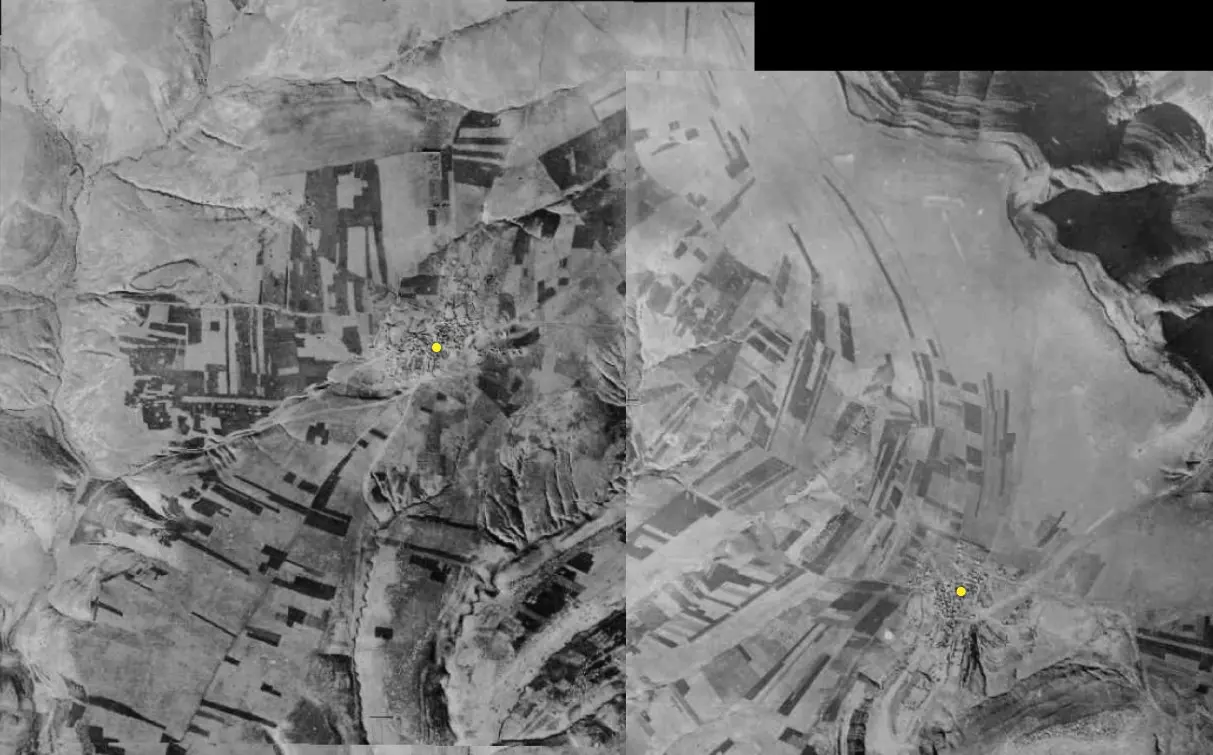
| Pre-Nakba Aerial View |
||||||||||||||||||||||
|
||||||||||||||||||||||
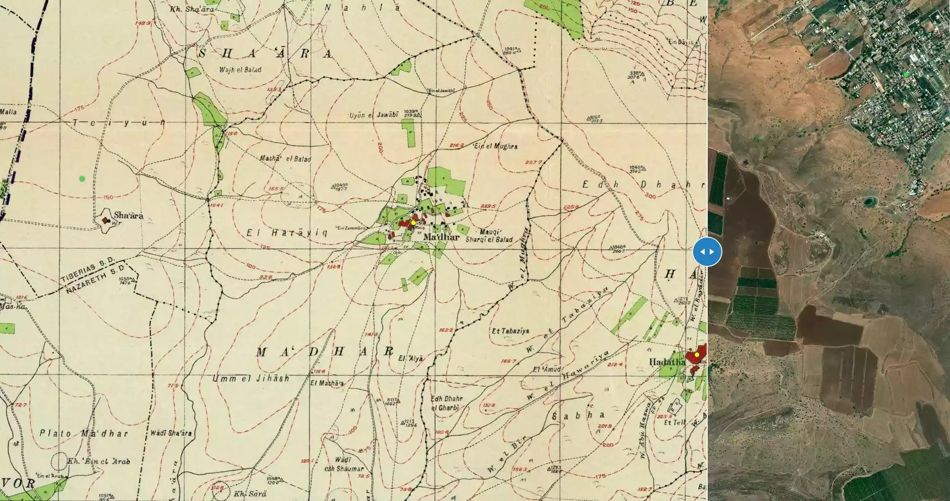
| Map Location | See location #21 on the map View from satellite |
|||||||||||||||||||||
| Military Operation | Operation Gideon | |||||||||||||||||||||
| Attacking Units | Golani Brigade | |||||||||||||||||||||
| Exodus Cause | Abandonment based on Arab orders | |||||||||||||||||||||
| Village Temains | The village has been completely defaced, and only house rubble left behind. | |||||||||||||||||||||
| Ethnically Cleansing | Ma'dhar inhabitants were completely ethnically cleansed. | |||||||||||||||||||||
| Pre-Nakba Land Ownership |
**Town Lands' Demarcation Maps |
|||||||||||||||||||||
| Land Usage As of 1945 |
|
|||||||||||||||||||||
| Population |
|
|||||||||||||||||||||
| Number of Houses |
|
|||||||||||||||||||||
| Town's Name Through History | The Crusades referred to Ma'dhar by Kapharmater. | |||||||||||||||||||||
| Schools | Ma'dhar had a school founded which was by the Ottomans, but closed its doors during the British Mandate period. | |||||||||||||||||||||
| Places of Warship | One mosque | |||||||||||||||||||||
| Water Supply | Ma'dhar drew its water from two nearby springs to the east and west,and few artesian wells. | |||||||||||||||||||||
| Archeological Sites | Ma'dhar contains a ruined church, a burial ground, and the ruins of a Crusade fortress called Casel de Cherio. | |||||||||||||||||||||
| Exculsive Jewish Colonies Who Usurped Village Lands |
Kefar Qish, Sharona, and Shadmot Devora | |||||||||||||||||||||
| Featured Video | ||||||||||||||||||||||
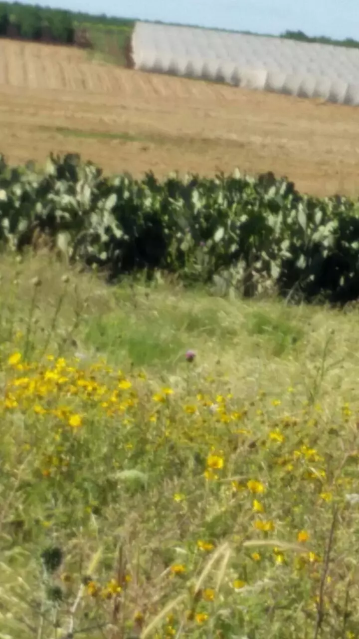
Village Before NakbaThe village stood on elevated, flat terrain in eastern lower Galilee, 6 km to the northeast of Mount Tabor (Jabal al-Tur). Several streams from village springs fed Wadi al-Bira, one of the Jordan's tributaries. A dirt path linked it to the village of Kafr Kama in the northwest, itself on a highway leading to Samakh on the southern tip of Lake Tiberias. The village was known as Kapharmater during the Crusader period; a Crusader fortress, Casel de Cherio, was built there. In 1596, Ma'dhar was a village in the nahiya of Tiberias (liwa' of Safad) with a population of ninety-four. It paid taxes on a number of crops, including wheat, barley, and cotton, as well as on other types of property, such as goats, beehives, and orchards. In the late nineteenth century, Ma'dhar was described as a village built of basalt and other types of stone, situated on an arable plain. Its population was about 250.The village had no particular shape; its houses were dispersed in all directions around a densely-built core, which was in the south. They were built of stone, adobe, and cement; some roofs were made of wood or reeds and covered with a layer of mud. The residents of Ma'dhar were Muslims and maintained a village mosque. A school, built in the village during the Ottoman period, was closed down during the British Mandate. The people drew water for their domestic needs from two springs, east and west of the village, and from wells. The villagers depended on agriculture and cattle breeding for their livelihood. Agriculture was based on grain and vegetables; but fruit trees were also planted on land to the north, west, and south. In 1944/45 a total of 5,479 dunums was allocated to cereals; 498 dunums were irrigated or used for orchards, of which 30 dunums were planted with olive trees. Ma'dhar was built over the remnants of the Crusader and Ottoman villages. Remains from these periods included a ruined church and its burial ground. To the southwest lay Khirbat Sara (192231), which was also an archaeological site. Village Occupation and Ethnic CleaningThere is some inconsistency in the Israeli accounts of the fate of the village in the early months of the war. Israeli historian Benny Morris writes that the village (along with the neighboring cluster consisting of Sirin, 'Awlam, and Hadatha) was ordered to be evacuated on 6 April 1948 by the Arab Higher Committee, which is unlikely. The implication is that the order was carried out almost immediately. But the History of the Haganah states that the same cluster of villages was overrun by units of the Golani Brigade on 12 May, in an operation designed to consolidate control of the Baysan Valley. The account adds that 'their inhabitants fled in fear of the Jews.' It is not clear from Morris or the Haganah account where the villagers went or what became of their houses and land.Zionists Colonies on Village LandsKefar Qish (192230), built in 1946, is on village lands to the south of the site. Nearby, Sharona (194236), founded in 1938, and Shadmot Devora (191233), built in 1939, are north and west of the village site, respectively; they are not on village lands.Village TodayThe site has been fenced in and is used as an Israeli grazing area. A large cluster of cactus grows in the midst of the stone rubble of houses, and there is a well, capped with a pump, in the center of the site. About 20 m to the west of the well is a drinking trough for animals. Eucalyptus, doum palm, and chinaberry trees grow on the site (see photos section).SourceDr. Walid al-Khalidi, 1992: All That Remains. |
||||||||||||||||||||||
| Related Maps | Town Lands' Demarcation Maps خرائط للقضاء توضح حدود القرى والاودية Town's map on MapQuest View from satellite Help us map this town at WikiMapia |
|||||||||||||||||||||
| Related Links | Wikipedia's Page Google Search Google For Images Google For Videos |
|||||||||||||||||||||
| More Information | في كتاب كي لا ننسى في كتاب بلادنا فلسطين المزيد من موقع هوية |
|||||||||||||||||||||
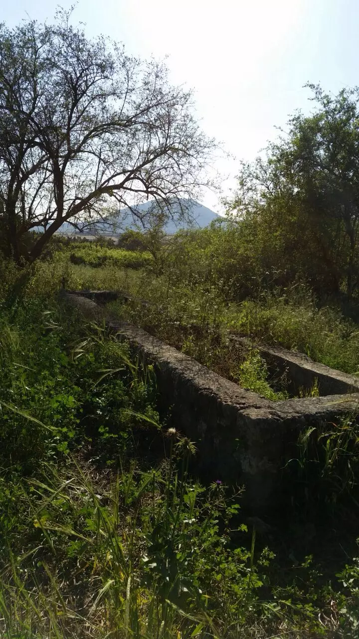
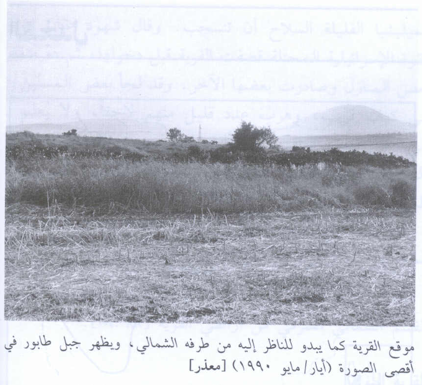
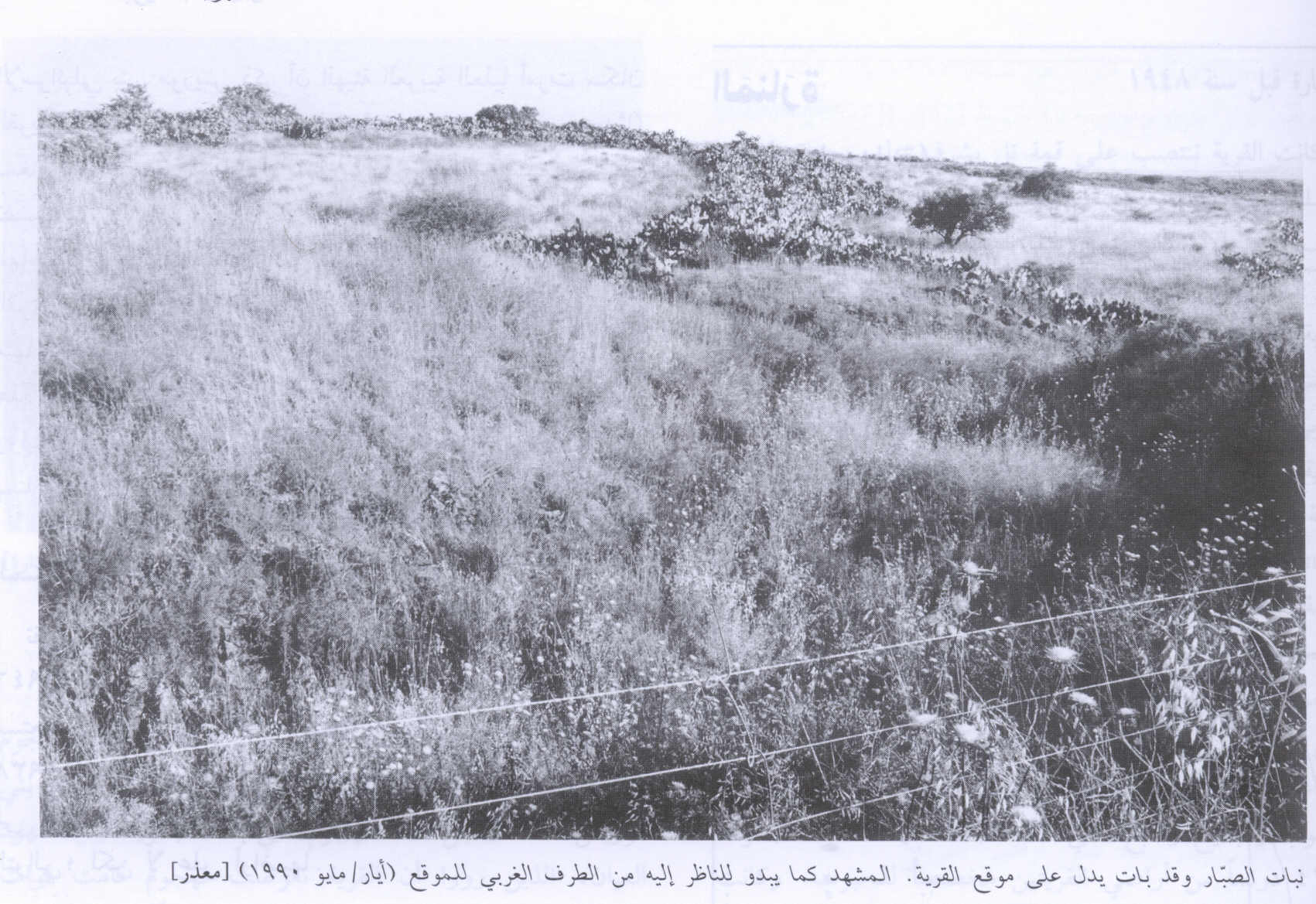
- The village site from its northern edge. Mount Tabur appears in the background, 1990
Scanned from "All That Remains" by Dr. Walid Khalidi - A view of the village site from the western edges of the village, 1990
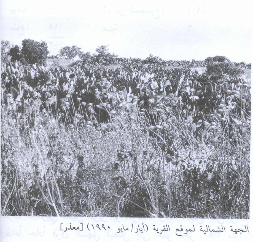
Scanned from "All That Remains" by Dr. Walid Khalidi 1 - The north side of the village, 1990
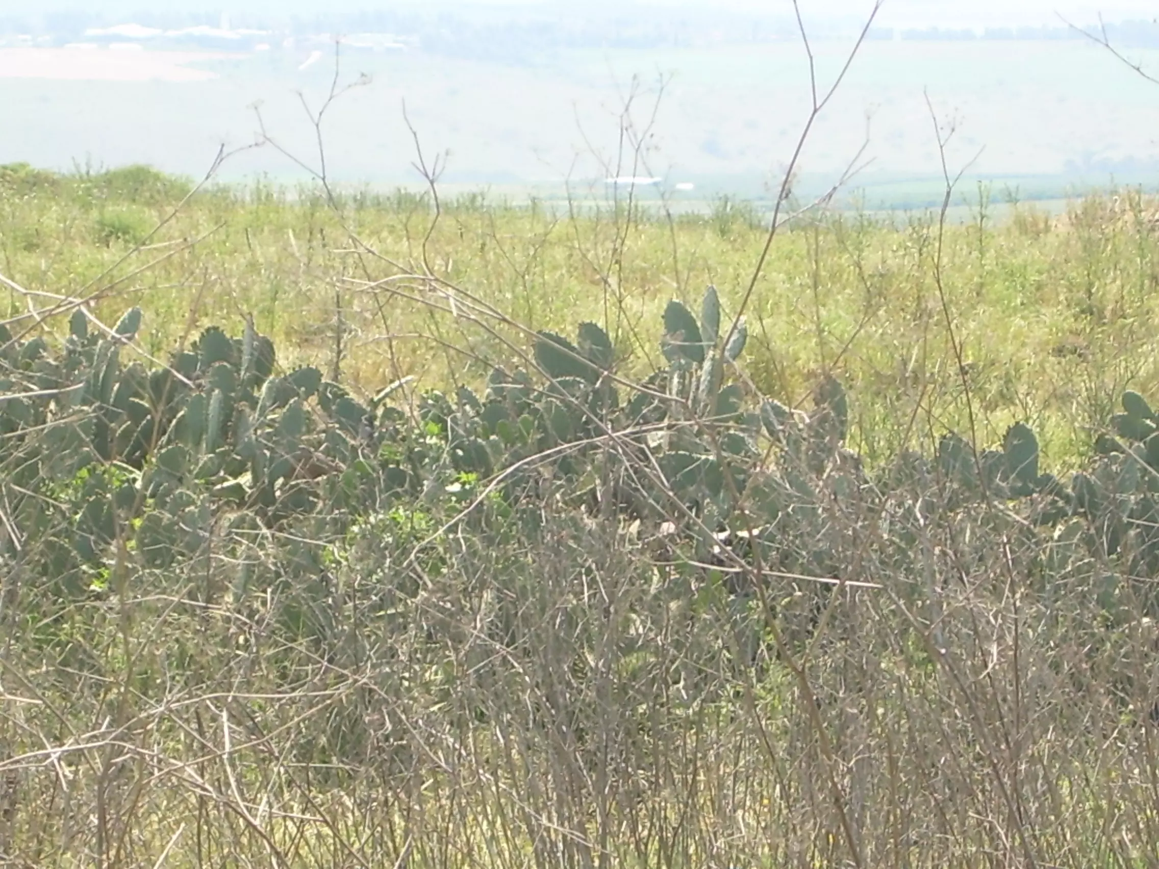
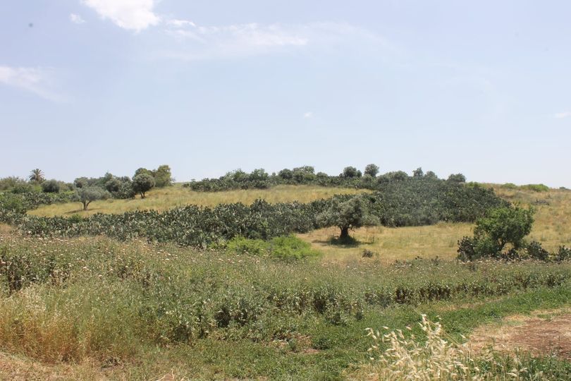
Scanned from "All That Remains" by Dr. Walid Khalidi - اشجار الزيتون والصبر ف معذر سنه 2006
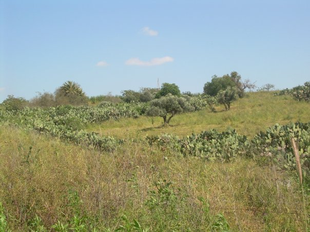
Posted by ابراهيم المغربي - معذر 2006
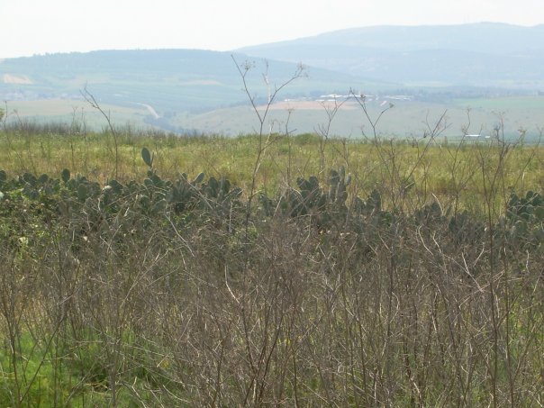
Posted by ابراهيم المغربي - معذر 2006
Posted by ابراهيم المغربي - معذر 24/4/15
Posted by ابراهيم محمديه المغربي - معذر24/4/15
Posted by ابراهيم محمديه المغربي - معذر 24/4/15
Posted by ابراهيم محمديه المغربي - معذر 24/4/15
Posted by ابراهيم محمديه المغربي - معذر

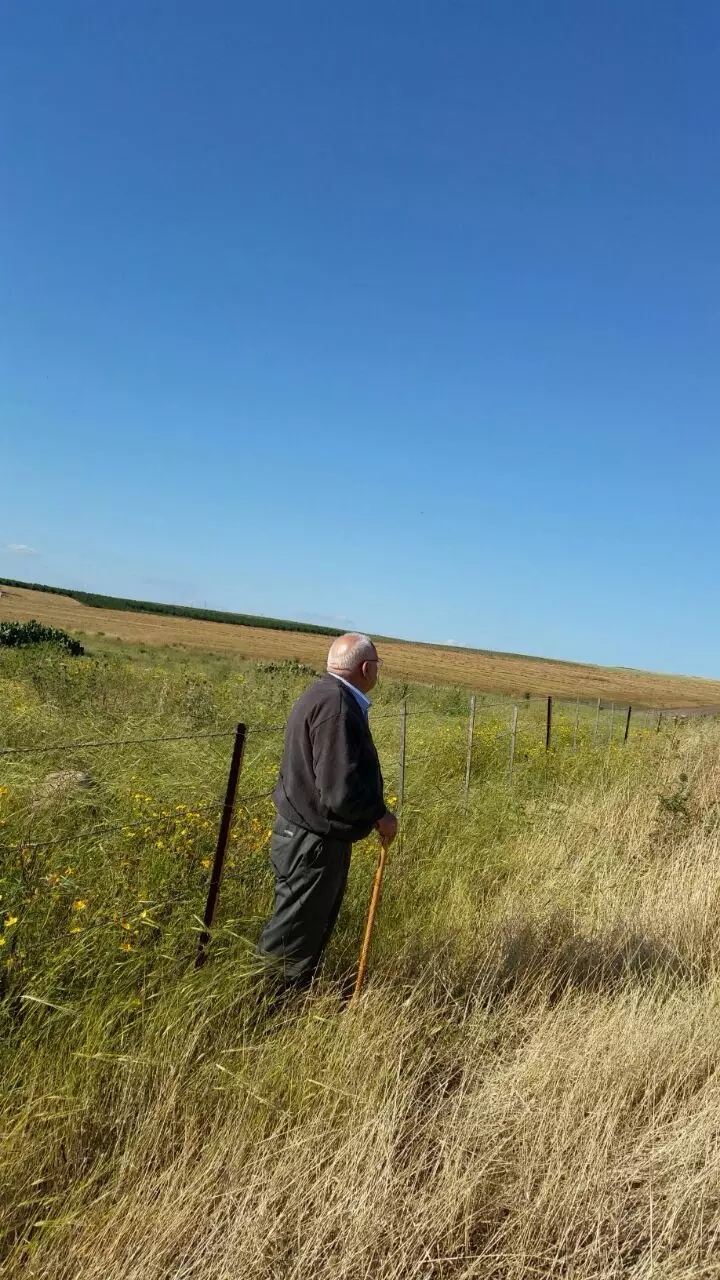
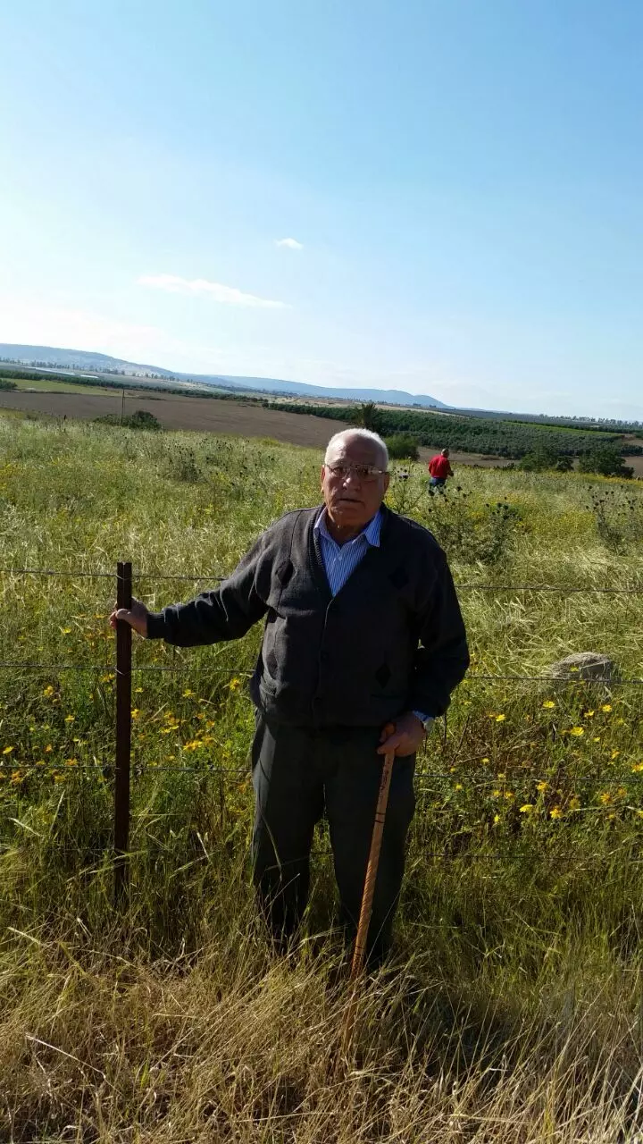
Posted by ابراهيم محمديه المغربي - الحاج عمر عيسى محمديه من مواليد معذر يزور مسقط رأسه 24/4/15
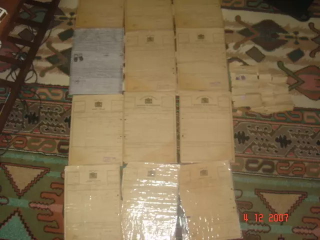
Posted by ابراهيم محمديه المغربي 1 - كواشين ارض وفرت لنا غضون مقابلة محمد المشرقي لتدوين شهادته عن النكبة
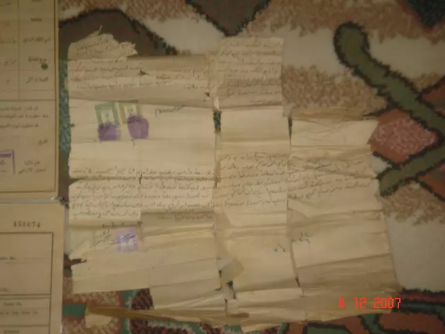
- كواشين ارض وفرت لنا غضون مقابلة محمد المشرقي لتدوين شهادته عن النكبة #6
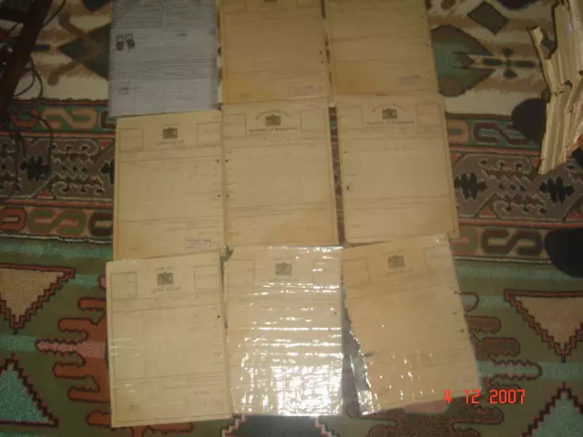
- كواشين ارض وفرت لنا غضون مقابلة محمد المشرقي لتدوين شهادته عن النكبة #5
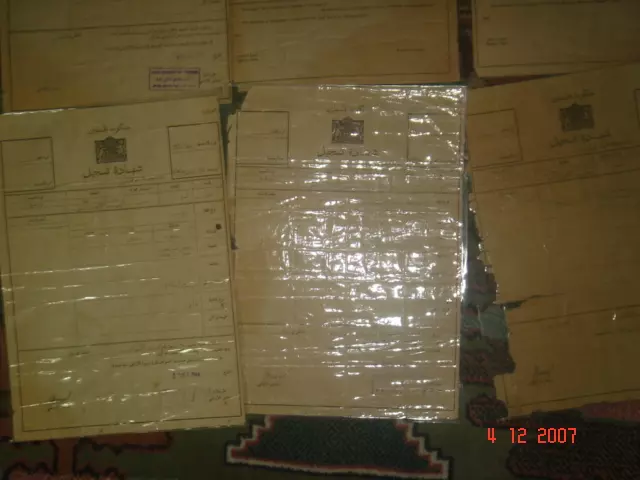
- كواشين ارض وفرت لنا غضون مقابلة محمد المشرقي لتدوين شهادته عن النكبة #4
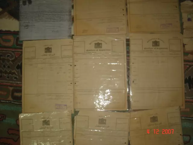
- كواشين ارض وفرت لنا غضون مقابلة محمد المشرقي لتدوين شهادته عن النكبة #3
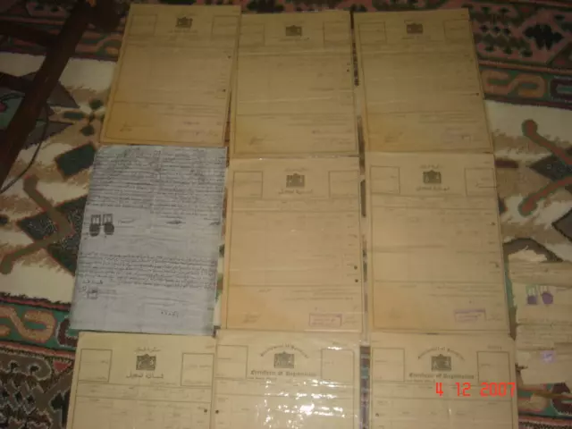
- كواشين ارض وفرت لنا غضون مقابلة محمد المشرقي لتدوين شهادته عن النكبة #2
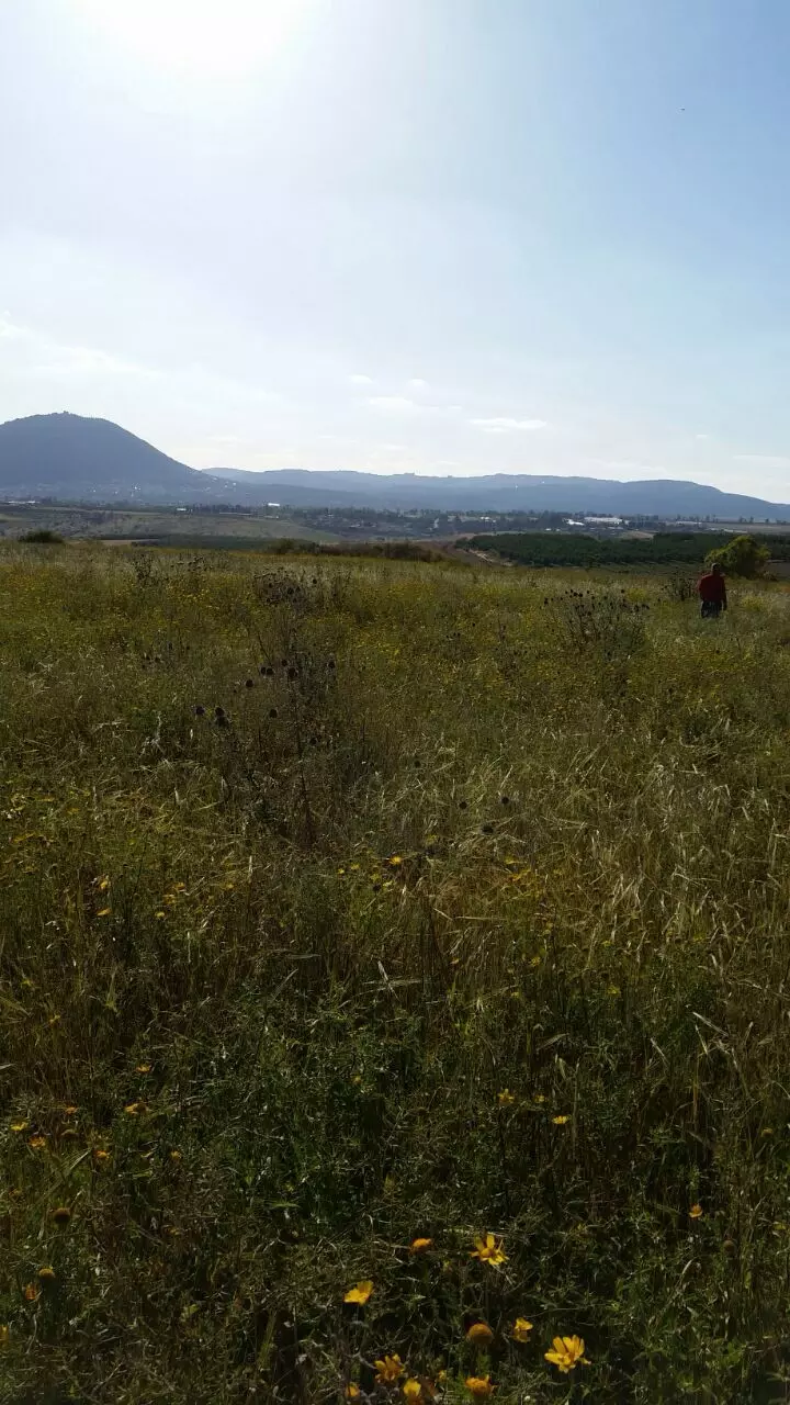
- في موقع قرية معذر المهجرة ( قضاء طبريا) وهي إحدى قرى المغاربة الواقعة في منطقة الشفا على الخط الواقع بين مرج بن عامر والغور .
- Pre-Nakba Aerial view of the village / صورة من الجو للقرية اخذت قبل النكبة
Want to browse more? 80,000 pictures were grouped in these gallaries:
- كواشين ارض وفرت لنا غضون مقابلة محمد المشرقي لتدوين شهادته عن النكبة
- كواشين ارض وفرت لنا غضون مقابلة محمد المشرقي لتدوين شهادته عن النكبة #6
- كواشين ارض وفرت لنا غضون مقابلة محمد المشرقي لتدوين شهادته عن النكبة #5
- كواشين ارض وفرت لنا غضون مقابلة محمد المشرقي لتدوين شهادته عن النكبة #4
- كواشين ارض وفرت لنا غضون مقابلة محمد المشرقي لتدوين شهادته عن النكبة #3
- كواشين ارض وفرت لنا غضون مقابلة محمد المشرقي لتدوين شهادته عن النكبة #2
| Display Name | Clan/Hamolah | Country of Residence |
| CYBIL | Muqary | - |
| الطيب | - | - |
| ابراهيم المغربي | - | اكسال, فلسطين |
No links have been shared yet, be free to the first to share the first link.
 Fake Valor: Why Did Zionist Jews Hoist Nazis Flag on Their Ships in the 1930s?
What is new?
-
Facts About Oct. 7th Gaza Raid
-
Remined Us Please:: Who Did Rape Who? Palestinians Raped Israelis? Or, was the other way around?
-
When Prof. Edward Said was invited to debate Bibi Netanyahu in the 1980s, watch what happened!
-
Ezra Klein of the NY Times on the "Jewish Race".
-
Abusing Blood Libel!
-
Did Israeli Soldiers Activate The Hanniba Direective On Oct. 7th? You Be The Judge
-
Zionist FAQ: Isn't it true that Palestinians don't want peace? Palestinians never accepted the two-state solution
- Facts about Haavara (Transfer) Agreement between Ben-Gurion & Hitler
-
Haavara FAQs: Why Did Zionist Jews Hoist Nazis' Flags on Their Ships in the 1930s?
- Haavara FAQs: When Chaim Weizmann met FDR in mid-1943, why was he silent about rescuing European Jewry?
-
Dear ChatGPT: How did Palestinians resist Napoleon's invasion of their country in 1799?
-
Dear ChatGPT: Gaza had a vibrant Jewish community in the mid-17th century. What happened to them?
-
Dear ChatGPT: Why did the Jewish Agency suppress news of the Holocaust during WWII?
-
Video Playlist: Jews share their DNA tests to end the conflict for good.
-
A Tale of Two Conflicts: Examining the Definition of Genocide
-
Prof. Abraham Polak And The Suppressed History of the Khazars and European Jewry
-
How Ronald Reagan would have framed the genocide in Gaza if he were still alive?
-
Haavara FAQs: Let us do the math: how many German Jews did The Haavara Agreement save?
-
Zionist FAQs: The Hebron Massacre of 1929, "clearly proves" that Palestinians are antisemitic, how could you deny it?
-
Zionist FAQs: Why Anti-Zionist Is Not Antisemitism?
-
Zionist FAQs: Isn't it true that the KGB created Palestinian Nationalism in the early 1960s?
- Zionist FAQs: Muslims are killing Muslims all the time; why are Israeli Jews being singled out in the media?
- Zionist FAQs: How is Israel an apartheid state when 20% of its citizens are Arabs who enjoy full rights?
-
Haavara FAQs: Why Did Dorothy Thompson Flip From A Zionist Advocate to A Silenced Dissenter?
-
Haavara FAQs: Analysis of Herzl's Uganda Scheme and how it could have saved millions of Jews.
-
Haavara FAQs: Why did Hayim Greenberg describe American Jewry as "morally bankrupt" in early 1943?
-
Haavara FAQs: What if the Evian Conference was a resounding success? What would have been the impact of saving European Jewry on Zionism?
- Haavara FAQs: What if the six million were saved, how that would have impacted the Zionist project?
-
Haavara FAQs: How did Zionist leaders react when Europe's Jews lingered in the DP camps after WWII ended?
-
Why does the American Jewish community repeat lies that David Ben-Gurion had debunked before he died?
-
Who has the power to rename the Tatar/Khazar Gene Marker to Jewish IV?
-
Zionist FAQs: Why won't Egypt, Syria, and Jordan take their people back? Jews are indigenous to Palestine, and Arabs immigrated after Jews developed the country. Arabs should leave.
-
Haavara FAQs: Did Hitler and the Nazis conflate between Judaism and Zionist? If that wasn't case, then why?
-
Haavara FAQs: Winston Churchill and antisemitism, a collection of articles written Churchill.
-
Haavara FAQs: Broken by country, how many Jews survived vs. killed during the Holocaust?
-
Haavara FAQs: Why did European Jews vote with their feet and to immigrated to the Americas, not Palestine, after WWII?
-
Watch this American Jewish Girl describing Israeli Jews' cognitive dissonance like no other in under two minutes
-
Haavara FAQs: When the Nazis went out of their way to hide the Holocaust, Israeli Jews did the exact opposite by broadcasting their genocide of Gazans. But why?
-
Haavara FAQs: How Zionist Jews went out of their to show their appreciation to Nazism and Fascism?
- Haavara FAQs: Why Zionist leaders were against bombing the death camps & the Railroads leading to them?
-
Haavara FAQs: Hitler's message to the British and American people: If Jews are such noble citizens and you care about them, how come you're not letting them in? I will gladly ship them to you at my expense, even on luxury liners!
-
A shortlist of Zionist and Israeli false flag operations in the name Jews.
-
The Most Moral Army
- The Land of Kapos (Israel): Where the brave are boycotted and Kapos walk free.
- Why did early Zionists often named their communal enterprises "colonial"?
- Zionist Relations with Nazi Germany by Faris Glubb
-
Two NY Times advertisements by Zionists in the early 1943 that exposes Zionists' treason at the height of the calamity
- Facts Not Lies about the Palestinian-Israeli Conflict.
- Site's pictures have been categorized
- Campgain Against Lice
- A Survey of Palestine, the official source about Palestine before Nakba produced by the British Mandate; over 1200 pages.
- Satellite View & Google Earth: Over 6,000 placemarks identifying all destroyed towns, W. Bank & Gaza Strip Towns, & refugee camps.
- PalestineRemembered.com and its Nakba Oral History Project were featured on al-Jazeera Satellite TV.
- Nakba Oral History Video Podcast:
 Over 700 Oral History interviews (including 3,500+ hours of recording) can be viewed online.
 - Palestine Village Statistics Project
- Gaza Jail Break
- النسخة العربية للموقع الان متوفرة
- Videos: Documenting the destroyed villages in video: Tracing all that remains since Nakba.
- Videos: Responding to Zionist Propaganda
- Interview: The ethnic cleansing of Palestine: George Galloway interviews Israeli Historian Ilan Pappe.
- For Palestinians, memory matters. It provides a blueprint for their future By George Bisharat.
- Zionist FAQ now available in Hebrew שאלות שציונים שואלים, עכשיו בעברית
- Video: The Stephen Walt and John Mearsheimer report on the influence of the Israel Lobby on U.S. Foreign Policy
- The Palestinian-Israeli conflict for beginners
