| PalestineRemembered | About Us | Oral History | العربية | |
| Pictures | Zionist FAQs | Haavara | Maps | |
| Search |
| Camps |
| Districts |
| Acre |
| Baysan |
| Beersheba |
| Bethlehem |
| Gaza |
| Haifa |
| Hebron |
| Jaffa |
| Jericho |
| Jerusalem |
| Jinin |
| Nablus |
| Nazareth |
| Ramallah |
| al-Ramla |
| Safad |
| Tiberias |
| Tulkarm |
| Donate |
| Contact |
| Profile |
| Videos |
Welcome To Wadi al-Hamam - وادي الحمام (ואדי אל-חמאם)
|
District of Tiberias
Ethnically cleansed days ago |
العربية Google Earth |
 |
Gallery (82) |
- Statistics & Facts
-
Before & After

- Satellite View
- Articles 2
- Pictures 82
- Oral History 1
- Members 5
- All That Remains
- Videos 2
- Guest Book 4
- Links
| Statistic & Fact | Value |
| Occupation Date | April 22, 1948 |
| Distance From District | 5.5 (km) Northeast of Tiberias |
| Elevation | 98 (meters) |
| Before & After Nakba, Click Map For Details |
|
|
|
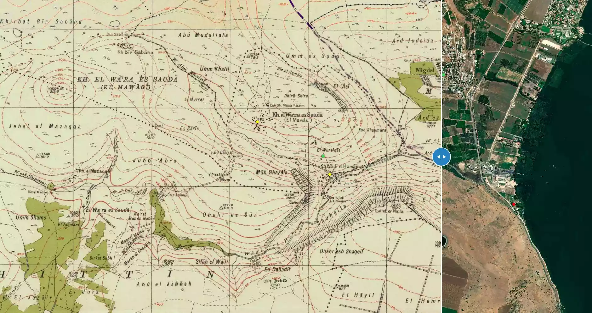
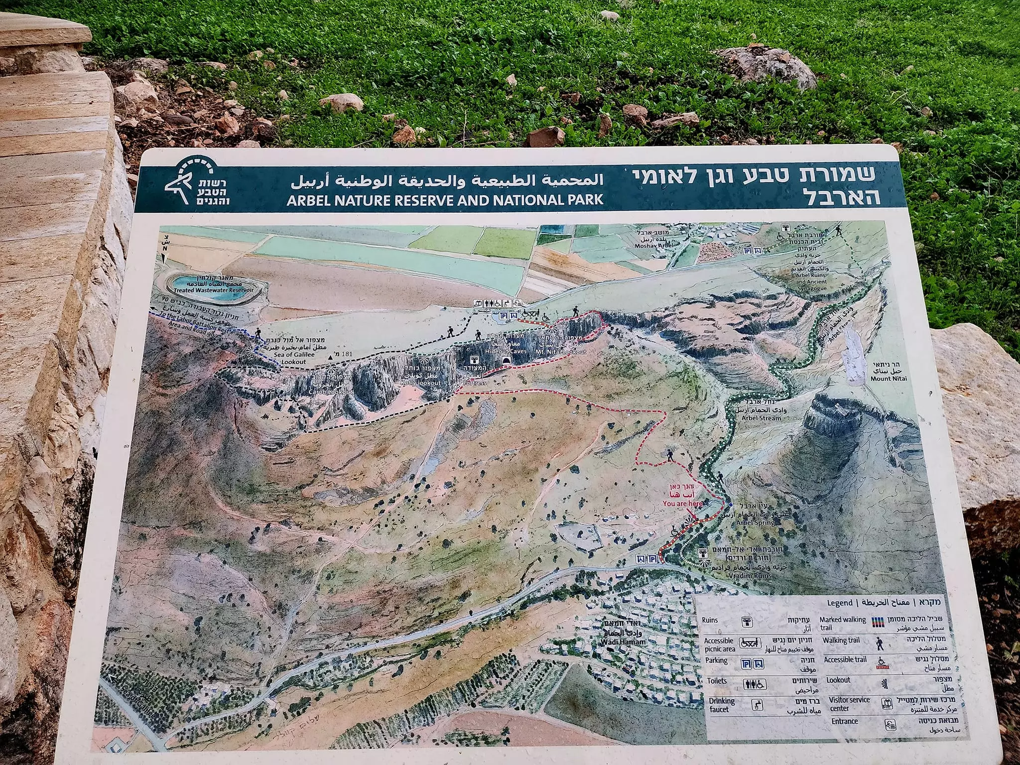
| Map Location | See location #7 on the map View from satellite |
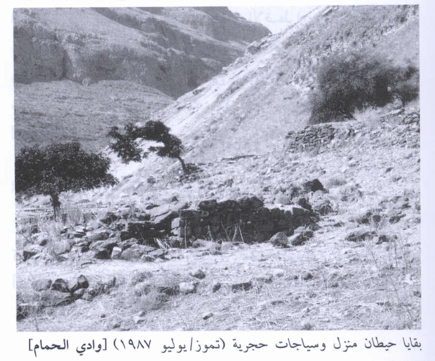
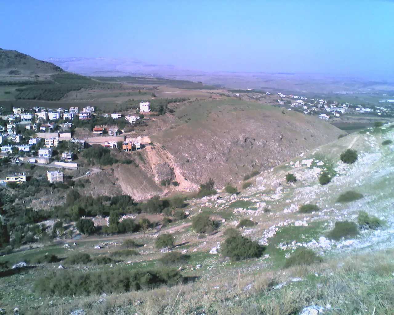
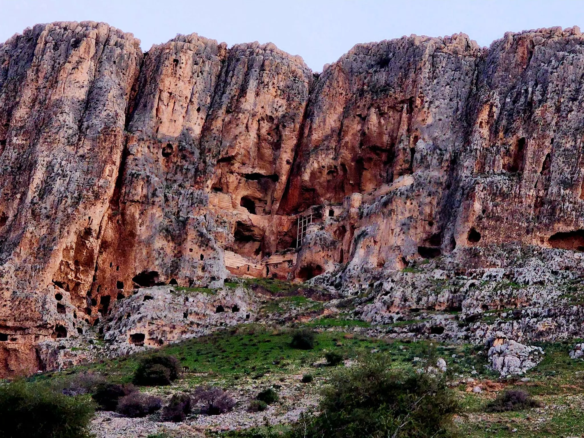
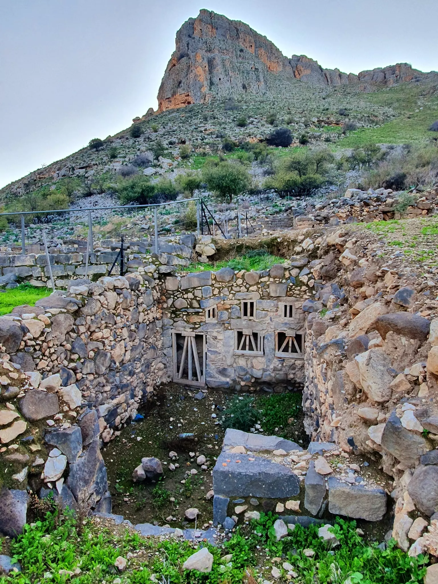
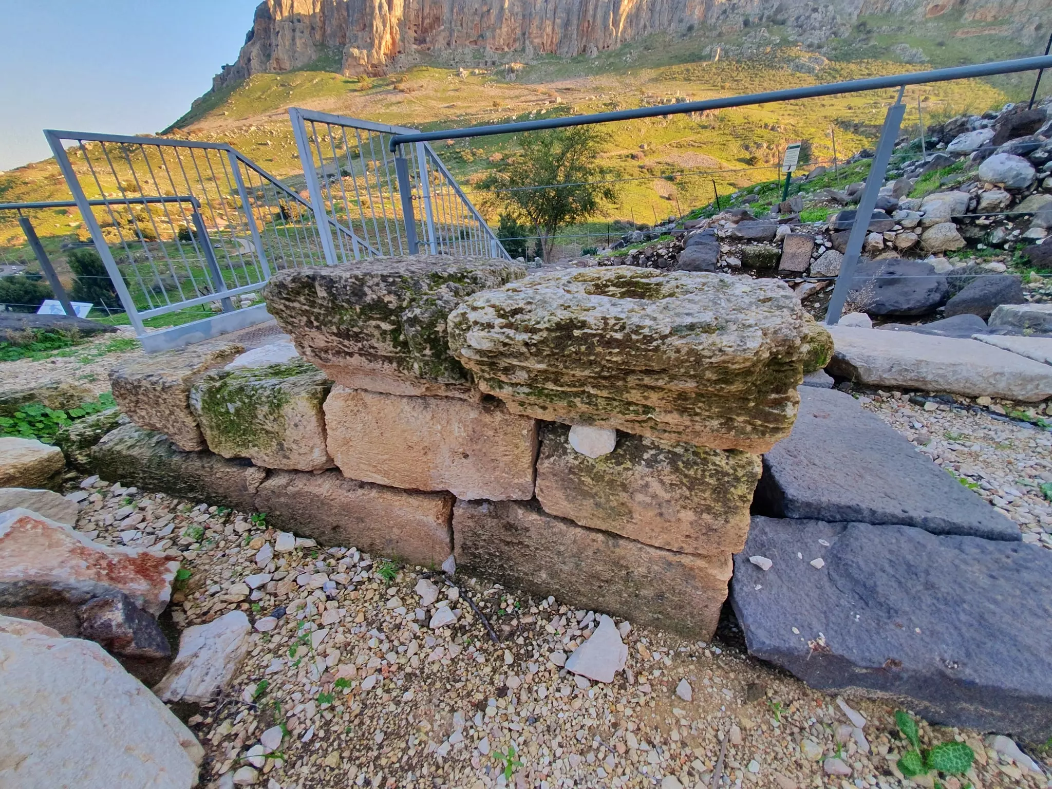
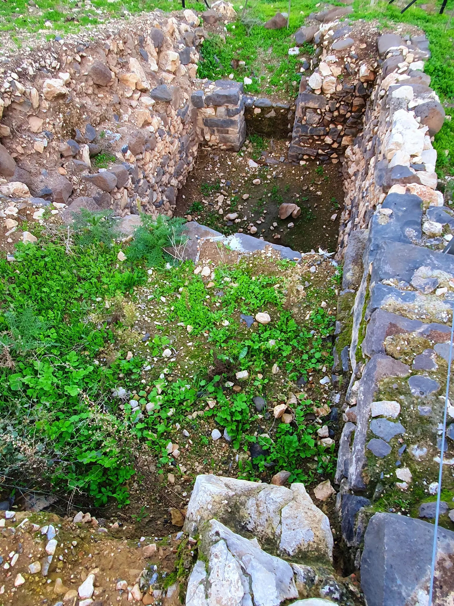
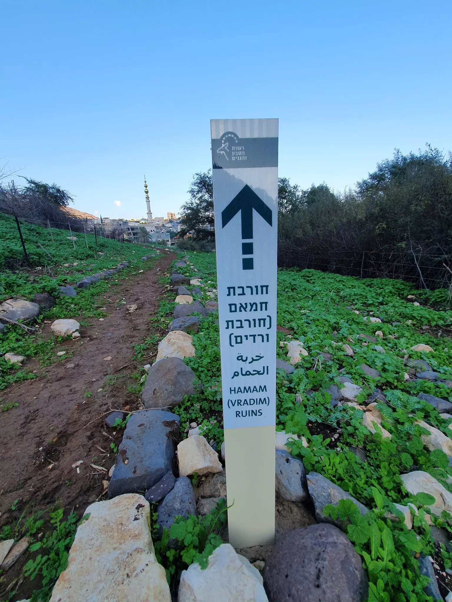
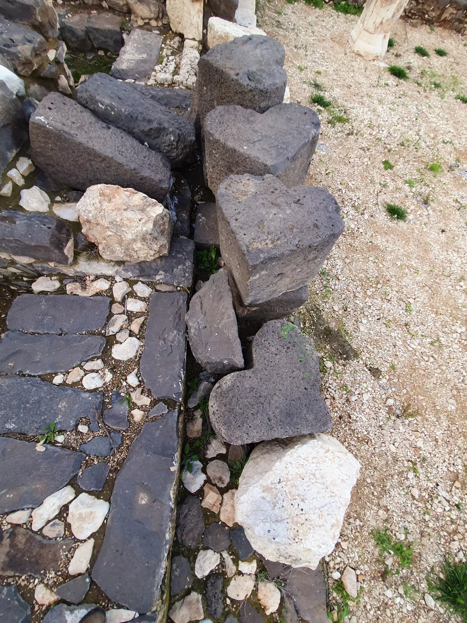
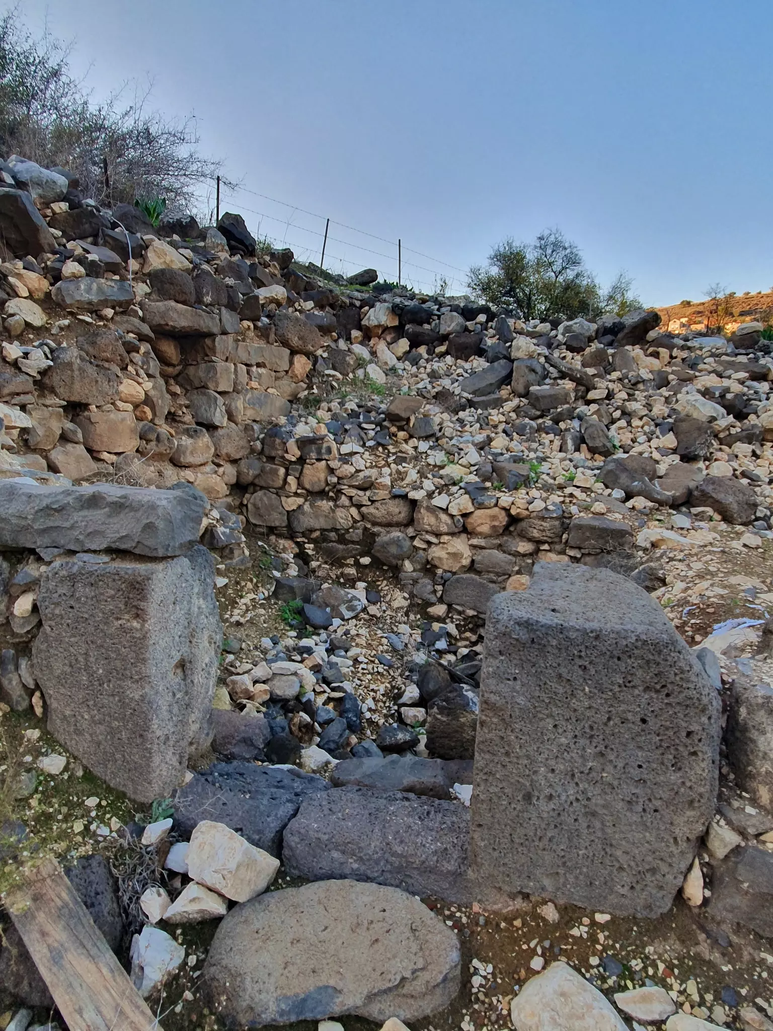
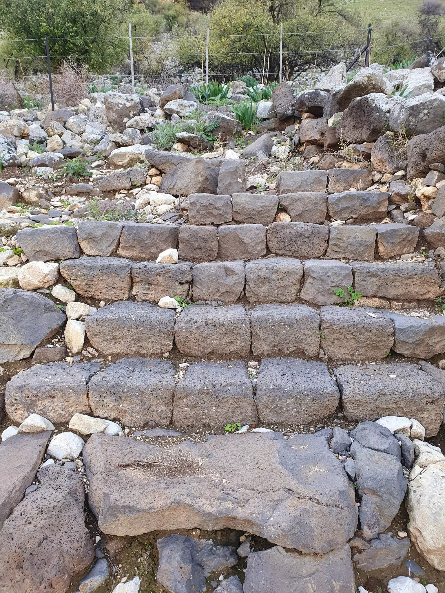
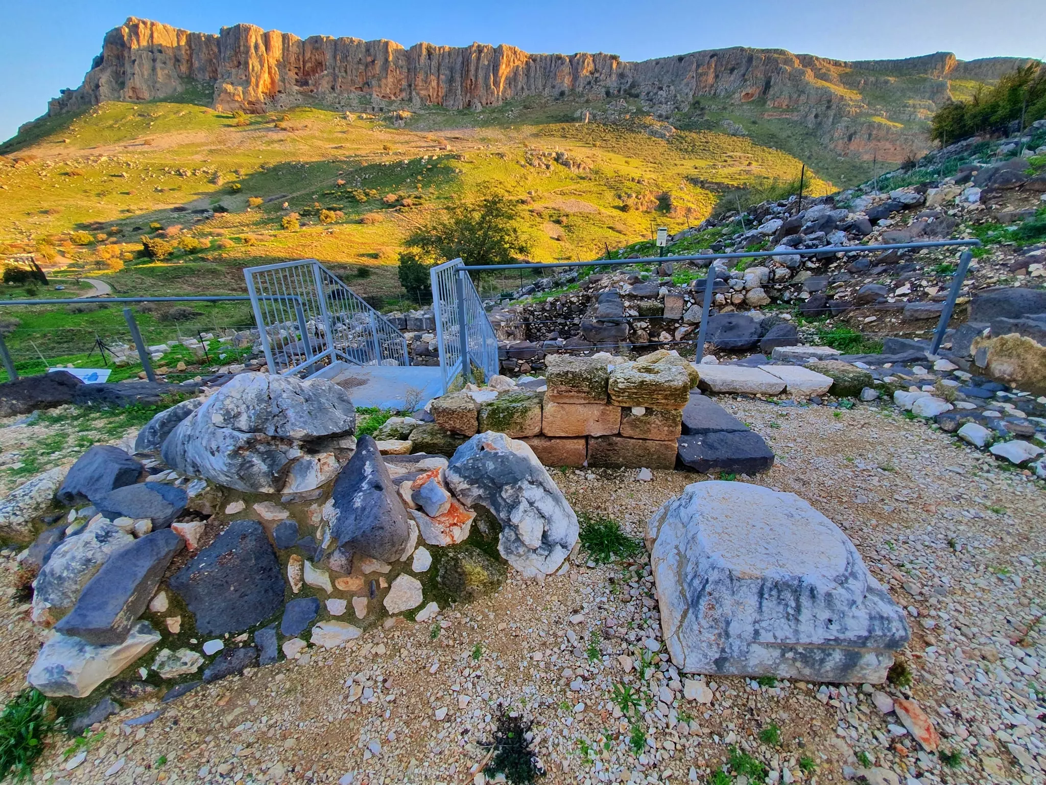
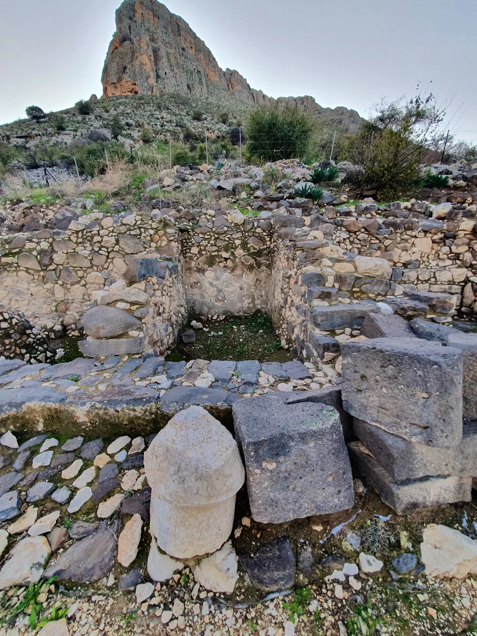
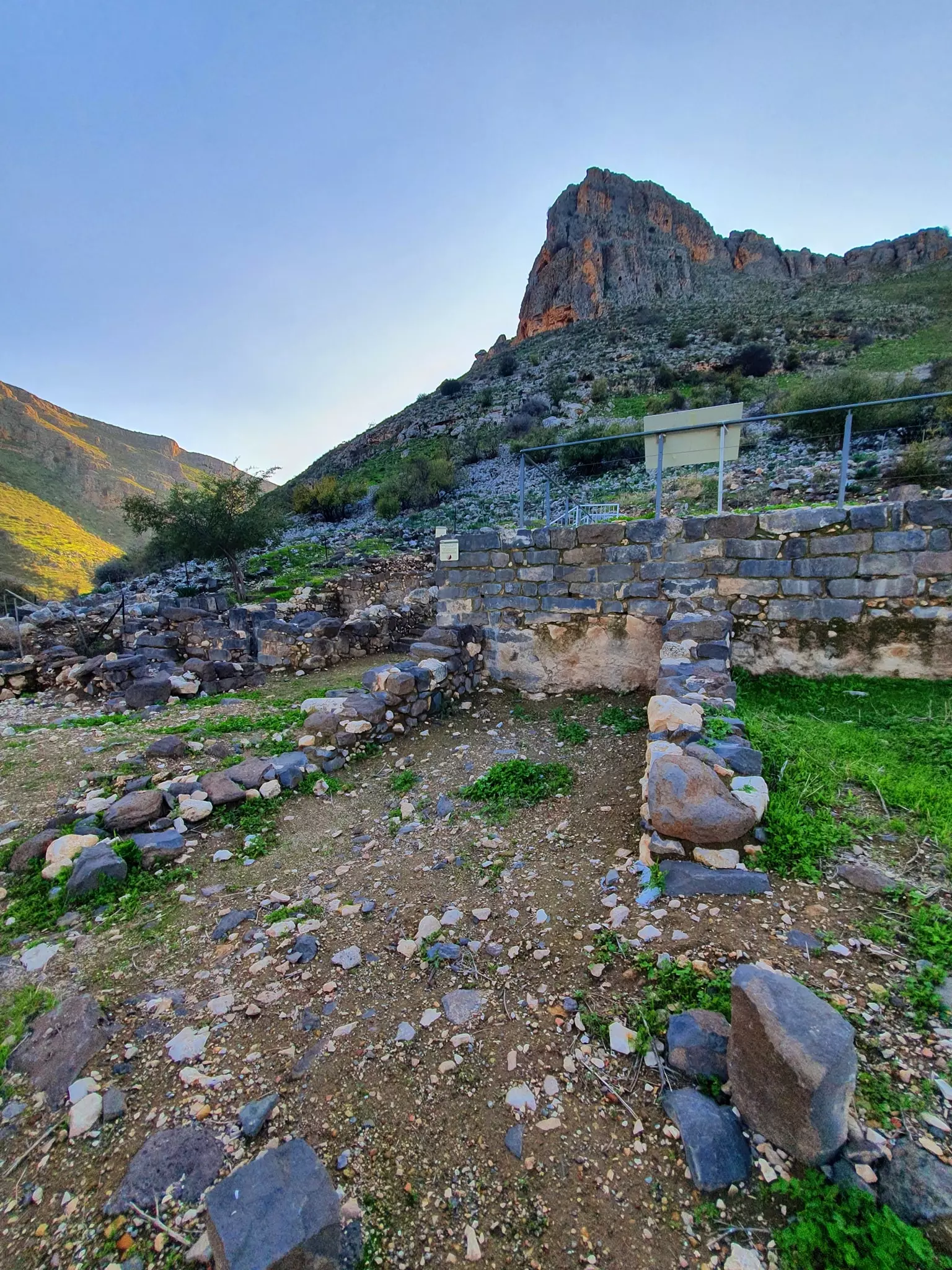
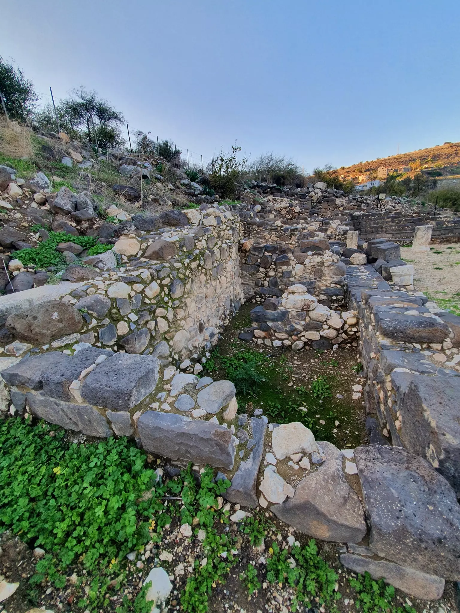
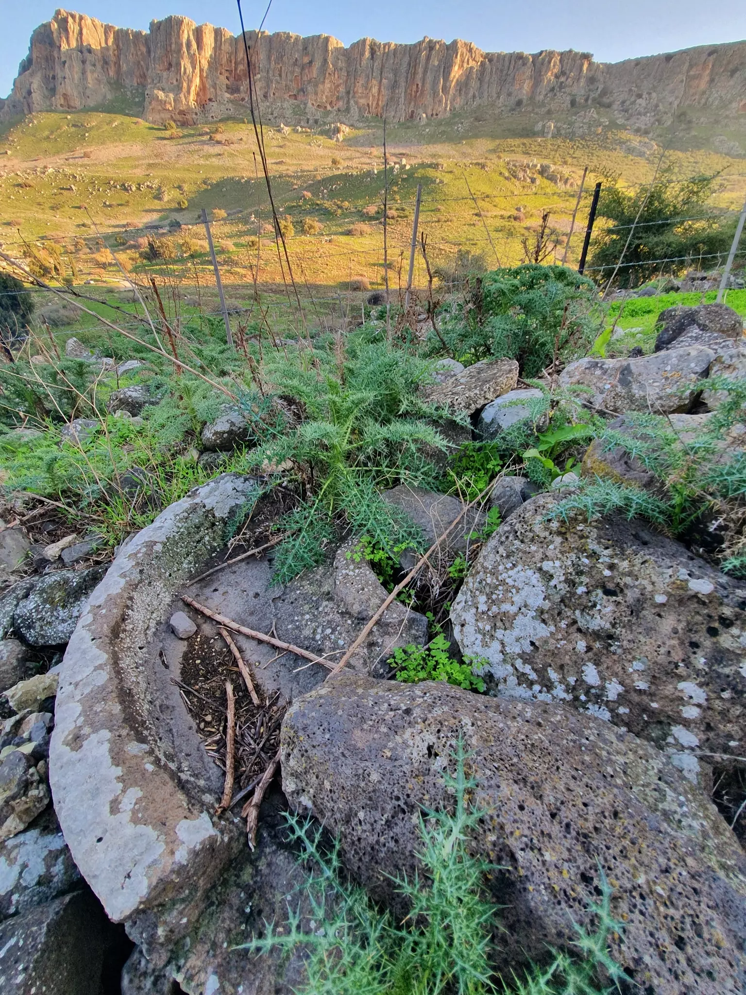
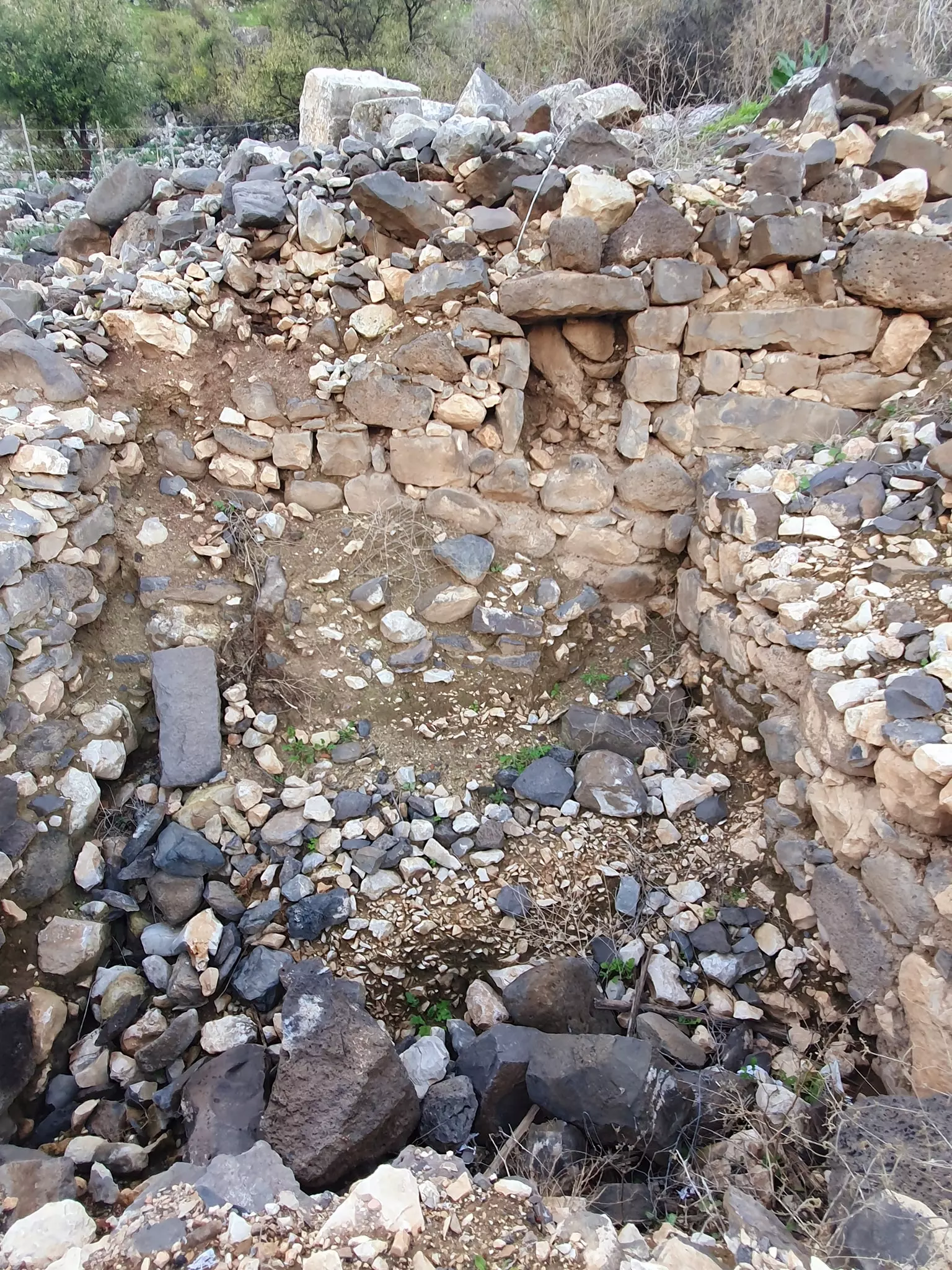
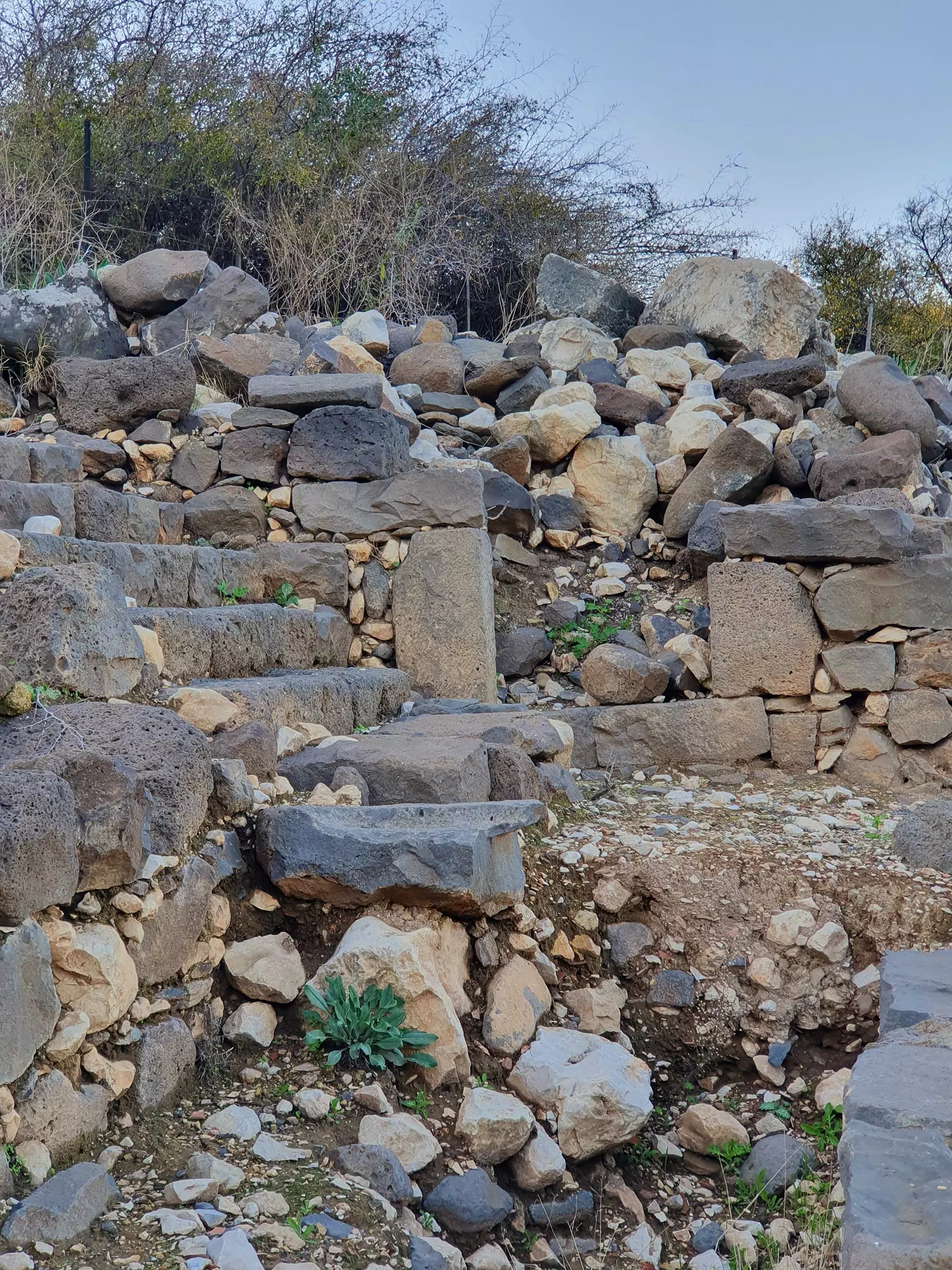
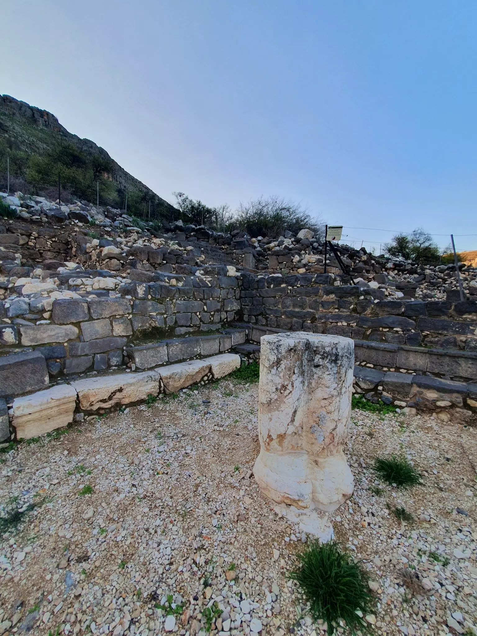
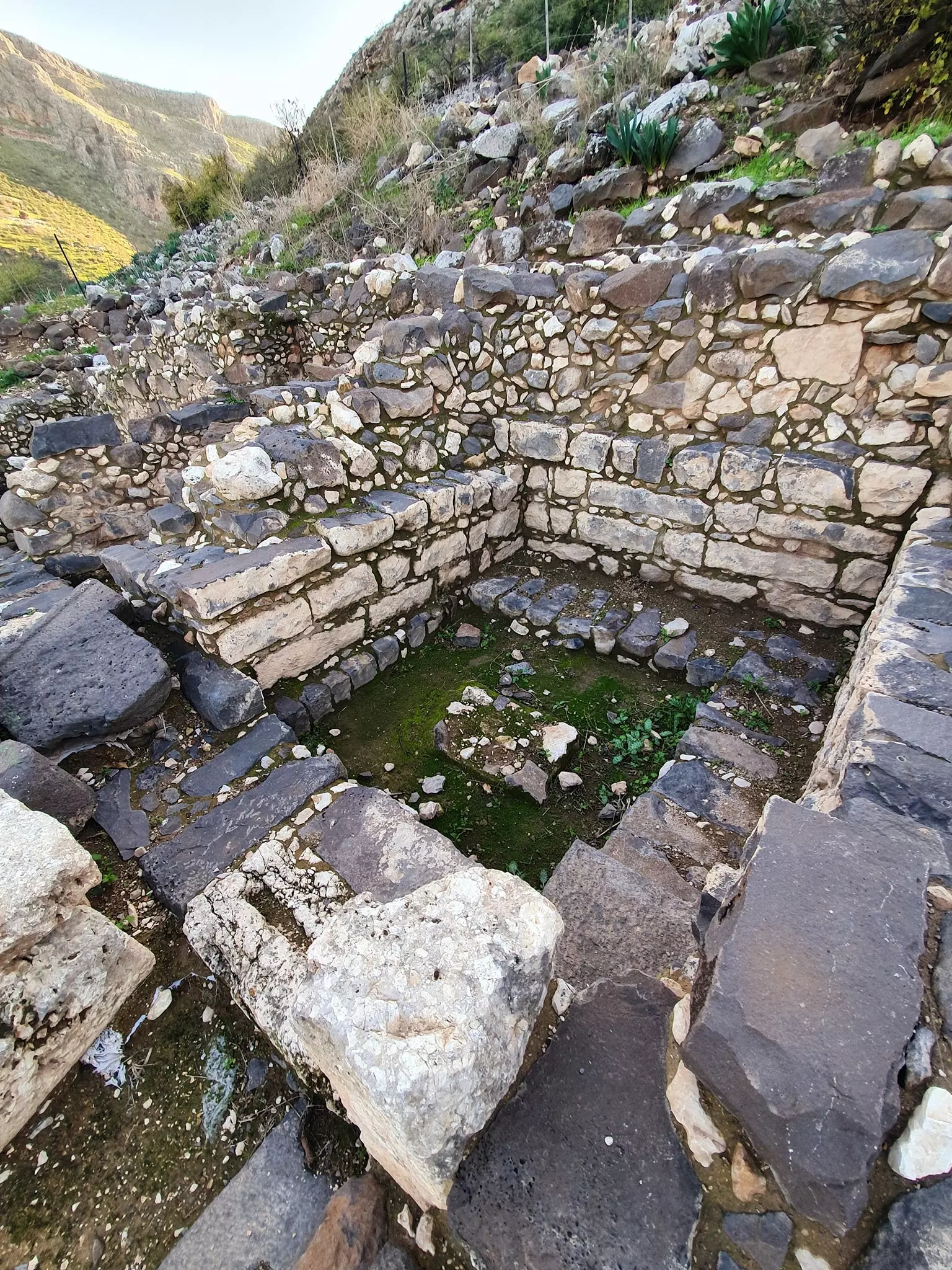
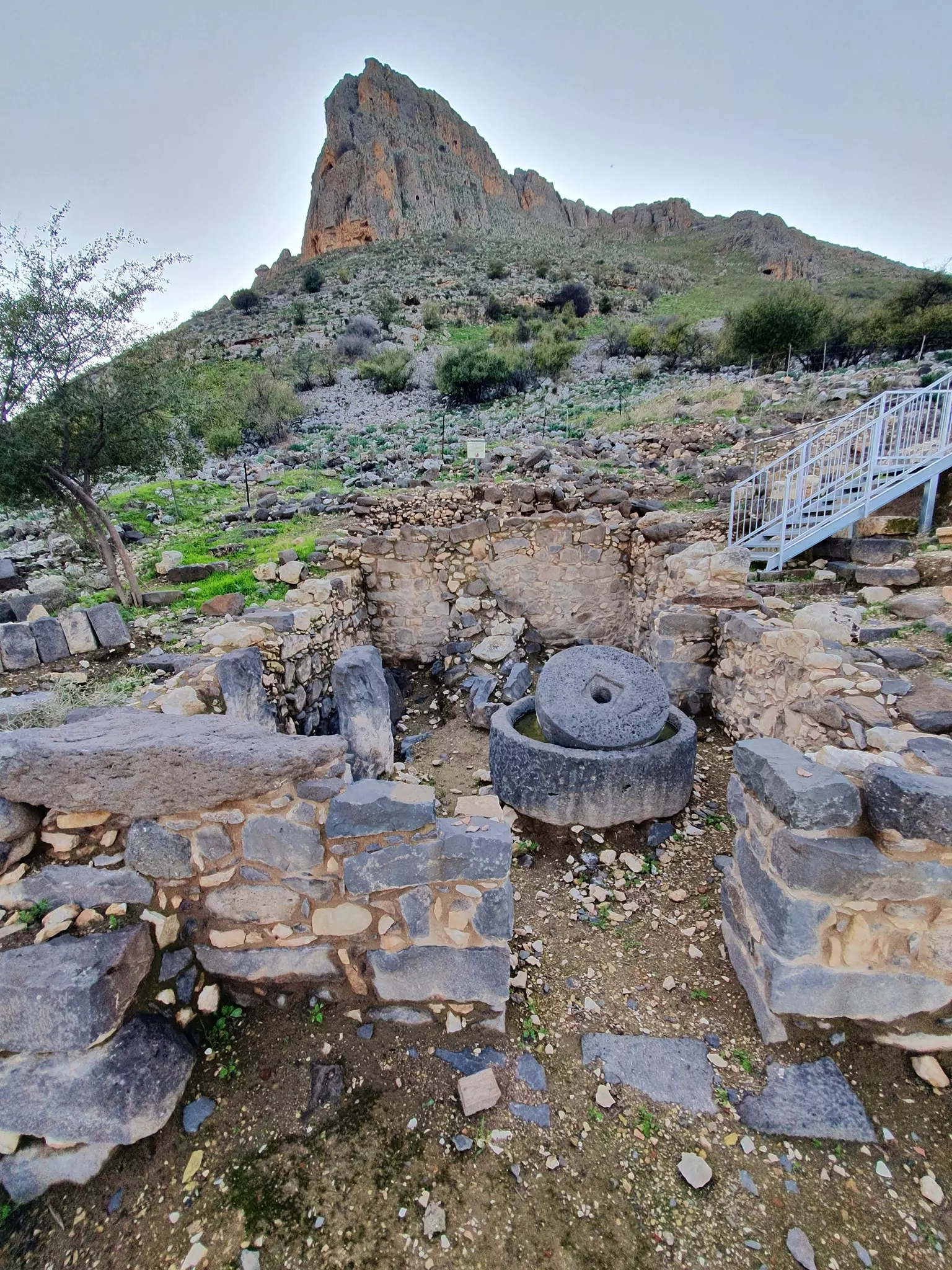
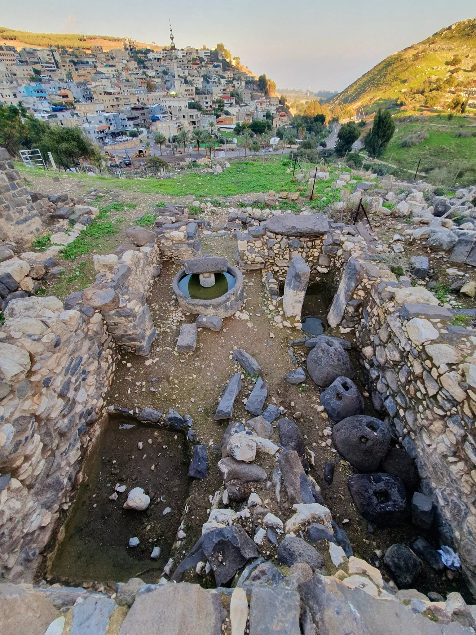
| Village Temains | Wadi al-Hamam was completely obliterated, and only house rubble left behind. |
| Ethnically Cleansing | Wadi al-Hamam inhabitants were completely ethnically cleansed. |
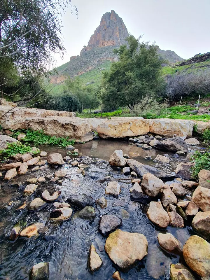
| Nearby Wadies & Rivers | Wadi al-Hamam is situated on the banks of Wadi al-Hamam. |
| Exculsive Jewish Colonies Who Usurped Village Lands |
No settlements on village lands |
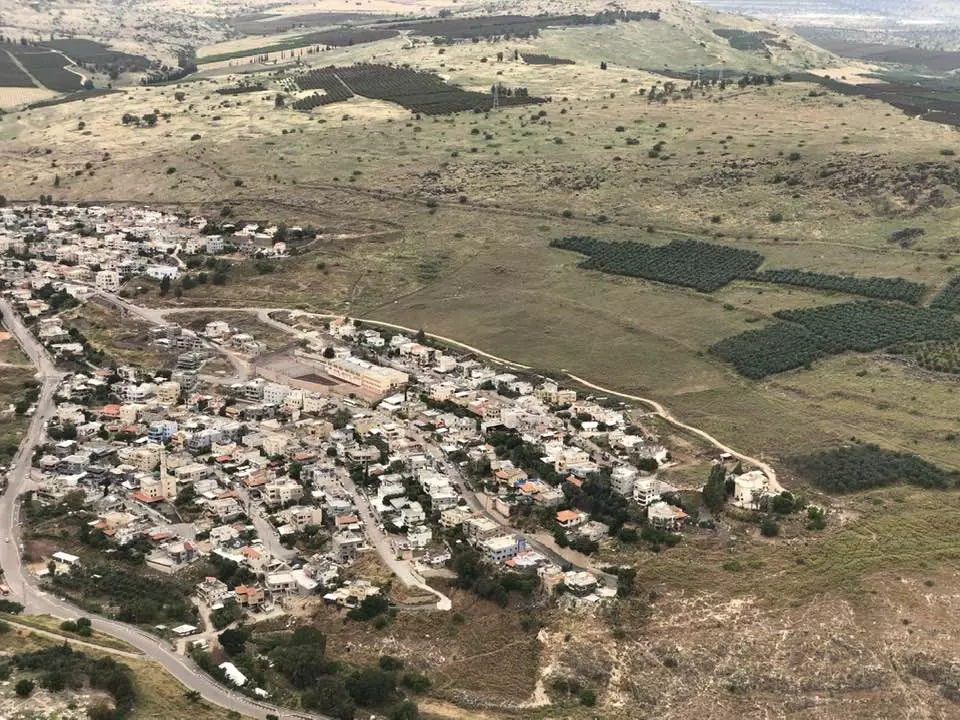
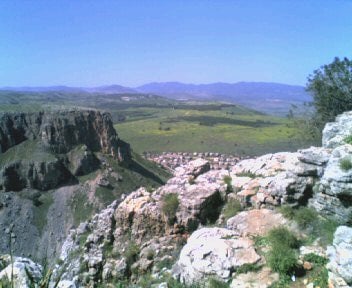
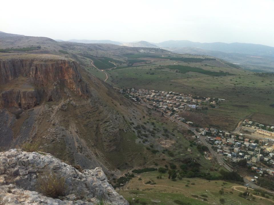
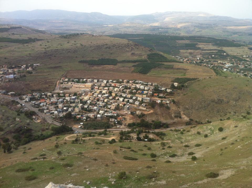
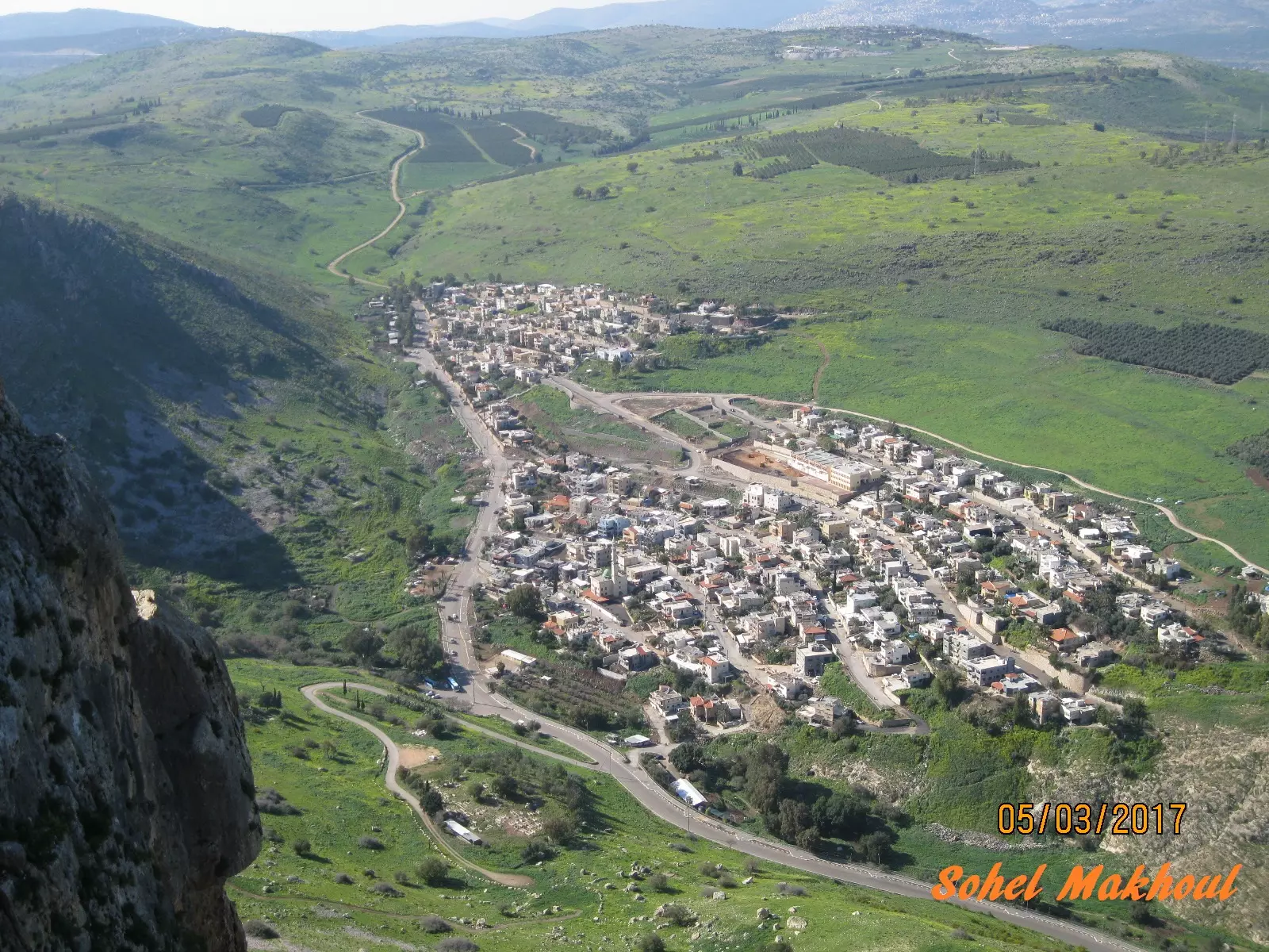
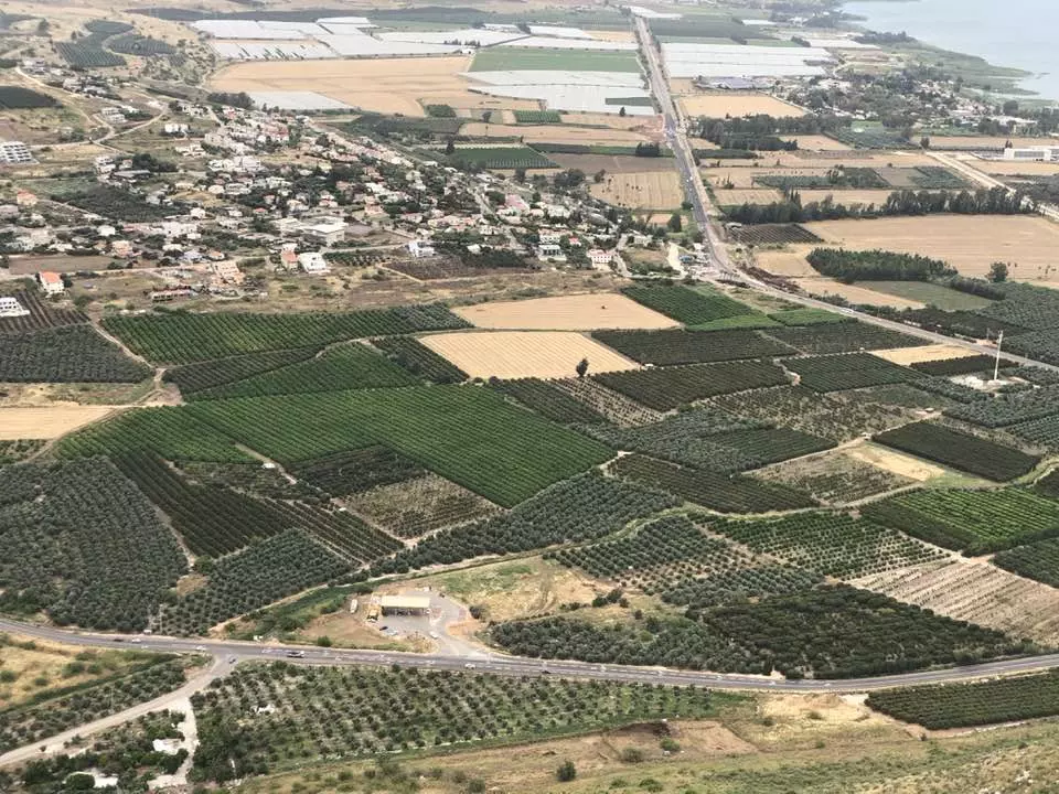
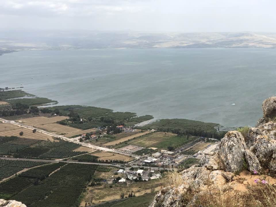
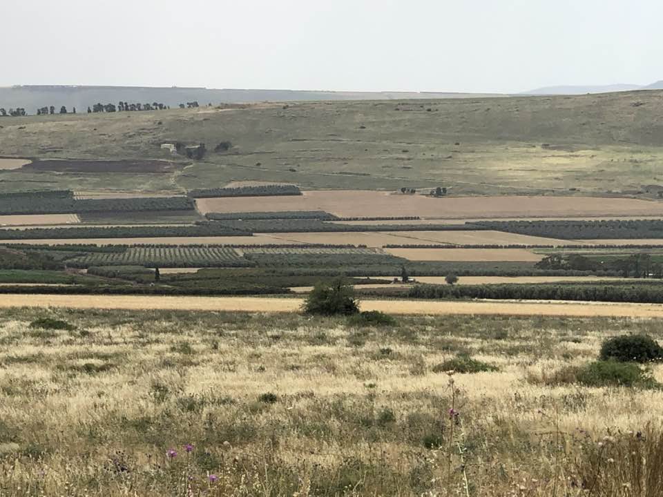
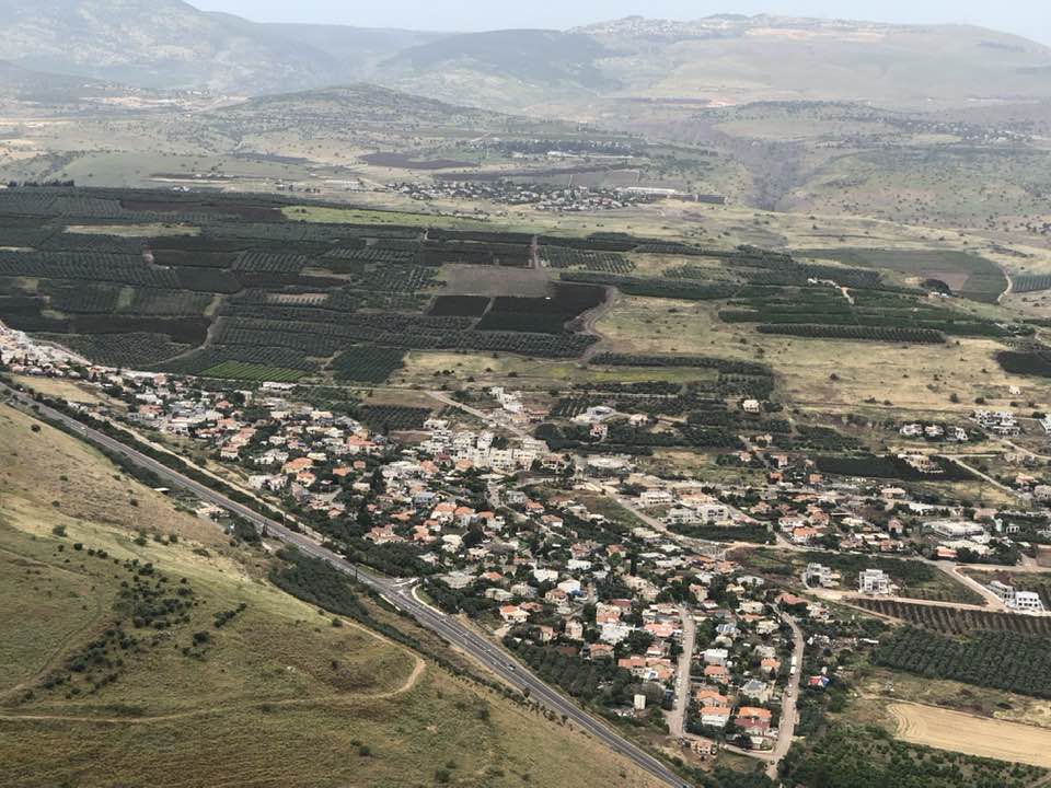
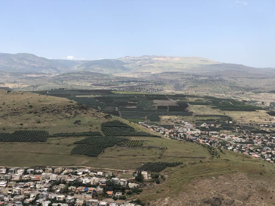
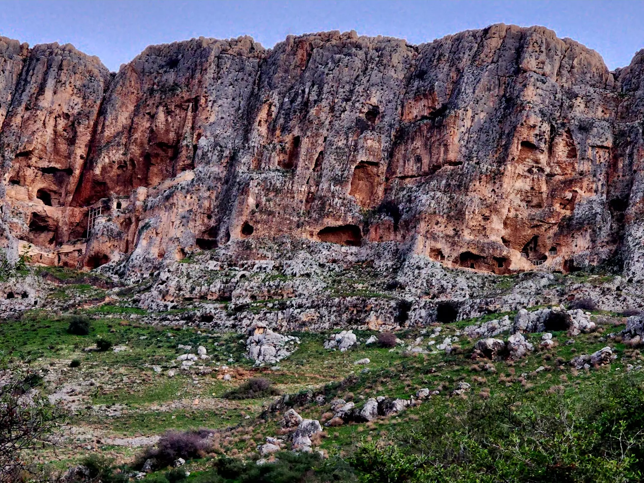
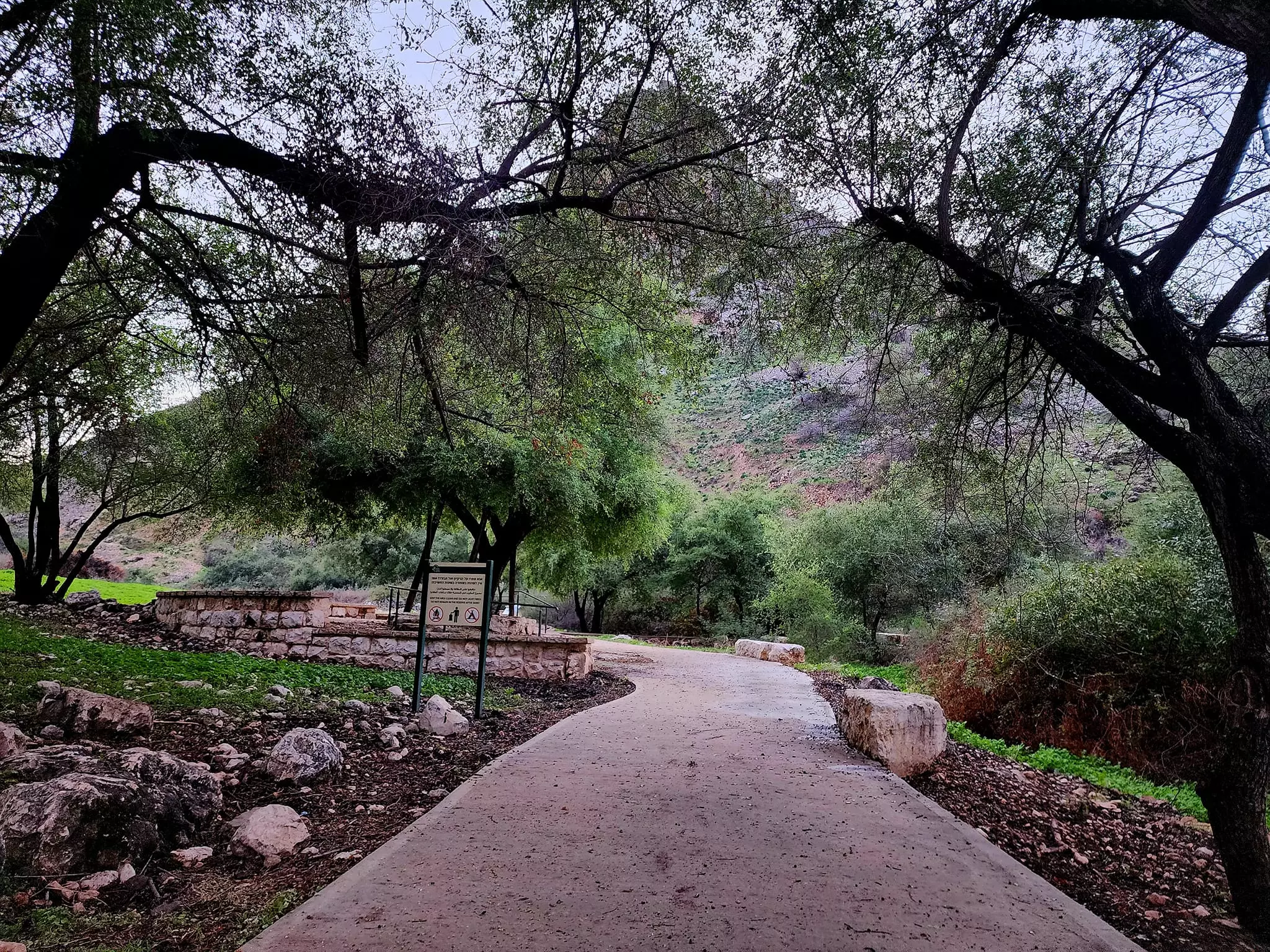
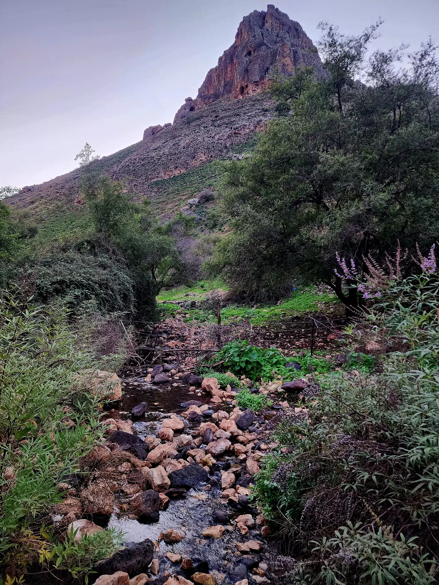
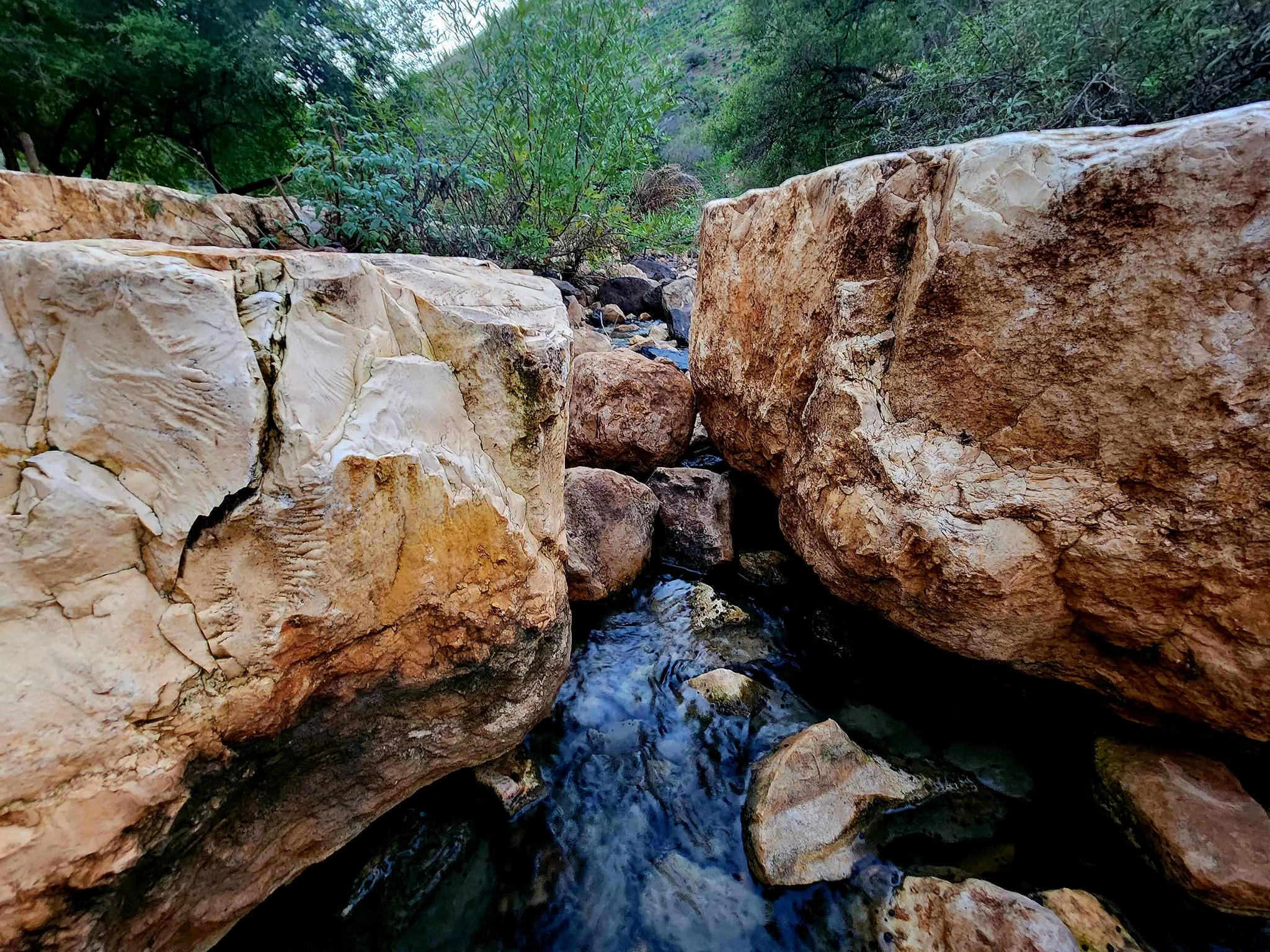
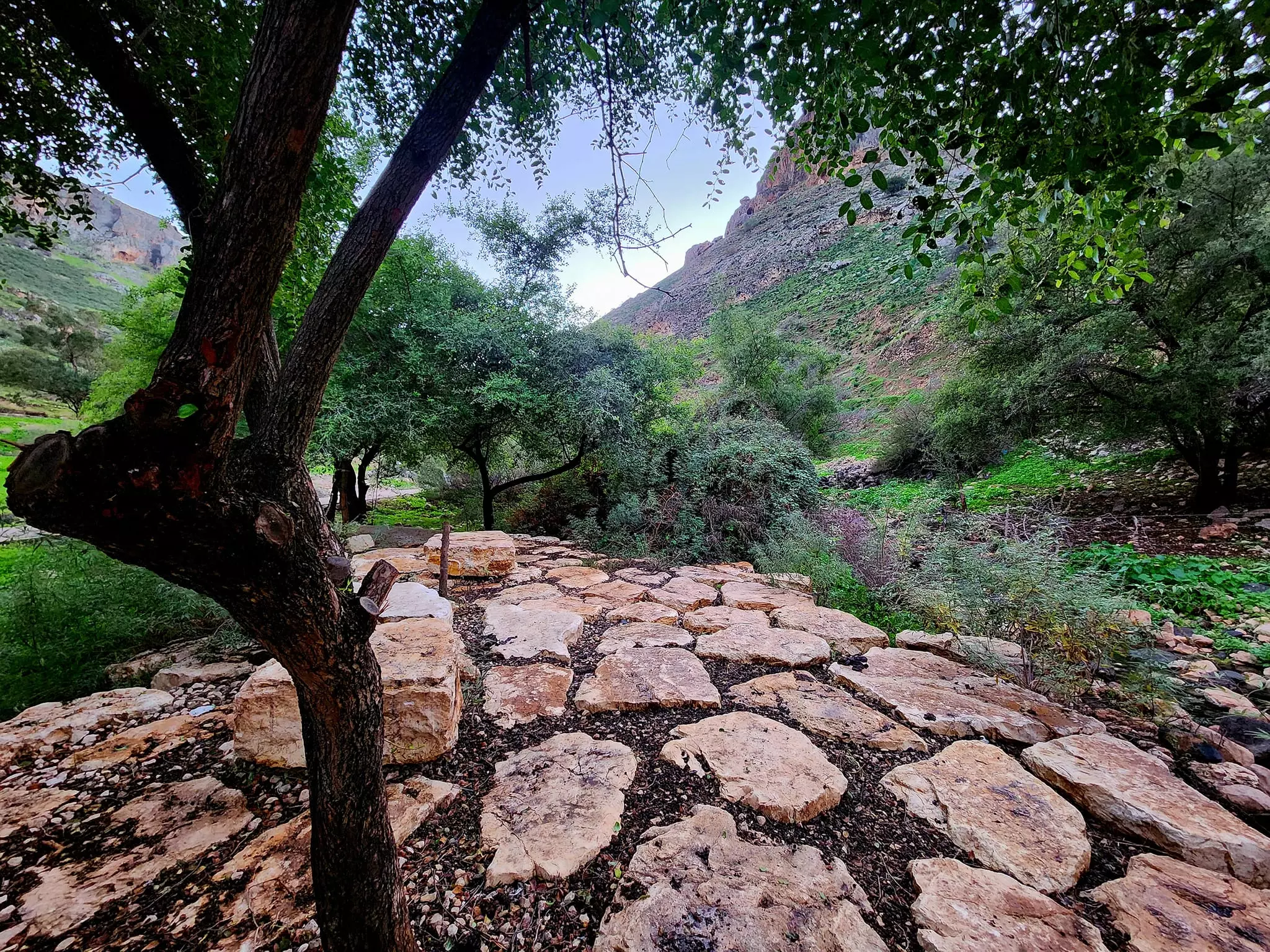
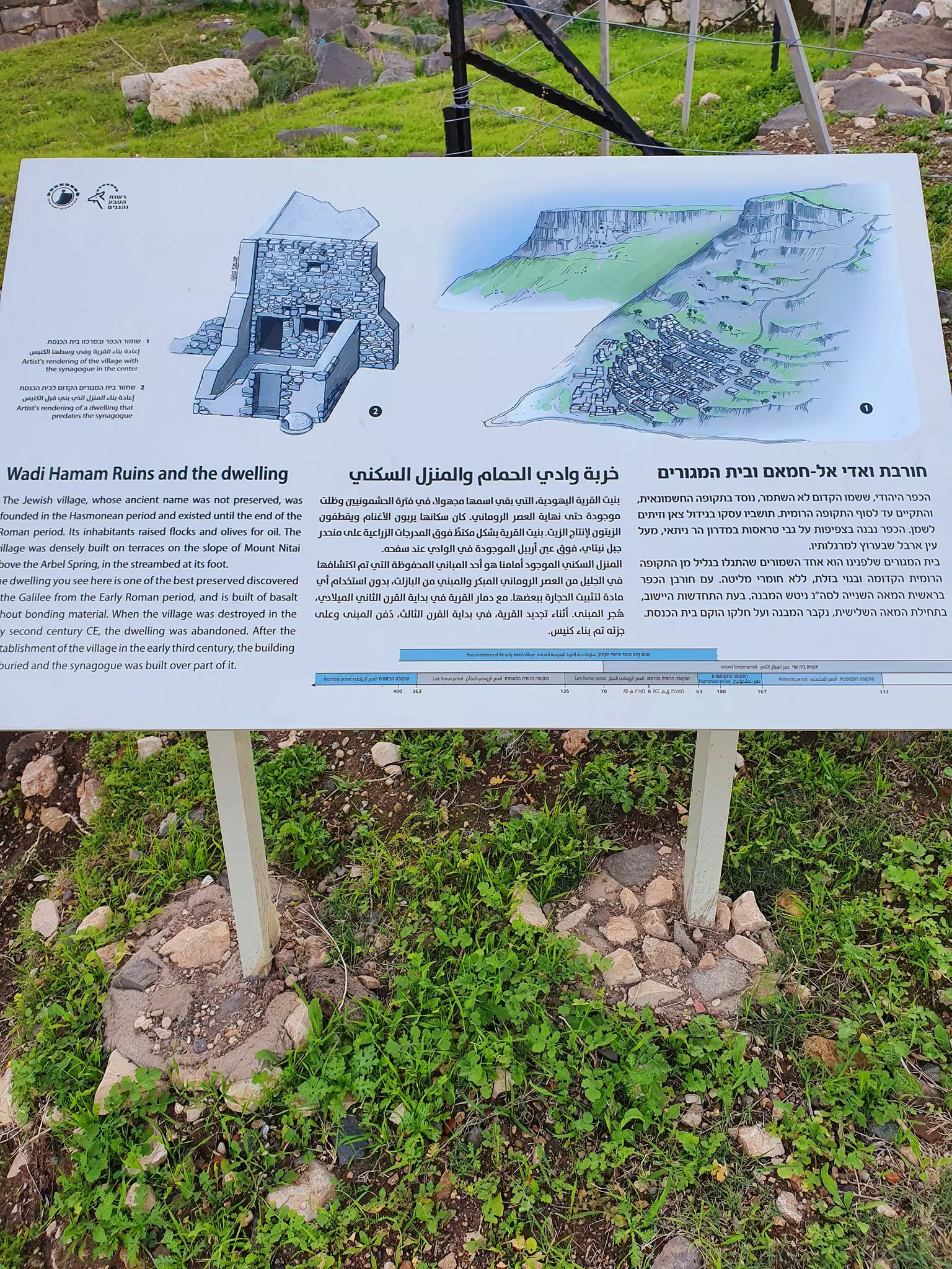
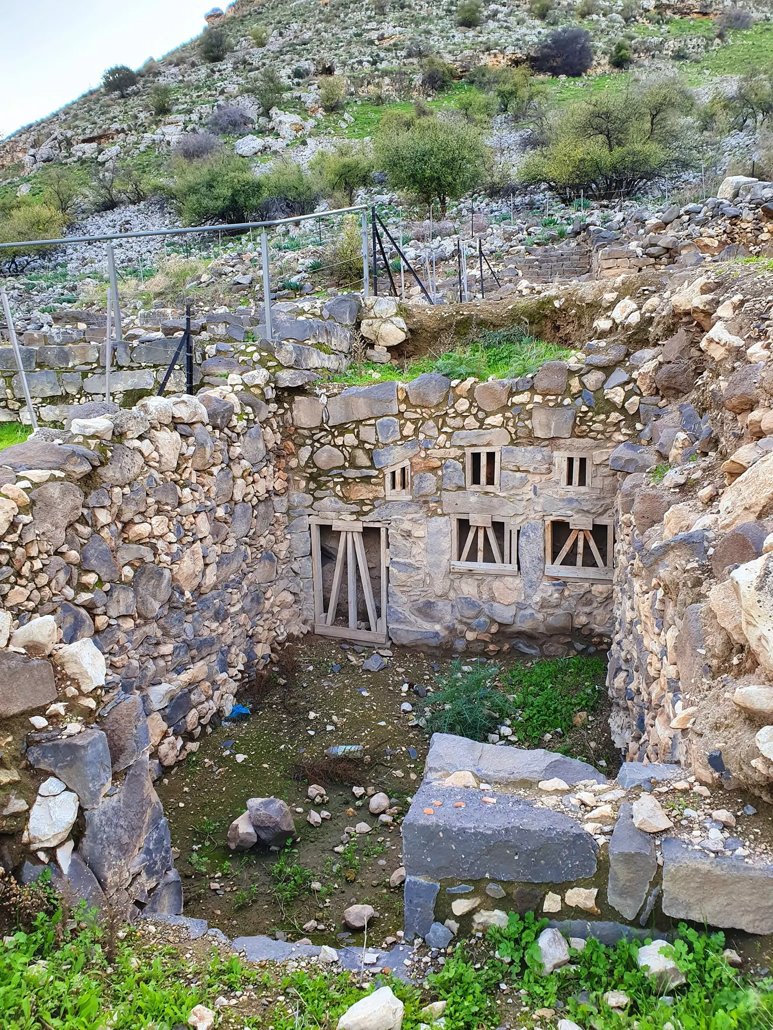
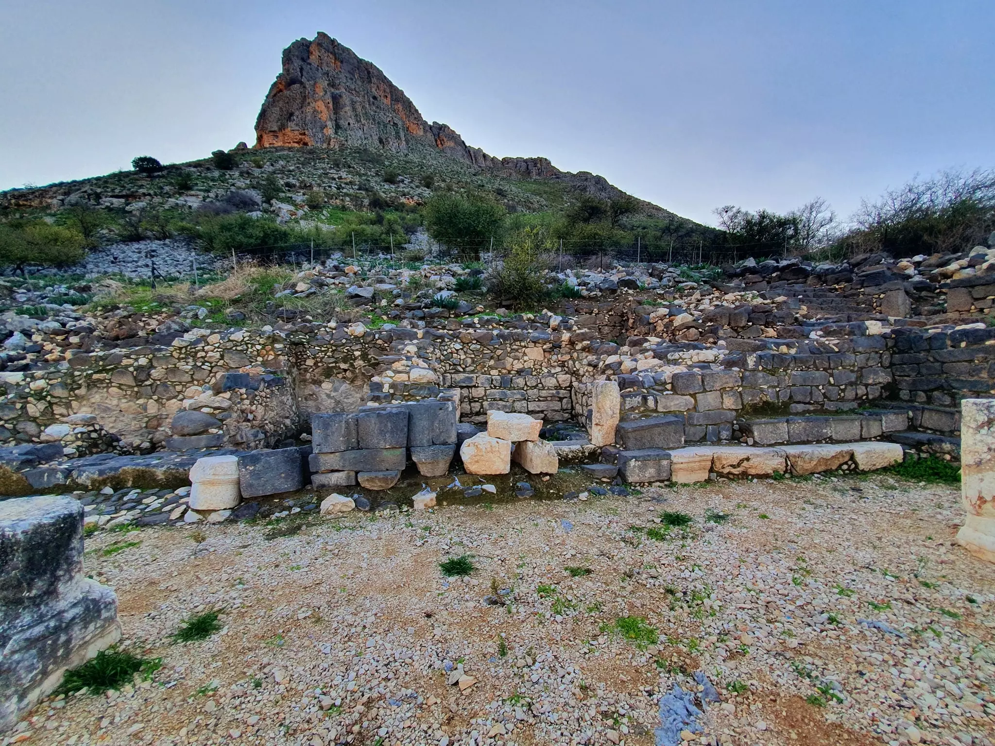
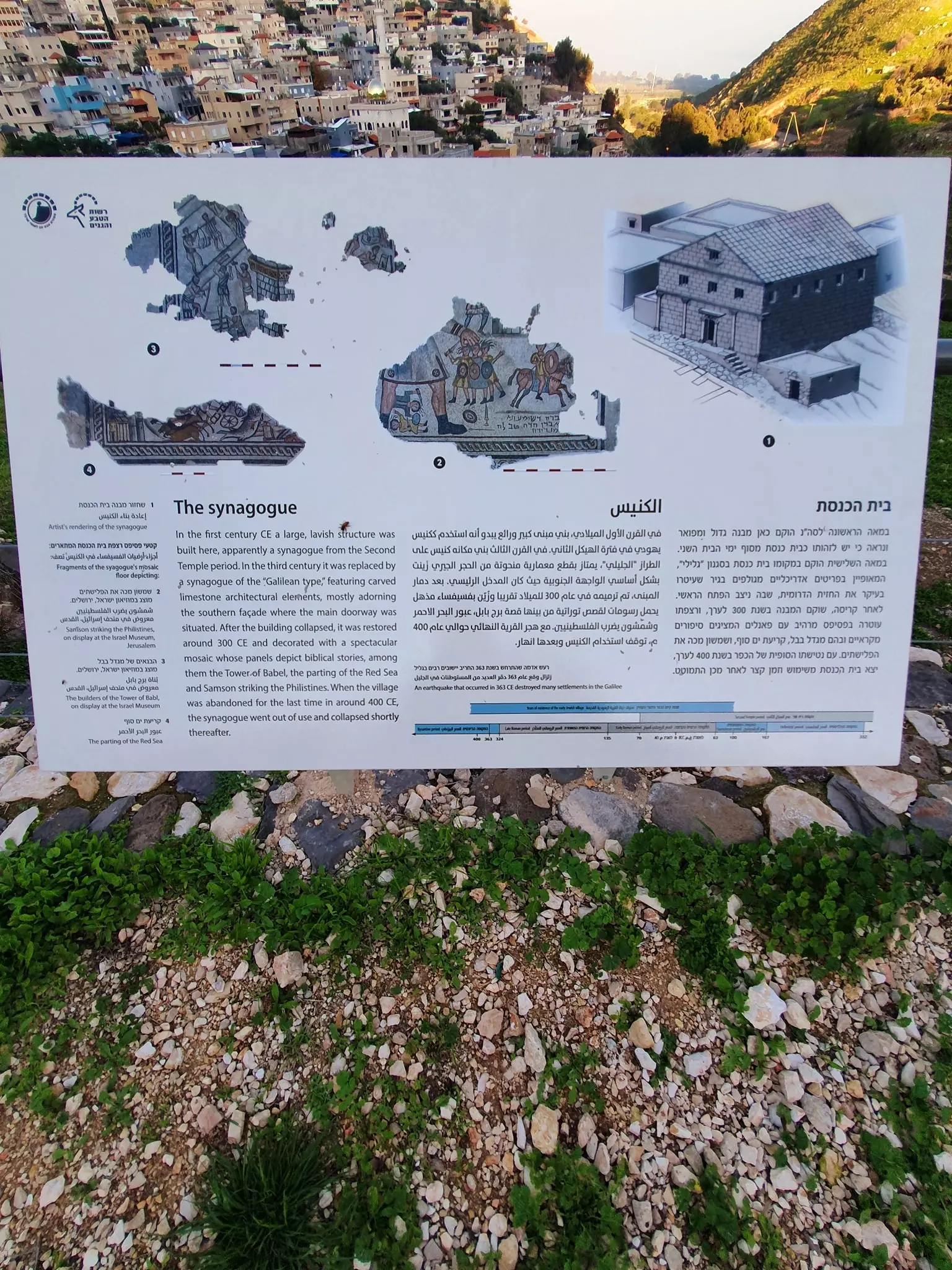
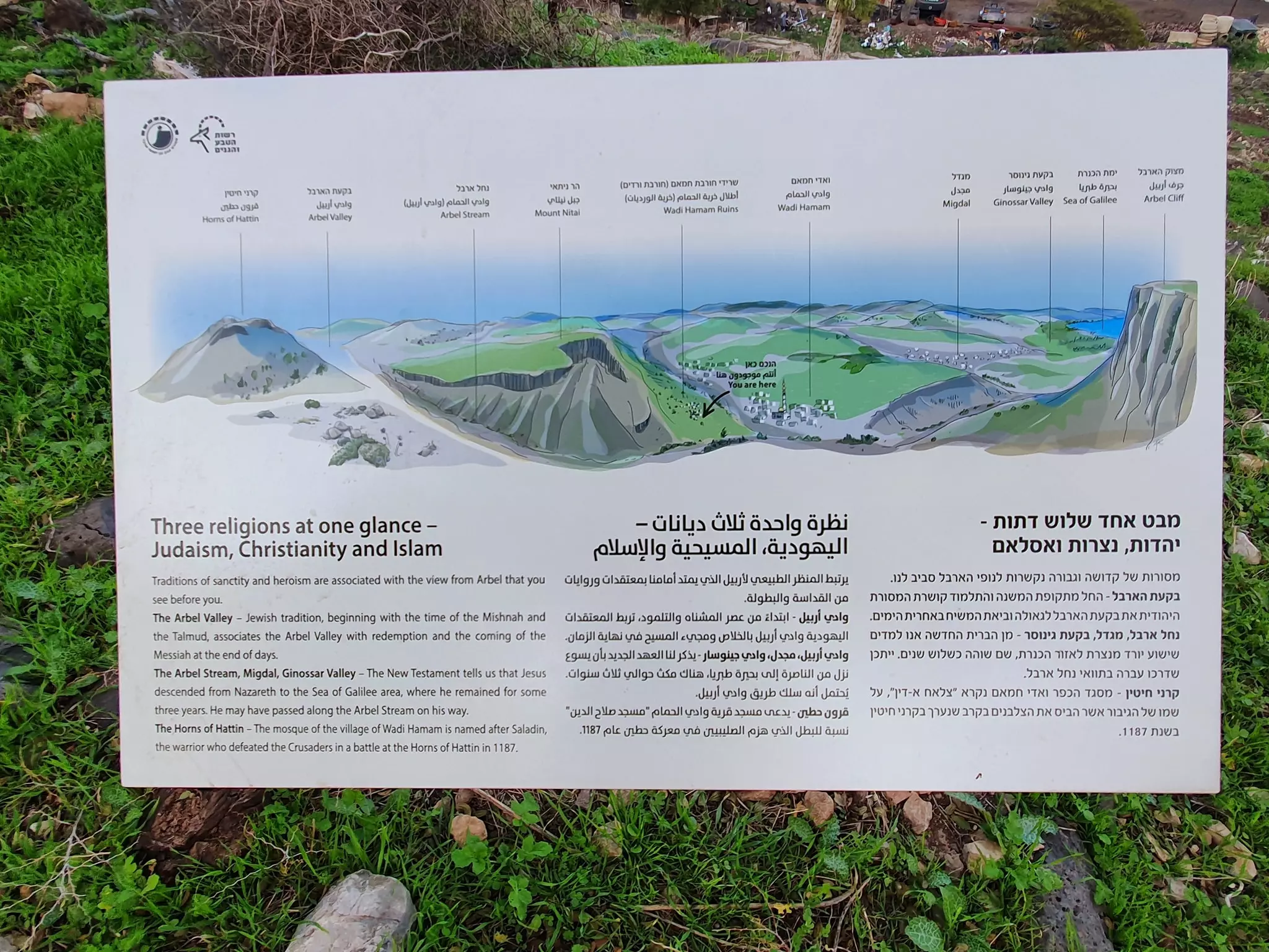
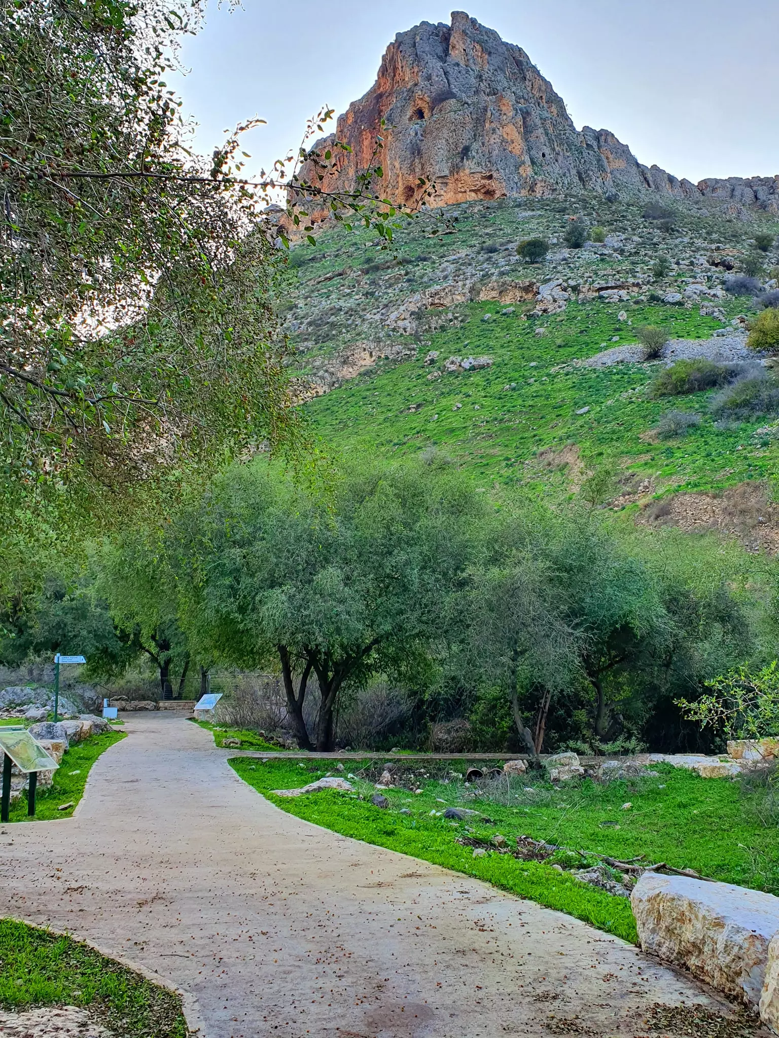
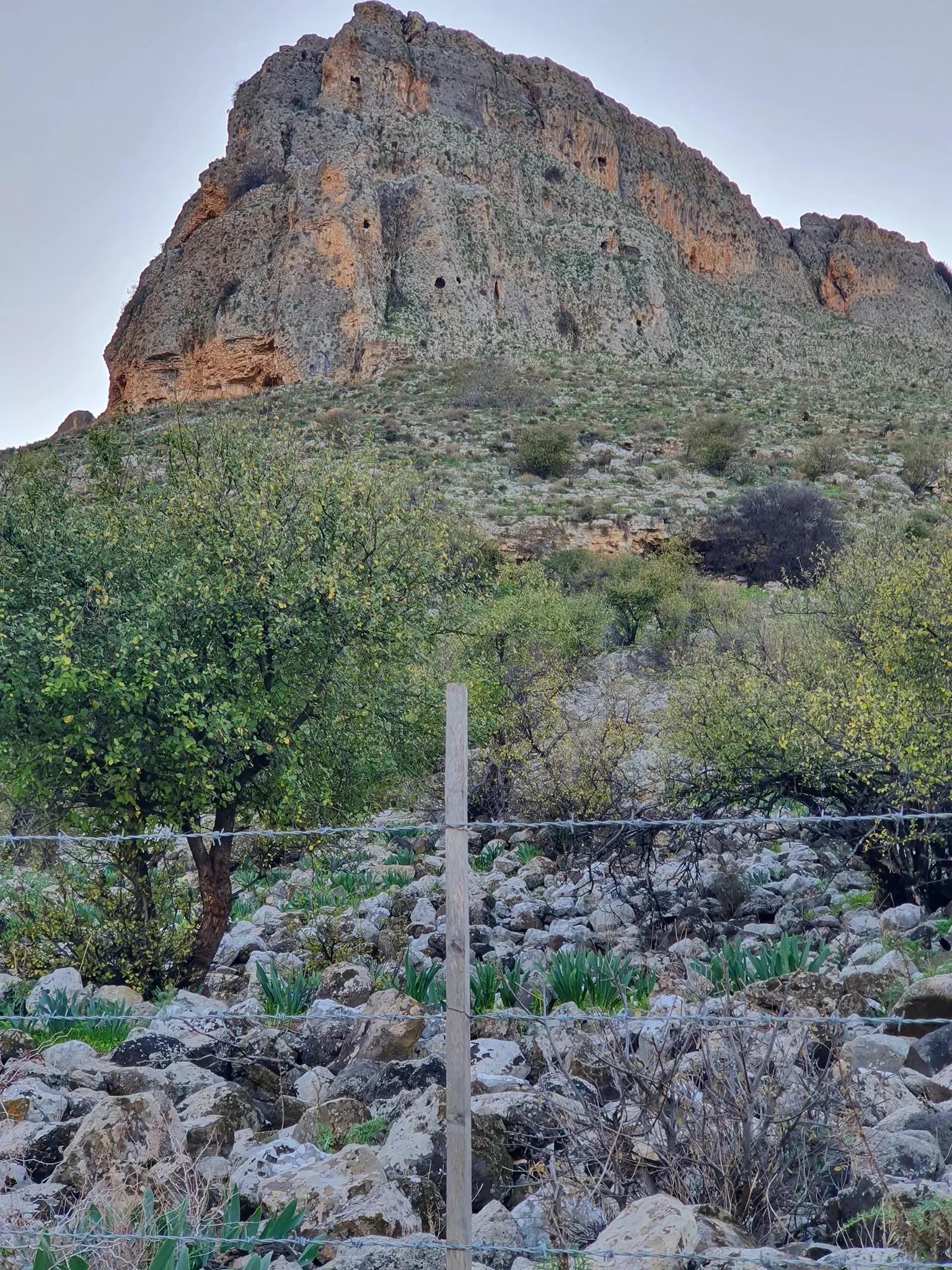
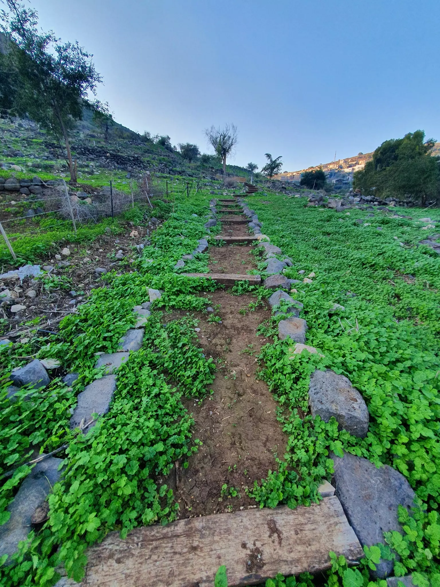
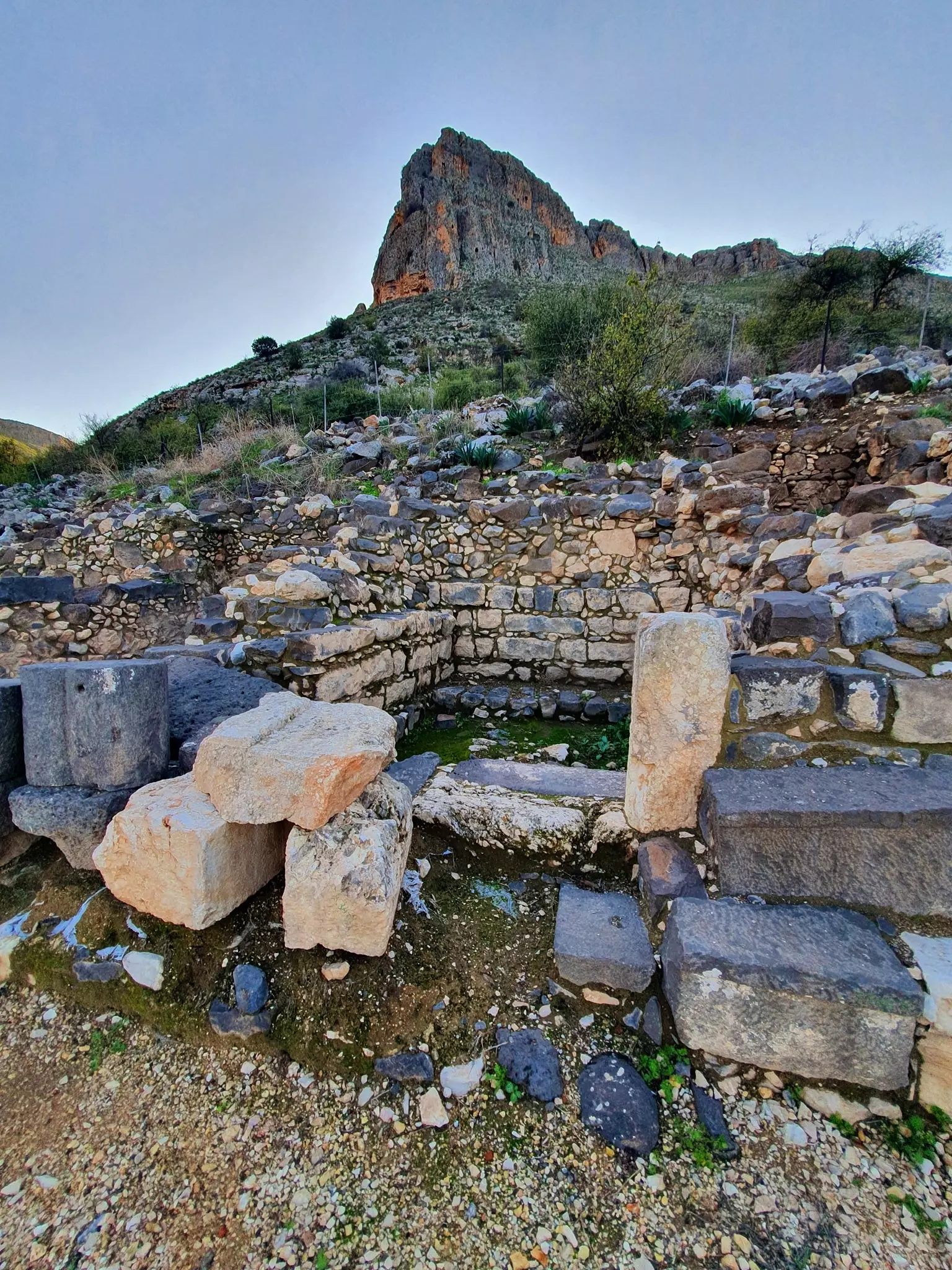
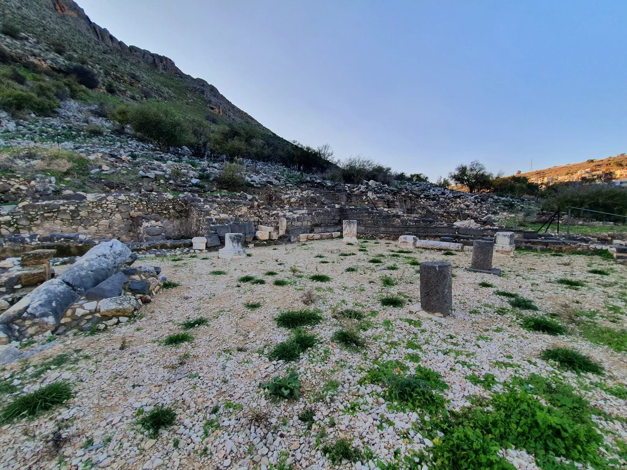
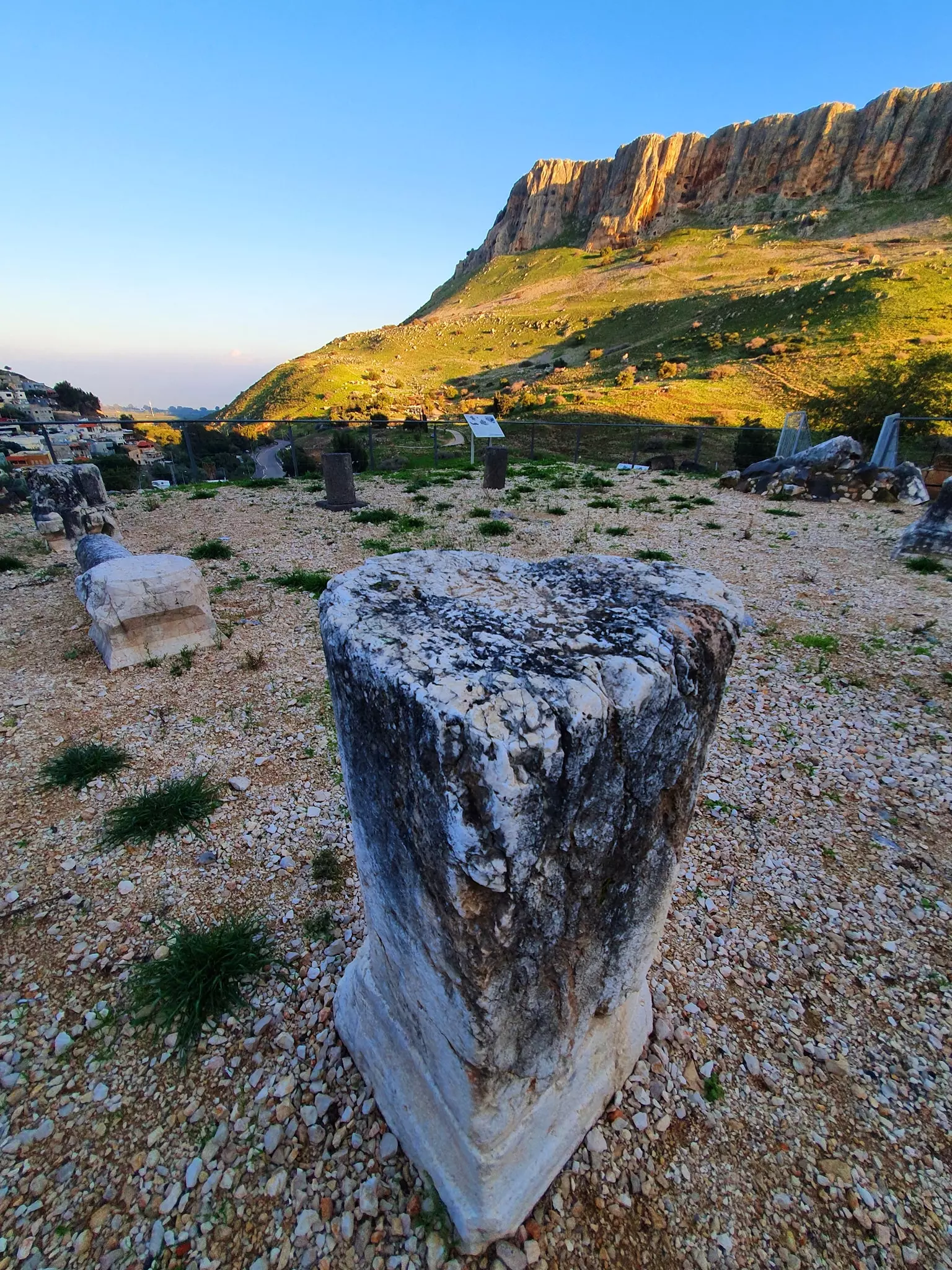
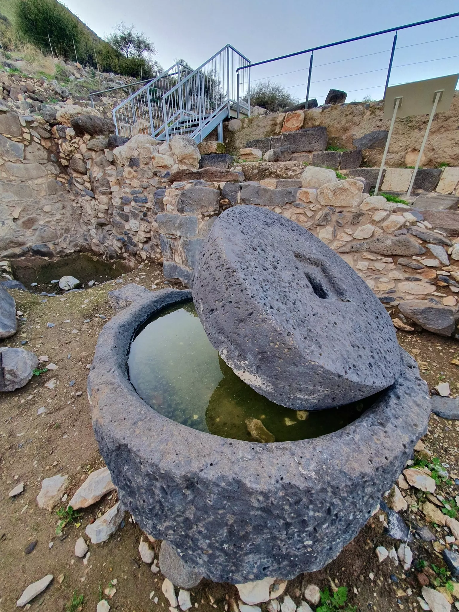
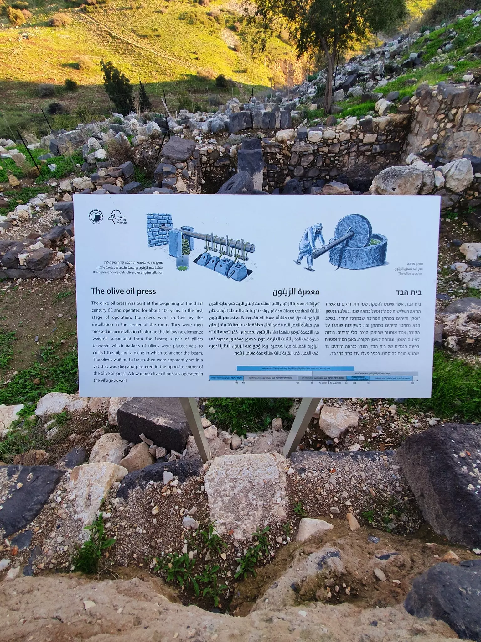
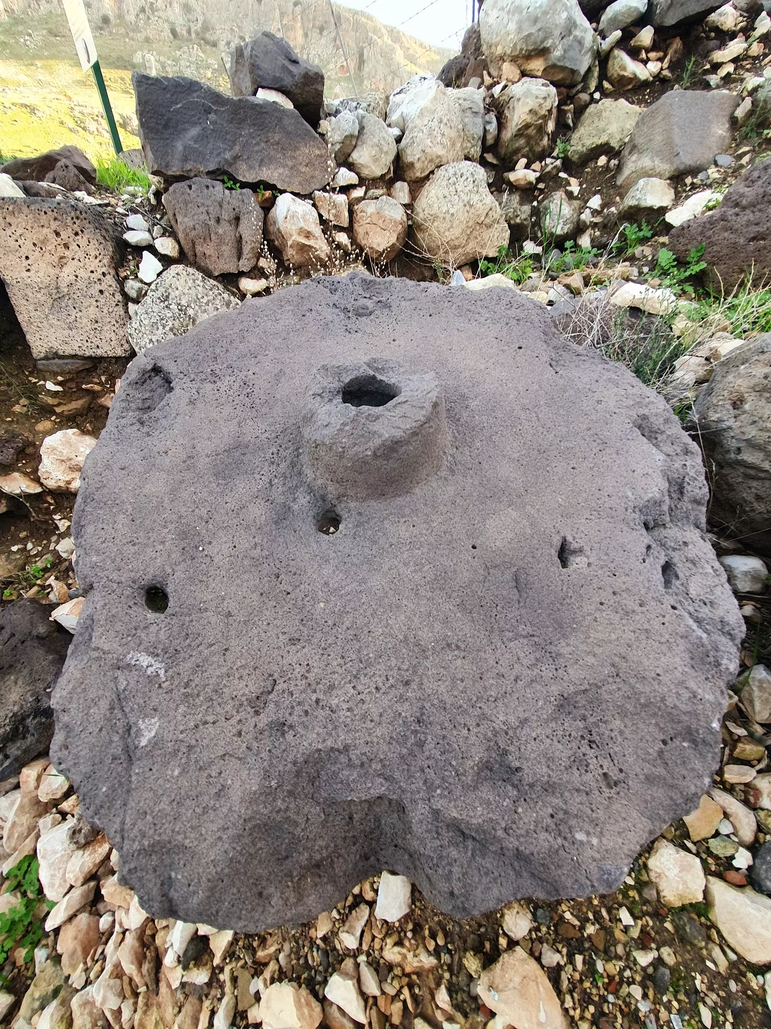
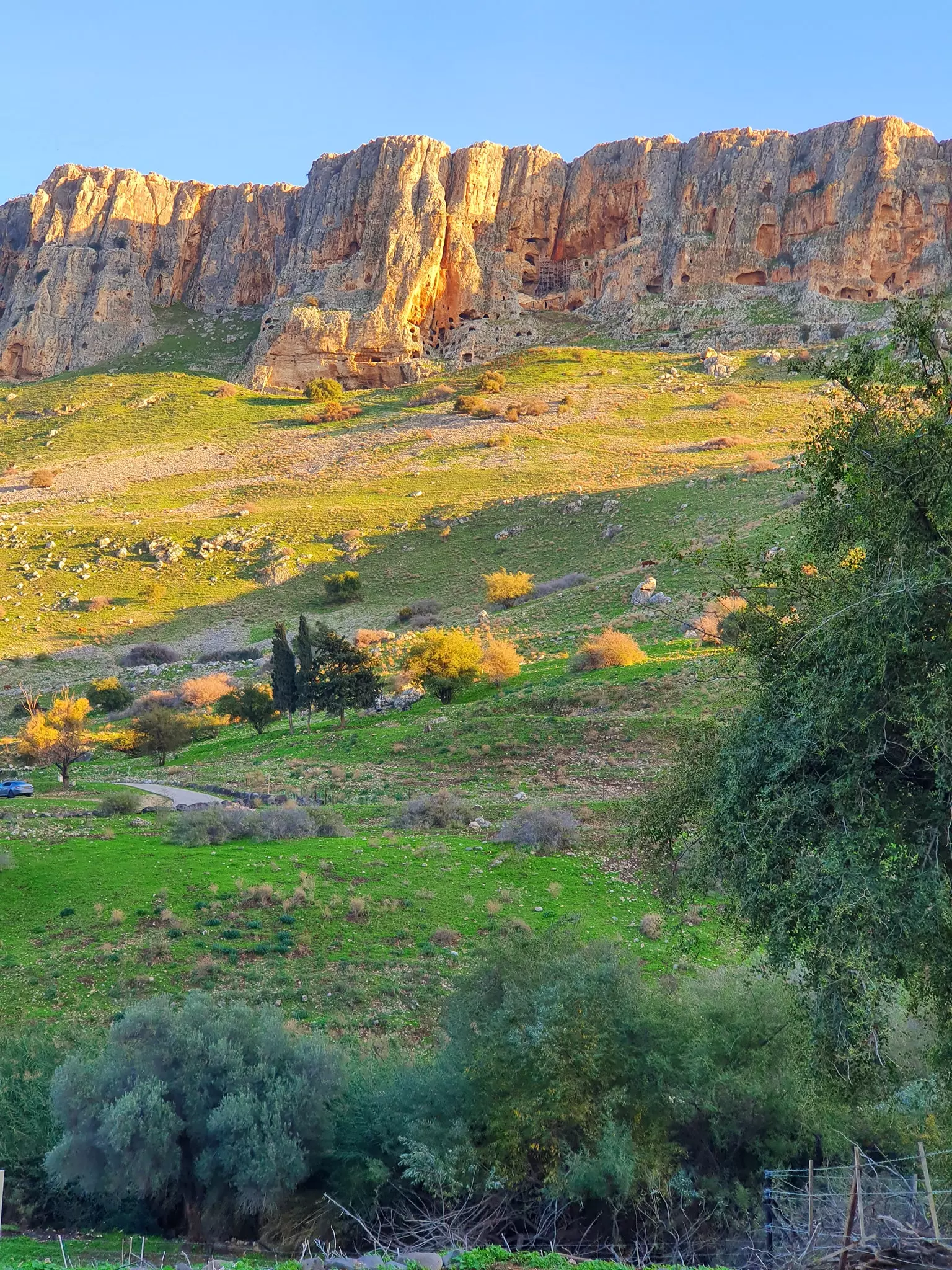
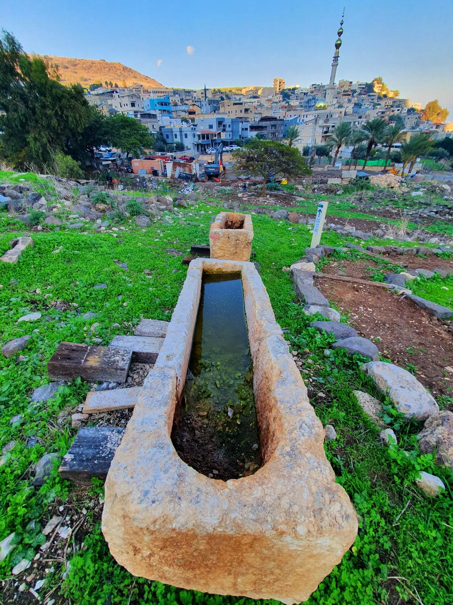
Village Before NakbaThe village was located on the northern bank of a wadi that bore the same name: Wadi al-Hamam ('Valley of the Pigeons'). It was about 3 km west of the shore of Lake Tiberias. A dirt path linked it to a highway leading to the village of al-Majdal on the lake. A small fort, known as Qal'at al-Hamam or Qal'at ibn Ma'ni, was nearby. The English traveler Richard Pococke visited the wadi in 1737 [[Pococke (1945) II:66-69]] , as did Burckhardt almost a century later. [[Burckhardt 1822:320]] Both reported seeing the fort but made no mention of a village. According to later sources, however, the Bedouin of the area had settled near the wadi.Zionists Colonies on Village LandsThere are no Israeli settlements on village lands.Village TodayAll that remains of the village are the debris of houses and the remnants of walls. The site is overgrown with thorns, grasses, and some trees. Near the site, a new village bearing the same name has been set up by Israelis for Palestinian "internal refugees" from the villages of the al-Hula area, especially the village of al-Muftakhira (in Safad sub-district). These villagers, however, do not own any of the land around the village. Some of this land is used as pasture and some is cultivated.SourceDr. Walid al-Khalidi, 1992: All That Remains. |
|
| Related Maps | Town Lands' Demarcation Maps خرائط للقضاء توضح حدود القرى والاودية Town's map on MapQuest View from satellite Help us map this town at WikiMapia |
| More Information | في كتاب كي لا ننسى المزيد من موقع هوية |
- Remains of house walls & stone fences, 1987
2 - منظر عام لاراضي القرية
Posted by رامي مصطفى - وادي الحمام
Posted by رامي مصطفى 2 - General View
Posted by جهاد السوالمة - General View
Posted by جهاد السوالمة 1 - موقع القريه
Posted by abu raya - وادي الحمام
Posted by abu raya - موقع قريه وادي الحمام
Posted by abu raya - وادي الحمام
Posted by abu raya - اثار ردم بيوت القريه
Posted by abu raya - منظر عام لقرية وادي الحمام
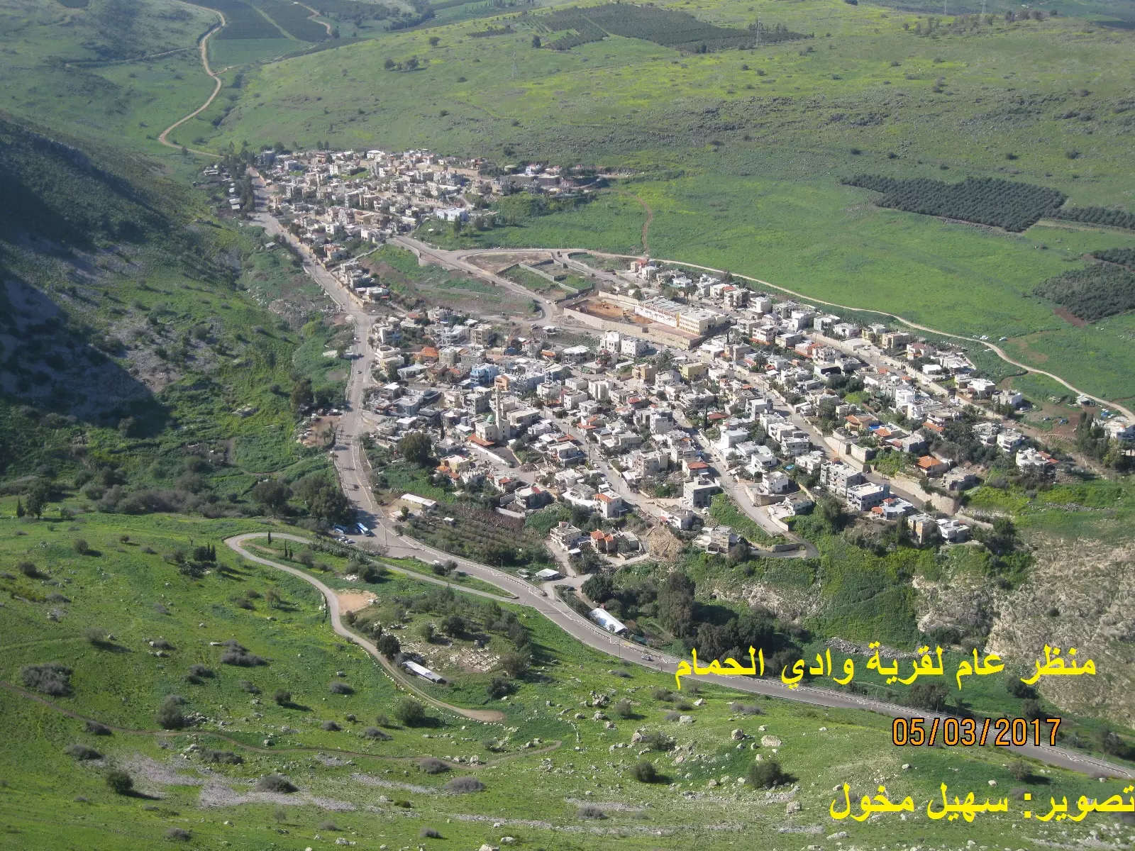
Posted by سهيل مخول - منظر عام لقرية وادي الحمام
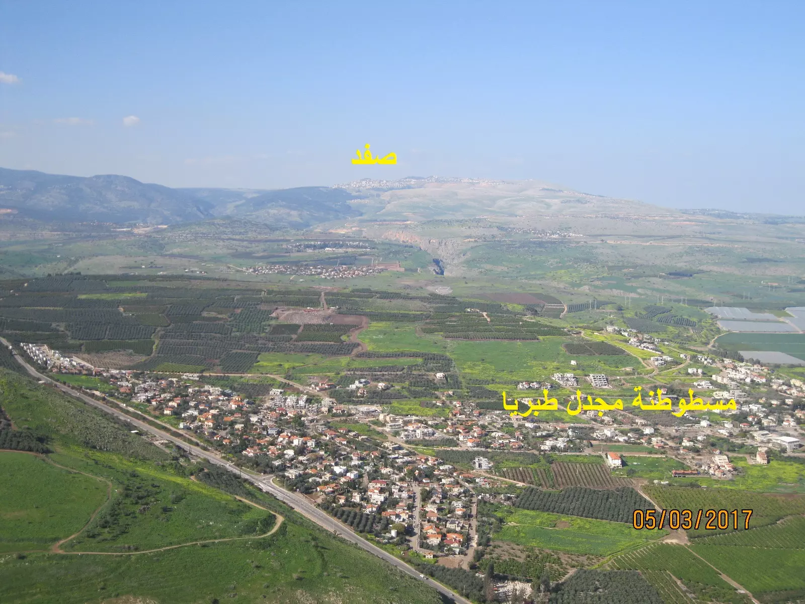
Posted by سهيل مخول - مسطوطنة مجدل على اراضي قرية مجدل طبريا المهجرة
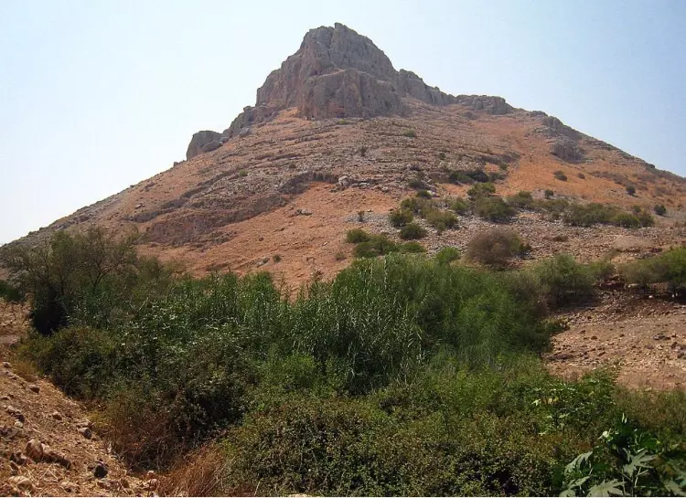
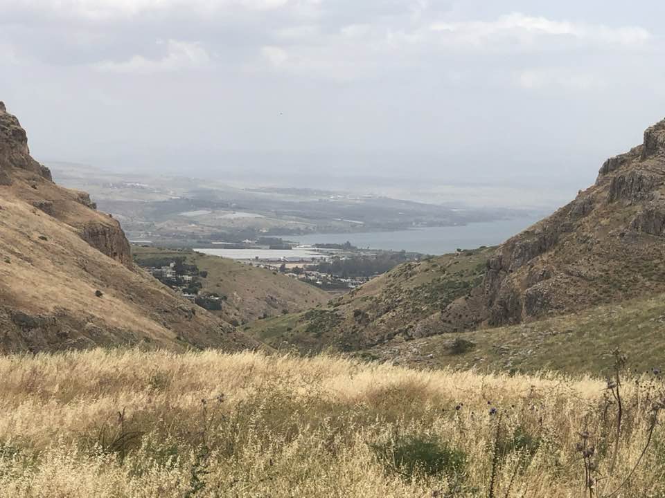
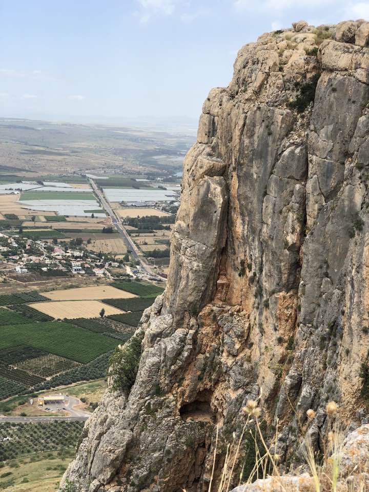
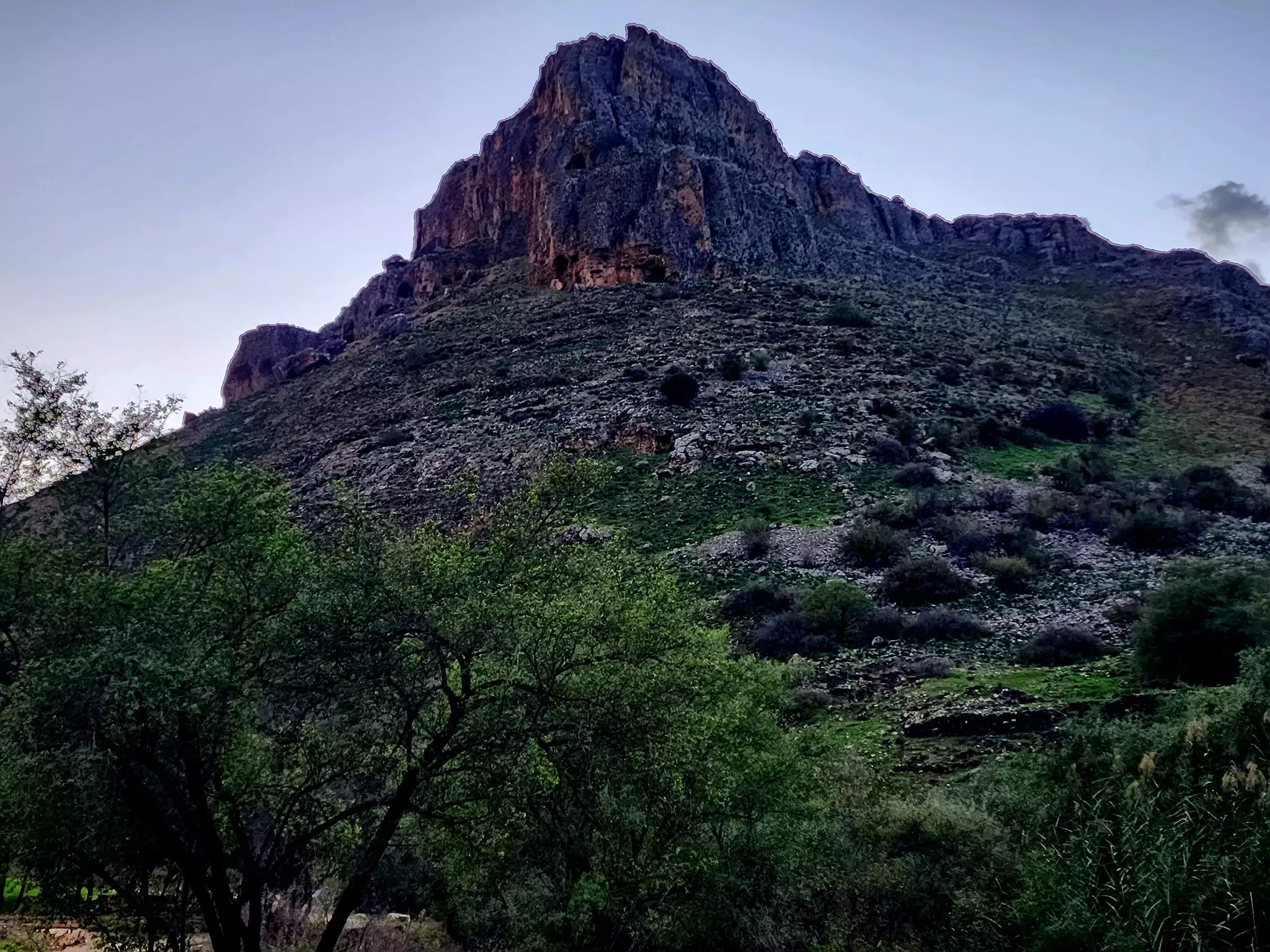
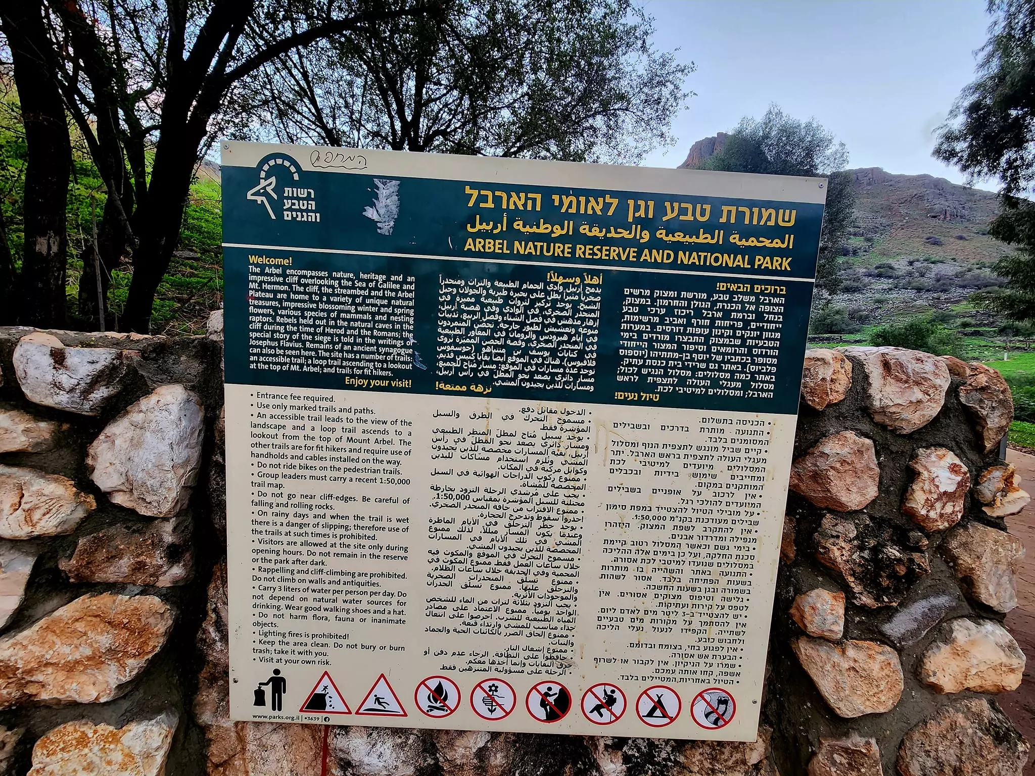
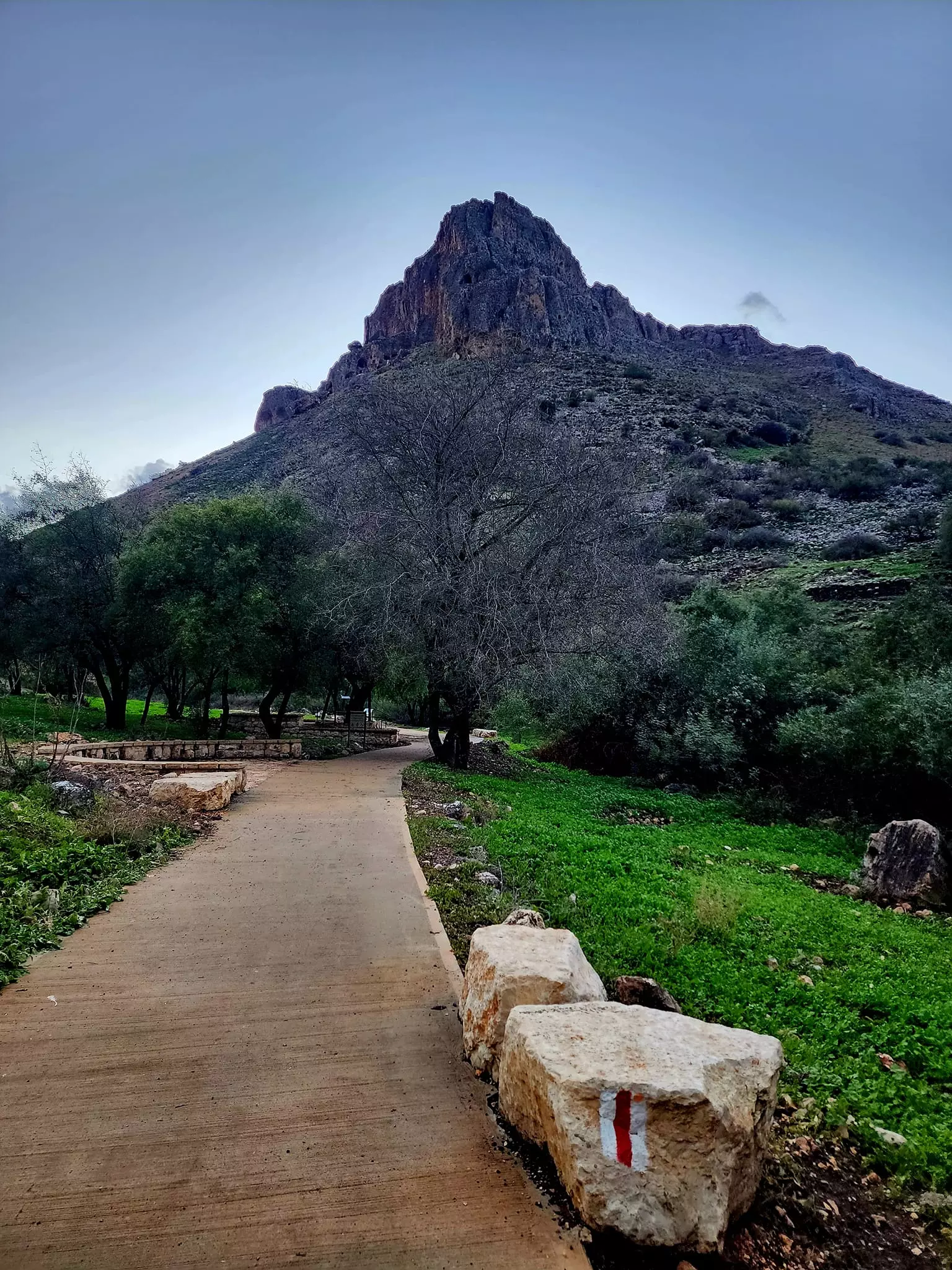
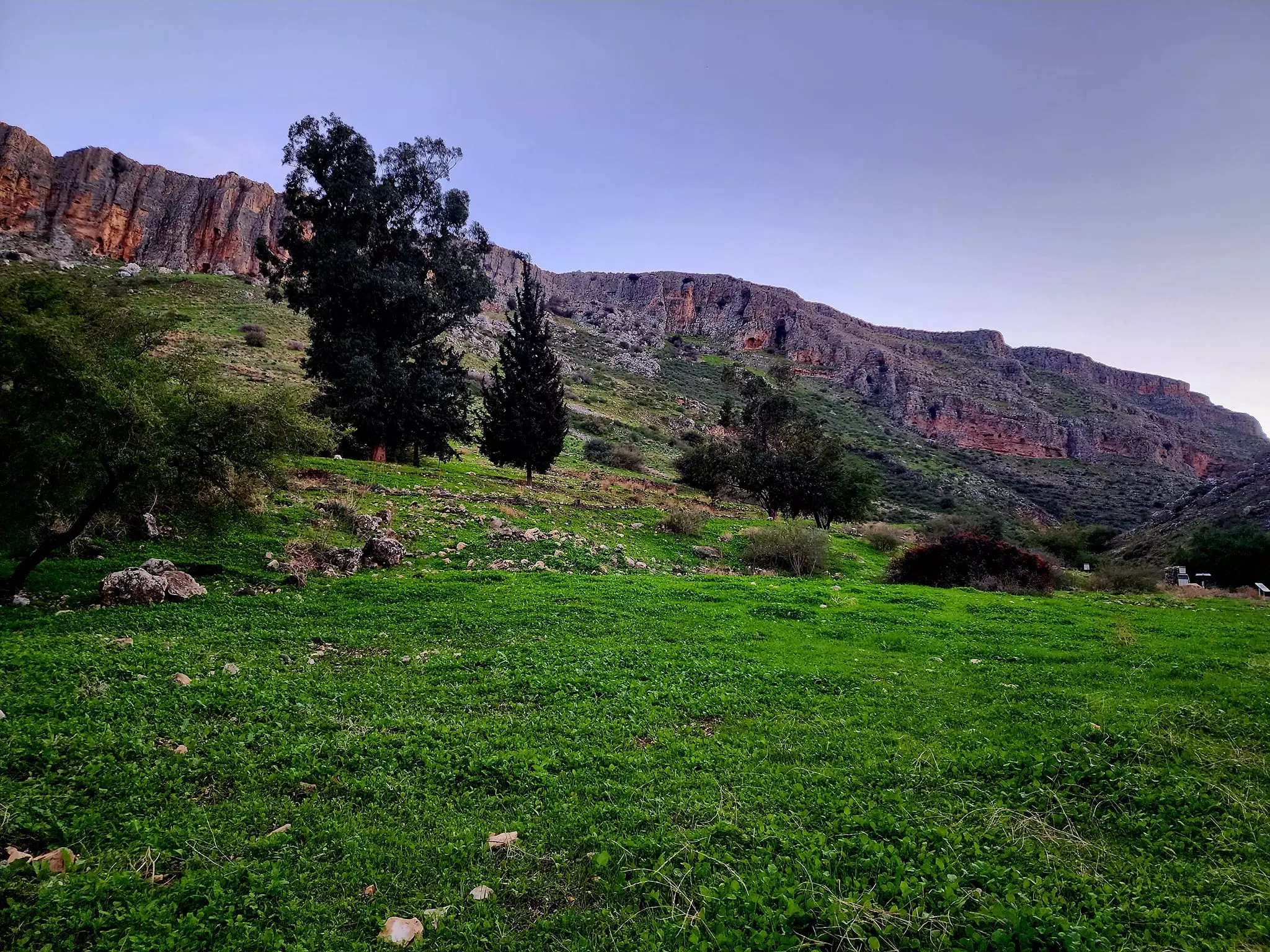
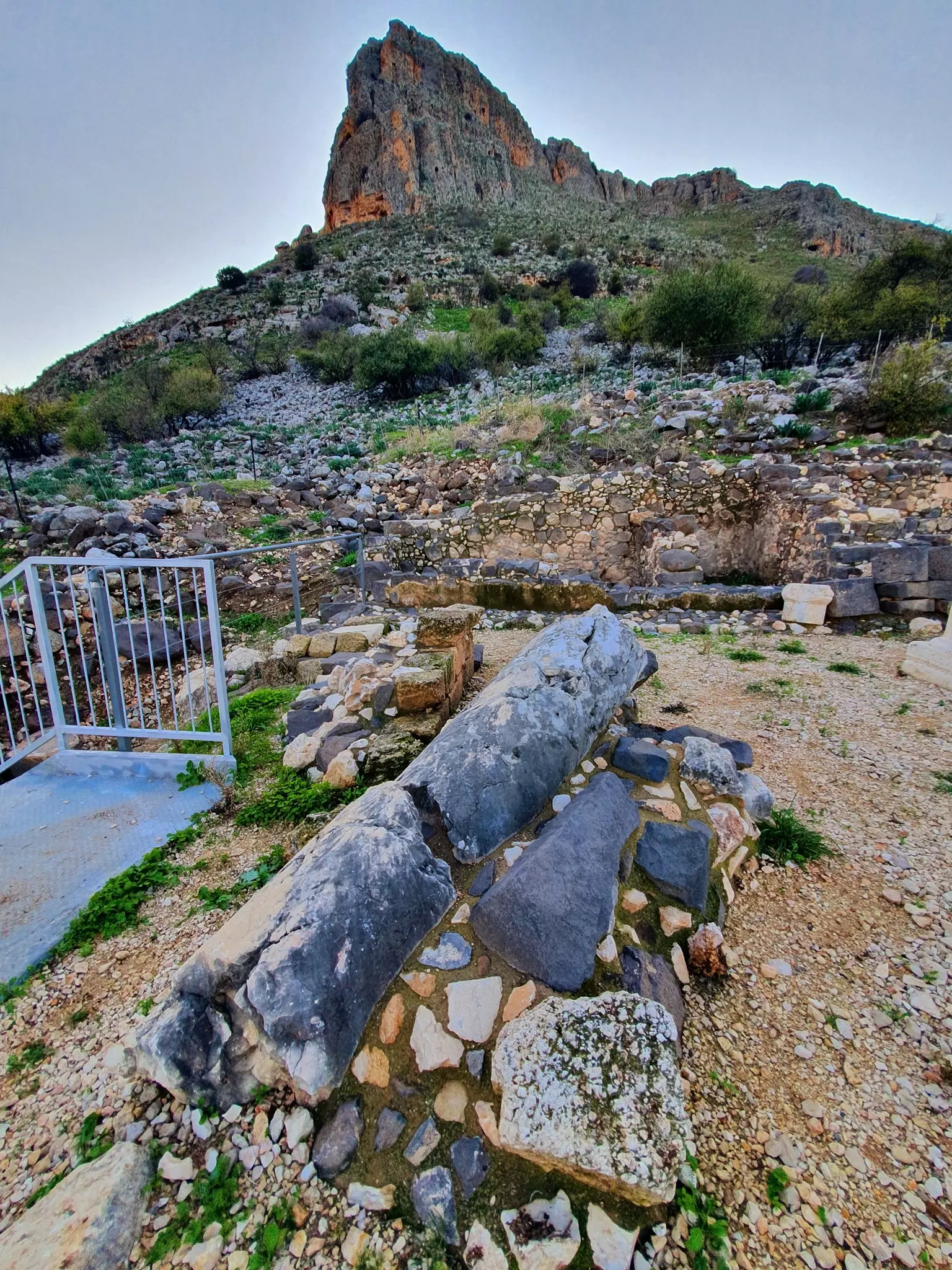
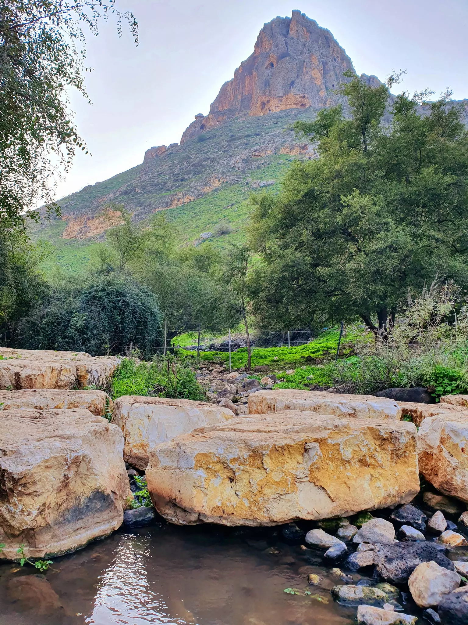
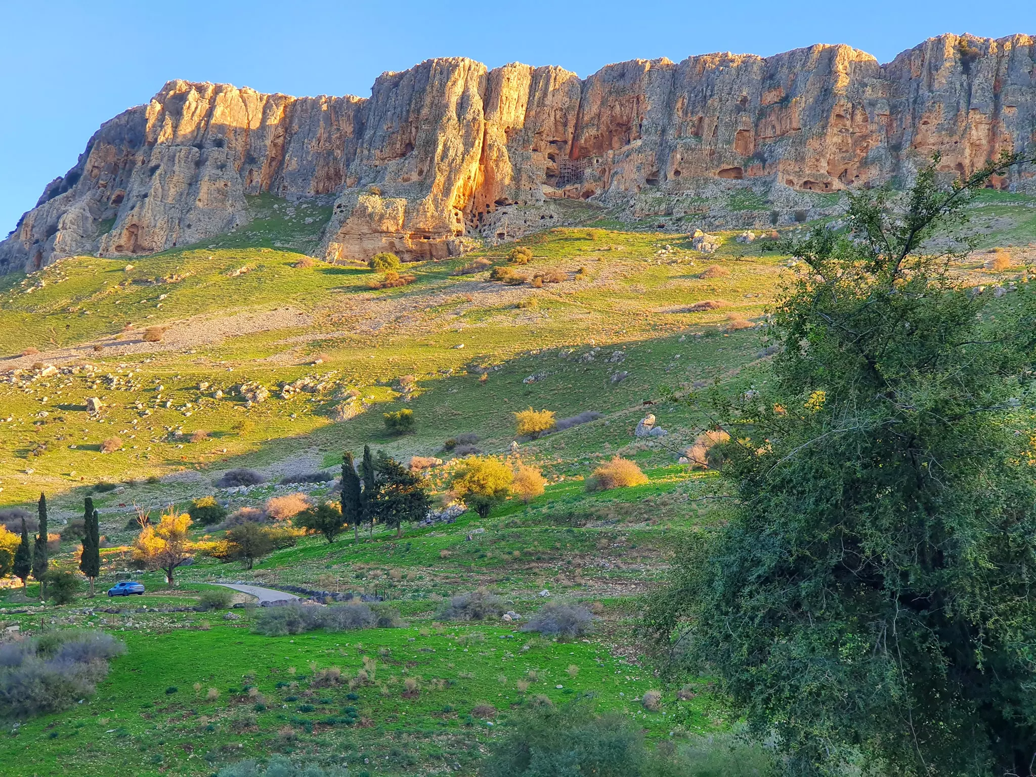
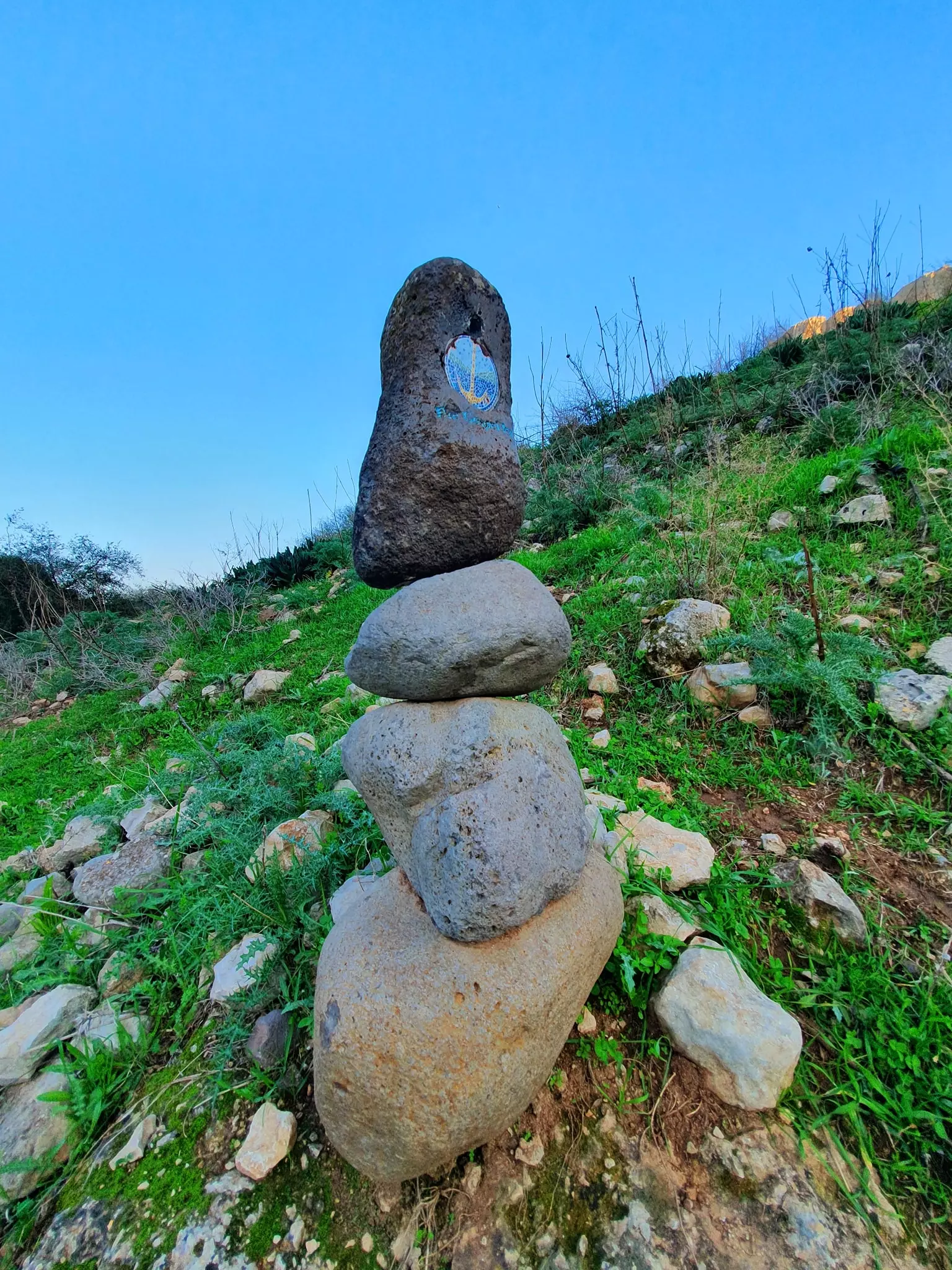
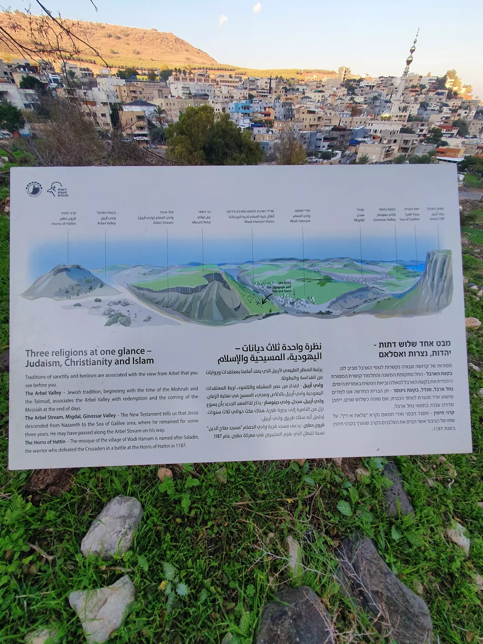
Posted by سهيل مخول - جبل أربيل وادي الحمام.
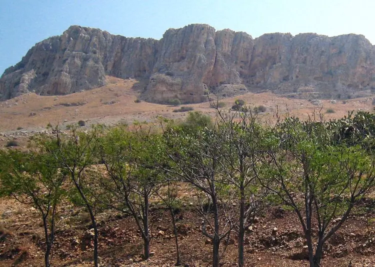
جبل وادي الحمام (أربيل) يقع في منطقة الجليل الأسفل وهو جبل جيري يطل على بحيرة طبريا وهو شديد الانحدار نحو البحيرة ويطل على الجولان وجبل الشيخ وسهل حطين -- 2023 -- Iyad Jaber
- جبل أربيل وادي الحمام.
جبل وادي الحمام (أربيل) يقع في منطقة الجليل الأسفل وهو جبل جيري يطل على بحيرة طبريا وهو شديد الانحدار نحو البحيرة ويطل على الجولان وجبل الشيخ وسهل حطين -- 2023 -- Iyad Jaber #2
- جبل أربيل وادي الحمام.
جبل وادي الحمام (أربيل) يقع في منطقة الجليل الأسفل وهو جبل جيري يطل على بحيرة طبريا وهو شديد الانحدار نحو البحيرة ويطل على الجولان وجبل الشيخ وسهل حطين -- 2023 -- Iyad Jaber #3
- جبل أربيل وادي الحمام.
جبل وادي الحمام (أربيل) يقع في منطقة الجليل الأسفل وهو جبل جيري يطل على بحيرة طبريا وهو شديد الانحدار نحو البحيرة ويطل على الجولان وجبل الشيخ وسهل حطين -- 2023 -- Iyad Jaber #4
- جبل أربيل وادي الحمام.
جبل وادي الحمام (أربيل) يقع في منطقة الجليل الأسفل وهو جبل جيري يطل على بحيرة طبريا وهو شديد الانحدار نحو البحيرة ويطل على الجولان وجبل الشيخ وسهل حطين -- 2023 -- Iyad Jaber #5
- جبل أربيل وادي الحمام.
جبل وادي الحمام (أربيل) يقع في منطقة الجليل الأسفل وهو جبل جيري يطل على بحيرة طبريا وهو شديد الانحدار نحو البحيرة ويطل على الجولان وجبل الشيخ وسهل حطين -- 2023 -- Iyad Jaber #6
- جبل أربيل وادي الحمام.
جبل وادي الحمام (أربيل) يقع في منطقة الجليل الأسفل وهو جبل جيري يطل على بحيرة طبريا وهو شديد الانحدار نحو البحيرة ويطل على الجولان وجبل الشيخ وسهل حطين -- 2023 -- Iyad Jaber #7
- جبل أربيل وادي الحمام.
جبل وادي الحمام (أربيل) يقع في منطقة الجليل الأسفل وهو جبل جيري يطل على بحيرة طبريا وهو شديد الانحدار نحو البحيرة ويطل على الجولان وجبل الشيخ وسهل حطين -- 2023 -- Iyad Jaber #8
- جبل أربيل وادي الحمام.
جبل وادي الحمام (أربيل) يقع في منطقة الجليل الأسفل وهو جبل جيري يطل على بحيرة طبريا وهو شديد الانحدار نحو البحيرة ويطل على الجولان وجبل الشيخ وسهل حطين -- 2023 -- Iyad Jaber #9
- جبل أربيل وادي الحمام.
جبل وادي الحمام (أربيل) يقع في منطقة الجليل الأسفل وهو جبل جيري يطل على بحيرة طبريا وهو شديد الانحدار نحو البحيرة ويطل على الجولان وجبل الشيخ وسهل حطين -- 2023 -- Iyad Jaber #10
- جبل أربيل وادي الحمام.
جبل وادي الحمام (أربيل) يقع في منطقة الجليل الأسفل وهو جبل جيري يطل على بحيرة طبريا وهو شديد الانحدار نحو البحيرة ويطل على الجولان وجبل الشيخ وسهل حطين -- 2023 -- Iyad Jaber #11
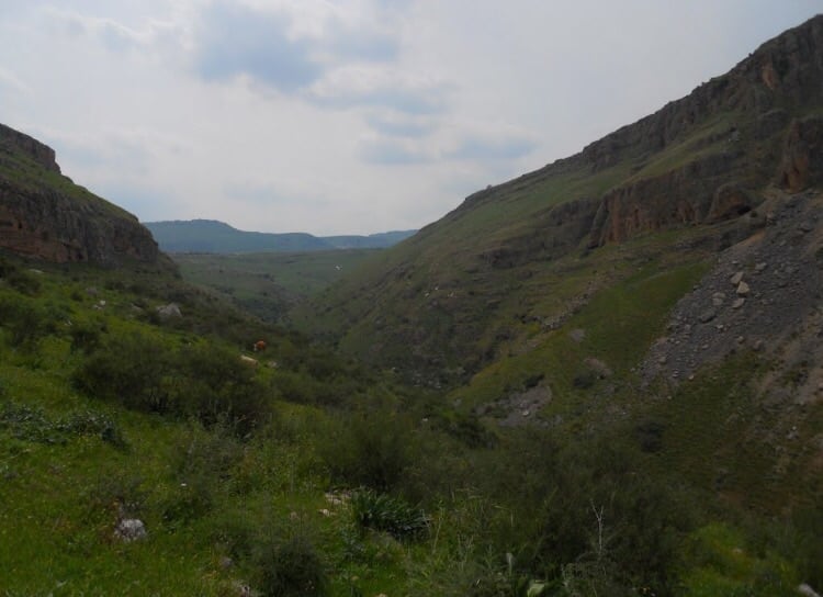
- Let us tour Wadi al-Hamam (Arbel), Dec. - 2023 -- Nabela Salem -- جولة في وادي الحمام (أربيل)
- Let us tour Wadi al-Hamam (Arbel), Dec. - 2023 -- Nabela Salem -- جولة في وادي الحمام (أربيل) #2
- Let us tour Wadi al-Hamam (Arbel), Dec. - 2023 -- Nabela Salem -- جولة في وادي الحمام (أربيل) #3
- Let us tour Wadi al-Hamam (Arbel), Dec. - 2023 -- Nabela Salem -- جولة في وادي الحمام (أربيل) #4
- Let us tour Wadi al-Hamam (Arbel), Dec. - 2023 -- Nabela Salem -- جولة في وادي الحمام (أربيل) #5
- Let us tour Wadi al-Hamam (Arbel), Dec. - 2023 -- Nabela Salem -- جولة في وادي الحمام (أربيل) #6
- Let us tour Wadi al-Hamam (Arbel), Dec. - 2023 -- Nabela Salem -- جولة في وادي الحمام (أربيل) #7
- Let us tour Wadi al-Hamam (Arbel), Dec. - 2023 -- Nabela Salem -- جولة في وادي الحمام (أربيل) #8
- Let us tour Wadi al-Hamam (Arbel), Dec. - 2023 -- Nabela Salem -- جولة في وادي الحمام (أربيل) #9
- Let us tour Wadi al-Hamam (Arbel), Dec. - 2023 -- Nabela Salem -- جولة في وادي الحمام (أربيل) #10
- Let us tour Wadi al-Hamam (Arbel), Dec. - 2023 -- Nabela Salem -- جولة في وادي الحمام (أربيل) #11
- Let us tour Wadi al-Hamam (Arbel), Dec. - 2023 -- Nabela Salem -- جولة في وادي الحمام (أربيل) #12
- Let us tour Wadi al-Hamam (Arbel), Dec. - 2023 -- Nabela Salem -- جولة في وادي الحمام (أربيل) #13
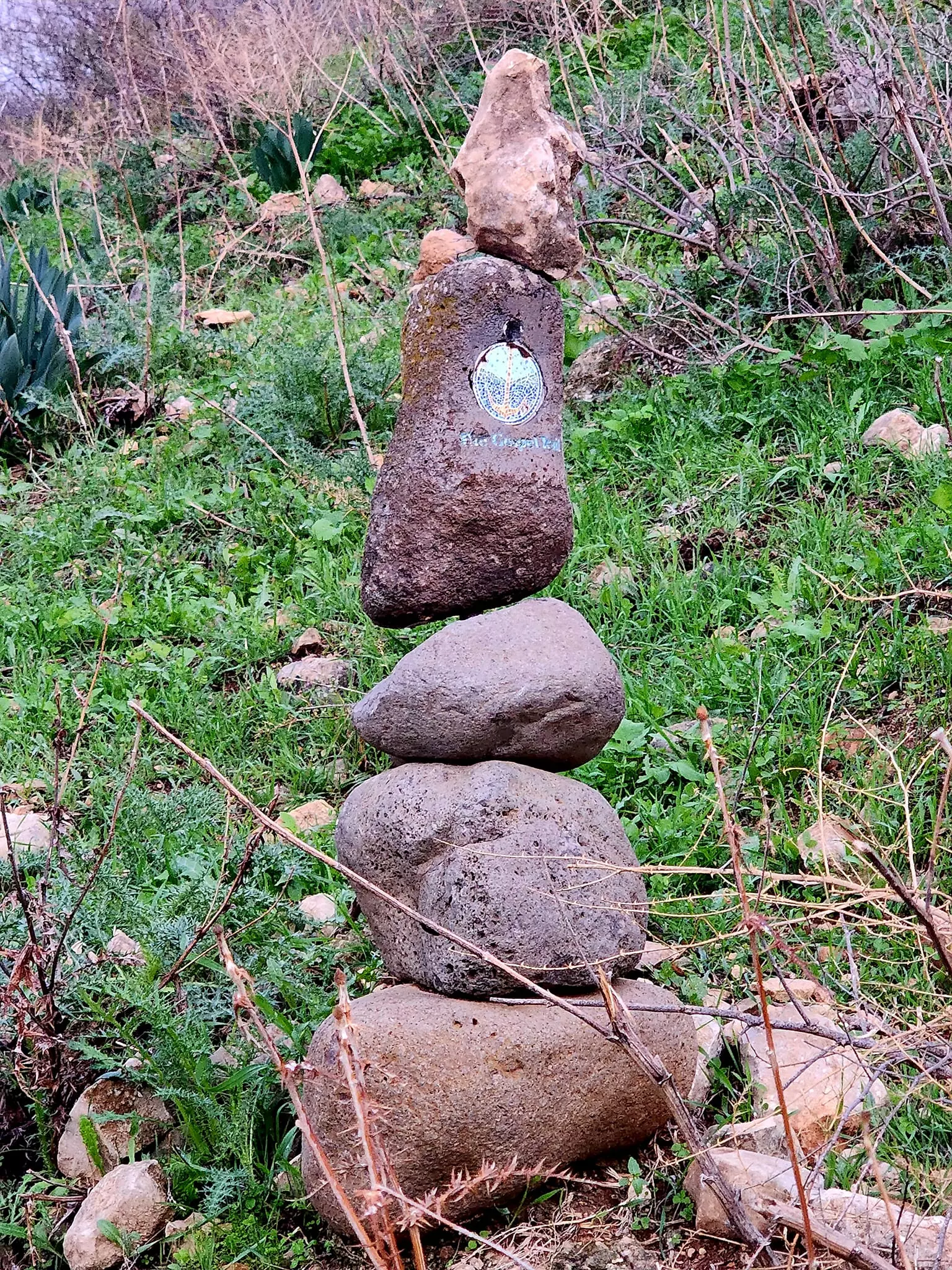
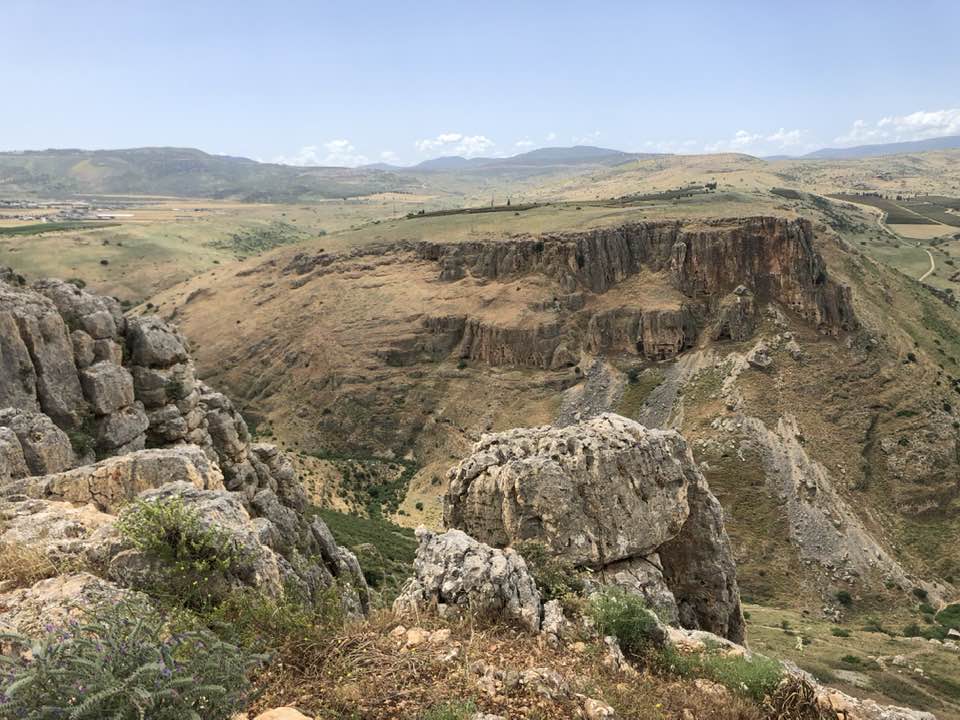
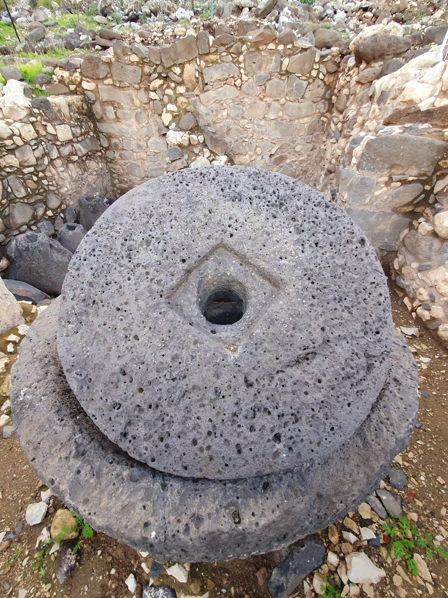
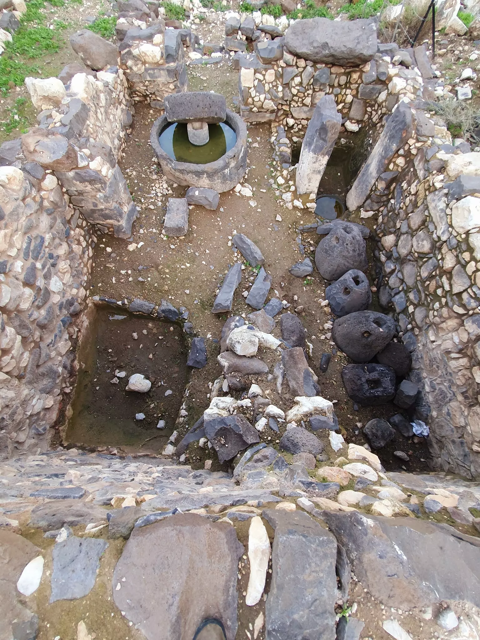
- Let us tour Arbel Nature Reserve and its famous Khirba/ruins just outside the village -- Jan. 2022 -Nabela Salem -- جولة في جبل أربيل وخربة وادي ألحمام
- Let us tour Arbel Nature Reserve and its famous Khirba/ruins just outside the village -- Jan. 2022 -Nabela Salem -- جولة في جبل أربيل وخربة وادي ألحمام #2
- Let us tour Arbel Nature Reserve and its famous Khirba/ruins just outside the village -- Jan. 2022 -Nabela Salem -- جولة في جبل أربيل وخربة وادي ألحمام #3
- Let us tour Arbel Nature Reserve and its famous Khirba/ruins just outside the village -- Jan. 2022 -Nabela Salem -- جولة في جبل أربيل وخربة وادي ألحمام #4
- Let us tour Arbel Nature Reserve and its famous Khirba/ruins just outside the village -- Jan. 2022 -Nabela Salem -- جولة في جبل أربيل وخربة وادي ألحمام #5
- Let us tour Arbel Nature Reserve and its famous Khirba/ruins just outside the village -- Jan. 2022 -Nabela Salem -- جولة في جبل أربيل وخربة وادي ألحمام #6
- Let us tour Arbel Nature Reserve and its famous Khirba/ruins just outside the village -- Jan. 2022 -Nabela Salem -- جولة في جبل أربيل وخربة وادي ألحمام #7
- Let us tour Arbel Nature Reserve and its famous Khirba/ruins just outside the village -- Jan. 2022 -Nabela Salem -- جولة في جبل أربيل وخربة وادي ألحمام #8
- Let us tour Arbel Nature Reserve and its famous Khirba/ruins just outside the village -- Jan. 2022 -Nabela Salem -- جولة في جبل أربيل وخربة وادي ألحمام #9
- Let us tour Arbel Nature Reserve and its famous Khirba/ruins just outside the village -- Jan. 2022 -Nabela Salem -- جولة في جبل أربيل وخربة وادي ألحمام #10
- Let us tour Arbel Nature Reserve and its famous Khirba/ruins just outside the village -- Jan. 2022 -Nabela Salem -- جولة في جبل أربيل وخربة وادي ألحمام #11
- Let us tour Arbel Nature Reserve and its famous Khirba/ruins just outside the village -- Jan. 2022 -Nabela Salem -- جولة في جبل أربيل وخربة وادي ألحمام #12
- Let us tour Arbel Nature Reserve and its famous Khirba/ruins just outside the village -- Jan. 2022 -Nabela Salem -- جولة في جبل أربيل وخربة وادي ألحمام #13
- Let us tour Arbel Nature Reserve and its famous Khirba/ruins just outside the village -- Jan. 2022 -Nabela Salem -- جولة في جبل أربيل وخربة وادي ألحمام #14
- Let us tour Arbel Nature Reserve and its famous Khirba/ruins just outside the village -- Jan. 2022 -Nabela Salem -- جولة في جبل أربيل وخربة وادي ألحمام #15
- Let us tour Arbel Nature Reserve and its famous Khirba/ruins just outside the village -- Jan. 2022 -Nabela Salem -- جولة في جبل أربيل وخربة وادي ألحمام #16
- Let us tour Arbel Nature Reserve and its famous Khirba/ruins just outside the village -- Jan. 2022 -Nabela Salem -- جولة في جبل أربيل وخربة وادي ألحمام #17
- Let us tour Arbel Nature Reserve and its famous Khirba/ruins just outside the village -- Jan. 2022 -Nabela Salem -- جولة في جبل أربيل وخربة وادي ألحمام #18
- Let us tour Arbel Nature Reserve and its famous Khirba/ruins just outside the village -- Jan. 2022 -Nabela Salem -- جولة في جبل أربيل وخربة وادي ألحمام #19
- Let us tour Arbel Nature Reserve and its famous Khirba/ruins just outside the village -- Jan. 2022 -Nabela Salem -- جولة في جبل أربيل وخربة وادي ألحمام #20
- Let us tour Arbel Nature Reserve and its famous Khirba/ruins just outside the village -- Jan. 2022 -Nabela Salem -- جولة في جبل أربيل وخربة وادي ألحمام #21
- Let us tour Arbel Nature Reserve and its famous Khirba/ruins just outside the village -- Jan. 2022 -Nabela Salem -- جولة في جبل أربيل وخربة وادي ألحمام #22
- Let us tour Arbel Nature Reserve and its famous Khirba/ruins just outside the village -- Jan. 2022 -Nabela Salem -- جولة في جبل أربيل وخربة وادي ألحمام #23
- Let us tour Arbel Nature Reserve and its famous Khirba/ruins just outside the village -- Jan. 2022 -Nabela Salem -- جولة في جبل أربيل وخربة وادي ألحمام #24
- Let us tour Arbel Nature Reserve and its famous Khirba/ruins just outside the village -- Jan. 2022 -Nabela Salem -- جولة في جبل أربيل وخربة وادي ألحمام #25
- Let us tour Arbel Nature Reserve and its famous Khirba/ruins just outside the village -- Jan. 2022 -Nabela Salem -- جولة في جبل أربيل وخربة وادي ألحمام #26
- Let us tour Arbel Nature Reserve and its famous Khirba/ruins just outside the village -- Jan. 2022 -Nabela Salem -- جولة في جبل أربيل وخربة وادي ألحمام #27
- Let us tour Arbel Nature Reserve and its famous Khirba/ruins just outside the village -- Jan. 2022 -Nabela Salem -- جولة في جبل أربيل وخربة وادي ألحمام #28
- Let us tour Arbel Nature Reserve and its famous Khirba/ruins just outside the village -- Jan. 2022 -Nabela Salem -- جولة في جبل أربيل وخربة وادي ألحمام #29
- Let us tour Arbel Nature Reserve and its famous Khirba/ruins just outside the village -- Jan. 2022 -Nabela Salem -- جولة في جبل أربيل وخربة وادي ألحمام #30
- Let us tour Arbel Nature Reserve and its famous Khirba/ruins just outside the village -- Jan. 2022 -Nabela Salem -- جولة في جبل أربيل وخربة وادي ألحمام #31
- Let us tour Arbel Nature Reserve and its famous Khirba/ruins just outside the village -- Jan. 2022 -Nabela Salem -- جولة في جبل أربيل وخربة وادي ألحمام #32
- Let us tour Arbel Nature Reserve and its famous Khirba/ruins just outside the village -- Jan. 2022 -Nabela Salem -- جولة في جبل أربيل وخربة وادي ألحمام #33
- Let us tour Arbel Nature Reserve and its famous Khirba/ruins just outside the village -- Jan. 2022 -Nabela Salem -- جولة في جبل أربيل وخربة وادي ألحمام #34
- Let us tour Arbel Nature Reserve and its famous Khirba/ruins just outside the village -- Jan. 2022 -Nabela Salem -- جولة في جبل أربيل وخربة وادي ألحمام #35
- Let us tour Arbel Nature Reserve and its famous Khirba/ruins just outside the village -- Jan. 2022 -Nabela Salem -- جولة في جبل أربيل وخربة وادي ألحمام #36
- Let us tour Arbel Nature Reserve and its famous Khirba/ruins just outside the village -- Jan. 2022 -Nabela Salem -- جولة في جبل أربيل وخربة وادي ألحمام #37
- Let us tour Arbel Nature Reserve and its famous Khirba/ruins just outside the village -- Jan. 2022 -Nabela Salem -- جولة في جبل أربيل وخربة وادي ألحمام #38
- Let us tour Arbel Nature Reserve and its famous Khirba/ruins just outside the village -- Jan. 2022 -Nabela Salem -- جولة في جبل أربيل وخربة وادي ألحمام #39
- Let us tour Arbel Nature Reserve and its famous Khirba/ruins just outside the village -- Jan. 2022 -Nabela Salem -- جولة في جبل أربيل وخربة وادي ألحمام #40
- Let us tour Arbel Nature Reserve and its famous Khirba/ruins just outside the village -- Jan. 2022 -Nabela Salem -- جولة في جبل أربيل وخربة وادي ألحمام #41
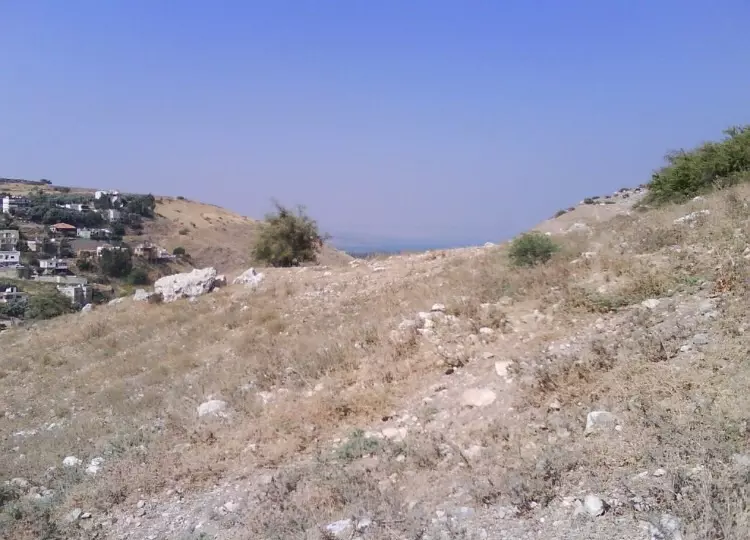
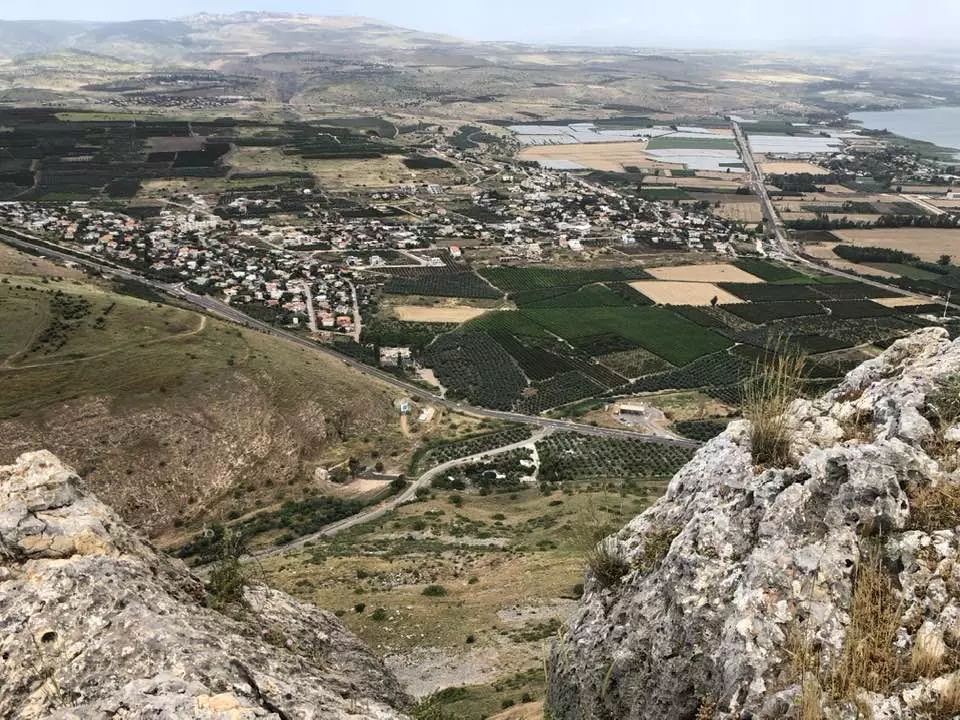
- General view of the village from al-Khirba -- Jan. 2022 -- Nabela Salem -- منظر عام رائع للبلد من الخربة
- General view of the village from al-Khirba -- Jan. 2022 -- Nabela Salem -- منظر عام رائع للبلد من الخربة #2
- General view of the village from al-Khirba -- Jan. 2022 -- Nabela Salem -- منظر عام رائع للبلد من الخربة #3
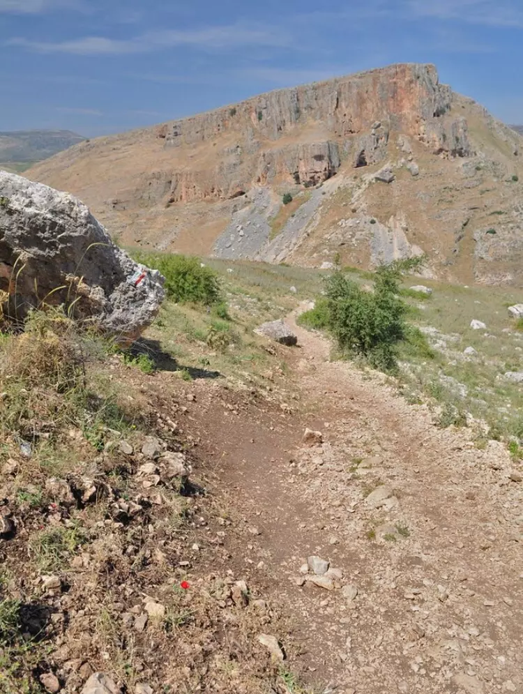
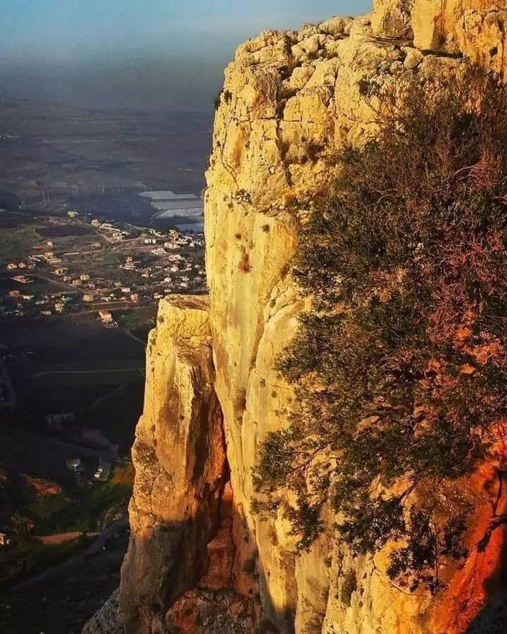
- منحدر وادي الحمام او منحدر اربيل
Want to browse more? 80,000 pictures were grouped in these gallaries:
| Display Name | Clan/Hamolah | Country of Residence |
| Leila Waheib | Al Woheib | Australia |
| KHALID AL-WAHAIBI | الوهيبي | إربد, إربد |
| mohd kasem | almesawe | syria, syria |
| Awad Joumaa | WEHAIB | LEBANON, LEBANON |
| Ahmad Joumaa | Joumaa | London, UK |
- الذاكرة مفتاح العودة-الحلقة 50-وادي الحمام Duration: 23 min 22 sec
- الذاكرة مفتاح العودة -- الحلقة 96 -- سيبانة
No links have been shared yet, be free to the first to share the first link.
 Fake Valor: Why Did Zionist Jews Hoist Nazis Flag on Their Ships in the 1930s?
What is new?
-
Facts About Oct. 7th Gaza Raid
-
Remined Us Please:: Who Did Rape Who? Palestinians Raped Israelis? Or, was the other way around?
-
When Prof. Edward Said was invited to debate Bibi Netanyahu in the 1980s, watch what happened!
-
Ezra Klein of the NY Times on the "Jewish Race".
-
Abusing Blood Libel!
-
Zionist FAQ: Isn't it true that Palestinians don't want peace? Palestinians never accepted the two-state solution
- Facts about Haavara (Transfer) Agreement between Ben-Gurion & Hitler
-
Haavara FAQs: Why Did Zionist Jews Hoist Nazis' Flags on Their Ships in the 1930s?
-
Dear ChatGPT: Why did the Jewish Agency suppress news of the Holocaust during WWII?
-
Video Playlist: Jews share their DNA tests to end the conflict for good.
-
A Tale of Two Conflicts: Examining the Definition of Genocide
-
Prof. Abraham Polak And The Suppressed History of the Khazars and European Jewry
-
How Ronald Reagan would have framed the genocide in Gaza if he were still alive?
-
Haavara FAQs: Let us do the math: how many German Jews did The Haavara Agreement save?
-
Zionist FAQs: The Hebron Massacre of 1929, "clearly proves" that Palestinians are antisemitic, how could you deny it?
-
Zionist FAQs: Why Anti-Zionist Is Not Antisemitism?
-
Zionist FAQs: Isn't it true that the KGB create Palestinian Nationalism in the early 1960s?
- Zionist FAQs: Muslims are killing Muslims all the time; why are Israeli Jews being singled out in the media?
- Zionist FAQs: How is Israel an apartheid state when 20% of its citizens are Arabs who enjoy full rights?
-
Haavara FAQs: Analysis of Herzl's Uganda Scheme and how it could have saved millions of Jews.
-
Haavara FAQs: Why did Hayim Greenberg describe American Jewry as "morally bankrupt" in early 1943?
-
Haavara FAQs: What if the Evian Conference was a resounding success? What would have been the impact of saving European Jewry on Zionism?
- Haavara FAQs: What if the six million were saved, how that would have impacted the Zionist project?
-
Haavara FAQs: How did Zionist leaders react when Europe's Jews lingered in the DP camps after WWII ended?
-
Why does the American Jewish community repeat lies that David Ben-Gurion had debunked before he died?
-
Who has the power to rename the Tatar/Khazar Gene Marker to Jewish IV?
-
Zionist FAQs: Why won't Egypt, Syria, and Jordan take their people back? Jews are indigenous to Palestine, and Arabs immigrated after Jews developed the country. Arabs should leave.
-
Haavara FAQs: Did Hitler and the Nazis conflate between Judaism and Zionist? If that wasn't case, then why?
-
Haavara FAQs: Winston Churchill and antisemitism, a collection of articles written Churchill.
-
Haavara FAQs: Broken by country, how many Jews survived vs. killed during the Holocaust?
-
Haavara FAQs: Why did European Jews vote with their feet and to immigrated to the Americas, not Palestine, after WWII?
-
Watch this American Jewish Girl describing Israeli Jews' cognitive dissonance like no other in under two minutes
-
Haavara FAQs: When the Nazis went out of their way to hide the Holocaust, Israeli Jews did the exact opposite by broadcasting their genocide of Gazans. But why?
-
Haavara FAQs: How Zionist Jews went out of their to show their appreciation to Nazism and Fascism?
- Haavara FAQs: Why Zionist leaders were against bombing the death camps & the Railroads leading to them?
-
Haavara FAQs: Hitler's message to the British and American people: If Jews are such noble citizens and you care about them, how come you're not letting them in? I will gladly ship them to you at my expense, even on luxury liners!
-
A shortlist of Zionist and Israeli false flag operations in the name Jews.
-
The Most Moral Army
- The Land of Kapos (Israel): Where the brave are boycotted and Kapos walk free.
- Why did early Zionists often named their communal enterprises "colonial"?
- Zionist Relations with Nazi Germany by Faris Glubb
-
Two NY Times advertisements by Zionists in the early 1943 that exposes Zionists' treason at the height of the calamity
- Facts Not Lies about the Palestinian-Israeli Conflict.
- Site's pictures have been categorized
- Campgain Against Lice
- A Survey of Palestine, the official source about Palestine before Nakba produced by the British Mandate; over 1200 pages.
- Satellite View & Google Earth: Over 6,000 placemarks identifying all destroyed towns, W. Bank & Gaza Strip Towns, & refugee camps.
- PalestineRemembered.com and its Nakba Oral History Project were featured on al-Jazeera Satellite TV.
- Nakba Oral History Video Podcast:
 Over 700 Oral History interviews (including 3,500+ hours of recording) can be viewed online.
 - Palestine Village Statistics Project
- Gaza Jail Break
- النسخة العربية للموقع الان متوفرة
- Videos: Documenting the destroyed villages in video: Tracing all that remains since Nakba.
- Videos: Responding to Zionist Propaganda
- Interview: The ethnic cleansing of Palestine: George Galloway interviews Israeli Historian Ilan Pappe.
- For Palestinians, memory matters. It provides a blueprint for their future By George Bisharat.
- Zionist FAQ now available in Hebrew שאלות שציונים שואלים, עכשיו בעברית
- Video: The Stephen Walt and John Mearsheimer report on the influence of the Israel Lobby on U.S. Foreign Policy
- The Palestinian-Israeli conflict for beginners
