| PalestineRemembered | About Us | Oral History | العربية | |
| Pictures | Zionist FAQs | Haavara | Maps | |
| Search |
| Camps |
| Districts |
| Acre |
| Baysan |
| Beersheba |
| Bethlehem |
| Gaza |
| Haifa |
| Hebron |
| Jaffa |
| Jericho |
| Jerusalem |
| Jinin |
| Nablus |
| Nazareth |
| Ramallah |
| al-Ramla |
| Safad |
| Tiberias |
| Tulkarm |
| Donate |
| Contact |
| Profile |
| Videos |
Welcome To al-Manara - المنارة (אל-מנארה)
|
District of Tiberias
Ethnically cleansed days ago |
العربية Google Earth |
 |
Gallery (10) |
- Statistics & Facts
-
Before & After

- Satellite View
- Articles 1
- Pictures 10
- Members 2
- All That Remains
- Wikipedia
- Videos
- Guest Book
- Links
| Statistic & Fact | Value | |||||||||||||||
| Occupation Date | March 1, 1948 | |||||||||||||||
| Distance From District | 5 (km) South of Tiberias | |||||||||||||||
| Elevation | 255 (meters) | |||||||||||||||
| Before & After Nakba, Click Map For Details |
||||||||||||||||
|
||||||||||||||||
| Map Location | See location #14 on the map View from satellite |
|||||||||||||||
| Exodus Cause | Expulsion by Zionist troops | |||||||||||||||
| Village Temains | al-Manara was completely obliterated and defaced. | |||||||||||||||
| Ethnically Cleansing | al-Manara inhabitants were completely ethnically cleansed. | |||||||||||||||
| Pre-Nakba Land Ownership |
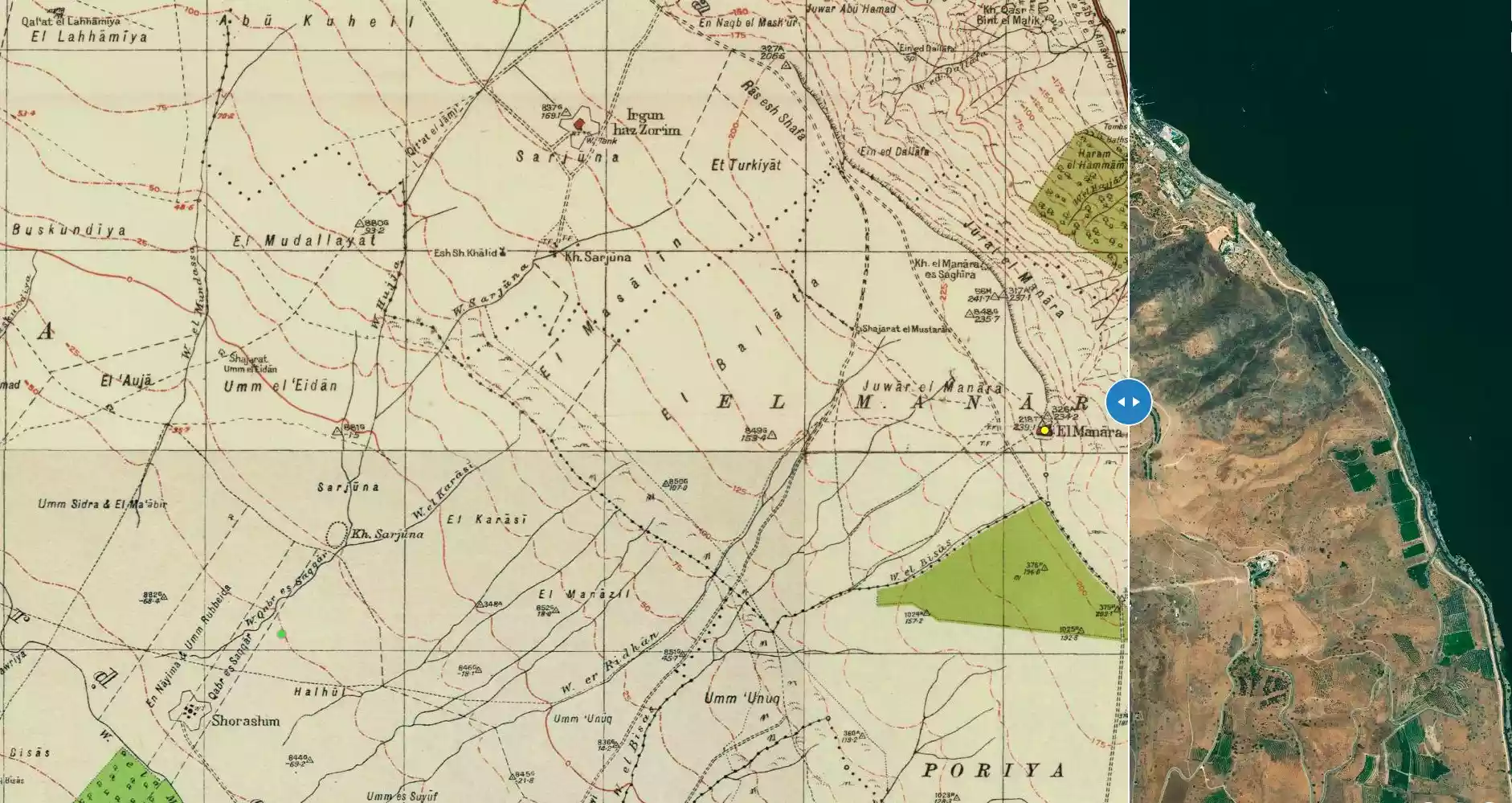
**Town Lands' Demarcation Maps |
|||||||||||||||
| Land Usage As of 1945 |
|
|||||||||||||||
| Population |
|
|||||||||||||||
| Number of Houses |
|
|||||||||||||||
| Near By Towns |
||||||||||||||||
|
||||||||||||||||
| Town's Name Through History | The Crusades referred to al-Manara by Menan. | |||||||||||||||
| Water Supply | The village had several springs including a group of hot springs. | |||||||||||||||
| Archeological Sites | al-Manara contains Khirbat al-Manara and Khirbat Sarjuna. | |||||||||||||||
| Exculsive Jewish Colonies Who Usurped Village Lands |
Poriyya is nearby village lands. | |||||||||||||||
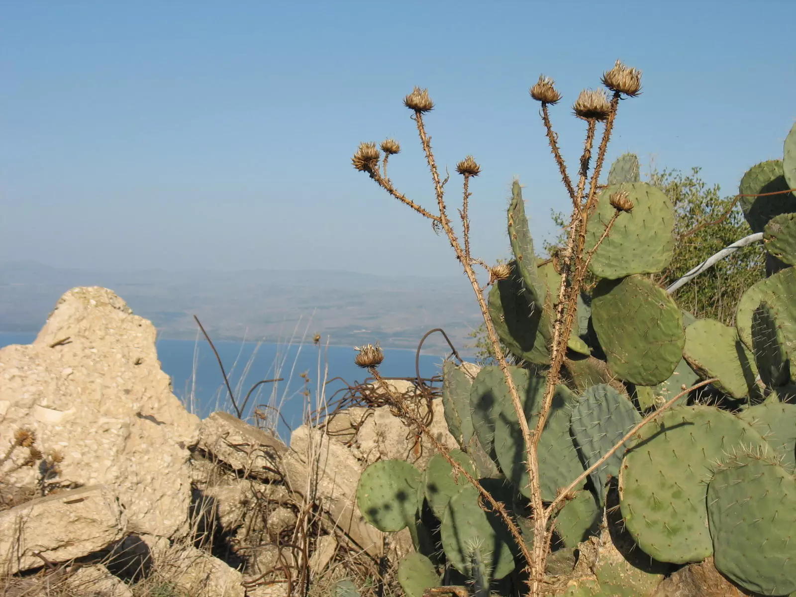
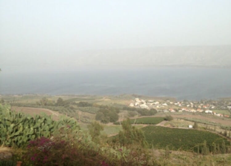
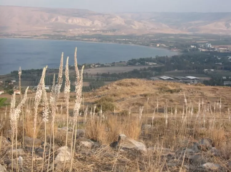
Village Before NakbaThe village was located on a hilltop overlooking Lake Tiberias in lower eastern Galilee. Northeast of it, a steep slope descended toward the edge of the lake. To the south, there was a moderately sloping plain. AI-Manara's twin village of Nasir aI-Din lay about 3 km to the northwest. A secondary road linked the village to a highway in the northwest that led to Tiberias. The name al-Manara, which means "lighthouse" in Arabic, may have been derived from the name of Kefar Menori, which was located on the same spot during the Roman period. It was known as Menan by the Crusaders. The village site was a small, square area in which houses were crowded closely together. Its residents were Muslims. The village was close to several springs, including a group of hot springs which lay 1.5 km to the northeast, on the shores of Lake Tiberias. The people of al-Manara worked in agriculture and livestock breeding. Their main agricultural products were grain, watermelons, and tobacco. In 1944/45 a total of 4,172 dunums of the land of the two villages was allocated to cereals. The village was an archaeological site that contained the ruins of houses. Archaeological remains were also found at Khirbat al-Manara (200241) and Khirbat Sarjuna (198241).Village Occupation and Ethnic CleaningThe village fell in early March 1948, during an attack that preluded the capture of Tiberias. The assault 'precipitated the evacuation' of the village, according to Israeli historian Benny Morris. Eyewitnesses, who related that the village was attacked by Haganah forces on 2 March, provided further details to Palestinian historian Nafez Nazzal. They said that Zionist soldiers chased the villagers out, destroyed some houses, and left leaflets behind warning the inhabitants not to return because the village had been mined. The attack greatly demoralized the residents of Tiberias. It was also the first step in the isolation of the city, cutting it off from the south and increasing its sense of beleaguerment. Tiberias itself was not captured until the following month.Zionists Colonies on Village LandsThere are no Israeli settlements on village lands. The closest settlement is Poriyya (201236), built in 1949 to the south.Village TodayThe site has been levelled and is strewn with pieces of black stone. At its northern edge are walls of dark stone, with doum-palm trees growing in their midst. At the Site, a sign (in Arabic, Hebrew, and English) reads, "This is a historical site, please protect it" (see photos section).SourceDr. Walid al-Khalidi, 1992: All That Remains. |
||||||||||||||||
| Related Maps | Town Lands' Demarcation Maps خرائط للقضاء توضح حدود القرى والاودية Town's map on MapQuest View from satellite Help us map this town at WikiMapia |
|||||||||||||||
| Related Links | Wikipedia's Page Google Search Google For Images Google For Videos |
|||||||||||||||
| More Information | في كتاب كي لا ننسى المزيد من موقع هوية |
|||||||||||||||
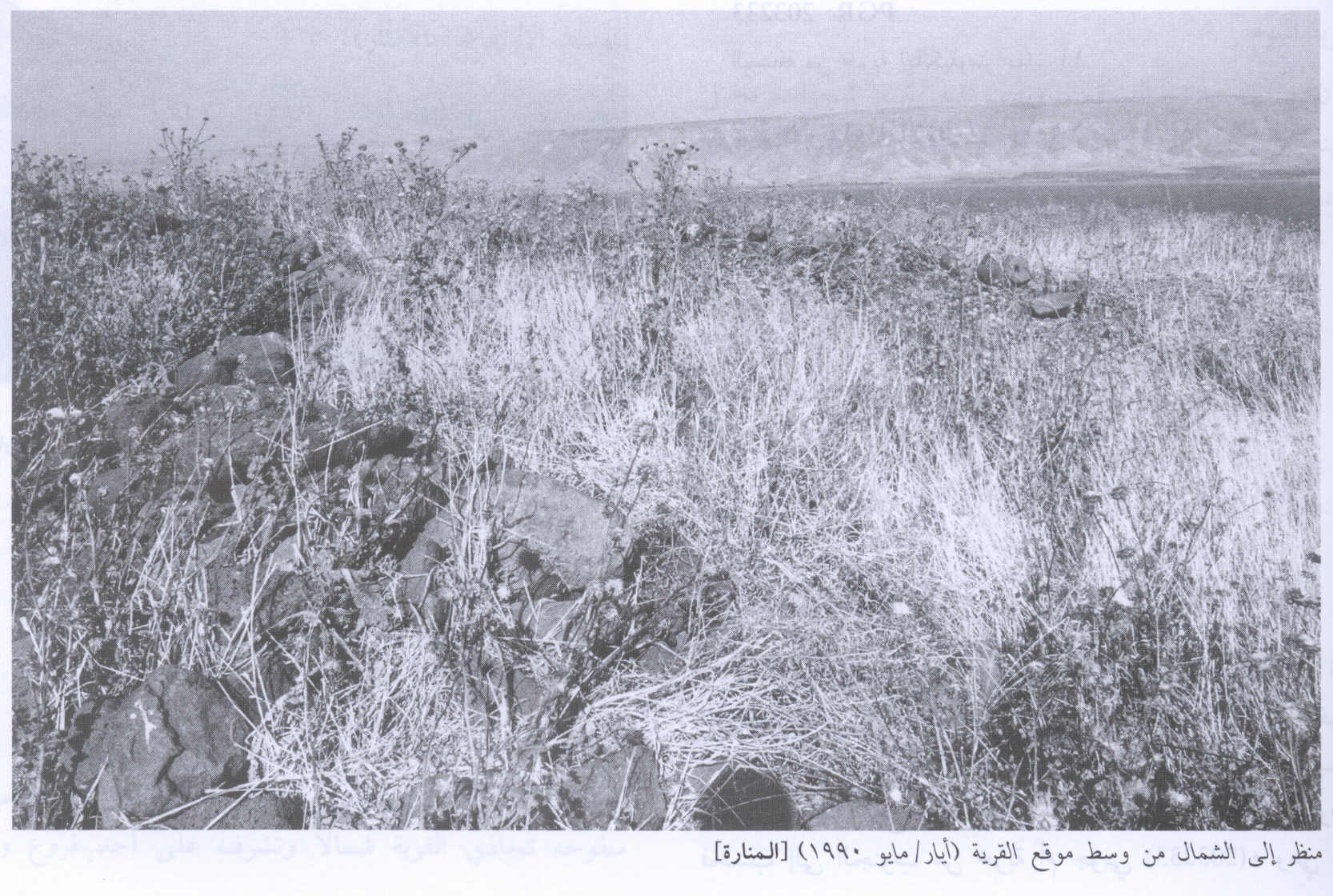
- View Of The Village Land In 1990
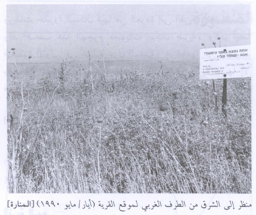
Scanned from "All That Remains" by Dr. Walid Khalidi - View Of The Village Site In 1990
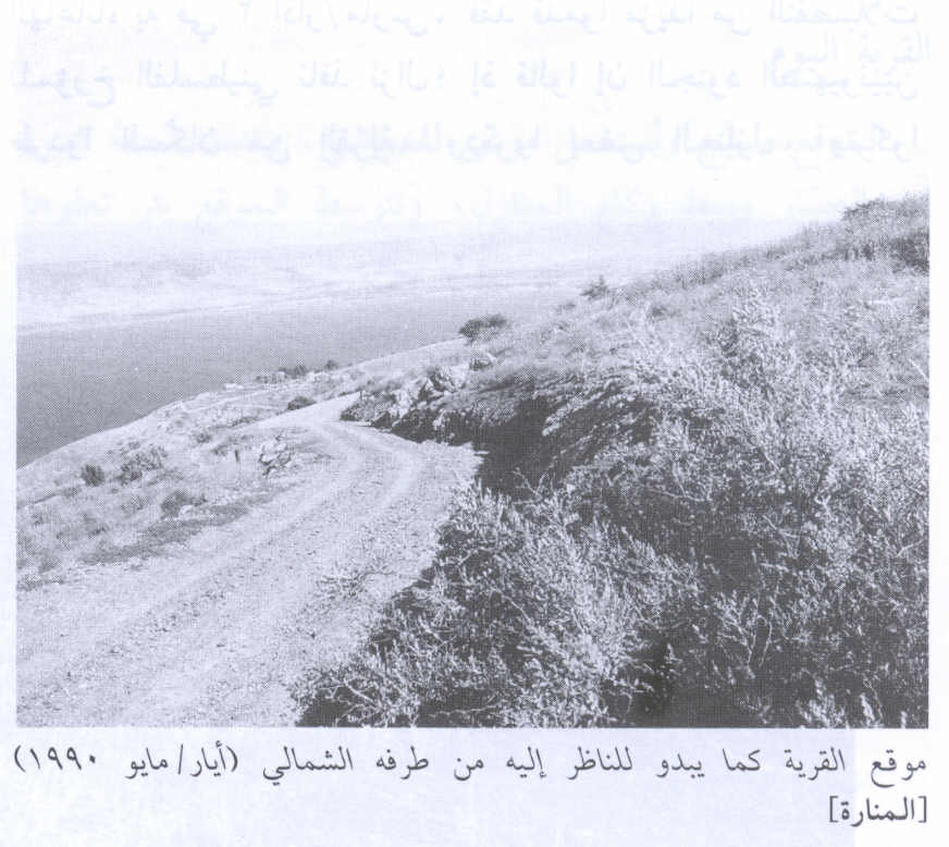
Scanned from "All That Remains" by Dr. Walid Khalidi - View Of The Village Site 2 In 1990
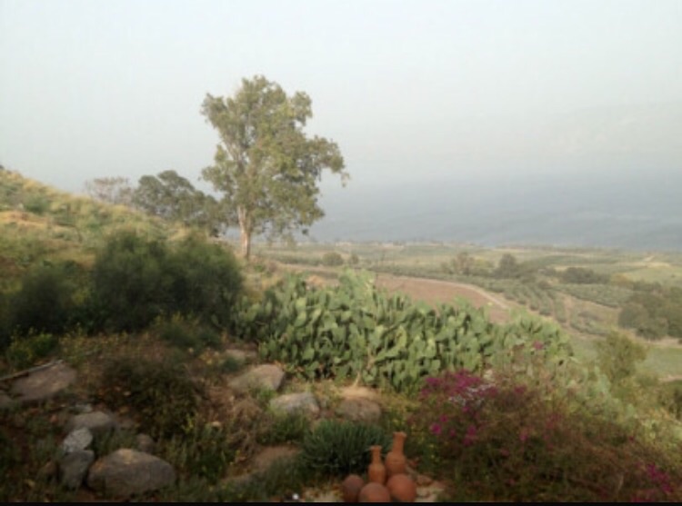
Scanned from "All That Remains" by Dr. Walid Khalidi - Ruins of the destroyed Palestinian village, and lake Tiberias in the background
Posted by Noga Kadman - موقع القريه
Posted by abu raya - اراضي القريه وفي الاسفل بحيره طبريا
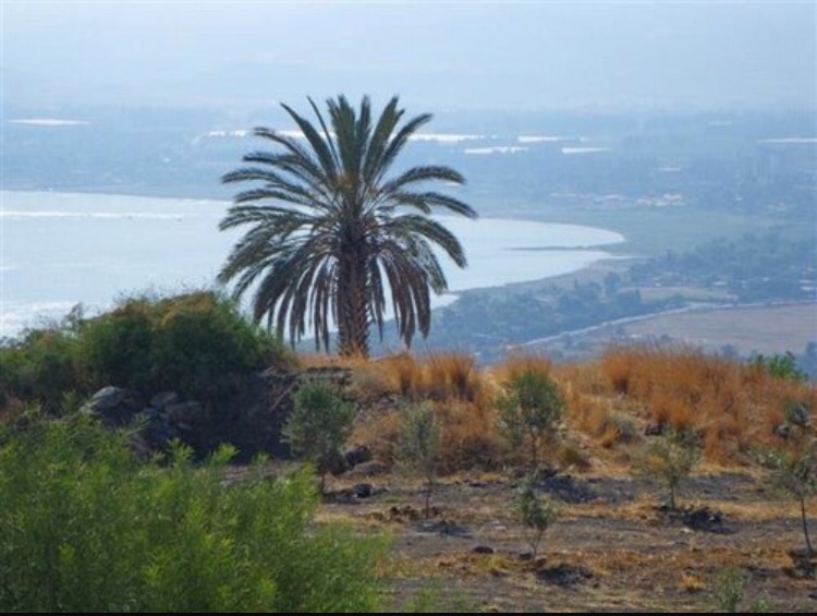
Posted by abu raya - الموقع من شرق القريه
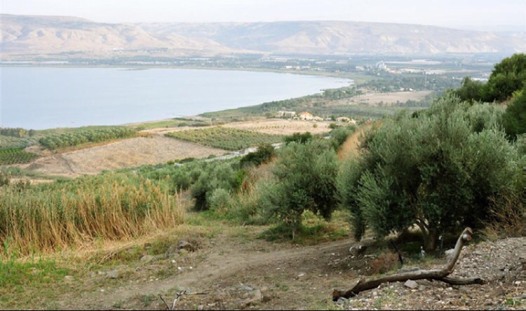
Posted by abu raya - منظر من موقع القريه
Posted by abu raya - موقع القريه
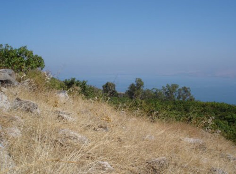
Posted by abu raya - من موقع القريه
Posted by abu raya
Want to browse more? 80,000 pictures were grouped in these gallaries:
| Display Name | Clan/Hamolah | Country of Residence |
| sword | العطوات | hama, syria |
| سعيد هارون | الجودة | - |
No links have been shared yet, be free to the first to share the first link.
 Fake Valor: Why Did Zionist Jews Hoist Nazis Flag on Their Ships in the 1930s?
What is new?
-
Facts About Oct. 7th Gaza Raid
-
Remined Us Please:: Who Did Rape Who? Palestinians Raped Israelis? Or, was the other way around?
-
When Prof. Edward Said was invited to debate Bibi Netanyahu in the 1980s, watch what happened!
-
Ezra Klein of the NY Times on the "Jewish Race".
-
Abusing Blood Libel!
-
Did Israeli Soldiers Activate The Hanniba Direective On Oct. 7th? You Be The Judge
-
Zionist FAQ: Isn't it true that Palestinians don't want peace? Palestinians never accepted the two-state solution
- Facts about Haavara (Transfer) Agreement between Ben-Gurion & Hitler
-
Haavara FAQs: Why Did Zionist Jews Hoist Nazis' Flags on Their Ships in the 1930s?
- Haavara FAQs: When Chaim Weizmann met FDR in mid-1943, why was he silent about rescuing European Jewry?
-
Dear ChatGPT: How did Palestinians resist Napoleon's invasion of their country in 1799?
-
Dear ChatGPT: Gaza had a vibrant Jewish community in the mid-17th century. What happened to them?
-
Dear ChatGPT: Why did the Jewish Agency suppress news of the Holocaust during WWII?
-
Video Playlist: Jews share their DNA tests to end the conflict for good.
-
A Tale of Two Conflicts: Examining the Definition of Genocide
-
Prof. Abraham Polak And The Suppressed History of the Khazars and European Jewry
-
How Ronald Reagan would have framed the genocide in Gaza if he were still alive?
-
Haavara FAQs: Let us do the math: how many German Jews did The Haavara Agreement save?
-
Zionist FAQs: The Hebron Massacre of 1929, "clearly proves" that Palestinians are antisemitic, how could you deny it?
-
Zionist FAQs: Why Anti-Zionist Is Not Antisemitism?
-
Zionist FAQs: Isn't it true that the KGB created Palestinian Nationalism in the early 1960s?
- Zionist FAQs: Muslims are killing Muslims all the time; why are Israeli Jews being singled out in the media?
- Zionist FAQs: How is Israel an apartheid state when 20% of its citizens are Arabs who enjoy full rights?
-
Haavara FAQs: Why Did Dorothy Thompson Flip From A Zionist Advocate to A Silenced Dissenter?
-
Haavara FAQs: Analysis of Herzl's Uganda Scheme and how it could have saved millions of Jews.
-
Haavara FAQs: Why did Hayim Greenberg describe American Jewry as "morally bankrupt" in early 1943?
-
Haavara FAQs: What if the Evian Conference was a resounding success? What would have been the impact of saving European Jewry on Zionism?
- Haavara FAQs: What if the six million were saved, how that would have impacted the Zionist project?
-
Haavara FAQs: How did Zionist leaders react when Europe's Jews lingered in the DP camps after WWII ended?
-
Why does the American Jewish community repeat lies that David Ben-Gurion had debunked before he died?
-
Who has the power to rename the Tatar/Khazar Gene Marker to Jewish IV?
-
Zionist FAQs: Why won't Egypt, Syria, and Jordan take their people back? Jews are indigenous to Palestine, and Arabs immigrated after Jews developed the country. Arabs should leave.
-
Haavara FAQs: Did Hitler and the Nazis conflate between Judaism and Zionist? If that wasn't case, then why?
-
Haavara FAQs: Winston Churchill and antisemitism, a collection of articles written Churchill.
-
Haavara FAQs: Broken by country, how many Jews survived vs. killed during the Holocaust?
-
Haavara FAQs: Why did European Jews vote with their feet and to immigrated to the Americas, not Palestine, after WWII?
-
Watch this American Jewish Girl describing Israeli Jews' cognitive dissonance like no other in under two minutes
-
Haavara FAQs: When the Nazis went out of their way to hide the Holocaust, Israeli Jews did the exact opposite by broadcasting their genocide of Gazans. But why?
-
Haavara FAQs: How Zionist Jews went out of their to show their appreciation to Nazism and Fascism?
- Haavara FAQs: Why Zionist leaders were against bombing the death camps & the Railroads leading to them?
-
Haavara FAQs: Hitler's message to the British and American people: If Jews are such noble citizens and you care about them, how come you're not letting them in? I will gladly ship them to you at my expense, even on luxury liners!
-
A shortlist of Zionist and Israeli false flag operations in the name Jews.
-
The Most Moral Army
- The Land of Kapos (Israel): Where the brave are boycotted and Kapos walk free.
- Why did early Zionists often named their communal enterprises "colonial"?
- Zionist Relations with Nazi Germany by Faris Glubb
-
Two NY Times advertisements by Zionists in the early 1943 that exposes Zionists' treason at the height of the calamity
- Facts Not Lies about the Palestinian-Israeli Conflict.
- Site's pictures have been categorized
- Campgain Against Lice
- A Survey of Palestine, the official source about Palestine before Nakba produced by the British Mandate; over 1200 pages.
- Satellite View & Google Earth: Over 6,000 placemarks identifying all destroyed towns, W. Bank & Gaza Strip Towns, & refugee camps.
- PalestineRemembered.com and its Nakba Oral History Project were featured on al-Jazeera Satellite TV.
- Nakba Oral History Video Podcast:
 Over 700 Oral History interviews (including 3,500+ hours of recording) can be viewed online.
 - Palestine Village Statistics Project
- Gaza Jail Break
- النسخة العربية للموقع الان متوفرة
- Videos: Documenting the destroyed villages in video: Tracing all that remains since Nakba.
- Videos: Responding to Zionist Propaganda
- Interview: The ethnic cleansing of Palestine: George Galloway interviews Israeli Historian Ilan Pappe.
- For Palestinians, memory matters. It provides a blueprint for their future By George Bisharat.
- Zionist FAQ now available in Hebrew שאלות שציונים שואלים, עכשיו בעברית
- Video: The Stephen Walt and John Mearsheimer report on the influence of the Israel Lobby on U.S. Foreign Policy
- The Palestinian-Israeli conflict for beginners
