| PalestineRemembered | About Us | Oral History | العربية | |
| Pictures | Zionist FAQs | Haavara | Maps | |
| Search |
| Camps |
| Districts |
| Acre |
| Baysan |
| Beersheba |
| Bethlehem |
| Gaza |
| Haifa |
| Hebron |
| Jaffa |
| Jericho |
| Jerusalem |
| Jinin |
| Nablus |
| Nazareth |
| Ramallah |
| al-Ramla |
| Safad |
| Tiberias |
| Tulkarm |
| Donate |
| Contact |
| Profile |
| Videos |
Welcome To Bayyarat Hannun - بيارات حنون (ביארת חנון)
|
District of Tulkarm
Ethnically cleansed days ago |
العربية Google Earth |
 |
Gallery (28) |
- Statistics & Facts
-
Before & After

- Satellite View
- Articles 2
- Pictures 28
- Members 2
- All That Remains
- Wikipedia
- Videos 2
- Guest Book
- Links 1
| Statistic & Fact | Value | |||||||||
| Occupation Date | March 31, 1948 | |||||||||
| Distance From District | 16 (km) West of Tulkarm | |||||||||
| Elevation | 25 (meters) | |||||||||
| Before & After Nakba, Click Map For Details |
||||||||||
|
||||||||||
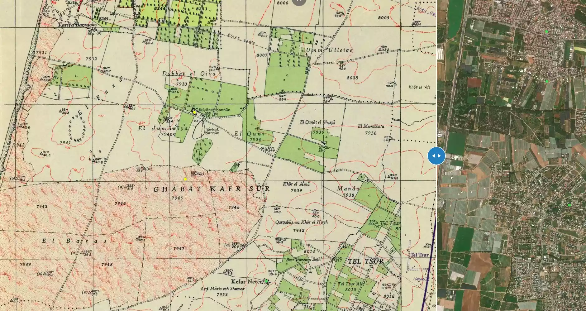
| Map Location | See location #11 on the map View from satellite |
|||||||||
| Military Operation | Operation Coastal Clearing | |||||||||
| Exodus Cause | Expulsion by Zionist troops | |||||||||
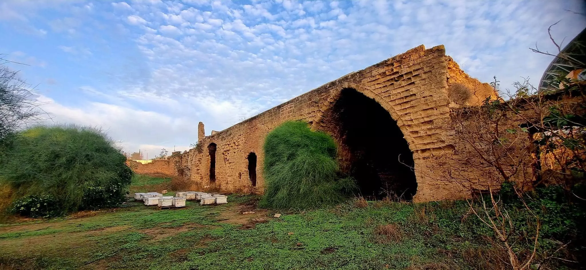
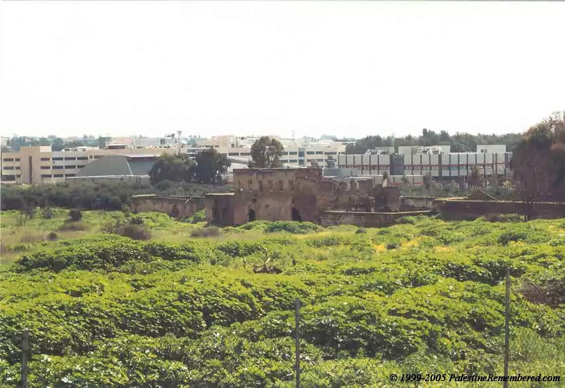
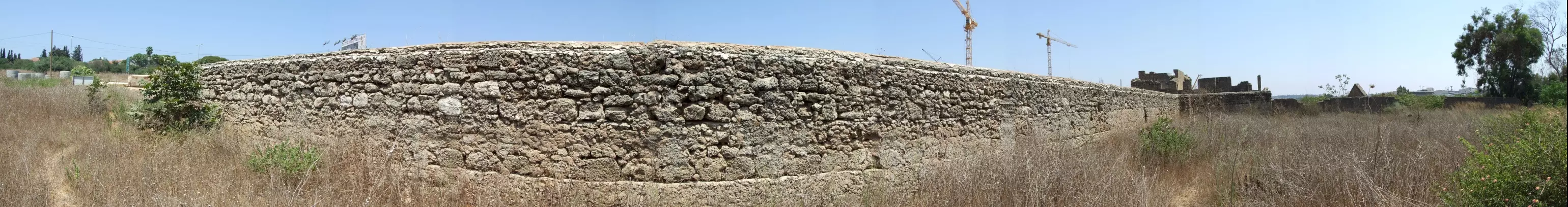
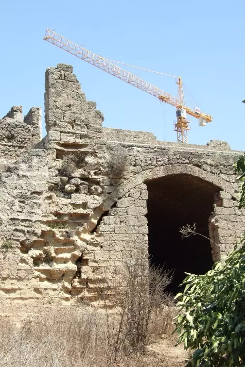
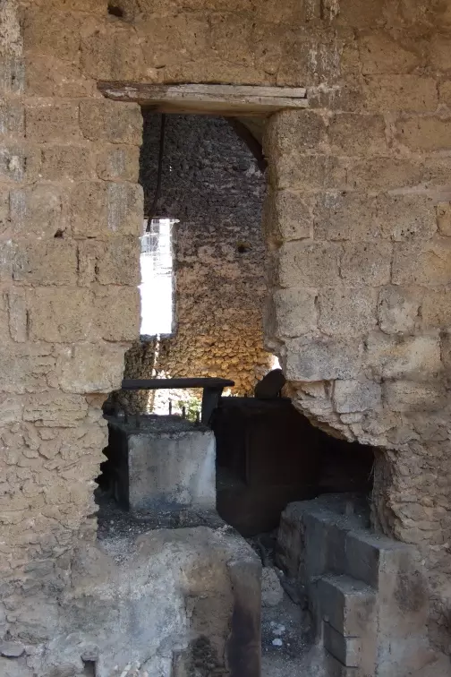
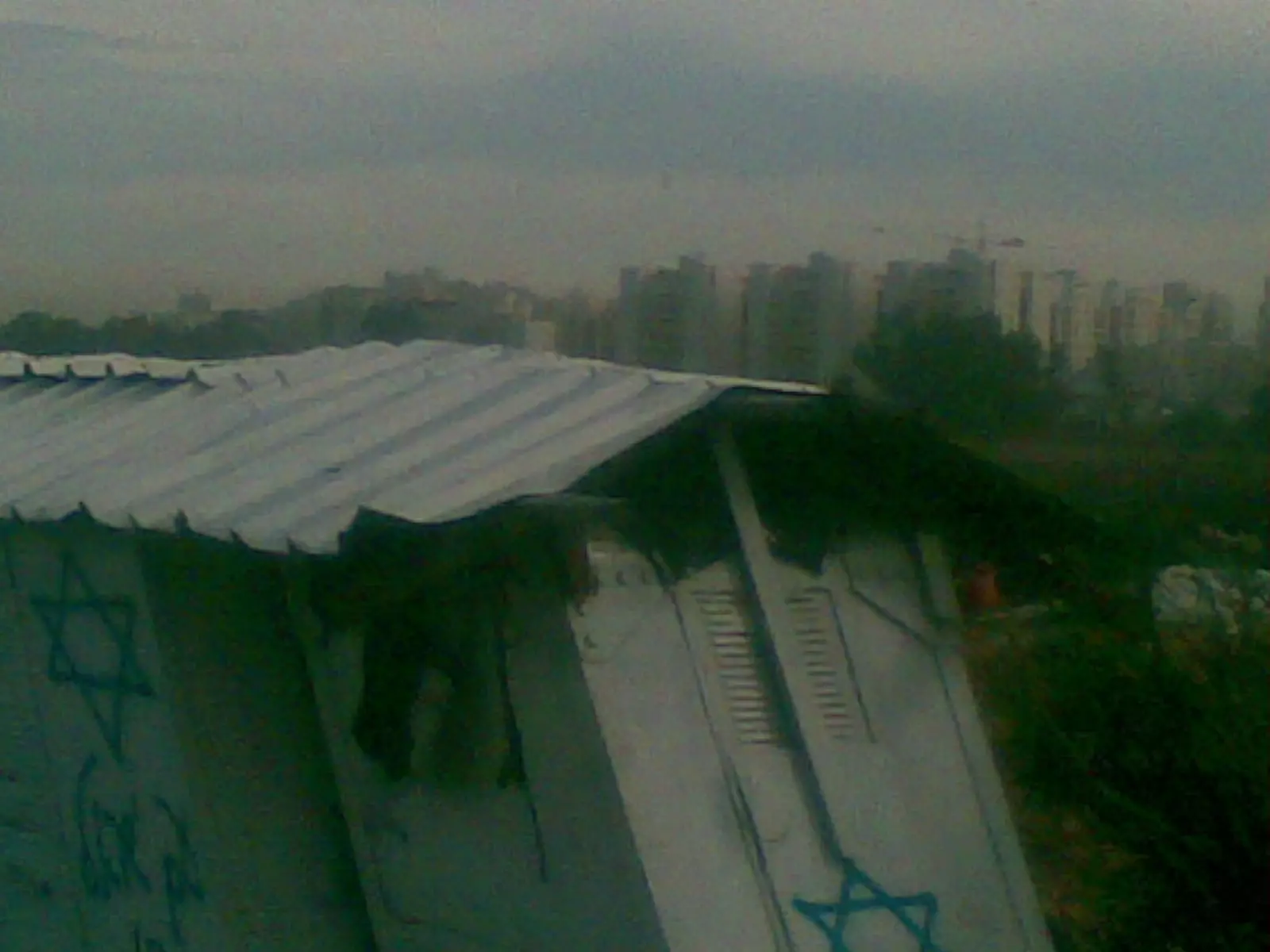
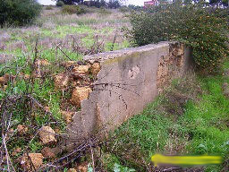
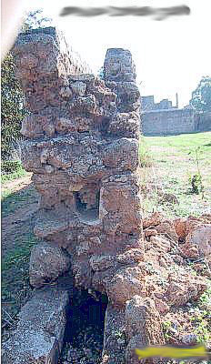
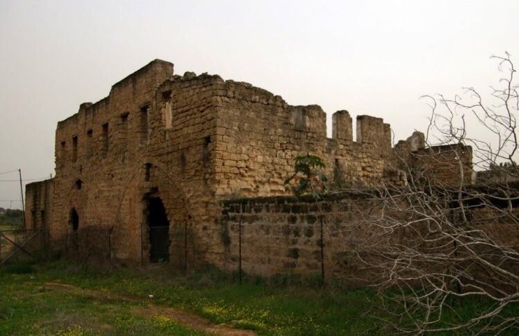
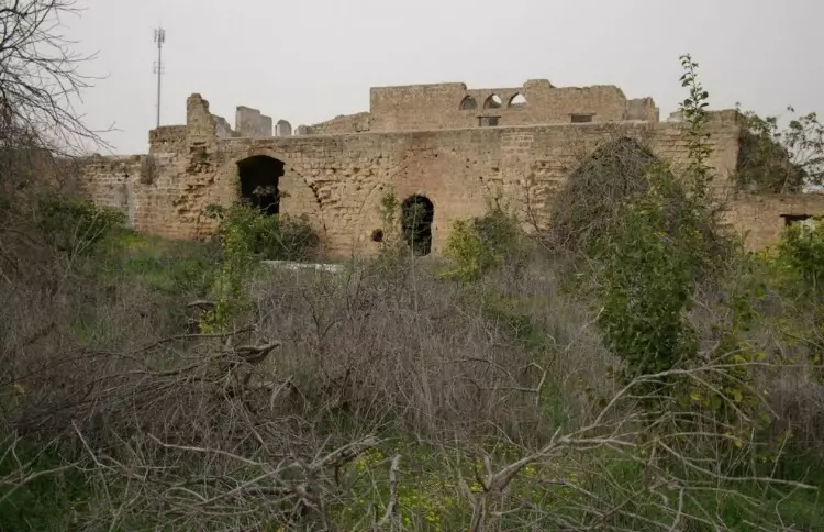
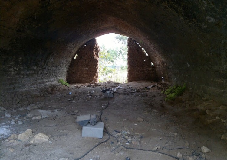
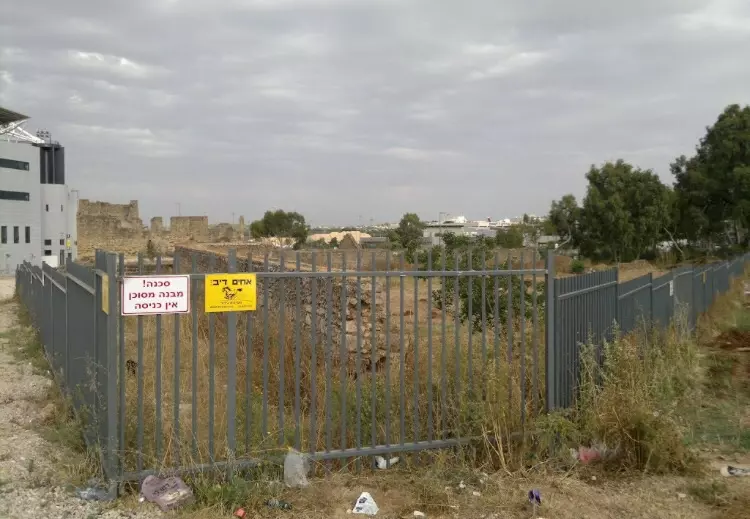
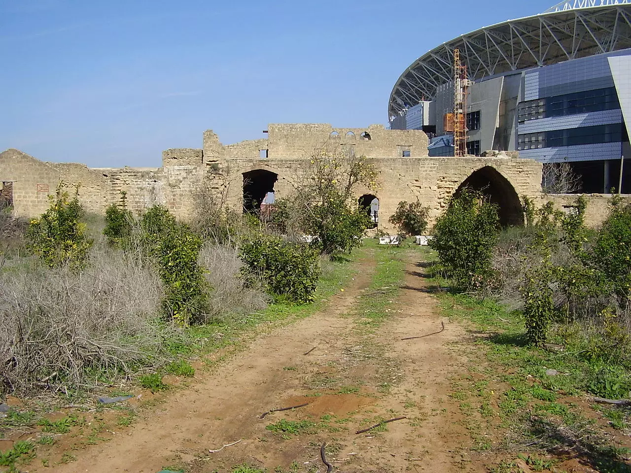
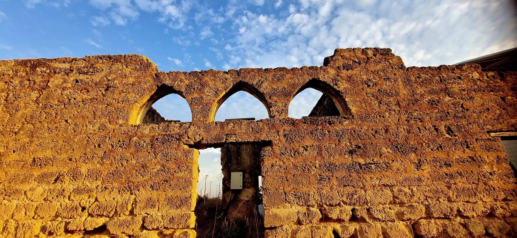
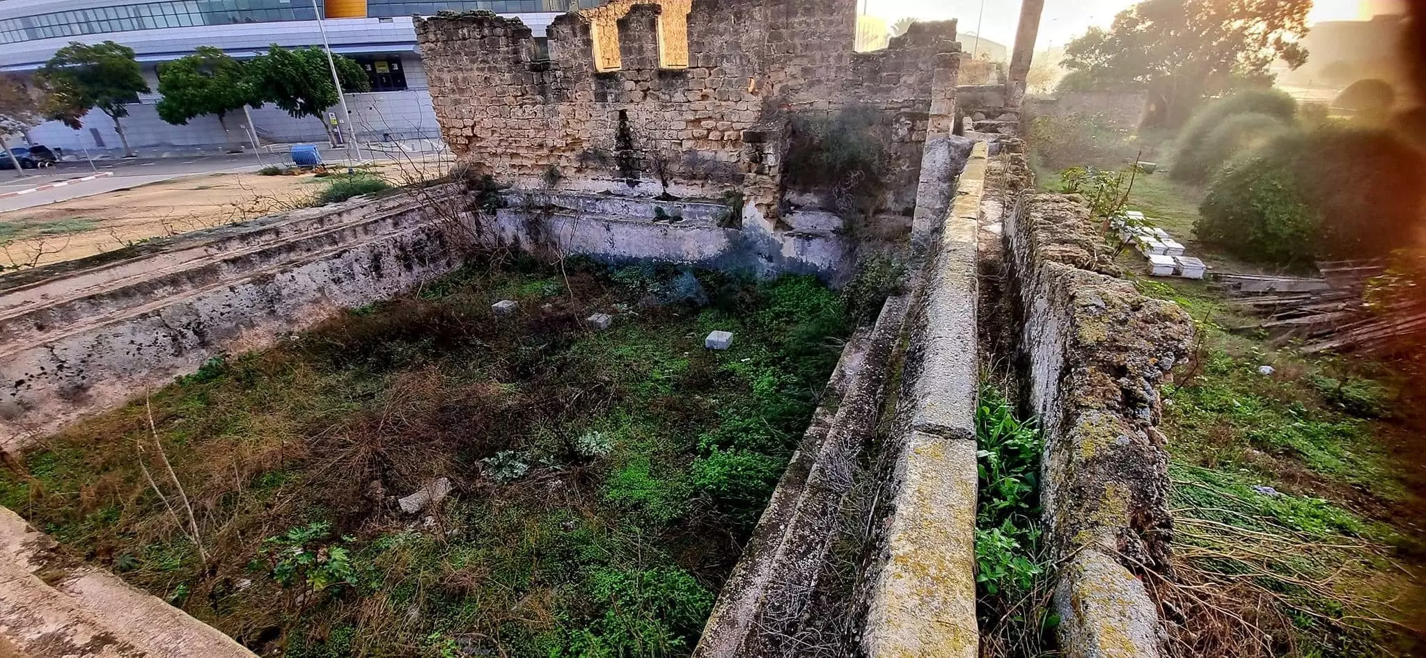
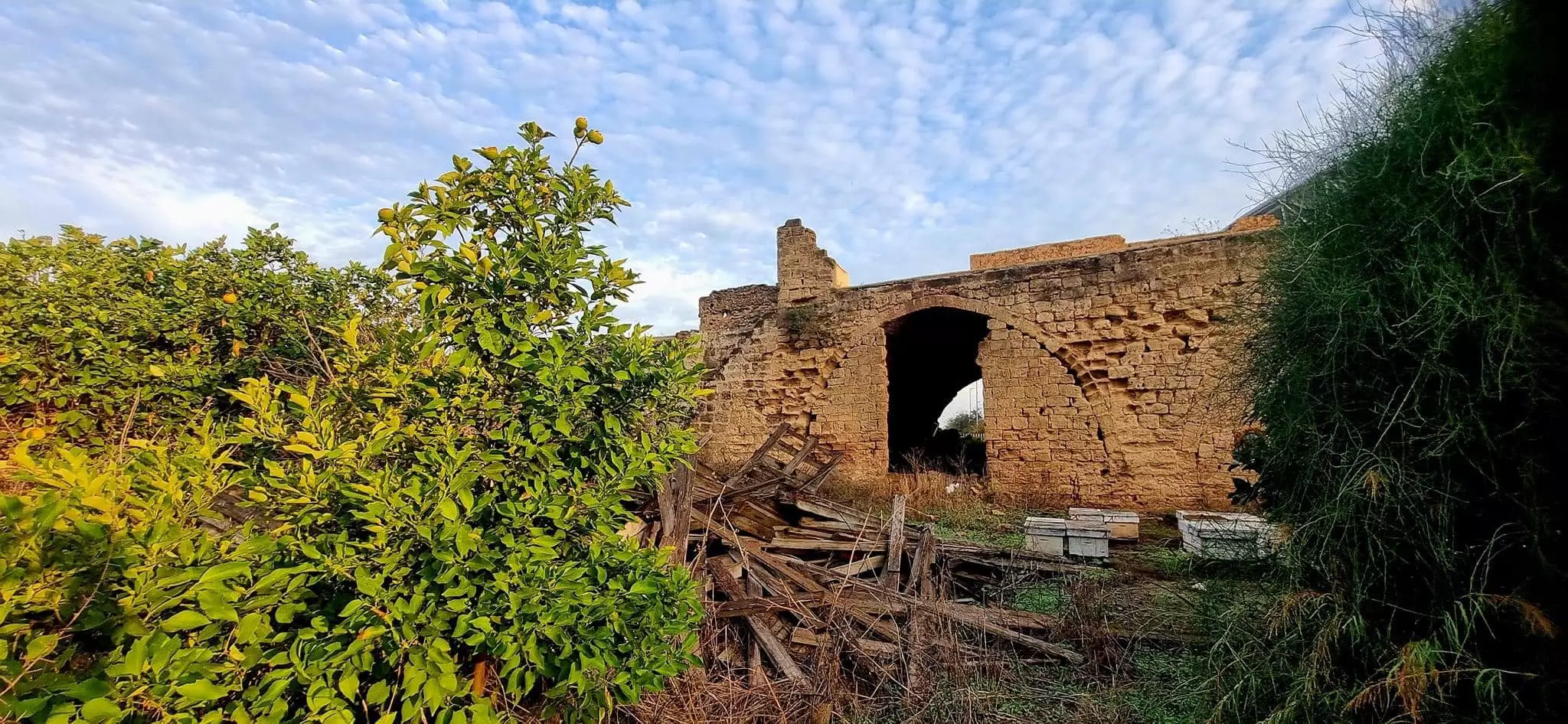
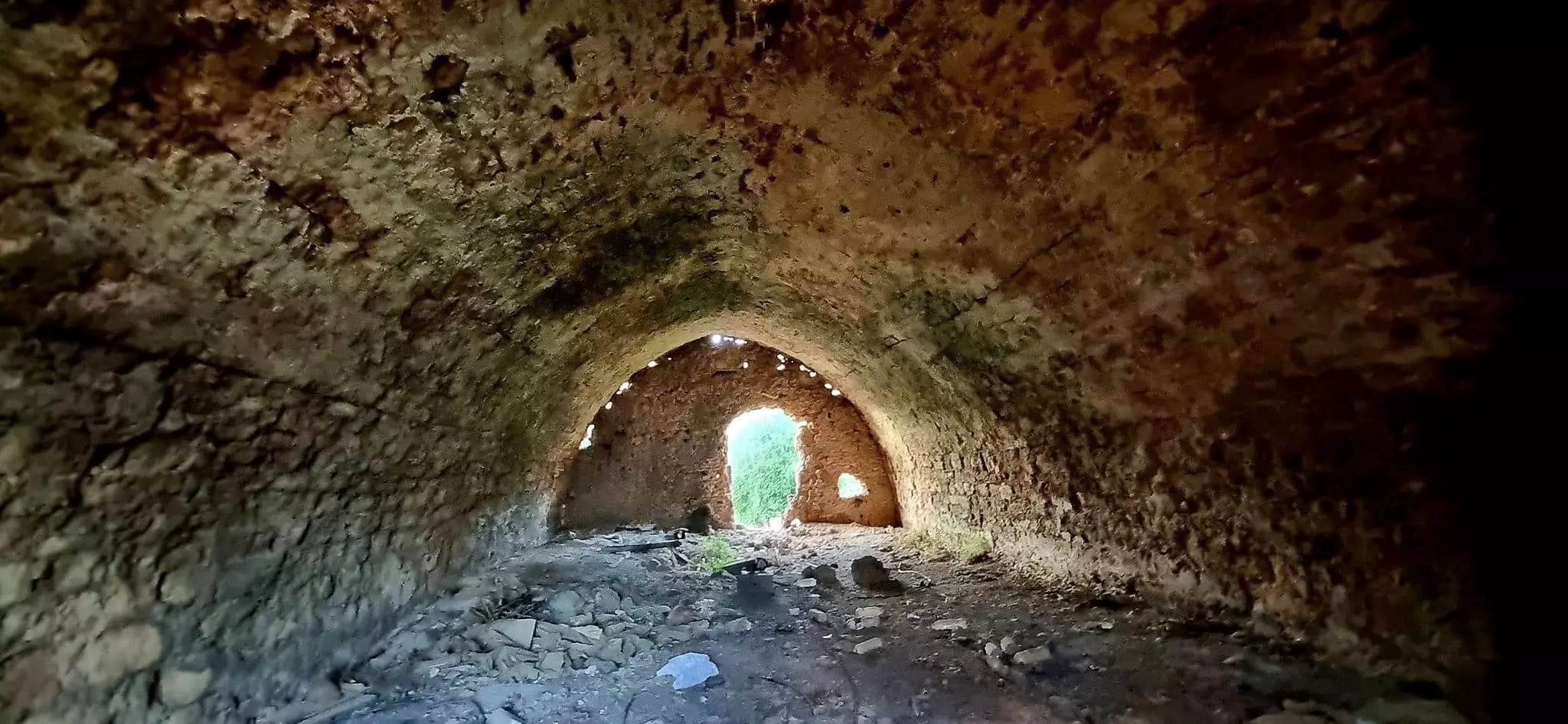
| Village Temains | Bayarat Hannun was mostly destroyed with the exception of one large two-story deserted house remain standing. | |||||||||
| Ethnically Cleansing | Bayyarat Hannun inhabitants were completely ethnically cleansed. | |||||||||
| Population |
|
|||||||||
| Near By Towns |
||||||||||
|
||||||||||
| Exculsive Jewish Colonies Who Usurped Village Lands |
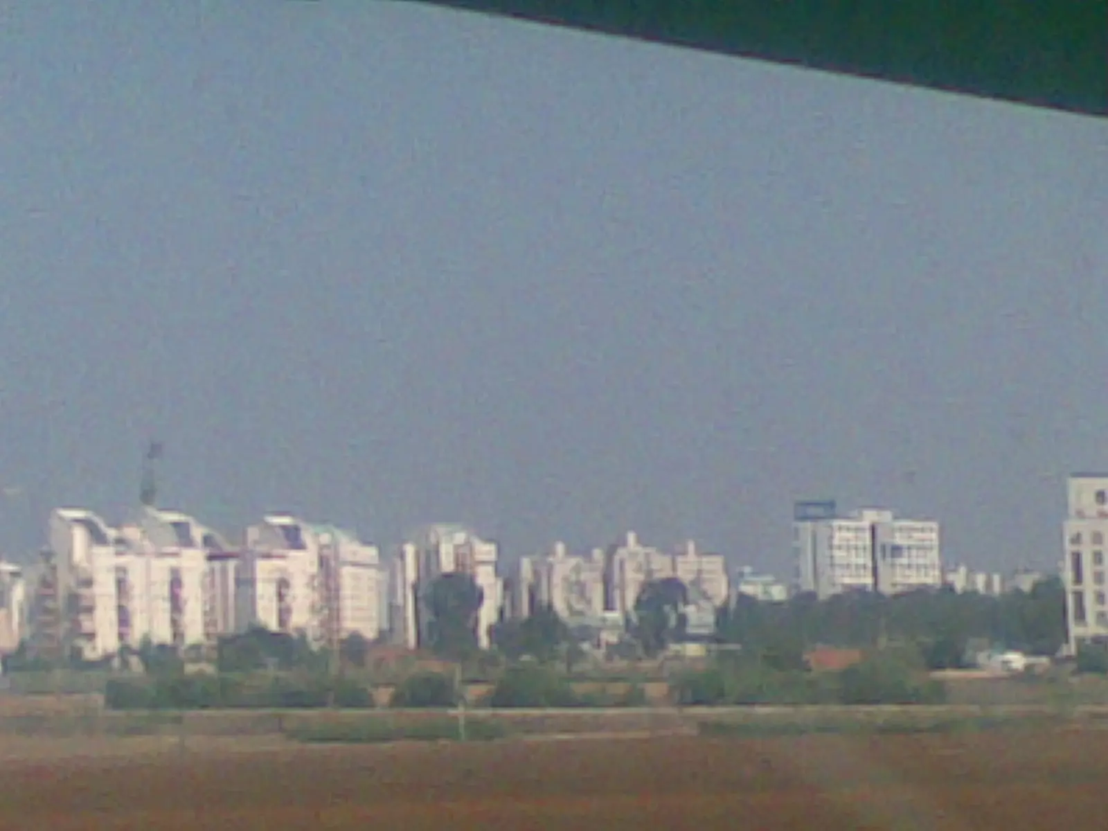
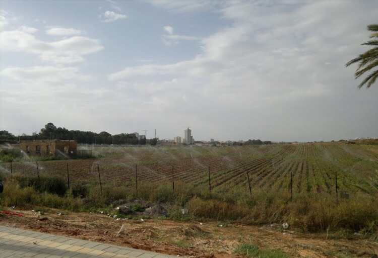
The Israeli city of Netanya occupies some of Bayarat Hannun's lands. | |||||||||
| Featured Video | ||||||||||
Village Before NakbaThe village, which was classified as a hamlet by the Palestine Index Gazetteer, stood on a slight elevation that rose above a stretch of flat ground. To the south of it was an artificial pond. Its most distinctive feature was one large house. It was linked by secondary roads to surrounding villages and localities. One such road passed through the village, dividing it into eastern and western halves. The first part of its name, bayyara, meant 'orchard' in Arabic. This suggests that the village may have been established during the citrus boom that began as early as the 1880s in the coastal areas of Palestine.Village Occupation and Ethnic CleaningLike many villages in the Tulkarm, Bayyarat Hannun probably felt the effects of the war in its early stages. Although it is not known when this village was occupied, this portion of the coast was an area of heavy Jewish settlement and was targeted for 'clearing' by the end of March 1948. The Haganah and Irgun Zvai Leumi carried out raids on many villages in this area, expelling their inhabitants and terrorizing many other communities into flight. One village that was displaced during March was nearby Umm Khalid, according to Israeli historian Benny Morris. Most of the villages that remained populated by the end of March, such as Khirbat Bayt Lid, were evacuated during April and early May.Zionists Colonies on Village LandsThe lands of Bayyarat Hannun have been merged with those that once belonged to another destroyed village, Ghabat Kafr Sur. Two Israeli settlements have been built on the lands of Ghabat Kafr Sur. The southern portion of the town of Netanya is located 0.5 km from the site of Bayyarat Hannun.Village TodayOne large, two-storey, deserted house still stands on the site, although some sections of it have been destroyed. Each storey consists of three large rooms. There is an artificial pond near the western side of the house, and a wall runs from the house to the west and east. The rooms on the lower floor are used to store agricultural implements. The house is bordered by avocado orchards on the north and west, and by citrus on the southern side. On the eastern edge of the site is a group of dilapidated houses.SourceDr. Walid al-Khalidi, 1992: All That Remains. |
||||||||||
| Related Maps | Town Lands' Demarcation Maps خرائط للقضاء توضح حدود القرى والاودية Town's map on MapQuest View from satellite Help us map this town at WikiMapia |
|||||||||
| Related Links | Wikipedia's Page Google Search Google For Images Google For Videos |
|||||||||
| More Information | في كتاب كي لا ننسى المزيد من موقع هوية |
|||||||||
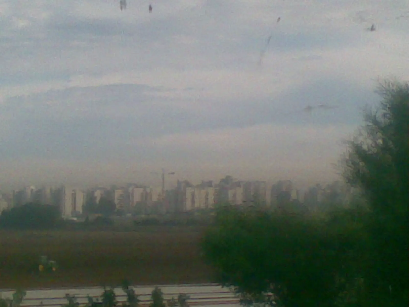
- A cluster of village houses on the east side of the village, 1990
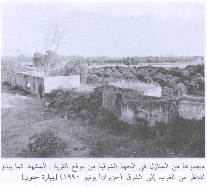
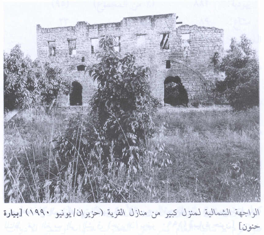
Scanned from "All That Remains" by Dr. Walid Khalidi - The northern facade of alarge village house, 1990
Scanned from "All That Remains" by Dr. Walid Khalidi 2 - One of the remaining structure left standing in Bayyarat Hannun
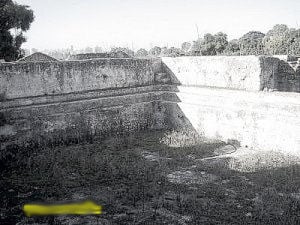
1 - A panorama. The centre of the panorama is north. Mostly we see the irrigation canal.
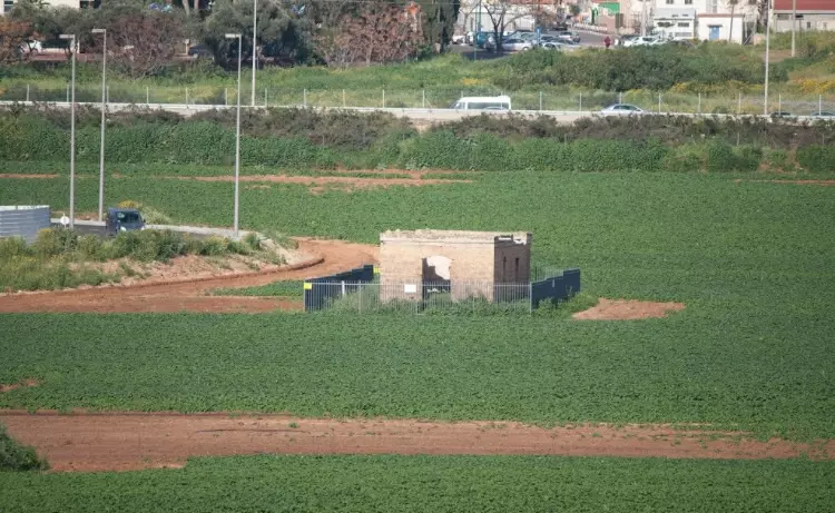
Posted by Uri Zackhem - The central building. Above it the cranes that build the new Natanya municipal stadium.
Posted by Uri Zackhem - Here probably used to be the pump motor.
Posted by Uri Zackhem - بيارات حنون

Posted by ابو الثائر - بيارات حنون
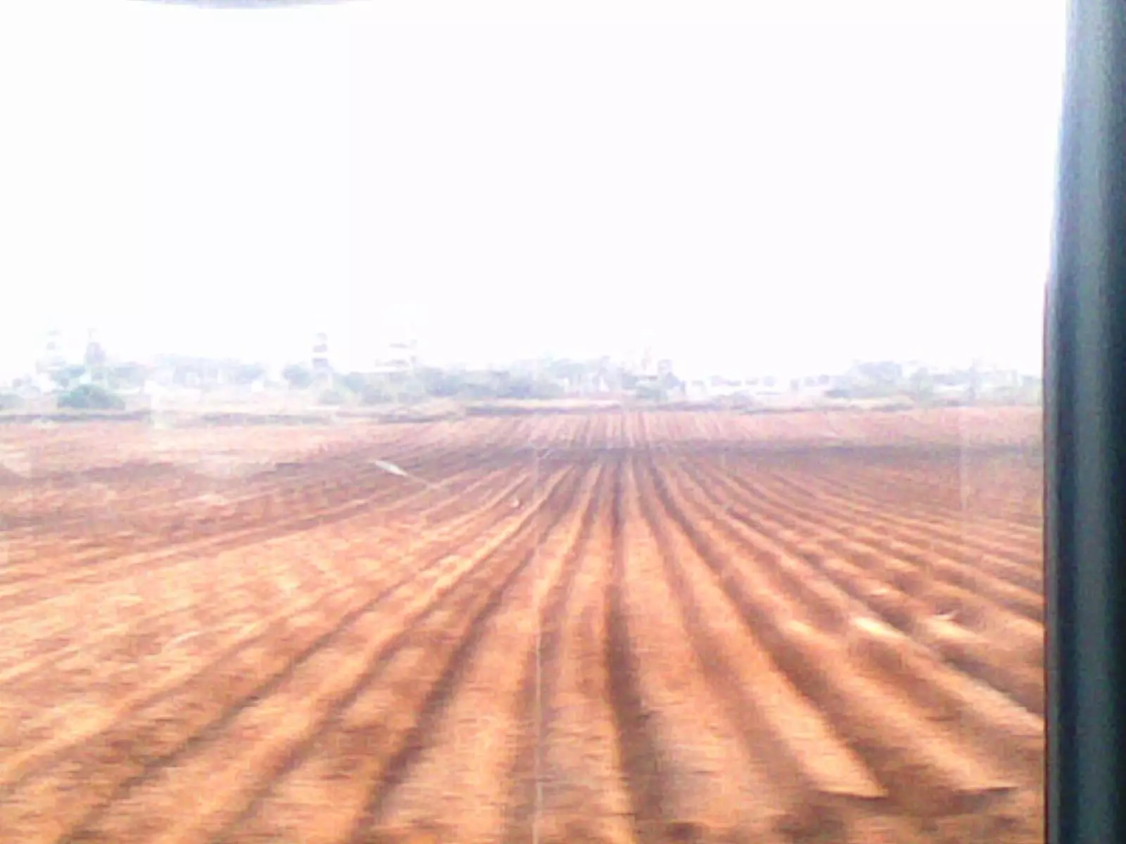
Posted by ابو الثائر - مساحات شاسعه للزراعه من ارض بيارات حنون
Posted by ابو الثائر - بيارات حنون
Posted by ابو الثائر - بنيات على اراضي البلده
Posted by ابو الثائر - أنقاض
Posted by Karmawi - انقاض خربة حنون
Posted by Karmawi - انقاض خربة حنون
Posted by Karmawi - بيوت بيارات حنون
Posted by abu raya - بيوت بيارات حنون الباقيه في القريه
Posted by abu raya - اراضي بيارات حنون
Posted by abu raya - اثار بيت في بيارات حنون
Posted by abu raya - بيارات حنون
Posted by abu raya - بيارات حنون
Posted by abu raya - Part of Bayyarat Hannun, during construction of Netanya Stadium
- جولة في احد البنايات المتبقية -- 2023 -- ابو النجوان بطاطا .
- جولة في احد البنايات المتبقية -- 2023 -- ابو النجوان بطاطا . #2
- جولة في احد البنايات المتبقية -- 2023 -- ابو النجوان بطاطا . #3
- جولة في احد البنايات المتبقية -- 2023 -- ابو النجوان بطاطا . #4
- جولة في احد البنايات المتبقية -- 2023 -- ابو النجوان بطاطا . #5
- جولة في احد البنايات المتبقية -- 2023 -- ابو النجوان بطاطا . #6
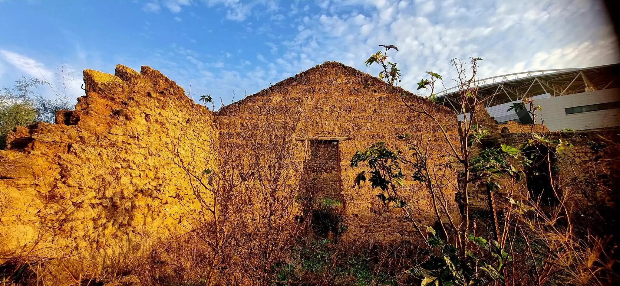
- Part of Bayyarat Hannun, during construction of Netanya Stadium

Want to browse more? 80,000 pictures were grouped in these gallaries:
| Display Name | Clan/Hamolah | Country of Residence |
| Hussein | Younes - Al-Fukaha' | Central, Saudi Arabia |
| Abdalla Saif | - | Saudi Arabia, Saudi Arabia |
- Tracing All That Remains of Bayyarat Hanoun Since Nakba Duration: 5 min 22 sec
- بيارات حنون المهجرة في غابة كفر صور: قصر فلاح عبد الفتاح - القصر والغرف والبيارة والمرج وادلة للمعركة الاخيرة عام 1948 Duration: 5 min 34 sec
 Fake Valor: Why Did Zionist Jews Hoist Nazis Flag on Their Ships in the 1930s?
What is new?
-
Facts About Oct. 7th Gaza Raid
-
Remined Us Please:: Who Did Rape Who? Palestinians Raped Israelis? Or, was the other way around?
-
When Prof. Edward Said was invited to debate Bibi Netanyahu in the 1980s, watch what happened!
-
Ezra Klein of the NY Times on the "Jewish Race".
-
Abusing Blood Libel!
-
Zionist FAQ: Isn't it true that Palestinians don't want peace? Palestinians never accepted the two-state solution
- Facts about Haavara (Transfer) Agreement between Ben-Gurion & Hitler
-
Haavara FAQs: Why Did Zionist Jews Hoist Nazis' Flags on Their Ships in the 1930s?
-
Dear ChatGPT: Why did the Jewish Agency suppress news of the Holocaust during WWII?
-
Video Playlist: Jews share their DNA tests to end the conflict for good.
-
A Tale of Two Conflicts: Examining the Definition of Genocide
-
Prof. Abraham Polak And The Suppressed History of the Khazars and European Jewry
-
How Ronald Reagan would have framed the genocide in Gaza if he were still alive?
-
Haavara FAQs: Let us do the math: how many German Jews did The Haavara Agreement save?
-
Zionist FAQs: The Hebron Massacre of 1929, "clearly proves" that Palestinians are antisemitic, how could you deny it?
-
Zionist FAQs: Why Anti-Zionist Is Not Antisemitism?
-
Zionist FAQs: Isn't it true that the KGB create Palestinian Nationalism in the early 1960s?
- Zionist FAQs: Muslims are killing Muslims all the time; why are Israeli Jews being singled out in the media?
- Zionist FAQs: How is Israel an apartheid state when 20% of its citizens are Arabs who enjoy full rights?
-
Haavara FAQs: Analysis of Herzl's Uganda Scheme and how it could have saved millions of Jews.
-
Haavara FAQs: Why did Hayim Greenberg describe American Jewry as "morally bankrupt" in early 1943?
-
Haavara FAQs: What if the Evian Conference was a resounding success? What would have been the impact of saving European Jewry on Zionism?
- Haavara FAQs: What if the six million were saved, how that would have impacted the Zionist project?
-
Haavara FAQs: How did Zionist leaders react when Europe's Jews lingered in the DP camps after WWII ended?
-
Why does the American Jewish community repeat lies that David Ben-Gurion had debunked before he died?
-
Who has the power to rename the Tatar/Khazar Gene Marker to Jewish IV?
-
Zionist FAQs: Why won't Egypt, Syria, and Jordan take their people back? Jews are indigenous to Palestine, and Arabs immigrated after Jews developed the country. Arabs should leave.
-
Haavara FAQs: Did Hitler and the Nazis conflate between Judaism and Zionist? If that wasn't case, then why?
-
Haavara FAQs: Winston Churchill and antisemitism, a collection of articles written Churchill.
-
Haavara FAQs: Broken by country, how many Jews survived vs. killed during the Holocaust?
-
Haavara FAQs: Why did European Jews vote with their feet and to immigrated to the Americas, not Palestine, after WWII?
-
Watch this American Jewish Girl describing Israeli Jews' cognitive dissonance like no other in under two minutes
-
Haavara FAQs: When the Nazis went out of their way to hide the Holocaust, Israeli Jews did the exact opposite by broadcasting their genocide of Gazans. But why?
-
Haavara FAQs: How Zionist Jews went out of their to show their appreciation to Nazism and Fascism?
- Haavara FAQs: Why Zionist leaders were against bombing the death camps & the Railroads leading to them?
-
Haavara FAQs: Hitler's message to the British and American people: If Jews are such noble citizens and you care about them, how come you're not letting them in? I will gladly ship them to you at my expense, even on luxury liners!
-
A shortlist of Zionist and Israeli false flag operations in the name Jews.
-
The Most Moral Army
- The Land of Kapos (Israel): Where the brave are boycotted and Kapos walk free.
- Why did early Zionists often named their communal enterprises "colonial"?
- Zionist Relations with Nazi Germany by Faris Glubb
-
Two NY Times advertisements by Zionists in the early 1943 that exposes Zionists' treason at the height of the calamity
- Facts Not Lies about the Palestinian-Israeli Conflict.
- Site's pictures have been categorized
- Campgain Against Lice
- A Survey of Palestine, the official source about Palestine before Nakba produced by the British Mandate; over 1200 pages.
- Satellite View & Google Earth: Over 6,000 placemarks identifying all destroyed towns, W. Bank & Gaza Strip Towns, & refugee camps.
- PalestineRemembered.com and its Nakba Oral History Project were featured on al-Jazeera Satellite TV.
- Nakba Oral History Video Podcast:
 Over 700 Oral History interviews (including 3,500+ hours of recording) can be viewed online.
 - Palestine Village Statistics Project
- Gaza Jail Break
- النسخة العربية للموقع الان متوفرة
- Videos: Documenting the destroyed villages in video: Tracing all that remains since Nakba.
- Videos: Responding to Zionist Propaganda
- Interview: The ethnic cleansing of Palestine: George Galloway interviews Israeli Historian Ilan Pappe.
- For Palestinians, memory matters. It provides a blueprint for their future By George Bisharat.
- Zionist FAQ now available in Hebrew שאלות שציונים שואלים, עכשיו בעברית
- Video: The Stephen Walt and John Mearsheimer report on the influence of the Israel Lobby on U.S. Foreign Policy
- The Palestinian-Israeli conflict for beginners
