| PalestineRemembered | About Us | Oral History | العربية | |
| Pictures | Zionist FAQs | Haavara | Maps | |
| Search |
| Camps |
| Districts |
| Acre |
| Baysan |
| Beersheba |
| Bethlehem |
| Gaza |
| Haifa |
| Hebron |
| Jaffa |
| Jericho |
| Jerusalem |
| Jinin |
| Nablus |
| Nazareth |
| Ramallah |
| al-Ramla |
| Safad |
| Tiberias |
| Tulkarm |
| Donate |
| Contact |
| Profile |
| Videos |
Welcome To Umm Khalid - ام خالد (אום ח'אלד)
|
District of Tulkarm
Ethnically cleansed days ago |
العربية Google Earth |
 |
Gallery (94) |
- Statistics & Facts
-
Before & After

- Satellite View
- Articles 8
- Pictures 94
- Oral History 2
- Members 26
- Families
- All That Remains
- Wikipedia
- Videos 1
- Guest Book 28
- Links 1
| Statistic & Fact | Value | ||||||||||||||||||
| Occupation Date | March 20, 1948 | ||||||||||||||||||
| Distance From District | 15 (km) West of Tulkarm | ||||||||||||||||||
| Elevation | 25 (meters) | ||||||||||||||||||
| Before & After Nakba, Click Map For Details |
|||||||||||||||||||
|
|||||||||||||||||||
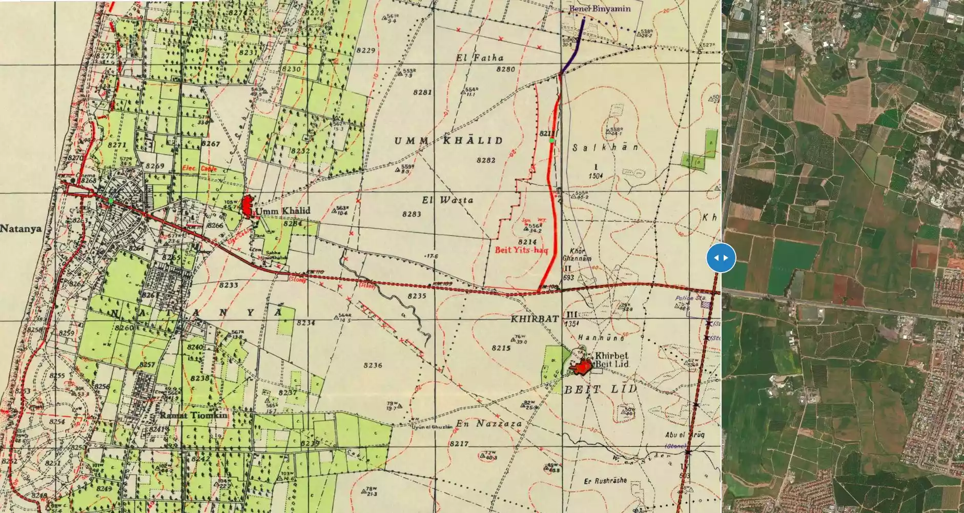
| Map Location | See location #9 on the map View from satellite |
||||||||||||||||||
| Military Operation | Coastal Clearing | ||||||||||||||||||
| Exodus Cause | Fear of Jewish attack, or of being caught in the fighting | ||||||||||||||||||
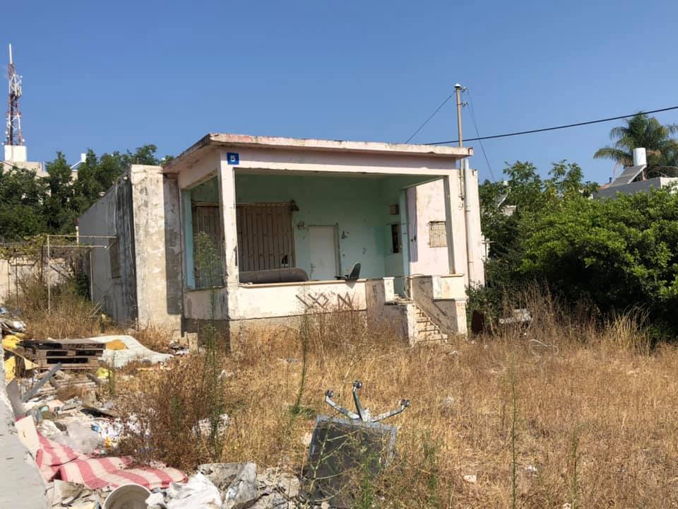
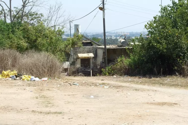
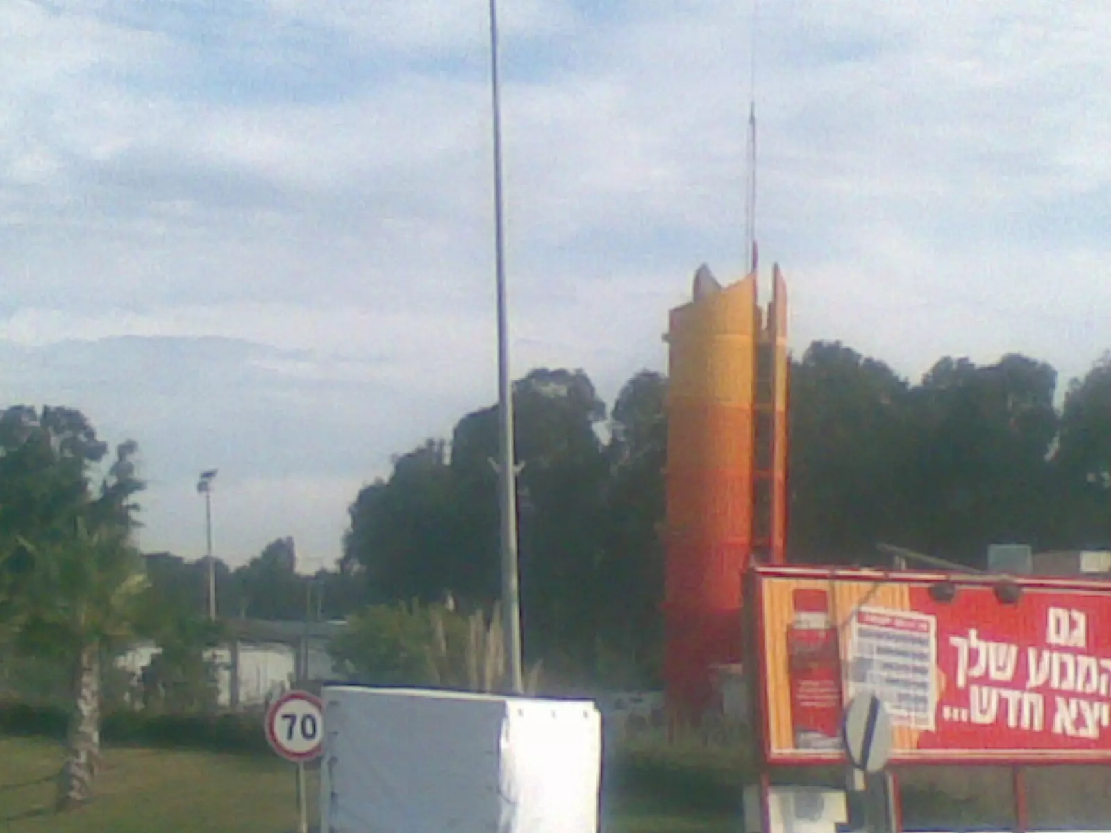
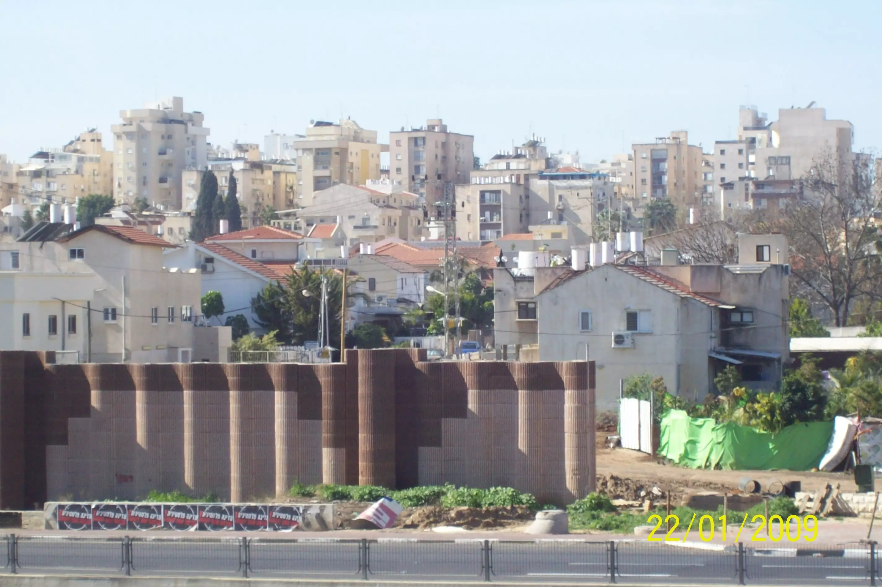
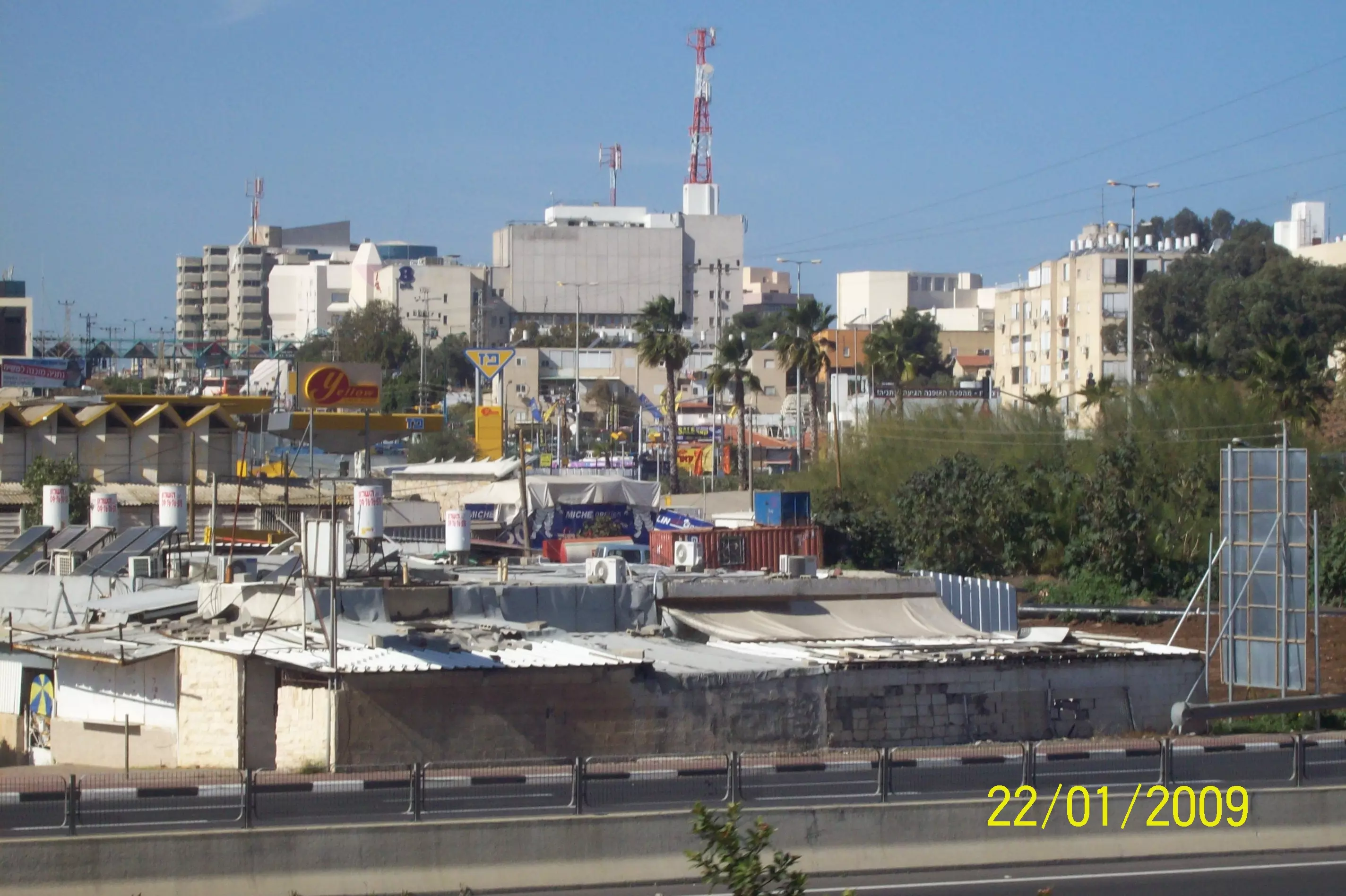
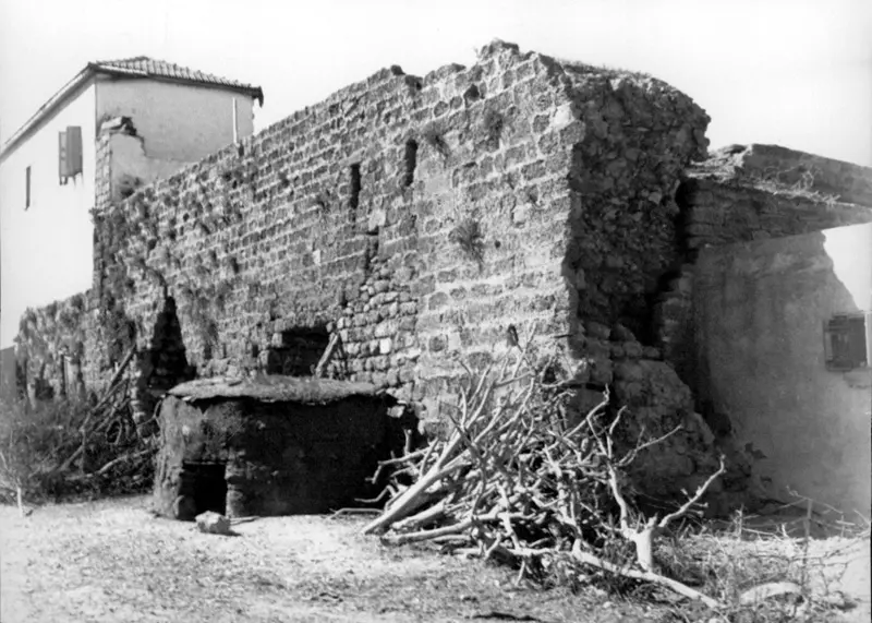
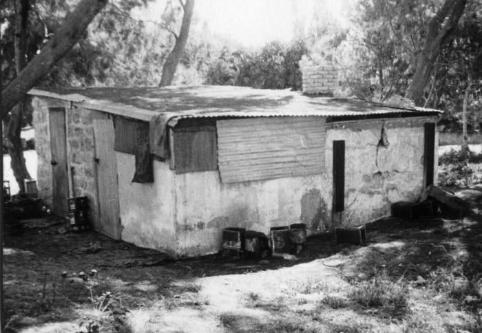
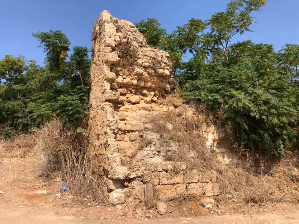
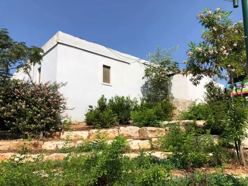
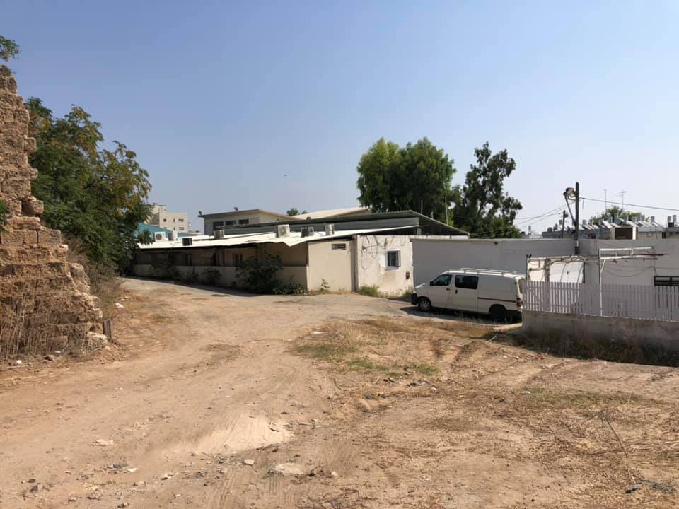
| Village Temains | Umm Khalid was mostly destroyed with the exception of few houses remain standing. Currently, these houses are being occupied by Jewish settlers from the nearby Israeli City of Natanya. | ||||||||||||||||||
| Ethnically Cleansing | Umm Khalid inhabitants were intimidated into fleeing by the Haganah on March 20th, 1948. | ||||||||||||||||||
| Pre-Nakba Land Ownership |
**Town Lands' Demarcation Maps |
||||||||||||||||||
| Land Usage As of 1945 |
|
||||||||||||||||||
| Population |
|
||||||||||||||||||
| Number of Houses | In (1931): 131 (includes 'Arab al-Balawina) | ||||||||||||||||||
| Near By Towns |
|||||||||||||||||||
|
|||||||||||||||||||
| Schools | Umm Khalid had an elementary school for boys. | ||||||||||||||||||
| Places of Warship | One Mosque | ||||||||||||||||||
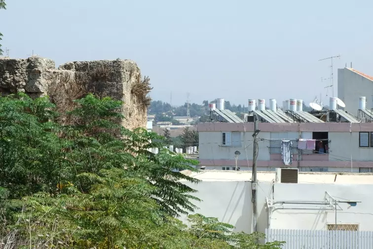
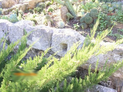
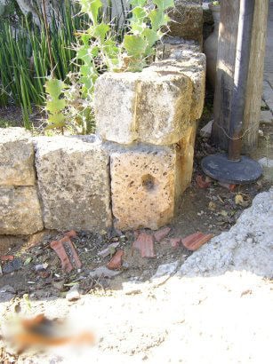
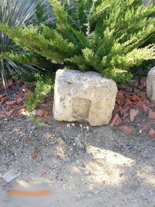
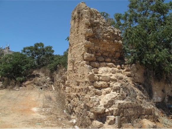
| Archeological Sites | Umm Khalid contains archeological remains of towers, fortresses, wells, reservoirs, cisterns, and pottery. | ||||||||||||||||||
| Exculsive Jewish Colonies Who Usurped Village Lands |
The Israeli City of Netanya. | ||||||||||||||||||
| Featured Video | |||||||||||||||||||
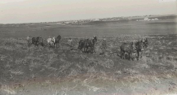
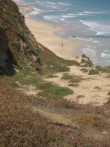
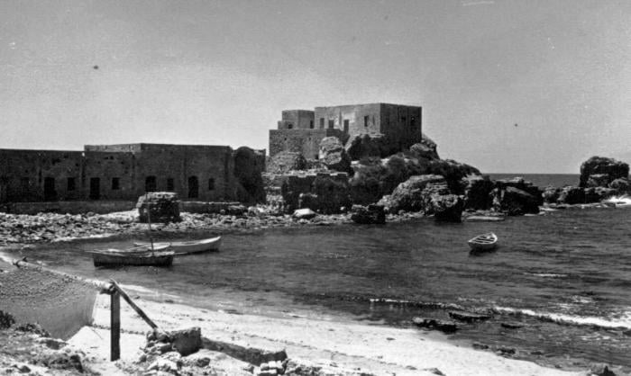
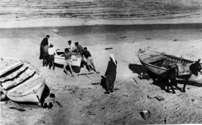
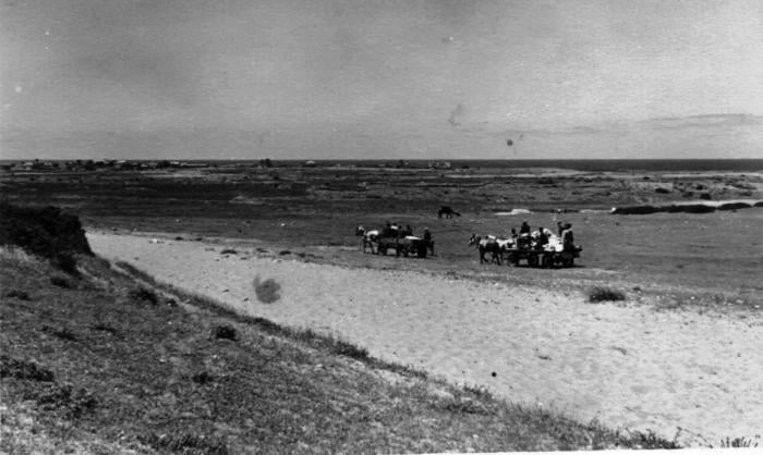
Village Before NakbaThe village was located on a sandstone hill less than 2 km east of the Mediterranean shore. The Tulkarm-Netanya highway passed south of it. Flint tools found around the site suggest that the area might have been inhabited since prehistoric times. The village site contained the Lombard Castle of Roger that was built by the Crusaders. Umm Khalid was razed by the troops of Napoleon in 1799 during their return to Egypt, after they had failed to occupy the city of Acre in northern Palestine. In the nineteenth century, Umm Khalid was a rest area between al-Tantura (Haifa sub-disctrict) and Ra's al-'Ayn, a village in the Jaffa sub-disctrict on the al-'Awja River, where Ottoman officials stopped and received dignitaries. [[D 3/2:311]] In 1856 M. Rogers described Umm Khalid as a flourishing village, and noted the extensive melon gardens west of the village. [[Rogers 1862:344-45]]The village was rectangular and extended in a north-south direction. Its houses were built of stone and mud and were crowded together, separated by narrow alleys. The village was endowed with fertile soil and plentiful underground water. At the village center was a mosque, an elementary school for boys, and four shops for groceries and fabrics. Its residents were predominantly Muslim; many of them had come from other villages in the sub-district seeking work in agriculture. Agriculture, the economic mainstay of the village, was based on watermelons, citrus, vegetables, and grain. In 1944/45 a total of 47 dunums was devoted to citrus and bananas and 1,830 dunums were planted in cereals. The villagers also raised livestock and processed dairy products. Archaeological findings around the village included the remains of towers, fortresses, wells, reservoirs, cisterns, and pottery. Village Occupation and Ethnic CleaningAccording to an Israeli military intelligence report, Umm Khalid was evacuated on 20 March 1948, out of a general sense of fear. Israeli historian Benny Morris states that a number of villages in the area suffered the same fate, as attacks increased on villages north of Tel Aviv in the early weeks of the war. This coastal area was the site of a heavy concentration of Jewish settlements and was regarded by the Zionist leadership as the core of the planned Jewish state. In their view it was therefore desirable that Arab residents be made to leave before 15 May. [[M:52-54]]Zionists Colonies on Village LandsMuch of the village land has been engulfed by the suburbs of the city of Netanya (136192), originally founded in 1929. The settlements of Gan Chefer, founded in 1940, and Nira, founded in 1941, were merged in 1953 to form a single, large settlement, Sha'ar Chefer (140193); this settlement covers part of the village lands. [[P:133, 184, 235, 243]]Village TodayThe village site has become part of the city of Netanya. Some houses remain and are used either as residences or for commercial purposes such as warehouses for Israeli companies. The lands in the vicinity are planted in citrus trees.SourceDr. Walid al-Khalidi, 1992: All That Remains. |
|||||||||||||||||||
| Related Maps | Town Lands' Demarcation Maps خرائط للقضاء توضح حدود القرى والاودية Town's map on MapQuest View from satellite Help us map this town at WikiMapia |
||||||||||||||||||
| Related Links | Wikipedia's Page Google Search Google For Images Google For Videos |
||||||||||||||||||
| More Information | في كتاب كي لا ننسى في كتاب بلادنا فلسطين المزيد من موقع هوية |
||||||||||||||||||
- Hamshari's Home in Um Khalid
- This land was theirs By Hannah Mermelstein
- أم خالد
- بيت رشيد - آخر مختار في أم خالد
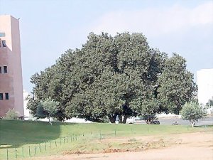
- Sycamore 'Jummez Tree' - by Rana Abdulla
- كتابة تذكارية على حائط جامع قرية أم خالد المهجرة.../د.محمد عقل
- نبذة تاريخية عن قرية ام خالد (قضاء طولكرم) من كتاب (كي لا ننسى)
- عائلات و حمايل و عشائر القرية
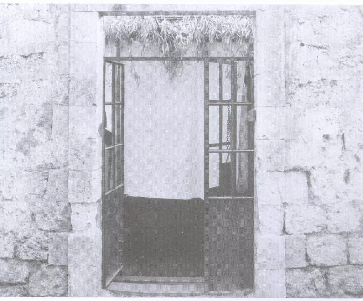
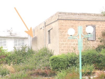
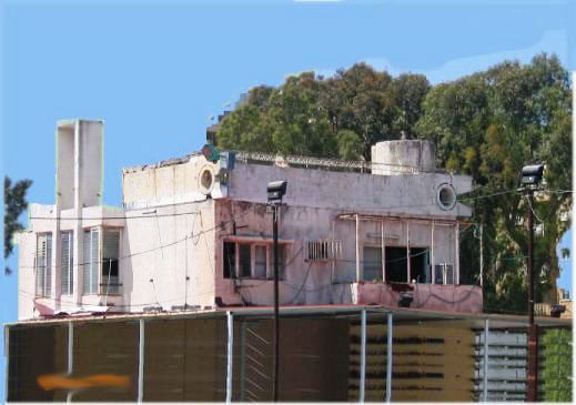
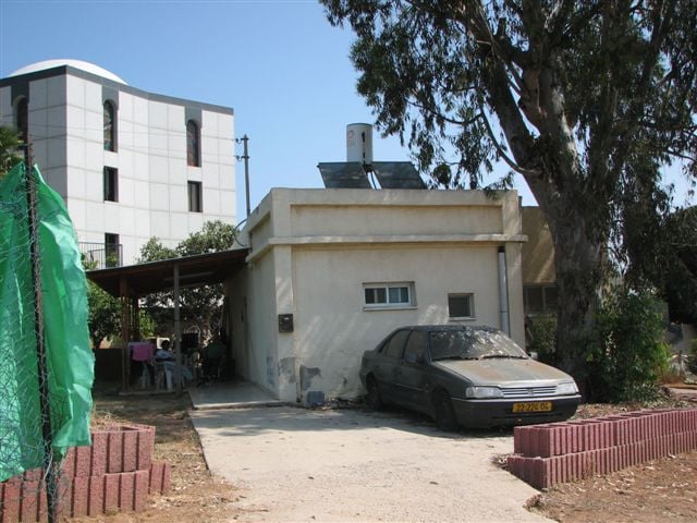
- A village house now used by a Jewish settler, 1987
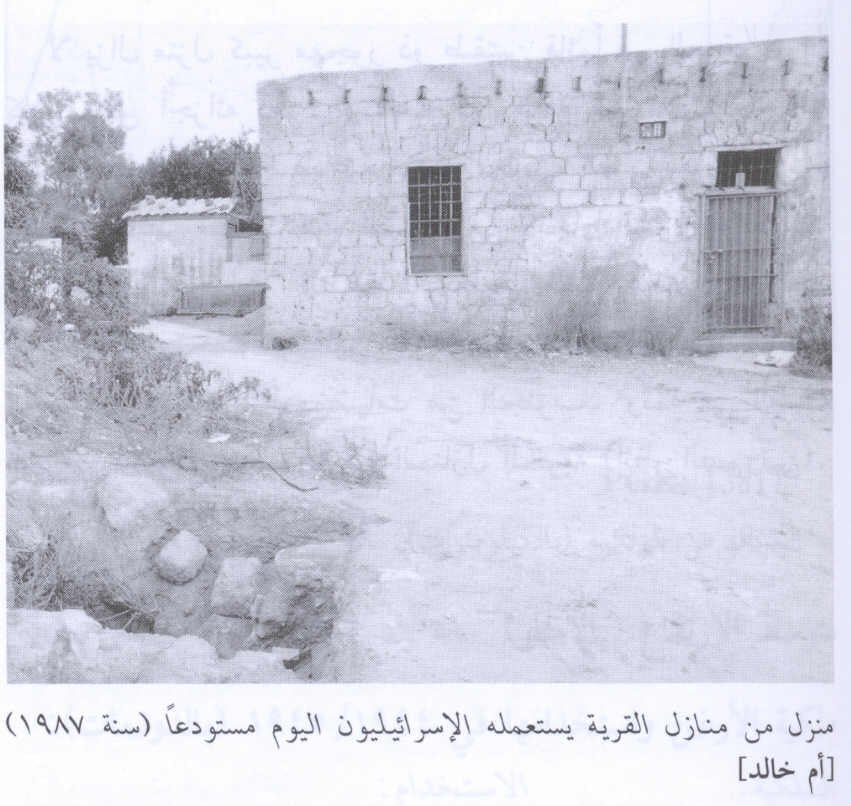
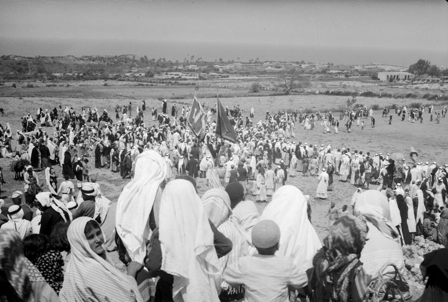
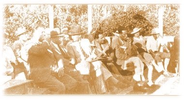
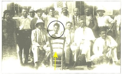
Scanned from "All That Remains" by Dr. Walid Khalidi 1 - One of the annual festivals in Umm Khalid, 1918
- إحدى البيوت المغتصبة
Scanned from "All That Remains" by Dr. Walid Khalidi - A house
Posted by Uri Zackhem 1 - Wall of the khan, and new buildings.
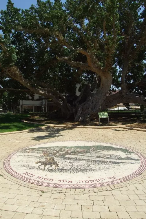
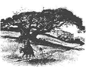
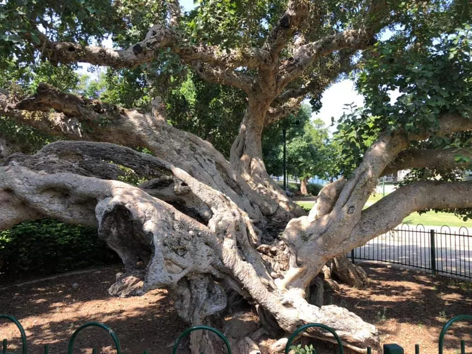
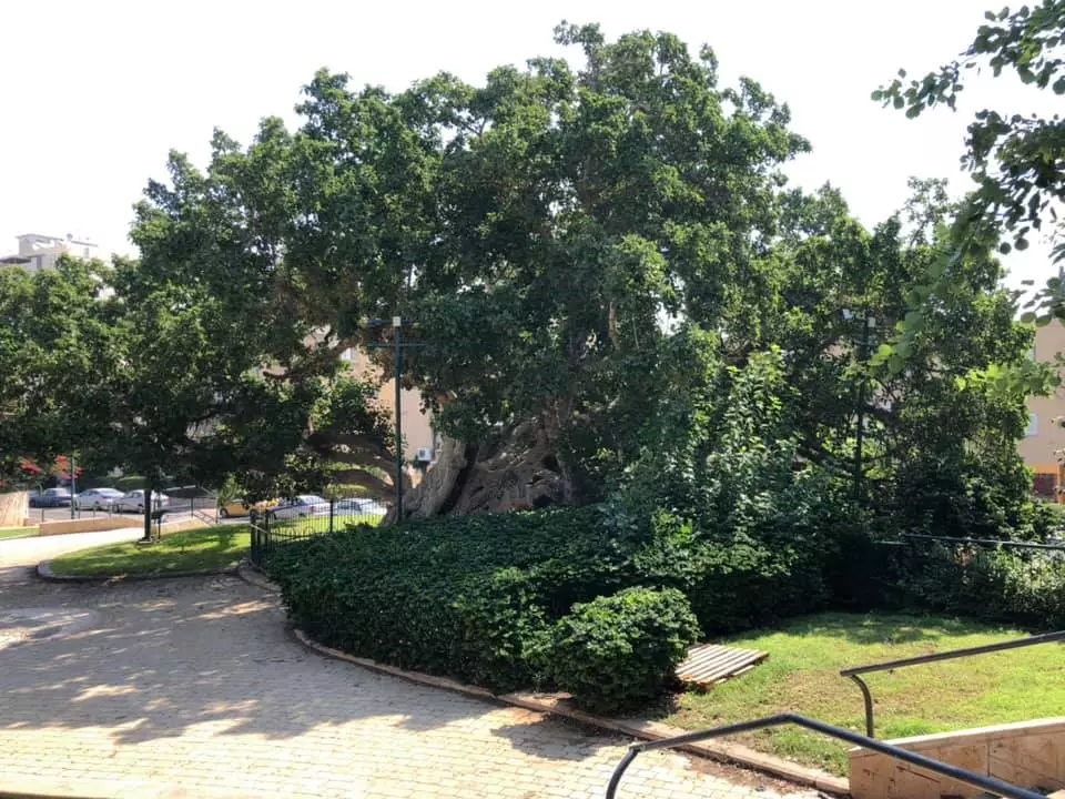
Posted by Uri Zackhem - The magnificent sycamore of Umm Khaled. It is estimated to be 1000 years old.
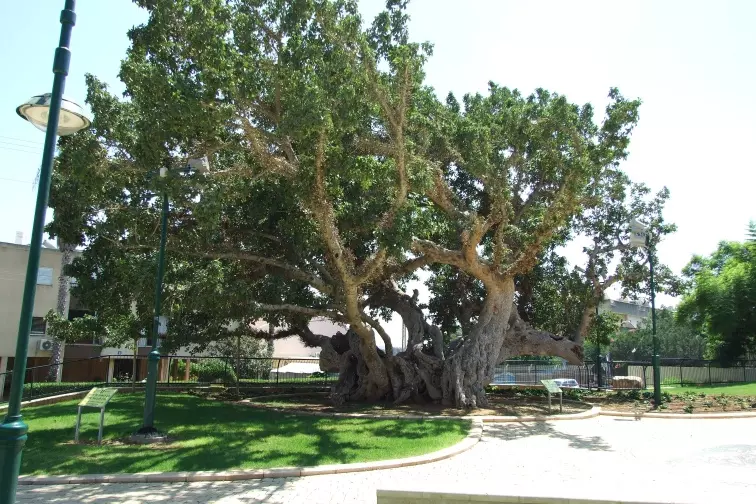
Posted by Uri Zackhem 2 - On the floor, there's a reproduction of an engraving of the 19th century depicting the tree.
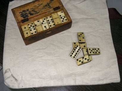
Posted by Uri Zackhem 1 - Bone Domino from Shiekh House
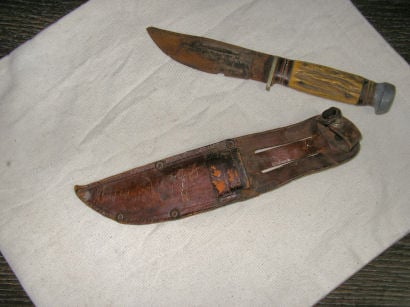
Posted by Khaled El Sala - Shabria from sheikh's house
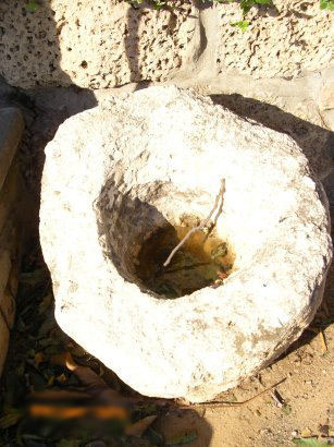
Posted by Khaled El Sala - Well of the village
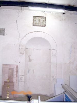
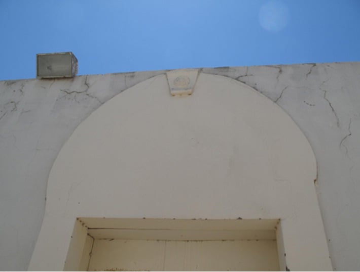
Posted by Khaled El Sala - The Mosque
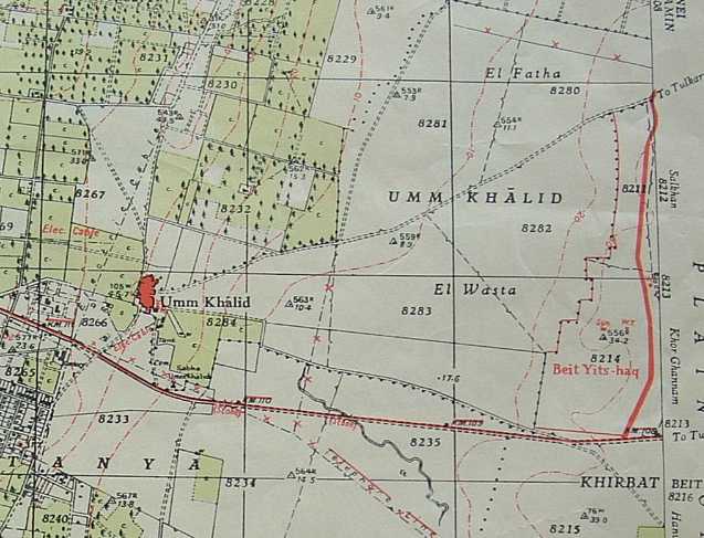
Posted by Khaled El Sala - Old Map
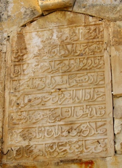
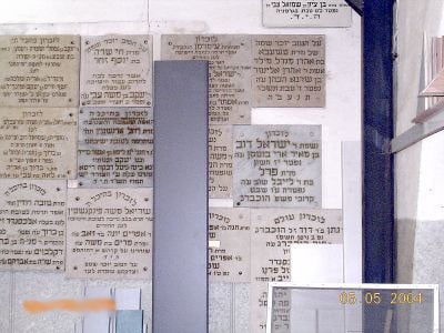
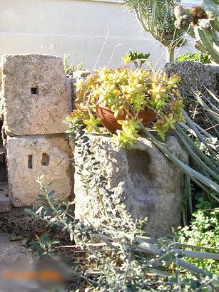
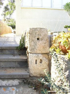
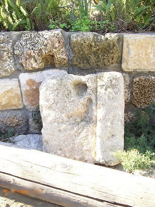
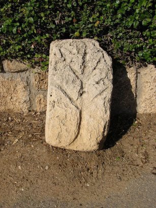
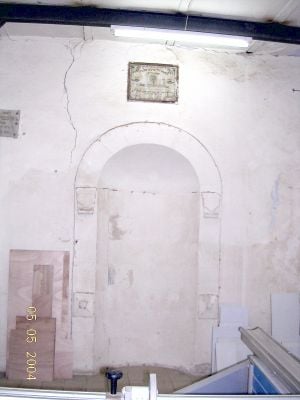
Posted by Khaled El Sala - Tablet that was on the mosque wall
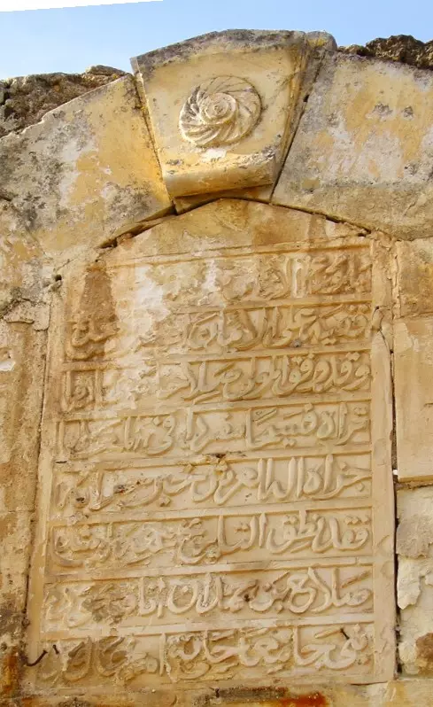
Posted by Khaled El Sala 3 - Tablet that was on the mosque wall
Posted by Khaled El Sala - صالح حمدان مختار ام خالد
Posted by محمد ألأعسم 13 - ام خالد
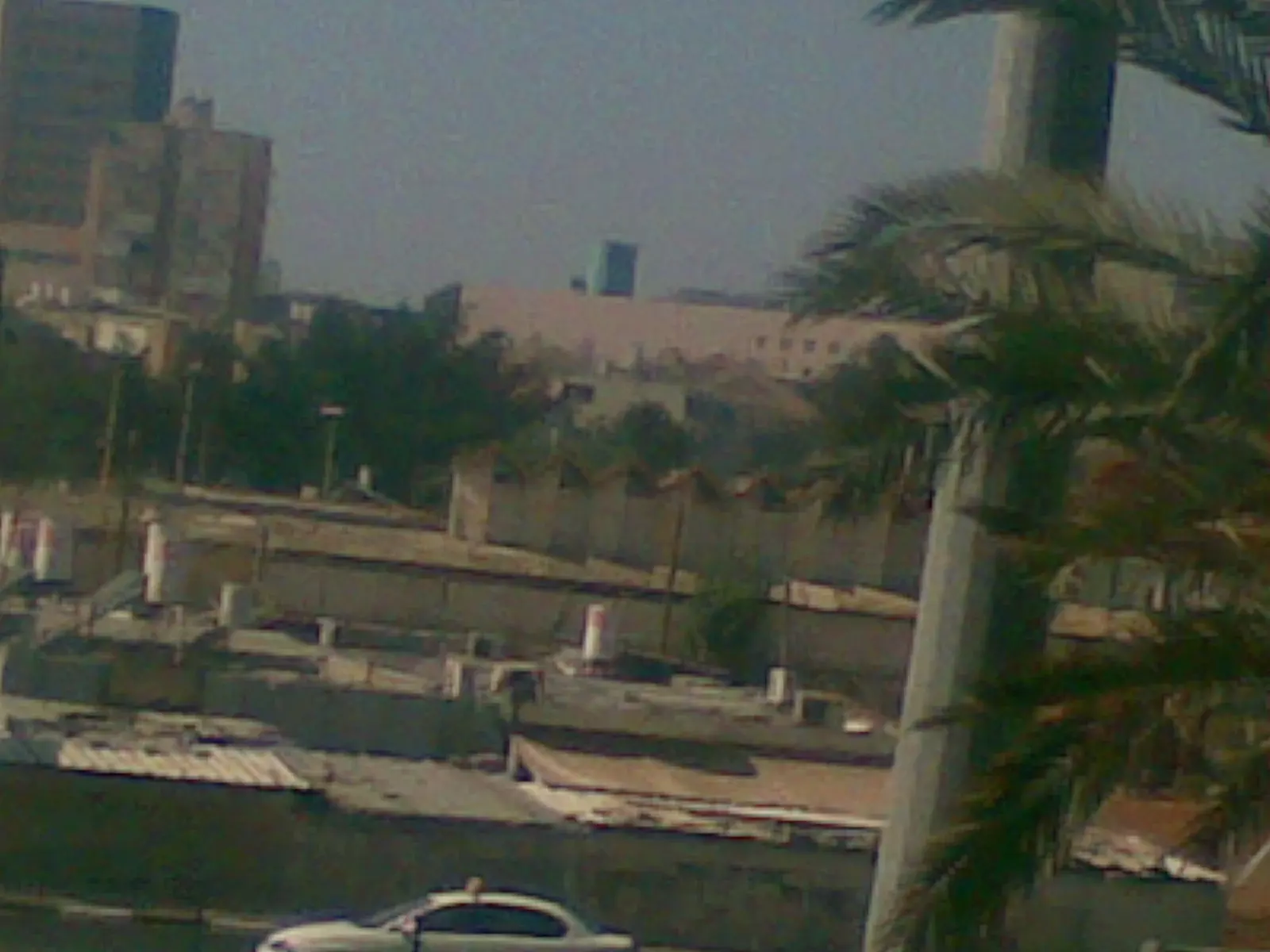
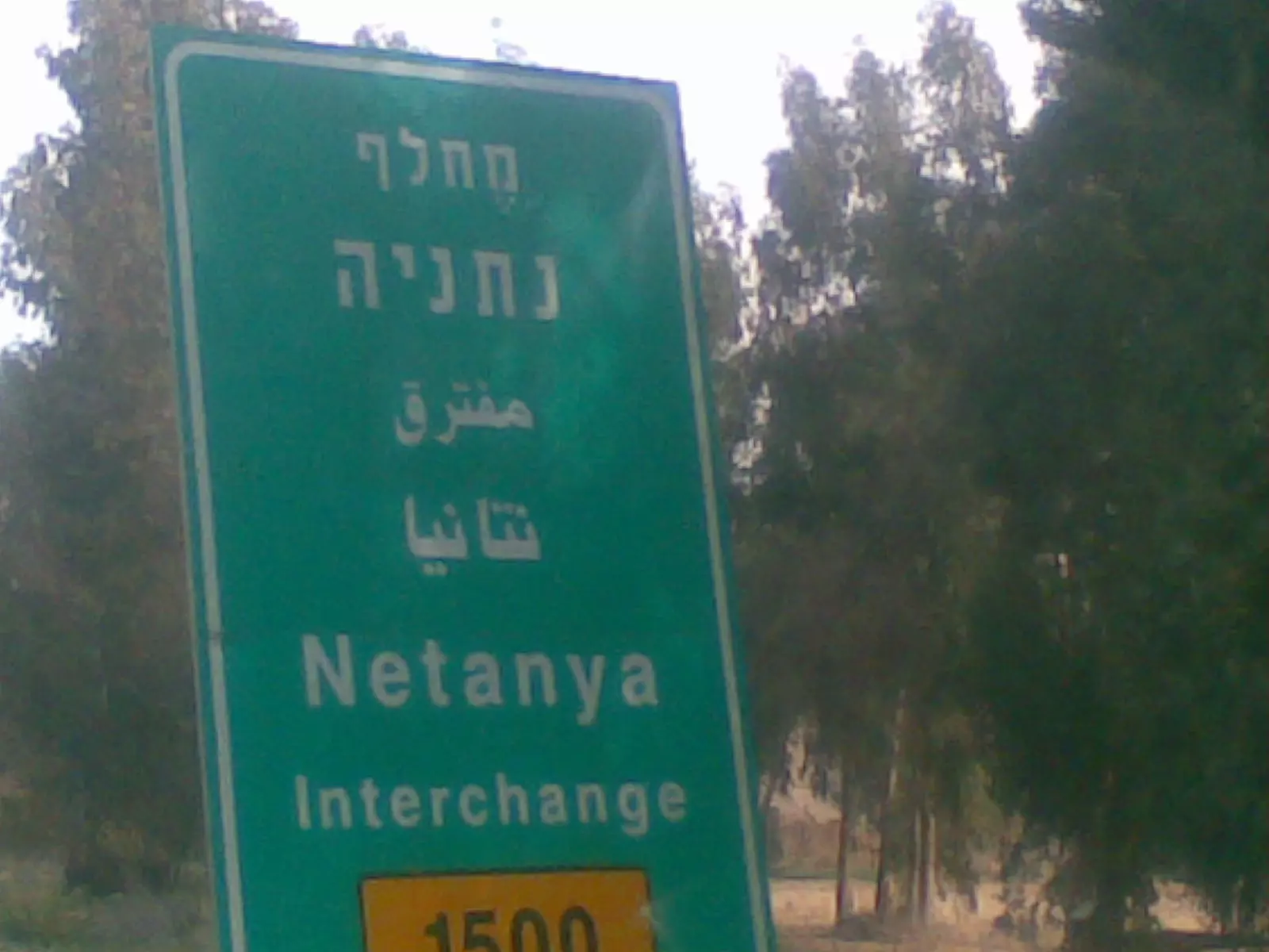
Posted by ابو الثائر - لافته الى مدينة نتانيا الواقعه على ارض قرية ام خالد
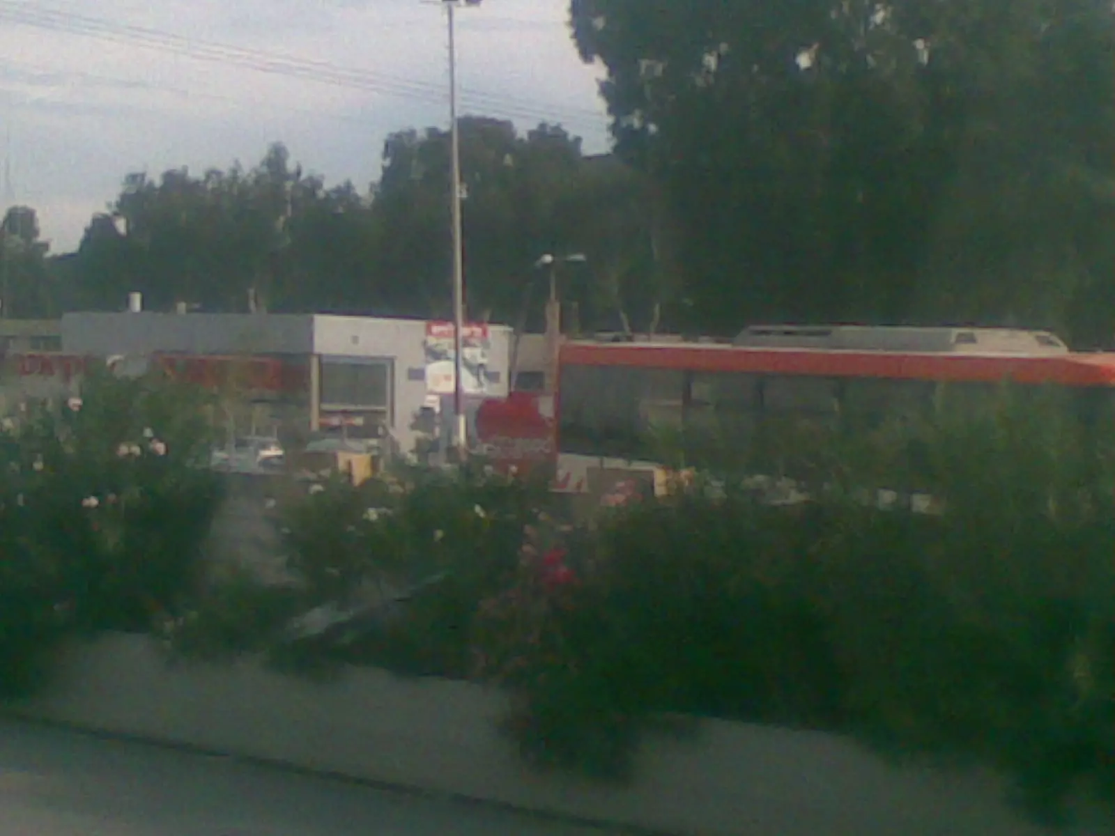
Posted by ابو الثائر - محطة وقود على ارض ام خالد
Posted by ابو الثائر - ام خالد
Posted by ابو الثائر - ام خالد
Posted by ابو الثائر - ام خالد
Posted by ابو الثائر - ام خالد
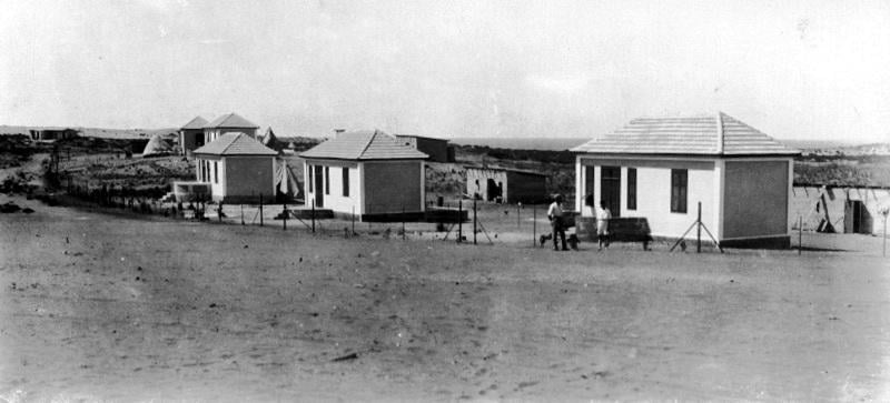
Posted by ابو الثائر - ام خالد 18 شباط 1929م
Posted by Karmawi - صورة قديمة من ام خالد
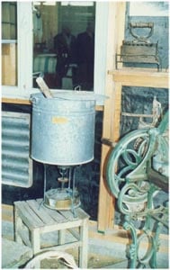
Posted by Karmawi - أدوات منزلية قديمة من ام خالد يلاحظ البريموس والمكواة الحديدي
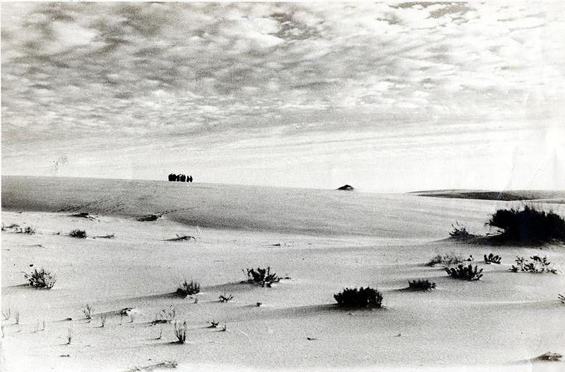
Posted by Karmawi - شاطئ البحر سنوات 1940
Posted by Karmawi - ام خالد 2003م
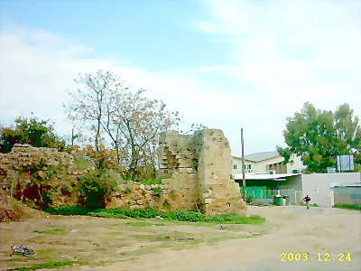
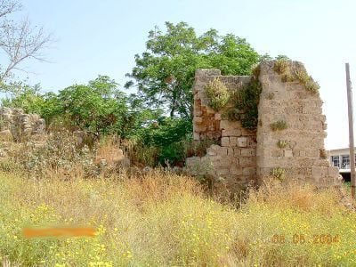
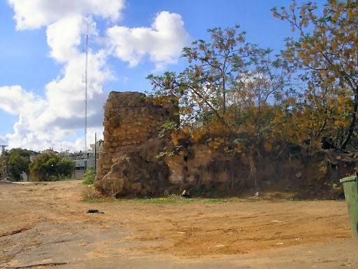
Posted by Karmawi - من أطلال أم خالد
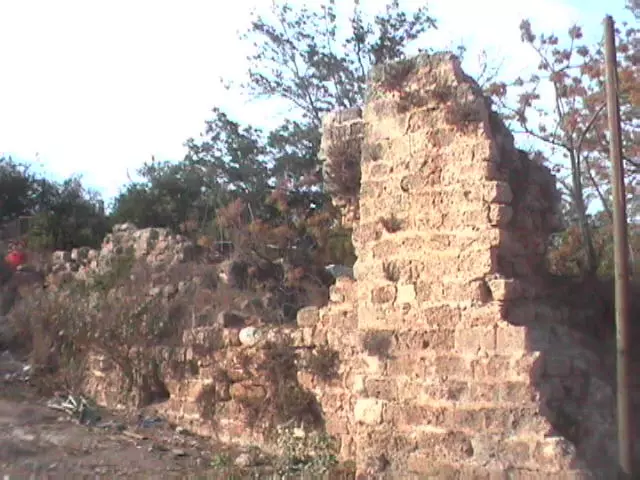
Posted by Karmawi - من أطلال أم خالد - صورة قديمة
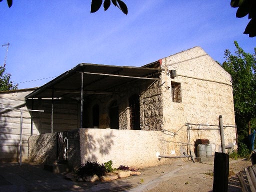
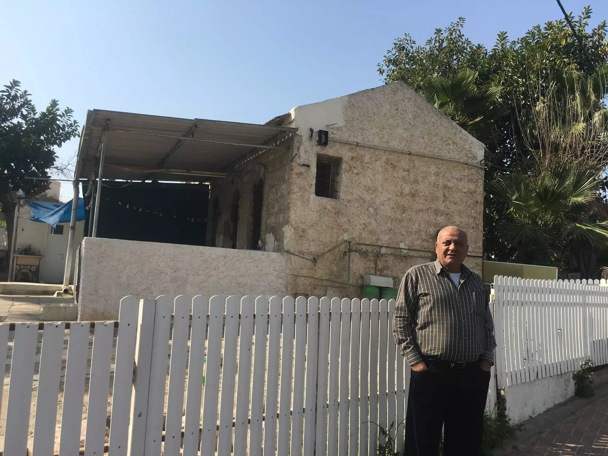
Posted by Karmawi - من البيوت القديمة الباقية في البلدة
Posted by Karmawi - بدايات الاستيطان الاسرائيلي 1930 في البلدة
Posted by Karmawi - شجرة معمرة
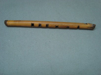
Posted by Karmawi - مزمار من بيت مختار ام خالد
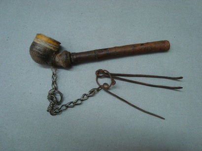
Posted by Karmawi 1 - غليون مختار ام خالد
Posted by Karmawi - القلعة الصليبية
Posted by Karmawi - القلعة - الحصن - الصليبية
Posted by Karmawi - محراب مسجد ام خالد
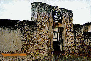
Posted by Karmawi - تحويل المسجد الى كنيس
Posted by Karmawi - مسجد ام خالد ويلاحظ كتابة عبرية على بوابته وقد حول الى كنيس
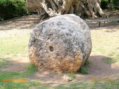
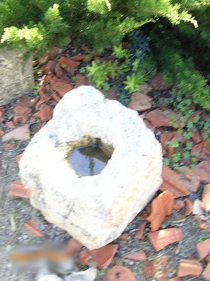
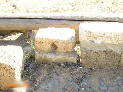
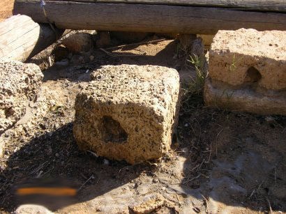
Posted by Karmawi 1 - حجر معصرة زيتون قديم
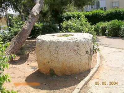
Posted by Karmawi - حجر طاحونة قديم
Posted by Karmawi - مبنى قديم على مدخل ام خالد
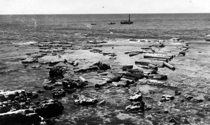
Posted by Karmawi - أثريات أم خالد 1
Posted by Karmawi - أثريات أم خالد 2
Posted by Karmawi - أثريات أم خالد 3
Posted by Karmawi - أثريات أم خالد 4
Posted by Karmawi - أثريات أم خالد 5
Posted by Karmawi - أثريات أم خالد 6
Posted by Karmawi - أثريات أم خالد 7
Posted by Karmawi - أثريات أم خالد 8
Posted by Karmawi - أثريات أم خالد 9
Posted by Karmawi - أثريات أم خالد 10
Posted by Karmawi - أثريات أم خالد 11
Posted by Karmawi - أثريات أم خالد 12
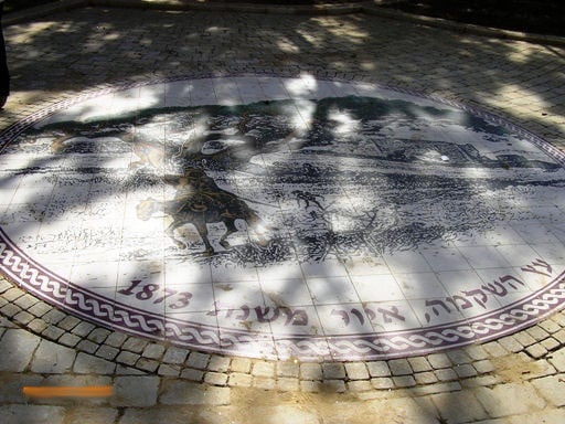
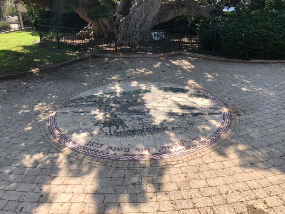
Posted by Karmawi - فسيفساء وضعت تخليدا لشجرة جميز ألفية عمرها ألف عام - 1873م
Posted by Karmawi - صورة في ام خالد بعد الاحتلال
Posted by Karmawi - صورة قديمة - ام خالد
Posted by Karmawi - بحر ام خالد - البحر الأبيض المتوسط
Posted by Karmawi - أطلال أم خالد تغفو قرب البحر
Posted by Karmawi - صورة قديمة للقوارب على البحر
Posted by Karmawi - صورة قديمة جدا من أم خالد
Posted by Karmawi - من بيوت ام خالد المغتصبة
Posted by Karmawi - من أطلال ام خالد ويشاهد المسجد - صورة قديمة
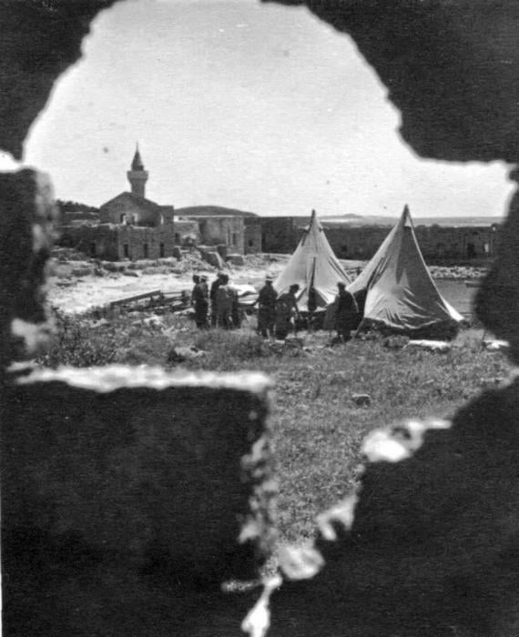
Posted by Karmawi - المغتصبون في ام خالد - بعد الاحتلال
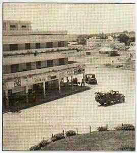
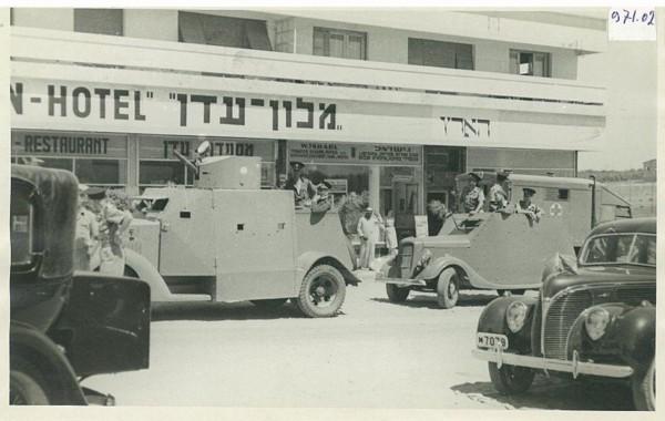
Posted by Karmawi - قوات من جيش المغتصبين لأم خالد أمام مبنى أقيم عليه فندق سمي فندق عدن
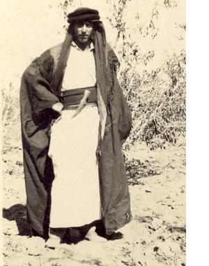
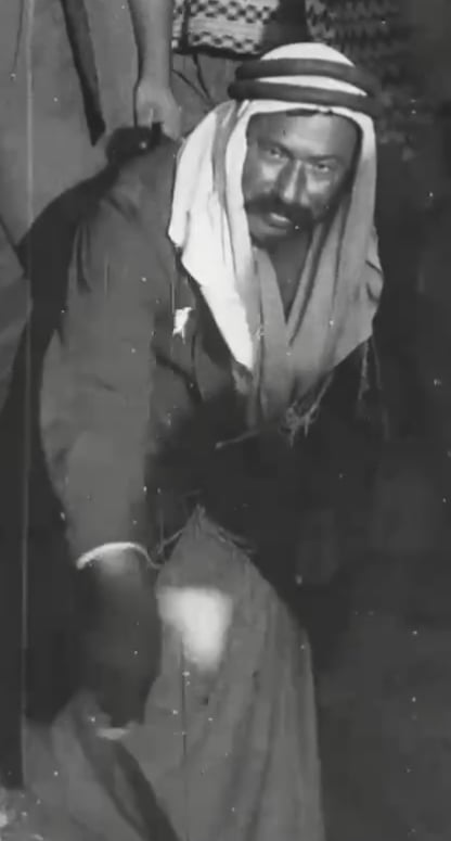
Posted by Karmawi - صورة قديمة يظهر بها مختار القرية
Posted by Karmawi - صورة قديمة لقاطنين في ام خالد
Posted by Karmawi - هدوء البحر- صور قديمة
Posted by Karmawi - مسجد أم خالد بعد التعديلات التي أجراها عليه اليهود وتم تحويله لمنزل أو معبد
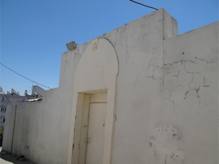
Posted by Karmawi - مسجد أم خالد بعد التعديلات التي اجراها اليهود
Posted by Karmawi - الحصن الصليبي
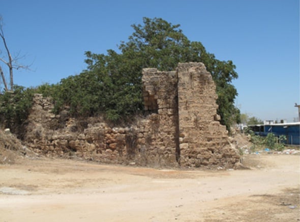
Posted by Karmawi - الحصن الصليبي تصوير من زاوية اخرى
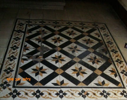
Posted by Karmawi - بلاط بيت رشيد - آخر مختار في أم خالد قبل النكبة
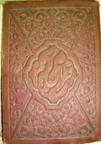
Posted by Karmawi - مقتنيات مختار ام خالد - نسخة من القرآن الكريم بقيت في منزله بعد الهجرة 1
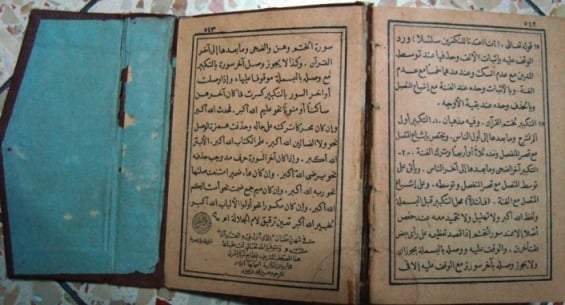
Posted by Karmawi - مقتنيات مختار ام خالد - نسخة من القرآن الكريم بقيت في منزله بعد الهجرة 2
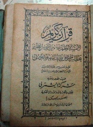
Posted by Karmawi - مقتنيات مختار ام خالد - نسخة من القرآن الكريم بقيت في منزله بعد الهجرة 3
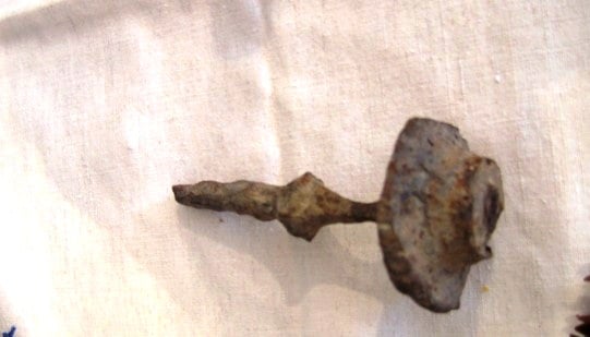
Posted by Karmawi - مسمار أثري من أبواب الحصن الصليبي
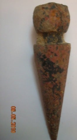
Posted by Karmawi - قطعة معدنية اثرية من ابواب الحصن الصليبي
Posted by Karmawi - محراب المسجد من الداخل
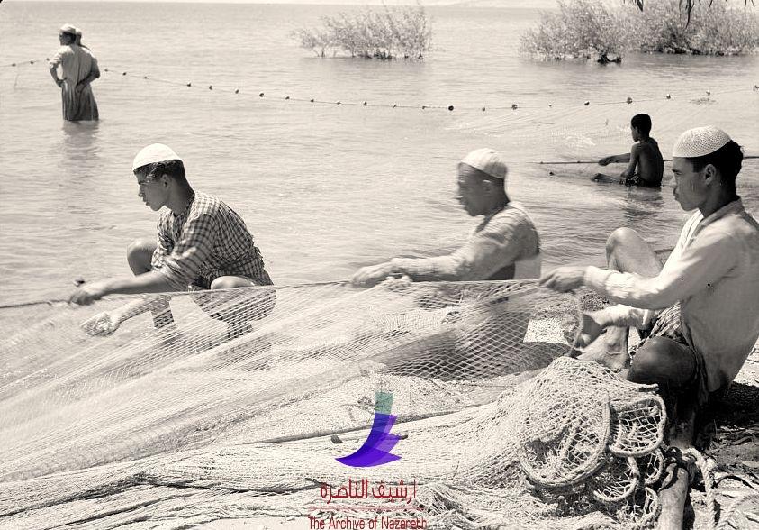
Posted by Karmawi - صيادي أم خالد قبل النكبة - أحمد مروات
- احد المباني المنهوبة في قرية ام خالد المهجرة
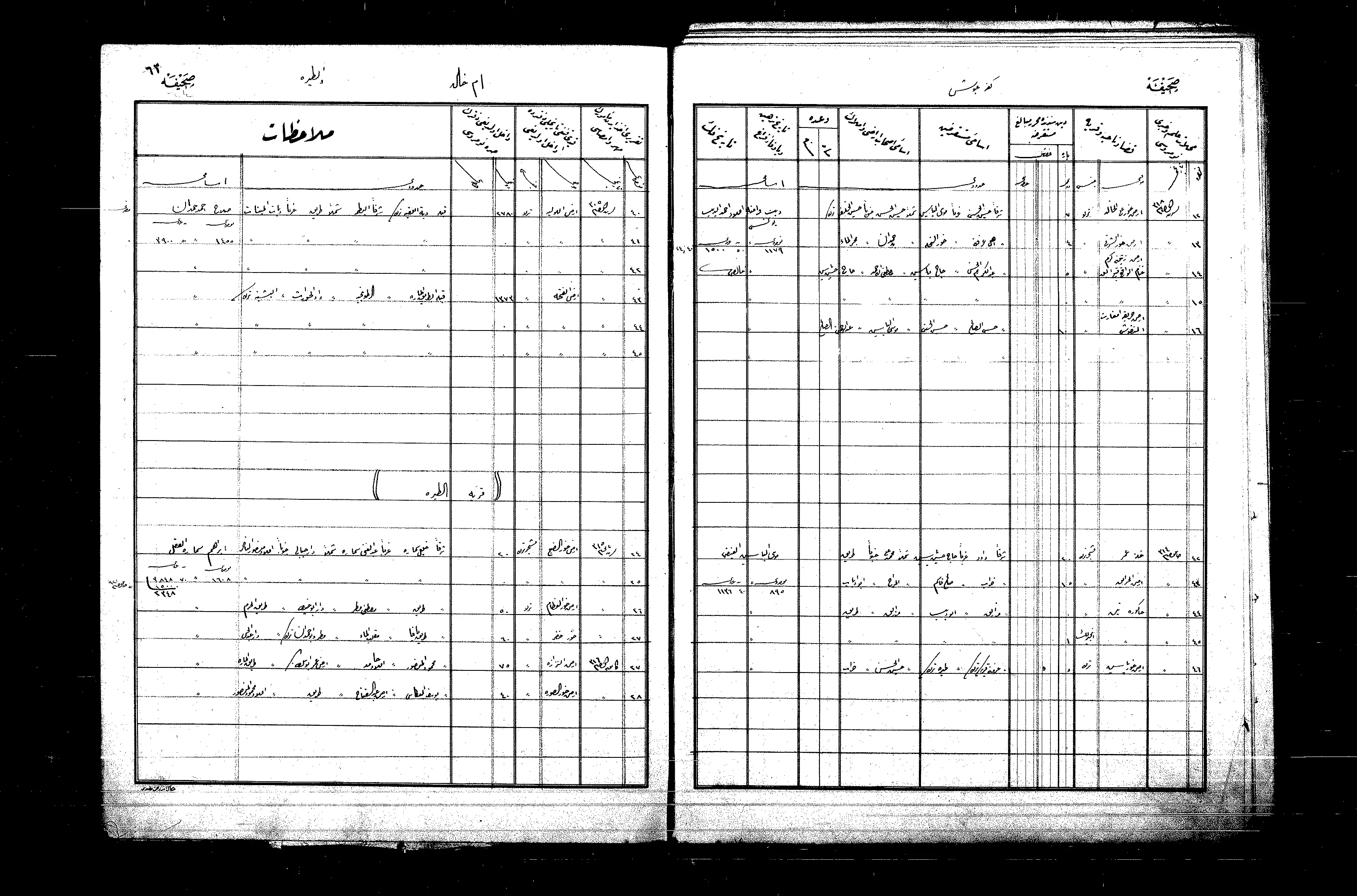
- السجلات العثمانية - سجل أملاك في ام خالد قضاء طولكرم 1300-1325هـ
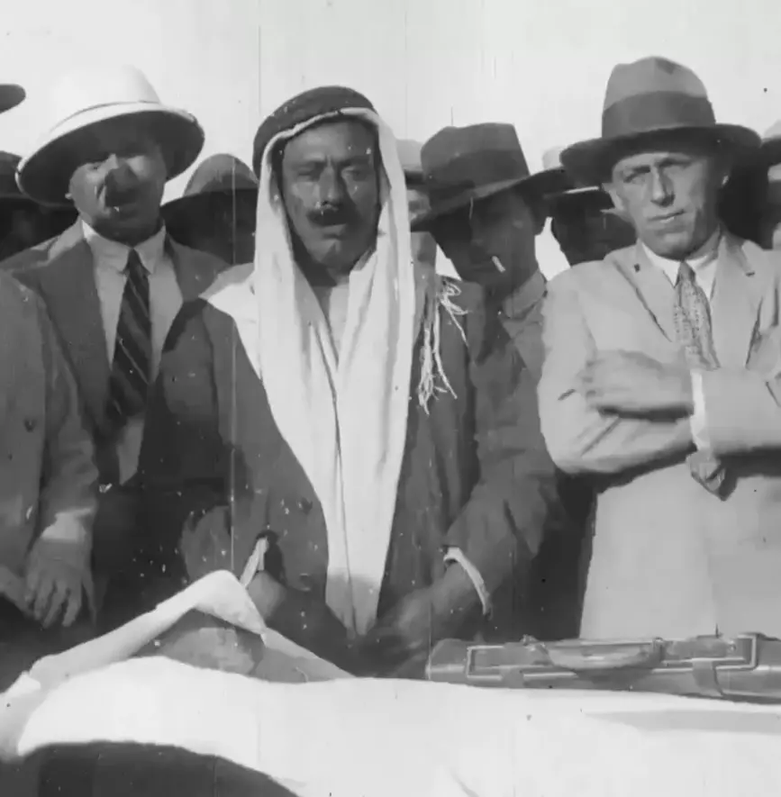
Posted by Wadi Alhawarith - مختار القرية في السنة 1928م
Posted by Rashid - مختار القرية في السنة 1928م #2
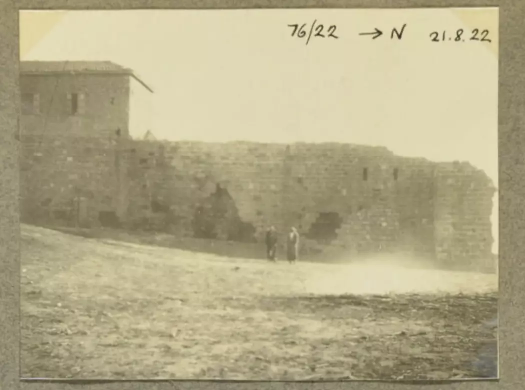
Posted by Rashid - منزل عبدالرحيم صلاح الحمدان في السنة 1922م
Posted by Rashid - بيت أحمد الهمشري في أم خالد المهجرة ( قضاء طولكرم الانتدابي ) --
1 - Let us see how the most "liberal and civilized" of world Jewry has obliterated our village. How else will the Jews be great and safe again? -- القرية دمرت بالكامل.. من هنا مر الهمج
- Let us see how the most "liberal and civilized" of world Jewry has obliterated our village. How else will the Jews be great and safe again? -- القرية دمرت بالكامل.. من هنا مر الهمج #2
- Let us see how the most "liberal and civilized" of world Jewry has obliterated our village. How else will the Jews be great and safe again? -- القرية دمرت بالكامل.. من هنا مر الهمج #3
- Let us see how the most "liberal and civilized" of world Jewry has obliterated our village. How else will the Jews be great and safe again? -- القرية دمرت بالكامل.. من هنا مر الهمج #4
- Let us see how the most "liberal and civilized" of world Jewry has obliterated our village. How else will the Jews be great and safe again? -- القرية دمرت بالكامل.. من هنا مر الهمج #5
- Let us see how the most "liberal and civilized" of world Jewry has obliterated our village. How else will the Jews be great and safe again? -- القرية دمرت بالكامل.. من هنا مر الهمج #6
- Let us see how the most "liberal and civilized" of world Jewry has obliterated our village. How else will the Jews be great and safe again? -- القرية دمرت بالكامل.. من هنا مر الهمج #7
- Let us see how the most "liberal and civilized" of world Jewry has obliterated our village. How else will the Jews be great and safe again? -- القرية دمرت بالكامل.. من هنا مر الهمج #8
Want to browse more? 80,000 pictures were grouped in these gallaries:
| Display Name | Clan/Hamolah | Country of Residence |
| عبدالرحمن محمد حاتم صلاح حمدان | Hamdan | عمان, الأردن |
| ابوليث الشيخ ياسين | الشيخ ياسين | - |
| aseel toubeh | toubeh | jeddah, Saudi Arabia |
| ابوتحسين | - | طولكرم |
| علي الهندي | الشيخ ياسين | - |
| Wafa Abdul Kareem Al Shalakhty | Al Shalakhty | Amman, Jordan |
| احمد الجلاد | - | Dubai-UAE |
| Inas Hamshari | Hamshari | Kuwait |
| عصام | حمدان | tulkarem |
| أبو مالك | همشري | طولكرم |
| Estatah استيته | استيته Estatah | Tullkarwem, Palestine |
| Bashar | Hamdan | Az-zarqa, Jordan |
| jalloudti | Jallad | ohio, USA |
| pales | hamdan | tulkarem |
| Al jallad | jallad | - |
| jallado | aljallad | kuwait, tulkarm |
| Yahya Jallad | Jallad | - |
| JAS | jallad | manila, philippines |
| Munzer Jallad | Jallad | Abu Dhabi, UAE |
| Ammar Jallad | Khader | Amman - swileh, Jordan |
| amjad hindi | الشيخ ياسين | jordan |
| Said Hamdan | Hamdan | USA |
| Rana Abdulla | Mahmoud | - |
| saif eldin hamdan | hamdan | egypt, egypt |
| jallad | umm khalid | Abu Dhabi, United Arab Emiratrs |
| shadi shaikh yaseen | shaikh yaseen | - |
- Tracing all That Remains of Umm Khalid Duration: 3 min 10 sec
 Fake Valor: Why Did Zionist Jews Hoist Nazis Flag on Their Ships in the 1930s?
What is new?
-
Facts About Oct. 7th Gaza Raid
-
Remined Us Please:: Who Did Rape Who? Palestinians Raped Israelis? Or, was the other way around?
-
When Prof. Edward Said was invited to debate Bibi Netanyahu in the 1980s, watch what happened!
-
Ezra Klein of the NY Times on the "Jewish Race".
-
Abusing Blood Libel!
-
Did Israeli Soldiers Activate The Hanniba Direective On Oct. 7th? You Be The Judge
-
Zionist FAQ: Isn't it true that Palestinians don't want peace? Palestinians never accepted the two-state solution
- Facts about Haavara (Transfer) Agreement between Ben-Gurion & Hitler
-
Haavara FAQs: Why Did Zionist Jews Hoist Nazis' Flags on Their Ships in the 1930s?
- Haavara FAQs: When Chaim Weizmann met FDR in mid-1943, why was he silent about rescuing European Jewry?
-
Dear ChatGPT: How did Palestinians resist Napoleon's invasion of their country in 1799?
-
Dear ChatGPT: Gaza had a vibrant Jewish community in the mid-17th century. What happened to them?
-
Dear ChatGPT: Why did the Jewish Agency suppress news of the Holocaust during WWII?
-
Video Playlist: Jews share their DNA tests to end the conflict for good.
-
A Tale of Two Conflicts: Examining the Definition of Genocide
-
Prof. Abraham Polak And The Suppressed History of the Khazars and European Jewry
-
How Ronald Reagan would have framed the genocide in Gaza if he were still alive?
-
Haavara FAQs: Let us do the math: how many German Jews did The Haavara Agreement save?
-
Zionist FAQs: The Hebron Massacre of 1929, "clearly proves" that Palestinians are antisemitic, how could you deny it?
-
Zionist FAQs: Why Anti-Zionist Is Not Antisemitism?
-
Zionist FAQs: Isn't it true that the KGB created Palestinian Nationalism in the early 1960s?
- Zionist FAQs: Muslims are killing Muslims all the time; why are Israeli Jews being singled out in the media?
- Zionist FAQs: How is Israel an apartheid state when 20% of its citizens are Arabs who enjoy full rights?
-
Haavara FAQs: Why Did Dorothy Thompson Flip From A Zionist Advocate to A Silenced Dissenter?
-
Haavara FAQs: Analysis of Herzl's Uganda Scheme and how it could have saved millions of Jews.
-
Haavara FAQs: Why did Hayim Greenberg describe American Jewry as "morally bankrupt" in early 1943?
-
Haavara FAQs: What if the Evian Conference was a resounding success? What would have been the impact of saving European Jewry on Zionism?
- Haavara FAQs: What if the six million were saved, how that would have impacted the Zionist project?
-
Haavara FAQs: How did Zionist leaders react when Europe's Jews lingered in the DP camps after WWII ended?
-
Why does the American Jewish community repeat lies that David Ben-Gurion had debunked before he died?
-
Who has the power to rename the Tatar/Khazar Gene Marker to Jewish IV?
-
Zionist FAQs: Why won't Egypt, Syria, and Jordan take their people back? Jews are indigenous to Palestine, and Arabs immigrated after Jews developed the country. Arabs should leave.
-
Haavara FAQs: Did Hitler and the Nazis conflate between Judaism and Zionist? If that wasn't case, then why?
-
Haavara FAQs: Winston Churchill and antisemitism, a collection of articles written Churchill.
-
Haavara FAQs: Broken by country, how many Jews survived vs. killed during the Holocaust?
-
Haavara FAQs: Why did European Jews vote with their feet and to immigrated to the Americas, not Palestine, after WWII?
-
Watch this American Jewish Girl describing Israeli Jews' cognitive dissonance like no other in under two minutes
-
Haavara FAQs: When the Nazis went out of their way to hide the Holocaust, Israeli Jews did the exact opposite by broadcasting their genocide of Gazans. But why?
-
Haavara FAQs: How Zionist Jews went out of their to show their appreciation to Nazism and Fascism?
- Haavara FAQs: Why Zionist leaders were against bombing the death camps & the Railroads leading to them?
-
Haavara FAQs: Hitler's message to the British and American people: If Jews are such noble citizens and you care about them, how come you're not letting them in? I will gladly ship them to you at my expense, even on luxury liners!
-
A shortlist of Zionist and Israeli false flag operations in the name Jews.
-
The Most Moral Army
- The Land of Kapos (Israel): Where the brave are boycotted and Kapos walk free.
- Why did early Zionists often named their communal enterprises "colonial"?
- Zionist Relations with Nazi Germany by Faris Glubb
-
Two NY Times advertisements by Zionists in the early 1943 that exposes Zionists' treason at the height of the calamity
- Facts Not Lies about the Palestinian-Israeli Conflict.
- Site's pictures have been categorized
- Campgain Against Lice
- A Survey of Palestine, the official source about Palestine before Nakba produced by the British Mandate; over 1200 pages.
- Satellite View & Google Earth: Over 6,000 placemarks identifying all destroyed towns, W. Bank & Gaza Strip Towns, & refugee camps.
- PalestineRemembered.com and its Nakba Oral History Project were featured on al-Jazeera Satellite TV.
- Nakba Oral History Video Podcast:
 Over 700 Oral History interviews (including 3,500+ hours of recording) can be viewed online.
 - Palestine Village Statistics Project
- Gaza Jail Break
- النسخة العربية للموقع الان متوفرة
- Videos: Documenting the destroyed villages in video: Tracing all that remains since Nakba.
- Videos: Responding to Zionist Propaganda
- Interview: The ethnic cleansing of Palestine: George Galloway interviews Israeli Historian Ilan Pappe.
- For Palestinians, memory matters. It provides a blueprint for their future By George Bisharat.
- Zionist FAQ now available in Hebrew שאלות שציונים שואלים, עכשיו בעברית
- Video: The Stephen Walt and John Mearsheimer report on the influence of the Israel Lobby on U.S. Foreign Policy
- The Palestinian-Israeli conflict for beginners
