| PalestineRemembered | About Us | Oral History | العربية | |
| Pictures | Zionist FAQs | Haavara | Maps | |
| Search |
| Camps |
| Districts |
| Acre |
| Baysan |
| Beersheba |
| Bethlehem |
| Gaza |
| Haifa |
| Hebron |
| Jaffa |
| Jericho |
| Jerusalem |
| Jinin |
| Nablus |
| Nazareth |
| Ramallah |
| al-Ramla |
| Safad |
| Tiberias |
| Tulkarm |
| Donate |
| Contact |
| Profile |
| Videos |
Welcome To Saydun - صيدون (צידון)
|
District of al-Ramla
Ethnically cleansed days ago |
العربية Google Earth |
 |
Gallery (25) |
- Statistics & Facts
-
Before & After

- Satellite View
- Articles 2
- Pictures 25
- Oral History 2
- Members 21
- Families
- All That Remains
- Wikipedia
- Videos 1
- Guest Book 13
- Links
| Statistic & Fact | Value | ||||||||||||||||||
| Occupation Date | April 6, 1948 | ||||||||||||||||||
| Distance From District | 9 (km) South of al-Ramla | ||||||||||||||||||
| Elevation | 150 (meters) | ||||||||||||||||||
| Before & After Nakba, Click Map For Details |
|||||||||||||||||||
|
|||||||||||||||||||
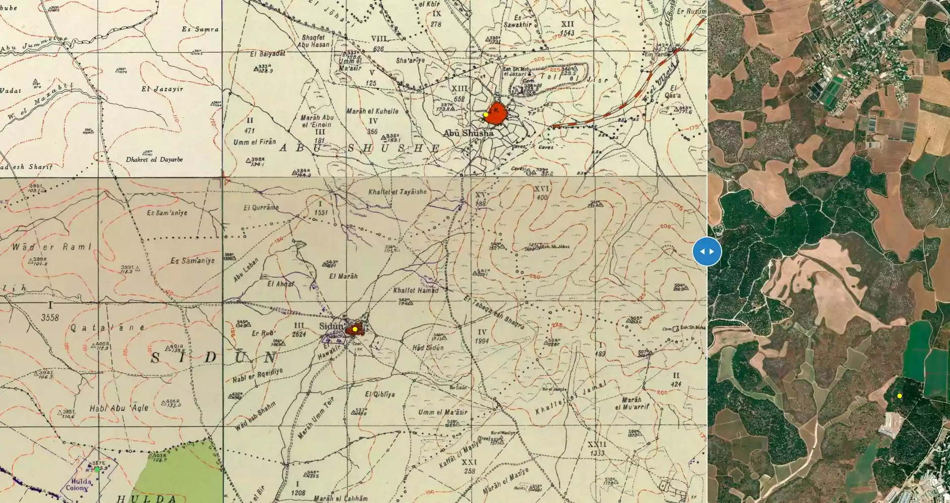
| Map Location | See location #38 on the map View from satellite |
||||||||||||||||||
| Military Operation | Operation Nachshon | ||||||||||||||||||
| Exodus Cause | Military assault by Zionist troops | ||||||||||||||||||
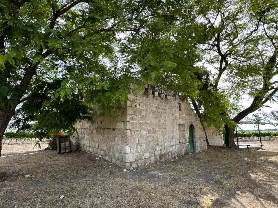
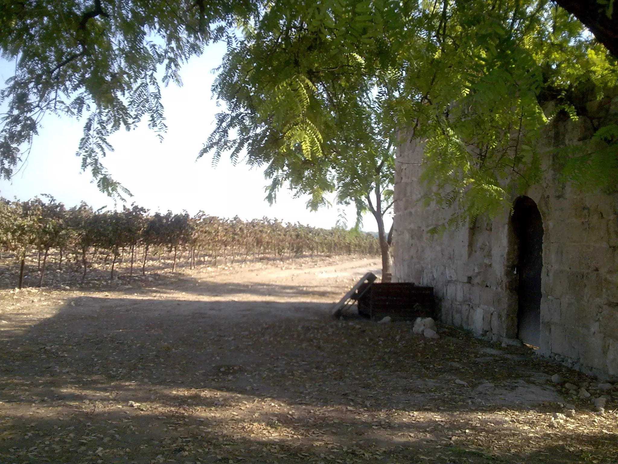
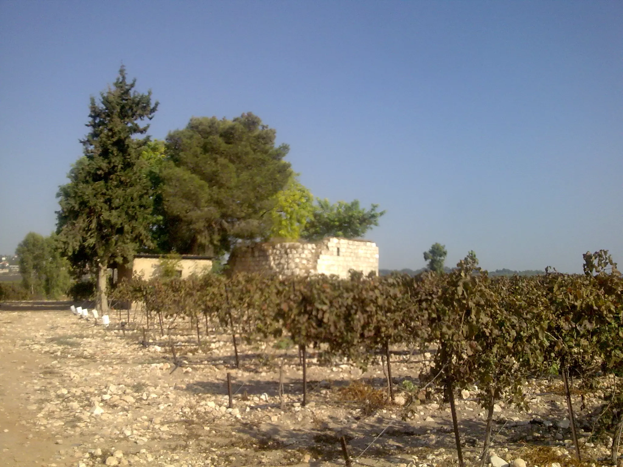
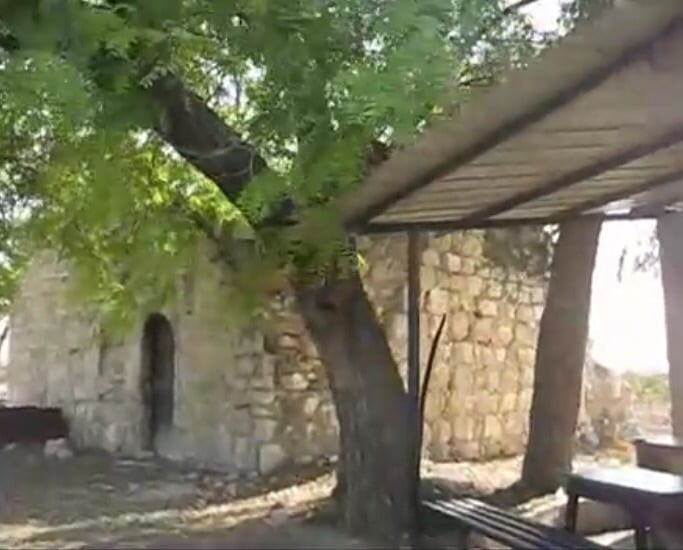
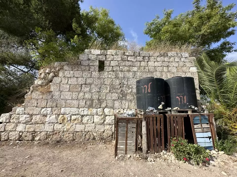
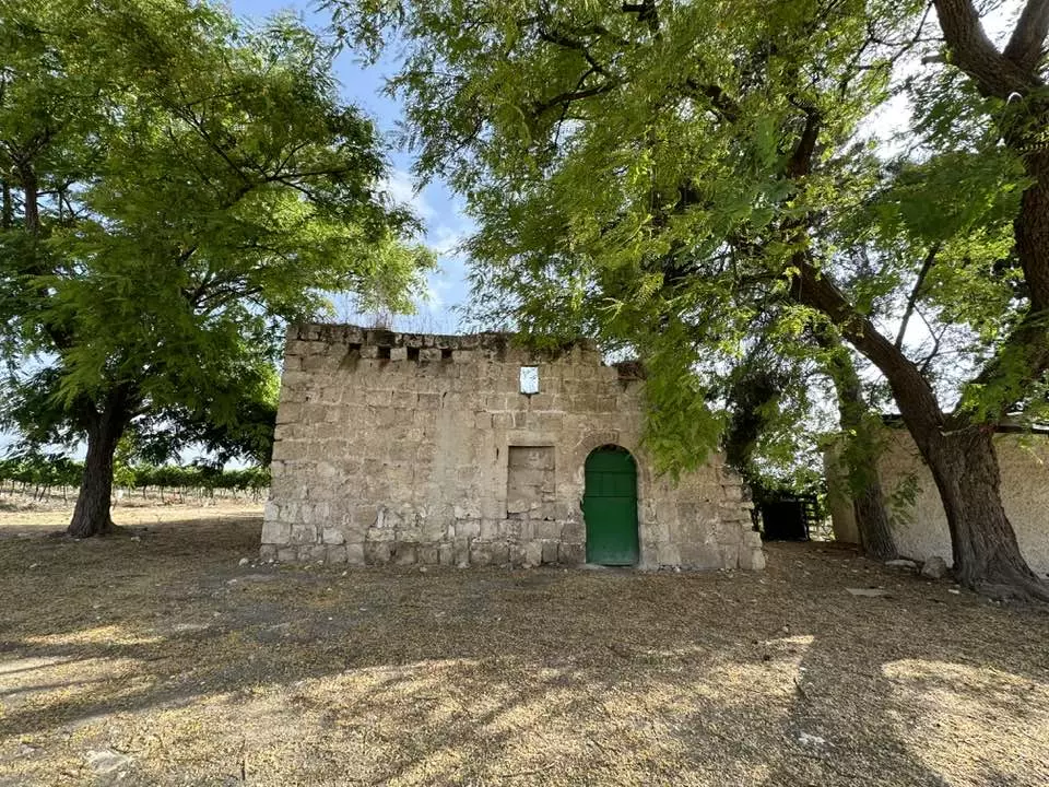
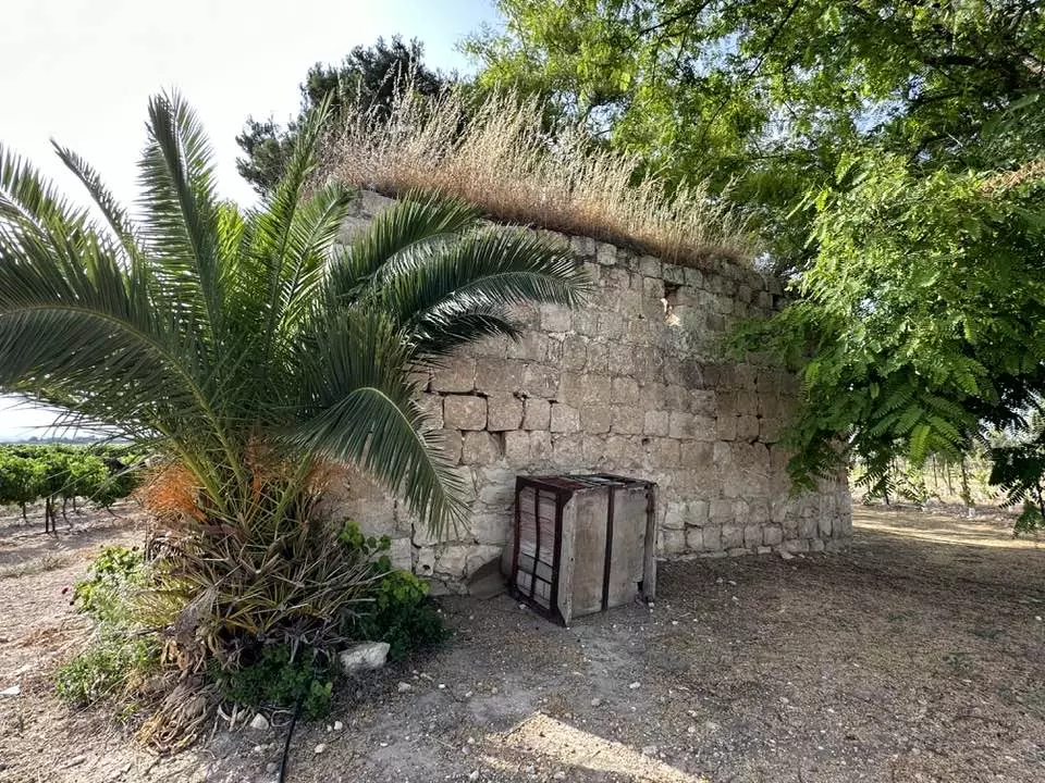
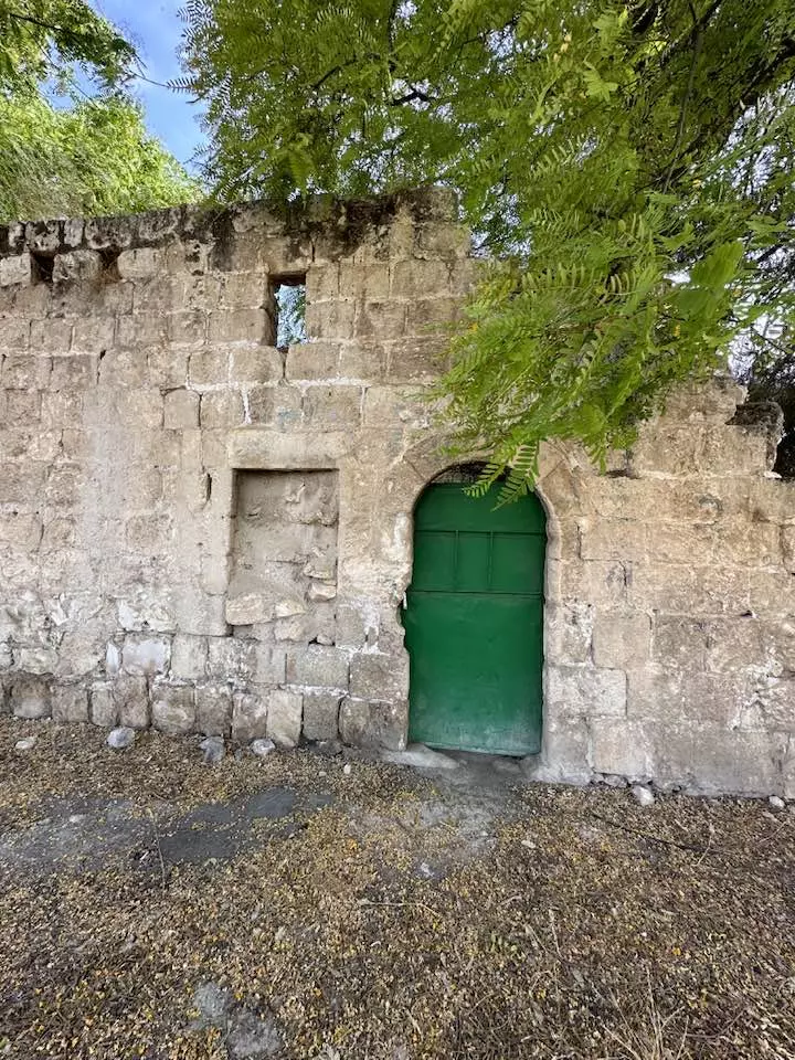
| Village Temains | The village was mostly destroyed with the exception of one house | ||||||||||||||||||
| Ethnically Cleansing | Saydun inhabitants were completely ethnically cleansed. | ||||||||||||||||||
| Pre-Nakba Land Ownership |
**Town Lands' Demarcation Maps |
||||||||||||||||||
| Land Usage As of 1945 |
|
||||||||||||||||||
| Population |
|
||||||||||||||||||
| Number of Houses |
|
||||||||||||||||||
| Near By Towns |
|||||||||||||||||||
|
|
|||||||||||||||||||
| Shrines / Maqams | A maqam for a local sage. | ||||||||||||||||||
| Nearby Wadies & Rivers | The village stands on the east bank of Wadi Saydun. | ||||||||||||||||||
| Exculsive Jewish Colonies Who Usurped Village Lands |
No Israeli settlements on village lands. | ||||||||||||||||||
| Featured Video | |||||||||||||||||||
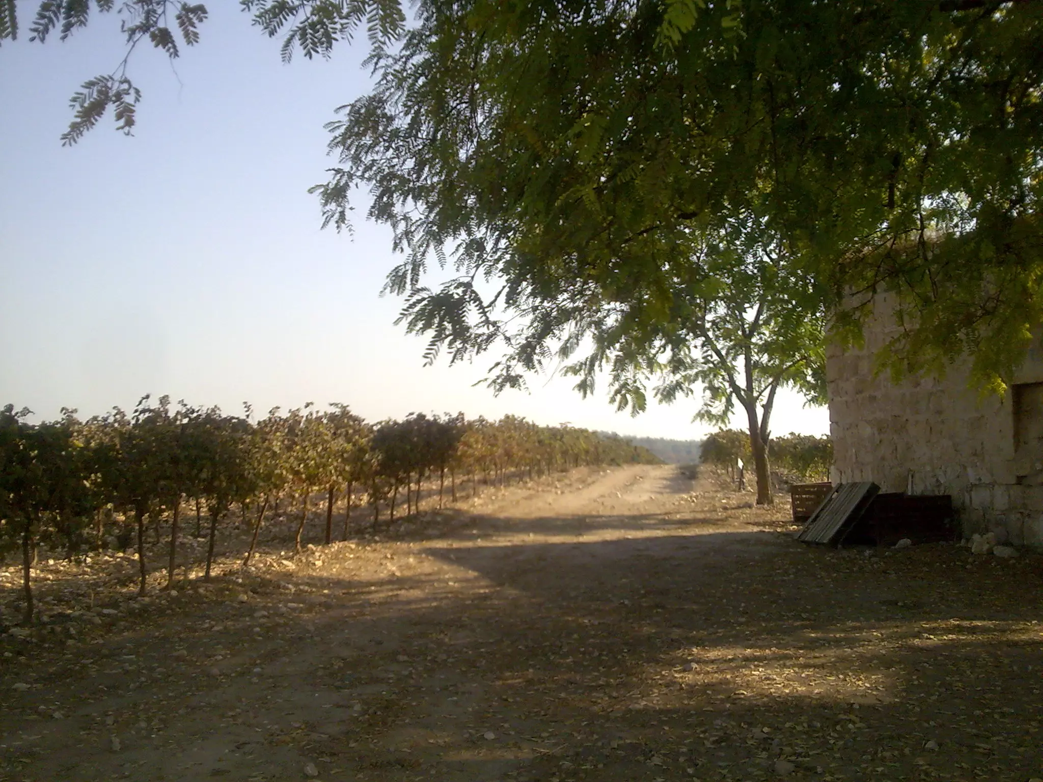
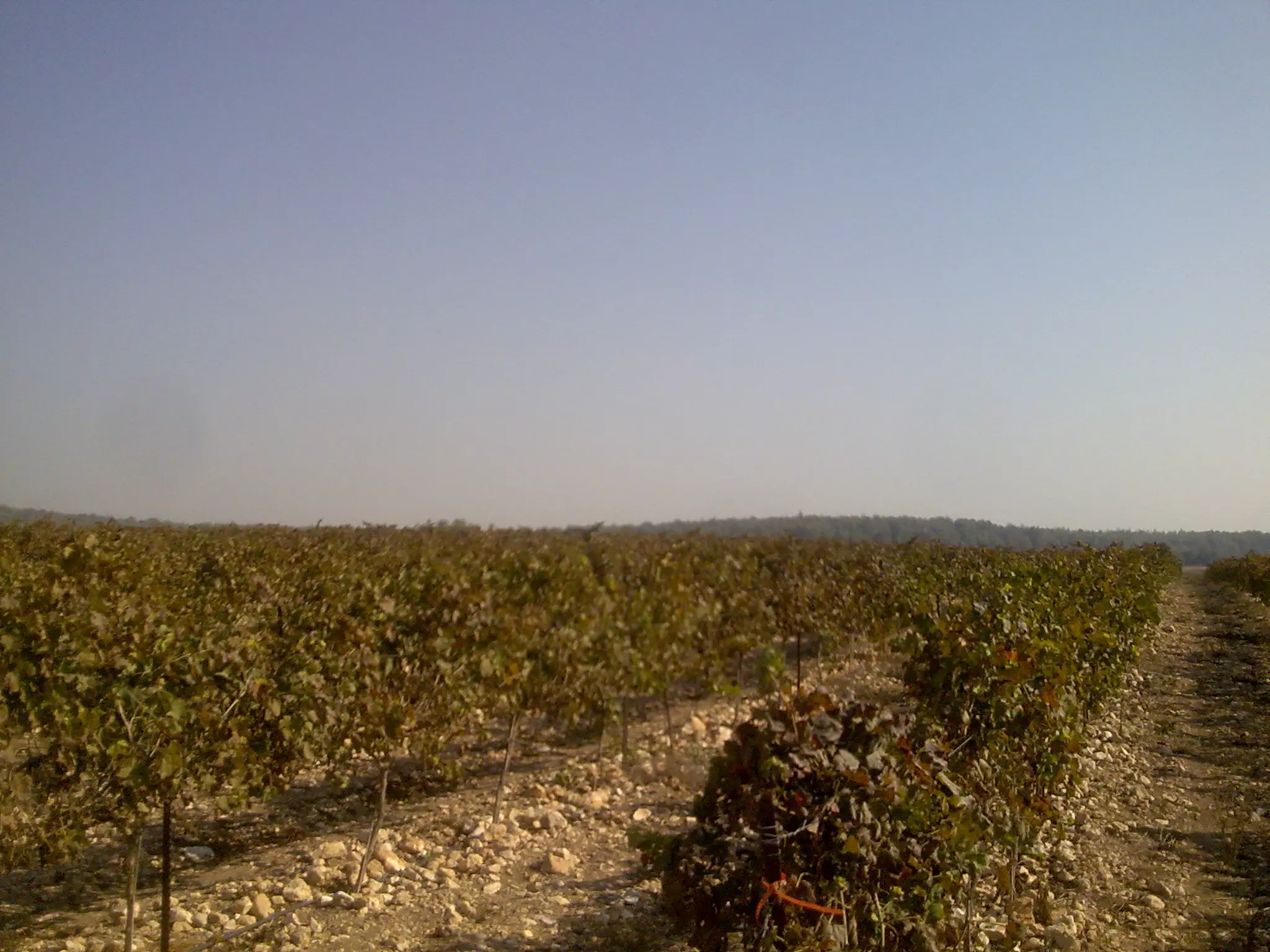
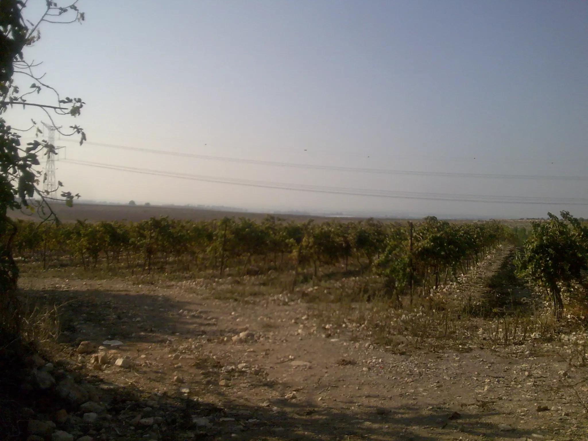
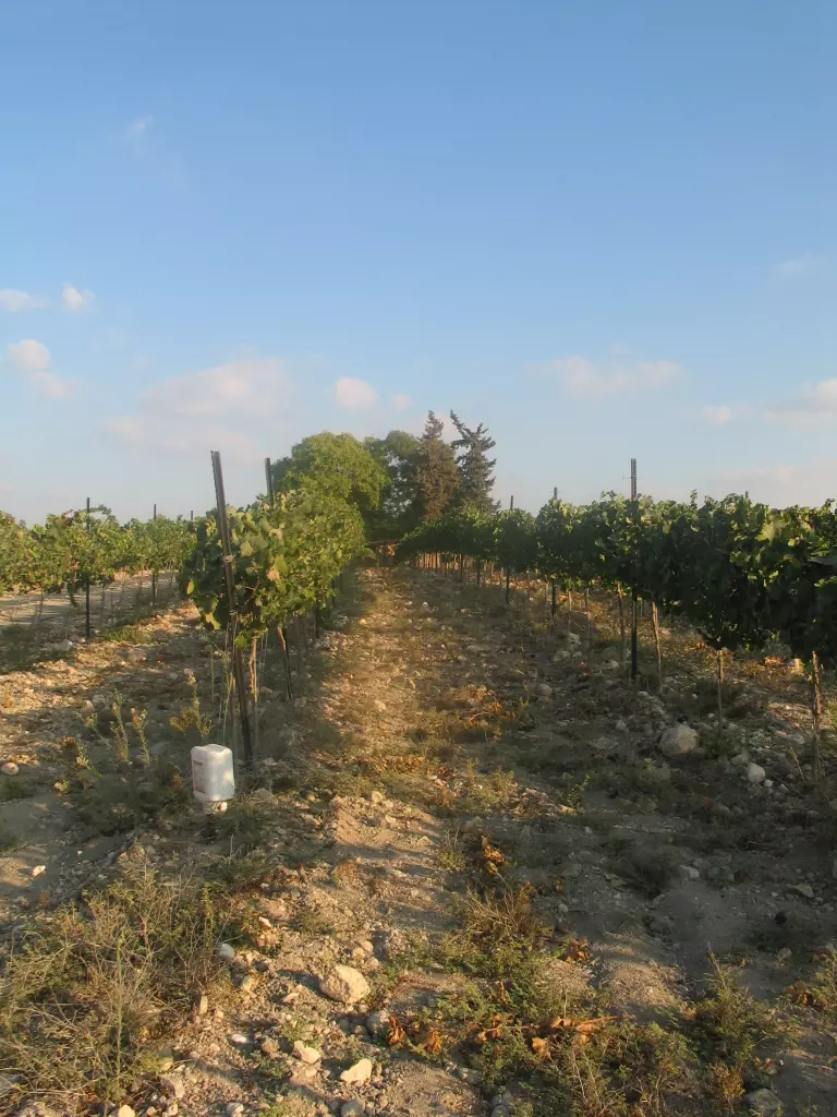
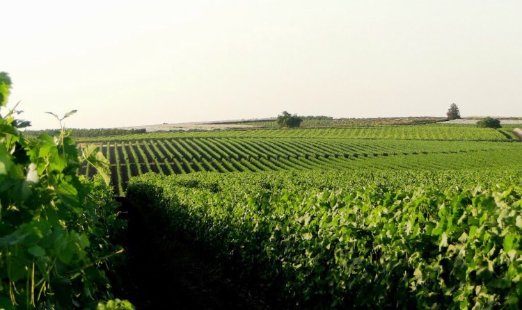
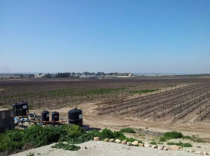
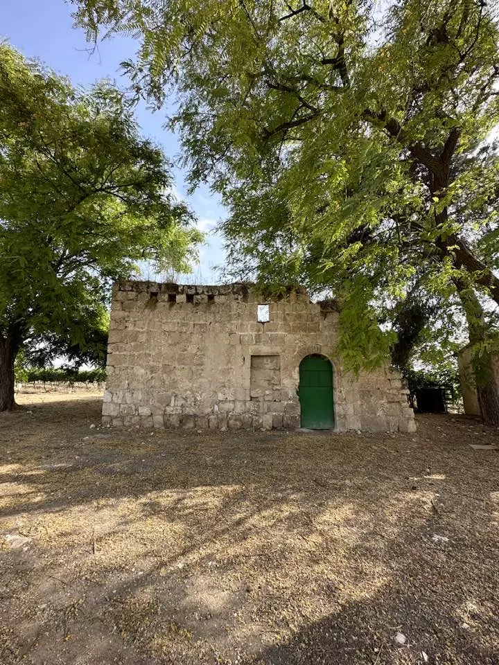
Village Before NakbaThe village stood on the east bank of Wadi Saydun, a tributary of Wadi al-Sarar, on the eastern edge of the coastal plain. Saydun was south of the southern branch of the Ramla-Jerusalem highway. In the 1830s it was a large village, according to Robinson, who passed by it in 1838 , but by the late nineteenth century it was described as a small village built of adobe bricks. Later houses, constructed of mud, cement, and stone, were clustered together along the above-mentioned road and also along paths that led to other villages. The population was predominantly Muslim. The village had a few small shops and a maqam (shrine) for a local religious figure. A well on the north side supplied it with drinking water. The villagers worked mostly in rainfed agriculture and animal husbandry. They cultivated mainly grain. In 1944/45 a total of 5,247 dunums was allocated to cereals; 49 dunums were irrigated or used for orchards. The antiquities authorities of the Mandate noted that the foundations of earlier structures were present in the village.Village Occupation and Ethnic CleaningSaydun was probably one of the first villages to fall during Operation Nachshon (see Bayt Naqquba, Jerusalem sub-disctrict). The operational orders in the first stage called for capturing it, along with Khulda and Dayr Muhaysin, in order to control the western entrance to the Jerusalem corridor. No details are given about its occupation, but it probably fell shortly after the operation began on 3 April 1948. It probably was destroyed soon after its capture, as were most other villages in the area (notably Khulda and Dayr Muhaysin). Israeli historian Benny Morris indicates that residents of the area fled either before or during the conquest of their villages and that expulsion orders were not necessary.Zionists Colonies on Village LandsThere are no Israeli settlements on village lands.Village TodayCactuses and numerous grapevines grow on the site. Only one stone house remains; it has a flat roof and a round-arched door and is used for storage. The surrounding lands are used for agriculture by Israelis.SourceDr. Walid al-Khalidi, 1992: All That Remains. |
|||||||||||||||||||
| Related Maps | Town Lands' Demarcation Maps خرائط للقضاء توضح حدود القرى والاودية Town's map on MapQuest View from satellite Help us map this town at WikiMapia |
||||||||||||||||||
| Related Links | Wikipedia's Page Facebook Page Google Search Google For Images Google For Videos |
||||||||||||||||||
| More Information | في كتاب كي لا ننسى في كتاب بلادنا فلسطين المزيد من موقع هوية |
||||||||||||||||||
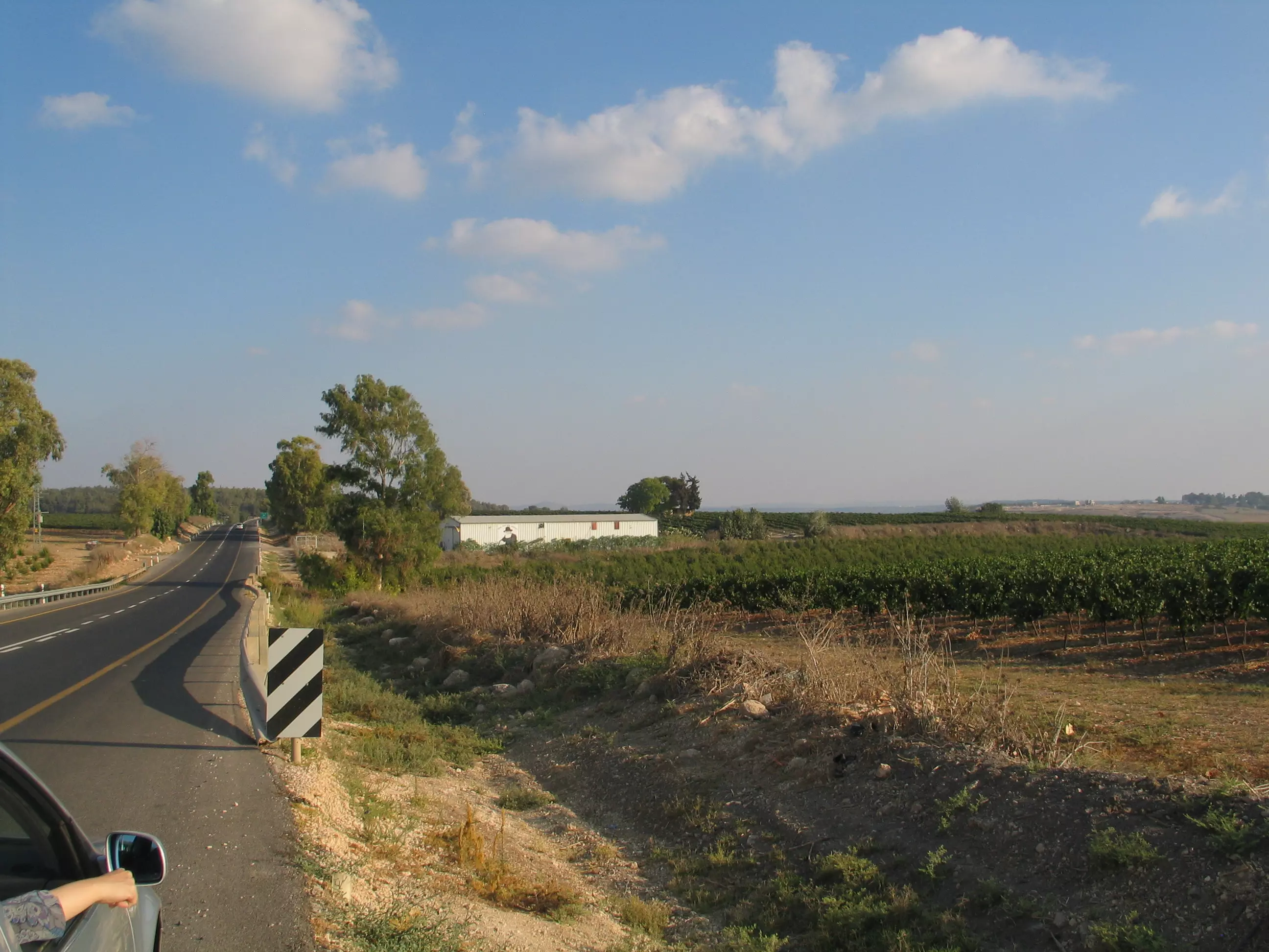
- صيدون 2010
Posted by سبأ البس Saba' Albess 1 - صيدون 2 - 2010
Posted by سبأ البس Saba' Albess - صيدون 3 - 2010
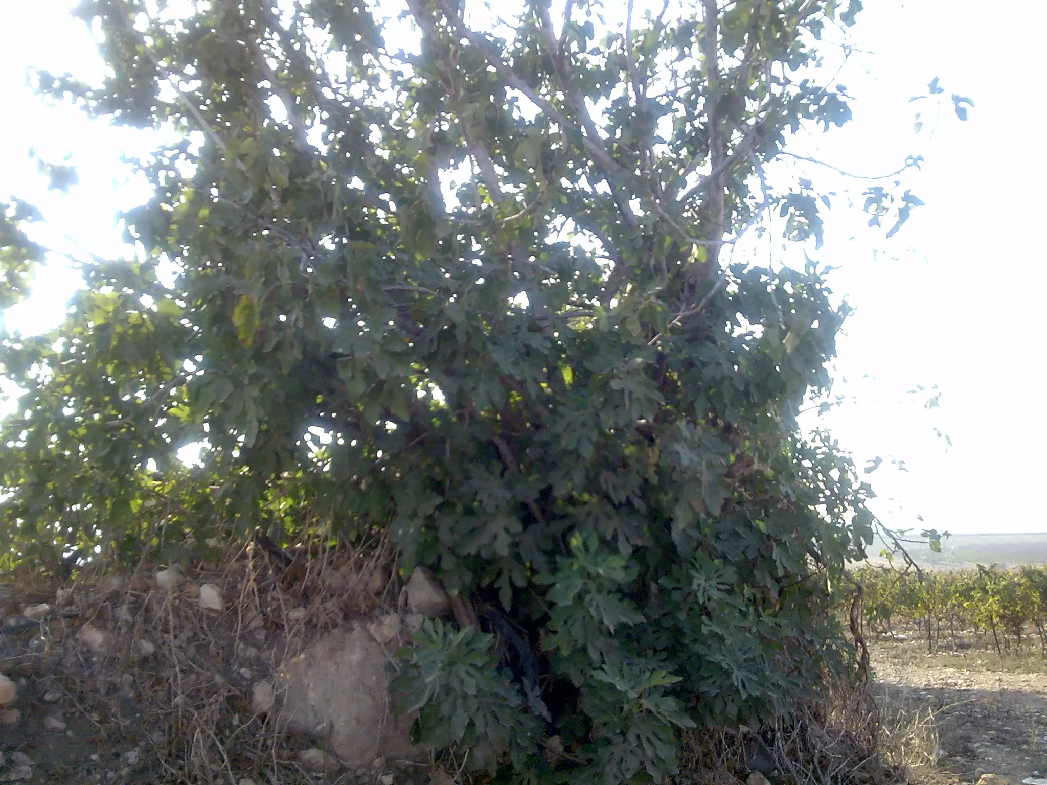
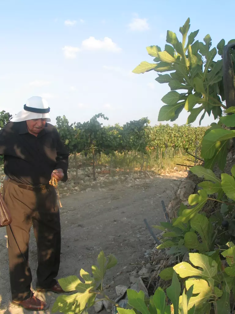
Posted by سبأ البس Saba' Albess - تينة الشيخ حسن - صيدون
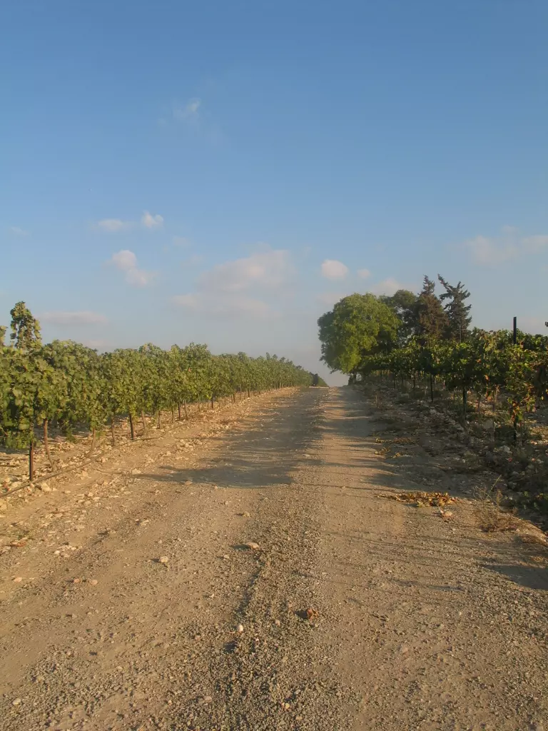
Posted by سبأ البس Saba' Albess - كروم العنب فوق أراضي القرية المدمرة
Posted by سبأ البس Saba' Albess - صيدون 4 - 2010

Posted by سبأ البس Saba' Albess - صيدون 5 - 2010
Posted by سبأ البس Saba' Albess - Saidoun 2011
Posted by سبأ البس Saba' Albess - The Return of my grandfather to his home village 4
Posted by سبأ البس Saba' Albess 1 - The Return of my grandfather to his home village 5
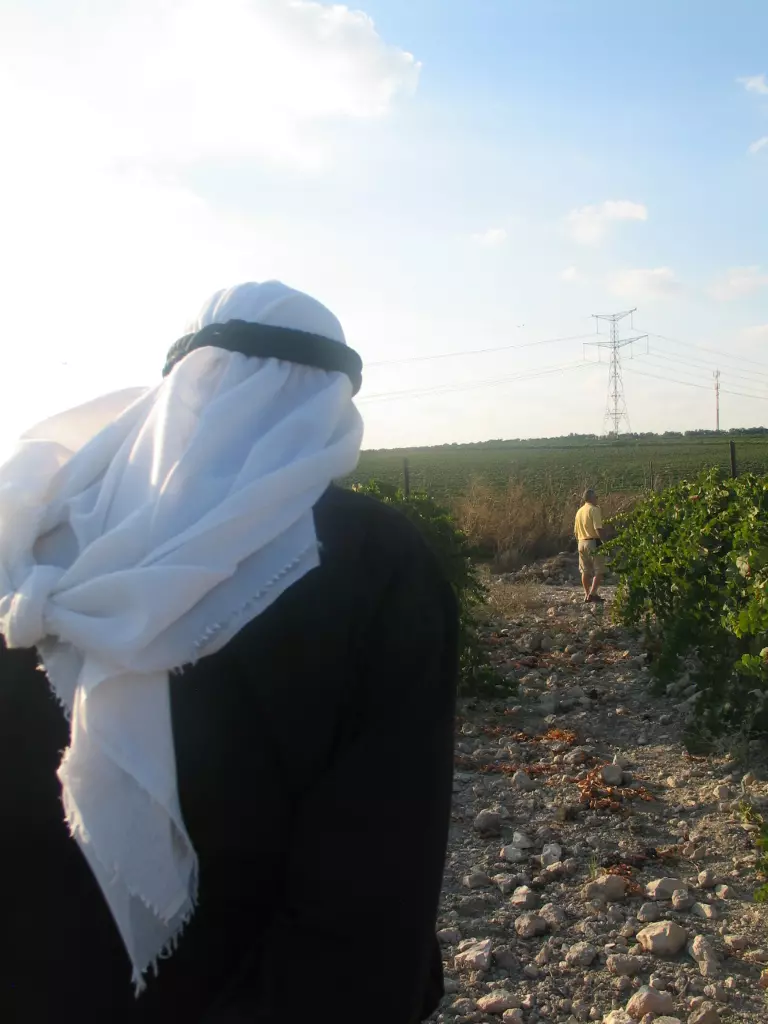
Posted by سبأ البس Saba' Albess - Saidoun 2011 4
Posted by سبأ البس Saba' Albess - Saidoun 2011 5
Posted by سبأ البس Saba' Albess - زيتون القريه
Posted by abu raya - اراضي القريه
Posted by abu raya - من موقع القريه
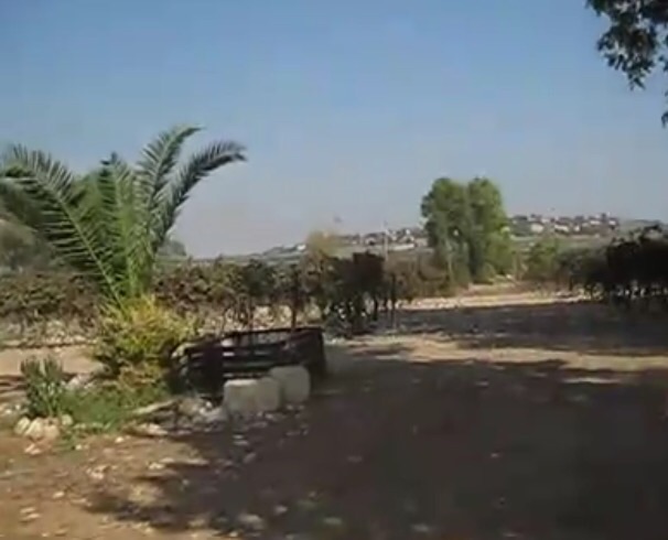
Posted by abu raya - البيت الوحيد الباقي في القريه
Posted by abu raya - اراضي القريه
Posted by abu raya - منظر عام لاراضي القريه
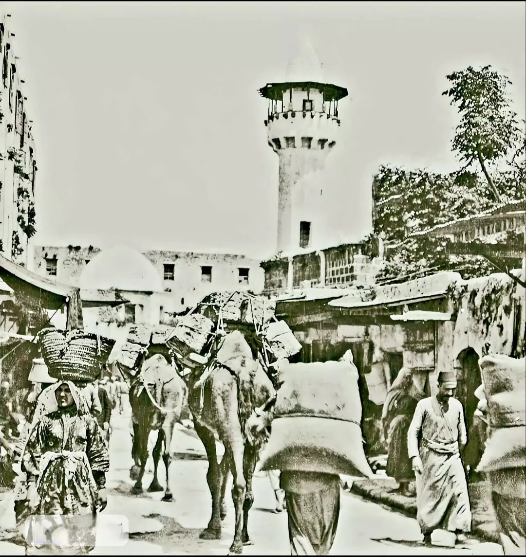
Posted by abu raya - صورة نادرة لسوق قرية صيدون قضاء الرملة عام 1903..
- The "most civilized" who landed on us from Europe obliterated the village, except a few remaining structures like this one. This is how the Jews will be great again. That is how they can feel safe: Jim Crow, plunder, ethnic cleansing, and genocide.
- The "most civilized" who landed on us from Europe obliterated the village, except a few remaining structures like this one. This is how the Jews will be great again. That is how they can feel safe: Jim Crow, plunder, ethnic cleansing, and genocide. #2
- The "most civilized" who landed on us from Europe obliterated the village, except a few remaining structures like this one. This is how the Jews will be great again. That is how they can feel safe: Jim Crow, plunder, ethnic cleansing, and genocide. #3
- The "most civilized" who landed on us from Europe obliterated the village, except a few remaining structures like this one. This is how the Jews will be great again. That is how they can feel safe: Jim Crow, plunder, ethnic cleansing, and genocide. #4
- The "most civilized" who landed on us from Europe obliterated the village, except a few remaining structures like this one (which happens to belong to Salim Hasan al-Biss). This is how the Jews will be great again. That is how they can feel safe: Jim Crow, plunder, ethnic cleansing, and genocide. #5
- The "most civilized" who landed on us from Europe obliterated the village, except a few remaining structures like this one (which happens to belong to Salim Hasan al-Biss). This is how the Jews will be great again. That is how they can feel safe: Jim Crow, plunder, ethnic cleansing, and genocide. #6
Want to browse more? 80,000 pictures were grouped in these gallaries:
| Display Name | Clan/Hamolah | Country of Residence |
| Ghassan AL Bess | - | - |
| amersaduni | - | jordan, saidun |
| ABD ALNASER TREEH | اطريح | - |
| محمد شكري حسن منصور | منصور | الزرقاء, الاردن |
| محمد علاء الدين محمد احمد منصور | منصور | amman, jordan |
| مروان نمورة | - | - |
| موسى عبد اللطيف سليمان علي | - | سحاب, الأردن |
| ali treah | - | - |
| ناصر الصيدوني | منصور | - |
| توفيق البس | - | عمان |
| said mansour | mansour | Dubai, UAE |
| خالد عبد اللطيف منصور | - | عمان / سحاب |
| الحاج خليل محمد عثمان | احمد | الصويفية, الاردن |
| حسن | - | - |
| ابو الزوز | - | - |
| علاء الدين منصور | منصور | عمان |
| Shaban Albis | - | - |
| ريما صالح البس | البس | عمان |
| Palestine4 Ever | Mansour | Amman, Jordan |
| Haytham Rashad Ibrahim | Elbiss | Amman, Jordan |
| jihan diab | elbis | il, united states |
No links have been shared yet, be free to the first to share the first link.
 Fake Valor: Why Did Zionist Jews Hoist Nazis Flag on Their Ships in the 1930s?
What is new?
-
Facts About Oct. 7th Gaza Raid
-
Remined Us Please:: Who Did Rape Who? Palestinians Raped Israelis? Or, was the other way around?
-
When Prof. Edward Said was invited to debate Bibi Netanyahu in the 1980s, watch what happened!
-
Ezra Klein of the NY Times on the "Jewish Race".
-
Abusing Blood Libel!
-
Zionist FAQ: Isn't it true that Palestinians don't want peace? Palestinians never accepted the two-state solution
- Facts about Haavara (Transfer) Agreement between Ben-Gurion & Hitler
-
Haavara FAQs: Why Did Zionist Jews Hoist Nazis' Flags on Their Ships in the 1930s?
-
Dear ChatGPT: Gaza had a vibrant Jewish community in the mid-17th century. What happened to them?
-
Dear ChatGPT: Why did the Jewish Agency suppress news of the Holocaust during WWII?
-
Video Playlist: Jews share their DNA tests to end the conflict for good.
-
A Tale of Two Conflicts: Examining the Definition of Genocide
-
Prof. Abraham Polak And The Suppressed History of the Khazars and European Jewry
-
How Ronald Reagan would have framed the genocide in Gaza if he were still alive?
-
Haavara FAQs: Let us do the math: how many German Jews did The Haavara Agreement save?
-
Zionist FAQs: The Hebron Massacre of 1929, "clearly proves" that Palestinians are antisemitic, how could you deny it?
-
Zionist FAQs: Why Anti-Zionist Is Not Antisemitism?
-
Zionist FAQs: Isn't it true that the KGB create Palestinian Nationalism in the early 1960s?
- Zionist FAQs: Muslims are killing Muslims all the time; why are Israeli Jews being singled out in the media?
- Zionist FAQs: How is Israel an apartheid state when 20% of its citizens are Arabs who enjoy full rights?
-
Haavara FAQs: Analysis of Herzl's Uganda Scheme and how it could have saved millions of Jews.
-
Haavara FAQs: Why did Hayim Greenberg describe American Jewry as "morally bankrupt" in early 1943?
-
Haavara FAQs: What if the Evian Conference was a resounding success? What would have been the impact of saving European Jewry on Zionism?
- Haavara FAQs: What if the six million were saved, how that would have impacted the Zionist project?
-
Haavara FAQs: How did Zionist leaders react when Europe's Jews lingered in the DP camps after WWII ended?
-
Why does the American Jewish community repeat lies that David Ben-Gurion had debunked before he died?
-
Who has the power to rename the Tatar/Khazar Gene Marker to Jewish IV?
-
Zionist FAQs: Why won't Egypt, Syria, and Jordan take their people back? Jews are indigenous to Palestine, and Arabs immigrated after Jews developed the country. Arabs should leave.
-
Haavara FAQs: Did Hitler and the Nazis conflate between Judaism and Zionist? If that wasn't case, then why?
-
Haavara FAQs: Winston Churchill and antisemitism, a collection of articles written Churchill.
-
Haavara FAQs: Broken by country, how many Jews survived vs. killed during the Holocaust?
-
Haavara FAQs: Why did European Jews vote with their feet and to immigrated to the Americas, not Palestine, after WWII?
-
Watch this American Jewish Girl describing Israeli Jews' cognitive dissonance like no other in under two minutes
-
Haavara FAQs: When the Nazis went out of their way to hide the Holocaust, Israeli Jews did the exact opposite by broadcasting their genocide of Gazans. But why?
-
Haavara FAQs: How Zionist Jews went out of their to show their appreciation to Nazism and Fascism?
- Haavara FAQs: Why Zionist leaders were against bombing the death camps & the Railroads leading to them?
-
Haavara FAQs: Hitler's message to the British and American people: If Jews are such noble citizens and you care about them, how come you're not letting them in? I will gladly ship them to you at my expense, even on luxury liners!
-
A shortlist of Zionist and Israeli false flag operations in the name Jews.
-
The Most Moral Army
- The Land of Kapos (Israel): Where the brave are boycotted and Kapos walk free.
- Why did early Zionists often named their communal enterprises "colonial"?
- Zionist Relations with Nazi Germany by Faris Glubb
-
Two NY Times advertisements by Zionists in the early 1943 that exposes Zionists' treason at the height of the calamity
- Facts Not Lies about the Palestinian-Israeli Conflict.
- Site's pictures have been categorized
- Campgain Against Lice
- A Survey of Palestine, the official source about Palestine before Nakba produced by the British Mandate; over 1200 pages.
- Satellite View & Google Earth: Over 6,000 placemarks identifying all destroyed towns, W. Bank & Gaza Strip Towns, & refugee camps.
- PalestineRemembered.com and its Nakba Oral History Project were featured on al-Jazeera Satellite TV.
- Nakba Oral History Video Podcast:
 Over 700 Oral History interviews (including 3,500+ hours of recording) can be viewed online.
 - Palestine Village Statistics Project
- Gaza Jail Break
- النسخة العربية للموقع الان متوفرة
- Videos: Documenting the destroyed villages in video: Tracing all that remains since Nakba.
- Videos: Responding to Zionist Propaganda
- Interview: The ethnic cleansing of Palestine: George Galloway interviews Israeli Historian Ilan Pappe.
- For Palestinians, memory matters. It provides a blueprint for their future By George Bisharat.
- Zionist FAQ now available in Hebrew שאלות שציונים שואלים, עכשיו בעברית
- Video: The Stephen Walt and John Mearsheimer report on the influence of the Israel Lobby on U.S. Foreign Policy
- The Palestinian-Israeli conflict for beginners
