| PalestineRemembered | About Us | Oral History | العربية | |
| Pictures | Zionist FAQs | Haavara | Maps | |
| Search |
| Camps |
| Districts |
| Acre |
| Baysan |
| Beersheba |
| Bethlehem |
| Gaza |
| Haifa |
| Hebron |
| Jaffa |
| Jericho |
| Jerusalem |
| Jinin |
| Nablus |
| Nazareth |
| Ramallah |
| al-Ramla |
| Safad |
| Tiberias |
| Tulkarm |
| Donate |
| Contact |
| Profile |
| Videos |
Welcome To Abu Shusha - ابو شوشة (אבו שושה)
|
District of al-Ramla
Ethnically cleansed days ago |
العربية Google Earth |
 |
Gallery (71) |
- Statistics & Facts
-
Before & After

- Satellite View
- Articles 12
- Pictures 71
- Aerial Views 3
- Land Deeds 7
- Oral History 2
- Members 25
- All That Remains
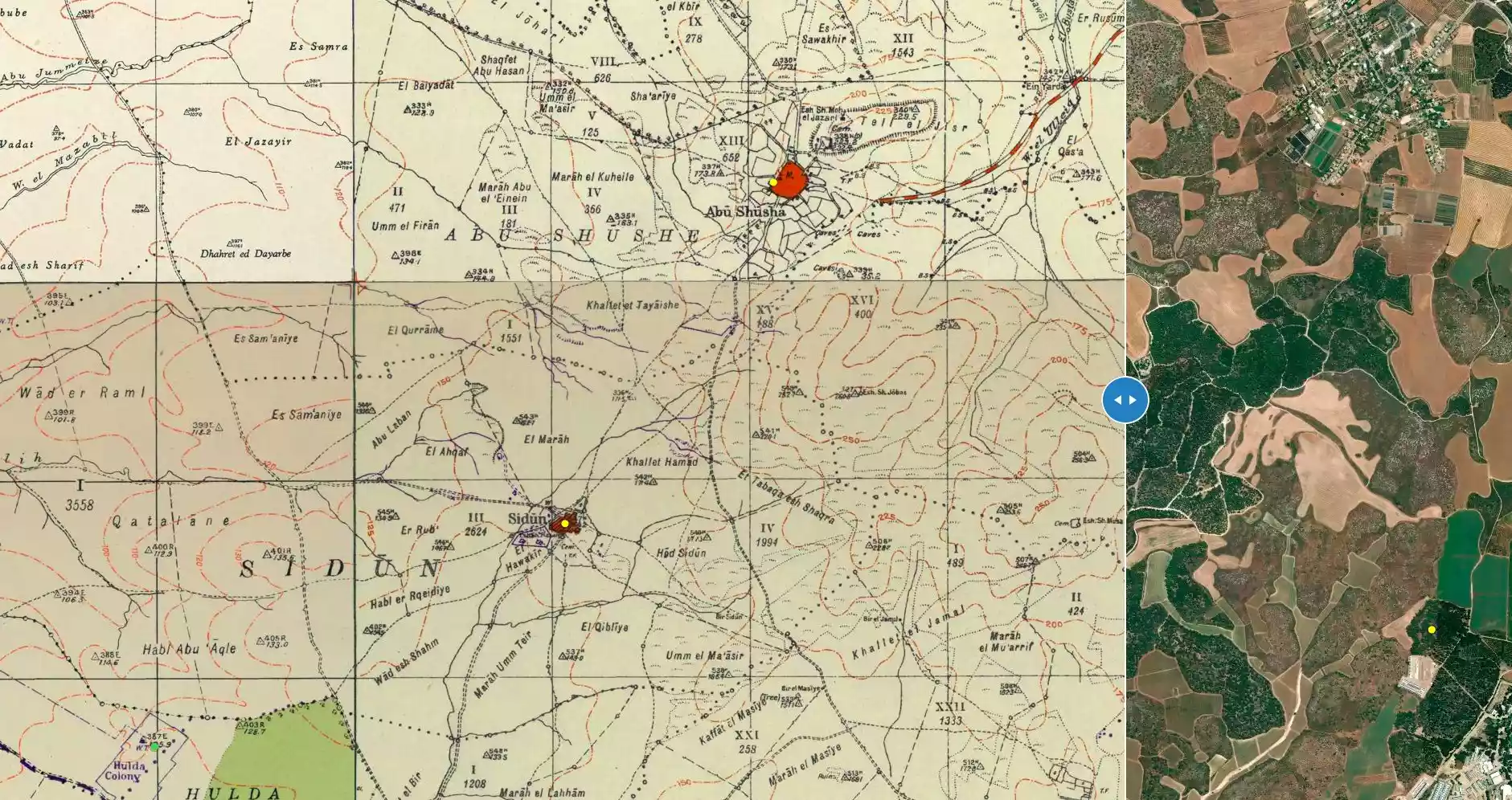
- Town's Map
- Wikipedia
- Videos 3
- Guest Book 37
- Links
| Statistic & Fact | Value | ||||||||||||||||||
| Occupation Date | May 14, 1948 | ||||||||||||||||||
| Distance From District | 8.5 (km) Southeast of al-Ramla | ||||||||||||||||||
| Elevation | 200 (meters) | ||||||||||||||||||
| Before & After Nakba, Click Map For Details |
|||||||||||||||||||
|
|||||||||||||||||||
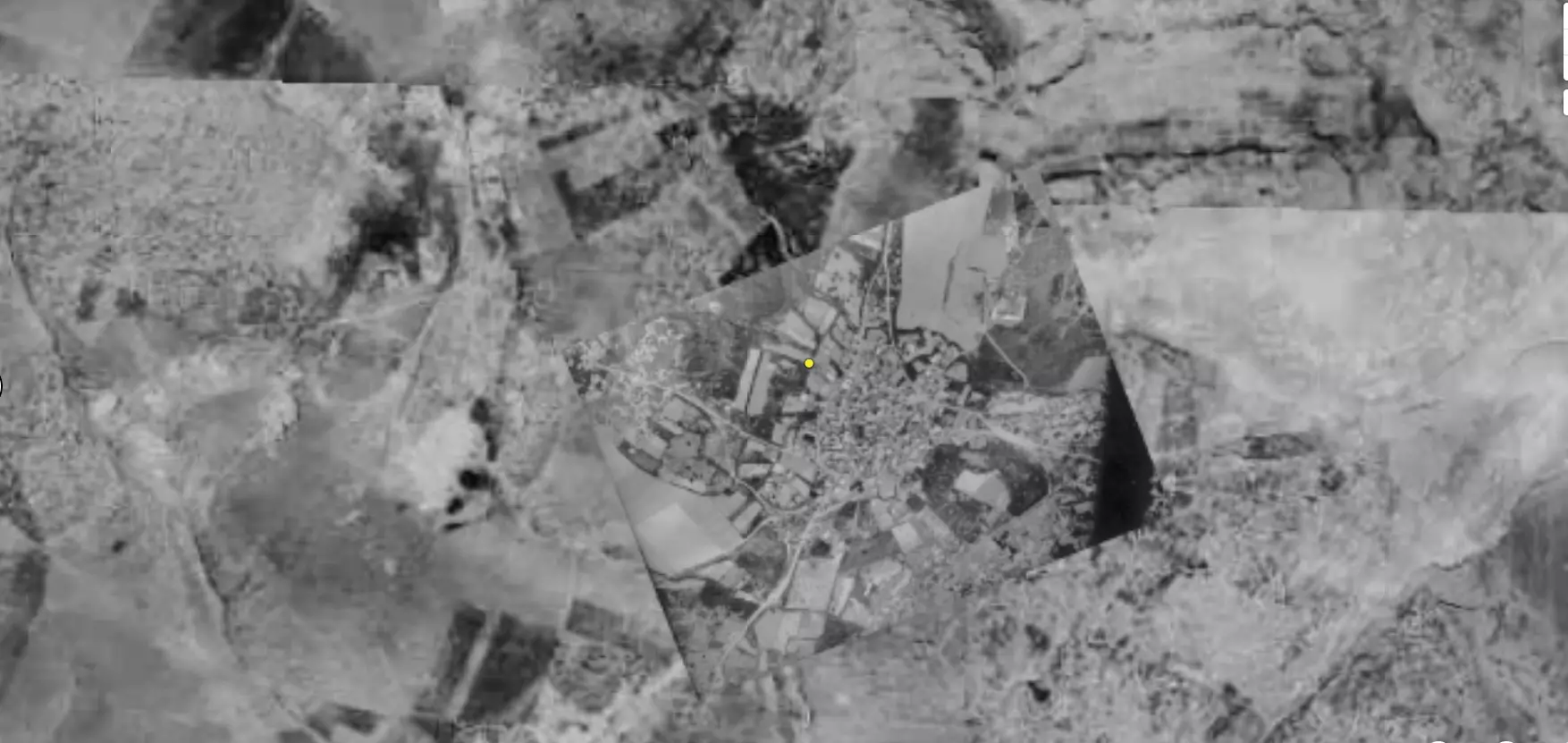
| Pre-Nakba Aerial View |
|||||||||||||||||||
|
|||||||||||||||||||
| Map Location | See location #37 on the map View from satellite |
||||||||||||||||||
| Military Operation | Operation Barak | ||||||||||||||||||
| Attacking Units | Giv'ati Brigade | ||||||||||||||||||
| Defenders | Arab Liberation Army volunteers, and some local Palestinian militia. | ||||||||||||||||||
| Acts of Terror | Birzeit University, in the occupied West Bank, uncovered a massacre occured in the village soon after occupation. Their research stated that more than 60 unarmed villager were hacked to death. For more detail account of such masscare, click here. | ||||||||||||||||||
| Exodus Cause | Military assault by Zionist troops | ||||||||||||||||||
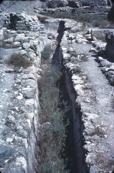
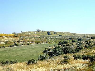
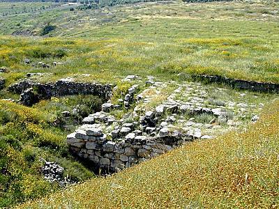
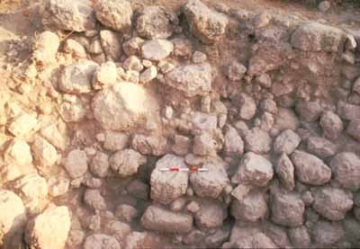
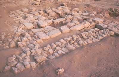
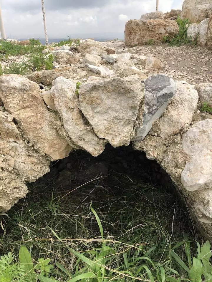
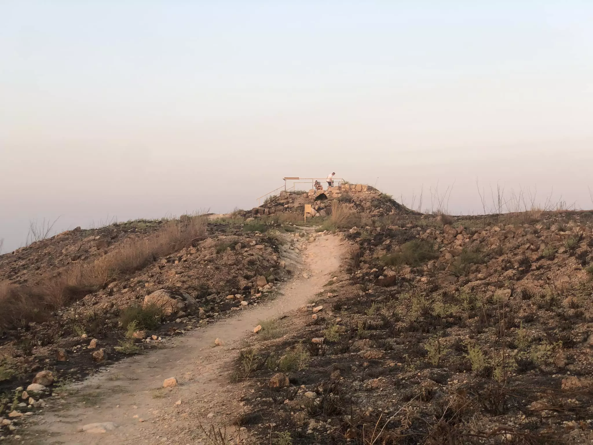
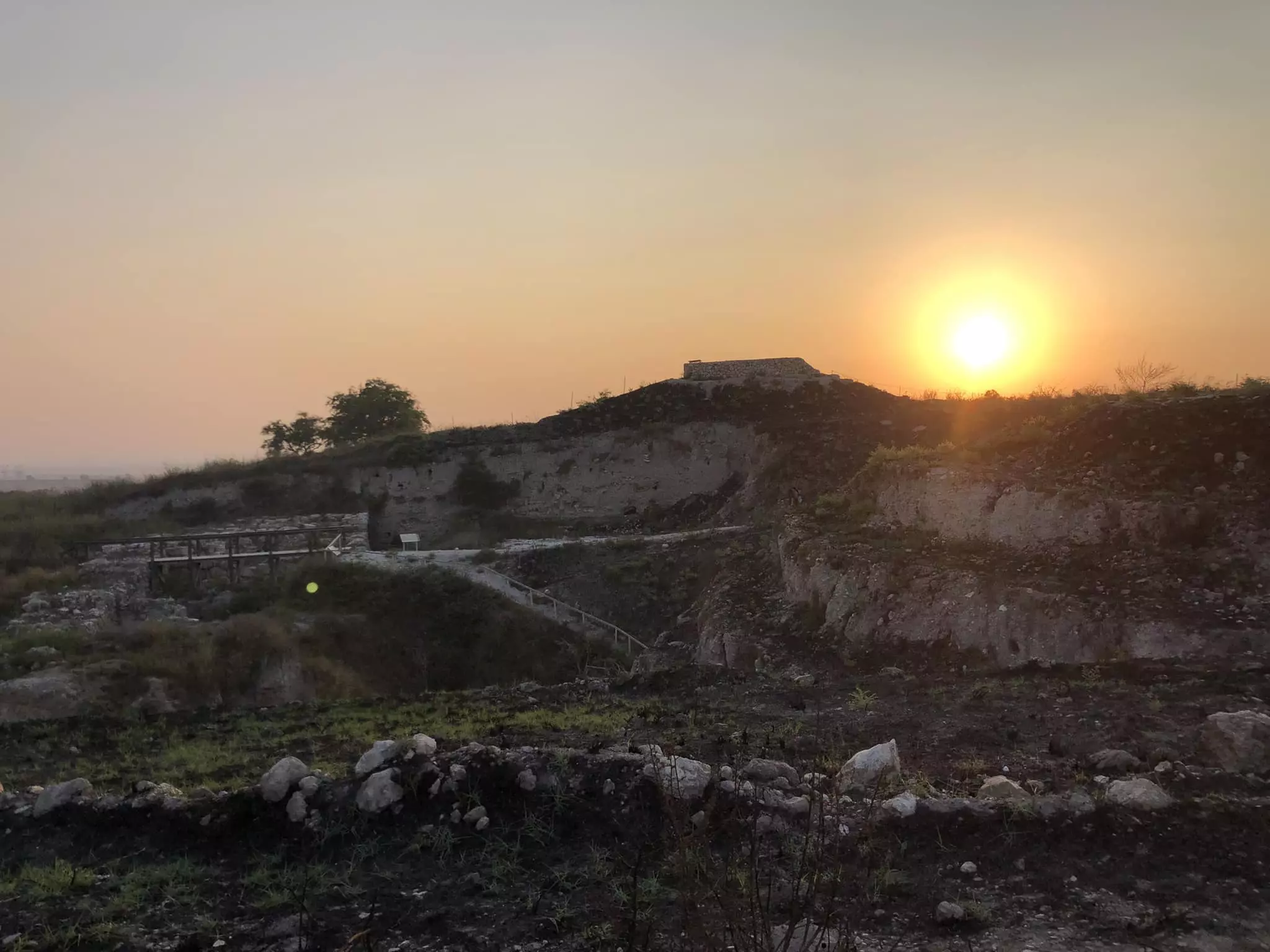
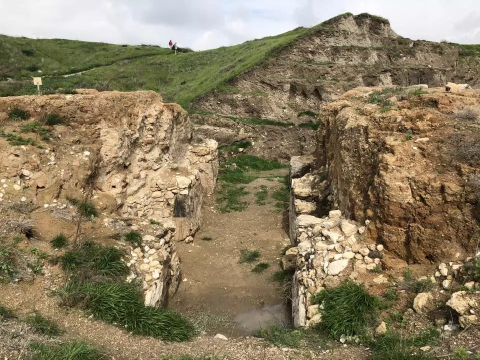
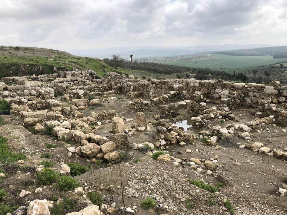
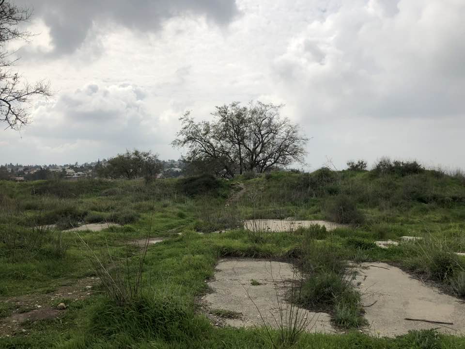
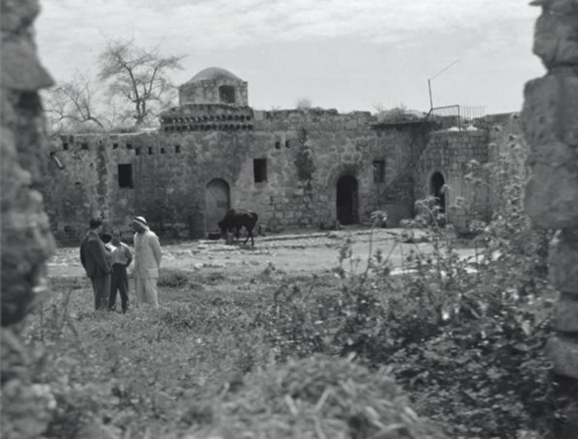
| Village Temains | Abu Shusha was completely destroyed and defaced. | ||||||||||||||||||
| Ethnically Cleansing | Abu Shusha inhabitants were completely ethnically cleansed. | ||||||||||||||||||
| Pre-Nakba Land Ownership |
**Town Lands' Demarcation Maps |
||||||||||||||||||
| Land Usage As of 1945 |
|
||||||||||||||||||
| Population |
|
||||||||||||||||||
| Number of Houses |
|
||||||||||||||||||
| Near By Towns |
|||||||||||||||||||
|
|||||||||||||||||||
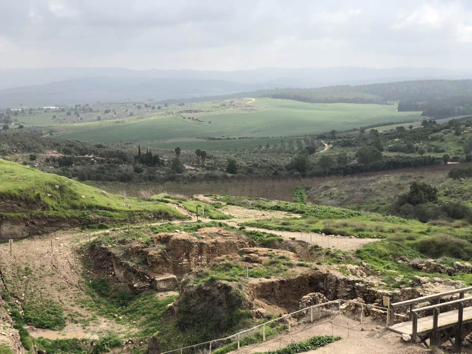
| Town's Name Through History | The Old Testament referred to Abu Shusha by the City of Gezer, the Romans called it Gazara, and the Crusades known it by Mont Gisart. | ||||||||||||||||||
| Schools | An elementary school for boys which was founded in 1947, and it had an initial enrollment of 33 boys. | ||||||||||||||||||
| Places of Warship | One mosque | ||||||||||||||||||
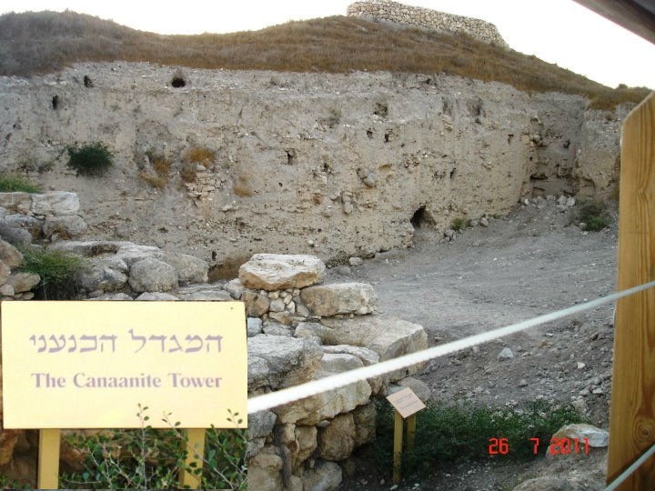
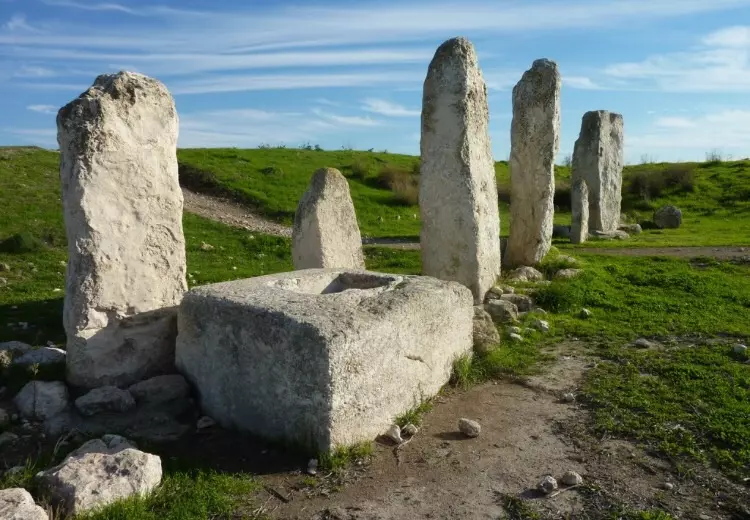
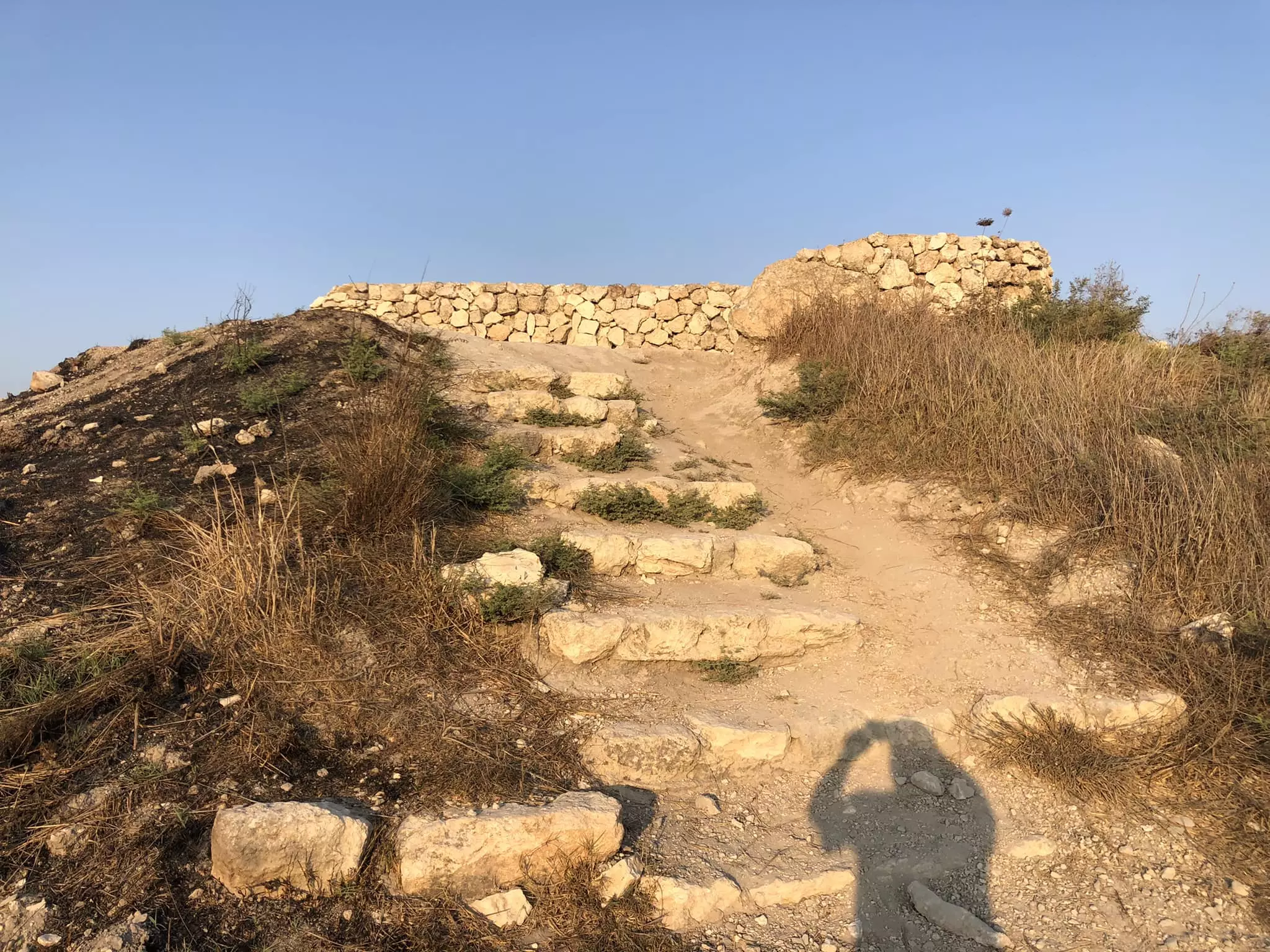
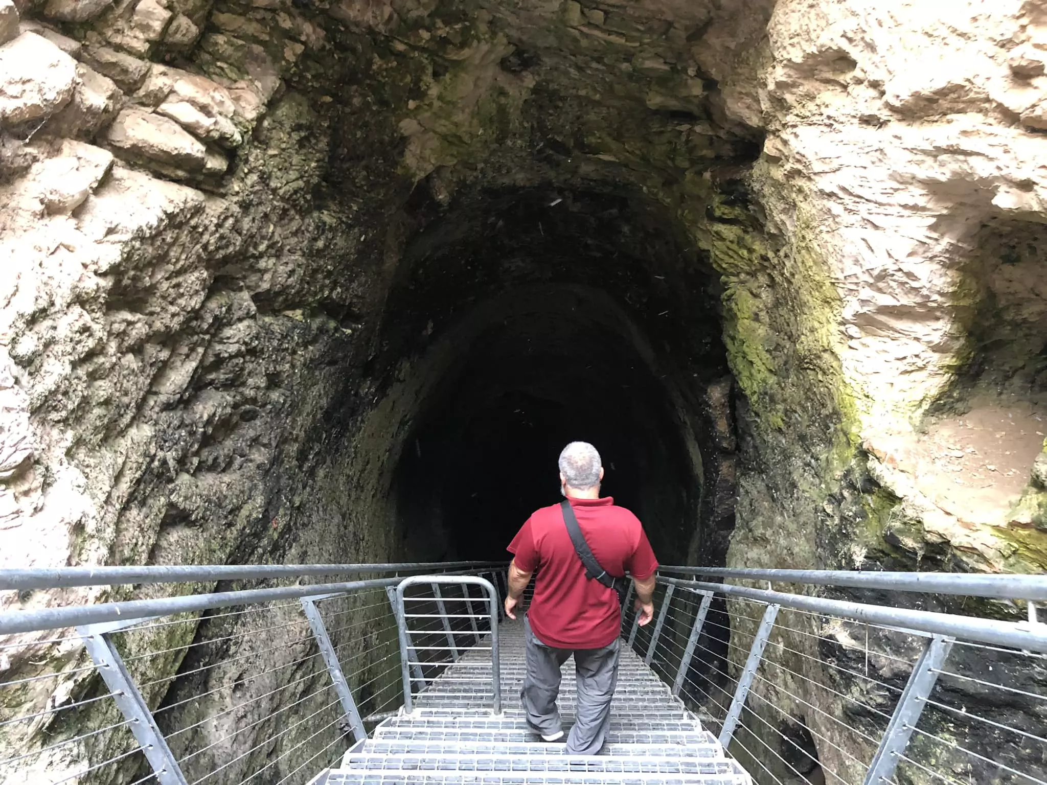
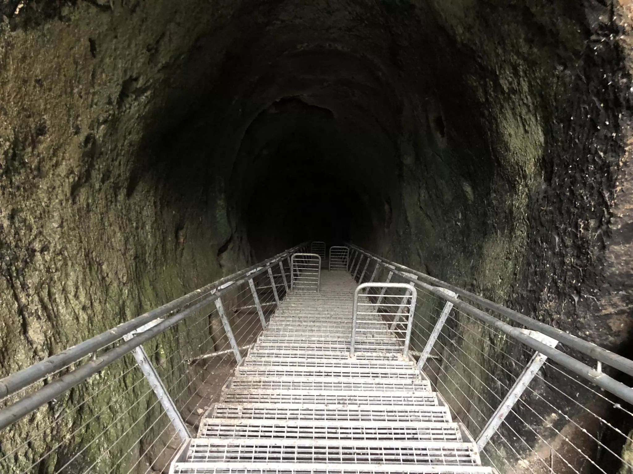
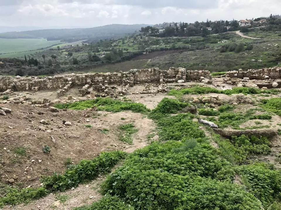
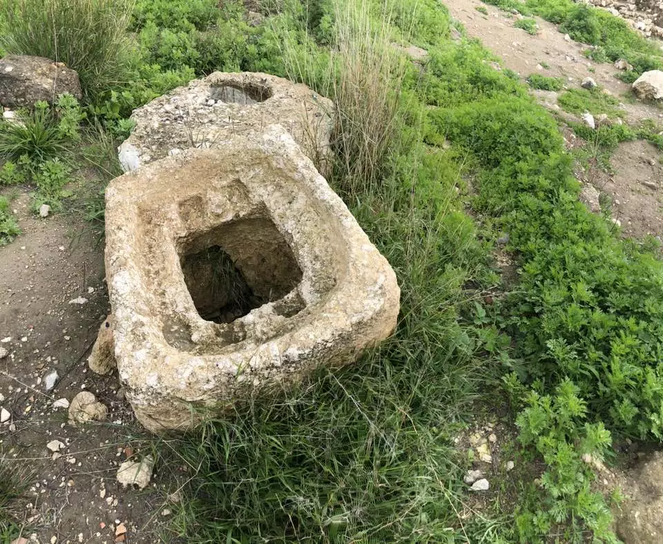
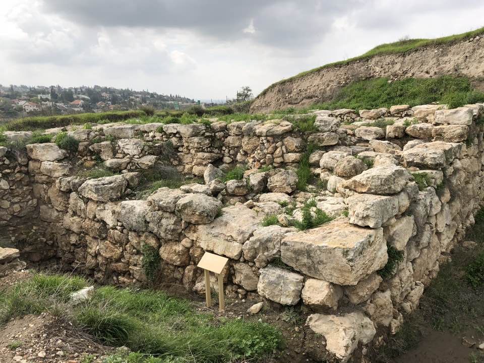
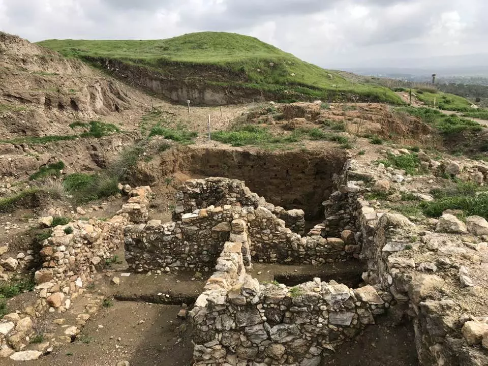
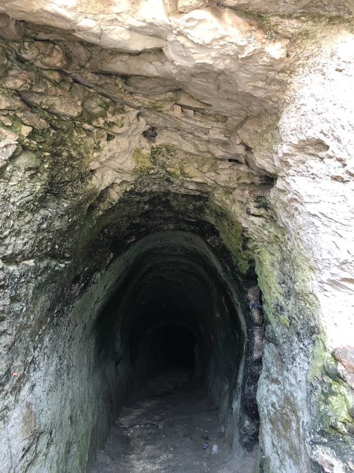
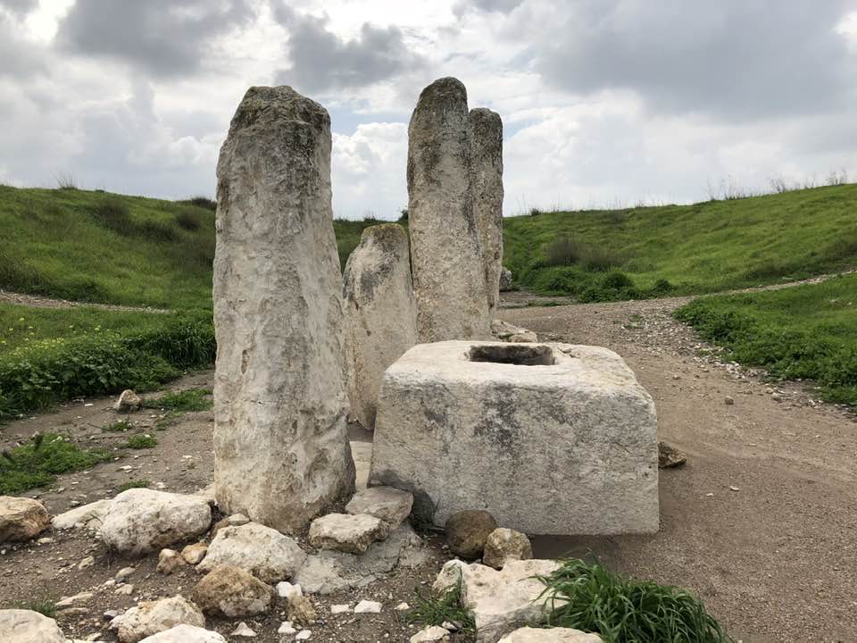
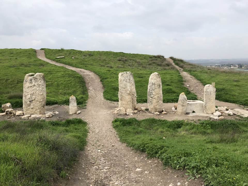
| Archeological Sites | The village was the location of a battle between the Crusades and the troops of Salah al-Din al-Ayyubi. | ||||||||||||||||||
| Exculsive Jewish Colonies Who Usurped Village Lands |
Ameilim, Pedaya, & Gezer. | ||||||||||||||||||
| Featured Video | |||||||||||||||||||
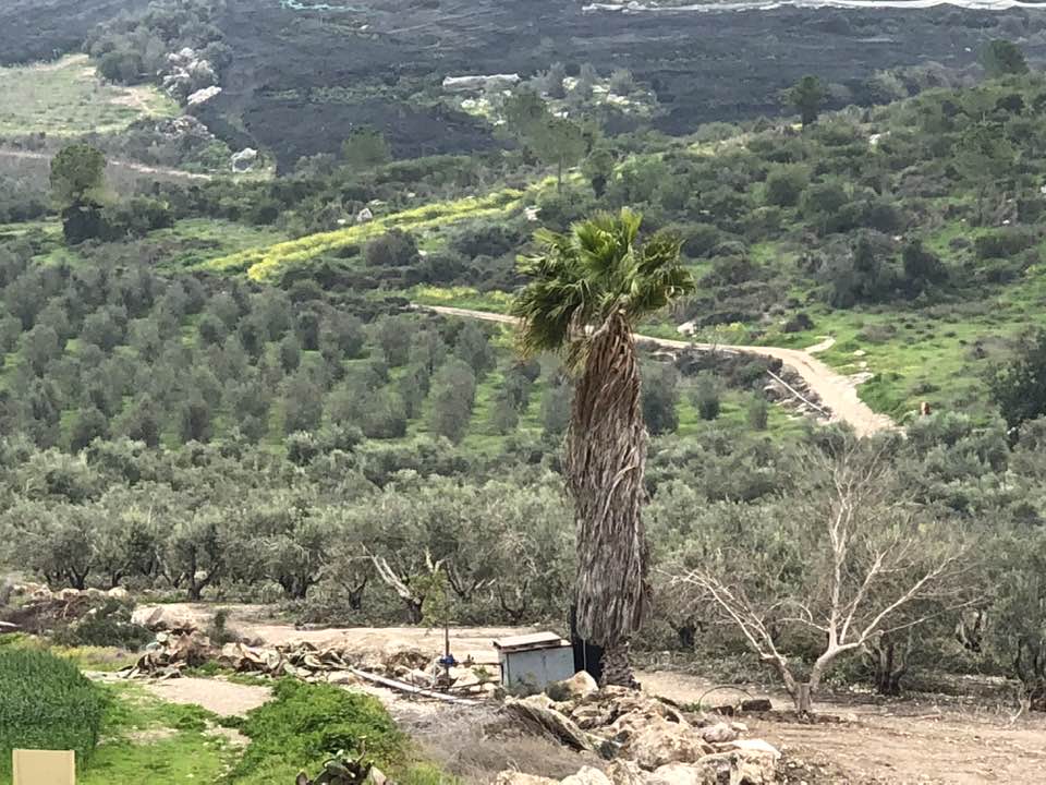
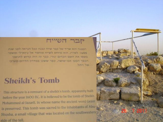
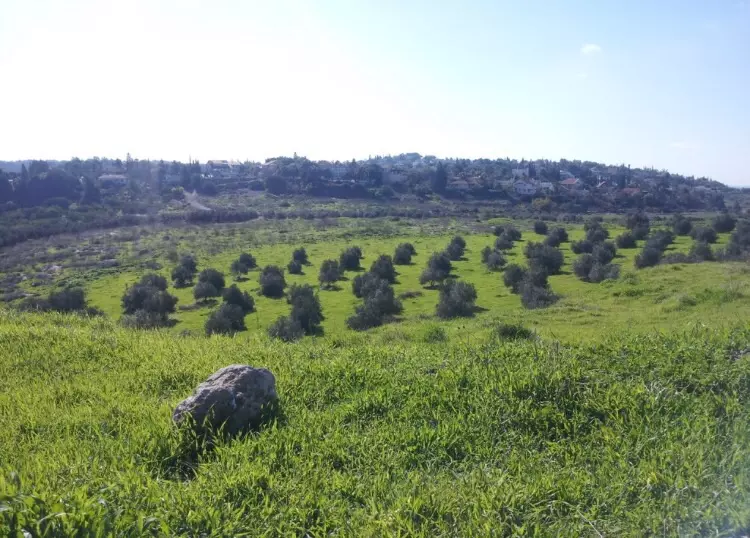
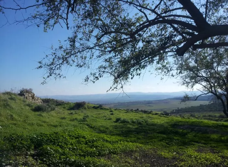
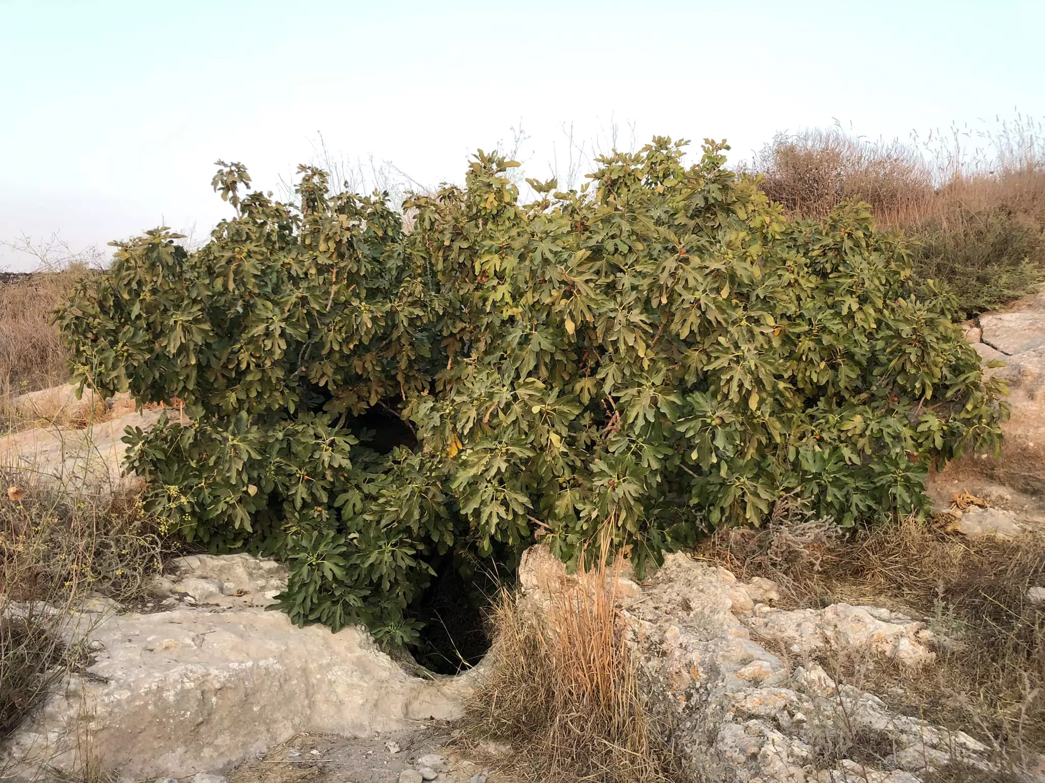
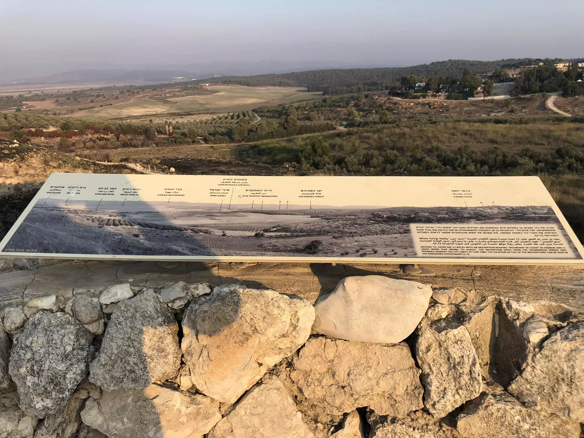
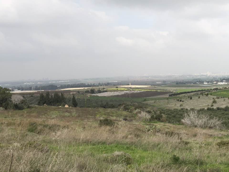
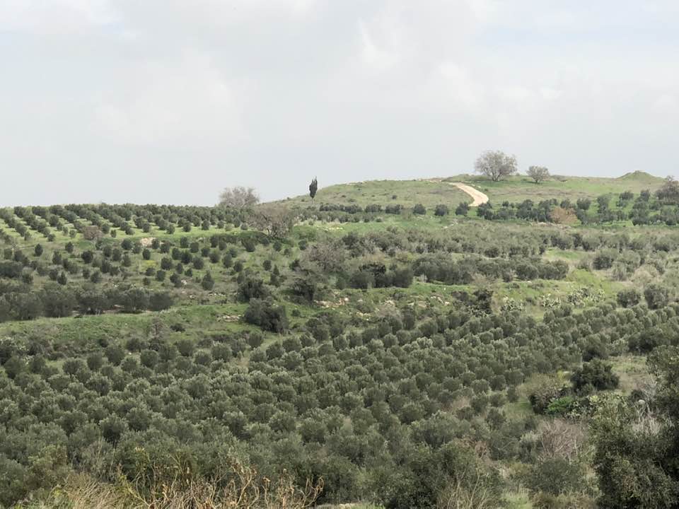
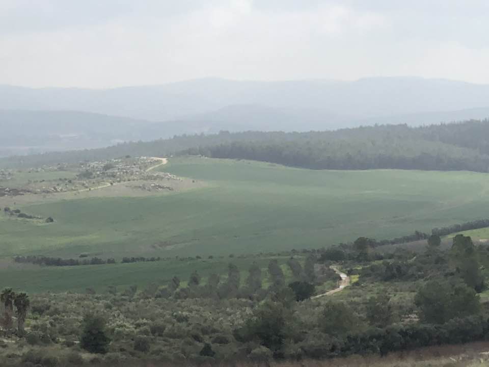
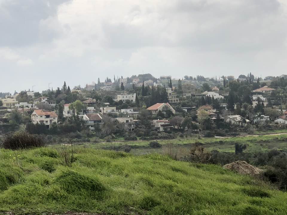
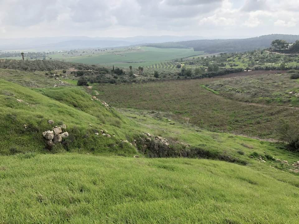
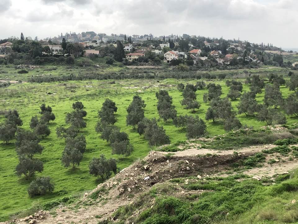
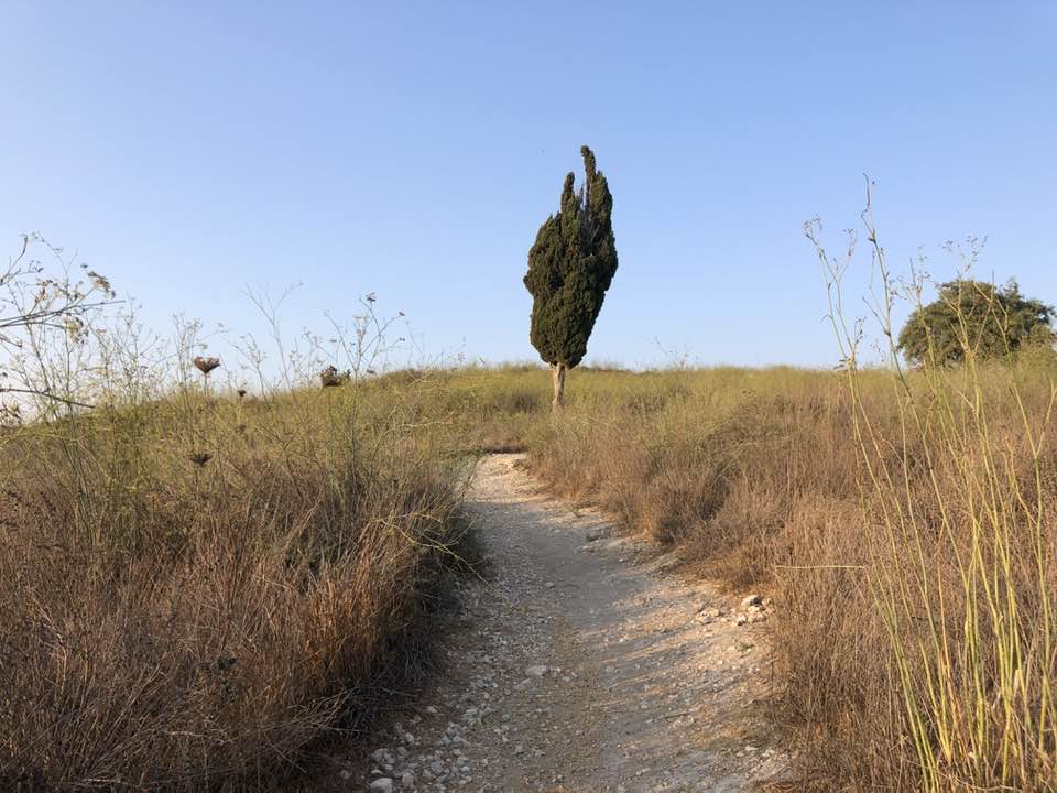
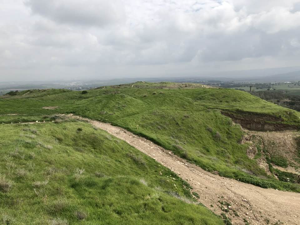
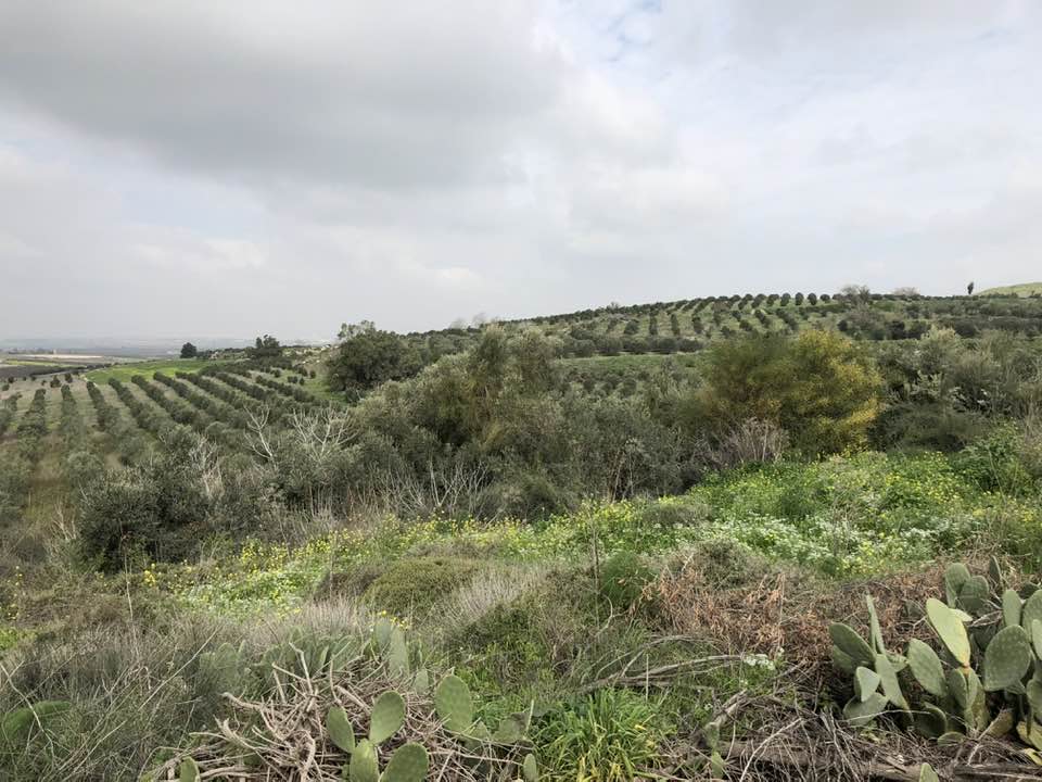
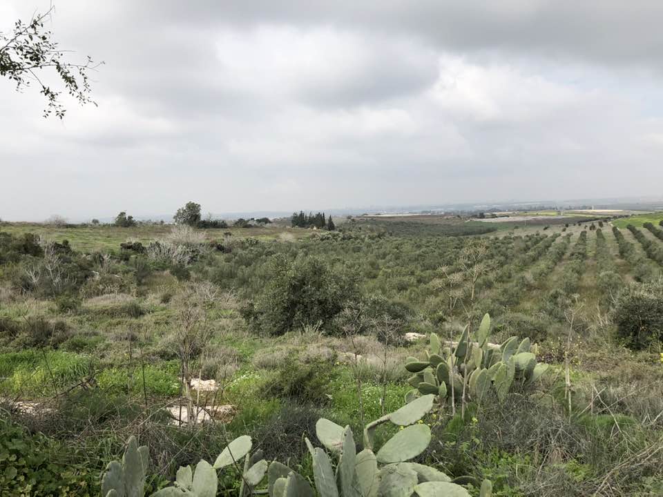
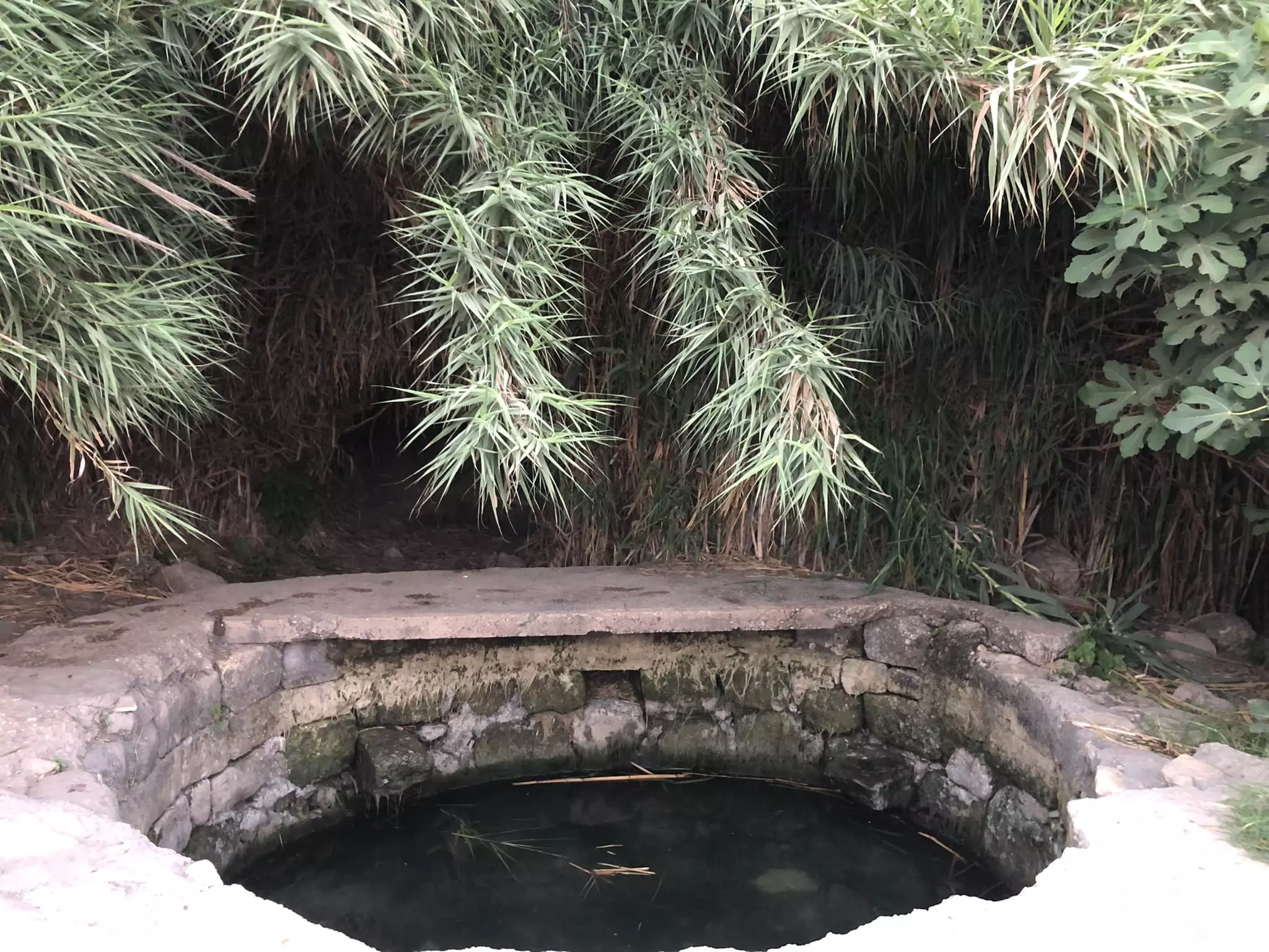
Village Before NakbaThe village was situated on the south slope of Tall Jazar, where the coastal plain met the Jerusalem foothills. It was linked by a secondary road to the Jaffa-Jerusalem highway, which ran northeast of it. Tall Jazar is identified with the Old Testament city of Gezer, which was the site of a major excavation early in this century. The city may have first been settled as early as the fourth millennium B.C.; excavations in the village turned up artifacts that dated back to the third millennium B.C. (the early Bronze Age). The Canaanites made the place into a city and enclosed it with a wall. It was mentioned as one of the cities that were occupied by Thutmose III around 1469 B.C. Solomon is believed to have turned it into a major stronghold. It prospered as well under the Persians and the Greeks; a Roman house and early Christian lamps were unearthed there. In Roman times the site was called Gazara. It lay within the administrative jurisdiction of Nicopolis, a city that occupied the site of the modern Palestinian village of 'Imwas. (This village was populated until June 1967, when the Israeli government destroyed it and two other villages, Bayt Nuba and Yalu, soon after the capture of the West Bank.) Little is known about Abu Shusha in the early Islamic period. In A.D. 1177 the site, called Mont Gisart by the Crusaders, was the location of a battle between the Crusaders and the troops of Salah al-Din al-Ayyubi (Saladin) in which the latter were defeated. Artifacts (ceramics and coins) dating to the thirteenth century A.D. that were found on the site indicate that it may have been inhabited at that time. There is also evidence of construction in the following centuries; a shrine (maqam) on the tell seems to have been built in the sixteenth century. During the early nineteenth century Abu Shusha was a village built of stone and mud and surrounded by cactus hedges. The village population consisted of 100 families. Later in the nineteenth century the traveler Elihu Grant, who saw Abu Shusha, described it as a tiny village.In modern times the entire population of the village was Muslim. The villagers made their houses of mud and stone and built them close to each other. Abu Shusha had a mosque, a number of shops, and an elementary school founded in 1947, with an initial enrollment of 33 children. In 1944/45 a total of 2,475 dunums was allocated to cereals; 54 dunums were irrigated or used for orchards. Village Occupation and Ethnic CleaningAbu Shusha was first attacked in the early months of the war in what the Haganah called 'the model of a studied retaliatory operation.' According to the account given by the History of the Haganah, the hit-and-run attack was carried out after a guardsman from the nearby settlement of Gezer was killed while trespassing on the fields of Abu Shusha. After midnight on 1 April 1948, two platoons of the Giv'ati Brigade's Second Battalion, accompanied by other forces, infiltrated into the village and demolition experts blew up a house and a well. Meanwhile, reinforcements for the Arab militia arrived from the adjacent village of al-Qubab and clashed with a Haganah unit covering the attackers. One of the Jewish attackers was fatally wounded, but the History makes no mention of Arab casualties among the villagers or local militiamen.The village fell during Operation Barak (see al-Batani al-Gharbi, Gaza sub-disctrict) on 14 May 1948, at the hands of the Giv'ati Brigade, according to Israeli historian Benny Morris. (The History of the Haganah puts the occupation a day later.) Morris states that the attacking units shelled Abu Shusha with mortars the night before it fell, on 13 May; the residents fled, and some of the village houses were dynamited. The destruction of the village was also coordinated with an offensive in progress to the east, aimed at occupying the strategic village of al-Latrun. With the capture of Abu Shusha, the units participating in Operation Makkabi (see Khirbat Bayt Far, Ramla sub-disctrict) gained a stronger foothold in the area. Zionists Colonies on Village LandsIn 1948, a settlement named Ameilim was established on the site of the destroyed village. Pedaya (139140) was established in 1951 on the lands of Abu Shusha, close to its border with the lands of the destroyed village of al-Na'ani (138142). Gezer (142142), established on 13 March 1945, north of Abu Shusha is also close to the site but stands on land that formerly belonged to the village of al-Qubab. Other nearby settlements that are not on village land are Petachya (139141) and Beyt 'Uzzi'el (141141), founded in 1951 and 1956, respectively. Both settlements are northwest of the former village.Village TodayThe Israeli settlement of Ameilim occupies much of the site. Fig and cypress trees, cactuses, and one palm tree grow on the site. The surrounding valleys are planted in apricots and figs, and various kinds of fruit trees are cultivated on the heights.SourceDr. Walid al-Khalidi, 1992: All That Remains. |
|||||||||||||||||||
| Related Maps | Town Lands' Demarcation Maps خرائط للقضاء توضح حدود القرى والاودية Town's map on MapQuest View from satellite Help us map this town at WikiMapia |
||||||||||||||||||
| Related Links | Wikipedia's Page Facebook Page Featured Article Google Search Google For Images Google For Videos |
||||||||||||||||||
| More Information | مخطط البلد في كتاب كي لا ننسى في كتاب بلادنا فلسطين المزيد من موقع هوية |
||||||||||||||||||
- من اين اتى اسم ابو شوشه لقريتنا ؟
- ابو شوشه " جازر" في العصر الحجري
- ابو شوشه " جازر" في التوراة
- تاريخ ابو شوشه
- ابو شوشه " جازر" في العصر الكنعاني
- ي ذكر مجزرة ابوشوشة
- في ذكرى مجزرة ابوشوشة
- ابوشــوشة والمذبحة المجهولة (عن كتاب قرية ابوشوشة / سلسلة القرى الفلسطينية المدمرة )
- حافظة النقود أنستني طريق الصمود !!!!!
- موقع أبو شُوشَــة / المتوقع
- نبذة تاريخية عن قرية ابو شوشة (قضاء الرملة) من كتاب (كي لا ننسى)
- مجزرة أبو شوشة, مجزرة بشعة بحق فلسطين بقيت مجهولة 47 عاما
- General view
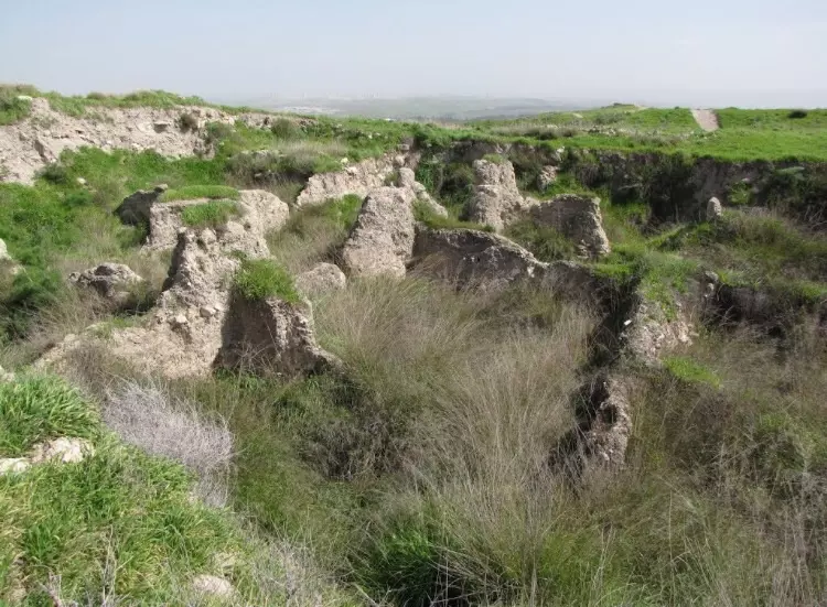
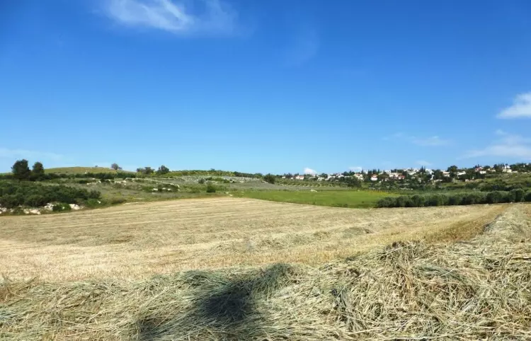
Posted by ABU BARAA 10 - اثار ابو شوشة
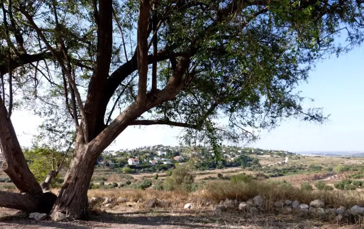
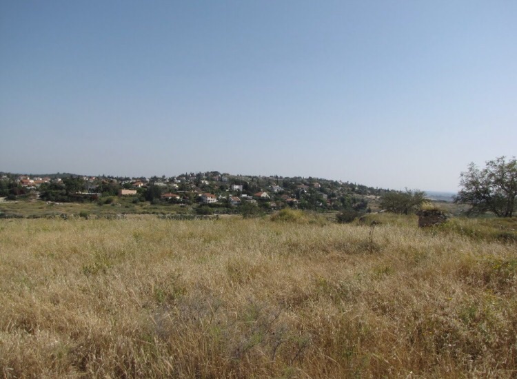
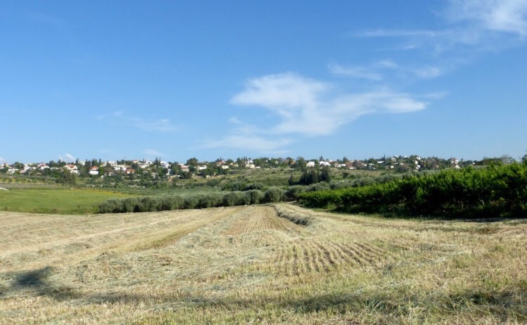
Posted by suliman saleh 2 - منظر عام للقرية
Posted by suliman saleh 2 - منظر عام للقرية
Posted by suliman saleh 1 - اثار ابو شوشة
Posted by suliman saleh 1 - اثار القرية
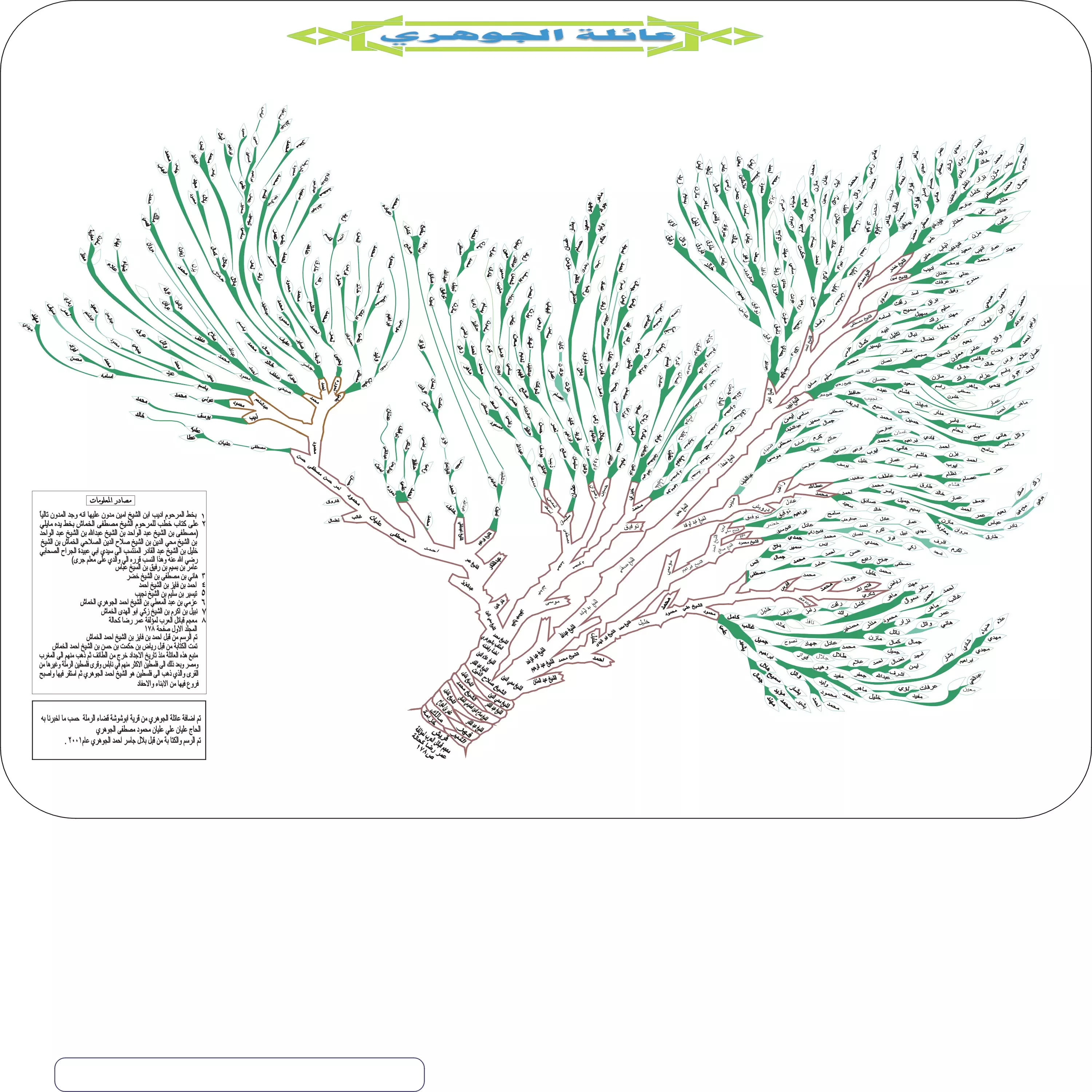
Posted by suliman saleh - al-Jawhari's family tree

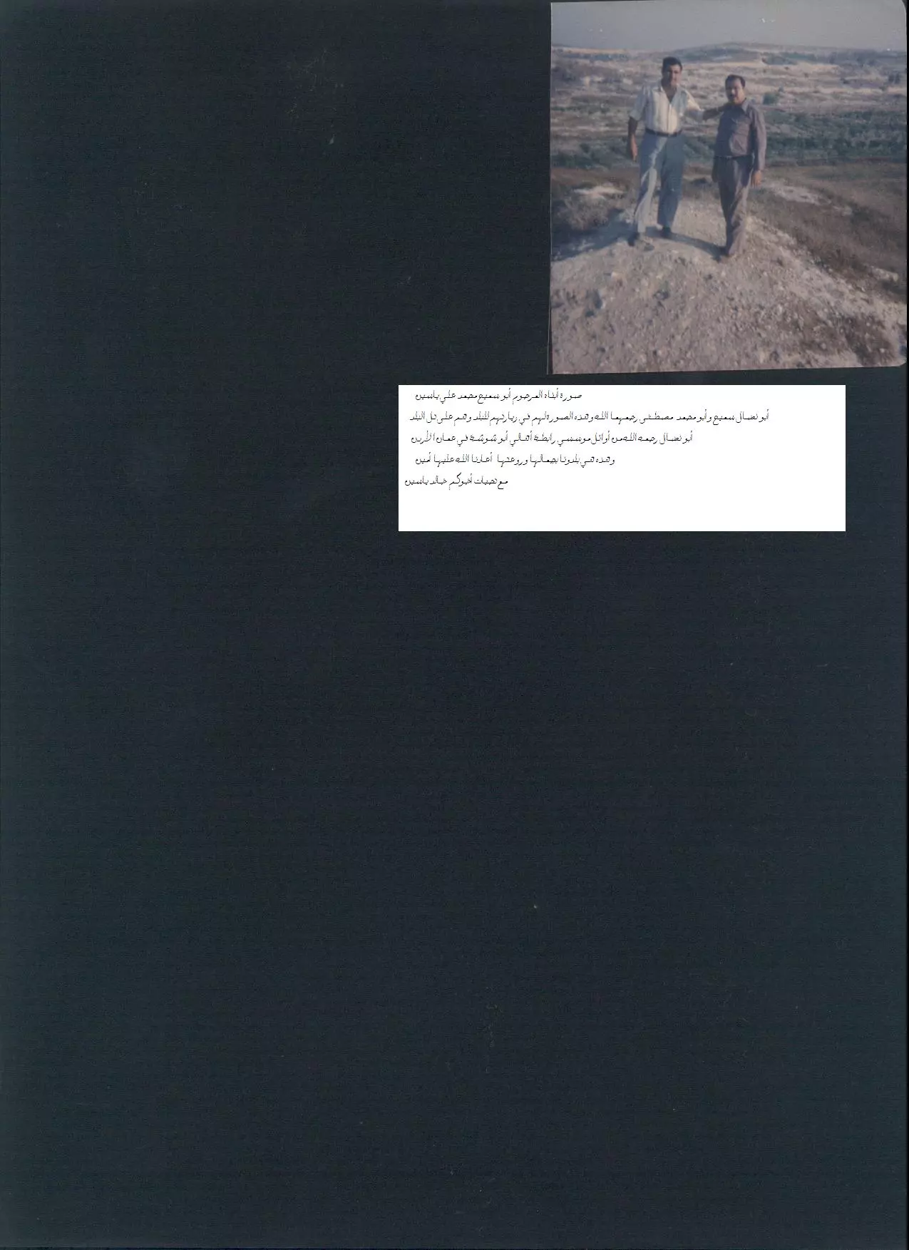
2 - المرحومان ((أبو نضال وأبو مصطفى))
Posted by عبدالله ياسين 2 - الحاج المرحوم بإذن الله محمد علي ياسين ((أبو سميح))
Posted by عبدالله ياسين 3 - الحاج المرحوم محمد علي ياسين وابنه الأستاذ إبراهيم محمد علي ياسين ((أبو عماد))
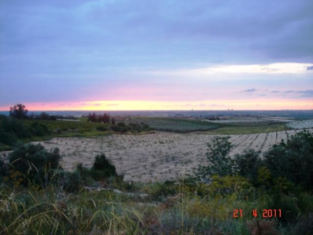
Posted by عبدالله ياسين 1 - سهول القرية ونشاهد الساحل
Posted by خالد دويات - البرج الكنعاني
Posted by خالد دويات - قبر الشيخ محمد
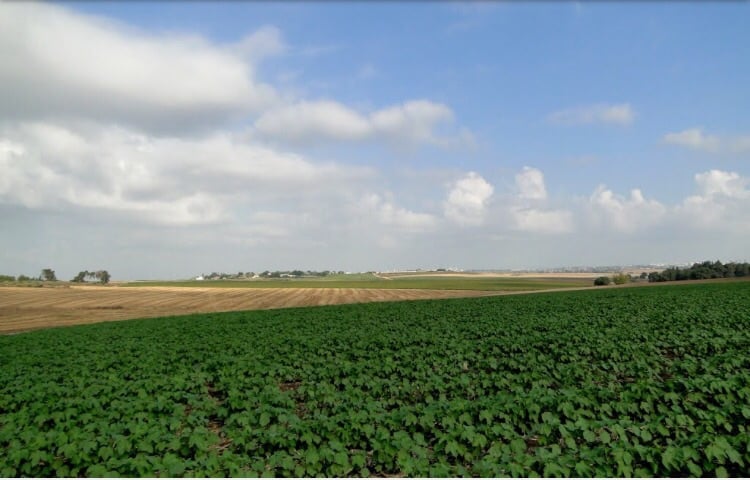
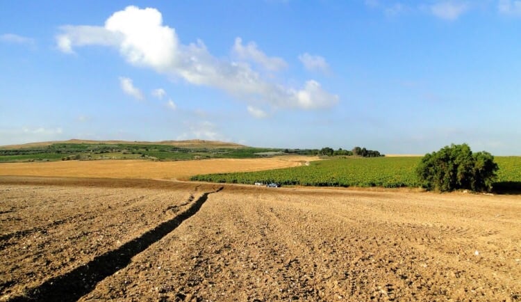
Posted by خالد دويات - اراضي القريه
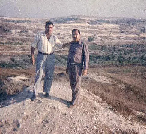
Posted by abu raya - موقع القريه
Posted by abu raya - موقع القريه مغطى بالاعشاب والمستوطنه المقامه على اراضيها
Posted by abu raya - اثار القريه
Posted by abu raya - موقع القريه واراضيها
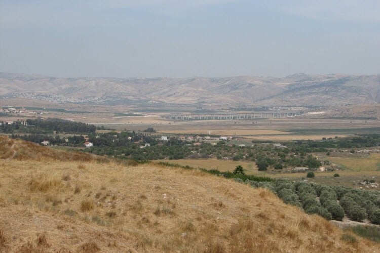
Posted by abu raya - اراضي القريه
Posted by abu raya - اراضي القريه
Posted by abu raya - من اراضي القريه
Posted by abu raya - اثار القريه
Posted by abu raya - موقع القريه وزيتونها
Posted by abu raya - موقع القريه
Posted by abu raya - منظر عام لقريه ابو شوشه قبل النكبه
Posted by abu raya - ابو شوشه قبل النكبه
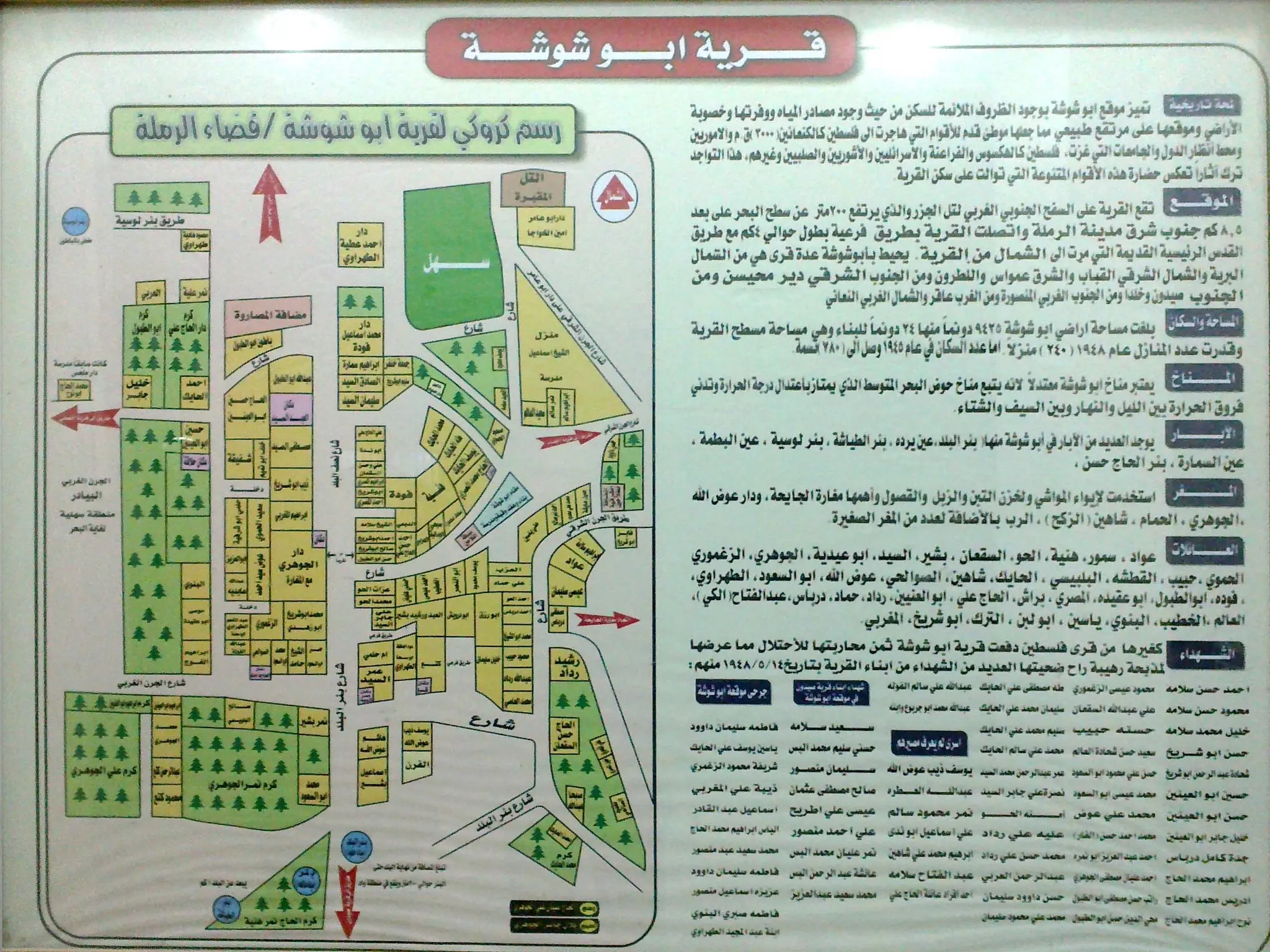
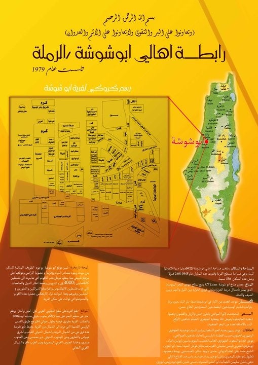
Posted by abu raya - مخطط قرية ابو شوشة قبل الهدم والتهجير
- رابطة اهالي ابو شوشة في الاردن
- شجرة عائلة آل الجوهري
- مدخل قرية أبوشوشة الفلسطينية التي دمرها الاحتلال الإسرائيلي عام 48
- Pre-Nakba Aerial view of the village / صورة من الجو للقرية اخذت قبل النكبة
- That is how the "civilized" erased and replaced us: Abu Shusha was completely obliterated, as you see -- ابو شوشة باتت أثر بعد عين. من هنا مر الهمجّ
- That is how the "civilized" erased and replaced us: Abu Shusha was completely obliterated, as you see -- ابو شوشة باتت أثر بعد عين. من هنا مر الهمجّ #2
- That is how the "civilized" erased and replaced us: Abu Shusha was completely obliterated, as you see -- ابو شوشة باتت أثر بعد عين. من هنا مر الهمجّ #3
- That is how the "civilized" erased and replaced us: Abu Shusha was completely obliterated, as you see -- ابو شوشة باتت أثر بعد عين. من هنا مر الهمجّ #4
- That is how the "civilized" erased and replaced us: Abu Shusha was completely obliterated, as you see -- ابو شوشة باتت أثر بعد عين. من هنا مر الهمجّ #5
- That is how the "civilized" erased and replaced us: Abu Shusha was completely obliterated, as you see -- ابو شوشة باتت أثر بعد عين. من هنا مر الهمجّ #6
- That is how the "civilized" erased and replaced us: Abu Shusha was completely obliterated, as you see -- ابو شوشة باتت أثر بعد عين. من هنا مر الهمجّ #7
- That is how the "civilized" erased and replaced us: Abu Shusha was completely obliterated, as you see -- ابو شوشة باتت أثر بعد عين. من هنا مر الهمجّ #8
- That is how the "civilized" erased and replaced us: Abu Shusha was completely obliterated, as you see -- ابو شوشة باتت أثر بعد عين. من هنا مر الهمجّ #9
- That is how the "civilized" erased and replaced us: Abu Shusha was completely obliterated, as you see -- ابو شوشة باتت أثر بعد عين. من هنا مر الهمجّ #10
- That is how the "civilized" erased and replaced us: Abu Shusha was completely obliterated, as you see -- ابو شوشة باتت أثر بعد عين. من هنا مر الهمجّ #11
- That is how the "civilized" erased and replaced us: Abu Shusha was completely obliterated, as you see -- ابو شوشة باتت أثر بعد عين. من هنا مر الهمجّ #12
- That is how the "civilized" erased and replaced us: Abu Shusha was completely obliterated, as you see -- ابو شوشة باتت أثر بعد عين. من هنا مر الهمجّ #13
- That is how the "civilized" erased and replaced us: Abu Shusha was completely obliterated, as you see -- ابو شوشة باتت أثر بعد عين. من هنا مر الهمجّ #14
- That is how the "civilized" erased and replaced us: Abu Shusha was completely obliterated, as you see -- ابو شوشة باتت أثر بعد عين. من هنا مر الهمجّ #15
- That is how the "civilized" erased and replaced us: Abu Shusha was completely obliterated, as you see -- ابو شوشة باتت أثر بعد عين. من هنا مر الهمجّ #16
- That is how the "civilized" erased and replaced us: Abu Shusha was completely obliterated, as you see -- ابو شوشة باتت أثر بعد عين. من هنا مر الهمجّ #17
- That is how the "civilized" erased and replaced us: Abu Shusha was completely obliterated, as you see -- ابو شوشة باتت أثر بعد عين. من هنا مر الهمجّ #18
- That is how the "civilized" erased and replaced us: Abu Shusha was completely obliterated, as you see -- ابو شوشة باتت أثر بعد عين. من هنا مر الهمجّ #19
- That is how the "civilized" erased and replaced us: Abu Shusha was completely obliterated, as you see -- ابو شوشة باتت أثر بعد عين. من هنا مر الهمجّ #20
- That is how the "civilized" erased and replaced us: Abu Shusha was completely obliterated, as you see -- ابو شوشة باتت أثر بعد عين. من هنا مر الهمجّ #21
- That is how the "civilized" erased and replaced us: Abu Shusha was completely obliterated, as you see -- ابو شوشة باتت أثر بعد عين. من هنا مر الهمجّ #22
- That is how the "civilized" erased and replaced us: Abu Shusha was completely obliterated, as you see -- ابو شوشة باتت أثر بعد عين. من هنا مر الهمجّ #23
- That is how the "civilized" erased and replaced us: Abu Shusha was completely obliterated, as you see -- ابو شوشة باتت أثر بعد عين. من هنا مر الهمجّ #24
- That is how the "civilized" erased and replaced us: Abu Shusha was completely obliterated, as you see -- ابو شوشة باتت أثر بعد عين. من هنا مر الهمجّ #25
- That is how the "civilized" erased and replaced us: Abu Shusha was completely obliterated, as you see -- ابو شوشة باتت أثر بعد عين. من هنا مر الهمجّ #26
- That is how the "civilized" erased and replaced us: Abu Shusha was completely obliterated, as you see -- ابو شوشة باتت أثر بعد عين. من هنا مر الهمجّ #27
- That is how the "civilized" erased and replaced us: Abu Shusha was completely obliterated, as you see -- ابو شوشة باتت أثر بعد عين. من هنا مر الهمجّ #28
- That is how the "civilized" erased and replaced us: Abu Shusha was completely obliterated, as you see -- ابو شوشة باتت أثر بعد عين. من هنا مر الهمجّ #29
- That is how the "civilized" erased and replaced us: Abu Shusha was completely obliterated, as you see -- ابو شوشة باتت أثر بعد عين. من هنا مر الهمجّ #30
- That is how the "civilized" erased and replaced us: Abu Shusha was completely obliterated, as you see -- ابو شوشة باتت أثر بعد عين. من هنا مر الهمجّ #31
- That is how the "civilized" erased and replaced us: Abu Shusha was completely obliterated, as you see -- ابو شوشة باتت أثر بعد عين. من هنا مر الهمجّ #32
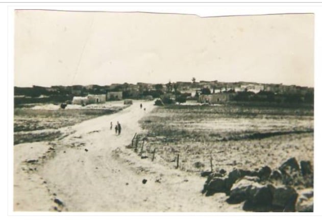
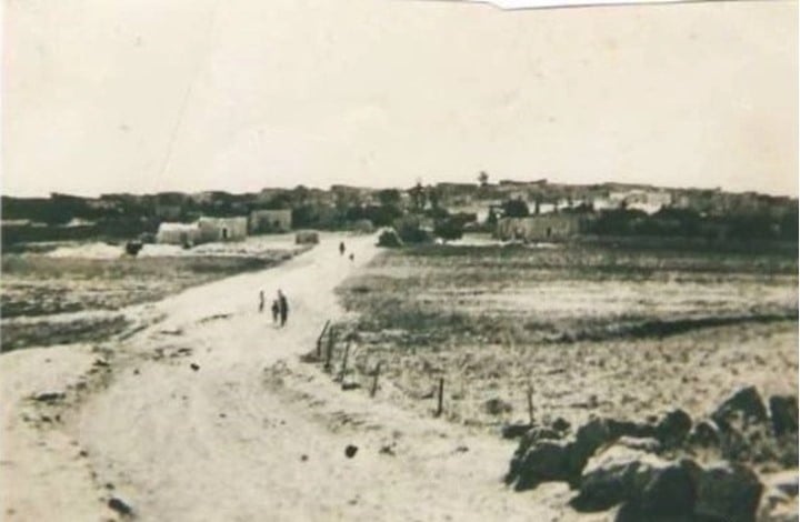
- A view in the village of Abu Shusha, 1945
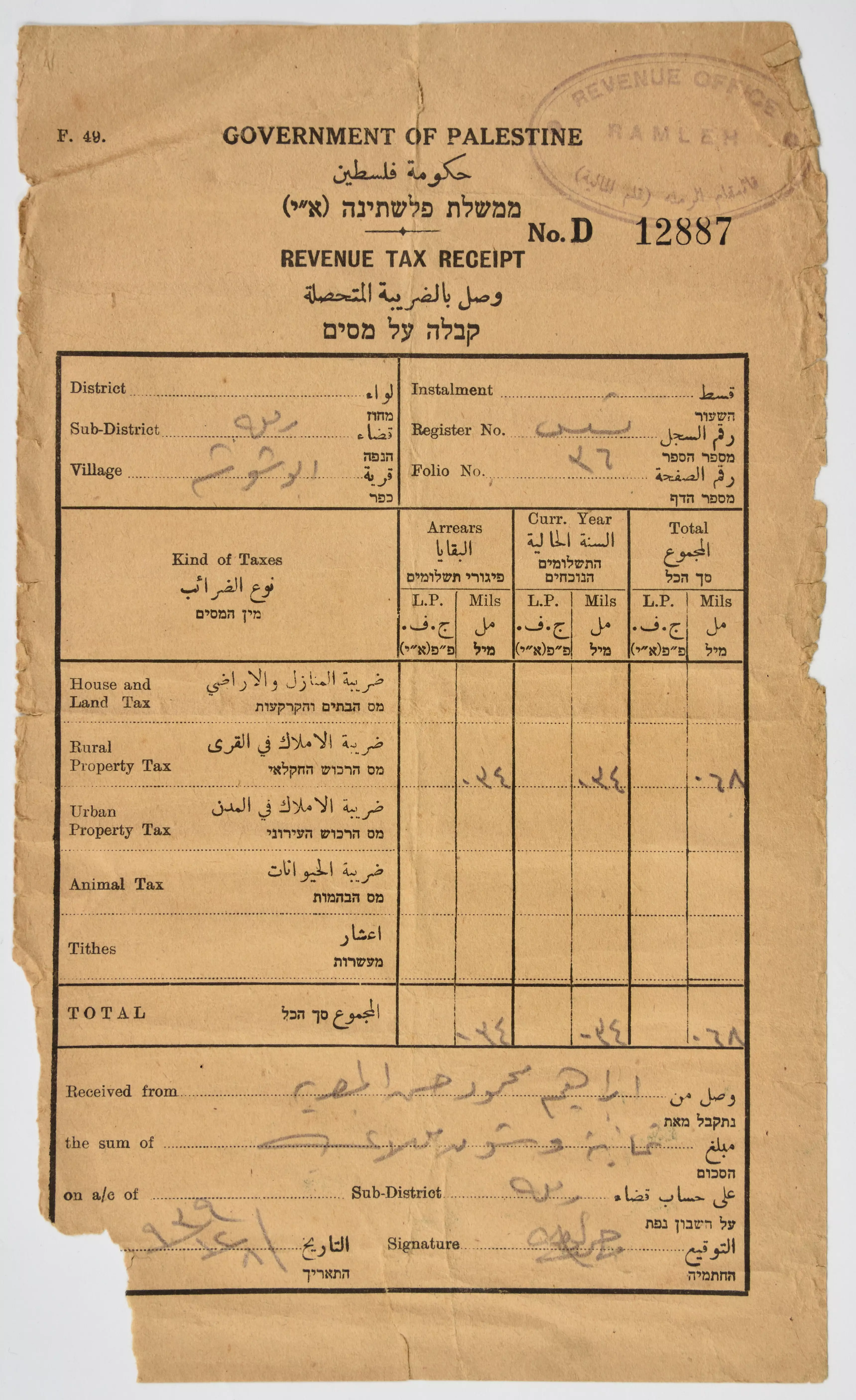
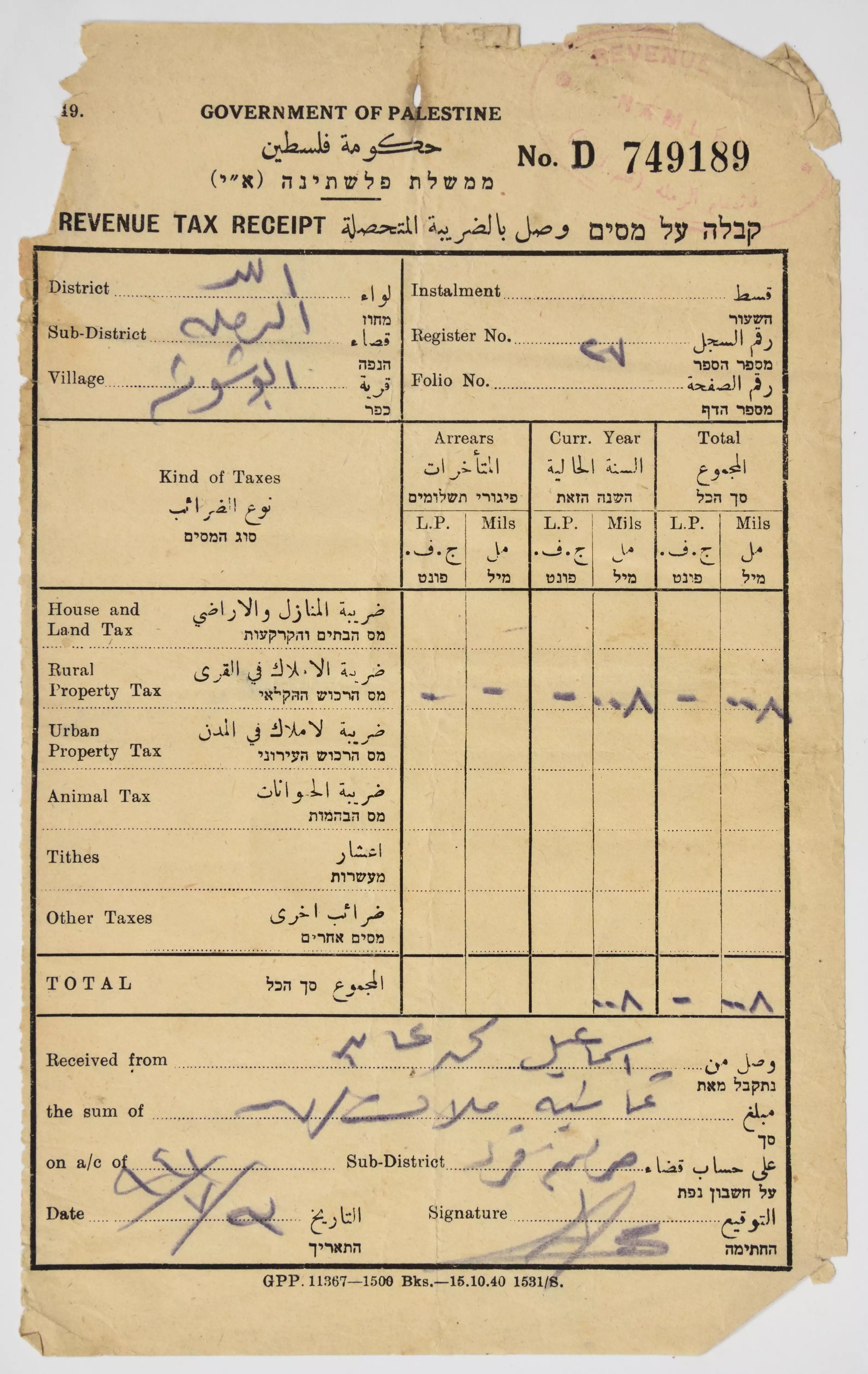
- A receipt of the taxes collected from the British Mandate government of Lod District, Ramallah, Abu Shusha village, on behalf of: Ibrahim Mahmoud Hasan al-Masreya.
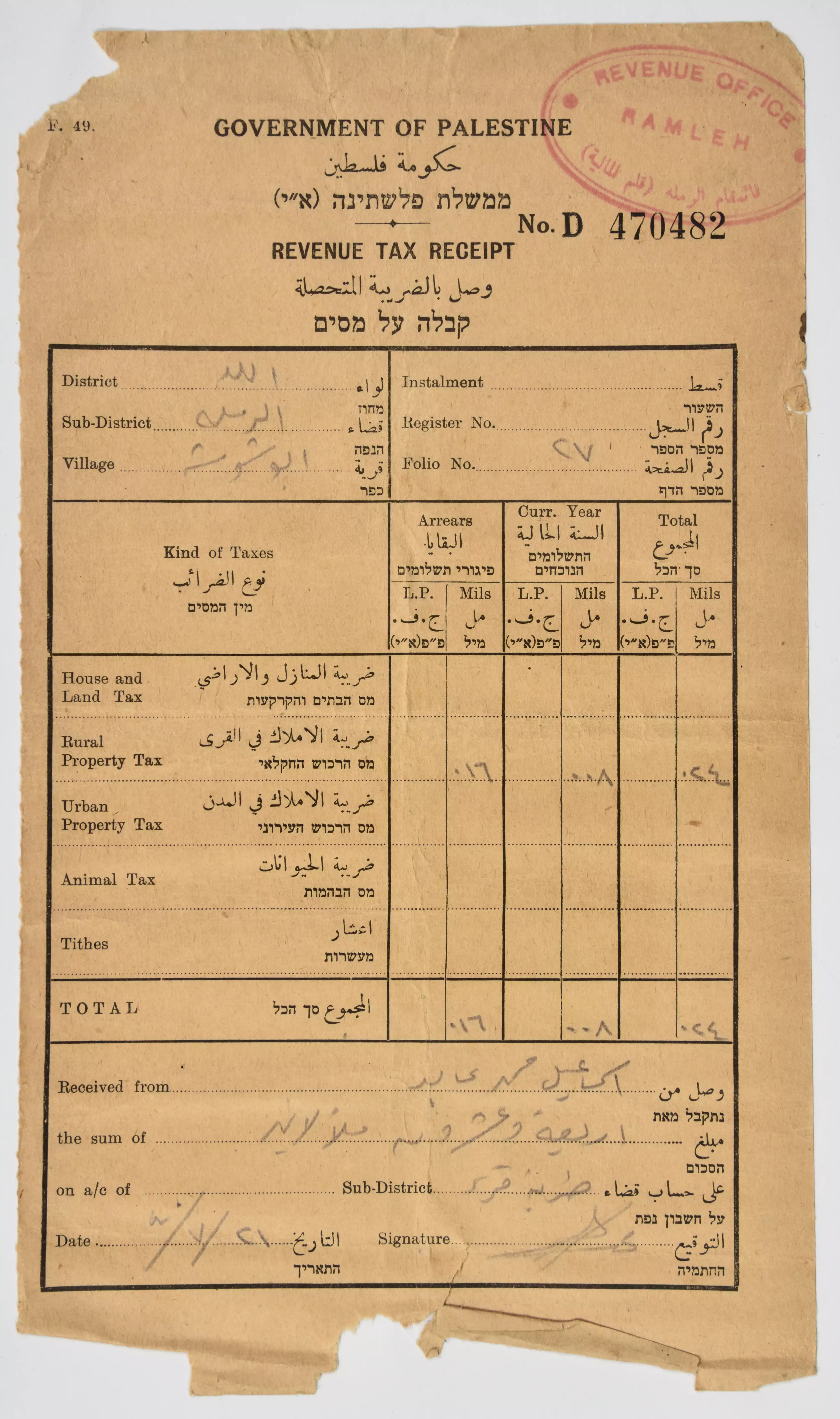
- A receipt of the taxes collected from the British Mandate government of Lod District, Ramlah, Abu Shusha village, on behalf of: Ibrahim Mahmoud Hasan al-Masreya, 1937 - 1946
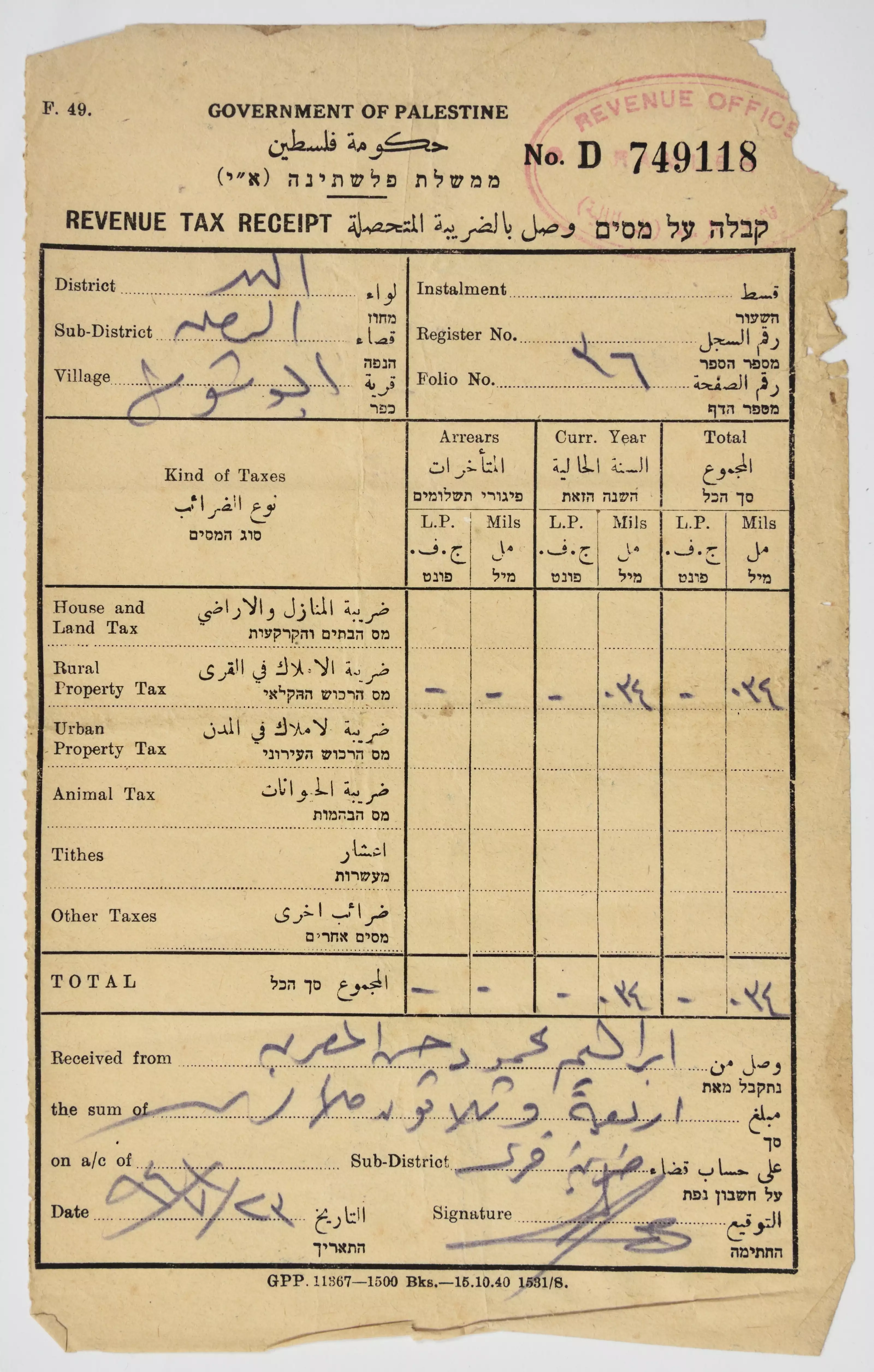
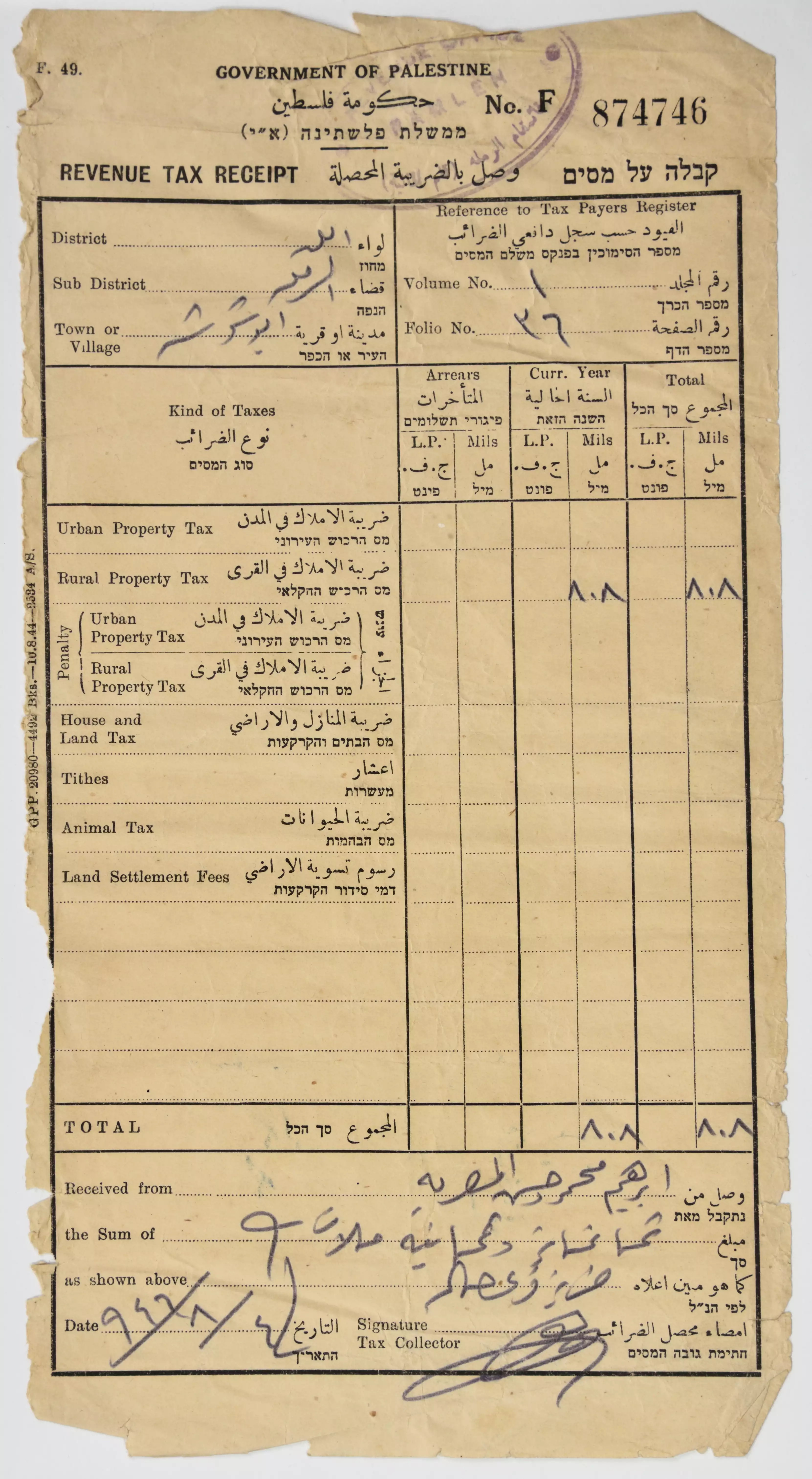
- A receipt of the taxes collected from the British Mandate government of Lod District, Ramlah, Abu Shusha village, on behalf of: Ibrahim Mahmoud Hasan al-Masreya, 1937 - 1946 #2
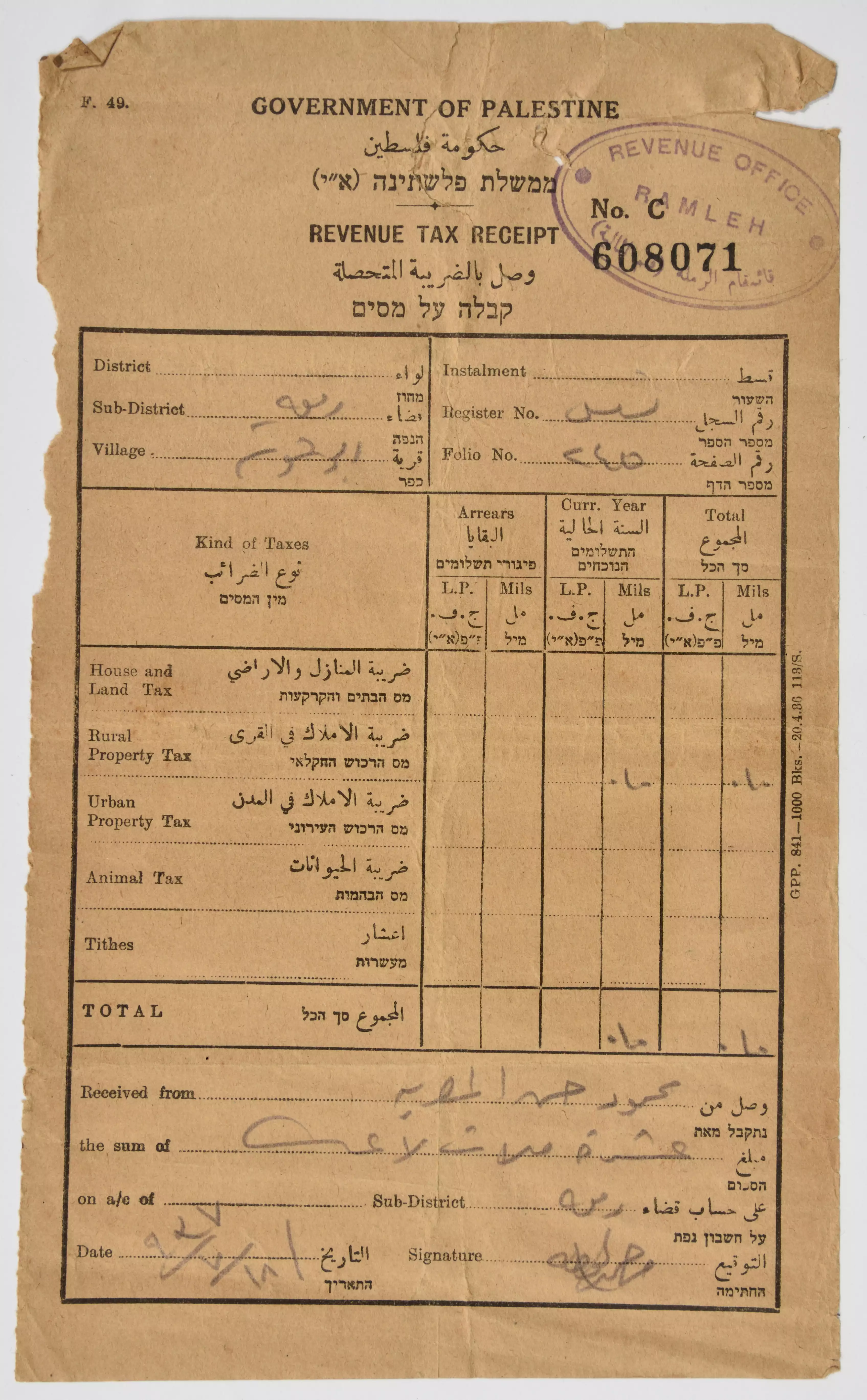
- A receipt of the taxes collected from the British Mandate government of Lod District, Ramlah, Abu Shusha village, on behalf of: Ibrahim Mahmoud Hasan al-Masreya, 1937 - 1946 #3
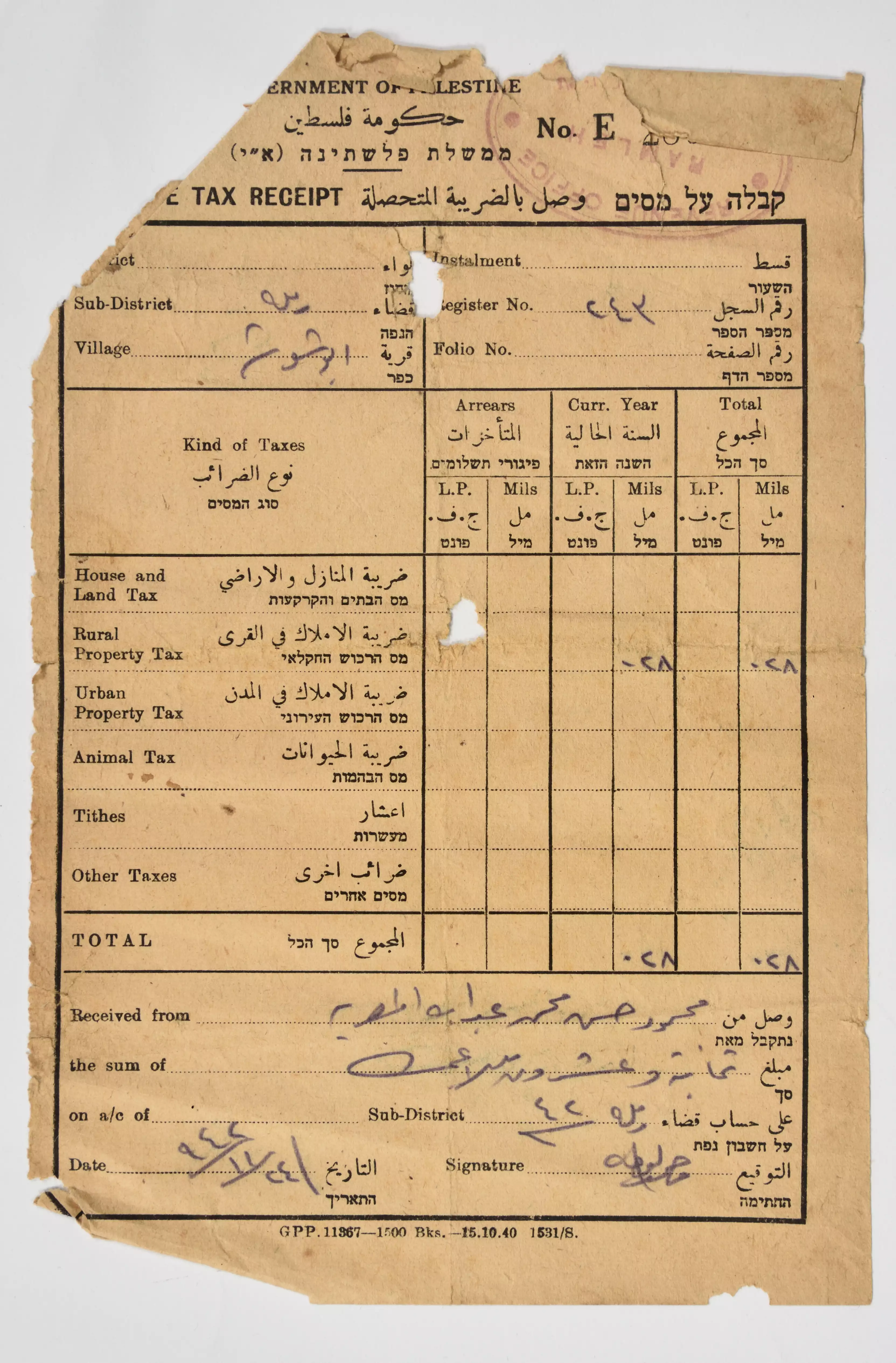
- A receipt of the taxes collected from the British Mandate government of Lod District, Ramlah, Abu Shusha village, on behalf of: Ibrahim Mahmoud Hasan al-Masreya, 1937 - 1946 #4
- A receipt of the taxes collected from the British Mandate government of Lod District, Ramlah, Abu Shusha village, on behalf of: Ibrahim Mahmoud Hasan al-Masreya, 1937 - 1946 #5
- A receipt of the taxes collected from the British Mandate government of Lod District, Ramlah, Abu Shusha village, on behalf of: Ibrahim Mahmoud Hasan al-Masreya, 1937 - 1946 #6
Want to browse more? 80,000 pictures were grouped in these gallaries:
- A receipt of the taxes collected from the British Mandate government of Lod District, Ramallah, Abu Shusha village, on behalf of: Ibrahim Mahmoud Hasan al-Masreya.
- A receipt of the taxes collected from the British Mandate government of Lod District, Ramlah, Abu Shusha village, on behalf of: Ibrahim Mahmoud Hasan al-Masreya, 1937 - 1946
- A receipt of the taxes collected from the British Mandate government of Lod District, Ramlah, Abu Shusha village, on behalf of: Ibrahim Mahmoud Hasan al-Masreya, 1937 - 1946 #2
- A receipt of the taxes collected from the British Mandate government of Lod District, Ramlah, Abu Shusha village, on behalf of: Ibrahim Mahmoud Hasan al-Masreya, 1937 - 1946 #3
- A receipt of the taxes collected from the British Mandate government of Lod District, Ramlah, Abu Shusha village, on behalf of: Ibrahim Mahmoud Hasan al-Masreya, 1937 - 1946 #4
- A receipt of the taxes collected from the British Mandate government of Lod District, Ramlah, Abu Shusha village, on behalf of: Ibrahim Mahmoud Hasan al-Masreya, 1937 - 1946 #5
- A receipt of the taxes collected from the British Mandate government of Lod District, Ramlah, Abu Shusha village, on behalf of: Ibrahim Mahmoud Hasan al-Masreya, 1937 - 1946 #6
| Display Name | Clan/Hamolah | Country of Residence |
| Loai Toboul | - | - |
| أحمد جمعة درباس | درباس | الأردن, الأردن |
| علي الكي | elkay | amman, jordan |
| MrHack79 | ابو العينين | - |
| الجنرال | - | فلسطين, فلسطين |
| ايمن الصوالحي | الصوالحي | عمان |
| عبدالله ابو شمله | ابوشمله | الاردن, الاردن |
| عماد ابراهيم ياسين | ياسين | - |
| nidal deeb | deeb | amman, jordan |
| محمد الجوهري | المصاروة | اربد, الاردن |
| Samah | Jaber | - |
| KHADER | AWWAD | RAMALLAH |
| حسن عواد | عواد | - |
| ali abu shosha | الحاج علي | - |
| طارق ياسين | ال ياسين | - |
| Taher Suleiman | Suleiman | Dubai, UAE |
| Nedham Mohammad Abdul Rahman Basheer | Basheer | Dhahran / Saudi Aramco, Kingdom of Saudi Arabia |
| shareef ahmed habeeb | Habeeb | zarka, jordan |
| NIDAL | YASSIN | - |
| OMAR DERBAS | DERBAS | - |
| mohammad Salameh | AL-HAAJ ALI | Amman, Jordan |
| Mahmoud Brash | Brash | - |
| Saleh Abu Shindi | AL-Hayek | Florida, United states |
| KHALED | YASSIN | - |
| suliman saleh | saleh suliman | - |
- بلدة أبو شوشة (قضاء الرملة): تعرّف على البلدة وتل الجزر الكنعاني وقناة الرملة التي اقام الخليفة سليمان بن عبد المالك من عيون ابو شوشة Duration: 2 min sec
- ابو شوشة المهجرة قضاء الرملة -- August 22nd, 2022 Duration: 44 sec
- جولة رائعة في القرية المهجرة -- 2025 Duration: min 9 sec
No links have been shared yet, be free to the first to share the first link.
 Fake Valor: Why Did Zionist Jews Hoist Nazis Flag on Their Ships in the 1930s?
What is new?
-
Facts About Oct. 7th Gaza Raid
-
Remined Us Please:: Who Did Rape Who? Palestinians Raped Israelis? Or, was the other way around?
-
When Prof. Edward Said was invited to debate Bibi Netanyahu in the 1980s, watch what happened!
-
Ezra Klein of the NY Times on the "Jewish Race".
-
Abusing Blood Libel!
-
Did Israeli Soldiers Activate The Hanniba Direective On Oct. 7th? You Be The Judge
-
Zionist FAQ: Isn't it true that Palestinians don't want peace? Palestinians never accepted the two-state solution
- Facts about Haavara (Transfer) Agreement between Ben-Gurion & Hitler
-
Haavara FAQs: Why Did Zionist Jews Hoist Nazis' Flags on Their Ships in the 1930s?
- Haavara FAQs: When Chaim Weizmann met FDR in mid-1943, why was he silent about rescuing European Jewry?
-
Dear ChatGPT: How did Palestinians resist Napoleon's invasion of their country in 1799?
-
Dear ChatGPT: Gaza had a vibrant Jewish community in the mid-17th century. What happened to them?
-
Dear ChatGPT: Why did the Jewish Agency suppress news of the Holocaust during WWII?
-
Video Playlist: Jews share their DNA tests to end the conflict for good.
-
A Tale of Two Conflicts: Examining the Definition of Genocide
-
Prof. Abraham Polak And The Suppressed History of the Khazars and European Jewry
-
How Ronald Reagan would have framed the genocide in Gaza if he were still alive?
-
Haavara FAQs: Let us do the math: how many German Jews did The Haavara Agreement save?
-
Zionist FAQs: The Hebron Massacre of 1929, "clearly proves" that Palestinians are antisemitic, how could you deny it?
-
Zionist FAQs: Why Anti-Zionist Is Not Antisemitism?
-
Zionist FAQs: Isn't it true that the KGB created Palestinian Nationalism in the early 1960s?
- Zionist FAQs: Muslims are killing Muslims all the time; why are Israeli Jews being singled out in the media?
- Zionist FAQs: How is Israel an apartheid state when 20% of its citizens are Arabs who enjoy full rights?
-
Haavara FAQs: Why Did Dorothy Thompson Flip From A Zionist Advocate to A Silenced Dissenter?
-
Haavara FAQs: Analysis of Herzl's Uganda Scheme and how it could have saved millions of Jews.
-
Haavara FAQs: Why did Hayim Greenberg describe American Jewry as "morally bankrupt" in early 1943?
-
Haavara FAQs: What if the Evian Conference was a resounding success? What would have been the impact of saving European Jewry on Zionism?
- Haavara FAQs: What if the six million were saved, how that would have impacted the Zionist project?
-
Haavara FAQs: How did Zionist leaders react when Europe's Jews lingered in the DP camps after WWII ended?
-
Why does the American Jewish community repeat lies that David Ben-Gurion had debunked before he died?
-
Who has the power to rename the Tatar/Khazar Gene Marker to Jewish IV?
-
Zionist FAQs: Why won't Egypt, Syria, and Jordan take their people back? Jews are indigenous to Palestine, and Arabs immigrated after Jews developed the country. Arabs should leave.
-
Haavara FAQs: Did Hitler and the Nazis conflate between Judaism and Zionist? If that wasn't case, then why?
-
Haavara FAQs: Winston Churchill and antisemitism, a collection of articles written Churchill.
-
Haavara FAQs: Broken by country, how many Jews survived vs. killed during the Holocaust?
-
Haavara FAQs: Why did European Jews vote with their feet and to immigrated to the Americas, not Palestine, after WWII?
-
Watch this American Jewish Girl describing Israeli Jews' cognitive dissonance like no other in under two minutes
-
Haavara FAQs: When the Nazis went out of their way to hide the Holocaust, Israeli Jews did the exact opposite by broadcasting their genocide of Gazans. But why?
-
Haavara FAQs: How Zionist Jews went out of their to show their appreciation to Nazism and Fascism?
- Haavara FAQs: Why Zionist leaders were against bombing the death camps & the Railroads leading to them?
-
Haavara FAQs: Hitler's message to the British and American people: If Jews are such noble citizens and you care about them, how come you're not letting them in? I will gladly ship them to you at my expense, even on luxury liners!
-
A shortlist of Zionist and Israeli false flag operations in the name Jews.
-
The Most Moral Army
- The Land of Kapos (Israel): Where the brave are boycotted and Kapos walk free.
- Why did early Zionists often named their communal enterprises "colonial"?
- Zionist Relations with Nazi Germany by Faris Glubb
-
Two NY Times advertisements by Zionists in the early 1943 that exposes Zionists' treason at the height of the calamity
- Facts Not Lies about the Palestinian-Israeli Conflict.
- Site's pictures have been categorized
- Campgain Against Lice
- A Survey of Palestine, the official source about Palestine before Nakba produced by the British Mandate; over 1200 pages.
- Satellite View & Google Earth: Over 6,000 placemarks identifying all destroyed towns, W. Bank & Gaza Strip Towns, & refugee camps.
- PalestineRemembered.com and its Nakba Oral History Project were featured on al-Jazeera Satellite TV.
- Nakba Oral History Video Podcast:
 Over 700 Oral History interviews (including 3,500+ hours of recording) can be viewed online.
 - Palestine Village Statistics Project
- Gaza Jail Break
- النسخة العربية للموقع الان متوفرة
- Videos: Documenting the destroyed villages in video: Tracing all that remains since Nakba.
- Videos: Responding to Zionist Propaganda
- Interview: The ethnic cleansing of Palestine: George Galloway interviews Israeli Historian Ilan Pappe.
- For Palestinians, memory matters. It provides a blueprint for their future By George Bisharat.
- Zionist FAQ now available in Hebrew שאלות שציונים שואלים, עכשיו בעברית
- Video: The Stephen Walt and John Mearsheimer report on the influence of the Israel Lobby on U.S. Foreign Policy
- The Palestinian-Israeli conflict for beginners
