| PalestineRemembered | About Us | Oral History | العربية | |
| Pictures | Zionist FAQs | Haavara | Maps | |
| Search |
| Camps |
| Districts |
| Acre |
| Baysan |
| Beersheba |
| Bethlehem |
| Gaza |
| Haifa |
| Hebron |
| Jaffa |
| Jericho |
| Jerusalem |
| Jinin |
| Nablus |
| Nazareth |
| Ramallah |
| al-Ramla |
| Safad |
| Tiberias |
| Tulkarm |
| Donate |
| Contact |
| Profile |
| Videos |
Welcome To Wadi Hunayn - وادي حنين (ואדי חנין)
|
District of al-Ramla
Ethnically cleansed days ago |
العربية Google Earth |
 |
Gallery (111) |
- Statistics & Facts
-
Before & After

- Satellite View
- Articles 4
- Pictures 111
- Land Deeds 3
- Members 21
- Families
- All That Remains
- Wikipedia
- Videos 1
- Guest Book 8
- Links
| Statistic & Fact | Value | |||||||||||||||
| Occupation Date | April 17, 1948 | |||||||||||||||
| Distance From District | 9 (km) West of al-Ramla | |||||||||||||||
| Elevation | 50 (meters) | |||||||||||||||
| Before & After Nakba, Click Map For Details |
||||||||||||||||
|
||||||||||||||||
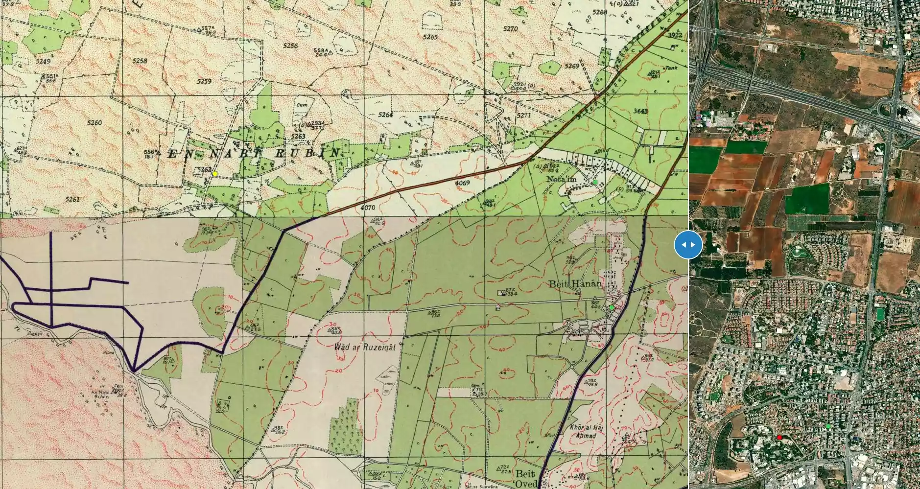
| Map Location | See location #14 on the map View from satellite |
|||||||||||||||
| Exodus Cause | Influence of fall of, or exoduce from, neighboring town | |||||||||||||||
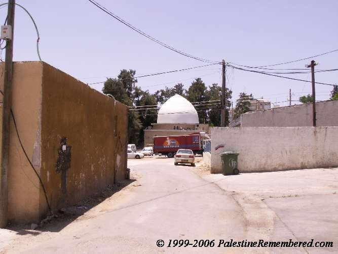
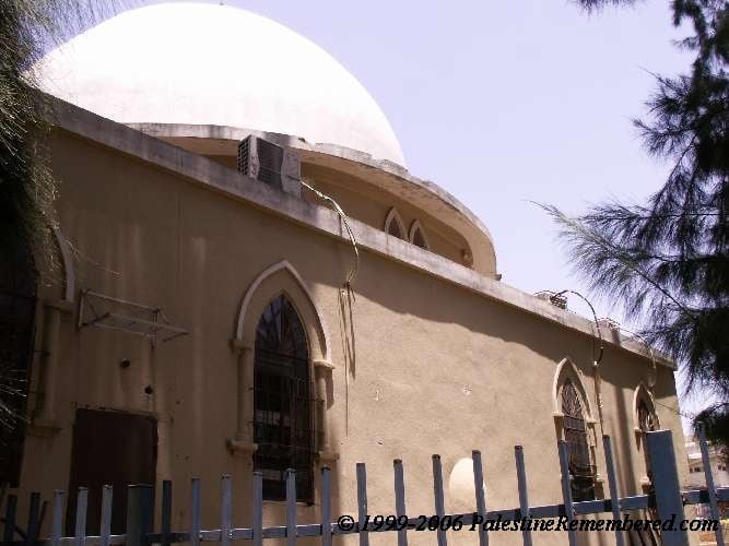
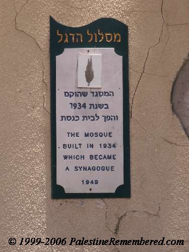
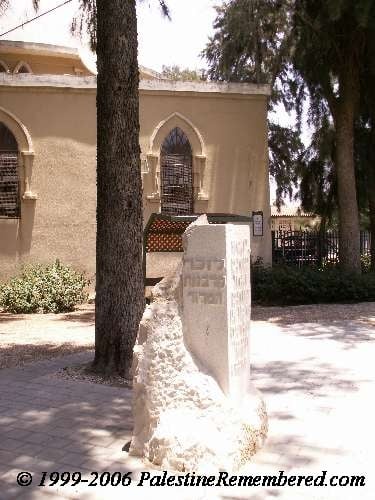
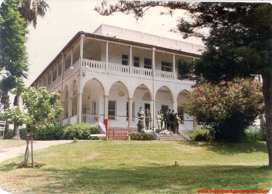
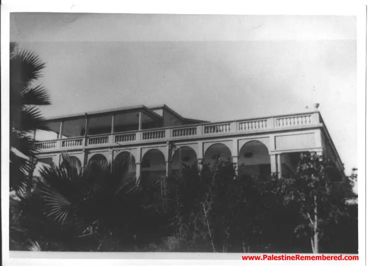
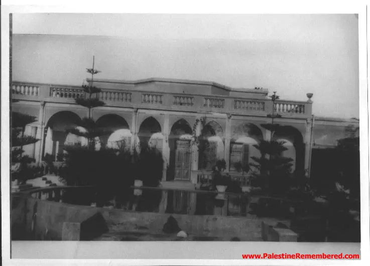
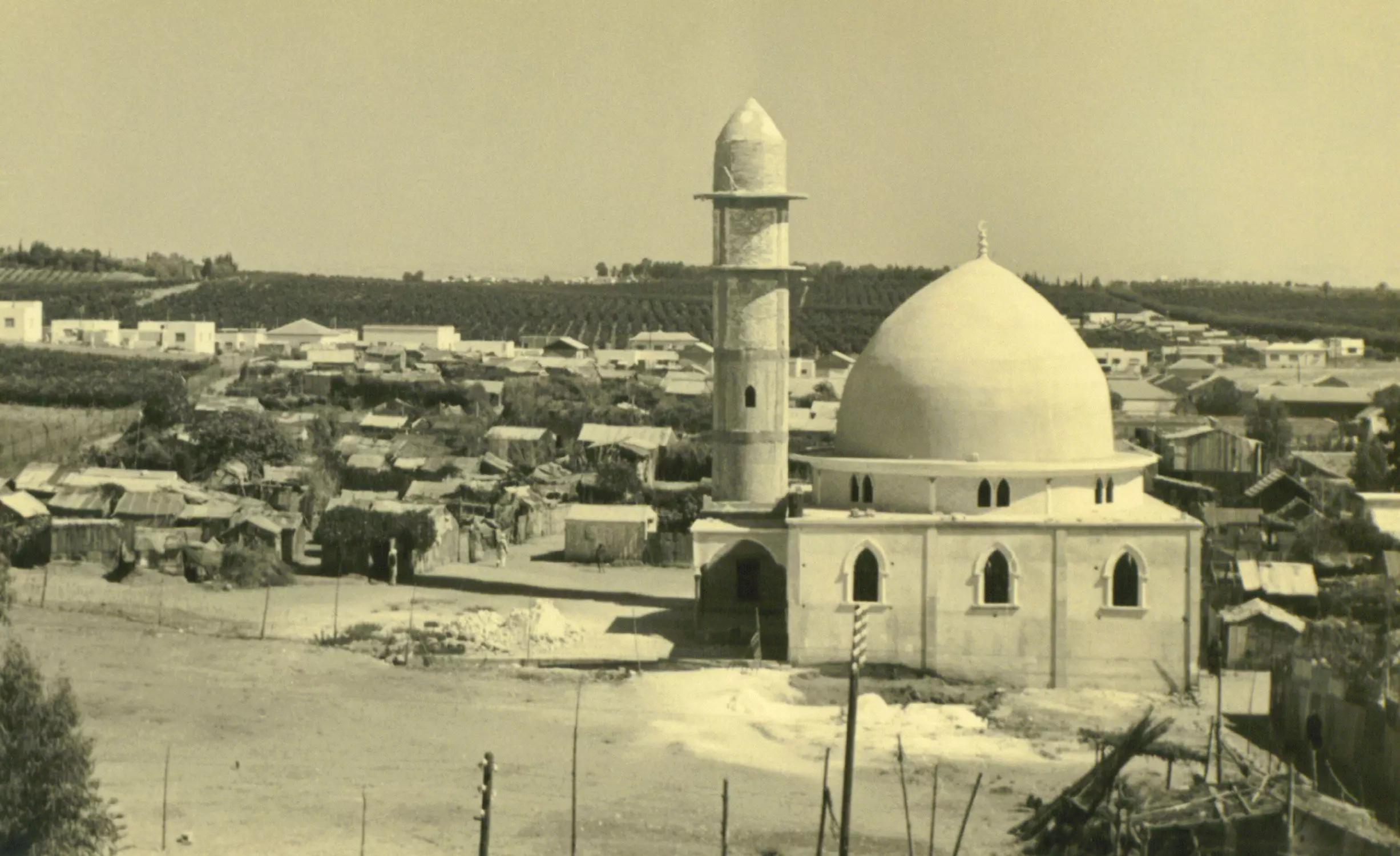
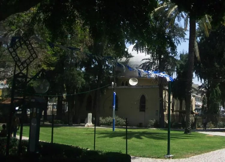
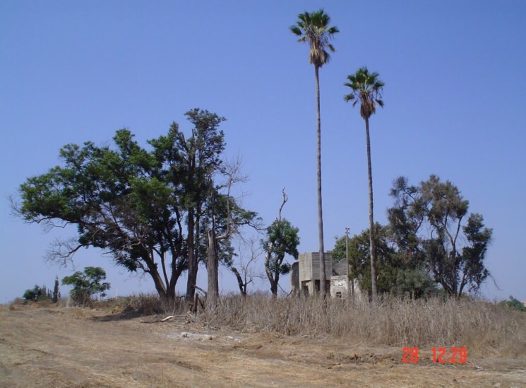
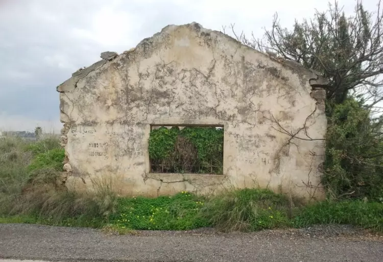
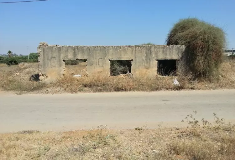
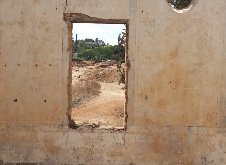
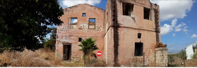
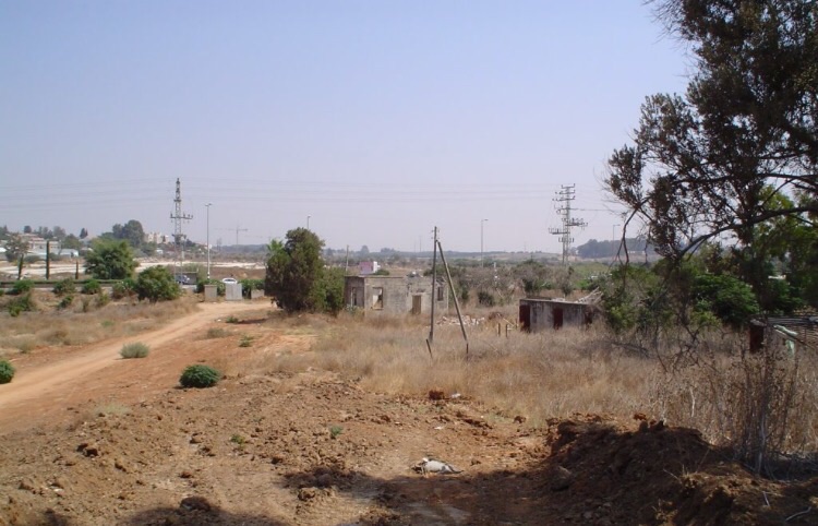
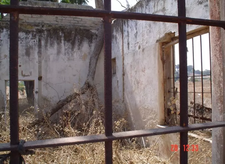
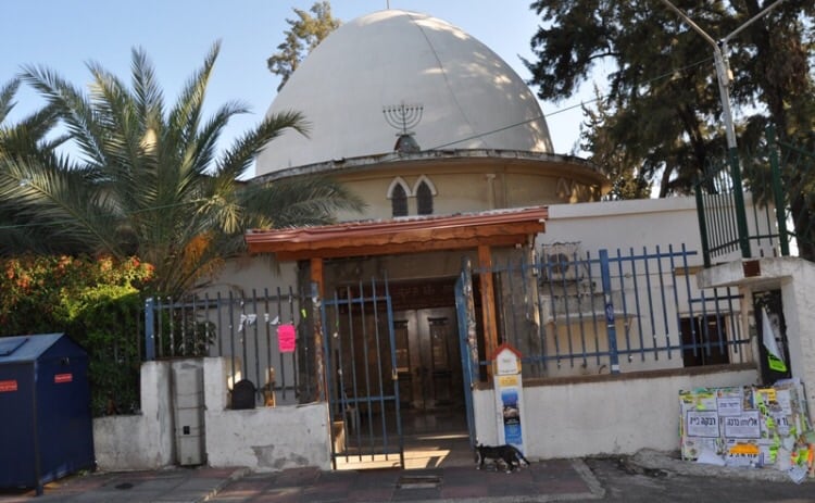
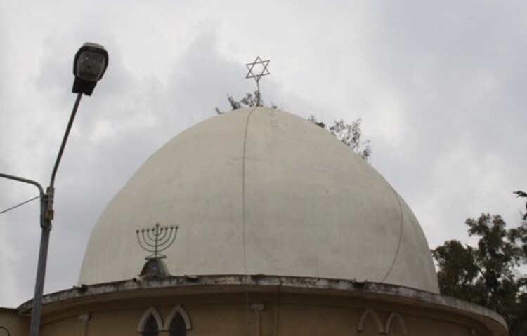
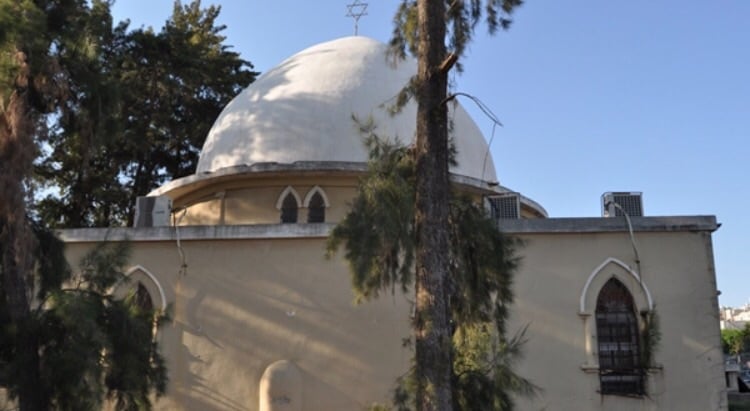
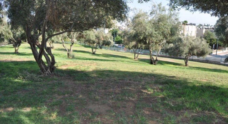
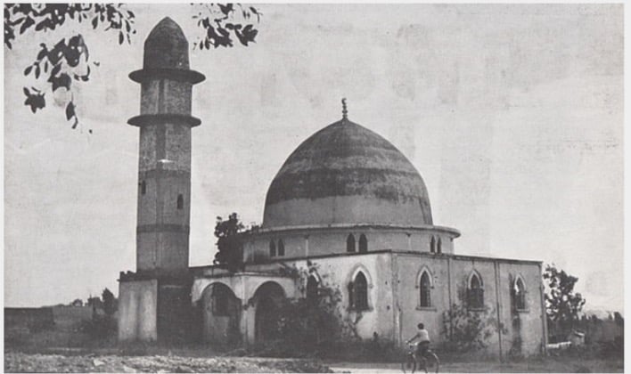
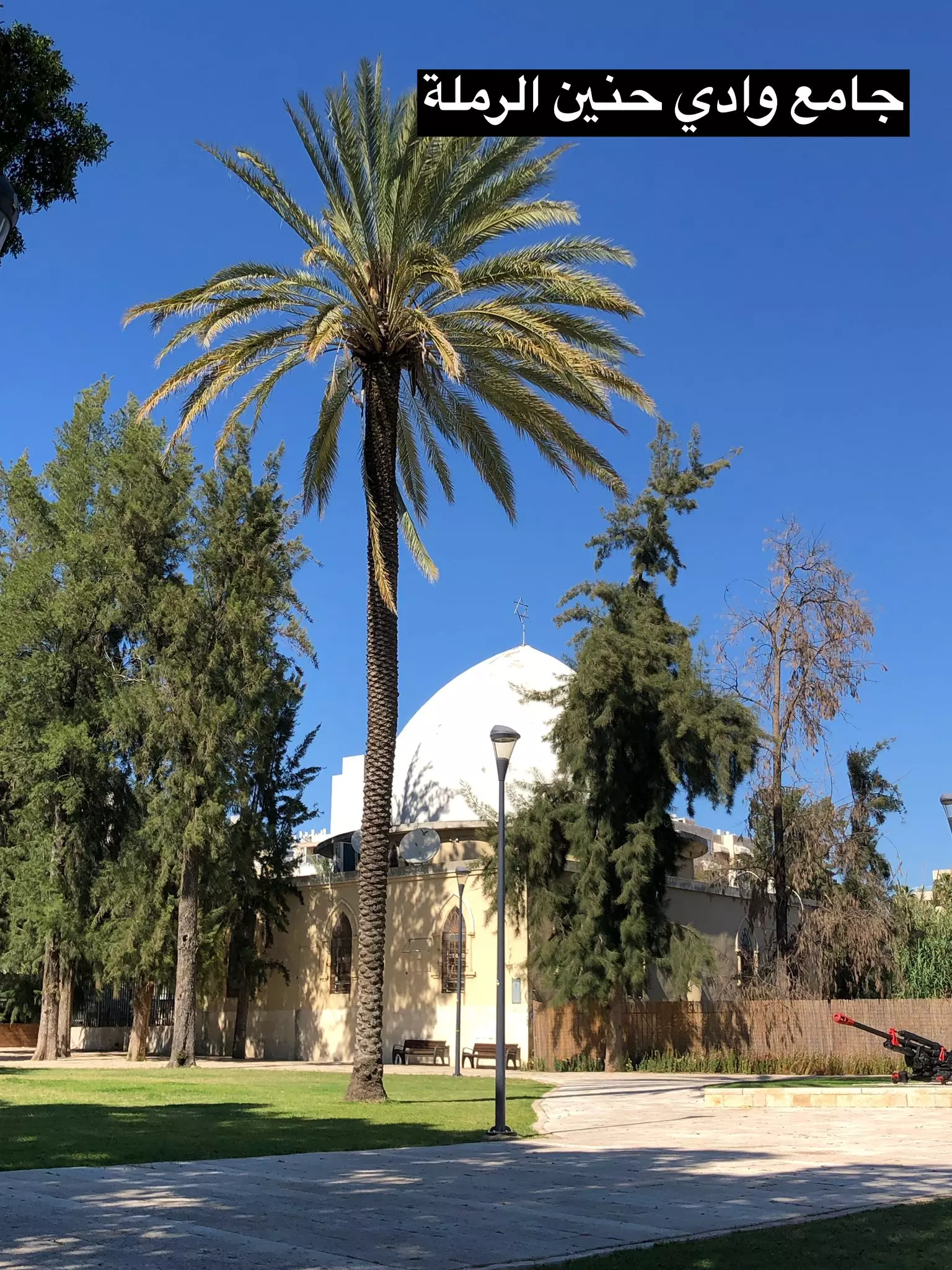
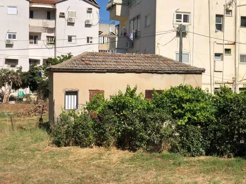
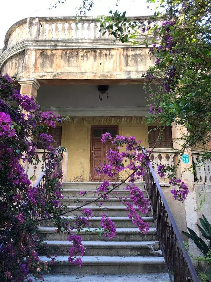
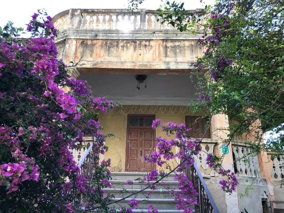
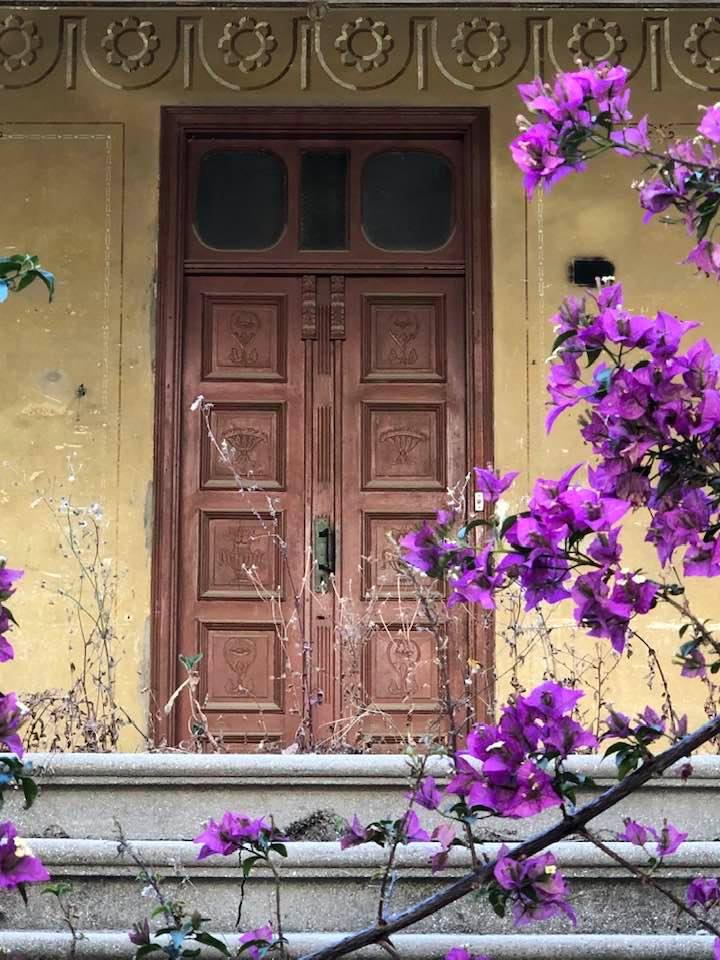
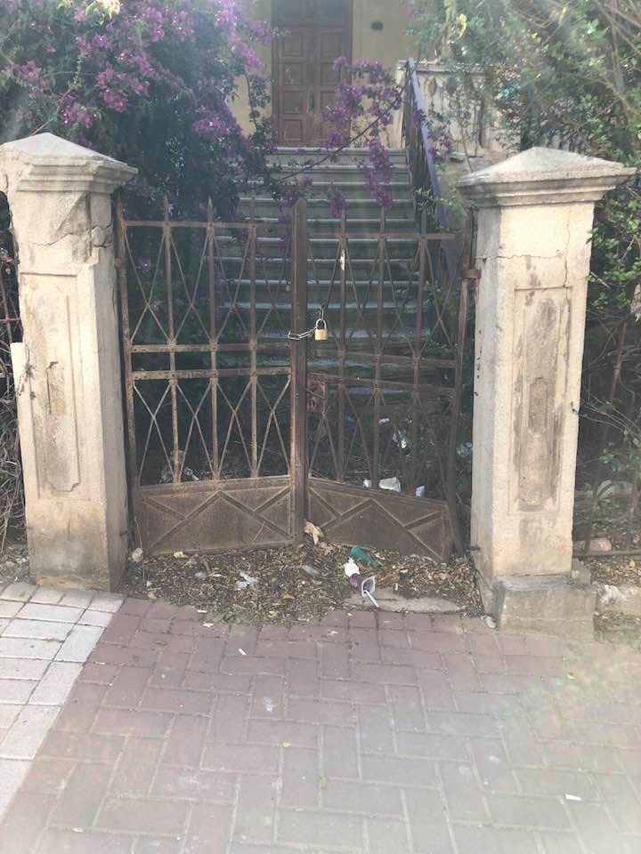
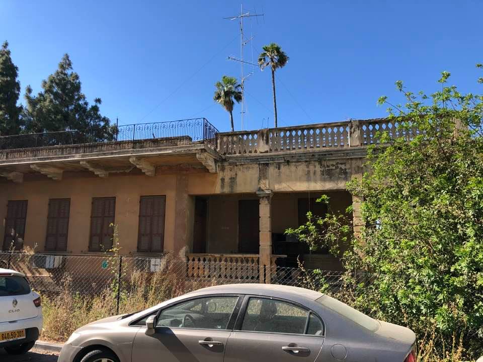
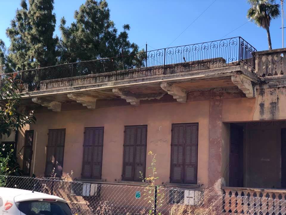
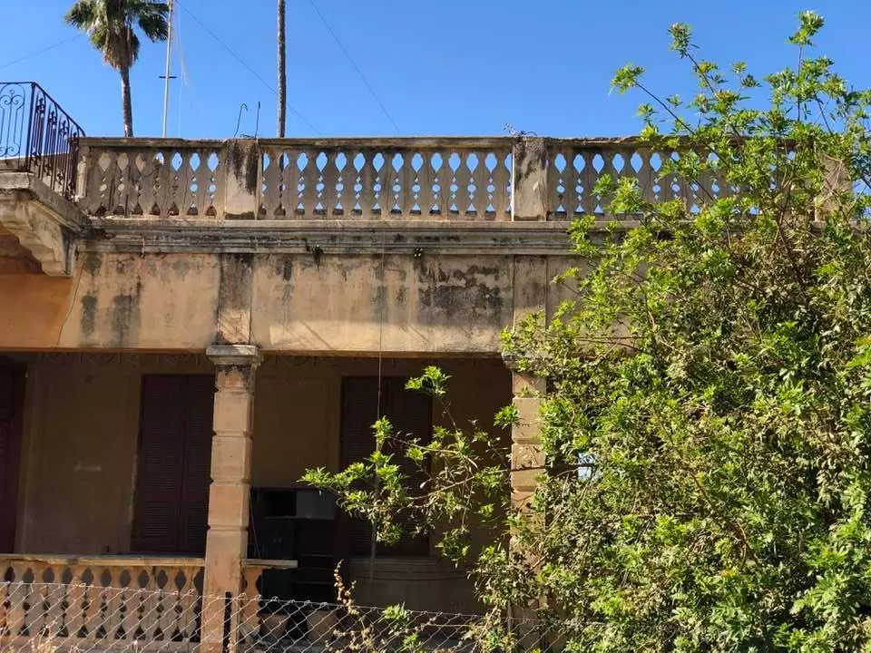
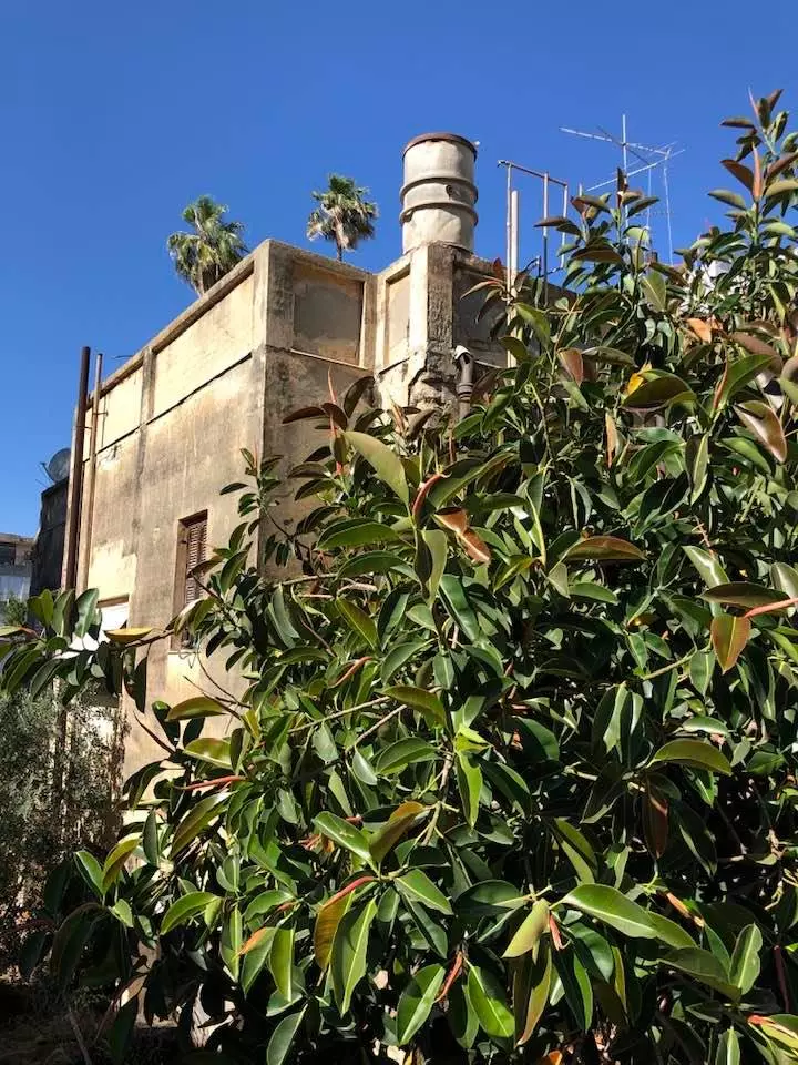
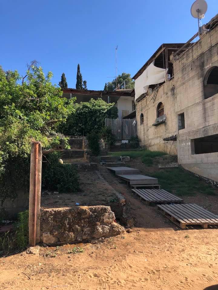
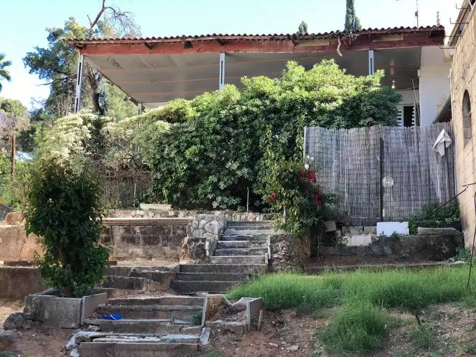
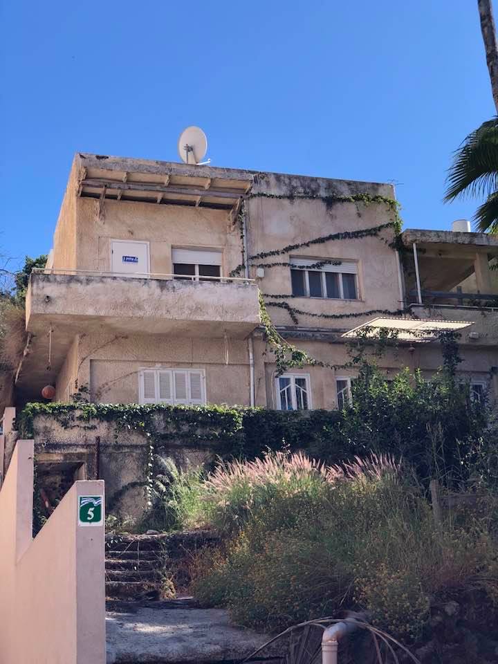
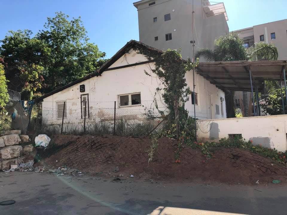
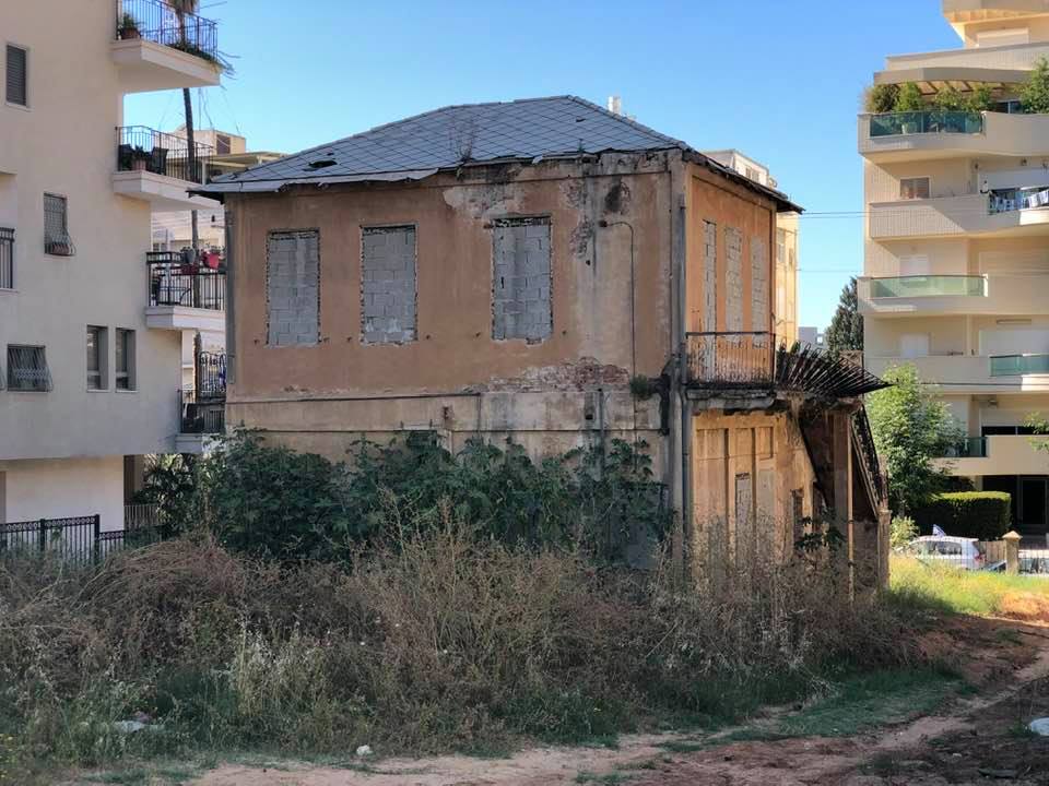
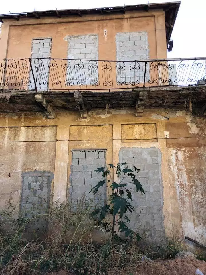
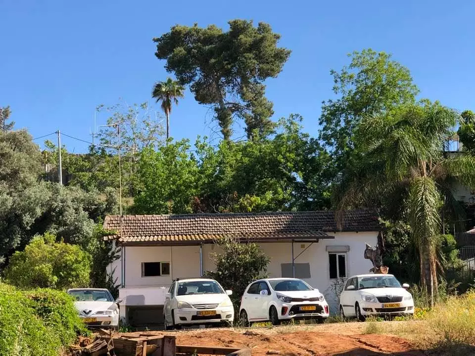
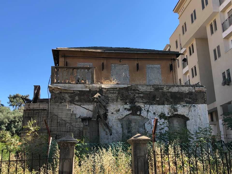
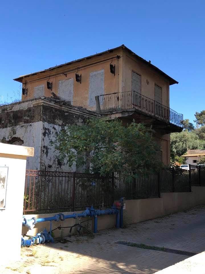
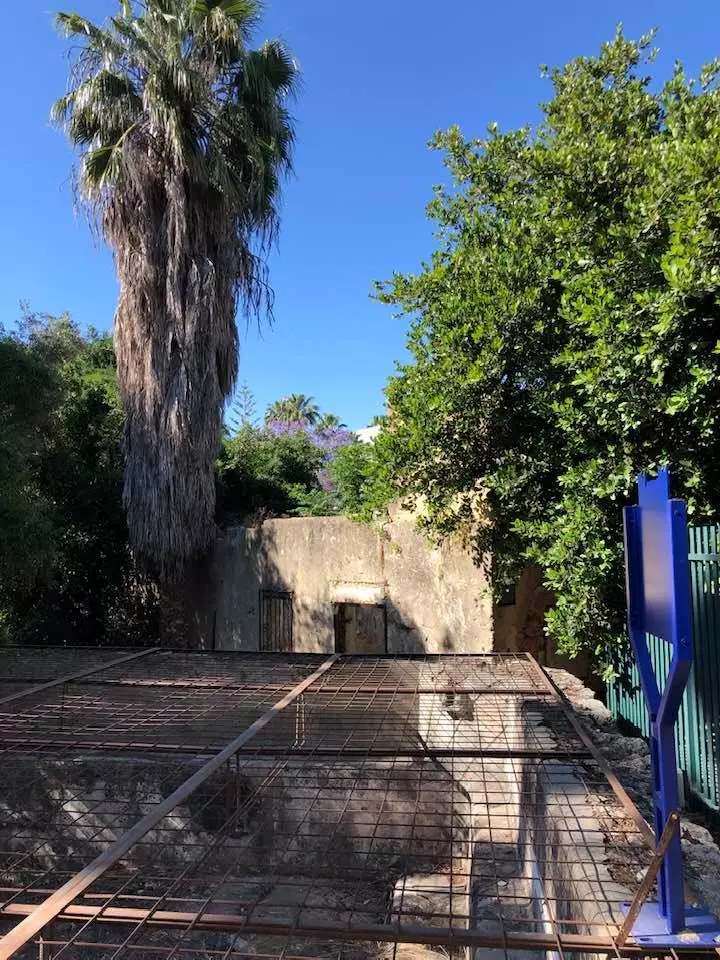
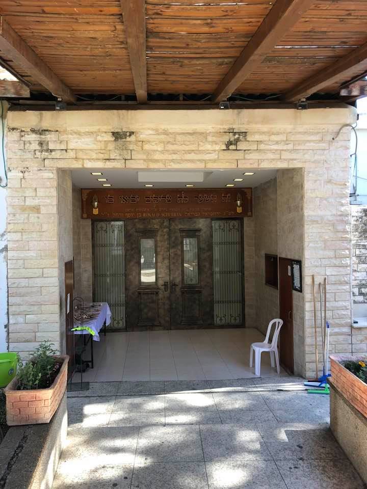
| Village Temains | Wadi Hunayn was mostly destroyed with exception of few of its houses and Mosque (now functions as a synagogue). One of the few surviving houses belongs to Shucri Beik al-Taji al-Farouki, which currently functions as the Weitzman Institute. See the Pictures section for details. | |||||||||||||||
| Ethnically Cleansing | Wadi Hunayn inhabitants were completely ethnically cleansed. | |||||||||||||||
| Clans | al-Farouki al-Tagi family | |||||||||||||||
| Pre-Nakba Land Ownership |
**Town Lands' Demarcation Maps |
|||||||||||||||
| Land Usage As of 1945 |
|
|||||||||||||||
| Population |
|
|||||||||||||||
| Number of Houses |
|
|||||||||||||||
| Near By Towns |
||||||||||||||||
|
||||||||||||||||
| Schools | The village students, numbering 65 in 1945, used to share a school at the nearby village of Sarafand al-Kharab. | |||||||||||||||
| Inhabitants Place of Origin | The Qada'a tribe settled the village in the early Islamic period and named the village after their native home, Wadi Hunayn, in Hadramawt (Yemen). | |||||||||||||||
| Places of Warship | One mosque which currently functions as a Jewish synagogue. | |||||||||||||||
| Exculsive Jewish Colonies Who Usurped Village Lands |
Nes Tziyyona | |||||||||||||||
| Featured Video | ||||||||||||||||
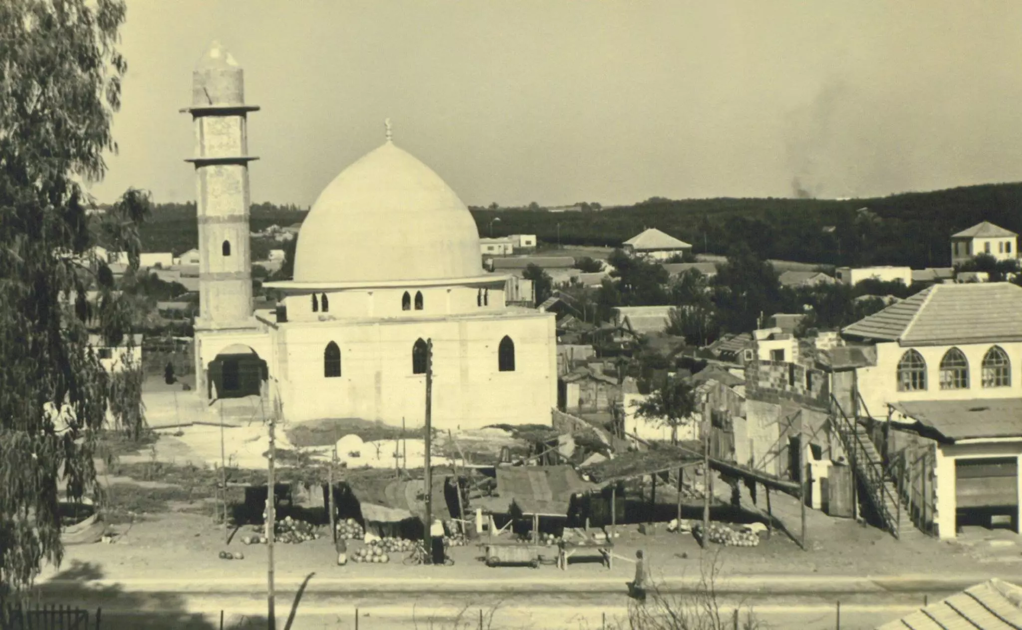
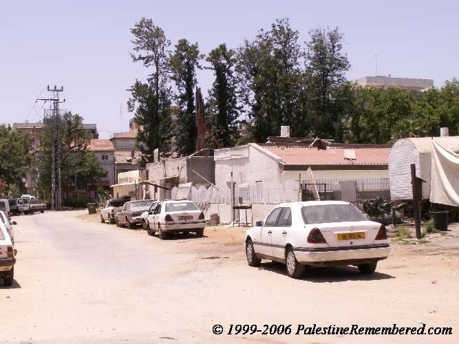
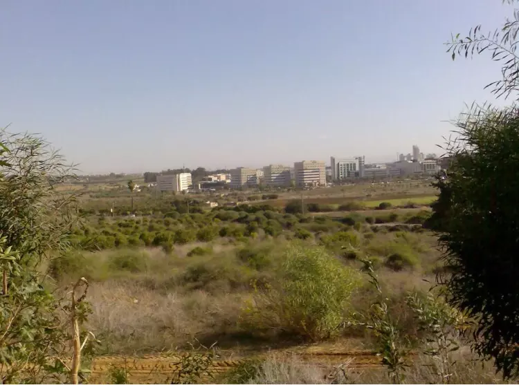
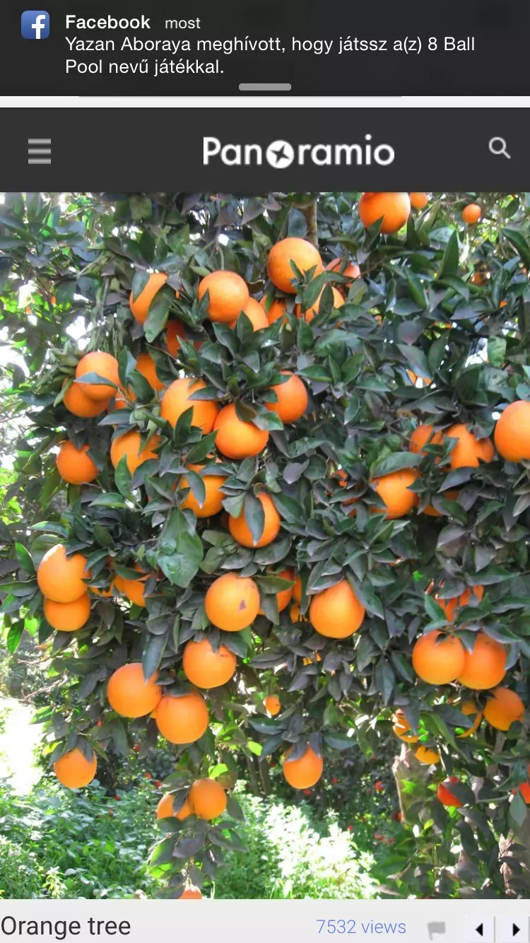
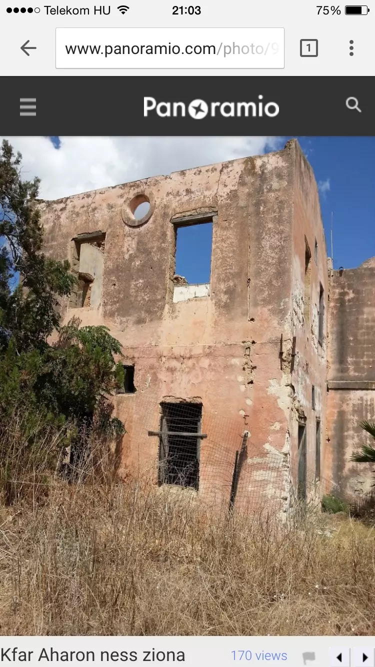
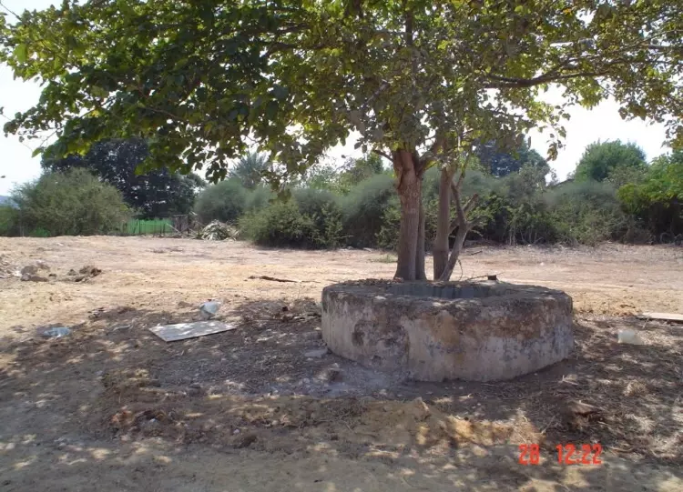
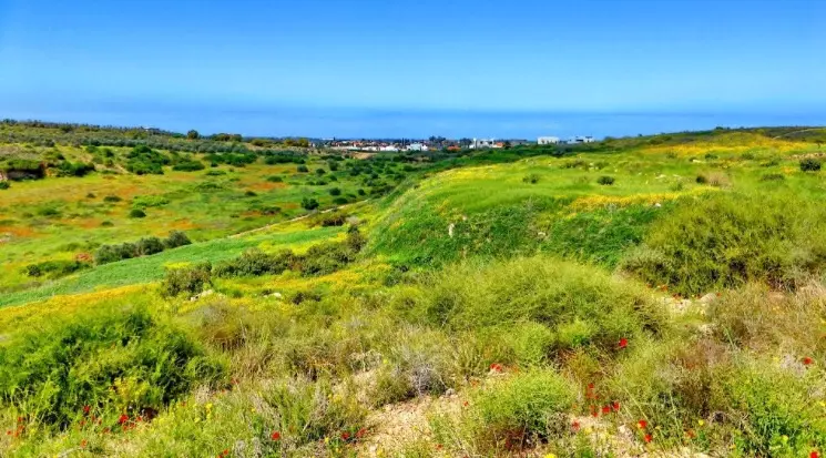
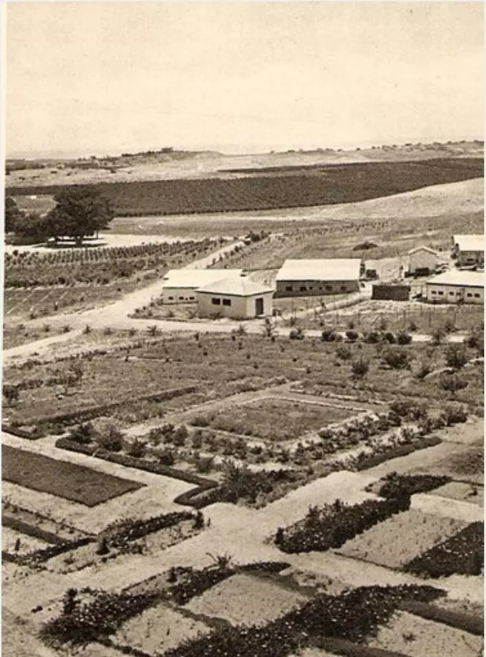
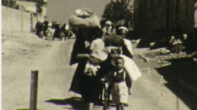
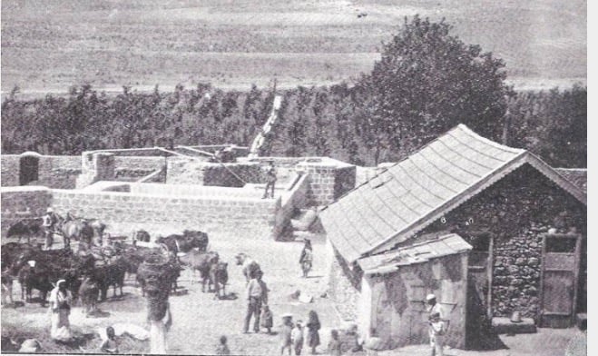
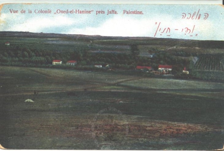
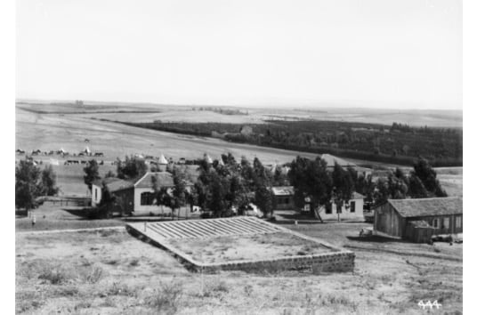
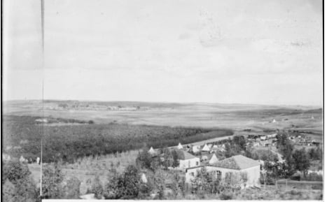
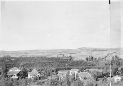
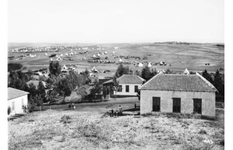
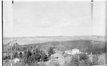
Village Before NakbaThe village was situated on flat terrain on the central coastal plain. It lay on the highway leading to al-Ramla, Jaffa, and other urban centers, and was linked to area villages by a variety of roads. In addition, the Lydda-Jaffa railway line ran about 1.5 km east of the village. There is a tradition that members of the Qada'a tribe settled the village in the early Islamic period and named it after their native home, Wadi Hunayn, in Hadramawt (Yemen). In modern times the village houses, made of mud, cement, and stone, were scattered randomly across the site. In the center of the village were a mosque and several shops. The entire population was Muslim. During the first decade of the twentieth century the citrus industry in the coastal region west of Wadi Hunayn began to expand, attracting workers from the surrounding area. Many Palestinians from other parts of the country came to work in citrus cultivation, and some of them settled in Wadi Hunayn. Zionist immigrants also arrived and took up residence in Nes Tziyyona, a settlement on land purchased from Wadi Hunayn in 1883. The influx of agricultural workers, who found employment in both Arab-owned citrus groves and those owned by the settlers of Nes Tziyyona, added to the population of Wadi Hunayn. During the first four decades of the twentieth century, the "liberal" policy of Nes Tziyyona was sharply criticized by leading Zionists because it did not exclude non-Jewish labor from Zionist enterprises. But the more general exclusionary policy would have been difficult to apply in Nes Tziyyona, since the settlement was located across the road from Wadi Hunayn. This was the only genuinely "mixed" locality in Palestine, where Zionist immigrants and Palestinians actually lived in close proximity. All of the village's sixty-five students attended the local school at nearby Sarafand al-Kharab in the mid-1940s. Its agricultural land was fairly flat and fertile. Citrus fruits were the major crop; citrus orchards were irrigated with water from the many artesian wells drilled around the village. The residents worked in the orchards and marketed their produce in the cities. In 1944/45 a total of 1,827 dunums was devoted to citrus and bananas and 134 dunums were allotted to cereals; 19 dunums were irrigated or used for orchards. Village Occupation and Ethnic CleaningIsraeli historian Benny Morris indicates that the villagers fled on 17 April 1948, under the influence of the capture or evacuation of a neighboring town. However, because there were no major Zionist operations in the vicinity at this time, the identity of the neighboring town is unclear. The closest threat to the villagers was some distance to the east, in the Jerusalem corridor, where the Giv'ati Brigade had just concluded Operation Nachshon (see Bayt Naqquba, Jerusalem sub-disctrict) and where the Deir Yasin massacre had taken place over a week earlier. The only other village in the area that may have been depopulated at the same time is Sarafand al-Kharab, which is reported to have been evacuated on 20 April, out of fear of a Zionist attack. If these dates are accurate, it is possible both Wadi Hunayn and Sarafand al-Kharab were targeted or threatened in the course of the Haganah's coastal 'clearing' campaign in April and early Mayor during the encirclement of Jaffa in the second half of April Zionists Colonies on Village LandsThe settlement of Nes Tziyyona (130148), on the west side of the Gaza-Jaffa coastal road, was established in 1883. As it expanded, its buildings encroached on village land. Kefar Aharon, established in 1948 on village lands, has been merged with Nes Tziyyona.l Village TodayThe mosque has been converted into a synagogue, Gulat Yisra'el (see photo). About ten houses survive. One of them, which belonged to Shaykh Sulayman al-Faruqi, is now inhabited by Jewish families. It is a two-story house that looks like an apartment building and is divided into five units, each with a small front porch. The gable-roofed, elaborate house of ibn Hamid has been converted into a mental hospital. The palatial house of Abu 'Umar Effendi is utilized for unspecified purposes by the Israeli military and cannot be photographed. Castor oil (ricinus) plants and batches of cypress and mulberry trees are visible on the site, and the surrounding land is cultivated. SourceDr. Walid al-Khalidi, 1992: All That Remains. |
||||||||||||||||
| Related Maps | Town Lands' Demarcation Maps خرائط للقضاء توضح حدود القرى والاودية Town's map on MapQuest View from satellite Help us map this town at WikiMapia |
|||||||||||||||
| Related Links | Wikipedia's Page Google Search Google For Images Google For Videos |
|||||||||||||||
| More Information | في كتاب كي لا ننسى في كتاب بلادنا فلسطين المزيد من موقع هوية |
|||||||||||||||
- Wadi Hunayn's Moaque #2
Posted by Uri Zackhem - منظرعام ١٩٣٠ ويظهر الجامع الذي تحول لكنيس الآن
- Village Mosque Now A Synagogue In 1987
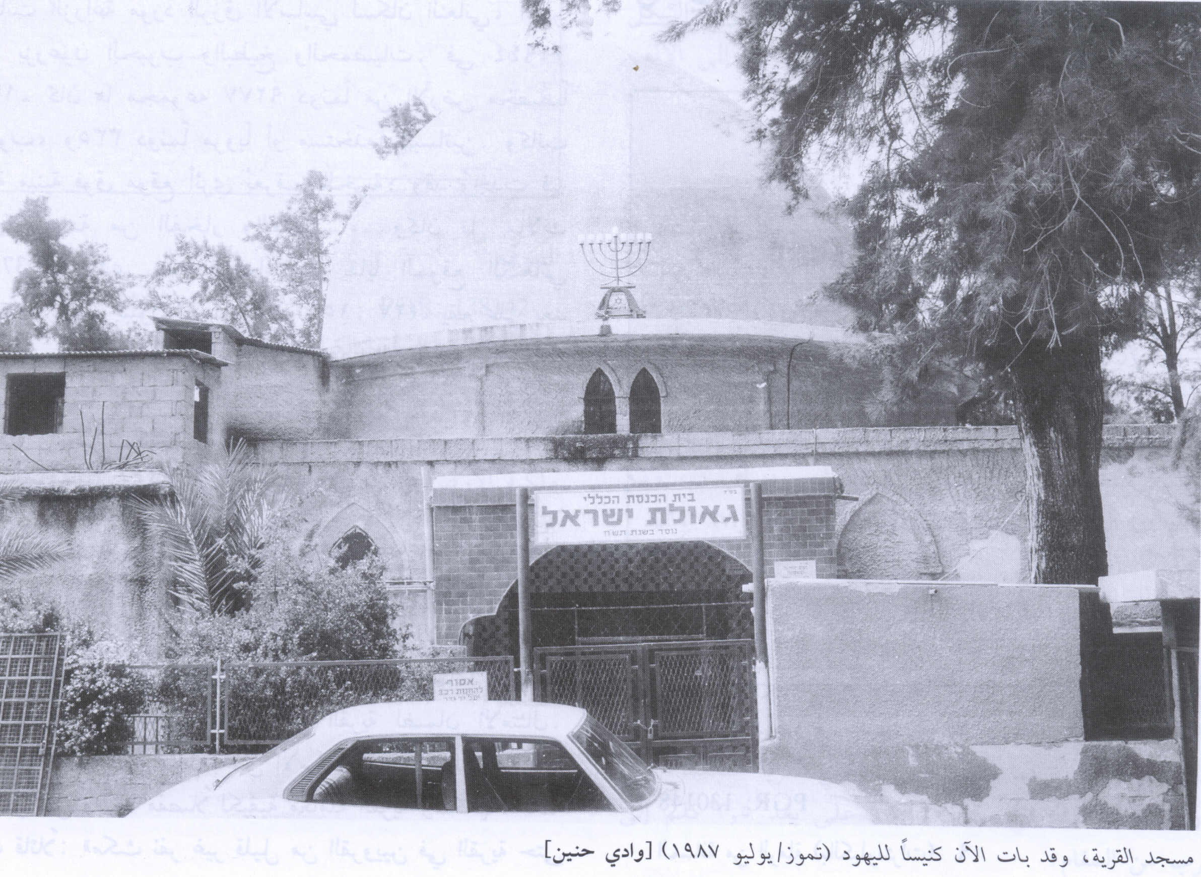
Scanned from "All That Remains" by Dr. Walid Khalidi 3 - Wadi Hunayn's Moaque #1
Posted by Uri Zackhem - Wadi Hunayn's Moaque #3
Posted by Uri Zackhem - Wadi Hunayn's Moaque #4
Posted by Uri Zackhem - A picture of al-Taji family house
Posted by Abd El-Rahman 26 - A picture of Shucri al-Taji's house before 1948 #1
Posted by Ahmed Shucri Taji Farouki 3 - A picture of Shucri al-Taji's house before 1948 #2
Posted by Ahmed Shucri Taji Farouki 1 - Inside the village
Posted by Uri Zackhem - A picture of Shucri al-Taji's house before 1948 #3
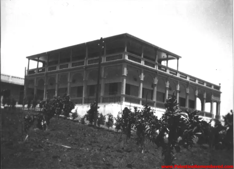
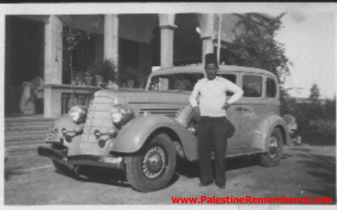
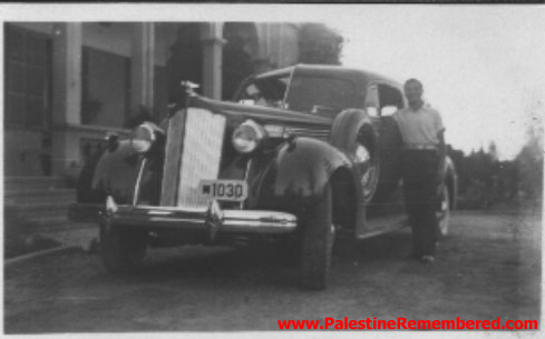
Posted by Ahmed Shucri Taji Farouki - Shucri Beik's old cars before 1948
Posted by Ahmed Shucri Taji Farouki - Ghaleb Shukri el-Taji el-Farouki in front of his father's residence before 1948
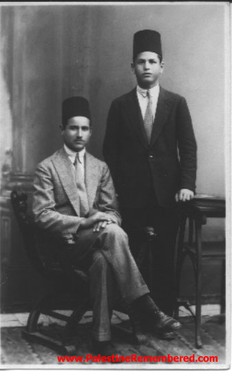
Posted by Ahmed Shucri Taji Farouki 1 - Nour el-Dine al-Taji & Awni Husseini taken in April 18th 1930
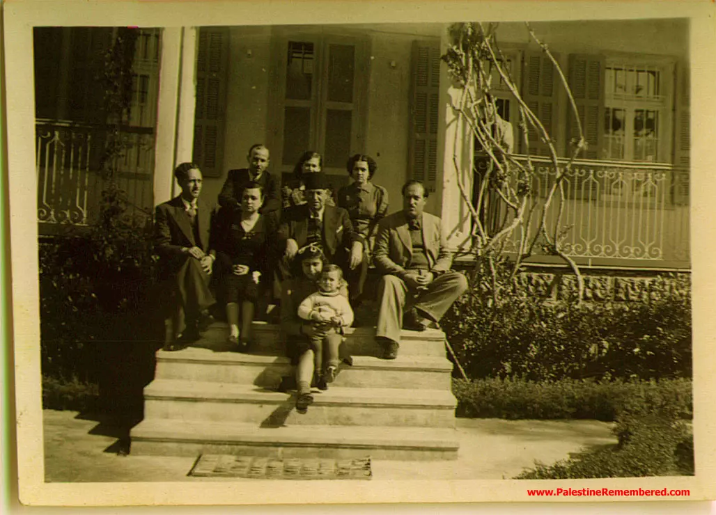
Posted by Ahmed Shucri Taji Farouki - Abdel Rahman Taji's Family on stairs of Wadi Hunain Mansion 1936
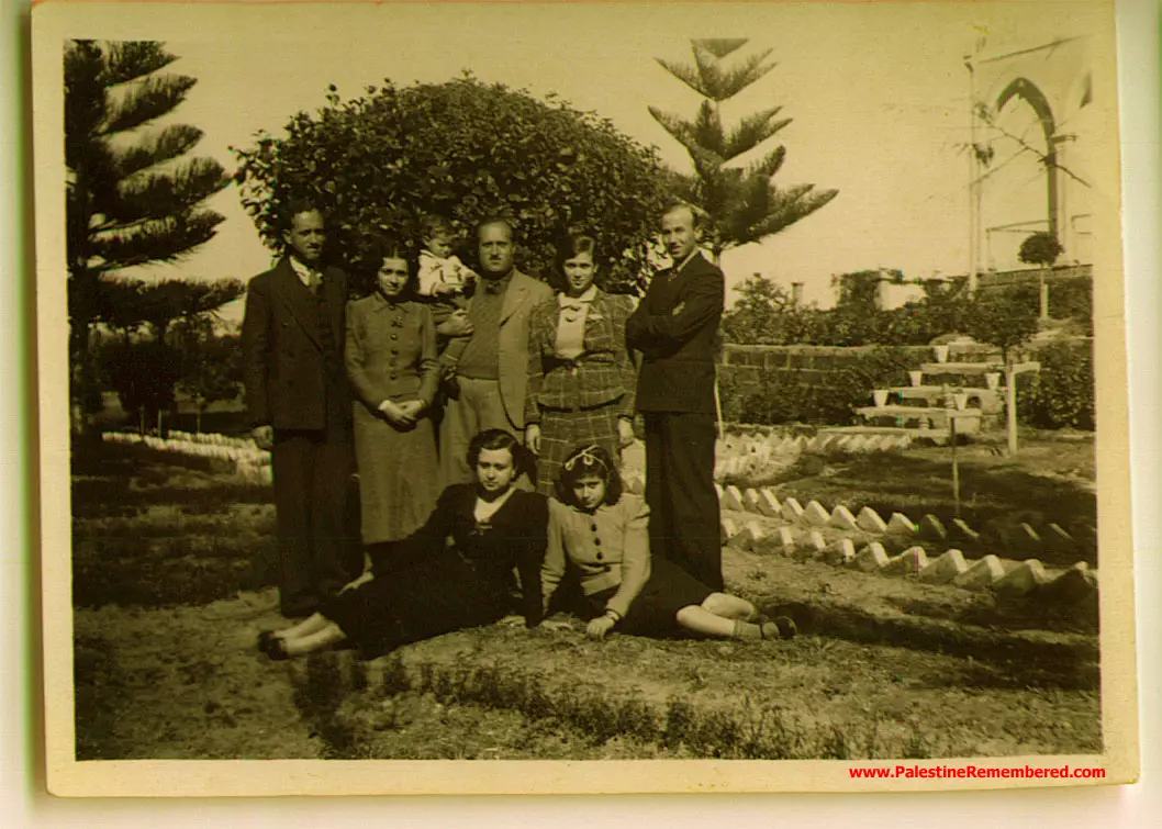
Posted by Said Husseini - Abdel Rahman Taji Family on Lawn of Wadi Hunain Mansion 1936
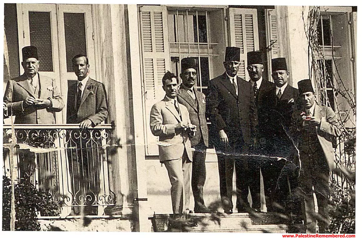
Posted by Said Husseini 3 - Abdel Rahman Taji and Palestinian Notables in Wadi Hunain
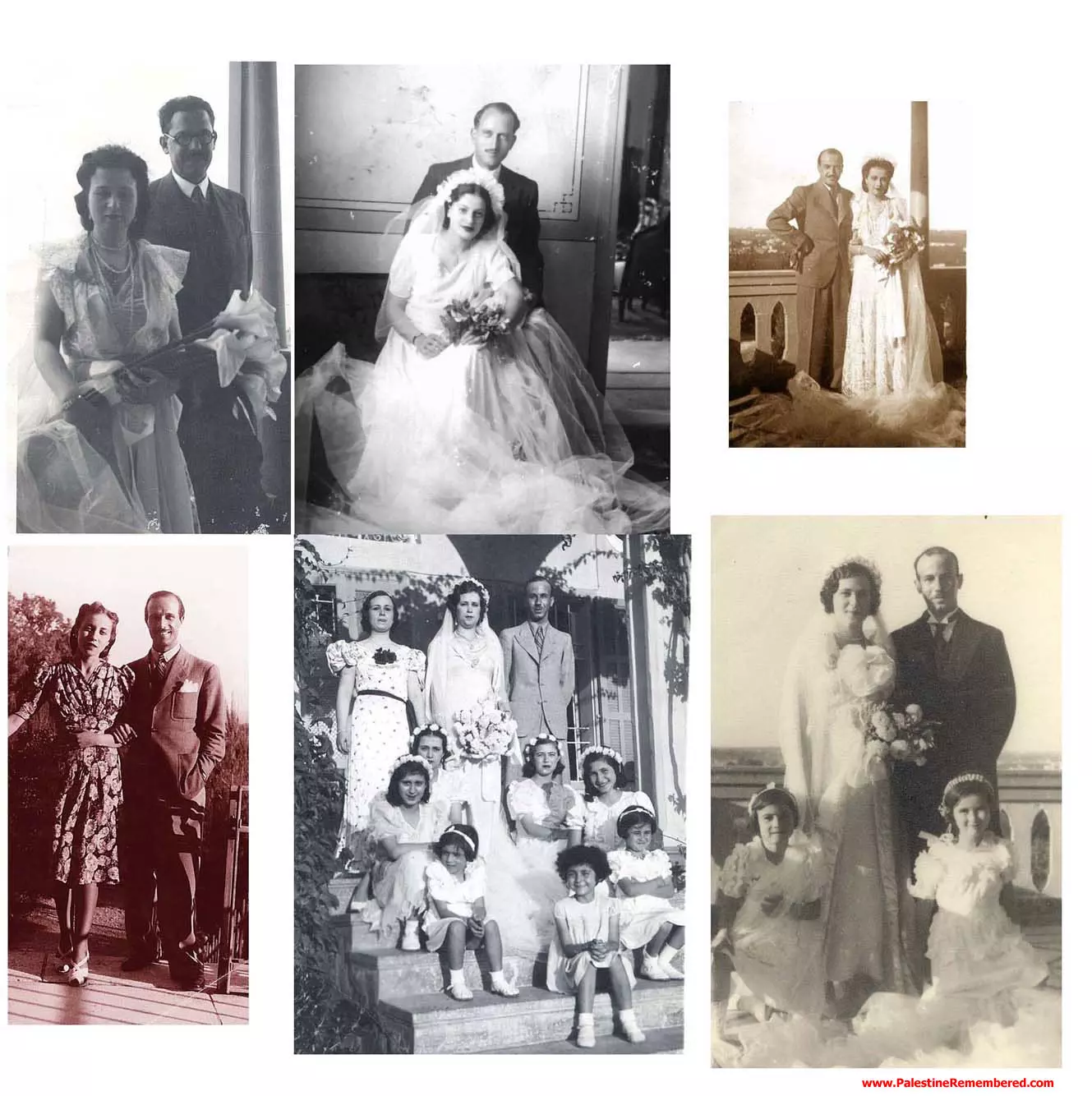
Posted by Said Husseini - Weddings in Wadi Hunain
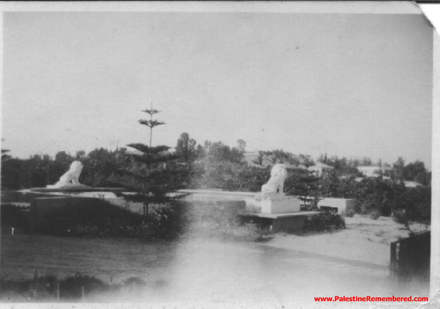
Posted by Said Husseini - The two famous lions over-looking Shucri's Bayyara
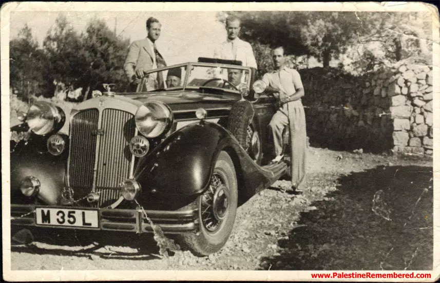
Posted by Ahmed Shucri Taji Farouki 1 - The Taji Brothers in their Horch car in Wadi-Hunain
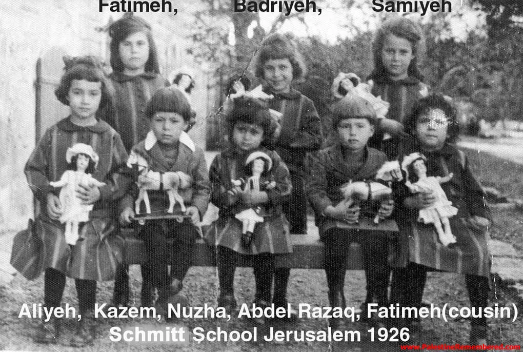
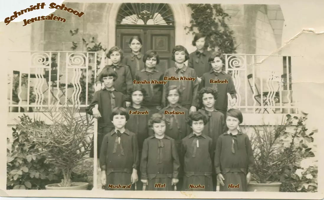
Posted by Said Husseini - Taji Children at Schmitt School In Jerusalem 1926
Posted by Said Husseini 1 - Pictures of Tajis & Family at Wadi Hunain

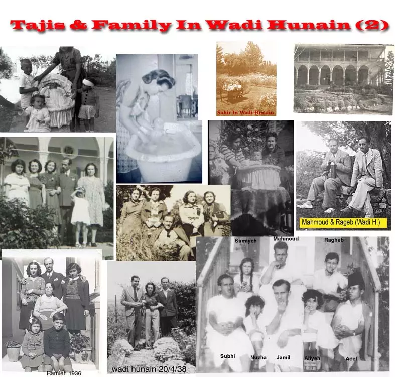
Posted by Said Husseini - Pictures Of Tajis & Family at Wadi Hunain (2)
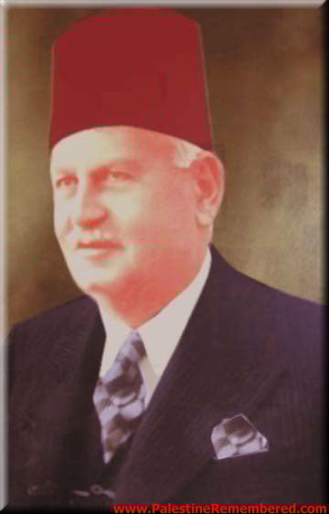
Posted by Said Husseini - Portrait of Abdel Rahman El Taji (Wadi Hunain)
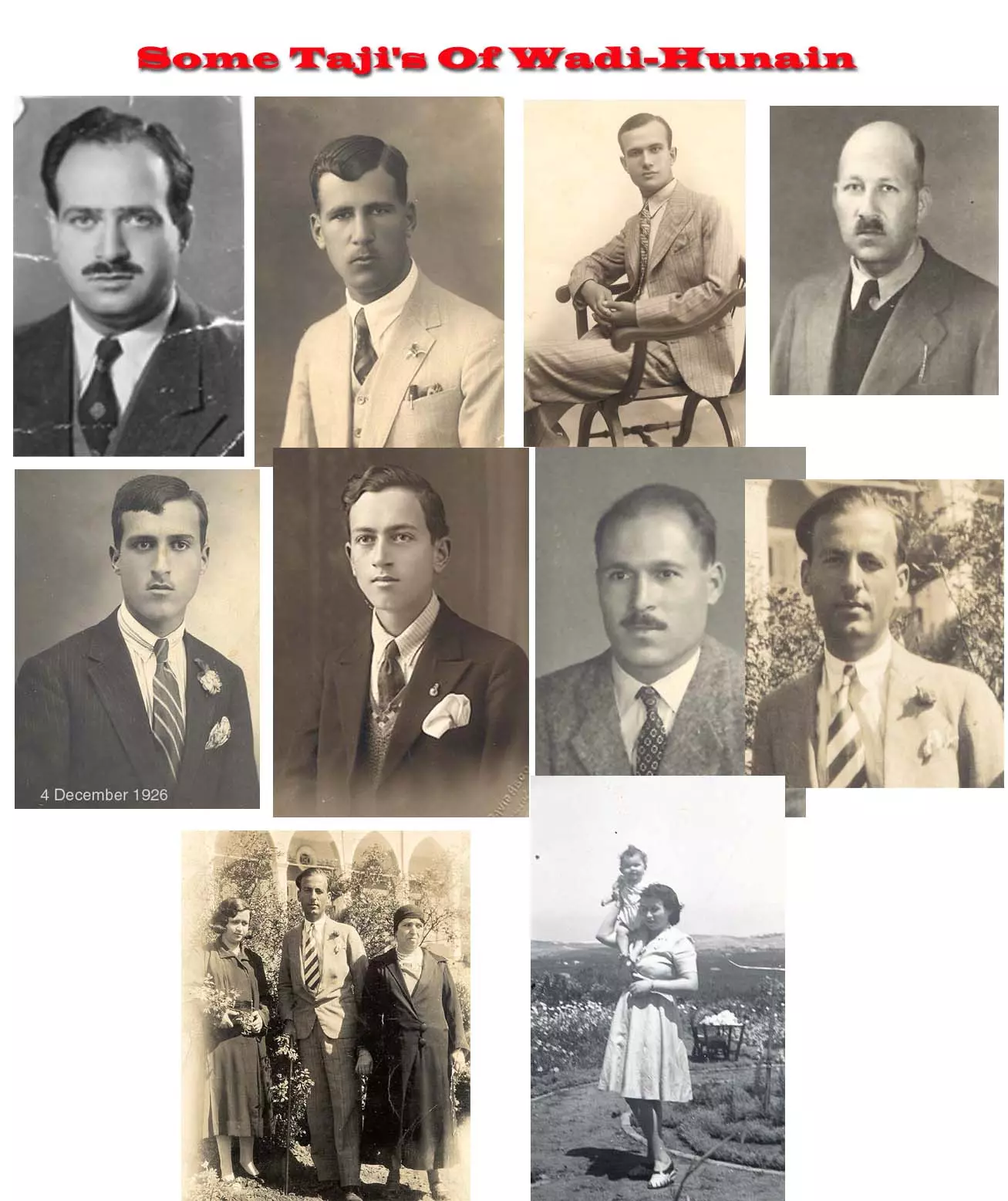
Posted by Said Husseini - Some of the Taji Family Of Wadi Hunain
Posted by Said Husseini - Abd-El-Rahman Nafez Taji El-Farouqi
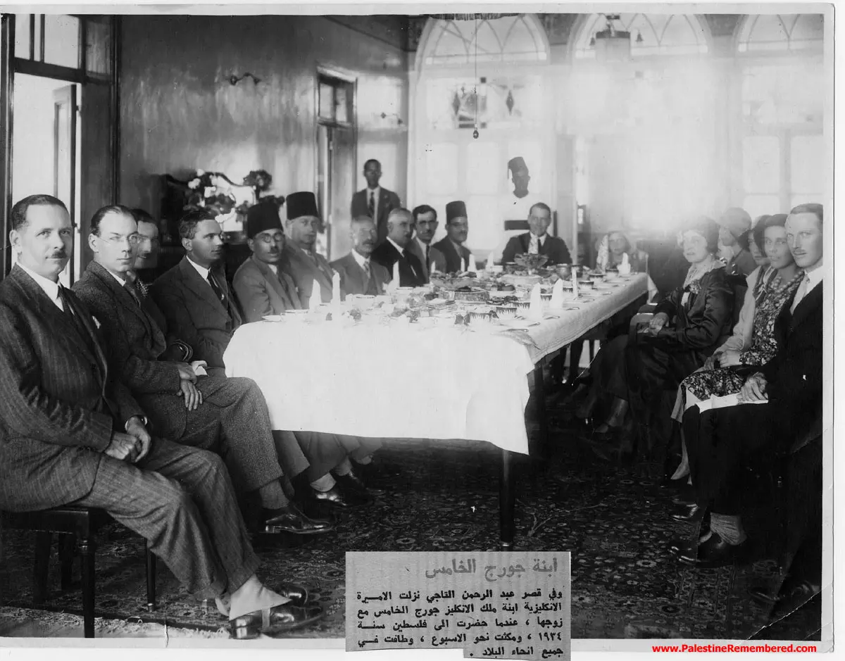
Posted by Abd El-Rahman - A visit of the daughter of King George (V) to Wadi Hunain
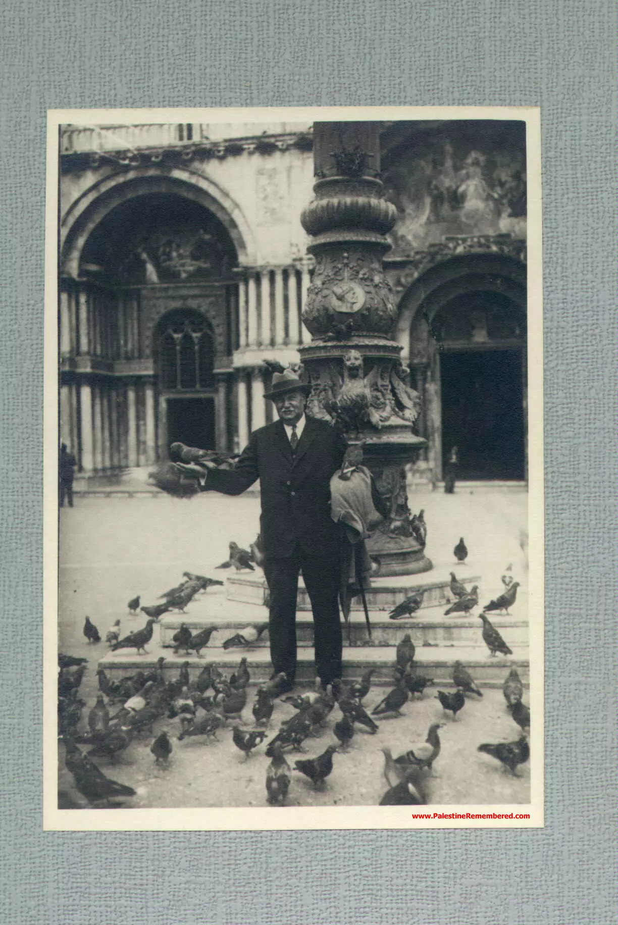
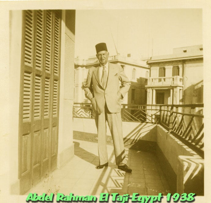
Posted by Said Husseini 1 - Abdel Rahman El Taji In Egypt 1938
Posted by Said Husseini - Class of 1926 in Schmidts School Jerusalem
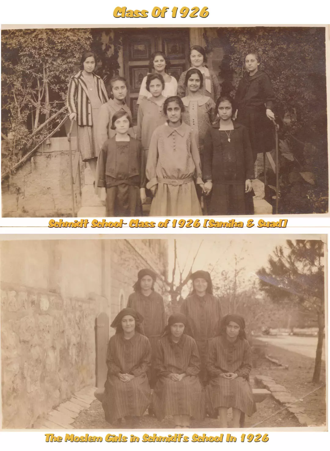
Posted by Said Husseini - Palestinian Girls In Schmidts School Jerusalem 1926-1928
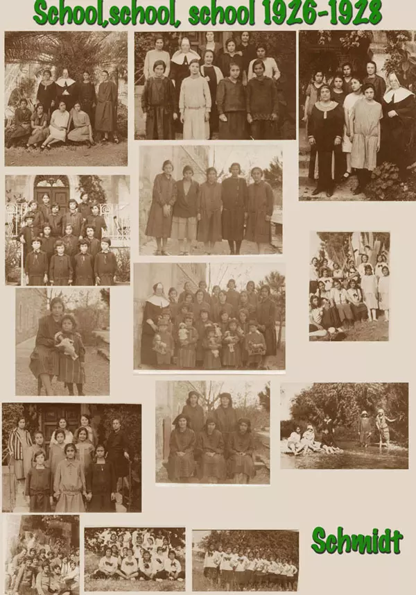
Posted by Said Husseini - A class in Schmidts School 1928
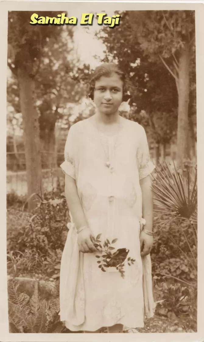
Posted by Said Husseini - Samiha El Taji (Ramleh-Palestine)
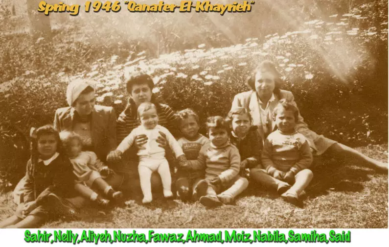
Posted by Said Husseini 1 - A Palestinian family visiting Qanater In Egypt
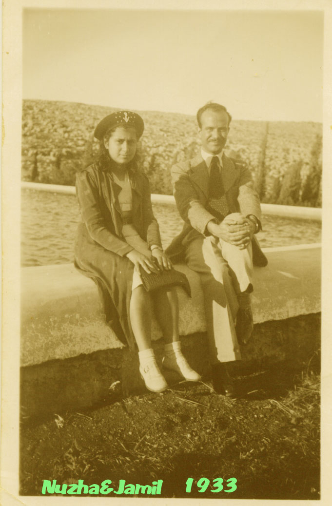
Posted by Said Husseini - Nuzha and Jamil Taji 1933
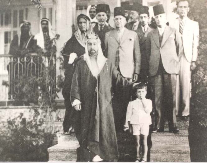
Posted by Said Husseini - Abd-El-Rahman Taji & H.M. King Abdullah
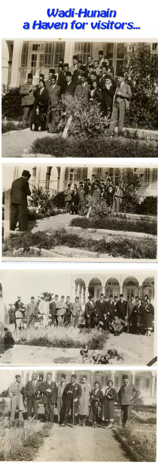
Posted by Abd El-Rahman - wadi-Hunain a haven for visitors
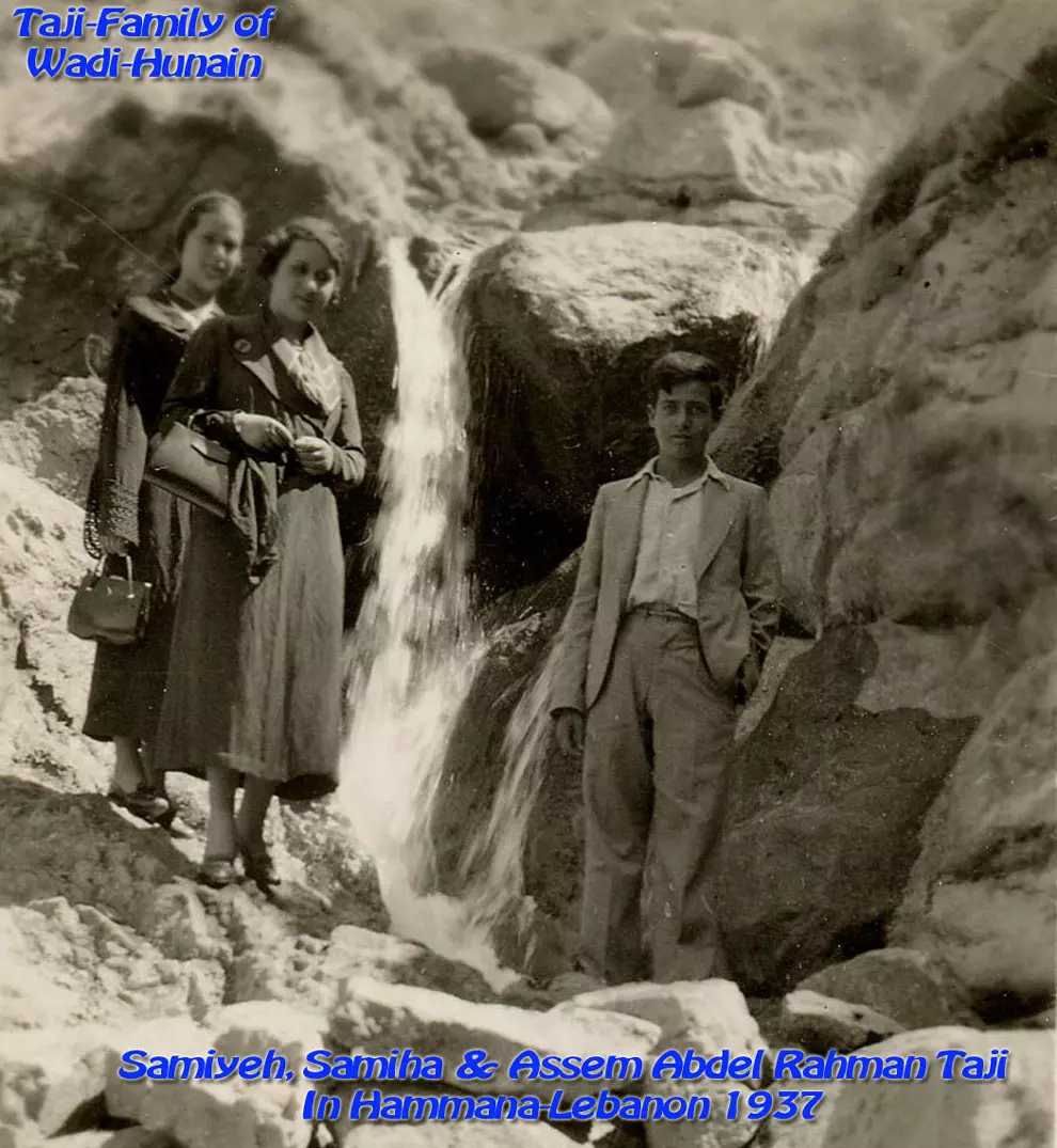
Posted by Said Husseini - Taji Family in Hammana Lebanon
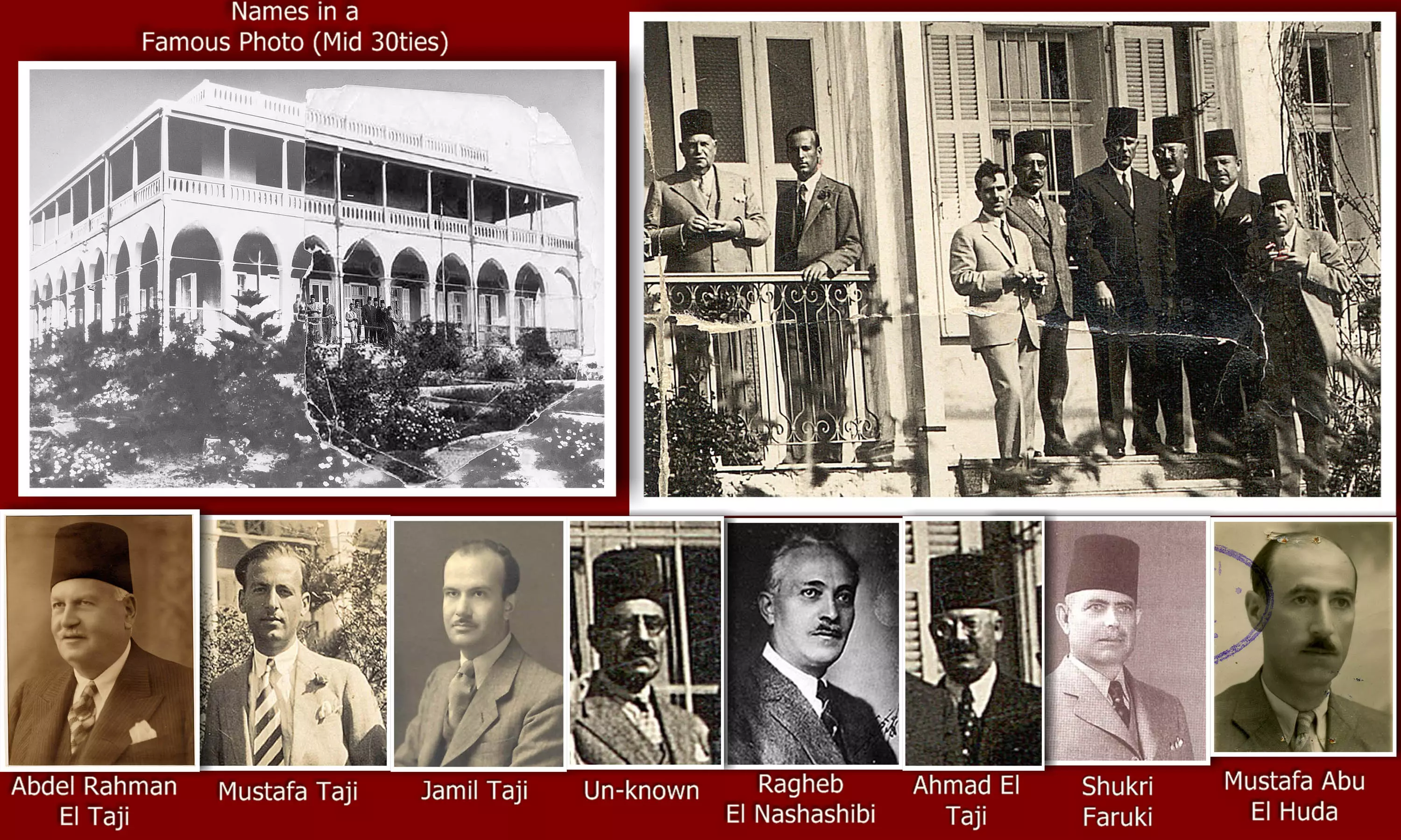
Posted by Said Husseini 1 - Names of Palestinian Notables in a famous photo- Wadi Hunain
Posted by Said Husseini 1 - The Abdel Rahman Taji Family from Wadi Hunayn
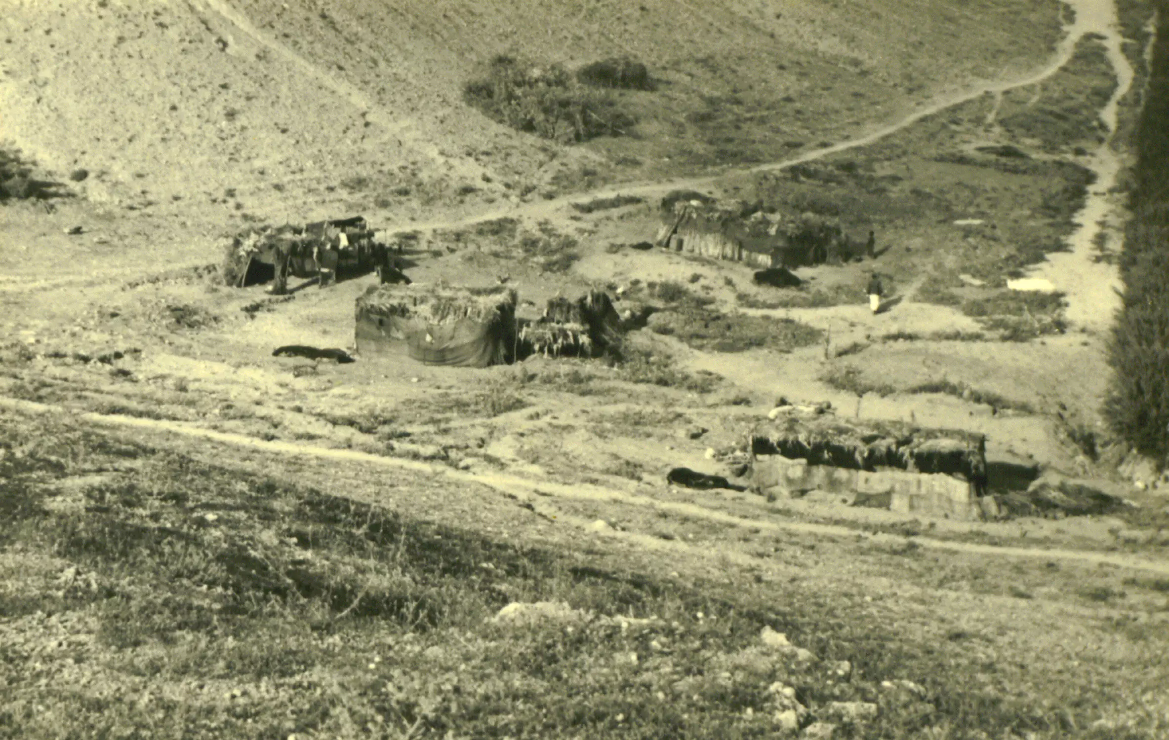
Posted by Said Husseini - Wadi Hunayn bedouins
Posted by Ido Shtern - Wadi Hunayn mosque, late 1930s

Posted by Ido Shtern - another view on Wadi Hunayn mosque, late 1930s
Posted by Ido Shtern - مسجد القريه تم تحويله لكنيس يهودي
Posted by abu raya - من موقع القريه
Posted by abu raya - التله غرب القريه
Posted by abu raya - اراضي القريه
Posted by abu raya - برتقال القريه
Posted by abu raya - بيت قديم من جنوب القريه
Posted by abu raya - من جنوب القريه
Posted by abu raya - بيت قديم جنوب القريه
Posted by abu raya - جنوب القريه
Posted by abu raya - جنوب القريه
Posted by abu raya - من جنوب القريه
Posted by abu raya - بيوت قديمه جنوب القريه
Posted by abu raya - من القريه
Posted by abu raya - بقايا بيت قديم من جنوب القريه
Posted by abu raya - اراضي القريه من الجنوب
Posted by abu raya - من غرب القريه
Posted by abu raya - مسجد القريه
Posted by abu raya - قبه مسجد القريه
Posted by abu raya - مسجد القريه
Posted by abu raya - موقع مقبره القريه
Posted by abu raya - وادي حنين قبل النكبه
Posted by abu raya - العصابات الصهيونيه امام بيت التاجي بعد احتلال القريه
Posted by abu raya - صوره حزينه ليوم تهجير اهالي القريه
Posted by abu raya - صوره من القريه قبل النكبه
Posted by abu raya - مسجد القريه قبل النكبه
Posted by abu raya - القريه واراضيها قبل النكبه
Posted by abu raya - صوره لقريه وادي حنين سنه 1918
Posted by abu raya - قريه وادي حنين قبل النكبه
Posted by abu raya - صوره قديمه لوادي حنين وبياراتها قبل النكبه
Posted by abu raya - منظر عام لقريه وادي حنين سنه 1918
Posted by abu raya - قريه وادي حنين وبيارتها قبل النكبه
Posted by abu raya - منزل قديم في وادي حنين الفلسطينية المهجرة
- منزل قديم في وادي حنين الفلسطينية المهجرة #2
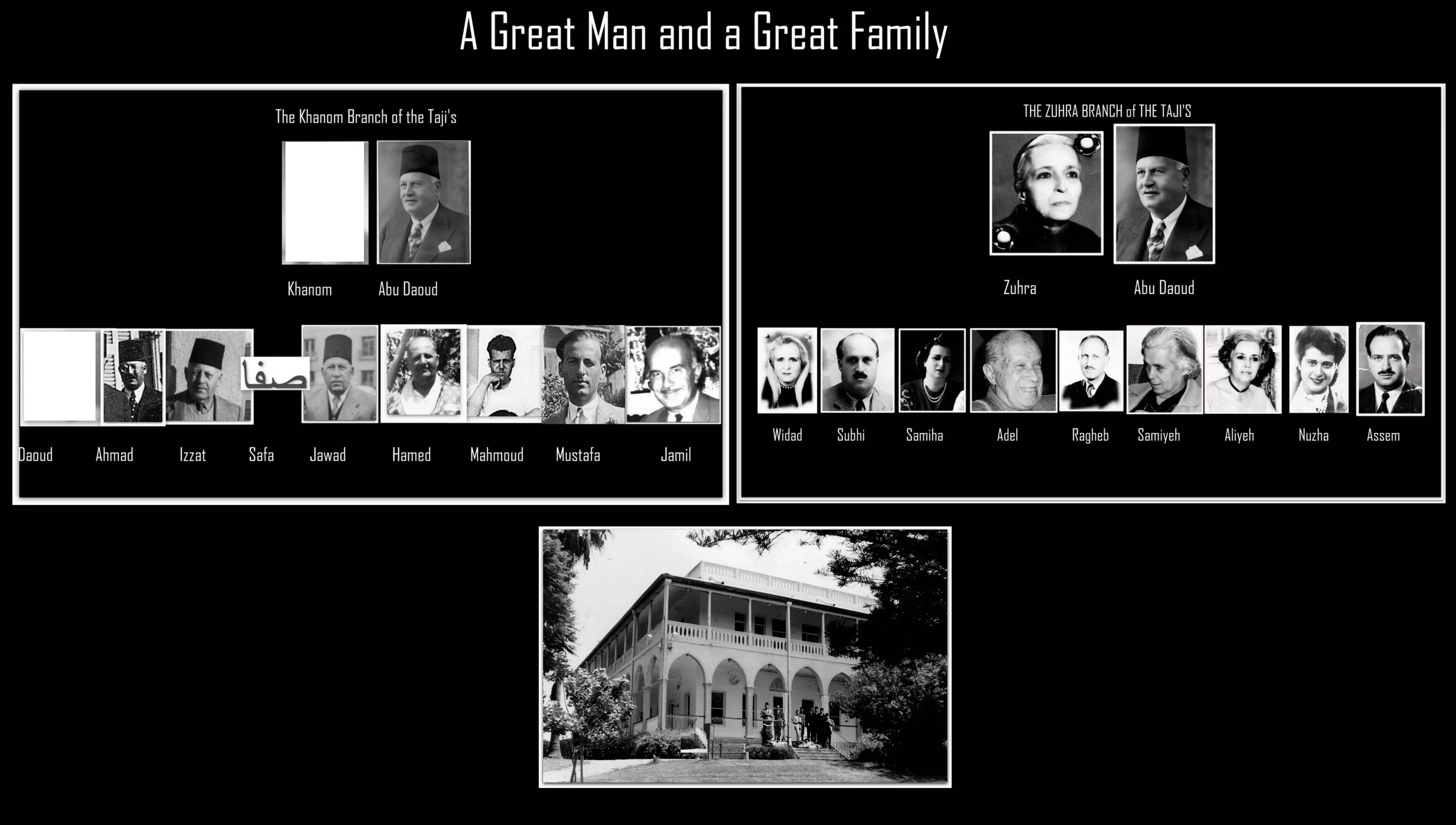
- EL-Taji EL-Farouki Family Tree
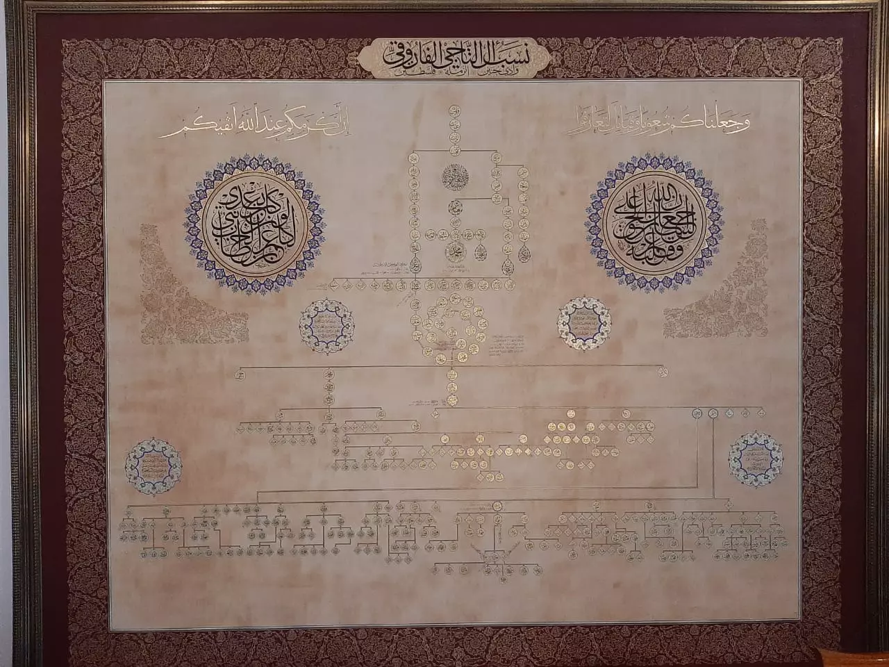
Posted by Souhail G. S. T. EL-Farouki - EL-Taji EL-Farouki Family Tree

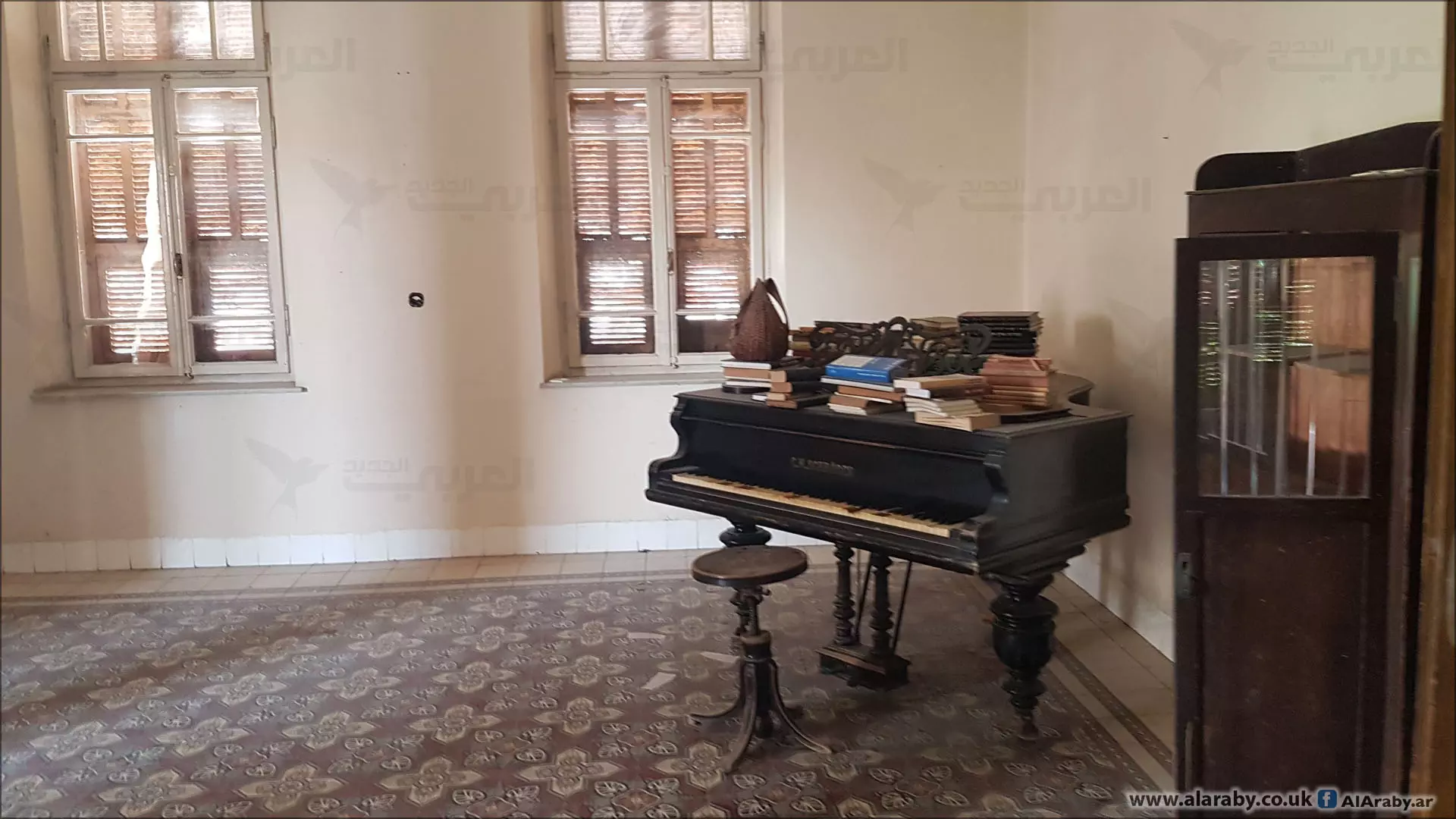
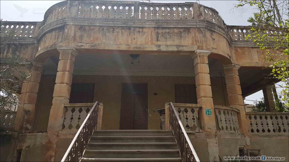
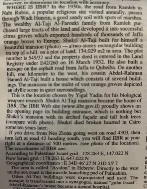
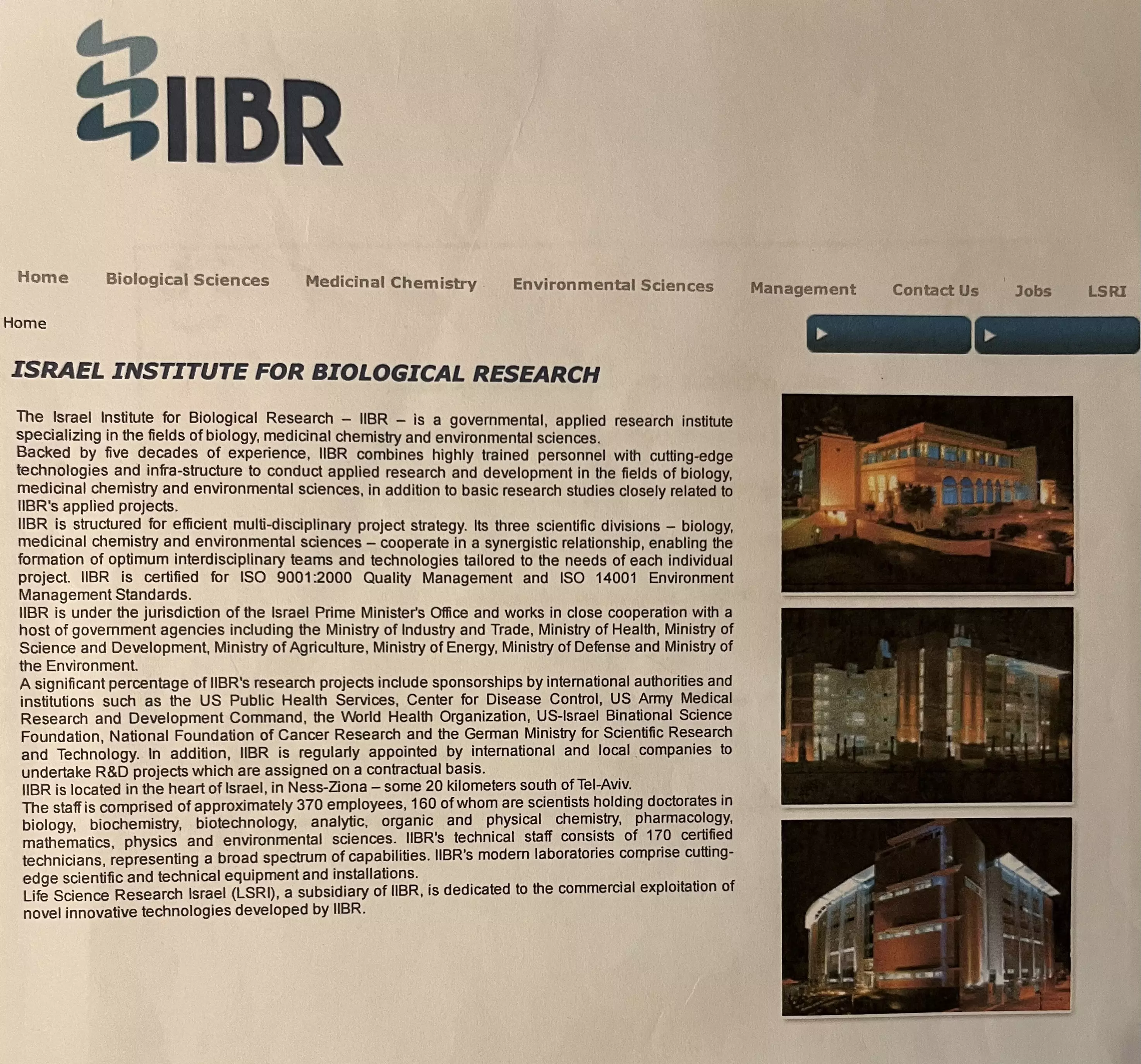
Posted by Souhail G. S. T. EL-Farouki 1 - Shukri EL-Taji EL-Farouki Residence is today transformed into IIBR (Israeli Institute for Biological Research) in West Nes Ziona (ex. Wadi-Hunayn), as reported by: Professor Salman Abu-Sitta and released in AL-Ahram news Paper, page 12 dated 27 February to 5 March 2003. Location of IIBR, West of Nes Ziona, East of Nabi Rubin, IIBR is located 500 meters South of the Junctions of Roads 4303 and 42.
Posted by Souhail G. S. T. EL-Farouki - Mansion of Shukri EL-Taji EL-Farouki and Grounds transformed into IIBR (Israeli Institute of Biological Research)
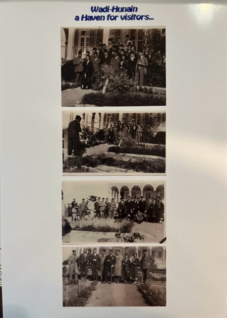
Posted by Souhail G. S. T. EL-Farouki - Wadi-Hunayn a Haven for Visitors for EL-Taji EL-Farouki Family.
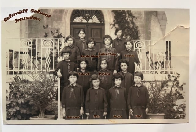
Posted by Souhail G. S. T. EL-Farouki - Schmidt School Jerusalem: (left to right) 9 Family members of EL-Taji EL-Farouki.
Front Row: Musharaf, Iffat, Nuzha, Hind.
Second Row: Fatimeh, Rudaina,
Third Row: Second in line Samiha Khairy, Rafika Khairy, Badrieh
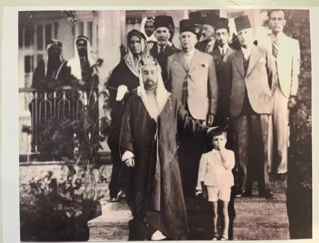
Posted by Souhail G. S. T. EL-Farouki - His Royal Highness King Abdullah of Jordan visiting Abdul-Rahman EL-Taji Residence which became a Hospital and recently has been deserted.
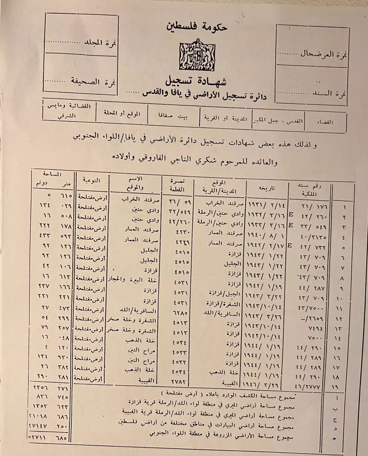
Posted by Souhail G. S. T. EL-Farouki - Several Properties of Shukri EL-Taji EL-Farouki and Sons and reference to their registrations amounting to 52,711 Dunums.
Posted by Souhail G. S. T. EL-Farouki - Example of Certificate of Property of Shukri EL-Taji EL-Farouki.
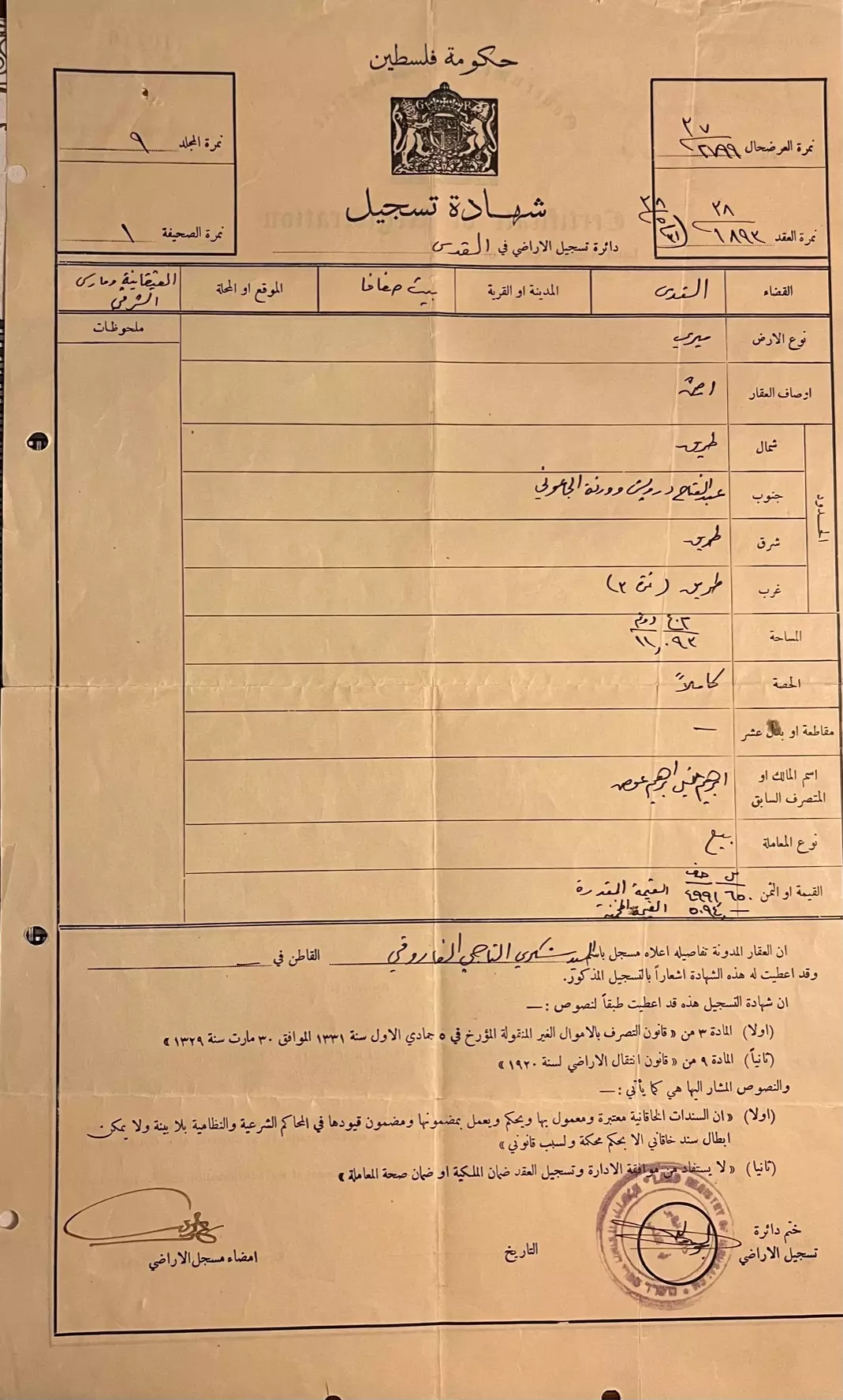
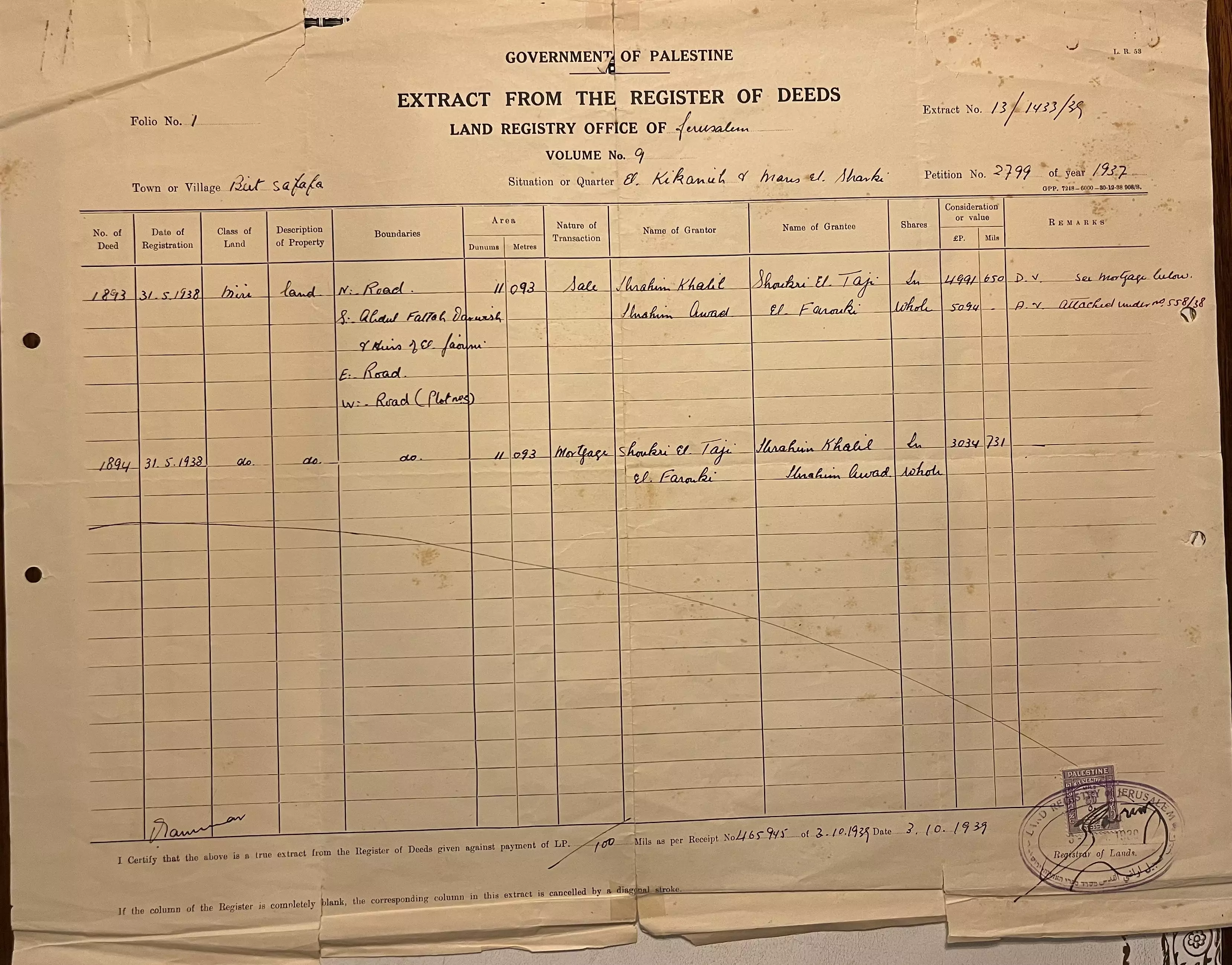
Posted by Souhail G. S. T. EL-Farouki - Shukri EL-Taji EL-Farouki, Register of Deed, Beit Safafa, Jerusalem.
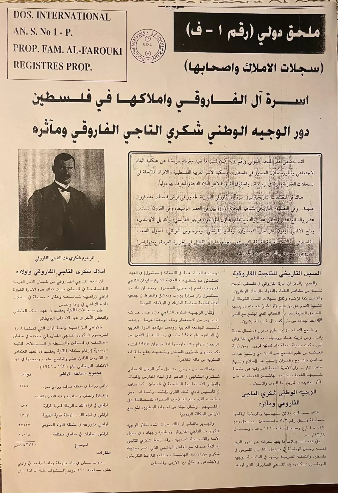
Posted by Souhail G. S. T. EL-Farouki - DOS. INTERNATIONAL AN.S. No 1-P. Property Ownership of Shukri EL-Taji EL-Farouki Family in Palestine, 52,710 Dunums.
Posted by Souhail G. S. T. EL-Farouki - Sulaiman EL-Taji EL-Farouki.
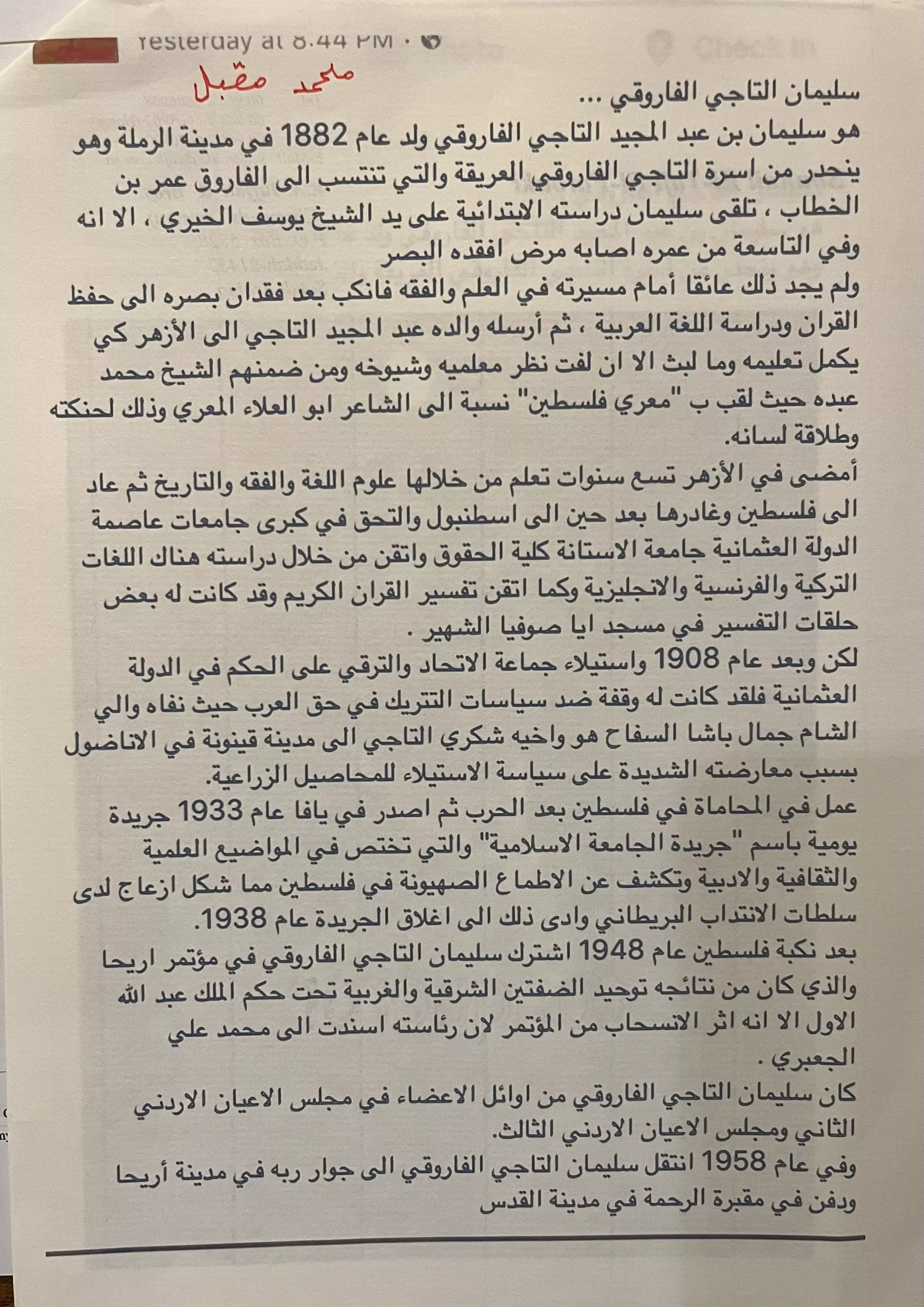
Posted by Souhail G. S. T. EL-Farouki - EL-Taji EL-Farouki Family Tree from Ghaleb EL-Taji EL-Farouki's Book, The effects of the Palestinian Catastrophe Page 202 to 204.
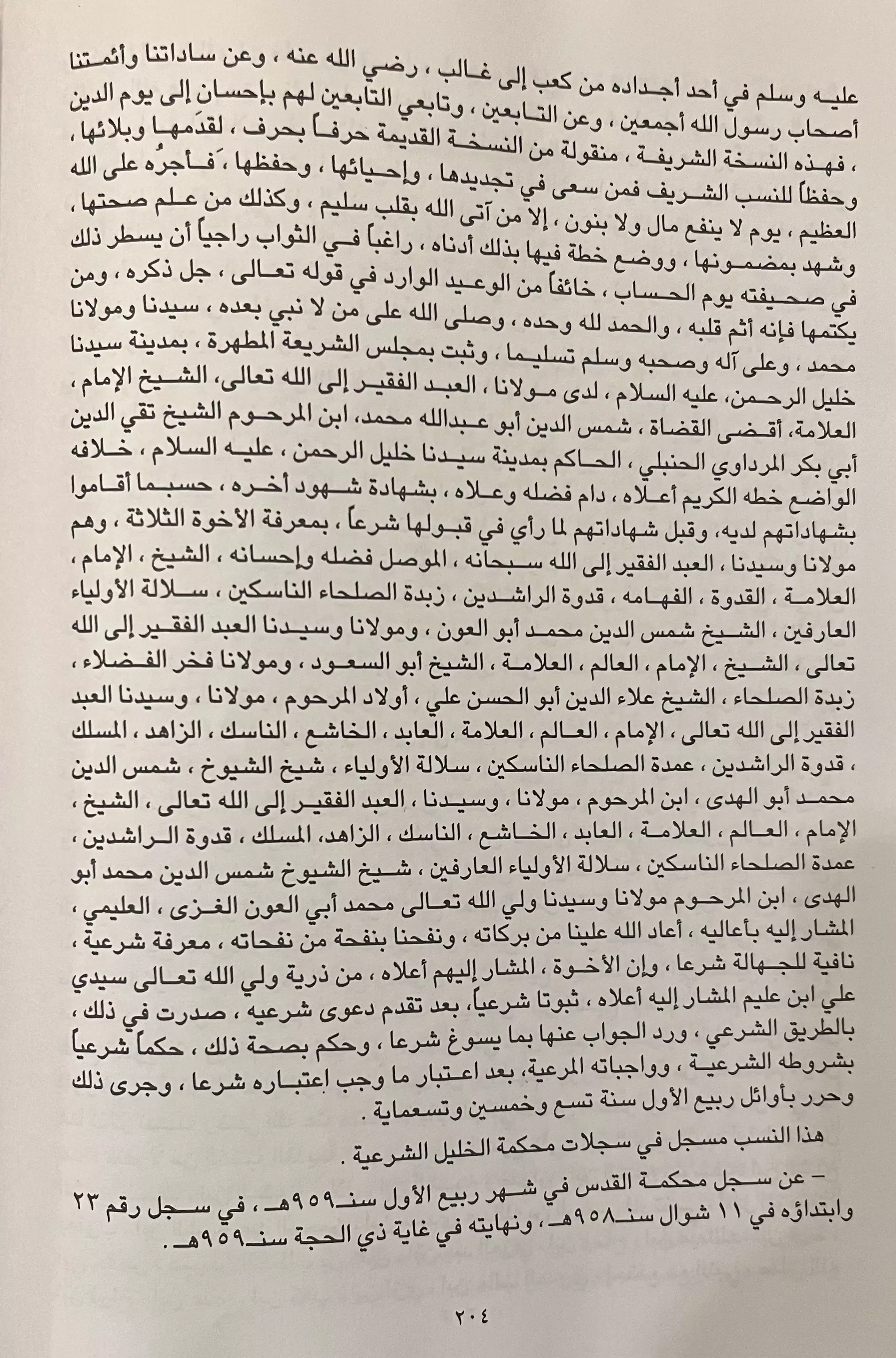
Posted by Souhail G. S. T. EL-Farouki - EL-Taji EL-Farouki Family Tree from Ghaleb EL-Taji EL-Farouki Book, The effects of the Palestinian Catastrophe Page 202.
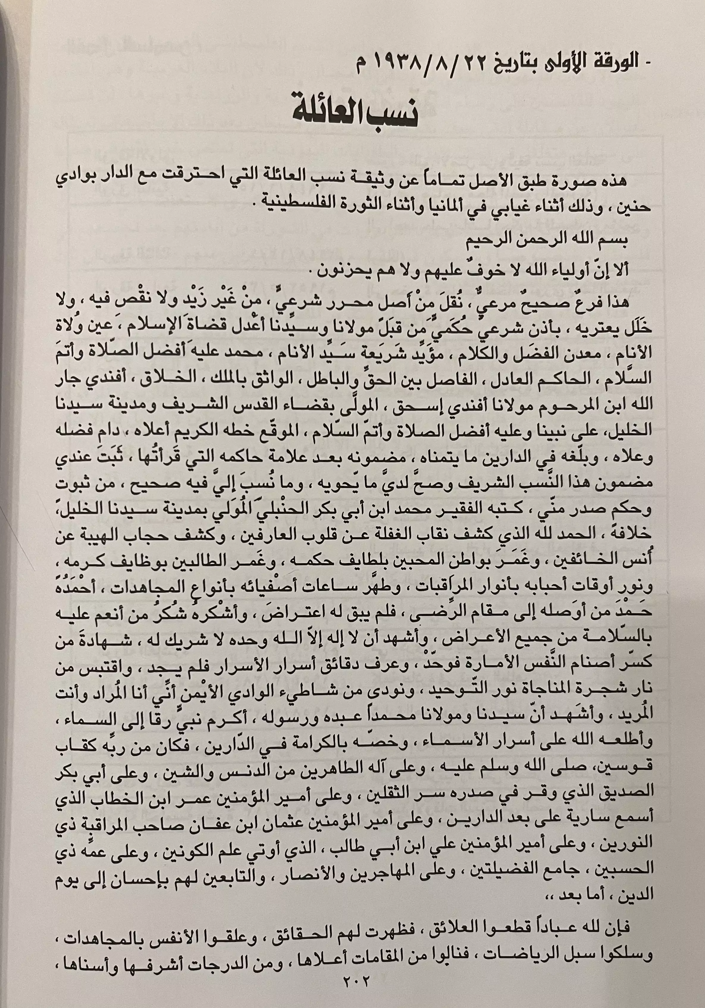
Posted by Souhail G. S. T. EL-Farouki - EL-Taji EL-Farouki Family Tree from Ghaleb EL-Taji EL-Farouki Book, The effects of the Palestinian Catastrophe Page 203.

Posted by Souhail G. S. T. EL-Farouki - المسجد الذي حوله الكيان لكنيس
- Although Wadi Hunayn had friendly relations with neighboring Zionist colonies, it was obliterated except for a few buildings, including the village mosque, which was converted to a synagogue. How else will the Jews be free & safe again?
- Although Wadi Hunayn had friendly relations with neighboring Zionist colonies, it was obliterated except for a few buildings, including the village mosque, which was converted to a synagogue. How else will the Jews be free & safe again? #2
- Although Wadi Hunayn had friendly relations with neighboring Zionist colonies, it was obliterated except for a few buildings, including the village mosque, which was converted to a synagogue. How else will the Jews be free & safe again? #3
- Although Wadi Hunayn had friendly relations with neighboring Zionist colonies, it was obliterated except for a few buildings, including the village mosque, which was converted to a synagogue. How else will the Jews be free & safe again? #4
- Although Wadi Hunayn had friendly relations with neighboring Zionist colonies, it was obliterated except for a few buildings, including the village mosque, which was converted to a synagogue. How else will the Jews be free & safe again? #5
- Although Wadi Hunayn had friendly relations with neighboring Zionist colonies, it was obliterated except for a few buildings, including the village mosque, which was converted to a synagogue. How else will the Jews be free & safe again? #6
- Although Wadi Hunayn had friendly relations with neighboring Zionist colonies, it was obliterated except for a few buildings, including the village mosque, which was converted to a synagogue. How else will the Jews be free & safe again? #7
- Although Wadi Hunayn had friendly relations with neighboring Zionist colonies, it was obliterated except for a few buildings, including the village mosque, which was converted to a synagogue. How else will the Jews be free & safe again? #8
- Although Wadi Hunayn had friendly relations with neighboring Zionist colonies, it was obliterated except for a few buildings, including the village mosque, which was converted to a synagogue. How else will the Jews be free & safe again? #9
- Although Wadi Hunayn had friendly relations with neighboring Zionist colonies, it was obliterated except for a few buildings, including the village mosque, which was converted to a synagogue. How else will the Jews be free & safe again? #10
- Although Wadi Hunayn had friendly relations with neighboring Zionist colonies, it was obliterated except for a few buildings, including the village mosque, which was converted to a synagogue. How else will the Jews be free & safe again? #11
- Although Wadi Hunayn had friendly relations with neighboring Zionist colonies, it was obliterated except for a few buildings, including the village mosque, which was converted to a synagogue. How else will the Jews be free & safe again? #12
- Although Wadi Hunayn had friendly relations with neighboring Zionist colonies, it was obliterated except for a few buildings, including the village mosque, which was converted to a synagogue. How else will the Jews be free & safe again? #13
- Although Wadi Hunayn had friendly relations with neighboring Zionist colonies, it was obliterated except for a few buildings, including the village mosque, which was converted to a synagogue. How else will the Jews be free & safe again? #14
- Although Wadi Hunayn had friendly relations with neighboring Zionist colonies, it was obliterated except for a few buildings, including the village mosque, which was converted to a synagogue. How else will the Jews be free & safe again? #15
- Although Wadi Hunayn had friendly relations with neighboring Zionist colonies, it was obliterated except for a few buildings, including the village mosque, which was converted to a synagogue. How else will the Jews be free & safe again? #16
- Although Wadi Hunayn had friendly relations with neighboring Zionist colonies, it was obliterated except for a few buildings, including the village mosque, which was converted to a synagogue. How else will the Jews be free & safe again? #17
- Although Wadi Hunayn had friendly relations with neighboring Zionist colonies, it was obliterated except for a few buildings, including the village mosque, which was converted to a synagogue. How else will the Jews be free & safe again? #18
- Although Wadi Hunayn had friendly relations with neighboring Zionist colonies, it was obliterated except for a few buildings, including the village mosque, which was converted to a synagogue. How else will the Jews be free & safe again? #19
- Although Wadi Hunayn had friendly relations with neighboring Zionist colonies, it was obliterated except for a few buildings, including the village mosque, which was converted to a synagogue. How else will the Jews be free & safe again? #20
Want to browse more? 80,000 pictures were grouped in these gallaries:
- Several Properties of Shukri EL-Taji EL-Farouki and Sons and reference to their registrations amounting to 52,711 Dunums.
Posted by Souhail G. S. T. EL-Farouki - Example of Certificate of Property of Shukri EL-Taji EL-Farouki.
Posted by Souhail G. S. T. EL-Farouki - Shukri EL-Taji EL-Farouki, Register of Deed, Beit Safafa, Jerusalem.
Posted by Souhail G. S. T. EL-Farouki
| Display Name | Clan/Hamolah | Country of Residence |
| ناريمان غندور (الشاذلي) | - | Manitoba, Canada |
| عبد العزيز ابو زايد | - | قطاع غزة, فلسطين |
| جابر المصري | أبو سالم | - |
| أبو غسان | \ | غزة |
| Adila Taji | Taji Farouki | Amman, Jordan |
| ABDELRAHMAN | - | UNITED KINGDOM |
| Afaf Taji FAROUKI | - | - |
| Naila Farouky | Taji El-Faruqi/Al-Husseini | NY, United States |
| Jalal El-Taji El-Farouki | - | Dubai, UAE |
| Ahmad Abul-Huda | - | Dubai, United Arab Emirates |
| AHMAD SHUCRI TAJI FAROUKI | TAJI FAROUKI | JEDDAH, SAUDI ARABIA |
| khalil farouqi | - | - |
| Taji-Farouki David Nafez | - | - |
| Farouqi | Taji Farouqi | Amman, Jordan |
| Azza El-Taji El-Farouki | - | Jeddah, KSA |
| Fahed Taji Farouki | Al Taji Al Farouki | Amman, Jordan |
| Ali Fawaz Taji El-Farouki | al-Taji | - |
| Mohammed Issam Abulhuda | Palestine | Palestine |
| Taj T. Farouki | El Farouki | USA |
| Dalooleh | Taji El-Farouki | Abu Dhabi, United Arab Emirates |
| Abd El-Rahman | Taji - Farouqi | Palestine, Palestine |
- فيديو نادر لقرية وادي حنين Duration: min
 Fake Valor: Why Did Zionist Jews Hoist Nazis Flag on Their Ships in the 1930s?
What is new?
-
Facts About Oct. 7th Gaza Raid
-
Remined Us Please:: Who Did Rape Who? Palestinians Raped Israelis? Or, was the other way around?
-
When Prof. Edward Said was invited to debate Bibi Netanyahu in the 1980s, watch what happened!
-
Ezra Klein of the NY Times on the "Jewish Race".
-
Abusing Blood Libel!
-
Zionist FAQ: Isn't it true that Palestinians don't want peace? Palestinians never accepted the two-state solution
- Facts about Haavara (Transfer) Agreement between Ben-Gurion & Hitler
-
Haavara FAQs: Why Did Zionist Jews Hoist Nazis' Flags on Their Ships in the 1930s?
-
Dear ChatGPT: Why did the Jewish Agency suppress news of the Holocaust during WWII?
-
Video Playlist: Jews share their DNA tests to end the conflict for good.
-
A Tale of Two Conflicts: Examining the Definition of Genocide
-
Prof. Abraham Polak And The Suppressed History of the Khazars and European Jewry
-
How Ronald Reagan would have framed the genocide in Gaza if he were still alive?
-
Haavara FAQs: Let us do the math: how many German Jews did The Haavara Agreement save?
-
Zionist FAQs: The Hebron Massacre of 1929, "clearly proves" that Palestinians are antisemitic, how could you deny it?
-
Zionist FAQs: Why Anti-Zionist Is Not Antisemitism?
-
Zionist FAQs: Isn't it true that the KGB create Palestinian Nationalism in the early 1960s?
- Zionist FAQs: Muslims are killing Muslims all the time; why are Israeli Jews being singled out in the media?
- Zionist FAQs: How is Israel an apartheid state when 20% of its citizens are Arabs who enjoy full rights?
-
Haavara FAQs: Analysis of Herzl's Uganda Scheme and how it could have saved millions of Jews.
-
Haavara FAQs: Why did Hayim Greenberg describe American Jewry as "morally bankrupt" in early 1943?
-
Haavara FAQs: What if the Evian Conference was a resounding success? What would have been the impact of saving European Jewry on Zionism?
- Haavara FAQs: What if the six million were saved, how that would have impacted the Zionist project?
-
Haavara FAQs: How did Zionist leaders react when Europe's Jews lingered in the DP camps after WWII ended?
-
Why does the American Jewish community repeat lies that David Ben-Gurion had debunked before he died?
-
Who has the power to rename the Tatar/Khazar Gene Marker to Jewish IV?
-
Zionist FAQs: Why won't Egypt, Syria, and Jordan take their people back? Jews are indigenous to Palestine, and Arabs immigrated after Jews developed the country. Arabs should leave.
-
Haavara FAQs: Did Hitler and the Nazis conflate between Judaism and Zionist? If that wasn't case, then why?
-
Haavara FAQs: Winston Churchill and antisemitism, a collection of articles written Churchill.
-
Haavara FAQs: Broken by country, how many Jews survived vs. killed during the Holocaust?
-
Haavara FAQs: Why did European Jews vote with their feet and to immigrated to the Americas, not Palestine, after WWII?
-
Watch this American Jewish Girl describing Israeli Jews' cognitive dissonance like no other in under two minutes
-
Haavara FAQs: When the Nazis went out of their way to hide the Holocaust, Israeli Jews did the exact opposite by broadcasting their genocide of Gazans. But why?
-
Haavara FAQs: How Zionist Jews went out of their to show their appreciation to Nazism and Fascism?
- Haavara FAQs: Why Zionist leaders were against bombing the death camps & the Railroads leading to them?
-
Haavara FAQs: Hitler's message to the British and American people: If Jews are such noble citizens and you care about them, how come you're not letting them in? I will gladly ship them to you at my expense, even on luxury liners!
-
A shortlist of Zionist and Israeli false flag operations in the name Jews.
-
The Most Moral Army
- The Land of Kapos (Israel): Where the brave are boycotted and Kapos walk free.
- Why did early Zionists often named their communal enterprises "colonial"?
- Zionist Relations with Nazi Germany by Faris Glubb
-
Two NY Times advertisements by Zionists in the early 1943 that exposes Zionists' treason at the height of the calamity
- Facts Not Lies about the Palestinian-Israeli Conflict.
- Site's pictures have been categorized
- Campgain Against Lice
- A Survey of Palestine, the official source about Palestine before Nakba produced by the British Mandate; over 1200 pages.
- Satellite View & Google Earth: Over 6,000 placemarks identifying all destroyed towns, W. Bank & Gaza Strip Towns, & refugee camps.
- PalestineRemembered.com and its Nakba Oral History Project were featured on al-Jazeera Satellite TV.
- Nakba Oral History Video Podcast:
 Over 700 Oral History interviews (including 3,500+ hours of recording) can be viewed online.
 - Palestine Village Statistics Project
- Gaza Jail Break
- النسخة العربية للموقع الان متوفرة
- Videos: Documenting the destroyed villages in video: Tracing all that remains since Nakba.
- Videos: Responding to Zionist Propaganda
- Interview: The ethnic cleansing of Palestine: George Galloway interviews Israeli Historian Ilan Pappe.
- For Palestinians, memory matters. It provides a blueprint for their future By George Bisharat.
- Zionist FAQ now available in Hebrew שאלות שציונים שואלים, עכשיו בעברית
- Video: The Stephen Walt and John Mearsheimer report on the influence of the Israel Lobby on U.S. Foreign Policy
- The Palestinian-Israeli conflict for beginners
