| PalestineRemembered | About Us | Oral History | العربية | |
| Pictures | Zionist FAQs | Haavara | Maps | |
| Search |
| Camps |
| Districts |
| Acre |
| Baysan |
| Beersheba |
| Bethlehem |
| Gaza |
| Haifa |
| Hebron |
| Jaffa |
| Jericho |
| Jerusalem |
| Jinin |
| Nablus |
| Nazareth |
| Ramallah |
| al-Ramla |
| Safad |
| Tiberias |
| Tulkarm |
| Donate |
| Contact |
| Profile |
| Videos |
Welcome To Bir Salim - بئر سالم (ביר סאלם)
|
District of al-Ramla
Ethnically cleansed days ago |
العربية Google Earth |
 |
Gallery (55) |
- Statistics & Facts
-
Before & After

- Satellite View
- Articles 2
- Pictures 55
- Members
- All That Remains
- Wikipedia
- Videos
- Guest Book 2
- Links 1
| Statistic & Fact | Value | ||||||||||||||
| Occupation Date | May 9, 1948 | ||||||||||||||
| Distance From District | 4 (km) West of al-Ramla | ||||||||||||||
| Elevation | 75 (meters) | ||||||||||||||
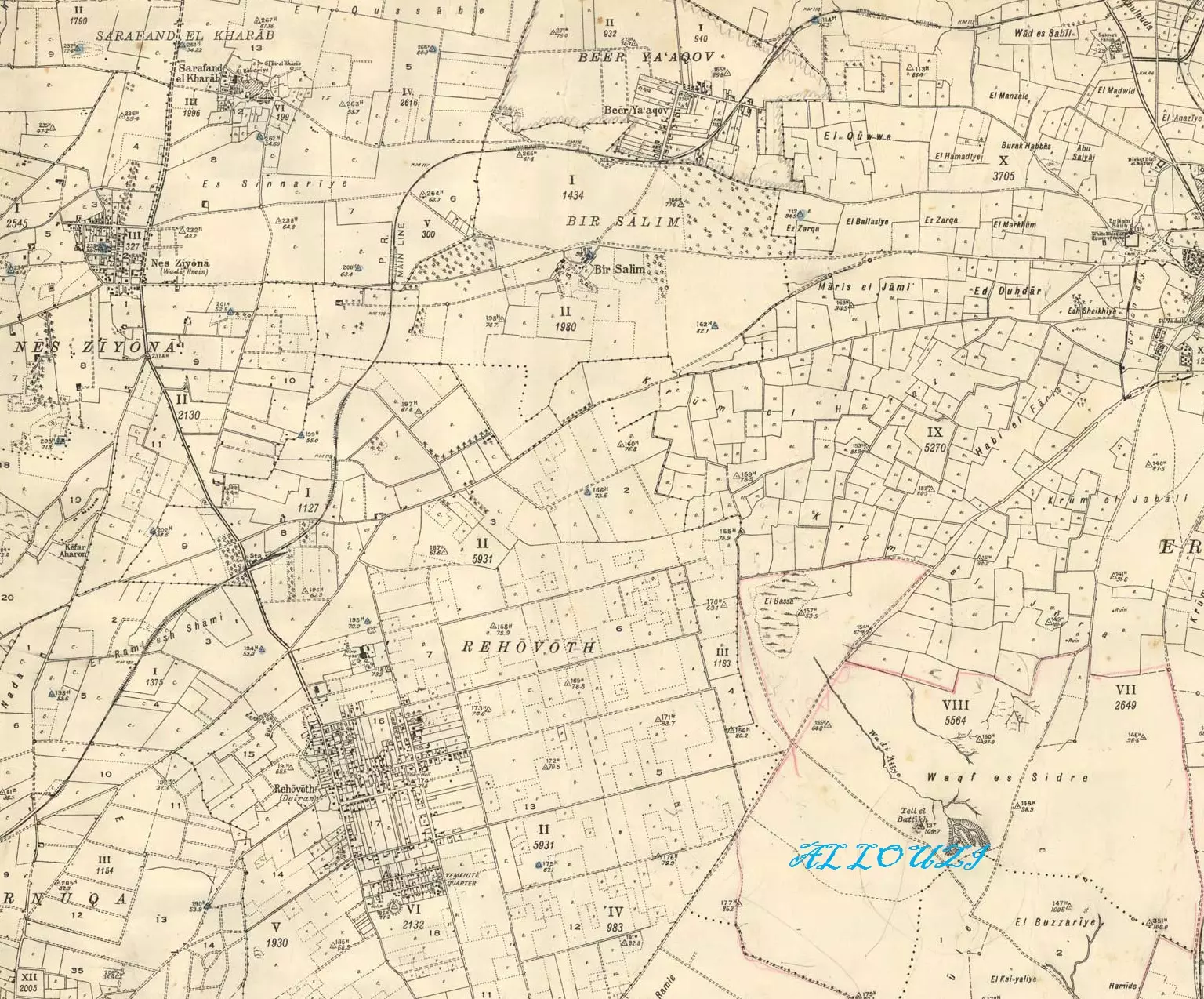
| Before & After Nakba, Click Map For Details |
|||||||||||||||
|
|||||||||||||||
| Map Location | See location #15 on the map View from satellite |
||||||||||||||
| Attacking Units | Giva'ti brigade | ||||||||||||||
| Defenders | Arab Liberation Army volunteers and local Palestinian militia organized by of Hasan Salameh (from Qula). | ||||||||||||||
| Exodus Cause | Military assault by Zionist troops | ||||||||||||||
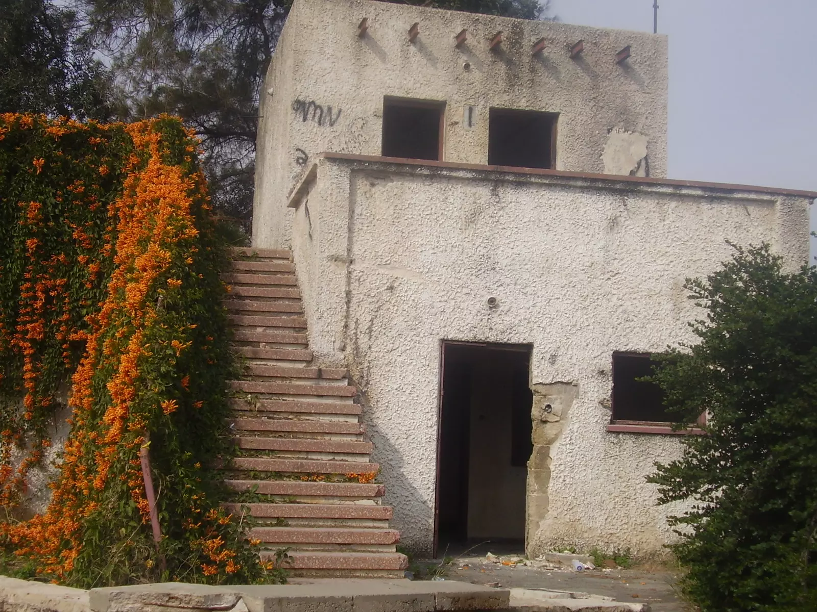
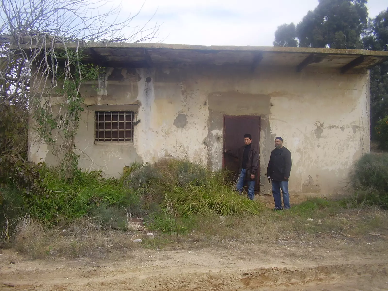
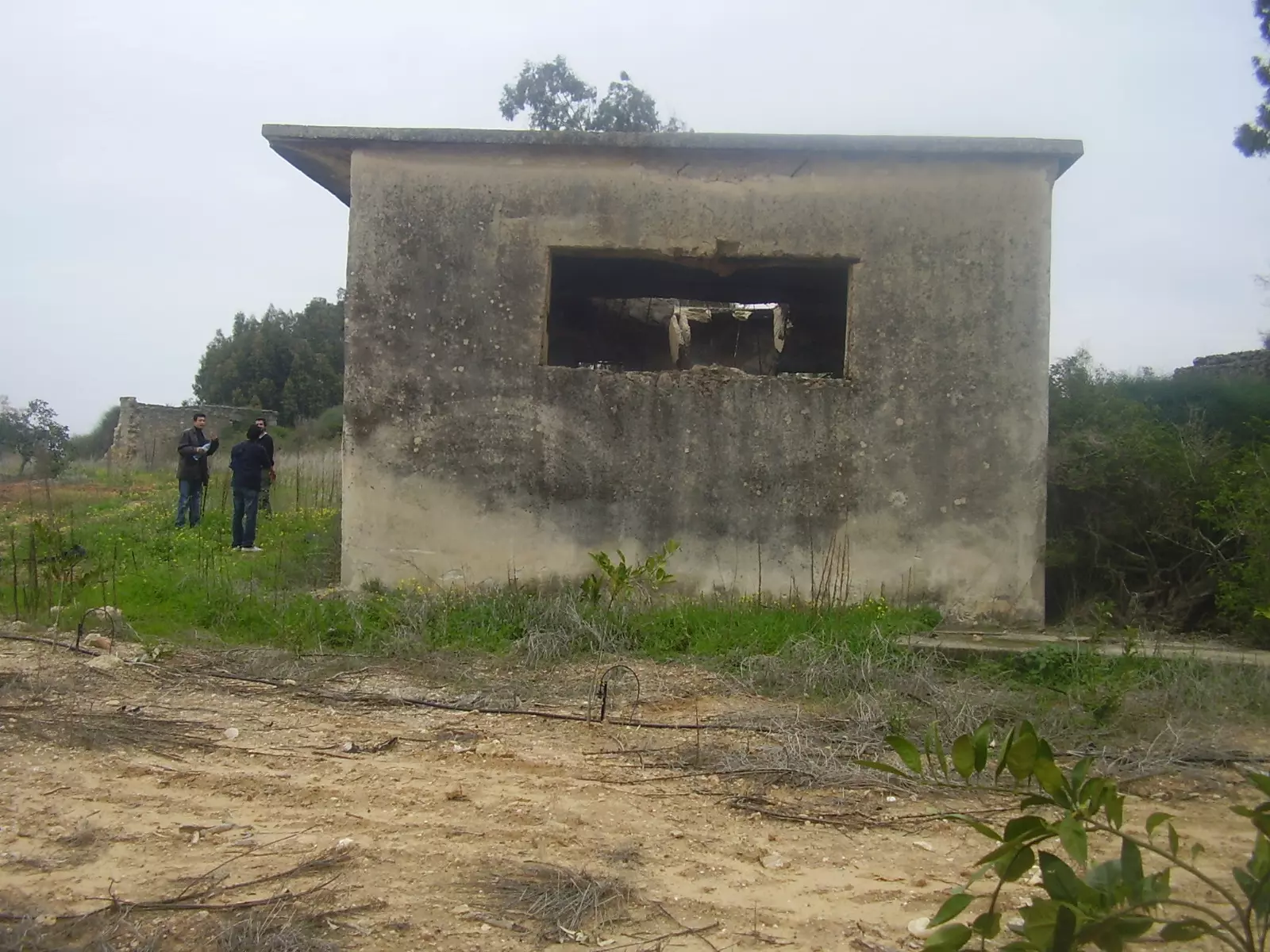
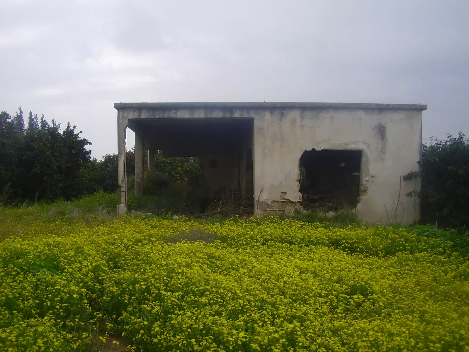
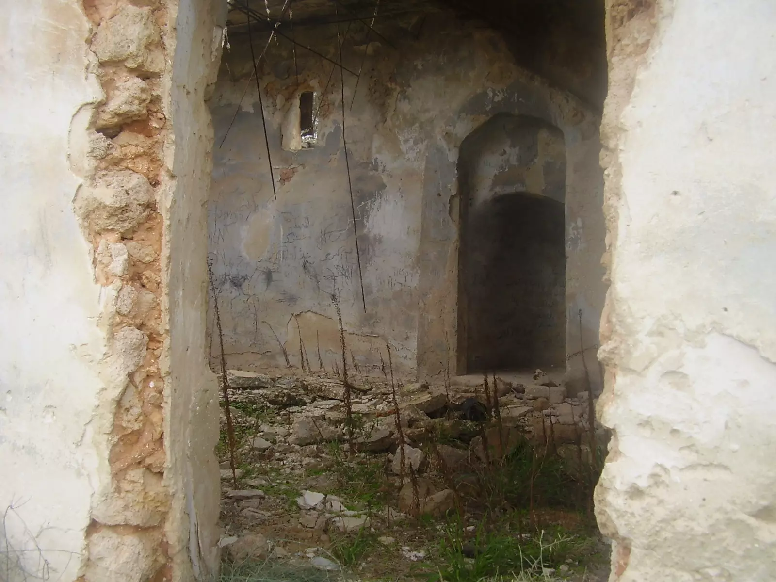
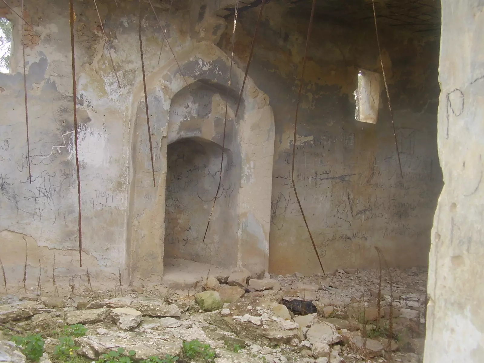
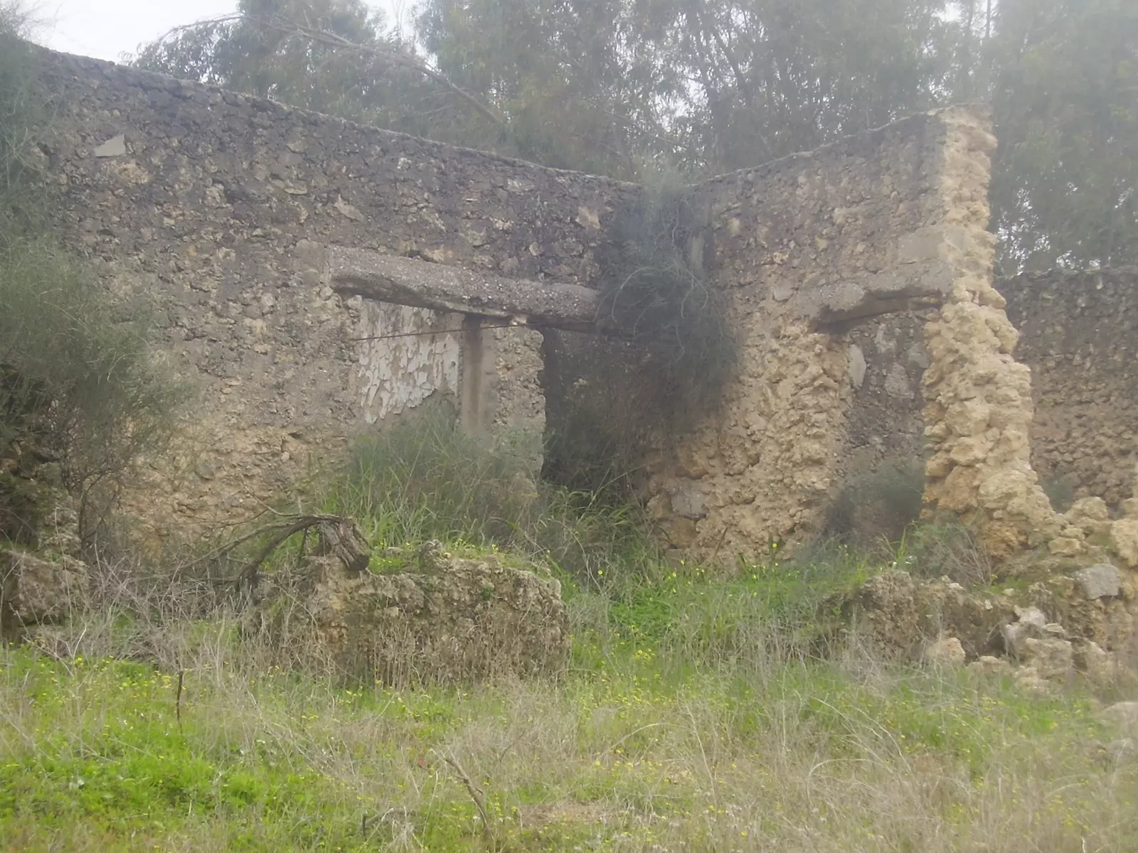
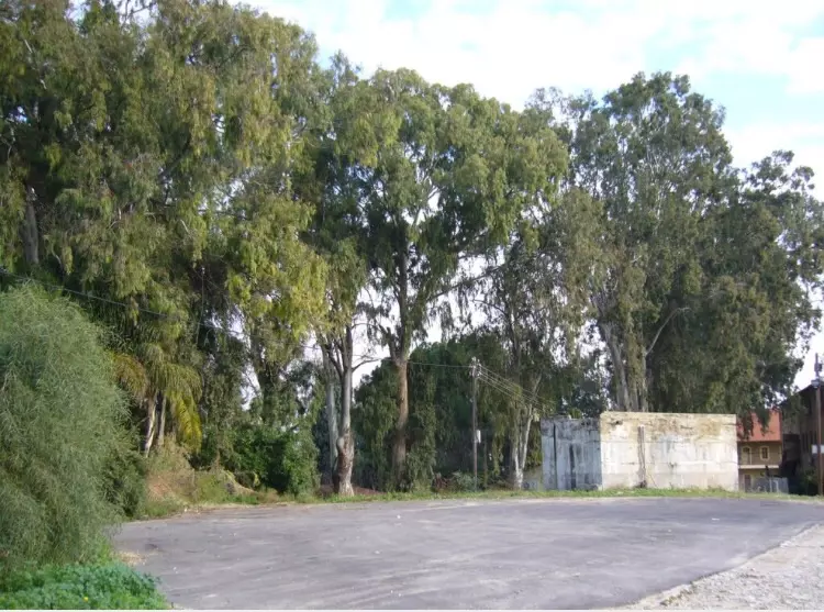
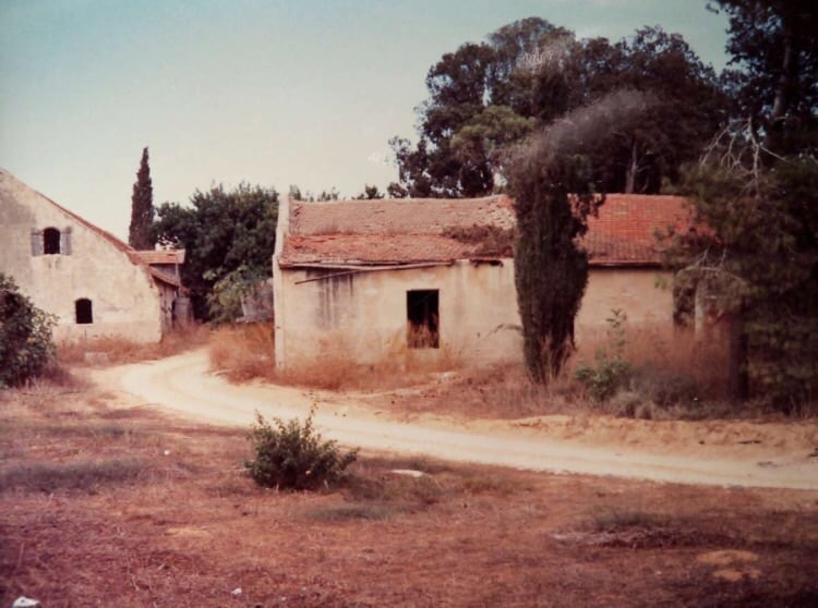
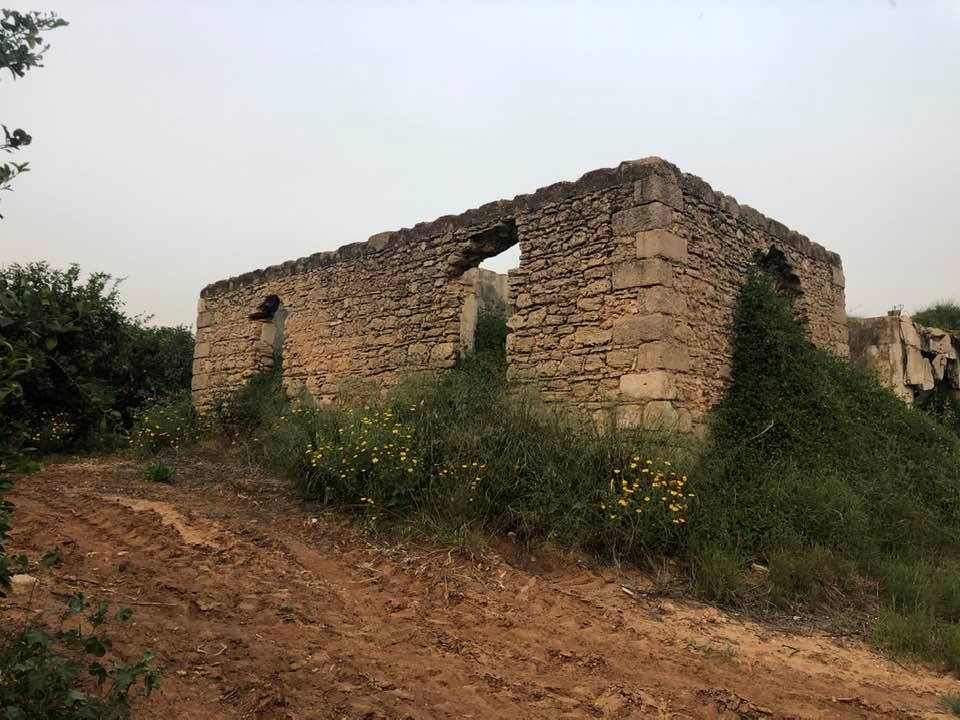
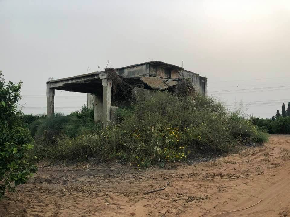
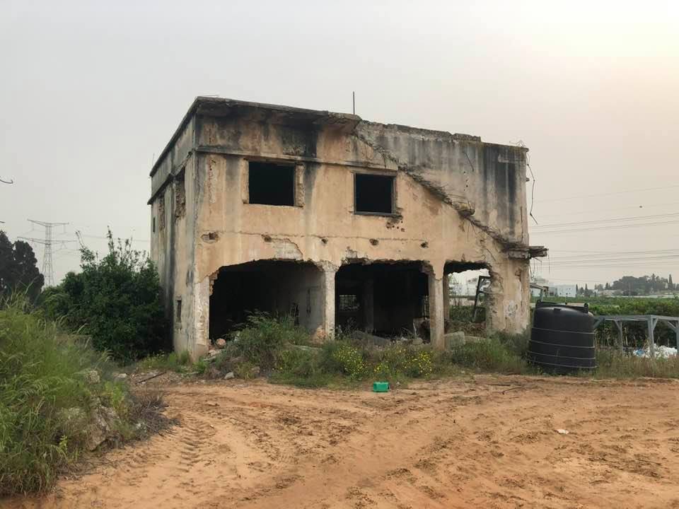
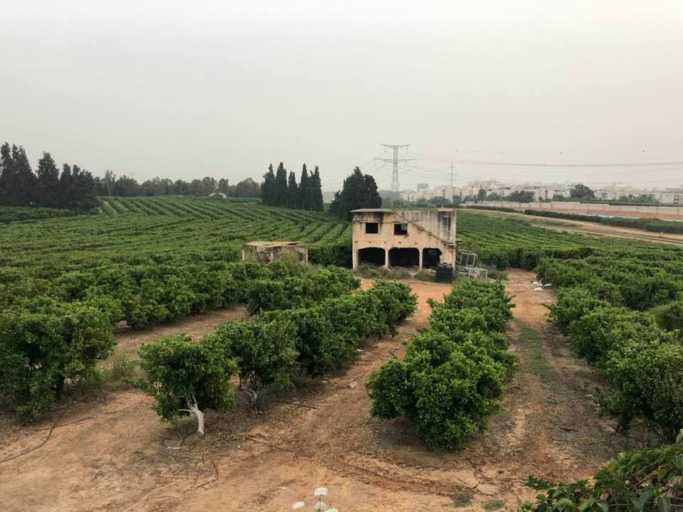
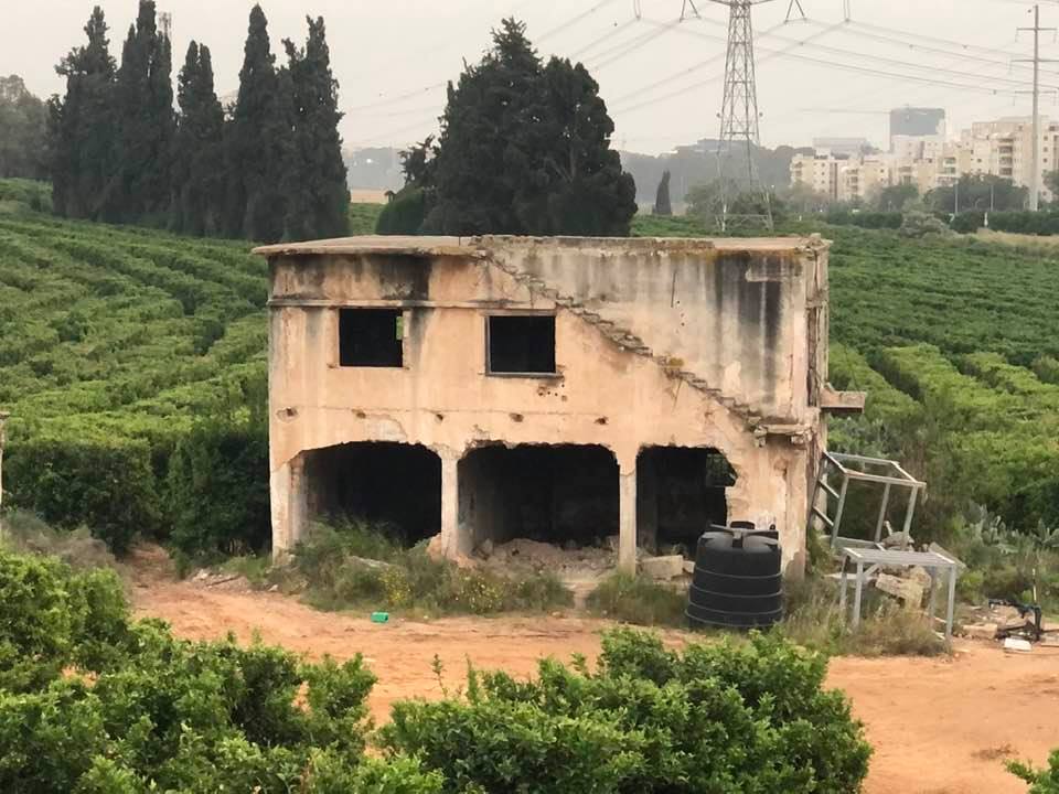
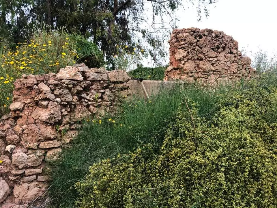
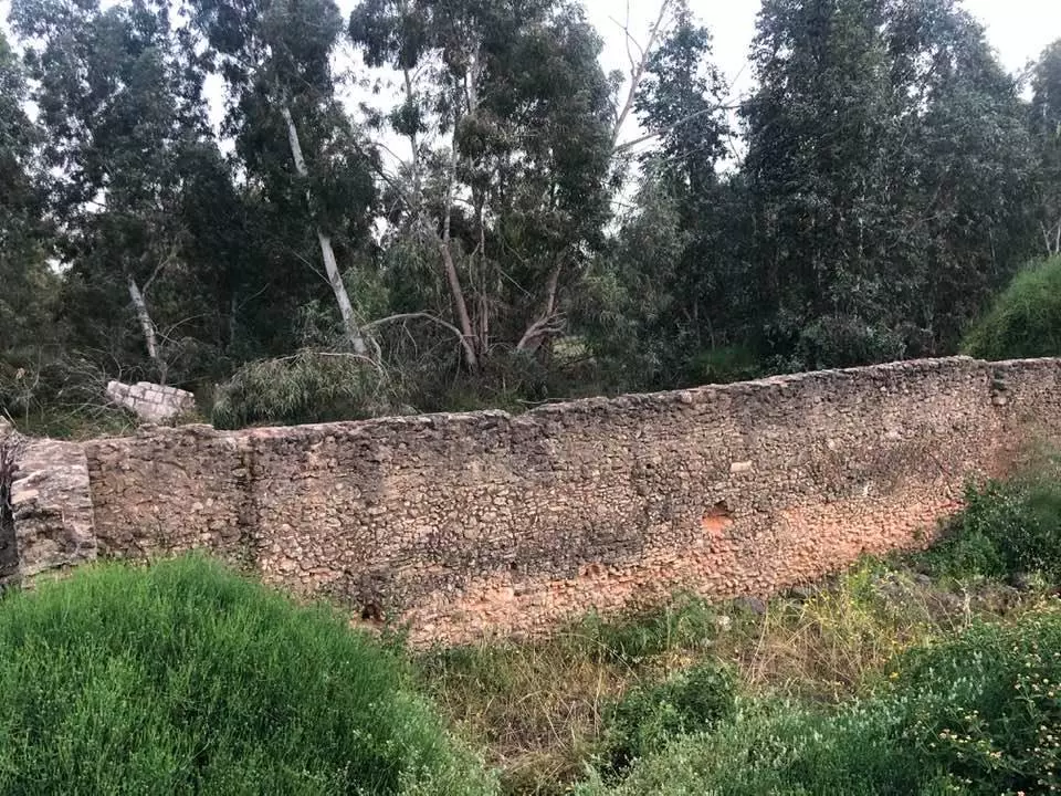
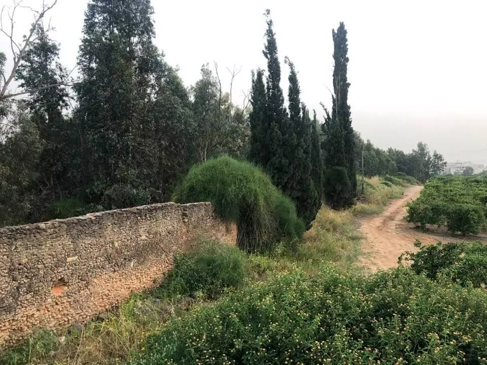
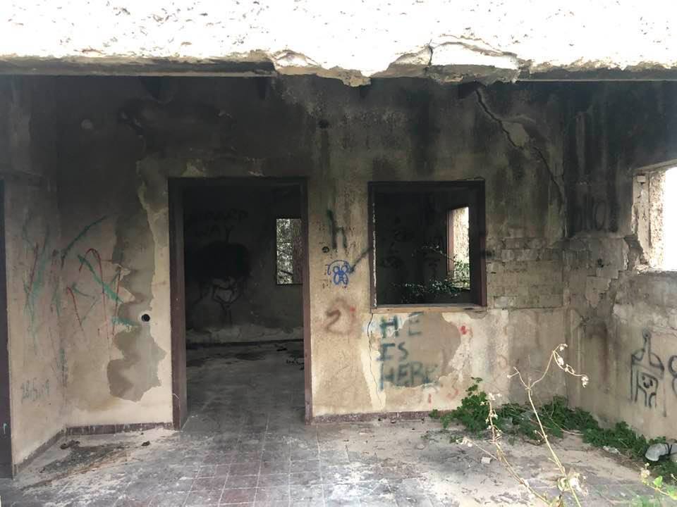
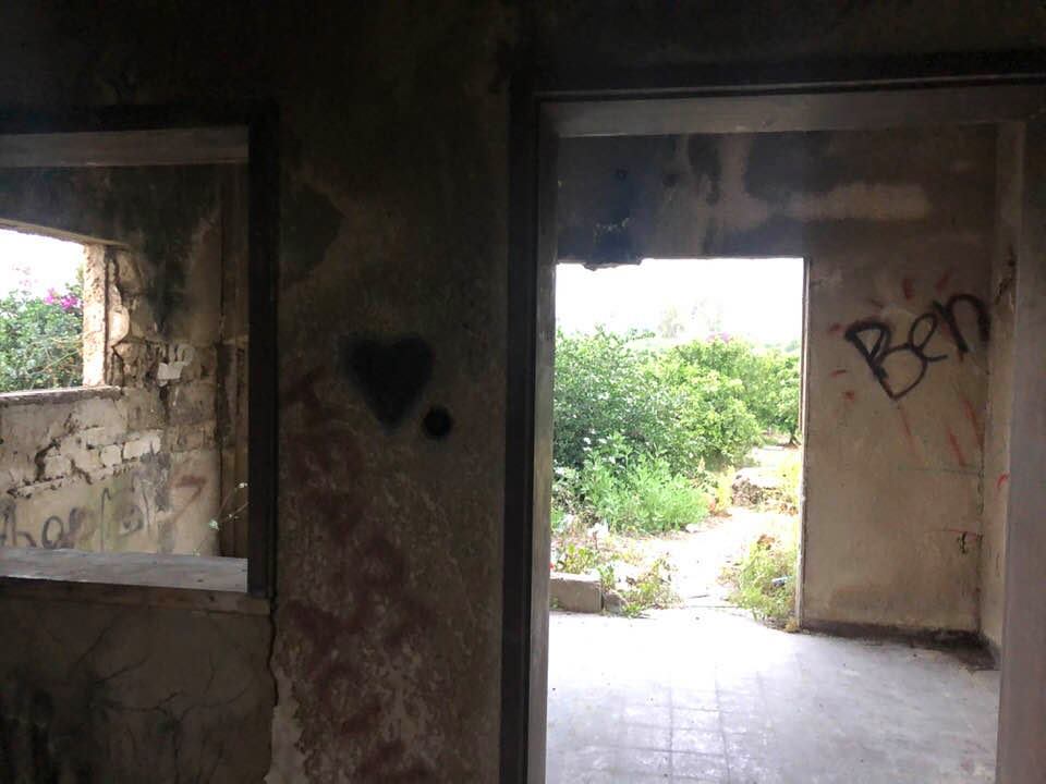
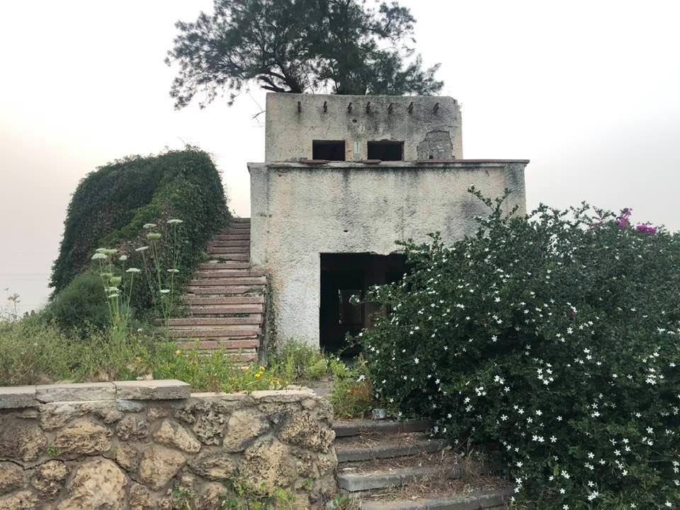
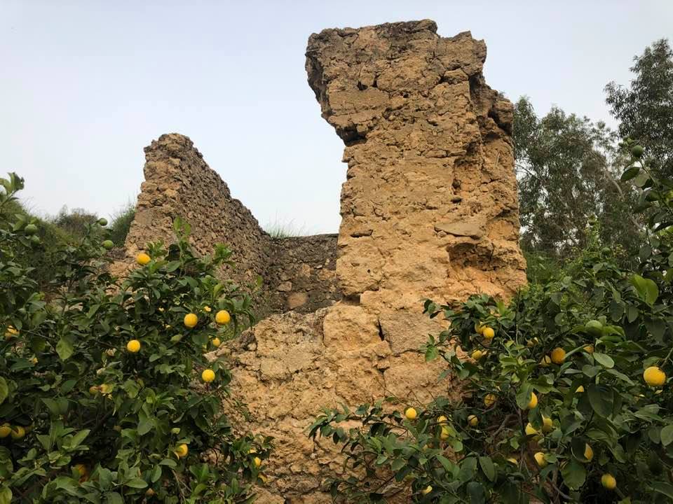
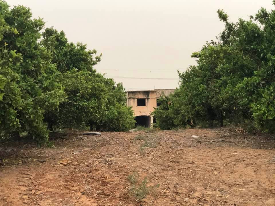
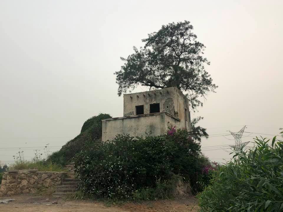
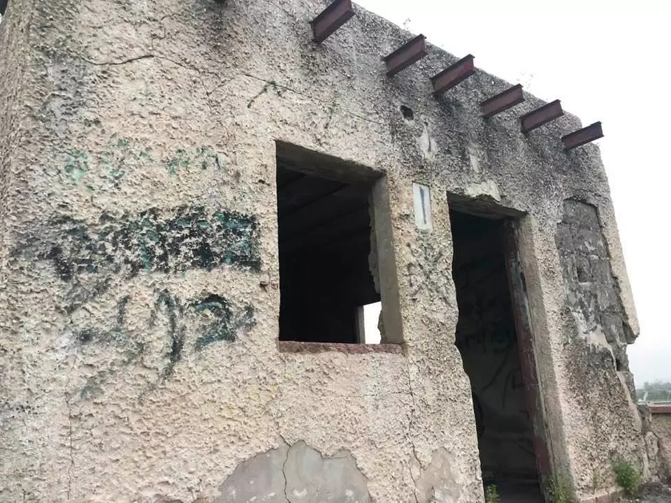
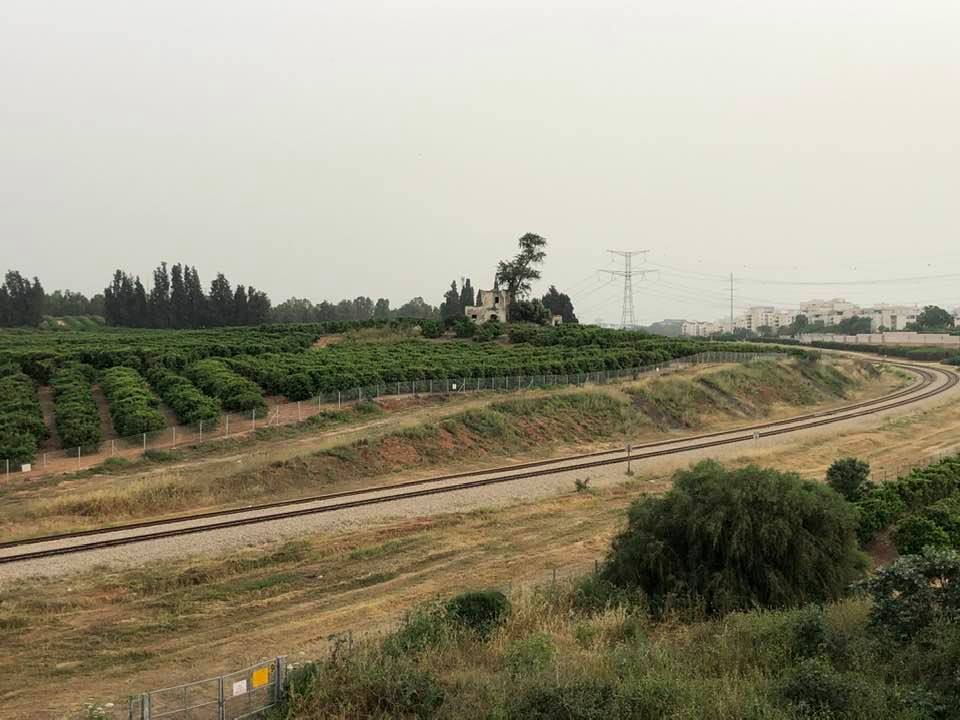
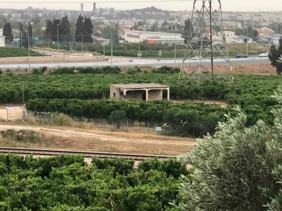
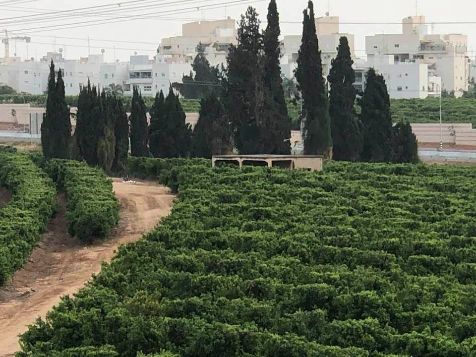
| Village Temains | Bir Salem was mostly destroyed with the exception of its water tank remains standing. | ||||||||||||||
| Ethnically Cleansing | Bir Salim inhabitants were completely ethnically cleansed. | ||||||||||||||
| Pre-Nakba Land Ownership |
**Town Lands' Demarcation Maps |
||||||||||||||
| Land Usage As of 1945 |
|
||||||||||||||
| Population |
|
||||||||||||||
| Number of Houses | At least a hundred houses in 1945 | ||||||||||||||
| Near By Towns |
|||||||||||||||
|
|||||||||||||||
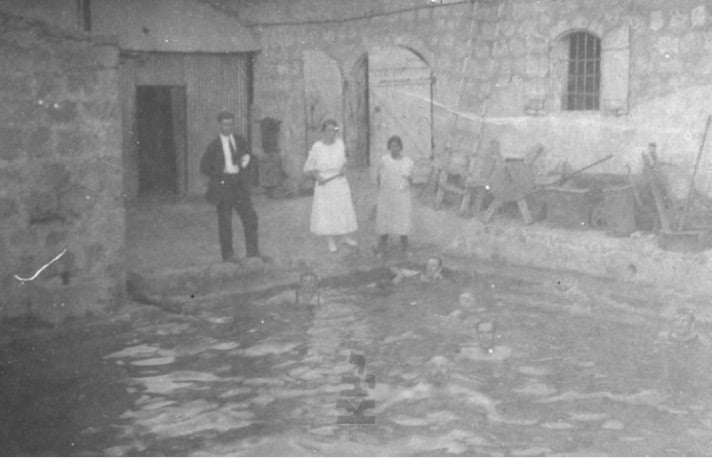
| Water Supply | A water tank which used to supply the village with drinking water. The tank remain standing and its water still very sweet! | ||||||||||||||
| Exculsive Jewish Colonies Who Usurped Village Lands |
Netzer Sereni | ||||||||||||||
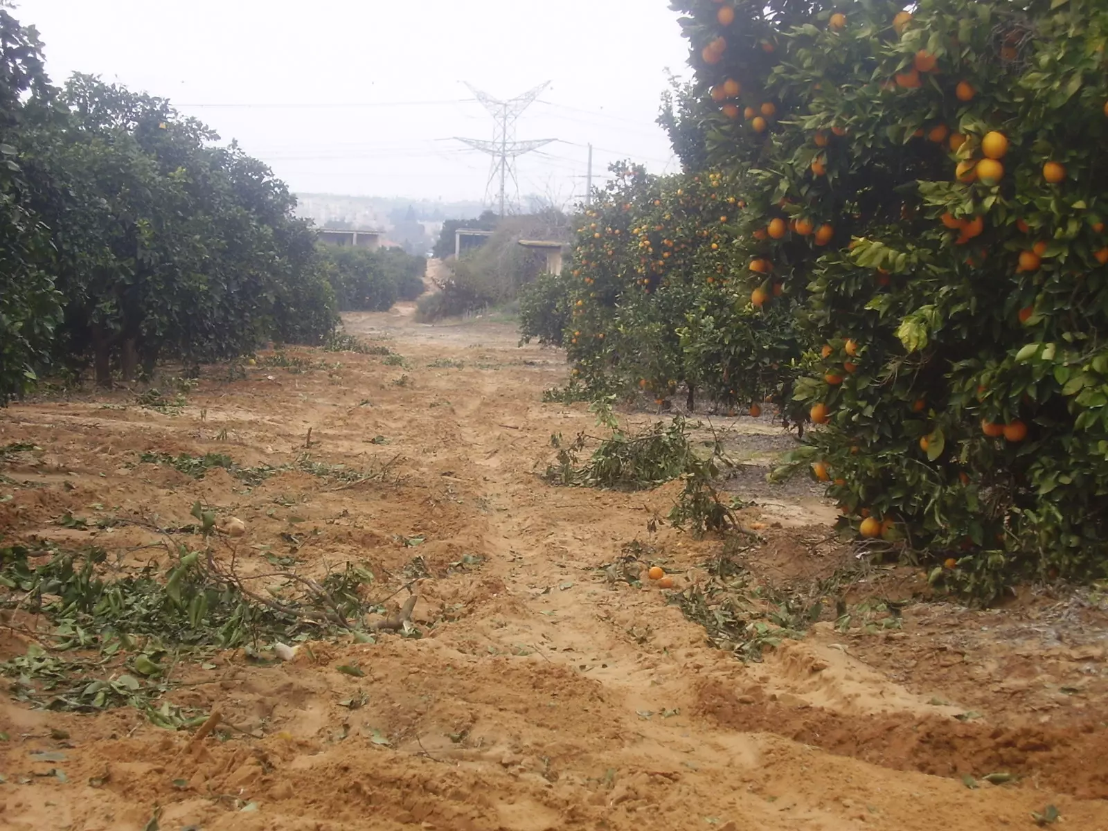
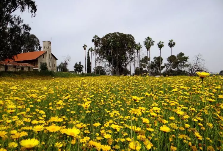
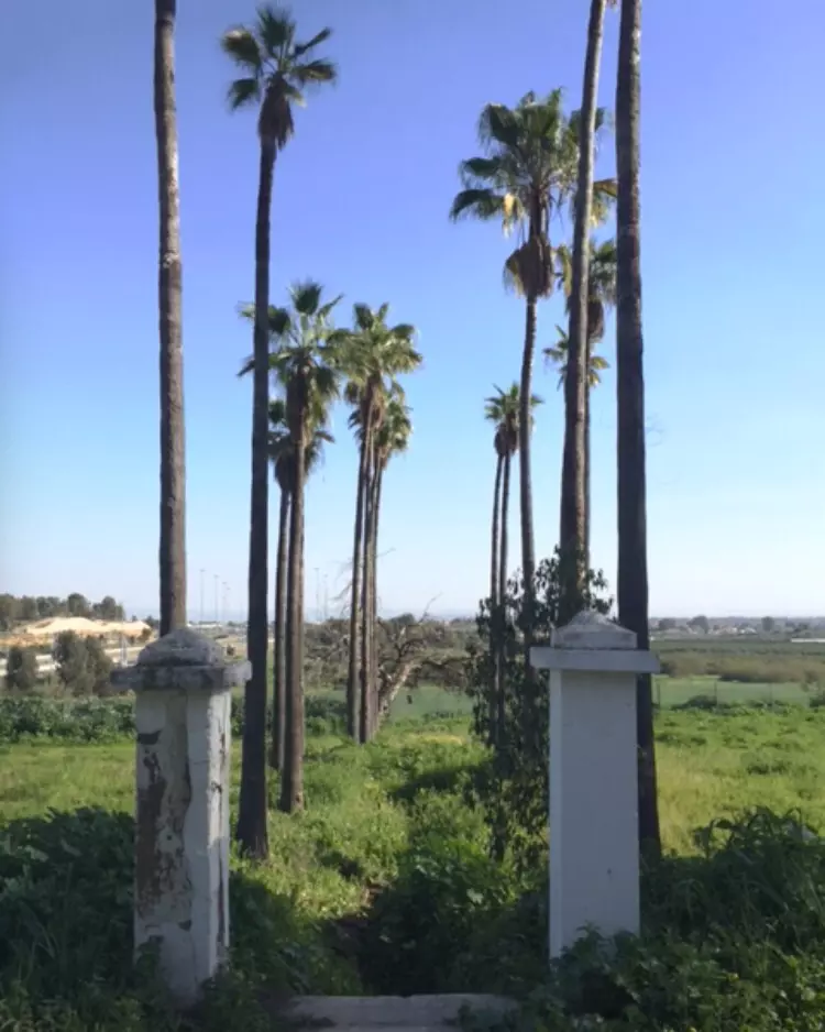
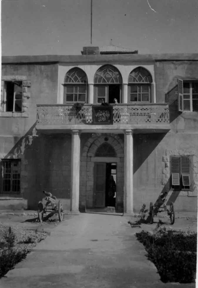
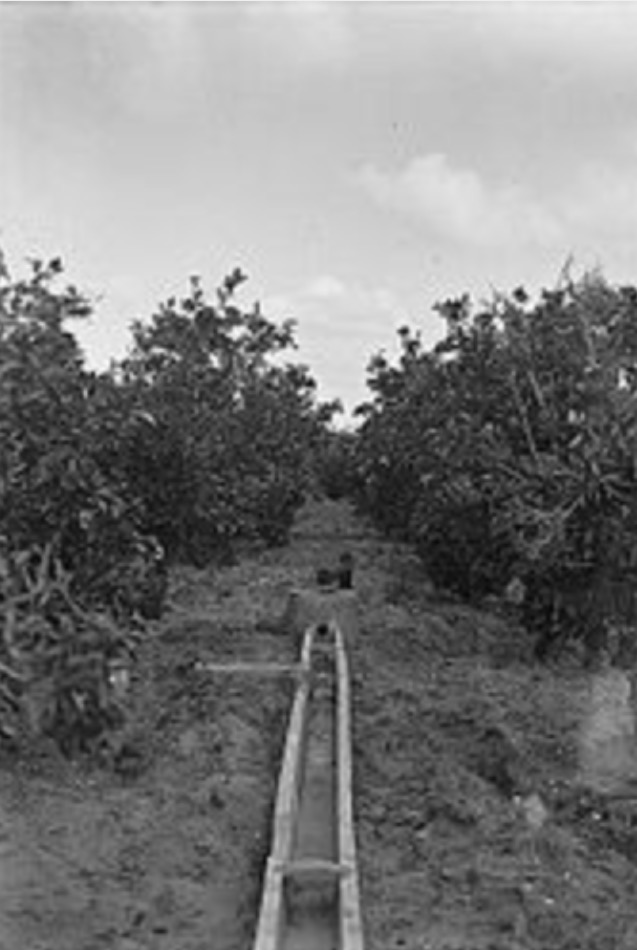
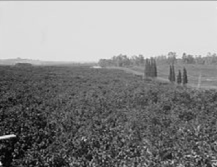
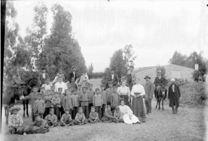
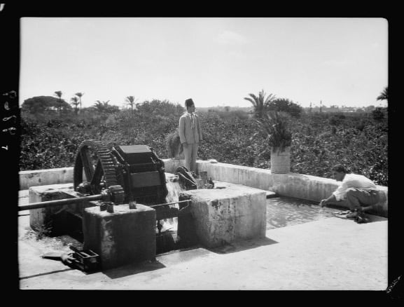
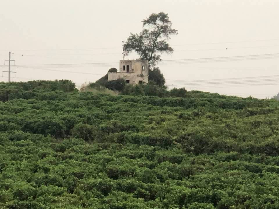
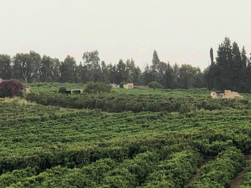
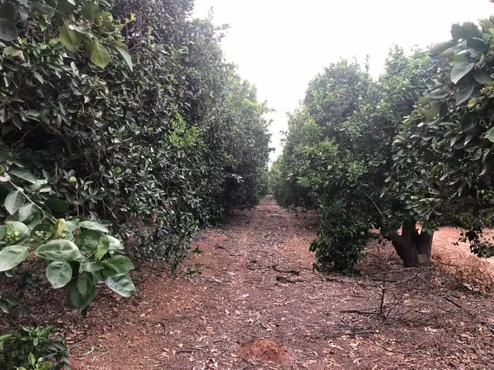
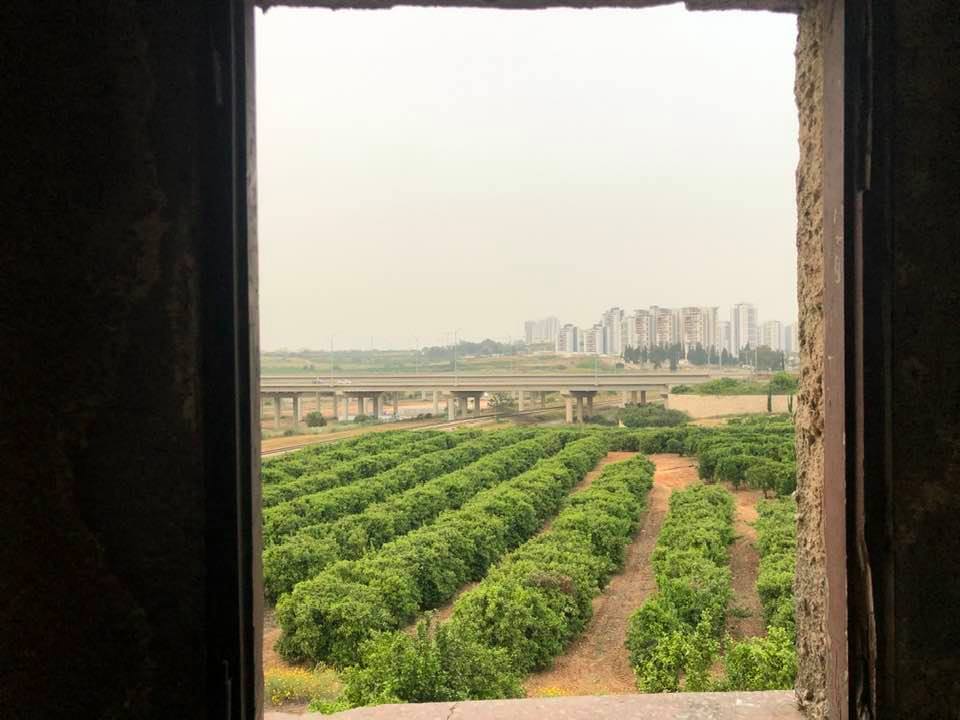
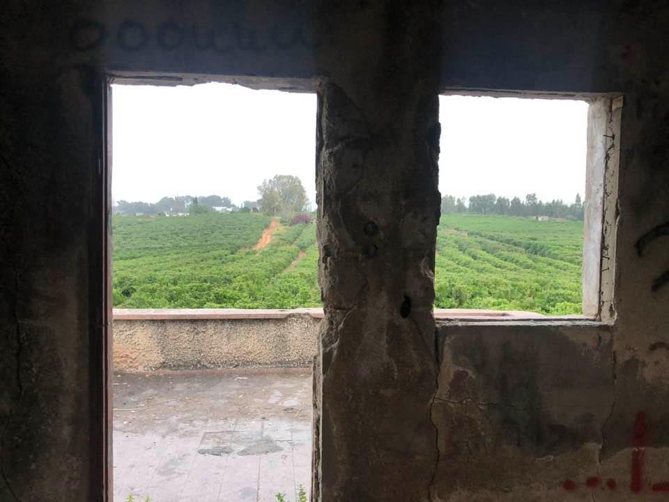
Village Before NakbaThe village stood on flat terrain on the coastal plain, linked by a spur (which was also the village's main street) to the highway between Ramla and Jaffa. Bir Salim, classified in the Palestine Index Gazetteer as a hamlet, was built along a northeast-southwest axis. Its houses, made of either adobe or cement, were separated by narrow alleys that branched off from the main street. After World War I the British built a military headquarters in the village for General Allenby, who had led the Allied fight against the Ottomans in Palestine and Syria. All of the people of Bir Salim were Muslims. Agriculture, especially citrus cultivation, was their main economic activity. In 1944/45 they used 742 dunums of village land to grow citrus, and 1,468 dunums for cereals. In addition to cultivating crops, the villagers engaged in animal husbandry.Zionists Colonies on Village LandsThe settlement of Netzer Sereni (133148) was built on village land in 1948.Village TodayThe site is now occupied by the Israeli settlement of Netzer Sereni. All of the former houses are gone. The old village water tank remains, and some of the old pine trees still grow on village land.SourceDr. Walid al-Khalidi, 1992: All That Remains. |
|||||||||||||||
| Related Maps | Town Lands' Demarcation Maps خرائط للقضاء توضح حدود القرى والاودية Town's map on MapQuest View from satellite Help us map this town at WikiMapia |
||||||||||||||
| Related Links | Wikipedia's Page Google Search Google For Images Google For Videos |
||||||||||||||
| More Information | في كتاب كي لا ننسى المزيد من موقع هوية |
||||||||||||||
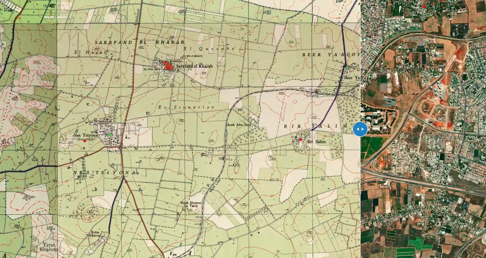
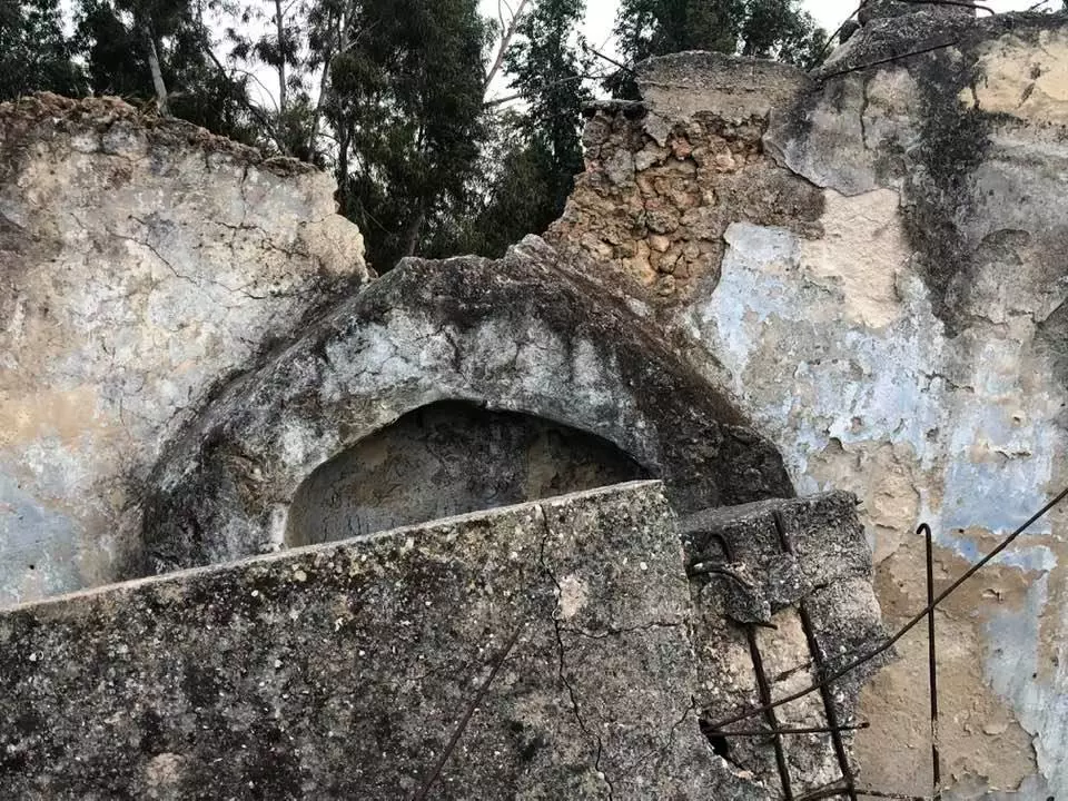
- Beir Salim mosque's mihrab
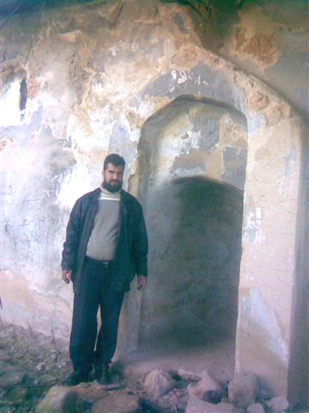
Posted by farid haj yahya 1 - One of the few remaining house in Bir Salim, Jan. 12th,2007
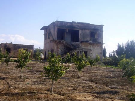
Posted by farid haj yahya 1 - One of the few remaining house in Bir Salim #2, Jan. 12th,2007
Posted by farid haj yahya - منزل مختار بير سالم المغتصب
Posted by farid haj yahya 4 - احد منازل القرية
Posted by farid haj yahya - احد منازل القرية
Posted by farid haj yahya - احد منازل القرية
Posted by farid haj yahya - مدخل مسجد بير سالم
Posted by farid haj yahya 2 - مسجد القرية من الداخل
Posted by farid haj yahya - أطلال بيوت القرية المدمرة
Posted by farid haj yahya - الشارع المؤدي الى القرية
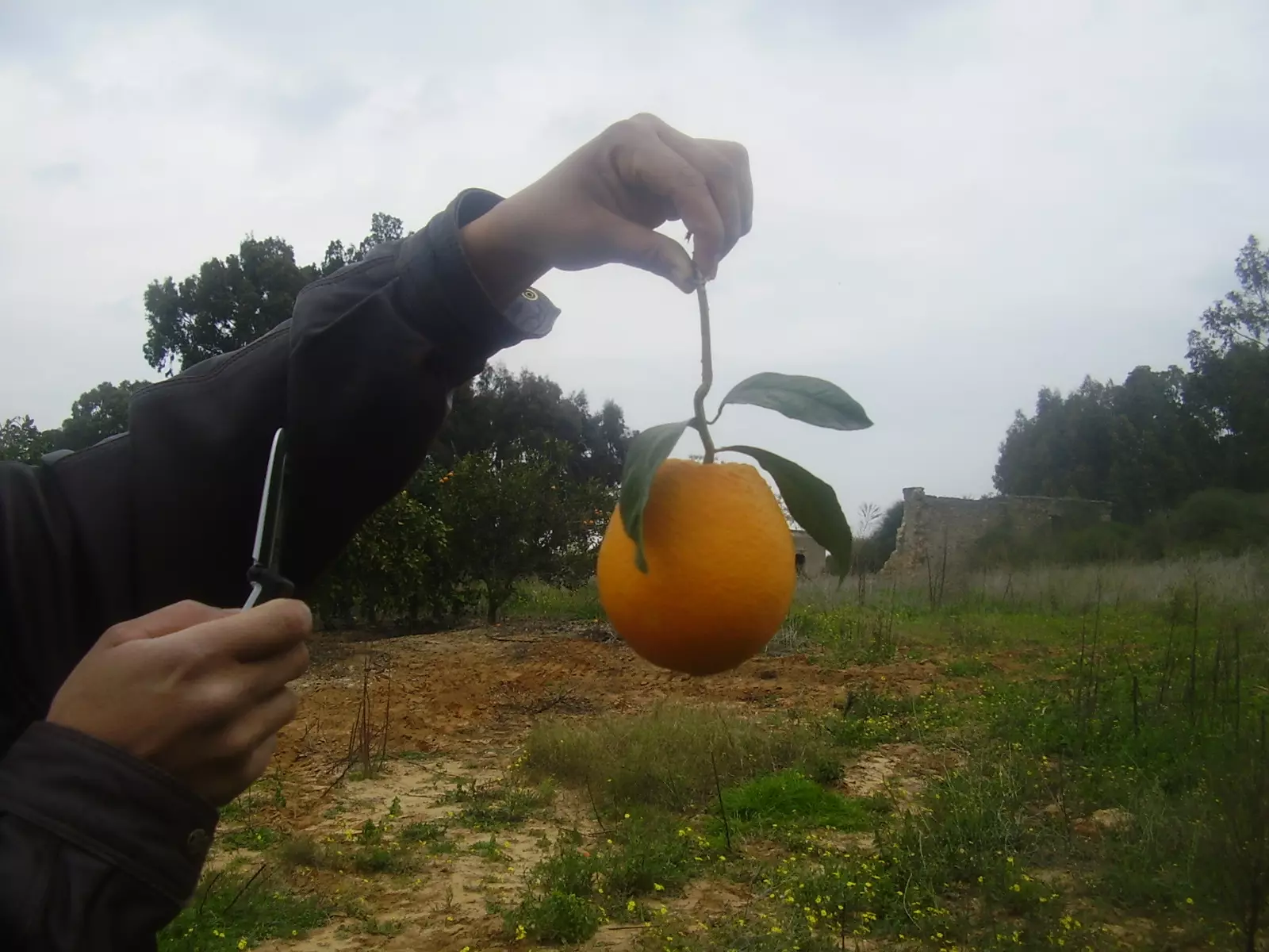
Posted by farid haj yahya - برتقال القرية وما احلاه
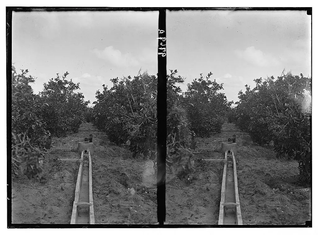
Posted by farid haj yahya - The orange groves, Matson collection
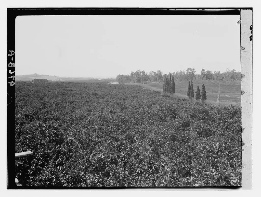
- The orange groves, Matson collection
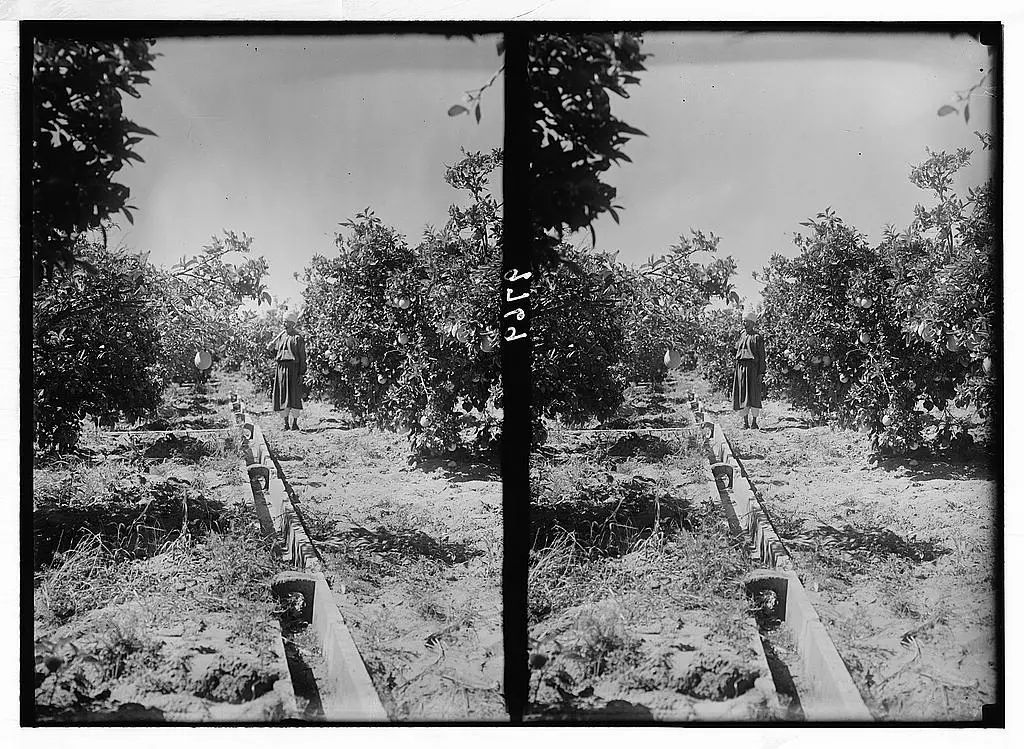
- The orange groves, Matson collection
1 - خارطة بءر سالم والاراضي التي حولها عام 1930
Posted by hussein abdo - احد بيوت القريه
Posted by abu raya - الربيع في بير سالم
Posted by abu raya - بير سالم
Posted by abu raya - بير سالم
Posted by abu raya - بير سالم قبل النكبه
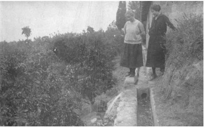
Posted by abu raya - بيارات بير سالم قبل النكبه
Posted by abu raya - بيارات بير سالم قبل النكبه
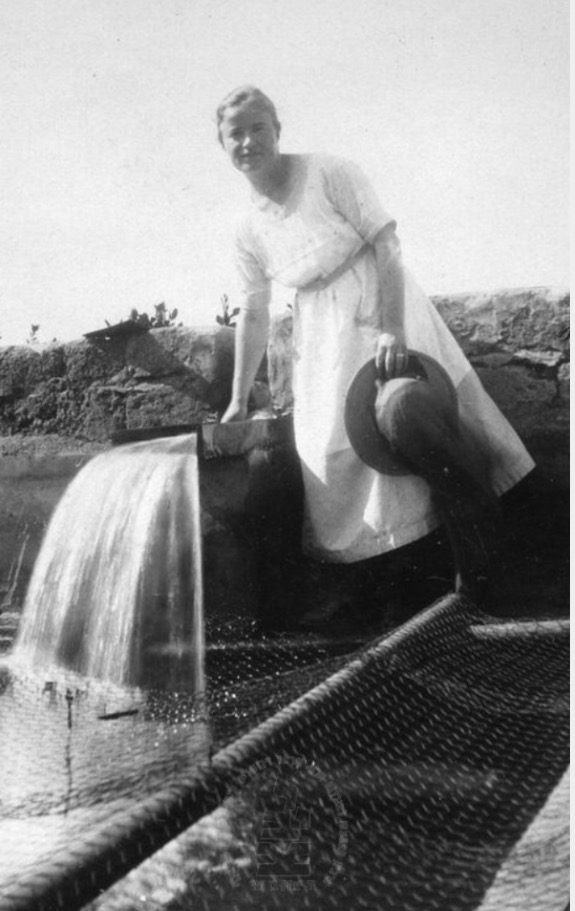
Posted by abu raya - بير سالم قبل النكبه
Posted by abu raya - بير سالم قبل النكبه
Posted by abu raya - بير سالم سنه 1925
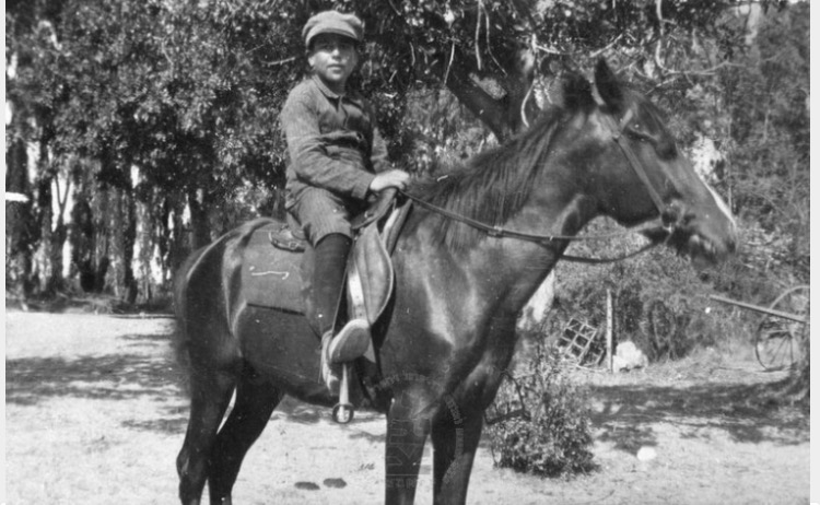
Posted by abu raya - بير سالم سنه 1924
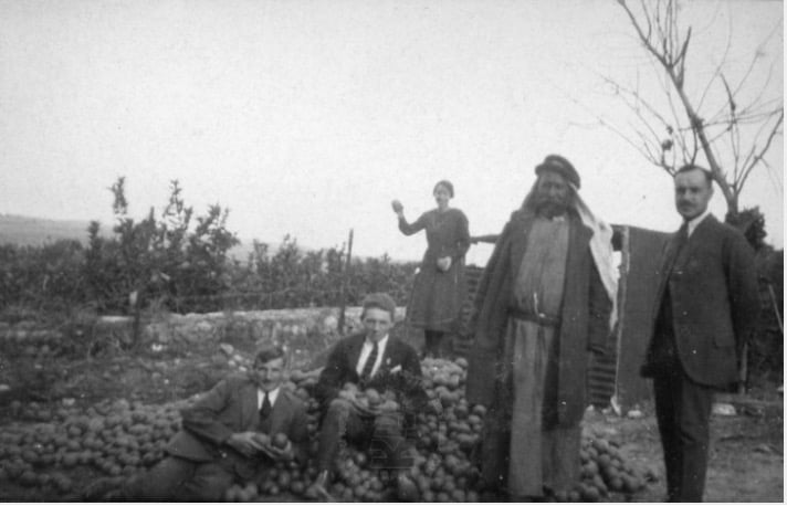
Posted by abu raya - بير سالم قبل النكبه
Posted by abu raya - بير سالم قبل النكبه
Posted by abu raya - بير سالم قبل النكبه
Posted by abu raya - Let us see how the most "liberal and civilized" of world Jewry has obliterated our village except for a few structures. How else will the Jews be great and safe again?
- Let us see how the most "liberal and civilized" of world Jewry has obliterated our village except for a few structures. How else will the Jews be great and safe again? #2
- Let us see how the most "liberal and civilized" of world Jewry has obliterated our village except for a few structures. How else will the Jews be great and safe again? #3
- Let us see how the most "liberal and civilized" of world Jewry has obliterated our village except for a few structures. How else will the Jews be great and safe again? #4
- Let us see how the most "liberal and civilized" of world Jewry has obliterated our village except for a few structures. How else will the Jews be great and safe again? #5
- Let us see how the most "liberal and civilized" of world Jewry has obliterated our village except for a few structures. How else will the Jews be great and safe again? #6
- Let us see how the most "liberal and civilized" of world Jewry has obliterated our village except for a few structures. How else will the Jews be great and safe again? #7
- Let us see how the most "liberal and civilized" of world Jewry has obliterated our village except for a few structures. How else will the Jews be great and safe again? #8
- Let us see how the most "liberal and civilized" of world Jewry has obliterated our village except for a few structures. How else will the Jews be great and safe again? #9
- Let us see how the most "liberal and civilized" of world Jewry has obliterated our village except for a few structures. How else will the Jews be great and safe again? #10
- Let us see how the most "liberal and civilized" of world Jewry has obliterated our village except for a few structures. How else will the Jews be great and safe again? #11
- Let us see how the most "liberal and civilized" of world Jewry has obliterated our village except for a few structures. How else will the Jews be great and safe again? #12
- Let us see how the most "liberal and civilized" of world Jewry has obliterated our village except for a few structures. How else will the Jews be great and safe again? #13
- Let us see how the most "liberal and civilized" of world Jewry has obliterated our village except for a few structures. How else will the Jews be great and safe again? #14
- Let us see how the most "liberal and civilized" of world Jewry has obliterated our village except for a few structures. How else will the Jews be great and safe again? #15
- Let us see how the most "liberal and civilized" of world Jewry has obliterated our village except for a few structures. How else will the Jews be great and safe again? #16
- Let us see how the most "liberal and civilized" of world Jewry has obliterated our village except for a few structures. How else will the Jews be great and safe again? #17
- Let us see how the most "liberal and civilized" of world Jewry has obliterated our village except for a few structures. How else will the Jews be great and safe again? #18
- Let us see how the most "liberal and civilized" of world Jewry has obliterated our village except for a few structures. How else will the Jews be great and safe again? #19
- Let us see how the most "liberal and civilized" of world Jewry has obliterated our village except for a few structures. How else will the Jews be great and safe again? #20
- Let us see how the most "liberal and civilized" of world Jewry has obliterated our village except for a few structures. How else will the Jews be great and safe again? #21
- Let us see how the most "liberal and civilized" of world Jewry has obliterated our village except for a few structures. How else will the Jews be great and safe again? #22
- Let us see how the most "liberal and civilized" of world Jewry has obliterated our village except for a few structures. How else will the Jews be great and safe again? #23
- Let us see how the most "liberal and civilized" of world Jewry has obliterated our village except for a few structures. How else will the Jews be great and safe again? #24
- Let us see how the most "liberal and civilized" of world Jewry has obliterated our village except for a few structures. How else will the Jews be great and safe again? #25
Want to browse more? 80,000 pictures were grouped in these gallaries:
| Display Name | Clan/Hamolah | Country of Residence |
 Fake Valor: Why Did Zionist Jews Hoist Nazis Flag on Their Ships in the 1930s?
What is new?
-
Facts About Oct. 7th Gaza Raid
-
Remined Us Please:: Who Did Rape Who? Palestinians Raped Israelis? Or, was the other way around?
-
When Prof. Edward Said was invited to debate Bibi Netanyahu in the 1980s, watch what happened!
-
Ezra Klein of the NY Times on the "Jewish Race".
-
Abusing Blood Libel!
-
Did Israeli Soldiers Activate The Hanniba Direective On Oct. 7th? You Be The Judge
-
Zionist FAQ: Isn't it true that Palestinians don't want peace? Palestinians never accepted the two-state solution
- Facts about Haavara (Transfer) Agreement between Ben-Gurion & Hitler
-
Haavara FAQs: Why Did Zionist Jews Hoist Nazis' Flags on Their Ships in the 1930s?
- Haavara FAQs: When Chaim Weizmann met FDR in mid-1943, why was he silent about rescuing European Jewry?
-
Dear ChatGPT: How did Palestinians resist Napoleon's invasion of their country in 1799?
-
Dear ChatGPT: Gaza had a vibrant Jewish community in the mid-17th century. What happened to them?
-
Dear ChatGPT: Why did the Jewish Agency suppress news of the Holocaust during WWII?
-
Video Playlist: Jews share their DNA tests to end the conflict for good.
-
A Tale of Two Conflicts: Examining the Definition of Genocide
-
Prof. Abraham Polak And The Suppressed History of the Khazars and European Jewry
-
How Ronald Reagan would have framed the genocide in Gaza if he were still alive?
-
Haavara FAQs: Let us do the math: how many German Jews did The Haavara Agreement save?
-
Zionist FAQs: The Hebron Massacre of 1929, "clearly proves" that Palestinians are antisemitic, how could you deny it?
-
Zionist FAQs: Why Anti-Zionist Is Not Antisemitism?
-
Zionist FAQs: Isn't it true that the KGB created Palestinian Nationalism in the early 1960s?
- Zionist FAQs: Muslims are killing Muslims all the time; why are Israeli Jews being singled out in the media?
- Zionist FAQs: How is Israel an apartheid state when 20% of its citizens are Arabs who enjoy full rights?
-
Haavara FAQs: Why Did Dorothy Thompson Flip From A Zionist Advocate to A Silenced Dissenter?
-
Haavara FAQs: Analysis of Herzl's Uganda Scheme and how it could have saved millions of Jews.
-
Haavara FAQs: Why did Hayim Greenberg describe American Jewry as "morally bankrupt" in early 1943?
-
Haavara FAQs: What if the Evian Conference was a resounding success? What would have been the impact of saving European Jewry on Zionism?
- Haavara FAQs: What if the six million were saved, how that would have impacted the Zionist project?
-
Haavara FAQs: How did Zionist leaders react when Europe's Jews lingered in the DP camps after WWII ended?
-
Why does the American Jewish community repeat lies that David Ben-Gurion had debunked before he died?
-
Who has the power to rename the Tatar/Khazar Gene Marker to Jewish IV?
-
Zionist FAQs: Why won't Egypt, Syria, and Jordan take their people back? Jews are indigenous to Palestine, and Arabs immigrated after Jews developed the country. Arabs should leave.
-
Haavara FAQs: Did Hitler and the Nazis conflate between Judaism and Zionist? If that wasn't case, then why?
-
Haavara FAQs: Winston Churchill and antisemitism, a collection of articles written Churchill.
-
Haavara FAQs: Broken by country, how many Jews survived vs. killed during the Holocaust?
-
Haavara FAQs: Why did European Jews vote with their feet and to immigrated to the Americas, not Palestine, after WWII?
-
Watch this American Jewish Girl describing Israeli Jews' cognitive dissonance like no other in under two minutes
-
Haavara FAQs: When the Nazis went out of their way to hide the Holocaust, Israeli Jews did the exact opposite by broadcasting their genocide of Gazans. But why?
-
Haavara FAQs: How Zionist Jews went out of their to show their appreciation to Nazism and Fascism?
- Haavara FAQs: Why Zionist leaders were against bombing the death camps & the Railroads leading to them?
-
Haavara FAQs: Hitler's message to the British and American people: If Jews are such noble citizens and you care about them, how come you're not letting them in? I will gladly ship them to you at my expense, even on luxury liners!
-
A shortlist of Zionist and Israeli false flag operations in the name Jews.
-
The Most Moral Army
- The Land of Kapos (Israel): Where the brave are boycotted and Kapos walk free.
- Why did early Zionists often named their communal enterprises "colonial"?
- Zionist Relations with Nazi Germany by Faris Glubb
-
Two NY Times advertisements by Zionists in the early 1943 that exposes Zionists' treason at the height of the calamity
- Facts Not Lies about the Palestinian-Israeli Conflict.
- Site's pictures have been categorized
- Campgain Against Lice
- A Survey of Palestine, the official source about Palestine before Nakba produced by the British Mandate; over 1200 pages.
- Satellite View & Google Earth: Over 6,000 placemarks identifying all destroyed towns, W. Bank & Gaza Strip Towns, & refugee camps.
- PalestineRemembered.com and its Nakba Oral History Project were featured on al-Jazeera Satellite TV.
- Nakba Oral History Video Podcast:
 Over 700 Oral History interviews (including 3,500+ hours of recording) can be viewed online.
 - Palestine Village Statistics Project
- Gaza Jail Break
- النسخة العربية للموقع الان متوفرة
- Videos: Documenting the destroyed villages in video: Tracing all that remains since Nakba.
- Videos: Responding to Zionist Propaganda
- Interview: The ethnic cleansing of Palestine: George Galloway interviews Israeli Historian Ilan Pappe.
- For Palestinians, memory matters. It provides a blueprint for their future By George Bisharat.
- Zionist FAQ now available in Hebrew שאלות שציונים שואלים, עכשיו בעברית
- Video: The Stephen Walt and John Mearsheimer report on the influence of the Israel Lobby on U.S. Foreign Policy
- The Palestinian-Israeli conflict for beginners
