PalestineRemembered About Us Oral History العربية
Menu Pictures Zionist FAQs Haavara Maps
PalestineRemembered.com Satellite View Search Donate Contact Us Looting 101 العربية
About Us Zionist FAQs Conflict 101 Pictures Maps Oral History Haavara Facts Not Lies Zionism 101 Zionist Quotes

Palestine Maps: A detailed map of Palestine (inclusive of Hauran in southern Syria), and the adjacent districts published by Charles Knight & Co -- London on April 15th, 1843

This is our gift to the so many Jews who keep repeating the big lies that Palestine was empty and waiting for 2,000 years for Jews to return to bloom its desert. Notice how this map cited the seasonal port of Abu Zabura (now known by Mikhmoret after Israelis destroyed and replaced the neighboring village of Wadi al-Hawarith) just west of Jinin and north of Netanya today. Here is a fun fact about Abu Zabura's port: two million watermelons used to be exported from this port just before Nakba. Nowadays in the "liberal world", holding a picture of the watermelon has become an antisemitic symbol as hoisting the Swastika. Anyhow, click the map to enlarge itAs you inspect the map, please compare it with Google's Satellite view, and you will see how many Palestinian towns Israelis have completely erased and replaced (marked with red balloons) just within 105 years. That is a vivid picture of how colonial settlers worked for the past 500 years; they all recycled the same white man's narrative: deny, deny, and keep on denying reality. Honestly, do you think Zionist Jews gave a good for refugees?

Map-of-Palestine-and-Houran-1843
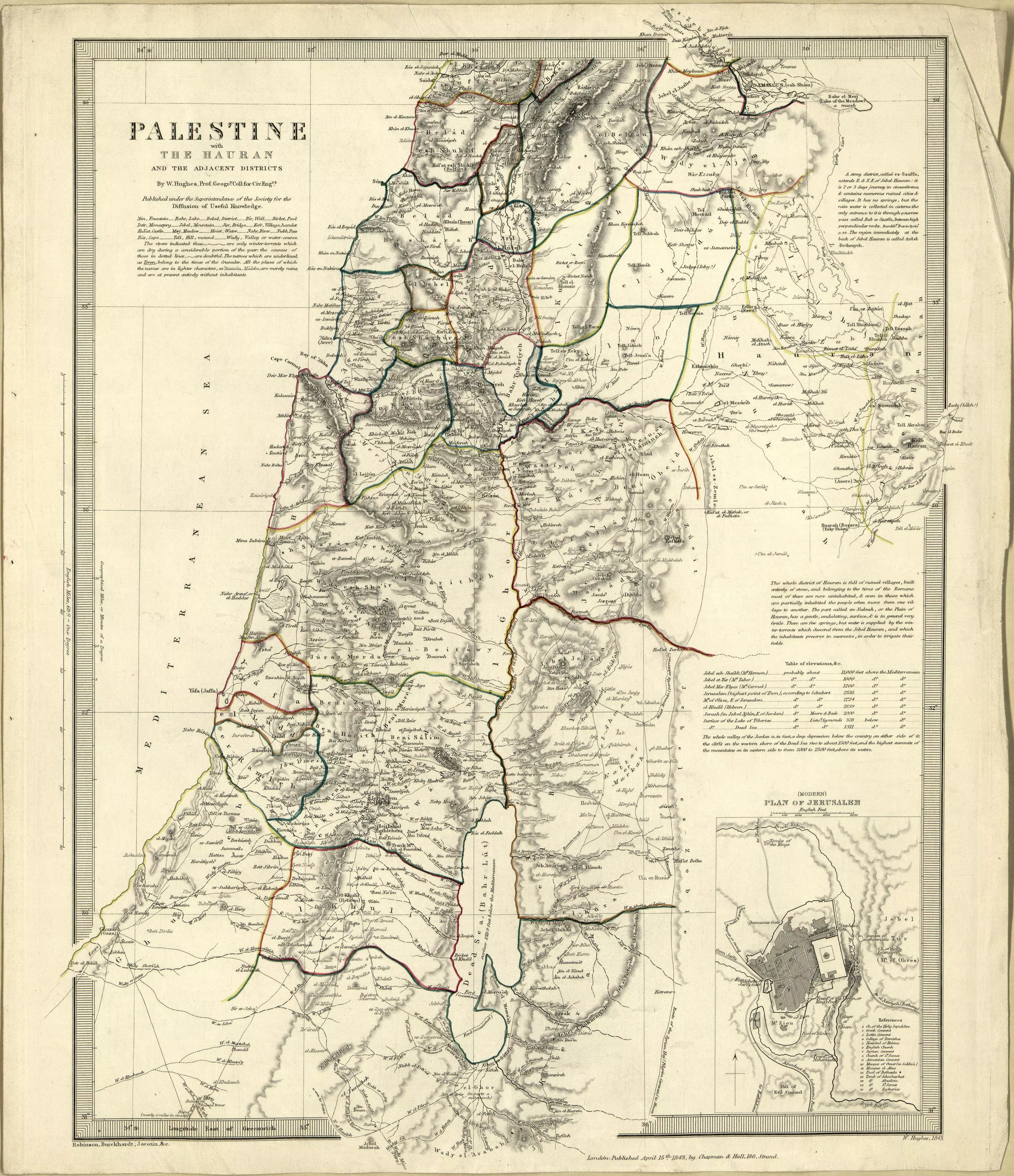
For more details about this map, please visit the Library of Congress.

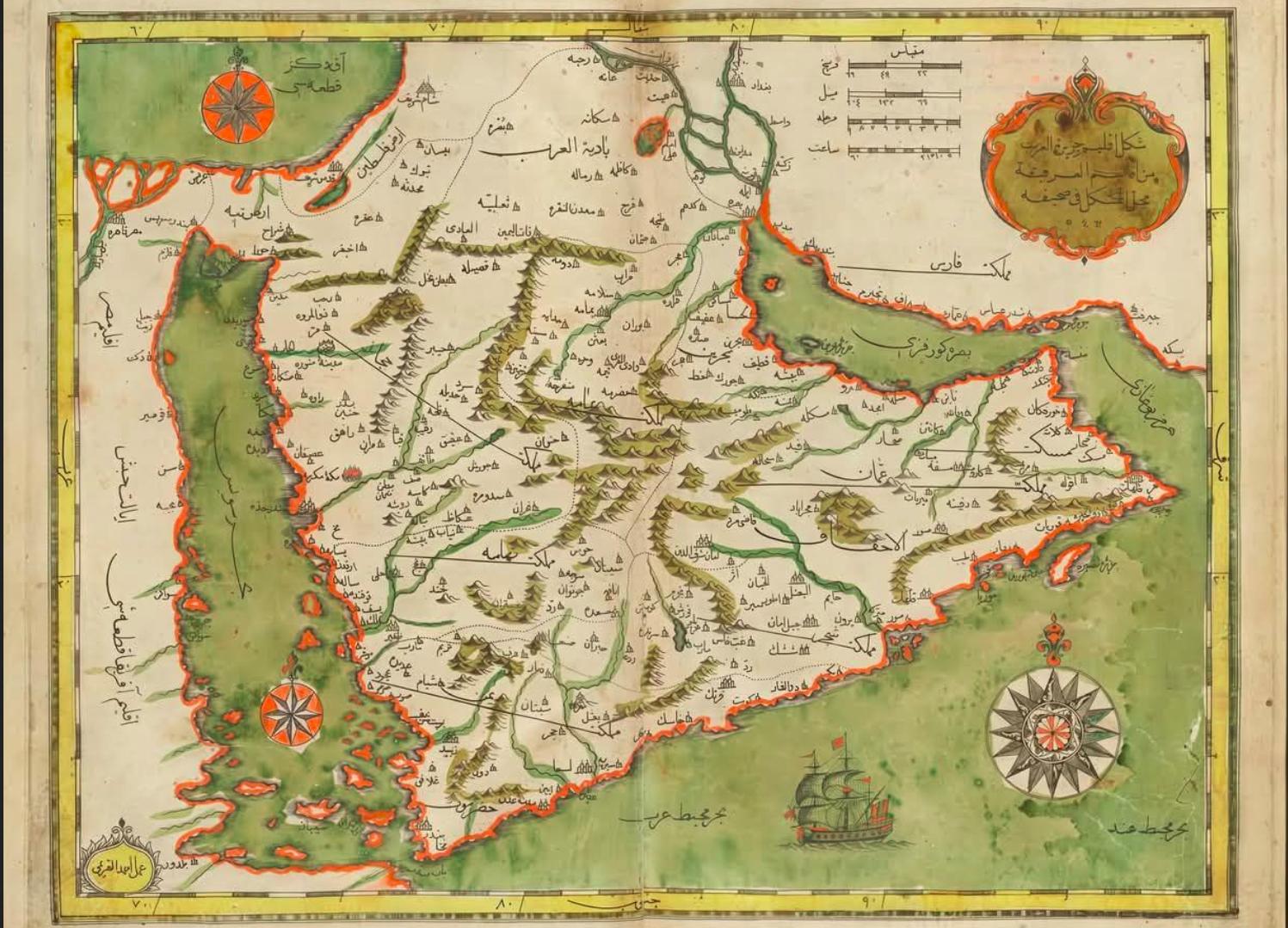
Here is another gift to world Jewry: an old Ottoman map (published in 1650 AD) that is at least 450 years old for the Greater Syria (Sham), Iraq, Eastern Iran, and Hijaz. As you can see in the top left corner, Palestine was cited: The Land of Palestine: أرض فلسطين. What is tragically funny is that the Sinai Peninsula was included in Palestine, which was changed after the British colonized Egypt: Old-Ottoman-Map-ofSyria-and-Hijaz-in-1650

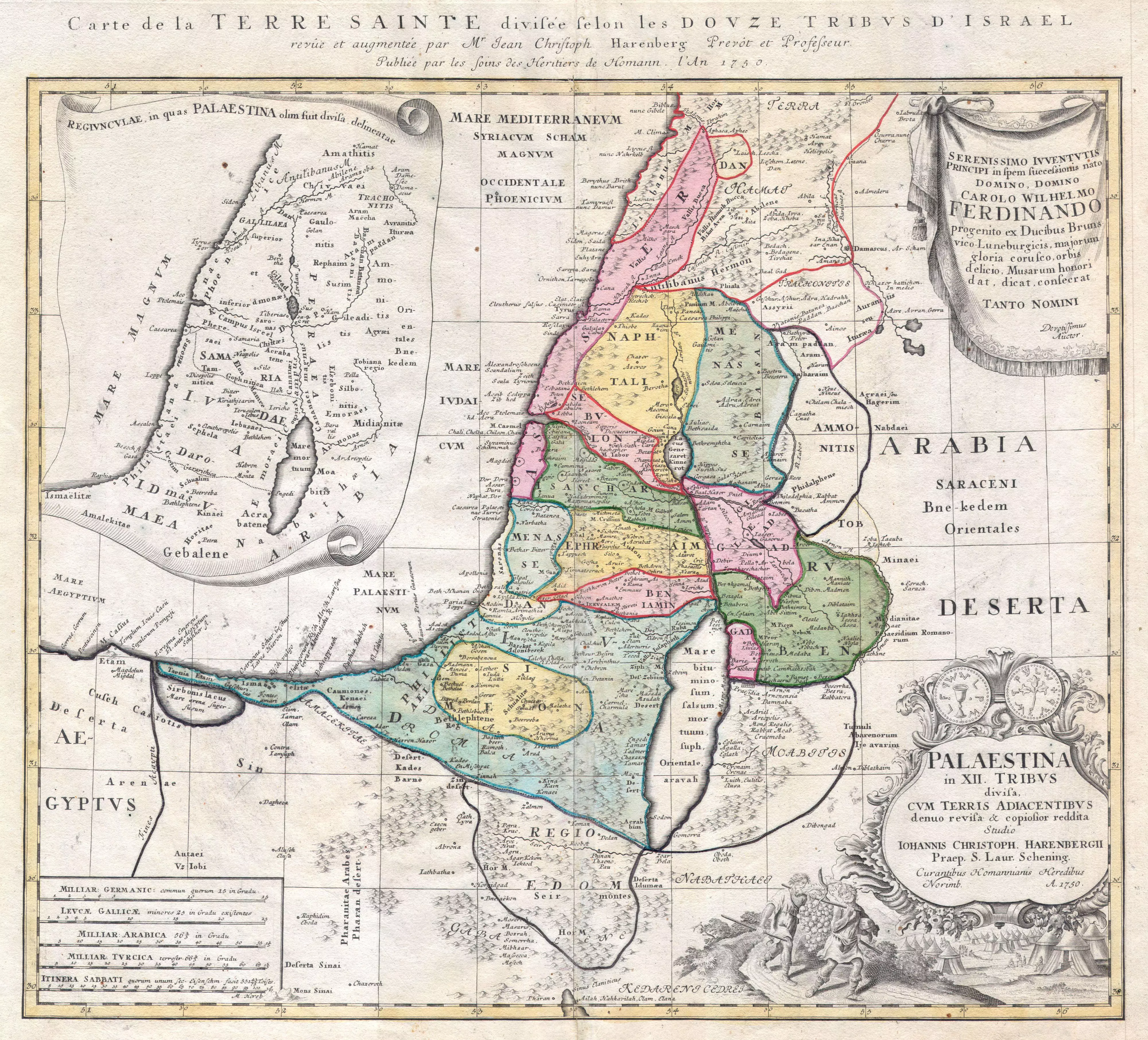
Here is Map of of Palestine and the 12 Tribes of Israel by Homann Heirs as of 1750 AD. Pay attention to how this map said nothing about Israel, but when you search online or inspect Wikipedia's pages, Israel is mentioned first before Palestine. It seems the Ministry of Truth has been working overtime on this one: 1750_Homann_Heirs_Map_of-Palestine-Holy_Land

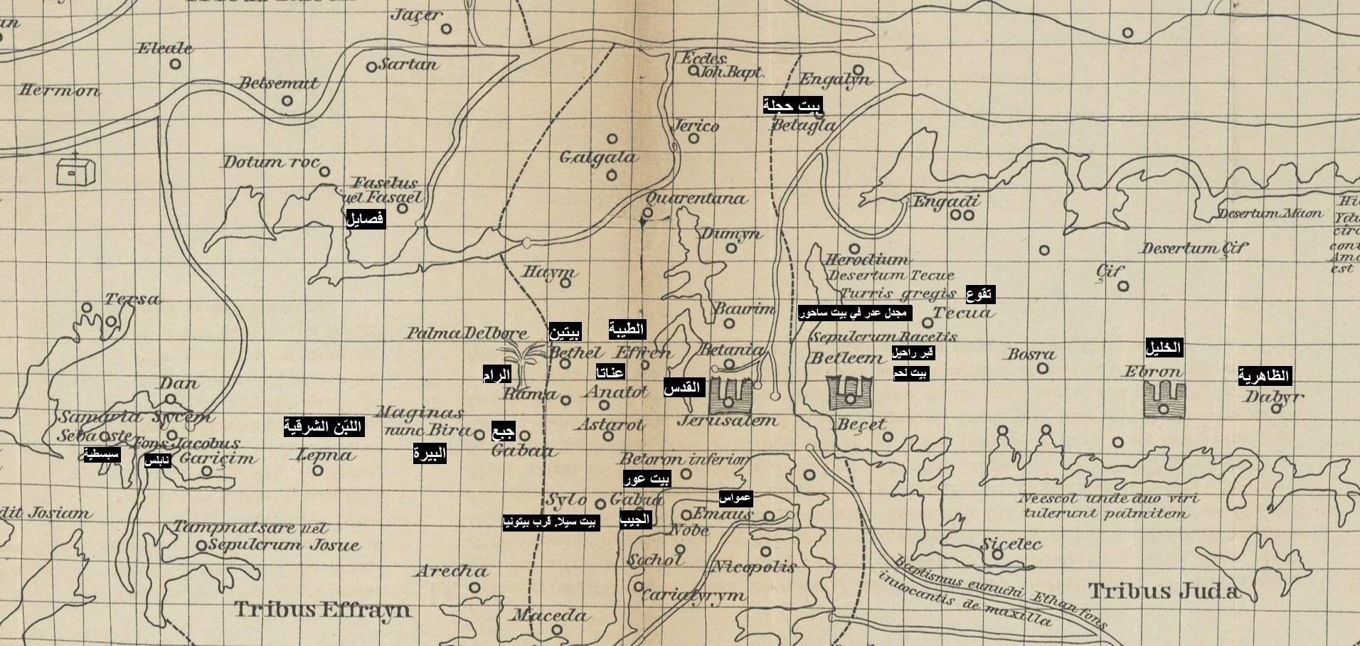
Here is a map by Marino Sanudo in 1321 AD, who detailed the names of West Bank Palestinian villages that exist to this date, which are still known by the same names. Note that the left represents North. This is a small part of the map, but not the entire map:

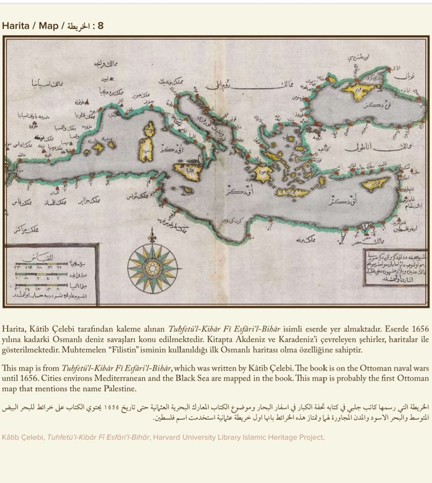
Here is a 500-year-old naval map published by the Ottoman Navy in 1656. On the far right in the middle, "The Land of Palestine" was written in Arabic (أرض فلسطن):

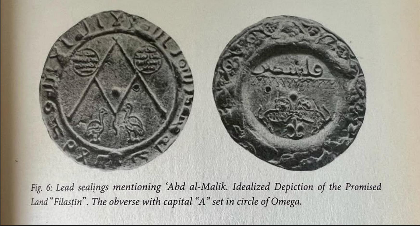
Here is a lead sealing mentioning 'Abd al-Malik dating to the 7th-8th century A.D., with an Idealized depiction of the "promised land" of "Filistin". Note the obverse with capital "A" set in a circle of Omega. This seal was found in the early 20th century in the ethnically leased and destroyed Palestinian village of Abu Kishk. That is our gift to the so many Jews who keep saying Palestine was empty and didn't exist:

If you have five minutes to spare, here is one of the best presentations on this topic: 1,000 Years of Palestine in Maps: from 985 to 1915 CE:

From "The West Wing," the president asks: why cannot a simple map of Palestine in 1709 be framed in the White House? Watch for minutes and you find how the Ministry of Truth has been hard at work:


Post Your Comment

 
Fake Valor: Why Did Zionist Jews Hoist Nazis Flag on Their Ships in the 1930s?

What is new?