| PalestineRemembered | About Us | Oral History | العربية | |
| Pictures | Zionist FAQs | Haavara | Maps | |
| Search |
| Camps |
| Districts |
| Acre |
| Baysan |
| Beersheba |
| Bethlehem |
| Gaza |
| Haifa |
| Hebron |
| Jaffa |
| Jericho |
| Jerusalem |
| Jinin |
| Nablus |
| Nazareth |
| Ramallah |
| al-Ramla |
| Safad |
| Tiberias |
| Tulkarm |
| Donate |
| Contact |
| Profile |
| Videos |
Welcome To al-Kabri - الكابري (אל-כאברי)
|
District of Acre
Ethnically cleansed days ago |
العربية Google Earth |
 |
Gallery (134) |
- Statistics & Facts
-
Before & After

- Satellite View
- Articles 3
- Pictures 134
- Oral History 8
- Members 54
- All That Remains
- Wikipedia
- Videos 5
- Guest Book 66
- Links
| Statistic & Fact | Value | ||||||||||||||
| Occupation Date | May 21, 1948 | ||||||||||||||
| Distance From District | 12.5 (km) Northeast of Acre | ||||||||||||||
| Elevation | 80 (meters) | ||||||||||||||
| Before & After Nakba, Click Map For Details |
|||||||||||||||
|
|||||||||||||||
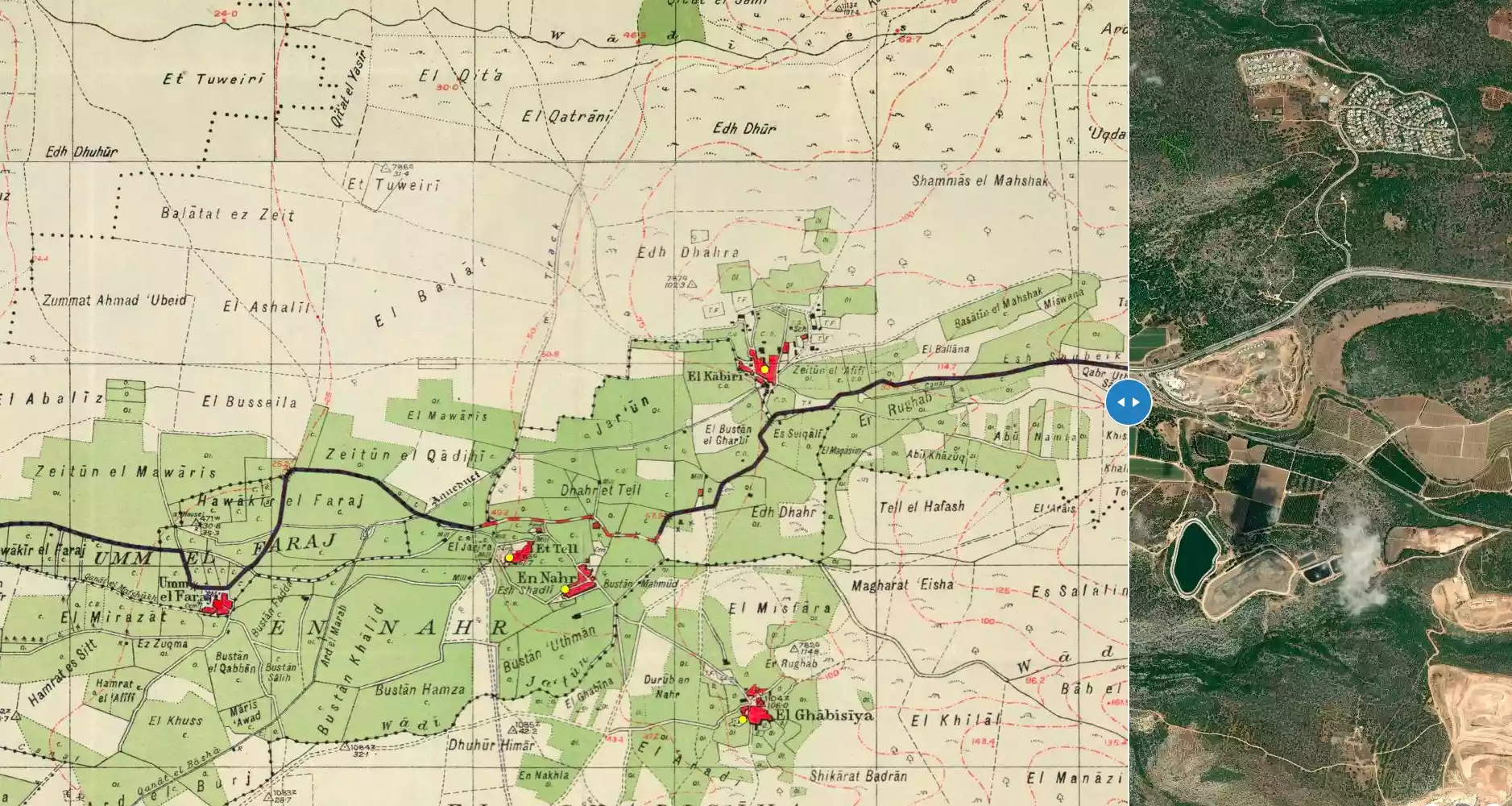
| Map Location | See location #11 on the map View from satellite |
||||||||||||||
| Military Operation | Second stage of Ben-Ami Operation | ||||||||||||||
| Defenders | Arab Liberation Army | ||||||||||||||
| Acts of Terror | Massacre occured by Zionist troops against the town's inhabitants. | ||||||||||||||
| Exodus Cause | Military assault by Zionist troops | ||||||||||||||
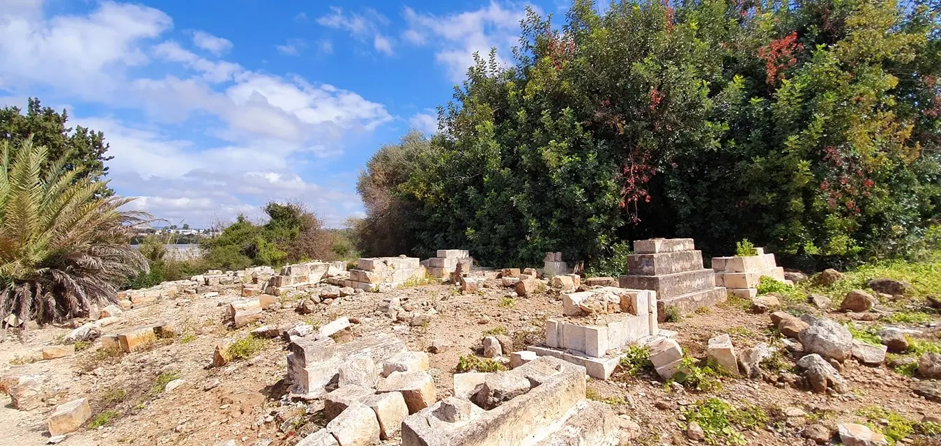
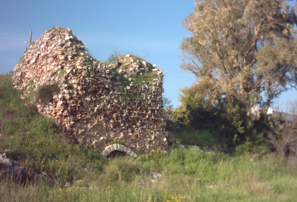
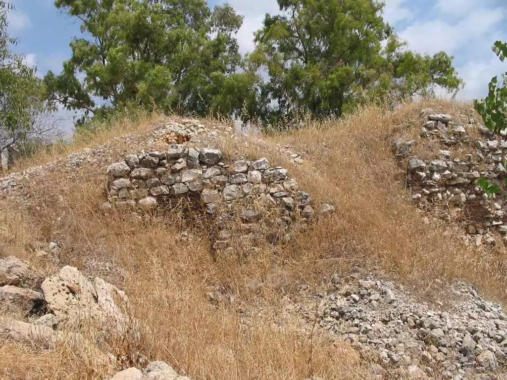
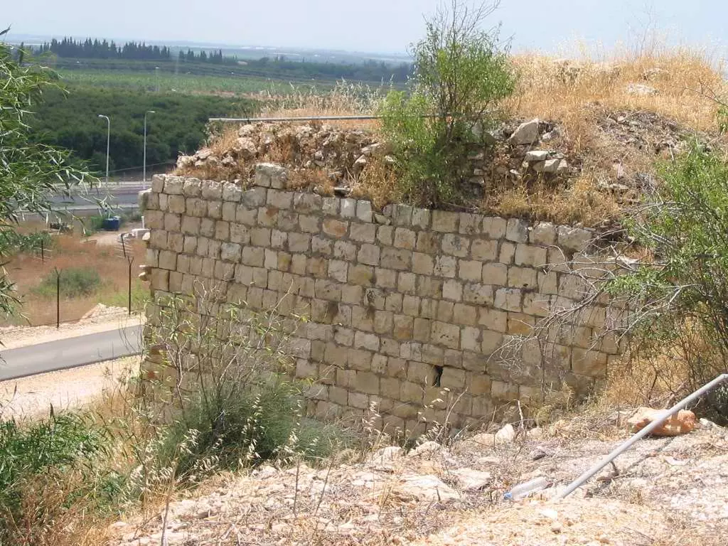
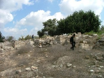
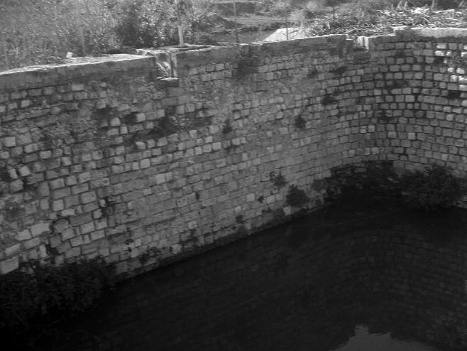
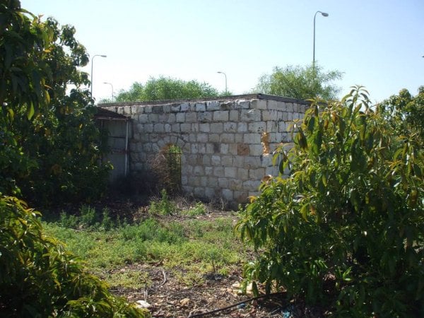
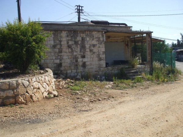
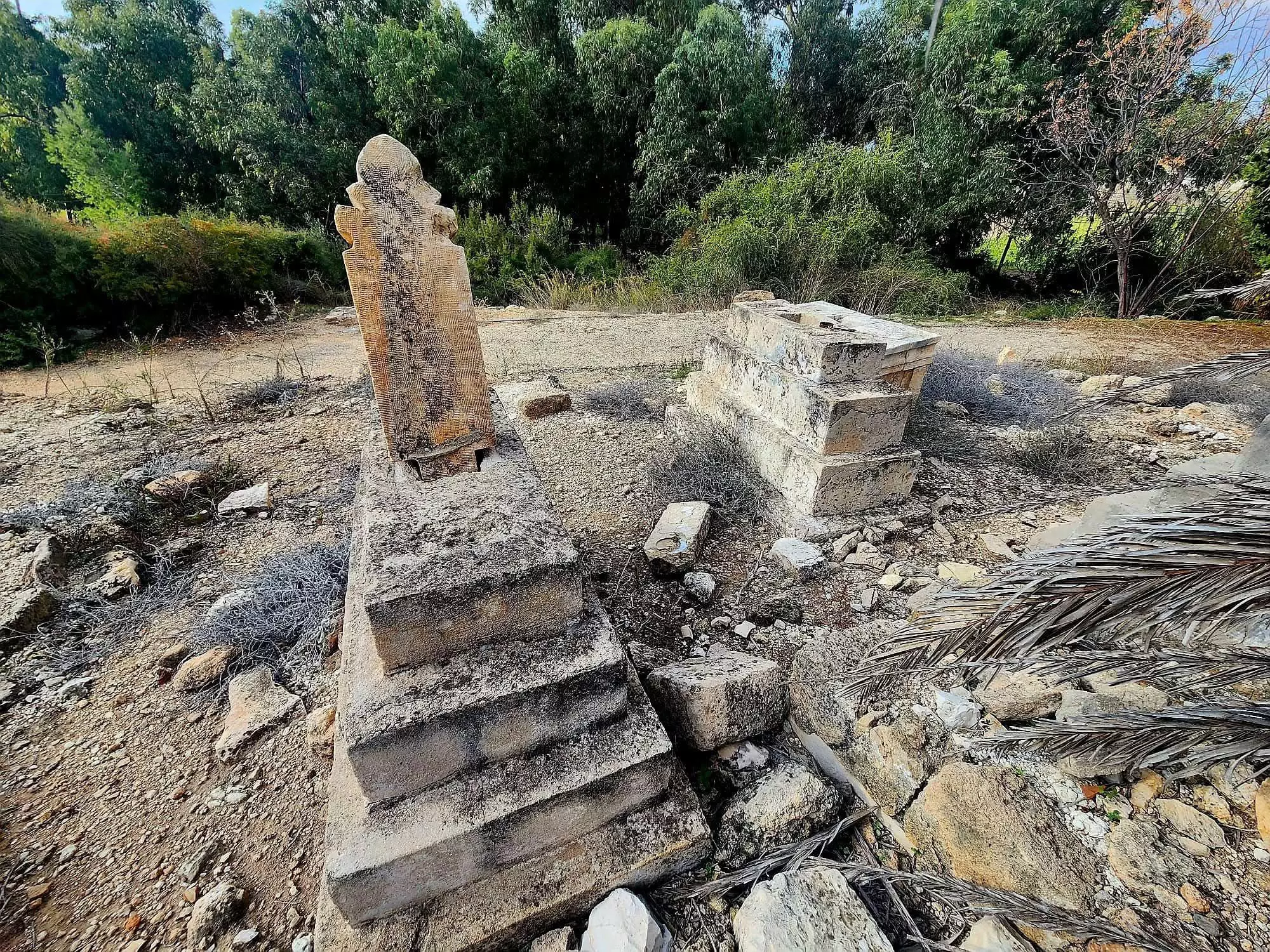
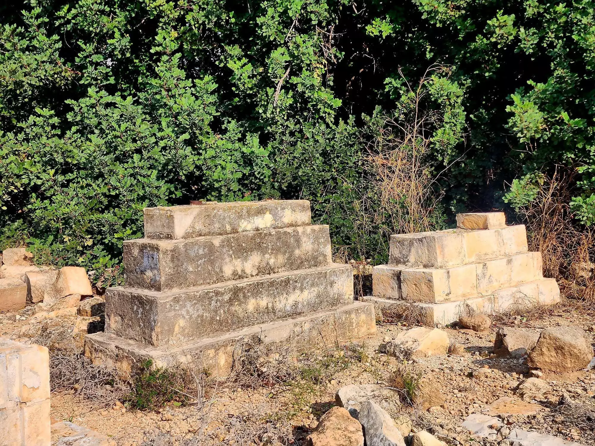
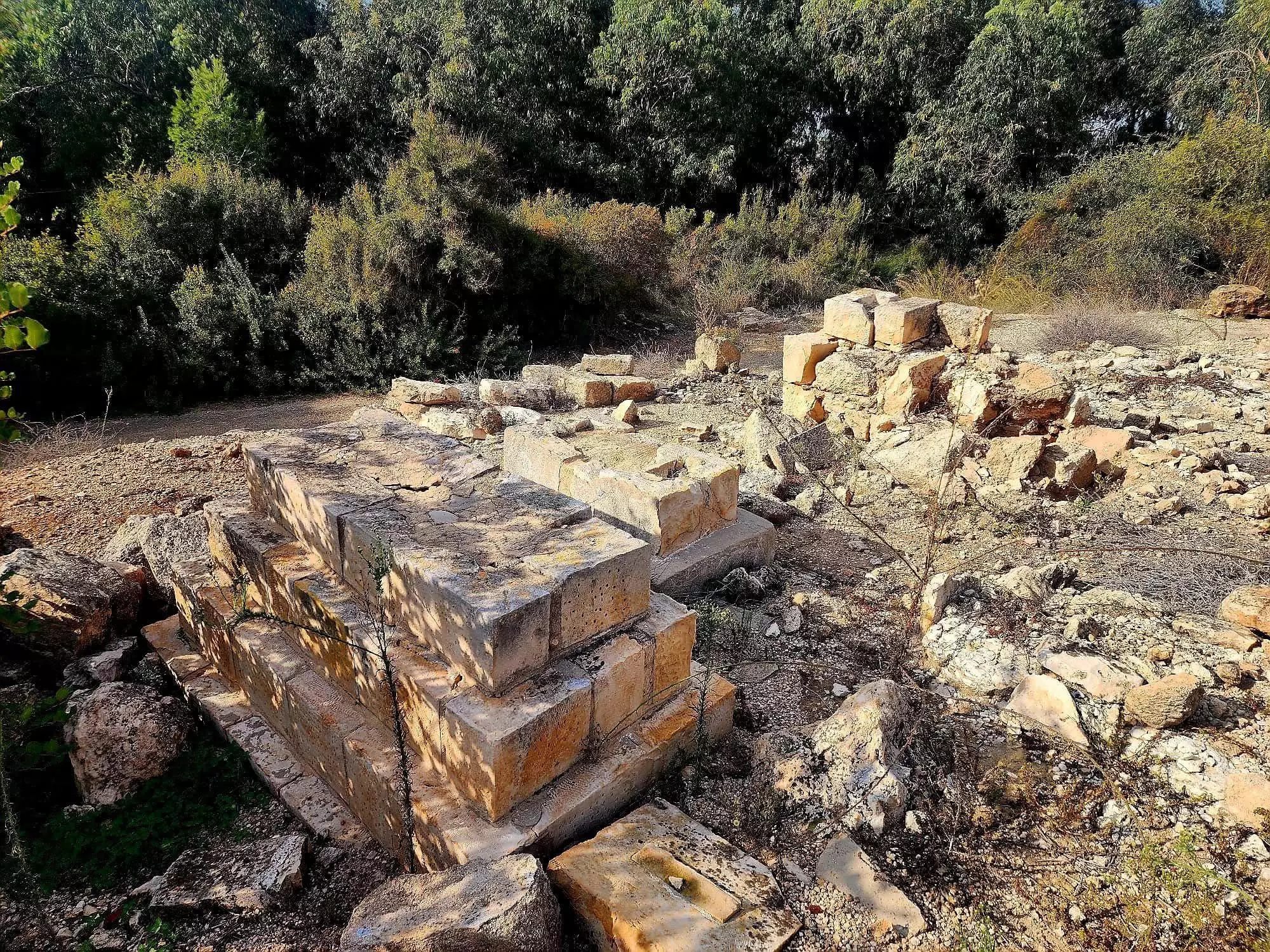
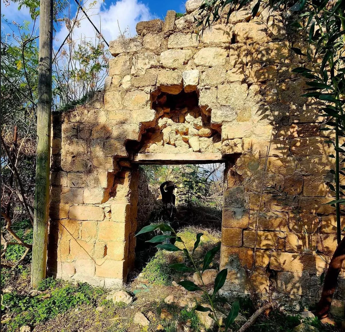
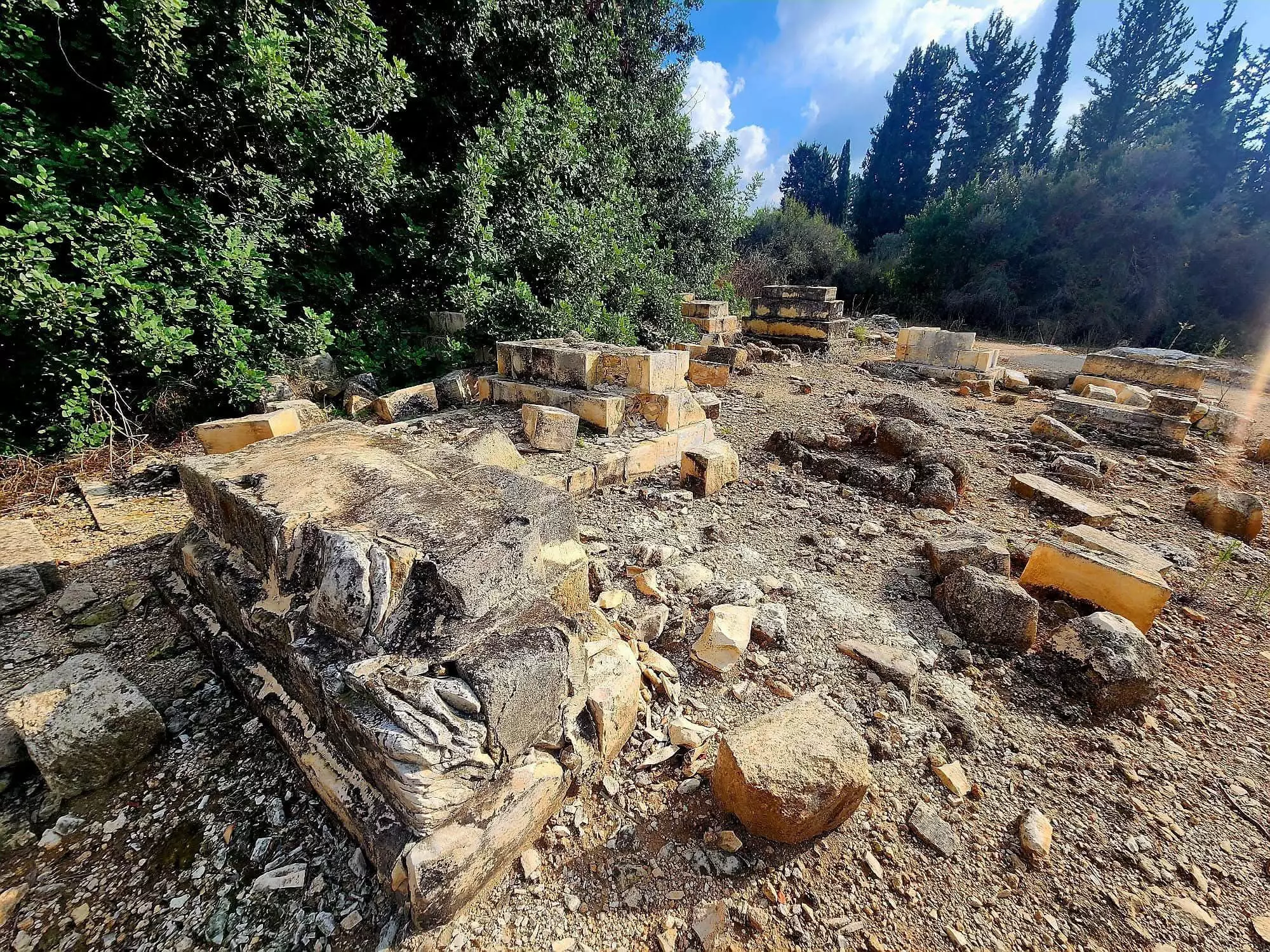
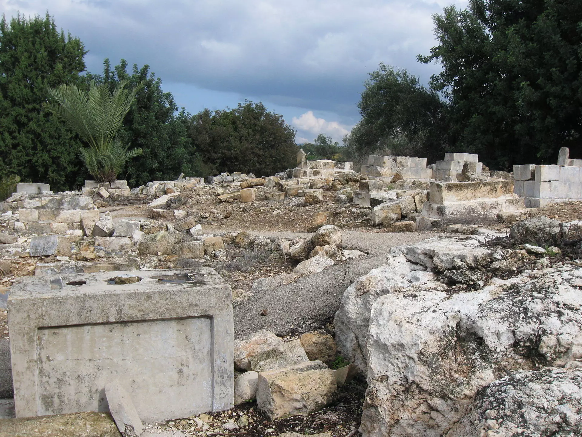
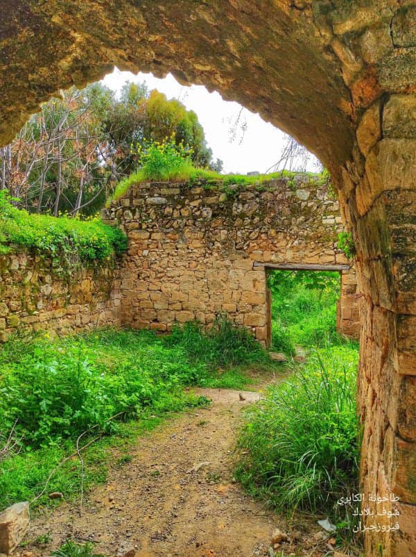
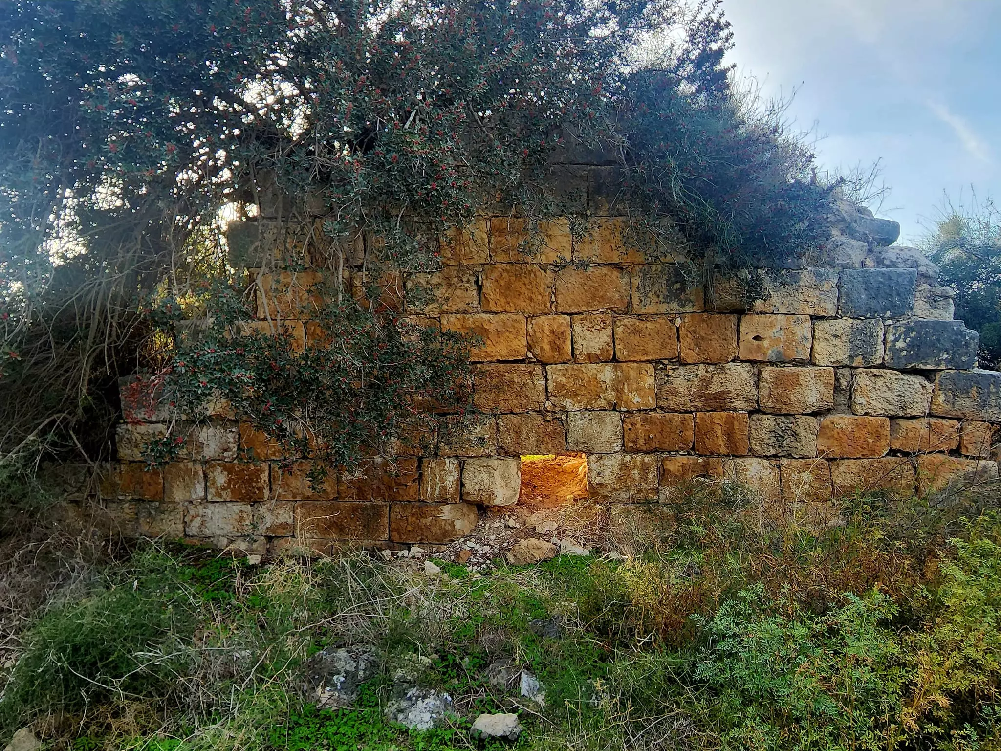
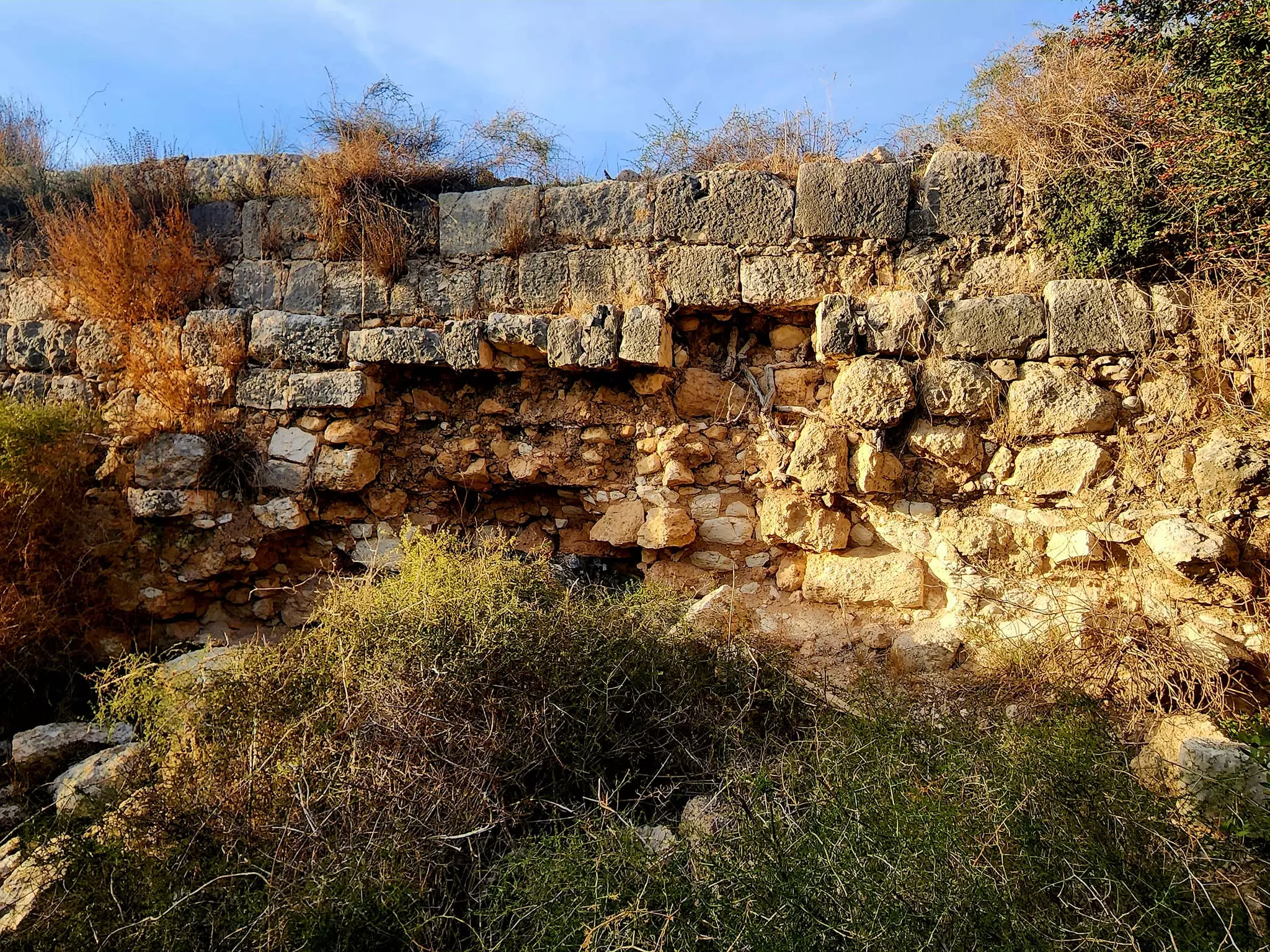
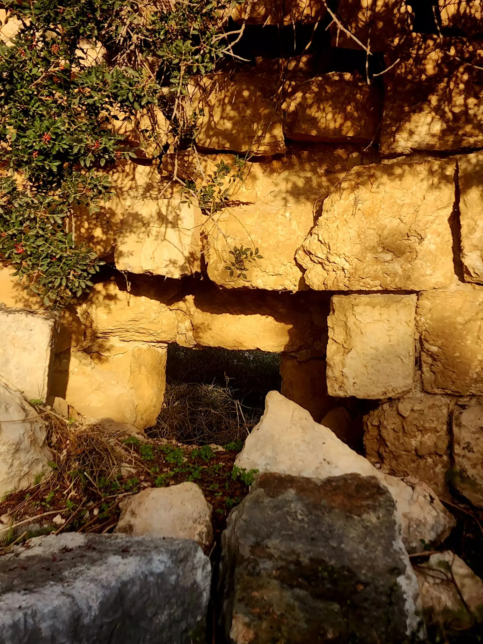
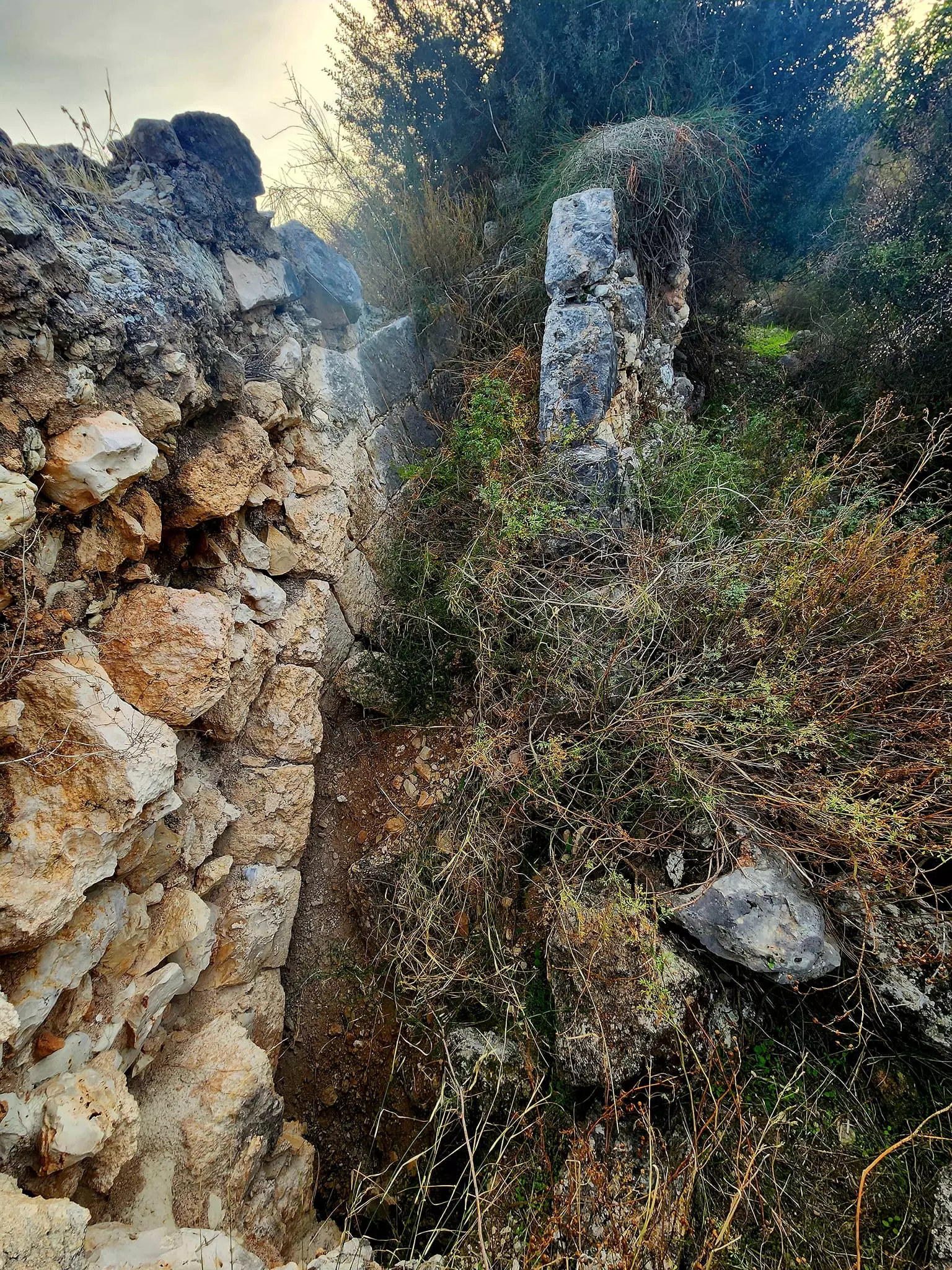
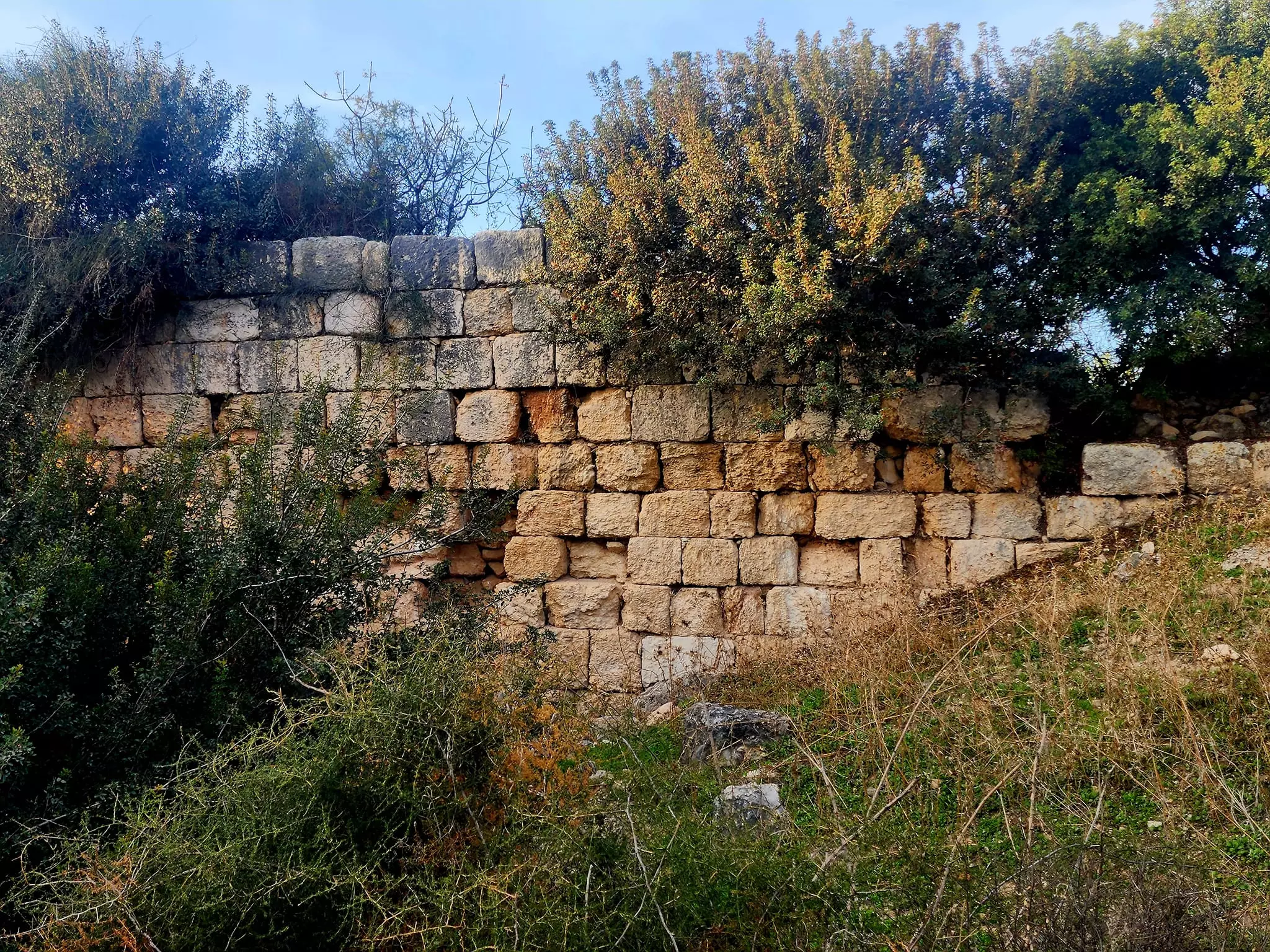
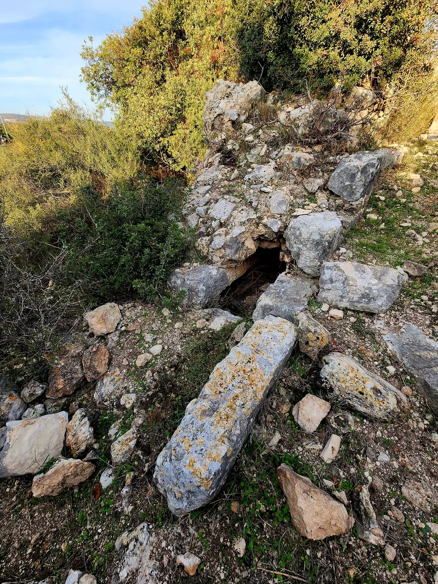
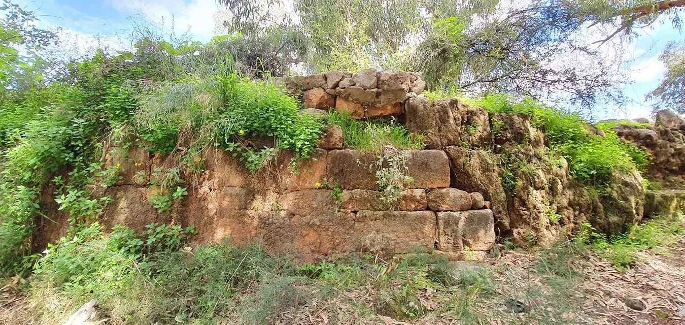
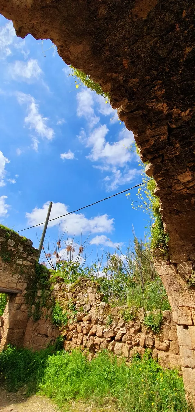
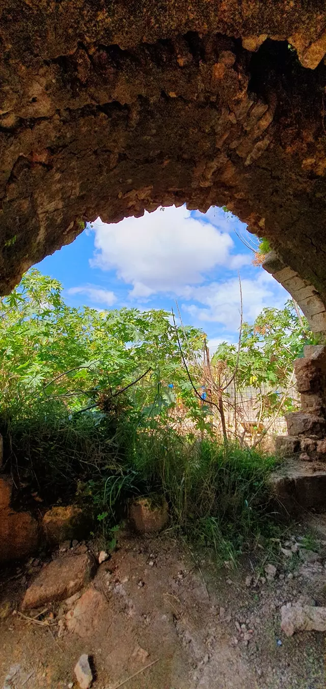
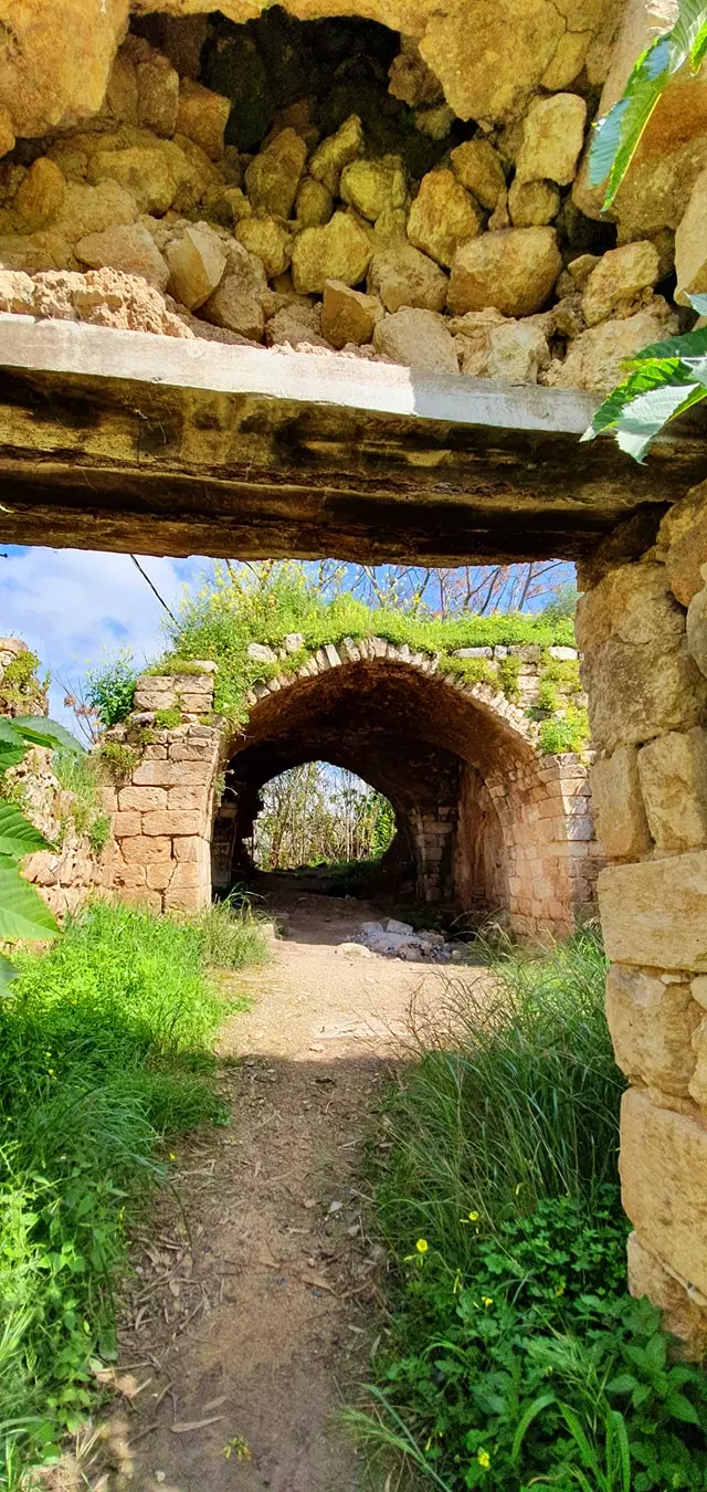
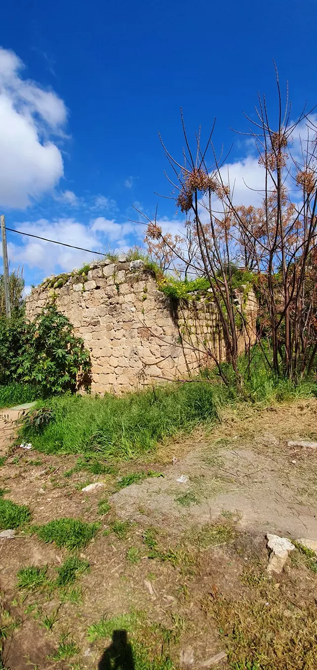
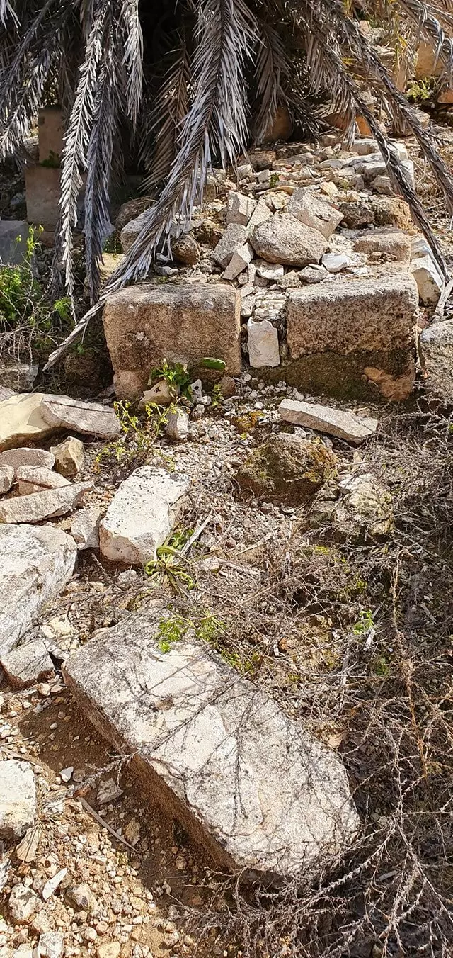
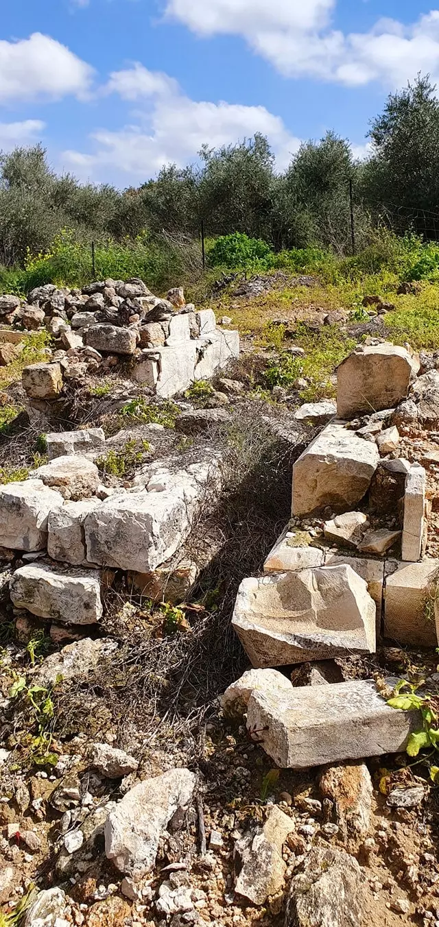
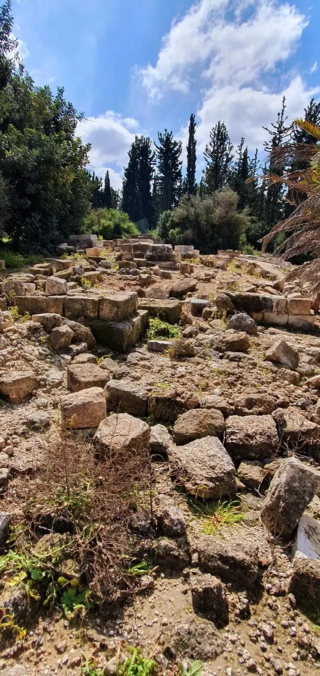
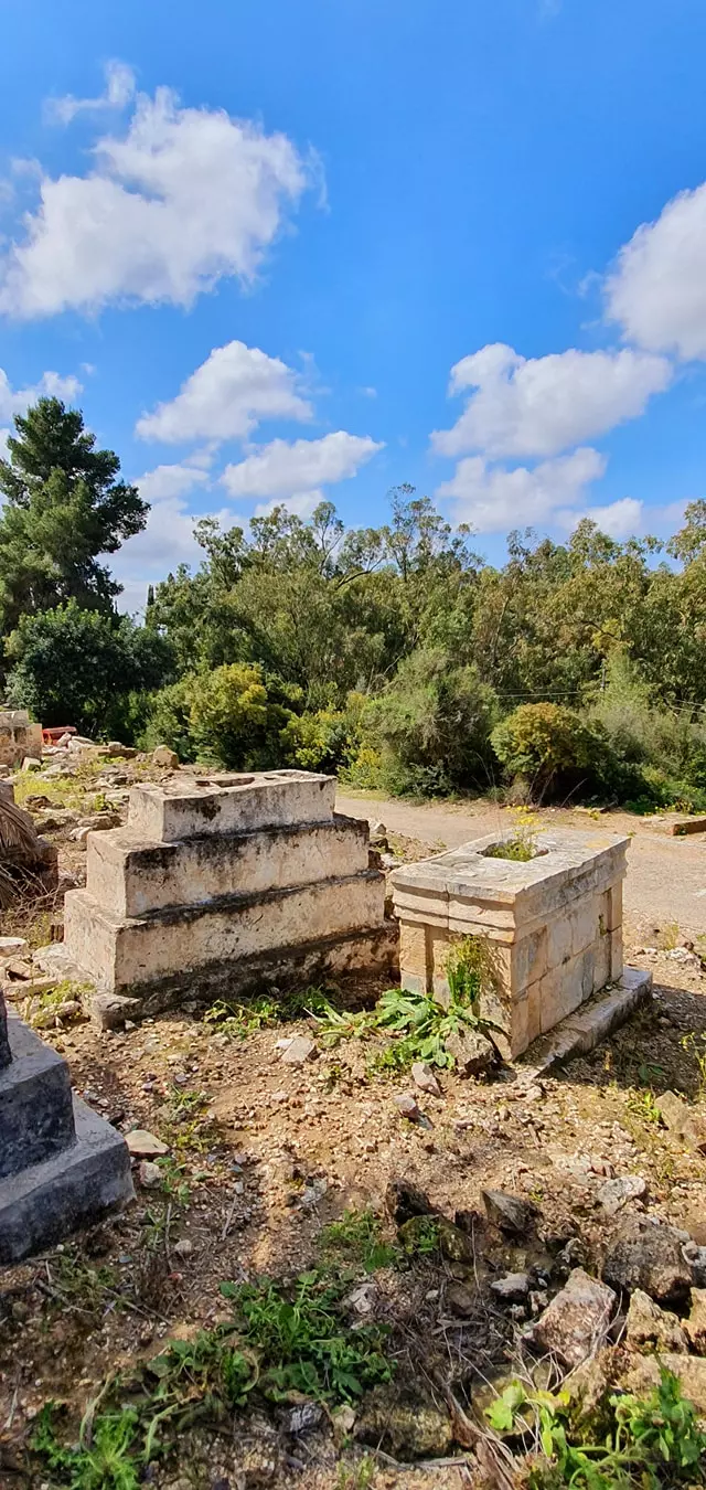
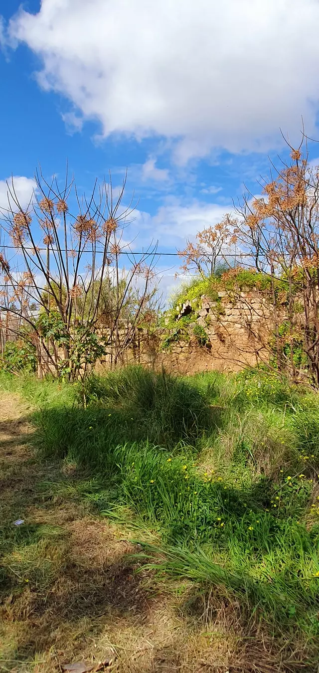
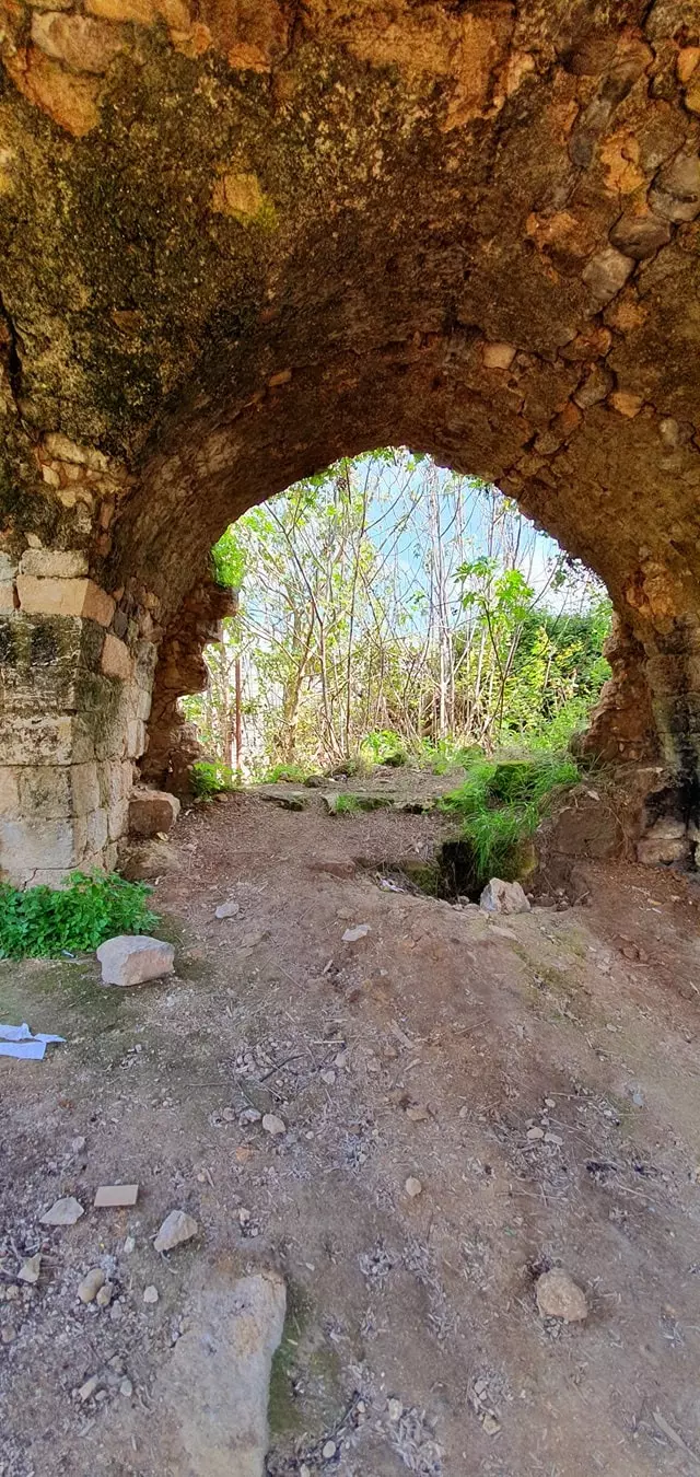
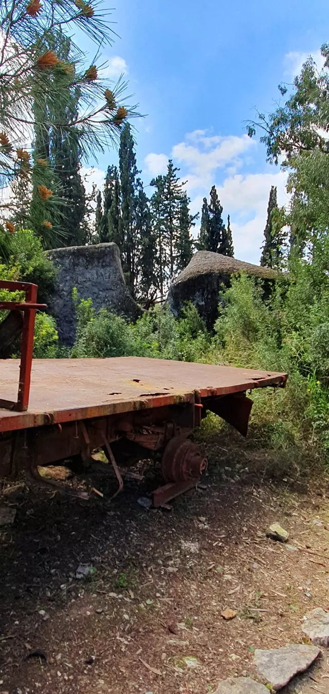
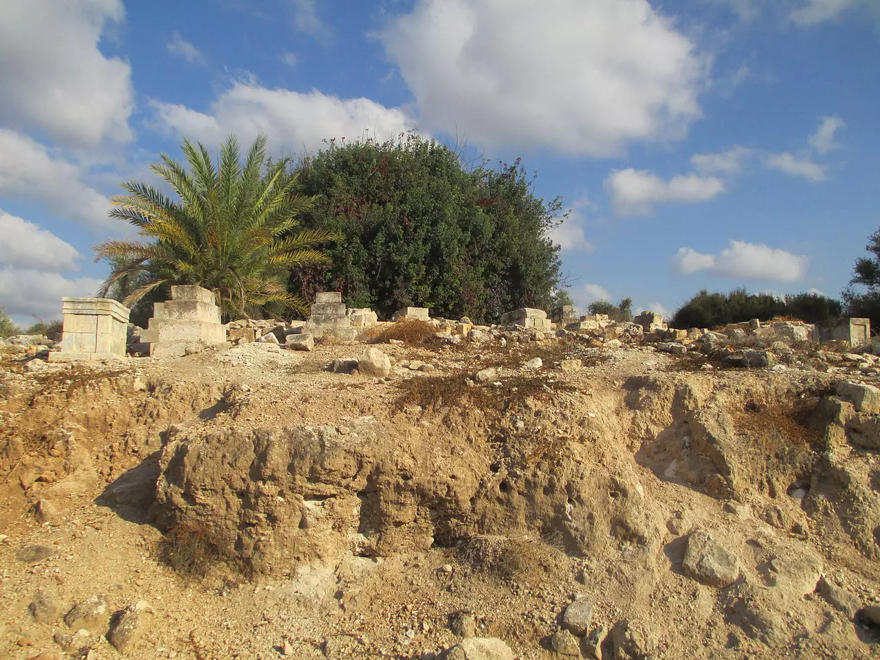
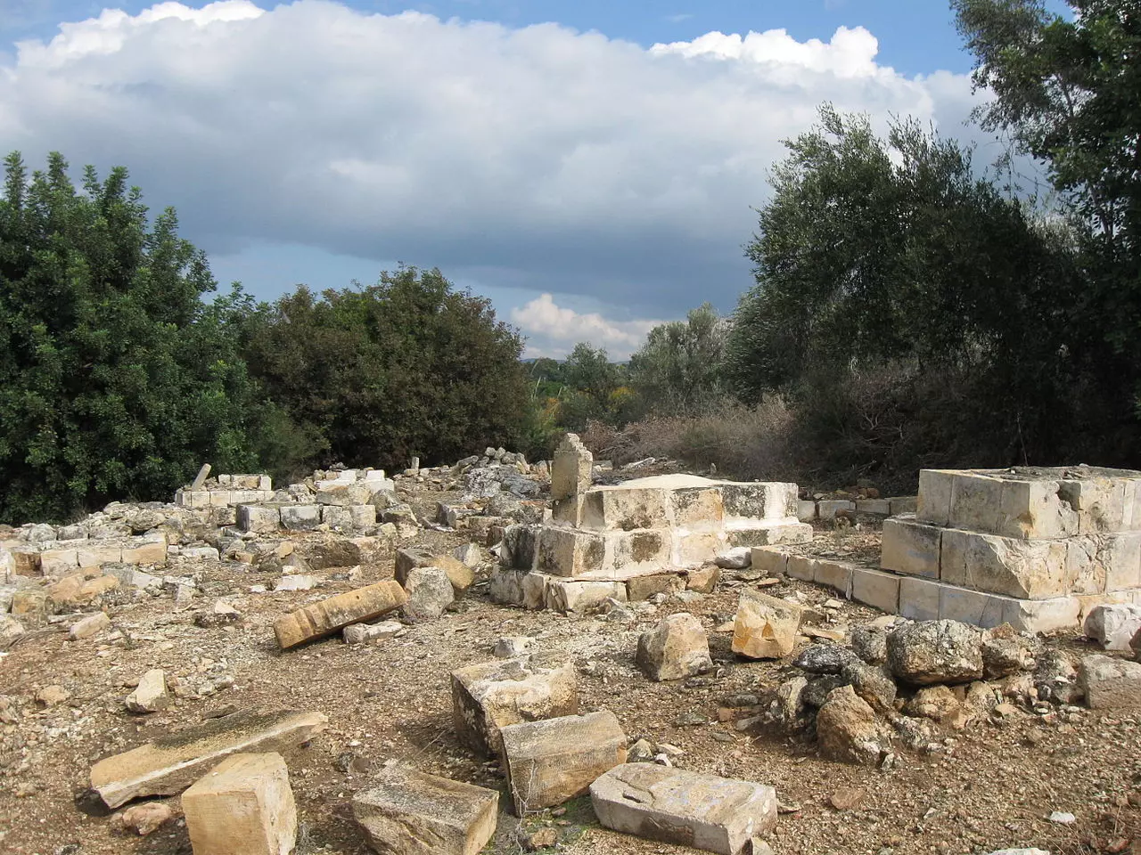
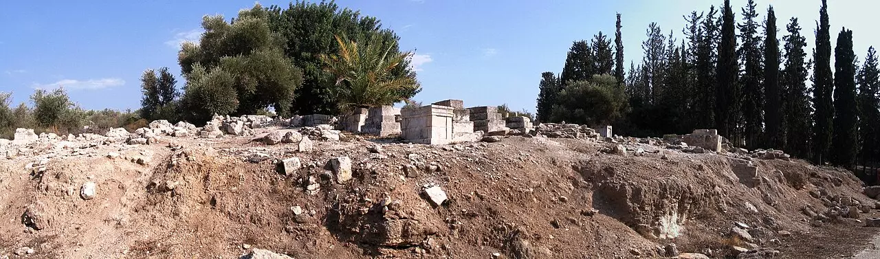
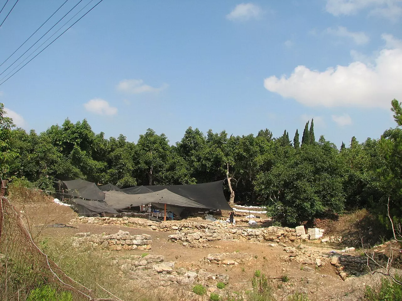
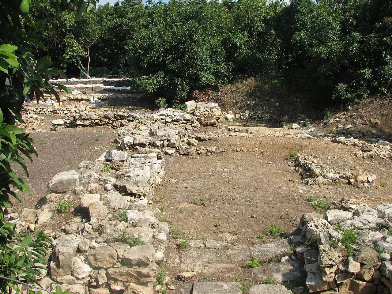
| Village Temains | al-Kabri was completely destroyed and defaced. | ||||||||||||||
| Ethnically Cleansing | al-Kabri inhabitants were completely ethnically cleansed. | ||||||||||||||
| Pre-Nakba Land Ownership |
**Town Lands' Demarcation Maps |
||||||||||||||
| Land Usage As of 1945 |
|
||||||||||||||
| Population |
|
||||||||||||||
| Number of Houses |
|
||||||||||||||
| Near By Towns |
|||||||||||||||
|
|||||||||||||||
| Town's Name Through History | Crusaders referred to al-Kabri by Cabra. | ||||||||||||||
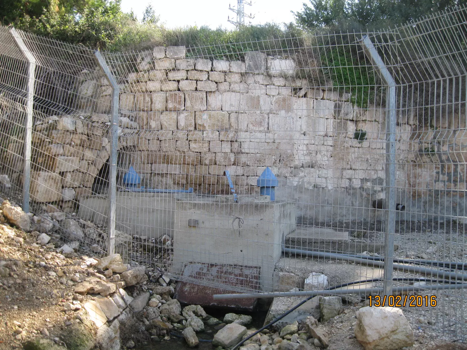
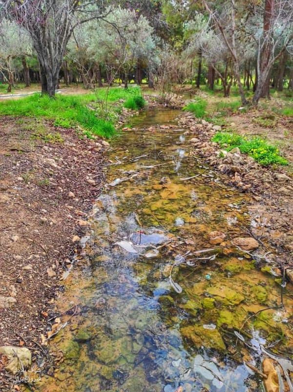
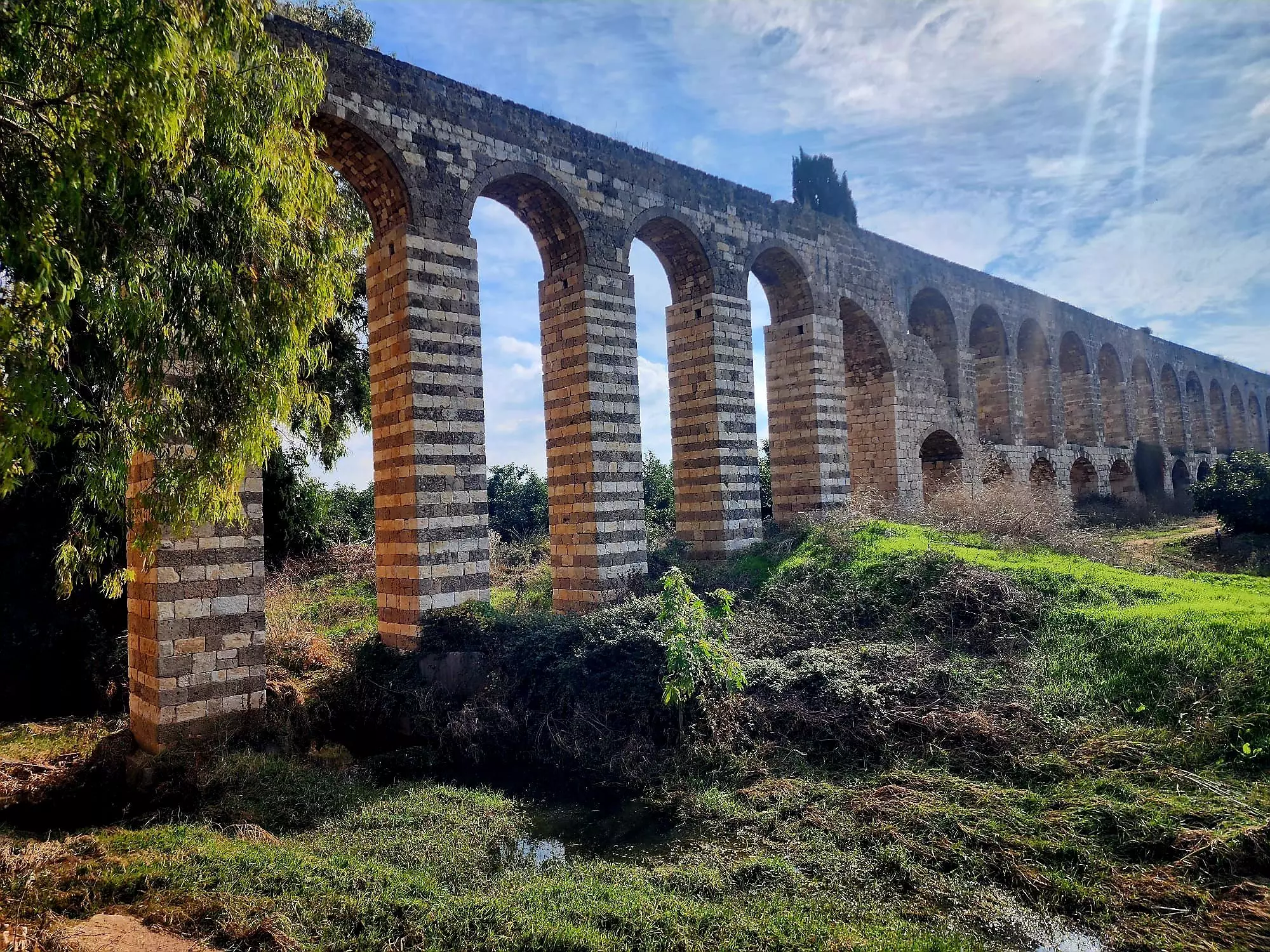
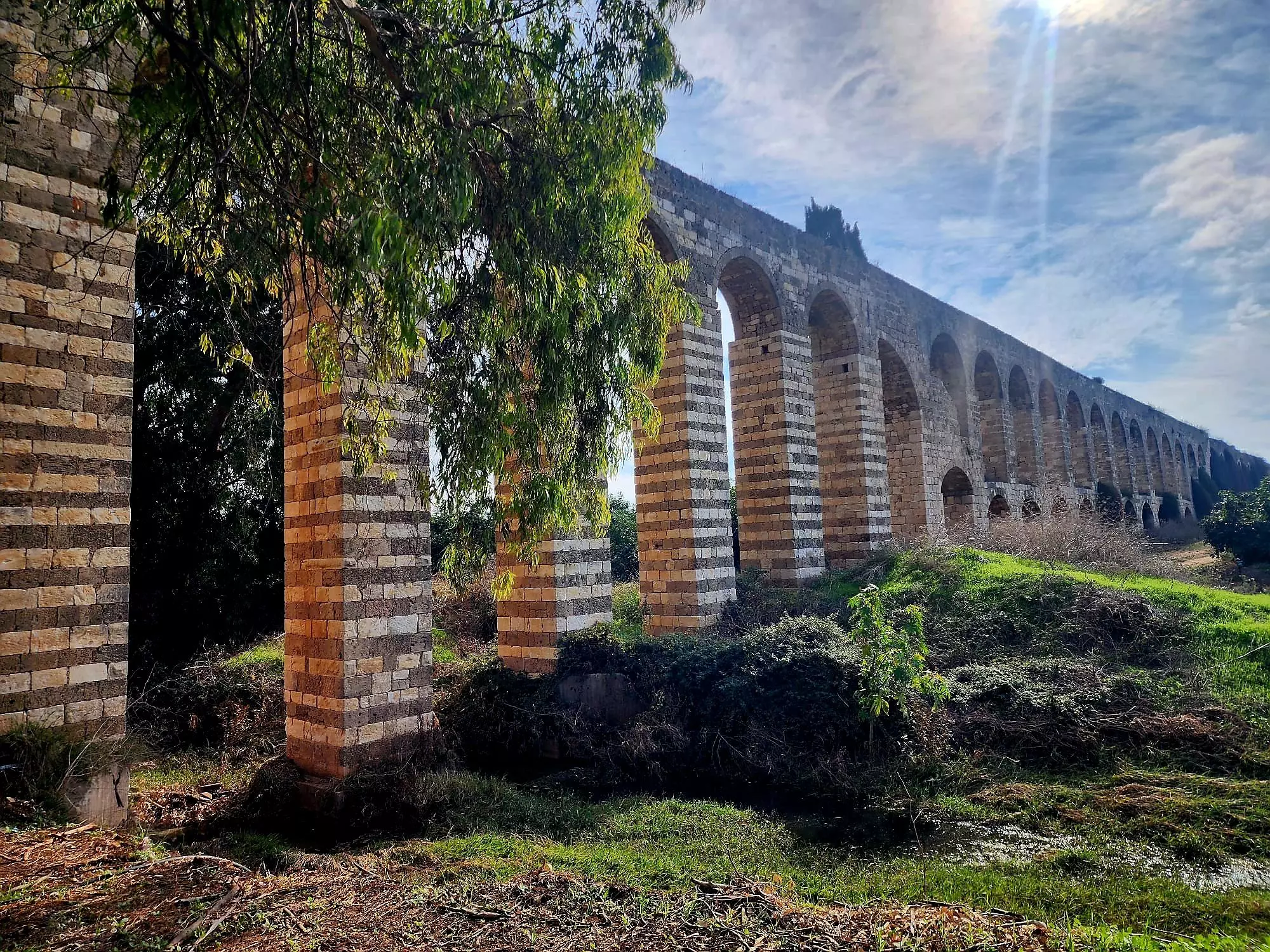
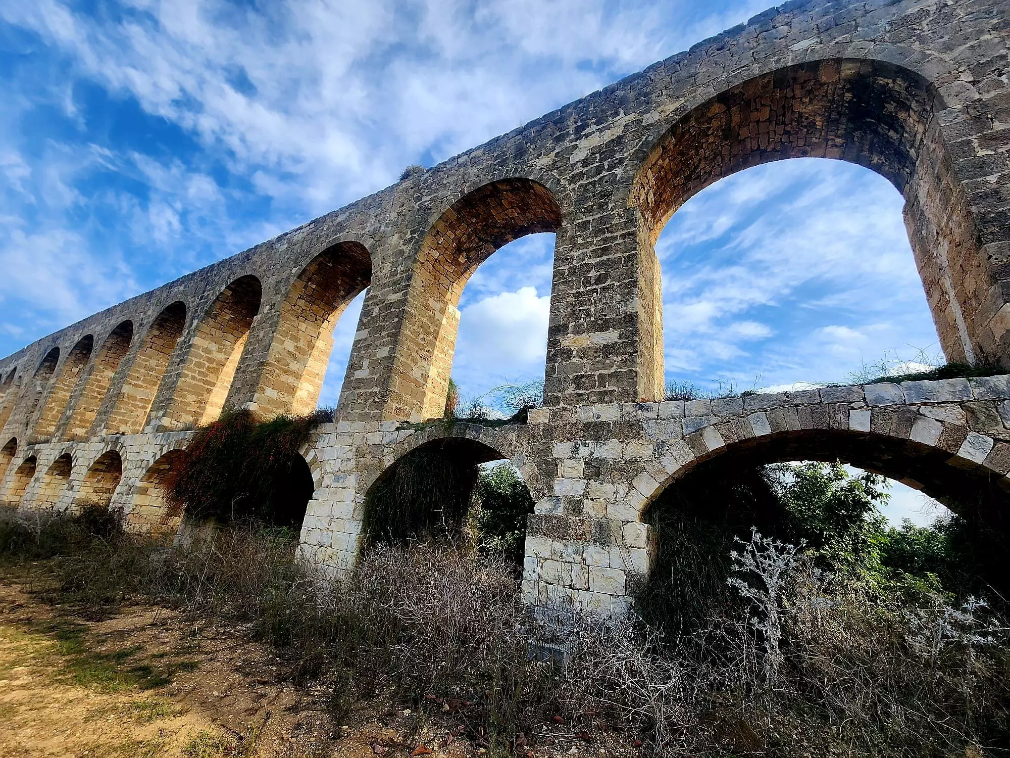
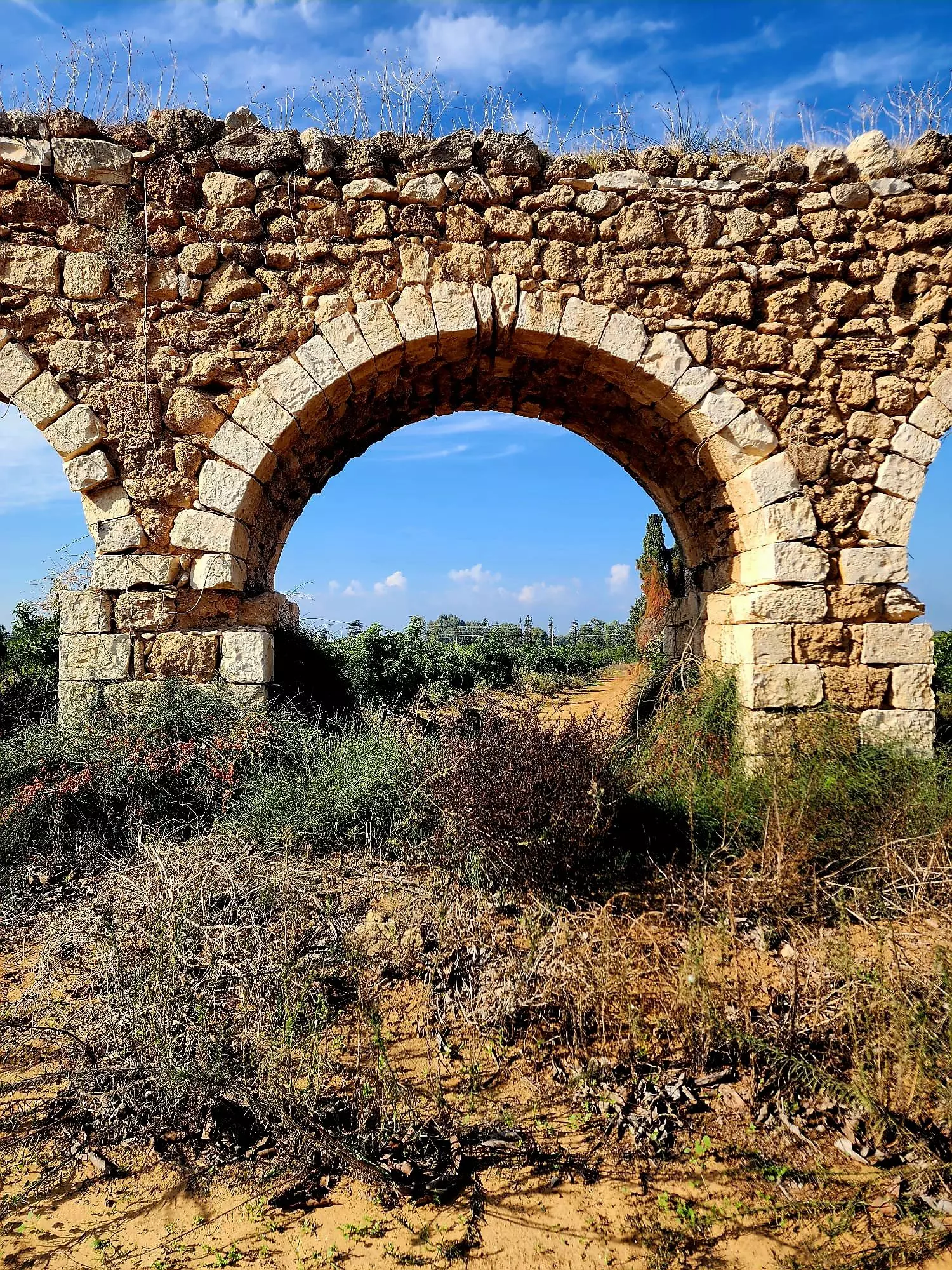
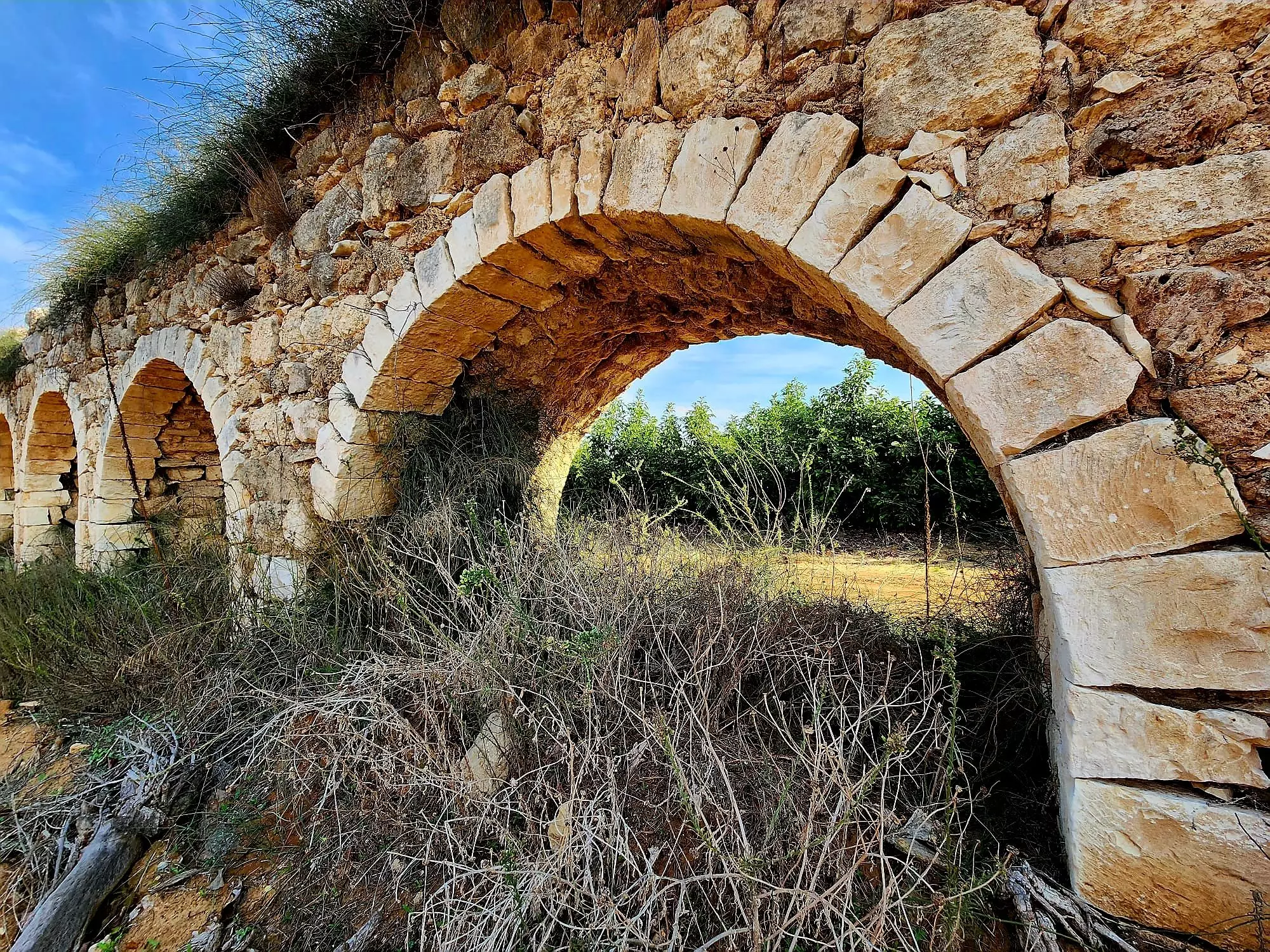
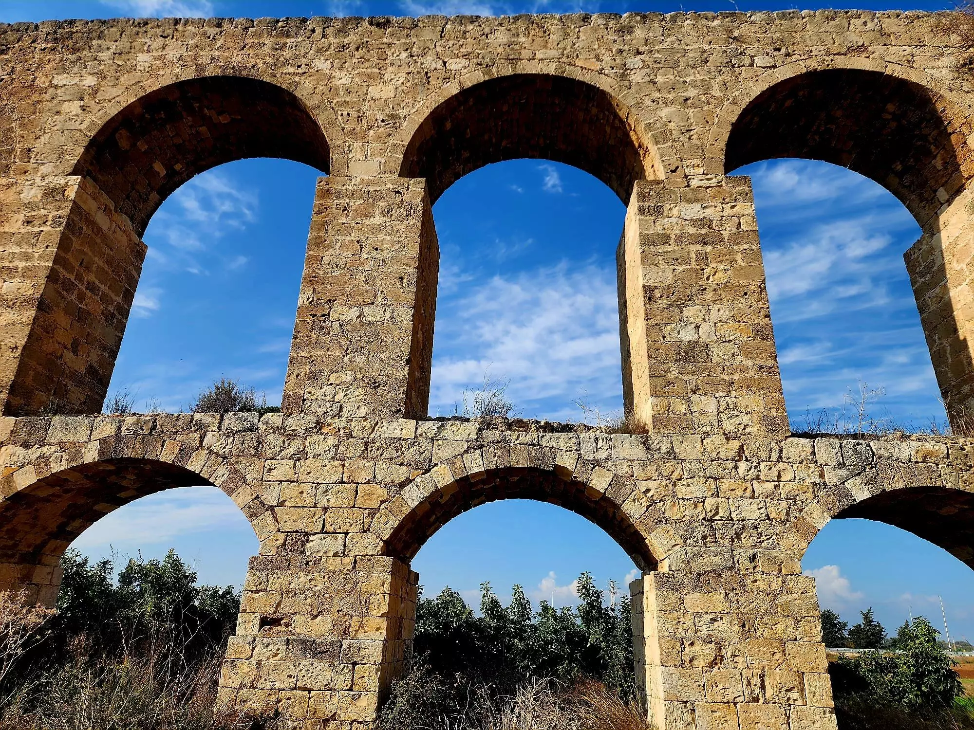
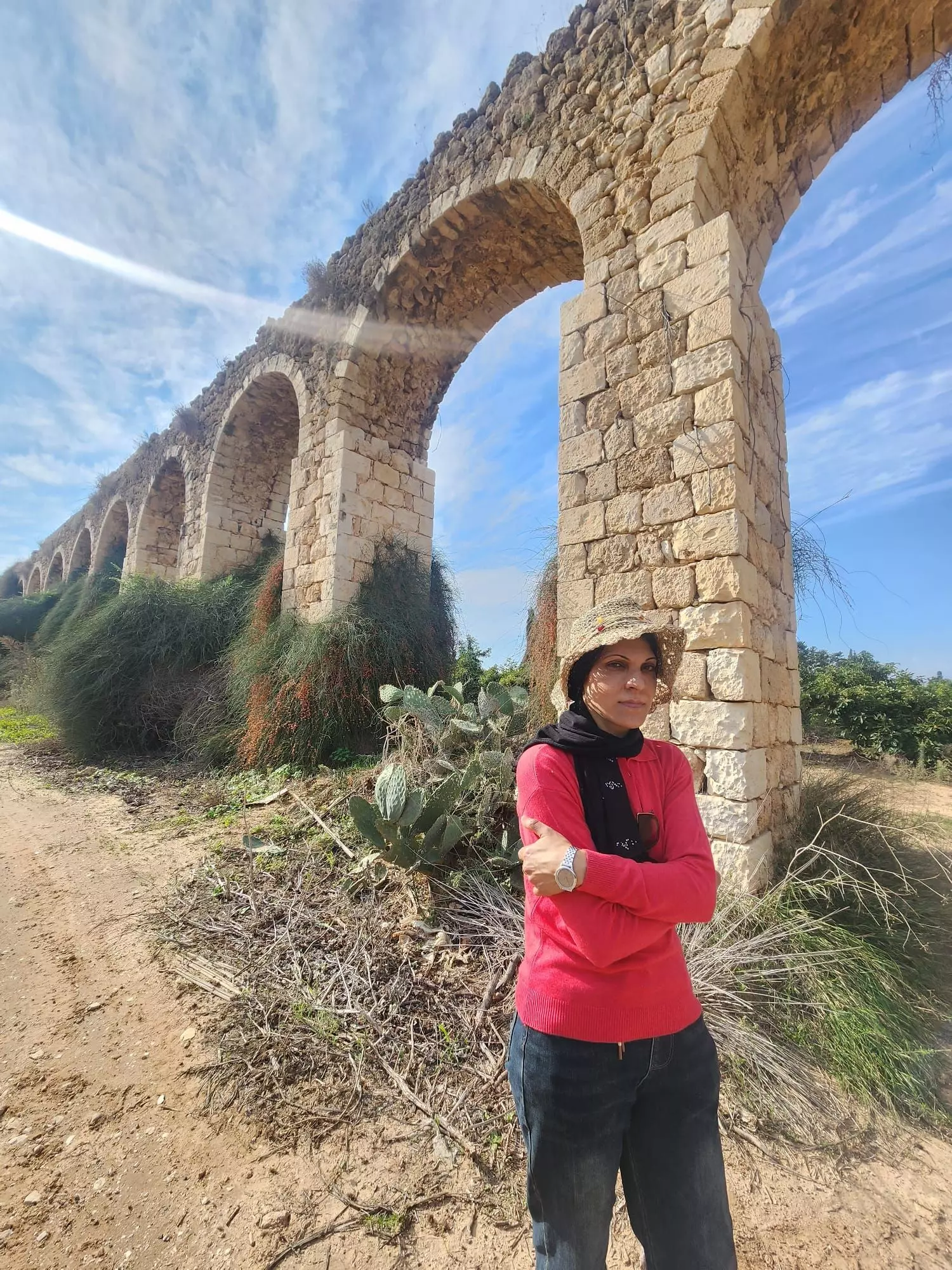
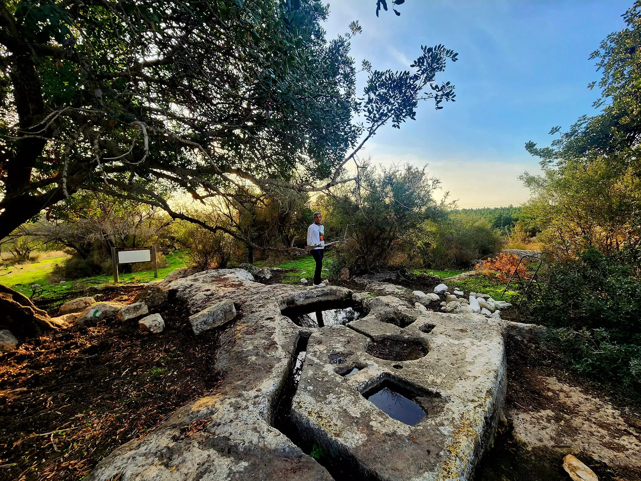
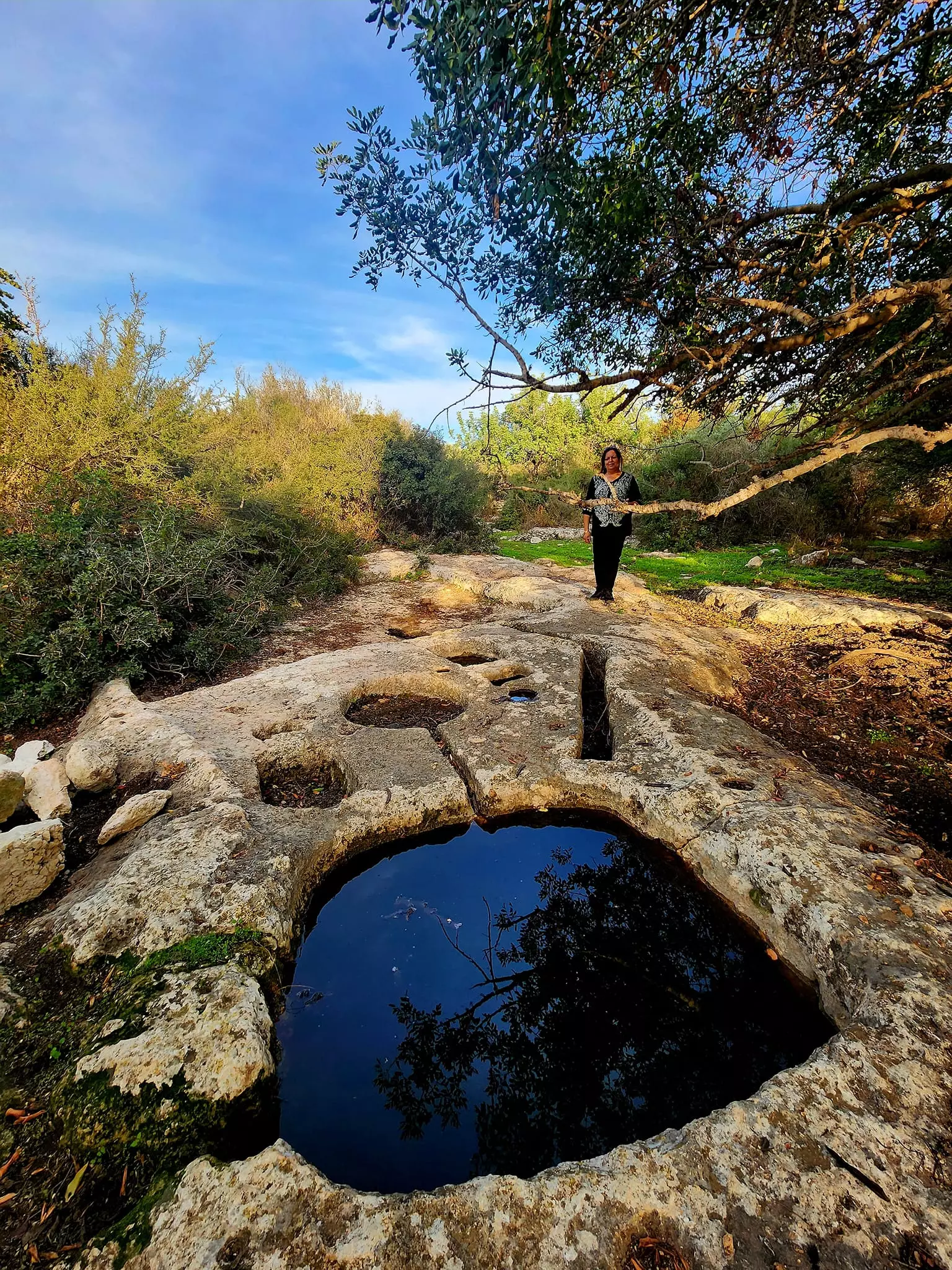
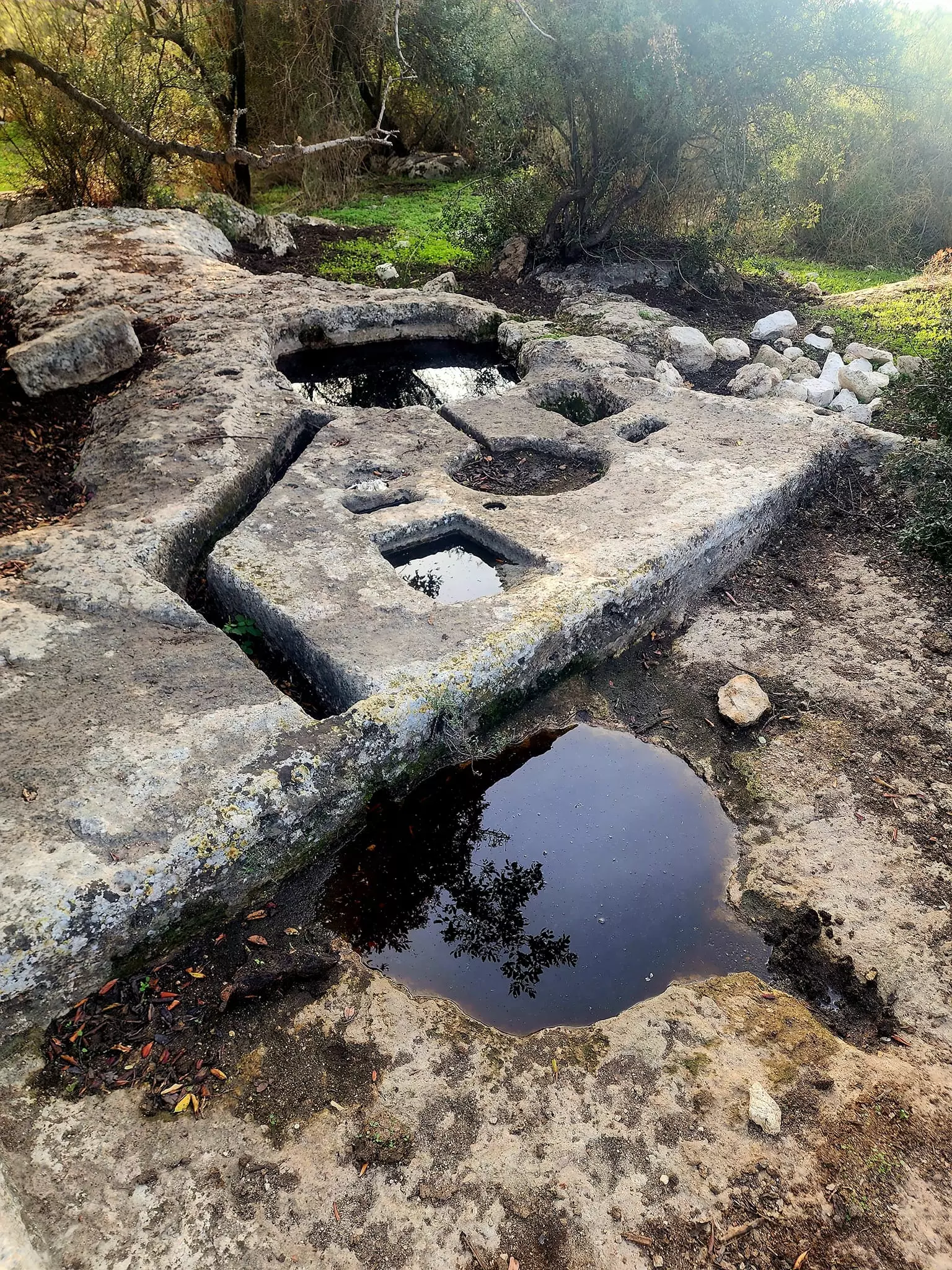
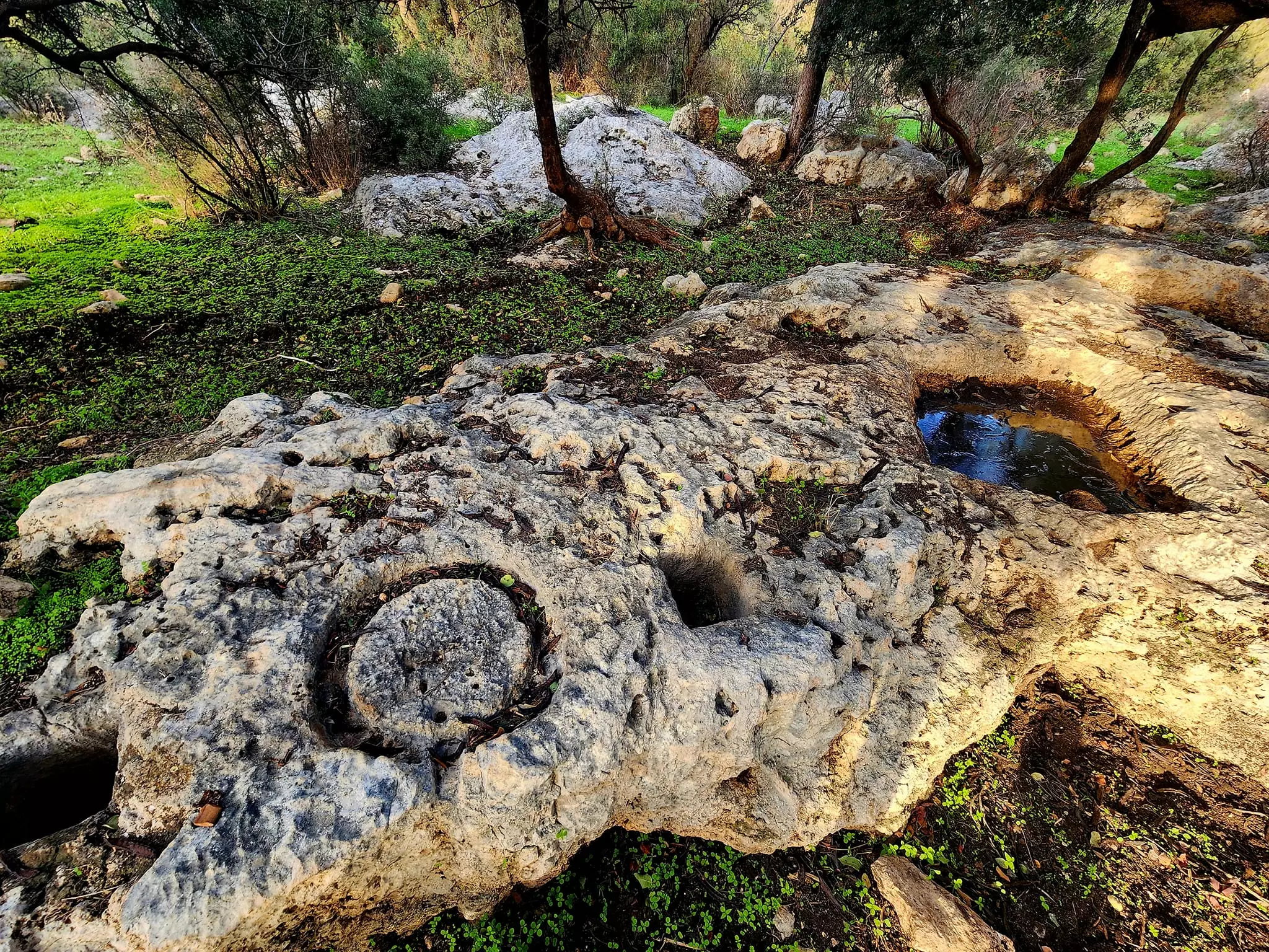
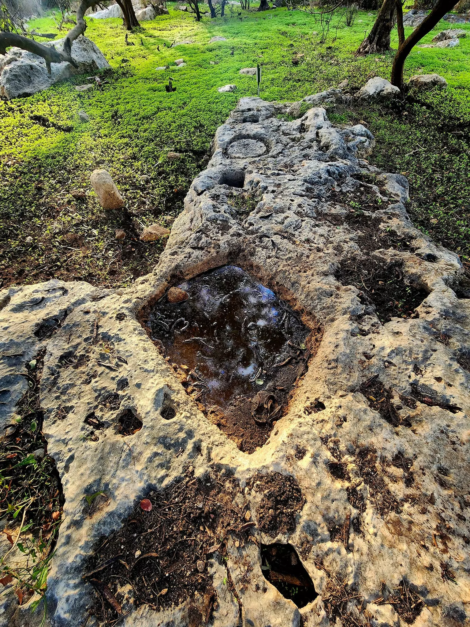
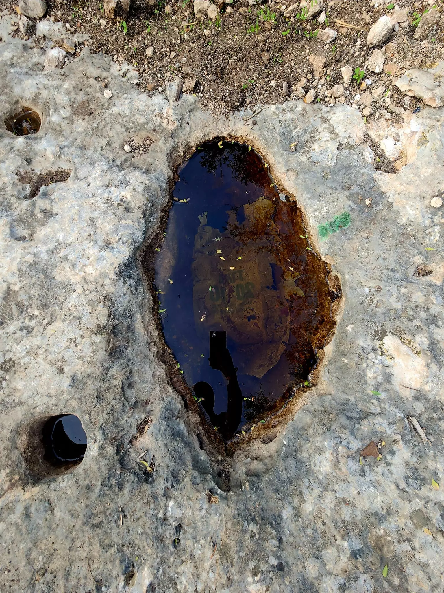
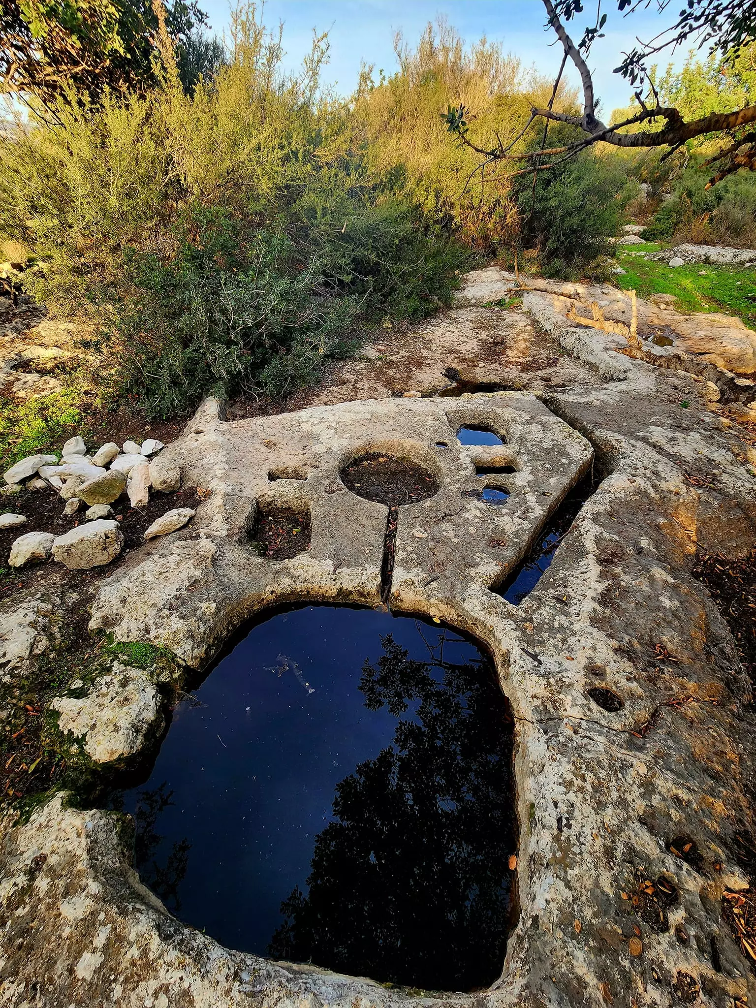
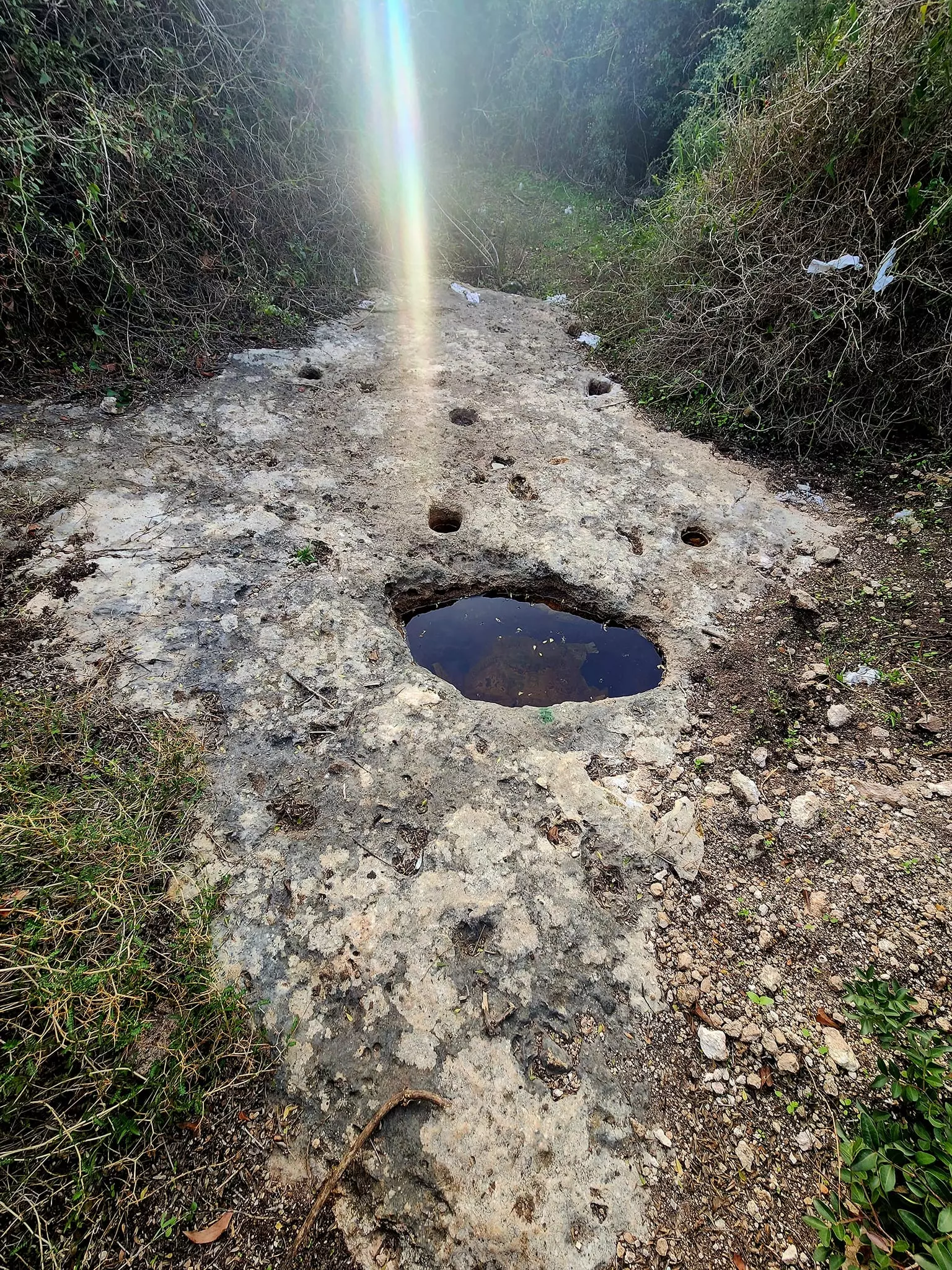
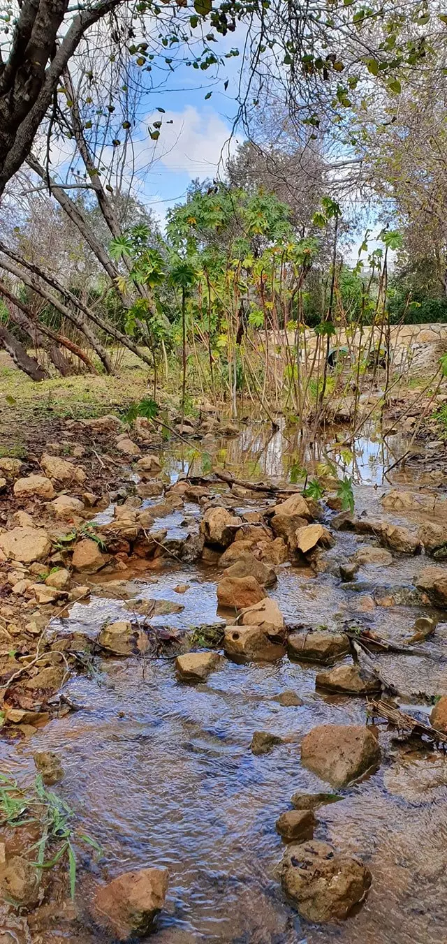
| Water Supply | al-Kabri was WELL known for its many springs, including 'Ayn Mafshuh, 'Ayn Fawwar, 'Ayn al-'Asal, and 'Ayn Kabri, which together were the largest fresh water source in Palestine | ||||||||||||||
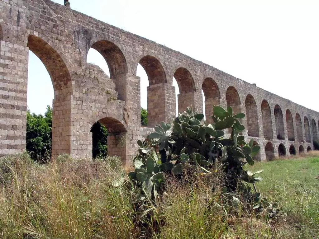
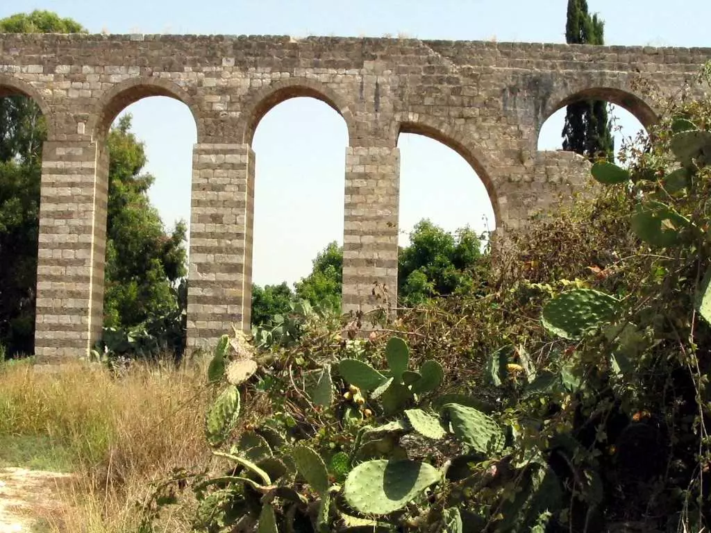
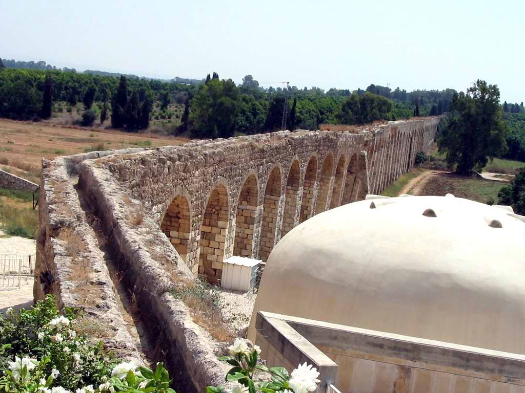
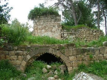
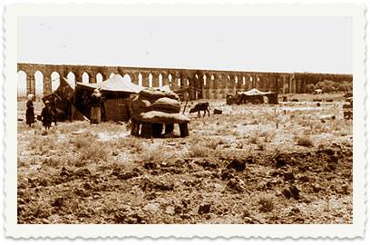
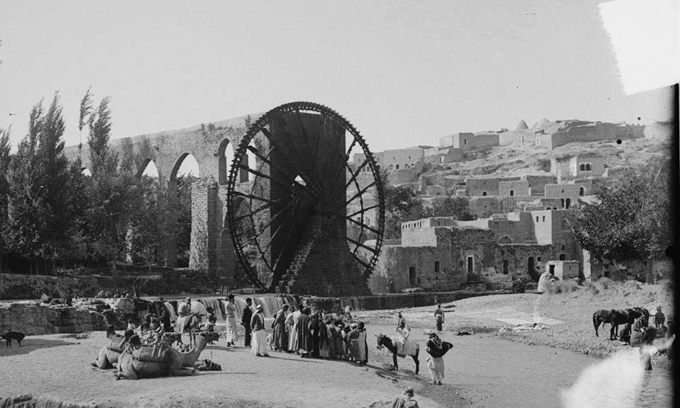
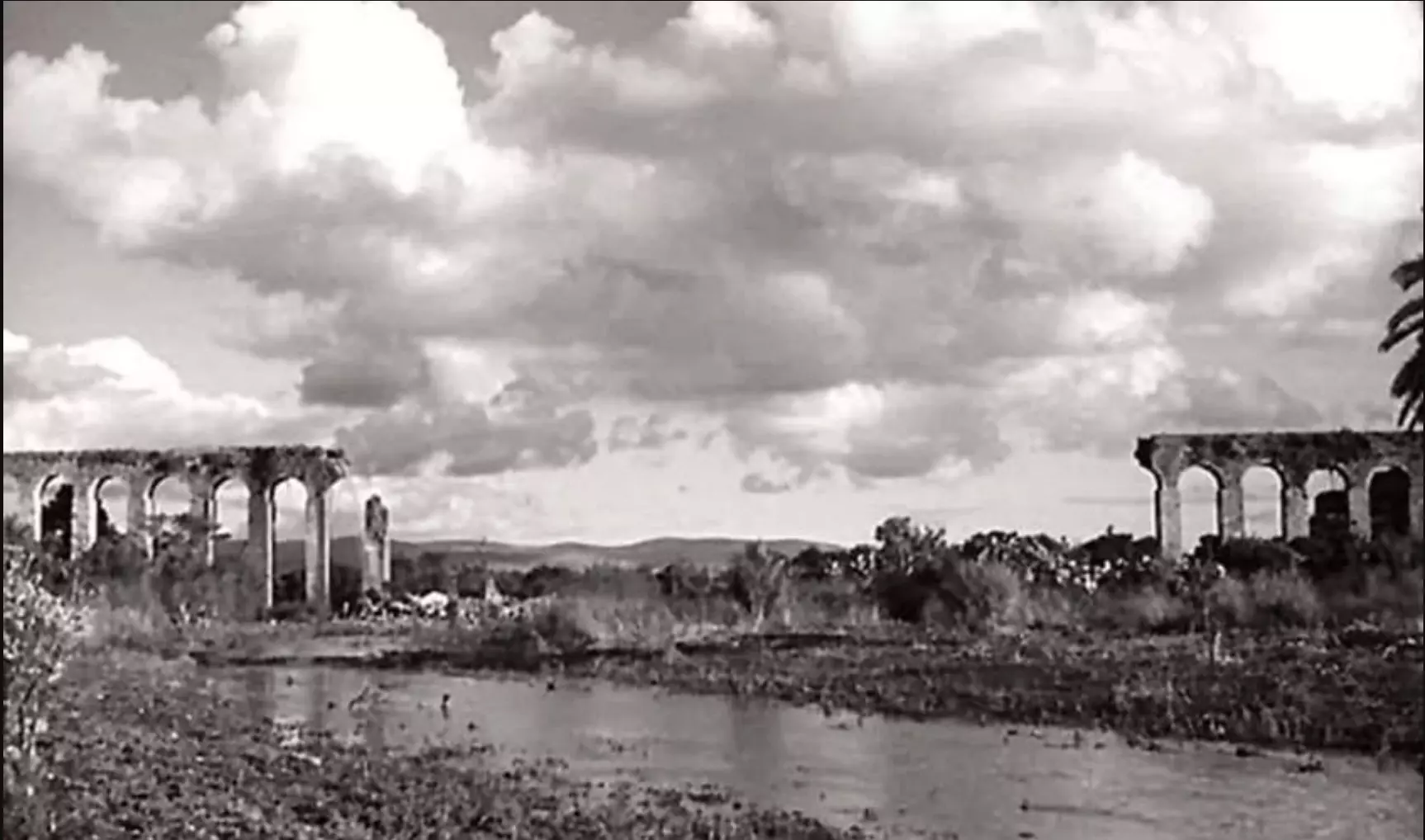
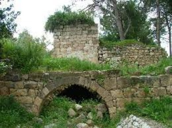
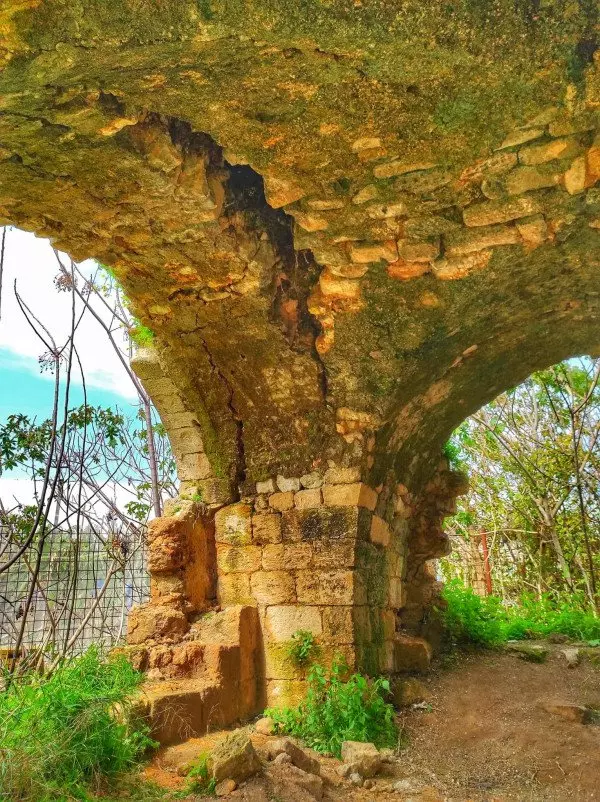
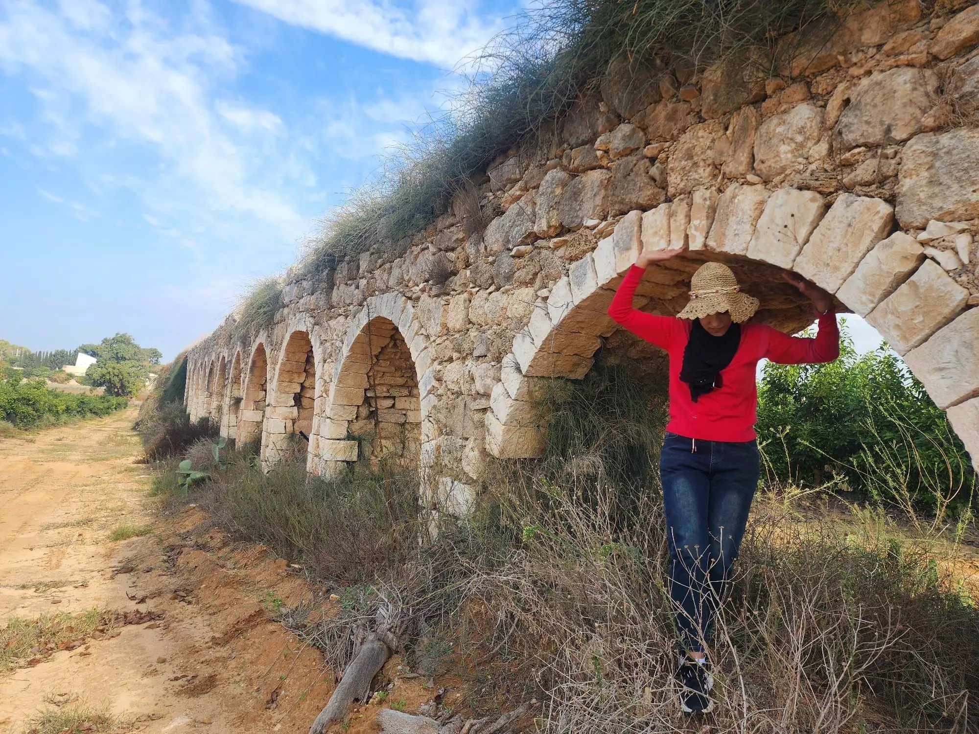
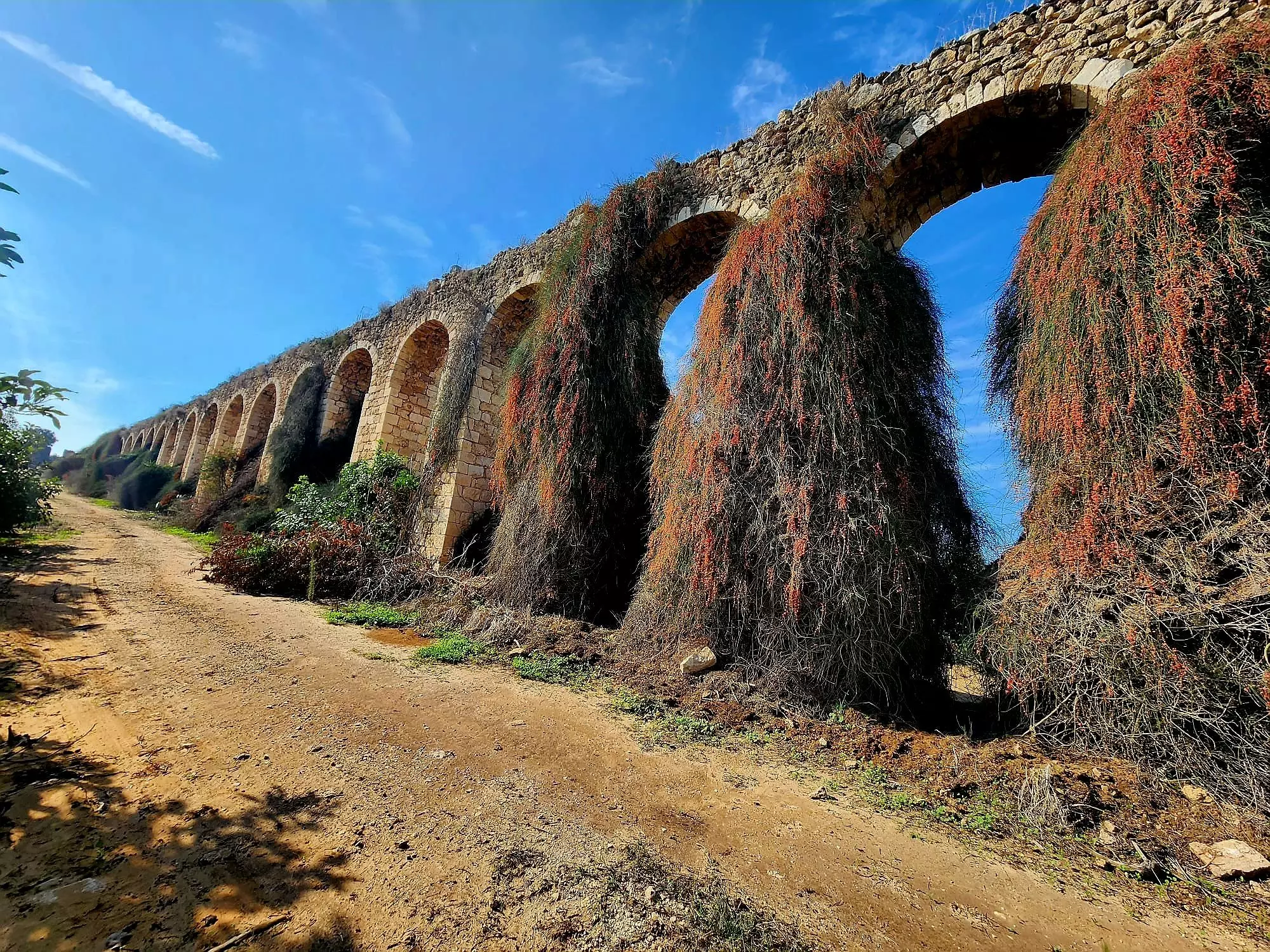
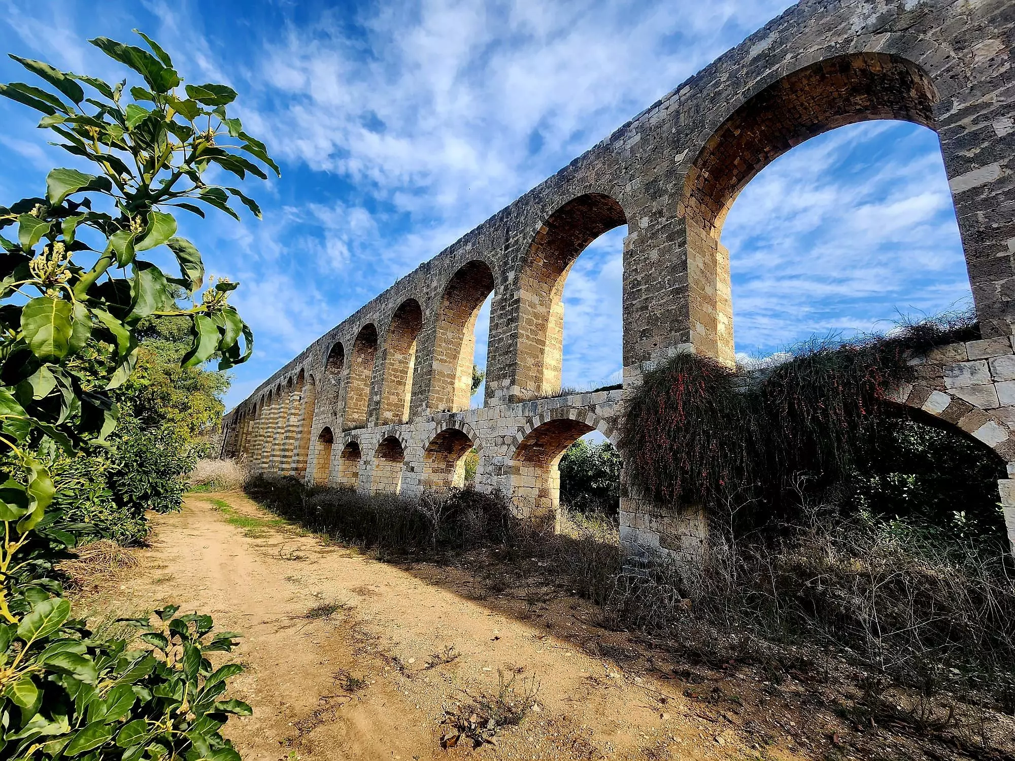
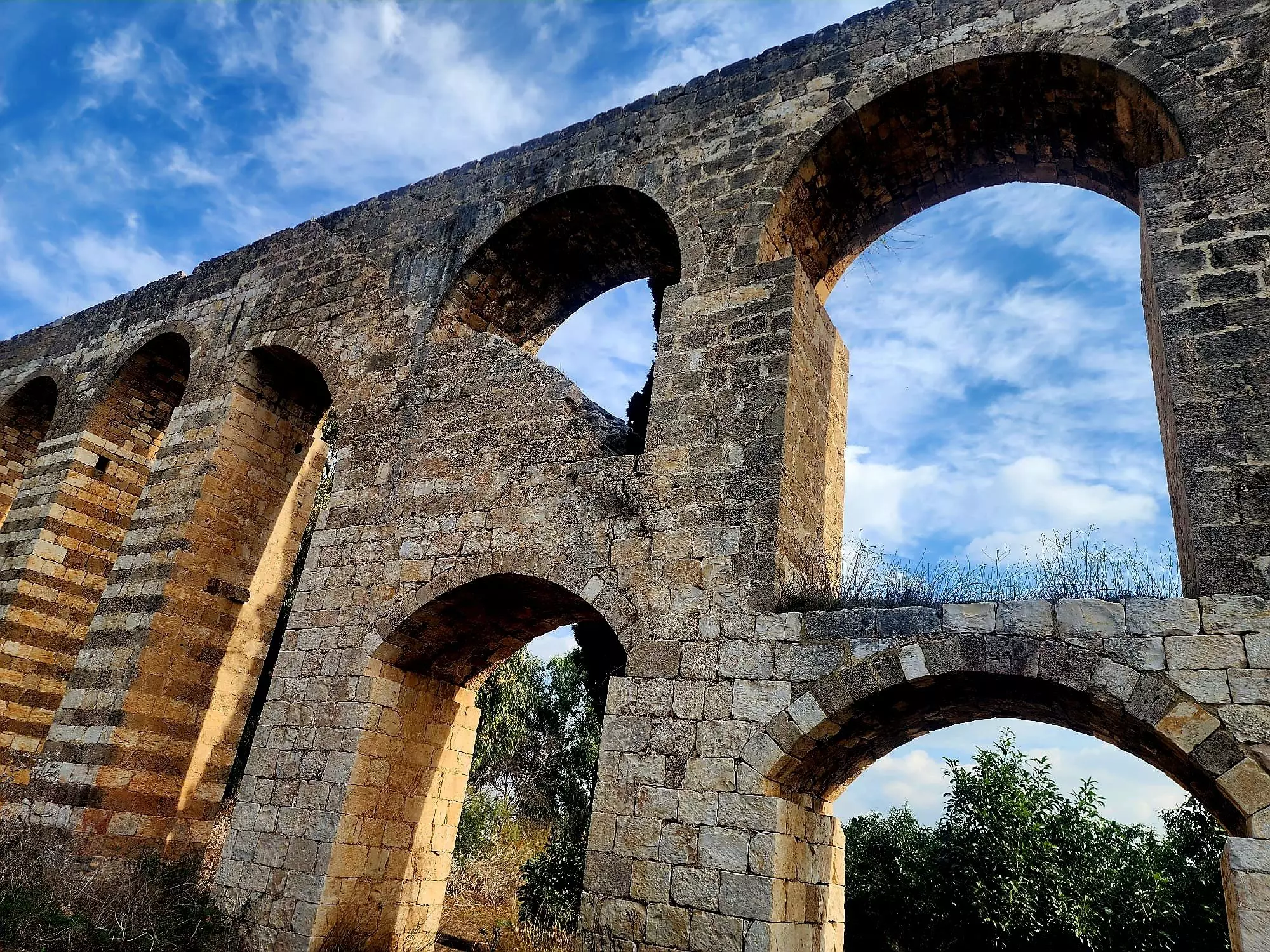
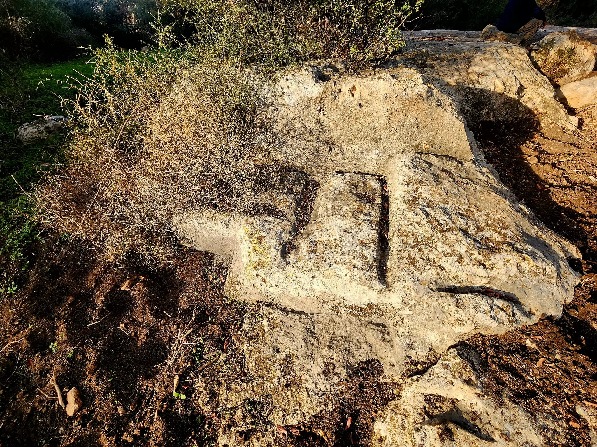
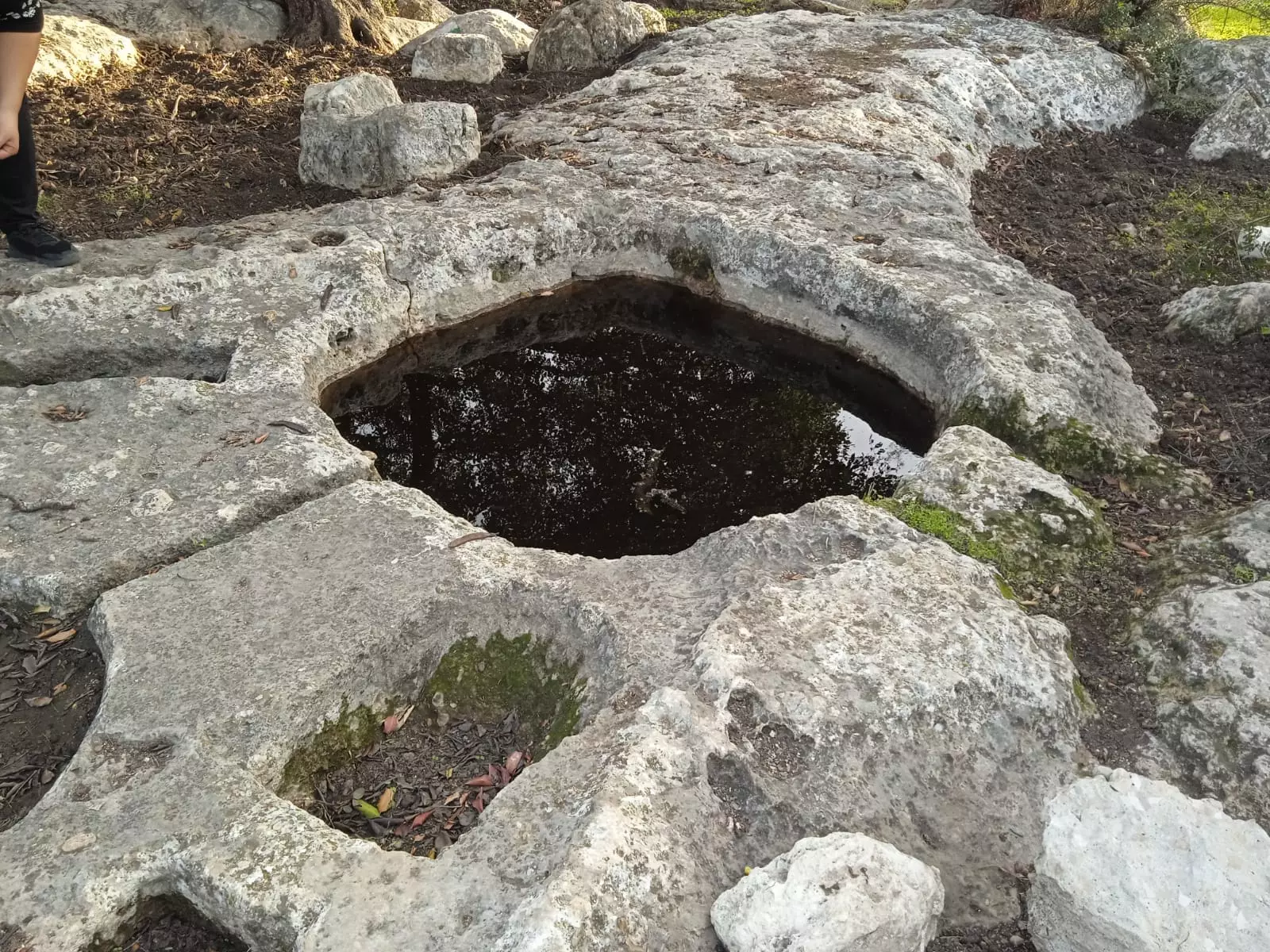
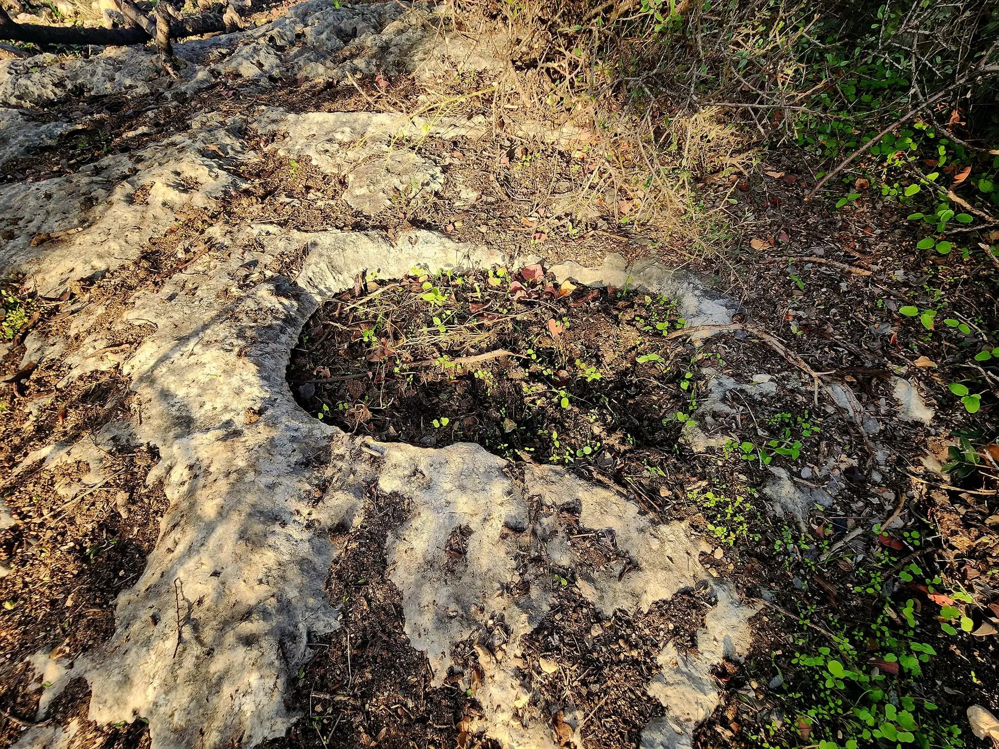
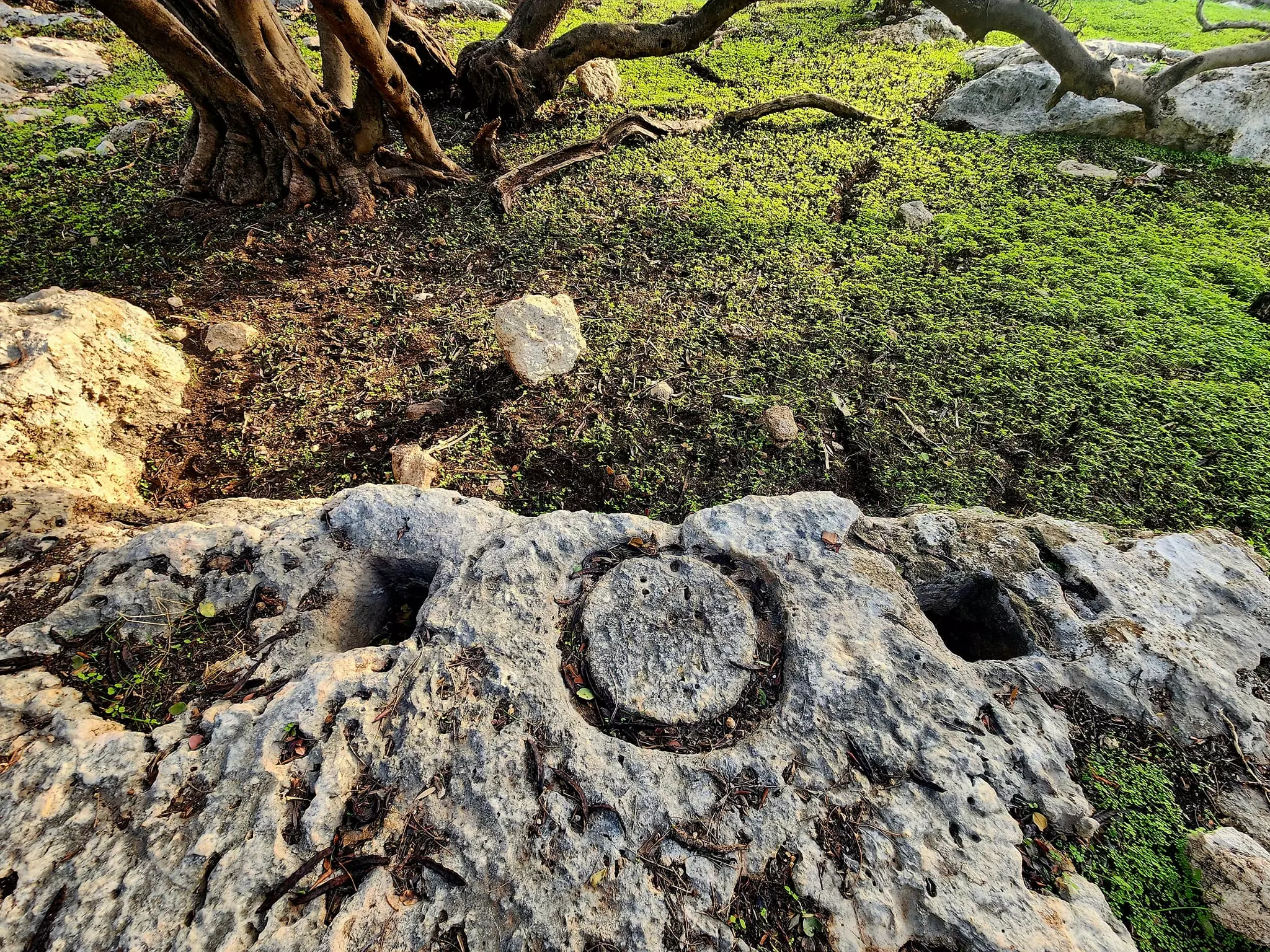
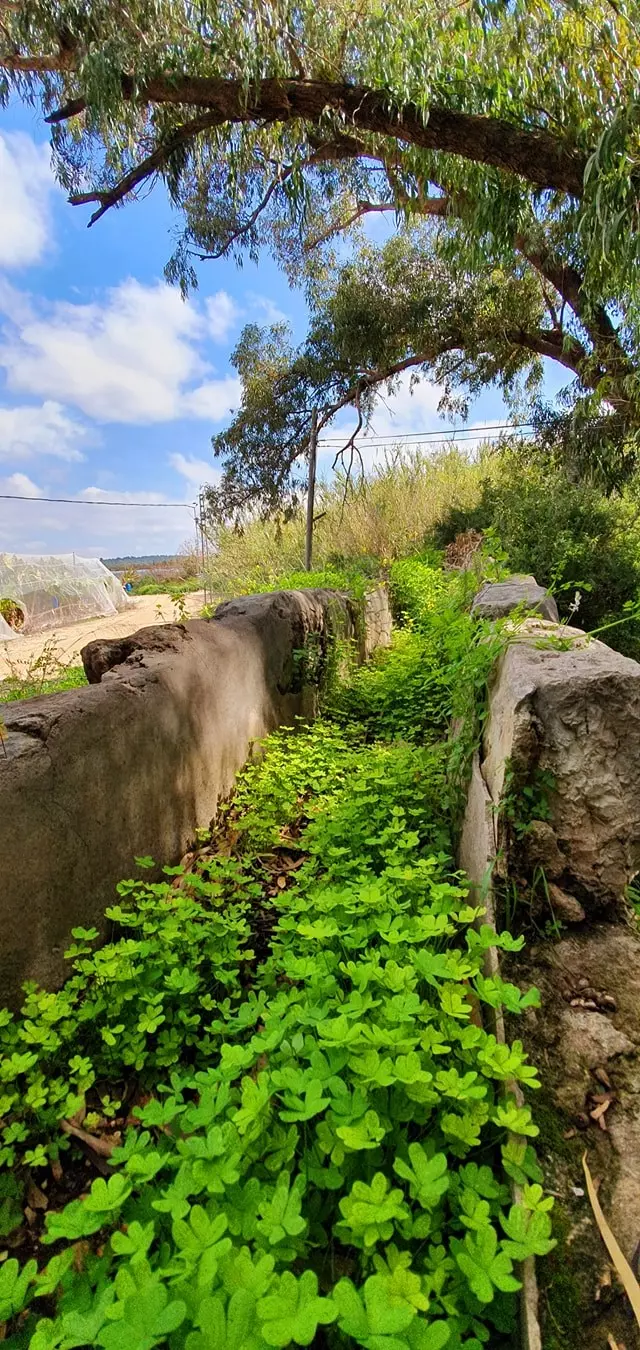
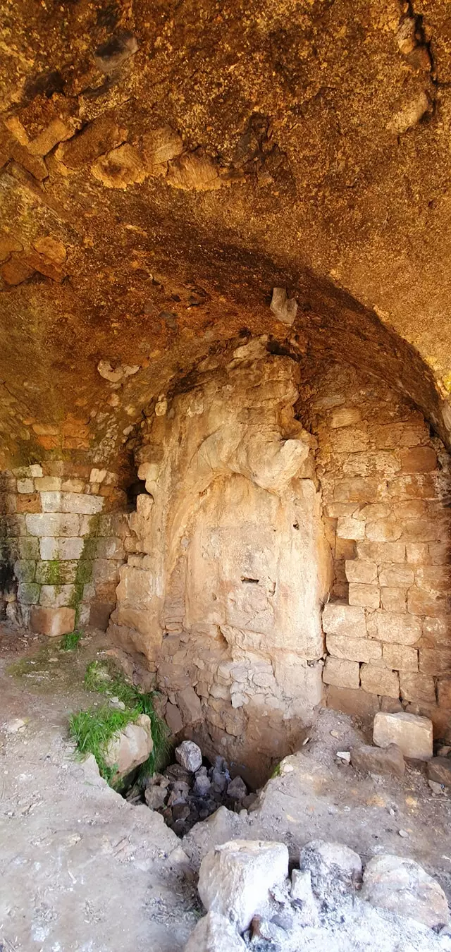
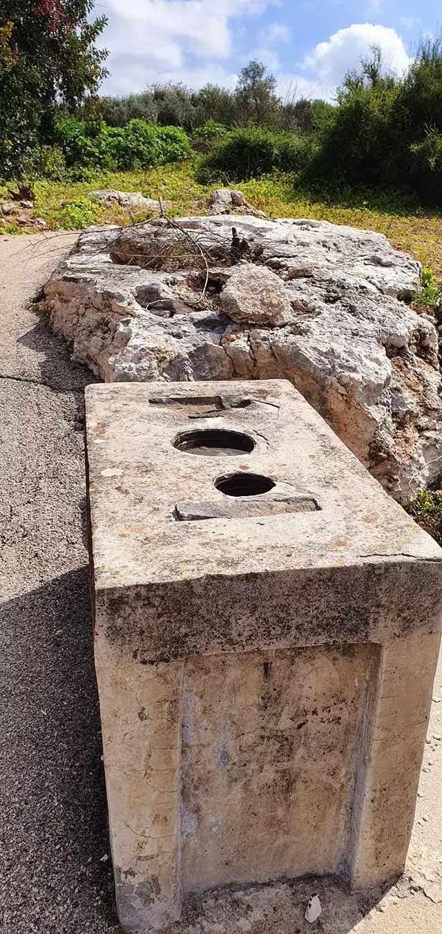
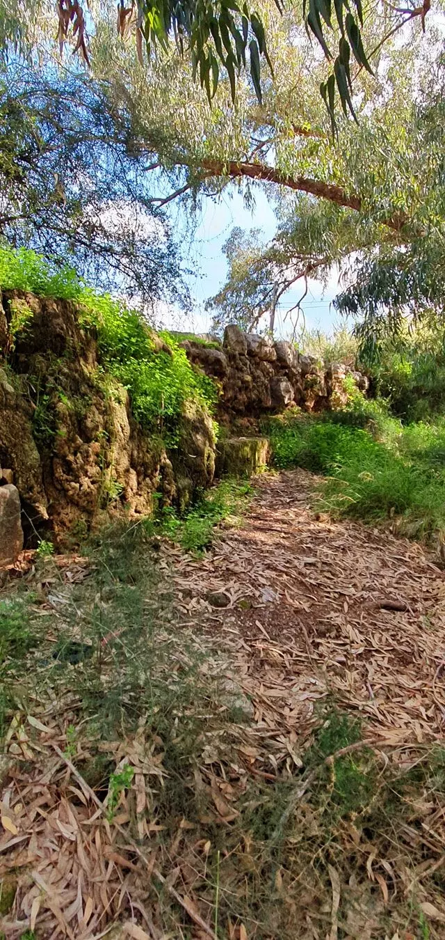
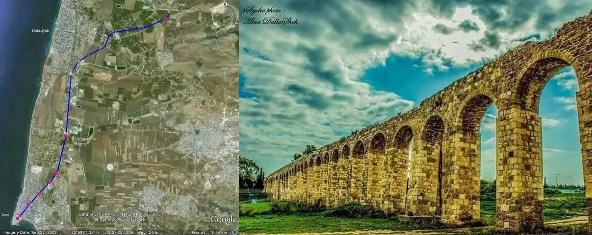
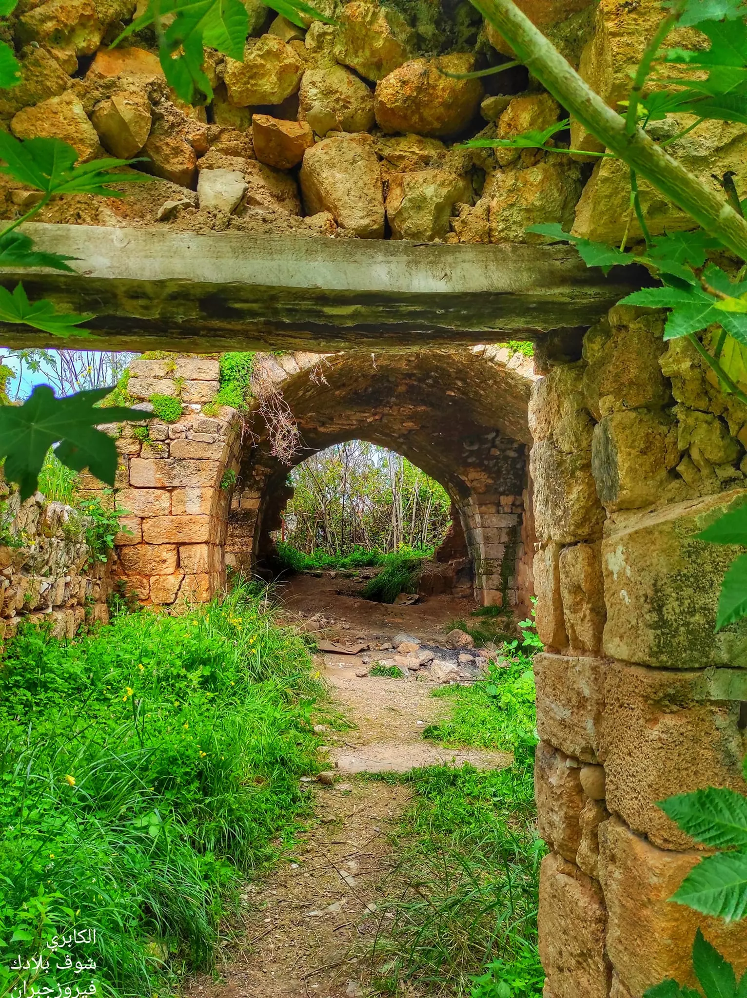
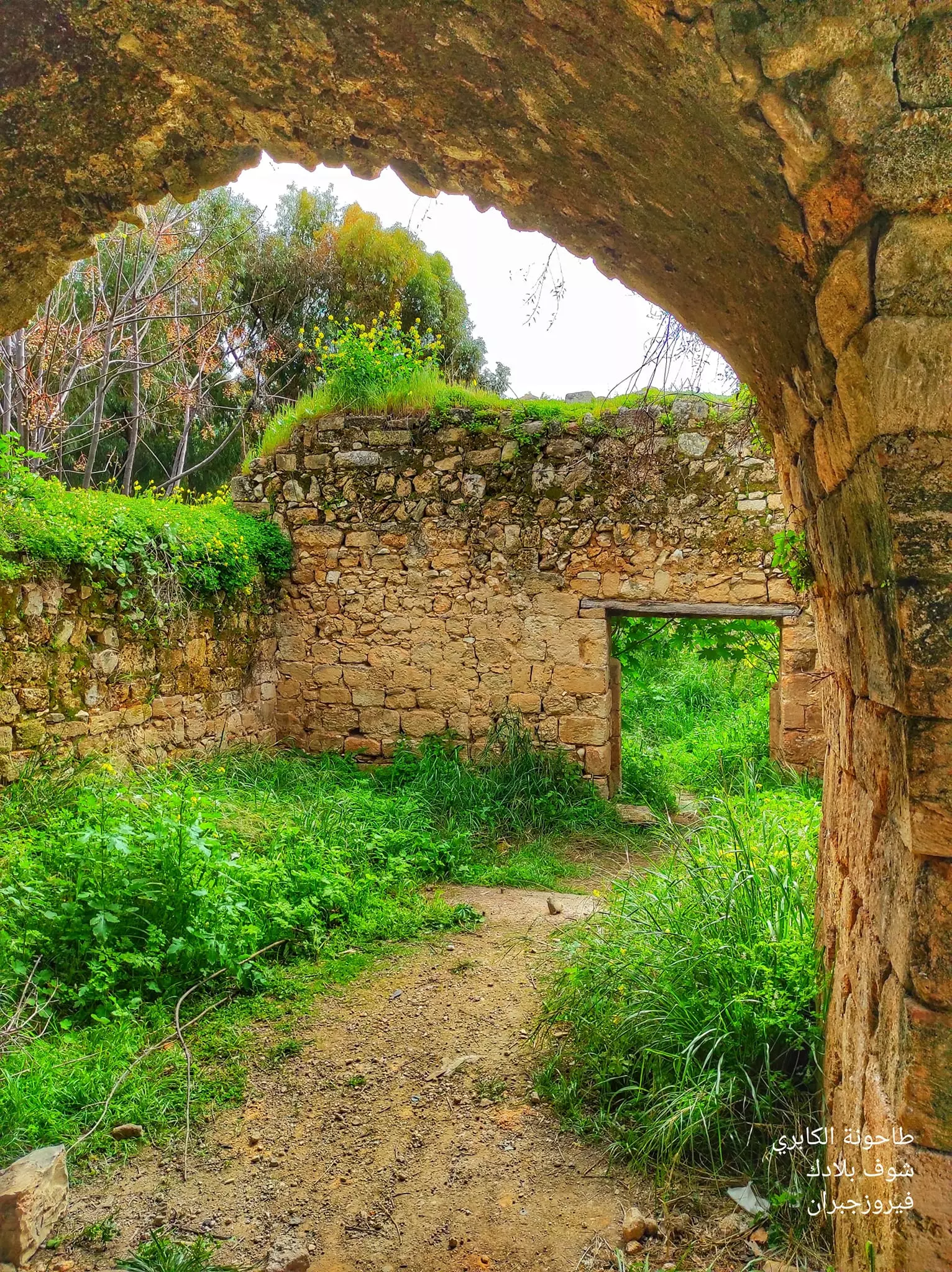
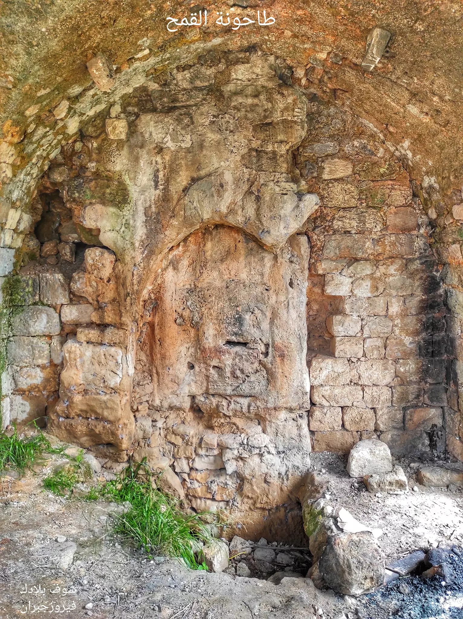
| Archeological Sites | The village contains an Aqueduct, built during the Hellenistic period, which supplied ancient Acre with water, and it also contains a water canal, built in the 19th century, for the same purpose too. | ||||||||||||||
| Exculsive Jewish Colonies Who Usurped Village Lands |
Kibbutz Kabri, Ga'ton, Me'ona, 'En Ya'aqov, and Ma'alot. | ||||||||||||||
| Featured Video | |||||||||||||||
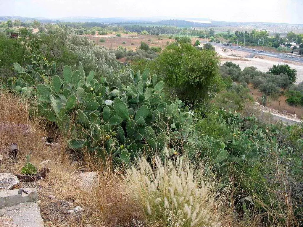
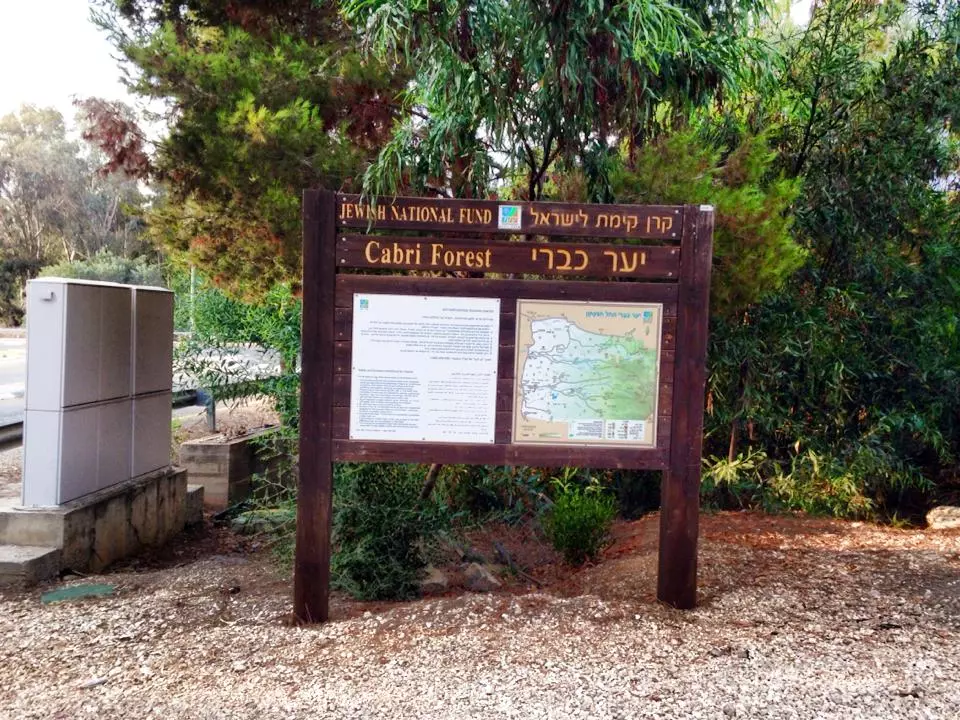
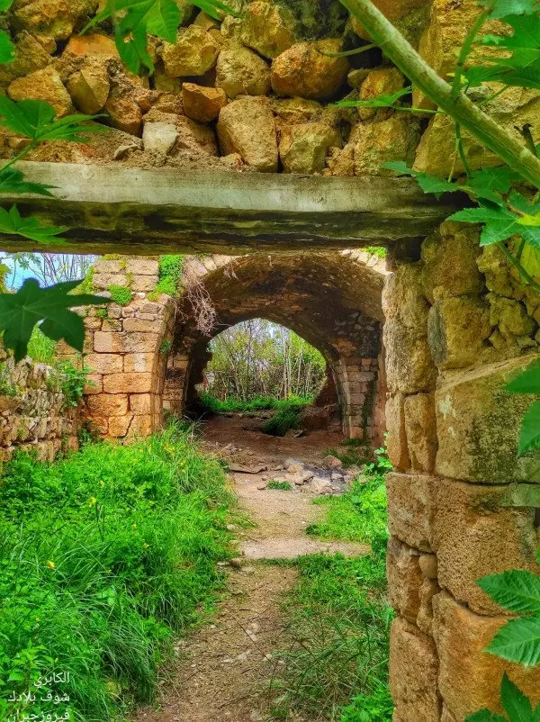
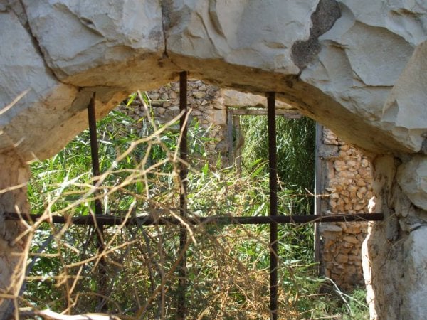
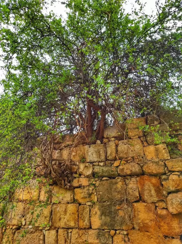
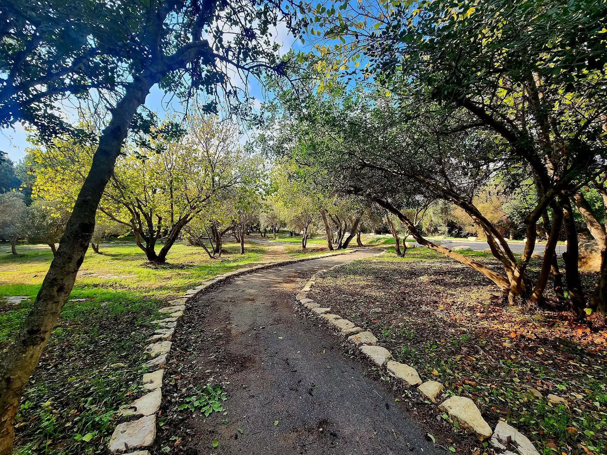
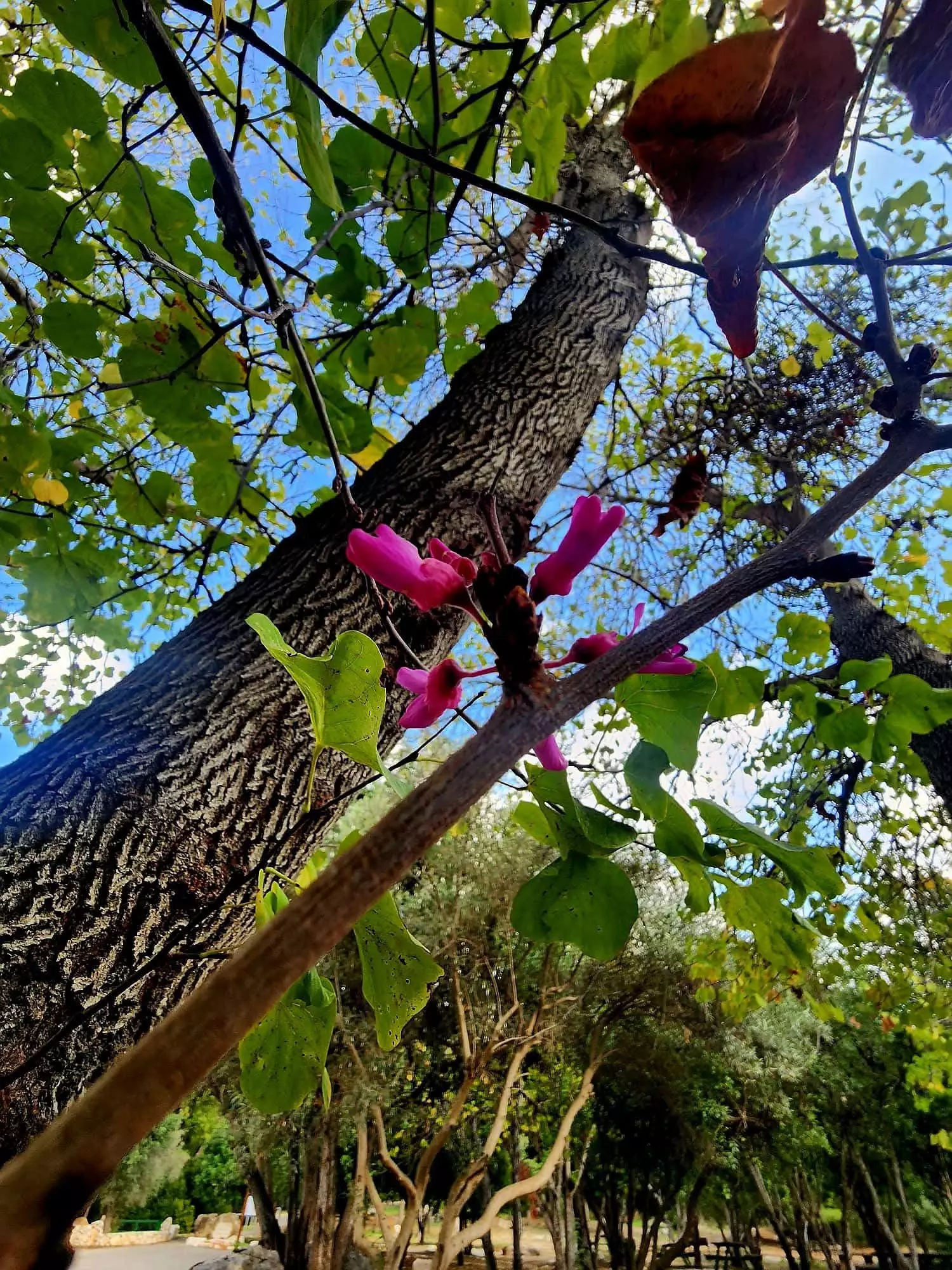
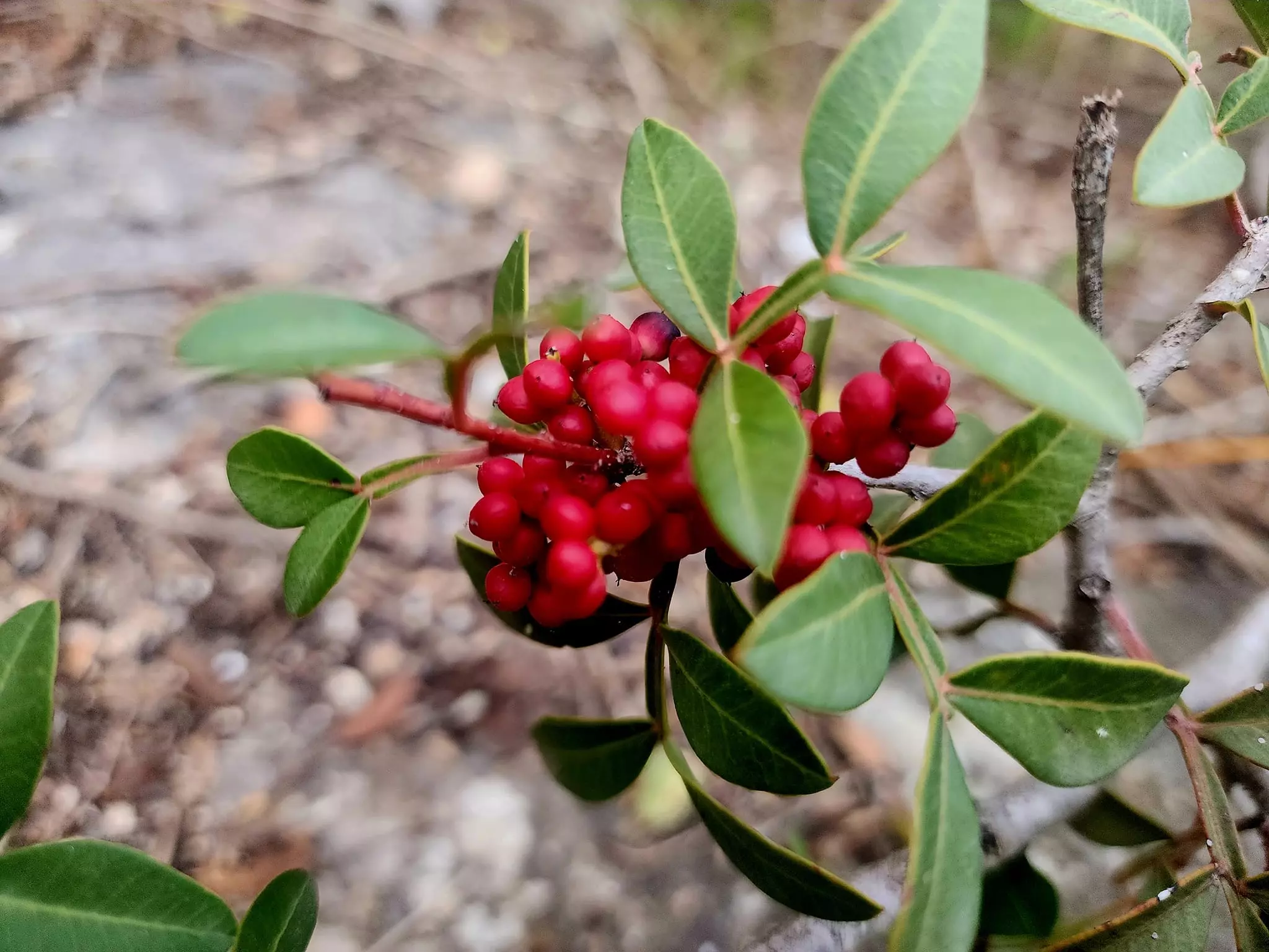
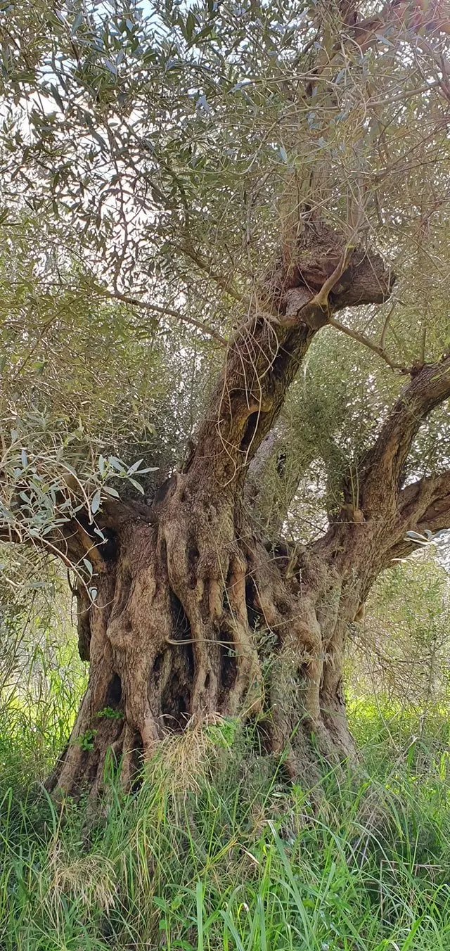
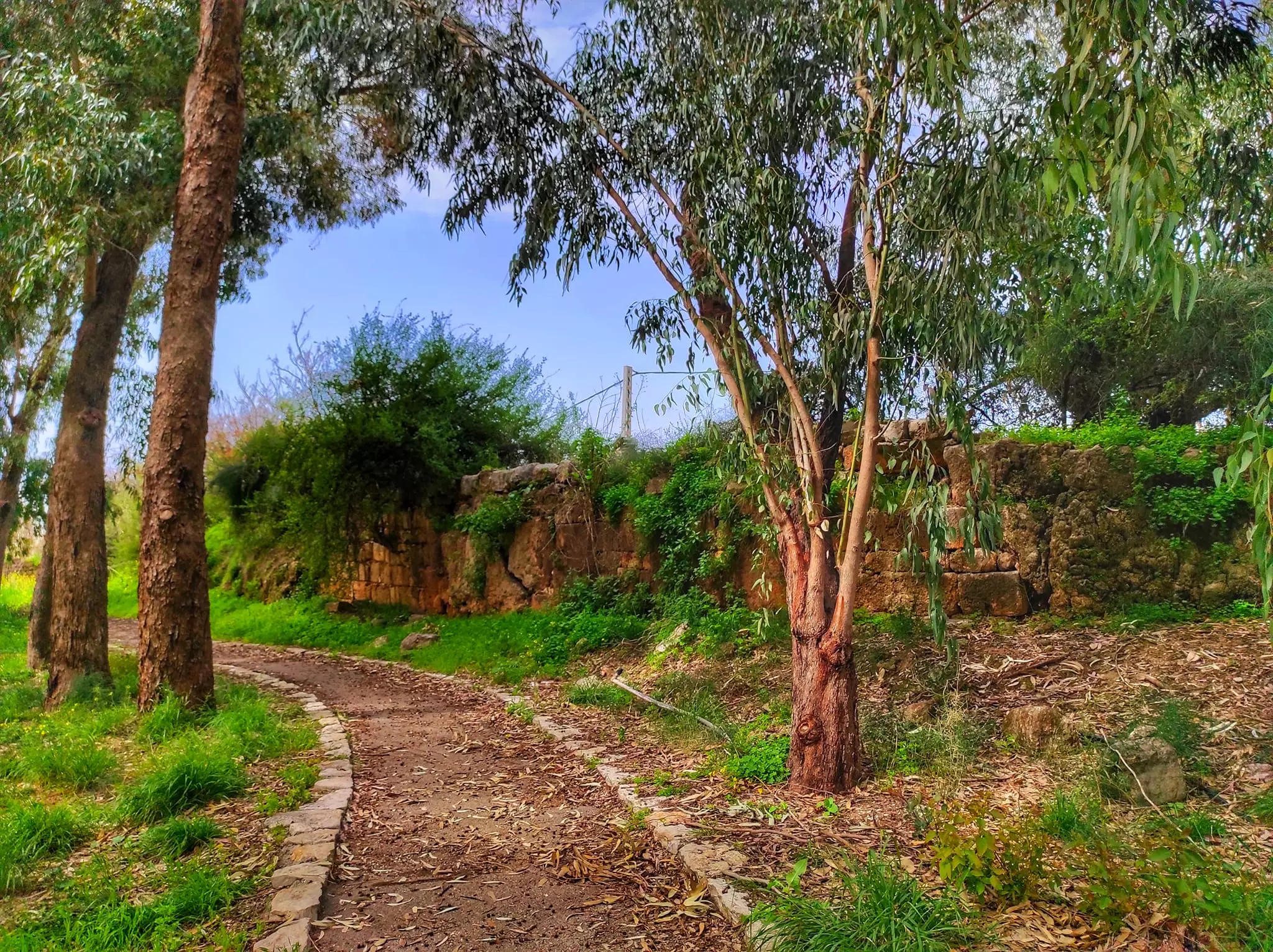
Village Before NakbaThe village was situated in the area where the western slopes of the Galilee Mountains met the plain of Acre. A highway linked it to the settlement of Nahariyya (to the west), which was itself on the coastal highway that led south to Acre. Its name may have been derived from the Syriac kabiraya, meaning "large, wealthy." The Arab geographer al-Maqrizi (d. 1441) called it al-Kabira and said that the Mamluk ruler al-Ashraf allocated its income to one of the charitable organizations in Cairo in 1291. The Crusaders called it Cabra. In the late nineteenth century, al-Kabri was a village built of stone with a population of 400. The villagers planted the surrounding area with fig, olive, pomegranate, mulberry, and apple trees. The village was known for its springs, including Ayn Mafshuh, Ayn Fawwar, Ayn al-Asal, and Ayn Kabri, which together had an annual discharge of 8.6 million cubic meters. This made it one of the main sources of fresh water in Palestine and the principal one in Acre sub-disctrict. Aqueducts that channelled water from the spring to Acre were built during the Hellenistic period. Two canals were also built in the nineteenth century for the same purpose, by two successive governors of Acre, Ahmad Pasha al-Jazzar , in 1800, and by Sulayman Pasha, in 1814. Village Occupation and Ethnic CleaningThe village was occupied on the night of 20–21 May, as part of the second stage of Operation Ben-Ami, in Acre sub-district. The History of the War of Independence states, probably mistakenly, that it fell later, in mid–July, during Operation Dekel. Morris writes that most villagers had already fled before its occupation, following a 'Haganah retaliatory action, in which a number of villagers were killed.' He does not mention when this took place or how many casualties were left by the 'retaliatory action.' The village apparently was regarded as a center of 'anti–Yishuv forces.' Zionists Colonies on Village LandsOn 18 January 1949, a kibbutz was inaugurated in place of the destroyed village and named Kibbutz Kabri, according to records consulted by Morris. It was established in the northwest part of the village site. The settlements of Ga'ton , built in 1948, Me'ona , built in 1949, En Ya'aqov , built in 1950, and Ma'alot , built in 1957, are today all to the east of the site on lands that belonged either to al-Kabri or to the village of Tarshiha, some 10 km east of al-Kabri. Because the last Mandate--era map of village landholdings amalgamates the lands of al-Kabri and Tarshiha , it is impossible to determine whether it is al-Kabri's land or the land of Tarshiha which has now been occupied by the latter four settlements. The newest settlement on al-Kabri's lands is Kefar Vradim, built in 1984.Village TodayAll that remains of the village are crumbled walls and stone rubble, overgrown with thorns, weeds, and bushes. The settlement of Kabri uses the land adjacent to the site for agriculture and as a pasture.SourceDr. Walid al-Khalidi, 1992: All That Remains. |
|||||||||||||||
| Related Maps | Town Lands' Demarcation Maps خرائط للقضاء توضح حدود القرى والاودية Town's map on MapQuest View from satellite Help us map this town at WikiMapia |
||||||||||||||
| Related Links | Wikipedia's Page Facebook Page Google Search Google For Images Google For Videos |
||||||||||||||
| More Information | في كتاب كي لا ننسى في كتاب بلادنا فلسطين المزيد من موقع هوية |
||||||||||||||
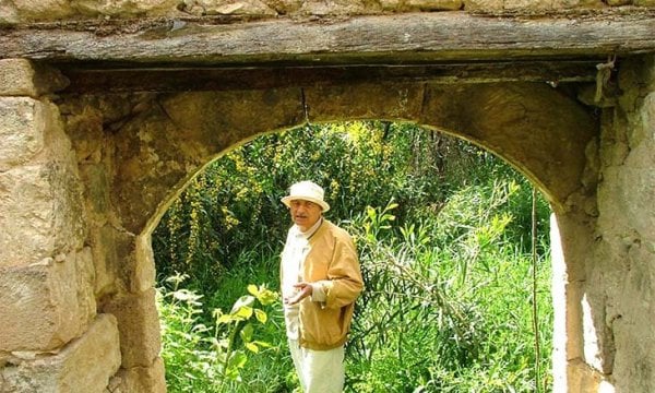
- اثار واضحة للقرية من ناحية الشارع الرئيسي جنوباً 2003
Posted by Makbula Nassar 1 - قناة الكابري 1
Posted by مروان ابراهيم الجشي - قناة الكابري 2
Posted by مروان ابراهيم الجشي - قناة الكابري 3
Posted by مروان ابراهيم الجشي 2 - اثار واضحة للقرية 1
Posted by مروان ابراهيم الجشي - اثار واضحة للقرية 2
Posted by مروان ابراهيم الجشي 1 - اثار واضحة للقرية 3
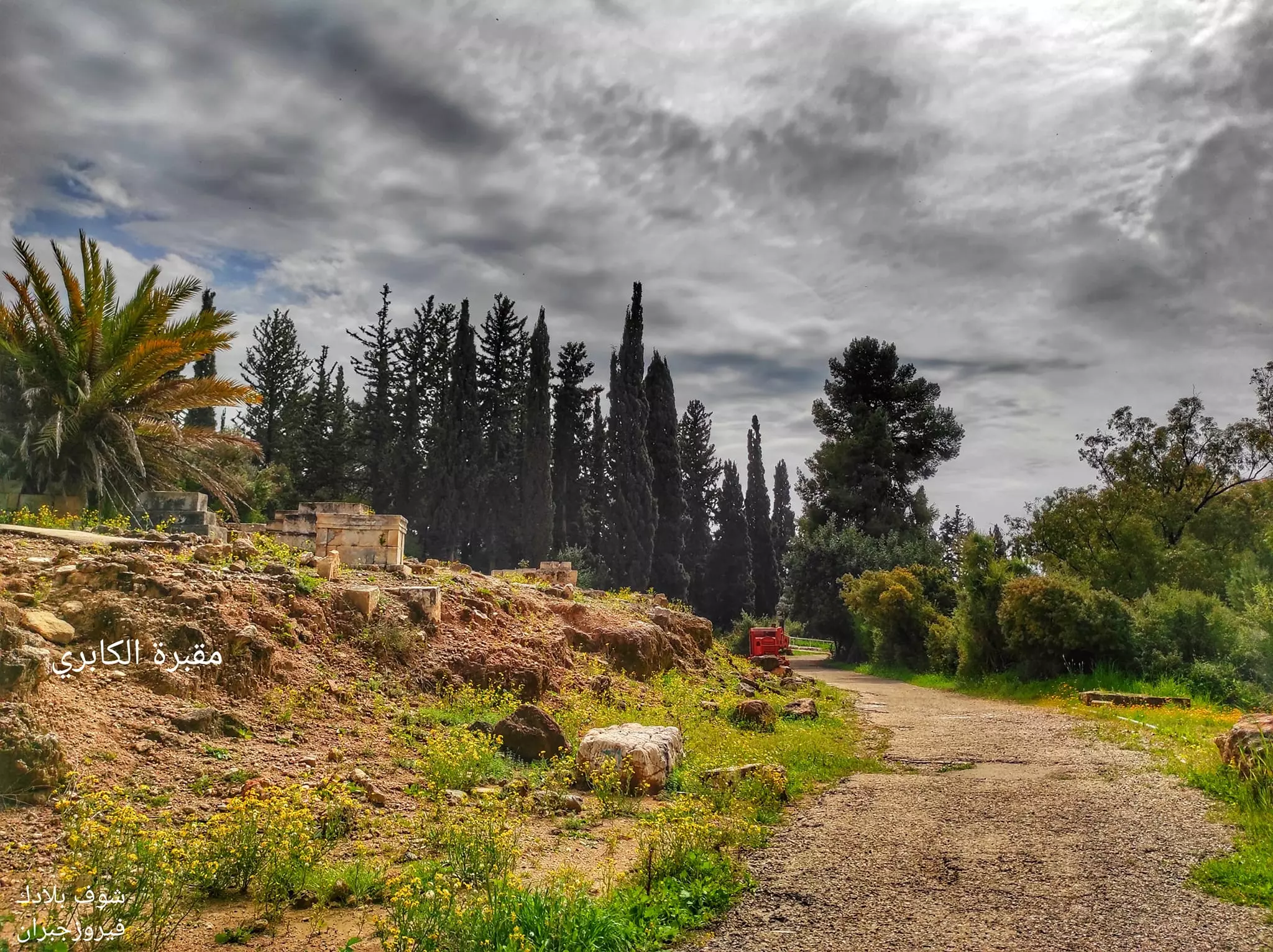
Posted by مروان ابراهيم الجشي - مقبرة الكابري
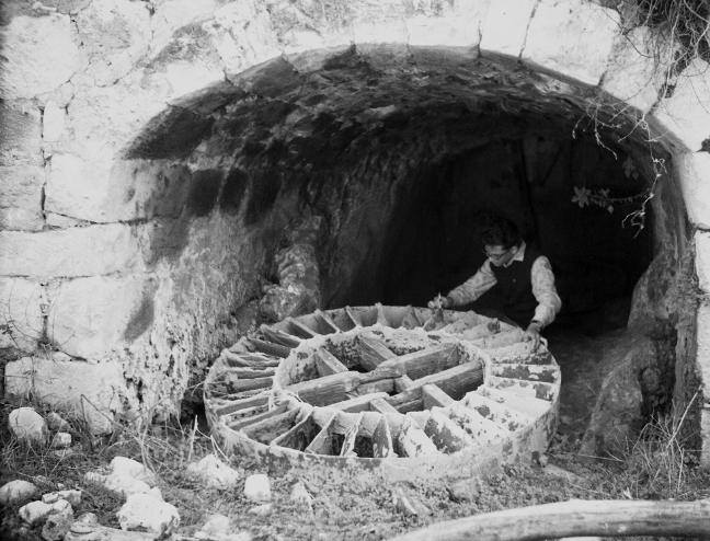
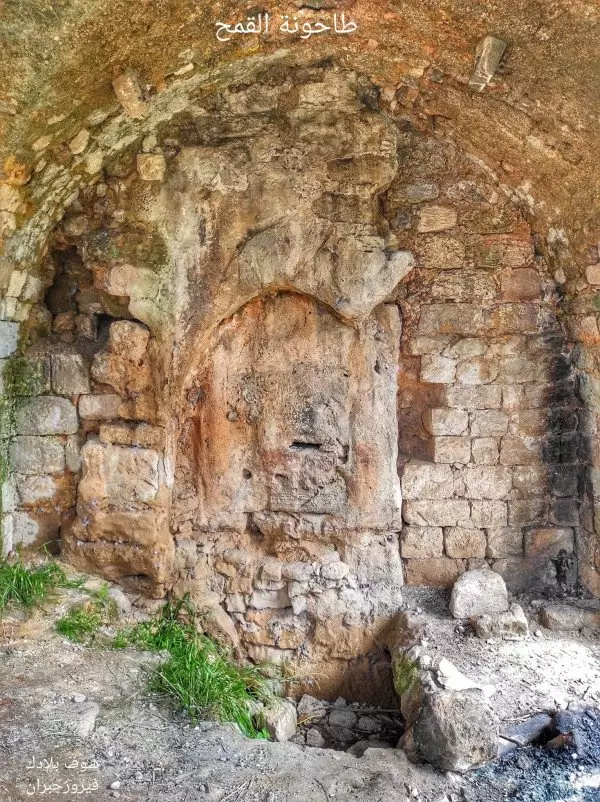
Posted by مروان ابراهيم الجشي - اثار طاحونة
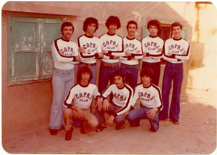
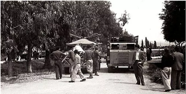
Posted by مروان ابراهيم الجشي - نادي الكابري-مخيم برج البراجنة 1978
Posted by مروان ابراهيم الجشي 2 - من اثار موقعة الكابري
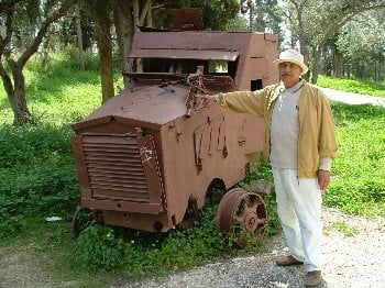
Posted by Saleh Arki 1 - المصفحات التي هوجمت في معركة الكابري في اذار 1948
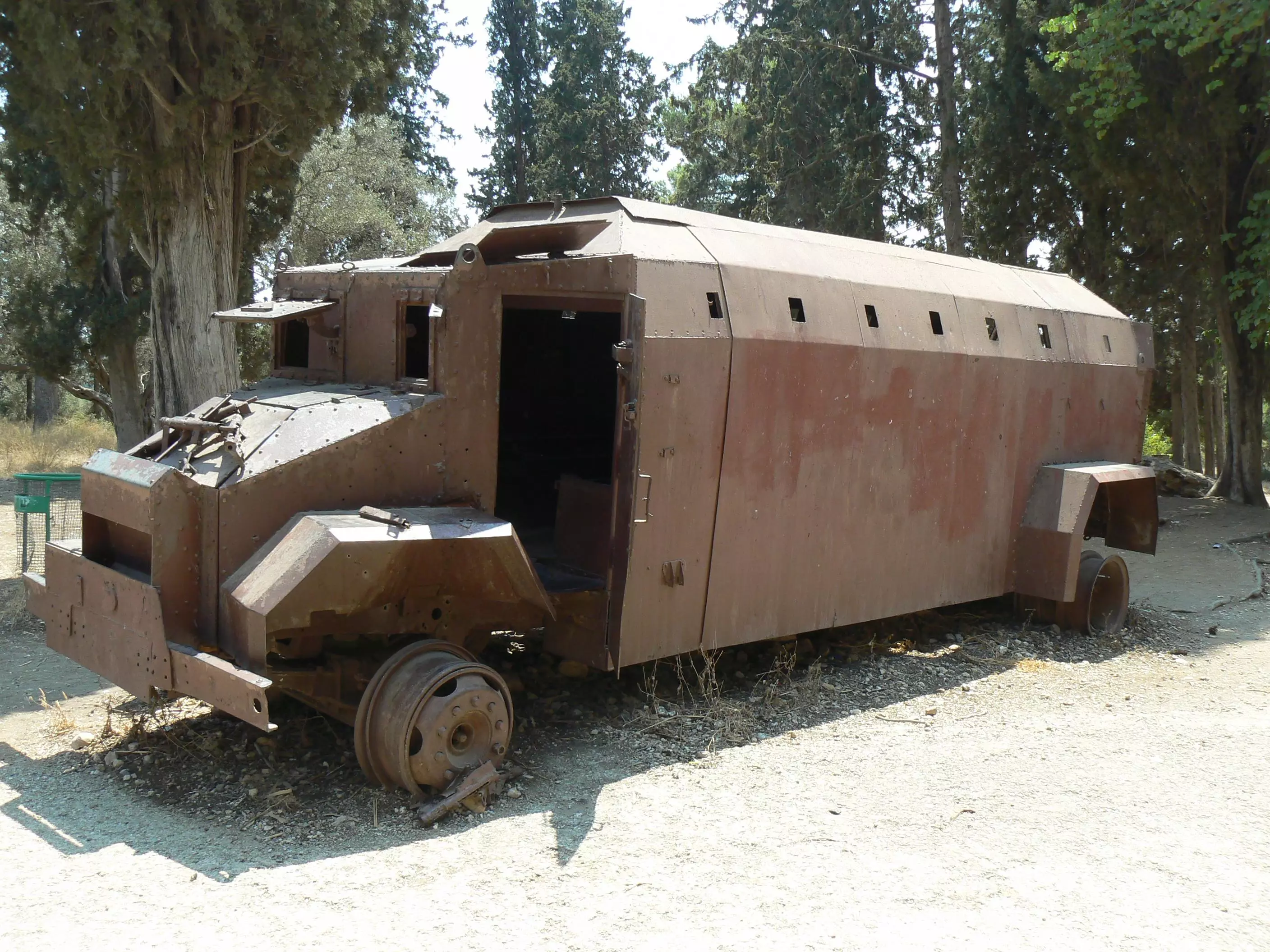
Posted by raneen geries - المصفحات التي هوجمت في معركة الكابري في اذار 1948
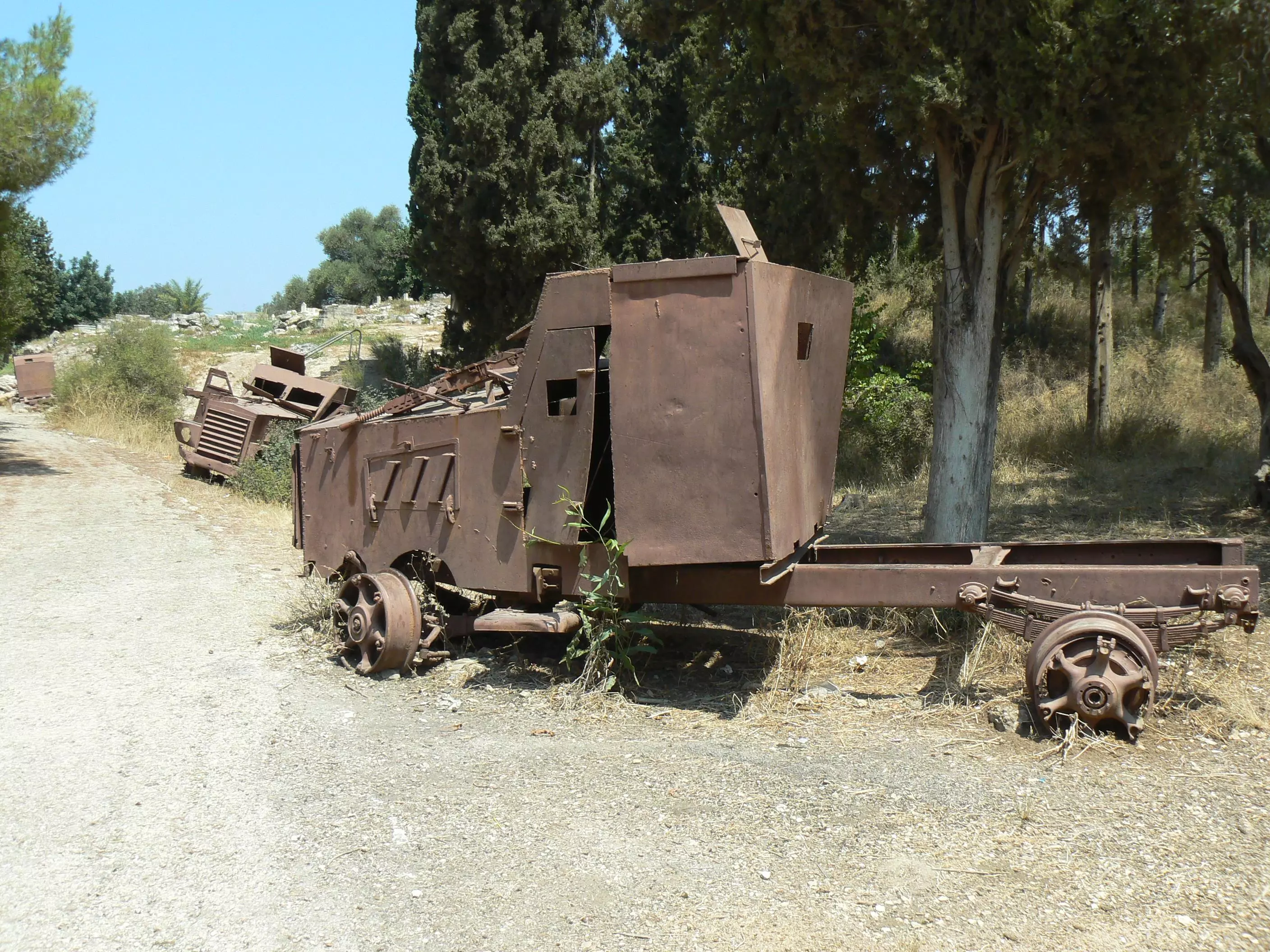
Posted by raneen geries 1 - قافلة المدرعات اليهودية في نهاريا في 27/3/1948 وقد دمرت في معركة الكابري
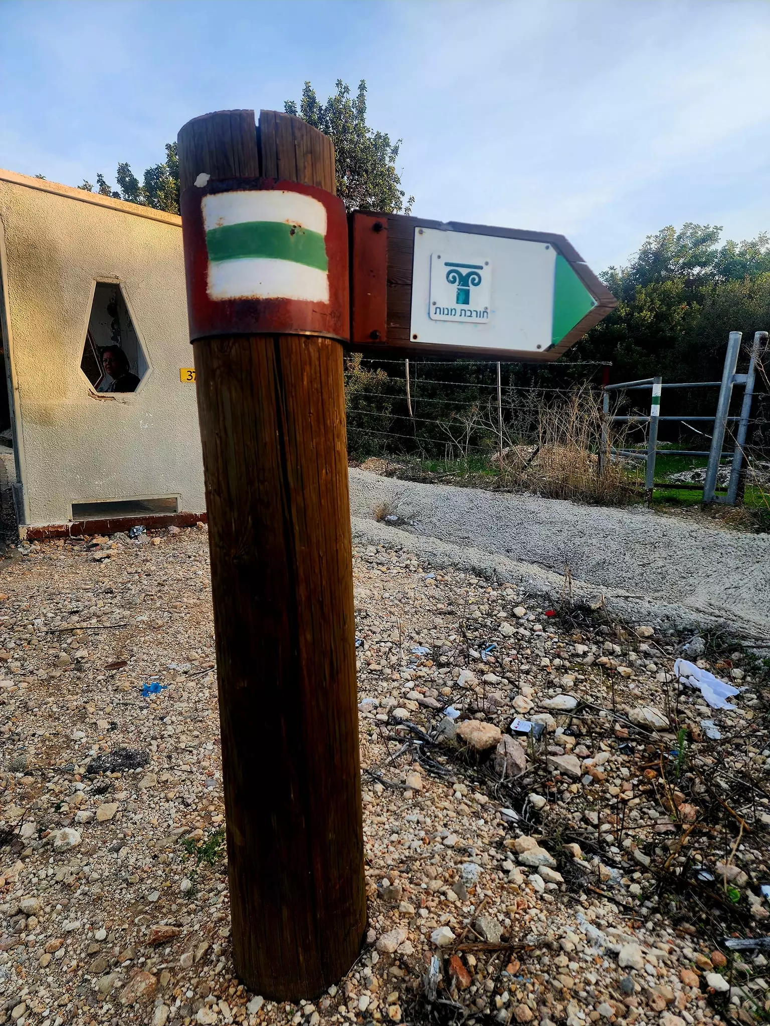
Posted by د.محمد عقل - آثار القناة المائيّة في غابة الكابري- 5/8/2014
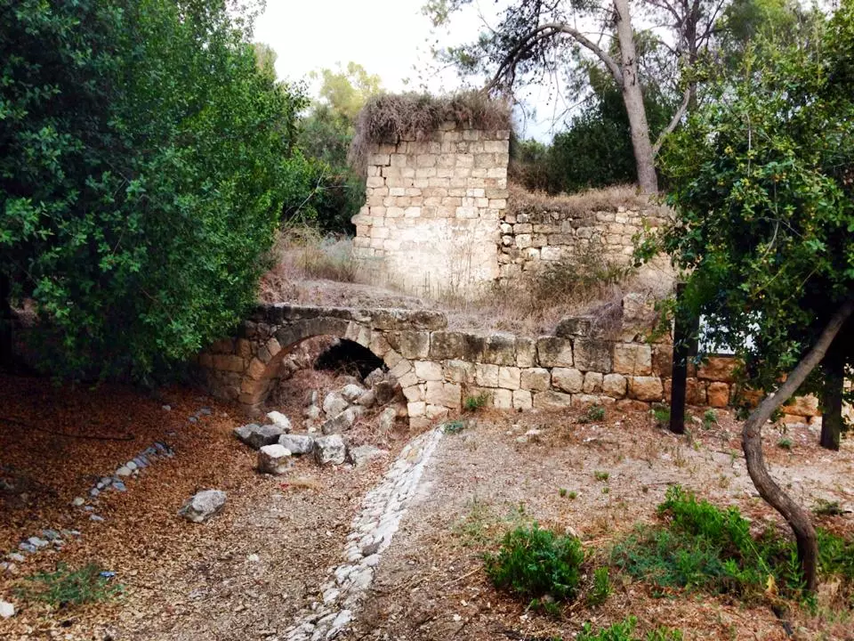
- أنقاض البيوت- 5/8/2014
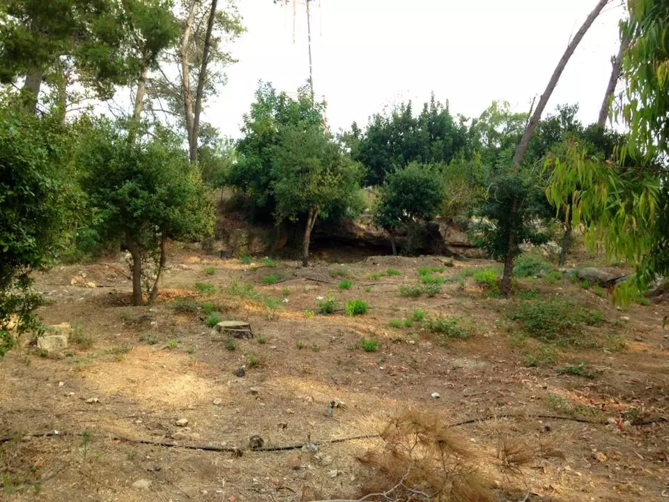
- غابة الكابري- 5/8/2014
- عربان بالقرب من قناة الكابري(فيحة) عام 1930
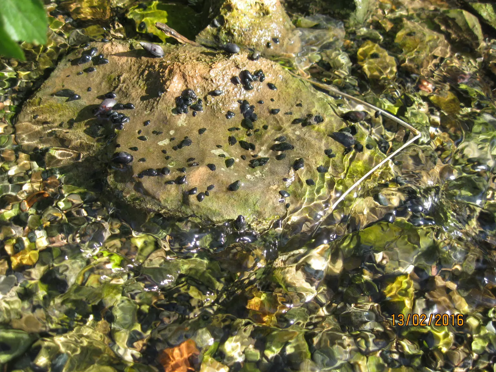
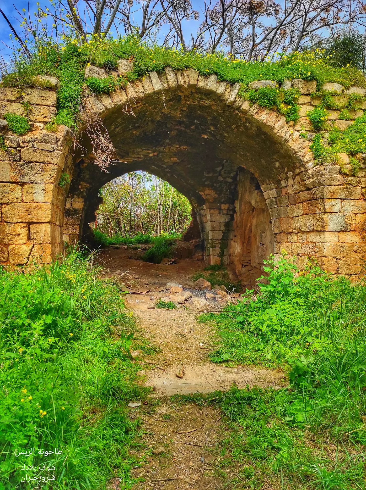
1 - مطحنة بالقرب من وادي الجعتون - بعدسة سهيل مخول يوم 13.2.2016
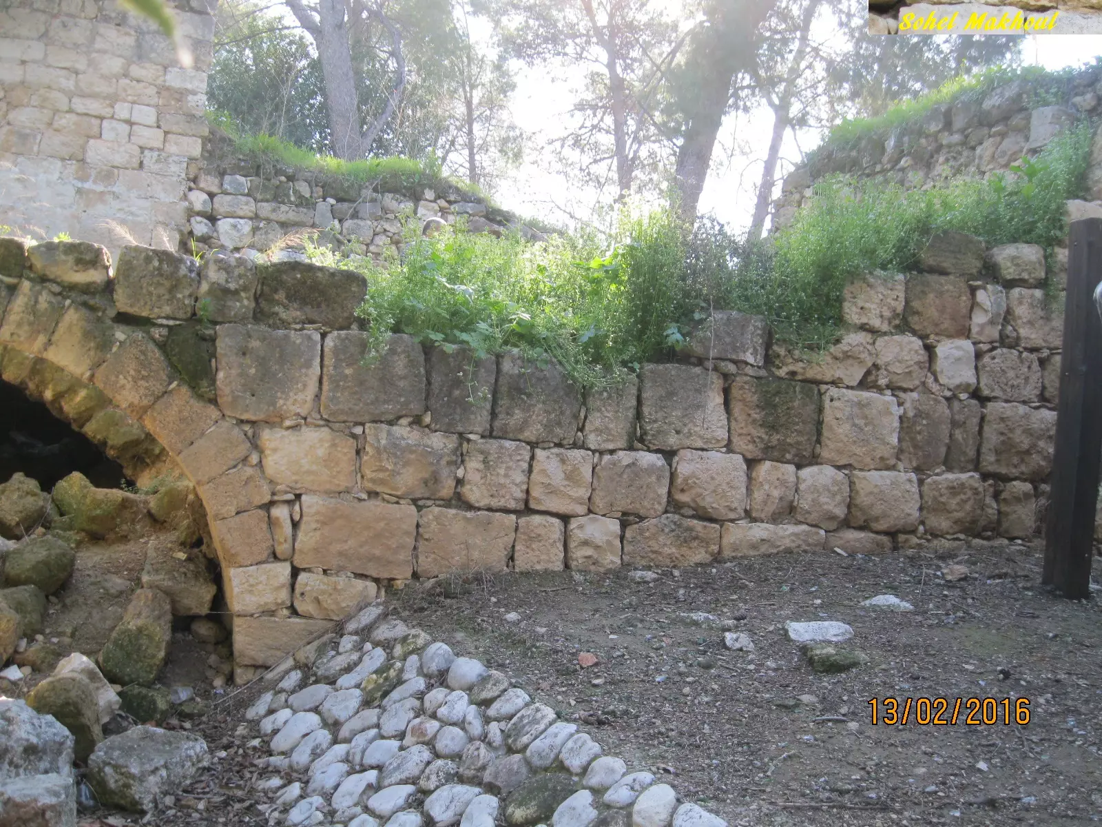
Posted by سهيل مخول - مطحنة بالقرب من وادي الجعتون - بعدسة سهيل مخول يوم 13.2.2016
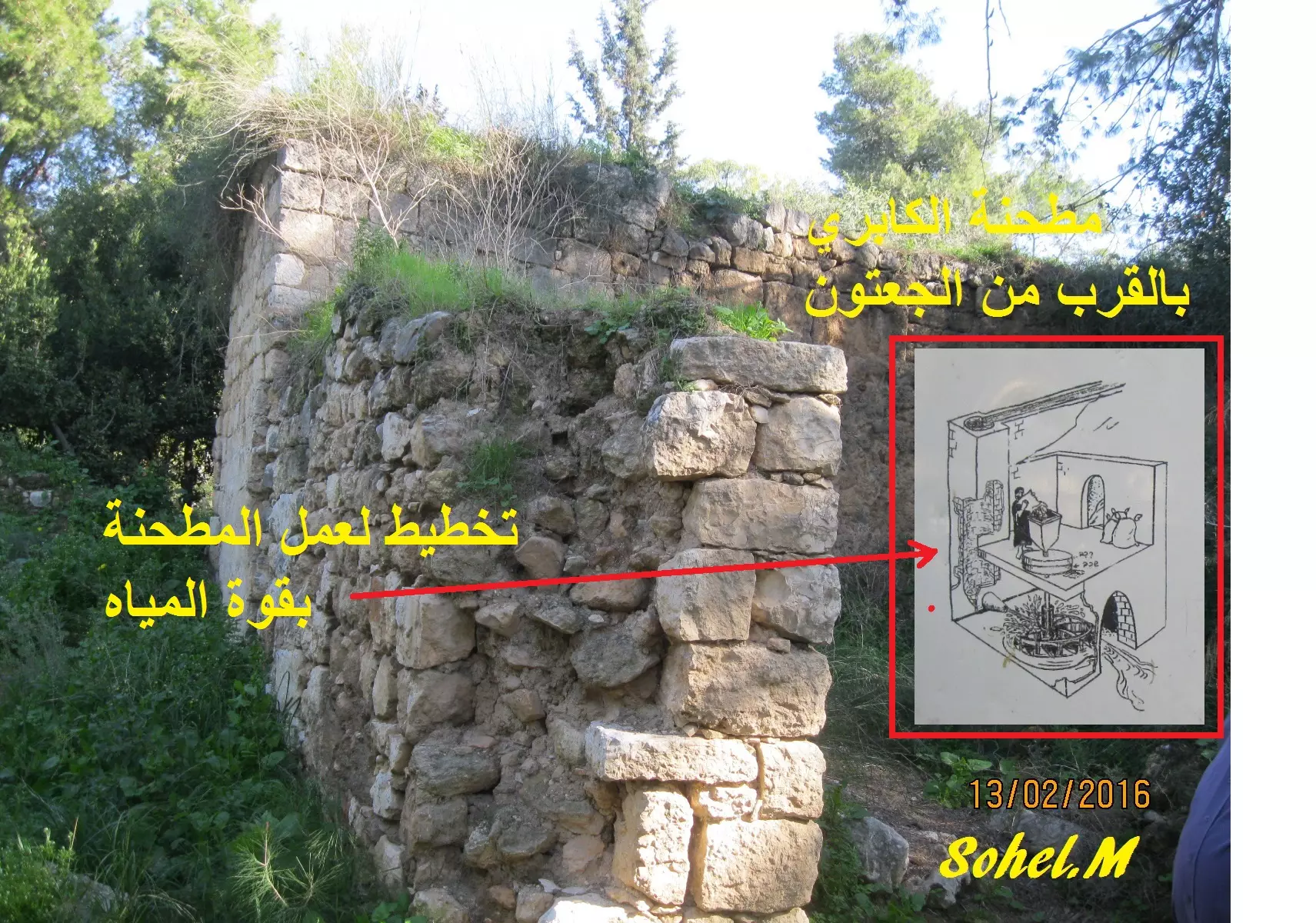
Posted by سهيل مخول - نبع المفشوخ باقرب من الكابري ومطحنة القمح - بعدسة سهيل مخول يوم 13.2.2016
Posted by سهيل مخول - عين العسل بالقرب من الكابري
Posted by سهيل مخول - عين العسل بالقرب من الكابري
Posted by سهيل مخول - ناعورة الكابري - 1940
- بقايا طحونة القمح في الكابري. صورة نادرة لفراش الطواحين التي كانت في فلسطين قبل النكبة
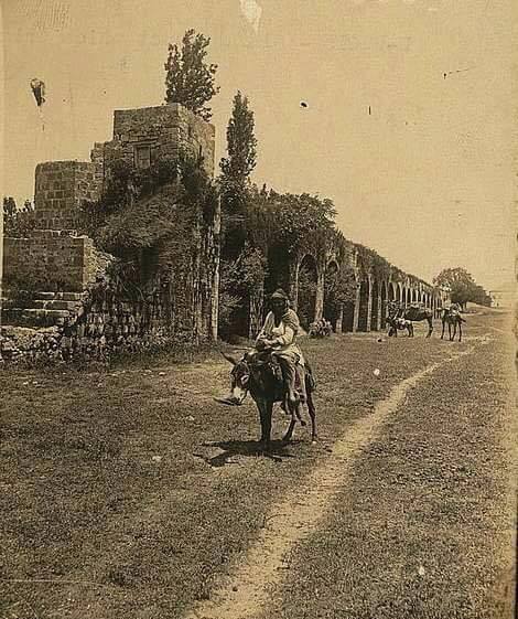
- قناطر الكابري قبل النكبة
- عين مفحوش في قرية الكابري المهجرة قضاء عكا سنة 1938
- عكا قناطر الكابري قرب المزرعة في اليوم الذي تلى العاصفة والتي ادت الى تدمير جزء كبير من القناطر سنة 1946
- جولة بي انقاض ومنازل قرية الكابري المهجرة
- جولة بي انقاض ومنازل قرية الكابري المهجرة #2

- جولة بي انقاض ومنازل قرية الكابري المهجرة #3
- جولة بي انقاض ومنازل قرية الكابري المهجرة #4
- جولة بي انقاض ومنازل قرية الكابري المهجرة #5
- جولة بي انقاض ومنازل قرية الكابري المهجرة #6
- جولة بي انقاض ومنازل قرية الكابري المهجرة #7
- جولة بي انقاض ومنازل قرية الكابري المهجرة #8
- جولة بي انقاض ومنازل قرية الكابري المهجرة #9
- جولة بي انقاض ومنازل قرية الكابري المهجرة #10
- جولة بي انقاض ومنازل قرية الكابري المهجرة #11

- جولة بي انقاض ومنازل قرية الكابري المهجرة #12

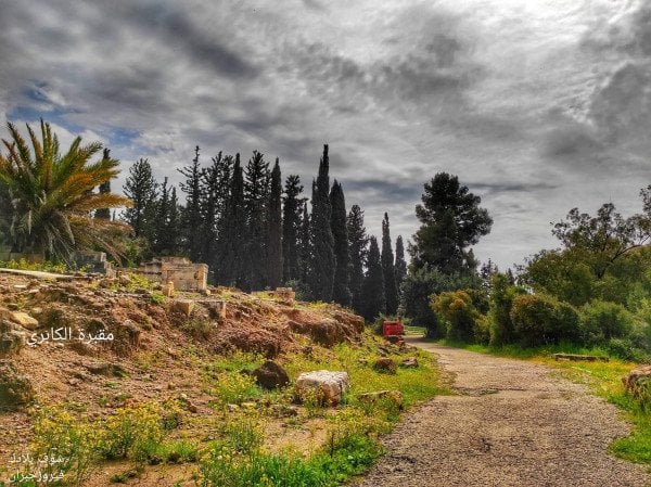
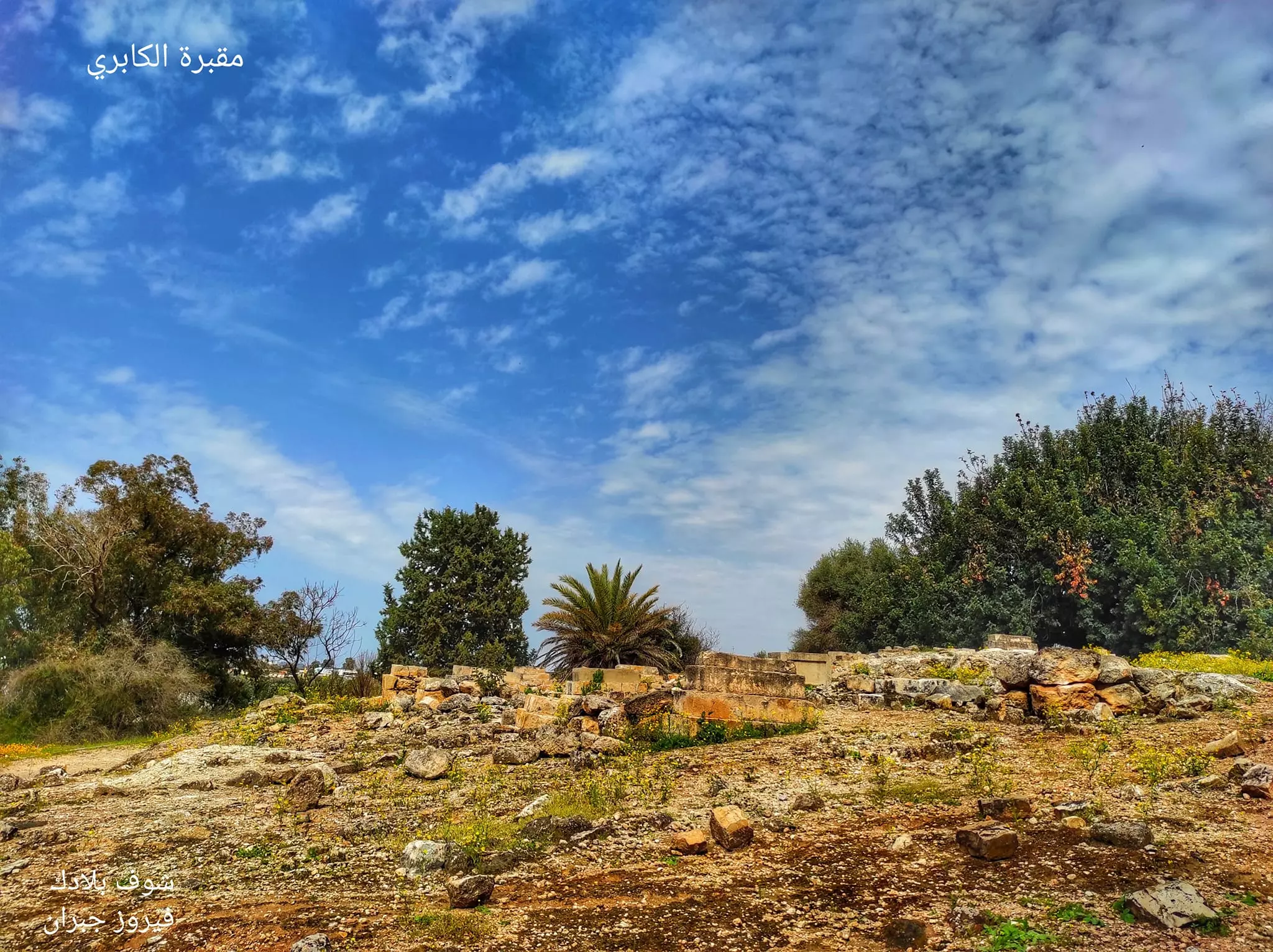
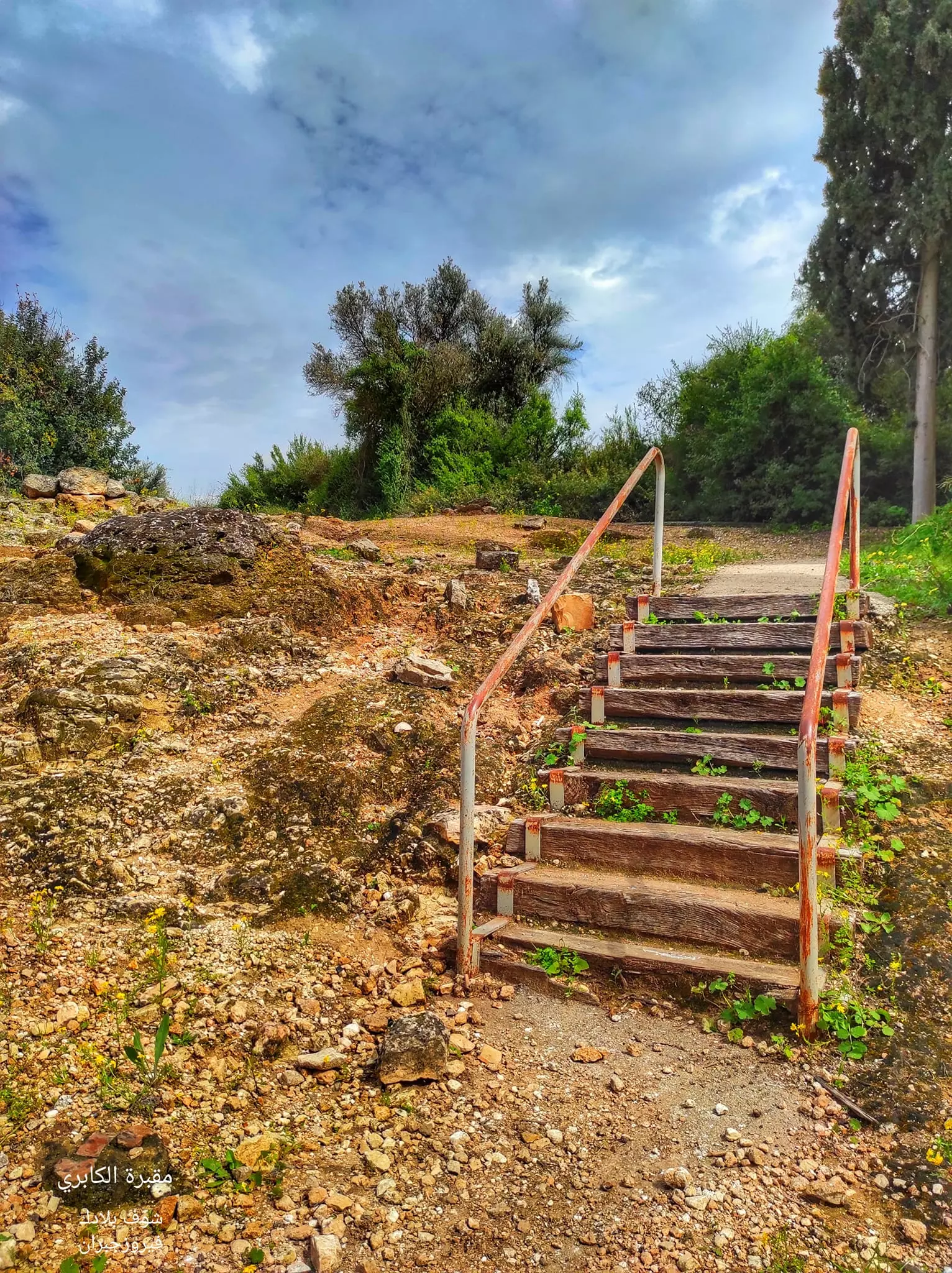
- مقبرة قرية الكابري المهجرة
- جولة في مقبرة الكابري -- نبيلة سالم
- جولة في مقبرة الكابري -- نبيلة سالم #2
- جولة في مقبرة الكابري -- نبيلة سالم #3
- جولة في مقبرة الكابري -- نبيلة سالم #4
- جولة في مقبرة الكابري -- نبيلة سالم #5
- جولة في مقبرة الكابري -- نبيلة سالم #6
- جولة في مقبرة الكابري -- نبيلة سالم #7
- جولة في مقبرة الكابري -- نبيلة سالم #8
- The only thing "the civilized" didn't destroy: al-Kabri's cemetery.
- That is how the "civilized" erased and replaced us: al-Kabri was completely obliterated, as you see -- الكابري باتت أثر بعد عين. من هنا مر الهمجّ

- That is how the "civilized" erased and replaced us: al-Kabri was completely obliterated, as you see -- الكابري باتت أثر بعد عين. من هنا مر الهمجّ #2
- That is how the "civilized" erased and replaced us: al-Kabri was completely obliterated, as you see -- الكابري باتت أثر بعد عين. من هنا مر الهمجّ #3
- That is how the "civilized" erased and replaced us: al-Kabri was completely obliterated, as you see -- الكابري باتت أثر بعد عين. من هنا مر الهمجّ #4
- That is how the "civilized" erased and replaced us: al-Kabri was completely obliterated, as you see -- الكابري باتت أثر بعد عين. من هنا مر الهمجّ
#5

- قناة الباشا من ألكابري إلى عكا -- Nabela Salem
- قناة الباشا من ألكابري إلى عكا -- Nabela Salem #2
- قناة الباشا من ألكابري إلى عكا -- Nabela Salem #3
- قناة الباشا من ألكابري إلى عكا -- Nabela Salem #4
- قناة الباشا من ألكابري إلى عكا -- Nabela Salem #5
- قناة الباشا من ألكابري إلى عكا -- Nabela Salem #6
- قناة الباشا من ألكابري إلى عكا -- Nabela Salem #7
- قناة الباشا من ألكابري إلى عكا -- Nabela Salem #8
- قناة الباشا من ألكابري إلى عكا -- Nabela Salem #9
- قناة الباشا من ألكابري إلى عكا -- Nabela Salem #10
- قناة الباشا من ألكابري إلى عكا -- Nabela Salem #11
- قناة الباشا من ألكابري إلى عكا -- Nabela Salem #12
- جولة في معاصر سكر خربة منوات ...قضاء عكا وشمال مفرق الكابري -- المزيد عنها في قسم التعليقات -- Dec. 2023 -- Nabela Salem
1 - جولة في معاصر سكر خربة منوات ...قضاء عكا وشمال مفرق الكابري -- المزيد عنها في قسم التعليقات -- Dec. 2023 -- Nabela Salem #2
- جولة في معاصر سكر خربة منوات ...قضاء عكا وشمال مفرق الكابري -- المزيد عنها في قسم التعليقات -- Dec. 2023 -- Nabela Salem #3
- جولة في معاصر سكر خربة منوات ...قضاء عكا وشمال مفرق الكابري -- المزيد عنها في قسم التعليقات -- Dec. 2023 -- Nabela Salem #4
- جولة في معاصر سكر خربة منوات ...قضاء عكا وشمال مفرق الكابري -- المزيد عنها في قسم التعليقات -- Dec. 2023 -- Nabela Salem #5
- جولة في معاصر سكر خربة منوات ...قضاء عكا وشمال مفرق الكابري -- المزيد عنها في قسم التعليقات -- Dec. 2023 -- Nabela Salem #6
- جولة في معاصر سكر خربة منوات ...قضاء عكا وشمال مفرق الكابري -- المزيد عنها في قسم التعليقات -- Dec. 2023 -- Nabela Salem #7
- جولة في معاصر سكر خربة منوات ...قضاء عكا وشمال مفرق الكابري -- المزيد عنها في قسم التعليقات -- Dec. 2023 -- Nabela Salem #8
- جولة في معاصر سكر خربة منوات ...قضاء عكا وشمال مفرق الكابري -- المزيد عنها في قسم التعليقات -- Dec. 2023 -- Nabela Salem #9
- جولة في معاصر سكر خربة منوات ...قضاء عكا وشمال مفرق الكابري -- المزيد عنها في قسم التعليقات -- Dec. 2023 -- Nabela Salem #10
- جولة في معاصر سكر خربة منوات ...قضاء عكا وشمال مفرق الكابري -- المزيد عنها في قسم التعليقات -- Dec. 2023 -- Nabela Salem #11
- جولة في معاصر سكر خربة منوات ...قضاء عكا وشمال مفرق الكابري -- المزيد عنها في قسم التعليقات -- Dec. 2023 -- Nabela Salem #12
- جولة في معاصر سكر خربة منوات ...قضاء عكا وشمال مفرق الكابري -- المزيد عنها في قسم التعليقات -- Dec. 2023 -- Nabela Salem #13
- جولة في معاصر سكر خربة منوات ...قضاء عكا وشمال مفرق الكابري -- المزيد عنها في قسم التعليقات -- Dec. 2023 -- Nabela Salem #14
- جولة في معاصر سكر خربة منوات ...قضاء عكا وشمال مفرق الكابري -- المزيد عنها في قسم التعليقات -- Dec. 2023 -- Nabela Salem #15
- جولة في معاصر سكر خربة منوات ...قضاء عكا وشمال مفرق الكابري -- المزيد عنها في قسم التعليقات -- Dec. 2023 -- Nabela Salem #16
- جولة في معاصر سكر خربة منوات ...قضاء عكا وشمال مفرق الكابري -- المزيد عنها في قسم التعليقات -- Dec. 2023 -- Nabela Salem #17
- جولة في معاصر سكر خربة منوات ...قضاء عكا وشمال مفرق الكابري -- المزيد عنها في قسم التعليقات -- Dec. 2023 -- Nabela Salem #18
- جولة في معاصر سكر خربة منوات ...قضاء عكا وشمال مفرق الكابري -- المزيد عنها في قسم التعليقات -- Dec. 2023 -- Nabela Salem #19
- جولة في معاصر سكر خربة منوات ...قضاء عكا وشمال مفرق الكابري -- المزيد عنها في قسم التعليقات -- Dec. 2023 -- Nabela Salem #20
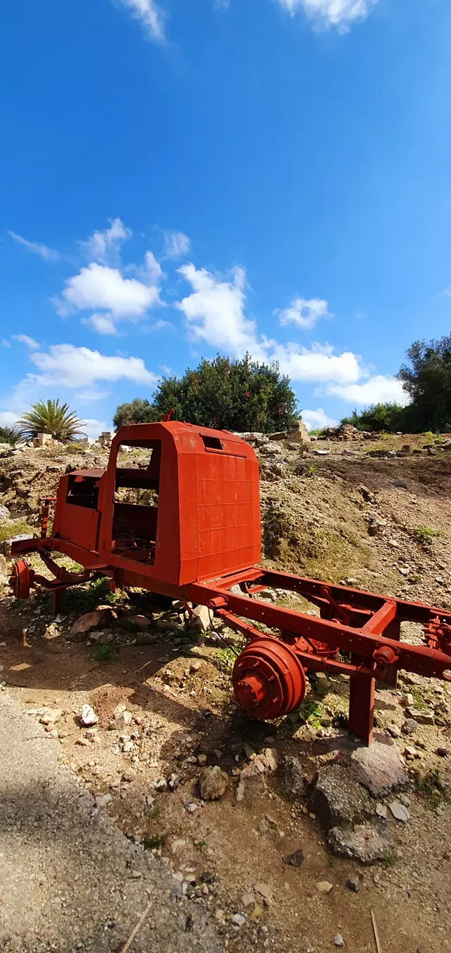
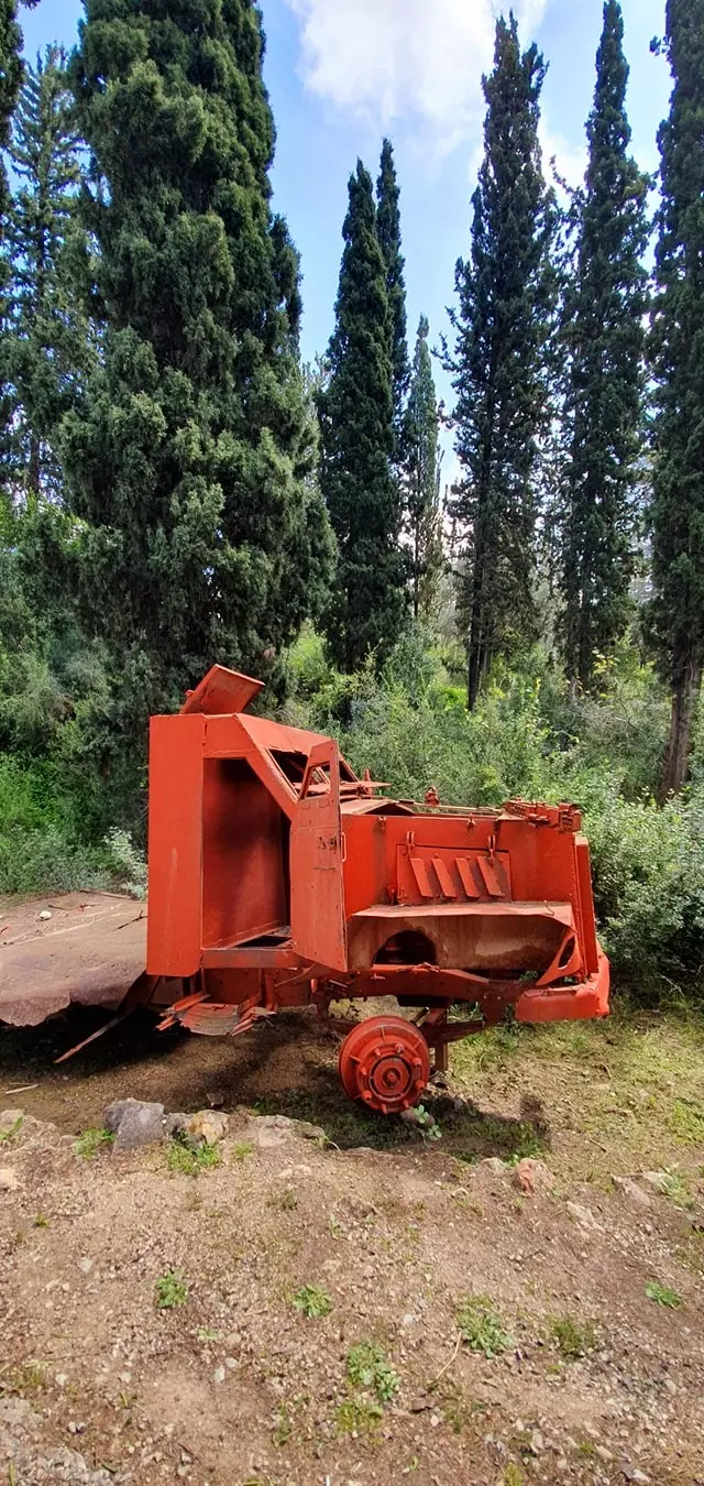
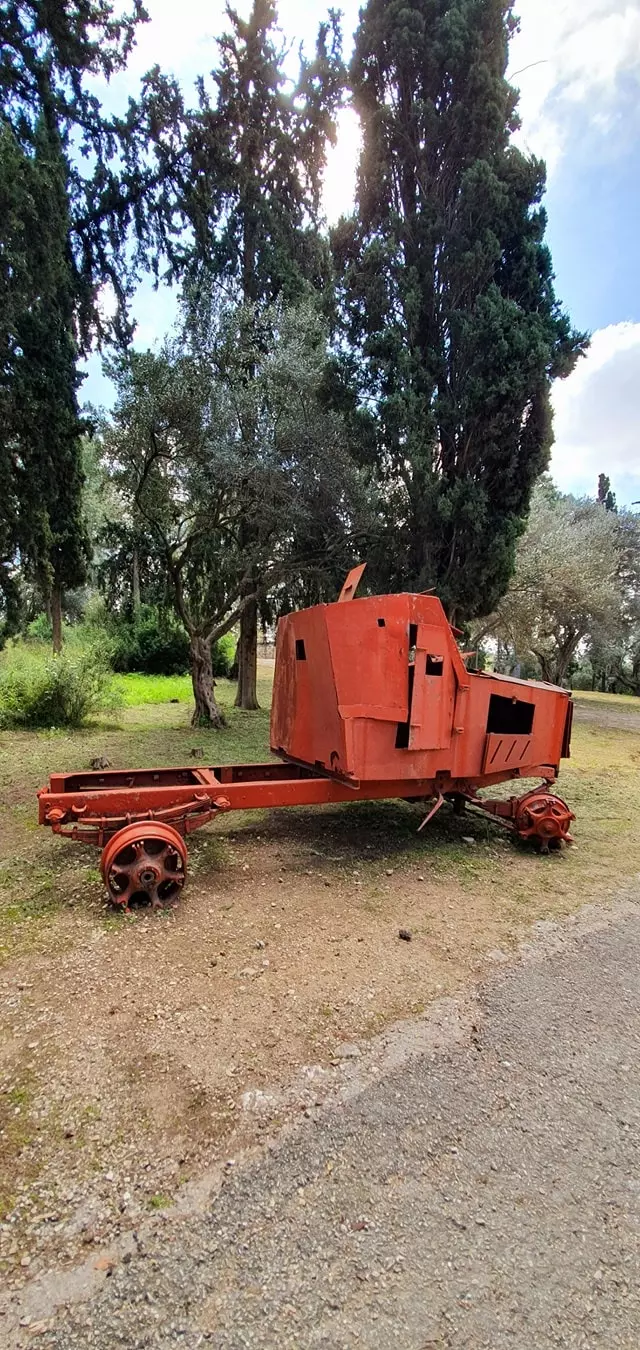
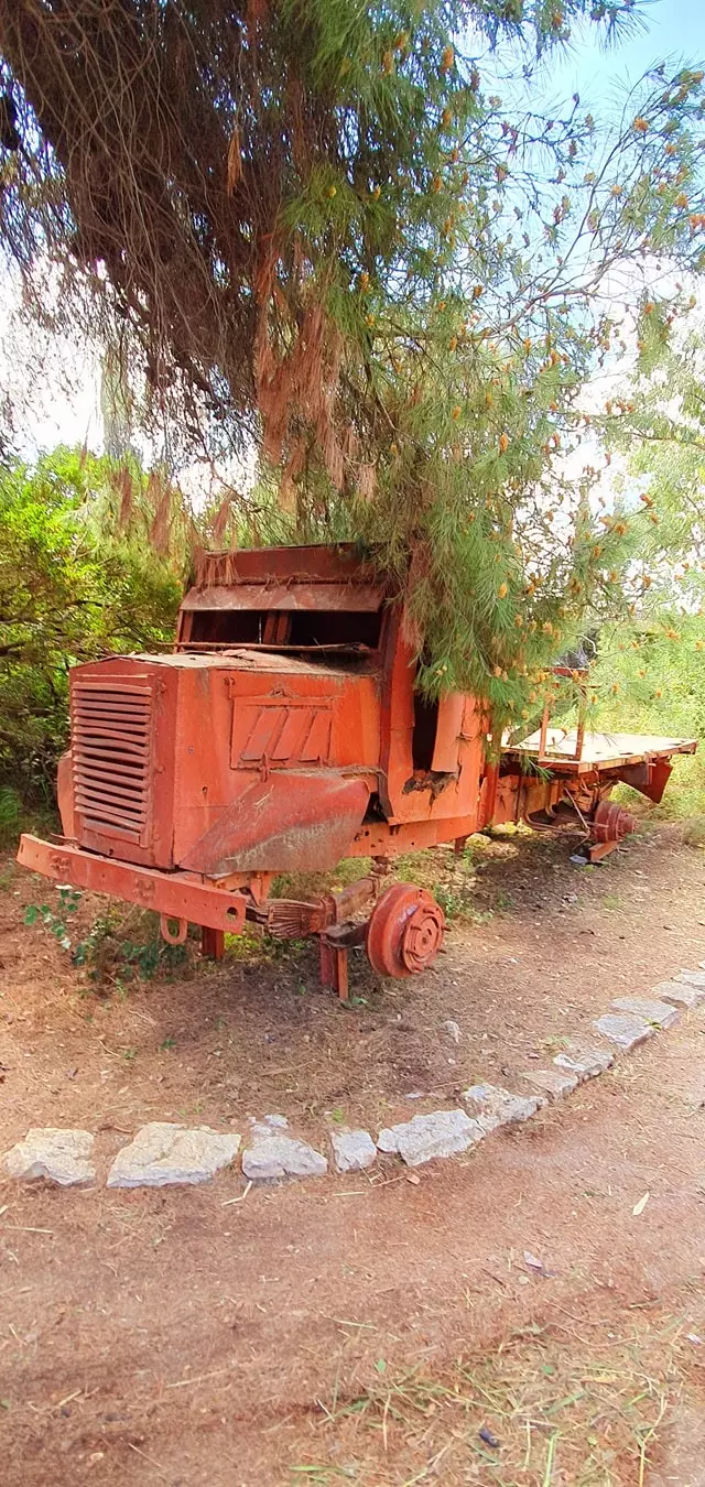
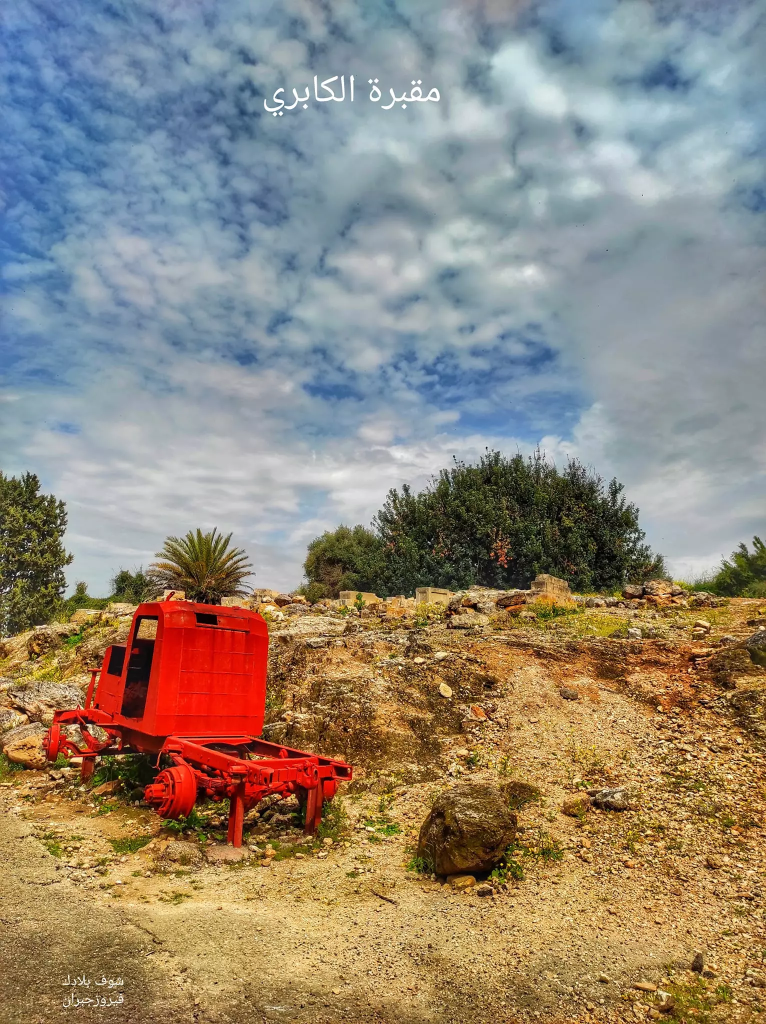
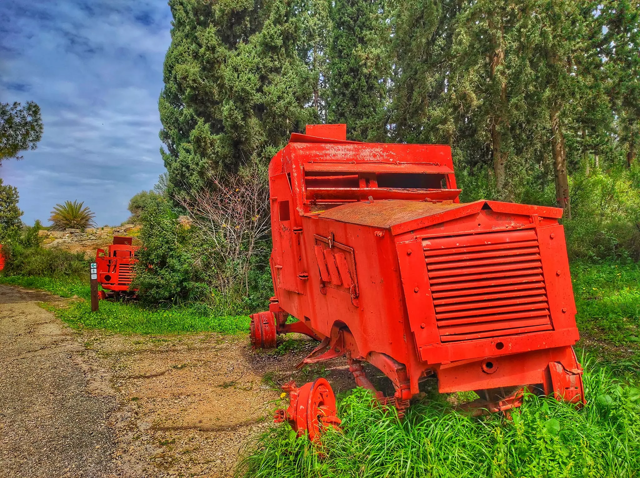
- جولة في مطحنة قرية ألكابري ألمهجرة ألمقبرة وألمركبات ألتي أستعملت في معركة ألبلدة ألتي قتل فيها 47 شخص في كميل نصب لهم -- March 2021 -- Nabela Salem
- جولة في مطحنة قرية ألكابري ألمهجرة ألمقبرة وألمركبات ألتي أستعملت في معركة ألبلدة ألتي قتل فيها 47 شخص في كميل نصب لهم -- March 2021 -- Nabela Salem #2
- جولة في مطحنة قرية ألكابري ألمهجرة ألمقبرة وألمركبات ألتي أستعملت في معركة ألبلدة ألتي قتل فيها 47 شخص في كميل نصب لهم -- March 2021 -- Nabela Salem #3
- جولة في مطحنة قرية ألكابري ألمهجرة ألمقبرة وألمركبات ألتي أستعملت في معركة ألبلدة ألتي قتل فيها 47 شخص في كميل نصب لهم -- March 2021 -- Nabela Salem #4
- جولة في مطحنة قرية ألكابري ألمهجرة ألمقبرة وألمركبات ألتي أستعملت في معركة ألبلدة ألتي قتل فيها 47 شخص في كميل نصب لهم -- March 2021 -- Nabela Salem #5
- جولة في مطحنة قرية ألكابري ألمهجرة ألمقبرة وألمركبات ألتي أستعملت في معركة ألبلدة ألتي قتل فيها 47 شخص في كميل نصب لهم -- March 2021 -- Nabela Salem #6
- جولة في مطحنة قرية ألكابري ألمهجرة ألمقبرة وألمركبات ألتي أستعملت في معركة ألبلدة ألتي قتل فيها 47 شخص في كميل نصب لهم -- March 2021 -- Nabela Salem #7
- جولة في مطحنة قرية ألكابري ألمهجرة ألمقبرة وألمركبات ألتي أستعملت في معركة ألبلدة ألتي قتل فيها 47 شخص في كميل نصب لهم -- March 2021 -- Nabela Salem #8
- جولة في مطحنة قرية ألكابري ألمهجرة ألمقبرة وألمركبات ألتي أستعملت في معركة ألبلدة ألتي قتل فيها 47 شخص في كميل نصب لهم -- March 2021 -- Nabela Salem #9
- جولة في مطحنة قرية ألكابري ألمهجرة ألمقبرة وألمركبات ألتي أستعملت في معركة ألبلدة ألتي قتل فيها 47 شخص في كميل نصب لهم -- March 2021 -- Nabela Salem #10
- جولة في مطحنة قرية ألكابري ألمهجرة ألمقبرة وألمركبات ألتي أستعملت في معركة ألبلدة ألتي قتل فيها 47 شخص في كميل نصب لهم -- March 2021 -- Nabela Salem #11
- جولة في مطحنة قرية ألكابري ألمهجرة ألمقبرة وألمركبات ألتي أستعملت في معركة ألبلدة ألتي قتل فيها 47 شخص في كميل نصب لهم -- March 2021 -- Nabela Salem #12
- جولة في مطحنة قرية ألكابري ألمهجرة ألمقبرة وألمركبات ألتي أستعملت في معركة ألبلدة ألتي قتل فيها 47 شخص في كميل نصب لهم -- March 2021 -- Nabela Salem #13
- جولة في مطحنة قرية ألكابري ألمهجرة ألمقبرة وألمركبات ألتي أستعملت في معركة ألبلدة ألتي قتل فيها 47 شخص في كميل نصب لهم -- March 2021 -- Nabela Salem #14
- جولة في مطحنة قرية ألكابري ألمهجرة ألمقبرة وألمركبات ألتي أستعملت في معركة ألبلدة ألتي قتل فيها 47 شخص في كميل نصب لهم -- March 2021 -- Nabela Salem #15
- جولة في مطحنة قرية ألكابري ألمهجرة ألمقبرة وألمركبات ألتي أستعملت في معركة ألبلدة ألتي قتل فيها 47 شخص في كميل نصب لهم -- March 2021 -- Nabela Salem #16
- جولة في مطحنة قرية ألكابري ألمهجرة ألمقبرة وألمركبات ألتي أستعملت في معركة ألبلدة ألتي قتل فيها 47 شخص في كميل نصب لهم -- March 2021 -- Nabela Salem #17
- جولة في مطحنة قرية ألكابري ألمهجرة ألمقبرة وألمركبات ألتي أستعملت في معركة ألبلدة ألتي قتل فيها 47 شخص في كميل نصب لهم -- March 2021 -- Nabela Salem #18
- جولة في مطحنة قرية ألكابري ألمهجرة ألمقبرة وألمركبات ألتي أستعملت في معركة ألبلدة ألتي قتل فيها 47 شخص في كميل نصب لهم -- March 2021 -- Nabela Salem #19
- جولة في مطحنة قرية ألكابري ألمهجرة ألمقبرة وألمركبات ألتي أستعملت في معركة ألبلدة ألتي قتل فيها 47 شخص في كميل نصب لهم -- March 2021 -- Nabela Salem #20
- جولة في مطحنة قرية ألكابري ألمهجرة ألمقبرة وألمركبات ألتي أستعملت في معركة ألبلدة ألتي قتل فيها 47 شخص في كميل نصب لهم -- March 2021 -- Nabela Salem #21
- جولة في مطحنة قرية ألكابري ألمهجرة ألمقبرة وألمركبات ألتي أستعملت في معركة ألبلدة ألتي قتل فيها 47 شخص في كميل نصب لهم -- March 2021 -- Nabela Salem #22
- جولة في مطحنة قرية ألكابري ألمهجرة ألمقبرة وألمركبات ألتي أستعملت في معركة ألبلدة ألتي قتل فيها 47 شخص في كميل نصب لهم -- March 2021 -- Nabela Salem #23
- جولة في مطحنة قرية ألكابري ألمهجرة ألمقبرة وألمركبات ألتي أستعملت في معركة ألبلدة ألتي قتل فيها 47 شخص في كميل نصب لهم -- March 2021 -- Nabela Salem #24
- جولة في مطحنة قرية ألكابري ألمهجرة ألمقبرة وألمركبات ألتي أستعملت في معركة ألبلدة ألتي قتل فيها 47 شخص في كميل نصب لهم -- March 2021 -- Nabela Salem #25
- مسارة قناة الكابري من منبعها في قرية الكابري حتى مدينة عكا..المزيد عنها في قسم التعليقات
1 - The most "civilized & liberal" of world Jewry completely obliterated our village except for its cemetery as you see
- The most "civilized & liberal" of world Jewry completely obliterated our village except for its cemetery as you see #2
- The most "civilized & liberal" of world Jewry completely obliterated our village except for its cemetery as you see #3
- The most "civilized & liberal" of world Jewry completely obliterated our village except for its cemetery as you see #4
- The most "civilized & liberal" of world Jewry completely obliterated our village except for its cemetery as you see #5
- The most "civilized & liberal" of world Jewry completely obliterated our village except for its cemetery as you see #6

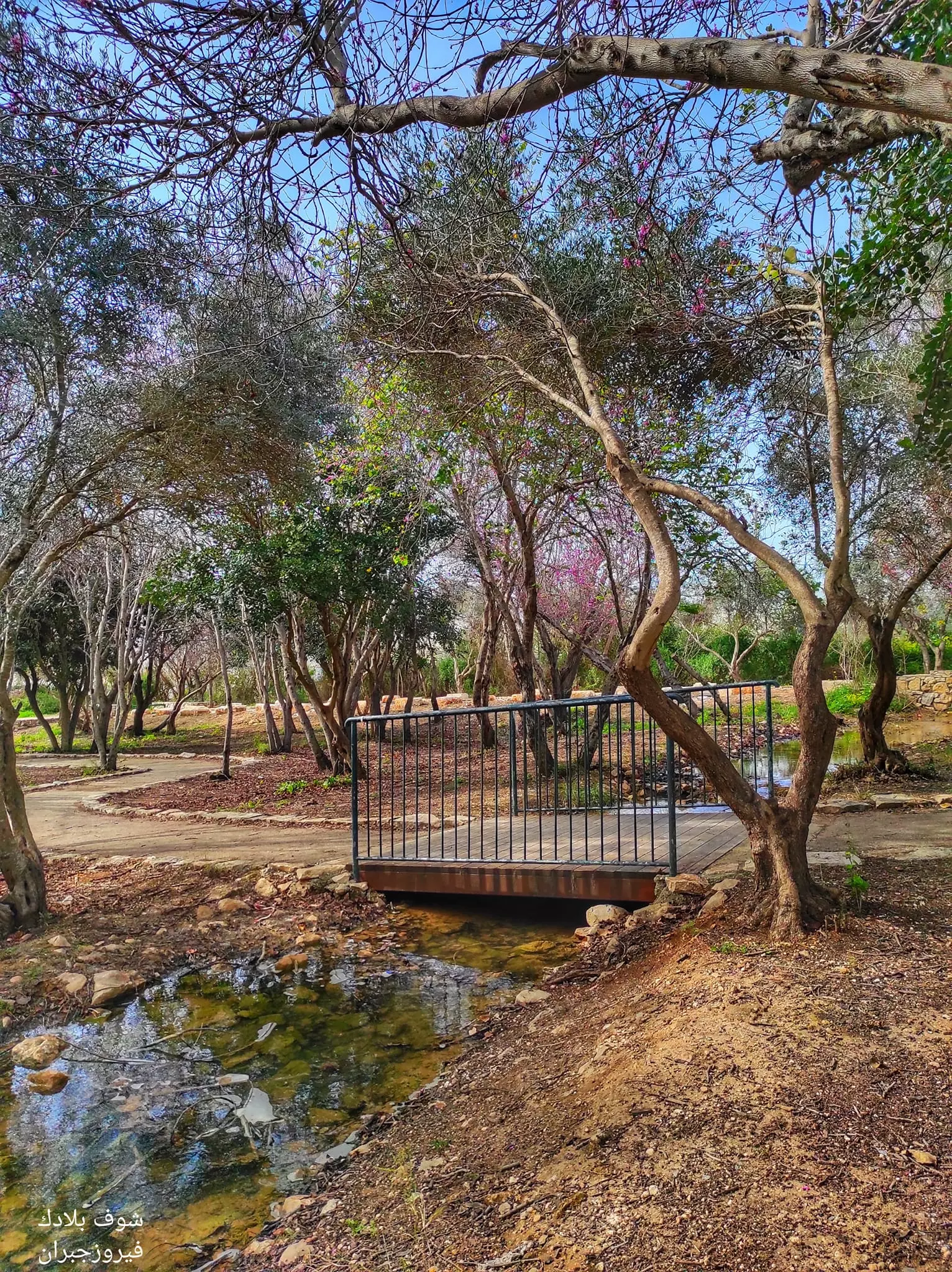
- Let us tour what remained of the famous water-powered mill and Kabri's cemetery, March 2023 -- Fairouz Jubran
- Let us tour what remained of the famous water-powered mill and Kabri's cemetery, March 2023 -- Fairouz Jubran #2
- Let us tour what remained of the famous water-powered mill and Kabri's cemetery, March 2023 -- Fairouz Jubran #3
- Let us tour what remained of the famous water-powered mill and Kabri's cemetery, March 2023 -- Fairouz Jubran #4

- Let us tour what remained of the famous water-powered mill and Kabri's cemetery, March 2023 -- Fairouz Jubran #5
- Let us tour what remained of the famous water-powered mill and Kabri's cemetery, March 2023 -- Fairouz Jubran #6

- Let us tour what remained of the famous water-powered mill and Kabri's cemetery, March 2023 -- Fairouz Jubran #7
- Let us tour what remained of the famous water-powered mill and Kabri's cemetery, March 2023 -- Fairouz Jubran #8
- Let us tour what remained of the famous water-powered mill and Kabri's cemetery, March 2023 -- Fairouz Jubran #9
- Let us tour what remained of the famous water-powered mill and Kabri's cemetery, March 2023 -- Fairouz Jubran #10
- Let us tour what remained of the famous water-powered mill and Kabri's cemetery, March 2023 -- Fairouz Jubran #11
- Let us tour what remained of the famous water-powered mill and Kabri's cemetery, March 2023 -- Fairouz Jubran #12
- Let us tour what remained of the famous water-powered mill and Kabri's cemetery, March 2023 -- Fairouz Jubran #13

- Let us tour what remained of the famous water-powered mill and Kabri's cemetery, March 2023 -- Fairouz Jubran #14

- Let us tour what remained of the famous water-powered mill and Kabri's cemetery, March 2023 -- Fairouz Jubran #15
Want to browse more? 80,000 pictures were grouped in these gallaries:
| Display Name | Clan/Hamolah | Country of Residence |
| Khadijah Hisham shaker | - | lebanon, Lebanon |
| ربيع بلقيس | - | - |
| ali issa | - | - |
| Salman Kadoura | - | Malmo, Sweden |
| zeina waarie | - | oslo, norway |
| Ihsan Waarieh | waarieh | Oslo, Norway |
| Abulwaleed | El-Jishi | Texas, USA |
| Yusra Zaazouh | Zaazouh | Nivå, Danmark |
| بسام BASSAM بلقيس BALKIS | - | DUBAI, U.A.E |
| صالح أحمد عركي | عركي | - |
| أبو خالد | - | Doha, Qatar |
| Mohannad Kaddoura | - | Texas, USA |
| AdnanAldabaja | - | Texas, USA |
| ABou Hussein | - | UAE, UAE |
| Ahmad Salim Oueiti | Oueiti | Denmark, Denmark |
| Omar Ahmad Salim Oueiti | Oueiti | Vejle, Denmark |
| ابو خالد بلقيس | - | DANMARK |
| falastine | - | - |
| Sobhi Elassaad | - | Ontario, Canada |
| خالد بلقيس | - | - |
| Ramez | El-jishi | - |
| شحادة شيخة | شيخة | dubai, U A E |
| Nazih El-Jichi | - | sztutowo, poland |
| Thaer Jawhar | - | California, USA |
| Rami El - Jishi | - | - |
| ashwah | عكا | حماة |
| Ahmed Eldabaja | - | NB, CANADA |
| jamil yassine | - | - |
| ehssan el-jechy | el-jechy | vejle, Denmark |
| Ziad shaker eljishi | elJishi | - |
| issam | jishi | denmark |
| ابو احمد | AL JISHI | ABUDABI-AL AIN |
| ابو حسام | عواد | دير البلح, دير البلح |
| Abu Mohammad | dgheim | - |
| عماد الدين الجشي | الجشي | California, USA |
| khaled al dahhan | - | uae, uae |
| balkees | balkees | libya, palestine |
| Mohamad El-Jechi | El-Jechi | Al-riyadh, Saudi Arabia |
| Khaled Dahak | Waarieh / Dahhan | Australia |
| مروان ابراهيم الجشي | الجشي | Texas, USA |
| shaker Balkis | Balkis | califotnia, USA |
| Mahmoud El-Safadi | - | - |
| El Kapri | - | Odense, odense C |
| abu ghassan | al_jichi | beirut, Lebanon |
| Abu Karim Haj Khalil | Haj Khalil | - |
| mostafa merhie | - | - |
| omar sarhan | Sarhan | wa, america |
| Rola Badawi | Shabati | Athens, Greece |
| Ghassan Ahmad Abdelatif Jawhar | Jawhar | USA |
| RAAFAT | - | - |
| Fadi Balqis | Balqis | Gothenborg, SWEDEN |
| mohsen aljishi | aljishi | alain, UAE |
| Nermin Serhan | Serhan | - |
| Rani Taha | Taha | Dubai, UAE |
- قرية الكابري المهجرة - فوزي ناصر Duration: 24 min 4 sec
- الذاكرة مفتاح العودة -- الحلقة 102 -- الكابري
- مقبرة قرية الكابري االمهجرة والتي تبعد 12كم عن مدينة عكا Duration: 2 min sec
- وقفة على ركام قرية الكابري المهجرة Duration: 22 min 32 sec
- How To Erase a People, a documentary about al-Kabri from one of its daughters Duration: 21 min 33 sec
 Fake Valor: Why Did Zionist Jews Hoist Nazis Flag on Their Ships in the 1930s?
What is new?
-
Facts About Oct. 7th Gaza Raid
-
Remined Us Please:: Who Did Rape Who? Palestinians Raped Israelis? Or, was the other way around?
-
When Prof. Edward Said was invited to debate Bibi Netanyahu in the 1980s, watch what happened!
-
Ezra Klein of the NY Times on the "Jewish Race".
-
Abusing Blood Libel!
-
Zionist FAQ: Isn't it true that Palestinians don't want peace? Palestinians never accepted the two-state solution
- Facts about Haavara (Transfer) Agreement between Ben-Gurion & Hitler
-
Haavara FAQs: Why Did Zionist Jews Hoist Nazis' Flags on Their Ships in the 1930s?
- Haavara FAQs: When Chaim Weizmann met FDR in mid-1943, why was he silent about rescuing European Jewry?
-
Dear ChatGPT: How did Palestinians resist Napoleon's invasion of their country in 1799?
-
Dear ChatGPT: Gaza had a vibrant Jewish community in the mid-17th century. What happened to them?
-
Dear ChatGPT: Why did the Jewish Agency suppress news of the Holocaust during WWII?
-
Video Playlist: Jews share their DNA tests to end the conflict for good.
-
A Tale of Two Conflicts: Examining the Definition of Genocide
-
Prof. Abraham Polak And The Suppressed History of the Khazars and European Jewry
-
How Ronald Reagan would have framed the genocide in Gaza if he were still alive?
-
Haavara FAQs: Let us do the math: how many German Jews did The Haavara Agreement save?
-
Zionist FAQs: The Hebron Massacre of 1929, "clearly proves" that Palestinians are antisemitic, how could you deny it?
-
Zionist FAQs: Why Anti-Zionist Is Not Antisemitism?
-
Zionist FAQs: Isn't it true that the KGB create Palestinian Nationalism in the early 1960s?
- Zionist FAQs: Muslims are killing Muslims all the time; why are Israeli Jews being singled out in the media?
- Zionist FAQs: How is Israel an apartheid state when 20% of its citizens are Arabs who enjoy full rights?
-
Haavara FAQs: Analysis of Herzl's Uganda Scheme and how it could have saved millions of Jews.
-
Haavara FAQs: Why did Hayim Greenberg describe American Jewry as "morally bankrupt" in early 1943?
-
Haavara FAQs: What if the Evian Conference was a resounding success? What would have been the impact of saving European Jewry on Zionism?
- Haavara FAQs: What if the six million were saved, how that would have impacted the Zionist project?
-
Haavara FAQs: How did Zionist leaders react when Europe's Jews lingered in the DP camps after WWII ended?
-
Why does the American Jewish community repeat lies that David Ben-Gurion had debunked before he died?
-
Who has the power to rename the Tatar/Khazar Gene Marker to Jewish IV?
-
Zionist FAQs: Why won't Egypt, Syria, and Jordan take their people back? Jews are indigenous to Palestine, and Arabs immigrated after Jews developed the country. Arabs should leave.
-
Haavara FAQs: Did Hitler and the Nazis conflate between Judaism and Zionist? If that wasn't case, then why?
-
Haavara FAQs: Winston Churchill and antisemitism, a collection of articles written Churchill.
-
Haavara FAQs: Broken by country, how many Jews survived vs. killed during the Holocaust?
-
Haavara FAQs: Why did European Jews vote with their feet and to immigrated to the Americas, not Palestine, after WWII?
-
Watch this American Jewish Girl describing Israeli Jews' cognitive dissonance like no other in under two minutes
-
Haavara FAQs: When the Nazis went out of their way to hide the Holocaust, Israeli Jews did the exact opposite by broadcasting their genocide of Gazans. But why?
-
Haavara FAQs: How Zionist Jews went out of their to show their appreciation to Nazism and Fascism?
- Haavara FAQs: Why Zionist leaders were against bombing the death camps & the Railroads leading to them?
-
Haavara FAQs: Hitler's message to the British and American people: If Jews are such noble citizens and you care about them, how come you're not letting them in? I will gladly ship them to you at my expense, even on luxury liners!
-
A shortlist of Zionist and Israeli false flag operations in the name Jews.
-
The Most Moral Army
- The Land of Kapos (Israel): Where the brave are boycotted and Kapos walk free.
- Why did early Zionists often named their communal enterprises "colonial"?
- Zionist Relations with Nazi Germany by Faris Glubb
-
Two NY Times advertisements by Zionists in the early 1943 that exposes Zionists' treason at the height of the calamity
- Facts Not Lies about the Palestinian-Israeli Conflict.
- Site's pictures have been categorized
- Campgain Against Lice
- A Survey of Palestine, the official source about Palestine before Nakba produced by the British Mandate; over 1200 pages.
- Satellite View & Google Earth: Over 6,000 placemarks identifying all destroyed towns, W. Bank & Gaza Strip Towns, & refugee camps.
- PalestineRemembered.com and its Nakba Oral History Project were featured on al-Jazeera Satellite TV.
- Nakba Oral History Video Podcast:
 Over 700 Oral History interviews (including 3,500+ hours of recording) can be viewed online.
 - Palestine Village Statistics Project
- Gaza Jail Break
- النسخة العربية للموقع الان متوفرة
- Videos: Documenting the destroyed villages in video: Tracing all that remains since Nakba.
- Videos: Responding to Zionist Propaganda
- Interview: The ethnic cleansing of Palestine: George Galloway interviews Israeli Historian Ilan Pappe.
- For Palestinians, memory matters. It provides a blueprint for their future By George Bisharat.
- Zionist FAQ now available in Hebrew שאלות שציונים שואלים, עכשיו בעברית
- Video: The Stephen Walt and John Mearsheimer report on the influence of the Israel Lobby on U.S. Foreign Policy
- The Palestinian-Israeli conflict for beginners
