| PalestineRemembered | About Us | Oral History | العربية | |
| Pictures | Zionist FAQs | Haavara | Maps | |
| Search |
| Camps |
| Districts |
| Acre |
| Baysan |
| Beersheba |
| Bethlehem |
| Gaza |
| Haifa |
| Hebron |
| Jaffa |
| Jericho |
| Jerusalem |
| Jinin |
| Nablus |
| Nazareth |
| Ramallah |
| al-Ramla |
| Safad |
| Tiberias |
| Tulkarm |
| Donate |
| Contact |
| Profile |
| Videos |
Welcome To Tall al-Shawk - تل الشوك (תל א-שוכ)
|
District of Baysan
Ethnically cleansed days ago |
العربية Google Earth |
 |
Gallery (19) |
- Statistics & Facts
-
Before & After

- Satellite View
- Articles 1
- Pictures 19
- Members
- All That Remains
- Wikipedia
- Videos 2
- Guest Book
- Links
| Statistic & Fact | Value | ||||||||||||||||||
| Occupation Date | May 12, 1948 | ||||||||||||||||||
| Distance From District | 5 (km) West of Baysan | ||||||||||||||||||
| Elevation | -100 (meters) | ||||||||||||||||||
| Before & After Nakba, Click Map For Details |
|||||||||||||||||||
|
|||||||||||||||||||
| Map Location | See location #19 on the map View from satellite |
||||||||||||||||||
| Military Operation | Operation Gideon | ||||||||||||||||||
| Attacking Units | Golani Brigade | ||||||||||||||||||
| Exodus Cause | Influence of fall of, or exoduce from, neighboring town | ||||||||||||||||||
| Village Temains | The village was completely obliterated. | ||||||||||||||||||
| Ethnically Cleansing | Tall al-Shawk inhabitants were completely ethnically cleansed. | ||||||||||||||||||
| Pre-Nakba Land Ownership |
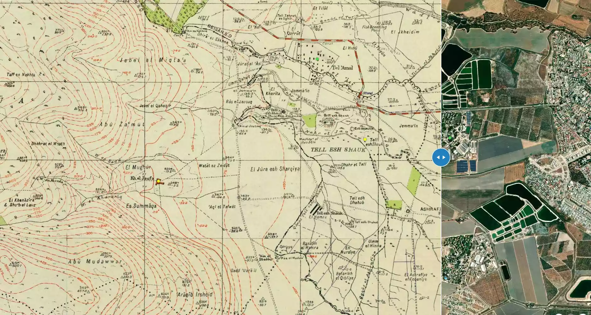
**Town Lands' Demarcation Maps |
||||||||||||||||||
| Land Usage As of 1945 |
|
||||||||||||||||||
| Population |
|
||||||||||||||||||
| Number of Houses |
|
||||||||||||||||||
| Near By Towns |
|||||||||||||||||||
|
|||||||||||||||||||
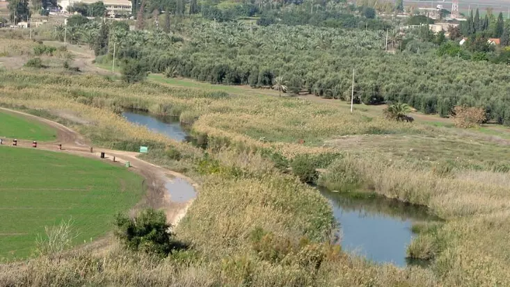
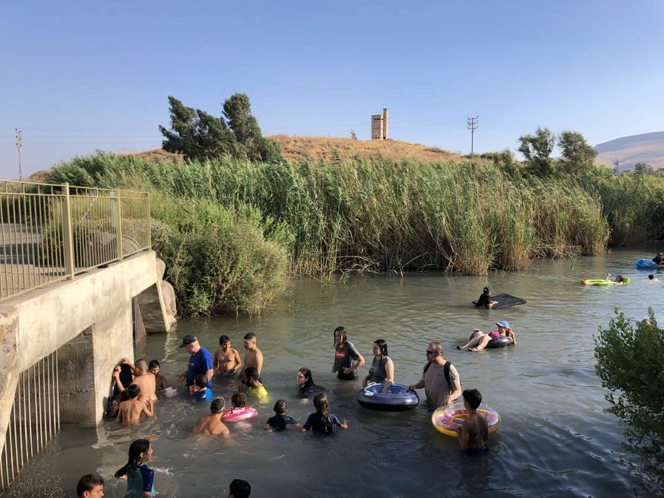
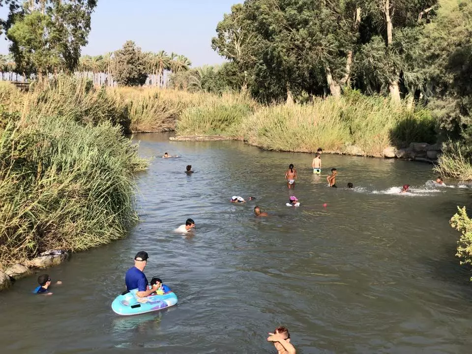
| Nearby Wadies & Rivers | Tall al-Shawk is situated between the al-Januna'in River on the north and Wadi al-Jawsaq on the south. | ||||||||||||||||||
| Archeological Sites | The village was built above an ancient archeological site. The nearby Tall al-Shaykh Humus contains ancient granite colums. | ||||||||||||||||||
| Exculsive Jewish Colonies Who Usurped Village Lands |
No Israeli settlements on village lands. | ||||||||||||||||||
| Featured Video | |||||||||||||||||||
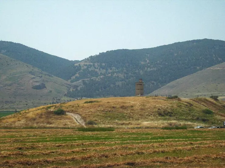
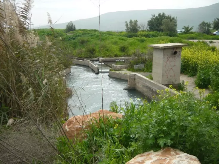
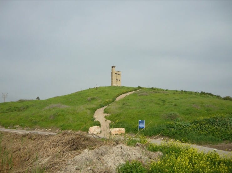
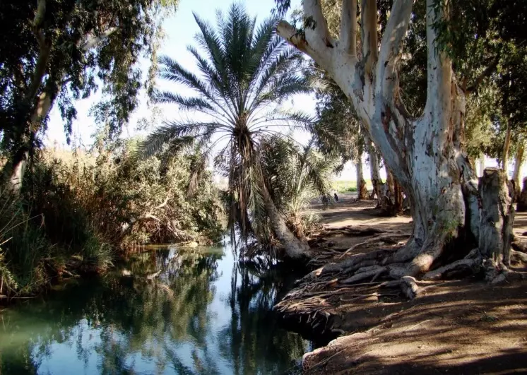
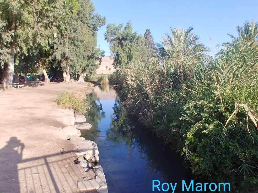
Village Before NakbaThe village was situated between the Jamma'in River (on the north) and Wadi al-Jawsaq (on the south), on flat terrain that sloped gradually towards the northeast, near the foot of the al-Faqqu'a Mountains (also known as the Jilbu' Hills). The spring of Ayn al-Jawsaq flowed 0.5 km south of the site, and a dam equipped with a water-powered mill stood about 0.2 km to the west. Tall al-Shawk was linked directly to Baysan by a secondary road; dirt paths connected it to neighboring villages. It had a rectangular plan. Its inhabitants were Muslims. In 1944/45 a total of 33 dunums of what was left of village land was allocated to cereals; 14 dunums were irrigated or used for orchards. As its name suggested, the village was built on a mound in which traces of earlier buildings were visible. The nearby Tall al-Shaykh Humud (192211) had granite columns on its surface.Israeli Settlements on Village Lands Zionists Colonies on Village LandsThere are no Israeli settlements on village lands.Village TodayNo traces of the village remain. The site itself is covered with weeds and thorns and is traversed by a man-made canal. Two large eucalyptus trees can be seen on the site. The land around Wadi al-Jawsaq is cultivated by the settlement of Nir David, which was established in 1936, on the nearby lands of al-Sakhina.SourceDr. Walid al-Khalidi, 1992: All That Remains. |
|||||||||||||||||||
| Related Maps | Town Lands' Demarcation Maps خرائط للقضاء توضح حدود القرى والاودية Town's map on MapQuest View from satellite Help us map this town at WikiMapia |
||||||||||||||||||
| Related Links | Wikipedia's Page Google Search Google For Images Google For Videos |
||||||||||||||||||
| More Information | في كتاب كي لا ننسى في كتاب بلادنا فلسطين المزيد من موقع هوية |
||||||||||||||||||
- Village Site in 1990
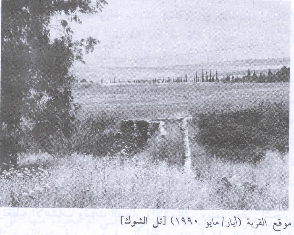
Scanned from "All That Remains" by Dr. Walid Khalidi - موقع القريه
Posted by abu raya - موقع القريه
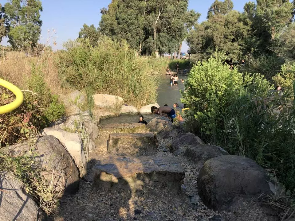
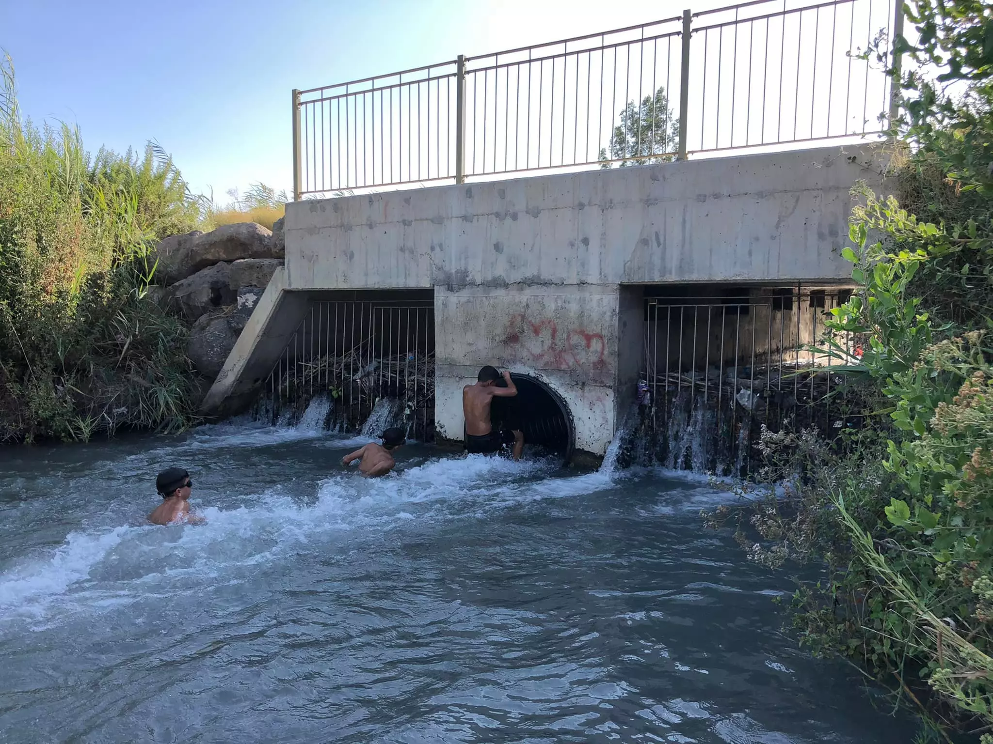
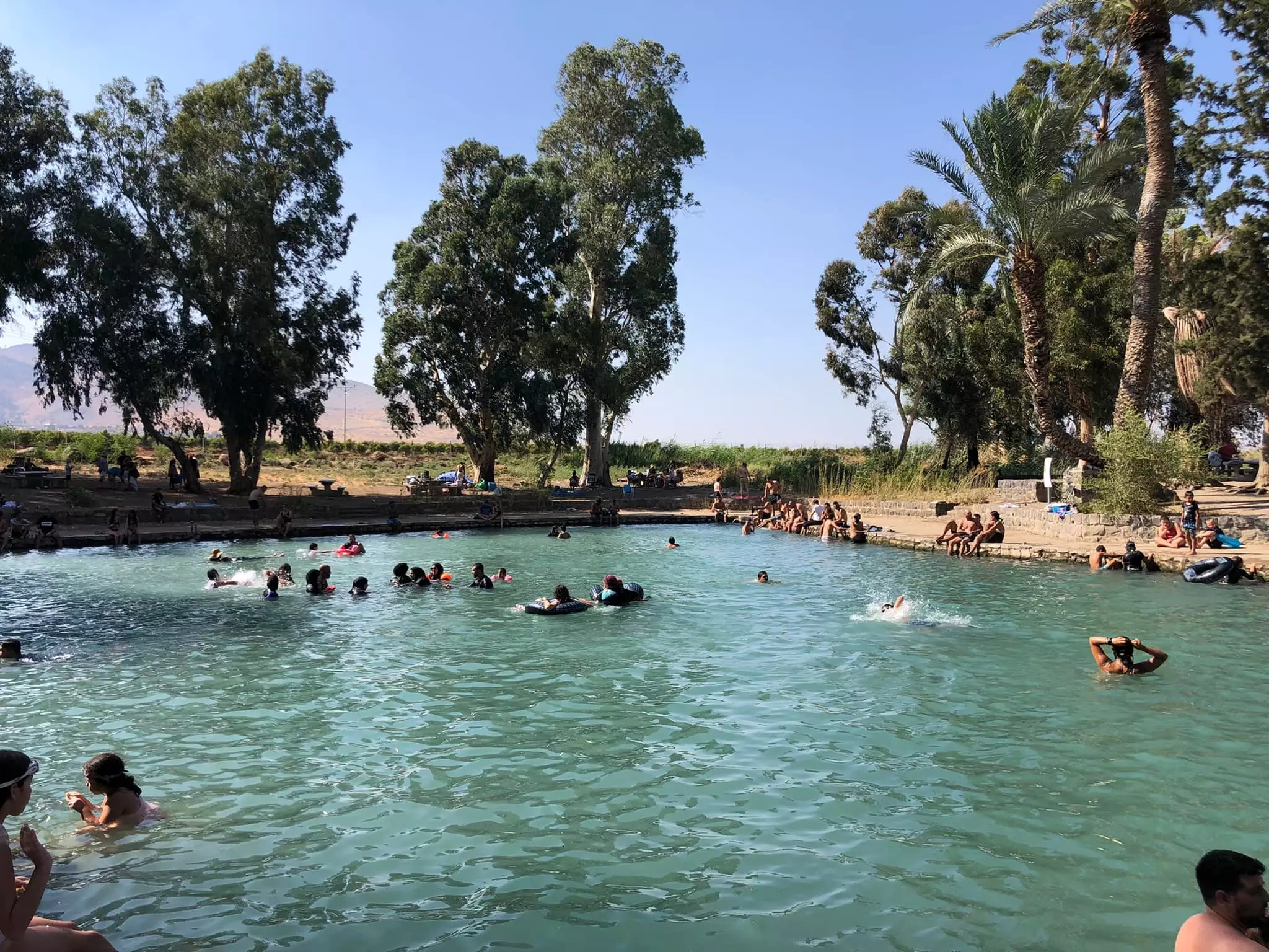
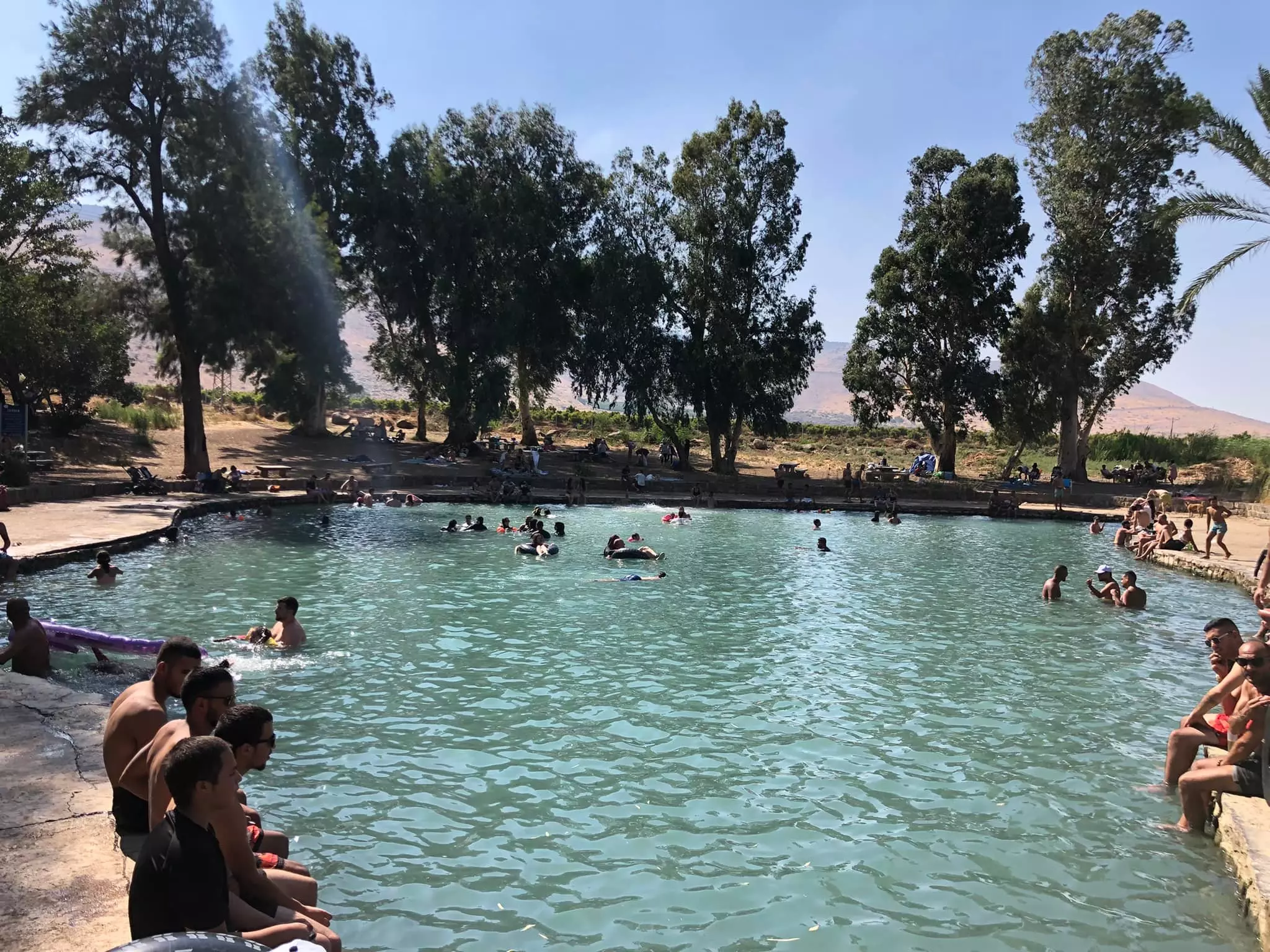
Posted by abu raya - من ينابيع القريه
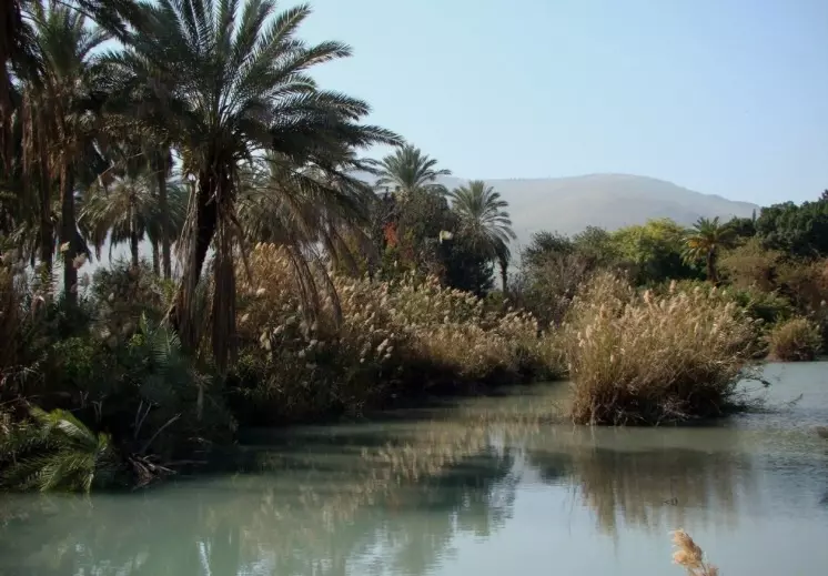
Posted by abu raya - ينابيع القريه
Posted by abu raya - موقع القريه
Posted by abu raya - مياه القريه
Posted by abu raya - مياه القريه
Posted by abu raya - قناة الجوسق في تل الشوك المهجرة
- التل الأثري في موقع قرية تل الشوك المهجرة (قضاء بيسان )
- That is how the "civilized" erased and replaced us: Tall al-Shawk was completely obliterated, as you see -- تل الشوك باتت أثر بعد عين. من هنا مر الهمجّ
- That is how the "civilized" erased and replaced us: Tall al-Shawk was completely obliterated, as you see -- تل الشوك باتت أثر بعد عين. من هنا مر الهمجّ
#2
- That is how the "civilized" erased and replaced us: Tall al-Shawk was completely obliterated, as you see -- تل الشوك باتت أثر بعد عين. من هنا مر الهمجّ
#3
- That is how the "civilized" erased and replaced us: Tall al-Shawk was completely obliterated, as you see -- تل الشوك باتت أثر بعد عين. من هنا مر الهمجّ
#4
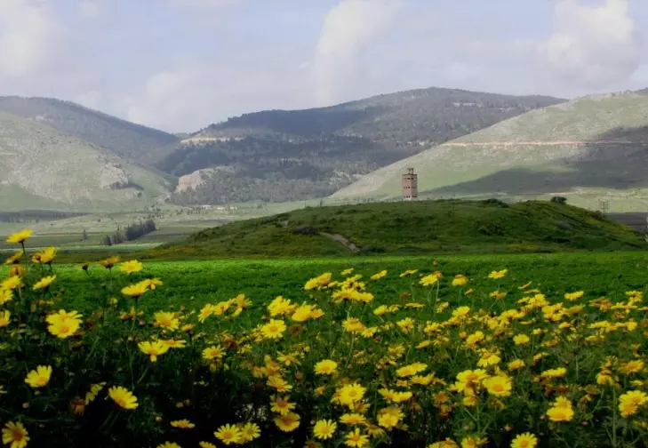
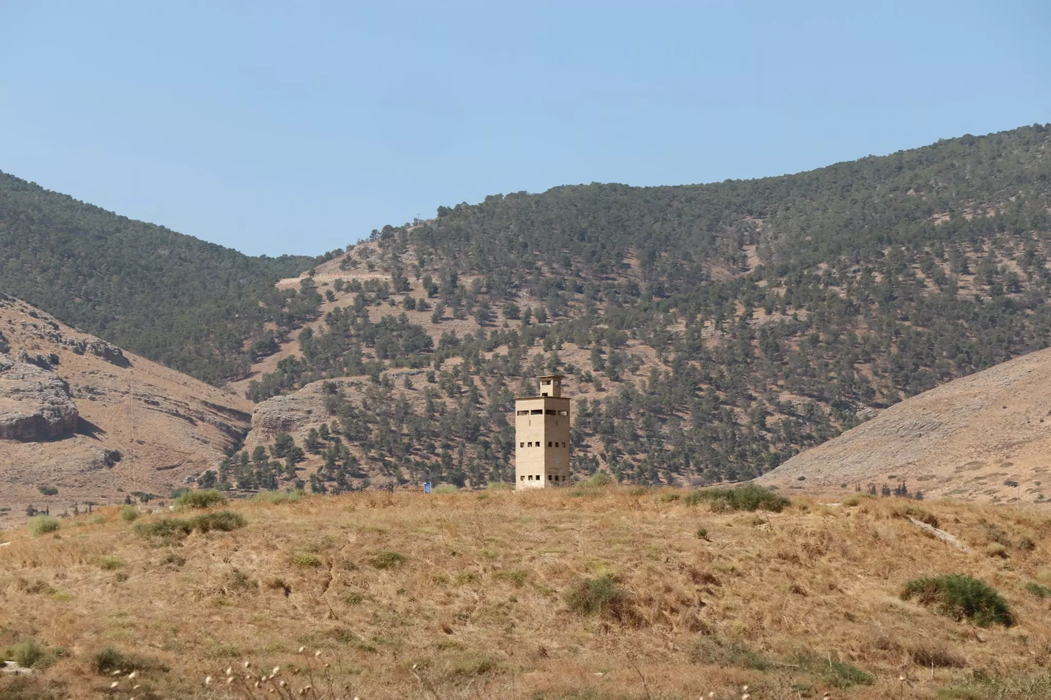
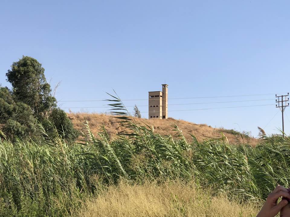
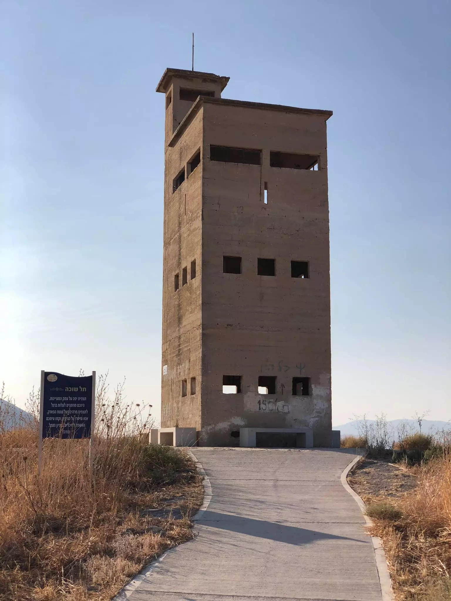
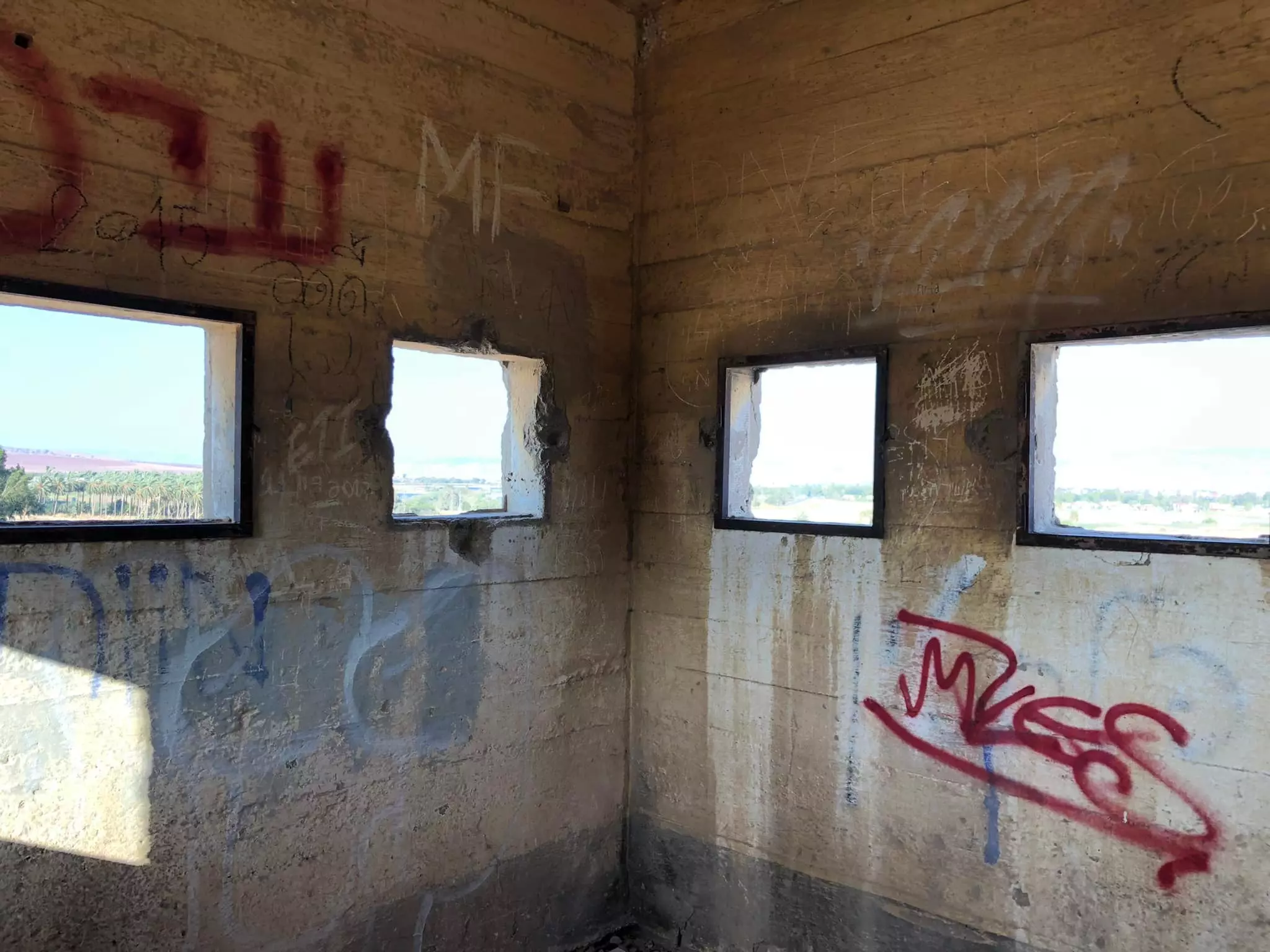
- برج تل الشوكة الخرساني
وينابيع كثيرة ، غرب مدينة بيسان عند منحدرات الشرقية لجبال فقوعة الجلبوع
- برج تل الشوكة الخرساني
وينابيع كثيرة ، غرب مدينة بيسان عند منحدرات الشرقية لجبال فقوعة الجلبوع #2
- برج تل الشوكة الخرساني
وينابيع كثيرة ، غرب مدينة بيسان عند منحدرات الشرقية لجبال فقوعة الجلبوع #3
- برج تل الشوكة الخرساني
وينابيع كثيرة ، غرب مدينة بيسان عند منحدرات الشرقية لجبال فقوعة الجلبوع #4
- برج تل الشوكة الخرساني
وينابيع كثيرة ، غرب مدينة بيسان عند منحدرات الشرقية لجبال فقوعة الجلبوع #5
Want to browse more? 80,000 pictures were grouped in these gallaries:
| Display Name | Clan/Hamolah | Country of Residence |
- في موقغ قرية تل الشوك المهجرة (قضاء بيسان ) وعلى ضفاف نهر الجوسق . Duration: min 33 sec
- في رحاب قرية تل الشوك المهجرة (قضاء بيسان) Duration: min 14 sec
No links have been shared yet, be free to the first to share the first link.
 Fake Valor: Why Did Zionist Jews Hoist Nazis Flag on Their Ships in the 1930s?
What is new?
-
Facts About Oct. 7th Gaza Raid
-
Remined Us Please:: Who Did Rape Who? Palestinians Raped Israelis? Or, was the other way around?
-
When Prof. Edward Said was invited to debate Bibi Netanyahu in the 1980s, watch what happened!
-
Ezra Klein of the NY Times on the "Jewish Race".
-
Abusing Blood Libel!
-
Did Israeli Soldiers Activate The Hanniba Direective On Oct. 7th? You Be The Judge
-
Zionist FAQ: Isn't it true that Palestinians don't want peace? Palestinians never accepted the two-state solution
- Facts about Haavara (Transfer) Agreement between Ben-Gurion & Hitler
-
Haavara FAQs: Why Did Zionist Jews Hoist Nazis' Flags on Their Ships in the 1930s?
- Haavara FAQs: When Chaim Weizmann met FDR in mid-1943, why was he silent about rescuing European Jewry?
-
Dear ChatGPT: How did Palestinians resist Napoleon's invasion of their country in 1799?
-
Dear ChatGPT: Gaza had a vibrant Jewish community in the mid-17th century. What happened to them?
-
Dear ChatGPT: Why did the Jewish Agency suppress news of the Holocaust during WWII?
-
Video Playlist: Jews share their DNA tests to end the conflict for good.
-
A Tale of Two Conflicts: Examining the Definition of Genocide
-
Prof. Abraham Polak And The Suppressed History of the Khazars and European Jewry
-
How Ronald Reagan would have framed the genocide in Gaza if he were still alive?
-
Haavara FAQs: Let us do the math: how many German Jews did The Haavara Agreement save?
-
Zionist FAQs: The Hebron Massacre of 1929, "clearly proves" that Palestinians are antisemitic, how could you deny it?
-
Zionist FAQs: Why Anti-Zionist Is Not Antisemitism?
-
Zionist FAQs: Isn't it true that the KGB created Palestinian Nationalism in the early 1960s?
- Zionist FAQs: Muslims are killing Muslims all the time; why are Israeli Jews being singled out in the media?
- Zionist FAQs: How is Israel an apartheid state when 20% of its citizens are Arabs who enjoy full rights?
-
Haavara FAQs: Why Did Dorothy Thompson Flip From A Zionist Advocate to A Silenced Dissenter?
-
Haavara FAQs: Analysis of Herzl's Uganda Scheme and how it could have saved millions of Jews.
-
Haavara FAQs: Why did Hayim Greenberg describe American Jewry as "morally bankrupt" in early 1943?
-
Haavara FAQs: What if the Evian Conference was a resounding success? What would have been the impact of saving European Jewry on Zionism?
- Haavara FAQs: What if the six million were saved, how that would have impacted the Zionist project?
-
Haavara FAQs: How did Zionist leaders react when Europe's Jews lingered in the DP camps after WWII ended?
-
Why does the American Jewish community repeat lies that David Ben-Gurion had debunked before he died?
-
Who has the power to rename the Tatar/Khazar Gene Marker to Jewish IV?
-
Zionist FAQs: Why won't Egypt, Syria, and Jordan take their people back? Jews are indigenous to Palestine, and Arabs immigrated after Jews developed the country. Arabs should leave.
-
Haavara FAQs: Did Hitler and the Nazis conflate between Judaism and Zionist? If that wasn't case, then why?
-
Haavara FAQs: Winston Churchill and antisemitism, a collection of articles written Churchill.
-
Haavara FAQs: Broken by country, how many Jews survived vs. killed during the Holocaust?
-
Haavara FAQs: Why did European Jews vote with their feet and to immigrated to the Americas, not Palestine, after WWII?
-
Watch this American Jewish Girl describing Israeli Jews' cognitive dissonance like no other in under two minutes
-
Haavara FAQs: When the Nazis went out of their way to hide the Holocaust, Israeli Jews did the exact opposite by broadcasting their genocide of Gazans. But why?
-
Haavara FAQs: How Zionist Jews went out of their to show their appreciation to Nazism and Fascism?
- Haavara FAQs: Why Zionist leaders were against bombing the death camps & the Railroads leading to them?
-
Haavara FAQs: Hitler's message to the British and American people: If Jews are such noble citizens and you care about them, how come you're not letting them in? I will gladly ship them to you at my expense, even on luxury liners!
-
A shortlist of Zionist and Israeli false flag operations in the name Jews.
-
The Most Moral Army
- The Land of Kapos (Israel): Where the brave are boycotted and Kapos walk free.
- Why did early Zionists often named their communal enterprises "colonial"?
- Zionist Relations with Nazi Germany by Faris Glubb
-
Two NY Times advertisements by Zionists in the early 1943 that exposes Zionists' treason at the height of the calamity
- Facts Not Lies about the Palestinian-Israeli Conflict.
- Site's pictures have been categorized
- Campgain Against Lice
- A Survey of Palestine, the official source about Palestine before Nakba produced by the British Mandate; over 1200 pages.
- Satellite View & Google Earth: Over 6,000 placemarks identifying all destroyed towns, W. Bank & Gaza Strip Towns, & refugee camps.
- PalestineRemembered.com and its Nakba Oral History Project were featured on al-Jazeera Satellite TV.
- Nakba Oral History Video Podcast:
 Over 700 Oral History interviews (including 3,500+ hours of recording) can be viewed online.
 - Palestine Village Statistics Project
- Gaza Jail Break
- النسخة العربية للموقع الان متوفرة
- Videos: Documenting the destroyed villages in video: Tracing all that remains since Nakba.
- Videos: Responding to Zionist Propaganda
- Interview: The ethnic cleansing of Palestine: George Galloway interviews Israeli Historian Ilan Pappe.
- For Palestinians, memory matters. It provides a blueprint for their future By George Bisharat.
- Zionist FAQ now available in Hebrew שאלות שציונים שואלים, עכשיו בעברית
- Video: The Stephen Walt and John Mearsheimer report on the influence of the Israel Lobby on U.S. Foreign Policy
- The Palestinian-Israeli conflict for beginners
