| PalestineRemembered | About Us | Oral History | العربية | |
| Pictures | Zionist FAQs | Haavara | Maps | |
| Search |
| Camps |
| Districts |
| Acre |
| Baysan |
| Beersheba |
| Bethlehem |
| Gaza |
| Haifa |
| Hebron |
| Jaffa |
| Jericho |
| Jerusalem |
| Jinin |
| Nablus |
| Nazareth |
| Ramallah |
| al-Ramla |
| Safad |
| Tiberias |
| Tulkarm |
| Donate |
| Contact |
| Profile |
| Videos |
Welcome To al-Sakhina - الساخنه (א-סאח'נה)
|
District of Baysan
Ethnically cleansed days ago |
العربية Google Earth |
 |
Gallery (29) |
- Statistics & Facts
-
Before & After

- Satellite View
- Articles 1
- Pictures 29
- Oral History 2
- Members 4
- All That Remains
- Wikipedia
- Videos
- Guest Book 2
- Links
| Statistic & Fact | Value | ||||||||||||||||||
| Occupation Date | May 12, 1948 | ||||||||||||||||||
| Distance From District | 5 (km) West of Baysan | ||||||||||||||||||
| Elevation | -95 (meters) | ||||||||||||||||||
| Before & After Nakba, Click Map For Details |
|||||||||||||||||||
|
|||||||||||||||||||
| Map Location | See location #18 on the map View from satellite |
||||||||||||||||||
| Military Operation | Operation Gideon | ||||||||||||||||||
| Attacking Units | Golani Brigade | ||||||||||||||||||
| Village Temains | al-Sakhina was completely destroyed and defaced. | ||||||||||||||||||
| Ethnically Cleansing | al-Sakhina inhabitants were completely ethnically cleansed. | ||||||||||||||||||
| Pre-Nakba Land Ownership |
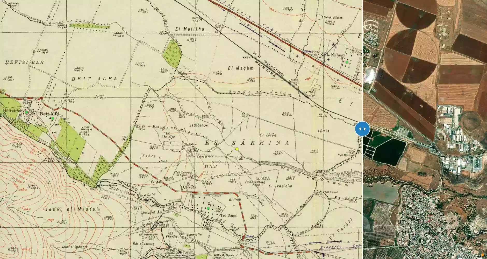
**Town Lands' Demarcation Maps |
||||||||||||||||||
| Land Usage As of 1945 |
|
||||||||||||||||||
| Population |
|
||||||||||||||||||
| Number of Houses |
|
||||||||||||||||||
| Near By Towns |
|||||||||||||||||||
|
|||||||||||||||||||
| Nearby Wadies & Rivers | The Jalud River crosses village lands on its way to the Jordan River. | ||||||||||||||||||
| Exculsive Jewish Colonies Who Usurped Village Lands |
Nir David & Tel' Amal. | ||||||||||||||||||
| Featured Video | |||||||||||||||||||
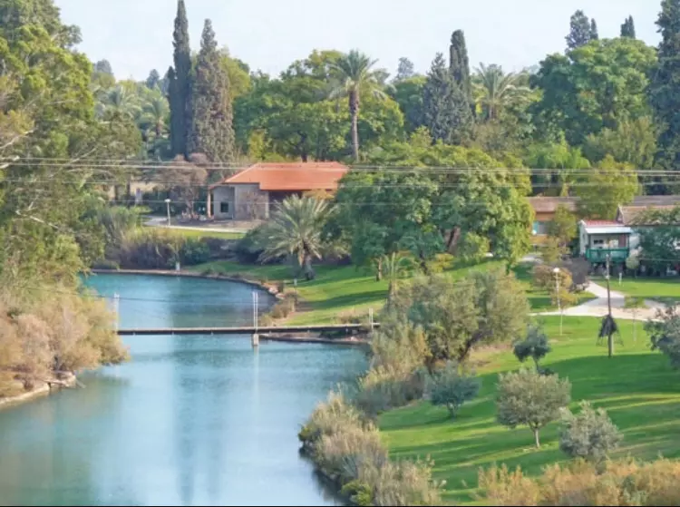
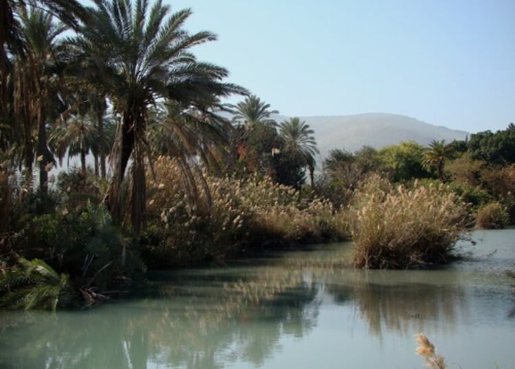
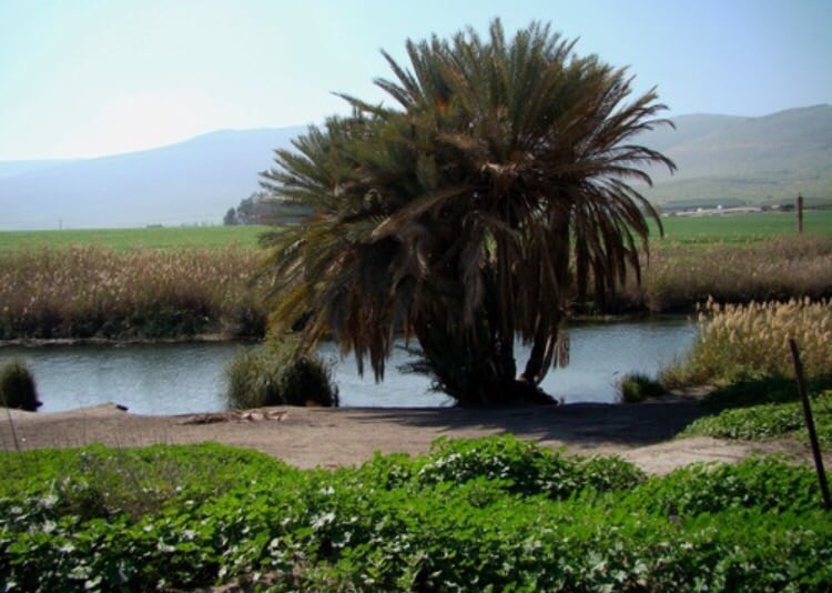
Village Before NakbaThe village was located in the middle of a plain, bordered by three tells: Tall al-Dahra al-Kabir ("the tell of the big mountain peak"), in the north, and Tall al-Dahra al-Saghir ("the tell of the small mountain peak"), in the south, and Tall 'Amal, also in the south. The al-Faqqu'a Mountains (also known as the Jilbu' Hills) stretched south of the village. The Jalud River crossed the village lands on its way to the Jordan. The village was also intersected by a highway leading to Baysan, and was linked via a secondary road to the nearby village of al-Murassas. Numerous springs were to be found in the area, and the inhabitants, all of whom were Muslims, worked mainly in agriculture. Most of their land was devoted to the cultivation of vegetables (grown along the southern bank of the Jalud River), grapes and fruit trees; date palms were tended in the eastern lands. In 1944/45 a total of 260 dunums was allocated to cereals; 828 dunums were irrigated or used for orchards. A forest occupied a large area to the northwest.Village Occupation and Ethnic CleaningOn 12 May 1948, a couple of neighboring villages were occupied and al-Sakhina may have fallen at the same time. That was the same day on which the town of Baysan was taken by the Golani Brigade, in a sweep through the entire Baysan Valley known as Operation Gideon.Zionists Colonies on Village LandsThe settlement of Nir David , established in 1936 under the name Tel 'Amal , is just south of the village site, on lands that traditionally belonged to al-Sakhina.Village TodayNo physical evidence remains by which the site may be identified, as the entire area has been plowed and turned into agricultural fields. The village lands are cultivated by the Nir David settlement.SourceDr. Walid al-Khalidi, 1992: All That Remains. |
|||||||||||||||||||
| Related Maps | Town Lands' Demarcation Maps خرائط للقضاء توضح حدود القرى والاودية Town's map on MapQuest View from satellite Help us map this town at WikiMapia |
||||||||||||||||||
| Related Links | Wikipedia's Page Google Search Google For Images Google For Videos |
||||||||||||||||||
| More Information | في كتاب كي لا ننسى في كتاب بلادنا فلسطين المزيد من موقع هوية |
||||||||||||||||||
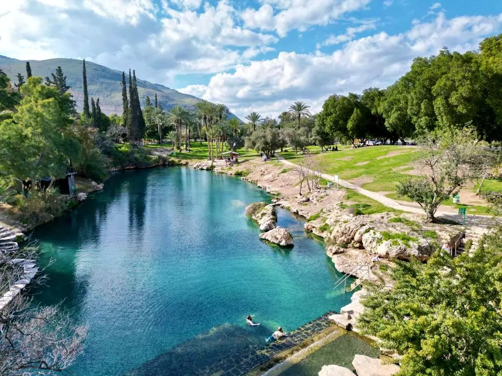
- Village Site in 1990
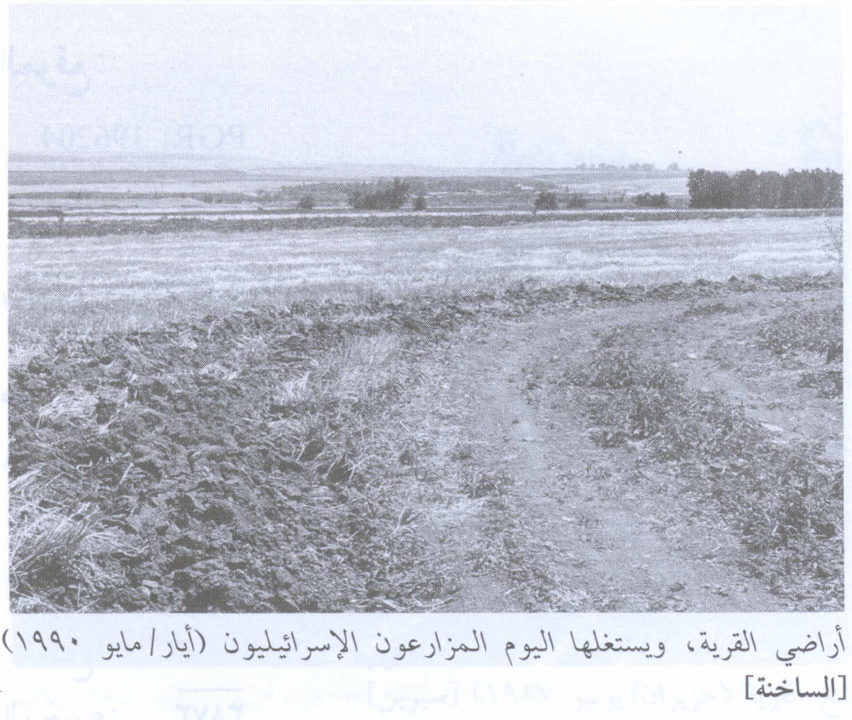
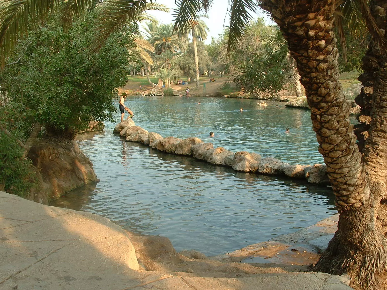
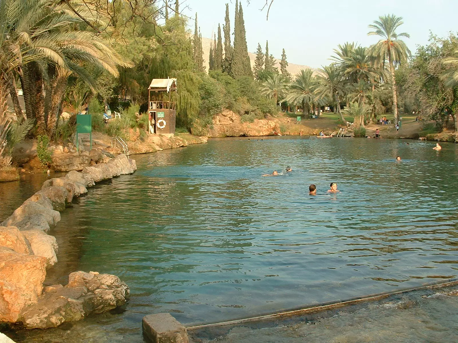
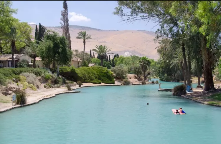
Scanned from "All That Remains" by Dr. Walid Khalidi - بركة الساخنة عام 2005 بعدسة محمد كريم
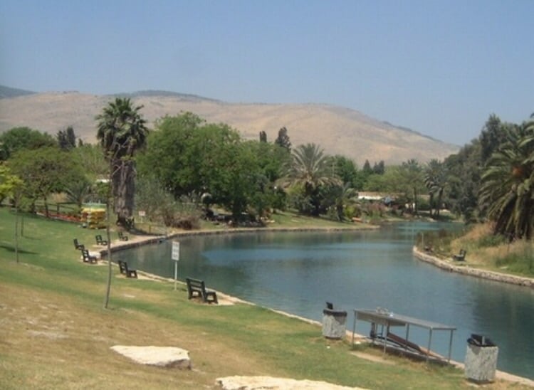
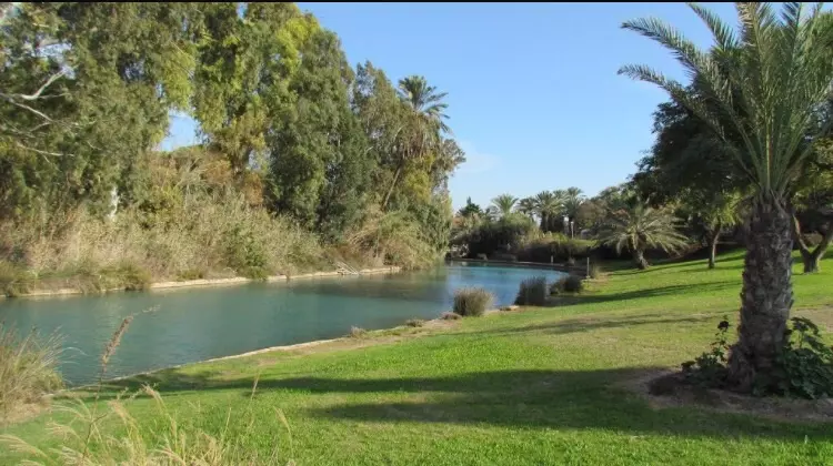
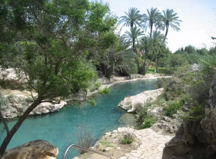
Posted by محمد كريم - بركة الساخنة وقد حولت إلى محمية طبيعية للاستجمام عام 2005 بعدسة محمد كريم

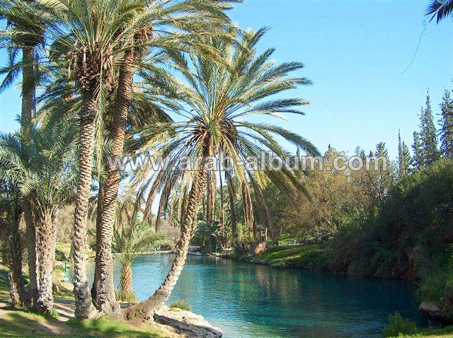
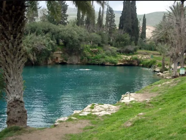
Posted by محمد كريم 1 - مياه عيون الساخنة عام 2005 بعدسة محمد كريم
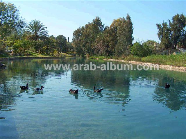
Posted by محمد كريم 1 - عيون الساخنة عام 2005 بعدسة محمد كريم

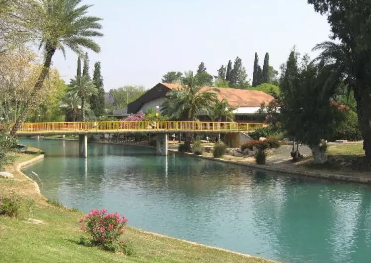
Posted by محمد كريم - Al-Sakhneh 2002
Posted by Sana Khsheiboun - Al-Sakhneh 2002
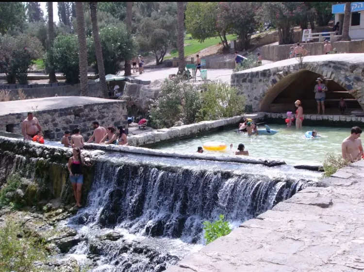
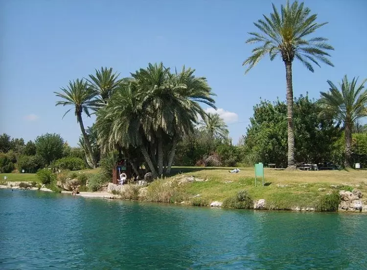
Posted by Sana Khsheiboun - عيون الساخنه
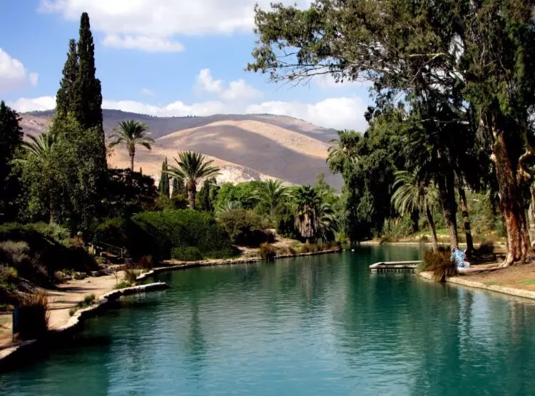
Posted by abu raya - عيون الساخنه
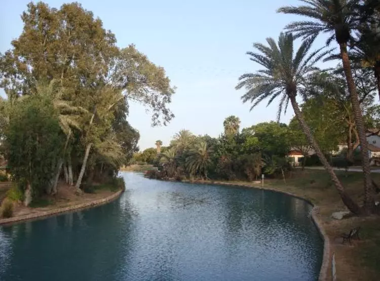
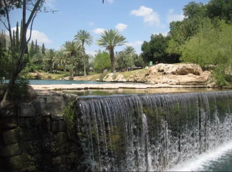
Posted by abu raya - مياه الساخنه من داخل المستوطنه المقامه على اراضي القريه
Posted by abu raya - من برك الساخنه وتظهر في الصوره البنايات المتبقيه من القريه
Posted by abu raya - مياه الساخنه داخل المستوطنه
Posted by abu raya - مياه الساخنه
Posted by abu raya - من برك الساخنه
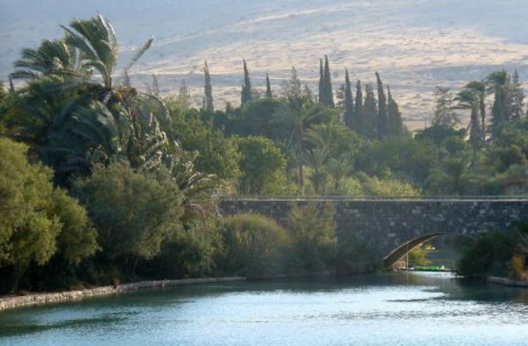
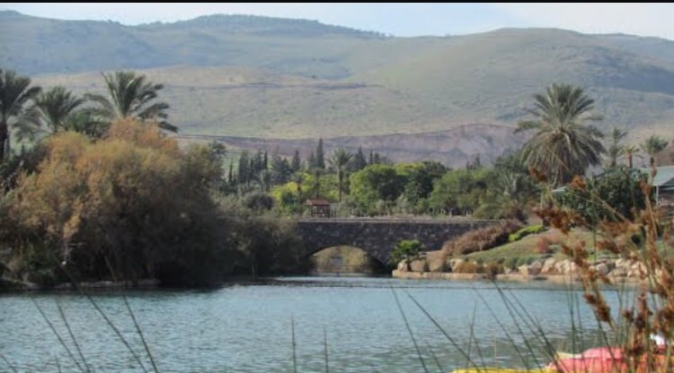
Posted by abu raya - مياه الساخنه ويظهرفي الصوره احدى الجسور القديمه
Posted by abu raya - مياه الساخنه
Posted by abu raya - منظر من مياه الساخنه
Posted by abu raya - من مياه الساخنه
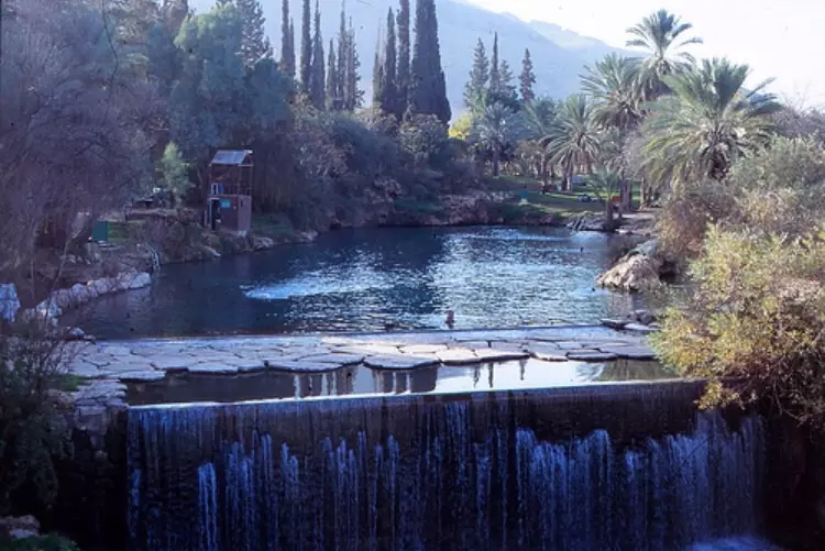
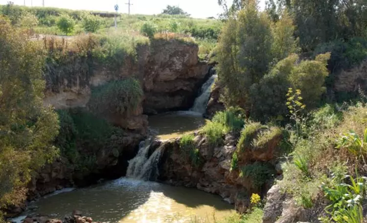
Posted by abu raya - شلالات مياه الساخنه
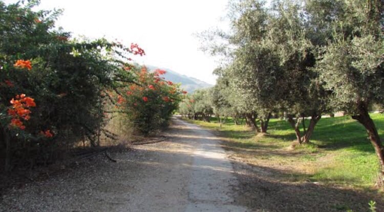
Posted by abu raya - زيتون الساخنه
Posted by abu raya - مياه الساخنه
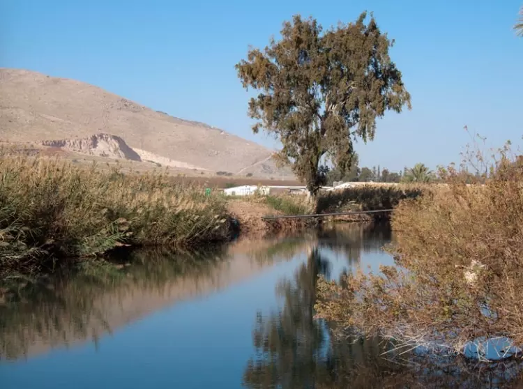
Posted by abu raya - مجرى مياه الساخنه خارج القريه
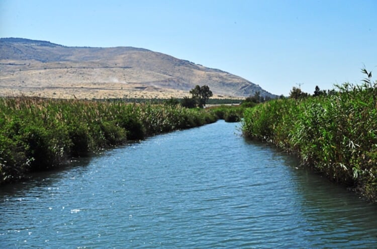
Posted by abu raya - مجرى مياه الساخنه
Posted by abu raya - منظر من مياه الساخنه
Posted by abu raya - مجرى مياه الساخنه
Posted by abu raya - مياه الساخنه
Posted by abu raya - منظر من مياه الساخنه والجبال المحيطه بالقريه
Posted by abu raya - شلالات الساخنه
Posted by abu raya - لوحة فنية طبيعية من الاغوار
Want to browse more? 80,000 pictures were grouped in these gallaries:
| Display Name | Clan/Hamolah | Country of Residence |
| mohammed al_zubaidi | الصقور | irbed |
| مؤيد | - | - |
| mamoun hosein | al-qarrot | -, AQABA- JORDAN |
| abdel-khaliq al-zubaidi | - | Irbid, Jordan |
No links have been shared yet, be free to the first to share the first link.
 Fake Valor: Why Did Zionist Jews Hoist Nazis Flag on Their Ships in the 1930s?
What is new?
-
Facts About Oct. 7th Gaza Raid
-
Remined Us Please:: Who Did Rape Who? Palestinians Raped Israelis? Or, was the other way around?
-
When Prof. Edward Said was invited to debate Bibi Netanyahu in the 1980s, watch what happened!
-
Ezra Klein of the NY Times on the "Jewish Race".
-
Abusing Blood Libel!
-
Did Israeli Soldiers Activate The Hanniba Direective On Oct. 7th? You Be The Judge
-
Zionist FAQ: Isn't it true that Palestinians don't want peace? Palestinians never accepted the two-state solution
- Facts about Haavara (Transfer) Agreement between Ben-Gurion & Hitler
-
Haavara FAQs: Why Did Zionist Jews Hoist Nazis' Flags on Their Ships in the 1930s?
- Haavara FAQs: When Chaim Weizmann met FDR in mid-1943, why was he silent about rescuing European Jewry?
-
Dear ChatGPT: How did Palestinians resist Napoleon's invasion of their country in 1799?
-
Dear ChatGPT: Gaza had a vibrant Jewish community in the mid-17th century. What happened to them?
-
Dear ChatGPT: Why did the Jewish Agency suppress news of the Holocaust during WWII?
-
Video Playlist: Jews share their DNA tests to end the conflict for good.
-
A Tale of Two Conflicts: Examining the Definition of Genocide
-
Prof. Abraham Polak And The Suppressed History of the Khazars and European Jewry
-
How Ronald Reagan would have framed the genocide in Gaza if he were still alive?
-
Haavara FAQs: Let us do the math: how many German Jews did The Haavara Agreement save?
-
Zionist FAQs: The Hebron Massacre of 1929, "clearly proves" that Palestinians are antisemitic, how could you deny it?
-
Zionist FAQs: Why Anti-Zionist Is Not Antisemitism?
-
Zionist FAQs: Isn't it true that the KGB created Palestinian Nationalism in the early 1960s?
- Zionist FAQs: Muslims are killing Muslims all the time; why are Israeli Jews being singled out in the media?
- Zionist FAQs: How is Israel an apartheid state when 20% of its citizens are Arabs who enjoy full rights?
-
Haavara FAQs: Why Did Dorothy Thompson Flip From A Zionist Advocate to A Silenced Dissenter?
-
Haavara FAQs: Analysis of Herzl's Uganda Scheme and how it could have saved millions of Jews.
-
Haavara FAQs: Why did Hayim Greenberg describe American Jewry as "morally bankrupt" in early 1943?
-
Haavara FAQs: What if the Evian Conference was a resounding success? What would have been the impact of saving European Jewry on Zionism?
- Haavara FAQs: What if the six million were saved, how that would have impacted the Zionist project?
-
Haavara FAQs: How did Zionist leaders react when Europe's Jews lingered in the DP camps after WWII ended?
-
Why does the American Jewish community repeat lies that David Ben-Gurion had debunked before he died?
-
Who has the power to rename the Tatar/Khazar Gene Marker to Jewish IV?
-
Zionist FAQs: Why won't Egypt, Syria, and Jordan take their people back? Jews are indigenous to Palestine, and Arabs immigrated after Jews developed the country. Arabs should leave.
-
Haavara FAQs: Did Hitler and the Nazis conflate between Judaism and Zionist? If that wasn't case, then why?
-
Haavara FAQs: Winston Churchill and antisemitism, a collection of articles written Churchill.
-
Haavara FAQs: Broken by country, how many Jews survived vs. killed during the Holocaust?
-
Haavara FAQs: Why did European Jews vote with their feet and to immigrated to the Americas, not Palestine, after WWII?
-
Watch this American Jewish Girl describing Israeli Jews' cognitive dissonance like no other in under two minutes
-
Haavara FAQs: When the Nazis went out of their way to hide the Holocaust, Israeli Jews did the exact opposite by broadcasting their genocide of Gazans. But why?
-
Haavara FAQs: How Zionist Jews went out of their to show their appreciation to Nazism and Fascism?
- Haavara FAQs: Why Zionist leaders were against bombing the death camps & the Railroads leading to them?
-
Haavara FAQs: Hitler's message to the British and American people: If Jews are such noble citizens and you care about them, how come you're not letting them in? I will gladly ship them to you at my expense, even on luxury liners!
-
A shortlist of Zionist and Israeli false flag operations in the name Jews.
-
The Most Moral Army
- The Land of Kapos (Israel): Where the brave are boycotted and Kapos walk free.
- Why did early Zionists often named their communal enterprises "colonial"?
- Zionist Relations with Nazi Germany by Faris Glubb
-
Two NY Times advertisements by Zionists in the early 1943 that exposes Zionists' treason at the height of the calamity
- Facts Not Lies about the Palestinian-Israeli Conflict.
- Site's pictures have been categorized
- Campgain Against Lice
- A Survey of Palestine, the official source about Palestine before Nakba produced by the British Mandate; over 1200 pages.
- Satellite View & Google Earth: Over 6,000 placemarks identifying all destroyed towns, W. Bank & Gaza Strip Towns, & refugee camps.
- PalestineRemembered.com and its Nakba Oral History Project were featured on al-Jazeera Satellite TV.
- Nakba Oral History Video Podcast:
 Over 700 Oral History interviews (including 3,500+ hours of recording) can be viewed online.
 - Palestine Village Statistics Project
- Gaza Jail Break
- النسخة العربية للموقع الان متوفرة
- Videos: Documenting the destroyed villages in video: Tracing all that remains since Nakba.
- Videos: Responding to Zionist Propaganda
- Interview: The ethnic cleansing of Palestine: George Galloway interviews Israeli Historian Ilan Pappe.
- For Palestinians, memory matters. It provides a blueprint for their future By George Bisharat.
- Zionist FAQ now available in Hebrew שאלות שציונים שואלים, עכשיו בעברית
- Video: The Stephen Walt and John Mearsheimer report on the influence of the Israel Lobby on U.S. Foreign Policy
- The Palestinian-Israeli conflict for beginners
