| PalestineRemembered | About Us | Oral History | العربية | |
| Pictures | Zionist FAQs | Haavara | Maps | |
| Search |
| Camps |
| Districts |
| Acre |
| Baysan |
| Beersheba |
| Bethlehem |
| Gaza |
| Haifa |
| Hebron |
| Jaffa |
| Jericho |
| Jerusalem |
| Jinin |
| Nablus |
| Nazareth |
| Ramallah |
| al-Ramla |
| Safad |
| Tiberias |
| Tulkarm |
| Donate |
| Contact |
| Profile |
| Videos |
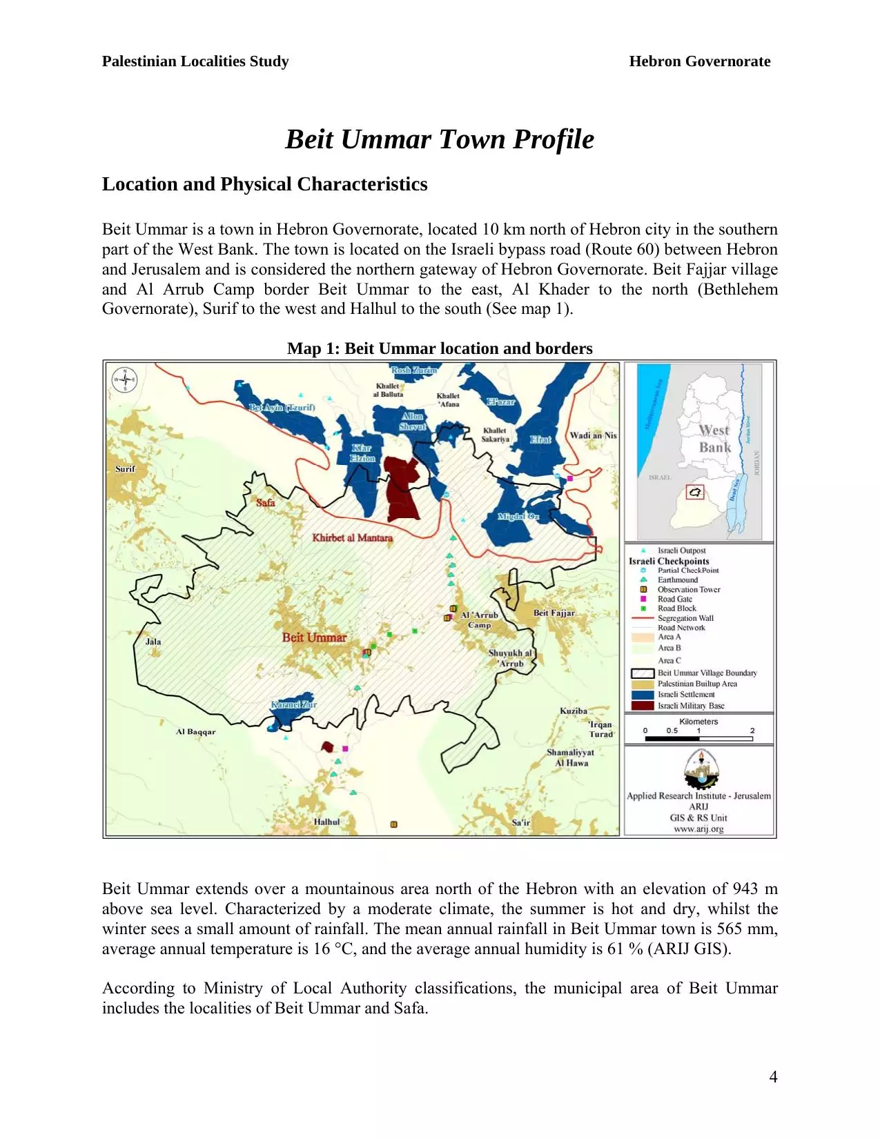
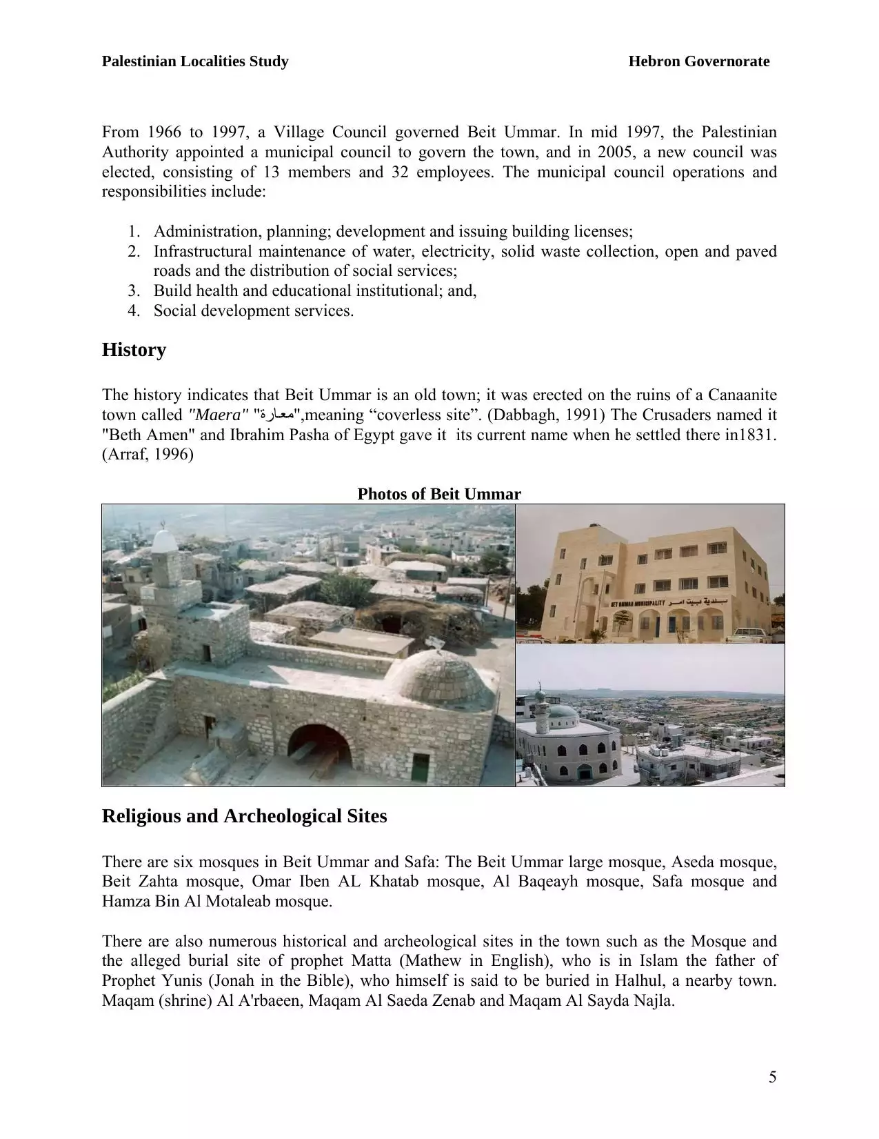
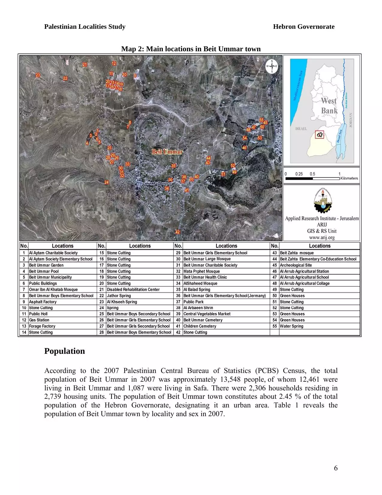
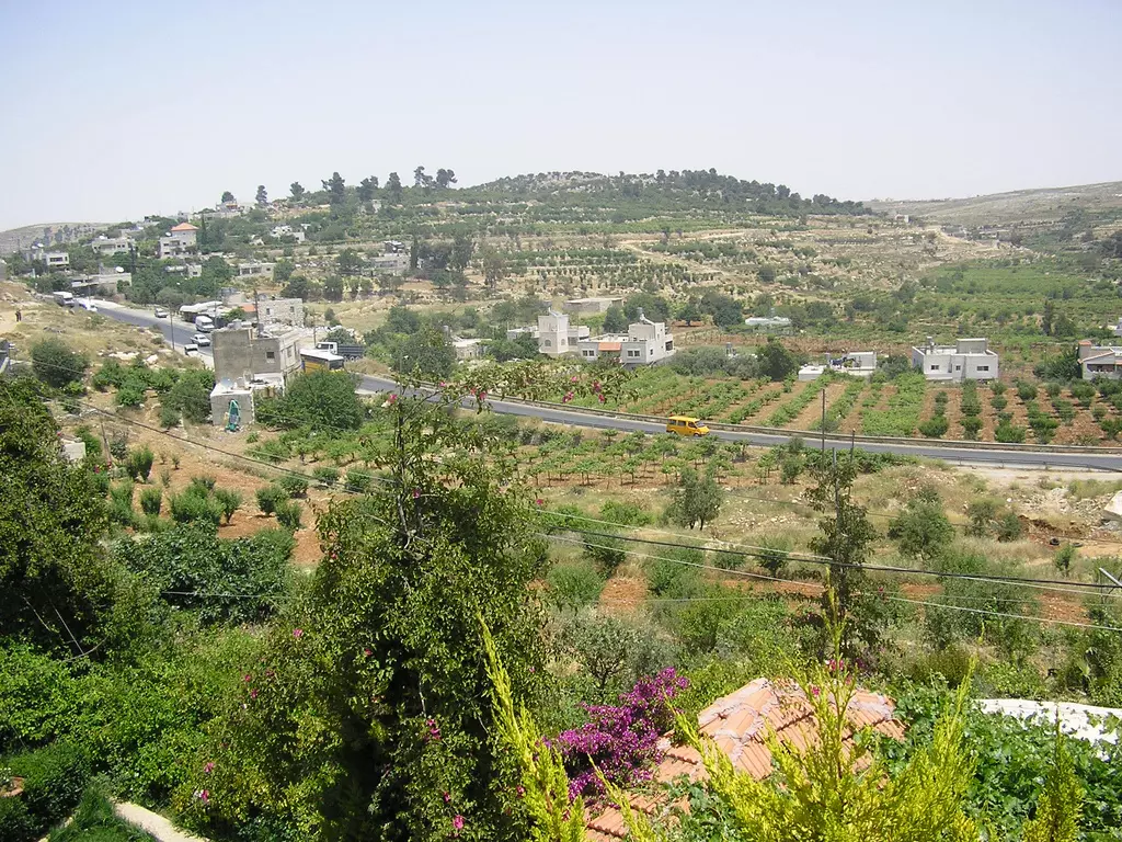
Welcome To Bayt Ummar - بيت اُمّر (בית אומר)
|
District of Hebron
Occupied days ago |
العربية Google Earth |
 |
Gallery (58) |
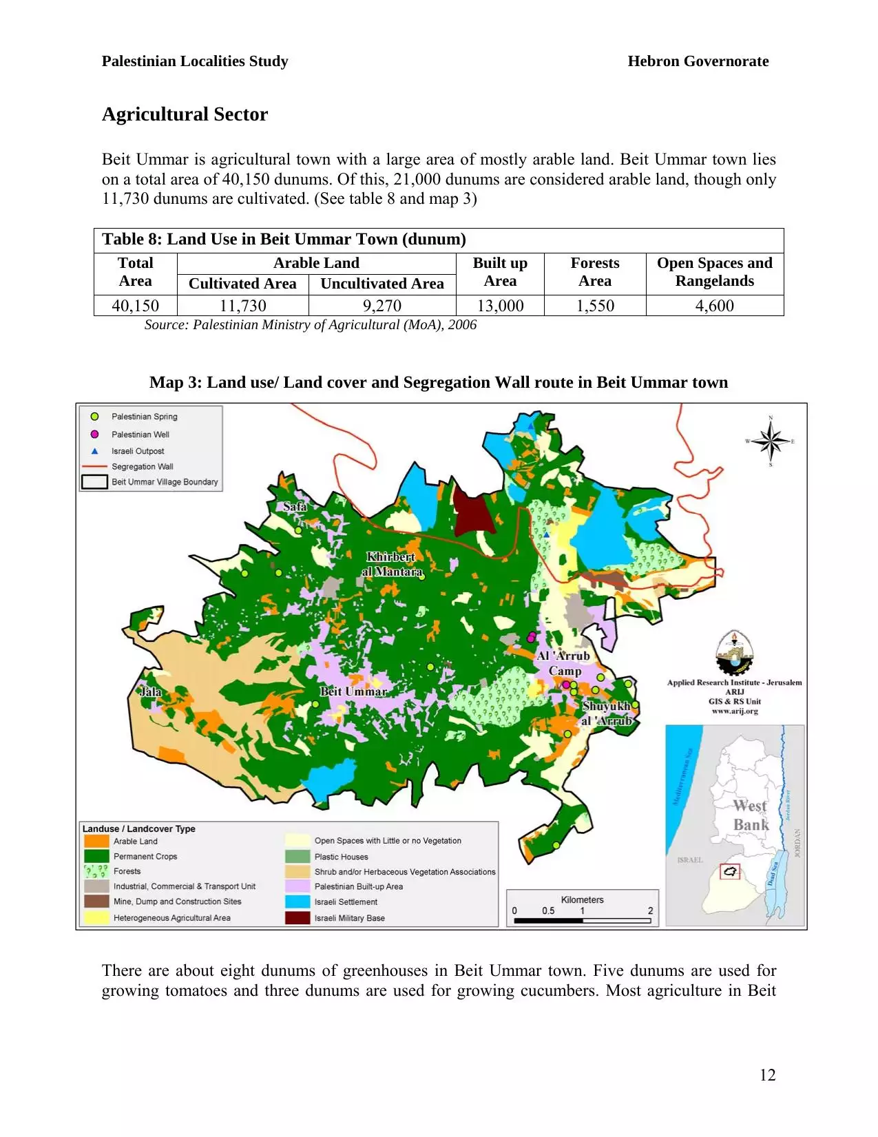
- Statistics & Facts
-
Before & After

- Satellite View
- Articles
- Pictures 58
- Aerial Views 1
- Mayrters & Prisoners 1
- Members 22
- Families
- Wikipedia
- ARIJ Guide
- Videos
- Guest Book 8
- Links
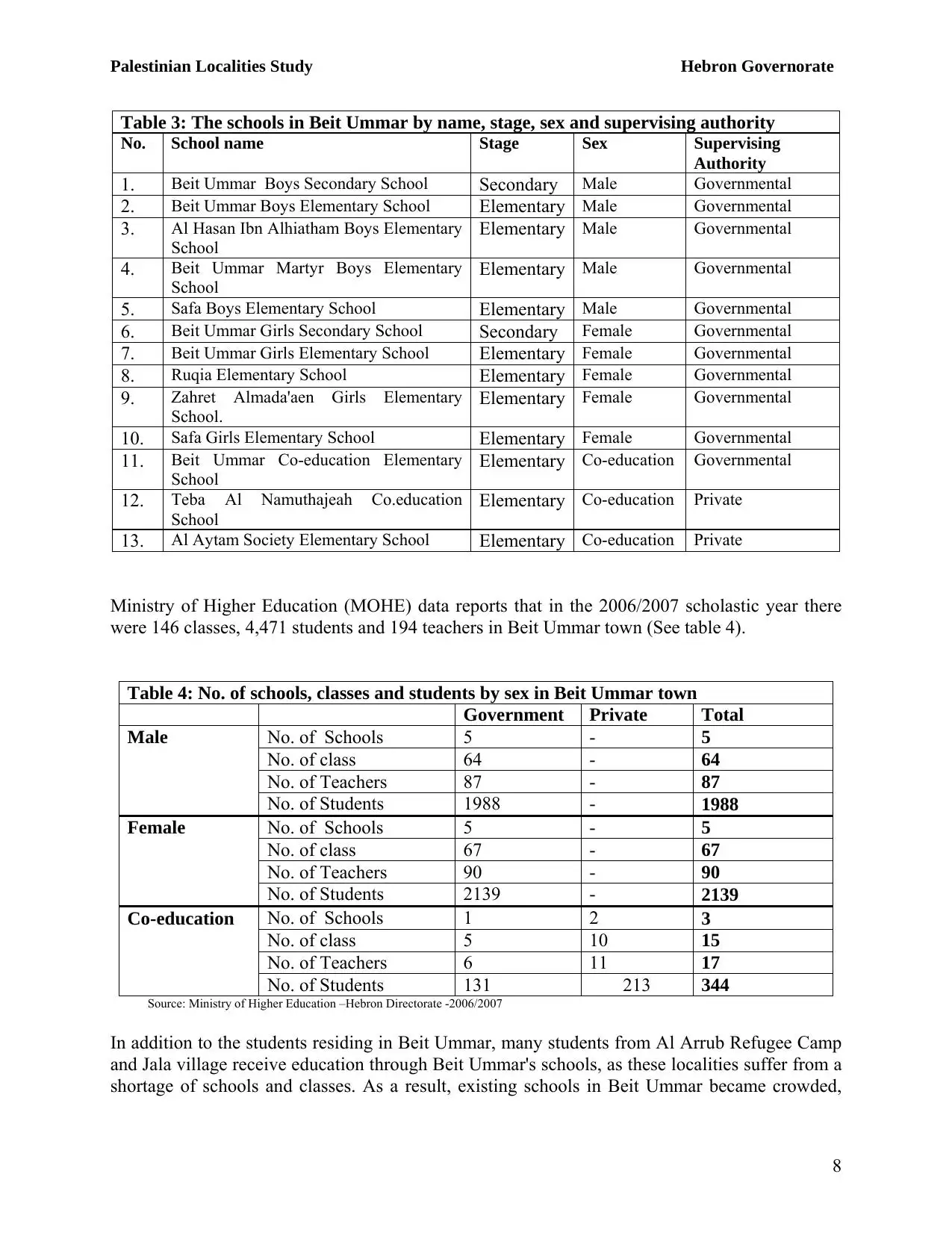
| Statistic & Fact | Value | |||||||||||||||||||||
| Distance From District | 11 km northwest of Hebron | |||||||||||||||||||||
| Elevation | 987 meters | |||||||||||||||||||||
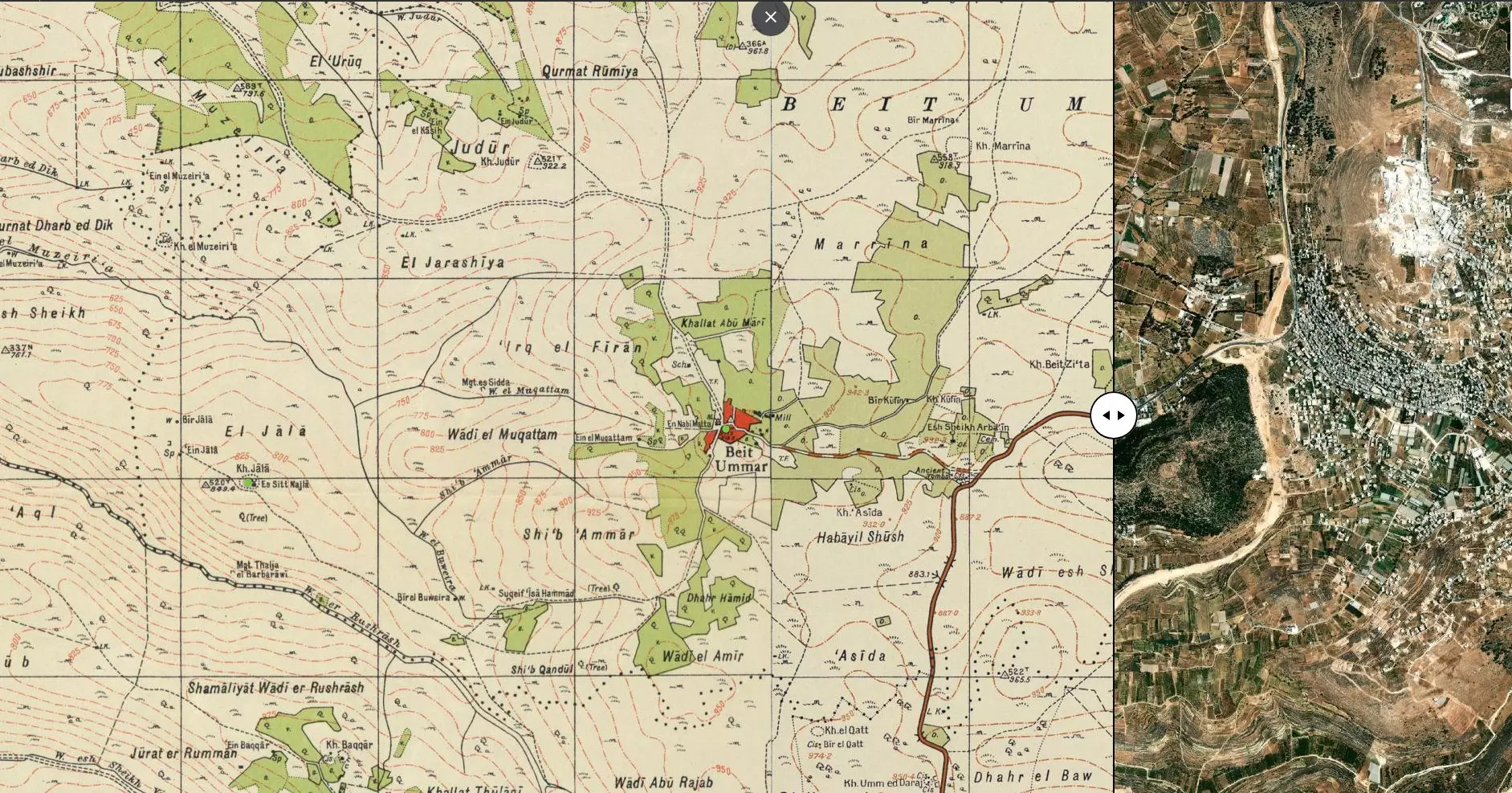
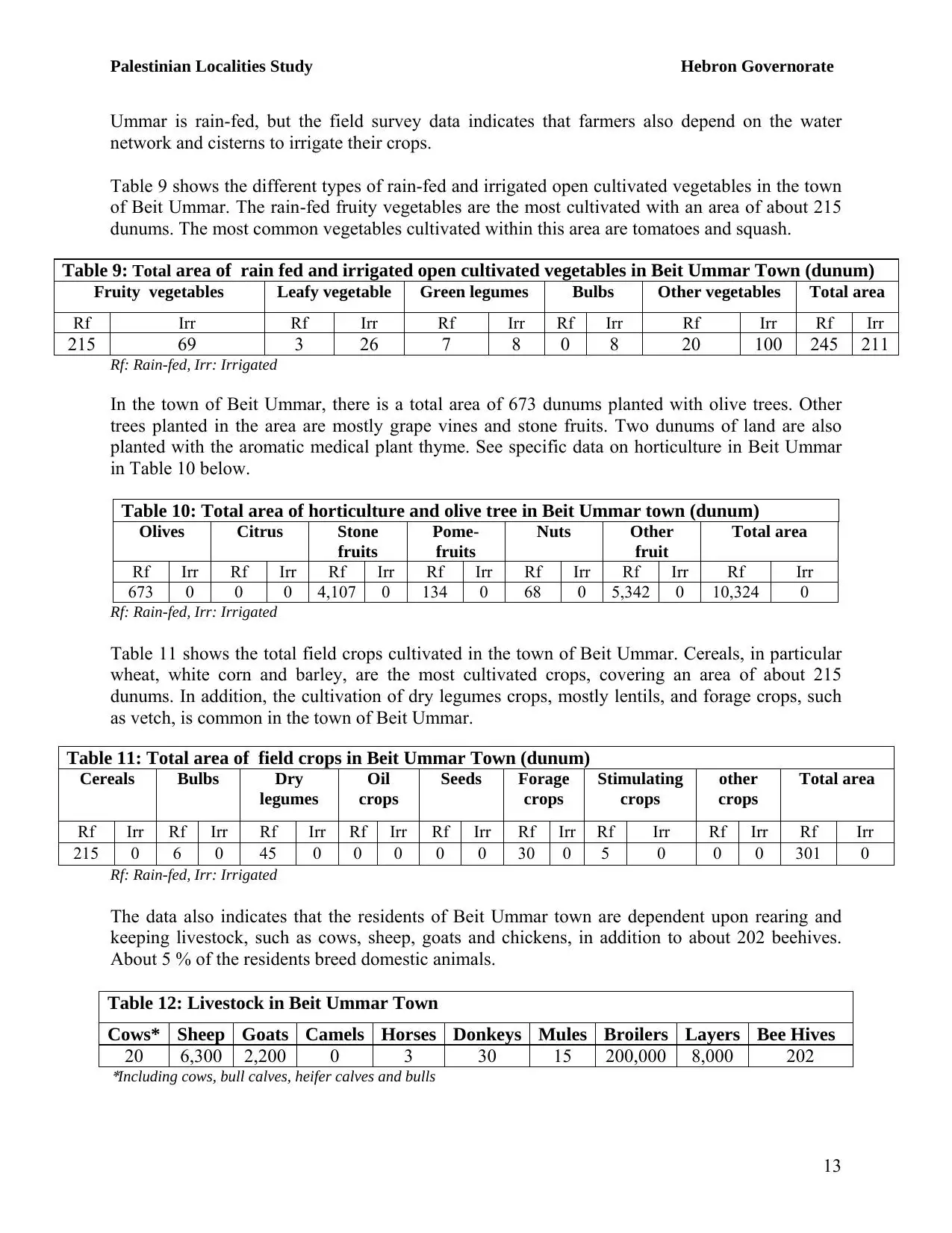
| Before & After Nakba, Click Map For Details |
||||||||||||||||||||||
|
||||||||||||||||||||||
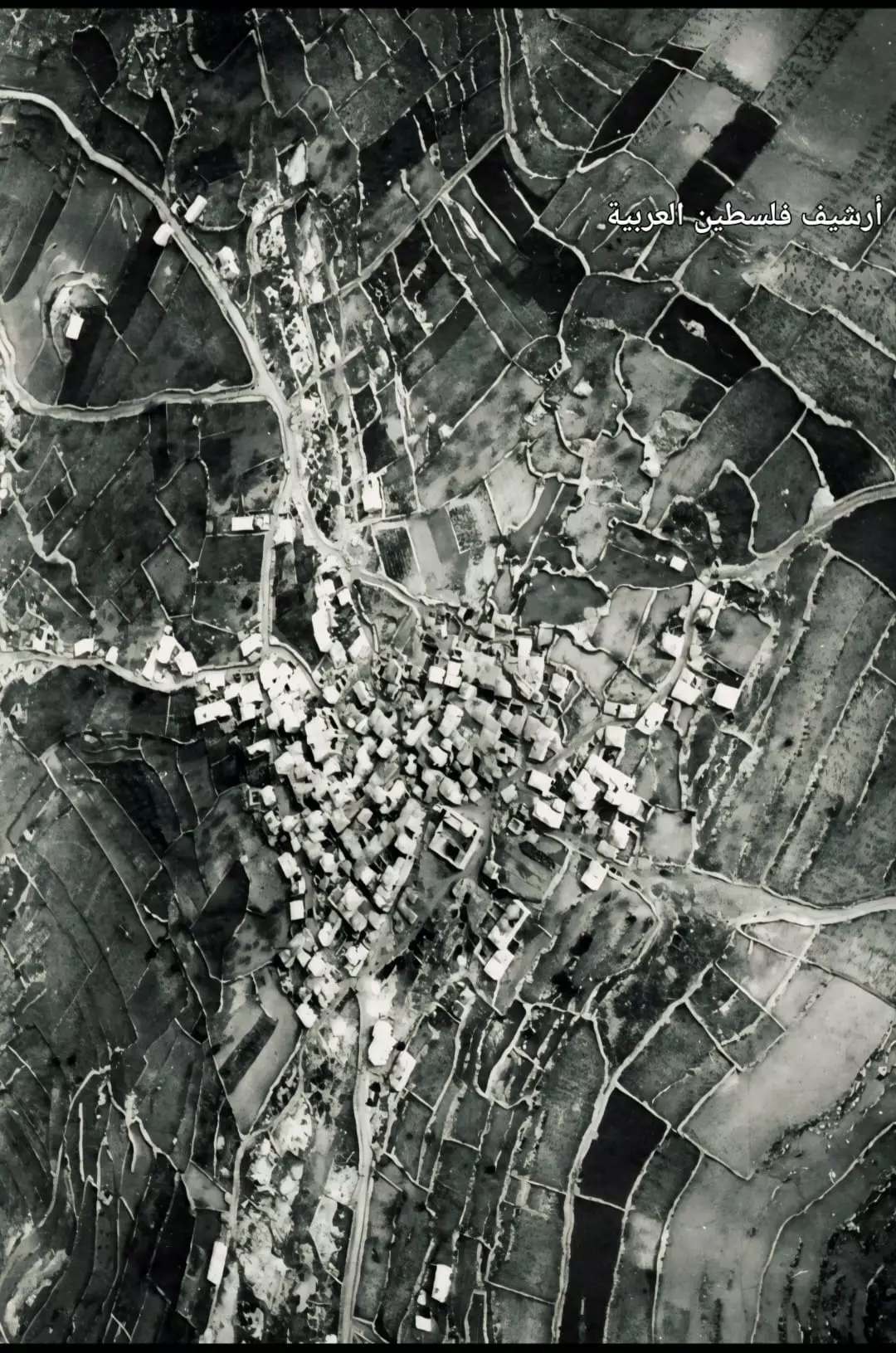
| Pre-Nakba Aerial View |
||||||||||||||||||||||
|
||||||||||||||||||||||
| Land Ownership |
**Town Lands' Demarcation Maps |
|||||||||||||||||||||
| Land Usage As of 1945 |
|
|||||||||||||||||||||
| Population |
|
|||||||||||||||||||||
| Near By Towns |
||||||||||||||||||||||
|
||||||||||||||||||||||
| Featured Video | ||||||||||||||||||||||
| ARIJ Guide | ||||||||||||||||||||||
3.
4. 
5. 
6. 
7. 
8. 
9. 
10. 
11. 
12. 
13. 
14. 
15. 
16. 
17. 
18. 
Click here to browse online. |
||||||||||||||||||||||
| Related Maps | Town Lands' Demarcation Maps خرائط للقضاء توضح حدود القرى والاودية View from satellite Town's map on MapQuest Help us map this town at WikiMapia |
|||||||||||||||||||||
| Related Links | Wikipedia's Page Facebook Page ARIJ Guide Google Search Google For Images Google For Videos في كتاب بلادنا فلسطين دليل أريج المزيد من موقع هوية |
|||||||||||||||||||||
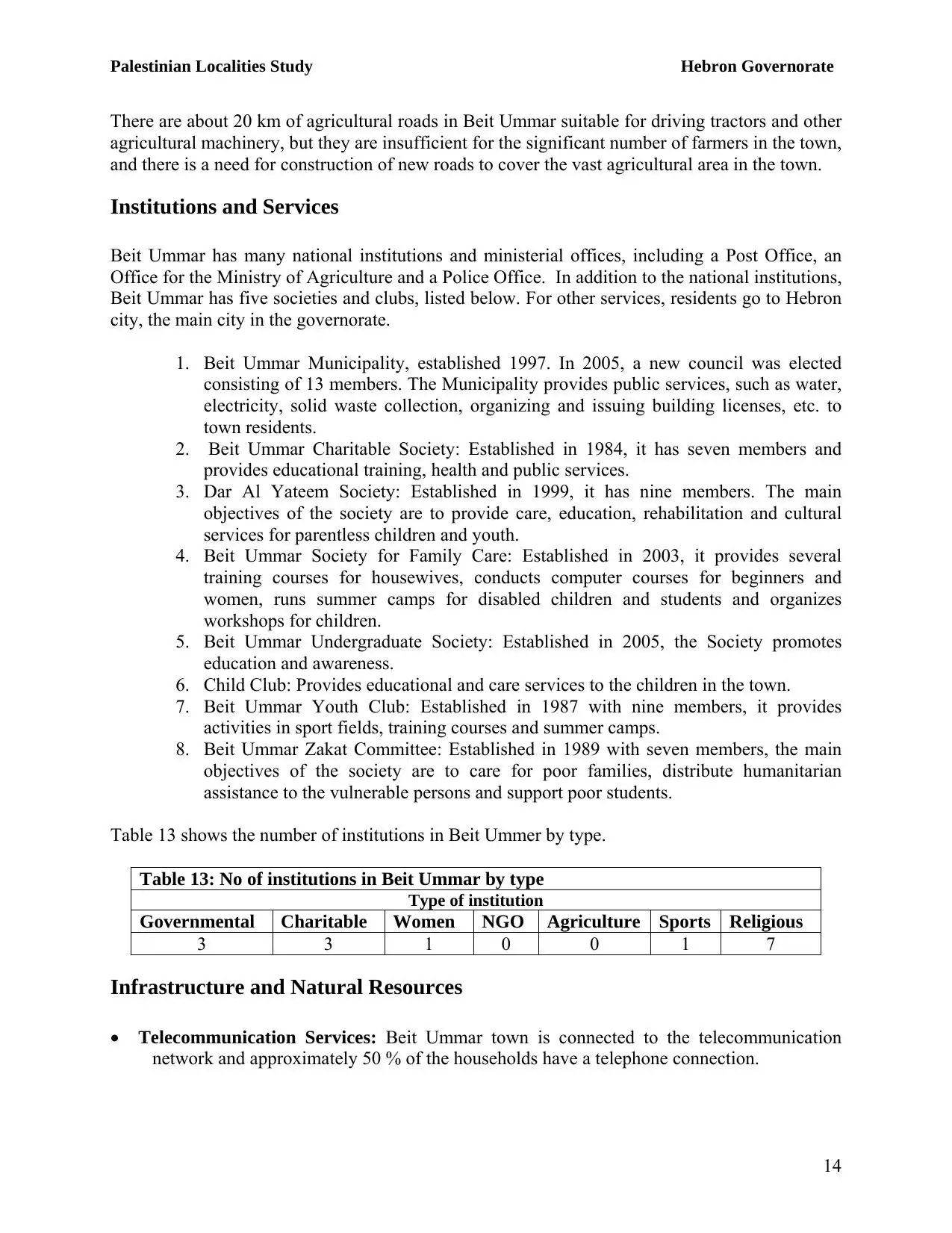
No articles have been added yet, please be free to be the first to add one.
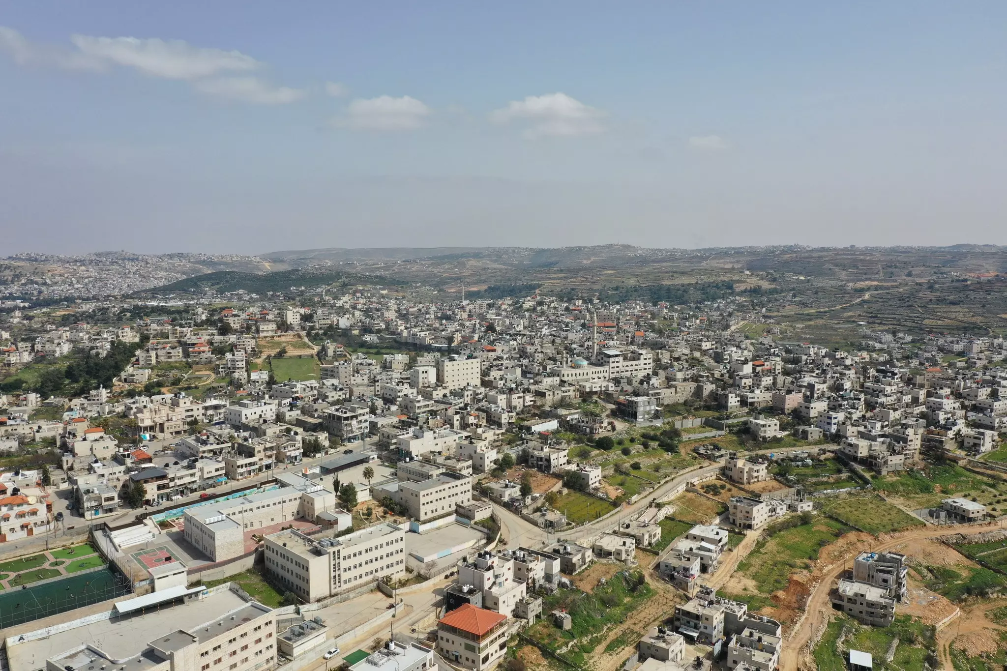
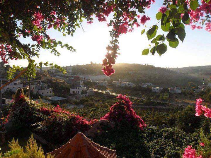
- General view
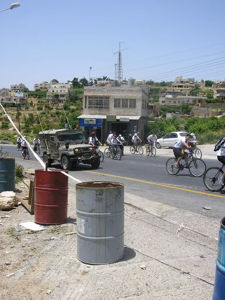
21 - Biking in Bayt Ummar by members of the solidarity movement
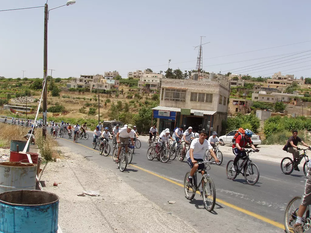
- Biking in Bayt Ummar by members of the solidarity movement #2
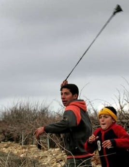
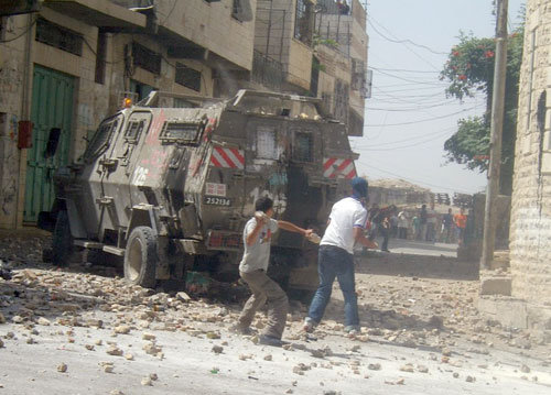
4 - A Palestinian demonstrator uses a slingshot against Israeli troops during a protest against the construction of Israel'sAppartheid wall near the West Bank village of Beit Ommar near Hebron January 5, 2008
- Palestinian demonstrators shout at Israeli troops during a protest against the construction of Israel's Apartheid Wall near the West Bank village of Beit Ommar near Hebron January 5, 2008
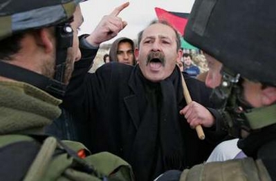
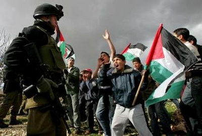
1 - Palestinian demonstrators shout at Israeli troops during a protest against the construction of Israel's Apartheid Wall near the West Bank village of Beit Ommar near Hebron January 5, 2008
- عين العروب اوائل ايام الاحتلال البريطاني
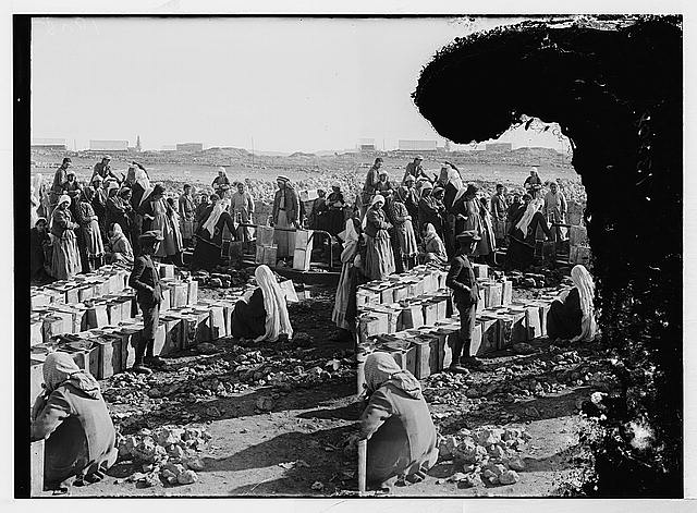
Posted by ابو عمر 1 - جمهرة نساء على عين العروب فترة الثلاثينيات -هدية من صفافي-
Posted by ابو عمر 2 - بيت امر
Posted by ابو اكثم 3 - بيت امر
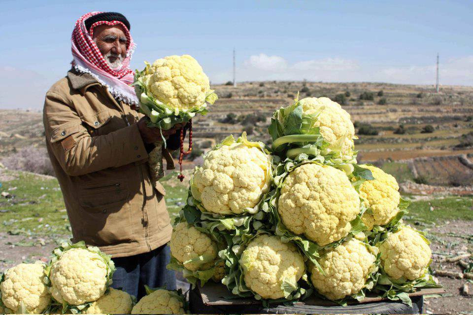
Posted by ابو اكثم 3 - خليلي يا قرنبيط
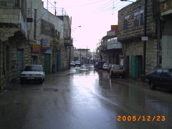
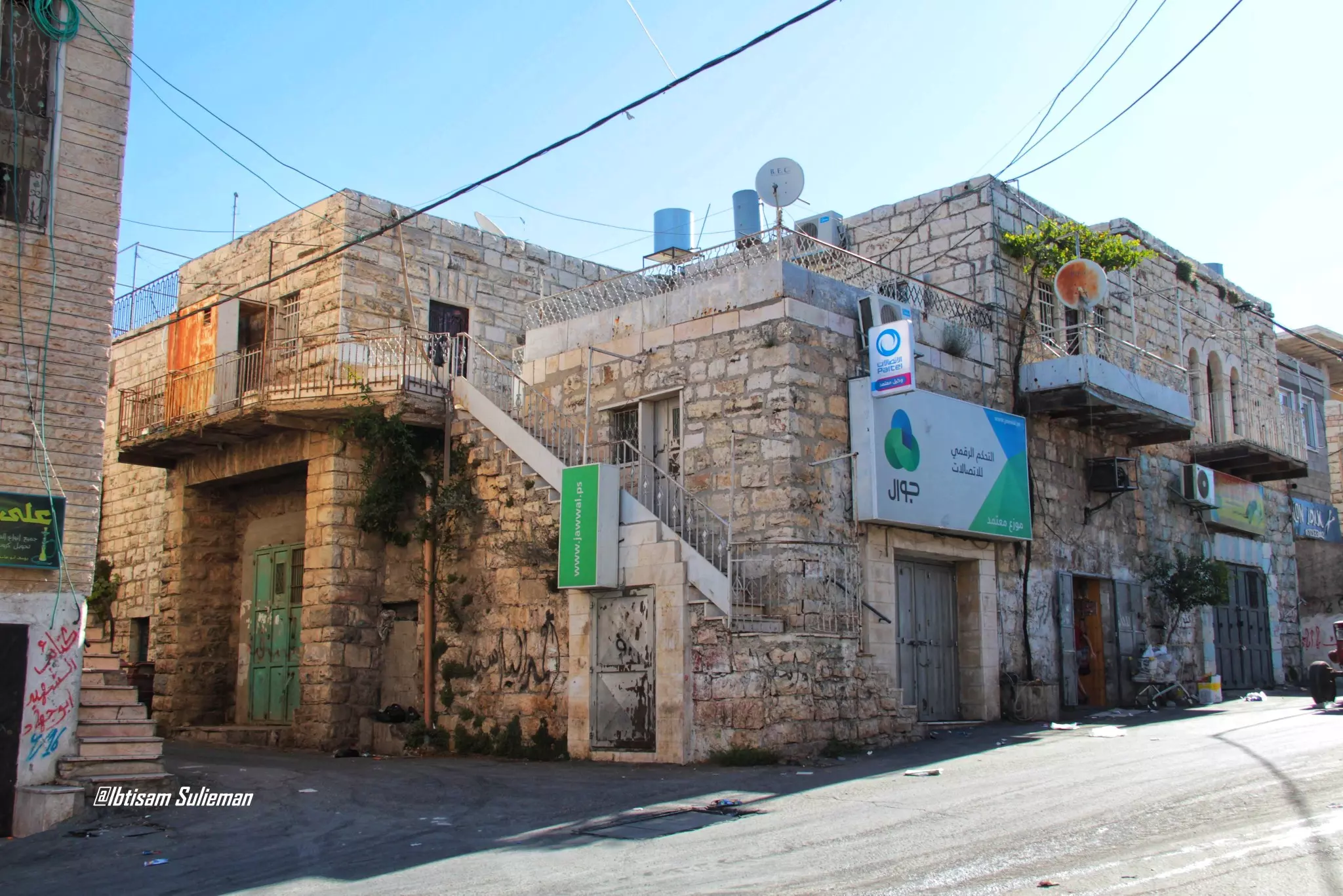
- منظر عام
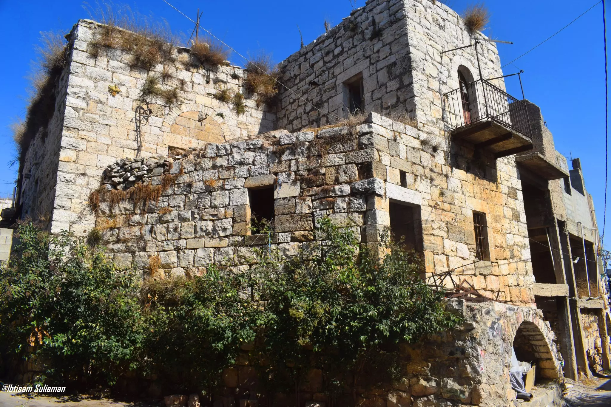
- من البيوت القديمة ببلدة بيت أمر \ الخليل
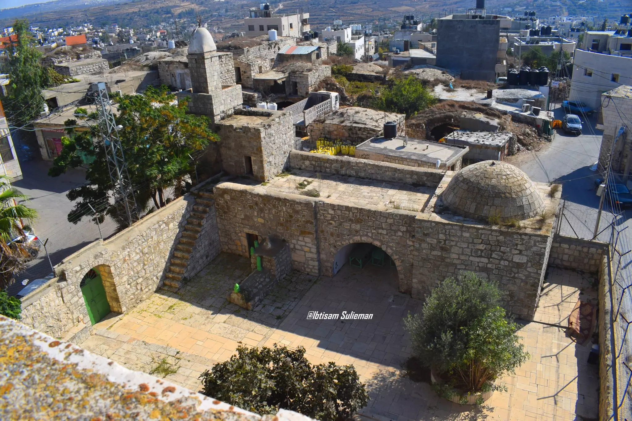
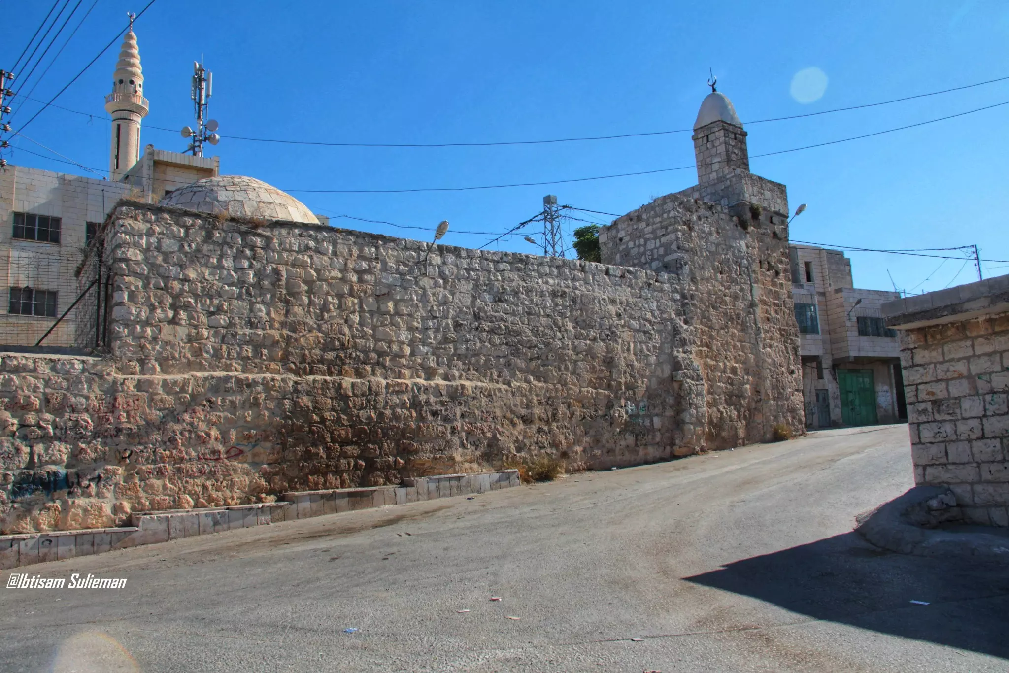
- البلدة القديمة \\ بيت أمر الخليل--يظهر بمقدمة الصورة مقام ومسجد النبي متى
- صورة من الجو لقرية بيت أمر قضاء الخليل عام 1947..
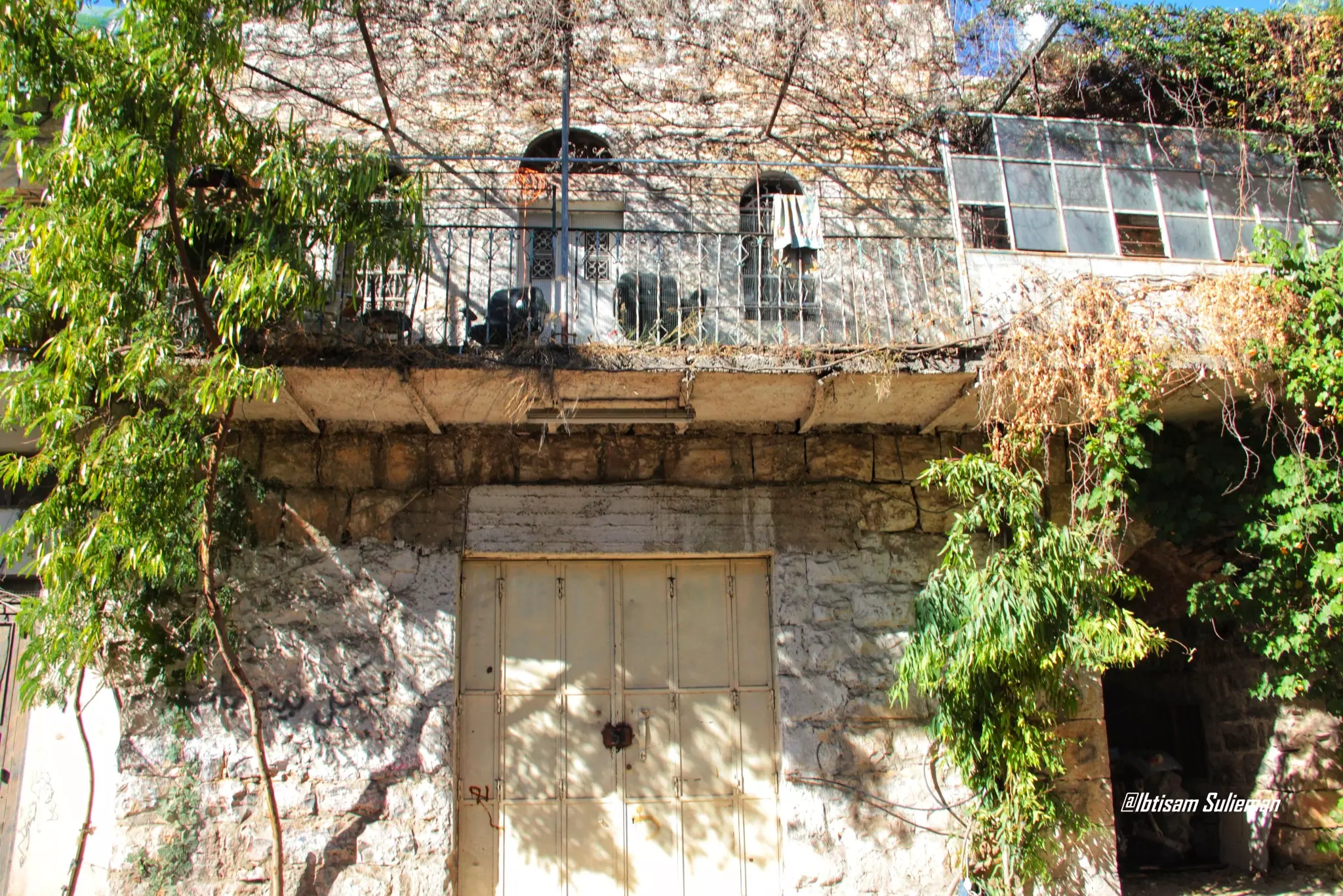
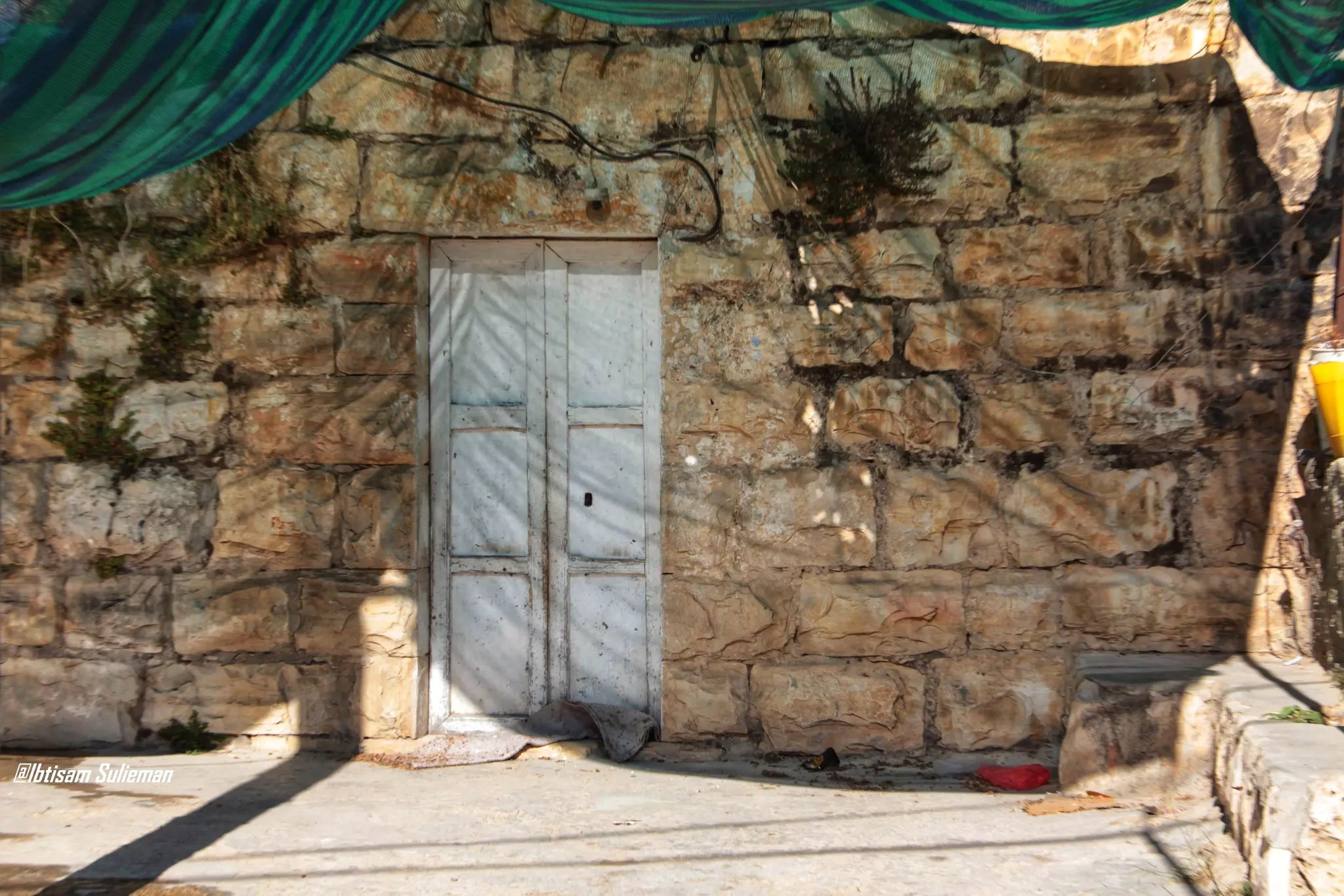
- البيوت القديمة في قرية بيت أمر -- Ibtisam Sulieman
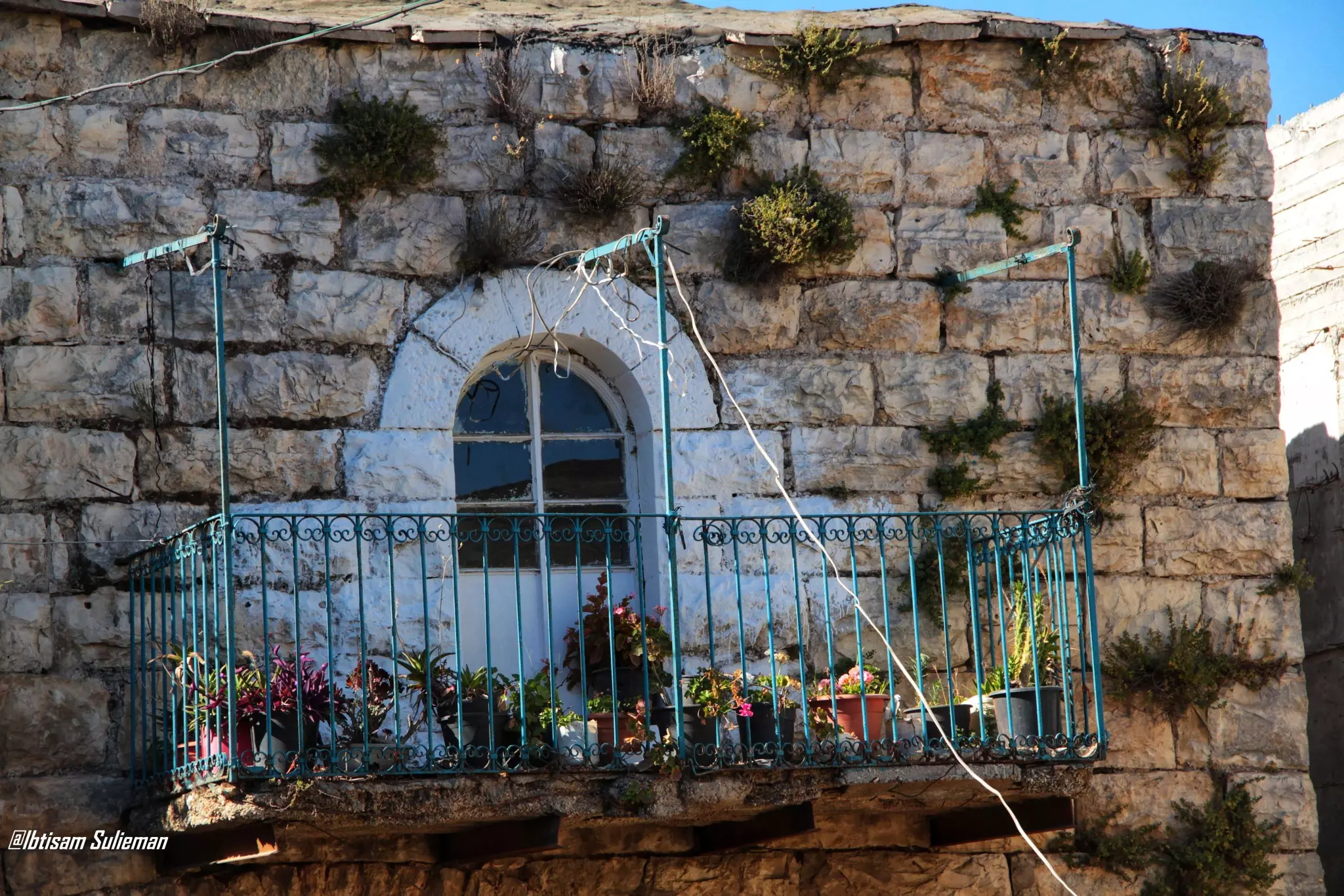
- البيوت القديمة في قرية بيت أمر -- Ibtisam Sulieman #2
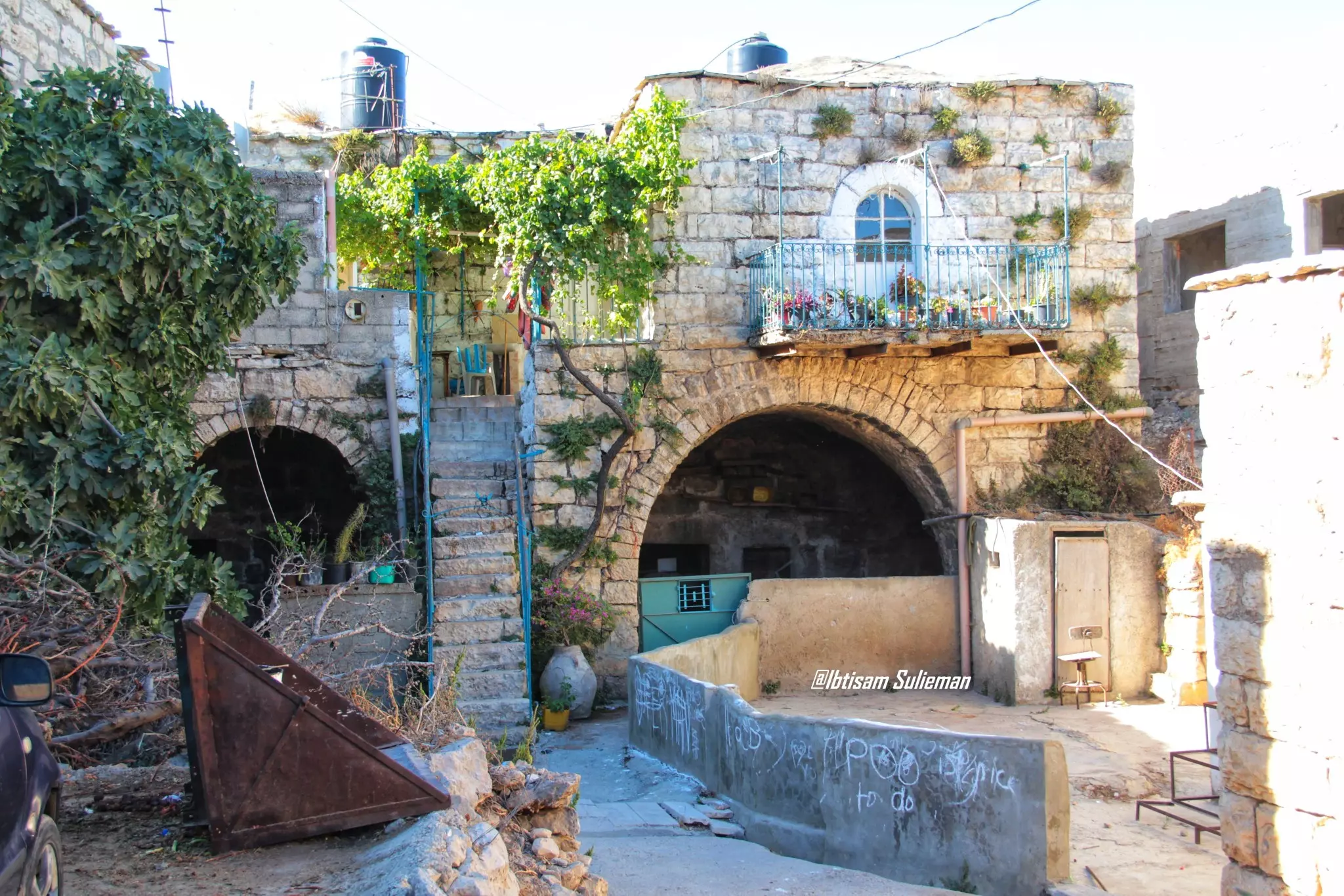
- البيوت القديمة في قرية بيت أمر -- Ibtisam Sulieman #3
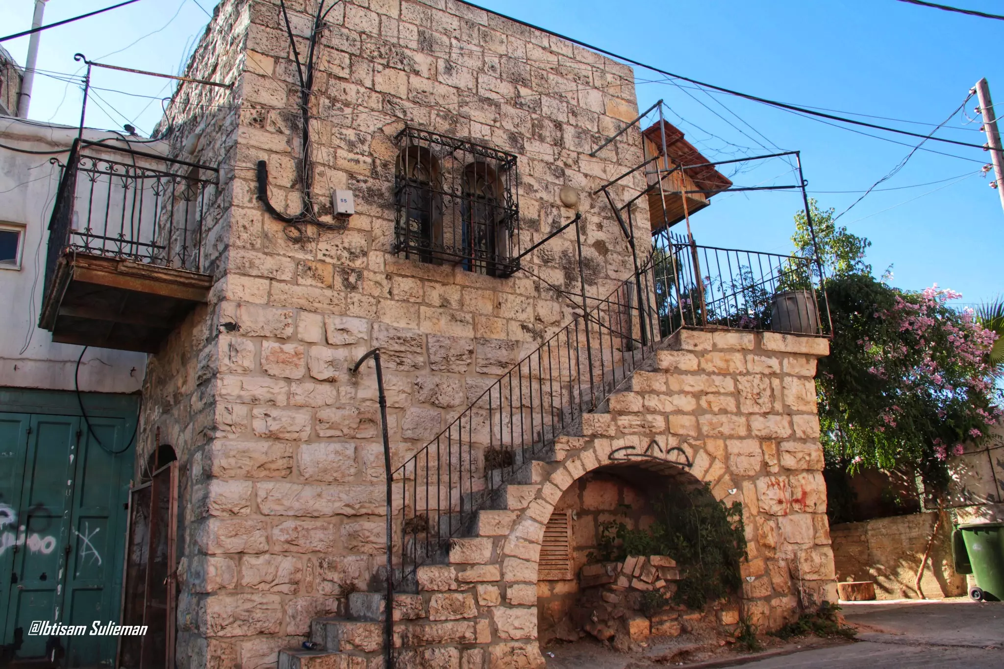
- البيوت القديمة في قرية بيت أمر -- Ibtisam Sulieman #4
- البيوت القديمة في قرية بيت أمر -- Ibtisam Sulieman #5
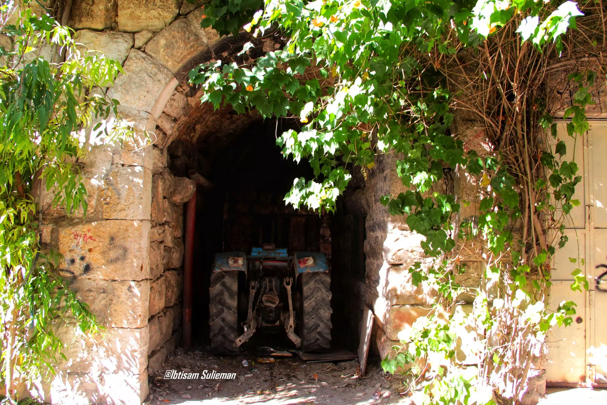
- البيوت القديمة في قرية بيت أمر -- Ibtisam Sulieman #6
- البيوت القديمة في قرية بيت أمر -- Ibtisam Sulieman #7
- البيوت القديمة في قرية بيت أمر -- Ibtisam Sulieman #8
- مقام النبي مَتّى -- واجد النوباني
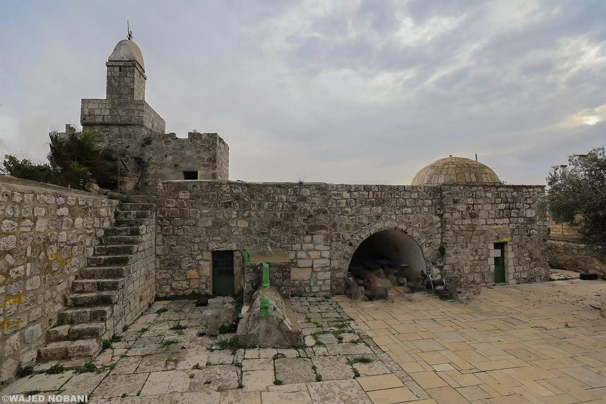
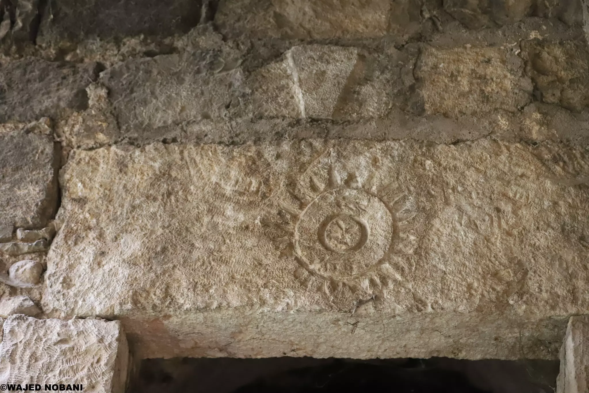
- مقام مَتّى .. بيت أُمَّر - الخليل/ فلسطين. يضم المبنى أعمدة وحجارة من الفترة الرومانية ونقوش من الفترة الاسلامية -- واجد النوباني
- مقام مَتّى .. بيت أُمَّر - الخليل/ فلسطين. يضم المبنى أعمدة وحجارة من الفترة الرومانية ونقوش من الفترة الاسلامية -- واجد النوباني #2
- مقام مَتّى .. بيت أُمَّر - الخليل/ فلسطين. يضم المبنى أعمدة وحجارة من الفترة الرومانية ونقوش من الفترة الاسلامية -- واجد النوباني #3
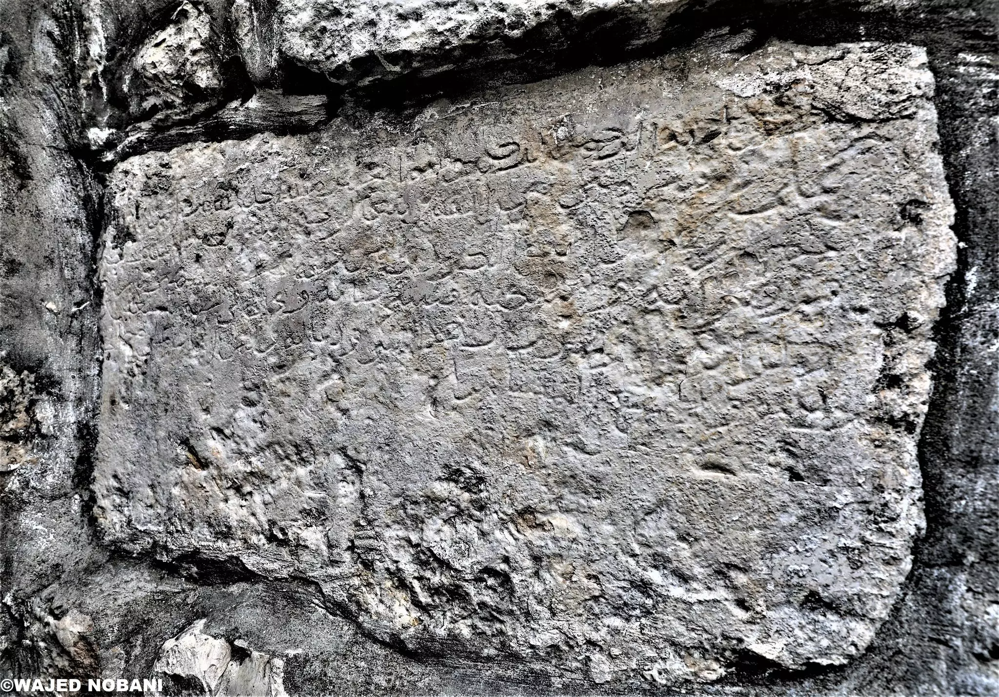
- مقام مَتّى .. بيت أُمَّر - الخليل/ فلسطين. يضم المبنى أعمدة وحجارة من الفترة الرومانية ونقوش من الفترة الاسلامية -- واجد النوباني #4
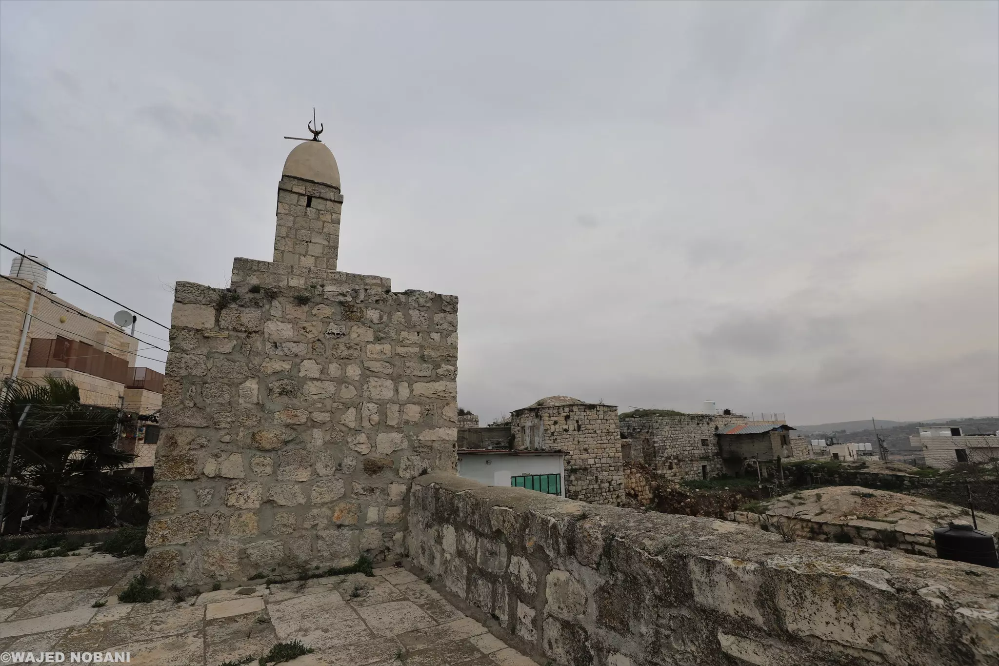
- مقام مَتّى .. بيت أُمَّر - الخليل/ فلسطين. يضم المبنى أعمدة وحجارة من الفترة الرومانية ونقوش من الفترة الاسلامية -- واجد النوباني #5
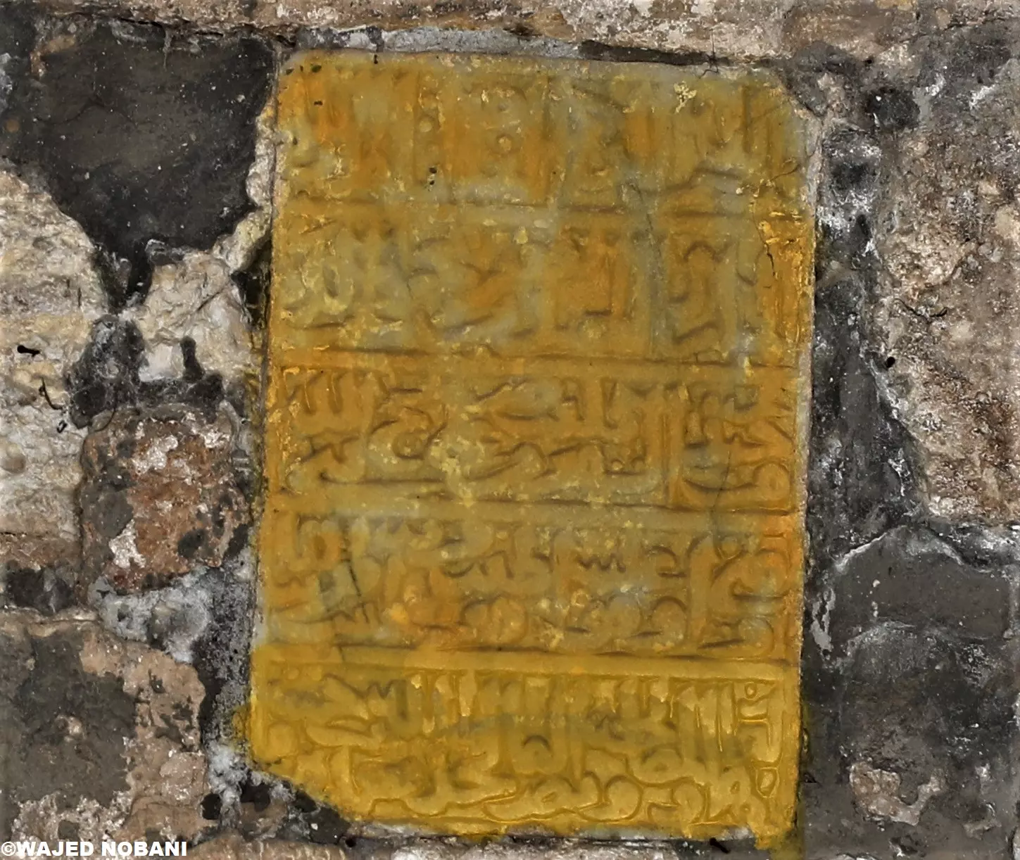
- مقام مَتّى .. بيت أُمَّر - الخليل/ فلسطين. يضم المبنى أعمدة وحجارة من الفترة الرومانية ونقوش من الفترة الاسلامية -- واجد النوباني #6
- مقام مَتّى .. بيت أُمَّر - الخليل/ فلسطين. يضم المبنى أعمدة وحجارة من الفترة الرومانية ونقوش من الفترة الاسلامية -- واجد النوباني #7
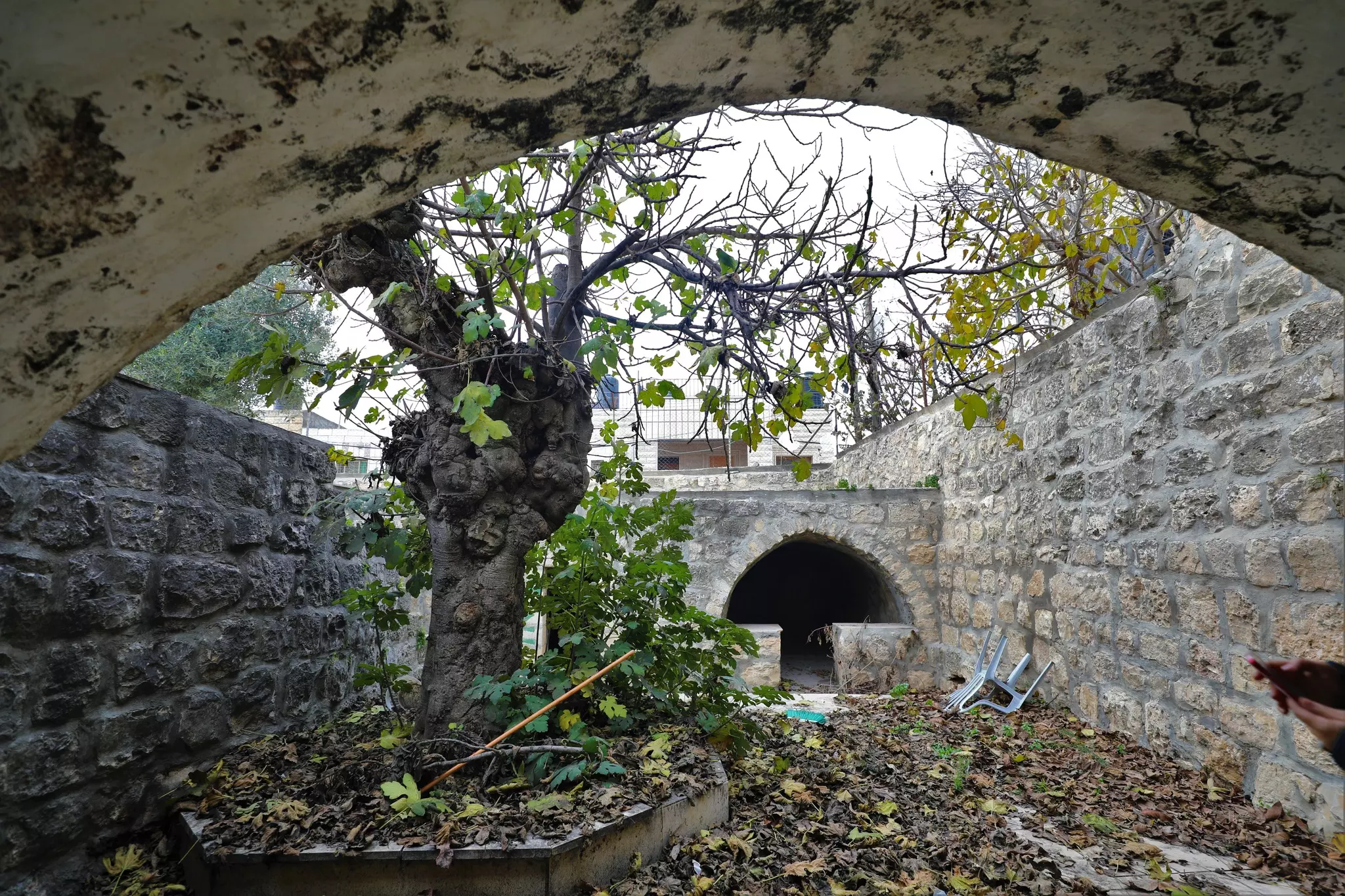
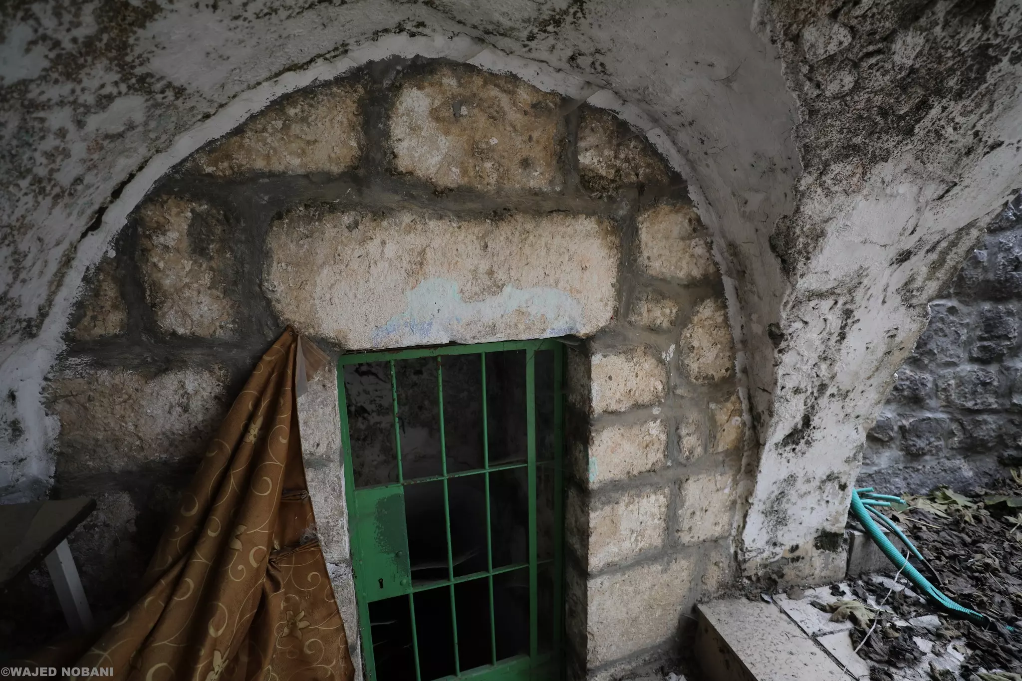
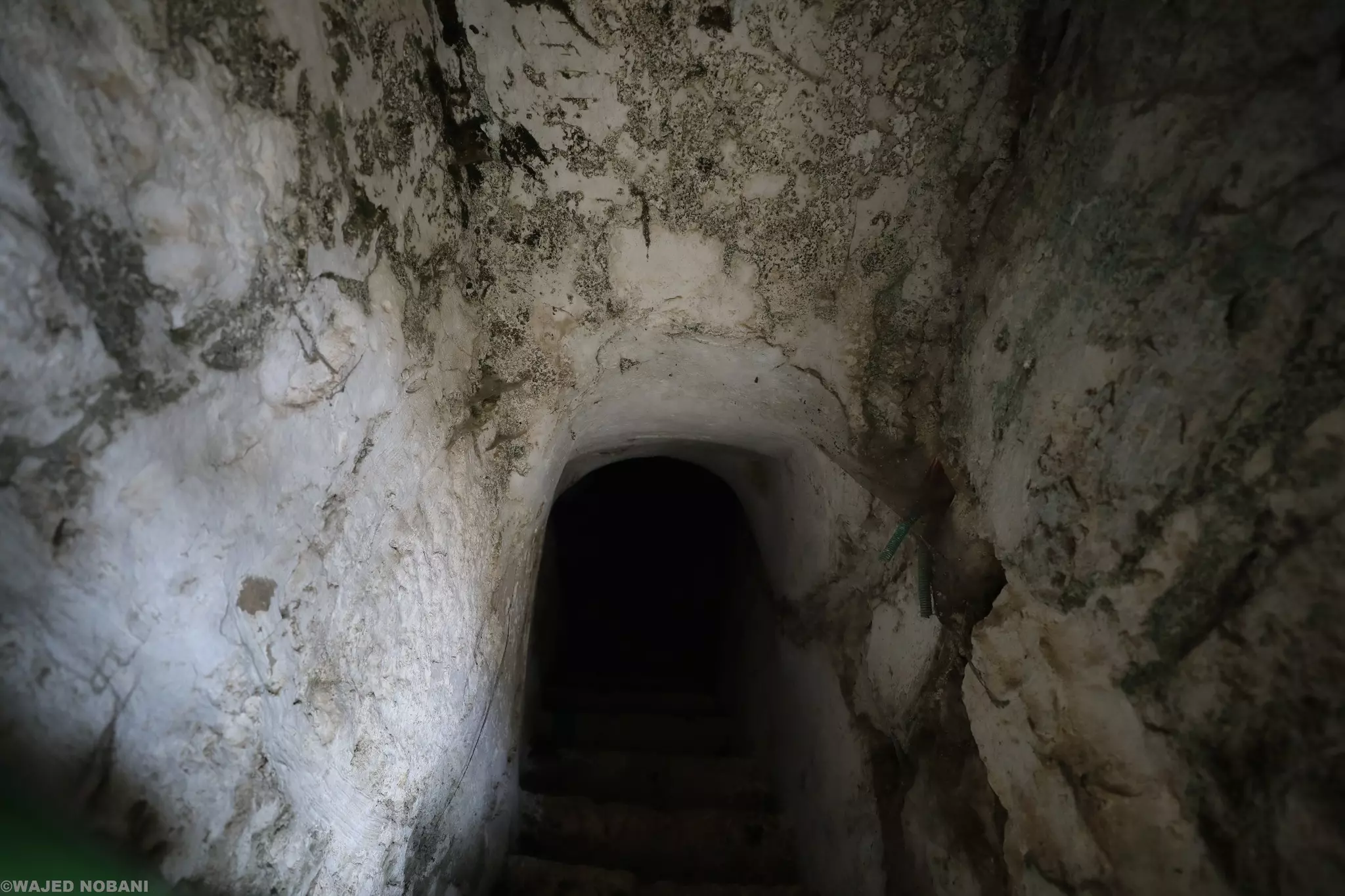
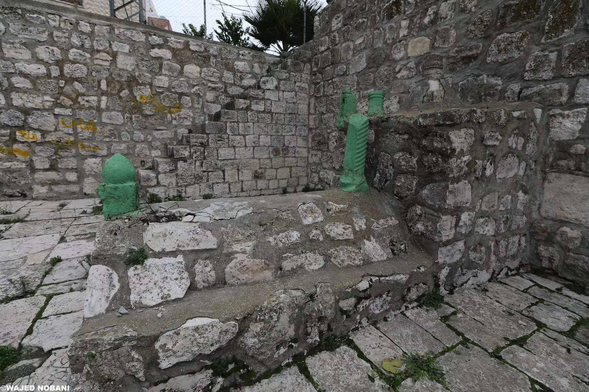
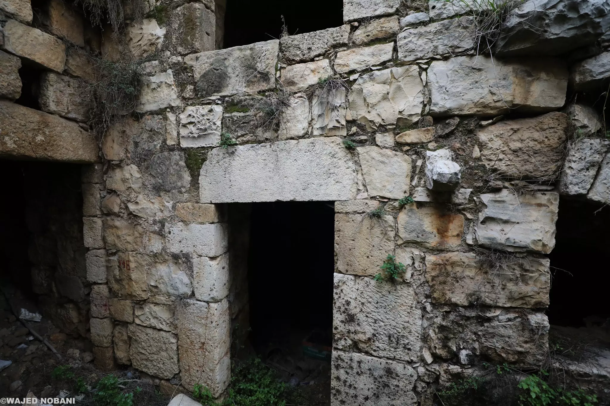
- جولة بين بيوت بيت أمر القديمة -- واجد النوباني
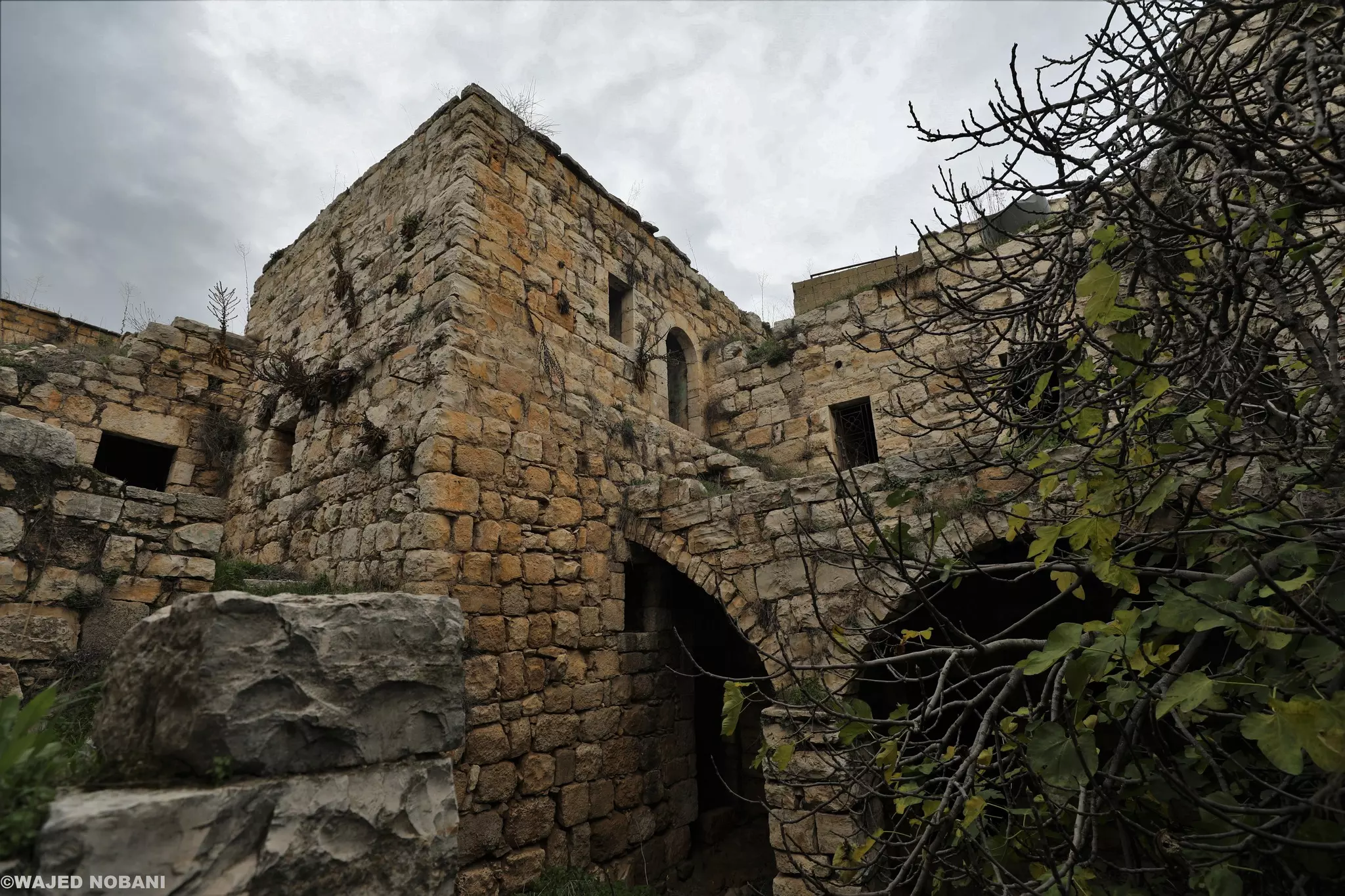
- جولة بين بيوت بيت أمر القديمة -- واجد النوباني #2
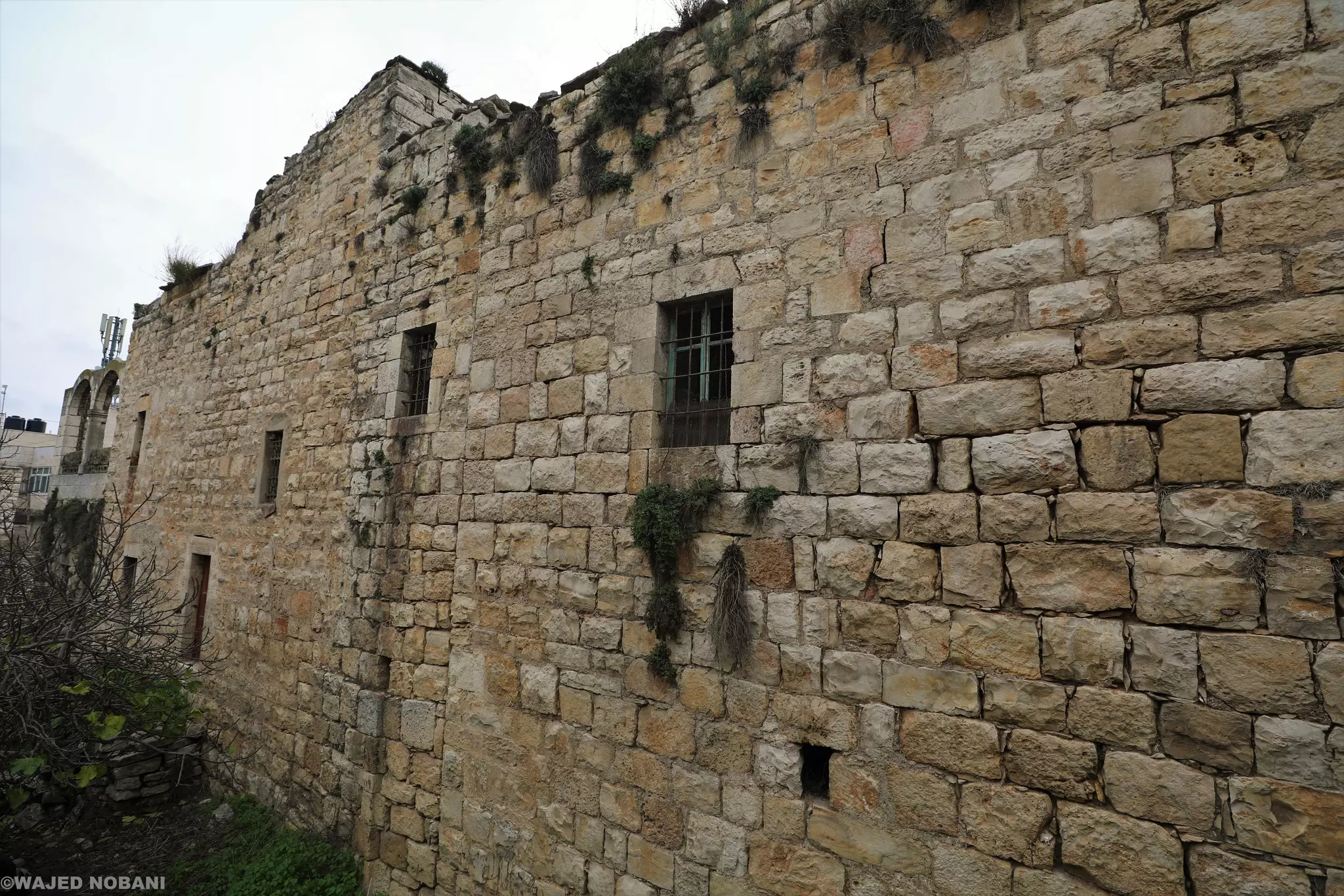
- جولة بين بيوت بيت أمر القديمة -- واجد النوباني #3
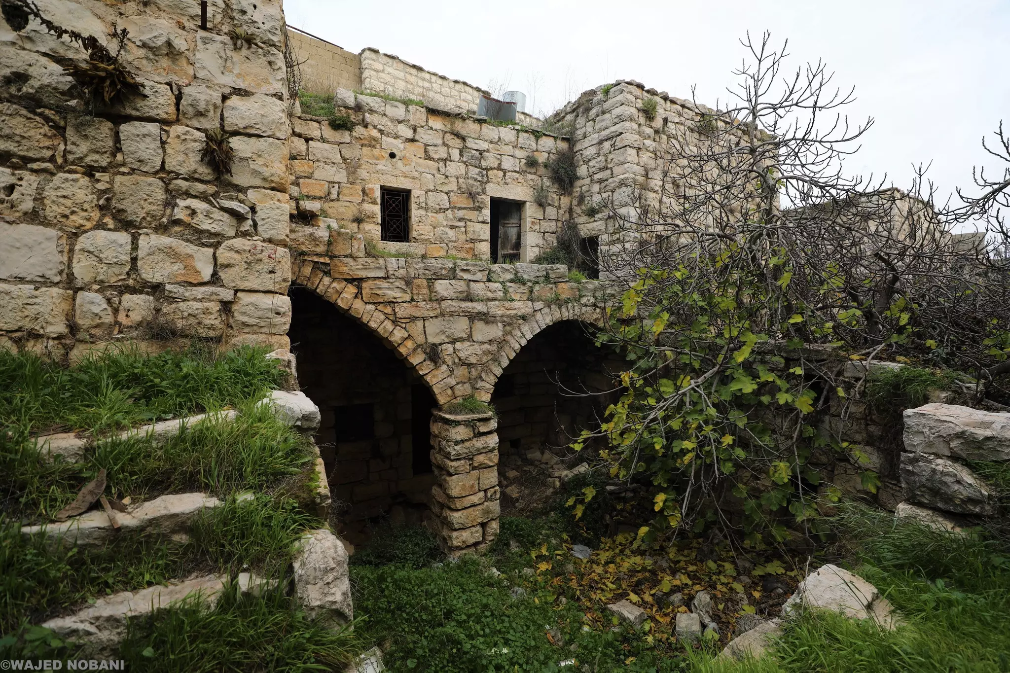
- جولة بين بيوت بيت أمر القديمة -- واجد النوباني #4
- جولة بين بيوت بيت أمر القديمة -- واجد النوباني #5
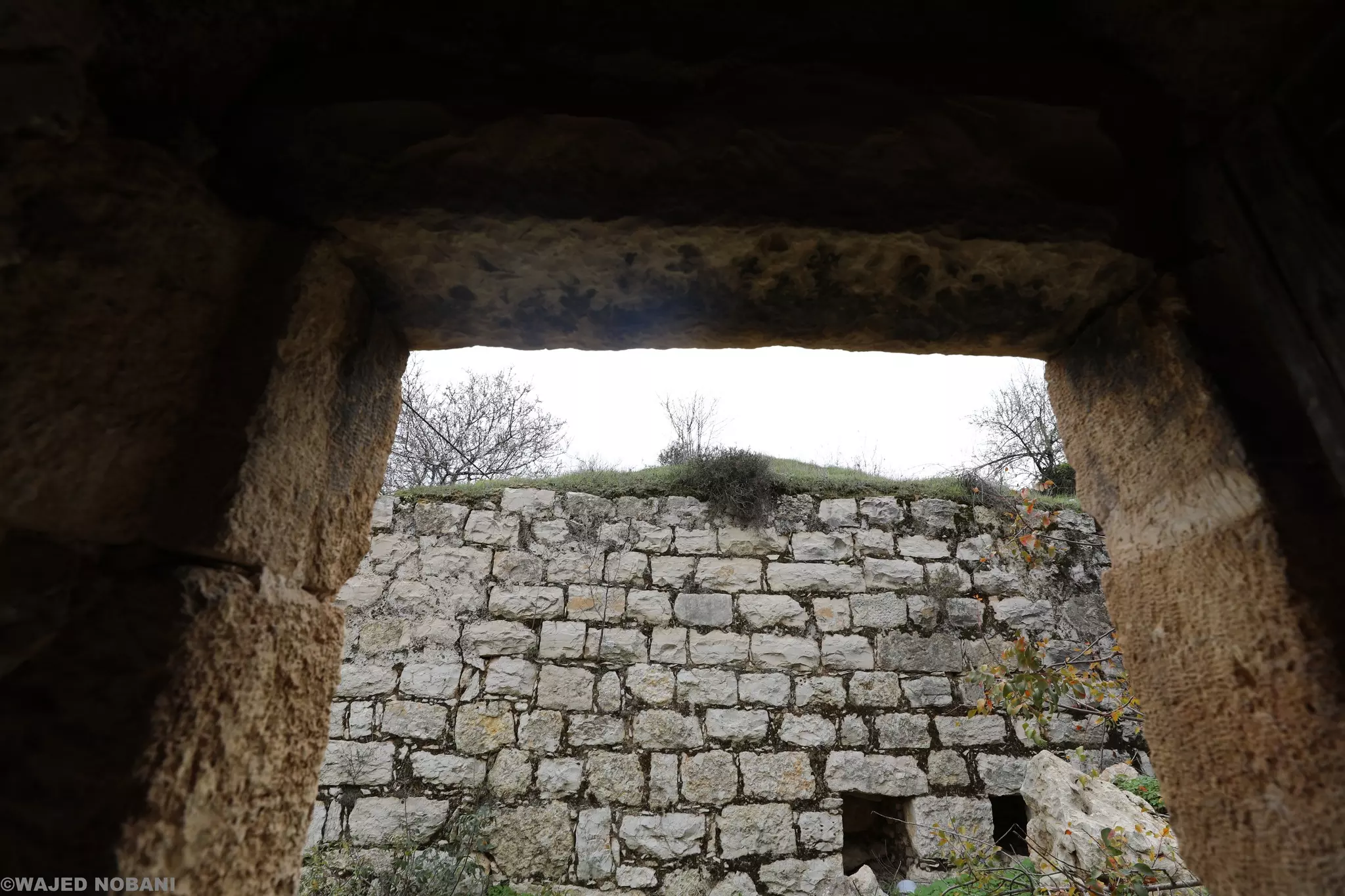
- جولة بين بيوت بيت أمر القديمة -- واجد النوباني #6
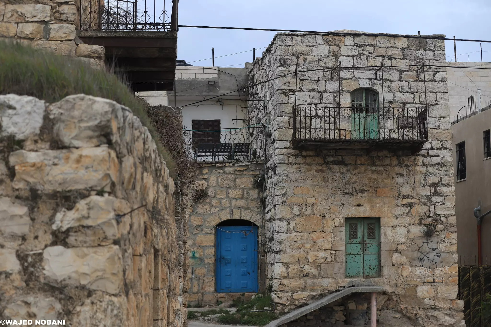
- جولة بين بيوت بيت أمر القديمة -- واجد النوباني #7
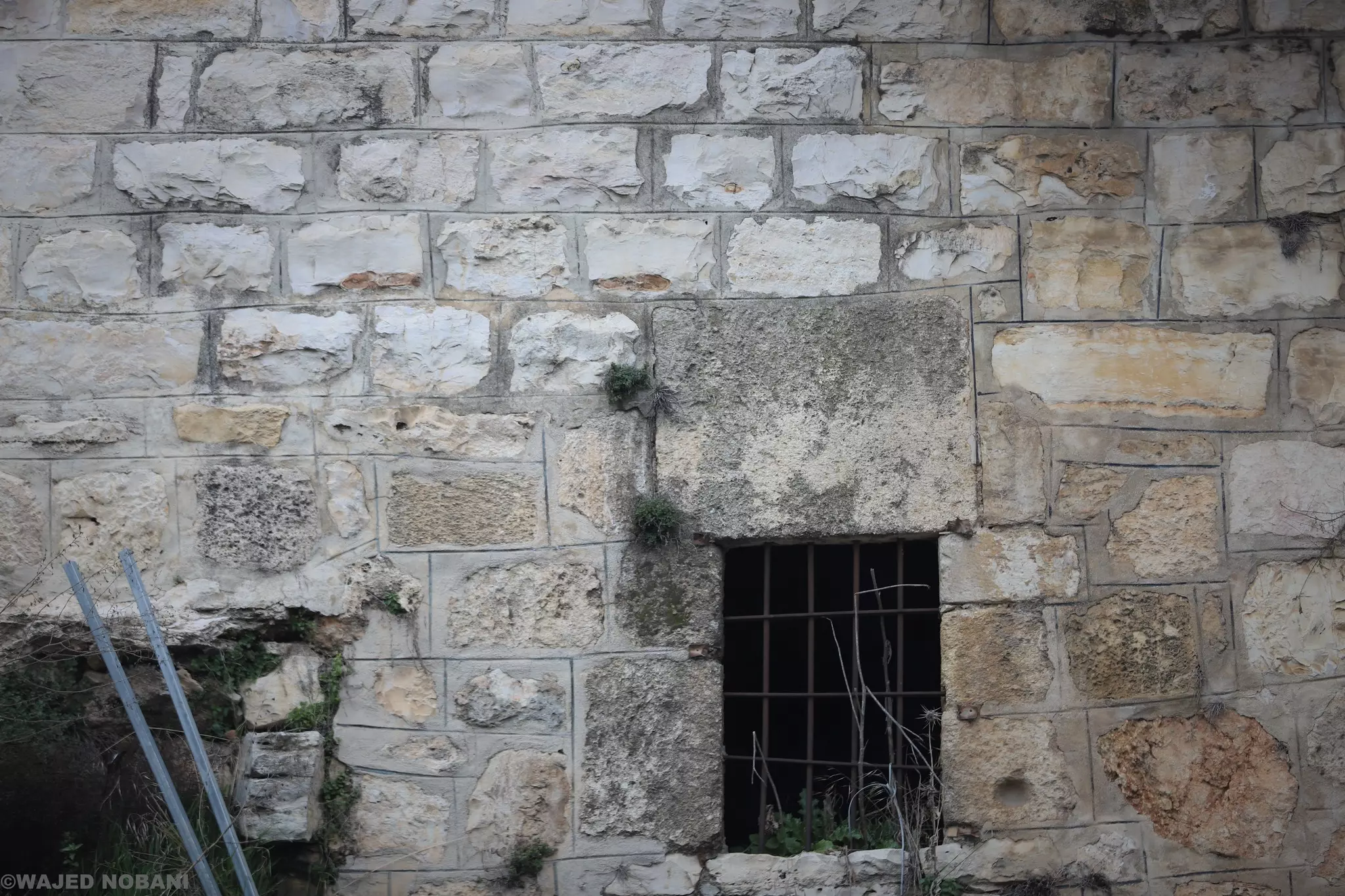
- جولة بين بيوت بيت أمر القديمة -- واجد النوباني #8
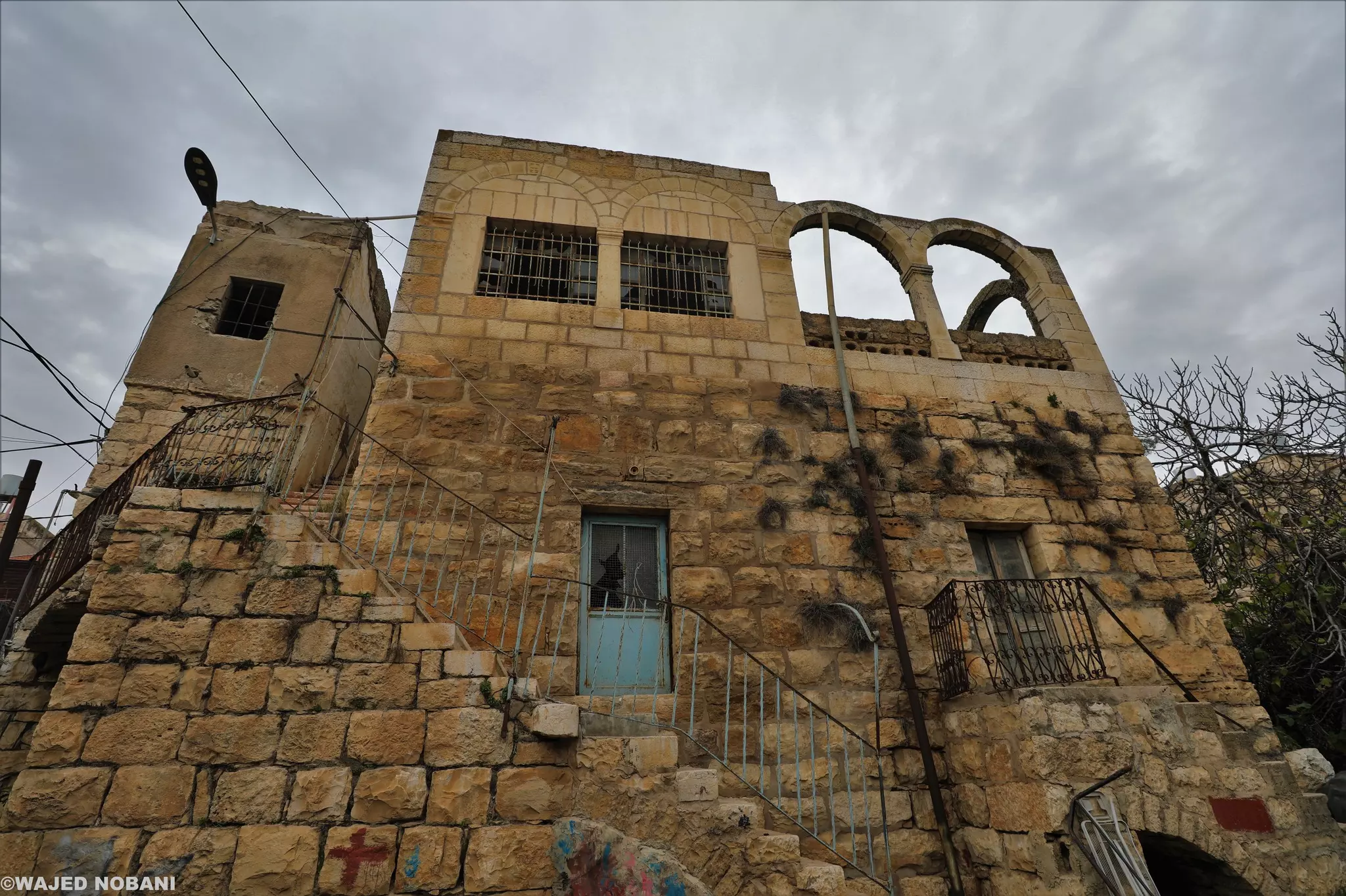
- جولة بين بيوت بيت أمر القديمة -- واجد النوباني #9
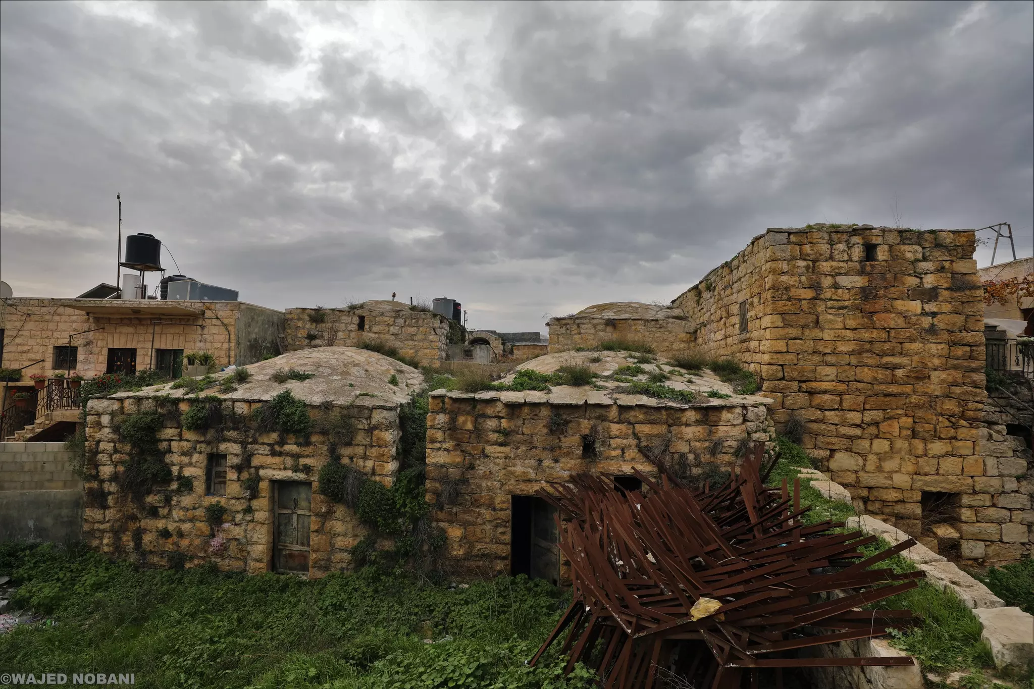
- جولة بين بيوت بيت أمر القديمة -- واجد النوباني #10
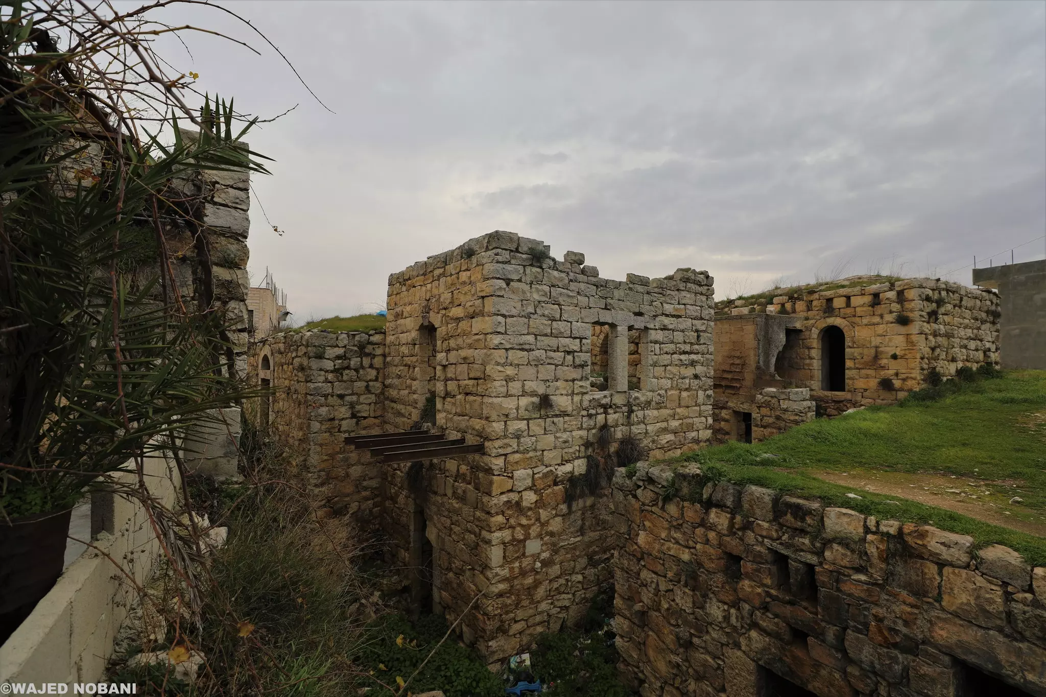
- جولة بين بيوت بيت أمر القديمة -- واجد النوباني #11
- منظر عام
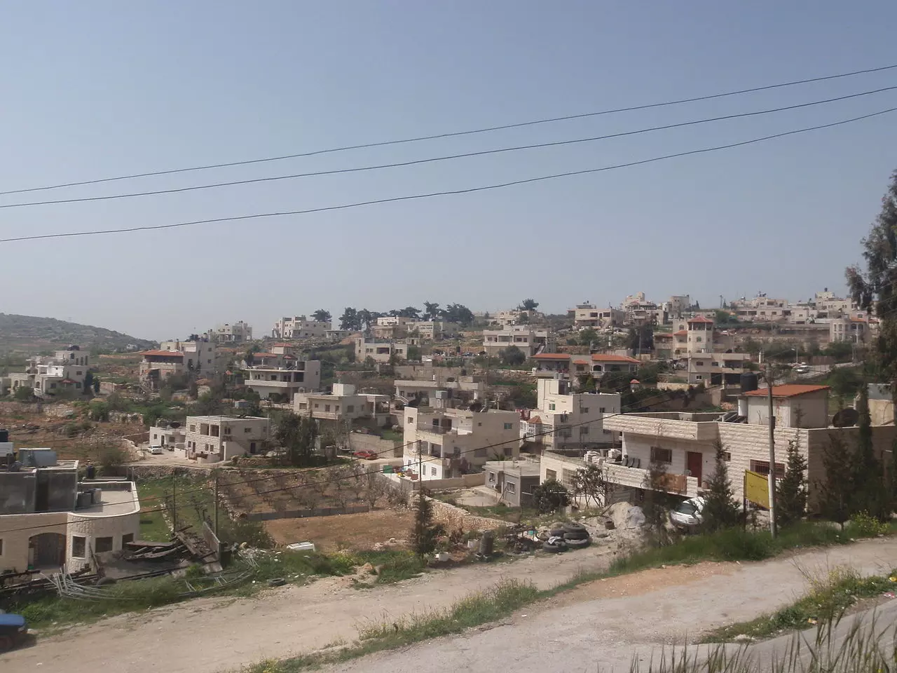
- منظر عام
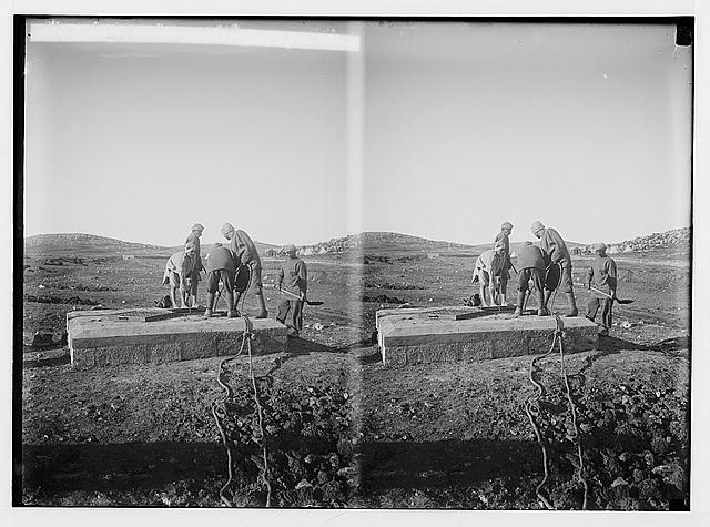
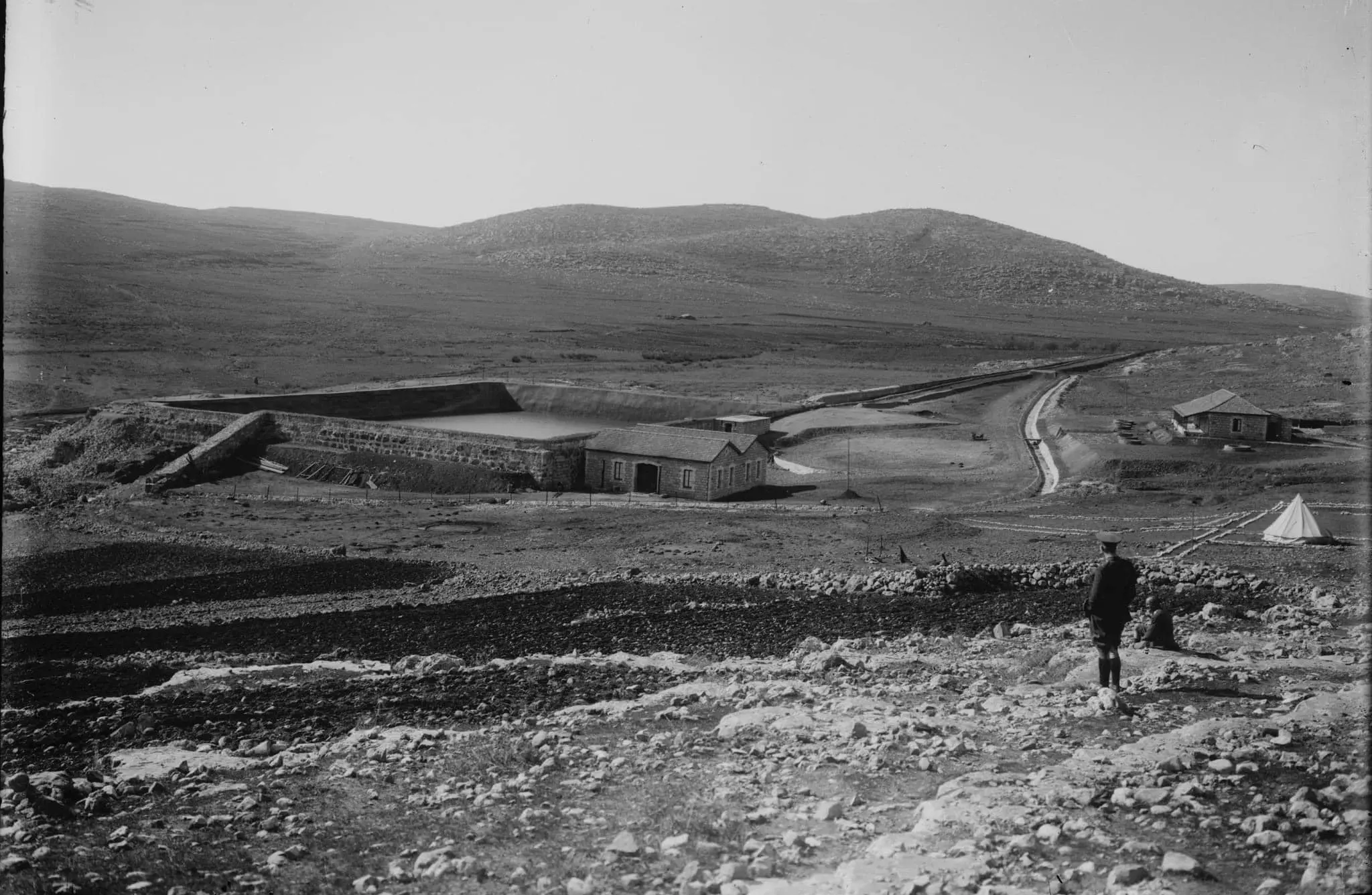
- عين العرّوب - شرق بيت أُمَّر. 1918م.
- مسجد بيت أُمَّر الكبير في قرية بيت أُمَّر قضاء الخليل، بني المسجد سنة 1995. وُجدت الصورة ضمن مجموعة مركز السنابل للدراسات والتراث الشعبي
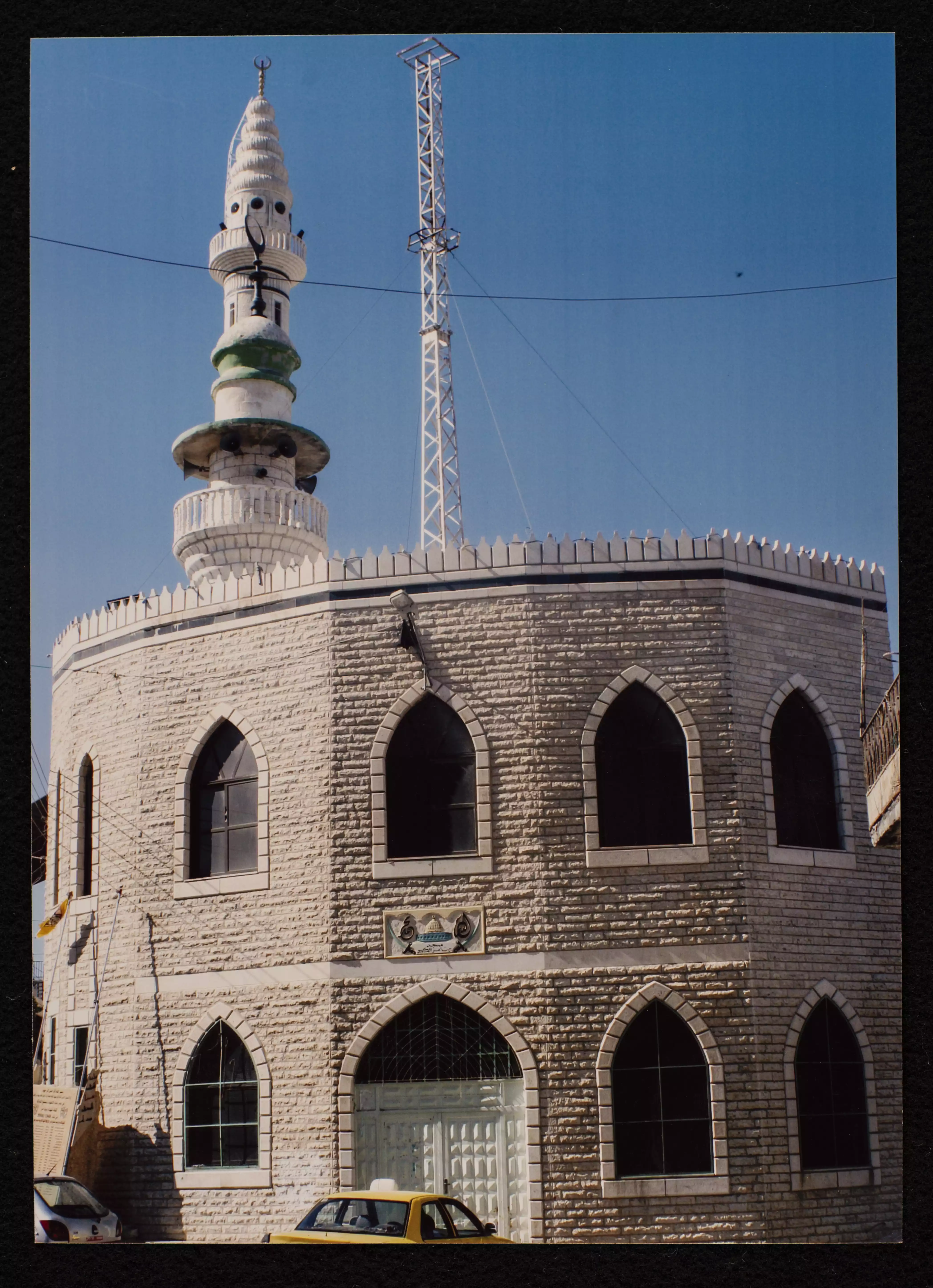
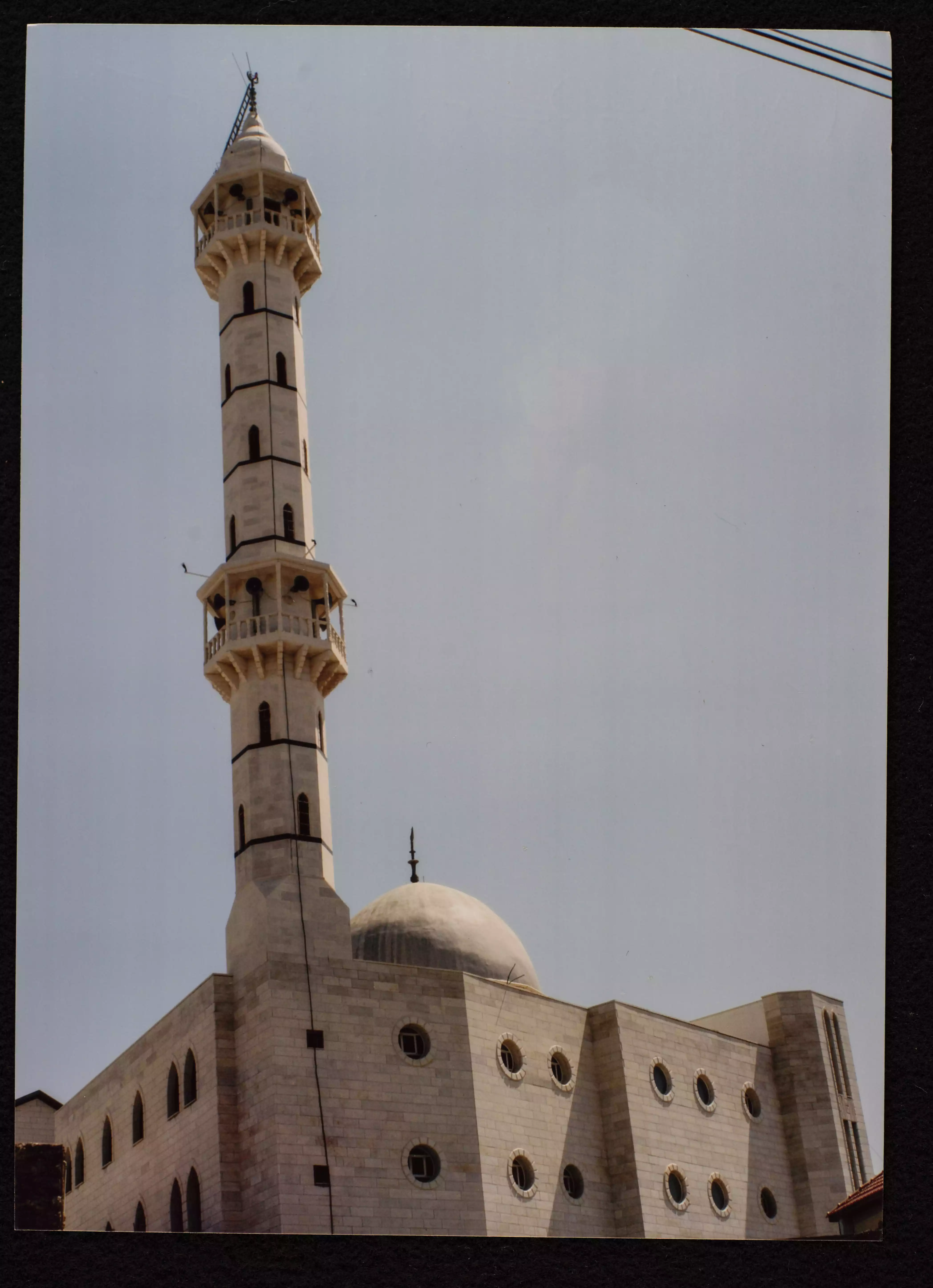
- لمسجد عمر بن الخطاب في قرية بيت أُمَّر قضاء الخليل، بُني المسجد سنة 1983 وهو تابع لوزارة الأوقاف والشؤون الدينية. وُجدت الصورة ضمن مجموعة مركز السنابل للدراسات والتراث الشعبي
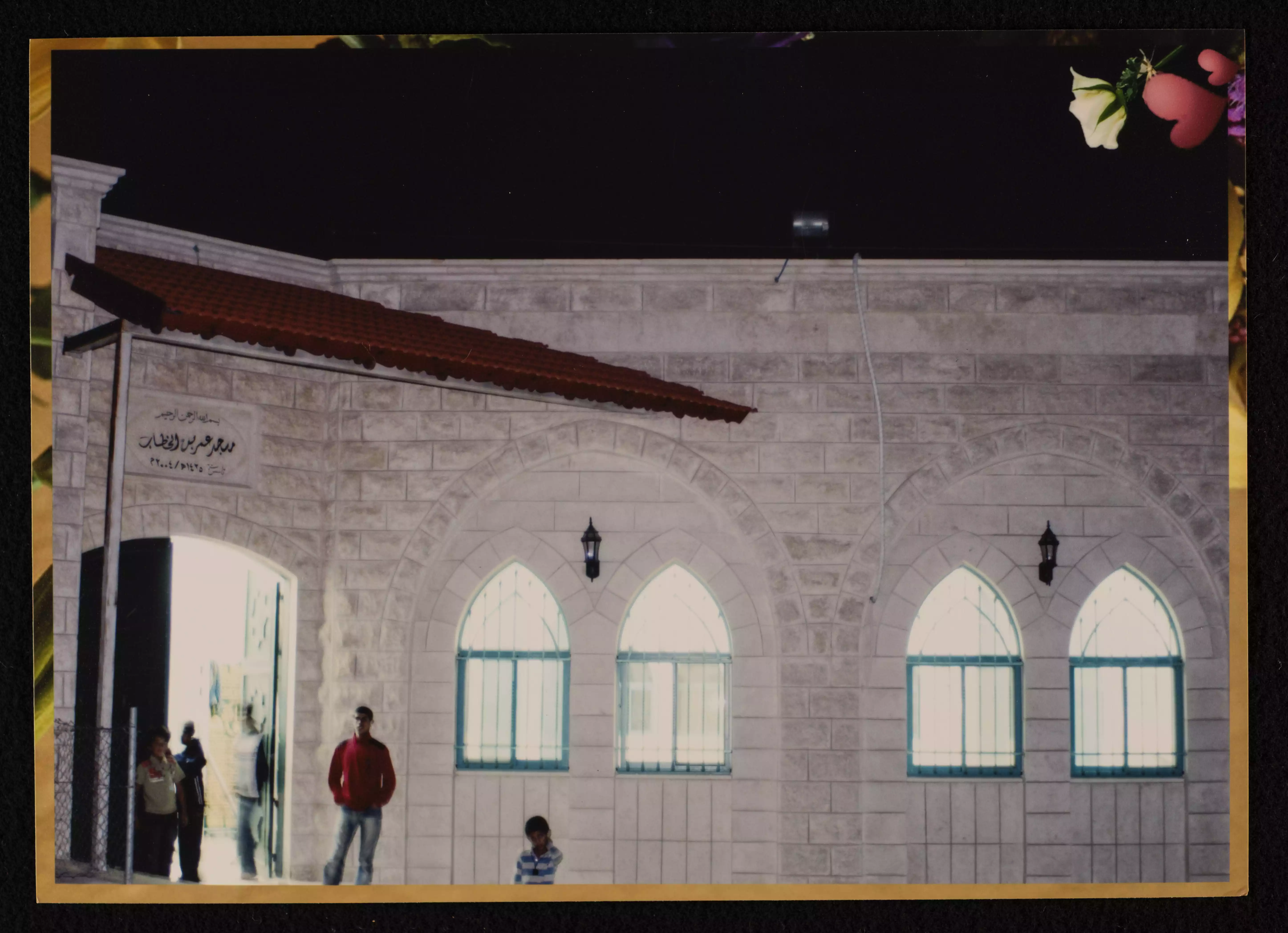
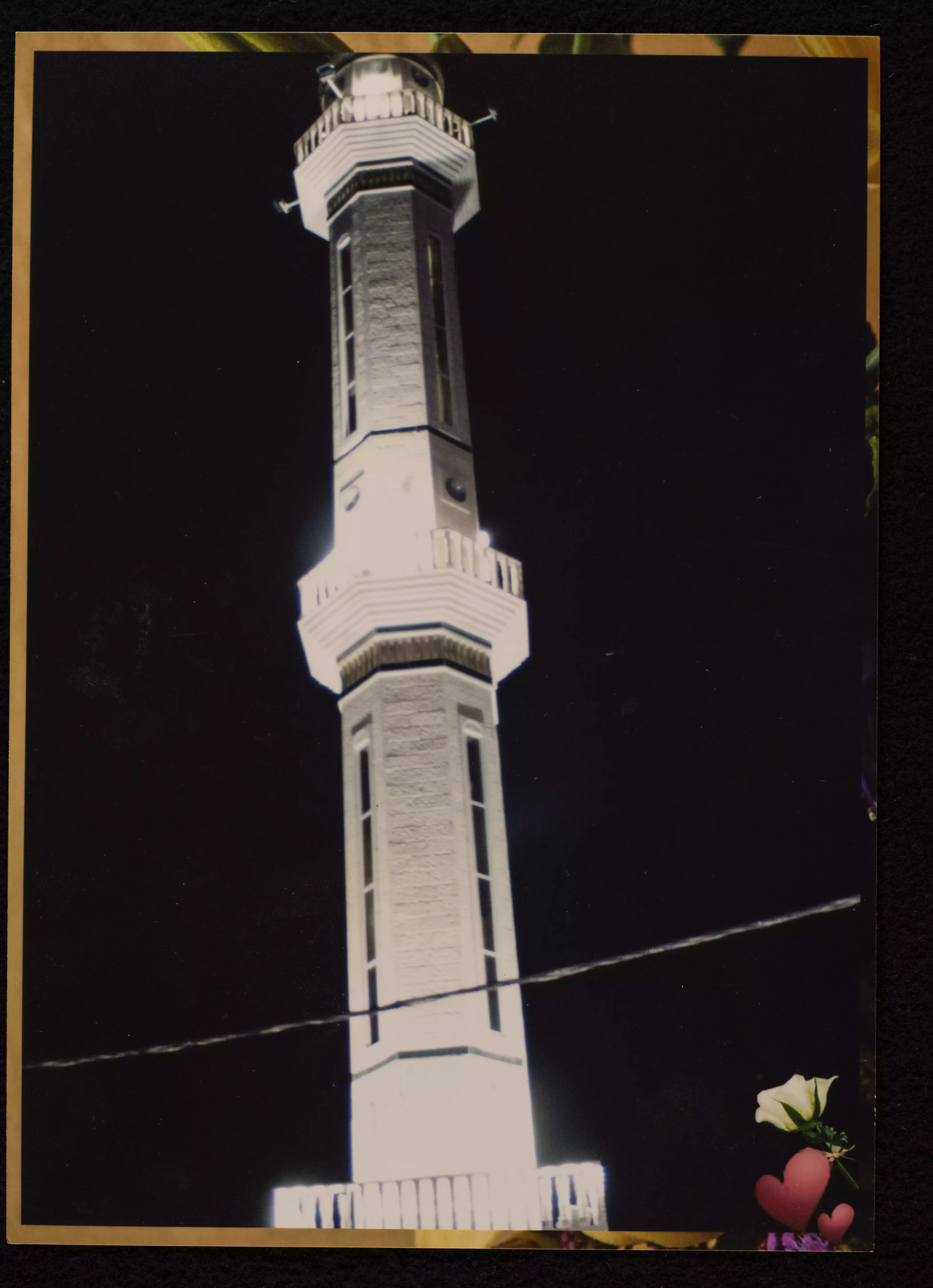
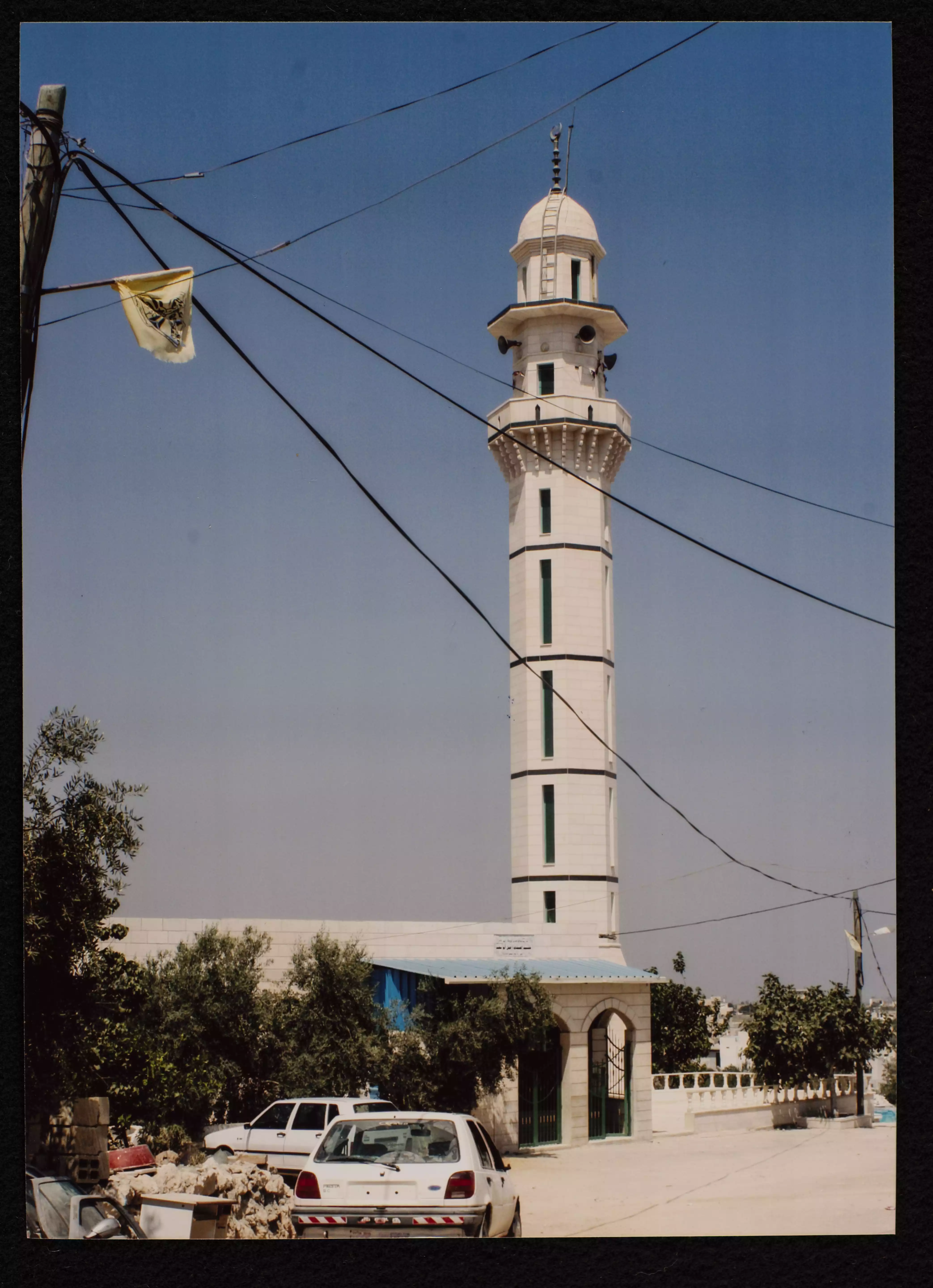
- مسجد بيت أُمَّر الكبير في قرية بيت أُمَّر قضاء الخليل، بُني المسجد سنة 1995وهو تابع لوزارة الأوقاف والشؤون الدينية. وُجدت الصورة ضمن مجموعة مركز السنابل للدراسات والتراث الشعبي
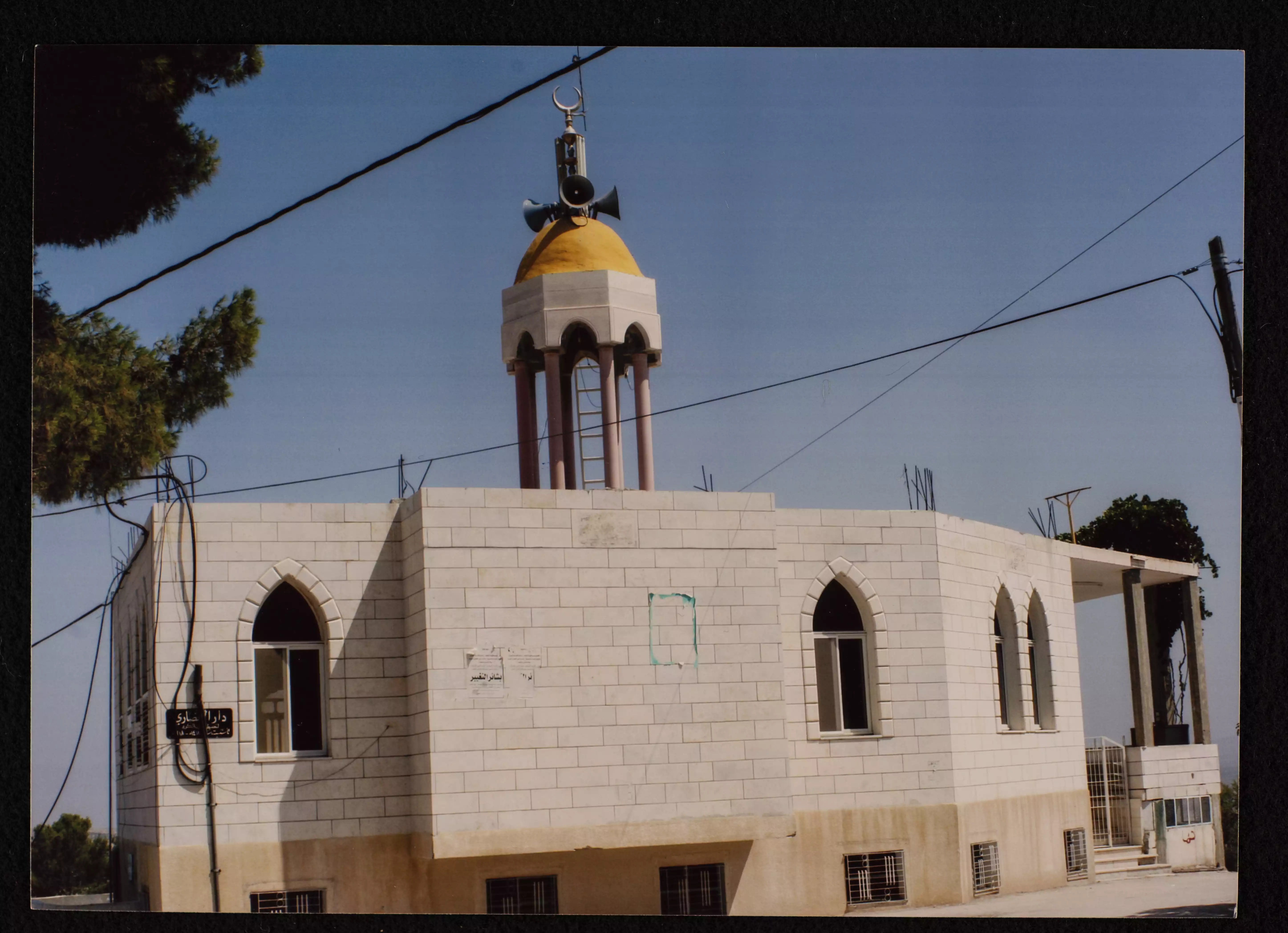
- مسجد الأنصاري في بيت أولا قضاء الخليل، بُني المسجد سنة 2005 وهو تابع لوزارة الأوقاف والشؤون الدينية. وُجدت الصورة ضمن مجموعة مركز السنابل للدراسات والتراث الشعبي.
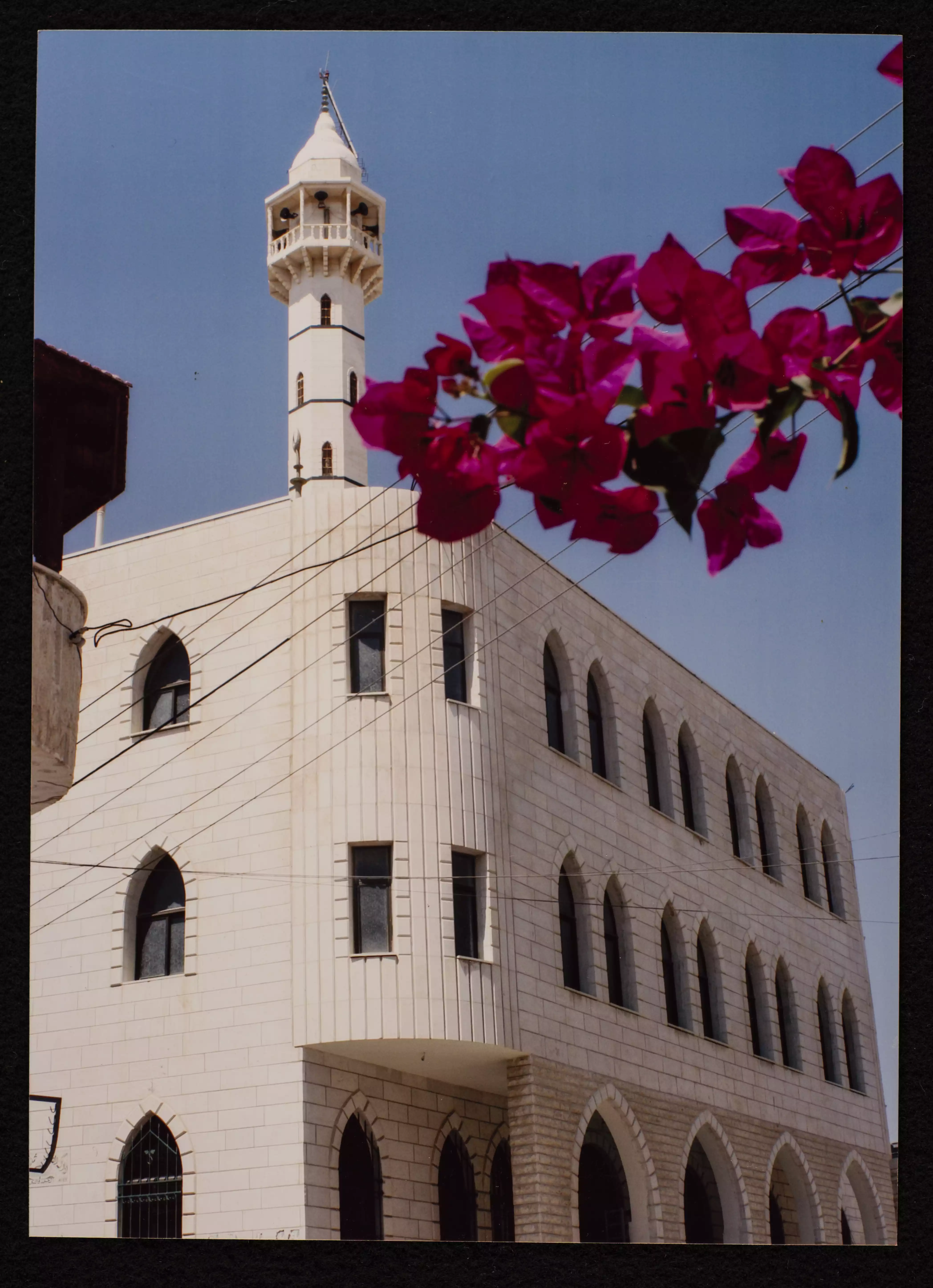
- مسجد العمري (مسجد بيت أولا الكبير) في بيت أولا قضاء الخليل، بُني المسجد سنة 1988 وهو تابع لوزارة الاوقاف والشؤون الدينية. وُجدت الصورة ضمن مجموعة مركز السنابل للدراسات والتراث الشعبي
- مسجد العمري (مسجد بيت أولا الكبير) في بيت أولا قضاء الخليل، بُني المسجد سنة 1988 وهو تابع لوزارة الاوقاف والشؤون الدينية. وُجدت الصورة ضمن مجموعة مركز السنابل للدراسات والتراث الشعبي
- مسجد العمري (مسجد بيت أولا الكبير) في بيت أولا قضاء الخليل، بُني المسجد سنة 1988 وهو تابع لوزارة الاوقاف والشؤون الدينية. وُجدت الصورة ضمن مجموعة مركز السنابل للدراسات والتراث الشعبي
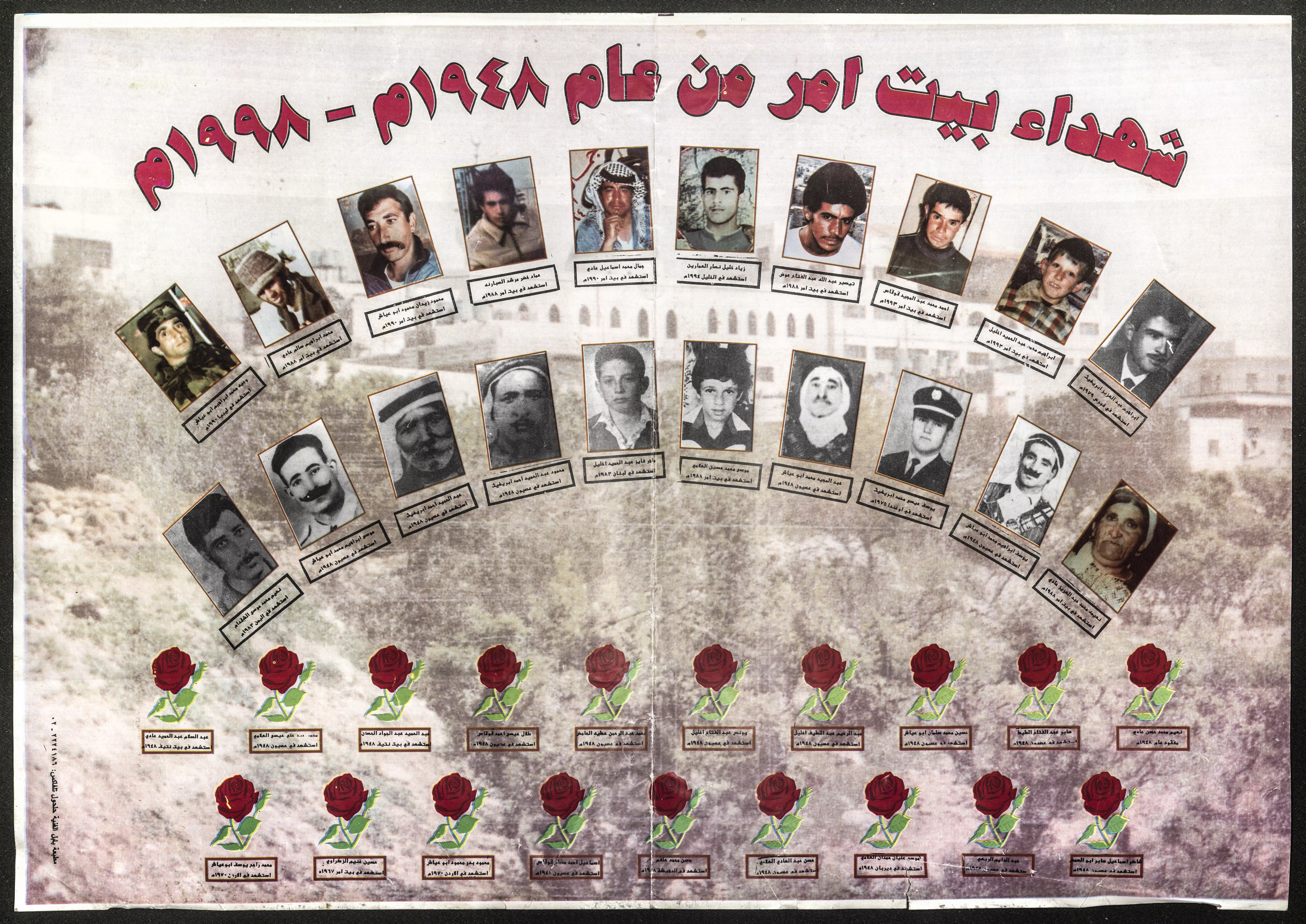
- ملصق ملون، يحتوي على صور شهداء بيت أمر من عام 1948 - 1998. وجدت في مجموعة مركز سنابل للدراسات والتراث
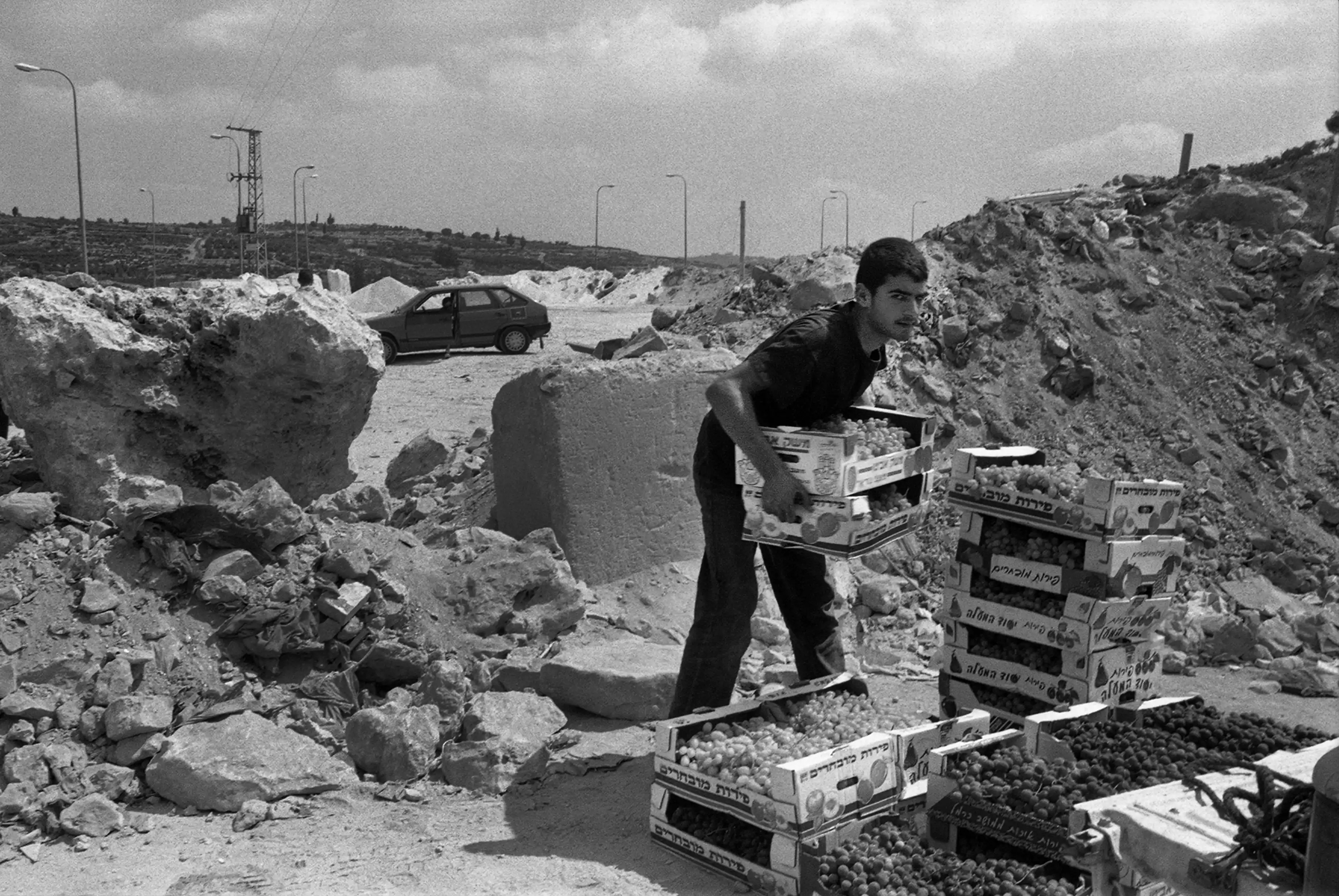
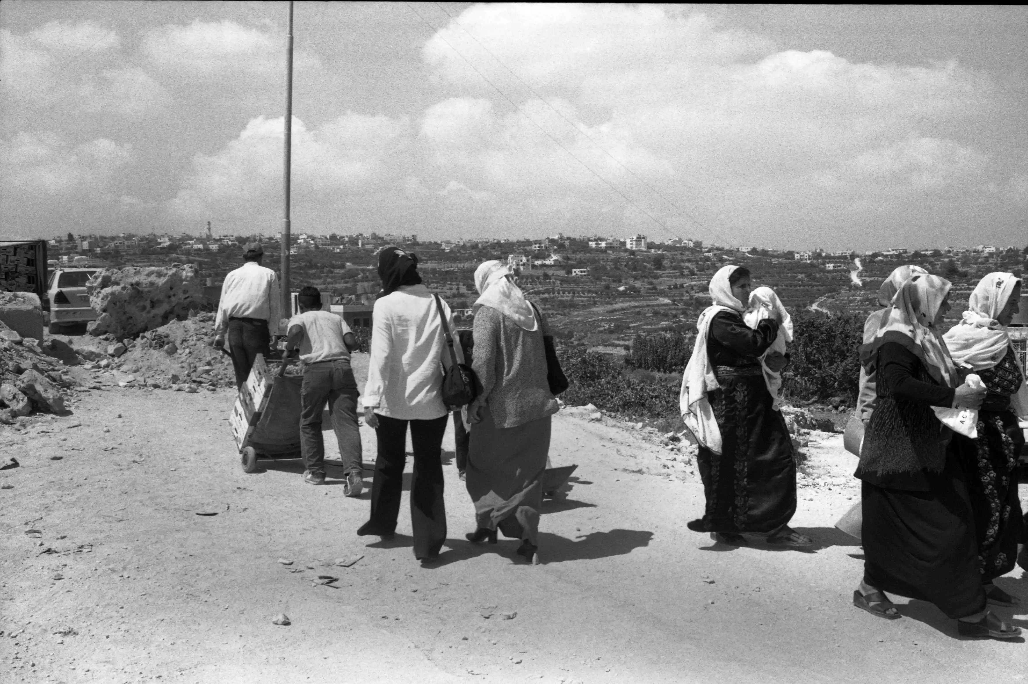
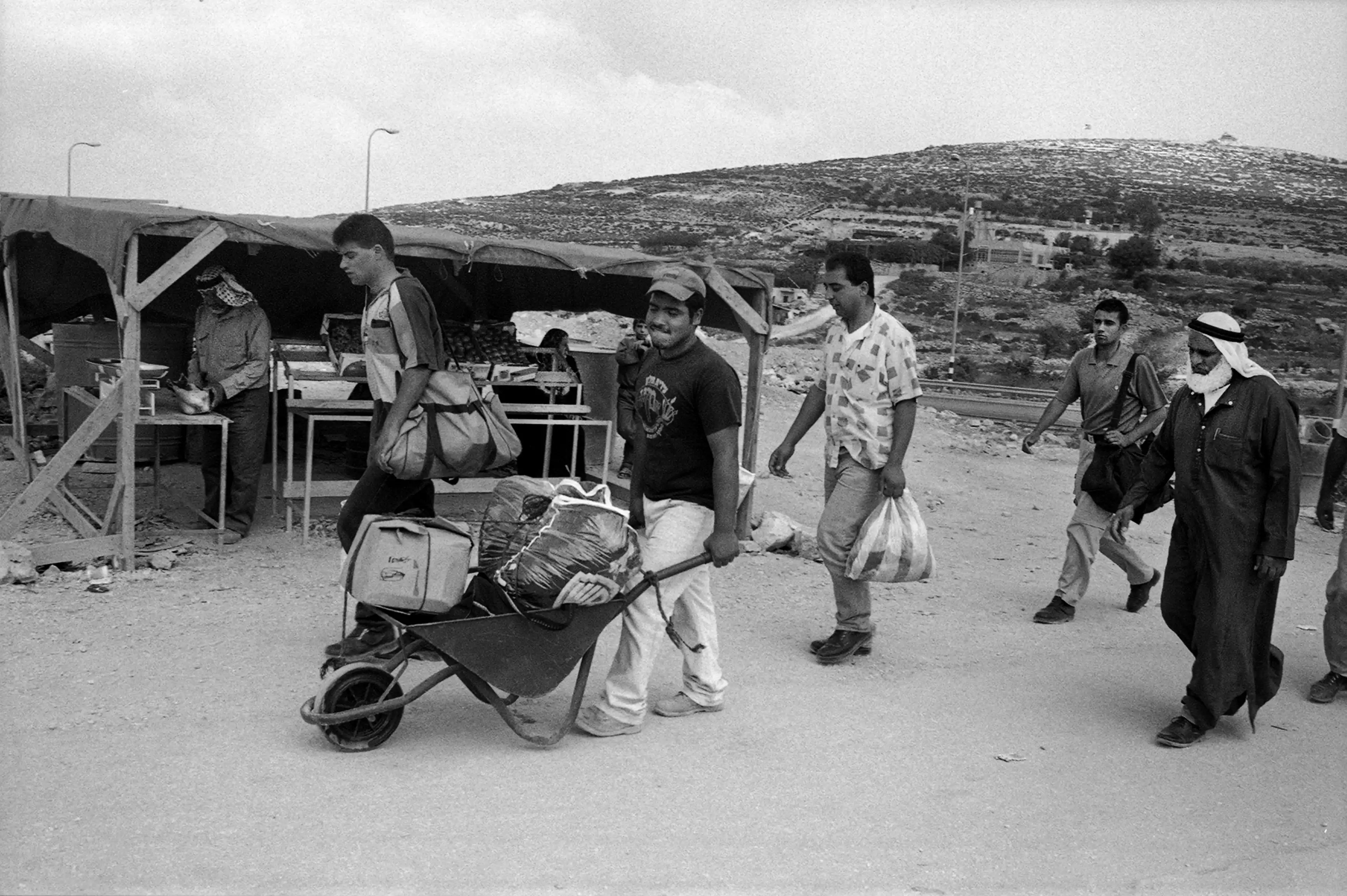
- سُدّ مدخل قرية بيت اُمّرفي الخليل في كانون الأول 2001 بالكتل الخرسانية والسدود الترابية التي أنشأها الجيش الإسرائيلي لمنع حركة البضائع والأشخاص، واضطُرسكان القرية للعودة إلى القرية سيرًا على الأقدام -- 2001
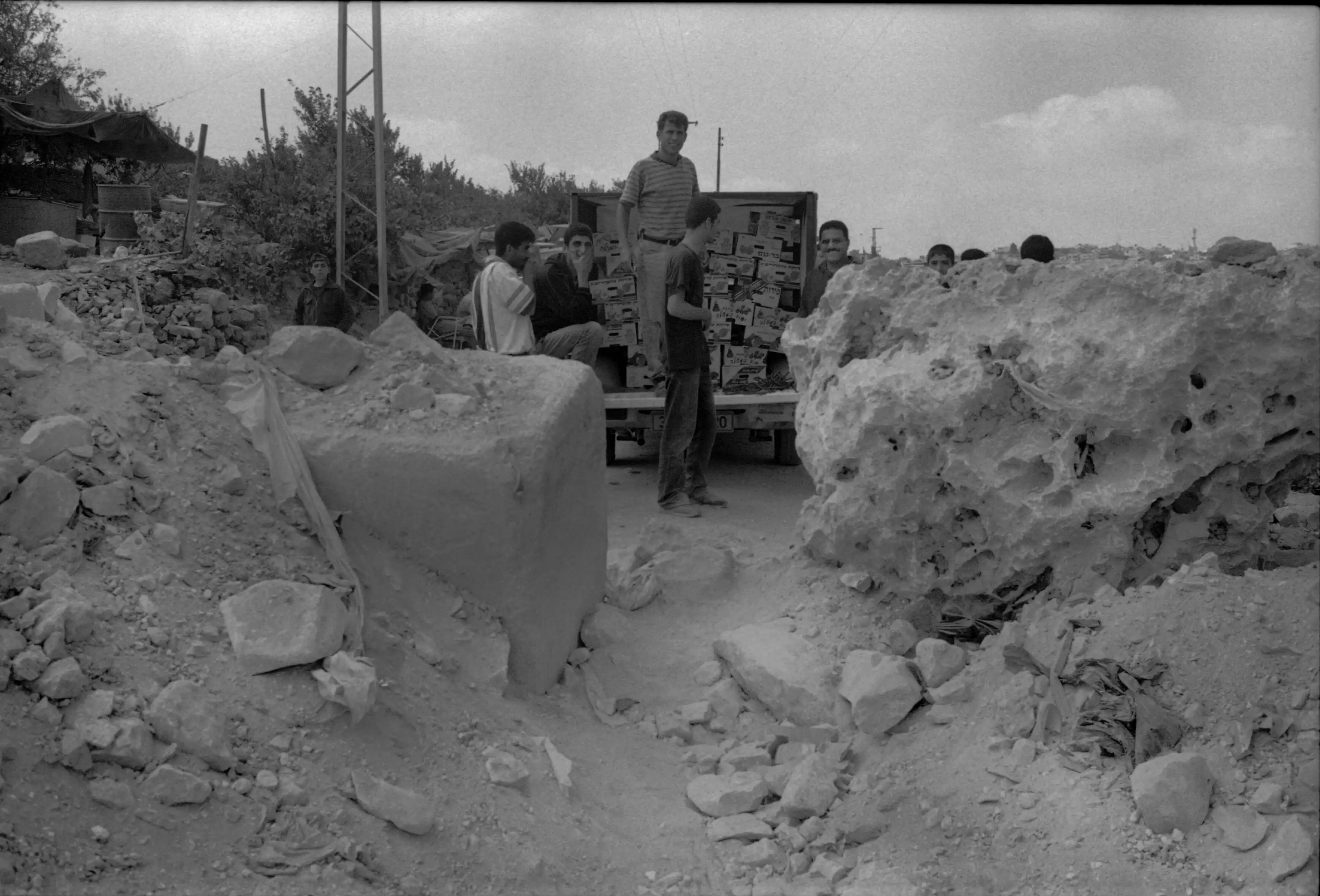
- سُدّ مدخل قرية بيت اُمّرفي الخليل في كانون الأول 2001 بالكتل الخرسانية والسدود الترابية التي أنشأها الجيش الإسرائيلي لمنع حركة البضائع والأشخاص، واضطُرسكان القرية للعودة إلى القرية سيرًا على الأقدام -- 2001 #2
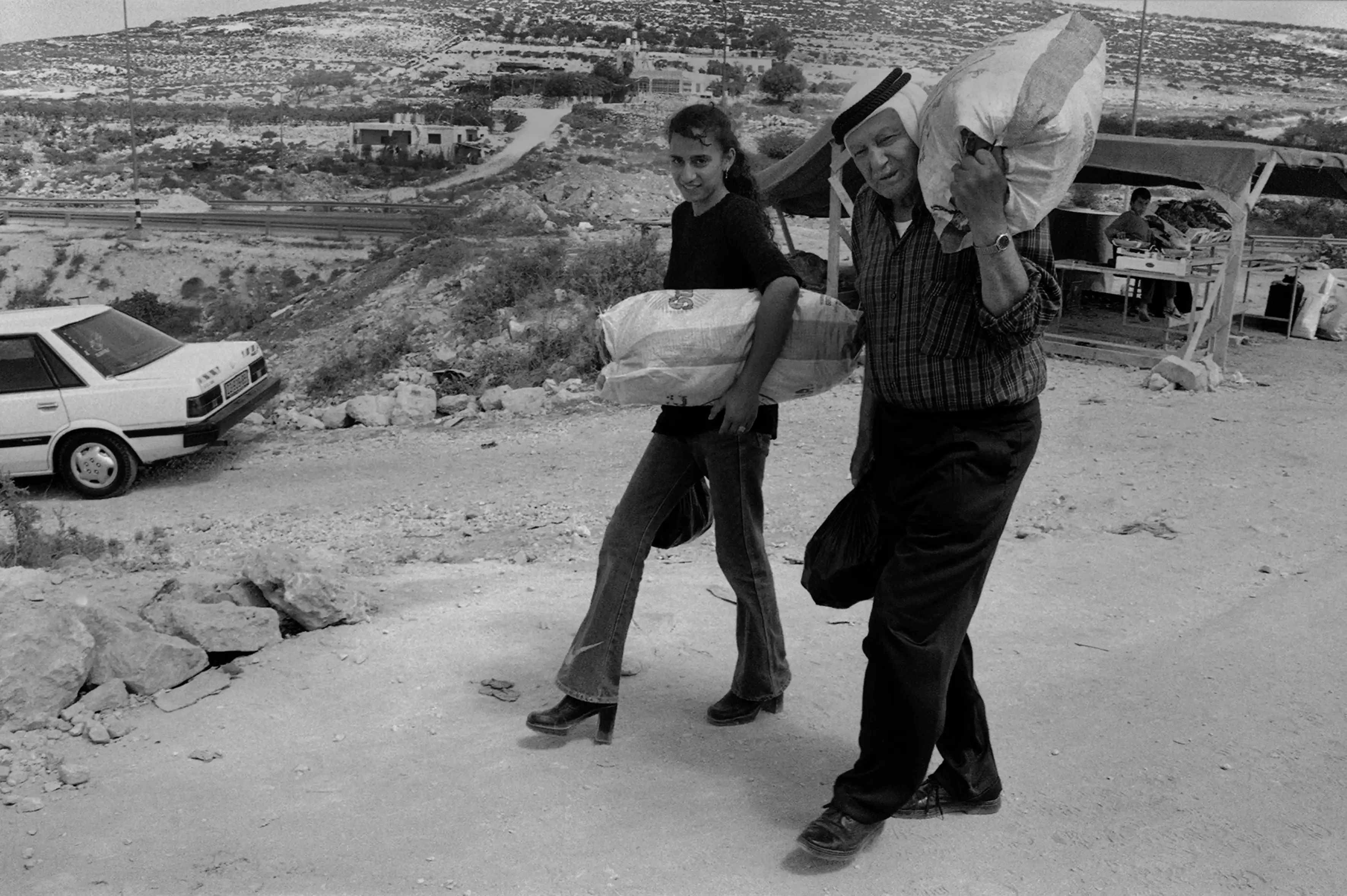
- سُدّ مدخل قرية بيت اُمّرفي الخليل في كانون الأول 2001 بالكتل الخرسانية والسدود الترابية التي أنشأها الجيش الإسرائيلي لمنع حركة البضائع والأشخاص، واضطُرسكان القرية للعودة إلى القرية سيرًا على الأقدام -- 2001 #3
- سُدّ مدخل قرية بيت اُمّرفي الخليل في كانون الأول 2001 بالكتل الخرسانية والسدود الترابية التي أنشأها الجيش الإسرائيلي لمنع حركة البضائع والأشخاص، واضطُرسكان القرية للعودة إلى القرية سيرًا على الأقدام -- 2001 #4
- سُدّ مدخل قرية بيت اُمّرفي الخليل في كانون الأول 2001 بالكتل الخرسانية والسدود الترابية التي أنشأها الجيش الإسرائيلي لمنع حركة البضائع والأشخاص، واضطُرسكان القرية للعودة إلى القرية سيرًا على الأقدام -- 2001 #5
Want to browse more? 80,000 pictures were grouped in these gallaries:
| Display Name | Clan/Hamolah | Country of Residence |
| الصبارنة | الصبارنة | كيبتاون, جنوب افريقيا |
| معمر ابو عياش | أبو عياش | الخليل, بيت أمر |
| محمد أشرف محمد علقم | علقم | فلسطين, بيت أمر |
| عادي اصل البلد | عادي | بيت امر, بيت امر |
| arar | عرار | فلسطين, فلسطين |
| محمد العلامي | العلامي | Zarqa, الاردن |
| محمد الوهادنة | الوهادين | Abu Dhabi, United Arab Emirates |
| أبو كمال | العلامي | الزرقاء, الاردن |
| وديع العلامي | العلامي | الزرقاء, الأردن |
| أبو زكي | آل وهادين | السعودية |
| Mohammad Hussein Al Alami | العلامي | الزرقاء, الأردن |
| kamel Hussein Al-Alami | العلامي | الزرقاء, الاردن |
| Mahmoud Hussein Al-Alami | - | Zarqaa, Jordan |
| أحمد حسين العلامي | - | Zarqaa, Jordan |
| Kamal Al-alami | العلامي | Zarqa, Jordan |
| KHaled Al-Alami | Al-Alami | Jordan, Jordan |
| محمد حسين عبدالفتاح العلامي | العلامي | الاردن, الاردن |
| rawan abu awwad | ابو عواد | irbid |
| إبن البلد | الوهادين | عمان, الأردن |
| YOunES RAyyAN | عبيات | palestine, bethlehem |
| ابو محمود | العمارنة | - |
| صبارنة | صبارنة | فلسطين, بيت أمر |
No links have been shared yet, be free to the first to share the first link.
 Fake Valor: Why Did Zionist Jews Hoist Nazis Flag on Their Ships in the 1930s?
What is new?
-
Facts About Oct. 7th Gaza Raid
-
Remined Us Please:: Who Did Rape Who? Palestinians Raped Israelis? Or, was the other way around?
-
When Prof. Edward Said was invited to debate Bibi Netanyahu in the 1980s, watch what happened!
-
Ezra Klein of the NY Times on the "Jewish Race".
-
Abusing Blood Libel!
-
Did Israeli Soldiers Activate The Hanniba Direective On Oct. 7th? You Be The Judge
-
Zionist FAQ: Isn't it true that Palestinians don't want peace? Palestinians never accepted the two-state solution
- Facts about Haavara (Transfer) Agreement between Ben-Gurion & Hitler
-
Haavara FAQs: Why Did Zionist Jews Hoist Nazis' Flags on Their Ships in the 1930s?
- Haavara FAQs: When Chaim Weizmann met FDR in mid-1943, why was he silent about rescuing European Jewry?
-
Dear ChatGPT: How did Palestinians resist Napoleon's invasion of their country in 1799?
-
Dear ChatGPT: Gaza had a vibrant Jewish community in the mid-17th century. What happened to them?
-
Dear ChatGPT: Why did the Jewish Agency suppress news of the Holocaust during WWII?
-
Video Playlist: Jews share their DNA tests to end the conflict for good.
-
A Tale of Two Conflicts: Examining the Definition of Genocide
-
Prof. Abraham Polak And The Suppressed History of the Khazars and European Jewry
-
How Ronald Reagan would have framed the genocide in Gaza if he were still alive?
-
Haavara FAQs: Let us do the math: how many German Jews did The Haavara Agreement save?
-
Zionist FAQs: The Hebron Massacre of 1929, "clearly proves" that Palestinians are antisemitic, how could you deny it?
-
Zionist FAQs: Why Anti-Zionist Is Not Antisemitism?
-
Zionist FAQs: Isn't it true that the KGB created Palestinian Nationalism in the early 1960s?
- Zionist FAQs: Muslims are killing Muslims all the time; why are Israeli Jews being singled out in the media?
- Zionist FAQs: How is Israel an apartheid state when 20% of its citizens are Arabs who enjoy full rights?
-
Haavara FAQs: Why Did Dorothy Thompson Flip From A Zionist Advocate to A Silenced Dissenter?
-
Haavara FAQs: Analysis of Herzl's Uganda Scheme and how it could have saved millions of Jews.
-
Haavara FAQs: Why did Hayim Greenberg describe American Jewry as "morally bankrupt" in early 1943?
-
Haavara FAQs: What if the Evian Conference was a resounding success? What would have been the impact of saving European Jewry on Zionism?
- Haavara FAQs: What if the six million were saved, how that would have impacted the Zionist project?
-
Haavara FAQs: How did Zionist leaders react when Europe's Jews lingered in the DP camps after WWII ended?
-
Why does the American Jewish community repeat lies that David Ben-Gurion had debunked before he died?
-
Who has the power to rename the Tatar/Khazar Gene Marker to Jewish IV?
-
Zionist FAQs: Why won't Egypt, Syria, and Jordan take their people back? Jews are indigenous to Palestine, and Arabs immigrated after Jews developed the country. Arabs should leave.
-
Haavara FAQs: Did Hitler and the Nazis conflate between Judaism and Zionist? If that wasn't case, then why?
-
Haavara FAQs: Winston Churchill and antisemitism, a collection of articles written Churchill.
-
Haavara FAQs: Broken by country, how many Jews survived vs. killed during the Holocaust?
-
Haavara FAQs: Why did European Jews vote with their feet and to immigrated to the Americas, not Palestine, after WWII?
-
Watch this American Jewish Girl describing Israeli Jews' cognitive dissonance like no other in under two minutes
-
Haavara FAQs: When the Nazis went out of their way to hide the Holocaust, Israeli Jews did the exact opposite by broadcasting their genocide of Gazans. But why?
-
Haavara FAQs: How Zionist Jews went out of their to show their appreciation to Nazism and Fascism?
- Haavara FAQs: Why Zionist leaders were against bombing the death camps & the Railroads leading to them?
-
Haavara FAQs: Hitler's message to the British and American people: If Jews are such noble citizens and you care about them, how come you're not letting them in? I will gladly ship them to you at my expense, even on luxury liners!
-
A shortlist of Zionist and Israeli false flag operations in the name Jews.
-
The Most Moral Army
- The Land of Kapos (Israel): Where the brave are boycotted and Kapos walk free.
- Why did early Zionists often named their communal enterprises "colonial"?
- Zionist Relations with Nazi Germany by Faris Glubb
-
Two NY Times advertisements by Zionists in the early 1943 that exposes Zionists' treason at the height of the calamity
- Facts Not Lies about the Palestinian-Israeli Conflict.
- Site's pictures have been categorized
- Campgain Against Lice
- A Survey of Palestine, the official source about Palestine before Nakba produced by the British Mandate; over 1200 pages.
- Satellite View & Google Earth: Over 6,000 placemarks identifying all destroyed towns, W. Bank & Gaza Strip Towns, & refugee camps.
- PalestineRemembered.com and its Nakba Oral History Project were featured on al-Jazeera Satellite TV.
- Nakba Oral History Video Podcast:
 Over 700 Oral History interviews (including 3,500+ hours of recording) can be viewed online.
 - Palestine Village Statistics Project
- Gaza Jail Break
- النسخة العربية للموقع الان متوفرة
- Videos: Documenting the destroyed villages in video: Tracing all that remains since Nakba.
- Videos: Responding to Zionist Propaganda
- Interview: The ethnic cleansing of Palestine: George Galloway interviews Israeli Historian Ilan Pappe.
- For Palestinians, memory matters. It provides a blueprint for their future By George Bisharat.
- Zionist FAQ now available in Hebrew שאלות שציונים שואלים, עכשיו בעברית
- Video: The Stephen Walt and John Mearsheimer report on the influence of the Israel Lobby on U.S. Foreign Policy
- The Palestinian-Israeli conflict for beginners
