| PalestineRemembered | About Us | Oral History | العربية | |
| Pictures | Zionist FAQs | Haavara | Maps | |
| Search |
| Camps |
| Districts |
| Acre |
| Baysan |
| Beersheba |
| Bethlehem |
| Gaza |
| Haifa |
| Hebron |
| Jaffa |
| Jericho |
| Jerusalem |
| Jinin |
| Nablus |
| Nazareth |
| Ramallah |
| al-Ramla |
| Safad |
| Tiberias |
| Tulkarm |
| Donate |
| Contact |
| Profile |
| Videos |
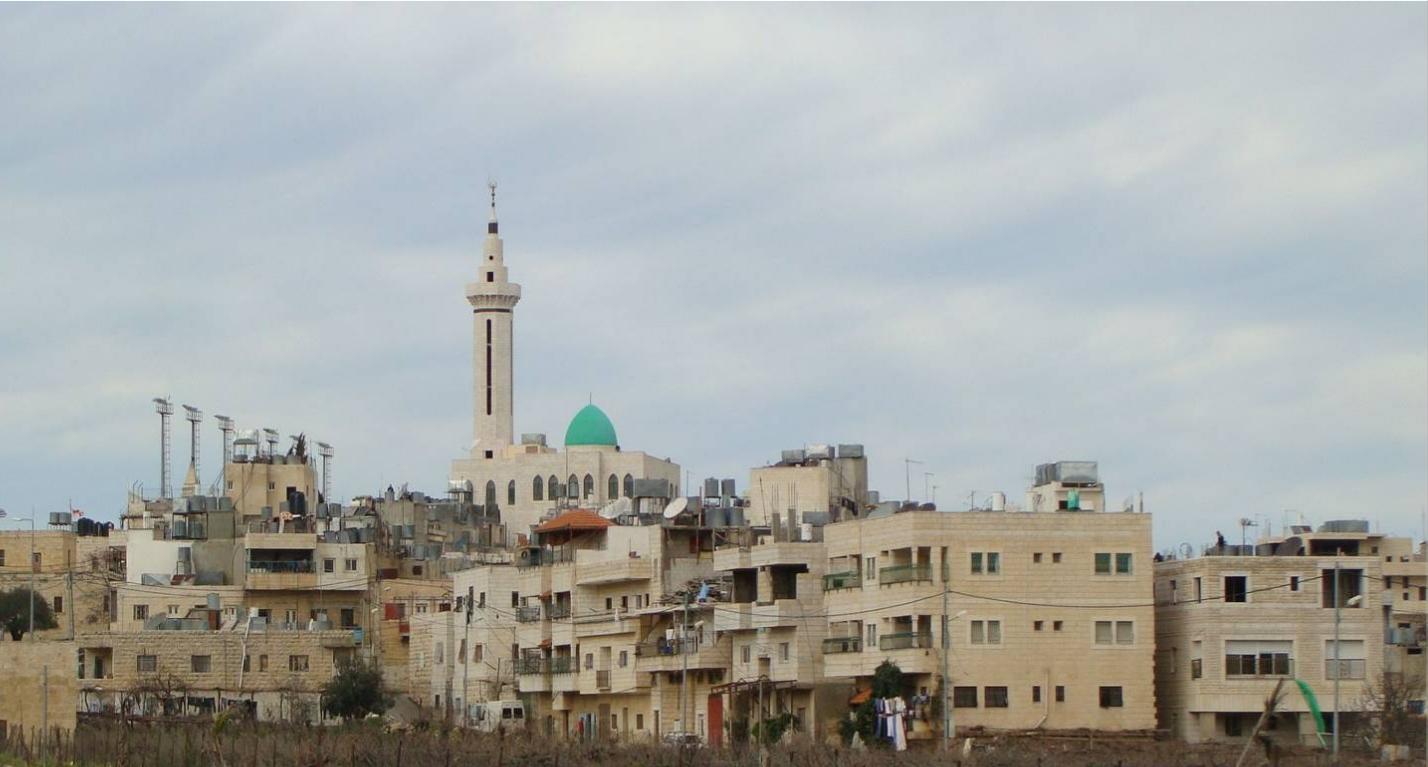
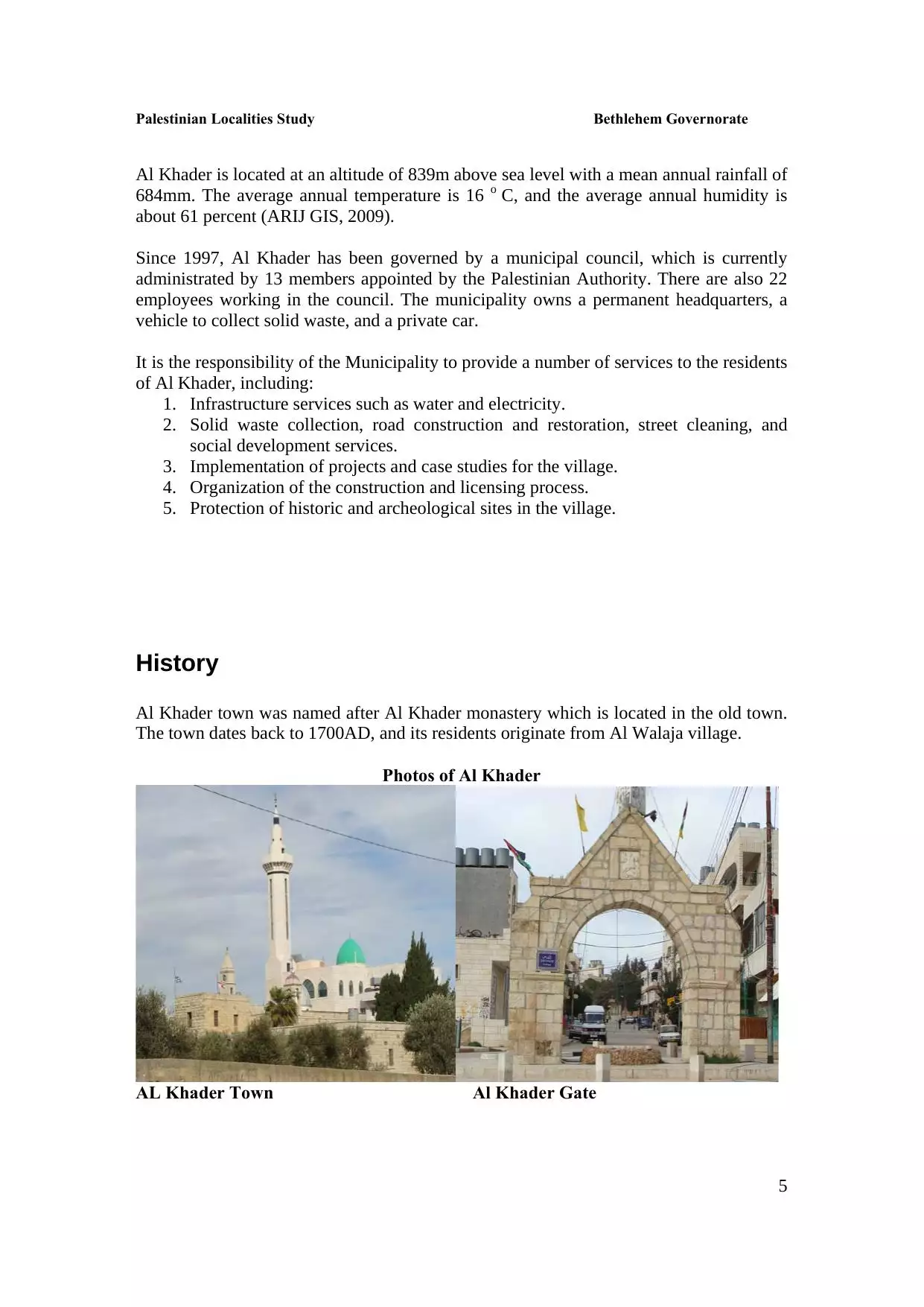
Welcome To al-Khadr - الخضر (??-?'??)
|
District of Bethlehem
Occupied days ago |
العربية Google Earth |
 |
Gallery (38) |
- Statistics & Facts
-
Before & After

- Satellite View
- Articles 1
- Pictures 38
- Members 9
- Families
- Wikipedia
- ARIJ Guide
- Videos 1
- Guest Book 2
- Links
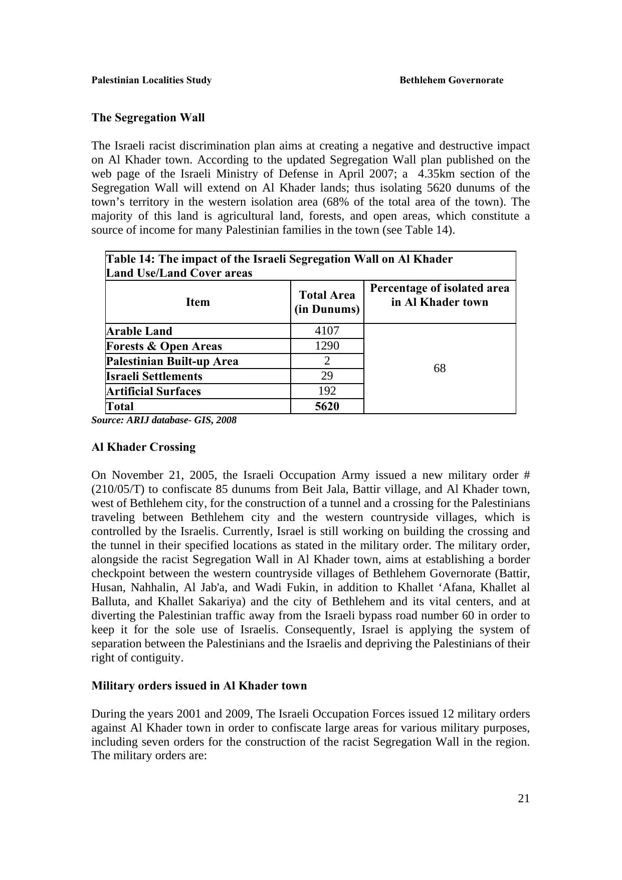
| Statistic & Fact | Value | |||||||||||||||||||||
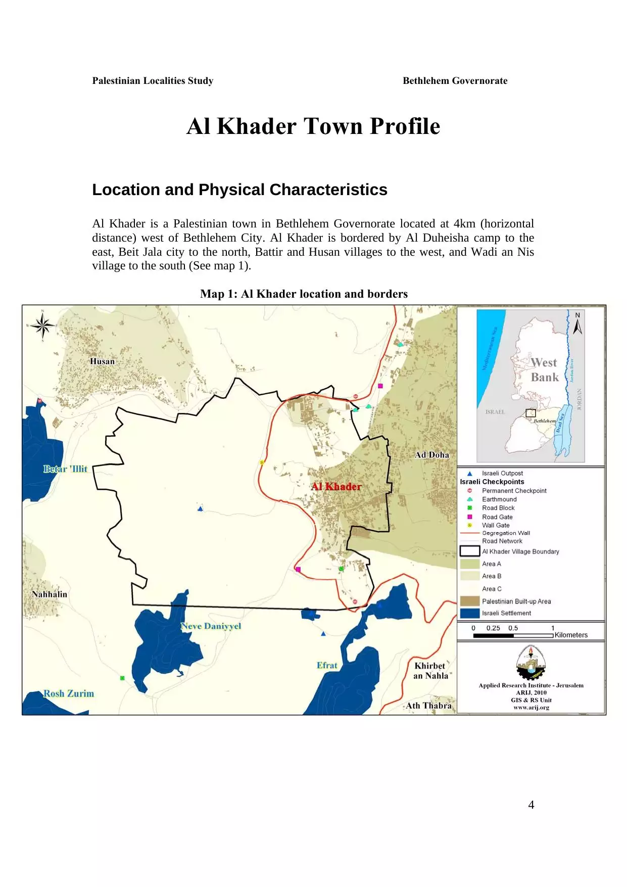
| Distance From District | 5 km west of Bethlehem | |||||||||||||||||||||
| Elevation | 880 meters | |||||||||||||||||||||
| Before & After Nakba, Click Map For Details |
||||||||||||||||||||||
|
||||||||||||||||||||||
| Land Ownership |
**Town Lands' Demarcation Maps |
|||||||||||||||||||||
| Land Usage As of 1945 |
|
|||||||||||||||||||||
| Population |
|
|||||||||||||||||||||
| Near By Towns |
||||||||||||||||||||||
|
||||||||||||||||||||||
| Featured Video | ||||||||||||||||||||||
| ARIJ Guide | ||||||||||||||||||||||
3.
4. 
5. 
6. 
7. 
8. 
9. 
10. 
11. 
12. 
13. 
14. 
15. 
16. 
17. 
18. 
19. 
20. 
21. 
22. 
23. 
24. 
25. 
26. 
Click here to browse online. |
||||||||||||||||||||||
| Related Maps | Town Lands' Demarcation Maps خرائط للقضاء توضح حدود القرى والاودية View from satellite Town's map on MapQuest Help us map this town at WikiMapia |
|||||||||||||||||||||
| Related Links | Wikipedia's Page Facebook Page ARIJ Guide Google Search Google For Images Google For Videos في كتاب بلادنا فلسطين في كتاب النكبة والفردوس المفقود دليل أريج المزيد من موقع هوية |
|||||||||||||||||||||
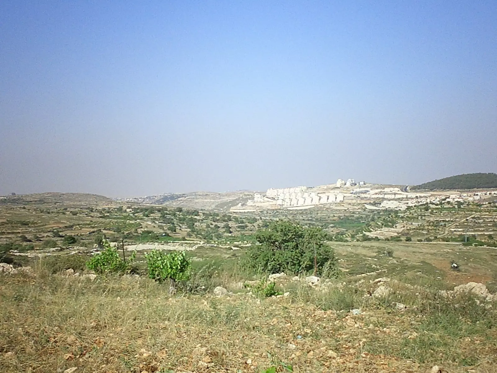
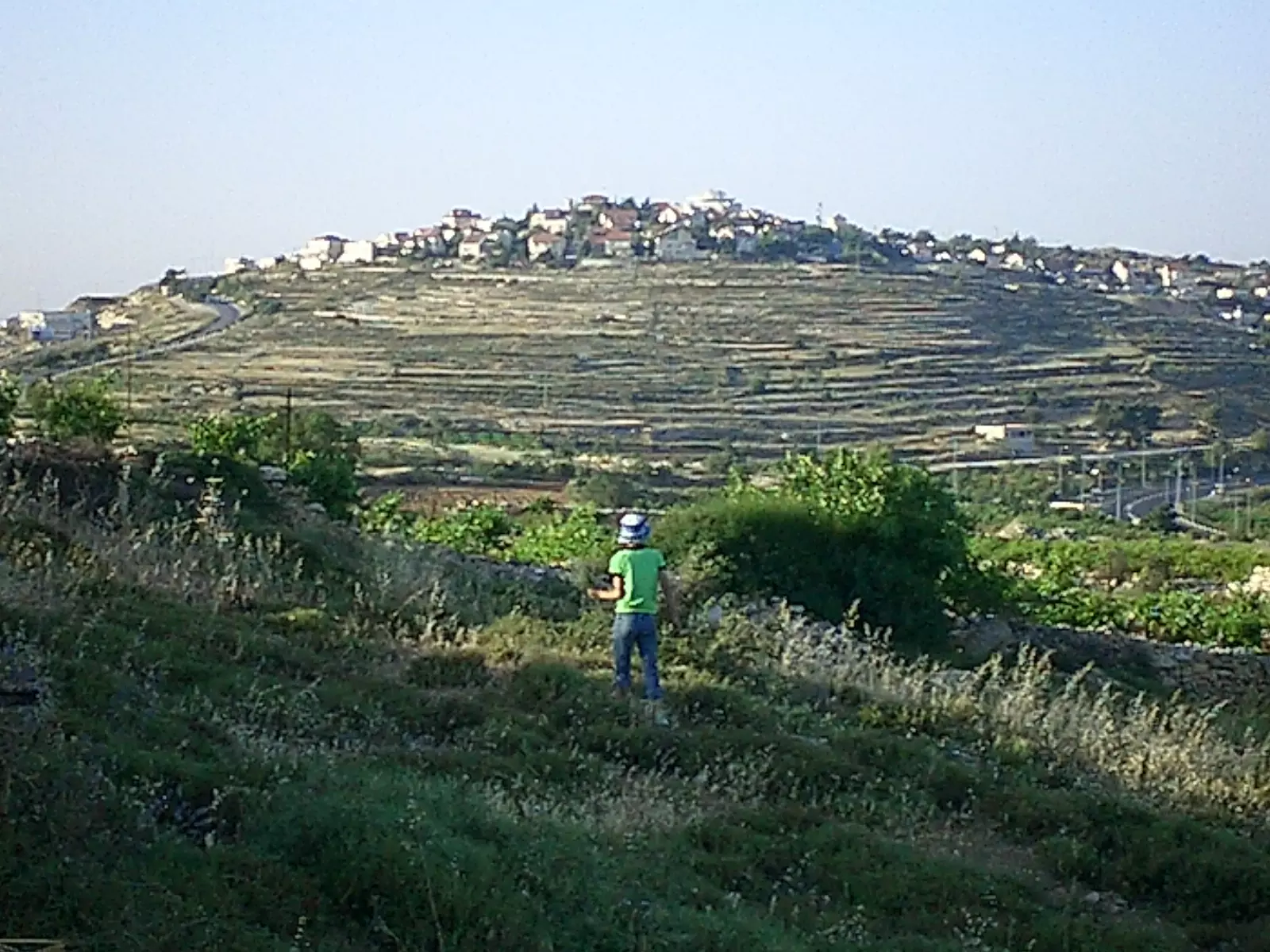
- Nearby Israeli Colony (#1)
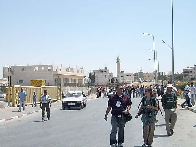
Posted by akram 3 - A demonstration
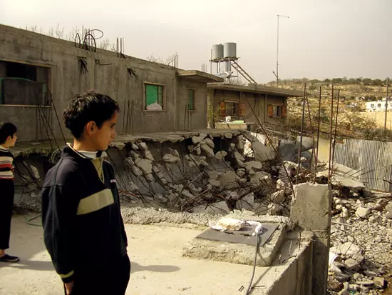
Posted by akram 1 - Israeli house demolition
Posted by akram - Israeli (Exclusive Jewish Colony) Neve Daniyyal in al-Khader
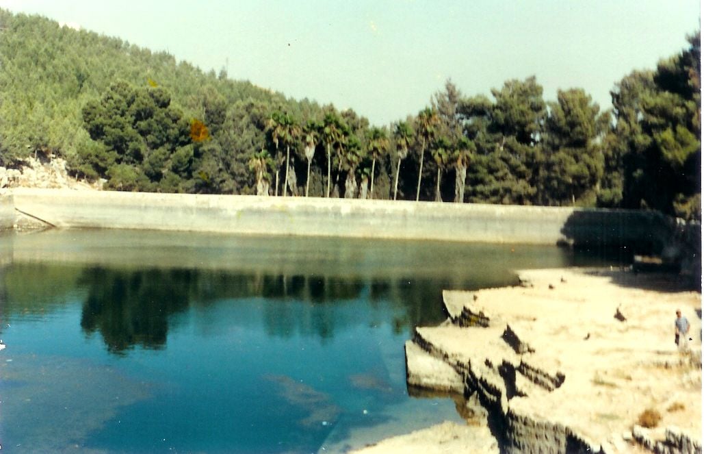
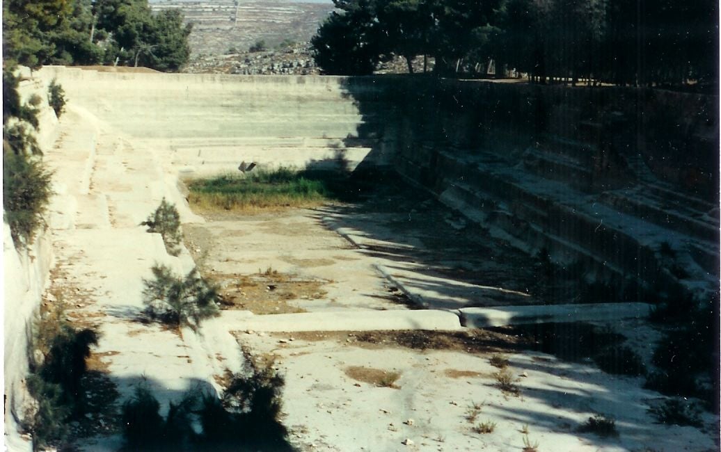
Posted by akram 3 - King Suleiman's Pool
Posted by Umar Abu El-Bararri 4 - King Suleiman's Pool #2
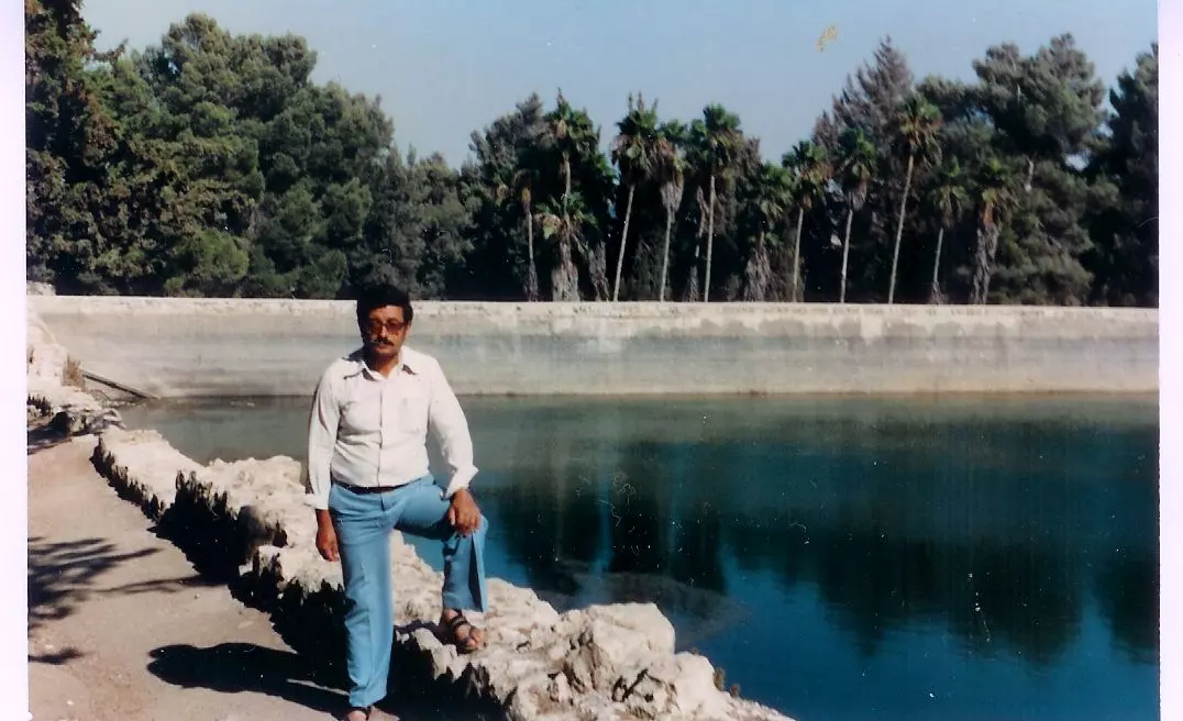
Posted by Umar Abu El-Bararri 2 - One Of King Suleiman's Pools #3
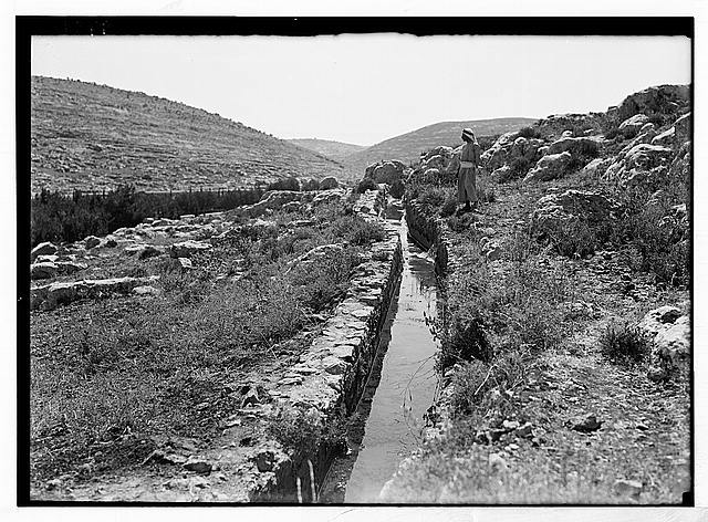
Posted by Umar Abu El-Bararri 2 - Solomon's Pool from the 'Matson Collection' 1900-1926
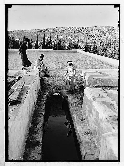
Posted by Umar Abu El-Bararri 2 - Solomon's Pool from the 'Matson Collection' 1900-1926
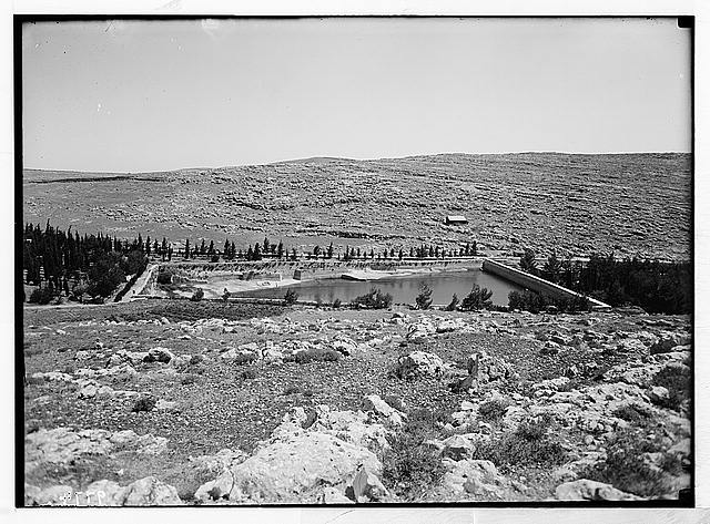
Posted by Umar Abu El-Bararri 2 - Solomon's Pool from the 'Matson Collection' 1900-1926
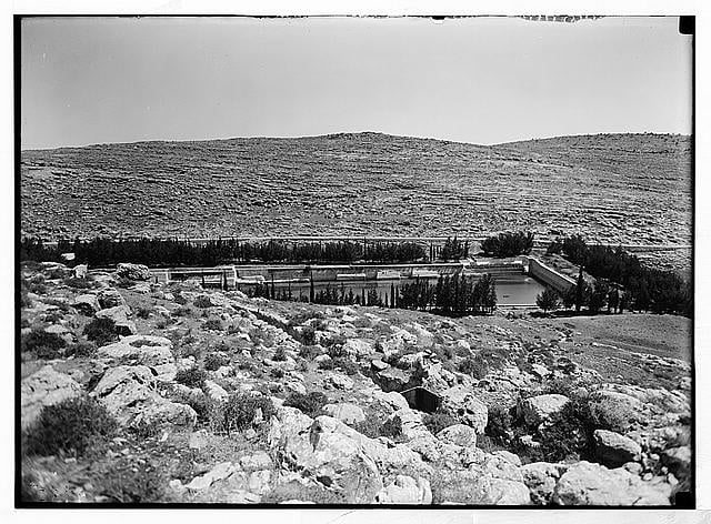
Posted by Umar Abu El-Bararri 1 - Solomon's Pool from the 'Matson Collection' 1900-1926
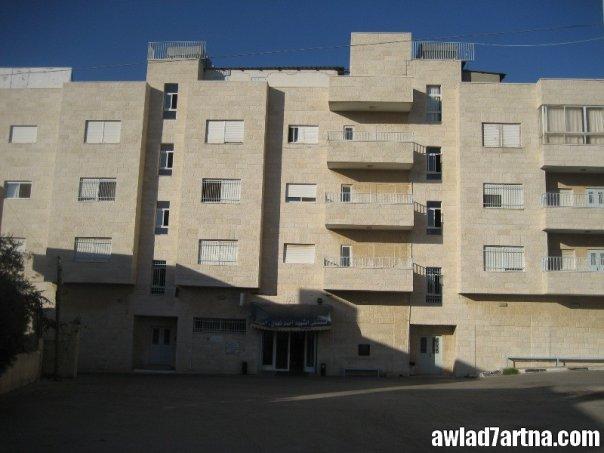
Posted by Umar Abu El-Bararri 3 - مستشفى اليمامة
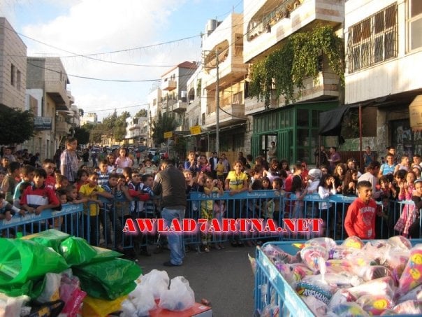
Posted by akram 1 - وسط البلد منظر عام
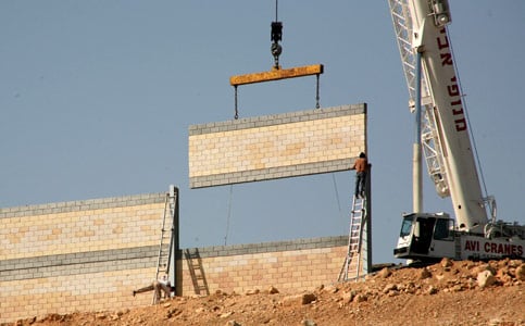
Posted by akram - جدار الفصل العنصري
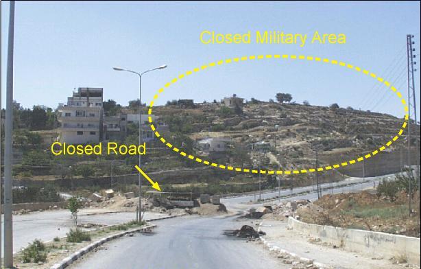
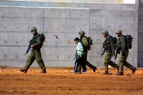
Posted by akram - منطقة الحاجز العسكري
Posted by akram - استاد الخضر الدولي اثناء البناء
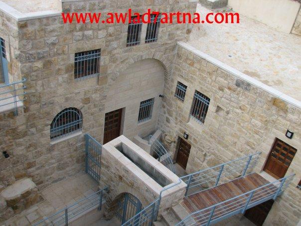
Posted by akram 1 - حوش البوبرية
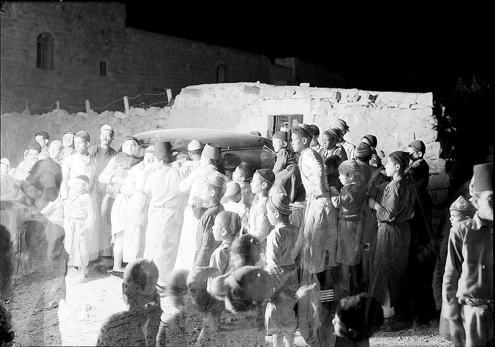
Posted by akram 2 - #1 - Villagers of El-Khadder, listening to a radio of a passing car, October 1937
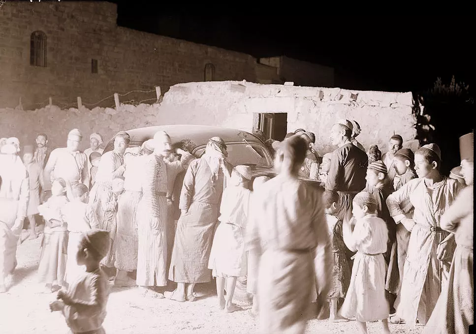
Posted by Umar Abu El-Bararri 1 - #2 - Villagers of El - Khadder, listening to a radio of passing car, October 1937.
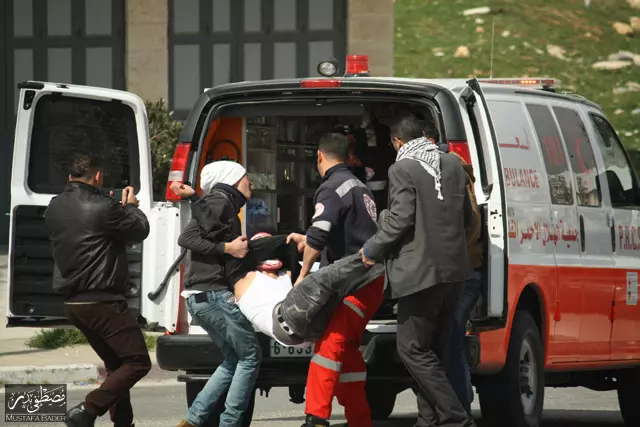
Posted by Umar Abu El-Bararri - من المواجهات في بلدة الخضر 1 مارس 2013 - عدسة: مصطفى بدر
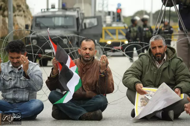
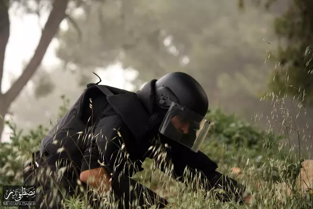
Posted by Mustafa Bader - من المواجهات في بلدة الخضر 1 مارس 2013 - عدسة: مصطفى بدر
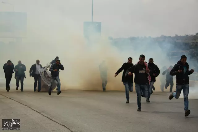
Posted by Mustafa Bader - من المواجهات في بلدة الخضر 1 مارس 2013 - عدسة: مصطفى بدر
Posted by Mustafa Bader - ملازم من هندسة المتفجرات الفلسطينية يقوم بتفحص جسم مشبوه في أطراف الخضر - عدسة: مصطفى بدر
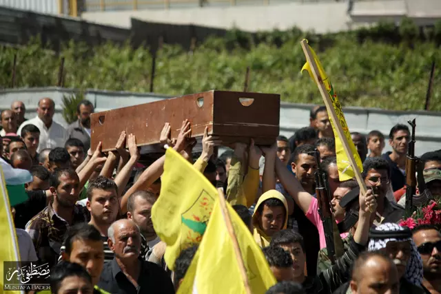
Posted by Mustafa Bader - جنازة الشهيد صالح الجهالين في بلدة الخضر بتاريخ 26 أبريل 2013 - عدسة: مصطفى بدر
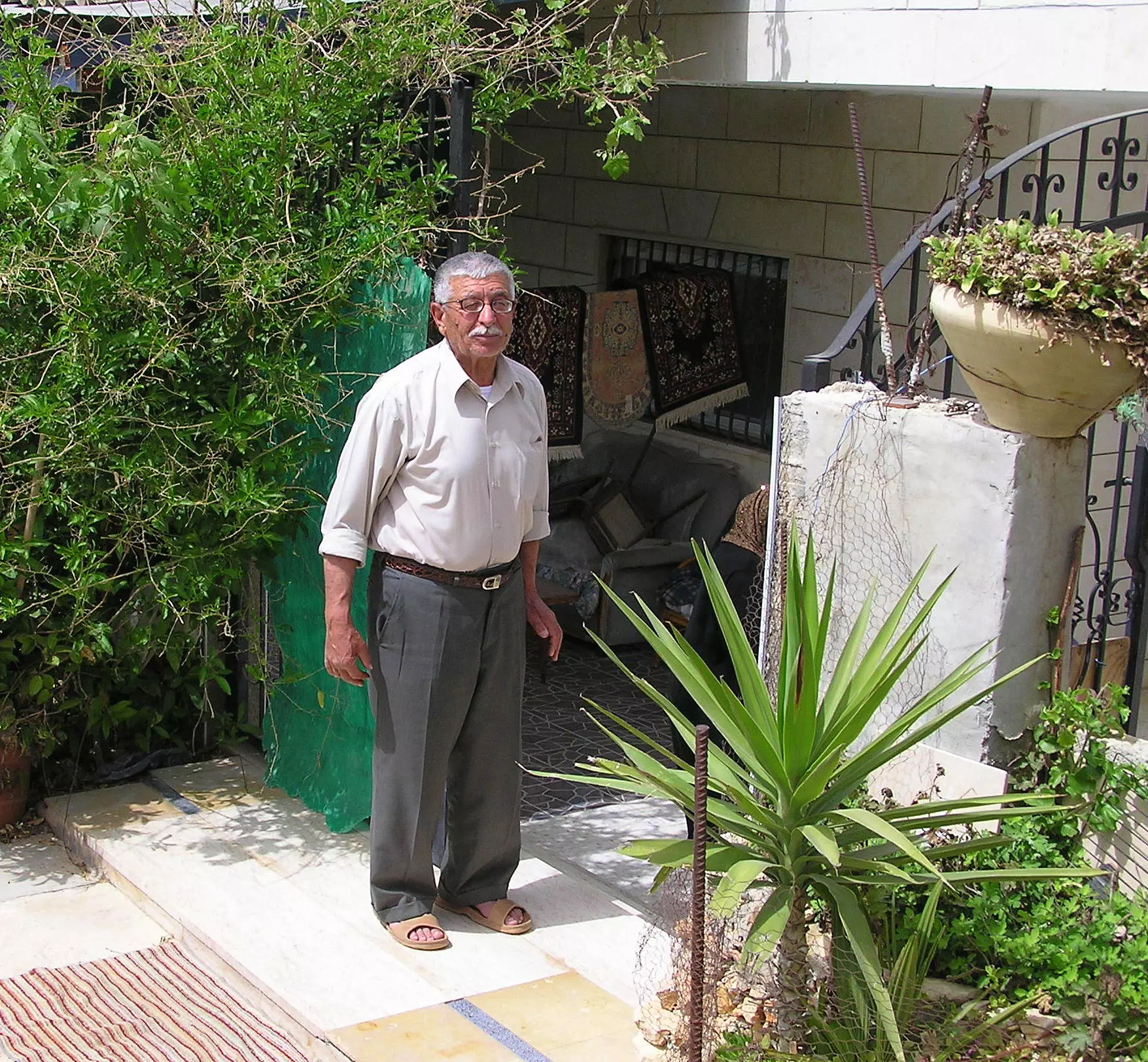
Posted by Mustafa Bader - أبو محمود ... رحمه الله وجعله من أهل الجنة
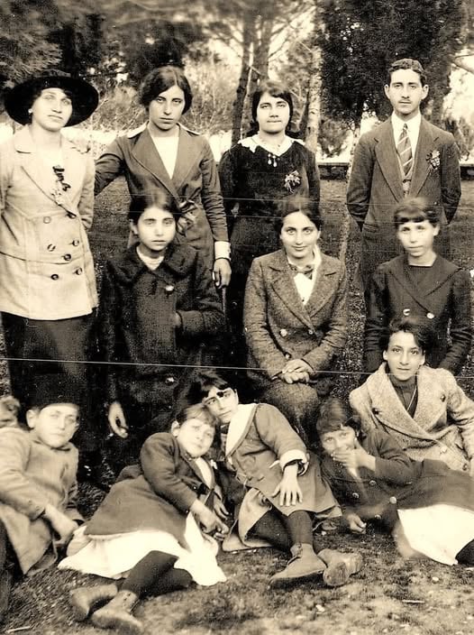
Posted by Umar Abu El-Bararri - صوره من قريه الخضر سنه 1938
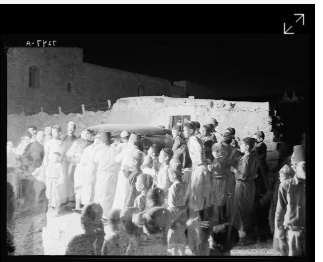
Posted by abu raya - في الغابة، محيط برك سليمان، بالقرب من قرية الخضر، جنوب غرب بيت لحم حوالي 1916. فلسطين.
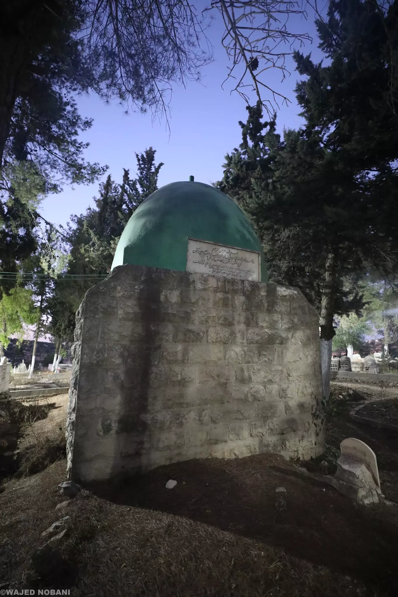
- زرنا قبر سعيد العاص وقرأنا الفاتحة على روحه، لقد ضحى بحياته لأجل البلاد، وُلد في 1889م وهو سوري من حماة، قرر النزول إلى فلسطين وقد قاتل في ثورة ال36 وارتقى في معركة الخضر قرب بيت لحم يوم 6 تشرين أول 1936. سكان بلدة الخضر بنوا على قبره هذا المزار لتخليد سيرته -- واجد النوباني
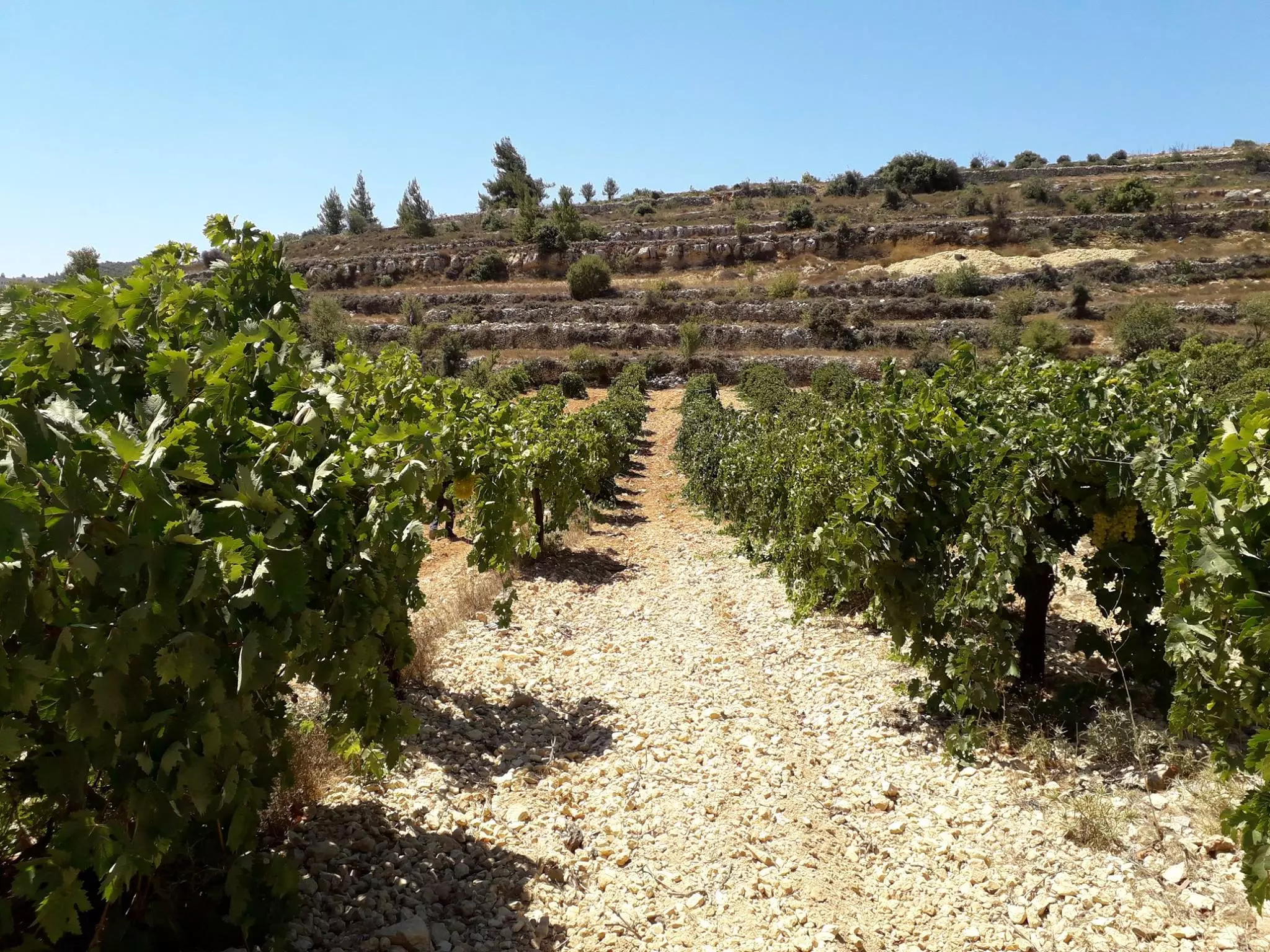
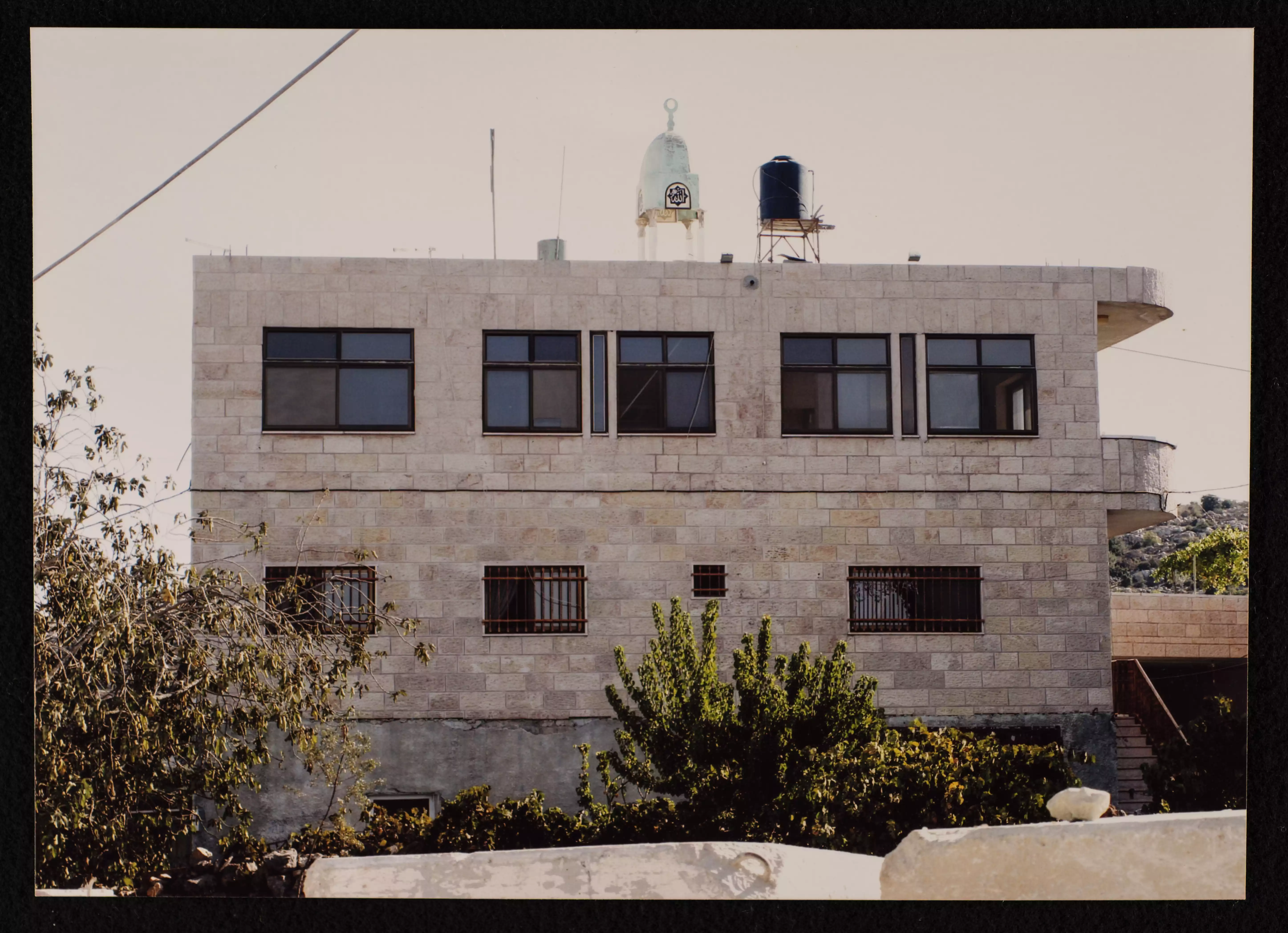
- أحد الحقول في قرية الخضر
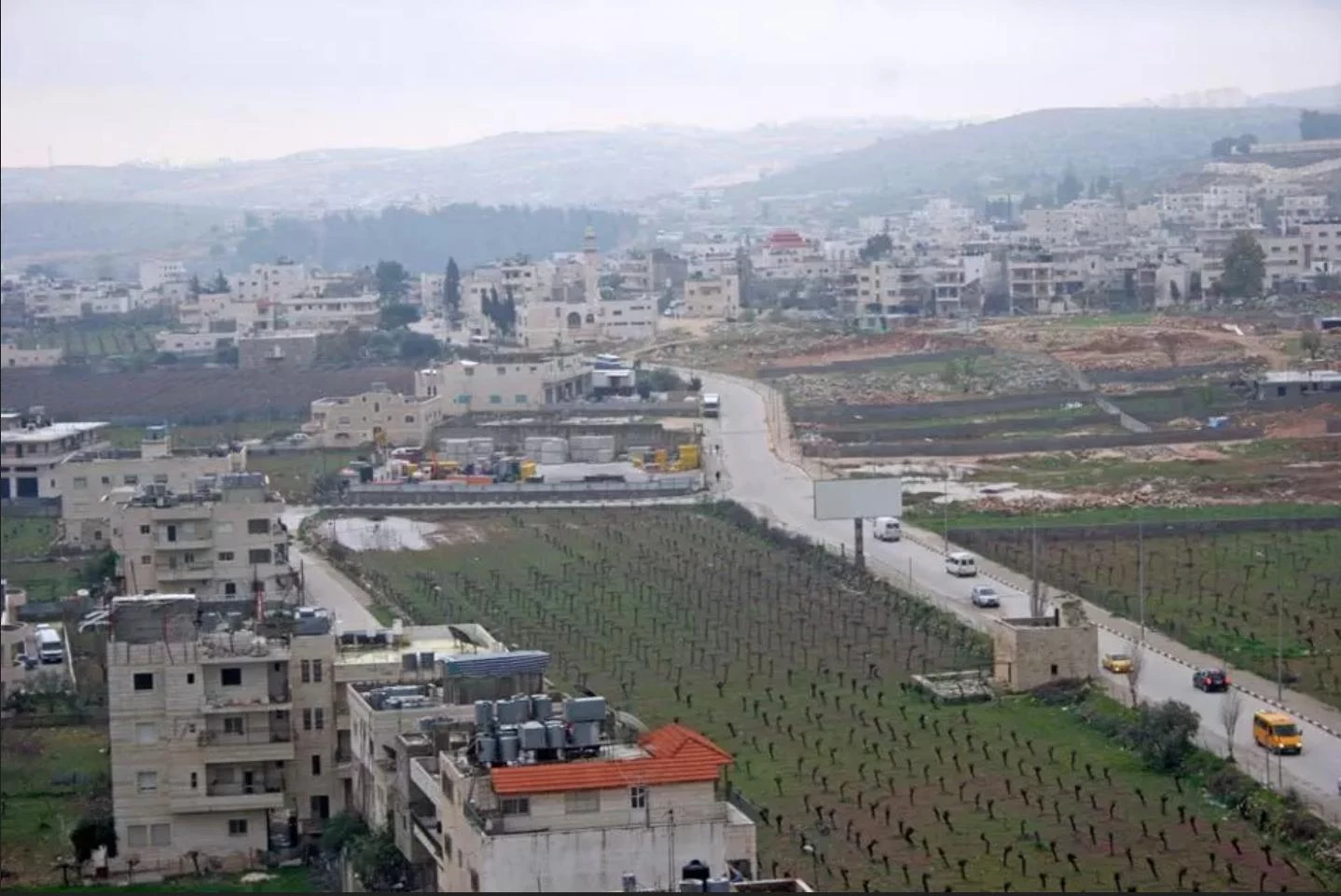
- منظر عام
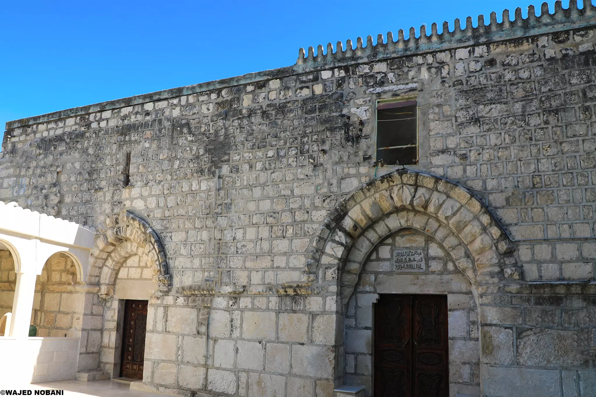
- في الموضع قام معبد روماني، ثم تحول لكنيسة في الفترة البيزنطية، بعد ذلك، المسلمون بنوه على بقايا الكنيسة البيزنطية مسجدا، ثم جاء الصليبيين وجعلوه كنيسة، ثم أعاده المسلمون في عهد صلاح الدين مسجداً،
ما تشاهدونه بالضبط، من الأسفل الكنيسة من الفترة الصليبية، وفوقها بناء المسجد الذي يرجع لللفترة المملوكية (في عهد السلطان سيف الدين قلاون الذي حكم ما بين 1279م - 1290م)
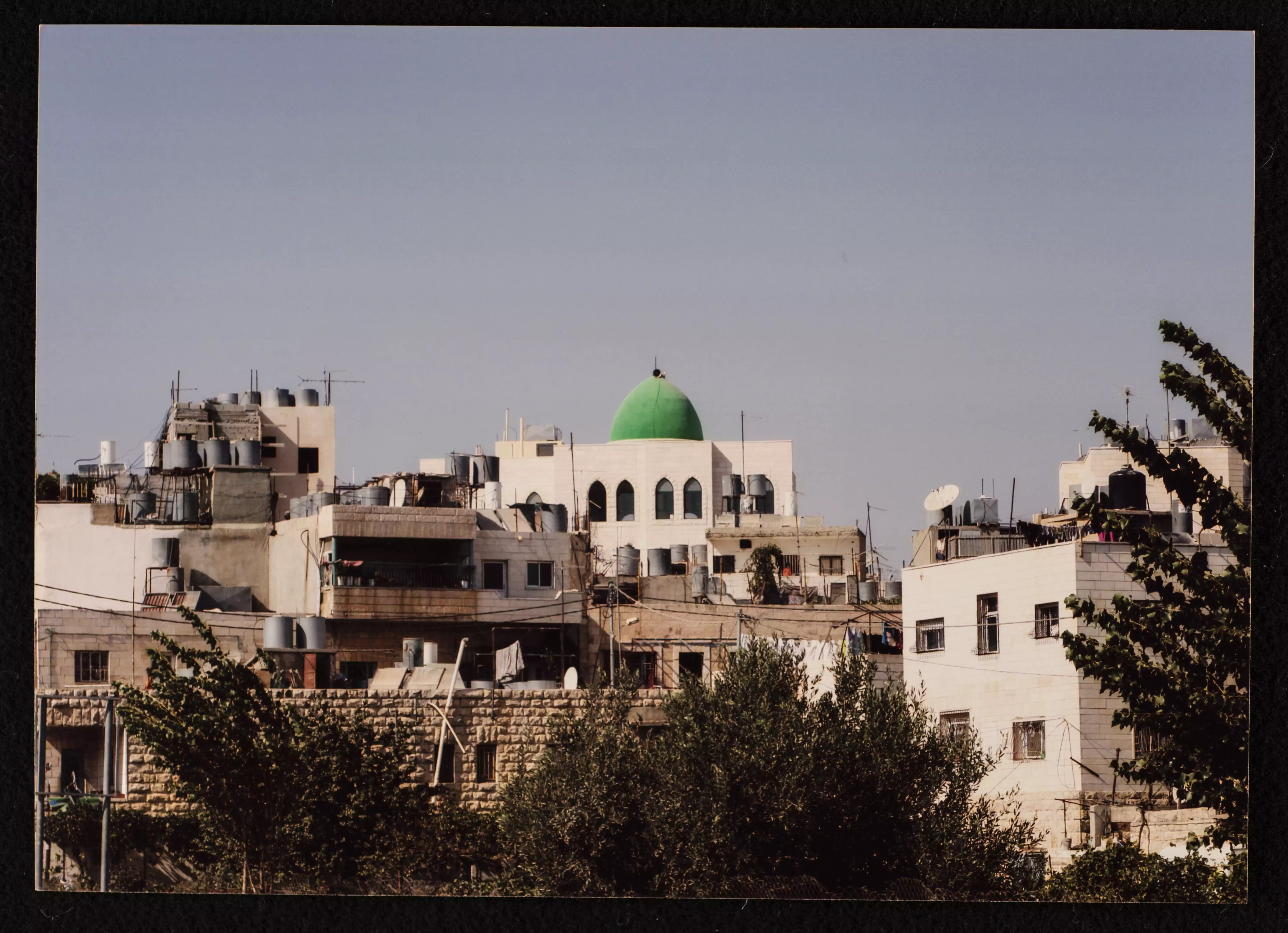
- منظر عام
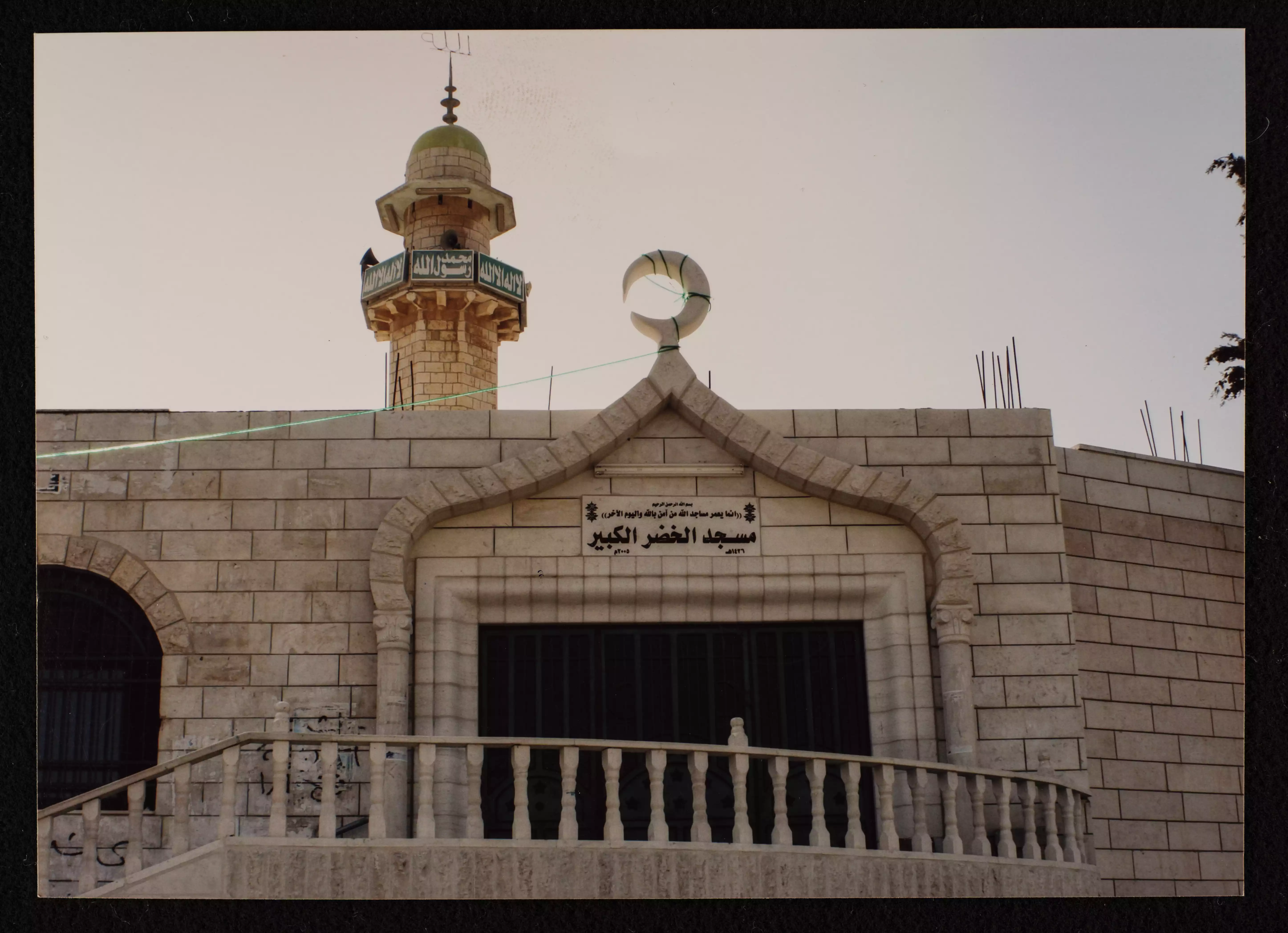
- مسجد الخضر الكبير -- 1990 - 1999
- مسجد الخضر القديم -- 19990 - 1999
- مسجد الجبل، الخضر -- 1990 - 1999
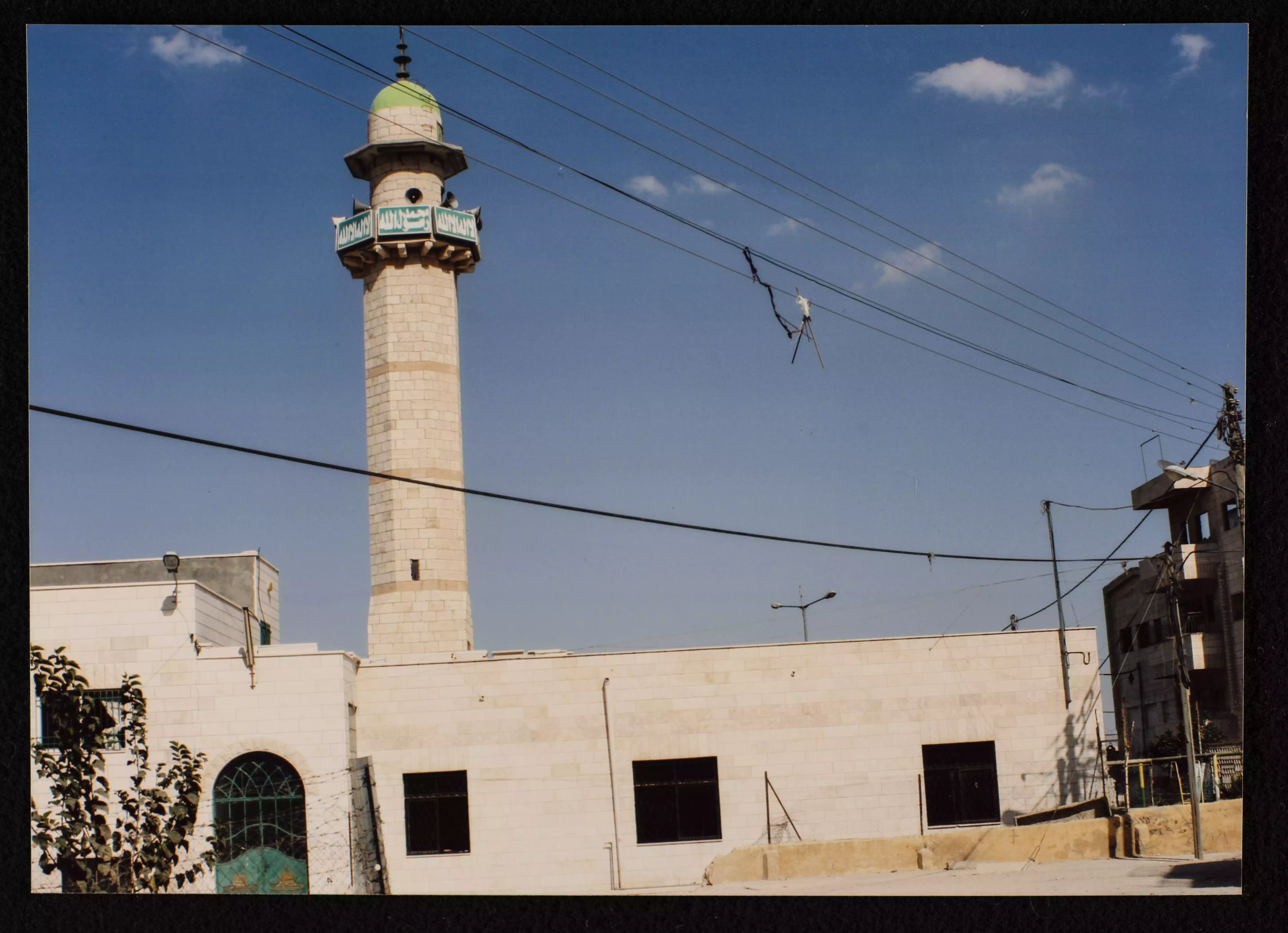
- مسجد الخضر الجديد، الخضر -- 1990 - 1999
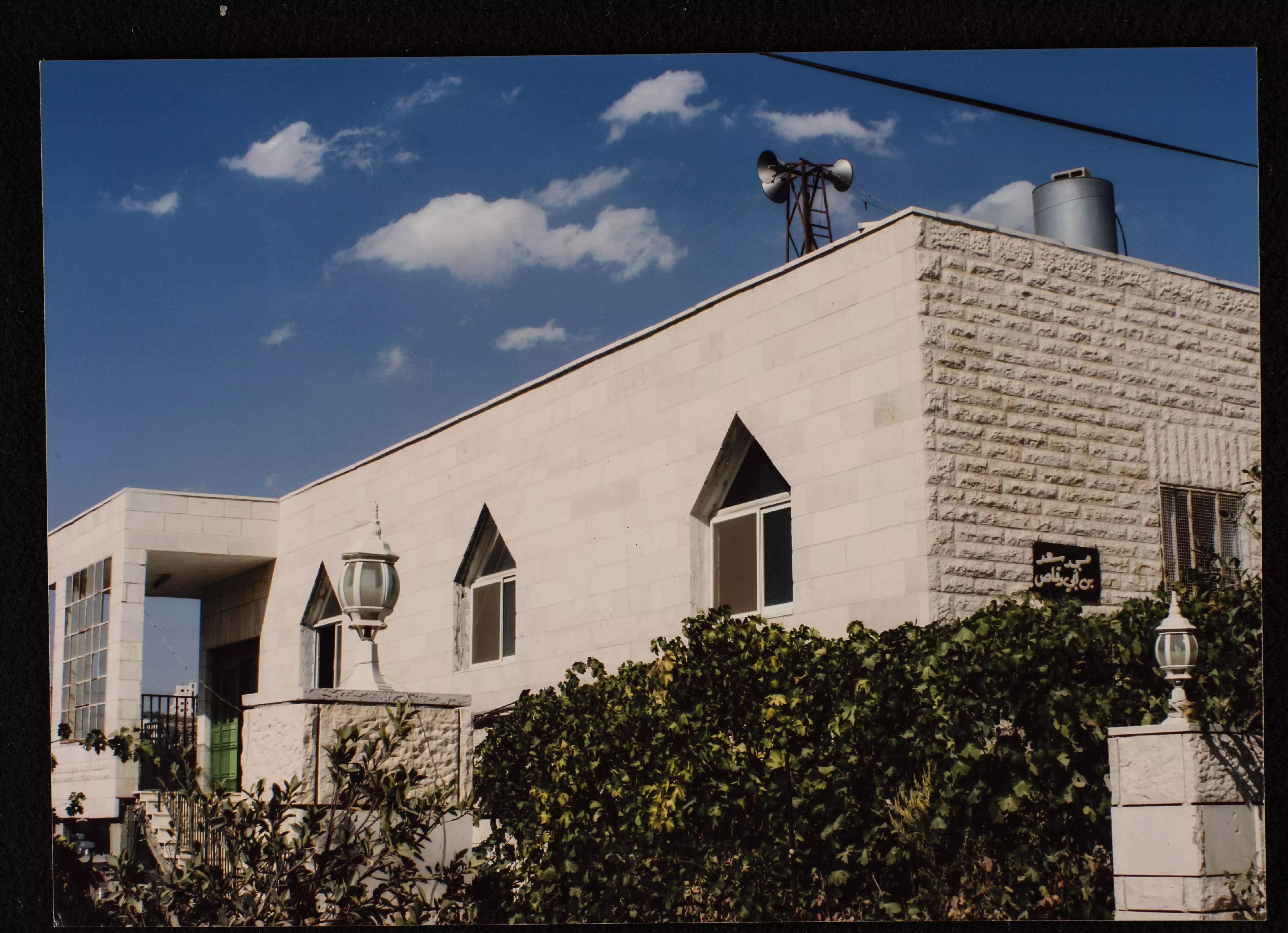
- مسجد سعد بن أبي وقّاص، الخضر -- 1990 - 1999
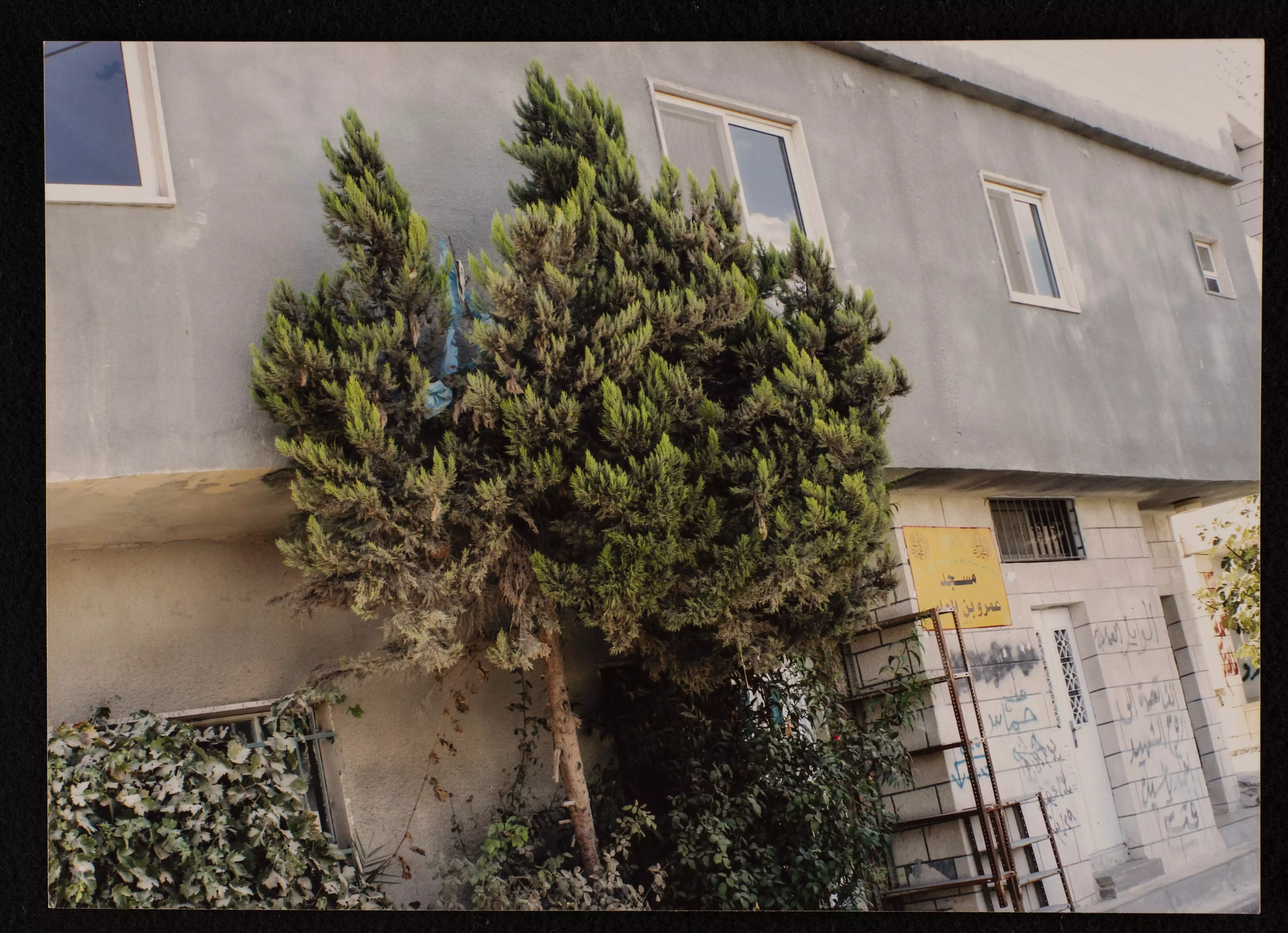
- مسجد عمرو بن العاص، الخضر -- 1990 - 1999
Want to browse more? 80,000 pictures were grouped in these gallaries:
| Display Name | Clan/Hamolah | Country of Residence |
| shereen | غنيم | - |
| ابو غليون | - | بيت لحم, الخضر |
| عرفات | salah | - |
| ismat daadoa | دعدوع | amman, jordan |
| Carlooo | - | bethlehem, palestine |
| mariam | muosa | Al-khader, bethlehem |
| omar hadi | دعدوع | القدس, القدس |
| khalil salah | salah | - |
| akram | mousa | bethlehem, palestine |
- جولة في شوارع - الخضر - قضاء بيت لحم - لي وطن - النسخة الأصلية Duration: 4 min 51 sec
No links have been shared yet, be free to the first to share the first link.
 Fake Valor: Why Did Zionist Jews Hoist Nazis Flag on Their Ships in the 1930s?
What is new?
-
Facts About Oct. 7th Gaza Raid
-
Remined Us Please:: Who Did Rape Who? Palestinians Raped Israelis? Or, was the other way around?
-
When Prof. Edward Said was invited to debate Bibi Netanyahu in the 1980s, watch what happened!
-
Ezra Klein of the NY Times on the "Jewish Race".
-
Abusing Blood Libel!
-
Zionist FAQ: Isn't it true that Palestinians don't want peace? Palestinians never accepted the two-state solution
- Facts about Haavara (Transfer) Agreement between Ben-Gurion & Hitler
-
Haavara FAQs: Why Did Zionist Jews Hoist Nazis' Flags on Their Ships in the 1930s?
- Haavara FAQs: When Chaim Weizmann met FDR in mid-1943, why was he silent about rescuing European Jewry?
-
Dear ChatGPT: How did Palestinians resist Napoleon's invasion of their country in 1799?
-
Dear ChatGPT: Gaza had a vibrant Jewish community in the mid-17th century. What happened to them?
-
Dear ChatGPT: Why did the Jewish Agency suppress news of the Holocaust during WWII?
-
Video Playlist: Jews share their DNA tests to end the conflict for good.
-
A Tale of Two Conflicts: Examining the Definition of Genocide
-
Prof. Abraham Polak And The Suppressed History of the Khazars and European Jewry
-
How Ronald Reagan would have framed the genocide in Gaza if he were still alive?
-
Haavara FAQs: Let us do the math: how many German Jews did The Haavara Agreement save?
-
Zionist FAQs: The Hebron Massacre of 1929, "clearly proves" that Palestinians are antisemitic, how could you deny it?
-
Zionist FAQs: Why Anti-Zionist Is Not Antisemitism?
-
Zionist FAQs: Isn't it true that the KGB create Palestinian Nationalism in the early 1960s?
- Zionist FAQs: Muslims are killing Muslims all the time; why are Israeli Jews being singled out in the media?
- Zionist FAQs: How is Israel an apartheid state when 20% of its citizens are Arabs who enjoy full rights?
-
Haavara FAQs: Analysis of Herzl's Uganda Scheme and how it could have saved millions of Jews.
-
Haavara FAQs: Why did Hayim Greenberg describe American Jewry as "morally bankrupt" in early 1943?
-
Haavara FAQs: What if the Evian Conference was a resounding success? What would have been the impact of saving European Jewry on Zionism?
- Haavara FAQs: What if the six million were saved, how that would have impacted the Zionist project?
-
Haavara FAQs: How did Zionist leaders react when Europe's Jews lingered in the DP camps after WWII ended?
-
Why does the American Jewish community repeat lies that David Ben-Gurion had debunked before he died?
-
Who has the power to rename the Tatar/Khazar Gene Marker to Jewish IV?
-
Zionist FAQs: Why won't Egypt, Syria, and Jordan take their people back? Jews are indigenous to Palestine, and Arabs immigrated after Jews developed the country. Arabs should leave.
-
Haavara FAQs: Did Hitler and the Nazis conflate between Judaism and Zionist? If that wasn't case, then why?
-
Haavara FAQs: Winston Churchill and antisemitism, a collection of articles written Churchill.
-
Haavara FAQs: Broken by country, how many Jews survived vs. killed during the Holocaust?
-
Haavara FAQs: Why did European Jews vote with their feet and to immigrated to the Americas, not Palestine, after WWII?
-
Watch this American Jewish Girl describing Israeli Jews' cognitive dissonance like no other in under two minutes
-
Haavara FAQs: When the Nazis went out of their way to hide the Holocaust, Israeli Jews did the exact opposite by broadcasting their genocide of Gazans. But why?
-
Haavara FAQs: How Zionist Jews went out of their to show their appreciation to Nazism and Fascism?
- Haavara FAQs: Why Zionist leaders were against bombing the death camps & the Railroads leading to them?
-
Haavara FAQs: Hitler's message to the British and American people: If Jews are such noble citizens and you care about them, how come you're not letting them in? I will gladly ship them to you at my expense, even on luxury liners!
-
A shortlist of Zionist and Israeli false flag operations in the name Jews.
-
The Most Moral Army
- The Land of Kapos (Israel): Where the brave are boycotted and Kapos walk free.
- Why did early Zionists often named their communal enterprises "colonial"?
- Zionist Relations with Nazi Germany by Faris Glubb
-
Two NY Times advertisements by Zionists in the early 1943 that exposes Zionists' treason at the height of the calamity
- Facts Not Lies about the Palestinian-Israeli Conflict.
- Site's pictures have been categorized
- Campgain Against Lice
- A Survey of Palestine, the official source about Palestine before Nakba produced by the British Mandate; over 1200 pages.
- Satellite View & Google Earth: Over 6,000 placemarks identifying all destroyed towns, W. Bank & Gaza Strip Towns, & refugee camps.
- PalestineRemembered.com and its Nakba Oral History Project were featured on al-Jazeera Satellite TV.
- Nakba Oral History Video Podcast:
 Over 700 Oral History interviews (including 3,500+ hours of recording) can be viewed online.
 - Palestine Village Statistics Project
- Gaza Jail Break
- النسخة العربية للموقع الان متوفرة
- Videos: Documenting the destroyed villages in video: Tracing all that remains since Nakba.
- Videos: Responding to Zionist Propaganda
- Interview: The ethnic cleansing of Palestine: George Galloway interviews Israeli Historian Ilan Pappe.
- For Palestinians, memory matters. It provides a blueprint for their future By George Bisharat.
- Zionist FAQ now available in Hebrew שאלות שציונים שואלים, עכשיו בעברית
- Video: The Stephen Walt and John Mearsheimer report on the influence of the Israel Lobby on U.S. Foreign Policy
- The Palestinian-Israeli conflict for beginners
