| PalestineRemembered | About Us | Oral History | العربية | |
| Pictures | Zionist FAQs | Haavara | Maps | |
| Search |
| Camps |
| Districts |
| Acre |
| Baysan |
| Beersheba |
| Bethlehem |
| Gaza |
| Haifa |
| Hebron |
| Jaffa |
| Jericho |
| Jerusalem |
| Jinin |
| Nablus |
| Nazareth |
| Ramallah |
| al-Ramla |
| Safad |
| Tiberias |
| Tulkarm |
| Donate |
| Contact |
| Profile |
| Videos |
Welcome To Abu Zurayq - ابو زريق (אבו זריק)
|
District of Haifa
Ethnically cleansed days ago |
العربية Google Earth |
 |
Gallery (21) |
- Statistics & Facts
-
Before & After

- Satellite View
- Articles 3
- Pictures 21
- Oral History 2
- Members 41
- All That Remains
- Wikipedia
- Videos 1
- Guest Book 4
- Links
| Statistic & Fact | Value | ||||||||||||||
| Occupation Date | April 12, 1948 | ||||||||||||||
| Distance From District | 24 (km) South East of Haifa | ||||||||||||||
| Elevation | 100 (meters) | ||||||||||||||
| Before & After Nakba, Click Map For Details |
|||||||||||||||
|
|||||||||||||||
| Map Location | See location #24 on the map View from satellite |
||||||||||||||
| Military Operation | The battle for Mishmar ha-'Emeq | ||||||||||||||
| Attacking Units | A combination from the Palmach 1st Battalion, Carmeli and Alexandroni Brigades | ||||||||||||||
| Defenders | Arab Liberation Army volunteers and some local Palestinian militia | ||||||||||||||
| Acts of Terror | Massacre occured by Zionist troops against the town's inhabitants. | ||||||||||||||
| Exodus Cause | Military assault by Zionist troops | ||||||||||||||
| Village Temains | The village has been completely defaced on April 15th 1948. | ||||||||||||||
| Ethnically Cleansing | Upon occupation, 15 adult males and some 200 women and children from Abu Zurayq inhabitants were taken captives. The women and children were sent towards Jinin. | ||||||||||||||
| Pre-Nakba Land Ownership |
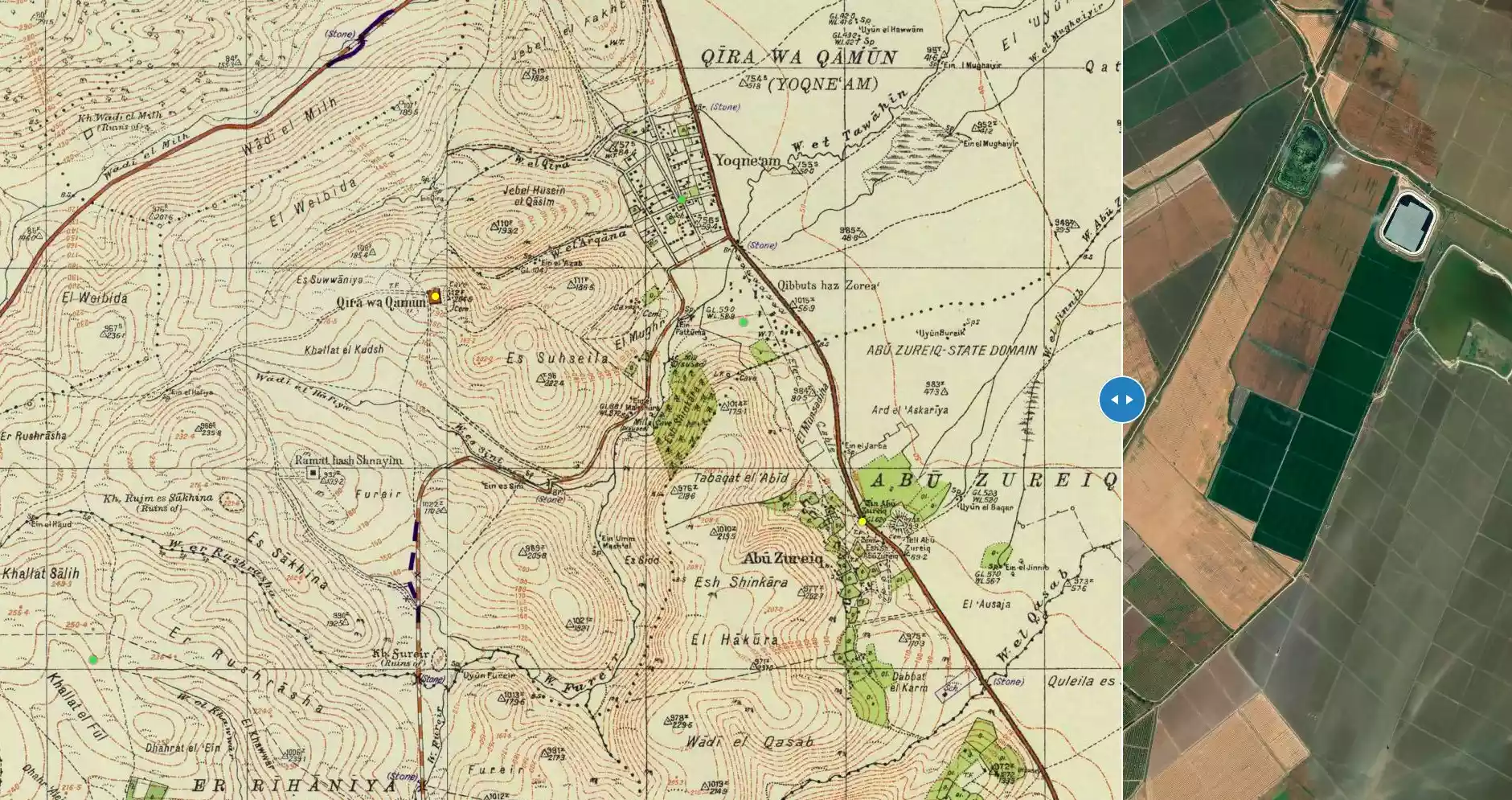
**Town Lands' Demarcation Maps |
||||||||||||||
| Land Usage As of 1945 |
|
||||||||||||||
| Population |
|
||||||||||||||
| Near By Towns |
|||||||||||||||
|
|||||||||||||||
| Schools | Abu Zurayq had an elementary school for boys. | ||||||||||||||
| Places of Warship | One mosque | ||||||||||||||
| Nearby Wadies & Rivers | The village was situated near Wadi Abu Zurayq | ||||||||||||||
| Water Supply | Water supplies were taken from a number of sources, among them Wadi Abu Zurayq, a nearby spring and a well. | ||||||||||||||
| Archeological Sites | Abu Zurayq contained rich sequence of Paleolithic stone tools have been found and the remains of an isolated Roman farmhouse | ||||||||||||||
| Exculsive Jewish Colonies Who Usurped Village Lands |
No settlements on village lands | ||||||||||||||
| Featured Video | |||||||||||||||
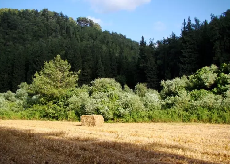
Village Before NakbaThe village was located in the northern foothills of a region known as the bilad al-rawha', the 'fragrant country' (see Daliyat al-Rawha', Haifa sub-district), which overlooked the plain of Marj ibn Amir. Some of the houses were also built on a small hill next to the Haifa-Jenin highway. Its name probably referred to the Abu Zurayq Bedouin, who settled there. The people of Abu Zurayq were Muslim. Their houses, scattered at some distance from one another, were built of stone and either mud or cement; the roofs were made of concrete or, in some cases, mud, straw, and wood. The village had a mosque and a boys' elementary school and drew its water from a number of sources, among them Wadi Abu Zurayq, a spring, and a well.Abu Zurayq's economy was based on agriculture and animal husbandry. Grain was the main crop, although vegetables were also grown, using irrigation. In 1942/43, 100 dunums were occupied by olive trees. Fruit trees were tended as well, and one dunum was planted with orange trees. In 1944/45 a total of 4,092 dunums were allotted to cereals; 282 dunums were irrigated or used for orchards. Next to the village was a tell that dated mainly to the Bronze and Iron ages, although it contained some materials that belonged to the early Islamic period. On the terraced ground above the tell (and below the village), a rich sequence of Paleolithic stone tools have been found. Northwest of Ayn Abu Zurayq were the remains of an isolated Roman farmhouse. Village Occupation and Ethnic CleaningPalmach units gained control of the village on 12 April 1948, after having seized it briefly three days earlier. According to the New York Times, this occurred when the Haganah broke a two-day truce to emerge from the settlement of Mishmar ha-Emeq and overrun a cluster of neighboring villages. The battle over Mishmar ha-Emeq had erupted on 4 April. On entering Abu Zurayq, the Palmach attackers took fifteen adult males captive, along with some 200 women and children, according to Israeli historian Benny Morris. No mention is made of the fate of the men, but the women and children were expelled towards Jenin. The Palestinian newspaper Filastin provides a more graphic account. The paper's correspondent wrote that as dawn broke, on the morning after the Zionist troops had occupied the village, a Haganah unit stationed to the north came across a number of villagers lying face down in the village fields. The Zionist forces surrounded these people-old men, women, and children-and opened fire, killing two women and four children, and taking a group of thirty people captive. Later, an Arab force counterattacked, liberating the villagers and taking them to safety in Jenin.Morris quotes Israeli sources as saying that some of Abu Zurayq's houses were blown up on the night of occupation, adding that the demolition of the village was completed by 15 April. This is confirmed by the New York Times, which quotes the British authorities as saying on 16 April that Haganah engineers had blown up the houses left standing in the village. The Palestinian daily Filastin states that thirty houses were blown up in the course of capturing the village, five of which were still occupied. Zionists Colonies on Village LandsThere are no Israeli settlements on village lands. The settlement of ha-Zore'a, built in 1936, is close by, to the north.Village TodayThe site is overgrown with cactus plants and fig and olive trees. The level lands in the vicinity are used for agriculture, while the uneven lands in the hills serve as pasture.SourceDr. Walid al-Khalidi, 1992: All That Remains. |
|||||||||||||||
| Related Maps | Town Lands' Demarcation Maps خرائط للقضاء توضح حدود القرى والاودية Town's map on MapQuest View from satellite Help us map this town at WikiMapia |
||||||||||||||
| Related Links | Wikipedia's Page Google Search Google For Images Google For Videos |
||||||||||||||
| More Information | في كتاب كي لا ننسى في كتاب بلادنا فلسطين في كتاب النكبة والفردوس المفقود المزيد من موقع هوية |
||||||||||||||
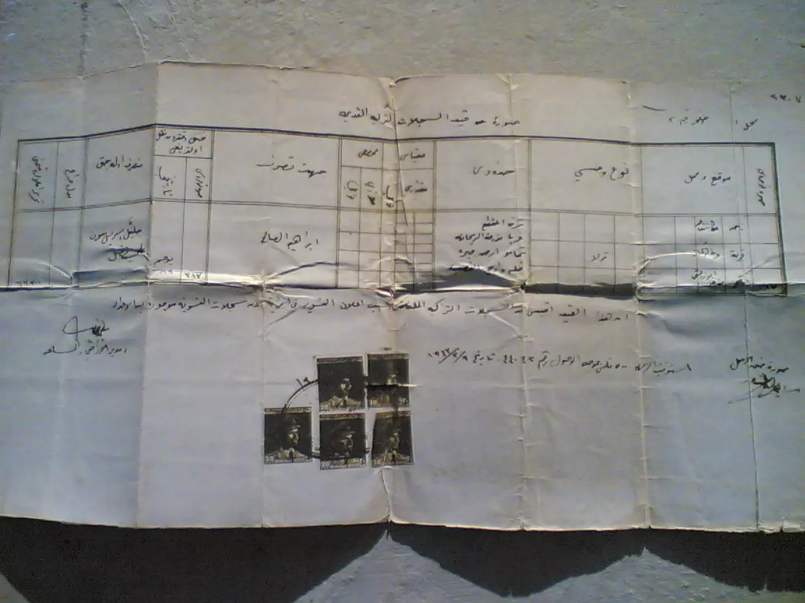
- Document of a land ownership in abuzrik
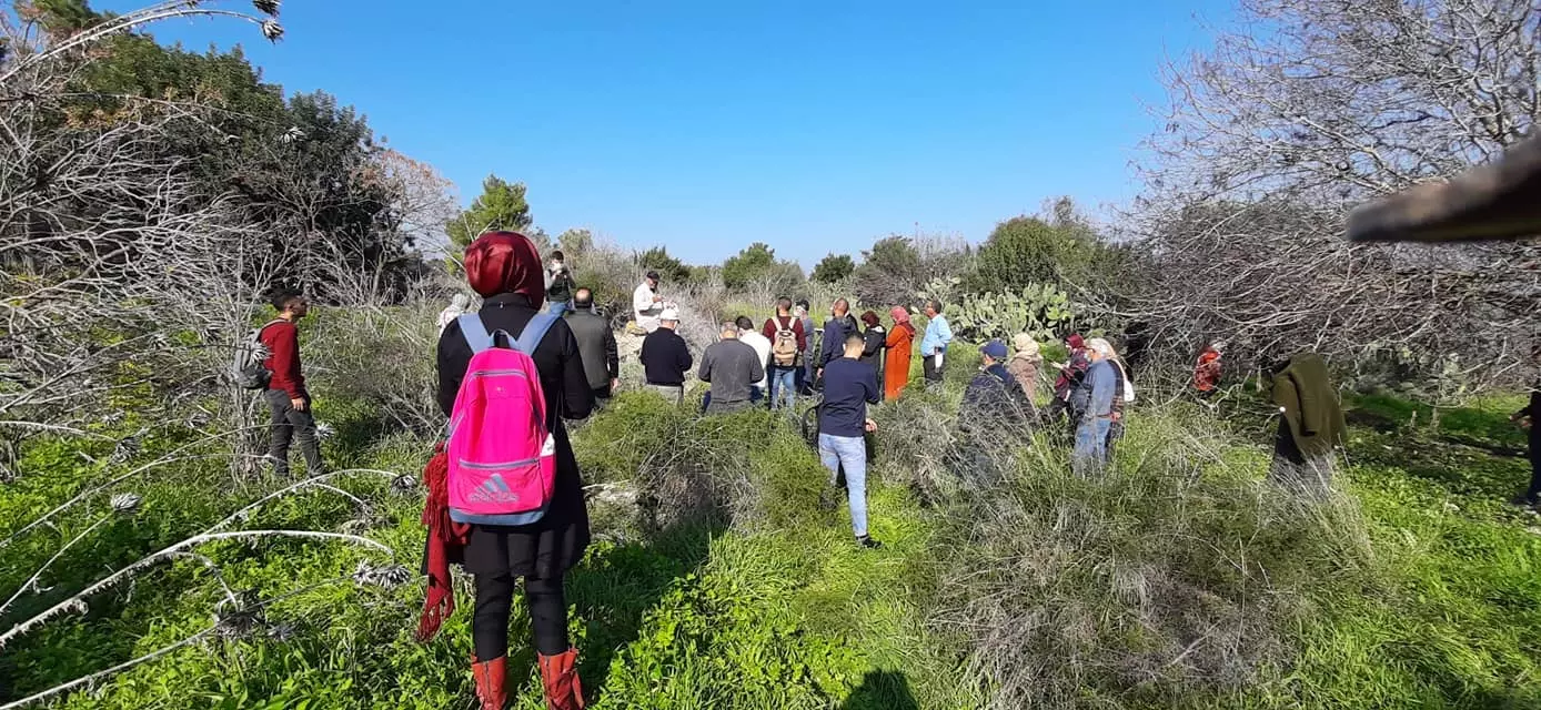
Posted by fawadlah - أبو زريق: ذهبت العلية وبقي الدرج، تصوير محمد يونس، شباط 2008
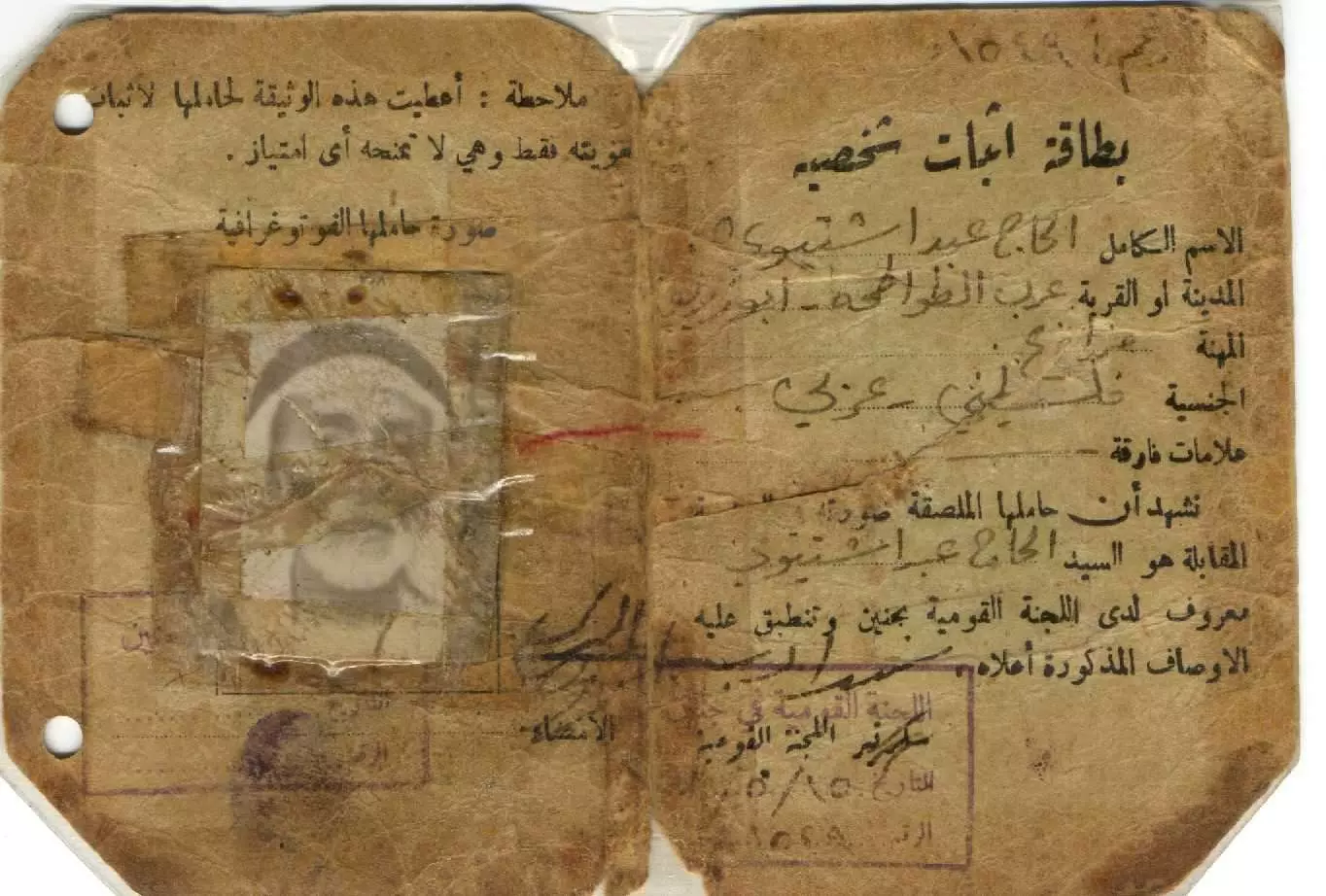
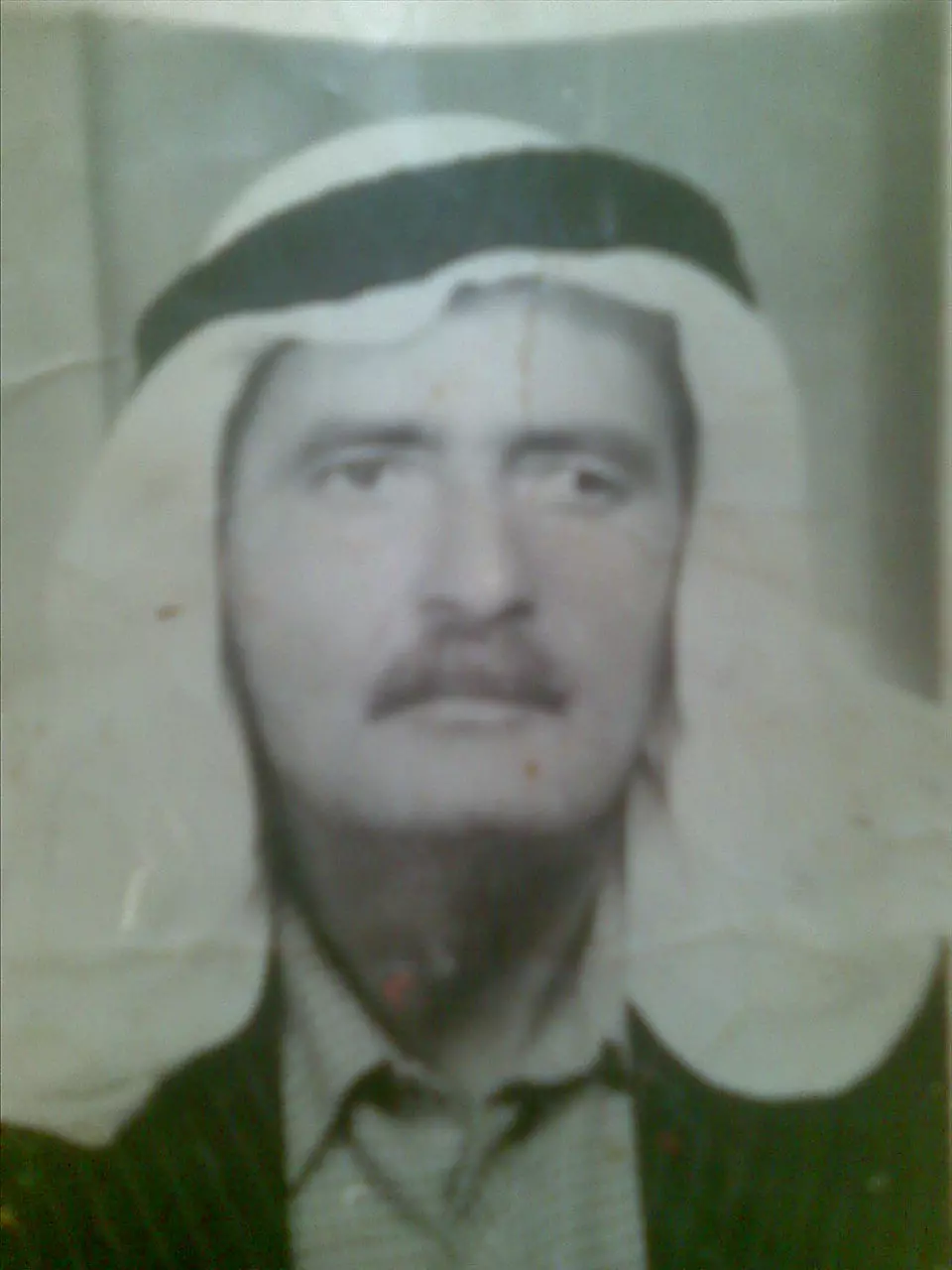
Posted by محمد سلامة يونس 10 - ID for my grand father Al-Haj Abdulkareem Shtewi Shaheen Abo Abdulla
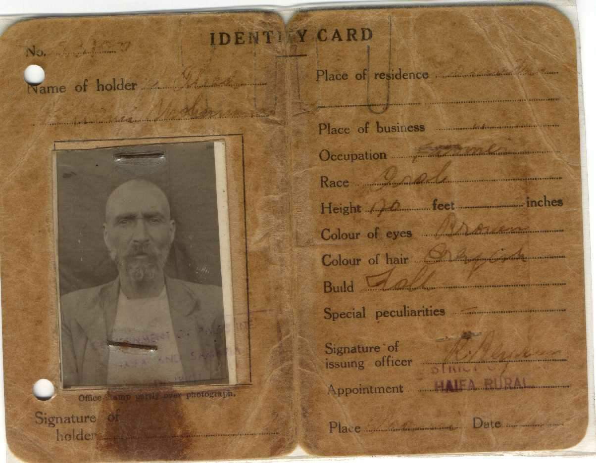
Posted by Ahmad Shaheen - Mustaf Jadoo3 ID
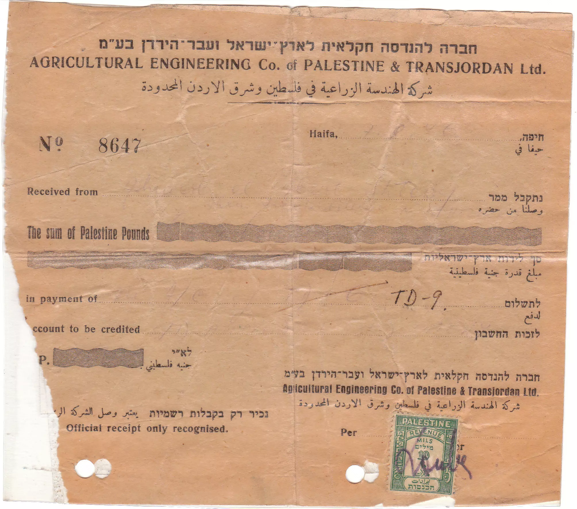
Posted by Ahmad Shaheen 2 - (International Crawler Tractor )Doc.& Invoice bought by My Uncle Ahmmad abdul Kareem Shtewi Shawaheen
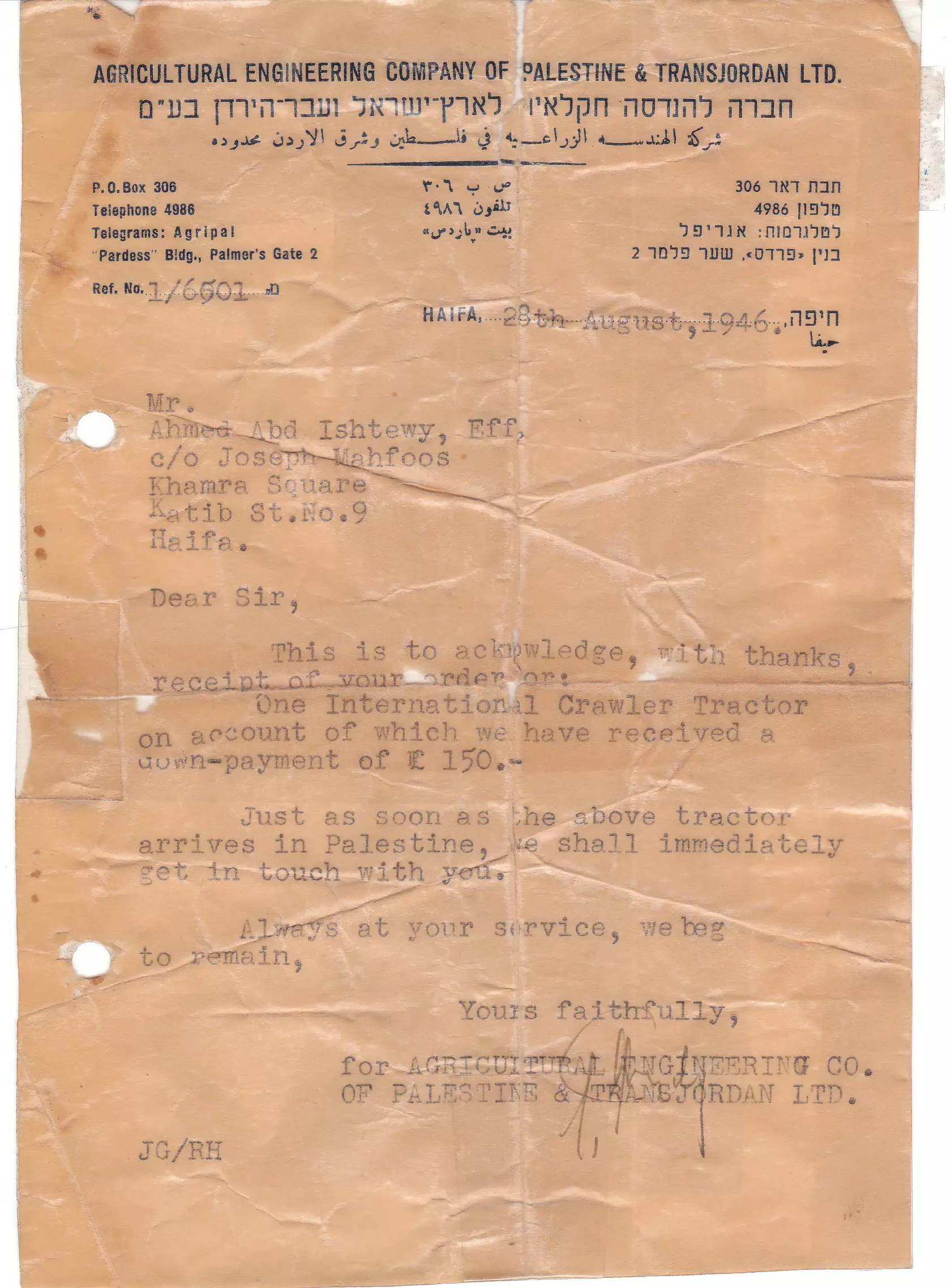
Posted by Ahmad Shaheen 1 - (International Crawler Tractor )Doc.& Invoice bought by My Uncle Ahmmad abdul Kareem Shtewi Shawaheen
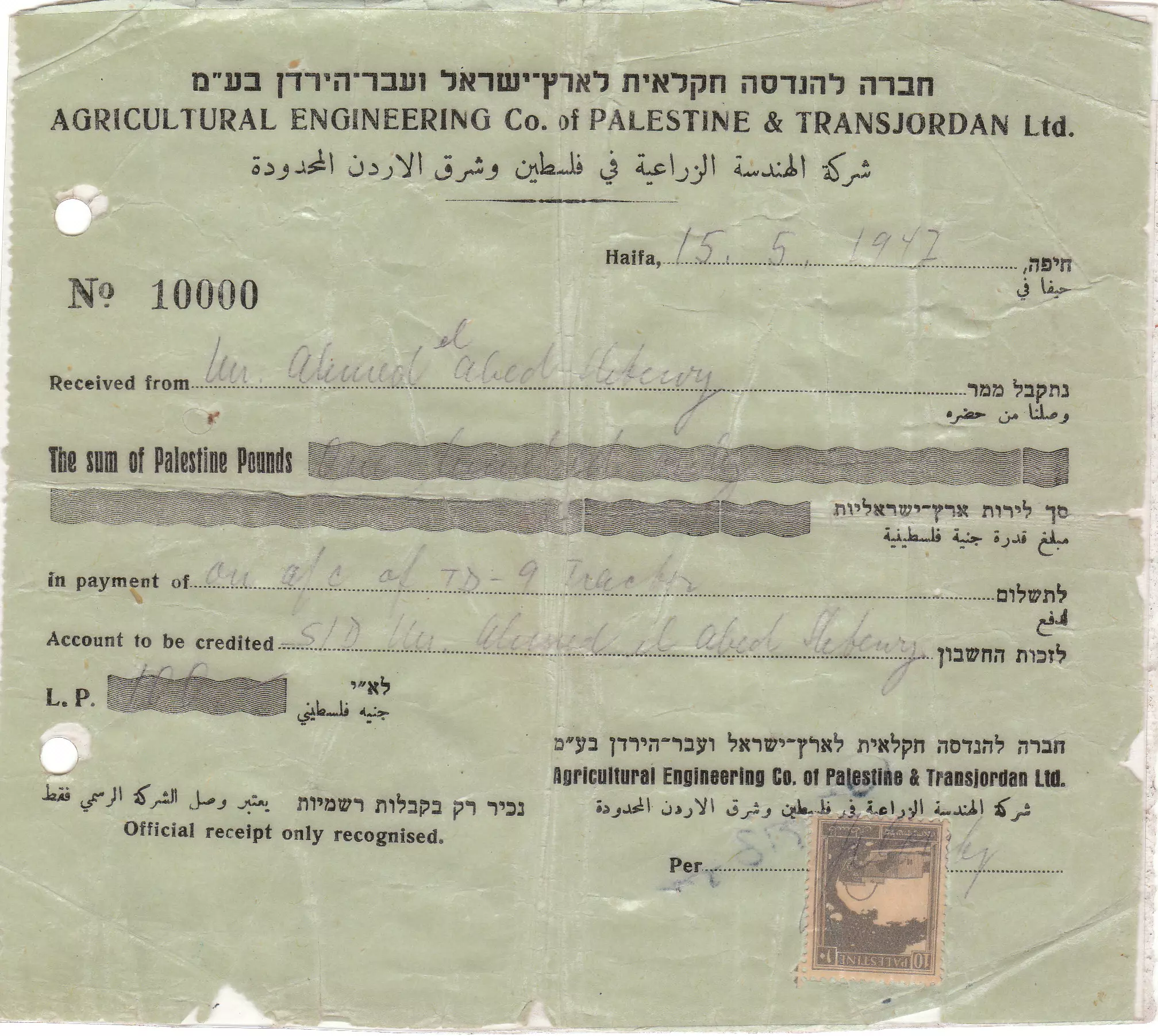
Posted by Ahmad Shaheen 1 - (International Crawler Tractor )Doc.& Invoice bought by My Uncle Ahmmad abdul Kareem Shtewi Shawaheen
Posted by Ahmad Shaheen 1 - تل ابو زريق والمقبرة
Posted by Abdessalam 3 - في الذاكرة

Posted by Abdessalam 3 - جمعة مصطفى شتيوي
Posted by Malak m7ammad shtewi 2 - ابو زريق
Posted by abu raya - اراضي ابو زريق
Posted by abu raya - اراضي ابو زريق
Posted by abu raya - ابو زريق
Posted by abu raya - اراضي القريه
Posted by abu raya - من موقع القريه

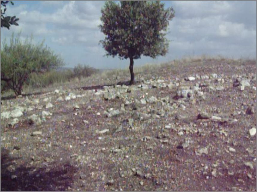
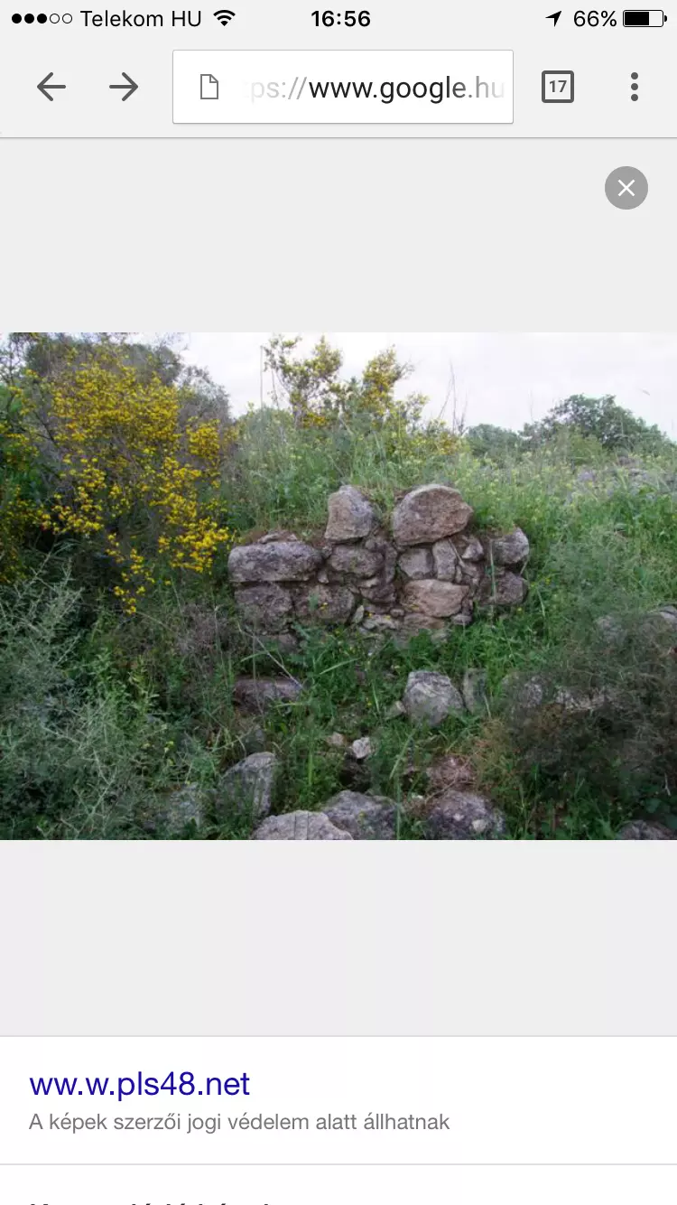
Posted by abu raya - اثار بيوت القريه
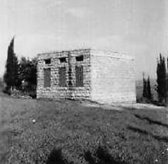
Posted by abu raya - مدرسة ابو زريق 1948

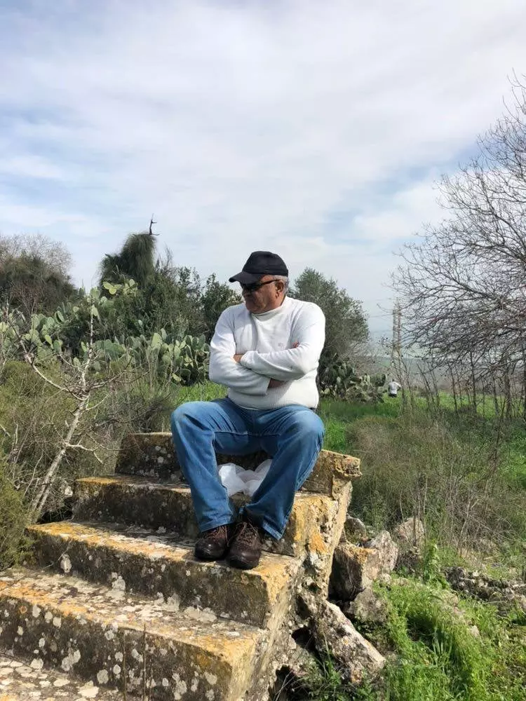
Posted by احمد فحماوي - جلسة على درجات عليّة بيت في قرية أبو زريق
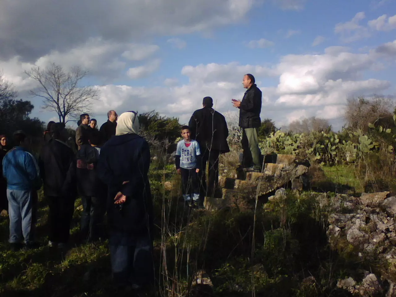
- على أطلال ما تبقى من أحد بيوت قرية أبو زريق المهجرة
- The village school way before "civilization" landed on us from Europe, pre-Nakba period
Want to browse more? 80,000 pictures were grouped in these gallaries:
| Display Name | Clan/Hamolah | Country of Residence |
| Zaina Fawadla | - | - |
| دهود ابو الطبول | الفواضله | عمان, الاردن |
| ابن الفواضلة | الفواضلة | صويلح-الكمالية |
| مختار(دخنوس)الطواطحة | الفواضلة | صويلح-الكمالية |
| معتصم عواد ( المشارفه) | المشارفه | عمان, الاردن |
| Abo Atif | Al- Shawaheen | Amman Jordan |
| محمد زريقات | الزريقات | amman, amman |
| rorota | shwaheen | - |
| eyad sarries fadel | fawadleh | al balq'a, jordan |
| kook14 | - | - |
| مصطفى صالح -- ابوزيد | مصطفى | عمان, الاردن |
| محمد صالح ---ابو هاشم | - | amman |
| OSD | AL-MASHARFA | amman |
| مهند التركماني | - | السلط, الاردن |
| asem almasharfa | almasharfa | amman, jordan |
| Mohammad Al Masharfa | - | Germany |
| hiba | - | - |
| Ghammaz | الغمامزه - غماز | Zarqa, Jordan |
| bent_marj_ibin_3amer | - | - |
| يوسف احميدي | المشارفة | الرياض, السعودية |
| سمور | الغمامزة | عمان |
| akshahin | Al-Shawaheen الشواهين | -, Jordan |
| MAJD | FAWADLAH | seweileh, jordan |
| ABU KHALID | FAWADLAH | BAQAA CAMP, jordan |
| DR.OMAR | FAWADLAH | BAQAA CAMP |
| HAZEM2005 | FAWADLAH | seweileh, jordan |
| HISHAM98 | FAWADLAH | seweileh, jordan |
| Mujahed Serres Alfawadleh | Alfawadleh | virginia, United states |
| Bassam Dakhnous - Abo Jawad | AL-FAWADLEH | - |
| Osama Fawadleh | Fawadleh | Amman, Jordan |
| jalal alfawadleh | alfawadleh | hamburg, germany |
| SUHAIL AL-FAWADLEH | AL-FAWADLEH | AMMAN |
| Ahmad Shaheen | Shawaheen | KSA, KSA |
| Serres | Alfawadleh | amman, jordan |
| DR.AHMAD | ALFAWADLAH | SEWEILEH, JORDAN |
| AHMAD SHAHEN | - | - |
| basheer shaheen | shawaheen | - |
| Yazeed Sarris | Alfawadleh | seweleh, Jordan |
| SARRIES | AlFawadleh (Sarries) | Dubai, UAE |
| ATIF SHAHEEN | SHWAHEEN | - |
| Abdulkarim Shahin | Shawaheen | Riyadh, Saudi Arabia |
No links have been shared yet, be free to the first to share the first link.
 Fake Valor: Why Did Zionist Jews Hoist Nazis Flag on Their Ships in the 1930s?
What is new?
-
Facts About Oct. 7th Gaza Raid
-
Remined Us Please:: Who Did Rape Who? Palestinians Raped Israelis? Or, was the other way around?
-
When Prof. Edward Said was invited to debate Bibi Netanyahu in the 1980s, watch what happened!
-
Abusing Blood Libel!
-
Zionist FAQ: Isn't it true that Palestinians don't want peace? Palestinians never accepted the two-state solution
- Facts about Haavara (Transfer) Agreement between Ben-Gurion & Hitler
-
Haavara FAQs: Why Did Zionist Jews Hoist Nazis' Flags on Their Ships in the 1930s?
-
Dear ChatGPT: Why did the Jewish Agency suppress news of the Holocaust during WWII?
-
Video Playlist: Jews share their DNA tests to end the conflict for good.
-
A Tale of Two Conflicts: Examining the Definition of Genocide
-
Prof. Abraham Polak And The Suppressed History of the Khazars and European Jewry
-
How Ronald Reagan would have framed the genocide in Gaza if he were still alive?
-
Haavara FAQs: Let us do the math: how many German Jews did The Haavara Agreement save?
-
Zionist FAQs: The Hebron Massacre of 1929, "clearly proves" that Palestinians are antisemitic, how could you deny it?
-
Zionist FAQs: Why Anti-Zionist Is Not Antisemitism?
-
Zionist FAQs: Isn't it true that the KGB create Palestinian Nationalism in the early 1960s?
- Zionist FAQs: Muslims are killing Muslims all the time; why are Israeli Jews being singled out in the media?
- Zionist FAQs: How is Israel an apartheid state when 20% of its citizens are Arabs who enjoy full rights?
-
Haavara FAQs: Analysis of Herzl's Uganda Scheme and how it could have saved millions of Jews.
-
Haavara FAQs: Why did Hayim Greenberg describe American Jewry as "morally bankrupt" in early 1943?
-
Haavara FAQs: What if the Evian Conference was a resounding success? What would have been the impact of saving European Jewry on Zionism?
- Haavara FAQs: What if the six million were saved, how that would have impacted the Zionist project?
-
Haavara FAQs: How did Zionist leaders react when Europe's Jews lingered in the DP camps after WWII ended?
-
Why does the American Jewish community repeat lies that David Ben-Gurion had debunked before he died?
-
Who has the power to rename the Tatar/Khazar Gene Marker to Jewish IV?
-
Zionist FAQs: Why won't Egypt, Syria, and Jordan take their people back? Jews are indigenous to Palestine, and Arabs immigrated after Jews developed the country. Arabs should leave.
-
Haavara FAQs: Did Hitler and the Nazis conflate between Judaism and Zionist? If that wasn't case, then why?
-
Haavara FAQs: Winston Churchill and antisemitism, a collection of articles written Churchill.
-
Haavara FAQs: Broken by country, how many Jews survived vs. killed during the Holocaust?
-
Haavara FAQs: Why did European Jews vote with their feet and to immigrated to the Americas, not Palestine, after WWII?
-
Watch this American Jewish Girl describing Israeli Jews' cognitive dissonance like no other in under two minutes
-
Haavara FAQs: When the Nazis went out of their way to hide the Holocaust, Israeli Jews did the exact opposite by broadcasting their genocide of Gazans. But why?
-
Haavara FAQs: How Zionist Jews went out of their to show their appreciation to Nazism and Fascism?
- Haavara FAQs: Why Zionist leaders were against bombing the death camps & the Railroads leading to them?
-
Haavara FAQs: Hitler's message to the British and American people: If Jews are such noble citizens and you care about them, how come you're not letting them in? I will gladly ship them to you at my expense, even on luxury liners!
-
A shortlist of Zionist and Israeli false flag operations in the name Jews.
-
The Most Moral Army
- The Land of Kapos (Israel): Where the brave are boycotted and Kapos walk free.
- Why did early Zionists often named their communal enterprises "colonial"?
- Zionist Relations with Nazi Germany by Faris Glubb
-
Two NY Times advertisements by Zionists in the early 1943 that exposes Zionists' treason at the height of the calamity
- Facts Not Lies about the Palestinian-Israeli Conflict.
- Site's pictures have been categorized
- Campgain Against Lice
- A Survey of Palestine, the official source about Palestine before Nakba produced by the British Mandate; over 1200 pages.
- Satellite View & Google Earth: Over 6,000 placemarks identifying all destroyed towns, W. Bank & Gaza Strip Towns, & refugee camps.
- PalestineRemembered.com and its Nakba Oral History Project were featured on al-Jazeera Satellite TV.
- Nakba Oral History Video Podcast:
 Over 700 Oral History interviews (including 3,500+ hours of recording) can be viewed online.
 - Palestine Village Statistics Project
- Gaza Jail Break
- النسخة العربية للموقع الان متوفرة
- Videos: Documenting the destroyed villages in video: Tracing all that remains since Nakba.
- Videos: Responding to Zionist Propaganda
- Interview: The ethnic cleansing of Palestine: George Galloway interviews Israeli Historian Ilan Pappe.
- For Palestinians, memory matters. It provides a blueprint for their future By George Bisharat.
- Zionist FAQ now available in Hebrew שאלות שציונים שואלים, עכשיו בעברית
- Video: The Stephen Walt and John Mearsheimer report on the influence of the Israel Lobby on U.S. Foreign Policy
- The Palestinian-Israeli conflict for beginners
