| PalestineRemembered | About Us | Oral History | العربية | |
| Pictures | Zionist FAQs | Haavara | Maps | |
| Search |
| Camps |
| Districts |
| Acre |
| Baysan |
| Beersheba |
| Bethlehem |
| Gaza |
| Haifa |
| Hebron |
| Jaffa |
| Jericho |
| Jerusalem |
| Jinin |
| Nablus |
| Nazareth |
| Ramallah |
| al-Ramla |
| Safad |
| Tiberias |
| Tulkarm |
| Donate |
| Contact |
| Profile |
| Videos |
Welcome To 'Atlit - عتليت (עתלית)
|
District of Haifa
Ethnically cleansed days ago |
العربية Google Earth |
 |
Gallery (74) |
- Statistics & Facts
-
Before & After

- Satellite View
- Articles 2
- Pictures 74
- Members
- All That Remains
- Wikipedia
- Videos
- Guest Book 2
- Links
| Statistic & Fact | Value | ||||||||||||||||||
| Occupation Date | May 15, 1948 | ||||||||||||||||||
| Distance From District | 12.5 (km) South West of Haifa | ||||||||||||||||||
| Elevation | 25 (meters) | ||||||||||||||||||
| Before & After Nakba, Click Map For Details |
|||||||||||||||||||
|
|||||||||||||||||||
| Map Location | See location #11 on the map View from satellite |
||||||||||||||||||
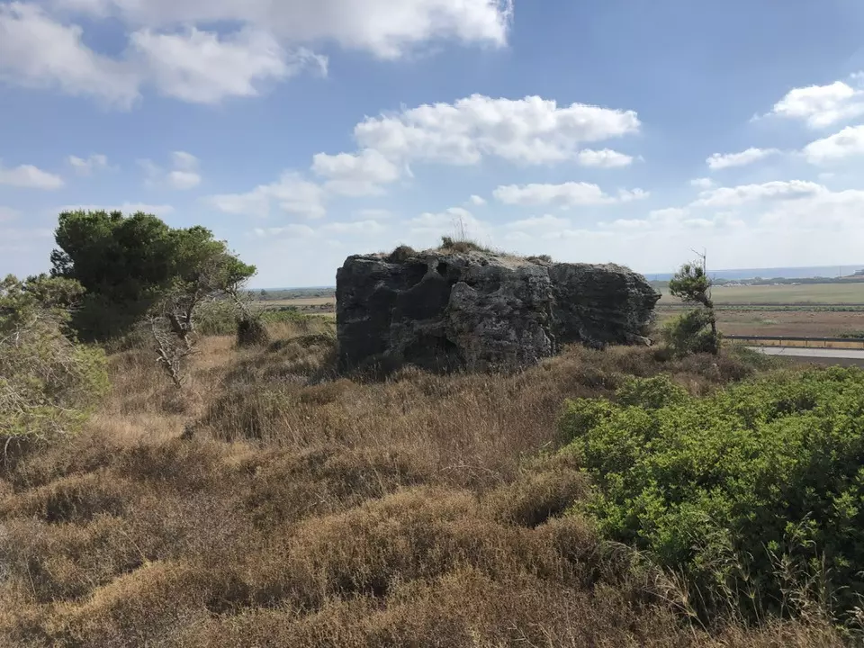
| Village Temains | No traces of Arab houses are left behind. | ||||||||||||||||||
| Ethnically Cleansing | 'Atlit inhabitants were completely ethnically cleansed. | ||||||||||||||||||
| Pre-Nakba Land Ownership |
**Town Lands' Demarcation Maps |
||||||||||||||||||
| Land Usage As of 1945 |
|
||||||||||||||||||
| Population |
|
||||||||||||||||||
| Number of Houses |
|
||||||||||||||||||
| Town's Name Through History | During the Hellenistic period, 'Atlit was known by Adarus. | ||||||||||||||||||
| Inhabitants Place of Origin | In 1296, descendants of the 'Uwayrat tribe (a Tatar tribe) settled in 'Atlit and its vicinity. | ||||||||||||||||||
| Nearby Wadies & Rivers | Wadi al-Tabun, wadi al-Sukhul, and Wadi Falah are bordering the village. | ||||||||||||||||||
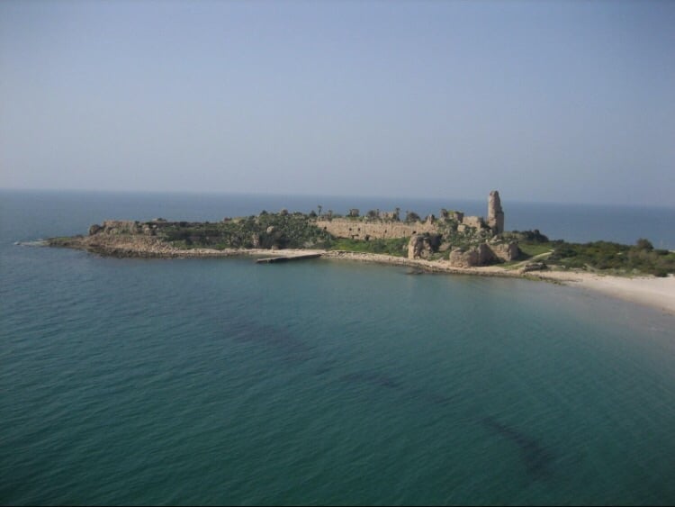
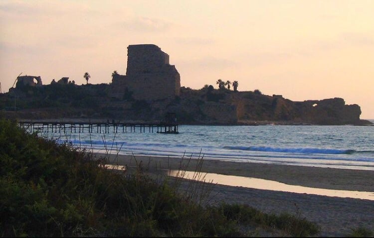
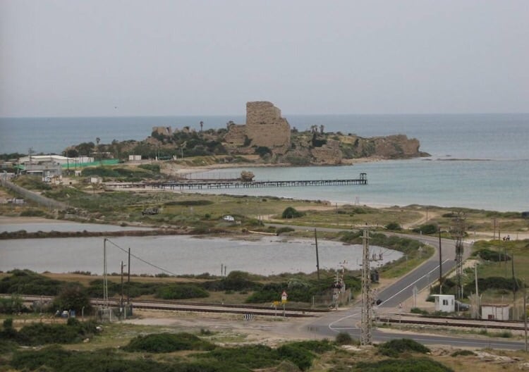
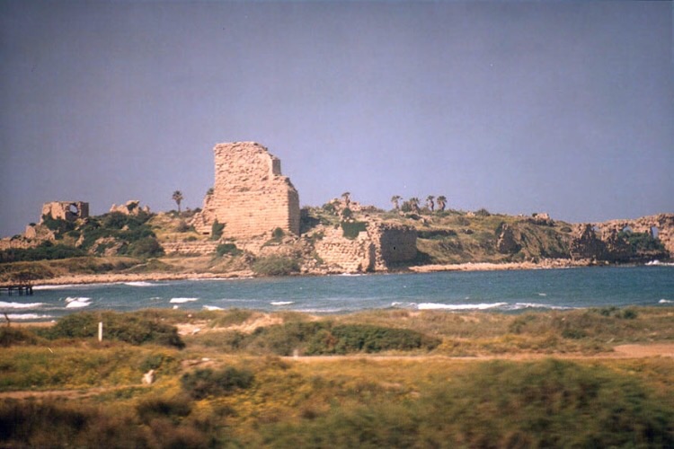
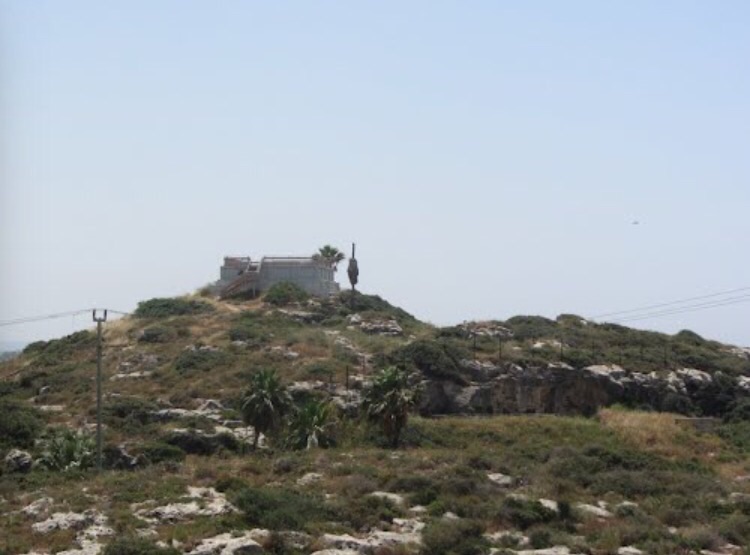
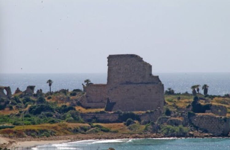
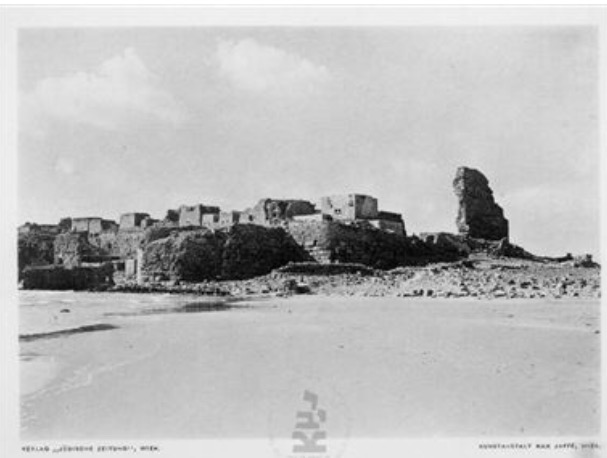
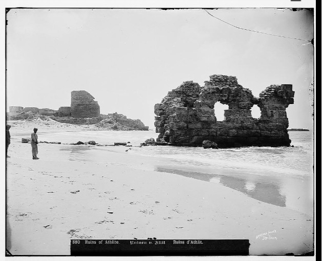
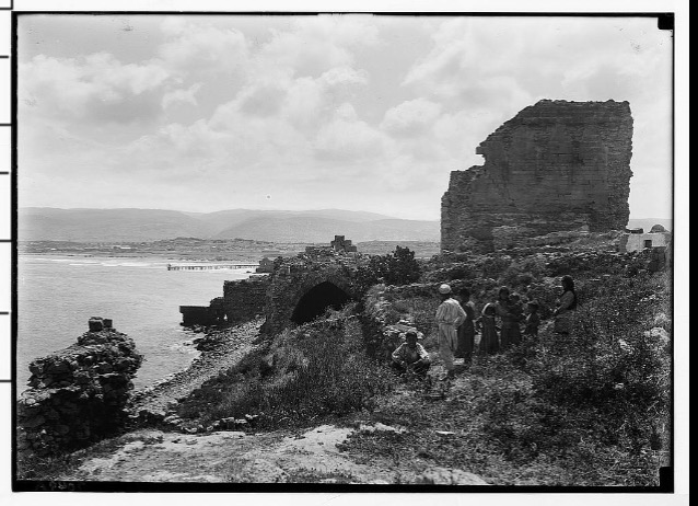
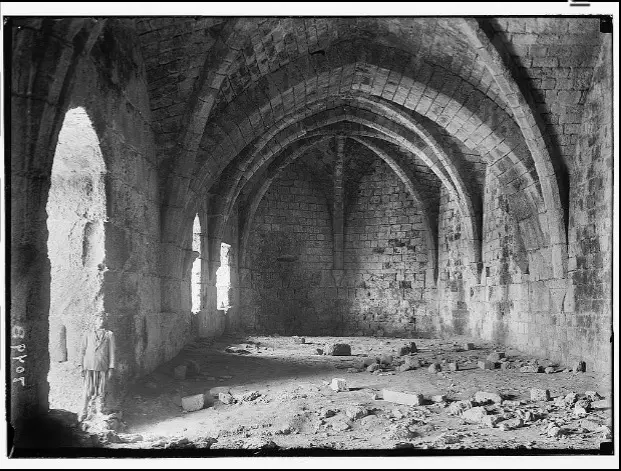
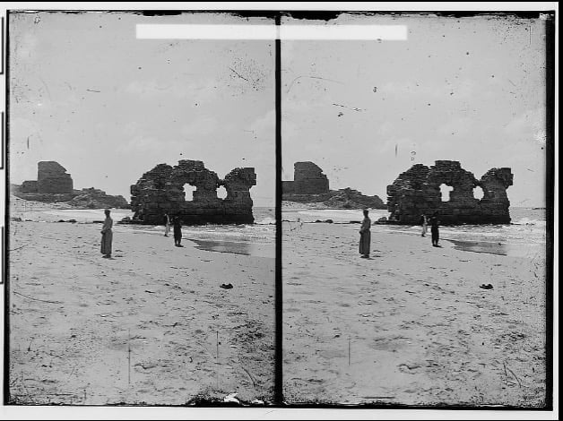
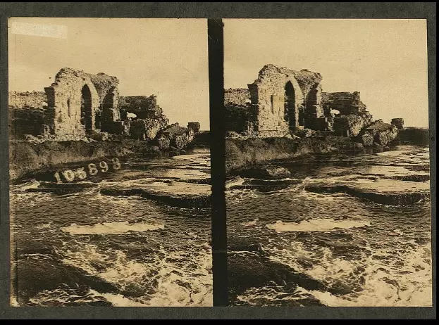
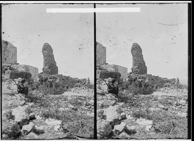
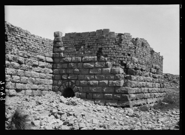
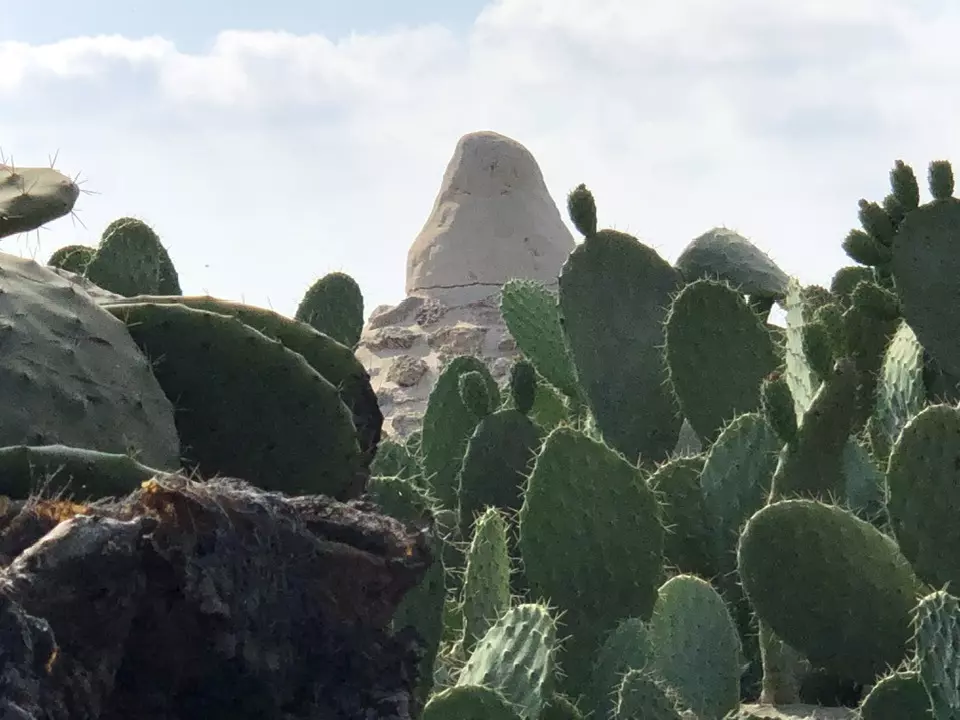
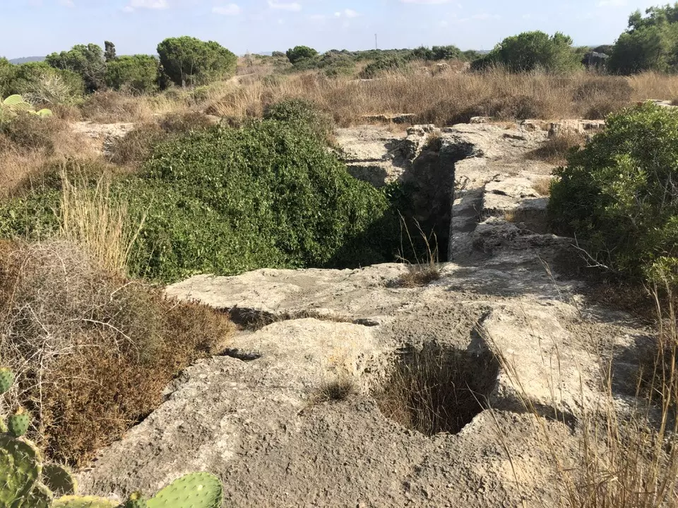
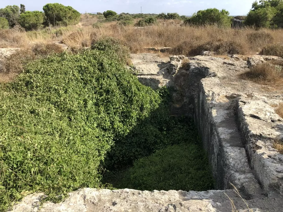
| Archeological Sites | 'Atlit contained a Crusades Castle called Castle Peregrinorum (castle of the pilgrims), and a Muslim cemetery east of the Crusader castle which has an Arabic inscription dating to 1800s. | ||||||||||||||||||
| Exculsive Jewish Colonies Who Usurped Village Lands |
'Atlit and Newe Yam | ||||||||||||||||||
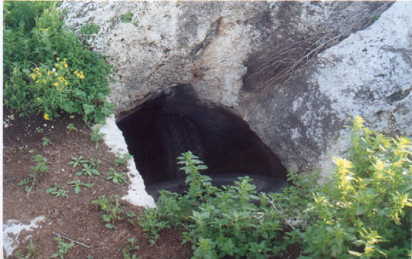
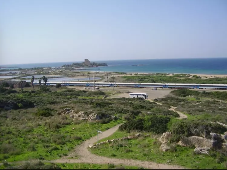
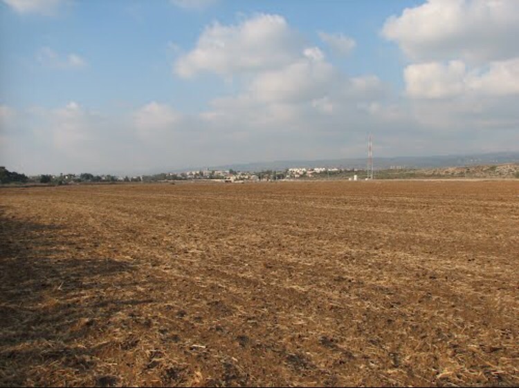
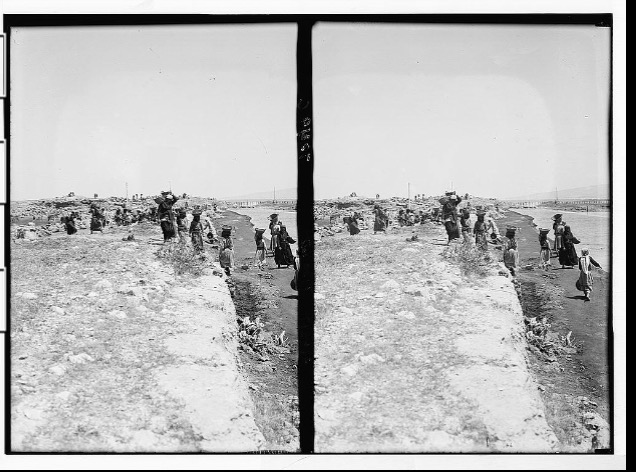
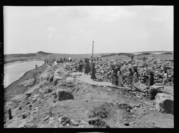
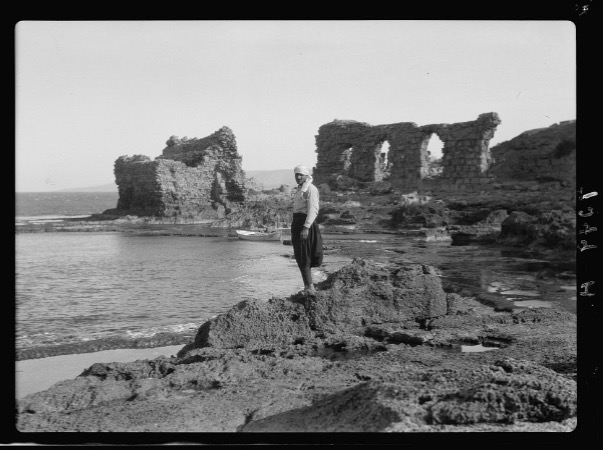
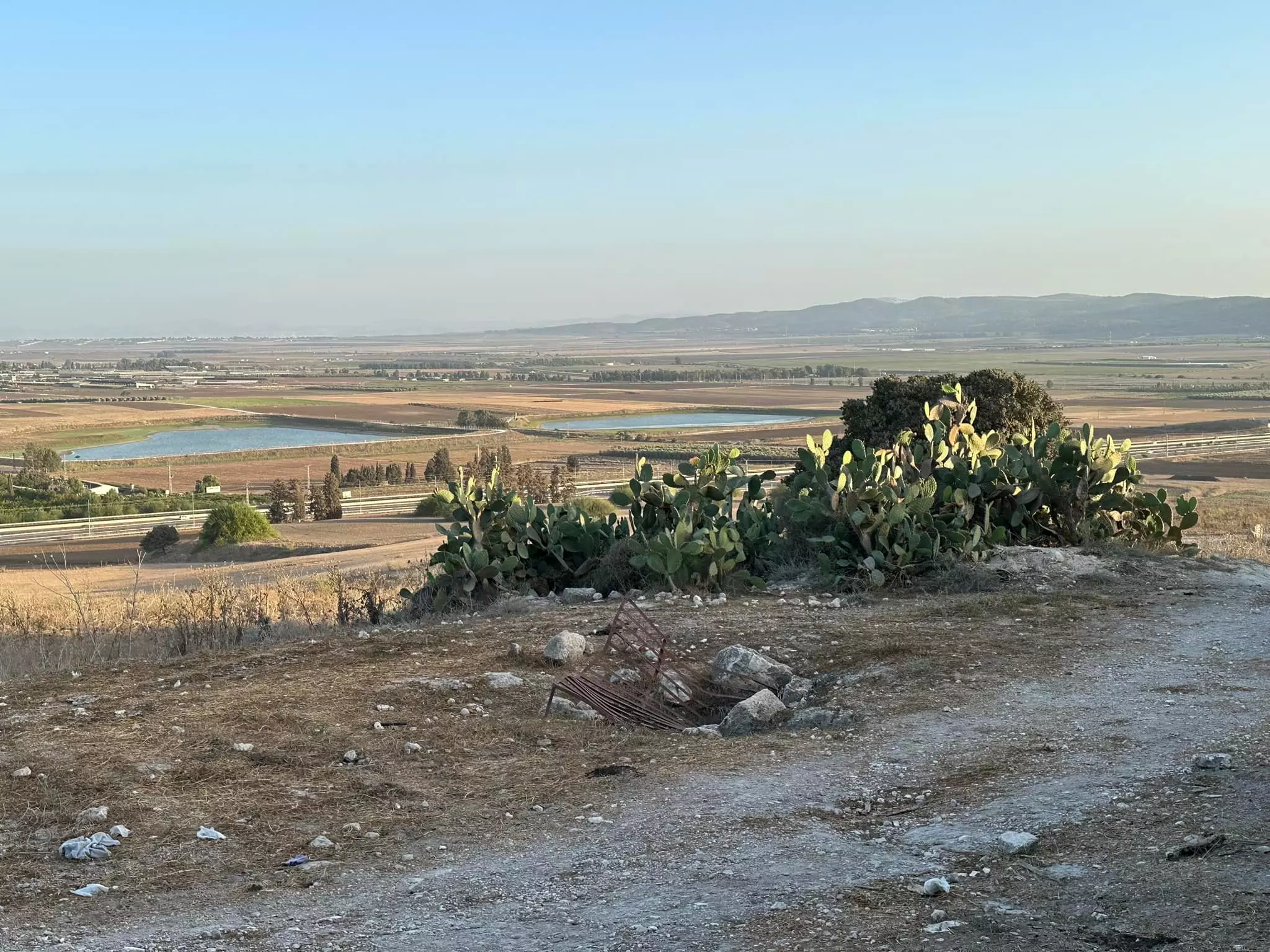
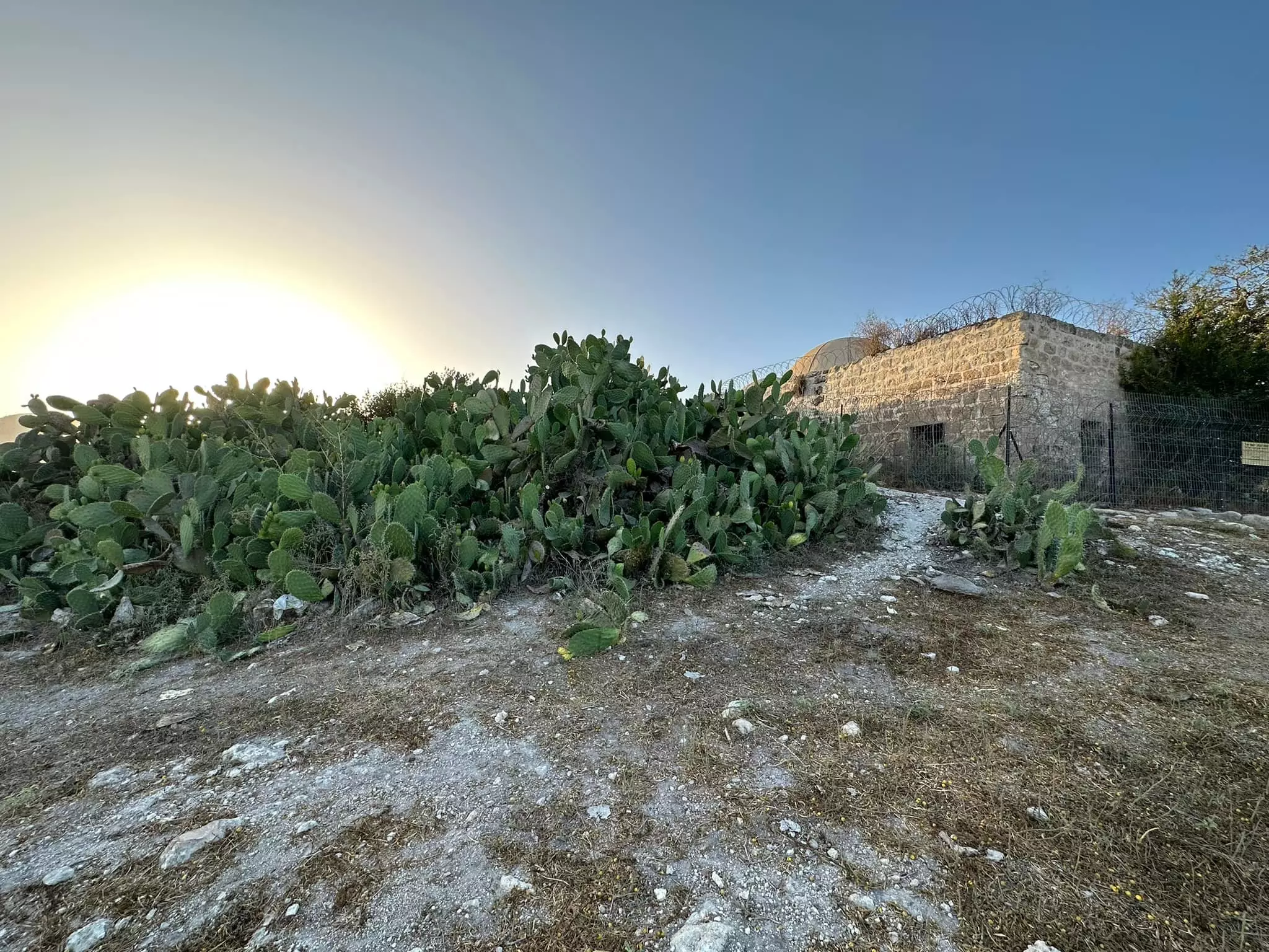
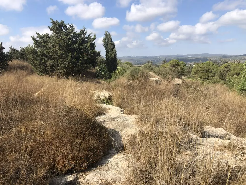
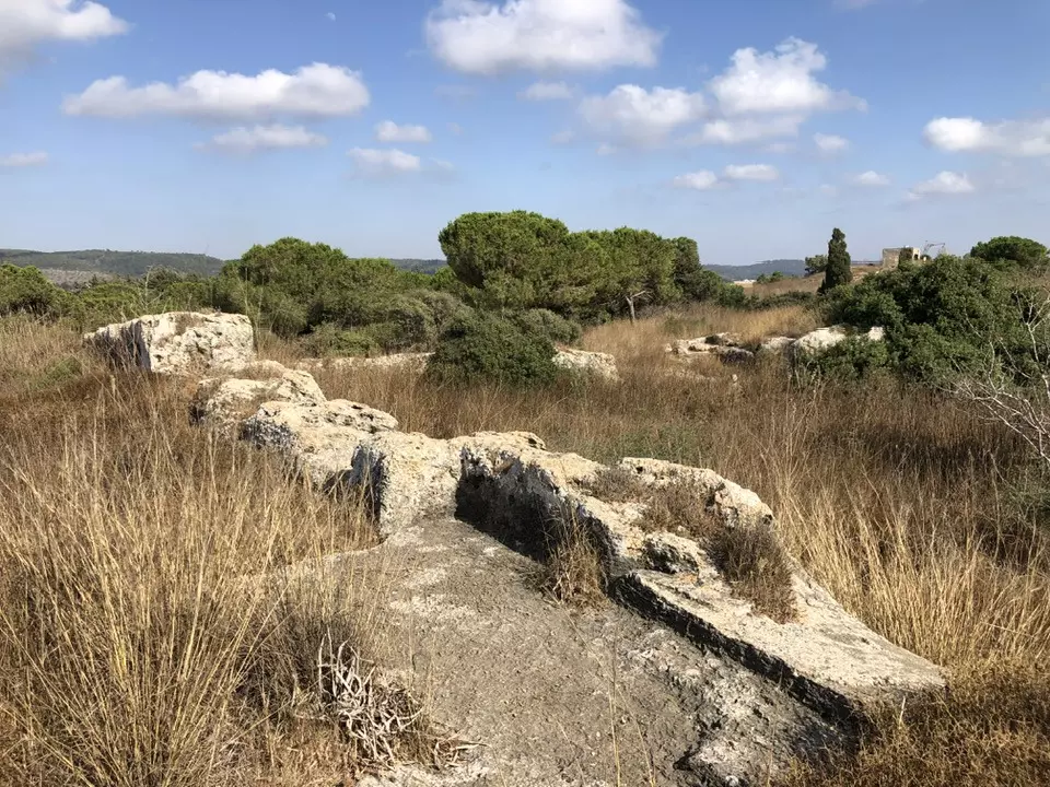
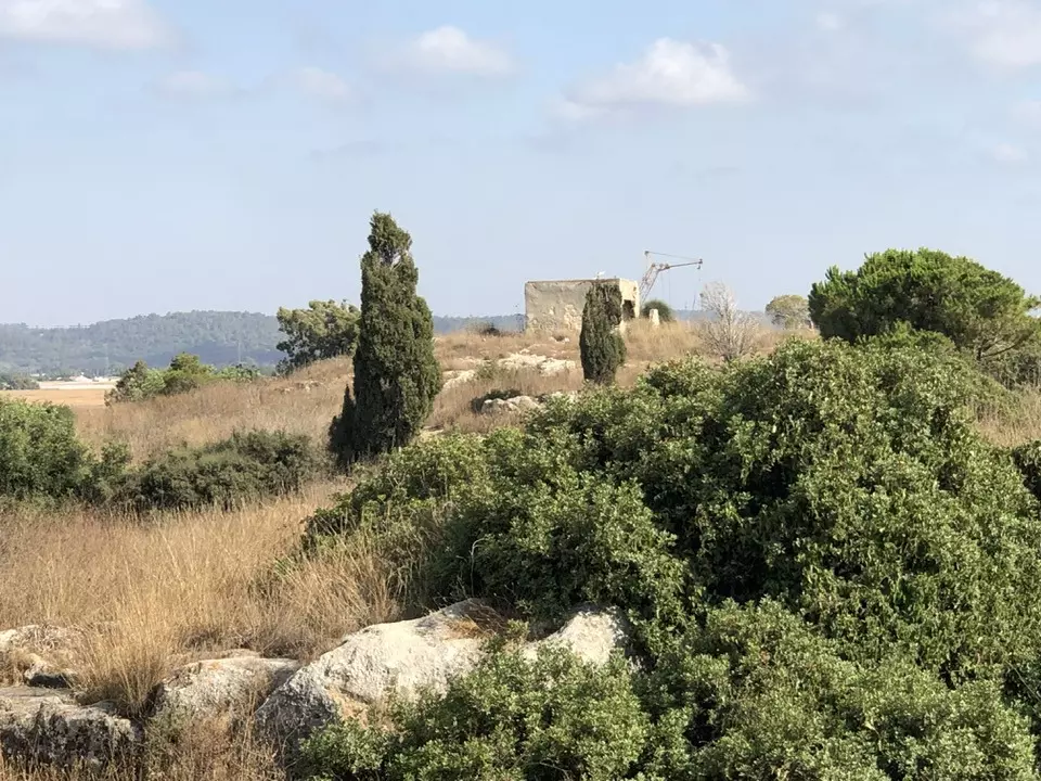
Village Before NakbaThe village was situated on a sandstone hill that overlooked the Mediterranean. It was bordered by coastal agricultural lands to the east and by large evaporation pans (used for extracting salt from sea water) to the southwest. Three km southeast of the village, in Wadi al-Mughara, evidence of early human habitation was discovered in the caves of al-Wad, al-Tabun, and al-Sukhul during an excavation in the 1930s. About 3 km northeast, at the entrance to Wadi Falah, evidence of a human presence during the Neolithic period was unearthed in a cave. Excavations close to the east revealed a site that had been occupied from the second millennium B.C. to the seventh century A.D. In a Hellenistic source the site is named Adarus, a colony of Sidon.The Arab geographer Yaqut al-Hamawi (d. 1228) referred to the village in his Mu'jam al-Buldan, describing it as a fortress called al-Ahmar ('red'). In 1218 the Crusaders built a town and a large fortress on the site of Adarus. They called the fortress Castellum Peregrinorum, 'castle of the pilgrims.' Atlit remained in the Crusaders' hands until 1291, when its defenders abandoned it in the wake of the general withdrawal of their forces from the coastal area of Palestine. In 1296 descendants of the 'Uwayrat tribe (a Tartar tribe) settled in 'Atlit and its vicinity. In 1596 'Atlit had a farm that paid taxes to the Ottoman government. In the early nineteenth century the British traveler Buckingham saw the ruins of the village from a distance. Later in that century, another traveler (Thomson) said that the village of Atlit was built inside the ruins of the Crusader village. The authors of the Survey of Western Palestine said it was a hamlet built of adobe bricks. Its inhabitants, who numbered about 200, tilled 20 faddans (1 faddan = 100-250 dunums). In 1903 Jewish settlers established a settlement near Atlit and gave it the same name. During World War I the Jewish settlement became a center for Nili (Netzach Yisra'el Lo Yeshaqqer, 'the strength of Israel will not lie'), a pro-British, Zionist intelligence organization. In the 1920s the Palestinian village of Atlit was a member of a regional cooperative association that was dedicated to the improvement of peasant life and included some 25 villages in Haifa sub-disctrict. By 1938 the population in both the village and the settlement of Atlit had grown to 732, comprised of 508 Arabs and 224 Jews. By 1944/45, however, the number of Arab inhabitants had fallen to 150, including 90 Muslims and 60 Christians. As for the land, only 15 dunums remained in Arab hands; 3 dunums were planted in cereals and 11 dunums were irrigated or used for orchards. The village had a railway station. In the 1930s C. N. Johns excavated the Crusader town and fortress for the Department of Antiquities in Palestine. More recent exploration has shown that the north harbor of the town may be Hellenistic in origin. A Muslim cemetery east of the Crusader castle has an Arabic inscription dating to 1800. Village Occupation and Ethnic CleaningThe History of the Haganah refers to Atlit as a base of Haganah activity and a source for recruits, who lived in the Jewish settlement there. Another Israeli source (historian Benny Morris) fails to list it among the villages captured and depopulated during 1948. It is not clear when the Arab village of Atlit fell into Zionist hands or by what means.Zionists Colonies on Village LandsThe Zionists established the settlement of Atlit in 1903 and Newe Yam in 1939. Both are now on village lands.Village TodayNo traces of Palestinian Arab houses are left. A railroad station that used to serve the village is still in use. A prison in the vicinity was used by Israel in 1989 for holding Lebanese and Palestinian detainees.SourceDr. Walid al-Khalidi, 1992: All That Remains. |
|||||||||||||||||||
| Related Maps | Town Lands' Demarcation Maps خرائط للقضاء توضح حدود القرى والاودية Town's map on MapQuest View from satellite Help us map this town at WikiMapia |
||||||||||||||||||
| Related Links | Wikipedia's Page Google Search Google For Images Google For Videos |
||||||||||||||||||
| More Information | في كتاب كي لا ننسى في كتاب بلادنا فلسطين المزيد من موقع هوية |
||||||||||||||||||
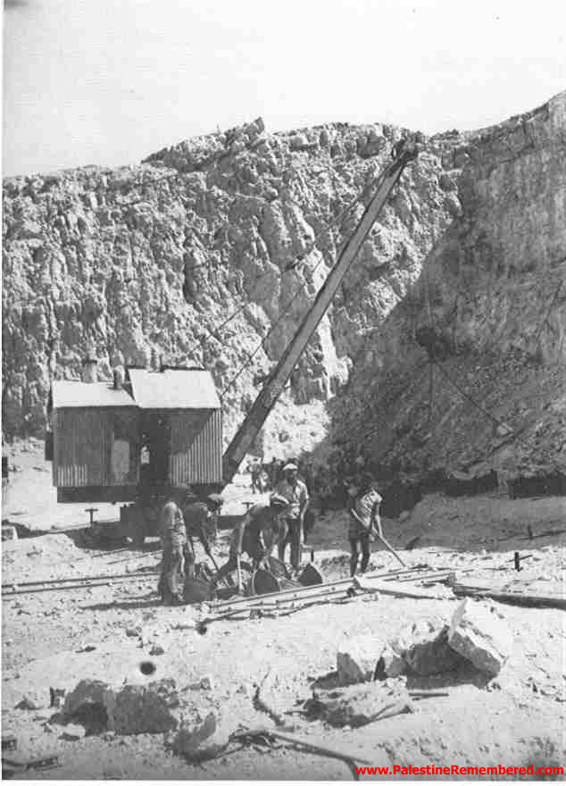
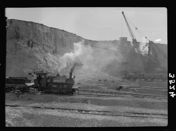
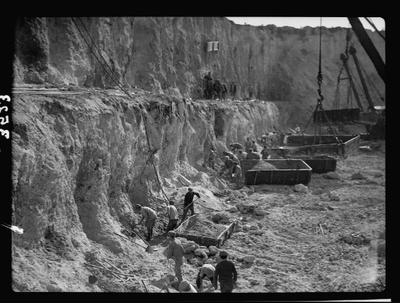
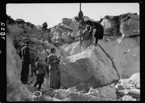
- Atliti stone quarries in the 1930s
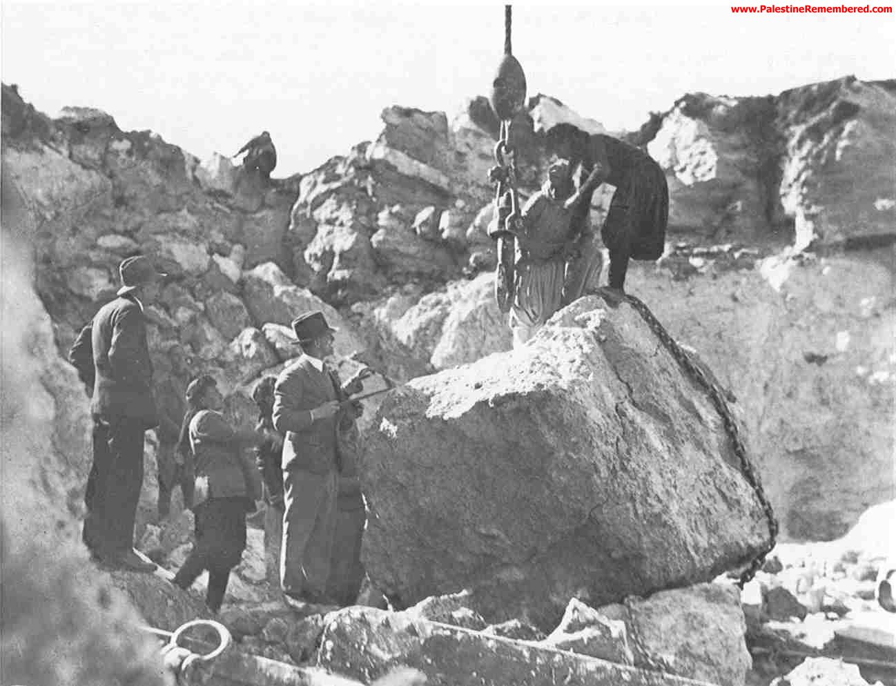
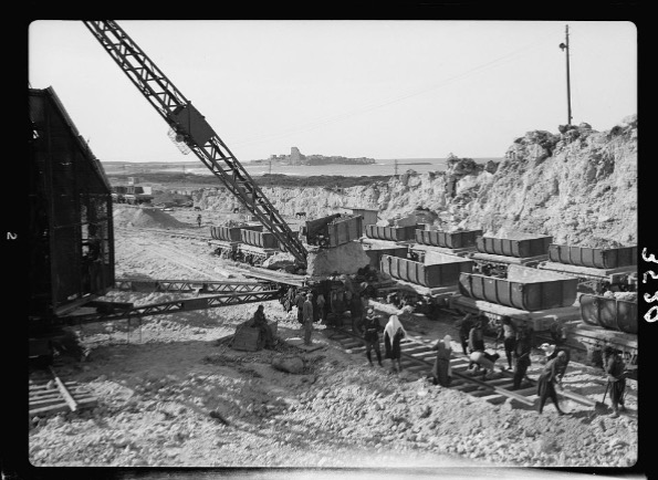
- Atliti stone quarries in the 2c1930s
- Ruins of Palestinian Arab House in Atlit, 2002
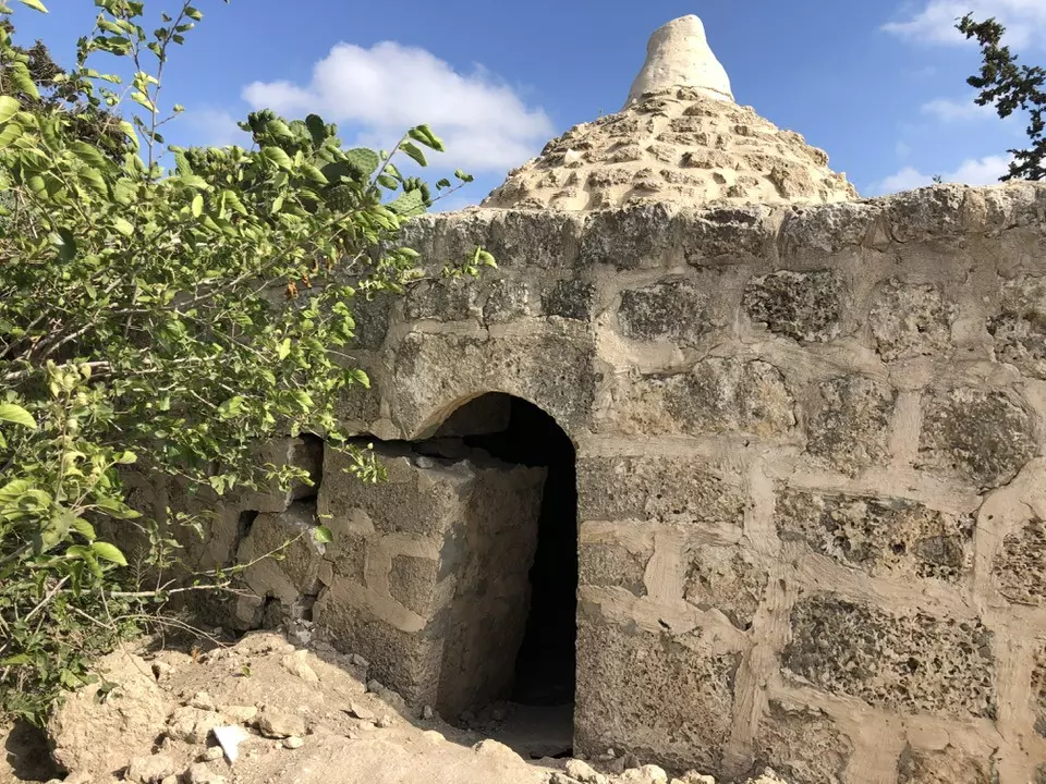
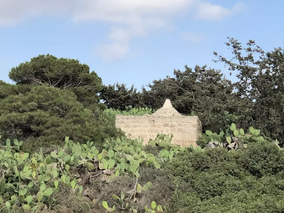
Posted by Uri Zackhem 1 - An old Palestinian shrine/maqam maintained by Israelis, 2002
Posted by Uri Zackhem 2 - An old Palestinian cistern (well) used to store rain water, 2002
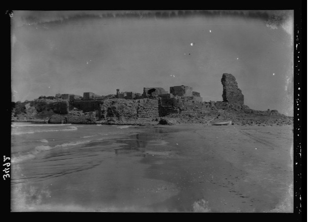
Posted by Uri Zackhem - Atlit's Citadel (pre-1900s)

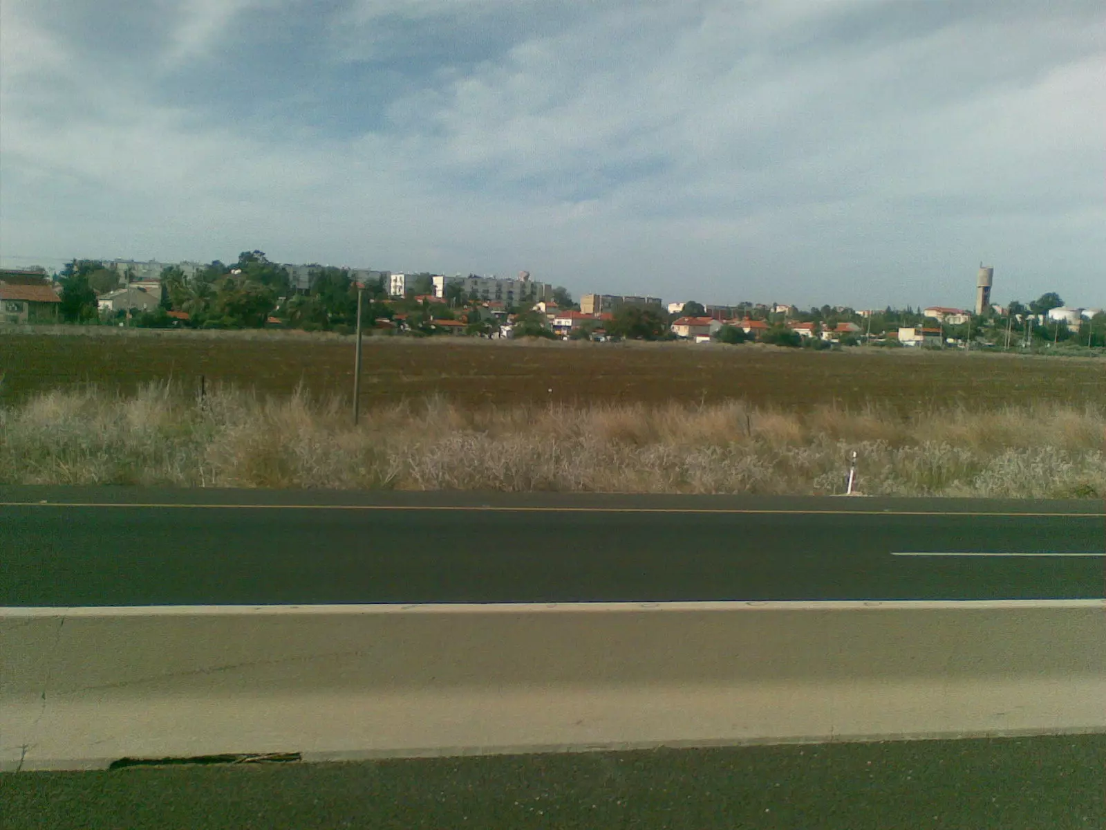
- عتليت صوره من الطريق العام حيفا تل ابيب
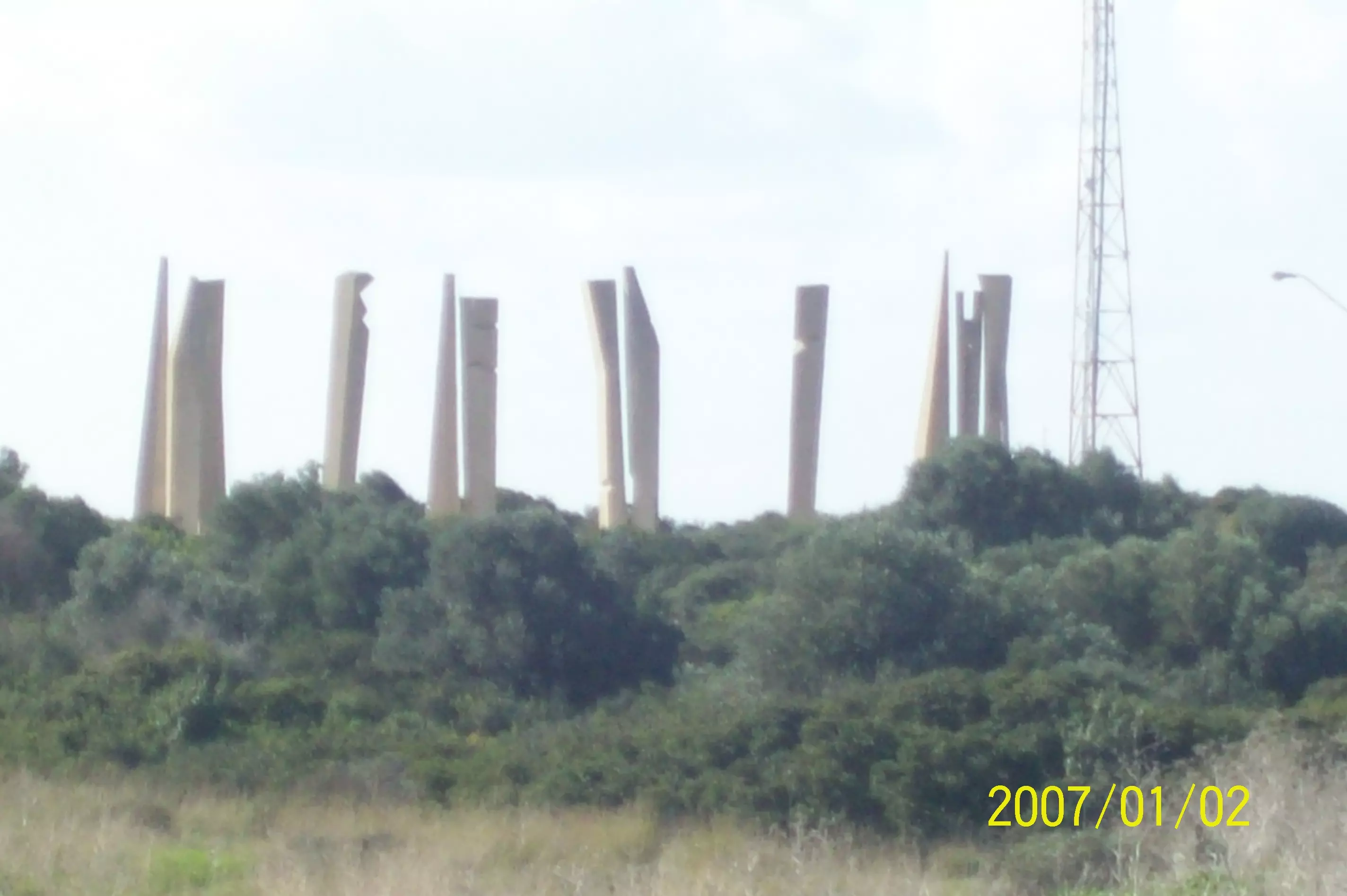
Posted by ابو الثائر - اعمدة اسمنت بمثابة نصب تذكاري للرياضيين الصهاينه الذين قتلو بعملية ميونخ عام 1972
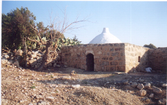
Posted by ابو الثائر - قلعه عتليت
Posted by abu raya - قلعه عتليت
Posted by abu raya - قلعه عتليت
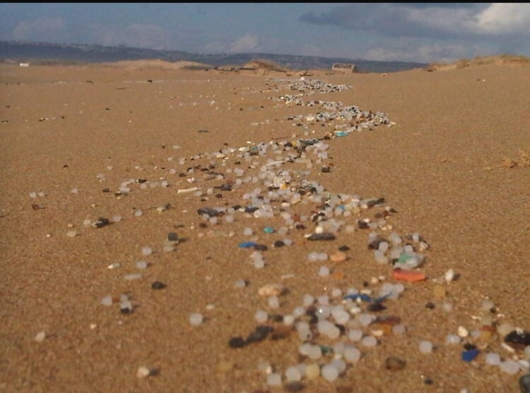
Posted by abu raya - شاطى بحر عتليت
Posted by abu raya - قلعه عتليت
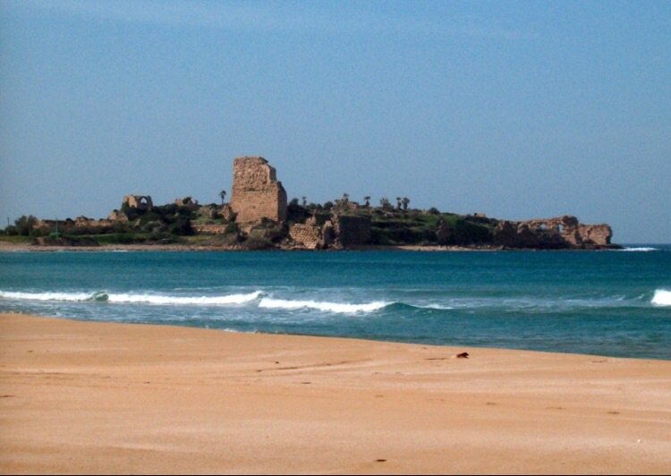
Posted by abu raya - قلعه عتليت
Posted by abu raya - قلعه عتليت
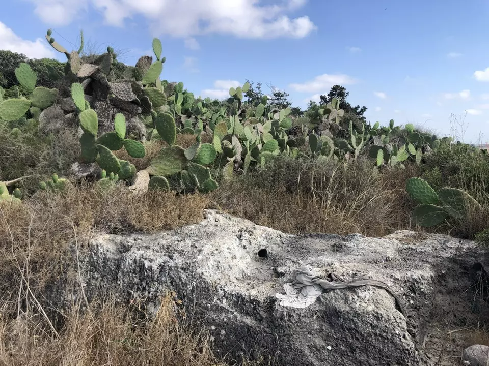
Posted by abu raya - اراضي عتليت
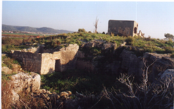
Posted by abu raya - بيوت عتليت الباقيه
Posted by abu raya - قلعه عتليت
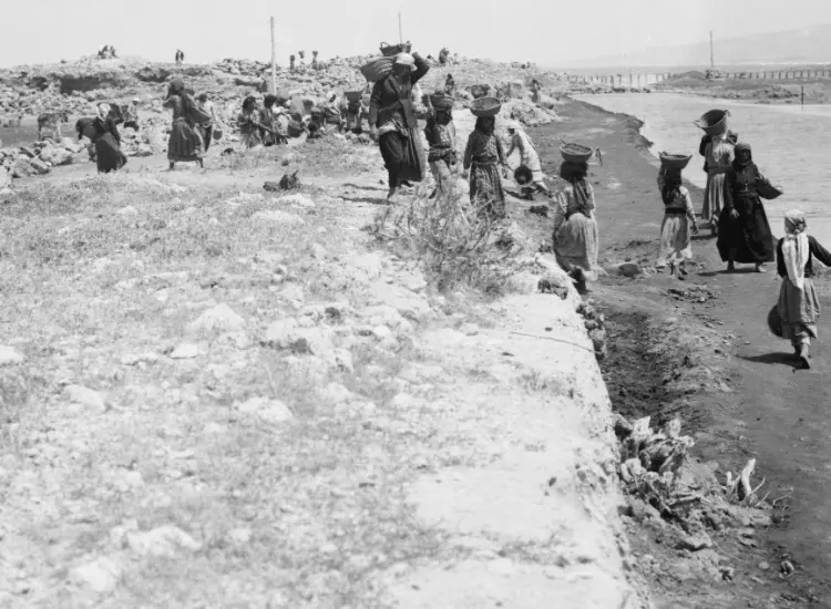
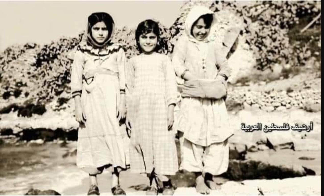
Posted by abu raya - عتليت قبل النكبه
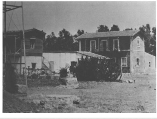
Posted by abu raya - عتليت قبل النكبه
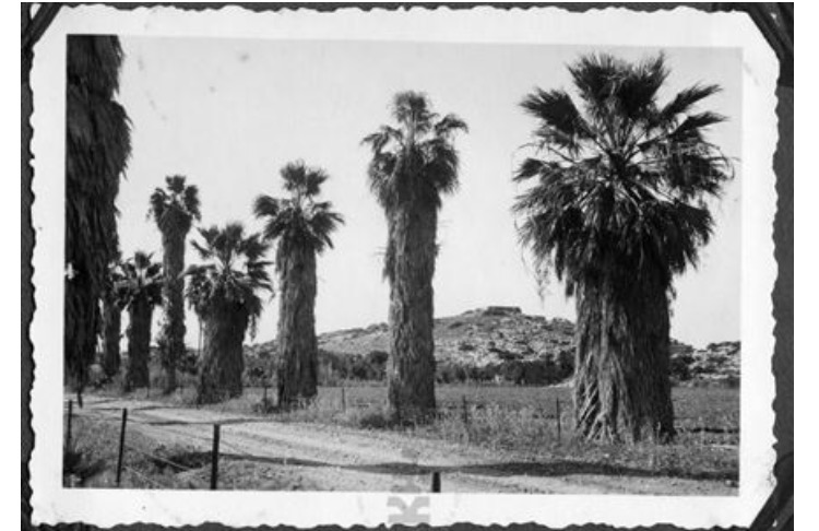
Posted by abu raya - عتليت قبل النكبه
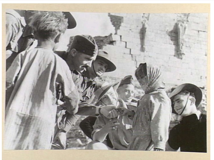
Posted by abu raya - صوره لجنود بريطانيين برفقه اطفال من عتليت سنه 1940
Posted by abu raya - عتليت سنه 1940
Posted by abu raya - عتليت قبل النكبه
Posted by abu raya - عتليت قبل النكبه
Posted by abu raya - عتليت قبل النكبه
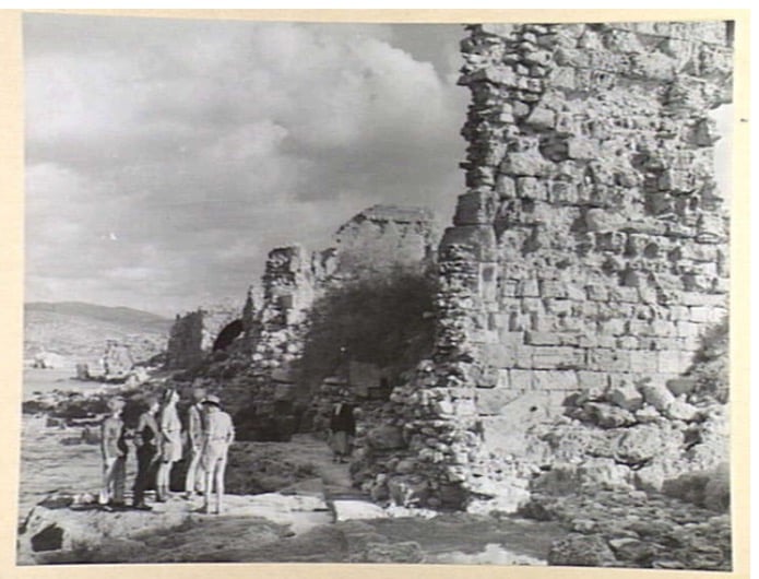
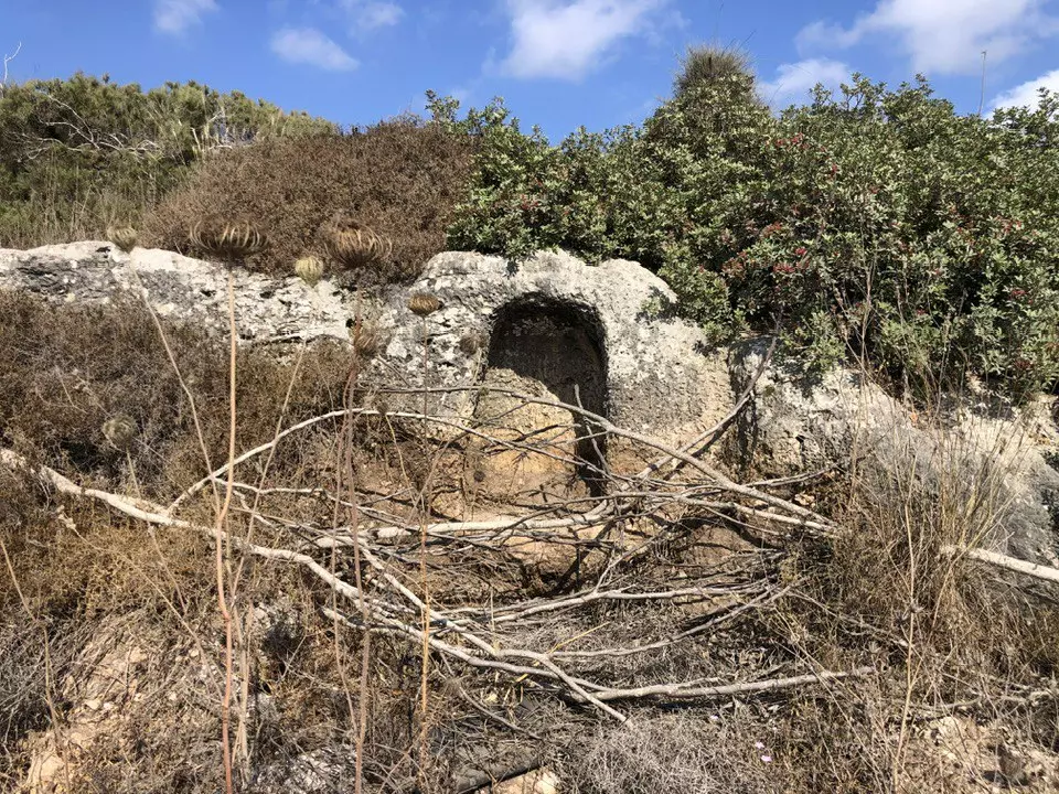
Posted by abu raya - اثار عتليت قبل النكبه
Posted by abu raya - عتليت قبل النكبه
Posted by abu raya - عتليت قبل النكبه
Posted by abu raya - عتليت قبل النكبه
Posted by abu raya - عتليت قبل النكبه
Posted by abu raya - عتليت قبل النكبه
Posted by abu raya - عتليت قبل النكبه
Posted by abu raya - خط سكه الحديد بالقرب من عتليت قبل النكبه
Posted by abu raya - عتليت قبل النكبه
Posted by abu raya - عتليت قبل النكبه
Posted by abu raya - ترميم خط سكه الحديد بالقرب من عتليت قبل النكبه
Posted by abu raya - عتليت قبل النكبه
Posted by abu raya - منظر عام لعتليت قبل النكبه
Posted by abu raya - صوره من عتليت المهجره قبل النكبه
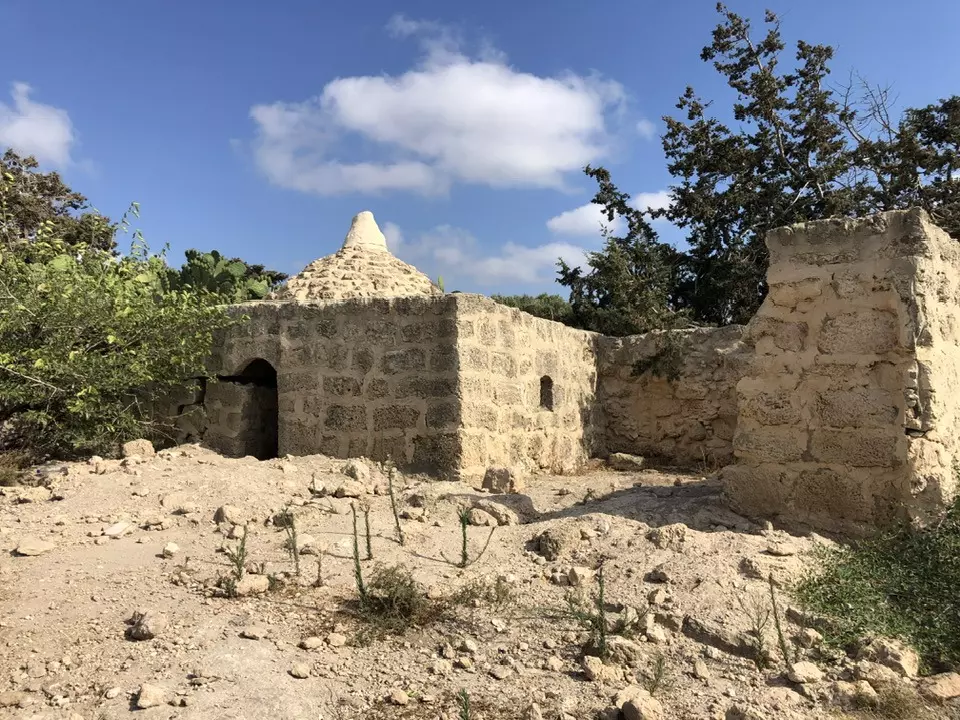
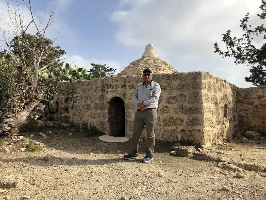
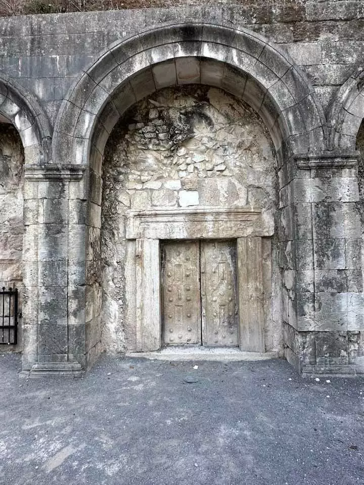
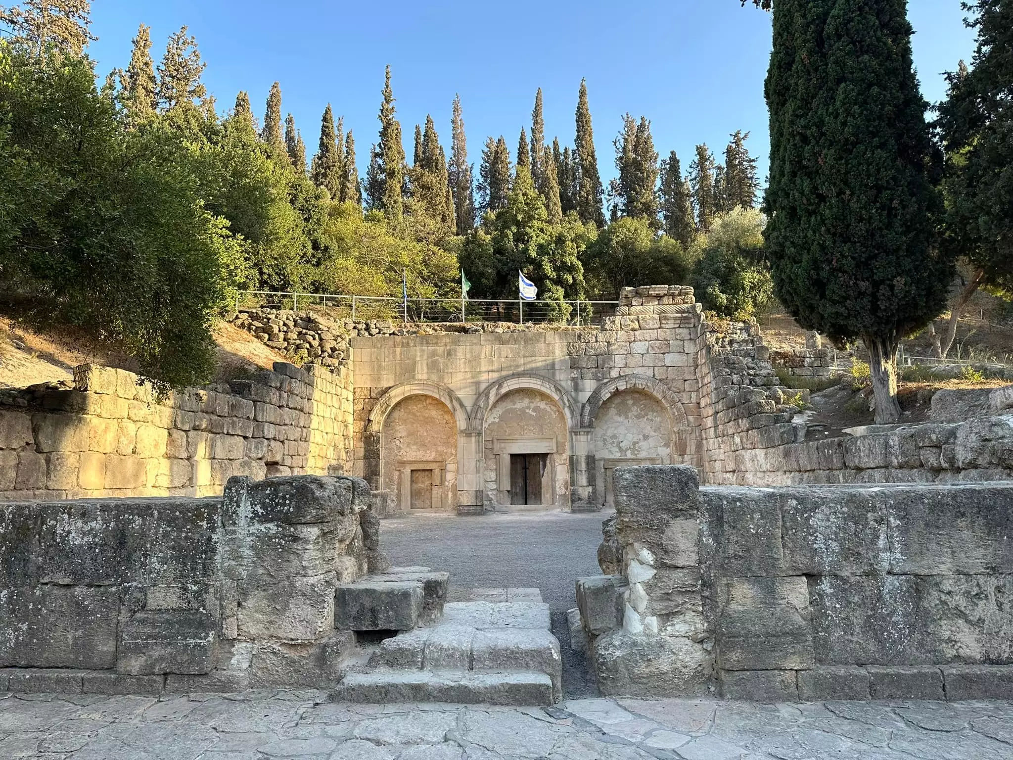
Posted by abu raya - في ساحة مقام الشيخ بريك في خربة الشيخ بريك-عثليث المهجرة (قضاء حيفا ).
يقع في منطقة الساحل جنوب عثليث ، في أحد أحياء عثليث الثلاثة والذي كان معظم سكانه من الأرمن . هناك مقام آخر يحمل نفس الاسم في منطقة طبعون ومرج بن عامر . أصل التسمية من البركة والتبرك وهو مقام من الفترة المملوكية وعلى الأغلب بني في النصف الأول من القرن السادس عشر .
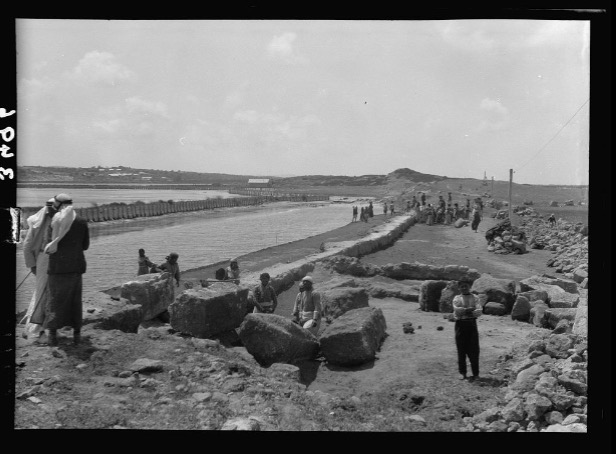
- قرية عتليت قضاء حيفا عام 1946 م
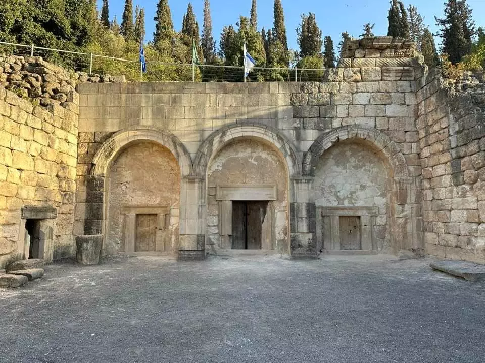
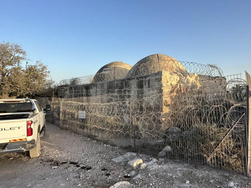
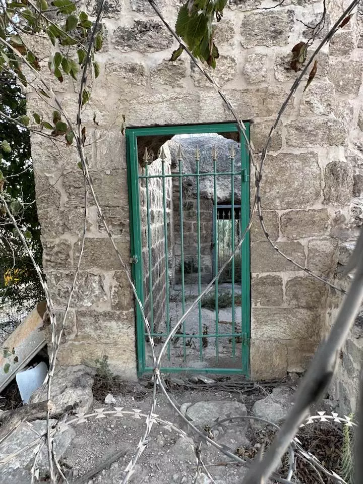
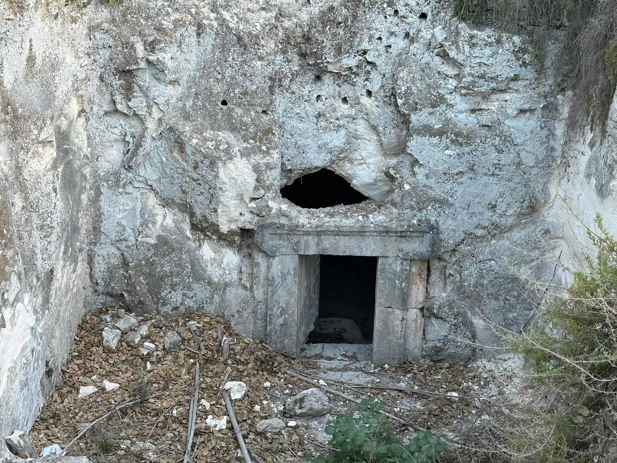
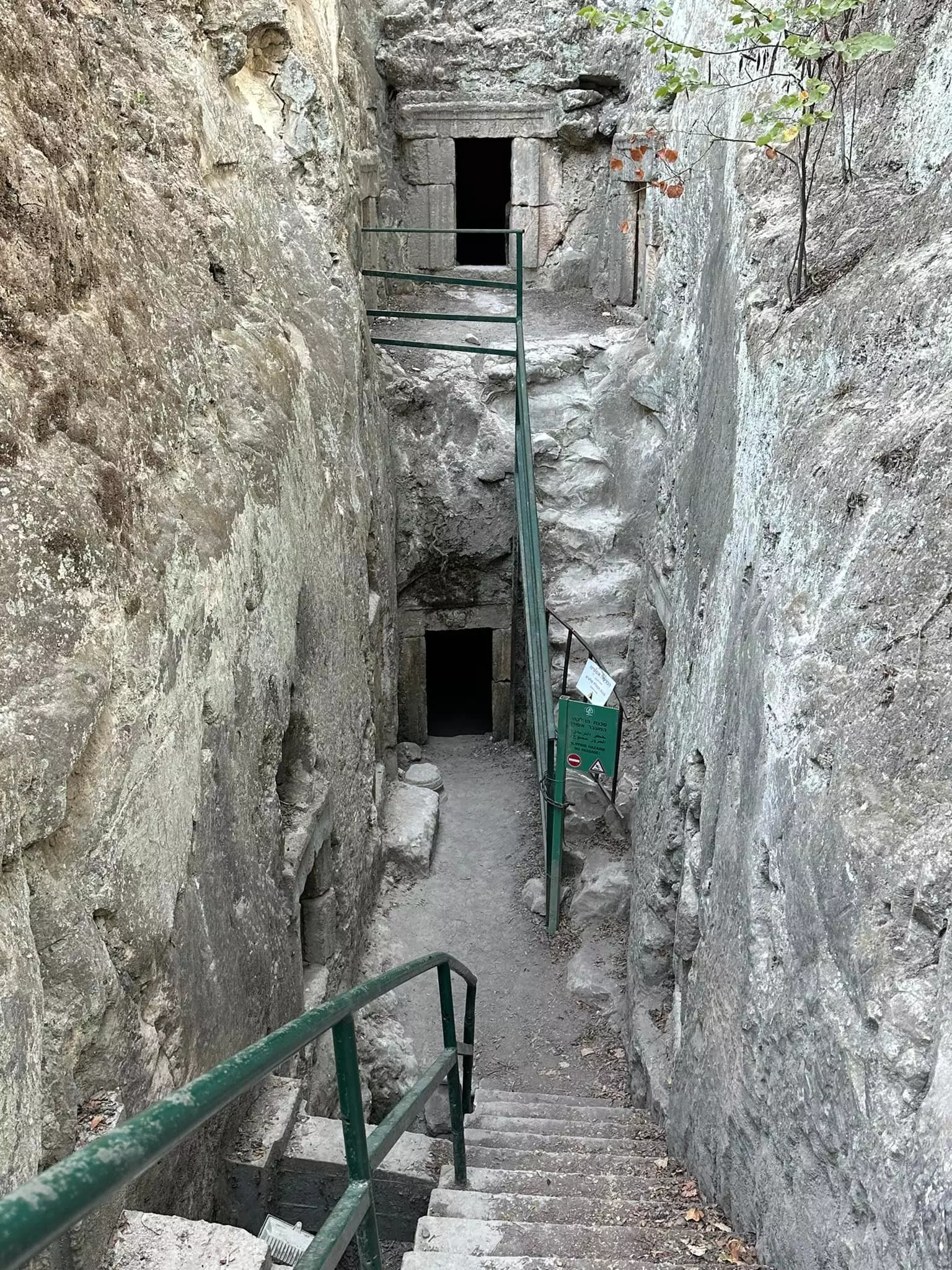
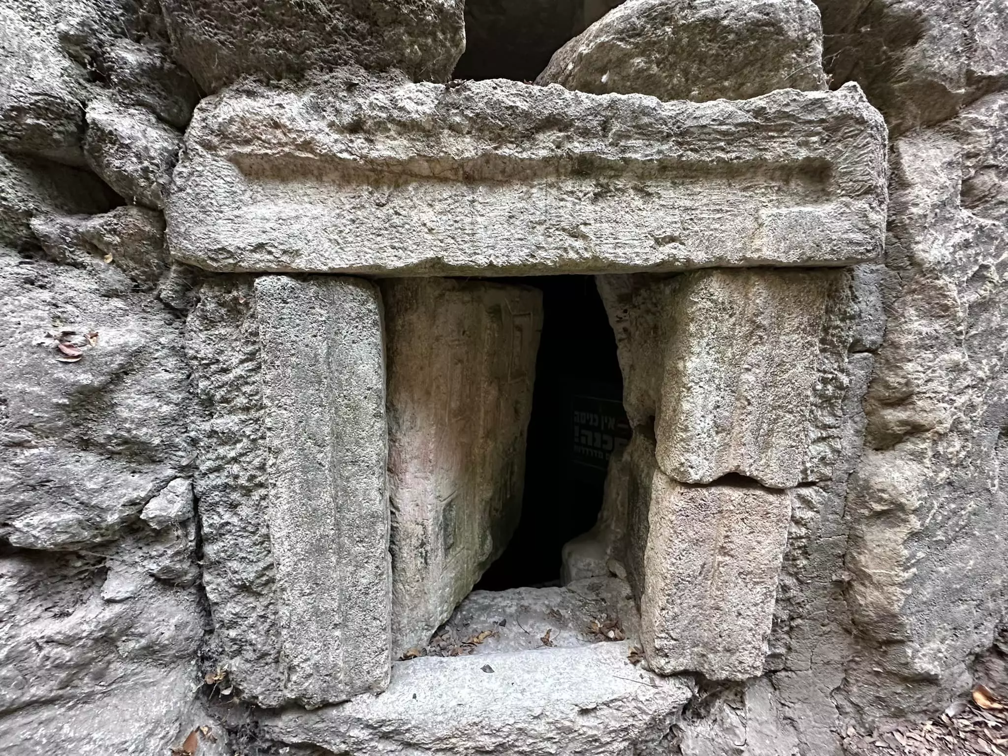
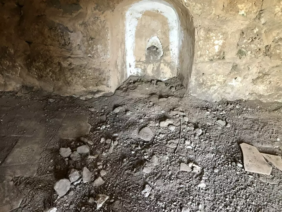
- مقبرة رومانية "نيكروبولس" في خربة الشيخ بريك حيفا مقبرة ذات كهوف محفورة في الصخر الطباشيري-- الأستاذ إياد جابر .
- مقبرة رومانية "نيكروبولس" في خربة الشيخ بريك حيفا مقبرة ذات كهوف محفورة في الصخر الطباشيري-- الأستاذ إياد جابر . #2
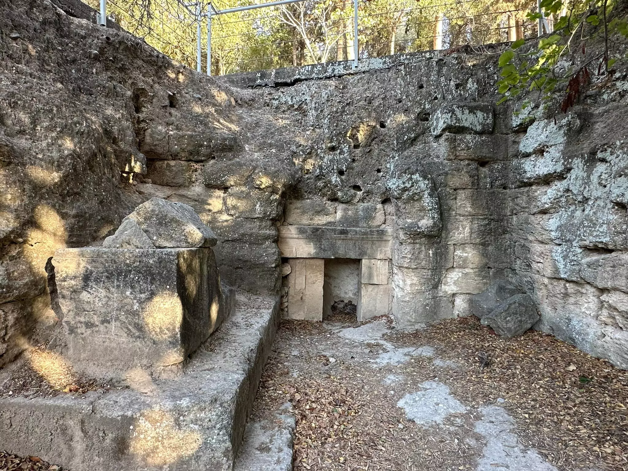
- مقبرة رومانية "نيكروبولس" في خربة الشيخ بريك حيفا مقبرة ذات كهوف محفورة في الصخر الطباشيري-- الأستاذ إياد جابر . #3
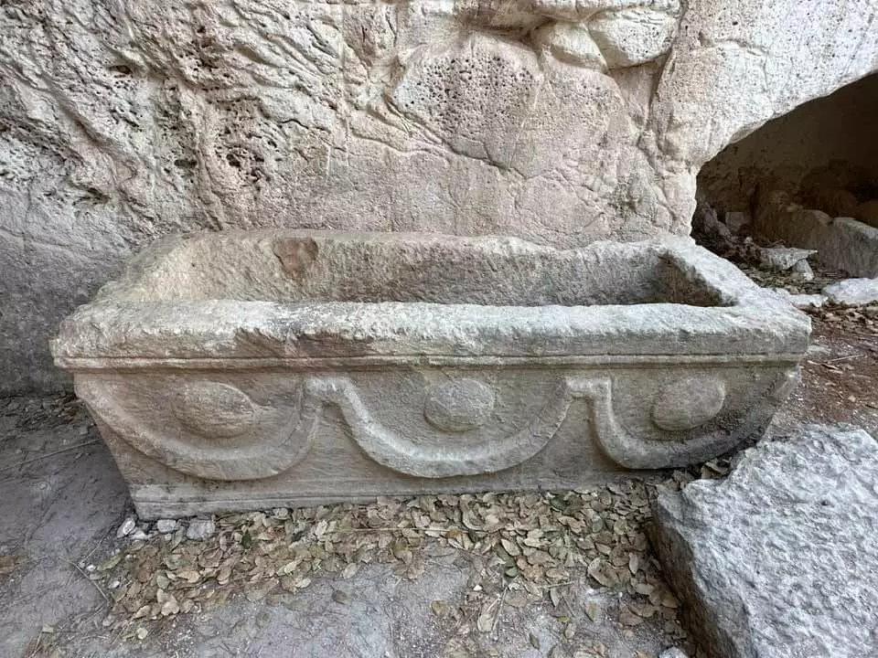
- مقبرة رومانية "نيكروبولس" في خربة الشيخ بريك حيفا مقبرة ذات كهوف محفورة في الصخر الطباشيري-- الأستاذ إياد جابر . #4
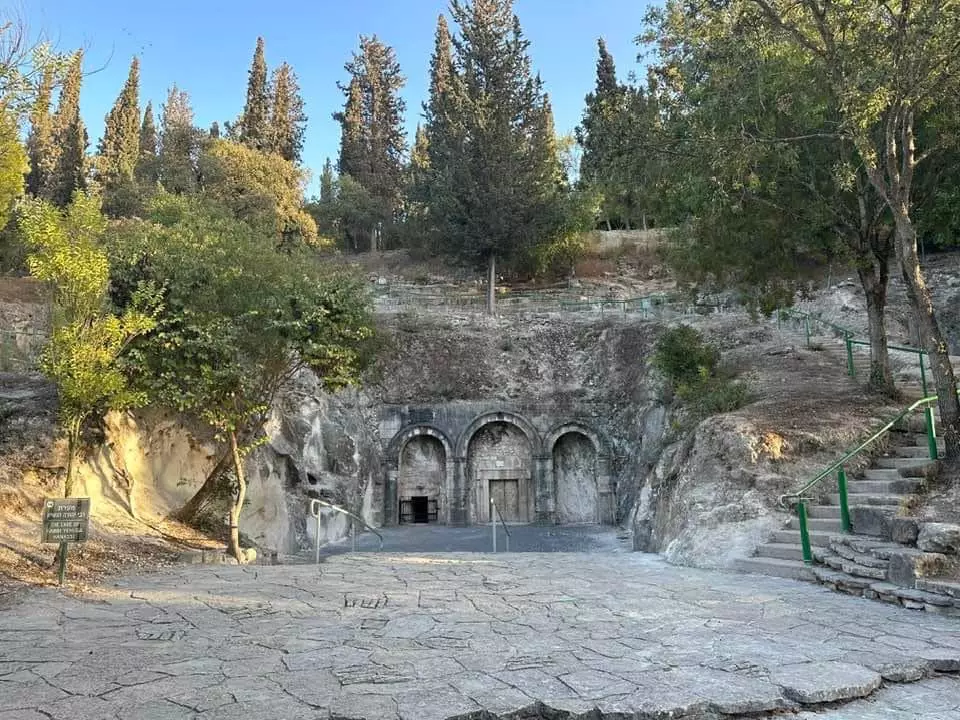
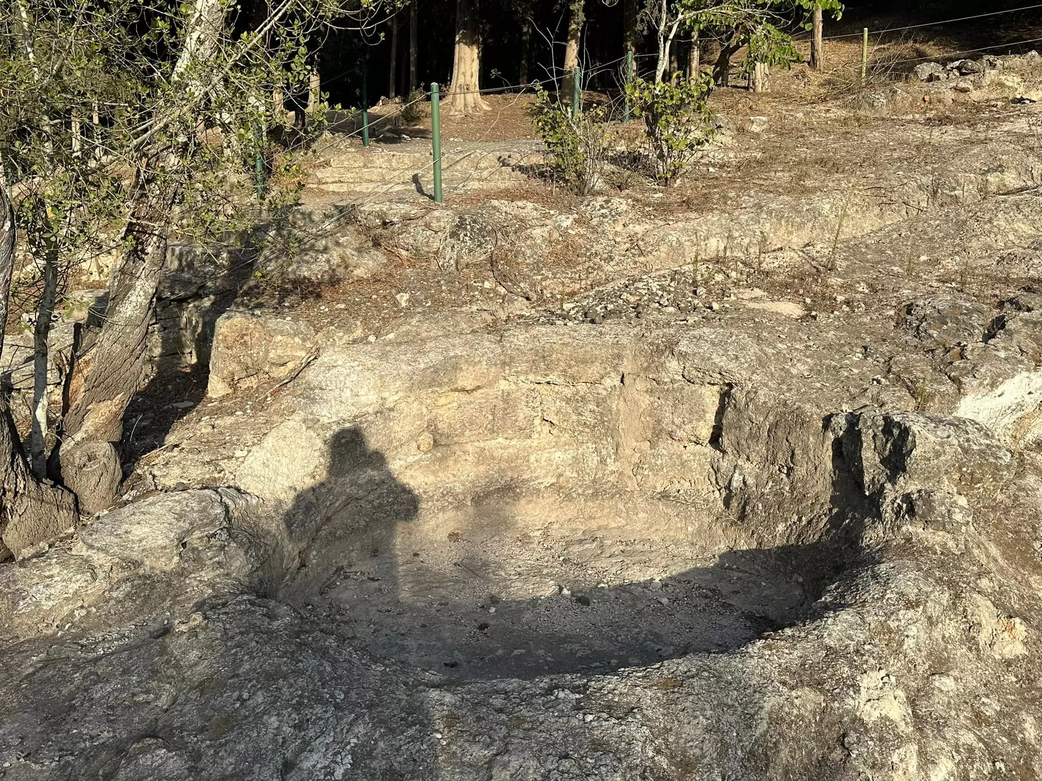
- مقبرة رومانية "نيكروبولس" في خربة الشيخ بريك حيفا مقبرة ذات كهوف محفورة في الصخر الطباشيري-- الأستاذ إياد جابر . #5
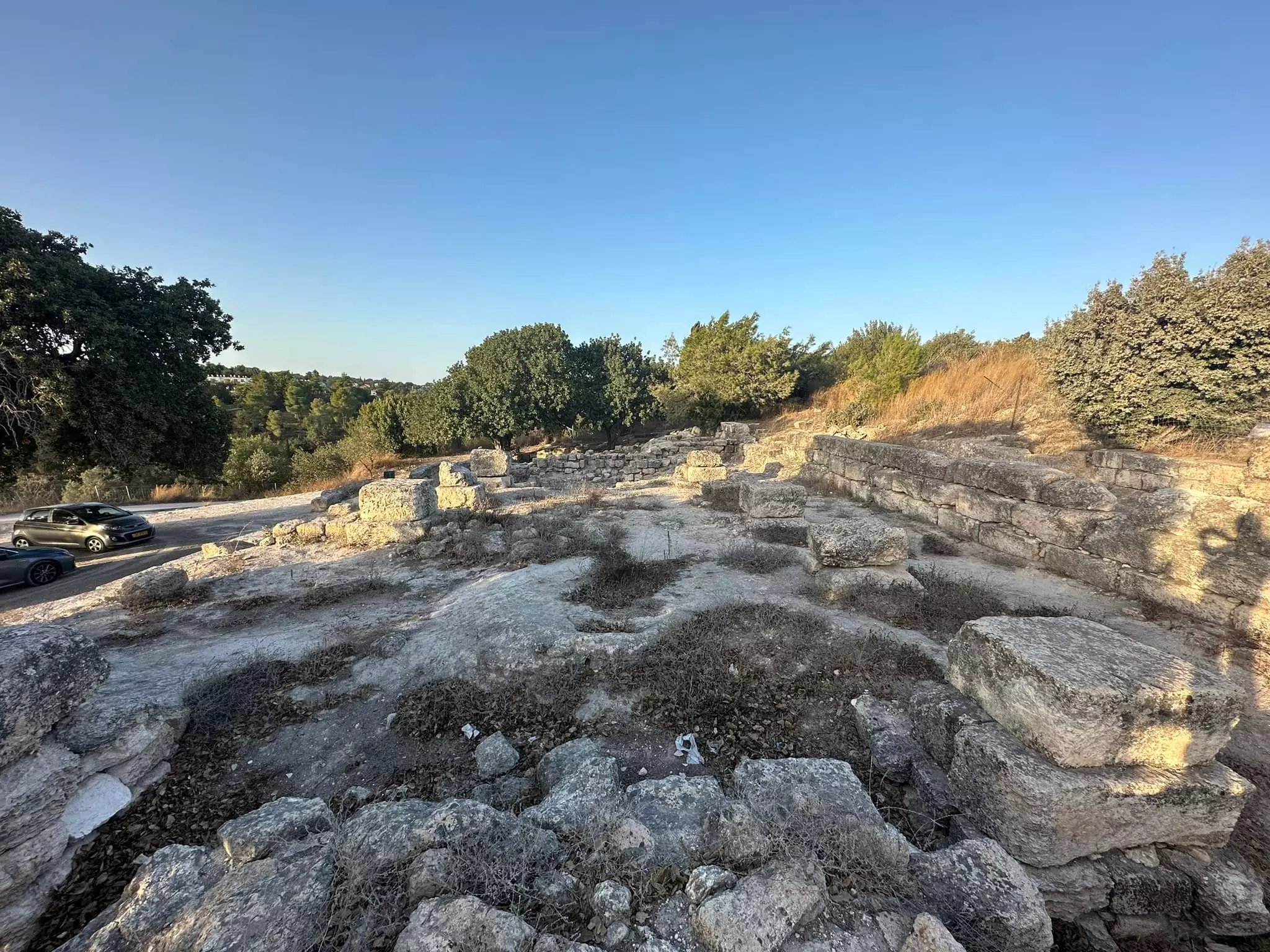
- قرية الشيخ بريق المهجرة القريبة من قرية عتليت
- قرية الشيخ بريق المهجرة القريبة من قرية عتليت #2
- مقبرة رومانية "نيكروبولس" في خربة الشيخ بريك حيفا مقبرة ذات كهوف محفورة في الصخر الطباشيري-- إياد جابر
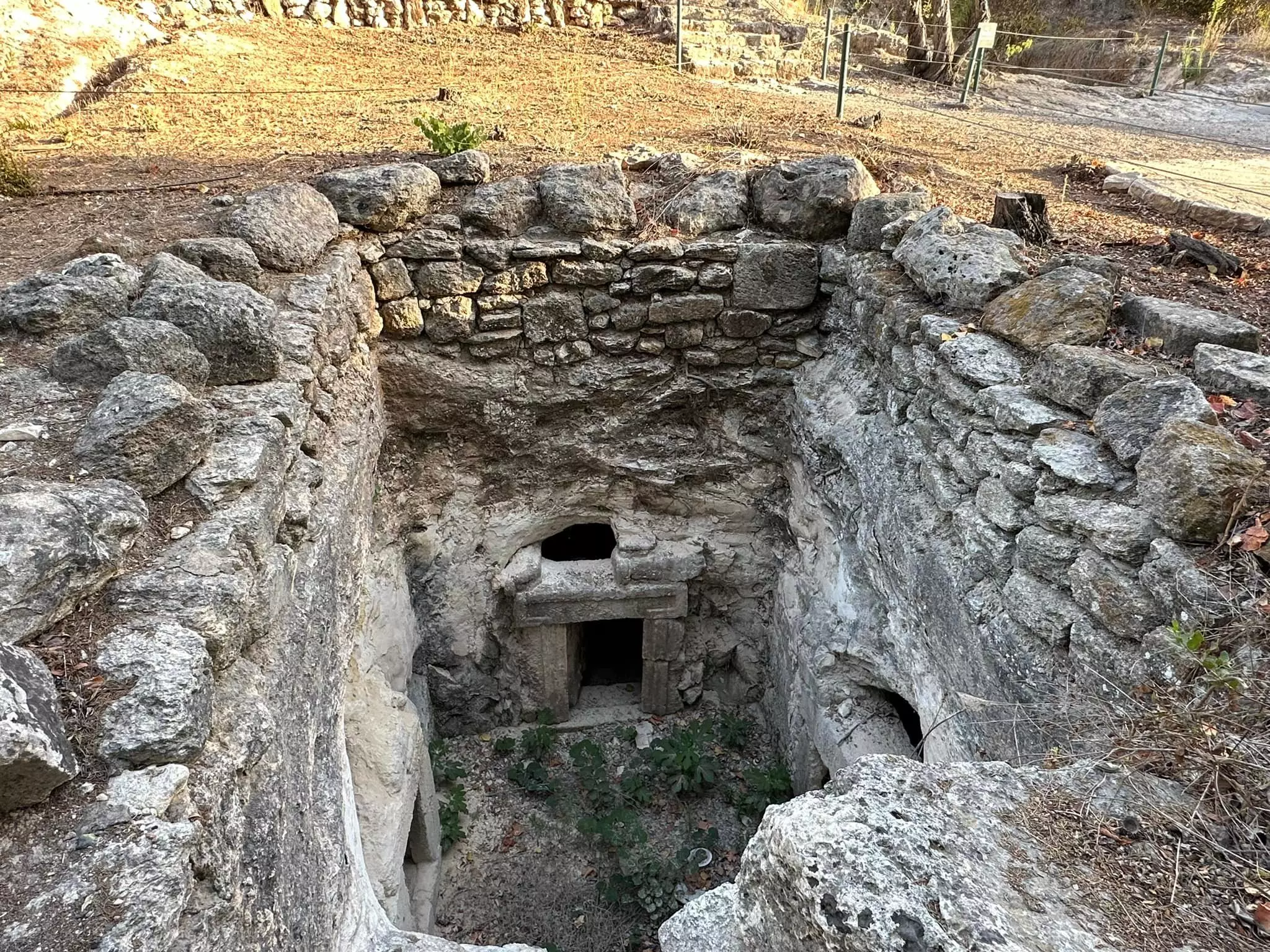
- مقبرة رومانية "نيكروبولس" في خربة الشيخ بريك حيفا مقبرة ذات كهوف محفورة في الصخر الطباشيري-- إياد جابر #2
- مقبرة رومانية "نيكروبولس" في خربة الشيخ بريك حيفا مقبرة ذات كهوف محفورة في الصخر الطباشيري-- إياد جابر #3
- مقبرة رومانية "نيكروبولس" في خربة الشيخ بريك حيفا مقبرة ذات كهوف محفورة في الصخر الطباشيري-- إياد جابر #4
- مقبرة رومانية "نيكروبولس" في خربة الشيخ بريك حيفا مقبرة ذات كهوف محفورة في الصخر الطباشيري-- إياد جابر #5
- مقبرة رومانية "نيكروبولس" في خربة الشيخ بريك حيفا مقبرة ذات كهوف محفورة في الصخر الطباشيري-- إياد جابر #6
- مقبرة رومانية "نيكروبولس" في خربة الشيخ بريك حيفا مقبرة ذات كهوف محفورة في الصخر الطباشيري-- إياد جابر #7
- مقبرة رومانية "نيكروبولس" في خربة الشيخ بريك حيفا مقبرة ذات كهوف محفورة في الصخر الطباشيري-- إياد جابر #8
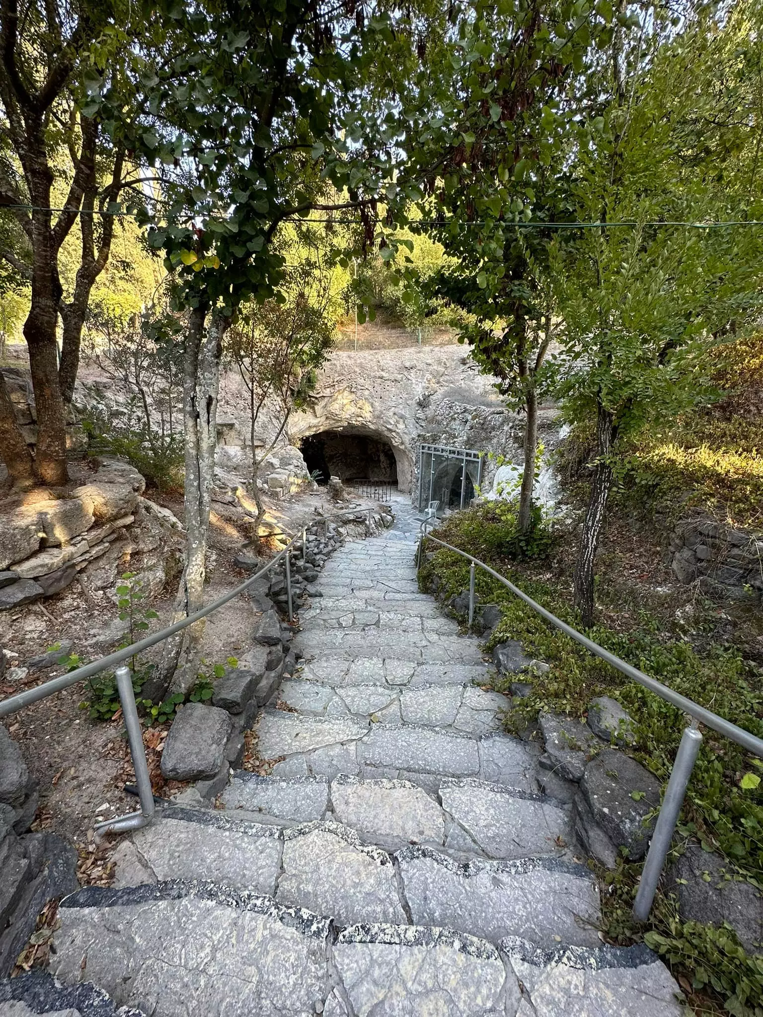
- مقبرة رومانية "نيكروبولس" في خربة الشيخ بريك حيفا مقبرة ذات كهوف محفورة في الصخر الطباشيري-- إياد جابر #9
- مقبرة رومانية "نيكروبولس" في خربة الشيخ بريك حيفا مقبرة ذات كهوف محفورة في الصخر الطباشيري-- إياد جابر #10
- مقبرة رومانية "نيكروبولس" في خربة الشيخ بريك حيفا مقبرة ذات كهوف محفورة في الصخر الطباشيري-- إياد جابر #11
- مقبرة رومانية "نيكروبولس" في خربة الشيخ بريك حيفا مقبرة ذات كهوف محفورة في الصخر الطباشيري-- إياد جابر #12
- جولة في قرية الشيخ بريك المهجرة بلقرب من عتليت...المزيد عنها في قسم التعليقات اسفل الصورة -- 2023 -- Iyad Jaber
1 - جولة في قرية الشيخ بريك المهجرة بلقرب من عتليت...المزيد عنها في قسم التعليقات اسفل الصورة -- 2023 -- Iyad Jaber #2
- جولة في قرية الشيخ بريك المهجرة بلقرب من عتليت...المزيد عنها في قسم التعليقات اسفل الصورة -- 2023 -- Iyad Jaber #3
- جولة في قرية الشيخ بريك المهجرة بلقرب من عتليت...المزيد عنها في قسم التعليقات اسفل الصورة -- 2023 -- Iyad Jaber #4
- جولة في قرية الشيخ بريك المهجرة بلقرب من عتليت...المزيد عنها في قسم التعليقات اسفل الصورة -- 2023 -- Iyad Jaber #5
- جولة في قرية الشيخ بريك المهجرة بلقرب من عتليت...المزيد عنها في قسم التعليقات اسفل الصورة -- 2023 -- Iyad Jaber #6
- جولة في قرية الشيخ بريك المهجرة بلقرب من عتليت...المزيد عنها في قسم التعليقات اسفل الصورة -- 2023 -- Iyad Jaber #7
- جولة في قرية الشيخ بريك المهجرة بلقرب من عتليت...المزيد عنها في قسم التعليقات اسفل الصورة -- 2023 -- Iyad Jaber #8
- جولة في قرية الشيخ بريك المهجرة بلقرب من عتليت...المزيد عنها في قسم التعليقات اسفل الصورة -- 2023 -- Iyad Jaber #9
- جولة في قرية الشيخ بريك المهجرة بلقرب من عتليت...المزيد عنها في قسم التعليقات اسفل الصورة -- 2023 -- Iyad Jaber #10
- جولة في قرية الشيخ بريك المهجرة بلقرب من عتليت...المزيد عنها في قسم التعليقات اسفل الصورة -- 2023 -- Iyad Jaber #11
- جولة في قرية الشيخ بريك المهجرة بلقرب من عتليت...المزيد عنها في قسم التعليقات اسفل الصورة -- 2023 -- Iyad Jaber #12
- جولة في قرية الشيخ بريك المهجرة بلقرب من عتليت...المزيد عنها في قسم التعليقات اسفل الصورة -- 2023 -- Iyad Jaber #13
Want to browse more? 80,000 pictures were grouped in these gallaries:
| Display Name | Clan/Hamolah | Country of Residence |
No links have been shared yet, be free to the first to share the first link.
 Fake Valor: Why Did Zionist Jews Hoist Nazis Flag on Their Ships in the 1930s?
What is new?
-
Facts About Oct. 7th Gaza Raid
-
Remined Us Please:: Who Did Rape Who? Palestinians Raped Israelis? Or, was the other way around?
-
When Prof. Edward Said was invited to debate Bibi Netanyahu in the 1980s, watch what happened!
-
Ezra Klein of the NY Times on the "Jewish Race".
-
Abusing Blood Libel!
-
Did Israeli Soldiers Activate The Hanniba Direective On Oct. 7th? You Be The Judge
-
Zionist FAQ: Isn't it true that Palestinians don't want peace? Palestinians never accepted the two-state solution
- Facts about Haavara (Transfer) Agreement between Ben-Gurion & Hitler
-
Haavara FAQs: Why Did Zionist Jews Hoist Nazis' Flags on Their Ships in the 1930s?
- Haavara FAQs: When Chaim Weizmann met FDR in mid-1943, why was he silent about rescuing European Jewry?
-
Dear ChatGPT: How did Palestinians resist Napoleon's invasion of their country in 1799?
-
Dear ChatGPT: Gaza had a vibrant Jewish community in the mid-17th century. What happened to them?
-
Dear ChatGPT: Why did the Jewish Agency suppress news of the Holocaust during WWII?
-
Video Playlist: Jews share their DNA tests to end the conflict for good.
-
A Tale of Two Conflicts: Examining the Definition of Genocide
-
Prof. Abraham Polak And The Suppressed History of the Khazars and European Jewry
-
How Ronald Reagan would have framed the genocide in Gaza if he were still alive?
-
Haavara FAQs: Let us do the math: how many German Jews did The Haavara Agreement save?
-
Zionist FAQs: The Hebron Massacre of 1929, "clearly proves" that Palestinians are antisemitic, how could you deny it?
-
Zionist FAQs: Why Anti-Zionist Is Not Antisemitism?
-
Zionist FAQs: Isn't it true that the KGB created Palestinian Nationalism in the early 1960s?
- Zionist FAQs: Muslims are killing Muslims all the time; why are Israeli Jews being singled out in the media?
- Zionist FAQs: How is Israel an apartheid state when 20% of its citizens are Arabs who enjoy full rights?
-
Haavara FAQs: Why Did Dorothy Thompson Flip From A Zionist Advocate to A Silenced Dissenter?
-
Haavara FAQs: Analysis of Herzl's Uganda Scheme and how it could have saved millions of Jews.
-
Haavara FAQs: Why did Hayim Greenberg describe American Jewry as "morally bankrupt" in early 1943?
-
Haavara FAQs: What if the Evian Conference was a resounding success? What would have been the impact of saving European Jewry on Zionism?
- Haavara FAQs: What if the six million were saved, how that would have impacted the Zionist project?
-
Haavara FAQs: How did Zionist leaders react when Europe's Jews lingered in the DP camps after WWII ended?
-
Why does the American Jewish community repeat lies that David Ben-Gurion had debunked before he died?
-
Who has the power to rename the Tatar/Khazar Gene Marker to Jewish IV?
-
Zionist FAQs: Why won't Egypt, Syria, and Jordan take their people back? Jews are indigenous to Palestine, and Arabs immigrated after Jews developed the country. Arabs should leave.
-
Haavara FAQs: Did Hitler and the Nazis conflate between Judaism and Zionist? If that wasn't case, then why?
-
Haavara FAQs: Winston Churchill and antisemitism, a collection of articles written Churchill.
-
Haavara FAQs: Broken by country, how many Jews survived vs. killed during the Holocaust?
-
Haavara FAQs: Why did European Jews vote with their feet and to immigrated to the Americas, not Palestine, after WWII?
-
Watch this American Jewish Girl describing Israeli Jews' cognitive dissonance like no other in under two minutes
-
Haavara FAQs: When the Nazis went out of their way to hide the Holocaust, Israeli Jews did the exact opposite by broadcasting their genocide of Gazans. But why?
-
Haavara FAQs: How Zionist Jews went out of their to show their appreciation to Nazism and Fascism?
- Haavara FAQs: Why Zionist leaders were against bombing the death camps & the Railroads leading to them?
-
Haavara FAQs: Hitler's message to the British and American people: If Jews are such noble citizens and you care about them, how come you're not letting them in? I will gladly ship them to you at my expense, even on luxury liners!
-
A shortlist of Zionist and Israeli false flag operations in the name Jews.
-
The Most Moral Army
- The Land of Kapos (Israel): Where the brave are boycotted and Kapos walk free.
- Why did early Zionists often named their communal enterprises "colonial"?
- Zionist Relations with Nazi Germany by Faris Glubb
-
Two NY Times advertisements by Zionists in the early 1943 that exposes Zionists' treason at the height of the calamity
- Facts Not Lies about the Palestinian-Israeli Conflict.
- Site's pictures have been categorized
- Campgain Against Lice
- A Survey of Palestine, the official source about Palestine before Nakba produced by the British Mandate; over 1200 pages.
- Satellite View & Google Earth: Over 6,000 placemarks identifying all destroyed towns, W. Bank & Gaza Strip Towns, & refugee camps.
- PalestineRemembered.com and its Nakba Oral History Project were featured on al-Jazeera Satellite TV.
- Nakba Oral History Video Podcast:
 Over 700 Oral History interviews (including 3,500+ hours of recording) can be viewed online.
 - Palestine Village Statistics Project
- Gaza Jail Break
- النسخة العربية للموقع الان متوفرة
- Videos: Documenting the destroyed villages in video: Tracing all that remains since Nakba.
- Videos: Responding to Zionist Propaganda
- Interview: The ethnic cleansing of Palestine: George Galloway interviews Israeli Historian Ilan Pappe.
- For Palestinians, memory matters. It provides a blueprint for their future By George Bisharat.
- Zionist FAQ now available in Hebrew שאלות שציונים שואלים, עכשיו בעברית
- Video: The Stephen Walt and John Mearsheimer report on the influence of the Israel Lobby on U.S. Foreign Policy
- The Palestinian-Israeli conflict for beginners
