| PalestineRemembered | About Us | Oral History | العربية | |
| Pictures | Zionist FAQs | Haavara | Maps | |
| Search |
| Camps |
| Districts |
| Acre |
| Baysan |
| Beersheba |
| Bethlehem |
| Gaza |
| Haifa |
| Hebron |
| Jaffa |
| Jericho |
| Jerusalem |
| Jinin |
| Nablus |
| Nazareth |
| Ramallah |
| al-Ramla |
| Safad |
| Tiberias |
| Tulkarm |
| Donate |
| Contact |
| Profile |
| Videos |
Welcome To Kafr Lam - كفر لام (כפר לאם)
|
District of Haifa
Ethnically cleansed days ago |
العربية Google Earth |
 |
Gallery (44) |
- Statistics & Facts
-
Before & After

- Satellite View
- Articles 1
- Pictures 44
- Aerial Views 1
- Members 14
- All That Remains
- Wikipedia
- Videos 3
- Guest Book 5
- Links 1
| Statistic & Fact | Value | ||||||||||||
| Occupation Date | July 16, 1948 | ||||||||||||
| Distance From District | 21.5 (km) South West of Haifa | ||||||||||||
| Elevation | 25 (meters) | ||||||||||||
| Before & After Nakba, Click Map For Details |
|||||||||||||
|
|||||||||||||
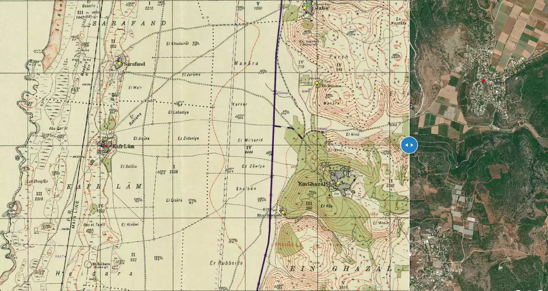
| Map Location | See location #19 on the map View from satellite |
||||||||||||
| Military Operation | Possibly the Coastal Clearing Operation | ||||||||||||
| Defenders | Local Palestinian militia, some Arab Liberation Army volunteers, and some support from the Iraqi Army in Tulkarm. | ||||||||||||
| Refugees' Migration Routes | The refugees were mostly expelled to the Triangle area and others to nearby POW camps. | ||||||||||||
| Exodus Cause | Military assault by Zionist troops | ||||||||||||
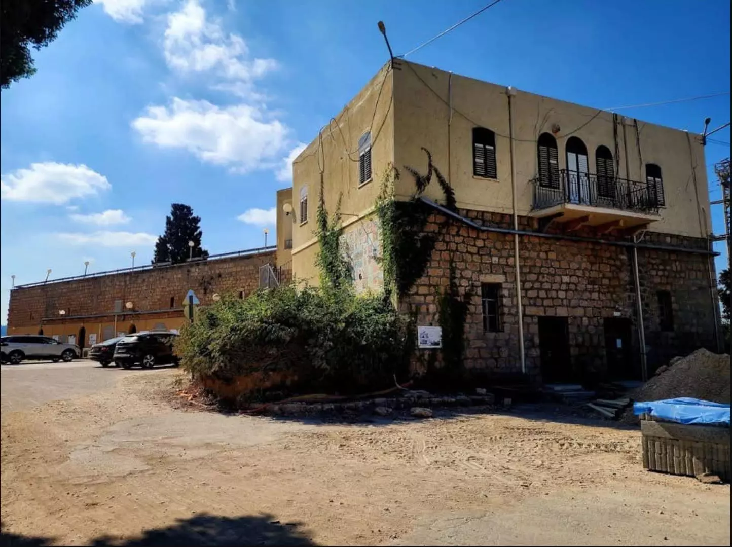
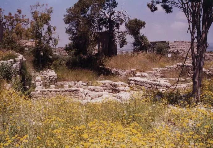
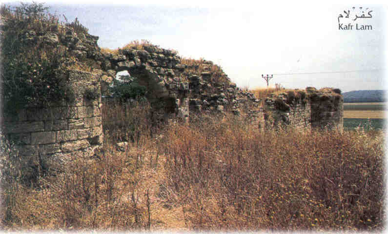
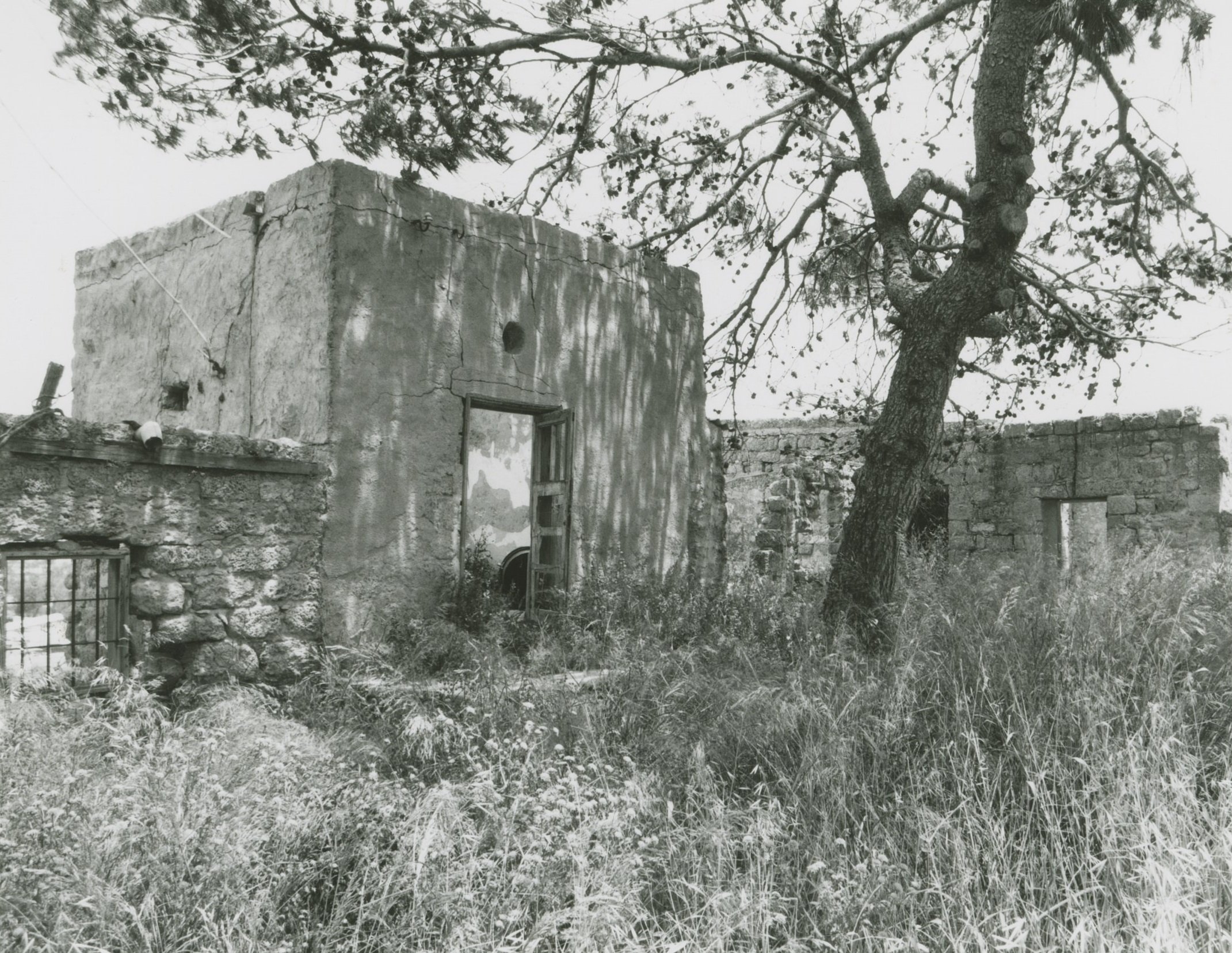
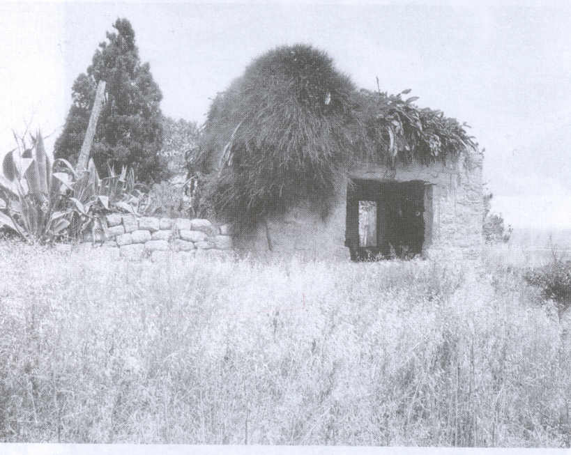
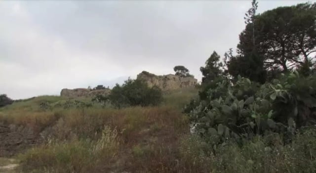
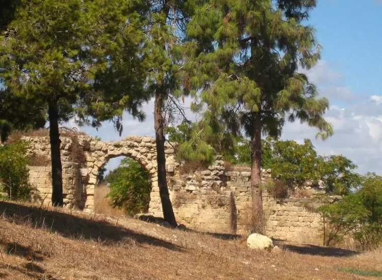
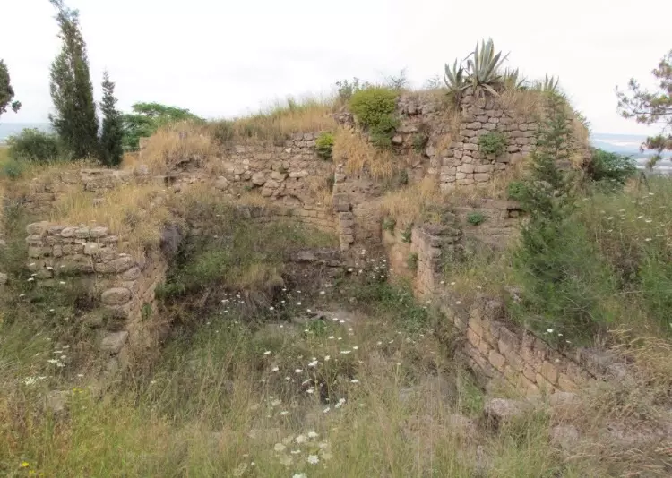
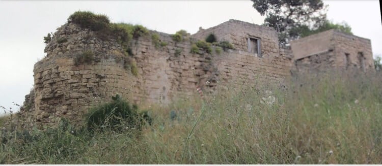
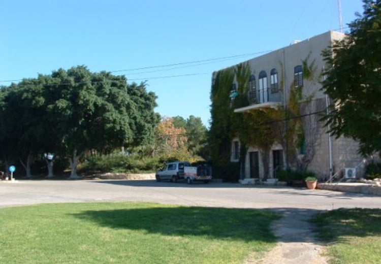
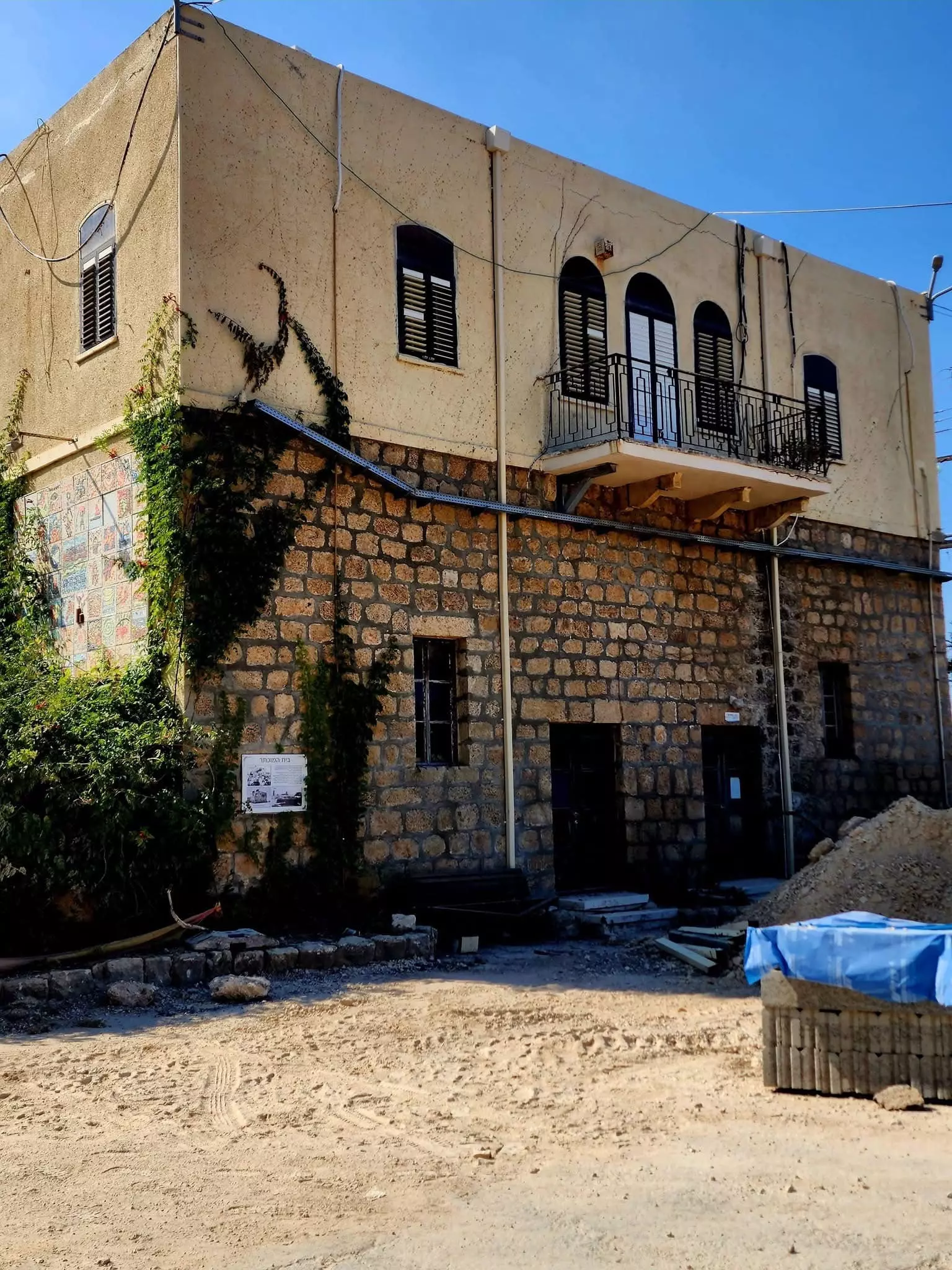
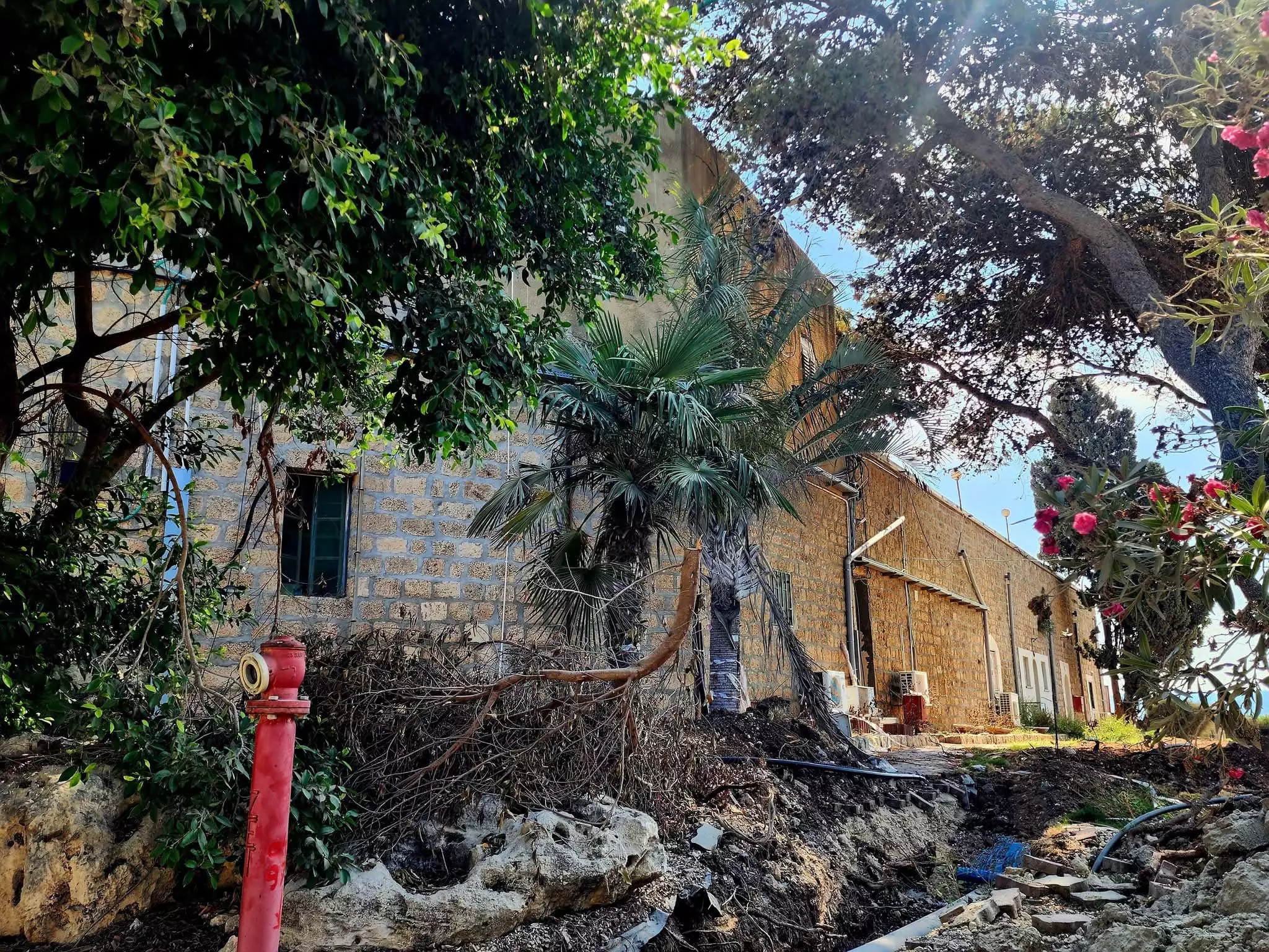
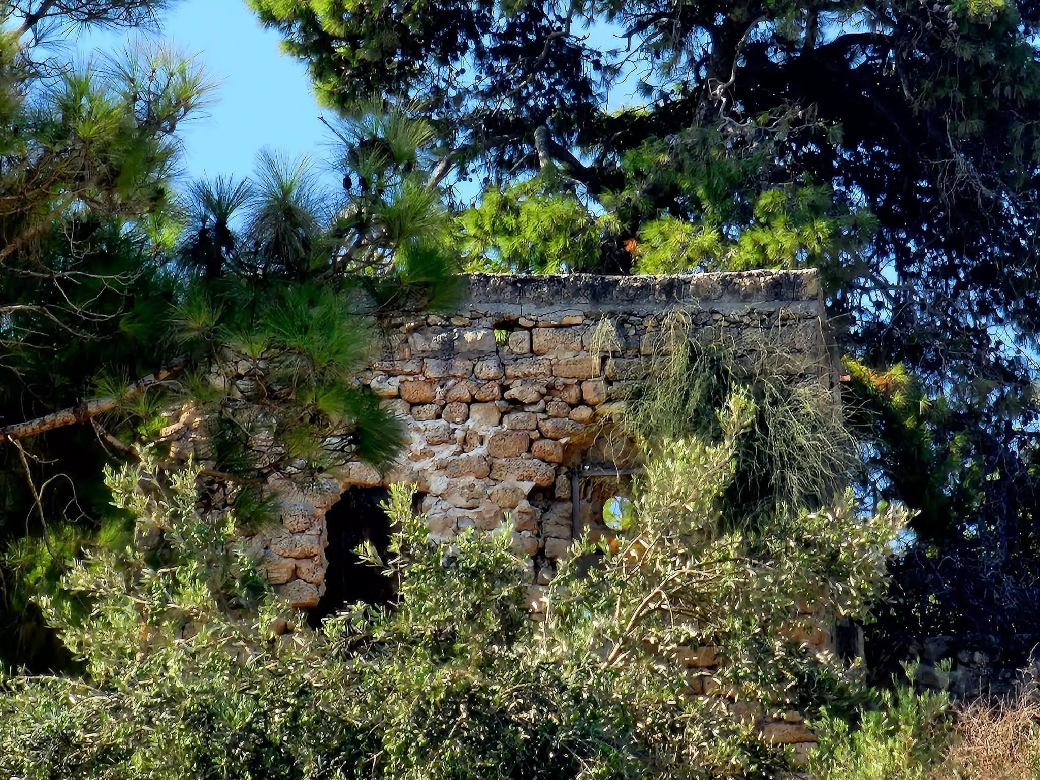
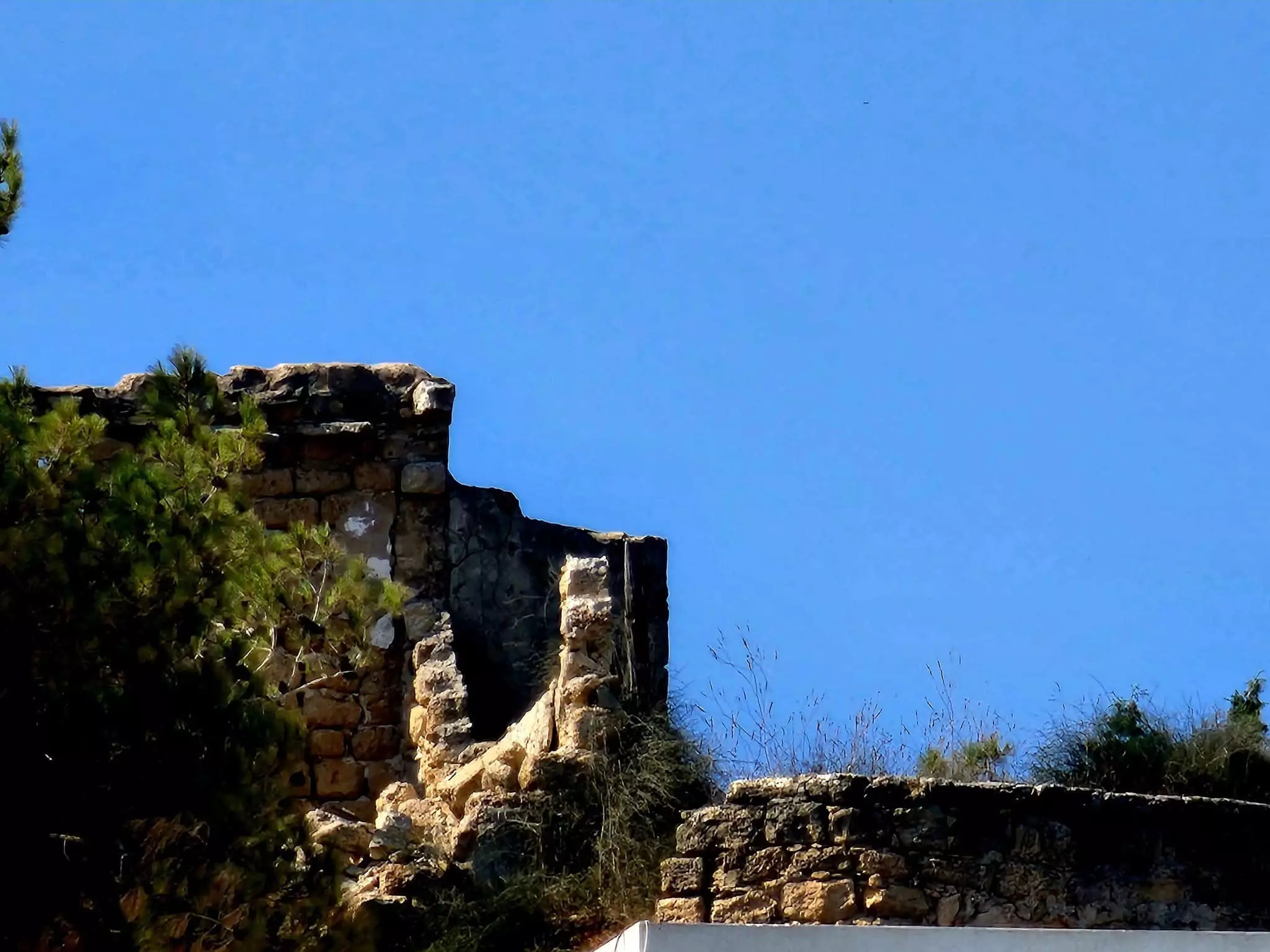
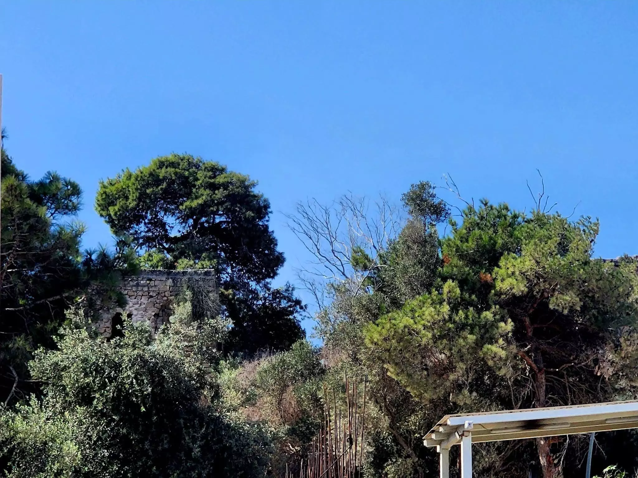
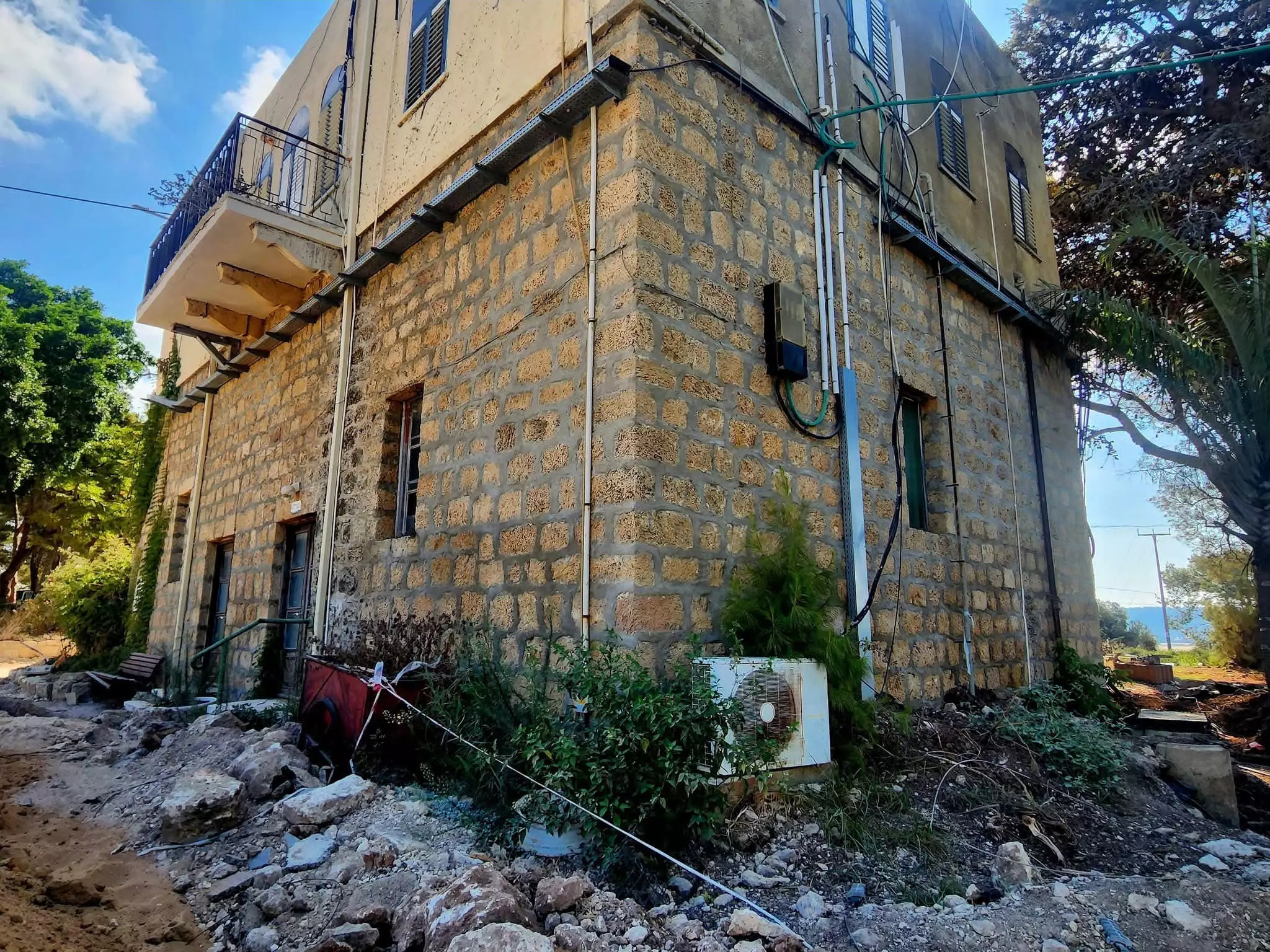
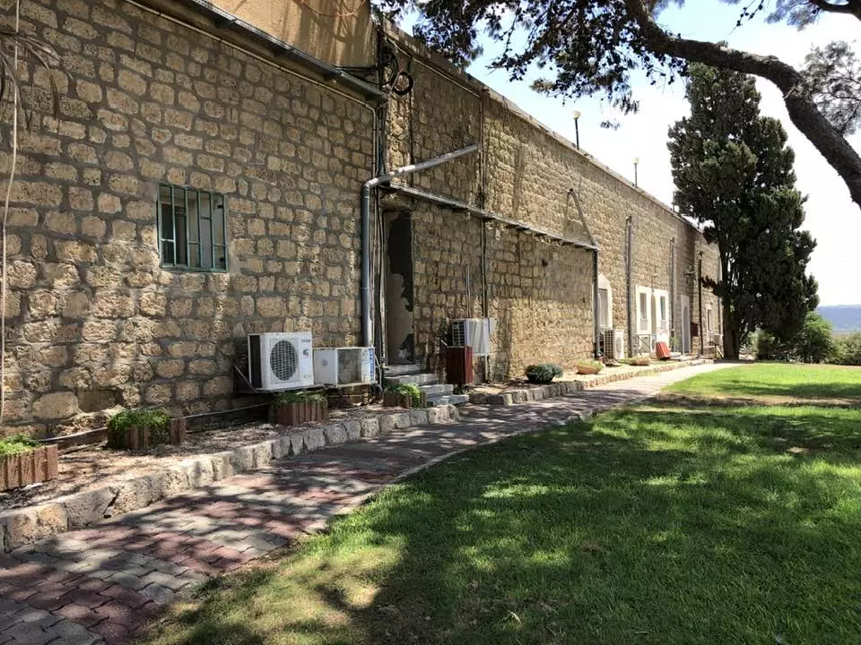
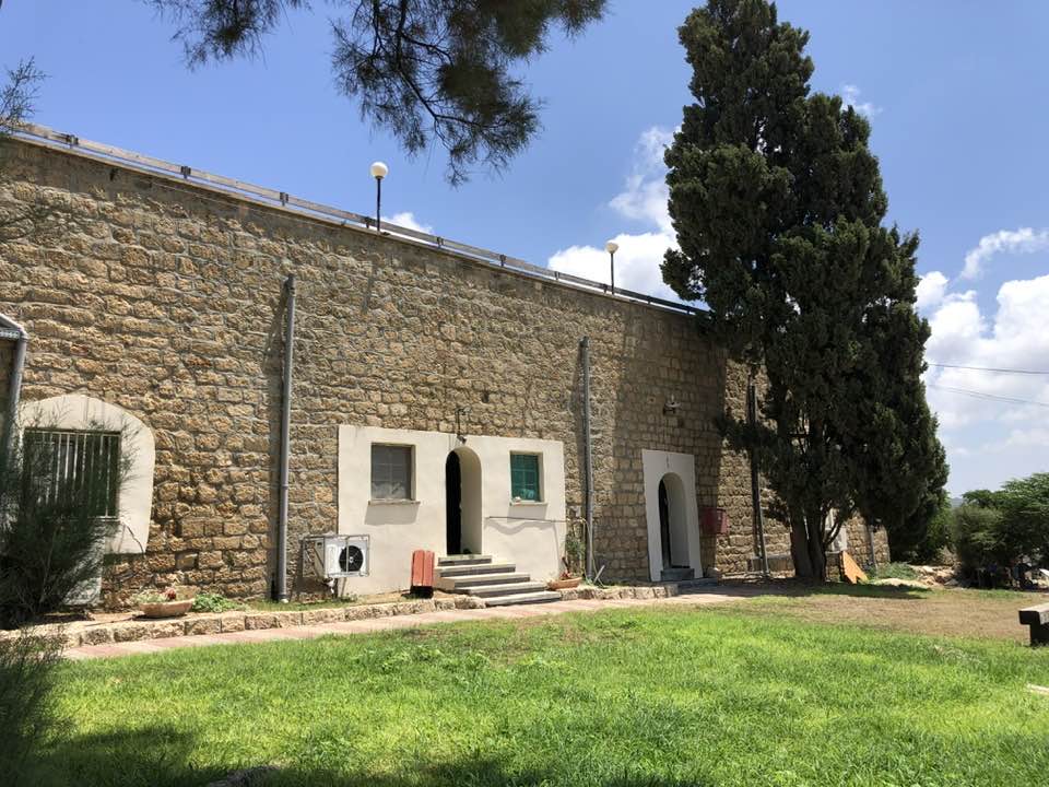
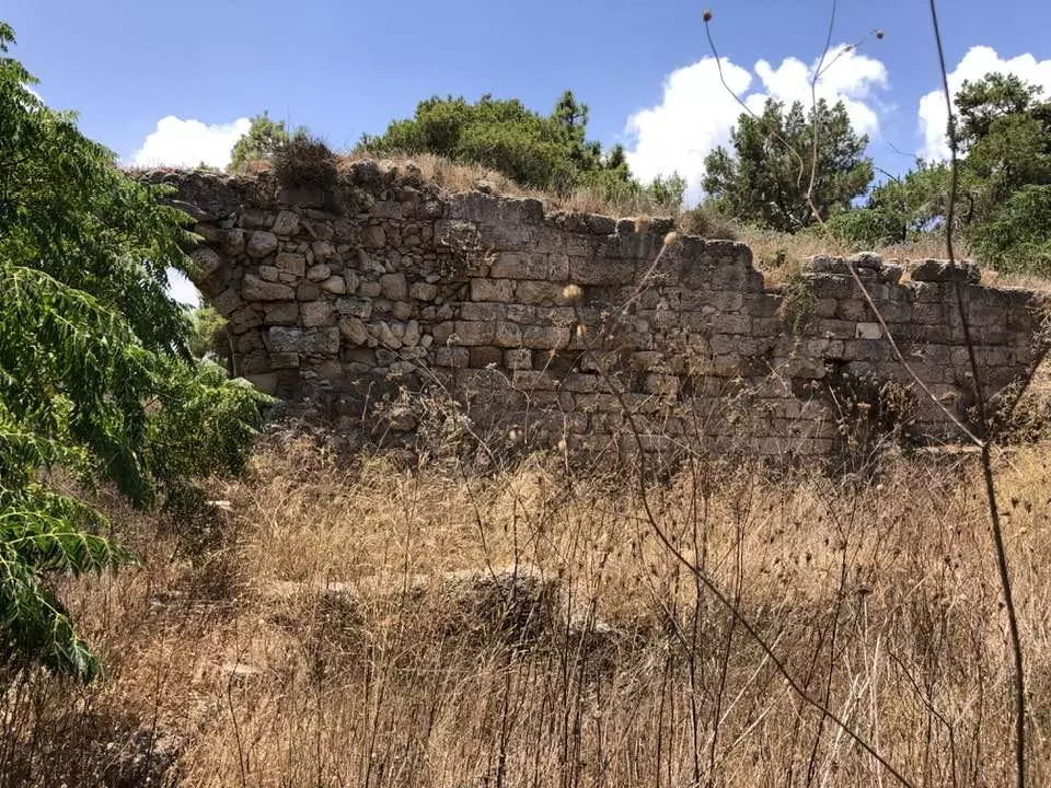
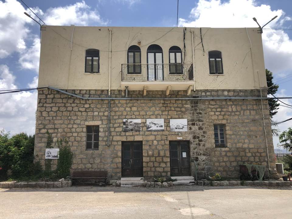
| Village Temains | The village has been mostly destroyed with the exception of two village house (one of them for Ahmad Bey Khalil). | ||||||||||||
| Ethnically Cleansing | Kafr Lam inhabitants were completely ethnically cleansed. | ||||||||||||
| Pre-Nakba Land Ownership |
**Town Lands' Demarcation Maps |
||||||||||||
| Land Usage As of 1945 |
|
||||||||||||
| Population |
|
||||||||||||
| Number of Houses | In (1931): 50 (includes Kafr Lam Station) | ||||||||||||
| Near By Towns |
|||||||||||||
|
|||||||||||||
| Town's Name Through History | The Crusaders may have referred to Kafr Lam with same name as the nearby castle of Cafarlet. | ||||||||||||
| Schools | Kafr Lam had an elementary school for boys, which was founded by the Ottoman in 1882, but it was later closed during the British Mandate period. | ||||||||||||
| Places of Warship | One mosque | ||||||||||||
| Water Supply | Kafr Lam had five wells which supplied it with its drinking water needs. | ||||||||||||
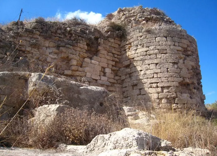
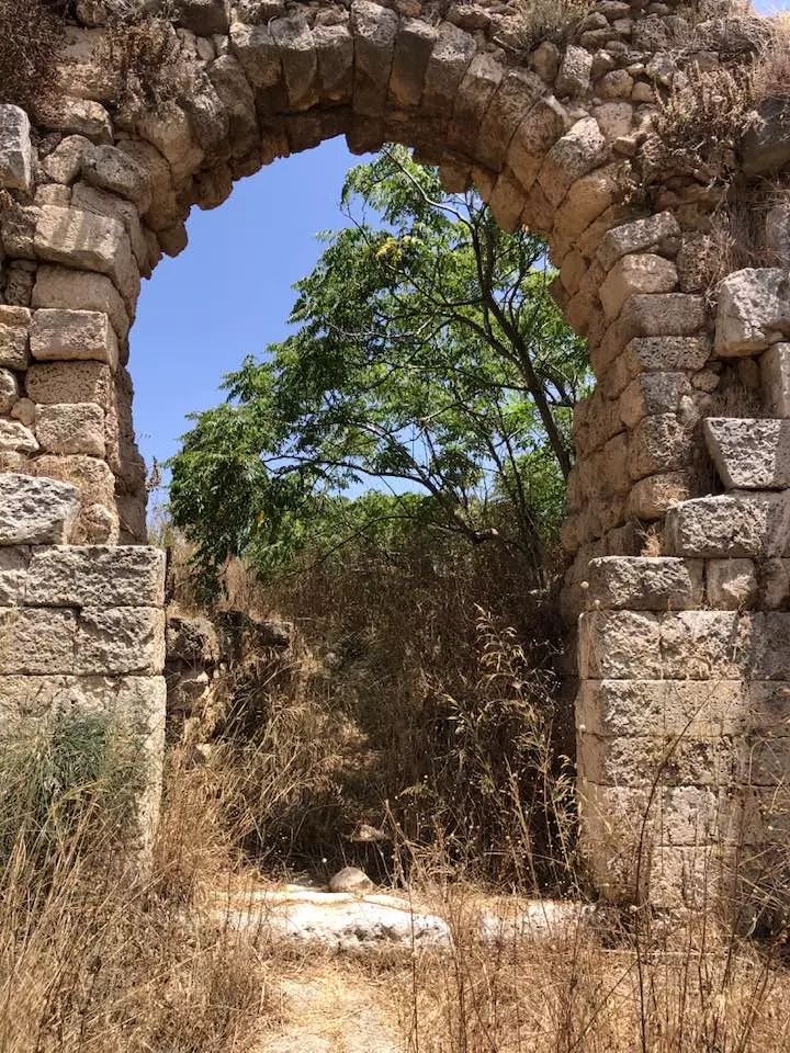
| Archeological Sites | Kafr Lam containes Crusader's (called Cafarlet) fortress and stone quarries. | ||||||||||||
| Exculsive Jewish Colonies That Usurped Village Lands |
'En Ayyala and ha-Bonim | ||||||||||||
| Featured Video | |||||||||||||
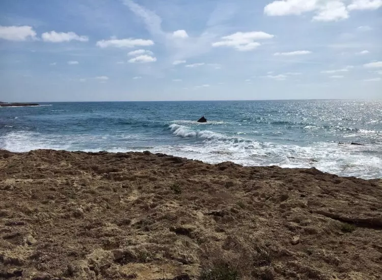
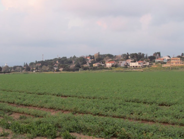
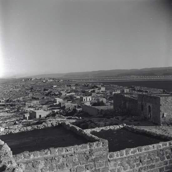
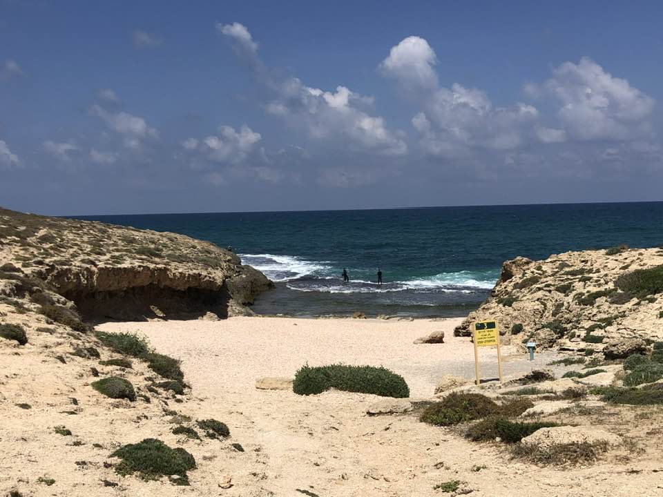
Village Before NakbaThe village was located on a sandstone hill on the coastal plain, about 1 km from the seashore. The coastal railway passed some 200 m to its west. According to the Arab geographer Yaqut al-Hamawi (d. 1228), the town of Kafr Lam was established near Qisarya (Caesarea) by the Umayyad caliph Hisham ibn 'Abd al-Malik (A.D. 724-743). The Crusaders built a castle there called Cafarlet which was captured by the Muslims in 1265. It was subsequently regained by the Crusaders, only to be taken by Mamluk forces in 1291. In 1596 a farm in Kafr Lam paid taxes to the government. The French traveler Guerin noted in mid-19th that Kafr Lam was situated on top of a small hill and was inhabited by about 300 villagers. He said that the village stood within a large stone enclosure which dated to the time of the Crusades. Mary Rogers, the sister of Edward Rogers (the British vice-consul in Haifa) visited Kafr Lam in 1856. She wrote that its houses were built of mud and stone and that the fields around the village abounded in Indian wheat, millet, sesame, tobacco, and orchards.In modem times the houses of Kafr Lam were made of stone and either mud or cement and were clustered together. The villagers were Muslims, and maintained a mosque; a boys' elementary school was built in 1882, but it was closed during the Mandate. There were five wells on village lands. The village economy depended on animal husbandry and agriculture. The main crops were various sorts of grain. In 1944/45 a total of 4,833 dunums were allotted to cereals; 75 dunums were irrigated or used for orchards. The antiquity of Kafr Lam documented in the literary sources remains evident from the partly-visible archaeological remains, chiefly the Crusader's fortress and stone quarries. Village Occupation and Ethnic CleaningDuring the Ten Days between the two truces of the war (8-18 July 1948), a number of Israeli military operations were carried out that resulted in the occupation of a string of villages just south of Haifa. One of the smaller of these operations was directed against Kafr Lam. This limited thrust took place around 15-16 July and resulted in the occupation of Kafr Lam, as well as al-Tira, al-Sarafand, and perhaps 'Ayn Hawd. The History of the War of Independence states that this operation involved the first use of support fire from naval forces; two warships participated in the attack, aiming light weapons fire at Kafr Lam and al-Sarafand. This account does not mention the fate of the villagers; however, nearby al-Tira, which was occupied during the same operation, was depopulated by its attackers. According to Israeli historian Benny Morris, the occupying units sent some of al-Tira's villagers to the Triangle area and others to POW camps.Zionists Colonies on Village LandsIn 1949, Zionist immigrants from South Africa and Britain established the settlement of ha-Bonim (143226) to the west of the village site, on village lands. Another settlement, 'En Ayyala (145226), was established in 1949 southeast of the site, also on village lands.Village TodayThe abandoned Crusader fortress and several houses are still standing. One house, that of Ahmad Bey Khalil, has been converted into a school; another is being used as an Israeli post officeSourceDr. Walid al-Khalidi, 1992: All That Remains. |
|||||||||||||
| Related Maps | Town Lands' Demarcation Maps خرائط للقضاء توضح حدود القرى والاودية Town's map on MapQuest View from satellite Help us map this town at WikiMapia |
||||||||||||
| Related Links | Wikipedia's Page Google Search Google For Images Google For Videos |
||||||||||||
| More Information | في كتاب كي لا ننسى في كتاب بلادنا فلسطين المزيد من موقع هوية |
||||||||||||
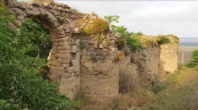
- All that remains after the destruction of Kafr Lam-March-2002
Posted by Aqsa Association-Palestine-1948 6 - All that remains after the destruction of Kafr Lam-March-2002

Posted by Aqsa Association-Palestine-1948 1 - Remaining house rubble and some house walls
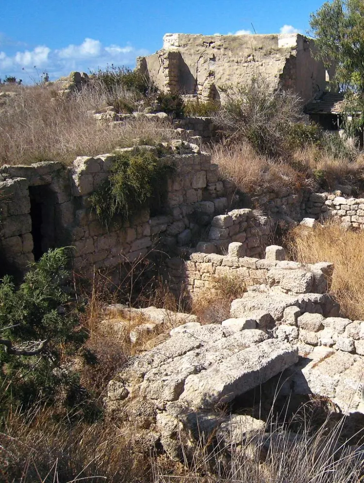
- بعض البيوت التي سلمت من التدمير الشامل الذي حل بالقرية
Scanned from "All That Remains" by Dr. Walid Khalidi - بيت سلم من التدمير الشامل الذي حل بالقرية
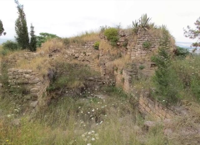
Scanned from "All That Remains" by Dr. Walid Khalidi - اثار بيوت القريه
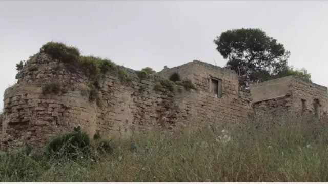
Posted by abu raya - اثار ما تبقى من القريه
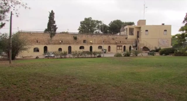
Posted by abu raya - بيوت باقيه في القريه يستعملها المستوطنين
Posted by abu raya - اثار القريه
Posted by abu raya - اثار بيوت القريه
Posted by abu raya - كفر لام
Posted by abu raya - كفر لام
Posted by abu raya - كفر لام
Posted by abu raya - كفر لام
Posted by abu raya - شاطى كفر لام
Posted by abu raya - كفر لام

Posted by abu raya - كفر لام
Posted by abu raya - شاطى كفر لام
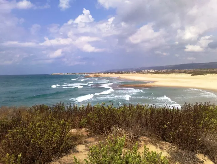
Posted by abu raya - شاطى كفر لام
Posted by abu raya - اراضي كفر لام ومستعمره هبونيم المقامه عليها
Posted by abu raya - قريه كفر لام بعداحتلالها

Posted by abu raya - بيوت كفرلام المتبقيه يسكنها المستوطنين
Posted by abu raya - قرية كفر لام عام 1950قرب الخضيره
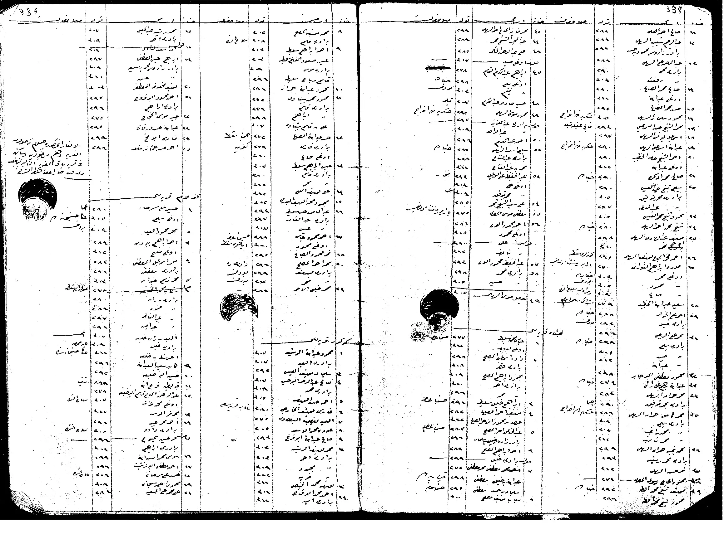
- السجلات العثمانية _ سجل نفوس رب الاسرة من سجلات المخاتير العثمانية كفر لام
Posted by Wadi Alhawarith - جولة بين البيوت المنهوبة في قرية كفر لام المهجرة --تصوير نبيلة سالم
- جولة بين البيوت المنهوبة في قرية كفر لام المهجرة --تصوير نبيلة سالم #2
- جولة بين البيوت المنهوبة في قرية كفر لام المهجرة --تصوير نبيلة سالم #3
- جولة بين البيوت المنهوبة في قرية كفر لام المهجرة --تصوير نبيلة سالم #4
- جولة بين البيوت المنهوبة في قرية كفر لام المهجرة --تصوير نبيلة سالم #5
- جولة بين البيوت المنهوبة في قرية كفر لام المهجرة --تصوير نبيلة سالم #6
- جولة بين البيوت المنهوبة في قرية كفر لام المهجرة --تصوير نبيلة سالم #7
- That is how the "civilized" erased and replaced us: Kafr Lam was completely obliterated except for a few remaining structures, as you see -- كفر لام باتت أثر بعد عين. من هنا مر الهمجّ
- That is how the "civilized" erased and replaced us: Kafr Lam was completely obliterated except for a few remaining structures, as you see -- كفر لام باتت أثر بعد عين. من هنا مر الهمجّ #2
- That is how the "civilized" erased and replaced us: Kafr Lam was completely obliterated except for a few remaining structures, as you see -- كفر لام باتت أثر بعد عين. من هنا مر الهمجّ #3
- That is how the "civilized" erased and replaced us: Kafr Lam was completely obliterated except for a few remaining structures, as you see -- كفر لام باتت أثر بعد عين. من هنا مر الهمجّ #4
- That is how the "civilized" erased and replaced us: Kafr Lam was completely obliterated except for a few remaining structures, as you see -- كفر لام باتت أثر بعد عين. من هنا مر الهمجّ #5
1 - That is how the "civilized" erased and replaced us: Kafr Lam was completely obliterated except for a few remaining structures, as you see -- كفر لام باتت أثر بعد عين. من هنا مر الهمجّ #6
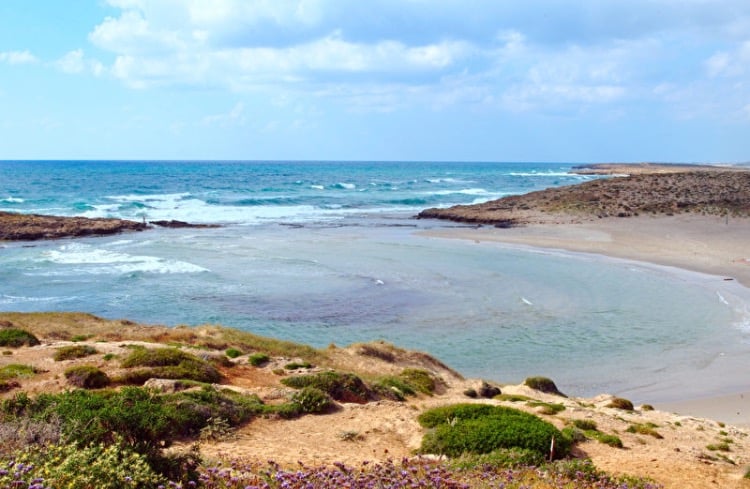
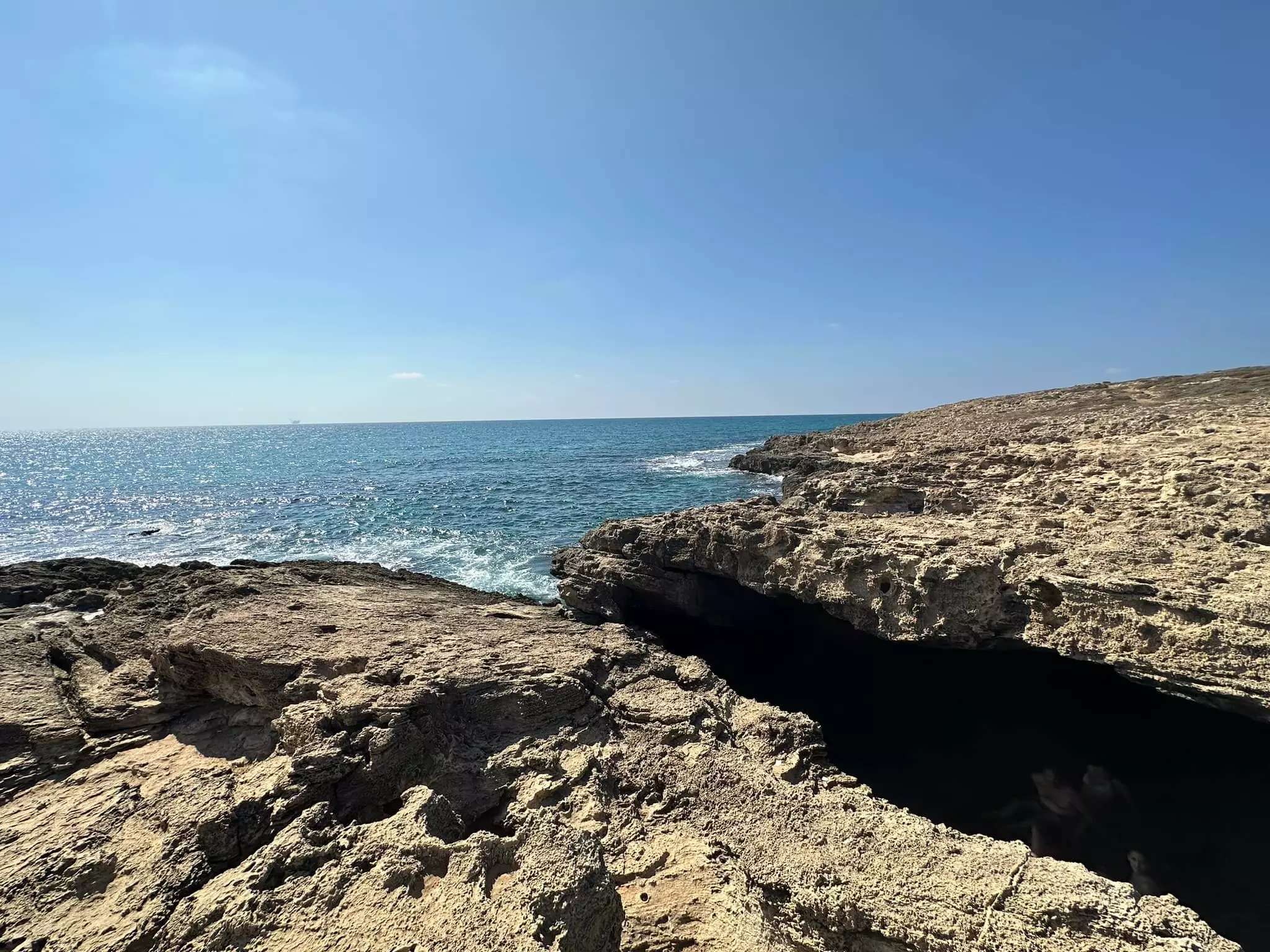
- المغارة الزرقاء في شاطئ قرية كفر لام المهجرة -- 2023 -- Iyad Jaber
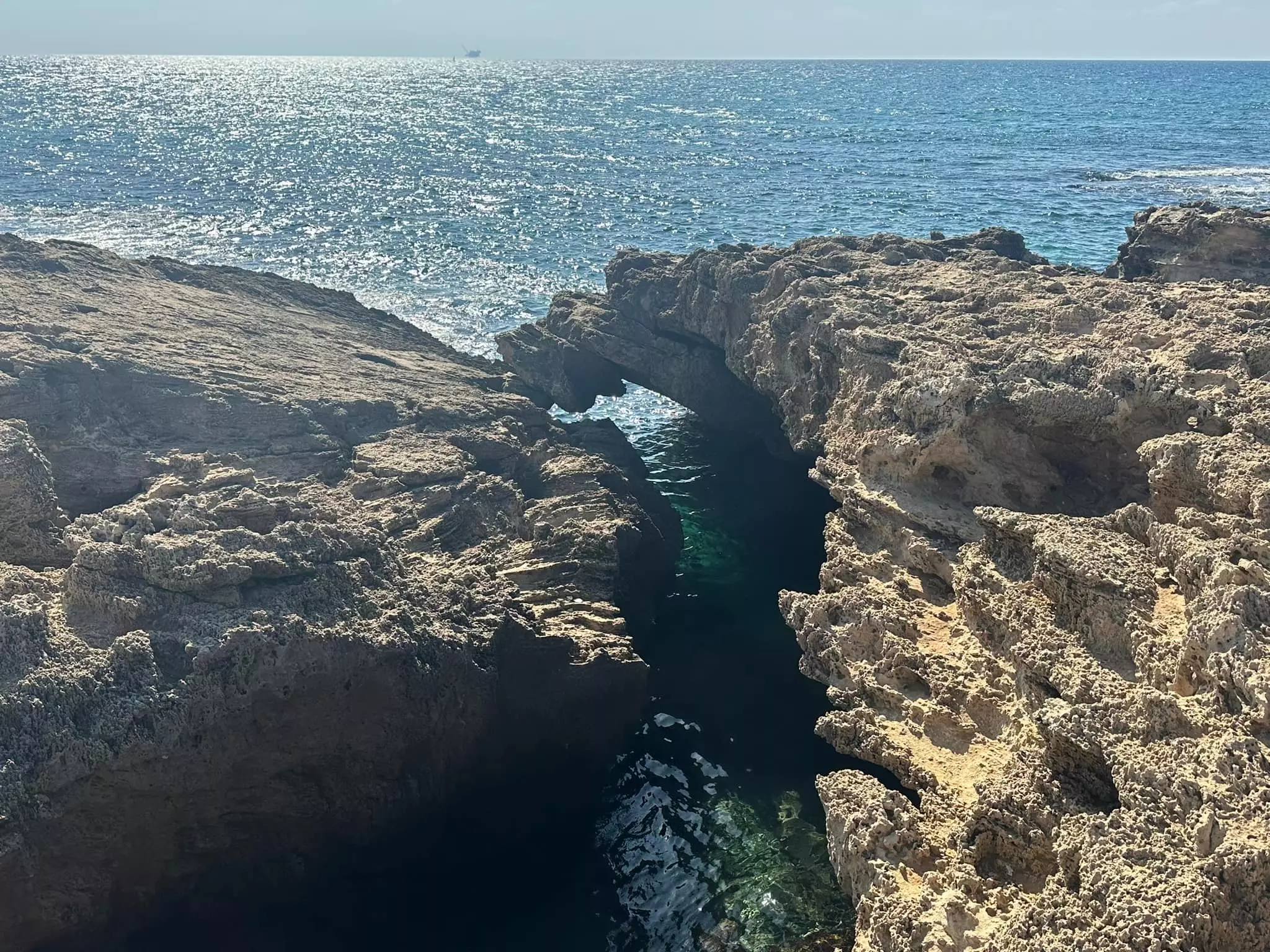
- المغارة الزرقاء في شاطئ قرية كفر لام المهجرة -- 2023 -- Iyad Jaber #2
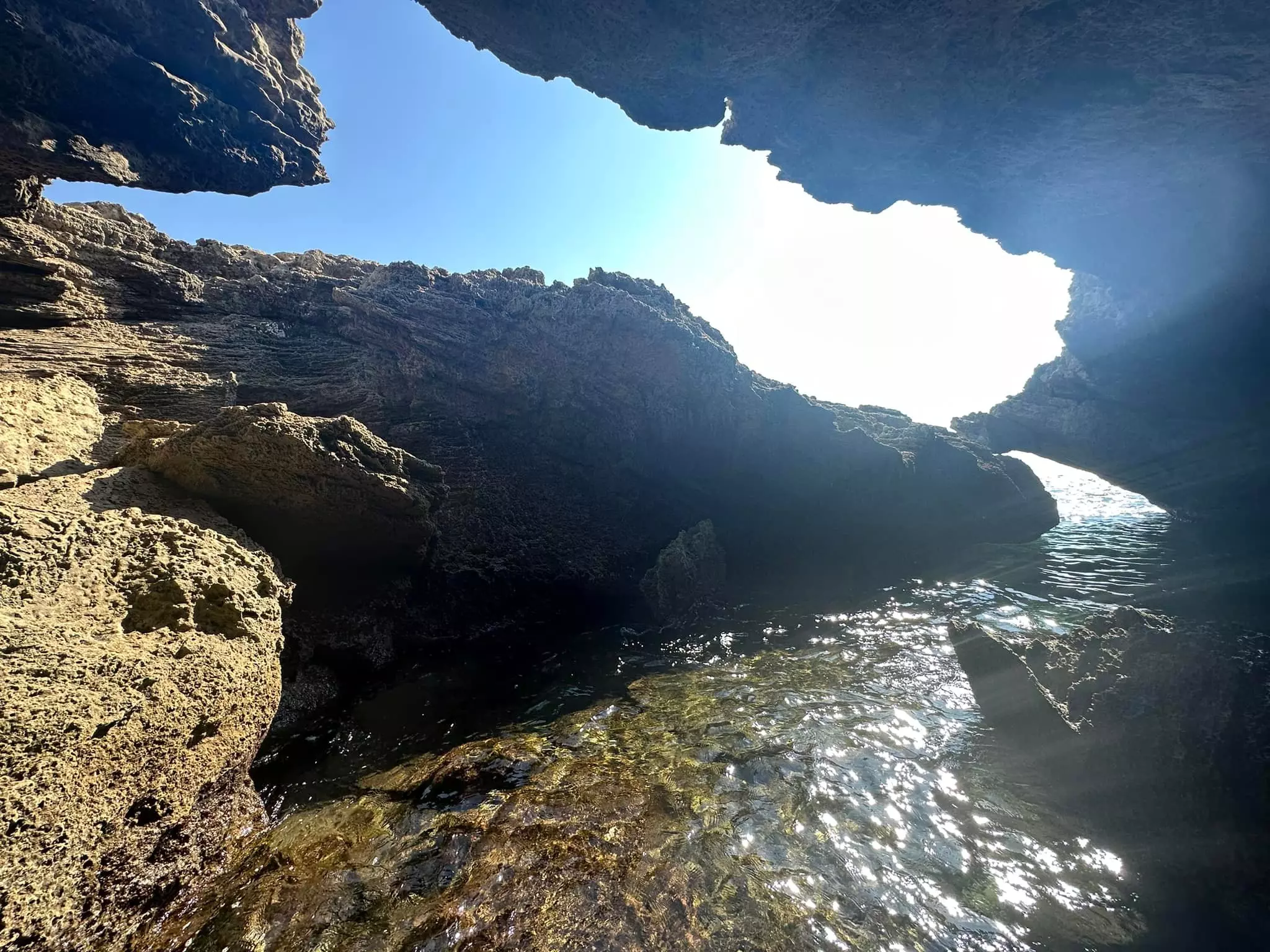
- المغارة الزرقاء في شاطئ قرية كفر لام المهجرة -- 2023 -- Iyad Jaber #3
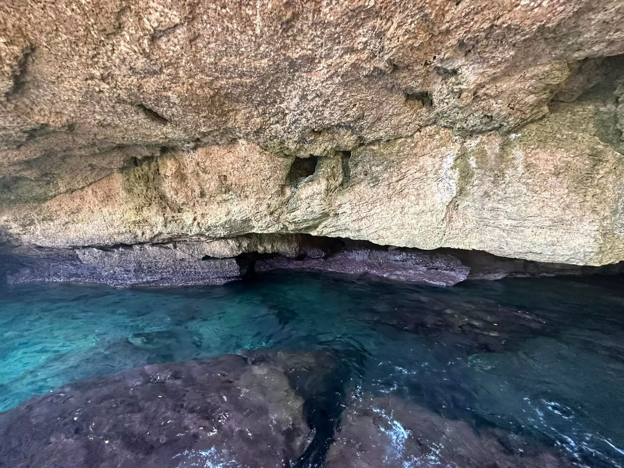
- المغارة الزرقاء في شاطئ قرية كفر لام المهجرة -- 2023 -- Iyad Jaber #4
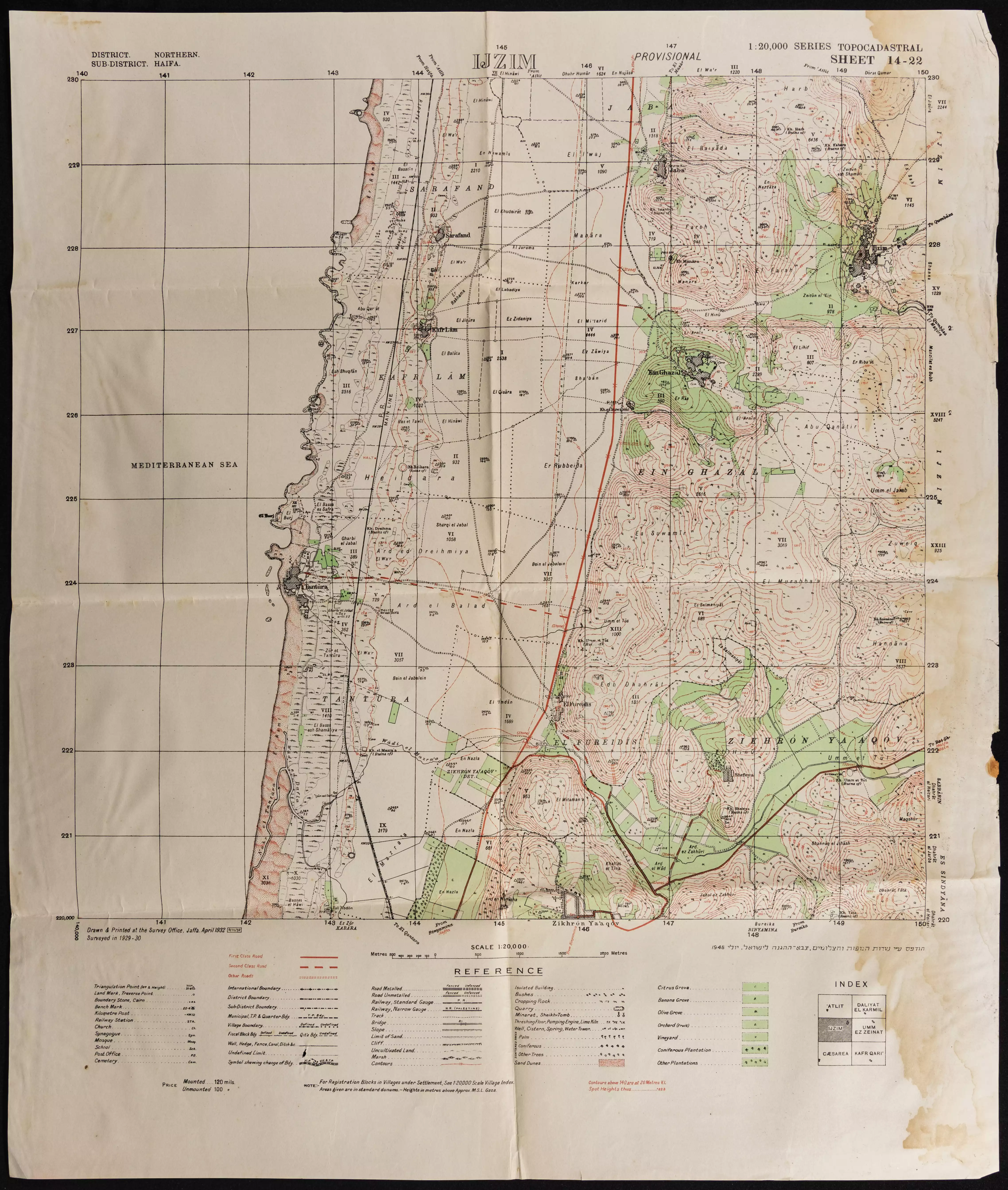
- خارطة تُظهِر الحدود والطرق بأنواعها والأماكن المقدسة والطبيعة الطوبغرافية من تلال وسهول ومنحدرات والتشكيلة الطبيعية للأرض وأنواع المزروعات. نُشرت الخريطة فترة الانتداب البريطاني، تم إضافة تعديلات عليها من قِبَل خدمة الخرائط والصور التابعة للقوات العسكرية الاسرائيلية فترة الأربعينيات.
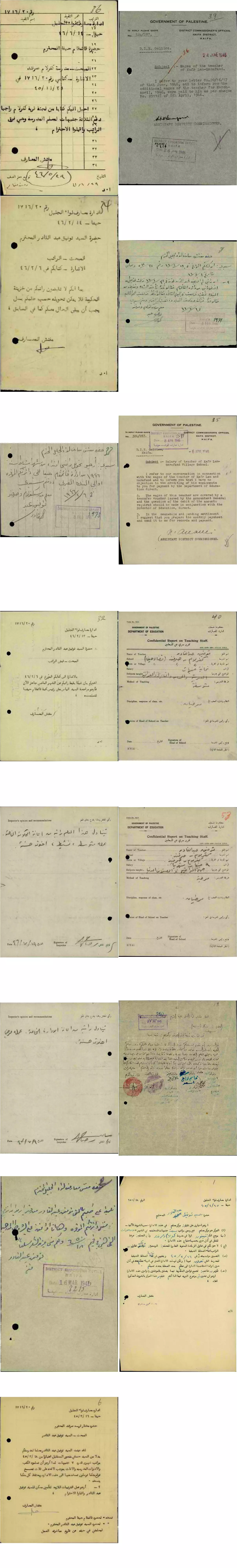
- مجموعة من الوثائق التي تخص تعين المعلم توفيق عبد القادر -- من قنير-- في مدرسة كفر لام والصرفند-- أنقر الصورة لتكبيرها - 1945 الى 1947
-
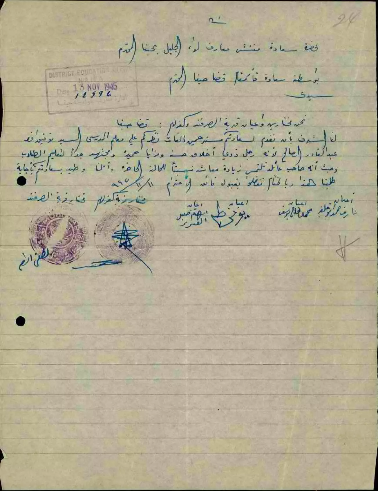
رسالة من مختارين وأعيان قرية الصرفند وكفر لام إلى مفتش المعارف يلفتون نظره على المعلم توفيق عبد القادر وحسن أخلاقه واجتهاده مطالبين زيادة معاشه -- 11-11-1945
Want to browse more? 80,000 pictures were grouped in these gallaries:
| Display Name | Clan/Hamolah | Country of Residence |
| انس عبد السلام | - | نابلس |
| Abukhalifa | Abukhalifa | - |
| مها | - | عمان , الأردن |
| عماد | خليفة | ابوظبي |
| البحر | خليفة | - |
| منتهى قنيري | قنيري | Mainz, Germany |
| نور عبدالسلام | - | Palestine |
| محمد عبدالسلام | - | أبوظبي, الإمارات |
| محمد مصطفى عطية | عطية | HAMBURG, GERMANY |
| مصطفى محمد عطية | عطية | baghdad, iraq |
| sanak | - | - |
| linda | ابو خليفة | CA, CA |
| Ahmed Atea | ATEA | - |
| maged khamra | khamra - elhaj | haifa, haifa |
- Tracing All That Remains of Kafr Lam since Nakba Duration: 4 min 22 sec
- زيارة توثيقية لمعالم قلعة كفرلام الأموية من بناية عبد الملك بن مروان: أكبر قلعة أموية في فلسطين التاريخية - السور والبوابة والأبراج والاروقة والقاعات والمعصرة وأبار الجمع والسراديب وبيوت قرية كفرلام العربية المهجرة Duration: 6 min 49 sec
- عالطاولة بالبلد : شومر محشي في قرية كفر لام المهجرة .. مع عفاف ابراهيم و ربيع خوري Duration: 23 min 27 sec
 Fake Valor: Why Did Zionist Jews Hoist Nazis Flag on Their Ships in the 1930s?
What is new?
-
Facts About Oct. 7th Gaza Raid
-
Remined Us Please: Who Did Rape Whom? Was it Palestinians who raped Israelis? Or, was the other way around? You'll be the judge
-
When Prof. Edward Said was invited to debate Bibi Netanyahu in the 1980s, watch what happened!
-
Ezra Klein of the NY Times on the "Jewish Race".
-
Abusing Blood Libel!
-
How and why Israeli Jewry has become the most hated cult?
-
Did Israeli Soldiers Activate The Hannibal Direective On Oct. 7th? You Be The Judge
-
Zionist FAQ: Isn't it true that Palestinians don't want peace? Palestinians never accepted the two-state solution
- Facts about Haavara (Transfer) Agreement between Ben-Gurion & Hitler
-
Haavara FAQs: Why Did Zionist Jews Hoist Nazis' Flags on Their Ships in the 1930s?
- Haavara FAQs: When Chaim Weizmann met FDR in mid-1943, why was he silent about rescuing European Jewry?
-
Dear ChatGPT: How did Palestinians resist Napoleon's invasion of their country in 1799?
-
Dear ChatGPT: Gaza had a vibrant Jewish community in the mid-17th century. What happened to them?
-
Dear ChatGPT: Why did the Jewish Agency suppress news of the Holocaust during WWII?
-
Video Playlist: Jews share their DNA tests to end the conflict for good.
-
A Tale of Two Conflicts: Examining the Definition of Genocide
-
Prof. Abraham Polak And The Suppressed History of the Khazars and European Jewry
-
How Ronald Reagan would have framed the genocide in Gaza if he were still alive?
-
Haavara FAQs: Let us do the math: how many German Jews did The Haavara Agreement save?
-
Zionist FAQs: The Hebron Massacre of 1929, "clearly proves" that Palestinians are antisemitic, how could you deny it?
-
Zionist FAQs: Why Anti-Zionist Is Not Antisemitism?
-
Zionist FAQs: Isn't it true that the KGB created Palestinian Nationalism in the early 1960s?
- Zionist FAQs: Muslims are killing Muslims all the time; why are Israeli Jews being singled out in the media?
- Zionist FAQs: How is Israel an apartheid state when 20% of its citizens are Arabs who enjoy full rights?
-
Haavara FAQs: Why Did Dorothy Thompson Flip From A Zionist Advocate to A Silenced Dissenter?
-
Haavara FAQs: Analysis of Herzl's Uganda Scheme and how it could have saved millions of Jews.
-
Haavara FAQs: Why did Hayim Greenberg describe American Jewry as "morally bankrupt" in early 1943?
-
Haavara FAQs: What if the Evian Conference was a resounding success? What would have been the impact of saving European Jewry on Zionism?
- Haavara FAQs: What if the six million were saved, how that would have impacted the Zionist project?
-
Haavara FAQs: How did Zionist leaders react when Europe's Jews lingered in the DP camps after WWII ended?
-
Why does the American Jewish community repeat lies that David Ben-Gurion had debunked before he died?
-
Who has the power to rename the Tatar/Khazar Gene Marker to Jewish IV?
-
Zionist FAQs: Why won't Egypt, Syria, and Jordan take their people back? Jews are indigenous to Palestine, and Arabs immigrated after Jews developed the country. Arabs should leave.
-
Haavara FAQs: Did Hitler and the Nazis conflate between Judaism and Zionist? If that wasn't case, then why?
-
Haavara FAQs: Winston Churchill and antisemitism, a collection of articles written Churchill.
-
Haavara FAQs: Broken by country, how many Jews survived vs. killed during the Holocaust?
-
Haavara FAQs: Why did European Jews vote with their feet and to immigrated to the Americas, not Palestine, after WWII?
-
Watch this American Jewish Girl describing Israeli Jews' cognitive dissonance like no other in under two minutes
-
Haavara FAQs: When the Nazis went out of their way to hide the Holocaust, Israeli Jews did the exact opposite by broadcasting their genocide of Gazans. But why?
-
Haavara FAQs: How Zionist Jews went out of their to show their appreciation to Nazism and Fascism?
- Haavara FAQs: Why Zionist leaders were against bombing the death camps & the Railroads leading to them?
-
Haavara FAQs: Hitler's message to the British and American people: If Jews are such noble citizens and you care about them, how come you're not letting them in? I will gladly ship them to you at my expense, even on luxury liners!
-
A shortlist of Zionist and Israeli false flag operations in the name Jews.
-
The Most Moral Army
- The Land of Kapos (Israel): Where the brave are boycotted and Kapos walk free.
- Why did early Zionists often named their communal enterprises "colonial"?
- Zionist Relations with Nazi Germany by Faris Glubb
-
Two NY Times advertisements by Zionists in the early 1943 that exposes Zionists' treason at the height of the calamity
- Facts Not Lies about the Palestinian-Israeli Conflict.
- Site's pictures have been categorized
- Campgain Against Lice
- A Survey of Palestine, the official source about Palestine before Nakba produced by the British Mandate; over 1200 pages.
- Satellite View & Google Earth: Over 6,000 placemarks identifying all destroyed towns, W. Bank & Gaza Strip Towns, & refugee camps.
- PalestineRemembered.com and its Nakba Oral History Project were featured on al-Jazeera Satellite TV.
- Nakba Oral History Video Podcast:
 Over 700 Oral History interviews (including 3,500+ hours of recording) can be viewed online.
 - Palestine Village Statistics Project
- Gaza Jail Break
- النسخة العربية للموقع الان متوفرة
- Videos: Documenting the destroyed villages in video: Tracing all that remains since Nakba.
- Videos: Responding to Zionist Propaganda
- Interview: The ethnic cleansing of Palestine: George Galloway interviews Israeli Historian Ilan Pappe.
- For Palestinians, memory matters. It provides a blueprint for their future By George Bisharat.
- Zionist FAQ now available in Hebrew שאלות שציונים שואלים, עכשיו בעברית
- Video: The Stephen Walt and John Mearsheimer report on the influence of the Israel Lobby on U.S. Foreign Policy
- The Palestinian-Israeli conflict for beginners
