| PalestineRemembered | About Us | Oral History | العربية | |
| Pictures | Zionist FAQs | Haavara | Maps | |
| Search |
| Camps |
| Districts |
| Acre |
| Baysan |
| Beersheba |
| Bethlehem |
| Gaza |
| Haifa |
| Hebron |
| Jaffa |
| Jericho |
| Jerusalem |
| Jinin |
| Nablus |
| Nazareth |
| Ramallah |
| al-Ramla |
| Safad |
| Tiberias |
| Tulkarm |
| Donate |
| Contact |
| Profile |
| Videos |
Welcome To Umm al-Shawf - ام الشوف (אום א-שוף)
|
District of Haifa
Ethnically cleansed days ago |
العربية Google Earth |
 |
Gallery (105) |
- Statistics & Facts
-
Before & After

- Satellite View
- Articles 2
- Pictures 105
- Aerial Views 1
- Land Deeds 5
- Oral History 2
- Members 35
- All That Remains
- Wikipedia
- Videos 5
- Guest Book 25
- Links 1
| Statistic & Fact | Value | ||||||||||||||
| Occupation Date | May 12, 1948 | ||||||||||||||
| Distance From District | 29.5 (km) South of Haifa | ||||||||||||||
| Elevation | 125 (meters) | ||||||||||||||
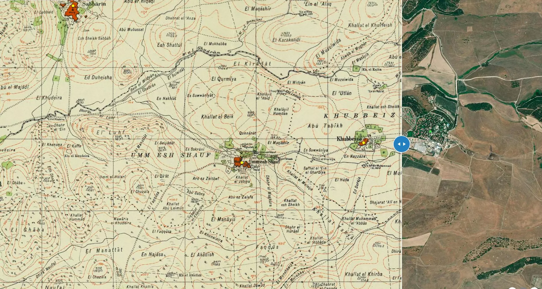
| Before & After Nakba, Click Map For Details |
|||||||||||||||
|
|||||||||||||||
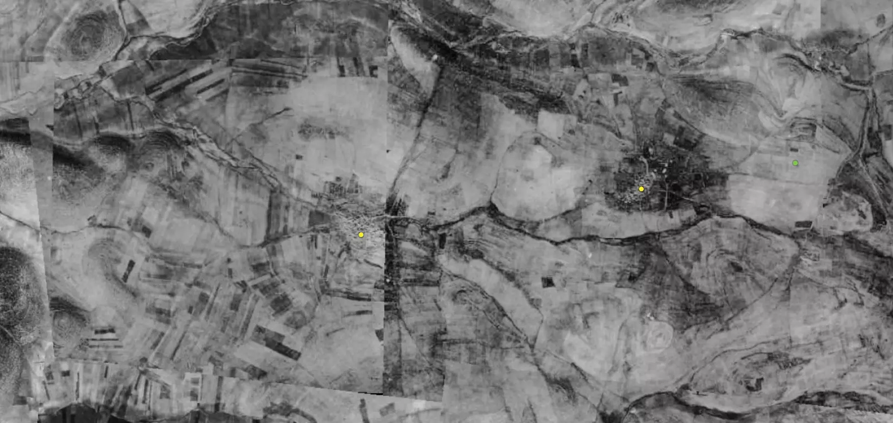
| Pre-Nakba Aerial View |
|||||||||||||||
|
|||||||||||||||
| Map Location | See location #39 on the map View from satellite |
||||||||||||||
| Military Operation | Operation Coastal Clearing | ||||||||||||||
| Attacking Units | Possibly units from the Haganah and the Irgun terror gang. | ||||||||||||||
| Defenders | Local Palestinian militia and Arab Liberation Army volunteers. | ||||||||||||||
| Acts of Terror | Massacre occured by Zionist troops against the town's inhabitants. | ||||||||||||||
| Exodus Cause | Military assault by Zionist troops | ||||||||||||||
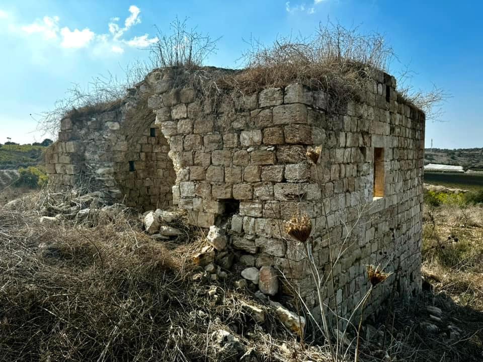
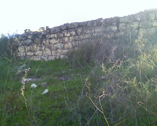
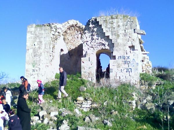
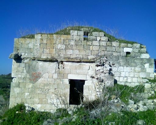
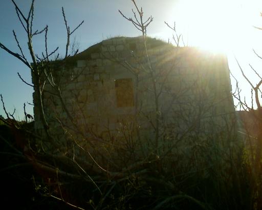
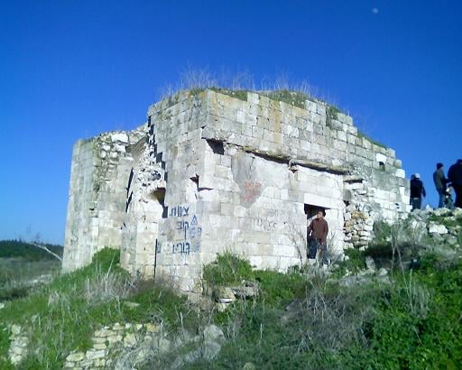
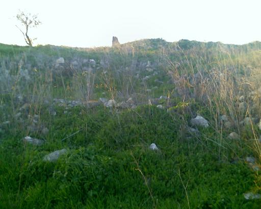
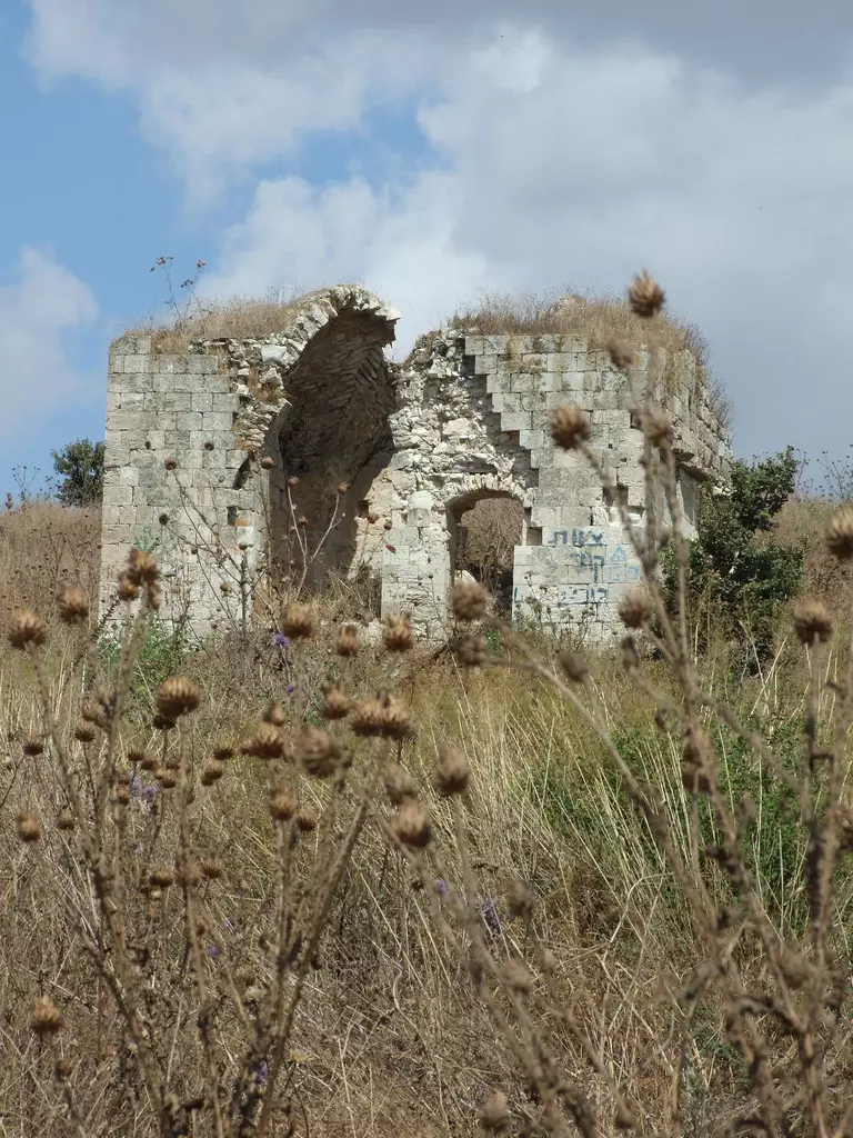
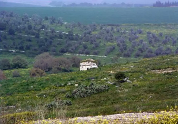
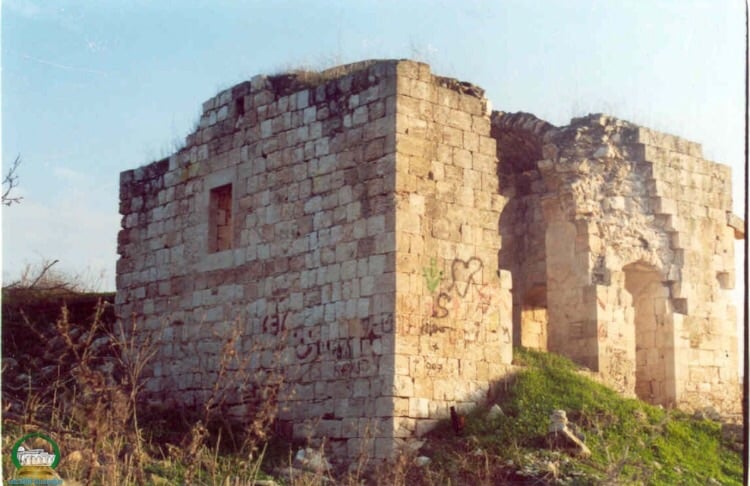
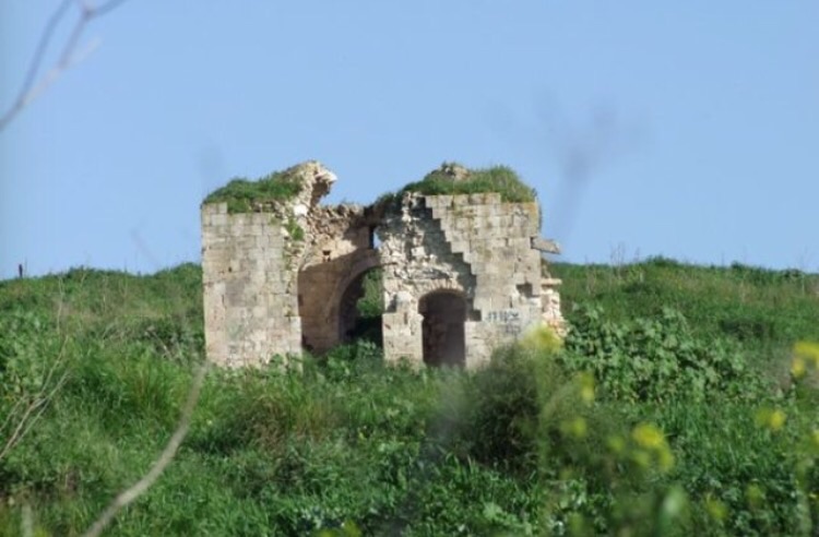
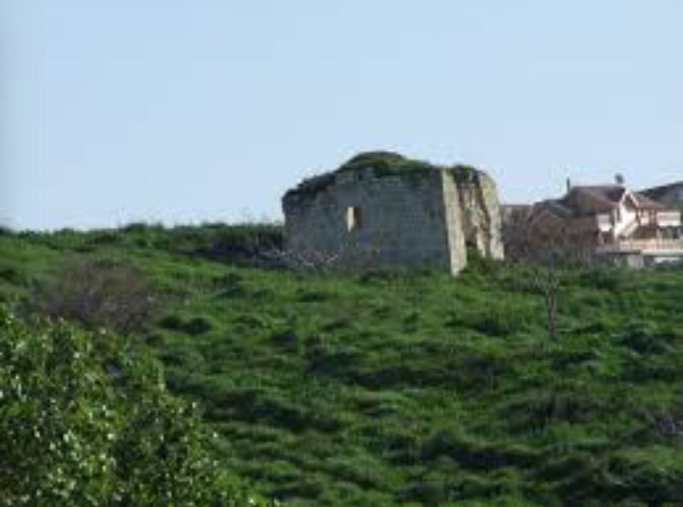
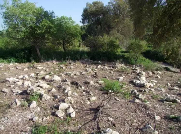
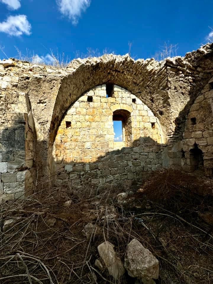
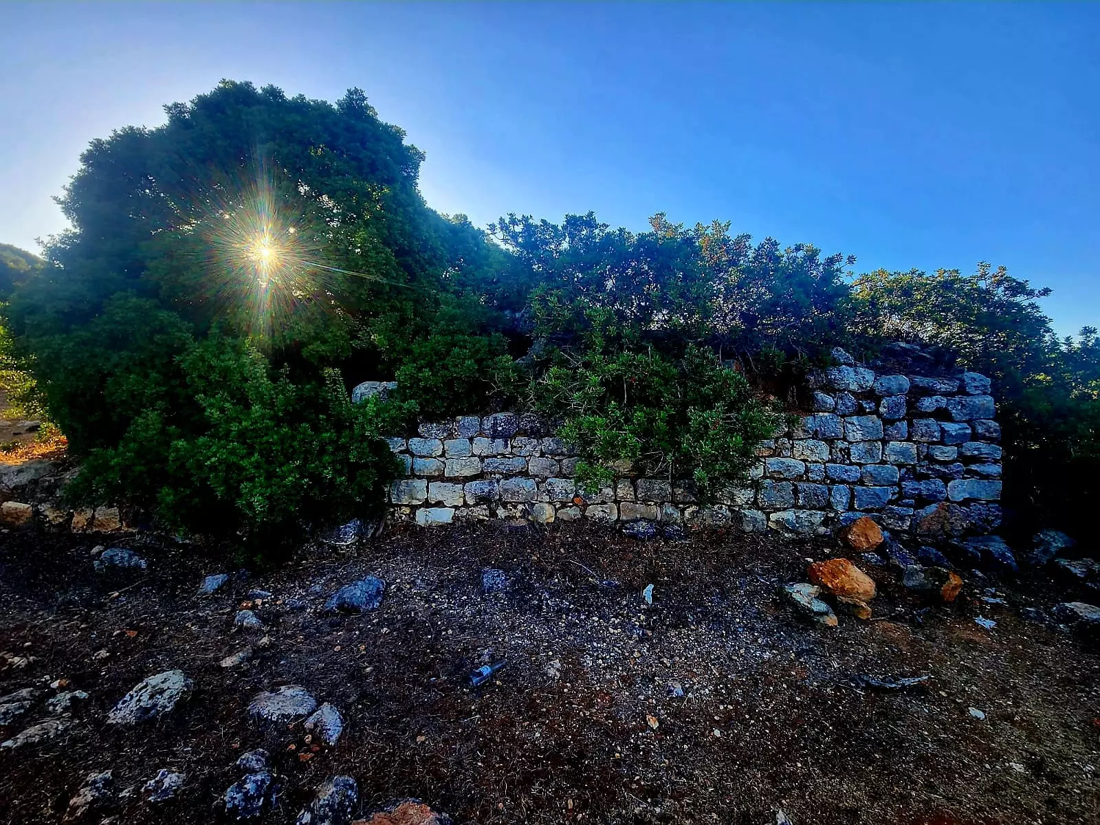
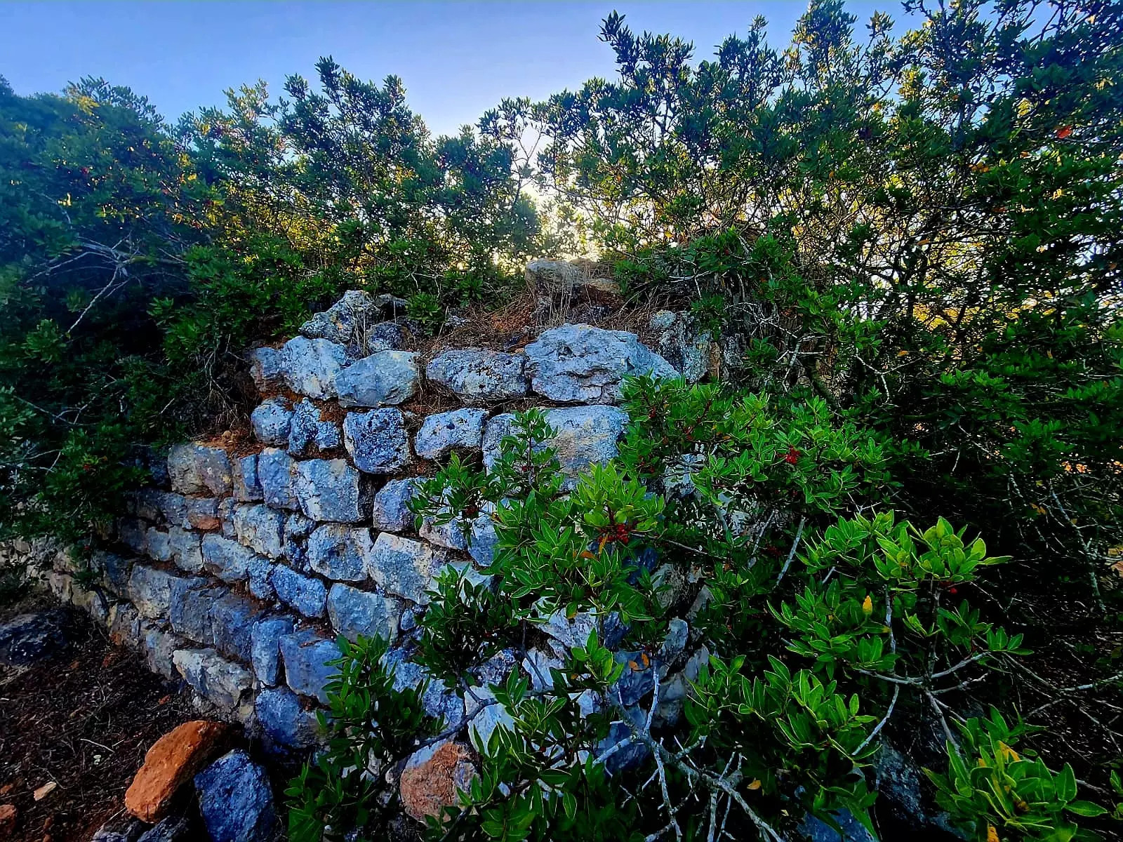
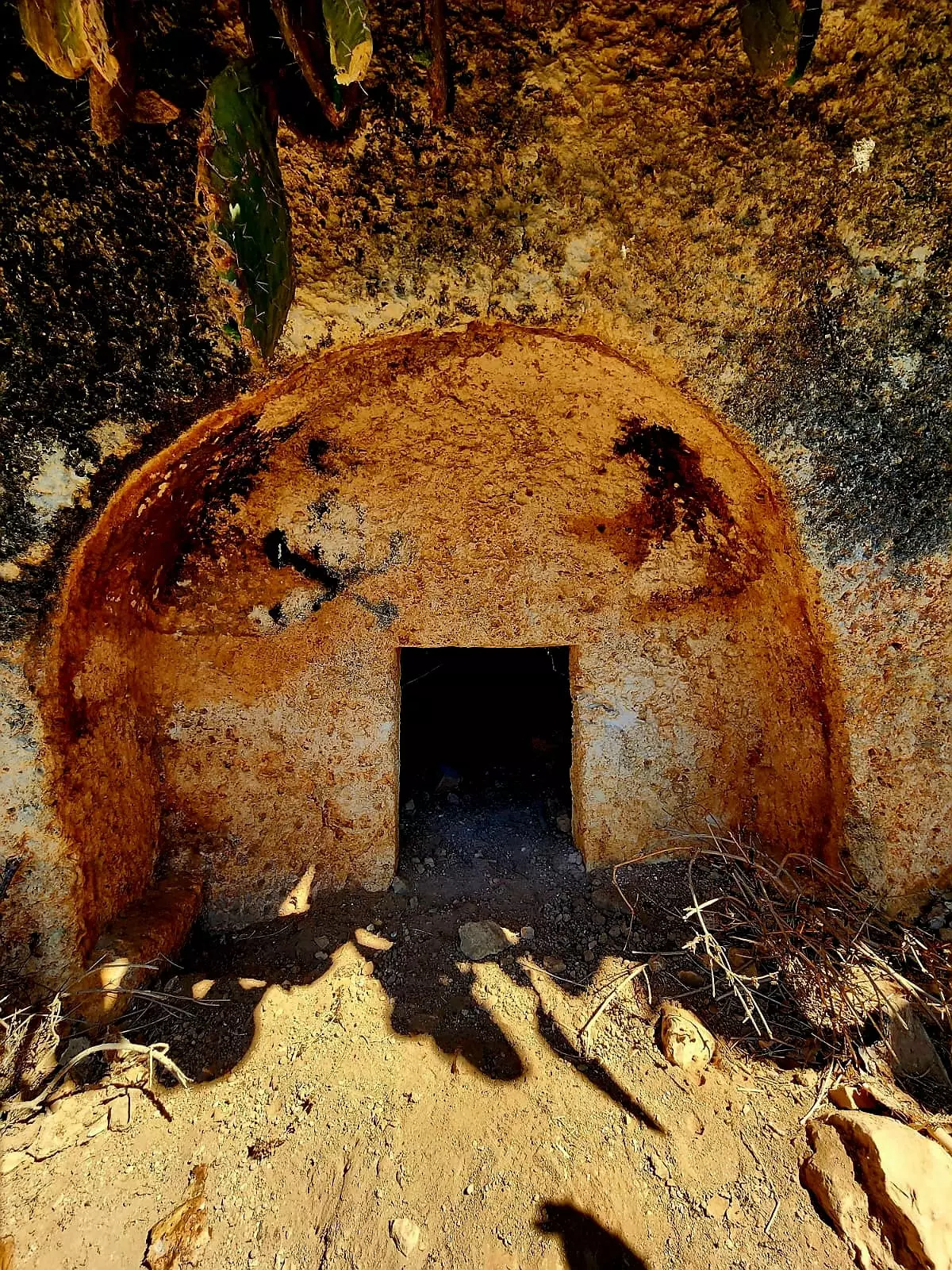
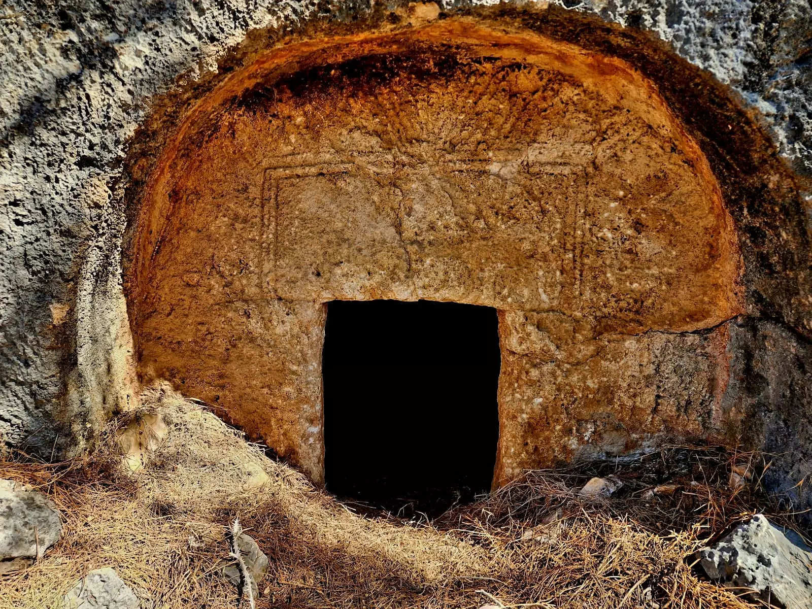
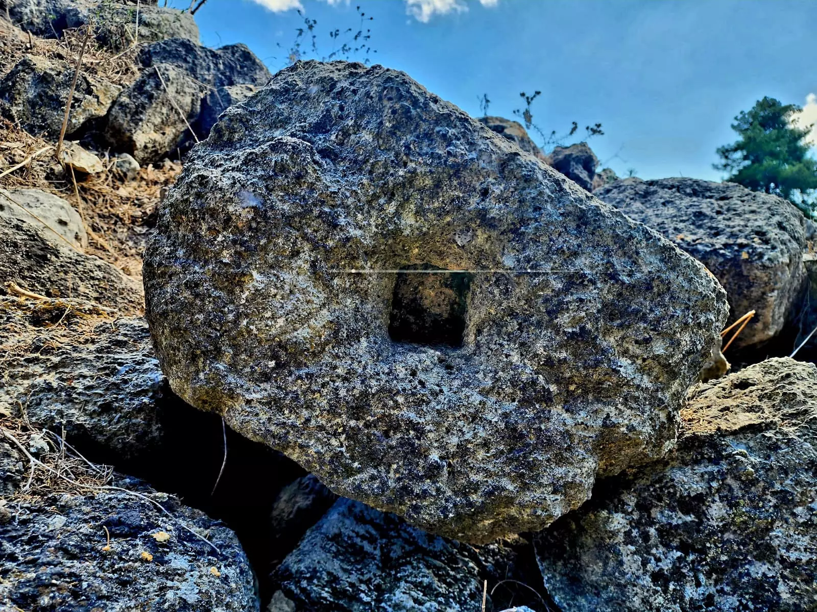
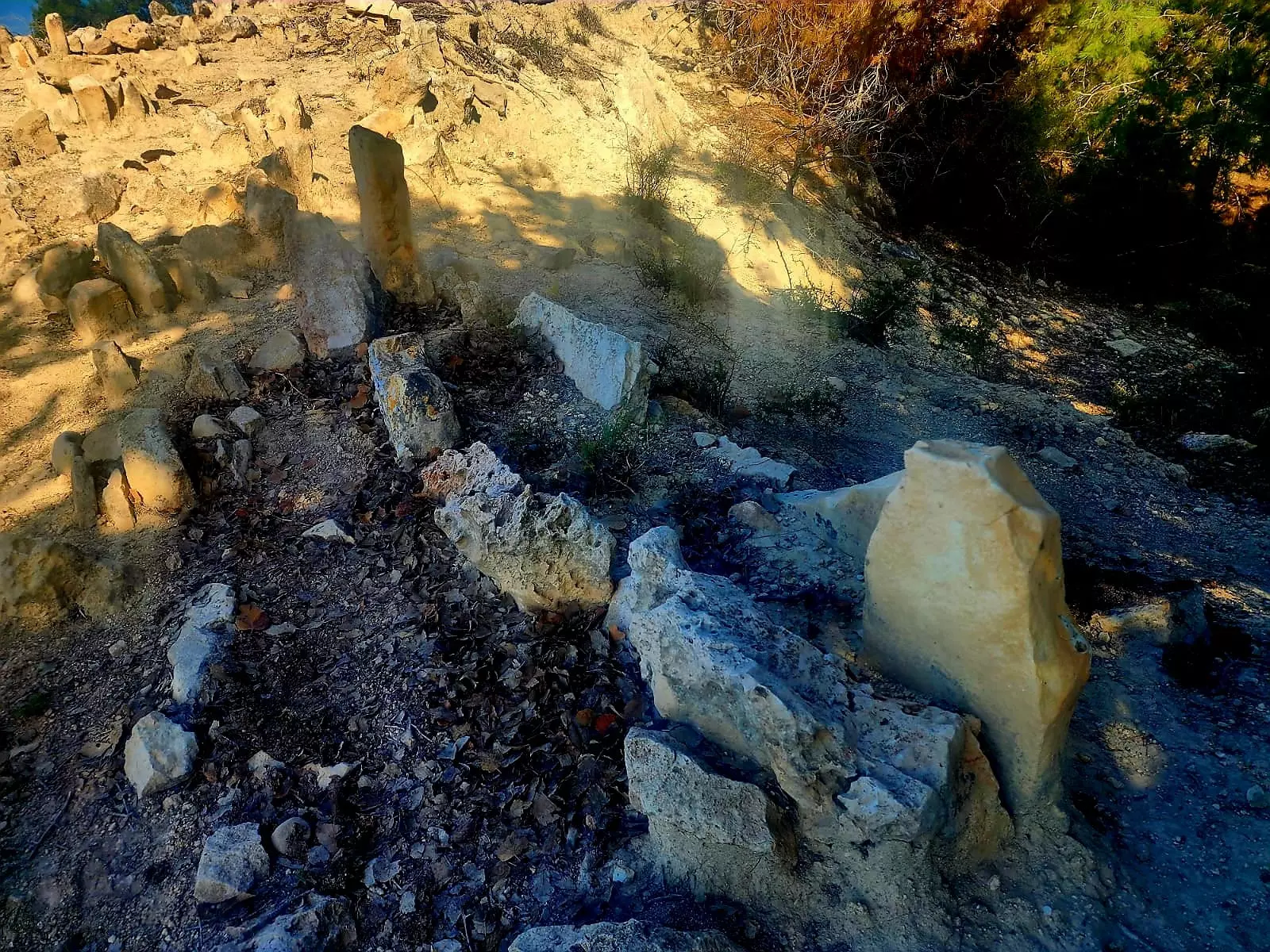
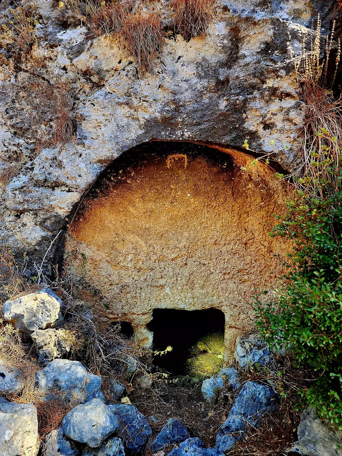
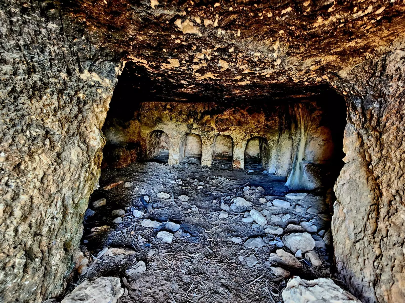
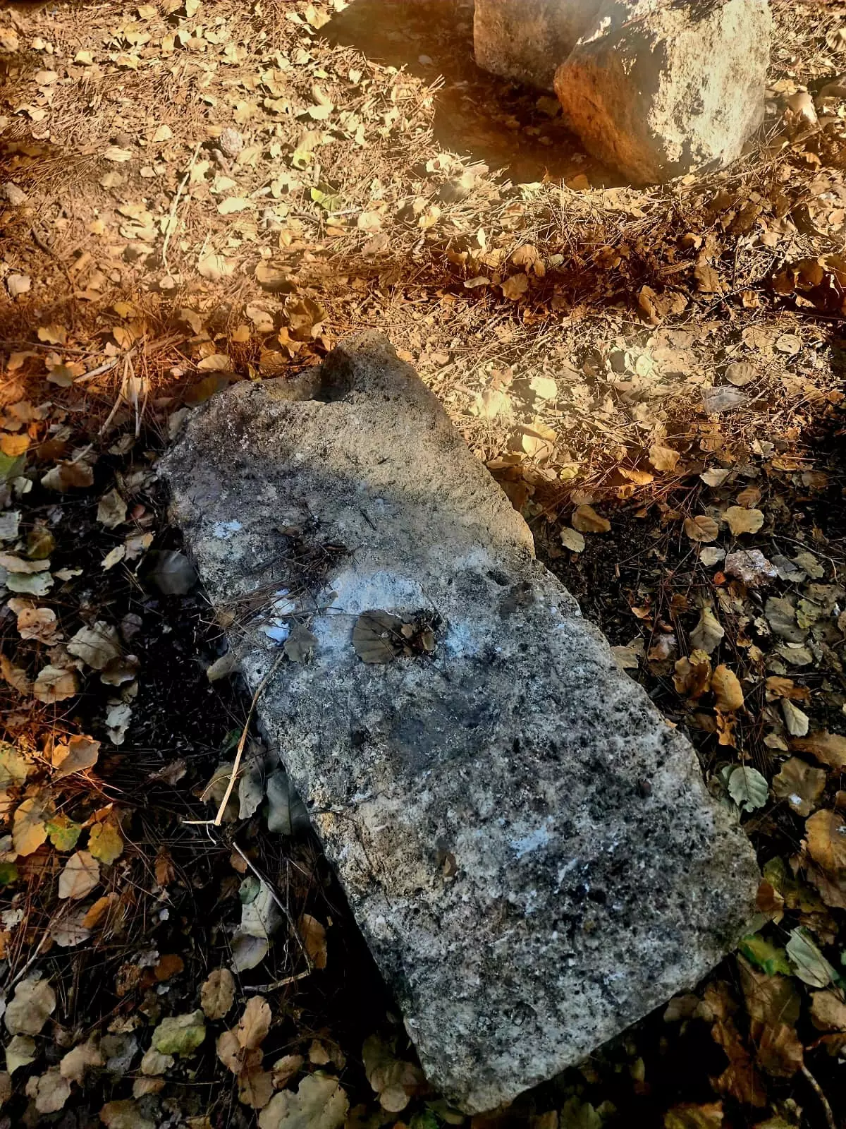
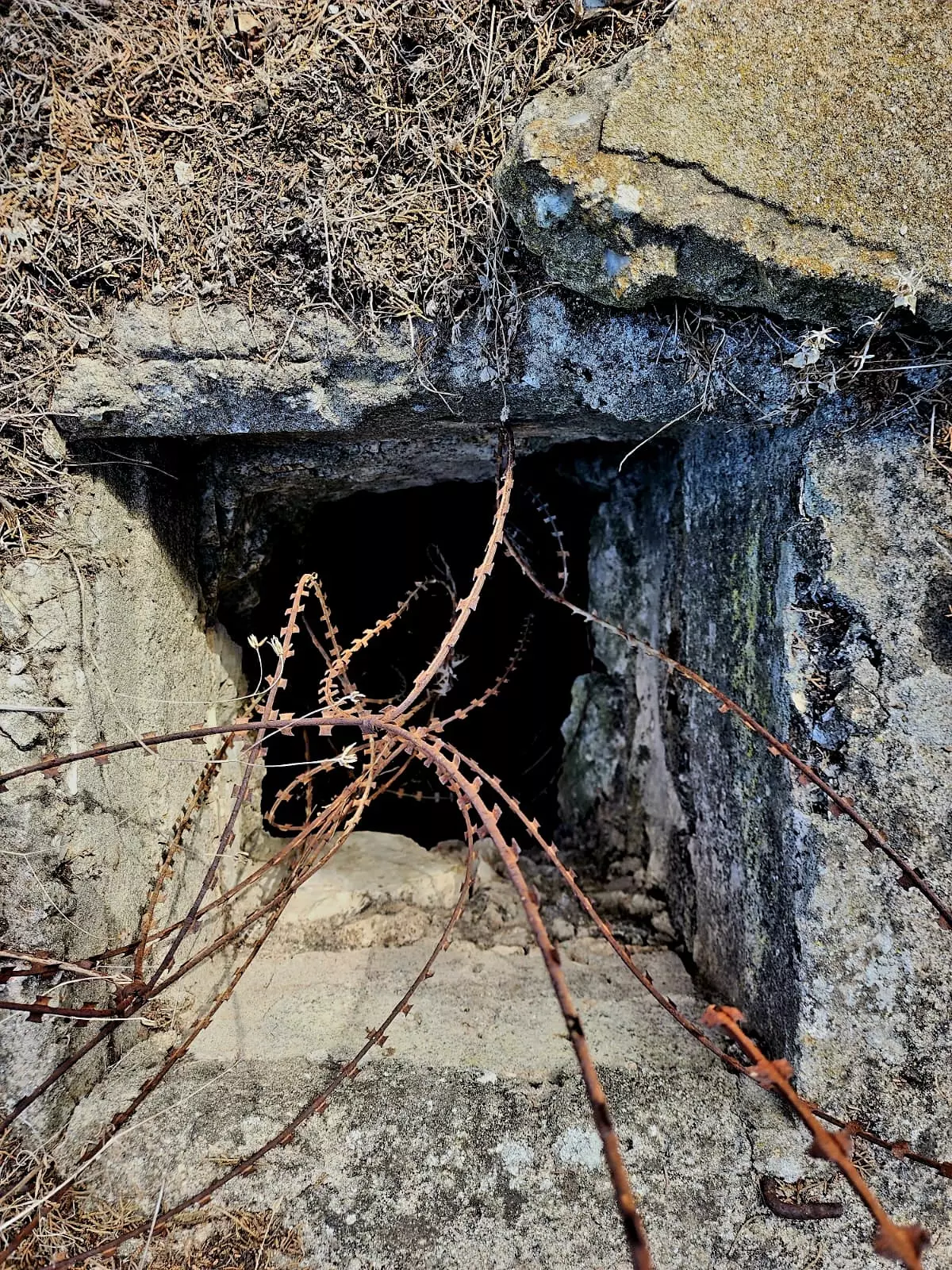
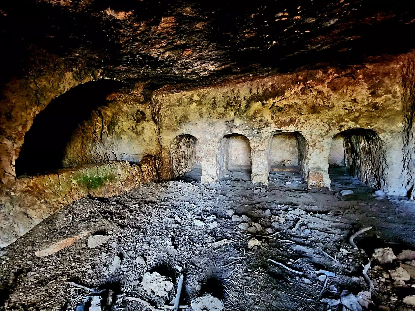
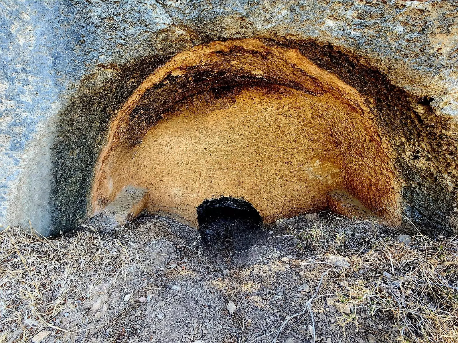
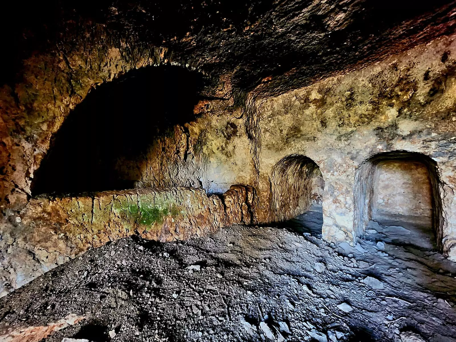
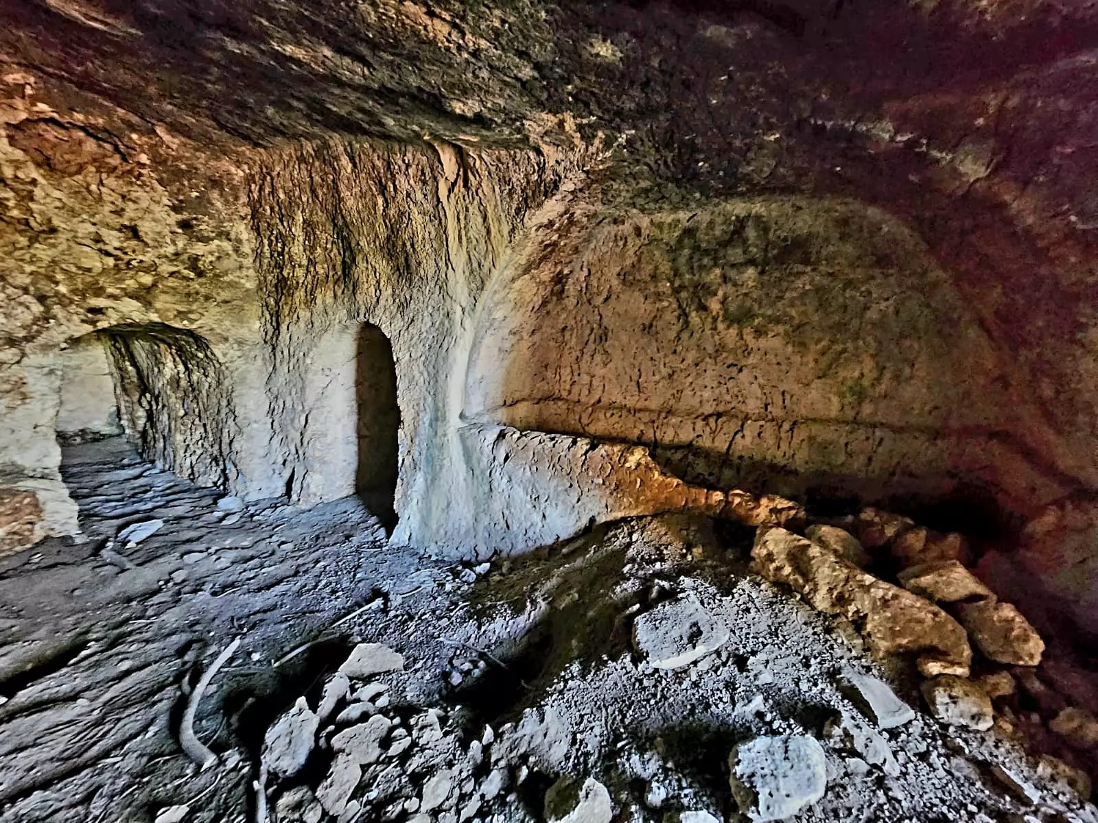
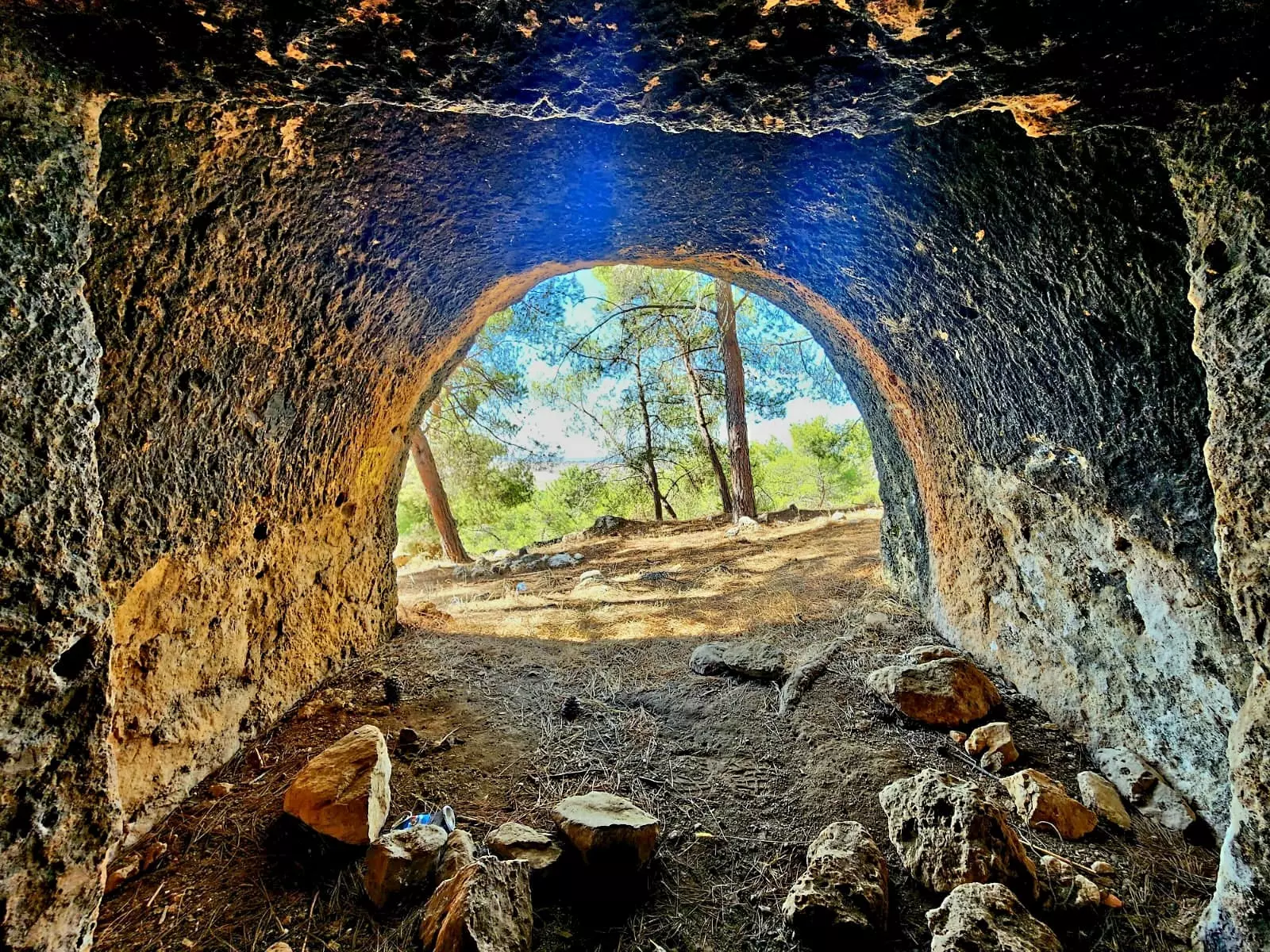
| Village Temains | The village has been completely obliterated with the exception of its shrine. | ||||||||||||||
| Ethnically Cleansing |
Soon after occupation, IZL gangs searched the Palestinian Arab refugees and found a pistol. When their demand to find out who owned the pistol was fruitless, the commander at the seen execute seven male refugees.(Benny Morris p. 117-118) |
||||||||||||||
| Pre-Nakba Land Ownership |
**Town Lands' Demarcation Maps |
||||||||||||||
| Land Usage As of 1945 |
|
||||||||||||||
| Population |
|
||||||||||||||
| Number of Houses |
|
||||||||||||||
| Near By Towns |
|||||||||||||||
|
|
|||||||||||||||
| Places of Warship | One mosque | ||||||||||||||
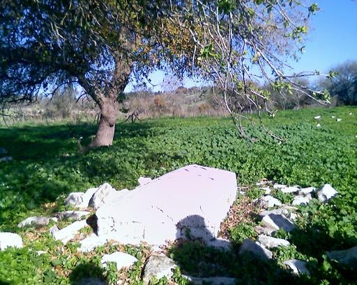
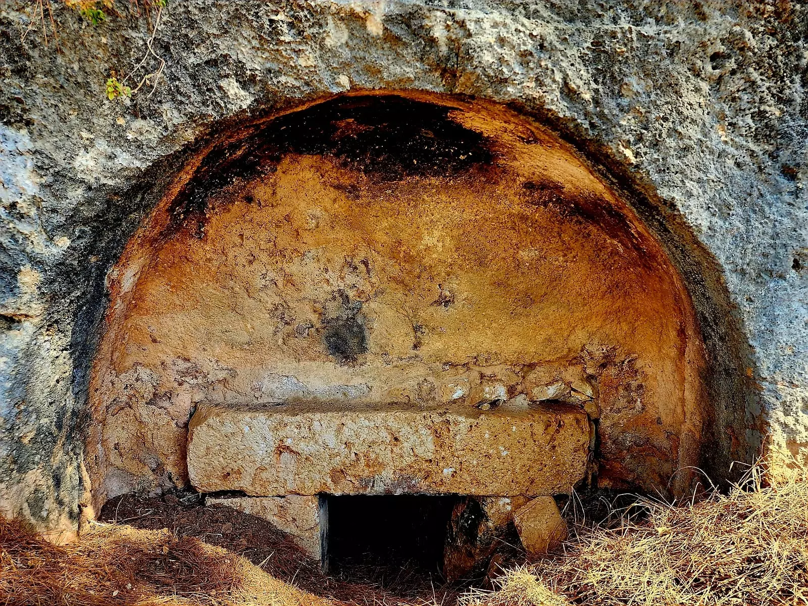
| Shrines / Maqams | A shrine for a local sage known by al-Shaykh 'Abd Allah (still standing). | ||||||||||||||
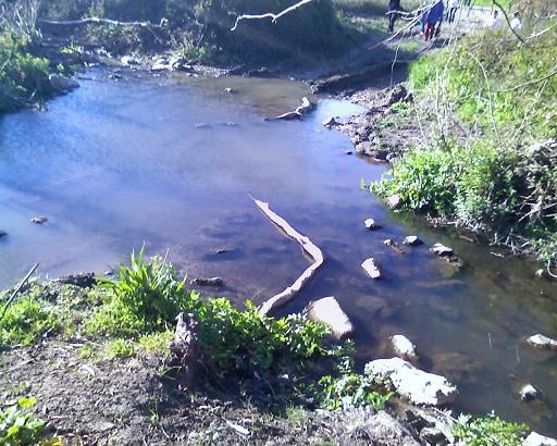
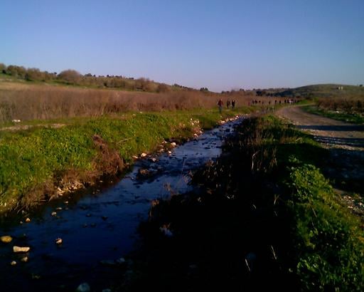
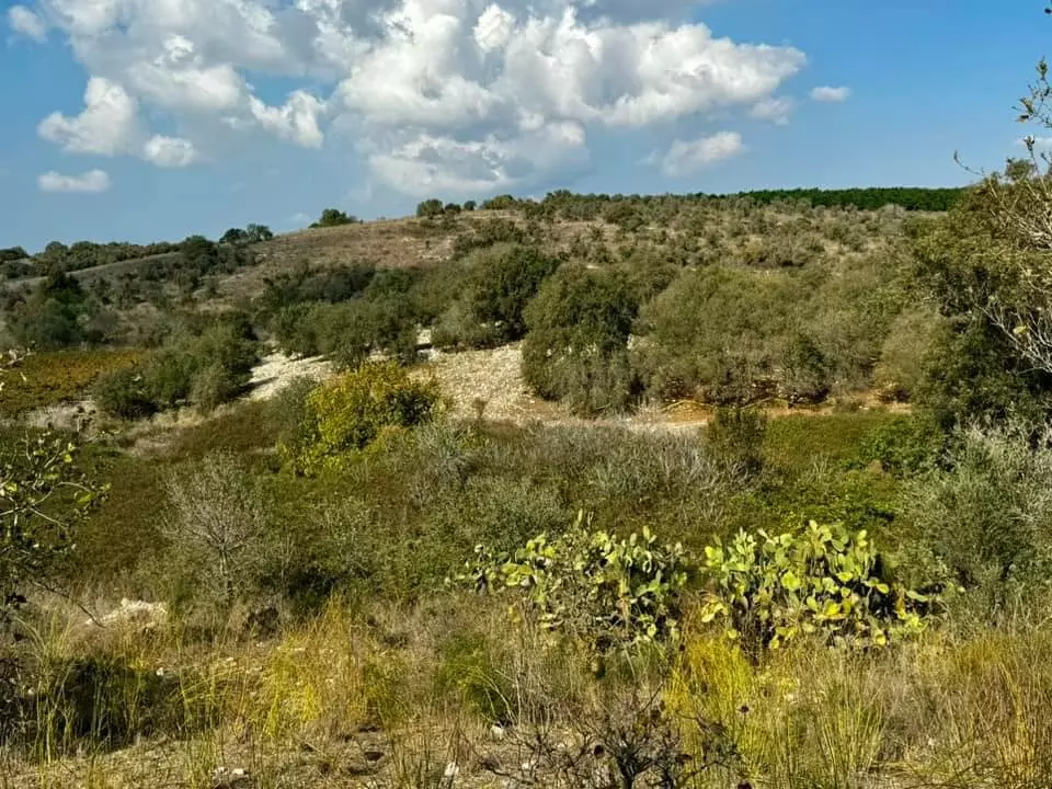
| Nearby Wadies & Rivers | Umm al-Shawf was situated on the sloping section of Wadi al-Marah. | ||||||||||||||
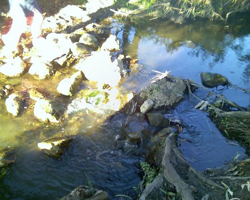
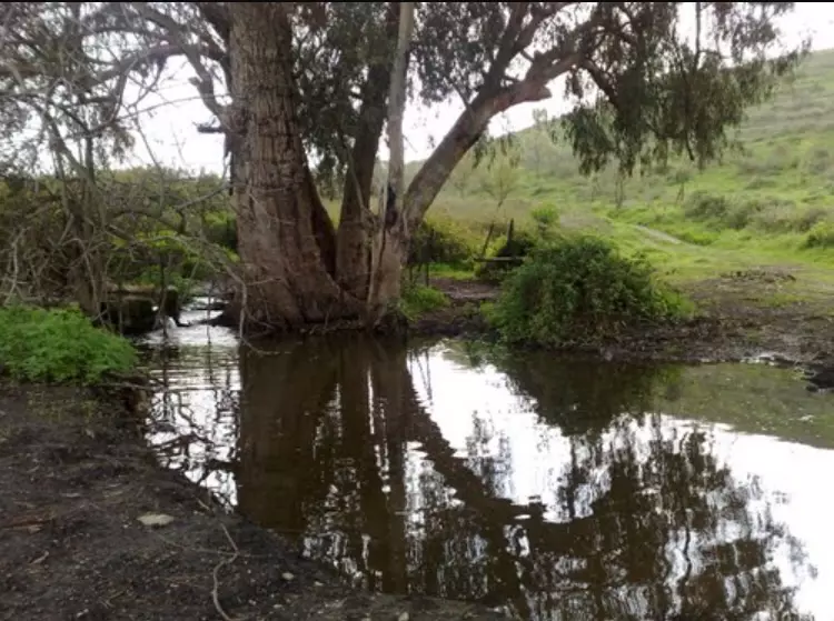
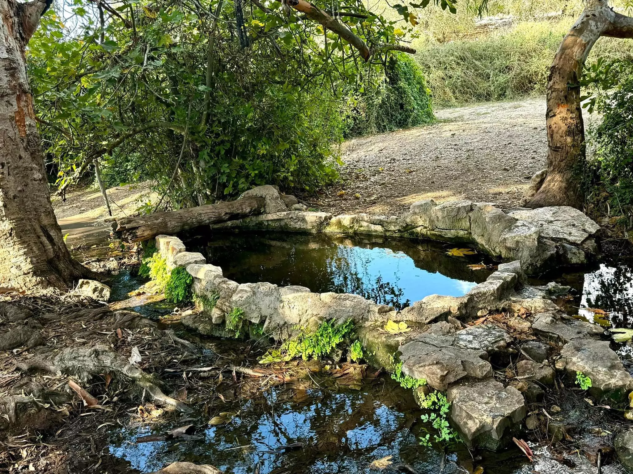
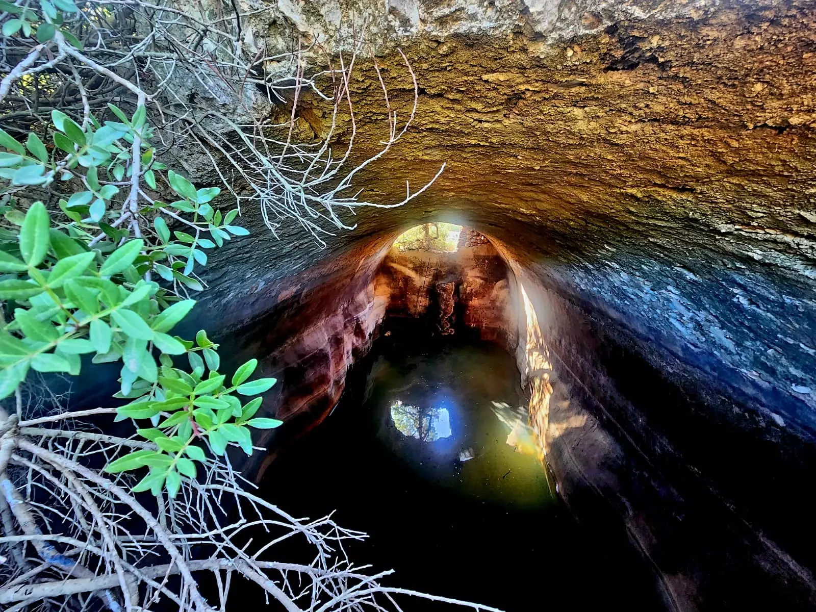
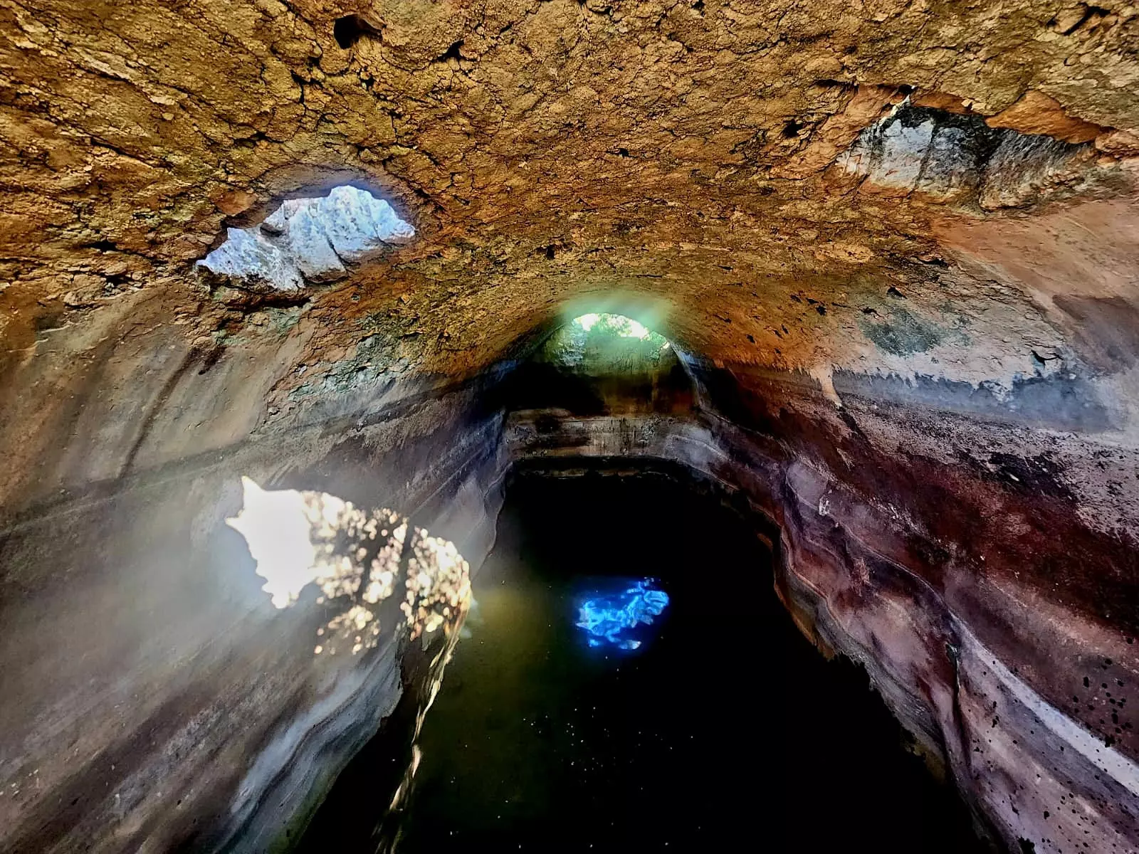
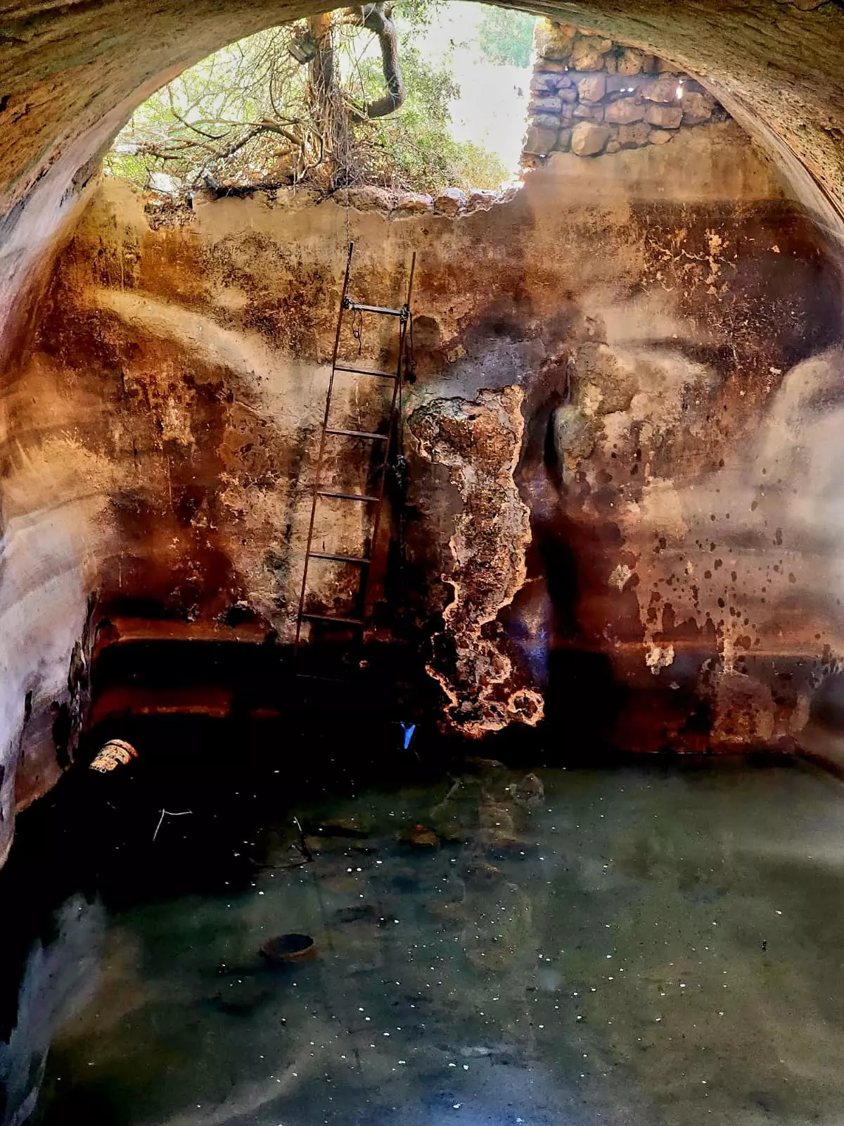
| Water Supply | Umm al-Shawf had two springs in its north side which supplied it with its drinking water needs. | ||||||||||||||
| Exculsive Jewish Colonies Who Usurped Village Lands |
Giv'at Nili | ||||||||||||||
| Featured Video | |||||||||||||||
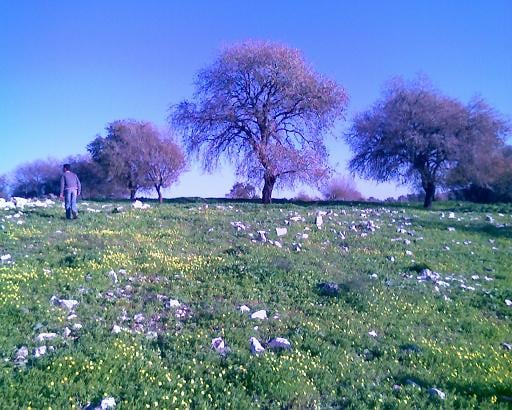
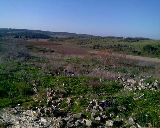
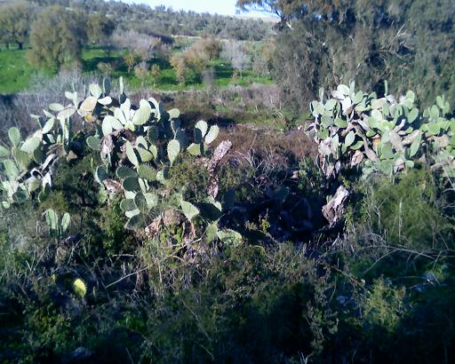
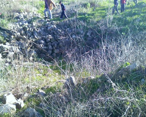
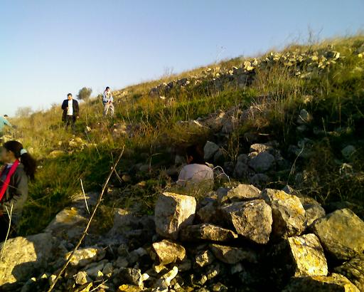
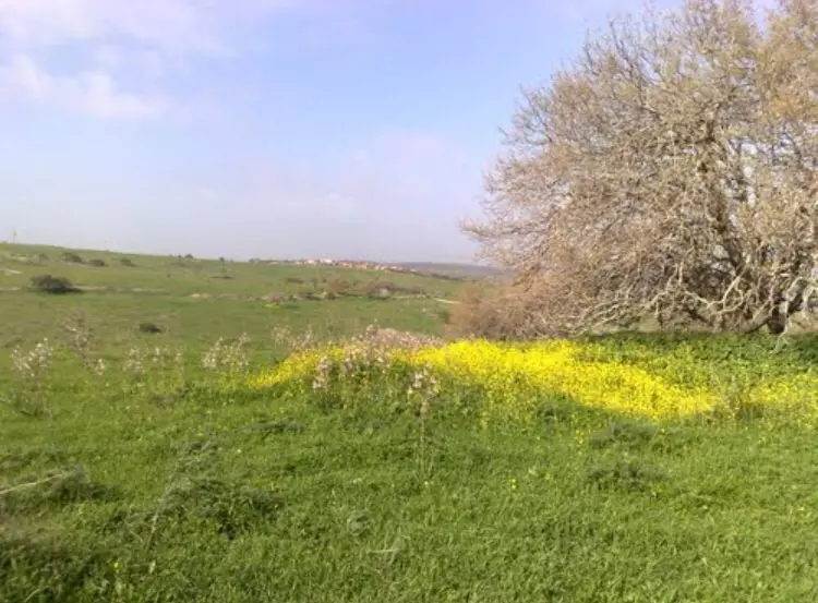
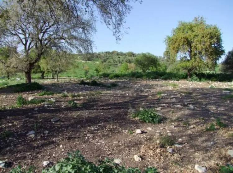
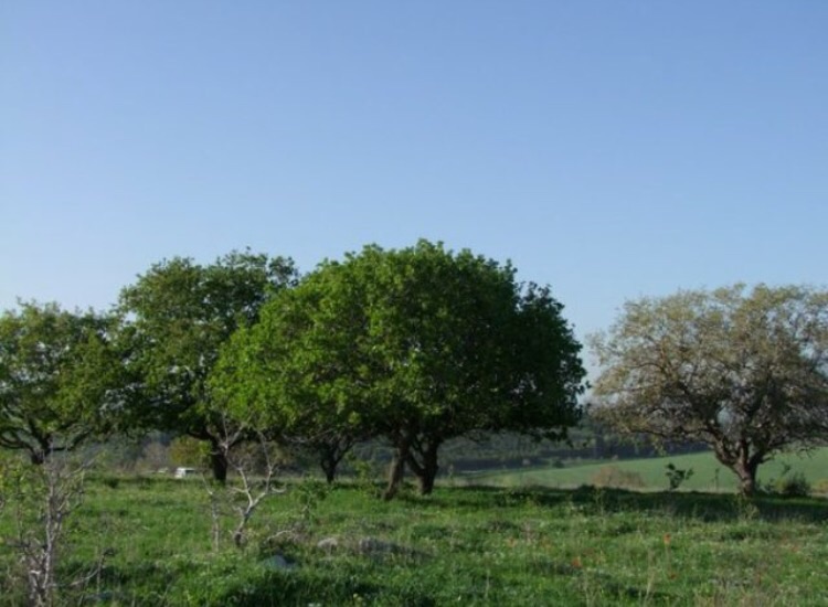
Village Before NakbaThe village stood on the southern, gently sloping section of Wadi al-Marah in the bilad al-rawha' (see Daliyat al-Rawha', Haifa sub-disctrict) and faced north. It was linked by a number of secondary roads to the coastal highway and the Haifa-Jenin highway, as well as to the neighboring villages. In the late nineteenth century, Umm al-Shawf was a small village that extended from the southeast to the northwest. Two springs north of the village supplied it with water. Its estimated 150 residents, who were Muslims, cultivated 21 faddans (1 faddan = 100-250 dunums). The houses were made of stone with either mud or cement. The village had a mosque and a shrine for a local sage, Shaykh Abd Allah. The village economy was based on agriculture and animal husbandry; the most important crops were grain and olives. In 1944/45 a total of 6,175 dunums was allocated to cereals; 107 dunums were irrigated or used for orchards, of which 32 dunums were used for growing olives.Zionists Colonies on Village LandsGiv'at Nili, founded in 1953, is on village lands south of the site.Village TodayPiles of stone debris from the houses are scattered about the site, which is overgrown with cactuses, thorns, and bushes. The shrine of Shaykh Abd Allah still stands.SourceDr. Walid al-Khalidi, 1992: All That Remains. |
|||||||||||||||
| Related Maps | Town Lands' Demarcation Maps خرائط للقضاء توضح حدود القرى والاودية Town's map on MapQuest View from satellite Help us map this town at WikiMapia |
||||||||||||||
| Related Links | Wikipedia's Page Google Search Google For Images Google For Videos |
||||||||||||||
| More Information | في كتاب كي لا ننسى في كتاب بلادنا فلسطين المزيد من موقع هوية |
||||||||||||||
- أم الشوف- المقام (من أرشيف ديرتنا)

Posted by محمد سلامة يونس 22 - مقبرة أم الشوف 2008 (من أرشيف ديرتنا)
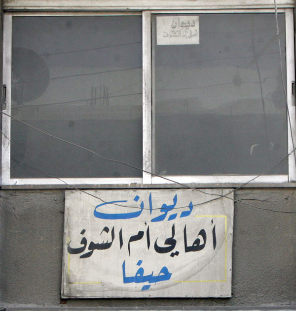
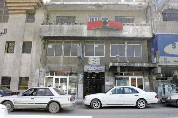
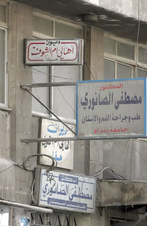
Posted by محمد سلامة يونس 5 - مقر ديوان أهالي قرية أم الشوف في المهجر - على شارع الرصيفة الرئيسي بمنطقة الزرقاء بالأردن حيث يجتمع أهالي القرية في أفراحهم وأترحهم

Posted by saher kaddarah 5 - مقر ديوان أهالي قرية أم الشوف في المهجر - على شارع الرصيفة الرئيسي بمنطقة الزرقاء بالأردن حيث يجتمع أهالي القرية في أفراحهم وأترحهم
Posted by saher kaddarah 5 - مقر ديوان أهالي قرية أم الشوف في المهجر - على شارع الرصيفة الرئيسي بمنطقة الزرقاء بالأردن حيث يجتمع أهالي القرية في أفراحهم وأترحهم
Posted by saher kaddarah - مقر ديوان أهالي قرية أم الشوف في المهجر - على شارع الرصيفة الرئيسي بمنطقة الزرقاء بالأردن حيث يجتمع أهالي القرية في أفراحهم وأترحهم
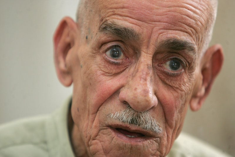
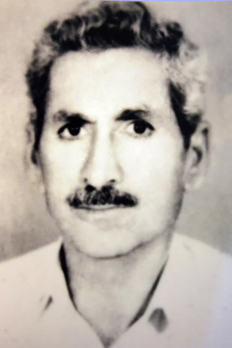
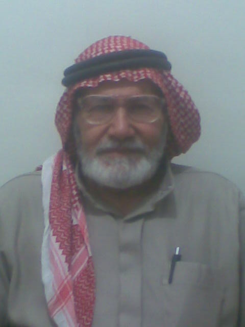
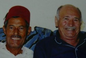
Posted by saher kaddarah 3 - الحاج أحمد نجيب مسعود صباح (أبو صباح) من أم الشوف - وجه أثر في ملامحه الحنين والشوق لقريته الحبيبة ، ولد سنة 1923م تقريبا بالقرية ، يعيش اليوم في مدينة الرصيفة بمنطقة الزرقاء بالأردن
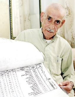
Posted by saher kaddarah 10 - الحاج أحمد نجيب مسعود صباح (أبو صباح) يحمل بين يديه قائمة مفصلة بأراضي والده في أم الشوف ، ولد سنة 1923م تقريبا ، يعيش اليوم في مدينة الرصيفة بمنطقة الزرقاء بالأردن يحدوه الحنين لمسقط رأسه الحبيب
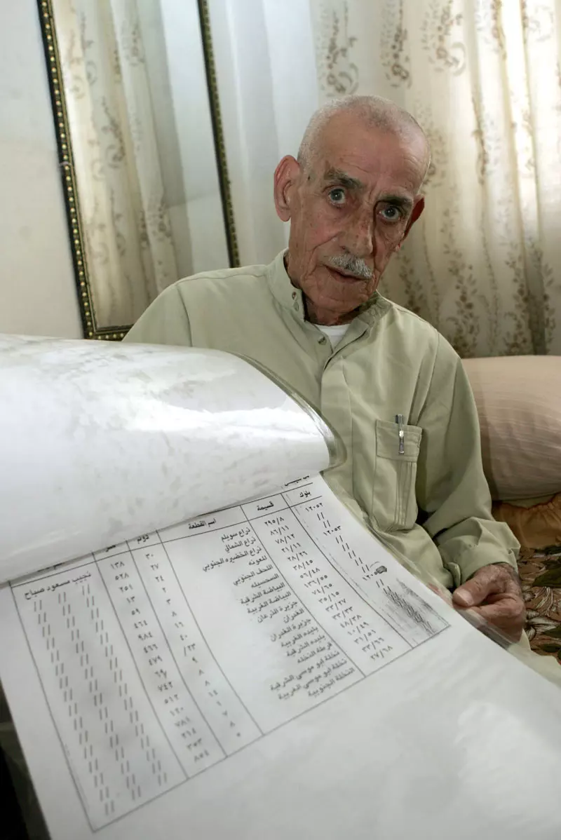
Posted by saher kaddarah 1 - الحاج أحمد نجيب مسعود صباح (أبو صباح) يحمل بين يديه قائمة مفصلة بأراضي والده في أم الشوف ، ولد سنة 1923م تقريبا ، يعيش اليوم في مدينة الرصيفة بمنطقة الزرقاء بالأردن يحدوه الحنين لمسقط رأسه الحبيب
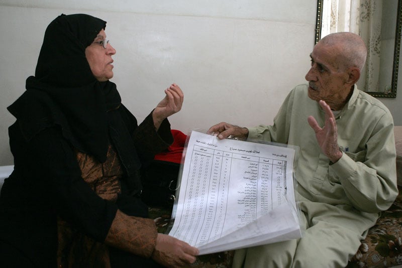
Posted by saher kaddarah 1 - الحاج أحمد نجيب مسعود صباح (أبو صباح) يشرح لابنة أخته عائشة صالح عبدالله عن قائمة مفصلة بأراضيهم بأم الشوف
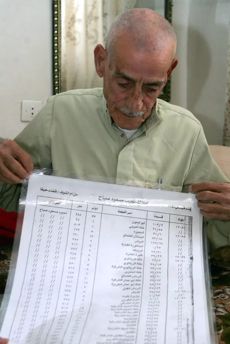
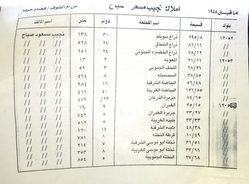
Posted by saher kaddarah 1 - قائمة مفصلة بأراضي المرحوم نجيب مسعود صباح (أبو صباح) بأم الشوف يحتفظ بها ابنه الحاج أحمد (أبو صباح) الذي يعيش في مدينة الرصيفة بمنطقة الزرقاء بالأردن
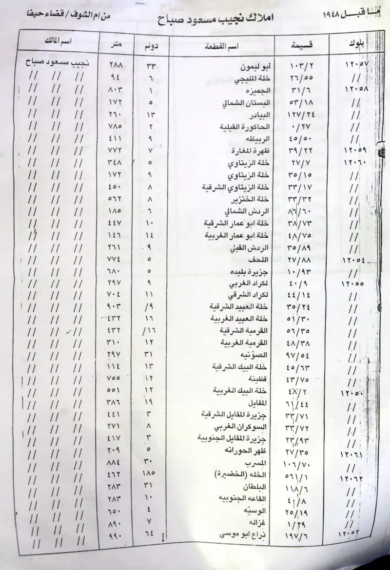
Posted by saher kaddarah 1 - تتمة القائمة المفصلة بأراضي المرحوم نجيب مسعود صباح (أبو صباح) بأم الشوف يحتفظ بها ابنه الحاج أحمد (أبو صباح) الذي يعيش في مدينة الرصيفة بمنطقة الزرقاء بالأردن
Posted by saher kaddarah - الحاج المرحوم سعيد نجيب مسعود صباح من أم الشوف المولود بالقرية السليبةعام 1928م تقريبا، توفي المرحوم في 6/4/2001م وكان يسكن منطقة الرصيفة بالأردن
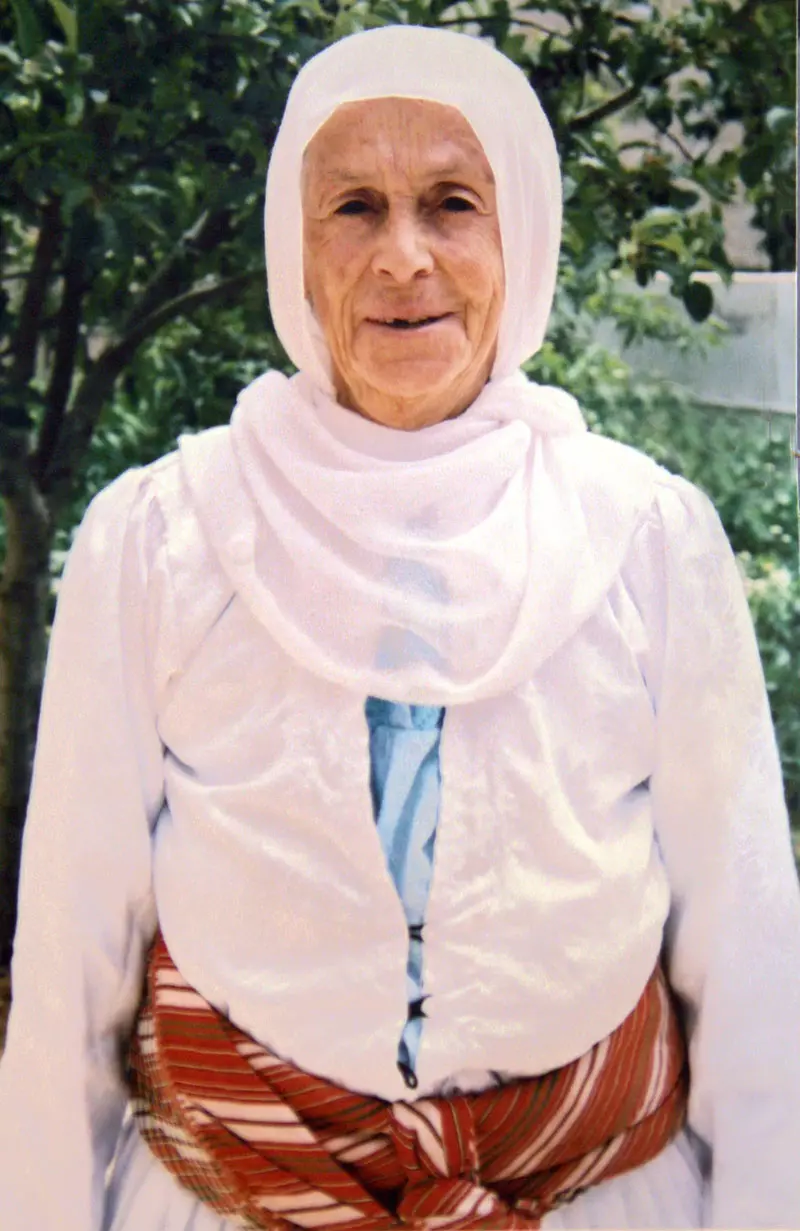
Posted by saher kaddarah 3 - الحاجة نايفة نجيب مسعود صباح ، ولدت سنة 1920م تقريبا بأم الشوف، تعيش اليوم في قرية قفين التابعة لمحافظة طولكرم بالضفة الغربية
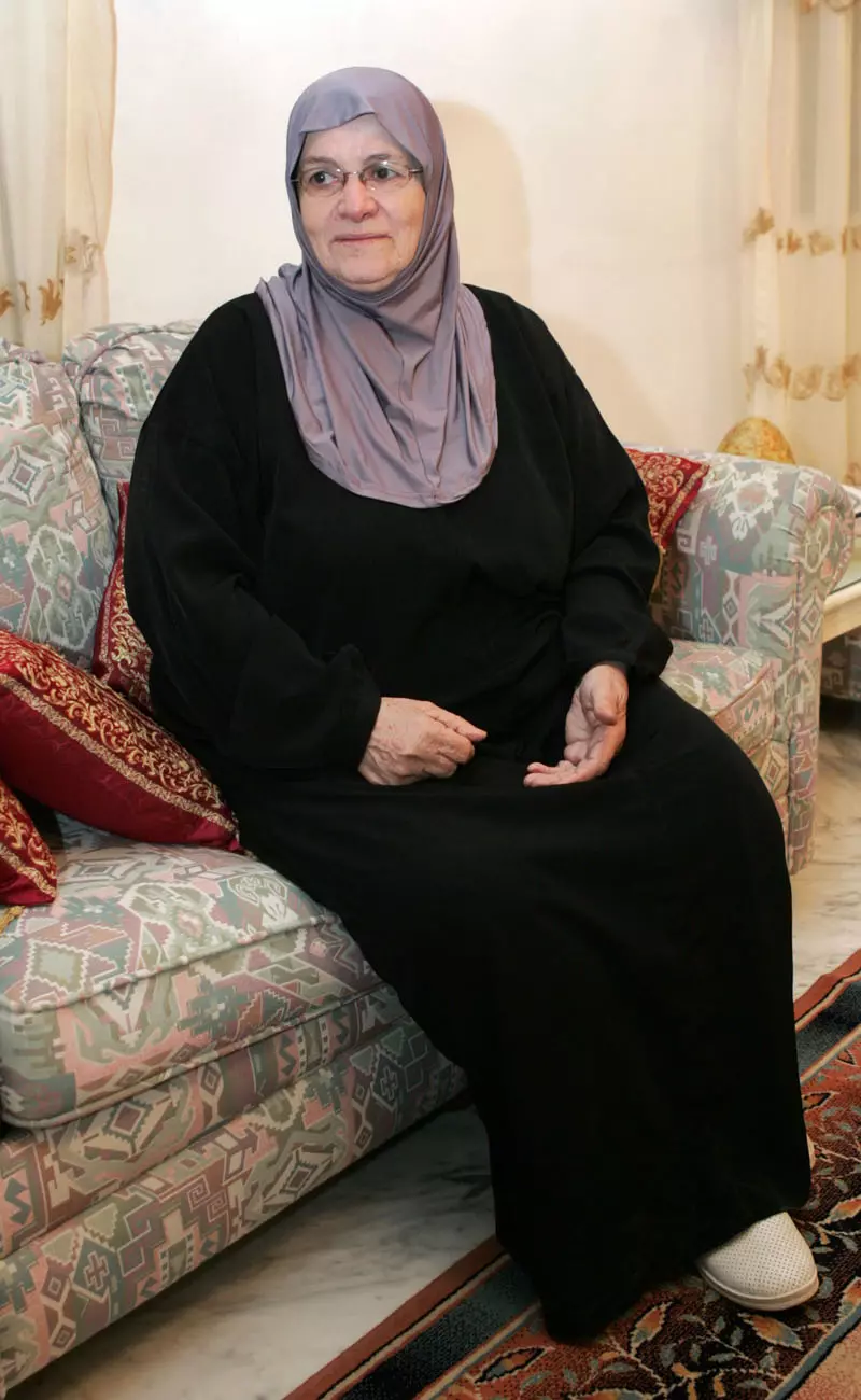
Posted by saher kaddarah 1 - الحاجة عريفة نجيب مسعود صباح (أم مؤيد) من أم الشوف، تعيش اليوم في منطقة طبربور في العاصمة الأردنية عمان 21/4/2008
Posted by saher kaddarah 10 - الجد جميل محمود قاسم احد رجالات ام الشوف والمقيم حاليا بالاردن
Posted by سحر تيسير قاسم 11 - الحاج يوسف نجيب مصطفى شناعة ( أبو الوليد )
Posted by زيد شناعة 2 - الحاجة فاطمة اديب سعيد شناعة ( ام الوليد )
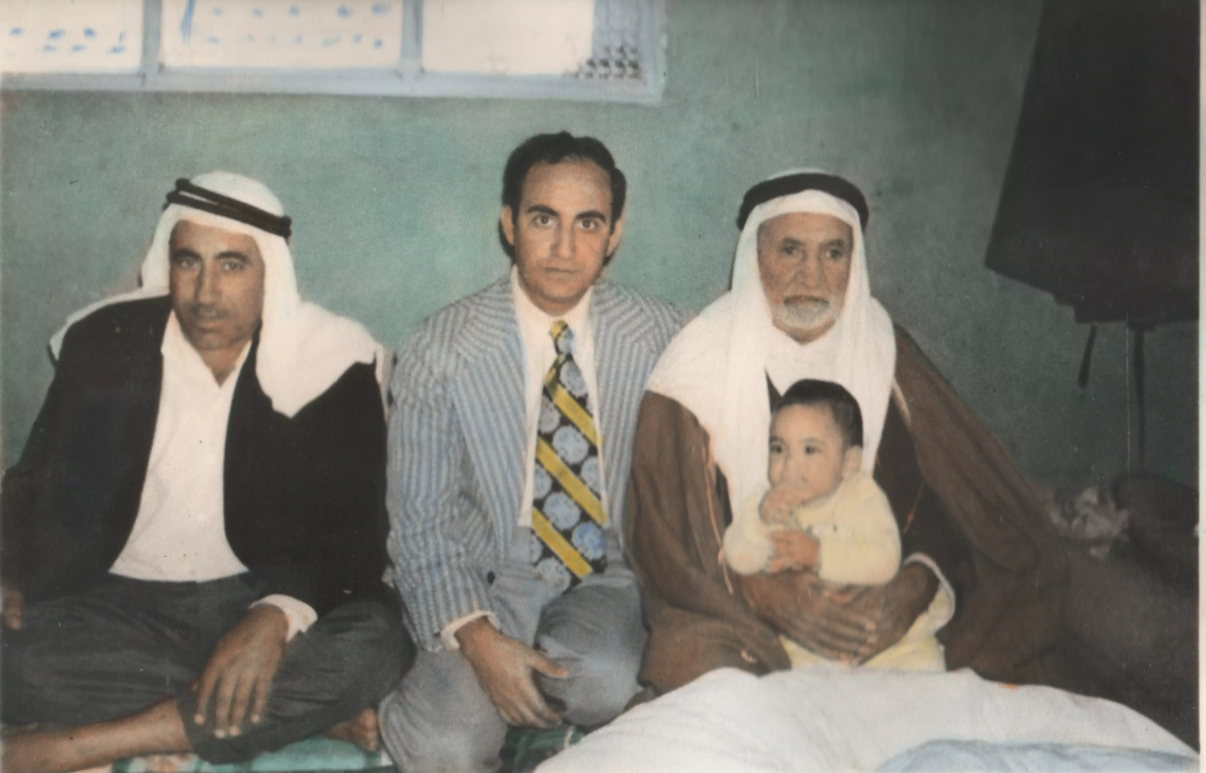
Posted by زيد شناعة - الحاج عماد معين نجيب مسعود صباح - (أبومراد) ، يحدوه الحنين ليسترجع ذكريات الماضي في إم الشوف ، ولد سنة 1950م تقريبا ، في مدينة عتيل ، وبيته اليوم في حي جبل الأميرة رحمة بمحافظة الزرقاء بالأردن ، ويعيش بمدينة الرياض بالمملكة العربية السعودية ، ينتظر العودة إلى البيت القديم في إم الشوف.
Posted by مجدي صباح 1 - آثار البيوت المهدمة
Posted by مجدي صباح - المسجد
Posted by مجدي صباح 1 - المسجد1
Posted by مجدي صباح 2 - المسجد3
Posted by مجدي صباح 3 - المسجد4
Posted by مجدي صباح 2 - دمار مسجد القرية
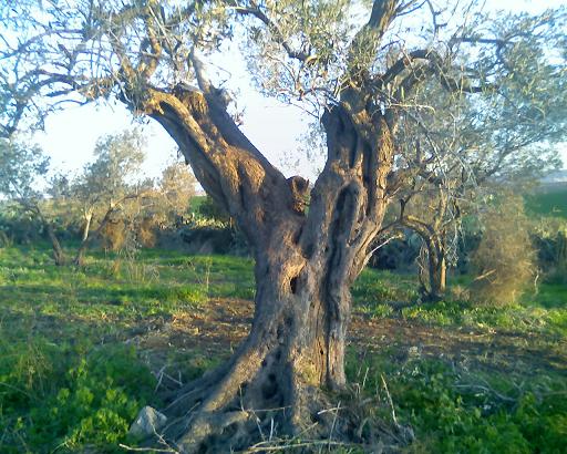
Posted by مجدي صباح - شجرة زيتون راسخة منذ القدم ... تنتظر عودة صاحب الارض الاصلي ليقطف ثمارها ...
Posted by مجدي صباح - صورة لمقبرة إم الشوف-مقبرة واسعة وقبورها متناثرة
Posted by مجدي صباح - صورة قريبة من عين الماء والمقبرة ومطلة على المسجد
Posted by مجدي صباح 1 - صورة لعين الماء الموجودة بالقرب من المسجد في إم الشوف 1
Posted by مجدي صباح - صورة لعين الماء الموجودة بالقرب من المسجد في إم الشوف 2
Posted by مجدي صباح - صورة لعين الماء الموجودة بالقرب من المسجد في إم الشوف 3
Posted by مجدي صباح 3 - صورة للبيادر
Posted by مجدي صباح 2 - صورة للصبار وهو مابقي من آثار الصمود
Posted by مجدي صباح - في الصورة تظهر حفرة هي بيت كان صامدا شامخا ففجر لعدم القدرة على هدمة ... عام 68
Posted by مجدي صباح - مابقي من آثار البيوت المهدمة
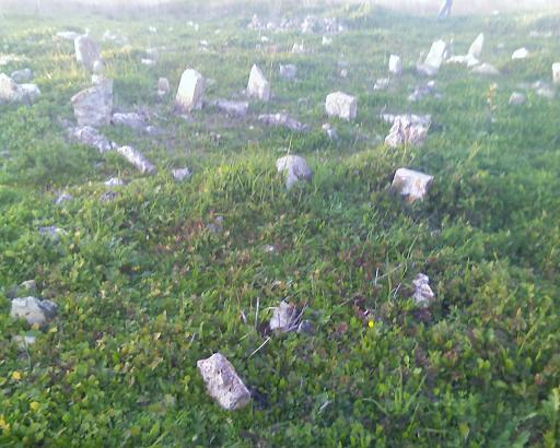
Posted by مجدي صباح 1 - مقبرة القرية 1
Posted by مجدي صباح - مقبرة القرية 2
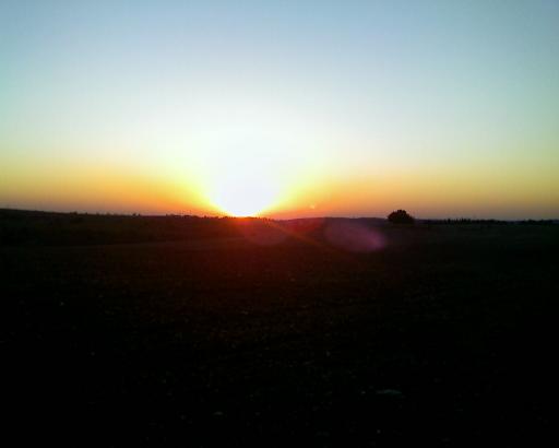
Posted by مجدي صباح - منظر القرية عند الغروب
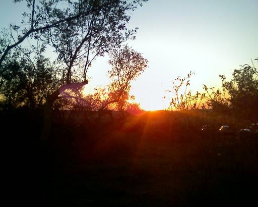
Posted by مجدي صباح - منظر القرية عند الغروب1
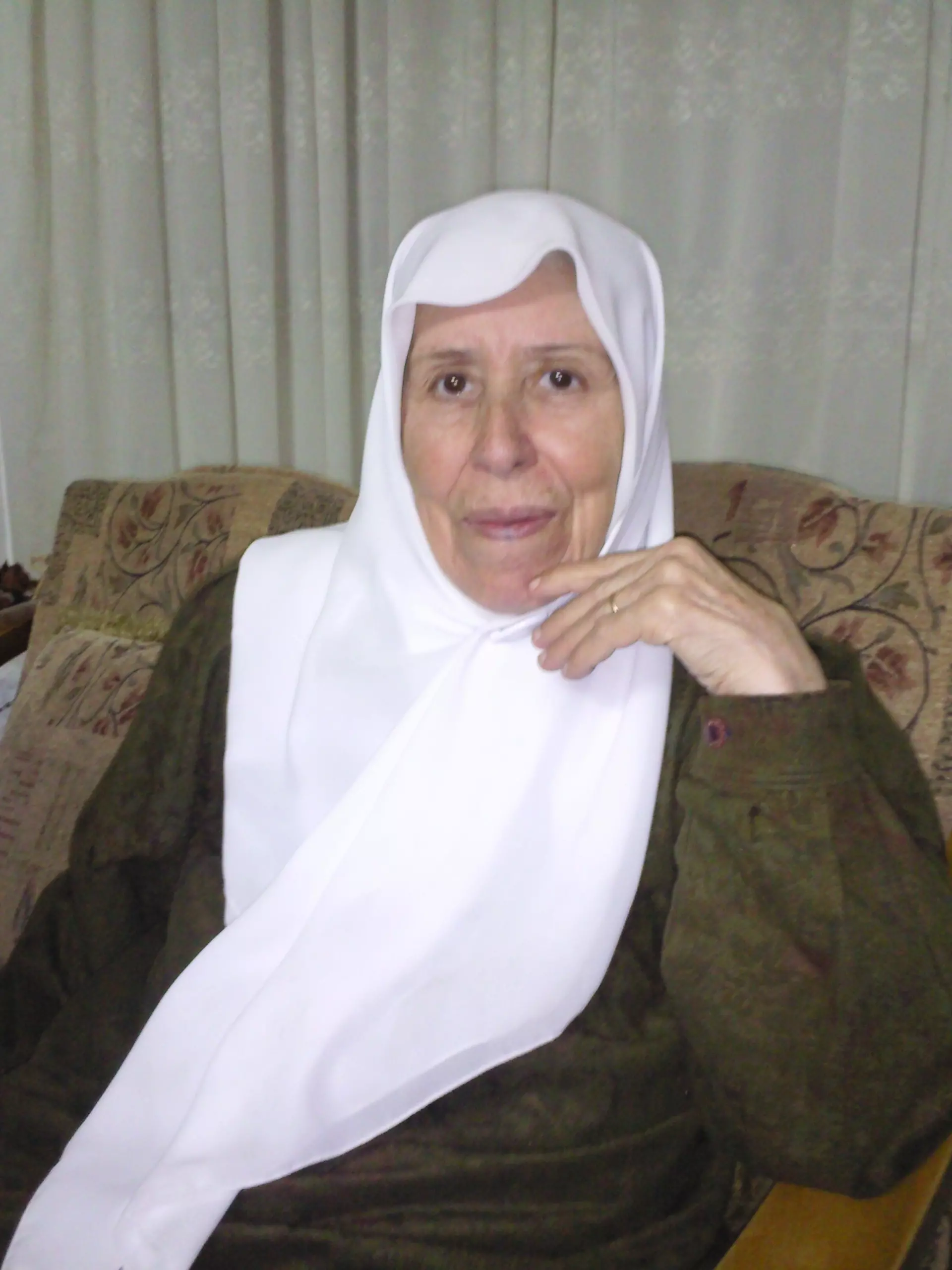
Posted by مجدي صباح - الحاجة فريدة ابراهيم صباح ام عصام
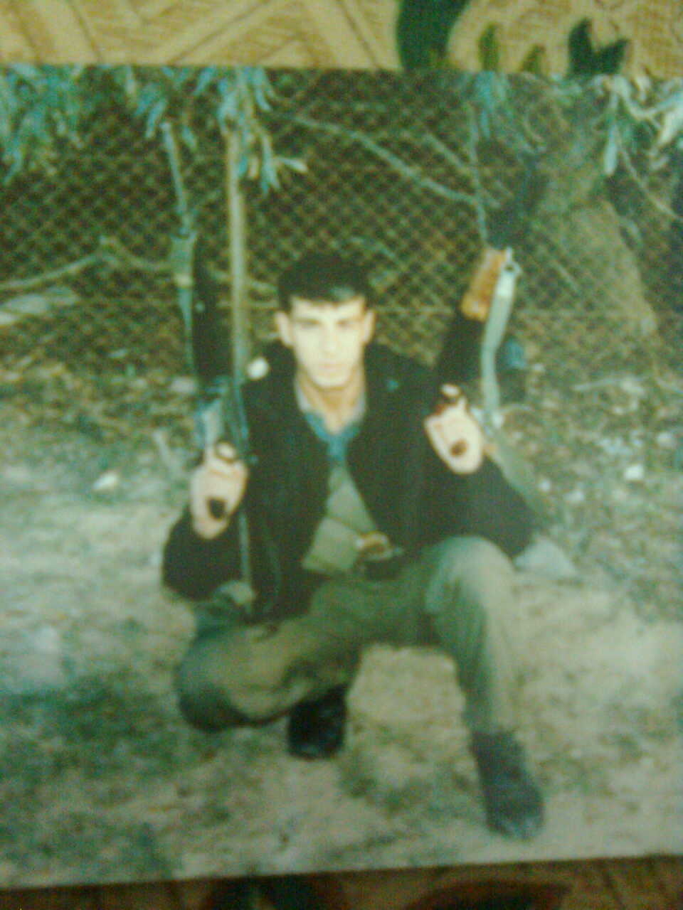
Posted by عصام جمال احمد صباح 1 - الاسير المحرر المبعد احمد سعيد محمد صباح
Posted by محمود صباح 2 - الاسير المحرر المبعد احمد سعيد محمد صباح
Posted by محمود صباح 1 - الاسير المحرر المبعد احمد سعيد محمد صباح
Posted by محمود صباح 1 - الاردن/ اربد
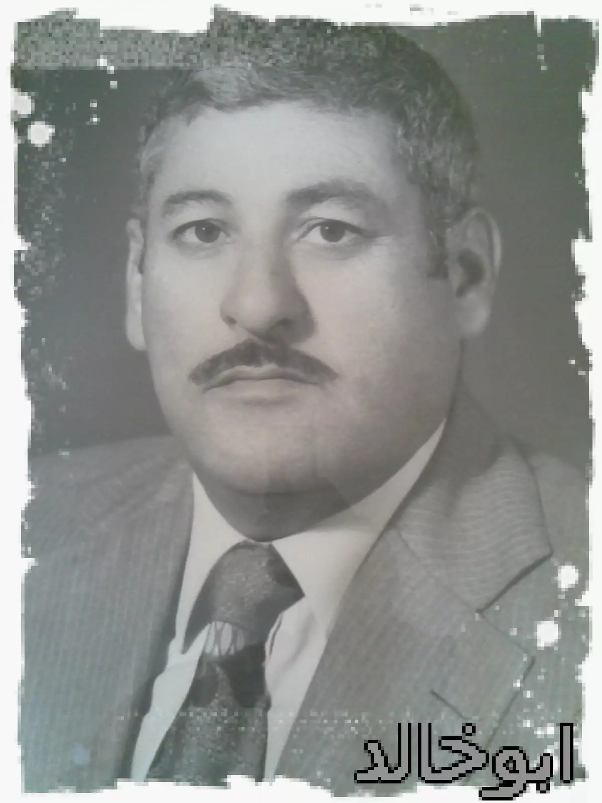
Posted by محمود محمد شناعه 1 - المرحوم توفيق أحمد محمد صباح (ابو خالد)
Posted by محمد صباح - Umm al-Shawf, the only structure remaining standing, 26-06-10
Posted by Uri Zackhem 1 - The only structure remaining standing
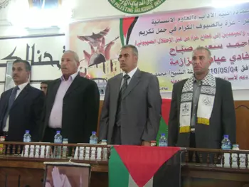
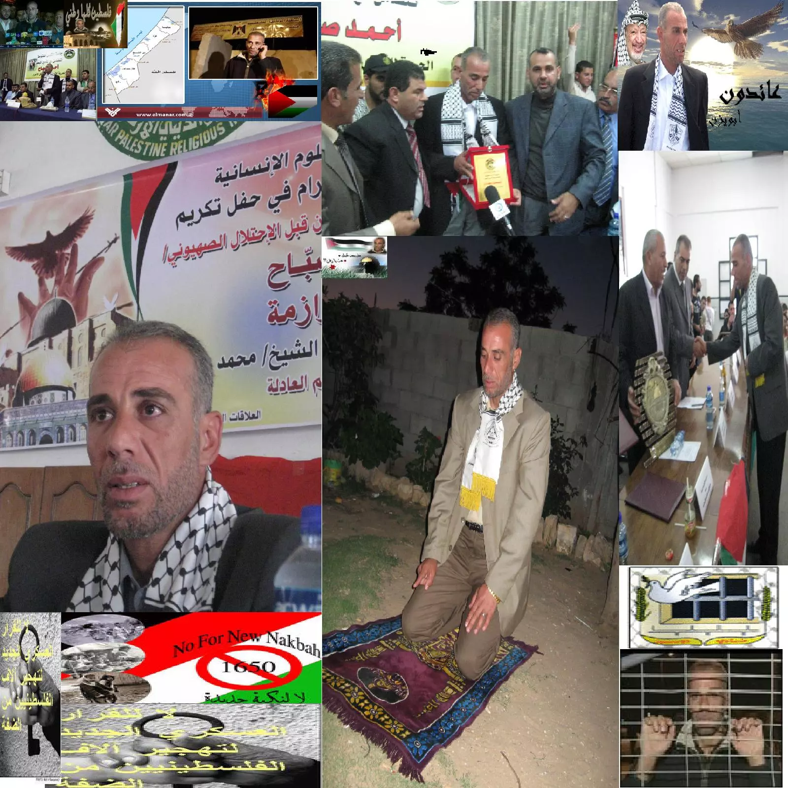
Posted by Uri Zackhem - ابناء ام الشوف يحييون صمود ابنهم الاسير المحرر المبعد احمد سعيد محمد صباح ضد قرار التهجير
Posted by محمود صباح 4 - الحاجة مريم أحمد محمد صباح ( أم عماد السعيد )من مواليد أم الشوف سنة 1939 و هي الأن من سكان الاردن / مدينة الرصيفة
Posted by محمود صباح 6 - الجد قاسم احمد قاسم (ابو عدنان)
Posted by سحر تيسير قاسم 4 - عبد الرحمن علو - أبو محمد (دير الغصون/ طولكرم/ فلسطين) - مواليد أم الشوف تقريبا 1927
Posted by يوسف علو 2 - Mohammad and Tawfeeq Sabbah
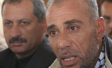
Posted by Hala Sabbah - لحاج أحمد صبّاح يستحضر لحظات اغتصاب قرية "أم الشوف" وعذابات الاعتقال والمنفى
1 - اثار ردم بيوت القريه
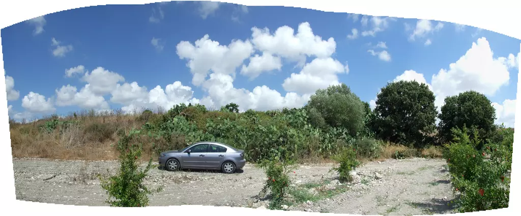
Posted by abu raya - اراضي القريه
Posted by abu raya - اراضي القريه
Posted by abu raya - موقع القريه والمبنى الوحيد الباقي فيها
Posted by abu raya - عين ماء القريه
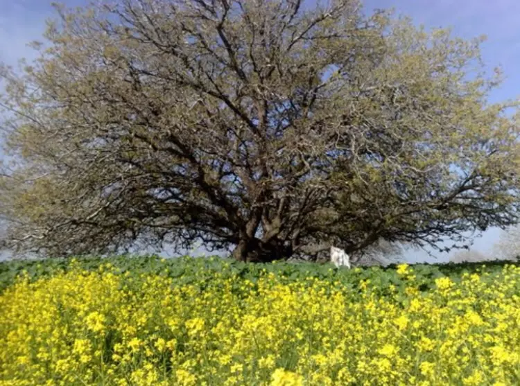
Posted by abu raya - شجره معمره في القريه
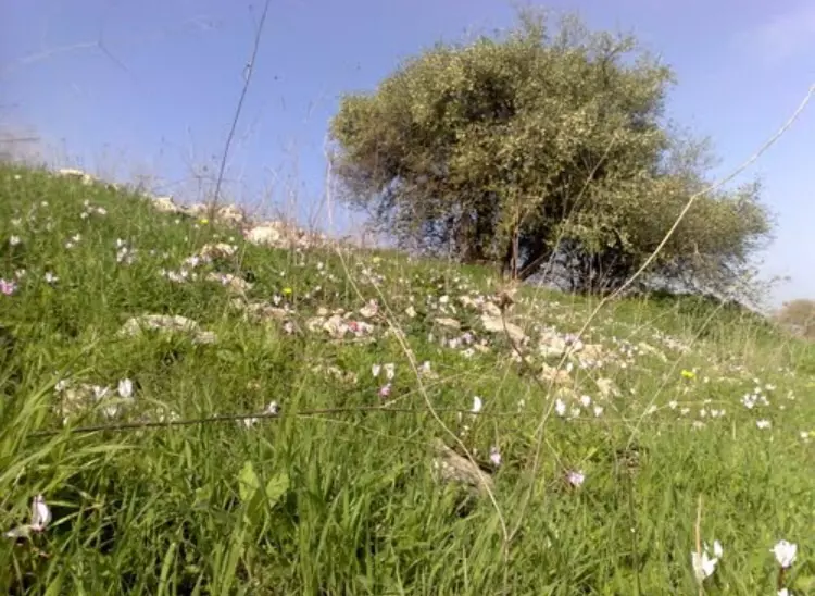
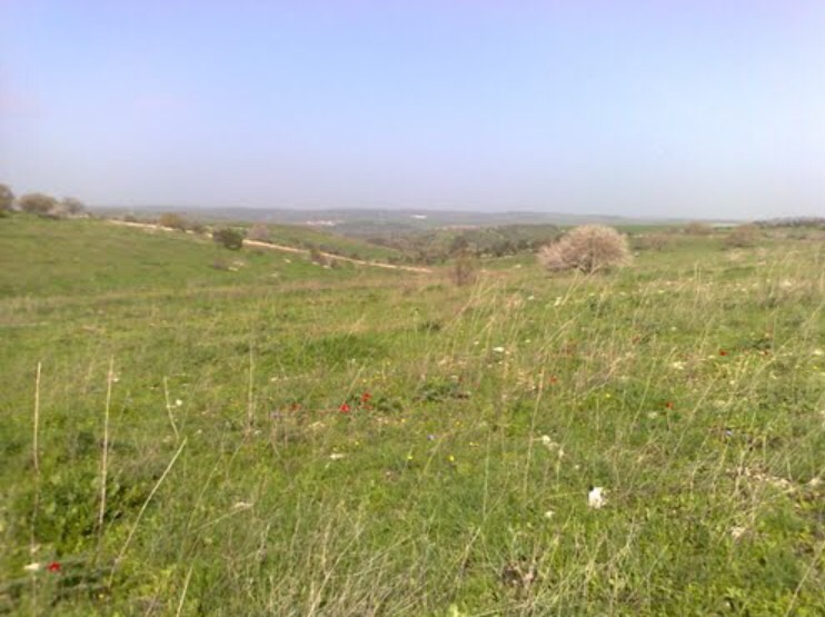
Posted by abu raya - موقع القريه مغطى بالاعشاب
Posted by abu raya - اراضي القريه
Posted by abu raya - ام الشوف
Posted by abu raya - بالقرب من موقع القريه والمستوطنه المقامه على اراضيها
Posted by abu raya - المبنى الوحيد الباقي في القريه
Posted by abu raya - مقبره القريه
Posted by abu raya - ام الشوف
Posted by abu raya - ام الشوف
Posted by abu raya - ام الشوف
Posted by abu raya - مقبره القريه
Posted by abu raya - Pre-Nakba Aerial view of the village / صورة من الجو للقرية اخذت قبل النكبة
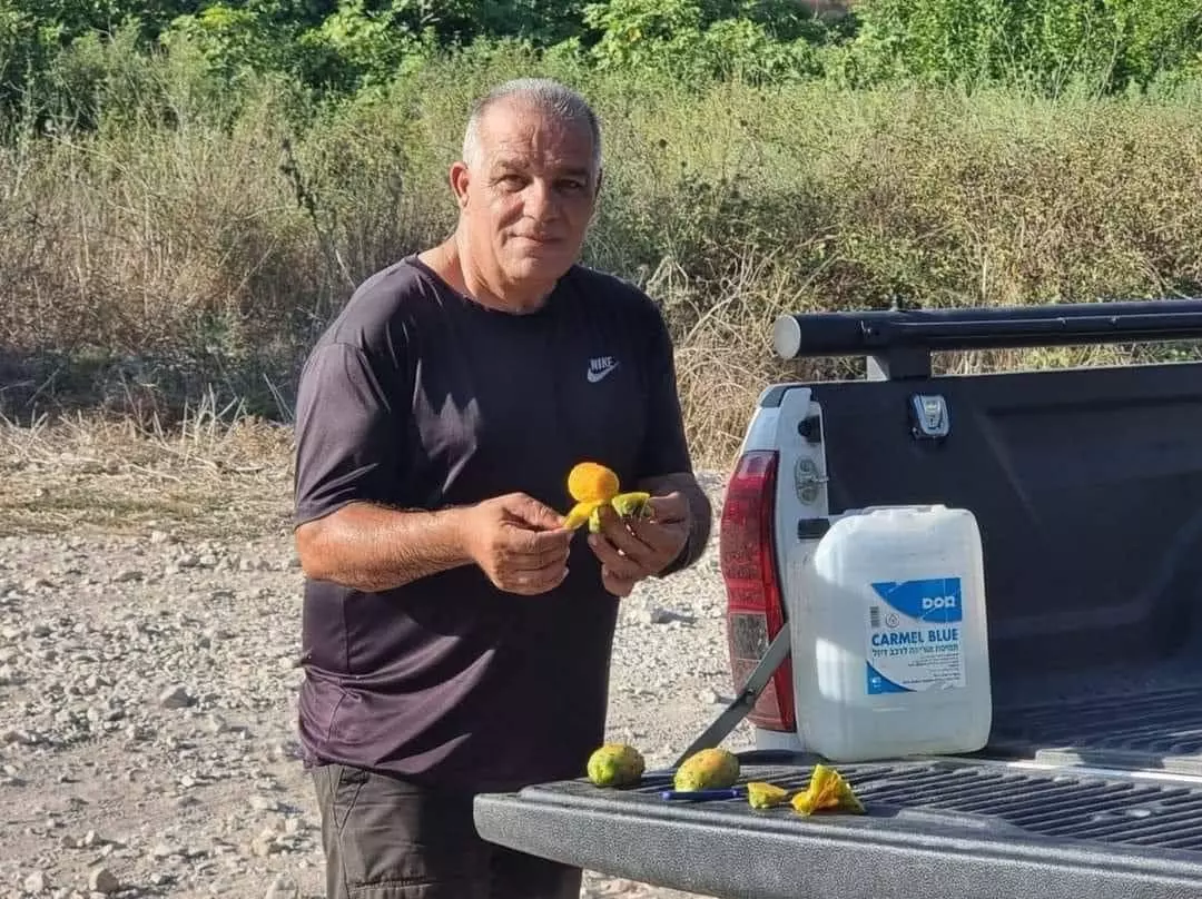
- مزارع يلتقط "التين الشوكي" في قرية أم الشوف المهجرة إلى الجنوب من مدينة حيفا.
- مزارع يلتقط "التين الشوكي" في قرية أم الشوف المهجرة إلى الجنوب من مدينة حيفا. #2
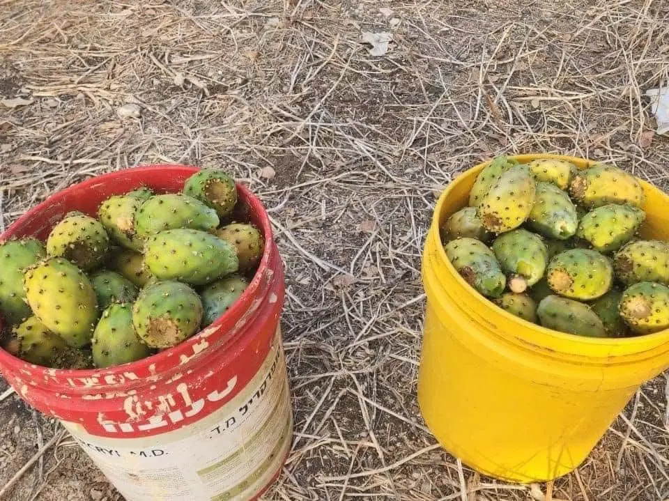
- مزارع يلتقط "التين الشوكي" في قرية أم الشوف المهجرة إلى الجنوب من مدينة حيفا. #3
- الحاج إبراهيم محمود صباح (أبو فوزي) وولديه فوزي (أبو مروان) وأسد (أبو شبل) رحمهم الله جميعا
Posted by شبل أسد - الحاج إبراهيم محمود صباح (أبو فوزي) وولديه فوزي (أبو مروان) وأسد (أبو شبل) رحمهم الله جميعا #2

Posted by شبل أسد - المرحوم الحاج ابراهيم محمود الصباح (ابو فوزي) وابنائه فوزي (ابو مروان) وأسد (أبو شبل) رحمهم الله جميعا

Posted by شبل أسد - المرحوم الحاج ابراهيم محمود الصباح (ابو فوزي) وابنائه فوزي (ابو مروان) وأسد (أبو شبل) رحمهم الله جميعا #2
Posted by شبل أسد 2 -
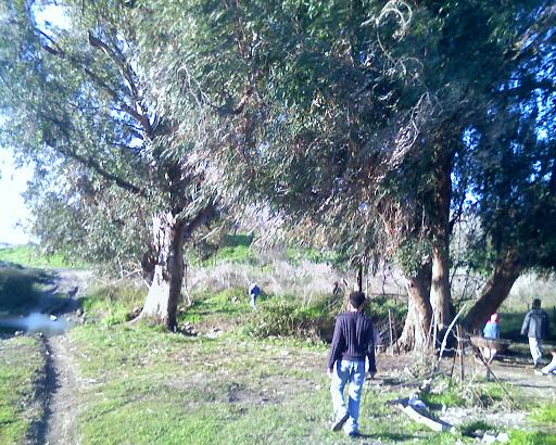
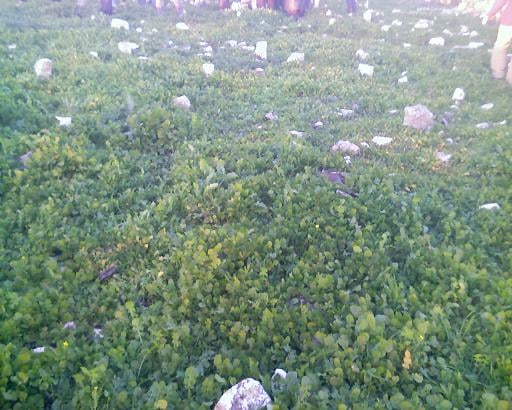
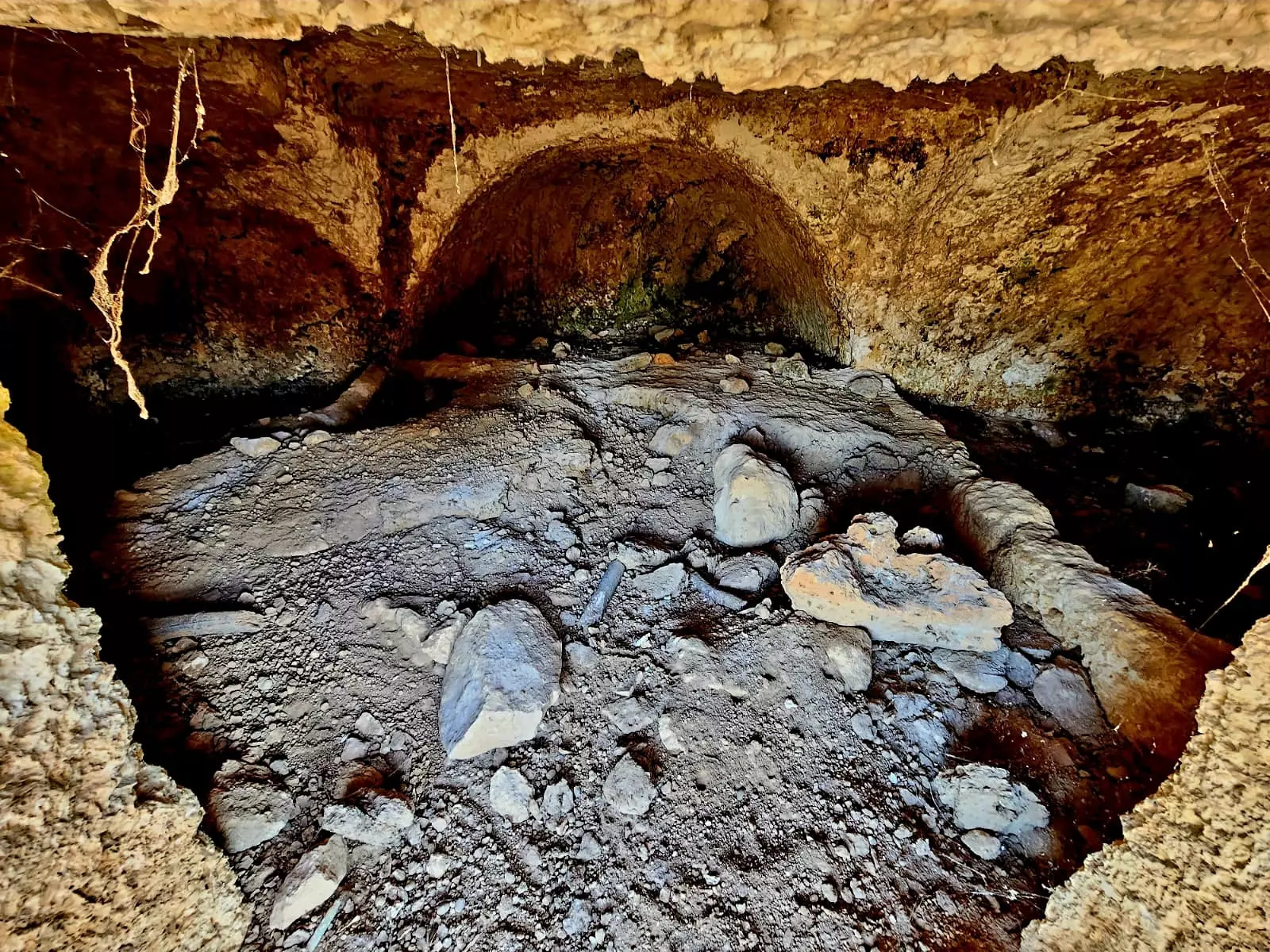
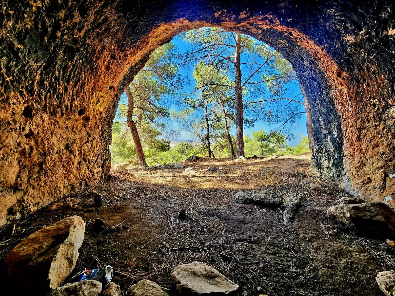
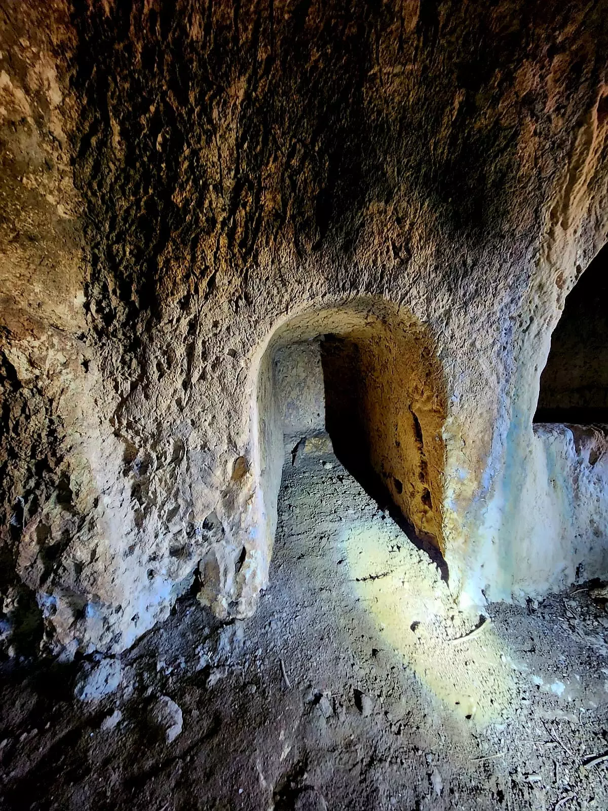
لم يبقى من القرية الا المقام للشيخ عبدالله، بقايا بيوت، المقبرة المدمرة كلياً، وعين ام الشوف -- ابراهيم أبو عمّار
-
لم يبقى من القرية الا المقام للشيخ عبدالله، بقايا بيوت، المقبرة المدمرة كلياً، وعين ام الشوف -- ابراهيم أبو عمّار
#2
-
لم يبقى من القرية الا المقام للشيخ عبدالله، بقايا بيوت، المقبرة المدمرة كلياً، وعين ام الشوف -- ابراهيم أبو عمّار
#3
-
لم يبقى من القرية الا المقام للشيخ عبدالله، بقايا بيوت، المقبرة المدمرة كلياً، وعين ام الشوف -- ابراهيم أبو عمّار
#4
- من زيارة قرية أم الزينات المهجرة قضاء حيفا -- May 18th, 2024 -- Nabela Salem
- من زيارة قرية أم الزينات المهجرة قضاء حيفا -- May 18th, 2024 -- Nabela Salem #2
- من زيارة قرية أم الزينات المهجرة قضاء حيفا -- May 18th, 2024 -- Nabela Salem #3
- من زيارة قرية أم الزينات المهجرة قضاء حيفا -- May 18th, 2024 -- Nabela Salem #4
- من زيارة قرية أم الزينات المهجرة قضاء حيفا -- May 18th, 2024 -- Nabela Salem #5
- من زيارة قرية أم الزينات المهجرة قضاء حيفا -- May 18th, 2024 -- Nabela Salem #6
- من زيارة قرية أم الزينات المهجرة قضاء حيفا -- May 18th, 2024 -- Nabela Salem #7
- من زيارة قرية أم الزينات المهجرة قضاء حيفا -- May 18th, 2024 -- Nabela Salem #8
- من زيارة قرية أم الزينات المهجرة قضاء حيفا -- May 18th, 2024 -- Nabela Salem #9
- من زيارة قرية أم الزينات المهجرة قضاء حيفا -- May 18th, 2024 -- Nabela Salem #10
- من زيارة قرية أم الزينات المهجرة قضاء حيفا -- May 18th, 2024 -- Nabela Salem #11
- من زيارة قرية أم الزينات المهجرة قضاء حيفا -- May 18th, 2024 -- Nabela Salem #12
- من زيارة قرية أم الزينات المهجرة قضاء حيفا -- May 18th, 2024 -- Nabela Salem #13
- من زيارة قرية أم الزينات المهجرة قضاء حيفا -- May 18th, 2024 -- Nabela Salem #14
- من زيارة قرية أم الزينات المهجرة قضاء حيفا -- May 18th, 2024 -- Nabela Salem #15
- من زيارة قرية أم الزينات المهجرة قضاء حيفا -- May 18th, 2024 -- Nabela Salem #16
- من زيارة قرية أم الزينات المهجرة قضاء حيفا -- May 18th, 2024 -- Nabela Salem #17
- من زيارة قرية أم الزينات المهجرة قضاء حيفا -- May 18th, 2024 -- Nabela Salem #18
- من زيارة قرية أم الزينات المهجرة قضاء حيفا -- May 18th, 2024 -- Nabela Salem #19
- من زيارة قرية أم الزينات المهجرة قضاء حيفا -- May 18th, 2024 -- Nabela Salem #20
- من زيارة قرية أم الزينات المهجرة قضاء حيفا -- May 18th, 2024 -- Nabela Salem #21
- من زيارة قرية أم الزينات المهجرة قضاء حيفا -- May 18th, 2024 -- Nabela Salem #22
- من زيارة قرية أم الزينات المهجرة قضاء حيفا -- May 18th, 2024 -- Nabela Salem #23
- من زيارة قرية أم الزينات المهجرة قضاء حيفا -- May 18th, 2024 -- Nabela Salem #24
Want to browse more? 80,000 pictures were grouped in these gallaries:
- الحاج أحمد نجيب مسعود صباح (أبو صباح) يحمل بين يديه قائمة مفصلة بأراضي والده في أم الشوف ، ولد سنة 1923م تقريبا ، يعيش اليوم في مدينة الرصيفة بمنطقة الزرقاء بالأردن يحدوه الحنين لمسقط رأسه الحبيب
Posted by saher kaddarah 1 - الحاج أحمد نجيب مسعود صباح (أبو صباح) يحمل بين يديه قائمة مفصلة بأراضي والده في أم الشوف ، ولد سنة 1923م تقريبا ، يعيش اليوم في مدينة الرصيفة بمنطقة الزرقاء بالأردن يحدوه الحنين لمسقط رأسه الحبيب
Posted by saher kaddarah 1 - الحاج أحمد نجيب مسعود صباح (أبو صباح) يشرح لابنة أخته عائشة صالح عبدالله عن قائمة مفصلة بأراضيهم بأم الشوف
Posted by saher kaddarah 1 - قائمة مفصلة بأراضي المرحوم نجيب مسعود صباح (أبو صباح) بأم الشوف يحتفظ بها ابنه الحاج أحمد (أبو صباح) الذي يعيش في مدينة الرصيفة بمنطقة الزرقاء بالأردن
Posted by saher kaddarah 1 - تتمة القائمة المفصلة بأراضي المرحوم نجيب مسعود صباح (أبو صباح) بأم الشوف يحتفظ بها ابنه الحاج أحمد (أبو صباح) الذي يعيش في مدينة الرصيفة بمنطقة الزرقاء بالأردن
Posted by saher kaddarah
| Display Name | Clan/Hamolah | Country of Residence |
| JEHAD FRAIJ | - | IRBID, JORDAN |
| معتز فريج | فريج | - |
| أسيد قاسم | - | فلسطين, فلسطين |
| hoji | - | - |
| مجد شناعه | شناعة | فلسطين, قباطيه |
| أبو شكري | - | ال |
| مسعود الصباح | صباح | الزرقاء, الزرقاء |
| علي فؤاد صباح | صباح | - |
| ابن حيفا حر | - | - |
| ابو ابراهيم | شناعة | قباطية, قباطية |
| مراد صبّاح | صبّاح | الرياض, المملكة العربية السعودية |
| احمد شناعة | شناعة | - |
| ابراهيم معين كامل بشر | بشر | الاردن, ام الزينات |
| Mahmoud Sabbah | Sabbah | - |
| Hala Sabbah | Sabbah | england - UK |
| مجدي صباح | - | السعودية |
| MUSTAFA FRAIJ | - | - |
| نشأت قاسم | قاسم | فلسطين, قفين |
| بهاء الدين نايف صباح | صبـاح | الرصيفة, الاردن |
| hazem bahjat | shanah | rusaifa, jordan |
| dana sabbah | - | الاردن, اربد |
| أبو يحيى | شناعة | الرياض, السعودية |
| صباح | SABBAH | - |
| Abdul raheem Fraij | Fraij | Jeddah - S. A |
| محمد صباح | sabbah | saudi arabia |
| abosaeed | sabbah | - |
| أبوجهاد | صباح | الرصيفة |
| Yousuf Mohammad Shana ah | - | UAE, Jordan-irbid |
| Haitham Sabbah | - | - |
| haitham sabbah | Sabbah | - |
| mohamed sabbah | sabbah | jordan, jordan |
| د. محمود مأمون الصباح | yes | Jordan, palestine |
| esamsabah | sabbah | palestine, palestine |
| Zakaria Sabbah | Sabbah | Jordan, Jordan |
| Ahmed AL-Ahmed | Yacoub Al-Ahmad | Madrid, Spain |
- Tracing all that remains Umm al-Shawf since Nakba
- قرية ام الشوف المهجره Duration: 19 min 16 sec
- زيارة زاوية ومقام الشيخ عبدالله العواطله امام بلدة ام الشوف المهجرة (قضاء حيفا). حلقة خاصة للتعرف على بلدة ام الشوف - عين الروحا - بمناسبة الذكرى ال72 لسقوطها 12.5ِ.1948. تحياتنا لابنائها من عائلات صبح صباح شناعة والقدح وباقي سكانها Duration: 2 min 51 sec
- في موقع أراضي وكروم قرية أم الشوف رالمهجرة (بلاد الروحة -قضاء حيفا ) Duration: min 2 sec
- الذاكرة مفتاح العودة -- الحلقة 84 -- أم الشوف Duration: 23 min 22 sec
 Fake Valor: Why Did Zionist Jews Hoist Nazis Flag on Their Ships in the 1930s?
What is new?
-
Facts About Oct. 7th Gaza Raid
-
Remined Us Please:: Who Did Rape Who? Palestinians Raped Israelis? Or, was the other way around?
-
When Prof. Edward Said was invited to debate Bibi Netanyahu in the 1980s, watch what happened!
-
Ezra Klein of the NY Times on the "Jewish Race".
-
Abusing Blood Libel!
-
Zionist FAQ: Isn't it true that Palestinians don't want peace? Palestinians never accepted the two-state solution
- Facts about Haavara (Transfer) Agreement between Ben-Gurion & Hitler
-
Haavara FAQs: Why Did Zionist Jews Hoist Nazis' Flags on Their Ships in the 1930s?
-
Dear ChatGPT: Why did the Jewish Agency suppress news of the Holocaust during WWII?
-
Video Playlist: Jews share their DNA tests to end the conflict for good.
-
A Tale of Two Conflicts: Examining the Definition of Genocide
-
Prof. Abraham Polak And The Suppressed History of the Khazars and European Jewry
-
How Ronald Reagan would have framed the genocide in Gaza if he were still alive?
-
Haavara FAQs: Let us do the math: how many German Jews did The Haavara Agreement save?
-
Zionist FAQs: The Hebron Massacre of 1929, "clearly proves" that Palestinians are antisemitic, how could you deny it?
-
Zionist FAQs: Why Anti-Zionist Is Not Antisemitism?
-
Zionist FAQs: Isn't it true that the KGB create Palestinian Nationalism in the early 1960s?
- Zionist FAQs: Muslims are killing Muslims all the time; why are Israeli Jews being singled out in the media?
- Zionist FAQs: How is Israel an apartheid state when 20% of its citizens are Arabs who enjoy full rights?
-
Haavara FAQs: Analysis of Herzl's Uganda Scheme and how it could have saved millions of Jews.
-
Haavara FAQs: Why did Hayim Greenberg describe American Jewry as "morally bankrupt" in early 1943?
-
Haavara FAQs: What if the Evian Conference was a resounding success? What would have been the impact of saving European Jewry on Zionism?
- Haavara FAQs: What if the six million were saved, how that would have impacted the Zionist project?
-
Haavara FAQs: How did Zionist leaders react when Europe's Jews lingered in the DP camps after WWII ended?
-
Why does the American Jewish community repeat lies that David Ben-Gurion had debunked before he died?
-
Who has the power to rename the Tatar/Khazar Gene Marker to Jewish IV?
-
Zionist FAQs: Why won't Egypt, Syria, and Jordan take their people back? Jews are indigenous to Palestine, and Arabs immigrated after Jews developed the country. Arabs should leave.
-
Haavara FAQs: Did Hitler and the Nazis conflate between Judaism and Zionist? If that wasn't case, then why?
-
Haavara FAQs: Winston Churchill and antisemitism, a collection of articles written Churchill.
-
Haavara FAQs: Broken by country, how many Jews survived vs. killed during the Holocaust?
-
Haavara FAQs: Why did European Jews vote with their feet and to immigrated to the Americas, not Palestine, after WWII?
-
Watch this American Jewish Girl describing Israeli Jews' cognitive dissonance like no other in under two minutes
-
Haavara FAQs: When the Nazis went out of their way to hide the Holocaust, Israeli Jews did the exact opposite by broadcasting their genocide of Gazans. But why?
-
Haavara FAQs: How Zionist Jews went out of their to show their appreciation to Nazism and Fascism?
- Haavara FAQs: Why Zionist leaders were against bombing the death camps & the Railroads leading to them?
-
Haavara FAQs: Hitler's message to the British and American people: If Jews are such noble citizens and you care about them, how come you're not letting them in? I will gladly ship them to you at my expense, even on luxury liners!
-
A shortlist of Zionist and Israeli false flag operations in the name Jews.
-
The Most Moral Army
- The Land of Kapos (Israel): Where the brave are boycotted and Kapos walk free.
- Why did early Zionists often named their communal enterprises "colonial"?
- Zionist Relations with Nazi Germany by Faris Glubb
-
Two NY Times advertisements by Zionists in the early 1943 that exposes Zionists' treason at the height of the calamity
- Facts Not Lies about the Palestinian-Israeli Conflict.
- Site's pictures have been categorized
- Campgain Against Lice
- A Survey of Palestine, the official source about Palestine before Nakba produced by the British Mandate; over 1200 pages.
- Satellite View & Google Earth: Over 6,000 placemarks identifying all destroyed towns, W. Bank & Gaza Strip Towns, & refugee camps.
- PalestineRemembered.com and its Nakba Oral History Project were featured on al-Jazeera Satellite TV.
- Nakba Oral History Video Podcast:
 Over 700 Oral History interviews (including 3,500+ hours of recording) can be viewed online.
 - Palestine Village Statistics Project
- Gaza Jail Break
- النسخة العربية للموقع الان متوفرة
- Videos: Documenting the destroyed villages in video: Tracing all that remains since Nakba.
- Videos: Responding to Zionist Propaganda
- Interview: The ethnic cleansing of Palestine: George Galloway interviews Israeli Historian Ilan Pappe.
- For Palestinians, memory matters. It provides a blueprint for their future By George Bisharat.
- Zionist FAQ now available in Hebrew שאלות שציונים שואלים, עכשיו בעברית
- Video: The Stephen Walt and John Mearsheimer report on the influence of the Israel Lobby on U.S. Foreign Policy
- The Palestinian-Israeli conflict for beginners
