| PalestineRemembered | About Us | Oral History | العربية | |
| Pictures | Zionist FAQs | Haavara | Maps | |
| Search |
| Camps |
| Districts |
| Acre |
| Baysan |
| Beersheba |
| Bethlehem |
| Gaza |
| Haifa |
| Hebron |
| Jaffa |
| Jericho |
| Jerusalem |
| Jinin |
| Nablus |
| Nazareth |
| Ramallah |
| al-Ramla |
| Safad |
| Tiberias |
| Tulkarm |
| Donate |
| Contact |
| Profile |
| Videos |
Welcome To al-Rihaniyya - الريحانية (א-ריחאניה)
|
District of Haifa
Ethnically cleansed days ago |
العربية Google Earth |
 |
Gallery (17) |
- Statistics & Facts
-
Before & After

- Satellite View
- Articles 2
- Pictures 17
- Oral History 1
- Members 11
- All That Remains
- Wikipedia
- Videos
- Guest Book 12
- Links 1
| Statistic & Fact | Value | ||||||||||||
| Occupation Date | April 30, 1948 | ||||||||||||
| Distance From District | 25 (km) South East of Haifa | ||||||||||||
| Elevation | 225 (meters) | ||||||||||||
| Before & After Nakba, Click Map For Details |
|||||||||||||
|
|||||||||||||
| Map Location | See location #25 on the map View from satellite |
||||||||||||
| Military Operation | The battle for Mishmar ha-'Emeq | ||||||||||||
| Defenders | Arab Liberation Army headed by Fawzi al-Qawuqji | ||||||||||||
| Exodus Cause | Expulsion by Zionist troops | ||||||||||||
| Village Temains | The village has been completely destroyed, and only house rubble left behind. | ||||||||||||
| Ethnically Cleansing | al-Rihaniyya inhabitants were completely ethnically cleansed. | ||||||||||||
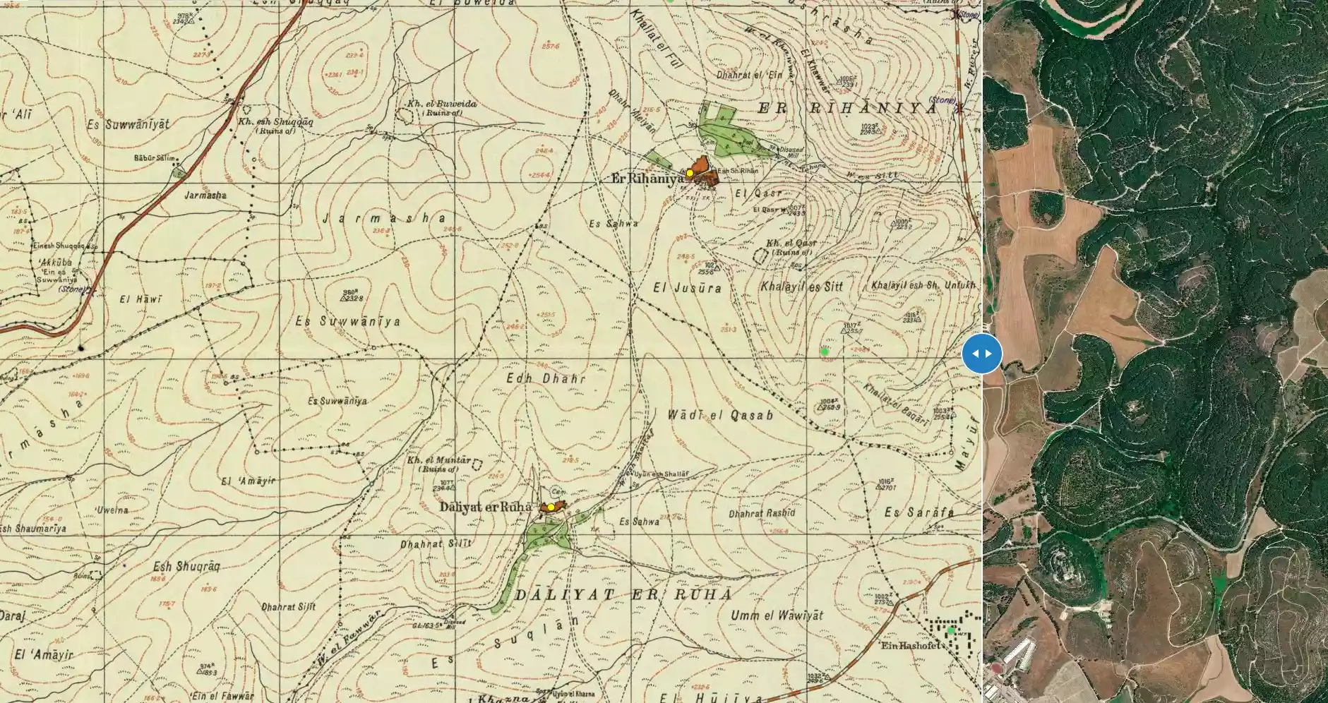
| Pre-Nakba Land Ownership |
**Town Lands' Demarcation Maps |
||||||||||||
| Land Usage As of 1945 |
|
||||||||||||
| Population |
|
||||||||||||
| Number of Houses |
|
||||||||||||
| Near By Towns |
|||||||||||||
|
|
|||||||||||||
| Schools | al-Rihaniyya had an elementary school for boys founded in 1888, but it was later closed during the British Mandate period. | ||||||||||||
| Places of Warship | One mosque | ||||||||||||
| Nearby Wadies & Rivers | The village was situated 3 km northwest of Wadi al-Mileh | ||||||||||||
| Archeological Sites | Khirbat Furayr lay about 1.5 km northwest of the village | ||||||||||||
| Exculsive Jewish Colonies Who Usurped Village Lands |
Ramat ha-Shofet & 'En ha-'Emeq | ||||||||||||
| Featured Video | |||||||||||||
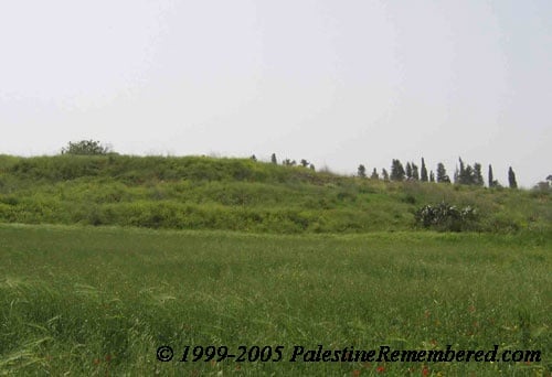
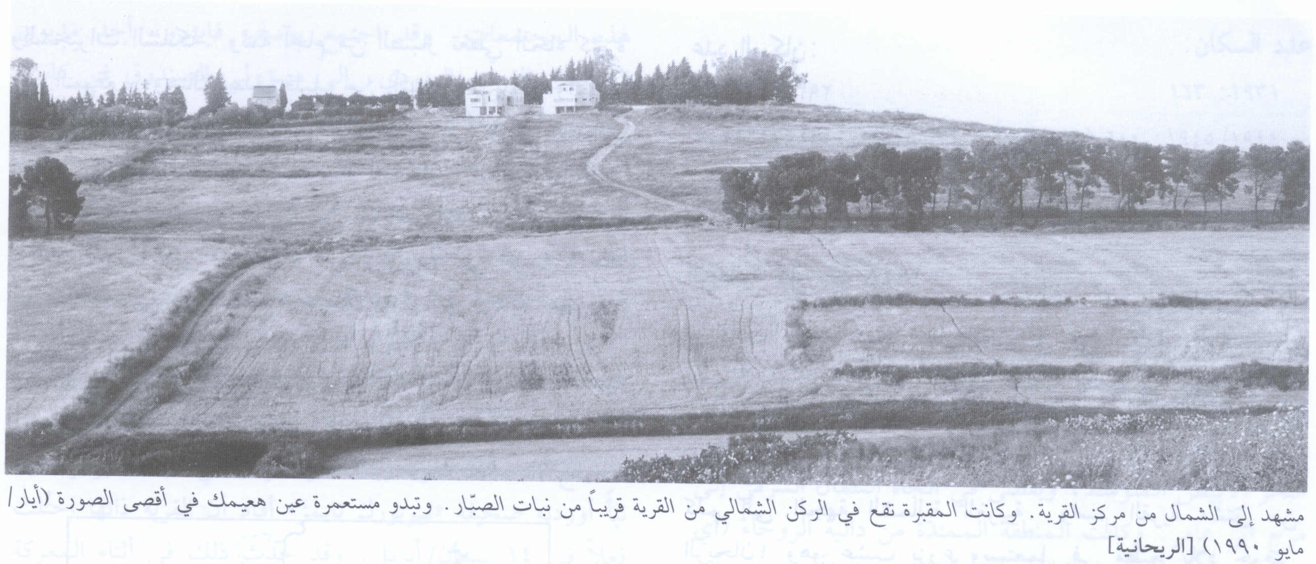
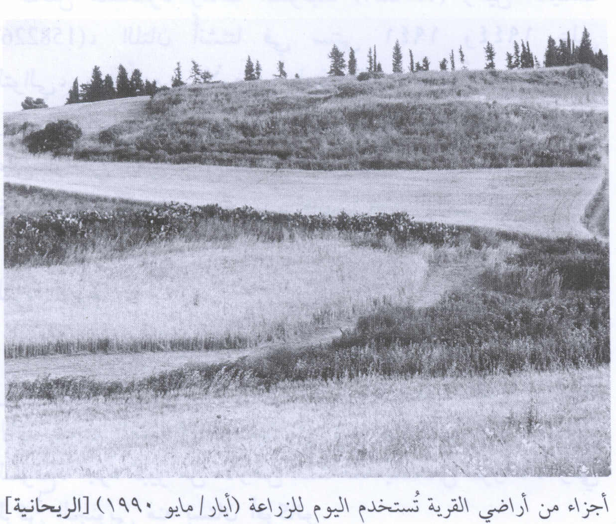
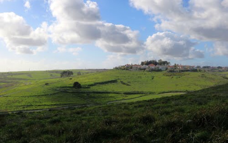
Village Before NakbaThe village stood on a hilltop in a generally hilly area. The hills behind the village to the east rose sharply while those to the west were more gentle, leading down to the Wadi Milh highway some 3 km to the northwest. The village's name derived from rihan, Arabic for "sweet basil," a cultivated herb used in Mediterranean cuisine. Al-Rihaniyya had a mosque and a boys' elementary school, established around 1887 during Ottoman rule. This school was closed during the Mandate. There were numerous springs along the wadi which bounded the village on the north and west; both the wadi and the springs were used as sources of water. Agriculture and animal husbandry dominated the village's economy. Its most important crops were grain and fruit. In 1944/45 a total of 1,761 dunums was allotted to cereals; 73 dunums were irrigated or used for orchards. Khirbat Furayr, which has been identified as an archaeological site, lay about 1.5 km northwest of the village it has not yet been dated.Village Occupation and Ethnic CleaningThe village was reportedly one of the last to be occupied in the aftermath of the battle of Mishmar ha-Emeq . The New York Times reported that al-Rihaniyya was occupied along with Daliyat al-Rawha' and al-Butaymat on 14 April. By that time, the Arab Liberation Army forces in the vicinity had been routed and some ten other villages had also been overrun, according to the Times correspondent. However, al-Rihaniyya may not have been securely under Haganah control for a couple of weeks, since the villages to the north and west of it were captured at the end of April following the fall of Haifa. Some Haganah units were ordered to 'secure' the approaches to the city in the context of Operation Bi'ur Hametz ('Passover Clearing), the offensive launched to secure the hinterland of Haifa after the fall of that city.Zionists Colonies on Village LandsRamat ha-Shofet, established in 1941, and En ha- Emeq, built in 1944, together occupy an arc of land that partially encircled the village on the north, east, and south. At the time of their construction they were not on village lands but were very close (about 0.5 km) to the village site. Currently their inhabitants make use of village land.Village TodayThe rubble of the houses lies in piles that are covered with dirt, bushes, and thorns. The village cemetery (now covered with cactuses) and a well are visible at the bottom of a hill north of the site. Large sections of the adjacent land are used for agriculture to the south there is an avocado orchard.SourceDr. Walid al-Khalidi, 1992: All That Remains. |
|||||||||||||
| Related Maps | Town Lands' Demarcation Maps خرائط للقضاء توضح حدود القرى والاودية Town's map on MapQuest View from satellite Help us map this town at WikiMapia |
||||||||||||
| Related Links | Wikipedia's Page Facebook Page Google Search Google For Images Google For Videos |
||||||||||||
| More Information | في كتاب كي لا ننسى في كتاب بلادنا فلسطين المزيد من موقع هوية |
||||||||||||
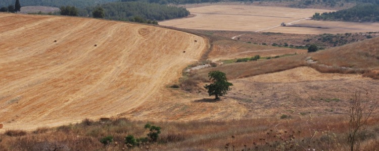
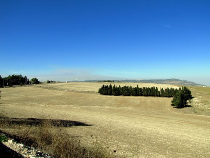
- General View Of Village Site In 1990
Scanned from "All That Remains" by Dr. Walid Khalidi - Portions of village land, 1990
Scanned from "All That Remains" by Dr. Walid Khalidi - General view of were the village used to stand
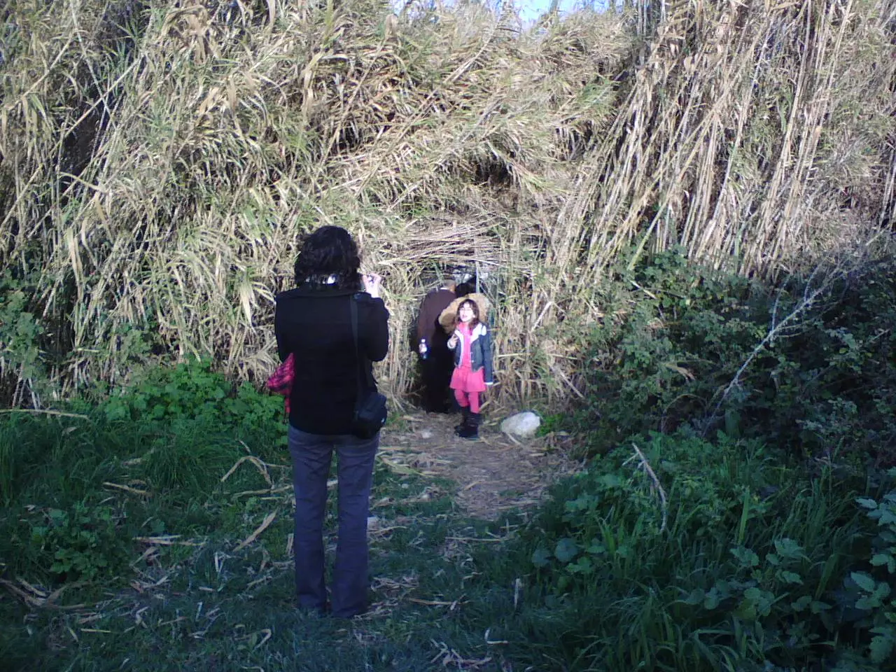
3 - نشطاء ديرتنا يتفقدون معالم القرية
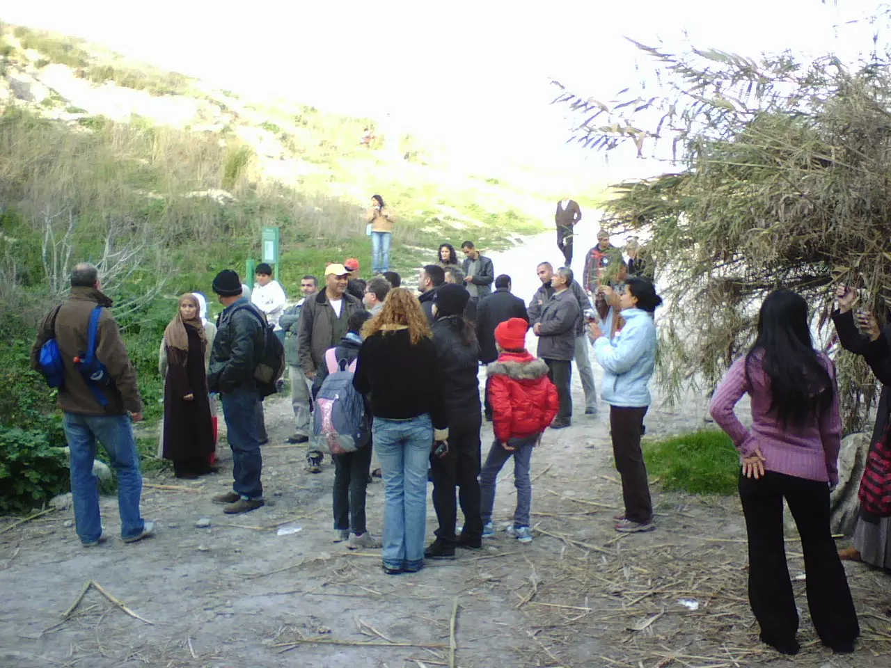
Posted by محمد سلامة يونس - الأعشاب تخفي مصادر المياه - تصوير محمد يونس، شتاء 2009
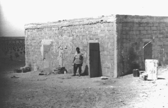
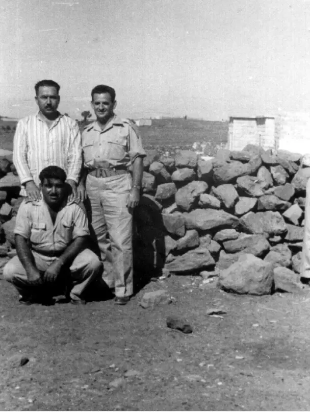
Posted by محمد سلامة يونس 3 - بيت محمد حج عمر الريحانية سنة 1948
Posted by فتحي ابو رضا \ العايدي - موقع قريه الريحانيه
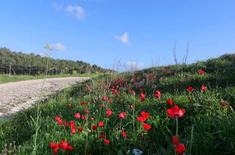
Posted by abu raya - الطبيعه في الريحانيه
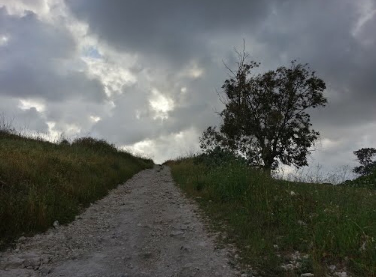
Posted by abu raya - الطريق المودي الى القريه
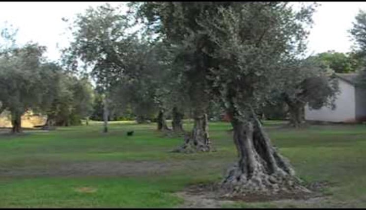
Posted by abu raya - زيتون القريه
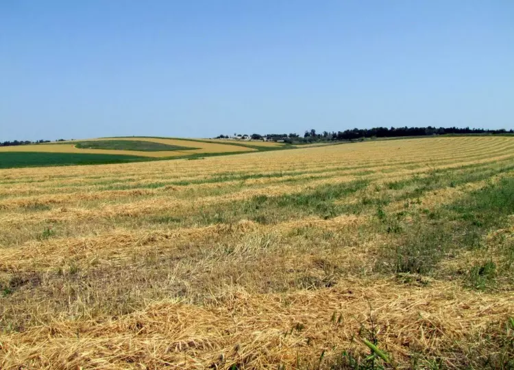
Posted by abu raya - اراضي قريه الريحانيه
Posted by abu raya - موقع القريه واراضيها
Posted by abu raya - اراضي الريحانيه
Posted by abu raya - الريحانيه قبل اانكبه
Posted by abu raya - الريحانيه
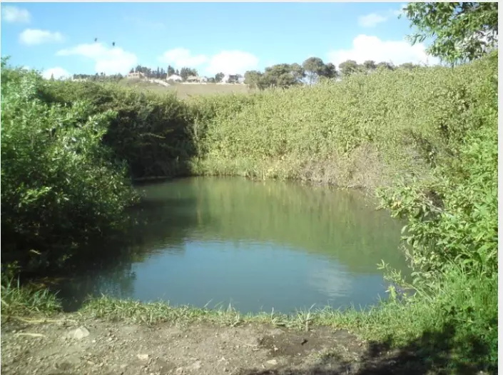
Posted by abu raya - عين الماء في الريحانيه
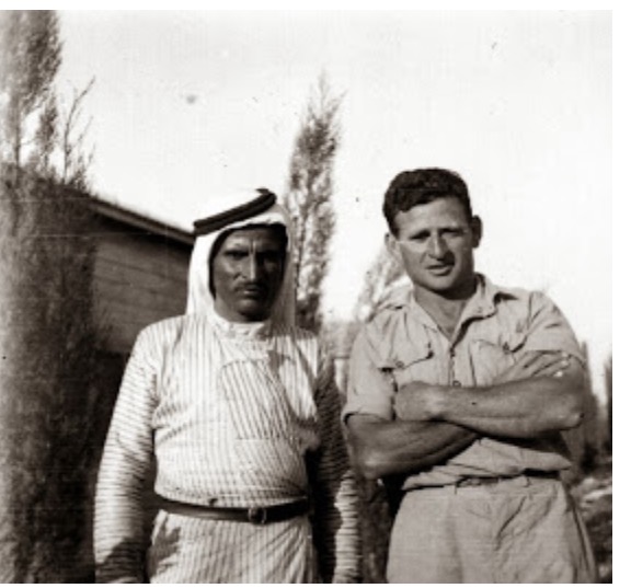
Posted by abu raya - صوره قديمه لسعيد الحمدان من الريحانيه مع مختار مستوطنه عين هشوفيط
Posted by abu raya
Want to browse more? 80,000 pictures were grouped in these gallaries:
| Display Name | Clan/Hamolah | Country of Residence |
| غزل صبح | - | - |
| ابو خضر | عليان | طولكرم, فلسطين |
| خالد صبح | - | - |
| Yousef Suboh | Suboh | - |
| ابو يزن | صبح | - |
| مأمون - أبو مراد | صبح | - |
| علاء عليان | - | - |
| يوسف صبح | صبح | فلسطين, فلسطين |
| القناص | - | - |
| هيثم صبح | - | - |
| عصفورة الفارعة | صبح | الرياض |
 Fake Valor: Why Did Zionist Jews Hoist Nazis Flag on Their Ships in the 1930s?
What is new?
-
Facts About Oct. 7th Gaza Raid
-
Remined Us Please:: Who Did Rape Who? Palestinians Raped Israelis? Or, was the other way around?
-
When Prof. Edward Said was invited to debate Bibi Netanyahu in the 1980s, watch what happened!
-
Ezra Klein of the NY Times on the "Jewish Race".
-
Abusing Blood Libel!
-
Zionist FAQ: Isn't it true that Palestinians don't want peace? Palestinians never accepted the two-state solution
- Facts about Haavara (Transfer) Agreement between Ben-Gurion & Hitler
-
Haavara FAQs: Why Did Zionist Jews Hoist Nazis' Flags on Their Ships in the 1930s?
-
Dear ChatGPT: Why did the Jewish Agency suppress news of the Holocaust during WWII?
-
Video Playlist: Jews share their DNA tests to end the conflict for good.
-
A Tale of Two Conflicts: Examining the Definition of Genocide
-
Prof. Abraham Polak And The Suppressed History of the Khazars and European Jewry
-
How Ronald Reagan would have framed the genocide in Gaza if he were still alive?
-
Haavara FAQs: Let us do the math: how many German Jews did The Haavara Agreement save?
-
Zionist FAQs: The Hebron Massacre of 1929, "clearly proves" that Palestinians are antisemitic, how could you deny it?
-
Zionist FAQs: Why Anti-Zionist Is Not Antisemitism?
-
Zionist FAQs: Isn't it true that the KGB create Palestinian Nationalism in the early 1960s?
- Zionist FAQs: Muslims are killing Muslims all the time; why are Israeli Jews being singled out in the media?
- Zionist FAQs: How is Israel an apartheid state when 20% of its citizens are Arabs who enjoy full rights?
-
Haavara FAQs: Analysis of Herzl's Uganda Scheme and how it could have saved millions of Jews.
-
Haavara FAQs: Why did Hayim Greenberg describe American Jewry as "morally bankrupt" in early 1943?
-
Haavara FAQs: What if the Evian Conference was a resounding success? What would have been the impact of saving European Jewry on Zionism?
- Haavara FAQs: What if the six million were saved, how that would have impacted the Zionist project?
-
Haavara FAQs: How did Zionist leaders react when Europe's Jews lingered in the DP camps after WWII ended?
-
Why does the American Jewish community repeat lies that David Ben-Gurion had debunked before he died?
-
Who has the power to rename the Tatar/Khazar Gene Marker to Jewish IV?
-
Zionist FAQs: Why won't Egypt, Syria, and Jordan take their people back? Jews are indigenous to Palestine, and Arabs immigrated after Jews developed the country. Arabs should leave.
-
Haavara FAQs: Did Hitler and the Nazis conflate between Judaism and Zionist? If that wasn't case, then why?
-
Haavara FAQs: Winston Churchill and antisemitism, a collection of articles written Churchill.
-
Haavara FAQs: Broken by country, how many Jews survived vs. killed during the Holocaust?
-
Haavara FAQs: Why did European Jews vote with their feet and to immigrated to the Americas, not Palestine, after WWII?
-
Watch this American Jewish Girl describing Israeli Jews' cognitive dissonance like no other in under two minutes
-
Haavara FAQs: When the Nazis went out of their way to hide the Holocaust, Israeli Jews did the exact opposite by broadcasting their genocide of Gazans. But why?
-
Haavara FAQs: How Zionist Jews went out of their to show their appreciation to Nazism and Fascism?
- Haavara FAQs: Why Zionist leaders were against bombing the death camps & the Railroads leading to them?
-
Haavara FAQs: Hitler's message to the British and American people: If Jews are such noble citizens and you care about them, how come you're not letting them in? I will gladly ship them to you at my expense, even on luxury liners!
-
A shortlist of Zionist and Israeli false flag operations in the name Jews.
-
The Most Moral Army
- The Land of Kapos (Israel): Where the brave are boycotted and Kapos walk free.
- Why did early Zionists often named their communal enterprises "colonial"?
- Zionist Relations with Nazi Germany by Faris Glubb
-
Two NY Times advertisements by Zionists in the early 1943 that exposes Zionists' treason at the height of the calamity
- Facts Not Lies about the Palestinian-Israeli Conflict.
- Site's pictures have been categorized
- Campgain Against Lice
- A Survey of Palestine, the official source about Palestine before Nakba produced by the British Mandate; over 1200 pages.
- Satellite View & Google Earth: Over 6,000 placemarks identifying all destroyed towns, W. Bank & Gaza Strip Towns, & refugee camps.
- PalestineRemembered.com and its Nakba Oral History Project were featured on al-Jazeera Satellite TV.
- Nakba Oral History Video Podcast:
 Over 700 Oral History interviews (including 3,500+ hours of recording) can be viewed online.
 - Palestine Village Statistics Project
- Gaza Jail Break
- النسخة العربية للموقع الان متوفرة
- Videos: Documenting the destroyed villages in video: Tracing all that remains since Nakba.
- Videos: Responding to Zionist Propaganda
- Interview: The ethnic cleansing of Palestine: George Galloway interviews Israeli Historian Ilan Pappe.
- For Palestinians, memory matters. It provides a blueprint for their future By George Bisharat.
- Zionist FAQ now available in Hebrew שאלות שציונים שואלים, עכשיו בעברית
- Video: The Stephen Walt and John Mearsheimer report on the influence of the Israel Lobby on U.S. Foreign Policy
- The Palestinian-Israeli conflict for beginners
