| PalestineRemembered | About Us | Oral History | العربية | |
| Pictures | Zionist FAQs | Haavara | Maps | |
| Search |
| Camps |
| Districts |
| Acre |
| Baysan |
| Beersheba |
| Bethlehem |
| Gaza |
| Haifa |
| Hebron |
| Jaffa |
| Jericho |
| Jerusalem |
| Jinin |
| Nablus |
| Nazareth |
| Ramallah |
| al-Ramla |
| Safad |
| Tiberias |
| Tulkarm |
| Donate |
| Contact |
| Profile |
| Videos |
Welcome To 'Islin - عسلين (עיסלין)
|
District of Jerusalem
Ethnically cleansed days ago |
العربية Google Earth |
 |
Gallery (19) |
- Statistics & Facts
-
Before & After

- Satellite View
- Articles 2
- Pictures 19
- Oral History 1
- Members 33
- All That Remains
- Wikipedia
- Videos
- Guest Book 113
- Links 1
| Statistic & Fact | Value | ||||||||||||||
| Occupation Date | July 18, 1948 | ||||||||||||||
| Distance From District | 21 (km) West of Jerusalem | ||||||||||||||
| Elevation | 280 (meters) | ||||||||||||||
| Before & After Nakba, Click Map For Details |
|||||||||||||||
|
|||||||||||||||
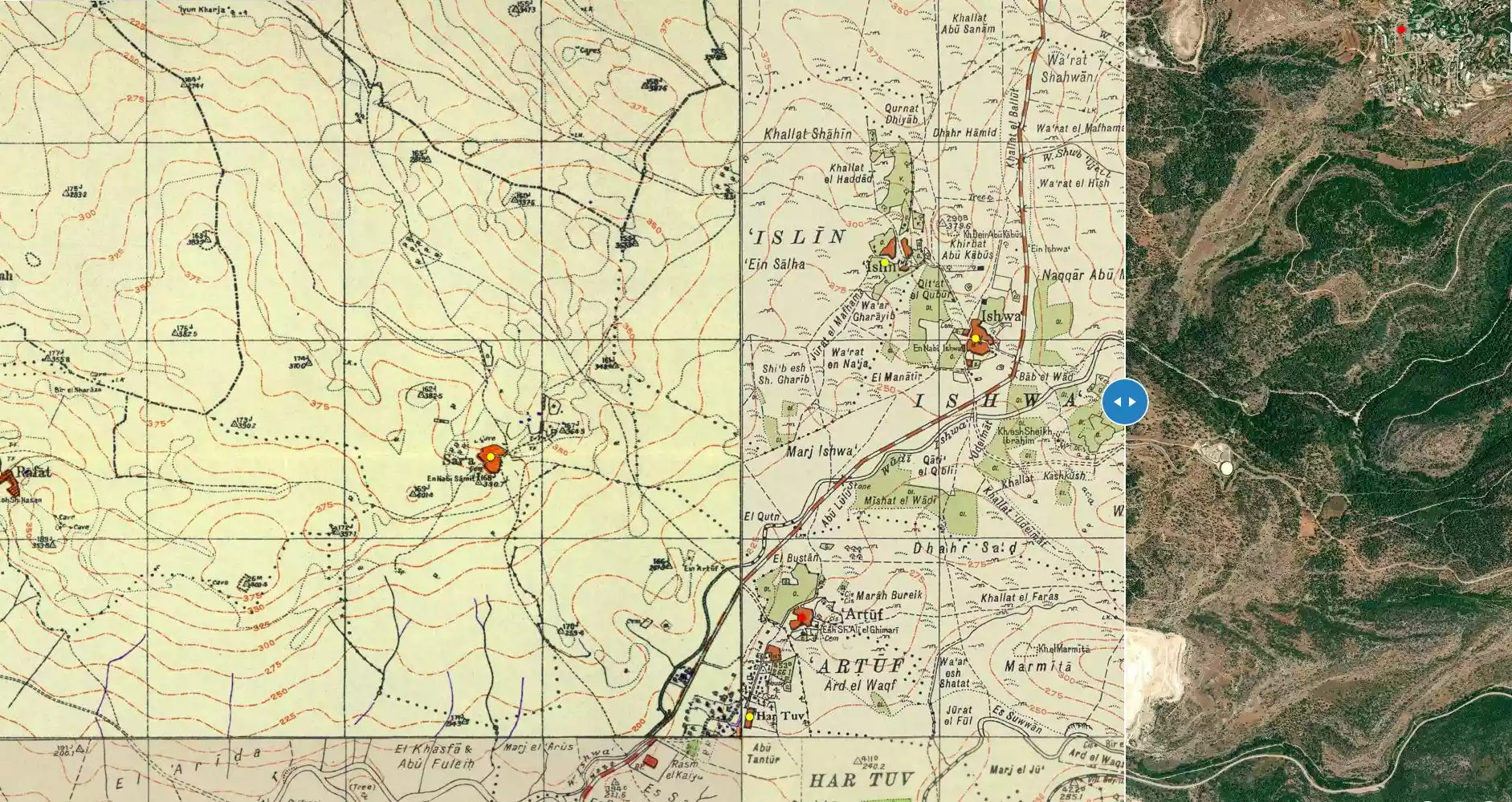
| Map Location | See location #15 on the map View from satellite |
||||||||||||||
| Military Operation | Operation Dani | ||||||||||||||
| Attacking Units | Possibly Fourth Battalion of the Har'el Brigade | ||||||||||||||
| Exodus Cause | Military assault by Zionist troops | ||||||||||||||
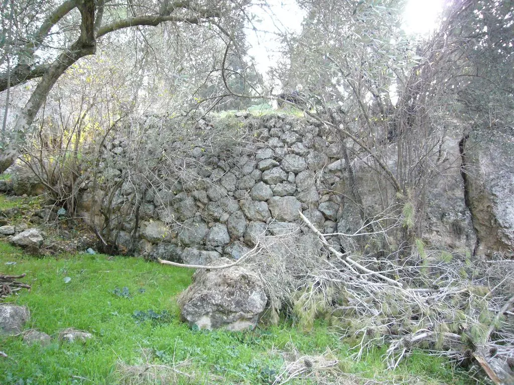
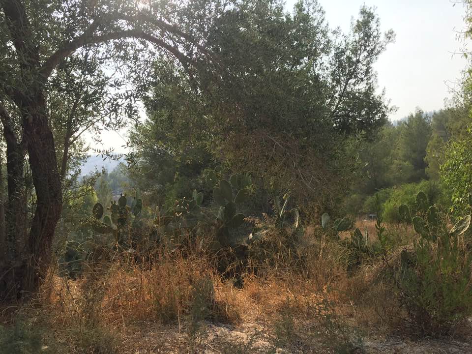
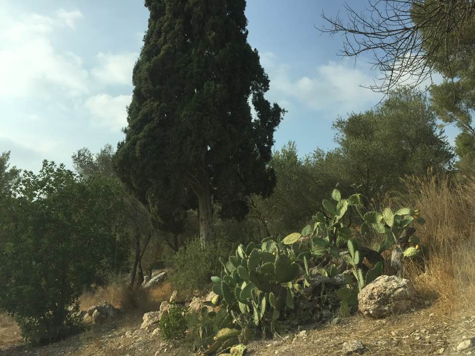
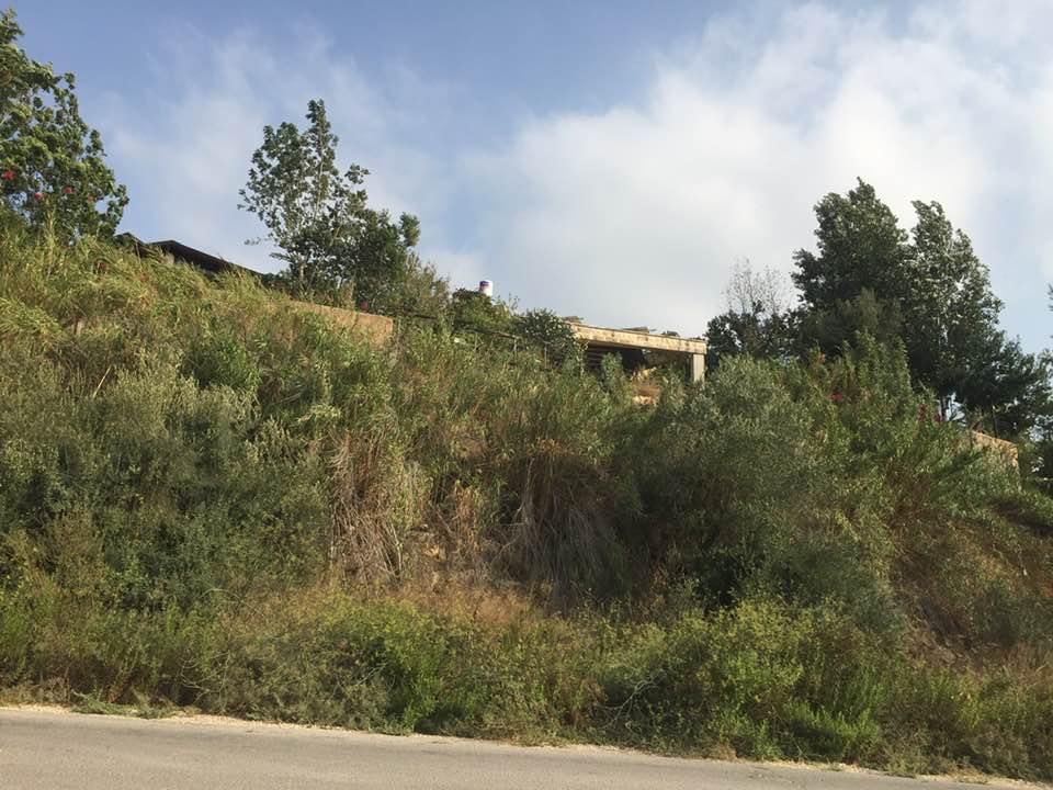
| Village Temains | 'Islin was completely defaced, and only house rubble left behind. | ||||||||||||||
| Ethnically Cleansing | 'Islin inhabitants were completely ethnically cleansed. | ||||||||||||||
| Pre-Nakba Land Ownership |
**Town Lands' Demarcation Maps |
||||||||||||||
| Land Usage As of 1945 |
|
||||||||||||||
| Population |
|
||||||||||||||
| Number of Houses |
|
||||||||||||||
| Exculsive Jewish Colonies Who Usurped Village Lands |
Eshta'ol | ||||||||||||||
| Featured Video | |||||||||||||||
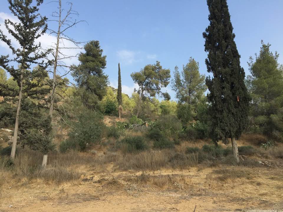
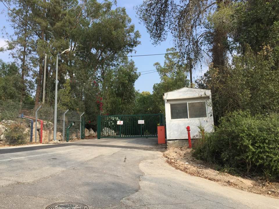
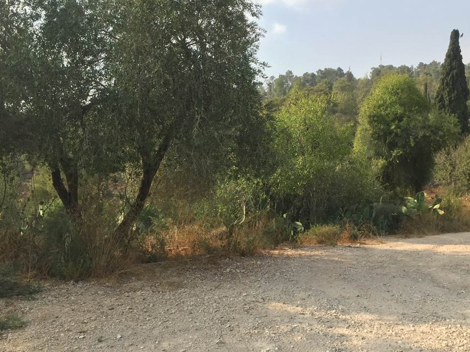
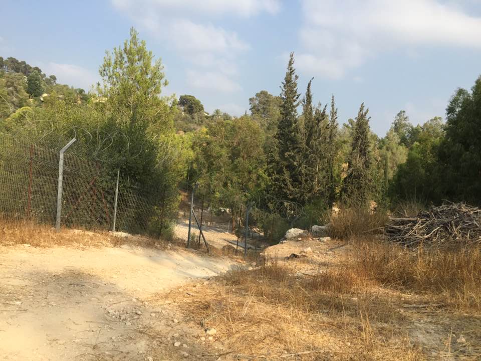
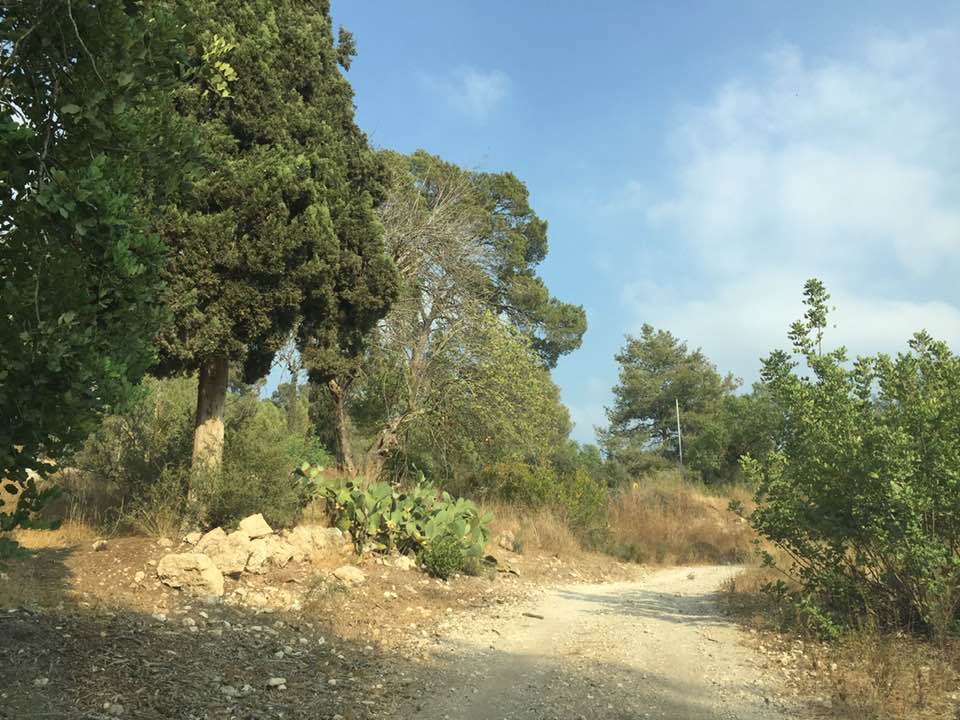
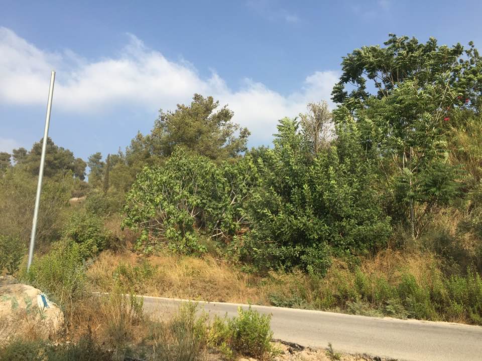
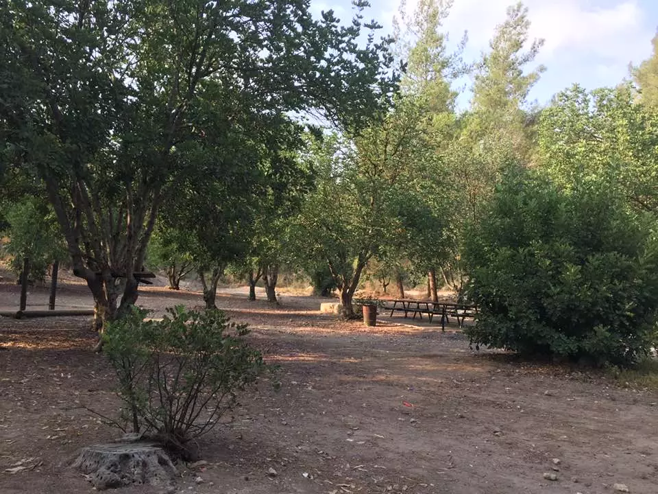
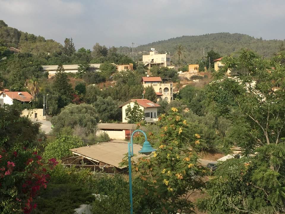
Village Before NakbaThe village stood on a hill on the southern slope of a mountain, facing southeast. A wadi ran along its western and southern perimeters. 'Islin was about 1 km west of the highway between Bayt Jibrin (a large village in the Hebron sub-disctrict) and the Jerusalem−Jaffa highway. Dirt paths linked it to nearby villages. 'Islin was divided into two main sections, one to the east and one to the west. New construction extended to the north. The village is identified with the sixteenth-century village of 'Islit which was mentioned in the Ottoman tax records for that time. It was in the nahiya of Ramla (liwa' of Gaza) and had a population of seventy-seven. It paid taxes on wheat, barley, and fruit trees as well as on goats and beehives. In the 1870s the village was uninhabited; the ruins of the sixteenth-century village were still visible. It was probably repopulated sometime around the beginning of the twentieth century.The residents of 'Islin were Muslims, and they built their houses of stone and mud. Springs and wells provided drinking water and crops were rainfed. The economy was based on grain, fruit trees, olive trees, and vineyards. In 1944/45 a total of 830 dunums was allotted to cereals; 104 dunums were irrigated or used for orchards. The agricultural lands lay north and southeast of the village site. Village Occupation and Ethnic CleaningThe only information available about 'Islin is that it fell to the Israeli army in a limited offensive that was implemented as part of Operation Dani (see Abu al-Fadl, Ramla sub-district). Along with a chain of other villages, it was mortared and captured by Israeli troops on 17−18 July 1948, according to Israeli historian Benny Morris.Zionists Colonies on Village LandsThe settlement of Eshta'ol (150132), founded in 1949, is on land belonging to 'Islin and the neighboring village of Ishwa'.Village TodayPartially destroyed walls and stone terraces can be seen throughout the site. A thick forest, bushes, and grass grow over and around the stone rubble. Many carob trees and some olive trees grow on the northern edge of the site, and eucalyptus and fir trees grow in the south. The Jewish National Fund (the land purchase and development body of the World Zionist Organization ) has established a plant nursery on the southern edge of the village. The site also houses a bus repair yard belonging to the Israeli public transportation cooperative, Egged.SourceDr. Walid al-Khalidi, 1992: All That Remains. |
|||||||||||||||
| Related Maps | Town Lands' Demarcation Maps خرائط للقضاء توضح حدود القرى والاودية Town's map on MapQuest View from satellite Help us map this town at WikiMapia |
||||||||||||||
| Related Links | Wikipedia's Page Google Search Google For Images Google For Videos |
||||||||||||||
| More Information | في كتاب كي لا ننسى في كتاب بلادنا فلسطين |
||||||||||||||
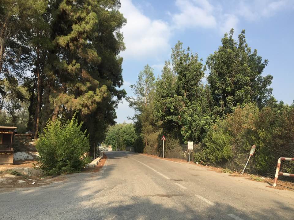
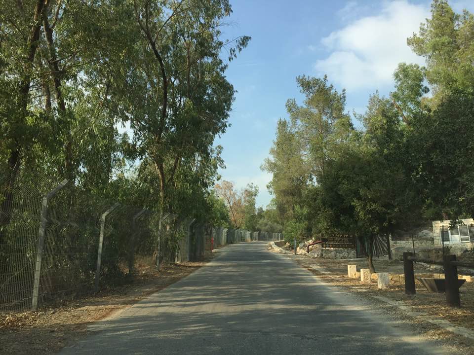
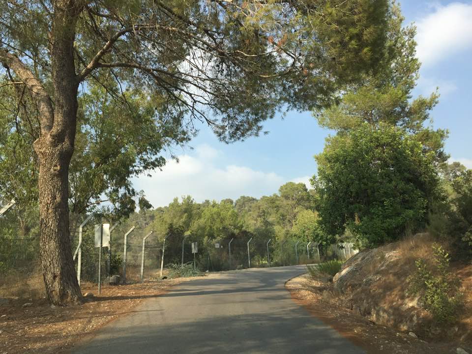
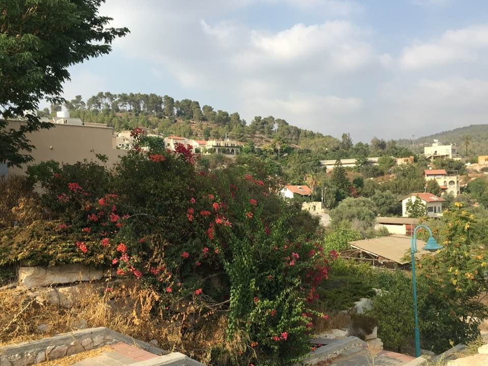
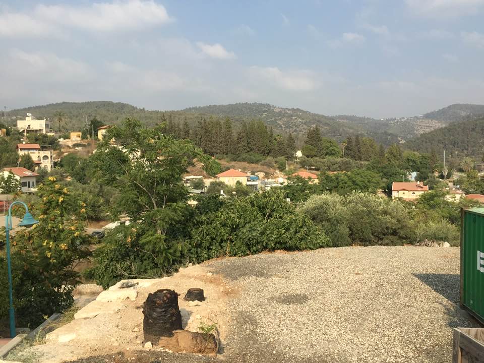
- A village house or wall on the site today
Posted by Seth Frantzman 1 - This is a view of the village land and site from a nearby hill

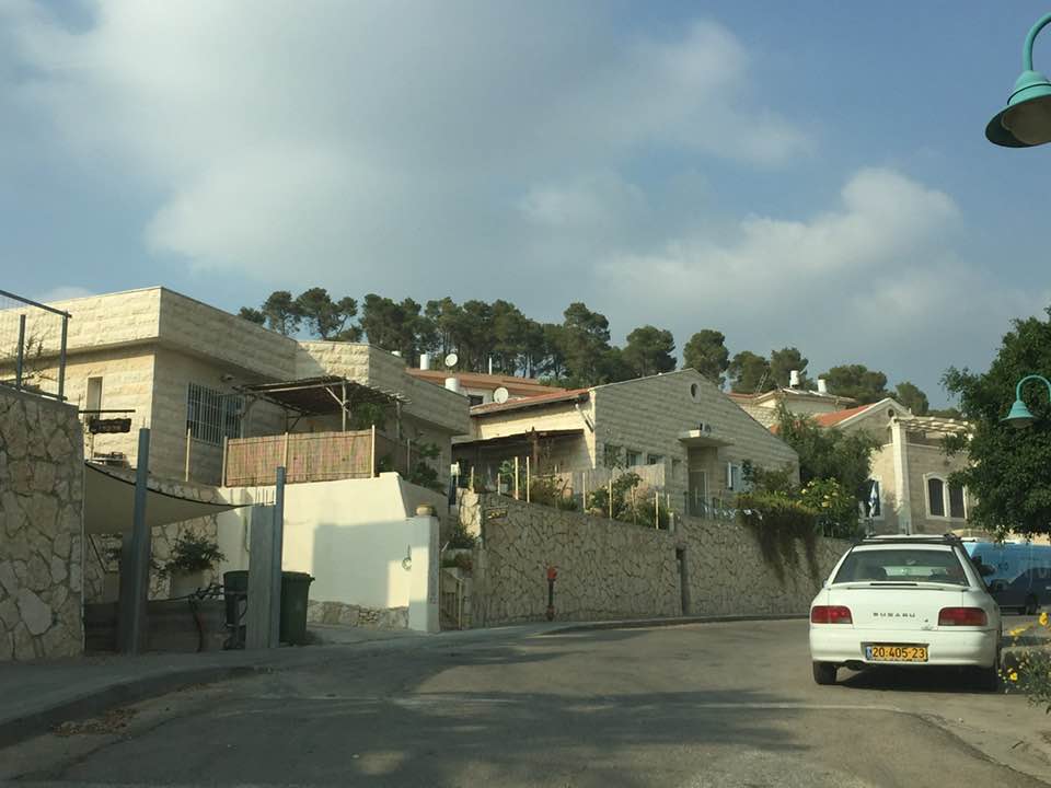
Posted by Seth Frantzman 2 - Let us see how the most "liberal and civilized" of world Jewry has obliterated our village. How else will the Jews be great and safe again?
- Let us see how the most "liberal and civilized" of world Jewry has obliterated our village. How else will the Jews be great and safe again? #2
- Let us see how the most "liberal and civilized" of world Jewry has obliterated our village. How else will the Jews be great and safe again? #3
- Let us see how the most "liberal and civilized" of world Jewry has obliterated our village. How else will the Jews be great and safe again? #4
- Let us see how the most "liberal and civilized" of world Jewry has obliterated our village. How else will the Jews be great and safe again? #5
- Let us see how the most "liberal and civilized" of world Jewry has obliterated our village. How else will the Jews be great and safe again? #6
- Let us see how the most "liberal and civilized" of world Jewry has obliterated our village. How else will the Jews be great and safe again? #7
- Let us see how the most "liberal and civilized" of world Jewry has obliterated our village. How else will the Jews be great and safe again? #8
- Let us see how the most "liberal and civilized" of world Jewry has obliterated our village. How else will the Jews be great and safe again? #9
- Let us see how the most "liberal and civilized" of world Jewry has obliterated our village. How else will the Jews be great and safe again? #10
- Let us see how the most "liberal and civilized" of world Jewry has obliterated our village. How else will the Jews be great and safe again? #11
- Let us see how the most "liberal and civilized" of world Jewry has obliterated our village. How else will the Jews be great and safe again? #12
- Let us see how the most "liberal and civilized" of world Jewry has obliterated our village. How else will the Jews be great and safe again? #13
- Let us see how the most "liberal and civilized" of world Jewry has obliterated our village. How else will the Jews be great and safe again? #14
- Let us see how the most "liberal and civilized" of world Jewry has obliterated our village. How else will the Jews be great and safe again? #15
- Let us see how the most "liberal and civilized" of world Jewry has obliterated our village. How else will the Jews be great and safe again? #16
- Let us see how the most "liberal and civilized" of world Jewry has obliterated our village. How else will the Jews be great and safe again? #17
Want to browse more? 80,000 pictures were grouped in these gallaries:
| Display Name | Clan/Hamolah | Country of Residence |
| ضياء ذيب | ذيب | عمان, الاردن |
| محمد مطاوع | مطاوع | عمان, الاردن |
| محمد حسن محمد عفانه | uthki | safut, jordan |
| خالد صالح رضوان (ابو صالح) | رضوان | البقعة, الاردن |
| aboyahia | Radwan | Jordan |
| يوسف سليمان | - | - |
| عزيزة رضوان | رضوان | - |
| rusha motawe | - | - |
| atallah | - | jordan |
| ahmad mutawe | - | - |
| محمد طه مطاوع | - | عمان, الاردن |
| Afaneh | - | - |
| Yousef Mutawe | - | Amman, Jordan |
| Aliaa Radwan | Radwan | Amman, Jordan |
| عسلينية | رضوان | عمان, الاردن |
| mohammed al hafy | - | Kuwait, Kuwait |
| mohammed mahmoud | - | Kuwait, Kuwait |
| abedhaed | حميد | - |
| khaledssr | - | - |
| Summer Mutawe | Mutawe | CA, USA |
| hasan mohammd mahmud mutawe | mutawe | abu dhabi, united arab emerites |
| عمار | عفانة | Ontario, Canada |
| Adel Radwan | Zaeed/Radwan | - |
| ali_mutawe | mutawe | amman, jordan |
| a | afaneh | - |
| ATTA AFANEH | - | - |
| safaa mutawi | Mutawi | TN, USA |
| sana mutawi | mutawi | canada |
| wisam afana | - | - |
| jamal solaiman | al sheekh ahmad | amman |
| monther mutawea | Motawea | - |
| Afif Mutawe | Mutawe | Canada |
| ATTA MAHMOOD HUSAIN ATALLA | ATALLA AFANEH | AMMAN, JORDAN |
 Fake Valor: Why Did Zionist Jews Hoist Nazis Flag on Their Ships in the 1930s?
What is new?
-
Facts About Oct. 7th Gaza Raid
-
Remined Us Please:: Who Did Rape Who? Palestinians Raped Israelis? Or, was the other way around?
-
When Prof. Edward Said was invited to debate Bibi Netanyahu in the 1980s, watch what happened!
-
Ezra Klein of the NY Times on the "Jewish Race".
-
Abusing Blood Libel!
-
Did Israeli Soldiers Activate The Hanniba Direective On Oct. 7th? You Be The Judge
-
Zionist FAQ: Isn't it true that Palestinians don't want peace? Palestinians never accepted the two-state solution
- Facts about Haavara (Transfer) Agreement between Ben-Gurion & Hitler
-
Haavara FAQs: Why Did Zionist Jews Hoist Nazis' Flags on Their Ships in the 1930s?
- Haavara FAQs: When Chaim Weizmann met FDR in mid-1943, why was he silent about rescuing European Jewry?
-
Dear ChatGPT: How did Palestinians resist Napoleon's invasion of their country in 1799?
-
Dear ChatGPT: Gaza had a vibrant Jewish community in the mid-17th century. What happened to them?
-
Dear ChatGPT: Why did the Jewish Agency suppress news of the Holocaust during WWII?
-
Video Playlist: Jews share their DNA tests to end the conflict for good.
-
A Tale of Two Conflicts: Examining the Definition of Genocide
-
Prof. Abraham Polak And The Suppressed History of the Khazars and European Jewry
-
How Ronald Reagan would have framed the genocide in Gaza if he were still alive?
-
Haavara FAQs: Let us do the math: how many German Jews did The Haavara Agreement save?
-
Zionist FAQs: The Hebron Massacre of 1929, "clearly proves" that Palestinians are antisemitic, how could you deny it?
-
Zionist FAQs: Why Anti-Zionist Is Not Antisemitism?
-
Zionist FAQs: Isn't it true that the KGB created Palestinian Nationalism in the early 1960s?
- Zionist FAQs: Muslims are killing Muslims all the time; why are Israeli Jews being singled out in the media?
- Zionist FAQs: How is Israel an apartheid state when 20% of its citizens are Arabs who enjoy full rights?
-
Haavara FAQs: Why Did Dorothy Thompson Flip From A Zionist Advocate to A Silenced Dissenter?
-
Haavara FAQs: Analysis of Herzl's Uganda Scheme and how it could have saved millions of Jews.
-
Haavara FAQs: Why did Hayim Greenberg describe American Jewry as "morally bankrupt" in early 1943?
-
Haavara FAQs: What if the Evian Conference was a resounding success? What would have been the impact of saving European Jewry on Zionism?
- Haavara FAQs: What if the six million were saved, how that would have impacted the Zionist project?
-
Haavara FAQs: How did Zionist leaders react when Europe's Jews lingered in the DP camps after WWII ended?
-
Why does the American Jewish community repeat lies that David Ben-Gurion had debunked before he died?
-
Who has the power to rename the Tatar/Khazar Gene Marker to Jewish IV?
-
Zionist FAQs: Why won't Egypt, Syria, and Jordan take their people back? Jews are indigenous to Palestine, and Arabs immigrated after Jews developed the country. Arabs should leave.
-
Haavara FAQs: Did Hitler and the Nazis conflate between Judaism and Zionist? If that wasn't case, then why?
-
Haavara FAQs: Winston Churchill and antisemitism, a collection of articles written Churchill.
-
Haavara FAQs: Broken by country, how many Jews survived vs. killed during the Holocaust?
-
Haavara FAQs: Why did European Jews vote with their feet and to immigrated to the Americas, not Palestine, after WWII?
-
Watch this American Jewish Girl describing Israeli Jews' cognitive dissonance like no other in under two minutes
-
Haavara FAQs: When the Nazis went out of their way to hide the Holocaust, Israeli Jews did the exact opposite by broadcasting their genocide of Gazans. But why?
-
Haavara FAQs: How Zionist Jews went out of their to show their appreciation to Nazism and Fascism?
- Haavara FAQs: Why Zionist leaders were against bombing the death camps & the Railroads leading to them?
-
Haavara FAQs: Hitler's message to the British and American people: If Jews are such noble citizens and you care about them, how come you're not letting them in? I will gladly ship them to you at my expense, even on luxury liners!
-
A shortlist of Zionist and Israeli false flag operations in the name Jews.
-
The Most Moral Army
- The Land of Kapos (Israel): Where the brave are boycotted and Kapos walk free.
- Why did early Zionists often named their communal enterprises "colonial"?
- Zionist Relations with Nazi Germany by Faris Glubb
-
Two NY Times advertisements by Zionists in the early 1943 that exposes Zionists' treason at the height of the calamity
- Facts Not Lies about the Palestinian-Israeli Conflict.
- Site's pictures have been categorized
- Campgain Against Lice
- A Survey of Palestine, the official source about Palestine before Nakba produced by the British Mandate; over 1200 pages.
- Satellite View & Google Earth: Over 6,000 placemarks identifying all destroyed towns, W. Bank & Gaza Strip Towns, & refugee camps.
- PalestineRemembered.com and its Nakba Oral History Project were featured on al-Jazeera Satellite TV.
- Nakba Oral History Video Podcast:
 Over 700 Oral History interviews (including 3,500+ hours of recording) can be viewed online.
 - Palestine Village Statistics Project
- Gaza Jail Break
- النسخة العربية للموقع الان متوفرة
- Videos: Documenting the destroyed villages in video: Tracing all that remains since Nakba.
- Videos: Responding to Zionist Propaganda
- Interview: The ethnic cleansing of Palestine: George Galloway interviews Israeli Historian Ilan Pappe.
- For Palestinians, memory matters. It provides a blueprint for their future By George Bisharat.
- Zionist FAQ now available in Hebrew שאלות שציונים שואלים, עכשיו בעברית
- Video: The Stephen Walt and John Mearsheimer report on the influence of the Israel Lobby on U.S. Foreign Policy
- The Palestinian-Israeli conflict for beginners
