| PalestineRemembered | About Us | Oral History | العربية | |
| Pictures | Zionist FAQs | Haavara | Maps | |
| Search |
| Camps |
| Districts |
| Acre |
| Baysan |
| Beersheba |
| Bethlehem |
| Gaza |
| Haifa |
| Hebron |
| Jaffa |
| Jericho |
| Jerusalem |
| Jinin |
| Nablus |
| Nazareth |
| Ramallah |
| al-Ramla |
| Safad |
| Tiberias |
| Tulkarm |
| Donate |
| Contact |
| Profile |
| Videos |
Welcome To Sar'a - صرعة (צרעה)
|
District of Jerusalem
Ethnically cleansed days ago |
العربية Google Earth |
 |
Gallery (69) |
- Statistics & Facts
-
Before & After

- Satellite View
- Articles 8
- Pictures 69
- Aerial Views 1
- Mayrters & Prisoners 3
- Oral History 1
- Members 21
- All That Remains
- Wikipedia
- Videos 10
- Guest Book 131
- Links 1
| Statistic & Fact | Value | ||||||||||||||||
| Occupation Date | July 18, 1948 | ||||||||||||||||
| Distance From District | 25 (km) West of Jerusalem | ||||||||||||||||
| Elevation | 350 (meters) | ||||||||||||||||
| Before & After Nakba, Click Map For Details |
|||||||||||||||||
|
|||||||||||||||||
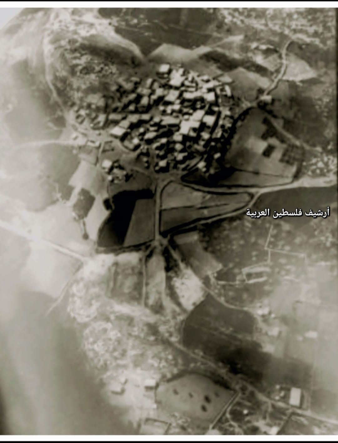
| Pre-Nakba Aerial View |
|||||||||||||||||
|
|||||||||||||||||
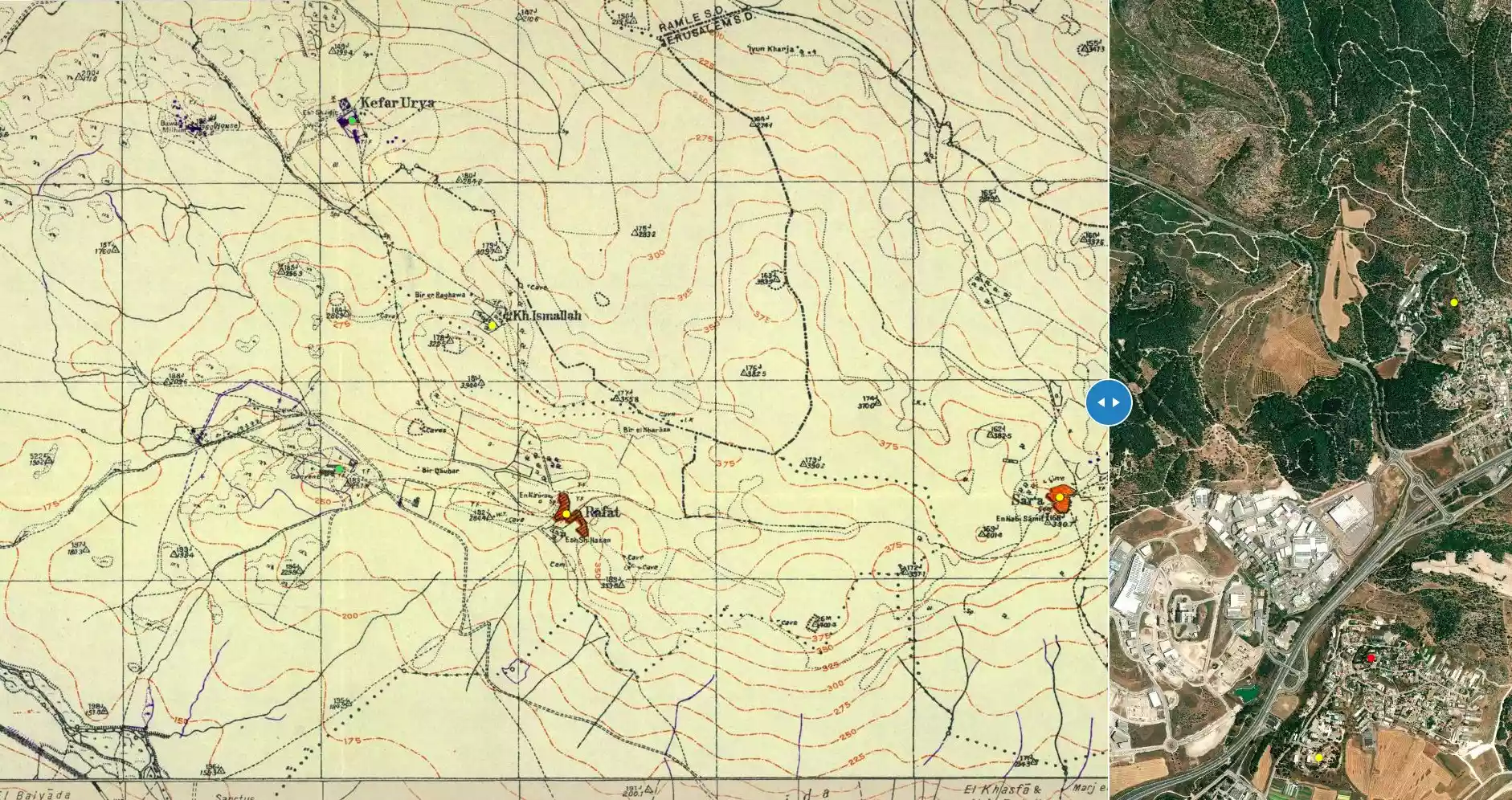
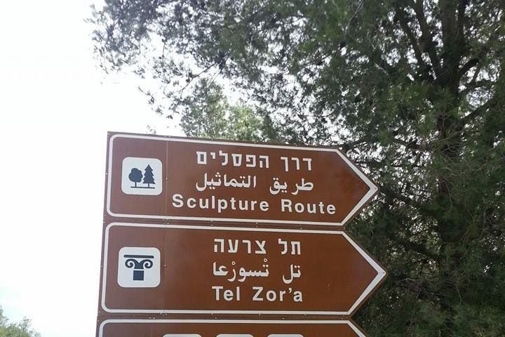
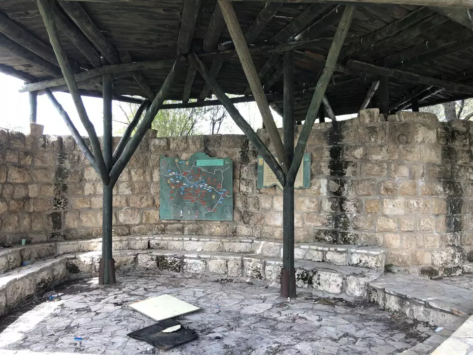
| Map Location | See location #14 on the map View from satellite |
||||||||||||||||
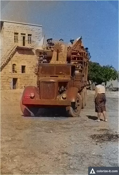
| Military Operation | Operation Dani | ||||||||||||||||
| Attacking Units | Har'el's Fourth Battalion | ||||||||||||||||
| Defenders | Egyptian Muslim Brotherhoods, some Arab Liberation Army volunteers, and some local Palestinian militia. | ||||||||||||||||
| Exodus Cause | Military assault by Zionist troops | ||||||||||||||||
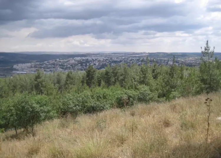
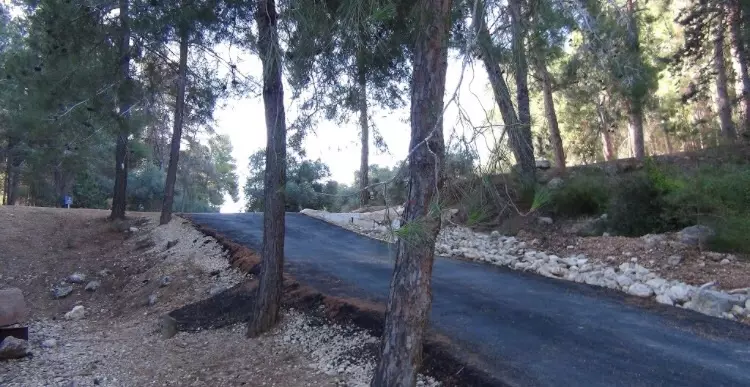
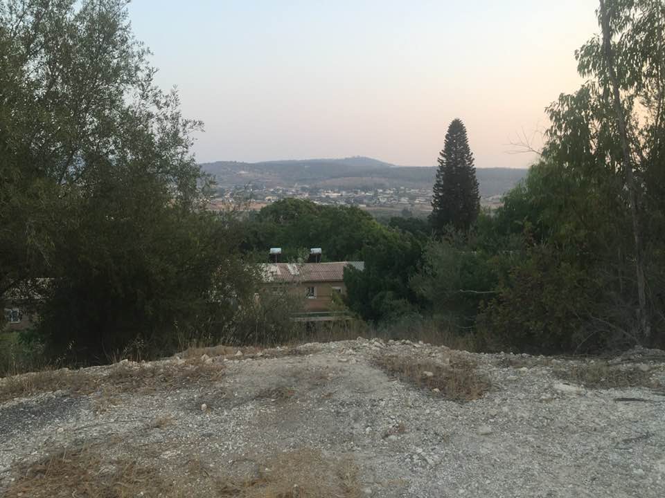
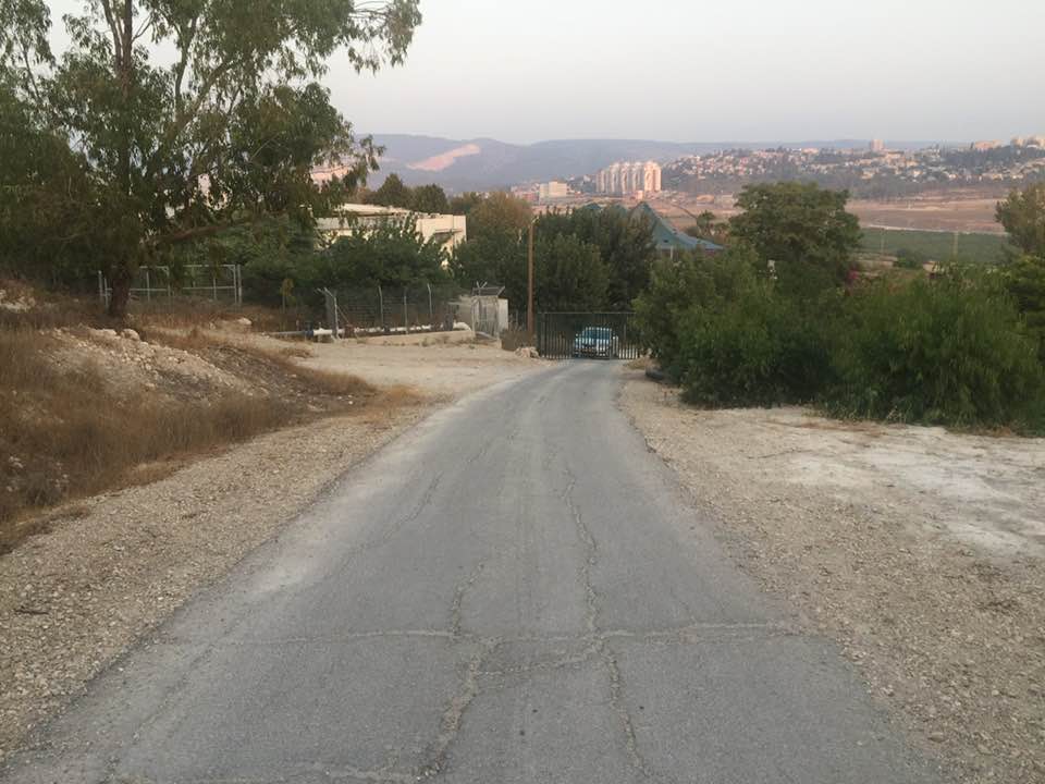
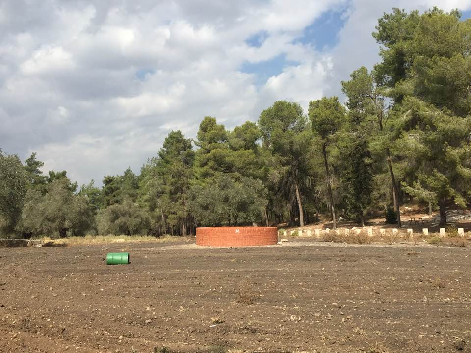
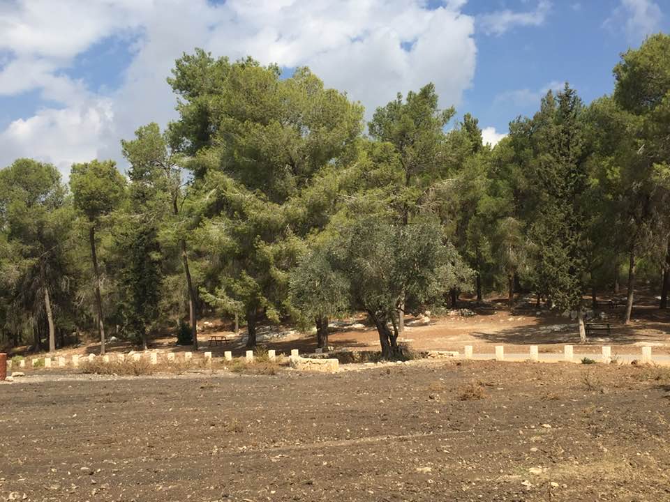
| Village Temains | Sar'a was destroyed some time in 1949 to make room for the settlement of Tzor'a. Currently, the village site has been completely defaced. | ||||||||||||||||
| Ethnically Cleansing | Sar'a inhabitants were completely ethnically cleansed. | ||||||||||||||||
| Pre-Nakba Land Ownership |
**Town Lands' Demarcation Maps |
||||||||||||||||
| Land Usage As of 1945 |
|
||||||||||||||||
| Population |
|
||||||||||||||||
| Number of Houses |
|
||||||||||||||||
| Town's Name Through History | The Canaanites referred to Sar'a by the city of Sur'a or Zorah, subsequently it was known by Danite, then the Romans called it Sarea. | ||||||||||||||||
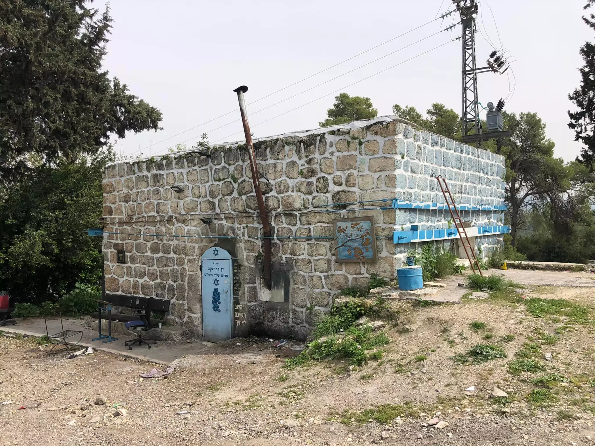
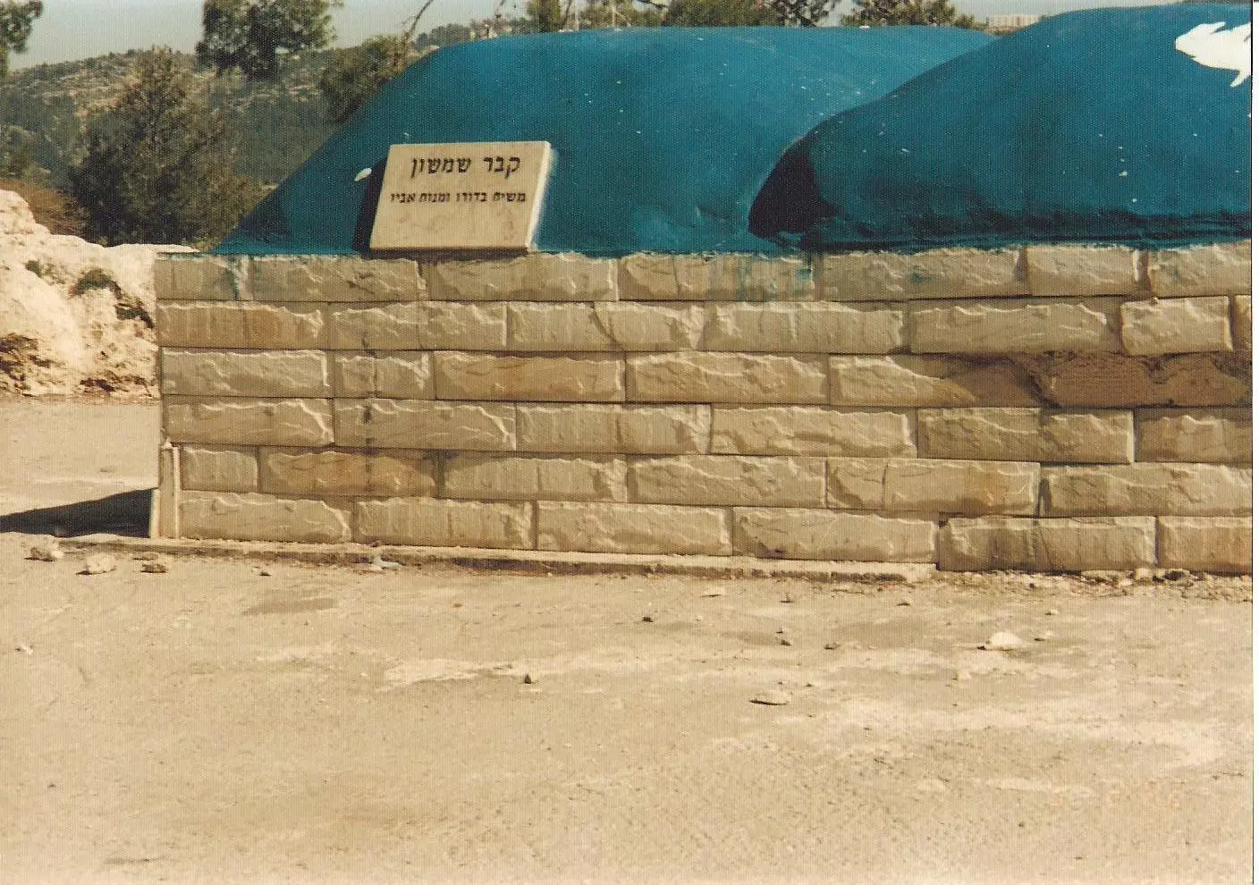
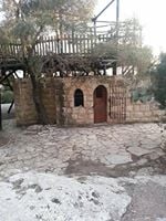
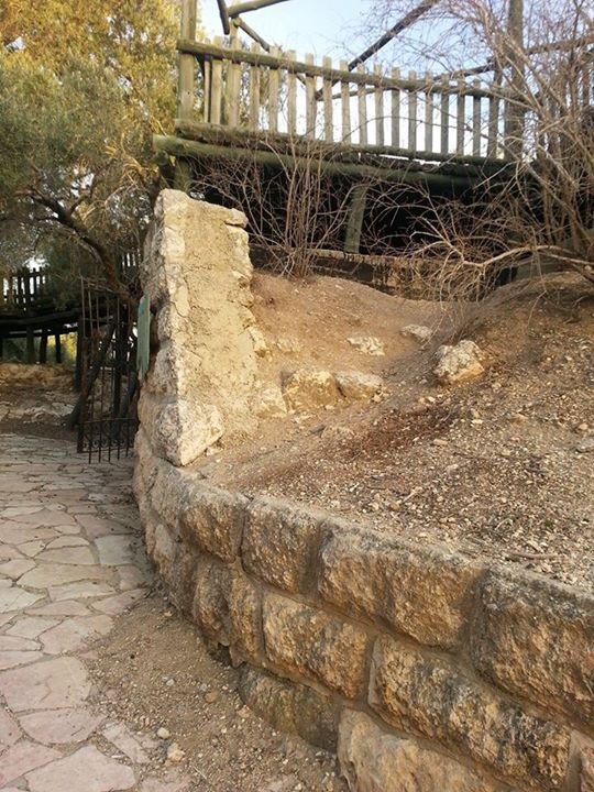
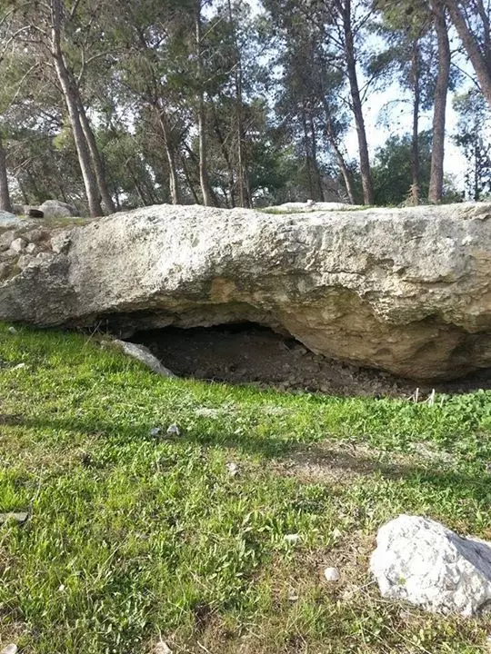
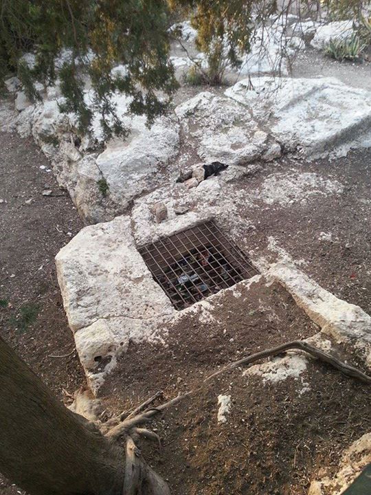
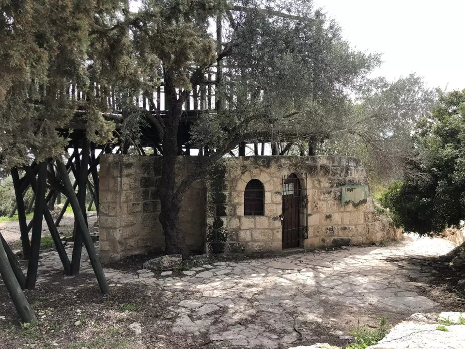
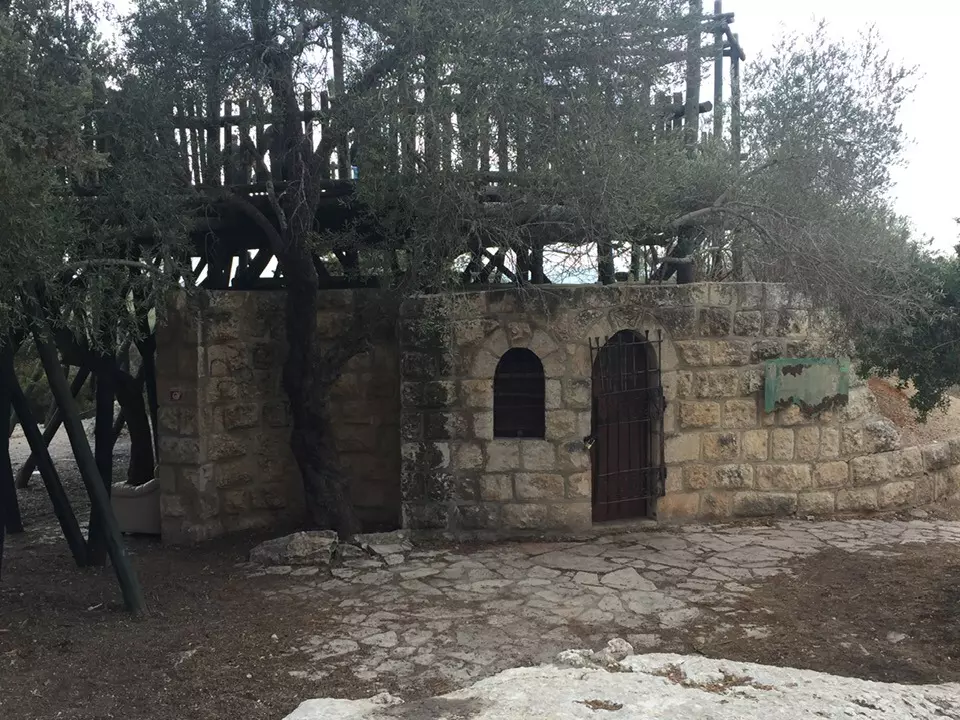
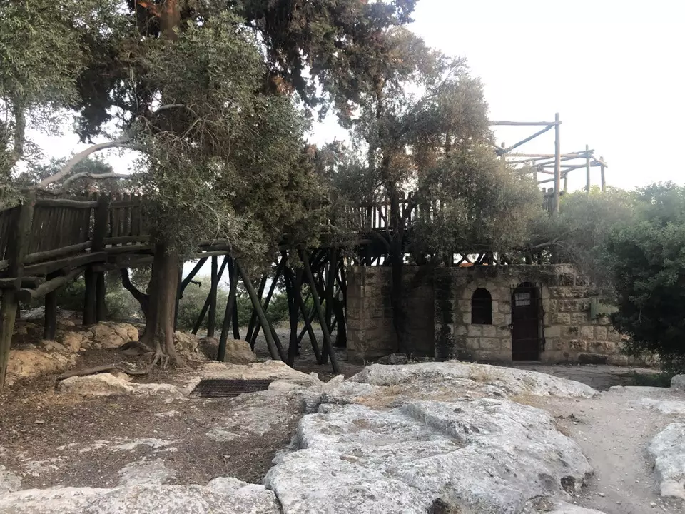
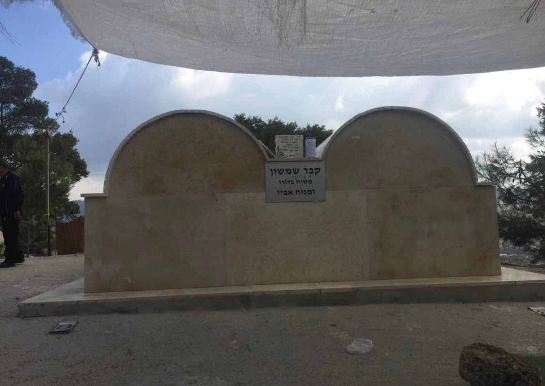
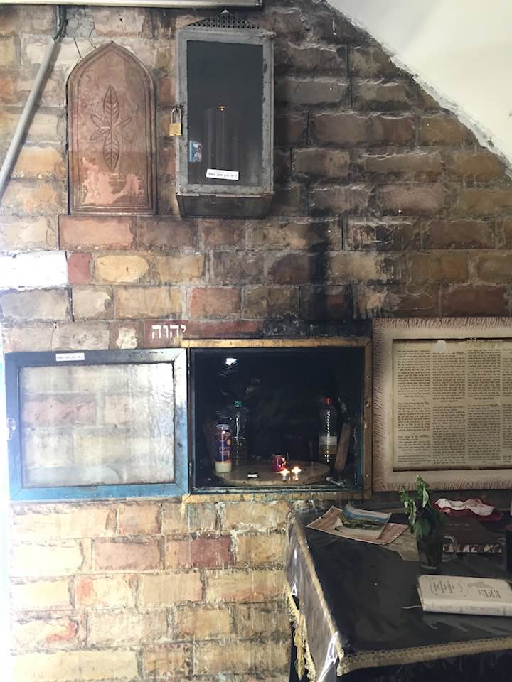
| Shrines / Maqams | Sar'a had two shrines one of which is still standing. The first belongs belongs to al-Nabi Samat, and the other for an unnown individuals. | ||||||||||||||||
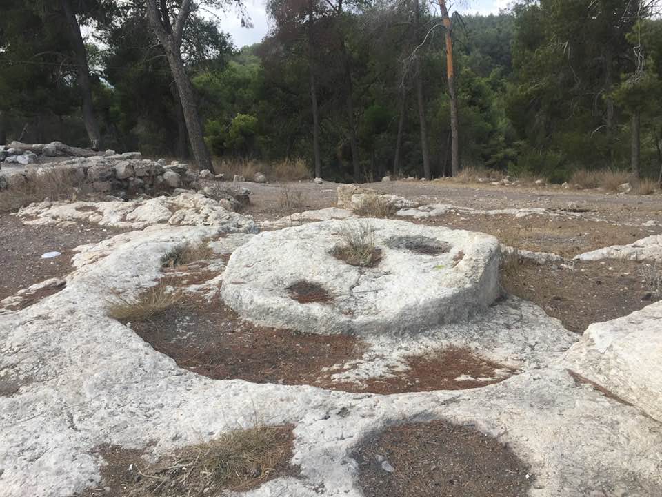
| Archeological Sites | The village has several Khirbas including Khirbat al-Tahuna, where the ruins of a building constructed of ashlars (squared stone masonry) and the foundations of other buildings. | ||||||||||||||||
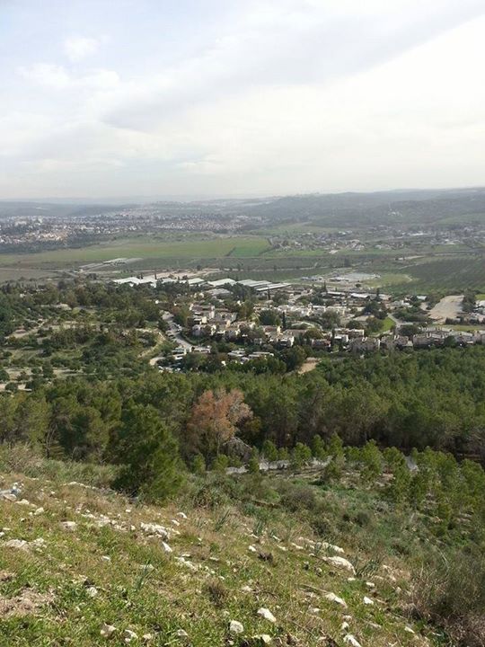
| Exculsive Jewish Colonies Who Usurped Village Lands |
Tarum and Tzor'a | ||||||||||||||||
| Featured Video | |||||||||||||||||
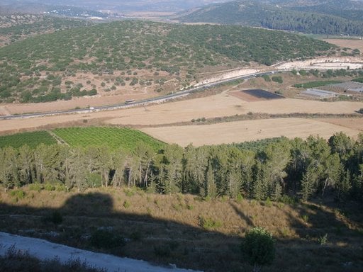
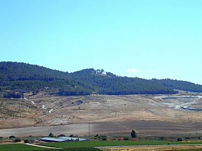
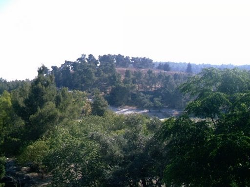
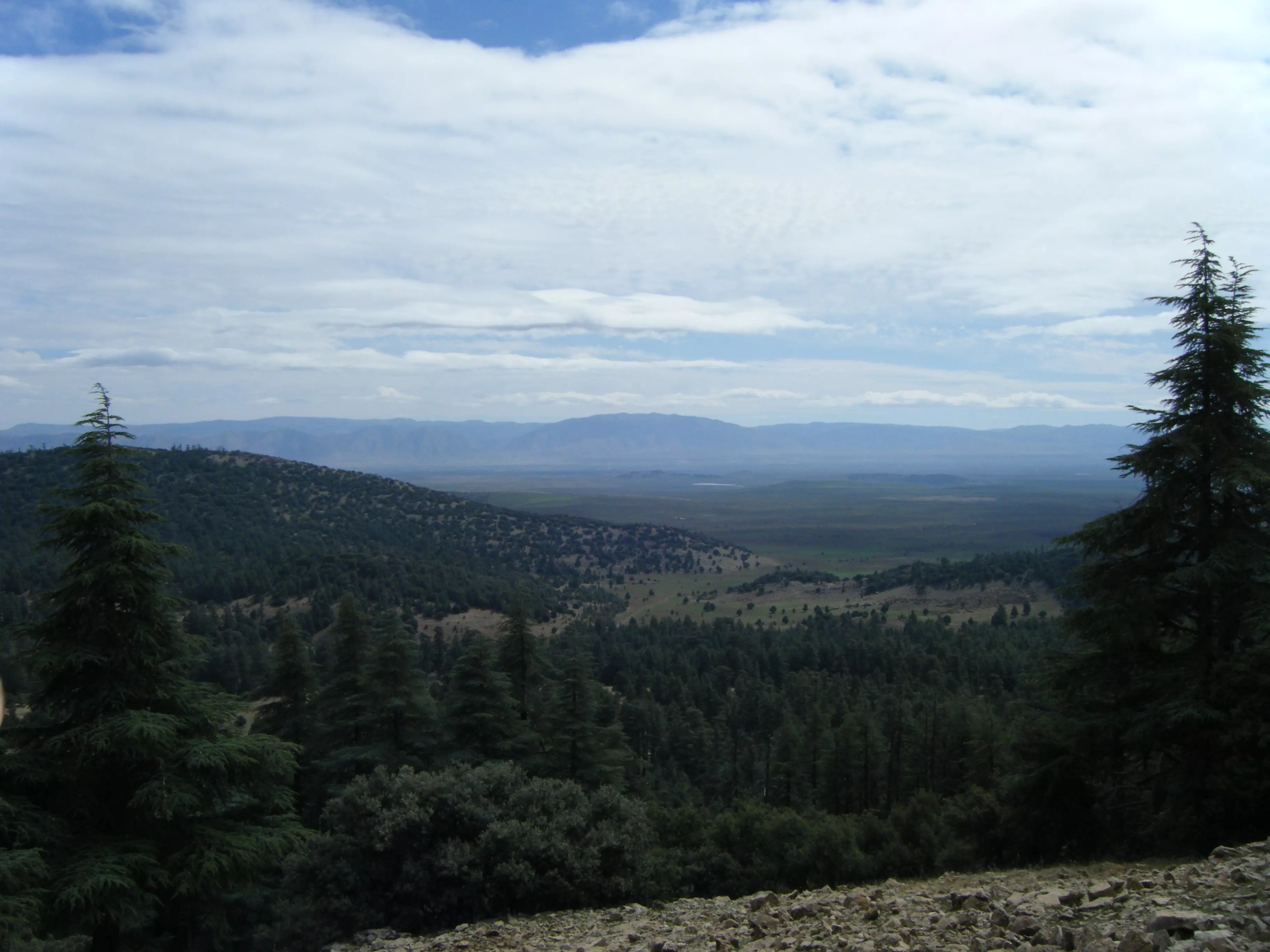
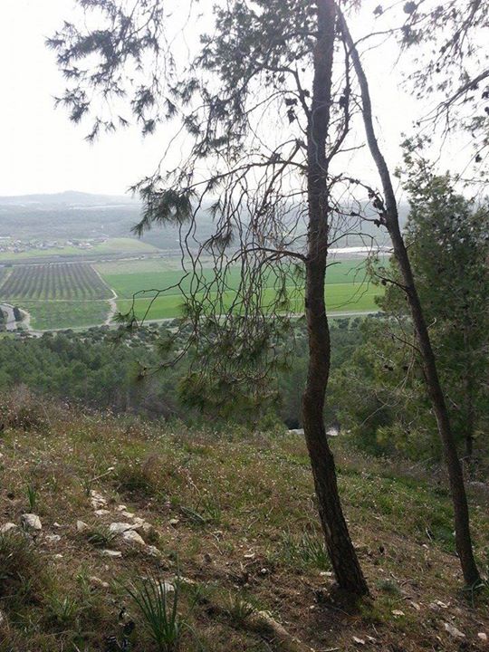
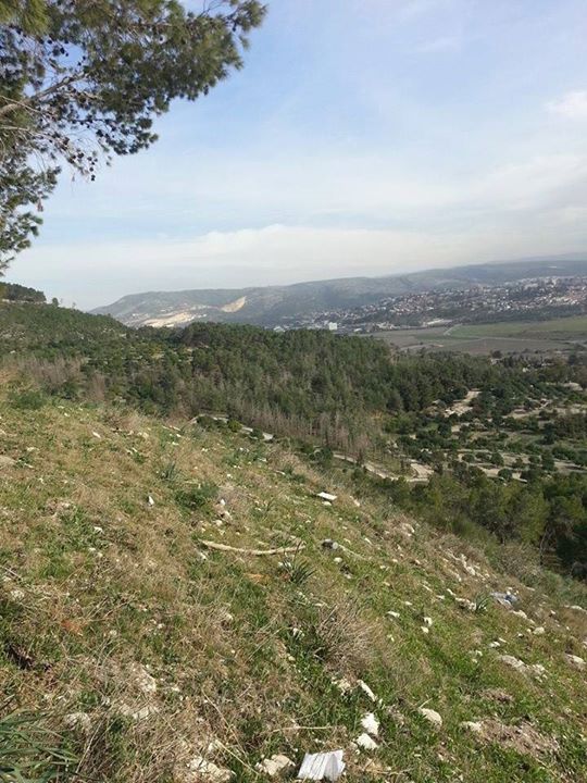
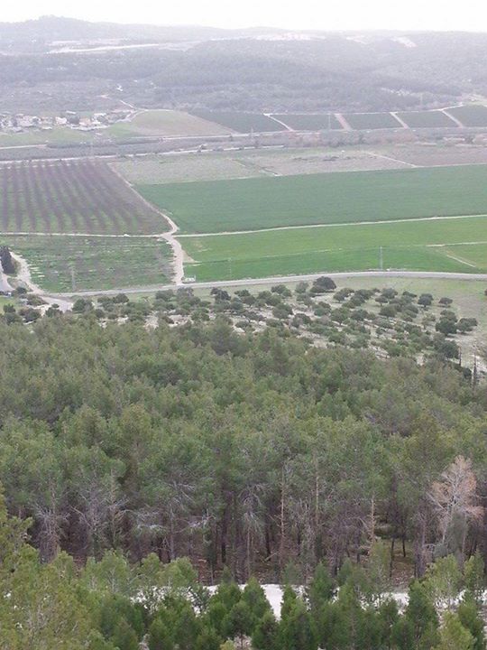
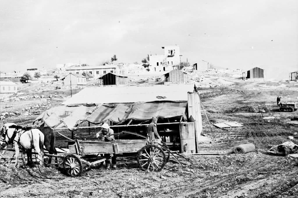
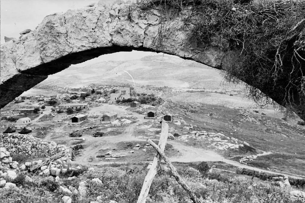
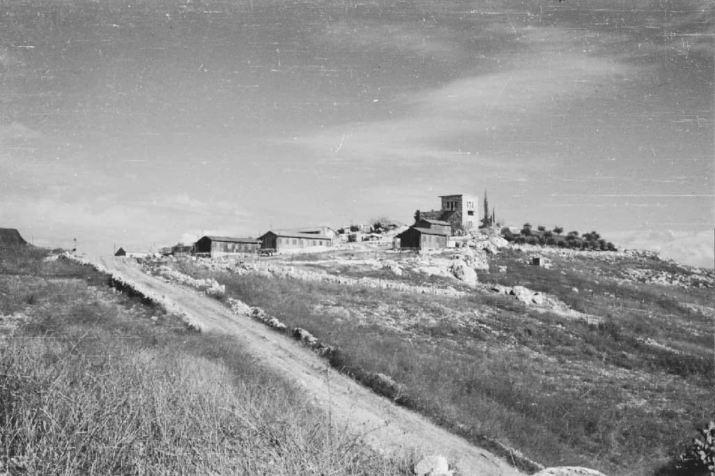
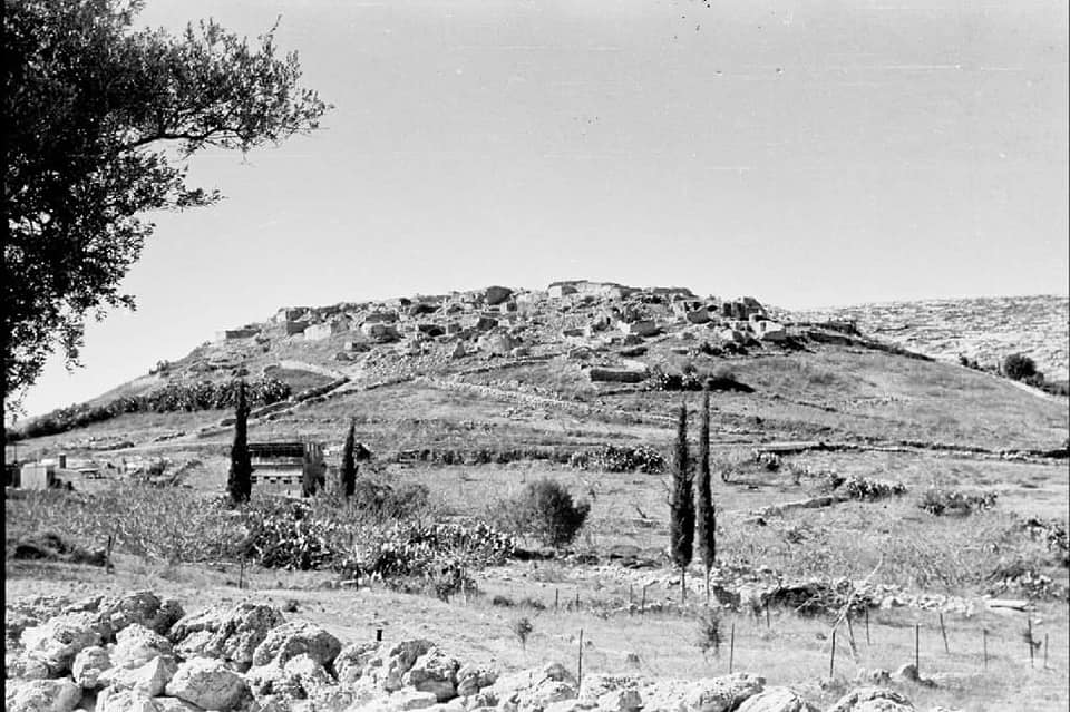
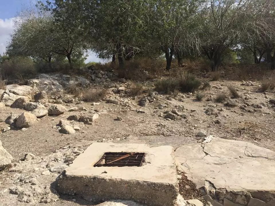
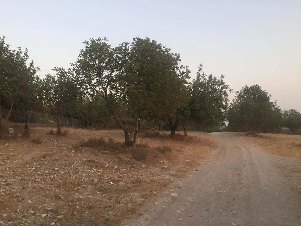
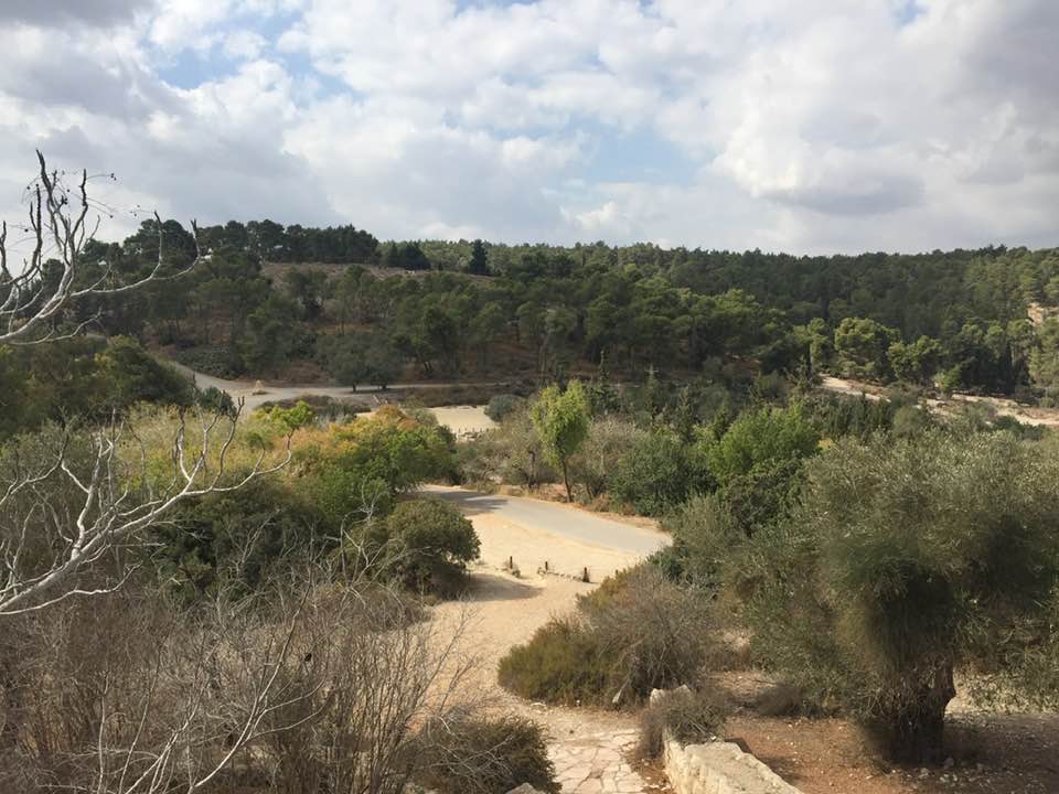
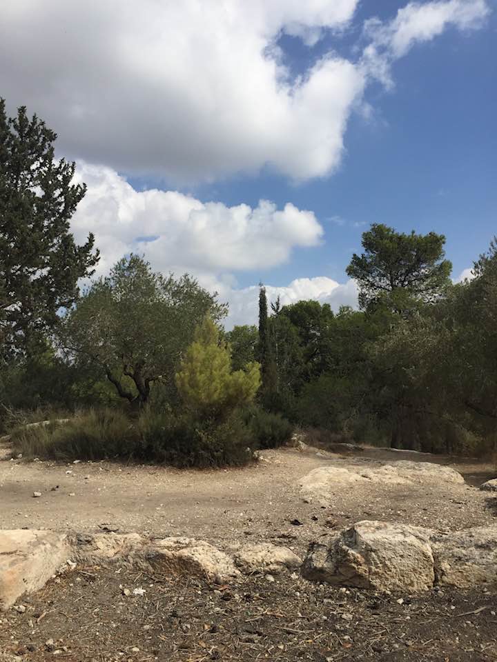
Village Before NakbaThe village was located on a prominent hill on the western slope of a mountain. A short (2 km) side road linked the village to a highway that ran northeast from Bayt Jibrin (a main village in the Hebron sub-disctrict) and intersected with the Jerusalem−Jaffa highway. Sar'a may have been built on the site of the Canaanite city of Sur'a, or Zorah, subsequently a Danite town (Joshua 15:33). It was known as Sarea during the Roman period. In 1596, Sar'a was a village in the nahiya of Ramla (liwa' of Gaza) with a population of ninety-four. It paid taxes on a number of crops, including wheat, barley, and olives, as well as on other types of produce, such as goats and beehives. The biblical scholar Edward Robinson mentioned passing by the village in 1841, shortly after leaving al-Latrun, a village on the Jerusalem−Jaffa highway. In 1875 the village was said to have a population of approximately 400. The British surveyors who authored the Survey of Western Palestine in the late nineteenth century described Sar'a as a village on a low, bare hill that consisted of white eocene chalk. To the south lay the maqam of al-Nabi Samat, sometimes identified with the biblical Samson (who according to tradition lived here).Sar'a was divided into three quarters. The mud and stone houses in each quarter were clustered together, divided by narrow, winding alleys. In the southern quarter, construction extended up the slope to the hilltop, while in the northern section construction extended along the northeastern foot of the hill. There were a few shops in the middle of each of the three quarters. The village population was Muslim. Their primary occupation was agriculture, which was based on rainfall and irrigation from springs in the valley floors. Their main crops were grain, olives, and fruit, including figs, apricots, and grapes. Olive groves covered 115 dunms and were concentrated in the eastern part of the land, while fruit trees were planted in the northern fields. In 1944/45 a total of 2,979 dunums was allocated to cereals; 194 dunums were irrigated or used for orchards. Forests and natural herbs grew on the western and eastern slopes. Sar'a was an archaeological site that contained caves, tombs, rock-hewn cisterns, and a press. Southeast of the site, also, was Khirbat al-Tahuna (147130), where the ruins of a building constructed of ashlars (squared stone masonry) and the foundations of other buildings betray its antiquity. Village Occupation and Ethnic CleaningIn mid-July 1948, a number of villages were occupied in the approaches to Jerusalem during Operation Dani (see Abu al-Fadl, Ramla sub-district). The History of the War of Independence states that the 'important role' in the operation was assigned to the Har'el Brigade which was active in the eastern sector of Dani. Sar'a, which was defended by Egyptian forces, was occupied on 13−14 July, during the invasion of the Lydda−al-Ramla plain to the west. It was taken by the Har'el's Fourth Battalion in preparation for the attack on nearby 'Artuf, which was defended by 'irregular forces' (perhaps Palestinian militia units) under the command of the Egyptian army.Zionists Colonies on Village LandsThe settlement of Tarum (148132) was built on the northeastern edge of the site, on village land, in 1950. Tzor'a (147129) was established about 2 km southwest of the site in 1949 , following the destruction of the village. It stands on land belonging to Dayr Aban.Village TodayStone rubble and iron girders are strewn among the trees on the site. A flat stone, surrounded by debris and inscribed with Arabic verses from the Qur'an, bears the date A.H. 1355 (1936). On the western edge of the site stands a shrine containing the tombs of two local religious teachers. A valley to the northeast is covered with fig, almond, and cypress trees.SourceDr. Walid al-Khalidi, 1992: All That Remains. |
|||||||||||||||||
| Related Maps | Town Lands' Demarcation Maps خرائط للقضاء توضح حدود القرى والاودية Town's map on MapQuest View from satellite Help us map this town at WikiMapia |
||||||||||||||||
| Related Links | Wikipedia's Page Facebook Page Google Search Google For Images Google For Videos |
||||||||||||||||
| More Information | في كتاب كي لا ننسى في كتاب بلادنا فلسطين المزيد من موقع هوية |
||||||||||||||||
- معلومات عن القرية
- قصة الشهيد احمد ابو لطيفة / منقول عن موقع المركز الفلسطيني للاعلام
- مقاومة الاحتلال من قبل القرية وجيرانها من القرى
- الحاجة صبحة تروي عذابات التهجير
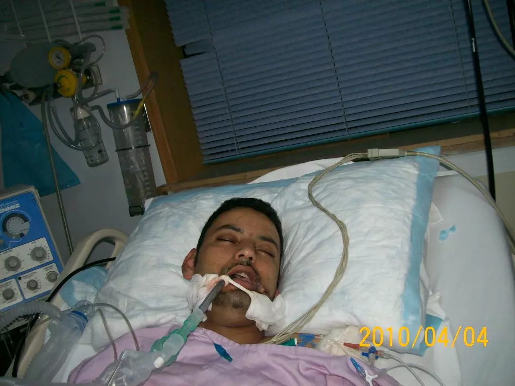
- عبد الله ابو لطيفة / جريح الاقصى
- ما بين قرية صرعا وبين حين الشيخ جراح في القدس
- الاسير امجد فائق ابو لطيفة
- نبذة تاريخية عن قرية صرعة (قضاء القدس) من كتاب (كي لا ننسى)
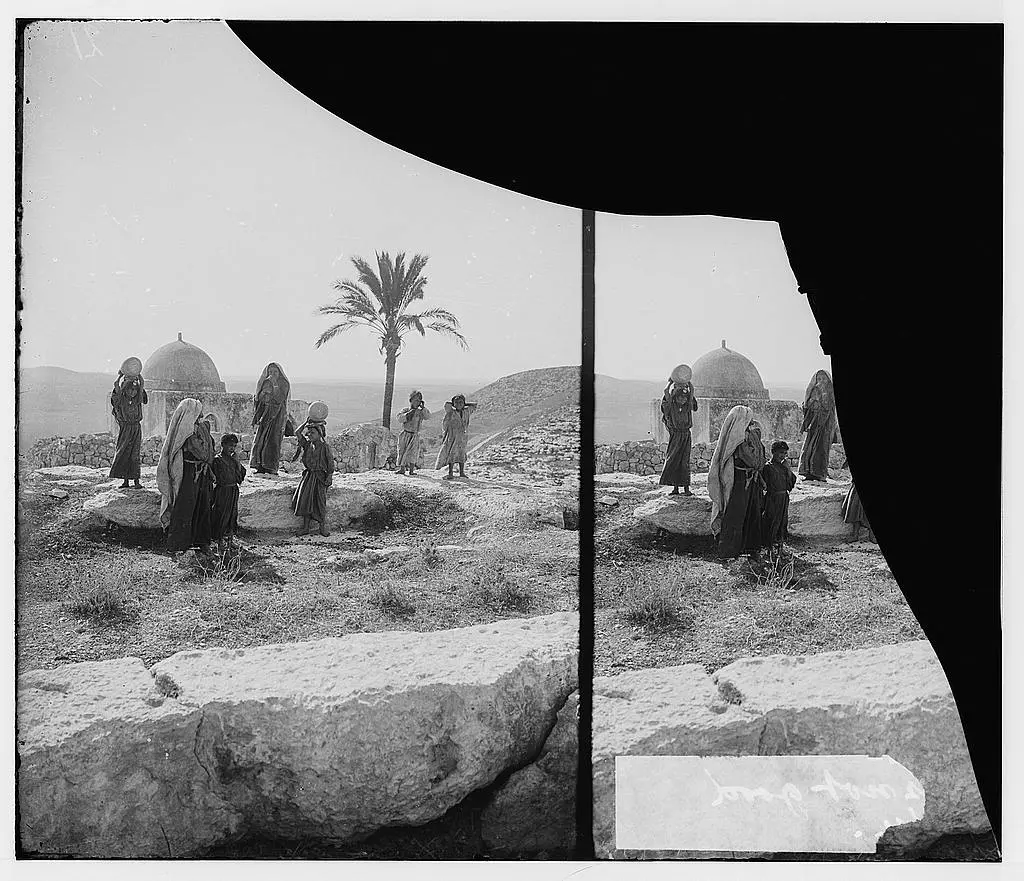
- A scene in the village before 1920, Matson Collection
16 - Field Vally-sar'a
Posted by Dr. Wael Abulatifeh 3 - Sar'a view from Beth Shemesh
Posted by Dr. Wael Abulatifeh 1 - Field- Tal Sar'a
Posted by Dr. Wael Abulatifeh 2 - مقام النبي الصامت الذي هدم وحول الى قبريهودي باسم شمشون
Posted by farid haj yahya 1 - خضرا يا بلادي
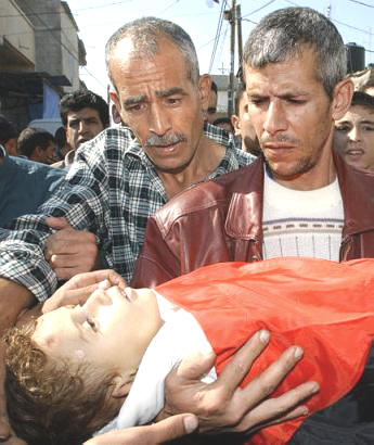
Posted by ابو علي 7 - صورة الشهيد احمد ابو لطيفة
Posted by nabelion 2 - الحاجة صبحة
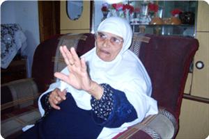
Posted by nabelion 1 - الحاجة صبحة

Posted by nabelion 2 - المناضل الجريح عبد الله ابراهيم لافي ابو لطيفة
Posted by nabelion 1 - مقام النبي صامت في صرعة
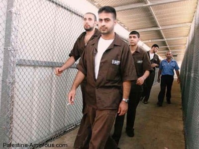
Posted by nabelion - الاسير امجد فايق طه ابو لطيفة / الموجه العام في سجون الاحتلال
Posted by nabelion - صرعة 1
Posted by 00000 abulatifah - صرعة 2
Posted by 00000 abulatifah - صرعة 4
Posted by 00000 abulatifah 1 - صرعة 5
Posted by 00000 abulatifah 1 - صرعة 6
Posted by 00000 abulatifah - قرية صرعة 2014
Posted by 00000 abulatifah - قرية صرعة 2014 / 1
Posted by 00000 abulatifah - قرية صرعة 2014/2
Posted by 00000 abulatifah - قرية صرعة 2014/3
Posted by 00000 abulatifah - قرية صرعة 2014/4
Posted by 00000 abulatifah - قرية صرعة 2014/5
Posted by 00000 abulatifah - قرية صرعة 2014/6
Posted by 00000 abulatifah - قرية صرعة 2014/7
Posted by 00000 abulatifah - قرية صرعة 8/2014
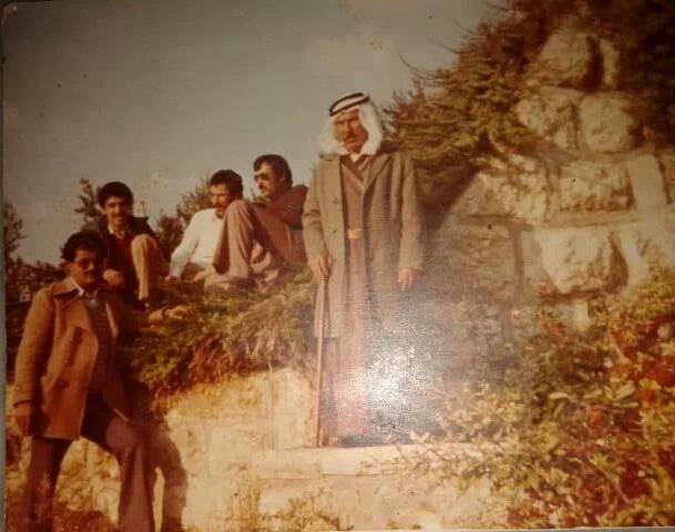
Posted by 00000 abulatifah - الحاج ذياب لافي ابو لطيفة
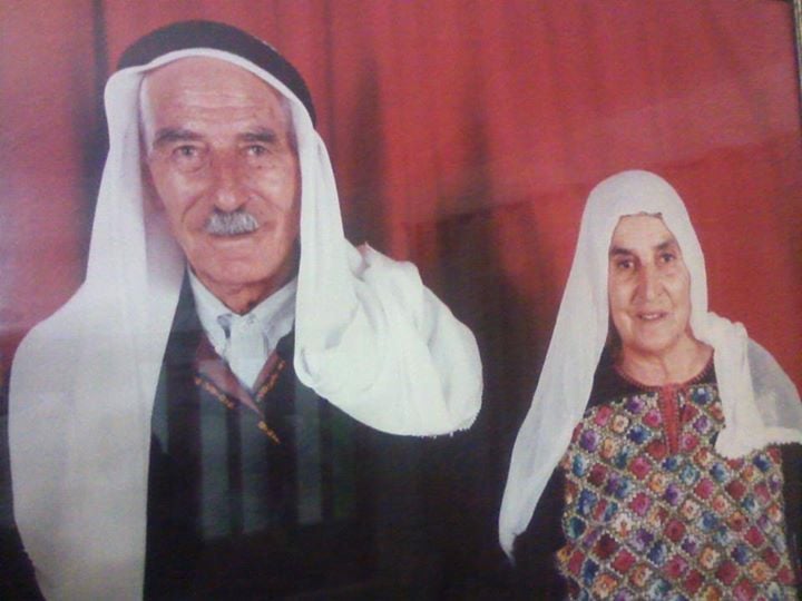
Posted by 00000 abulatifah - علي محمد علي ابو لطيفة وزوجته زهرة الاعرج / ابو جلال وام جلال الصعاوي
Posted by 00000 abulatifah - صرعه
Posted by abu raya - صرعه
Posted by abu raya - صرعه
Posted by abu raya - صرعه
Posted by abu raya - صرعه
Posted by abu raya - صرعه
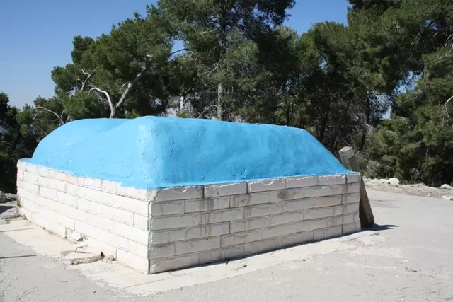
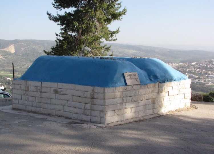
Posted by abu raya - مكان المقام الاسلامي في صرعه تم تحويله الى قبر يهودي
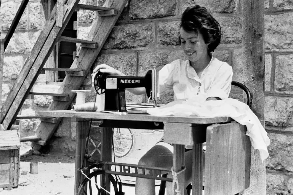
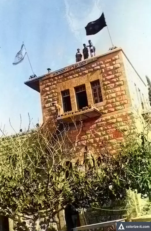
Posted by abu raya - إمرأة صهيونية تعمل بالخياطة أمام بيت مختار قرية صرعة المحتلة، يبدو أنها سكنت البيت بعد احتلال القرية
- صور اخذت بعد احتلال القرية
- صور اخذت بعد احتلال القرية #2
- صور اخذت بعد احتلال القرية #3
- قرية صرعة عام 1949 بعد احتلالها وتهجير اهلها وتسويتها بالارض
- قرية صرعة عام 1949 بعد احتلالها وتهجير اهلها وتسويتها بالارض #2
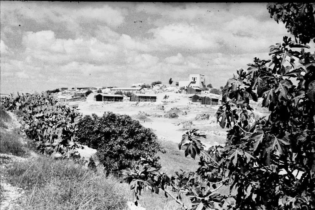
- قرية صرعة عام 1949 بعد احتلالها وتهجير اهلها وتسويتها بالارض #3
- قرية صرعة عام 1949 بعد احتلالها وتهجير اهلها وتسويتها بالارض #4
- قرية صرعة عام 1949 بعد احتلالها وتهجير اهلها وتسويتها بالارض #5
- قرية صرعة عام 1949 بعد احتلالها وتهجير اهلها وتسويتها بالارض #6
- قرية صرعة عام 1949 بعد احتلالها وتهجير اهلها وتسويتها بالارض #7
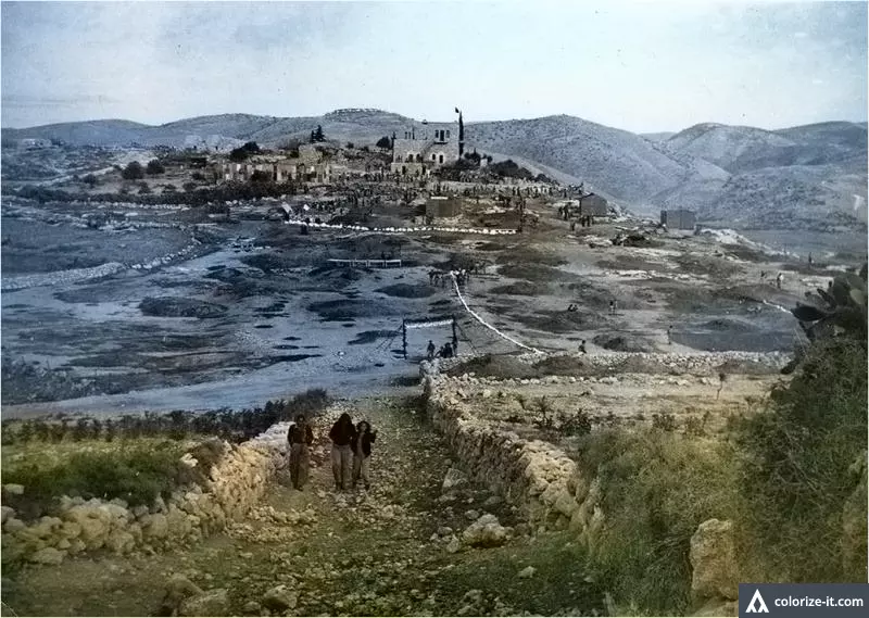
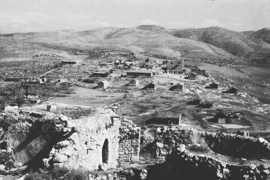
- صورة من الجو لقرية صرعة قضاء القدس عام 1948..
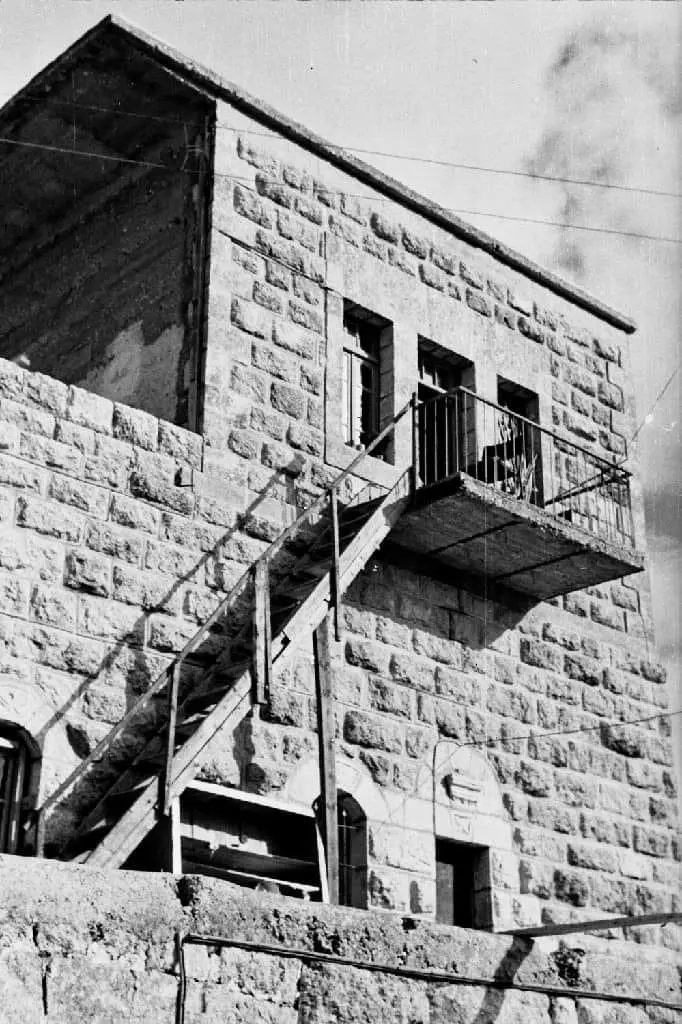
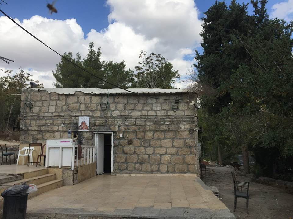
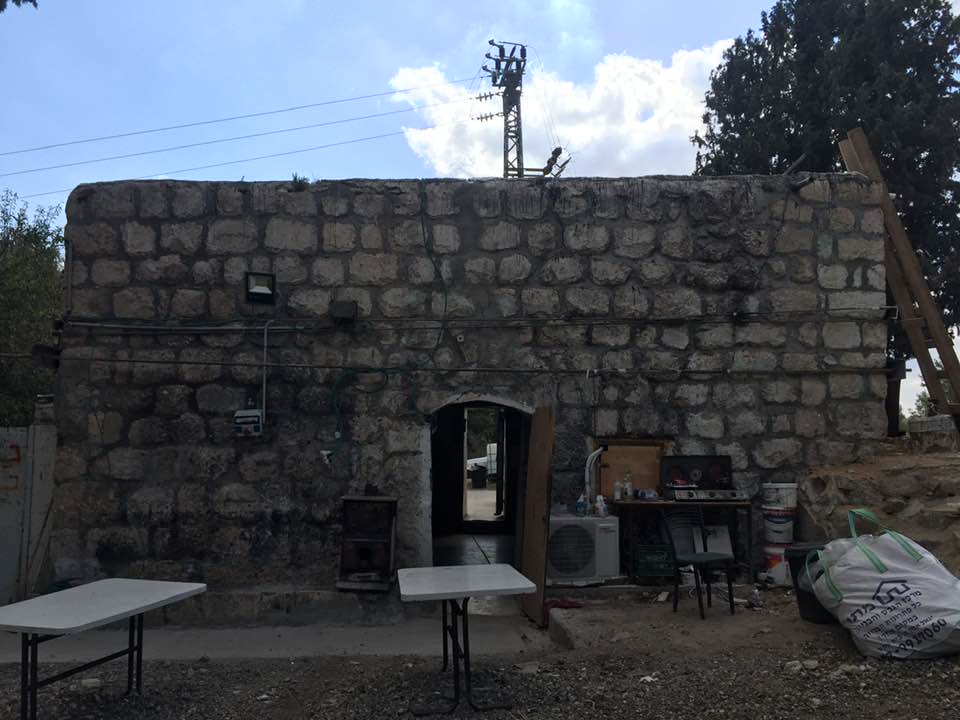
- بيت المختار عبد اللطيف عبدالله محمود ابو لطيفة في قرية صرعة المهجرة -- August 13th, 2022 -- Iyad Jaber
- بيت المختار عبد اللطيف عبدالله محمود ابو لطيفة في قرية صرعة المهجرة -- August 13th, 2022 -- Iyad Jaber #2
- بيت المختار عبد اللطيف عبدالله محمود ابو لطيفة في قرية صرعة المهجرة -- August 13th, 2022 -- Iyad Jaber #3
- بيت المختار عبد اللطيف عبدالله محمود ابو لطيفة في قرية صرعة المهجرة -- August 13th, 2022 -- Iyad Jaber #4
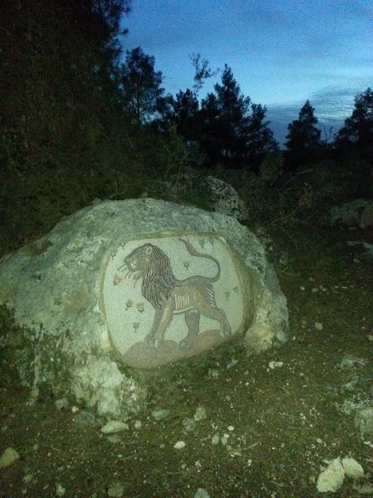
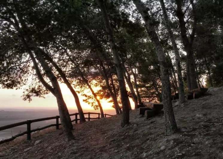
- That is how the "civilized" erased and replaced us: Sar'a was completely obliterated except for the village shrine, which was usurped, as you see
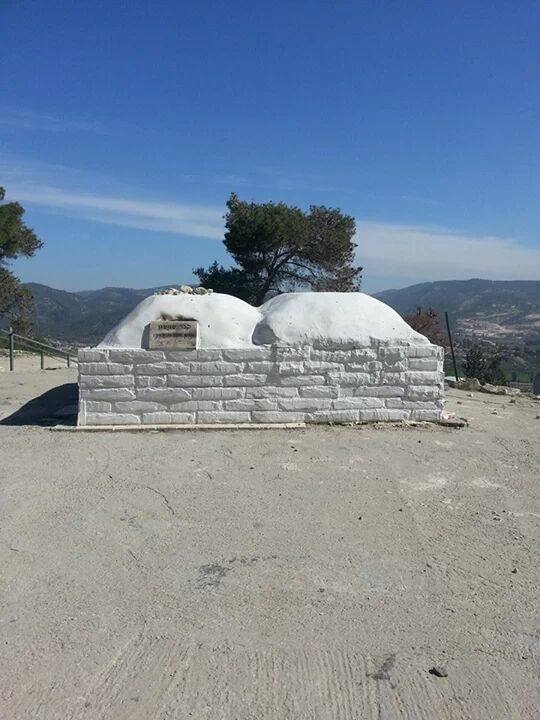
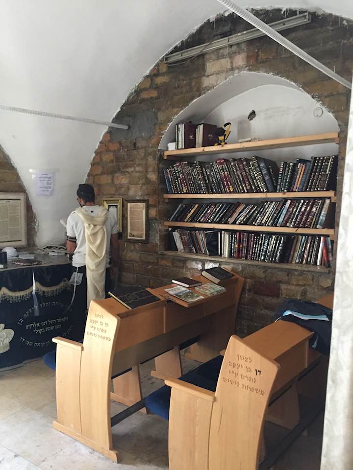
- قبر الشيخ الصامت في قرية صرعة المهجرة قضاء القدس تم تحويله الى קבר שמשון הגיבור.
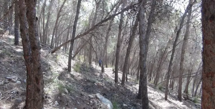
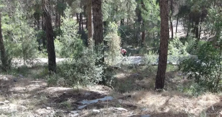
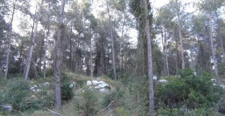
- Let us see how the most "liberal and civilized" of world Jewry has obliterated our village except for a few structures. How else will the Jews be great and safe again? -- القرية دمرت بالكامل.. من هنا مر الهمج
- Let us see how the most "liberal and civilized" of world Jewry has obliterated our village except for a few structures. How else will the Jews be great and safe again? -- القرية دمرت بالكامل.. من هنا مر الهمج #2
- Let us see how the most "liberal and civilized" of world Jewry has obliterated our village except for a few structures. How else will the Jews be great and safe again? -- القرية دمرت بالكامل.. من هنا مر الهمج #3
- Let us see how the most "liberal and civilized" of world Jewry has obliterated our village except for a few structures. How else will the Jews be great and safe again? -- القرية دمرت بالكامل.. من هنا مر الهمج #4
- Let us see how the most "liberal and civilized" of world Jewry has obliterated our village except for a few structures. How else will the Jews be great and safe again? -- القرية دمرت بالكامل.. من هنا مر الهمج #5
- Let us see how the most "liberal and civilized" of world Jewry has obliterated our village except for a few structures. How else will the Jews be great and safe again? -- القرية دمرت بالكامل.. من هنا مر الهمج #6
- Let us see how the most "liberal and civilized" of world Jewry has obliterated our village except for a few structures. How else will the Jews be great and safe again? -- القرية دمرت بالكامل.. من هنا مر الهمج #7
- Let us see how the most "liberal and civilized" of world Jewry has obliterated our village except for a few structures. How else will the Jews be great and safe again? -- القرية دمرت بالكامل.. من هنا مر الهمج #8
- Let us see how the most "liberal and civilized" of world Jewry has obliterated our village except for a few structures. How else will the Jews be great and safe again? -- القرية دمرت بالكامل.. من هنا مر الهمج #9
- Let us see how the most "liberal and civilized" of world Jewry has obliterated our village except for a few structures. How else will the Jews be great and safe again? -- القرية دمرت بالكامل.. من هنا مر الهمج #10
- Let us see how the most "liberal and civilized" of world Jewry has obliterated our village except for a few structures. How else will the Jews be great and safe again? -- القرية دمرت بالكامل.. من هنا مر الهمج #11
- Let us see how the most "liberal and civilized" of world Jewry has obliterated our village except for a few structures. How else will the Jews be great and safe again? -- القرية دمرت بالكامل.. من هنا مر الهمج #12
- Let us see how the most "liberal and civilized" of world Jewry has obliterated our village except for a few structures. How else will the Jews be great and safe again? -- القرية دمرت بالكامل.. من هنا مر الهمج #13
- Let us see how the most "liberal and civilized" of world Jewry has obliterated our village except for a few structures. How else will the Jews be great and safe again? -- القرية دمرت بالكامل.. من هنا مر الهمج #14
- Let us see how the most "liberal and civilized" of world Jewry has obliterated our village except for a few structures. How else will the Jews be great and safe again? -- القرية دمرت بالكامل.. من هنا مر الهمج #15
- Let us see how the most "liberal and civilized" of world Jewry has obliterated our village except for a few structures. How else will the Jews be great and safe again? -- القرية دمرت بالكامل.. من هنا مر الهمج #16
Want to browse more? 80,000 pictures were grouped in these gallaries:
| Display Name | Clan/Hamolah | Country of Residence |
| د.محمود محمد عزت محمود حماد | حماد أبو لطيفة | عمّان |
| علاء صلاح | صلاح | ANKARA, 00905545953876 |
| بلال صلاح | سجدية | عمان |
| Ahmad Hammad | ابو لطيفة | - |
| ابو عدي | - | مخيم الدهيشة |
| محمد زهران ابو عدي | - | مخيم الدهيشة |
| محمدين | - | بيت لحم مخيم الدهيشة |
| شرف | - | عمان, الاردن |
| يوسف ابولطيفة | عبدالله محمود | عمان |
| صرعاوية | الصرعاوي | - |
| احمد ابو لطيفة | ابو لطيفة | palestine, sar3a |
| ياسر زهران | - | - |
| omar abulatife | ابو لطيفه | - |
| اشرف | دار زهران | القدس, رام الله |
| ابو محمد | ..زهران | nablus |
| العائد | ابو لطيفة | - |
| احمد صالح | - | جنين |
| aziz | Salah | il, U.S.A |
| AshrafHamad | abo lateefa | - |
| nader | Abu Latifeh | Palestine, Palestine |
| abu ahmad | modallal | Abu Dhabi, UAE |
- زيارة لقرية صرعة المدمرة - القدس.. تصوير قيس فحماوي Duration: 13 min sec
- Return to Sar'a
- العودة الى قرية صرعه | השיבה לסַֿרְעה | The Return to Sar'a Duration: 8 min 44 sec
- جـولة في القـريـة الفلسطينيـّة المهجّرة صَـرْعـة (الجولة الكاملة) Duration: 62 min 8 sec
- صَرعَة بلدة الجبّارين. جولة ميدانية للتعارف على موقع مقام الشيخ صامت ومغارة البد واطلاعة مفصلة على المناطق المحيطة بالبلدة وذكر مقتطفات من تاريخها الطويل Duration: 4 min 24 sec
- صرعة المهجرة قضاء القدس Duration: min 8 sec
- ضريخ الشيخ الغريب في قرية صرعة المهجرة قضاء القدس ، تم تحويله الى قبر دان بن بعقوب ( קבר דן בן יעקב) Duration: 23 sec
- قبر الشيخ الصامت في اراضي قرية صرعة المهجرة قضاء القدس تم تحويله الى قبر קבר שמשון הגיבור Duration: 17 sec
- قبر الشيخ الصامت في اراضي قرية صرعة المهجرة قضاء القدس تم تحويله الى قبر קבר שמשון הגיבור Duration: 17 sec
- قبر الشيخ الغريب في قرية صرعة المهجرة قضاء القدس تم تحويله الى قبر يهودي يدعى دان بن يعقوب Duration: 51 sec
 Fake Valor: Why Did Zionist Jews Hoist Nazis Flag on Their Ships in the 1930s?
What is new?
-
Facts About Oct. 7th Gaza Raid
-
Remined Us Please:: Who Did Rape Who? Palestinians Raped Israelis? Or, was the other way around?
-
When Prof. Edward Said was invited to debate Bibi Netanyahu in the 1980s, watch what happened!
-
Ezra Klein of the NY Times on the "Jewish Race".
-
Abusing Blood Libel!
-
Did Israeli Soldiers Activate The Hanniba Direective On Oct. 7th? You Be The Judge
-
Zionist FAQ: Isn't it true that Palestinians don't want peace? Palestinians never accepted the two-state solution
- Facts about Haavara (Transfer) Agreement between Ben-Gurion & Hitler
-
Haavara FAQs: Why Did Zionist Jews Hoist Nazis' Flags on Their Ships in the 1930s?
- Haavara FAQs: When Chaim Weizmann met FDR in mid-1943, why was he silent about rescuing European Jewry?
-
Dear ChatGPT: How did Palestinians resist Napoleon's invasion of their country in 1799?
-
Dear ChatGPT: Gaza had a vibrant Jewish community in the mid-17th century. What happened to them?
-
Dear ChatGPT: Why did the Jewish Agency suppress news of the Holocaust during WWII?
-
Video Playlist: Jews share their DNA tests to end the conflict for good.
-
A Tale of Two Conflicts: Examining the Definition of Genocide
-
Prof. Abraham Polak And The Suppressed History of the Khazars and European Jewry
-
How Ronald Reagan would have framed the genocide in Gaza if he were still alive?
-
Haavara FAQs: Let us do the math: how many German Jews did The Haavara Agreement save?
-
Zionist FAQs: The Hebron Massacre of 1929, "clearly proves" that Palestinians are antisemitic, how could you deny it?
-
Zionist FAQs: Why Anti-Zionist Is Not Antisemitism?
-
Zionist FAQs: Isn't it true that the KGB created Palestinian Nationalism in the early 1960s?
- Zionist FAQs: Muslims are killing Muslims all the time; why are Israeli Jews being singled out in the media?
- Zionist FAQs: How is Israel an apartheid state when 20% of its citizens are Arabs who enjoy full rights?
-
Haavara FAQs: Why Did Dorothy Thompson Flip From A Zionist Advocate to A Silenced Dissenter?
-
Haavara FAQs: Analysis of Herzl's Uganda Scheme and how it could have saved millions of Jews.
-
Haavara FAQs: Why did Hayim Greenberg describe American Jewry as "morally bankrupt" in early 1943?
-
Haavara FAQs: What if the Evian Conference was a resounding success? What would have been the impact of saving European Jewry on Zionism?
- Haavara FAQs: What if the six million were saved, how that would have impacted the Zionist project?
-
Haavara FAQs: How did Zionist leaders react when Europe's Jews lingered in the DP camps after WWII ended?
-
Why does the American Jewish community repeat lies that David Ben-Gurion had debunked before he died?
-
Who has the power to rename the Tatar/Khazar Gene Marker to Jewish IV?
-
Zionist FAQs: Why won't Egypt, Syria, and Jordan take their people back? Jews are indigenous to Palestine, and Arabs immigrated after Jews developed the country. Arabs should leave.
-
Haavara FAQs: Did Hitler and the Nazis conflate between Judaism and Zionist? If that wasn't case, then why?
-
Haavara FAQs: Winston Churchill and antisemitism, a collection of articles written Churchill.
-
Haavara FAQs: Broken by country, how many Jews survived vs. killed during the Holocaust?
-
Haavara FAQs: Why did European Jews vote with their feet and to immigrated to the Americas, not Palestine, after WWII?
-
Watch this American Jewish Girl describing Israeli Jews' cognitive dissonance like no other in under two minutes
-
Haavara FAQs: When the Nazis went out of their way to hide the Holocaust, Israeli Jews did the exact opposite by broadcasting their genocide of Gazans. But why?
-
Haavara FAQs: How Zionist Jews went out of their to show their appreciation to Nazism and Fascism?
- Haavara FAQs: Why Zionist leaders were against bombing the death camps & the Railroads leading to them?
-
Haavara FAQs: Hitler's message to the British and American people: If Jews are such noble citizens and you care about them, how come you're not letting them in? I will gladly ship them to you at my expense, even on luxury liners!
-
A shortlist of Zionist and Israeli false flag operations in the name Jews.
-
The Most Moral Army
- The Land of Kapos (Israel): Where the brave are boycotted and Kapos walk free.
- Why did early Zionists often named their communal enterprises "colonial"?
- Zionist Relations with Nazi Germany by Faris Glubb
-
Two NY Times advertisements by Zionists in the early 1943 that exposes Zionists' treason at the height of the calamity
- Facts Not Lies about the Palestinian-Israeli Conflict.
- Site's pictures have been categorized
- Campgain Against Lice
- A Survey of Palestine, the official source about Palestine before Nakba produced by the British Mandate; over 1200 pages.
- Satellite View & Google Earth: Over 6,000 placemarks identifying all destroyed towns, W. Bank & Gaza Strip Towns, & refugee camps.
- PalestineRemembered.com and its Nakba Oral History Project were featured on al-Jazeera Satellite TV.
- Nakba Oral History Video Podcast:
 Over 700 Oral History interviews (including 3,500+ hours of recording) can be viewed online.
 - Palestine Village Statistics Project
- Gaza Jail Break
- النسخة العربية للموقع الان متوفرة
- Videos: Documenting the destroyed villages in video: Tracing all that remains since Nakba.
- Videos: Responding to Zionist Propaganda
- Interview: The ethnic cleansing of Palestine: George Galloway interviews Israeli Historian Ilan Pappe.
- For Palestinians, memory matters. It provides a blueprint for their future By George Bisharat.
- Zionist FAQ now available in Hebrew שאלות שציונים שואלים, עכשיו בעברית
- Video: The Stephen Walt and John Mearsheimer report on the influence of the Israel Lobby on U.S. Foreign Policy
- The Palestinian-Israeli conflict for beginners
