| PalestineRemembered | About Us | Oral History | العربية | |
| Pictures | Zionist FAQs | Haavara | Maps | |
| Search |
| Camps |
| Districts |
| Acre |
| Baysan |
| Beersheba |
| Bethlehem |
| Gaza |
| Haifa |
| Hebron |
| Jaffa |
| Jericho |
| Jerusalem |
| Jinin |
| Nablus |
| Nazareth |
| Ramallah |
| al-Ramla |
| Safad |
| Tiberias |
| Tulkarm |
| Donate |
| Contact |
| Profile |
| Videos |
Welcome To Zir'in - زرعين (זירעין)
|
District of Jinin
Ethnically cleansed days ago |
العربية Google Earth |
 |
Gallery (84) |
- Statistics & Facts
-
Before & After

- Satellite View
- Articles 6
- Pictures 84
- Aerial Views 1
- Oral History 2
- Members 20
- Families
- All That Remains
- Wikipedia
- Videos 4
- Guest Book 53
- Links
| Statistic & Fact | Value | |||||||||||||||
| Occupation Date | May 28, 1948 | |||||||||||||||
| Distance From District | 11 (km) North of Jinin | |||||||||||||||
| Elevation | 100 (meters) | |||||||||||||||
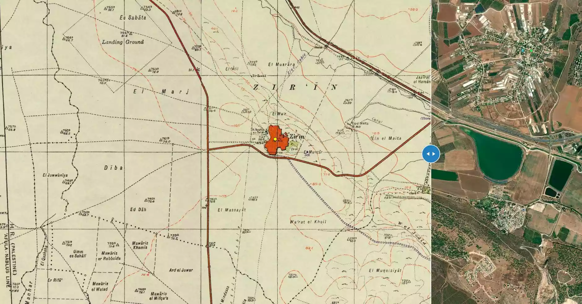
| Before & After Nakba, Click Map For Details |
||||||||||||||||
|
||||||||||||||||
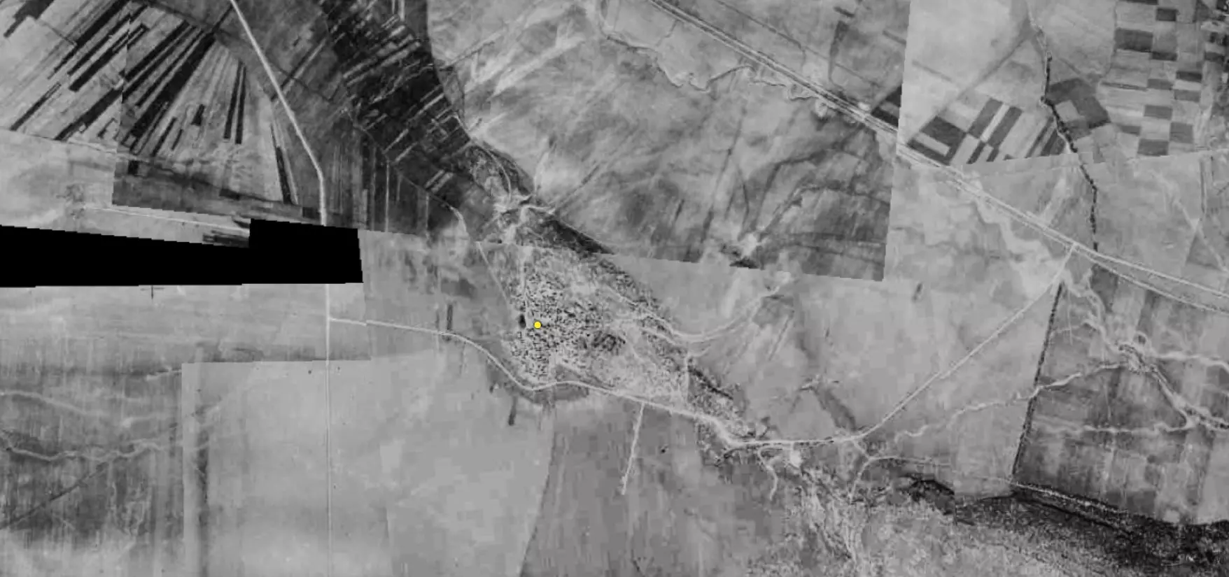
| Pre-Nakba Aerial View |
||||||||||||||||
|
||||||||||||||||
| Map Location | See location #3 on the map View from satellite |
|||||||||||||||
| Military Operation | Operation Gideon | |||||||||||||||
| Attacking Units | Fourth Battalion of the Golani Brigade | |||||||||||||||
| Defenders | Iraqi army units and some Palestinian and some ALA volunteers. | |||||||||||||||
| Exodus Cause | Military assault by Zionist troops | |||||||||||||||
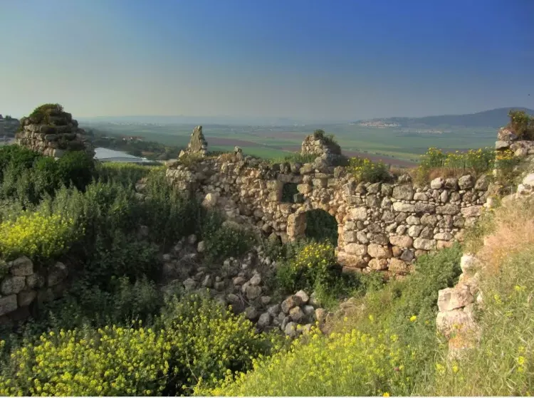
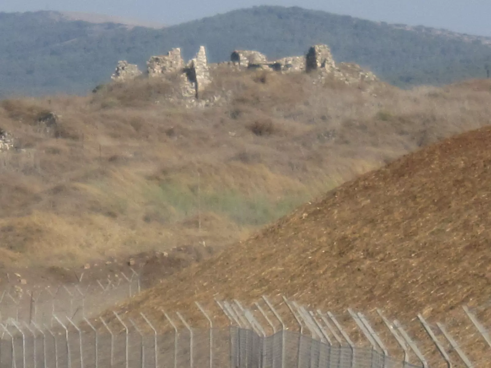
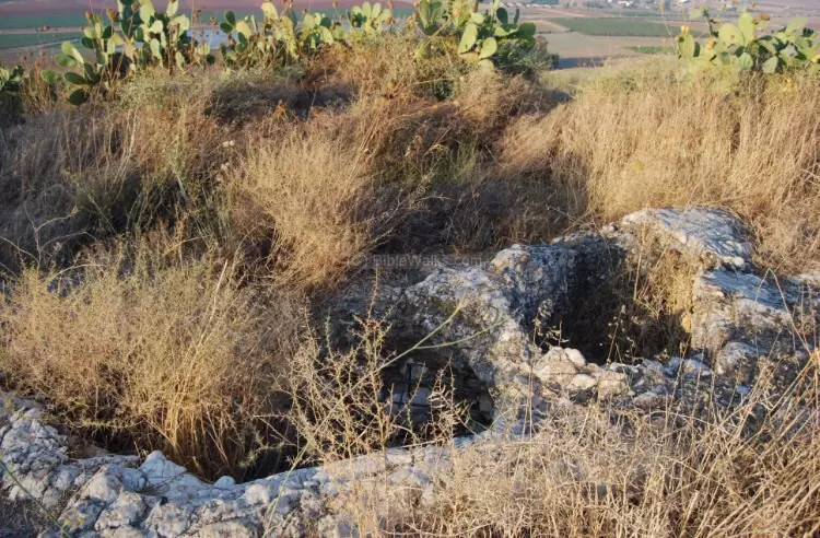
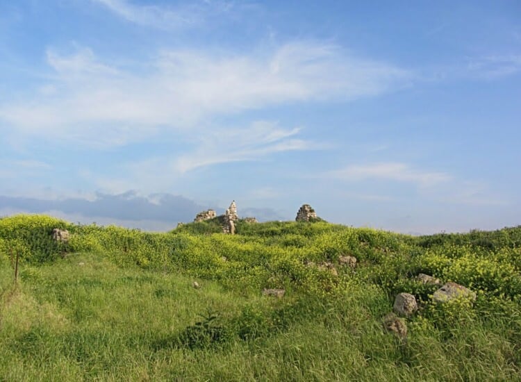
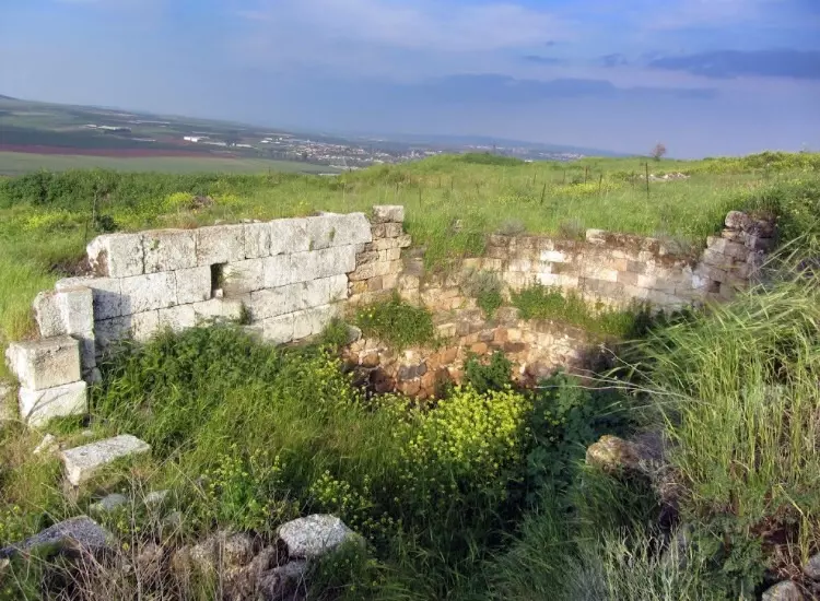
| Village Temains | Zir'in was mostly destroyed with the exception of one deserted village house. | |||||||||||||||
| Ethnically Cleansing | Zir'in inhabitants were completely ethnically cleansed. | |||||||||||||||
| Pre-Nakba Land Ownership |
**Town Lands' Demarcation Maps |
|||||||||||||||
| Land Usage As of 1945 |
|
|||||||||||||||
| Population |
|
|||||||||||||||
| Number of Houses | In the 19th century: 20-30 houses, and in (1931): 239 houses. | |||||||||||||||
| Near By Towns |
||||||||||||||||
|
||||||||||||||||
| Town's Name Through History | The Canaanites referred to the village by Yizre'el, and the Crusader called it Le Petit Gerin. | |||||||||||||||
| Schools | Zir'in had one school for boys which was founded during Ottoman period. | |||||||||||||||
| Town's Notable People | The village was the hometown of Mahmud Salim, one of the leaders of the 1936 intifada. | |||||||||||||||
| Places of Warship | Zir'in had a Mosque which was renovated by al-Zahir Baybars soon after the battle of 'Ayn Jalut. | |||||||||||||||
| Nearby Wadies & Rivers | The village northern and eastern sides slopes toward Wadi al-Jalud. | |||||||||||||||
| Archeological Sites | Next to the village, the Egyptian Mamluks triumphed over the Mongols in the decisive battle of 'Ayn Jalut. | |||||||||||||||
| Exculsive Jewish Colonies Who Usurped Village Lands |
Avital and Yizre'el | |||||||||||||||
| Featured Video | ||||||||||||||||
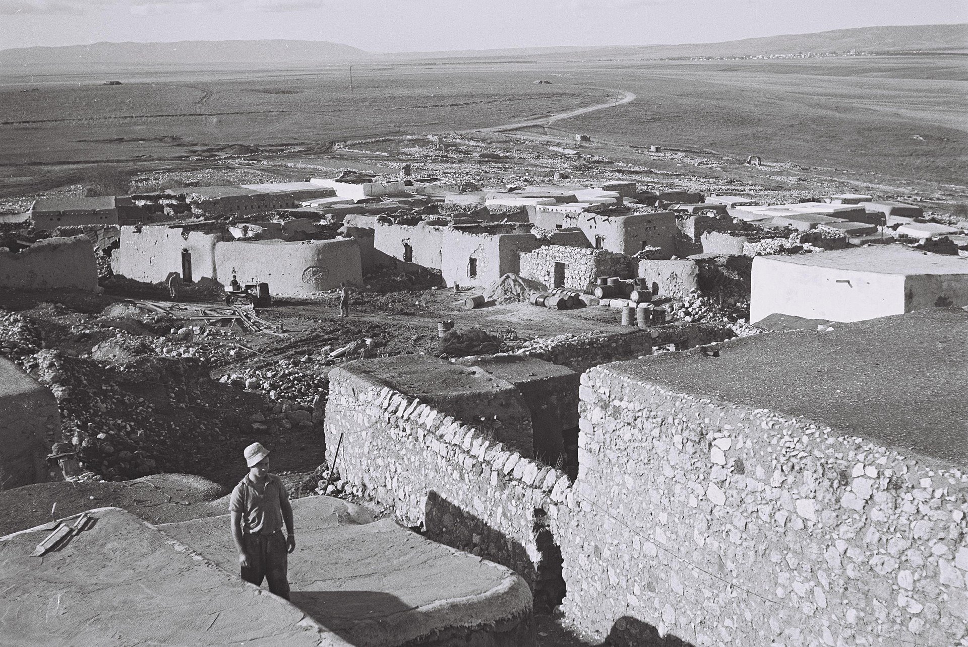
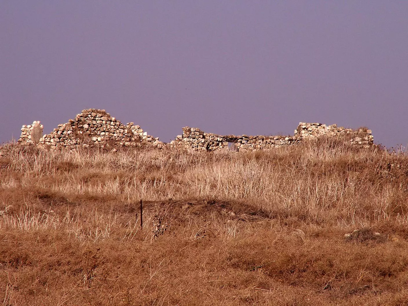
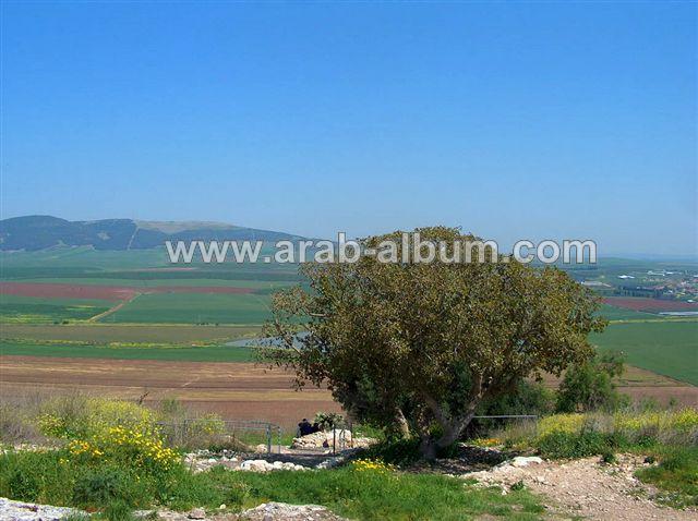
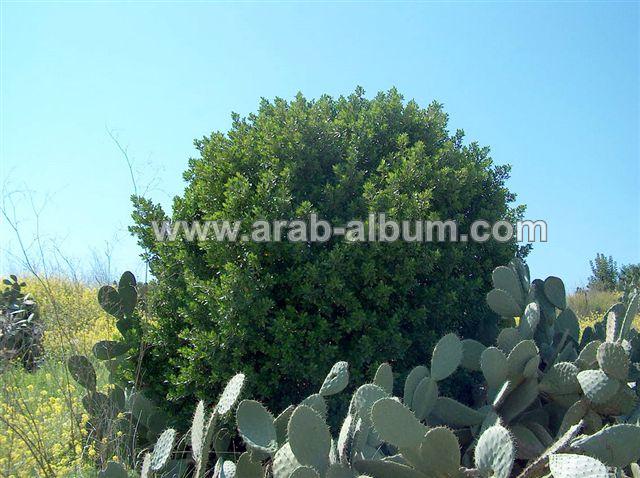
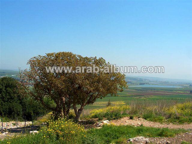
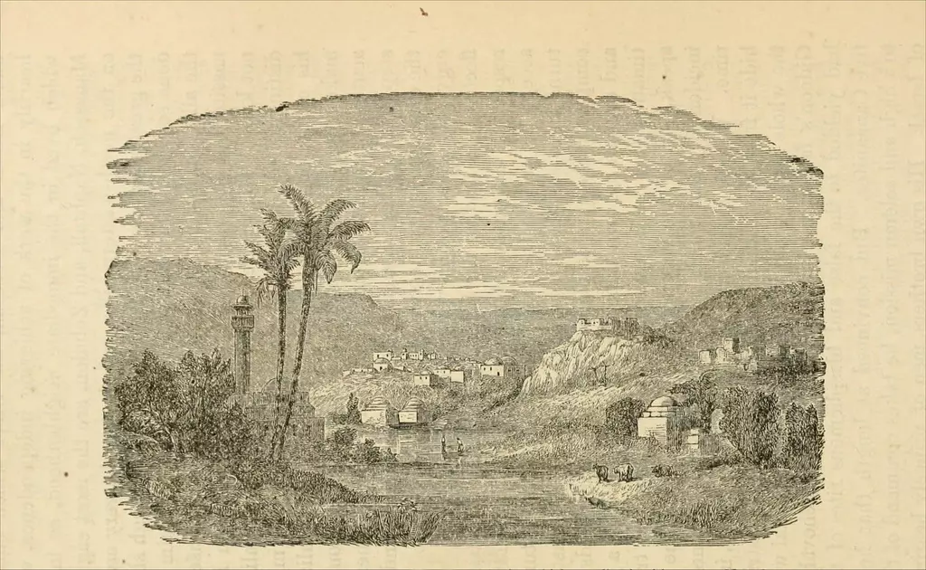
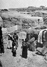
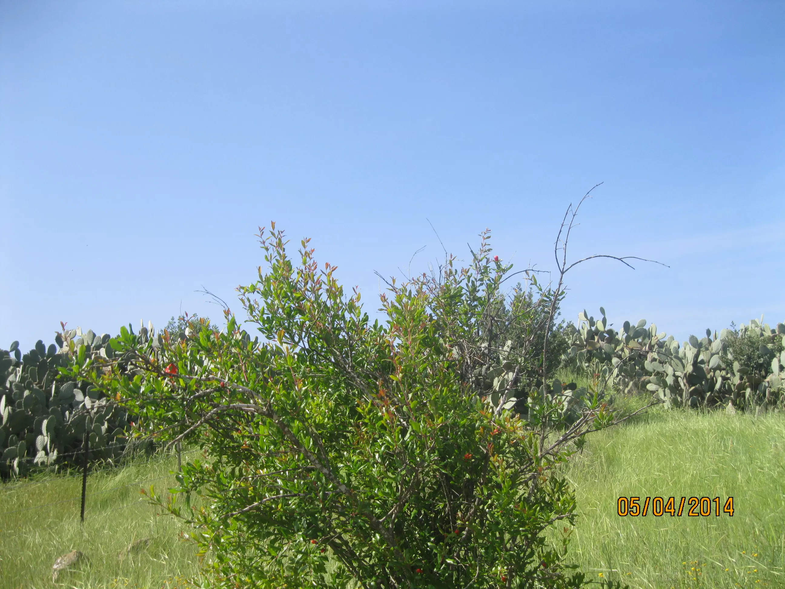
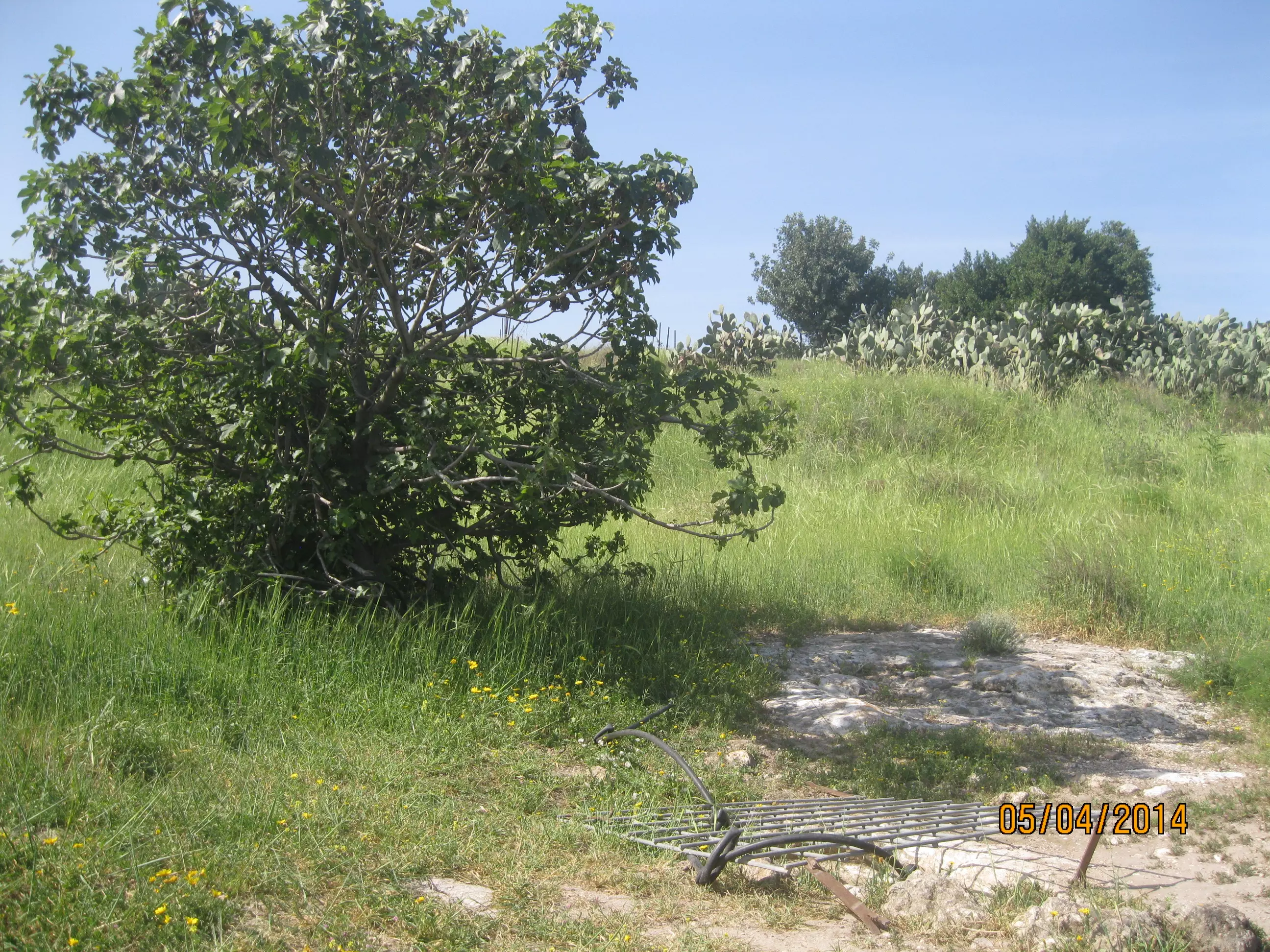
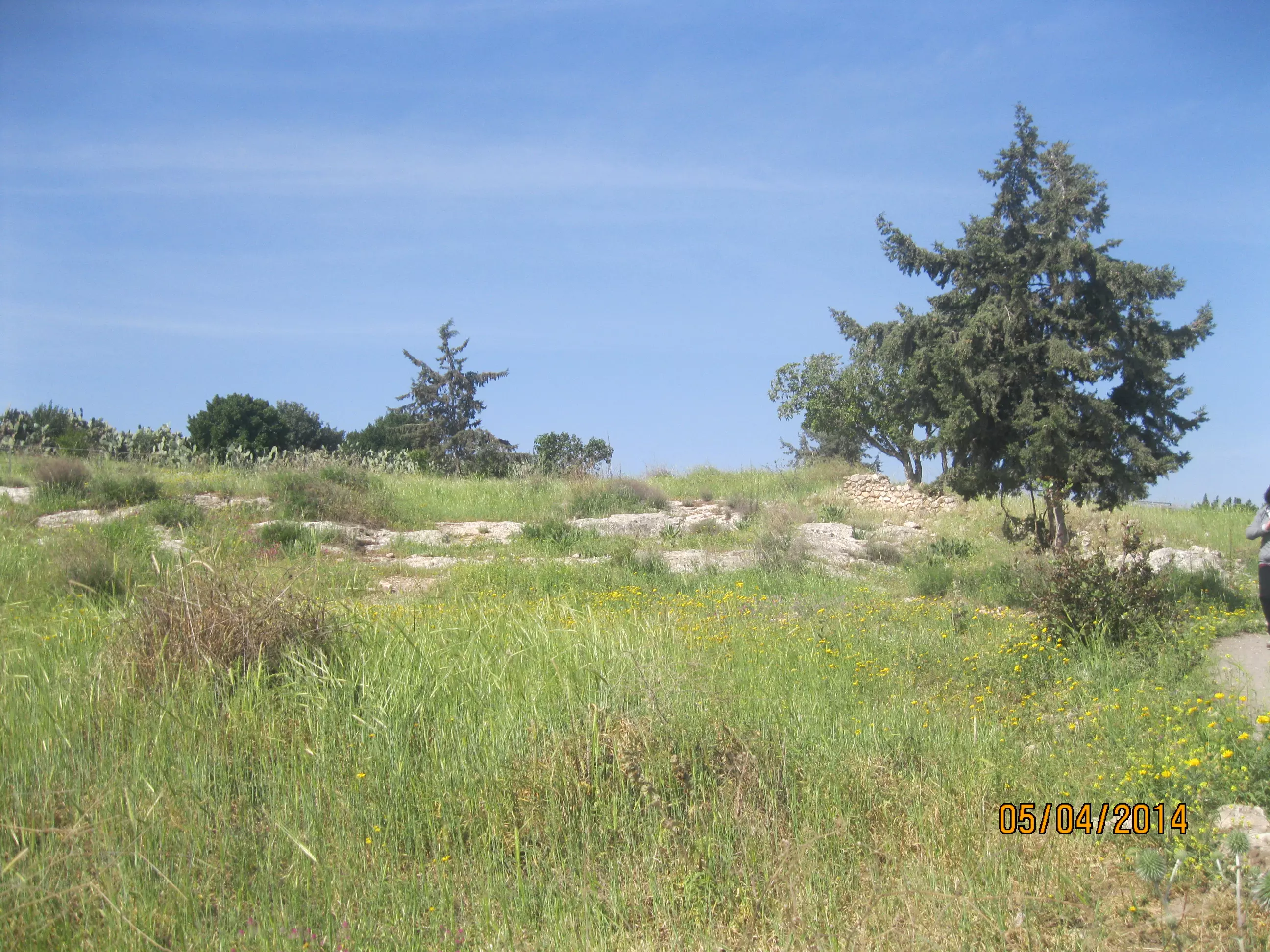
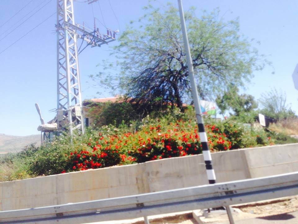
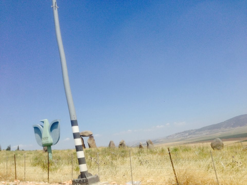
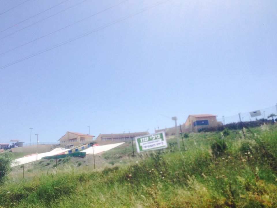
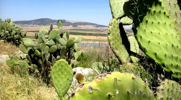
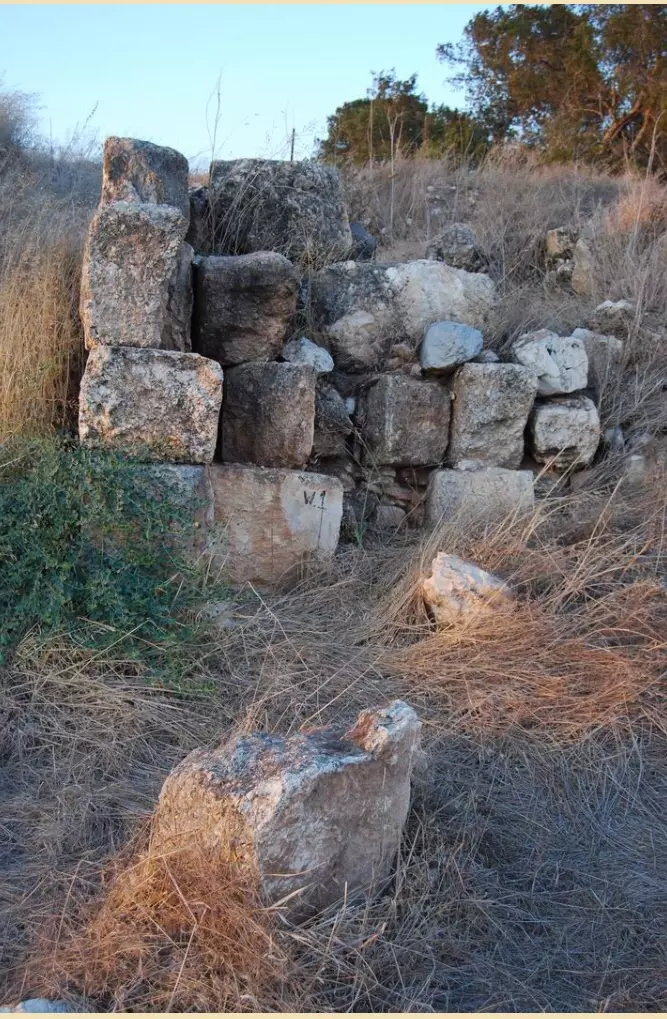
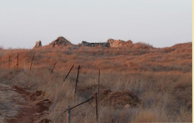
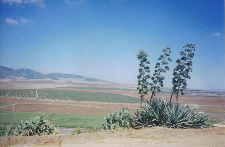
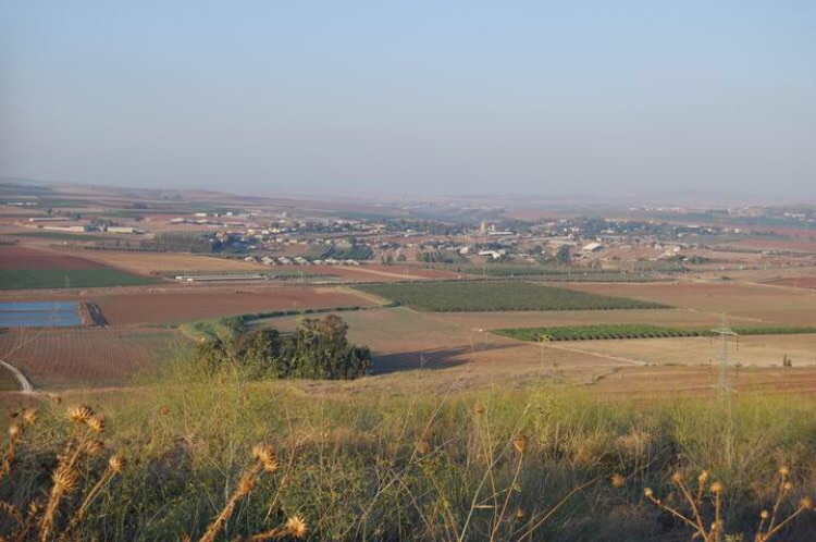
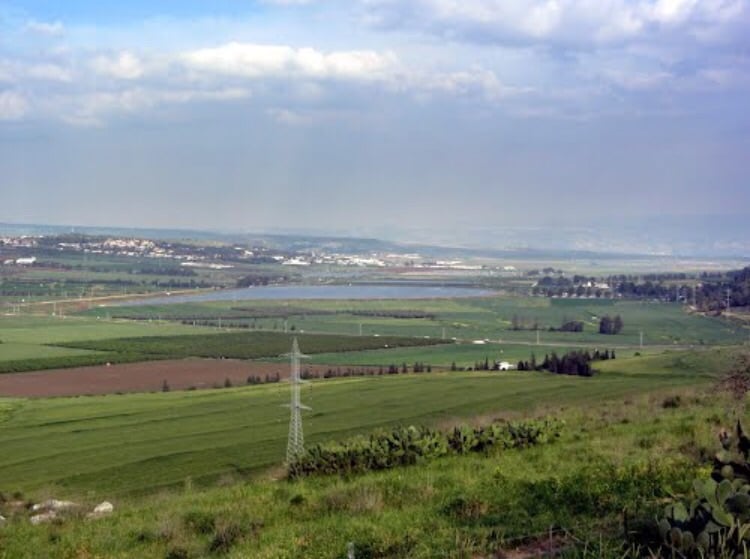
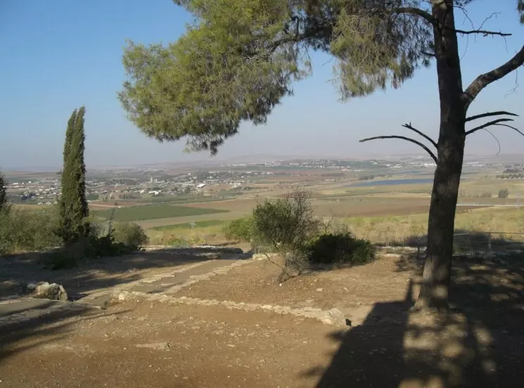
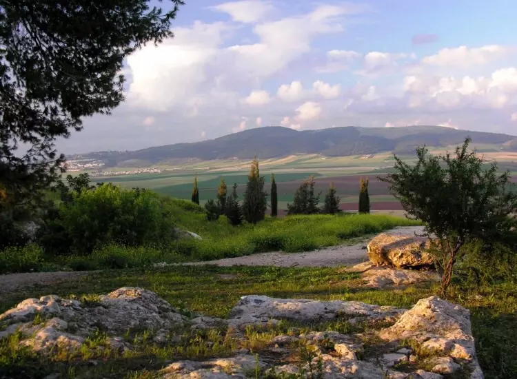
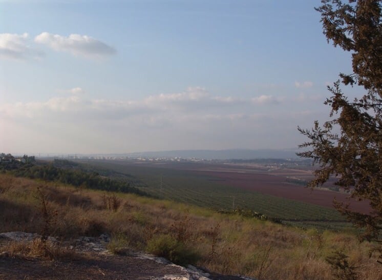
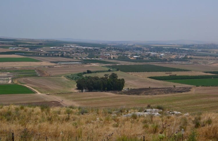
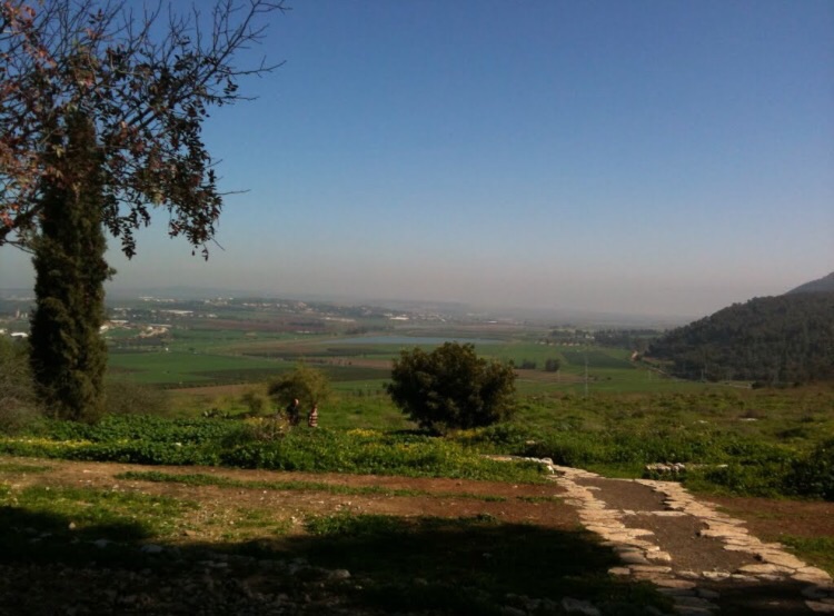
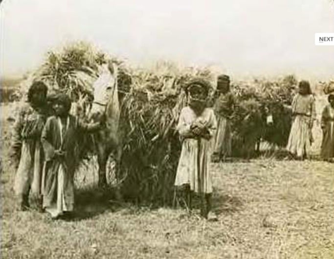
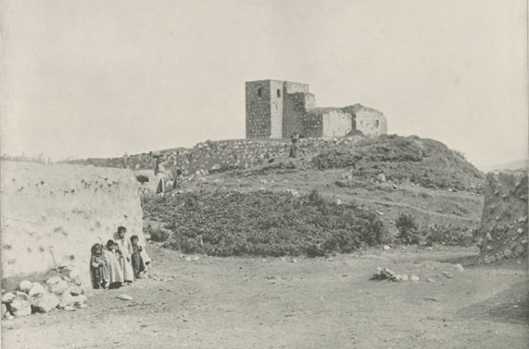
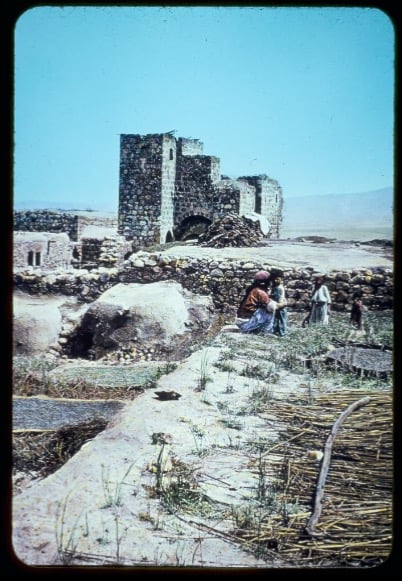
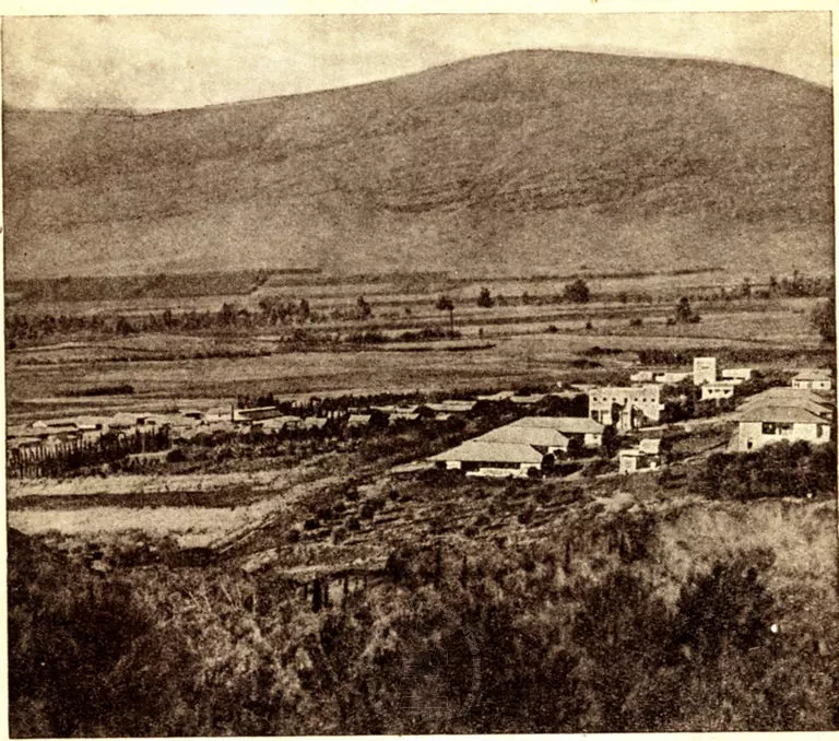
Village Before NakbaThe village stood on a small plateau, a spur projecting from the Faqqu'a Mountains to the south. The plateau was not much higher than the surrounding Marj ibn 'Amir Plain on its western and southern sides. Its northern and eastern sides sloped towards Wadi al-Jalud. Zir'in, the northernmost village in the sub-disctrict, was located on a lateral road link between two highways, one leading to Jenin and another to Baysan (to the southeast). The site has been identified with the Canaanite town of Yizre'el, mentioned in the Bible (Joshua 17:16). The ancient town's name contained the common Semitic root Yizre'-'el, with the meaning, 'to sow'; the later Hebrew name for the town, Yizre'-'el, meant 'May God give seed,' while the Arabic name for the village, Zir'in, had a similar connotation. Crusader sources referred to Zir'in as Le Petit Gerin, to differentiate it from Jenin, which they called Le Grand Gerin. In A.D. 1260 the Muslims, under the leadership of al-Zahir Baybars (who subsequently became a Mamluk sultan) defeated the Mongols in the decisive battle of 'Ayn Jalut; this took place near the spring of 'Ayn Jalut (or Jalud) (186218), which lay midway between Zir'in and the adjacent village of Nuris. In 1596, Zir'in was a village in the nahiya of Jenin (liwa' of Lajjun), with a population of twenty-two. It paid taxes on a number of crops, including wheat and barley, as well as on other types of property, such as goats and beehives.In the late nineteenth century Zir'in consisted of twenty to thirty houses. The most prominent family of the village resided in a tall, almost tower-like, house in the center of the village. A well and a spring supplied the village with water. In more recent times, the village was the hometown of a leader of the 1936 revolt, Mahmud Salim. Most of Zir'in's houses were built of mud, and were crowded closely together, separated by narrow alleys. House building increased during the British Mandate and many existing homes were improved. The people of the village were Muslims. A mosque that had been renovated by al-Zahir Baybars, a small marketplace, and a school founded under the Ottomans were located at the village center. The villagers cultivated grain, vegetables, and fruits, irrigating some of their crops from wells and springs. In 1944/45 a total of 20,964 dunums was allocated to cereals. Archaeological artifacts around the village included the remains of a medieval vaulted building and a chapel, the foundations of buildings, numerous cisterns, and wine presses. Tel Aviv University and the British School of Archaeology in Jerusalem began a five-year program of excavation at the site in 1990. Village Occupation and Ethnic CleaningIn March 1948, the Arab Liberation Army reported that 'the Jews have been trying since the 17th of this month to eliminate these villages [Zir'in and Nuris].' That spate of attacks was apparently suspended for about ten days on 19 March, after heavy Haganah losses. On 19 April, Palmach headquarters issued an order which read, in part: 'With the capture of Zir'in, most of the village's houses must be destroyed while [some houses] should be left intact for accommodation and defense.' Those orders are quoted by Israeli historian Benny Morris, who indicates that the village was occupied in a military attack the following month.According to the History of the War of Independence, Zir'in was occupied on 28 May 1948 by the Fourth Battalion of the Golani Brigade, the same unit that later occupied nearby Nuris. This took place in the wake of the occupation of the Baysan Valley to the northeast and as a prelude to an attack on Jenin. The New York Times confirms this, quoting an official Israeli army statement on 28 May announcing the capture of the village, and adds that it lay 'on one of the boundary lines set up in the United Nations partition scheme.' The attackers met with 'little resistance' in Zir'in, according to the dispatch, which relied on Israeli sources in Haifa. Another Times report stated that Arab forces counterattacked its Israeli occupiers two days later (30 May), apparently without success. There is also evidence of two other abortive attempts to regain control of the village in July. Iraqi forces tried to recapture Zir'in on 10 July, according to the History of the War of Independence, but were unable to break through the Israeli lines of defense. The Times reported a third Iraqi attack that took place on 19 July, the day after the second truce began. The armistice line was eventually drawn to the south of Zir'in. Zionists Colonies on Village LandsIsrael established the settlement of Yizre'el (180218) on the northwestern side of the village site in 1948. Avital (179218) was built on what were traditionally village lands in 1933.Village TodayOnly one (dilapidated) building remains. The site is overgrown with grass, thorns, and cactuses, interspersed with prominent piles of stones (see photo). An Israeli memorial has been erected on the site and is surrounded by trees. One old well remains. Many cactuses and pomegranate and almond trees grow on the village outskirts. The site itself and the hilly lands around it serve as grazing areas; the other, sloping lands are cultivated by Israelis.SourceDr. Walid al-Khalidi, 1992: All That Remains. |
||||||||||||||||
| Related Maps | Town Lands' Demarcation Maps خرائط للقضاء توضح حدود القرى والاودية Town's map on MapQuest View from satellite Help us map this town at WikiMapia |
|||||||||||||||
| Related Links | Wikipedia's Page Facebook Page Google Search Google For Images Google For Videos |
|||||||||||||||
| More Information | في كتاب كي لا ننسى في كتاب بلادنا فلسطين المزيد من موقع هوية |
|||||||||||||||
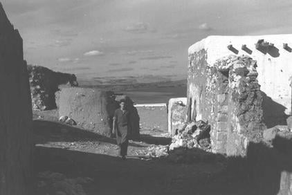
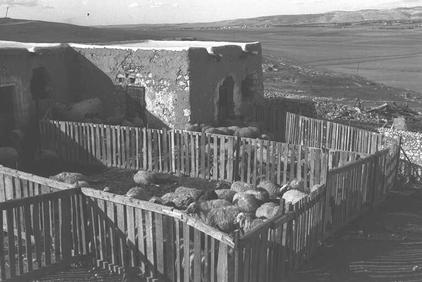
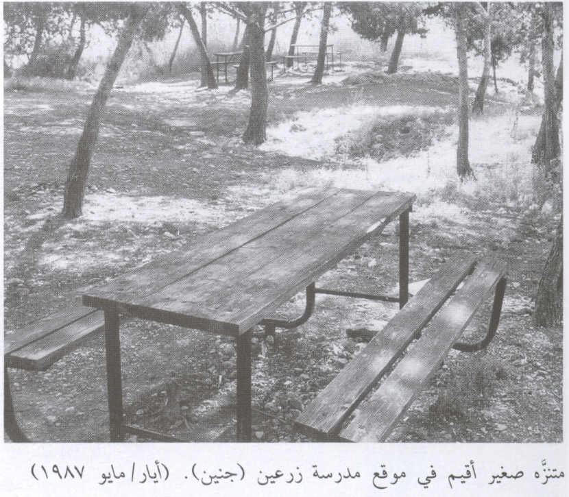
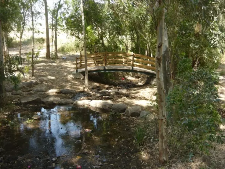
- The village site on a hill with the remains of a single building, 1987
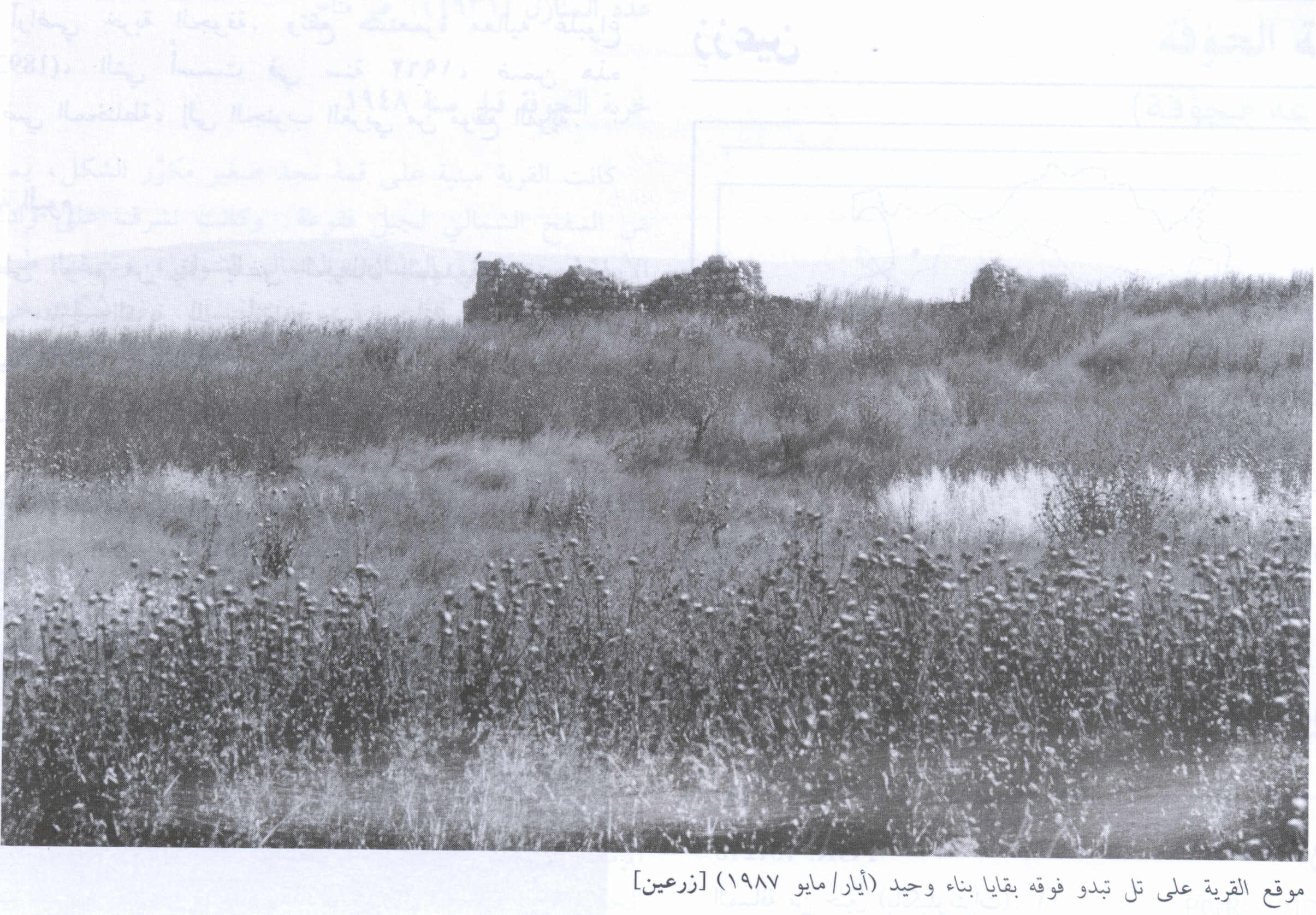
Scanned from "All That Remains" by Dr. Walid Khalidi - زرعين 1949 منظر عام للقرية قبل تدميرها
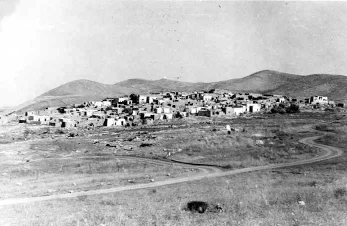
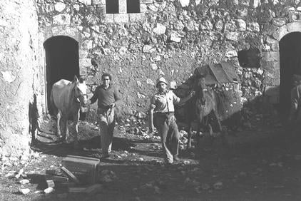
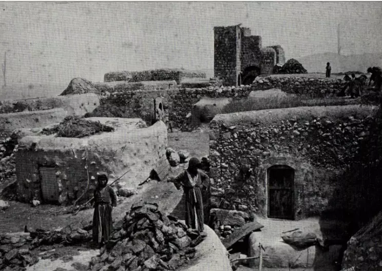
Posted by احمد فحماوي - General view of the village, 1918

Scanned from "All That Remains" by Dr. Walid Khalidi 2 - General View Of Zirin, 1949

Posted by Prince, Peaceful Israeli - General View Of Zirin (#2), 1949
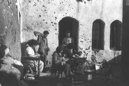
Posted by Prince, Peaceful Israeli - Street Scene In Zirin Soon After Occupation, 1949
Posted by Prince, Peaceful Israeli - A Looted Palestinian House #1, 1949
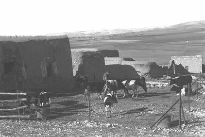
Posted by Prince, Peaceful Israeli - A Looted Palestinian House #2, 1949
Posted by Prince, Peaceful Israeli - A Looted Palestinian House #3, 1949
Posted by Prince, Peaceful Israeli - A Looted Palestinian House #4, 1949
Posted by Prince, Peaceful Israeli - Remains of a house, 2006
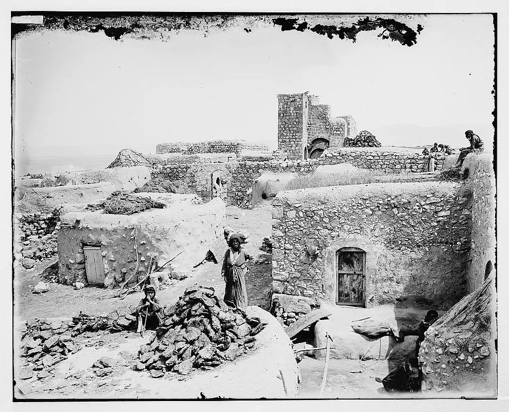
Posted by Uri Zackhem - A scene in the village before 1914, Matson Collection
1 - متنزه إسرائيلي اُقيم على أنقاض مدرسة القرية المدمرة. 1987
Scanned from "All That Remains" by Dr. Walid Khalidi - قرية زرعين 2005 بعدسة محمد كريم
Posted by محمد كريم - نبات الصبار في قرية زرعين 2005 بعدسة محمد كريم
Posted by محمد كريم - شجرة جميز قرية زرعين 2005 بعدسة محمد كريم
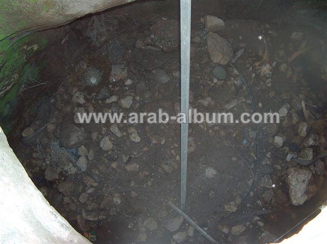
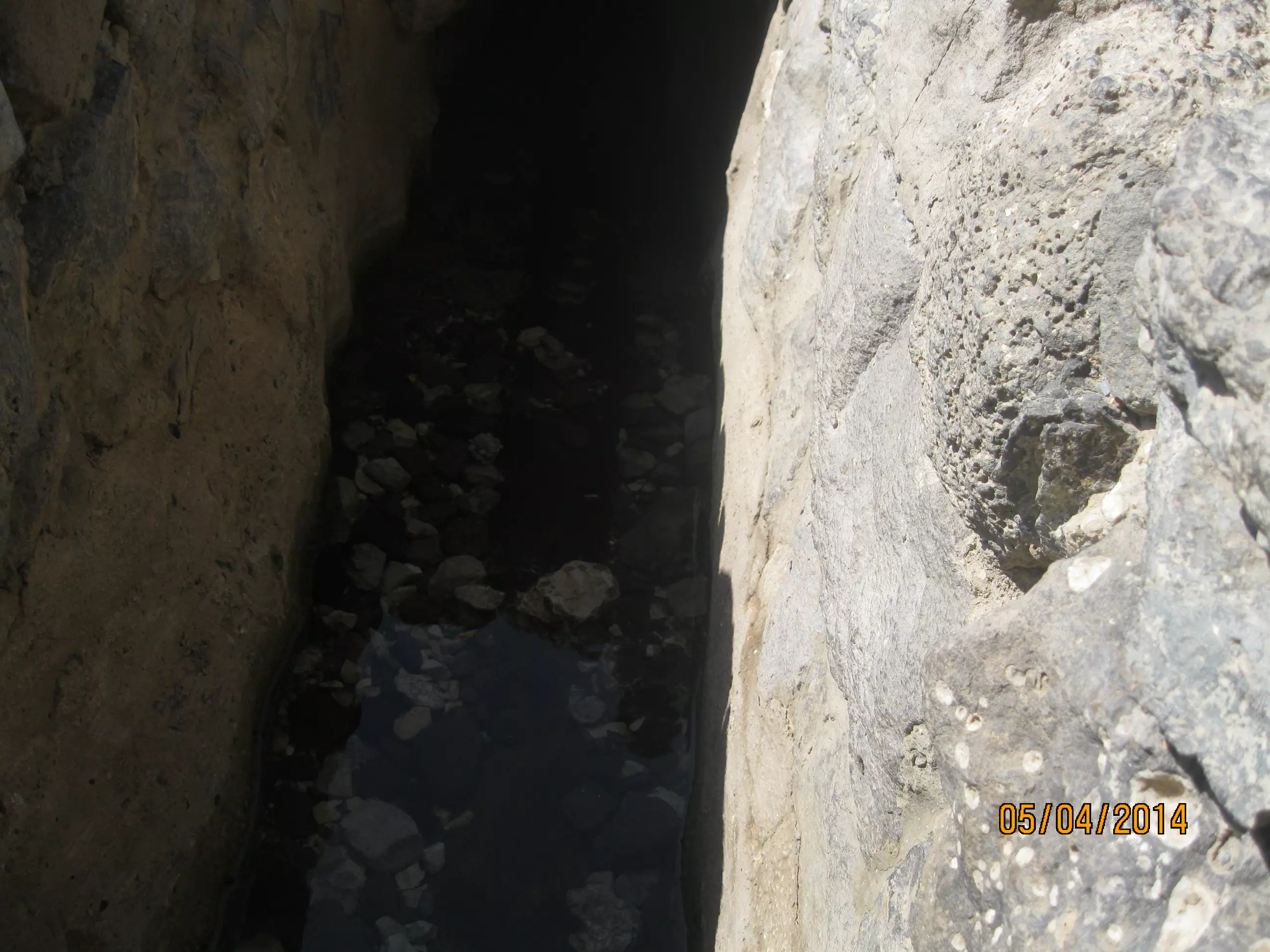
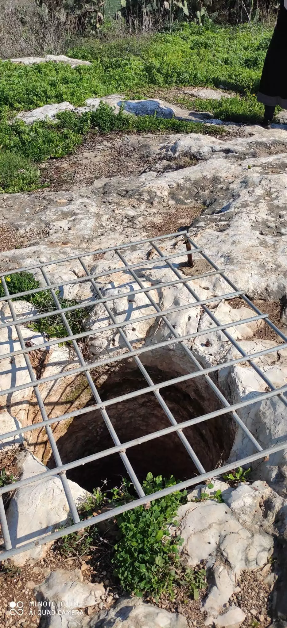
Posted by محمد كريم - آبار ماء في أنقاض قرية زرعين 2005 بعدسة محمد كريم
Posted by محمد كريم - نبات الصفير قرية زرعين 2005 بعدسة محمد كريم
Posted by محمد كريم - Zirin 2009
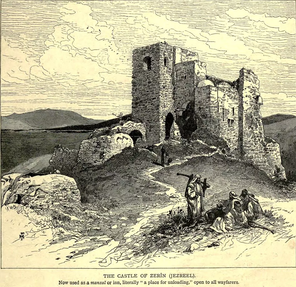
Posted by Rosi - ZIRIN - Zirin in the 1880s
Posted by Rami Atwan 1 - زرعين قبل 1948
Posted by Abdalla Fayed - منظر عام لموقع قرية زرعين وشجرة رمان- تصوير سهيل مخول
Posted by سهيل مخول - منظر عام لموقع قرية زرعين- في الصورة شجرة تين وئر ماء - تصوير سهيل مخول
Posted by سهيل مخول - منظر عام لموقع قرية زرعينالمهجرة، يظهر في الصورة شجيرات الصبر وبقيايا بناء- تصوير سهيل مخول
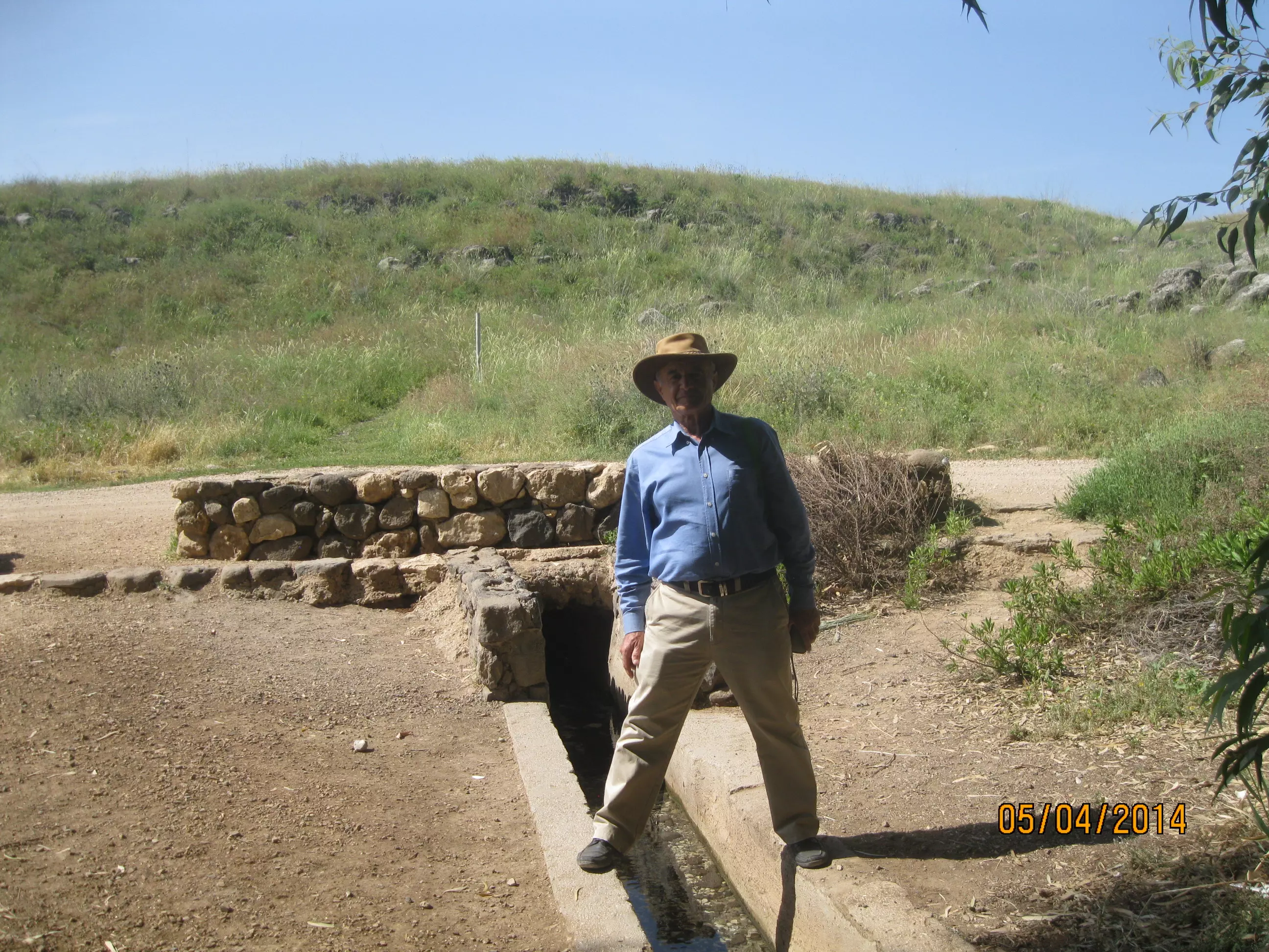
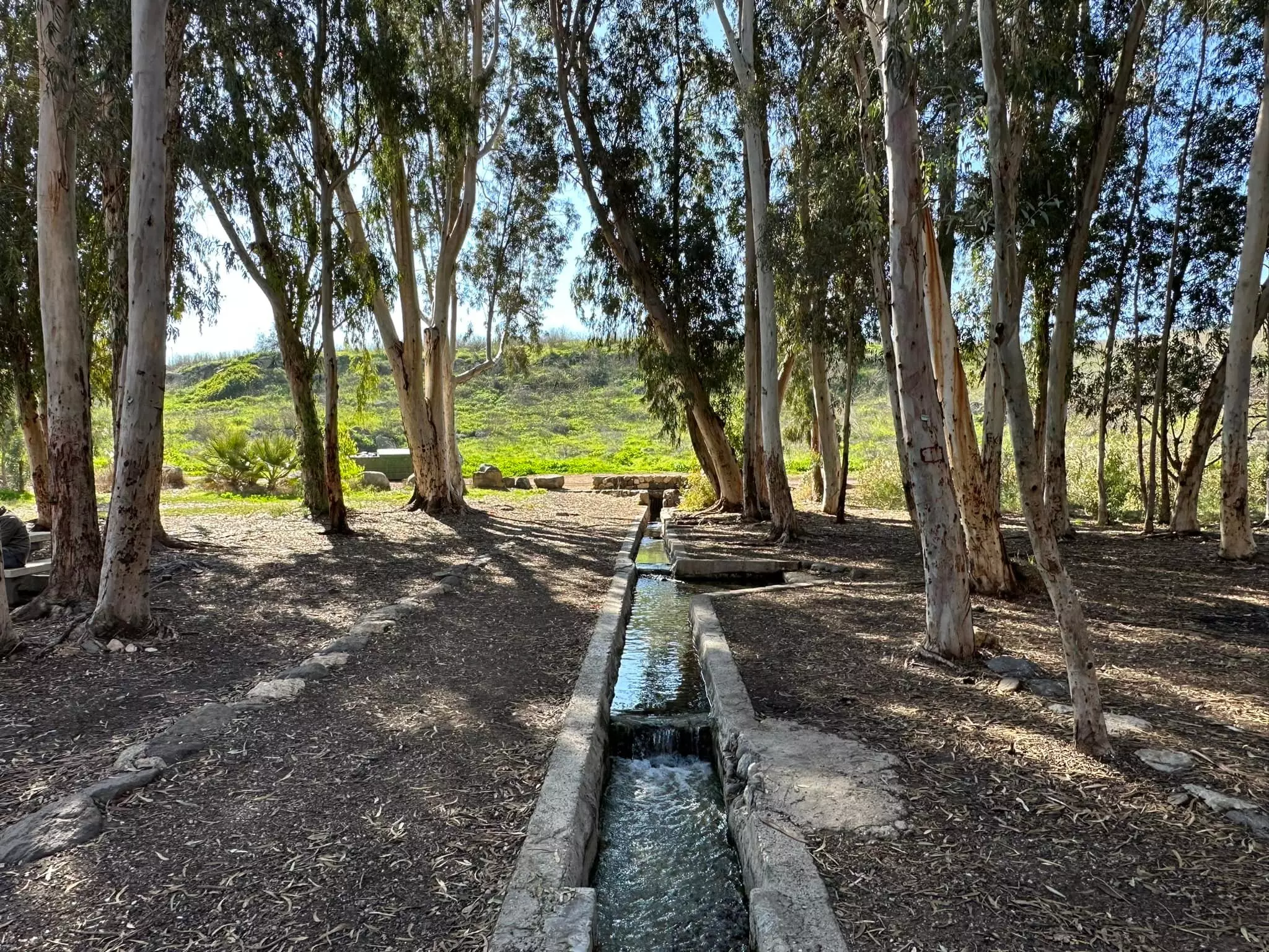
Posted by سهيل مخول - عين زرعين نبع ماء جاري - تصوير سهيل مخول
Posted by سهيل مخول - عين زرعين نبع ماء جاري
Posted by سهيل مخول 1 - تل زرعين
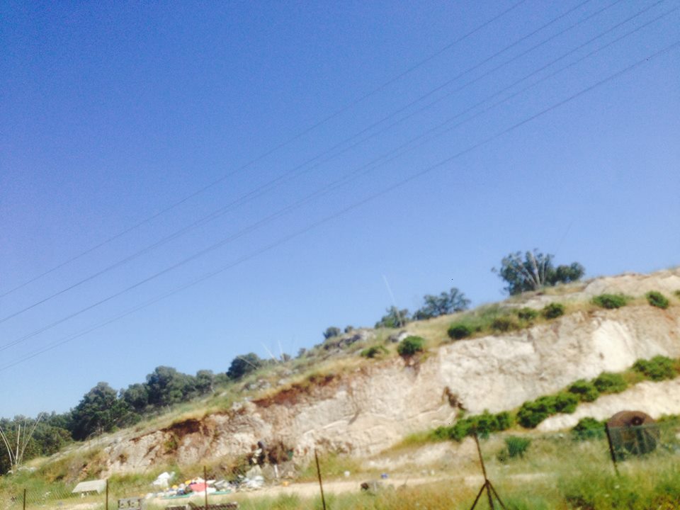
Posted by فتحي ابو رضا \ العايدي - تل زرعين
Posted by فتحي ابو رضا \ العايدي - تل زرعين الاثرية
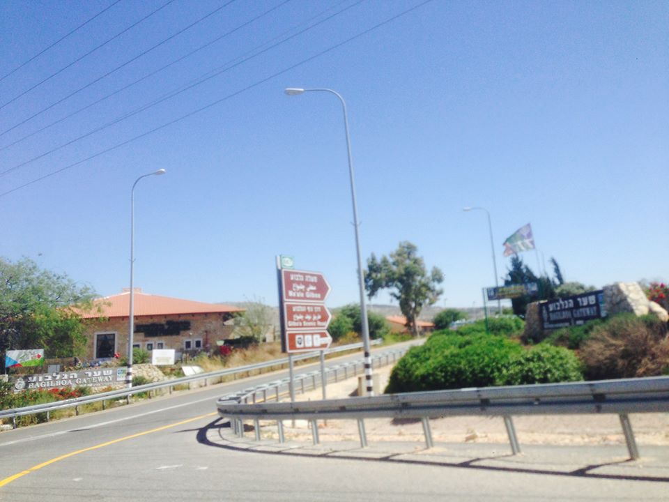
Posted by فتحي ابو رضا \ العايدي - ساحات التزلج الصيفي على اراضي زرعيت
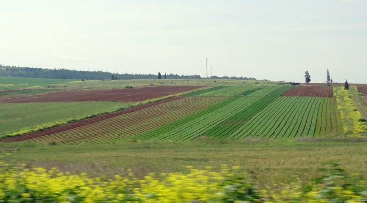
Posted by فتحي ابو رضا \ العايدي - بيارات على اراضي زرعين المغتصبة
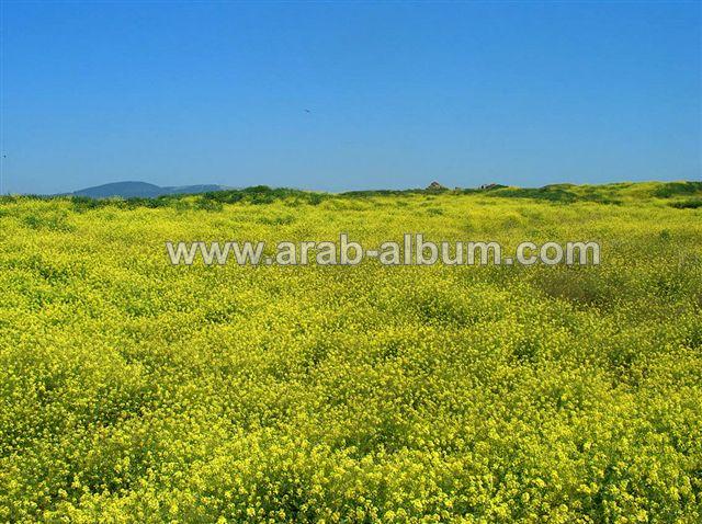
Posted by فتحي ابو رضا \ العايدي - سهل واراضي زرعين المغتصبة شمال القرية

Posted by فتحي ابو رضا \ العايدي - مدخل قرية المزار وقرية نورس من زرعين
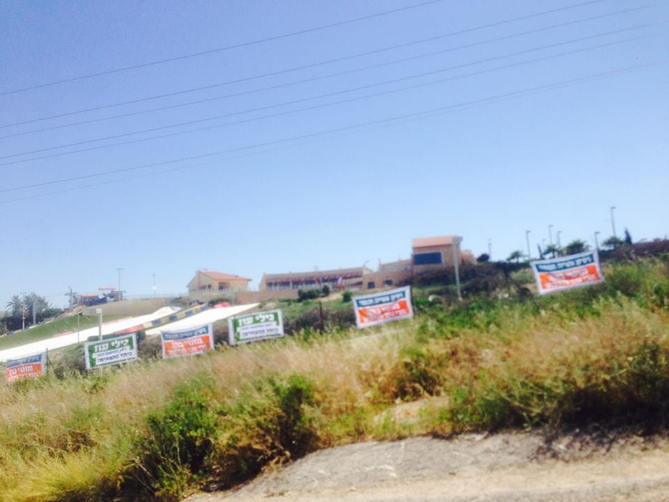
Posted by فتحي ابو رضا \ العايدي 1 - ساحات التزلج الصيفي وملاعب ومركز سباحب وتجاري على انقاض قرية زرعبن

Posted by فتحي ابو رضا \ العايدي - زرعين مركز سياحي وتجاري وساحات تزلج على انقاض القرية
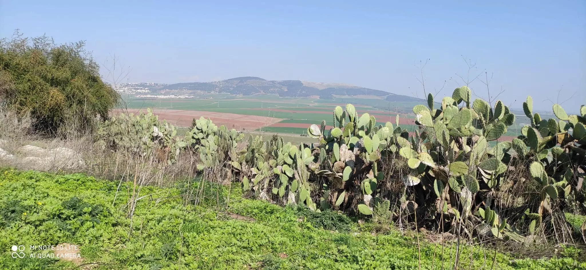
Posted by فتحي ابو رضا \ العايدي - بقايا الصبار في زرعين
Posted by abu raya - اثار ردم البيوت في زرعين
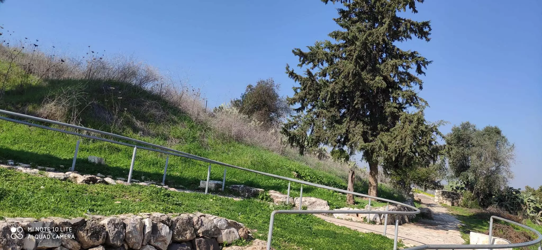
Posted by abu raya 1 - موقع القريه
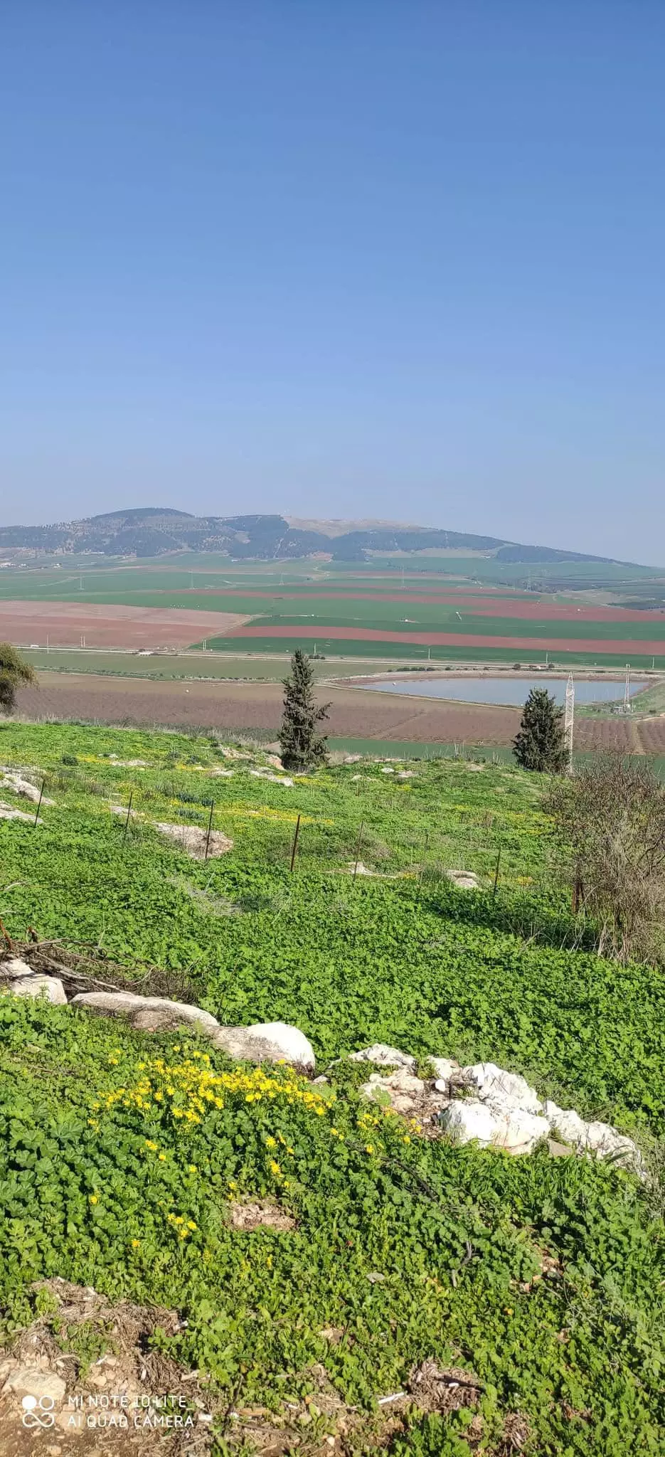
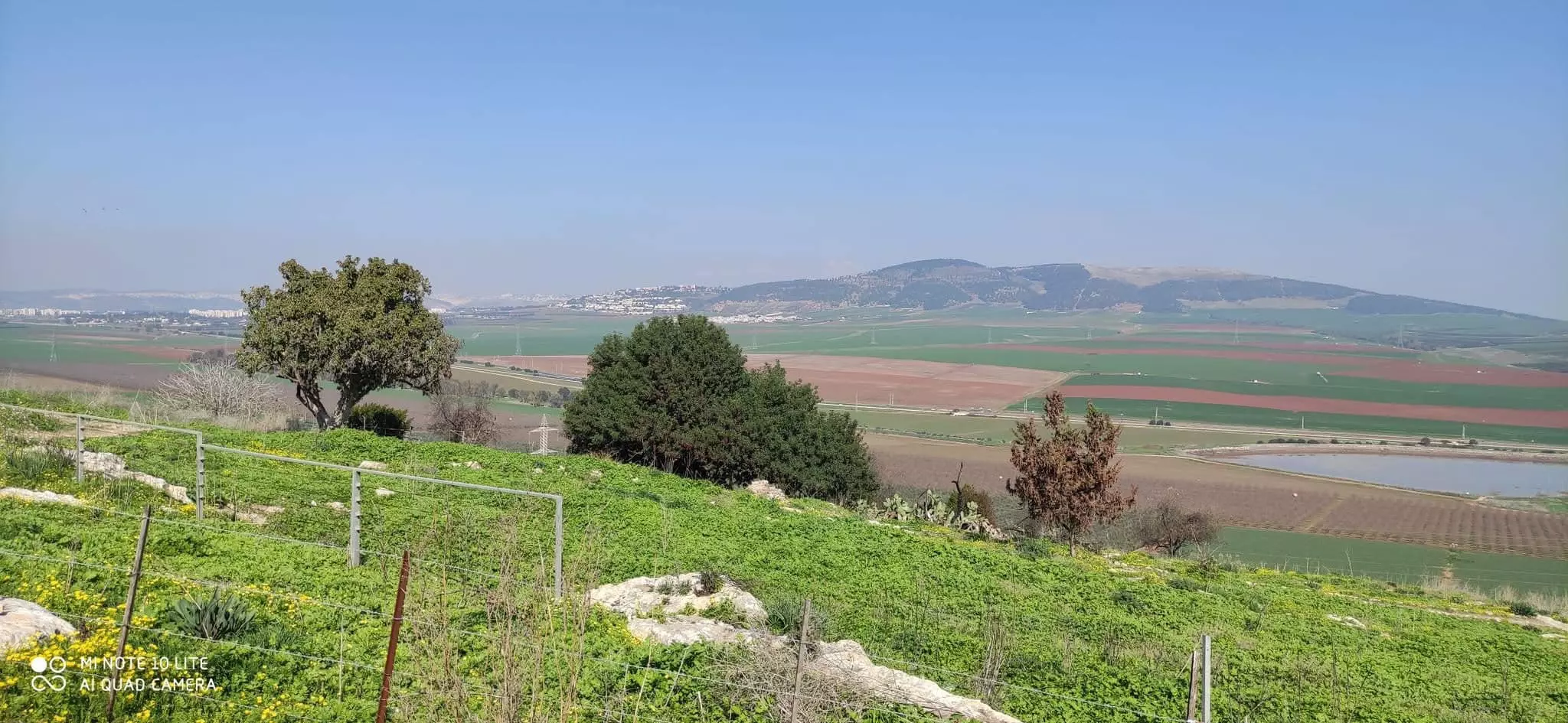
Posted by abu raya 1 - سهل القريه
Posted by abu raya - منظر من موقع القريه يطل على السهل
Posted by abu raya - من موقع القريه
Posted by abu raya - من موقع القريه والسهل
Posted by abu raya - زرعين
Posted by abu raya - اثار بيوت زرعين
Posted by abu raya - زرعين
Posted by abu raya - موقع القريه واراضيها
Posted by abu raya - موقع القريه واراضيها

Posted by abu raya 1 - موقع القريه واراضيها
Posted by abu raya - زرعين
Posted by abu raya - القريه واثار بيوتها
Posted by abu raya - اثار زرعين المتبقيه
Posted by abu raya 1 - مياه القريه
Posted by abu raya - اراضي زرعين
Posted by abu raya - زرعين قبل النكبه
Posted by abu raya - زرعين قبل النكبه
Posted by abu raya - صوره نادره لزرعين قبل النكبه
Posted by abu raya - زرعين قبل النكبه
Posted by abu raya - قريه زرعين قبل النكبه
Posted by abu raya - قريه زرعين قبل النكبه
Posted by abu raya - قريه زرعين قبل النكبه
Posted by abu raya - قريه زرعين قبل النكبه
Posted by abu raya - قريه زرعين قبل النكبه
Posted by abu raya - زرعين قبل النكبه
Posted by abu raya - عين جالوت 1930
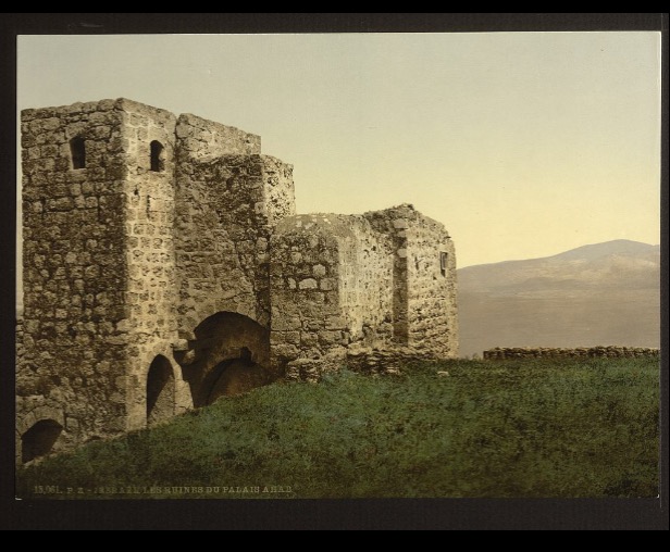
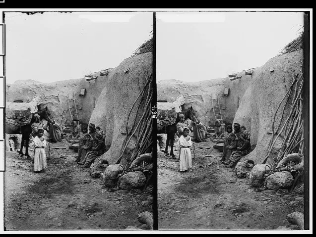
Posted by أبو اليزن السعافين - The Tower House of Zir'in, by Felix Bonfils, before 1885.
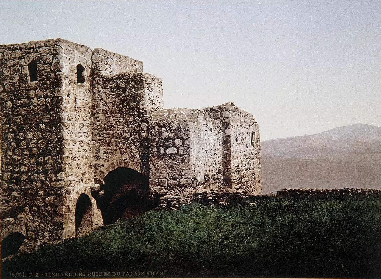
- The Tower House, early 1880s
- Pre-Nakba Aerial view of the village / صورة من الجو للقرية اخذت قبل النكبة
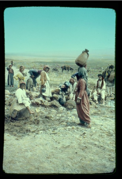
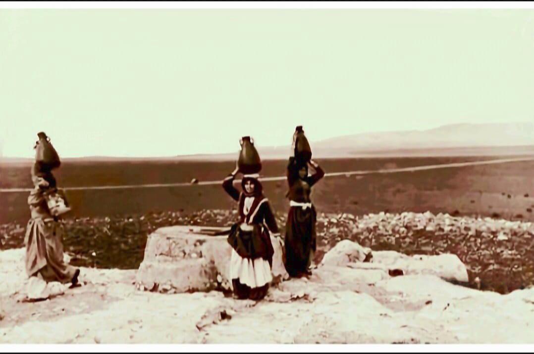
- نساء وجرار قرب بئر القرية..خلال رحلة جلب الماء في قرية زرعين قضاء جنين عشرينيات القرن العشرين..
- جولة بين معالم القرية تصوير اسنات ابراهيم
- جولة بين معالم القرية تصوير اسنات ابراهيم #2
- جولة بين معالم القرية تصوير اسنات ابراهيم #3
- جولة بين معالم القرية تصوير اسنات ابراهيم #4
- جولة بين معالم القرية تصوير اسنات ابراهيم #5
- جولة بين معالم القرية تصوير اسنات ابراهيم #6
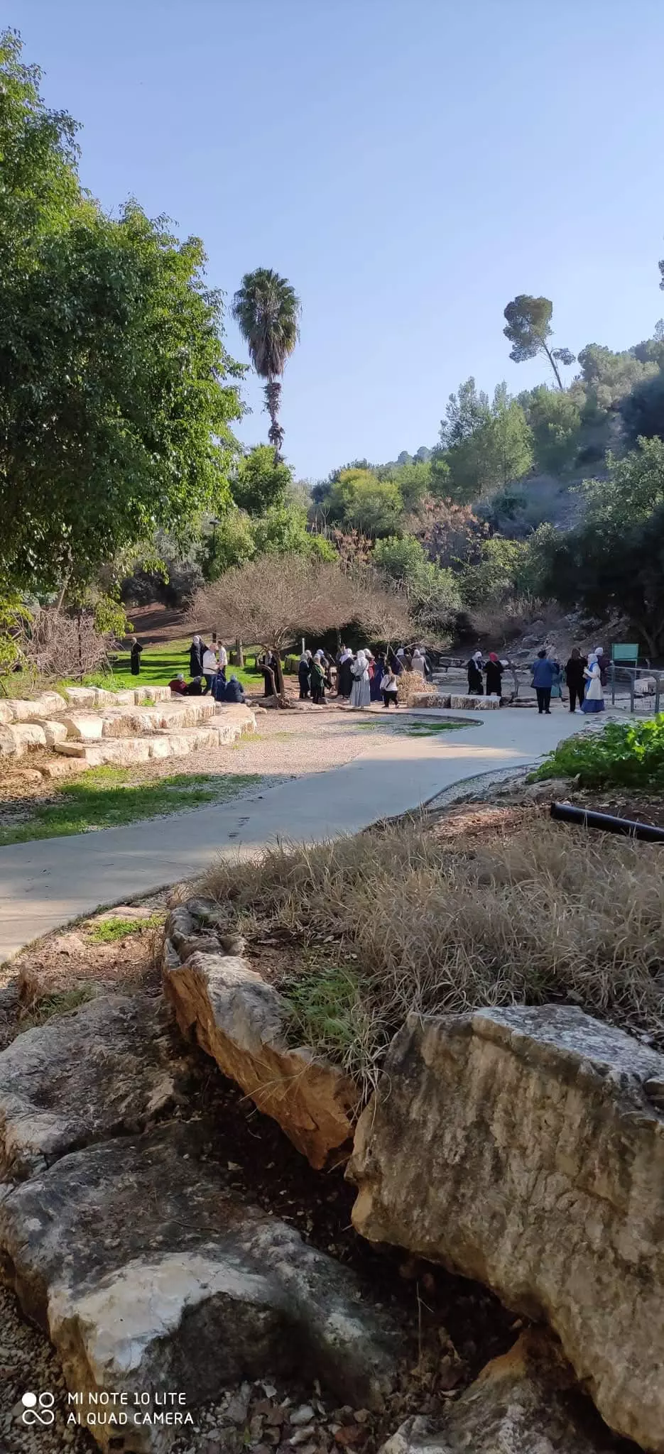
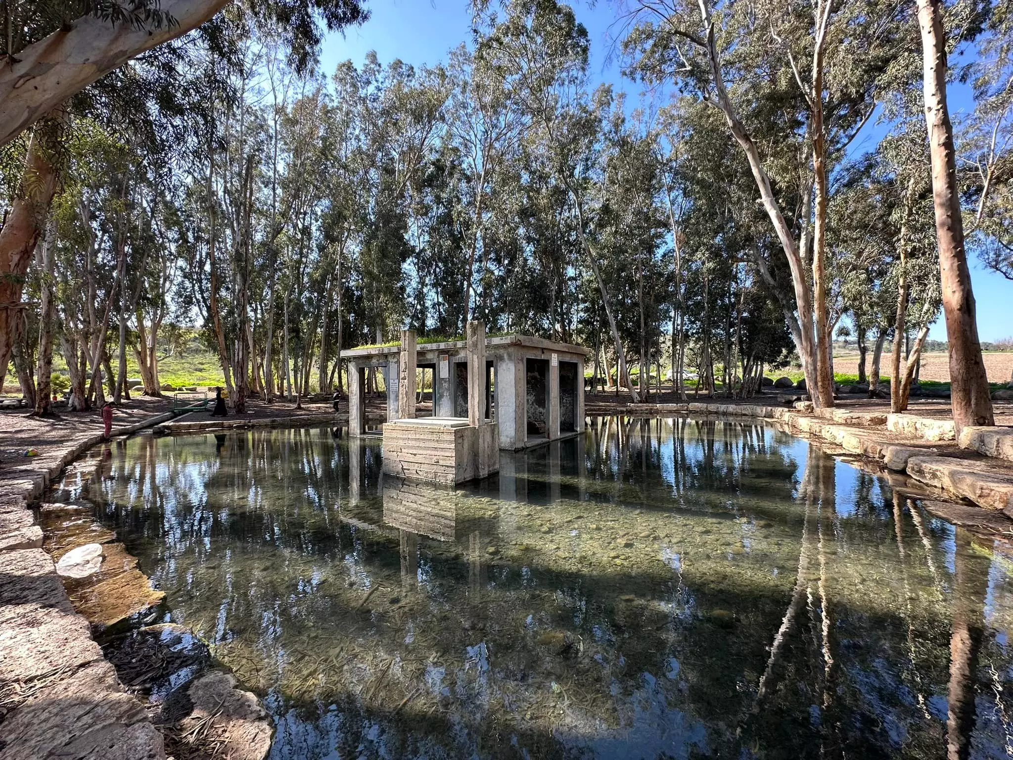
- عين زرعين أو عين الميتة في قرية زرعين المهجرة قضاء جنين waze עין עזראיל -- 2023-- Iyad Jaber
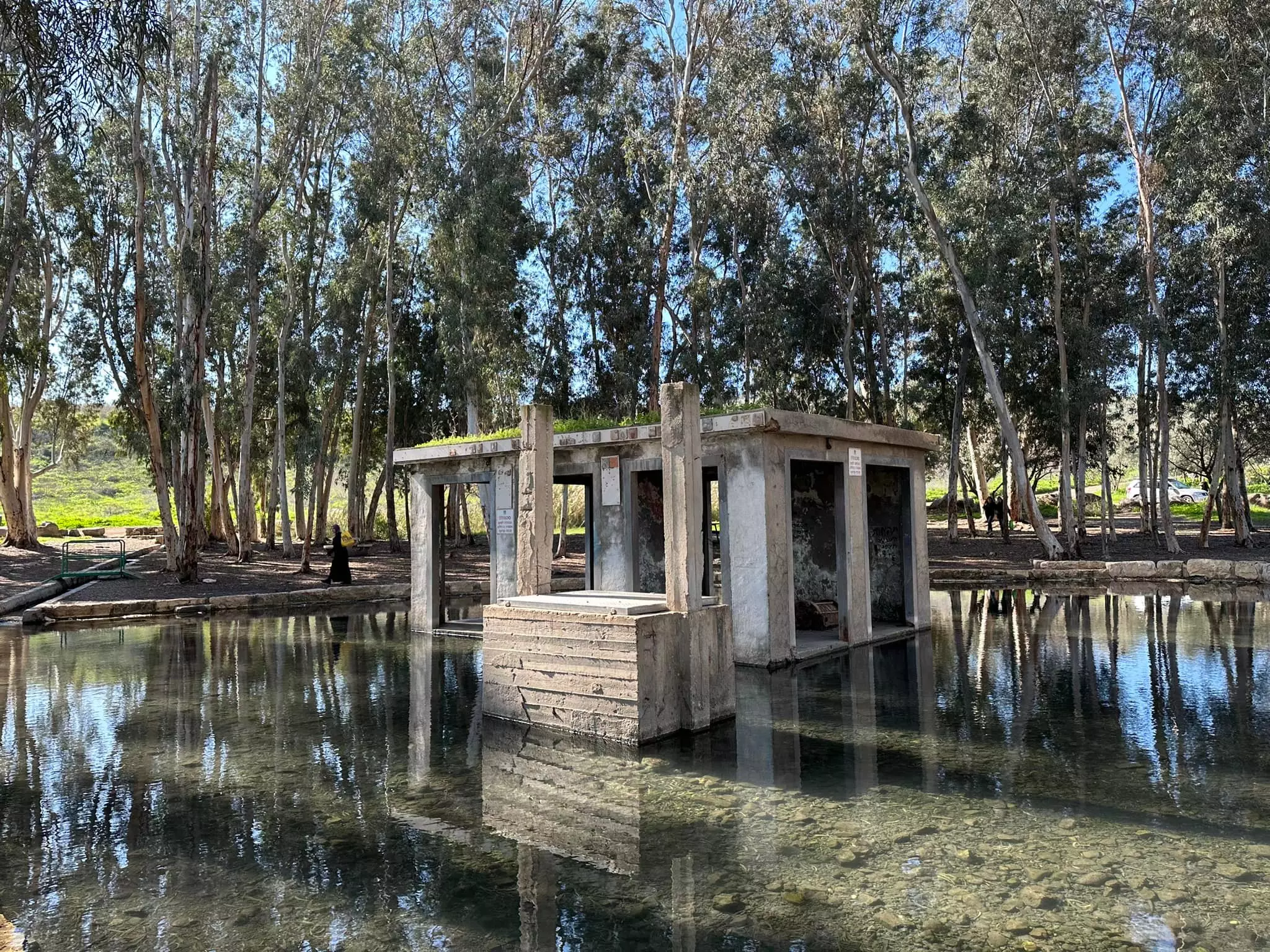
- عين زرعين أو عين الميتة في قرية زرعين المهجرة قضاء جنين waze עין עזראיל -- 2023-- Iyad Jaber #2
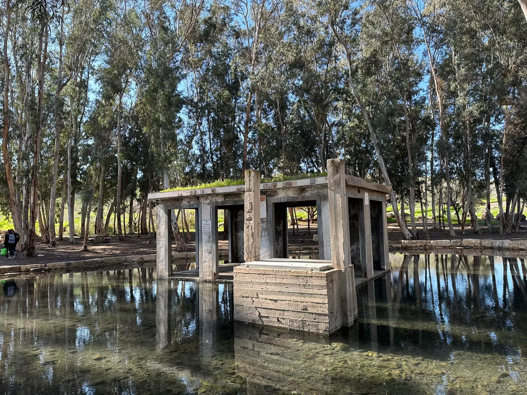
- عين زرعين أو عين الميتة في قرية زرعين المهجرة قضاء جنين waze עין עזראיל -- 2023-- Iyad Jaber #3
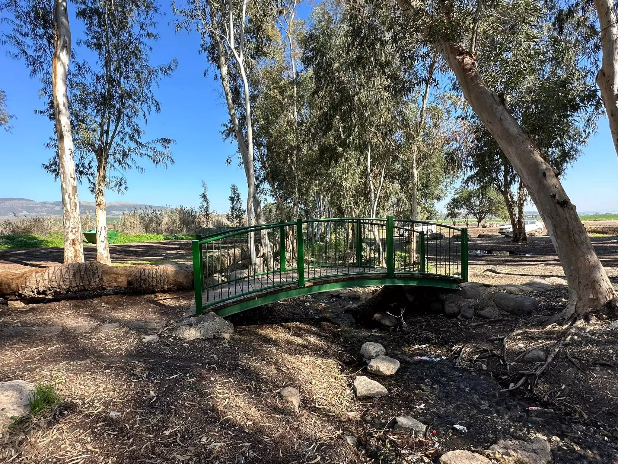
- عين زرعين أو عين الميتة في قرية زرعين المهجرة قضاء جنين waze עין עזראיל -- 2023-- Iyad Jaber #4
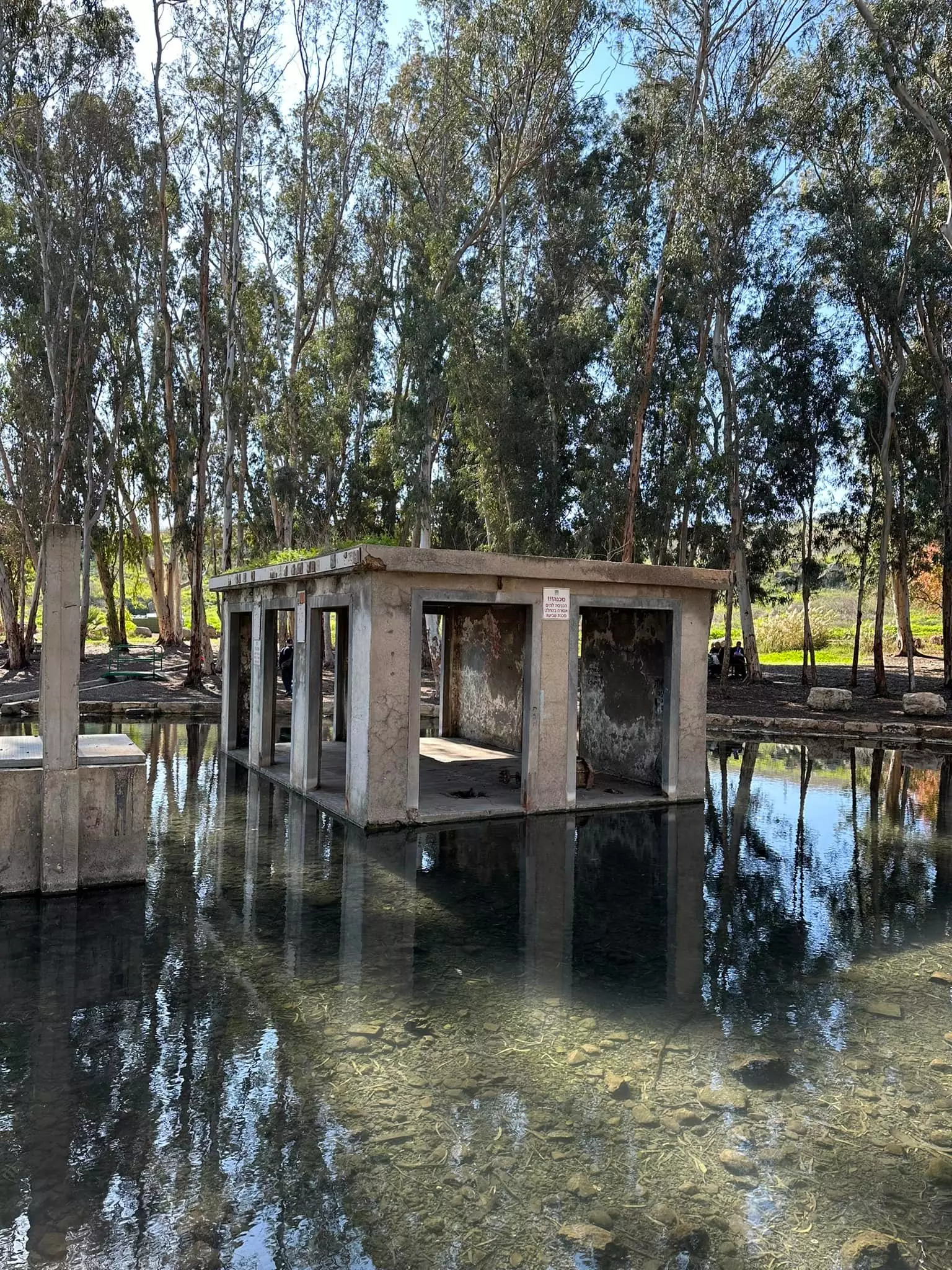
- عين زرعين أو عين الميتة في قرية زرعين المهجرة قضاء جنين waze עין עזראיל -- 2023-- Iyad Jaber #5
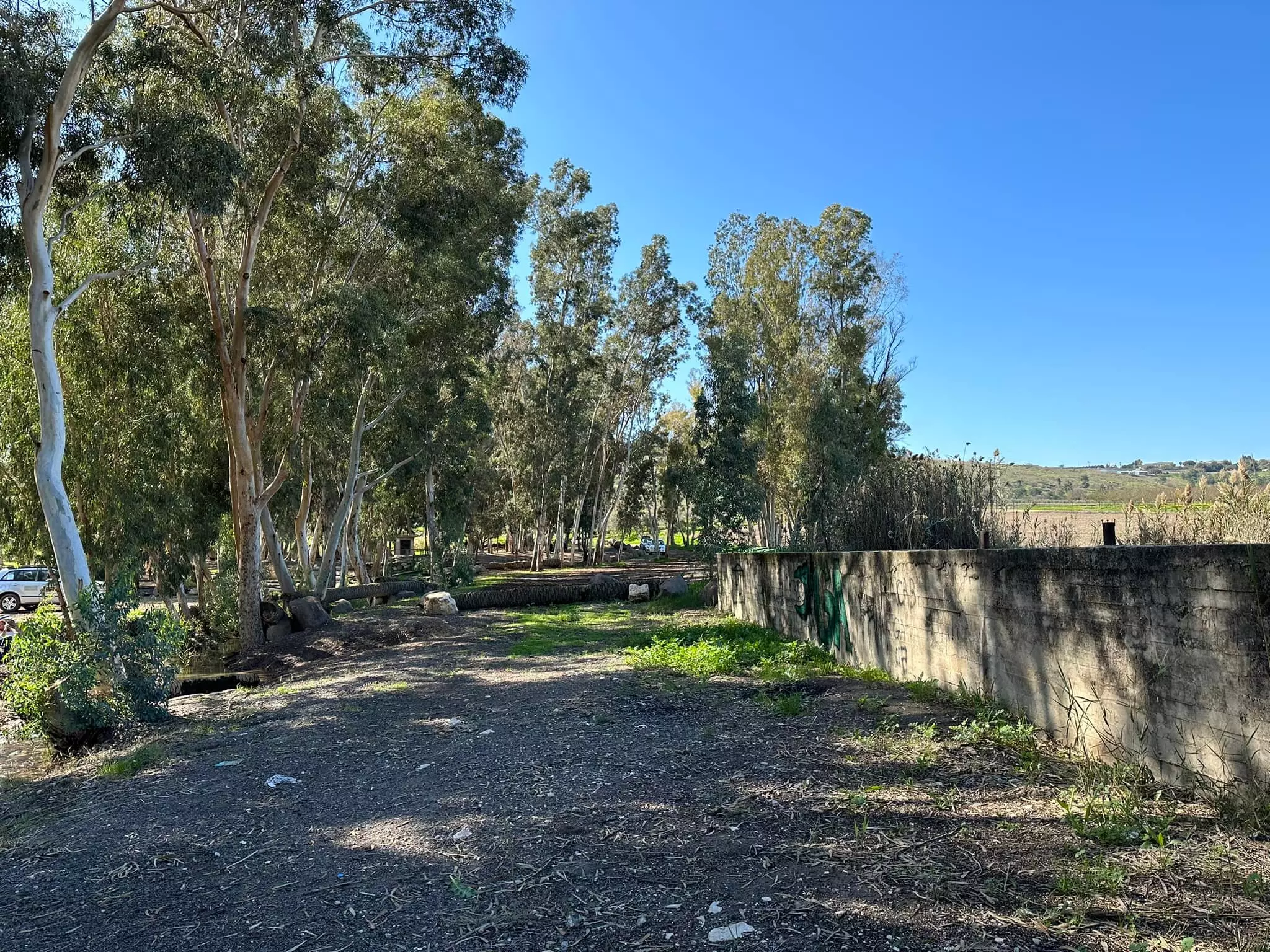
- عين زرعين أو عين الميتة في قرية زرعين المهجرة قضاء جنين waze עין עזראיל -- 2023-- Iyad Jaber #6
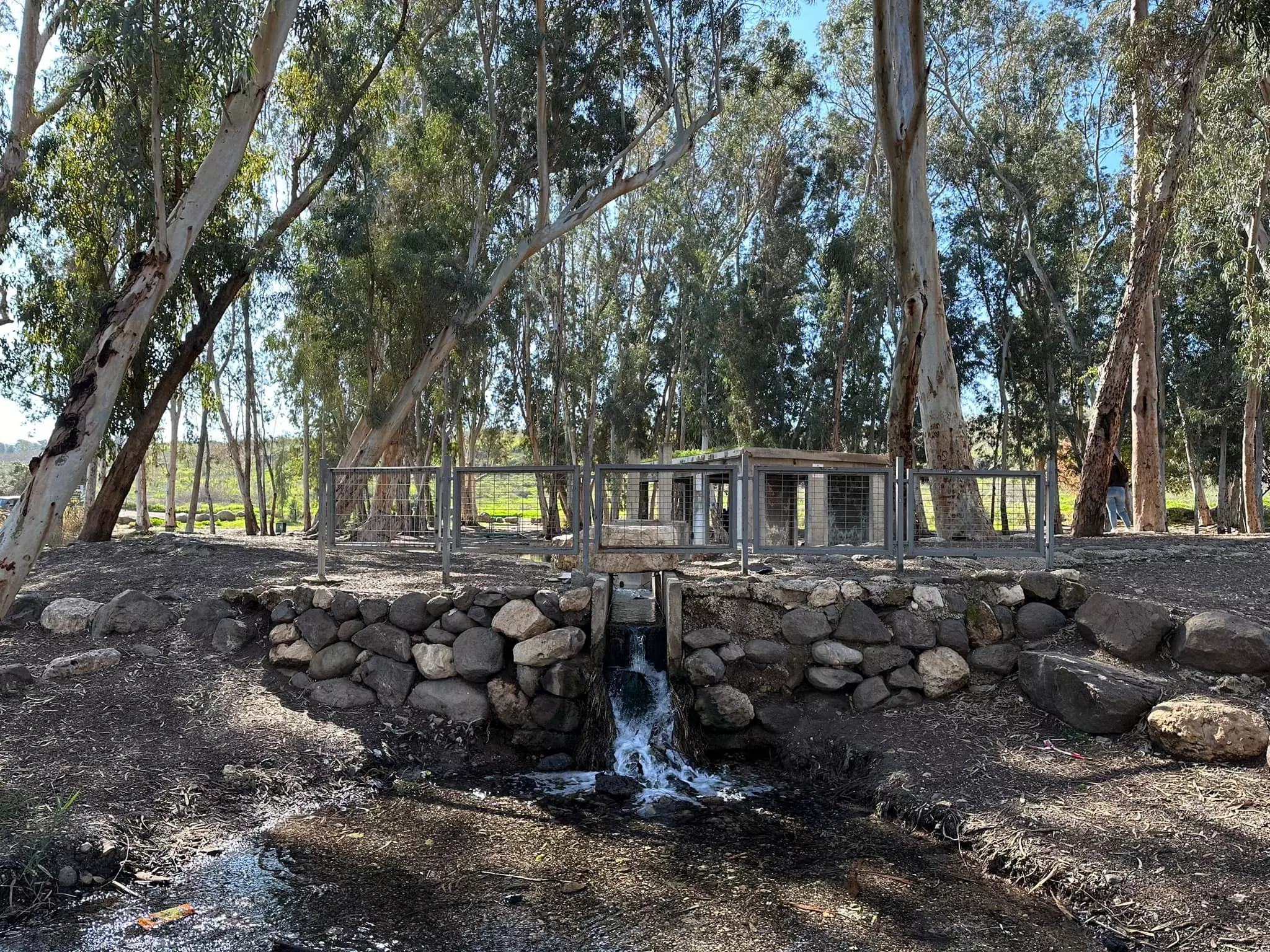
- عين زرعين أو عين الميتة في قرية زرعين المهجرة قضاء جنين waze עין עזראיל -- 2023-- Iyad Jaber #7
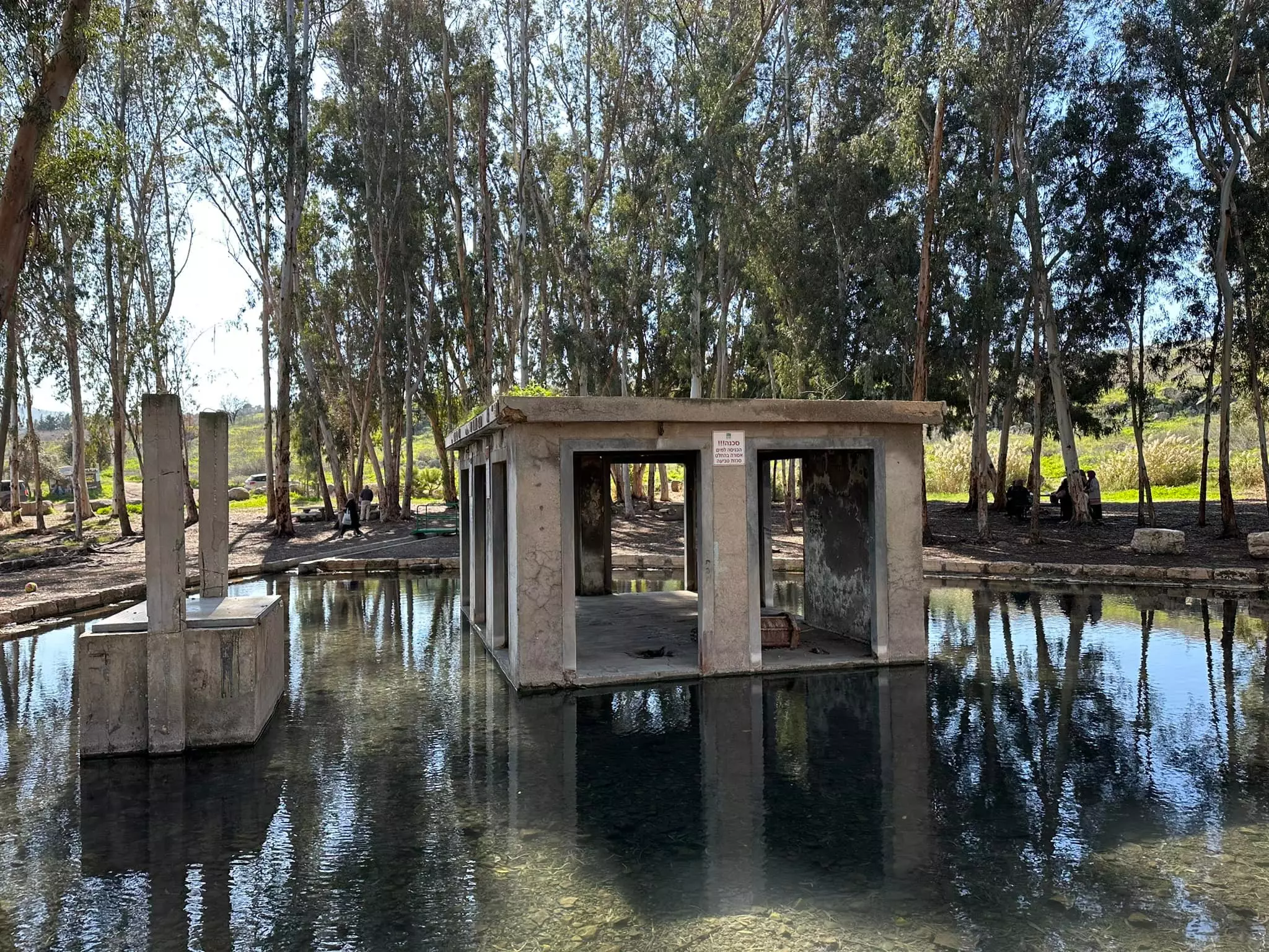
- عين زرعين أو عين الميتة في قرية زرعين المهجرة قضاء جنين waze עין עזראיל -- 2023-- Iyad Jaber #8
- عين زرعين أو عين الميتة في قرية زرعين المهجرة قضاء جنين waze עין עזראיל -- 2023-- Iyad Jaber #9
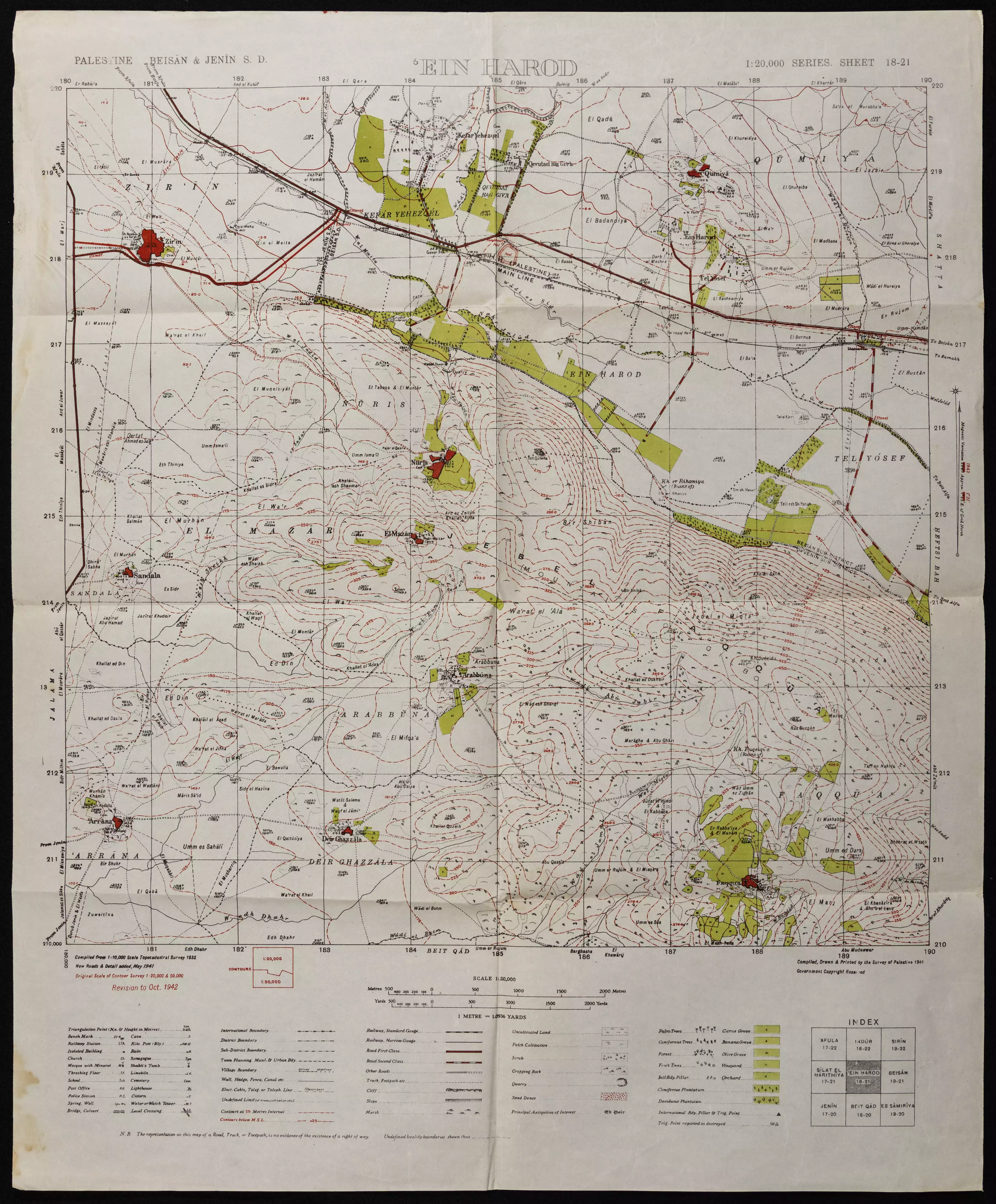
- خارطة تُظهِر الحدود والطرق بأنواعها والأماكن المقدسة والطبيعة الطوبغرافية من تلال وسهول ومنحدرات والتشكيلة الطبيعية للأرض وأنواع المزروعات. نُشرت الخريطة فترة الانتداب البريطاني، تم إضافة تعديلات عليها من قِبَل خدمة الخرائط والصور التابعة للقوات العسكرية الاسرائيلية فترة الأربعينيات.
Want to browse more? 80,000 pictures were grouped in these gallaries:
| Display Name | Clan/Hamolah | Country of Residence |
| Ibrahim Mahmoud Mohammad Ahmad Hammad Al Mqasqas | Al Mqasqas | Michigan, USA |
| عدنان زرعيني | احمد | اربد |
| أحمد الشلبي | الشلبي | عمان, الأردن |
| Abdalla Fayed | فايد | جنين |
| محمد احمد جبر | جبر | - |
| Raed Al-Haj Ibrahim | Al-Haj Ibrahim | JORDAN, JORDAN |
| saleh al haj ibrahim | al haj ibrahim | irbid, jordan |
| علي محمد حسين العموري | - | - |
| imad awwad | - | - |
| MOH"D FAYED | فايد/زرعيني | الكويت, جنين |
| mutaz sous | SOUS | DAMMAM |
| palestinelover | jabr\alzer3ine | al yadodeh, jordan |
| Ghassan Matahen | Matahen | - |
| abunada | AbuNada | جنين, الاردن |
| Ahmad Amin Mohammed Zureiqi | Zureiqi | Amman, Jordan |
| JeninHeart | al-Hajj Ibrahim | Egypt |
| Saad Nafea | Haj Ibrahim | Kuwait |
| Mohamed Fayed | Fayed | Palestine |
| Ahmad Yaghi | Yaghi | - |
| Taysir Baklizi | Baklizi | - |
- عين الميتة (زرعين) : تاريخ وذكريات ...تصوير قمنا به احتراما لال الفايد الكريمة من زرعين Duration: 4 min 10 sec
- عين زرعين او عين الميتة قضاء جنين waze נוף נחל חרוד Duration: 11 sec
- من اراضي قرية زرعين المهجرة قضاء جنين . Duration: 22 sec
- عين زرعين أو عين الميتة في قرية زرعين المهجرة قضاء جنين waze עין עזראיל #2
No links have been shared yet, be free to the first to share the first link.
 Fake Valor: Why Did Zionist Jews Hoist Nazis Flag on Their Ships in the 1930s?
What is new?
-
Facts About Oct. 7th Gaza Raid
-
Remined Us Please:: Who Did Rape Who? Palestinians Raped Israelis? Or, was the other way around?
-
When Prof. Edward Said was invited to debate Bibi Netanyahu in the 1980s, watch what happened!
-
Ezra Klein of the NY Times on the "Jewish Race".
-
Abusing Blood Libel!
-
Did Israeli Soldiers Activate The Hanniba Direective On Oct. 7th? You Be The Judge
-
Zionist FAQ: Isn't it true that Palestinians don't want peace? Palestinians never accepted the two-state solution
- Facts about Haavara (Transfer) Agreement between Ben-Gurion & Hitler
-
Haavara FAQs: Why Did Zionist Jews Hoist Nazis' Flags on Their Ships in the 1930s?
- Haavara FAQs: When Chaim Weizmann met FDR in mid-1943, why was he silent about rescuing European Jewry?
-
Dear ChatGPT: How did Palestinians resist Napoleon's invasion of their country in 1799?
-
Dear ChatGPT: Gaza had a vibrant Jewish community in the mid-17th century. What happened to them?
-
Dear ChatGPT: Why did the Jewish Agency suppress news of the Holocaust during WWII?
-
Video Playlist: Jews share their DNA tests to end the conflict for good.
-
A Tale of Two Conflicts: Examining the Definition of Genocide
-
Prof. Abraham Polak And The Suppressed History of the Khazars and European Jewry
-
How Ronald Reagan would have framed the genocide in Gaza if he were still alive?
-
Haavara FAQs: Let us do the math: how many German Jews did The Haavara Agreement save?
-
Zionist FAQs: The Hebron Massacre of 1929, "clearly proves" that Palestinians are antisemitic, how could you deny it?
-
Zionist FAQs: Why Anti-Zionist Is Not Antisemitism?
-
Zionist FAQs: Isn't it true that the KGB created Palestinian Nationalism in the early 1960s?
- Zionist FAQs: Muslims are killing Muslims all the time; why are Israeli Jews being singled out in the media?
- Zionist FAQs: How is Israel an apartheid state when 20% of its citizens are Arabs who enjoy full rights?
-
Haavara FAQs: Why Did Dorothy Thompson Flip From A Zionist Advocate to A Silenced Dissenter?
-
Haavara FAQs: Analysis of Herzl's Uganda Scheme and how it could have saved millions of Jews.
-
Haavara FAQs: Why did Hayim Greenberg describe American Jewry as "morally bankrupt" in early 1943?
-
Haavara FAQs: What if the Evian Conference was a resounding success? What would have been the impact of saving European Jewry on Zionism?
- Haavara FAQs: What if the six million were saved, how that would have impacted the Zionist project?
-
Haavara FAQs: How did Zionist leaders react when Europe's Jews lingered in the DP camps after WWII ended?
-
Why does the American Jewish community repeat lies that David Ben-Gurion had debunked before he died?
-
Who has the power to rename the Tatar/Khazar Gene Marker to Jewish IV?
-
Zionist FAQs: Why won't Egypt, Syria, and Jordan take their people back? Jews are indigenous to Palestine, and Arabs immigrated after Jews developed the country. Arabs should leave.
-
Haavara FAQs: Did Hitler and the Nazis conflate between Judaism and Zionist? If that wasn't case, then why?
-
Haavara FAQs: Winston Churchill and antisemitism, a collection of articles written Churchill.
-
Haavara FAQs: Broken by country, how many Jews survived vs. killed during the Holocaust?
-
Haavara FAQs: Why did European Jews vote with their feet and to immigrated to the Americas, not Palestine, after WWII?
-
Watch this American Jewish Girl describing Israeli Jews' cognitive dissonance like no other in under two minutes
-
Haavara FAQs: When the Nazis went out of their way to hide the Holocaust, Israeli Jews did the exact opposite by broadcasting their genocide of Gazans. But why?
-
Haavara FAQs: How Zionist Jews went out of their to show their appreciation to Nazism and Fascism?
- Haavara FAQs: Why Zionist leaders were against bombing the death camps & the Railroads leading to them?
-
Haavara FAQs: Hitler's message to the British and American people: If Jews are such noble citizens and you care about them, how come you're not letting them in? I will gladly ship them to you at my expense, even on luxury liners!
-
A shortlist of Zionist and Israeli false flag operations in the name Jews.
-
The Most Moral Army
- The Land of Kapos (Israel): Where the brave are boycotted and Kapos walk free.
- Why did early Zionists often named their communal enterprises "colonial"?
- Zionist Relations with Nazi Germany by Faris Glubb
-
Two NY Times advertisements by Zionists in the early 1943 that exposes Zionists' treason at the height of the calamity
- Facts Not Lies about the Palestinian-Israeli Conflict.
- Site's pictures have been categorized
- Campgain Against Lice
- A Survey of Palestine, the official source about Palestine before Nakba produced by the British Mandate; over 1200 pages.
- Satellite View & Google Earth: Over 6,000 placemarks identifying all destroyed towns, W. Bank & Gaza Strip Towns, & refugee camps.
- PalestineRemembered.com and its Nakba Oral History Project were featured on al-Jazeera Satellite TV.
- Nakba Oral History Video Podcast:
 Over 700 Oral History interviews (including 3,500+ hours of recording) can be viewed online.
 - Palestine Village Statistics Project
- Gaza Jail Break
- النسخة العربية للموقع الان متوفرة
- Videos: Documenting the destroyed villages in video: Tracing all that remains since Nakba.
- Videos: Responding to Zionist Propaganda
- Interview: The ethnic cleansing of Palestine: George Galloway interviews Israeli Historian Ilan Pappe.
- For Palestinians, memory matters. It provides a blueprint for their future By George Bisharat.
- Zionist FAQ now available in Hebrew שאלות שציונים שואלים, עכשיו בעברית
- Video: The Stephen Walt and John Mearsheimer report on the influence of the Israel Lobby on U.S. Foreign Policy
- The Palestinian-Israeli conflict for beginners
