| PalestineRemembered | About Us | Oral History | العربية | |
| Pictures | Zionist FAQs | Haavara | Maps | |
| Search |
| Camps |
| Districts |
| Acre |
| Baysan |
| Beersheba |
| Bethlehem |
| Gaza |
| Haifa |
| Hebron |
| Jaffa |
| Jericho |
| Jerusalem |
| Jinin |
| Nablus |
| Nazareth |
| Ramallah |
| al-Ramla |
| Safad |
| Tiberias |
| Tulkarm |
| Donate |
| Contact |
| Profile |
| Videos |
Welcome To Kafr Bir'im - كفر برعم (כפר בירעים)
|
District of Safad
Ethnically cleansed days ago |
العربية Google Earth |
 |
Gallery (209) |
- Statistics & Facts
-
Before & After

- Satellite View
- Articles 6
- Pictures 209
- Aerial Views 1
- Oral History 3
- Members 1
- Families
- All That Remains
- Wikipedia
- Videos 6
- Guest Book 9
- Links 2
| Statistic & Fact | Value | ||||||||||||||
| Occupation Date | November 4, 1948 | ||||||||||||||
| Distance From District | 11.5 (km) North West of Safad | ||||||||||||||
| Elevation | 750 (meters) | ||||||||||||||
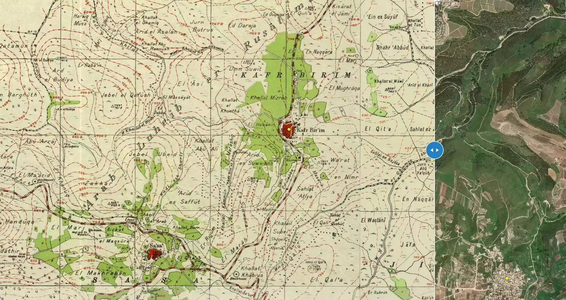
| Before & After Nakba, Click Map For Details |
|||||||||||||||
|
|||||||||||||||
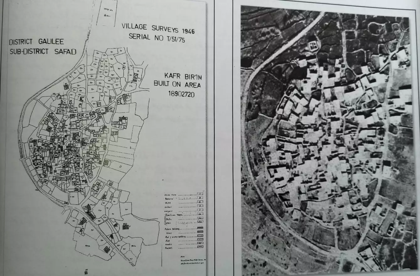
| Pre-Nakba Aerial View |
|||||||||||||||
|
|||||||||||||||
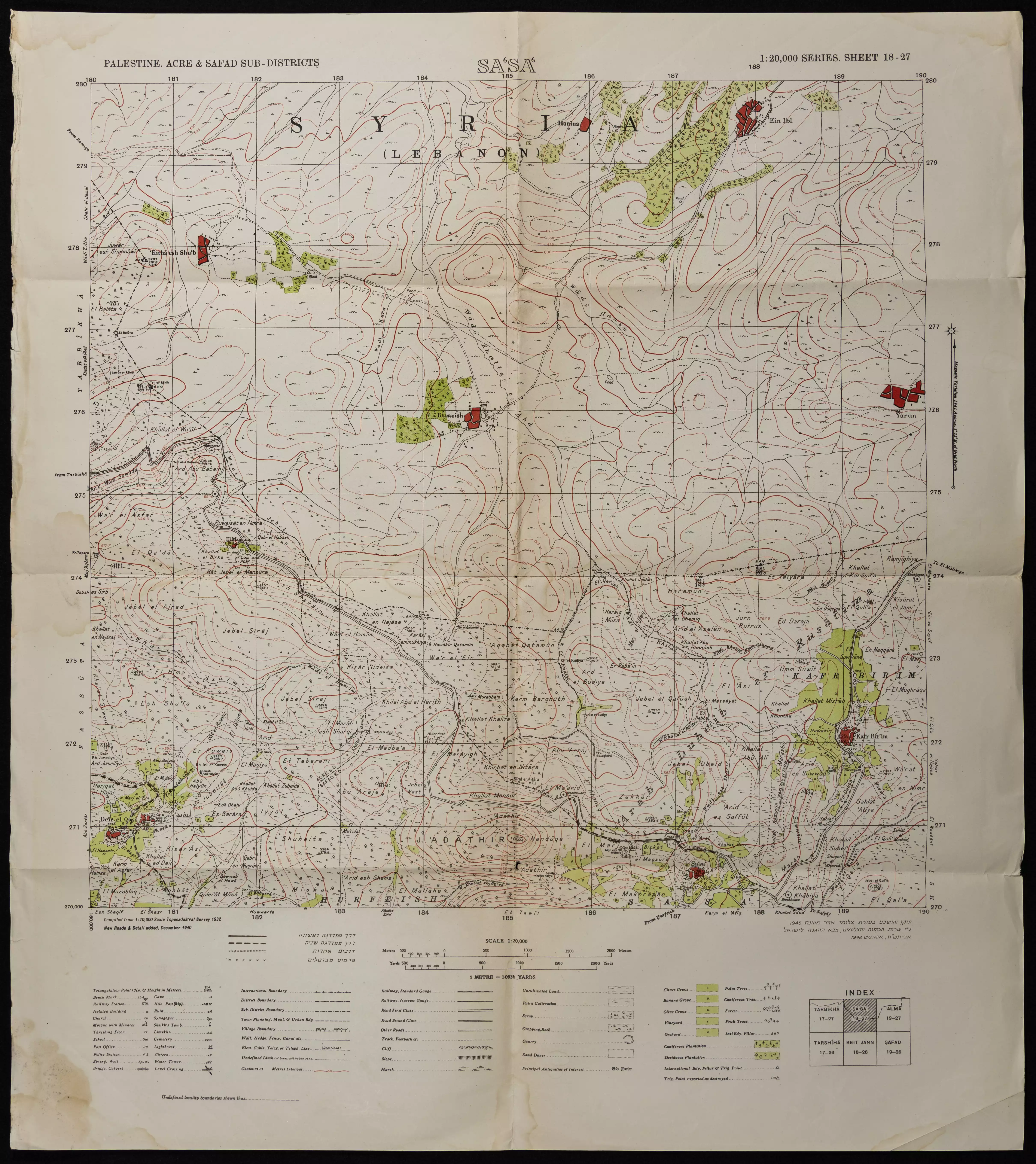
| Map Location | See location #41 on the map View from satellite |
||||||||||||||
| Military Operation | Operation Hiram | ||||||||||||||
| Exodus Cause | Expulsion by Zionist troops | ||||||||||||||
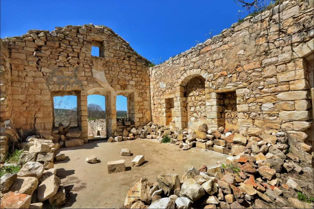
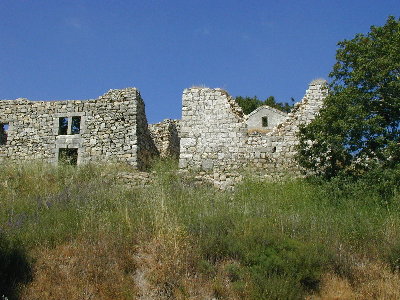
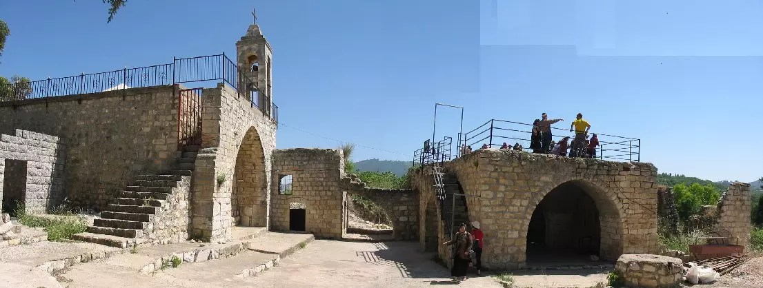
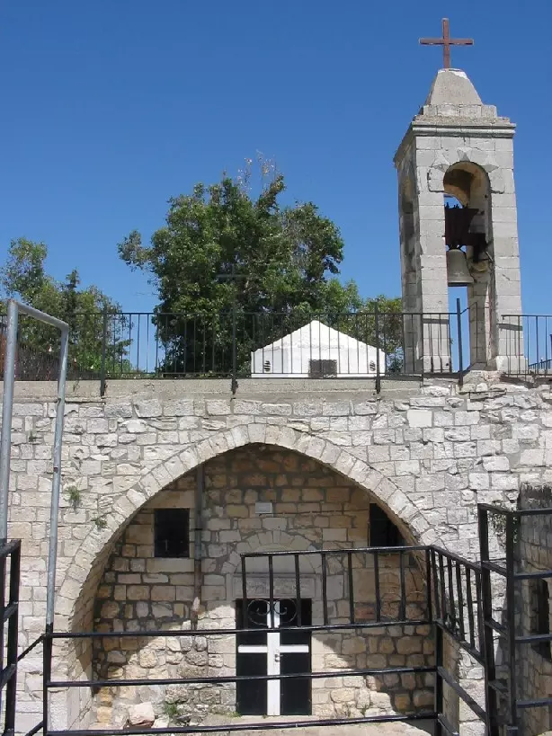
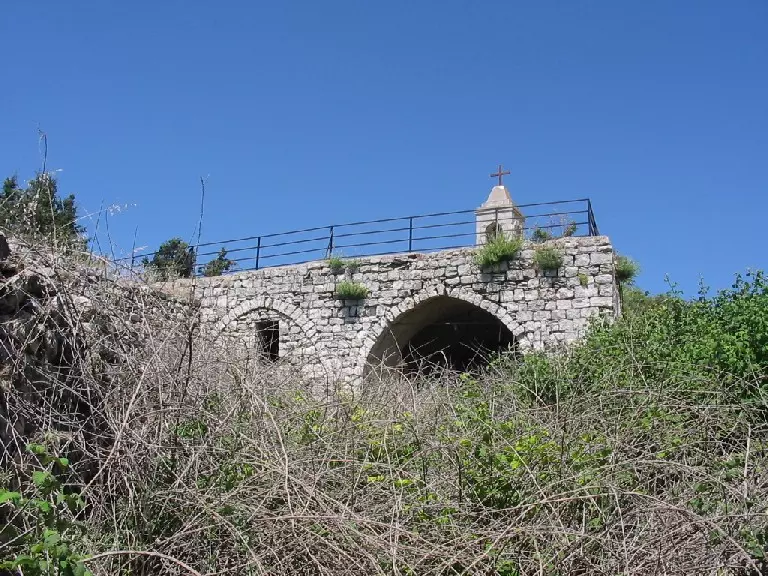
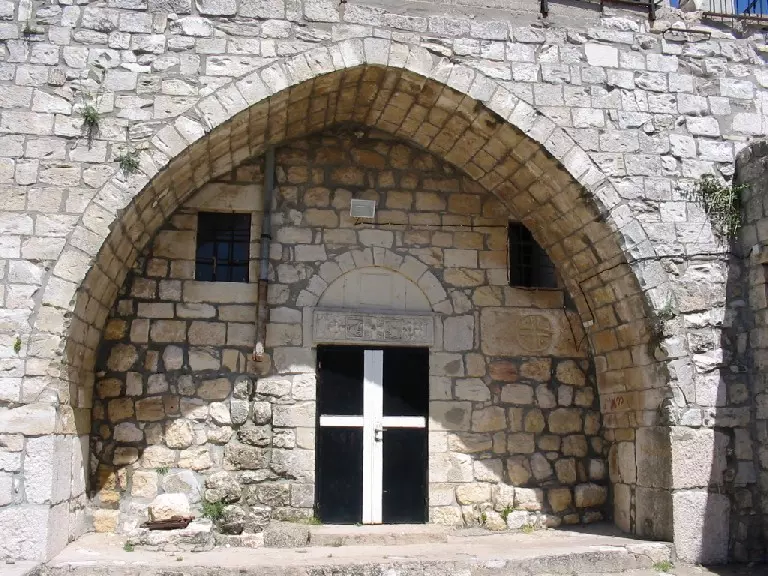
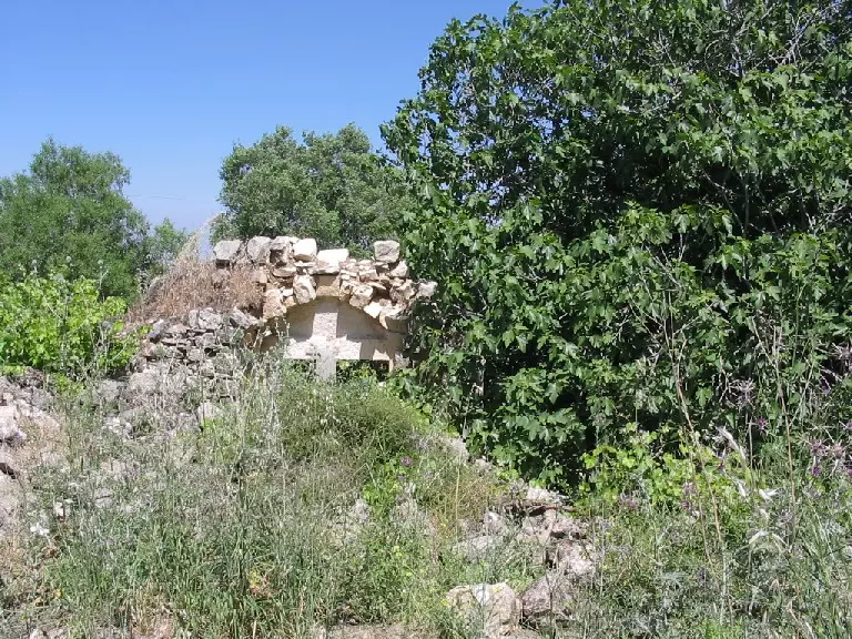
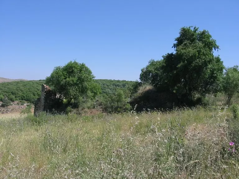
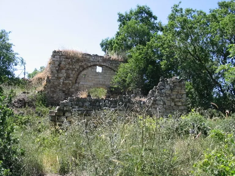
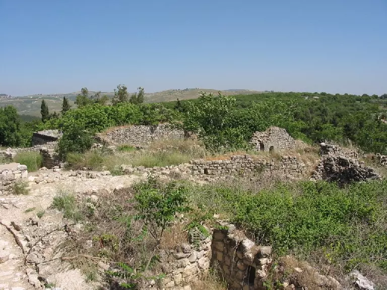
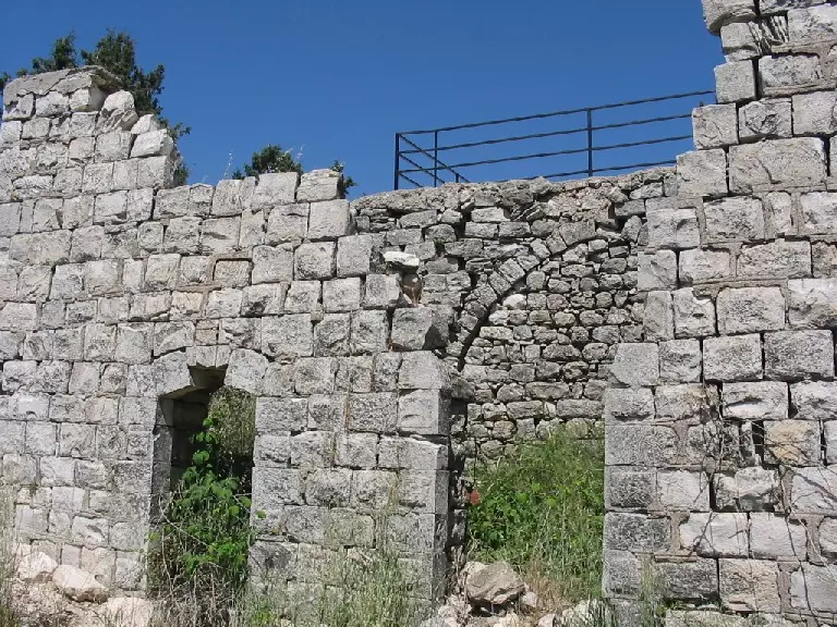
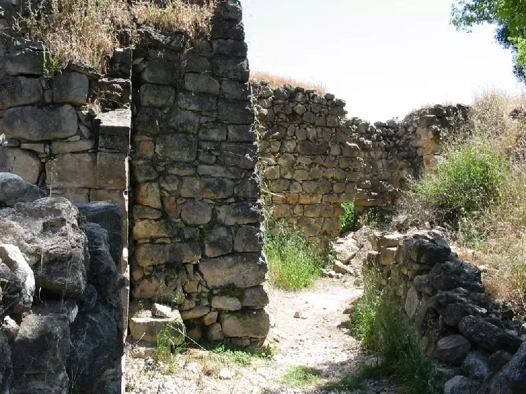
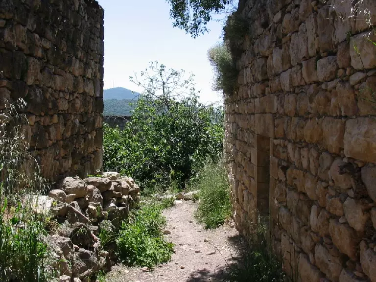
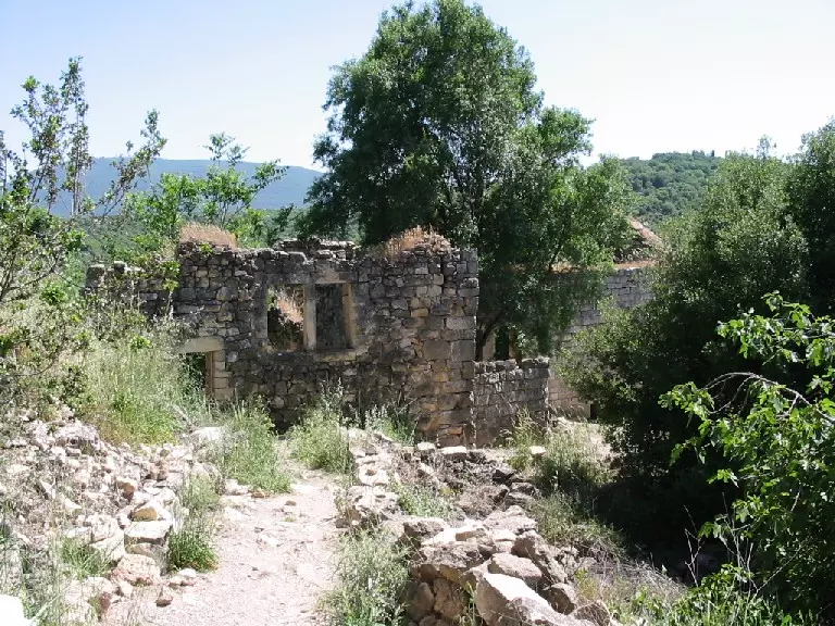
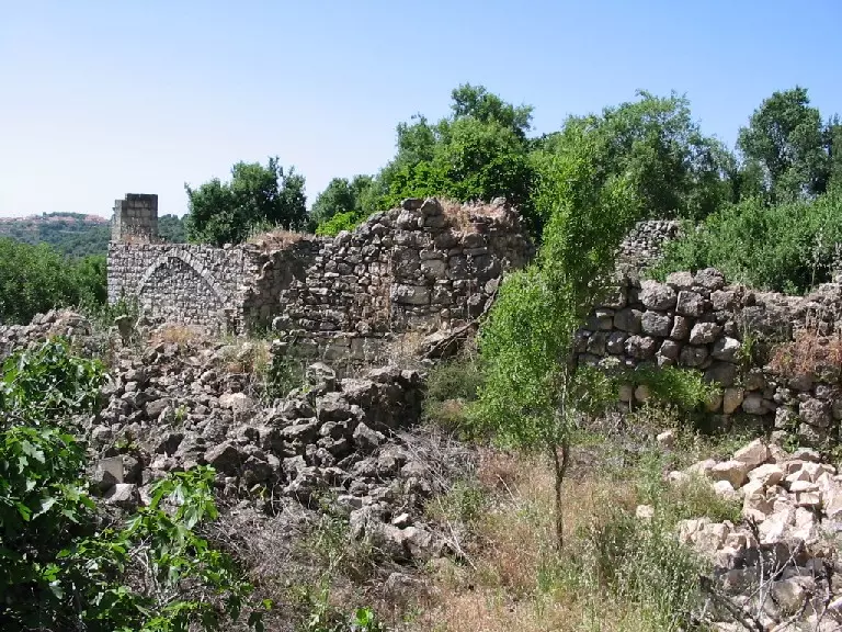
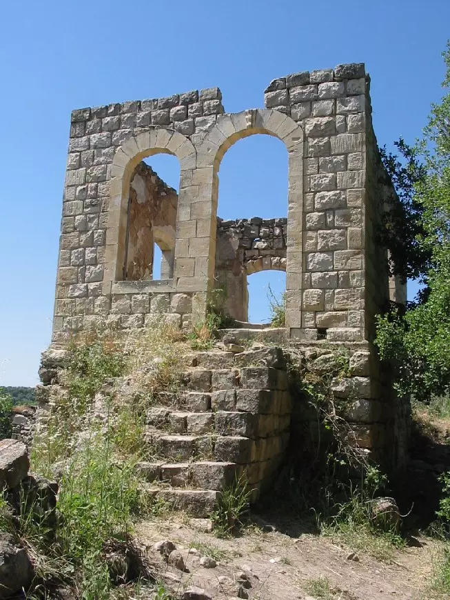
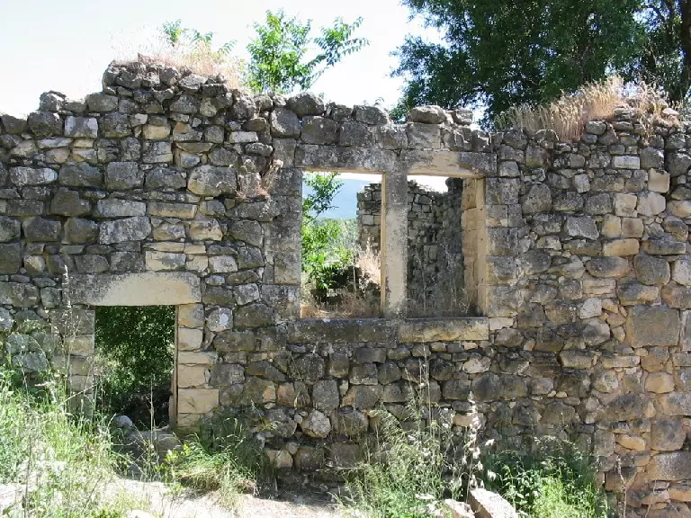
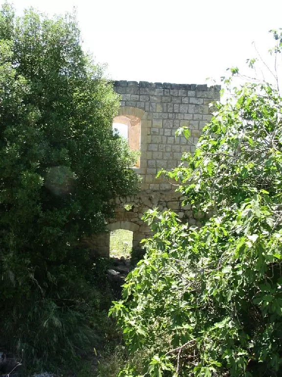
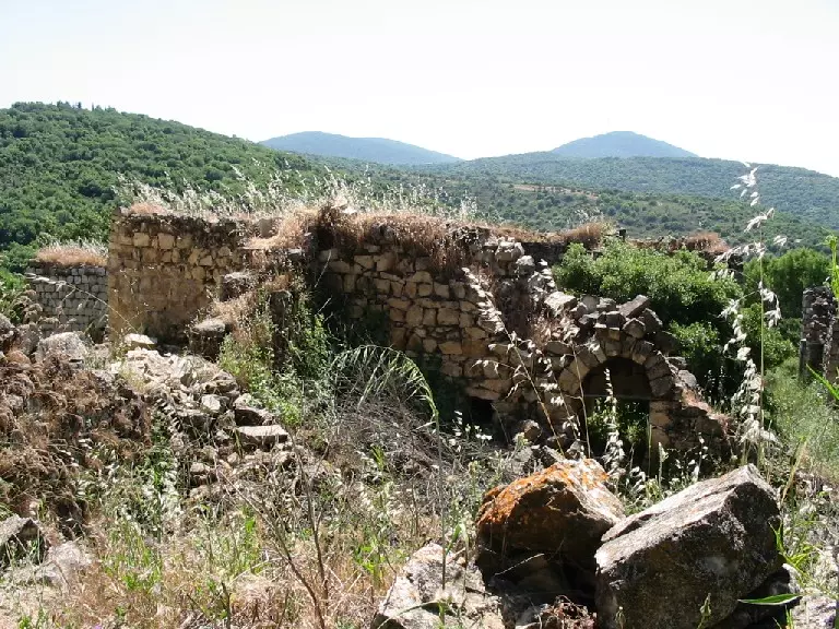
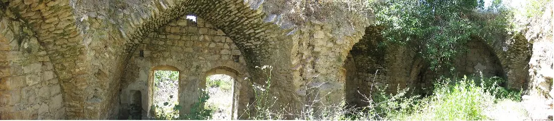
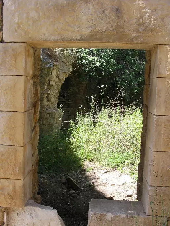
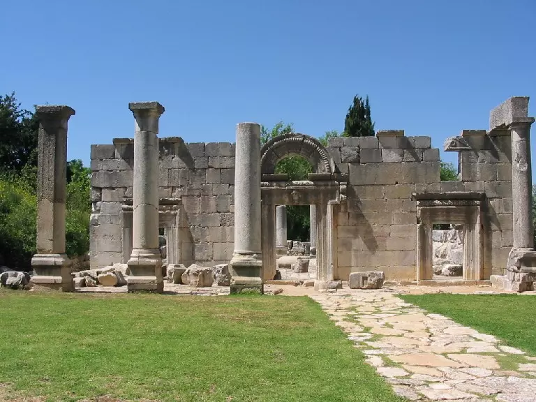
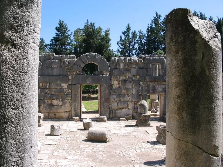
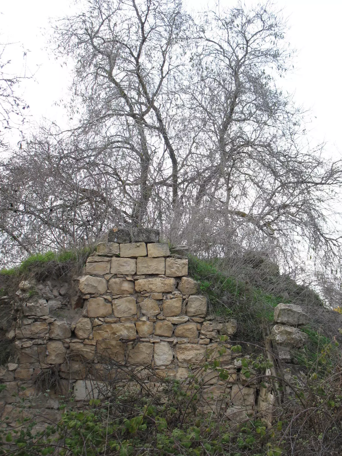
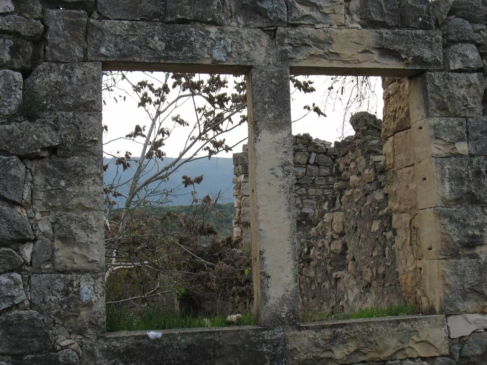
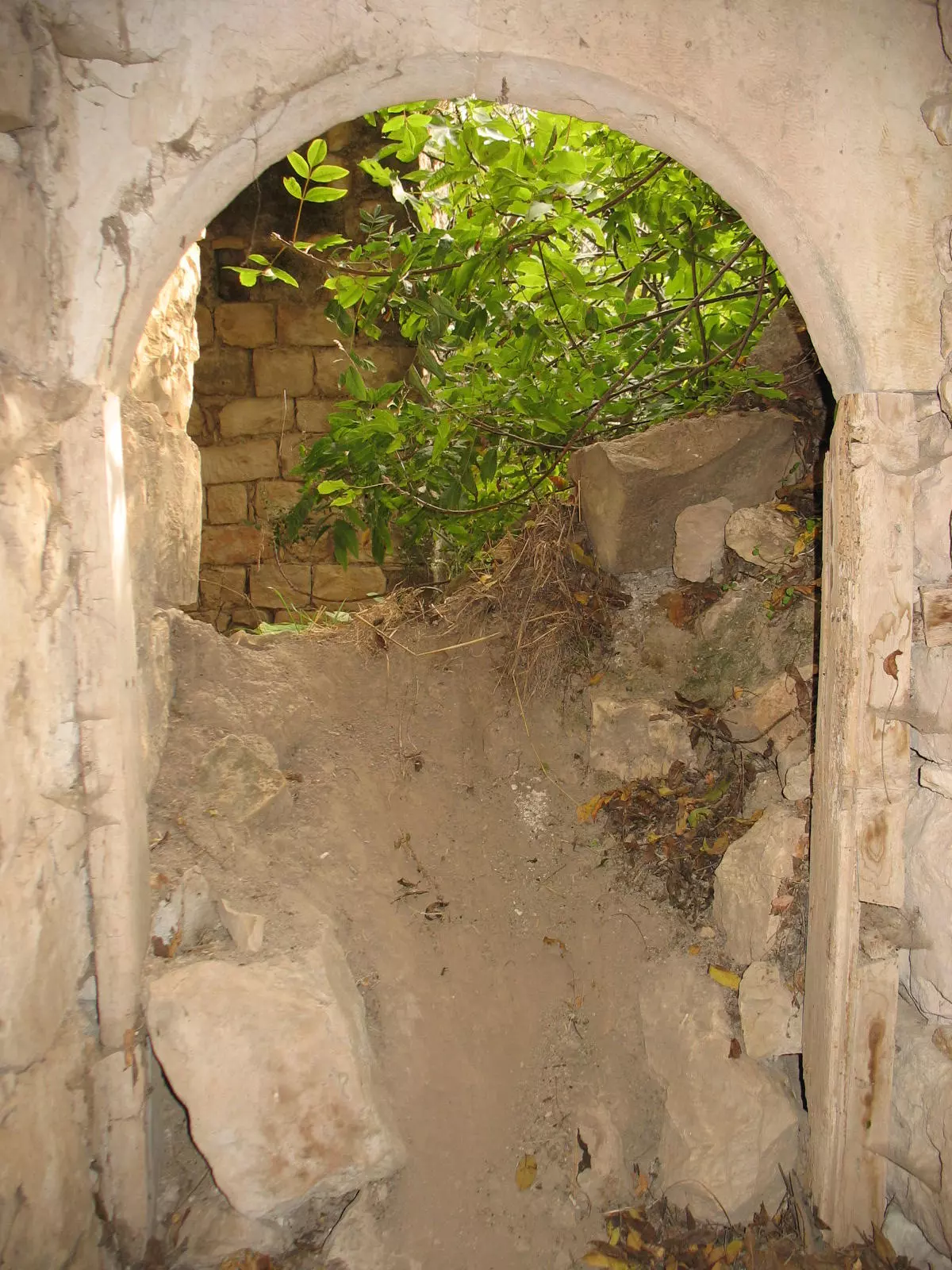
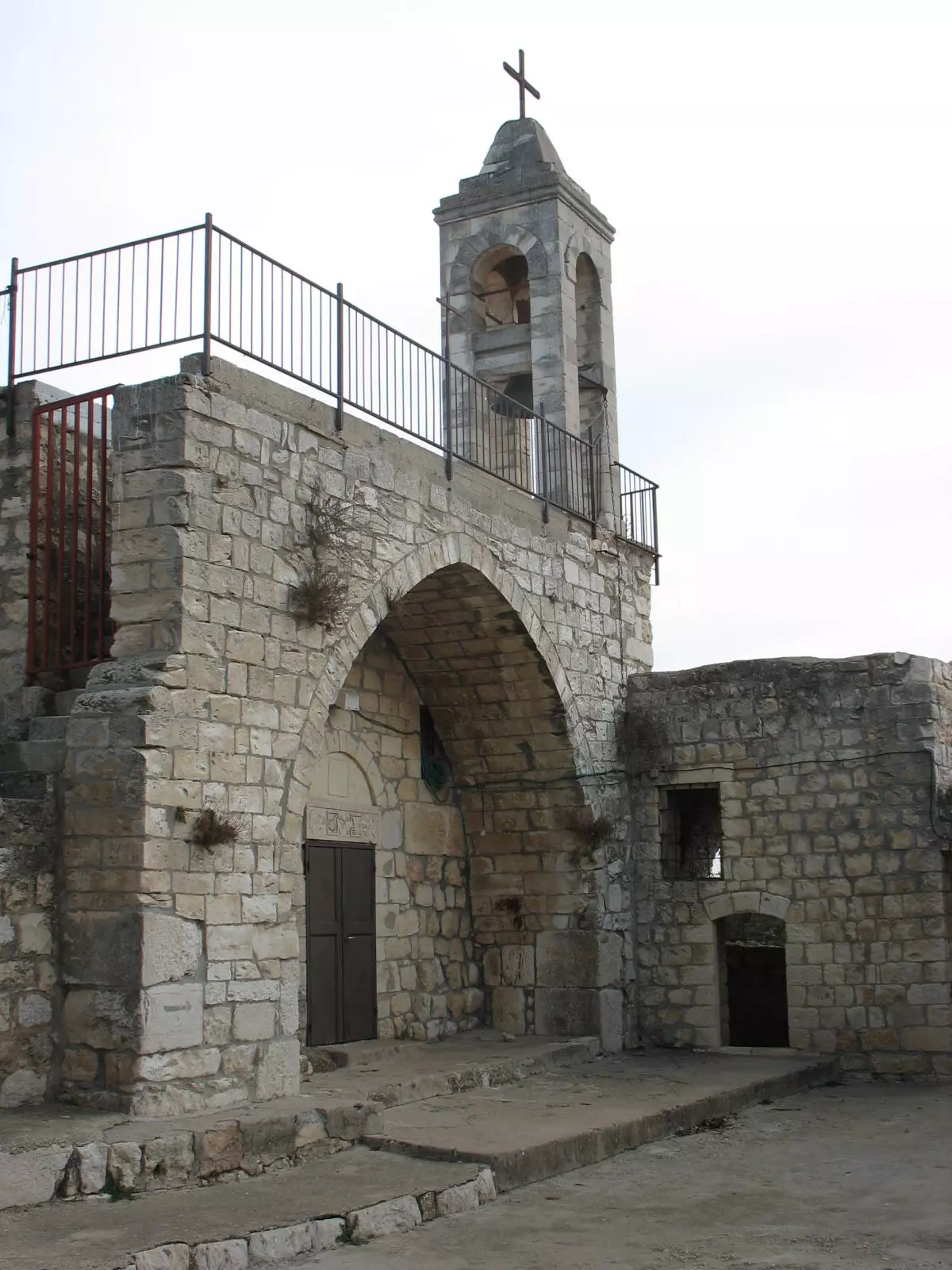
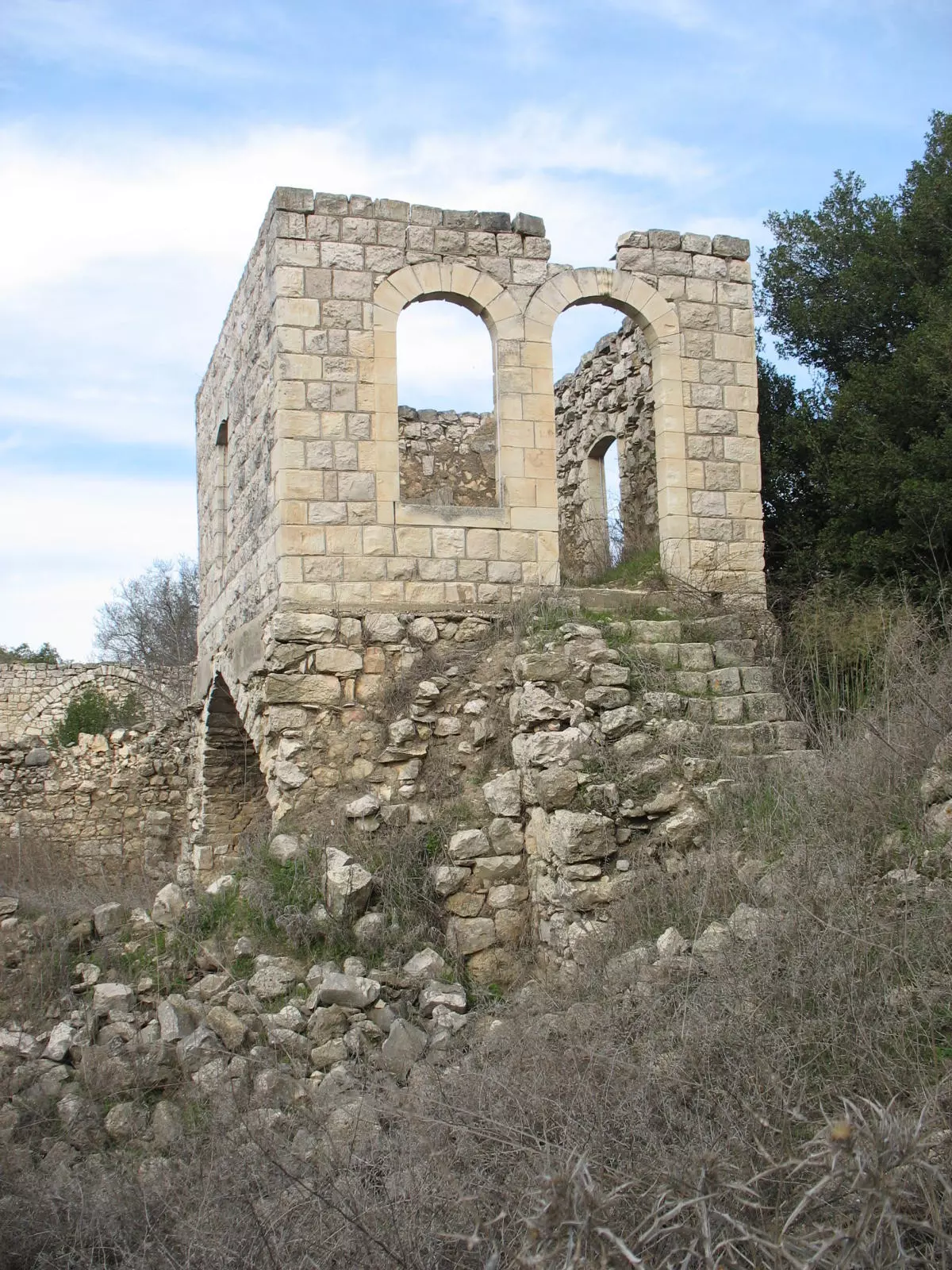
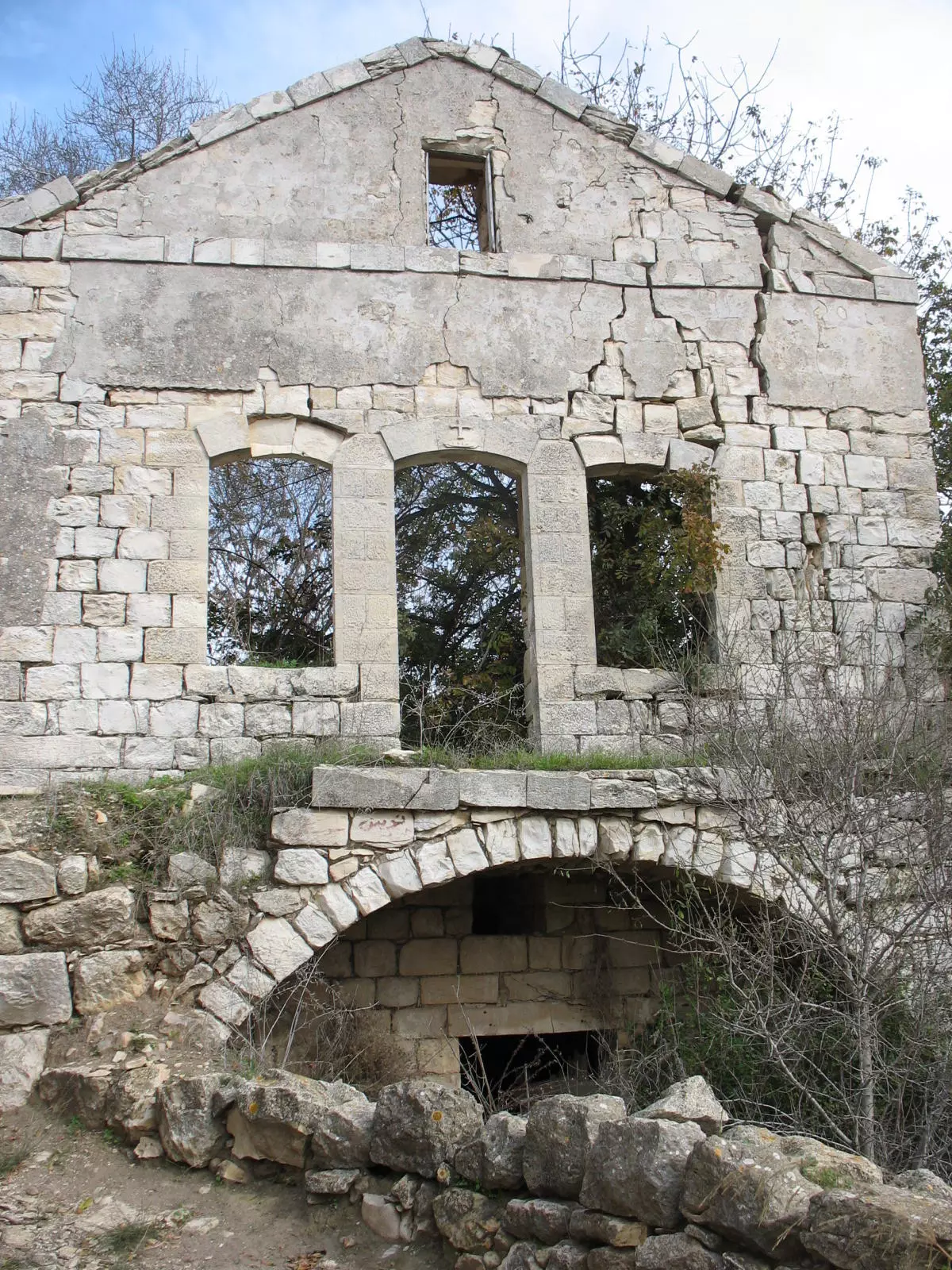
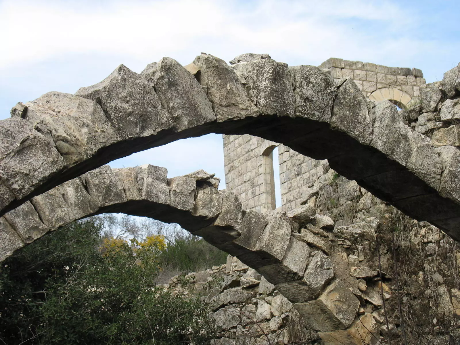
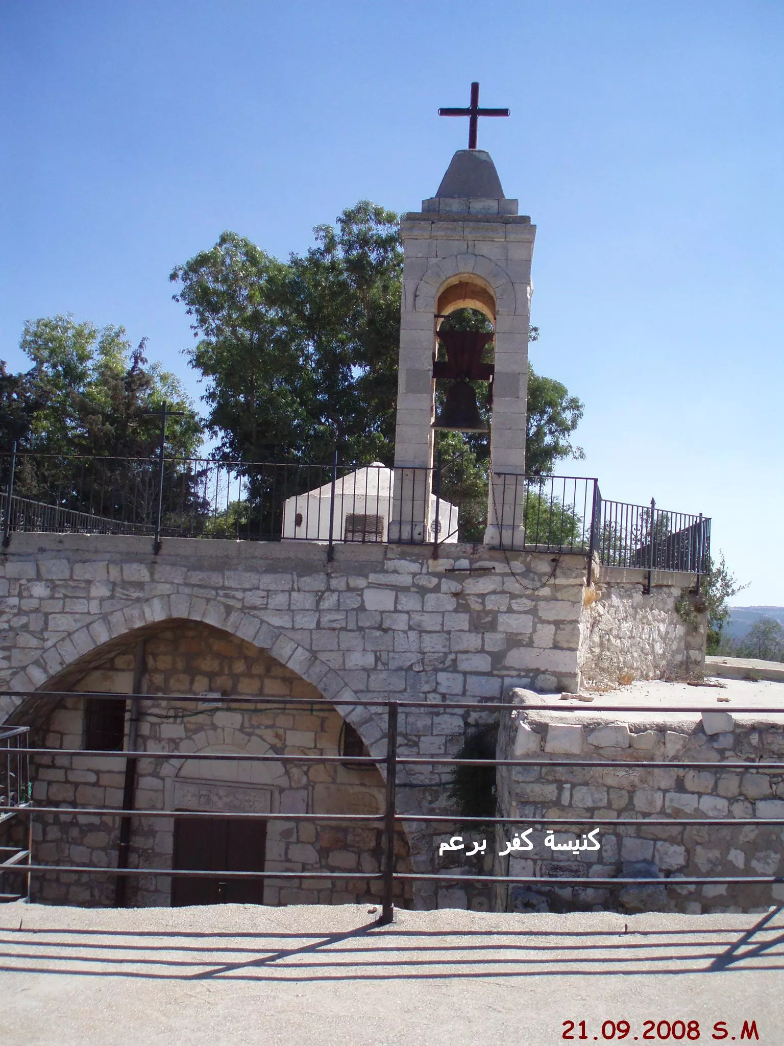
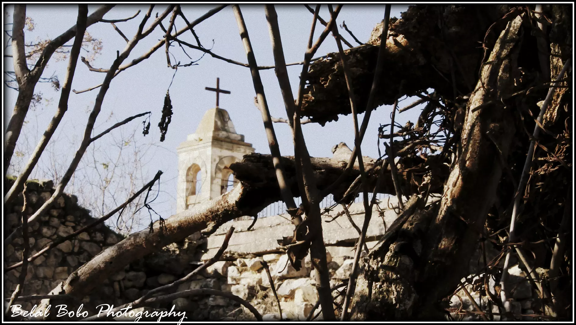
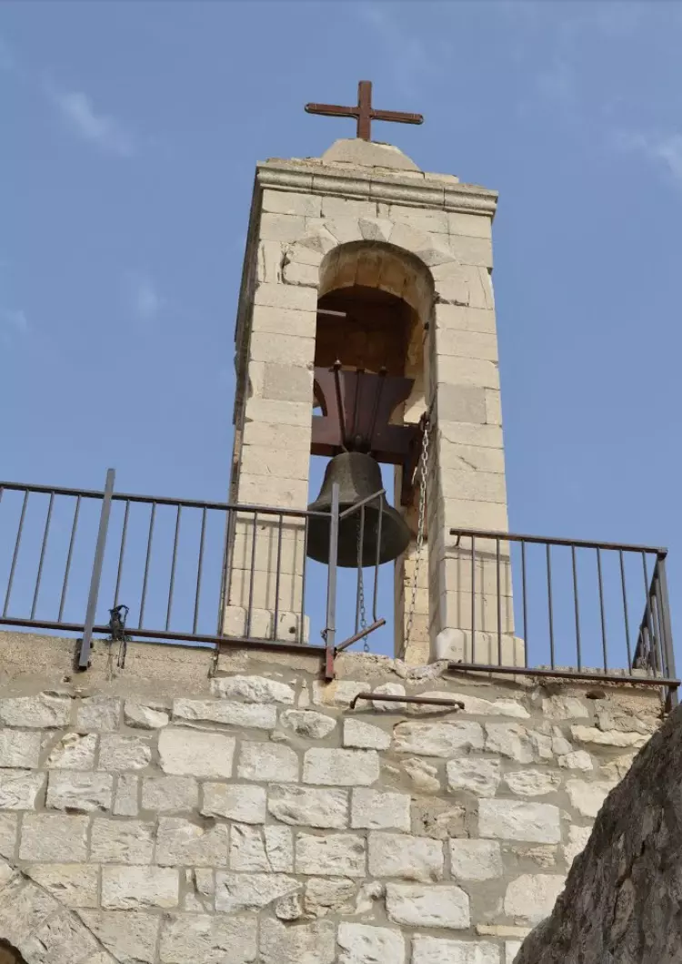
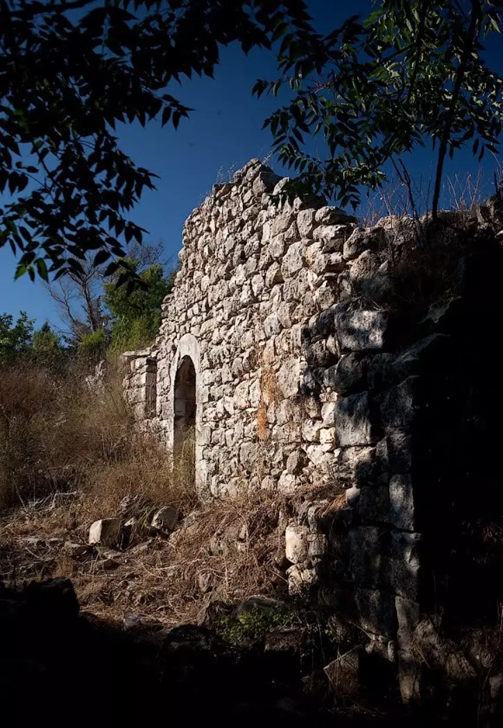
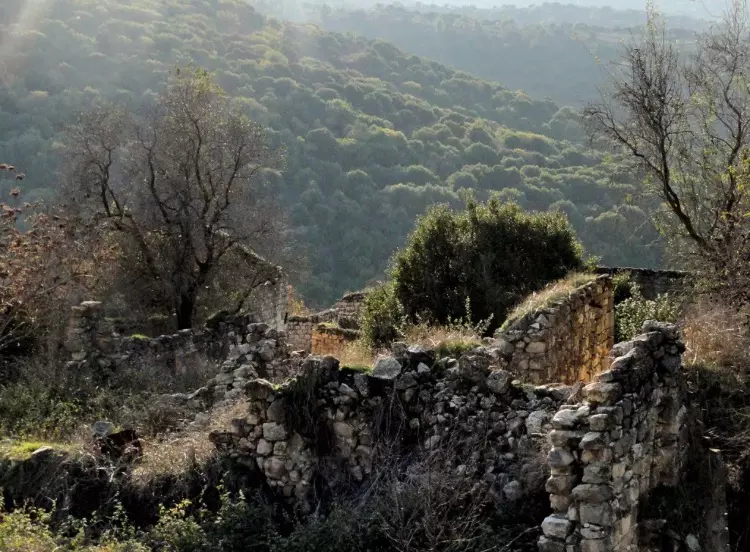
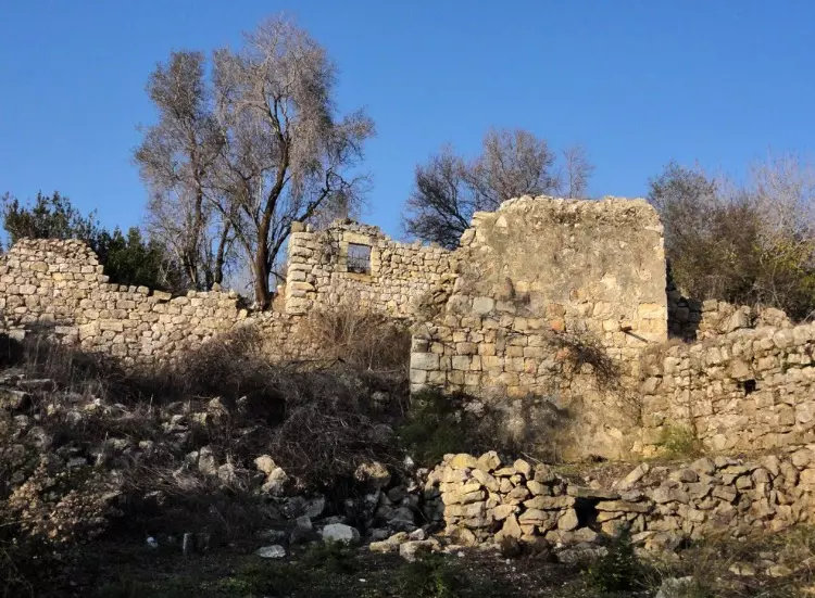
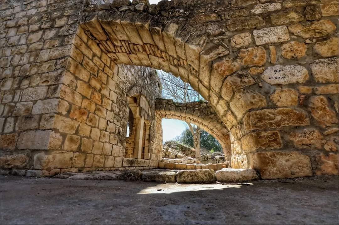
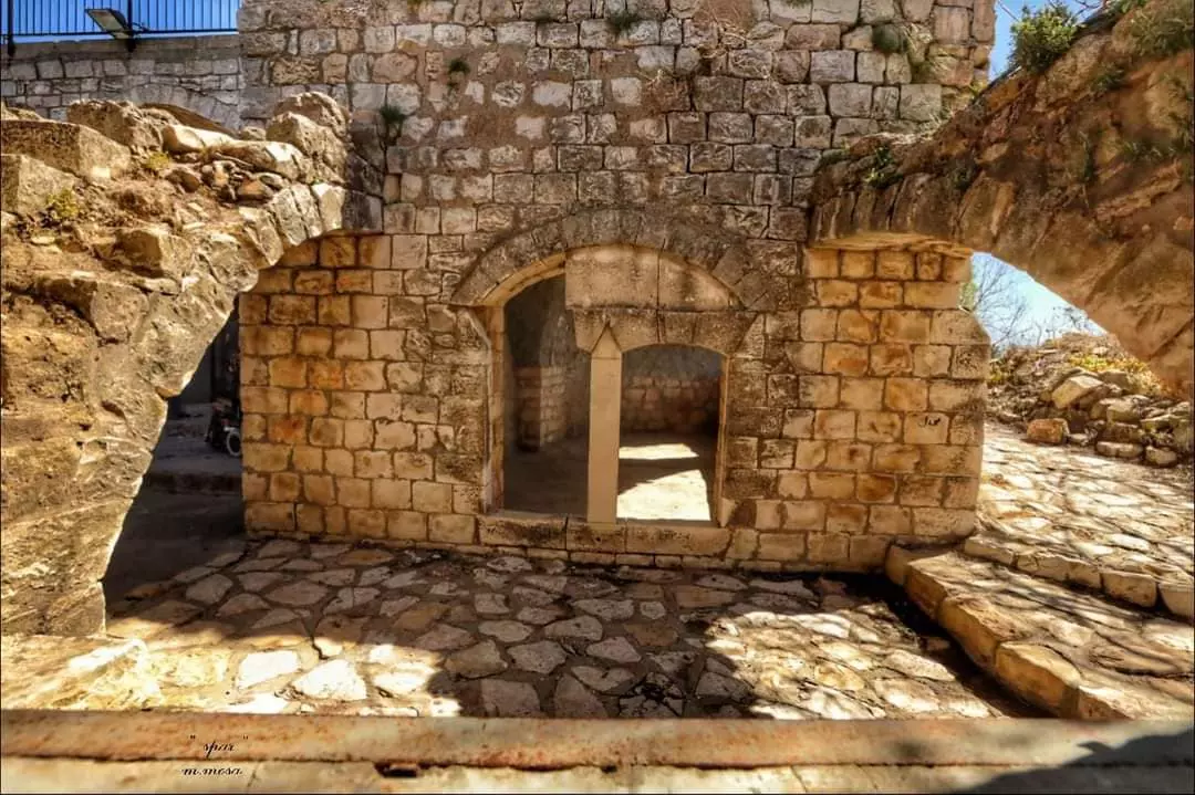
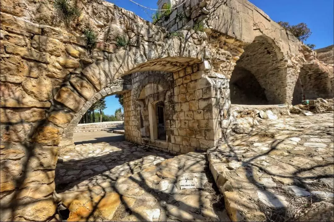
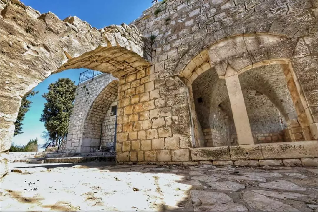
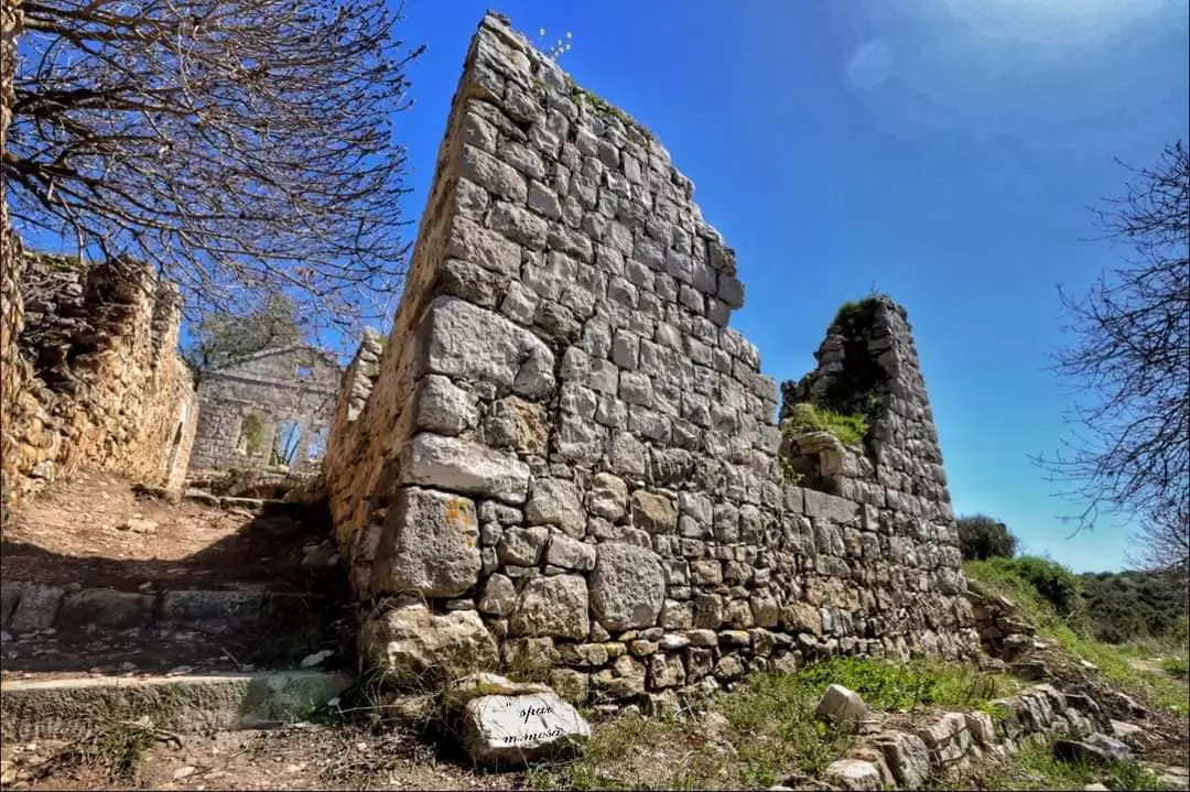
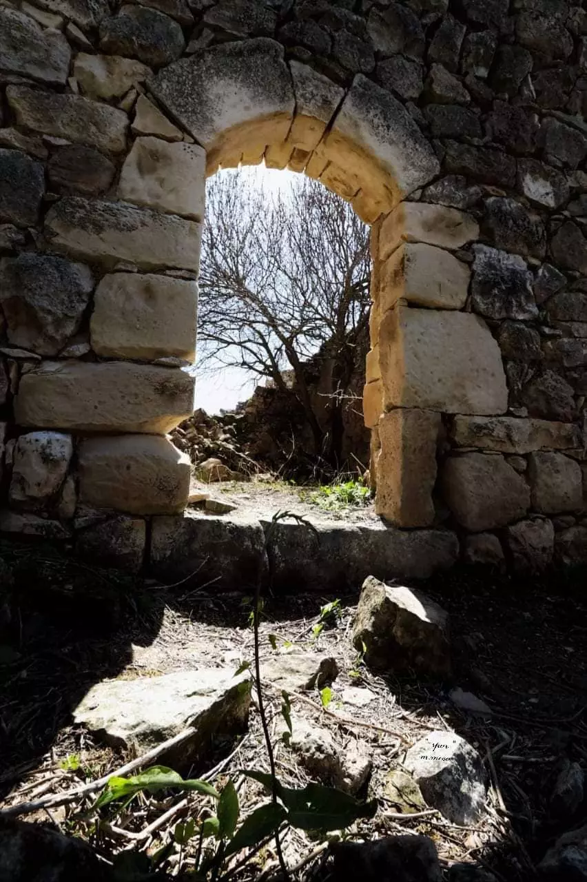
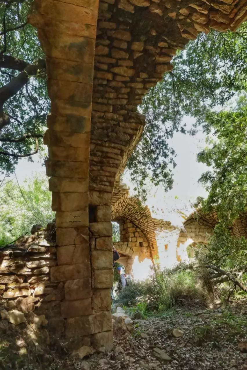
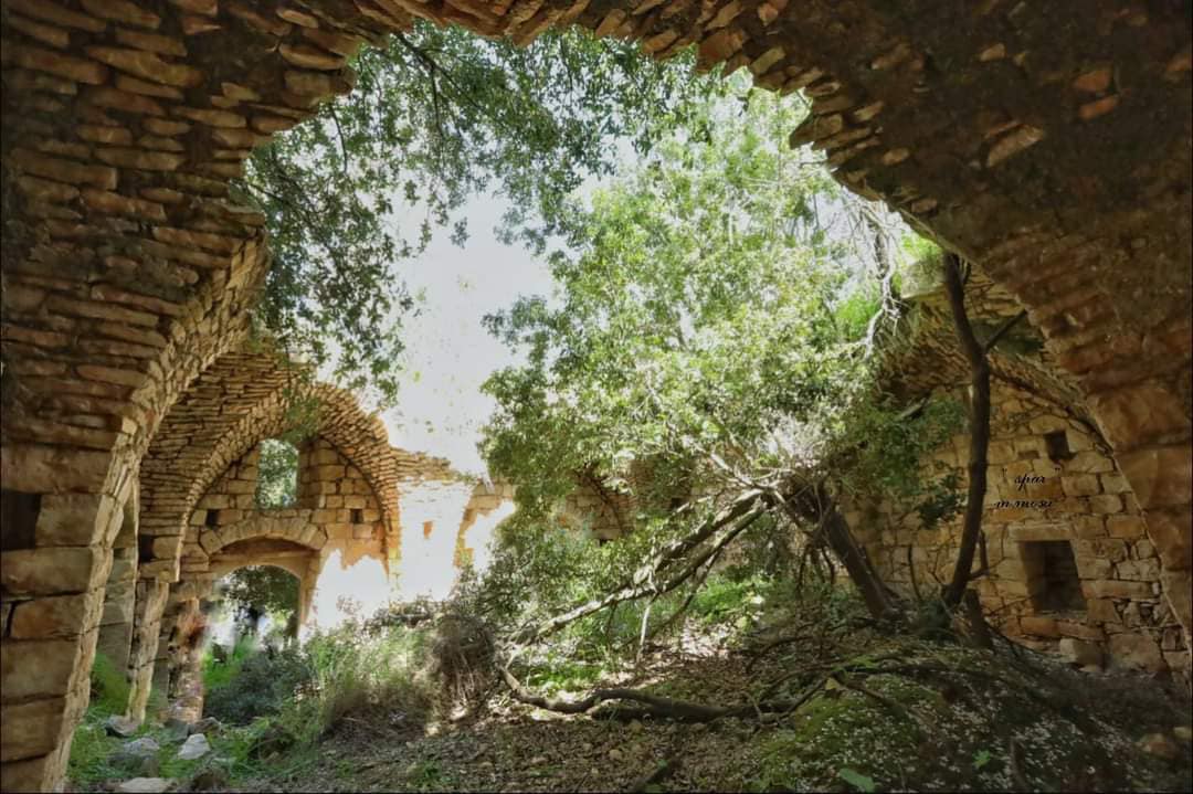
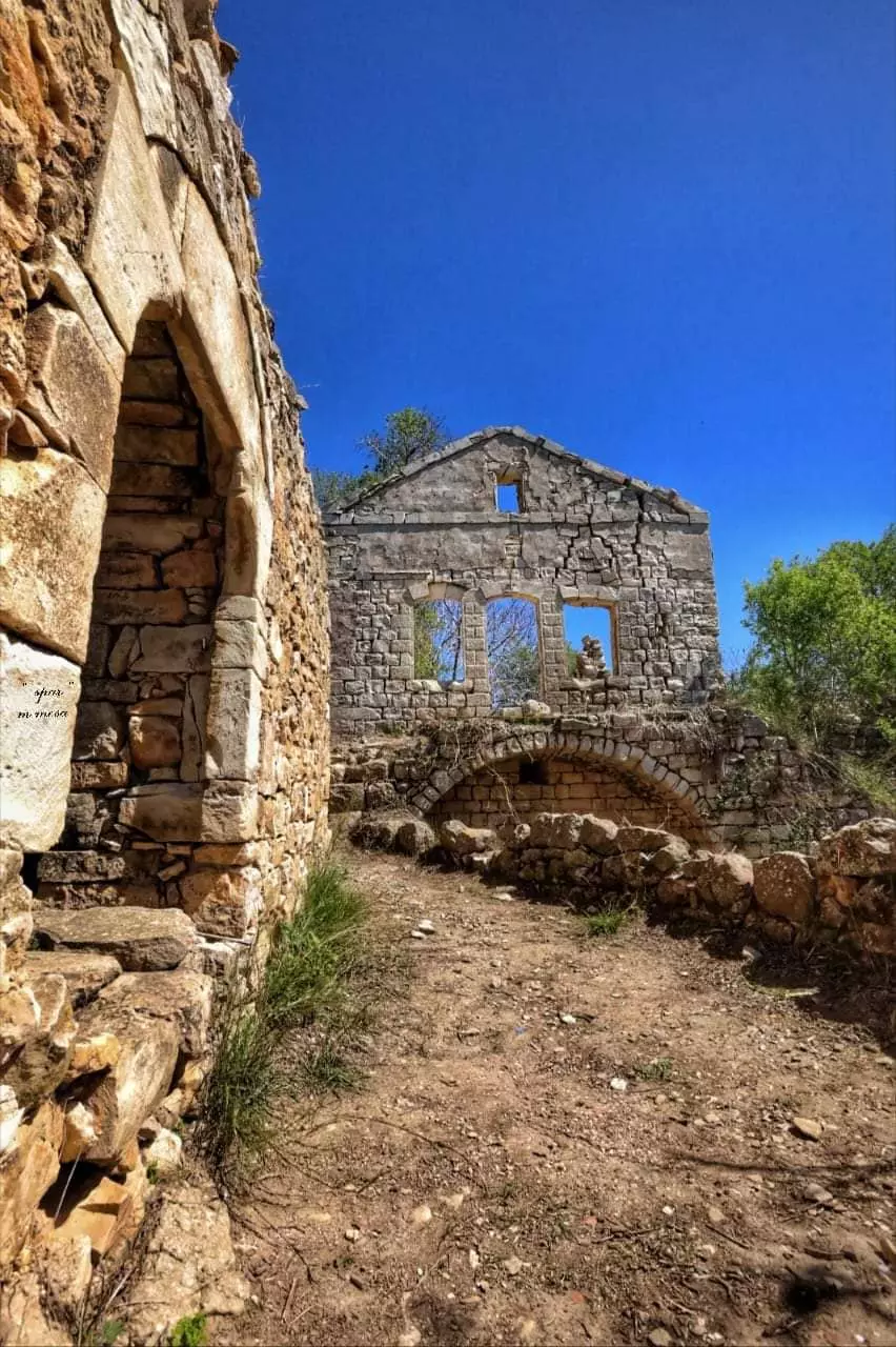
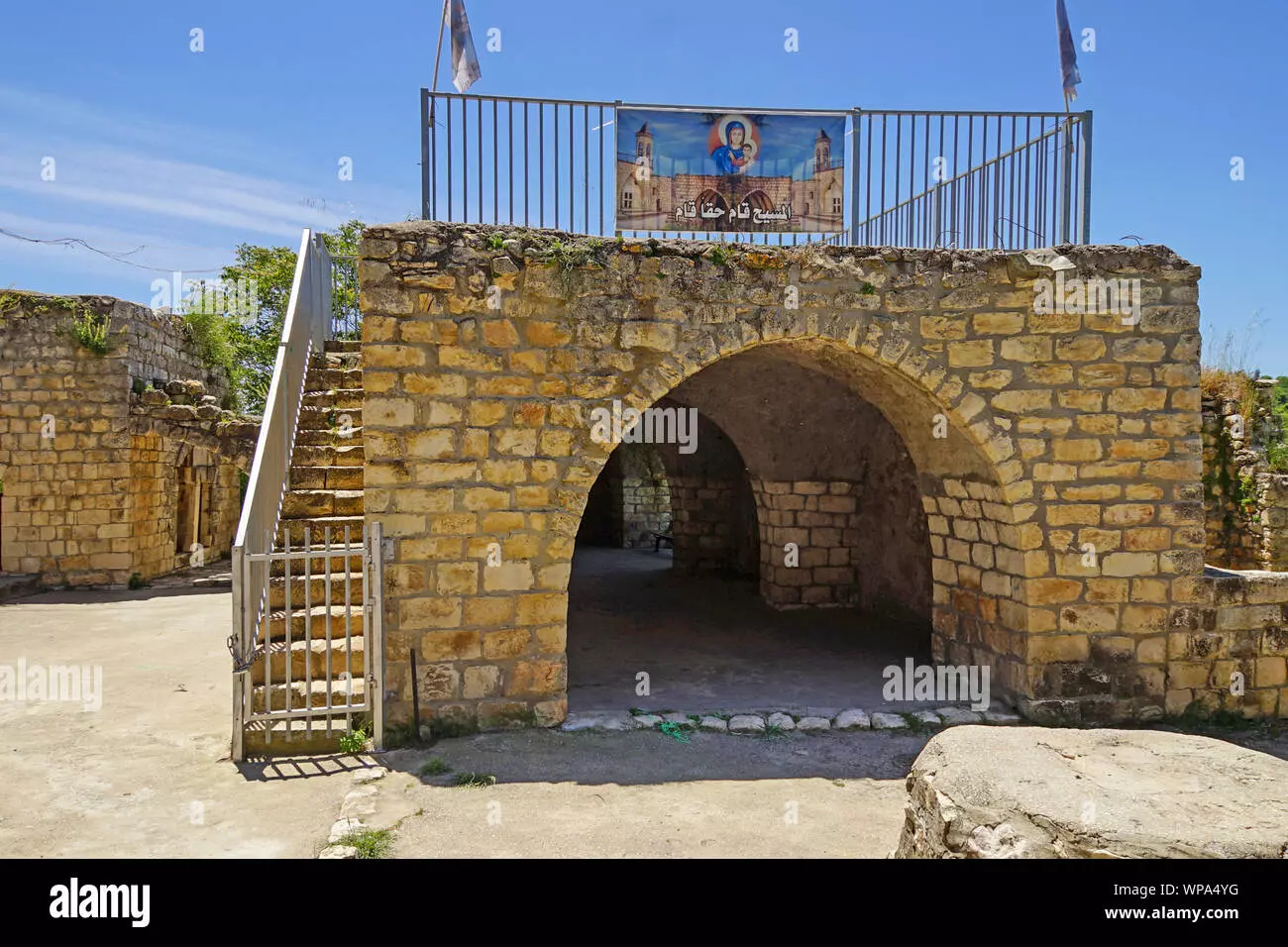
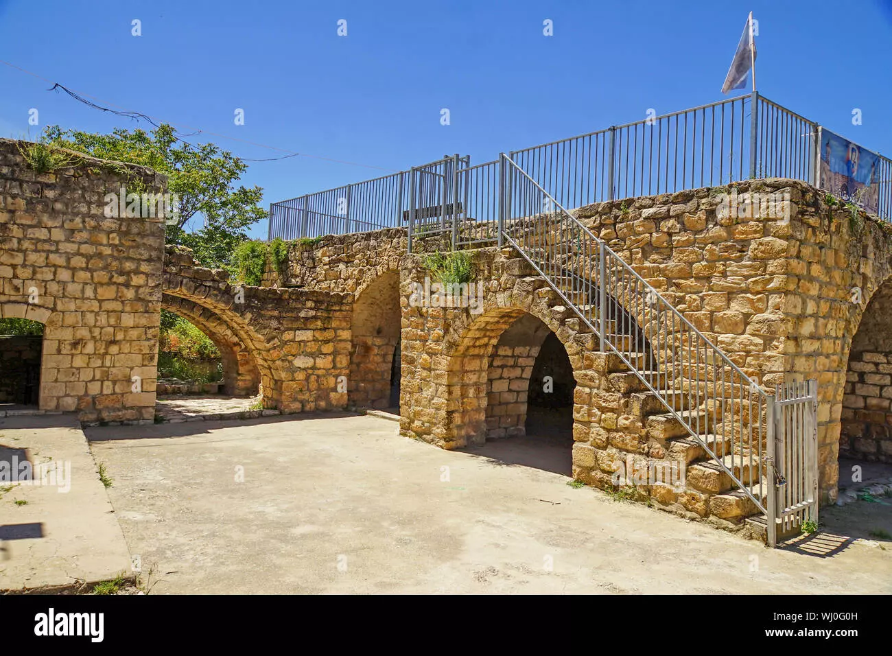
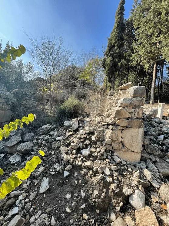
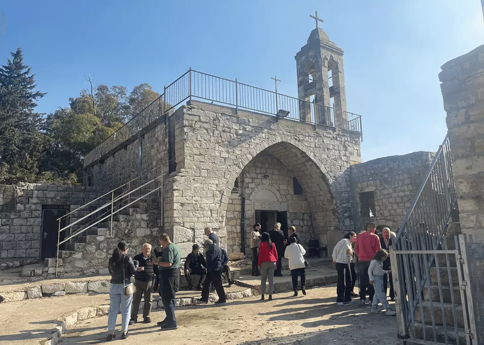
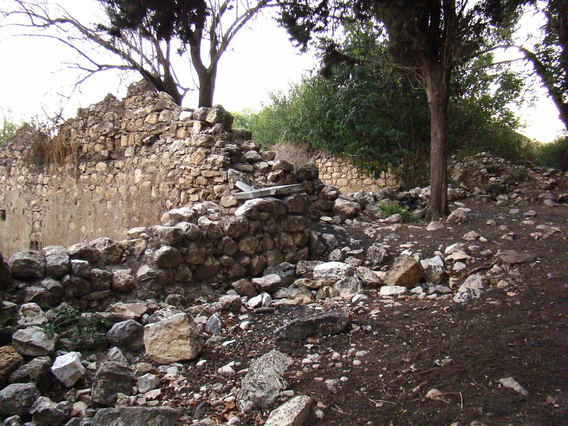
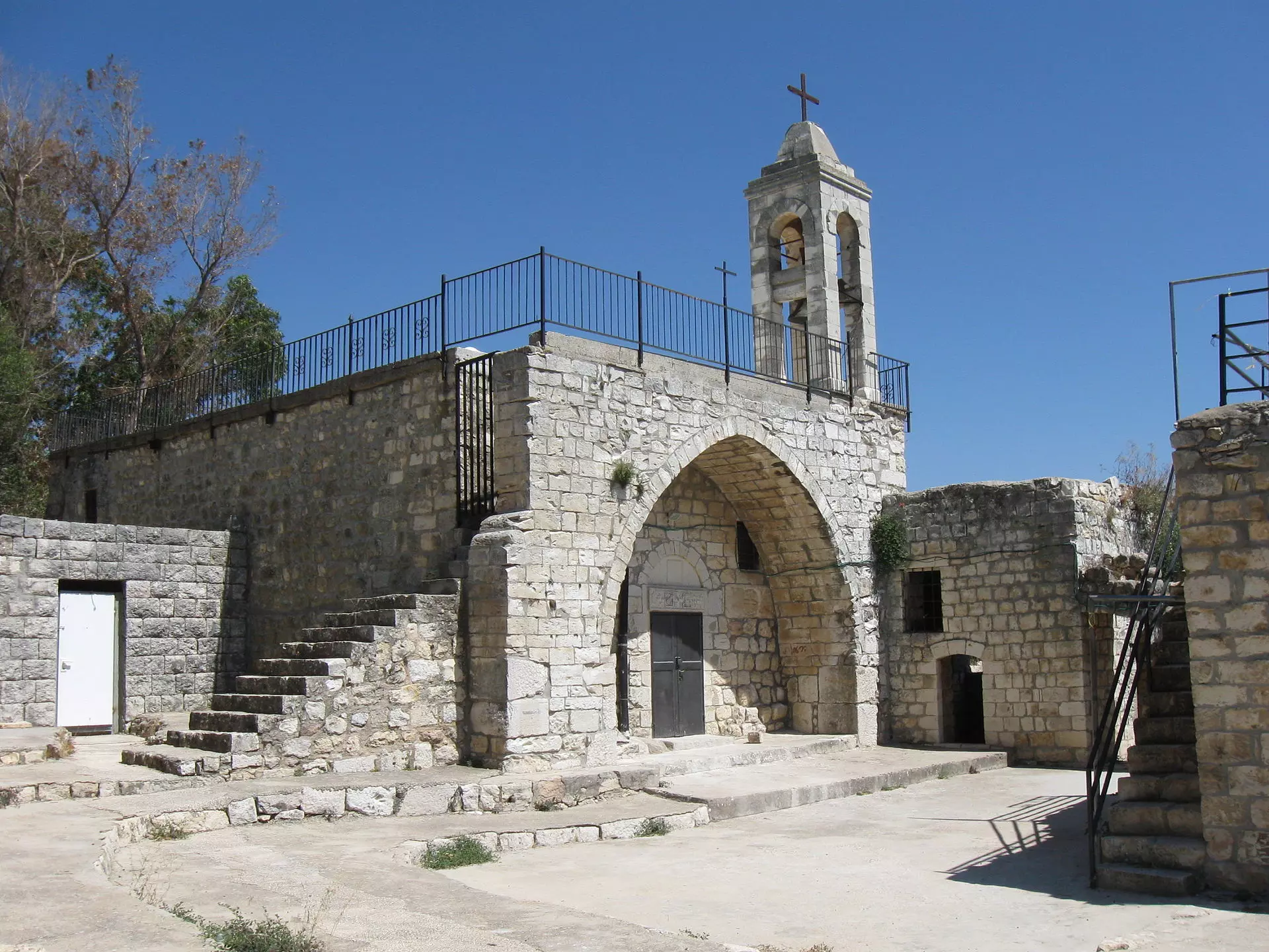
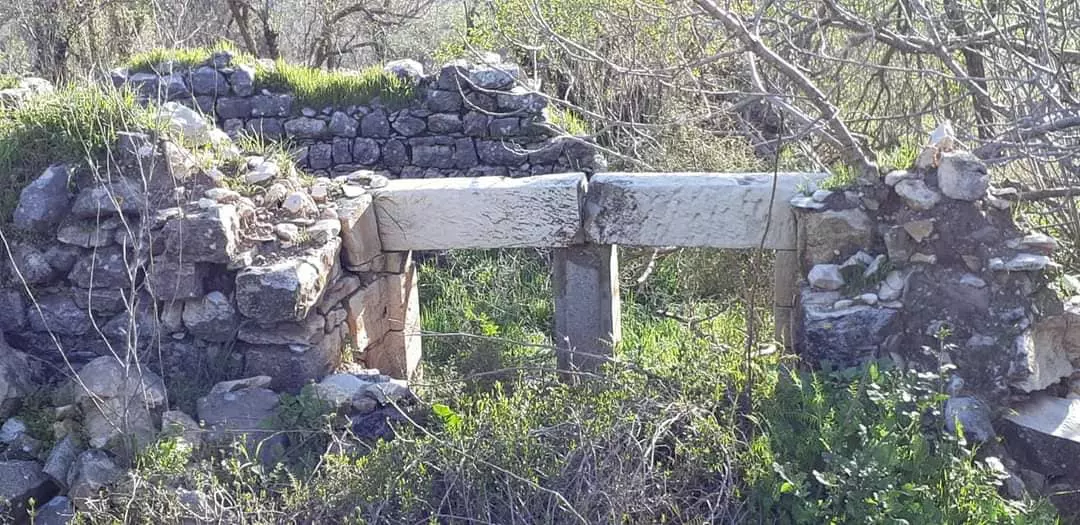
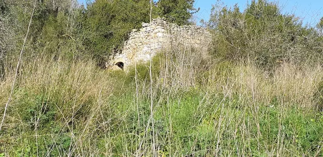
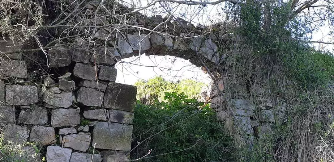
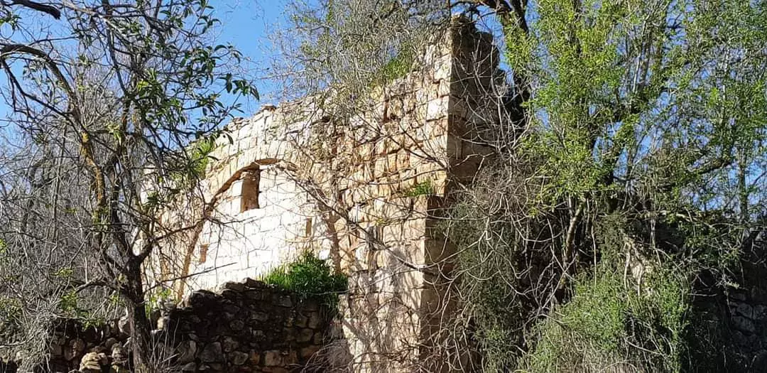
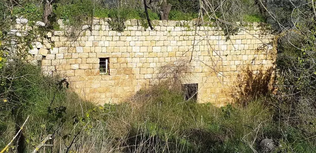
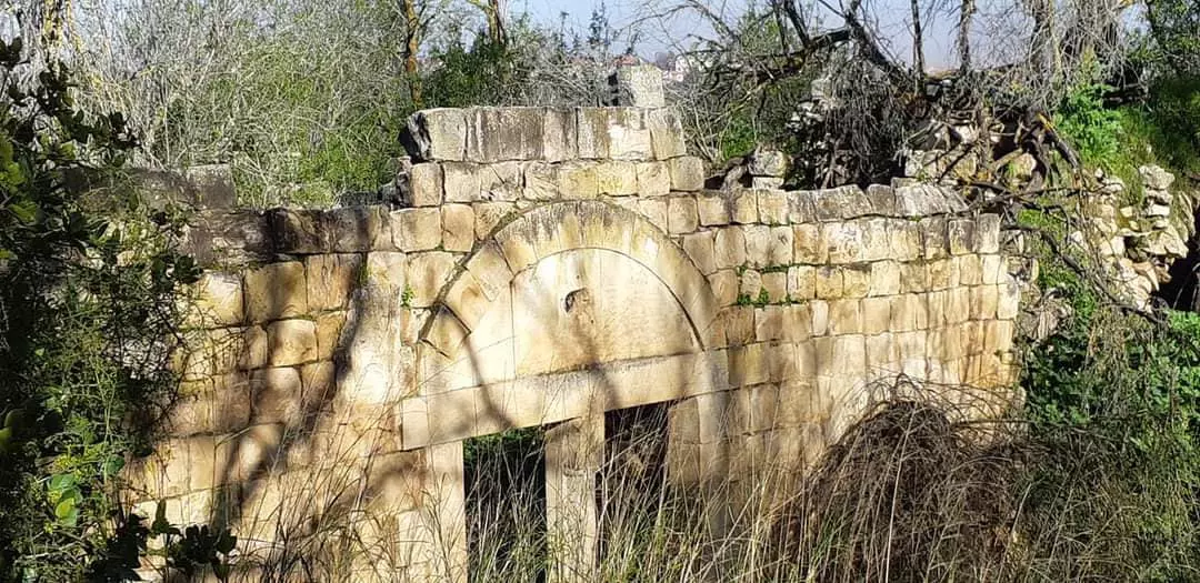
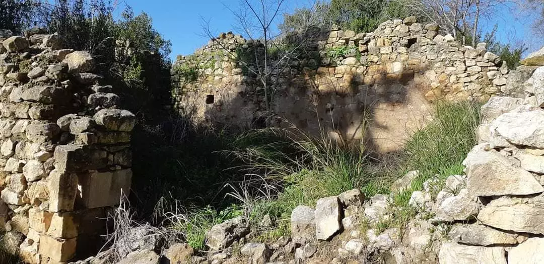
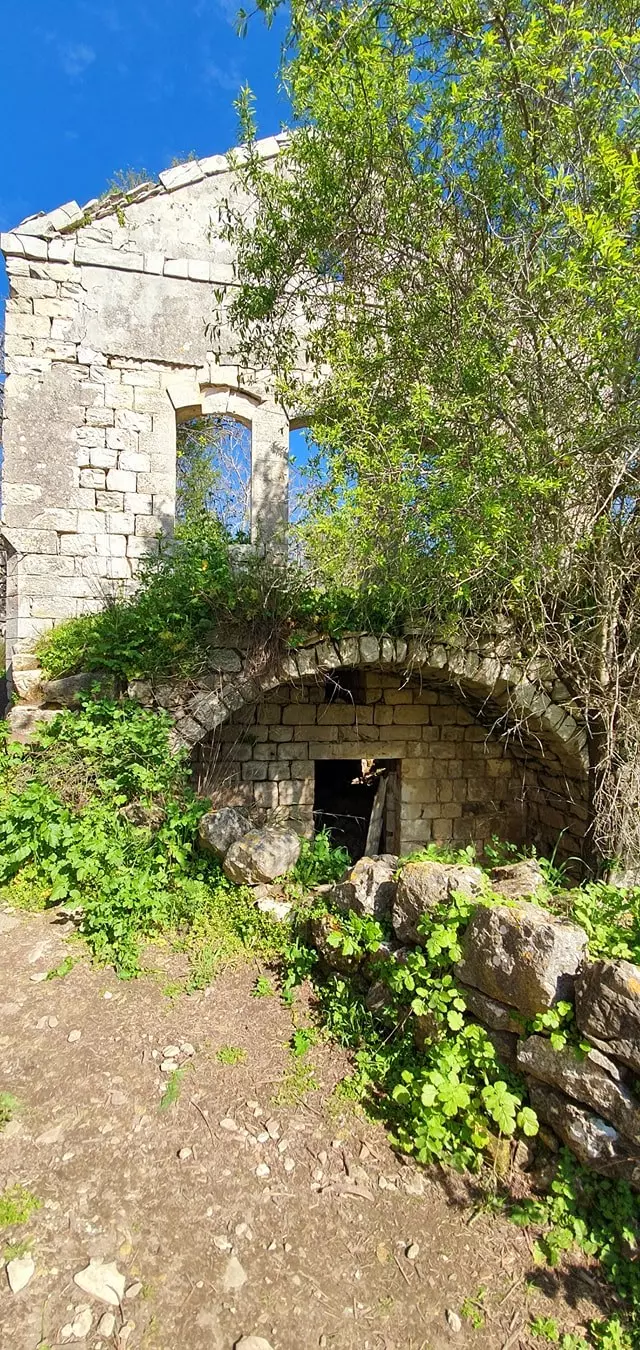
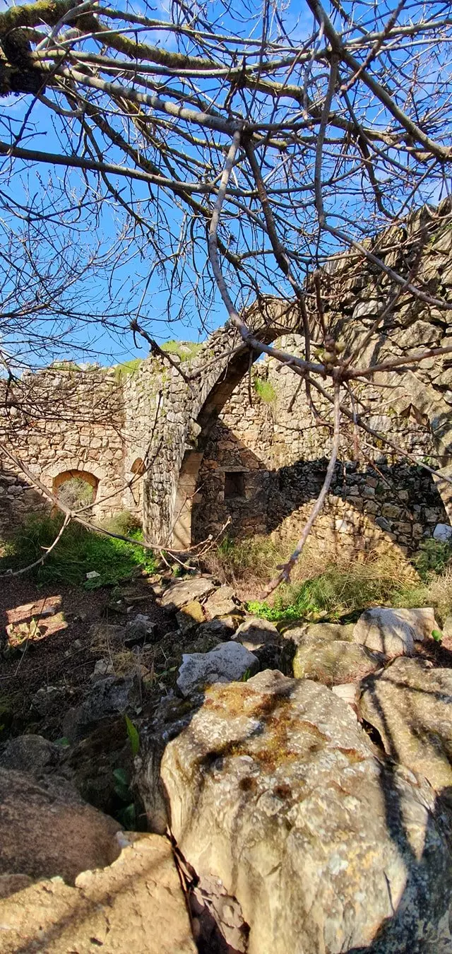
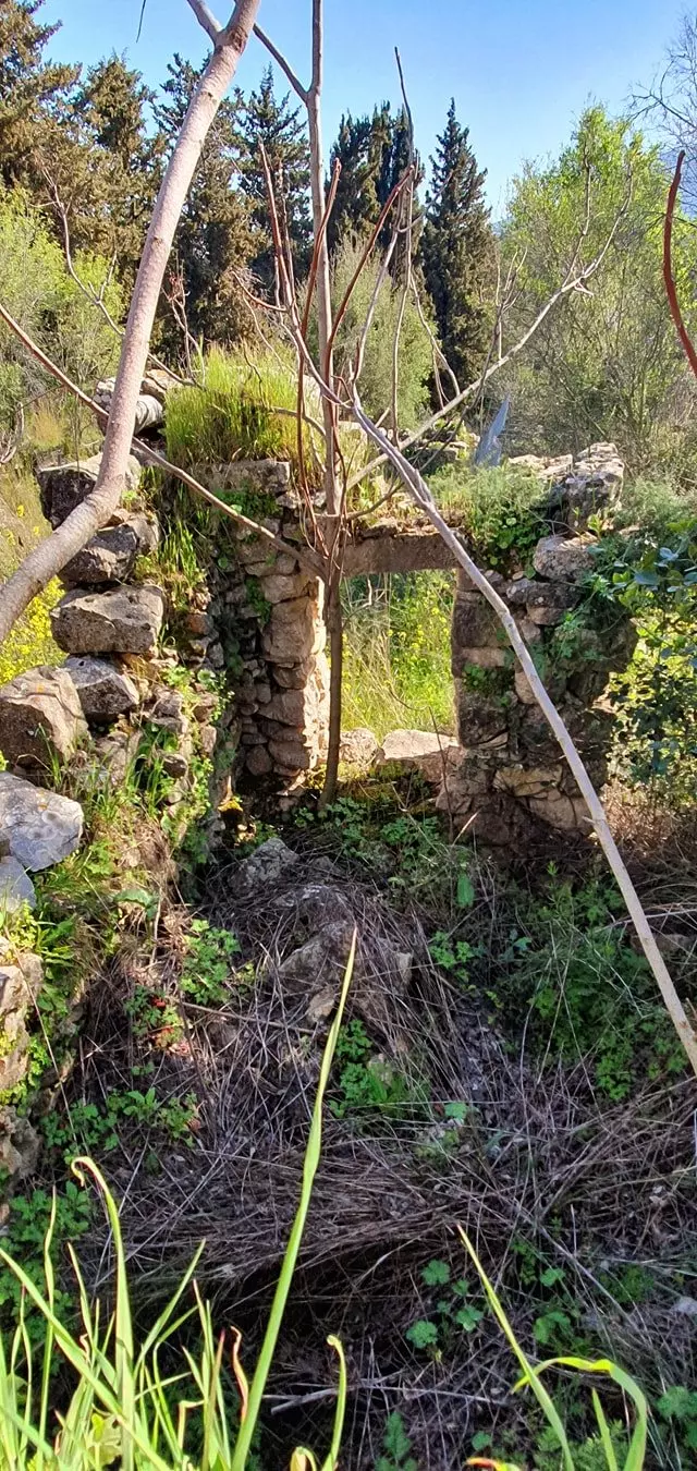
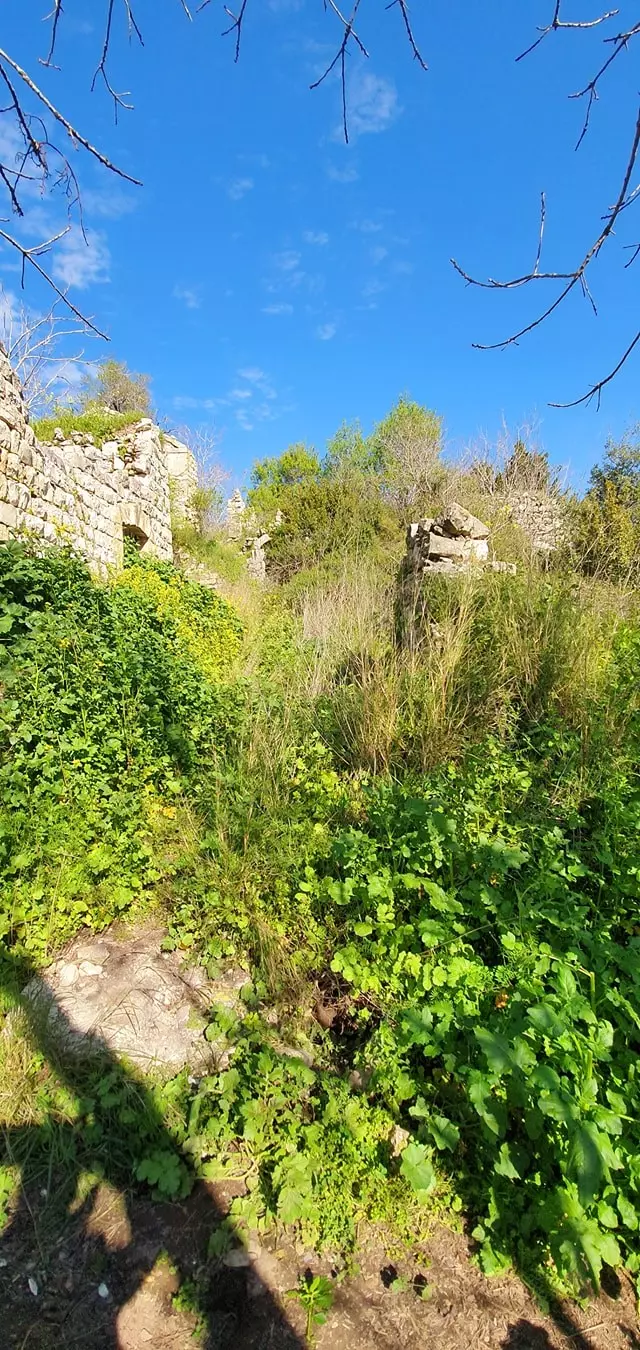
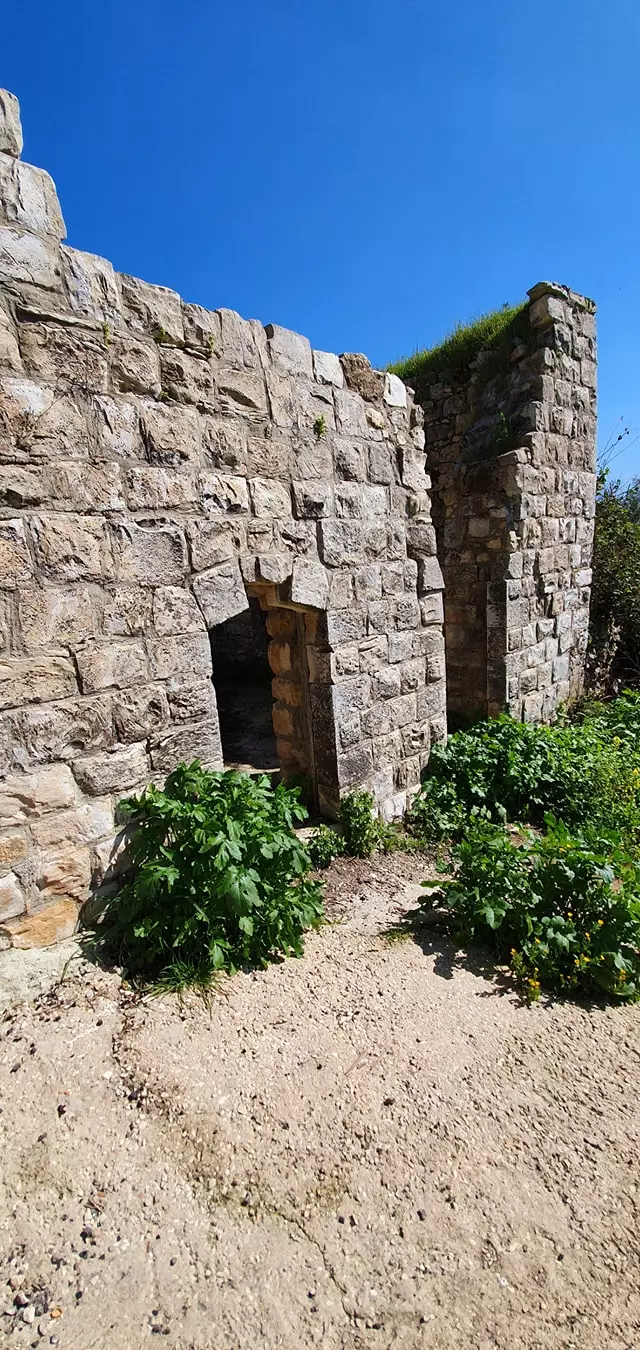
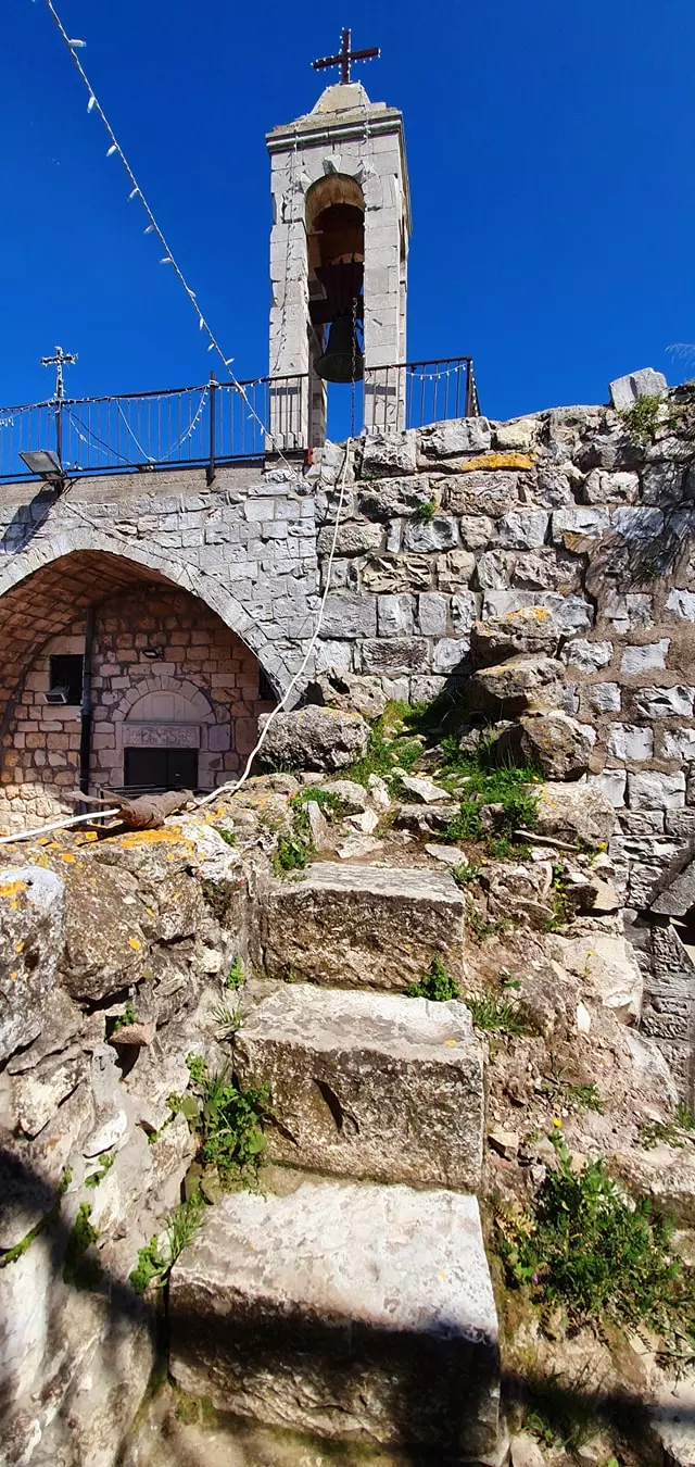
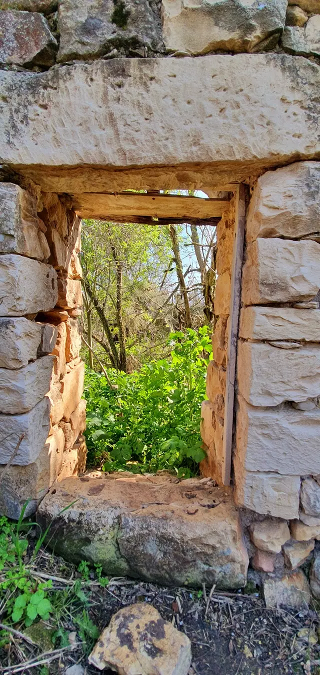
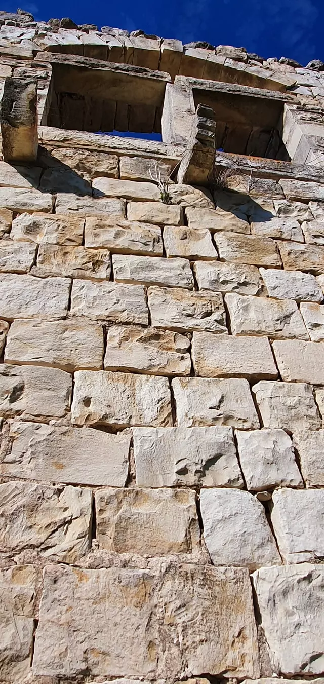
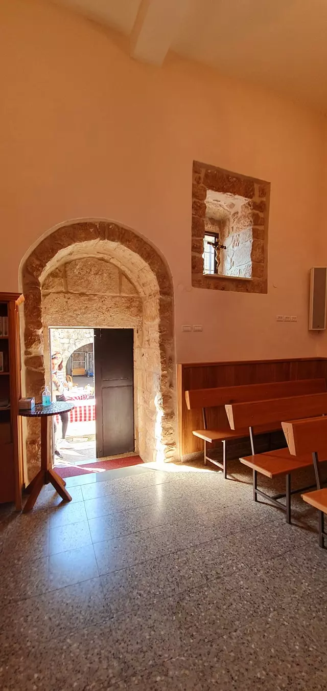
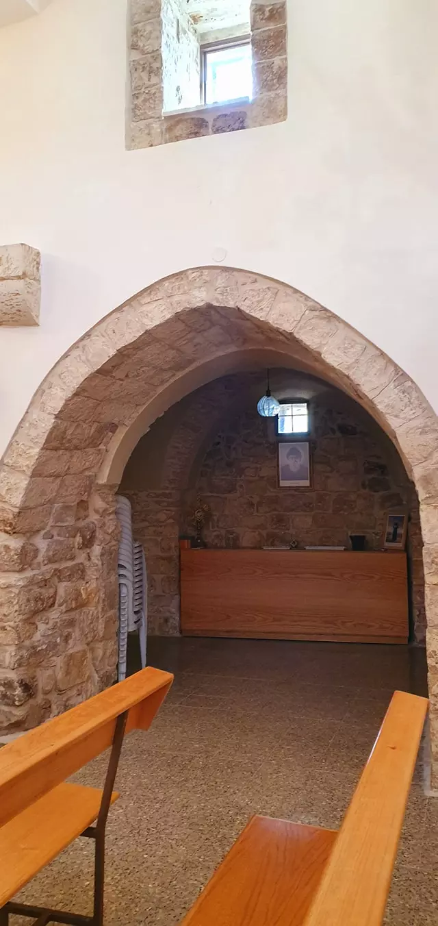
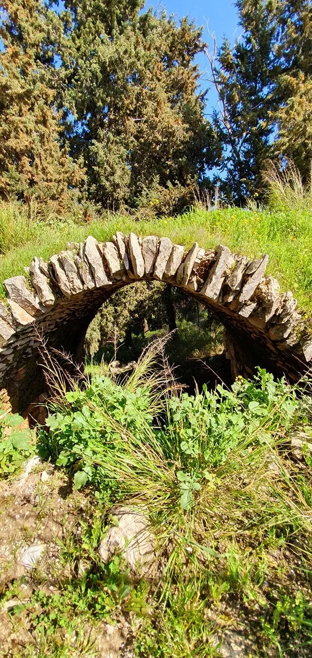
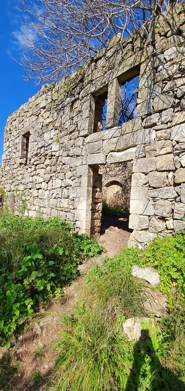
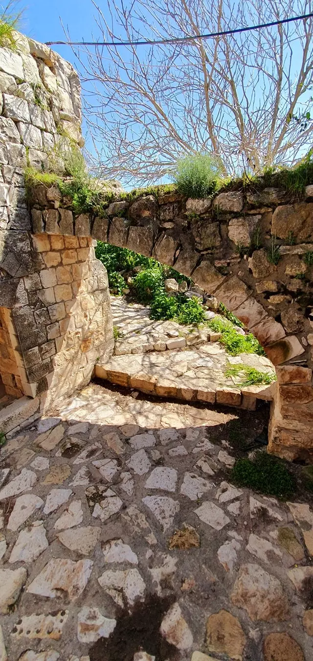
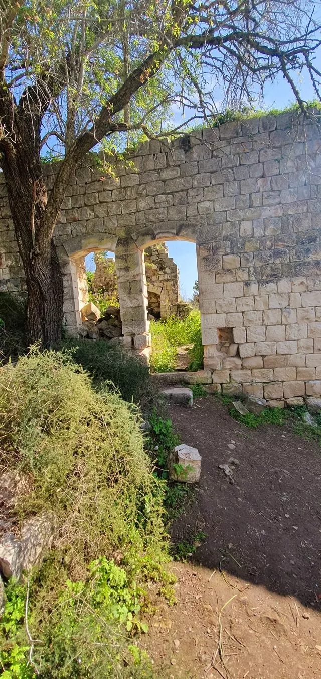
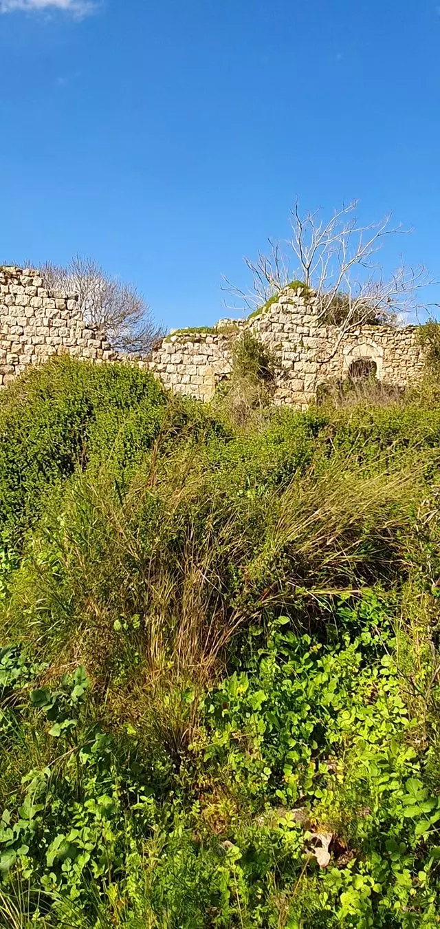
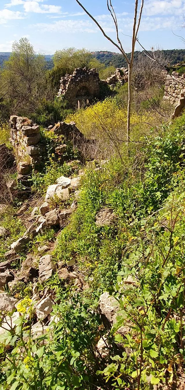
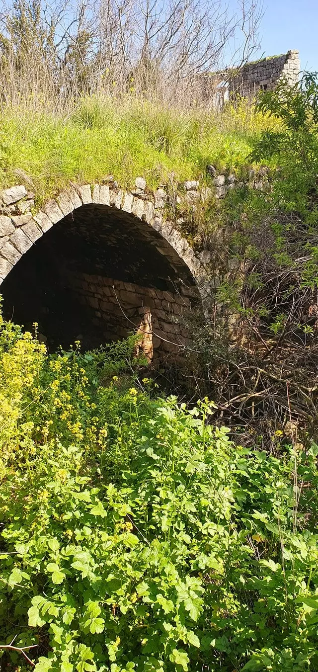
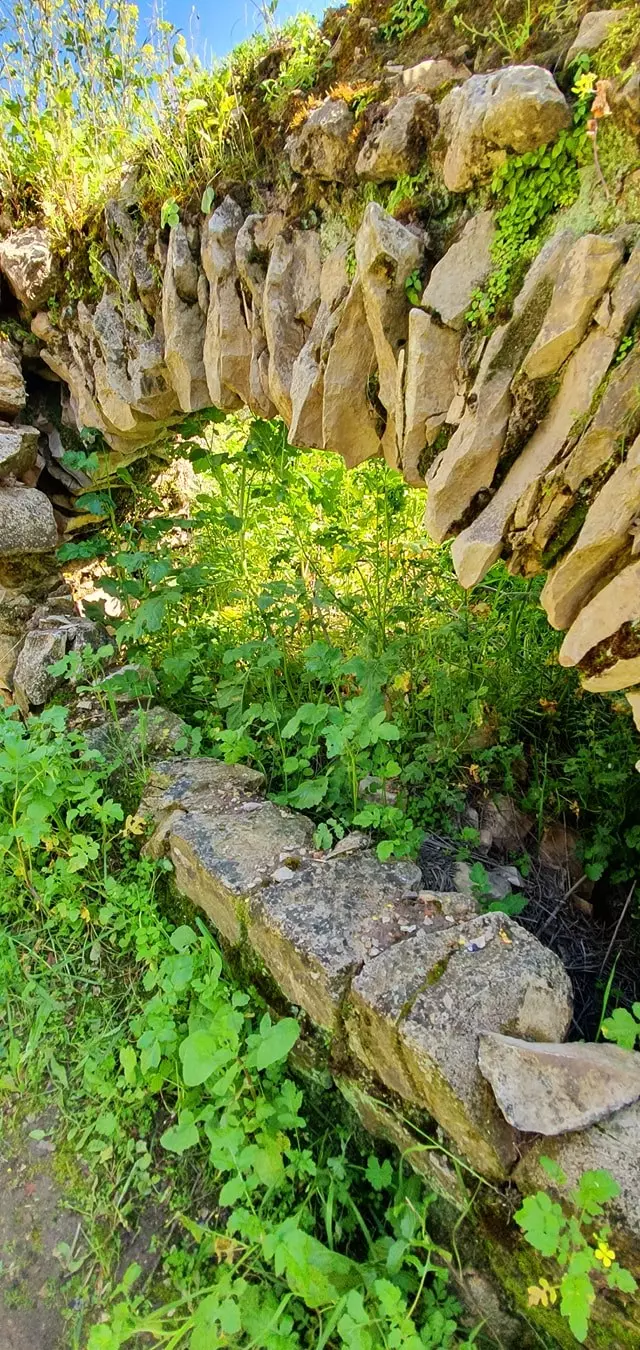
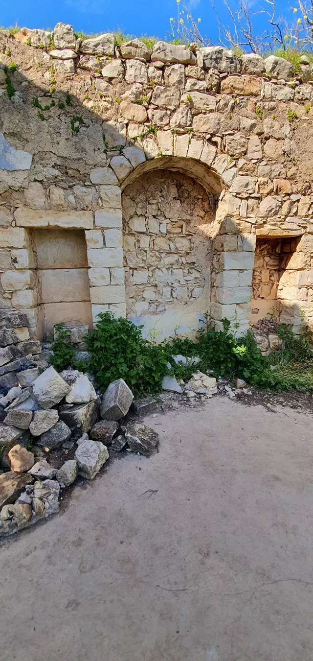
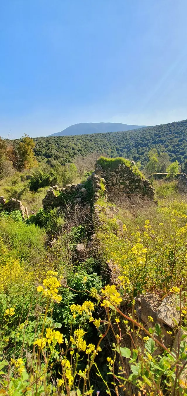
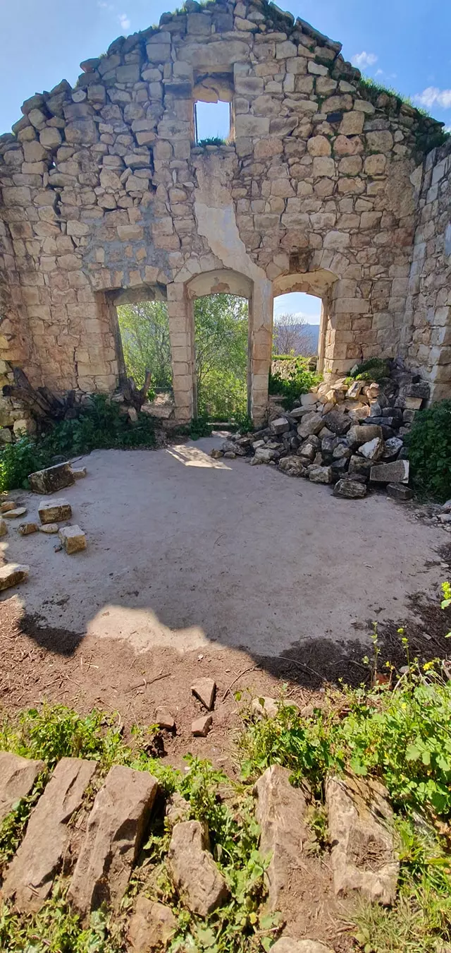
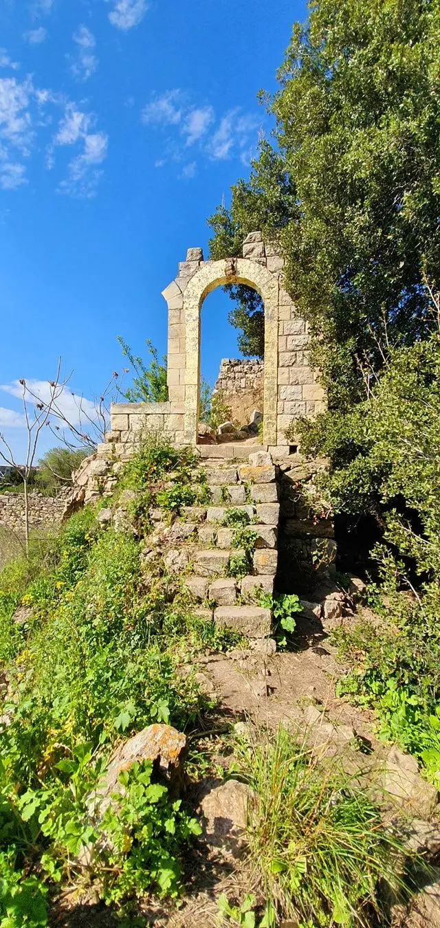
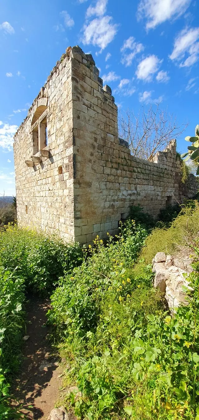
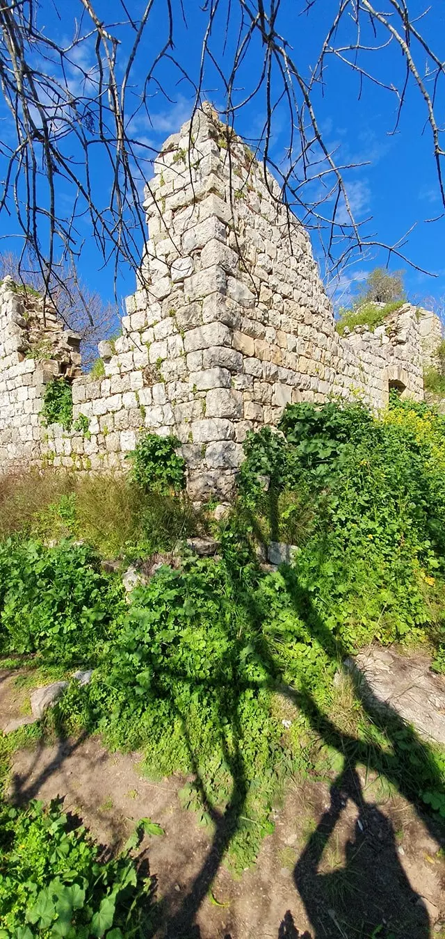
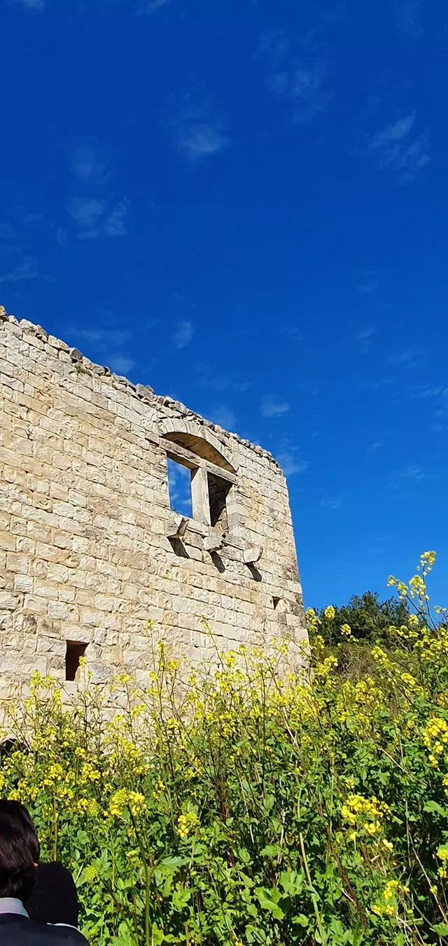
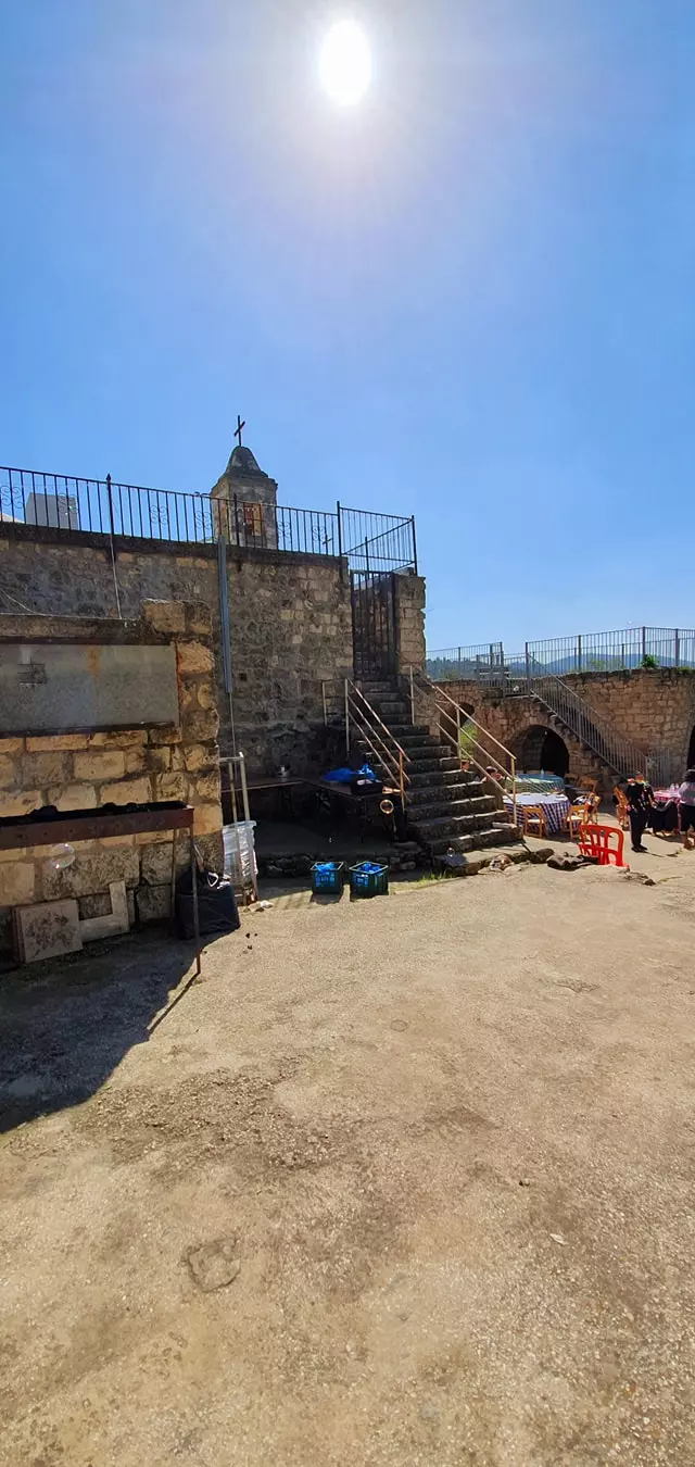
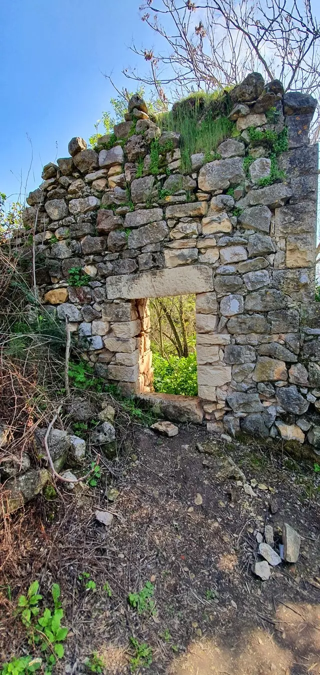
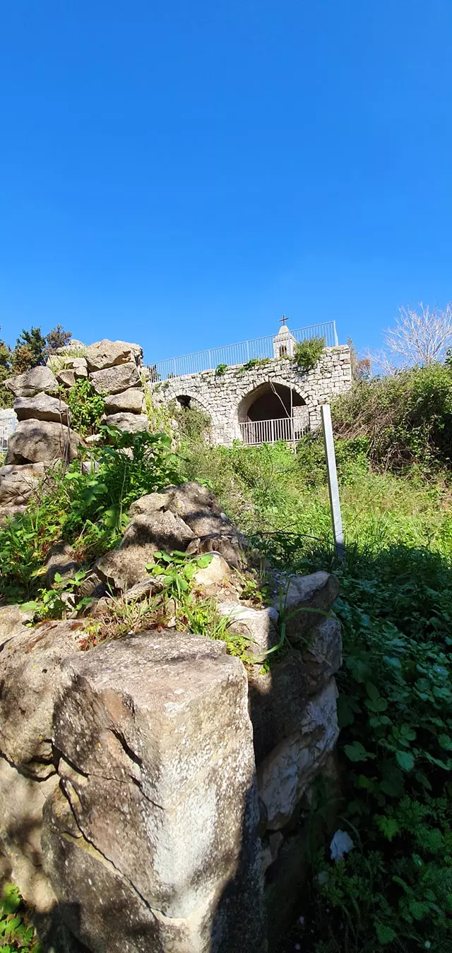
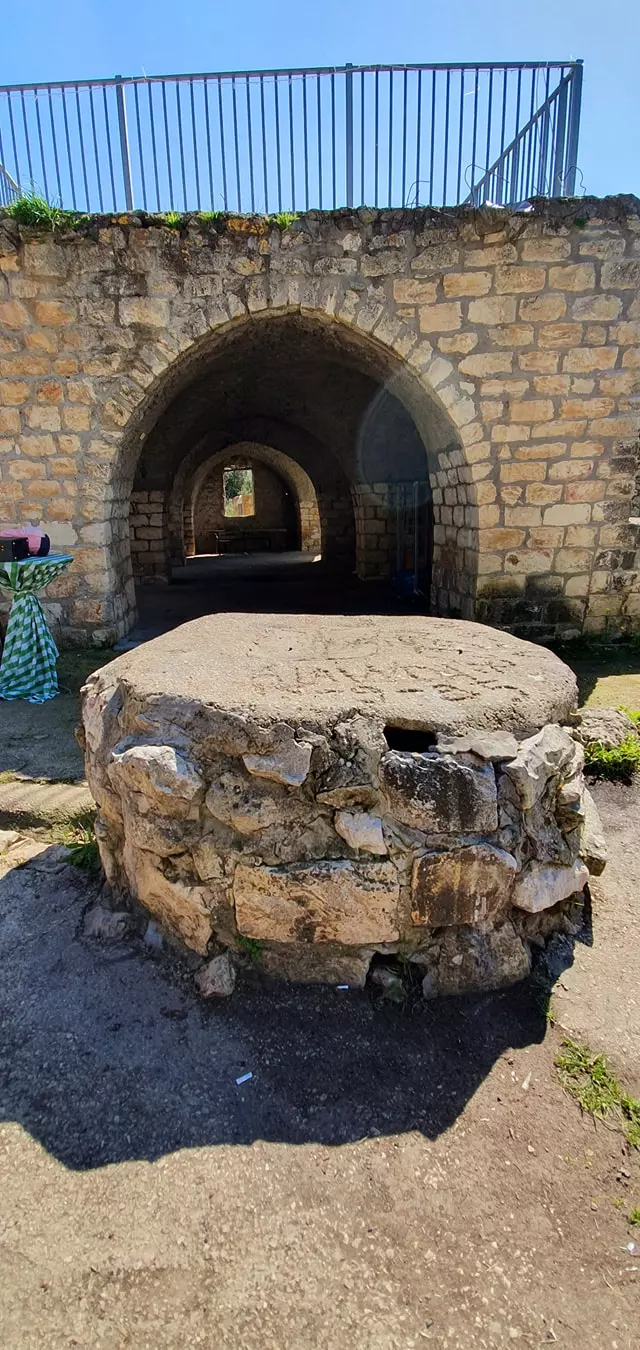
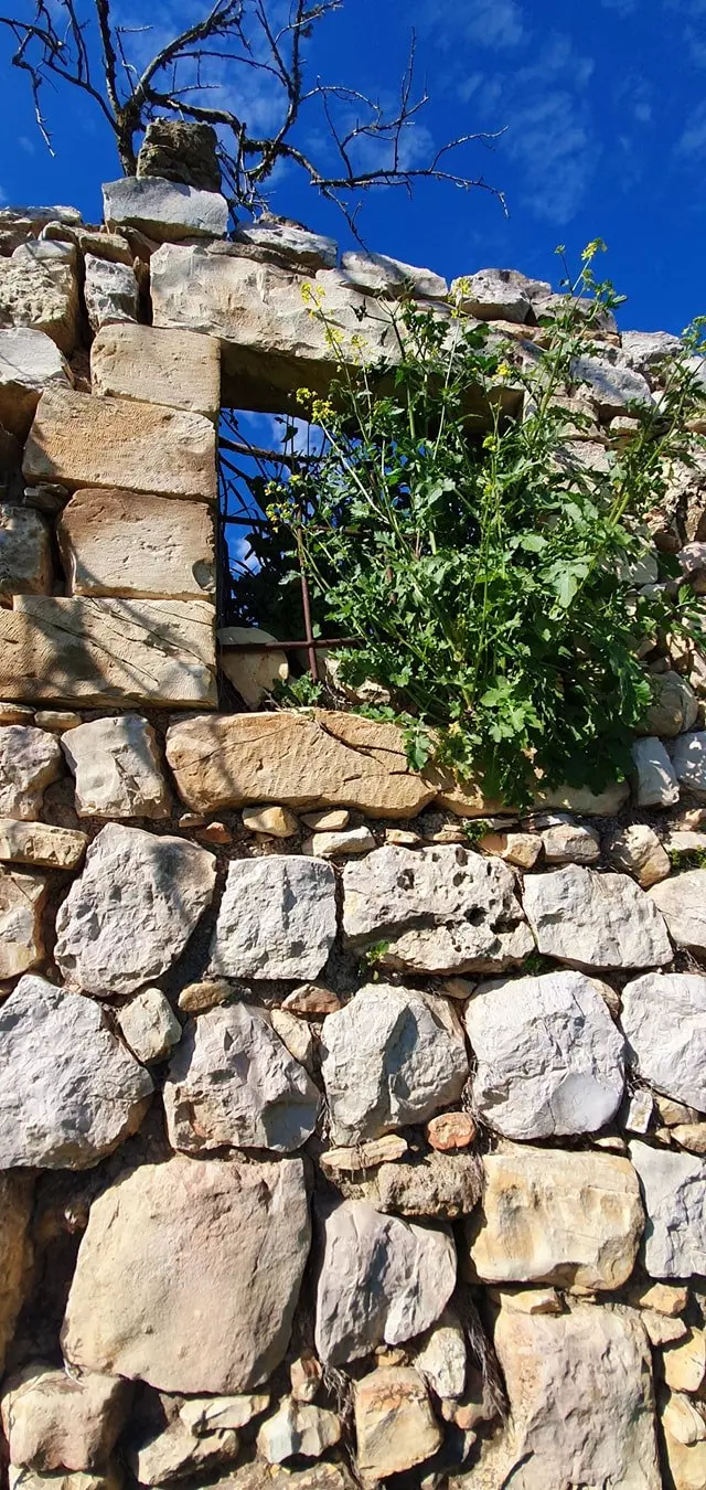
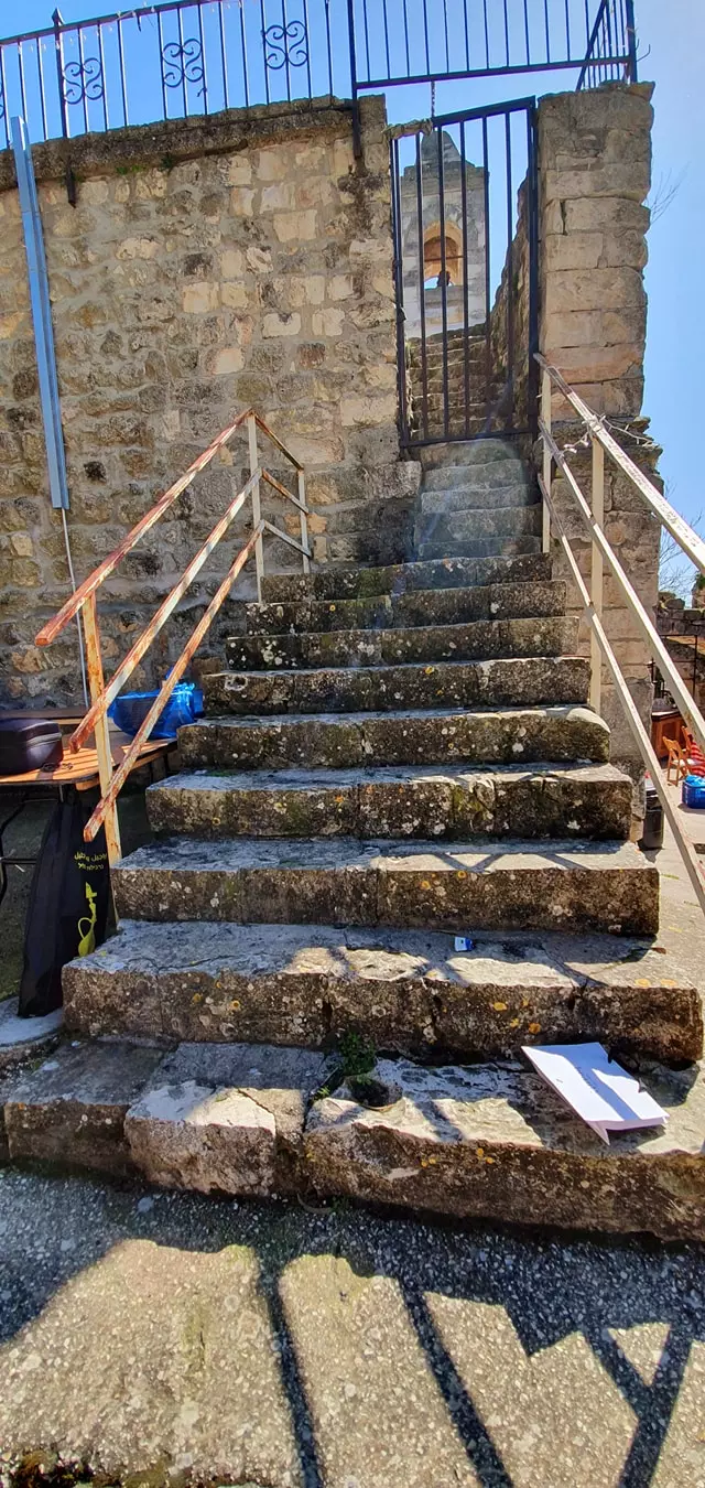
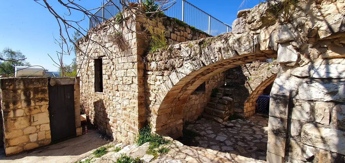
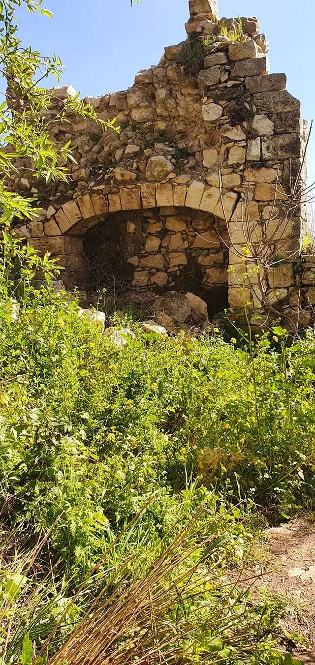
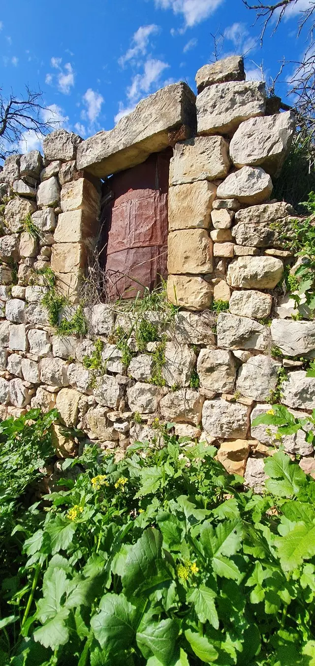
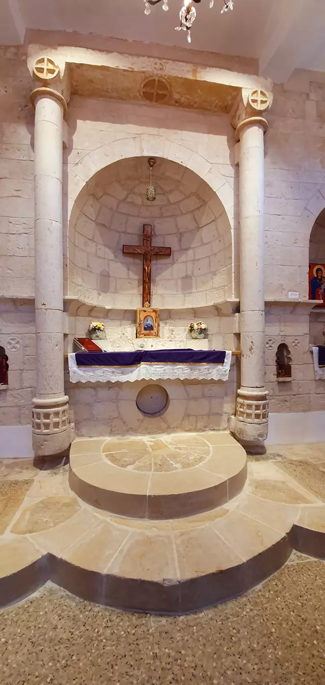
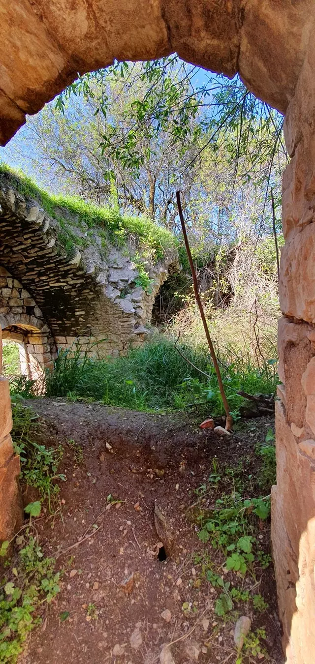
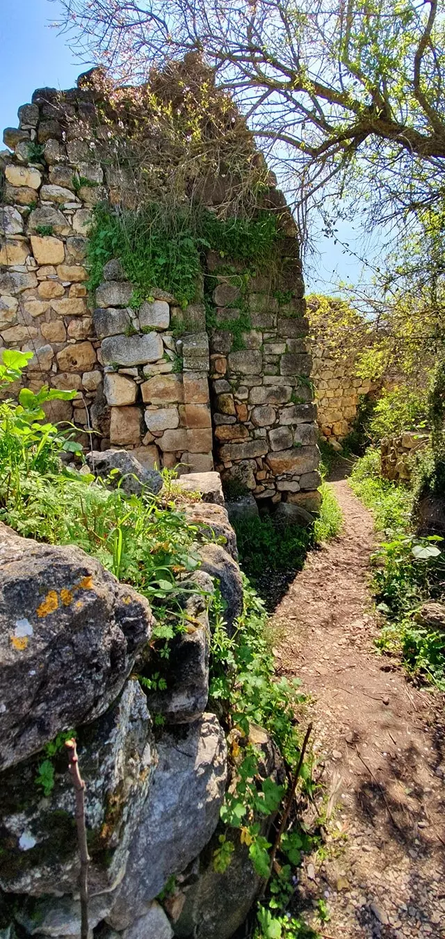
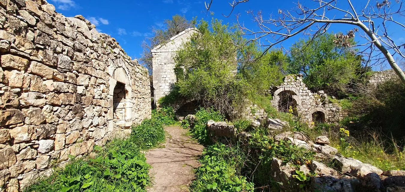
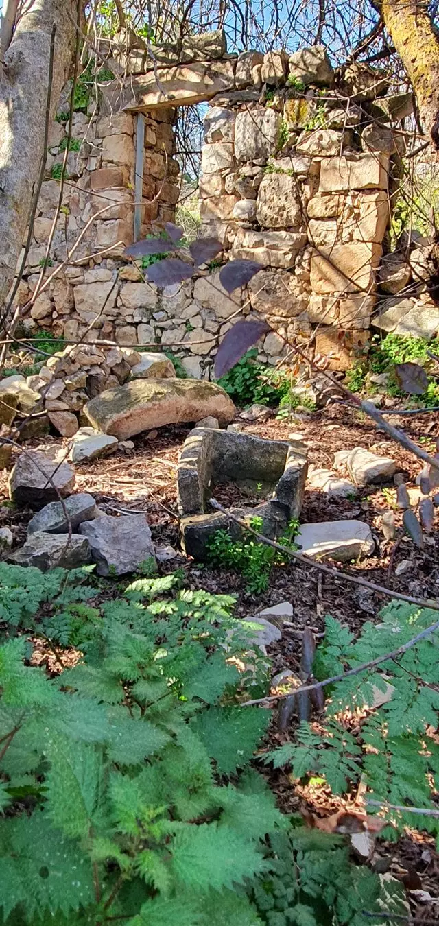
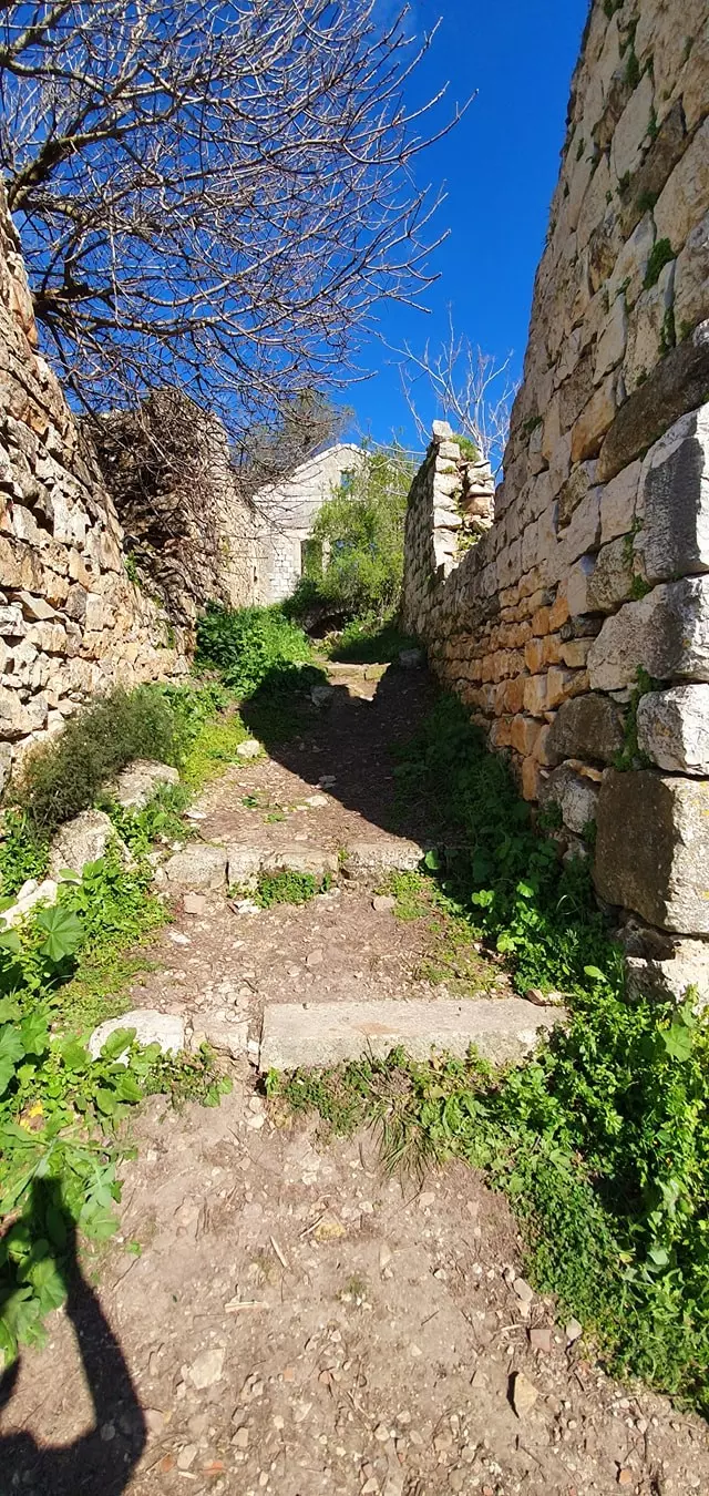
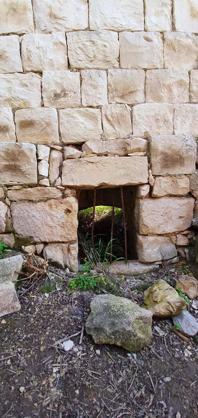
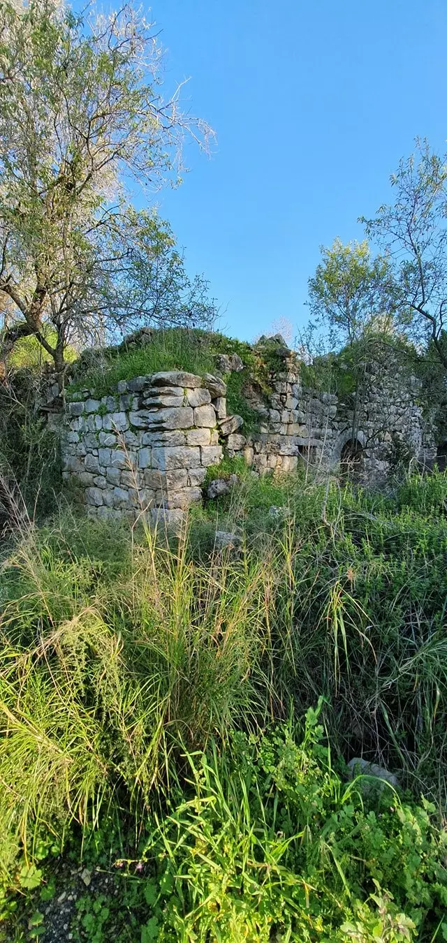
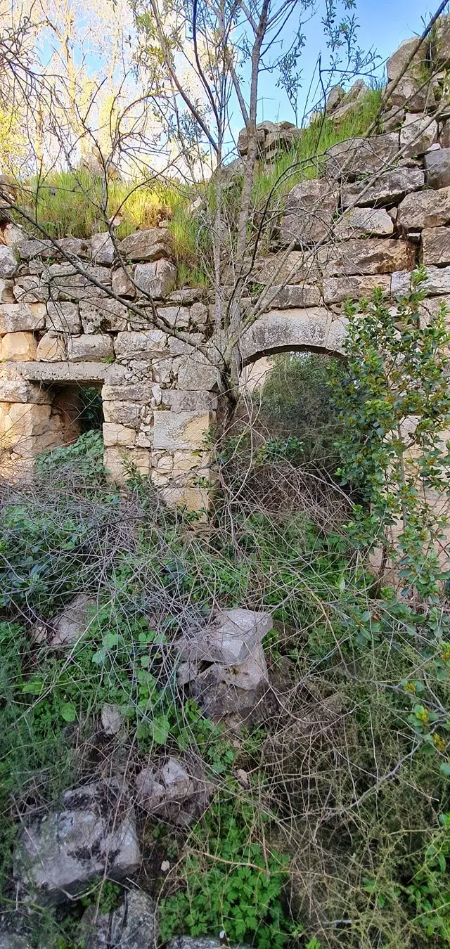
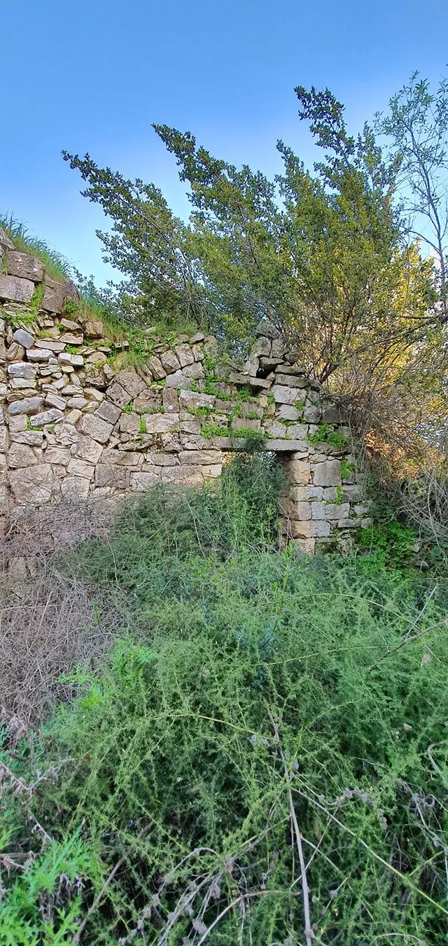
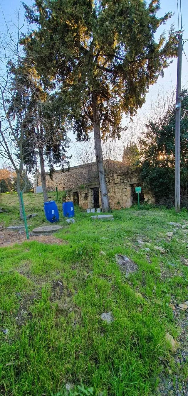
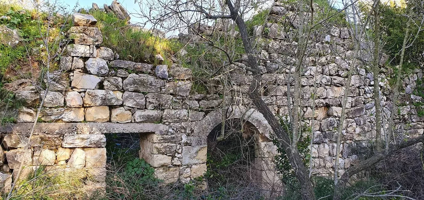
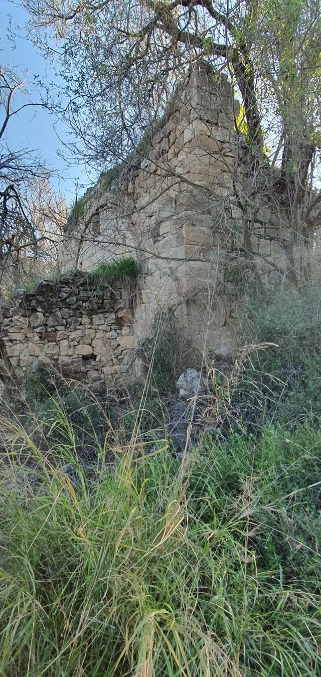
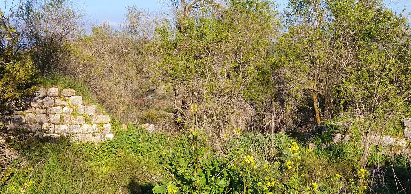
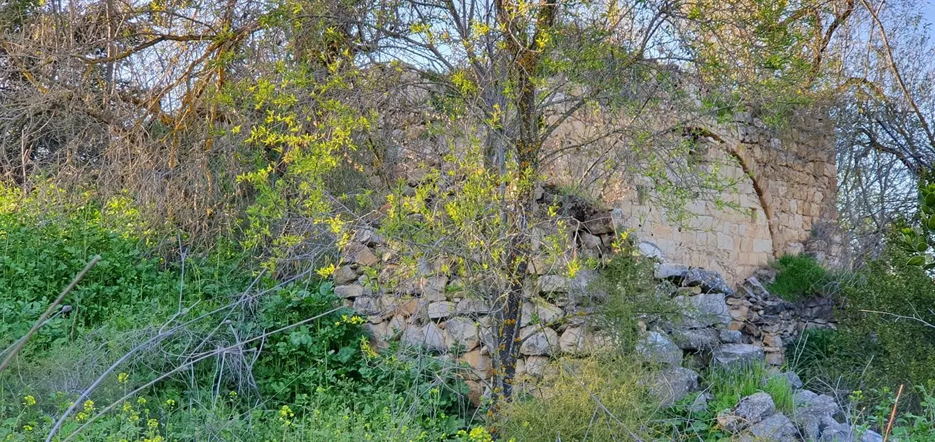
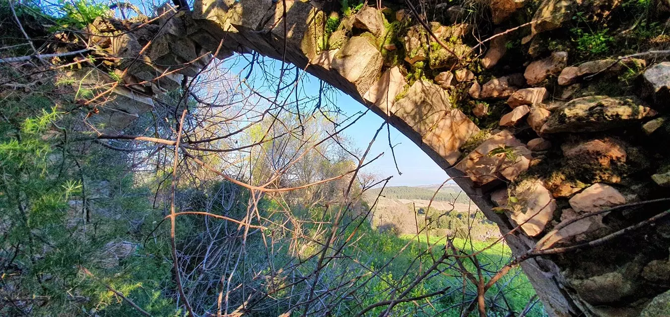
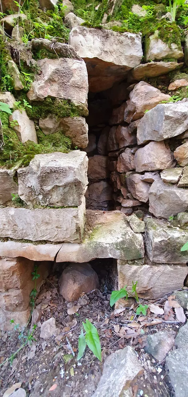
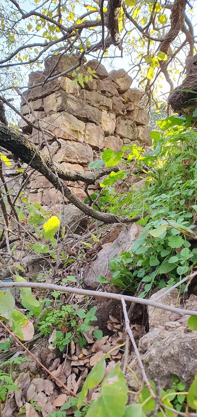
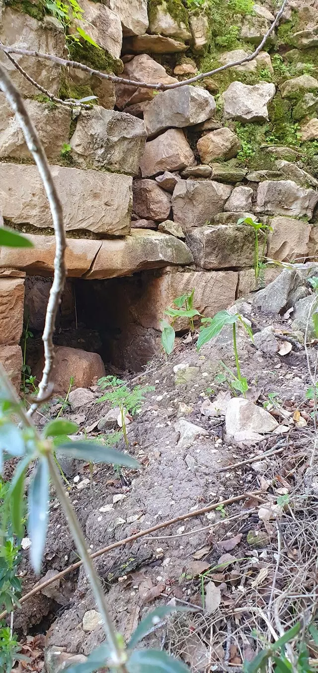
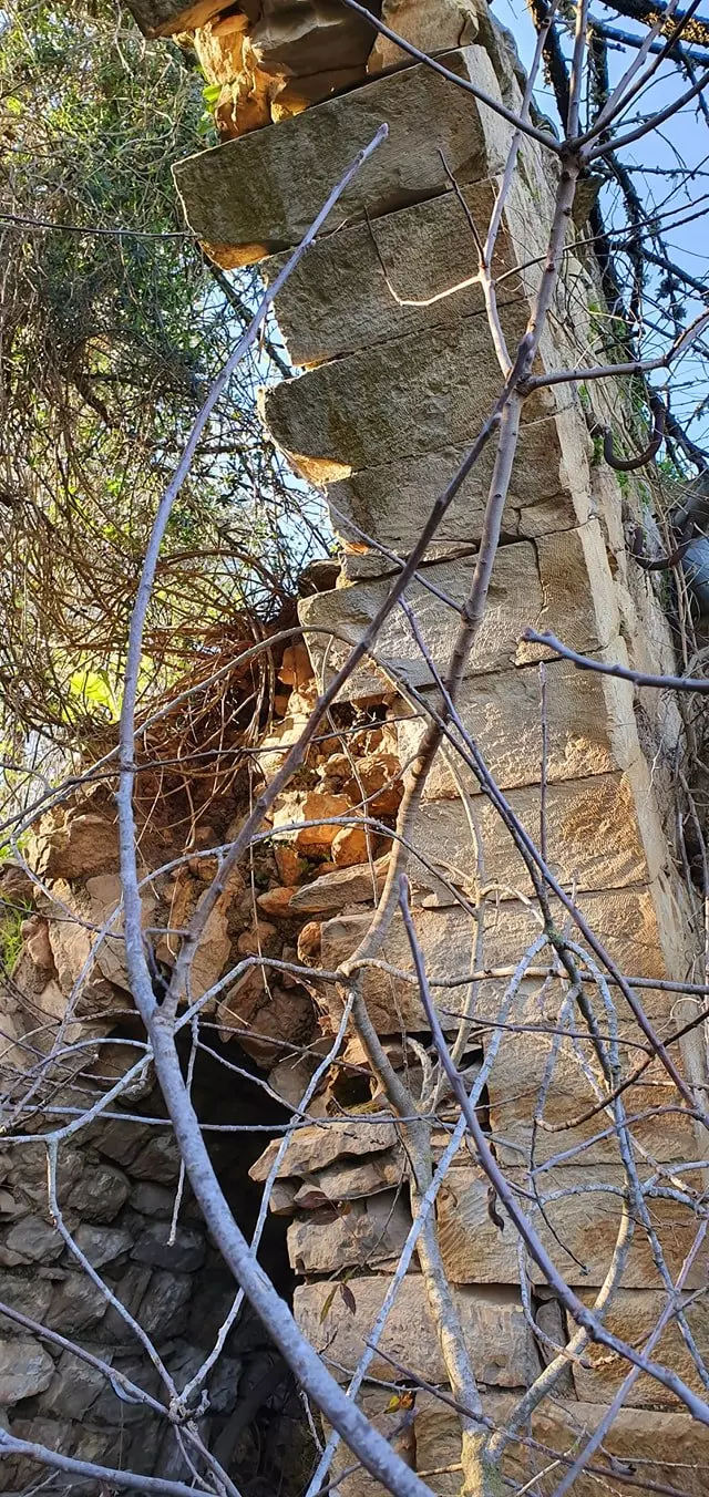
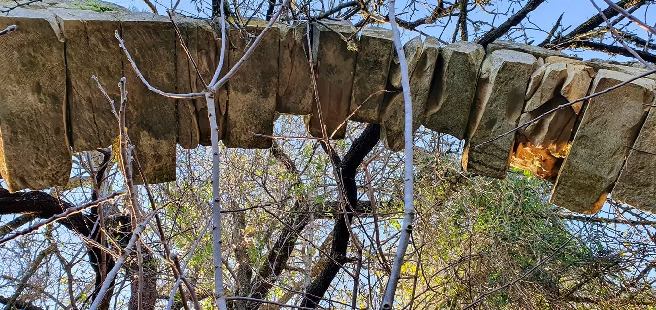
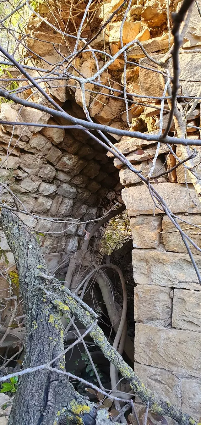
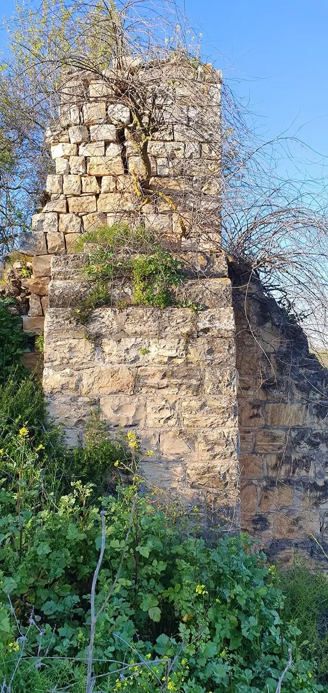
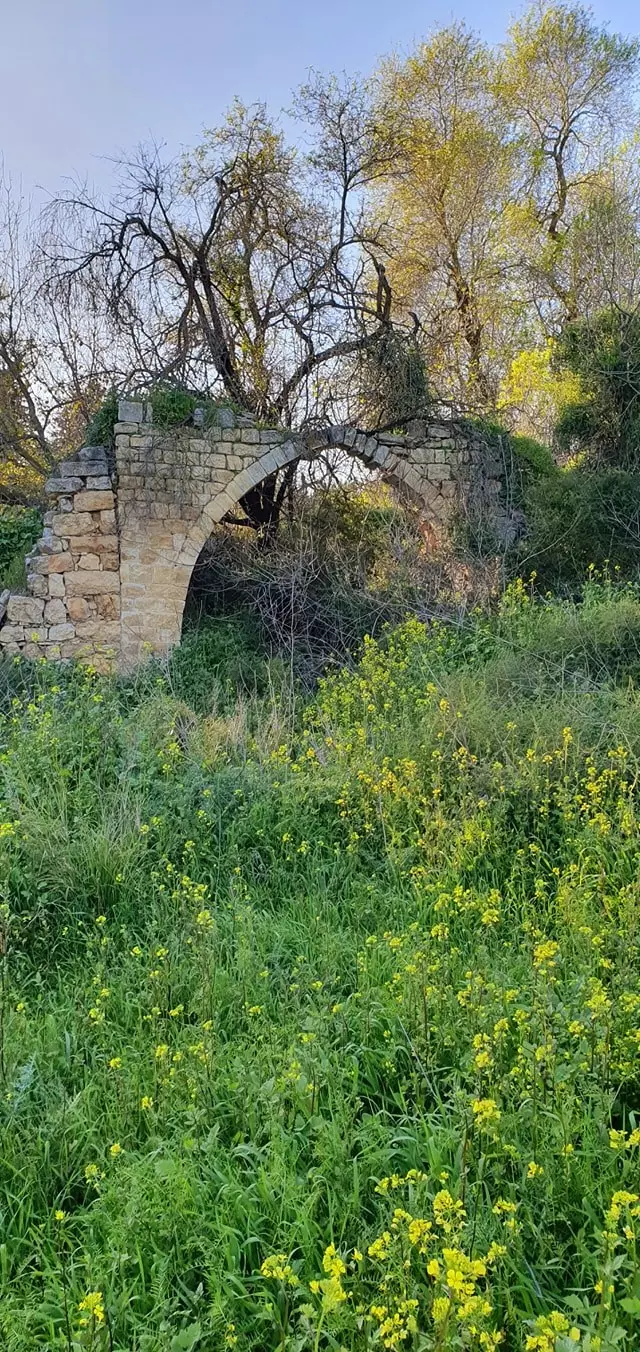
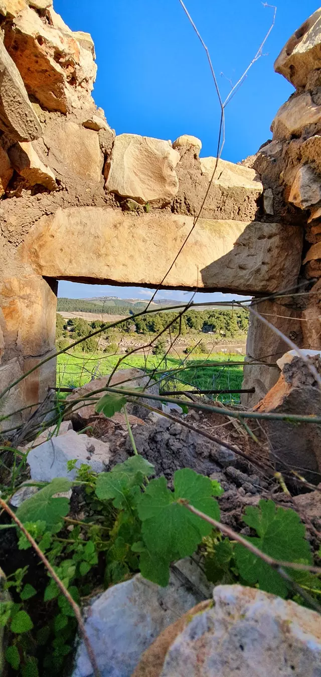
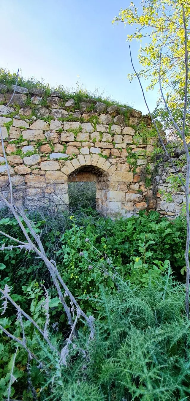
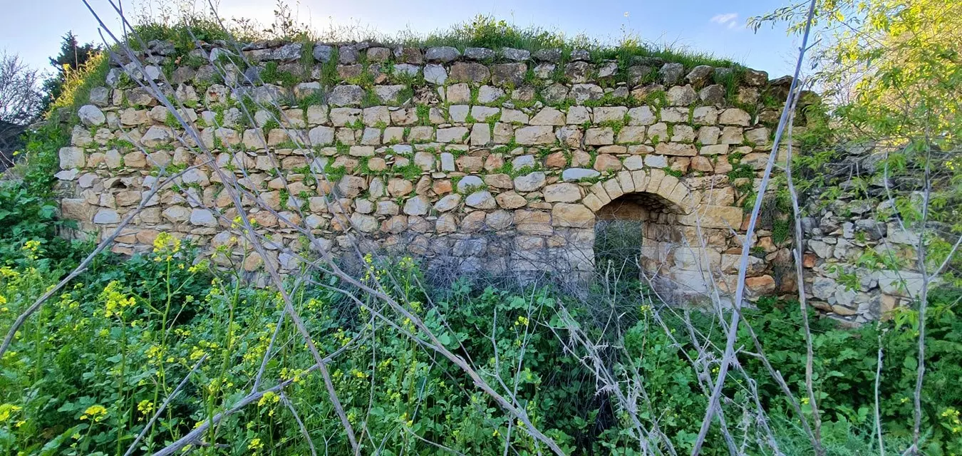
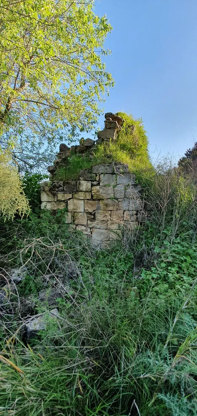
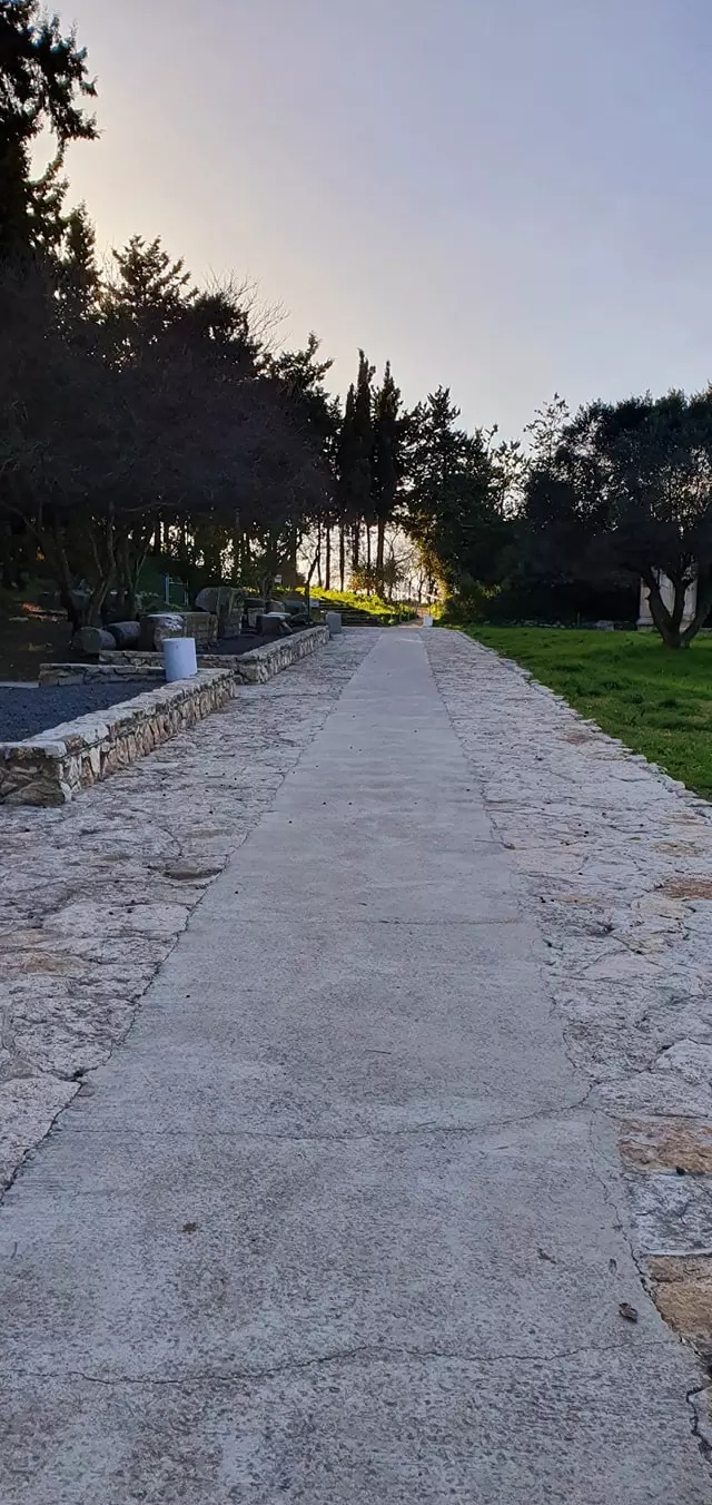
| Village Temains | Complete destruction of the village in 1953, Only the church and its bell tower left standing (it needs renovations, any volunteers!) | ||||||||||||||
| Ethnically Cleansing | Kafr Bir'im inhabitants were completely ethnically cleansed. | ||||||||||||||
| Pre-Nakba Land Ownership |
**Town Lands' Demarcation Maps |
||||||||||||||
| Land Usage As of 1945 |
|
||||||||||||||
| Population |
|
||||||||||||||
| Number of Houses |
|
||||||||||||||
| Near By Towns |
|||||||||||||||
|
|||||||||||||||
| Town's Name Through History | The Canaanites referred to the village by Periya'm | ||||||||||||||
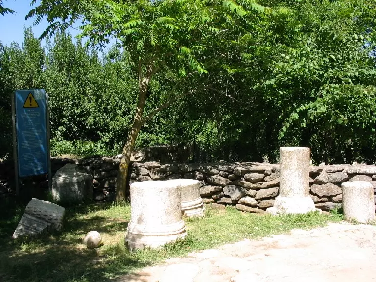
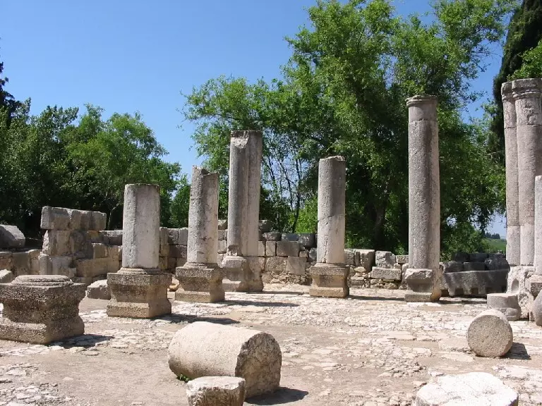
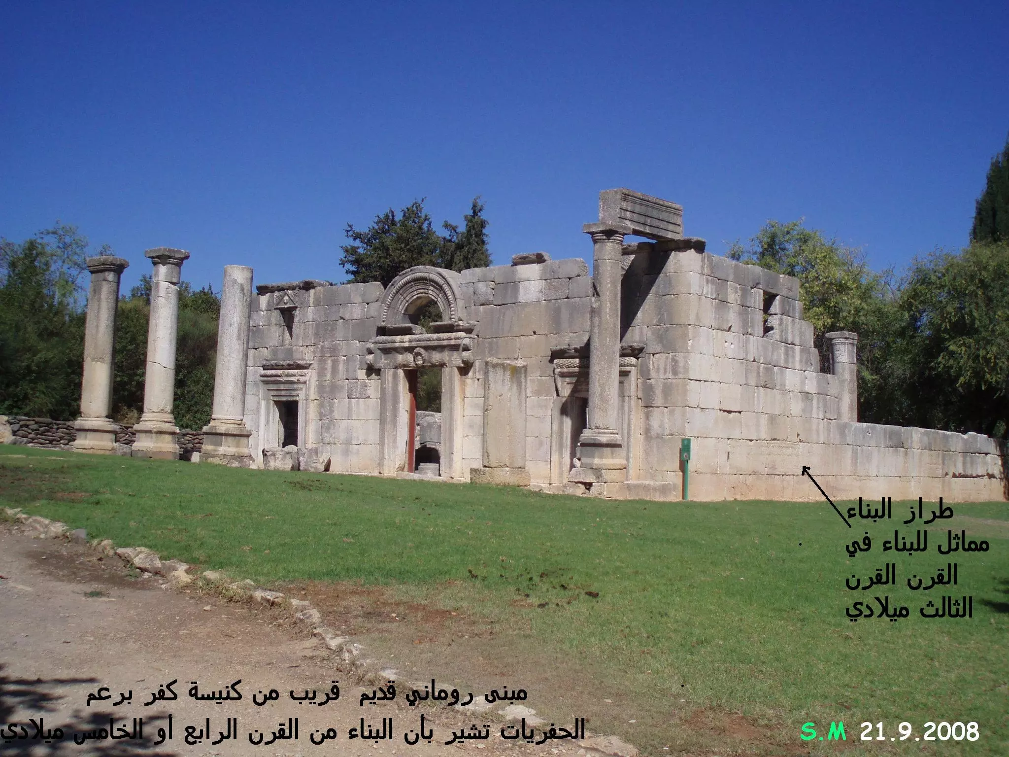
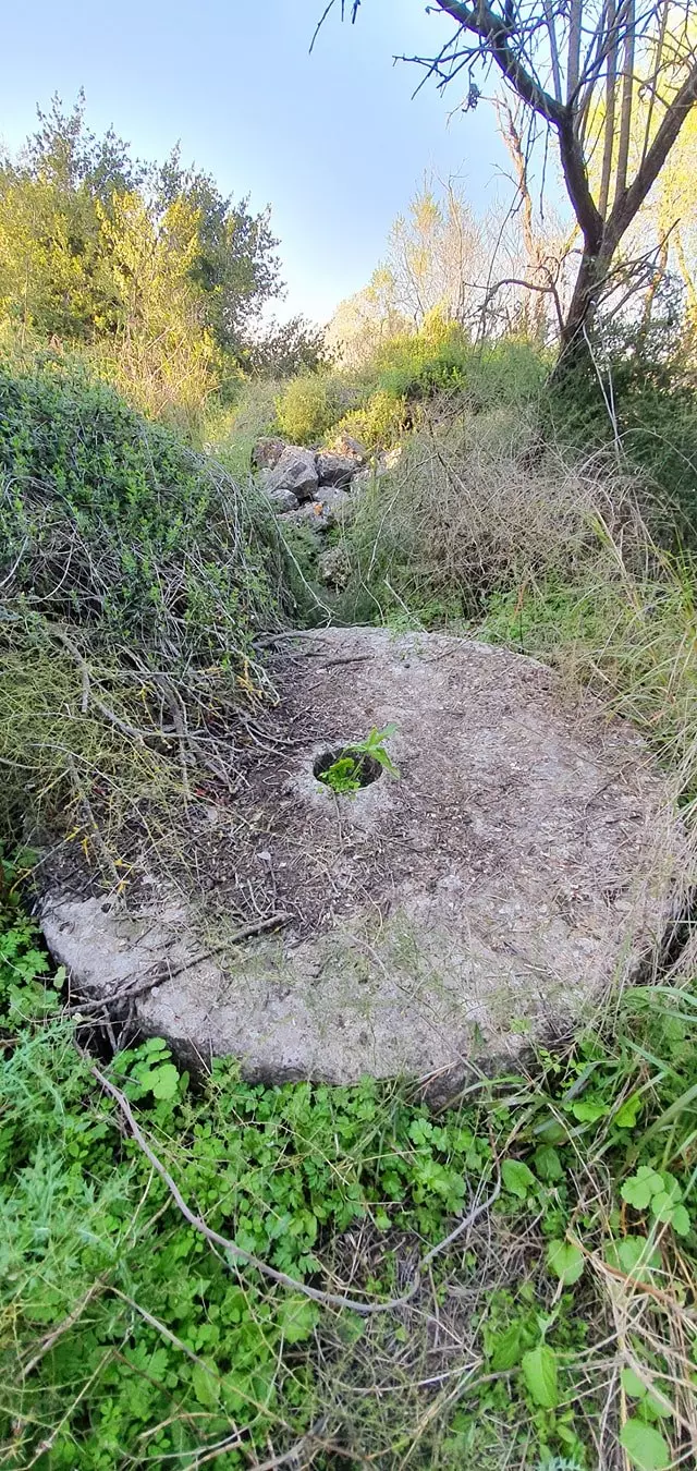
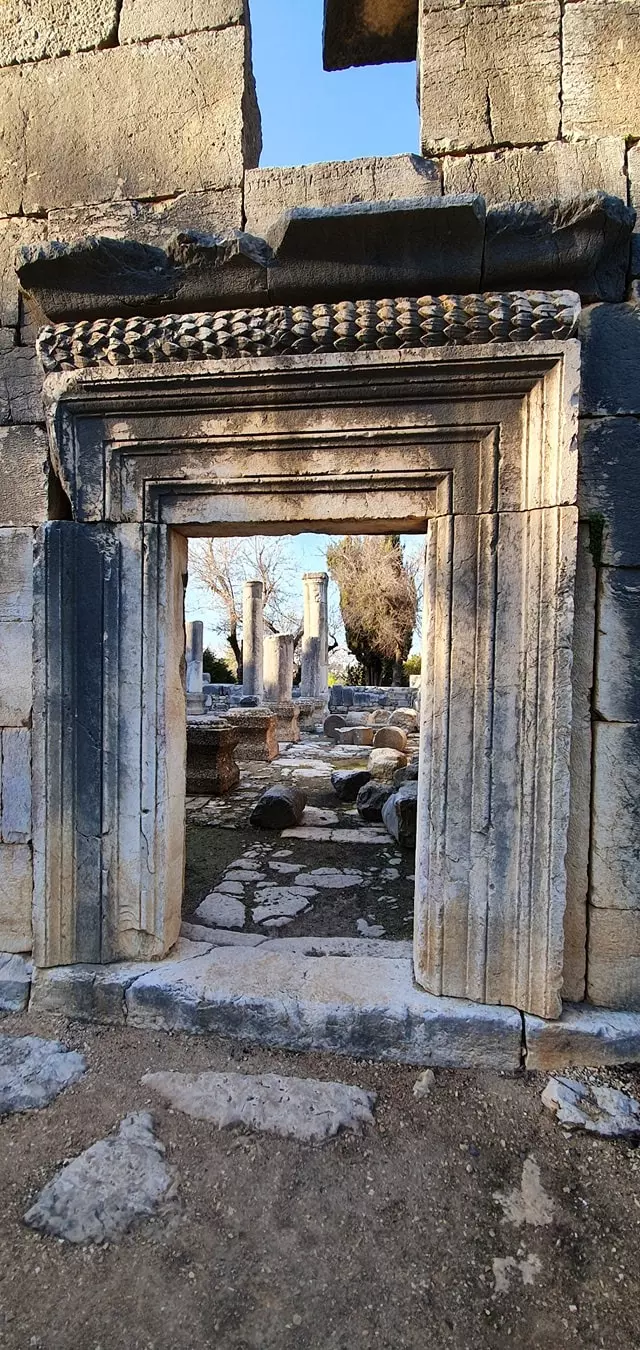
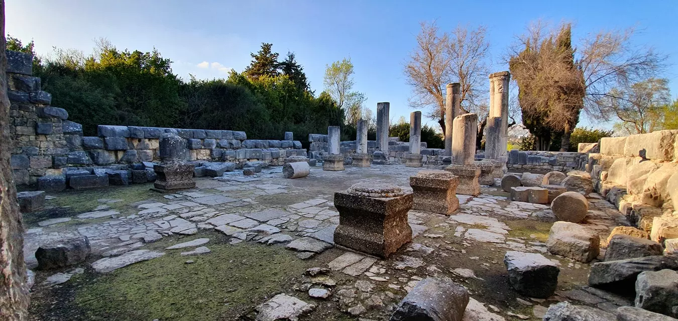
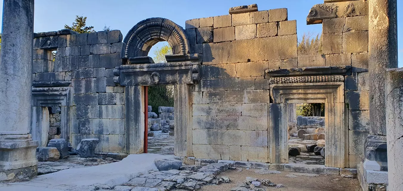
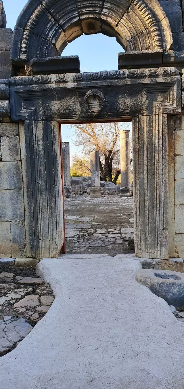
| Archeological Sites | The village contained the remains of olive presses, a synagogue, tombs, and cisterns | ||||||||||||||
| Exculsive Jewish Colonies Who Usurped Village Lands |
Baram and Dovev | ||||||||||||||
| Featured Video | |||||||||||||||
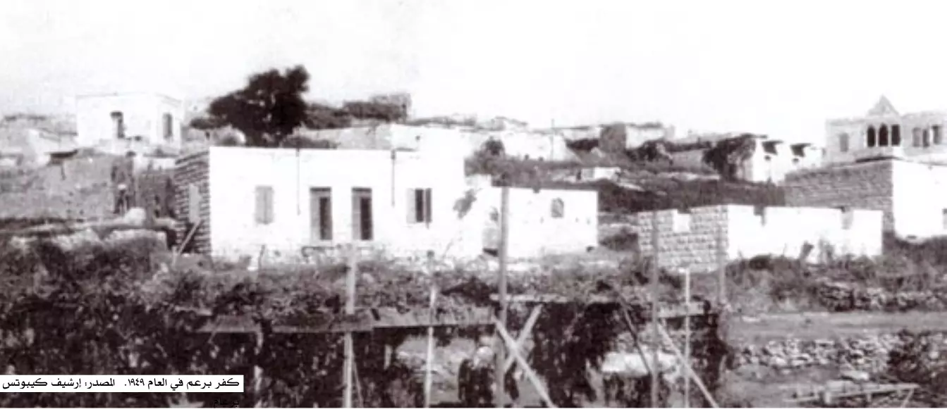
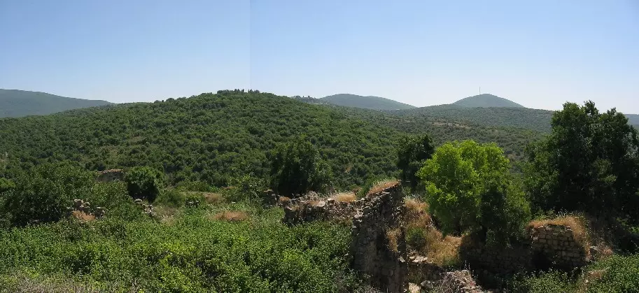
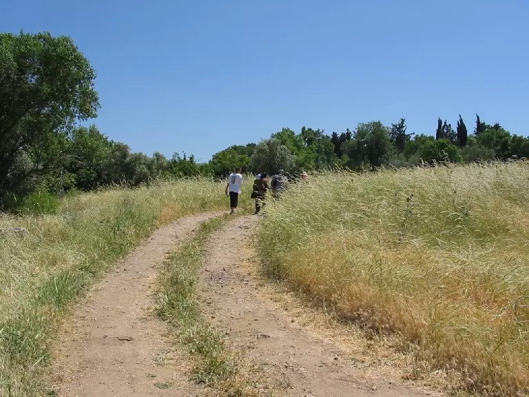
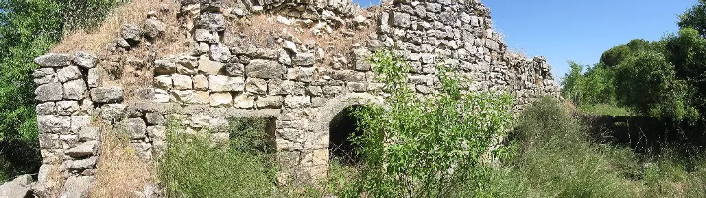
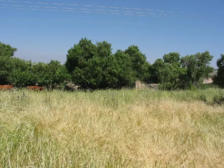
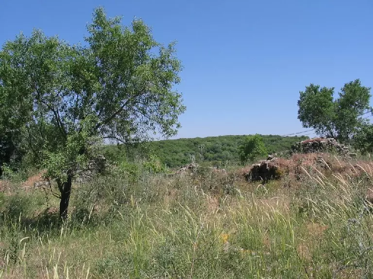
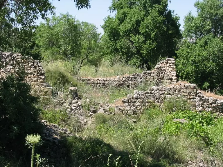
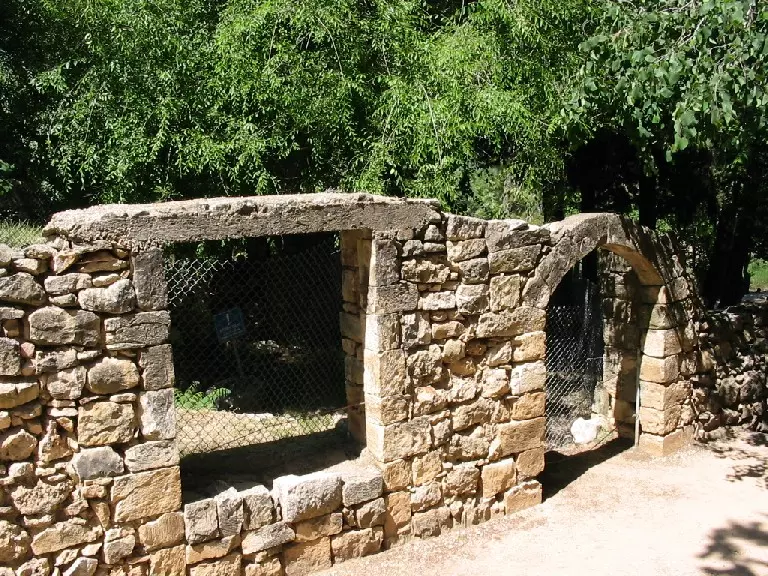
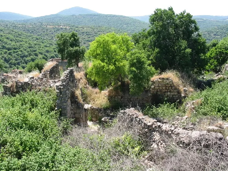
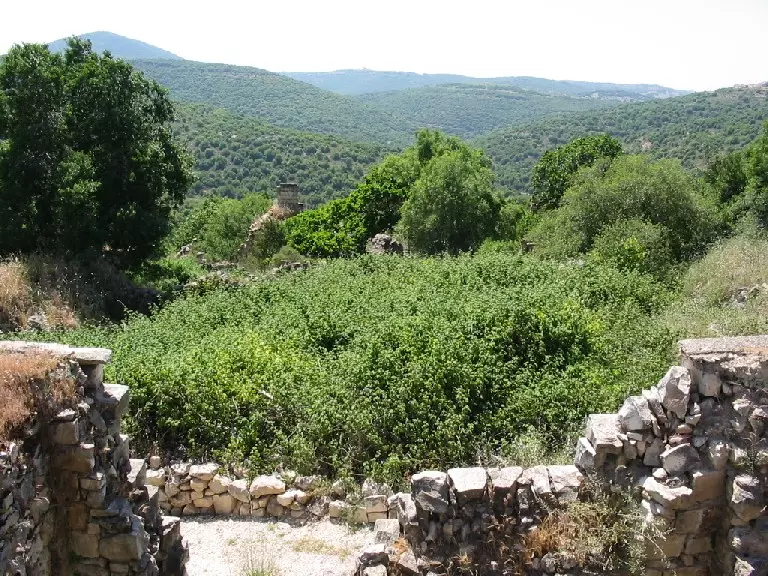
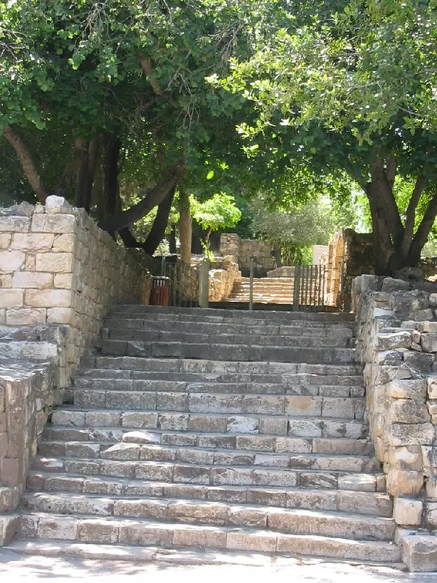
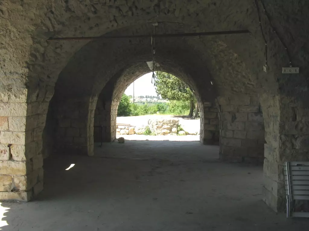
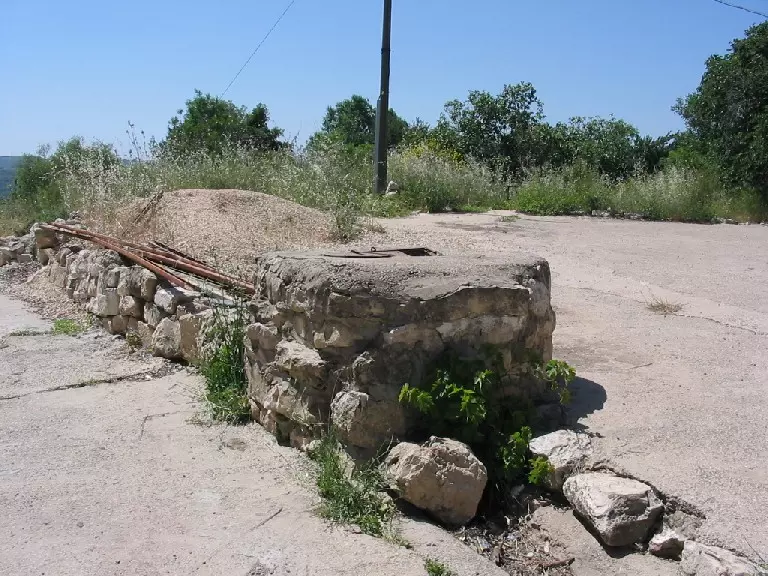
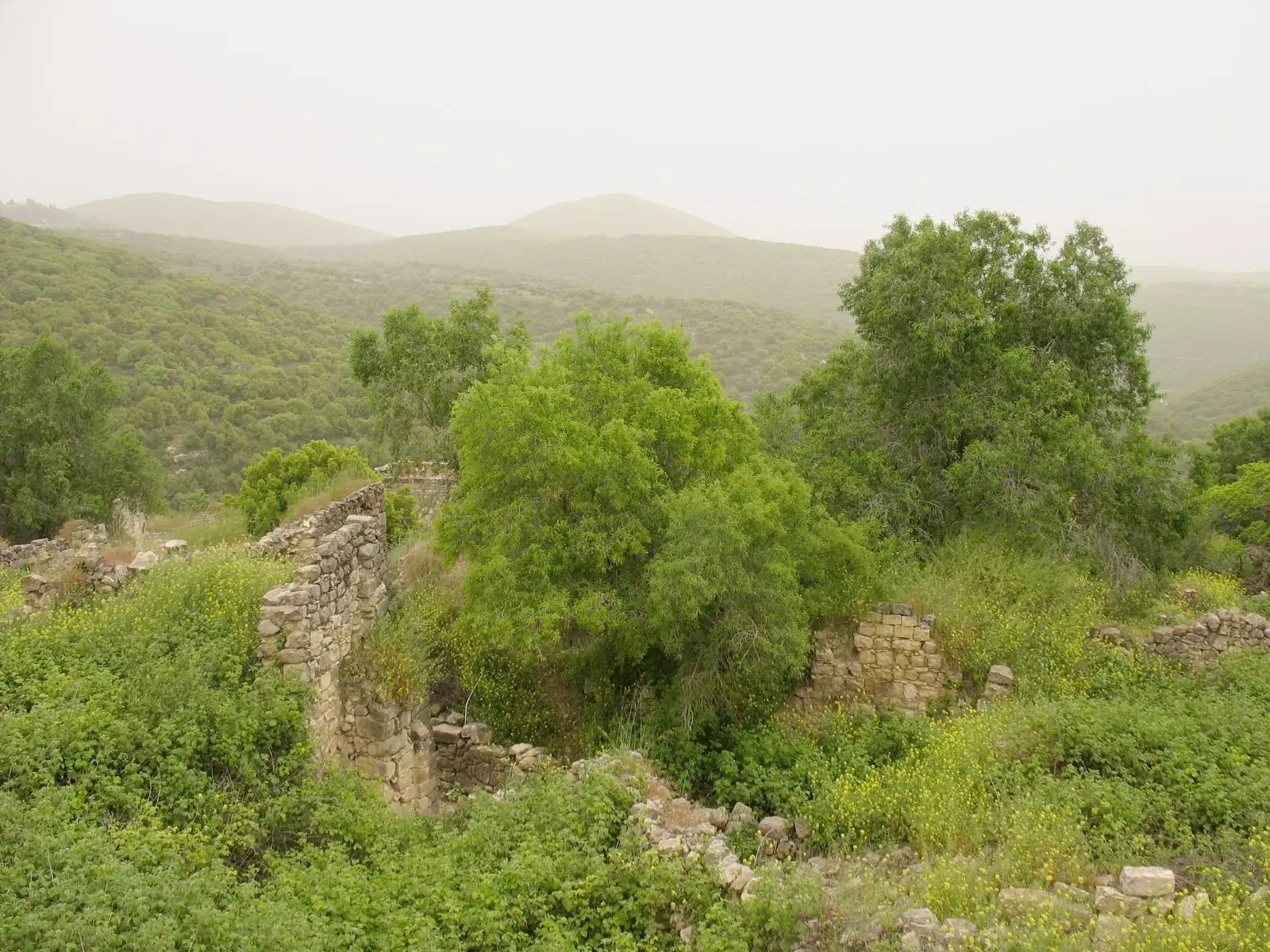
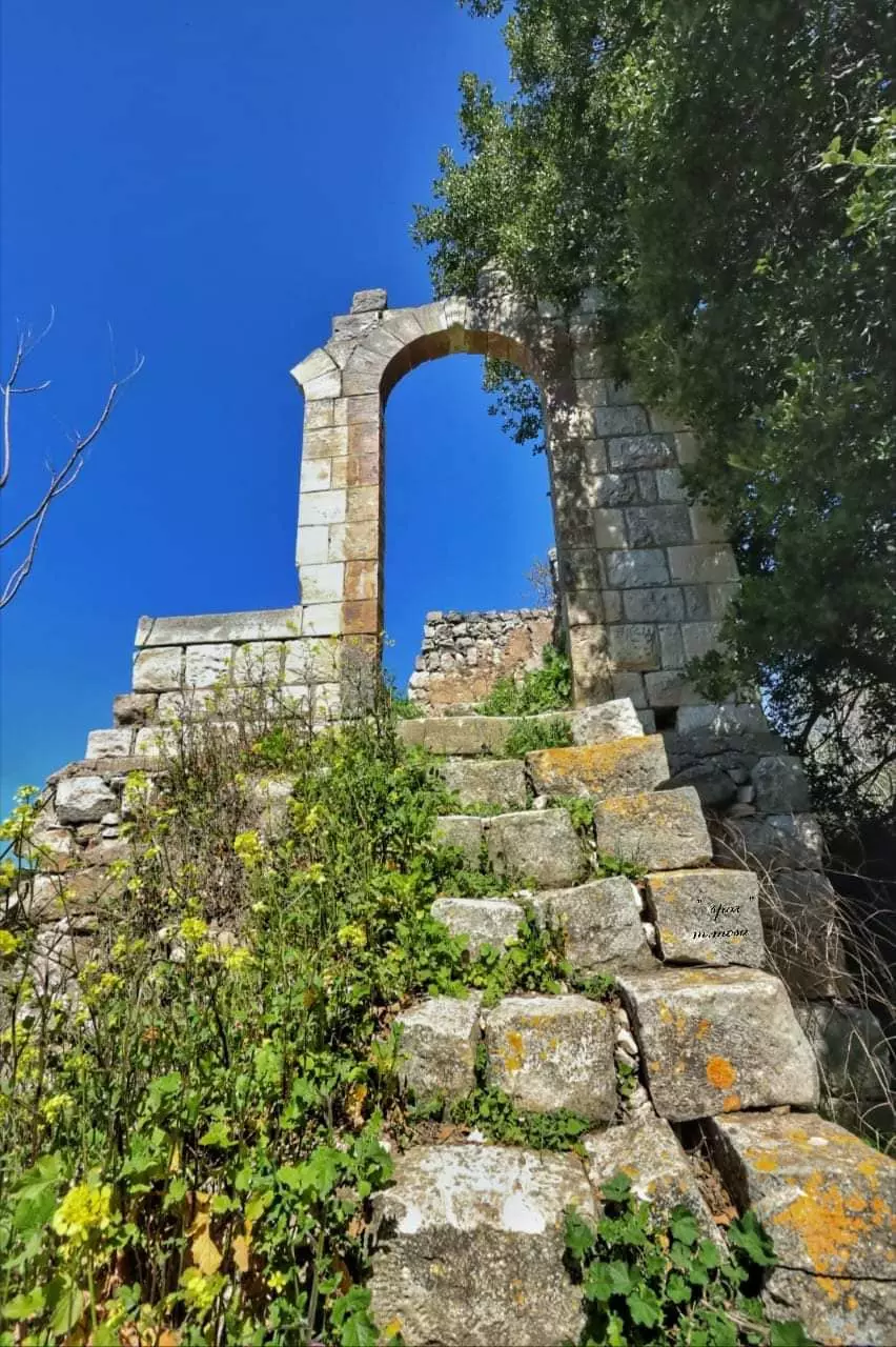
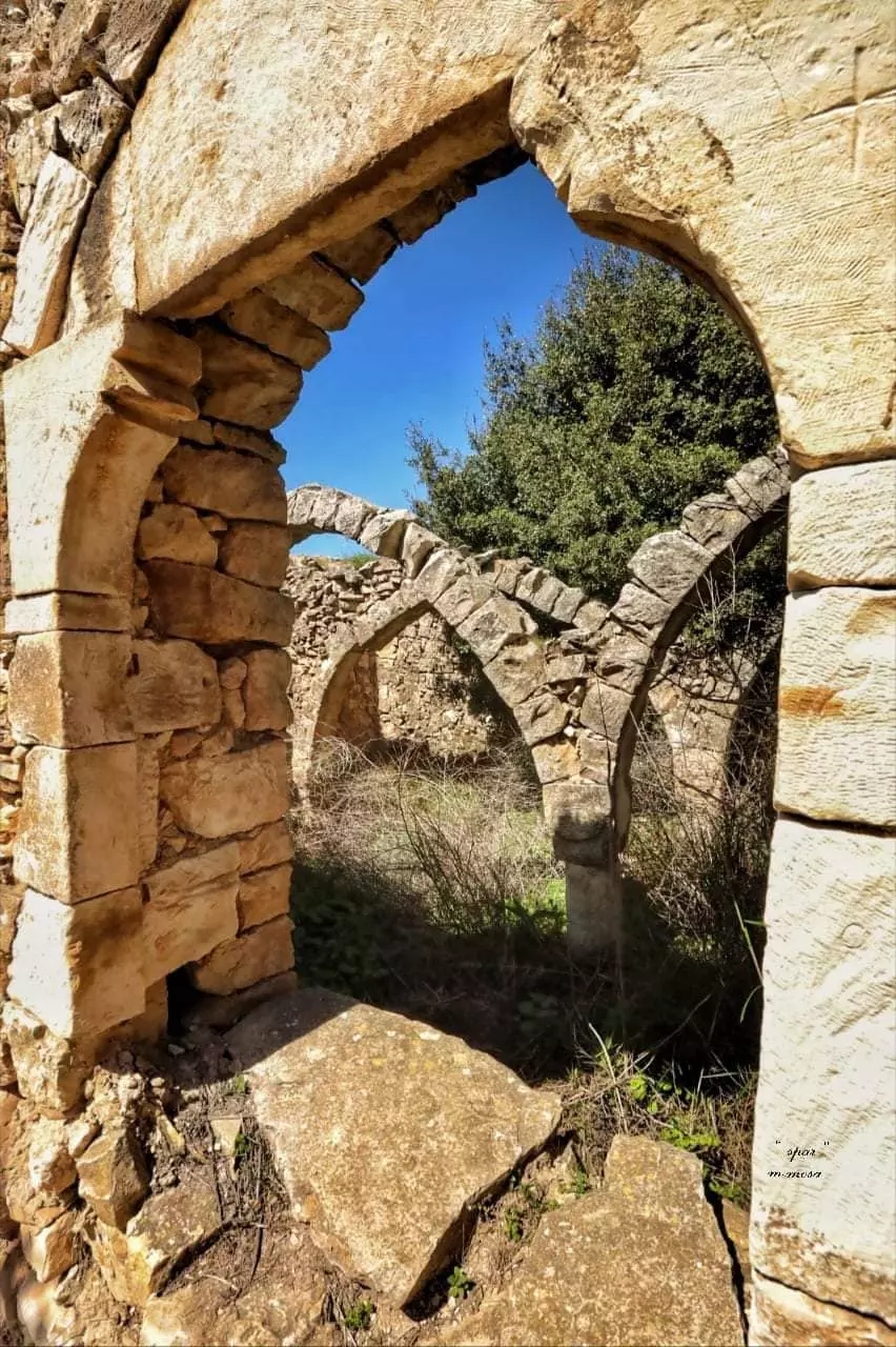
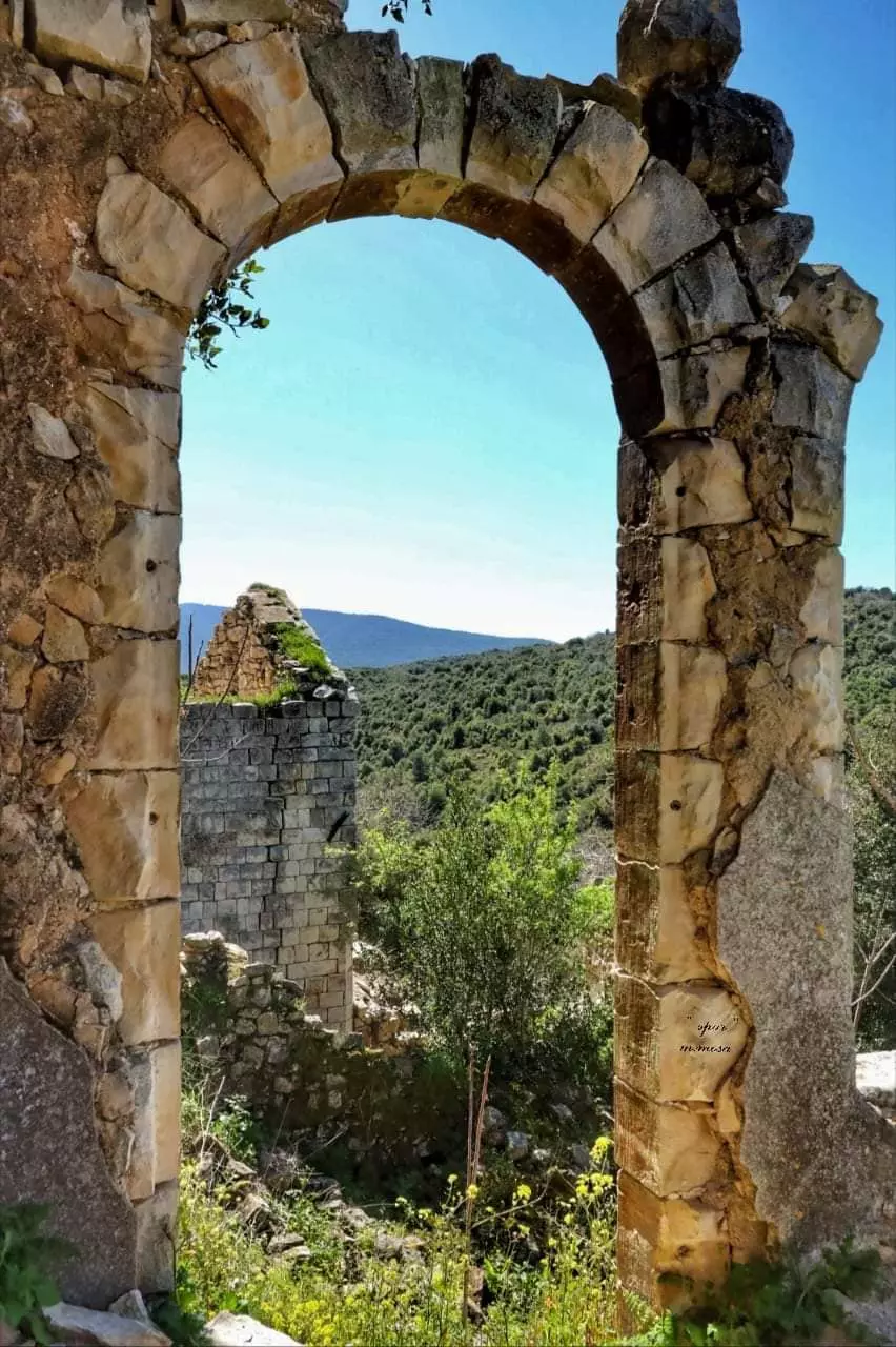
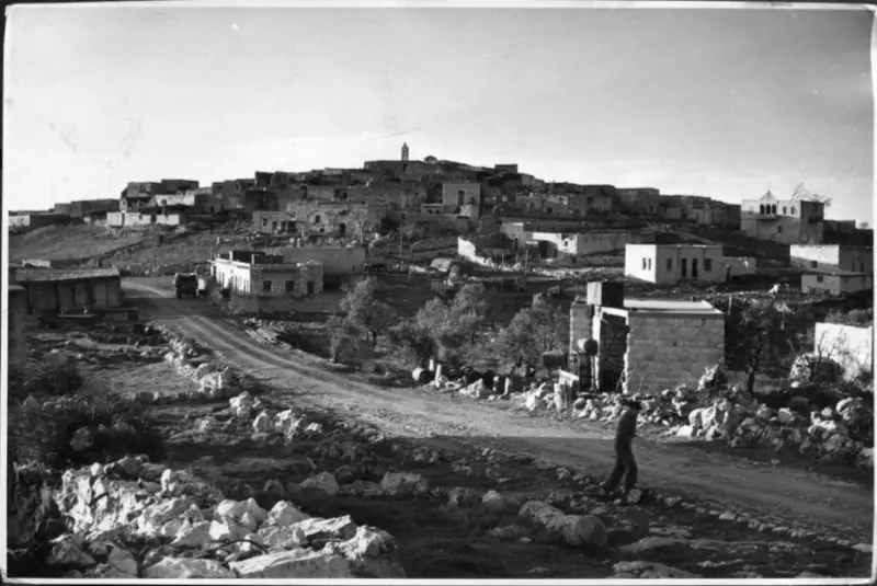
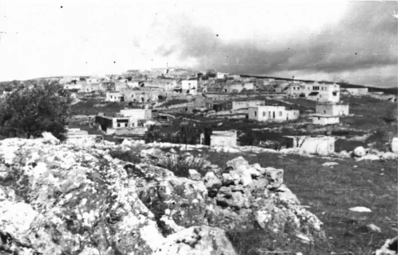
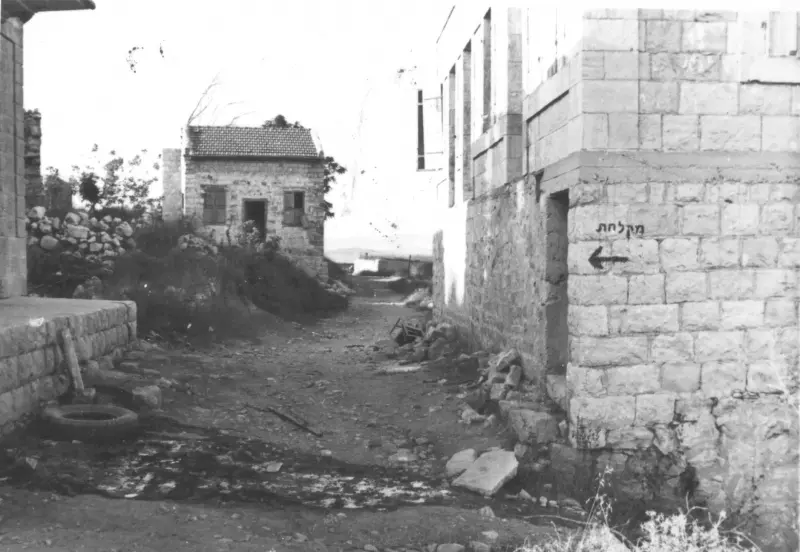
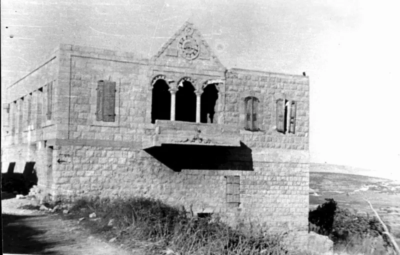
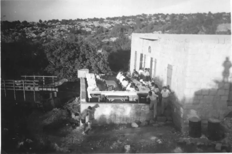
Village Before NakbaThe village stood on a rocky hill only a little higher than the surrounding area and faced north and west. A secondary road linked it to a number of villages in the west and east and led to the coastal highway and the highway to Safad. The village's name may have been a corruption of the name of the Canaanite town of Periya'm. In the late nineteenth century, Kafr Bir'im was described as a stone-built village, surrounded by gardens, olive trees, and vineyards. The population was estimated to be between 300 and 500. [[SWP (1881) I:198]] Most of the villagers were Christian; in modem times the population consisted of 700 Christians and 10 Muslims. Their houses, made of stone and mud, were built close together. Some of the land was forested. Agriculture, irrigated from the abundant springs, was the primary occupation of the villagers, who were especially active in olive and fruit cultivation. In 1944/45 a total of 3,718 dunums was allocated to cereals and 1101 dunums were irrigated or used for orchards. Kafr Bir'im was an archaeological site that contained the remains of olive presses, a synagogue, tombs, and cisterns.Village Occupation and Ethnic CleaningKafr Bir'im surrendered in early November 1948, when Galilee fell to Israeli forces during Operation Hiram (see 'Arab al-Samniyya, Acre sub-district). Its residents, along with those of other border villages, were "temporarily" expelled for "security reasons." Some of those expelled across the border were later allowed to return to Israel, but not to their village. Others found hiding in caves near the village were transported to the village of Jish (3 km to the southeast) and settled in its previously emptied houses. The Israeli Supreme Court ruled in July 1952 that there was no reason to prevent their return. The army, however, leveled the village in 1953.Zionists Colonies on Village LandsThe settlement of Dovev (188273), established in 1963, is northwest of the village site on village land. To the northeast, a bit farther away from the site, is the settlement of Bar'am (191273), founded in 1949 by members of the Palmach. [[P:37]]Village TodayThe village has been demolished. The only standing structure is the church and its bell tower. Crumbled walls some scattered, partially-collapsed houses, and extensive rubble cover the hillside, all overgrown with bushes and wild grasses (see photos). Some of the archaeological remains are still visible. The village site has been closed off and the surrounding area declared an archaeological and tourist site.SourceDr. Walid al-Khalidi, 1992: All That Remains. |
|||||||||||||||
| Related Maps | Town Lands' Demarcation Maps خرائط للقضاء توضح حدود القرى والاودية Town's map on MapQuest View from satellite Help us map this town at WikiMapia |
||||||||||||||
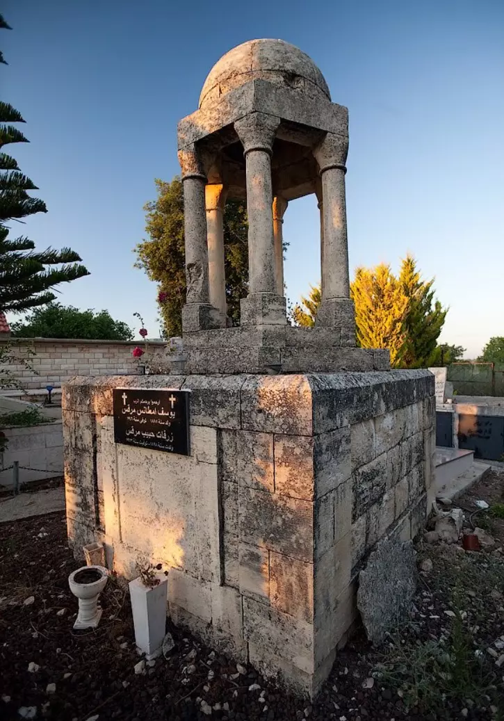
| Related Links | Wikipedia's Page Facebook Page Google Search Google For Images Google For Videos |
||||||||||||||
| More Information | في كتاب كي لا ننسى في كتاب بلادنا فلسطين المزيد من موقع هوية |
||||||||||||||
- كتاب قرية كفر برعم - إعداد: د. شريف كنعانة و د. محمد اشتية
- Justice for Ikrit and Biram By Ha'aretz Daily
- Ha'aretz Daily: Sharon asks court to reject appeal of Ikrit, Biram residents
- كفر برعم انتصرت في إعادة الأموات وتصرّ اليوم على حقها في إعادة الأحياء
- Promises made, a town stays broken
- نبذة تاريخية عن قرية كفر برعم (قضاء صفد) من كتاب (كي لا ننسى)
- Village house Ruins And Village Church, 1987

Scanned from "All That Remains" by Dr. Walid Khalidi - Aerial Views of the village, 1945
- Village house walls remain standing #1

Posted by BADIL Organization - Village house walls remain standing #2

Posted by BADIL Organization 1 - Village house walls remain standing #3

Posted by BADIL Organization - Village house walls remain standing #4
Posted by BADIL Organization - Village house walls remain standing #5

Posted by BADIL Organization - Village house walls remain standing #6

Posted by BADIL Organization - Now to enter our village, you have to PAY the Zionist first!

Posted by BADIL Organization - Frontal view of the village main church, 2000

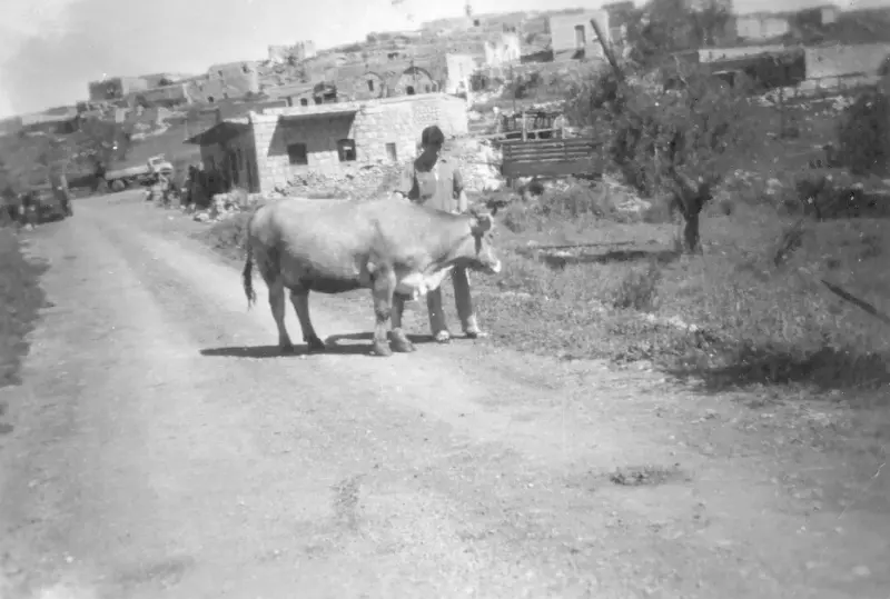
Posted by H. Chacour - Elementary school students with their teachers, 1939

- The village was occupied intact as you see but later destroyed using the IOF, 1949
- The Proud Church Of Kafr Bir'im Remains Standing, 1972

Posted by Prince, Peaceful Israeli 4 - مناظر الى الجنوب والغرب من اراضي كفر برعم كما ترى من سطح الكنيسة 18/5/2003

Posted by Makbula Nassar - اراضي واثار من كفر برعم من الناحية الشرقية 18/5/2003

Posted by Makbula Nassar - 18/5/2003 جبال صفدواثار من القرية في الجهة الجنوبية الغربية
Posted by Makbula Nassar - فرعم \برعم الكنيسة 1932

Posted by فتحي ابو رضا \ العايدي - 18/5/2003 طريق ترابي مؤدي الى القرية من الجهة الغربية بجانب المقبرة ,الدخول دون الحاجة لدفع رسوم لكون القرية متنزه اثري اليوم
Posted by Makbula Nassar - 18/5/2003 اثار احد بيوت القرية الباقية
Posted by Makbula Nassar - 18/5/2003 الكنيسة القرية من الجهة الشمالية
Posted by Makbula Nassar - 18/5/2003 الكنيسة القرية من الجهة الغربية
Posted by Makbula Nassar - 18/5/2003 الكنيسة القرية من الجهة الغربية
Posted by Makbula Nassar - 18/5/2003 مدخل كنيسة القرية
Posted by Makbula Nassar - 18/5/2003 اثار باقية لبيوت القرية
Posted by Makbula Nassar - 18/5/2003 - (2) اثار باقية لبيوت القرية
Posted by Makbula Nassar - 18/5/2003 - (3) اثار باقية لبيوت القرية
Posted by Makbula Nassar - 18/5/2003 - (4) اثار باقية لبيوت القرية
Posted by Makbula Nassar 1 - 18/5/2003 - (5) اثار باقية لبيوت القرية
Posted by Makbula Nassar - اثار باقية لبيوت القرية (6) - 18/5/2003
Posted by Makbula Nassar - 18/5/2003 - (7) اثار باقية لبيوت القرية
Posted by Makbula Nassar - اثار باقية لبيوت القرية (8) - 18/5/2003
Posted by Makbula Nassar - 18/5/2003 - (9)اثار باقية لبيوت القرية جنوبي الكنيسة
Posted by Makbula Nassar - اثار باقية لبيوت القرية غربي الكنيسة (10) - 18/5/2003
Posted by Makbula Nassar - 18/5/2003 - (11)اثار باقية لبيوت القرية غربي الكنيسة
Posted by Makbula Nassar - اثار باقية لبيوت القرية غربي الكنيسة (12) - 18/5/2003
Posted by Makbula Nassar - 18/5/2003 - (11)اثار باقية لبيوت القرية غربي الكنيسة
Posted by Makbula Nassar - اثار باقية لبيوت القرية غربي الكنيسة (14) - 18/5/2003
Posted by Makbula Nassar - 18/5/2003 - (15)اثار باقية لبيوت القرية غربي الكنيسة
Posted by Makbula Nassar - اثار باقية لبيوت القرية غربي الكنيسة (16) - 18/5/2003
Posted by Makbula Nassar - 18/5/2003 - (17)اثار باقية لبيوت القرية غربي الكنيسة
Posted by Makbula Nassar - اثار باقية لبيوت القرية غربي الكنيسة (18) - 18/5/2003
Posted by Makbula Nassar - 18/5/2003 - (19)اثار باقية لبيوت القرية غربي الكنيسة
Posted by Makbula Nassar - اثار باقية لبيوت القرية غربي الكنيسة (20) - 18/5/2003
Posted by Makbula Nassar - 18/5/2003 - احد البيوت الكبيرة تظهر القناطر الداخلية للبيت الواقع غربي الكنيسة
Posted by Makbula Nassar - شباك مطل على البيت في الصورة السابقة من احد ازقة القرية - 18/5/2003
Posted by Makbula Nassar - اعمدة رخامية باقية من الاثار البيزنطية في القرية - 18/5/2003
Posted by Makbula Nassar - 18/5/2003 - درج يربط مدخل القري من الجهة الشمالية بمنطقة الاثار التاريخية
Posted by Makbula Nassar - الاثار البيزنطية في القرية التي تحولت الى متنزة اثري - 18/5/2003
Posted by Makbula Nassar - 18/5/2003 - منظر داخلي للموقع الاثري في الصورة السابقة
Posted by Makbula Nassar - 18/5/2003 - (2 )منظر داخلي للموقع الاثري في الصورة السابقة
Posted by Makbula Nassar - احد بيوت القرية الباقي بشكل كامل والواقع مقابل الاثار التاريخية - 18/5/2003
Posted by Makbula Nassar - 18/5/2003 - احد الابنية الباقية الى جانب الكنيسة من الداخل, في صرة سابقة يظهر المتنزهين على سطح المبنى
Posted by Makbula Nassar 1 - بئر ماء متبقية بجانب الكنيسة - 18/5/2003
Posted by Makbula Nassar - 18/5/2003 - مقبرة القرية على الطريق العام غربي موقع القرية,والتي لا يزال اهل القرية يستعملونها اينما كانوا
Posted by Makbula Nassar - مقبرة القرية ( 2)- 18/5/2003
Posted by Makbula Nassar - كنيسة كفر برعم من الداخل - 1 /6/2003

Posted by Makbula Nassar - Ruins of a destoyed house in the destroyed Palestinian village.
Posted by Noga Kadman - Ruins of a destoyed house in the destroyed Palestinian village.
Posted by Noga Kadman - Ruins of a destoyed house in the destroyed Palestinian village.
Posted by Noga Kadman - The Village's Church, often newly weds have their wedding here.
Posted by Noga Kadman - The ruins of a destroyed Palestinian house in the destroyed village.
Posted by Noga Kadman - The ruins of a destroyed Palestinian house in the destroyed village.
Posted by Noga Kadman - The ruins of a destroyed Palestinian house in the destroyed village.
Posted by Noga Kadman - The beautiful landscape, the destroyed village appears in the foreground
Posted by Noga Kadman - The beautiful landscape, the destroyed village appears in he foreground

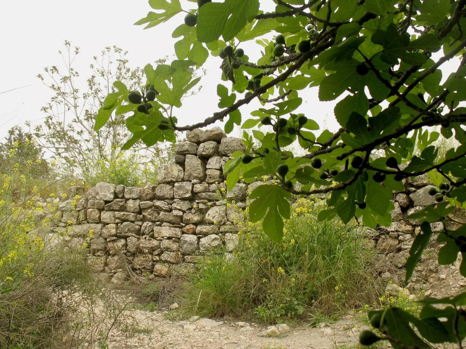
Posted by Noga Kadman - A fig tree, a destroyed Palestinian house in the background
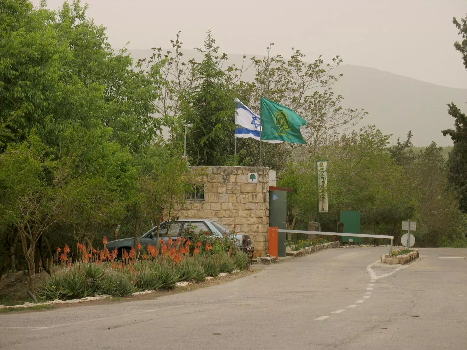
Posted by Noga Kadman - Entrance to the destroyed village, now you have to pay a fee to enter since the village has been converted to a park by the Israeli authority
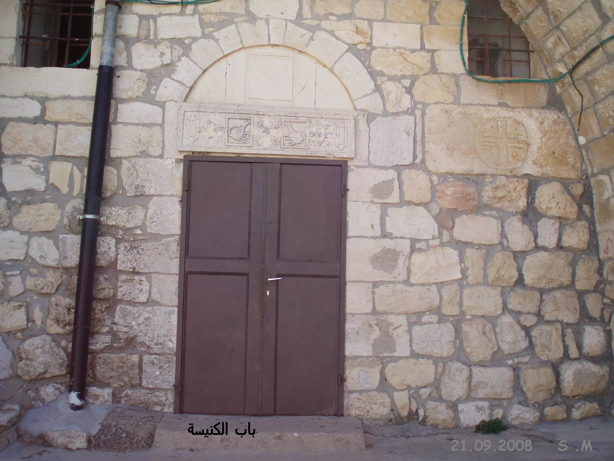
Posted by Noga Kadman 2 - باب الكنيسة كما يظهر يوم 21.9.08 تصوير الأستاذ سهيل مخول
Posted by سهيل مخول - بيت من كفر برعم المهجرة, كما يظهر يوم 21.9.08 تصوير الأستاذ Sohel Makhoul
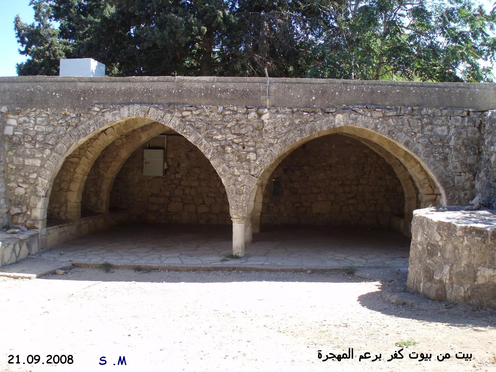
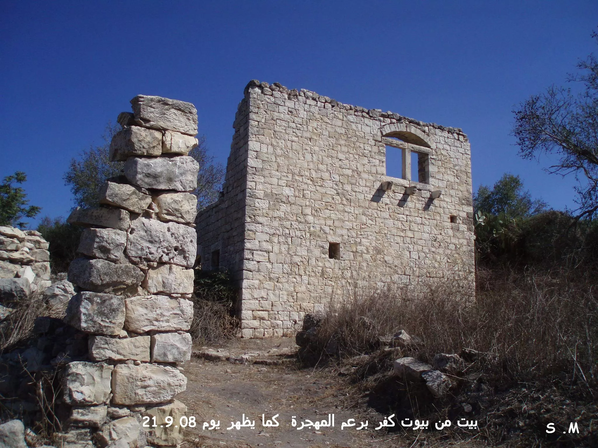
Posted by سهيل مخول 1 - بيت من كفر برعم المهجرة, كما يظهر يوم 21.9.08 تصوير الأستاذ Sohel Makhoul
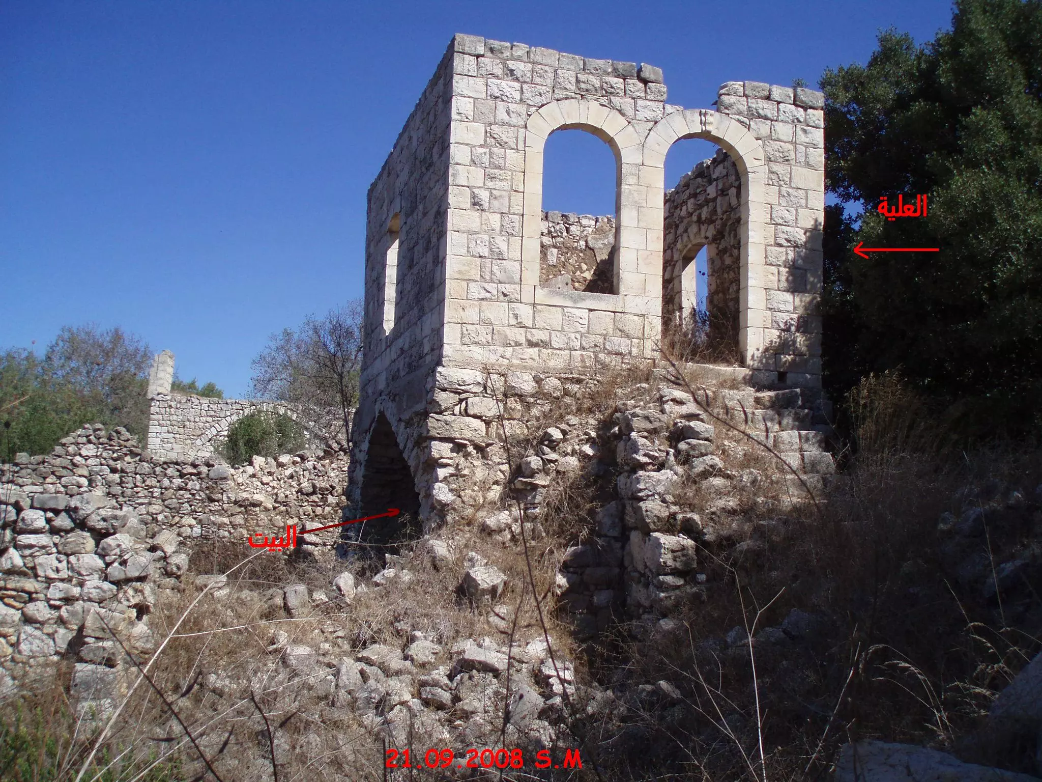
Posted by سهيل مخول - علية أحد بيوت كفر برعم المهجرة, كما يظهر يوم 21.9.08 تصوير الأستاذ Sohel Makhoul
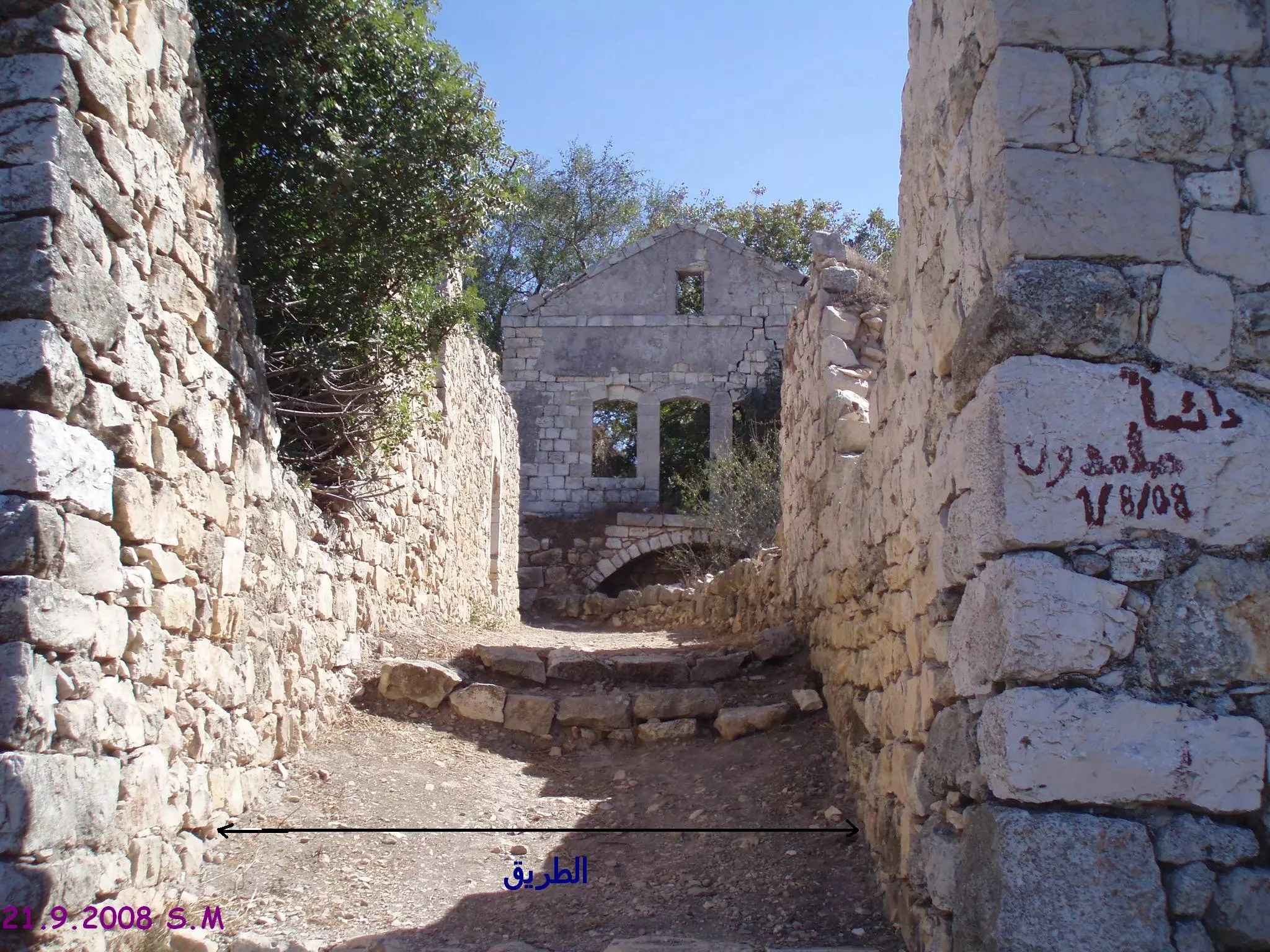
Posted by سهيل مخول - الطريق و بيوت كفر برعم المهجرة, يوم 21.9.08 تصوير الأستاذ Sohel Makhoul
Posted by سهيل مخول - كنيسة كفر برعم المهجرة, يوم 21.9.08 تصوير الأستاذ Sohel Makhoul
Posted by سهيل مخول - مبنى من القرن الرابع/ الخامس ميلادي اليهود يدعون بأنه كنيس يهودي بالرغم من أنه لم يذكر في أي مصدر تصوير الأستاذ سهيل مخول يوم 21.9.2008
Posted by سهيل مخول - كنيسة برعم
Posted by belal226 - كنيسه كفر برعم
Posted by abu raya - كنيسه كفر برعم

Posted by abu raya - اراضي كفر برعم وفي الافق جبال الشيخ
Posted by abu raya - اثار بيوت القريه
Posted by abu raya - بيوت كفر برعم
Posted by abu raya - بيوت القريه
Posted by abu raya - مقبره القريه
Posted by abu raya - بيوت القريه
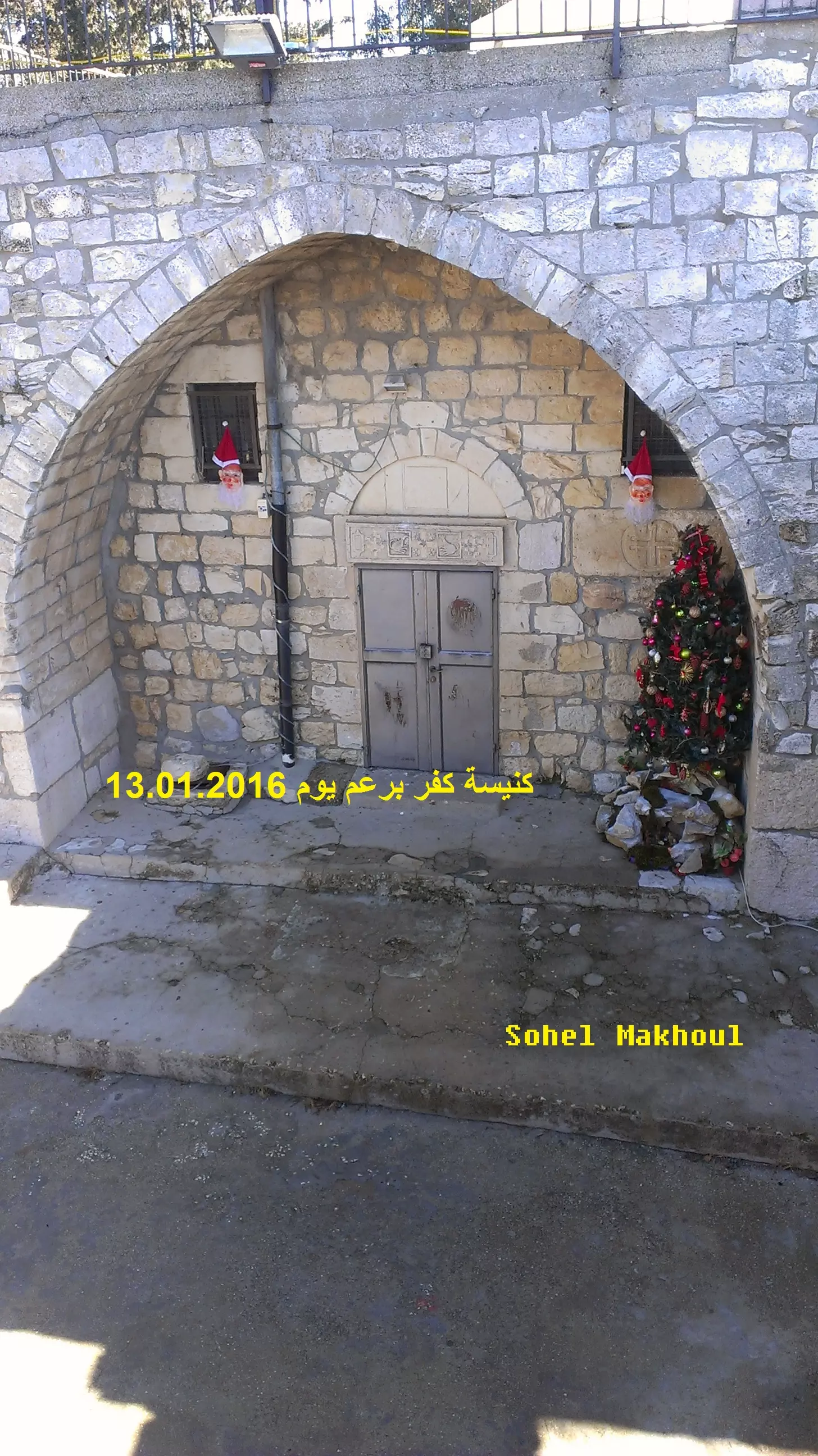
Posted by abu raya - كنيسة كفر برعم يوم 13.1.2016 بعدسة سهيل مخول
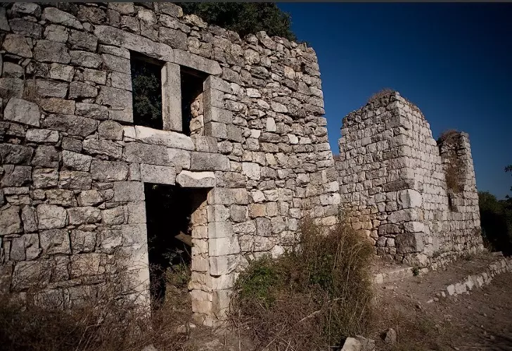
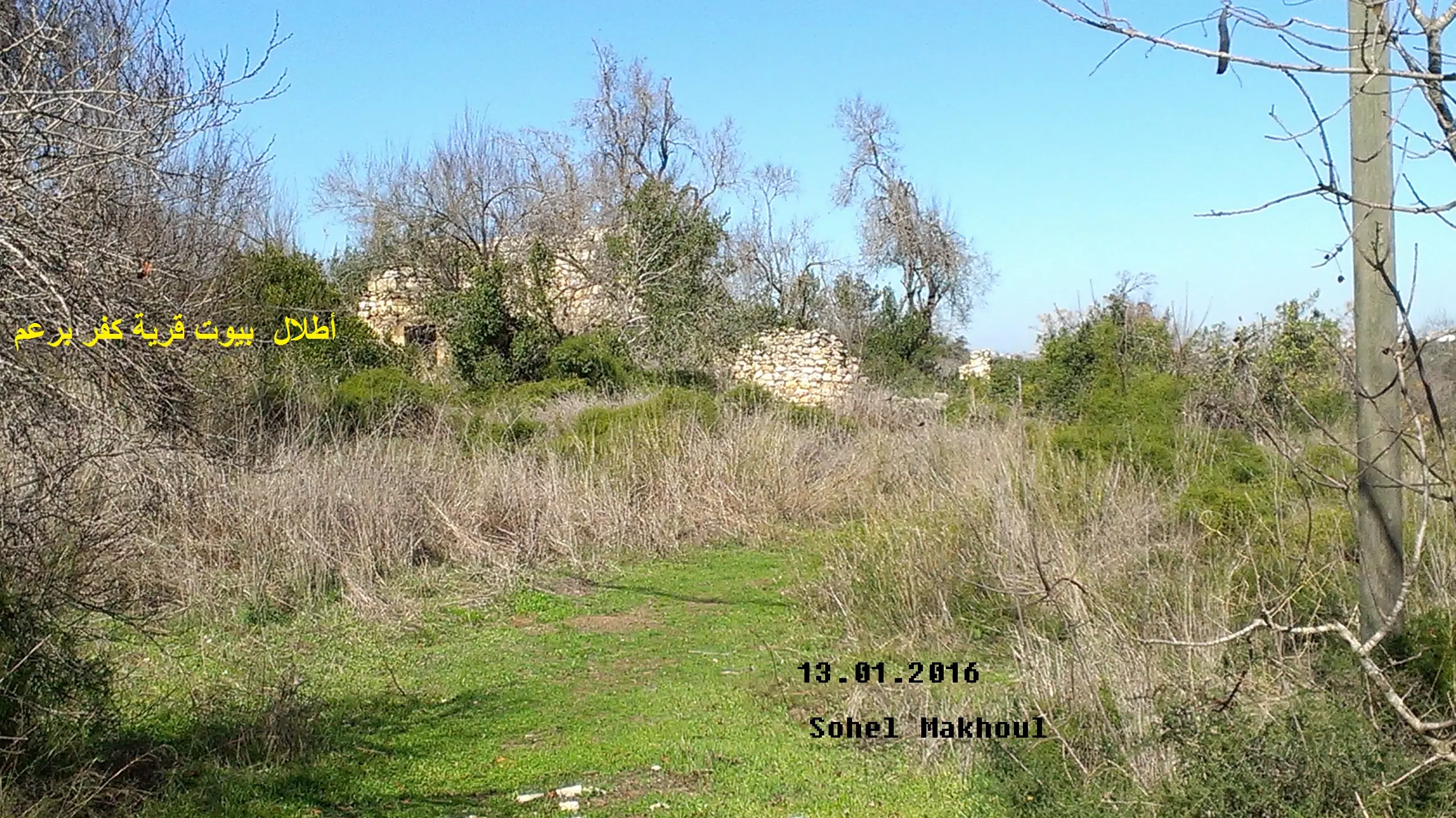
Posted by سهيل مخول - أطلال بيوت قرية كفر برعم المهجرة بعدسة سهيل مخول يوم 13.1.2016
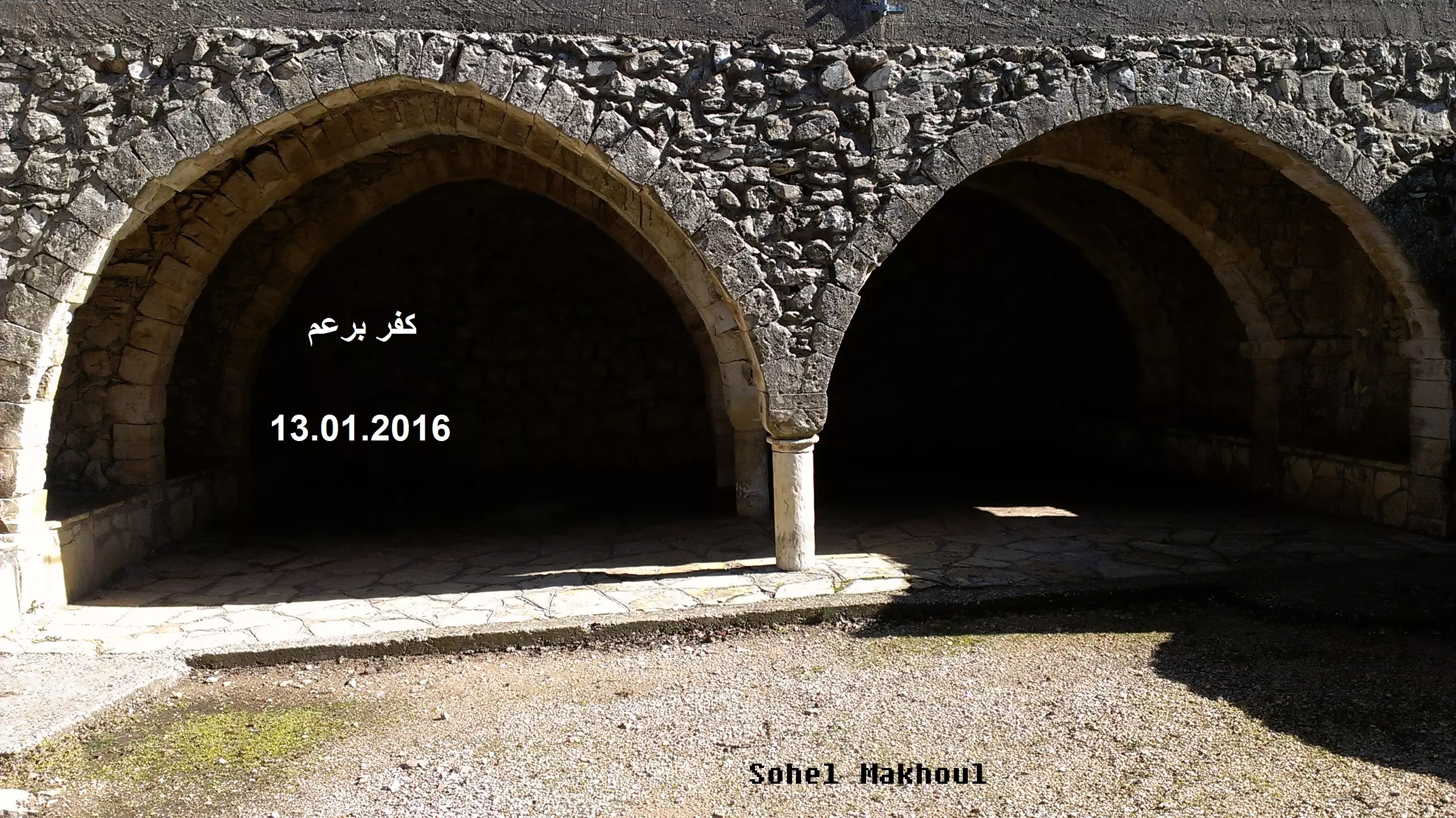
Posted by سهيل مخول - قناطر بيت في قرية برعم المهجرة بعدسة سهيل مخول يوم 13.1.2016
Posted by سهيل مخول - قرية كفر برعم عام 1938

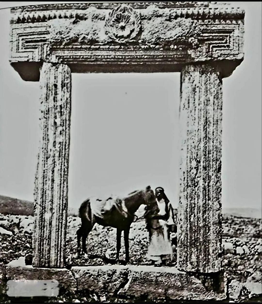
- آثار قديمة في قرية كفر برعم قضاء صفد - صورة من عشرينيات القرن العشرين..
- That is how the "civilized" erased and replaced us: Kafr Bir'im was completely obliterated although Kafr Bir'im was occupied intact, as you see -- كفر برعم باتت أثر بعد عين. من هنا مر الهمجّ
- That is how the "civilized" erased and replaced us: Kafr Bir'im was completely obliterated although Kafr Bir'im was occupied intact, as you see -- كفر برعم باتت أثر بعد عين. من هنا مر الهمجّ #2
- That is how the "civilized" erased and replaced us: Kafr Bir'im was completely obliterated although Kafr Bir'im was occupied intact, as you see -- كفر برعم باتت أثر بعد عين. من هنا مر الهمجّ #3
- That is how the "civilized" erased and replaced us: Kafr Bir'im was completely obliterated although Kafr Bir'im was occupied intact, as you see -- كفر برعم باتت أثر بعد عين. من هنا مر الهمجّ #4
- That is how the "civilized" erased and replaced us: Kafr Bir'im was completely obliterated although Kafr Bir'im was occupied intact, as you see -- كفر برعم باتت أثر بعد عين. من هنا مر الهمجّ #5
- That is how the "civilized" erased and replaced us: Kafr Bir'im was completely obliterated although Kafr Bir'im was occupied intact, as you see -- كفر برعم باتت أثر بعد عين. من هنا مر الهمجّ #6
- That is how the "civilized" erased and replaced us: Kafr Bir'im was completely obliterated although Kafr Bir'im was occupied intact, as you see -- كفر برعم باتت أثر بعد عين. من هنا مر الهمجّ #7
- That is how the "civilized" erased and replaced us: Kafr Bir'im was completely obliterated although Kafr Bir'im was occupied intact, as you see -- كفر برعم باتت أثر بعد عين. من هنا مر الهمجّ #8
- That is how the "civilized" erased and replaced us: Kafr Bir'im was completely obliterated although Kafr Bir'im was occupied intact, as you see -- كفر برعم باتت أثر بعد عين. من هنا مر الهمجّ #9
- That is how the "civilized" erased and replaced us: Kafr Bir'im was completely obliterated although Kafr Bir'im was occupied intact, as you see -- كفر برعم باتت أثر بعد عين. من هنا مر الهمجّ #10
- That is how the "civilized" erased and replaced us: Kafr Bir'im was completely obliterated although Kafr Bir'im was occupied intact, as you see -- كفر برعم باتت أثر بعد عين. من هنا مر الهمجّ #11
- That is how the "civilized" erased and replaced us: Kafr Bir'im was completely obliterated although Kafr Bir'im was occupied intact, as you see -- كفر برعم باتت أثر بعد عين. من هنا مر الهمجّ #12
- That is how the "civilized" erased and replaced us: Kafr Bir'im was completely obliterated although Kafr Bir'im was occupied intact, as you see -- كفر برعم باتت أثر بعد عين. من هنا مر الهمجّ #13
- That is how the "civilized" erased and replaced us: Kafr Bir'im was completely obliterated, although Kafr Bir'im was occupied intact, as you see -- كفر برعم باتت أثر بعد عين. من هنا مر الهمجّ #14
- That is how the "civilized" erased and replaced us: Kafr Bir'im was completely obliterated although Kafr Bir'im was occupied intact, as you see -- كفر برعم باتت أثر بعد عين. من هنا مر الهمجّ #15
- That is how the "civilized" erased and replaced us: Kafr Bir'im was completely obliterated, although Kafr Bir'im was occupied intact, as you see -- كفر برعم باتت أثر بعد عين. من هنا مر الهمجّ #16
- That is how the "civilized" erased and replaced us: Kafr Bir'im was completely obliterated, although Kafr Bir'im was occupied intact, as you see -- كفر برعم باتت أثر بعد عين. من هنا مر الهمجّ #17
- That is how the "civilized" erased and replaced us: Kafr Bir'im was completely obliterated, although Kafr Bir'im was occupied intact, as you see -- كفر برعم باتت أثر بعد عين. من هنا مر الهمجّ #18
- That is how the "civilized" erased and replaced us: Kafr Bir'im was completely obliterated, although Kafr Bir'im was occupied intact, as you see -- كفر برعم باتت أثر بعد عين. من هنا مر الهمجّ #19
- As you can see below, the "civilized" occupied Kafr Bir'im intact; then destroyed, although the war ended. Think about it: how else will the Jews get great again? Little ethnic cleansing, plunder, Jim Crow, and genocide do not harm. At least, not yet!. Mazeltov, dear Jew,s for this "wonderful gift" to humanity!
- As you can see below, the "civilized" occupied Kafr Bir'im intact; then destroyed, although the war ended. Think about it: how else will the Jews get great again? Little ethnic cleansing, plunder, Jim Crow, and genocide do not harm. At least, not yet!. Mazeltov, dear Jew,s for this "wonderful gift" to humanity! #2
- As you can see below, the "civilized" occupied Kafr Bir'im intact; then destroyed, although the war ended. Think about it: how else will the Jews get great again? Little ethnic cleansing, plunder, Jim Crow, and genocide do not harm. At least, not yet!. Mazeltov, dear Jew,s for this "wonderful gift" to humanity! #3
- As you can see below, the "civilized" occupied Kafr Bir'im intact; then destroyed, although the war ended. Think about it: how else will the Jews get great again? Little ethnic cleansing, plunder, Jim Crow, and genocide do not harm. At least, not yet!. Mazeltov, dear Jew,s for this "wonderful gift" to humanity! #4
- As you can see below, the "civilized" occupied Kafr Bir'im intact; then destroyed, although the war ended. Think about it: how else will the Jews get great again? Little ethnic cleansing, plunder, Jim Crow, and genocide do not harm. At least, not yet!. Mazeltov, dear Jew,s for this "wonderful gift" to humanity! #5

- As you can see below, the "civilized" occupied Kafr Bir'im intact; then destroyed, although the war ended. Think about it: how else will the Jews get great again? Little ethnic cleansing, plunder, Jim Crow, and genocide do not harm. At least, not yet!. Mazeltov, dear Jew,s for this "wonderful gift" to humanity! #6
- As you can see below, the "civilized" occupied Kafr Bir'im intact; then destroyed, although the war ended. Think about it: how else will the Jews get great again? Little ethnic cleansing, plunder, Jim Crow, and genocide do not harm. At least, not yet!. Mazeltov, dear Jew,s for this "wonderful gift" to humanity! #7
- As you can see below, the "civilized" occupied Kafr Bir'im intact; then destroyed, although the war ended. Think about it: how else will the Jews get great again? Little ethnic cleansing, plunder, Jim Crow, and genocide do not harm. At least, not yet!. Mazeltov, dear Jew,s for this "wonderful gift" to humanity! #8

- As you can see below, the "civilized" occupied Kafr Bir'im intact; then destroyed, although the war ended. Think about it: how else will the Jews get great again? Little ethnic cleansing, plunder, Jim Crow, and genocide do not harm. At least, not yet!. Mazeltov, dear Jew,s for this "wonderful gift" to humanity! #9

- That is how the "civilized" erased and replaced us: Kafr Bir'im was completely obliterated except for the Church, as you see. Although the Israeli Supreme Court approved of our return, the government still refuses to allow us to do so -- كفر برعم باتت أثر بعد عين. من هنا مر الهمجّ

- That is how the "civilized" erased and replaced us: Kafr Bir'im was completely obliterated except for the Church, as you see. Although the Israeli Supreme Court approved of our return, the government still refuses to allow us to do so -- كفر برعم باتت أثر بعد عين. من هنا مر الهمجّ #2
- That is how the "civilized" erased and replaced us: Kafr Bir'im was completely obliterated except for the Church, as you see. Although the Israeli Supreme Court approved of our return, the government still refuses to allow us to do so -- كفر برعم باتت أثر بعد عين. من هنا مر الهمجّ #3
- That is how the "civilized" erased and replaced us: Kafr Bir'im was completely obliterated except for the Church, as you see. Although the Israeli Supreme Court approved of our return, the government still refuses to allow us to do so -- كفر برعم باتت أثر بعد عين. من هنا مر الهمجّ #4

- That is how the "civilized" erased and replaced us: Kafr Bir'im was completely obliterated except for the Church, as you see. Although the Israeli Supreme Court approved of our return, the government still refuses to allow us to do so -- كفر برعم باتت أثر بعد عين. من هنا مر الهمجّ #5
- That is how the "civilized" erased and replaced us: Kafr Bir'im was completely obliterated except for the Church, as you see. Although the Israeli Supreme Court approved of our return, the government still refuses to allow us to do so -- كفر برعم باتت أثر بعد عين. من هنا مر الهمجّ #6

- That is how the "civilized" erased and replaced us: Kafr Bir'im was completely obliterated except for the Church, as you see. Although the Israeli Supreme Court approved of our return, the government still refuses to allow us to do so -- كفر برعم باتت أثر بعد عين. من هنا مر الهمجّ #7
- That is how the "civilized" erased and replaced us: Kafr Bir'im was completely obliterated except for the Church, as you see. Although the Israeli Supreme Court approved of our return, the government still refuses to allow us to do so -- كفر برعم باتت أثر بعد عين. من هنا مر الهمجّ #8
- That is how the "civilized" erased and replaced us: Kafr Bir'im was completely obliterated except for the Church, as you see. Although the Israeli Supreme Court approved of our return, the government still refuses to allow us to do so -- كفر برعم باتت أثر بعد عين. من هنا مر الهمجّ #9

- That is how the "civilized" erased and replaced us: Kafr Bir'im was completely obliterated except for the Church, as you see. Although the Israeli Supreme Court approved of our return, the government still refuses to allow us to do so -- كفر برعم باتت أثر بعد عين. من هنا مر الهمجّ #10

- That is how the "civilized" erased and replaced us: Kafr Bir'im was completely obliterated except for the Church, as you see. Although the Israeli Supreme Court approved of our return, the government still refuses to allow us to do so -- كفر برعم باتت أثر بعد عين. من هنا مر الهمجّ #11

- That is how the "civilized" erased and replaced us: Kafr Bir'im was completely obliterated except for the Church, as you see. Although the Israeli Supreme Court approved of our return, the government still refuses to allow us to do so -- كفر برعم باتت أثر بعد عين. من هنا مر الهمجّ #12
- That is how the "civilized" erased and replaced us: Kafr Bir'im was completely obliterated except for the Church, as you see. Although the Israeli Supreme Court approved of our return, the government still refuses to allow us to do so -- كفر برعم باتت أثر بعد عين. من هنا مر الهمجّ #13
- That is how the "civilized" erased and replaced us: Kafr Bir'im was completely obliterated except for the Church, as you see. Although the Israeli Supreme Court approved of our return, the government still refuses to allow us to do so -- كفر برعم باتت أثر بعد عين. من هنا مر الهمجّ #14

- That is how the "civilized" erased and replaced us: Kafr Bir'im was completely obliterated except for the Church, as you see. Although the Israeli Supreme Court approved of our return, the government still refuses to allow us to do so -- كفر برعم باتت أثر بعد عين. من هنا مر الهمجّ #15
- That is how the "civilized" erased and replaced us: Kafr Bir'im was completely obliterated except for the Church, as you see. Although the Israeli Supreme Court approved of our return, the government still refuses to allow us to do so -- كفر برعم باتت أثر بعد عين. من هنا مر الهمجّ #16

- Let us see how the most "liberal and civilized" of world Jewry has obliterated our village except for the church, which was partially destroyed. It should be NOTED that our town was destroyed by the Israelis way after the war was over to hinder our return, and the Supreme Court granted us the right to return. However, the Israeli government still refuses to enforce the ruling. Think about it: how else will the Jews be great and safe again? -- القرية دمرت بالكامل بإستثناء بضعة مبناني.. من هنا مر الهمج
- Let us see how the most "liberal and civilized" of world Jewry has obliterated our village except for the church, which was partially destroyed. It should be NOTED that our town was destroyed by the Israelis way after the war was over to hinder our return, and the Supreme Court granted us the right to return. However, the Israeli government still refuses to enforce the ruling. Think about it: how else will the Jews be great and safe again? -- القرية دمرت بالكامل بإستثناء بضعة مبناني.. من هنا مر الهمج #2
- Let us see how the most "liberal and civilized" of world Jewry has obliterated our village except for the church, which was partially destroyed. It should be NOTED that our town was destroyed by the Israelis way after the war was over to hinder our return, and the Supreme Court granted us the right to return. However, the Israeli government still refuses to enforce the ruling. Think about it: how else will the Jews be great and safe again? -- القرية دمرت بالكامل بإستثناء بضعة مبناني.. من هنا مر الهمج #3
- Let us see how the most "liberal and civilized" of world Jewry has obliterated our village except for the church, which was partially destroyed. It should be NOTED that our town was destroyed by the Israelis way after the war was over to hinder our return, and the Supreme Court granted us the right to return. However, the Israeli government still refuses to enforce the ruling. Think about it: how else will the Jews be great and safe again? -- القرية دمرت بالكامل بإستثناء بضعة مبناني.. من هنا مر الهمج #4
- Let us see how the most "liberal and civilized" of world Jewry has obliterated our village except for the church, which was partially destroyed. It should be NOTED that our town was destroyed by the Israelis way after the war was over to hinder our return, and the Supreme Court granted us the right to return. However, the Israeli government still refuses to enforce the ruling. Think about it: how else will the Jews be great and safe again? -- القرية دمرت بالكامل بإستثناء بضعة مبناني.. من هنا مر الهمج #5
- Let us see how the most "liberal and civilized" of world Jewry has obliterated our village except for the church, which was partially destroyed. It should be NOTED that our town was destroyed by the Israelis way after the war was over to hinder our return, and the Supreme Court granted us the right to return. However, the Israeli government still refuses to enforce the ruling. Think about it: how else will the Jews be great and safe again? -- القرية دمرت بالكامل بإستثناء بضعة مبناني.. من هنا مر الهمج #6
- Let us see how the most "liberal and civilized" of world Jewry has obliterated our village except for the church, which was partially destroyed. It should be NOTED that our town was destroyed by the Israelis way after the war was over to hinder our return, and the Supreme Court granted us the right to return. However, the Israeli government still refuses to enforce the ruling. Think about it: how else will the Jews be great and safe again? -- القرية دمرت بالكامل بإستثناء بضعة مبناني.. من هنا مر الهمج #7
- Let us see how the most "liberal and civilized" of world Jewry has obliterated our village except for the church, which was partially destroyed. It should be NOTED that our town was destroyed by the Israelis way after the war was over to hinder our return, and the Supreme Court granted us the right to return. However, the Israeli government still refuses to enforce the ruling. Think about it: how else will the Jews be great and safe again? -- القرية دمرت بالكامل بإستثناء بضعة مبناني.. من هنا مر الهمج #8
- Let us see how the most "liberal and civilized" of world Jewry has obliterated our village except for the church, which was partially destroyed. It should be NOTED that our town was destroyed by the Israelis way after the war was over to hinder our return, and the Supreme Court granted us the right to return. However, the Israeli government still refuses to enforce the ruling. Think about it: how else will the Jews be great and safe again? -- القرية دمرت بالكامل بإستثناء بضعة مبناني.. من هنا مر الهمج #9
- Let us see how the most "liberal and civilized" of world Jewry has obliterated our village except for the church, which was partially destroyed. It should be NOTED that our town was destroyed by the Israelis way after the war was over to hinder our return, and the Supreme Court granted us the right to return. However, the Israeli government still refuses to enforce the ruling. Think about it: how else will the Jews be great and safe again? -- القرية دمرت بالكامل بإستثناء بضعة مبناني.. من هنا مر الهمج #10
- Let us see how the most "liberal and civilized" of world Jewry has obliterated our village except for the church, which was partially destroyed. It should be NOTED that our town was destroyed by the Israelis way after the war was over to hinder our return, and the Supreme Court granted us the right to return. However, the Israeli government still refuses to enforce the ruling. Think about it: how else will the Jews be great and safe again? -- القرية دمرت بالكامل بإستثناء بضعة مبناني.. من هنا مر الهمج #11
- Let us see how the most "liberal and civilized" of world Jewry has obliterated our village except for the church, which was partially destroyed. It should be NOTED that our town was destroyed by the Israelis way after the war was over to hinder our return, and the Supreme Court granted us the right to return. However, the Israeli government still refuses to enforce the ruling. Think about it: how else will the Jews be great and safe again? -- القرية دمرت بالكامل بإستثناء بضعة مبناني.. من هنا مر الهمج #12
- Let us see how the most "liberal and civilized" of world Jewry has obliterated our village except for the church, which was partially destroyed. It should be NOTED that our town was destroyed by the Israelis way after the war was over to hinder our return, and the Supreme Court granted us the right to return. However, the Israeli government still refuses to enforce the ruling. Think about it: how else will the Jews be great and safe again? -- القرية دمرت بالكامل بإستثناء بضعة مبناني.. من هنا مر الهمج #13
- Let us see how the most "liberal and civilized" of world Jewry has obliterated our village except for the church, which was partially destroyed. It should be NOTED that our town was destroyed by the Israelis way after the war was over to hinder our return, and the Supreme Court granted us the right to return. However, the Israeli government still refuses to enforce the ruling. Think about it: how else will the Jews be great and safe again? -- القرية دمرت بالكامل بإستثناء بضعة مبناني.. من هنا مر الهمج #14
- Let us see how the most "liberal and civilized" of world Jewry has obliterated our village except for the church, which was partially destroyed. It should be NOTED that our town was destroyed by the Israelis way after the war was over to hinder our return, and the Supreme Court granted us the right to return. However, the Israeli government still refuses to enforce the ruling. Think about it: how else will the Jews be great and safe again? -- القرية دمرت بالكامل بإستثناء بضعة مبناني.. من هنا مر الهمج #15
- Let us see how the most "liberal and civilized" of world Jewry has obliterated our village except for the church, which was partially destroyed. It should be NOTED that our town was destroyed by the Israelis way after the war was over to hinder our return, and the Supreme Court granted us the right to return. However, the Israeli government still refuses to enforce the ruling. Think about it: how else will the Jews be great and safe again? -- القرية دمرت بالكامل بإستثناء بضعة مبناني.. من هنا مر الهمج #16
- Let us see how the most "liberal and civilized" of world Jewry has obliterated our village except for the church, which was partially destroyed. It should be NOTED that our town was destroyed by the Israelis way after the war was over to hinder our return, and the Supreme Court granted us the right to return. However, the Israeli government still refuses to enforce the ruling. Think about it: how else will the Jews be great and safe again? -- القرية دمرت بالكامل بإستثناء بضعة مبناني.. من هنا مر الهمج #17
- Let us see how the most "liberal and civilized" of world Jewry has obliterated our village except for the church, which was partially destroyed. It should be NOTED that our town was destroyed by the Israelis way after the war was over to hinder our return, and the Supreme Court granted us the right to return. However, the Israeli government still refuses to enforce the ruling. Think about it: how else will the Jews be great and safe again? -- القرية دمرت بالكامل بإستثناء بضعة مبناني.. من هنا مر الهمج #18
- Let us see how the most "liberal and civilized" of world Jewry has obliterated our village except for the church, which was partially destroyed. It should be NOTED that our town was destroyed by the Israelis way after the war was over to hinder our return, and the Supreme Court granted us the right to return. However, the Israeli government still refuses to enforce the ruling. Think about it: how else will the Jews be great and safe again? -- القرية دمرت بالكامل بإستثناء بضعة مبناني.. من هنا مر الهمج #19
- Let us see how the most "liberal and civilized" of world Jewry has obliterated our village except for the church, which was partially destroyed. It should be NOTED that our town was destroyed by the Israelis way after the war was over to hinder our return, and the Supreme Court granted us the right to return. However, the Israeli government still refuses to enforce the ruling. Think about it: how else will the Jews be great and safe again? -- القرية دمرت بالكامل بإستثناء بضعة مبناني.. من هنا مر الهمج #20
- Let us see how the most "liberal and civilized" of world Jewry has obliterated our village except for the church, which was partially destroyed. It should be NOTED that our town was destroyed by the Israelis way after the war was over to hinder our return, and the Supreme Court granted us the right to return. However, the Israeli government still refuses to enforce the ruling. Think about it: how else will the Jews be great and safe again? -- القرية دمرت بالكامل بإستثناء بضعة مبناني.. من هنا مر الهمج #21
- Let us see how the most "liberal and civilized" of world Jewry has obliterated our village except for the church, which was partially destroyed. It should be NOTED that our town was destroyed by the Israelis way after the war was over to hinder our return, and the Supreme Court granted us the right to return. However, the Israeli government still refuses to enforce the ruling. Think about it: how else will the Jews be great and safe again? -- القرية دمرت بالكامل بإستثناء بضعة مبناني.. من هنا مر الهمج #22
- Let us see how the most "liberal and civilized" of world Jewry has obliterated our village except for the church, which was partially destroyed. It should be NOTED that our town was destroyed by the Israelis way after the war was over to hinder our return, and the Supreme Court granted us the right to return. However, the Israeli government still refuses to enforce the ruling. Think about it: how else will the Jews be great and safe again? -- القرية دمرت بالكامل بإستثناء بضعة مبناني.. من هنا مر الهمج #23
- Let us see how the most "liberal and civilized" of world Jewry has obliterated our village except for the church, which was partially destroyed. It should be NOTED that our town was destroyed by the Israelis way after the war was over to hinder our return, and the Supreme Court granted us the right to return. However, the Israeli government still refuses to enforce the ruling. Think about it: how else will the Jews be great and safe again? -- القرية دمرت بالكامل بإستثناء بضعة مبناني.. من هنا مر الهمج #24
- Let us see how the most "liberal and civilized" of world Jewry has obliterated our village except for the church, which was partially destroyed. It should be NOTED that our town was destroyed by the Israelis way after the war was over to hinder our return, and the Supreme Court granted us the right to return. However, the Israeli government still refuses to enforce the ruling. Think about it: how else will the Jews be great and safe again? -- القرية دمرت بالكامل بإستثناء بضعة مبناني.. من هنا مر الهمج #25
- Let us see how the most "liberal and civilized" of world Jewry has obliterated our village except for the church, which was partially destroyed. It should be NOTED that our town was destroyed by the Israelis way after the war was over to hinder our return, and the Supreme Court granted us the right to return. However, the Israeli government still refuses to enforce the ruling. Think about it: how else will the Jews be great and safe again? -- القرية دمرت بالكامل بإستثناء بضعة مبناني.. من هنا مر الهمج #26
- Let us see how the most "liberal and civilized" of world Jewry has obliterated our village except for the church, which was partially destroyed. It should be NOTED that our town was destroyed by the Israelis way after the war was over to hinder our return, and the Supreme Court granted us the right to return. However, the Israeli government still refuses to enforce the ruling. Think about it: how else will the Jews be great and safe again? -- القرية دمرت بالكامل بإستثناء بضعة مبناني.. من هنا مر الهمج #27
- Let us see how the most "liberal and civilized" of world Jewry has obliterated our village except for the church, which was partially destroyed. It should be NOTED that our town was destroyed by the Israelis way after the war was over to hinder our return, and the Supreme Court granted us the right to return. However, the Israeli government still refuses to enforce the ruling. Think about it: how else will the Jews be great and safe again? -- القرية دمرت بالكامل بإستثناء بضعة مبناني.. من هنا مر الهمج #28
- Let us see how the most "liberal and civilized" of world Jewry has obliterated our village except for the church, which was partially destroyed. It should be NOTED that our town was destroyed by the Israelis way after the war was over to hinder our return, and the Supreme Court granted us the right to return. However, the Israeli government still refuses to enforce the ruling. Think about it: how else will the Jews be great and safe again? -- القرية دمرت بالكامل بإستثناء بضعة مبناني.. من هنا مر الهمج #29
- Let us see how the most "liberal and civilized" of world Jewry has obliterated our village except for the church, which was partially destroyed. It should be NOTED that our town was destroyed by the Israelis way after the war was over to hinder our return, and the Supreme Court granted us the right to return. However, the Israeli government still refuses to enforce the ruling. Think about it: how else will the Jews be great and safe again? -- القرية دمرت بالكامل بإستثناء بضعة مبناني.. من هنا مر الهمج #30
- Let us see how the most "liberal and civilized" of world Jewry has obliterated our village except for the church, which was partially destroyed. It should be NOTED that our town was destroyed by the Israelis way after the war was over to hinder our return, and the Supreme Court granted us the right to return. However, the Israeli government still refuses to enforce the ruling. Think about it: how else will the Jews be great and safe again? -- القرية دمرت بالكامل بإستثناء بضعة مبناني.. من هنا مر الهمج #31
- Let us see how the most "liberal and civilized" of world Jewry has obliterated our village except for the church, which was partially destroyed. It should be NOTED that our town was destroyed by the Israelis way after the war was over to hinder our return, and the Supreme Court granted us the right to return. However, the Israeli government still refuses to enforce the ruling. Think about it: how else will the Jews be great and safe again? -- القرية دمرت بالكامل بإستثناء بضعة مبناني.. من هنا مر الهمج #32
- Let us see how the most "liberal and civilized" of world Jewry has obliterated our village except for the church, which was partially destroyed. It should be NOTED that our town was destroyed by the Israelis way after the war was over to hinder our return, and the Supreme Court granted us the right to return. However, the Israeli government still refuses to enforce the ruling. Think about it: how else will the Jews be great and safe again? -- القرية دمرت بالكامل بإستثناء بضعة مبناني.. من هنا مر الهمج #33
- Let us see how the most "liberal and civilized" of world Jewry has obliterated our village except for the church, which was partially destroyed. It should be NOTED that our town was destroyed by the Israelis way after the war was over to hinder our return, and the Supreme Court granted us the right to return. However, the Israeli government still refuses to enforce the ruling. Think about it: how else will the Jews be great and safe again? -- القرية دمرت بالكامل بإستثناء بضعة مبناني.. من هنا مر الهمج #34
- Let us see how the most "liberal and civilized" of world Jewry has obliterated our village except for the church, which was partially destroyed. It should be NOTED that our town was destroyed by the Israelis way after the war was over to hinder our return, and the Supreme Court granted us the right to return. However, the Israeli government still refuses to enforce the ruling. Think about it: how else will the Jews be great and safe again? -- القرية دمرت بالكامل بإستثناء بضعة مبناني.. من هنا مر الهمج #35
- Let us see how the most "liberal and civilized" of world Jewry has obliterated our village except for the church, which was partially destroyed. It should be NOTED that our town was destroyed by the Israelis way after the war was over to hinder our return, and the Supreme Court granted us the right to return. However, the Israeli government still refuses to enforce the ruling. Think about it: how else will the Jews be great and safe again? -- القرية دمرت بالكامل بإستثناء بضعة مبناني.. من هنا مر الهمج #36
- Let us see how the most "liberal and civilized" of world Jewry has obliterated our village except for the church, which was partially destroyed. It should be NOTED that our town was destroyed by the Israelis way after the war was over to hinder our return, and the Supreme Court granted us the right to return. However, the Israeli government still refuses to enforce the ruling. Think about it: how else will the Jews be great and safe again? -- القرية دمرت بالكامل بإستثناء بضعة مبناني.. من هنا مر الهمج #37
- Let us see how the most "liberal and civilized" of world Jewry has obliterated our village except for the church, which was partially destroyed. It should be NOTED that our town was destroyed by the Israelis way after the war was over to hinder our return, and the Supreme Court granted us the right to return. However, the Israeli government still refuses to enforce the ruling. Think about it: how else will the Jews be great and safe again? -- القرية دمرت بالكامل بإستثناء بضعة مبناني.. من هنا مر الهمج #38
- Let us see how the most "liberal and civilized" of world Jewry has obliterated our village except for the church, which was partially destroyed. It should be NOTED that our town was destroyed by the Israelis way after the war was over to hinder our return, and the Supreme Court granted us the right to return. However, the Israeli government still refuses to enforce the ruling. Think about it: how else will the Jews be great and safe again? -- القرية دمرت بالكامل بإستثناء بضعة مبناني.. من هنا مر الهمج #39
- Let us see how the most "liberal and civilized" of world Jewry has obliterated our village except for the church, which was partially destroyed. It should be NOTED that our town was destroyed by the Israelis way after the war was over to hinder our return, and the Supreme Court granted us the right to return. However, the Israeli government still refuses to enforce the ruling. Think about it: how else will the Jews be great and safe again? -- القرية دمرت بالكامل بإستثناء بضعة مبناني.. من هنا مر الهمج #40
- Let us see how the most "liberal and civilized" of world Jewry has obliterated our village except for the church, which was partially destroyed. It should be NOTED that our town was destroyed by the Israelis way after the war was over to hinder our return, and the Supreme Court granted us the right to return. However, the Israeli government still refuses to enforce the ruling. Think about it: how else will the Jews be great and safe again? -- القرية دمرت بالكامل بإستثناء بضعة مبناني.. من هنا مر الهمج #41
- Let us see how the most "liberal and civilized" of world Jewry has obliterated our village except for the church, which was partially destroyed. It should be NOTED that our town was destroyed by the Israelis way after the war was over to hinder our return, and the Supreme Court granted us the right to return. However, the Israeli government still refuses to enforce the ruling. Think about it: how else will the Jews be great and safe again? -- القرية دمرت بالكامل بإستثناء بضعة مبناني.. من هنا مر الهمج #42
- Let us see how the most "liberal and civilized" of world Jewry has obliterated our village except for the church, which was partially destroyed. It should be NOTED that our town was destroyed by the Israelis way after the war was over to hinder our return, and the Supreme Court granted us the right to return. However, the Israeli government still refuses to enforce the ruling. Think about it: how else will the Jews be great and safe again? -- القرية دمرت بالكامل بإستثناء بضعة مبناني.. من هنا مر الهمج #43
- Let us see how the most "liberal and civilized" of world Jewry has obliterated our village except for the church, which was partially destroyed. It should be NOTED that our town was destroyed by the Israelis way after the war was over to hinder our return, and the Supreme Court granted us the right to return. However, the Israeli government still refuses to enforce the ruling. Think about it: how else will the Jews be great and safe again? -- القرية دمرت بالكامل بإستثناء بضعة مبناني.. من هنا مر الهمج #44
- Let us see how the most "liberal and civilized" of world Jewry has obliterated our village except for the church. How else will the Jews be great and safe again? -- القرية دمرت بالكامل بإستثناء بضعة مبناني.. من هنا مر الهمج
- Let us see how the most "liberal and civilized" of world Jewry has obliterated our village except for the church. How else will the Jews be great and safe again? -- القرية دمرت بالكامل بإستثناء بضعة مبناني.. من هنا مر الهمج #2
- Let us see how the most "liberal and civilized" of world Jewry has obliterated our village except for the church. How else will the Jews be great and safe again? -- القرية دمرت بالكامل بإستثناء بضعة مبناني.. من هنا مر الهمج #3
- Let us see how the most "liberal and civilized" of world Jewry has obliterated our village except for the church. How else will the Jews be great and safe again? -- القرية دمرت بالكامل بإستثناء بضعة مبناني.. من هنا مر الهمج #4
- Let us see how the most "liberal and civilized" of world Jewry has obliterated our village except for the church. How else will the Jews be great and safe again? -- القرية دمرت بالكامل بإستثناء بضعة مبناني.. من هنا مر الهمج #5
- Let us see how the most "liberal and civilized" of world Jewry has obliterated our village except for the church. How else will the Jews be great and safe again? -- القرية دمرت بالكامل بإستثناء بضعة مبناني.. من هنا مر الهمج #6
- Let us see how the most "liberal and civilized" of world Jewry has obliterated our village except for the church. How else will the Jews be great and safe again? -- القرية دمرت بالكامل بإستثناء بضعة مبناني.. من هنا مر الهمج #7
- Let us see how the most "liberal and civilized" of world Jewry has obliterated our village except for the church. How else will the Jews be great and safe again? -- القرية دمرت بالكامل بإستثناء بضعة مبناني.. من هنا مر الهمج #8
- Let us see how the most "liberal and civilized" of world Jewry has obliterated our village except for the church. How else will the Jews be great and safe again? -- القرية دمرت بالكامل بإستثناء بضعة مبناني.. من هنا مر الهمج #9
- Let us see how the most "liberal and civilized" of world Jewry has obliterated our village except for the church. How else will the Jews be great and safe again? -- القرية دمرت بالكامل بإستثناء بضعة مبناني.. من هنا مر الهمج #10
- Let us see how the most "liberal and civilized" of world Jewry has obliterated our village except for the church. How else will the Jews be great and safe again? -- القرية دمرت بالكامل بإستثناء بضعة مبناني.. من هنا مر الهمج #11
- Let us see how the most "liberal and civilized" of world Jewry has obliterated our village except for the church. How else will the Jews be great and safe again? -- القرية دمرت بالكامل بإستثناء بضعة مبناني.. من هنا مر الهمج #12
- Let us see how the most "liberal and civilized" of world Jewry has obliterated our village except for the church. How else will the Jews be great and safe again? -- القرية دمرت بالكامل بإستثناء بضعة مبناني.. من هنا مر الهمج #13
- Let us see how the most "liberal and civilized" of world Jewry has obliterated our village except for the church. How else will the Jews be great and safe again? -- القرية دمرت بالكامل بإستثناء بضعة مبناني.. من هنا مر الهمج #14
- Let us see how the most "liberal and civilized" of world Jewry has obliterated our village except for the church. How else will the Jews be great and safe again? -- القرية دمرت بالكامل بإستثناء بضعة مبناني.. من هنا مر الهمج #15
- Let us see how the most "liberal and civilized" of world Jewry has obliterated our village except for the church. How else will the Jews be great and safe again? -- القرية دمرت بالكامل بإستثناء بضعة مبناني.. من هنا مر الهمج #16
- Let us see how the most "liberal and civilized" of world Jewry has obliterated our village except for the church. How else will the Jews be great and safe again? -- القرية دمرت بالكامل بإستثناء بضعة مبناني.. من هنا مر الهمج #17
- Let us see how the most "liberal and civilized" of world Jewry has obliterated our village except for the church. How else will the Jews be great and safe again? -- القرية دمرت بالكامل بإستثناء بضعة مبناني.. من هنا مر الهمج #18
- Let us see how the most "liberal and civilized" of world Jewry has obliterated our village except for the church. How else will the Jews be great and safe again? -- القرية دمرت بالكامل بإستثناء بضعة مبناني.. من هنا مر الهمج #19
- Let us see how the most "liberal and civilized" of world Jewry has obliterated our village except for the church. How else will the Jews be great and safe again? -- القرية دمرت بالكامل بإستثناء بضعة مبناني.. من هنا مر الهمج #20
- Let us see how the most "liberal and civilized" of world Jewry has obliterated our village except for the church. How else will the Jews be great and safe again? -- القرية دمرت بالكامل بإستثناء بضعة مبناني.. من هنا مر الهمج #21
- Let us see how the most "liberal and civilized" of world Jewry has obliterated our village except for the church. How else will the Jews be great and safe again? -- القرية دمرت بالكامل بإستثناء بضعة مبناني.. من هنا مر الهمج #22
- Let us see how the most "liberal and civilized" of world Jewry has obliterated our village except for the church. How else will the Jews be great and safe again? -- القرية دمرت بالكامل بإستثناء بضعة مبناني.. من هنا مر الهمج #23
- Let us see how the most "liberal and civilized" of world Jewry has obliterated our village except for the church. How else will the Jews be great and safe again? -- القرية دمرت بالكامل بإستثناء بضعة مبناني.. من هنا مر الهمج #24
- Let us see how the most "liberal and civilized" of world Jewry has obliterated our village except for the church. How else will the Jews be great and safe again? -- القرية دمرت بالكامل بإستثناء بضعة مبناني.. من هنا مر الهمج #25
- Let us see how the most "liberal and civilized" of world Jewry has obliterated our village except for the church. How else will the Jews be great and safe again? -- القرية دمرت بالكامل بإستثناء بضعة مبناني.. من هنا مر الهمج #26
- Let us see how the most "liberal and civilized" of world Jewry has obliterated our village except for the church. How else will the Jews be great and safe again? -- القرية دمرت بالكامل بإستثناء بضعة مبناني.. من هنا مر الهمج #27
- Let us see how the most "liberal and civilized" of world Jewry has obliterated our village except for the church. How else will the Jews be great and safe again? -- القرية دمرت بالكامل بإستثناء بضعة مبناني.. من هنا مر الهمج #28
- Let us see how the most "liberal and civilized" of world Jewry has obliterated our village except for the church. How else will the Jews be great and safe again? -- القرية دمرت بالكامل بإستثناء بضعة مبناني.. من هنا مر الهمج #29
- Let us see how the most "liberal and civilized" of world Jewry has obliterated our village except for the church. How else will the Jews be great and safe again? -- القرية دمرت بالكامل بإستثناء بضعة مبناني.. من هنا مر الهمج #30
- Let us see how the most "liberal and civilized" of world Jewry has obliterated our village except for the church. How else will the Jews be great and safe again? -- القرية دمرت بالكامل بإستثناء بضعة مبناني.. من هنا مر الهمج #31
- Let us see how the most "liberal and civilized" of world Jewry has obliterated our village except for the church. How else will the Jews be great and safe again? -- القرية دمرت بالكامل بإستثناء بضعة مبناني.. من هنا مر الهمج #32
- خارطة تُظهِر الحدود والطرق بأنواعها والأماكن المقدسة والطبيعة الطوبغرافية من تلال وسهول ومنحدرات والتشكيلة الطبيعية للأرض وأنواع المزروعات. نُشرت الخريطة فترة الانتداب البريطاني، تم إضافة تعديلات عليها من قِبَل خدمة الخرائط والصور التابعة للقوات العسكرية الاسرائيلية فترة الأربعينيات.
Want to browse more? 80,000 pictures were grouped in these gallaries:
| Display Name | Clan/Hamolah | Country of Residence |
| habib | khalil | nsw, australia |
- قرية برعم المهجرة في يوم مثلج صور رائعة في أنقاض القرية Duration: 3 min 3 sec
- Return To Kafr Bir'em Duration: 7 min 17 sec
- قرية كفر برعم المهجرة والواقعة بالقرب من الحدود اللبنانية - حلوة يا دنيا Duration: 13 min 55 sec
- برنامج 48 قرية كفر برعم المهجرة - فلسطين Duration: 26 min 48 sec
- كفر برعم المهجرة - فلسطين - حلوة يا دنيا Duration: 15 min 19 sec
- نظرة جوية لقرية كفربرعم المهجرة 2020 Duration: 4 min 40 sec
 Fake Valor: Why Did Zionist Jews Hoist Nazis Flag on Their Ships in the 1930s?
What is new?
-
Facts About Oct. 7th Gaza Raid
-
Remined Us Please:: Who Did Rape Who? Palestinians Raped Israelis? Or, was the other way around?
-
When Prof. Edward Said was invited to debate Bibi Netanyahu in the 1980s, watch what happened!
-
Ezra Klein of the NY Times on the "Jewish Race".
-
Abusing Blood Libel!
-
Did Israeli Soldiers Activate The Hanniba Direective On Oct. 7th? You Be The Judge
-
Zionist FAQ: Isn't it true that Palestinians don't want peace? Palestinians never accepted the two-state solution
- Facts about Haavara (Transfer) Agreement between Ben-Gurion & Hitler
-
Haavara FAQs: Why Did Zionist Jews Hoist Nazis' Flags on Their Ships in the 1930s?
- Haavara FAQs: When Chaim Weizmann met FDR in mid-1943, why was he silent about rescuing European Jewry?
-
Dear ChatGPT: How did Palestinians resist Napoleon's invasion of their country in 1799?
-
Dear ChatGPT: Gaza had a vibrant Jewish community in the mid-17th century. What happened to them?
-
Dear ChatGPT: Why did the Jewish Agency suppress news of the Holocaust during WWII?
-
Video Playlist: Jews share their DNA tests to end the conflict for good.
-
A Tale of Two Conflicts: Examining the Definition of Genocide
-
Prof. Abraham Polak And The Suppressed History of the Khazars and European Jewry
-
How Ronald Reagan would have framed the genocide in Gaza if he were still alive?
-
Haavara FAQs: Let us do the math: how many German Jews did The Haavara Agreement save?
-
Zionist FAQs: The Hebron Massacre of 1929, "clearly proves" that Palestinians are antisemitic, how could you deny it?
-
Zionist FAQs: Why Anti-Zionist Is Not Antisemitism?
-
Zionist FAQs: Isn't it true that the KGB created Palestinian Nationalism in the early 1960s?
- Zionist FAQs: Muslims are killing Muslims all the time; why are Israeli Jews being singled out in the media?
- Zionist FAQs: How is Israel an apartheid state when 20% of its citizens are Arabs who enjoy full rights?
-
Haavara FAQs: Why Did Dorothy Thompson Flip From A Zionist Advocate to A Silenced Dissenter?
-
Haavara FAQs: Analysis of Herzl's Uganda Scheme and how it could have saved millions of Jews.
-
Haavara FAQs: Why did Hayim Greenberg describe American Jewry as "morally bankrupt" in early 1943?
-
Haavara FAQs: What if the Evian Conference was a resounding success? What would have been the impact of saving European Jewry on Zionism?
- Haavara FAQs: What if the six million were saved, how that would have impacted the Zionist project?
-
Haavara FAQs: How did Zionist leaders react when Europe's Jews lingered in the DP camps after WWII ended?
-
Why does the American Jewish community repeat lies that David Ben-Gurion had debunked before he died?
-
Who has the power to rename the Tatar/Khazar Gene Marker to Jewish IV?
-
Zionist FAQs: Why won't Egypt, Syria, and Jordan take their people back? Jews are indigenous to Palestine, and Arabs immigrated after Jews developed the country. Arabs should leave.
-
Haavara FAQs: Did Hitler and the Nazis conflate between Judaism and Zionist? If that wasn't case, then why?
-
Haavara FAQs: Winston Churchill and antisemitism, a collection of articles written Churchill.
-
Haavara FAQs: Broken by country, how many Jews survived vs. killed during the Holocaust?
-
Haavara FAQs: Why did European Jews vote with their feet and to immigrated to the Americas, not Palestine, after WWII?
-
Watch this American Jewish Girl describing Israeli Jews' cognitive dissonance like no other in under two minutes
-
Haavara FAQs: When the Nazis went out of their way to hide the Holocaust, Israeli Jews did the exact opposite by broadcasting their genocide of Gazans. But why?
-
Haavara FAQs: How Zionist Jews went out of their to show their appreciation to Nazism and Fascism?
- Haavara FAQs: Why Zionist leaders were against bombing the death camps & the Railroads leading to them?
-
Haavara FAQs: Hitler's message to the British and American people: If Jews are such noble citizens and you care about them, how come you're not letting them in? I will gladly ship them to you at my expense, even on luxury liners!
-
A shortlist of Zionist and Israeli false flag operations in the name Jews.
-
The Most Moral Army
- The Land of Kapos (Israel): Where the brave are boycotted and Kapos walk free.
- Why did early Zionists often named their communal enterprises "colonial"?
- Zionist Relations with Nazi Germany by Faris Glubb
-
Two NY Times advertisements by Zionists in the early 1943 that exposes Zionists' treason at the height of the calamity
- Facts Not Lies about the Palestinian-Israeli Conflict.
- Site's pictures have been categorized
- Campgain Against Lice
- A Survey of Palestine, the official source about Palestine before Nakba produced by the British Mandate; over 1200 pages.
- Satellite View & Google Earth: Over 6,000 placemarks identifying all destroyed towns, W. Bank & Gaza Strip Towns, & refugee camps.
- PalestineRemembered.com and its Nakba Oral History Project were featured on al-Jazeera Satellite TV.
- Nakba Oral History Video Podcast:
 Over 700 Oral History interviews (including 3,500+ hours of recording) can be viewed online.
 - Palestine Village Statistics Project
- Gaza Jail Break
- النسخة العربية للموقع الان متوفرة
- Videos: Documenting the destroyed villages in video: Tracing all that remains since Nakba.
- Videos: Responding to Zionist Propaganda
- Interview: The ethnic cleansing of Palestine: George Galloway interviews Israeli Historian Ilan Pappe.
- For Palestinians, memory matters. It provides a blueprint for their future By George Bisharat.
- Zionist FAQ now available in Hebrew שאלות שציונים שואלים, עכשיו בעברית
- Video: The Stephen Walt and John Mearsheimer report on the influence of the Israel Lobby on U.S. Foreign Policy
- The Palestinian-Israeli conflict for beginners
