| PalestineRemembered | About Us | Oral History | العربية | |
| Pictures | Zionist FAQs | Haavara | Maps | |
| Search |
| Camps |
| Districts |
| Acre |
| Baysan |
| Beersheba |
| Bethlehem |
| Gaza |
| Haifa |
| Hebron |
| Jaffa |
| Jericho |
| Jerusalem |
| Jinin |
| Nablus |
| Nazareth |
| Ramallah |
| al-Ramla |
| Safad |
| Tiberias |
| Tulkarm |
| Donate |
| Contact |
| Profile |
| Videos |
Welcome To Qaddita - قديتا (קדיתא)
|
District of Safad
Ethnically cleansed days ago |
العربية Google Earth |
 |
Gallery (36) |
- Statistics & Facts
-
Before & After

- Satellite View
- Articles 2
- Pictures 36
- Members 17
- All That Remains
- Wikipedia
- Videos 2
- Guest Book 10
- Links
| Statistic & Fact | Value | ||||||||||||||||
| Occupation Date | May 11, 1948 | ||||||||||||||||
| Distance From District | 5 (km) Northwest of Safad | ||||||||||||||||
| Elevation | 750 (meters) | ||||||||||||||||
| Before & After Nakba, Click Map For Details |
|||||||||||||||||
|
|||||||||||||||||
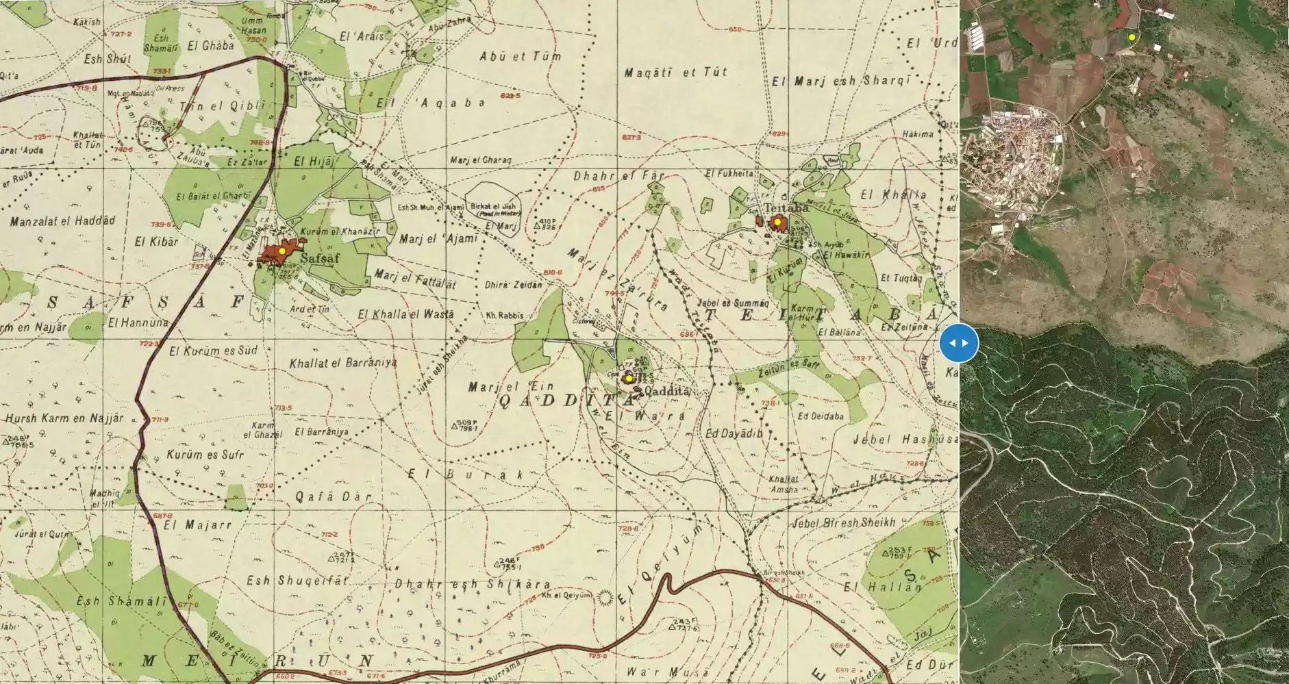
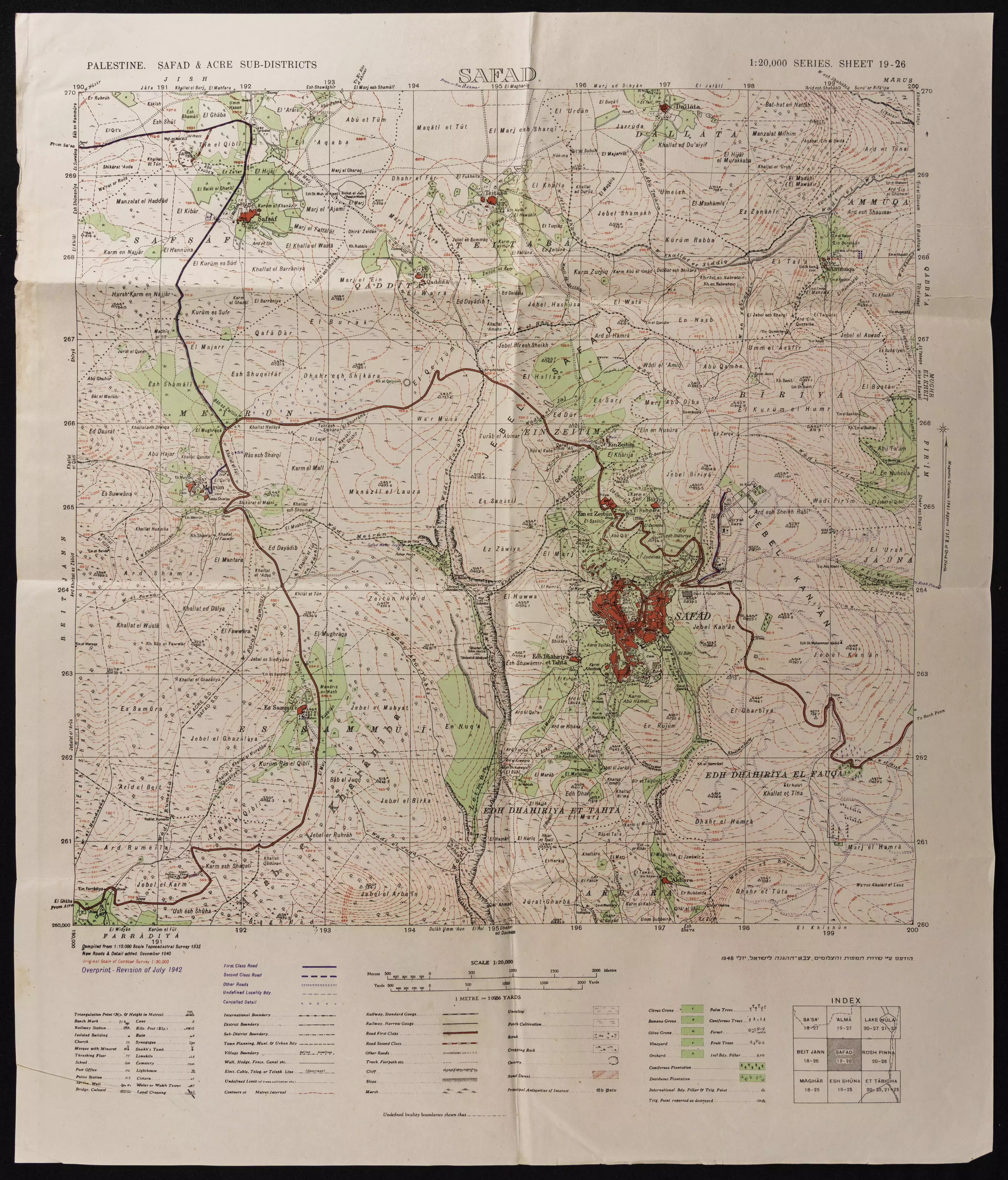
| Map Location | See location #52 on the map View from satellite |
||||||||||||||||
| Military Operation | Operation Yiftach (commanded by the ethnic cleansing champion Yigal Allon) | ||||||||||||||||
| Attacking Units | The Palmach's First Battalion | ||||||||||||||||
| Exodus Cause | Influence of fall of, or exoduce from, neighboring town | ||||||||||||||||
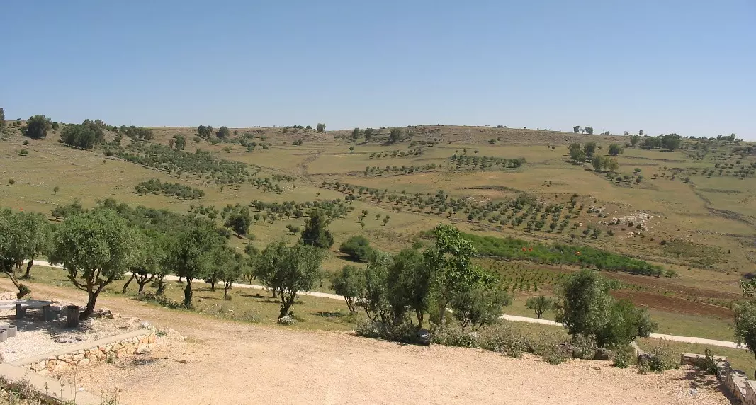
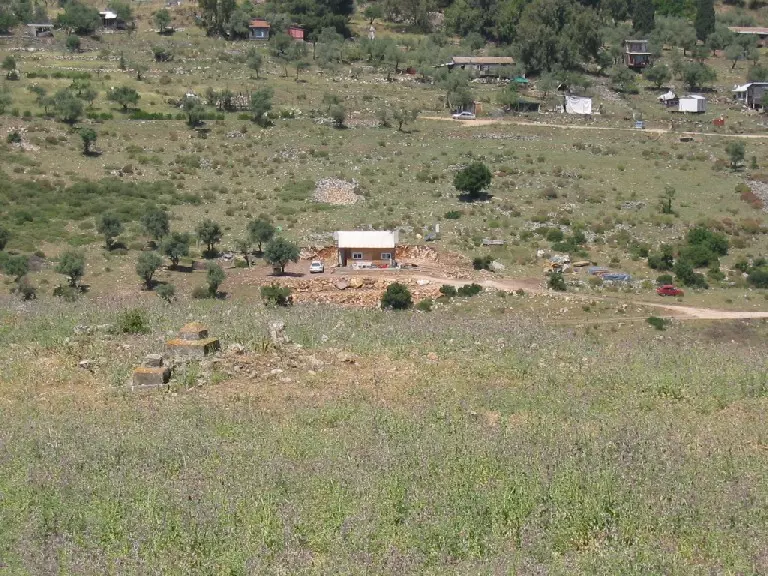
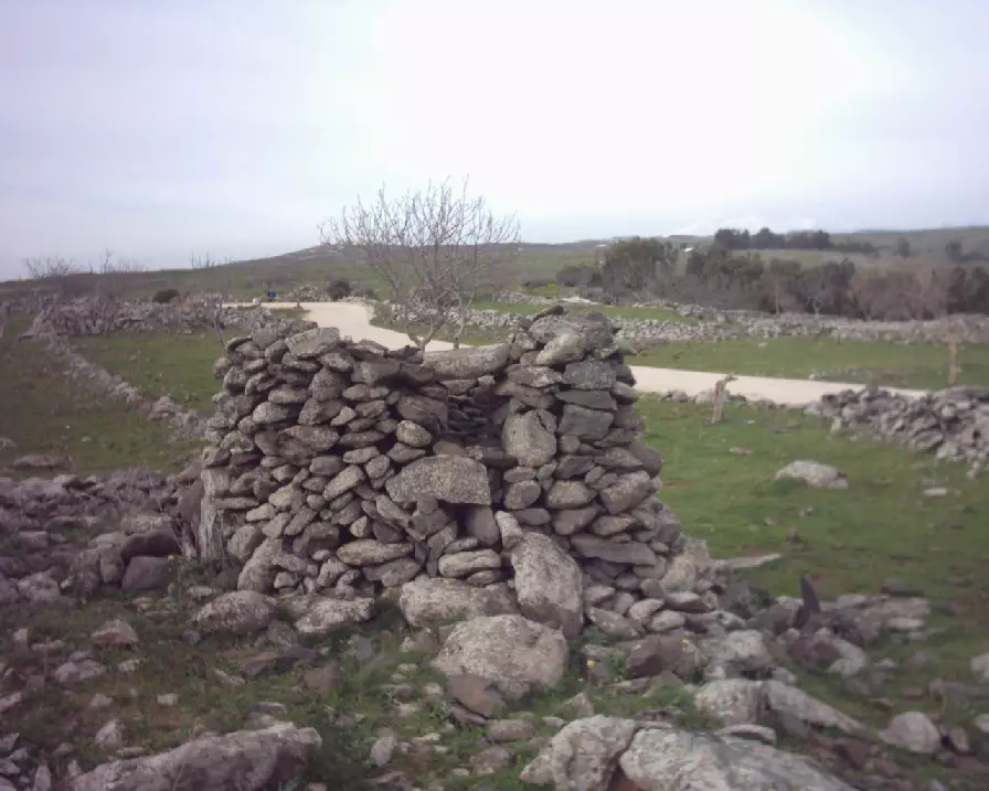
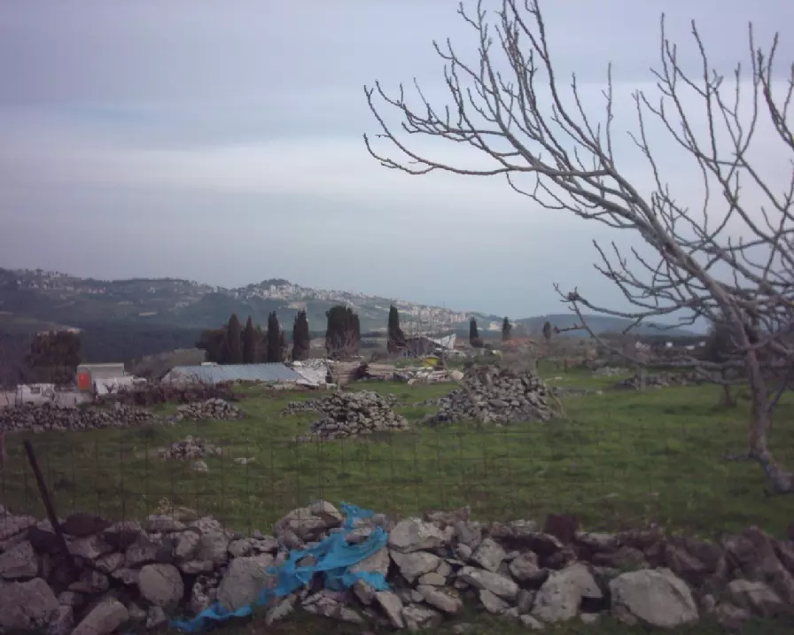
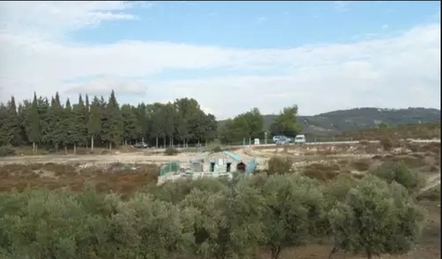
| Village Temains | The village has been mostly destroyed with the exception of the village cemetery and rubble from destroyed houses | ||||||||||||||||
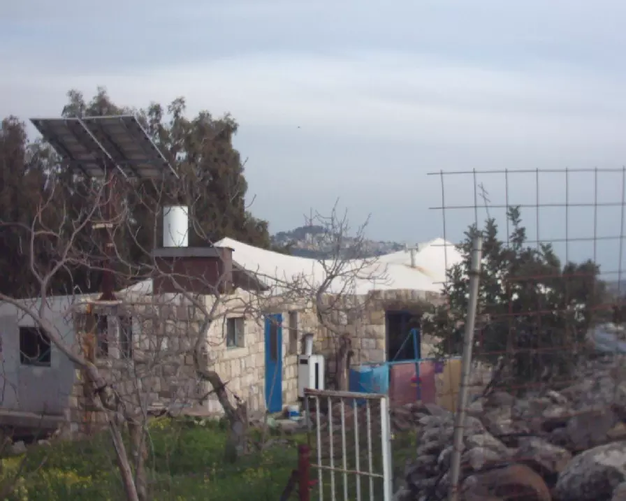
| Ethnically Cleansing | Qaddita was mostly ethnically cleansed, some villagers were allowed to stay in 'Akbara (Safad). | ||||||||||||||||
| Pre-Nakba Land Ownership |
**Town Lands' Demarcation Maps |
||||||||||||||||
| Land Usage As of 1945 |
|
||||||||||||||||
| Population |
|
||||||||||||||||
| Number of Houses |
|
||||||||||||||||
| Near By Towns |
|||||||||||||||||
|
|||||||||||||||||
| Town's Name Through History | Qaddita may have been a corruption of the Syriac word Kaddisha meaning | ||||||||||||||||
| Exculsive Jewish Colonies Who Usurped Village Lands |
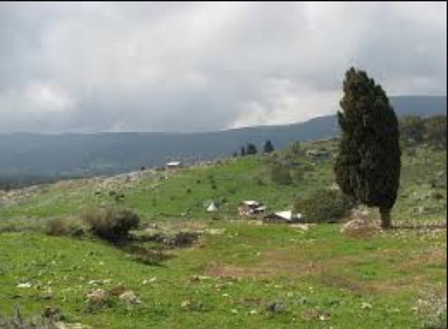
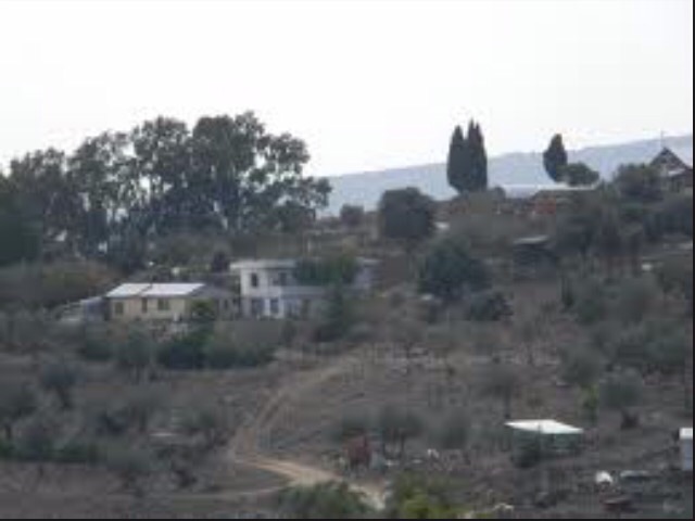
Kadita is the nearest to the village. Sifsofa and Dalton settlements are nearby the village. | ||||||||||||||||
| Featured Video | |||||||||||||||||
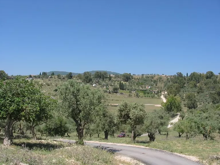
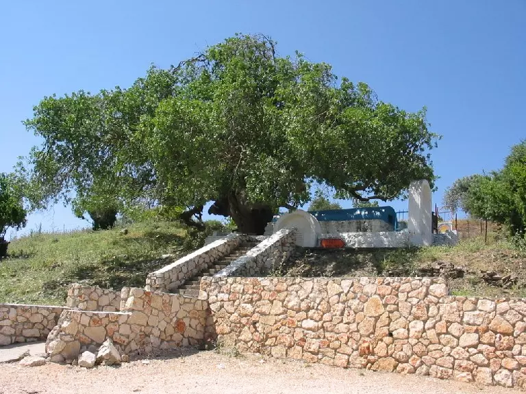
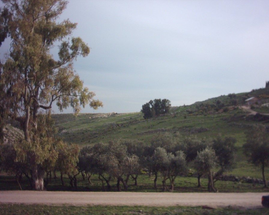
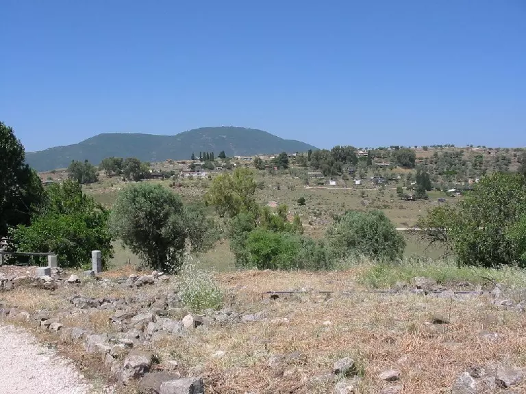
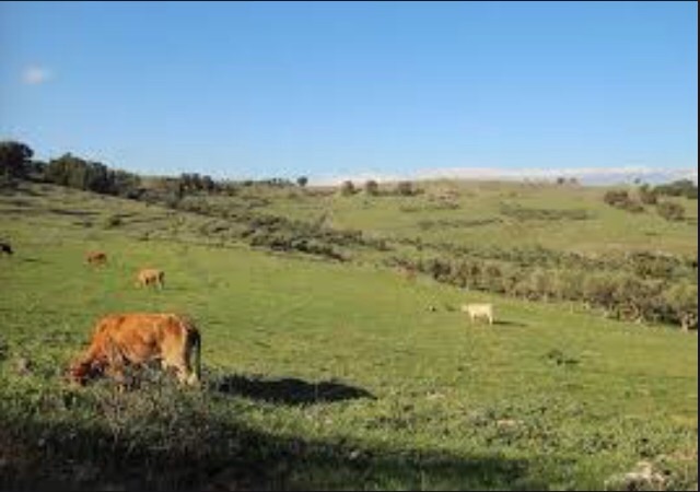
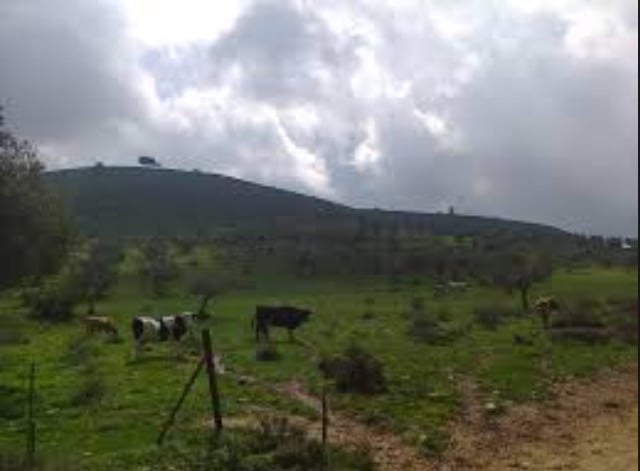
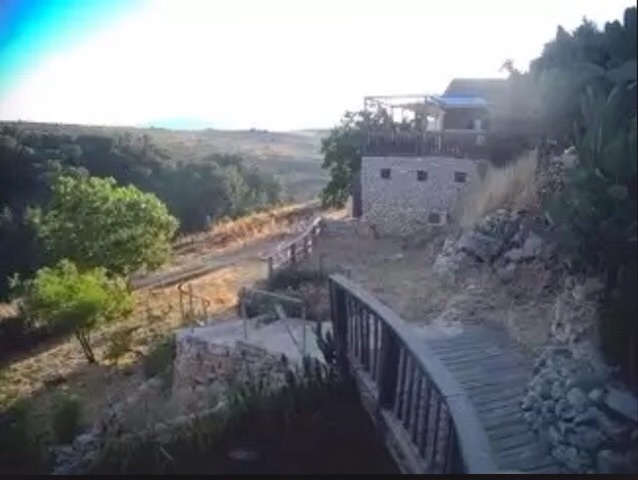
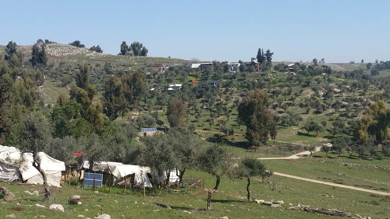
Village Before NakbaThe village was situated on the slope of a hill and faced southeast. Its name could have been a corruption of the Syriac word kaddisha, 'sacred.' A secondary road linked it to a highway going to Safad. In 1596, Qaddita was a village in the nahiya of Jira (liwa' of Safad) with a population of 149. It paid taxes on a number of crops, including wheat and barley, as well as on other types of produce and property, such as goats, beehives, and vineyards. [[Hut. and Abd.:175]] In the late nineteenth century, Qaddita was a village built of stone and mud; the slope on which it was located was partially covered by gardens and fig trees. The village's population, estimated at 200, lived in 'ten houses' [[according to Guérin; see SWP (1881) I:198]] It seems likely that at least one or two of these 'houses' were clusters of one-room dwellings centered around enclosed courtyards; such a house could shelter a number of related families. In modem times Qaddita extended in a northwest-southeast direction, following the contours of the land. Its houses, made of stone, were grouped closely together. Its entire population was Muslim. Its economy was based on animal husbandry and crop cultivation, the most important crops being grain and fruits such as grapes, figs, and pomegranates. In the 1942/43 season 77 dunums of village land were planted with olive trees. In 1944/45 a total of 1,452 dunums was allotted to cereals; 150 dunums were irrigated or used for orchards.Village Occupation and Ethnic CleaningDirectly after the fall of Safad, a number of eastern Galilee villages were evacuated, and Qaddita was one of them, according to Israeli military intelligence. By 11 May 1948 it had been emptied of its residents, under the influence of the capture of Safad on 9‒10 May. Israeli historian Benny Morris does not make clear whether or not Haganah forces mounted a direct attack on the village when they entered it, nor does he say whether they destroyed it. Qaddita was one of the westernmost villages to fall within the scope of Operation Yiftach (see Abil al-Qamh, Safad sub-disctrict), designed in part to render eastern Galilee 'Arab-free.' [[M:123]] Some villagers were apparently evicted some time after the village was occupied. In 1949, Morris reports that some refugees from Qaddita had been transported to 'Akbara, just south of Safad. They lived there in harrowing circumstances and these conditions 'remained bad for years.' [[M:242]]Zionists Colonies on Village LandsThere are no Israeli settlements on village lands. However, the settlements of Sifsofa (191268), built on Safsaf village lands to the northwest, and Dalton (196269), built on Dallata village lands to the northeast, are not far from the site.Village TodayAll that remains are tombs from the cemetery and stone rubble from the destroyed homes. The site is covered with thorns and weeds, as well as a few neglected fig and olive trees. The nearby settlements have planted forests as well as fruit trees on some of the surrounding land.SourceDr. Walid al-Khalidi, 1992: All That Remains. |
|||||||||||||||||
| Related Maps | Town Lands' Demarcation Maps خرائط للقضاء توضح حدود القرى والاودية Town's map on MapQuest View from satellite Help us map this town at WikiMapia |
||||||||||||||||
| Related Links | Wikipedia's Page Facebook Page Google Search Google For Images Google For Videos |
||||||||||||||||
| More Information | في كتاب كي لا ننسى في كتاب بلادنا فلسطين المزيد من موقع هوية |
||||||||||||||||
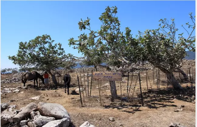
- اراضي قديثا من الناحية الشمالية - 18/5/2003
Posted by Makbula Nassar - اراضي قديثا وأثار القرية من الناحية الغربية - 18/5/2003
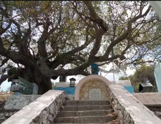
Posted by Makbula Nassar 2 - بطمة قديثا المعمرة ومقام بنات يعقوب من تحتها - 18/5/2003
Posted by Makbula Nassar - اثار مقبرة القرية , يظهر الى الغرب بيوت المستوطنة غير المعترف بها المقامة على اراضي القرية - 18/5/2003
Posted by Makbula Nassar 1 - اطلالة القرية , تظهر بيوت المستوطنة غير المعترف بها المقامة على اراضي القرية - 18/5/2003
Posted by Makbula Nassar - اثار لبيوت القرية من الجهة الشرقية - 18/5/2003
Posted by Makbula Nassar 1 - اثار لبيوت القرية من الجهة الغربية, يظهر رجم حجري استعلعلى الارجح كتنور للخبز - 18/5/2003
Posted by Makbula Nassar - اراضي القرية من الجهة الغربية , تظهر بيوت مستوطنة عشوائية مقامة بشكل غير معترف به- 18/5/2003
Posted by Makbula Nassar - احد بيوت القرية , مستعمل من قبل المستوطنين في القرية - 18/5/2003
Posted by Makbula Nassar - طريق مؤدي الى التلة الشرقية من القرية , يظهر مدخل احد بيوت المستوطنة - 18/5/2003
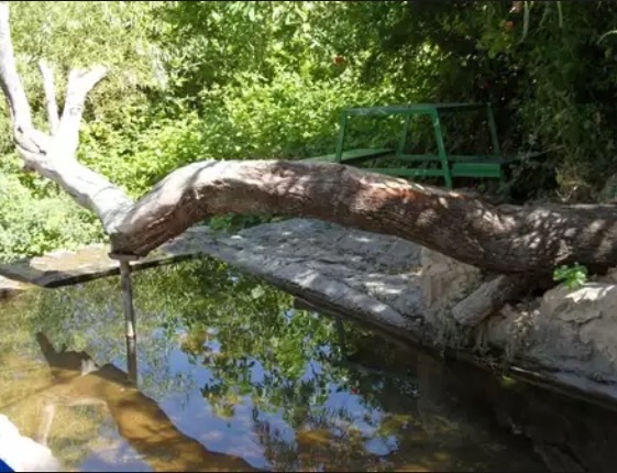
Posted by Makbula Nassar - ابار القرية الباقية بالقرب من مقام بنات يعقوب - 1/6/2003
Posted by Makbula Nassar - أنقاض قبور القرية المدمرة
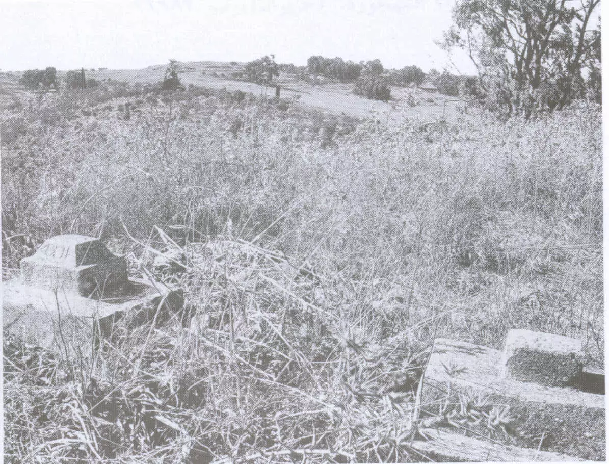
Scanned from "All That Remains" by Dr. Walid Khalidi - موقع القريه
Posted by abu raya - موقع القريه جنوبا وتظهر بيوت المستوطنين
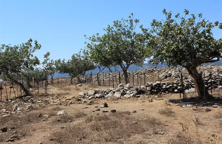
Posted by abu raya - اراضي القريه من الجهه الشرقيه
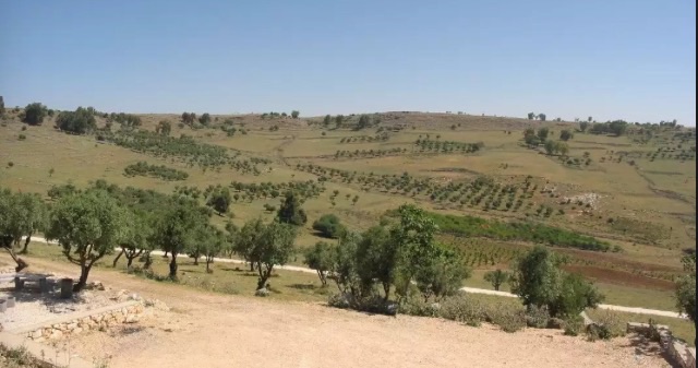
Posted by abu raya - اراضي القريه وكثره اشجار الزيتون
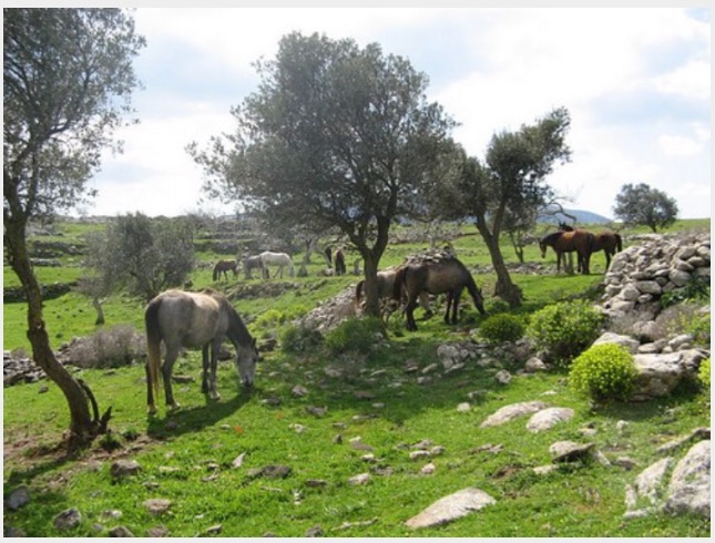
Posted by abu raya - اراضي القريه
Posted by abu raya - الطريق الموديه ال القريه من الجنوب
Posted by abu raya - بيوت المستوطنين في القريه
Posted by abu raya - مقام في القريه يستعمله المستوطنين
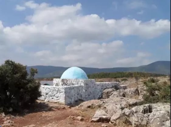
Posted by abu raya - مقام في القريه يستعمله المستوطنين
Posted by abu raya - القريه من الجنوب
Posted by abu raya - منظر من القريه
Posted by abu raya - احدى ابار القريه
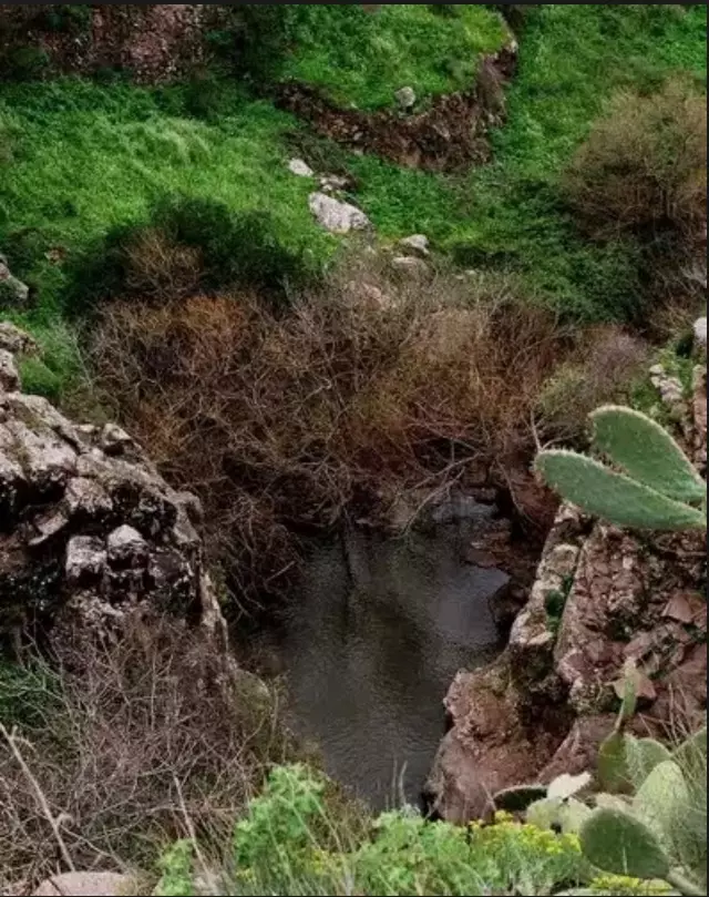
Posted by abu raya - عين ماء في القريه
Posted by abu raya 1 - منظر من قديثا
Posted by abu raya - منظر من قديثا
Posted by abu raya - موقع قريه قديثا
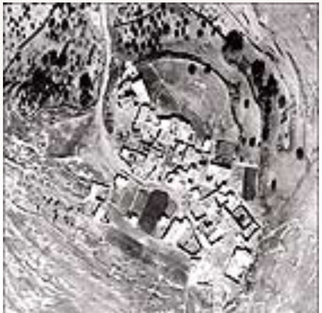
Posted by abu raya - صوره من الجو لقريه قديثا سنه 1945
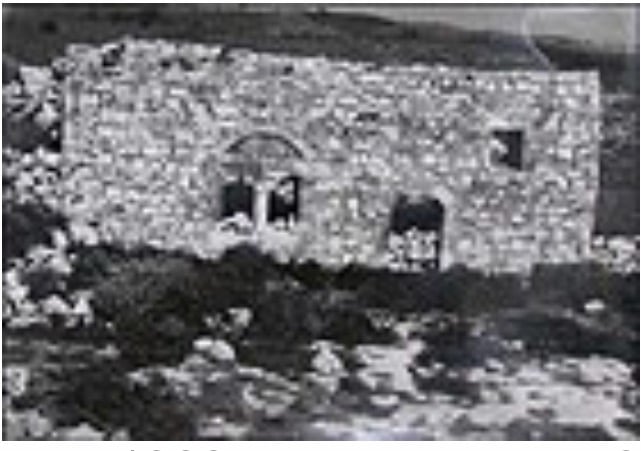
Posted by abu raya - بيوت قديثا بعد احتلالها
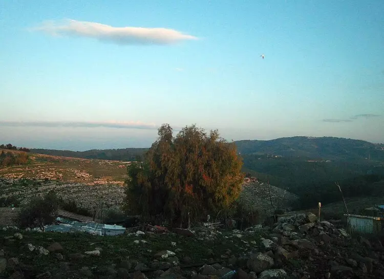
Posted by abu raya - منظر عام لموقع قريه قديثا
Posted by abu raya - اراضي قريه قديثا
Posted by abu raya - اثار ردم بيوت قديثا
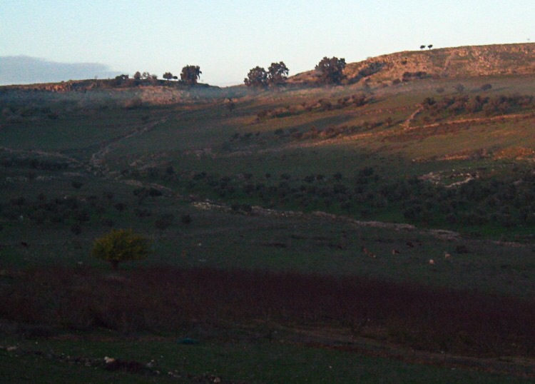
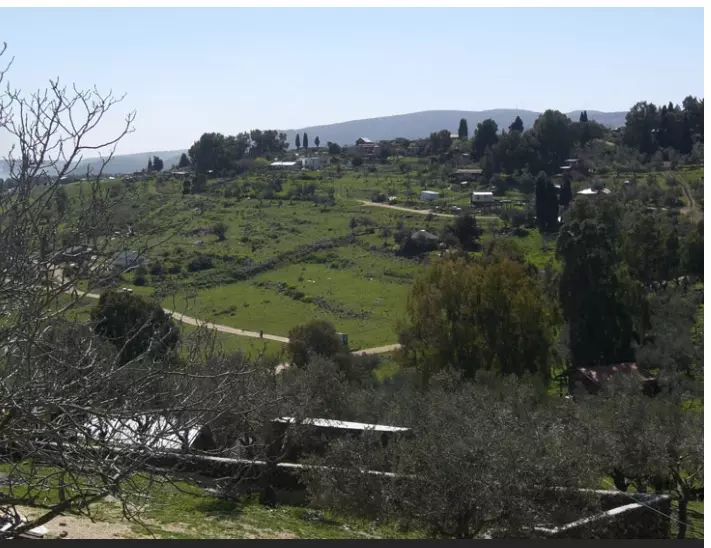
Posted by abu raya - منظرعام للتلة التي كانت عليها القرية قبل هدمها
- منظرعام للتلة التي كانت عليها القرية قبل هدمها
- خارطة تُظهِر الحدود والطرق بأنواعها والأماكن المقدسة والطبيعة الطوبغرافية من تلال وسهول ومنحدرات والتشكيلة الطبيعية للأرض وأنواع المزروعات. نُشرت الخريطة فترة الانتداب البريطاني، تم إضافة تعديلات عليها من قِبَل خدمة الخرائط والصور التابعة للقوات العسكرية الاسرائيلية فترة الأربعينيات.
Want to browse more? 80,000 pictures were grouped in these gallaries:
| Display Name | Clan/Hamolah | Country of Residence |
| Ali hleihel | - | - |
| عدنان دكور | صفد | - |
| رحاب بنت محمد حمزة | حمزة | - |
| ibrahim | hamze | k.s.a. |
| Hussein Bilal Hamze' | Hamze' | Manama, Bahrain |
| Elham | Hamzah | Saudi Arabia |
| stavro | - | Sweden |
| ابو شكرالله | - | - |
| وسام محمود | - | برلين, المانيا |
| Ayman Hamzeh | - | Sharjah, UAE |
| Samer Hamze | - | - |
| Mahmoud Hleihel | - | - |
| Hassan Hamzeh | Saado | Sharjah, UAE |
| akram youssef | youssef | north, lebanon |
| Bilal Hamze' | Hamze' | Manama, Bahrain |
| HUSSAM HAMZEH | HAMZEH | Athens, Greece |
| Hassan Hashim | - | Homs, Syria |
- الذاكرة مفتاح العودة | قرية قديتا - قضاء صفد - فلسطين Duration: 26 min 48 sec
- إيابًا: جولة في قرية قديتا مع سعيد سلامة وسعيد حليحل Duration: 26 min 43 sec
No links have been shared yet, be free to the first to share the first link.
 Fake Valor: Why Did Zionist Jews Hoist Nazis Flag on Their Ships in the 1930s?
What is new?
-
Facts About Oct. 7th Gaza Raid
-
Remined Us Please:: Who Did Rape Who? Palestinians Raped Israelis? Or, was the other way around?
-
When Prof. Edward Said was invited to debate Bibi Netanyahu in the 1980s, watch what happened!
-
Ezra Klein of the NY Times on the "Jewish Race".
-
Abusing Blood Libel!
-
Did Israeli Soldiers Activate The Hanniba Direective On Oct. 7th? You Be The Judge
-
Zionist FAQ: Isn't it true that Palestinians don't want peace? Palestinians never accepted the two-state solution
- Facts about Haavara (Transfer) Agreement between Ben-Gurion & Hitler
-
Haavara FAQs: Why Did Zionist Jews Hoist Nazis' Flags on Their Ships in the 1930s?
- Haavara FAQs: When Chaim Weizmann met FDR in mid-1943, why was he silent about rescuing European Jewry?
-
Dear ChatGPT: How did Palestinians resist Napoleon's invasion of their country in 1799?
-
Dear ChatGPT: Gaza had a vibrant Jewish community in the mid-17th century. What happened to them?
-
Dear ChatGPT: Why did the Jewish Agency suppress news of the Holocaust during WWII?
-
Video Playlist: Jews share their DNA tests to end the conflict for good.
-
A Tale of Two Conflicts: Examining the Definition of Genocide
-
Prof. Abraham Polak And The Suppressed History of the Khazars and European Jewry
-
How Ronald Reagan would have framed the genocide in Gaza if he were still alive?
-
Haavara FAQs: Let us do the math: how many German Jews did The Haavara Agreement save?
-
Zionist FAQs: The Hebron Massacre of 1929, "clearly proves" that Palestinians are antisemitic, how could you deny it?
-
Zionist FAQs: Why Anti-Zionist Is Not Antisemitism?
-
Zionist FAQs: Isn't it true that the KGB created Palestinian Nationalism in the early 1960s?
- Zionist FAQs: Muslims are killing Muslims all the time; why are Israeli Jews being singled out in the media?
- Zionist FAQs: How is Israel an apartheid state when 20% of its citizens are Arabs who enjoy full rights?
-
Haavara FAQs: Why Did Dorothy Thompson Flip From A Zionist Advocate to A Silenced Dissenter?
-
Haavara FAQs: Analysis of Herzl's Uganda Scheme and how it could have saved millions of Jews.
-
Haavara FAQs: Why did Hayim Greenberg describe American Jewry as "morally bankrupt" in early 1943?
-
Haavara FAQs: What if the Evian Conference was a resounding success? What would have been the impact of saving European Jewry on Zionism?
- Haavara FAQs: What if the six million were saved, how that would have impacted the Zionist project?
-
Haavara FAQs: How did Zionist leaders react when Europe's Jews lingered in the DP camps after WWII ended?
-
Why does the American Jewish community repeat lies that David Ben-Gurion had debunked before he died?
-
Who has the power to rename the Tatar/Khazar Gene Marker to Jewish IV?
-
Zionist FAQs: Why won't Egypt, Syria, and Jordan take their people back? Jews are indigenous to Palestine, and Arabs immigrated after Jews developed the country. Arabs should leave.
-
Haavara FAQs: Did Hitler and the Nazis conflate between Judaism and Zionist? If that wasn't case, then why?
-
Haavara FAQs: Winston Churchill and antisemitism, a collection of articles written Churchill.
-
Haavara FAQs: Broken by country, how many Jews survived vs. killed during the Holocaust?
-
Haavara FAQs: Why did European Jews vote with their feet and to immigrated to the Americas, not Palestine, after WWII?
-
Watch this American Jewish Girl describing Israeli Jews' cognitive dissonance like no other in under two minutes
-
Haavara FAQs: When the Nazis went out of their way to hide the Holocaust, Israeli Jews did the exact opposite by broadcasting their genocide of Gazans. But why?
-
Haavara FAQs: How Zionist Jews went out of their to show their appreciation to Nazism and Fascism?
- Haavara FAQs: Why Zionist leaders were against bombing the death camps & the Railroads leading to them?
-
Haavara FAQs: Hitler's message to the British and American people: If Jews are such noble citizens and you care about them, how come you're not letting them in? I will gladly ship them to you at my expense, even on luxury liners!
-
A shortlist of Zionist and Israeli false flag operations in the name Jews.
-
The Most Moral Army
- The Land of Kapos (Israel): Where the brave are boycotted and Kapos walk free.
- Why did early Zionists often named their communal enterprises "colonial"?
- Zionist Relations with Nazi Germany by Faris Glubb
-
Two NY Times advertisements by Zionists in the early 1943 that exposes Zionists' treason at the height of the calamity
- Facts Not Lies about the Palestinian-Israeli Conflict.
- Site's pictures have been categorized
- Campgain Against Lice
- A Survey of Palestine, the official source about Palestine before Nakba produced by the British Mandate; over 1200 pages.
- Satellite View & Google Earth: Over 6,000 placemarks identifying all destroyed towns, W. Bank & Gaza Strip Towns, & refugee camps.
- PalestineRemembered.com and its Nakba Oral History Project were featured on al-Jazeera Satellite TV.
- Nakba Oral History Video Podcast:
 Over 700 Oral History interviews (including 3,500+ hours of recording) can be viewed online.
 - Palestine Village Statistics Project
- Gaza Jail Break
- النسخة العربية للموقع الان متوفرة
- Videos: Documenting the destroyed villages in video: Tracing all that remains since Nakba.
- Videos: Responding to Zionist Propaganda
- Interview: The ethnic cleansing of Palestine: George Galloway interviews Israeli Historian Ilan Pappe.
- For Palestinians, memory matters. It provides a blueprint for their future By George Bisharat.
- Zionist FAQ now available in Hebrew שאלות שציונים שואלים, עכשיו בעברית
- Video: The Stephen Walt and John Mearsheimer report on the influence of the Israel Lobby on U.S. Foreign Policy
- The Palestinian-Israeli conflict for beginners
