| PalestineRemembered | About Us | Oral History | العربية | |
| Pictures | Zionist FAQs | Haavara | Maps | |
| Search |
| Camps |
| Districts |
| Acre |
| Baysan |
| Beersheba |
| Bethlehem |
| Gaza |
| Haifa |
| Hebron |
| Jaffa |
| Jericho |
| Jerusalem |
| Jinin |
| Nablus |
| Nazareth |
| Ramallah |
| al-Ramla |
| Safad |
| Tiberias |
| Tulkarm |
| Donate |
| Contact |
| Profile |
| Videos |
Welcome To Qaytiyya - قيطية (קיטיה)
|
District of Safad
Ethnically cleansed days ago |
العربية Google Earth |
 |
Gallery (12) |
- Statistics & Facts
-
Before & After

- Satellite View
- Articles 1
- Pictures 12
- Members 3
- All That Remains
- Wikipedia
- Videos
- Guest Book 2
- Links
| Statistic & Fact | Value | |||||||||||||||||||||
| Occupation Date | May 19, 1948 | |||||||||||||||||||||
| Distance From District | 28 (km) North East of Safad | |||||||||||||||||||||
| Elevation | 75 (meters) | |||||||||||||||||||||
| Before & After Nakba, Click Map For Details |
||||||||||||||||||||||

|
||||||||||||||||||||||
| Map Location | See location #14 on the map View from satellite |
|||||||||||||||||||||
| Military Operation | Operation Yiftach (commanded by the ethnic cleansing champion Yigal Allon) | |||||||||||||||||||||
| Attacking Units | The Palmach's First Battalion | |||||||||||||||||||||
| Exodus Cause | Haganah 'Wispering' campaign (psychological warfare) | |||||||||||||||||||||
| Village Temains | Mostly destroyed with the exception of few stone houses | |||||||||||||||||||||
| Ethnically Cleansing | Mostly ethnically cleansed as a result of a campaign of psychological warfare on the 19th of May 1948. Completely ethnical cleansed in June 1949 | |||||||||||||||||||||
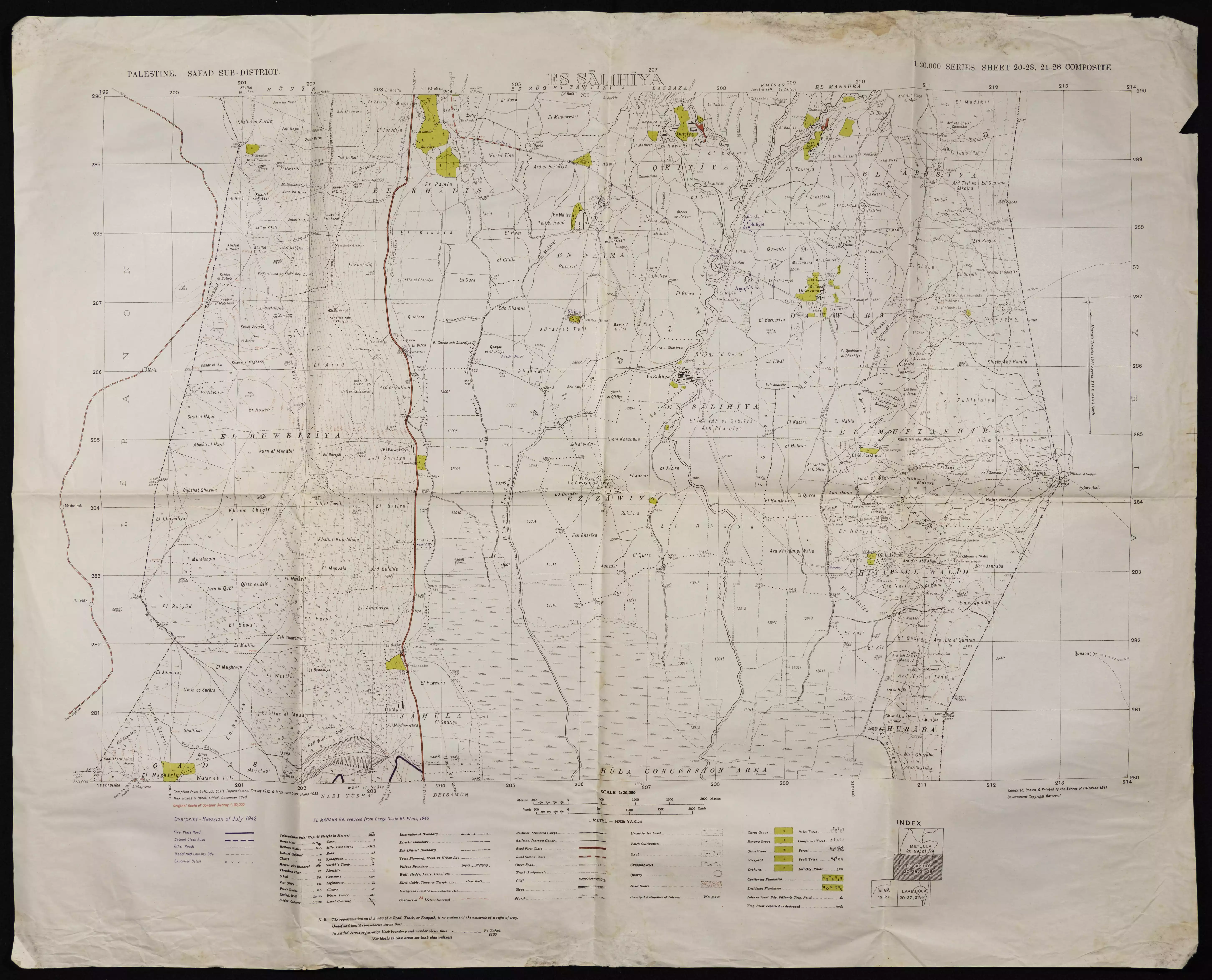
| Pre-Nakba Land Ownership |
**Town Lands' Demarcation Maps |
|||||||||||||||||||||
| Land Usage As of 1945 |
|
|||||||||||||||||||||
| Population |
|
|||||||||||||||||||||
| Number of Houses |
|
|||||||||||||||||||||
| Near By Towns |
||||||||||||||||||||||
|
|
||||||||||||||||||||||
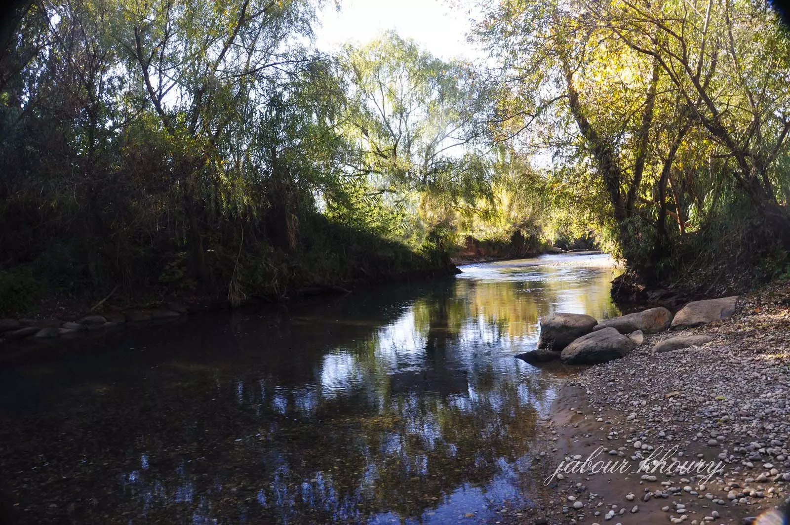
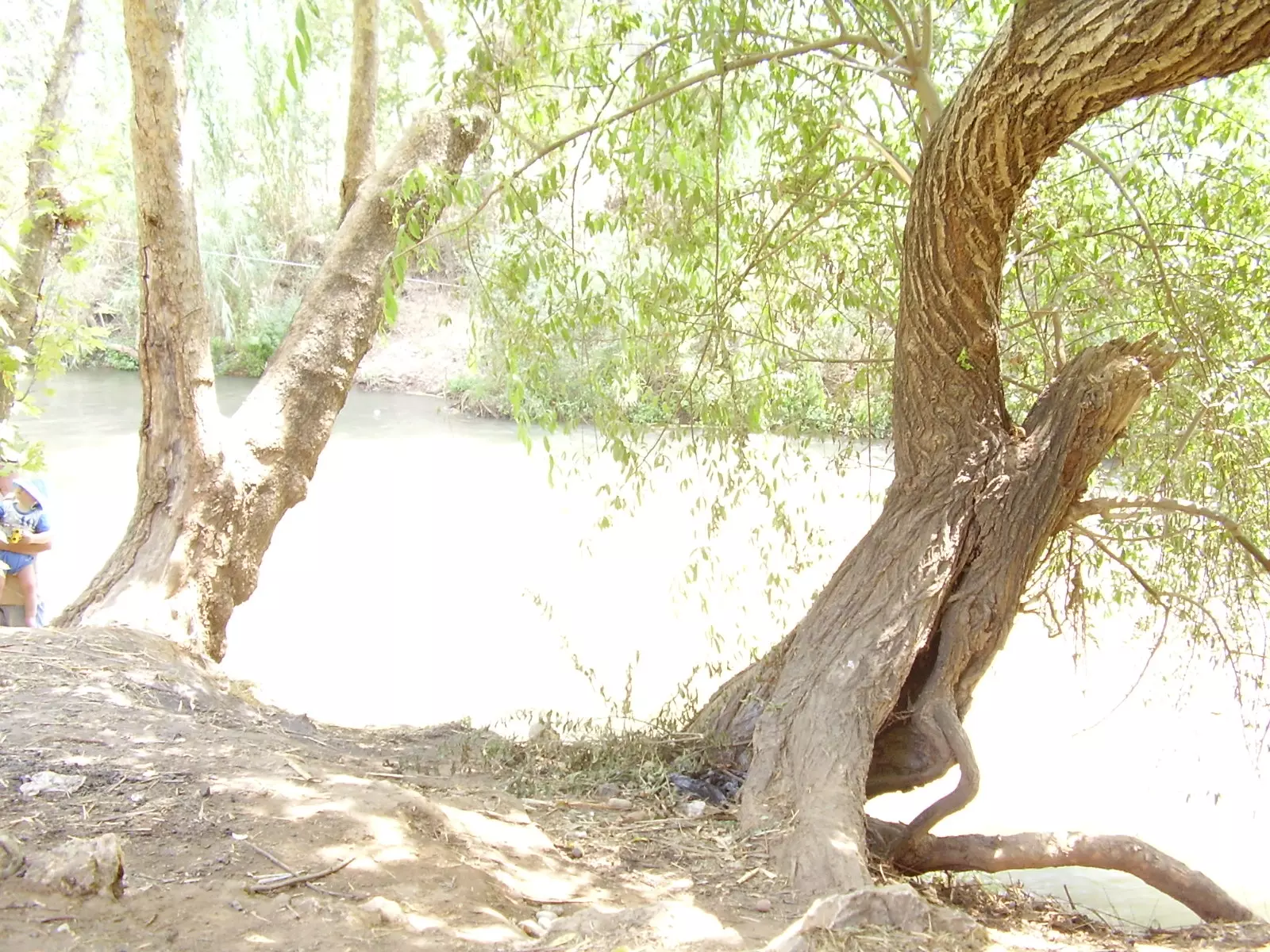
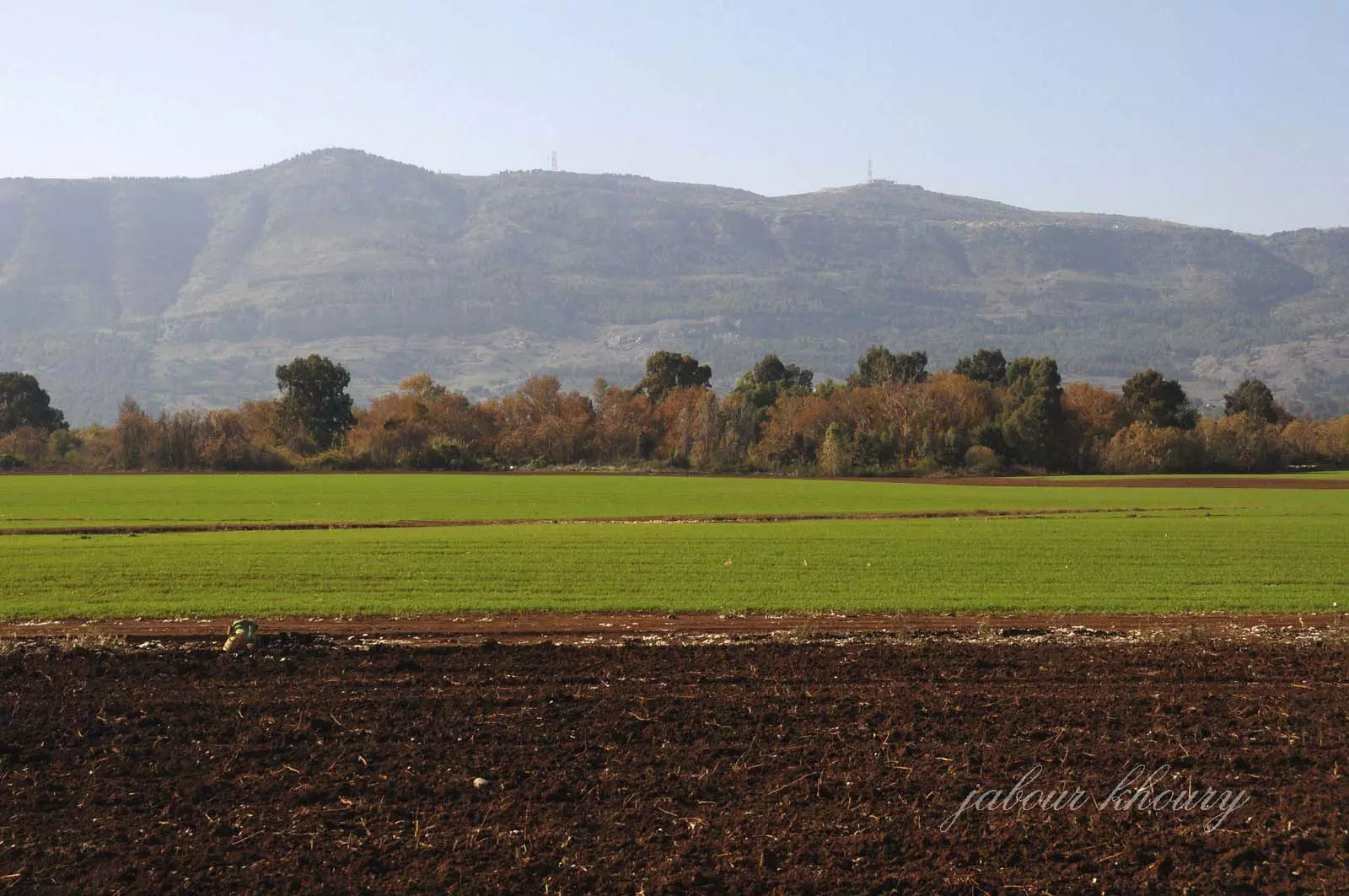
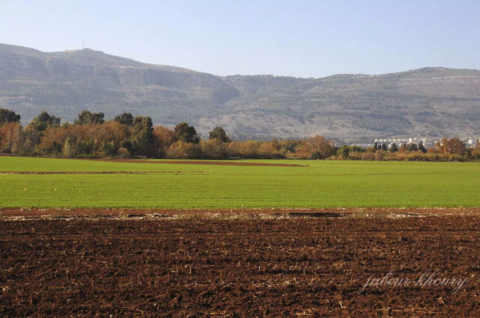
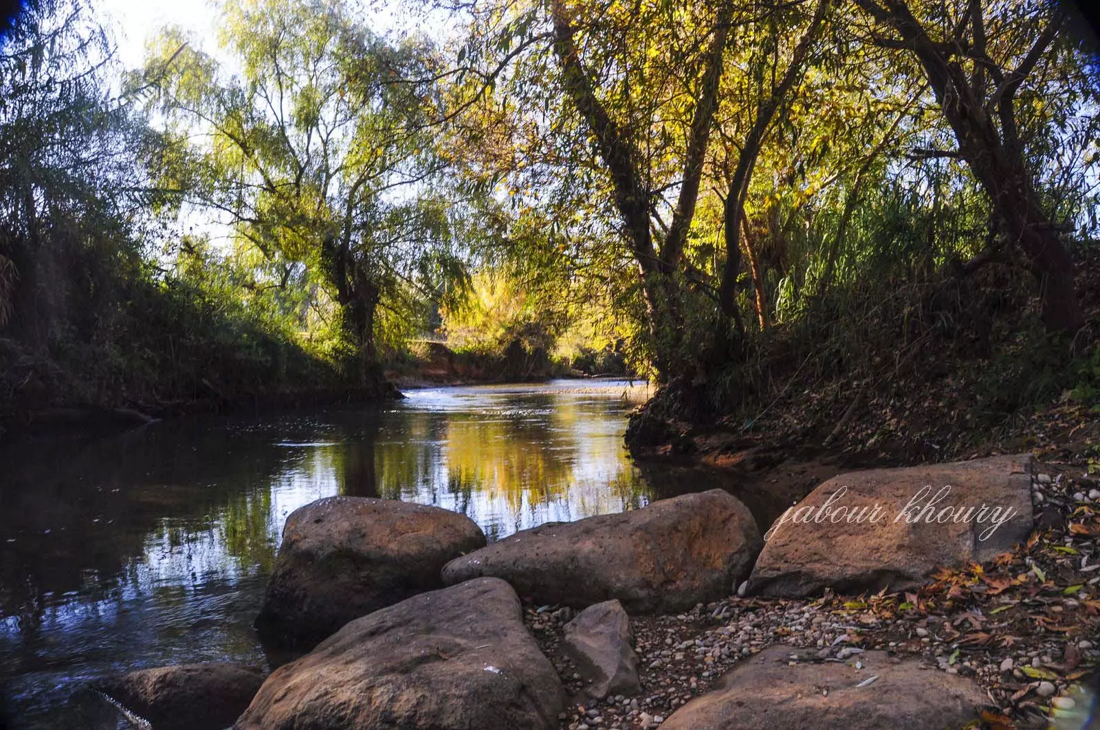
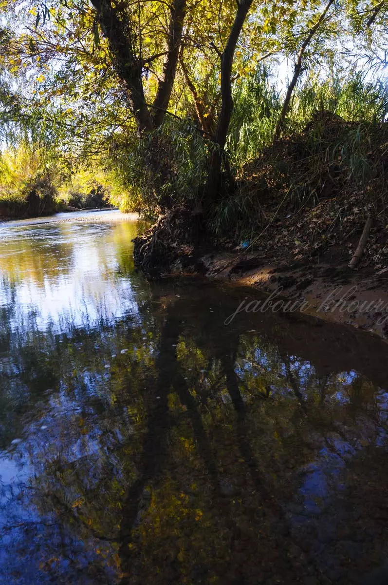
| Nearby Wadies & Rivers | The village was bordering both the Hasibani and the Dan Rivers | |||||||||||||||||||||
| Exculsive Jewish Colonies Who Usurped Village Lands |
Kefar Blum and Beyt Hillel are near by village lands | |||||||||||||||||||||
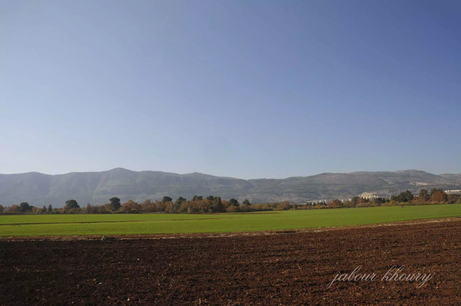
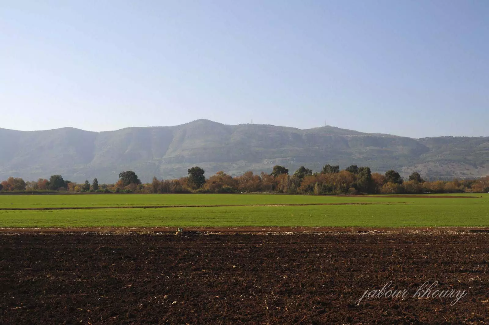
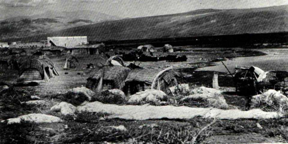
Village Before NakbaThe village was built on flat land between the al-Hasibani and the Dan rivers (both tributaries of the Jordan), in the northern segment of the al-Hula Plain. A secondary road linked it to the neighboring village of al-Khalisa, located 3 km to the west on a highway that led to Safad. Qaytiyya was divided into two quarters: an eastern quarter on the west bank of the al-Dan River, and a western quarter on the east bank of the al-Hasibani River. The houses of the eastern quarter were clustered together, while those of the western quarter were more widely dispersed. The population of Qaytiyya was predominantly Muslim. The villagers earned their living mainly from agriculture and animal husbandry. In 1944/45 a total of 19 dunums was devoted to citrus and bananas and 44 dunums were allocated to cereals; 4,465 dunums were irrigated or used for orchards. The village also had its own grain mill on the bank of the al-Dan River.Village Occupation and Ethnic CleaningThe displacement of the villagers of Qaytiyya is attributed to the campaign of psychological warfare that the Haganah waged as part of Operation Yiftach (see Abil al-Qamh, Safad sub-disctrict). Israeli historian Benny Morris writes that the villagers left on 19 May 1948, but at least some of the people of Qaytiyya remained in their village until June 1949. [M:123] However, at midnight on 5 June, army trucks encircled the village and Israeli troops swept down on it. They rounded up its residents and dumped them, together with the villagers of al-Ja'una and al-Khisas, on a bare hillside near 'Akbara, south of Safad. This raid on the three villages caused a stir among some left-wing Israelis. One Knesset member from the Mapam party said the Palestinian villagers were treated 'with brutality... with kicks, curses and maltreatment.' The Israeli army justified its brutality by claiming that they had learned that Syrian intelligence was trying to win the allegiance of the villagers and 'use them against us,' in the words of an intelligence official. For this reason, it was important to move them 'away from the border.' Prime Minister David Ben-Gurion said that he found the military's reasons 'sufficient.' It is not clear what became of the villagers of Qaytiyya, but Morris states that conditions at 'Akbara, where they had been left, 'remained bad for years.' [M:242]Zionists Colonies on Village LandsZionists founded the settlement of Kefar Blum (207286) to the south of the village in 1943 on lands that belonged to Qaytiyya. Beyt Hillel (206290), founded in 1940, was closer to the village site than Kefar Blum but was not on village lands. When the settlement was extended in 1948 it may have absorbed some of these lands.Village TodayOnly a few stones from the old village are still visible. The surrounding land is cultivated, except for a small section that contains stone rubble and is overgrown with thorny plants and eucalyptus trees.SourceDr. Walid al-Khalidi, 1992: All That Remains. |
||||||||||||||||||||||
| Related Maps | Town Lands' Demarcation Maps خرائط للقضاء توضح حدود القرى والاودية Town's map on MapQuest View from satellite Help us map this town at WikiMapia |
|||||||||||||||||||||
| Related Links | Wikipedia's Page Google Search Google For Images Google For Videos |
|||||||||||||||||||||
| More Information | في كتاب كي لا ننسى في كتاب بلادنا فلسطين المزيد من موقع هوية |
|||||||||||||||||||||
- al hasibani river in qaytiyya
Posted by Abu Raya Muafaq 1 - اراضي القريه -لم يتبقى ايا اثر للقريه المجاوره لقريه لزازه وكلتاهما تقعان على ضفاف نهر الحاصباني
Posted by Jabour Khoury 1 - اراضي القريه
Posted by Jabour Khoury - موقع القريه
Posted by Jabour Khoury - اراضي القريه
Posted by Jabour Khoury 1 - نهر الحاصباني عند مروره بارض القريه
Posted by Jabour Khoury 1 - نهر الحاصباني عند مروره بارض القريه
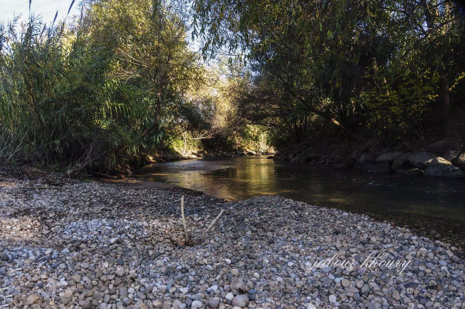
Posted by Jabour Khoury 1 - نهر الحاصباني عند مروره باراضي القريه
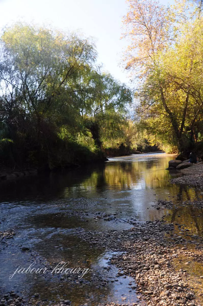
Posted by Jabour Khoury - نهر الحاصباني عند مروره باراضي القريه
Posted by Jabour Khoury - الحاصباني
Posted by Jabour Khoury 2 - مناظر قبل النكبة
- خارطة تُظهِر الحدود والطرق بأنواعها والأماكن المقدسة والطبيعة الطوبغرافية من تلال وسهول ومنحدرات والتشكيلة الطبيعية للأرض وأنواع المزروعات. نُشرت الخريطة فترة الانتداب البريطاني، تم إضافة تعديلات عليها من قِبَل خدمة الخرائط والصور التابعة للقوات العسكرية الاسرائيلية فترة الأربعينيات.
Want to browse more? 80,000 pictures were grouped in these gallaries:
| Display Name | Clan/Hamolah | Country of Residence |
| Mohamed Kotesh | - | Palestine |
| SAFAA EBRAHEEM | - | damascus, سوريا |
| Hesham Mohammad | Mohammad | Syrien, Syria |
No links have been shared yet, be free to the first to share the first link.
 Fake Valor: Why Did Zionist Jews Hoist Nazis Flag on Their Ships in the 1930s?
What is new?
-
Facts About Oct. 7th Gaza Raid
-
Remined Us Please:: Who Did Rape Who? Palestinians Raped Israelis? Or, was the other way around?
-
When Prof. Edward Said was invited to debate Bibi Netanyahu in the 1980s, watch what happened!
-
Ezra Klein of the NY Times on the "Jewish Race".
-
Abusing Blood Libel!
-
Did Israeli Soldiers Activate The Hanniba Direective On Oct. 7th? You Be The Judge
-
Zionist FAQ: Isn't it true that Palestinians don't want peace? Palestinians never accepted the two-state solution
- Facts about Haavara (Transfer) Agreement between Ben-Gurion & Hitler
-
Haavara FAQs: Why Did Zionist Jews Hoist Nazis' Flags on Their Ships in the 1930s?
- Haavara FAQs: When Chaim Weizmann met FDR in mid-1943, why was he silent about rescuing European Jewry?
-
Dear ChatGPT: How did Palestinians resist Napoleon's invasion of their country in 1799?
-
Dear ChatGPT: Gaza had a vibrant Jewish community in the mid-17th century. What happened to them?
-
Dear ChatGPT: Why did the Jewish Agency suppress news of the Holocaust during WWII?
-
Video Playlist: Jews share their DNA tests to end the conflict for good.
-
A Tale of Two Conflicts: Examining the Definition of Genocide
-
Prof. Abraham Polak And The Suppressed History of the Khazars and European Jewry
-
How Ronald Reagan would have framed the genocide in Gaza if he were still alive?
-
Haavara FAQs: Let us do the math: how many German Jews did The Haavara Agreement save?
-
Zionist FAQs: The Hebron Massacre of 1929, "clearly proves" that Palestinians are antisemitic, how could you deny it?
-
Zionist FAQs: Why Anti-Zionist Is Not Antisemitism?
-
Zionist FAQs: Isn't it true that the KGB created Palestinian Nationalism in the early 1960s?
- Zionist FAQs: Muslims are killing Muslims all the time; why are Israeli Jews being singled out in the media?
- Zionist FAQs: How is Israel an apartheid state when 20% of its citizens are Arabs who enjoy full rights?
-
Haavara FAQs: Why Did Dorothy Thompson Flip From A Zionist Advocate to A Silenced Dissenter?
-
Haavara FAQs: Analysis of Herzl's Uganda Scheme and how it could have saved millions of Jews.
-
Haavara FAQs: Why did Hayim Greenberg describe American Jewry as "morally bankrupt" in early 1943?
-
Haavara FAQs: What if the Evian Conference was a resounding success? What would have been the impact of saving European Jewry on Zionism?
- Haavara FAQs: What if the six million were saved, how that would have impacted the Zionist project?
-
Haavara FAQs: How did Zionist leaders react when Europe's Jews lingered in the DP camps after WWII ended?
-
Why does the American Jewish community repeat lies that David Ben-Gurion had debunked before he died?
-
Who has the power to rename the Tatar/Khazar Gene Marker to Jewish IV?
-
Zionist FAQs: Why won't Egypt, Syria, and Jordan take their people back? Jews are indigenous to Palestine, and Arabs immigrated after Jews developed the country. Arabs should leave.
-
Haavara FAQs: Did Hitler and the Nazis conflate between Judaism and Zionist? If that wasn't case, then why?
-
Haavara FAQs: Winston Churchill and antisemitism, a collection of articles written Churchill.
-
Haavara FAQs: Broken by country, how many Jews survived vs. killed during the Holocaust?
-
Haavara FAQs: Why did European Jews vote with their feet and to immigrated to the Americas, not Palestine, after WWII?
-
Watch this American Jewish Girl describing Israeli Jews' cognitive dissonance like no other in under two minutes
-
Haavara FAQs: When the Nazis went out of their way to hide the Holocaust, Israeli Jews did the exact opposite by broadcasting their genocide of Gazans. But why?
-
Haavara FAQs: How Zionist Jews went out of their to show their appreciation to Nazism and Fascism?
- Haavara FAQs: Why Zionist leaders were against bombing the death camps & the Railroads leading to them?
-
Haavara FAQs: Hitler's message to the British and American people: If Jews are such noble citizens and you care about them, how come you're not letting them in? I will gladly ship them to you at my expense, even on luxury liners!
-
A shortlist of Zionist and Israeli false flag operations in the name Jews.
-
The Most Moral Army
- The Land of Kapos (Israel): Where the brave are boycotted and Kapos walk free.
- Why did early Zionists often named their communal enterprises "colonial"?
- Zionist Relations with Nazi Germany by Faris Glubb
-
Two NY Times advertisements by Zionists in the early 1943 that exposes Zionists' treason at the height of the calamity
- Facts Not Lies about the Palestinian-Israeli Conflict.
- Site's pictures have been categorized
- Campgain Against Lice
- A Survey of Palestine, the official source about Palestine before Nakba produced by the British Mandate; over 1200 pages.
- Satellite View & Google Earth: Over 6,000 placemarks identifying all destroyed towns, W. Bank & Gaza Strip Towns, & refugee camps.
- PalestineRemembered.com and its Nakba Oral History Project were featured on al-Jazeera Satellite TV.
- Nakba Oral History Video Podcast:
 Over 700 Oral History interviews (including 3,500+ hours of recording) can be viewed online.
 - Palestine Village Statistics Project
- Gaza Jail Break
- النسخة العربية للموقع الان متوفرة
- Videos: Documenting the destroyed villages in video: Tracing all that remains since Nakba.
- Videos: Responding to Zionist Propaganda
- Interview: The ethnic cleansing of Palestine: George Galloway interviews Israeli Historian Ilan Pappe.
- For Palestinians, memory matters. It provides a blueprint for their future By George Bisharat.
- Zionist FAQ now available in Hebrew שאלות שציונים שואלים, עכשיו בעברית
- Video: The Stephen Walt and John Mearsheimer report on the influence of the Israel Lobby on U.S. Foreign Policy
- The Palestinian-Israeli conflict for beginners
