| PalestineRemembered | About Us | Oral History | العربية | |
| Pictures | Zionist FAQs | Haavara | Maps | |
| Search |
| Camps |
| Districts |
| Acre |
| Baysan |
| Beersheba |
| Bethlehem |
| Gaza |
| Haifa |
| Hebron |
| Jaffa |
| Jericho |
| Jerusalem |
| Jinin |
| Nablus |
| Nazareth |
| Ramallah |
| al-Ramla |
| Safad |
| Tiberias |
| Tulkarm |
| Donate |
| Contact |
| Profile |
| Videos |
Welcome To al-Nabi Yusha' - النبي يوشع (א-נבי יושע)
|
District of Safad
Ethnically cleansed days ago |
العربية Google Earth |
 |
Gallery (103) |
- Statistics & Facts
-
Before & After

- Satellite View
- Articles 2
- Pictures 103
- Members
- All That Remains
- Wikipedia
- Videos 2
- Guest Book 7
- Links
| Statistic & Fact | Value | ||||||||||
| Occupation Date | May 16, 1948 | ||||||||||
| Distance From District | 17 (km) North East of Safad | ||||||||||
| Elevation | 375 (meters) | ||||||||||
| Before & After Nakba, Click Map For Details |
|||||||||||
|
|||||||||||
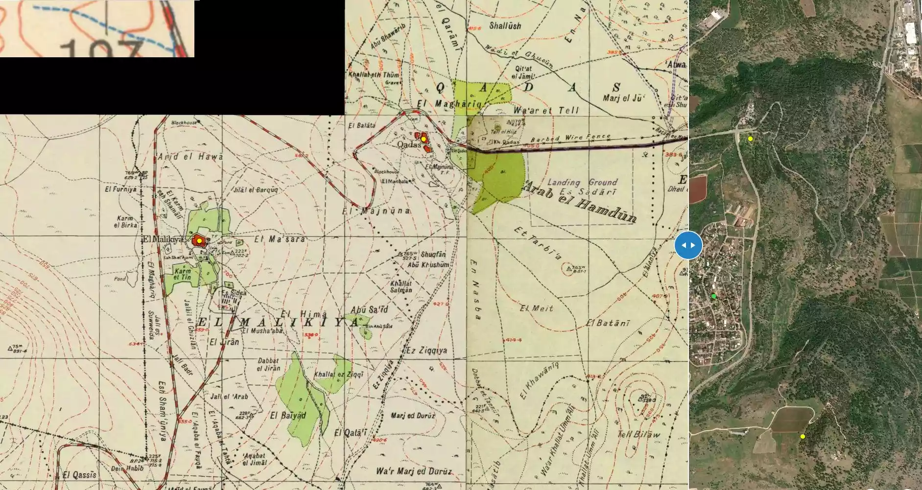
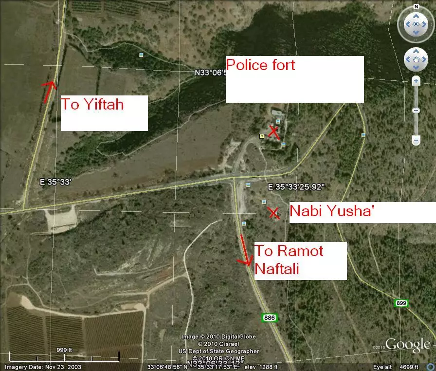
| Map Location | See location #26 on the map View from satellite |
||||||||||
| Military Operation | Operation Yiftach (commanded by the ethnic cleansing champion Yigal Allon) | ||||||||||
| Attacking Units | The Palmach's First Battalion | ||||||||||
| Defenders | Local militia & Arab Liberation Army | ||||||||||
| Exodus Cause | Military assault by Zionist troops | ||||||||||
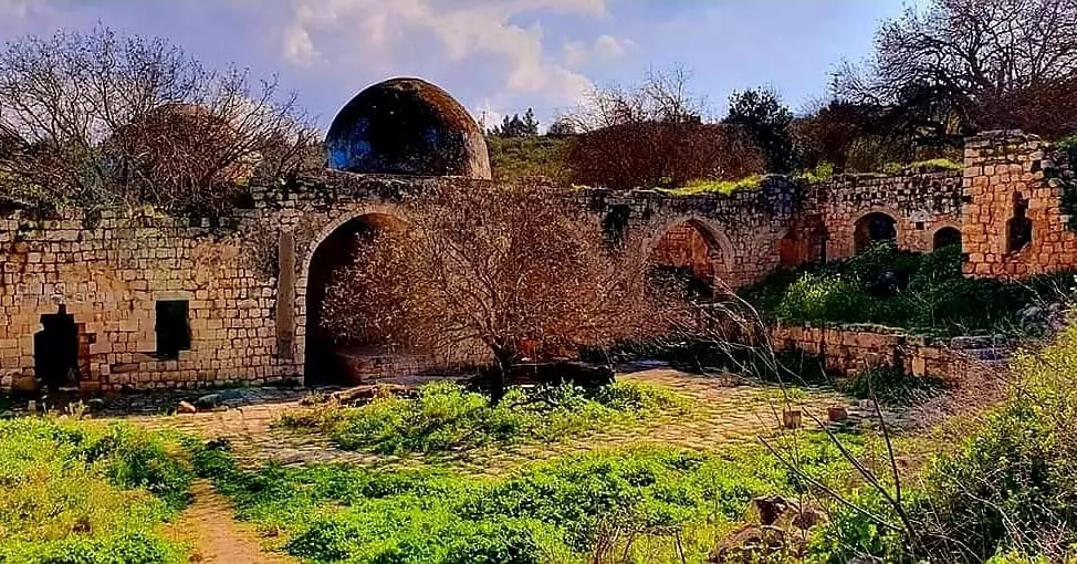
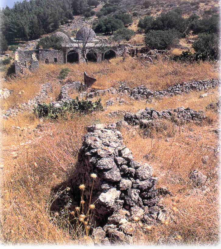
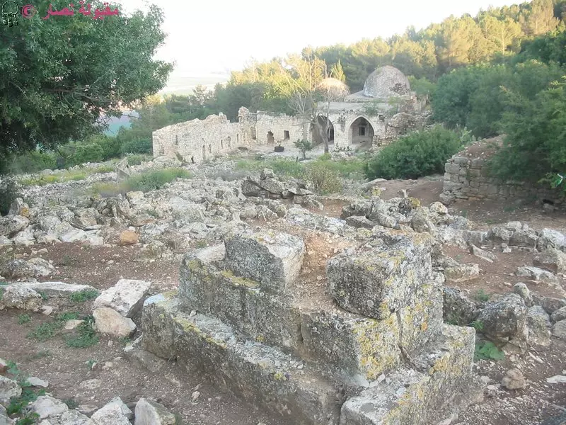
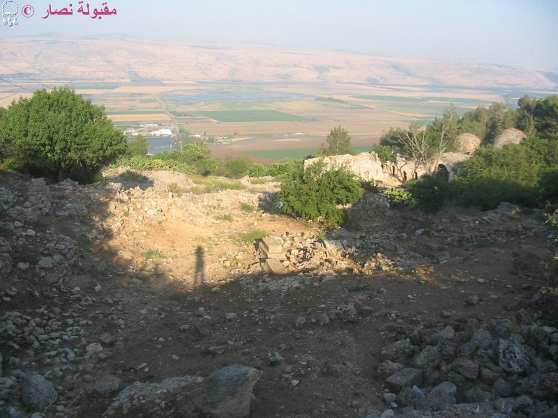
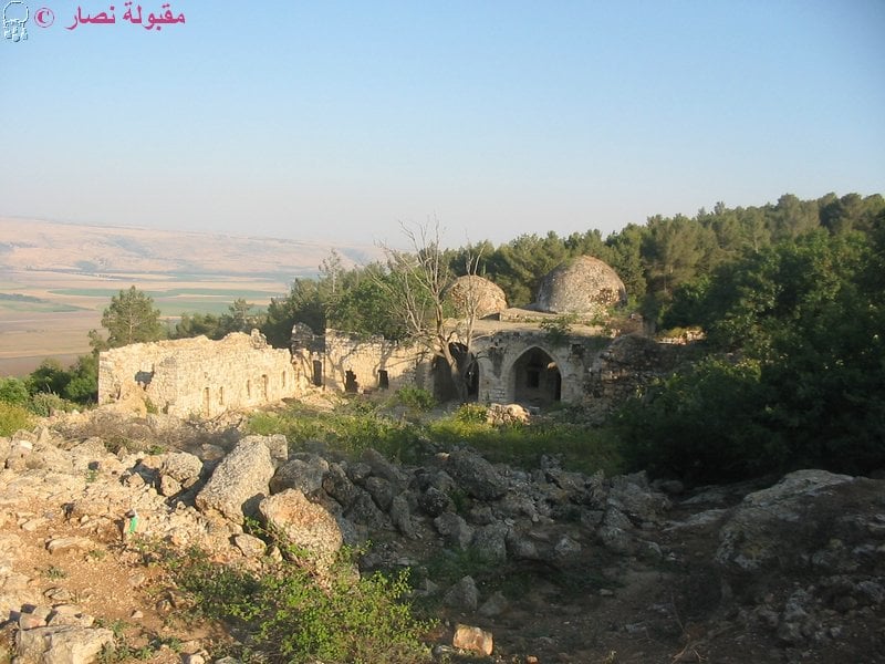
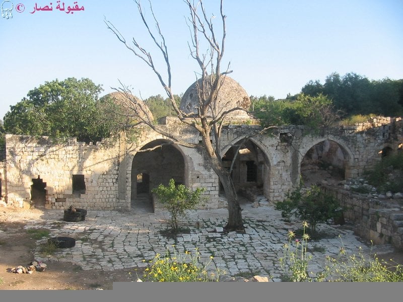
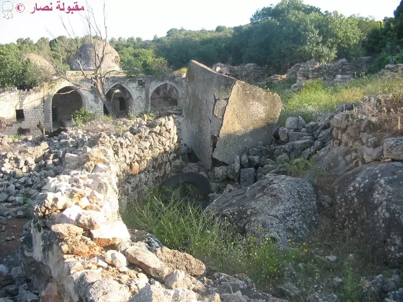
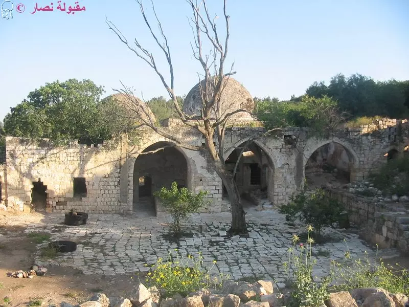
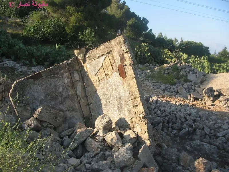
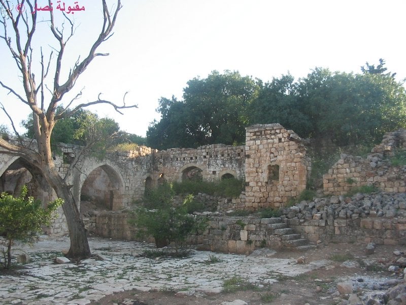
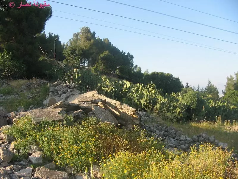
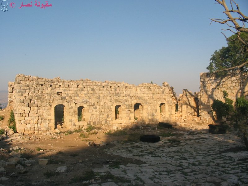
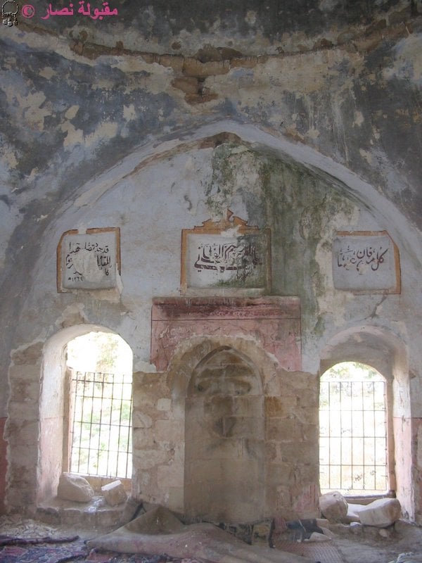
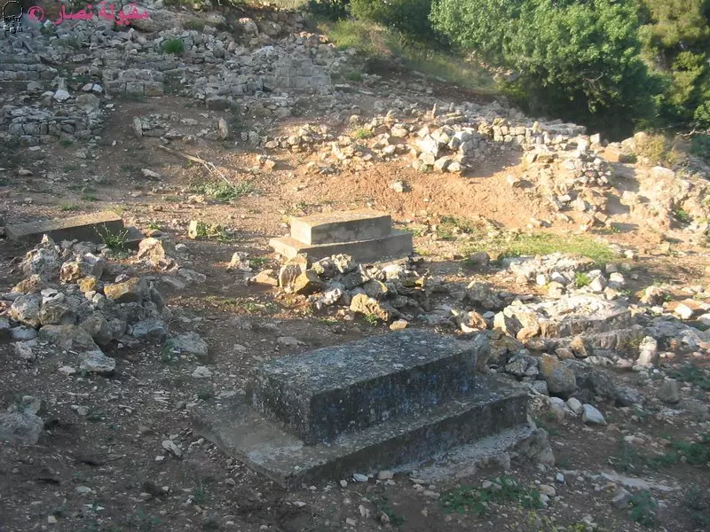
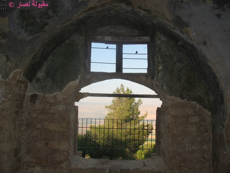
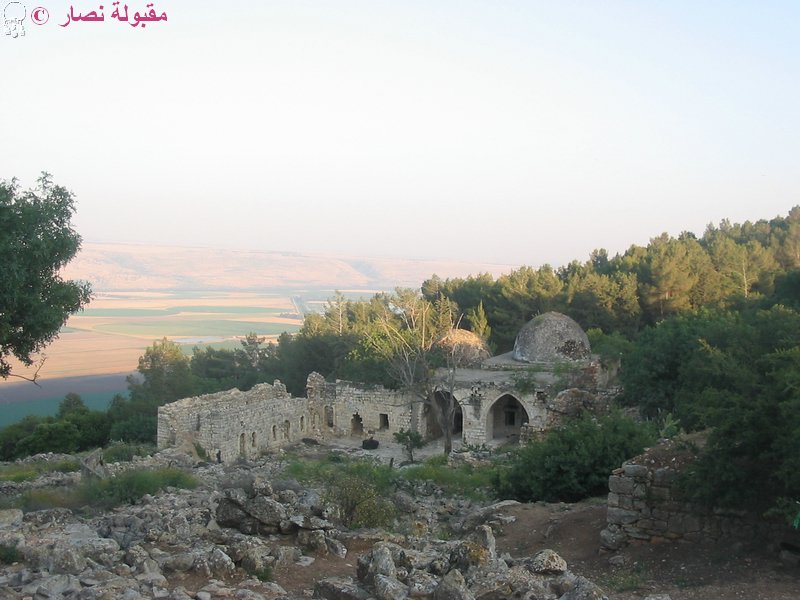
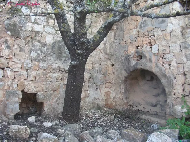
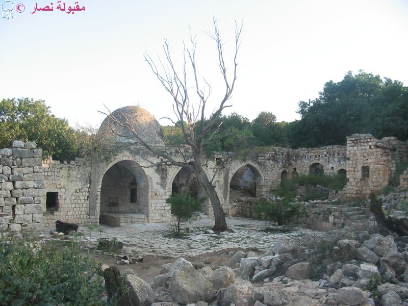
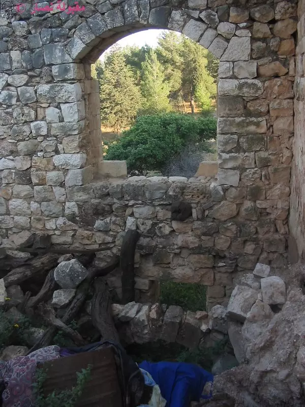
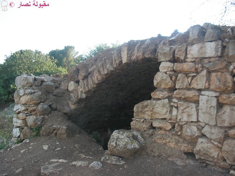
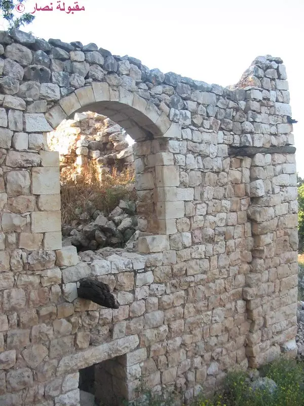
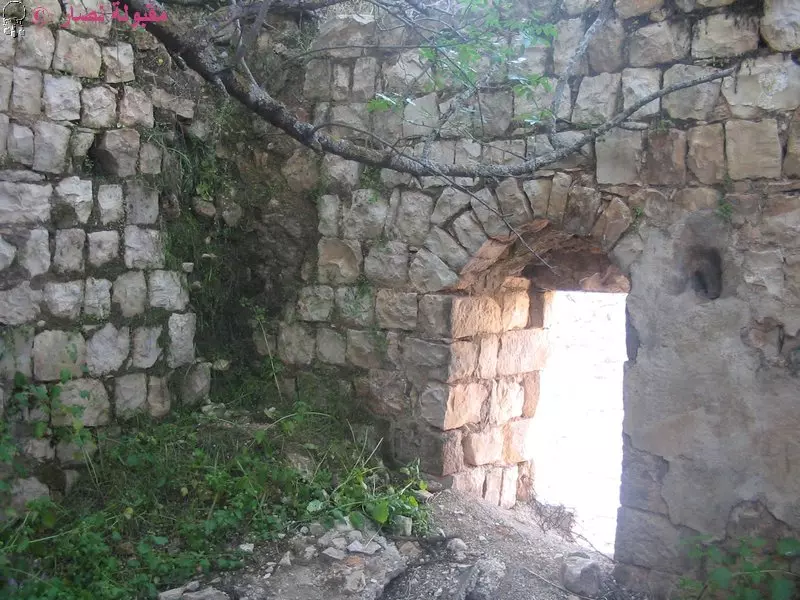
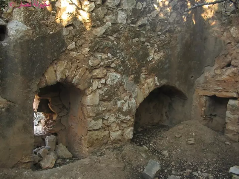
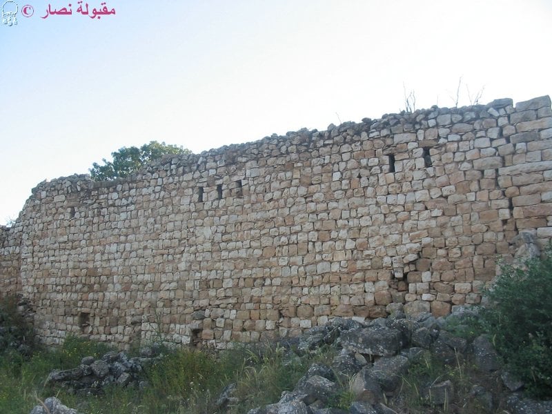
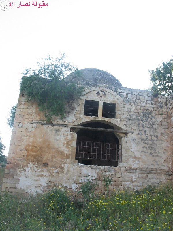
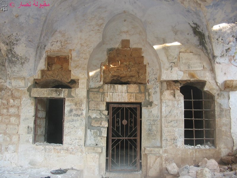
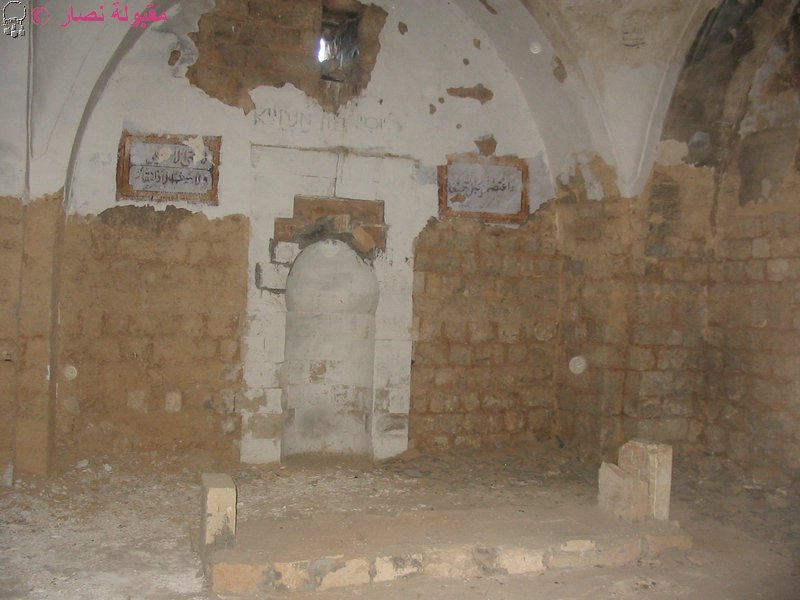
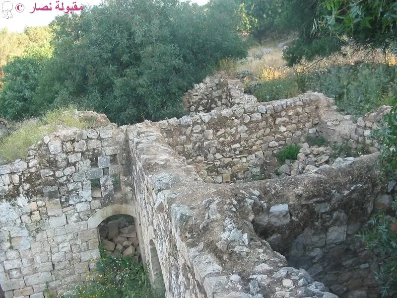
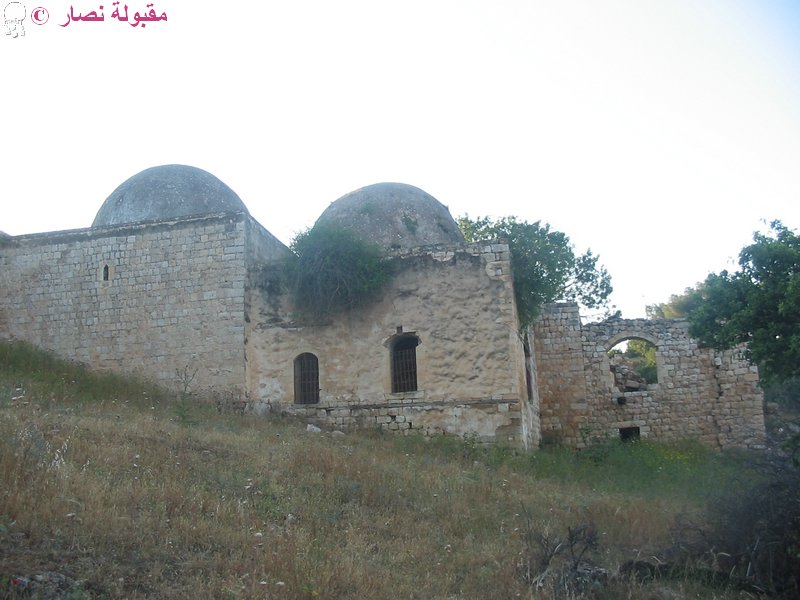
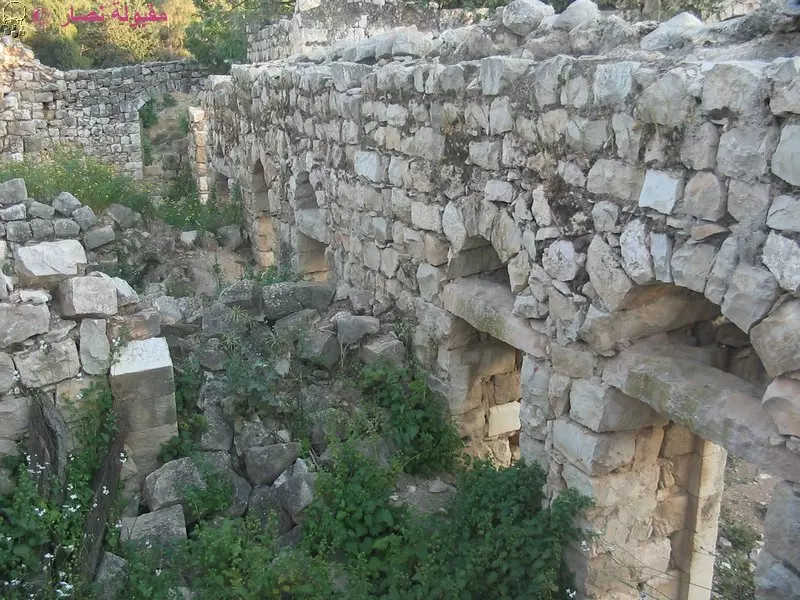
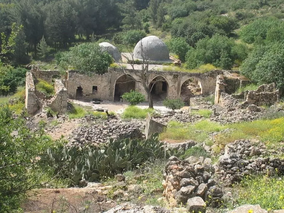
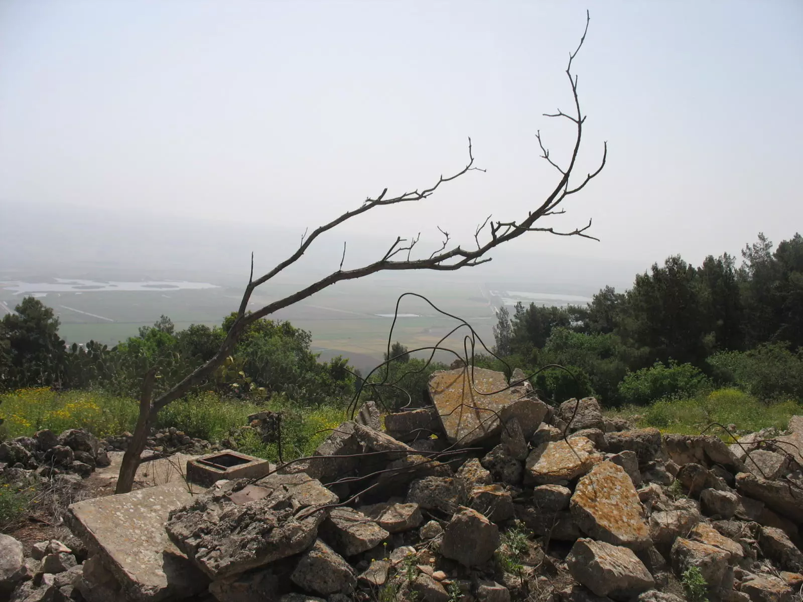
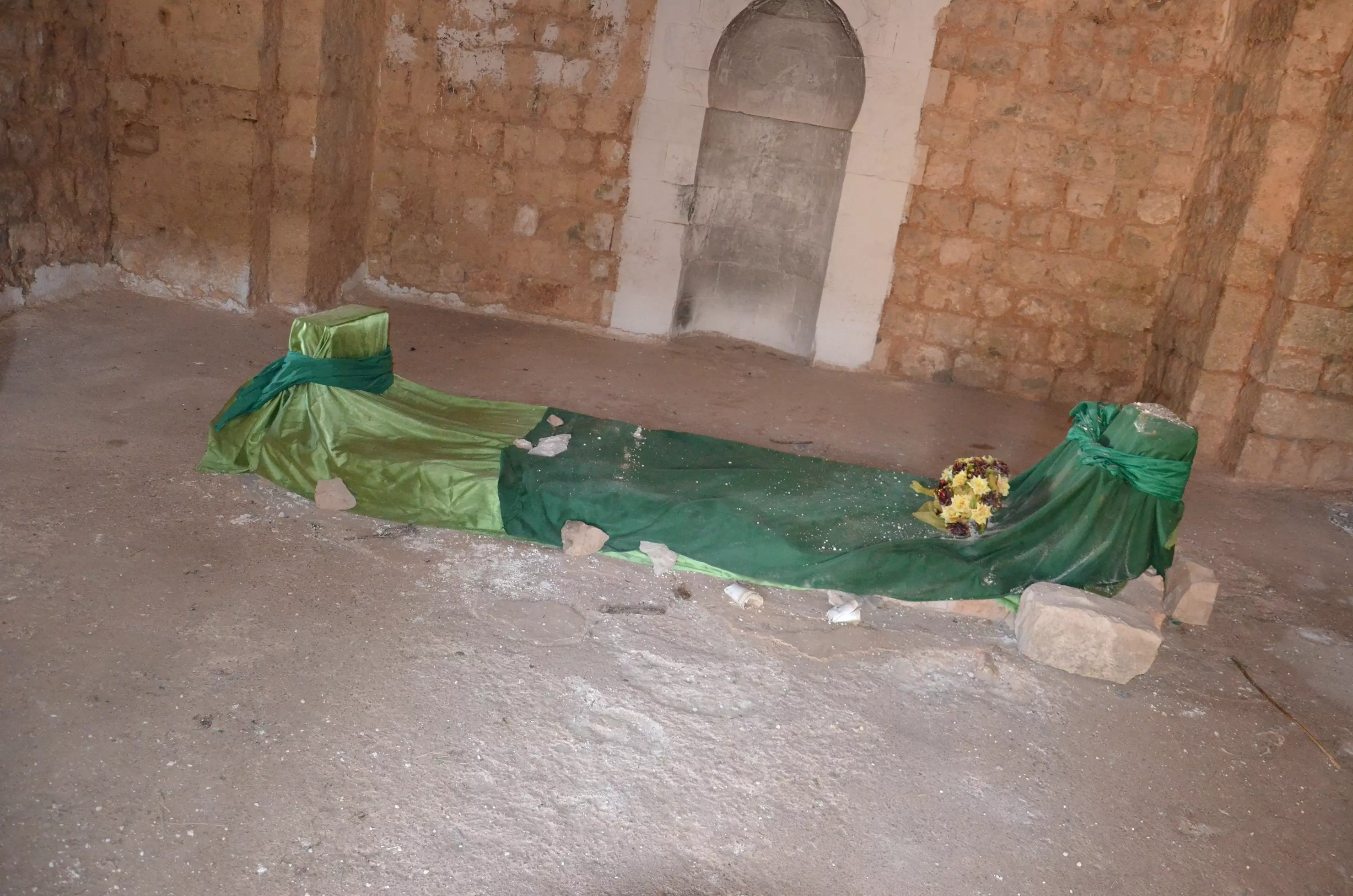
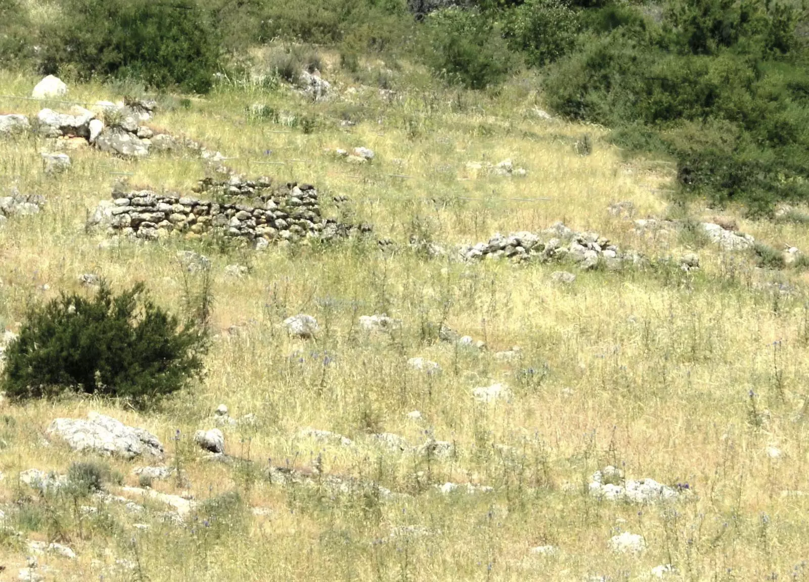
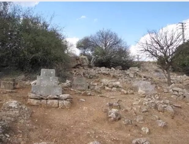
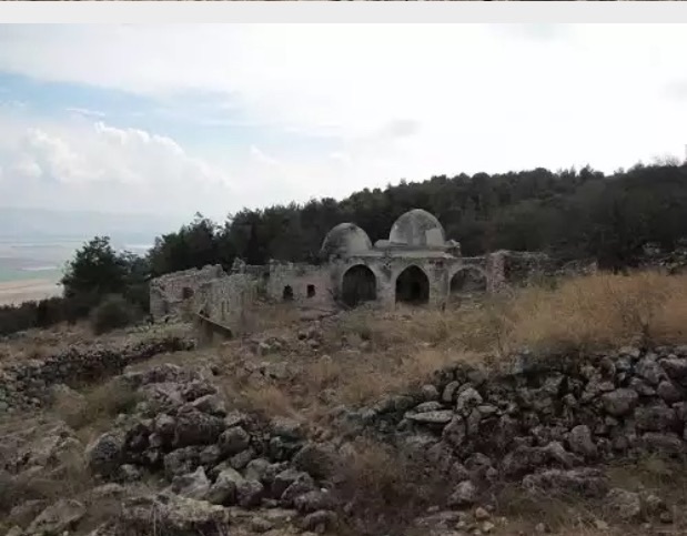
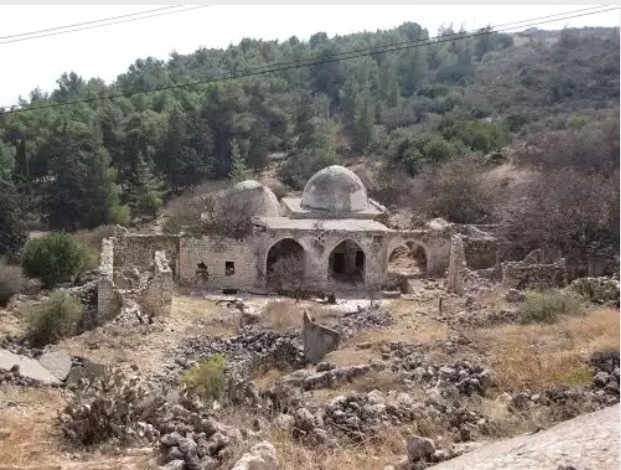
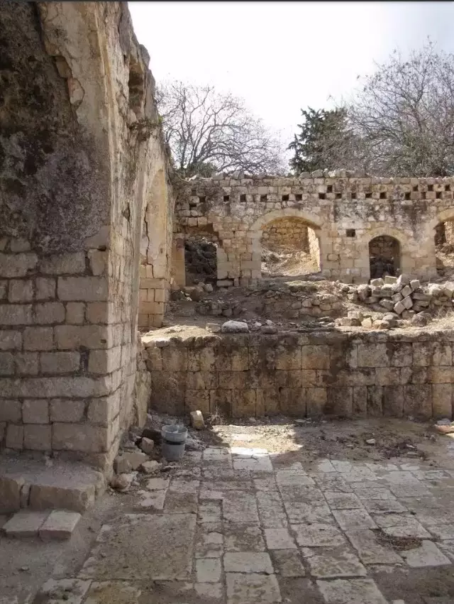
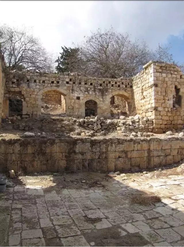
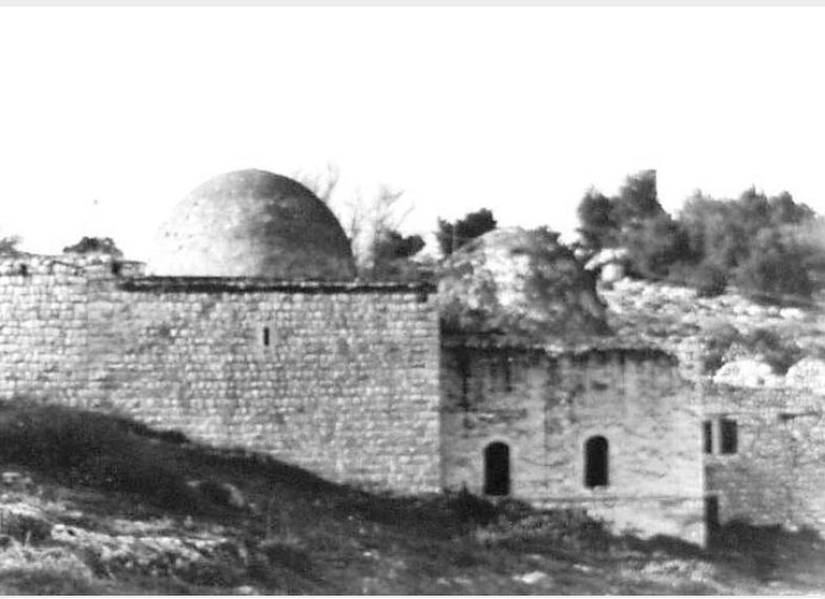
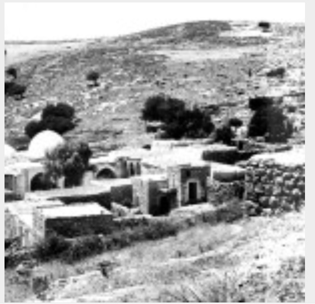
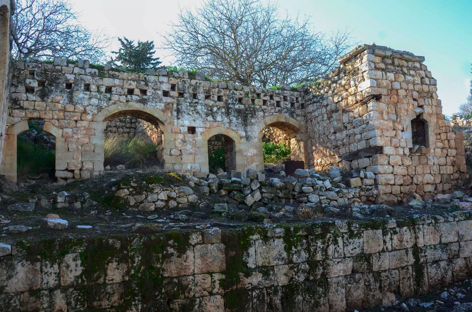
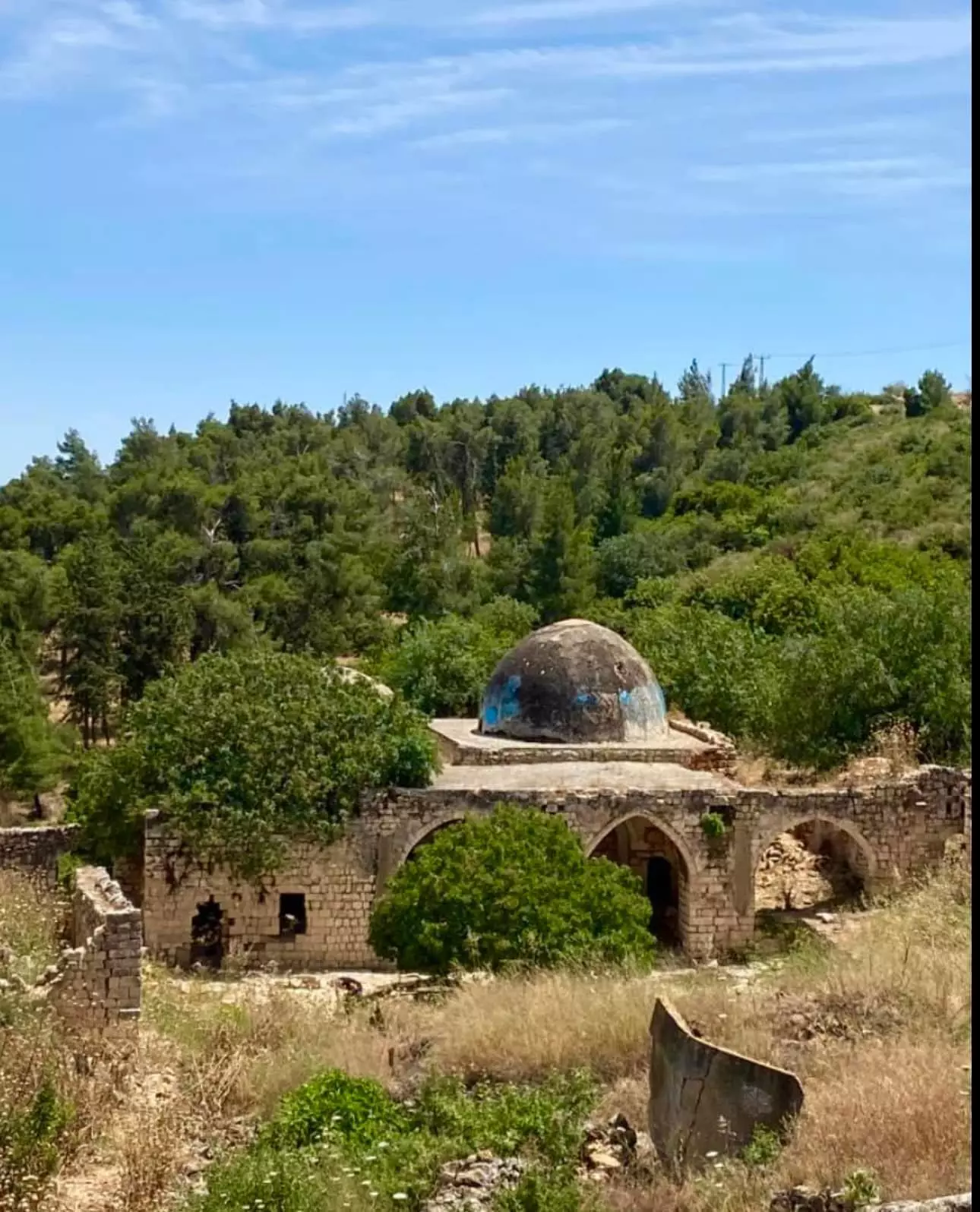
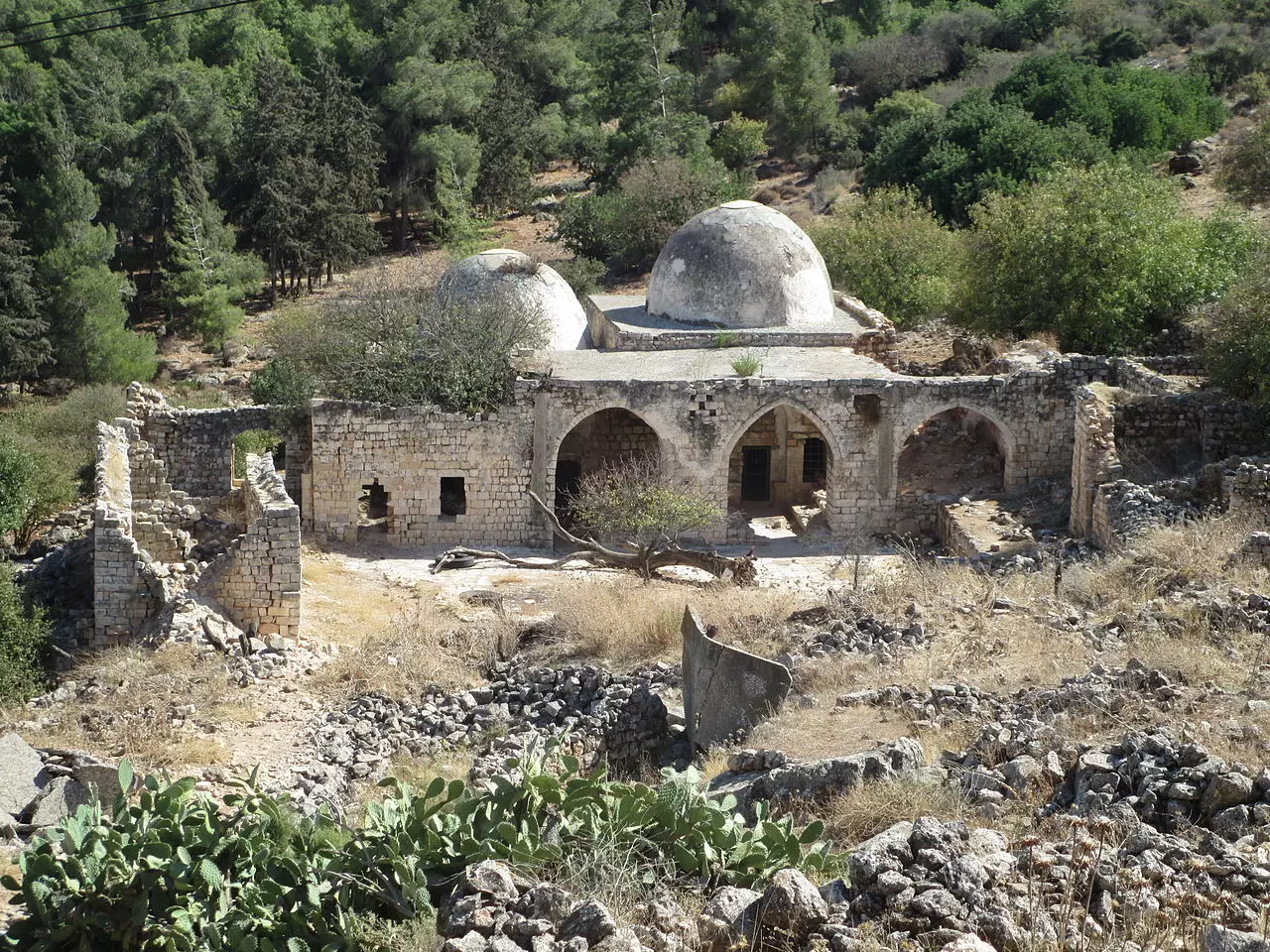
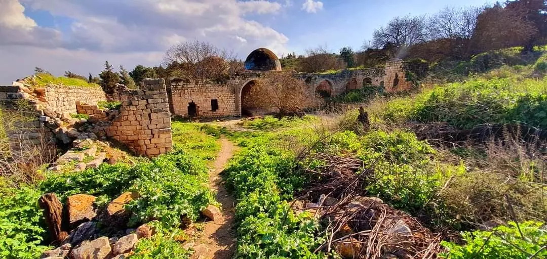
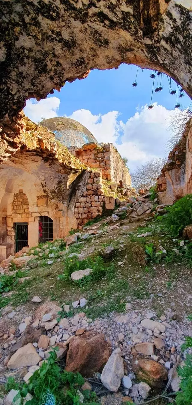
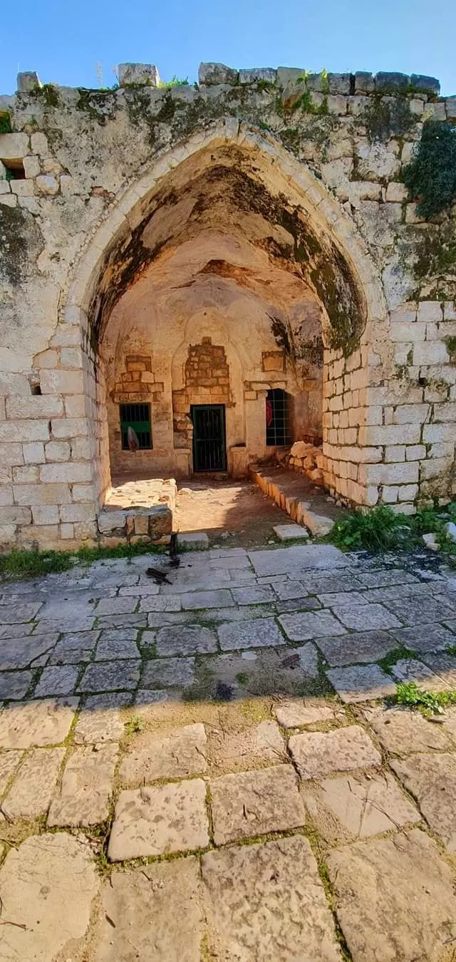
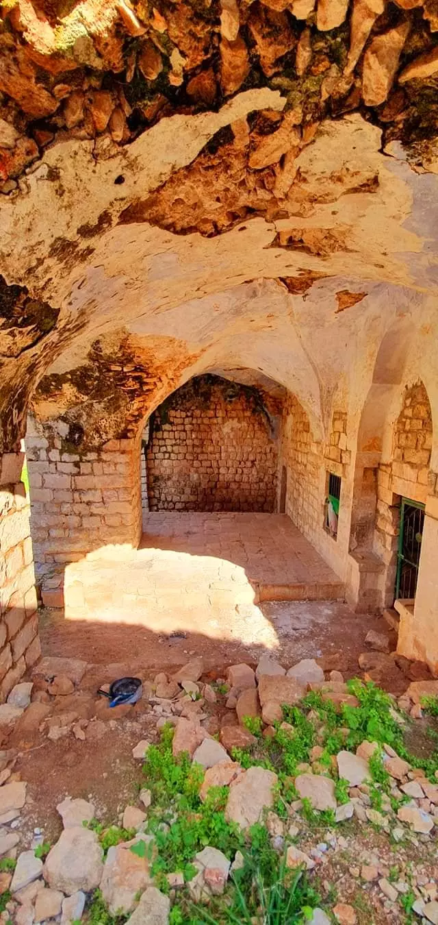
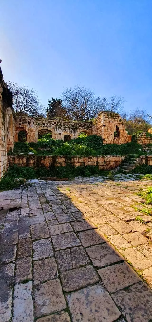
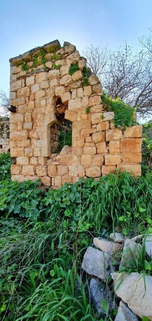
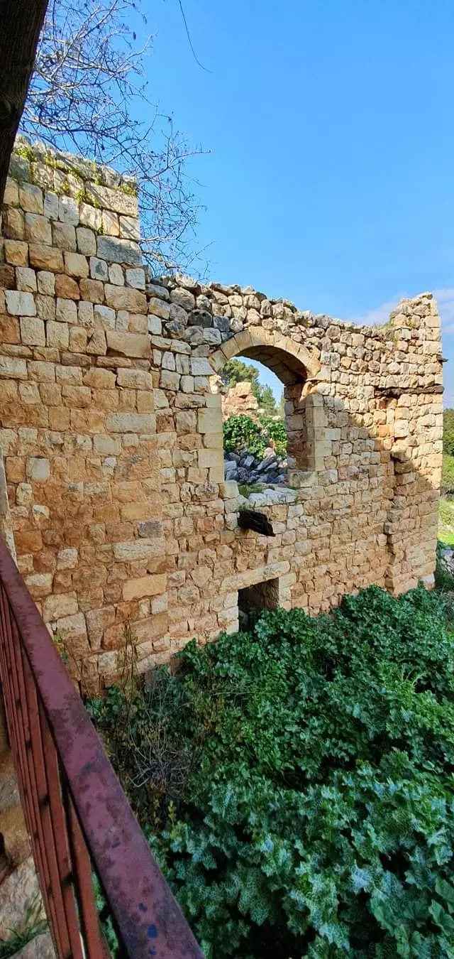
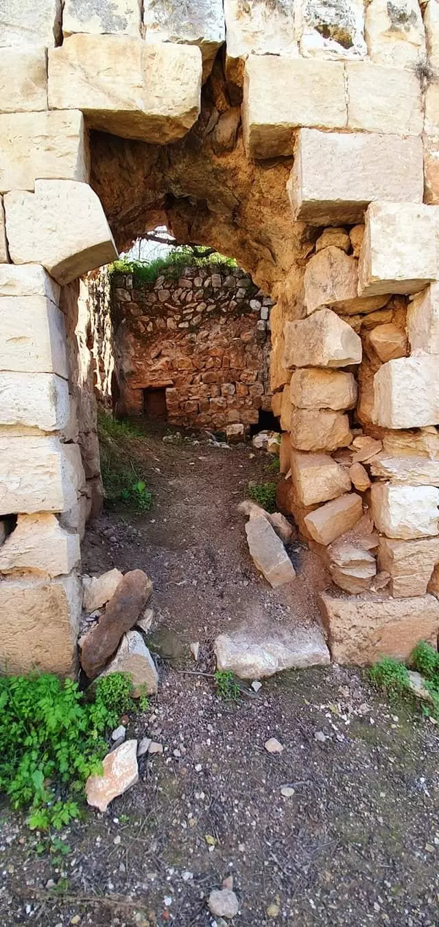
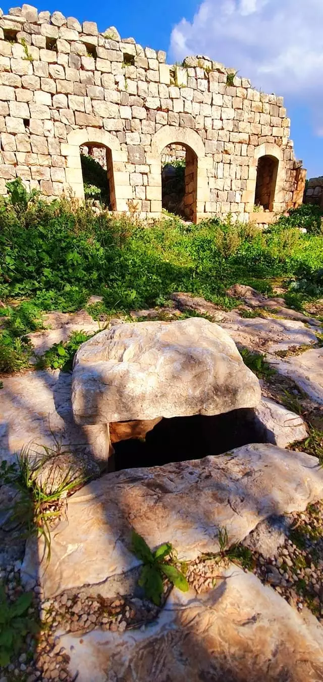
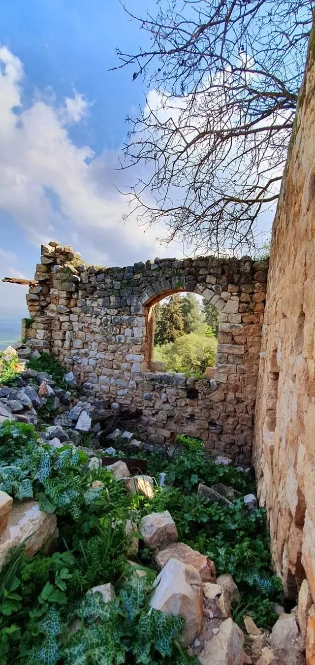
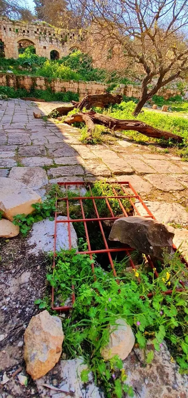
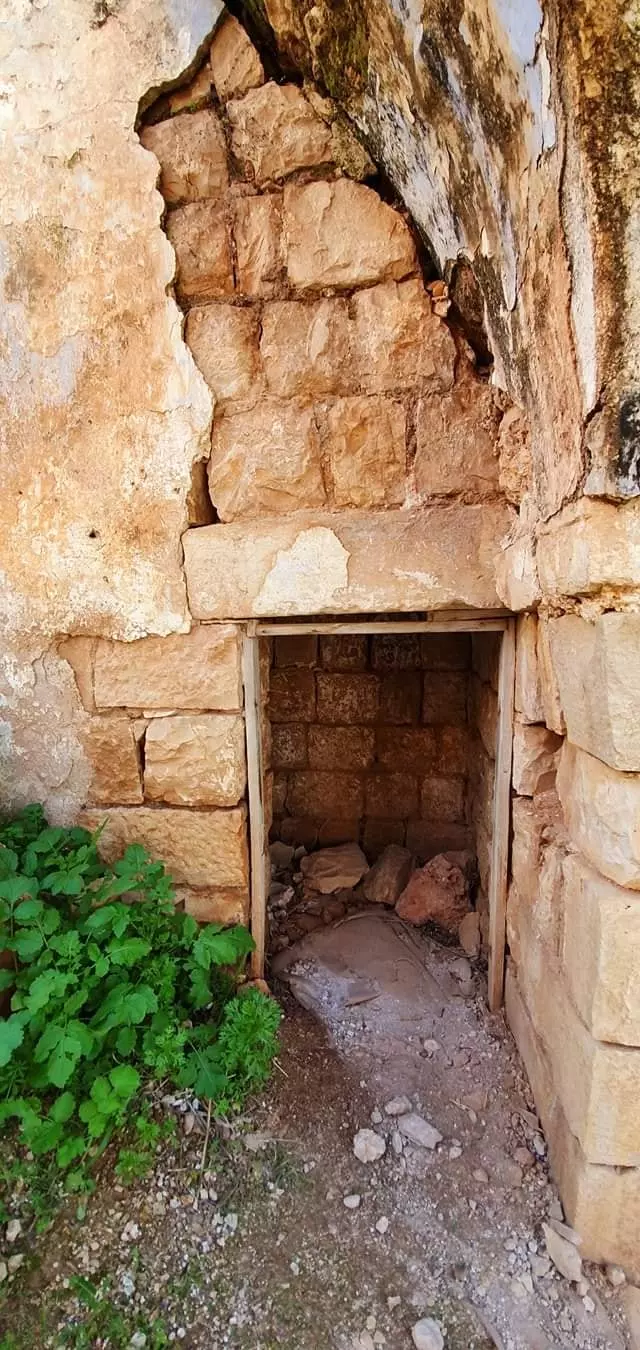
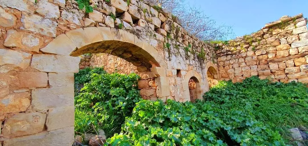
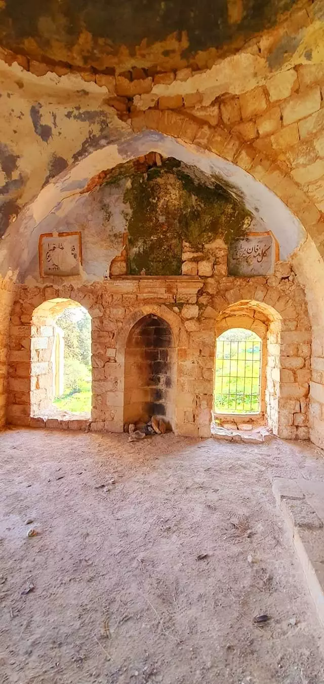
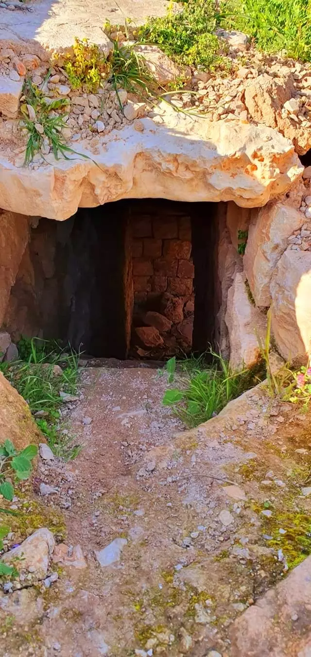
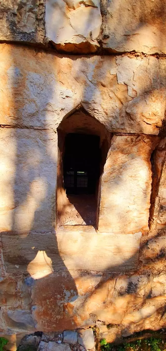
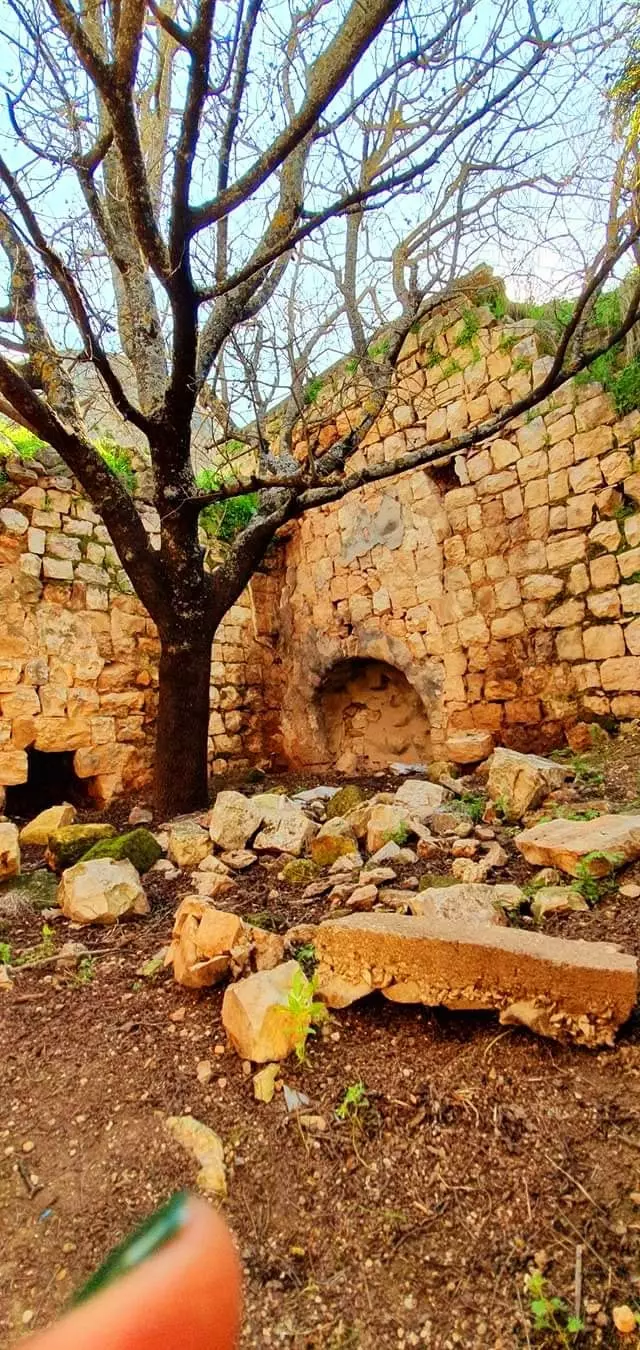
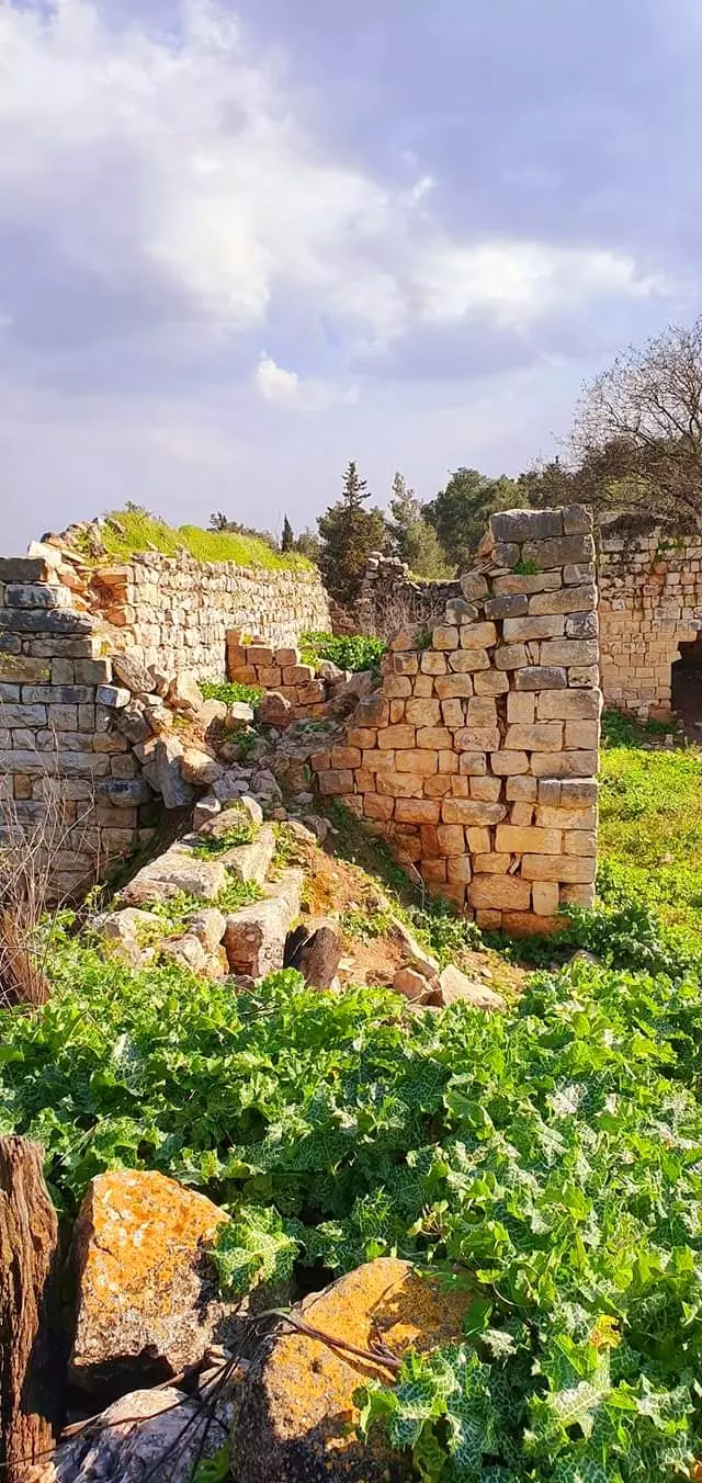
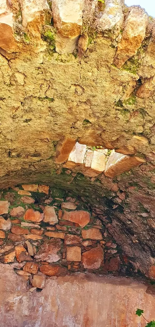
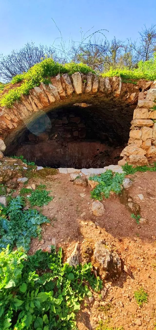
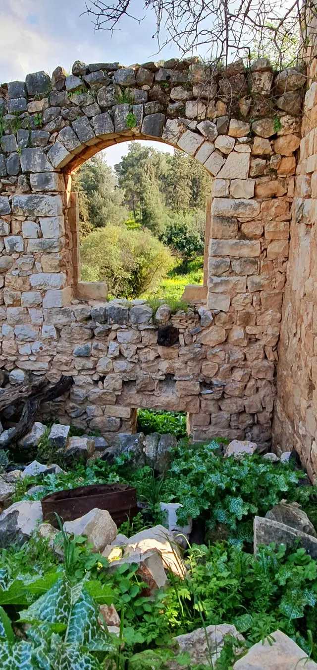
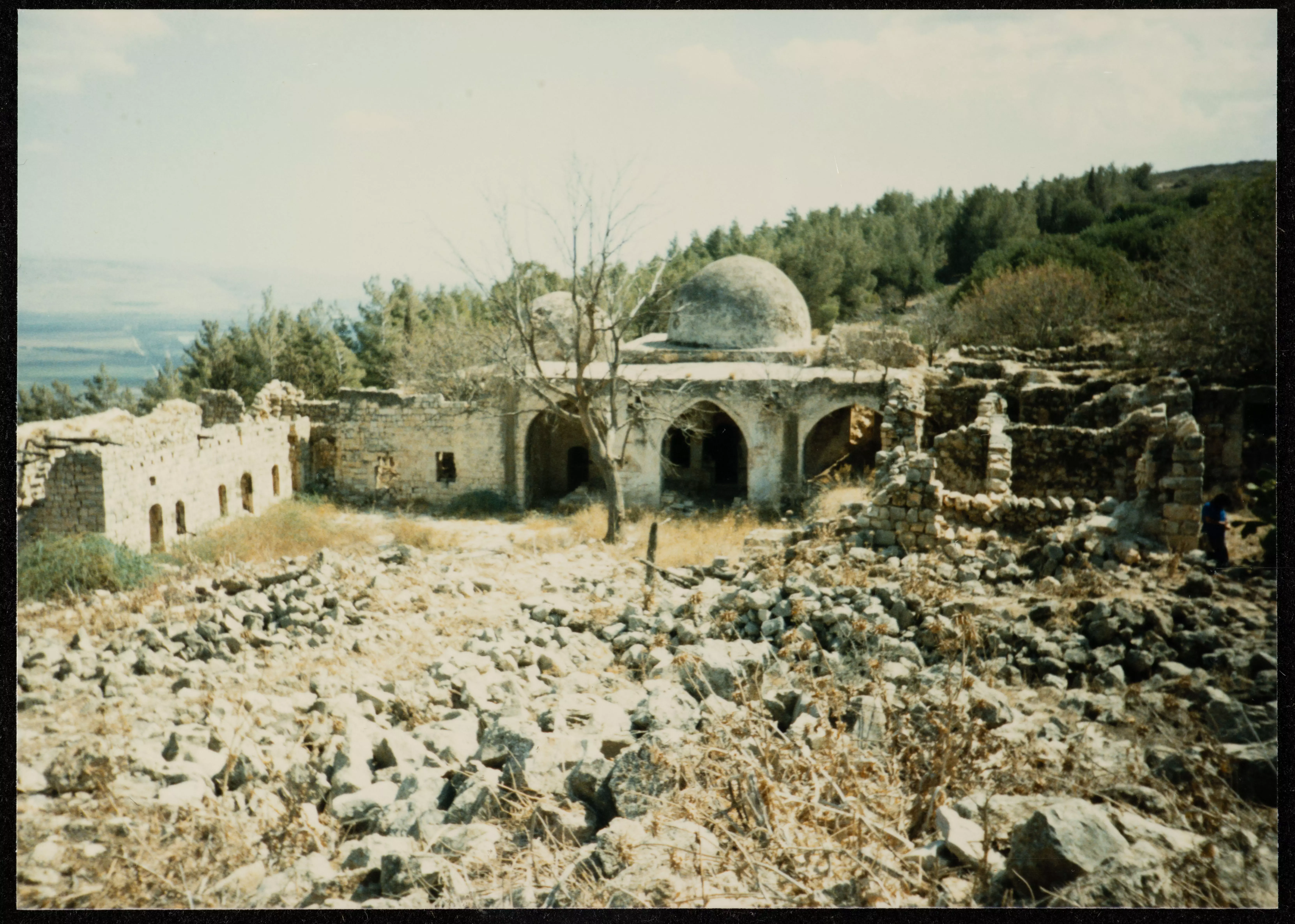
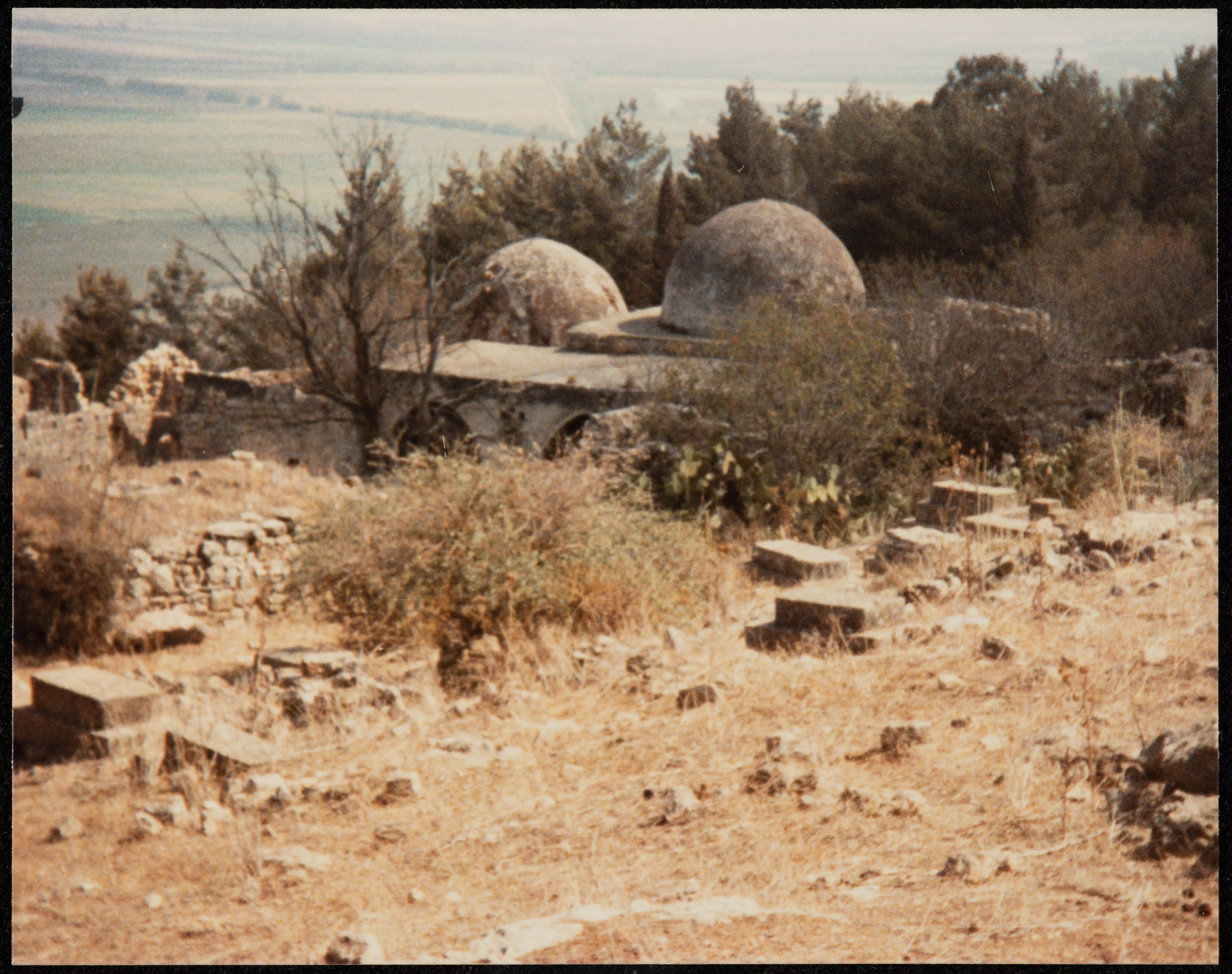
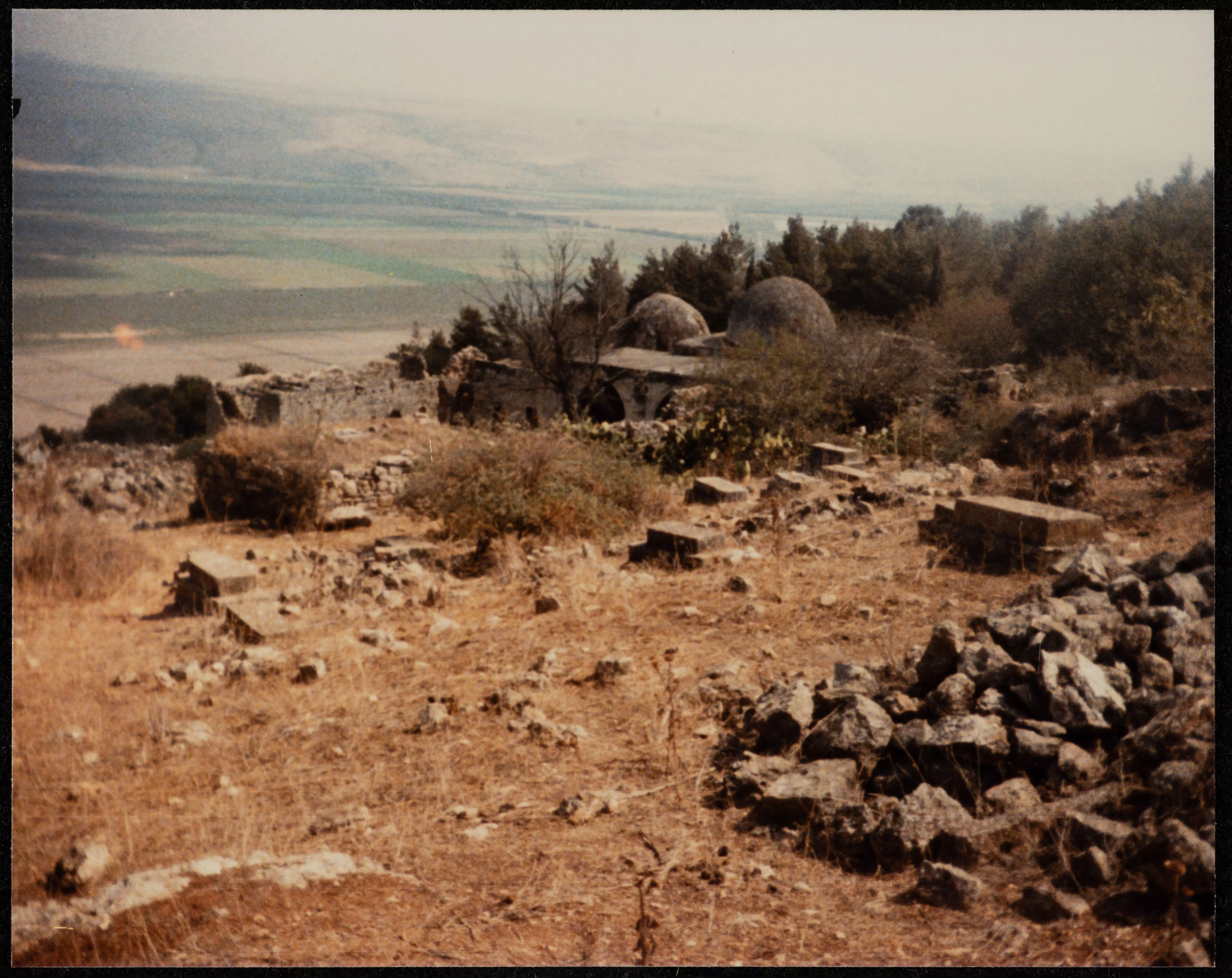
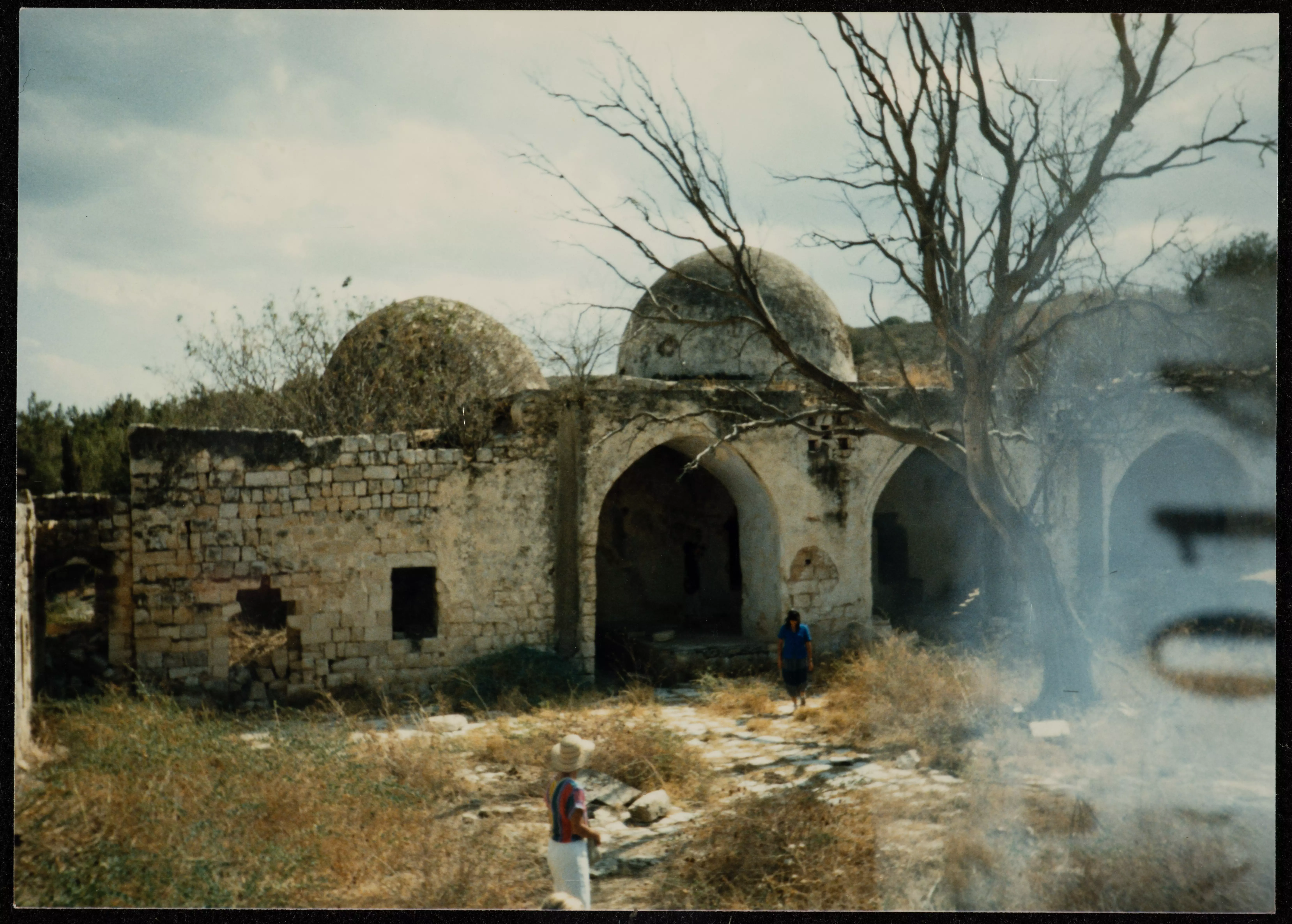
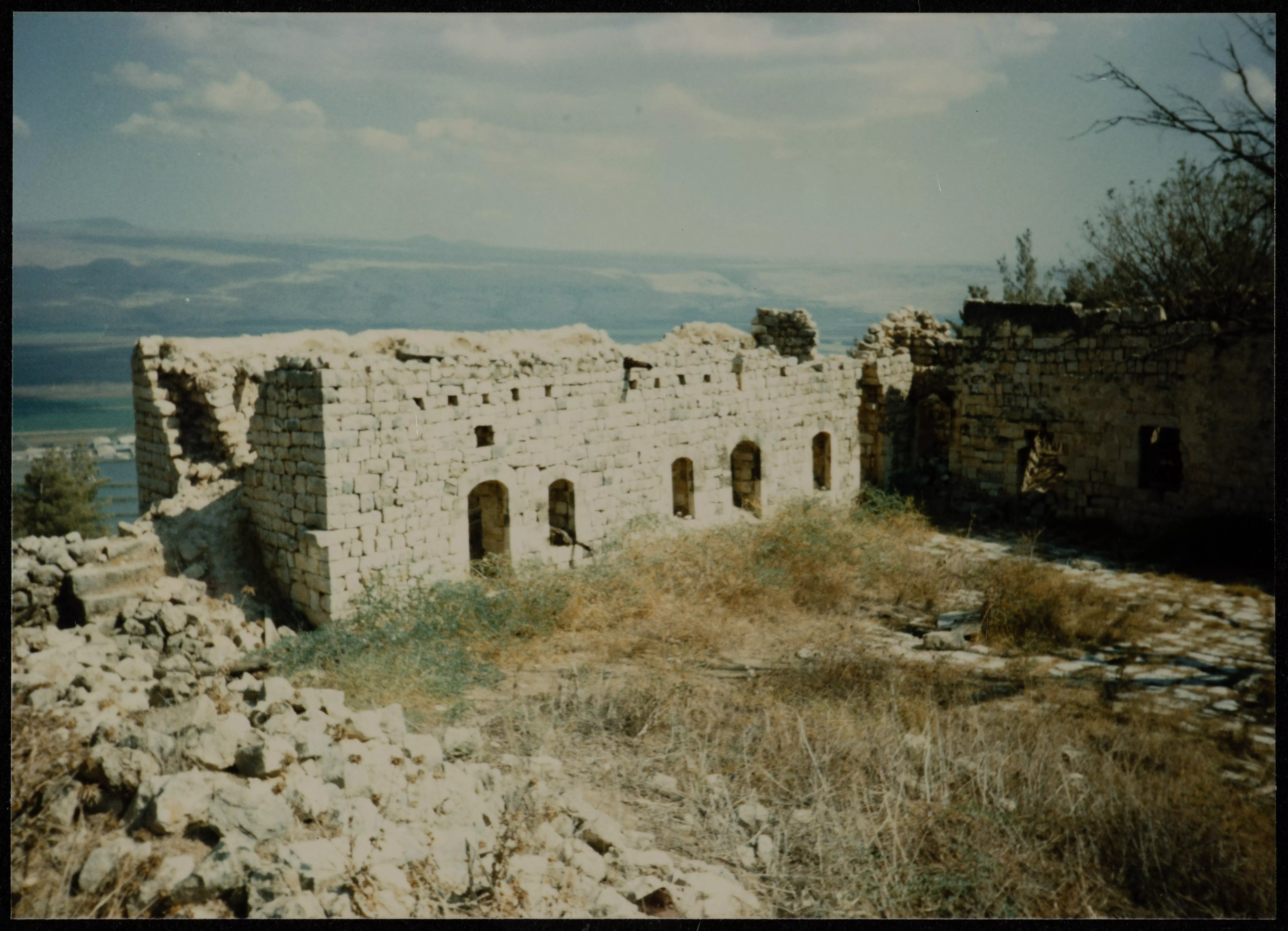
| Village Temains | The village has been mostly destroyed with the exception of the shrine for al-Nabi Yashoa' and few deserted village houses. | ||||||||||
| Ethnically Cleansing | al-Nabi Yusha' inhabitants were completely ethnically cleansed. | ||||||||||
| Pre-Nakba Land Ownership |
**Town Lands' Demarcation Maps |
||||||||||
| Land Usage As of 1945 |
|
||||||||||
| Population |
|
||||||||||
| Number of Houses |
|
||||||||||
| Near By Towns |
|||||||||||
|
|||||||||||
| Places of Warship | One mosque close to the shrine | ||||||||||
| Shrines / Maqams | The village maintained a shrine for al-Nabi Yusha' (still standing, but in need of serious renovation guys!) | ||||||||||
| Exculsive Jewish Colonies Who Usurped Village Lands |
Ramot Naftali | ||||||||||
| Featured Video | |||||||||||
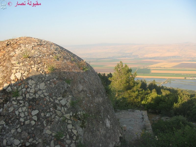
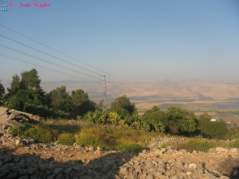
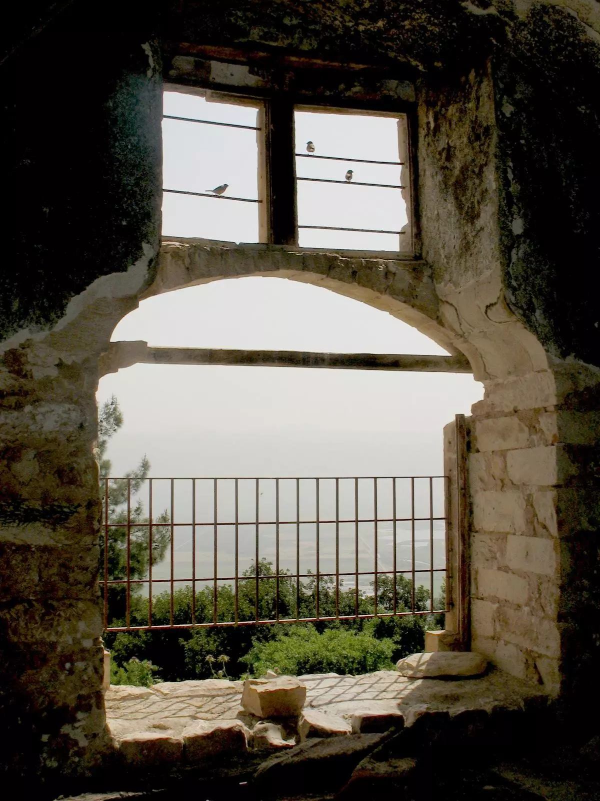
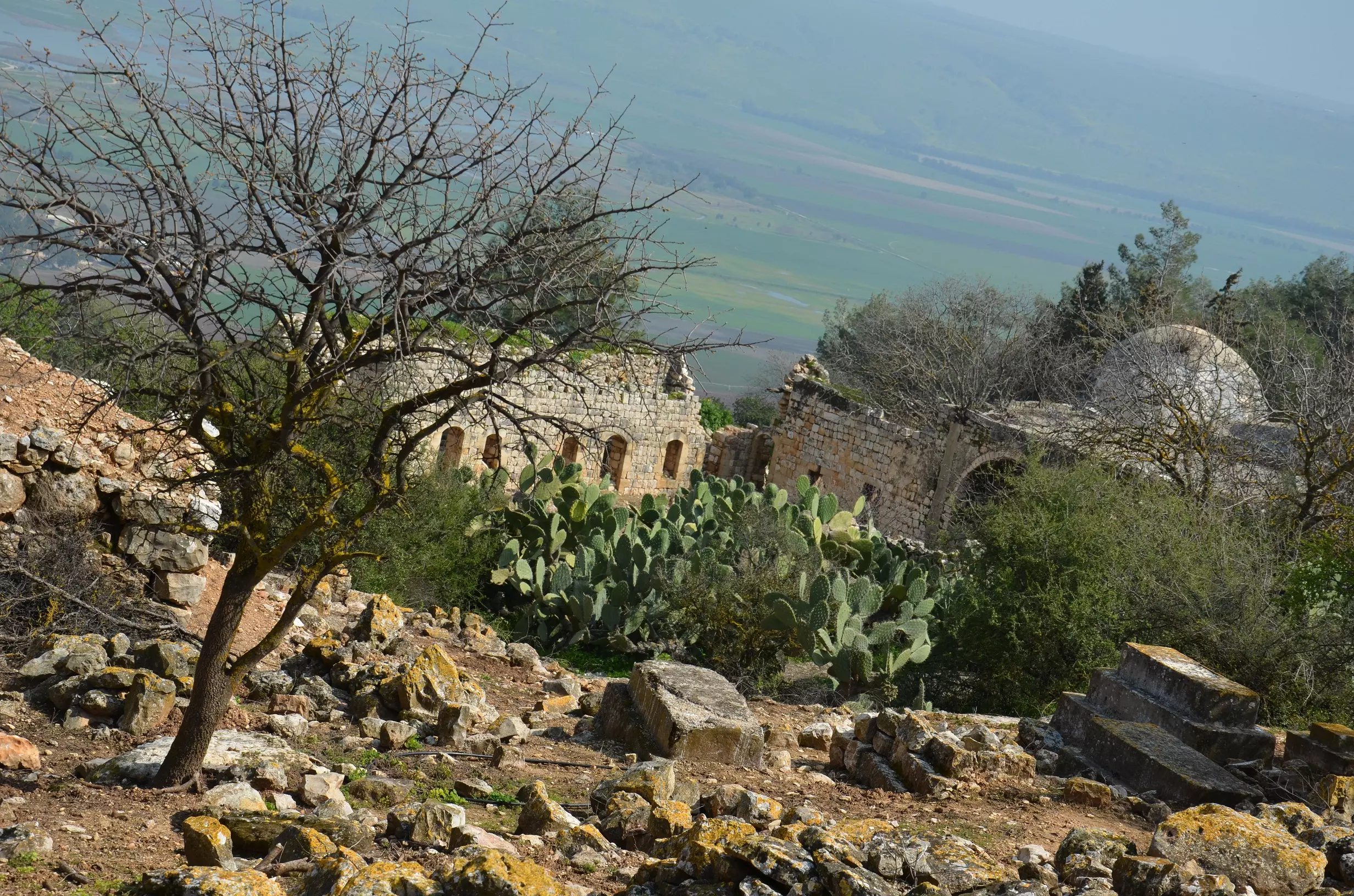
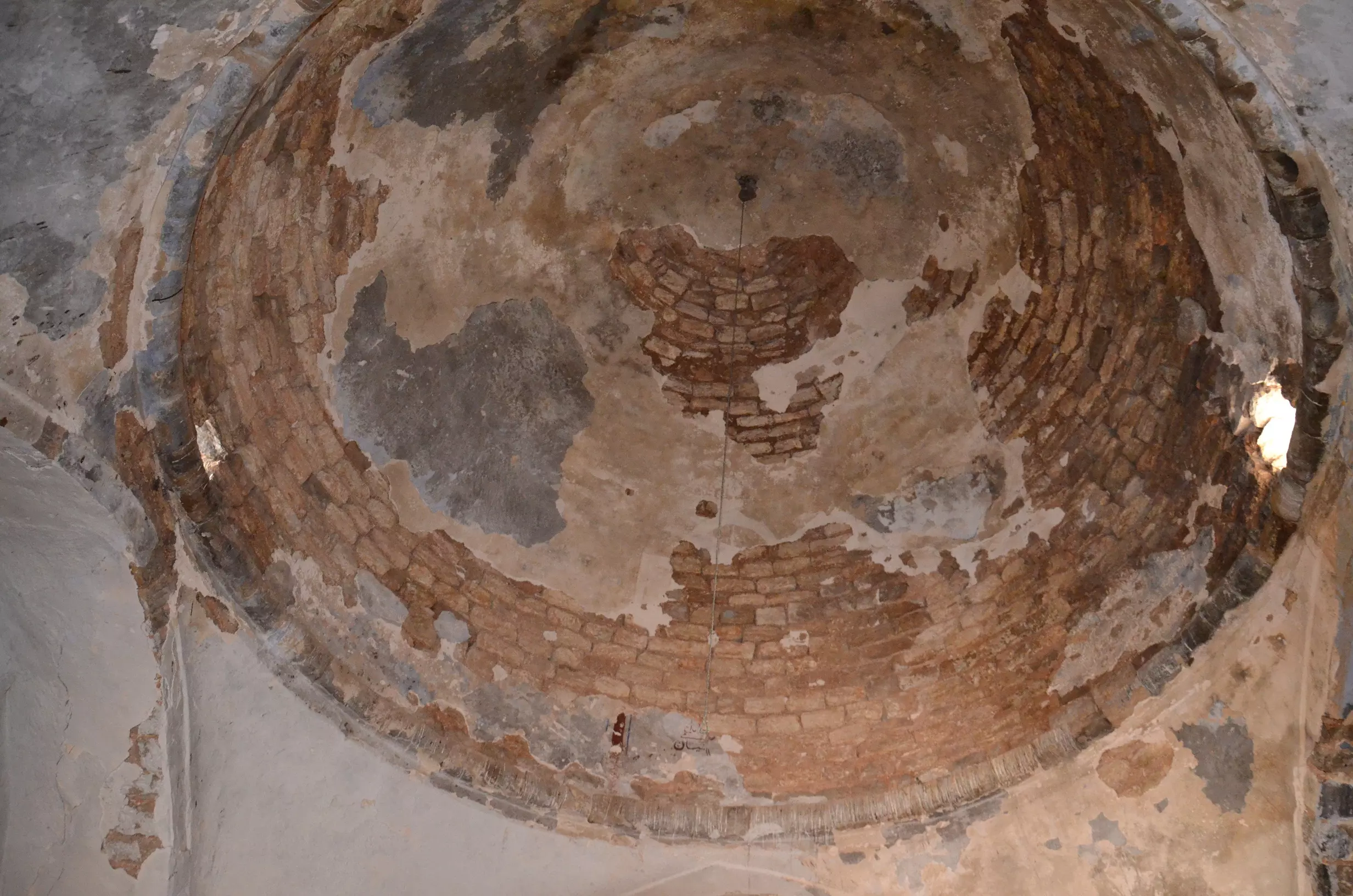
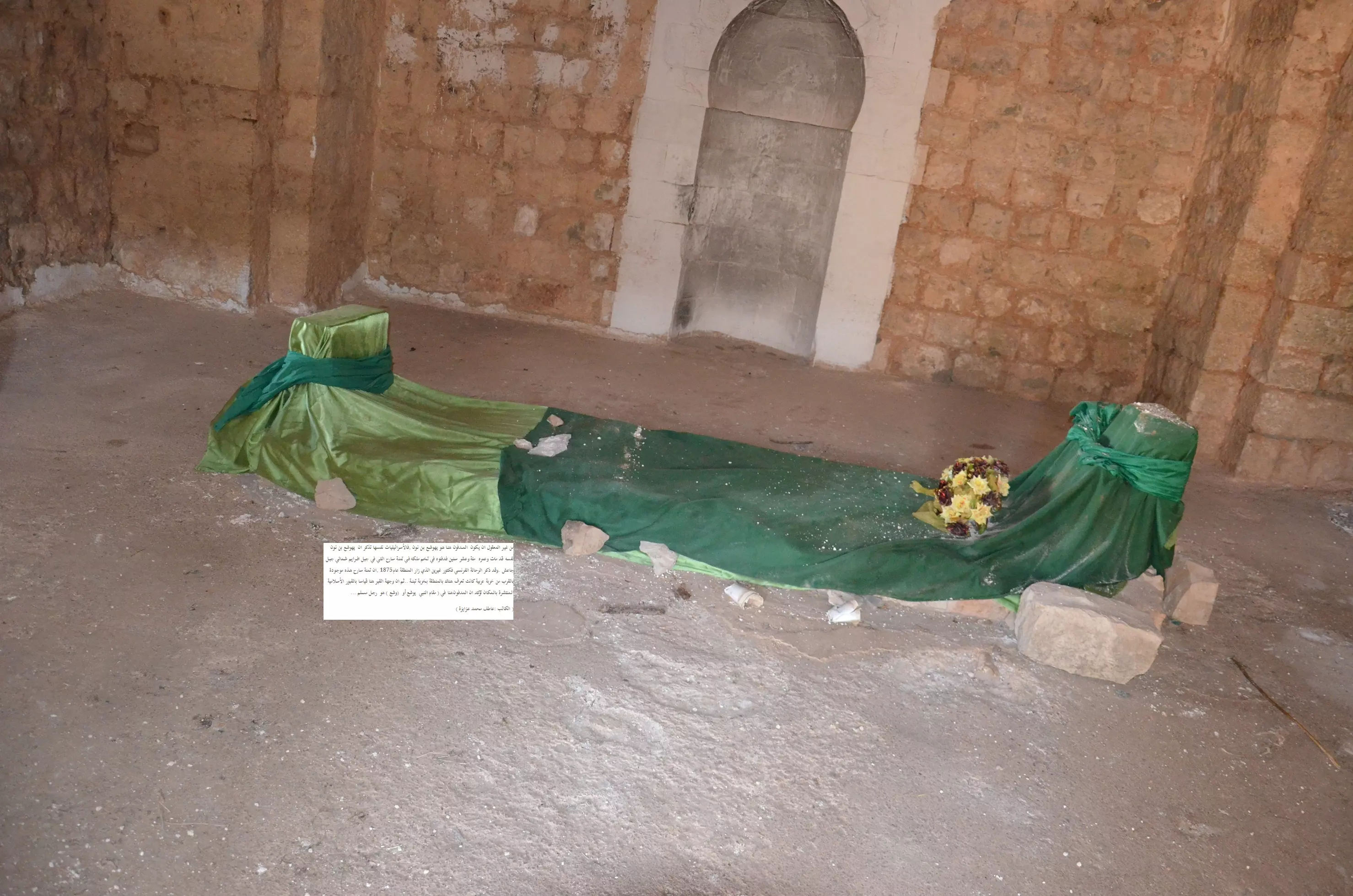
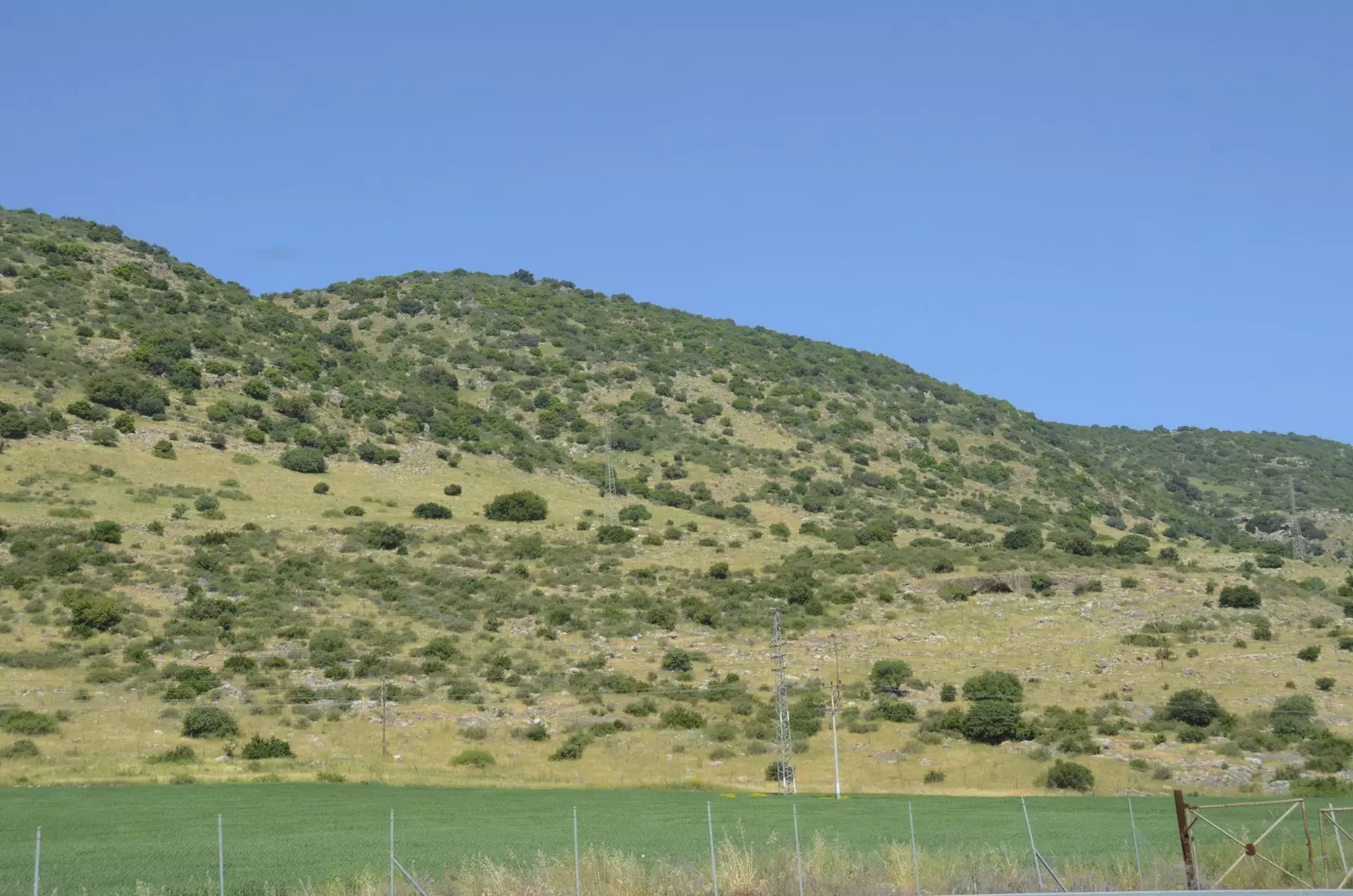
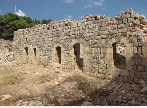
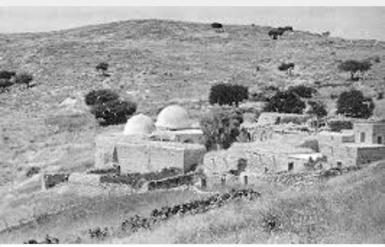
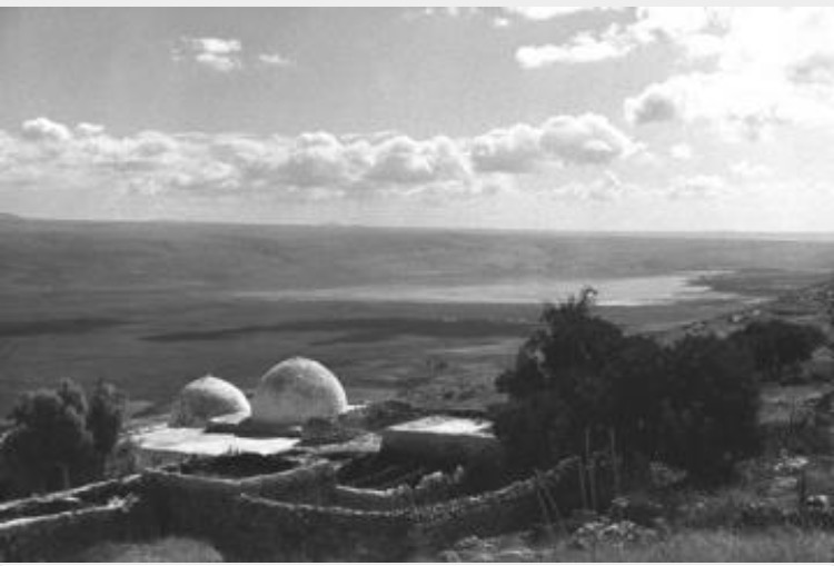
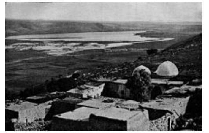
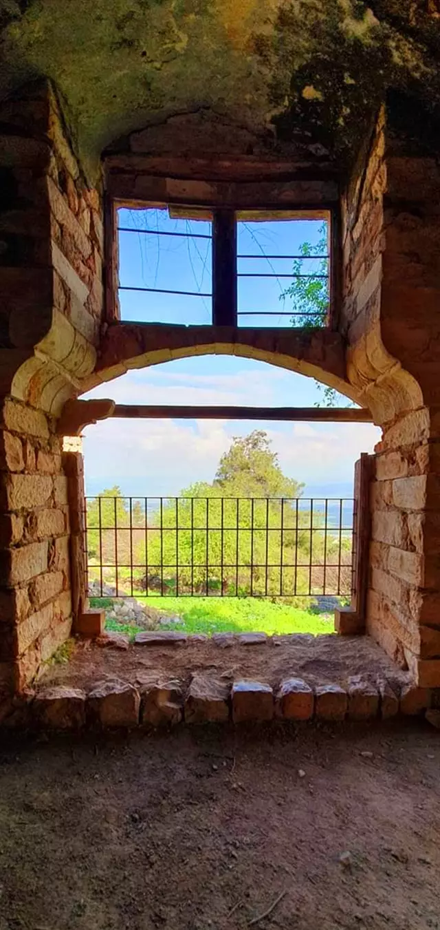
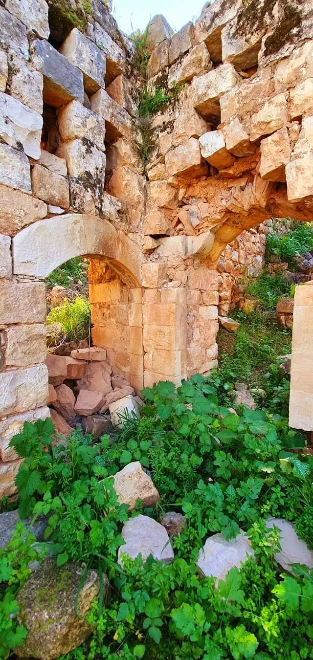
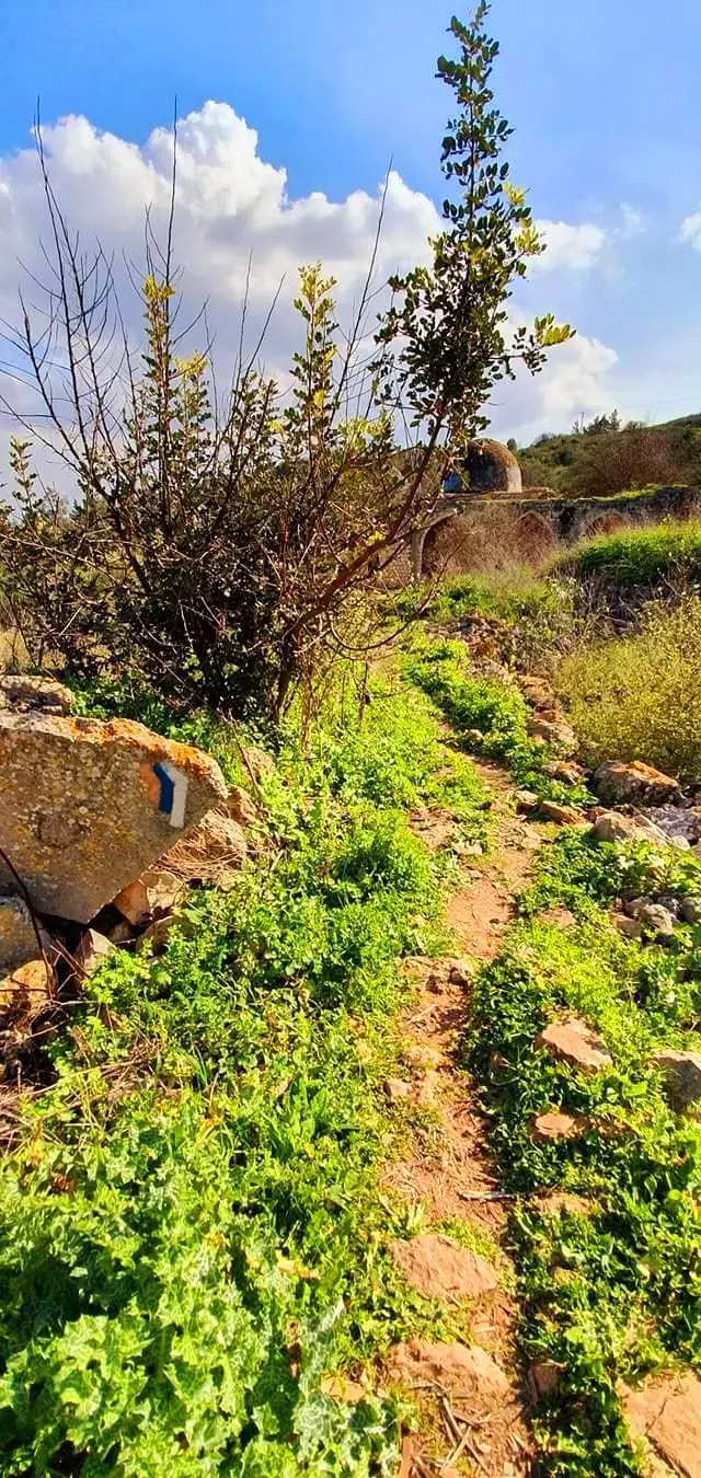
Village Before NakbaThe village was situated near the bed of a small wadi on steepily sloping hills, overlooking the al-Hula Plain to the east and south. The village, linked by a paved spur to a highway that led to Safad and Tiberias, was the site of a shrine that was believed to be the burial grounds of the prophet (nabi) Yusha'. During the late eighteenth century, a family known as Al al-Ghul established the shrine, which included a mosque and a building for visitors, as an act of devotion. This family, also called the 'servants of the shrine,' numbered about fifty and were the first to settle the site; they cultivated the surrounding land, and the place subsequently evolved into a village. During the Mandate, the British chose the village as the location for a police station. The people of al-Nabi Yusha', all of whom were Muslims, held an annual mawsim, or pilgrimage and festive,l on the fifteenth of Sha'ban (the eighth month of the Muslim calendar). The mawsim was similar to that of al-Nabi Rubin's festival in Ramla sub-district. The villagers earned their livelihood primarily from farming. In 1944/45 they planted a total of 640 dunums in cereals.Village Occupation and Ethnic CleaningThe village, and its police station in particular, were the targets of four Zionist attacks by the Haganah in April and May 1948. When the British evacuated the al-Nabi Yusha' police station on 15 April, it was commandeered by units of the Arab Liberation Army (ALA) and other militiamen. According to records kept by ALA commander Fawzi al-Qawuqji, his troops first took up positions around it in late March. The first Haganah attack, which inaugurated Operation Yiftach (see Abil al-Qamh, Safad sub-district), took place on 17 April. This attack failed. The second raid, mounted three days later, also failed, resulting in the death of twenty-two of the Jewish attackers, according to the History of the Haganah. The Haganah account relates that the plan was to cut through the barbed wire and mine the police station, but the Palmach unit was discovered at daybreak and shelled by the ALA. Two more attempts were made later during the same operation. An attempt on the night of 15‒16 May was quickly called off, but the following night, the attackers received air support, and succeeded in their objective. As the History describes the attack, Israeli planes dropped incendiary bombs on the village police station, while ground units blasted their way through the barbed wire defenses, causing the defenders to withdraw. The fate of the villagers is not explicitly mentioned; they probably fled or were expelled at the time of this attack.For the next five months (i.e., until the end of the second truce of the war), the front lines between Israeli and Arab forces ran just outside the village. During Operation Hiram (see 'Arab al-Samniyya, Acre sub-disctrict), Israeli units coming from the west reached the village in October 1948, thus extending Israeli control over the length of the Lebanese border. A New York Times report stated that fighting on the northern front broke out on 22 October and spread along the entire line from al-Nabi Yusha' northwards to Manara. Manara (201289), an Israeli settlement with an Arabic name, was founded in the extreme north of the Safad sub-district in 1943. Zionists Colonies on Village LandsThe agricultural settlement of Ramot Naftali (202278), established in 1945 on village lands, is south ofthe village site. It is close to the border between al-Nabi Yusha' and the lands of the Arab village of Mallaha (204277).Village TodayThe site has been fenced in with barbed wire and is buried under rubble, making access difficult. However, some evidence of the village remains: fragments of houses, tombs in the village's cemetery, and the shrine of al-Nabi Yusha'. The two domes and arched entrance of the main part of the shrine are still intact, but the thick stone walls of the rooms attached to it are broken and the entire complex of buildings is neglected; weeds sprout from the roof. The village site is surrounded by fig trees and cactuses. The flat lands around the site are planted by Israeli farmers with apple trees, while the sloping parts are wooded or used as pasture.SourceDr. Walid al-Khalidi, 1992: All That Remains. |
|||||||||||
| Related Maps | Town Lands' Demarcation Maps خرائط للقضاء توضح حدود القرى والاودية Town's map on MapQuest View from satellite Help us map this town at WikiMapia |
||||||||||
| Related Links | Wikipedia's Page Google Search Google For Images Google For Videos |
||||||||||
| More Information | في كتاب كي لا ننسى في كتاب بلادنا فلسطين المزيد من موقع هوية |
||||||||||
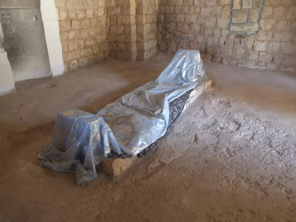
- The shrine for al-Nabi Yusha' and the remains of house rubble
- مقام النبي يوشع والمقبرة, أخر ما بقي في القرية, 7.5.2005- تصوير: مقبولة نصار
Posted by Makbula Nassar - مقام النبي يوشع والمقبرة, أخر ما بقي في القرية, 7.5.2005- تصوير: مقبولة نصار
Posted by Makbula Nassar 1 - مقام النبي يوشع والمقبرة, أخر ما بقي في القرية, 7.5.2005- تصوير: مقبولة نصار
Posted by Makbula Nassar - مقام النبي يوشع والمقبرة, أخر ما بقي في القرية, 7.5.2005- تصوير: مقبولة نصار
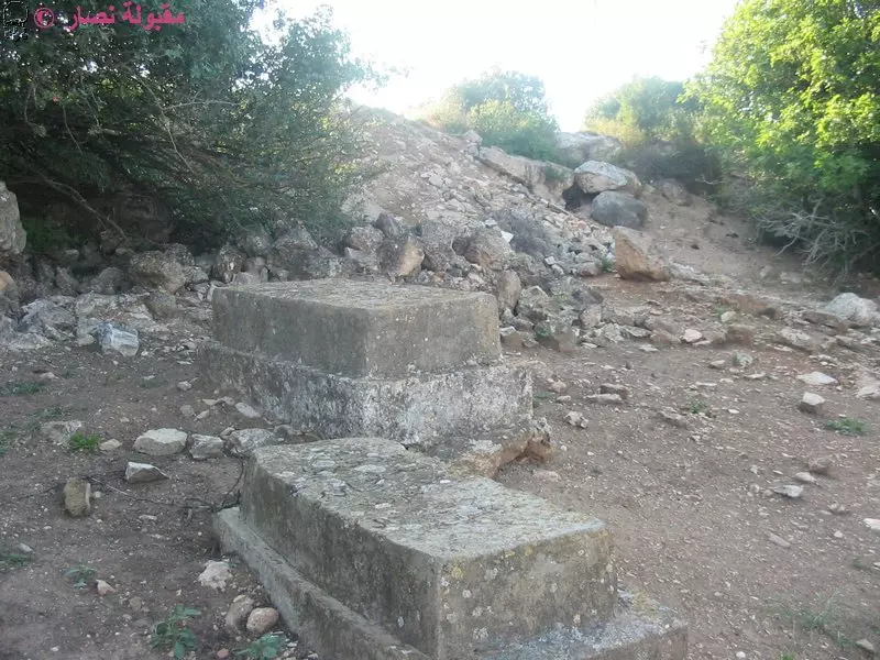
Posted by Makbula Nassar - الركام حول المقام , 7.5.2005- تصوير: مقبولة نصار
Posted by Makbula Nassar 1 - مقام النبي يوشع والمقبرة, أخر ما بقي في القرية, 7.5.2005- تصوير: مقبولة نصار
Posted by Makbula Nassar - الركام حول المقام , 7.5.2005- تصوير: مقبولة نصار
Posted by Makbula Nassar 1 - مقام النبي يوشع والمقبرة, والغرف المحيطة بالمقام, 7.5.2005- تصوير: مقبولة نصار
Posted by Makbula Nassar - الركام حول المقام , 7.5.2005- تصوير: مقبولة نصار
Posted by Makbula Nassar - مقام النبي يوشع والمقبرة, والغرف المحيطة بالمقام, 7.5.2005- تصوير: مقبولة نصار
Posted by Makbula Nassar - مقبرة القرية , 7.5.2005- تصوير: مقبولة نصار
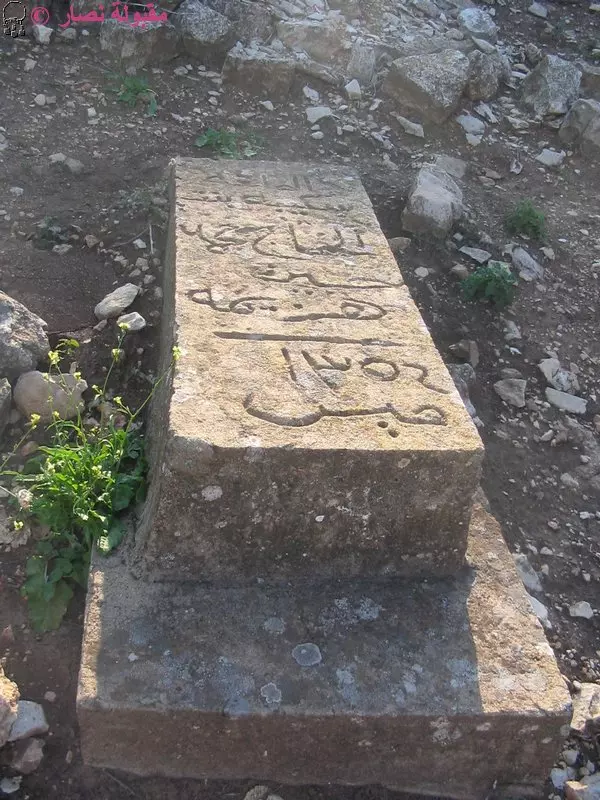
Posted by Makbula Nassar - مقبرة القرية , 7.5.2005- تصوير: مقبولة نصار
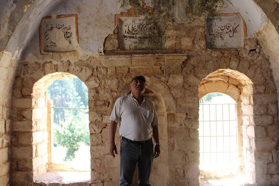
Posted by Makbula Nassar - غرف المقام من الداخل , 7.5.2005- تصوير: مقبولة نصار
Posted by Makbula Nassar 1 - مقبرة القرية , 7.5.2005- تصوير: مقبولة نصار
Posted by Makbula Nassar - غرف المقام من الداخل , 7.5.2005- تصوير: مقبولة نصار
Posted by Makbula Nassar 1 - مقام النبي يوشع, 7.5.2005- تصوير: مقبولة نصار
Posted by Makbula Nassar - غرف المقام من الداخل , 7.5.2005- تصوير: مقبولة نصار
Posted by Makbula Nassar 2 - مقام النبي يوشع, 7.5.2005- تصوير: مقبولة نصار
Posted by Makbula Nassar 1 - غرف المقام من الداخل , 7.5.2005- تصوير: مقبولة نصار
Posted by Makbula Nassar - احد الآبار المحيطة بالقرية , , 7.5.2005- تصوير: مقبولة نصار
Posted by Makbula Nassar - احد الجوانب الخارجية للمقام , 7.5.2005- تصوير: مقبولة نصار
Posted by Makbula Nassar - غرف المقام من الداخل , 7.5.2005- تصوير: مقبولة نصار
Posted by Makbula Nassar - غرف المقام من الداخل , 7.5.2005- تصوير: مقبولة نصار
Posted by Makbula Nassar - احد الجوانب الخارجية للمقام , 7.5.2005- تصوير: مقبولة نصار
Posted by Makbula Nassar - احد الجوانب الخارجية للمقام , 7.5.2005- تصوير: مقبولة نصار
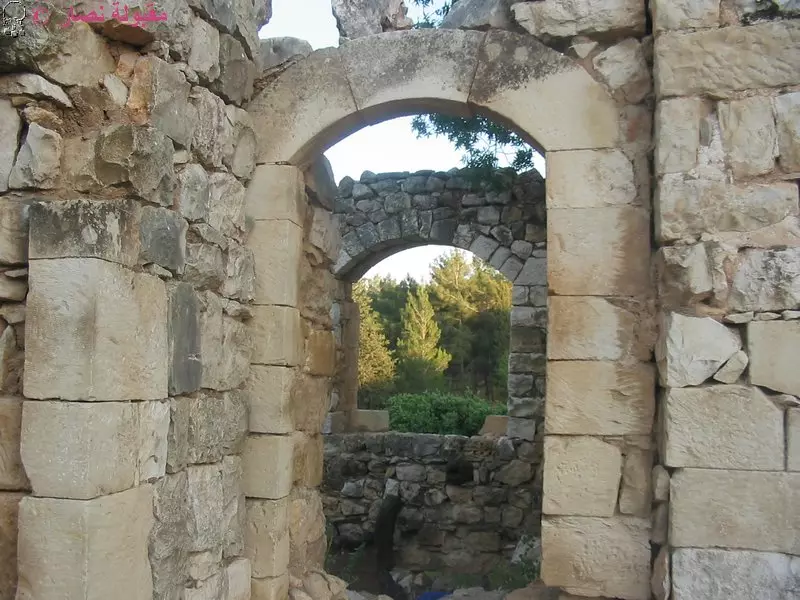
Posted by Makbula Nassar - المدخل الى المقام , 7.5.2005- تصوير: مقبولة نصار
Posted by Makbula Nassar - المقام من الداخل, 7.5.2005- تصوير: مقبولة نصار
Posted by Makbula Nassar - سطح المقام يظهر في الافق سهل الحولة, 7.5.2005- تصوير: مقبولة نصار
Posted by Makbula Nassar - غرف المقام المهدمة اليوم , 7.5.2005- تصوير: مقبولة نصار
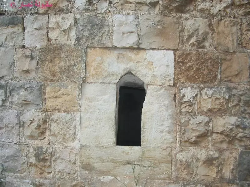
Posted by Makbula Nassar - احدى نوافذ المقام , 7.5.2005- تصوير: مقبولة نصار
Posted by Makbula Nassar - اثار الهدم في منطقة المقام , 7.5.2005- تصوير: مقبولة نصار
Posted by Makbula Nassar - الناحية الخلفية , 7.5.2005- تصوير: مقبولة نصار
Posted by Makbula Nassar - اثار الهدم في منطقة المقام , 7.5.2005- تصوير: مقبولة نصار
Posted by Makbula Nassar - موقع القرية , 7.5.2005- تصوير: مقبولة نصار
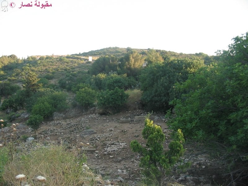
Posted by Makbula Nassar - سهل الحولة كما نراه من موقع القرية , 7.5.2005- تصوير: مقبولة نصار
Posted by Makbula Nassar 3 - Geneal view to the Shrine and rubble of the destroyed houses can be seen all over the place
Posted by Noga Kadman 1 - A view from one of shrine, note the brids on bars
Posted by Noga Kadman - Rubble of the destroyed Palestinian houses, the beautiful landscape in the background
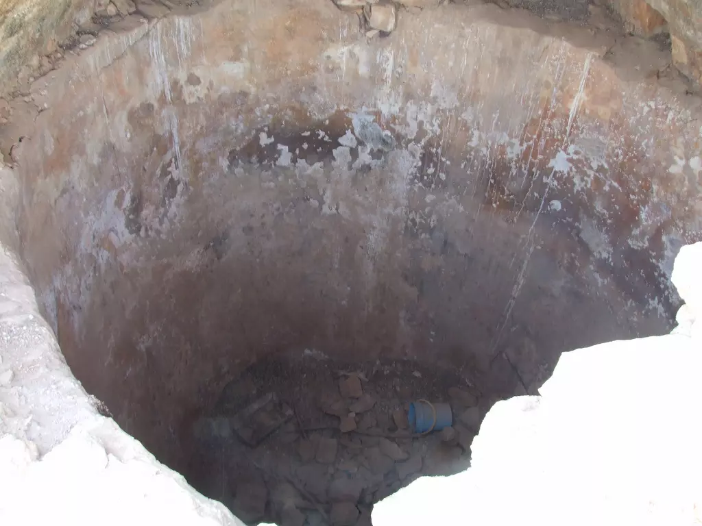
Posted by Noga Kadman - Water reservoir
Posted by Uri Zackhem - A grave
Posted by Uri Zackhem - The place is still venerated. I met Julan Druze there.
Posted by Uri Zackhem - The Wali's grave
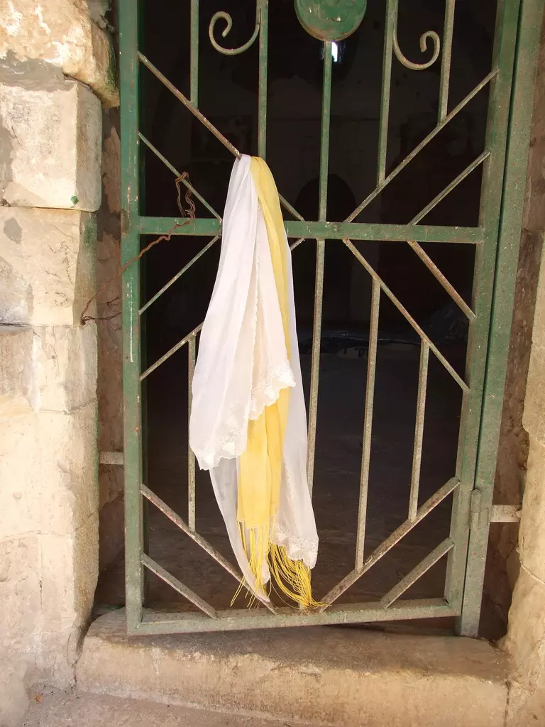
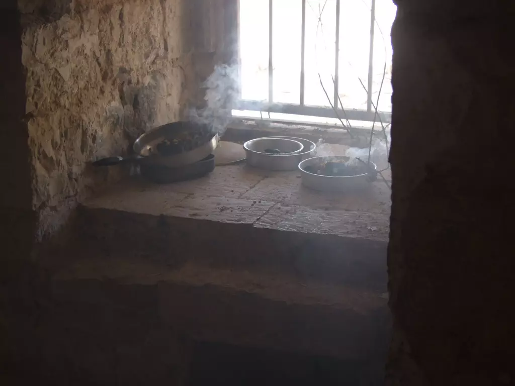
Posted by Uri Zackhem - Incense burning
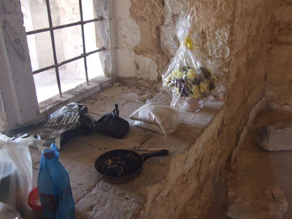
Posted by Uri Zackhem - Flowers brought in
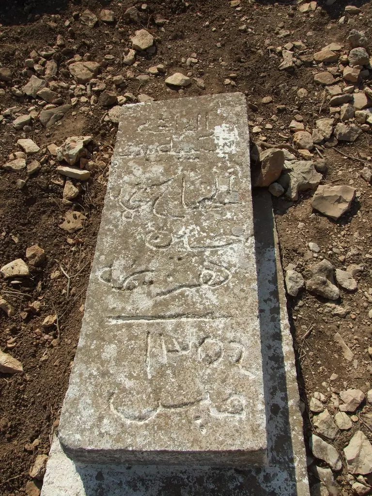
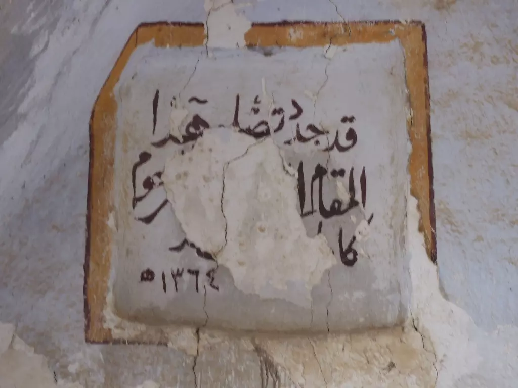
Posted by Uri Zackhem - Inscription 1
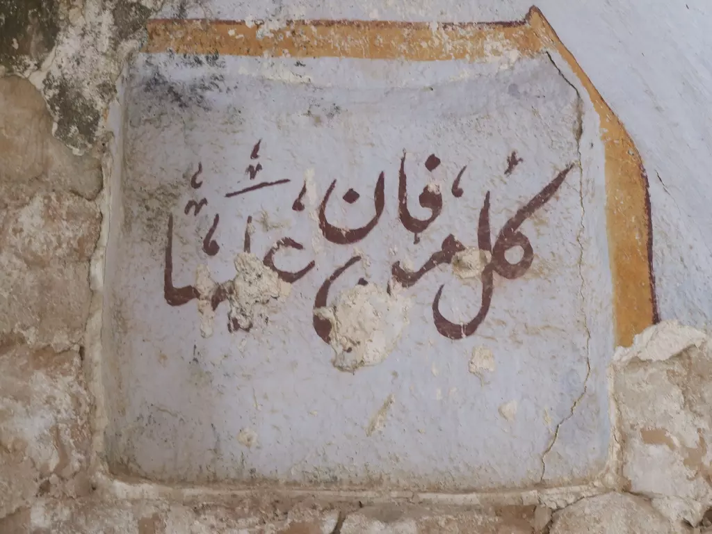
Posted by Uri Zackhem - Inscription #2
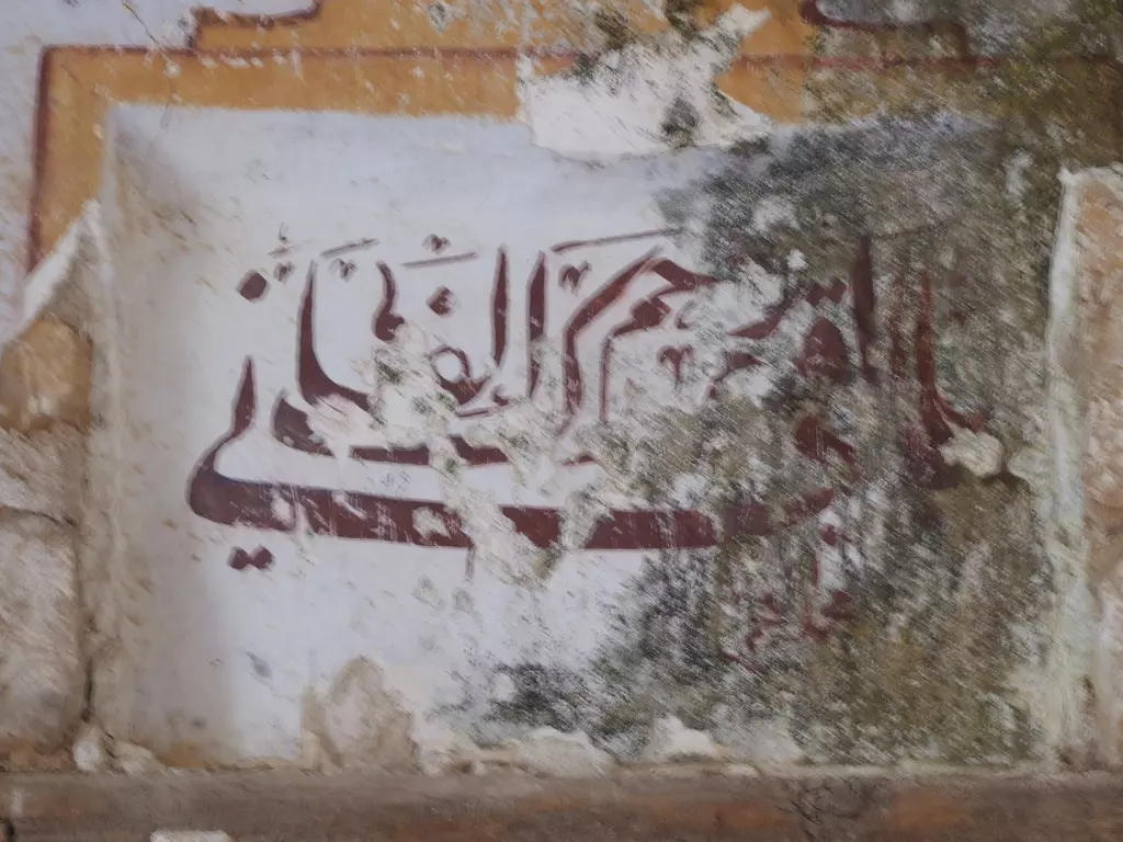
Posted by Uri Zackhem 1 - Inscription #3
Posted by Uri Zackhem - Orientation
Posted by Uri Zackhem - قبر النبي يوشع أو وشع .التقطت في 7/3/2012
Posted by Atef Azaiza - مقام النبي يوشع .التقطت في 8/3/2012

Posted by Atef Azaiza - قبور مندثرة في بقعة مقام النبي يوشع
Posted by Atef Azaiza - القبة التي تعلو ضريح مقام النبي يوشع ..!
Posted by Atef Azaiza - قبر النبي يوشع ..!
Posted by Atef Azaiza - موقع القريه
Posted by jabour khoury - موقع القريه
Posted by jabour khoury - مقبره النبي يوشع
Posted by abu raya - مقام النبي يوشع
Posted by abu raya - بقايا بيوت القريه
Posted by abu raya - النبي يوشع
Posted by abu raya - اثار بيوت القريه
Posted by abu raya - اثار بيوت النبي يوشع
Posted by abu raya - قريه النبي يوشع قبل النكبه
Posted by abu raya - النبي يوشع قبل النكبه

Posted by abu raya - النبي يوشع قبل النكبه
Posted by abu raya - النبي يوشع قبل النكبه
Posted by abu raya - النبي يوشع قبل النكبه
Posted by abu raya - النبي يوشع قبل النكبه
Posted by abu raya - احد المباني المهدومة
- في مقام النبي يوشع في قرية النبي يوشع المهجرة (قضاء صفد ) ----
بروفيسور مصطفى كبها
- مسجد ومقام النبي يوشع -- سليمان بويرات
- مسجد ومقام النبي يوشع
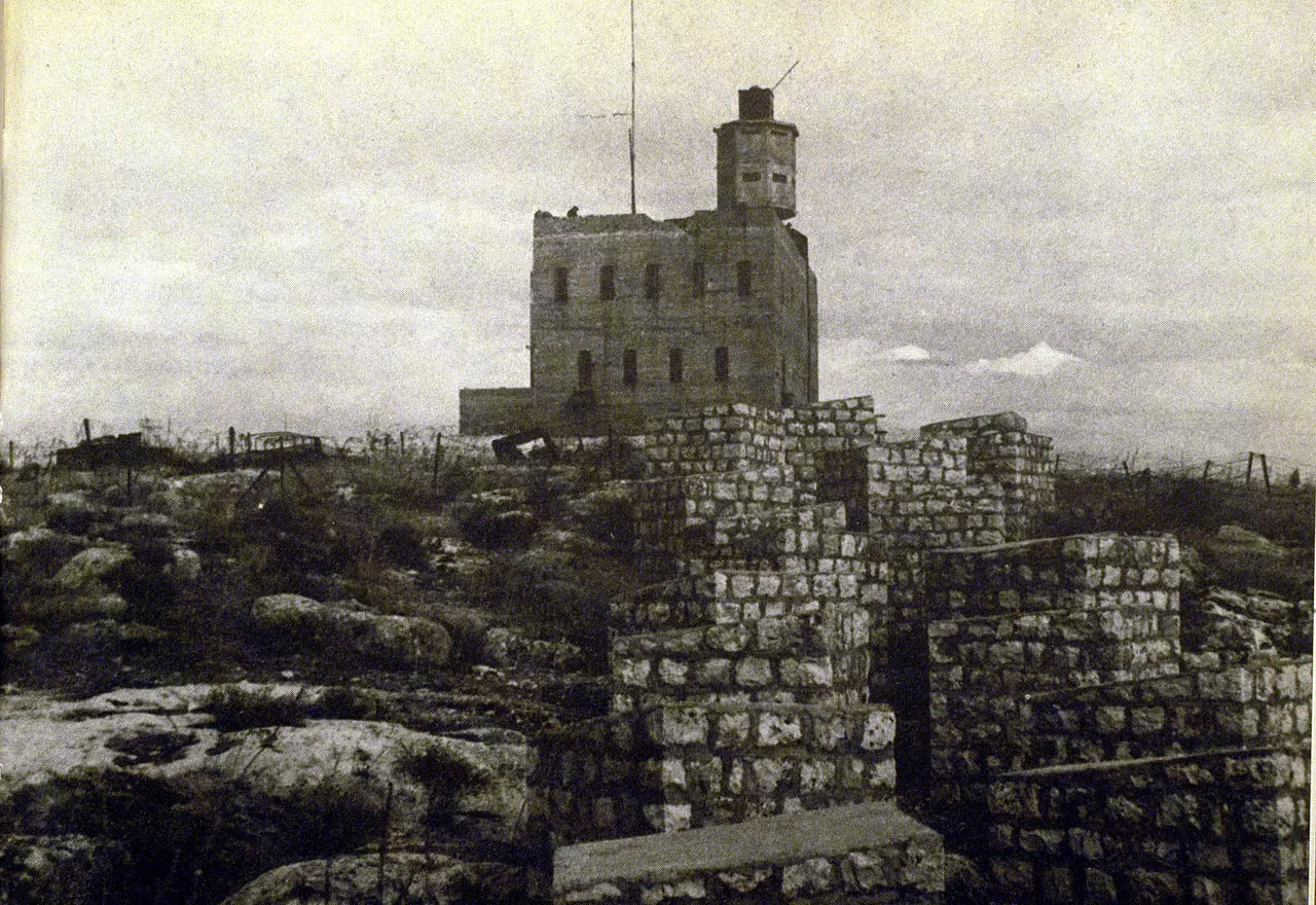
- al-Nabi Yusha's police fortress, 1948
- مقام ألنبي يوشع .-- Nov. 2023 -- Nabela Salem
- جولة في مقام ألنبي يوشع -- March 2022 -- Nabela Salem
- جولة في مقام ألنبي يوشع -- March 2022 -- Nabela Salem #2
- جولة في مقام ألنبي يوشع -- March 2022 -- Nabela Salem #3
- جولة في مقام ألنبي يوشع -- March 2022 -- Nabela Salem #4
- جولة في مقام ألنبي يوشع -- March 2022 -- Nabela Salem #5
- جولة في مقام ألنبي يوشع -- March 2022 -- Nabela Salem #6
- جولة في مقام ألنبي يوشع -- March 2022 -- Nabela Salem #7
- جولة في مقام ألنبي يوشع -- March 2022 -- Nabela Salem #8
- جولة في مقام ألنبي يوشع -- March 2022 -- Nabela Salem #9
- جولة في مقام ألنبي يوشع -- March 2022 -- Nabela Salem #10
- جولة في مقام ألنبي يوشع -- March 2022 -- Nabela Salem #11
- جولة في مقام ألنبي يوشع -- March 2022 -- Nabela Salem #12
- جولة في مقام ألنبي يوشع -- March 2022 -- Nabela Salem #13
- جولة في مقام ألنبي يوشع -- March 2022 -- Nabela Salem #14
- جولة في مقام ألنبي يوشع -- March 2022 -- Nabela Salem #15
- جولة في مقام ألنبي يوشع -- March 2022 -- Nabela Salem #16
- جولة في مقام ألنبي يوشع -- March 2022 -- Nabela Salem #17
- جولة في مقام ألنبي يوشع -- March 2022 -- Nabela Salem #18
- جولة في مقام ألنبي يوشع -- March 2022 -- Nabela Salem #19
- جولة في مقام ألنبي يوشع -- March 2022 -- Nabela Salem #20
- جولة في مقام ألنبي يوشع -- March 2022 -- Nabela Salem #21
- جولة في مقام ألنبي يوشع -- March 2022 -- Nabela Salem #22
- جولة في مقام ألنبي يوشع -- March 2022 -- Nabela Salem #23
- جولة في مقام ألنبي يوشع -- March 2022 -- Nabela Salem #24
- The shrine of Prophet Yosha in the depopulated village of Nabi Yusha, located in the district of Safad -- 1980s
- The shrine of Prophet Yosha in the depopulated village of Nabi Yusha, located in the district of Safad -- 1980s #2
- The shrine of Prophet Yosha in the depopulated village of Nabi Yusha, located in the district of Safad -- 1980s #3
- The shrine of Prophet Yosha in the depopulated village of Nabi Yusha, located in the district of Safad -- 1980s #4
- The shrine of Prophet Yosha in the depopulated village of Nabi Yusha, located in the district of Safad -- 1980s #5
Want to browse more? 80,000 pictures were grouped in these gallaries:
| Display Name | Clan/Hamolah | Country of Residence |
- Tracing all that remains of al-Nabi Yusha' Duration: 6 min 2 sec
- مقام وقرية النبي يوشع المهجرة - الجليل الأعلى Duration: 6 min 14 sec
No links have been shared yet, be free to the first to share the first link.
 Fake Valor: Why Did Zionist Jews Hoist Nazis Flag on Their Ships in the 1930s?
What is new?
-
Facts About Oct. 7th Gaza Raid
-
Remined Us Please:: Who Did Rape Who? Palestinians Raped Israelis? Or, was the other way around?
-
When Prof. Edward Said was invited to debate Bibi Netanyahu in the 1980s, watch what happened!
-
Ezra Klein of the NY Times on the "Jewish Race".
-
Abusing Blood Libel!
-
Zionist FAQ: Isn't it true that Palestinians don't want peace? Palestinians never accepted the two-state solution
- Facts about Haavara (Transfer) Agreement between Ben-Gurion & Hitler
-
Haavara FAQs: Why Did Zionist Jews Hoist Nazis' Flags on Their Ships in the 1930s?
-
Dear ChatGPT: Why did the Jewish Agency suppress news of the Holocaust during WWII?
-
Video Playlist: Jews share their DNA tests to end the conflict for good.
-
A Tale of Two Conflicts: Examining the Definition of Genocide
-
Prof. Abraham Polak And The Suppressed History of the Khazars and European Jewry
-
How Ronald Reagan would have framed the genocide in Gaza if he were still alive?
-
Haavara FAQs: Let us do the math: how many German Jews did The Haavara Agreement save?
-
Zionist FAQs: The Hebron Massacre of 1929, "clearly proves" that Palestinians are antisemitic, how could you deny it?
-
Zionist FAQs: Why Anti-Zionist Is Not Antisemitism?
-
Zionist FAQs: Isn't it true that the KGB create Palestinian Nationalism in the early 1960s?
- Zionist FAQs: Muslims are killing Muslims all the time; why are Israeli Jews being singled out in the media?
- Zionist FAQs: How is Israel an apartheid state when 20% of its citizens are Arabs who enjoy full rights?
-
Haavara FAQs: Analysis of Herzl's Uganda Scheme and how it could have saved millions of Jews.
-
Haavara FAQs: Why did Hayim Greenberg describe American Jewry as "morally bankrupt" in early 1943?
-
Haavara FAQs: What if the Evian Conference was a resounding success? What would have been the impact of saving European Jewry on Zionism?
- Haavara FAQs: What if the six million were saved, how that would have impacted the Zionist project?
-
Haavara FAQs: How did Zionist leaders react when Europe's Jews lingered in the DP camps after WWII ended?
-
Why does the American Jewish community repeat lies that David Ben-Gurion had debunked before he died?
-
Who has the power to rename the Tatar/Khazar Gene Marker to Jewish IV?
-
Zionist FAQs: Why won't Egypt, Syria, and Jordan take their people back? Jews are indigenous to Palestine, and Arabs immigrated after Jews developed the country. Arabs should leave.
-
Haavara FAQs: Did Hitler and the Nazis conflate between Judaism and Zionist? If that wasn't case, then why?
-
Haavara FAQs: Winston Churchill and antisemitism, a collection of articles written Churchill.
-
Haavara FAQs: Broken by country, how many Jews survived vs. killed during the Holocaust?
-
Haavara FAQs: Why did European Jews vote with their feet and to immigrated to the Americas, not Palestine, after WWII?
-
Watch this American Jewish Girl describing Israeli Jews' cognitive dissonance like no other in under two minutes
-
Haavara FAQs: When the Nazis went out of their way to hide the Holocaust, Israeli Jews did the exact opposite by broadcasting their genocide of Gazans. But why?
-
Haavara FAQs: How Zionist Jews went out of their to show their appreciation to Nazism and Fascism?
- Haavara FAQs: Why Zionist leaders were against bombing the death camps & the Railroads leading to them?
-
Haavara FAQs: Hitler's message to the British and American people: If Jews are such noble citizens and you care about them, how come you're not letting them in? I will gladly ship them to you at my expense, even on luxury liners!
-
A shortlist of Zionist and Israeli false flag operations in the name Jews.
-
The Most Moral Army
- The Land of Kapos (Israel): Where the brave are boycotted and Kapos walk free.
- Why did early Zionists often named their communal enterprises "colonial"?
- Zionist Relations with Nazi Germany by Faris Glubb
-
Two NY Times advertisements by Zionists in the early 1943 that exposes Zionists' treason at the height of the calamity
- Facts Not Lies about the Palestinian-Israeli Conflict.
- Site's pictures have been categorized
- Campgain Against Lice
- A Survey of Palestine, the official source about Palestine before Nakba produced by the British Mandate; over 1200 pages.
- Satellite View & Google Earth: Over 6,000 placemarks identifying all destroyed towns, W. Bank & Gaza Strip Towns, & refugee camps.
- PalestineRemembered.com and its Nakba Oral History Project were featured on al-Jazeera Satellite TV.
- Nakba Oral History Video Podcast:
 Over 700 Oral History interviews (including 3,500+ hours of recording) can be viewed online.
 - Palestine Village Statistics Project
- Gaza Jail Break
- النسخة العربية للموقع الان متوفرة
- Videos: Documenting the destroyed villages in video: Tracing all that remains since Nakba.
- Videos: Responding to Zionist Propaganda
- Interview: The ethnic cleansing of Palestine: George Galloway interviews Israeli Historian Ilan Pappe.
- For Palestinians, memory matters. It provides a blueprint for their future By George Bisharat.
- Zionist FAQ now available in Hebrew שאלות שציונים שואלים, עכשיו בעברית
- Video: The Stephen Walt and John Mearsheimer report on the influence of the Israel Lobby on U.S. Foreign Policy
- The Palestinian-Israeli conflict for beginners
