| PalestineRemembered | About Us | Oral History | العربية | |
| Pictures | Zionist FAQs | Haavara | Maps | |
| Search |
| Camps |
| Districts |
| Acre |
| Baysan |
| Beersheba |
| Bethlehem |
| Gaza |
| Haifa |
| Hebron |
| Jaffa |
| Jericho |
| Jerusalem |
| Jinin |
| Nablus |
| Nazareth |
| Ramallah |
| al-Ramla |
| Safad |
| Tiberias |
| Tulkarm |
| Donate |
| Contact |
| Profile |
| Videos |
Welcome To Harrawi - هراوي (عرب الحمدون)
|
District of Safad
Ethnically cleansed days ago |
العربية Google Earth |
 |
Gallery (22) |
- Statistics & Facts
-
Before & After

- Satellite View
- Articles 1
- Pictures 22
- Mayrters & Prisoners 1
- Oral History 1
- Members 15
- All That Remains
- Wikipedia
- Videos
- Guest Book 1
- Links
| Statistic & Fact | Value | |||||||||||||||
| Occupation Date | May 25, 1948 | |||||||||||||||
| Distance From District | 18 (km) North East of Safad | |||||||||||||||
| Elevation | 500 (meters) | |||||||||||||||
| Before & After Nakba, Click Map For Details |
||||||||||||||||
|
||||||||||||||||
| Map Location | See location #32 on the map View from satellite |
|||||||||||||||
| Military Operation | Operation Yiftach (commanded by the ethnic cleansing champion Yigal Allon) | |||||||||||||||
| Attacking Units | The Palmach's First Battalion | |||||||||||||||
| Defenders | Local militia & Arab Liberation Army | |||||||||||||||
| Exodus Cause | Military assault by Zionist troops | |||||||||||||||
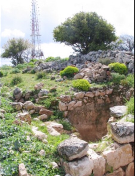
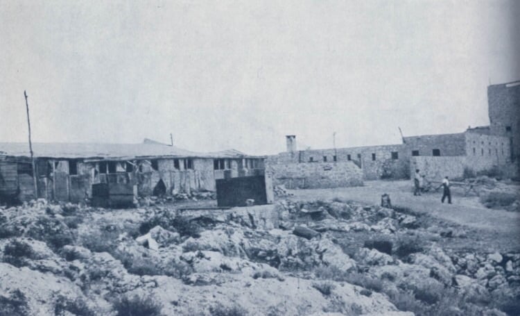
| Village Temains | Harrawi was completely destroyed soon after occupation | |||||||||||||||
| Ethnically Cleansing | Harrawi inhabitants were completely ethnically cleansed. | |||||||||||||||
| Pre-Nakba Land Ownership |
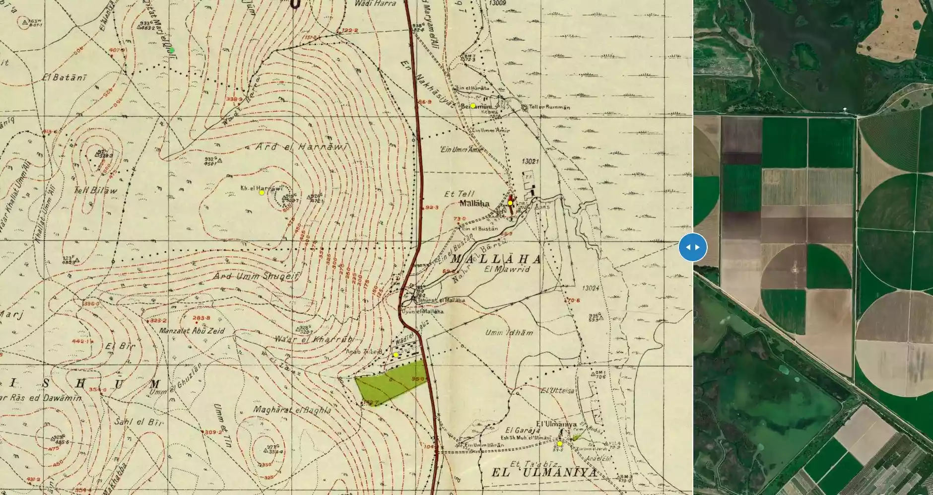
**Town Lands' Demarcation Maps |
|||||||||||||||
| Land Usage As of 1945 |
|
|||||||||||||||
| Population |
|
|||||||||||||||
| Number of Houses | In (1931): 36 (listed under 'Arab al-Hamdun) | |||||||||||||||
| Near By Towns |
||||||||||||||||
|
||||||||||||||||
| Town's Name Through History | The was also known by the name of 'Arab al-Hamdun | |||||||||||||||
| Inhabitants Place of Origin | The people of Harrawi were descendants of Bedouin from the 'Arab al-Hamdun tribe | |||||||||||||||
| Archeological Sites | The village contained ruins include the foundations of walls, tessellated floors, a wine-press, and Greek inscriptions | |||||||||||||||
| Exculsive Jewish Colonies Who Usurped Village Lands |
Ramot Naftali is close by village lands | |||||||||||||||
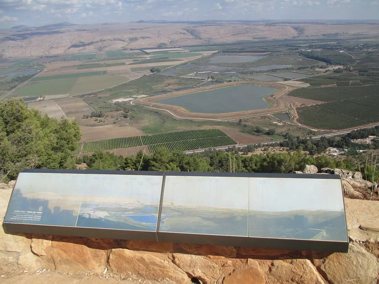
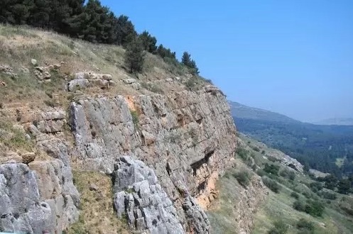
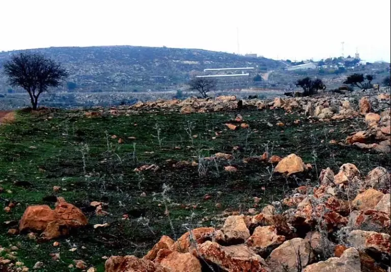
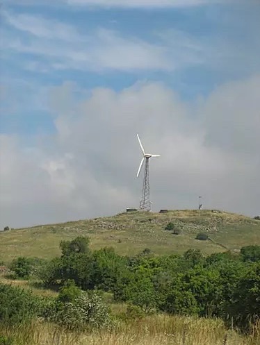
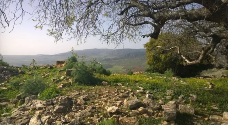
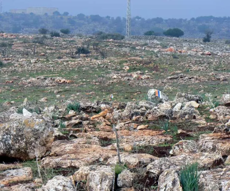
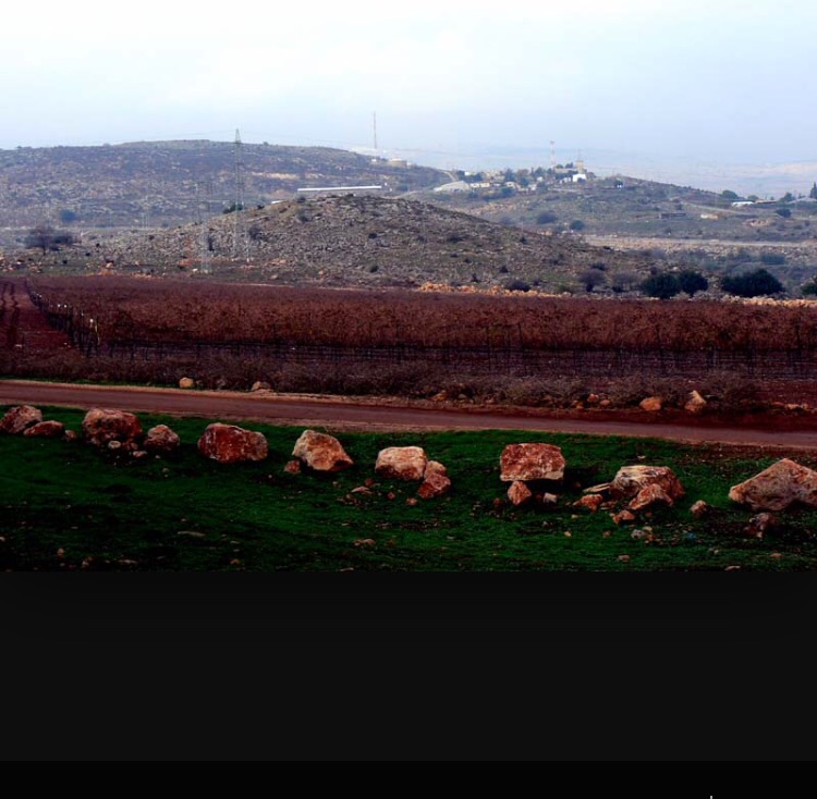
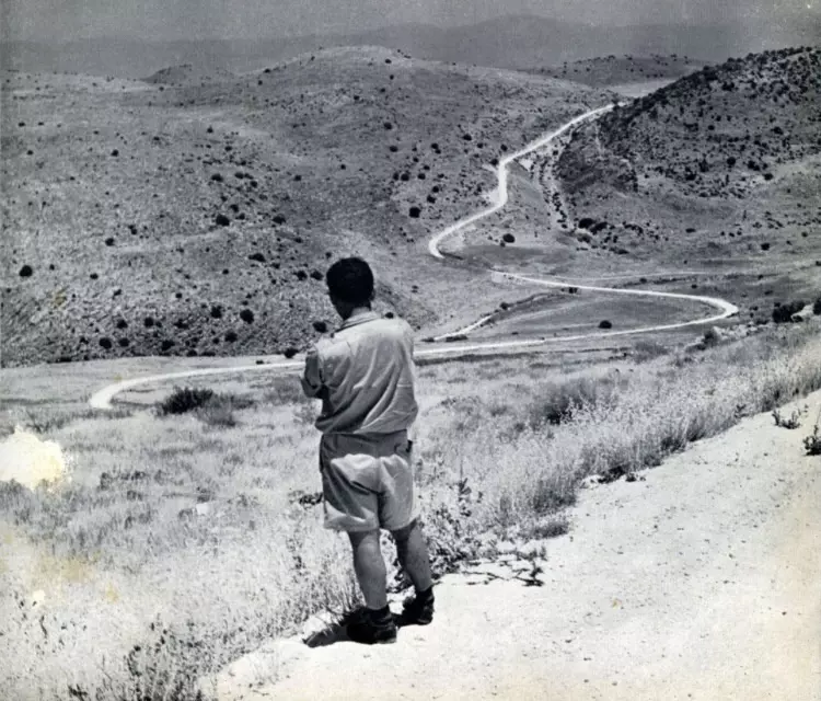
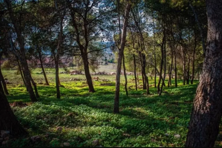
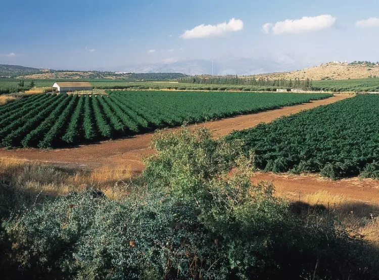
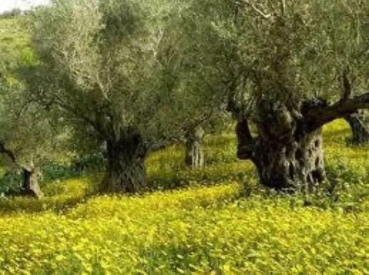
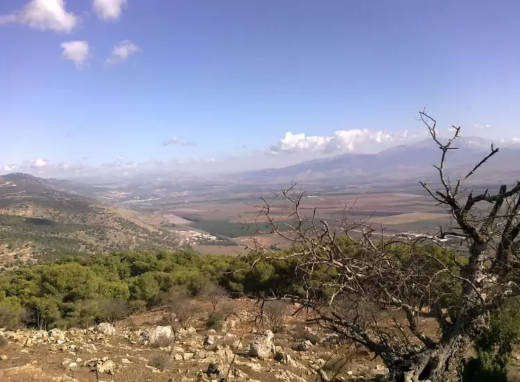
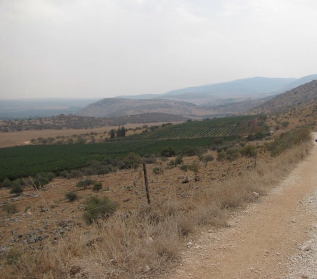
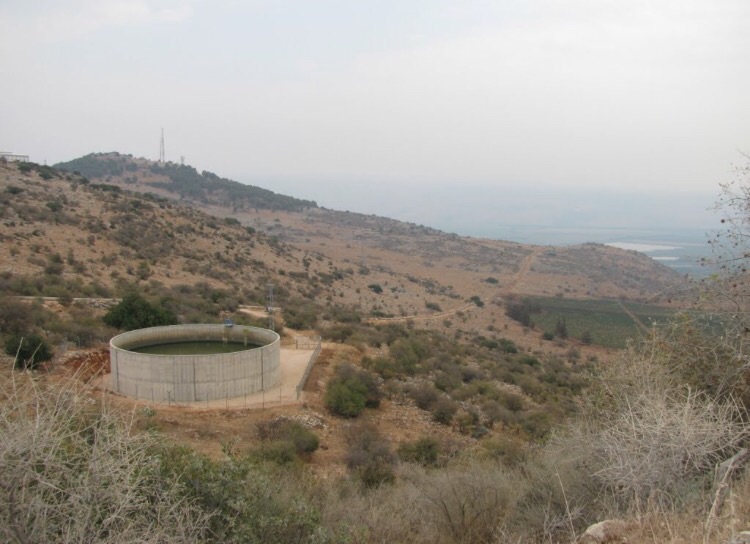
Village Before NakbaThe village was situated on a mountain peak in eastern Upper Galilee, overlooking the aI-Hula Plain. A trail that passed it in a northwestern direction linked it to the village of Qadas. Forests abounded in the area around the village. Its houses were generally grouped close together in a circular pattern, although some newer housing was built toward the east. The people of Harrawi were descendants of Bedouin from the 'Arab al-Hamdun tribe. Some of them continued to migrate in winter to the lowlands adjacent to the al-Hula Plain, where their animals could graze. They also worked in agriculture, and in 1944/45 they planted a total of 551 dunums in cereals. Evidence of earlier habitation, most of which appears to date to the Byzantine period, abounds in the village. The ruins include the foundations of walls, tessellated floors, a wine-press, and Greek inscriptions.Village Occupation and Ethnic CleaningAn early incident in the vicinity of the village was reported in February 1948 by the Palestinian daily Filastin. According to that report, an Arab bus en route from al-Hula to Safad was ambushed at Harrawi on 12 February by a Zionist military unit. A mine exploded under the bus and the attackers fired at the passengers and threw firebombs, killing four people. [F:13/2/48]On 5 May 1948, Arab Liberation Army (ALA) commander Fawzi al-Qawuqji reported that 'the Jews have occupied all the hills around Harrawi.' This occurred in the early stages of Operation Yiftach (see Abil al-Qamh, Safad sub-district). The area was defended by the ALA's Second Yarmuk Battalion, commanded by Lt. Col. Adib al-Shishakli, later president of Syria. The village was probably occupied by mid-May, because Arab forces claimed to have reoccupied Harrawi after the entry of Arab armies into Palestine. A New York Times report out of Damascus stated on 17 May that Lebanese troops and Arab 'irregulars' supported by Syrian aircraft had claimed victories at Harrawi and al-Malikiyya, 5 km to the northwest. The village may not have remained long in Arab hands, however, since the closest villages to Harrawi, Mallaha and Baysamun, both fell into Israeli hands at the very end of Operation Yiftach, on 25 May. [NYT:18/5/48; Q:62; see M:121-22] Zionists Colonies on Village LandsNo Israeli settlements have been built on village lands, although Ramot Naftali (202278), founded in 1945 north/northwest of Harrawi, is on the neighboring lands of the village of al-Nabi Yusha'.Village TodayNo traces of the village are visible. Woods cover the slopes and peak of the mountain on which the village was located. Some of the lands in the area are wooded while others have been planted by Israelis with fruit trees.SourceDr. Walid al-Khalidi, 1992: All That Remains. |
||||||||||||||||
| Related Maps | Town Lands' Demarcation Maps خرائط للقضاء توضح حدود القرى والاودية Town's map on MapQuest View from satellite Help us map this town at WikiMapia |
|||||||||||||||
| Related Links | Wikipedia's Page Google Search Google For Images Google For Videos |
|||||||||||||||
| More Information | في كتاب كي لا ننسى المزيد من موقع هوية |
|||||||||||||||
- فايز المصطفى
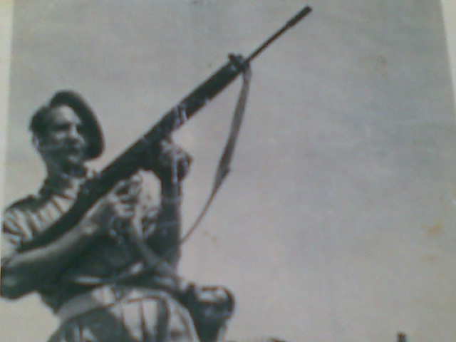
Posted by imad 1 - ألفاتحة(ألمرحوم قاسم خالد)
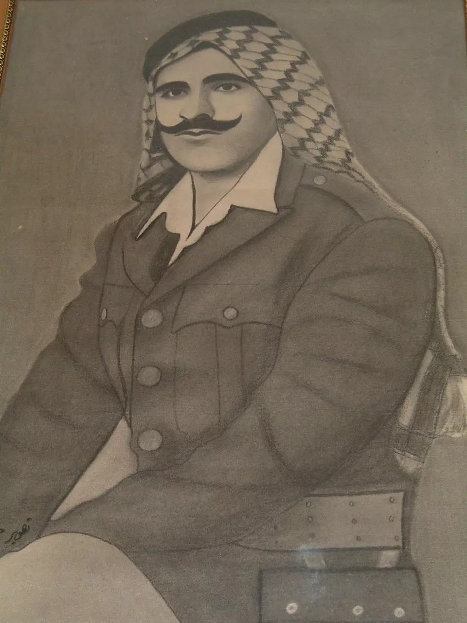
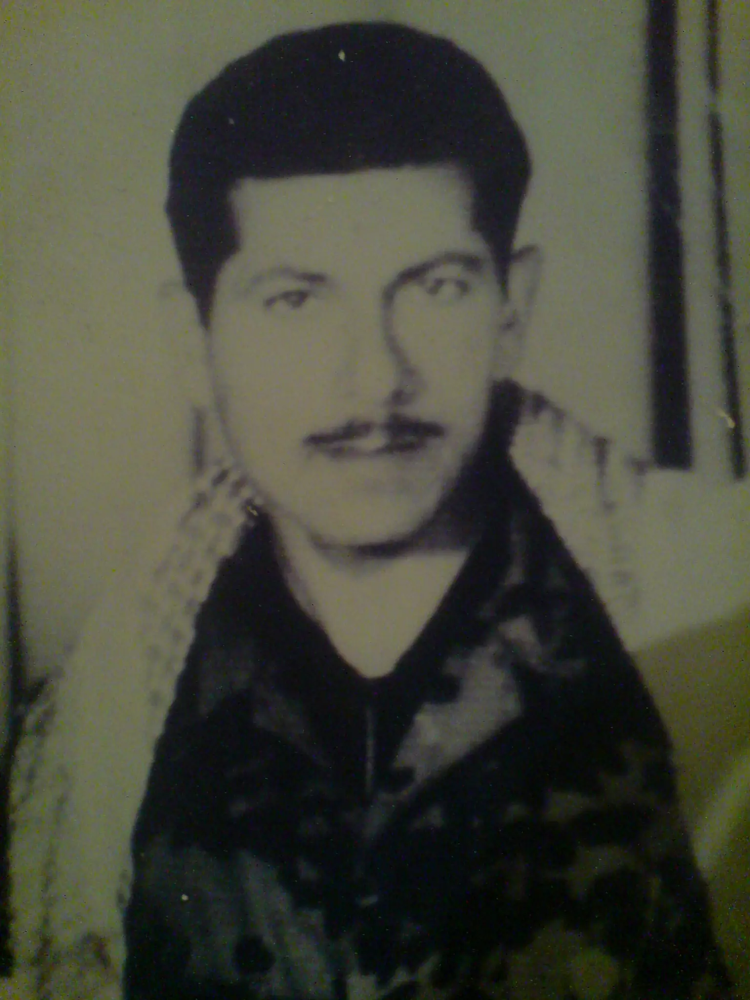
Posted by خالد - الشهيد احمد دياب العلي ابو ياسر
Posted by yasser 2 - منظر طبيعي الى الجنوب من القريه
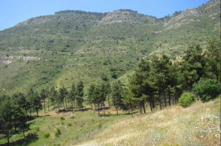
Posted by abu raya - موقع القريه من الجهه الشرقيه
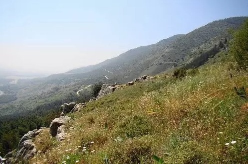
Posted by abu raya - موقع القريه من الشرق وفي الاسفل يظهر سهل الحوله
Posted by abu raya - منحدر جبال الحوله من الجهه الشرقيه للقريه
Posted by abu raya - اثار بيوت القريه من ناحيه الغرب
Posted by abu raya - اثار موقع القريه على التله
Posted by abu raya - موقع القريه وتظهر اثار البيوت المهدومه
Posted by abu raya - منظر من شرق القريه
Posted by abu raya - القريه بعد احتلالها 1948
Posted by abu raya - من موقع القريه واثار الردم
Posted by abu raya - اراضي القريه شرق موقع القريه
Posted by abu raya - منظر من غرب القريه بعد احتلالها ومن الجنوب يظهر الشارع الذي يربط قريه علما حتى الحدود اللبنانيه
Posted by abu raya - الاحراش من الشرق لموقع القريه
Posted by abu raya - من اراضي القريه
Posted by abu raya - من زيتون القريه
Posted by abu raya - منظر من شرق القريه
Posted by abu raya - اراضي القريه من جنوب القريه
Posted by abu raya - جنوب القريه
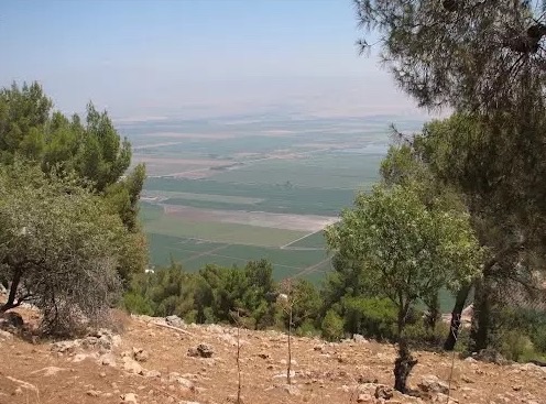
Posted by abu raya - Looking east towards the Houla plain. The most civilized of world Jewry stole from us a piece of heaven. Enjoy it while you can; we shall return
Want to browse more? 80,000 pictures were grouped in these gallaries:
| Display Name | Clan/Hamolah | Country of Residence |
| Abo Nedal | - | - |
| adnan assari | - | berlin, Germany |
| ali | - | alqasmeyah |
| hussam | arab al 7amdon | leipzig, germany |
| خالد | عرب ألحمدون | ألمانيا, ألمانيا |
| fawzi el mustapha | - | berlin, germany |
| alemid | alrahayla | dutschland, dutschland |
| imad | - | Berlin, germany |
| ahmed shibli | - | - |
| mostafa | el mustapha | trieste, italy |
| maysoun mostafa | - | saida, lebanon |
| Dr.Hasan | - | berlin, germany |
| ali mostafa | - | ohawo, USA |
| abo doma | - | lebanon |
| jawad mostafa | - | - |
No links have been shared yet, be free to the first to share the first link.
 Fake Valor: Why Did Zionist Jews Hoist Nazis Flag on Their Ships in the 1930s?
What is new?
-
Facts About Oct. 7th Gaza Raid
-
Remined Us Please:: Who Did Rape Who? Palestinians Raped Israelis? Or, was the other way around?
-
When Prof. Edward Said was invited to debate Bibi Netanyahu in the 1980s, watch what happened!
-
Ezra Klein of the NY Times on the "Jewish Race".
-
Abusing Blood Libel!
-
Did Israeli Soldiers Activate The Hanniba Direective On Oct. 7th? You Be The Judge
-
Zionist FAQ: Isn't it true that Palestinians don't want peace? Palestinians never accepted the two-state solution
- Facts about Haavara (Transfer) Agreement between Ben-Gurion & Hitler
-
Haavara FAQs: Why Did Zionist Jews Hoist Nazis' Flags on Their Ships in the 1930s?
- Haavara FAQs: When Chaim Weizmann met FDR in mid-1943, why was he silent about rescuing European Jewry?
-
Dear ChatGPT: How did Palestinians resist Napoleon's invasion of their country in 1799?
-
Dear ChatGPT: Gaza had a vibrant Jewish community in the mid-17th century. What happened to them?
-
Dear ChatGPT: Why did the Jewish Agency suppress news of the Holocaust during WWII?
-
Video Playlist: Jews share their DNA tests to end the conflict for good.
-
A Tale of Two Conflicts: Examining the Definition of Genocide
-
Prof. Abraham Polak And The Suppressed History of the Khazars and European Jewry
-
How Ronald Reagan would have framed the genocide in Gaza if he were still alive?
-
Haavara FAQs: Let us do the math: how many German Jews did The Haavara Agreement save?
-
Zionist FAQs: The Hebron Massacre of 1929, "clearly proves" that Palestinians are antisemitic, how could you deny it?
-
Zionist FAQs: Why Anti-Zionist Is Not Antisemitism?
-
Zionist FAQs: Isn't it true that the KGB created Palestinian Nationalism in the early 1960s?
- Zionist FAQs: Muslims are killing Muslims all the time; why are Israeli Jews being singled out in the media?
- Zionist FAQs: How is Israel an apartheid state when 20% of its citizens are Arabs who enjoy full rights?
-
Haavara FAQs: Why Did Dorothy Thompson Flip From A Zionist Advocate to A Silenced Dissenter?
-
Haavara FAQs: Analysis of Herzl's Uganda Scheme and how it could have saved millions of Jews.
-
Haavara FAQs: Why did Hayim Greenberg describe American Jewry as "morally bankrupt" in early 1943?
-
Haavara FAQs: What if the Evian Conference was a resounding success? What would have been the impact of saving European Jewry on Zionism?
- Haavara FAQs: What if the six million were saved, how that would have impacted the Zionist project?
-
Haavara FAQs: How did Zionist leaders react when Europe's Jews lingered in the DP camps after WWII ended?
-
Why does the American Jewish community repeat lies that David Ben-Gurion had debunked before he died?
-
Who has the power to rename the Tatar/Khazar Gene Marker to Jewish IV?
-
Zionist FAQs: Why won't Egypt, Syria, and Jordan take their people back? Jews are indigenous to Palestine, and Arabs immigrated after Jews developed the country. Arabs should leave.
-
Haavara FAQs: Did Hitler and the Nazis conflate between Judaism and Zionist? If that wasn't case, then why?
-
Haavara FAQs: Winston Churchill and antisemitism, a collection of articles written Churchill.
-
Haavara FAQs: Broken by country, how many Jews survived vs. killed during the Holocaust?
-
Haavara FAQs: Why did European Jews vote with their feet and to immigrated to the Americas, not Palestine, after WWII?
-
Watch this American Jewish Girl describing Israeli Jews' cognitive dissonance like no other in under two minutes
-
Haavara FAQs: When the Nazis went out of their way to hide the Holocaust, Israeli Jews did the exact opposite by broadcasting their genocide of Gazans. But why?
-
Haavara FAQs: How Zionist Jews went out of their to show their appreciation to Nazism and Fascism?
- Haavara FAQs: Why Zionist leaders were against bombing the death camps & the Railroads leading to them?
-
Haavara FAQs: Hitler's message to the British and American people: If Jews are such noble citizens and you care about them, how come you're not letting them in? I will gladly ship them to you at my expense, even on luxury liners!
-
A shortlist of Zionist and Israeli false flag operations in the name Jews.
-
The Most Moral Army
- The Land of Kapos (Israel): Where the brave are boycotted and Kapos walk free.
- Why did early Zionists often named their communal enterprises "colonial"?
- Zionist Relations with Nazi Germany by Faris Glubb
-
Two NY Times advertisements by Zionists in the early 1943 that exposes Zionists' treason at the height of the calamity
- Facts Not Lies about the Palestinian-Israeli Conflict.
- Site's pictures have been categorized
- Campgain Against Lice
- A Survey of Palestine, the official source about Palestine before Nakba produced by the British Mandate; over 1200 pages.
- Satellite View & Google Earth: Over 6,000 placemarks identifying all destroyed towns, W. Bank & Gaza Strip Towns, & refugee camps.
- PalestineRemembered.com and its Nakba Oral History Project were featured on al-Jazeera Satellite TV.
- Nakba Oral History Video Podcast:
 Over 700 Oral History interviews (including 3,500+ hours of recording) can be viewed online.
 - Palestine Village Statistics Project
- Gaza Jail Break
- النسخة العربية للموقع الان متوفرة
- Videos: Documenting the destroyed villages in video: Tracing all that remains since Nakba.
- Videos: Responding to Zionist Propaganda
- Interview: The ethnic cleansing of Palestine: George Galloway interviews Israeli Historian Ilan Pappe.
- For Palestinians, memory matters. It provides a blueprint for their future By George Bisharat.
- Zionist FAQ now available in Hebrew שאלות שציונים שואלים, עכשיו בעברית
- Video: The Stephen Walt and John Mearsheimer report on the influence of the Israel Lobby on U.S. Foreign Policy
- The Palestinian-Israeli conflict for beginners
