| PalestineRemembered | About Us | Oral History | العربية | |
| Pictures | Zionist FAQs | Haavara | Maps | |
| Search |
| Camps |
| Districts |
| Acre |
| Baysan |
| Beersheba |
| Bethlehem |
| Gaza |
| Haifa |
| Hebron |
| Jaffa |
| Jericho |
| Jerusalem |
| Jinin |
| Nablus |
| Nazareth |
| Ramallah |
| al-Ramla |
| Safad |
| Tiberias |
| Tulkarm |
| Donate |
| Contact |
| Profile |
| Videos |
Welcome To al-Qudayriyya - القديرية (אל-קדיריה)
|
District of Safad
Ethnically cleansed days ago |
العربية Google Earth |
 |
Gallery (38) |
- Statistics & Facts
-
Before & After

- Satellite View
- Articles 2
- Pictures 38
- Oral History 2
- Members 14
- All That Remains
- Wikipedia
- Videos
- Guest Book 41
- Links
| Statistic & Fact | Value | ||||||||||||
| Occupation Date | May 4, 1948 | ||||||||||||
| Distance From District | 6.5 (km) South of Safad | ||||||||||||
| Elevation | 150 (meters) | ||||||||||||
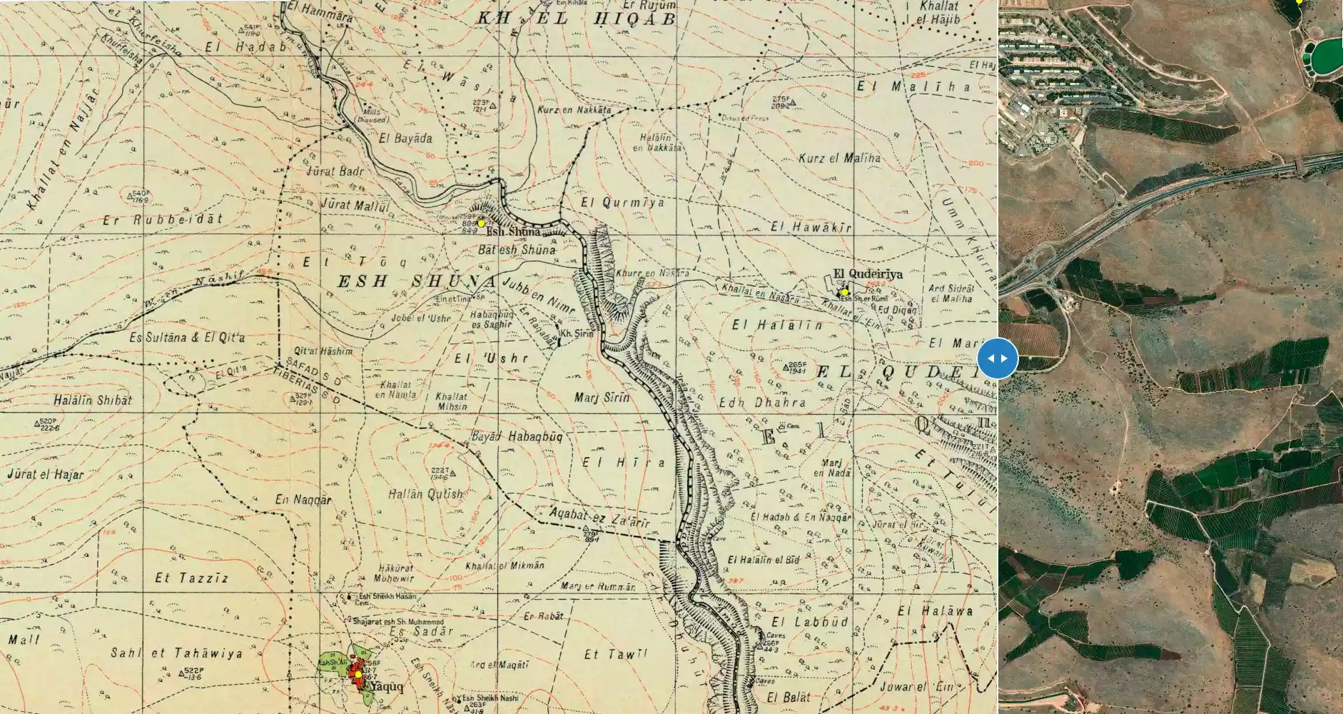
| Before & After Nakba, Click Map For Details |
|||||||||||||
|
|||||||||||||
| Map Location | See location #75 on the map View from satellite |
||||||||||||
| Military Operation | Operation Matate (Sub-operation of Operation Yiftach) | ||||||||||||
| Attacking Units | Some troops from the Haganah and the Palmach's First Battalion | ||||||||||||
| Defenders | Local militia & Arab Liberation Army | ||||||||||||
| Acts of Terror | Massacre occured by Zionist troops against the town's inhabitants. | ||||||||||||
| Exodus Cause | Expulsion by Zionist troops | ||||||||||||
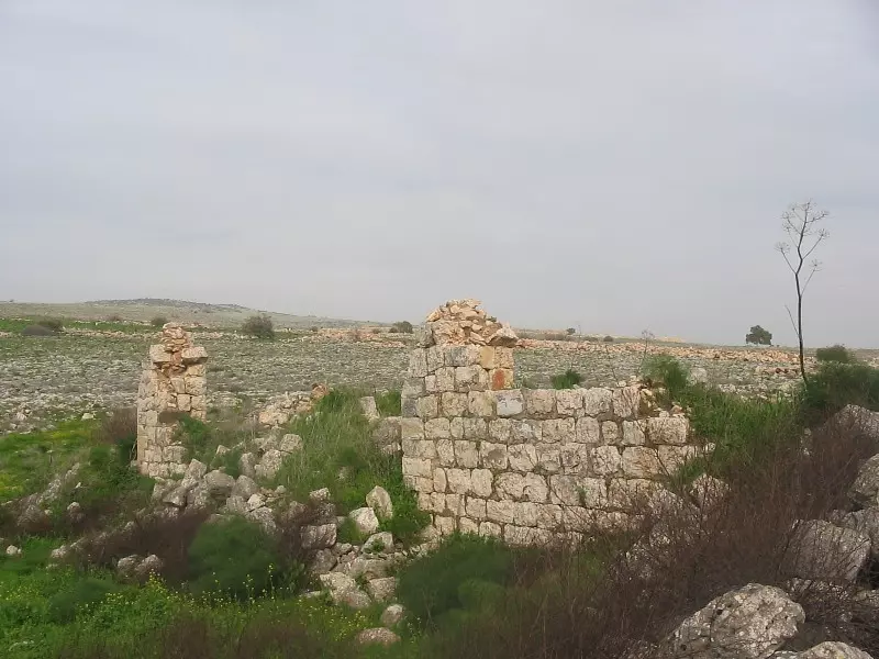
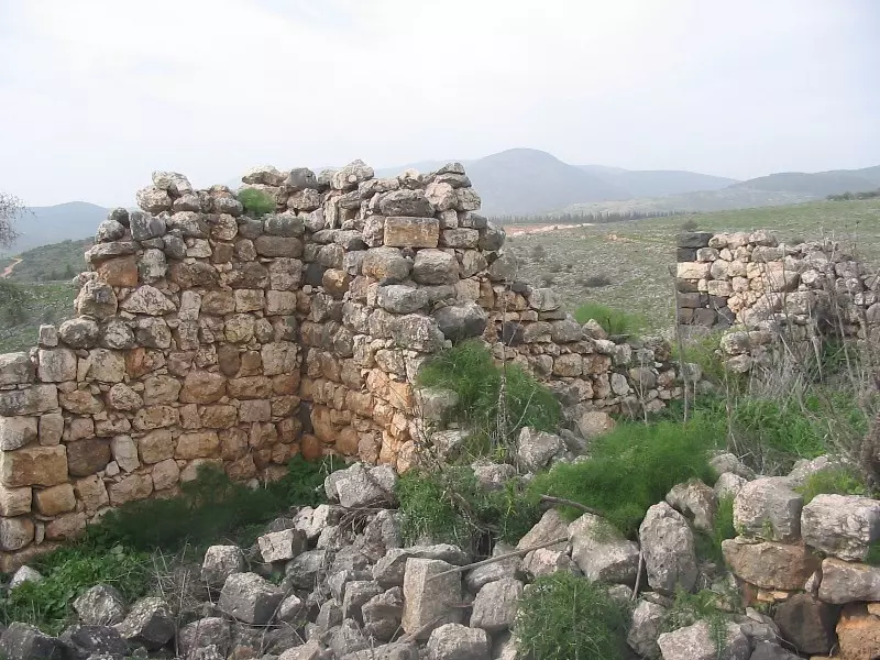
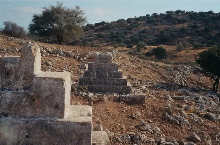
| Village Temains | The village has been completely destroyed, and only few structures are still standing. | ||||||||||||
| Ethnically Cleansing | al-Qudayriyya inhabitants were completely ethnically cleansed. | ||||||||||||
| Pre-Nakba Land Ownership |
**Town Lands' Demarcation Maps |
||||||||||||
| Land Usage As of 1945 |
|
||||||||||||
| Population |
|
||||||||||||
| Number of Houses |
|
||||||||||||
| Near By Towns |
|||||||||||||
|
|||||||||||||
| Shrines / Maqams | A shrine for a local sage known by al-Shaykh al-Rumi | ||||||||||||
| Nearby Wadies & Rivers | The village was situated 1 km east of Wadi al-'Amud. | ||||||||||||
| Archeological Sites | The village had Khirbat al-Nuwayriyya which contained heaps of drafted masonry and rock-cut wine presses; these relics were a sign of Roman-Byzantine habitation. | ||||||||||||
| Exculsive Jewish Colonies Who Usurped Village Lands |
Kachal | ||||||||||||
| Featured Video | |||||||||||||
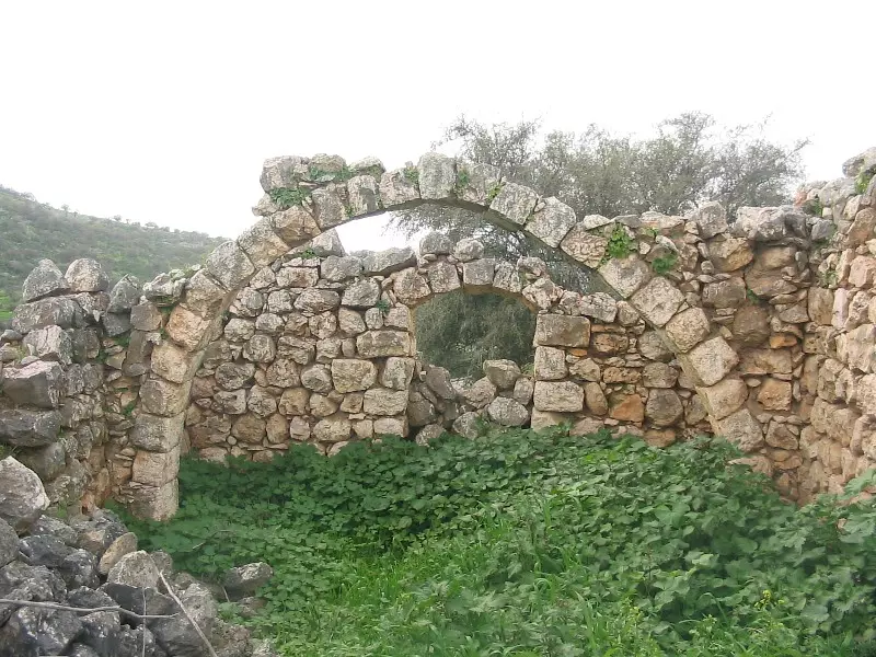
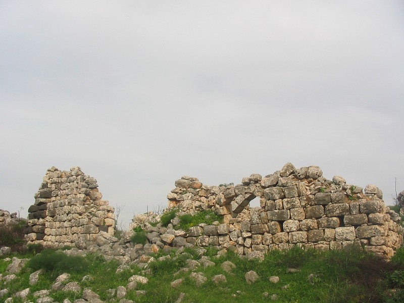
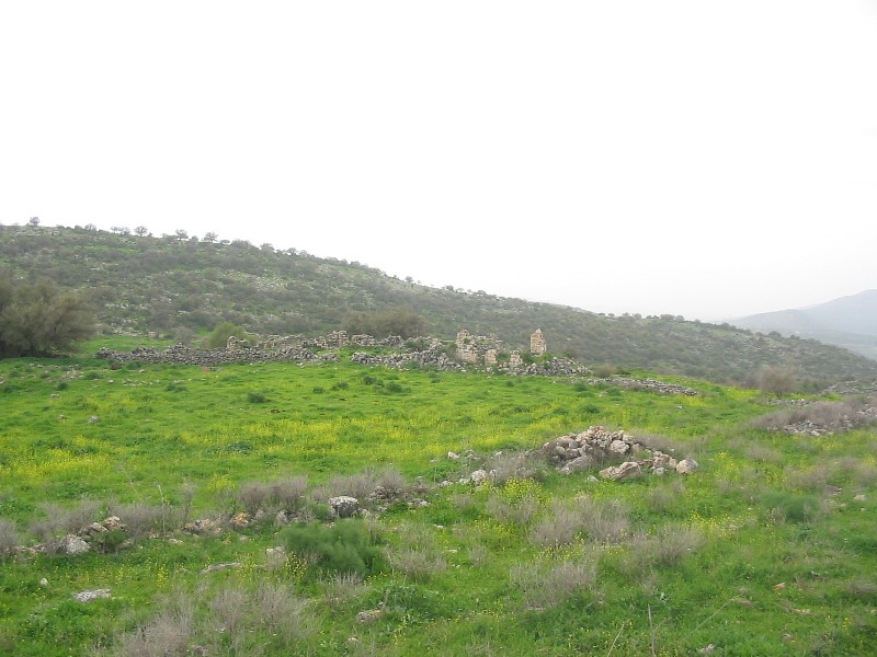
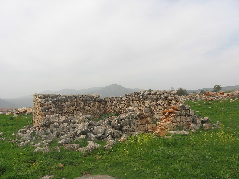
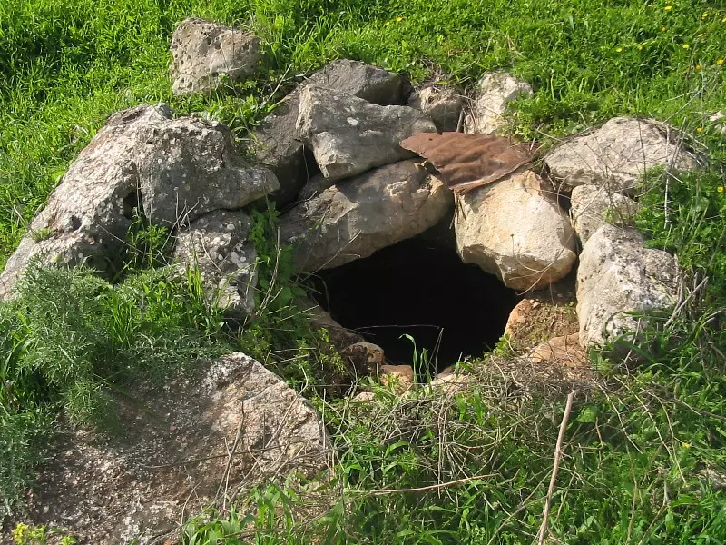
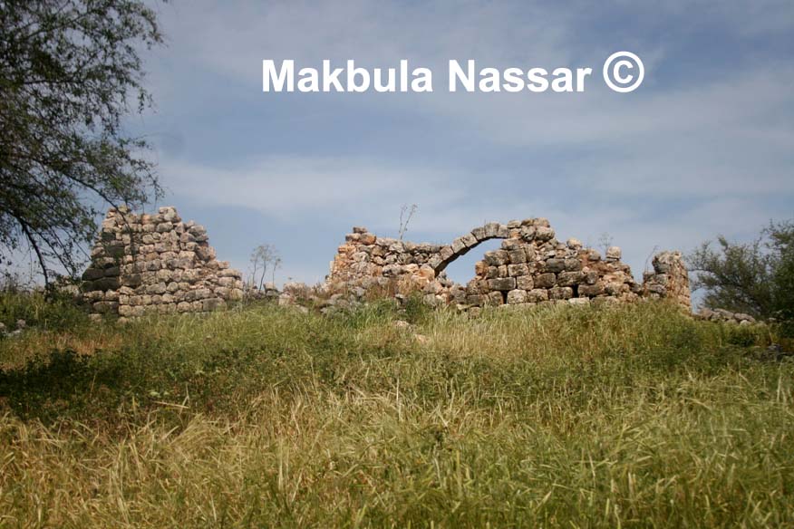
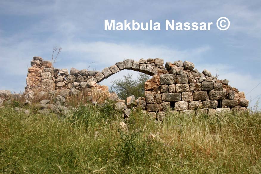
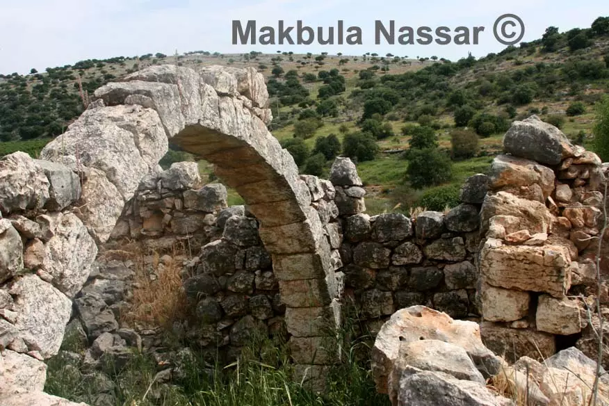
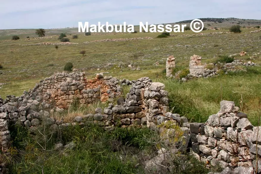
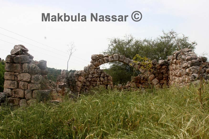
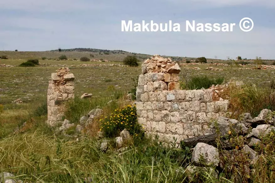
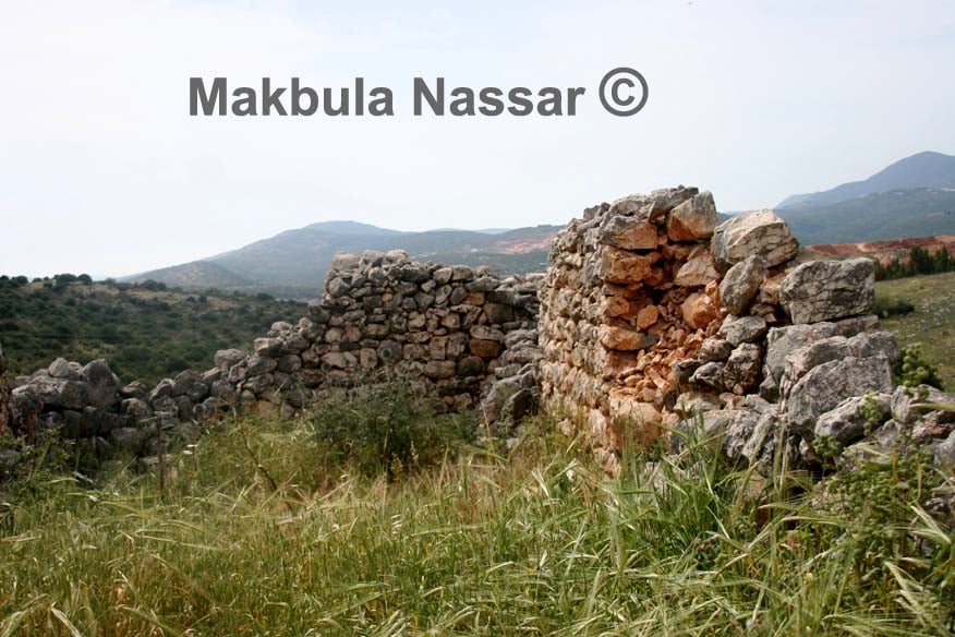
Village Before NakbaThe village was located in the eastern Galilee Mountains in an area that sloped southeastward and overlooked Lake Tiberias. It lay about 1 km east of Wadi al-'Amud, a perennial watercourse whose waters flowed from the vicinity of the city of Safad, in the north, down to Lake Tiberias, to the southeast. A shrine for a local sage, al-Shaykh al-Rumi, stood at the center of the village. While the majority of the villagers were herdsmen, some were farmers. In 1944/45 they planted a total of 2,029 dunums in cereals. The shrine for al-Shaykh al-Rumi was built next to an ancient ruin, Khirbat al-Nuwayriyya, that contained heaps of drafted masonry and rock-cut wine presses; these relics were a sign of Roman-Byzantine habitationVillage Occupation and Ethnic CleaningHaganah forces engaged in the occupation of eastern Galilee assaulted al-Qudayriyya on 4 May 1948, during Operation Yiftach (see Abil al-Qamh, Safad sub-disctrict). That attack resulted in the expulsion of the village's population by the occupying units, according to Israeli historian Benny Morris, who gives no further details. The occupation of the village was also reported at the time by the commander of the Arab Liberation Army (ALA), Fawzi al-Qawuqji. In a cable sent the following day, he indicated that the ALA's Second Yarmuk Battalion had defended the area. The assault on the village was part of a suboperation, Operation Matate (Broom), which was designed to 'sweep' Palestinians out of an area in the Jordan Valley between the Jordan River and the north-south road. Morris presents evidence that some of the other villages seized in the same operation were almost immediately laid to waste by occupying Haganah units who were ordered to blow up their houses. The offensive came roughly a week before the capture of Safad and was carried out, in part, to increase the pressure on the city before the final attack. The devastation of the villages occupied during Operation Matate had a 'tremendous psychological impact' on other communities in eastern Galilee, according to operational commander Yigal Allon. [M:xv, 121-22; Q:6]Zionists Colonies on Village LandsThe settlement of Kachal (198255), built in 1980 on village land, is southeast of the village site.Village TodayThe site is overgrown with wild grass and contains rubble from destroyed houses. A few structures still stand; one of them has an arched entrance, and the concrete lining of a well also remains. The surrounding land serves as pasture.SourceDr. Walid al-Khalidi, 1992: All That Remains. |
|||||||||||||
| Related Maps | Town Lands' Demarcation Maps خرائط للقضاء توضح حدود القرى والاودية Town's map on MapQuest View from satellite Help us map this town at WikiMapia |
||||||||||||
| Related Links | Wikipedia's Page Facebook Page Google Search Google For Images Google For Videos |
||||||||||||
| More Information | في كتاب كي لا ننسى في كتاب بلادنا فلسطين المزيد من موقع هوية |
||||||||||||
- Remains of an arched entrance to a village house, 1987
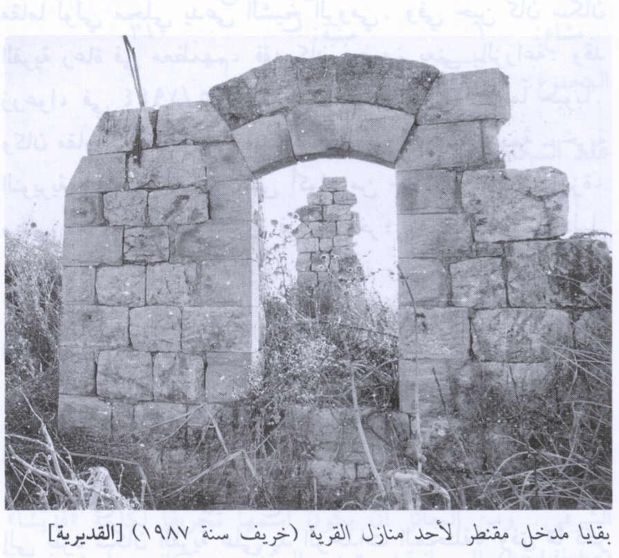
Scanned from "All That Remains" by Dr. Walid Khalidi 1 - 18.2.2005 اثار بيت مختار القديرية خالد المعجل , تصوير : مقبولة نصار
Posted by Makbula Nassar 7 - 18.2.2005 اثار بيت مختار القديرية خالد المعجل , تصوير : مقبولة نصار
Posted by Makbula Nassar - 18.2.2005 اثار بيت مختار القديرية خالد المعجل , تصوير : مقبولة نصار
Posted by Makbula Nassar - 18.2.2005 اثار بيت مختار القديرية خالد المعجل , تصوير : مقبولة نصار
Posted by Makbula Nassar - 18.2.2005 اثار بيت مختار القديرية خالد المعجل , تصوير : مقبولة نصار
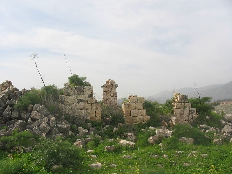
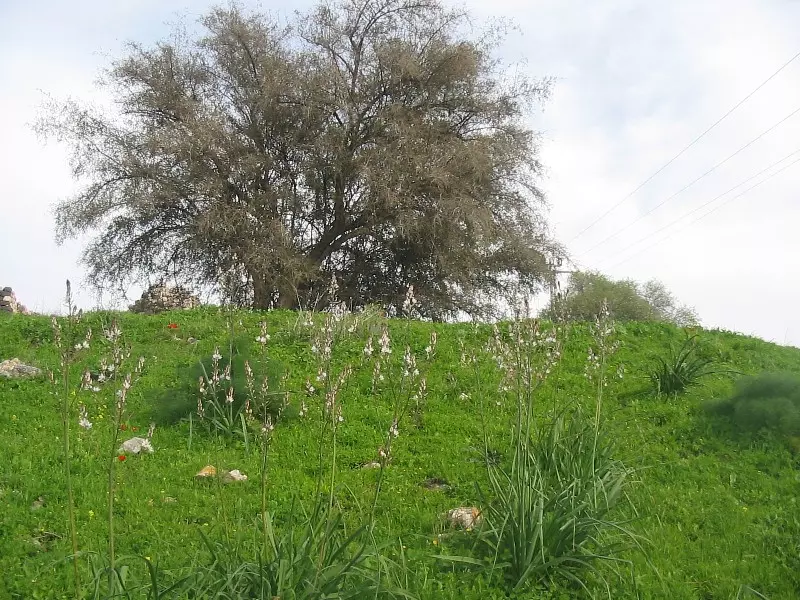
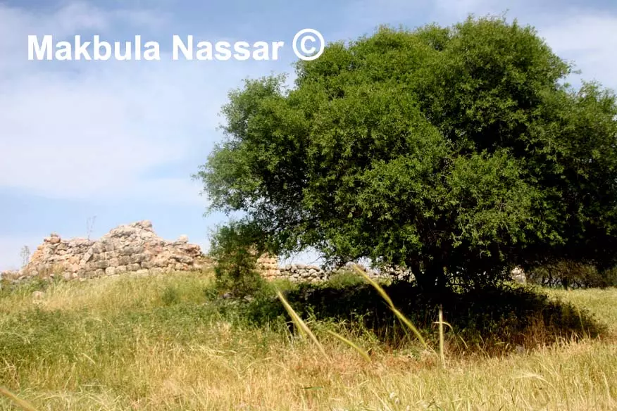
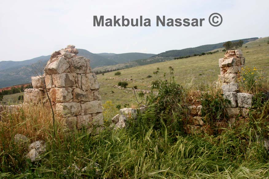
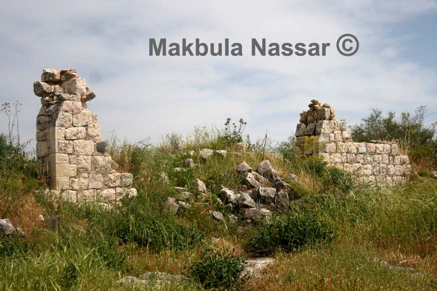
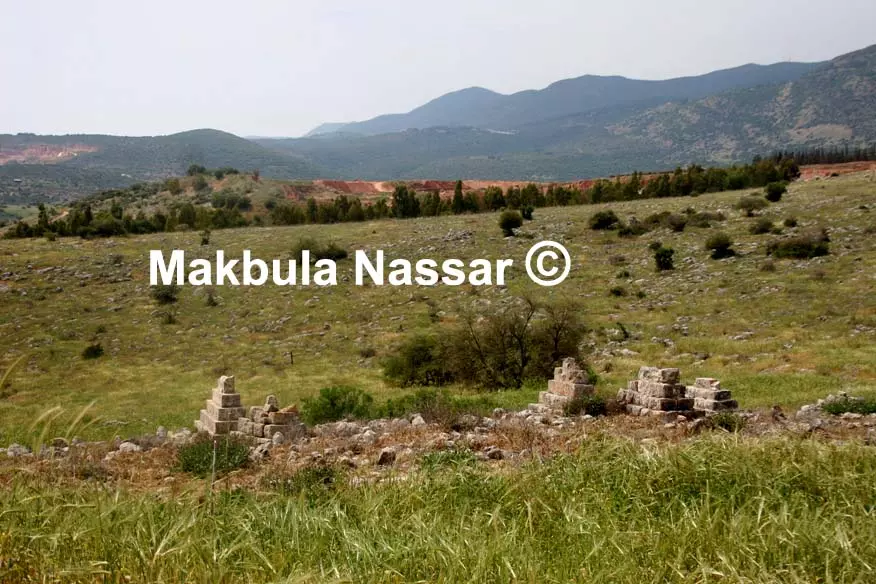
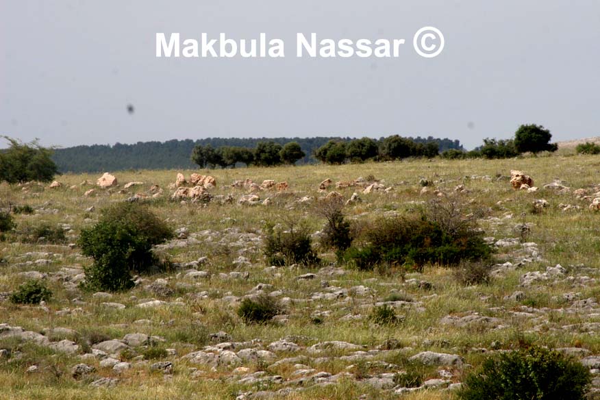
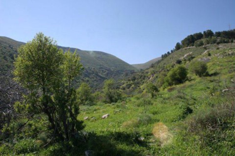
Posted by Makbula Nassar 1 - 18.2.2005 منظر عام للقرية والاثار الباقية , تصوير : مقبولة نصار
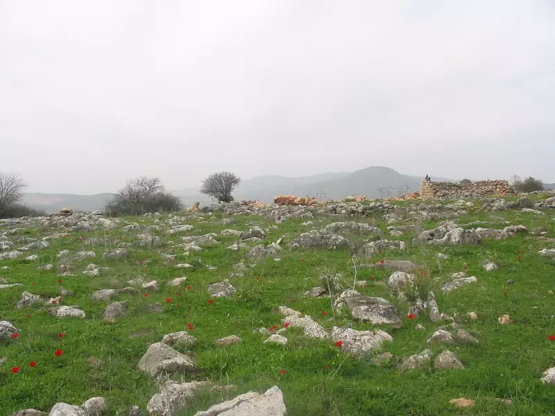
Posted by Makbula Nassar - 18.2.2005 منظر عام للقرية والاثار الباقية, تصوير : مقبولة نصار
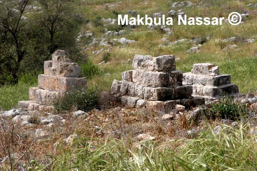
Posted by Makbula Nassar 2 - 18.2.2005 اثار احد البيوت الباقية , تصوير : مقبولة نصار
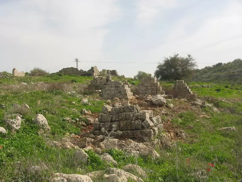
Posted by Makbula Nassar 2 - 18.2.2005 مقبرة القرية , تصوير : مقبولة نصار
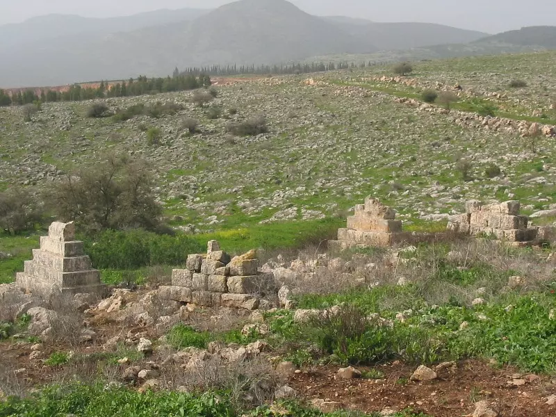
Posted by Makbula Nassar 2 - 18.2.2005 مقبرة القرية,يظهر بيت المختار شرقي المقبرة , تصوير : مقبولة نصار
Posted by Makbula Nassar - 18.2.2005 بئر ماء الى جانب البيت , تصوير : مقبولة نصار
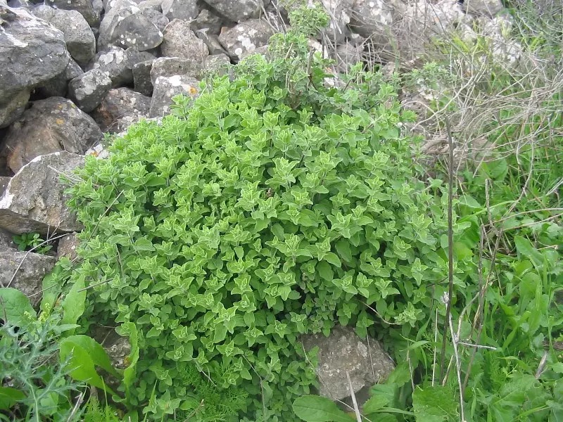
Posted by Makbula Nassar - 18.2.2005 الزعتر الاخضر يبشر بالربيع في القديرية , تصوير : مقبولة نصار
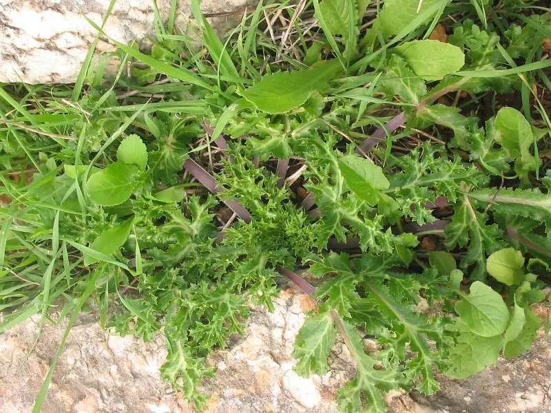
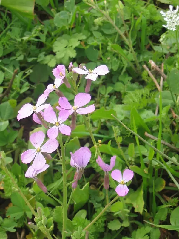
Posted by Makbula Nassar 1 - 18.2.2005 الطبيعة الفلسطينية , نباتات من القرية , تصوير : مقبولة نصار
Posted by Makbula Nassar 1 - 18.2.2005 الطبيعة الفلسطينية , نباتات من القرية , تصوير : مقبولة نصار
Posted by Makbula Nassar - 18.2.2005 الطبيعة الفلسطينية , نباتات من القرية , تصوير : مقبولة نصار
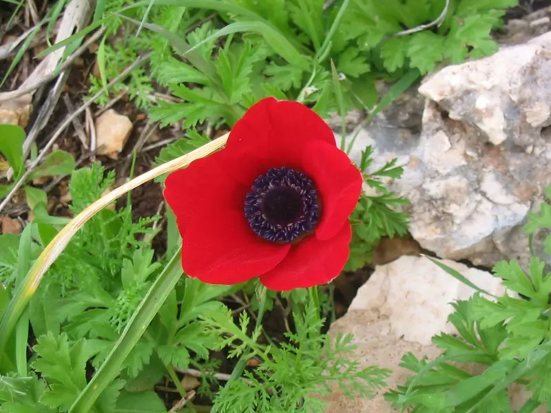
Posted by Makbula Nassar - 18.2.2005 الطبيعة الفلسطينية , نباتات من القرية , تصوير : مقبولة نصار
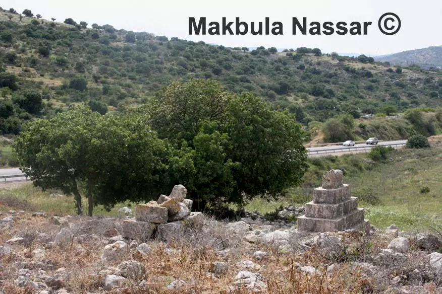
Posted by Makbula Nassar - القرية من الناحية الغربية- تصوير مقبولة نصار - 5.4.08
Posted by Makbula Nassar - القرية من الناحية الغربية- تصوير مقبولة نصار - 5.4.08
Posted by Makbula Nassar - اثار بيت المختار - تصوير مقبولة نصار - 5.4.08
Posted by Makbula Nassar - اثار بيت المختار - تصوير مقبولة نصار - 5.4.08
Posted by Makbula Nassar - اثار بيت المختار - تصوير مقبولة نصار - 5.4.08

Posted by Makbula Nassar - اثار بيت المختار - تصوير مقبولة نصار - 5.4.08
Posted by Makbula Nassar - اثار بيت المختار - تصوير مقبولة نصار - 5.4.08
Posted by Makbula Nassar - اثار بيت المختار - تصوير مقبولة نصار - 5.4.08
Posted by Makbula Nassar - اثار بيت المختار - تصوير مقبولة نصار - 5.4.08
Posted by Makbula Nassar 1 - اثار بيت المختار - تصوير مقبولة نصار - 5.4.08
Posted by Makbula Nassar - اثار بيت المختار - تصوير مقبولة نصار - 5.4.08
Posted by Makbula Nassar - مقبرة القرية من الناحية الغربية - تصوير مقبولة نصار - 5.4.08
Posted by Makbula Nassar - مقبرة القرية من الناحية الغربية - تصوير مقبولة نصار - 5.4.08
Posted by Makbula Nassar - مقبرة القرية من الناحية الغربية - تصوير مقبولة نصار - 5.4.08
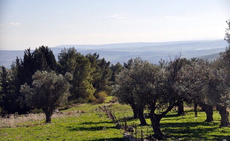
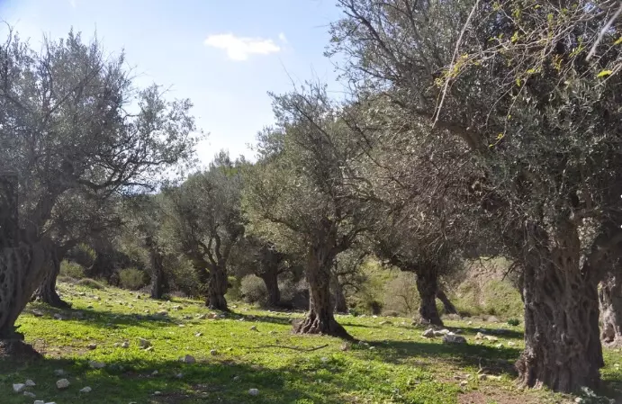
Posted by Makbula Nassar - اشجار زيتون باقية في الناحية الغربية - تصوير مقبولة نصار - 5.4.08
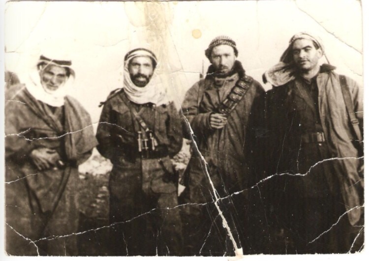
Posted by Makbula Nassar - صوره قديمه لمختار القريه خالد المعجل واديب الشيشكلي عبد الحميد سراج.عبد السلام العجيلي
Posted by abu raya - مقبره القريه
Posted by abu raya - زيتون القريه من الغرب
Posted by abu raya - من اطلال القريه
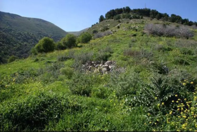
Posted by abu raya - من غرب القريه
Posted by abu raya - زيتون القريه
Posted by abu raya
Want to browse more? 80,000 pictures were grouped in these gallaries:
| Display Name | Clan/Hamolah | Country of Residence |
| ابو مهدي | - | Palestine |
| ميناس شهاب | القديري | Berlin, Germany |
| أكرم الحسين | القديرية | - |
| hasan | القديرية | - |
| alix abunassir | القديرية | - |
| د.ابوقيس | القديرية | دمشق, سوريا-السعودية |
| ناصر ابوناصر | ابوناصر | دمشق - مخيم السبينة, سوريا |
| اسامي | القديرية | دمشق, سوريه |
| علي صالح خليل القديري | القديرية | - |
| محمد بدر حمد | القديرية | - |
| حاتم قاسم | القديرية | - |
| طلال شهاب | شهاب | دمشق, سوريا |
| Palestinian for ever !!!!!!!! | - | Damascus, Syria |
| mskhaled | safad | syria, syria |
No links have been shared yet, be free to the first to share the first link.
 Fake Valor: Why Did Zionist Jews Hoist Nazis Flag on Their Ships in the 1930s?
What is new?
-
Facts About Oct. 7th Gaza Raid
-
Remined Us Please:: Who Did Rape Who? Palestinians Raped Israelis? Or, was the other way around?
-
When Prof. Edward Said was invited to debate Bibi Netanyahu in the 1980s, watch what happened!
-
Ezra Klein of the NY Times on the "Jewish Race".
-
Abusing Blood Libel!
-
Did Israeli Soldiers Activate The Hanniba Direective On Oct. 7th? You Be The Judge
-
Zionist FAQ: Isn't it true that Palestinians don't want peace? Palestinians never accepted the two-state solution
- Facts about Haavara (Transfer) Agreement between Ben-Gurion & Hitler
-
Haavara FAQs: Why Did Zionist Jews Hoist Nazis' Flags on Their Ships in the 1930s?
- Haavara FAQs: When Chaim Weizmann met FDR in mid-1943, why was he silent about rescuing European Jewry?
-
Dear ChatGPT: How did Palestinians resist Napoleon's invasion of their country in 1799?
-
Dear ChatGPT: Gaza had a vibrant Jewish community in the mid-17th century. What happened to them?
-
Dear ChatGPT: Why did the Jewish Agency suppress news of the Holocaust during WWII?
-
Video Playlist: Jews share their DNA tests to end the conflict for good.
-
A Tale of Two Conflicts: Examining the Definition of Genocide
-
Prof. Abraham Polak And The Suppressed History of the Khazars and European Jewry
-
How Ronald Reagan would have framed the genocide in Gaza if he were still alive?
-
Haavara FAQs: Let us do the math: how many German Jews did The Haavara Agreement save?
-
Zionist FAQs: The Hebron Massacre of 1929, "clearly proves" that Palestinians are antisemitic, how could you deny it?
-
Zionist FAQs: Why Anti-Zionist Is Not Antisemitism?
-
Zionist FAQs: Isn't it true that the KGB created Palestinian Nationalism in the early 1960s?
- Zionist FAQs: Muslims are killing Muslims all the time; why are Israeli Jews being singled out in the media?
- Zionist FAQs: How is Israel an apartheid state when 20% of its citizens are Arabs who enjoy full rights?
-
Haavara FAQs: Why Did Dorothy Thompson Flip From A Zionist Advocate to A Silenced Dissenter?
-
Haavara FAQs: Analysis of Herzl's Uganda Scheme and how it could have saved millions of Jews.
-
Haavara FAQs: Why did Hayim Greenberg describe American Jewry as "morally bankrupt" in early 1943?
-
Haavara FAQs: What if the Evian Conference was a resounding success? What would have been the impact of saving European Jewry on Zionism?
- Haavara FAQs: What if the six million were saved, how that would have impacted the Zionist project?
-
Haavara FAQs: How did Zionist leaders react when Europe's Jews lingered in the DP camps after WWII ended?
-
Why does the American Jewish community repeat lies that David Ben-Gurion had debunked before he died?
-
Who has the power to rename the Tatar/Khazar Gene Marker to Jewish IV?
-
Zionist FAQs: Why won't Egypt, Syria, and Jordan take their people back? Jews are indigenous to Palestine, and Arabs immigrated after Jews developed the country. Arabs should leave.
-
Haavara FAQs: Did Hitler and the Nazis conflate between Judaism and Zionist? If that wasn't case, then why?
-
Haavara FAQs: Winston Churchill and antisemitism, a collection of articles written Churchill.
-
Haavara FAQs: Broken by country, how many Jews survived vs. killed during the Holocaust?
-
Haavara FAQs: Why did European Jews vote with their feet and to immigrated to the Americas, not Palestine, after WWII?
-
Watch this American Jewish Girl describing Israeli Jews' cognitive dissonance like no other in under two minutes
-
Haavara FAQs: When the Nazis went out of their way to hide the Holocaust, Israeli Jews did the exact opposite by broadcasting their genocide of Gazans. But why?
-
Haavara FAQs: How Zionist Jews went out of their to show their appreciation to Nazism and Fascism?
- Haavara FAQs: Why Zionist leaders were against bombing the death camps & the Railroads leading to them?
-
Haavara FAQs: Hitler's message to the British and American people: If Jews are such noble citizens and you care about them, how come you're not letting them in? I will gladly ship them to you at my expense, even on luxury liners!
-
A shortlist of Zionist and Israeli false flag operations in the name Jews.
-
The Most Moral Army
- The Land of Kapos (Israel): Where the brave are boycotted and Kapos walk free.
- Why did early Zionists often named their communal enterprises "colonial"?
- Zionist Relations with Nazi Germany by Faris Glubb
-
Two NY Times advertisements by Zionists in the early 1943 that exposes Zionists' treason at the height of the calamity
- Facts Not Lies about the Palestinian-Israeli Conflict.
- Site's pictures have been categorized
- Campgain Against Lice
- A Survey of Palestine, the official source about Palestine before Nakba produced by the British Mandate; over 1200 pages.
- Satellite View & Google Earth: Over 6,000 placemarks identifying all destroyed towns, W. Bank & Gaza Strip Towns, & refugee camps.
- PalestineRemembered.com and its Nakba Oral History Project were featured on al-Jazeera Satellite TV.
- Nakba Oral History Video Podcast:
 Over 700 Oral History interviews (including 3,500+ hours of recording) can be viewed online.
 - Palestine Village Statistics Project
- Gaza Jail Break
- النسخة العربية للموقع الان متوفرة
- Videos: Documenting the destroyed villages in video: Tracing all that remains since Nakba.
- Videos: Responding to Zionist Propaganda
- Interview: The ethnic cleansing of Palestine: George Galloway interviews Israeli Historian Ilan Pappe.
- For Palestinians, memory matters. It provides a blueprint for their future By George Bisharat.
- Zionist FAQ now available in Hebrew שאלות שציונים שואלים, עכשיו בעברית
- Video: The Stephen Walt and John Mearsheimer report on the influence of the Israel Lobby on U.S. Foreign Policy
- The Palestinian-Israeli conflict for beginners
