| PalestineRemembered | About Us | Oral History | العربية | |
| Pictures | Zionist FAQs | Haavara | Maps | |
| Search |
| Camps |
| Districts |
| Acre |
| Baysan |
| Beersheba |
| Bethlehem |
| Gaza |
| Haifa |
| Hebron |
| Jaffa |
| Jericho |
| Jerusalem |
| Jinin |
| Nablus |
| Nazareth |
| Ramallah |
| al-Ramla |
| Safad |
| Tiberias |
| Tulkarm |
| Donate |
| Contact |
| Profile |
| Videos |
Welcome To Yaquq - ياقوق (יאקוק)
|
District of Tiberias
Ethnically cleansed days ago |
العربية Google Earth |
 |
Gallery (34) |
- Statistics & Facts
-
Before & After

- Satellite View
- Articles 3
- Pictures 34
- Members 2
- All That Remains
- Wikipedia
- Videos 1
- Guest Book 2
- Links
| Statistic & Fact | Value | |||||||||||||||||||||
| Occupation Date | May 1, 1948 | |||||||||||||||||||||
| Distance From District | 12.5 (km) North of Tiberias | |||||||||||||||||||||
| Elevation | 30 (meters) | |||||||||||||||||||||
| Before & After Nakba, Click Map For Details |
||||||||||||||||||||||
|
||||||||||||||||||||||
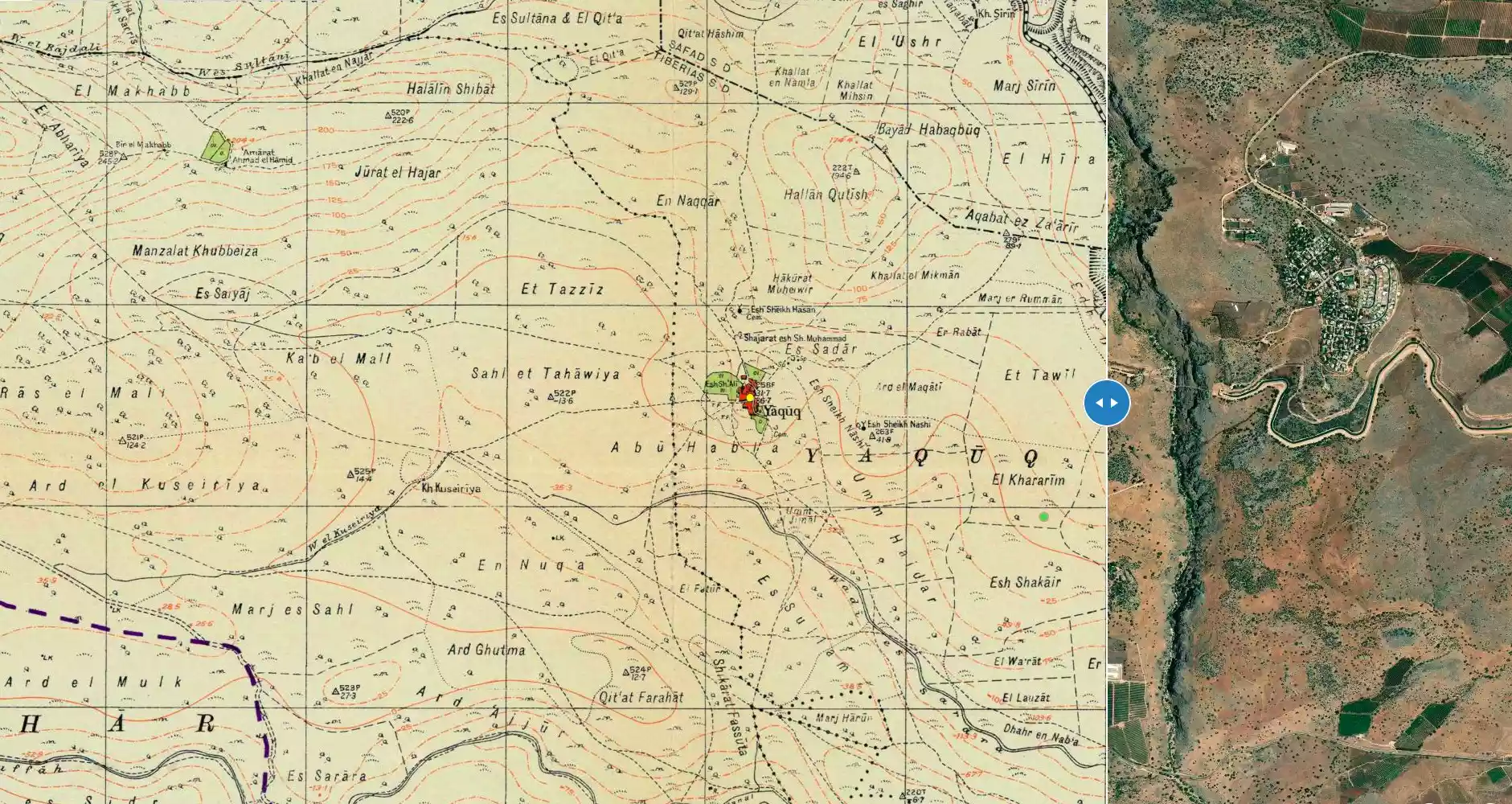
| Map Location | See location #2 on the map View from satellite |
|||||||||||||||||||||
| Exodus Cause | Influence of fall of, or exoduce from, neighboring town | |||||||||||||||||||||
| Village Temains | Yaquq was completely destroyed, and only house rubble left behind. | |||||||||||||||||||||
| Ethnically Cleansing | Yaquq inhabitants were completely ethnically cleansed. | |||||||||||||||||||||
| Pre-Nakba Land Ownership |
**Town Lands' Demarcation Maps |
|||||||||||||||||||||
| Land Usage As of 1945 |
|
|||||||||||||||||||||
| Population |
|
|||||||||||||||||||||
| Number of Houses | In (1931): 28, and in the 19th century 20 houses | |||||||||||||||||||||
| Near By Towns |
||||||||||||||||||||||
|
|
||||||||||||||||||||||
| Town's Name Through History | The Canaanites referred to Yaquq by Hukkok, and during the Roman period it was known by Hucuca. | |||||||||||||||||||||
| Exculsive Jewish Colonies Who Usurped Village Lands |
Chuqoq | |||||||||||||||||||||
| Featured Video | ||||||||||||||||||||||
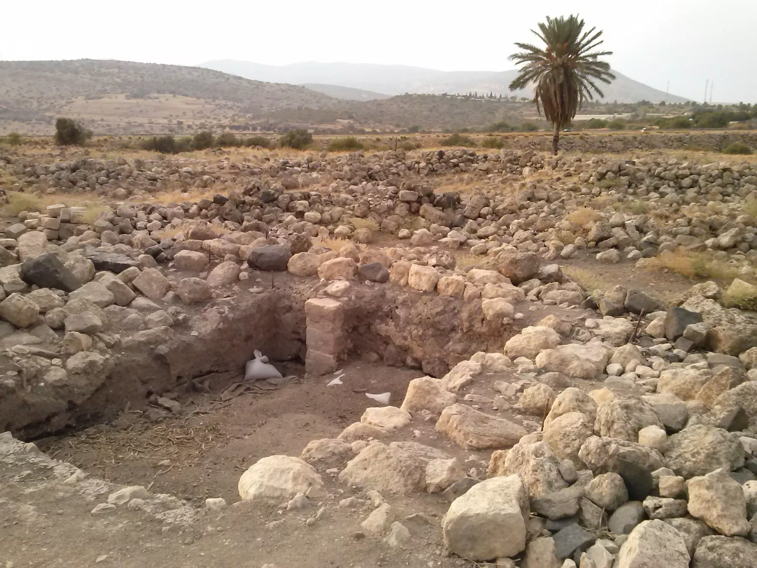
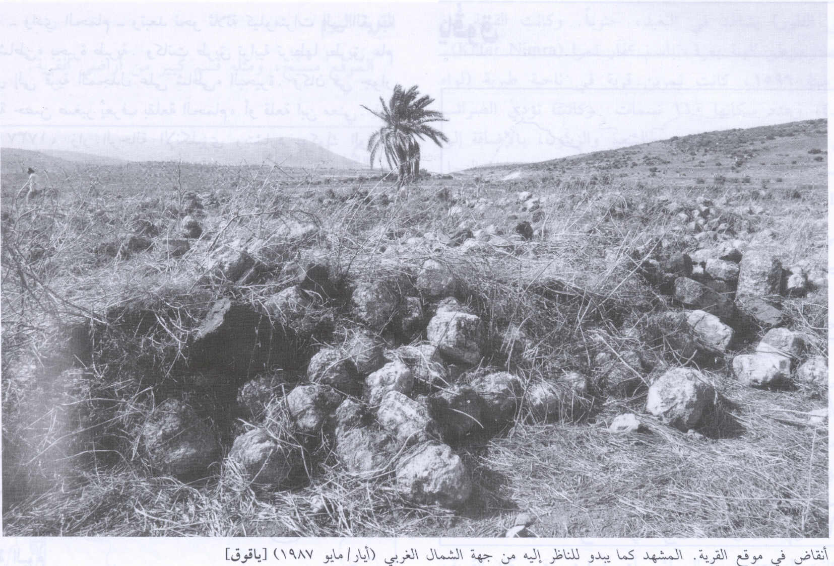
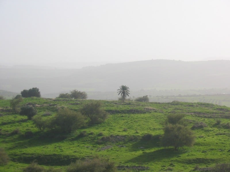
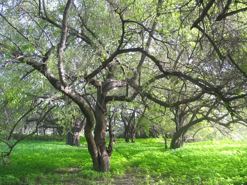
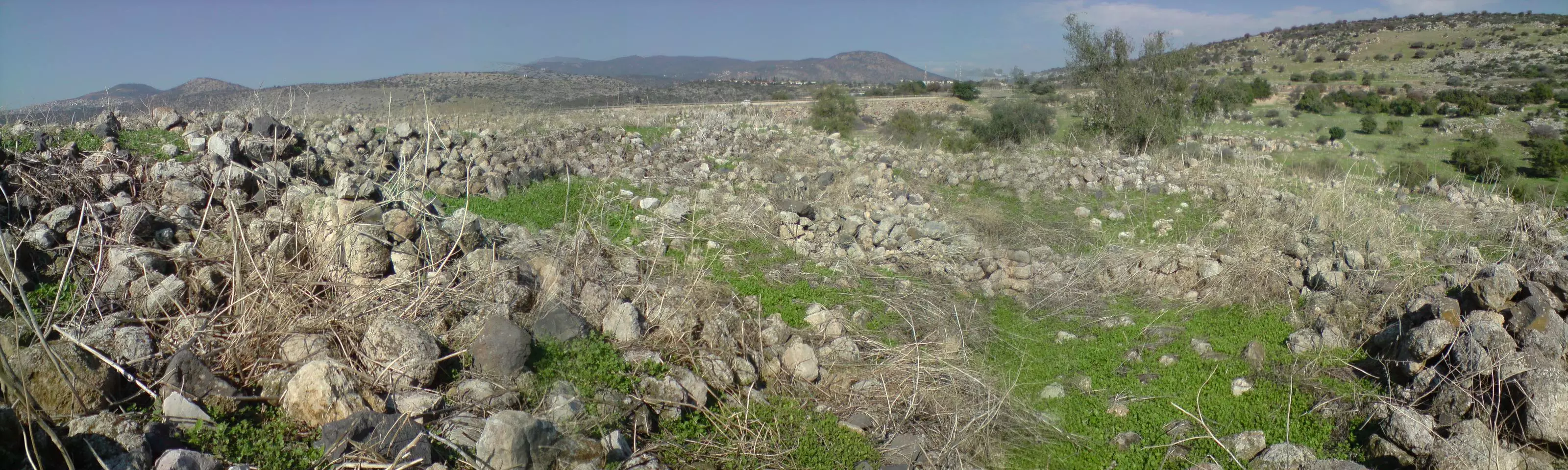
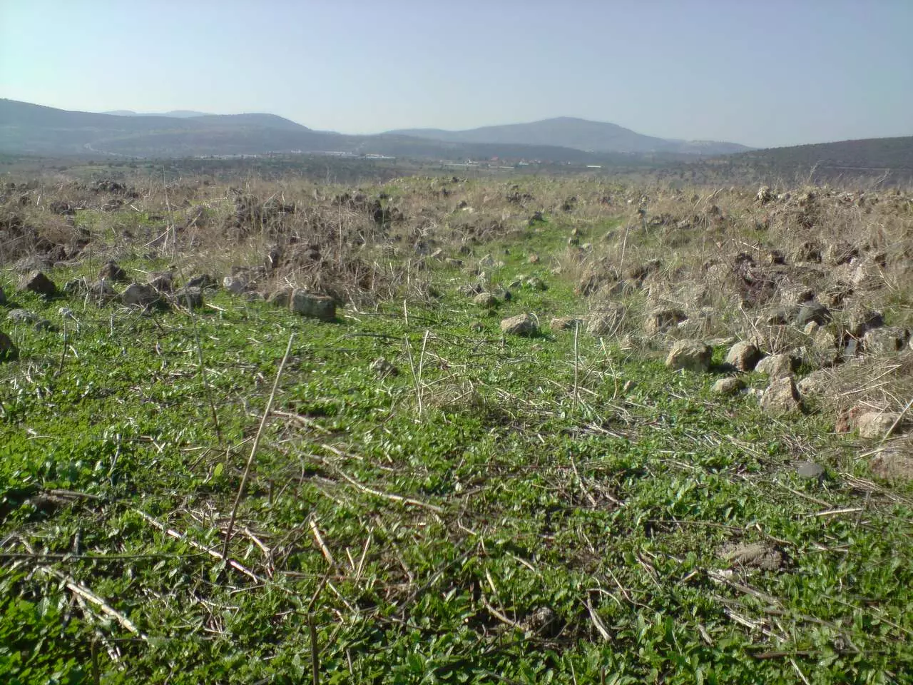
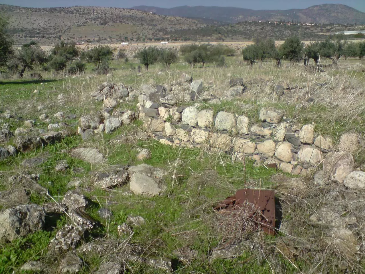
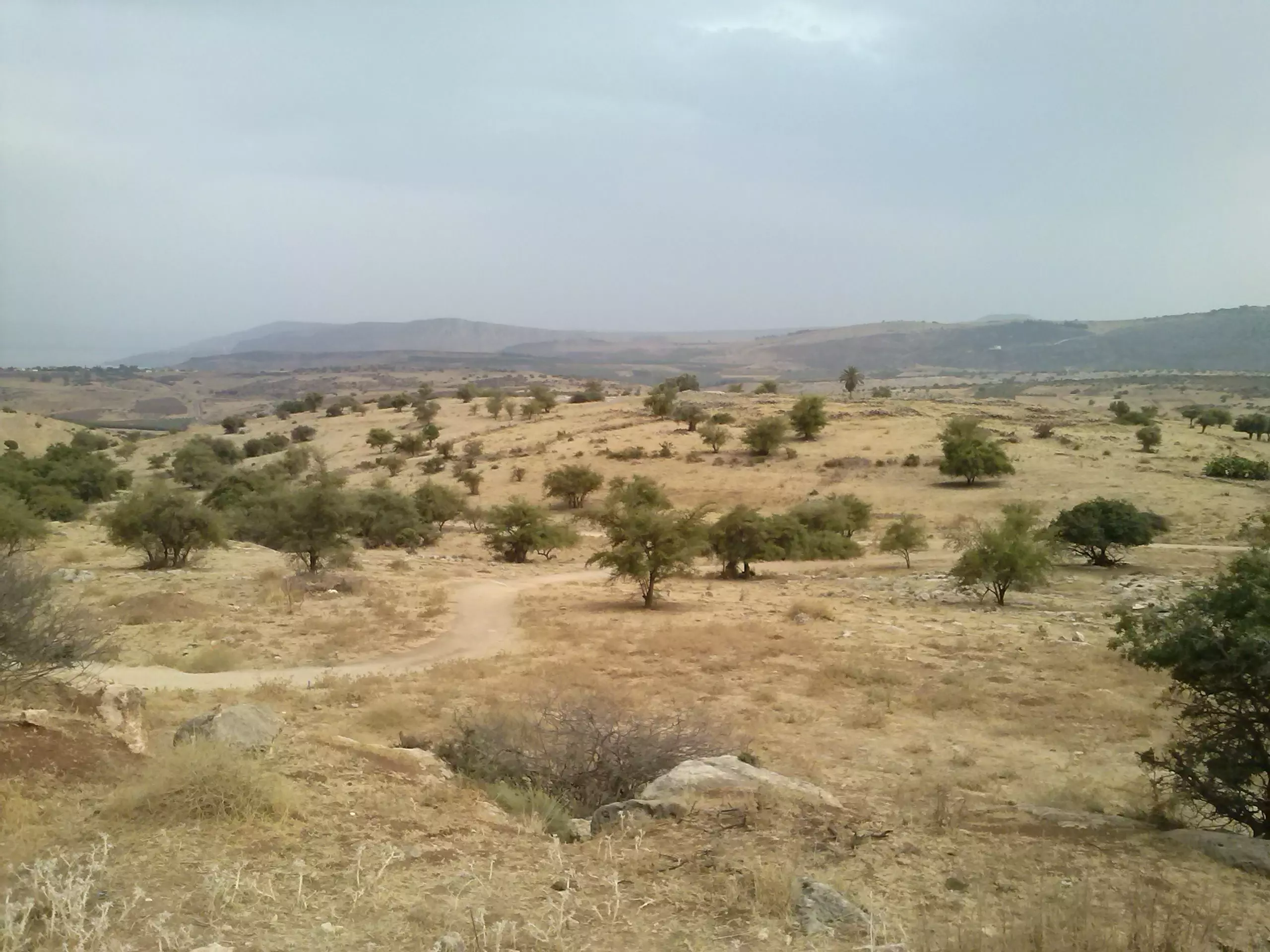
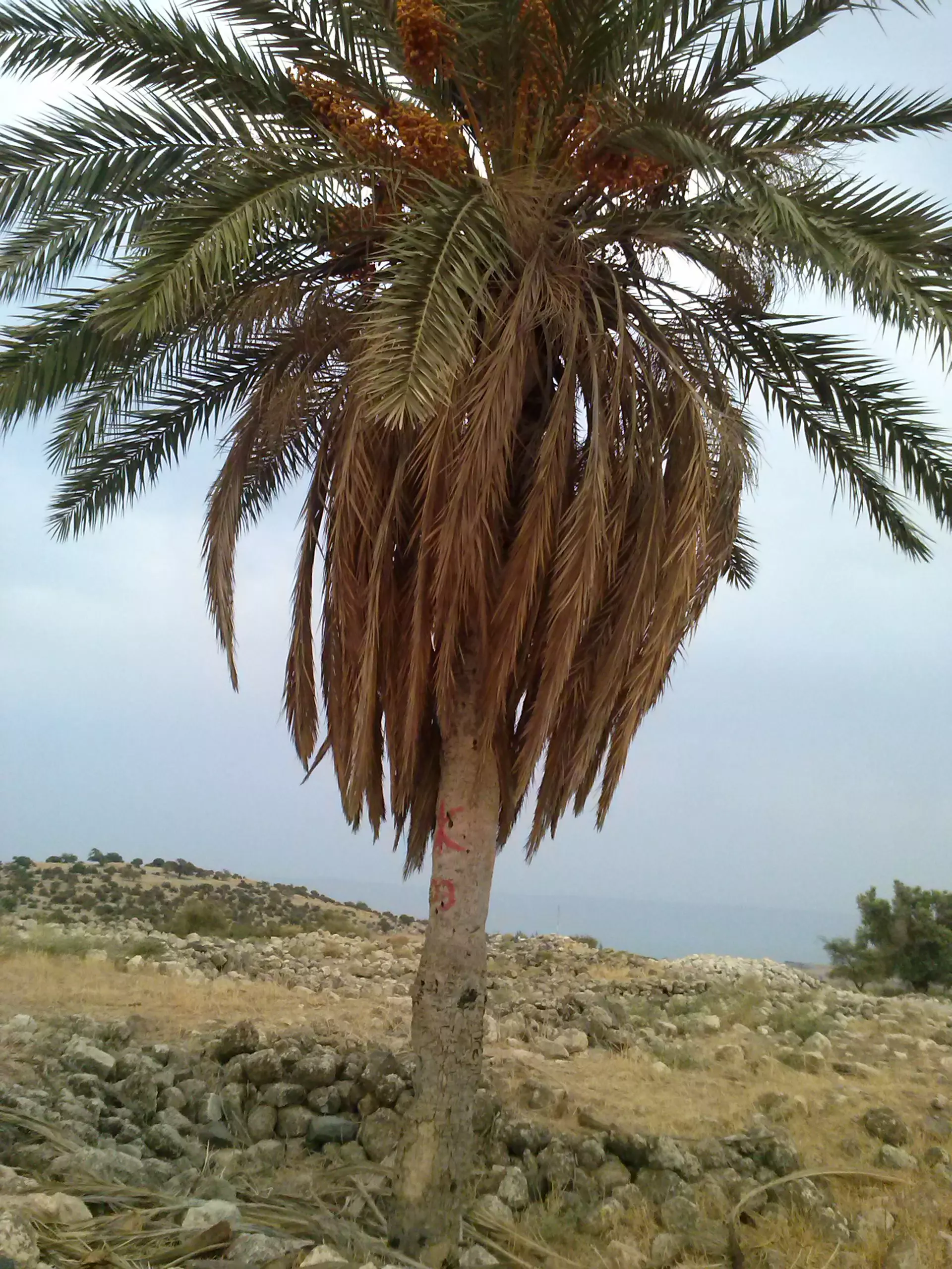
Village Before NakbaThe village stood on an uneven hill in the mountains of eastern lower Galilee, which was oriented along a southeast-northwest line and overlooked Lake Tiberias. It was linked by a dirt road to al-Shuna, the closest village, and by a dirt path to the road between Tiberias and al-Maghar. The village may have been established on the ruins of the Canaanite city of Hukkok ('hole'), mentioned in the Old Testament (Joshua 19:34). It was known by the name Hucuca in the Roman period. In 1596, Yaquq was a village in the nahiya of Jira (liwa' of Safad) with a population of 396. It paid taxes on a number of crops, including wheat, barley, and olives. Taxes were also paid on other types of property, such as goats, beehives, and a press which was used for processing either olives or grapes. [Hut. and Abd.:177]In the late nineteenth century, Yaquq consisted of about 20 stone houses and was situated at the foot of a hill. Its population was estimated at 200 in 1875. [SWP (1881) I:364] In 1944/45 a total of 1,010 dunums of village land was allotted to cereals, while 24 dunums were irrigated or used for orchards. The village had an archaeological site that contained tombs carved in rock and pieces of pillars and cisterns. Evidence of the village's antiquity included fragments of columns, some reused, and rock-cut tombs dating to the first and second centuries A.D. Village Occupation and Ethnic CleaningLike Ghuwayr Abu Shusha, a few kilometers to the southeast, Yaquq was probably affected by events in Tiberias and Safad, the two cities that it lay between. In late April and early May 1948, Tiberias had already succumbed to a Zionist assault and Palmach forces had begun to move on Safad by occupying some of the villages in its hinterland. The villagers of Yaquq were either deliberately expelled during this period, or came under pressure to leave because of the campaigns being waged to the north and south. Like other villagers in the area, they initially may have sought refuge in other parts of Galilee.Zionists Colonies on Village LandsThe settlement of Chuqoq (196254) was established 2 km southeast of the village site in 1943; some of its buildings are now on village land.Village TodayStone rubble covers the entire site. There is one palm tree in the center and an olive grove on the edge (see photo). Part of the surrounding land is cultivated by Israelis, while the remainder is used as a grazing area. A canal that passes to the west is part of the Israeli National Water Carrier, the water project that carries water from Lake Tiberias to the central coastal plainsSourceDr. Walid al-Khalidi, 1992: All That Remains. |
||||||||||||||||||||||
| Related Maps | Town Lands' Demarcation Maps خرائط للقضاء توضح حدود القرى والاودية Town's map on MapQuest View from satellite Help us map this town at WikiMapia |
|||||||||||||||||||||
| Related Links | Wikipedia's Page Google Search Google For Images Google For Videos |
|||||||||||||||||||||
| More Information | في كتاب كي لا ننسى في كتاب بلادنا فلسطين المزيد من موقع هوية |
|||||||||||||||||||||
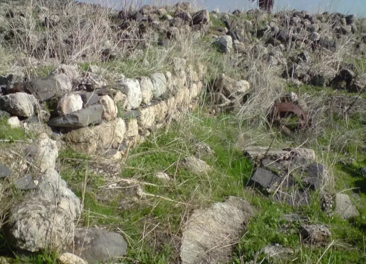
- A general view of the village looking northwest & some house rubble, 1987
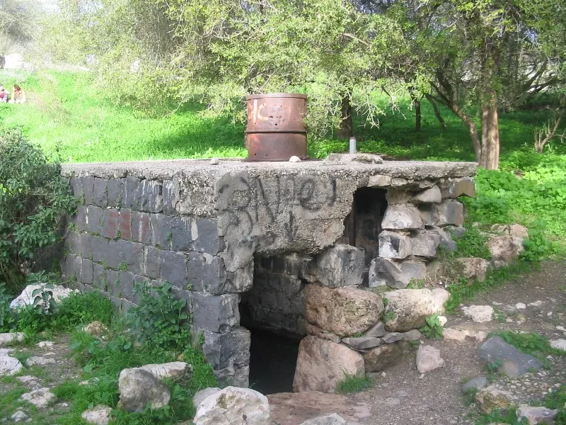
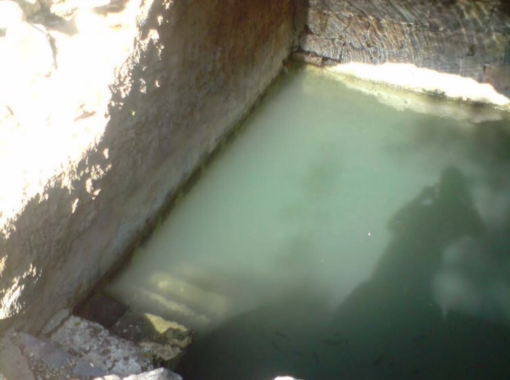
Scanned from "All That Remains" by Dr. Walid Khalidi - نبع ياقوق , 28.1.2005 تصوير : مقبولة نصار
Posted by Makbula Nassar - منظر عام للتلة التي توسطت القرية , 28.1.2005 تصوير : مقبولة نصار
Posted by Makbula Nassar 1 - منظر عام للتلة التي توسطت القرية , 28.1.2005 تصوير : مقبولة نصار

Posted by Makbula Nassar 1 - اشجار السدر بجانب النبع - 28.1.2005 تصوير : مقبولة نصار
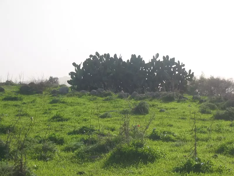
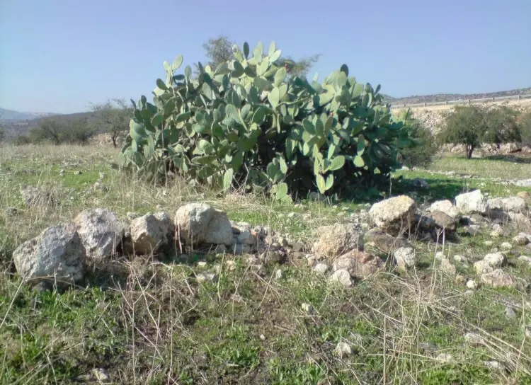
Posted by Makbula Nassar 2 - الصبار في ياقوق - 28.1.2005 تصوير : مقبولة نصار
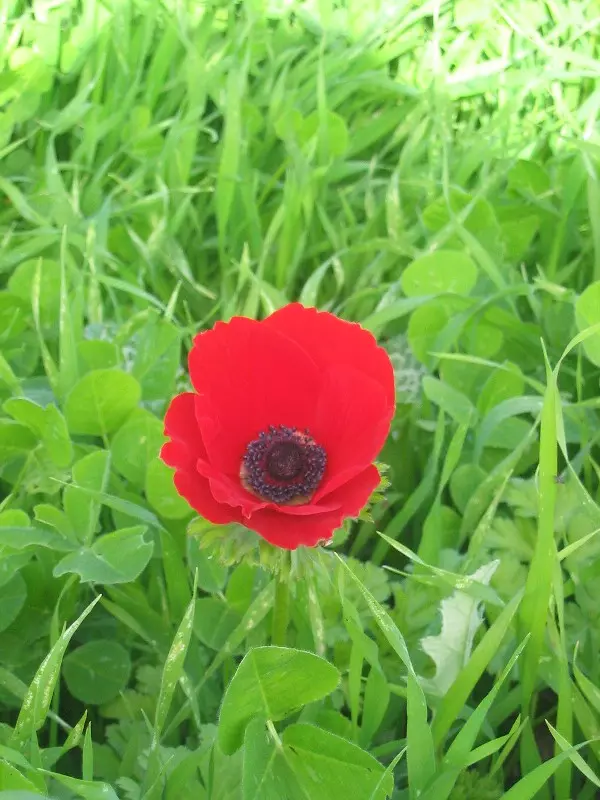
Posted by Makbula Nassar - هدية الربيع الى كل اهالي ياقوق - 28.1.2005 تصوير : مقبولة نصار
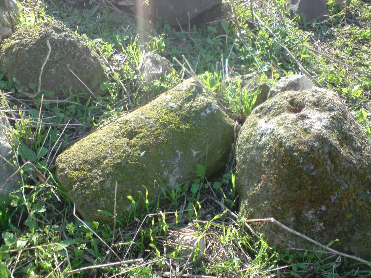
Posted by Makbula Nassar - The remains of a column بقايا عامود قديم في مركز القرية - تصوير رامز عيد
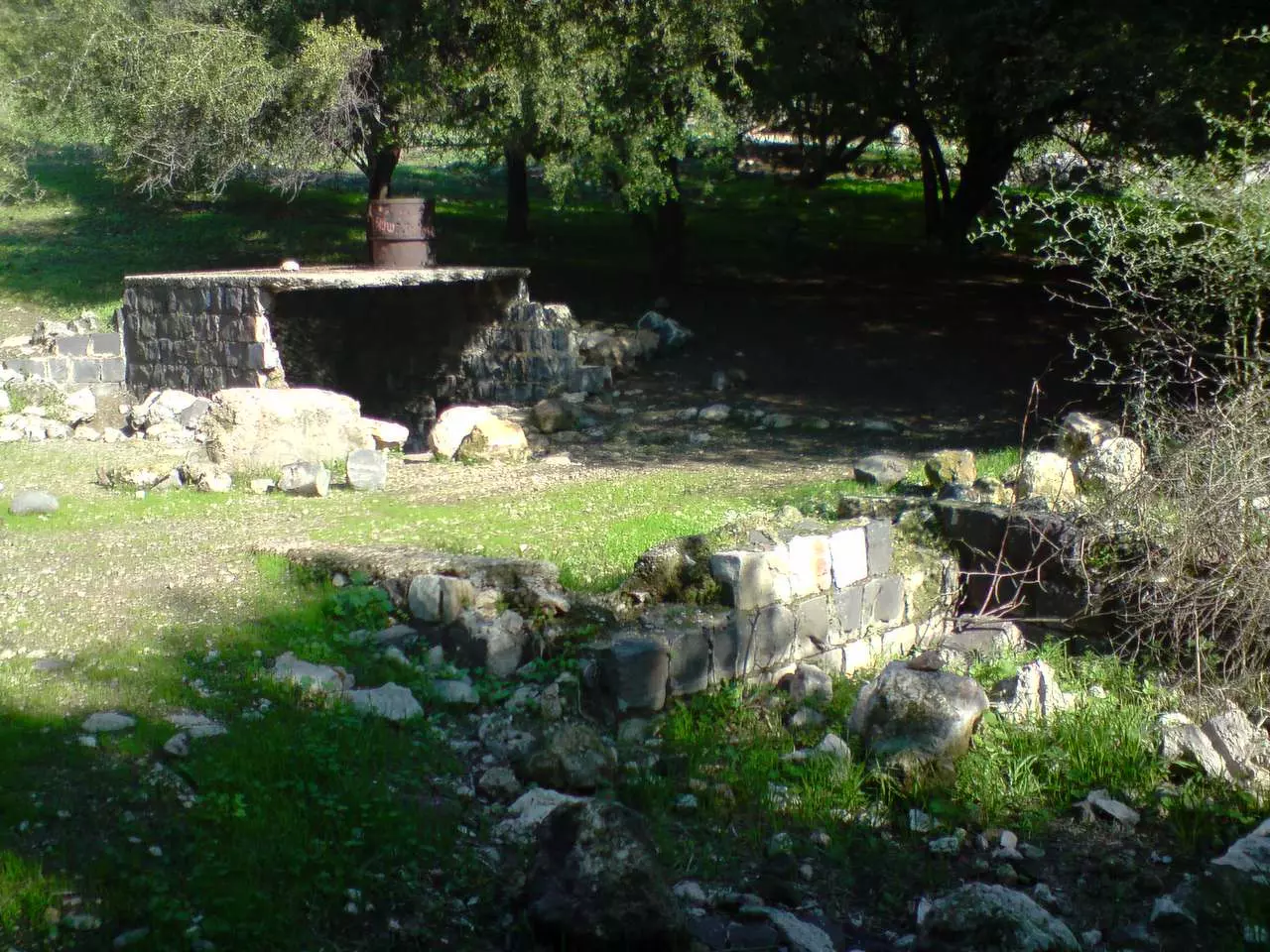
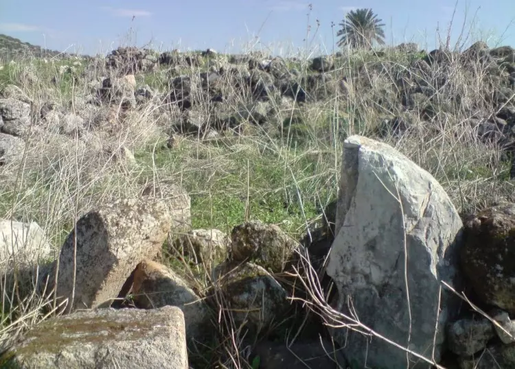
Posted by Ramez - The center of the village مركز القرية المهدم - تصوير رامز عيد
Posted by Ramez - The eastern entrance to the village مدخل القرية من جهة الشرق - تصوير رامز عيد
Posted by Ramez - The path to the water spring الطريق من القرية الى عين الماء - تصوير رامز عيد
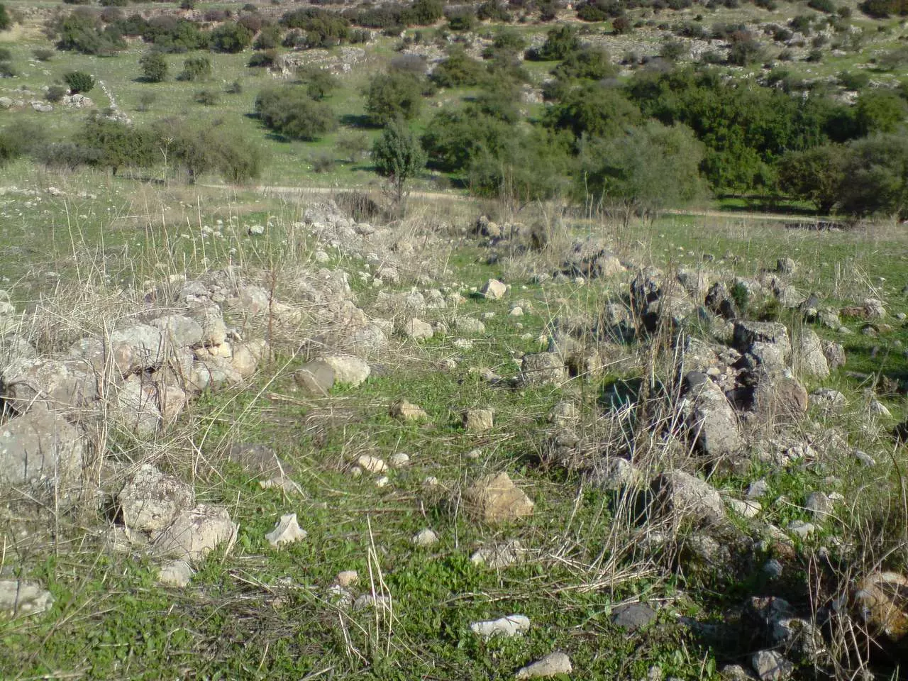
Posted by Ramez - The remains of one of the houses on the western side of the village بقايا احدى البيوت في الناخية الغربية للقرية - تصوير رامز عيد
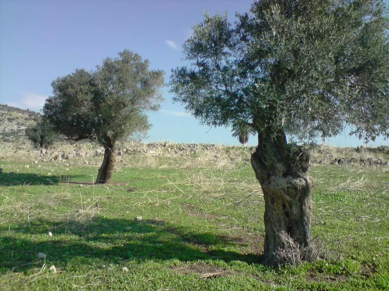
Posted by Ramez - Olive trees of the village on the western side كرم الزيتون في الجهة الغربية للقرية - تصوير رامز عيد
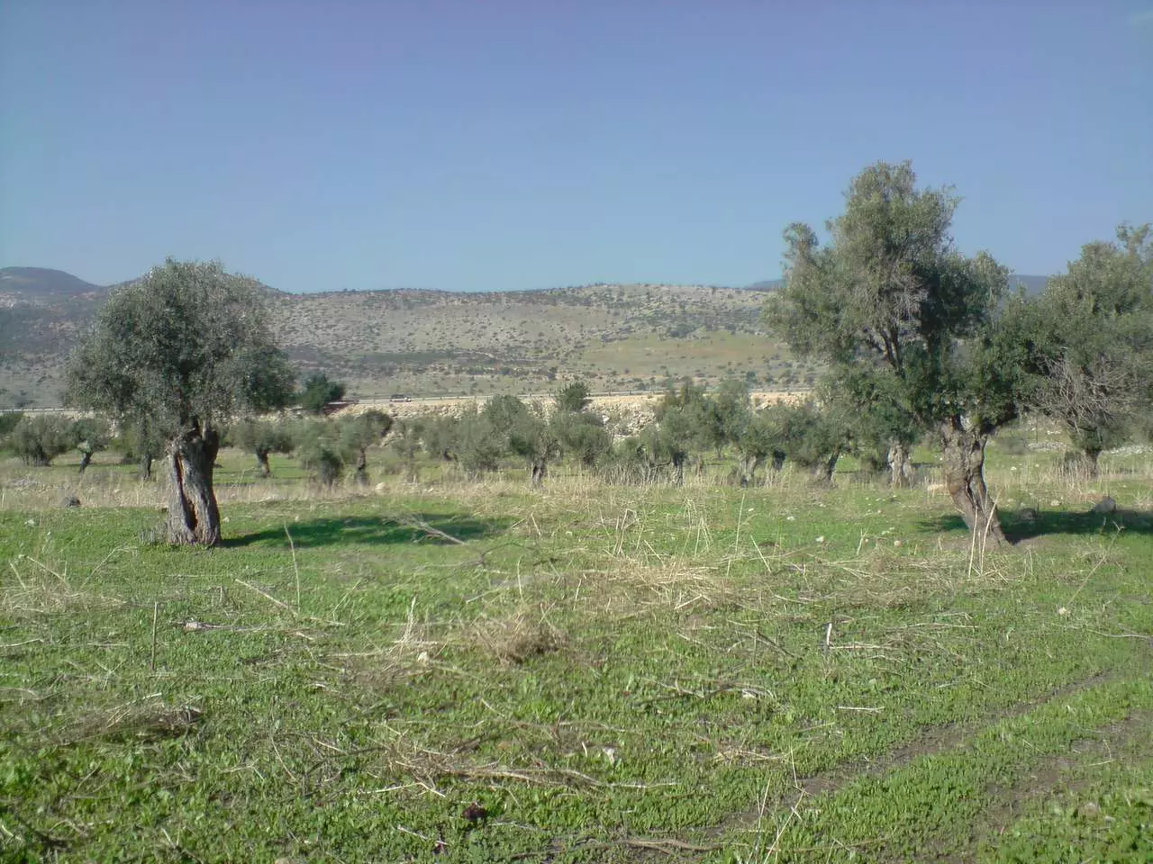
Posted by Ramez - Olive trees near the western side of the village طرف كرم الزيتون قرب الناحية الغربية للقرية - تصوير رامز عيد
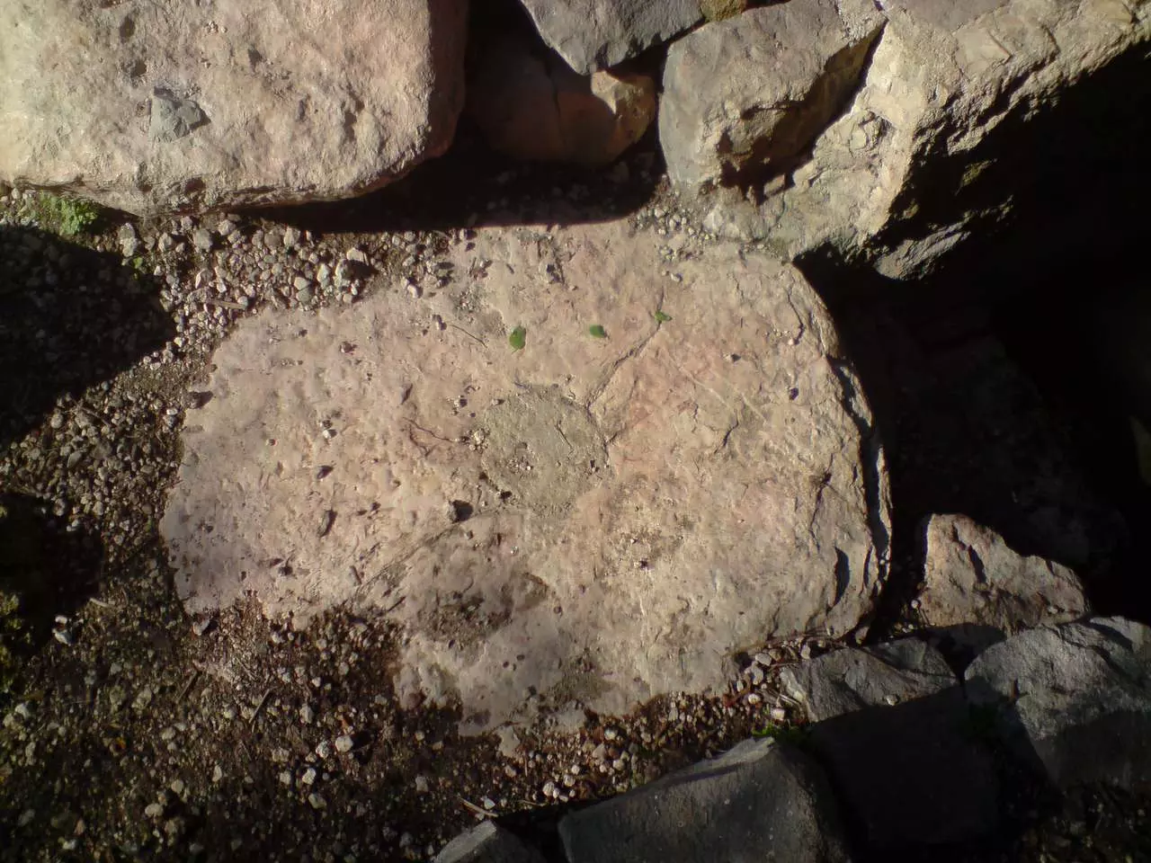
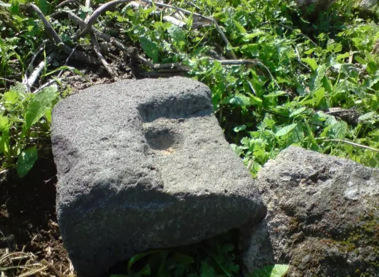
Posted by Ramez - A stone which was a part of the door حجر كان يستعمل لباب احدى البيوت - تصوير رامز عيد
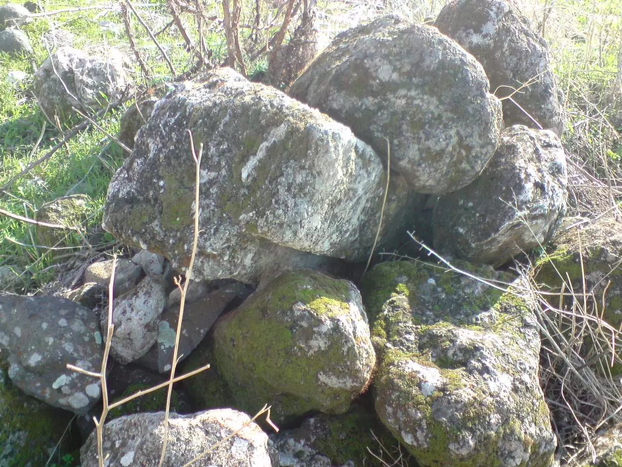
Posted by Ramez - The base of one of the gates حجر ارتكزت عليه بوابة في احد البيوت - تصوير رامز عيد
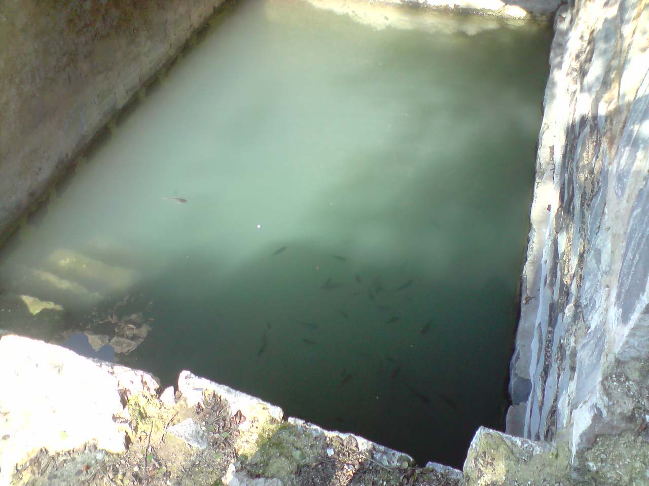
Posted by Ramez - The water spring on the northern side of the village عين الماء في الناحية الغربية للقرية - تصوير رامز عيد
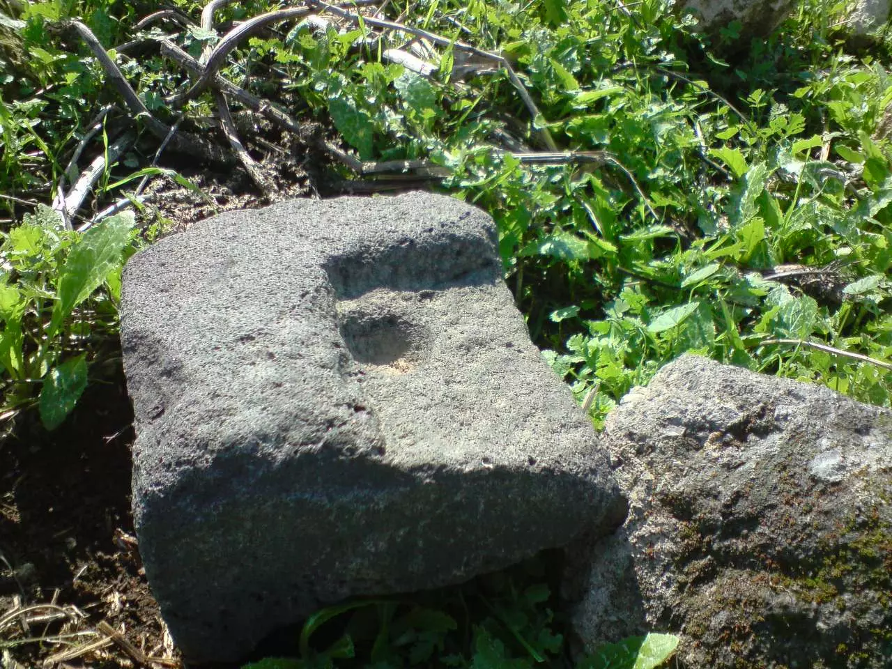
Posted by Ramez - The old olive press stone wheel حجر معصرة الزيتون ملقى على الارض - تصوير رامز عيد
Posted by Ramez - The water spring and the olive press بقايا العين ومعصرة الزيتون - تصوير رامز عيد
Posted by Ramez 1 - Yaquq - a general view ياقوق - من الجهة الشمالية تصوير رامز عيد 01.10.2012
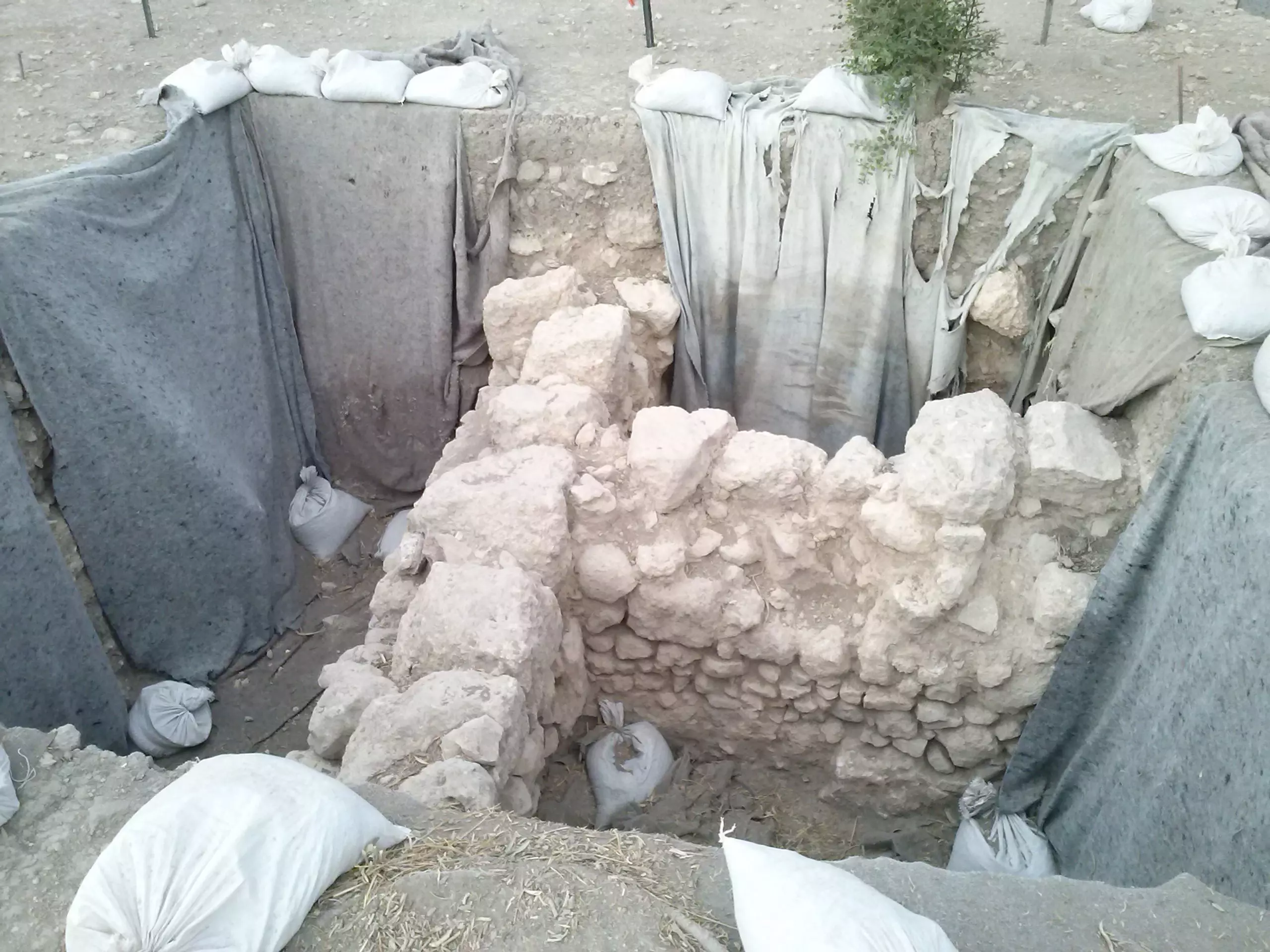
Posted by Ramez - Yaquq - archaeological dig , summer 2012 ياقوق - حفريات اثرية في مركز القرية المهدومة ، صيف 2012 تصوير رامز عيد
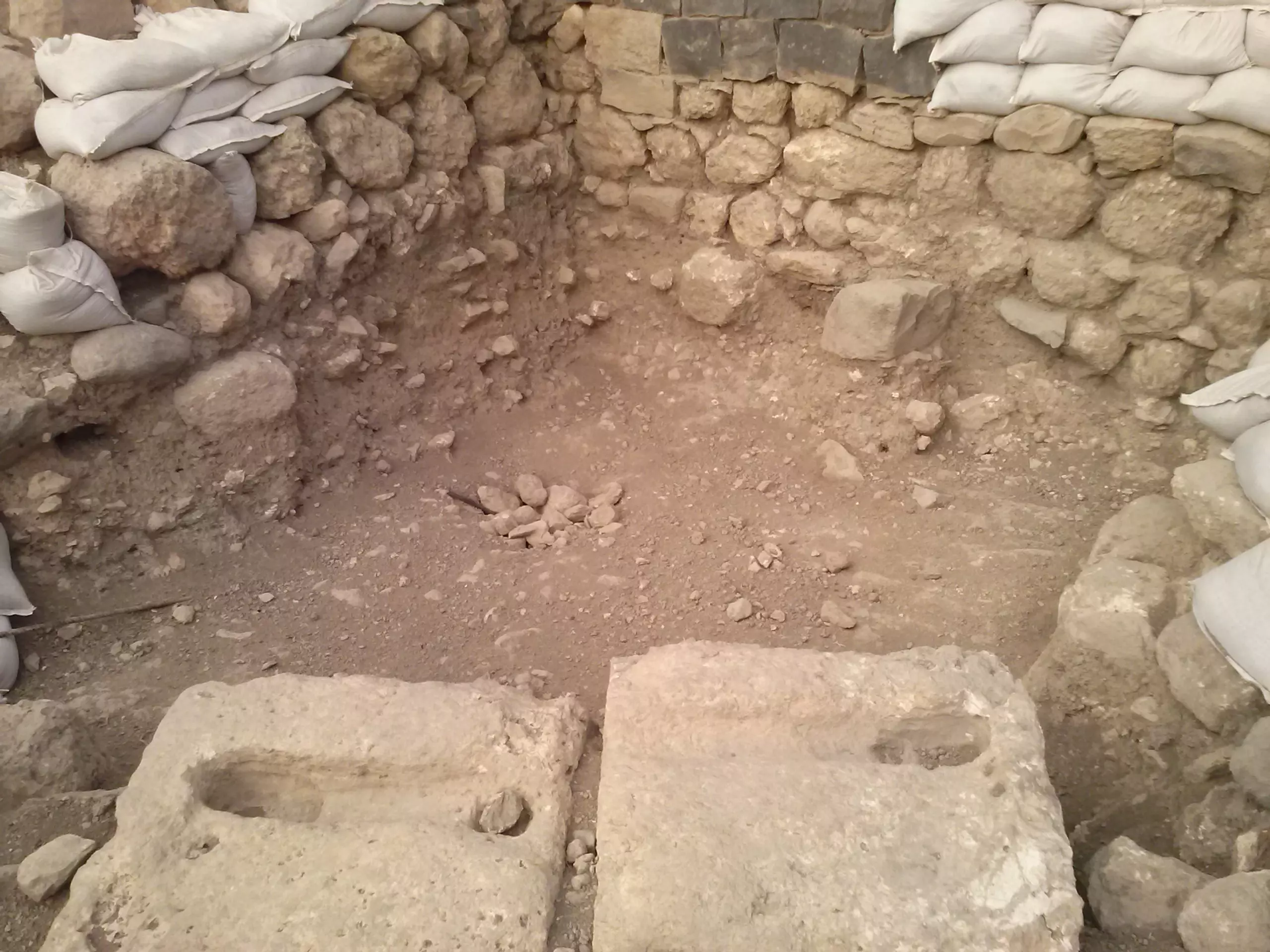
Posted by Ramez - Yaquq - archaeological dig , summer 2012 ياقوق - حفريات اثرية في مركز القرية المهدومة ، صيف 2012 تصوير رامز عيد
Posted by Ramez 1 - Yaquq - archaeological dig , summer 2012 ياقوق - حفريات اثرية في مركز القرية المهدومة ، صيف 2012 تصوير رامز عيد
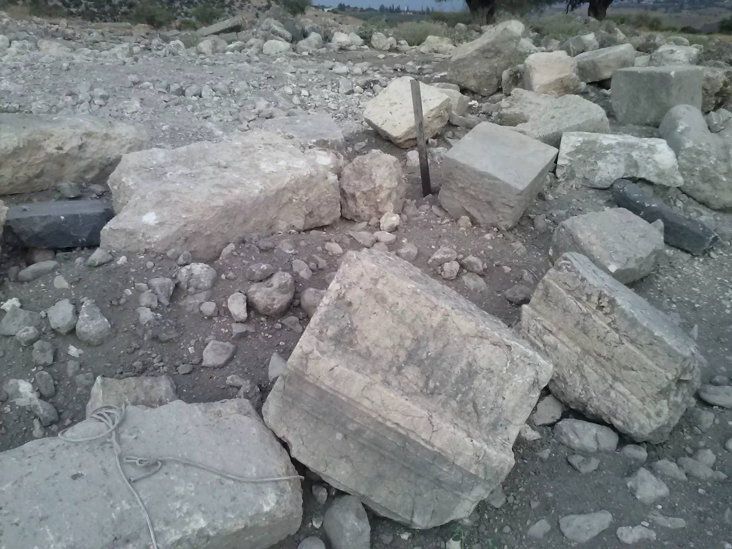
Posted by Ramez - Yaquq - Old stones found in the archaeological dig in the village 2012 ياقوق، احجار قديمة اثرية وجدت تحت بيوت القرية في صيف 2012 - تصوير رامز عيد
Posted by Ramez - Yaquq 2012 ياقوق، ولا زال الشجر يعطي ثمره، مركز القرية المهدومة، تصوير رامز عيد
Posted by Ramez - صبار وموقع القريه
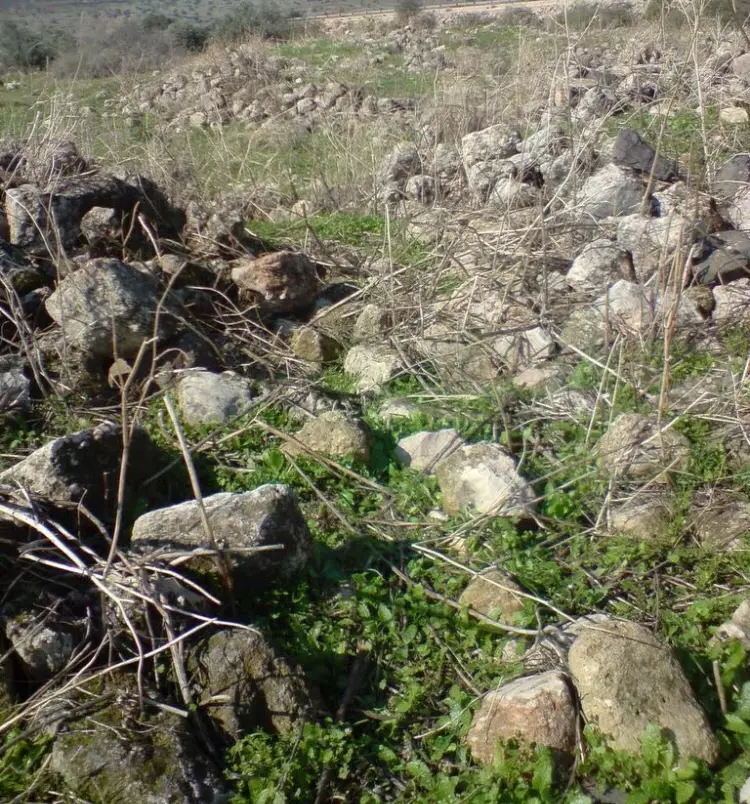
Posted by abu raya - حجاره بيوت القريه
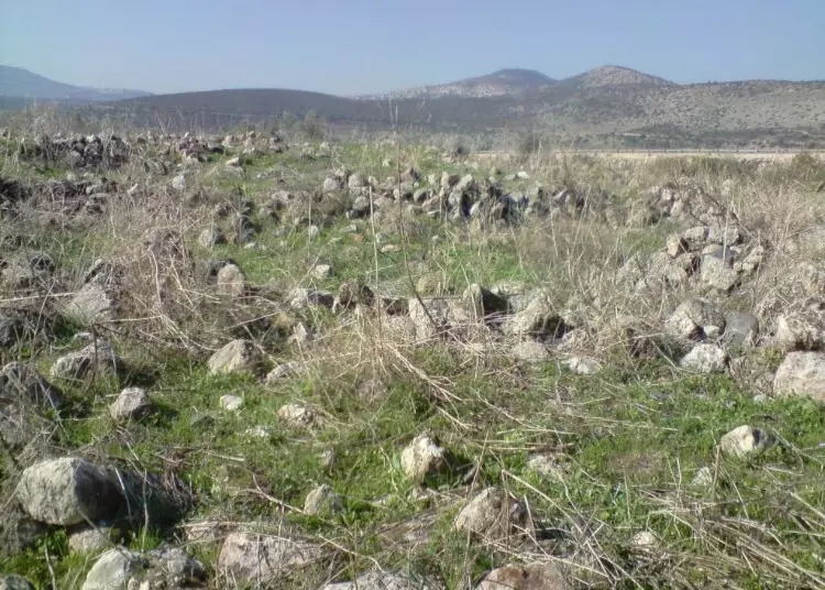
Posted by abu raya 1 - موقع القريه واثار ردم بيوتها

Posted by abu raya - موقع القريه واثار ردم بيوتها
Posted by abu raya - اثار حيطان بيوت القريه
Posted by abu raya - ردم بيوت القريه
Posted by abu raya - اثار بيوت القريه
Posted by abu raya - بىر ماء في القريه
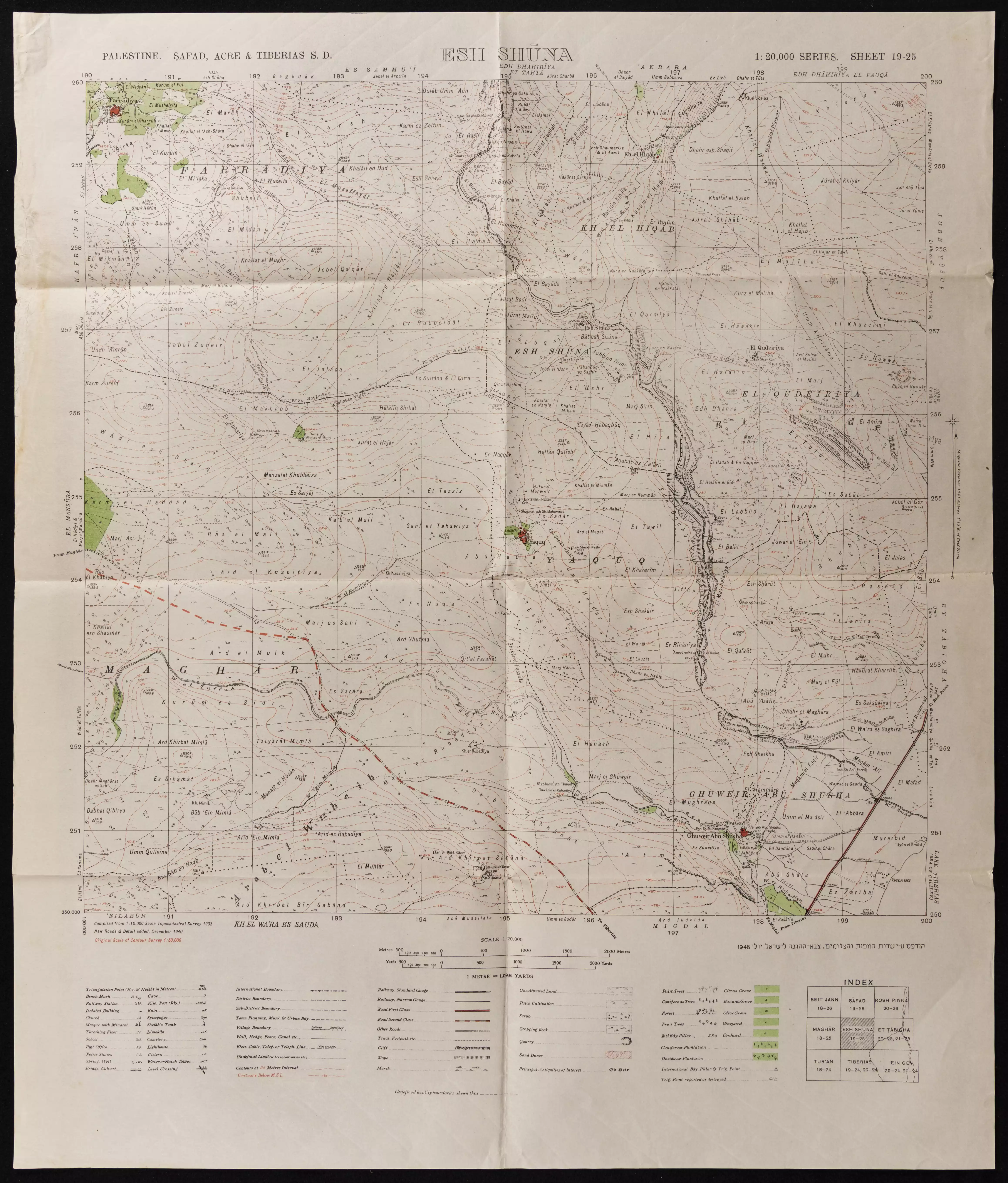
Posted by abu raya - خارطة تُظهِر الحدود والطرق بأنواعها والأماكن المقدسة والطبيعة الطوبغرافية من تلال وسهول ومنحدرات والتشكيلة الطبيعية للأرض وأنواع المزروعات. نُشرت الخريطة فترة الانتداب البريطاني، تم إضافة تعديلات عليها من قِبَل خدمة الخرائط والصور التابعة للقوات العسكرية الاسرائيلية فترة الأربعينيات.
Want to browse more? 80,000 pictures were grouped in these gallaries:
| Display Name | Clan/Hamolah | Country of Residence |
| خالد جمال حسين العلي | عشيرة المواسى | - |
| abu seiwd | yousef abu seiwd | اربد, اربد |
- الذاكرة مفتاح العودة-الحلقة 26- قرية ياقوق Duration: 23 min 22 sec
No links have been shared yet, be free to the first to share the first link.
 Fake Valor: Why Did Zionist Jews Hoist Nazis Flag on Their Ships in the 1930s?
What is new?
-
Facts About Oct. 7th Gaza Raid
-
Remined Us Please:: Who Did Rape Who? Palestinians Raped Israelis? Or, was the other way around?
-
When Prof. Edward Said was invited to debate Bibi Netanyahu in the 1980s, watch what happened!
-
Ezra Klein of the NY Times on the "Jewish Race".
-
Abusing Blood Libel!
-
Did Israeli Soldiers Activate The Hanniba Direective On Oct. 7th? You Be The Judge
-
Zionist FAQ: Isn't it true that Palestinians don't want peace? Palestinians never accepted the two-state solution
- Facts about Haavara (Transfer) Agreement between Ben-Gurion & Hitler
-
Haavara FAQs: Why Did Zionist Jews Hoist Nazis' Flags on Their Ships in the 1930s?
- Haavara FAQs: When Chaim Weizmann met FDR in mid-1943, why was he silent about rescuing European Jewry?
-
Dear ChatGPT: How did Palestinians resist Napoleon's invasion of their country in 1799?
-
Dear ChatGPT: Gaza had a vibrant Jewish community in the mid-17th century. What happened to them?
-
Dear ChatGPT: Why did the Jewish Agency suppress news of the Holocaust during WWII?
-
Video Playlist: Jews share their DNA tests to end the conflict for good.
-
A Tale of Two Conflicts: Examining the Definition of Genocide
-
Prof. Abraham Polak And The Suppressed History of the Khazars and European Jewry
-
How Ronald Reagan would have framed the genocide in Gaza if he were still alive?
-
Haavara FAQs: Let us do the math: how many German Jews did The Haavara Agreement save?
-
Zionist FAQs: The Hebron Massacre of 1929, "clearly proves" that Palestinians are antisemitic, how could you deny it?
-
Zionist FAQs: Why Anti-Zionist Is Not Antisemitism?
-
Zionist FAQs: Isn't it true that the KGB created Palestinian Nationalism in the early 1960s?
- Zionist FAQs: Muslims are killing Muslims all the time; why are Israeli Jews being singled out in the media?
- Zionist FAQs: How is Israel an apartheid state when 20% of its citizens are Arabs who enjoy full rights?
-
Haavara FAQs: Why Did Dorothy Thompson Flip From A Zionist Advocate to A Silenced Dissenter?
-
Haavara FAQs: Analysis of Herzl's Uganda Scheme and how it could have saved millions of Jews.
-
Haavara FAQs: Why did Hayim Greenberg describe American Jewry as "morally bankrupt" in early 1943?
-
Haavara FAQs: What if the Evian Conference was a resounding success? What would have been the impact of saving European Jewry on Zionism?
- Haavara FAQs: What if the six million were saved, how that would have impacted the Zionist project?
-
Haavara FAQs: How did Zionist leaders react when Europe's Jews lingered in the DP camps after WWII ended?
-
Why does the American Jewish community repeat lies that David Ben-Gurion had debunked before he died?
-
Who has the power to rename the Tatar/Khazar Gene Marker to Jewish IV?
-
Zionist FAQs: Why won't Egypt, Syria, and Jordan take their people back? Jews are indigenous to Palestine, and Arabs immigrated after Jews developed the country. Arabs should leave.
-
Haavara FAQs: Did Hitler and the Nazis conflate between Judaism and Zionist? If that wasn't case, then why?
-
Haavara FAQs: Winston Churchill and antisemitism, a collection of articles written Churchill.
-
Haavara FAQs: Broken by country, how many Jews survived vs. killed during the Holocaust?
-
Haavara FAQs: Why did European Jews vote with their feet and to immigrated to the Americas, not Palestine, after WWII?
-
Watch this American Jewish Girl describing Israeli Jews' cognitive dissonance like no other in under two minutes
-
Haavara FAQs: When the Nazis went out of their way to hide the Holocaust, Israeli Jews did the exact opposite by broadcasting their genocide of Gazans. But why?
-
Haavara FAQs: How Zionist Jews went out of their to show their appreciation to Nazism and Fascism?
- Haavara FAQs: Why Zionist leaders were against bombing the death camps & the Railroads leading to them?
-
Haavara FAQs: Hitler's message to the British and American people: If Jews are such noble citizens and you care about them, how come you're not letting them in? I will gladly ship them to you at my expense, even on luxury liners!
-
A shortlist of Zionist and Israeli false flag operations in the name Jews.
-
The Most Moral Army
- The Land of Kapos (Israel): Where the brave are boycotted and Kapos walk free.
- Why did early Zionists often named their communal enterprises "colonial"?
- Zionist Relations with Nazi Germany by Faris Glubb
-
Two NY Times advertisements by Zionists in the early 1943 that exposes Zionists' treason at the height of the calamity
- Facts Not Lies about the Palestinian-Israeli Conflict.
- Site's pictures have been categorized
- Campgain Against Lice
- A Survey of Palestine, the official source about Palestine before Nakba produced by the British Mandate; over 1200 pages.
- Satellite View & Google Earth: Over 6,000 placemarks identifying all destroyed towns, W. Bank & Gaza Strip Towns, & refugee camps.
- PalestineRemembered.com and its Nakba Oral History Project were featured on al-Jazeera Satellite TV.
- Nakba Oral History Video Podcast:
 Over 700 Oral History interviews (including 3,500+ hours of recording) can be viewed online.
 - Palestine Village Statistics Project
- Gaza Jail Break
- النسخة العربية للموقع الان متوفرة
- Videos: Documenting the destroyed villages in video: Tracing all that remains since Nakba.
- Videos: Responding to Zionist Propaganda
- Interview: The ethnic cleansing of Palestine: George Galloway interviews Israeli Historian Ilan Pappe.
- For Palestinians, memory matters. It provides a blueprint for their future By George Bisharat.
- Zionist FAQ now available in Hebrew שאלות שציונים שואלים, עכשיו בעברית
- Video: The Stephen Walt and John Mearsheimer report on the influence of the Israel Lobby on U.S. Foreign Policy
- The Palestinian-Israeli conflict for beginners
