| PalestineRemembered | About Us | Oral History | العربية | |
| Pictures | Zionist FAQs | Haavara | Maps | |
| Search |
| Camps |
| Districts |
| Acre |
| Baysan |
| Beersheba |
| Bethlehem |
| Gaza |
| Haifa |
| Hebron |
| Jaffa |
| Jericho |
| Jerusalem |
| Jinin |
| Nablus |
| Nazareth |
| Ramallah |
| al-Ramla |
| Safad |
| Tiberias |
| Tulkarm |
| Donate |
| Contact |
| Profile |
| Videos |
Welcome To al-Zanghariyya - زحلق (الزنغرية) (א-זנע'ריה)
|
District of Safad
Ethnically cleansed days ago |
العربية Google Earth |
 |
Gallery (11) |
- Statistics & Facts
-
Before & After

- Satellite View
- Articles 1
- Pictures 11
- Land Deeds 2
- Oral History 2
- Members 5
- All That Remains
- Wikipedia
- Videos 1
- Guest Book 7
- Links
| Statistic & Fact | Value | ||||||||||||
| Occupation Date | May 4, 1948 | ||||||||||||
| Distance From District | 8.5 (km) South East of Safad | ||||||||||||
| Elevation | 250 (meters) | ||||||||||||
| Before & After Nakba, Click Map For Details |
|||||||||||||
|
|||||||||||||
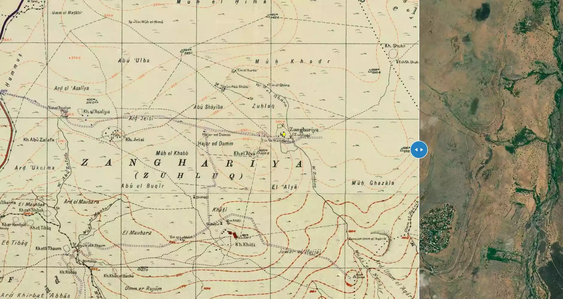
| Map Location | See location #69 on the map View from satellite |
||||||||||||
| Military Operation | Operation Matate (Broom) part of Operation Yiftach | ||||||||||||
| Attacking Units | Some unknown brigade from the Haganah | ||||||||||||
| Refugees' Migration Routes | Refugees fled eastwards into Syria. | ||||||||||||
| Exodus Cause | Expulsion by Zionist troops | ||||||||||||
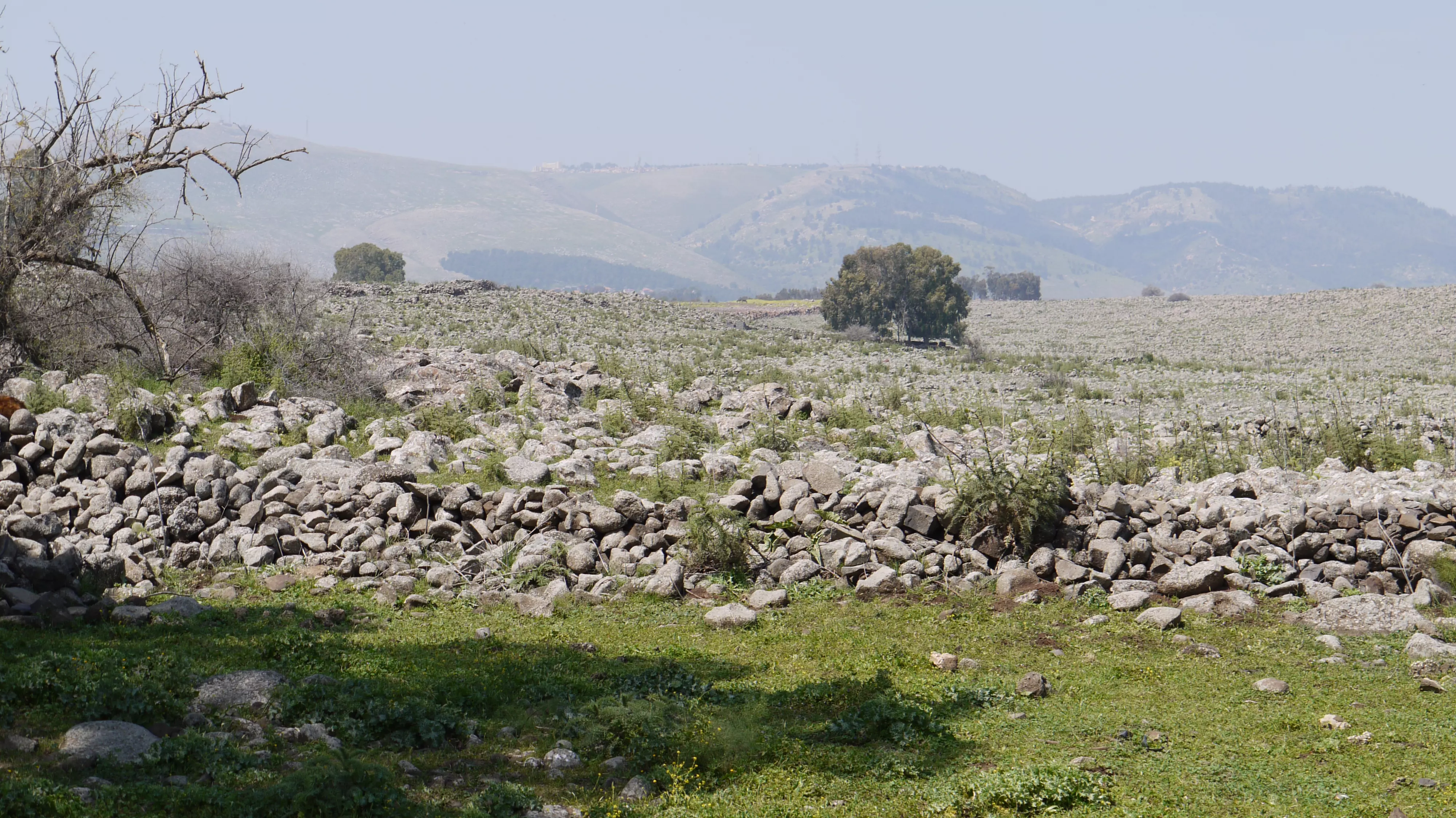
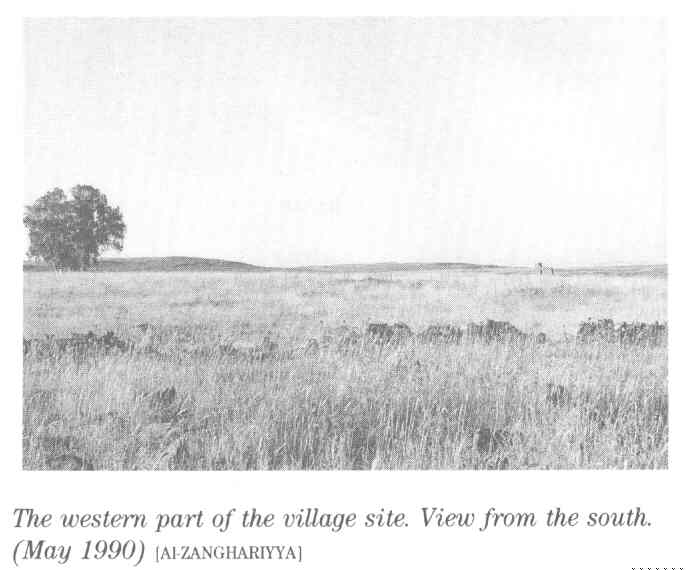
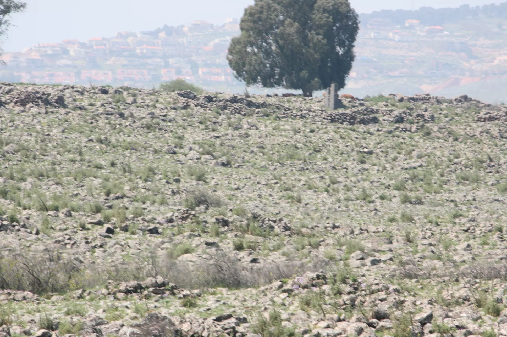
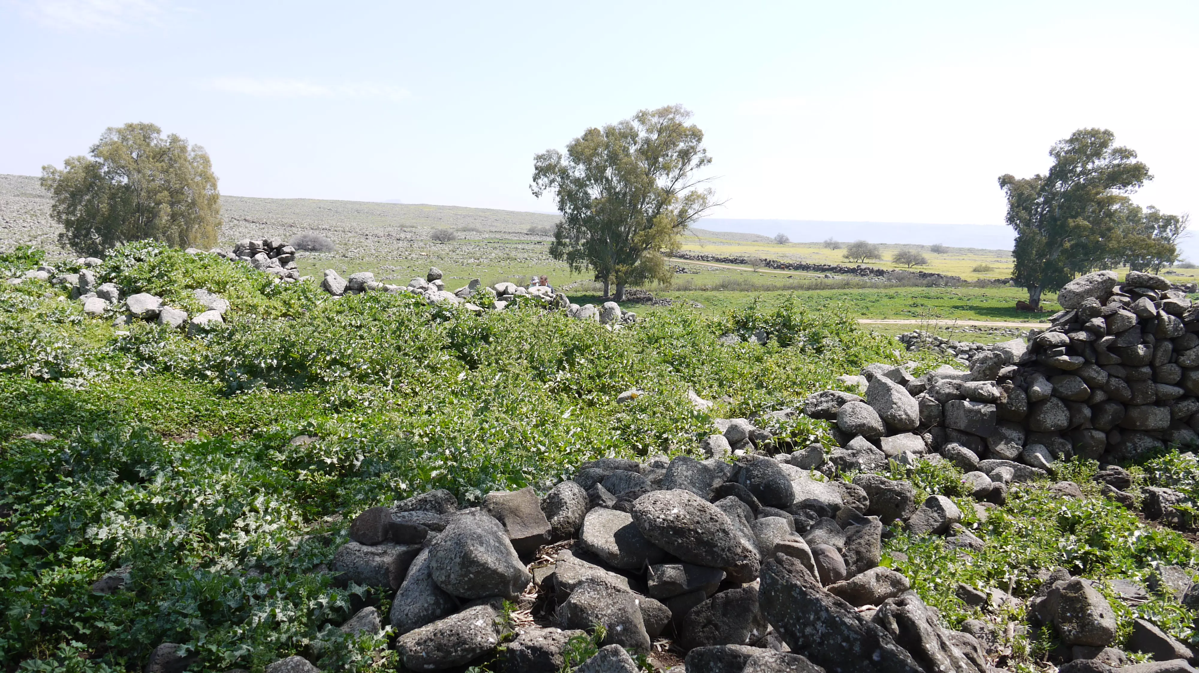
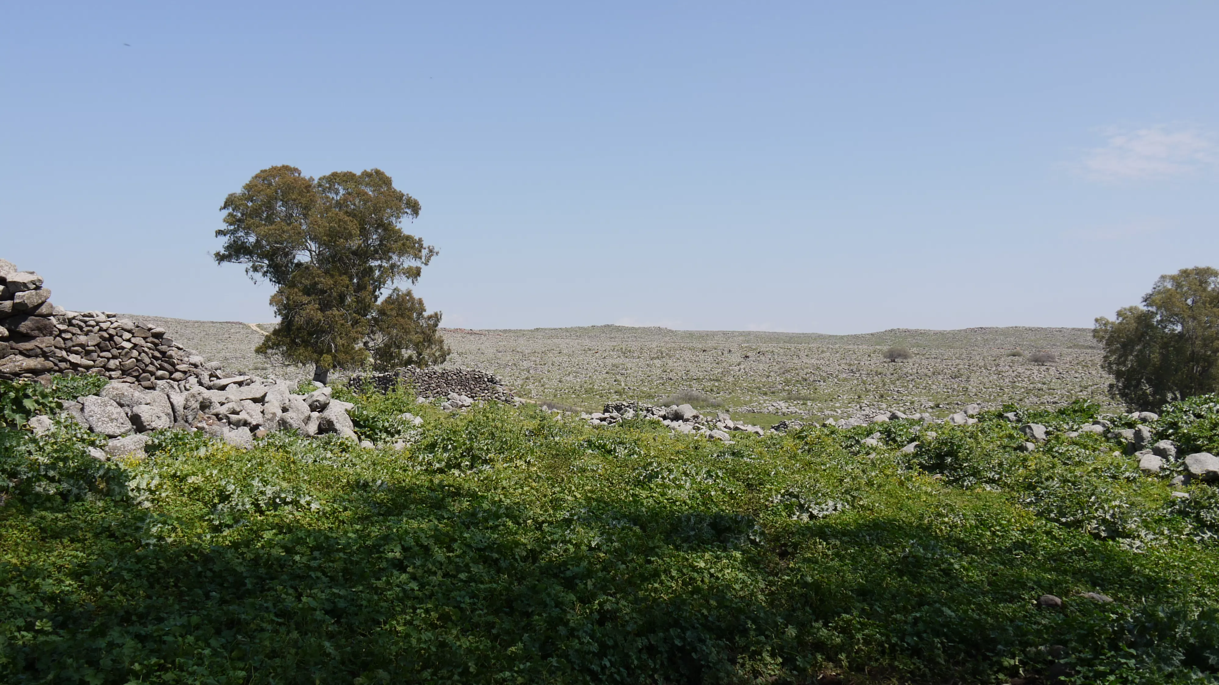
| Village Temains | The village has been burned and destroyed on the 17th of June 1948. | ||||||||||||
| Ethnically Cleansing | al-Zanghariyya inhabitants were completely ethnically cleansed. | ||||||||||||
| Pre-Nakba Land Ownership |
**Town Lands' Demarcation Maps |
||||||||||||
| Land Usage As of 1945 |
|
||||||||||||
| Population |
|
||||||||||||
| Number of Houses |
|
||||||||||||
| Town's Name Through History | The village was named after the 'Arab al-Zanghariyya Bedouin tribe, who first used the village as a camping ground and then gradually settled on village lands. | ||||||||||||
| Nearby Wadies & Rivers | The village was situated close to Wadi al-Ghara. | ||||||||||||
| Water Supply | Wadi al-Ghara supplied the village with several springs | ||||||||||||
| Exculsive Jewish Colonies Who Usurped Village Lands |
Elifelet and the private farm of Kare Deshe | ||||||||||||
| Featured Video | |||||||||||||
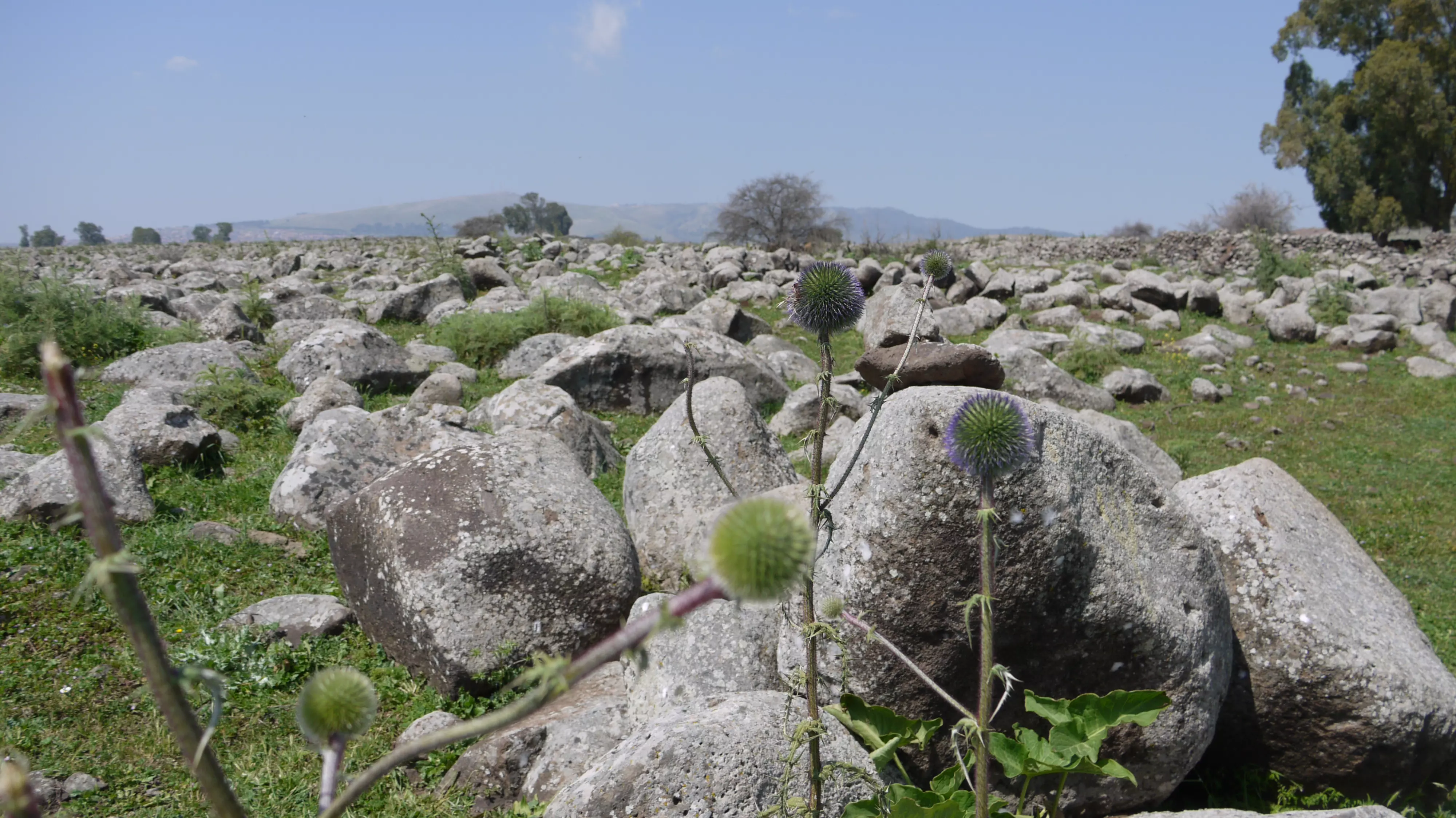
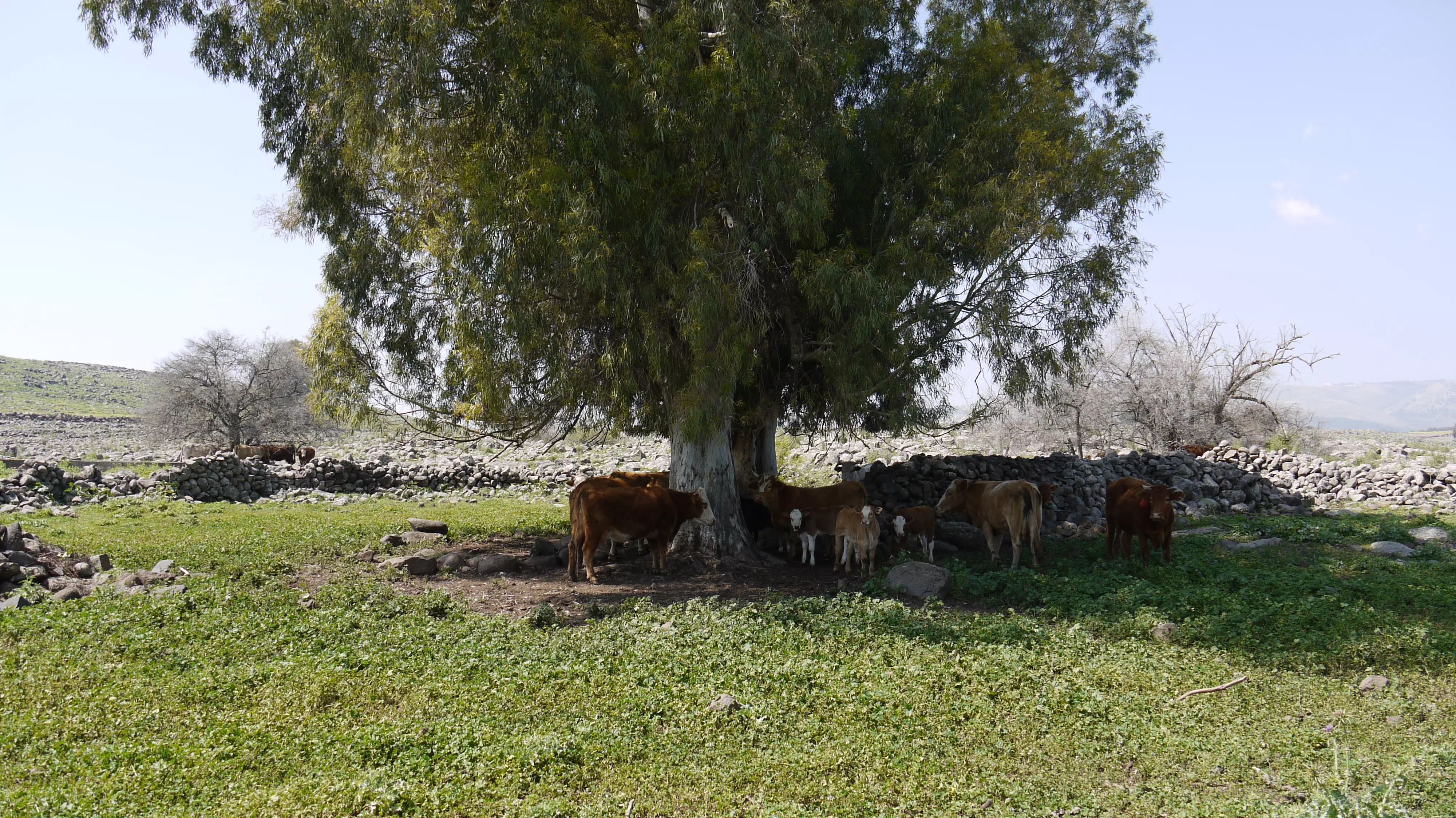
Village Before NakbaThe village was situated in a hollow in the side of a wide hill that gently sloped eastward. It faced the Golan Heights and overlooked the Jordan Valley. Several springs were present to the northwest, along Wadi al-Ghara. AI-Zanghariyya was linked via a dirt road to the Safad-Tiberias highway. It was named after the 'Arab al-Zanghariyya Bedouin tribe, who first used the site as a camping ground and then gradually settled there. The alternative name, Zuhluq (meaning "to slide" in Arabic), may have been given to the village because the slope on which it was located was subject to land slides. AI-Zanghariyya's houses, made of mud and stone, were divided into two groups: one to the east (known as Zanghariyya al-Sharqiyya) and one to the west (Zanghariyya al-Gharbiyya); these groups lay about 300-400 yards apart. Its population was predominantly Muslim.The lands around the village served mainly as pasture, although parts were planted in crops that were watered by both rainfall and irrigation. The villagers grew grain, fruit, and onions and also raised water buffalo and cattle. In 1944/45 a total of 7,265 dunums was allocated to cereals. Herdsmen from 'Arab al-Zanghariyya grazed their animals on adjacent pastures, alternating between the Jordan Valley in the winter and the eastern slopes of the Galilee Mountains in the summer. Fishing in Lake Tiberias and the Jordan also constituted an important activity for a segment of the population. AI-Zanghariyya contained evidence of earlier habitation, including building foundations and an enclosure built of basaltic stone. Village Occupation and Ethnic CleaningOperation Matate (Broom) was a Haganah offensive launched on 4 May 1948 in the course of Operation Yiftach (see Abil al-Qamh, Safad sub-disctrict). The goal of this offensive was to 'clear' an area east of Safad close to the Jordan River. The orders given to Palmach company commanders before the sub-operation stated specifically that the villages of al-Zanghariyya, al-Tabigha, and 'Arab al-Shamalina should be attacked, 'their inhabitants expelled and the [ir] houses blown up.' According to Israeli historian Benny Morris, the orders added that 'friendly Arabs' should not be harmed. Morris states that, as the Palmach columns approached these villages, the residents fled eastwards into Syria; the following day, sappers methodically blew up over fifty houses in al-Zanghariyya and the other villages. A cable sent by the Arab Liberation Army commander to the High Command in Syria confirms that al-Zanghariyya was occupied on 4 May, and adds that the occupation of the village was followed by an attack on Safad.The New York Times wrote: 'In this operation [Operation Broom] Israeli forces have spread confusion among Arab populations of Galilee towns and sent Arab civilians scurrying for the borders of Syria and Lebanon.' Syrian authorities told the British that this thrust alone created a further 2,000 refugees. One week into the first truce of the war, on 17 June, the New York Times quoted Syrian officials who asserted that Israeli forces had broken the cease-fire by setting al-Zanghariyya on fire, possibly completing the destruction of the village. Zionists Colonies on Village LandsIsrael established the settlement of Elifelet (201261) on village lands west of the village site in 1949. The private farm of Kare Deshe (201252), founded in 1954, is about 8 km to the southwest. An Israeli gazetteer mentions the settlement of Pedahe'el (205262) and says that its original name was Zangariya Bet. However, there is no other information available about this settlement, and it may have been abandoned during the 1950s. [[M:xx; P:313]]Village TodayAll that is left are blocks of basalt that once had been parts of twelve houses (see photos section). Although the houses have been demolished, some of their walls are still standing. Near the remnants of the village houses are stone barriers that form parts of livestock enclosures. The area serves as pasture for the cattle of the nearby Israeli farm, Kare Deshe, to the southwest.SourceDr. Walid al-Khalidi, 1992: All That Remains. |
|||||||||||||
| Related Maps | Town Lands' Demarcation Maps خرائط للقضاء توضح حدود القرى والاودية Town's map on MapQuest View from satellite Help us map this town at WikiMapia |
||||||||||||
| Related Links | Wikipedia's Page Google Search Google For Images Google For Videos |
||||||||||||
| More Information | في كتاب كي لا ننسى في كتاب بلادنا فلسطين المزيد من موقع هوية |
||||||||||||
- Village Land In 1987
Scanned from "All That Remains" by Dr. Walid Khalidi 2 - الشمالنة
Posted by okasha 1 - Al-Zangharyja
Posted by Aisha - Al-Zangharyja
Posted by Aisha - Al-Zangharyja
Posted by Aisha - Al-Zangharyja
Posted by Aisha - Al-Zangharyja
Posted by Aisha - Al-Zangharyja
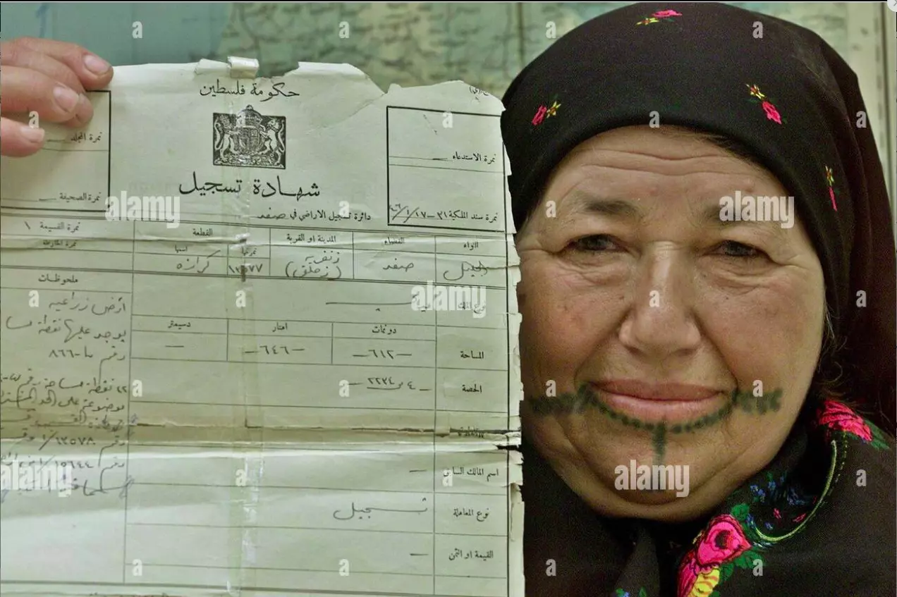
Posted by Aisha - Palestinian woman Hasna al-Jardat displays deeds to her land in the Safad area on May 14, 2004, issued by Palestinian authorities in 1946. Jardat fled to Syria in 1948, the year Israel was created. On Saturday, Palestinians mark the 56th anniversary of what they call their Nakba or the Catastrophe, of their 1948 upheaval. More than 350,000 Palestinian refugees live in Syria..REUTERS/ Khaled al-Hariri
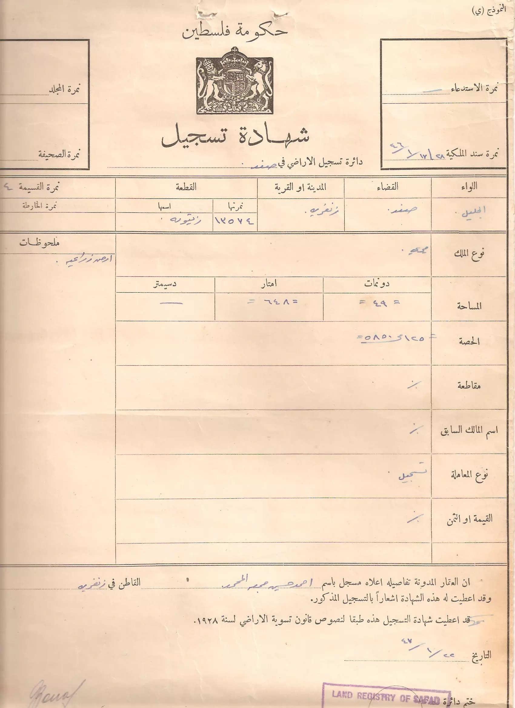
- كوشان لارض في الزنغرية طوبت بإسم احمد حسين جمعة
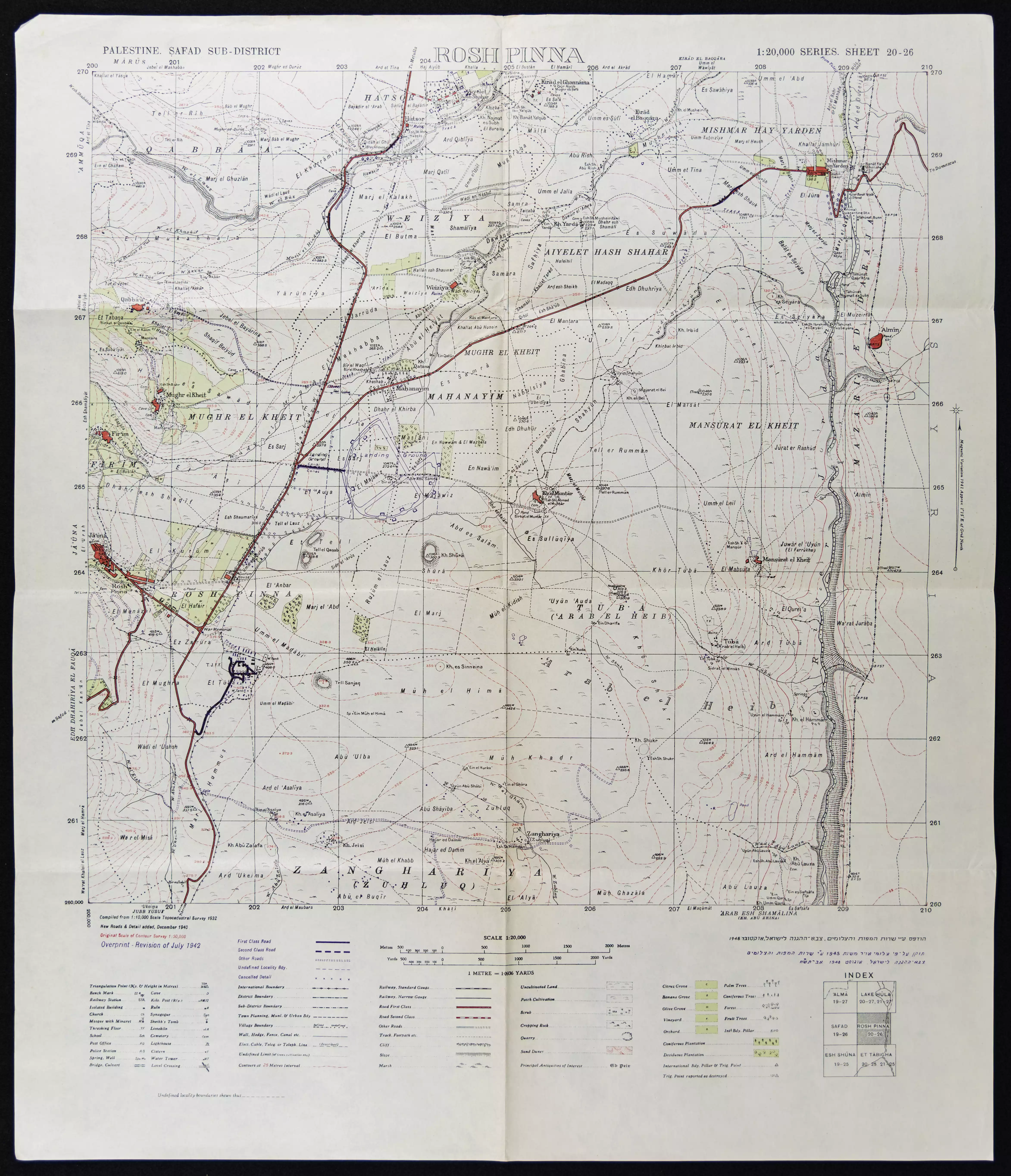
- خارطة تُظهِر الحدود والطرق بأنواعها والأماكن المقدسة والطبيعة الطوبغرافية من تلال وسهول ومنحدرات والتشكيلة الطبيعية للأرض وأنواع المزروعات. نُشرت الخريطة فترة الانتداب البريطاني، تم إضافة تعديلات عليها من قِبَل خدمة الخرائط والصور التابعة للقوات العسكرية الاسرائيلية فترة الأربعينيات.
Want to browse more? 80,000 pictures were grouped in these gallaries:
- Palestinian woman Hasna al-Jardat displays deeds to her land in the Safad area on May 14, 2004, issued by Palestinian authorities in 1946. Jardat fled to Syria in 1948, the year Israel was created. On Saturday, Palestinians mark the 56th anniversary of what they call their Nakba or the Catastrophe, of their 1948 upheaval. More than 350,000 Palestinian refugees live in Syria..REUTERS/ Khaled al-Hariri
- كوشان لارض في الزنغرية طوبت بإسم احمد حسين جمعة
| Display Name | Clan/Hamolah | Country of Residence |
| الملاك الأخير | الزنغري | Dar3a, Syria |
| زنغري من سوريا | - | المانيا |
| hussein | alzangaria | - |
| ashraf | - | ]lar |
| Midhat Ali | - | - |
- الذاكرة مفتاح العودة - الحلقة 1- قرية زحلق الزنغرية Duration: 23 min 22 sec
No links have been shared yet, be free to the first to share the first link.
 Fake Valor: Why Did Zionist Jews Hoist Nazis Flag on Their Ships in the 1930s?
What is new?
-
Facts About Oct. 7th Gaza Raid
-
Remined Us Please:: Who Did Rape Who? Palestinians Raped Israelis? Or, was the other way around?
-
When Prof. Edward Said was invited to debate Bibi Netanyahu in the 1980s, watch what happened!
-
Ezra Klein of the NY Times on the "Jewish Race".
-
Abusing Blood Libel!
-
Did Israeli Soldiers Activate The Hanniba Direective On Oct. 7th? You Be The Judge
-
Zionist FAQ: Isn't it true that Palestinians don't want peace? Palestinians never accepted the two-state solution
- Facts about Haavara (Transfer) Agreement between Ben-Gurion & Hitler
-
Haavara FAQs: Why Did Zionist Jews Hoist Nazis' Flags on Their Ships in the 1930s?
- Haavara FAQs: When Chaim Weizmann met FDR in mid-1943, why was he silent about rescuing European Jewry?
-
Dear ChatGPT: How did Palestinians resist Napoleon's invasion of their country in 1799?
-
Dear ChatGPT: Gaza had a vibrant Jewish community in the mid-17th century. What happened to them?
-
Dear ChatGPT: Why did the Jewish Agency suppress news of the Holocaust during WWII?
-
Video Playlist: Jews share their DNA tests to end the conflict for good.
-
A Tale of Two Conflicts: Examining the Definition of Genocide
-
Prof. Abraham Polak And The Suppressed History of the Khazars and European Jewry
-
How Ronald Reagan would have framed the genocide in Gaza if he were still alive?
-
Haavara FAQs: Let us do the math: how many German Jews did The Haavara Agreement save?
-
Zionist FAQs: The Hebron Massacre of 1929, "clearly proves" that Palestinians are antisemitic, how could you deny it?
-
Zionist FAQs: Why Anti-Zionist Is Not Antisemitism?
-
Zionist FAQs: Isn't it true that the KGB created Palestinian Nationalism in the early 1960s?
- Zionist FAQs: Muslims are killing Muslims all the time; why are Israeli Jews being singled out in the media?
- Zionist FAQs: How is Israel an apartheid state when 20% of its citizens are Arabs who enjoy full rights?
-
Haavara FAQs: Why Did Dorothy Thompson Flip From A Zionist Advocate to A Silenced Dissenter?
-
Haavara FAQs: Analysis of Herzl's Uganda Scheme and how it could have saved millions of Jews.
-
Haavara FAQs: Why did Hayim Greenberg describe American Jewry as "morally bankrupt" in early 1943?
-
Haavara FAQs: What if the Evian Conference was a resounding success? What would have been the impact of saving European Jewry on Zionism?
- Haavara FAQs: What if the six million were saved, how that would have impacted the Zionist project?
-
Haavara FAQs: How did Zionist leaders react when Europe's Jews lingered in the DP camps after WWII ended?
-
Why does the American Jewish community repeat lies that David Ben-Gurion had debunked before he died?
-
Who has the power to rename the Tatar/Khazar Gene Marker to Jewish IV?
-
Zionist FAQs: Why won't Egypt, Syria, and Jordan take their people back? Jews are indigenous to Palestine, and Arabs immigrated after Jews developed the country. Arabs should leave.
-
Haavara FAQs: Did Hitler and the Nazis conflate between Judaism and Zionist? If that wasn't case, then why?
-
Haavara FAQs: Winston Churchill and antisemitism, a collection of articles written Churchill.
-
Haavara FAQs: Broken by country, how many Jews survived vs. killed during the Holocaust?
-
Haavara FAQs: Why did European Jews vote with their feet and to immigrated to the Americas, not Palestine, after WWII?
-
Watch this American Jewish Girl describing Israeli Jews' cognitive dissonance like no other in under two minutes
-
Haavara FAQs: When the Nazis went out of their way to hide the Holocaust, Israeli Jews did the exact opposite by broadcasting their genocide of Gazans. But why?
-
Haavara FAQs: How Zionist Jews went out of their to show their appreciation to Nazism and Fascism?
- Haavara FAQs: Why Zionist leaders were against bombing the death camps & the Railroads leading to them?
-
Haavara FAQs: Hitler's message to the British and American people: If Jews are such noble citizens and you care about them, how come you're not letting them in? I will gladly ship them to you at my expense, even on luxury liners!
-
A shortlist of Zionist and Israeli false flag operations in the name Jews.
-
The Most Moral Army
- The Land of Kapos (Israel): Where the brave are boycotted and Kapos walk free.
- Why did early Zionists often named their communal enterprises "colonial"?
- Zionist Relations with Nazi Germany by Faris Glubb
-
Two NY Times advertisements by Zionists in the early 1943 that exposes Zionists' treason at the height of the calamity
- Facts Not Lies about the Palestinian-Israeli Conflict.
- Site's pictures have been categorized
- Campgain Against Lice
- A Survey of Palestine, the official source about Palestine before Nakba produced by the British Mandate; over 1200 pages.
- Satellite View & Google Earth: Over 6,000 placemarks identifying all destroyed towns, W. Bank & Gaza Strip Towns, & refugee camps.
- PalestineRemembered.com and its Nakba Oral History Project were featured on al-Jazeera Satellite TV.
- Nakba Oral History Video Podcast:
 Over 700 Oral History interviews (including 3,500+ hours of recording) can be viewed online.
 - Palestine Village Statistics Project
- Gaza Jail Break
- النسخة العربية للموقع الان متوفرة
- Videos: Documenting the destroyed villages in video: Tracing all that remains since Nakba.
- Videos: Responding to Zionist Propaganda
- Interview: The ethnic cleansing of Palestine: George Galloway interviews Israeli Historian Ilan Pappe.
- For Palestinians, memory matters. It provides a blueprint for their future By George Bisharat.
- Zionist FAQ now available in Hebrew שאלות שציונים שואלים, עכשיו בעברית
- Video: The Stephen Walt and John Mearsheimer report on the influence of the Israel Lobby on U.S. Foreign Policy
- The Palestinian-Israeli conflict for beginners
