| PalestineRemembered | About Us | Oral History | العربية | |
| Pictures | Zionist FAQs | Haavara | Maps | |
| Search |
| Camps |
| Districts |
| Acre |
| Baysan |
| Beersheba |
| Bethlehem |
| Gaza |
| Haifa |
| Hebron |
| Jaffa |
| Jericho |
| Jerusalem |
| Jinin |
| Nablus |
| Nazareth |
| Ramallah |
| al-Ramla |
| Safad |
| Tiberias |
| Tulkarm |
| Donate |
| Contact |
| Profile |
| Videos |
Welcome To Ghuwayr Abu Shusha - غوير أبو شوشة (ע'ויר אבו שושה)
|
District of Tiberias
Ethnically cleansed days ago |
العربية Google Earth |
 |
Gallery (66) |
- Statistics & Facts
-
Before & After

- Satellite View
- Articles 6
- Pictures 66
- Aerial Views 1
- Oral History 3
- Members
- Families
- All That Remains
- Wikipedia
- Videos 2
- Guest Book 1
- Links
| Statistic & Fact | Value | |||||||||||||||||||||
| Occupation Date | April 21, 1948 | |||||||||||||||||||||
| Distance From District | 8 (km) North of Tiberias | |||||||||||||||||||||
| Elevation | -150 (meters) | |||||||||||||||||||||
| Before & After Nakba, Click Map For Details |
||||||||||||||||||||||
|
||||||||||||||||||||||
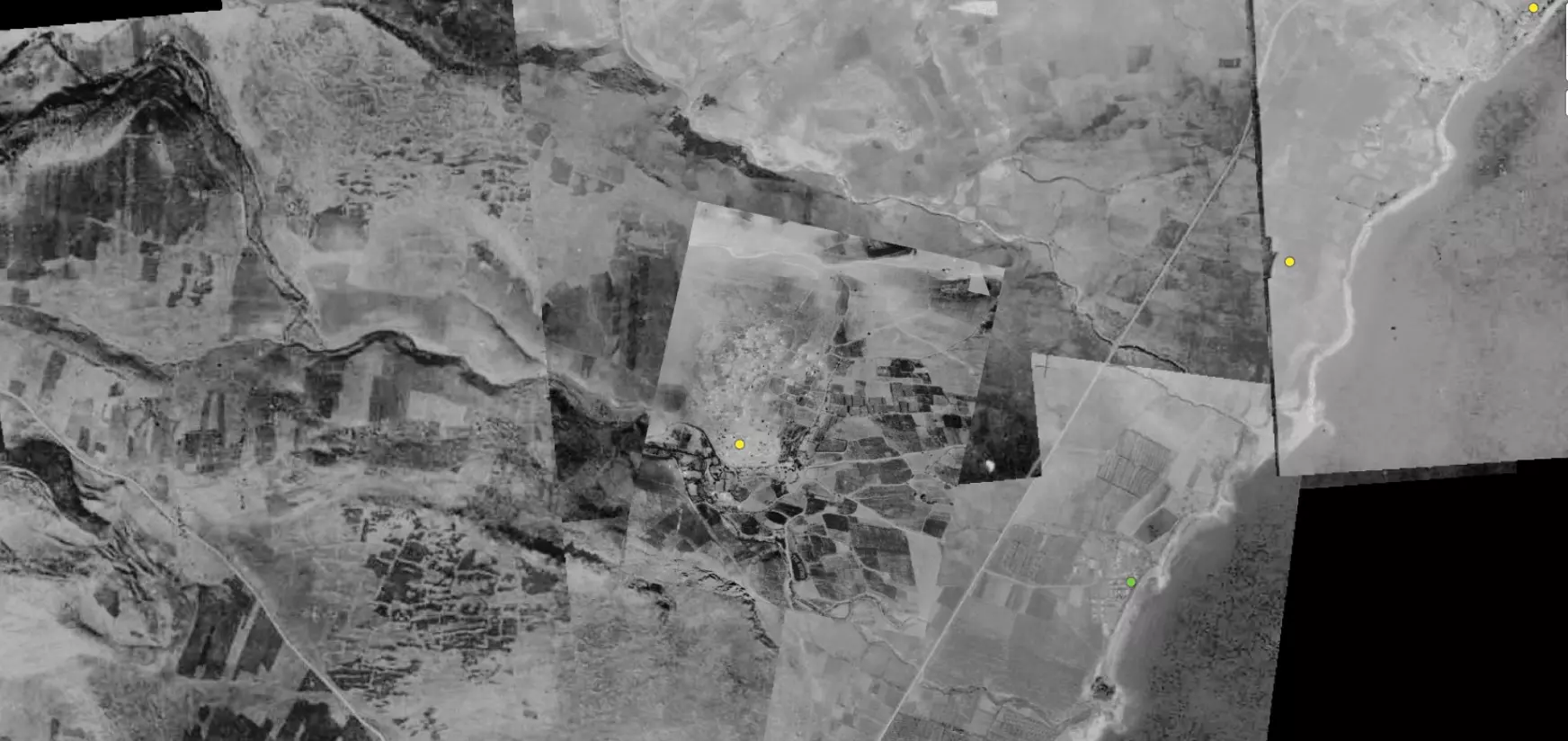
| Pre-Nakba Aerial View |
||||||||||||||||||||||
|
||||||||||||||||||||||
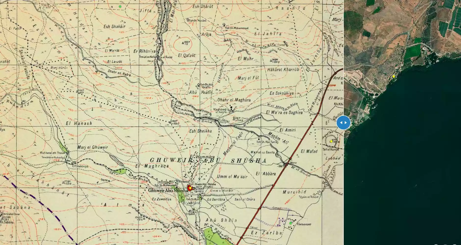
| Map Location | See location #5 on the map View from satellite |
|||||||||||||||||||||
| Attacking Units | Some unidentified troops from the Palmach | |||||||||||||||||||||
| Defenders | Local militia & Arab Liberation Army | |||||||||||||||||||||
| Refugees' Migration Routes | Ghuwayr Abu Shusha inhabitants were ethnically cleansed to the Galilean town of al-Rama, east of Acre. | |||||||||||||||||||||
| Exodus Cause | Influence of fall of, or exoduce from, neighboring town | |||||||||||||||||||||
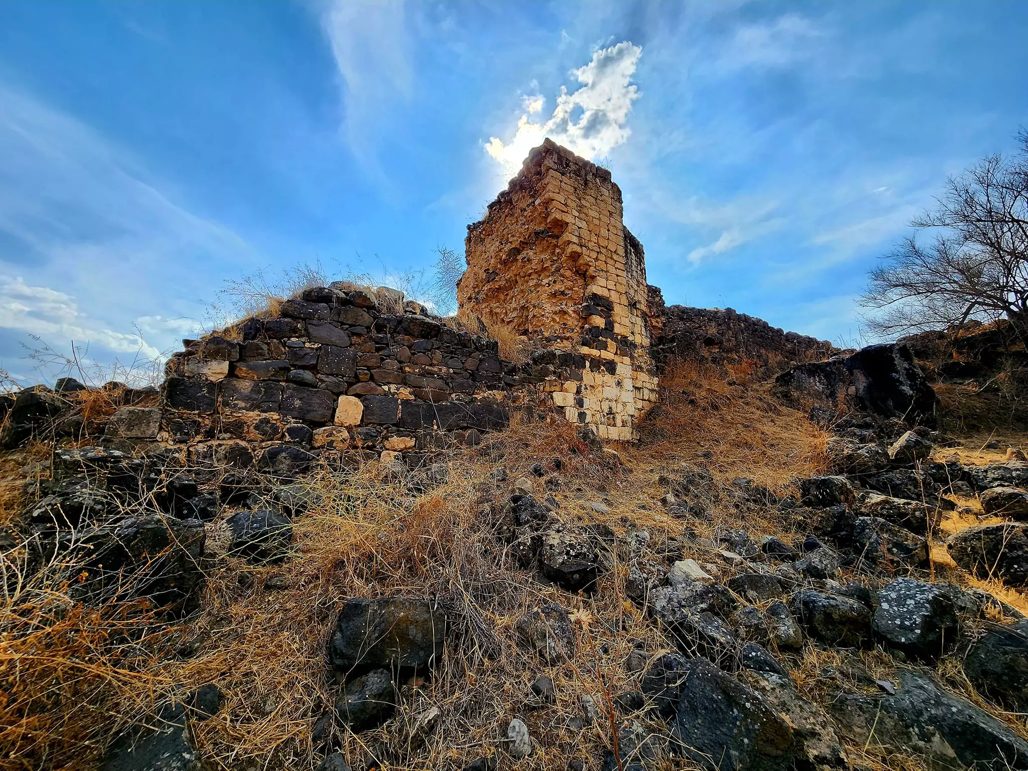
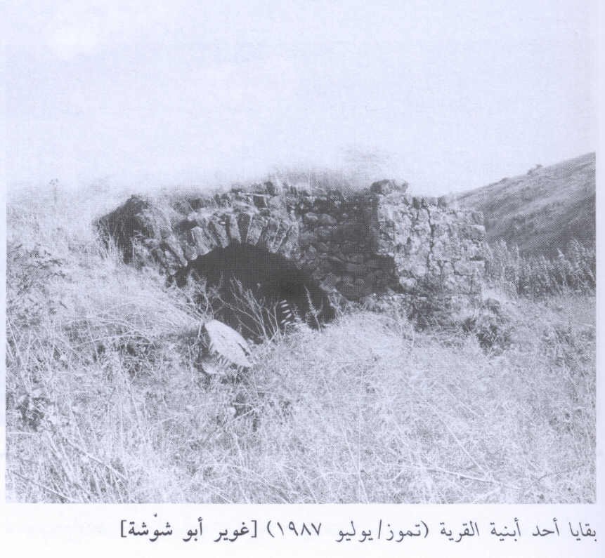
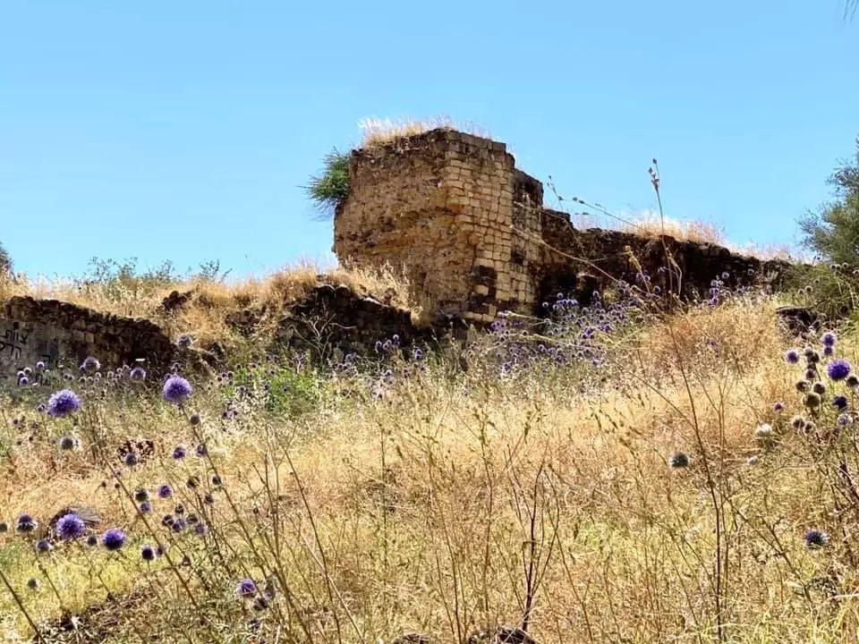
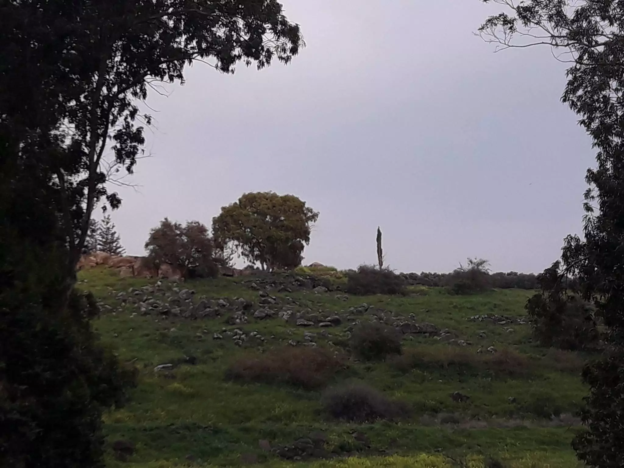
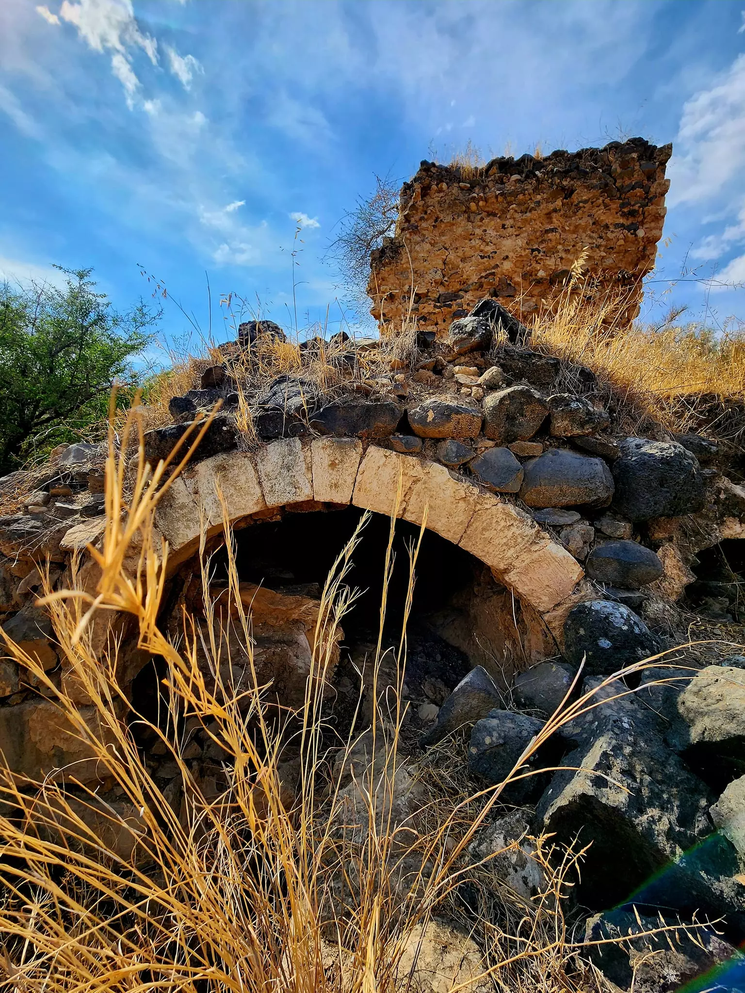
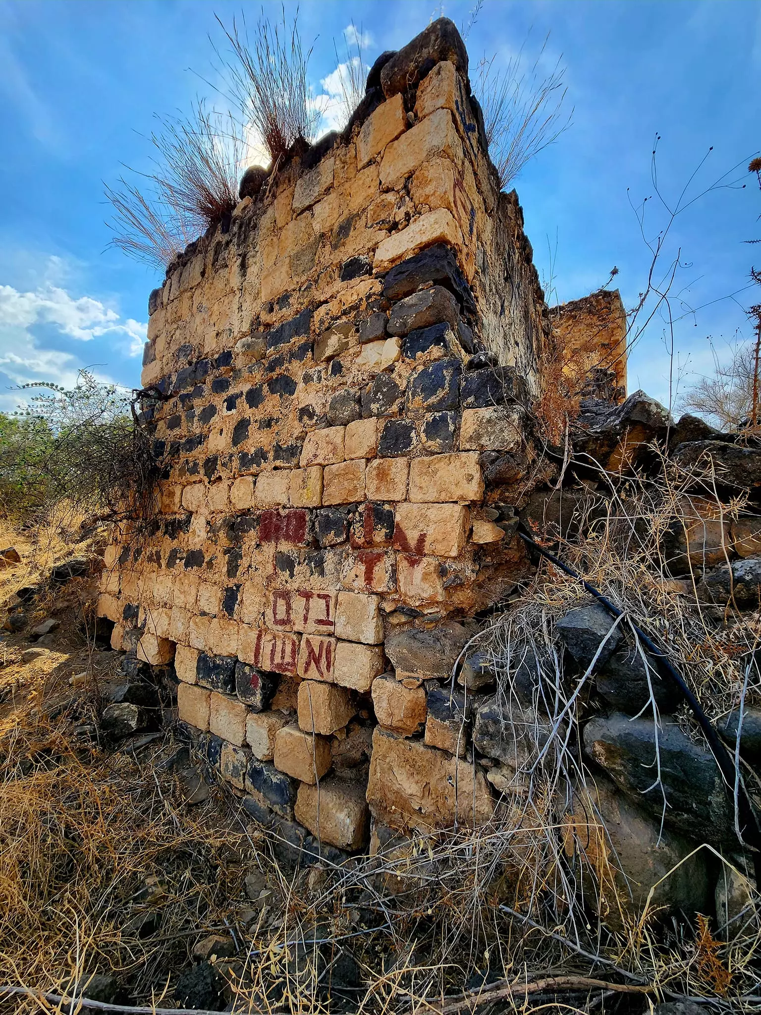
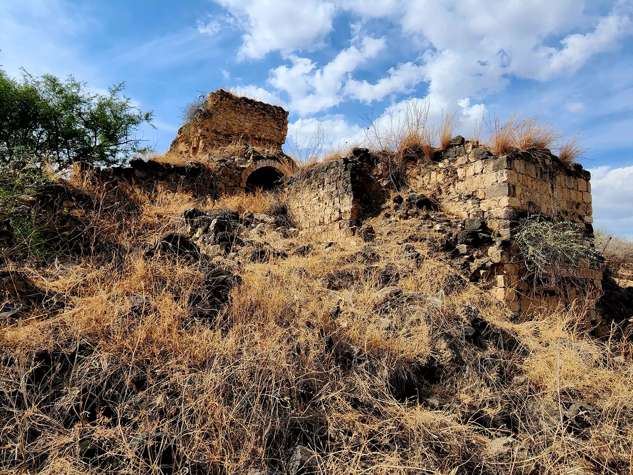
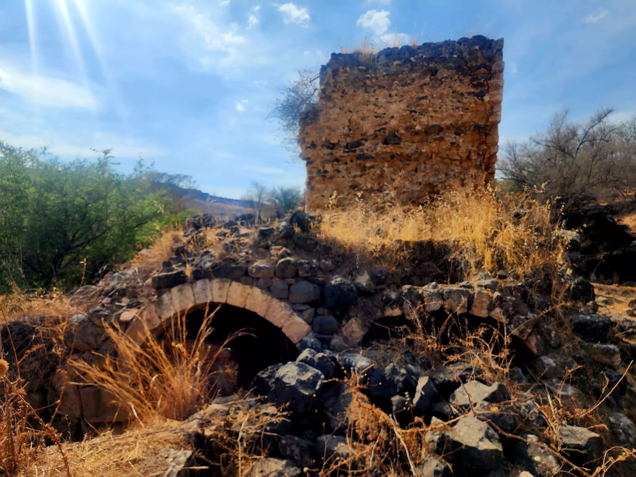
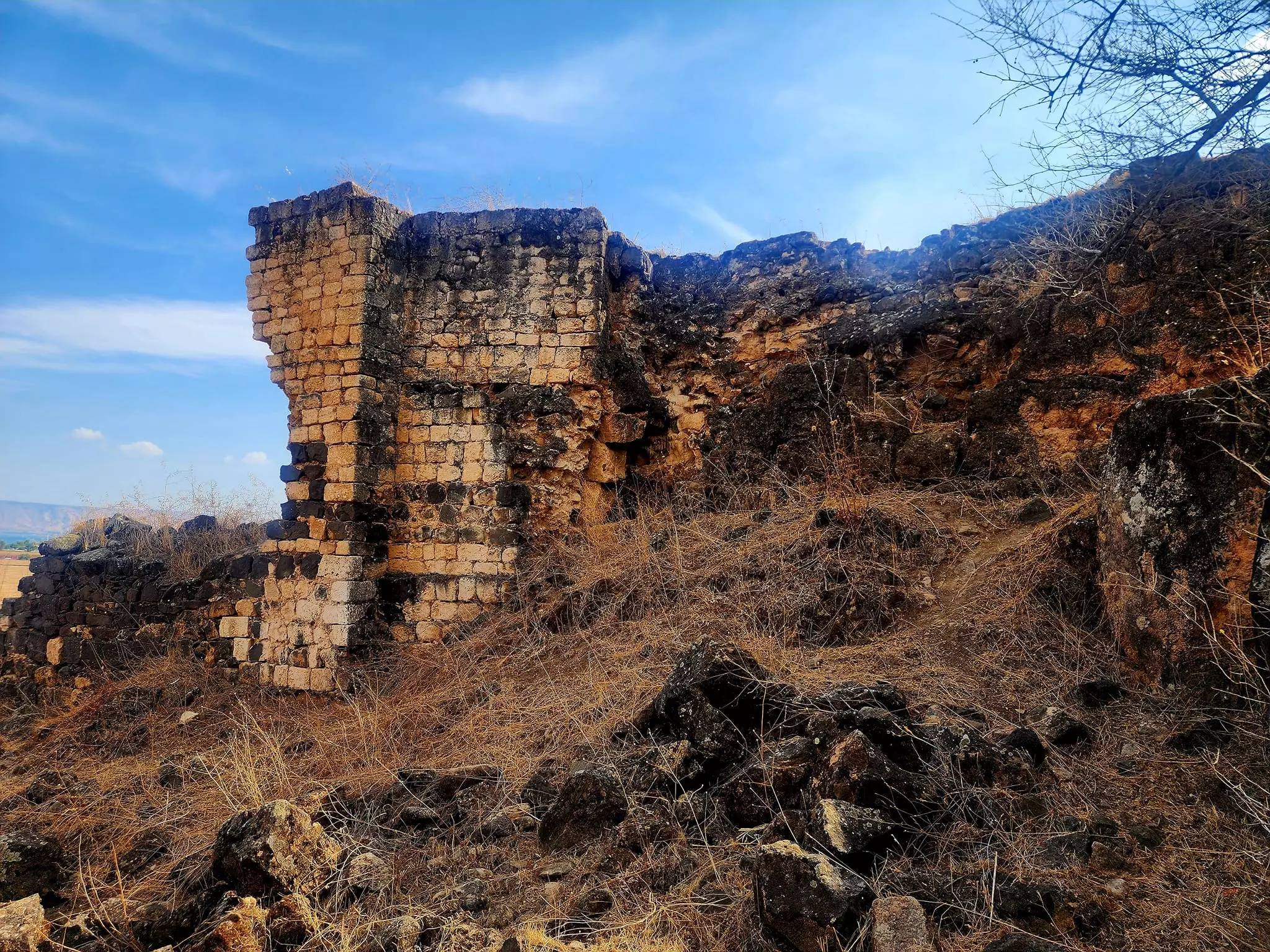
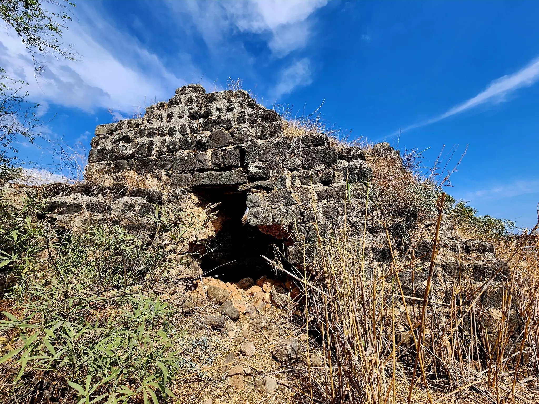
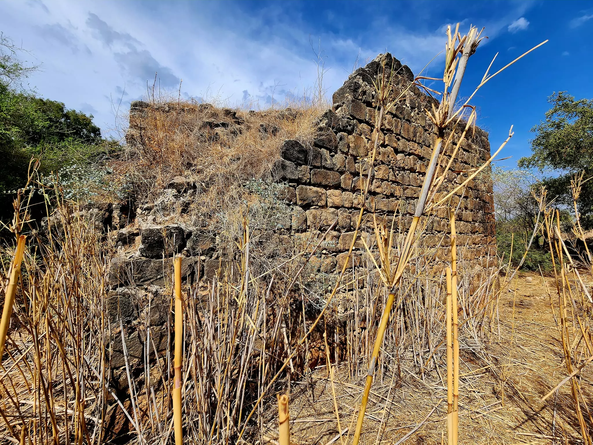
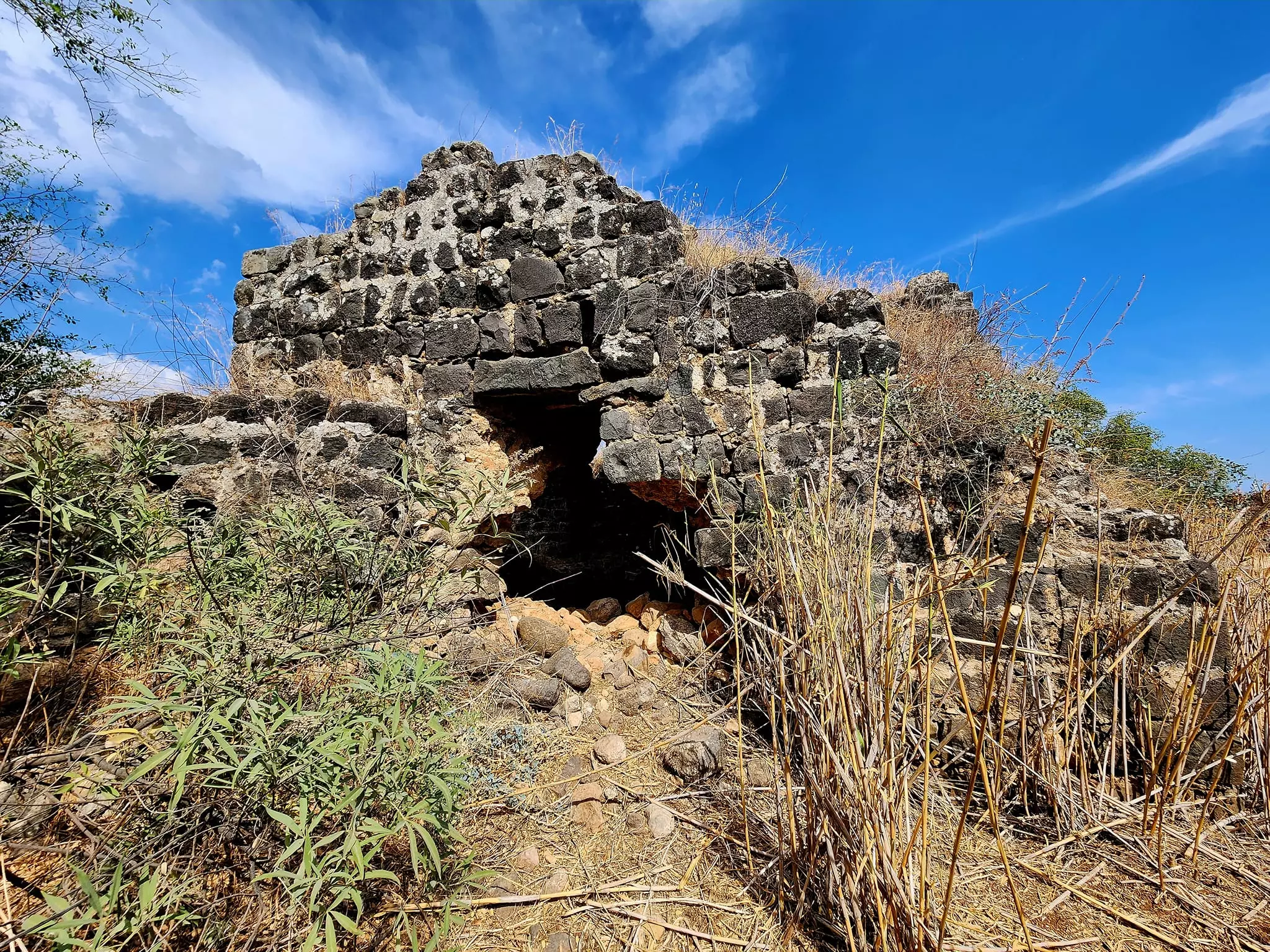
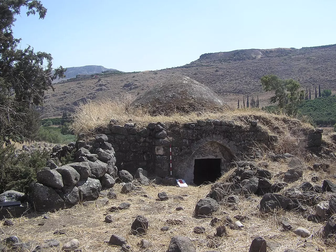
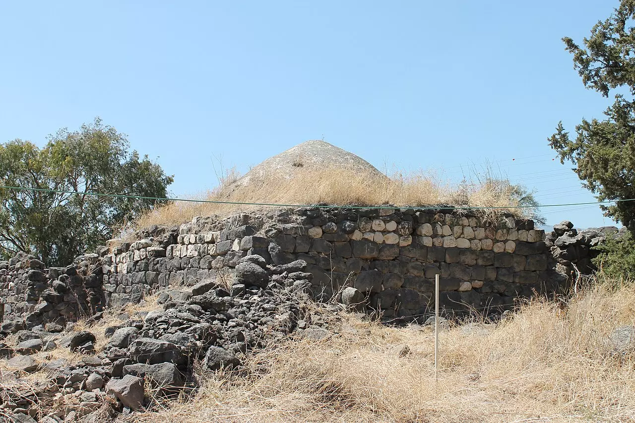
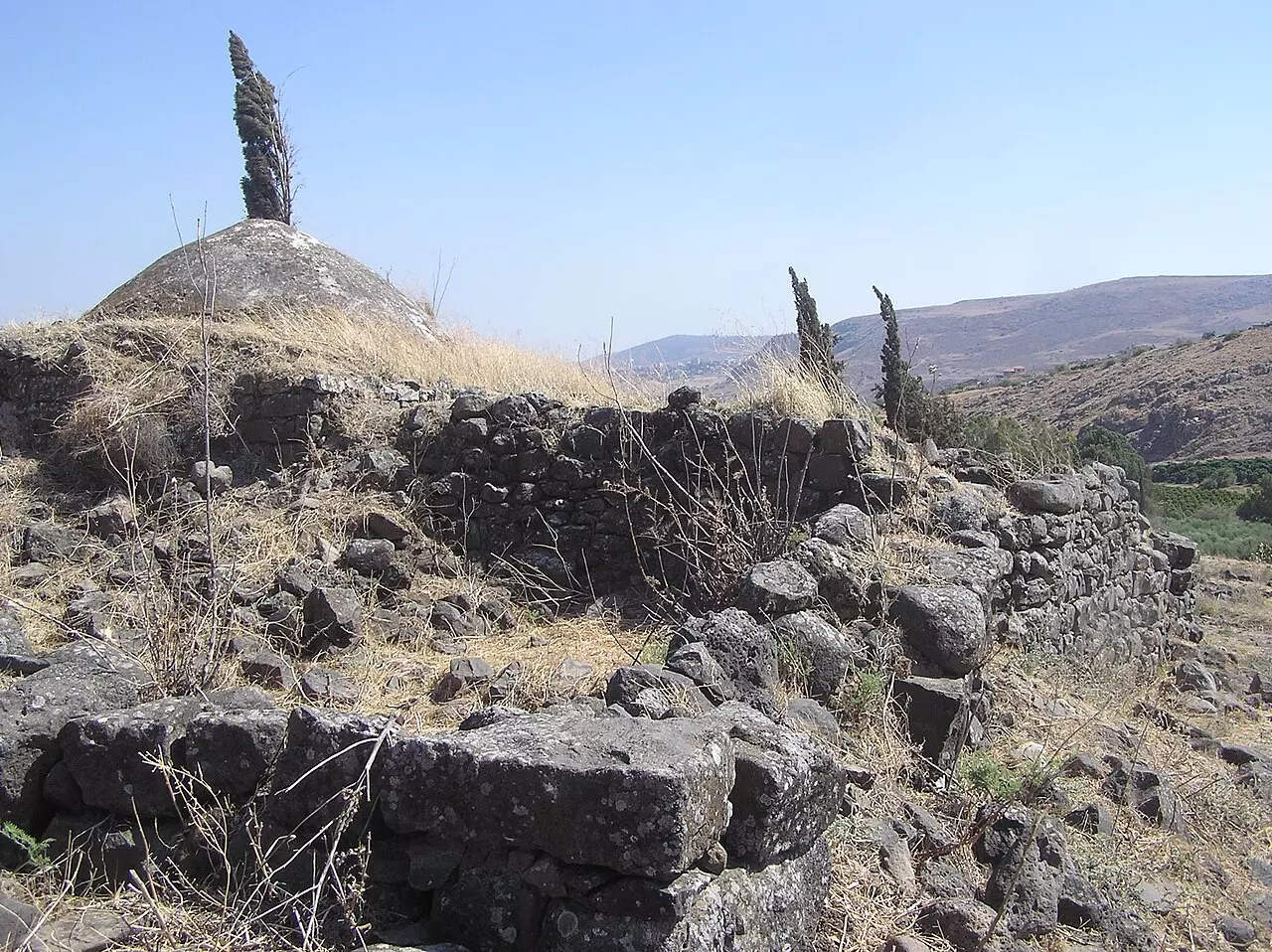
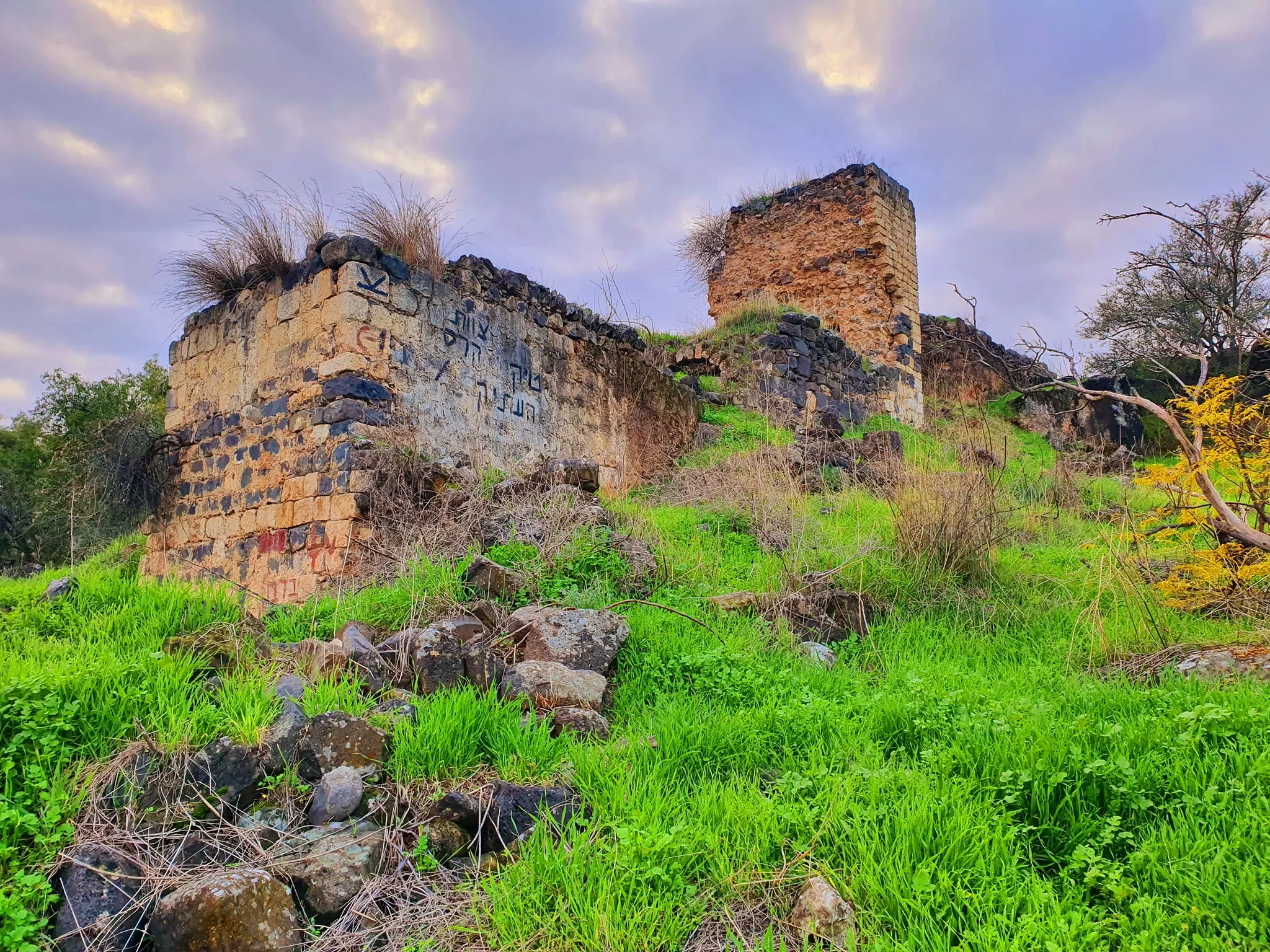
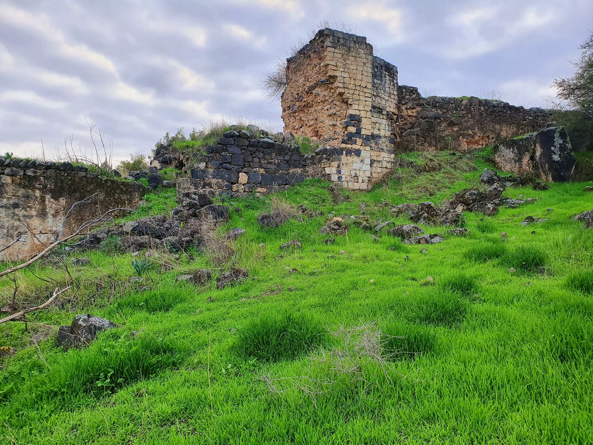
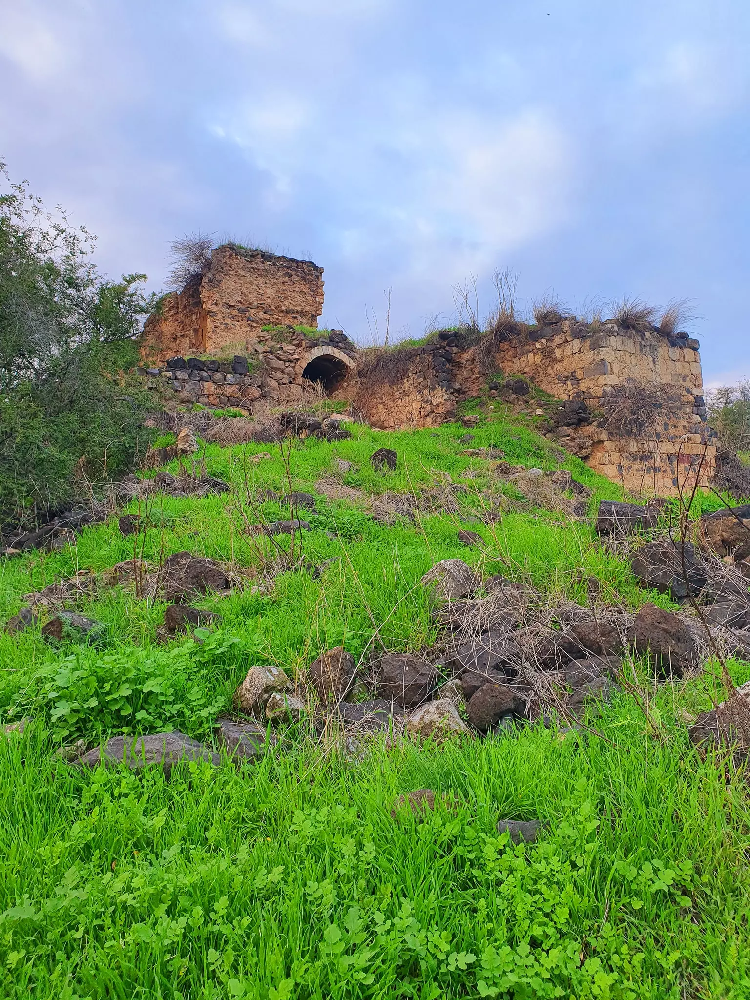
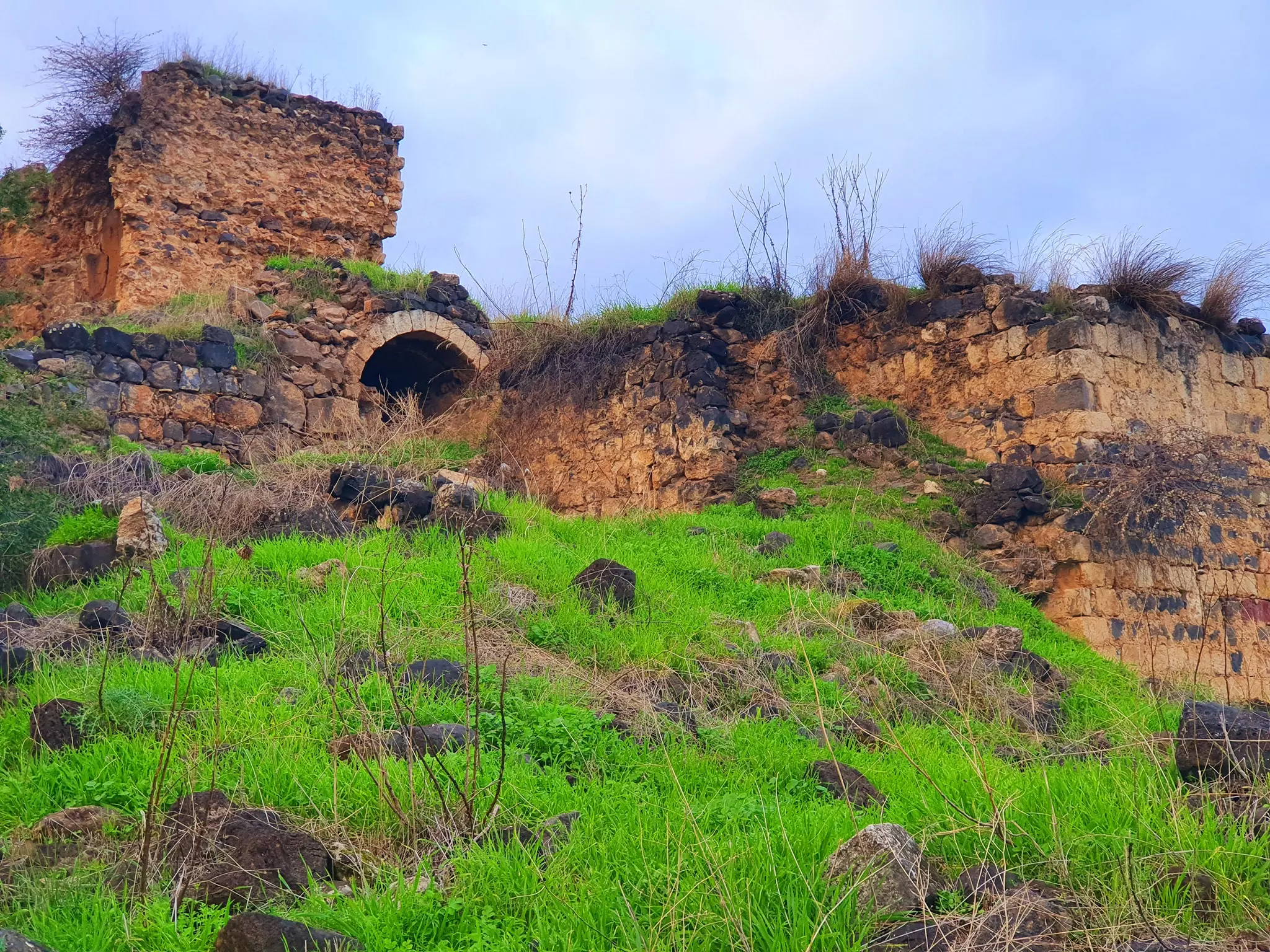
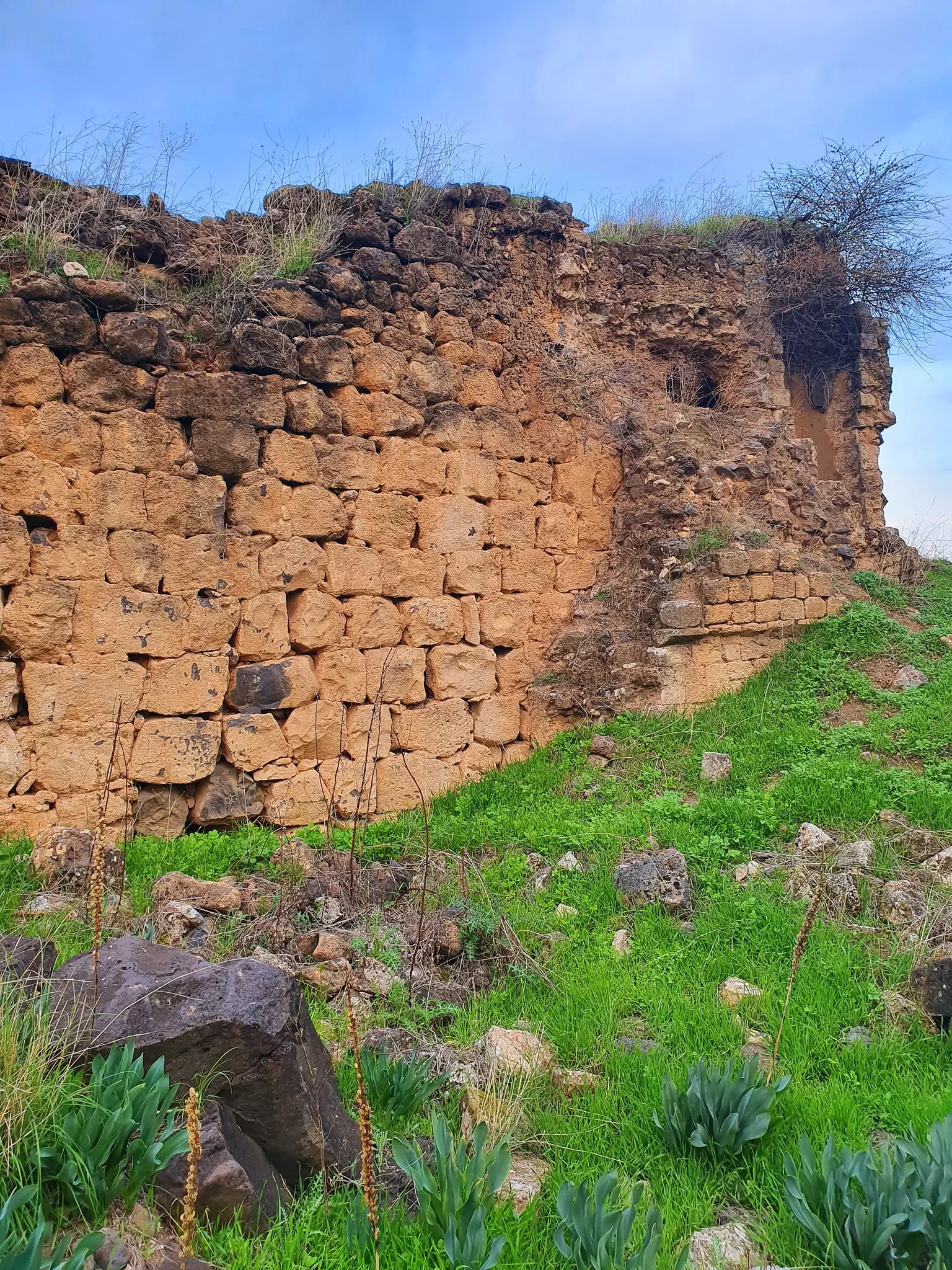
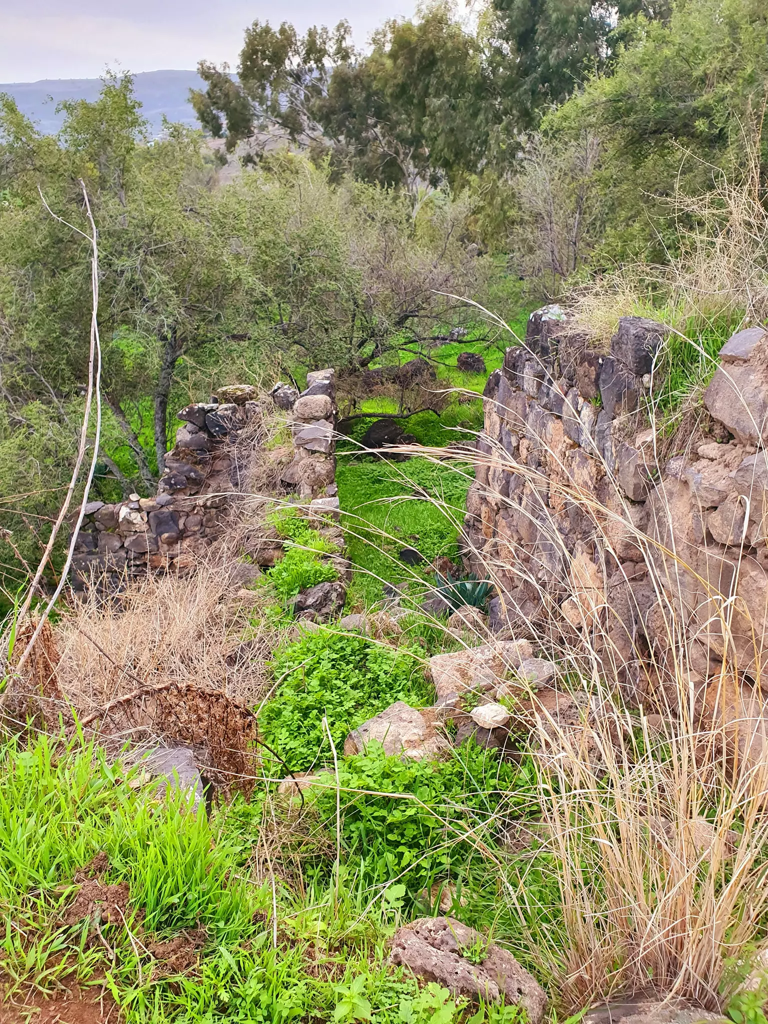
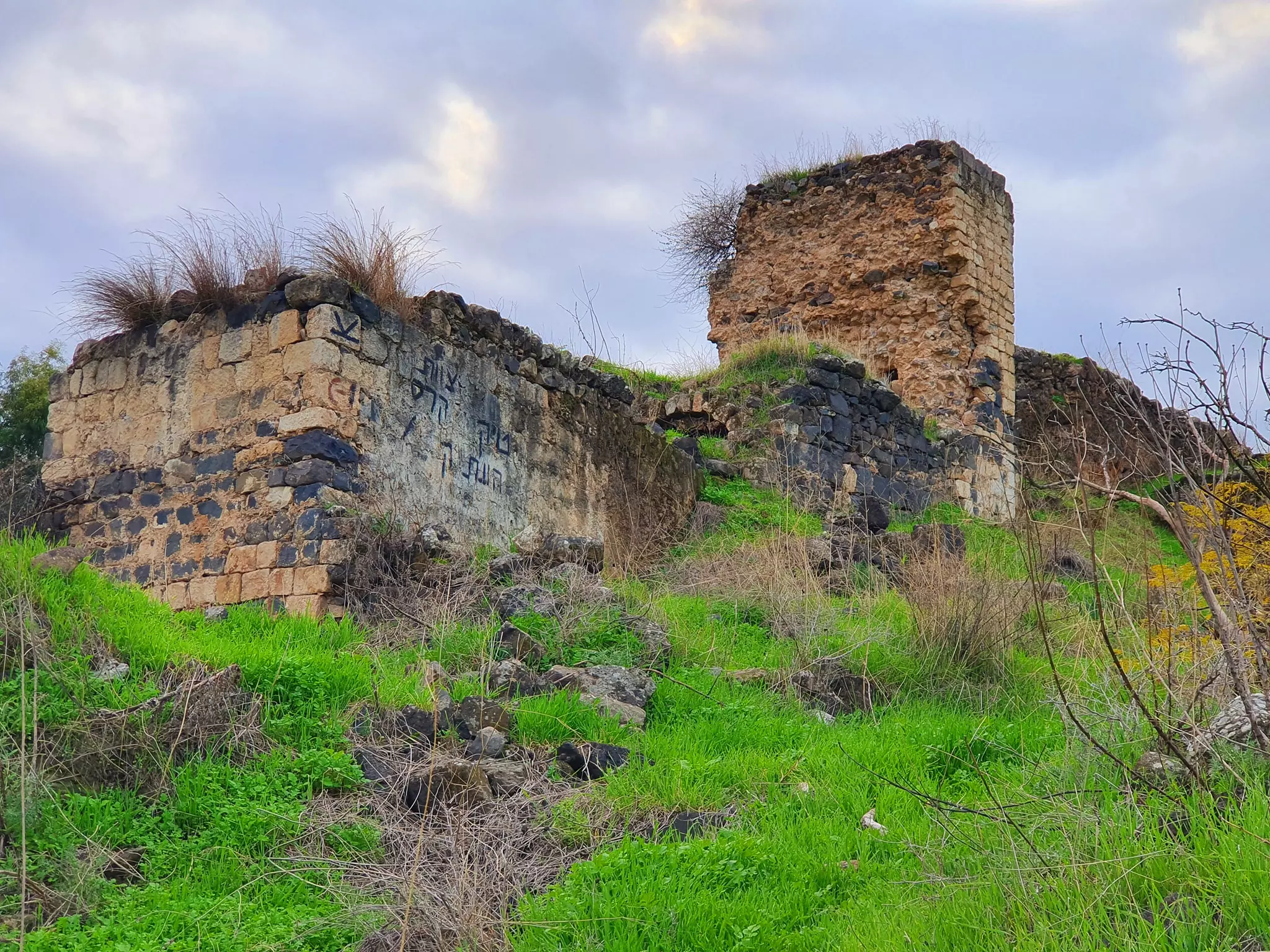
| Village Temains | Ghuwayr Abu Shusha was completely obliterated with the exception of its shrine. | |||||||||||||||||||||
| Ethnically Cleansing | The villagers were terrorized out of the village on 21st-28th of April 1948 | |||||||||||||||||||||
| Terminating Refugee Camps | Some of the villagers ended up in 'Ayn al-Hilwa, Saydun refugee camp in southern Lebanon | |||||||||||||||||||||
| Pre-Nakba Land Ownership |
**Town Lands' Demarcation Maps |
|||||||||||||||||||||
| Land Usage As of 1945 |
|
|||||||||||||||||||||
| Population |
|
|||||||||||||||||||||
| Inhabitants Place of Origin | Originally, the village was founded by al-Ghawarina and al-Samakiyya Bedouin tribes | |||||||||||||||||||||
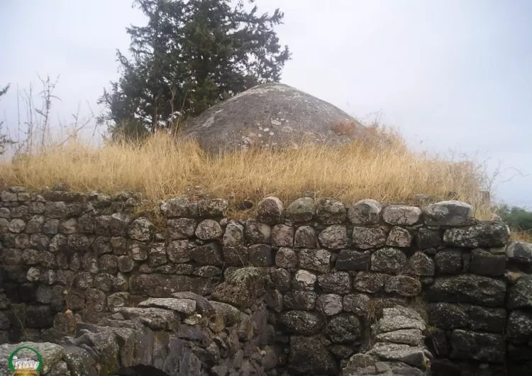
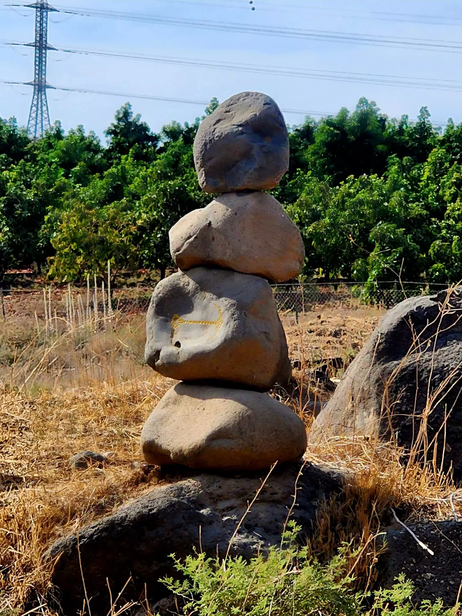
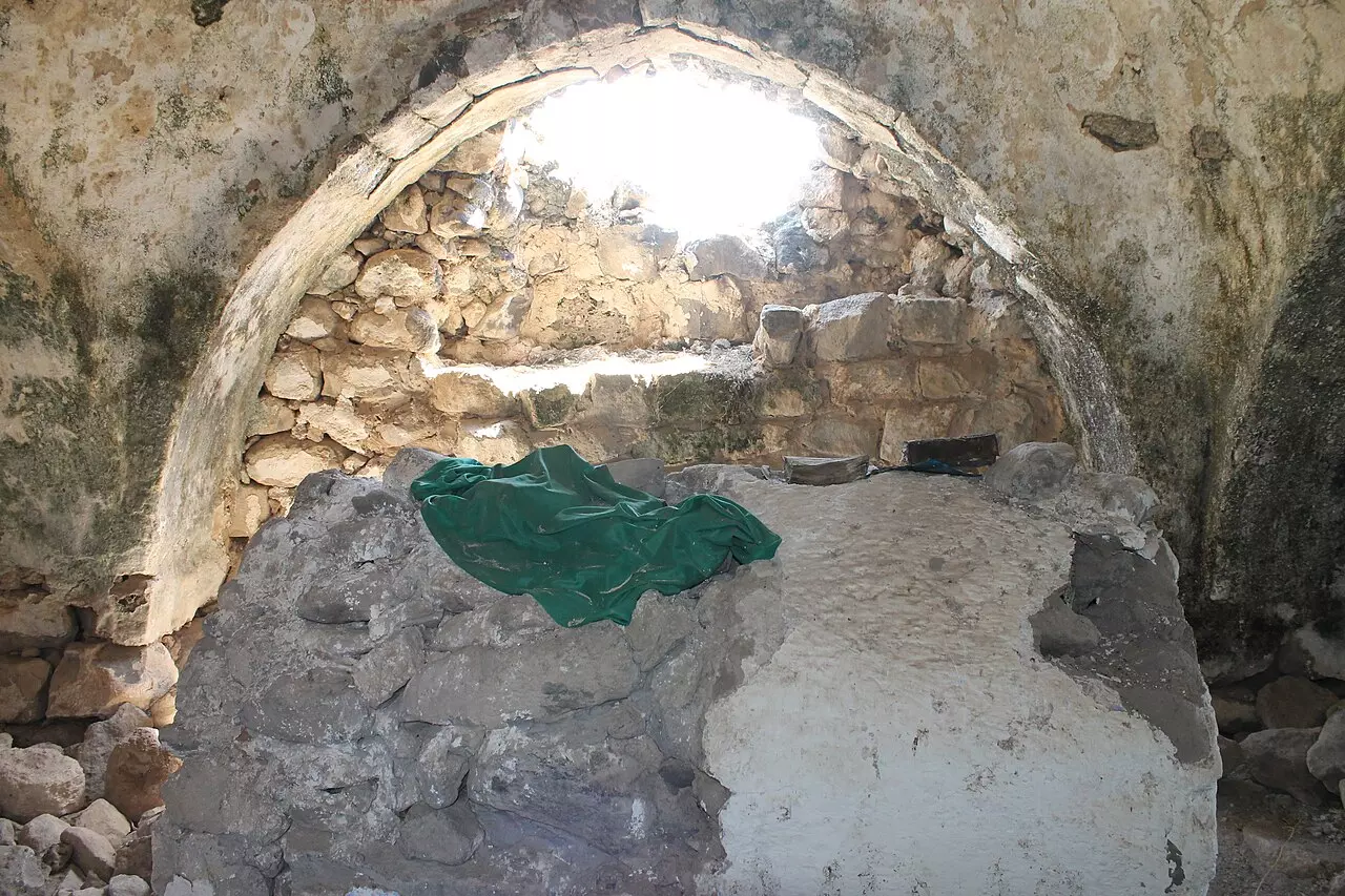
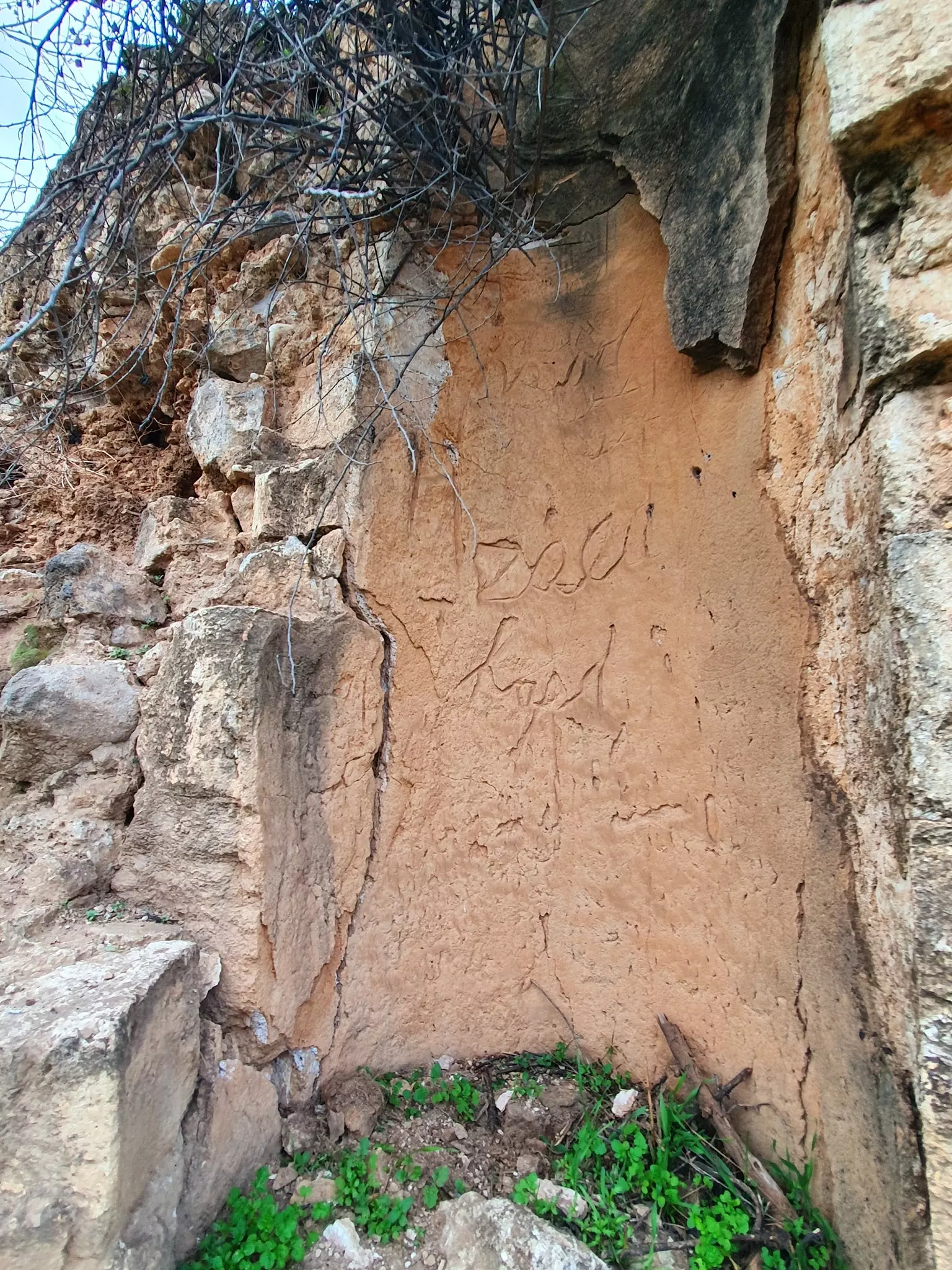
| Shrines / Maqams | A shrine for a local sage known by al-Shaykh Muhammad (remain standing). | |||||||||||||||||||||
| Nearby Wadies & Rivers | The village was nearby Wadi Rubadiyya | |||||||||||||||||||||
| Water Supply | The village had several nearby springs, which provided it with its dinking water needs. | |||||||||||||||||||||
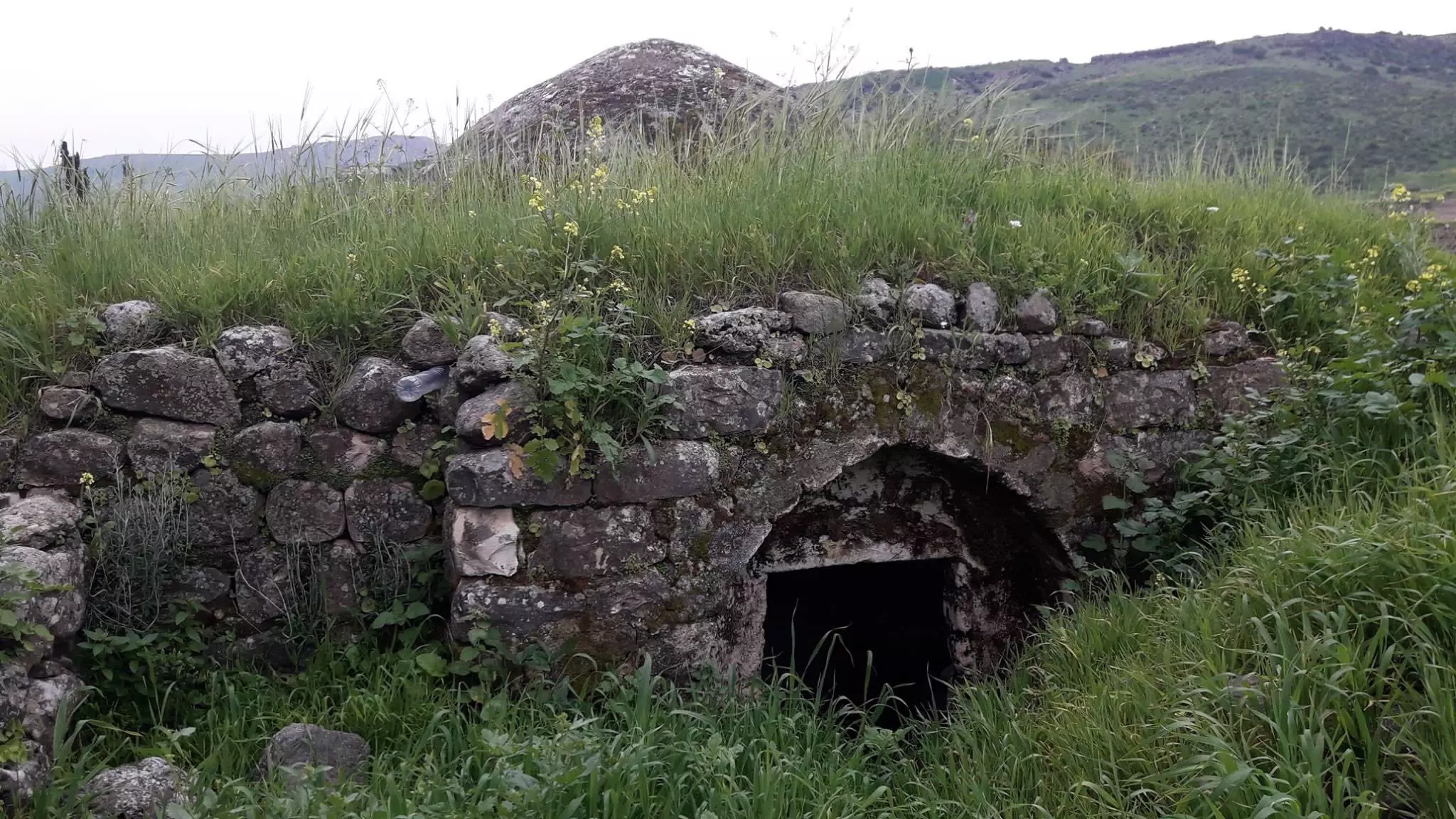
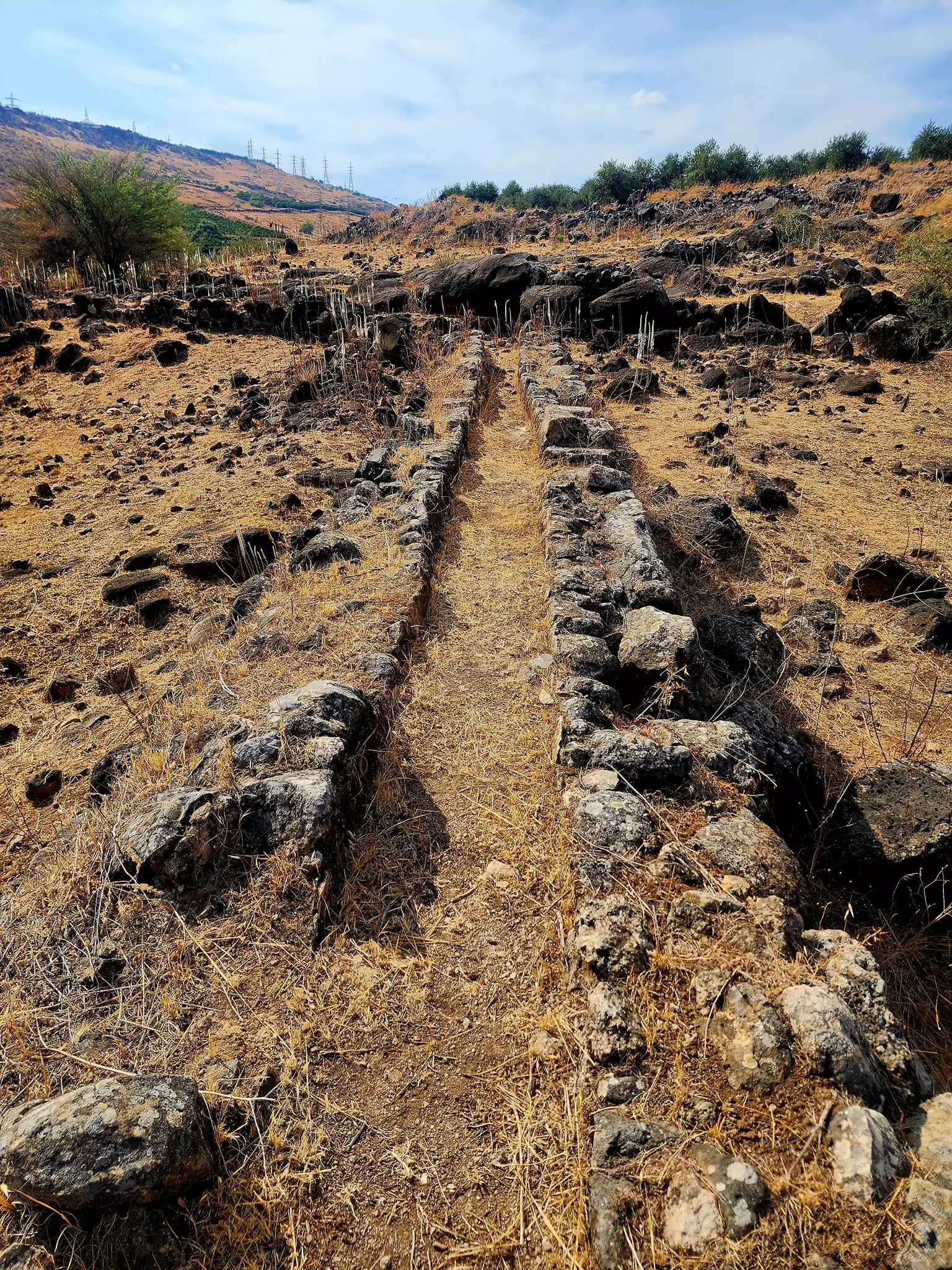
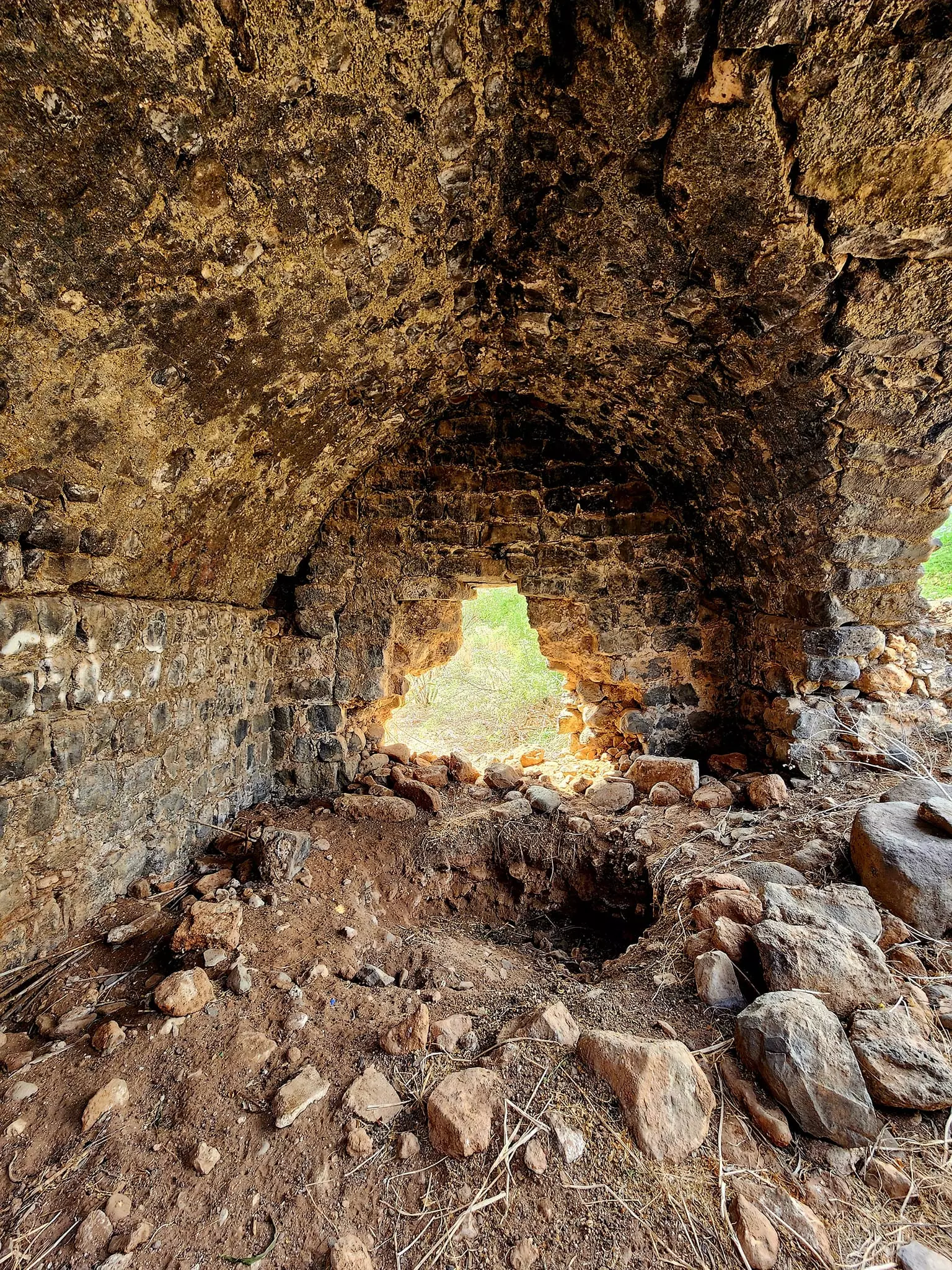
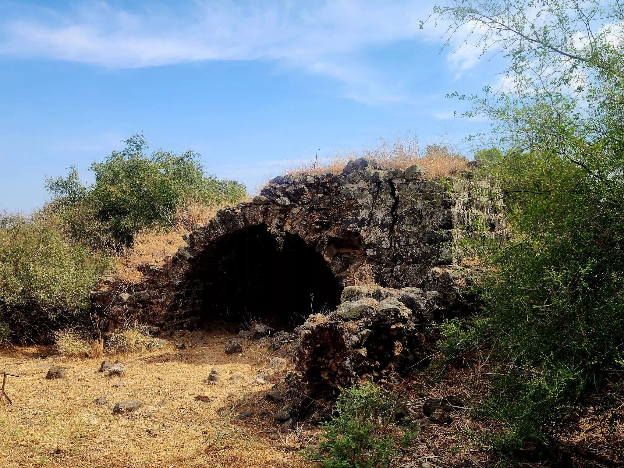
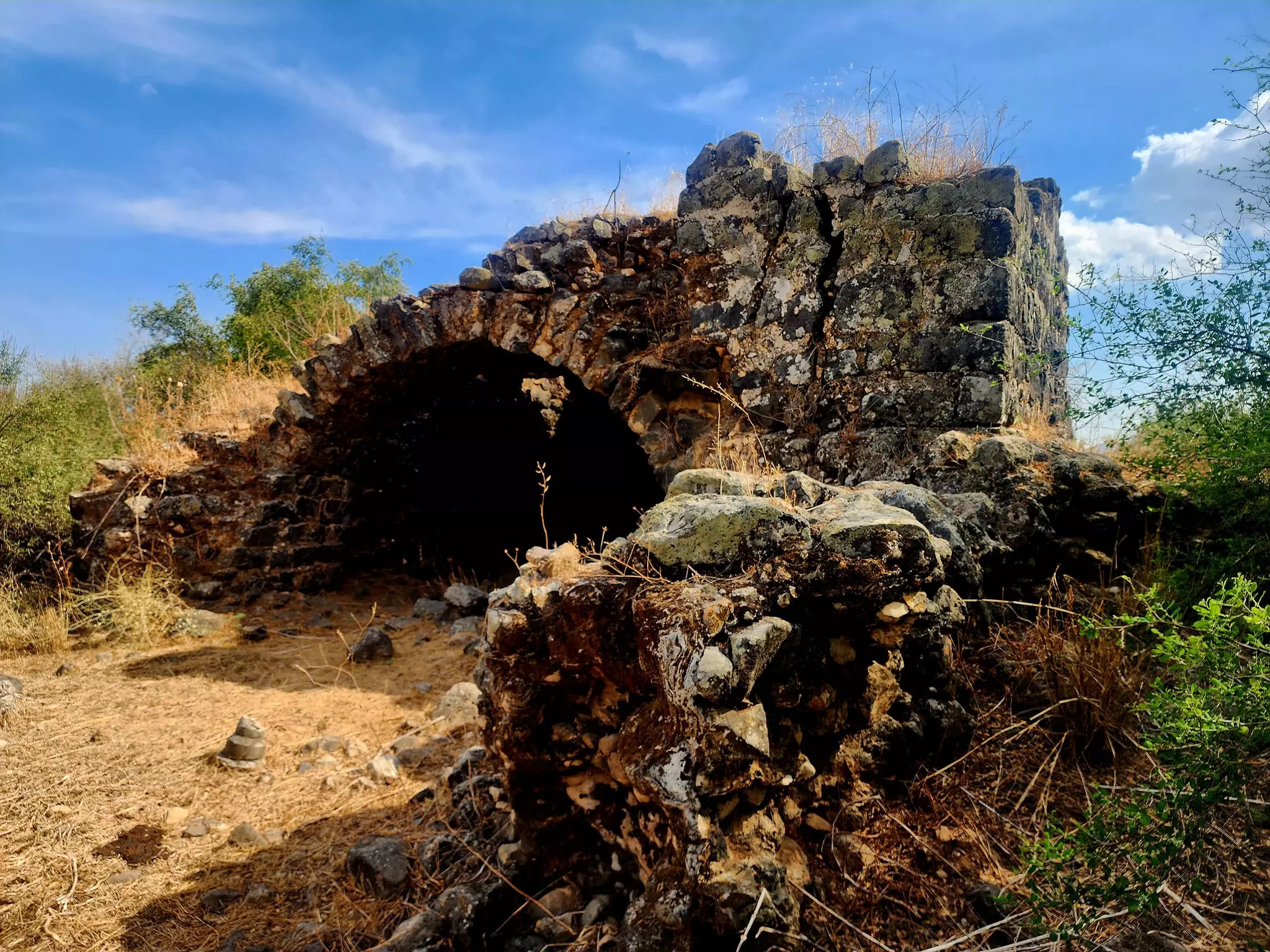
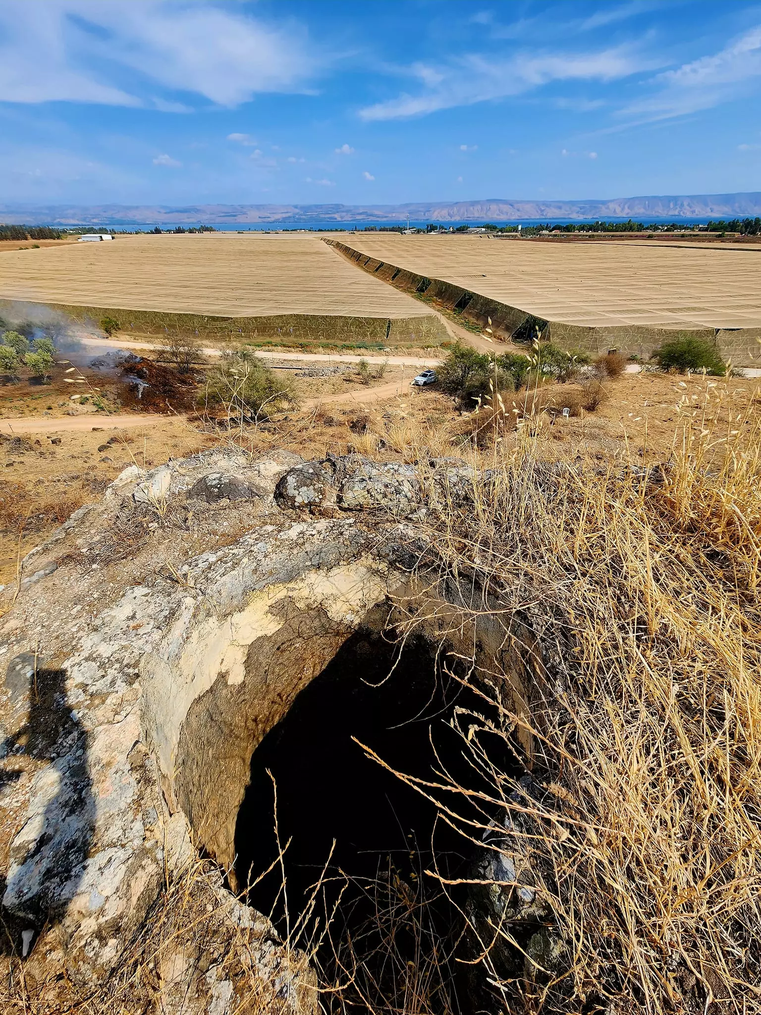
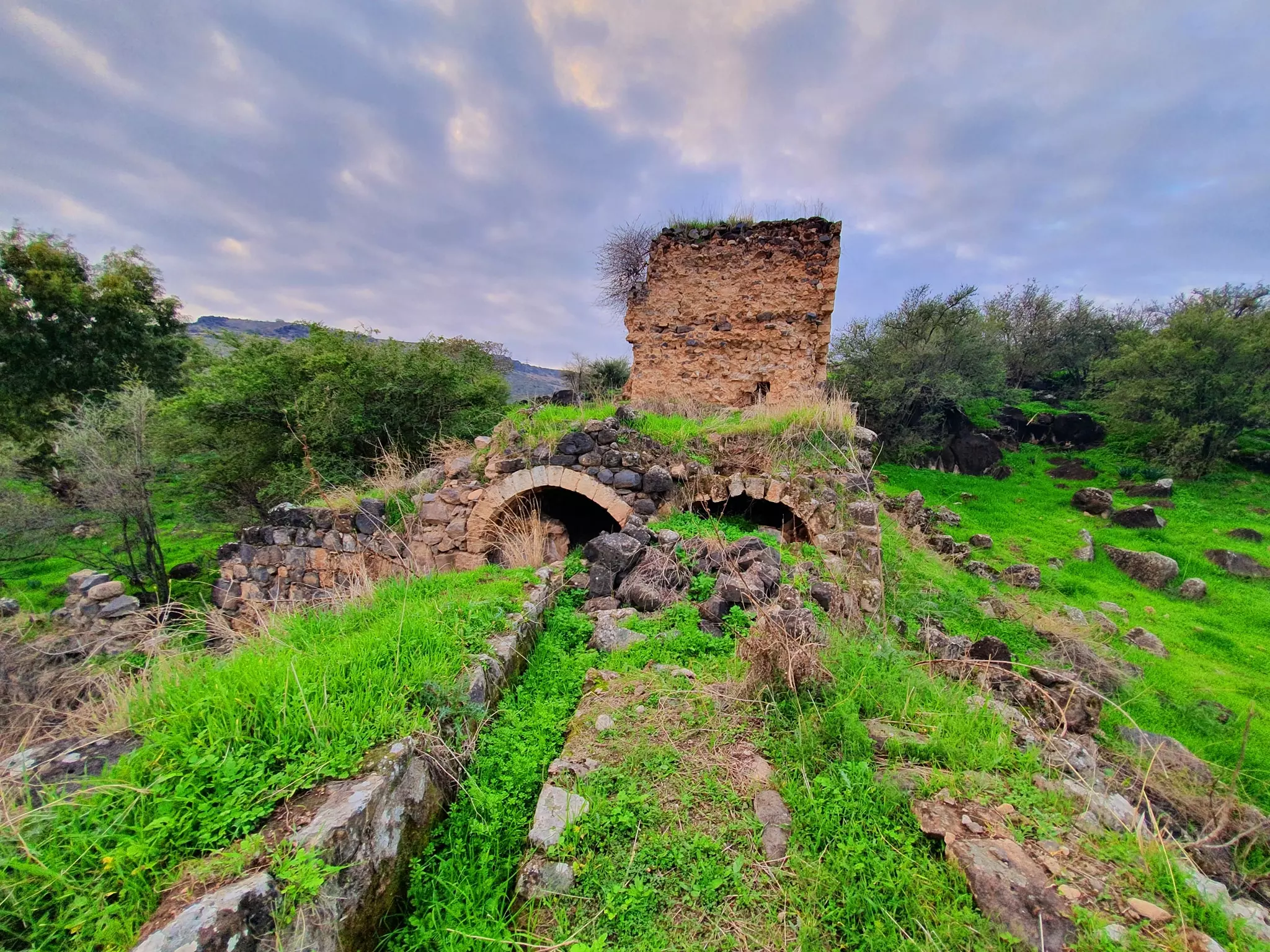
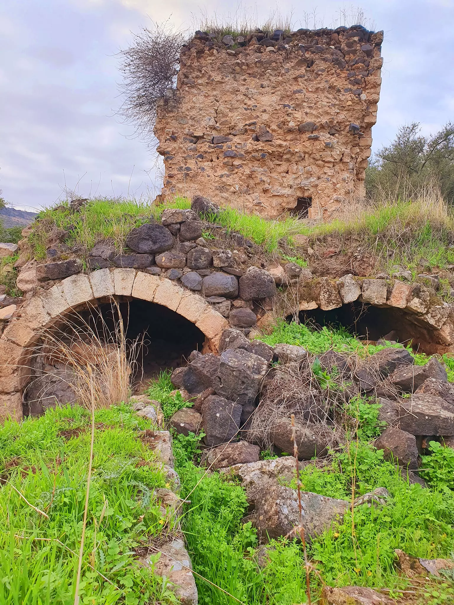
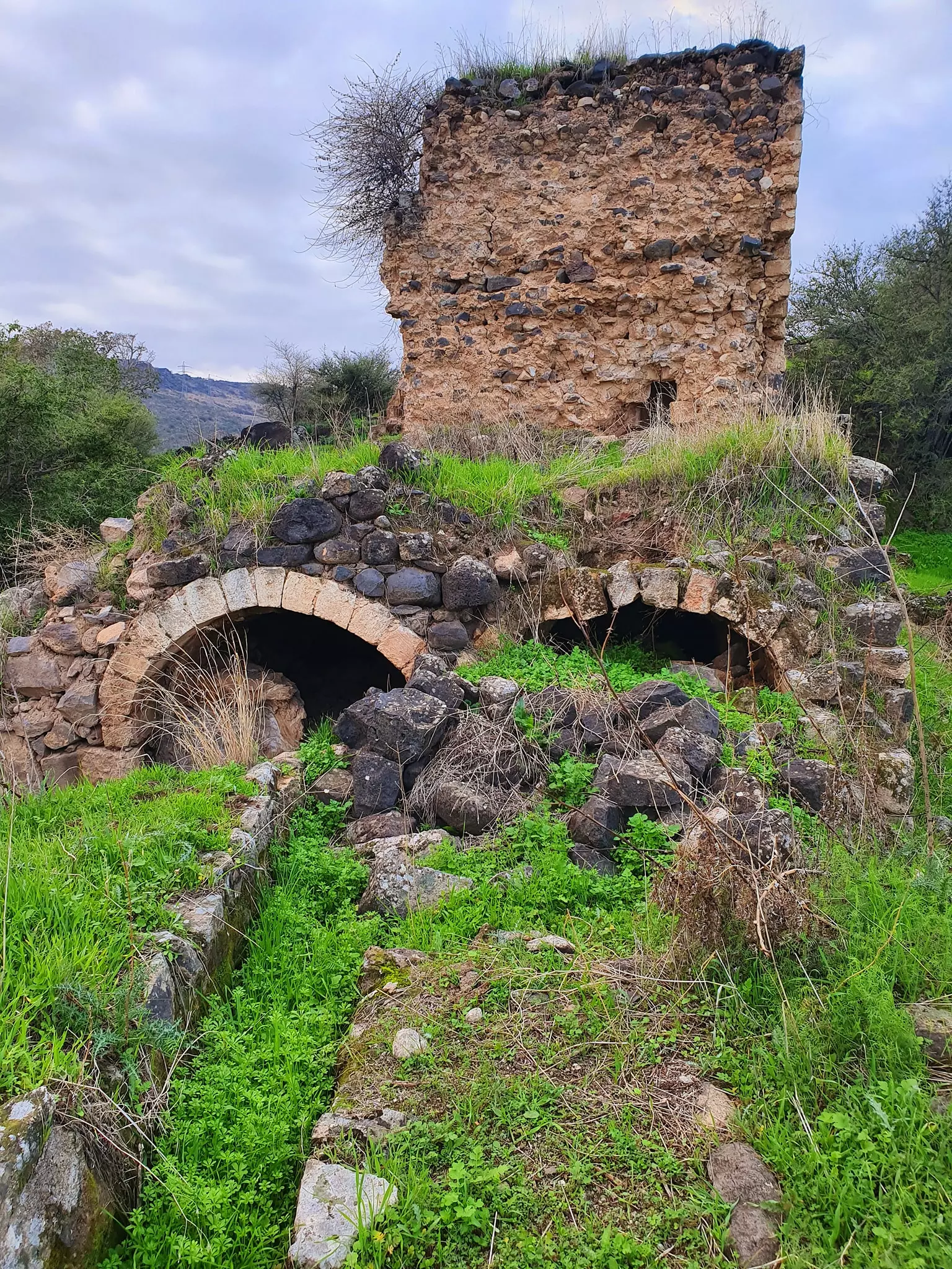
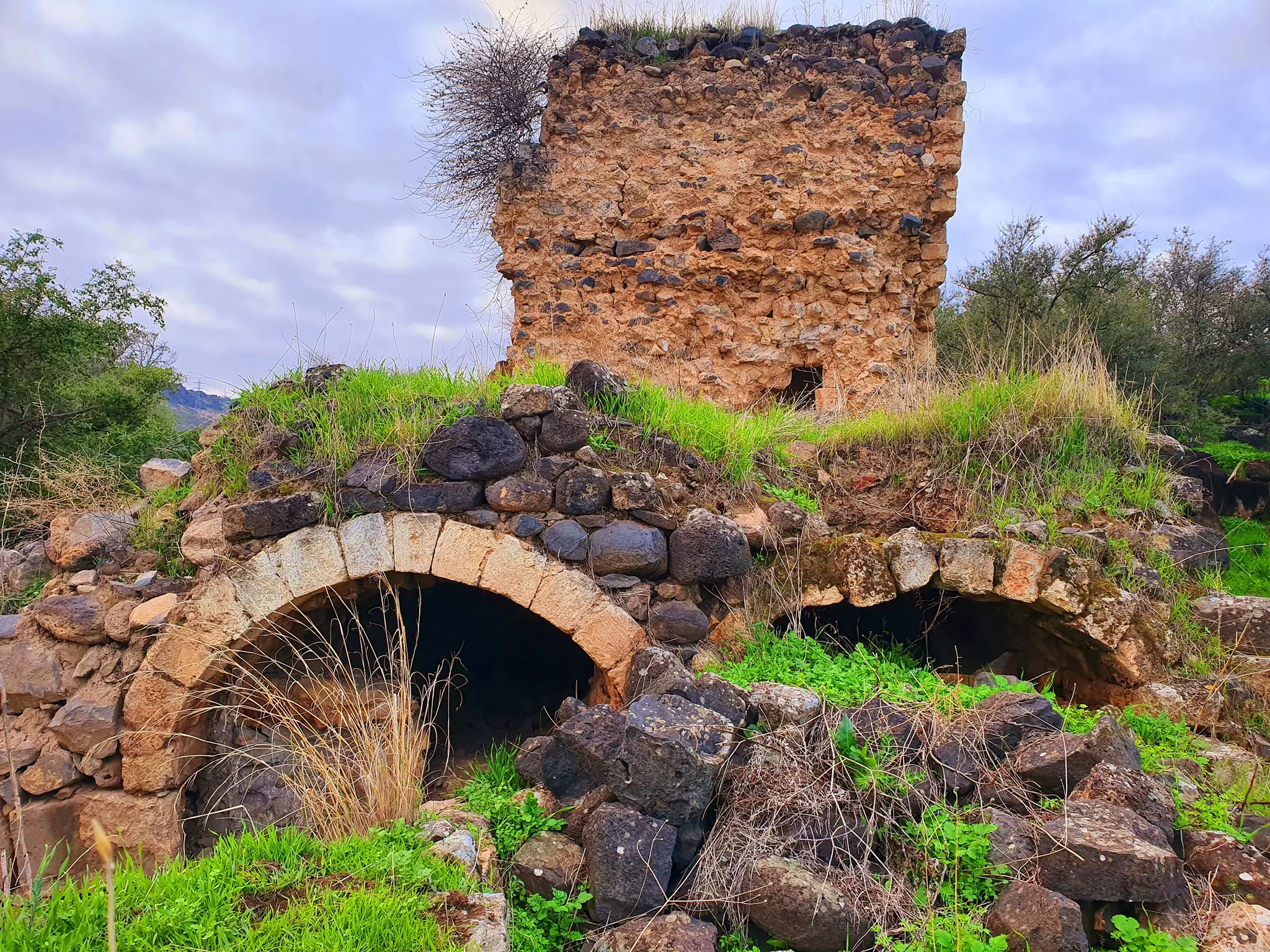
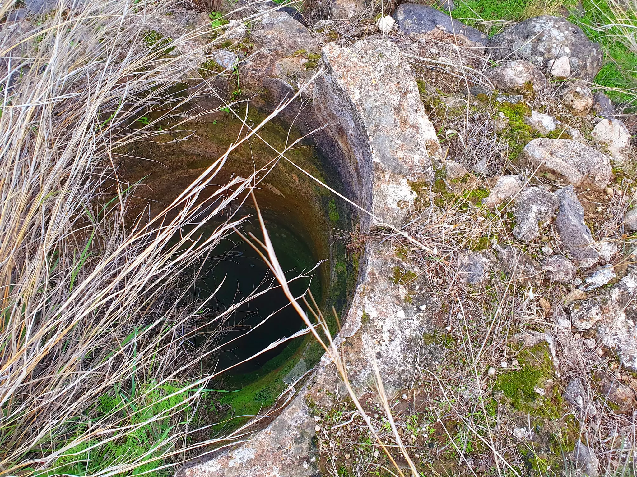
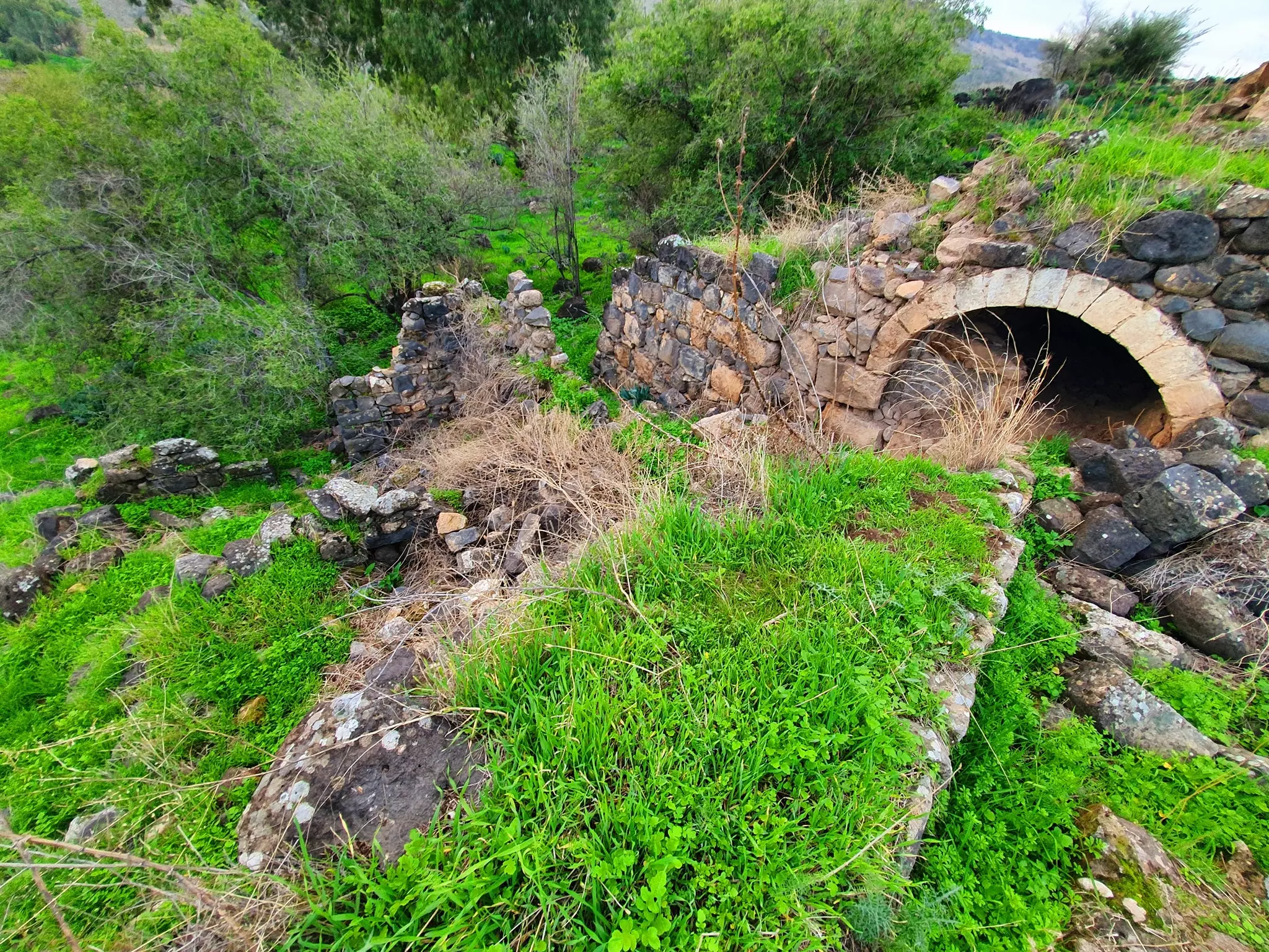
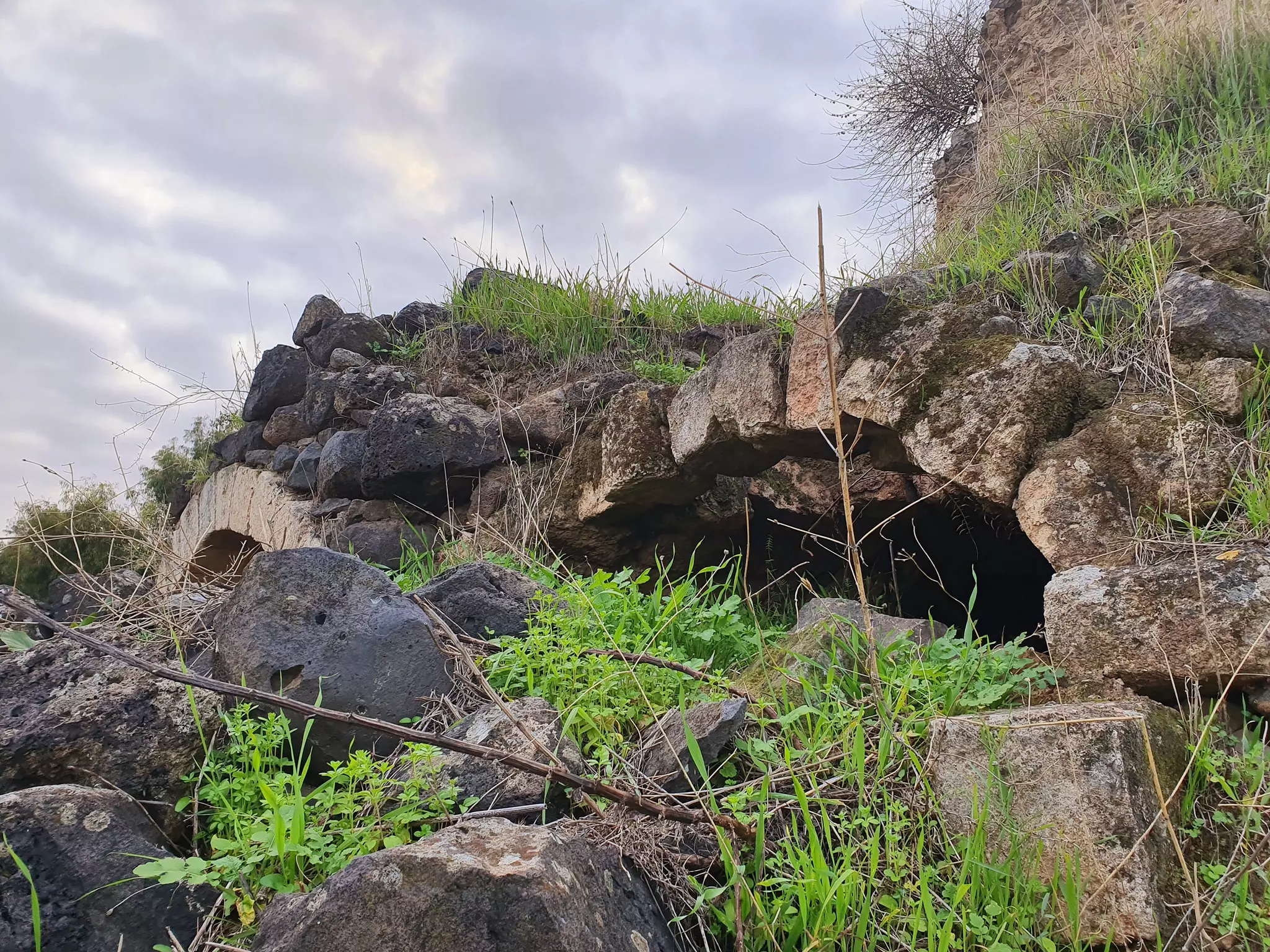
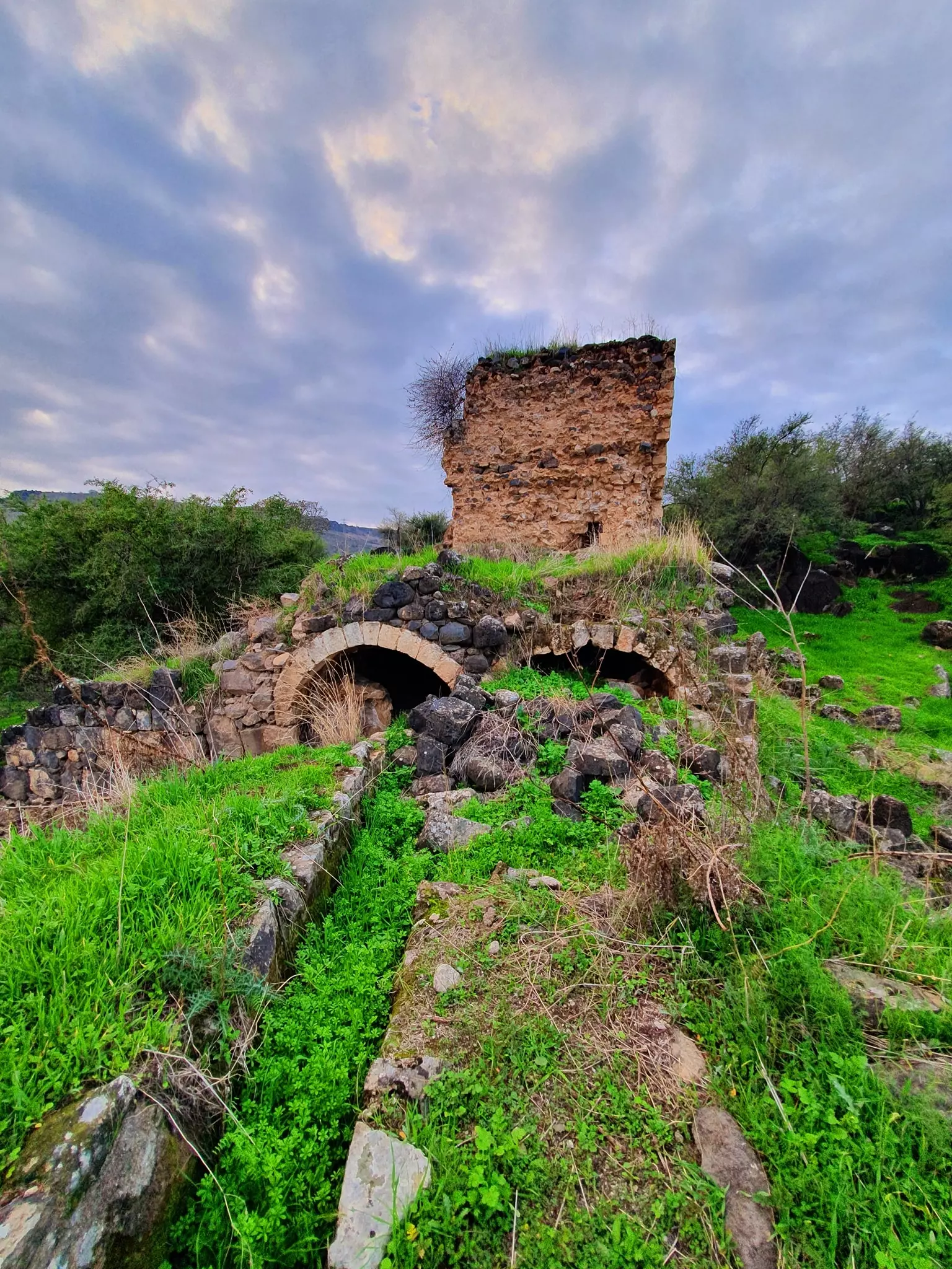
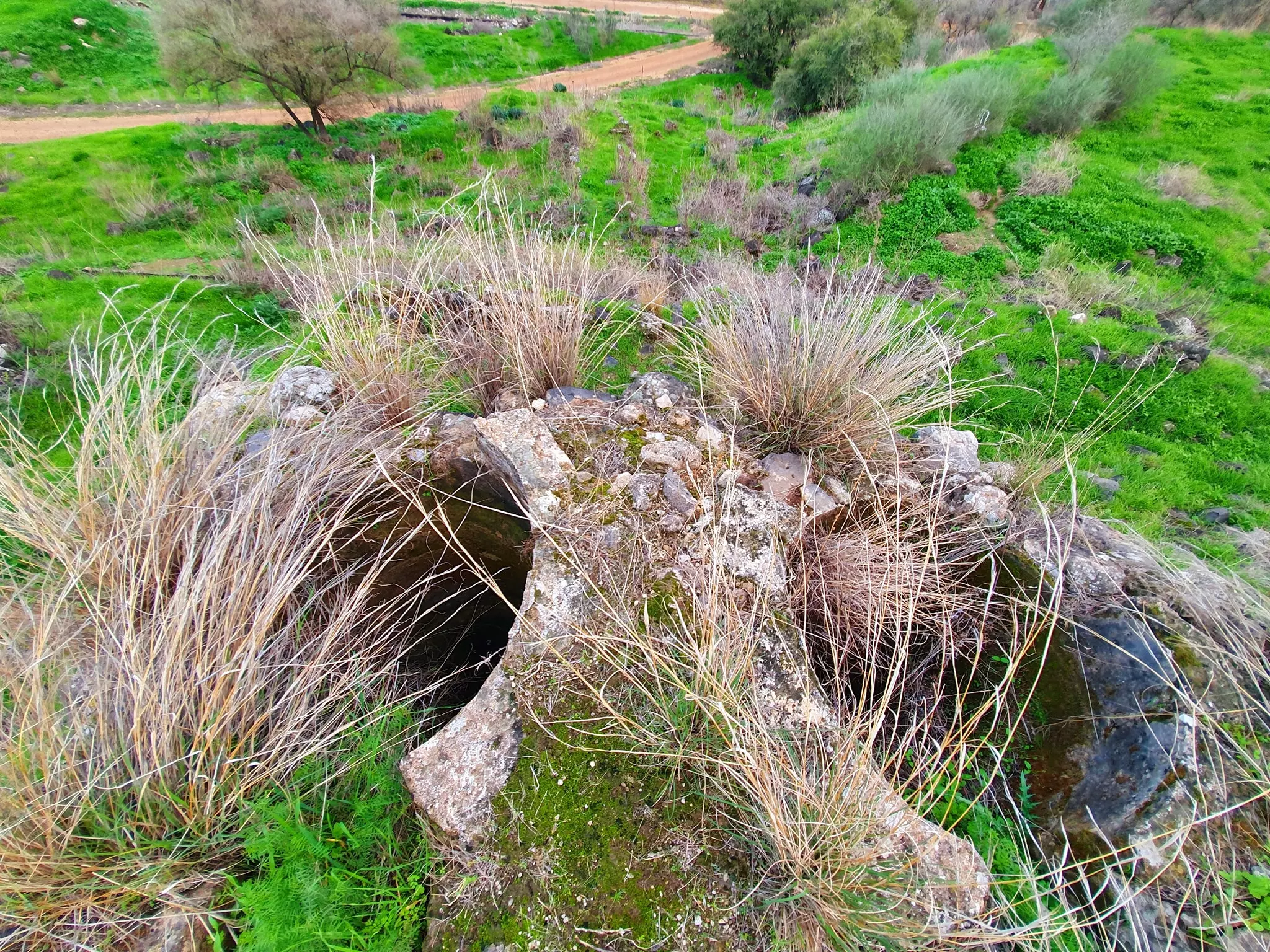
| Archeological Sites | The village contained Khirbat Abu Shusha, which had the ruins of water-powered mills. | |||||||||||||||||||||
| Exculsive Jewish Colonies Who Usurped Village Lands |
Ginnosar and Livnim | |||||||||||||||||||||
| Featured Video | ||||||||||||||||||||||
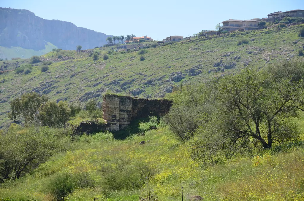
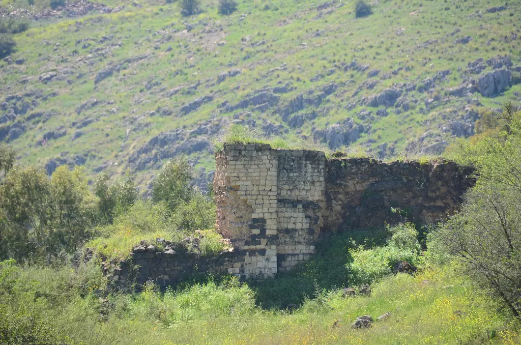
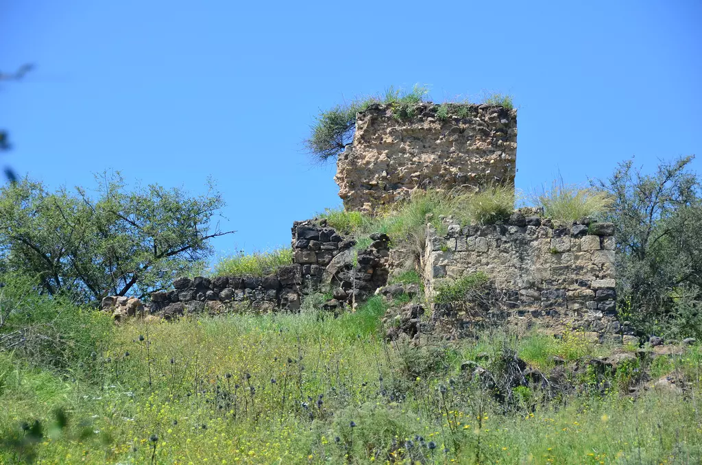
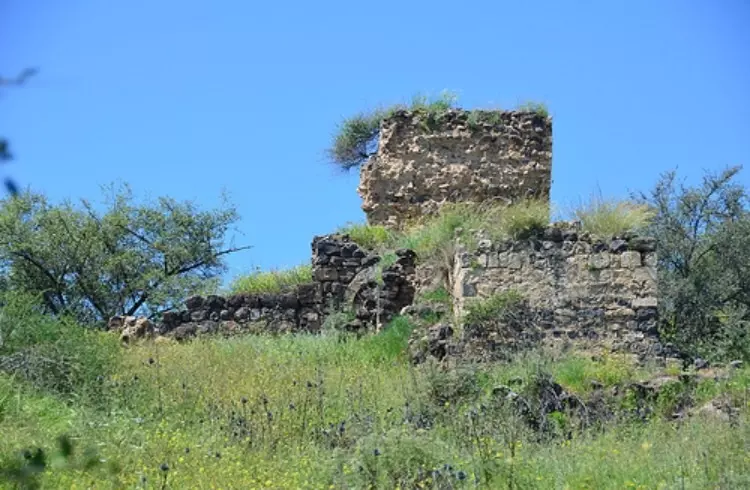
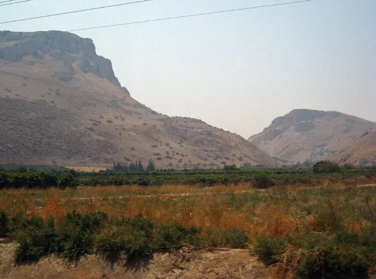
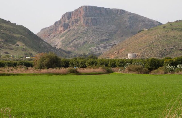
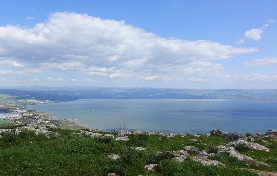
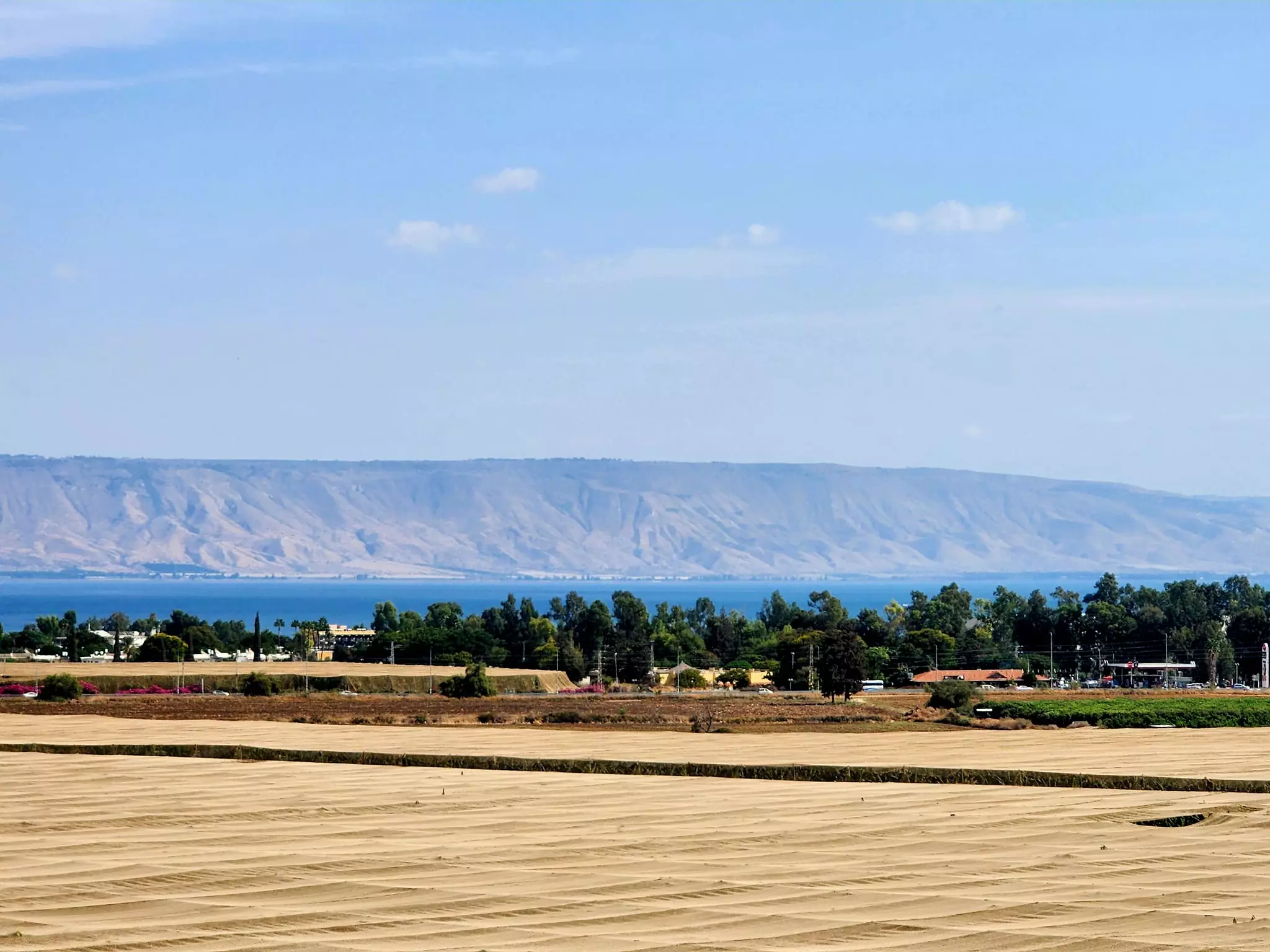
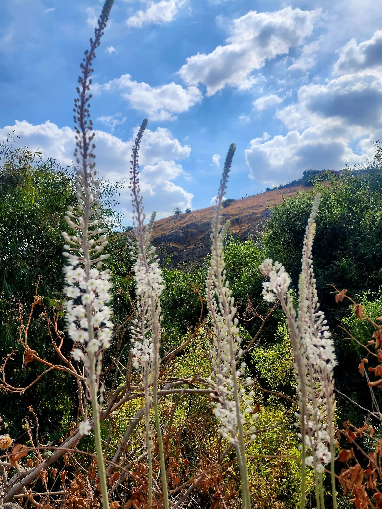
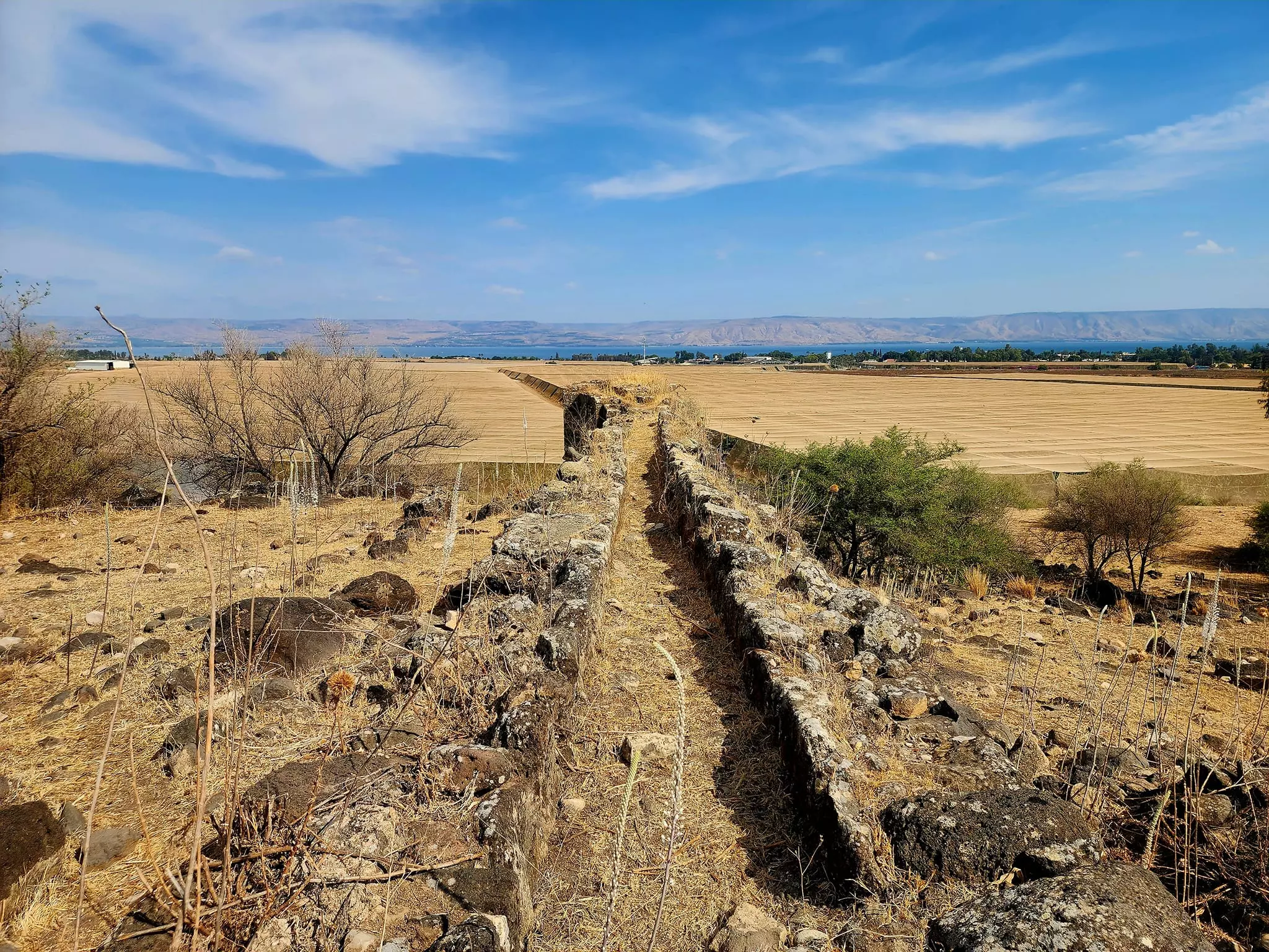
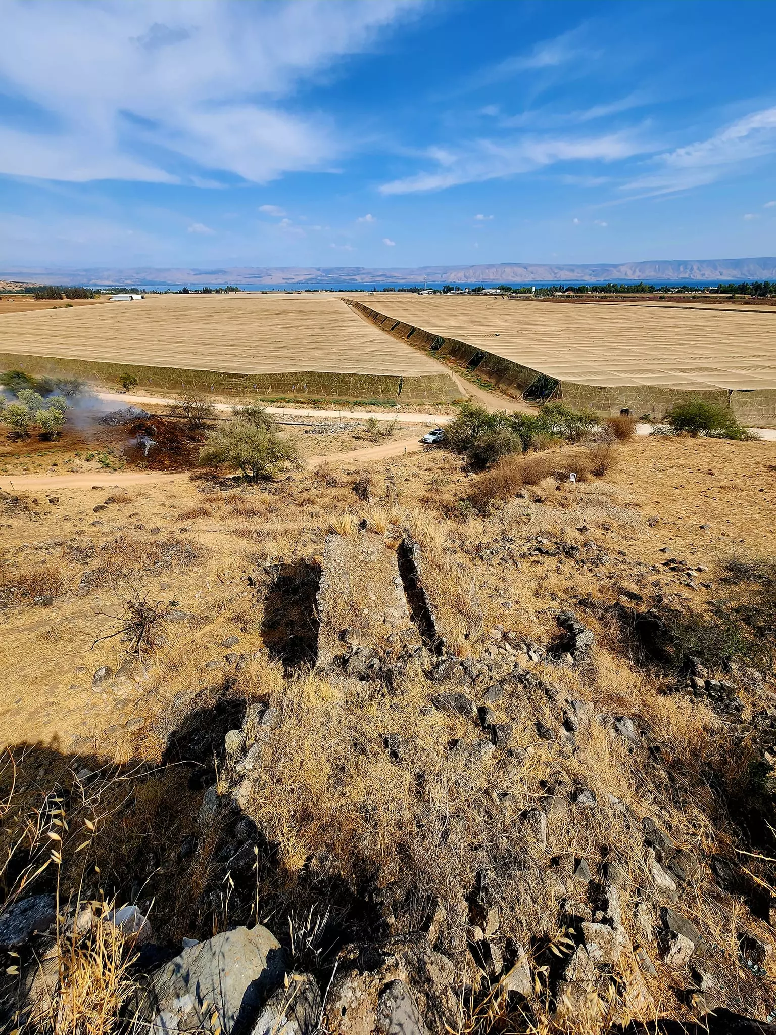
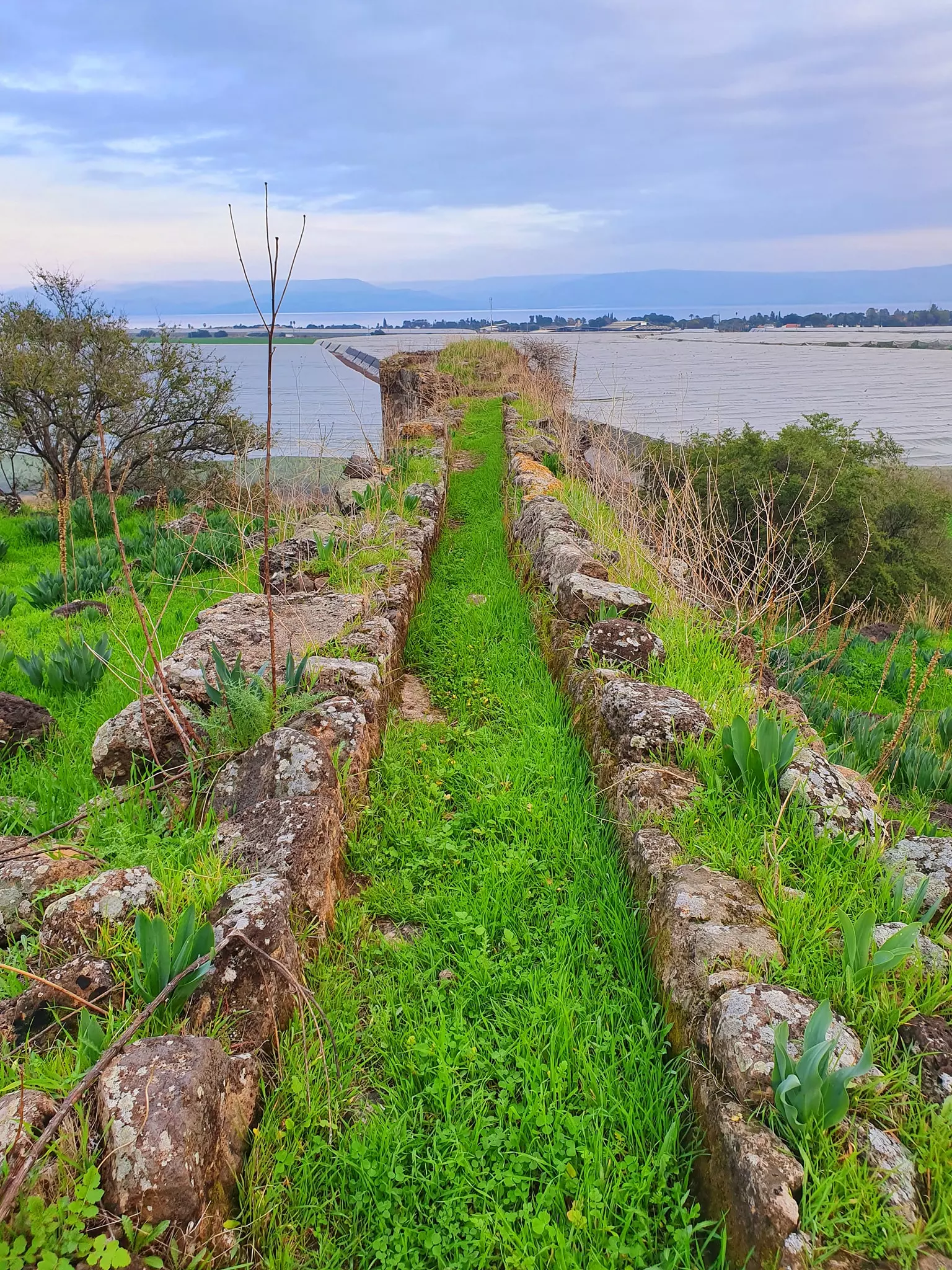
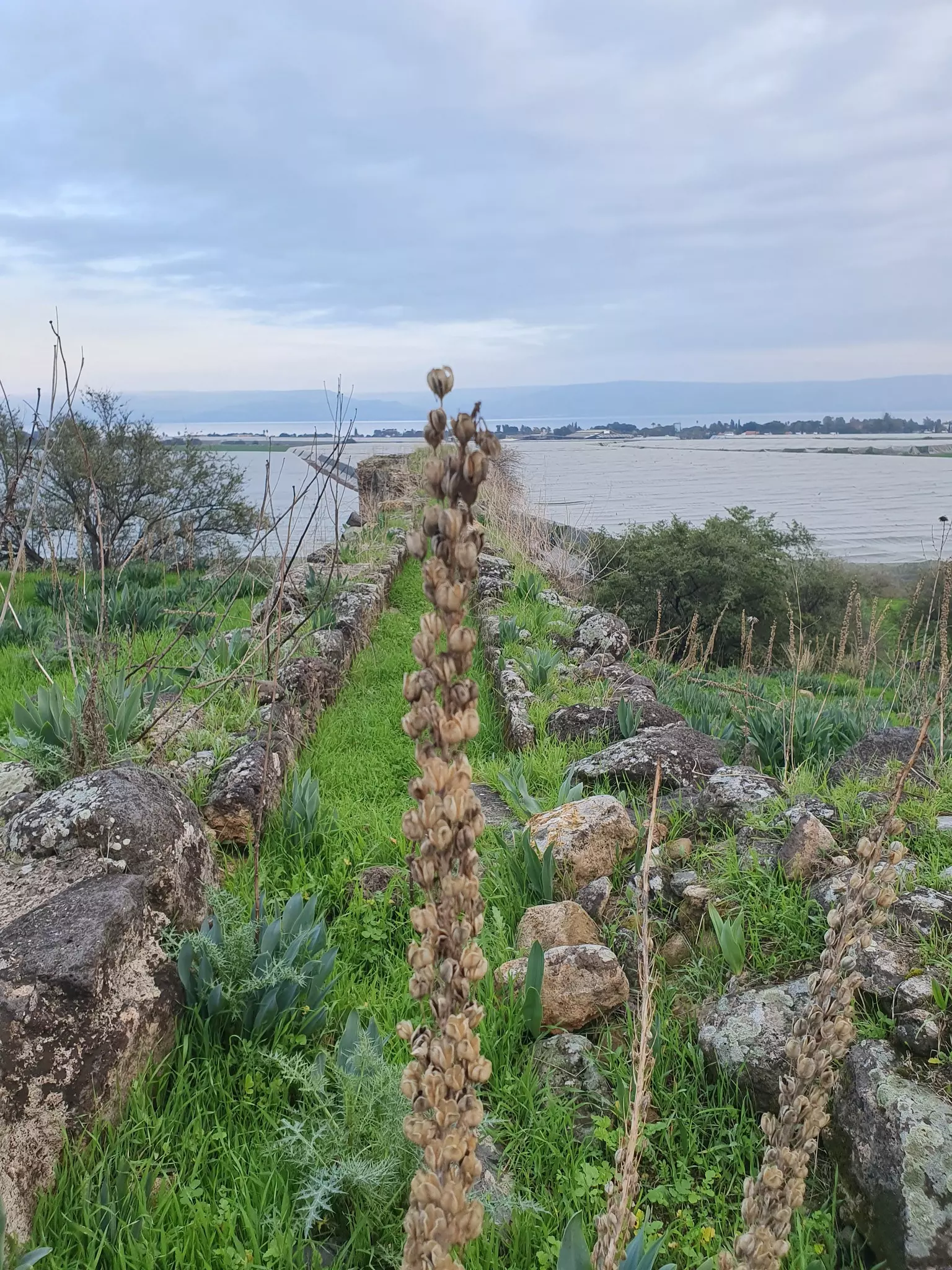
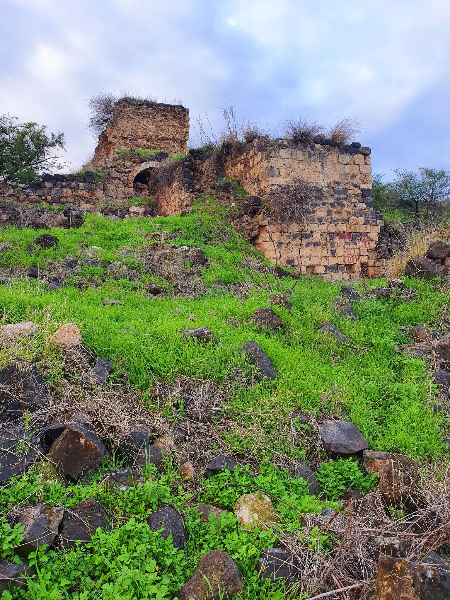
Village Before NakbaThe village stood atop a small, slightly elevated hill that overlooked Lake Tiberias; it was 2 km west of the lake shore. A secondary road linked Ghuwayr Abu Shusha to the Tiberias-Safad highway, and other secondary roads linked it to nearby villages. When the American biblical scholar, Edward Robinson, passed by in 1838 he could see only the remains of a few stone houses and a shrine. However, much of the fertile plain below the village was being planted by the al-Ghawarina Bedouin, and the Bedouin tribe of al-Samakiyya used some buildings in Ghuwayr Abu Shusha as storehouses. [[Robinson (1841) III:285-86]] Several springs provided its residents with drinking water. The villagers were Muslims and maintained a shrine for a Shaykh Muhammad, a local sage. They depended on agriculture for their livelihood. Orange trees covering 200 dunums of land to the west, north, and south of the village were owned by Jews; the villagers themselves grew vegetables and grain on the eastern part of the land. In 1944/45 a total of 21 dunums was devoted to citrus and bananas and 1,848 dunums were allocated to cereals; 1,377 dunums were irrigated or used for orchards. The nearby Khirbat Abu Shusha contained the ruins of water-powered mills which had stood next to Wadi Rubadiyya.Village Occupation and Ethnic CleaningThe Palestinian newspaper Filastin reported that forty Jewish militiamen attacked Ghuwayr Abu Shusha on 3 January 1948 at 3:00 a.m. The attack, confronted by the villagers, resulted in the deaths of the son of the village mukhtar and an unidentified woman. Three of the attackers also were killed. [[F:4/1/48]]Israeli historian Benny Morris claims that 'panic' led to an 'exodus' from the village over three months later, in the wake of the occupation of the sub-disctrict capital of Tiberias. Morris adds that the evacuation of Ghuwayr Abu Shusha had a demoralizing effect on the inhabitants of Safad, precipitating its fall. He states that the exodus apparently took place in two waves, on 21 and 28 April 1948, but makes no mention of a direct military attack on the village. Morris indicates that at least some of the villagers were displaced to the Galilean town of al-Rama. When that village itself was occupied at the end of October, they were ordered by Israeli forces to move again, this time across the border to Lebanon. [[M:xv, 102, 130, 227]] The villagers, interviewed a generation later, did recall a military attack on the village. They stated that they were not alarmed by the occupation of Tiberias, but were prepared to defend the village. However, when no arms were supplied to them by the Arab Liberation Army, they decided to evacuate women, children, and old men to the village of al-Rama, leaving forty-eight men in the village sharing some thirty-five to forty rifles. At dawn on 24 April, while the armed men were asleep west of the village, Ghuwayr Abu Shusha was occupied in a surprise attack by the Palmach. They decided not to counterattack, since 'there was no one in the village to protect.' The people of Ghuwayr Abu Shush a remained in al-Rama until it too fell, frequently returning to their village to retrieve their belongings. Some of the villagers ended up in 'Ayn aI-Hilwa refugee camp in southern Lebanon, where they were interviewed in 1973. [[N:30-33]] According to Morris, the lands of the village were acquired by the state and leased to the nearby Jewish settlements of Migdal (197249), about 1 km to the south, and Kibbutz Ginnosar (199250), almost 2 km to the east, in the summer or early autumn of 1949. The leases were for one year only; Morris does not indicate whether these two settlements were later given long-term leases or title deeds to the village lands. [[M:176-177,179]] Zionists Colonies on Village LandsZionists established the settlement of Ginnosar (199250) in 1937, to the east of the village on what had traditionally been village land. The settlement of Livnim (196252), founded in 1982 on village land, is about 1 km northwest of the village site.Village TodayThe village site is covered with thorns and wild vegetation, including Christ's-thorn trees and cactuses. The shrine of Shaykh Muhammad and the remains of a mill can be seen among piles of stones and a few olive trees. The lower-lying lands are planted in bananas and citrus, while the highlands are used as grazing areas by Israelis.SourceDr. Walid al-Khalidi, 1992: All That Remains. |
||||||||||||||||||||||
| Related Maps | Town Lands' Demarcation Maps خرائط للقضاء توضح حدود القرى والاودية Town's map on MapQuest View from satellite Help us map this town at WikiMapia |
|||||||||||||||||||||
| Related Links | Wikipedia's Page Facebook Page Featured Article Google Search Google For Images Google For Videos |
|||||||||||||||||||||
| More Information | في كتاب كي لا ننسى في كتاب بلادنا فلسطين المزيد من موقع هوية |
|||||||||||||||||||||
- كتاب قرية غوير أبو شوشة المهجرة -- إعداد ماهر حسن شاويش
- نبذة تاريخية عن قرية غوير أبو شوشة (قضاء طبريا) من كتاب (كي لا ننسى)
- غوير أبو شوشة...(الخطيب السميري) شيخ السمايرة ..حياته وتاريخه
- غوير ابو شوشة ..والسميري ...تاريخ وأحداث
- غوير أبو شوشة وعائلة السميري_الخطيب السميري في وجه اليهود الطامعين
- غوير أبو شوشة __والخطيب السميري__(صلحة عرب المواسى مع الدروز)
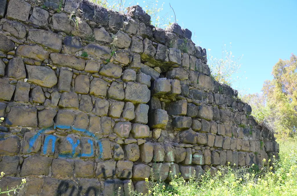
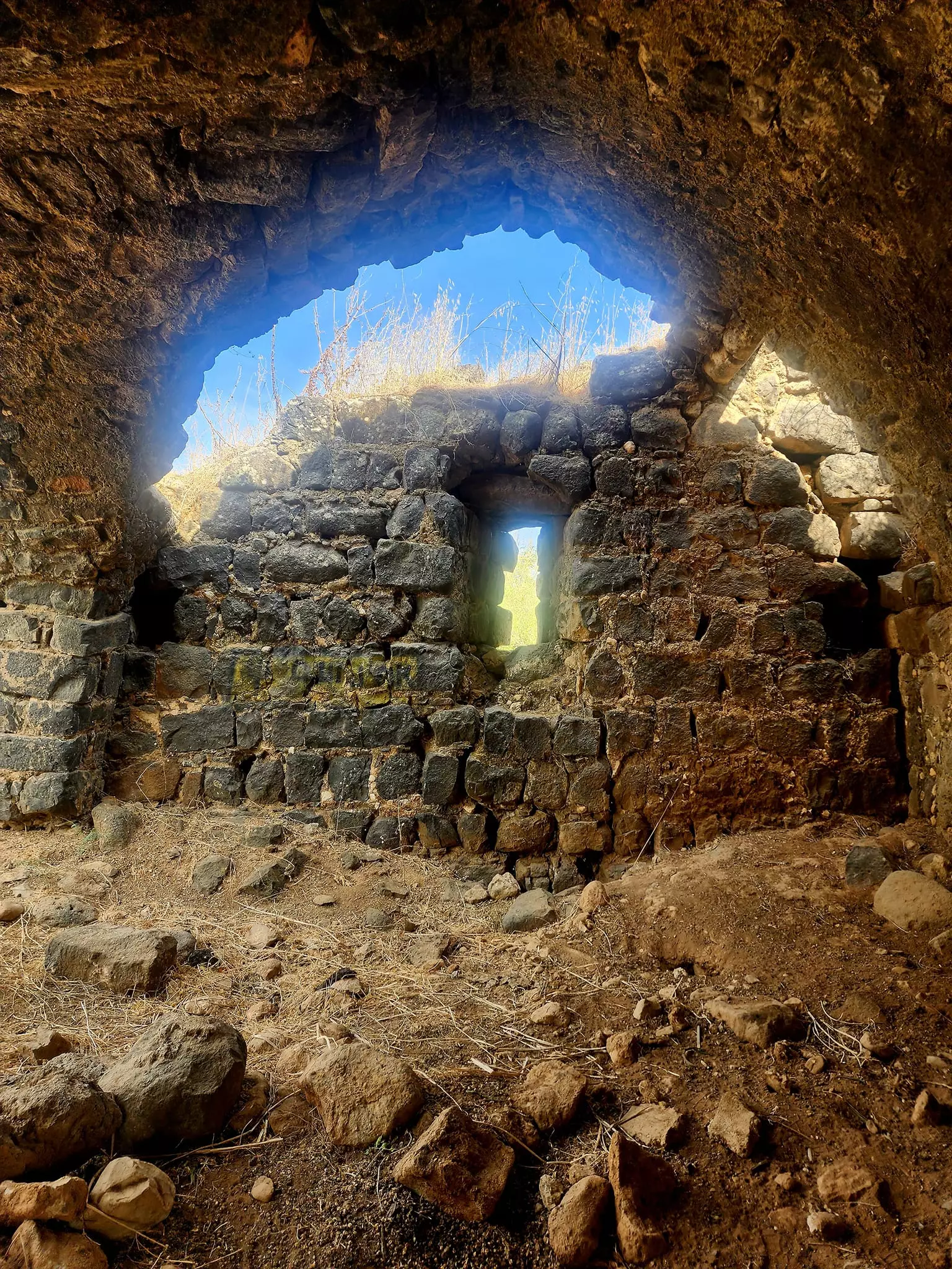
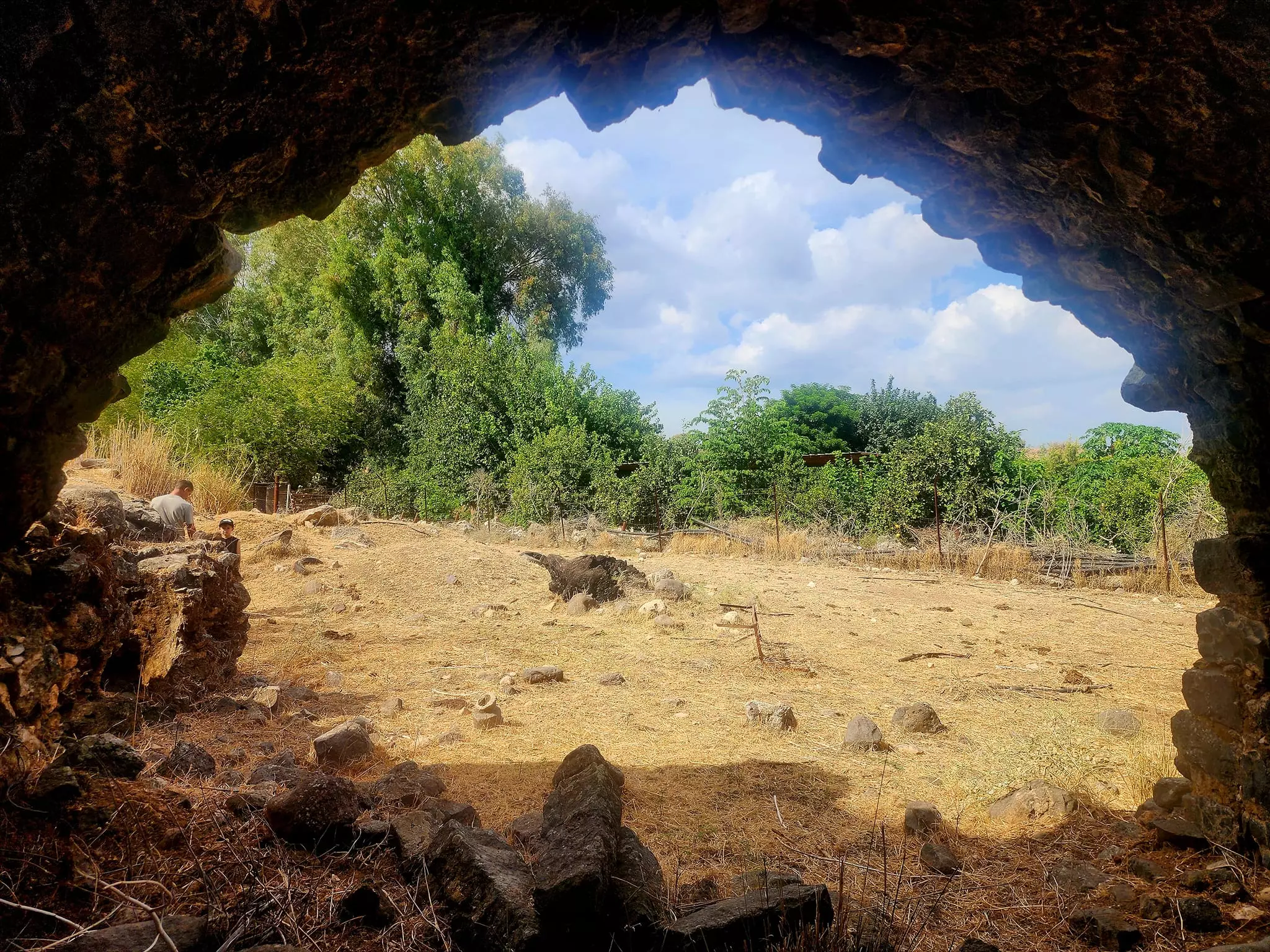
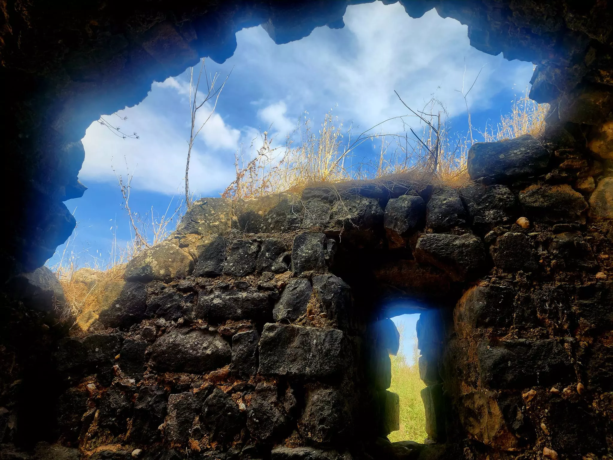
- The remains of a village structure, 1987
Scanned from "All That Remains" by Dr. Walid Khalidi - Qabu watermill
Posted by Uri Zackhem - Qabu watermill
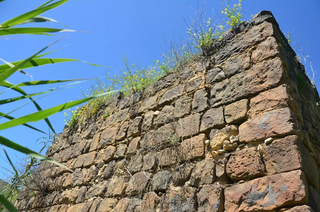
Posted by Uri Zackhem - Remains
Posted by Uri Zackhem - Remains
Posted by Uri Zackhem - Remains
Posted by Uri Zackhem - من اثار بنايات القريه
Posted by abu raya - من مقامات القريه
Posted by abu raya 1 - اراضي القريه
Posted by abu raya - اراضي القريه
Posted by abu raya - انقاض القرية المدمرة
- انقاض القرية المدمرة #2
- انقاض القرية المدمرة #3
- منظر عام لبحيرة طبريا من القرية المدمرة
- Pre-Nakba Aerial view of the village / صورة من الجو للقرية اخذت قبل النكبة
- Let us see how the most "liberal and civilized" of world Jewry has obliterated our village. How else will the Jews be great and safe again? -- القرية دمرت بالكامل.. من هنا مر الهمج
- Let us see how the most "liberal and civilized" of world Jewry has obliterated our village. How else will the Jews be great and safe again? -- القرية دمرت بالكامل.. من هنا مر الهمج
#2
- Let us see how the most "liberal and civilized" of world Jewry has obliterated our village. How else will the Jews be great and safe again? -- القرية دمرت بالكامل.. من هنا مر الهمج
#3
- Let us see how the most "liberal and civilized" of world Jewry has obliterated our village. How else will the Jews be great and safe again? -- القرية دمرت بالكامل.. من هنا مر الهمج
#4
- Let us see how the most "liberal and civilized" of world Jewry has obliterated our village. How else will the Jews be great and safe again? -- القرية دمرت بالكامل.. من هنا مر الهمج
#5
- Let us see how the most "liberal and civilized" of world Jewry has obliterated our village. How else will the Jews be great and safe again? -- القرية دمرت بالكامل.. من هنا مر الهمج
#6
- Let us see how the most "liberal and civilized" of world Jewry has obliterated our village. How else will the Jews be great and safe again? -- القرية دمرت بالكامل.. من هنا مر الهمج
#7
- Let us see how the most "liberal and civilized" of world Jewry has obliterated our village. How else will the Jews be great and safe again? -- القرية دمرت بالكامل.. من هنا مر الهمج
#8
- Let us see how the most "liberal and civilized" of world Jewry has obliterated our village. How else will the Jews be great and safe again? -- القرية دمرت بالكامل.. من هنا مر الهمج
#9
- Let us see how the most "liberal and civilized" of world Jewry has obliterated our village. How else will the Jews be great and safe again? -- القرية دمرت بالكامل.. من هنا مر الهمج
#10
- Let us see how the most "liberal and civilized" of world Jewry has obliterated our village. How else will the Jews be great and safe again? -- القرية دمرت بالكامل.. من هنا مر الهمج
#11
- Let us see how the most "liberal and civilized" of world Jewry has obliterated our village. How else will the Jews be great and safe again? -- القرية دمرت بالكامل.. من هنا مر الهمج
#12
- Let us see how the most "liberal and civilized" of world Jewry has obliterated our village. How else will the Jews be great and safe again? -- القرية دمرت بالكامل.. من هنا مر الهمج
#13
- Let us see how the most "liberal and civilized" of world Jewry has obliterated our village. How else will the Jews be great and safe again? -- القرية دمرت بالكامل.. من هنا مر الهمج
#14
- Let us see how the most "liberal and civilized" of world Jewry has obliterated our village. How else will the Jews be great and safe again? -- القرية دمرت بالكامل.. من هنا مر الهمج
#15
- Let us see how the most "liberal and civilized" of world Jewry has obliterated our village. How else will the Jews be great and safe again? -- القرية دمرت بالكامل.. من هنا مر الهمج
#16
- Let us see how the most "liberal and civilized" of world Jewry has obliterated our village. How else will the Jews be great and safe again? -- القرية دمرت بالكامل.. من هنا مر الهمج
#17
- Let us see how the most "liberal and civilized" of world Jewry has obliterated our village. How else will the Jews be great and safe again? -- القرية دمرت بالكامل.. من هنا مر الهمج
#18
- Let us see how the most "liberal and civilized" of world Jewry has obliterated our village. How else will the Jews be great and safe again? -- القرية دمرت بالكامل.. من هنا مر الهمج
#19
- Let us see how the most "liberal and civilized" of world Jewry has obliterated our village. How else will the Jews be great and safe again? -- القرية دمرت بالكامل.. من هنا مر الهمج
#20
- Let us see how the most "liberal and civilized" of world Jewry has obliterated our village. How else will the Jews be great and safe again? -- القرية دمرت بالكامل.. من هنا مر الهمج
#21
- Let us see how the most "liberal and civilized" of world Jewry has obliterated our village. How else will the Jews be great and safe again? -- القرية دمرت بالكامل.. من هنا مر الهمج
#22
- Let us see how the most "liberal and civilized" of world Jewry has obliterated our village. How else will the Jews be great and safe again? -- القرية دمرت بالكامل.. من هنا مر الهمج
#23
- Let us see how the most "liberal and civilized" of world Jewry has obliterated our village. How else will the Jews be great and safe again? -- القرية دمرت بالكامل.. من هنا مر الهمج
#24
- Let us see how the most "liberal and civilized" of world Jewry has obliterated our village. How else will the Jews be great and safe again? -- القرية دمرت بالكامل.. من هنا مر الهمج
#25
- Let us see how the most "liberal and civilized" of world Jewry has obliterated our village. How else will the Jews be great and safe again? -- القرية دمرت بالكامل.. من هنا مر الهمج
#26
- The most "liberal and civilized" of world Jewry has obliterated our village except of the shrine/maqam it was known for. How else will the Jews be great and safe again? It seems making more enemies & fewer friends strengthens the fight against antisemitism. Mazeltov
- The most "liberal and civilized" of world Jewry has obliterated our village except of the shrine/maqam it was known for. How else will the Jews be great and safe again? It seems making more enemies & fewer friends strengthens the fight against antisemitism. Mazeltov
#2
- The most "liberal and civilized" of world Jewry has obliterated our village except of the shrine/maqam it was known for. How else will the Jews be great and safe again? It seems making more enemies & fewer friends strengthens the fight against antisemitism. Mazeltov
#3
- The most "liberal and civilized" of world Jewry has obliterated our village except of the shrine/maqam it was known for. How else will the Jews be great and safe again? It seems making more enemies & fewer friends strengthens the fight against antisemitism. Mazeltov
#4
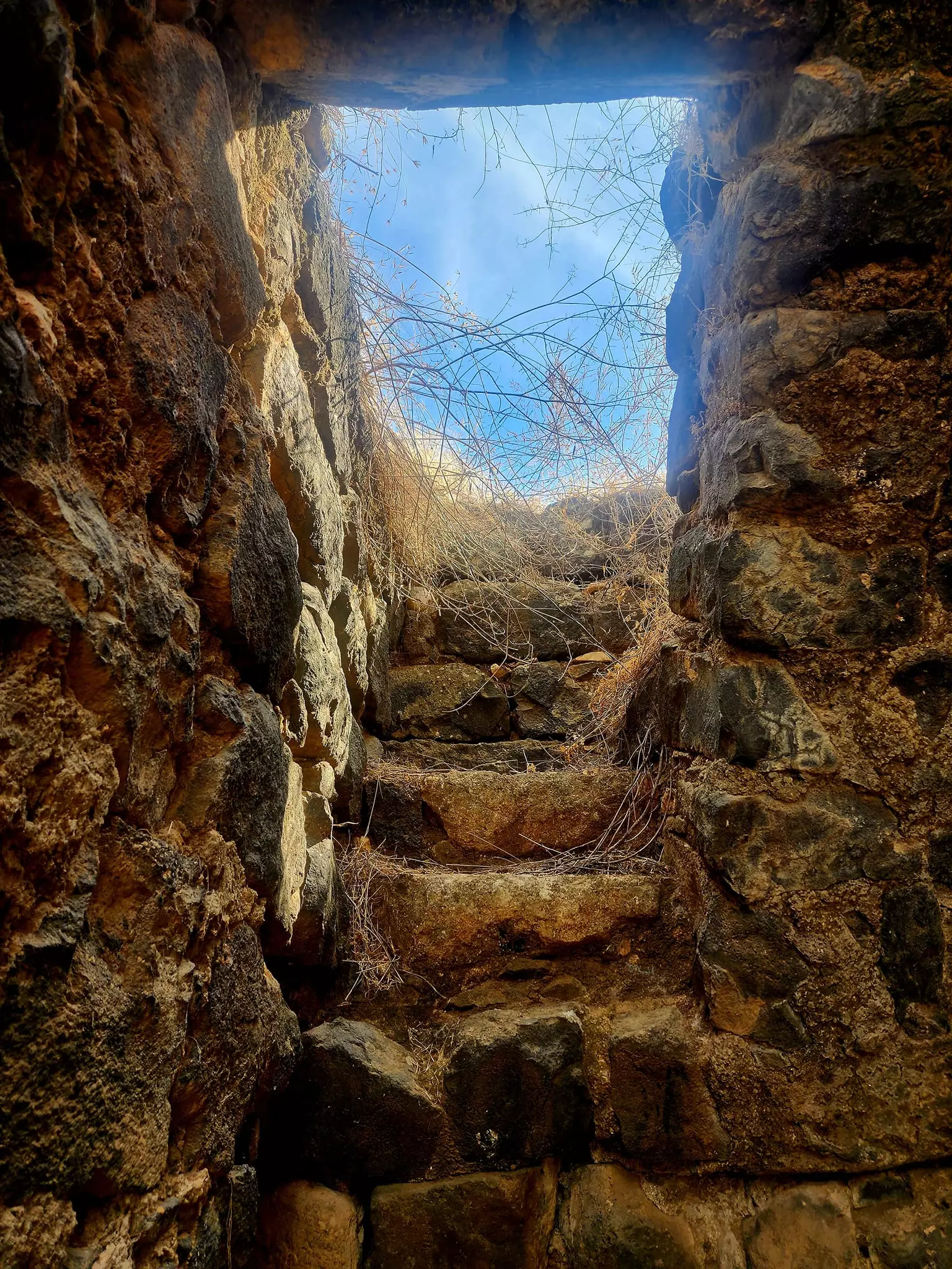
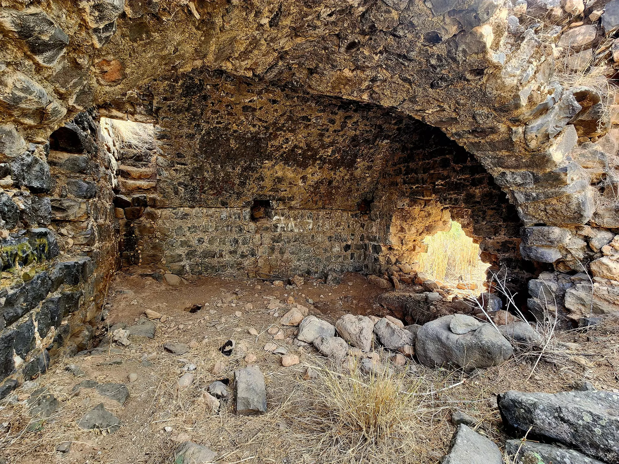
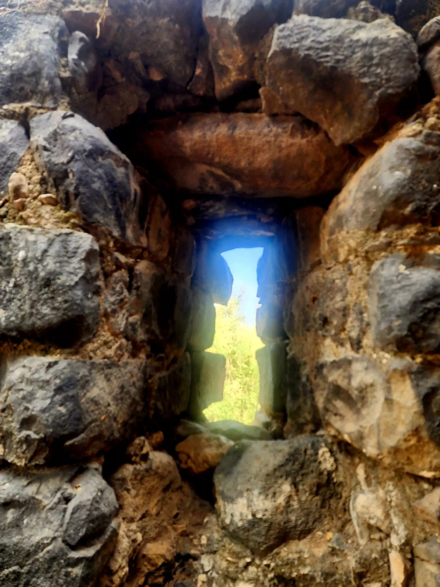
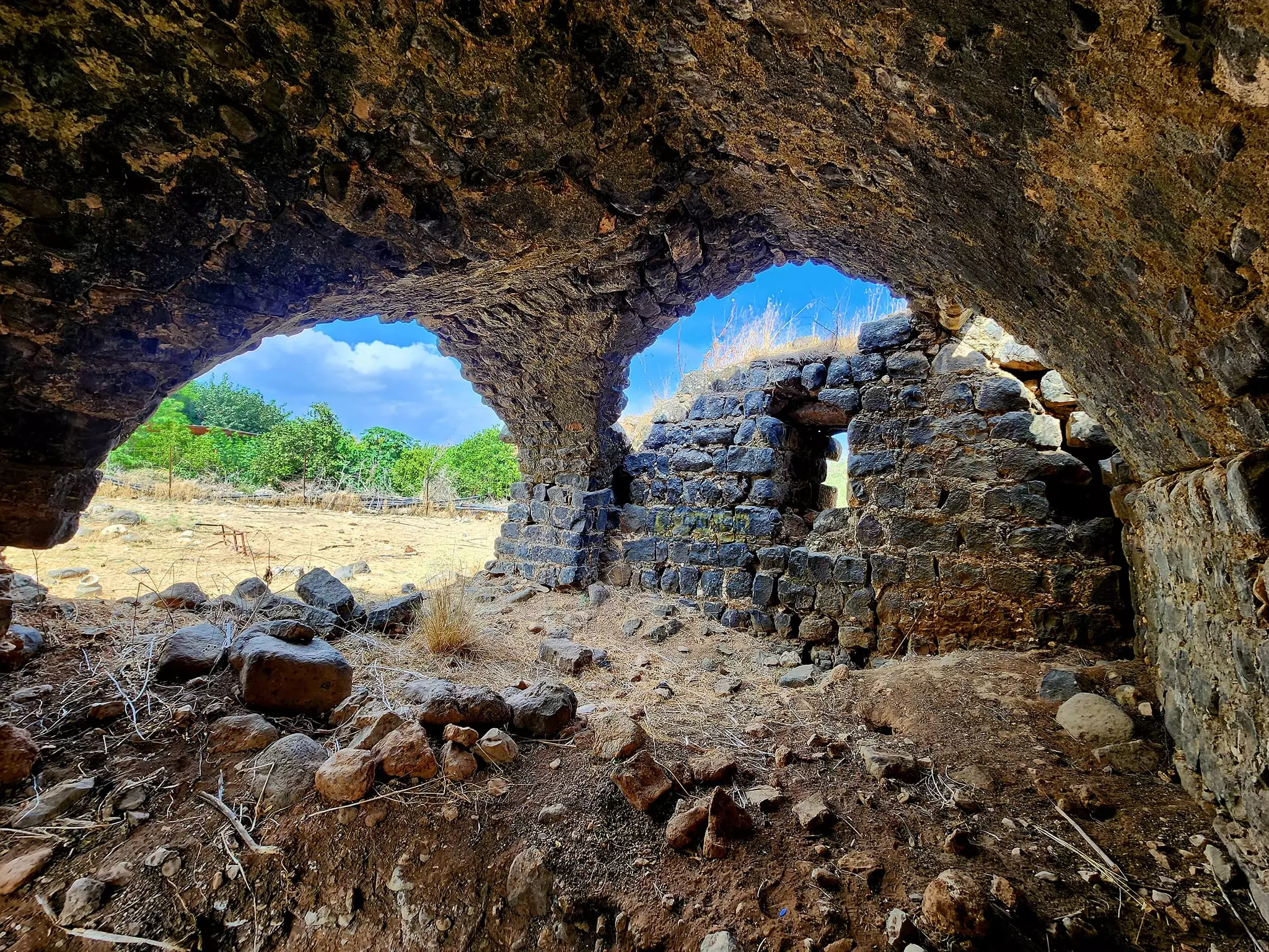
- Let us tour Abu Shusha's famous water-powered mill -- Jan. 2022 -- Nabela Salem -- مطحنة قمح قرية ألغوير أبو شوشة
- Let us tour Abu Shusha's famous water-powered mill -- Jan. 2022 -- Nabela Salem -- مطحنة قمح قرية ألغوير أبو شوشة #2
- Let us tour Abu Shusha's famous water-powered mill -- Jan. 2022 -- Nabela Salem -- مطحنة قمح قرية ألغوير أبو شوشة #3
- Let us tour Abu Shusha's famous water-powered mill -- Jan. 2022 -- Nabela Salem -- مطحنة قمح قرية ألغوير أبو شوشة #4
- Let us tour Abu Shusha's famous water-powered mill -- Jan. 2022 -- Nabela Salem -- مطحنة قمح قرية ألغوير أبو شوشة #5
- Let us tour Abu Shusha's famous water-powered mill -- Jan. 2022 -- Nabela Salem -- مطحنة قمح قرية ألغوير أبو شوشة #6
- Let us tour Abu Shusha's famous water-powered mill -- Jan. 2022 -- Nabela Salem -- مطحنة قمح قرية ألغوير أبو شوشة #7
- Let us tour Abu Shusha's famous water-powered mill -- Jan. 2022 -- Nabela Salem -- مطحنة قمح قرية ألغوير أبو شوشة #8
- Let us tour Abu Shusha's famous water-powered mill -- Jan. 2022 -- Nabela Salem -- مطحنة قمح قرية ألغوير أبو شوشة #9
- Let us tour Abu Shusha's famous water-powered mill -- Jan. 2022 -- Nabela Salem -- مطحنة قمح قرية ألغوير أبو شوشة #10
- Let us tour Abu Shusha's famous water-powered mill -- Jan. 2022 -- Nabela Salem -- مطحنة قمح قرية ألغوير أبو شوشة #11
- Let us tour Abu Shusha's famous water-powered mill -- Jan. 2022 -- Nabela Salem -- مطحنة قمح قرية ألغوير أبو شوشة #12
- Let us tour Abu Shusha's famous water-powered mill -- Jan. 2022 -- Nabela Salem -- مطحنة قمح قرية ألغوير أبو شوشة #13
- Let us tour Abu Shusha's famous water-powered mill -- Jan. 2022 -- Nabela Salem -- مطحنة قمح قرية ألغوير أبو شوشة #14
- Let us tour Abu Shusha's famous water-powered mill -- Jan. 2022 -- Nabela Salem -- مطحنة قمح قرية ألغوير أبو شوشة #15
- Let us tour Abu Shusha's famous water-powered mill -- Jan. 2022 -- Nabela Salem -- مطحنة قمح قرية ألغوير أبو شوشة #16
- Let us tour Abu Shusha's famous water-powered mill -- Jan. 2022 -- Nabela Salem -- مطحنة قمح قرية ألغوير أبو شوشة #17
- Let us tour Abu Shusha's famous water-powered mill -- Jan. 2022 -- Nabela Salem -- مطحنة قمح قرية ألغوير أبو شوشة #18
- Let us tour Abu Shusha's famous water-powered mill -- Jan. 2022 -- Nabela Salem -- مطحنة قمح قرية ألغوير أبو شوشة #19
- Let us tour Abu Shusha's famous water-powered mill -- Jan. 2022 -- Nabela Salem -- مطحنة قمح قرية ألغوير أبو شوشة #20
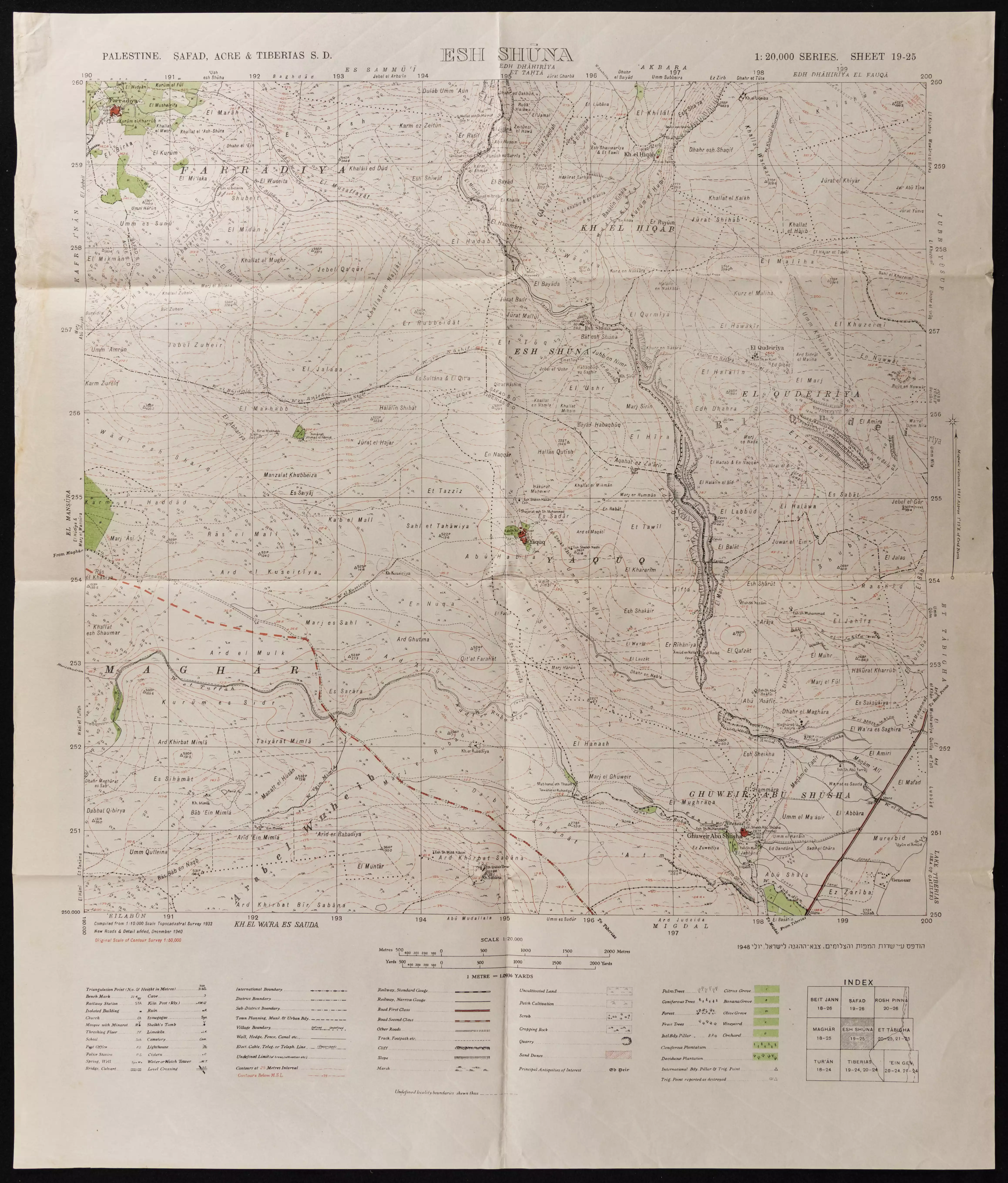
- خارطة تُظهِر الحدود والطرق بأنواعها والأماكن المقدسة والطبيعة الطوبغرافية من تلال وسهول ومنحدرات والتشكيلة الطبيعية للأرض وأنواع المزروعات. نُشرت الخريطة فترة الانتداب البريطاني، تم إضافة تعديلات عليها من قِبَل خدمة الخرائط والصور التابعة للقوات العسكرية الاسرائيلية فترة الأربعينيات.
Want to browse more? 80,000 pictures were grouped in these gallaries:
| Display Name | Clan/Hamolah | Country of Residence |
No links have been shared yet, be free to the first to share the first link.
 Fake Valor: Why Did Zionist Jews Hoist Nazis Flag on Their Ships in the 1930s?
What is new?
-
Facts About Oct. 7th Gaza Raid
-
Remined Us Please:: Who Did Rape Who? Palestinians Raped Israelis? Or, was the other way around?
-
When Prof. Edward Said was invited to debate Bibi Netanyahu in the 1980s, watch what happened!
-
Ezra Klein of the NY Times on the "Jewish Race".
-
Abusing Blood Libel!
-
Did Israeli Soldiers Activate The Hanniba Direective On Oct. 7th? You Be The Judge
-
Zionist FAQ: Isn't it true that Palestinians don't want peace? Palestinians never accepted the two-state solution
- Facts about Haavara (Transfer) Agreement between Ben-Gurion & Hitler
-
Haavara FAQs: Why Did Zionist Jews Hoist Nazis' Flags on Their Ships in the 1930s?
- Haavara FAQs: When Chaim Weizmann met FDR in mid-1943, why was he silent about rescuing European Jewry?
-
Dear ChatGPT: How did Palestinians resist Napoleon's invasion of their country in 1799?
-
Dear ChatGPT: Gaza had a vibrant Jewish community in the mid-17th century. What happened to them?
-
Dear ChatGPT: Why did the Jewish Agency suppress news of the Holocaust during WWII?
-
Video Playlist: Jews share their DNA tests to end the conflict for good.
-
A Tale of Two Conflicts: Examining the Definition of Genocide
-
Prof. Abraham Polak And The Suppressed History of the Khazars and European Jewry
-
How Ronald Reagan would have framed the genocide in Gaza if he were still alive?
-
Haavara FAQs: Let us do the math: how many German Jews did The Haavara Agreement save?
-
Zionist FAQs: The Hebron Massacre of 1929, "clearly proves" that Palestinians are antisemitic, how could you deny it?
-
Zionist FAQs: Why Anti-Zionist Is Not Antisemitism?
-
Zionist FAQs: Isn't it true that the KGB created Palestinian Nationalism in the early 1960s?
- Zionist FAQs: Muslims are killing Muslims all the time; why are Israeli Jews being singled out in the media?
- Zionist FAQs: How is Israel an apartheid state when 20% of its citizens are Arabs who enjoy full rights?
-
Haavara FAQs: Why Did Dorothy Thompson Flip From A Zionist Advocate to A Silenced Dissenter?
-
Haavara FAQs: Analysis of Herzl's Uganda Scheme and how it could have saved millions of Jews.
-
Haavara FAQs: Why did Hayim Greenberg describe American Jewry as "morally bankrupt" in early 1943?
-
Haavara FAQs: What if the Evian Conference was a resounding success? What would have been the impact of saving European Jewry on Zionism?
- Haavara FAQs: What if the six million were saved, how that would have impacted the Zionist project?
-
Haavara FAQs: How did Zionist leaders react when Europe's Jews lingered in the DP camps after WWII ended?
-
Why does the American Jewish community repeat lies that David Ben-Gurion had debunked before he died?
-
Who has the power to rename the Tatar/Khazar Gene Marker to Jewish IV?
-
Zionist FAQs: Why won't Egypt, Syria, and Jordan take their people back? Jews are indigenous to Palestine, and Arabs immigrated after Jews developed the country. Arabs should leave.
-
Haavara FAQs: Did Hitler and the Nazis conflate between Judaism and Zionist? If that wasn't case, then why?
-
Haavara FAQs: Winston Churchill and antisemitism, a collection of articles written Churchill.
-
Haavara FAQs: Broken by country, how many Jews survived vs. killed during the Holocaust?
-
Haavara FAQs: Why did European Jews vote with their feet and to immigrated to the Americas, not Palestine, after WWII?
-
Watch this American Jewish Girl describing Israeli Jews' cognitive dissonance like no other in under two minutes
-
Haavara FAQs: When the Nazis went out of their way to hide the Holocaust, Israeli Jews did the exact opposite by broadcasting their genocide of Gazans. But why?
-
Haavara FAQs: How Zionist Jews went out of their to show their appreciation to Nazism and Fascism?
- Haavara FAQs: Why Zionist leaders were against bombing the death camps & the Railroads leading to them?
-
Haavara FAQs: Hitler's message to the British and American people: If Jews are such noble citizens and you care about them, how come you're not letting them in? I will gladly ship them to you at my expense, even on luxury liners!
-
A shortlist of Zionist and Israeli false flag operations in the name Jews.
-
The Most Moral Army
- The Land of Kapos (Israel): Where the brave are boycotted and Kapos walk free.
- Why did early Zionists often named their communal enterprises "colonial"?
- Zionist Relations with Nazi Germany by Faris Glubb
-
Two NY Times advertisements by Zionists in the early 1943 that exposes Zionists' treason at the height of the calamity
- Facts Not Lies about the Palestinian-Israeli Conflict.
- Site's pictures have been categorized
- Campgain Against Lice
- A Survey of Palestine, the official source about Palestine before Nakba produced by the British Mandate; over 1200 pages.
- Satellite View & Google Earth: Over 6,000 placemarks identifying all destroyed towns, W. Bank & Gaza Strip Towns, & refugee camps.
- PalestineRemembered.com and its Nakba Oral History Project were featured on al-Jazeera Satellite TV.
- Nakba Oral History Video Podcast:
 Over 700 Oral History interviews (including 3,500+ hours of recording) can be viewed online.
 - Palestine Village Statistics Project
- Gaza Jail Break
- النسخة العربية للموقع الان متوفرة
- Videos: Documenting the destroyed villages in video: Tracing all that remains since Nakba.
- Videos: Responding to Zionist Propaganda
- Interview: The ethnic cleansing of Palestine: George Galloway interviews Israeli Historian Ilan Pappe.
- For Palestinians, memory matters. It provides a blueprint for their future By George Bisharat.
- Zionist FAQ now available in Hebrew שאלות שציונים שואלים, עכשיו בעברית
- Video: The Stephen Walt and John Mearsheimer report on the influence of the Israel Lobby on U.S. Foreign Policy
- The Palestinian-Israeli conflict for beginners
