| PalestineRemembered | About Us | Oral History | العربية | |
| Pictures | Zionist FAQs | Haavara | Maps | |
| Search |
| Camps |
| Districts |
| Acre |
| Baysan |
| Beersheba |
| Bethlehem |
| Gaza |
| Haifa |
| Hebron |
| Jaffa |
| Jericho |
| Jerusalem |
| Jinin |
| Nablus |
| Nazareth |
| Ramallah |
| al-Ramla |
| Safad |
| Tiberias |
| Tulkarm |
| Donate |
| Contact |
| Profile |
| Videos |
Welcome To Hadatha - حدثا (חדת'א)
|
District of Tiberias
Ethnically cleansed days ago |
العربية Google Earth |
 |
Gallery (53) |
- Statistics & Facts
-
Before & After

- Satellite View
- Articles 2
- Pictures 53
- Aerial Views 1
- Oral History 2
- Members 40
- All That Remains
- Wikipedia
- Videos 1
- Guest Book 38
- Links
| Statistic & Fact | Value | ||||||||||||||||
| Occupation Date | May 12, 1948 | ||||||||||||||||
| Distance From District | 12.5 (km) Southwest of Tiberias | ||||||||||||||||
| Elevation | 225 (meters) | ||||||||||||||||
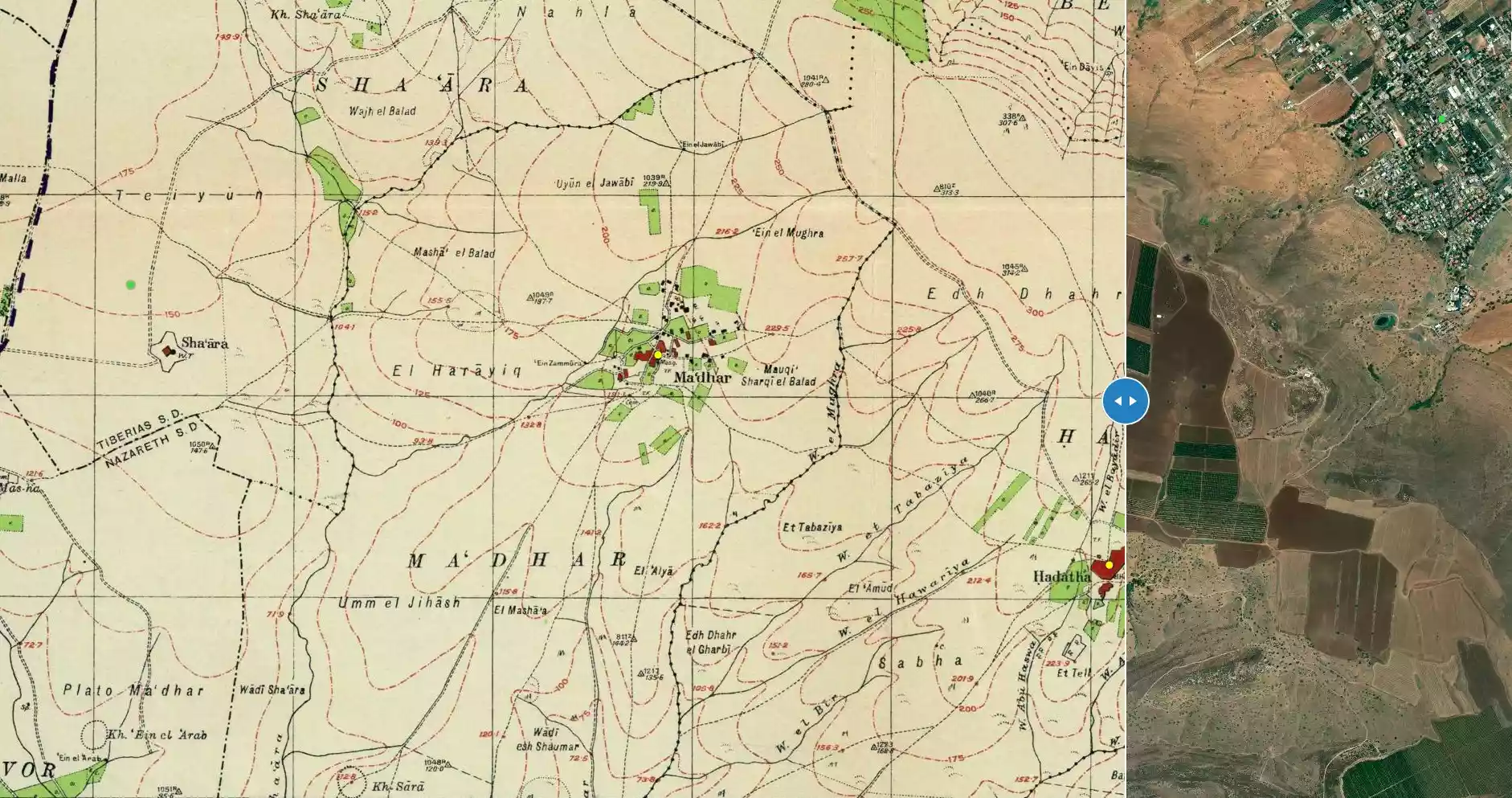
| Before & After Nakba, Click Map For Details |
|||||||||||||||||
|
|||||||||||||||||
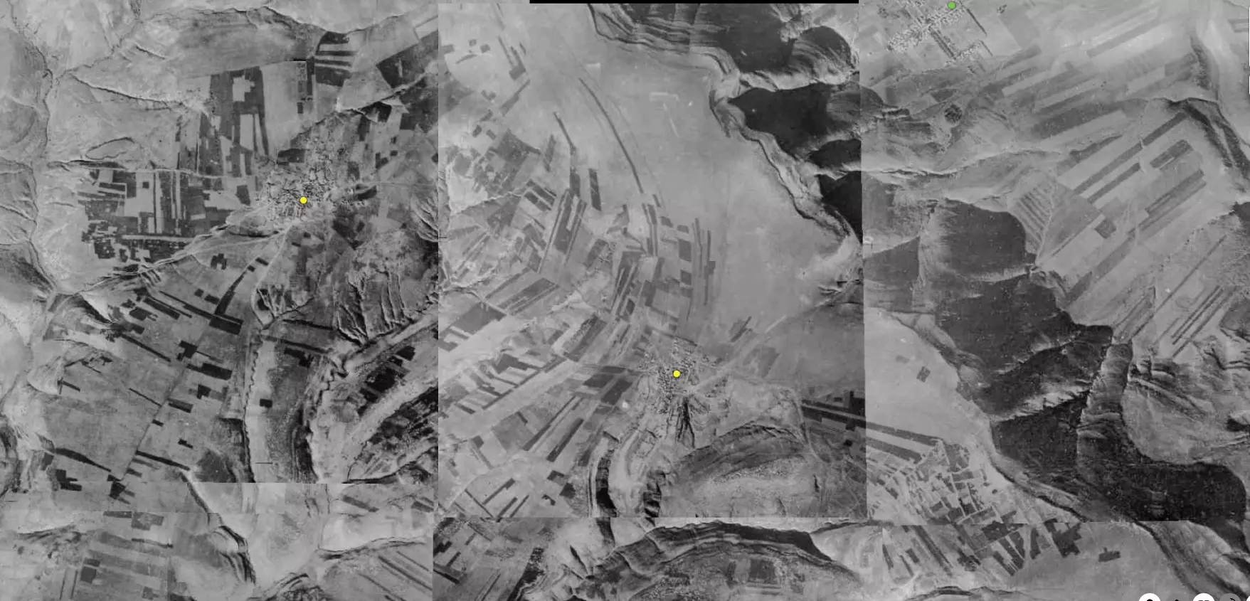
| Pre-Nakba Aerial View |
|||||||||||||||||
|
|||||||||||||||||
| Map Location | See location #22 on the map View from satellite |
||||||||||||||||
| Attacking Units | Golani Brigade | ||||||||||||||||
| Exodus Cause | Abandonment based on Arab orders | ||||||||||||||||
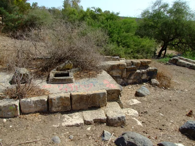
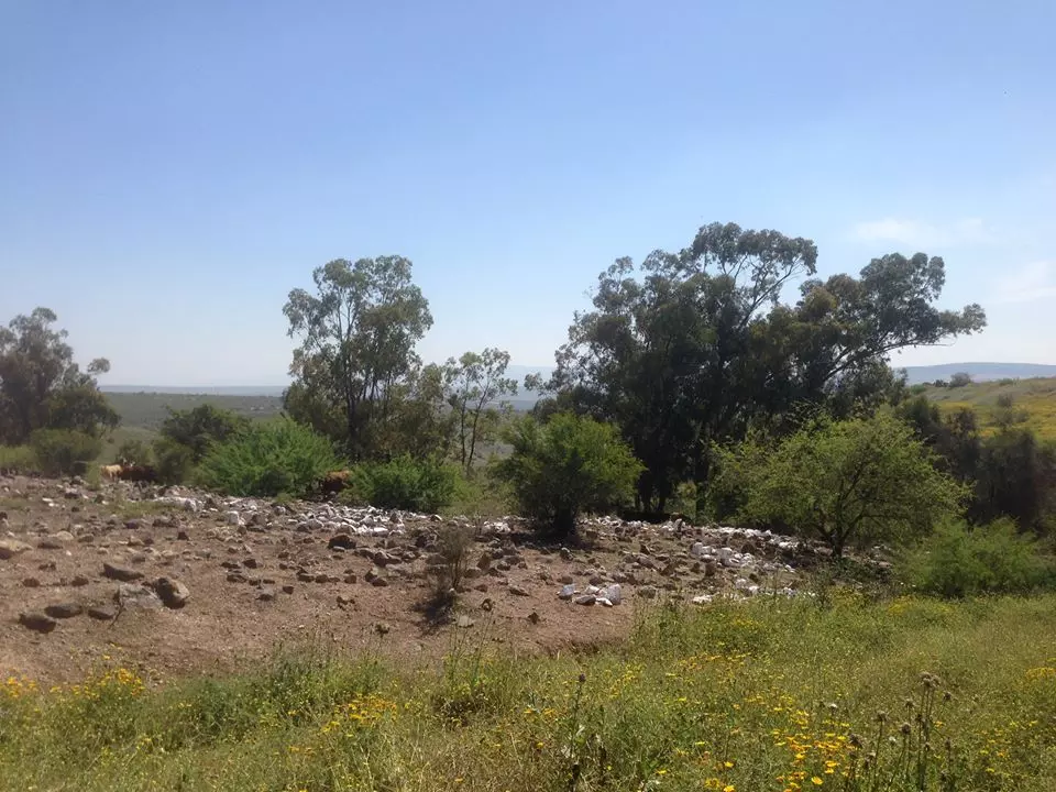
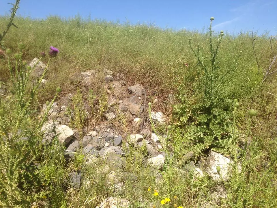
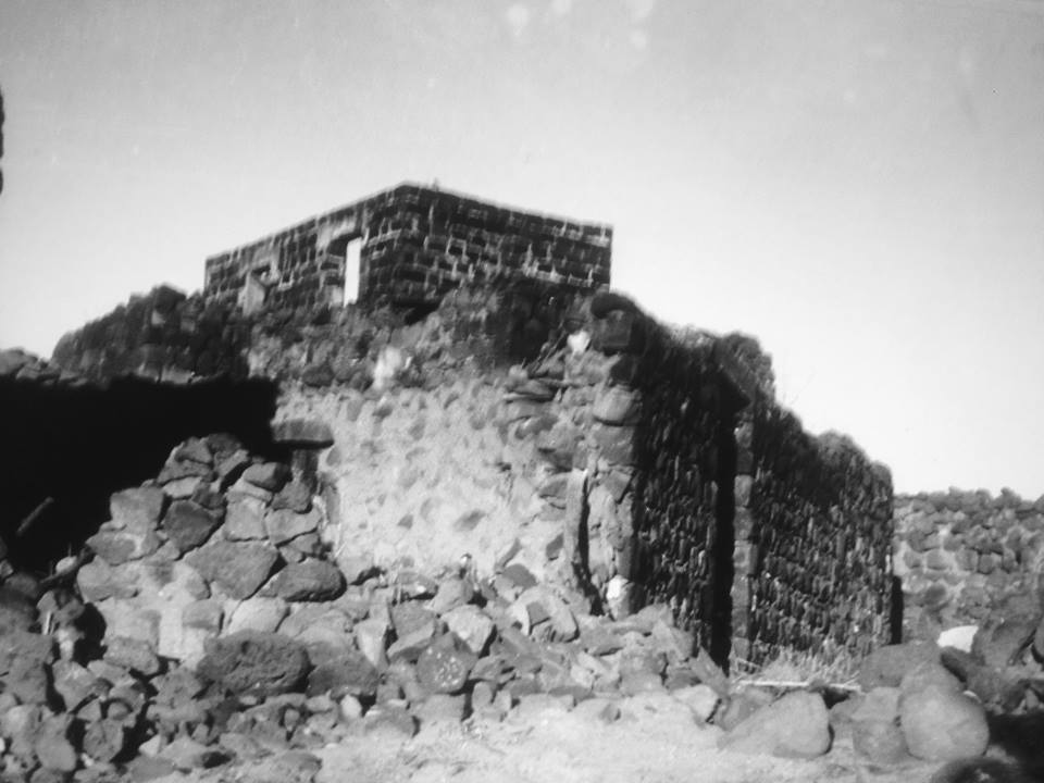
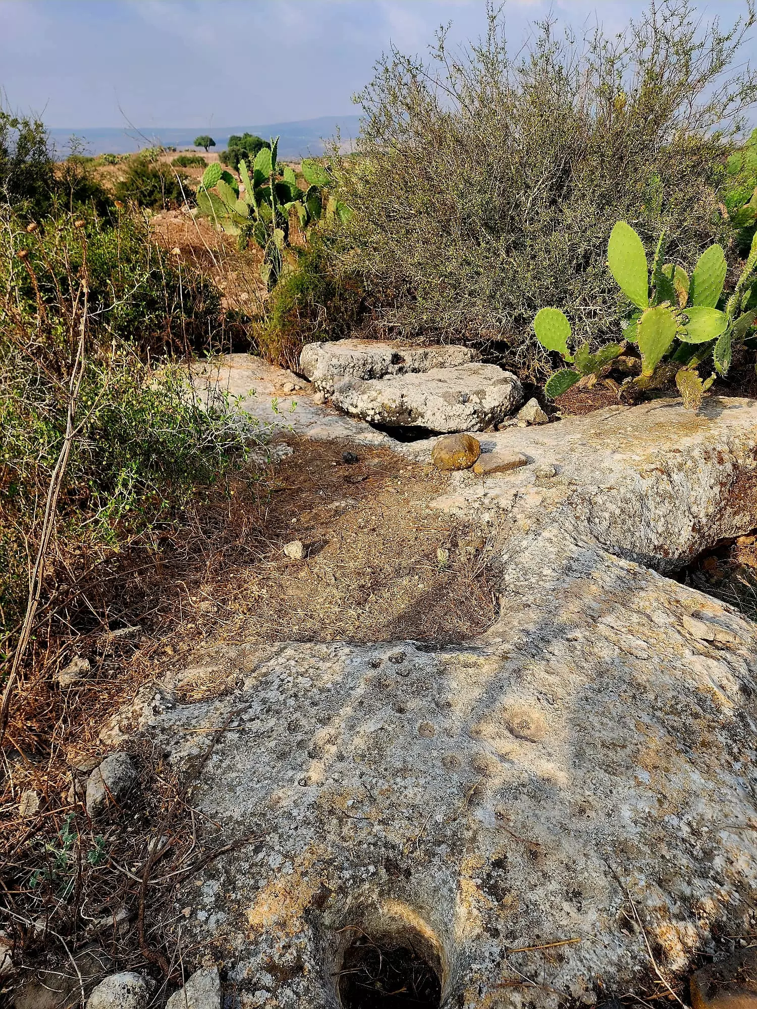
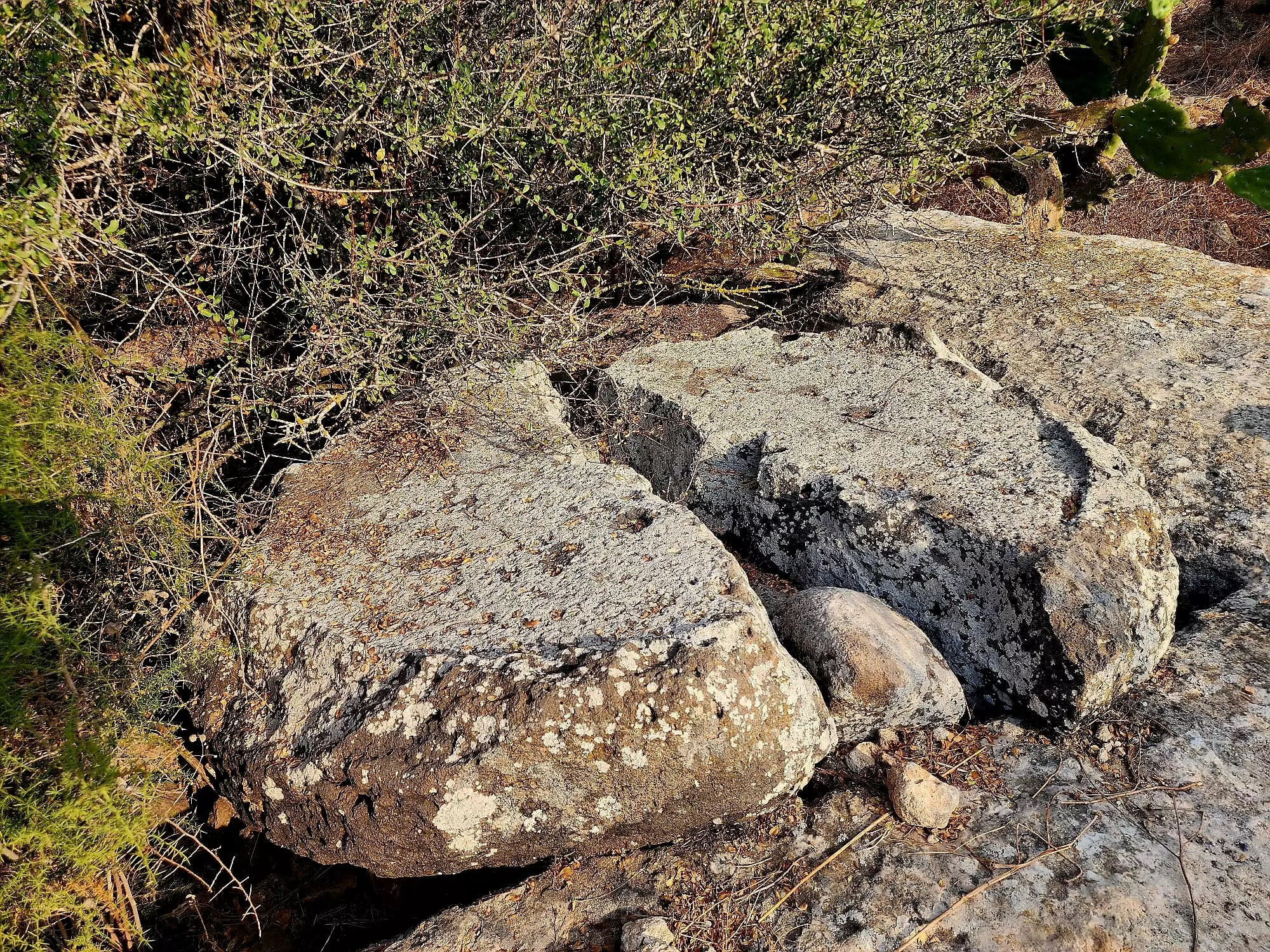
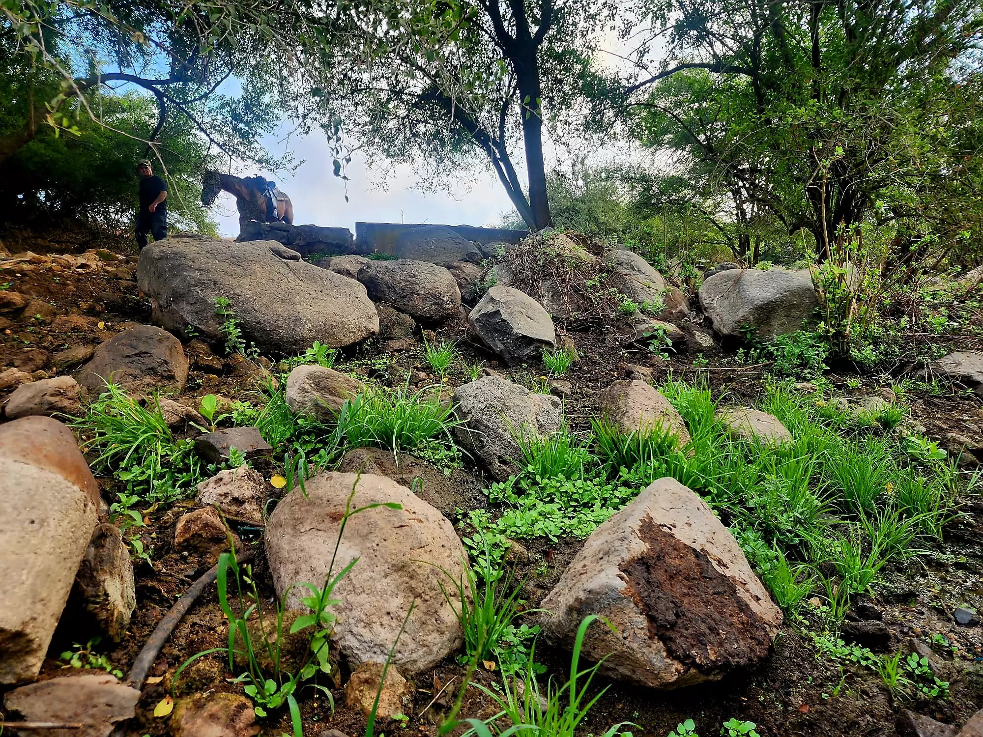
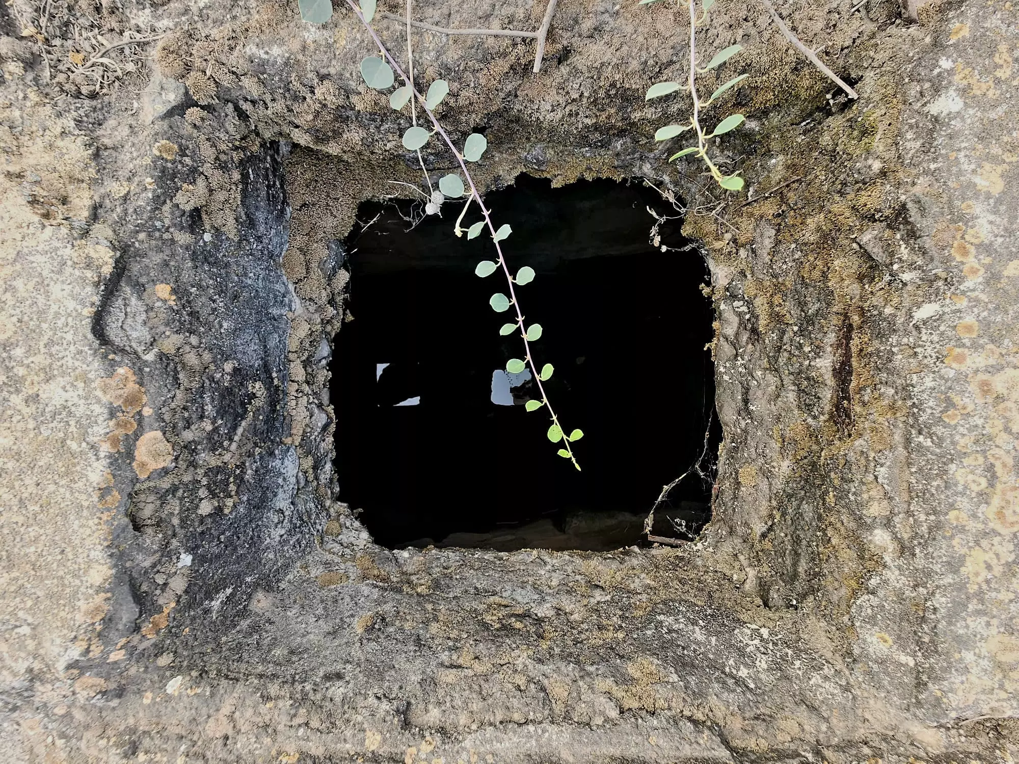
| Village Temains | Hadatha was completely obliterated and defaced. | ||||||||||||||||
| Ethnically Cleansing | Hadatha inhabitants were completely ethnically cleansed. | ||||||||||||||||
| Pre-Nakba Land Ownership |
**Town Lands' Demarcation Maps |
||||||||||||||||
| Land Usage As of 1945 |
|
||||||||||||||||
| Population |
|
||||||||||||||||
| Number of Houses |
|
||||||||||||||||
| Near By Towns |
|||||||||||||||||
|
|||||||||||||||||
| Schools | Hadatha had an elementary school for boys which was founded in 1897 by Ottomans, but it closed its doors during the British Mandate period. | ||||||||||||||||
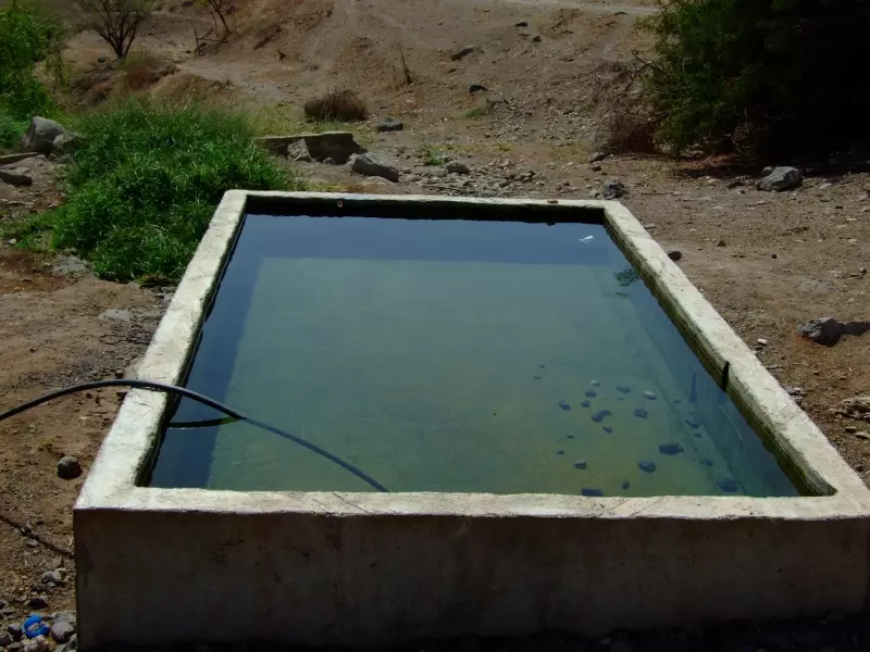
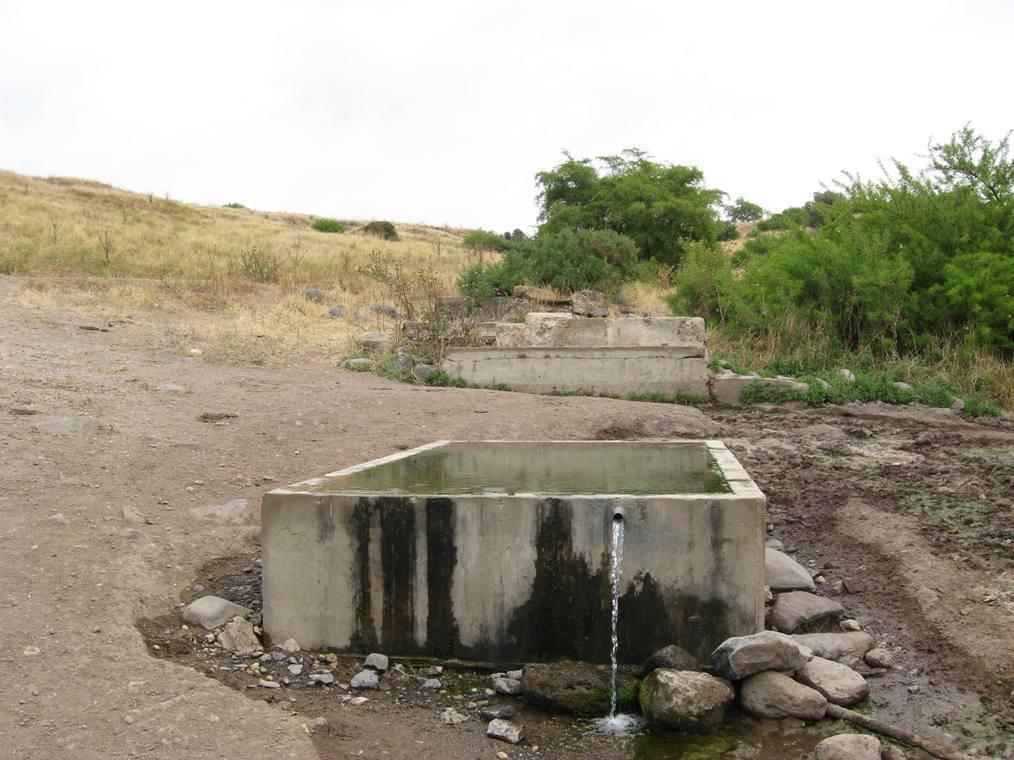
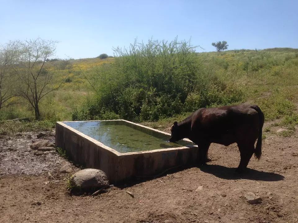
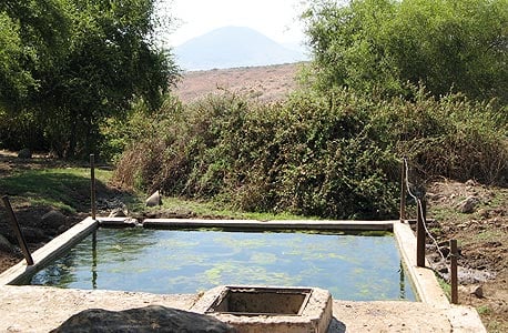
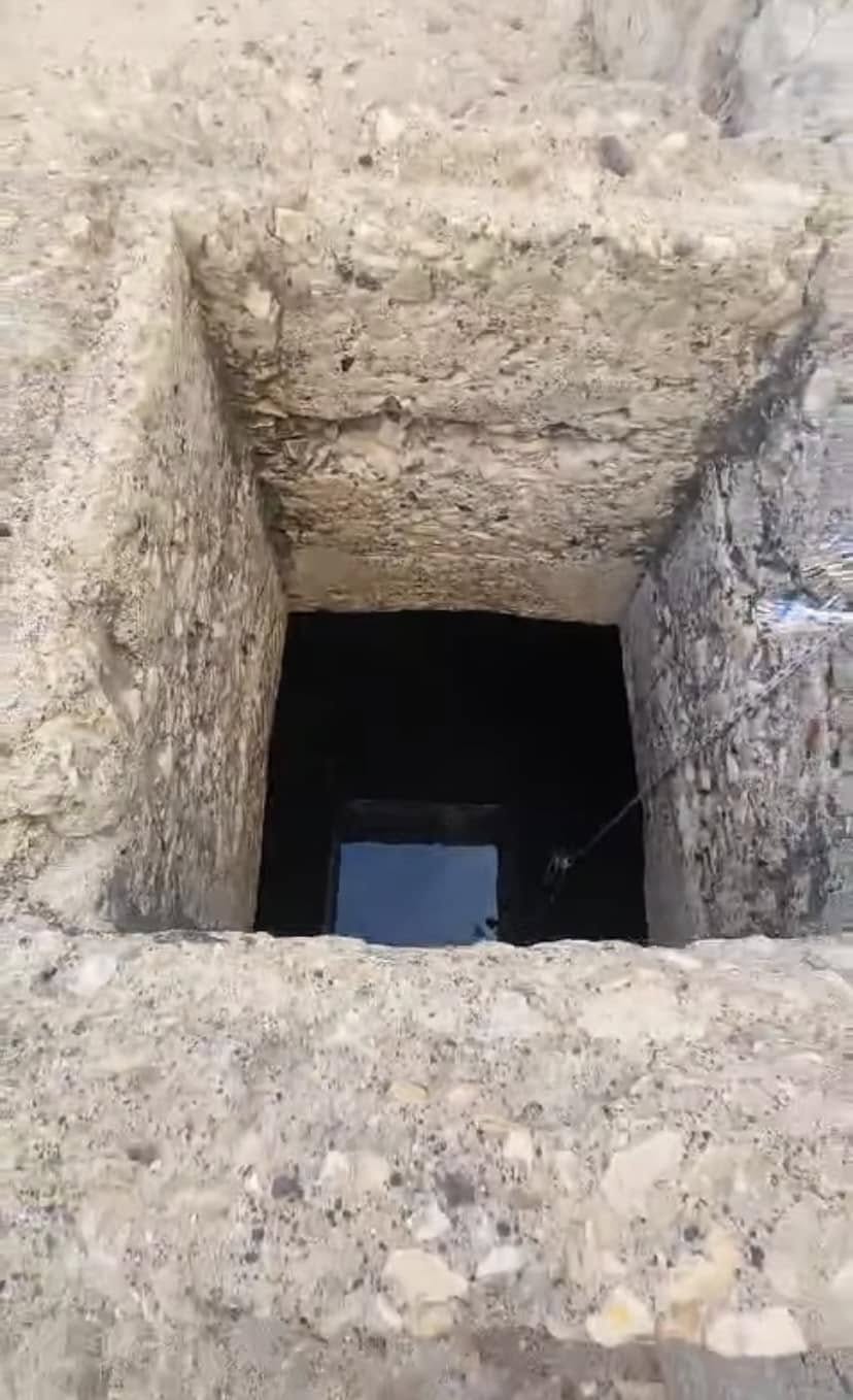
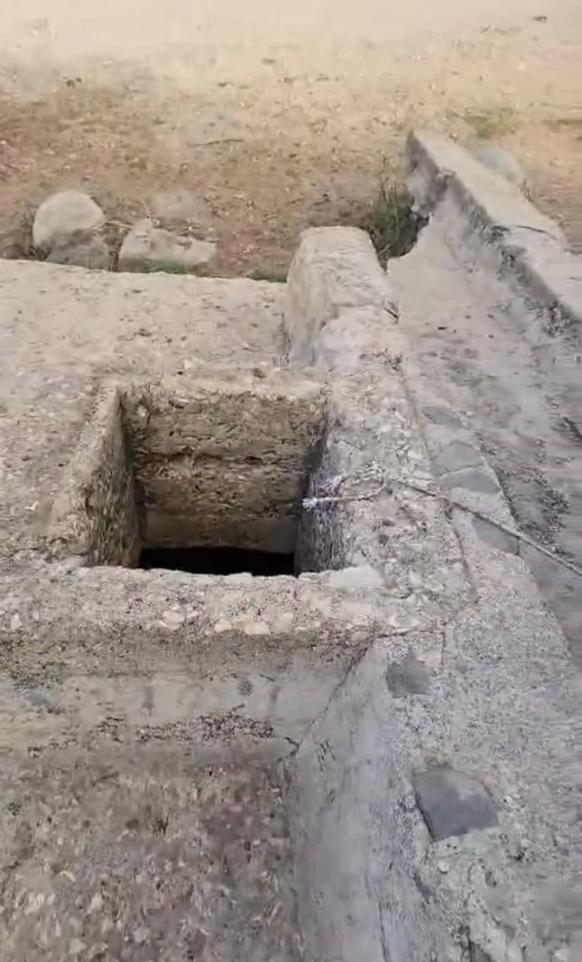
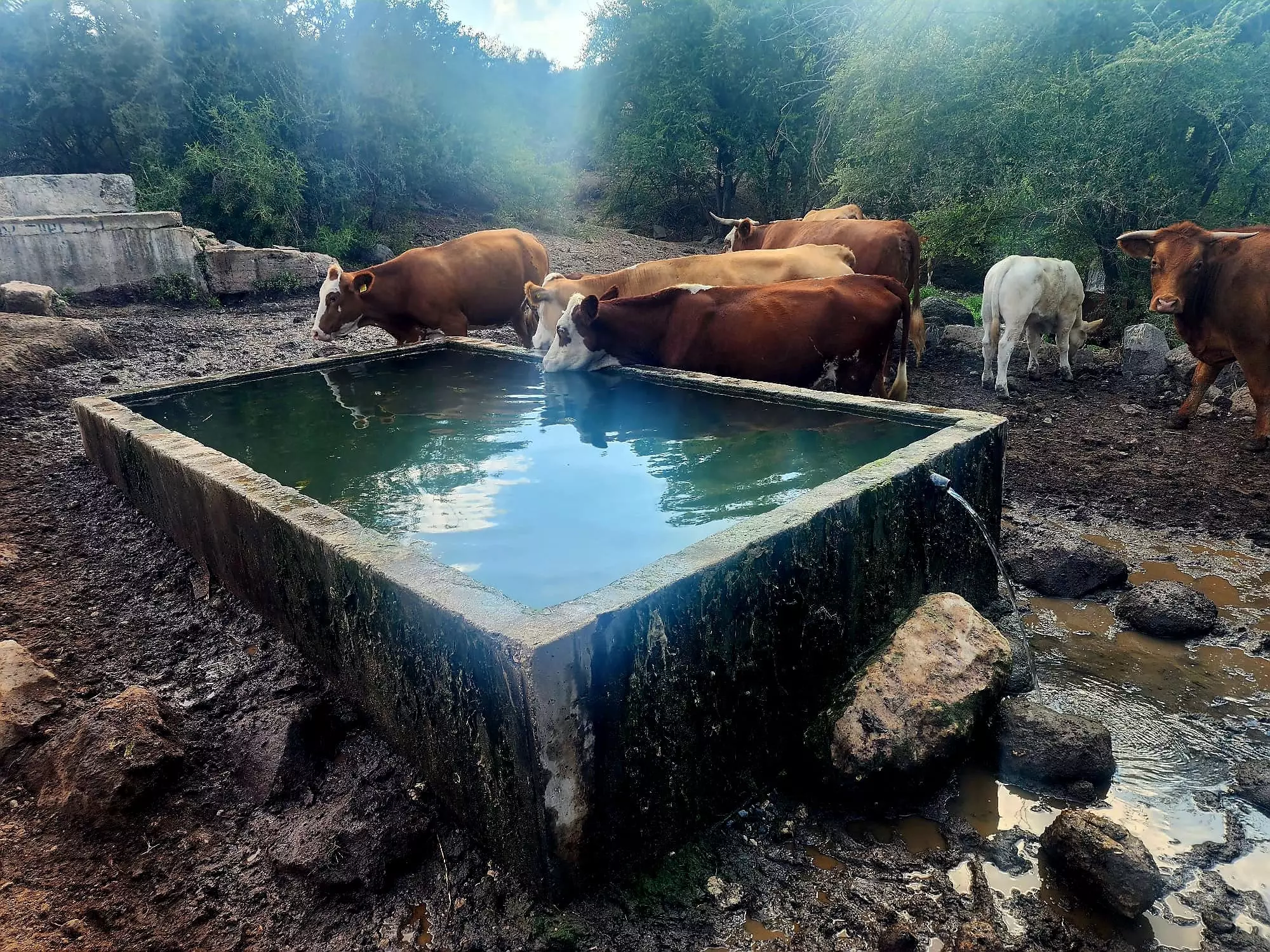
| Water Supply | Hadatha had a spring to the east which provided the village with its drinking water needs. | ||||||||||||||||
| Exculsive Jewish Colonies Who Usurped Village Lands |
Kefar Qish is nearby village lands | ||||||||||||||||
| Featured Video | |||||||||||||||||
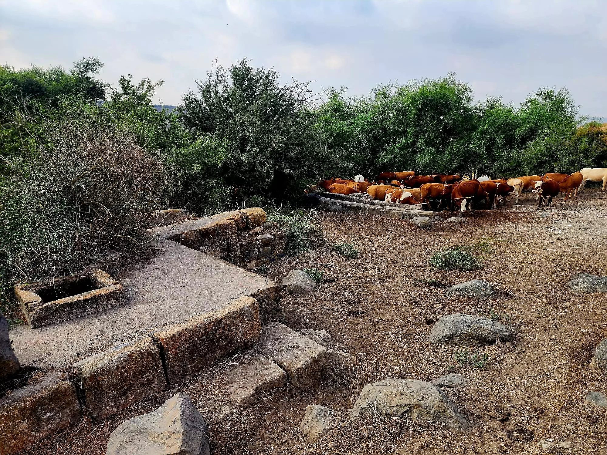
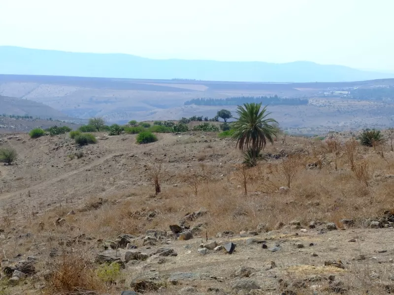
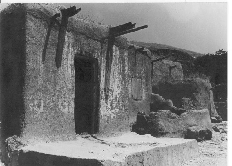
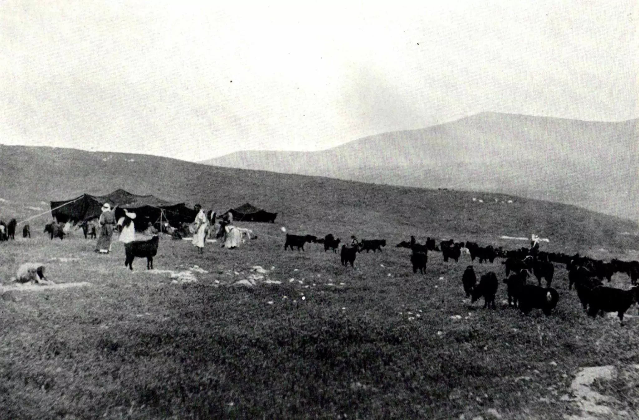
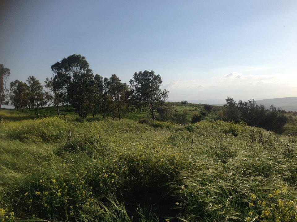
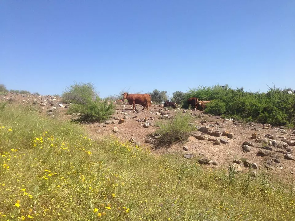
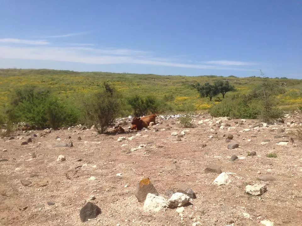
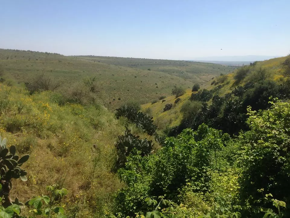
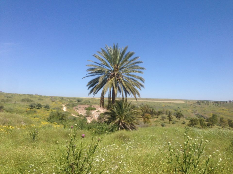
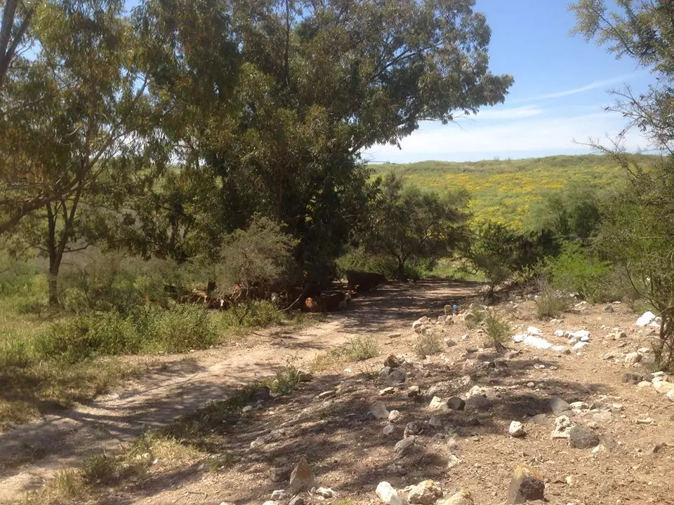
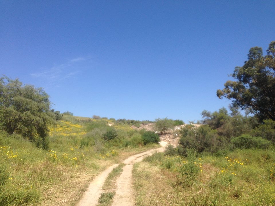
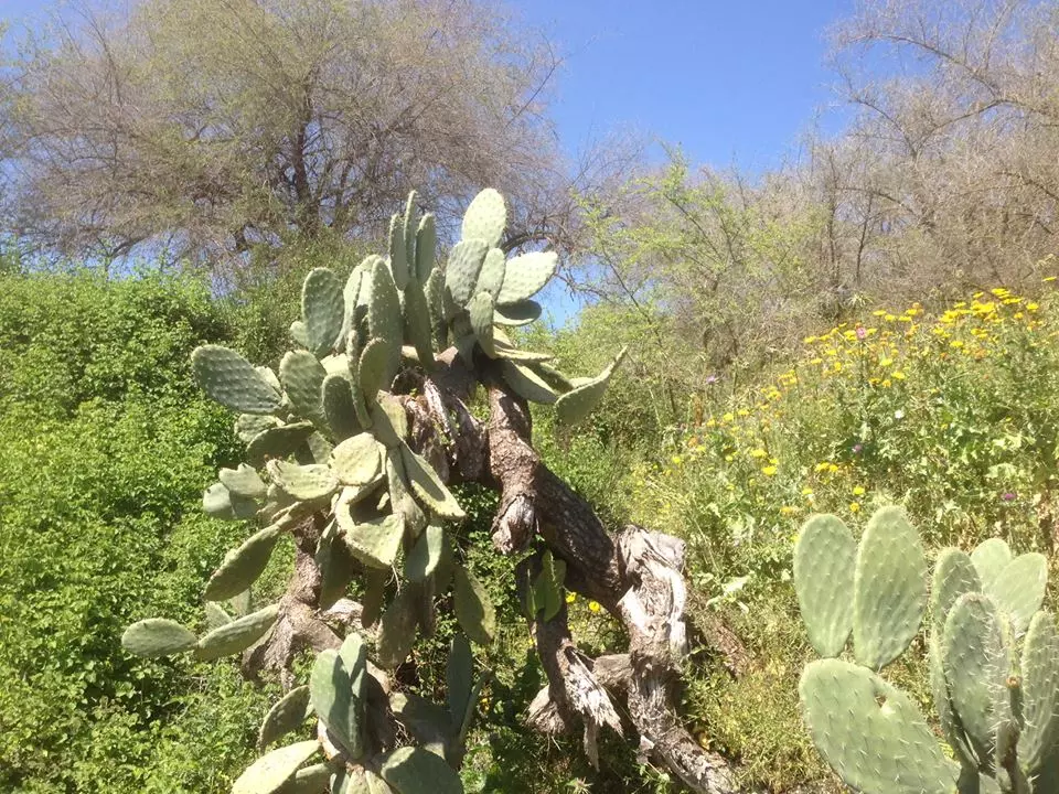
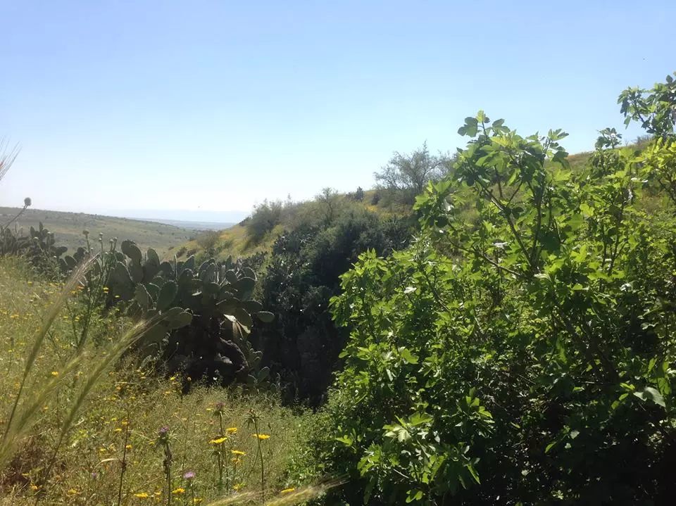
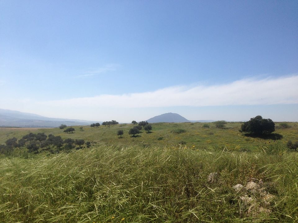
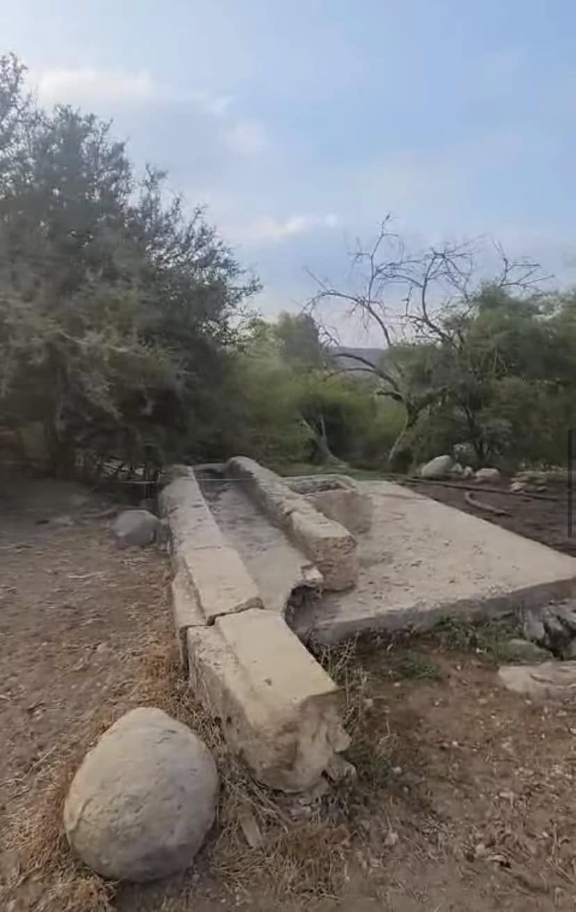
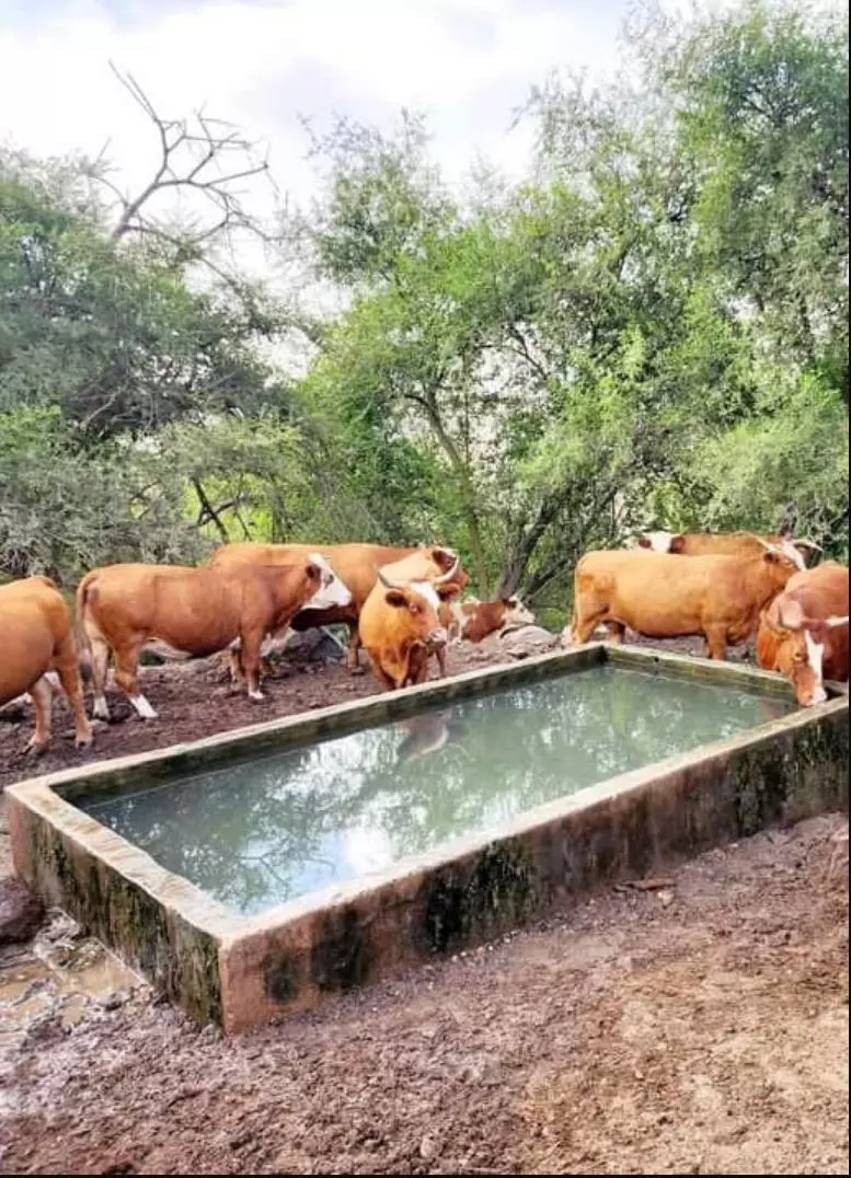
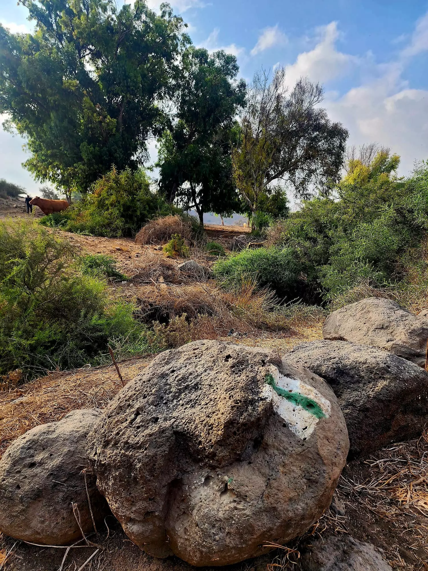
Village Before NakbaThe village, located between two small wadis, was to the east and west of a gently sloping, rocky hill. It was surrounded by a basin fed by numerous wadis that carried runoff down from the surrounding heights and merged to form Wadi al-Bira, a tributary of the Jordan. A spring to the east of the site provided the residents with fresh water. Hadatha was linked by a secondary road to the village of Kafr Kama, itself on a highway leading to Samakh on the southern tip of Lake Tiberias. In 1596, Hadatha was a village in the nahiya of Tiberias (liwa' of Safad) with a population of 121. It paid taxes on a number of crops, including wheat and barley, as well as on other types of property, such as goats and beehives. [[Hut. and Abd.:187]]In the late nineteenth century, Hadatha was a village built of stone and situated on a hilltop. The 150 residents of the village cultivated grapes, figs, and olives. [[SWP (1881) I:201]] During the British Mandate, the village had a triangular layout, and its houses were spread northwest along the road to Kafr Kama. The people of Hadatha were Sunni Muslims, except for one Christian and one Druze. An elementary school was established in 1897, during the Ottoman period, but it was closed during the British Mandate. Agriculture was based on olives and vegetables. Olive trees were planted mainly in the highlands in the north and east, while vegetables were grown on the lands lying to the east, west, and south. In 1944/45 a total of 8,379 dunums was allocated to cereals; 199 dunums were irrigated or used for orchards. Hadatha was an archaeological site that contained a vaulted structure built over a spring and the remains of a press. Village Occupation and Ethnic CleaningThere is some inconsistency in the Israeli accounts of the capture of this village. It was one of a cluster of four villages, including Sirin (in Baysan sub-disctrict), 'Awlam, and Ma'dhar (both in Tiberias sub-disctrict), which an Israeli intelligence report claims were evacuated on 6 April 1948, on orders from the Arab Higher Committee. However, the History of the Haganah states that the same four villages were occupied over a month later, on 12 May, by units of the Golani Brigade, adding that 'the inhabitants fled in fear of the Jews.' This implies that the evacuation was a result of the military operation; the account goes on to say that with this attack, 'the lower Galilee was empty of Arabs.'Zionists Colonies on Village LandsThere are no Israeli settlements on village land. Zionists established the settlement of Kefar Qish (192230) in 1946 on lands belonging to the nearby village of Ma'dhar.Village TodayStone rubble provides the only indication of the village's location. The fenced-in site is used as a cow pasture, and mulberry and fig trees and cactuses grow on it. The surrounding lands are used by the residents of Kefar Qish and are planted in vegetables and almond trees. Parts of the lower wadis are also fenced in.SourceDr. Walid al-Khalidi, 1992: All That Remains. |
|||||||||||||||||
| Related Maps | Town Lands' Demarcation Maps خرائط للقضاء توضح حدود القرى والاودية Town's map on MapQuest View from satellite Help us map this town at WikiMapia |
||||||||||||||||
| Related Links | Wikipedia's Page Google Search Google For Images Google For Videos |
||||||||||||||||
| More Information | في كتاب كي لا ننسى في كتاب بلادنا فلسطين المزيد من موقع هوية |
||||||||||||||||
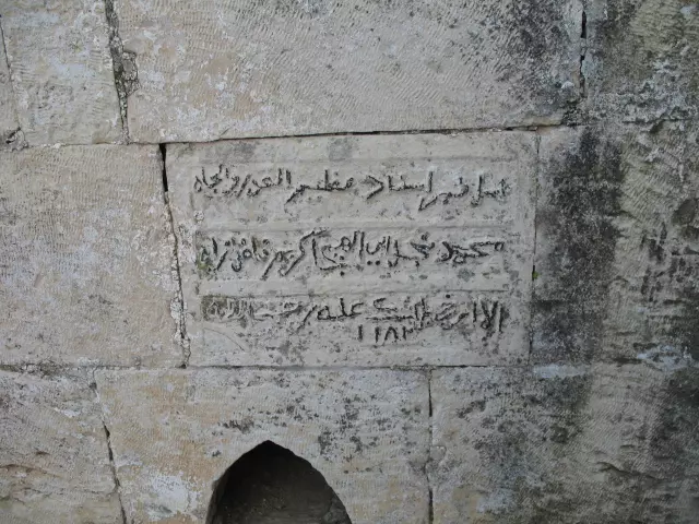
- Maqam/Shrin for Abu al-Hija. If you have any information about this Maqam please provide in the below comments section
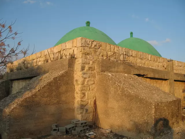
Posted by Mohammad Abo Al Heja 4 - Arabic inscription on Abu al-Hija Maqam/Shrin . If you have any information about this Maqam please provide in the below comments section
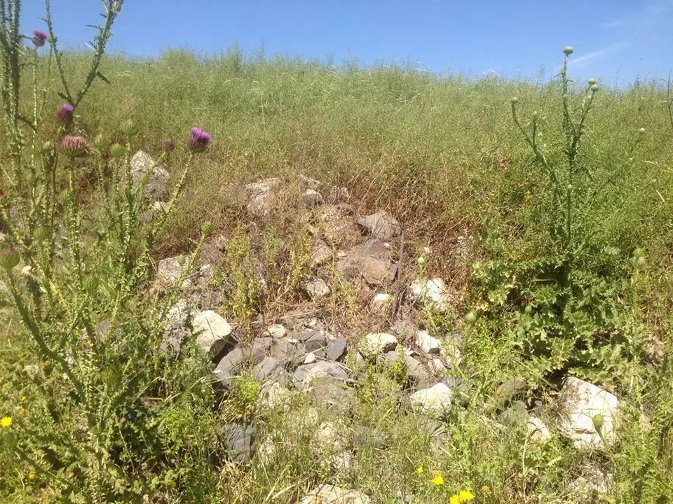
Posted by Mohammad Abo Al Heja 1 - Some remains, 04/10/08
Posted by Uri Zackhem 1 - Trees near the spring, 04/10/08

Posted by Uri Zackhem - Looking at the spring, 04/10/08
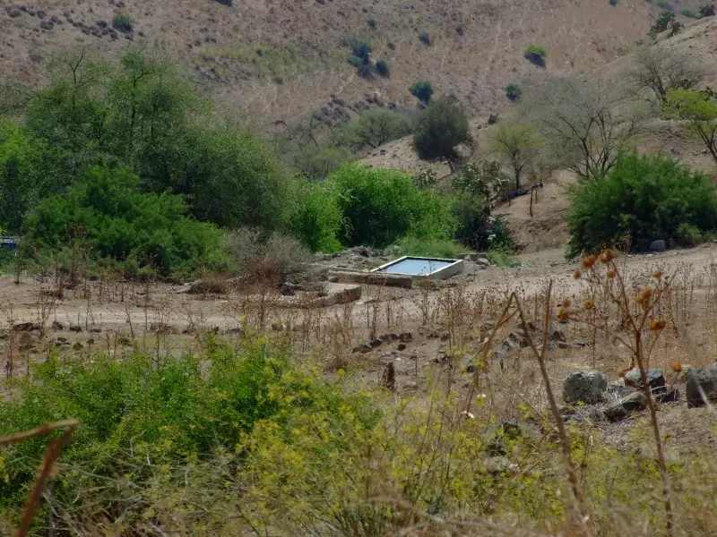
Posted by Uri Zackhem 1 - The spring, 04/10/08
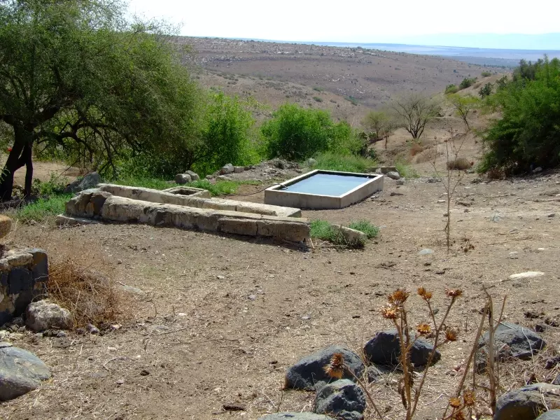
Posted by Uri Zackhem - The spring, 04/10/08
Posted by Uri Zackhem 1 - The spring, 04/10/08
Posted by Uri Zackhem 1 - احد البيوت اسعفها الحظ لتكون صورة تذكارية...بعد تهجبر اهلها
- صورة في القرية قبل النكبة
- عين القرية
- الربيع وجمالة البدبع
- الحدثة بانجاة الغرب ويظهر جبل طابور
Posted by فتحي ابو رضا \ العايدي - الحدثة المقبرة..اصبحت مراح للابقار
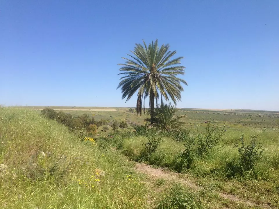
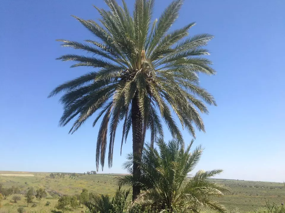
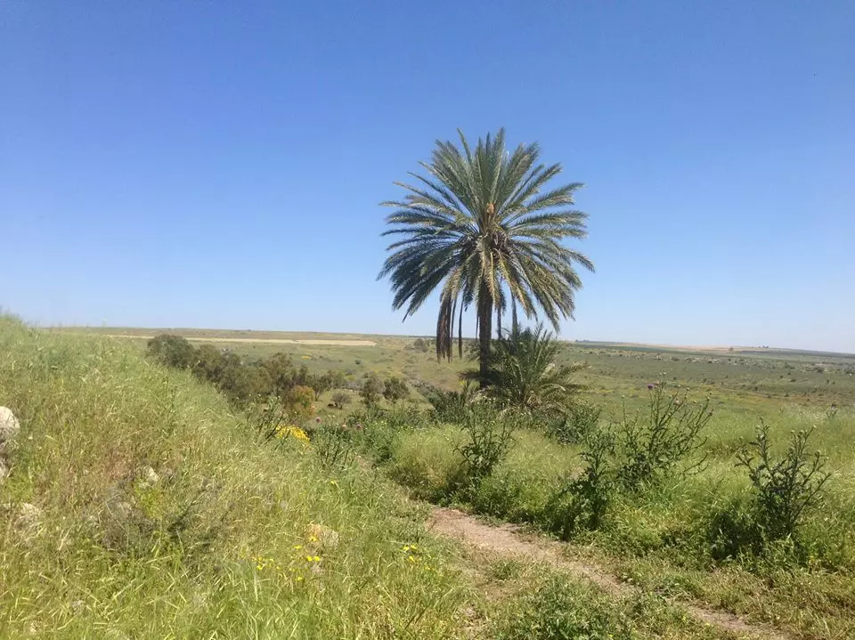
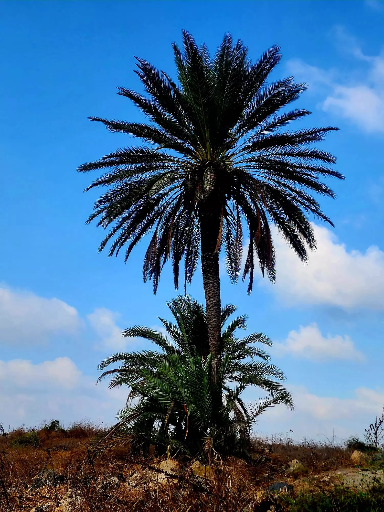
Posted by فتحي ابو رضا \ العايدي - الحدثة النخلة ...مركز البلد
Posted by فتحي ابو رضا \ العايدي - الحدثة اطلال القربة
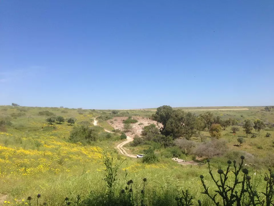
Posted by فتحي ابو رضا \ العايدي - الحدثة الطريق
Posted by فتحي ابو رضا \ العايدي - الحدثة العين
Posted by فتحي ابو رضا \ العايدي - الحدتة

Posted by فتحي ابو رضا \ العايدي - الحدثة مركز البلد (النخلة)
Posted by فتحي ابو رضا \ العايدي - الحدثة المقبرة
Posted by فتحي ابو رضا \ العايدي - الحدثة المراح
Posted by فتحي ابو رضا \ العايدي - من وسط البلد باتجاة الغرب ويظهر جبل طابور

Posted by فتحي ابو رضا \ العايدي - من وسط الفلرية باتجاة الشمال
Posted by فتحي ابو رضا \ العايدي - الواد...واد العين
Posted by فتحي ابو رضا \ العايدي - من على الانقاض باتجاة الشرق
Posted by فتحي ابو رضا \ العايدي - الحدثة مراح ابقار
Posted by فتحي ابو رضا \ العايدي - طريق داخل البلد
Posted by فتحي ابو رضا \ العايدي - انقاض البيوت
Posted by فتحي ابو رضا \ العايدي - الصبر والدووم
Posted by فتحي ابو رضا \ العايدي - الصبر والتين
Posted by فتحي ابو رضا \ العايدي - منظر من الحدثة ويظهر جبل طابور
Posted by فتحي ابو رضا \ العايدي - عين الحدثة
Posted by د.محمد عقل - منظر من الحدثة ..العلية الوحيدة التي كانت في البلدة الصورة من الحدثة بعد تهجيرها قيب هدمهل
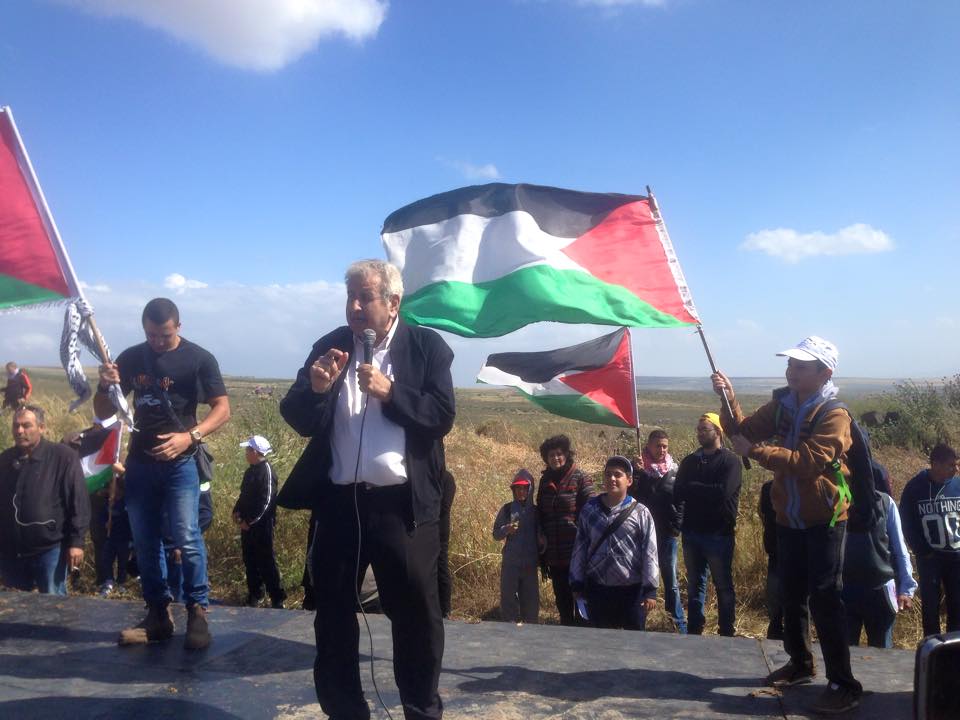
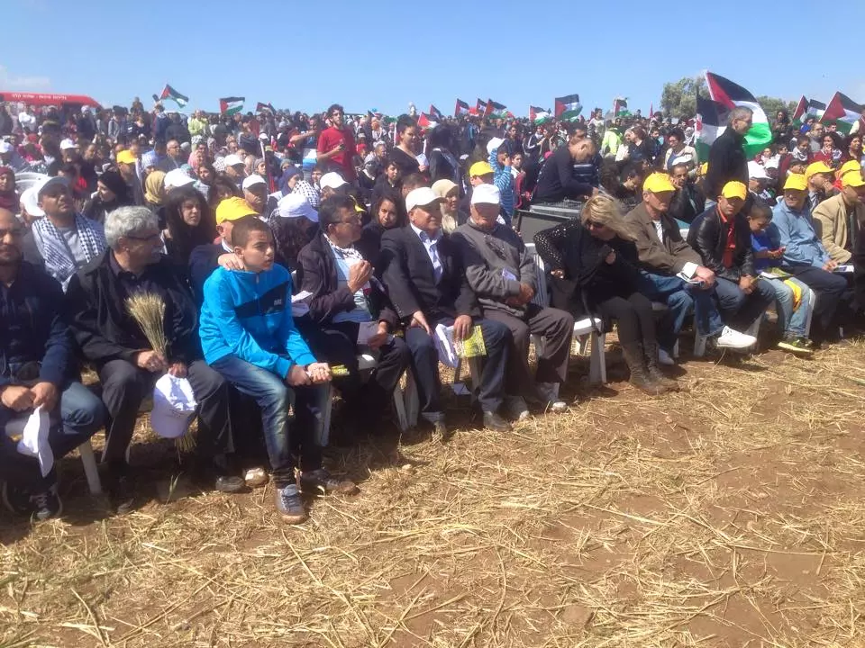
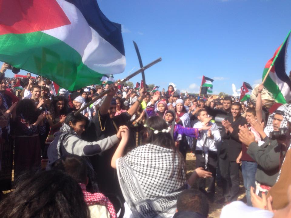
Posted by فتحي ابو رضا \ العايدي - مسيرة العودة ال18 الى الحدثة في الصورة العم ابو سلام عادل ابو الهيجة ابن الحدثة يلقي كلمة اهل الحدثة في المهرجان
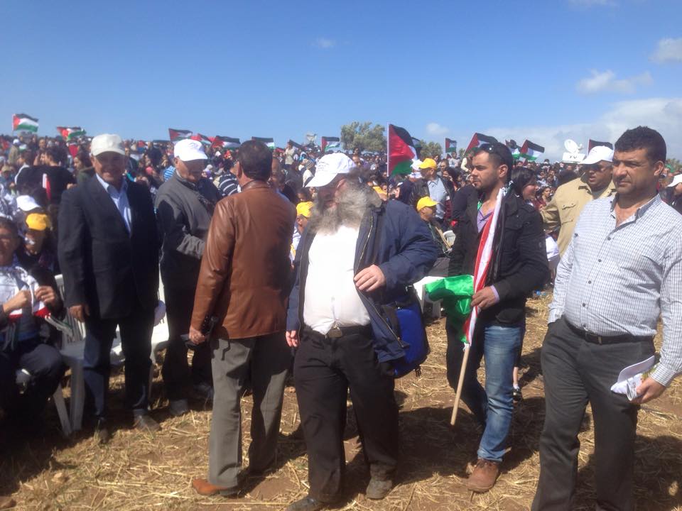
Posted by فتحي ابو رضا \ العايدي - مسيرة العودة ال18 الى الحدثة احد اليهود من نتوري كارتا التي لا تعترف بالدولة الصهيونبة بشارك في مسيرة العودة
Posted by فتحي ابو رضا \ العايدي - مسيرة العودة ال18 الى الحدثة
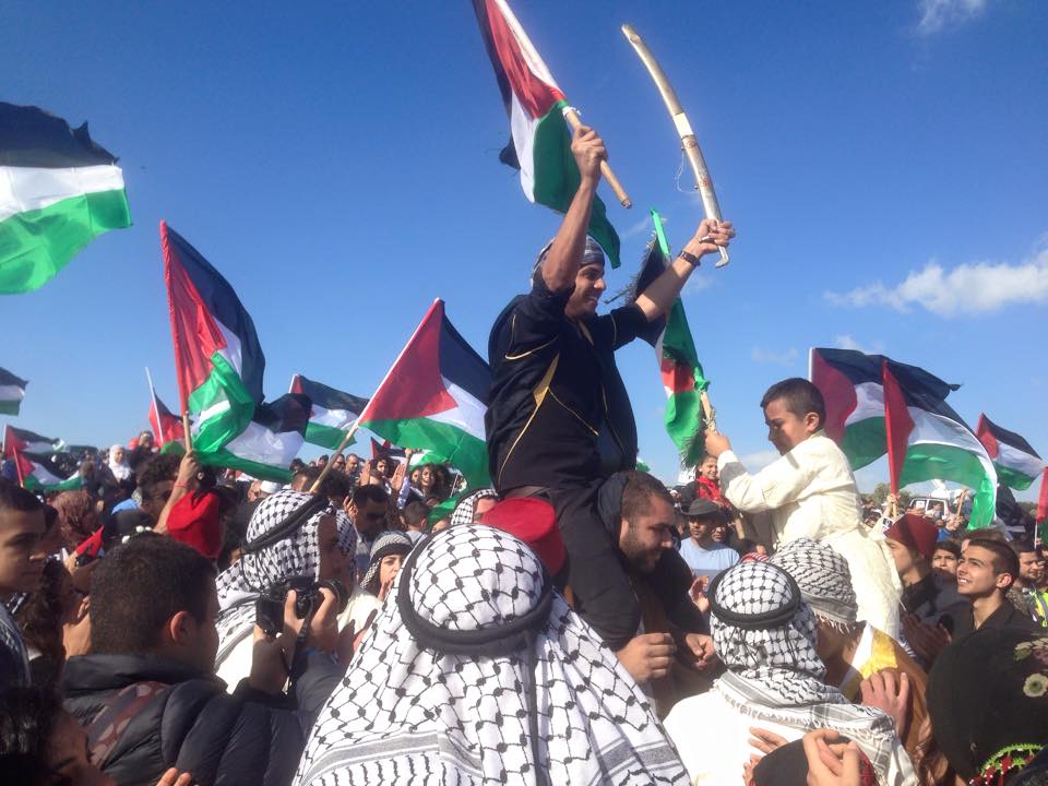
Posted by فتحي ابو رضا \ العايدي - مسيرة العودة ال18 الى الحدثة
Posted by فتحي ابو رضا \ العايدي - مسيرة العودة ال18 الى الحدثة ..دبكة
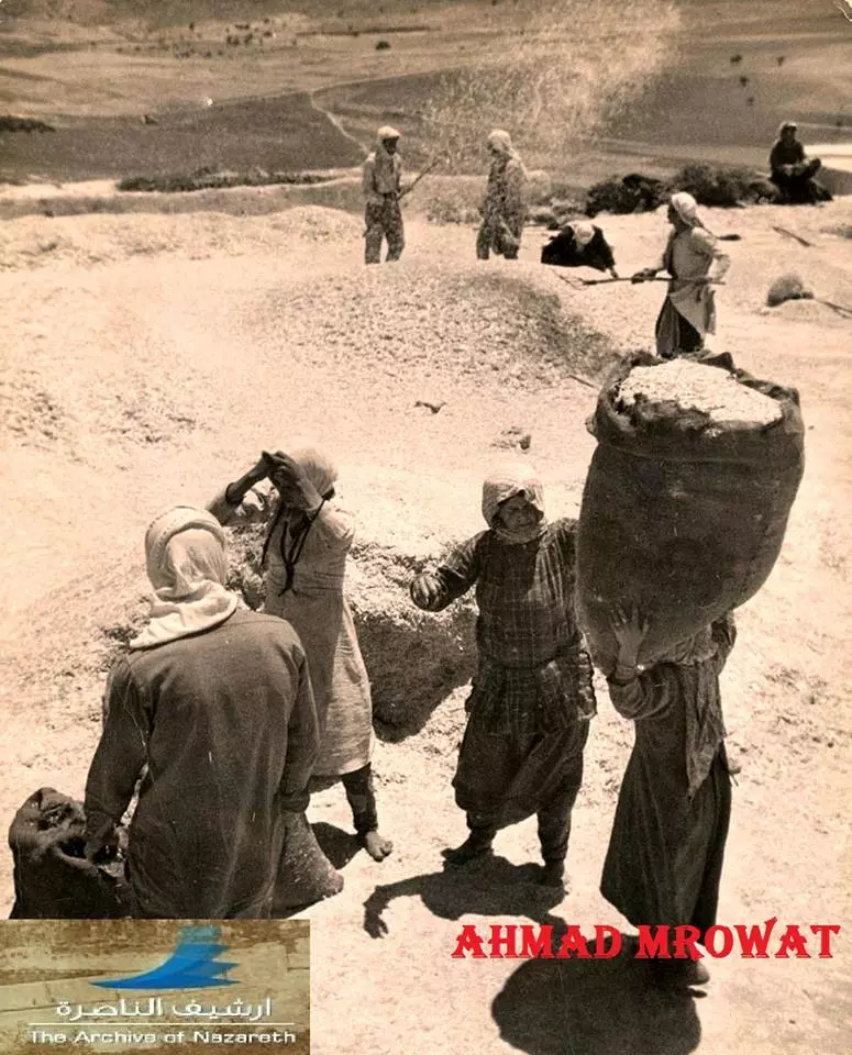
Posted by فتحي ابو رضا \ العايدي - بيادر وفلاحي القرية 1938 --الباحث احمد مروات
- Pre-Nakba Aerial view of the village / صورة من الجو للقرية اخذت قبل النكبة
- جولة بين أبير وبرك القرية المهجرة
- جولة بين أبير وبرك القرية المهجرة #2
- جولة بين أبير وبرك القرية المهجرة #3
- جولة بين أبير وبرك القرية المهجرة #4
- Let us see how the most "liberal and civilized" of world Jewry has obliterated our village. How else will the Jews be great and safe again? -- القرية دمرت بالكامل.. من هنا مر الهمج
- Let us see how the most "liberal and civilized" of world Jewry has obliterated our village. How else will the Jews be great and safe again? -- القرية دمرت بالكامل.. من هنا مر الهمج
#2
- Let us see how the most "liberal and civilized" of world Jewry has obliterated our village. How else will the Jews be great and safe again? -- القرية دمرت بالكامل.. من هنا مر الهمج
#3
- Let us see how the most "liberal and civilized" of world Jewry has obliterated our village. How else will the Jews be great and safe again? -- القرية دمرت بالكامل.. من هنا مر الهمج
#4
- Let us see how the most "liberal and civilized" of world Jewry has obliterated our village. How else will the Jews be great and safe again? -- القرية دمرت بالكامل.. من هنا مر الهمج
#5
- Let us see how the most "liberal and civilized" of world Jewry has obliterated our village. How else will the Jews be great and safe again? -- القرية دمرت بالكامل.. من هنا مر الهمج
#6
- Let us see how the most "liberal and civilized" of world Jewry has obliterated our village. How else will the Jews be great and safe again? -- القرية دمرت بالكامل.. من هنا مر الهمج
#7
- Let us see how the most "liberal and civilized" of world Jewry has obliterated our village. How else will the Jews be great and safe again? -- القرية دمرت بالكامل.. من هنا مر الهمج
#8
Want to browse more? 80,000 pictures were grouped in these gallaries:
| Display Name | Clan/Hamolah | Country of Residence |
| اسامة محمد ابو الهيجاء | - | الرياض السعودية |
| mohannad | ABU AL HAIJA | ON, CANADA |
| كارولين | ابو الهيجاء | الناصره, الناصره |
| ابن الحبيب | ابو الهيجاء | - |
| هيجاوي | ابو الهيجاء | - |
| رشا | أبو الهيجاء | albrta, canada |
| Eman Abu Alhaija | - | Amman, Jordan |
| Ahmed Zhran | - | ontario, canada |
| Shireen Aboualloul | Al samalot | KSA |
| abu seiwd | yousef abu seiwd | اربد, اربد |
| Naseem Abu-ElHaija | - | - |
| mohammad abo el hija | ابوعلان | ontario, canada |
| abumohannad | ABU AL HEIJA | ONT, toronto |
| Mohammad Abo Al Heja | Abo Al Heja | Kaboul, Pleastine 1948 |
| sihamsaid | abu al haija | haifa, israel |
| abu mohanned | dwahdee | ontario, canada |
| Rami Abu-alhiga | Abu-alhiga | Bremen, Germany |
| Narjes Abu El-haija | - | NRW, Germany |
| Mohammed Abul-Haija | Abul-Haija | Irbid, Jordan |
| TARIQ ABUL HAIJA | ABUL HAIJA | BUCHARESTI, ROMANIA |
| AHMED ABU AL HAIJA | - | - |
| Adnan abu alhaija | Abualhaija | Amman, Jordan |
| Akramah | Abu el Haija | Düsseldorf, germany |
| Rami Abu Alhaiga | - | Irbid, Jordan |
| EL-SHANTI | ABUL-HAIJA | IA, USA |
| Canada Immigartion and Education Services (CIES) Inc. | - | AB, Canada |
| Rami Abu Al Hayja | abu al haija | Trondheim, Norway |
| Abu el-hija Aladin | Abu el-hija | Regensburg, Germany |
| احمد مصطفى ابو الهيجاء | ابو الهيجاء | اربد, الاردن |
| Thaer Abuelhaija | Abuelhaija | AB, Canada |
| Basil Abu El Haija | - | - |
| mohammad abu el-haija | - | Uae, UAE |
| wael Abulhaija | Abulhaija | UAE |
| EMAD ABULHAIJA | ABULHAIJA | AL-KHOBAR, SAUDI ARABIA |
| Basem Abulhaija | - | - |
| Ahmed Fakhri | Abulhaija | - |
| Ahmad Abu-El-Haija | Abu-El-Haija | Amman, Jordan |
| FAYEZ ABU EL-HAIJA | abu el-haija | - |
| Ayman Abu-Elhaija | Abu-Elhaija | Virginia, U.S.A |
| Haitham Abul-Haija | Abul-Haija' | CA, USA |
No links have been shared yet, be free to the first to share the first link.
 Fake Valor: Why Did Zionist Jews Hoist Nazis Flag on Their Ships in the 1930s?
What is new?
-
Facts About Oct. 7th Gaza Raid
-
Remined Us Please:: Who Did Rape Who? Palestinians Raped Israelis? Or, was the other way around?
-
When Prof. Edward Said was invited to debate Bibi Netanyahu in the 1980s, watch what happened!
-
Ezra Klein of the NY Times on the "Jewish Race".
-
Abusing Blood Libel!
-
Zionist FAQ: Isn't it true that Palestinians don't want peace? Palestinians never accepted the two-state solution
- Facts about Haavara (Transfer) Agreement between Ben-Gurion & Hitler
-
Haavara FAQs: Why Did Zionist Jews Hoist Nazis' Flags on Their Ships in the 1930s?
-
Dear ChatGPT: Why did the Jewish Agency suppress news of the Holocaust during WWII?
-
Video Playlist: Jews share their DNA tests to end the conflict for good.
-
A Tale of Two Conflicts: Examining the Definition of Genocide
-
Prof. Abraham Polak And The Suppressed History of the Khazars and European Jewry
-
How Ronald Reagan would have framed the genocide in Gaza if he were still alive?
-
Haavara FAQs: Let us do the math: how many German Jews did The Haavara Agreement save?
-
Zionist FAQs: The Hebron Massacre of 1929, "clearly proves" that Palestinians are antisemitic, how could you deny it?
-
Zionist FAQs: Why Anti-Zionist Is Not Antisemitism?
-
Zionist FAQs: Isn't it true that the KGB create Palestinian Nationalism in the early 1960s?
- Zionist FAQs: Muslims are killing Muslims all the time; why are Israeli Jews being singled out in the media?
- Zionist FAQs: How is Israel an apartheid state when 20% of its citizens are Arabs who enjoy full rights?
-
Haavara FAQs: Analysis of Herzl's Uganda Scheme and how it could have saved millions of Jews.
-
Haavara FAQs: Why did Hayim Greenberg describe American Jewry as "morally bankrupt" in early 1943?
-
Haavara FAQs: What if the Evian Conference was a resounding success? What would have been the impact of saving European Jewry on Zionism?
- Haavara FAQs: What if the six million were saved, how that would have impacted the Zionist project?
-
Haavara FAQs: How did Zionist leaders react when Europe's Jews lingered in the DP camps after WWII ended?
-
Why does the American Jewish community repeat lies that David Ben-Gurion had debunked before he died?
-
Who has the power to rename the Tatar/Khazar Gene Marker to Jewish IV?
-
Zionist FAQs: Why won't Egypt, Syria, and Jordan take their people back? Jews are indigenous to Palestine, and Arabs immigrated after Jews developed the country. Arabs should leave.
-
Haavara FAQs: Did Hitler and the Nazis conflate between Judaism and Zionist? If that wasn't case, then why?
-
Haavara FAQs: Winston Churchill and antisemitism, a collection of articles written Churchill.
-
Haavara FAQs: Broken by country, how many Jews survived vs. killed during the Holocaust?
-
Haavara FAQs: Why did European Jews vote with their feet and to immigrated to the Americas, not Palestine, after WWII?
-
Watch this American Jewish Girl describing Israeli Jews' cognitive dissonance like no other in under two minutes
-
Haavara FAQs: When the Nazis went out of their way to hide the Holocaust, Israeli Jews did the exact opposite by broadcasting their genocide of Gazans. But why?
-
Haavara FAQs: How Zionist Jews went out of their to show their appreciation to Nazism and Fascism?
- Haavara FAQs: Why Zionist leaders were against bombing the death camps & the Railroads leading to them?
-
Haavara FAQs: Hitler's message to the British and American people: If Jews are such noble citizens and you care about them, how come you're not letting them in? I will gladly ship them to you at my expense, even on luxury liners!
-
A shortlist of Zionist and Israeli false flag operations in the name Jews.
-
The Most Moral Army
- The Land of Kapos (Israel): Where the brave are boycotted and Kapos walk free.
- Why did early Zionists often named their communal enterprises "colonial"?
- Zionist Relations with Nazi Germany by Faris Glubb
-
Two NY Times advertisements by Zionists in the early 1943 that exposes Zionists' treason at the height of the calamity
- Facts Not Lies about the Palestinian-Israeli Conflict.
- Site's pictures have been categorized
- Campgain Against Lice
- A Survey of Palestine, the official source about Palestine before Nakba produced by the British Mandate; over 1200 pages.
- Satellite View & Google Earth: Over 6,000 placemarks identifying all destroyed towns, W. Bank & Gaza Strip Towns, & refugee camps.
- PalestineRemembered.com and its Nakba Oral History Project were featured on al-Jazeera Satellite TV.
- Nakba Oral History Video Podcast:
 Over 700 Oral History interviews (including 3,500+ hours of recording) can be viewed online.
 - Palestine Village Statistics Project
- Gaza Jail Break
- النسخة العربية للموقع الان متوفرة
- Videos: Documenting the destroyed villages in video: Tracing all that remains since Nakba.
- Videos: Responding to Zionist Propaganda
- Interview: The ethnic cleansing of Palestine: George Galloway interviews Israeli Historian Ilan Pappe.
- For Palestinians, memory matters. It provides a blueprint for their future By George Bisharat.
- Zionist FAQ now available in Hebrew שאלות שציונים שואלים, עכשיו בעברית
- Video: The Stephen Walt and John Mearsheimer report on the influence of the Israel Lobby on U.S. Foreign Policy
- The Palestinian-Israeli conflict for beginners
