| PalestineRemembered | About Us | Oral History | العربية | |
| Pictures | Zionist FAQs | Haavara | Maps | |
| Search |
| Camps |
| Districts |
| Acre |
| Baysan |
| Beersheba |
| Bethlehem |
| Gaza |
| Haifa |
| Hebron |
| Jaffa |
| Jericho |
| Jerusalem |
| Jinin |
| Nablus |
| Nazareth |
| Ramallah |
| al-Ramla |
| Safad |
| Tiberias |
| Tulkarm |
| Donate |
| Contact |
| Profile |
| Videos |
Welcome To al-Majdal - المجدل (אל-מג'דל)
|
District of Tiberias
Ethnically cleansed days ago |
العربية Google Earth |
 |
Gallery (37) |
- Statistics & Facts
-
Before & After

- Satellite View
- Articles 1
- Pictures 37
- Oral History 2
- Members 3
- All That Remains
- Wikipedia
- Videos 2
- Guest Book 3
- Links
| Statistic & Fact | Value | ||||||||||||||
| Occupation Date | April 22, 1948 | ||||||||||||||
| Distance From District | 4 (km) Northwest of Tiberias | ||||||||||||||
| Elevation | -200 (meters) | ||||||||||||||
| Before & After Nakba, Click Map For Details |
|||||||||||||||
|
|||||||||||||||
| Map Location | See location #8 on the map View from satellite |
||||||||||||||
| Attacking Units | Some unidentified troops from the Haganah | ||||||||||||||
| Exodus Cause | Military assault by Zionist troops | ||||||||||||||
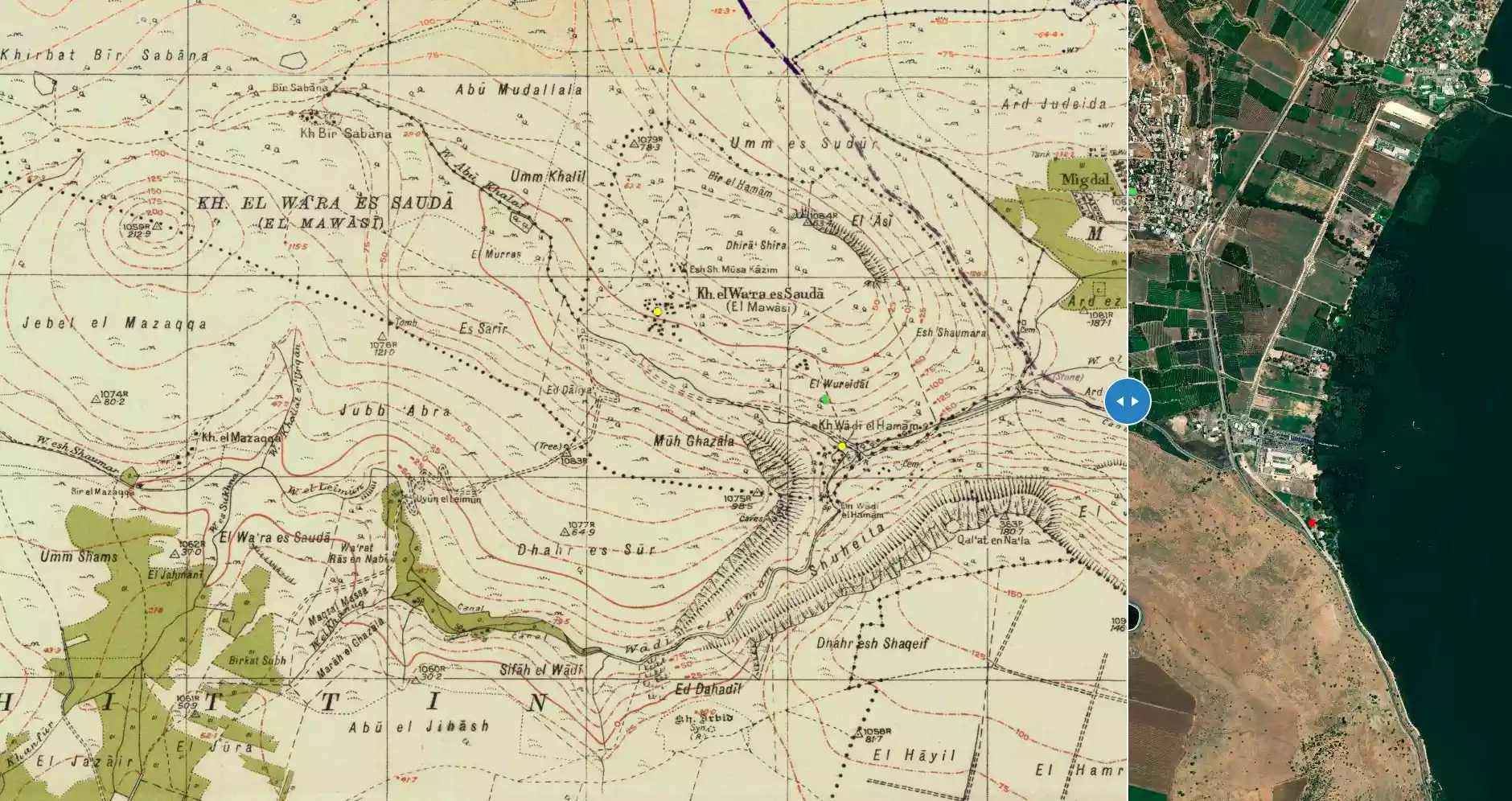
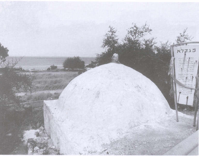
| Village Temains | al-Majdal was mostly destroyed with the exception of its shrine. | ||||||||||||||
| Ethnically Cleansing | al-Majdal inhabitants were completely ethnically cleansed. | ||||||||||||||
| Pre-Nakba Land Ownership |
**Town Lands' Demarcation Maps |
||||||||||||||
| Land Usage As of 1945 |
|
||||||||||||||
| Population |
|
||||||||||||||
| Number of Houses |
|
||||||||||||||
| Near By Towns |
|||||||||||||||
|
|||||||||||||||
| Town's Name Through History | The Romans referred to al-Majdal by Tariclreae. | ||||||||||||||
| Shrines / Maqams | A shrine for Muhammad al-'Ajami (still standing) | ||||||||||||||
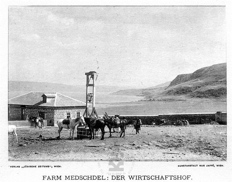
| Exculsive Jewish Colonies Who Usurped Village Lands |
Migdal | ||||||||||||||
| Featured Video | |||||||||||||||
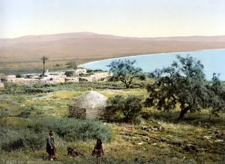
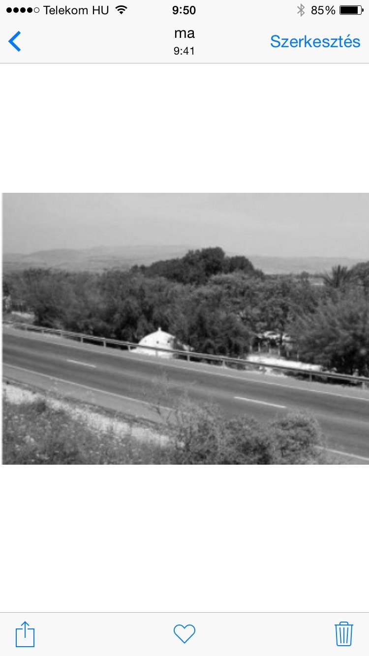
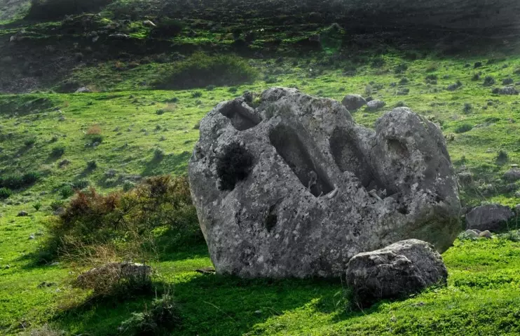
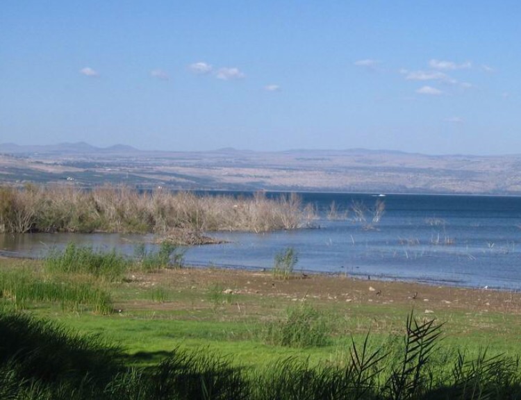
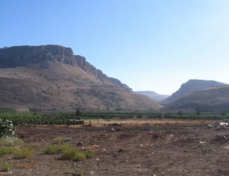
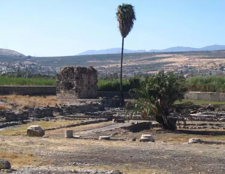
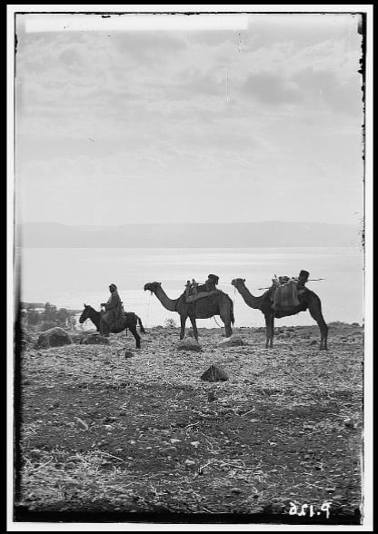
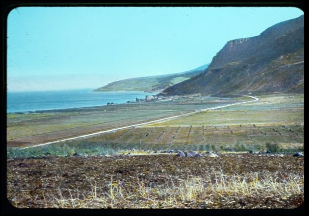
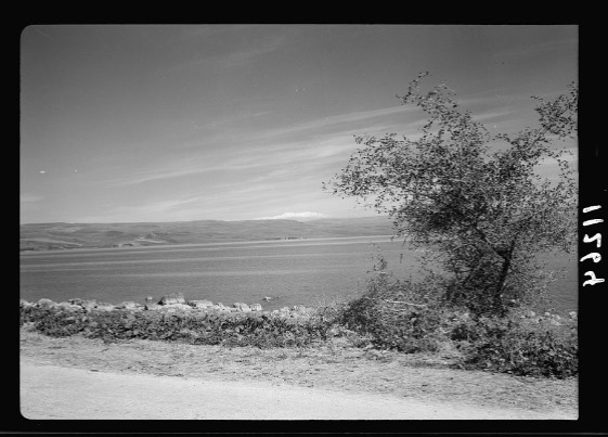
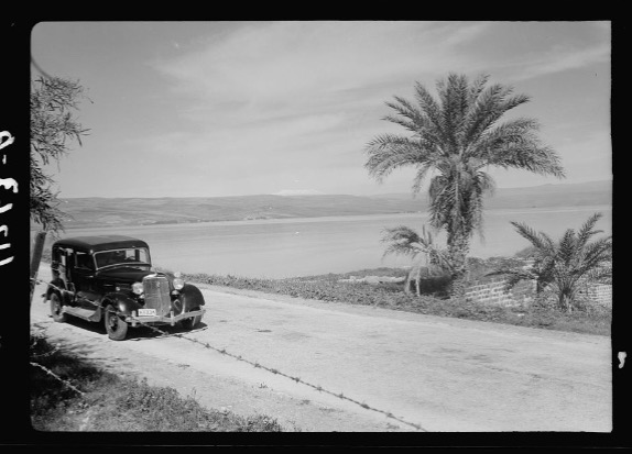
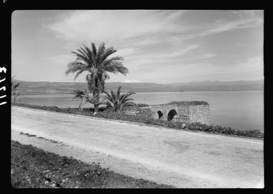
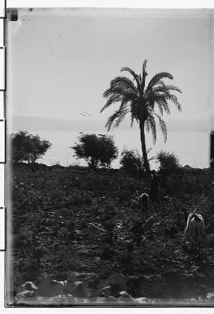
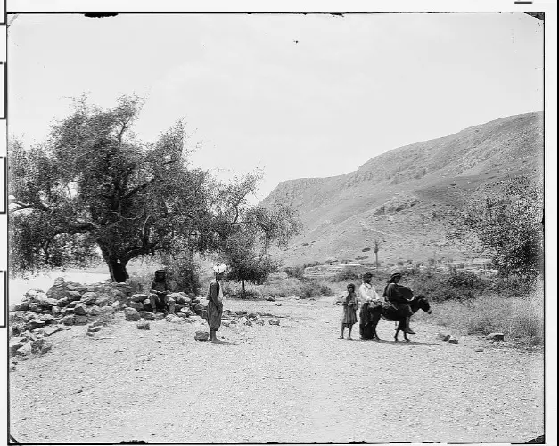
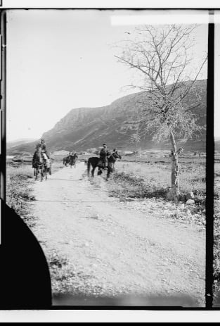
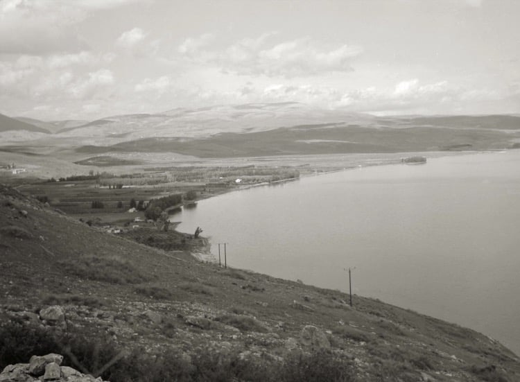
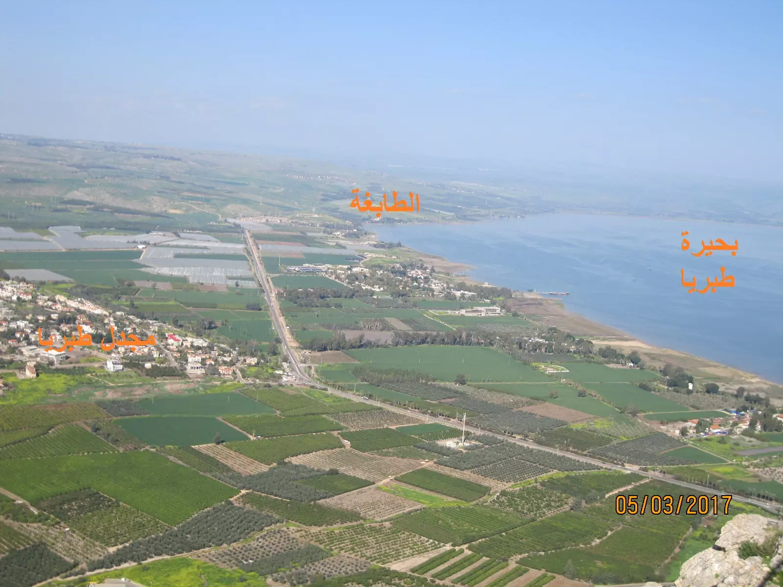
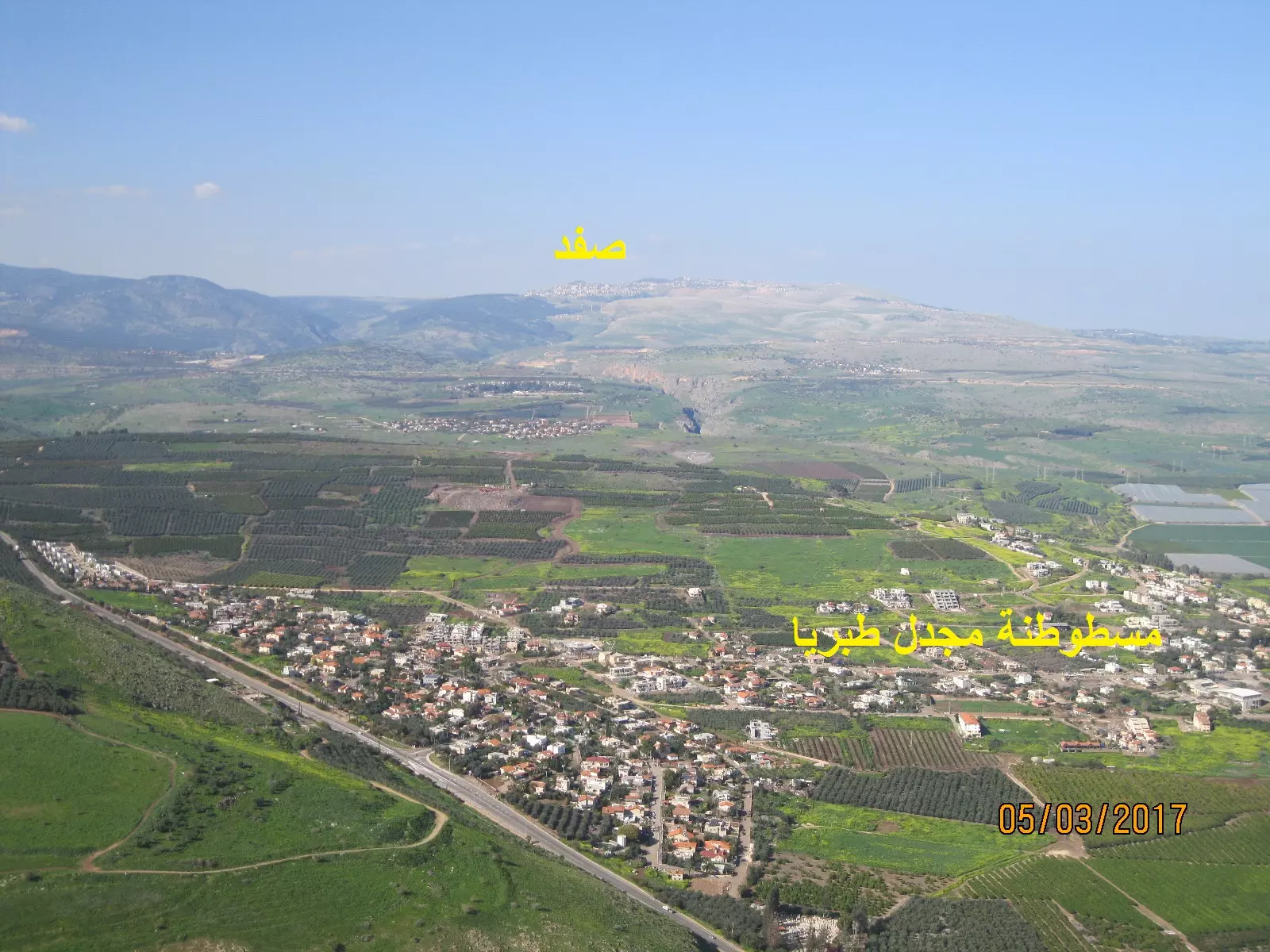
Village Before NakbaThe village was located on the western shore of Lake Tiberias, on the southern edge of the plain of Ghuwayr Abu Shusha, at the foot of a mountain that rose sharply above the plain to a height of some 380 m. It was linked to the city of Tiberias by a highway that wound around the lake shore. AI-Majdal was probably the ancient town mentioned in the New Testament (Luke 7:37-50) as Magdala, the home of Mary Magdalene. In Talmudic sources it appears as Migdal Nunaya, a center for fishing and the fish-salting industry. It was known in the Roman period as Taricheae, a prosperous, fortified Jewish city known for weaving, dye making, and fishing. The Swiss traveler Burckhardt noted in 1821 that the village was in rather poor condition. [Burckhardt 1822:320] In the late nineteenth century, al-Majdal was described as a stone-built village, situated on a partially arable plain. Its population was estimated to be eighty. [SWP (1881) I:361]In modern times, al-Majdal had a rectangular layout. Its houses were crowded together, although a few houses were spaced further apart toward the north, along the lake shore. They were built of stone, cement, and mud, and some had roofs made of wood and cane covered with a layer of mud. It was the smallest village in the sub-disctrict in terms of area. The inhabitants, all of whom were Muslims, maintained a shrine for one Muhammad al-'Ajami on the northern outskirts of the village. The remains of the Crusader fortress of Magdala (later known as Qal'at ('the fortress of”) Na'la were located on the summit of the mountain, west of the village. About 1 km south of the village, on the lake's shore, was a perforated black stone that was mentioned by Arab travelers in the late seventeenth and early eighteenth centuries. Local belief had it that the holes in the rock were caused by ants that had eaten through it, and for this reason it was called hajar al-namla, 'the ant's stone.' The village economy was based on agriculture; vegetables and grain were the most important agricultural products. In 1944/45, 24 dunums of its lands were planted with citrus and bananas and 41 dunums were planted in cereals; 17 dunums were irrigated or used for orchards. Archaeological evidence of the previous occupations was found in the village. Village Occupation and Ethnic CleaningThe only fact provided about the fall of al-Majdal in Israeli sources is that the villagers left on 22 April 1948. Israeli historian Benny Morris indicates that the depopulation of the village was partly due to a military attack as well as to the demoralizing effect of the fall of neighboring Tiberias (on 18 April). Haganah forces based in Tiberias probably seized the village a few days after Tiberias fell into their hands. [M:xv]Zionists Colonies on Village LandsThe settlement of Migdal (197249), established in 1910 on land purchased by Zionists, is 1.5 km northwest of the village site. After 1948 it was expanded to accommodate immigrant settlers. Its population has grown from 213 (in 1948) to 830 (in 1983), and in the course of its expansion it has spread onto village land. [See Katz 1987]Village TodayThe site is dotted with rubble, Christ's-thorn, and a few palm and olive trees. The only remaining village landmark is the neglected shrine of Muhammad al-'Ajami, a low, square, stone structure topped by a formerly whitewashed dome. The land in the vicinity is cultivated by Israelis.SourceDr. Walid al-Khalidi, 1992: All That Remains. |
|||||||||||||||
| Related Maps | Town Lands' Demarcation Maps خرائط للقضاء توضح حدود القرى والاودية Town's map on MapQuest View from satellite Help us map this town at WikiMapia |
||||||||||||||
| Related Links | Wikipedia's Page Google Search Google For Images Google For Videos |
||||||||||||||
| More Information | في كتاب كي لا ننسى في كتاب بلادنا فلسطين المزيد من موقع هوية |
||||||||||||||
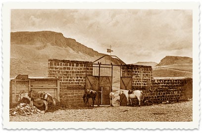
- مقام في القرية المغتصبة
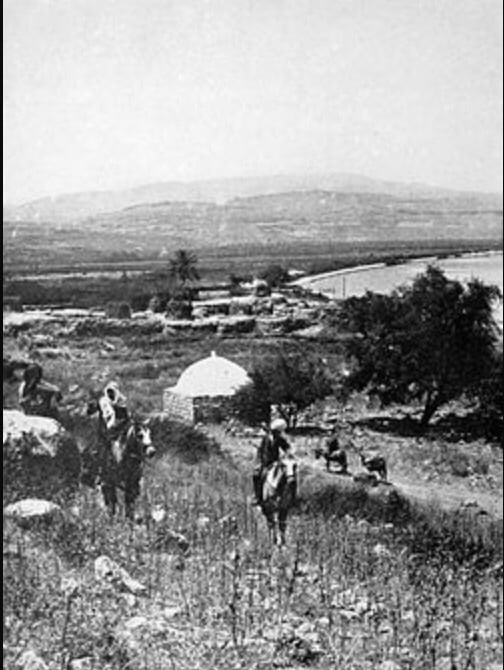
Scanned from "All That Remains" by Dr. Walid Khalidi - المجدل طبرية عام 1912
Posted by فتحي ابو رضا \ العايدي - المجدل طبرية خيول عربية
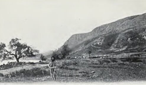
Posted by فتحي ابو رضا \ العايدي - قريه المجدل من ايام زمان
Posted by abu raya - صوره قديمه لقريه المجدل
Posted by abu raya - صوره قديمه من المجدل
Posted by abu raya - المجدل
Posted by abu raya - صوره قديمه من المجدل

Posted by abu raya - المجدل

Posted by abu raya - صوره قديمه من المجدل

Posted by abu raya - موقع القريه من الغرب
Posted by abu raya - اثار المجدل القديمه

Posted by abu raya - شاطى بحيره طبريا من المجدل
Posted by abu raya - اراضي المجدل
Posted by abu raya - اثار المجدل القديمه
Posted by abu raya - صوره قديمه من المجدل
Posted by abu raya - قريه المجدل قبل النكبه
Posted by abu raya - المجدل قبل النكبه
Posted by abu raya - المجدل قبل النكبه
Posted by abu raya - المجدل قبل النكبه
Posted by abu raya - المجدل قبل النكبه
Posted by abu raya - صوره من قريه مجدل طبريا قبل النكبه
Posted by abu raya - صوره من قريه المجدل قبل النكبه
Posted by abu raya - المجدل قبل النكبه
Posted by abu raya - صوره قديمه لبحيره طبريا وقريه المجدل المهجره قبل النكبه
Posted by abu raya - منظر عام لموقع مجدل طبريا المهجرة، تظهر مسطوطنة المجدل مكانها

Posted by سهيل مخول 2 - منظرعام لقرية مجدل طبريا المهجرة
Posted by سهيل مخول - منظر عام لموقع مجدل طبريا المهجرة، تظهر مسطوطنة المجدل مكانها
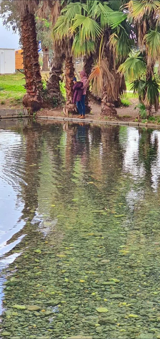
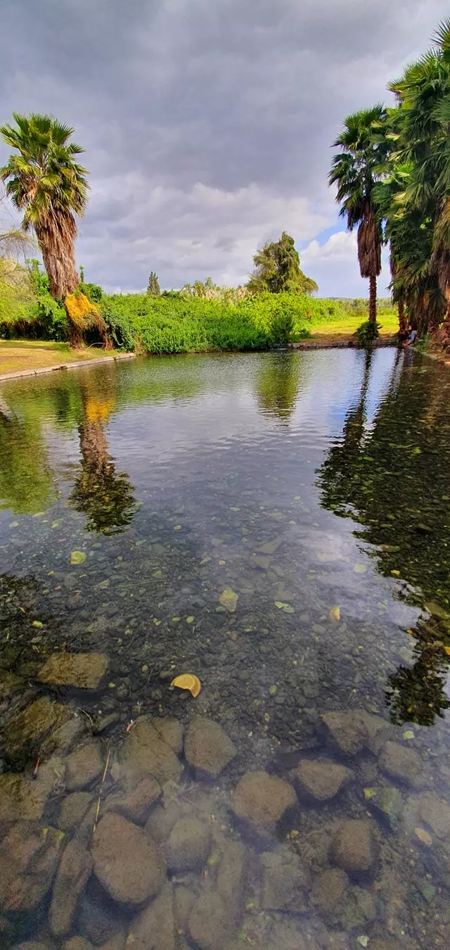
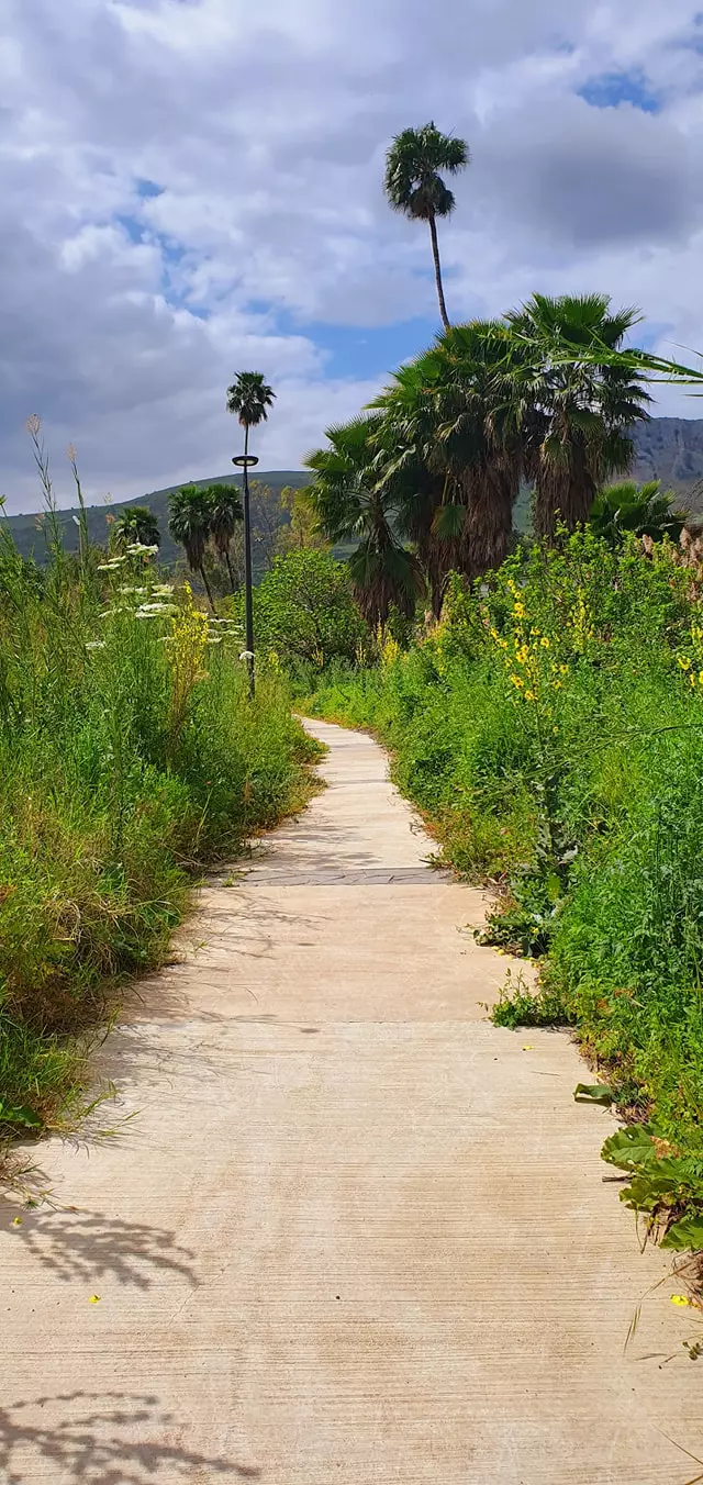
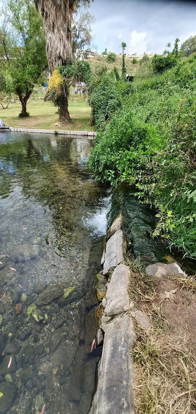
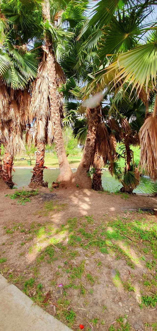
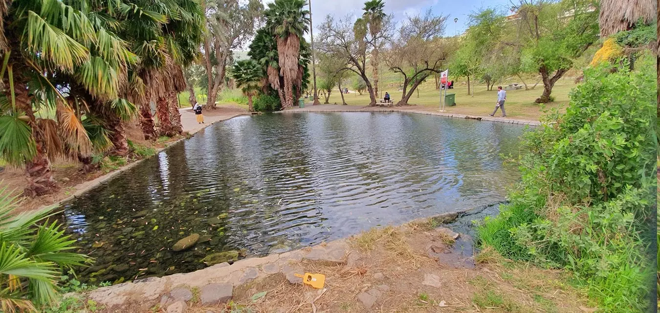
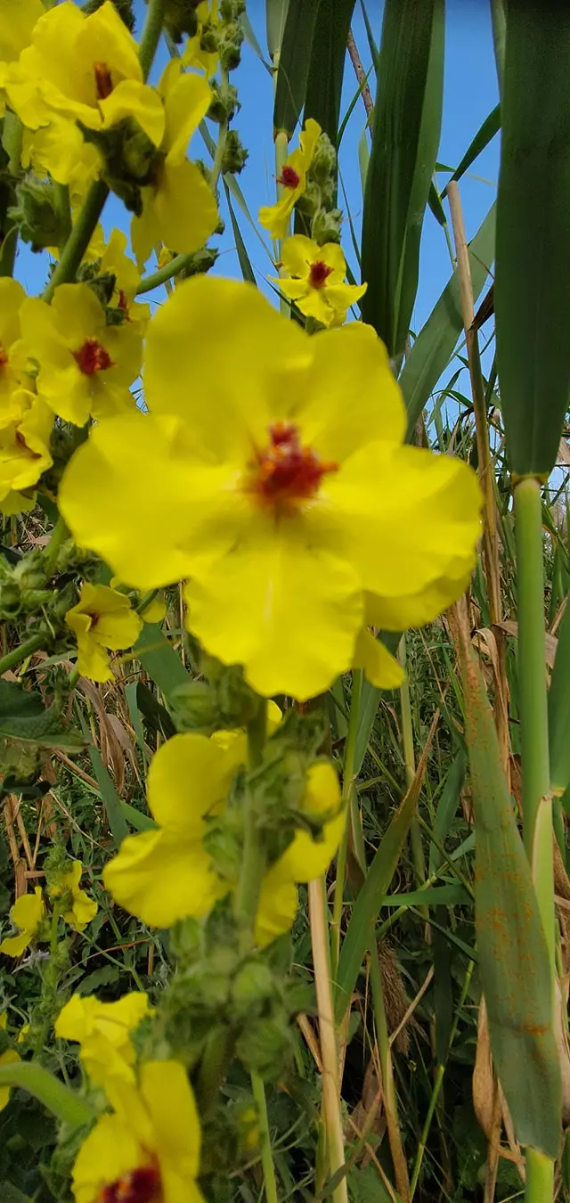
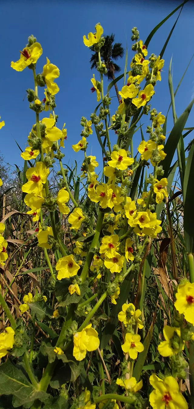
Posted by سهيل مخول - جولة في العين المدورة او عين نون -- April 2021 -- Nabela Salem
- جولة في العين المدورة او عين نون -- April 2021 -- Nabela Salem #2
- جولة في العين المدورة او عين نون -- April 2021 -- Nabela Salem #3

- جولة في العين المدورة او عين نون -- April 2021 -- Nabela Salem #4
- جولة في العين المدورة او عين نون -- April 2021 -- Nabela Salem #5
- جولة في العين المدورة او عين نون -- April 2021 -- Nabela Salem #6
- جولة في العين المدورة او عين نون -- April 2021 -- Nabela Salem #7
- جولة في العين المدورة او عين نون -- April 2021 -- Nabela Salem #8
- جولة في العين المدورة او عين نون -- April 2021 -- Nabela Salem #9
Want to browse more? 80,000 pictures were grouped in these gallaries:
| Display Name | Clan/Hamolah | Country of Residence |
| سامر سعيد | - | - |
| اسماعيل محمود السعيد | - | الشونه الشماليه, الاردن |
| دكتور اسحاق الشيخ احمد | الشيخ احمد | جده, السعوديه |
- عين المجدل /طبريا Duration: 2 min 10 sec
- الذاكرة مفتاح العودة -- الحلقة 96 -- سيبانة Duration: 23 min 22 sec
No links have been shared yet, be free to the first to share the first link.
 Fake Valor: Why Did Zionist Jews Hoist Nazis Flag on Their Ships in the 1930s?
What is new?
-
Facts About Oct. 7th Gaza Raid
-
Remined Us Please:: Who Did Rape Who? Palestinians Raped Israelis? Or, was the other way around?
-
When Prof. Edward Said was invited to debate Bibi Netanyahu in the 1980s, watch what happened!
-
Ezra Klein of the NY Times on the "Jewish Race".
-
Abusing Blood Libel!
-
Zionist FAQ: Isn't it true that Palestinians don't want peace? Palestinians never accepted the two-state solution
- Facts about Haavara (Transfer) Agreement between Ben-Gurion & Hitler
-
Haavara FAQs: Why Did Zionist Jews Hoist Nazis' Flags on Their Ships in the 1930s?
-
Dear ChatGPT: Why did the Jewish Agency suppress news of the Holocaust during WWII?
-
Video Playlist: Jews share their DNA tests to end the conflict for good.
-
A Tale of Two Conflicts: Examining the Definition of Genocide
-
Prof. Abraham Polak And The Suppressed History of the Khazars and European Jewry
-
How Ronald Reagan would have framed the genocide in Gaza if he were still alive?
-
Haavara FAQs: Let us do the math: how many German Jews did The Haavara Agreement save?
-
Zionist FAQs: The Hebron Massacre of 1929, "clearly proves" that Palestinians are antisemitic, how could you deny it?
-
Zionist FAQs: Why Anti-Zionist Is Not Antisemitism?
-
Zionist FAQs: Isn't it true that the KGB create Palestinian Nationalism in the early 1960s?
- Zionist FAQs: Muslims are killing Muslims all the time; why are Israeli Jews being singled out in the media?
- Zionist FAQs: How is Israel an apartheid state when 20% of its citizens are Arabs who enjoy full rights?
-
Haavara FAQs: Analysis of Herzl's Uganda Scheme and how it could have saved millions of Jews.
-
Haavara FAQs: Why did Hayim Greenberg describe American Jewry as "morally bankrupt" in early 1943?
-
Haavara FAQs: What if the Evian Conference was a resounding success? What would have been the impact of saving European Jewry on Zionism?
- Haavara FAQs: What if the six million were saved, how that would have impacted the Zionist project?
-
Haavara FAQs: How did Zionist leaders react when Europe's Jews lingered in the DP camps after WWII ended?
-
Why does the American Jewish community repeat lies that David Ben-Gurion had debunked before he died?
-
Who has the power to rename the Tatar/Khazar Gene Marker to Jewish IV?
-
Zionist FAQs: Why won't Egypt, Syria, and Jordan take their people back? Jews are indigenous to Palestine, and Arabs immigrated after Jews developed the country. Arabs should leave.
-
Haavara FAQs: Did Hitler and the Nazis conflate between Judaism and Zionist? If that wasn't case, then why?
-
Haavara FAQs: Winston Churchill and antisemitism, a collection of articles written Churchill.
-
Haavara FAQs: Broken by country, how many Jews survived vs. killed during the Holocaust?
-
Haavara FAQs: Why did European Jews vote with their feet and to immigrated to the Americas, not Palestine, after WWII?
-
Watch this American Jewish Girl describing Israeli Jews' cognitive dissonance like no other in under two minutes
-
Haavara FAQs: When the Nazis went out of their way to hide the Holocaust, Israeli Jews did the exact opposite by broadcasting their genocide of Gazans. But why?
-
Haavara FAQs: How Zionist Jews went out of their to show their appreciation to Nazism and Fascism?
- Haavara FAQs: Why Zionist leaders were against bombing the death camps & the Railroads leading to them?
-
Haavara FAQs: Hitler's message to the British and American people: If Jews are such noble citizens and you care about them, how come you're not letting them in? I will gladly ship them to you at my expense, even on luxury liners!
-
A shortlist of Zionist and Israeli false flag operations in the name Jews.
-
The Most Moral Army
- The Land of Kapos (Israel): Where the brave are boycotted and Kapos walk free.
- Why did early Zionists often named their communal enterprises "colonial"?
- Zionist Relations with Nazi Germany by Faris Glubb
-
Two NY Times advertisements by Zionists in the early 1943 that exposes Zionists' treason at the height of the calamity
- Facts Not Lies about the Palestinian-Israeli Conflict.
- Site's pictures have been categorized
- Campgain Against Lice
- A Survey of Palestine, the official source about Palestine before Nakba produced by the British Mandate; over 1200 pages.
- Satellite View & Google Earth: Over 6,000 placemarks identifying all destroyed towns, W. Bank & Gaza Strip Towns, & refugee camps.
- PalestineRemembered.com and its Nakba Oral History Project were featured on al-Jazeera Satellite TV.
- Nakba Oral History Video Podcast:
 Over 700 Oral History interviews (including 3,500+ hours of recording) can be viewed online.
 - Palestine Village Statistics Project
- Gaza Jail Break
- النسخة العربية للموقع الان متوفرة
- Videos: Documenting the destroyed villages in video: Tracing all that remains since Nakba.
- Videos: Responding to Zionist Propaganda
- Interview: The ethnic cleansing of Palestine: George Galloway interviews Israeli Historian Ilan Pappe.
- For Palestinians, memory matters. It provides a blueprint for their future By George Bisharat.
- Zionist FAQ now available in Hebrew שאלות שציונים שואלים, עכשיו בעברית
- Video: The Stephen Walt and John Mearsheimer report on the influence of the Israel Lobby on U.S. Foreign Policy
- The Palestinian-Israeli conflict for beginners
