| PalestineRemembered | About Us | Oral History | العربية | |
| Pictures | Zionist FAQs | Haavara | Maps | |
| Search |
| Camps |
| Districts |
| Acre |
| Baysan |
| Beersheba |
| Bethlehem |
| Gaza |
| Haifa |
| Hebron |
| Jaffa |
| Jericho |
| Jerusalem |
| Jinin |
| Nablus |
| Nazareth |
| Ramallah |
| al-Ramla |
| Safad |
| Tiberias |
| Tulkarm |
| Donate |
| Contact |
| Profile |
| Videos |
Welcome To Zalafa, Khirbat - خربة زلفة (ח'ירבת זלפה)
|
District of Tulkarm
Ethnically cleansed days ago |
العربية Google Earth |
| Gallery (3) |
- Statistics & Facts
-
Before & After

- Satellite View
- Articles 1
- Pictures 3
- Oral History 1
- Members
- All That Remains
- Wikipedia
- Videos
- Guest Book
- Links
| Statistic & Fact | Value | |||||||||||||||||||||
| Occupation Date | April 15, 1948 | |||||||||||||||||||||
| Distance From District | 15 (km) Northwest of Tulkarm | |||||||||||||||||||||
| Elevation | 25 (meters) | |||||||||||||||||||||
| Before & After Nakba, Click Map For Details |
||||||||||||||||||||||

|
||||||||||||||||||||||
| Map Location | See location #3 on the map View from satellite |
|||||||||||||||||||||
| Military Operation | Coastal Clearing | |||||||||||||||||||||
| Exodus Cause | Fear of Jewish attack, or of being caught in the fighting | |||||||||||||||||||||
| Village Temains | Khirbat Zalafa was completely obliterated | |||||||||||||||||||||
| Ethnically Cleansing | Zalafa, Khirbat inhabitants were completely ethnically cleansed. | |||||||||||||||||||||
| Pre-Nakba Land Ownership |
**Town Lands' Demarcation Maps |
|||||||||||||||||||||
| Land Usage As of 1945 |
|
|||||||||||||||||||||
| Population |
|
|||||||||||||||||||||
| Near By Towns |
||||||||||||||||||||||
|
||||||||||||||||||||||
| Inhabitants Place of Origin | The people who founded the village originally migrated from the nearby village of 'Attil, Tulkarm (currently, in the occupied West Bank). | |||||||||||||||||||||
| Exculsive Jewish Colonies Who Usurped Village Lands |
No Israeli Jewish settlements on village lands. | |||||||||||||||||||||
| Featured Video | ||||||||||||||||||||||
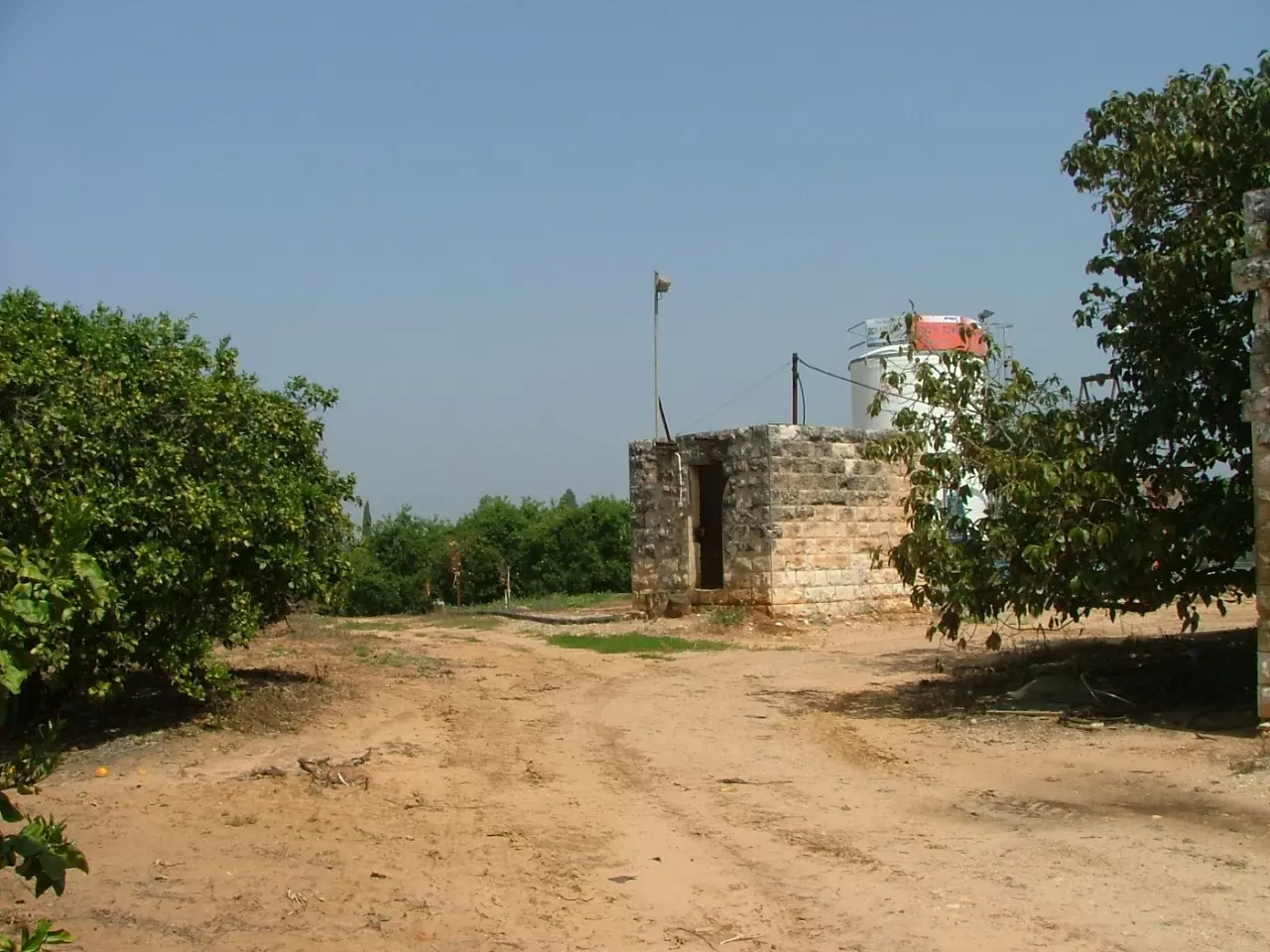
Village Before NakbaThe village stood on a small, slightly elevated hill in the middle of a wide plain. It was linked by secondary roads to neighboring villages, as well as to 'Attil, the 'mother' village. Originally, the people of Khirbat Zalafa came from 'Attil to farm the village lands; they gradually settled in the village so that they could be closer to their farms. In the late nineteenth century, Khirbat Zalafa was described as a small hamlet with springs to the south. [SWP (1881) II:153] The village had a small core of houses but many of the village dwellings were scattered throughout the agricultural lands. Agriculture was based on watermelons, vegetables, grain, and olives. In 1944/45 a total of 38 dunums was devoted to citrus and bananas and 6,798 dunums were allotted to cereals; 6 additional dunums were irrigated or used for orchards.Village Occupation and Ethnic CleaningThe Haganah command considered the coastal area north of Tel Aviv to be 'the core of the emergent Jewish state,' and decided to 'secure' it before 15 May 1948, by depopulating it of its Arab inhabitants. During early April a series of expulsion orders were issued to the communities that remained. About mid-April, Haganah representatives reached an agreement with the villagers of Khirbat Zalafa to the effect that, if they left, local Zionist settlements would safeguard their property and allow them to return to their homes after the war. Israeli historian Benny Morris states that they 'may have been pressured to leave.' At the end of that month and in early May, the houses of the village (as well as a number of others) were systematically destroyed by the Haganah, assisted by the local Zionist settlements. No information is given about what happened to the village land. [M:118-19]Zionists Colonies on Village LandsThere are no Israeli settlements on village land.Village TodayThe village has been completely levelled. Both the original site and the surrounding lands are covered with Israeli citrus orchards.SourceDr. Walid al-Khalidi, 1992: All That Remains. |
||||||||||||||||||||||
| Related Maps | Town Lands' Demarcation Maps خرائط للقضاء توضح حدود القرى والاودية Town's map on MapQuest View from satellite Help us map this town at WikiMapia |
|||||||||||||||||||||
| Related Links | Wikipedia's Page Google Search Google For Images Google For Videos |
|||||||||||||||||||||
| More Information | في كتاب كي لا ننسى في كتاب بلادنا فلسطين المزيد من موقع هوية |
|||||||||||||||||||||
Want to browse more? 80,000 pictures were grouped in these gallaries:
| Display Name | Clan/Hamolah | Country of Residence |
No links have been shared yet, be free to the first to share the first link.


