| PalestineRemembered | About Us | Oral History | العربية | |
| Pictures | Zionist FAQs | Haavara | Maps | |
| Search |
| Camps |
| Districts |
| Acre |
| Baysan |
| Beersheba |
| Bethlehem |
| Gaza |
| Haifa |
| Hebron |
| Jaffa |
| Jericho |
| Jerusalem |
| Jinin |
| Nablus |
| Nazareth |
| Ramallah |
| al-Ramla |
| Safad |
| Tiberias |
| Tulkarm |
| Donate |
| Contact |
| Profile |
| Videos |
Welcome To 'Aqir - عاقر (עאקר)
|
District of al-Ramla
Ethnically cleansed days ago |
العربية Google Earth |
 |
Gallery (26) |
- Statistics & Facts
-
Before & After

- Satellite View
- Articles 4
- Pictures 26
- Oral History 2
- Members 73
- All That Remains
- Wikipedia
- Videos 2
- Guest Book 76
- Links
| Statistic & Fact | Value | |||||||||||||||||||||
| Occupation Date | May 6, 1948 | |||||||||||||||||||||
| Distance From District | 9 (km) Southwest of al-Ramla | |||||||||||||||||||||
| Elevation | 50 (meters) | |||||||||||||||||||||
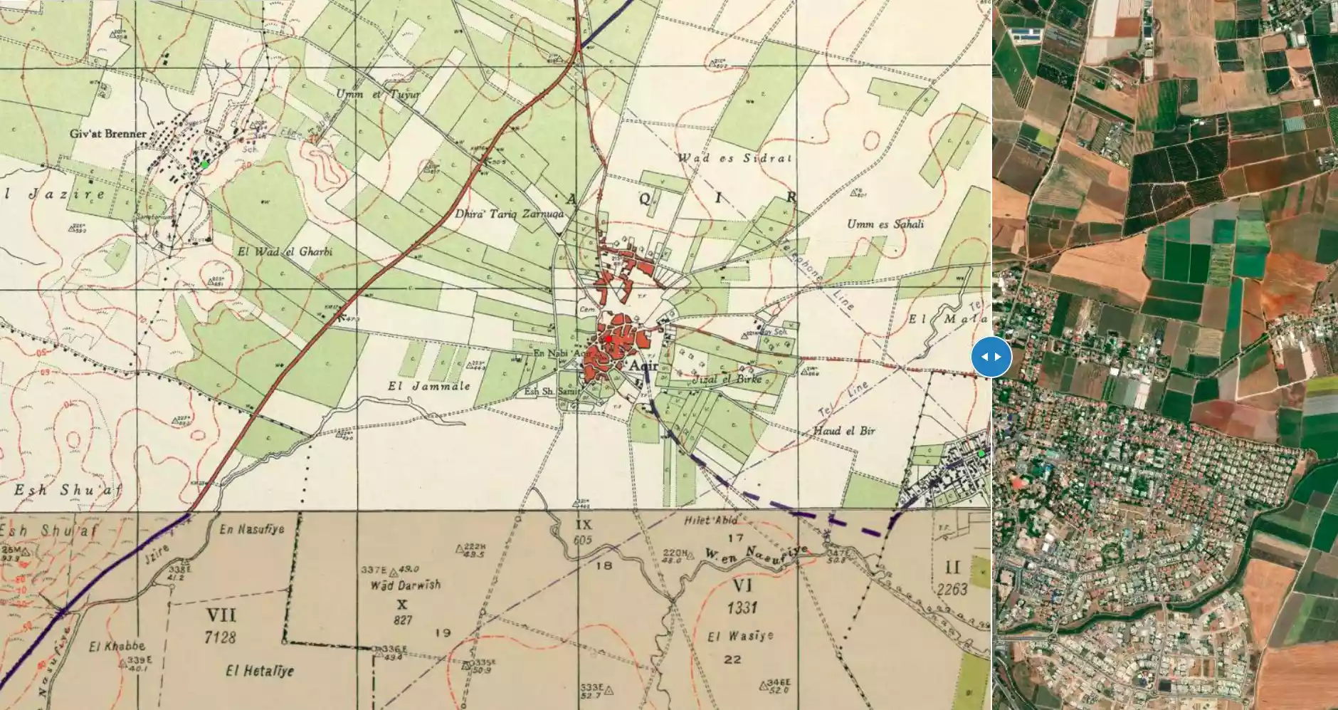
| Before & After Nakba, Click Map For Details |
||||||||||||||||||||||
|
||||||||||||||||||||||
| Map Location | See location #36 on the map View from satellite |
|||||||||||||||||||||
| Attacking Units | Giv'ati Brigade | |||||||||||||||||||||
| Exodus Cause | Military assault by Zionist troops | |||||||||||||||||||||
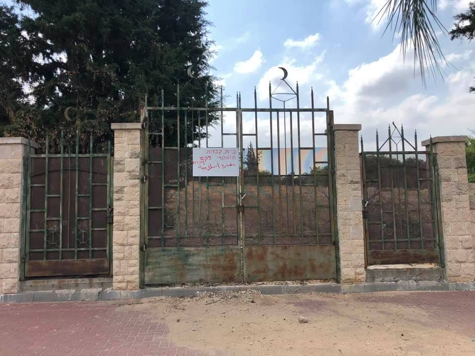
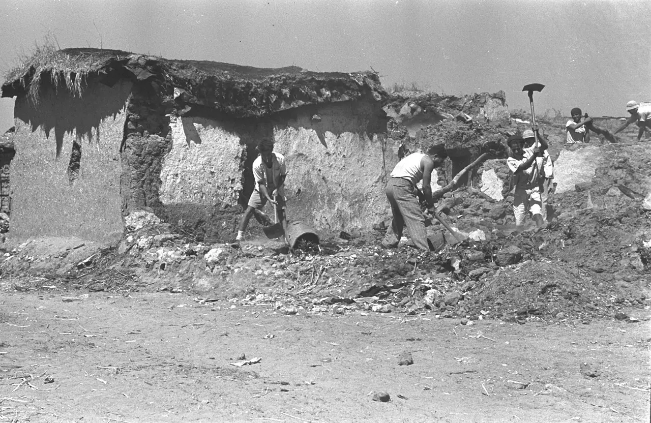
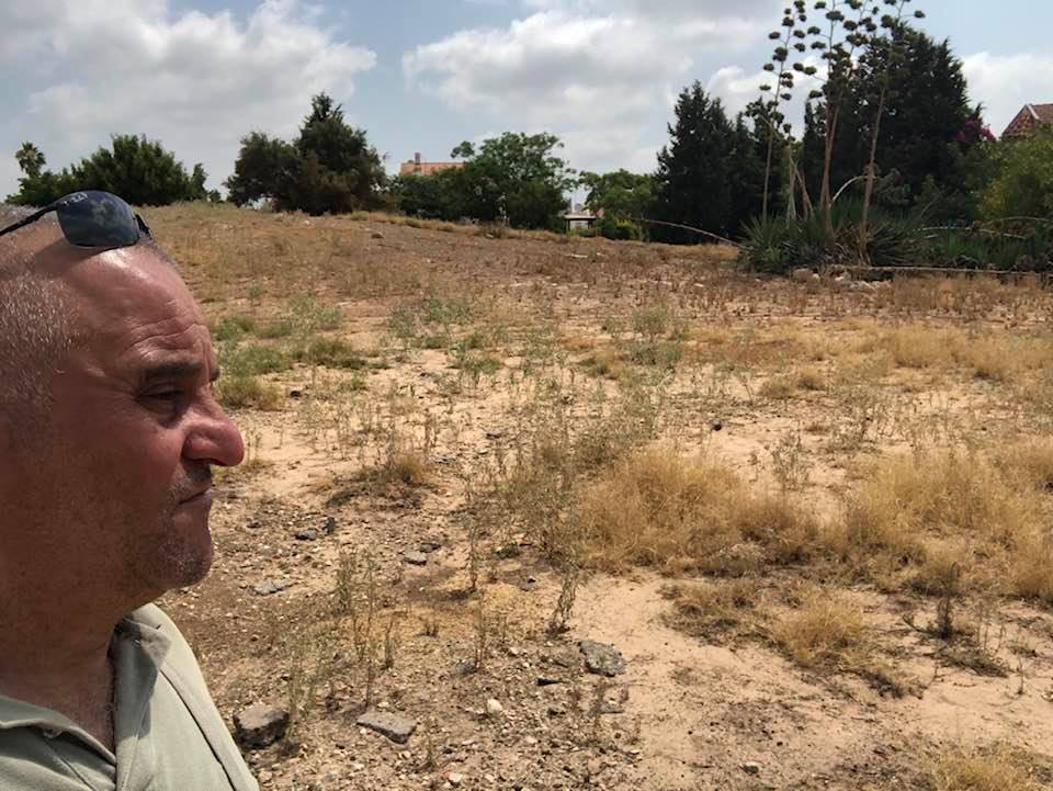
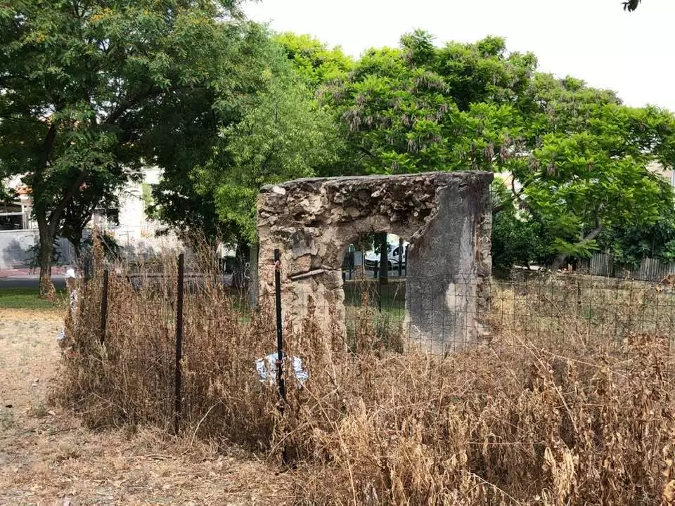
| Village Temains | 'Aqior was mostly destroyed with the exception of five of its houses. | |||||||||||||||||||||
| Ethnically Cleansing | 'Aqir inhabitants were completely ethnically cleansed. | |||||||||||||||||||||
| Pre-Nakba Land Ownership |
**Town Lands' Demarcation Maps |
|||||||||||||||||||||
| Land Usage As of 1945 |
|
|||||||||||||||||||||
| Population |
|
|||||||||||||||||||||
| Number of Houses |
|
|||||||||||||||||||||
| Near By Towns |
||||||||||||||||||||||
|
||||||||||||||||||||||
| Town's Name Through History | The Romans referred to the village by Accaron. | |||||||||||||||||||||
| Schools | Two elementary schools: the 1st was for boys founded in 1921 which had an enrollment of 391 boys in 1945; the 2nd was for girls which had an enrollment of 46 girls in 1945. | |||||||||||||||||||||
| Places of Warship | Two mosques | |||||||||||||||||||||
| Shrines / Maqams | Two shrines for unknown individuals. | |||||||||||||||||||||
| Nearby Wadies & Rivers | The village is situated 1 km north of Wadi al-Nasufiyya. | |||||||||||||||||||||
| Water Supply | Ground water was plentiful, and in the 1940s a number of artesian wells were drilled. | |||||||||||||||||||||
| Exculsive Jewish Colonies Who Usurped Village Lands |
Mazkeret Batya, Kefar 'Eqron, and Ganne Yochanan. | |||||||||||||||||||||
| Featured Video | ||||||||||||||||||||||
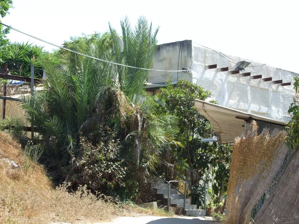
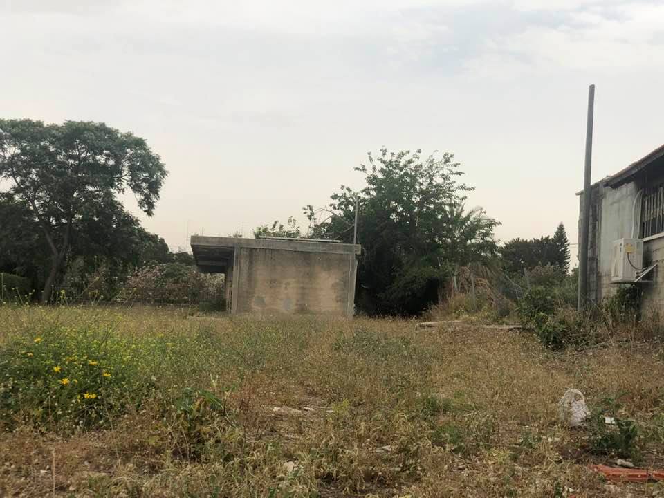
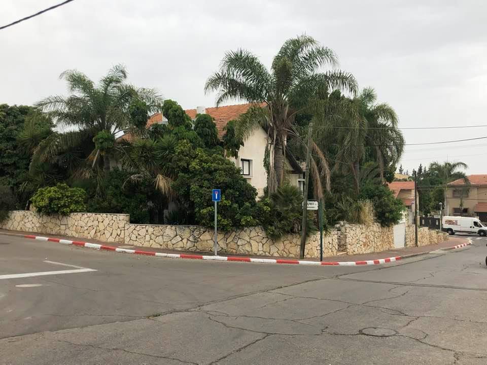
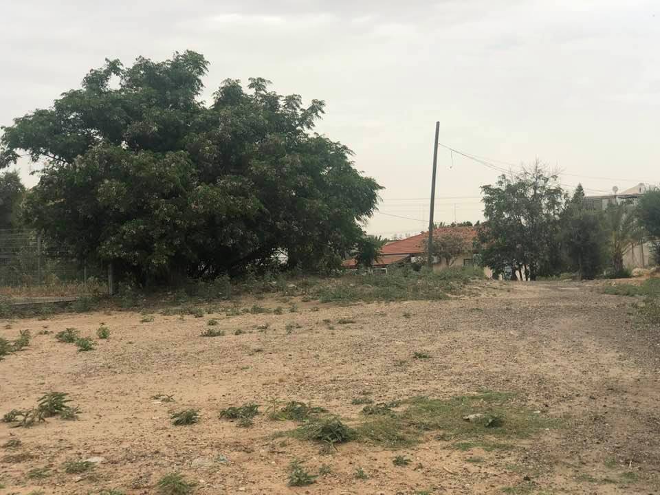
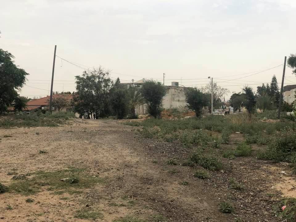
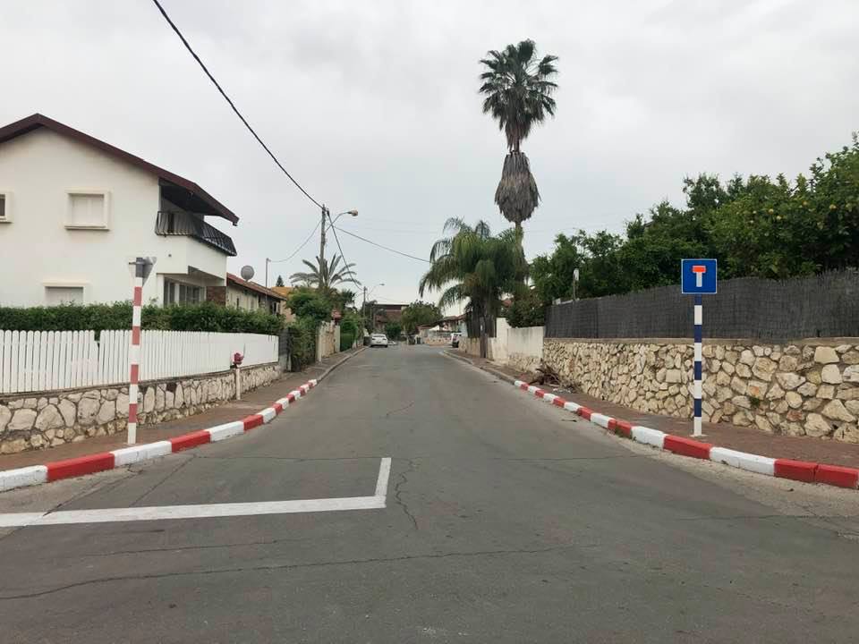
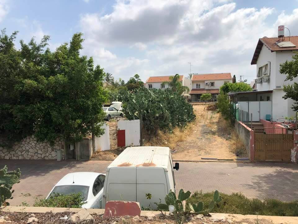
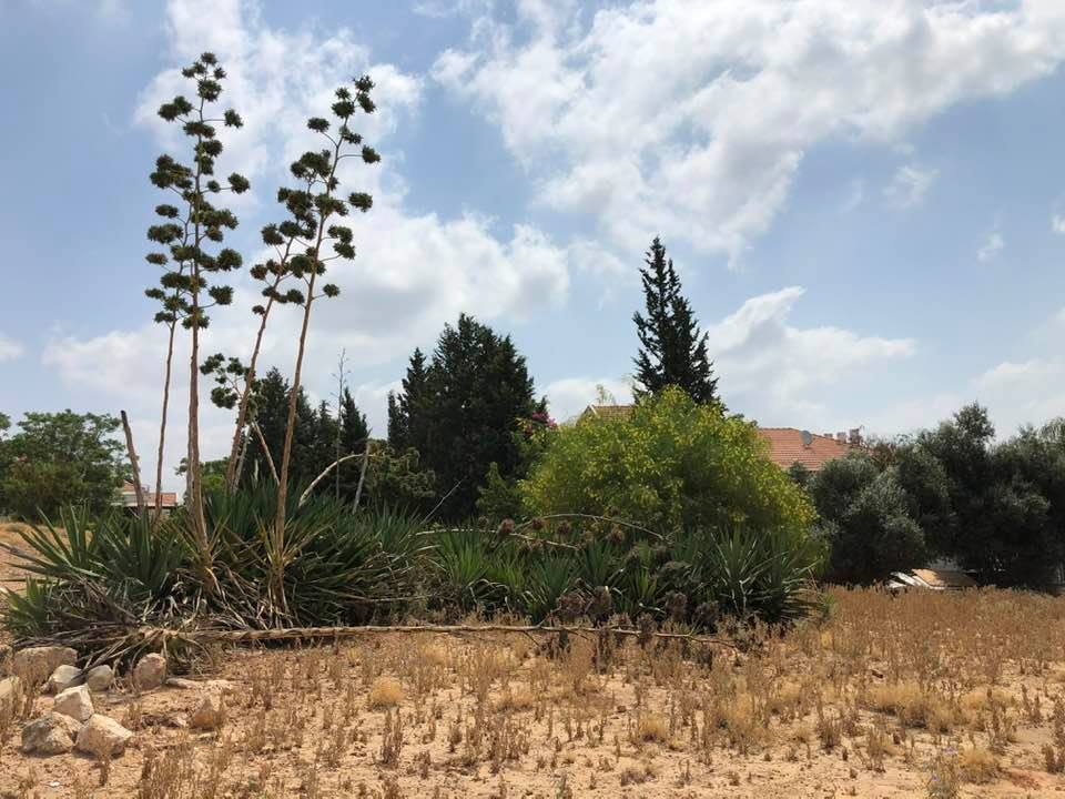
Village Before NakbaThe village was situated on the central coastal plain. Wadi al-Nasufiyya ran 1 km south of it, and a secondary road linked it to the highway leading to Ramla and other urban centers. Aqir has been identified with the Roman town of Accaron. In the tenth century the Arab geographer al-Maqdisi (d. A.D. 985) described Aqir as a big village with a large mosque, the residents of which baked a special kind of bread; its people were generous and philanthropic. In 1596, Aqir was a village in the nahiya of Ramla (liwa of Gaza) with a population of 161. It paid taxes on a number of crops, including wheat, barley, and fruit, as well as on other types of produce and property, such as goats, beehives, and vineyards.In the late nineteenth century, the village of Aqir was situated on low ground and built of adobe bricks. The American biblical scholar Edward Robinson visited Aqir in 1838 and described it as a sizable village. Its houses were built of sun-burnt bricks. The village was surrounded by fields and orchards. During World War II, the British established a military airport south of the village, and a military hospital 2 km north of it. At this time the village had a rectangular layout. Its houses were made of mud, cement, and stone, and were built very close to each other. As house construction increased toward the end of the Mandate, the village expanded, especially north of the secondary road that split the village into two halves. Its population was predominantly Muslim. Aqir had two elementary schools, one for boys (established in 1921) and another for girls. In 1947, 391 boys and 46 girls were enrolled in the two schools. The village also had two mosques and two shrines. Ground water was plentiful, and in the 1940s a number of artesian wells were drilled on village land. These wells supplied irrigation water for citrus groves. The villagers cultivated other fruits as well, such as grapes, figs, and apricots. They also planted grain, which was watered by rainfall. In 1944/45 a total of 1,300 dunums was devoted to citrus and bananas and 8,968 dunums were allotted to cereals; 914 dunums were irrigated or used for orchards. Village Occupation and Ethnic CleaningAqir was the first village to fall to the Giv'ati Brigade when it implemented the part of Plan Dalet for which it was responsible. On 5 May 1948 the brigade moved southwards from Rehovot and proceeded to surround the village. The Haganah force, estimated at 400 by a New York Times report, then demanded that all guns in the village be handed over. But Israeli historian Benny Morris adds that when this was done, 'intelligence officers believed that the villagers were holding back,' and the Giv'ati Brigade took eight villagers hostage, promising to release them when the remaining weapons were surrendered. Morris writes that the brigade then withdrew in response to British intervention. The New York Times reported that the ordeal lasted six and a half hours and that as a result, some 3,000 people fled from the village. This figure probably included refugees from nearby villages. The following day, the Haganah units returned to occupy the village, most of the residents having sought refuge in the neighboring villages of Yibna and al-Maghar. Morris writes that, 'Within weeks, the 30-odd villagers who had remained behind were expelled-an act that sparked a flurry of protests in Mapam [the Israeli United Workers' Party]...'Zionists Colonies on Village LandsBaron Edmond Rothschild established the settlement of Eqron in 1883, 1 km south of the village site on land purchased by the settlers; it was later renamed Mazkeret Batya . The settlement of Qiryat Eqron was established in 1948 on village lands; its name was later changed to Kefar Eqron. Ganne Yochanan , also on village lands, was built in 1950.Village TodayA number of small houses remain, several of which are occupied by Jewish families. One is a cement house with a gabled roof and rectangular doors and windows; another is similar in its features, but its roof is flat. Cypresses, sycamores, and cactuses grow on the site. The surrounding lands are cultivated by Israelis.SourceDr. Walid al-Khalidi, 1992: All That Remains. |
||||||||||||||||||||||
| Related Maps | Town Lands' Demarcation Maps خرائط للقضاء توضح حدود القرى والاودية Town's map on MapQuest View from satellite Help us map this town at WikiMapia |
|||||||||||||||||||||
| Related Links | Wikipedia's Page Facebook Page Google Search Google For Images Google For Videos |
|||||||||||||||||||||
| More Information | في كتاب كي لا ننسى في كتاب بلادنا فلسطين المزيد من موقع هوية |
|||||||||||||||||||||
- New Jewish Emigrants Living In Palestinian House Soon After Occupation, 1948
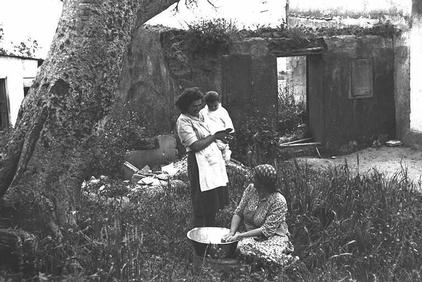
Posted by Prince, Peaceful Israeli 2 - صورة نادرة للقرية
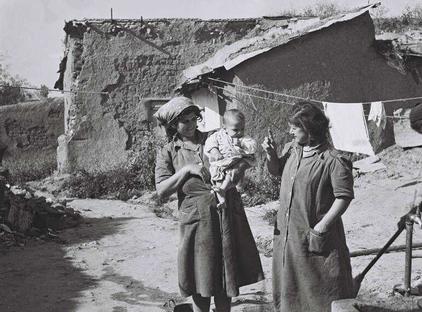
Posted by احمد فحماوي - View in the usuped village soon after occupation. Note in the backgroyund how the new Jewish Immigrants use Palestinian people's poor mud houses. Many of whom recently came from Europe escaping persecution.
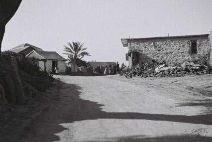
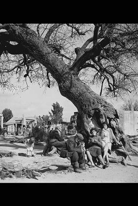
- View in the usuped village soon after occupation. Note the palm tree in the background
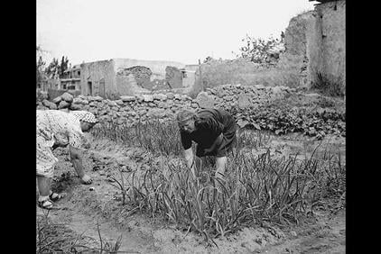
2 - Hey GUYS, let's Join The New LOOT, Farming a Palestinian House Garden, 1948
Posted by Prince, Peaceful Israeli 4 - A LOOTED Palestinian House, Enjoy The STAY, 1948
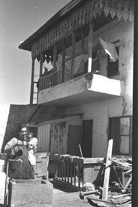
Posted by Prince, Peaceful Israeli - Jewish Settlers In 'Aqir Soon After Occupation, 1948
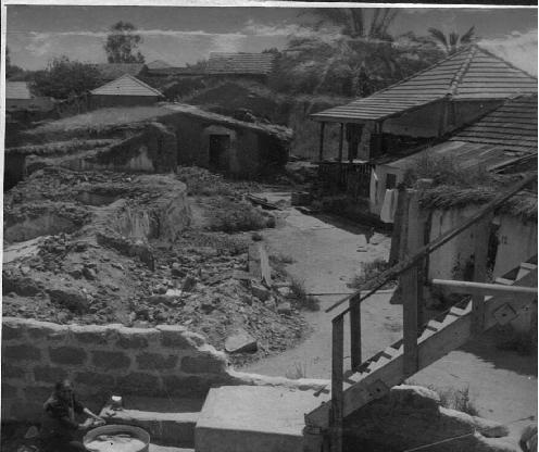
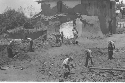
Posted by Prince, Peaceful Israeli 5 - Destroying the unwanted Mud Houses In 'Aqir, 1948
Posted by Prince, Peaceful Israeli - Jewish Settlers ENJOYING The New LOOT, Unbelievable, 1948

Posted by Prince, Peaceful Israeli 14 - A house on Rabin corner Kovshey HaHermon st.
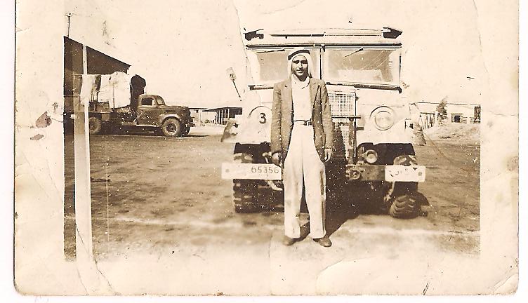
Posted by Uri Zackhem - صورة نادرة للسيد/ محمد محمود ابراهيم صيدم فى مطار عاقر
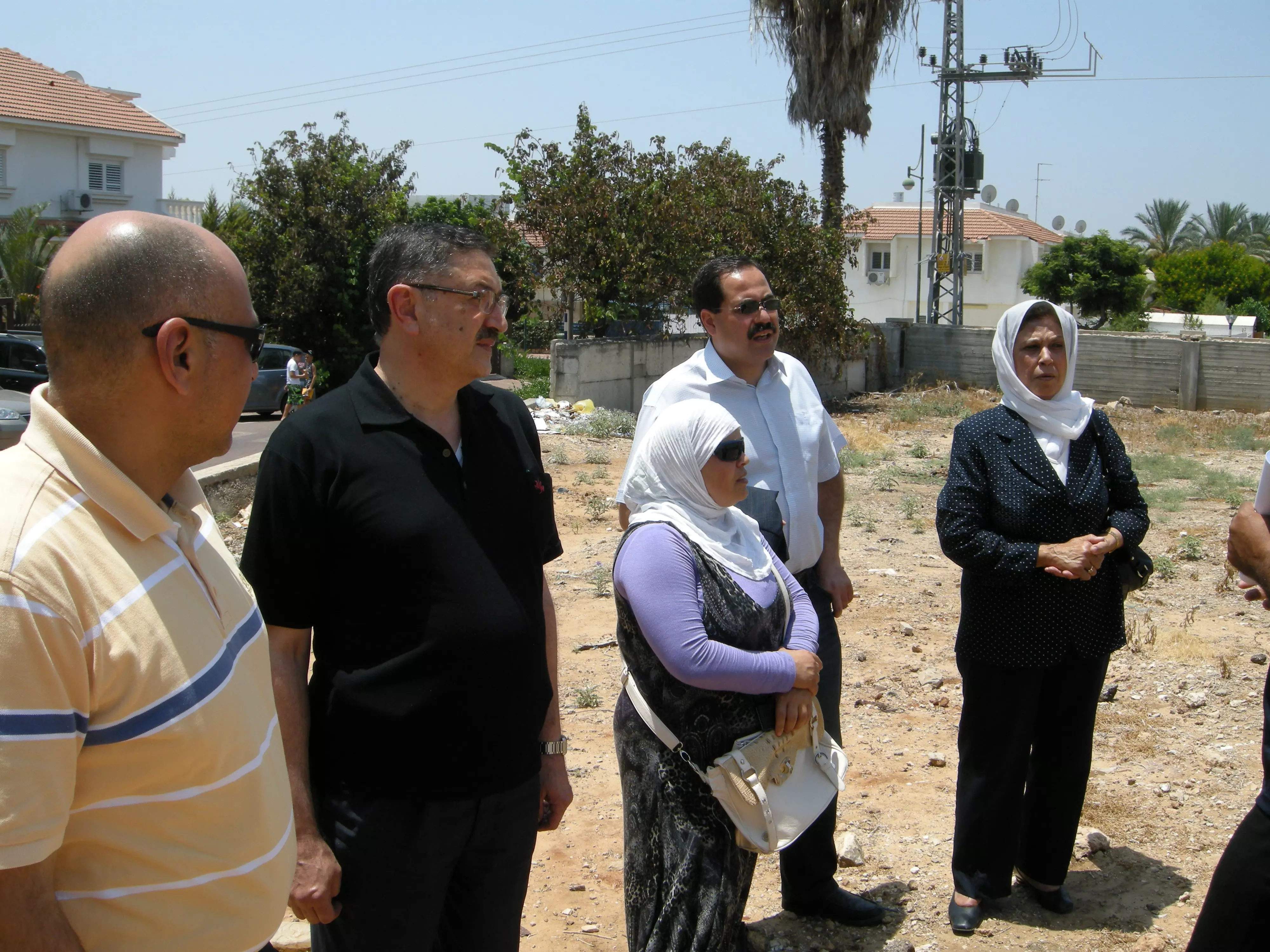
Posted by ابو احمد - جميلة صيدم - ام صبري قي زيارتها الوحيدة لقرية عاقر قبل وفاتها باسبوع رحمها الله يرافقها ابها صبري والدكتور هيثم الحسن عمر اغبارية ومريم الزيناتي وازدهار محاميد
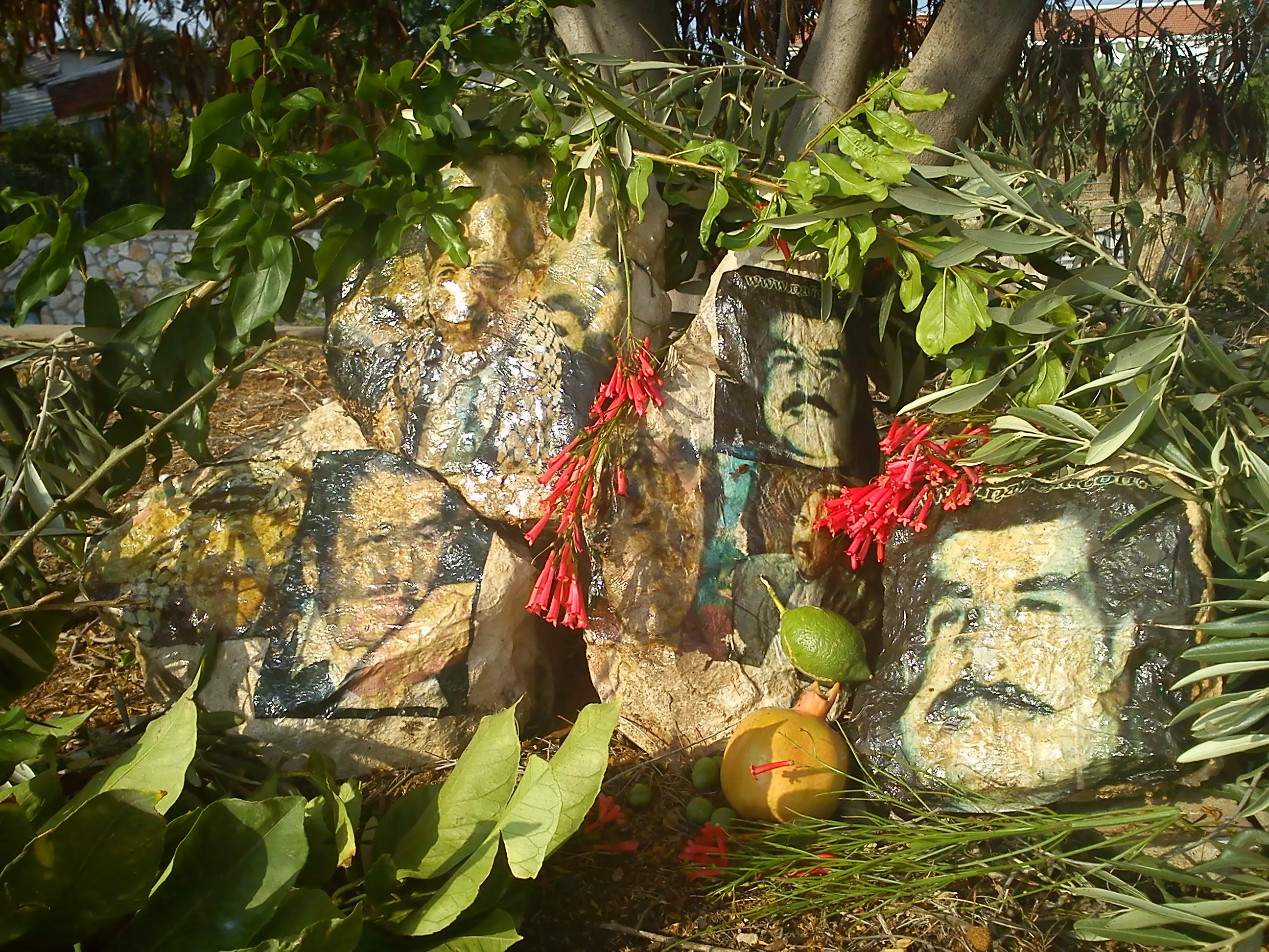
Posted by خالد كساب محاميد - - نصب تذكاري وقبر مجازي لجميلة صيدم وممدوح صيدم وخالد الحن وياسر عرفات في مقبرة عاقر المهجرة
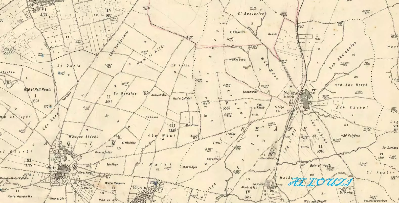
Posted by خالد كساب محاميد - خارطة عاقر والاراضي التي حولها عام 1930
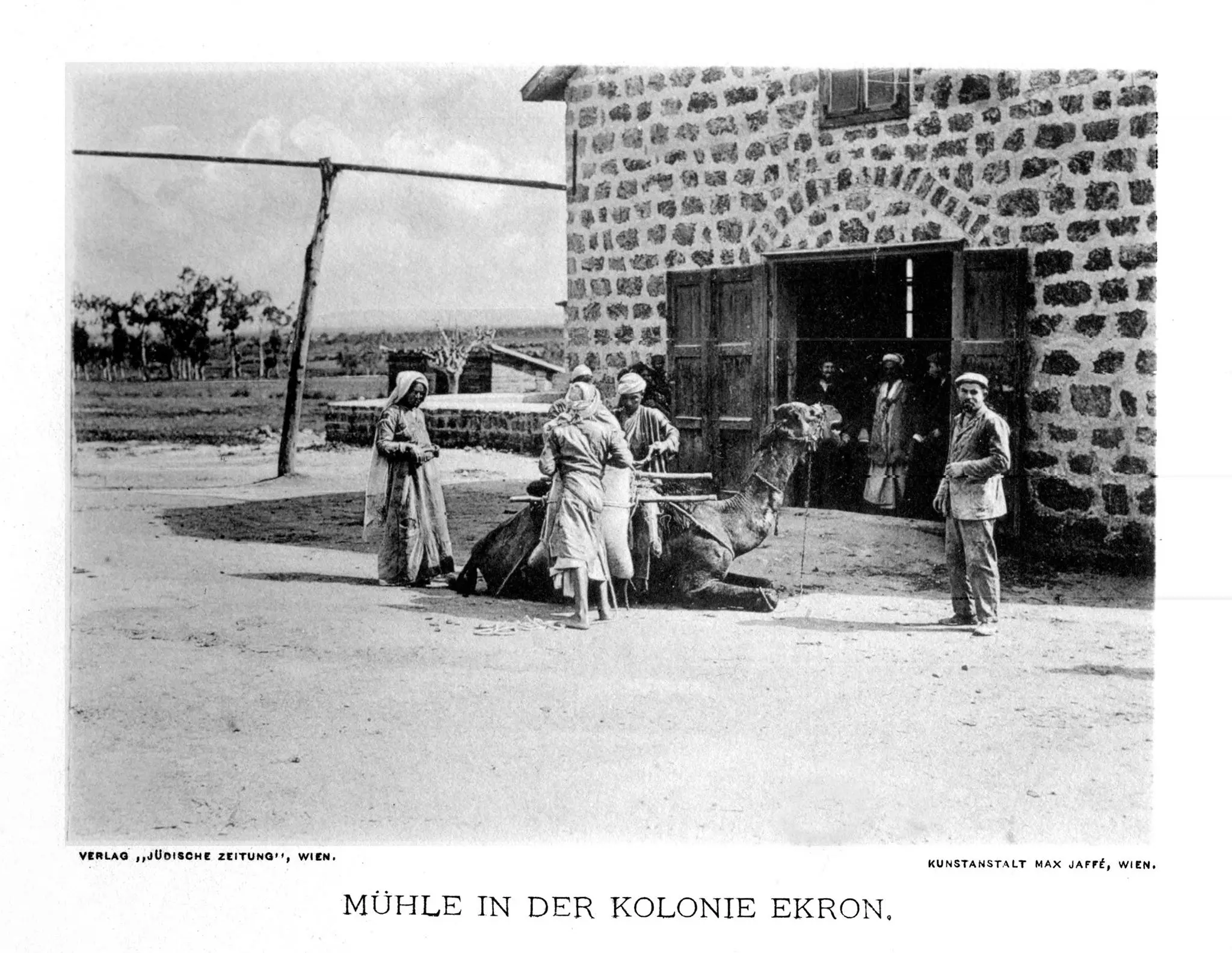
Posted by hussein abdo - بابور قرية عاقر قضاء الرملة سنة 1912
- A rare picture of the "civilized" destroying our village four years after the Holocaust ended. You would think those Zionist Jews fought the Nazis who were gassing their families in Poland? Think twice
- The "civilized" obliterated our village; they completely defaced it. How else will the Jews be great & safe again?
- The "civilized" obliterated our village; they completely defaced it. How else will the Jews be great & safe again? #2
- The "civilized" obliterated our village; they completely defaced it. How else will the Jews be great & safe again? #3
- The "civilized" obliterated our village; they completely defaced it. How else will the Jews be great & safe again? #4
- The "civilized" obliterated our village; they completely defaced it. How else will the Jews be great & safe again? #5
- The "civilized" obliterated our village; they completely defaced it. How else will the Jews be great & safe again? #6
- The "civilized" obliterated our village; they completely defaced it. How else will the Jews be great & safe again? #7
- The "civilized" obliterated our village; they completely defaced it. How else will the Jews be great & safe again? #8
- The "civilized" obliterated our village; they completely defaced it. How else will the Jews be great & safe again? #9
- The "civilized" obliterated our village; they completely defaced it. How else will the Jews be great & safe again? #10
Want to browse more? 80,000 pictures were grouped in these gallaries:
| Display Name | Clan/Hamolah | Country of Residence |
| Bara Jerjawi | - | Palestine |
| حسن صيدم | - | Palestine |
| محمود نبيل شقفه | شقفة | الرياض , السعودية |
| Mahmoud Attia | Attia | London, United Kingdom |
| أحمد نصر | - | فلسطين, فلسطين |
| عدنان الأطرش | الأطرش | denmark |
| عاطف أحمد محمد ﻣﻄﺮ | ﻣﻄﺮ | ﺭﻓﺢ, ﻋﺎﻗﺮ |
| تميم | البابلي | غزة |
| عبد الرحمن الملاحي | - | عمان , الاردن |
| احمد خليل ابورحمه | ابورحمه | الرياض, السعوديه |
| عاصف ابو نجم | - | الرياض |
| محمود موسى محمود عمران | عمران | جـــــده, السعودية |
| Adnan Elkhaldy | Elkhaldy-ISSA | - |
| نبيل الشطلي | - | الاردن, الاردن |
| kholoud sowaileh | sowaileh | KSA, KSA |
| عامر عمران | عمران | جده, السعوديه |
| ابو حازم | ابو دلال | - |
| مــــراد | SHAQFA | AL-RIYADH, SAUDIARABIA |
| Mousa Adnan M. Shaqfa | Shaqfa | Jeddah, Saudi Arabia |
| معتصم أبو حسين | ابو حسين | Jordan, Jordan |
| وائل حامد السعداوي | - | كندا |
| فراس ابو حسين | ابو حسين | - |
| أحمد نصر | نصر | عاقر, فلسطين |
| حسني عمران | عمران | السعودية, السعودية |
| Maysa Hajjaj | Hajjaj | - |
| شادي مطر | - | غزة, عاقر |
| مهند نصر | نصر | الرياض |
| حسن نصر | نصر | الرياض |
| عبدالرحمن نصر | نصر | الرياض |
| علاء نصر | - | الريلض |
| Amjad Matar | Matar | Riyadh, Saudi Arabia |
| مجاهد أصيل 2 | الشاعر | - |
| ابن النكبة والتحرير | موسى | السعوديه - الدمام |
| mam | abo sharaf | dubai |
| يوسف | عمران | السعودية \ جدة |
| كارلوس | ابو عامر | رام الله ____ فلسطين |
| سماء عمران | عمران | عمان....الأردن, عمان....الأردن |
| ابو احمد | شقفة | - |
| Mamoon Abdulla | Abdulla | Qatar, Qatar |
| Hatem Shaqfa | Shaqfa | Ramallah |
| Abu Habeb | حـمـدان | Riyadh, Suadi Aribian |
| ahmed matar | matar | makkah, saudi arabia |
| Elham Abu Nejim | Abu Nejim | - |
| Mousa Mohammed Attiyah | Abu Attiyah | - |
| khalid shaqfeh | shaqfeh | Dubai, UAE |
| shereen | - | رام الله |
| ابو مصعب | موسى | - |
| nidal | abu sharaf | fujirah, uae |
| adnan alsaadawi | alsaadawi | - |
| motassm | - | الاردن, الاردن |
| Jakob | abdallah | gothenburg , 3aker |
| palestinalibra | أبوعامر | - |
| Sohaib Abuamer | Abu amer | Dubai, U.A.E |
| ماجد صيدم | صيدم | غزة, فلسطين |
| Tariq abu keshek | Abu Keshek | Nablus , palestine |
| رياض | ابو رحمة | - |
| zeyad ballour | ballour | poland, poland |
| Saleh Mahmoud Shaqfa | shaqfa | gaza Strip, Palestine |
| abu khaleel | alnajjar | saudi arabia, عاقر |
| ali | Daseh | jordan, jordan |
| Ibrahim | - | Amman, Jordan |
| Sadieh Abdeljawad Ali Khalil Abdallah | Abdallah | Amman, Jordan |
| mohammed alnajjar | alnajjar | - |
| Saidam | صيدم | Syria |
| assem attia | attia | giza, egypt |
| Nabil Issa | Issa | USA |
| jerusalem_you | Musa | Amman, Jordan |
| abu mahmoud | Ghneim | Palestine, Palestine |
| عمران | عمران | Saudi Arabia , Saudi Arabia |
| hosny omran | construction | Saudi Arabia , Saudi Arabia |
| Osama Nasr | Nasr | KSA |
| Fadi | Attia | England, United Kingdom |
| Saidam | - | amman, jordan |
No links have been shared yet, be free to the first to share the first link.
 Fake Valor: Why Did Zionist Jews Hoist Nazis Flag on Their Ships in the 1930s?
What is new?
-
Facts About Oct. 7th Gaza Raid
-
Remined Us Please:: Who Did Rape Who? Palestinians Raped Israelis? Or, was the other way around?
-
When Prof. Edward Said was invited to debate Bibi Netanyahu in the 1980s, watch what happened!
-
Ezra Klein of the NY Times on the "Jewish Race".
-
Abusing Blood Libel!
-
Did Israeli Soldiers Activate The Hanniba Direective On Oct. 7th? You Be The Judge
-
Zionist FAQ: Isn't it true that Palestinians don't want peace? Palestinians never accepted the two-state solution
- Facts about Haavara (Transfer) Agreement between Ben-Gurion & Hitler
-
Haavara FAQs: Why Did Zionist Jews Hoist Nazis' Flags on Their Ships in the 1930s?
- Haavara FAQs: When Chaim Weizmann met FDR in mid-1943, why was he silent about rescuing European Jewry?
-
Dear ChatGPT: How did Palestinians resist Napoleon's invasion of their country in 1799?
-
Dear ChatGPT: Gaza had a vibrant Jewish community in the mid-17th century. What happened to them?
-
Dear ChatGPT: Why did the Jewish Agency suppress news of the Holocaust during WWII?
-
Video Playlist: Jews share their DNA tests to end the conflict for good.
-
A Tale of Two Conflicts: Examining the Definition of Genocide
-
Prof. Abraham Polak And The Suppressed History of the Khazars and European Jewry
-
How Ronald Reagan would have framed the genocide in Gaza if he were still alive?
-
Haavara FAQs: Let us do the math: how many German Jews did The Haavara Agreement save?
-
Zionist FAQs: The Hebron Massacre of 1929, "clearly proves" that Palestinians are antisemitic, how could you deny it?
-
Zionist FAQs: Why Anti-Zionist Is Not Antisemitism?
-
Zionist FAQs: Isn't it true that the KGB created Palestinian Nationalism in the early 1960s?
- Zionist FAQs: Muslims are killing Muslims all the time; why are Israeli Jews being singled out in the media?
- Zionist FAQs: How is Israel an apartheid state when 20% of its citizens are Arabs who enjoy full rights?
-
Haavara FAQs: Why Did Dorothy Thompson Flip From A Zionist Advocate to A Silenced Dissenter?
-
Haavara FAQs: Analysis of Herzl's Uganda Scheme and how it could have saved millions of Jews.
-
Haavara FAQs: Why did Hayim Greenberg describe American Jewry as "morally bankrupt" in early 1943?
-
Haavara FAQs: What if the Evian Conference was a resounding success? What would have been the impact of saving European Jewry on Zionism?
- Haavara FAQs: What if the six million were saved, how that would have impacted the Zionist project?
-
Haavara FAQs: How did Zionist leaders react when Europe's Jews lingered in the DP camps after WWII ended?
-
Why does the American Jewish community repeat lies that David Ben-Gurion had debunked before he died?
-
Who has the power to rename the Tatar/Khazar Gene Marker to Jewish IV?
-
Zionist FAQs: Why won't Egypt, Syria, and Jordan take their people back? Jews are indigenous to Palestine, and Arabs immigrated after Jews developed the country. Arabs should leave.
-
Haavara FAQs: Did Hitler and the Nazis conflate between Judaism and Zionist? If that wasn't case, then why?
-
Haavara FAQs: Winston Churchill and antisemitism, a collection of articles written Churchill.
-
Haavara FAQs: Broken by country, how many Jews survived vs. killed during the Holocaust?
-
Haavara FAQs: Why did European Jews vote with their feet and to immigrated to the Americas, not Palestine, after WWII?
-
Watch this American Jewish Girl describing Israeli Jews' cognitive dissonance like no other in under two minutes
-
Haavara FAQs: When the Nazis went out of their way to hide the Holocaust, Israeli Jews did the exact opposite by broadcasting their genocide of Gazans. But why?
-
Haavara FAQs: How Zionist Jews went out of their to show their appreciation to Nazism and Fascism?
- Haavara FAQs: Why Zionist leaders were against bombing the death camps & the Railroads leading to them?
-
Haavara FAQs: Hitler's message to the British and American people: If Jews are such noble citizens and you care about them, how come you're not letting them in? I will gladly ship them to you at my expense, even on luxury liners!
-
A shortlist of Zionist and Israeli false flag operations in the name Jews.
-
The Most Moral Army
- The Land of Kapos (Israel): Where the brave are boycotted and Kapos walk free.
- Why did early Zionists often named their communal enterprises "colonial"?
- Zionist Relations with Nazi Germany by Faris Glubb
-
Two NY Times advertisements by Zionists in the early 1943 that exposes Zionists' treason at the height of the calamity
- Facts Not Lies about the Palestinian-Israeli Conflict.
- Site's pictures have been categorized
- Campgain Against Lice
- A Survey of Palestine, the official source about Palestine before Nakba produced by the British Mandate; over 1200 pages.
- Satellite View & Google Earth: Over 6,000 placemarks identifying all destroyed towns, W. Bank & Gaza Strip Towns, & refugee camps.
- PalestineRemembered.com and its Nakba Oral History Project were featured on al-Jazeera Satellite TV.
- Nakba Oral History Video Podcast:
 Over 700 Oral History interviews (including 3,500+ hours of recording) can be viewed online.
 - Palestine Village Statistics Project
- Gaza Jail Break
- النسخة العربية للموقع الان متوفرة
- Videos: Documenting the destroyed villages in video: Tracing all that remains since Nakba.
- Videos: Responding to Zionist Propaganda
- Interview: The ethnic cleansing of Palestine: George Galloway interviews Israeli Historian Ilan Pappe.
- For Palestinians, memory matters. It provides a blueprint for their future By George Bisharat.
- Zionist FAQ now available in Hebrew שאלות שציונים שואלים, עכשיו בעברית
- Video: The Stephen Walt and John Mearsheimer report on the influence of the Israel Lobby on U.S. Foreign Policy
- The Palestinian-Israeli conflict for beginners
