| PalestineRemembered | About Us | Oral History | العربية | |
| Pictures | Zionist FAQs | Haavara | Maps | |
| Search |
| Camps |
| Districts |
| Acre |
| Baysan |
| Beersheba |
| Bethlehem |
| Gaza |
| Haifa |
| Hebron |
| Jaffa |
| Jericho |
| Jerusalem |
| Jinin |
| Nablus |
| Nazareth |
| Ramallah |
| al-Ramla |
| Safad |
| Tiberias |
| Tulkarm |
| Donate |
| Contact |
| Profile |
| Videos |
Welcome To al-Maghar - المغار (אל-מע'אר)
|
District of al-Ramla
Ethnically cleansed days ago |
العربية Google Earth |
 |
Gallery (38) |
- Statistics & Facts
-
Before & After

- Satellite View
- Articles 4
- Pictures 38
- Aerial Views 1
- Oral History 2
- Members 45
- Families
- All That Remains
- Wikipedia
- Videos
- Guest Book 16
- Links 1
| Statistic & Fact | Value | ||||||||||||||||||||||||
| Occupation Date | May 18, 1948 | ||||||||||||||||||||||||
| Distance From District | 12 (km) Southwest of al-Ramla | ||||||||||||||||||||||||
| Elevation | 50 (meters) | ||||||||||||||||||||||||
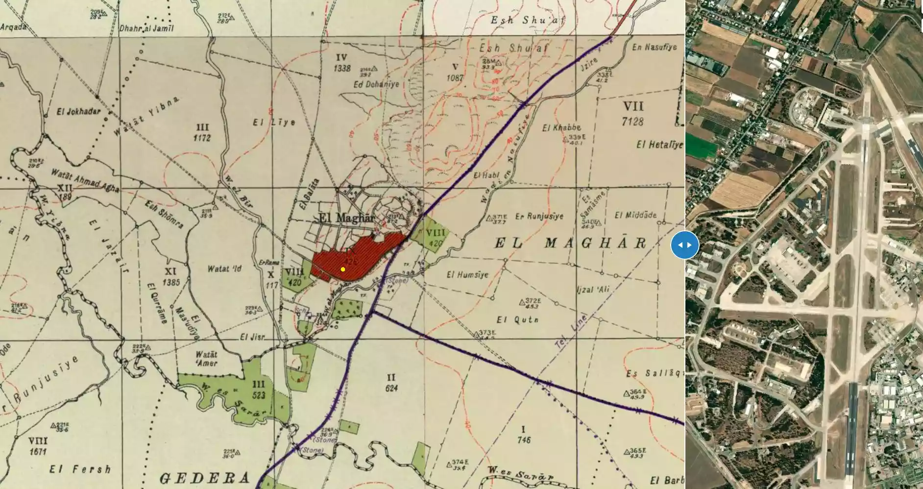
| Before & After Nakba, Click Map For Details |
|||||||||||||||||||||||||
|
|||||||||||||||||||||||||
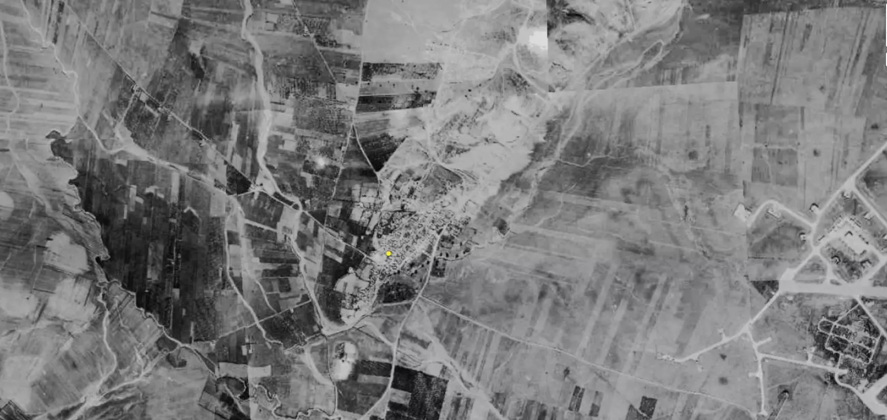
| Pre-Nakba Aerial View |
|||||||||||||||||||||||||
|
|||||||||||||||||||||||||
| Map Location | See location #40 on the map View from satellite |
||||||||||||||||||||||||
| Military Operation | Operation Barak (lightening) | ||||||||||||||||||||||||
| Attacking Units | Giv'ati Brigade | ||||||||||||||||||||||||
| Exodus Cause | Military assault by Zionist troops | ||||||||||||||||||||||||
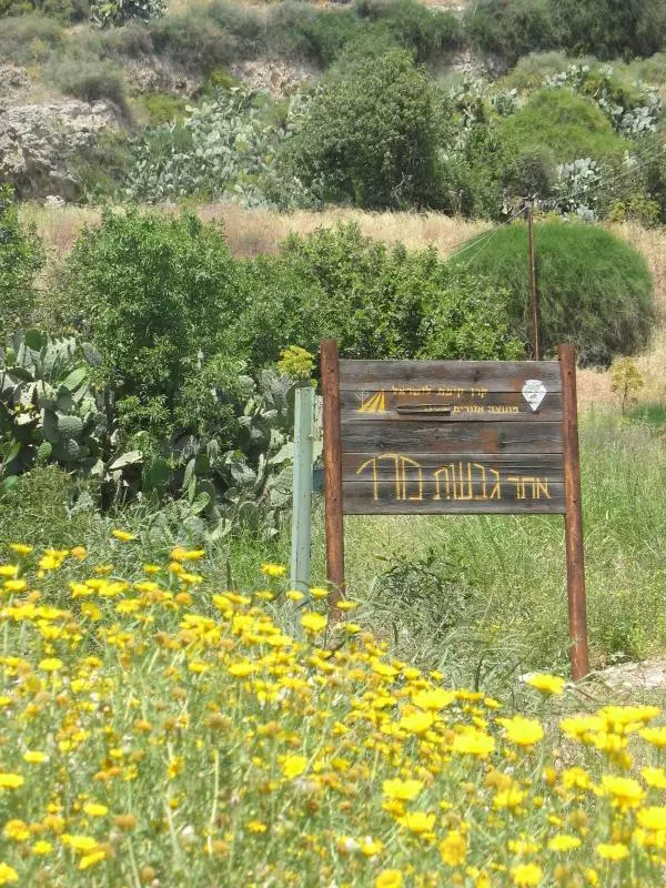
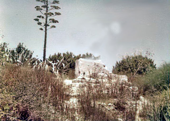
| Village Temains | On June 10th 1948, the Jewish Army started leveling the village based on an order of Yosef Weitz (a Jewish National Fund official). However, few houses remain standing which were mostly looted by Israeli Jewish settlers. | ||||||||||||||||||||||||
| Ethnically Cleansing | al-Maghar inhabitants were completely ethnically cleansed. | ||||||||||||||||||||||||
| Pre-Nakba Land Ownership |
**Town Lands' Demarcation Maps |
||||||||||||||||||||||||
| Land Usage As of 1945 |
|
||||||||||||||||||||||||
| Population |
|
||||||||||||||||||||||||
| Number of Houses |
|
||||||||||||||||||||||||
| Near By Towns |
|||||||||||||||||||||||||
|
|
|||||||||||||||||||||||||
| Schools | An elementary school for boys, and in 1945 it had an enrollment of 170 students. | ||||||||||||||||||||||||
| Town's Notable People | In the eighth century A.D, the village was the birthplace of the Islamic jurist Abu al-Hasan Muhammad al-Maghari. | ||||||||||||||||||||||||
| Places of Warship | One mosque | ||||||||||||||||||||||||
| Nearby Wadies & Rivers | The village is situated north of Wadi al-Maghar. | ||||||||||||||||||||||||
| Exculsive Jewish Colonies Who Usurped Village Lands |
Beyt El'azari | ||||||||||||||||||||||||
| Featured Video | |||||||||||||||||||||||||
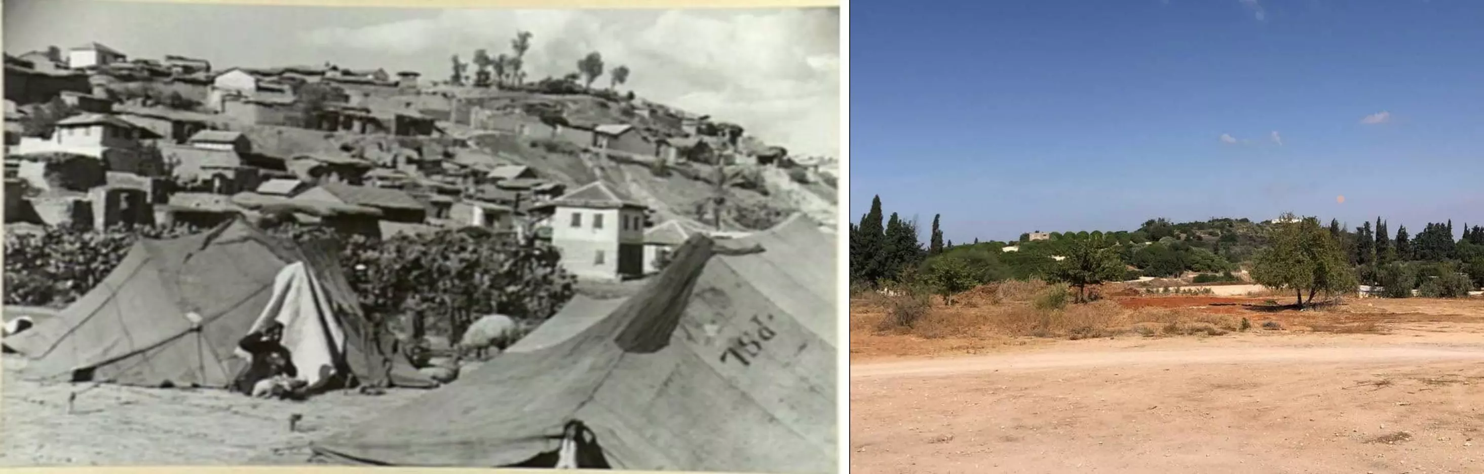
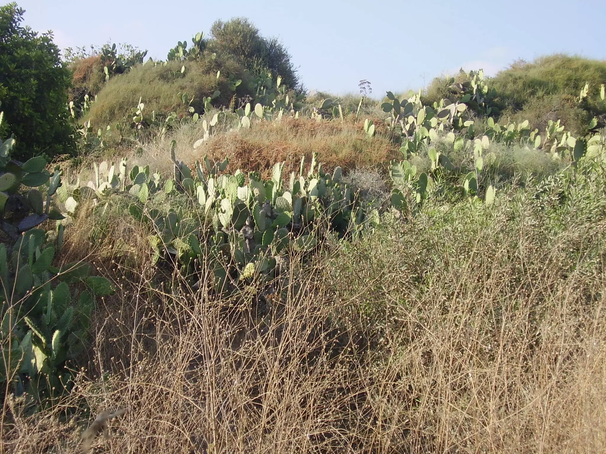
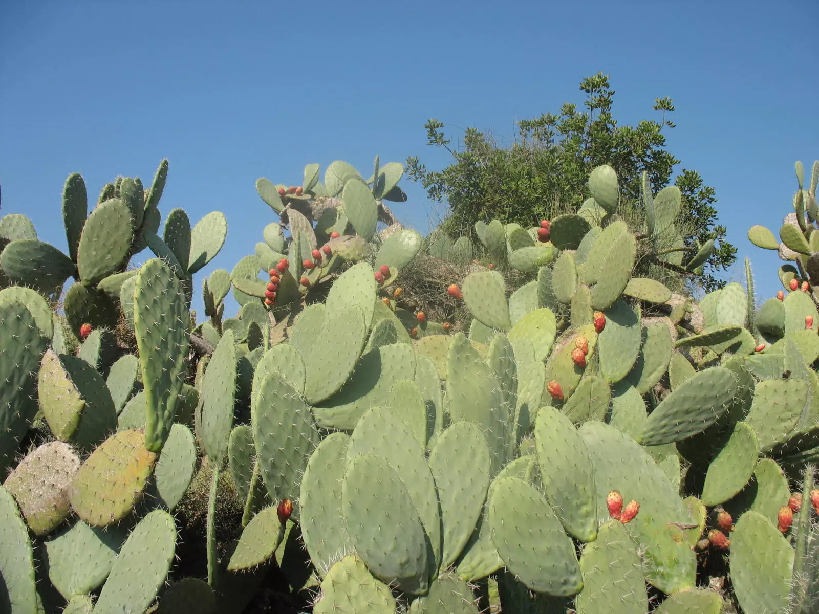
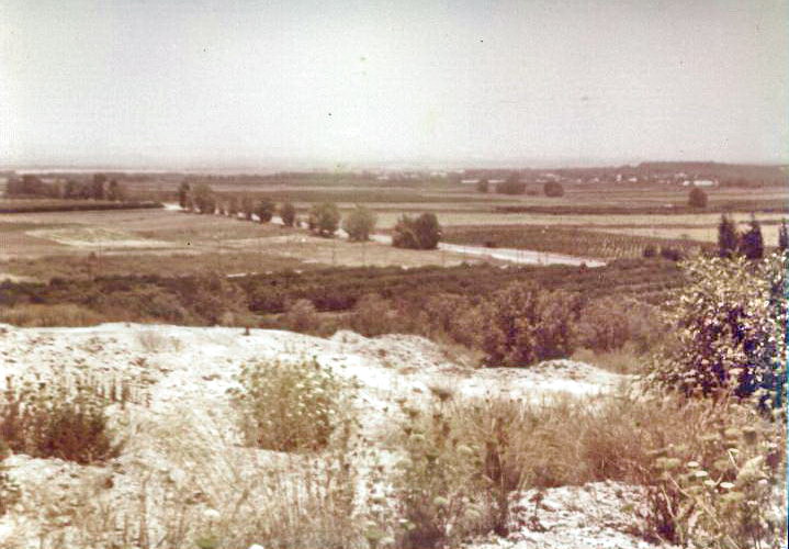
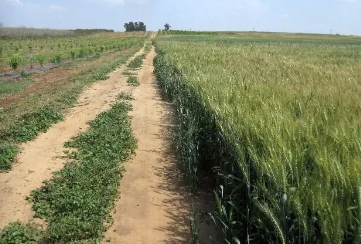
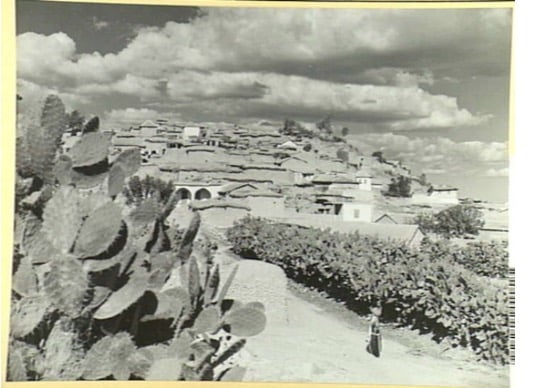
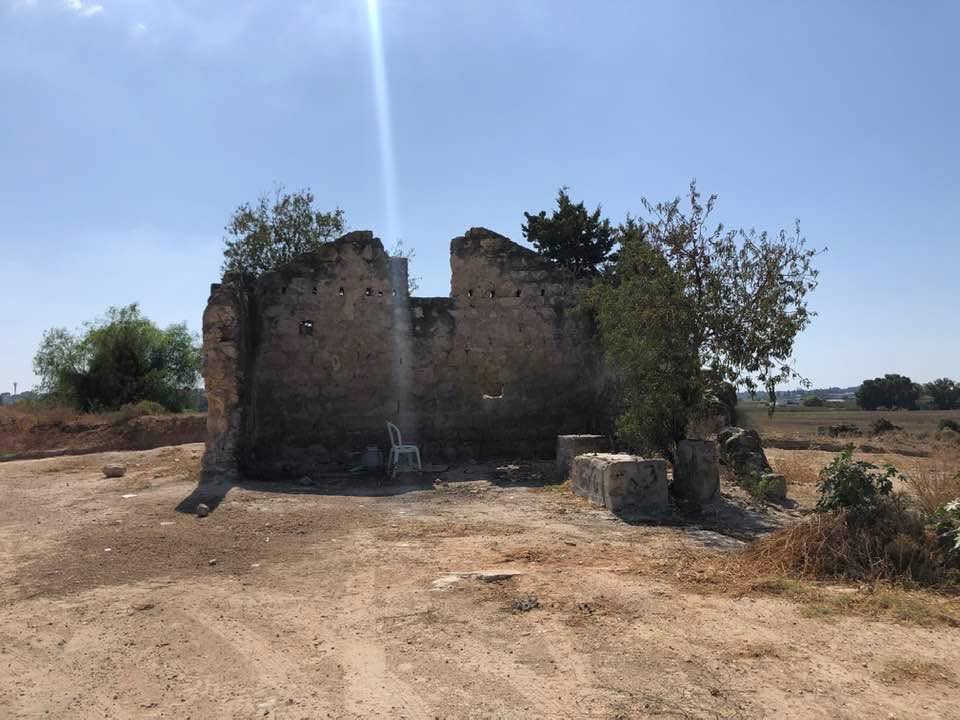
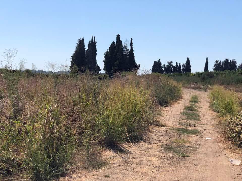
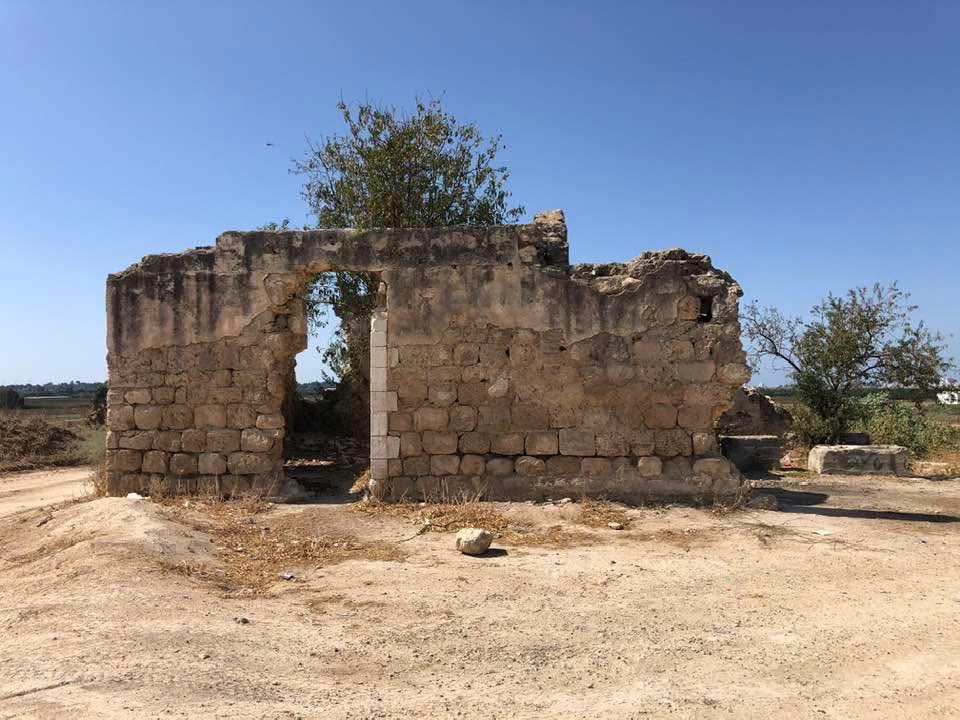
Village Before NakbaThe village stood on three slightly elevated hills in an otherwise flat area on the central coastal plain, on a highway leading northeast to Ramla. The military airport at 'Aqir was located a few km east of it, and Wadi al-Maghar bordered it to the south. Its name meant 'cave' in Arabic. The site of the village contained remains indicating ancient habitation; one of the three hills on which it was situated contained antiquities that presumably dated to the Canaanite era. In the early Islamic period it was a seasonal camping ground for the Arab tribe of Lakhm. The Muslim geographer Yaqut al-Hamawi (d. 1228) said that the village was in the Ramla sub-disctrict and that the Islamic jurist Abu aI-Hasan Muhammad al-Maghari was born there in the eighth century A.D. In 1596, al-Maghar was a village in the nahiya of Gaza (liwa' of Gaza) with a population of 121. It paid taxes on a number of crops, including wheat, barley, sesame, and fruits.In the late nineteenth century, al-Maghar was a village built of adobe bricks and situated on the south slope of a hill. It was surrounded by pastureland and fig-tree orchards. In the first half of the twentieth century the houses were made of mud, cement, and stone. They were laid out in clusters, each comprised of closely built units, and spread along Wadi al-Maghar and along the various tracks crossing the village. Construction increased during the Mandate era, and houses were built on the two other hills-to the north and to the south-that rose on either side of the originally populated one, as well as along the road leading to the nearby village of Yibna (see photo). Most of the people in the village were Muslims. Al-Maghar had a mosque and a number of shops. The villagers invested about 5,000 Palestinian pounds to establish an elementary school on twenty-two dunums of land; 190 students were enrolled in the mid-1940s. The village was well-provided with ground water and had good soil for agriculture, which was the villagers' chief occupation. They cultivated a variety of crops, including rainfed grain and irrigated vegetables and fruits. In 1944/45 a total of 1,772 dunums was devoted to citrus and bananas and 9,075 dunums were allocated to cereals. Eighty-six dunums were irrigated or used for orchards, 22 dunums of which were for olives. Village Occupation and Ethnic CleaningAl-Maghar was attacked on 10 February 1948, according to a communiqué issued by the Arab militia forces in the Jaffa area that were commanded by Hasan Salama. The communiqué, quoted in the Palestinian newspaper Filastin, said only that a Jewish convoy approached the village, firing at villagers on both sides of the road; no casualty figures were given. The New York Times reported another attack on 29 March 1948, which was discovered only after the British police discovered the wreckage of an armored car that had blown during the attack on the village. The charred bodies of six Jewish soldiers were recovered from the wreckage, but no Arab casualties were reported.The Haganah's Giv'ati Brigade invaded the village on 15 May, at the beginning of Operation Barak (see al-Batani al-Gharbi, Gaza sub-disctrict). The New York Times reported that Jewish forces heading south seized the 'Arab fortress' at this village, which commanded the road to the Negev. By the following month, the Jewish National Fund (JNF) had already begun to level the village. Israeli historian Benny Morris reports that on 10 June, high-ranking JNF official Yosef Weitz sent two employees to tour the coastal plain to determine which villages should be destroyed and which should be settled with Jews. One of them informed Weitz that he had made arrangements for the destruction of al-Maghar to begin the very next day. On 14 June, Weitz received a progress report of how the destruction was proceeding, and the following day he went to visit what remained of al-Maghar. 'Three tractors are completing its destruction,' he wrote later. 'I was surprised that nothing moved in me at the sight…. Not regret and not hatred, as this is the way of the world…. The dwellers of these mud-houses did not want us to exist here.' Zionists Colonies on Village LandsThe settlement of Beyt EI'azari (131139), built in 1948, is on village landVillage TodayA number of houses still stand: four of them are occupied by Jewish families and the rest are deserted. Some walls of demolished houses are still erect. Cactuses grow on the site (see photos).SourceDr. Walid al-Khalidi, 1992: All That Remains. |
|||||||||||||||||||||||||
| Related Maps | Town Lands' Demarcation Maps خرائط للقضاء توضح حدود القرى والاودية Town's map on MapQuest View from satellite Help us map this town at WikiMapia |
||||||||||||||||||||||||
| Related Links | Wikipedia's Page Facebook Page Google Search Google For Images Google For Videos |
||||||||||||||||||||||||
| More Information | في كتاب كي لا ننسى في كتاب بلادنا فلسطين المزيد من موقع هوية |
||||||||||||||||||||||||
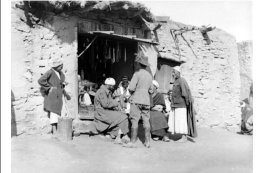
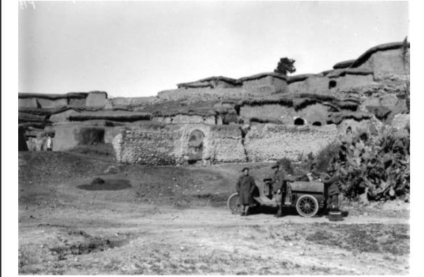
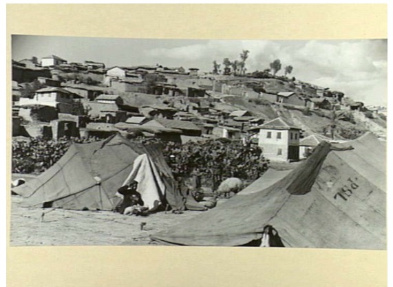
- General view (1928)
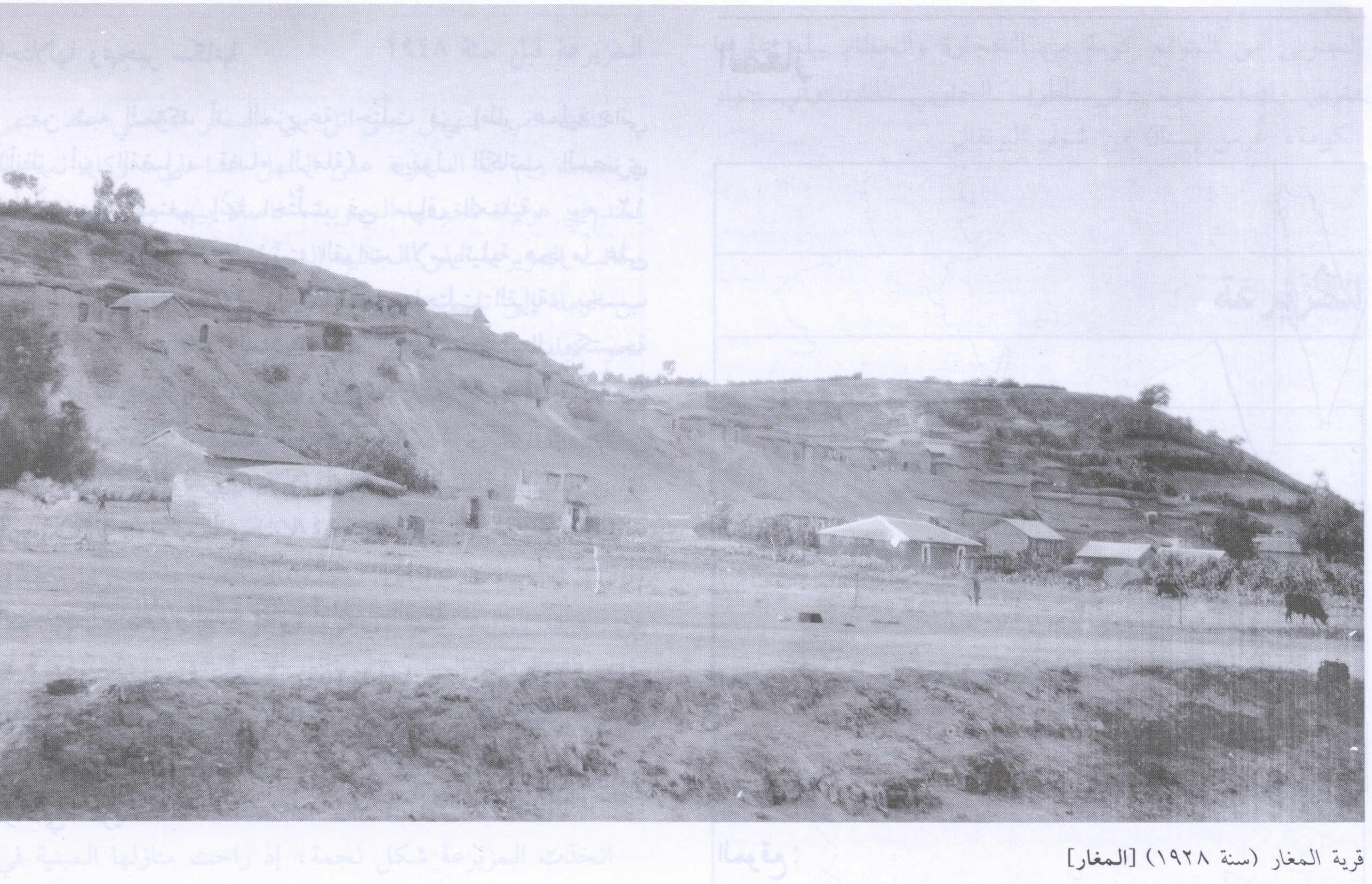
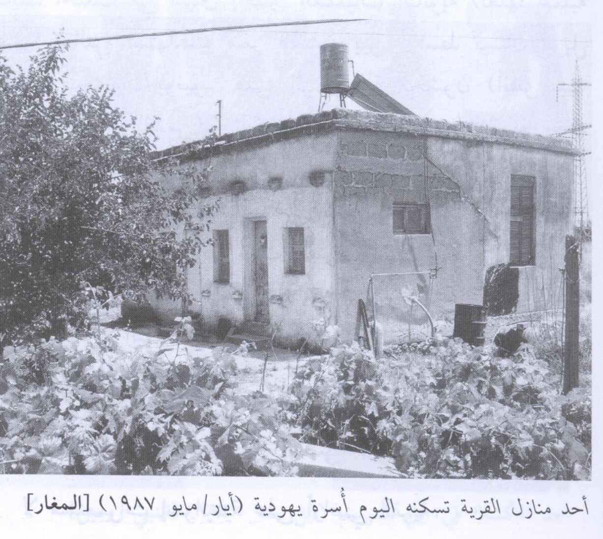
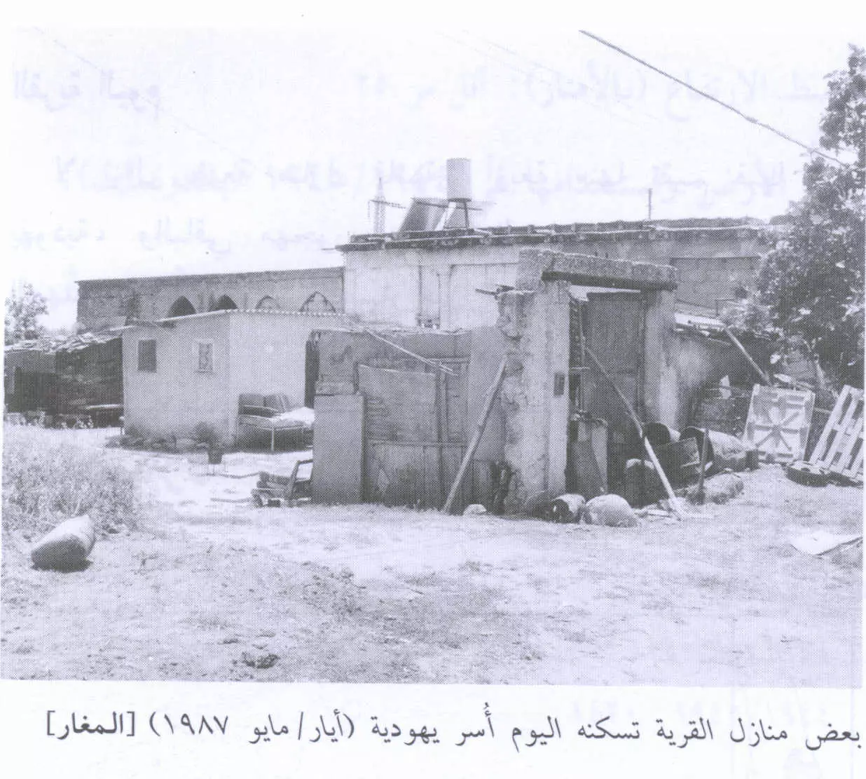
Scanned from "All That Remains" by Dr. Walid Khalidi 5 - Village House Still In Use By A Jewish Family In 1987
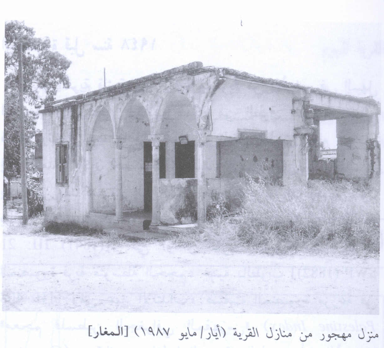
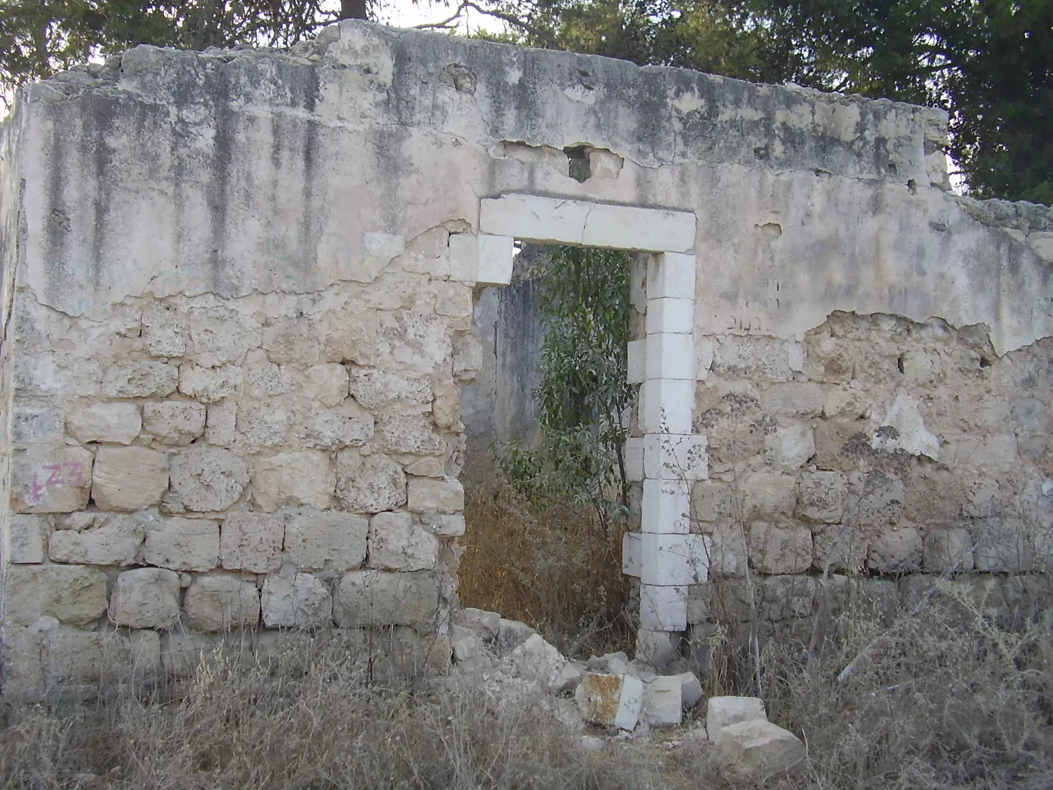
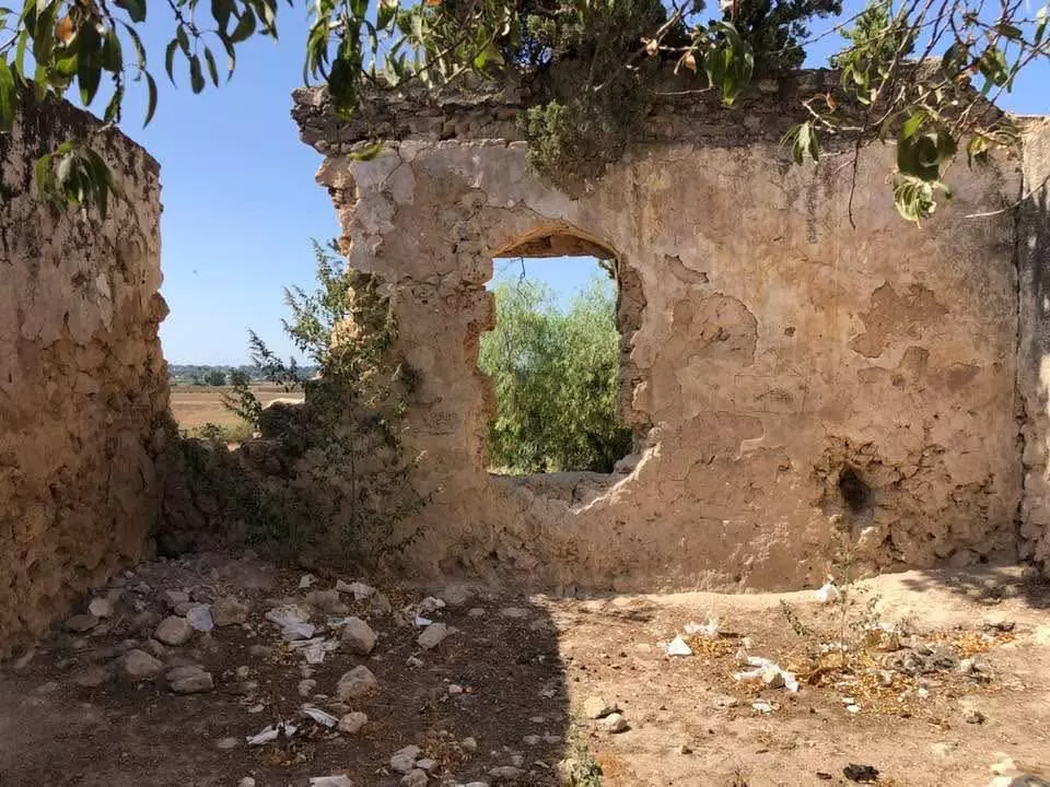
Scanned from "All That Remains" by Dr. Walid Khalidi 5 - A Deserted Village House In 1987
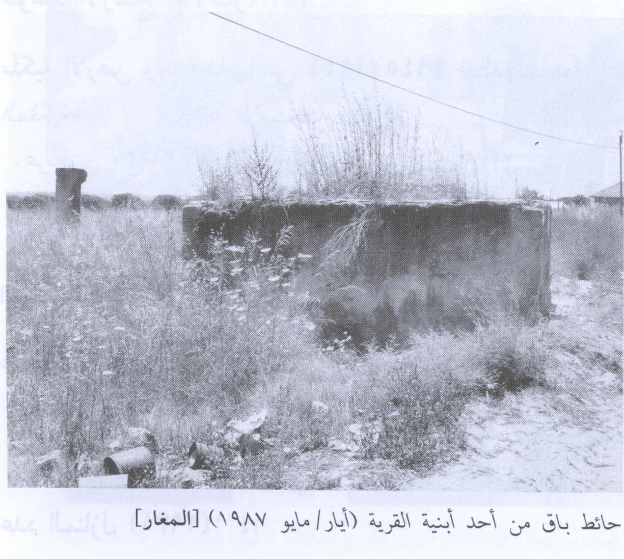
Scanned from "All That Remains" by Dr. Walid Khalidi 2 - Remaining Walls From A Village Building In 1987
Scanned from "All That Remains" by Dr. Walid Khalidi 1 - الجهة الغربية لقرية المغار
Posted by farid haj yahya 8 - احدى المُغر التي اسخدمة كمصلى
Posted by farid haj yahya 1 - ما تبقى من احد البيوت
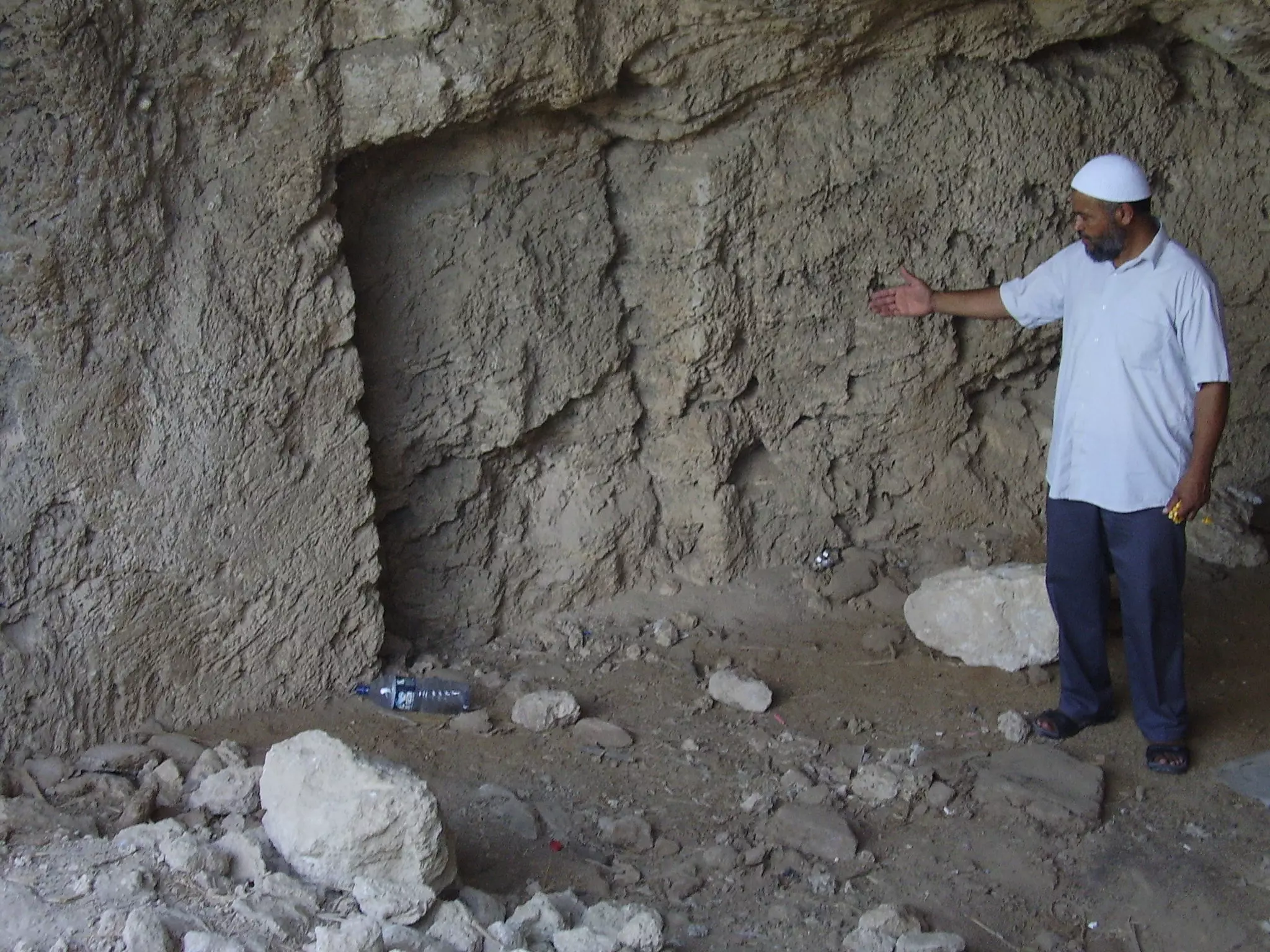
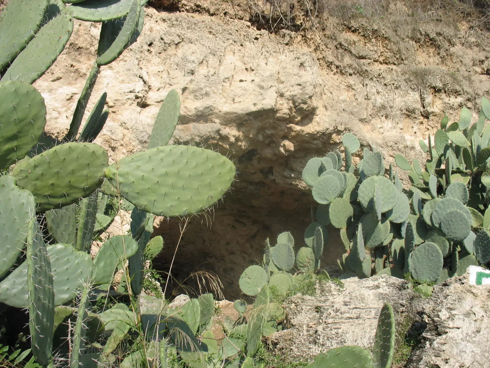
Posted by farid haj yahya - A cave in the village lands
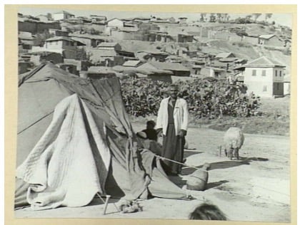
Posted by Noga Kadman - Sabir Ya refugees
Posted by Noga Kadman 1 - Sabir Ya refugees
Posted by Noga Kadman 2 - البعض من بيوت القرية المعتصبة. 1987
Scanned from "All That Remains" by Dr. Walid Khalidi 6 - صورة لقرية المغار عام 1980
Posted by ابو عماد 9 - صورة أحد القبور في مقبرة القرية عام 1980
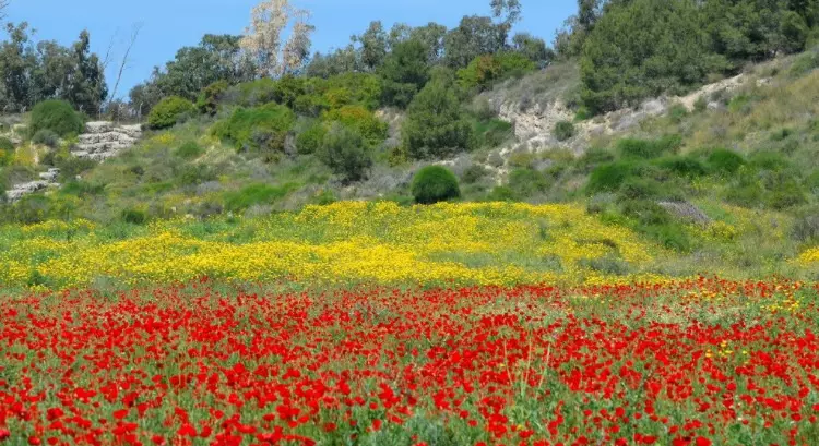
Posted by ابو عماد 4 - الربيع في المغار
Posted by abu raya - موقع القريه
Posted by abu raya - من موقع القريه
Posted by abu raya - اراضي القريه
Posted by abu raya - اراضي القريه
Posted by abu raya - صوره من قريه المغار سنه 1918
Posted by abu raya - صوره نادره من قريه المغار سنه 1918
Posted by abu raya - منظر عام لقريه المغار سنه 1940
Posted by abu raya - قريه المغار سنه 1940
Posted by abu raya - منظر عام لقريه المغار سنه 1940
Posted by abu raya - Pre-Nakba Aerial view of the village / صورة من الجو للقرية اخذت قبل النكبة
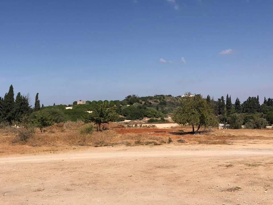
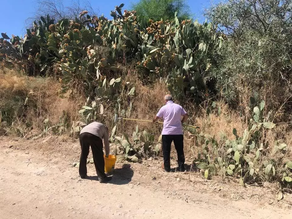
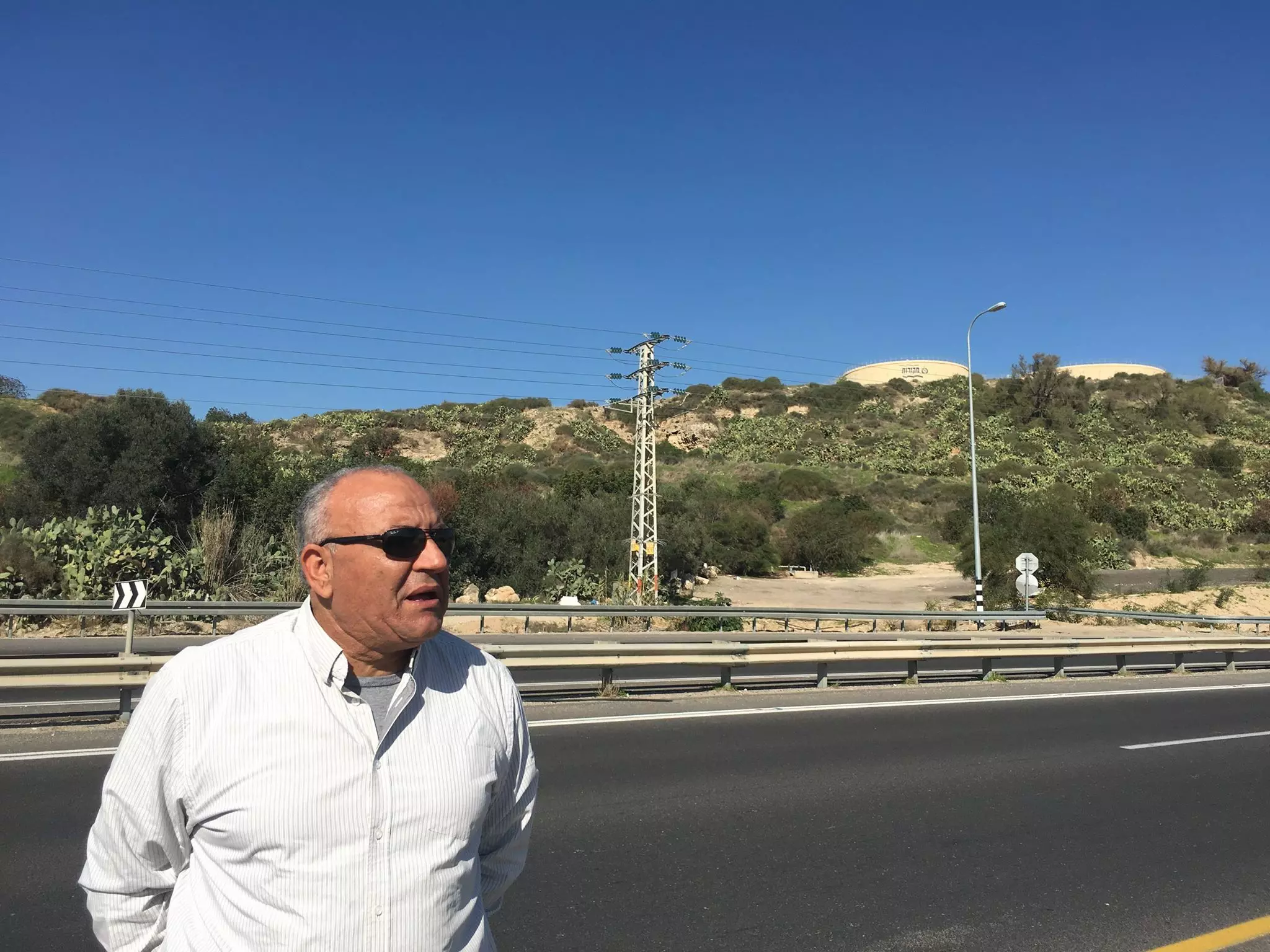
- جولة بين انقاض وأراضي القرية المغار -- إياد جابر
- جولة بين انقاض وأراضي القرية المغار -- إياد جابر
#2
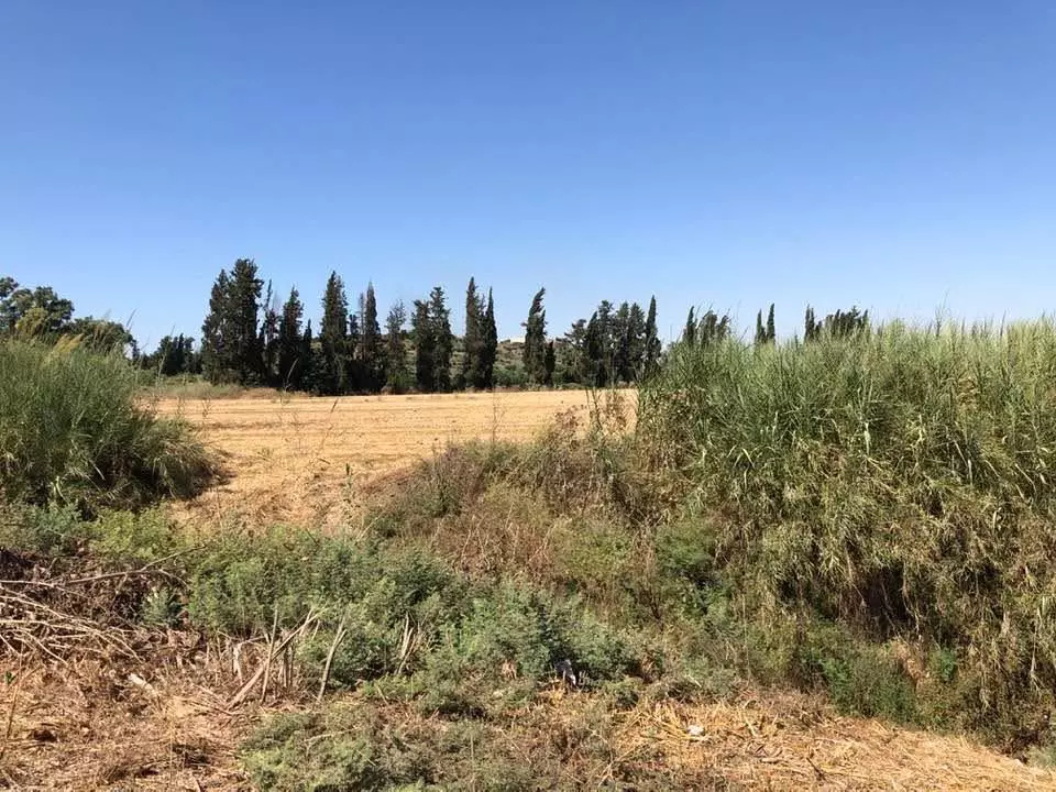
- جولة بين انقاض وأراضي القرية المغار -- إياد جابر
#3
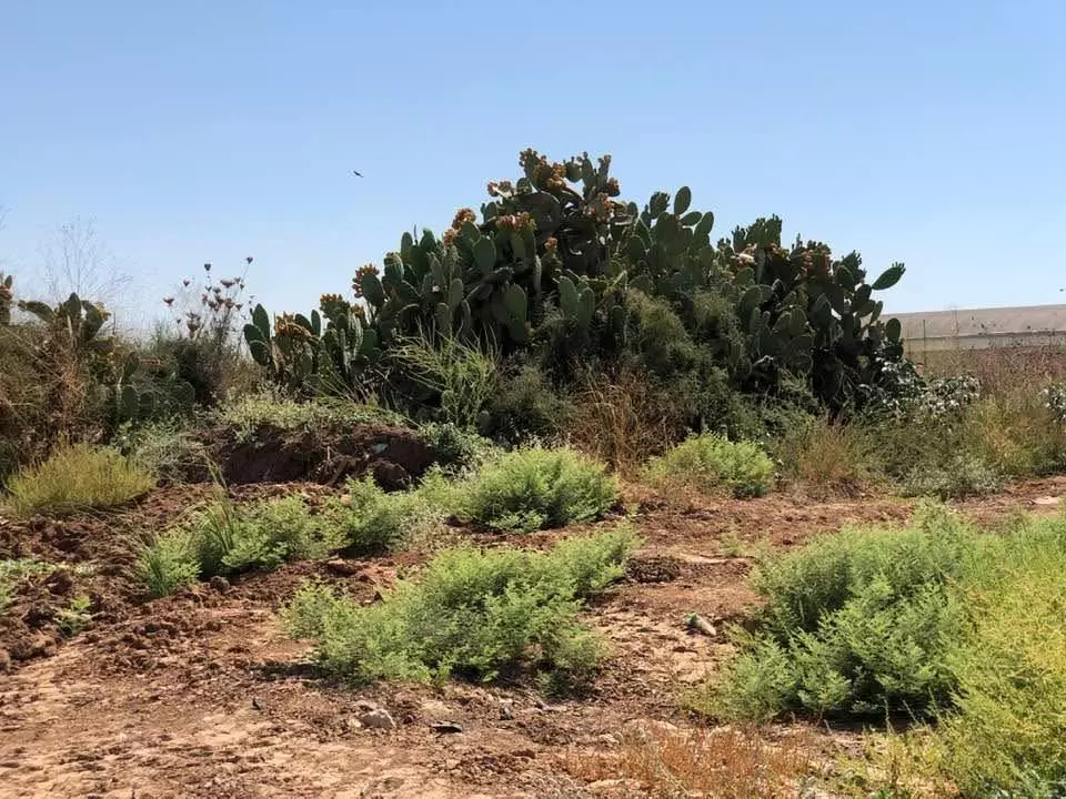
- جولة بين انقاض وأراضي القرية المغار -- إياد جابر
#4
- جولة بين انقاض وأراضي القرية المغار -- إياد جابر
#5
- جولة بين انقاض وأراضي القرية المغار -- إياد جابر
#6
- جولة بين انقاض وأراضي القرية المغار -- إياد جابر
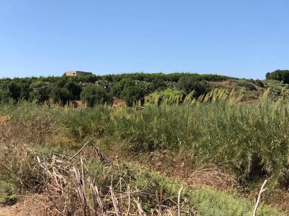
#7 -- على هذه التلة كانت تقع القرية --- It should be noted that the village used to stand where this hill is before the most so-called "civilized" replaced us
- جولة بين انقاض وأراضي القرية المغار -- إياد جابر
#8
- جولة بين انقاض وأراضي القرية المغار -- إياد جابر
#9
- جولة بين انقاض وأراضي القرية المغار -- إياد جابر
#10
- جولة بين انقاض وأراضي القرية المغار -- إياد جابر
#11
- Before and after the "civilized" arrived from Europe and erased us. How else will Jews be great again? The Jews want this kind of "peace"
- قبالة قرية المغارالمهجرة (قضاء الرملة ) -- Mustafa Kabha
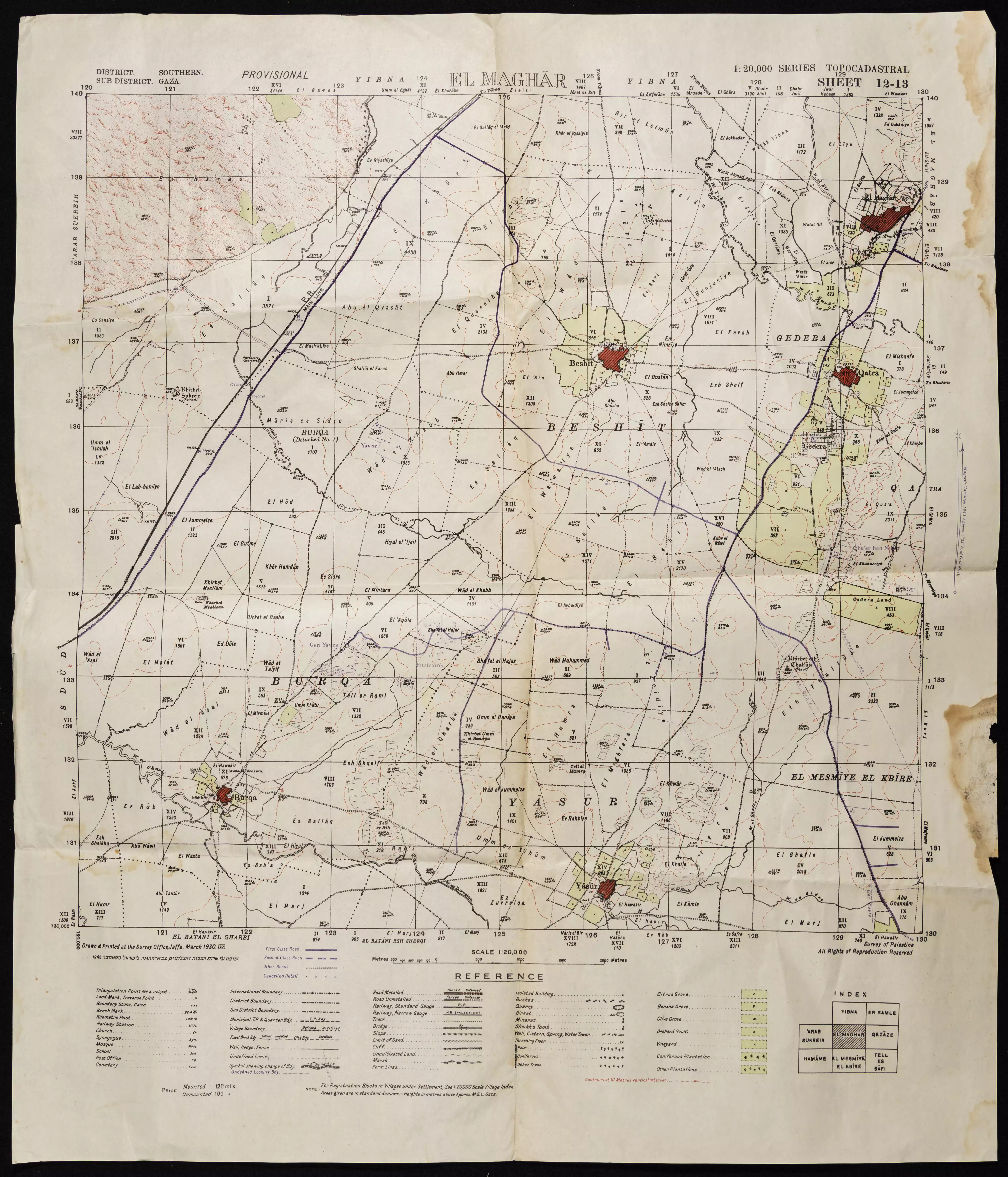
- خارطة تُظهِر الحدود والطرق بأنواعها والأماكن المقدسة والطبيعة الطوبغرافية من تلال وسهول ومنحدرات والتشكيلة الطبيعية للأرض وأنواع المزروعات. نُشرت الخريطة فترة الانتداب البريطاني، تم إضافة تعديلات عليها من قِبَل خدمة الخرائط والصور التابعة للقوات العسكرية الاسرائيلية فترة الأربعينيات.
Want to browse more? 80,000 pictures were grouped in these gallaries:
| Display Name | Clan/Hamolah | Country of Residence |
| Raneem Alhour | - | Palestine |
| قاسم عمر عبدالرحمن الطويل | - | Turkey |
| مثقال | - | الخليل, فلسطين |
| رائد موسى محمد الطويل | الطويل | عمان, الاردن |
| ابو عمر | جبر | - |
| المشاغب | الغريز | غزة, النصيرات |
| angel | - | عمان |
| Mohd Alhour | alhour | Qatar |
| ابو يونس | الطويل | الغربية, جدة |
| المهاجر | الهور | مخيم العروب |
| السراج | السراج | القاهرة, مصر |
| mohammed ali al- taweel | al taweel | amman, jordan |
| ابو ربيع | الهور | - |
| ابنة الوطن | جبر | مخيم البريج, فلسطين |
| سنرجع يوما | - | طرابلس, ليبيا |
| HAZEM | - | AMMAN, AMMAN |
| Khaldoun Elias Jabr | Jabr | Amman, Jordan |
| ابو العز | حمدان | القطاع, البريج |
| أبو عامر | جبر | البريج, فلسطين |
| Alothmani | Al-Othmani | Kuwait |
| ابو عماد | جبر | , فلسطين |
| Ashraf Al hour | Al hour | Jordan, jordan |
| Mohammad Altaweel | Altaweel | Doha, Qatar |
| الفلسطيني انا | الطويل | عمان, الاردن |
| عاشقة الوطن الجريح | الطويل | عمان, الاردن |
| ABONASER | ALTAWILL | K.S.A |
| Abu Youssef | Al- Tawil | Saudi Arabia, Saudi Arabia |
| العسود | - | - |
| سامي حمد | حمد | Michigan, USA |
| hadeel hamad | hamad | jordan |
| احمد حمد | حمد | الجزائر |
| خليلية | خليلية | جبع |
| alhour | alhour | doha, qatar |
| Abu Hani | Al Sarraj | Palestine, Palestine |
| Omar El Taweel | - | Palestine, Palestine |
| Mohammed Taha | Alhour | - |
| khaled al Hour | Al Hour | doha, Qatar |
| majed shaheen | Palestine | - |
| Mohammed Hamad | Hamad | Saudi Arabia |
| abo siraj | jaber | palestine, palestine |
| Ahmad Al Hour | Al Hour | Amman, Jordan |
| Rami Al Hour | Taha | UAE |
| Mohammed Altawil | - | Ontario, Canada |
| FUAD | MUGHAR | CANADA, CANADA |
| bilal | ghani | ocupied teritories, palestine |
 Fake Valor: Why Did Zionist Jews Hoist Nazis Flag on Their Ships in the 1930s?
What is new?
-
Facts About Oct. 7th Gaza Raid
-
Remined Us Please:: Who Did Rape Who? Palestinians Raped Israelis? Or, was the other way around?
-
When Prof. Edward Said was invited to debate Bibi Netanyahu in the 1980s, watch what happened!
-
Ezra Klein of the NY Times on the "Jewish Race".
-
Abusing Blood Libel!
-
Did Israeli Soldiers Activate The Hanniba Direective On Oct. 7th? You Be The Judge
-
Zionist FAQ: Isn't it true that Palestinians don't want peace? Palestinians never accepted the two-state solution
- Facts about Haavara (Transfer) Agreement between Ben-Gurion & Hitler
-
Haavara FAQs: Why Did Zionist Jews Hoist Nazis' Flags on Their Ships in the 1930s?
- Haavara FAQs: When Chaim Weizmann met FDR in mid-1943, why was he silent about rescuing European Jewry?
-
Dear ChatGPT: How did Palestinians resist Napoleon's invasion of their country in 1799?
-
Dear ChatGPT: Gaza had a vibrant Jewish community in the mid-17th century. What happened to them?
-
Dear ChatGPT: Why did the Jewish Agency suppress news of the Holocaust during WWII?
-
Video Playlist: Jews share their DNA tests to end the conflict for good.
-
A Tale of Two Conflicts: Examining the Definition of Genocide
-
Prof. Abraham Polak And The Suppressed History of the Khazars and European Jewry
-
How Ronald Reagan would have framed the genocide in Gaza if he were still alive?
-
Haavara FAQs: Let us do the math: how many German Jews did The Haavara Agreement save?
-
Zionist FAQs: The Hebron Massacre of 1929, "clearly proves" that Palestinians are antisemitic, how could you deny it?
-
Zionist FAQs: Why Anti-Zionist Is Not Antisemitism?
-
Zionist FAQs: Isn't it true that the KGB created Palestinian Nationalism in the early 1960s?
- Zionist FAQs: Muslims are killing Muslims all the time; why are Israeli Jews being singled out in the media?
- Zionist FAQs: How is Israel an apartheid state when 20% of its citizens are Arabs who enjoy full rights?
-
Haavara FAQs: Why Did Dorothy Thompson Flip From A Zionist Advocate to A Silenced Dissenter?
-
Haavara FAQs: Analysis of Herzl's Uganda Scheme and how it could have saved millions of Jews.
-
Haavara FAQs: Why did Hayim Greenberg describe American Jewry as "morally bankrupt" in early 1943?
-
Haavara FAQs: What if the Evian Conference was a resounding success? What would have been the impact of saving European Jewry on Zionism?
- Haavara FAQs: What if the six million were saved, how that would have impacted the Zionist project?
-
Haavara FAQs: How did Zionist leaders react when Europe's Jews lingered in the DP camps after WWII ended?
-
Why does the American Jewish community repeat lies that David Ben-Gurion had debunked before he died?
-
Who has the power to rename the Tatar/Khazar Gene Marker to Jewish IV?
-
Zionist FAQs: Why won't Egypt, Syria, and Jordan take their people back? Jews are indigenous to Palestine, and Arabs immigrated after Jews developed the country. Arabs should leave.
-
Haavara FAQs: Did Hitler and the Nazis conflate between Judaism and Zionist? If that wasn't case, then why?
-
Haavara FAQs: Winston Churchill and antisemitism, a collection of articles written Churchill.
-
Haavara FAQs: Broken by country, how many Jews survived vs. killed during the Holocaust?
-
Haavara FAQs: Why did European Jews vote with their feet and to immigrated to the Americas, not Palestine, after WWII?
-
Watch this American Jewish Girl describing Israeli Jews' cognitive dissonance like no other in under two minutes
-
Haavara FAQs: When the Nazis went out of their way to hide the Holocaust, Israeli Jews did the exact opposite by broadcasting their genocide of Gazans. But why?
-
Haavara FAQs: How Zionist Jews went out of their to show their appreciation to Nazism and Fascism?
- Haavara FAQs: Why Zionist leaders were against bombing the death camps & the Railroads leading to them?
-
Haavara FAQs: Hitler's message to the British and American people: If Jews are such noble citizens and you care about them, how come you're not letting them in? I will gladly ship them to you at my expense, even on luxury liners!
-
A shortlist of Zionist and Israeli false flag operations in the name Jews.
-
The Most Moral Army
- The Land of Kapos (Israel): Where the brave are boycotted and Kapos walk free.
- Why did early Zionists often named their communal enterprises "colonial"?
- Zionist Relations with Nazi Germany by Faris Glubb
-
Two NY Times advertisements by Zionists in the early 1943 that exposes Zionists' treason at the height of the calamity
- Facts Not Lies about the Palestinian-Israeli Conflict.
- Site's pictures have been categorized
- Campgain Against Lice
- A Survey of Palestine, the official source about Palestine before Nakba produced by the British Mandate; over 1200 pages.
- Satellite View & Google Earth: Over 6,000 placemarks identifying all destroyed towns, W. Bank & Gaza Strip Towns, & refugee camps.
- PalestineRemembered.com and its Nakba Oral History Project were featured on al-Jazeera Satellite TV.
- Nakba Oral History Video Podcast:
 Over 700 Oral History interviews (including 3,500+ hours of recording) can be viewed online.
 - Palestine Village Statistics Project
- Gaza Jail Break
- النسخة العربية للموقع الان متوفرة
- Videos: Documenting the destroyed villages in video: Tracing all that remains since Nakba.
- Videos: Responding to Zionist Propaganda
- Interview: The ethnic cleansing of Palestine: George Galloway interviews Israeli Historian Ilan Pappe.
- For Palestinians, memory matters. It provides a blueprint for their future By George Bisharat.
- Zionist FAQ now available in Hebrew שאלות שציונים שואלים, עכשיו בעברית
- Video: The Stephen Walt and John Mearsheimer report on the influence of the Israel Lobby on U.S. Foreign Policy
- The Palestinian-Israeli conflict for beginners
