| PalestineRemembered | About Us | Oral History | العربية | |
| Pictures | Zionist FAQs | Haavara | Maps | |
| Search |
| Camps |
| Districts |
| Acre |
| Baysan |
| Beersheba |
| Bethlehem |
| Gaza |
| Haifa |
| Hebron |
| Jaffa |
| Jericho |
| Jerusalem |
| Jinin |
| Nablus |
| Nazareth |
| Ramallah |
| al-Ramla |
| Safad |
| Tiberias |
| Tulkarm |
| Donate |
| Contact |
| Profile |
| Videos |
Welcome To Dayr Abu Salama - دير أبو سلمه (דיר אבו סלאמה)
|
District of al-Ramla
Ethnically cleansed days ago |
العربية Google Earth |
 |
Gallery (6) |
- Statistics & Facts
-
Before & After

- Satellite View
- Articles 2
- Pictures 6
- Members 3
- All That Remains
- Wikipedia
- Videos
- Guest Book 1
- Links
| Statistic & Fact | Value | ||||||||||
| Occupation Date | July 13, 1948 | ||||||||||
| Distance From District | 8 (km) Northeast of al-Ramla | ||||||||||
| Elevation | 175 (meters) | ||||||||||
| Before & After Nakba, Click Map For Details |
|||||||||||
|
|||||||||||
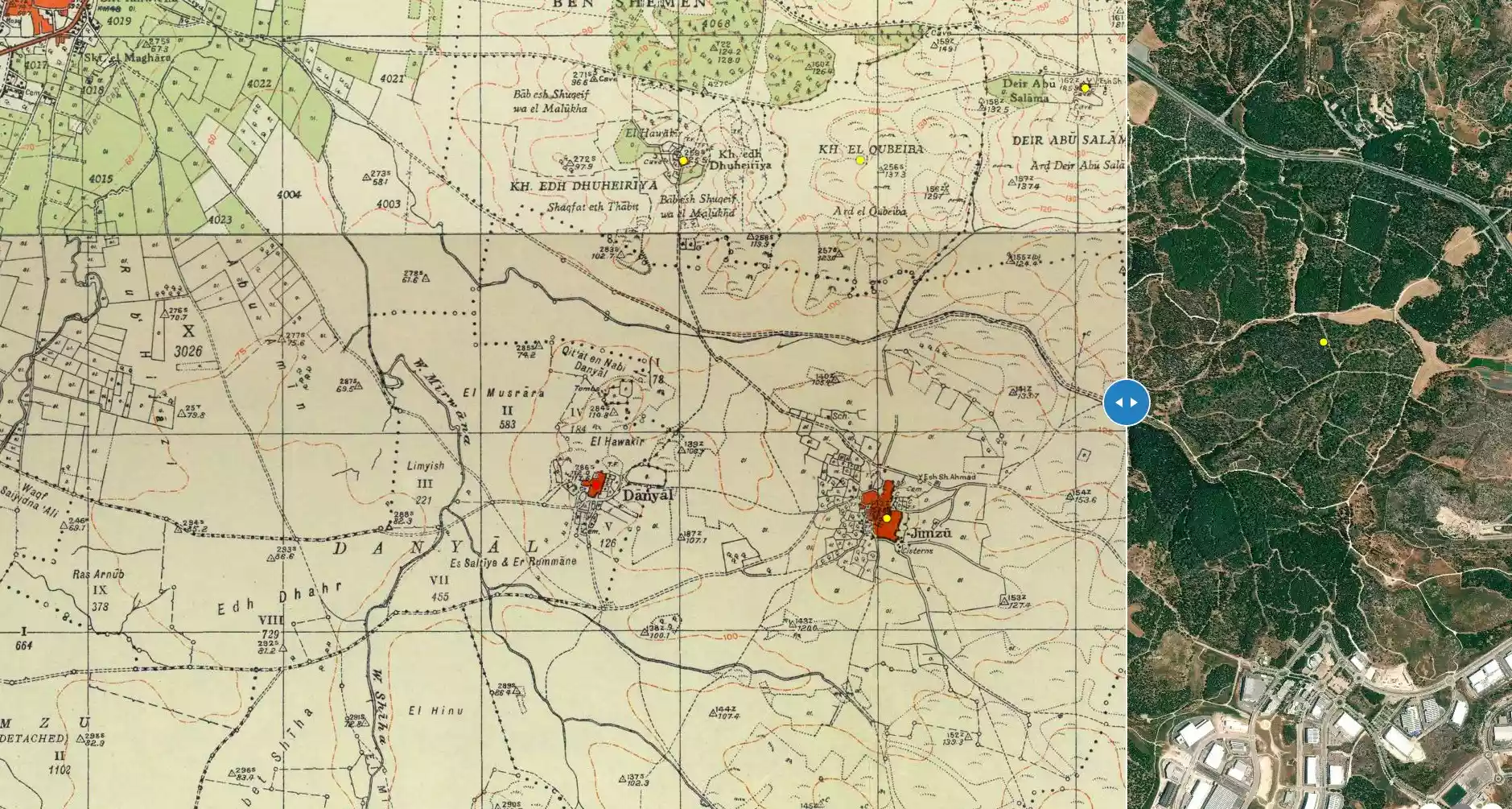
| Map Location | See location #7 on the map View from satellite |
||||||||||
| Military Operation | First phase of Operation Dani | ||||||||||
| Attacking Units | Possibly Yiftach Brigade | ||||||||||
| Exodus Cause | Military assault by Zionist troops | ||||||||||
| Village Temains | Based on the orders of a Jewish National Fund (JNF) official, Yosif Weitz, Dayr Abu Salama was completely obliterated. | ||||||||||
| Ethnically Cleansing | Dayr Abu Salama inhabitants were completely ethnically cleansed. | ||||||||||
| Pre-Nakba Land Ownership |
**Town Lands' Demarcation Maps |
||||||||||
| Land Usage As of 1945 |
|
||||||||||
| Population |
|
||||||||||
| Near By Towns |
|||||||||||
|
|||||||||||
| Shrines / Maqams | A shrine for a local sage known as al-Shaykh Abu Salama. | ||||||||||
| Water Supply | The village had an abundance of ground water including two reservoirs. | ||||||||||
| Exculsive Jewish Colonies Who Usurped Village Lands |
No Israeli settlements on village lands. | ||||||||||
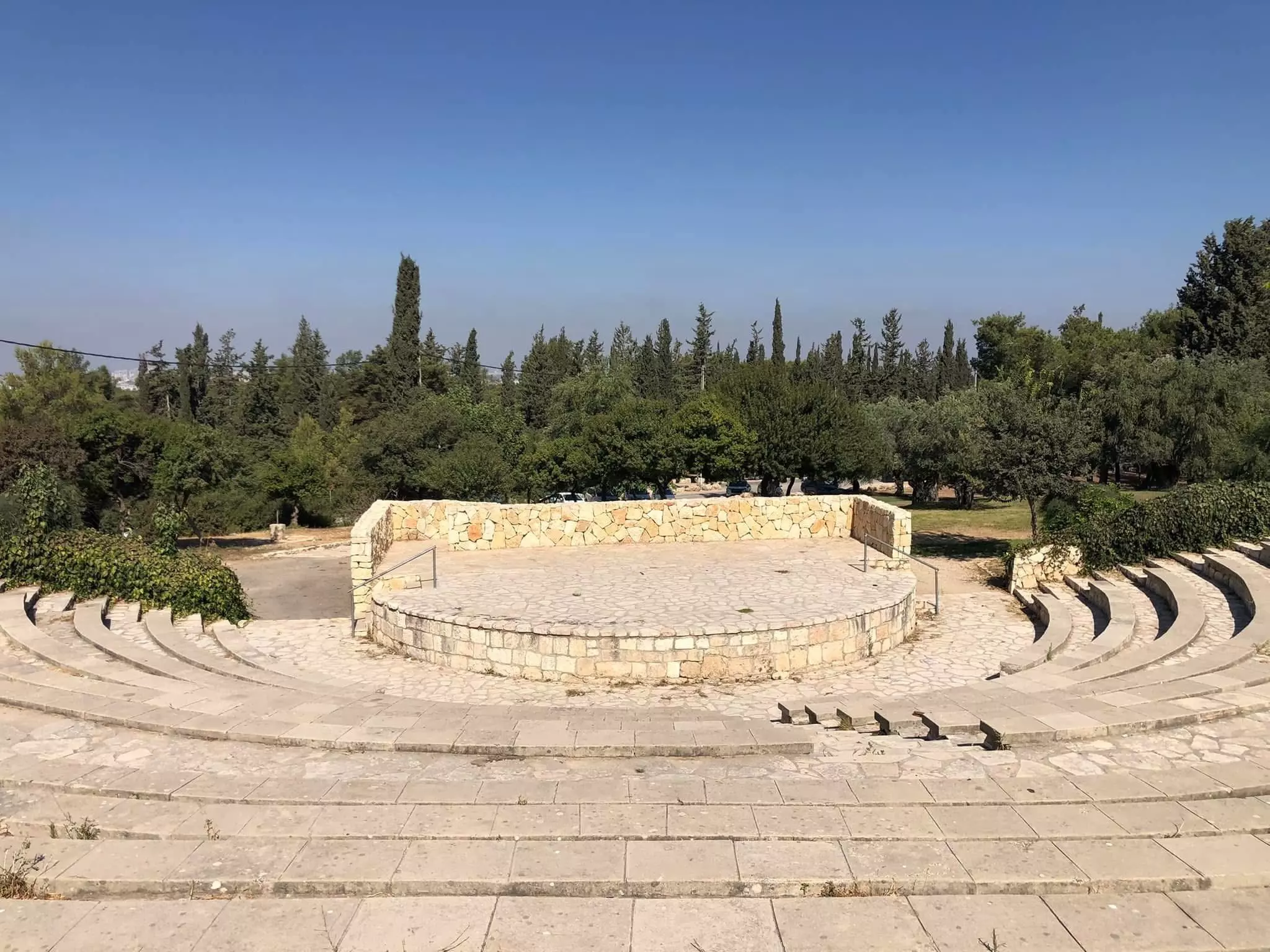
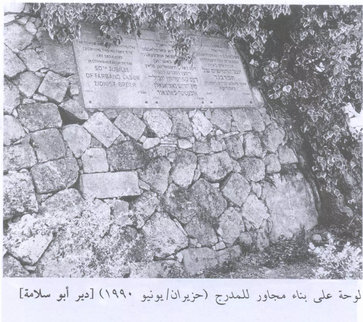
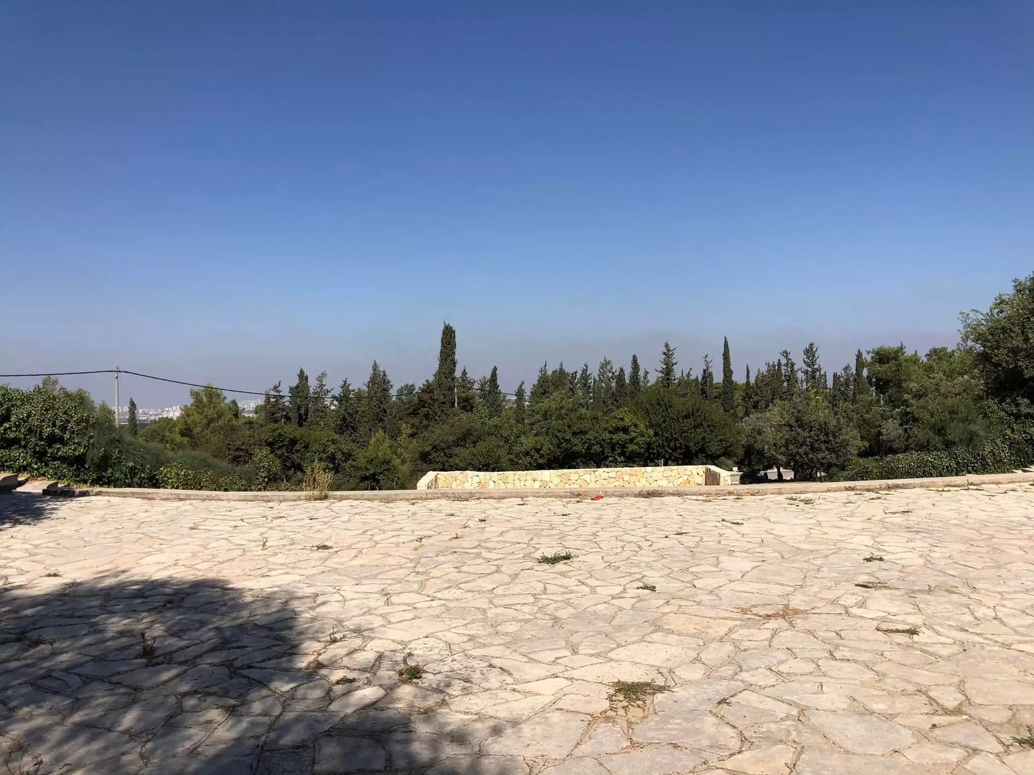
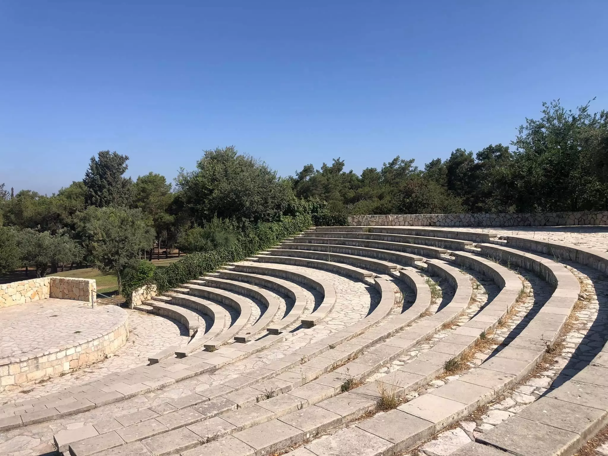
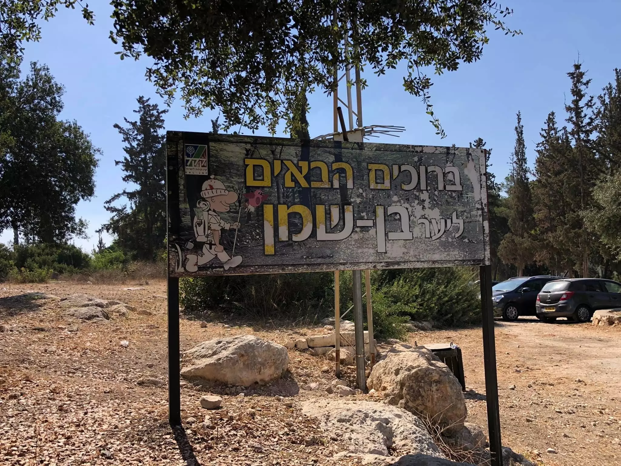
Village Before NakbaThe village was located on a flat hilltop on the central coastal plain that was surrounded by lower hills. It overlooked wide expanses of land on all sides, and was connected by a secondary road to the highway leading to Ramla and Lydda. Dirt paths connected it to several neighboring villages as well. On the eastern outskirts of the village was a shrine for a Shaykh Abu Salama; this most probably was the source of the village's name. Dayr Abu Salama had an irregular layout. Classified as a hamlet by the Palestine Index Gazetteer, its population was predominantly Muslim, and its houses were built of adobe brick. Its agricultural lands, which lay mainly to the north, were endowed with fertile soil and an abundance of ground water, including two reservoirs in the area. Cultivated crops included grain, vegetables, olives, citrus fruits, grapes, and figs. In 1944/45 a total of 695 dunums was allocated to cereals; 41 dunums were irrigated or used for orchards. The village contained the remains of a monastery and rock-cut tombs.Village Occupation and Ethnic CleaningAfter occupying Lydda in the first phase of Operation Dani (see Abu aI-FadI, Ramla sub-disctrict), Israeli forces proceeded to fan out into the town's hinterland, overrunning a number of nearby villages. Israeli historian Benny Morris indicates that Dayr Abu Salama fell on 13 July 1948, but does not say what happened to its residents. It is likely that those who remained in their homes were expelled by the invading units, as was the case in Lydda, Ramla, and many of the villages which fell during the operation. Two days before the village was captured, Operation Dani headquarters ordered the Yiftach Brigade 'to dig in in every place captured and to destroy every house not intended for occupation [by Israeli troops].'Zionists Colonies on Village LandsThere are no Israeli settlements on village lands.Village TodayThe site has been converted into an Israeli picnic area and is surrounded by stands of pine and cypress trees. Workers for the Jewish National Fund have used stones retrieved from the destroyed village houses to construct a watchtower and an amphitheater on the village site (see photos). The area in front of the amphitheater has been levelled and is covered by a green lawn. Old fig and olive trees still grow there; cactuses and carob trees grow on the western and northern edges of the site.SourceDr. Walid al-Khalidi, 1992: All That Remains. |
|||||||||||
| Related Maps | Town Lands' Demarcation Maps خرائط للقضاء توضح حدود القرى والاودية Town's map on MapQuest View from satellite Help us map this town at WikiMapia |
||||||||||
| Related Links | Wikipedia's Page Google Search Google For Images Google For Videos |
||||||||||
| More Information | في كتاب كي لا ننسى في كتاب بلادنا فلسطين المزيد من موقع هوية |
||||||||||
- Israeli Amphitheater Now On Village Site In 1990
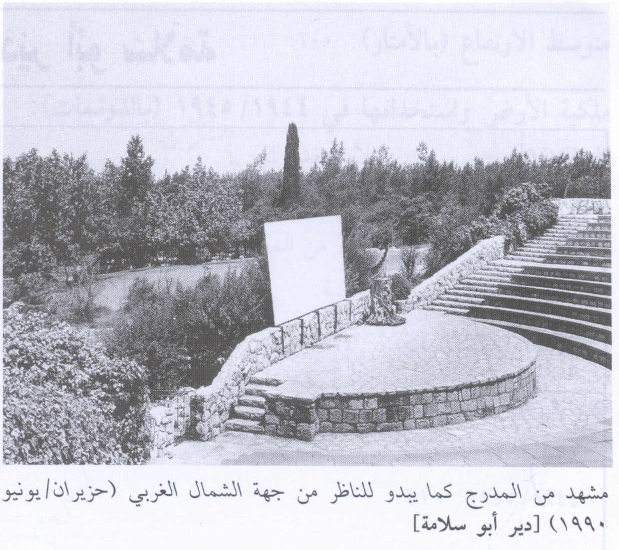
Scanned from "All That Remains" by Dr. Walid Khalidi - لوحة بالقرب من المدرج. 1990
Scanned from "All That Remains" by Dr. Walid Khalidi - قرية دير ابو سلامة المهجرة، تم تحويلها الى متنزه ( بن شمن ) وبناء برج للمرافبة من حجارة بيوت القرية -- إياد جابر.
- قرية دير ابو سلامة المهجرة، تم تحويلها الى متنزه ( بن شمن ) وبناء برج للمرافبة من حجارة بيوت القرية -- إياد جابر. #2
- قرية دير ابو سلامة المهجرة، تم تحويلها الى متنزه ( بن شمن ) وبناء برج للمرافبة من حجارة بيوت القرية -- إياد جابر. #3
- قرية دير ابو سلامة المهجرة، تم تحويلها الى متنزه ( بن شمن ) وبناء برج للمرافبة من حجارة بيوت القرية -- إياد جابر. #4
Want to browse more? 80,000 pictures were grouped in these gallaries:
| Display Name | Clan/Hamolah | Country of Residence |
| khawaja | khawaja | neustadt, deutchland |
| محمد الحاج | - | بيت سيرا, بيت سيرا |
| ramzi tumallah | Tumallah | muscat, Oman |
No links have been shared yet, be free to the first to share the first link.
 Fake Valor: Why Did Zionist Jews Hoist Nazis Flag on Their Ships in the 1930s?
What is new?
-
Facts About Oct. 7th Gaza Raid
-
Remined Us Please:: Who Did Rape Who? Palestinians Raped Israelis? Or, was the other way around?
-
When Prof. Edward Said was invited to debate Bibi Netanyahu in the 1980s, watch what happened!
-
Ezra Klein of the NY Times on the "Jewish Race".
-
Abusing Blood Libel!
-
Did Israeli Soldiers Activate The Hanniba Direective On Oct. 7th? You Be The Judge
-
Zionist FAQ: Isn't it true that Palestinians don't want peace? Palestinians never accepted the two-state solution
- Facts about Haavara (Transfer) Agreement between Ben-Gurion & Hitler
-
Haavara FAQs: Why Did Zionist Jews Hoist Nazis' Flags on Their Ships in the 1930s?
- Haavara FAQs: When Chaim Weizmann met FDR in mid-1943, why was he silent about rescuing European Jewry?
-
Dear ChatGPT: How did Palestinians resist Napoleon's invasion of their country in 1799?
-
Dear ChatGPT: Gaza had a vibrant Jewish community in the mid-17th century. What happened to them?
-
Dear ChatGPT: Why did the Jewish Agency suppress news of the Holocaust during WWII?
-
Video Playlist: Jews share their DNA tests to end the conflict for good.
-
A Tale of Two Conflicts: Examining the Definition of Genocide
-
Prof. Abraham Polak And The Suppressed History of the Khazars and European Jewry
-
How Ronald Reagan would have framed the genocide in Gaza if he were still alive?
-
Haavara FAQs: Let us do the math: how many German Jews did The Haavara Agreement save?
-
Zionist FAQs: The Hebron Massacre of 1929, "clearly proves" that Palestinians are antisemitic, how could you deny it?
-
Zionist FAQs: Why Anti-Zionist Is Not Antisemitism?
-
Zionist FAQs: Isn't it true that the KGB created Palestinian Nationalism in the early 1960s?
- Zionist FAQs: Muslims are killing Muslims all the time; why are Israeli Jews being singled out in the media?
- Zionist FAQs: How is Israel an apartheid state when 20% of its citizens are Arabs who enjoy full rights?
-
Haavara FAQs: Why Did Dorothy Thompson Flip From A Zionist Advocate to A Silenced Dissenter?
-
Haavara FAQs: Analysis of Herzl's Uganda Scheme and how it could have saved millions of Jews.
-
Haavara FAQs: Why did Hayim Greenberg describe American Jewry as "morally bankrupt" in early 1943?
-
Haavara FAQs: What if the Evian Conference was a resounding success? What would have been the impact of saving European Jewry on Zionism?
- Haavara FAQs: What if the six million were saved, how that would have impacted the Zionist project?
-
Haavara FAQs: How did Zionist leaders react when Europe's Jews lingered in the DP camps after WWII ended?
-
Why does the American Jewish community repeat lies that David Ben-Gurion had debunked before he died?
-
Who has the power to rename the Tatar/Khazar Gene Marker to Jewish IV?
-
Zionist FAQs: Why won't Egypt, Syria, and Jordan take their people back? Jews are indigenous to Palestine, and Arabs immigrated after Jews developed the country. Arabs should leave.
-
Haavara FAQs: Did Hitler and the Nazis conflate between Judaism and Zionist? If that wasn't case, then why?
-
Haavara FAQs: Winston Churchill and antisemitism, a collection of articles written Churchill.
-
Haavara FAQs: Broken by country, how many Jews survived vs. killed during the Holocaust?
-
Haavara FAQs: Why did European Jews vote with their feet and to immigrated to the Americas, not Palestine, after WWII?
-
Watch this American Jewish Girl describing Israeli Jews' cognitive dissonance like no other in under two minutes
-
Haavara FAQs: When the Nazis went out of their way to hide the Holocaust, Israeli Jews did the exact opposite by broadcasting their genocide of Gazans. But why?
-
Haavara FAQs: How Zionist Jews went out of their to show their appreciation to Nazism and Fascism?
- Haavara FAQs: Why Zionist leaders were against bombing the death camps & the Railroads leading to them?
-
Haavara FAQs: Hitler's message to the British and American people: If Jews are such noble citizens and you care about them, how come you're not letting them in? I will gladly ship them to you at my expense, even on luxury liners!
-
A shortlist of Zionist and Israeli false flag operations in the name Jews.
-
The Most Moral Army
- The Land of Kapos (Israel): Where the brave are boycotted and Kapos walk free.
- Why did early Zionists often named their communal enterprises "colonial"?
- Zionist Relations with Nazi Germany by Faris Glubb
-
Two NY Times advertisements by Zionists in the early 1943 that exposes Zionists' treason at the height of the calamity
- Facts Not Lies about the Palestinian-Israeli Conflict.
- Site's pictures have been categorized
- Campgain Against Lice
- A Survey of Palestine, the official source about Palestine before Nakba produced by the British Mandate; over 1200 pages.
- Satellite View & Google Earth: Over 6,000 placemarks identifying all destroyed towns, W. Bank & Gaza Strip Towns, & refugee camps.
- PalestineRemembered.com and its Nakba Oral History Project were featured on al-Jazeera Satellite TV.
- Nakba Oral History Video Podcast:
 Over 700 Oral History interviews (including 3,500+ hours of recording) can be viewed online.
 - Palestine Village Statistics Project
- Gaza Jail Break
- النسخة العربية للموقع الان متوفرة
- Videos: Documenting the destroyed villages in video: Tracing all that remains since Nakba.
- Videos: Responding to Zionist Propaganda
- Interview: The ethnic cleansing of Palestine: George Galloway interviews Israeli Historian Ilan Pappe.
- For Palestinians, memory matters. It provides a blueprint for their future By George Bisharat.
- Zionist FAQ now available in Hebrew שאלות שציונים שואלים, עכשיו בעברית
- Video: The Stephen Walt and John Mearsheimer report on the influence of the Israel Lobby on U.S. Foreign Policy
- The Palestinian-Israeli conflict for beginners
