| PalestineRemembered | About Us | Oral History | العربية | |
| Pictures | Zionist FAQs | Haavara | Maps | |
| Search |
| Camps |
| Districts |
| Acre |
| Baysan |
| Beersheba |
| Bethlehem |
| Gaza |
| Haifa |
| Hebron |
| Jaffa |
| Jericho |
| Jerusalem |
| Jinin |
| Nablus |
| Nazareth |
| Ramallah |
| al-Ramla |
| Safad |
| Tiberias |
| Tulkarm |
| Donate |
| Contact |
| Profile |
| Videos |
Welcome To al-Duhayriyya, Khirbat - خربة الضهيرية (ח'ירבת א-דוהיריה)
|
District of al-Ramla
Ethnically cleansed days ago |
العربية Google Earth |
 |
Gallery (29) |
- Statistics & Facts
-
Before & After

- Satellite View
- Articles 1
- Pictures 29
- Oral History 1
- Members
- All That Remains
- Wikipedia
- Videos 1
- Guest Book
- Links
| Statistic & Fact | Value | ||||||||||||
| Occupation Date | July 10, 1948 | ||||||||||||
| Distance From District | 6 (km) Northeast of al-Ramla | ||||||||||||
| Elevation | 125 (meters) | ||||||||||||
| Before & After Nakba, Click Map For Details |
|||||||||||||

|
|||||||||||||
| Map Location | See location #10 on the map View from satellite |
||||||||||||
| Military Operation | First phase of Operation Dani | ||||||||||||
| Attacking Units | Giva'ti Brigade | ||||||||||||
| Exodus Cause | Military assault by Zionist troops | ||||||||||||
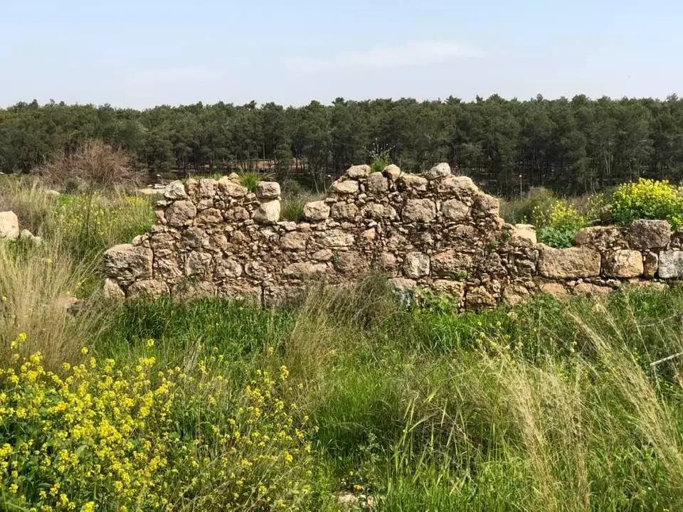
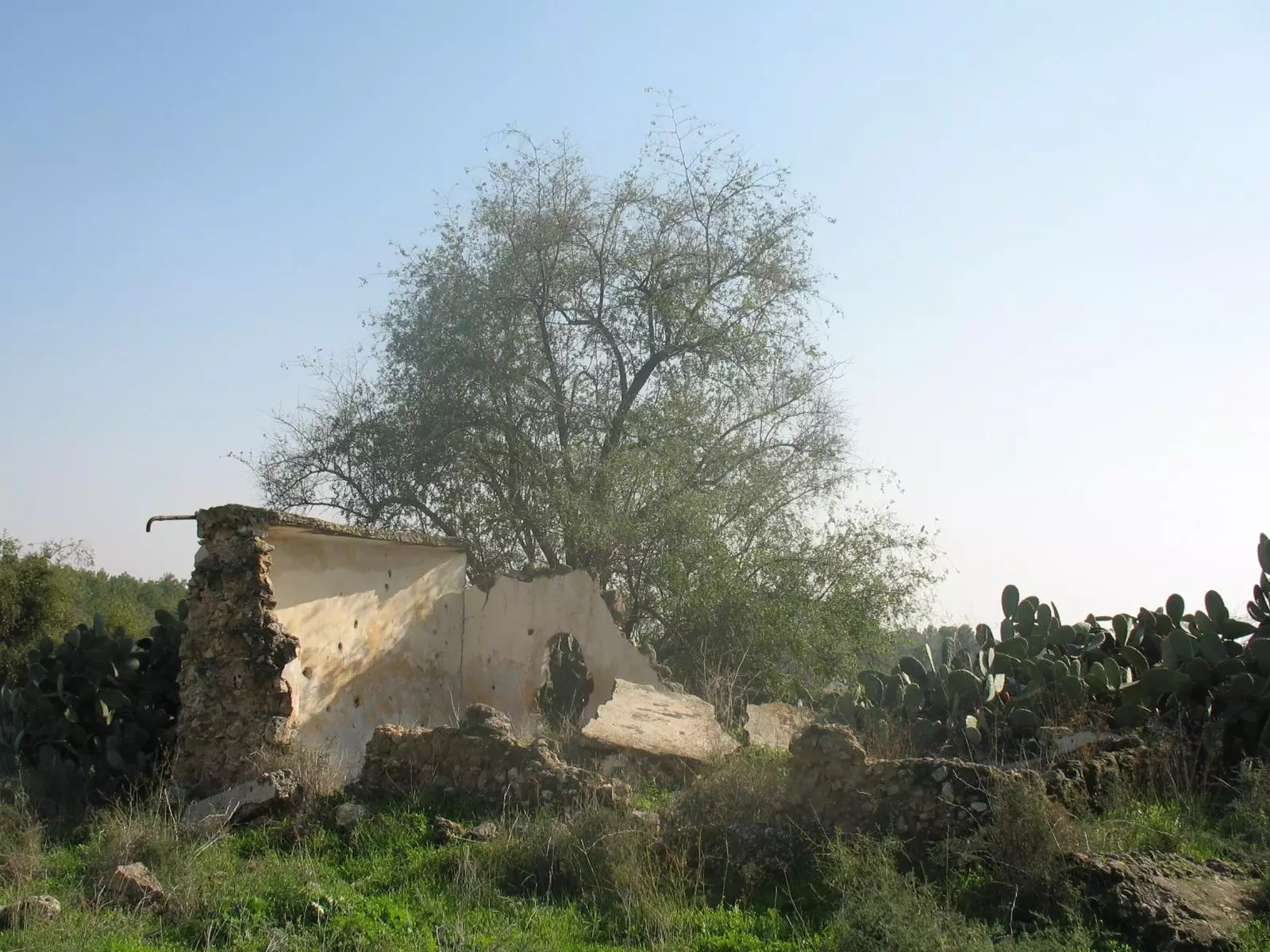
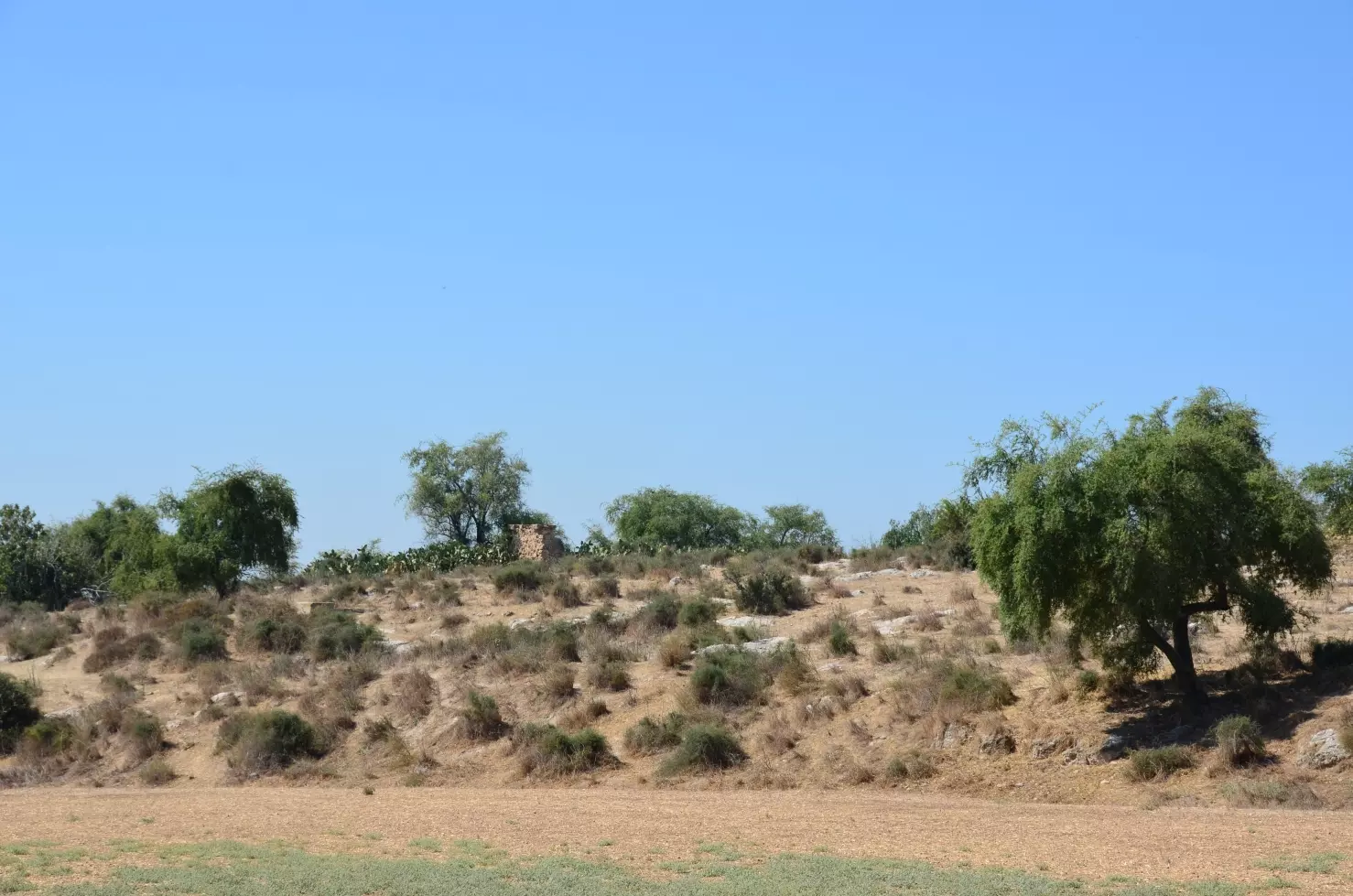
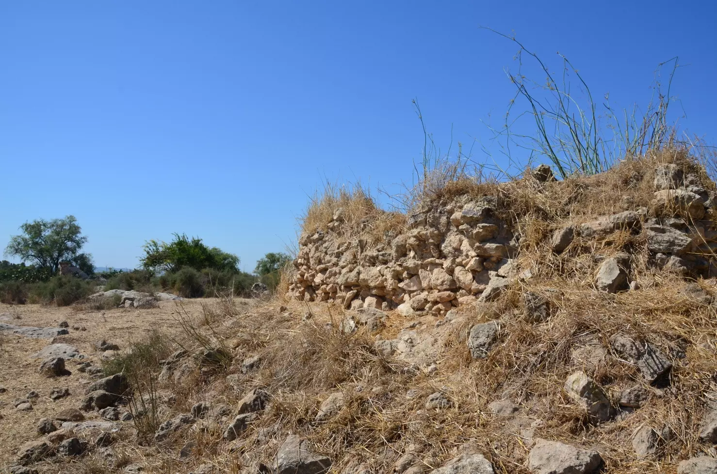
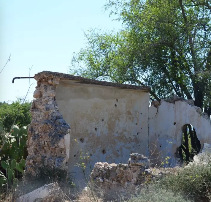
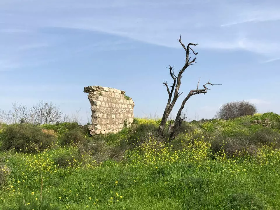
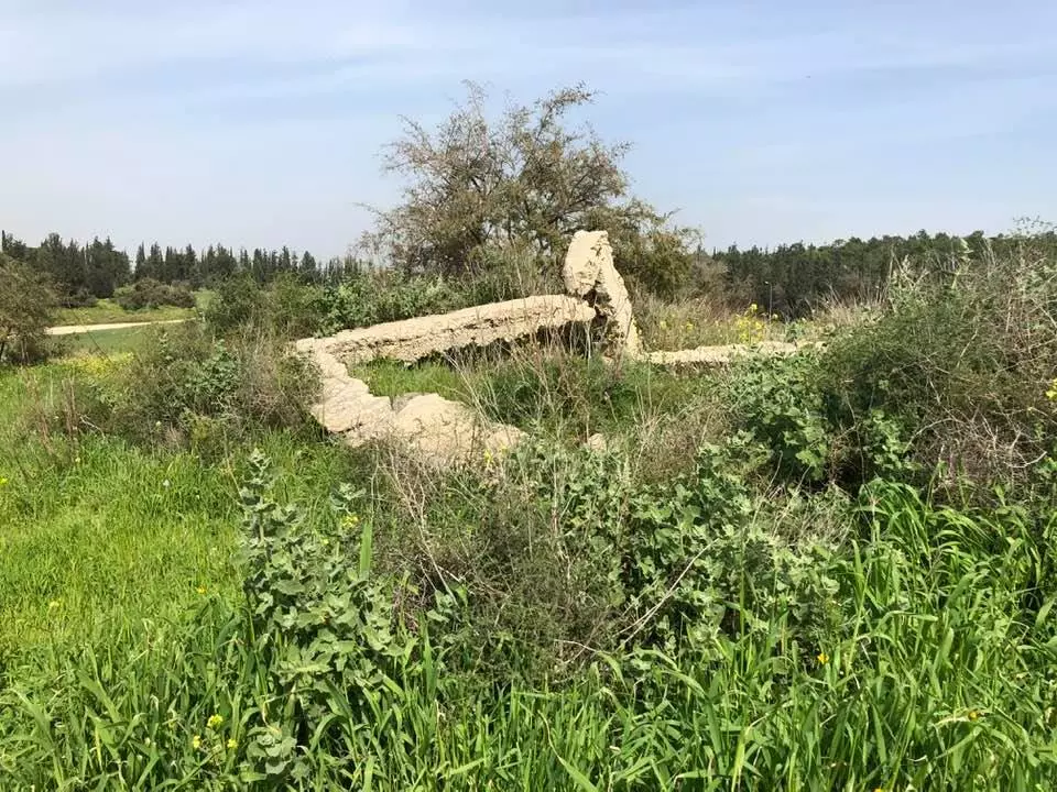
| Village Temains | Khirbat al-Duhayriyya was completely obliterated, and only the rubble of destroyed houses left behind. | ||||||||||||
| Ethnically Cleansing | al-Duhayriyya, Khirbat inhabitants were completely ethnically cleansed. | ||||||||||||
| Pre-Nakba Land Ownership |
**Town Lands' Demarcation Maps |
||||||||||||
| Land Usage As of 1945 |
|
||||||||||||
| Population |
|
||||||||||||
| Number of Houses |
|
||||||||||||
| Near By Towns |
|||||||||||||
|
|||||||||||||
| Town's Name Through History | The village was also known by al-Zuheiriya. | ||||||||||||
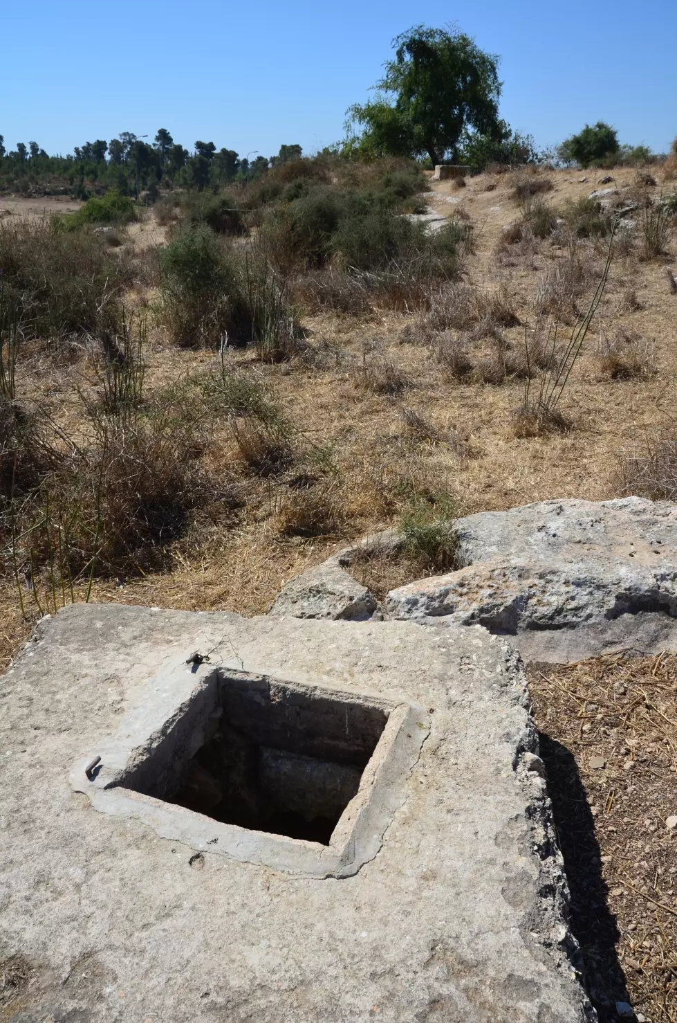
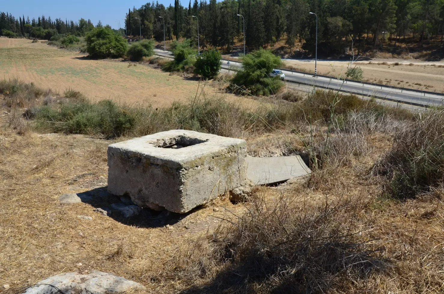
| Water Supply | A well at the southeastern edges of the village which use to provide the residents with their water needs. | ||||||||||||
| Exculsive Jewish Colonies Who Usurped Village Lands |
No Israeli settlements on village lands. | ||||||||||||
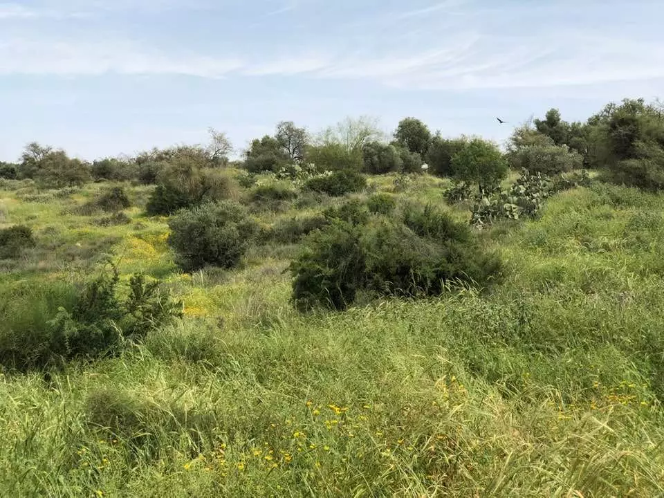
Village Before NakbaThe village stood on uneven terrain on the coastal plain and was ringed by wadis. Secondary roads linked it to Lydda and neighboring villages. Its name was derived from an Arabic word, dahr, which means "mountain." Khirbat al-Duhayriyya was classified as a hamlet in the Palestine Index Gazetteer, and had a predominantly Muslim population. A well at the southeastern edge of the village provided the residents with water for their domestic needs, Their main economic activity was rainfed agriculture, the chief crops being grain, olives, and citrus. In 1944/45 a total of 1,224 dunums was allocated to cereals; 66 dunums were irrigated or used for orchards. It was evident from the still-visible foundations of earlier buildings that Khirbat al-Duhayriyya had been built with reused materials from the site. There were rock-cut cisterns and abundant pottery fragments on the site.Zionists Colonies on Village LandsThere are no Israeli settlements on village lands.Village TodayThe walls of some ten houses still stand. Otherwise, the village has been reduced to piles of stone rubble interspersed with fig, doum palm, and almond trees, along with thickets of thorns and wild vegetation. The site is fenced in and serves as a pasture for animals. Cactuses grow along the northern and southern sides of the site (see photos section).SourceDr. Walid al-Khalidi, 1992: All That Remains. |
|||||||||||||
| Related Maps | Town Lands' Demarcation Maps خرائط للقضاء توضح حدود القرى والاودية Town's map on MapQuest View from satellite Help us map this town at WikiMapia |
||||||||||||
| Related Links | Wikipedia's Page Google Search Google For Images Google For Videos |
||||||||||||
| More Information | في كتاب كي لا ننسى في كتاب بلادنا فلسطين المزيد من موقع هوية |
||||||||||||
- Village Well Plus Remains Of A House In 1990

Scanned from "All That Remains" by Dr. Walid Khalidi - Village Site with Some Destroyed Houses In 1990

Scanned from "All That Remains" by Dr. Walid Khalidi - The remains of a destroyed Palestinian house in the destroyed village
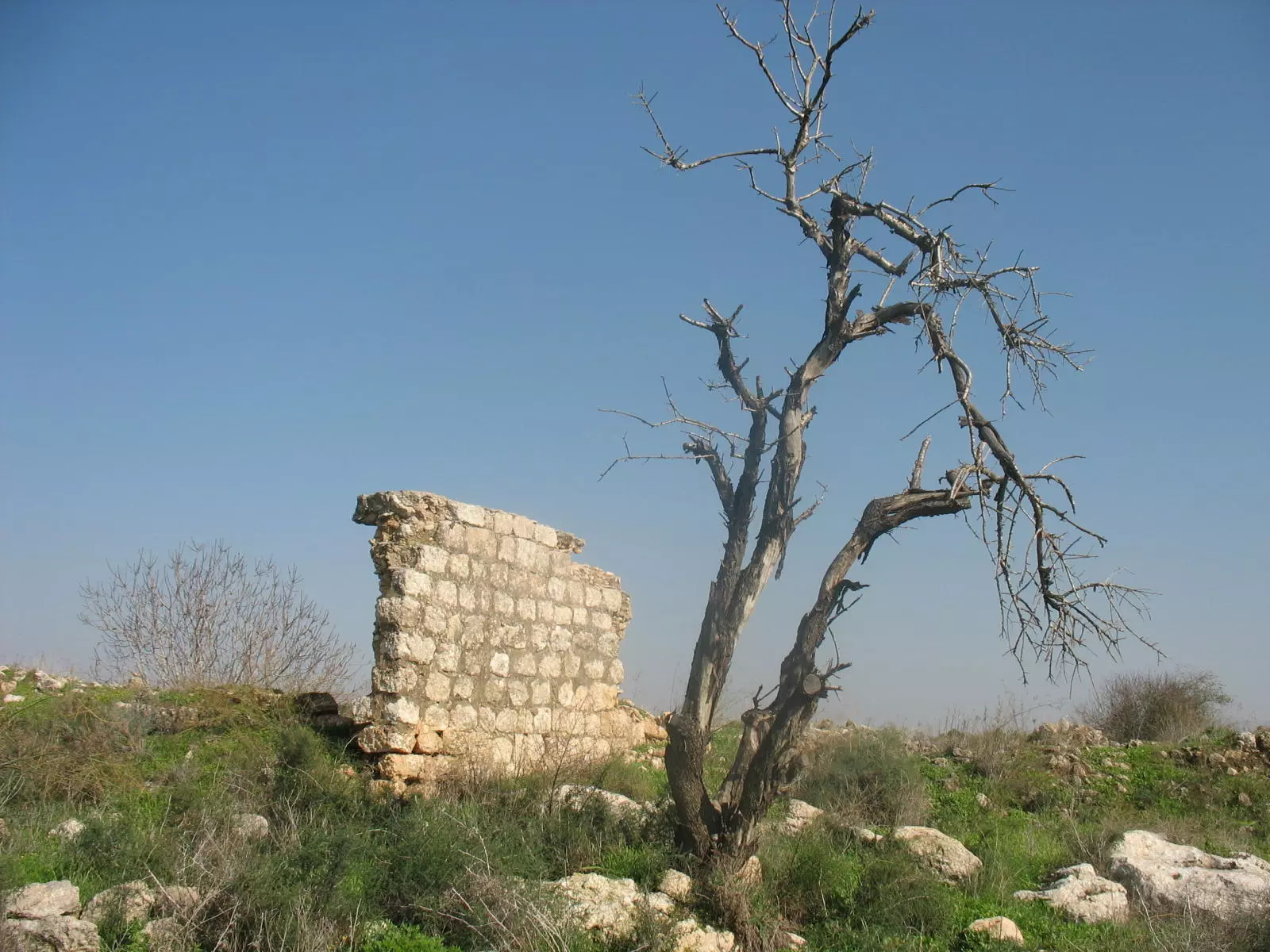
Posted by Noga Kadman - The remains of a destroyed Palestinian house in the destroyed village
Posted by Noga Kadman - A view of the hill
Posted by Uri Zackhem - A cistern
Posted by Uri Zackhem - Remains
Posted by Uri Zackhem - A cistern
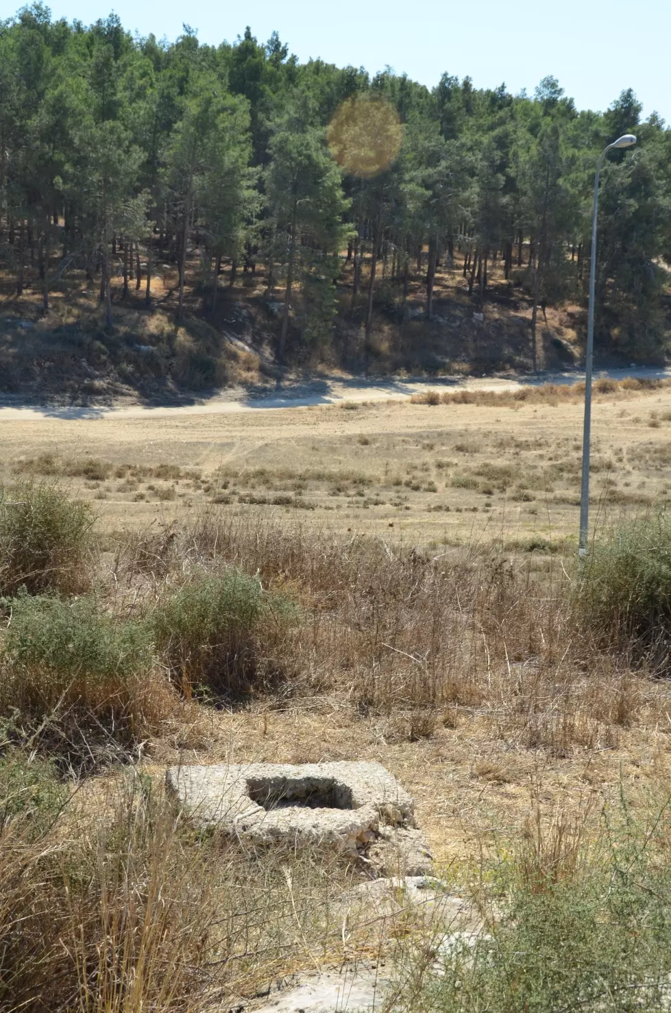
Posted by Uri Zackhem - A cistern
Posted by Uri Zackhem - اثار ردم بيوت القريه

Posted by abu raya - المتبقي من بيوت القريه

Posted by abu raya - بيوت القريه
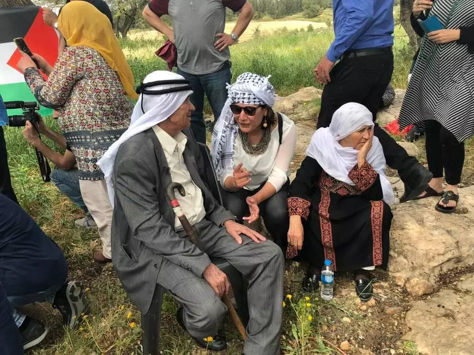
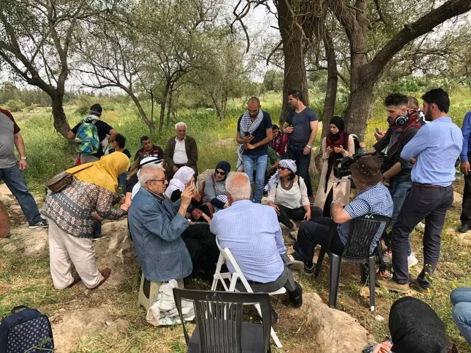
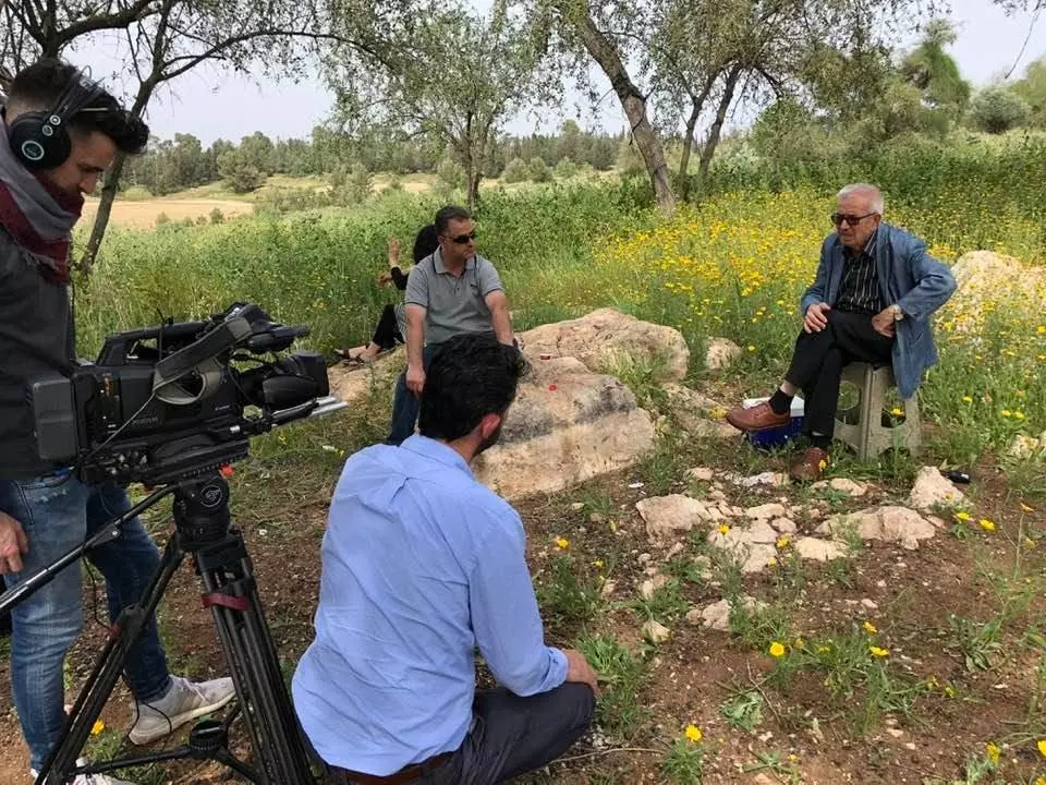
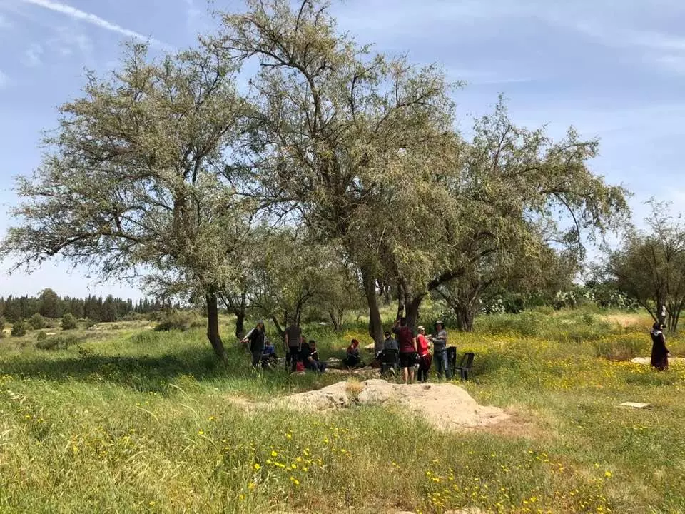
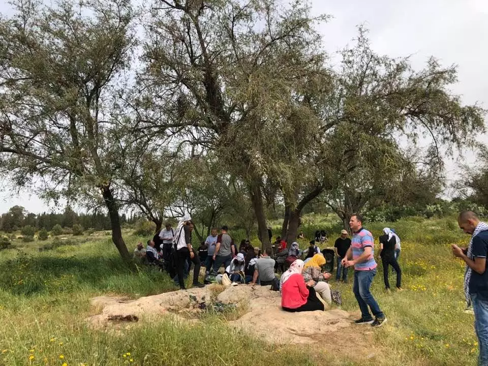
Posted by abu raya - That is how the "civilized" erased and replaced us: Kh. al-Duhayriyya was completely obliterated, as you see -- خربة الضهيرية باتت أثر بعد عين. من هنا مر الهمجّ
- That is how the "civilized" erased and replaced us: Kh. al-Duhayriyya was completely obliterated, as you see -- خربة الضهيرية باتت أثر بعد عين. من هنا مر الهمجّ #2
- That is how the "civilized" erased and replaced us: Kh. al-Duhayriyya was completely obliterated, as you see -- خربة الضهيرية باتت أثر بعد عين. من هنا مر الهمجّ #3

- That is how the "civilized" erased and replaced us: Kh. al-Duhayriyya was completely obliterated, as you see -- خربة الضهيرية باتت أثر بعد عين. من هنا مر الهمجّ #4
- That is how the "civilized" erased and replaced us: Kh. al-Duhayriyya was completely obliterated, as you see -- خربة الضهيرية باتت أثر بعد عين. من هنا مر الهمجّ #5
- That is how the "civilized" erased and replaced us: Kh. al-Duhayriyya was completely obliterated, as you see -- خربة الضهيرية باتت أثر بعد عين. من هنا مر الهمجّ #6
- That is how the "civilized" erased and replaced us: Kh. al-Duhayriyya was completely obliterated, as you see -- خربة الضهيرية باتت أثر بعد عين. من هنا مر الهمجّ #7

- That is how the "civilized" erased and replaced us: Kh. al-Duhayriyya was completely obliterated, as you see -- خربة الضهيرية باتت أثر بعد عين. من هنا مر الهمجّ #8
- That is how the "civilized" erased and replaced us: Kh. al-Duhayriyya was completely obliterated, as you see -- خربة الضهيرية باتت أثر بعد عين. من هنا مر الهمجّ #9
- Let us see how the most "liberal and civilized" of world Jewry has obliterated our village. How else will the Jews be great and safe again?

- Let us see how the most "liberal and civilized" of world Jewry has obliterated our village. How else will the Jews be great and safe again? #2

- Let us see how the most "liberal and civilized" of world Jewry has obliterated our village. How else will the Jews be great and safe again? #3

- Let us see how the most "liberal and civilized" of world Jewry has obliterated our village. How else will the Jews be great and safe again? #4

- Let us see how the most "liberal and civilized" of world Jewry has obliterated our village. How else will the Jews be great and safe again? #5
- Let us see how the most "liberal and civilized" of world Jewry has obliterated our village. How else will the Jews be great and safe again? #6
- Let us see how the most "liberal and civilized" of world Jewry has obliterated our village. How else will the Jews be great and safe again? #7

- Let us see how the most "liberal and civilized" of world Jewry has obliterated our village. How else will the Jews be great and safe again? #8
Want to browse more? 80,000 pictures were grouped in these gallaries:
| Display Name | Clan/Hamolah | Country of Residence |
No links have been shared yet, be free to the first to share the first link.
 Fake Valor: Why Did Zionist Jews Hoist Nazis Flag on Their Ships in the 1930s?
What is new?
-
Facts About Oct. 7th Gaza Raid
-
Remined Us Please:: Who Did Rape Who? Palestinians Raped Israelis? Or, was the other way around?
-
When Prof. Edward Said was invited to debate Bibi Netanyahu in the 1980s, watch what happened!
-
Ezra Klein of the NY Times on the "Jewish Race".
-
Abusing Blood Libel!
-
Did Israeli Soldiers Activate The Hanniba Direective On Oct. 7th? You Be The Judge
-
Zionist FAQ: Isn't it true that Palestinians don't want peace? Palestinians never accepted the two-state solution
- Facts about Haavara (Transfer) Agreement between Ben-Gurion & Hitler
-
Haavara FAQs: Why Did Zionist Jews Hoist Nazis' Flags on Their Ships in the 1930s?
- Haavara FAQs: When Chaim Weizmann met FDR in mid-1943, why was he silent about rescuing European Jewry?
-
Dear ChatGPT: How did Palestinians resist Napoleon's invasion of their country in 1799?
-
Dear ChatGPT: Gaza had a vibrant Jewish community in the mid-17th century. What happened to them?
-
Dear ChatGPT: Why did the Jewish Agency suppress news of the Holocaust during WWII?
-
Video Playlist: Jews share their DNA tests to end the conflict for good.
-
A Tale of Two Conflicts: Examining the Definition of Genocide
-
Prof. Abraham Polak And The Suppressed History of the Khazars and European Jewry
-
How Ronald Reagan would have framed the genocide in Gaza if he were still alive?
-
Haavara FAQs: Let us do the math: how many German Jews did The Haavara Agreement save?
-
Zionist FAQs: The Hebron Massacre of 1929, "clearly proves" that Palestinians are antisemitic, how could you deny it?
-
Zionist FAQs: Why Anti-Zionist Is Not Antisemitism?
-
Zionist FAQs: Isn't it true that the KGB created Palestinian Nationalism in the early 1960s?
- Zionist FAQs: Muslims are killing Muslims all the time; why are Israeli Jews being singled out in the media?
- Zionist FAQs: How is Israel an apartheid state when 20% of its citizens are Arabs who enjoy full rights?
-
Haavara FAQs: Why Did Dorothy Thompson Flip From A Zionist Advocate to A Silenced Dissenter?
-
Haavara FAQs: Analysis of Herzl's Uganda Scheme and how it could have saved millions of Jews.
-
Haavara FAQs: Why did Hayim Greenberg describe American Jewry as "morally bankrupt" in early 1943?
-
Haavara FAQs: What if the Evian Conference was a resounding success? What would have been the impact of saving European Jewry on Zionism?
- Haavara FAQs: What if the six million were saved, how that would have impacted the Zionist project?
-
Haavara FAQs: How did Zionist leaders react when Europe's Jews lingered in the DP camps after WWII ended?
-
Why does the American Jewish community repeat lies that David Ben-Gurion had debunked before he died?
-
Who has the power to rename the Tatar/Khazar Gene Marker to Jewish IV?
-
Zionist FAQs: Why won't Egypt, Syria, and Jordan take their people back? Jews are indigenous to Palestine, and Arabs immigrated after Jews developed the country. Arabs should leave.
-
Haavara FAQs: Did Hitler and the Nazis conflate between Judaism and Zionist? If that wasn't case, then why?
-
Haavara FAQs: Winston Churchill and antisemitism, a collection of articles written Churchill.
-
Haavara FAQs: Broken by country, how many Jews survived vs. killed during the Holocaust?
-
Haavara FAQs: Why did European Jews vote with their feet and to immigrated to the Americas, not Palestine, after WWII?
-
Watch this American Jewish Girl describing Israeli Jews' cognitive dissonance like no other in under two minutes
-
Haavara FAQs: When the Nazis went out of their way to hide the Holocaust, Israeli Jews did the exact opposite by broadcasting their genocide of Gazans. But why?
-
Haavara FAQs: How Zionist Jews went out of their to show their appreciation to Nazism and Fascism?
- Haavara FAQs: Why Zionist leaders were against bombing the death camps & the Railroads leading to them?
-
Haavara FAQs: Hitler's message to the British and American people: If Jews are such noble citizens and you care about them, how come you're not letting them in? I will gladly ship them to you at my expense, even on luxury liners!
-
A shortlist of Zionist and Israeli false flag operations in the name Jews.
-
The Most Moral Army
- The Land of Kapos (Israel): Where the brave are boycotted and Kapos walk free.
- Why did early Zionists often named their communal enterprises "colonial"?
- Zionist Relations with Nazi Germany by Faris Glubb
-
Two NY Times advertisements by Zionists in the early 1943 that exposes Zionists' treason at the height of the calamity
- Facts Not Lies about the Palestinian-Israeli Conflict.
- Site's pictures have been categorized
- Campgain Against Lice
- A Survey of Palestine, the official source about Palestine before Nakba produced by the British Mandate; over 1200 pages.
- Satellite View & Google Earth: Over 6,000 placemarks identifying all destroyed towns, W. Bank & Gaza Strip Towns, & refugee camps.
- PalestineRemembered.com and its Nakba Oral History Project were featured on al-Jazeera Satellite TV.
- Nakba Oral History Video Podcast:
 Over 700 Oral History interviews (including 3,500+ hours of recording) can be viewed online.
 - Palestine Village Statistics Project
- Gaza Jail Break
- النسخة العربية للموقع الان متوفرة
- Videos: Documenting the destroyed villages in video: Tracing all that remains since Nakba.
- Videos: Responding to Zionist Propaganda
- Interview: The ethnic cleansing of Palestine: George Galloway interviews Israeli Historian Ilan Pappe.
- For Palestinians, memory matters. It provides a blueprint for their future By George Bisharat.
- Zionist FAQ now available in Hebrew שאלות שציונים שואלים, עכשיו בעברית
- Video: The Stephen Walt and John Mearsheimer report on the influence of the Israel Lobby on U.S. Foreign Policy
- The Palestinian-Israeli conflict for beginners
