| PalestineRemembered | About Us | Oral History | العربية | |
| Pictures | Zionist FAQs | Haavara | Maps | |
| Search |
| Camps |
| Districts |
| Acre |
| Baysan |
| Beersheba |
| Bethlehem |
| Gaza |
| Haifa |
| Hebron |
| Jaffa |
| Jericho |
| Jerusalem |
| Jinin |
| Nablus |
| Nazareth |
| Ramallah |
| al-Ramla |
| Safad |
| Tiberias |
| Tulkarm |
| Donate |
| Contact |
| Profile |
| Videos |
Welcome To Sajad - سجد (סג'ד)
|
District of al-Ramla
Ethnically cleansed days ago |
العربية Google Earth |
 |
Gallery (11) |
- Statistics & Facts
-
Before & After

- Satellite View
- Articles 2
- Pictures 11
- Aerial Views 1
- Oral History 3
- Members 30
- All That Remains
- Wikipedia
- Videos 1
- Guest Book 38
- Links
| Statistic & Fact | Value | ||||||||||||
| Occupation Date | June 1, 1948 | ||||||||||||
| Distance From District | 16 (km) South of al-Ramla | ||||||||||||
| Elevation | 150 (meters) | ||||||||||||
| Before & After Nakba, Click Map For Details |
|||||||||||||
|
|||||||||||||
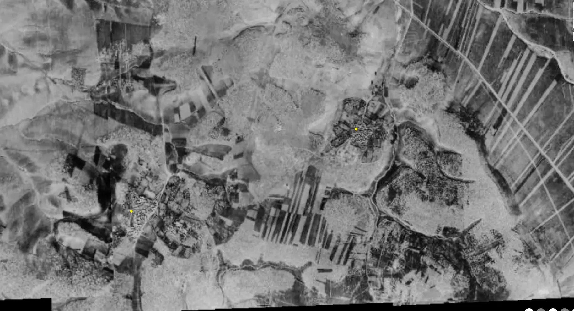
| Pre-Nakba Aerial View |
|||||||||||||
|
|||||||||||||
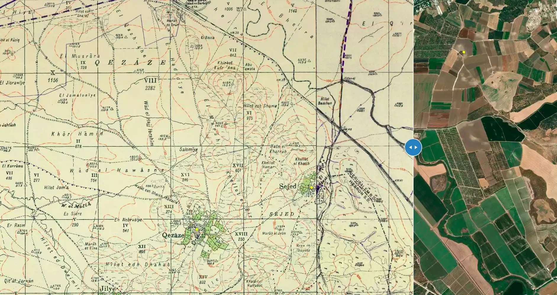
| Map Location | See location #53 on the map View from satellite |
||||||||||||
| Military Operation | Operation An-Far | ||||||||||||
| Attacking Units | Giv'ati Brigade | ||||||||||||
| Refugees' Migration Routes | The villagers most likely fled to the Hebron area. | ||||||||||||
| Exodus Cause | Military assault by Zionist troops | ||||||||||||
| Village Temains | Sajad is most likely destroyed. Currently, its lands are being used by the Israeli army. | ||||||||||||
| Ethnically Cleansing | Sajad inhabitants were completely ethnically cleansed. | ||||||||||||
| Pre-Nakba Land Ownership |
**Town Lands' Demarcation Maps |
||||||||||||
| Land Usage As of 1945 |
|
||||||||||||
| Population |
|
||||||||||||
| Number of Houses |
|
||||||||||||
| Schools | In 1945, village students started to attend school at the nearby village of Qazaza. | ||||||||||||
| Exculsive Jewish Colonies Who Usurped Village Lands |
Sajad's lands are used by the Israeli army. | ||||||||||||
| Featured Video | |||||||||||||
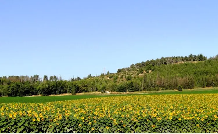
Village Before NakbaThe village was located in a hilly region at the eastern edge of the central coastal plain. A secondary road linked it to a highway to the north that connected Gaza to the highway between Ramla and Jerusalem. Sajad was one of the first villages to benefit from the construction of a railway system in Palestine. In August of 1892 train service between Jaffa and Jerusalem was initiated on a line constructed for the Ottoman government by a French railway company; the train stopped in Sajad. The land cultivated by the villagers was originally owned by the Ottoman sultan 'Abd al-Hamid but was taken from him by the Ottoman government in 1908. It was classified as jiftlik land and was owned henceforth by the government but leased on a long-term basis to the inhabitants. In the early 1930s the Mandate government went to court in an effort to prove that the tenants had no hereditary rights to continue leasing the land (which in this case amounted to little more than paying taxes and registration fees on it). Apparently the government's case was vindicated, which may account for the categorization of all village land as 'public' in the census of 1945.The village's entire population was Muslim. Sajad had no school of its own, but in 1945-46 it began to send its students to a school in Qazaza, a neighboring village to the southeast. The houses of the village were built with reused materials taken from the remains and foundations of earlier settlements on the same site. Village Occupation and Ethnic CleaningAccording to Israeli historian Benny Morris, operations in the first half of June 1948 'precipitated the evacuation' of this and at least fifteen other villages in the area. The Israeli army's Giv'ati Brigade mounted an offensive known as Operation An-Far that aimed at linking the Israeli-held coast with the Negev and driving out the residents of the area south of Ramla (see Bi'lin, Gaza sub-disctrict). Sajad probably fell in the first stage of the operation, on 9-10 July, and its population reportedly fled to the Hebron area.Zionists Colonies on Village LandsThere are no Israeli settlements on village lands.Village TodayThe site is an inaccessible military zone.SourceDr. Walid al-Khalidi, 1992: All That Remains. |
|||||||||||||
| Related Maps | Town Lands' Demarcation Maps خرائط للقضاء توضح حدود القرى والاودية Town's map on MapQuest View from satellite Help us map this town at WikiMapia |
||||||||||||
| Related Links | Wikipedia's Page Google Search Google For Images Google For Videos |
||||||||||||
| More Information | في كتاب كي لا ننسى في كتاب بلادنا فلسطين المزيد من موقع هوية |
||||||||||||
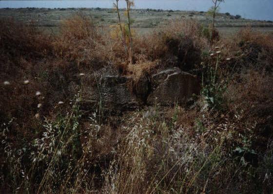
- Remains of Sajad's railway station (destroyed by turks in 1915). In the backround you can see village lands, 2001
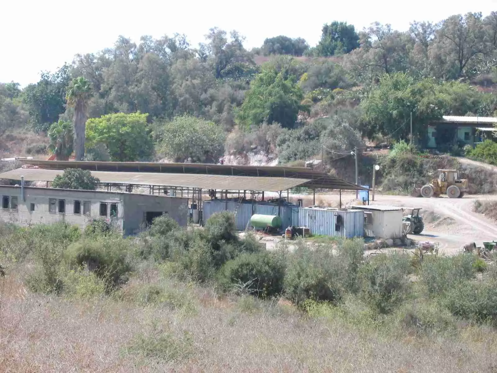
Posted by Prince, Peaceful Israeli 3 - a farm that was built on part of Sajad is in the front of the picture. it is possible to see the trees in the back, including an old palm tree on the left side of the picture.
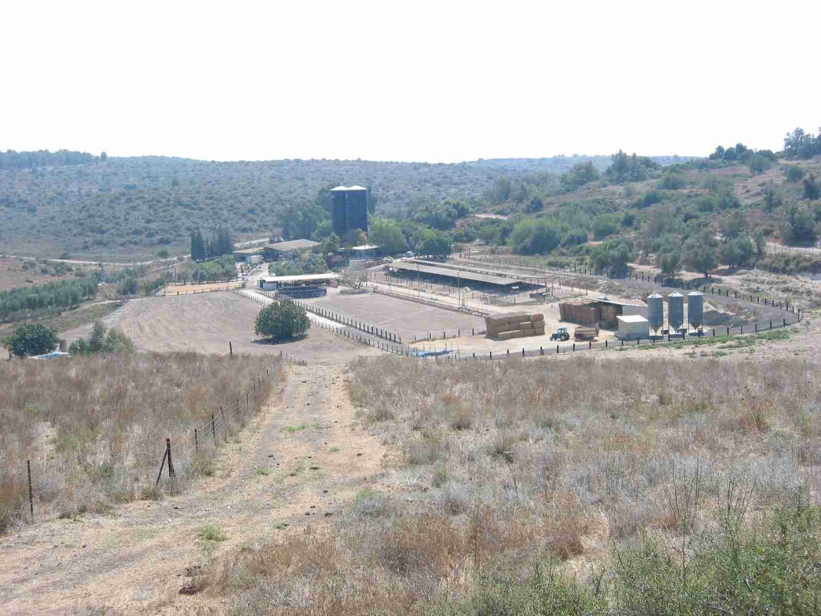
Posted by Hanoch Frankovits 1 - Part of Sajad's land, you can see the fence of the militery base that is crossing the area of Sajad.

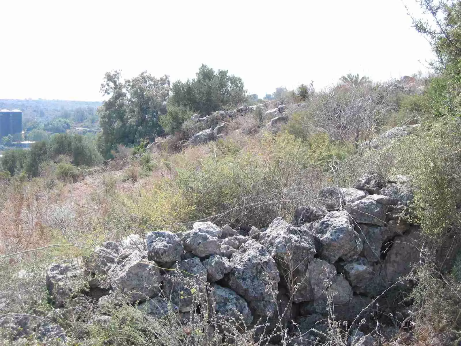
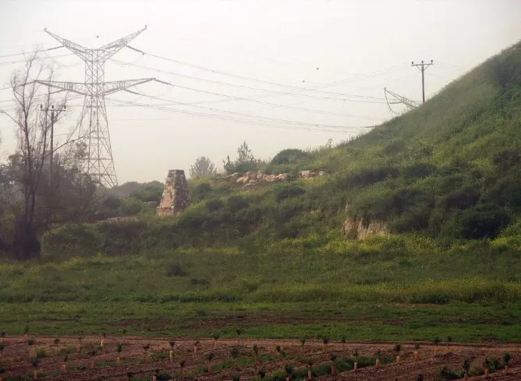
Posted by Hanoch Frankovits 2 - A stone wall on the hill that is just north to Sajad.
Posted by Hanoch Frankovits 2 - The farm that was built on Sajad land, remains of Sajad are on the slope of the hill, inside the area of the military base (just where the farm ends).
Posted by Hanoch Frankovits 4 - اراضي القريه
Posted by abu raya - اراضي القريه
Posted by abu raya - موقع القريه
Posted by abu raya 1 - اراضي القريه

Posted by abu raya - اراضي القريه
Posted by abu raya - Pre-Nakba Aerial view of the village / صورة من الجو للقرية اخذت قبل النكبة
Want to browse more? 80,000 pictures were grouped in these gallaries:
| Display Name | Clan/Hamolah | Country of Residence |
| زيد حميدة | حميدة | البقعة |
| يحيى جهاد | حميده | البقعه, الاردن |
| salem almasri | almasri | ain albasha, qtiba bin muslem |
| salem almasri abu aizat | - | ain albasha, jordan |
| مهند سالم | كليب | شفا بدران, الاردن |
| اسامة شحادة | كليب | عمان |
| معاذ حميده | حميده | عمان |
| محمد الوراقي | الوراقي | عين الباشا , Palestine |
| هبه المدلل | المدلل | عمان, الاردن |
| يوسف محمد علي ابو جادو | ابو جاد و | - |
| أيمن عواد | عواد | الأردن - عمان, سجد |
| Mohammed Kulaib | Kulaib | Abu Dhabi |
| ابو جهاد | حميده | - |
| كليب | كليب | عمان, الأردن |
| Dr Ismail Hdaib | Hdaib | Marj Al-hamam, Jordan |
| زياد | - | - |
| أبو إبراهيم هديب | هديب | عمان, الأردن |
| احمد صالح نمر حميده | حميده | - |
| كنعان | حميده | - |
| ابو زيد | كليب | عمان, سجد |
| mohammad abu shakra | abu shakra | sajed, sajed |
| murad abu jado | abu jado | - |
| Celica Abushawish | Abu Shawish | USA/Jordan |
| عمار | عطاطري | دبي, الامارات |
| luay alnabtiti | alnabtiti | - |
| KHALID AWWAD | AWWAD | EASTREN, SAUDI ARABIA |
| حسام شحادة | كليب | - |
| اسماعيل شحده حميده | حميده | البقعه |
| Abu Adil | هديب | Ayn |Al Basha , Ayn |Al Basha |
| Marwan Abujado | Abujado | Amman, Jordan |
No links have been shared yet, be free to the first to share the first link.
 Fake Valor: Why Did Zionist Jews Hoist Nazis Flag on Their Ships in the 1930s?
What is new?
-
Facts About Oct. 7th Gaza Raid
-
Remined Us Please:: Who Did Rape Who? Palestinians Raped Israelis? Or, was the other way around?
-
When Prof. Edward Said was invited to debate Bibi Netanyahu in the 1980s, watch what happened!
-
Ezra Klein of the NY Times on the "Jewish Race".
-
Abusing Blood Libel!
-
Did Israeli Soldiers Activate The Hanniba Direective On Oct. 7th? You Be The Judge
-
Zionist FAQ: Isn't it true that Palestinians don't want peace? Palestinians never accepted the two-state solution
- Facts about Haavara (Transfer) Agreement between Ben-Gurion & Hitler
-
Haavara FAQs: Why Did Zionist Jews Hoist Nazis' Flags on Their Ships in the 1930s?
- Haavara FAQs: When Chaim Weizmann met FDR in mid-1943, why was he silent about rescuing European Jewry?
-
Dear ChatGPT: How did Palestinians resist Napoleon's invasion of their country in 1799?
-
Dear ChatGPT: Gaza had a vibrant Jewish community in the mid-17th century. What happened to them?
-
Dear ChatGPT: Why did the Jewish Agency suppress news of the Holocaust during WWII?
-
Video Playlist: Jews share their DNA tests to end the conflict for good.
-
A Tale of Two Conflicts: Examining the Definition of Genocide
-
Prof. Abraham Polak And The Suppressed History of the Khazars and European Jewry
-
How Ronald Reagan would have framed the genocide in Gaza if he were still alive?
-
Haavara FAQs: Let us do the math: how many German Jews did The Haavara Agreement save?
-
Zionist FAQs: The Hebron Massacre of 1929, "clearly proves" that Palestinians are antisemitic, how could you deny it?
-
Zionist FAQs: Why Anti-Zionist Is Not Antisemitism?
-
Zionist FAQs: Isn't it true that the KGB created Palestinian Nationalism in the early 1960s?
- Zionist FAQs: Muslims are killing Muslims all the time; why are Israeli Jews being singled out in the media?
- Zionist FAQs: How is Israel an apartheid state when 20% of its citizens are Arabs who enjoy full rights?
-
Haavara FAQs: Why Did Dorothy Thompson Flip From A Zionist Advocate to A Silenced Dissenter?
-
Haavara FAQs: Analysis of Herzl's Uganda Scheme and how it could have saved millions of Jews.
-
Haavara FAQs: Why did Hayim Greenberg describe American Jewry as "morally bankrupt" in early 1943?
-
Haavara FAQs: What if the Evian Conference was a resounding success? What would have been the impact of saving European Jewry on Zionism?
- Haavara FAQs: What if the six million were saved, how that would have impacted the Zionist project?
-
Haavara FAQs: How did Zionist leaders react when Europe's Jews lingered in the DP camps after WWII ended?
-
Why does the American Jewish community repeat lies that David Ben-Gurion had debunked before he died?
-
Who has the power to rename the Tatar/Khazar Gene Marker to Jewish IV?
-
Zionist FAQs: Why won't Egypt, Syria, and Jordan take their people back? Jews are indigenous to Palestine, and Arabs immigrated after Jews developed the country. Arabs should leave.
-
Haavara FAQs: Did Hitler and the Nazis conflate between Judaism and Zionist? If that wasn't case, then why?
-
Haavara FAQs: Winston Churchill and antisemitism, a collection of articles written Churchill.
-
Haavara FAQs: Broken by country, how many Jews survived vs. killed during the Holocaust?
-
Haavara FAQs: Why did European Jews vote with their feet and to immigrated to the Americas, not Palestine, after WWII?
-
Watch this American Jewish Girl describing Israeli Jews' cognitive dissonance like no other in under two minutes
-
Haavara FAQs: When the Nazis went out of their way to hide the Holocaust, Israeli Jews did the exact opposite by broadcasting their genocide of Gazans. But why?
-
Haavara FAQs: How Zionist Jews went out of their to show their appreciation to Nazism and Fascism?
- Haavara FAQs: Why Zionist leaders were against bombing the death camps & the Railroads leading to them?
-
Haavara FAQs: Hitler's message to the British and American people: If Jews are such noble citizens and you care about them, how come you're not letting them in? I will gladly ship them to you at my expense, even on luxury liners!
-
A shortlist of Zionist and Israeli false flag operations in the name Jews.
-
The Most Moral Army
- The Land of Kapos (Israel): Where the brave are boycotted and Kapos walk free.
- Why did early Zionists often named their communal enterprises "colonial"?
- Zionist Relations with Nazi Germany by Faris Glubb
-
Two NY Times advertisements by Zionists in the early 1943 that exposes Zionists' treason at the height of the calamity
- Facts Not Lies about the Palestinian-Israeli Conflict.
- Site's pictures have been categorized
- Campgain Against Lice
- A Survey of Palestine, the official source about Palestine before Nakba produced by the British Mandate; over 1200 pages.
- Satellite View & Google Earth: Over 6,000 placemarks identifying all destroyed towns, W. Bank & Gaza Strip Towns, & refugee camps.
- PalestineRemembered.com and its Nakba Oral History Project were featured on al-Jazeera Satellite TV.
- Nakba Oral History Video Podcast:
 Over 700 Oral History interviews (including 3,500+ hours of recording) can be viewed online.
 - Palestine Village Statistics Project
- Gaza Jail Break
- النسخة العربية للموقع الان متوفرة
- Videos: Documenting the destroyed villages in video: Tracing all that remains since Nakba.
- Videos: Responding to Zionist Propaganda
- Interview: The ethnic cleansing of Palestine: George Galloway interviews Israeli Historian Ilan Pappe.
- For Palestinians, memory matters. It provides a blueprint for their future By George Bisharat.
- Zionist FAQ now available in Hebrew שאלות שציונים שואלים, עכשיו בעברית
- Video: The Stephen Walt and John Mearsheimer report on the influence of the Israel Lobby on U.S. Foreign Policy
- The Palestinian-Israeli conflict for beginners
