| PalestineRemembered | About Us | Oral History | العربية | |
| Pictures | Zionist FAQs | Haavara | Maps | |
| Search |
| Camps |
| Districts |
| Acre |
| Baysan |
| Beersheba |
| Bethlehem |
| Gaza |
| Haifa |
| Hebron |
| Jaffa |
| Jericho |
| Jerusalem |
| Jinin |
| Nablus |
| Nazareth |
| Ramallah |
| al-Ramla |
| Safad |
| Tiberias |
| Tulkarm |
| Donate |
| Contact |
| Profile |
| Videos |
Welcome To Shilta - شلتة (שילתא)
|
District of al-Ramla
Ethnically cleansed days ago |
العربية Google Earth |
 |
Gallery (21) |
- Statistics & Facts
-
Before & After

- Satellite View
- Articles 1
- Pictures 21
- Members 1
- All That Remains
- Wikipedia
- Videos 1
- Guest Book 1
- Links
| Statistic & Fact | Value | ||||||||||||
| Occupation Date | July 18, 1948 | ||||||||||||
| Distance From District | 15 (km) East of al-Ramla | ||||||||||||
| Elevation | 300 (meters) | ||||||||||||
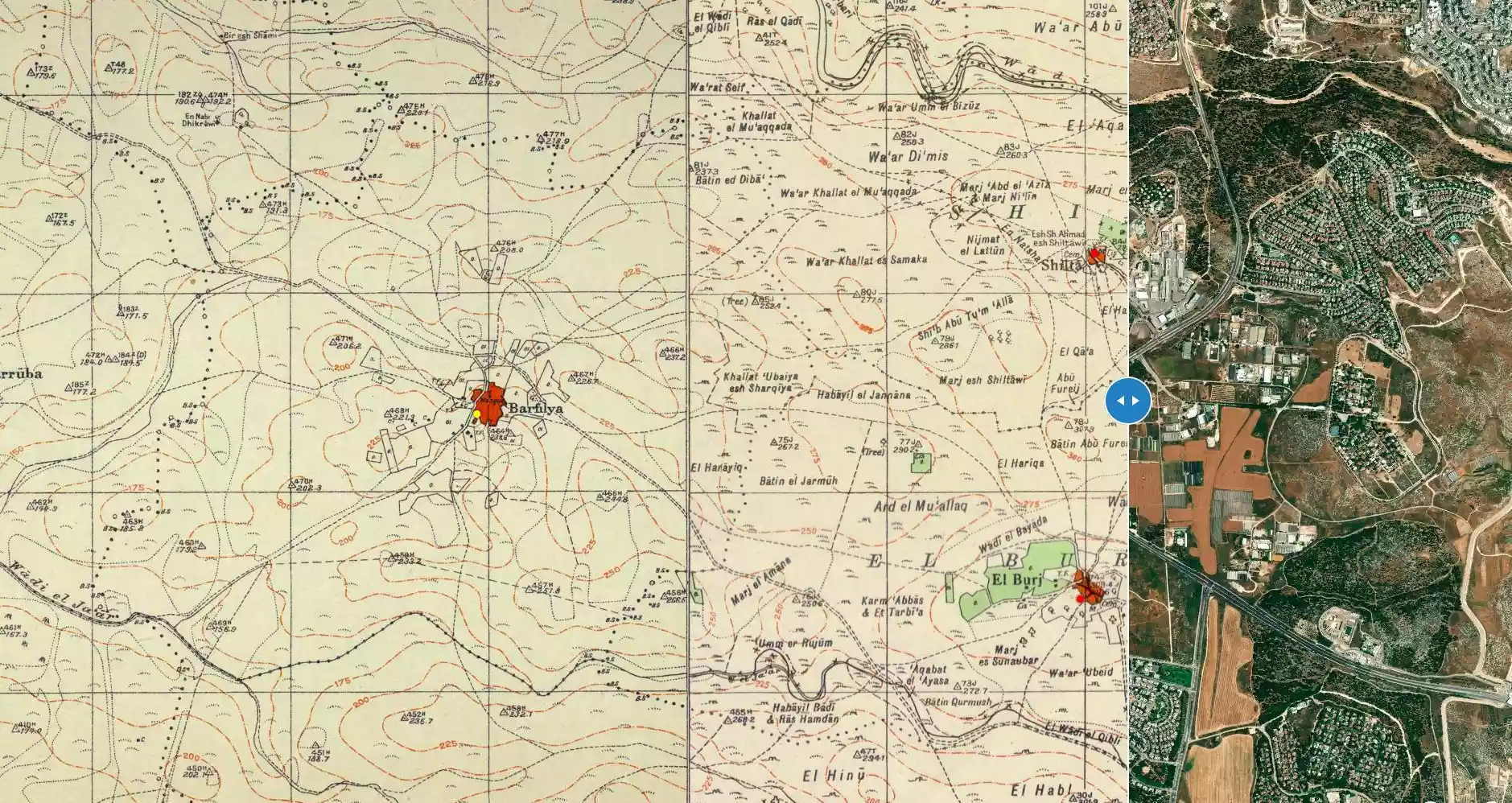
| Before & After Nakba, Click Map For Details |
|||||||||||||
|
|||||||||||||
| Map Location | See location #19 on the map View from satellite |
||||||||||||
| Military Operation | Operation Dani | ||||||||||||
| Attacking Units | First Battalion of the Yiftach Brigade | ||||||||||||
| Defenders | Jordanian Army & Local militia | ||||||||||||
| Exodus Cause | Military assault by Zionist troops | ||||||||||||
| Village Temains | Shilta was completely obliterated and defaced. | ||||||||||||
| Ethnically Cleansing | Shilta inhabitants were completely ethnically cleansed. | ||||||||||||
| Pre-Nakba Land Ownership |
**Town Lands' Demarcation Maps |
||||||||||||
| Land Usage As of 1945 |
|
||||||||||||
| Population |
|
||||||||||||
| Number of Houses |
|
||||||||||||
| Near By Towns |
|||||||||||||
|
|||||||||||||
| Town's Name Through History | The Crusades referred to Shilta by Capharscylta. | ||||||||||||
| Places of Warship | One mosque | ||||||||||||
| Shrines / Maqams | A shrine for a local sage known by al-Shaykh Ahmad al-Shiltawi. | ||||||||||||
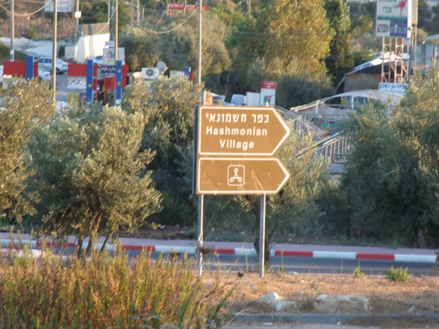
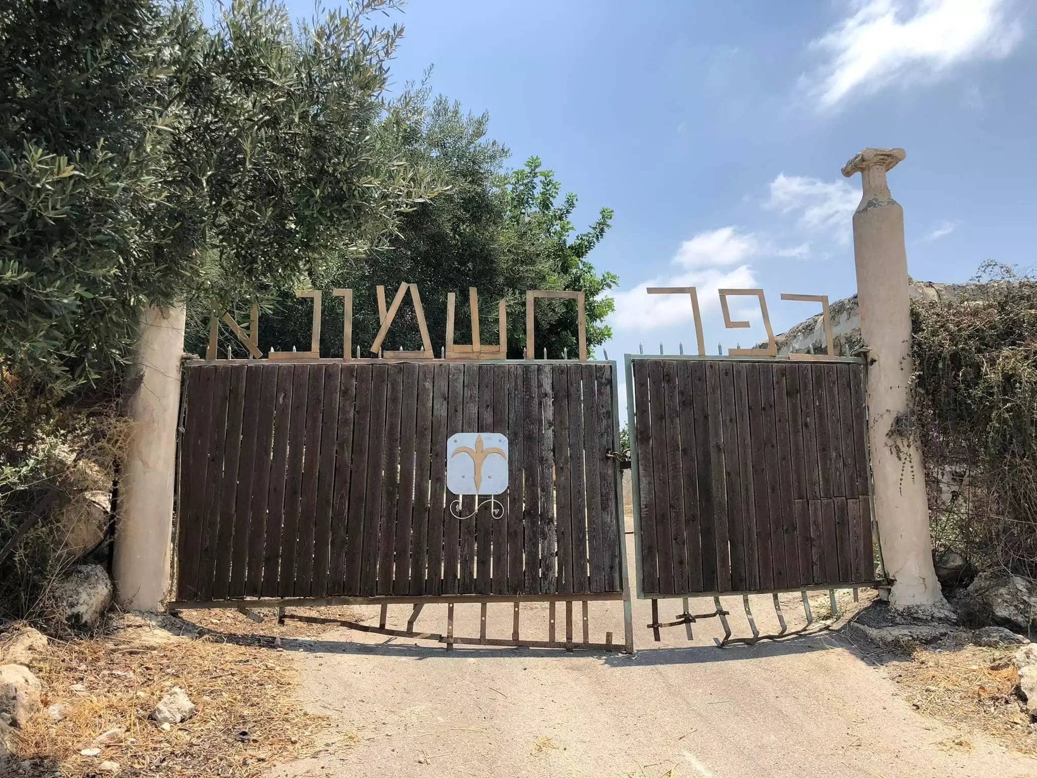
| Exculsive Jewish Colonies Who Usurped Village Lands |
Shilat and Kefar Rut. | ||||||||||||
| Featured Video | |||||||||||||
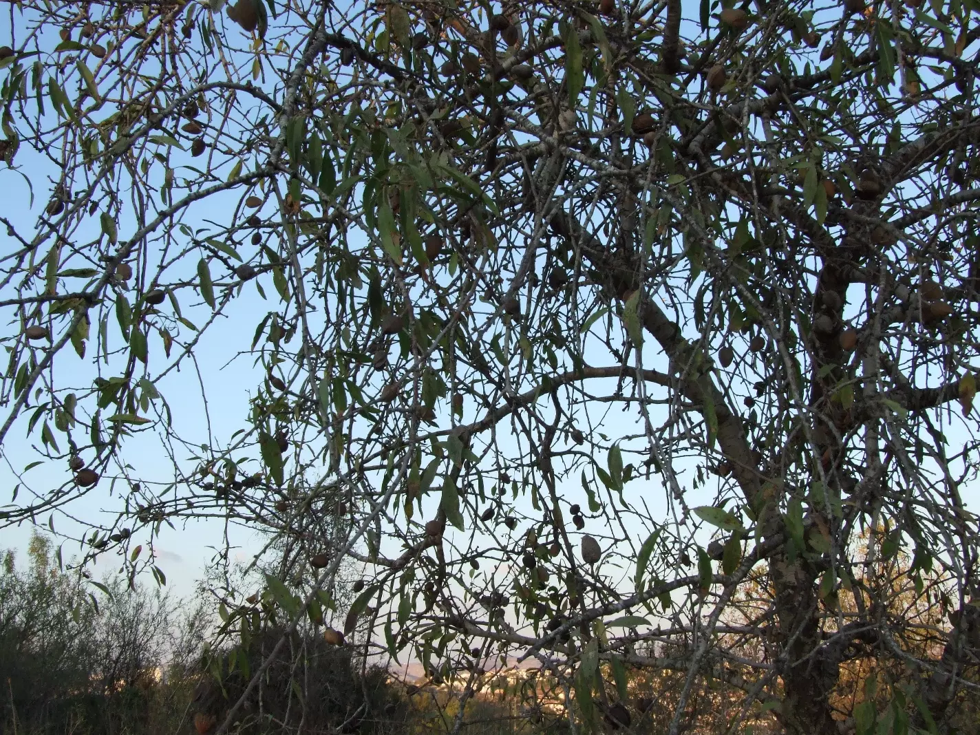
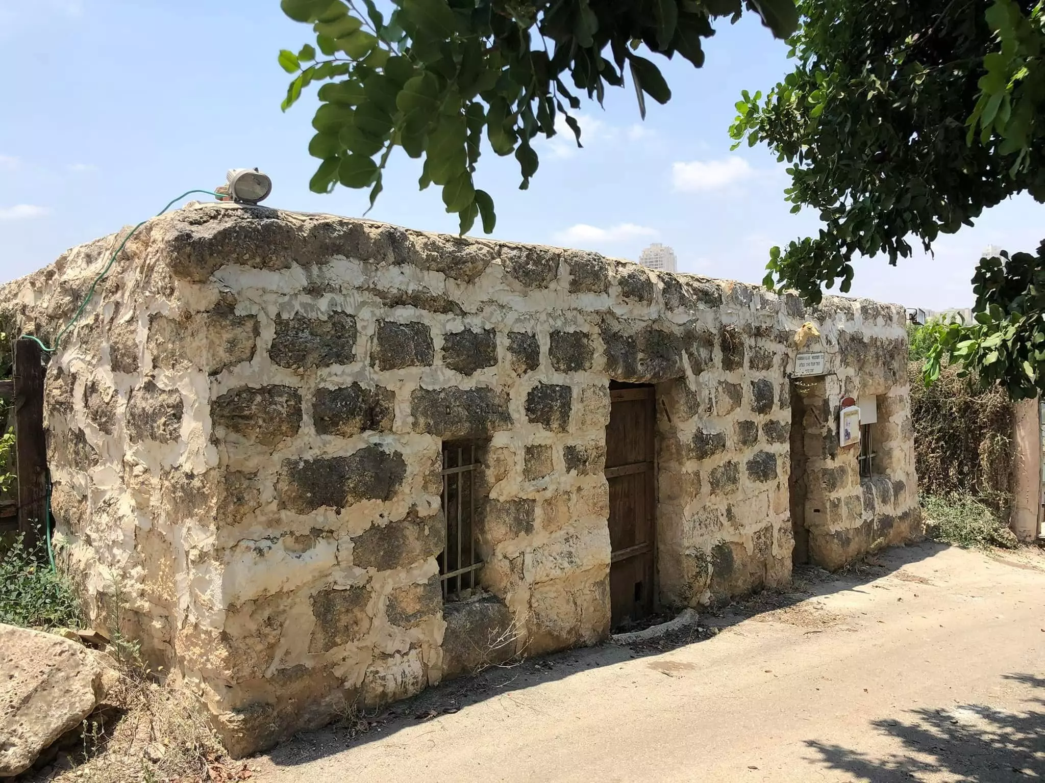
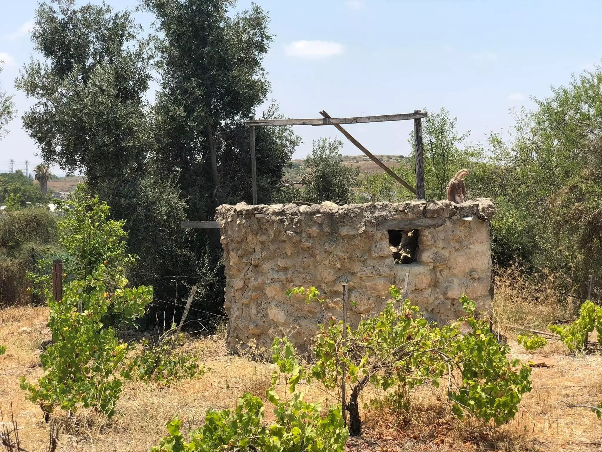
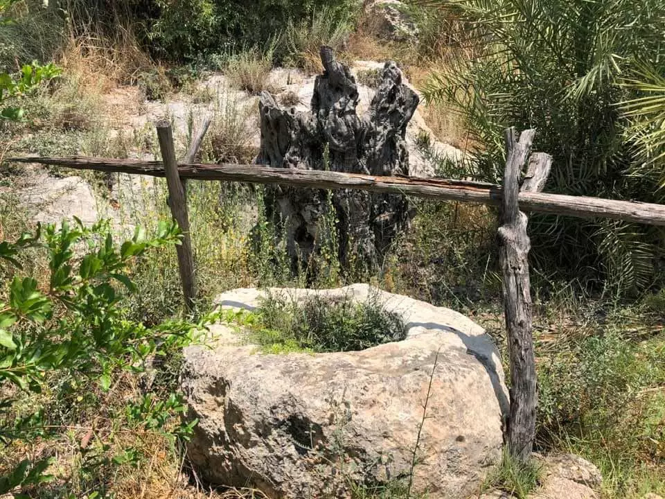
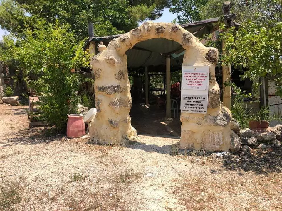
Village Before NakbaShilta was situated on a hill of hard limestone on the easternmost edge of the central coastal plain. Several trails connected it to neighboring villages. The village site has been identified with the Crusader locality of Capharscylta. The French traveler Guérin, who visited Palestine several times, noted in 1874 that Shilta consisted of several houses, some of which were the remains of older buildings that had been supplemented with new enclosures to make them habitable. He also saw the remains of the Crusader structure. The stone-and-mud houses of Shilta were built very close to each other, separated by narrow alleys. Shilta was referred to as a hamlet in the Palestine Index Gazetteer. The population was predominantly Muslim. The shrine of a Shaykh Ahmad al-Shiltawi was located near the mosque at the north end. Rainfed agriculture and animal husbandry were the principal occupations of the residents, who cultivated a variety of crops, including grain, vegetables, grapes, figs, almonds, and olives. In 1944/45 a total of 2,159 dunums was allotted to cereals; 27 dunums were irrigated or used for orchards.Village Occupation and Ethnic CleaningAt the end of Operation Dani (see Abu al-Fadl, Ramla sub-disctrict), just as the second truce was about to take effect, Israeli forces turned their attention from the Lydda-Ramla plain towards al-Latrun. On the night of 17-18 July 1948, they made an attempt to cut the al-Latrun-Ramallah road. After midnight on 18 July, a company of the First Battalion of the Yiftach Brigade occupied Shilta. By morning, however, the unit discovered that its position, dominated as it was by an elevated position occupied by the Arab Legion, was indefensible. It decided to withdraw from Shilta, but came under heavy fire, losing forty-four men in the process. The History of the War of Independence states: 'Thus, in the few hours before the truce took effect, we experienced the most severe blow of Operation Dani, which had been full of triumphs.'Israeli historian Benny Morris claims that this attack occurred a couple of days earlier. At any rate, Shilta was probably depopulated as a result of this attack. It is not clear when the village was reoccupied, but it may have been ceded to Israel as a result of the armistice agreement. Zionists Colonies on Village LandsIsrael established the agricultural settlements of Shilat (152147) and Kefar Rut (153146) in 1977 on village lands.Village TodayThe site is overgrown with mountain flora, including long grasses and pomegranate, almond, and carob trees. Some of the cactus hedges survive, and several wells also are visible. Israelis have built greenhouses for growing flowers, as well as full-scale models of Arab houses and other structures on the site. One shows a shed, perhaps a watchman's, built of casually-stacked stones, topped with a wooden frame. Israeli settlement houses have been built on village land.SourceDr. Walid al-Khalidi, 1992: All That Remains. |
|||||||||||||
| Related Maps | Town Lands' Demarcation Maps خرائط للقضاء توضح حدود القرى والاودية Town's map on MapQuest View from satellite Help us map this town at WikiMapia |
||||||||||||
| Related Links | Wikipedia's Page Google Search Google For Images Google For Videos |
||||||||||||
| More Information | في كتاب كي لا ننسى في كتاب بلادنا فلسطين المزيد من موقع هوية |
||||||||||||
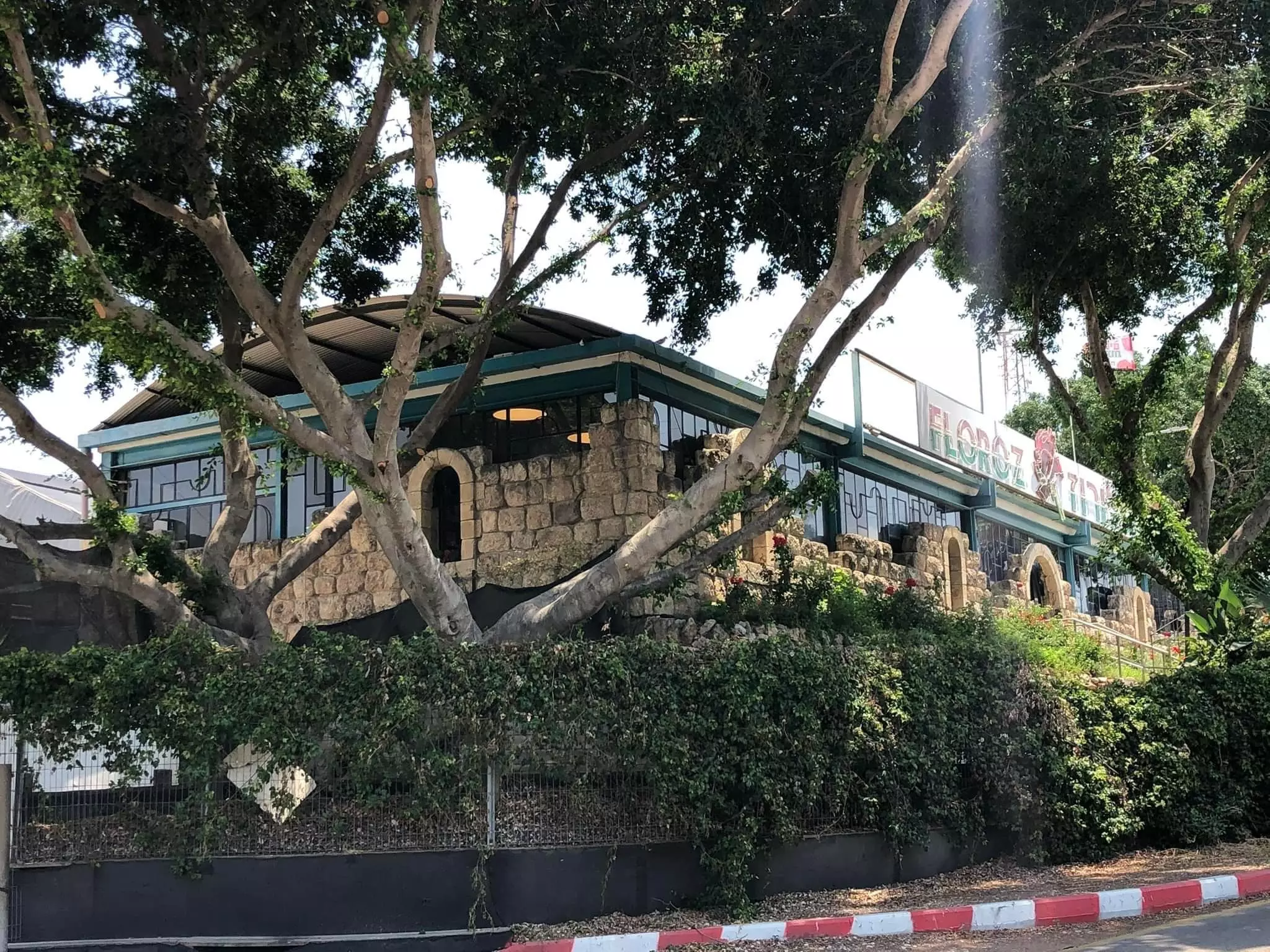
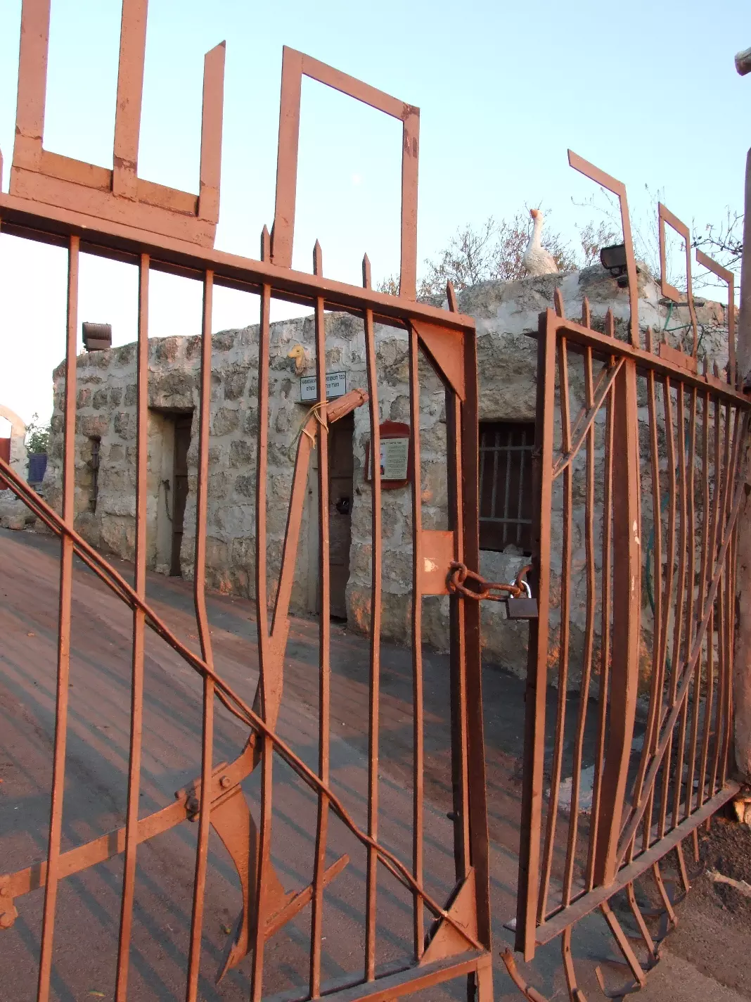
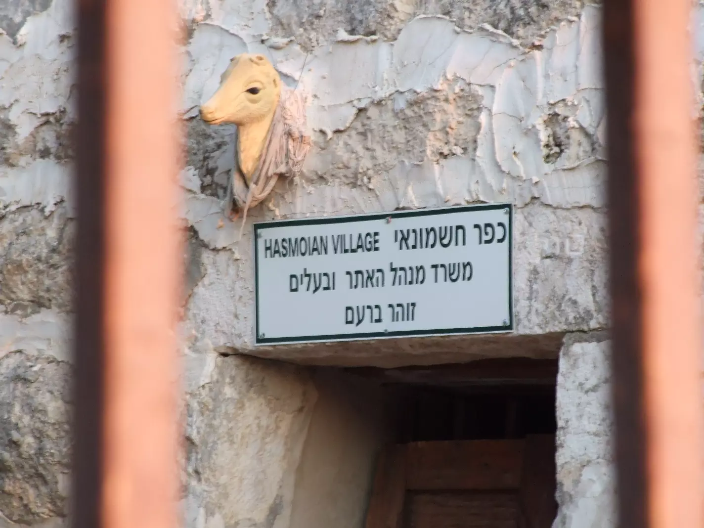
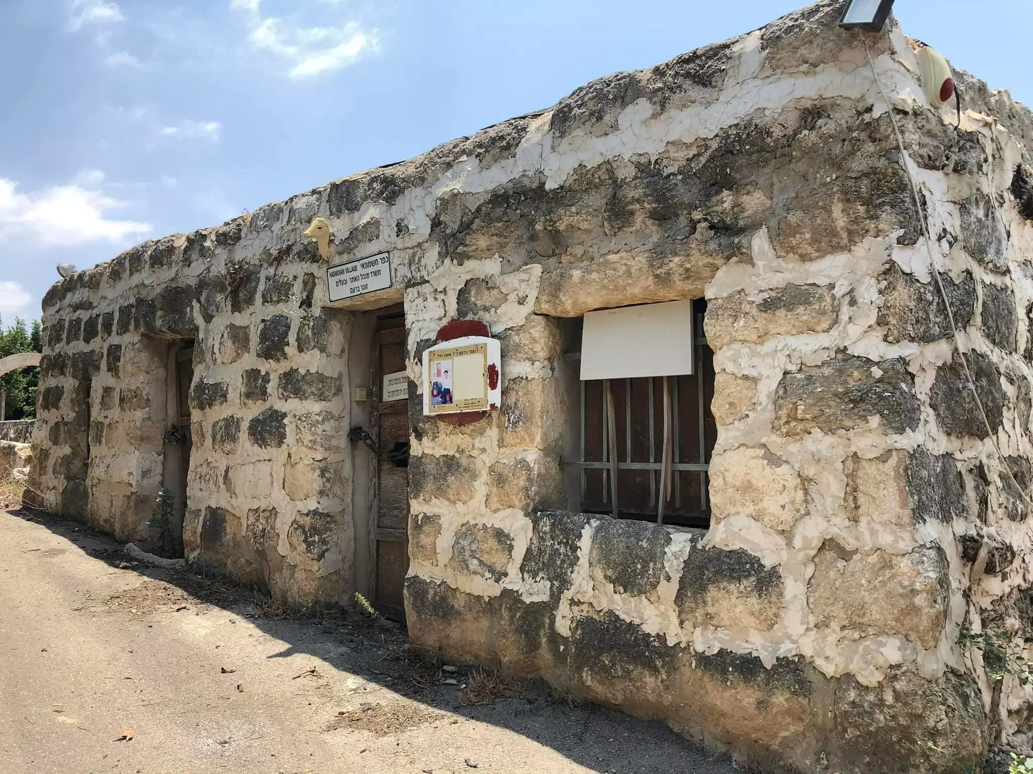
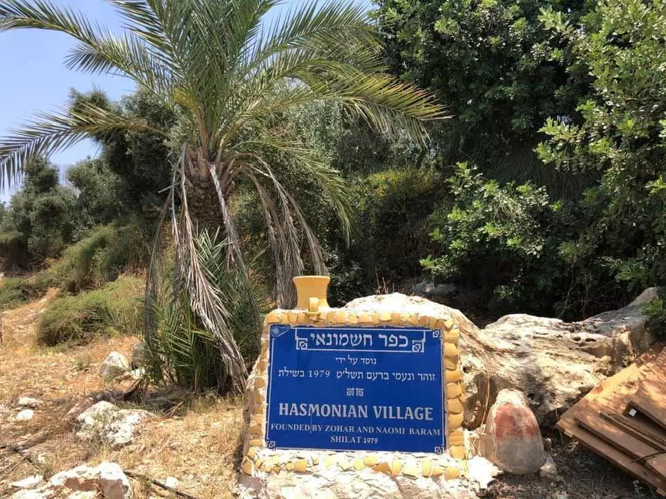
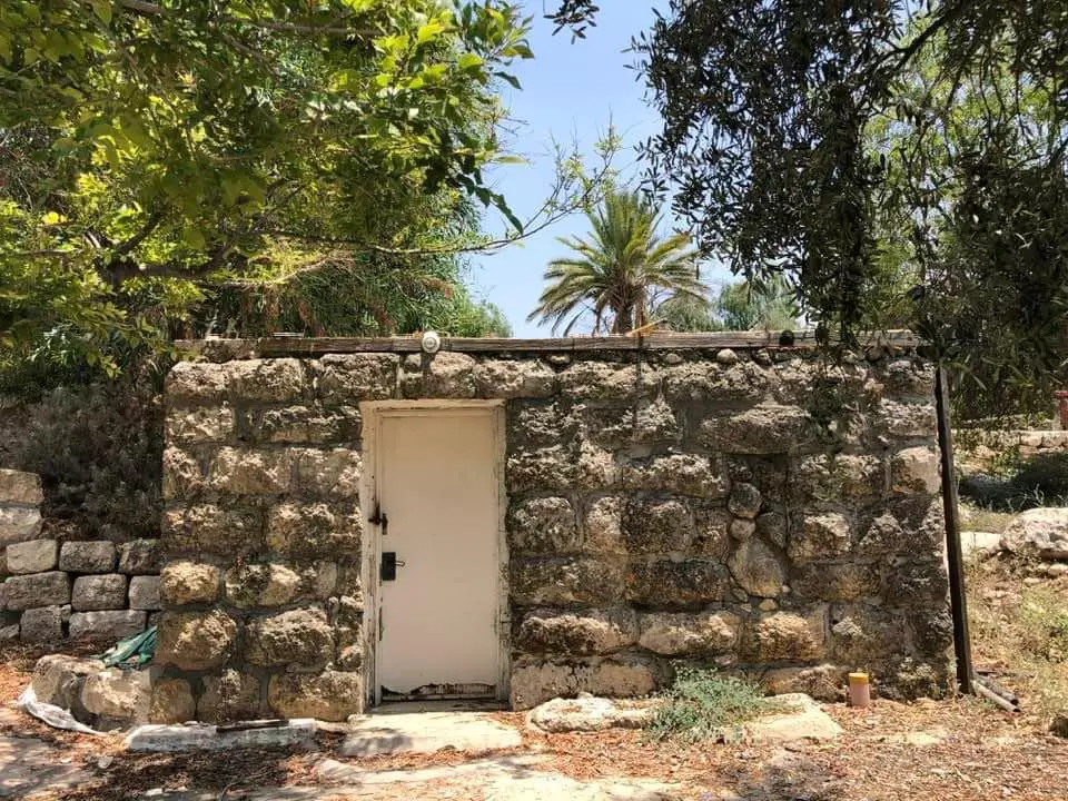
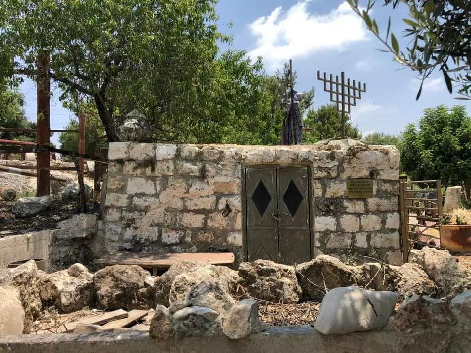
- The southern part of the hill is taken by the "Hasmonean village". The village remains are the backdrop of supposedly Hasmonean period tourist site.
Posted by Uri Zackhem - Almond tree on the hill
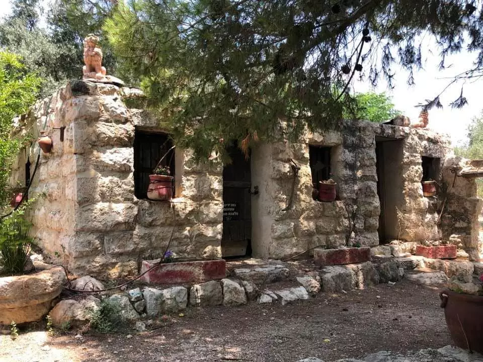
Posted by Uri Zackhem - The entrance to the 'Hasmonean' village - one of the Arab houses
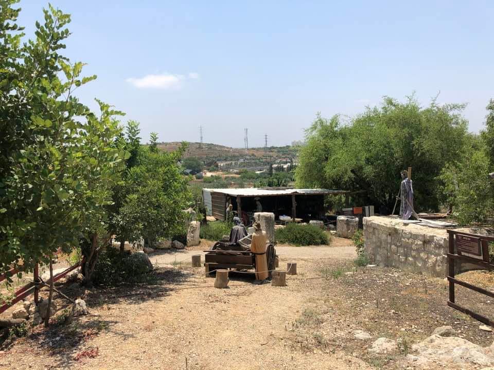
Posted by Uri Zackhem - ''Hasmonean village - office of the site manager & owner''
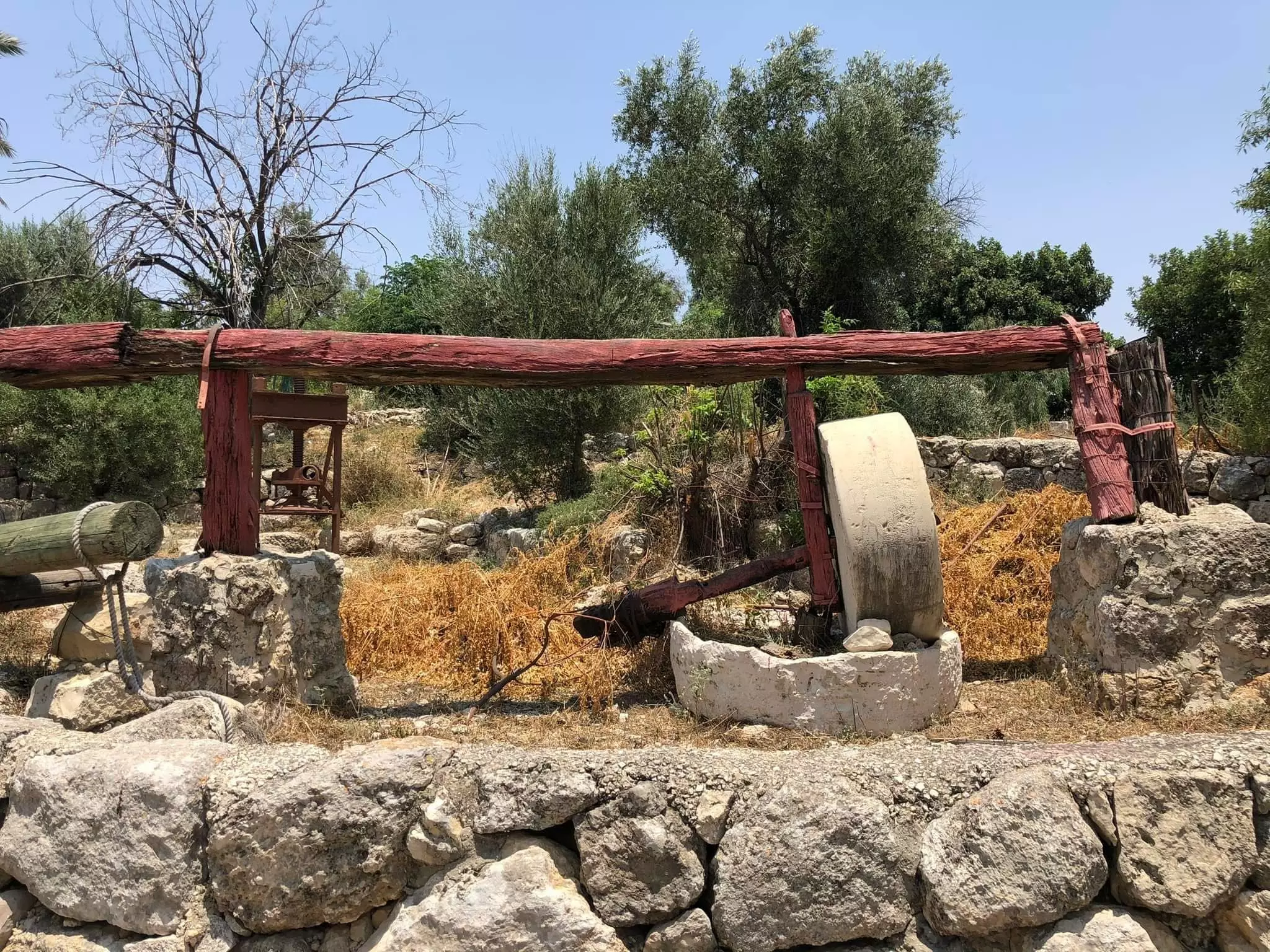
Posted by Uri Zackhem 1 - Let us tour the Palestinian homes that were looted by the "most civilized". How else will the Jews be great again? Mazletov -- جولة بين البيوت والمعاصر المغتصبة
- Let us tour the Palestinian homes that were looted by the "most civilized". How else will the Jews be great again? Mazletov -- جولة بين البيوت والمعاصر المغتصبة #2
- Let us tour the Palestinian homes that were looted by the "most civilized". How else will the Jews be great again? Mazletov -- جولة بين البيوت والمعاصر المغتصبة #3
- Let us tour the Palestinian homes that were looted by the "most civilized". How else will the Jews be great again? Mazletov -- جولة بين البيوت والمعاصر المغتصبة #4
- Let us tour the Palestinian homes that were looted by the "most civilized". How else will the Jews be great again? Mazletov -- جولة بين البيوت والمعاصر المغتصبة #5
- Let us tour the Palestinian homes that were looted by the "most civilized". How else will the Jews be great again? Mazletov -- جولة بين البيوت والمعاصر المغتصبة #6
- Let us tour the Palestinian homes that were looted by the "most civilized". How else will the Jews be great again? Mazletov -- جولة بين البيوت والمعاصر المغتصبة #7

- Let us tour the Palestinian homes that were looted by the "most civilized". How else will the Jews be great again? Mazletov -- جولة بين البيوت والمعاصر المغتصبة #8
- Let us tour the Palestinian homes that were looted by the "most civilized". How else will the Jews be great again? Mazletov -- جولة بين البيوت والمعاصر المغتصبة #9
- A tour of Palestinian houses which were looted by the "most moral people" humanity has ever known-- جولة بين البيوت الفلسطينية المنهوبة
- A tour of Palestinian houses which were looted by the "most moral people" humanity has ever known-- جولة بين البيوت الفلسطينية المنهوبة #2
- A tour of Palestinian houses which were looted by the "most moral people" humanity has ever known-- جولة بين البيوت الفلسطينية المنهوبة #3
- A tour of Palestinian houses which were looted by the "most moral people" humanity has ever known-- جولة بين البيوت الفلسطينية المنهوبة #4
- A tour of Palestinian houses which were looted by the "most moral people" humanity has ever known-- جولة بين البيوت الفلسطينية المنهوبة #5
- A tour of Palestinian houses which were looted by the "most moral people" humanity has ever known-- جولة بين البيوت الفلسطينية المنهوبة #6
- A tour of Palestinian houses which were looted by the "most moral people" humanity has ever known-- جولة بين البيوت الفلسطينية المنهوبة #7
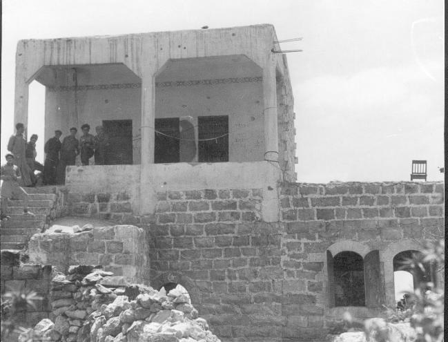
- Members of the Yiftach Brigade in Shiltah during Operation Danny. 1948
Want to browse more? 80,000 pictures were grouped in these gallaries:
| Display Name | Clan/Hamolah | Country of Residence |
| بركات شلاتوة | - | - |
- Tracing all That remains of the destroyed village of Shilta, Palestine Duration: 4 min sec
No links have been shared yet, be free to the first to share the first link.
 Fake Valor: Why Did Zionist Jews Hoist Nazis Flag on Their Ships in the 1930s?
What is new?
-
Facts About Oct. 7th Gaza Raid
-
Remined Us Please:: Who Did Rape Who? Palestinians Raped Israelis? Or, was the other way around?
-
When Prof. Edward Said was invited to debate Bibi Netanyahu in the 1980s, watch what happened!
-
Ezra Klein of the NY Times on the "Jewish Race".
-
Abusing Blood Libel!
-
Did Israeli Soldiers Activate The Hanniba Direective On Oct. 7th? You Be The Judge
-
Zionist FAQ: Isn't it true that Palestinians don't want peace? Palestinians never accepted the two-state solution
- Facts about Haavara (Transfer) Agreement between Ben-Gurion & Hitler
-
Haavara FAQs: Why Did Zionist Jews Hoist Nazis' Flags on Their Ships in the 1930s?
- Haavara FAQs: When Chaim Weizmann met FDR in mid-1943, why was he silent about rescuing European Jewry?
-
Dear ChatGPT: How did Palestinians resist Napoleon's invasion of their country in 1799?
-
Dear ChatGPT: Gaza had a vibrant Jewish community in the mid-17th century. What happened to them?
-
Dear ChatGPT: Why did the Jewish Agency suppress news of the Holocaust during WWII?
-
Video Playlist: Jews share their DNA tests to end the conflict for good.
-
A Tale of Two Conflicts: Examining the Definition of Genocide
-
Prof. Abraham Polak And The Suppressed History of the Khazars and European Jewry
-
How Ronald Reagan would have framed the genocide in Gaza if he were still alive?
-
Haavara FAQs: Let us do the math: how many German Jews did The Haavara Agreement save?
-
Zionist FAQs: The Hebron Massacre of 1929, "clearly proves" that Palestinians are antisemitic, how could you deny it?
-
Zionist FAQs: Why Anti-Zionist Is Not Antisemitism?
-
Zionist FAQs: Isn't it true that the KGB created Palestinian Nationalism in the early 1960s?
- Zionist FAQs: Muslims are killing Muslims all the time; why are Israeli Jews being singled out in the media?
- Zionist FAQs: How is Israel an apartheid state when 20% of its citizens are Arabs who enjoy full rights?
-
Haavara FAQs: Why Did Dorothy Thompson Flip From A Zionist Advocate to A Silenced Dissenter?
-
Haavara FAQs: Analysis of Herzl's Uganda Scheme and how it could have saved millions of Jews.
-
Haavara FAQs: Why did Hayim Greenberg describe American Jewry as "morally bankrupt" in early 1943?
-
Haavara FAQs: What if the Evian Conference was a resounding success? What would have been the impact of saving European Jewry on Zionism?
- Haavara FAQs: What if the six million were saved, how that would have impacted the Zionist project?
-
Haavara FAQs: How did Zionist leaders react when Europe's Jews lingered in the DP camps after WWII ended?
-
Why does the American Jewish community repeat lies that David Ben-Gurion had debunked before he died?
-
Who has the power to rename the Tatar/Khazar Gene Marker to Jewish IV?
-
Zionist FAQs: Why won't Egypt, Syria, and Jordan take their people back? Jews are indigenous to Palestine, and Arabs immigrated after Jews developed the country. Arabs should leave.
-
Haavara FAQs: Did Hitler and the Nazis conflate between Judaism and Zionist? If that wasn't case, then why?
-
Haavara FAQs: Winston Churchill and antisemitism, a collection of articles written Churchill.
-
Haavara FAQs: Broken by country, how many Jews survived vs. killed during the Holocaust?
-
Haavara FAQs: Why did European Jews vote with their feet and to immigrated to the Americas, not Palestine, after WWII?
-
Watch this American Jewish Girl describing Israeli Jews' cognitive dissonance like no other in under two minutes
-
Haavara FAQs: When the Nazis went out of their way to hide the Holocaust, Israeli Jews did the exact opposite by broadcasting their genocide of Gazans. But why?
-
Haavara FAQs: How Zionist Jews went out of their to show their appreciation to Nazism and Fascism?
- Haavara FAQs: Why Zionist leaders were against bombing the death camps & the Railroads leading to them?
-
Haavara FAQs: Hitler's message to the British and American people: If Jews are such noble citizens and you care about them, how come you're not letting them in? I will gladly ship them to you at my expense, even on luxury liners!
-
A shortlist of Zionist and Israeli false flag operations in the name Jews.
-
The Most Moral Army
- The Land of Kapos (Israel): Where the brave are boycotted and Kapos walk free.
- Why did early Zionists often named their communal enterprises "colonial"?
- Zionist Relations with Nazi Germany by Faris Glubb
-
Two NY Times advertisements by Zionists in the early 1943 that exposes Zionists' treason at the height of the calamity
- Facts Not Lies about the Palestinian-Israeli Conflict.
- Site's pictures have been categorized
- Campgain Against Lice
- A Survey of Palestine, the official source about Palestine before Nakba produced by the British Mandate; over 1200 pages.
- Satellite View & Google Earth: Over 6,000 placemarks identifying all destroyed towns, W. Bank & Gaza Strip Towns, & refugee camps.
- PalestineRemembered.com and its Nakba Oral History Project were featured on al-Jazeera Satellite TV.
- Nakba Oral History Video Podcast:
 Over 700 Oral History interviews (including 3,500+ hours of recording) can be viewed online.
 - Palestine Village Statistics Project
- Gaza Jail Break
- النسخة العربية للموقع الان متوفرة
- Videos: Documenting the destroyed villages in video: Tracing all that remains since Nakba.
- Videos: Responding to Zionist Propaganda
- Interview: The ethnic cleansing of Palestine: George Galloway interviews Israeli Historian Ilan Pappe.
- For Palestinians, memory matters. It provides a blueprint for their future By George Bisharat.
- Zionist FAQ now available in Hebrew שאלות שציונים שואלים, עכשיו בעברית
- Video: The Stephen Walt and John Mearsheimer report on the influence of the Israel Lobby on U.S. Foreign Policy
- The Palestinian-Israeli conflict for beginners
